
École nationale supérieure d’architecture de Versailles
PÉROU
Territoires du commun
P45 2023 - 2024
Sous la direction de : Susanne Stacher & Luciano Aletta
Introduction P45 TERRITOIRE DU COMMUN
Tom BELDJILAH
Roxane DURAND
Gabriel HELOU
Eugénie TRACA
Gabriel GONZÁLEZ-PINTO
Logement
ADAPTING TO COPE
SELF-BUILD MANUAL
A NEW TYPE OF TOURISM
RURAL TURNOVER
SREET DOGS
Agriculture
Raph BAILLY-ORSINGHER
Benjamin GUIRAUD
Mylène NGUYEN
Eliana SIDIBE
Maria HUSAK
Mickaël MONTEIRO
Fatima ZAHRA TILKAS
Productivity
Sacha DE AMORIM Maelle GALLAND
Marion NICOUD
FROM HERITAGE TO PLATE GROWING HOUSES
AGROBIODIVERSITY NETWORKS
SHARING THE LANDS
COCA LEAF PRODUCTION
ASSOCIATIVE MINING THE WHITE GOLD FACTORY


Benjamin Guiraud
Sacha De Amorim
Mylène Nguyen
Susanne Stacher Raphaël Bailly-Orshinger
Mariia Husak
Eliana Sidibe
Maelle Galland
Gabriel Helou
Marion Nicoud
Roxane Durand
Mickaël Monteiro
Tom Beldjilah
Fatima Zahra Tilkas
Gabriel González-Pinto
Luciano Aletta
Eugénie Tracanelli

Visited city
Plane journey
Train journey
Bus journey
Project site


Inca transect

Arequipa
Cuzco Aguas Calientes
Chivay Colca Canyon
Yauri


A New Type of Tourism
-79,9861834; -15,0783414
1:80 000

Self-Build Manual
-80,0912336; -15,2063193
1:6 000

Rural Turnover
-80,0799935; -15,2105657
1:80 000


Raph
-80,75603741; -14,78543450
1:7 000
Growing Houses
-79,958419; -16;224738
1:10 000
Agrobiodiversity in Food Netwoks
-79,8997978; -15,0418486
1:10 000


Sharing the Lands
-80,224078; -15,045584
1:80 000


Un transect exploratoire sur la route des Inca, d’Arequipa à Cuzco « Construire les mondes des coexistences »
Atelier de projet P45 avec séminaire et workshop
Universités impliquées : ENSA Versailles (ENSA-V), Pontificia Universidad Católica del Peru (PUCP)
Enseignants :
Susanne Stacher (ENSA-V), Luciano Aletta (ENSA-V), Luis Rodríguez-Riviera (PUCP), Marta Bell (PUCP), LuisMartin Piccini (PUCP)

Face aux grands enjeux contemporains induits par la métropolisation planétaire, cet atelier de projet associé à un séminaire est axé sur l’écologie environnementale et sociale dans les Andes. Cette région, longtemps un exemple de soutien mutuel entre les communautés et de relation de réciprocité avec la terre, est aujourd’hui menacée par le processus d’urbanisation. Comment esquisser des alternatives à cette dynamique qui efface justement ces qualités ancestrales ? Comment envisager une coexistence, en plaçant les systèmes écologiques au centre d’une nouvelle vie politique et sociale ?
Prenant appui sur les théories des « biens communs » (l’eau, le sol, les forêts, etc.), le workshop a questionné la spécialisation et la rationalisation de l’espace imposées par la modernité, afin d’imaginer une nouvelle relation d’interdépendance entre l’homme et son milieu. Quelles sont les tensions et les conflits qui naissent aujourd’hui autour des biens communs ? Pris dans des dynamiques d’urbanisation, de gentrification et d’extractivisme, les populations locales restent en marge des bénéfices ou en sont souvent les victimes.
Séminaire et conférences :
Une journée de conférences à introduit un séminaire de réflexion sur les enjeux du territoire, à la fois sociaux, économiques, culturelles et écologiques. Après le mot de bienvenue du doyen de la faculté d’architecture
Paolo Dam, le professeur et architecte Luis RodríguezRiviera a introduit la thématique du workshop. Celle-ci portait sur la compréhension du territoire andin avec son organisation économique selon les conditions géographiques et climatiques : du nord au sud – le long la cordillère des Andes – et de ouest à l’est – de la côte à l’Amazonie –, ce territoire est organisé selon des étages écologiques. Comprendre les Andes nécessite une traversée transversale, raison pour laquelle le voyage d’étude a suivi un transect, de Arequipa à Cuzco, en plusieurs étapes. La zone d’étude principale était la région de Cuzco et la Vallée sacrée, afin d’apprendre des anciennes cultures comment elles établissaient une relation de réciprocité avec les éléments naturels (comme la terre et l’eau) qu’elles considéraient comme des biens communs.
La conférence de la géographe Marta Bell intitulée « La Cordillère des Andes comme phénomène géographique » portait sur le fonctionnement précis de ces étages écologiques, aussi d’un point de vue économique et social.
L’archéologue et urbaniste Rosabella Álvarez Calderón, avec sa conférence « Sites archéologiques dans la côte péruvienne et Cusco », nous a introduit dans l’histoire culturelle du Pérou précolonial dont il est difficile de comprendre toute sa signification et l’envergure aujourd’hui.
La conférence de l’architecte et anthropologue LuisMartin Piccini intitulée « Vision du monde et culture matérielle dans l’ancienne Pérou » a donné un aperçu sur la riche dimension anthropologique des cultures indigènes et de leurs manières de concevoir le monde et le vivre ensemble.
Luciano Aletta, doctorant à l’ENSA Versailles et enseignant dans cet atelier de projet, a présenté son sujet de thèse qui porte sur la notion des « Commons » d’un point de vue théorique et historique, tout en ouvrant le regard sur les défis actuels face aux crises écologiques et sociales.
Susanne Stacher, professeure à l’ESNA Versailles, a donné une conférence sur le sujet de son dernier livre “In Times of Crises Architects Designing ‚New Worlds’” qui traite des projets urbains et des visions de société en temps de crise, tâchant de construire d’autres formes de villes et d’autres manières de vivre ensemble.
Voyage d’études :
Nous avons analysé les caractéristiques du territoire andin en suivant un chemin Inca transversal depuis la côte péruvienne jusqu’à Cuzco.
Après la visite de nombreux sites archéologiques et musées à Lima, nous sommes partis à Arequipa, la première étape du transect. Ensuite, nous sommes montés dans les Andes pour faire une randonnée de deux jours dans le Canyon de la Colca où nous avons pu observer, en marchant, les différents étages écologiques qui s’étalent sur une hauteur de 1300m, jusqu’au en bas où se trouve le bassin de la rivière. L’organisation de la faune et de la flore, ainsi que l’exploitation agricole des flancs des rives en forme de terrasses nous ont fait comprendre la relation étroite qu’entretiennent ces cultivateurs avec leur milieu.
L’étape suivante était Yauri, une ville minière de la province d’Espinar suitée à 4000m, où nous avons été confrontés à la grande pauvreté de la population, souffrant de maladies dues à la pollution de l’eau potable par les mines des alentours. Nous avons visité le site de la mine Tintaya sans avoir accès au système d’extraction.
Une longue traversée du massif andin nous a fait comprendre que les modes de vie des paysans des hauts plateaux sont encore quasiment ancestraux, bien qu’ils soient connectés au monde contemporain via des téléphones portables. Sur ce long itinéraire de 14 heures, nous avons pu visiter l’un des derniers ponts construit entièrement en Ichu, une herbe de montagne, encore de nos jours tissés collectivement par les communautés environnantes afin de maintenir la liaison du Qhapac Ñan, le chemin des Incas.
La vallée sacrée autour de Cuzco nous a donné un aperçu impressionnant des connaissances des cultures préhispaniques en matière de gestion de l’eau et de l’agriculture. Il s’agissait de véritables laboratoires scientifiques, notamment à Tipon, une station de recherche pour la gestion et la canalisation de l’eau, et à Moray, un laboratoire d’agriculture circulaire où l’on testait différentes plantations en fonction de l’altitude des terrasses, afin de pouvoir ensuite cultiver les étages écologiques du royaume Inca. Et finalement, le Machu Picchu, la cité Inca la plus intacte, où construction et agriculture forment un ensemble indissociable. Son inscription sur la liste du patrimoine mondial de l’UNESCO a conduit au chantier d’un nouvel aéroport à Chinchero, près de Cuzco, actuellement en construction dans une zone humide qui était jusqu’à présent utilisée à des fins agricoles, tandis que l’ancien aéroport à Cuzco – une véritable île urbaine – deviendra une friche avec des enjeux considérables. Workshop dans la Vallée sacrée autour de Cuzco : Dans notre workshop, la gentrification et l’urbanisation ont été abordées, tout comme la problématique du tourisme de masse et du patrimoine culturel, ainsi que la question quel rôle joue la population locale qui n’a guère s’autres options que de se soumettre à cette dynamique puissante où l’argent dicte les règles.
Mais nous avons aussi pu observer la formation d’associations qui prennent en main le sort des communautés locales en introduisant des contredynamiques qui confèrent à la population locale un plus grand pouvoir d’action : des femmes s’organisent en coopératives de tissage ; des paysans créent une association pour la plantation d’un multitude de variétés de pommes de terres (Parque de la papa) ; une association de logement accompagne attentivement l’accaparement sauvage des terres afin de réduire les risques et d’améliorer les services communaux (comme le raccordement à l’eau potable et au réseau d’égouts) ; une association de commerçants a pu négocier avec succès le terrain devant la nouvelle gare d’Aquas Calientes (la gare d’arrivée pour le Machu Picchu) afin de profiter directement de la manne touristique sans devoir payer un loyer à des entreprises privées tels que les chemins de fer qui ont été privatisés (ils utilisent la population indigène pour animer les trajets des touristes avec de la musique, des danses et des jeux de théâtre totalement kitsch).
Quelles sont donc ici les tensions culturelles, économique et sociales, quelles sont les conflits autour des biens communs ? Un regard analytique et critique a inspiré la conception de projets qui esquissent des contretemps aux dynamiques en cours, en s’inspirant des associations locales ainsi que des formes d’organisation et de construction ancestrales –une sorte de learning from, transposé dans le monde
contemporain avec tous ses défis cruciaux. Nous nous sommes intéressés aux petites communautés rurales afin de comprendre leur fonctionnement ainsi qu’aux zones urbanisées autour de Cuzco où – soit à la manière de l’acupuncture, soit à grande échelle – nous avons conçu des projets architecturaux et urbains qui esquissent des alternatives.


Peru is an ecosystem in its own right, unique in the richness of its landscapes and the many biomes that make up its territory. These complex environments are obliged to maintain relations and exchanges of various kinds with one another, enabling them to exist and subsist. As a result, these environments have both unique and shared characteristics and resources. However, these environments, rich in diversity, reveal their fragility when a hazard disrupts their functioning.
This project workshop, which set out to study the conflicts between several common resources, revealed that the major hazard and vector of numerous conflicts was water, through the analyses carried out by the students and the lectures given. It is in this direction my work has taken.
First of all, the analysis revealed that several conflicts are linked to water resources themselves. Water comes mainly from the Andes, which supply the rest of Peru with a complex hydrographic network. It is used for agriculture, but also and above all for producing electricity. Indeed, one of Peru’s special features is that over 50% of its electricity is hydroelectric. Water is also used for construction, because with the arrival of cement and concrete on a massive scale during the modern era and the development of industry, construction has increased its water consumption dramatically and is now dependent on it.
This resource therefore links 3 main entities: Agriculture, Energy and Architecture. The balance and distribution of the resource is therefore becoming a

key issue, so that one entity does not take precedence over another, with consequences that would have repercussions on society and, consequently, on human beings, over more or less long periods of time.
In addition to the issues of resource allocation and conservation, global warming is increasing the water needs of each of the entities and is giving rise to conflicts that would not otherwise have arisen. This phenomenon is also increasing disparities in the availability of resources and the conditions for accessing them. In addition to the stress caused by periods of increasing drought brought on by global warming, this is also reflected in the intensification of natural phenomena. As a result, water-related issues are just as much linked to periods of water stress as
to times when there is an overabundance of water.
In fact, the study trip, and particularly the stay in Cusco, enabled us to see these various water-related problems for ourselves. In Lima and Arequipa, water stress is the cause, while in Cusco, water stress alternates with intense bad weather. Conflicts are emerging over the growing need for water to ensure an ever-improving standard of living for more and more people. The interests of different communities come together in the face of the risks and their consequences, giving rise to conflicts.
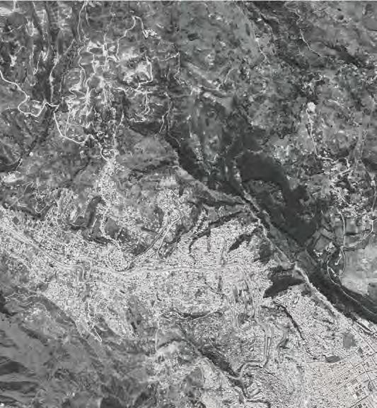
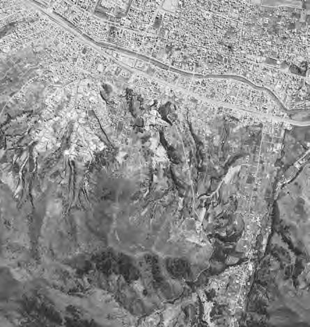
In Cusco, one of these conflicts is due to the risk of landslides caused by the excessive presence of water and unreasonable urban planning.
The chosen site is located in the northern laderas of Cusco. Like most of the laderas, the study site is undergoing heavy urbanisation. Cusco’s population is growing at a rate of 1.7% per year, and the historic centre is becoming gentrified, so new residents or those pushed out by rising prices have no choice but to move to the laderas.
As well as being a long way from the city centre, this forced choice to live in the laderas is synonymous with risks. Firstly, the whole of Cusco is at risk from earthquakes, but the fact that the laderas are located on the slopes of the valley where Cusco is situated considerably increases the risk and potential damage in the event of an earthquake. In addition, most of the laderas are at risk of landslides, due to deforestation and clearing of the vegetation that once covered the laderas, as well as excessive urban development and conventional agriculture, which exacerbate the problem.
Given these problems, the initial and current response proposed would be to relocate and rehouse the laderas and their residents. However, as living in these areas of the city is not a deliberate choice, it is certain that these same residents will return to live in the same areas where they were previously evicted, or that new residents will come and take their place.
This project therefore questions the viability and sustainability of the laderas and combines housing, farming and risk. It does not, however, have the utopian aim of providing an answer that would annihilate risk, because that does not exist. However, it does suggest a number of urban and architectural strategies that could be put in place to minimise the risk and reduce the damage that would occur in the event of a landslide.
To achieve this, 3 study zones with different levels of risk and urbanisation were chosen. Zone 1 is located in the upper part of the laderas, where urbanisation is increasing and encroaching on farmland. It is in this zone that most of the water infiltrates the soil before flowing underground and creating the risk. The aim of action in this zone is to reduce the overall risk. Zone 2 lies at the heart of the laderas, and is already heavily urbanised, with an increased level of risk. The aim of action in this zone is to prevent the risk locally. Zone 3 is located in a recently cleared area that is not at all urbanised at present, with an increased risk. The aim of working on this zone is to design the architecture and urban planning that will take root there to reduce the risks as much as possible.
The project is based on the premise that the multiplicity of interventions to prevent and reduce risk will make it possible to reduce the overall risk and ensure that the laderas are safer and more viable to live in.


View 1 - 11/2013 - @Google Earth
View 2 - 11/2013 - @Google Earth
View 3 - 11/2013 - @Google Earth
View 7 - 11/2013 - @Google Earth
View 8 - 11/2013 - @Google Earth
View 9 - 11/2013 - @Google Earth
View 4 - 11/2013 - @Google Earth
View 5 - 11/2013 - @Google Earth
View 6 - 11/2013 - @Google Earth

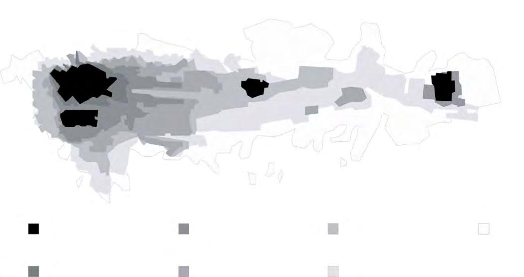
«The density of crosses corresponds to the level of risk combined with the need for intervention. Black crosses mean complete relocation replaced by reforestation, yellow crosses correspond to the intervention strategy for zone n°1, purple crosses to the intervention strategy for zone n°2 and red crosses to the intervention strategy for zone n°3.»

1 : 50 - pile foundations, burnt wood, reinforced concrete
Carbon footprint : 10,58 kg.eq.CO2 / ml
Risk reduction :

1 : 100 - protective wall (shield), reinforced concrete
Carbon footprint : 72,80 kg.eq.CO2 / m2 (m2 of wall)
Risk reduction :
1 : 50 - low earthwork wall, dry stone
Carbon footprint : 5,00 kg.eq.CO2 / ml
Risk reduction :
1 : 50 - screw pile foundations, steel, reinforced concrete
Carbon footprint : 99,33 kg.eq.CO2 / ml
Risk reduction :
1 : 50 - running wall, BTC
Carbon footprint : 26,10 kg.eq.CO2 / m2 (m of wall)
Risk reduction :
1 : 50 - emergency anchoring structure, steel
Carbon footprint : 43,70 kg.eq.CO2 / m2 (m of retained wall)
Risk reduction :
1 : 50 - spring foundations, wood / reinforced concrete / steel
Carbon footprint : 14,87 kg.eq.CO2 / m2 (m of floor)
Risk reduction :
1 : 50 - retaining wall, reinforced concrete
Carbon footprint : 123,00 kg.eq.CO2 / m2 (m of wall)
Risk reduction :
1 : 50 - ground stabilisation net, steel
Carbon footprint : 17,00 kg.eq.CO2 / ml
Risk reduction :

The buildings and landscaping are designed to be frugal. The aim is to ensure that they can be built by the general public and that they are sustainable. They are therefore designed to be easy to build without major technical resources or preparatory work. But also to be economically viable. During the course of this project, various ideas emerged about the financial arrangements that could be put in place to finance and build such a project.
These architectural fragments, equipment and facilities are designed to take advantage of the constraints and problems they
face to meet everyday needs. For example, some installations store water individually for the needs of each dwelling, or collectively to irrigate the agricultural plots that mix with the housing. These installations make use of the slope to create pressure in the water networks and thus seek to compensate for the absence of a running water network that the State does not want to install.
On the other hand, the architecture and landscaping to be put in place to reduce the risk are designed to strike a balance between risk reduction, feasibility and environmental consequences.


risk reduction increase of risk risk of landslides


risk of landslides increase of risk risk reduction
«Here the risk line does not move. As the study area is already heavily urbanised, the aim is to intervene on an ad hoc basis to prevent and protect against landslides. Over time, an urban development plan will reduce the density of the area and replace buildings with structures and facilities that will reduce the risk and cope with it.»


risk reduction increase of risk risk of landslides

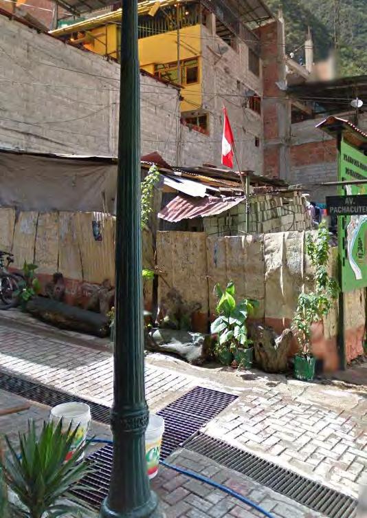
SELF-BUILD MANUAL
In Cusco
Roxane DURAND

ORIGINS OF THE CONFLICT Cusco’s uncontrolled expansion
Mapshowingcusco’sexpansionovertheyears.
The conflict had its roots in 1950, when a violent earthquake struck the city of Cusco. Almost the entire city was destroyed, leaving many inhabitants homeless. The state had to step in to help rebuild the city.
Surrounded by investors, they developed tourism as much as possible by upgrading the historic center. The city became a major tourist and economic hub in Peru, and its population exploded, leading to violent urban expansion. The city center was rebuilt, but the local population no longer lived there: either by choice, as it no longer suited their lifestyle, or by obligation, as they could no longer afford to live there. The poorest families find themselves exiled to the
outskirts of cities, in neighborhoods abandoned by tourists and the rich, where they have to resort to self-building. This creates a gap between the wealthy neighborhoods, with their comfortable new buildings, and the poorer neighborhoods, where self-build predominates.
ORIGINS OF THE CONFLICT Cusco’s uncontrolled expansion

Self-buildphototakeninCusco@EugénieTracanelli,April2024
Self-building is a skill that has been handed down from generation to generation. Imported from the countryside, it is increasingly being incorporated into towns and cities as a result of the region’s strong rural exodus.
Self-built homes use traditional codes and techniques mixed with modern materials and shapes, such as concrete and multi-storey buildings. This poses problems of safety, health,durability and comfort for the inhabitants.
Even if the current buildings were to be restored or the inhabitants rehoused, self-builders would still
resell them, as they are part of the Peruvian way of life and architectural heritage.
So, to combat poor housing and the endangerment of the poorest inhabitants, we have initiated a manual listing and explaining, in a non-exhaustive way, techniques that can help inhabitants to self-build. The manual is intended to be expanded as we go along, with the aim of creating a comprehensive handbook listing a multitude of techniques specific to self-building in Cusco.
Everyone will then be free to pick and choose according to the project they wish to carry out.
REPORT Walls
In Cuzco, two types of construction techniques dominate: adobe and concrete structure with clay brick infill. Adobe construction offers good thermal insulation, is ecological and economical, but is sensitive to humidity and requires regular maintenance.

This adobe building is fairly well protected from damp thanks to its stone base and large roof overhang.

This adobe building is fairly well protected from damp thanks to its stone base and large roof overhang.
Concrete structure and brick infill, on the other hand, is solid and durable if properly executed, but is energyintensive and poorly insulating. Both techniques are easy to apply on small jobs.
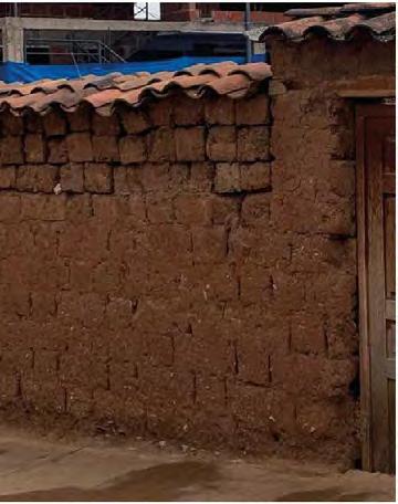

Cusco’s buildings have little or no insulation. When they are, it’s usually with polystyrene, an efficient but not very environmentallyfriendly technique.

An adobe wall that has probably been raised, with unfinished joints and no protective plaster applied.

Cusco’s buildings have little or no insulation. When they are, it’s usually with polystyrene, an efficient but not very environmentallyfriendly technique.
An adobe wall that has probably been raised, with unfinished joints and no protective plaster applied.


Brickwork
Flammand brickwork ensures great strength and stability thanks to the effective bond between the bricks. The wall is thicker, providing greater inertia and
thermal insulation. It creates an aesthetically pleasing pattern without requiring a great deal of complexity and time.
TIPS
Lime-hemp insulation
A 40 cm thick adobe wall requires little thermal insulation to preserve its inertia qualities. The main purpose of insulation is to combat the unpleasant “cold wall” feeling in winter, which can be experienced in uninsulated adobe buildings. An earth wall perspires, which means that water penetrates and emerges

throughout its lifetime. So you need to choose your insulation accordingly. Insulation that is sensitive to humidity will quickly deteriorate, while insulation that is too impermeable will block the passage of water, which will accumulate and eventually destroy the wall.

REPORT
Floors
Depending on the type of building - adobe or concrete structure - the floors vary. In the first option, lightweight wooden floors support one storey, two at most. In the case of concrete constructions, which are generally
larger and higher, the floors are made of polistyrene joists and spacers, covered with a concrete room. All resting on the main beams, which in turn rest on concrete columns.

The beams on which the floors rest protrude unprotected outside the building.

floor is made of polistyrene joists and girts.

The beams are laid directly on the adobe walls, with no insulation installed.
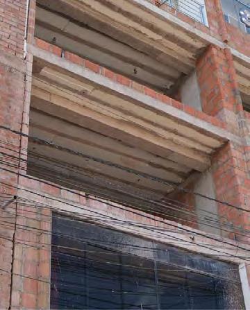

The joists are generally made of eucalyptus wood, 15 to 20cm in diameter and spaced 80cm to 1m apart.

The
The joists rest on main beams. The main beams rest on the concrete column structure that can be seen on the facades of many buildings.

Structure
A wood floor is lighter and more environmentally friendly than a concrete floor. It’s easier to install on
building sites, and perfectly suited to small spans of up to 5m.
REPORT
Joinery
The main purpose of a window is to bring light and air into a home. Once closed, they must be airtight, watertight and soundproof. The comfort of the
occupant will depend on how well the seal between the hole in the wall and the fixed window frame is made, as well as on the quality of the joinery.


The most common windows are large, single-glazed sliding windows.
Unprotected wood joinery takes on moisture.
Waterproofing is provided by a plastic sheet.
Some windows are just singleglazed with no joinery.
Wooden joinery integrated into an adobe wall.
Corner joinery on a building in Cusco.

Roofs
The roof is perhaps the most important element of a building. A bad roof that is not weatherproof will inevitably lead to the deterioration of other parts of the

Roofs are often made of canal tiles. The same tile can be used as a «current tile» (bottom tile) and «cover tile» (top tile).

The structure is simple, with rafters spaced 80cm to 1m apart, resting directly on the gable walls.
building. In Cusco, gable roofs are the most common, but singlepitch and flat roofs are also common.

Waterproofing depends on the slope of the roof and the covering between each tiles. The ideal slope is included between 15° to 19°, in cusco the slope varie 15° to 23°.

Sometimes the structure is more complexe with trusses.

The tiles are laid on a mortar made of earth and straw, which acts as insulation and filler. The whole structure rests on a reed mat laid directly on the wooden structure.

Small gutters are sometimes used to drain off rainwater from flat roofs.
Frame assembly
Joints are the most important elements in timber framing. They ensure continuity and join the parts together. They are chosen according to the location

of the parts they join and the forces to which they are subjected.

Waterproofing
The addition of a flexible under-roof screen guarantees watertightness in the event of tile displacement, and limits tile uplift under the effect of wind.

Waterproofing of flat roofs
Flat roofs are low-slope roofs. Their dual role of waterproofing and insulation is a delicate one, and must be perfectly executed.
REPORT
Second work
Once the walls, floors and roof have been completed, it’s time to protect the building and make it habitable.
Façade protection coatings help make the building more durable.

Walls unprotected from water are more fragile and eventually collapse.


Poorly maintained exterior rendering eventually disintegrates, revealing the adobe bricks.

The interior walls are made of brick. The rendering on this building has not been maintained and is starting to deteriorate.

This building has been protected by a rendering.
Concrete and brick walls are not protected.
REPORT Network
Water, electricity and air networks ensure the comfort and health of interior spaces. Very much present in today’s buildings, this is not the case in all self-built homes, which are often poorly connected or not at all.

Cuscqenian buildings are not very well ventilated. A few vents are visible on the facades.

Many of the rainwater collection systems are faulty.
As well as being uncomfortable, poor electrical and gas connections can lead to disasters on a much larger scale.


Electrical connections enter the house through plastic
that are folded back to prevent water from entering.

Electrical connection visible from the street, protected by a metal grille.
Wires run everywhere and get tangled up in the buildings.
sheaths
Water networks are exposed and visible from the street.
PROJECT Case
n°1
The P. family is a large multi-generational family, sharing a home with grandparents, children and grandchildren for a total of 15 people. At present, they live in the mountains north of Cusco after the earthquake destroyed the family home 75 years ago.

When they heard that the airport would soon be relocating to Chinchero, they decided to seize the opportunity to buy a building on the outskirts of the airport and turn it into a hotel, once the area had become quieter.


PROJECT
Site plan
PROJECT
Case n°1
They are buying a large building and want to restore it to make it more comfortable, cleaner and safer. They also want to create an extension to accommodate events and a rooftop restaurant. Unfortunately, the family

can’t afford to hire an architect or general contractor to carry out the work. They’re on their own, using the manual above to put their project together.


A NEW TYPE OF TOURISM
Gabriel HELOU

ViewofPisaccenterfromthearcheologicalsite
Pisac
Buildings
Historic Center
Gentrified Zones
Reduction
Agricultural Lands
Urban Expension Local Population
Urban Expension Foreign Population
Migrations
VersCusco
VersSalvador
Vers Calca


Pisac, a small town nestled in the mountains of the Peruvian Andes, has undergone a remarkable transformation with the rise of tourism over the years. Situated on the route of the Sacred Valley of the Incas, Pisac has become a must-visit for travelers from around the world seeking adventure, culture, and spirituality. Once, Pisac was primarily known for its bustling traditional market, where residents from local communities sold their artisanal products and harvests. This market, a true symbol of Andean authenticity, quickly became an iconic location in the Sacred Valley. The major turning point for Pisac occurred in the 1980s with the establishment of the Pisac Archaeological National Park, highlighting the region’s archaeological treasures and drawing international attention to this small town. Concurrently, the development of tourism in the Cusco region and improvements in infrastructure


helped make Pisac a leading tourist destination, attracting hundreds of thousands of visitors each year. This influx of tourists has brought profound changes to Pisac. On one hand, it has stimulated the local economy, improving infrastructure and the standard of living for residents.
However, this transformation is not without consequences. The pressure exerted by tourism has sometimes led to a loss of local culture, with excessive commercialization of ancestral traditions to meet tourists’ expectations. The traditional market that once made the town famous has become a tourist market where mainly low-quality products are found. Additionally, the gentrification of the historic center has led many local families to leave the downtown area for peripheral neighborhoods.
VersSalvador
Vers Calca
500 BC- 100 BC
Chanapata period, marked by the development of communities in Calca, Pisac, Anta, Paruro, Canchis and Quispicanchis.
6000 BC
First semi-permanent occupations in the Vilcanota River valley, with primitive forms of grazing and domestication of tubers.
1000 - 1200 AD
Intensive occupation of the Pisac valley by the Amaru Mayu, Pillahuaras and Antis ethnic groups, dedicated to agriculture.
Assimilation of the Pisac region to the Inca empire, with the construction of the city of Pacachaca by the Inca Wiracocha.
Republican era
Economic and social stagnation, with a crisis during the war of independence and the arrival of the train in Cusco in 1911.
period
Establishment of Indian reductions by Viceroy Toledo, giving birth to the colonial checkerboard. The colonial economy of Pisac was based on the cultivation of corn, wheat and medium-scale livestock.
era (1990 to the present)
The urban expansion occurring in the downtown area of Pisac has sparked the arrival of a new wave of residents from abroad, consequently precipitating a notable demographic shift within the heart of the city.
era (1980 - 1990)
Creation of the Pisac archaeological park and tourism development, leading to urban growth and demand for new facilities.
Inca eriod
Colonial
Contemporary
Contemporary
Pre-spanish period
-Pisac was an important commercial center due to its geographical location and access to natural resources.
-A market was created in Pisac to exchange products from di erent ecological regions
-Construction of the highway along the Cusco-Huambutio-Pisac road, changing the traditional trade system. 1930s

1970s
-Economic and social transformation of Pisac due to the installation of new inhabitants attracted by tourism and market development.
-Many farmers, attracted by this economic phenomenon, change activities after taking courses at the Artisanal School.

1980s to present
1950s
-Pisac had a small population, but the Sunday market was a crucial economic event.
-The construction of wooden tents on the market square was ordered by the mayor.

-Growth of tourism to Peru, leading to a constant ow of tourists to Pisac.
-Development of the artisanal market, with growing demand for Pisac's artisanal products on the international market.
-Transformation of the traditional market into a tourist market, internal and external migration, increase in economic income and development of Pisac thanks to artisanal production and tourism.

AgriculturalaltitudinalzonesoftheAndes
In addition to the decrease in agricultural land, the district of Pisac is faced with a series of challenges that compromise the quality and sustainability of its local agricultural production. The current situation is the result of a combination of economic, social, and environmental factors that have affected the region’s traditional farming practices.
Firstly, the shift in activity of many farmers who now prefer to dedicate themselves to the tourism industry has led them to sell or rent the land inherited from their ancestors to farmers less inclined to use traditional agricultural techniques. These new operators often favor more intensive methods, relying on chemical fertilizers and pesticides, to the detriment of product quality.
Furthermore, this causes a loss of agricultural biodiversity in the region. Once renowned for the variety
of its fruits and vegetables, the region is gradually losing many traditional species in favor of more profitable large-scale crops. This standardization of agricultural production not only reduces the nutritional richness of available foods but also compromises the resilience of local ecosystems against diseases and climate change. Moreover, the decline of the barter system, which was once a cornerstone of the local economy, has also contributed to the vulnerability of Pisac’s agricultural communities. Whereas farmers used to exchange part of their production for other goods necessary for their subsistence, today, most products are sold. This transition to a monetary economy has led to a disconnect between producers and local consumers, reducing the social and cultural value of traditional agriculture.
Tierra Caliennte Hot Land
City Center
Tierra Nevada Snow Land
Land Owners in Pisac
Agriculture in Pisac For Personal Consumtion or For Trade Work Work
Agriculture
Work in their land
Rent their land
Tourism Industry
Sell their land
Tradional Agriculture
Comercial Agriculture
Arrival of Settlers
Comercial Agriculture
Agriculture in Pisac
For Personal Consumtion or For Trade For Sale
Traditional Agriculture
Comercial Agriculture

EvolutionofthepopulationinthedistrictofPisac


Displacement of local population to the suburbs Urban expension
Gentrification, resulting from the influx of new residents, undoubtedly presents a detrimental facet of urban transformation, yet it merely scratches the surface of the complex issues at play. Beyond the displacement of existing communities and the reshaping of neighborhoods, there exists a deeper concern regarding the erosion of local identity and cultural heritage. This erosion manifests in various forms, with one prominent aspect being the phenomenon of cultural appropriation.
Cultural appropriation within gentrifying areas often unfolds as newcomers, devoid of historical ties or understanding, appropriate elements of the local culture without truly comprehending their significance. This can lead to a superficial fusion of cultural practices, where traditions and customs lose their authenticity amidst a mishmash of borrowed ideas and practices. The result is a dilution of the unique identity that once characterized the community, replaced by a generic, homogenized version that caters more to transient trends and outsider perceptions than to the genuine essence of the locale.
Misunderstanding and Commercialisation of local culture
Lost of the tradional local cuisine
Moreover, the commodification of culture exacerbates these challenges. As tourism burgeons in gentrified areas, there is a heightened pressure to transform cultural heritage into marketable commodities. Authentic rituals and traditions, once deeply ingrained in the fabric of local life, are repackaged as mere spectacles for the entertainment of visitors, stripped of their original context and significance. This not only distorts the true essence of the culture but also perpetuates stereotypes and shallow representations that fail to capture its depth and complexity.
Another casualty of gentrification is the culinary landscape of the community. As upscale eateries catering to the tastes of affluent newcomers proliferate, they often overlook or downplay the rich tapestry of local cuisine in favor of generic, internationallyinspired fare. This neglects the culinary heritage that has been cultivated over generations, relegating it to the sidelines in favor of more profitable ventures. As a result, authentic local flavors and culinary traditions are at risk of being overshadowed or even lost, depriving both residents and visitors of the opportunity to savor the true essence of the region’s gastronomic identity.


New activities
Spiritual ceremonies
Gentrification of the city center
New Housing Projects
New diet
Touristic Markets
The project aims firstly to limit urban expansion in favor of agricultural lands by protecting certain areas designated for agricultural use, while allowing new constructions in specific areas and applying construction laws aimed at preserving the natural soil as much as possible. Additionally, there is a plan to create an agreement between new arrivals with significant financial means, based on their standard of living in the region, and local residents. This agreement could take the form of subsidies granted to each building constructed by a foreign national, thereby enabling a farmer to commit to providing quality products in return. This initiative would foster cooperation among different community stakeholders, thus strengthening social ties.
Furthermore, the project aims to protect local farmers who still use ancestral techniques, opposing the omnipresent commercial agriculture in the region. This traditional agriculture, more environmentally friendly, helps preserve local biodiversity and maintain sustainable agricultural practices. To raise awareness of this agricultural wealth and encourage its development, it is proposed to establish an eco-tourism system. This system would showcase local products, traditional know-how, and regional cuisine, offering an authentic experience to visitors while supporting the local economy.
The objective is to offer an alternative to traditional tourism, primarily focused on luxury establishments in the city center. By promoting more responsible and environmentally friendly tourism, the project aims to preserve the cultural and natural identity of the region while providing economic opportunities for local communities.
Subsequently, the project plans to restore the importance of Pisac’s center, once a meeting place for all district inhabitants from different altitude zones, for bartering. This traditional market, once vital for the exchange of products and knowledge between communities, has lost its significance over time, transforming into a tourist market where low-quality products are often found. To revitalize this space and encourage a return to traditional practices, there is a proposal to create a barter market where residents can exchange local products, knowledge, and services. This initiative would strengthen social ties among different communities.
The project is divided into two interventions. On one hand, an eco-village in the agricultural community of Paru Paru where foreigners can be housed in exchange for labor and can therefore discover the local culture. On the other hand, a market dedicated to bartering in the center of Pisac where farmers can go to exchange their harvests.
Local Farmers
Protect local farmers

Prevent massive urbanisation of the city
Protect local Culture
Pisac District
Paru Paru community
Pisac Center


Paru Paru community
Pisac Center
B’ A’


Section A-A’


Colegio Bernardo Tambohuacso
Area for future buildings
Sports Ameneties
Escuela Virgen del Carmen
Plaza de la Constitucion
Church Market
Agricultural lands
Slow mobility network
Urban Limit

RURAL TURNOVER
A coming back to Incas’ roots in Cusco
Eugénie TRACANELLI

PROBLEMATIC ANALISIS
Cusco’s demographic growth has been exponential and disorderly since the 1950 earthquake. Over time, the city has become established in a valley surrounded by hills that were initially used for agriculture, but have gradually been transformed into housing estates. Taking advantage of this disorganisation, various associations have developed a market around the sale of these often unattractive plots of land at advantageous prices. The buyers, mainly peasants from the rural exodus with limited resources, are looking to move closer to the city, often at great sacrifice, in order to give their children access to education.
At the same time, the high increase of tourism has led to a significant rise in property prices in Cusco. The value of these ‘informal’ plots depends on their location. For example the ones that has a direct access to services such as water and electricity are being considerably more valuable than those without, or those located on running water faults, which severely increases the risk of landslides and so the risk for the inhabitants of those slopes.
The dwellings built on this land are developed according to the means and resources available to the families. Most of the time, these dwellings are rudimentary, made of adobe, stone and corrugated iron. Although these materials are not the best suited to natural hazards, they often represent the only temporary solution for the inhabitants. Unfortunately, those with less means often find themselves forced to live in areas exposed to high risks, putting their homes and their lives at risk.


Families leave the countryside with the hope of offering a good education to their children...
Families leave the countryside with the hope of offering a good education to their children...

...Arriving to the biggest city in the region they realize the lack of place to live there...

The lower prices are located on the slopes where the prices depend on the accessibility and on the geographic location
The lower prices are located on the slopes where the prices depend on the accessibility and on
The lower prices are located on the slopes where the prices depend on the accessibility and on the geographic location


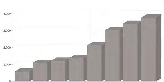
We calculated the total area inhabited by people living in the risky zones, which amounts to 1,159,276.29 square meters.
By averaging the population density of the affected neighborhoods (Wanchaq, San Sebastian, Santiago, San Jeronimo, Cusco, and Poroy), we determined a density of 3,303 inhabitants per square kilometer. Using a simple cross-multiplication, we estimated that approximately 3,830 inhabitants need to be relocated.

The purpose is to relocate them to the site of Cusco’s airport, which will be moved to the city of Chinchero. The surface area of Cusco’s airport is approximately 1,216,658 square meters.
We will designate 30% of this area for construction, leaving the remaining space for green areas, agricultural activities, and breeding.
This gives us 364,997 square meters for constructing housing buildings.
Assuming an average area of 200 square meters per construction, we estimate that each housing building would need to have between 2 and 3 floors of apartments.
THE MOST COMMON STRUCTURES
Sheet metal roof with simple wood structure
Concrete beams and columns filled by pre-fabricated clay bricks type : honey comb bricks, solid bricks, flat concrete rooftop which may be converted as an extra floor or a terrace
Stone basement, adobe assemblage with handmade shaped blocks, assembled roof tiles
Adobe brick structure renforced by metal sheet boards and tarp for waterproofing, sheet metal roof on top of it
Number
Housing type 2.A
Farming barn Craft housing type B
Housing type 1.A
Housing type 3.B
Housing type 3.AAgriculture greenhouse type
Housing type 2.B
Housing type 1.B
Typologie 2.A
2.A 2.A
R+1
R+2
2.A
2.A
Typologie 2.C
Typologie 2.B
Typologie 2.C
R+1
R+3
2.C
2.B
2.B
Typologie 2.B
R+1
R+3
2.C
2.B 2.B
Typologie 3.A
Typologie 3.B
Typologie 3.A
Typologie 3.B
Typologie 3.A
Typologie 3.A
R+1
Typologie 3.C
Typologie 3.C
3.C
3.C
R+2
R+1
R+1
3.C
3.C
R+2
R+1
4.B
Typologie


Materiality
STREET DOGS
Cuso
Gabriel GONZÁLEZ-PINTO

Valle de los Duendes : Project site


The one thing that drew my attention during my time in Cuzco was the vast number of free dogs you could find on the streets. Upon our arrival in the city, a big sized dog started jumping on us and it followed us until we reached our accommodation.
There are different consequences that this dog population has on the public space, the city’s inhabitants and the tourists. All these three can be considered ‘common goods’, in that they are not owned but rather managed by the community.
There are six million abandoned dogs in Peru (La República, 2021)[1]. Only in Cuzcothere were eight abandoned dogs for every person in 2010 (Diario Correo, 2010)[2].
Dogs can be a focus of zoonotic diseases like the rabies, but also a waste factory and a threat to other animal species. Dogs are the third most damaging species for other vertebrates, only preceded by cats and rats
(Comunicaciones CAPES, 2023)[3]
Some initiatives are taking place to improve the situation like sterilizing and dewormingcampaigns, however thereare currently no dog shelters in the city of Cuzco.
I propose a dog shelter building that can serve a wide range of pet-relatedactivities and actas a testbed for potential reproduction of the idea in other areas of around the city.
[1] La República. (2021) «Ley cuatropatas: qué es y por qué urge aplicar una política de esterilización de mascotas», La República, 1 dejulio. Disponibleen: Ley cuatro patas: qué es y por qué urge aplicar una política de esterilización de mascotas | Sociedad | La República (larepublica.pe)(Visitado:el7 de mayo de 2024).
[2] DiarioCorreo. (2010) «Hay 8 perros callejeros por cada cusqueño», DiarioCorreo, 18 deoctubre. Disponibleen: Hay 8 perros callejeros por cada cusqueño |PERU | CORREO (diariocorreo.pe)(Visitado:el7 de mayo de 2024).
[3] Comunicaciones CAPES. (2023) ««Perros de lacalle»:estudio identificó las causas y consecuencias de un problema social y ambiental», Center of AppliedEcology & Sustainability, 30 dediciembre. Disponibleen:»Perros de la calle»: estudio identificó las causas y consecuencias de un problema social y ambiental -capes(Visitado:el7 de mayo de 2024).
FROM HERITAGE TO PLATE
Agriculture and solidarity canteen at Machu Picchu
Raphaël BAILLY ORSINGHER

PICCHU! TAKE
MACHU PICCHU!
Economical Pro t
Diagram1:Actualconflict
reinvestment Economicalprot
Economical Pro t
Diagram2:Wrongresolution
Diagram3:Projectambitions
Heritage development at the expense of the local population
Heritage development at the expense of the local population
There is a marked discrepancy between the lucrative tourist economy developing around the Inca heritage sites and the quality of life of the locals. The main player in Peru’s tourist economy is Cuzco, the capital and original region of the Inca empire. Cuzco is developing tourism to assert itself against the economic capital Lima. Machu Picchu is the standard-bearer of the Inca heritage, and the tourist economy that has developed there continues to grow. As a result, significant revenues are generated and the morphology of buildings and uses has been reorganised to accommodate tourists. But on the other hand, this booming economy poses problems. First of all, despite the income generated, the benefits for local residents are extremely low. Most of the revenue is channelled to the capital, Cuzco, while the profits from Aguas Calientes, the town closest to Machu Picchu, are reinvested only in tourism. The consequence of this model is that social development and the wellbeing of the local people, who

feel neglected in favour of this economy, are sidelined. This imbalance between the tourist economy and the social development of the town of Aguas Calientes is creating a conflict (Diagram 1), the resolution of which is becoming increasingly complex as time goes by, with the intervention of private groups in ticket sales for Machu Picchu, for example. On the other hand, heritage is running out of steam because it is used only for tourism, as if trapped in the clutches of UNESCO. The risk of resolving this conflict would be to combat tourism so that it ends up no longer providing either economic or social support, creating a new conflict (Diagram 2). The solution envisaged is to postpone the end of this conflict by re-establishing a balance between social issues and tourism by minimising the competition between them (Diagram 3).

Ollantaytambo
Machu Picchu
Santa Teresa Aguas Calientes
Plan Machu Picchu itineraries from Cuzco
Cuzco
Cuzco
Santa Teresa
Machu Picchu
Plan Machu Picchu itineraries from Aguas Calientes 1:1000 10 0 20 40m

train véhicule piéton
Aguas Calientes bus station
Aguas Calientes train station
Machu Picchu bus station
Machu Picchu
Agua Calientes
In Peru, tourism was responsible for 4% of GDP in 2019. The Cuzco region is the most touristic region in Peru. Tourism was responsible for 16-20% of this region’s GDP in 2019. Machu Picchu is by far the most emblematic tourist attraction in the Cuzco region. According to the Tourism Commission of the Peruvian Congress, Machu Picchu generated annual revenue of $35.5 million in 2019.


What agriculture for the Machu Picchu
HARICOT
-Consomation fraîche ou séchage
-Séché 120 kcal/100g
-5 pieds/m2
-hauteur 50cm
POTATOE
-Consomation fraîche ou séchage
- 80 kcal/100g
-4 pieds/m2
-hauteur 40cm
MIZE
-Fresh consumption or drying -Dried 419 kcal/100g -4 plants/m2 -1,5m
Graph of average temperature curves since 1968
QUINOA
-Séchage
-Séché 368 kcal/100g
-4 pieds/m2
-hauteur 1,5m
Rainfall curves since 1968

of Machu Picchu
Feeding potential of Machu Picchu
The surface area of available terraces is 29,431m 2 or 2.9431 ha, equivalent to 4.6 football pitches.
4,6 football pitches with arable land
Considering the 4 crops studied above, beans, potatoes, maize and quinoa for their theoretical nutrient intake and consumption. We give priority to growing maize, followed by quinoa and potatoes. We can then propose the following distribution of this area: 50% maize + beans (14,715m2), 25% quinoa and 25% potatoes. If we consider the average production of each plant, we would arrive at a theoretical average yield of:
-20,6 T of maize
-8,8 T of quinoa
- 1,7 T of beans
-44,2 T of potatoe for a total energy of 147 320 000 kcal
The average metabolic rate for children aged between 3 and 17 is 1700kcal. Assuming that a child eats 700 kcal at lunchtime. In Peru, food is rich in starchy foods, and considering that 70% of kcal are provided by starchy foods, we can estimate that the cultivation of Machu Picchu should provide 490 kcal of food per midday meal for each child. Machu Picchu’s production can feed 829 children a year at lunchtime.
1700 kcal/J
829 meals/J during 1 year
The canteen will feed 500 children, i.e. 60.3% of the agricultural capacity of Machu Pichu. Representing a total of:
-12,4 T of maize = 17.22m3 (720kg/m3)
-5,3 T of quinoa = 10,6m3 (500kg/m3)
-1 T of beans = 1,25m3 (800kg/m3)
-26,6 T of potatoe = 38m3 (700kg/m2)

Final
Machu Picchu
PRESERVATIONS METHODS
The chunõ:
This technique allows potatoes to be stored for decades. It involves exposing the potatoes to the ground and the mercy of the frost for 3 days, then leaving them in the sun for a further 3 days. This method takes advantage of the large temperature delta between day and night. After this stage, the potatoes are crushed and left on the ground for a further two weeks.
The moraya:
This involves placing the potatoes in permeable plastic bags and soaking them in water from a river or lake in the shade for 20 to 30 days. They then undergo the same treatment as for chunõ. In the end, they have a white colour and a different taste.
The drying of the maize:
The maize was harvested and spread out on the terraces in the sun to dry for 1 to 2 weeks. It had to be kept in a well-ventilated place and turned regularly to prevent mould.
The drying of the quinoa:
Quinoa was harvested when the leaves were yellow. It was then threshed to remove the grains. They were then spread out and exposed to the sun until they were completely dry.
The drying of the beans:
The beans were beaten or pressed to release their seeds. They were then placed in the sun and stirred regularly to allow them to dry.
STORAGE METHODS
The «quollqas»:
These are round or square-shaped storage buildings. They were built in dry, arid locations, often at high altitude, in full view of the public. They had air inlets at ground level and air outlets at the top.
The clay pots:
These were round or square storage buildings. They were built in dry, arid locations, often at altitude, in full view of the public. They had air inlets at ground level and air outlets at the top.
chaquitacilla
chira
raucana
huayracca
Plantation Récolte
Consommation Programme
Traitements
Transport
Stockage
Machu Picchu
Aguas Calientes


Ecole
Aerial view of Aguas

Model photo, frontal view

Model photo, angle view
GROWING HOUSES
Architectural cycle of a self-sufficient micro-community building their home with material from their ressources

Eliana Sidibe, Benjamin Guiraud, Mylène Nguyen
TUMBES
PIURA
LAMBAYEQUE
ECUADOR
LAKE HUAYPO
Amulti-ressourcesite
LORETO
AMAZONAS
CAJAMARCA
LA LIBERTAD
SAN MARTIN
ANCASH
OCEANO PACIFICO
HUANUCO
PASCO
LIMA JUNIN
HUANCAVELICA
UCAYALI
COLOMBIA
ICA AYACUCHO
BRASIL
CHILE
LAGO TITICACA BOLIVIA
APURIMAC
MOQUEGUA
TACNA AREQUIPA
PUNO
CUZCO
MADRE DE DIOS
Lake Huaypo
Lake Huaypo is located northwest of the Sacred Valley in the farming community of Eqqecco, 44 km from the city of Cusco in the jurisdictions of the provinces of Urubamba and Anta. It’s a lagoon on a large plateau surrounded by snow-capped mountains. Located at an altitude of 3,507 metres, the Salkantay, Veronica and Chicon Apus (mountain gods) mountains can be seen from the lagoon.
It is 1.5 km long and 800 m wide, and is home to a wide variety of fish and migratory birds, especially between September and December.
The lake is at the center of an incomparable landscape of flora and fauna and local communities with indigenous customs and traditions. Huaypo is characterized by its crystal-clear waters and its agricultural fields and mountains.It is known for being surrounded by many fields such as potatoes, quinoa, wheat and corn.
One of the legends surrounding this lake is that the sun god asked Manco Capac (founder of the Inca culture in Cusco) to have his twin children accompany him at sunset. When they went to look for them, they discovered that the son who walked farthest had become the beautiful Huaypo lagoon, and the daughter the Piuray lagoon: one of the region’s most important water sources.
The Andean communities here are still governed by the Inca system of organisation known as “Ayllu”

Ayllu and organization
The “ayllu” was the traditional form of a community in the Inca society, especially among Quechuas and Aymaras, the indigenous people of South America. Everyone in the Inca Empire was part of an ayllu.
The ayllu is led by the Kuraka, responsible for land distribution and community affairs, Ayllus functioned as units in the Inca Empire, each managing its own land. Private land ownership doesn’t exist within Ayllus; land is communally owned, with various systems of communal ownership like annual redistribution or hereditary transmission. Spanish conquest disrupted Ayllu organization, leading to disorganization and abandonment due to colonial exploitation practices like the Mita system and taxation. Spanish colonization also altered Ayllu spatial organization. Becoming a comunero grants access to land and communal responsibilities over 20 years, including civil and religious duties, with religious responsibilities often leading to debt for the organizer.
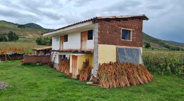
The Chacan community belongs to one of the largest towns from the Anta province. It is mainly an agricultural area with extensive farms and open fields. Another activity that they often carry out is artisanal fishing for trout, which they have been doing the same way that the ancestors did.
From this comes one of the favorite dishes of the area: breaded trout with potato and salad, all produced by them.

CONFLICT
Smallfarmersvsassociations
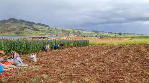
In recent years, there has been growing interest in growing quinoa in the Huaypo Lake’s region due to its increasing popularity on national and international markets. Quinoa is considered a superfood for its high nutritional value and resistance to harsh climatic conditions. However, this expansion of quinoa cultivation has led to tensions with local communities who fear the consequences of this agricultural transition on their traditional way of life and the environment.
Tensions between supporters of the expansion of quinoa cultivation and local opponents manifest themselves at several levels. Some local farmers have embraced quinoa cultivation because of its potential economic benefits, including higher market prices and growing demand.
These farmers are mostly part of associations that helps them develop and increase their incomes by planting in a more massive way.
However, others are concerned about the environmental consequences of this transition, including soil degradation due to intensive monoculture, loss of biodiversity and competition for water in a region where this ressource is still an issue. Opponents of the expansion of quinoa cultivation fear that this intensive crop will contribute to soil degradation and a reduction in biodiversity, particularly in fragile high-altitude areas.


National and international markets
Traditional farmers are concerned about increasing competition for water resources and traditional food crops, which are their main source of livelihood. Also, little farmers that are not or can not be part of associations have to face the difficulty of the market since there are already others farmers selling the same products in a more massive and effective way in the associations.
With that difficulty, they don’t have the ressources to really increase their incomes and stay in difficult living conditions.
Some members of local communities fear that the expansion of quinoa cultivation will threaten traditional farming practices and the diversity of crops indigenous to the region.
This conflict highlights the challenges of reconciling economic development objectives with environmental and cultural conservation imperatives. It also highlights the importance of strategic agricultural planning that takes into account the needs and aspirations of local communities while ensuring the sustainability of farming systems and environmental protection.
Nutritional values
Resistant to various climates


QUINOA
Afoodstuffwithhighnutritionalvaluebooming
Quinoa’s nutritional value is based on the presence of proteins (all essential amino acids), minerals, vitamins, linoleic acid, amylases and the absence of gluten. It’s wide genetic diversity enables it to adapt to various types of soil, particularly saline soils, and to environemnts covering wide gradients in humidity (from 40 to 90%), altitude (from -8°C to 38°C). This adaptability is an asset in the conext of climate change and the salinization of agricultural land.
So the quinoa is rich in nutrients and has the particularity of being able to be grown in extreme conditions (drought, altitude, torrential rain, salinity, frost...). For this reason, the UN considers that the global expansion of its cultivation could help to ensure global food security.
In 2013, the FAO (Food and Agriculture Organization of the United Nations) launched pilot programs to develop quinoa cultivation in 27 countries, including Algeria, Somalia and Iraq.
In 2013, the price of quinoa per tonne even reached 9,000 euros. An excessively high price, considering that a tonne of wheat in France currently costs 150 euros.
Government and international promotion has paid off. In Peru alone, between 2013 and 2015, exports rose by almost 300%. In just two years, quinoa has become one of the main crops grown in the Arequipa region. Whereas the country accounted for just 6% of global production in 2000, in 2016 it is the world’s leading producer, ahead of Bolivia for the first time
NUTRITIONAL BENEFITS OF QUINOA


Quinoa production and consumption
In recent years, due to the growth of the national and international demand, quinoa production has been intensified. Traditionally grown in the highlands and inter-Andean valleys, due to its versatility and adaptability to different environments, cultivation is spreading to important areas of the Peruvian coast, which has enormous potential for expansion and production.
The global interest generated following the declaration of 2013 as the International Year of Quinoa, the gastronomic “boom” of Peruvian cuisine and the boosting industrialization of quinoa generated nationwide interest in learning, research, production and consumption ofthis Andean grain for its recognized nutritional and dietary properties.
The production of quinoa in Peru is concentrated mainly in the highlands and valleys, with an increasing trend of cultivation on the coast for its favorable agroclimatic characteristics for production.
Quinoa is composed of the plant, the roots, the stem, the leaves, the inflorescence, the flowers, the fruit and the seeds.
The geographical extension of quinoa production has been made possible, among other things, by studies on the plant’s genome to obtain varieties better adapted to temperate climates.

These researches take place within an economic framework that can be very negative for the original production areas.
The product’s success is essentially due to its nutritional richness (protein and fiber, gluten-free). By 2023, the global quinoa market will be worth the equivalent of $1.18 billion.
Internationally, quinoa’s success has continued. Over time, and on different scales, more than 120 countries have invested in its production. France, Spain and Canada have taken the plunge with conviction, generating greater competition on international markets, even ifPeru and Bolivia remain leaders in terms of exports (74% in total in 2019).
Europe, quinoa was originally a poor man’s food for Peruvians and Bolivians. Its success has caused prices to soar.
Quinoa was originally a staple food. The “poor man’s cereal”, which is actually a herbaceous plant, was a popular dish until the early 20th century.
In Peru and Bolivia, buying quinoa is becoming a luxury. In 2012, buying a kilo of quinoa at the supermarket cost five times as much as a kilo of rice.


Photographiccensusofthedifferenttypesofquinoafoundintheregion


Farmershousenexttohisfields
CHEQUEREC
Huaypo Lake
ANTA MARAS Project area and surrounding cities


Different types of houses on the way to the
Huaypo Lake
Interviewer: What are the main products you grow?
Rafael: We mainly grow potatoes, quinoa and corn. Sometimes, if we have a large amount of planting, we sell the quinoa.
Interviewer: Could you explain the difference in growing season between quinoa and other crops like potatoes and corn?
Rafael: Quinoa is sown in June, whereas potatoes are sown in May. Quinoa is slower-growing than corn and potatoes.
Interviewer: How do you separate the edible part of the quinoa from the rest of the plant?
Rafael: We use stones and our hands to separate the edible part from the rest of the plant. Then we carefully wash the quinoa before eating it.
Interviewer: At what altitude do you grow these crops?
Rafael: We grow these crops at an altitude of around 3,700 meters. Potatoes, quinoa and corn are grown at a similar altitude, around 2500 meters.
Interviewer: Is there an ayllus system in your community?
Rafael: No, we’re independent. We farm to feed ourselves and our families. However, we can sometimes sell our crops, especially quinoa. There are ayllus systems for those who sell cuy (guinea pig).
Interviewer: What is the relative importance of corn versus quinoa in the region?
Rafael: Corn is more important than quinoa because of the more favorable soil and weather conditions.
Interviewer: Why don’t you work in June, July and August?
Rafael: During these months, we’ve already harvested our crops, and it’s also the season when there’s little or no rain. We plan our crops according to the seasons and rainfall to avoid having to look elsewhere for water.
Interviewer: How does the availability of water affect your plantations?
Rafael: We depend on a small lake for irrigation. If we don’t have rain, the lake can run dry, which means we can’t plant crops. Excerpt from a conversation with a farmer-taxi driver whose fields are an hour’s drive from the city of Cusco.

Rafael
Interviewer: Is that your quinoa field right here ?
Farmer: Yes it is, but all of it is not mine, each family here has its own plot and plantation. The quinoa plantation on the other side is not mine.
Interviewer: We see you are harvesting potatoes here. Is it to sell it or to eat it ?
Farmer: It’s mostly to sell it in the city.
Interviewer: Are you a farmer that is part of an association or not ?
Farmer: No i’m not.
Interviewer: What is the reason for that ?
Farmer: My plot is too small to be part of an association, then i have to work alone but it’s really difficult. I even struggle to pay and nourish the person helping me harvest and sell it.
Interviewer: What is the main issue that you face as a farmer?
Farmer: The main problem is having access to the market.
Interviewer: Do you have other plots here ?
Farmer: Yes i have some other fields higher up.
Interviewer: Is that your house right there (next to the field)
Farmer: Yes it is, i live here with my family.
Interviewer: Thank you so much for answering our questions sir, we are actually students from France and we are studying the plantations, especially quinoa crop.
Farmer: Oh okay no problem!
Excerpt from a conversation with a farmer whose fields are next to the Huaypo Lake

PROJECT
A “self-sufficient” rural community organization of farmers and craftsmen that manages to grow and develop an economy.
The community around Lake Huaypo, in the Urubamba region, is facing a series of challenges as a result of the global health crisis and internal political unrest. Deprived of the once prosperous tourism industry, the region now suffers from increasing economic insecurity, compounded by rising prices for basic commodities such as gasoline and quinoa.
However, the community remains strong in its Ayllus culture, where each family owns small plots of land at different altitudes, fostering a diversified plantation system and a tradition of bartering and mutual aid.
Faced with these challenges, our project proposes an innovative approach aimed at promoting integrated rural development and economic self-sufficiency. We plan to create a community organization bringing together farmers and craftsmen, with the aim of establishing a circular and sustainable economy.
Our actions will include preparing land for environmentally-friendly agriculture, planting a variety of crops adapted to different altitudes, transforming agricultural waste into ecological building materials, and building quality, affordable housing.
We also intend to promote bartering and the sale of local products to stimulate the local economy, while disseminating traditional know-how and developing rural tourism as an alternative source of income.
Our project is based on the use of local resources and the valorization of traditional knowledge, while respecting the different temporalities and specific geographical conditions of the region. We aim to offer concrete, sustainable solutions to the challenges facing the Lake Huaypo community, with a view to creating a better future for all its inhabitants.
POOR SMALL FARMERS
- Precarious living conditions
- Limited access to healthy food
- Health problems
- Nutritional problems
PROBLEMS HEALTH / NUTRITION
- Poor living conditions
- Low-cost housing
- Impact on health
- Impact on nutrition
CONFLICTS AGRICULTURAL OF LAKE HUAYPO
- Low income
- Limited access resources
- Rivalry with large farms
- Lack of visibility
- Lack of recognition
DIFFICULTIES IN INTEGRATING IN THE MARKET
- Distance from town
- Logistical difficulties for transporting products
- Cost of transport
- Dependence on transporters
HOUSINGS LOW COST AND THEREFORE LOW QUALITY
6 a LEARNING KNOW-HOW
8 INCREASED REVENUES 7 TOURISM
1 LAND PREPARATION
2 PLANTATION
6 b HOUSING CONSTRUCTION
3 CROP HARVESTING
4 c WASTE TREATMENT 5 TRANSFORMATION INTO CONSTRUCTION MATERIALS 4 a FOOD SUPPLY 6 c SALES OF MATERIALS 4 b SALES / TRADE
QUINOA
QUINOA
Quinoaisthemainagriculturalproductoftheproject.Itisusedasafoodstuff,inarchitectureasabuildingandcrafting materialsandalsoascompost
Quinoa is the main agricultural product of the project. It is used as a foodstuff, in architecture as a building and crafting material and also as compost.
Annotated diagram of quinoa
Consumption: Quinoa as a good nutritional dish
Quinoa will be a main source of income for farmers, who will sell it, produce architectural elements whose know-how they will share and sell, use it for handicrafts and weaving, and also for composting. All parts of the quinoa plant would be used, from seeds to branches, leaves and even roots. The leaves and roots would be used as compost, the seed would be eaten and sold, and the stem and panicle would be put in adobe bricks.
Quinoa will be a main source of income for farmers, who will sell it, produce architectural elements whose know how they will share and sell, use it for handicrafts and weaving, and also for composting. All parts of the quinoa plant would be used, from seeds to branches, leaves and even roots. The leaves and roots would be used as compost, the seed would be eaten and sold, and the stem and panicle would be put in adobe bricks.
Agriculture: composts of quinoa leaves and roots
Architecture: Adobe bricks with quinoa
QUINOA
POTATOES
Agriculture Consumption
Agricultural area (bamboo)
BAMBOO
LAKE HUAYPO
Farmer’s common
Adobe bricks’ manufacturing place
Fishermen common
Reed boats and fishing rods’ manufacturing place
Communities commons
Lakeside market and touristic area
Communities and tourists commons
Workshop place for know-how’s sharing
Adobe brick-making:
This plot is dedicated to sorting resources, making bricks in forms and drying them. There are three distinct structures. The first is designed for the farmers to dig into the ground and work the soil into the ideal mixture for making adobe bricks. The second is used to shape the adobe bricks by placing the mixture in molds. And the last is used to store the bricks and as a covered drying area. Farmers would work as a community to provide the raw materials needed to build their homes.
Fishermen manufacturing place: Fishermen use all the resources at their disposal. Indeed, as their stilt houses are located on the edge of the lake, they are close to reed shoots. As reed is strong, they use it together in this workshop to make fishing rods and boats. It’s a local tradition that we’d like to perpetuate, making their boats out of “totora”.
Market:
This plot of land is dedicated to the market, where different resources can be sold and exchanged. This market is the place where all the resources produced by each of the protagonists are bartered, exchanged and sold. Farmers would sell their crops, as well as their adobe bricks and woven quinoa furniture, while fishermen would sell and trade their fish and reed boats. It would be a place for sharing, not only between fishermen and farmers, but also with other neighboring communities.
Potatoes’ fields detail
Tourism:
Placed on the edge of the lake, the market would be accompanied by areas set aside for tourism and leisure activities, linking locals and foreigners alike. The lakeside area dedicated to tourism, with public facilities and organized activities for visitors. These common spaces encourage social interaction, knowledge sharing and collaboration, while supporting the local economy and development
Workshop:
A space where skills such as weaving and brick-making are shared with the community an the visitors. This structure is dedicated to sharing the know-how of the communities around the lake, with the aim of extending and publicizing innovative construction methods and increasing the communities’ income and visibility in the eyes of the world.
Corn’s fields detail
The farmers’ house is designed in two distinct blocks: on one side, the barn, and on the other, the living block, separated by a central «in between» space. This layout reflects the different stages of the agricultural cycle: from the fields, with land preparation, planting, harvesting and sorting of resources, to their processing in the in-between spaces.
The barn serves as a storage area, while the covered outdoor area (préau) is dedicated to sorting the various parts of the harvest, including building materials. The central space also houses a composting area.
The living area is designed to clean, prepare and consume harvested resources. It is divided into two parts: on the left, the main living space with lounge, dining room and kitchen, separated by a reception area and a distributive corridor leading to the private block comprising bedrooms and bathroom. On the façade, a programmatic strip is dedicated to weaving textiles with plant fibers, another key step in our project cycle, linking the house to the common activities of the street.
The house is built by the farmers themselves, using adobe bricks, bamboo and quinoa fiber partitions, materials sourced from their plantations and community exchanges.
The Fishermen’s House, set on stilts above the waters of Lake Huaypo, is an example of harmony between architecture and its natural environment. Its structure follows a bamboo grid, with bamboos spaced 35 cm apart integrated into the walls. These walls, from the inside out, are composed of a layer of dried earth forming an inner plaster, followed by horizontal bamboo mats, a new layer of earth enveloping the bamboo, then additional bamboo mats, earth (identical to that of the inner plaster), reed insulation, and finally, an outer layer of dried earth.
The interior layout is centered around a kitchen at the heart of the square, compact house. The quinoa-fiber partitions surrounding the kitchen diffuse heat to other rooms, such as the bedroom and living room. A pantry stores the fisherman’s tools and a freezer preserves the catch. The house also features a practical fishing terrace.
The roof, accentuating a gradation effect towards the living room, is raised and woven with quinoa stems, ensuring regular, natural ventilation of the dwelling.
AGROBIODIVERSITY IN FOOD NETWORKS
Building a resilient future through biodiversity conservation

Mariia Husak
At the time of the Spanish conquest in the 16th century, the Incas cultivated almost as many species of plants as the farmers of the entire Asia-Europe landmass. Although they had no iron, wheels, or draft animals for plowing, this wealth of agricultural biodiversity allowed the farmers of the highlands to support a population of some 15 million people, similar to the present-day population of the high Andes. Under Spanish rule, plants that had been central to Inca society were intentionally replaced by European species such as wheat, barley and carrots.
Within agro-ecological systems, the conservation of genetic diversity, so vital for food security, takes place in a fragmented manner across Peru. This occurs at the intersection of resilient landscapes and practices. Where physical conditions resist the complete industrialization of agriculture and where social initiatives support unconventional economies, diversified food systems thrive.
The primary goal of our project is to establish a sustainable community for farmers who have been displaced by the construction of a new airport in Chinchero. This initiative is strategically positioned between Urubamba and Yucay, areas rich in
agricultural tradition and natural beauty. By focusing on sustainability and resilience, our project aims to restore stability and prosperity to these displaced communities.
Drawing inspiration from the successful Potato Park in Peru, my approach involves adapting and integrating proven agricultural practices with innovative business strategies. This blend not only promises to enhance the quality of life for the local population but also ensures the sustainability of the community’s economic model. Through this fusion, we aspire to create a robust platform where tradition meets modernity, empowering farmers to thrive in changing times.
The project envisions the creation of a new village that will serve as a new home for the Chinchero farmers. This area will also act as a protected zone, dedicated to enhancing Peru’s biodiversity. By fostering a harmonious relationship between farming practices and environmental conservation, we aim to nurture a vibrant, biodiverse habitat. This community-driven development model will not only support local farmers but also promote ecological stewardship, positioning our project as a beacon of sustainable development in the region.

The Potato Park is located within the Cusco Valley, covers at total of 9,280 hectares, and has a population of 6,000 inhabitants. The first human settlements in the area are dated at some 3,000 years ago. Human populations have been co-evolving with the Cusco Valley since then. Archaeological and historical records have named several successive cultures that have inhabited the valley, such as the Markavalli, Chananpata and Sawasiras, among others.
In general, it is known that successive cultures had highly organized societies, based on principles of solidarity and respect. The Incas later founded their empire in Cusco, bringing their ancient traditions and religion to a large population, based on the principle of ayni, reciprocity. The sacred city of Cusco became the centre of Incan culture. For millennia, ancient Andean principles of reciprocity and interconnectedness have guided the interactions of people with the environment, producing the Andean landscape.
The European invasion and colonization of Peru had profound consequences for Andean landscapes, resource use and maintenance of sustainable food and economic systems for livelihoods. Today indigenous communities are confronting the impacts of colonialism by regaining their strength and inspiration from their own native identity and unique association with the land. important opportunity for a dynamic maintenance of genetic resources and landscapes.

1. LEARNING FROM POTATO PARK
Their survival is attributed to their endless patience and a profound spiritual reverence for the Pacha Mama and their ecological ayllu, and to their knowledge and innovation systems, which are based on sophisticated understanding of their mountain environment. This has provided them with an indigenous environmental ethic which has fuelled a conscious effort to preserve their environment and has propelled the creation of new mechanisms to conserve and sustain their natural resources. The case of the communities of the Potato Park demonstrates the deliberate efforts of Quechua communities to maintain diversity in domesticated and non-domesticated plants and animals, which characterizes Quechua farming systems, providing an important opportunity for a dynamic maintenance of genetic resources and landscapes.
Authority for the Park is shared between the villages, each of which elects one Chairperson to coordinate the work of the Association and concerted efforts are made to integrate traditional spiritual values, beliefs and understanding into the management.

The Potato Park in Pisac, Peru, is located at a high altitude ranging from approximately 3,350 meters (about 10,990 feet) to 3,800 meters (about 12,467 feet) above sea level. This altitude positions it within the high Andean region, where the climate and environmental conditions are particularly suited to the diverse varieties of native potatoes cultivated there

GreenhouseinPotatoPark


Potato park site location


Potato park site

THE AYLLU APPROACH
The Potato Park is based on the ayllu approach. While most studies describe ayllu as a political and socioeconomic system, few systematic analyses of the ayllu as an ecological phenomenon exist. We understand the ayllu as a community of individuals with the same interests and objectives linked through shared norms and principles with respect to humans, animals, rocks, spirits, mountains, lakes, rivers, pastures, food crops, wild life etc.
The following case study examines the ayllu from an ecological perspective with a particular focus on its importance for the management of landscapes and biodiversity. This interpretation and use of the ayllu concept offers the opportunity to appreciate the continued interactions between Andean peoples and the environment. Since pre-Hispanic times, the coevolutionary relationship of the mountain environment through management of biocultural resources has produced the ayllu cultural landscape. While more recent political trends have displaced the ayllu as a political, economic and administrative system, as a cultural landscape it continues to be nurtured by Andean peoples.
The main objective of the ayllu is attainment of wellbeing. Well-being is defined as Sumaq Qausay, the ideal that is sought after by men and women, that translates into social, economic and political well-being through a full life.
It expresses a relationship between human beings and their social and natural environments. It means to be in
equilibrium with one’s natural and social surroundings and to maintain reciprocity between all beings, including Pacha Mama (Mother Earth). Verticality, the control of a number of economic niches at different altitudes, is a principle of Andean life. The sharp vertical changes of the Andes create microclimates within relatively short distances. Peoples and even individual communities or families in pre-Columbian times strove to control a number of ecological zones where different kinds of crops could be raised. A community might reside in the altiplano growing potatoes and quinoa, an Andean grain, but might also have fields in lower valleys to grow maize, and pastures miles away at a higher elevation for their llamas, and even an outer colony in the montana to provide cotton, coca, and other tropical products. In fact, access to a variety of these ecological zones determined pre-Columbian patterns of settlement and influenced the historical development of the Andean world.
Still today, the landscape is organized by ecological zones and the exchange of products allows for the fulfilment of livelihood needs across the zones. Agrarian cycles are used to organize collective labour in each zone so that productivity is maximized by using the available labour force to its full potential. Social organization is based on the exchange of labour and agricultural products between the zones. The principle of ayni (reciprocity) is thus fundamental in ensuring that each ecological zone is as productive as possible, contributing to Sumaq Qausay of the ayllu.

The main subsistence activity in the Potato Park is agriculture and animal husbandry. Approximately 13.07 per cent of the park area (approximately 1,133 hectares) is used for permanent agriculture of corn, tarwi, potatoes, beans, barley, and other crops. About 33.81 per cent of the park area is made up of tundra, or land that is resting. Crop rotation occurs every three to nine years. First, farmers cultivate potatoes, masha and oca, then the land is left fallow. During fallow periods, many medicinal plants can be found in these plots.
The Potato Park is a centre of origin of the potato (CIP, 2008). The region is home to eight known native and cultivated species and 2,300 varieties, out of the 235 species and over 4,000 varieties found in the world. Also found in the region are 23 of over 200 wild species found in the world. The genetic diversity found within just one plot in the area can reach up to 150 varieties (Chawaytire community, Potato Park). Apart from potatoes, other native Andean crops such as olluco, beans, maize, quinua, wheat, tarwi, mashua and oca are produced. Beyond crop production for consumption, agriculture is also responsible for producing wool, medicine and wood. Other important functions of the agricultural system include food security, conservation, development and livelihoods and water conservation. Complementary economic activities include animal husbandry; sheep, cows and camelids.
The landscape of the Potato Park is the result of millennia of interactions between human populations and the environment and has been described by scholars as the product of ‘common-field agriculture’. ‘Common-field agriculture’ is a form of collective land management in which an assembly of farmers coordinates the production of crops and livestock grazing in managed fallow spaces among the designated sectors of a community.

The spatial and sequential organisation of land use in the Andes has been shown to be pivotal to maintaining a high biodiversity in the landscape (Godoy, 1991). This conceptualisation of Andean land management illustrates how productive activities organised collectively result in a landscape with high agrobiodiversity. Similarly, some have interpreted it as based on a landscape concept of space-based rotation and social organisation for access, providing a focus on the landscape as both environmental and productive, and social and cultural (Zimmerer, 2002). The biocultural system 3 approach of the ayllu system begins from an indigenous perspective, based on the Andean holistic worldview that recognises interconnectedness across all spheres of the cosmos, including the spiritual dimension. The landscape is
BIOCULTURAL
DATABASES
The Park has developed Local Biocultural Databases based on the traditional Andean system of Khipus. Khipus were used during prehispanic times to collect and store information, including information related to biological resources. The result of applying the Khipus system to biocultural databases is an adaptive system that allows capture, registration, storage and administration of indigenous knowledge based on Andean traditional science and technology. It is a tool that can be used to conserve, promote and protect local knowledge, thus becoming useful in facing political, social and technological challenges that are all too common in this era of globalisation. The methods and tools used are suited to oral and visual knowledge models. They include audiovisual information, matrices of biodiversity, Geographic Information Systems (GIS) and free software. Local protocols based on customary laws are used to regulate access to the information.

AndeanPotatofarmers
PLANNING & SOCIAL ORGANISATION
There are six Quechua communities in the Potato Park. In 1993, the total population of the Potato Park was 3880 inhabitants, with a population density of 444 inhabitants per square kilometre. There is a small majority of women 50.2 per cent. 51.6 per cent of the population is between the ages of 15 to 64. 28 per cent is between the ages of 4 to 14, and 16 per cent of infants are younger than 4 years old. The communities rank in fourth place for extreme poverty and sixth regarding absolute poverty.
The majority of the population is indigenous to the region, with only 1 per cent of the population being immigrants. There are two identifiable types of economic migration out of the Park seasonal temporal migration and permanent migration. Seasonal migration is mainly undertaken by the heads of families who migrate to Quillambamba and the Cusco areas from January to April, during the period of least agricultural activity in the high altitude zones. These migrants work in coffee plantations and as labourers.
There is however a small portion of mainly adult males from some communities that permanently work as porters for tourists hiking the Inca Trail to Machu Picchu. The Potato Park communities have developed subsistence mechanisms and social relations through adapting with their natural environment. The family unit is the productive unit and the vehicle for processing and planning future activities. Families in
the more isolated communities continue to develop their productive activities with a focus on food security, using traditional technology and crops (such as potatoes), and conserving as much diversity as possible. Those living in more open communities supplement their agricultural activities with commercialisation of products and artisan work, or working outside of the Park, as porters for example.
The majority of subsistence activities are based on diversifying uses. For example, native potatoes are transformed into chuno or moraya for consumption, seeds, sale or barter. Agricultural products are used based on the priorities and values of the communities, the best products are set aside for maintaining social relations, rituals and family consumption, products that are not as high quality are used for seed, barter and sale, the least desirable products are used for transformation or for animal feed, and the undesirable products are fed to the animals.
Women play an important role in the process, as they are the most knowledgeable in selection criteria and characteristics for the different uses. Women also manage the quantity of different types of product used. They are therefore ‘experts’ on both qualitative and quantitative value of their products, and can set a value on them for bartering purposes. Barter is mainly used at the household level, and women play a big part in managing the barter system.


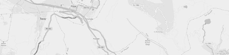

Given the focus on preserving genetic diversity, facilities for agricultural research, including labs for studying plant genetics and seed banks, are present. These labs help monitor and develop strategies for sustainable agriculture

Housing for the local communities who maintain and work in the park. These are typically traditional and may be used to showcase sustainable living practices.


These serve as hubs for meetings, educational programs, and community gatherings. They play a crucial role in maintaining the social and organizational structure of the park.


Areas designated for the preservation of cultural and historical aspects of the local communities, which might include museums or outdoor displays that explain the history and significance of the park and its practices.

While the park aims to maintain its ecological and cultural integrity, it also host small-scale eco-tourism facilities, such as lodges or guest houses that accommodate visitors interested in learning about the park’s efforts and local culture.
Potatoparksite
2. CONFLICT DESCRIPTION
The construction of the new international airport of Cusco in Chinchero started last November in spite of widespread outrage against it. Well-known international outlets and Peruvian media have reported on the potential impacts on the historical and cultural heritage as well as on watersheds in the region. The case of the Chinchero Airport has also been documented in the Map of Airport-related Resistance and Injustices, which is a joint project between Stay Grounded and the Environmental Justice Atlas.
Before construction of the Chinchero Airport began, the consortium led by the Korea Airports Corporation along with local and national governments ignored warnings issued by UNESCO over the location of the new airport near world heritage sites like Machu Picchu. A few months after the excavators started moving the terrain, the worst fears were confirmed: fertile land has been lost, the landscape disturbed, and the project advances over historical Incan and colonial roads.
Brutal environmental impacts from the new airport such as the reduction of flora and fauna, air and noise
pollution, soil erosion, conversion of arable land into urban areas, and destruction of lakes and wetlands would greatly affect the ecosystems sustaining this well-preserved agrarian landscape of Chinchero and the surrounding region.


FarmersandtheiractivitiesimpactedbytheAirport
THREATENED PEOPLE, HERITAGE AND CULTURE
The trail of destruction from this mega-project in Chinchero has already wreaked havoc upon its peoples and their cultural heritage, the land and the built environment. Another webinar panelist, Enrique Estrada who is an architect in Cusco, denounced the Ministry of Culture, claiming it “has not done the assessment study of cultural impact”, which is mandatory under Peruvian law for the conservation of cultural patrimony. For Estrada, the incalculable architectural value of this patrimony extending through the region is enough to argue against the airport. According to Carreno, the airport construction and future air traffic are leading to the destruction of Incan roads and pose a threat to historical Incan and colonial villages. Cruz also fears that ongoing urbanisation linked to the airport project, paired with climate and water crises, may threaten the culturally significant and globally unique variety of white corn.
White corn, particularly the Blanco Gigante Cusco variety from the Urubamba Valley in Peru, is known for its exceptional grain size and is one of the most productive maize races in the country. Cultivated at altitudes of 2750-2950 meters, this corn occupies over
90% of the cultivated area in the region, significant both for grain and fresh cob production. Despite high genetic and production quality potentials, the average yield remains low at around 3.3 tons per hectare, although yields can reach up to 10 tons per hectare under optimal management practices.
The construction of an airport near the Urubamba Valley, where white corn is cultivated, primarily influences land use and cultural dynamics. Transforming agricultural land into an airport reduces the area available for cultivating white corn, directly affecting production and potentially altering the local microclimate essential for its growth. Additionally, the cultural and social impacts are significant, as white corn is deeply intertwined with the indigenous heritage of the region. The shift in land use could disrupt traditional farming practices and the cultural significance of this crop, affecting the community’s connection to their ancestral agricultural practices. While improved infrastructure from the airport could enhance market access, the overall cultural and environmental changes might pose challenges to sustaining traditional white corn cultivation.
In the Yukay and Urubamba areas, renowned for their cultivation of the Blanco Gigante Cusco variety of white corn, the average yield in Yucay is relatively low at 1,374 kg/ha, which is the least productive among the districts within these regions. Meanwhile, the areas of Urubamba typically have higher yields, emphasizing their importance in the cultivation of this prominent maize variety. In the context of the broader Urubamba province, the average area cultivated annually is close to 4,000 ha, with total annual production fluctuating between 8,216 and 12,115 tons .
My architectural study project addresses the relocation of communities affected by the proposed airport construction. These regions, deeply rooted in agricultural traditions, face significant disruptions due to the development. My plan aims to develop
provides adequate housing but also ensures that displaced communities can continue their traditional agricultural practices, particularly the cultivation of white corn. This plan will focus on integrating local architectural styles and eco-friendly building techniques to maintain cultural continuity and minimize environmental impact.
The resettlement areas will be designed to enhance community cohesion and economic sustainability. Facilities such as community centers, educational institutions, and marketplaces will be strategically placed to support social and economic activities. The project aims to create a model for responsible and culturally sensitive development that can be replicated in other regions facing similar displacement challenges due to large-scale infrastructure projects.


3. PROJECT
Before embarking on the relocation project for the Yukay and Urubamba communities, I conducted an in-depth study of the Potato Park in Pisac to understand its operational framework. This system not only safeguards genetic diversity but also bolsters local economies through ecotourism and direct sales of agricultural products. Inspired by the Potato Park’s achievements in preserving biodiversity and empowering local communities, I aim to implement a similar approach in the Yukay and Urubamba areas.
Given that Yukay and Urubamba are pivotal for the cultivation of Blanco Gigante Cusco white corn adopting the Potato Park’s model could provide a sustainable solution. My project proposes to establish a ‘Corn Park’, where community-driven practices will focus on the conservation of white corn varieties. By involving local farmers and stakeholders in the cultivation, management, and sale of this corn, the project will help preserve its biodiversity. Additionally, this initiative will offer new employment opportunities for those who might lose their jobs due to the airport construction, ensuring economic stability and community resilience.
The ‘Corn Park’ will also integrate educational and tourism components to raise awareness about the importance of white corn and traditional farming practices. By hosting workshops, farm visits, and cultural events, the park will attract visitors and researchers interested in sustainable agriculture and indigenous crops. This exposure will not only generate additional income for the community but will also highlight the global significance of preserving unique agricultural practices and crops such as the Blanco Gigante Cusco.
Overall, the project’s intention is to create a system that preserves the biodiversity of corn while providing employment and supporting the local economy. By drawing on the successful practices of the Potato Park and tailoring them to the needs and conditions of Yukay and Urubamba, this initiative will help ensure that the cultural heritage and biodiversity of the region are maintained for future generations. This proactive approach offers a blueprint for other communities facing similar challenges worldwide, demonstrating how traditional agriculture can be a foundation for sustainable development.


• Total Airport area and surroundings impacted 534
• 10% of the total airport area was actually owned and used by locals for agricultures and other uses which in turn impacted biodiversity. 5% is around 30 hectares. (this 30 hectares include also the housing of the farmers and other infrastructures and
• 156 families impacted: People impacted in this 10%: Population: 10.000; Chincherro with
excluding airport: 550 hectares -> 0,055 hectares/person. 5% of impacted area: 30 hectares -> 545 people. (Peru: 3.5 people per household


AreaimpactedbytheAirport,Chinchero

ANALYSIS OF TERRITORIES
• 5 total hectares occupied by new houses for the 156 families impacted (100 m2 per family)
• 70% of 776 hectares (543 hectares) that are currently used and not for sales by local residents in
• 233 hectares = arable lands that can be used by the 156 families to preserve biodiversity impacted by the airport and apply the model and strategies of the Potato Park. This area is > 30 hectares, so the
• Pink Area: 97 hectares that can be used (5 hectares for houses, 30 hectares to use for arable fields, 62 extra hectares for new infrastructures inspired by
AreaimpactedbytheAirport,Chinchero
Additional information:
• Being in the middle of Urubamba and Yucai there will be easier to create synergies with them
• We will be able to concentrate all houses and fields in one area
• Additionally, we can leverage the additional 4050 hectares in the south of Yucai. So, even if the 50 hectares above used for new houses and fields for the 156 families are not enough, then we will have these additional 40-50 hectares of arable lands that is connected by a 6 minutes by car street.


HOUSING AND FIELD CONSTRUCTION
In designing the residential area for the 156 families displaced by airport construction, it is crucial to strike a balance between tradition, efficiency, and potential revenue generation. Here’s an evaluation of the housing and auxiliary building options:
• Cultural and Architectural Considerations. The design of the housing should pay homage to Peruvian architectural traditions, which could turn the area into an attractive destination for cultural tourism. Traditional building techniques, such as adobe construction which is both sustainable and culturally significant in Andean regions, could be utilized. These homes would not only blend harmoniously with the landscape but also provide natural insulation properties, reducing heating and cooling costs. Incorporating vibrant colors, courtyards, and local handicrafts can further reflect the rich cultural tapestry of Peru.
• Efficiency and Modern Amenities. While tradition is important, modern efficiencies cannot be overlooked. The use of eco-friendly technologies such as solar panels, rainwater harvesting systems, and efficient waste management should be considered to reduce the ecological footprint and lower ongoing utility costs. Smart design features like double-glazed windows, skylights for natural lighting, and green roofs can enhance living conditions while reducing energy consumption. The layout of the community should be planned to maximize natural light and ventilation, potentially reducing construction costs by minimizing the need for artificial lighting and air-conditioning.
• Commercial and Communal Facilities. In addition to residential buildings, the development plan should include commercial and communal facilities to support the local economy and social life. A community center that doubles as a museum or cultural hub can attract tourists and provide a venue for local artisans to
sell crafts, organic produce, and traditional foods. Small-scale laboratories linked with the agricultural fields can serve as research and innovation centers focusing on sustainable farming practices, which could generate additional revenue through partnerships with academic institutions or eco-tourism.
• Safety and Infrastructure. Proper infrastructure is essential to ensure safety and accessibility. This includes reliable roads, emergency services, and possibly even a small healthcare facility. Designing these facilities with traditional architectural styles and modern safety standards can further enhance the area’s appeal and functionality.
• Economic Considerations. The initial cost of incorporating traditional designs and modern technologies might be higher than standard construction methods. However, the potential for increased tourism revenue and lower long-term maintenance costs can offset these initial investments. It is beneficial to conduct a detailed cost-benefit analysis to compare the upfront costs against the longterm savings and revenue opportunities.
• Final Considerations. In conclusion, creating a blend of traditional Peruvian architectural elements with modern, sustainable building practices offers a compelling proposition. Not only does this approach respect and preserve local heritage, but it also positions the community as a unique eco-tourism destination, potentially generating substantial future revenue. The inclusion of commercial and communal facilities should be designed to complement this vision, ensuring they serve the needs of residents while attracting tourists. Careful planning and investment in these initial phases are crucial to securing long-term economic, environmental, and social benefits for the displaced families and surrounding communities.


Residential area + fields
Common areas
Common fields
Touristic facitilies

PLACEMENT OF BUILDINGS ON THE LAND
When planning the placement of buildings and structures on agricultural land covering 97 hectares, I consider functionality, ease of access, sanitary zone requirements, and efficient land use.
1. Residential Buildings. Farmer’s House and worker houses are placed in relatively quiet areas, away from production zones, but with easy access to the main working areas. I am creating a residential zone with greenery to improve living conditions and worker productivity.
2. Laboratories and Research Centers. Laboratories and research centers will be located in relatively quiet zones with good infrastructure for communication and sample transportation.
3. Seeds bank is located in front of the laboratory to ensure a comfortable transportation of seeds.
4. Kindergarten is placed in front of the Community Center for comfortable connection of parents with their kids.
5. Community center. Located in the heart of the territory, in place accessible from all sides, both by community members, people from neighbourhood and tourists.
6. Medical center. Located in the same area with Community Center and Kindergarten. Accesible for everyone.
7. Hotel and restaurant. All touristic areas will be located near the entrance to the territory for logistical convenience and attraction of tourists.
8. Marketplace. Same as other touristic areas. Will be located near the entrance to the territory along the main street.
9. Production Buildings. Storage facilities, vegetable storage, and grain storage will be located near the entrance to the territory for logistical convenience. These buildings should be easily accessible for machinery and have good access roads.
10. Processing Facilities. Dairy farms, meat processing plants, bakeries, and mills should be located near sources of raw materials and main roads for convenient transportation of finished products.
11. Drying and Cleaning Facilities. Drying complexes and cleaning facilities are placed to ensure convenient access to raw materials and finished products.
12. Livestock Buildings. Cattle barns, poultry houses, pigsties, and stables should be located away from residential zones and main storage facilities to avoid the spread of odors and noise. I ensure that pastures and exercise yards are in close proximity.
13. Greenhouses and Hotbeds. Greenhouses and hotbeds are placed in well-lit areas, protected from strong winds. It is recommended to place them near sources of water and fertilizers, so i place them next to the river.
14. Technical Facilities. Garages and workshops will be located in the center of the production zone to ensure quick access to the entire territory. Fuel storage should be placed considering fire safety requirements and away from residential and production buildings.
15. Feed Storage and Distribution Facilities. Feed workshops, silos, and hay storage will be placed near livestock complexes for convenient feed delivery.
General information
• I create a zoning plan for the territory, considering the functional purpose of each area.
• Taking into account sanitary zone requirements and maintain regulatory distances between different types of buildings.
• Planning convenient transport routes for machinery and workers.
• Leaving reserve areas for potential expansion and modernization.
SUSTAINABLE
DESIGN
• Orientation for Natural Light and Ventilation: Through detailed sun path and wind pattern analysis using QGIS, I oriented the buildings to maximize exposure to natural light and facilitate natural ventilation.
• Integration with Natural Landscapes: The development seamlessly integrates with the existing natural landscapes. Major natural features such as mature trees, rock formations, and existing topography were preserved and incorporated into the design as key elements of the community layout.
• Use of Sustainable Materials and Technologies: Adobe construction, a traditional and sustainable building method, was utilized to reflect local architectural styles and provide excellent thermal mass, reducing the need for mechanical heating and cooling. Modern technologies such as solar panels, rainwater harvesting systems, and green roofs were incorporated to ensure sustainability and reduce the ecological footprint.
• Commercial and Communal Facilities: The development includes a centrally located community center that doubles as a cultural hub and marketplace, supporting local artisans and farmers by providing spaces to sell crafts, organic produce, and traditional foods.
By following these carefully planned steps, the Andean Heritage Village project successfully created a sustainable, efficient, and culturally enriching environment for families displaced by the airport expansion, setting a benchmark for future communityoriented developments.

COMPARISON WITH POTATO PARK : POTATO PARK
• Biodiversity Conservation. Genetic Diversity: The park conserves over 1,300 varieties of potatoes, ensuring the preservation of genetic diversity. Seed Banks: Establishing community seed banks helps preserve local crop varieties and allows for the exchange and reintroduction of seeds, maintaining genetic diversity.
• Traditional Knowledge and Practices. Indigenous Knowledge: The park heavily relies on the traditional knowledge and farming practices of the indigenous Quechua communities. This includes techniques adapted to the local environment over centuries. Agroecology:
• Community Involvement and Empowerment. The management of the park involves local communities in decision-making processes, ensuring that the initiatives align with their needs and leveraging their expertise. The park provides education and training to farmers on sustainable practices, biodiversity conservation, and traditional knowledge, empowering them to manage their resources effectively.
• Cultural Preservation. The park integrates cultural practices and rituals associated with potato farming, preserving and promoting cultural heritage. The park recognizes the cultural landscapes shaped by traditional agricultural practices and works to maintain them.
• Sustainable Livelihoods. The park supports diversified income sources for local communities, including ecotourism, artisanal products, and value-added agricultural products. Facilitating access to markets for locally produced goods ensures fair prices and sustainable incomes for farmers.
• Environmental Stewardship. The park promotes sustainable land use practices that protect the environment and enhance ecosystem services. By maintaining diverse agricultural systems, the park supports ecosystem services such as pollination, soil fertility, and water regulation.
• Resilience and Adaptation. The diverse genetic pool and traditional practices help the park’s agricultural systems adapt to and withstand climate variability and change. The park employs adaptive management practices that allow for continuous learning and adaptation based on monitoring and feedback.
• Policy and Advocacy. Recognition of Rights: The park advocates for the recognition of indigenous rights and traditional knowledge in national and international policies. Supportive Policies: Engaging with policymakers to create a supportive environment for sustainable agriculture and biodiversity conservation.

COMPARISON WITH POTATO PARK : CORN PARK IN URUBAMBA
• Conserving Biodiversity: At Corn Park, I establish a seed bank and cultivate a variety of crops to enhance genetic diversity, drawing from Potato Park’s model of biodiversity conservation. Additionally, I use precision agriculture technologies to optimize the use of land and resources, further bolstering my efforts to preserve local plant species.
• Leveraging Traditional Knowledge: Incorporate local knowledge and agroecological practices in your farming methods.
•Engaging the Community: Involve local communities in decision-making and provide training on sustainable practices.
• Promoting Cultural Heritage: Integrate cultural practices related to agriculture and preserve cultural landscapes.
• Diversify Income Sources: Support diversified income streams through ecotourism and value-added products.
• Ensure Environmental Stewardship: Implement sustainable land use practices and protect ecosystem services.
• Enhancing Resilience: I use diverse crop varieties and adaptive management to build resilience against climate change, inspired by the resilience strategies at Potato Park. Furthermore, I engage in continuous
environmental monitoring to anticipate and mitigate potential impacts related to climate variability.
• Advocate for Supportive Policies: Engage with policymakers to support sustainable agriculture and the rights of local communities.
In addition:
• Business Strategy: I adopt a robust business strategy that aligns with my sustainable goals, ensuring that all project components are economically viable and selfsustaining over the long term.
• Easy Touristic Connection: I develop connections with local and international travel agencies to promote easy access to Corn Park, making it a prime destination for eco-conscious travelers
• Sustainable Design: My infrastructure and community layouts are designed with sustainability at the core, utilizing renewable energy sources and green building technologies to minimize my environmental footprint.

TRADITIONAL ARCHITECTURE
Peru as a country boasts a mix of cultures, climates, and architecture. What makes it an incredible place to visit is that modern Peru seamlessly blends together its diverse history. Nonetheless, each culture and each historical period is still visible and alive throughout the country. Traveling through Peru, I noticed that a recurring theme was not only the country’s architecture, but the way it was adapted to changing circumstances.
In general, buildings in Peru can be assigned to one of three categories: pre-Columbian, colonial, and vernacular.
1. Pre-Columbian Architecture in Peru
2. Colonial Architecture in Peru
3. Vernacular and Contemporary Architecture in Peru


HOUSING TOPOGRAPHY
In choosing the type of houses to be built in an area like Yucai/Urubamba in Peru, various metrics and factors are crucial to ensure that the project is suitable for the context, sustainable, and able to meet the needs of the families who will move there.
Here are some of the main factors I considered:
•Local Climate. The climate plays a fundamental role in architectural design. The Yucai/Urubamba region has a highly variable climate, which can be cold and humid. Therefore, houses should be designed to maximize thermal comfort through: 1. Adequate insulation to retain heat during the colder months. 2. Window arrangements for effective natural ventilation during the warmer months. 3.Use of materials that respond well to thermal fluctuations.
•Sustainability and Environmental Impact. It is important to minimize the environmental impact of new constructions. Some aspects to consider include Use of local and sustainable building materials, such as adobe, which reduce the carbon footprint of transportation. Integration of eco-friendly technologies such as solar panels and rainwater harvesting systems. Landscape design that preserves local biodiversity and uses native plants for gardens.
•Construction and Maintenance Costs The available budget for construction and future maintenance must be carefully considered: Choice of materials and construction techniques that balance initial cost with durability and long-term maintenance costs. Consideration of the total cost of ownership, including energy savings and local incentives for sustainable constructions.
•Local Culture and Lifestyle. The dwellings should reflect and respect the local culture: Design that aligns with local living practices, such as common areas for family or community meetings. Respect for local aesthetic traditions, which can influence the choice of colors, shapes, and layout of the buildings.
•Density and Spatial Configuration It is essential to consider how much space to occupy and how to distribute the buildings: Construction density that allows a balance between privacy and community. Layout that promotes safety, access to services, and social interactions.
•Expectations and Needs of the Families Finally, understanding the specific needs of the families who will move can guide many design decisions: Number of rooms and layouts needed to accommodate families of various sizes. Inclusion of flexible spaces that can change use based on future needs.
CHOSEN MATERIALS

Adobe (Mud Brick):
Why Used: Adobe is one of the most traditional building materials in the region. It has excellent thermal properties, helping interiors stay cool during the day and retaining heat at night, which is beneficial given the varying temperatures in the valley.
Considerations: While adobe is environmentally friendly and provides good insulation, it requires maintenance to protect against erosion, especially during the rainy season.

Stone:
Why Used: Stone is another traditional material widely available in the Andes. It is extremely durable and offers a strong resistance to seismic activity, which is crucial in earthquake-prone areas like Peru.
Considerations: Stone construction can be more laborintensive and costly, but its durability and minimal maintenance requirements can offset these initial investments.

Wood:
Why Used: Wood is often used for roofing, beams, and decorative elements. It is less common as a primary structural material due to concerns about sustainability and deforestation.
Considerations: If used, it’s important to ensure that the wood is sourced sustainably and treated to resist pests and moisture.

Clay Tiles:
Why used: Clay tiles are chosen for their durability, capable of withstanding the heavy rains and temperature swings of the Sacred Valley. They offer a traditional, aesthetic appeal that complements local architectural styles, while their excellent thermal properties help maintain comfortable indoor temperatures. Additionally, being fireproof adds a safety aspect to their use in construction.
Considerations: Clay tiles require strong structural support due to their weight, and their installation demands skilled labor to ensure a leak-proof and secure setup. Although initially more costly than some other roofing materials, their long-term durability and low maintenance needs can provide cost-effectiveness.


COMMUNITY CENTER
Nestled within the lush landscape of the Urubamba region, this innovative communal area serves as a dynamic epicenter for 150 families, weaving together education, wellness, and social interaction. Designed to foster a sense of unity and growth, the space is a harmonious blend of a kindergarten, community centre, and medical centre, each playing a vital role in the daily lives of residents.
• Kindergarten
The kindergarten is a haven of exploration and learning for the youngest members of the community. Here, children engage in a variety of activities that stimulate their minds and nurture their creativity. Bright, airy classrooms and a well-equipped art and craft room inspire imagination, while a dedicated sensory room enhances sensory development through interactive play. Outdoors, children delight in the spacious play area, where they can run, climb, and discover in a safe, natural setting. The napping area ensures that little ones have a cozy, quiet space to rest and recharge.
• Community centre
The community centre stands as the heartbeat of social life, offering a multifaceted space for gatherings, education, and cultural exchange. A large multipurpose hall hosts everything from community meetings and cultural events to indoor sports and workshops. Adjacent classrooms and workshop rooms provide venues for skill-building activities, from agricultural techniques to artisanal crafts. A serene library and resource center invite quiet study and access to information, while the health and wellness facilities promote physical and mental well-being through fitness classes and counseling sessions. Outdoor gardens and green spaces create a serene backdrop for relaxation and community gardening.
• Medical centre
The medical centre is a beacon of health and wellness, ensuring that all residents have access to quality healthcare. It offers a range of services, including regular check-ups, emergency care, and health education. The centre is equipped with modern facilities and staffed by compassionate healthcare professionals dedicated to the well-being of the community. Regular health workshops and wellness programs are held to educate residents on maintaining a healthy lifestyle.
A vision for a thriving community
This communal area is more than just a collection of buildings; it is a vibrant ecosystem where education, health, and community life intersect. It reflects a vision of sustainable living, where each space is designed to foster growth, learning, and well-being. Here, children play and learn, adults engage in lifelong education and cultural activities, and everyone benefits from accessible healthcare. It is a place where the seeds of knowledge, health, and community spirit are sown, nurtured, and allowed to flourish, creating a thriving, resilient community for generations to come.
Community zone including Medical Center, Kindergarten and Community Center 0 2 4 8 m 1 : 200
Firstfloorplan
Groundfloorplan
timber jamb
timber shutter

terracota tile mud rashes
cane matting
timber beam timber lintel
timber sill coating
gypsum plaster mudbrick
local marble mortar stone foundation


SHARING THE LANDS
Could we share lands with the evicted farmers ?
Mickaël Monteiro


Timeline of historic events that have impacted Peru’s Commons

15th century
Existing since a long time ago (before J-C.), the Salineras de Maras were then used by Incas to produce salt. And then very visited in the future by tourists comming to see the Machu Picchu.


2023
Disturbation of irrigation channels, Dispossession of lands, Looting of treasures and especially in the palaces and temples of Cusco. Farmers abandon their land to wage war. Leads to big repercussions on food and economy for the country.
New touristic attraction in the region of Cusco. More people will travel there to visit the site. Unfortunately locals stay poor in this region.
Agricutural lands are affected by fights along the border between Peru and Colombia. Lost of arable lands.
All the ressources of the country are affected by the war (forests, water, arable lands, mines.
Deforestation for terrorist tests, Guerrilla operations, Mining tests. Forced displacement of populations.
Loss and endangerment of cultural heritage by mass tourism. Region still as poor as when they discovered it.
Local peasant families, now in cooperative, preserved this heritage. Today, because of industrialization and extraction of sea salt, salt pans can no longer constitute a main income for them, who, in general, also cultivate land in the Sacred Valley. Moreover, they found bacteria in the salt because of visitors
Let’s take a look at the territory of Chinchero in Peru, and in particular at the creation of its international airport.
This airport is the source of various conflicts that have arisen over time. Among them, we can find agricultural land, livestock farming, the city’s non-conforming urbanization...
First, we took the time to analyze the historical moments in Peru and in this region that have had an impact in one way or another on the common goods of the local populations.
During the Spanish conquest, all the richnesses found in the temples and palaces (mainly in Cuzco)were stolen, and spannish took over the land and began various types of redevelopment that had an impact on water resources...
The various wars and conflicts within the country and its border have also had a negative impact on resources
in the more tourist-oriented regions.
It is also interesting to consider that the most touristic regions are not the richests.
This shows that the money generated by tourism hardly goes to the local populations who contribute so much to the economy in these regions.
After researches and a trip to the site, it emerged that more and more people who used to live off these resources are abandoning them to live and work in richer regions, or are being dispossessed by large foreign companies to whom the state hands over the land to become richer.
So it’s interesting to consider what solutions might emerge to overcome these problems by limiting mass tourism and returning to more frugal lifestyles and land-use planning.
Picchu « discovery »
Peru-Colombia War
Peru-Equador
Temporary closure of Machu Picchu
Salineras de Maras impacted by tourism
Salineras de Maras exploited by Incas
Interior Conflicts in Peru

If the Chinchero airport is ever built, we’ll need to find ways of resolving the conflicts it generates through architectural and urban planning.
The possibilities for intervention in this project would firstly be to plan a more organized urban layout of the city, to facilitate both pedestrian and transports movements within it.
As locals are accustomed to acquiring land and constructing buildings themselves, these constructions are often outside of many normes, but are also nondurable. We’d also need to find a way to offer local access to housing and various facilities by blocking price rises (real estate speculation) and setting up systems for them.
It would also be important to provide facilities such as schools, hospitals, police stations, etc. That would be adapted to the city’s future flows. If possible, find spaces in the city that could be
converted back into farmland/breeding areas, or at least establish the preservation of these existing areas. It’s important that, despite the city’s expansion and increasing openness to tourism, the local people are able to preserve their traditions and culture. Indeed, the project aims to preserve a very important notion for the Andean people: the notion of Duality. To achieve this, we have to accept the opening up to tourism and find limits and benefits for the good of the locals, but also preserve their culture and traditions. For example, the creation of the airport does not mean that all of Chinchero’s inhabitants have to start working in tourism and abandon agriculture...
Pyramids of comparison between GDP and Tourism attractivity in the differents regions of Peru
LIMA REGION (NORTH)
AREQUIPA REGION (SOUTH)
LA LIBERTAD REGION (NORTH)
PIURA REGION (NORTH)
CUSCO REGION (SOUTH)
ICA REGION (SOUTH)
ANCASH REGION (NORTH)
JUNIN REGION (NORTH)
CAJAMARCA REGION (NORTH)
LAMBAYEQUE REGION (NORTH)
Pyramid from most (top) to less (base) touristic regions of Peru.
LAMBAYEQUE REGION (NORTH)
PIURA REGION (NORTH)
LA LIBERTAD REGION (NORTH)
ANCASH REGION (NORTH)
LORETO (AMAZON RAINFOREST) REGION (NORTH)
PUNO REGION (SOUTH)
ICA REGION (SOUTH)
AREQUIPA REGION (SOUTH)
LIMA REGION (NORTH)
CUSCO REGION (SOUTH)
Pyramid from poorest (base) to richest (top) regions of Peru (by GDP).
• Is the airport project really on hold for now ? If yes do you know if it’s going to be constructed one day
From the beginning of the year, construction has stopped for several reasons, but the company hasn’t stopped design phase, we continue with that. To sum up, there are internal financial problems, lot of bureaucracy with the design approvals, climate constraints with the rainy season, and a lot of problems with the ministry and the stakeholders who are part of this project. In the last month, a public meeting took place with the government (you could search the video in Facebook or YouTube) where the contractor explained about the delays and obstacles, and they said the project should be finished on 2026 (it was expected by 2025). To be honest, I’m not sure if we are going to achieve that date because the speed of the project is too slow.

PaolaLorenaLizaHernandez Architectworkingontheproject oftheAirport
• Who is trying to make the project stop and why ?
I don’t think there is a single responsible. This project have several stakeholders. The ministry of transport as the Client, the main contractor (Consorcio Natividad de Chinchero), the Supervision and the PMO ( project management office). All of them have different nationalities, different backgrounds and technical opinions. Is not as simple as it seems, because there are a lot of legal and political aspects on board. Just to give you an idea, nowadays there are 3 to 5 ( I’m not sure if there are more) legal process with the Adjudication Dispute Board, in order to resolve cases about disagreements between the mentioned stakeholders. And of course, there is a lot of money involved.
• What impact do you think the airport would have on the city of Chinchero if it is finally constructed ? Did someone planned the new urbanisation of the city ?
That’s a question I made to myself before applying to this position. I consider that in general, Peruvian public projects have a lack of planning. Too much improvisation, and they do not analyse the impact in the future, so is not only this project. Parallel to this project, it exist the P-28 highway improvement which connects with Cusco. But it hasn’t started yet. I don’t know any other masterplan with the city, I supposed Chinchero city hall is working on that but I have never seen any proposals.
Stateland
Tofeed: thenobles thearmytheartists theelderly thesick foremergencies
Landofthegods
Tofeedthereligiousleaders
Landstofeed theAyllu
Landstofeed theAyllu
AYLLU AYLLU
Publicworks
Menhavetheobligationtocontributepartoftheirtimetobuildpublic workssuchasroads,buildings,etc.
It is important for me to explein here what the Ayllu is. The Ayllu is a community of people, who exploit a territory with a strong principle of equality. There are common politic and religious institutions in this system. In theory, there is no such thing as private ownership of land in the Ayllu: ownership is collective. An essential element is solidarity within the community. The Ayni is the mutual aid between community members for collective tasks such as the Minga and Faena (sowing, harvesting, maintenance of irrigation canals). It ensures that no one will grow richer than the others. If anyone has a problem with his labour or anything else he will not be in trouble thanks to this system.
The land use system itself is community-based: each family receives a plot of land, but never owns it. It is the community, the Ayllu, that owns the land. Several systems of community ownership exist an there are
different ways ot havin a land in the Ayllu like the annual redistribution of plots of land to families, during a religious ceremony: this is a cumbersome and complex system. Or you can also see hereditary transmission: this system is simple and frequently used. Since the land is collectively owned, it cannot be bought or sold. Nor can they be mortgaged, so no credit is available.
You will see in the following pages that Ayllu has been a very important notion for the development of this project. Indeed my Idea is really similar from this historical principle of community in Peru.
You can see on the image just above this text an exemple of what the Kancha typology looks like. First of all this typology is a typical Inca organisation plan for the lands. This typology is inherited from the Wari culture. It is a rectangular enclosure consisting of multiple buildings arranged around a central courtyard. This typology reflects the organizational and functional principles of Inca construction. In the central courtyard which served as a communal area for various activities. All of the buildings are often arranged othogonally , reflecting the preference of the Incas for right angles and straight lines.
It is a modular design that can be adapted to the site and repeated as much as needed. This typology was used for various contexts from housings and religious sites to administrative ones. It is an exemple of Inca’s architectural ingenuity showing their capacities to create spaces that are organized and multifonctional
which facilitated both daily life and ceremonial practices. You can see this type of typologies in the archeological sites of Ollantaytambo and Machu Picchu.
The urban site of the project that you’re going to see next was inspired by this historical organization process. It follows some common principle with the Inca version but it is adapted for our era.


To protect the city and its inhabitants, it is important to develop rules that will protect the lands and the culture of the city. To keep in the idea of duality that is mainly present in andean culture, the rules will be made not to be against the airport and the tourists development but to accept it while protecting the city.
• Plan urbanisation of the city (roads, water, electricity, agriculture, transports...)
• Create and develop an hospital able to host all of the people that will need it once the city will be full of new inhabitants and tourists.
• Develop the existing school campus to allow new inhabitants to give education to their children.
• Protect the lands by creating new systems of cooperative.(for agriculture, industry and housing)
• Create a waste collecting and treatment system. For the agriculture, the industry and the housings, the program would be to iniciate a system of land sharing like you can see in some countries like Italy and Portugal.
All of the owners of the lands around the airport, the agricultural terraces and some lands in the center of the city will become a community. This community
will share and use all of the lands that were listed above to live and develop their economy. The old agricultural lands around the airport will be transformed into forests maintained by the owners to reduce noise and pollution from the airport but mainly to prevent autoconstruction and uncontrolled urbanisation around the airport. On the lands located in the center of the city, the owners will share common buildings where they will find spaces for market and industry, housings for them and for tourists. Having this spaces will help them to earn a lot of money. They will be able to propose some activities more expensive for the tourists like working on the lands or forests during their stay to see how the food or the trees are created. It will also allow them to avoid paying a rent to the state/ rich people to obtain spaces for economy development. All of the common constructions will be financed by the state as a compensation for the destruction of their lands.


“Potatoes regulate digestion and can help lower blood cholesterol and blood sugar levels (which prolongs the feeling of satiety). In fact, there are over 3,000 varieties of potato with very different colors, textures and flavours in Peru. It’s something that was already cultivated by the Incas, and lot of traditionnal meals are served with potatoes. It shows the cultural importance of their production but also the nutritive importance that they have here.”
(source : terresmagiques.com)
“Quinoa is a seed rich in quercetin, kaempferol and flavonoids, phenolic compounds with antioxidant and anti-inflammatory action that help fight premature aging, strengthen the immune system and prevent the development of cardiovascular disease. It is a glutenfree aliment. Called “gold of the Andes” it became an export product. Between 2012 and 2014, the value of quinoa exports to the USA and Europe increased by 260%, according to the UN Food and Agriculture Organization (FAO). In Peru, exports have been widely promoted through a government campaign.”
(source : lesechos.fr)
“The Lima Bean is cultivated in warm countries for its seeds, which are eaten as a vegetable, unlike the common bean. The lima bean is a climbing herbaceous plant, with hairless or pubescent stems that can reach 4.5 m in length, and much more in the case of perennial plants. The well-developed root system can reach a depth of two meters, making the plant droughtresistant.”
(source : wikipedia.org)
Potato plant
Quinoa plant
Bean plant

“Red peppers are particularly rich in carotenoids, as well as other protective nutrients such as vitamin C. They protect the retina from oxidative damage and also reduce risks of anemia. Peppers are rich in antioxidants, which are associated with better health and protection against diseases such as heart disease and cancer. For example, peppers are particularly rich in antioxidant vitamins, including C, E and beta-carotene.”
(source : bbc.com)
“Low in energy and rich in fiber, it also contains carotenoids, mainly lycopene, whose antioxidant and anti-inflammatory effects have been known for some twenty years. It also provides minerals and vitamins. Lycopene has anti-inflammatory effects, correlated in humans with a reduced risk of cardiovascular disease, metabolic syndrome 3 and some cancers.”
(source : inrae.fr)
“Chillies, particularly cayenne, help relieve pain and improve performance in athletes, according to some studies. It’s a spice that helps normalize and control blood sugar levels.
All these elements enable chili to promote fat burning and reduce fatigue,” it is also an element that effectively combats oxidative stress.
It is recommended for people who suffer from indigestion and belly bloating. It is also an effective antibacterial, relieving muscular tension and reducing pain due to arthritis, rheumatism, torticollis, cramps and backache.”
(source : bbc.com)
Peppers plant
Tomato plant
Chili Peppers plant

“Tara spinosa or Caesalpinia spinosa are wild perennials that grow on dry, sub-moist and sub-humid valleys and hillsides of the Andes. Endemic to Peru, Tara has been cultivated by pre-Columbian civilizations since preHispanic times: traditionally, the pods are grown for tanning and dyeing animal skins.
Today, Spinosa cultivation represents a major socioeconomic advantage for the populations: it is a source of income for peasants, who belong to isolated local communities. Rural populations also use tara for firewood, farm tools, carpentry, fruit, fodder and fencing.” (source : nexira.com)
“Tara pods are harvested and threshed on site to separate the seeds from the shells. The endosperms seeds are then separated from the tegument and germ, and transported to Nexira’s Swiss factory, where they are transformed into tara gum using purely physical processes such as grinding.
The hulls are used to manufacture tannin powder, used for leather tanning.
Tara gum is used for a wide range of food applications: desserts and ice creams, bakery products, dairy products, bread-making, vegetal alternatives...”
“It’s a tree between 15 and 20 metres tall, with grey scaly bark and year-round evergreen foliage.
The Incas, and later the Spaniards, used its trunk in their buildings. Its leaves are used by Andean communities as a natural fabric dye and cattle feed. In the Andes, this tree is widely used for its curative curative qualities, such as for sore throats and infections.”(source : antipode-peru.com)
Tara pods
Tara tree
Aliso tree and his fruits/leaves
Longitudinal Section Zoom


Portionoftheurbansiterepresentedbyamodel


Portionoftheurbansiterepresentedbyamodel
COCA LEAF PRODUCTION
Understanding Peru’s Challenges and opportunities
Fatima Zahra Tilkas

Cocafild

Nestled within the majestic Andes Mountains, Peru is home to a plant of profound cultural and economic significance: the coca leaf. For centuries, indigenous communities have revered the coca leaf for its medicinal properties, spiritual significance, and role in traditional ceremonies. Today, the cultivation and consumption of coca serve as a vital source of income for many indigenous communities, sustaining their livelihoods and preserving their way of life.
However, the narrative surrounding the coca leaf has been overshadowed by its association with illicit drugs, particularly cocaine. This association has led to misconceptions and stigmatization, overlooking the rich cultural heritage and complex socioeconomic dynamics surrounding coca cultivation and consumption in Peru.
In this analysis, I delve into the multifaceted relationship between Peru and the coca leaf, exploring its historical, cultural, and economic dimensions. By examining the role of coca as a common resource and its significance to indigenous communities, I aim to challenge the narrow narrative that equates the coca leaf solely with drug trafficking. Instead, I seek to highlight the diverse perspectives and interests at play, offering insights into potential pathways towards sustainable development and social harmony in Peru’s coca-producing regions specially in la convencion , cusco .

For many indigenous farmers, coca cultivation represents a lifeline amidst economic uncertainty, providing a reliable source of income that supports their families and sustains their communities. However, this reliance on coca also exposes them to risks, including the threat of criminalization and violence associated with illicit drug trafficking activities.
Despite these challenges, indigenous communities have demonstrated resilience and resourcefulness in managing their coca cultivation practices sustainably. Many communities have adopted traditional agroecological techniques that prioritize environmental conservation and biodiversity, ensuring the long-term viability of their land and resources. Moreover, indigenous organizations have been actively advocating for the recognition of coca as a cultural heritage and economic resource, calling for policies
that support alternative development initiatives and empower local communities to participate in decisionmaking processes.
How can the principles of common ownership and community-driven initiatives be leveraged to develop effective strategies for resolving the coca conflict in Peru while promoting socio-economic development and environmental sustainability?

Andean Period:
Traditional practice of coca cultivation by indigenous communities in the Andes for medicinal, ceremonial and social purposes.

1980-2000: Period of strong expansion of cocaine production in Peru, fueling drug trafficking and narcoterrorism violence. Modern Era:

16th century: Arrival of the Spanish conquistadors in South America and introduction of repressive policies against coca cultivation. Colonial Era:

UNODC begins providing technical assistance and resources to the governments of cocaproducing countries, including Peru. 1995

Growing tensions between coca growers and the Peruvian government, with sporadic protests and clashes. 2000-2010:

Coca cultivation hits an all-time high in Peru, worsening deforestation and tensions between coca farmers, the government, and international bodies. 2022


Source: Perú, Colombia, Bolivia
Growth:
From: 500 to 1500 m.s.n.m.
La Coca
Forms of Uses: . Chewing Stimulating . Medicinal Application . Religious Rituals
Other Uses: Faculties on Natural Funeral Acts Festive Acts Social Relationships
Temperature: From: 18 to 25 degree Humidity and Heat.
Harvest: 3 to 4 times a year, in Huallaga up to 6
Life Time of a Plant: From: 10 to 50 years
Sienti c Name: Erythroxylum coca
She is hermaphrodite and bisexual, is very fertile, capable of giving lots of seed.
It absorbs solar energy, which then the human body processed by consuming it. Gives o oxygen through its leaves
Characteristics: . A plant grows up to 2.50 meters . Pest Resistant . Almost No Fertilizer Required
For its direct consumption 100% of the Chlorophyll
On the back of each sheet are two lines parallel to the midnb, unique feature of the entire plant kingdom.


A Territory : La Convencion
The drug trafficking situation in Peru, particularly in the La Convención region, poses significant dangers to the Andean community of coca farmers. La Convención, located in the Cusco region, has become a hotspot for the illegal drug trade, primarily due to its vast coca leaf cultivation. While coca has traditional and cultural significance in Andean societies, its commercialization for cocaine production has attracted criminal organizations.
These groups often coerce or manipulate local farmers into growing coca for illicit purposes, leading to a cycle of dependency and fear. The presence of drug cartels has increased violence,
corruption, and insecurity in these communities. Farmers face threats to their safety and livelihoods, as refusing to cooperate with traffickers can result in severe reprisals. Additionally, the environmental impact of coca cultivation and cocaine production is devastating, causing deforestation and pollution.
Efforts to eradicate illegal coca cultivation often ignore the socio-economic realities of these farmers, who rely on coca as their main source of income. Without viable alternative livelihoods, these communities remain vulnerable to the influences of the drug trade, perpetuating the cycle of poverty and violence in the region. The situation calls for comprehensive policies that address both the illicit drug trade and the economic needs of the Andean farmers.

Introduction:
The proposed project aims to establish a communitybased tourism center in the Quillabamba region of Peru, serving as a hub for immersive experiences where visitors can live and work alongside local indigenous communities. Through homestays, cultural workshops, guided tours of community-managed coca fields, traditional cooking classes, and other authentic activities, visitors will have the opportunity to explore the culture, language, and way of life of indigenous communities.
Objectives:
The primary goal is to promote responsible and environmentally friendly tourism while contributing to the economic and social development of local communities. By offering immersive and educational experiences, the project also seeks to challenge negative perceptions associated with coca leaves by highlighting their cultural significance and traditional uses.
Impact:
The project aims to create a platform for intercultural dialogue and collaboration between visitors and indigenous communities, while showcasing the cultural and natural heritage of the region. By challenging stereotypes associated with coca leaves and promoting cultural exchange, the project seeks to foster greater understanding and appreciation of indigenous cultures while supporting sustainable development in the Quillabamba area.


Reasons for Choosing this Location
1 . Synergy with the Coca Industry
ENACO is directly involved in the legal production of coca, providing access to resources and informationabout the cultivation and traditional uses of the plant.
Utilizing ENACO’s existing infrastructure saves construction costs and benefits from the company’s expertiseand network.
2 . Accessibility and Infrastructure
ENACO likely already has necessary infrastructures such as access roads, administrative buildings, andpossibly facilities for processing and packaging coca.
This facilitates organizing guided tours, educational workshops, and other tourist activities.
3 . Support for Local Communities
Collaborating with local producers and integrating community initiatives can create economic opportunitiesfor residents. The center can also serve as a platform for local artisans and farmers to sell their products.
Galland ASSOCIATIVE MINING
Alternative system
Sacha De Amorim -
Maelle

The mining industry is one of Peru’s most important economies. With no fewer than fifty active mining operations spread across the country, the environmental, economic and social issues associated with this activity are at the heart of numerous conflicts between local communities, operating companies and the state. This is particularly the case at the Constancia mine site, near the communities of Uchucarco and Chilloroya, in the province of Chumbivilcas, in the Cuzco region.
The story begins in 1970, when a Japanese mining company began exploiting the Katanga deposit. Although mining lasted only 10 years, the total absence of ecological considerations at the time already made it one of the most polluting examples of mining in the region.
Following the outbreak of a national armed conflict between communist activists and the country’s government, the company ceased operations and the Katanga deposit was abandoned. However, in the early 2000s, when the country calmed down, mining was taken over at an artisanal scale by a few miners from the communities of Uchucarco and Chilloroya.
In 2003, the mineral exploration market was back in full swing, and Katanga was bought by a first company. Rio Tinto carried out test drilling around the area and discovered the potential Constancia deposit. As the project was too big for them, the company sold its shares to Norsemont, who came to the same conclusions. In the end, Canadian company HudBay acquired Katanga in 2011.
As early as 2012, HudBay contacted local communities to acquire access to the land on which the current Constancia and Pampacancha deposits are located. A series of agreements were signed between the company and each community, of various types (lease, sale, financial compensation...) and with certain clauses.
Nevertheless, the conflict erupted in 2014, when HudBay received international recognition for its exemplary approach to the environment and corporate citizenship, while in reality communities were feeling wronged and demonstrating for the respect of their environmental and social conditions.


Mineral deposits
Main roads
Other roads
Main rivers
Small streams
District borders
CONSTANCIA MINING OPERATION AND ITS INFLUENCE’S AREA

Communities
CONSTANCIA MINING OPERATION AND ITS INFLUENCE’S AREA Project
CONSTANCIA MINING OPERATION AND ITS INFLUENCE’S AREA Project
CONSTANCIA MINING OPERATION AND ITS INFLUENCE’S AREA Project
CONSTANCIA MINING OPERATION AND ITS INFLUENCE’S AREA Project
CONSTANCIA MINING OPERATION AND ITS INFLUENCE’S AREA Project
Constancia mining operation and its influence’s area
District capital

CONSTANCIA MINING OPERATION AND ITS INFLUENCE’S AREA

CONSTANCIA MINING OPERATION AND ITS INFLUENCE’S AREA
CONSTANCIA MINING OPERATION AND ITS INFLUENCE’S AREA
CONSTANCIA MINING OPERATION AND ITS INFLUENCE’S AREA Project area
CONSTANCIA MINING OPERATION AND ITS INFLUENCE’S AREA
Mineral deposits
Mineral deposits
Mineral deposits
Main roads
Main roads
Main roads
Other roads
Other roads
Mineral deposits Main roads Other roads Main rivers
Other roads
Main rivers
Main rivers
Small streams
Main rivers
Small streams
Small streams
District borders
Small streams
District borders
District borders
District borders
Communities
Communities
Communities
District capital
District capital
District capital
The Sendero Luminoso emerged in the 1970s in the Ayacucho region, in the midst of the Cold War and revolt.
Abimael Guzman Reynoso, an university philosophy professor, founded the movement after a trip to China.
In 1980, armed struggle began and the Peruvian government responded by sending in the army. Intimidation, blackmail and assassination on both sides. 70,000 dead and the population a prisoner of this conflict.
April 5, 1991: President Alberto Fujimori decrees a state of emergency.
In 1993, Guzman accepted Fujimori’s peace proposal. An end to hostilities in theory, but not in practice.
In 1970, the Japanese entered the mining sector with the Katanga mine project near the village of Uchucarco.
In the 1960s, Japan invested in Peru. First in areas such as manufacturing, with companies like Toyota and Panasonic. Machining costs were lower in Peru, and Japan had to keep up with demand from Europe and the United States.
2007, Norsemont issues a call for tenders to extend their project to the Constancia deposit. Over 35 companies responded, including Hudbay.
On May 17 1980, armed conflict broke out between the Peruvian government and communist guerrillas. The Japanese left the country.
In 2005, Norsemont acquired Rio Tinto’s projects.
In 2000, the state gradually regained control of the country, and locals in Uchucarco (Chamaca district) and Chiloroya (Livitaca district) began artisanal mining in the Katanga deposit to supplement their livestock production.
In 2009, Hudbay became the sole bidder for the project and signed a letter of commitment.
In 2011, a press release was issued officially announcing Hudbay’s purchase of the mining project for $363 million.
From 2012 onwards, Hudbay entered into separate negotiations with the communities in the zone of indirect influence and the three surrounding districts (Chamaca, Livitaca, Vellile). A situation that makes regional alliances more difficult and fuels competition between communities. As well as with communities in the direct zone of influence, Uchucarco and Chiloroya.

From 2003 onwards, the situation changed. Tensions within the country eased following the arrest of Abimael Guzman. Rio Tinto, a multinational mining company, took control of the region’s deposits.
2010, Hudbay’s interest in the buyout becomes public information. Demonstrations are launched by artisanal miners, demanding the integration of the artisanal operation and its workers into the Constancia project.
JAPAN / PERUKATANGA
ARMED CONFLICTARTISANAL MINE
RIO TINTO NORSEMONT CALL FOR TENDER
SENDERO LUMINOSO
RIO TINTO
HUDBAY
NORSEMONT
HUDBAY

negotiates a contract including the lease of the land and 3 main closes.
In 2016, residents of Uchucarco protested against the extension of mining operations into the “safety” zone and against certain environmental contaminations. Chiloroya went on strike again in August over the nonimplementation of projects announced by Hudbay. A few months earlier, the Vellile district had mobilized against the company’s failure to respect the agreement
Uchucarco is mobilizing in the face of Hudbay’s failure to respect its initial contract in terms of project financing.
Hudbay receives the Entrepreneurial Creativity Award in the “public service” category for the creation of the CDM (technical assistance office, helping to attract public and private funding for development projects). Despite feedback from surrounding
The people of Uchucarco have demanded a say in the mine’s expansion, waste management and
Hudbay uses a number of “citizen participation” . Companies, all owned by the mining lobby, with most of the consultation meetings taking place in Lima, where no


20122 20132 20142 20152
Model
Actors
S cale
Environmental impact of the Constancia operation on the community of Uchucarco
Comparison of the current operating model and the project operating model
globalised, private, capitalist international titanic
Equipment industrial machinery
Impact
Benefits
Workers
Management
Communication
Infrastructure
brutal environmental impact financial profits abroad under pressure, underpaid opaque, vertical misleading private equipment
major social and environmental impacts on site, but no local benefits
associative, artisanal community members minimal
measured environmental impact production of local value autonomous, decision-making participatory, horizontal intelligible and reproducible model public equipment human scale tools
a reasoned exploitation driving a local circular economy, more respectful of the site
Hydrology and hydromorphology of the area

Topography lines
Geomorphological features
Rivers and streams
Mining pit
Hudbay’s management of the Constancia and Pampacancha deposits is disastrous from a social and economic point of view (see previous frieze), but it is also disastrous from an environmental point of view. Hudbay’s waste management policy consists of storing water laden with heavy metals in a huge retention basin (see left-hand page), but the mine site is located in a fissured aquifer hydrological zone, which means that seepage is
Porous aquifer
Fissured aquifer
widespread. Furthermore, as mining is an extractive activity, it brings to the surface rocks and minerals that would normally be buried (see next page), which now litter the ground around the mine. The main problem is that some of these minerals pose a health hazard if they come into contact with water sources. Exploitation therefore represents a danger for agriculture, fauna, flora and local residents.
Grès
Sedimentary rock composed of feldspar and quartz. It is found mainly on the surface of the earth’s crust.


Calcaire
Sedimentary carbonate rock composed of the fossilised shells of tiny marine animals.


Magnetic haematite
Formula Fe 2 O 3
Mineral rich in ferric oxide, the most common iron ore on Earth. Dangerous because it contains heavy metals.


Mélange terre et cuivre
Aggregate of earth and oxidised copper ore. These lumps form along the passage of water and prove the presence of copper in the surrounding soil.


Granite
Intrusive igneous rock composed of feldspar, quartz and micas. It is found mainly in the earth’s crust.
Variety of Chalcedony; stone formed from tiny Quartz crystals. Igneous rock that forms in the Earth’s mantle and oceanic crust. 1 2 3 4 5 6 7 8 9 10
Peridotite
Formula Fe 2 SiO 4


Quartz
Formula SiO 2
Mineral form of silica dioxide. Dangerous because its dust can cause serious lung disease.
Red Jasper
Formula SiO 2 Variety of Chalcedony; stone formed from tiny Quartz crystals. It also contains iron oxides. Dangerous because its dust can cause serious lung disease.
Quartz Monzonite
Diorite is a magmatic igneous rock composed of feldspar, quartz and porphyry. Porphyry is associated with the mineralisation of copper in copper ore deposits.
Chalcopyrite
Formula CuFeS2
Copper ore with a metallic copper-yellow colour. It is found in carbonate sedimentary rocks.
By analysing the history of the exploitation of the Katanga deposit by the Japanese and then by the communities, as well as that of the Constancia and Pampacancha deposits by Rio Tinto, Norsemont and Hudbay, we can identify two exploitation models: the private capitalist model and the artisanal model.
The capitalist model, which is widespread in some fifty mines in Peru, is harmful to the environment and does not build any positive relationship between the local inhabitants and the mining industry. However, the use of copper, iron and other ores has enabled many beneficial technical and technological advances to be made.
The aim is therefore to propose an alternative associative mining system, inspired by the days of artisanal mining in Katanga. This model could serve as an example to other rural communities throughout Peru, so that they in turn can exploit the small deposits close to them; too small to interest the big companies, but perfectly suited to this dynamic.
This associative model fully embraces the local community in its operation. It is an activity organised by the local people, for the local people. The infrastructure associated with this operation is therefore divided between the mining camp and the village, depending on its nature, but they all serve a common purpose: they are public facilities, whose use is open to miners and other residents.
hgtf
Our programme includes a logistics centre, a production building, a health centre, market halls and a training centre. Some of the elements of this programme are taken from requests made by the residents of Uchucarco since 2012 to the Hudbay-led CDM, but to date without result.
hug
The architecture developed is inspired on the one hand by the design of the traditional Inca plan, and on the other by vernacular Peruvian rural architecture. The foundations are stone, the walls adobe bricks, the frame is wood and the roof Ichu. The buildings are part of a more extensive system of land use, which includes the control of the relief and the use of different levels, in the form of terraces, for pleasure or agricultural purposes.


Main roads
Rivers and streams
Community village
Project buildings
Pick-up point


Other paths
Mountain peak
Mine camp
Katanga pit reopens
Urban interventions
Uchucarco
Uchucarco
Katanga
Map
The mining base is the beginining of the associative mining project. There is a day area with the administration building and the changing rooms and toilets building. There is also a living area, with 6 flats for up to 4 people. The whole complex is linked by the central building, the large kitchen and common room.
This project has a dual purpose: it’s a building that’s essential to the day-to-day running of the mine, but it’s also a kind of hostel, where representatives of other communities can come and discover the mining association model and launch the same kind of initiative at home.
Some of the elements of the mining association project take place directly within the village of Uchucarco, because even if their existence is driven by the birth of the new operation, their scope is wider. This is the case for the health centre, the market place and the school centre.
In order to integrate them perfectly into the fabric of the village, these projects are accompanied by other, more minimal interventions designed to create links between the new and existing elements, and to clearly redefine the dynamics of the village.
These projects are spread out along a partly new road, perpendicular to the existing main axis and linked to the roads leading to the surrounding villages and to the Katanga farm.
Sheltered bench to wait for your transport
Public basin at the market place entrance

for the village square

Landscaping


Large sheltered bench, meeting place
Children’s play area with shared gardens

Coca is a treatment for various gastrointestinal ailments, motion sickness, and laryngeal fatigue. It can be an adjunct in programs of weight reduction and physical fitness and may be a fast-acting antidepressant. In Peru, its most widespread use is to chew the leaves to combat altitude sickness.

Muña is used to relieve stomach problems, dizziness and breathing difficulties. For stomach complaints, the plant can be taken as an infusion. For altitude, rub a few brains between your hands and then breathe them in, to relieve dizziness, clear the bronchial tubes and decongest the respiratory tract.

Maca is best known for its root, which strengthens the body by stimulating the immune system and increasing memory and learning capacity. It also helps relieve problems associated with the menopause and menstruation.

Sacha Inchi, also known as the peanut of the Incas, is a star-shaped nut rich in omega-3, protein and vitamin E. It is reputed to reduce cholesterol, improve vision and memory and protect the body from oxidants. It can be made into snacks, flour or virgin oil.

Contains limoneno, geraniol and verbenona. Gives off a pleasant lemon scent. Luisa herb is known for its antispasmodic and carminative properties. It is effective in cases of indigestion or after a heavy meal to aid digestion.

Cat’s claw (Uña de gato) is a climbing plant. Its decoction is used as an antiinflammatory. It can also be used to treat diabetes, various tumours, cancer, viral processes, irregular menstrual cycles, convalescence
Plan of market place
0 2.5 5 10 m 1 : 250
Longitudinal section of market place
0 2.5 5 10 m 1 : 250
Exploded axonometry of market place
0 2 4 8 m 1 : 200
THE WHITE GOLD FACTORY
The iodised salt market
Marion Nicoud


I. The actal conflict in Salineas de Maras
The Maras salt pans, an outdoor salt mine dating back to Inca times, are still in operation. Managed by a community of 633 families, the salt pans number 3,600 and have been handed down from generation to generation. Located in the Sacred Valley, 50 km from Cusco, they have been attracting mass tourism for around ten years now, particularly during the dry season, for their colour-changing pools. This influx of tourists once caused bacterial pollution, leading to restrictions on public access in order to protect this heritage.
Today, the salt harvest pays the salaries of the members of the community, but this income is still insufficient to meet their needs. Some families leave the region to find better-paid jobs in Cusco or Lima, while others take up farming to stay close to the salt pans. The aban-
donment of investments and the combination of several activities are slowing down the joint benefits.
The salt works now export pure (unprocessed) salt nationally and internationally. Once exported, this salt is processed in factories in Bolivia or elsewhere, then re-imported into Peru to be sold to tourists. This market model is not optimal, and the community does not benefit from the profits of the processed salt. The treated salt (iodine and fluoride) from the Maras saltworks is sold at ten times the price of pure salt. The community is overwhelmed by the difficult working conditions and rising market prices. They can only export processed salt if they have the training and equipment to do so.w

Satelliteimageofstudysite


“ Thanks to tourism, the economy of the Salines des Maras has recovered and the money has enabled us to employ and train more young people. The land of the salt pans is part of our cultural heritage, and the pans have been passed down from generation to generation.”


“ Salt extraction is an activity that complements agriculture, enabling us to improve our economic income and provide for our families ”


“ Pure salt from the saltworks is only marketed to farmers and livestock breeders, as well as the cosmetics sector, and is not used for food purposes.”
“ Some plots are abandoned and neglected because their owners live too far away. The cooperative offsets the loss. The salt market is not optimised for the saltworks community because we lack the know-how to prioritise the sale of salt for food purposes in Peru.”

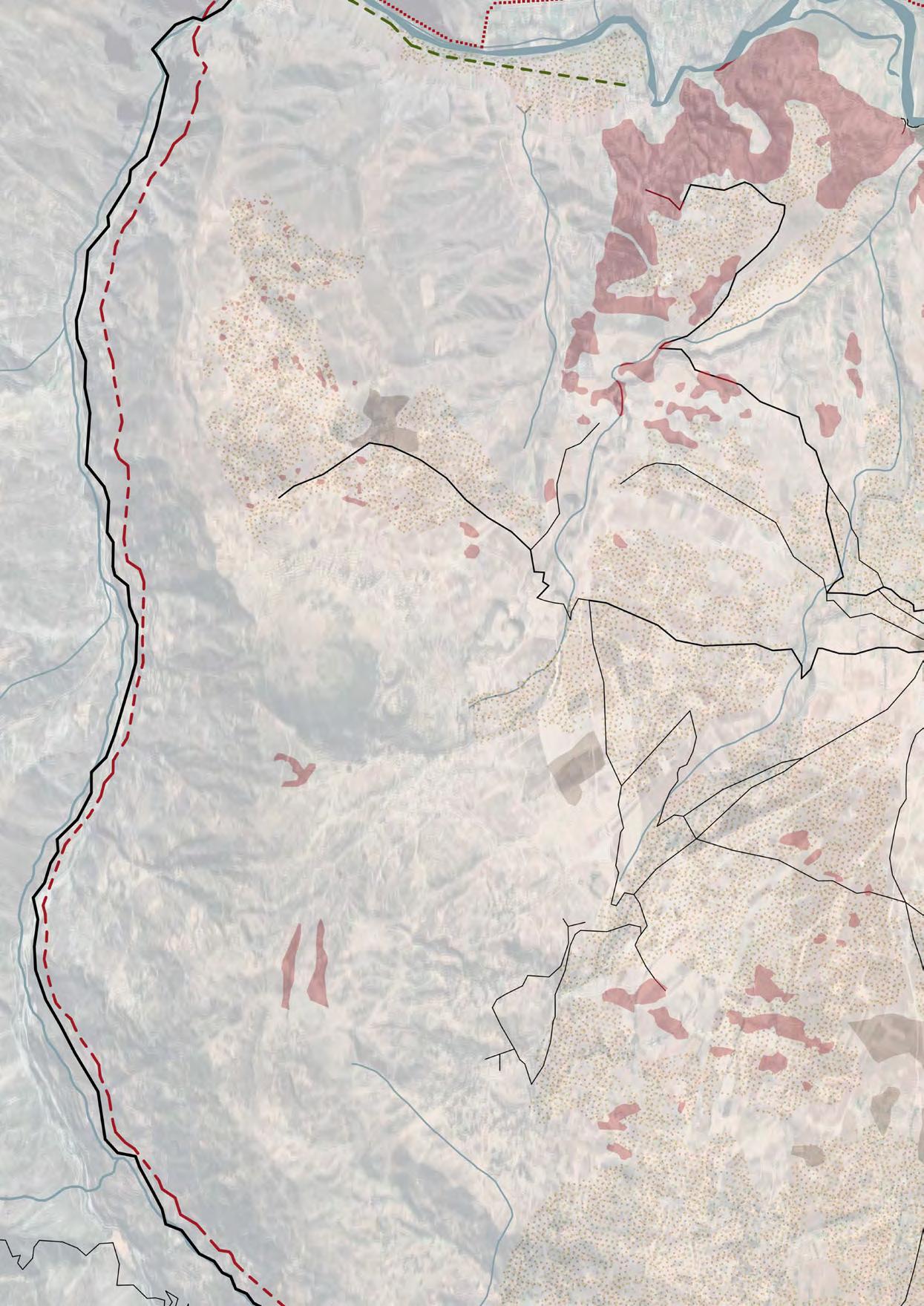


2791-2832 mm
2832-2840 mm
2840-2851 mm
2851-2860 mm
2860-2867 mm
2867-2874 mm
Legend :
Pools irrigation tanks
Pools
Museum road
Ways
Salt’s buildings

- Time period : (Apr-Jun)Just after rainy saison, They re build and waterproof pools
- Location : Located in the pool’s surface layer
- Description : The purest salt from the salt mines, More manpower needed, for greater selection and finer grain size
- Market: Food
2
- Time period : (Jun-Sept) Coldest and windy time of year
= Good evaporation of water in pools
- Location: Located between the layer of white salt and the red salt

- Description : The salt with the greatest commercial ac ceptance
- Market: Food + cosmetics + skin therapy
3
- Time period : (Oct-Nov) Salt production decreases due to occasional rainfall
- Location : Last layer of salt in contact with the pool floor
- Description : High salt wear level, Acts as an incepticide against Raga mites
- Market: Agricol

1 - WHITE SALT
- PINK SALT
- RED SALT


Project site
Project’s buildings
Legend : Salt road Treck road
Qhapaq Nan

V. The salt factory
This salt factory was designed to be placed along the sacred Inca trail of Qhapaq Ñan. The principle of this factory is to offer a community-scale facility capable of processing the salt extracted nearby from the Maras salt flats. The salt is treated to meet all commercial standards, including the addition of fluoride and iodine.
The members of the Maras community have always used ancestral techniques to preserve their tradition and historical heritage. To honor this tradition, the factory was designed to process the salt using mechanical, non-automated techniques and equipment. Salt is transported to the factory by wagons following a railway and also delivered by trucks through the same entrance used for the salt arriving by rail.
For ease of production, the salt moves through the factory on carts or conveyor belts. The first step is sorting the salt, where large debris is removed and the fleur de sel is set aside. The second step is washing, where the salt is rinsed in a tank using reused rainwater, then treated in vats with fluoride and iodine. The third step is drying, achieved through natural ventilation with openings at both ends of the buildings to create airflow.
The fourth step is grinding, where the salt workers turn a crank to operate a mill that grinds the salt. The penultimate step is packaging, using old harvest sacks, where the salt is weighed and packed according to different categories. The final step is selling; a portion of the salt production is exported, while a smaller part is kept and sold at the factory’s shop.
Tourists follow an exterior path along the canals, with numerous openings allowing them to see the different stages of the process.


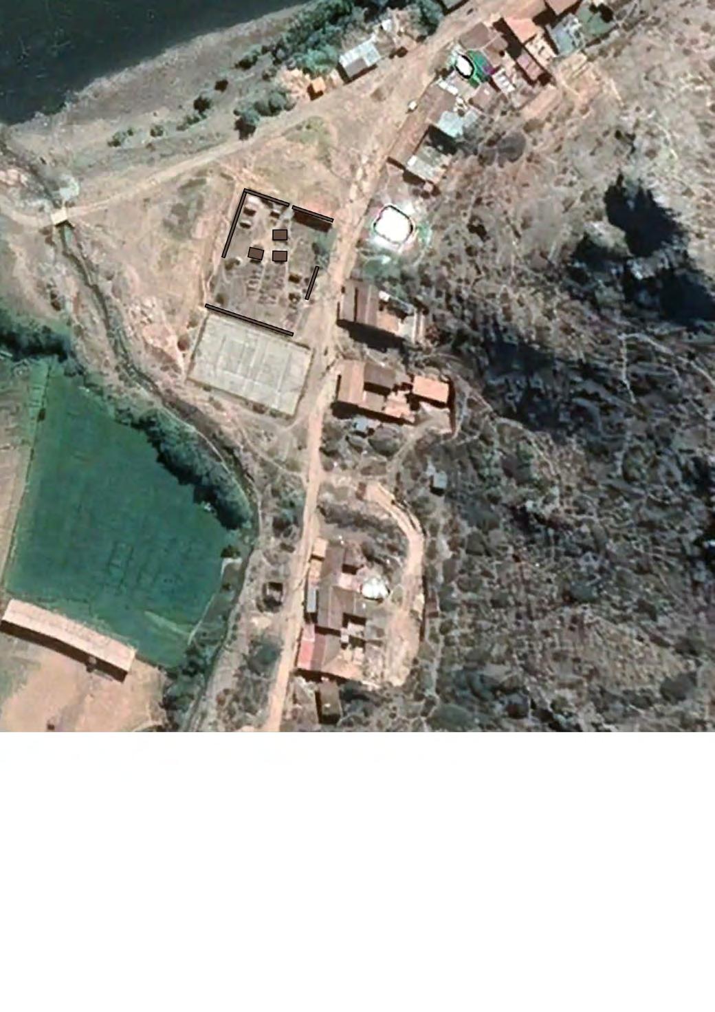
ed canals emphasize the housing units’ shape, reflecting the sophisticated water management systems of the Incas.
Architectural identity is maintained with roofs similar to those of the traditional factory and salt pans, following the same construction principles. These buildings share defining features: rectangular shapes, drainage channels, sloped roofs for rainwater harvesting, stone walls, wooden beams, and black steel doors. This approach preserves the aesthetic and functional aspects of Inca architecture, ensuring durability and sustainability.


VII. Inca construction techniques
The factory and housing project draws inspiration from the ingenious architectural techniques of the Incas, incorporating elements that have proven their worth over centuries. Among these techniques, terraces and their stairs play a central role. Designed to maximize the use of sloped land, these terraces not only allow for better space management but also effective irrigation of crops. Additionally, the stairs provide easy and harmonious access to all levels of the site.
Water supply is also a key aspect borrowed from Incan traditions. Carefully designed canals channel water to the agricultural lands and the factory, ensuring optimal distribution of this precious resource. This water management method, essential in areas where water can be
scarce, is complemented by a modern rainwater collec tion system. Rainwater is harvested and stored in retention pools, guaranteeing a usable reserve during dry periods and reducing dependence on external water sources.
In addition to these ancient techniques, the building integrates contemporary solutions aimed at minimizing energy footprint. The design promotes natural ventilation, maintaining comfortable temperatures without excessive use of air conditioning. Openings and room layouts are studied to maximize natural light entry, thus reducing the need for artificial lighting and fostering a healthy and pleasant indoor environment.
1 TONNE
3400 Soles Iode salt ( Food Market)
White salt + 2/3 of Pink salt
3000t of salt
10 200 000 Soles
VIII. The benefits of this project
The project offers numerous benefits, combining an ecological and sustainable architectural approach inspired by local architecture and ancient techniques. In addition to this innovative approach, it aims to enrich community members by ensuring income based on the benefits of controlled tourism activities and the sale of resources, particularly salt.
Processed salt sold in Peru is worth ten times more than pure salt. These profits enable families to better maintain the cultural heritage of the salt flats and to develop the town’s infrastructure. Planned improvements include the construction of new roads, the building of schools, and the reconstruction of houses damaged by seismic activity.

600 Soles Pure salt ( Market of Cosmetics, agriculture)
Red salt + 1/3 of Pink salt
2700t of salt
1 440 000 Soles
Thus, this project is not just about architectural development but also provides sustainable economic and social prospects for the community by valuing local resources and preserving cultural heritage.
P45 2023 - 2024
PÉROU - Territoire du commun
Universités impliquées : ENSA Versailles (ENSA-V), Pontificia Universidad Católica del Peru (PUCP)
Enseignants : Susanne Stacher (ENSA-V), Luciano Aletta (ENSA-V) Luis Rodríguez-Riviera (PUCP), Marta Bell (PUCP), Luis-Martin Piccini (PUCP)