2.2 NATURAL CHARACTERISTICS
2.2.1 Geological-seismic characteristics
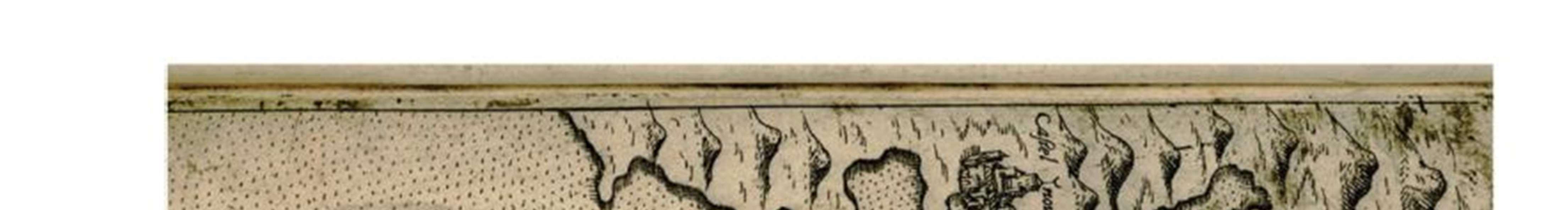
The area of the Montenegrin coast belongs to the southeastern part of the outer Dinarides, which is characterized by a complex tectonic structure and tectonic structure. The Bay of Kotor is the most indented part of the southeastern Dinaric coast. The geological structure of this unit includes shallow carbonate sediments of Jurassic and Cretaceous age, carbonate breccias of Cretaceous-Eocene andflysch sediments of Middle Eocene age. In the area from Risan to Kotor Bay, Paleogene sediments are represented by Orahovac breccias and flysch sediments of the Middle Eocene. Orahovac breccias (K-E) are very heterogeneous, coarse-grained and of considerable thickness. Various limestones of Jurassic and Cretaceous age are observed in the composition, and blocks of various dimensions are often precipitated.
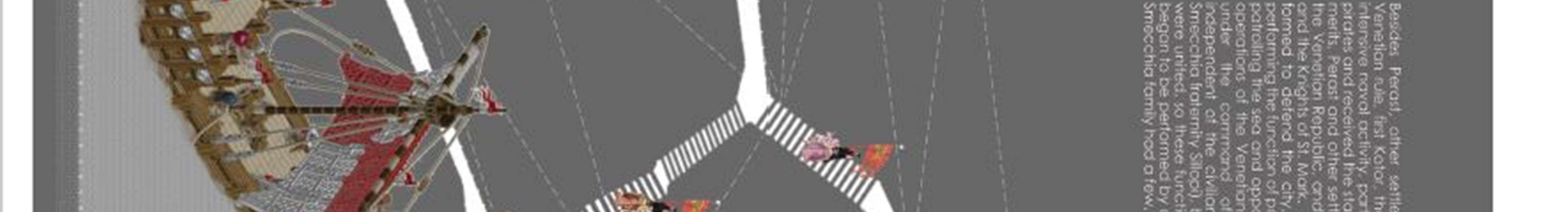
The UP Perast area belongs to the tectonic unit Visoki krš. The high karst tectonic unit is pulled over the tectonic unit of the Budva zone. This drawing route has a dinar direction of extension with significant deviations and bends. This route is visible west of Morinj Bay and continues east and southeast under the sea. The main feature is exceptional wear. The faults are mostly vertical and have different directions of extension, so that a parquet structure has been formed in some parts. The diverse and very complex geological composition and structure have conditioned the relief in this area to be very dynamic and complex. The basic characteristics of the Boka Kotorska Bay area are sudden hypsometric changes. The Bay of Kotor is composed of a system of branched bays between which are straits, among which the most famous is Verige, which is located across from Perast. This strait is the narrowest part of the bay (340m), which separates the inner from the outer part of the Boka. The bottom of the bay is at a predominant depth of 30-40metersandisslopingtowards theexit.Elementsoffluviodenudationreliefweredeterminedontheanalyzedpart of the terrain. Its genesis is conditioned by the process of fluvial erosion and denudation. This genetic type of relief is representedbysteepsections,narrowsharpandroundedridges,ravinesandgullies.Ontheslopesthatareabout30º, therearenumerousformsofmassmovement(landslides,landslides,sipars)whicharefurtheremphasizedbyseismictectonicevents.Landslidesareintheareabuiltofclasticrocks,flyschformations,andthemovementofblocksismuch rarer and is observed in the area of Veriga. The area of the Montenegrin coast is located within the IXbasic degree of seismicity of MCS, in the conditions of middle soil, and this combination of flysch, mostly clastic sediments and Quaternary formations is a major disadvantage in terms of seismic risk.
2.2.2 Climatic characteristics
TheobservedareahasallthefeaturesoftheMediterraneanclimate-mildandveryrainywinters,hotanddrysummers, as well as warmer autumns than spring. Mean monthly temperatures show a regular course with a maximum during July and August and a minimum during January and February. The annual fluctuation is about 17oC. Mean monthly temperatures above 10oC start relatively early, in March, and end only in December. The average annual air temperature for this area is in the range of 15-16o. For the summer period, extremely high temperatures have a value of 33-34ºC, and the lowest 15-17oC. The absolute maximum recorded at the station in Kotor is 33.9oC in August, and theabsoluteminimum-3.4oCinFebruary.Onsummerdayswhenthetemperatureisabove25oC,theaverageis114.6 for thearea ofKotor. The largest number is in Julyand August, andthere are alsoappearances in March. Thenumber of tropical days, when the temperature reaches 30 degrees and above, is 44.8, mainly during July and August. On frosty days when the temperature drops below zero during 24 hours in this area is 4.7, mainly in December, January and February, and much less often than in the rest of the Littoral. The annual precipitation regime is characterized by amaximumduringthewinterandaminimumduringthesummer.Thehighestprecipitation(30-40%)isduringOctober, November and December, and the lowest (10%) in June, July and August. During the winter period, the daily average precipitation is 5-8 l / m², and it is possible 40-80 l / m², while during the summer it is only 1 l / m². The total annual rainfallforthe area ofKotor is 1638.3 l / m2. It is useful to note that extreme 24-hourprecipitation for a returnperiod of 100 years is 235.19 l / m2. Silence prevails in this area, and the most common winds are the south wind, warm and humid wind blowing from the sea and bora, cold and dry wind blowing from the land. Extreme annual wind gusts have speeds ofupto333m/s(120km/ h).In terms of humidity,itishighestduringthe transitionalmonths(April-May-June and September-October), and the minimum is in the summer and during January and February. The average annual relative humidity in this area is about70%.
It is characteristic of the Littoral that 42% of the sky is covered with clouds every year. For Kotor, that amount is 4.46 tenths of the coverage of the sky, which is the highest in the coast. However, due to its position across the Veriga, Perast is one of the sunniest places in Boka. Increased cloudiness values were recorded during the winter part of the year, in contrast to summer,when clear weather prevails.
98 | Page
2.2.3 Hydrographic characteristics
Precipitation, which is very abundant in the period from November to April, has a significant impact on the sweetening and fertilization of the bay, because with the washing of the coastal area large amounts of nutrients are introduced so that phyto or zooplankton increases. That is why precipitation, along with springs, springs and streams, are fertility factors in the Bay of Kotor and thus suitable for growing oysters and mussels. As most of the inland waters flow into the bay, they significantly affect the temperature of water masses, and especially the surface layers. As the northern winds blow in certain periods, the surface layer of the sea cools down. It can be seen that the inner part of the bay is colderthantheouterpart.Themaximum temperaturesofthesurfacelayersoftheseawereregisteredinJuly-around 30oC, and the minimum annual temperature in February around 7oC. In terms of salinity, it can be seen that it grows from the inner to the outer bay. It is estimated at around 27 ‰ in the bay.
2.2.4 Pedological characteristics
The area of the plan is in the field built of flysch and mixed silicate-carbonate materials. The steeper terrain is more eroded and overgrown with sparse vegetation. Milder slopes are over time terraced and turned into arable land, and moderately steep slopes under bushes and woods. Brown soil and fleas are present in such terrain. Brown soil has heterogeneous properties, different depths, which is conditioned by slope, erosion, type of substrate. Brown soil is characterized by a high proportion of skeletons, which is of variable content depending on whether it is on slopes or terraces. If itis located on terraces, brown land is from IV toVI class, and outside theterrace terrainover VI class. It is suitableforgrowingolives,fruitsandvegetables.Intheareafrom theMorinj BaytotheBayofKotor,therearealsored rocks, which due to the slope and erosion are characterized as limestone-dolomite black, better known as buavica. It is a shallow soil, with a fairly high percentage of rocks and very stunted vegetation. The cliffs above Perast are typical rocky.
2.2.5 Flora and fauna
The area of the plan can be marked as a habitat and zoocenoses of macchia, garrigue and rocky areas. Karst is an area whereendemicMediterraneanspeciesoccur,especiallyinsects (Mediterraneandovetail),reptiles (sharp-headed lizard, karst lizard, blavor) and many thermophilic species of songbirds ). These species are mainly endangered by constructionandinfrastructure,aswellasfires.Thisareacanbeconsideredasahabitatandzoocenosisofsettlements and agricultural areas. Especially important for old settlements, walls and houses built in the traditional style is the preservation ofsome rare birds - woodpeckers, swallows, jackdaws, sparrows.
2.2.6 Landscape characteristics
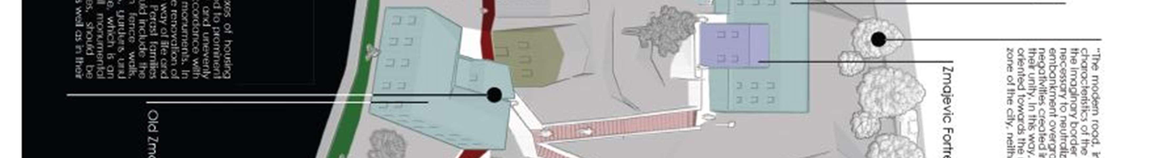
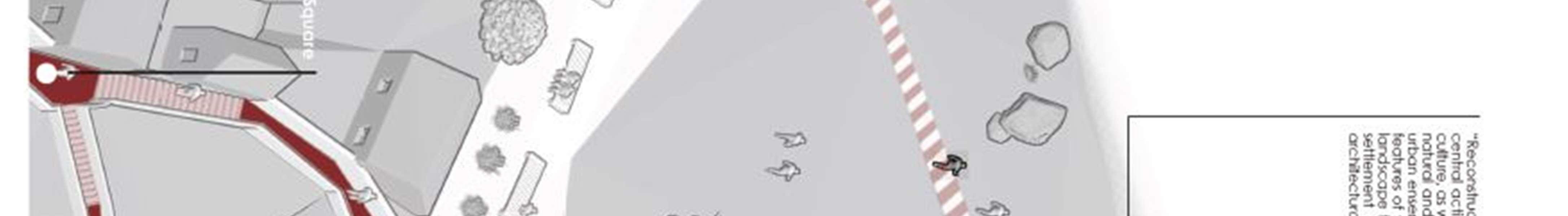
ThelandscapeoftheMontenegrincoastisareflectionofthecomplexity,diversity,quality,relationshipsandinteraction of the dominant natural elements (above all climatic, geomorphological, hydrographic and vegetation characteristics). Eight types of landscapescanbe identifiedonthecoast,of whichthelandscape of the BayofKotor. This is aspaceof specific and diverse natural values, primarily orographic and autochthonous vegetation characteristics, and valuable architectural heritage, which are intertwined with a lot of details (allochthonous flora) and thus form a unique whole. The Bay of Kotor is amacro-unit, consisting offour inland bays, connected by straits and seas. The inner Bay of Kotor and Risan has penetrated deeper into the mainland, is more dynamic and is divided into two branches between which arelocatedtheislandsofOurLadyofSkrpjeloandSt.George,andoppositethestraitsoftheChain.High,monumental rock massifs tower steeply over the sea. The specific identity of the landscape is given by the settlement with a rich architectural heritage, baroque palaces, the remains of medieval towers and walls, and the characteristic piers on the coast - ponte and mandraći. Inaddition to the existing groups of buildings, citrus and olive groves are interwoven, and exoticfloraisblendedintotheambience.ThevegetationofPerast,composedofpineandcypressgrovesinanendless complexof evergreen macchia, stretches to the very shoreofthesea.The lack of a luxurious plant fund inPerast was compensated by imaginative and functional construction as well as by cultivating rocky karst by forming terraced gardens-gardens.Createdonveryrough,steepterrain,itaboundsinawealthofman-madelandscapeandespecially architectural values. The components of cultural, architectural and natural heritage impose the obligation that all interventions in the area must take place in accordance with the protection of cultural property and landscape values. Therefore, the authenticityof this landscape and the harmony of naturalvalues and architectural heritage should have special treatment in further development.
2.2.7
State of the environment
Based on the measured air quality parameters, it can be said that the air in the Primorje area is of good quality and belongstotheclassofcleanair.Allindicatorsdonotexceedthestrictlimitvaluesenvisagedfortouristandrecreational
99 | Page
areas.Thewell-ventilatedareaofPerastcertainlycontributestothis.Asfaras thequalityofprecipitationisconcerned, the situation is relatively favorable. Mineralization is slightly increased, as is the occurrence of acid rain, especially in the bay and in winter. The sea water in the bay is of variable character and by localities. The best water quality was recorded, among other things, in the Veriga and Perast zone. At two measuring points (bathing areas at the entrance to the place - Borići and at theexit from the place near the museum building) satisfactory quality is observed between the first and second category, which is allowed for swimming in the bay, with better condition at the first measuring point. PH values are increased and often at the limit. The content of suspended solids along the coast is significantly lower and within the prescribed limits. Electrical conductivityis lowest in thebay near Perast. The content of dissolved oxygenisquitefavorable,whilethesituationwithbiochemicaloxygenconsumptionislessfavorable.Therearesporadic occurrences of detergents, phenols and zinc. The bacteriological condition of the water is mostly favorable, which in turndependsonuntreatedwastewaterfromthecoastandhinterland,theimpactoffreshwaterthatreducesthesalinity and self-purification power of sea water. In the Bay of Kotor, the characteristics of eutrophic areas appear: low transparencyofthesea,changeoftheusualcolorofthesea,highoxygensaturationonthesurface,highconcentration of microphytoplankton, increase in total zooplankton mass and high concentration of bacteria. However, the situation in the area of Perast is better due to the greater change in sea water and the position in the bay.
Purpose ofbuildings
Perast is dominated by housing organized in several forms:
permanent residence
Occasional housing
combined housing (partly permanent and partly occasional)
housing with activities
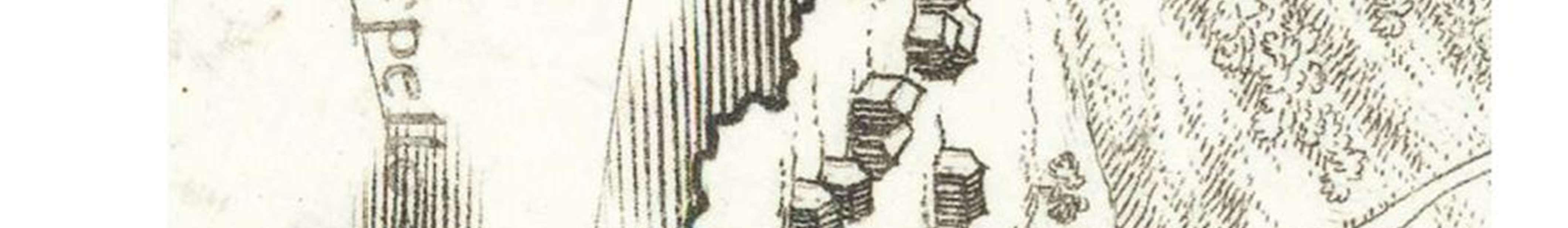
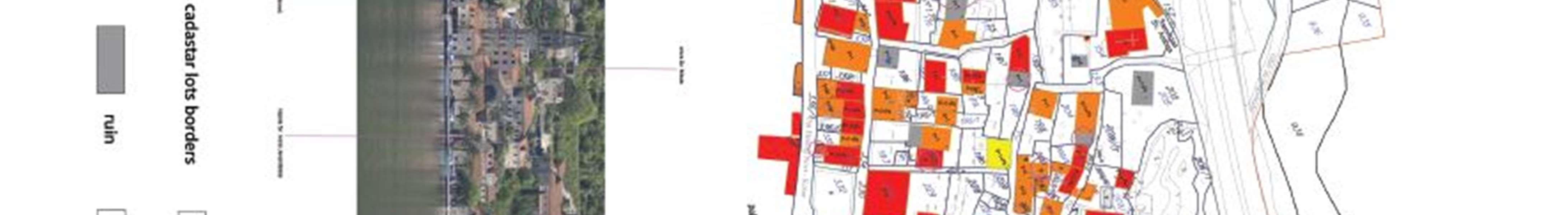
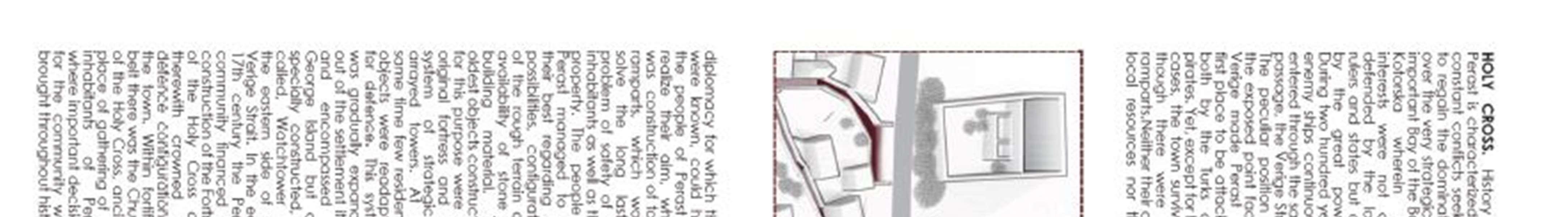
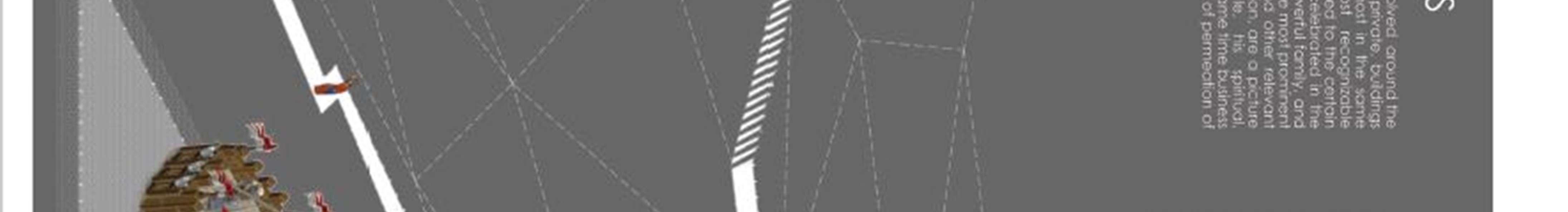
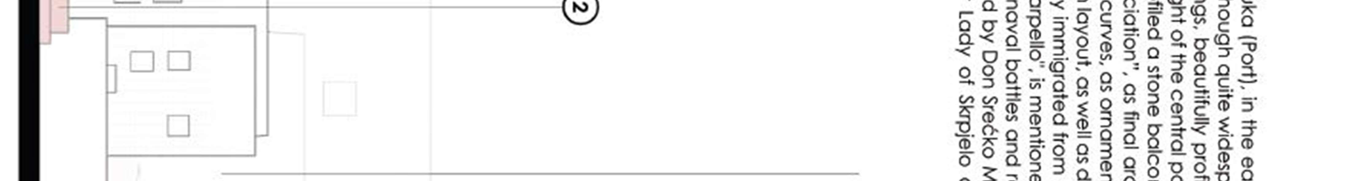
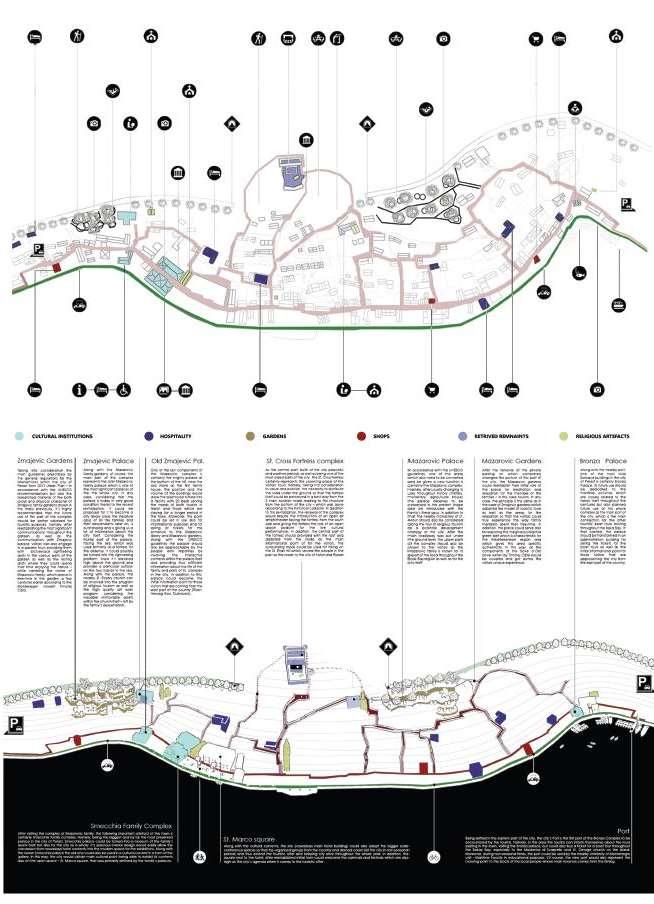
Given the scope and degree of preservation of natural and cultural-historical heritage, in which the dominant role is played by architectural heritage, the urban ensemble of Perast is categorized as a cultural monument of category I. In addition to the most numerous examples of traditional architecture in which housing is predominantly represented in representative buildings, the palaces house public and cultural institutions - the Museum of the City of Perast. Also, sacral buildings have a significant capacity for use. There are sixteen churches and chapels in the scope of the Plan, and two more are above the town, namely the church of St. Anne (XVIII century, about 300 m above the Peraška fortress) and thechurch of Our Ladyof Health. Theyoriginated in different time periods andbelong to different stylistic epochs. Also, they have different physical condition (destroyed churches of St. Cross and St. Nicholas) and monumental status (only a small number are entered in the Register of Cultural Monuments). A list of churches and chapelsisgivenhere, whileprecisedataon themaregiven inthe Study fortheProtectionof the ArchitecturalHeritage of Perast, which is an integral part of this Plan.
Church of St. Nicholas (on the main town square, old in 1616 and newin 1740)
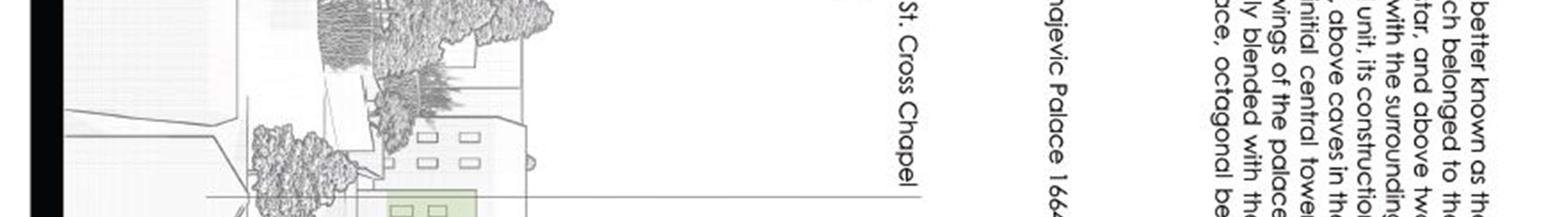
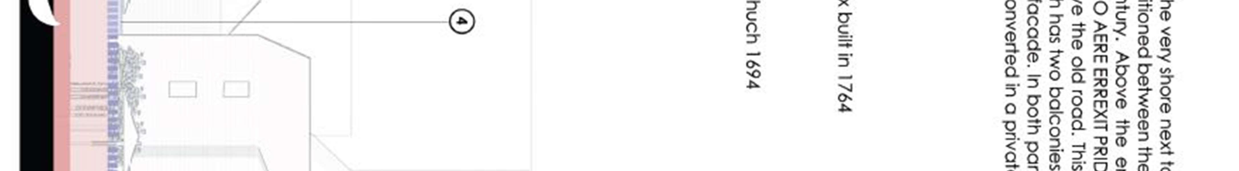
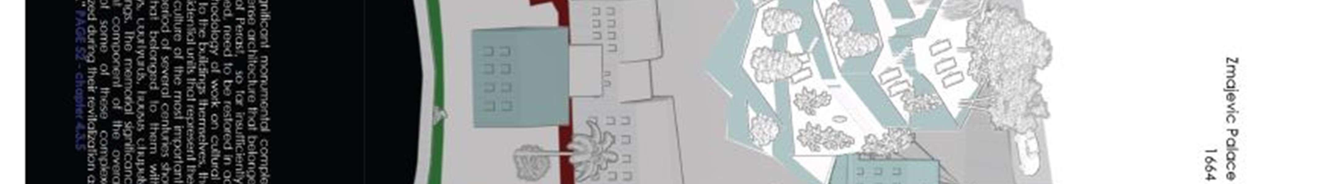
Church of Our Lady of the Rosary (part of the Zmajević Palace complex, 1694)
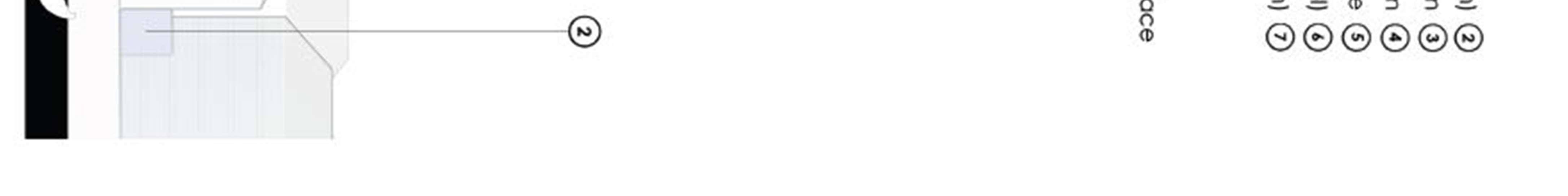
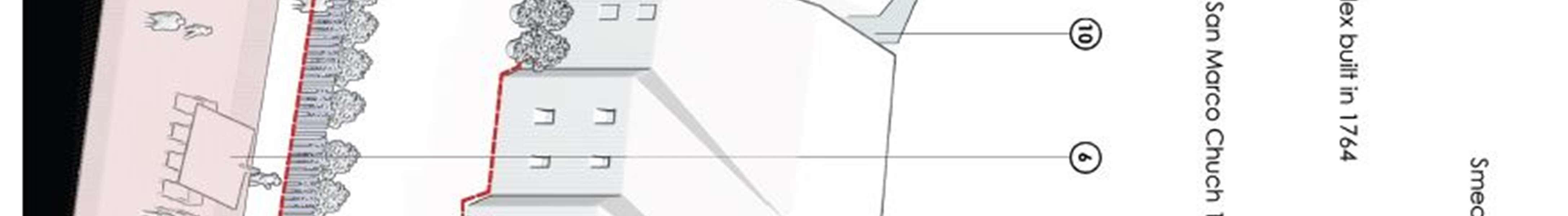
Church of St. Mark (part of the Smekja Palace complex, 1760)
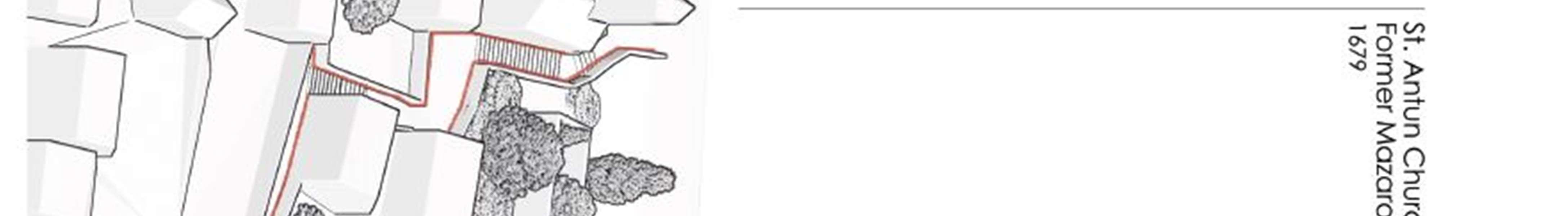
Church of St. Anthony (part of the Franciscan monastery complex, 1679)
Church of St.John the Baptist (in the western part ofPerast, 1595)
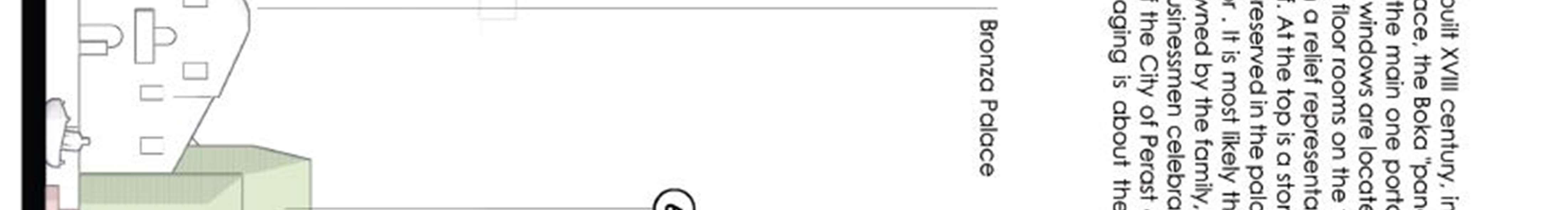
Chapel of the Holy Redeemer (behind the Bronze Palace)
Church of Our Lady of Carmen (inthe eastern part of Perast)
Church of St. Michael (within the cemetery)
Church of the Nativity of theMost Holy Mother of God (Orthodox Church)
Chapel with a cemetery (above the Church of the Nativity of the Blessed Virgin Mary)
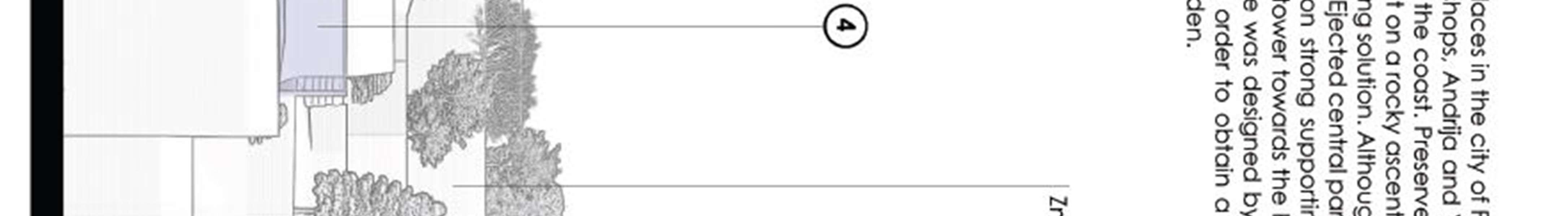
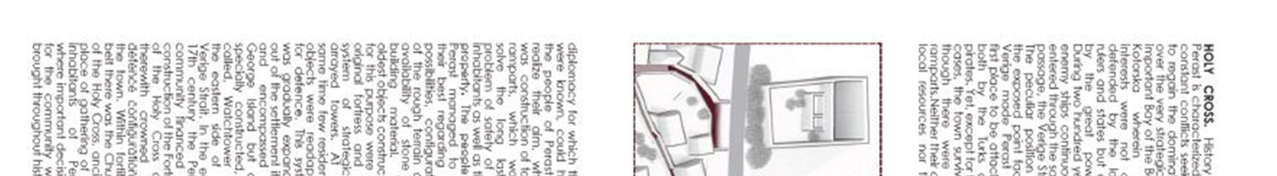
Chapel of the Holy Cross (on the steps to the palace of Zmajevic)
100 | Page
Our Lady of Skrpjela (on the island of the same name,)
Saint George (on the island of the same name)
Chapel of the Holy Cross (next to the Peraška fortress)
Church of the Holy Cross (within the fortress, demolished)
Church of St. Nicholas (next to the Krilović Palace complex, demolished)
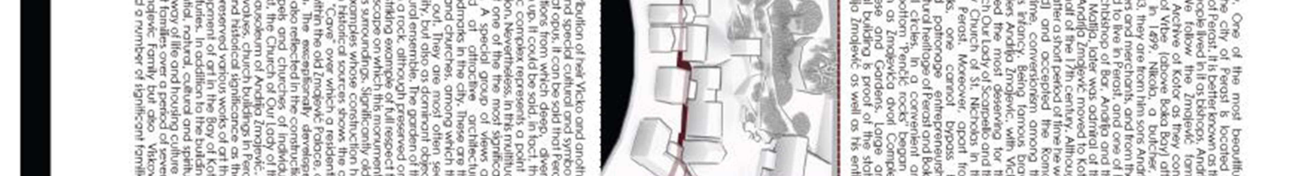
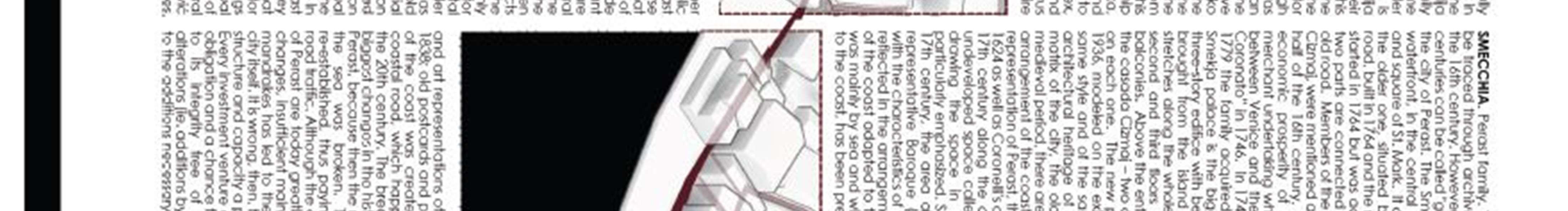
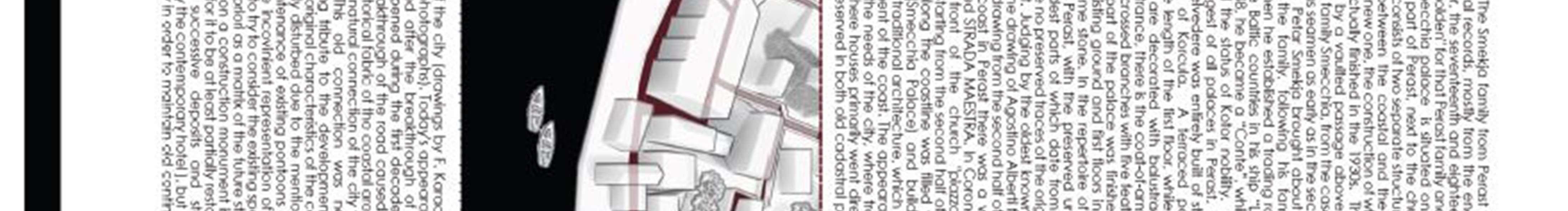
In Perast thereare a large number ofcaptain's palaces and residential buildings that are ofdifferent physical condition and are not registered in the Register of Cultural Monuments, although they have monumental values. A list is given here, and precisedataon them aregiven in the Studyfor the Protection of the Architectural Heritageof Perast, as well as an excerpt, which is an integral part ofthis plan.
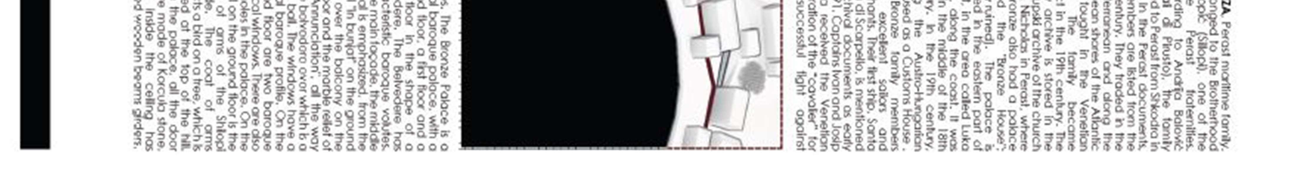
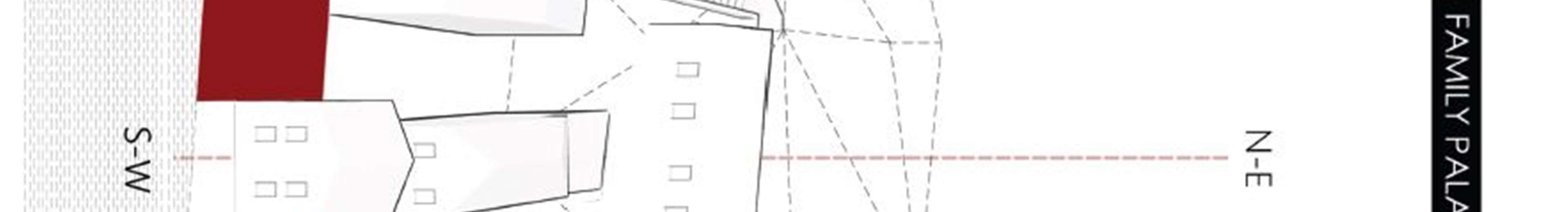
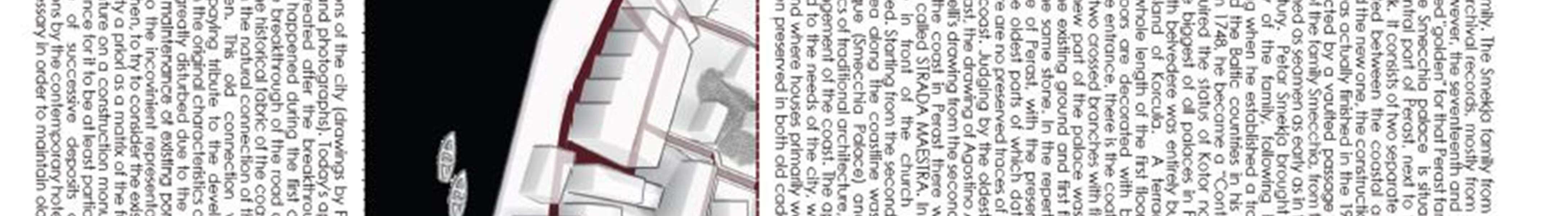
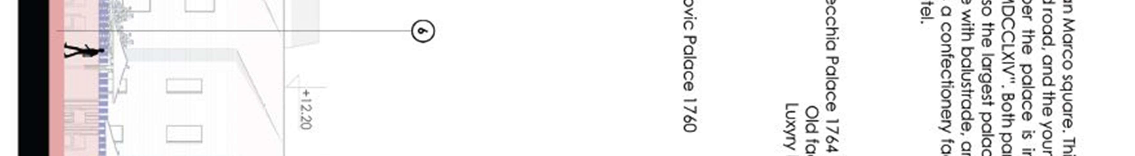
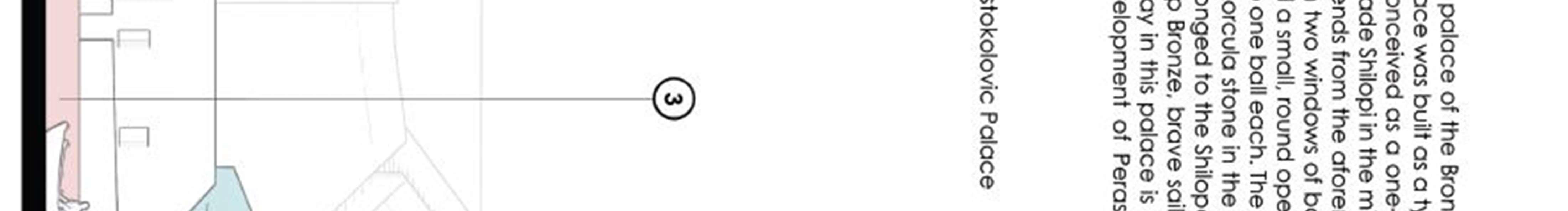
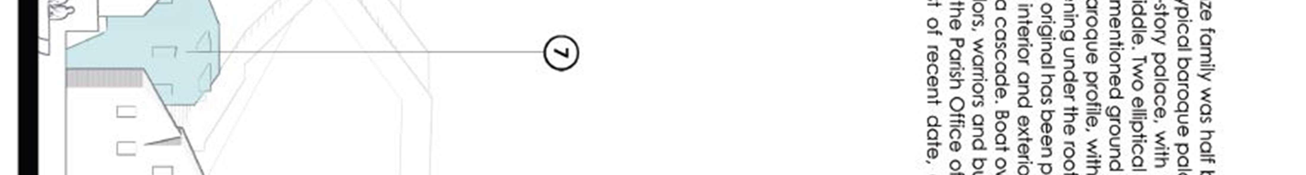
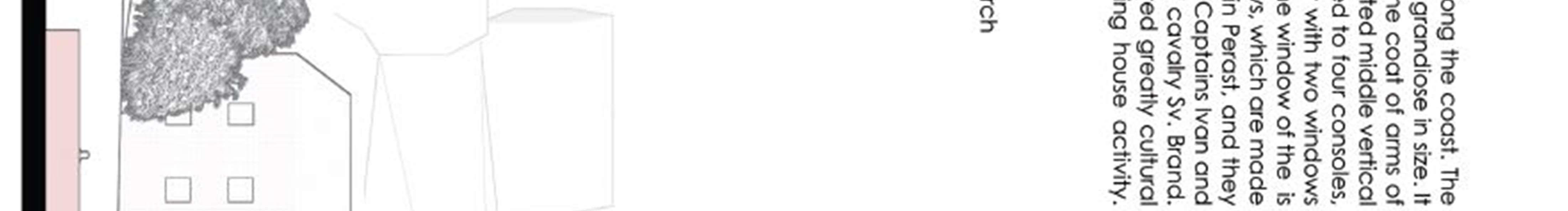
Vicko Bujović Palace (1694,PerastCity Museum)
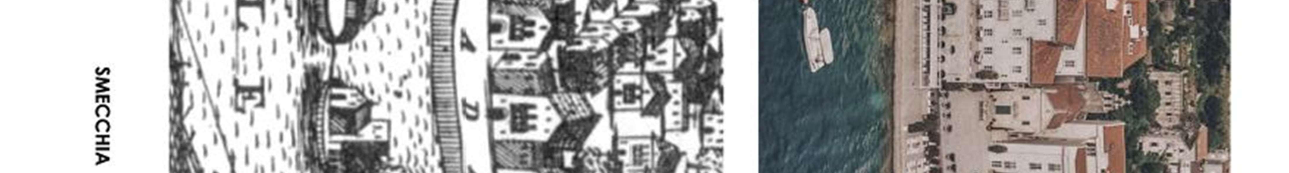
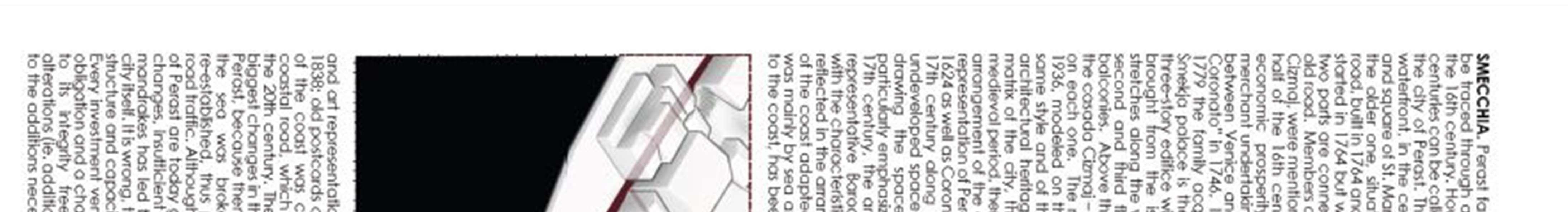
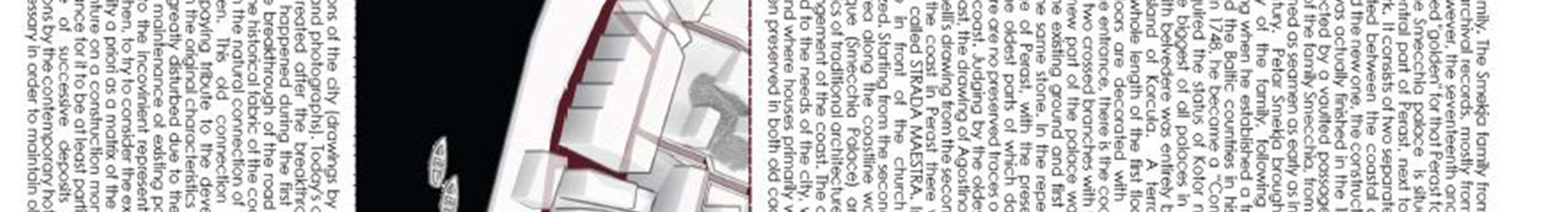
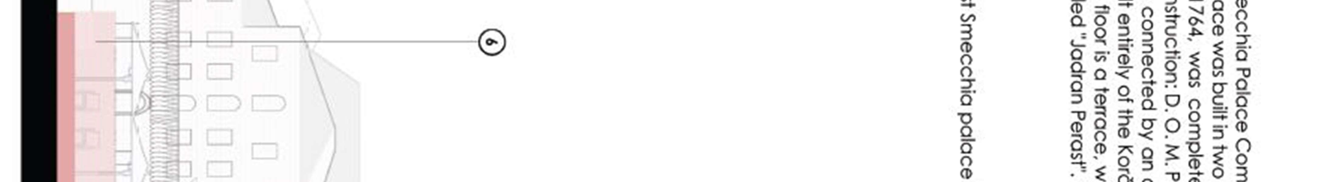
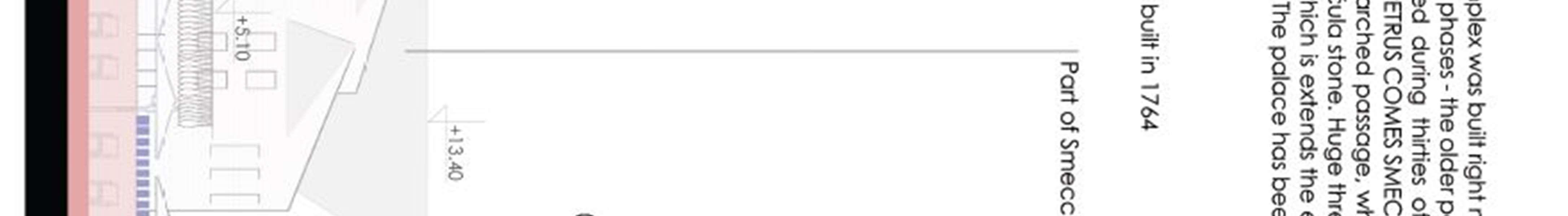
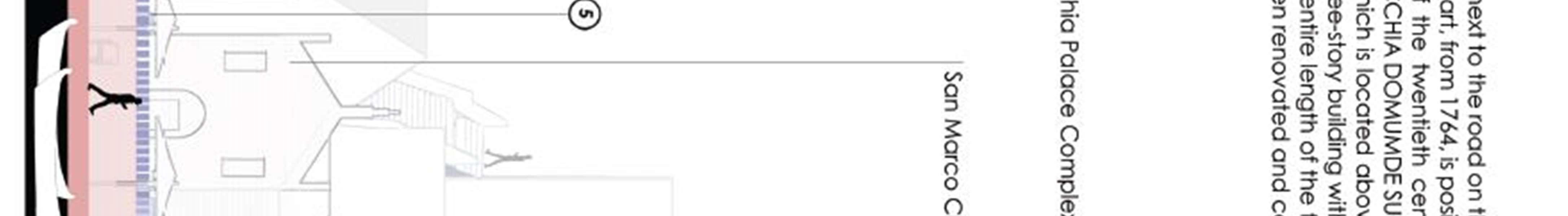
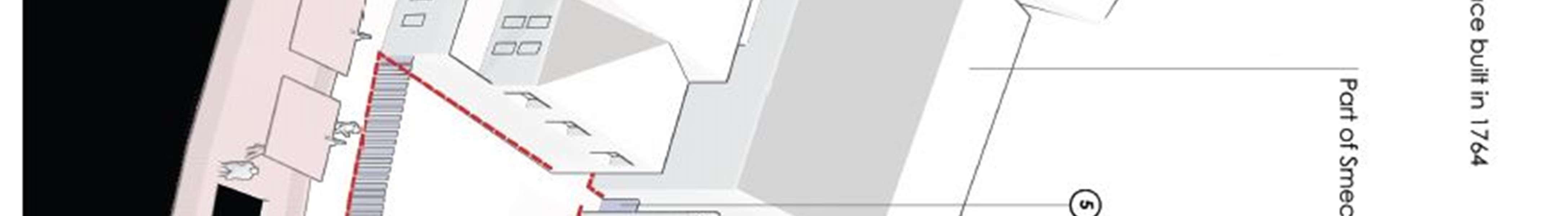
Smekja Palace (1764, hotel building "Jadran")
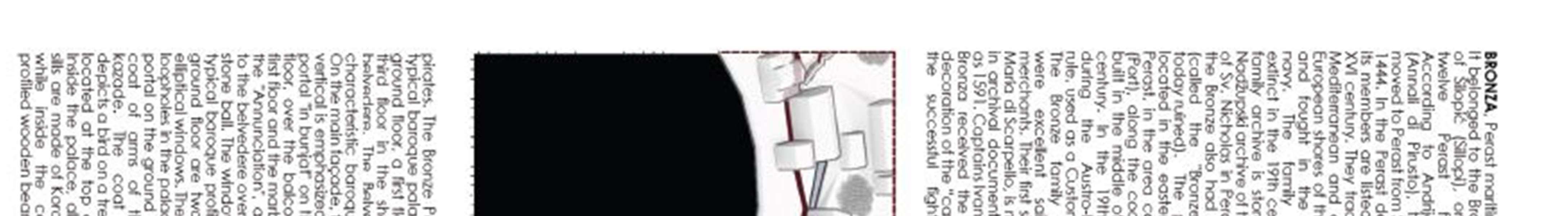
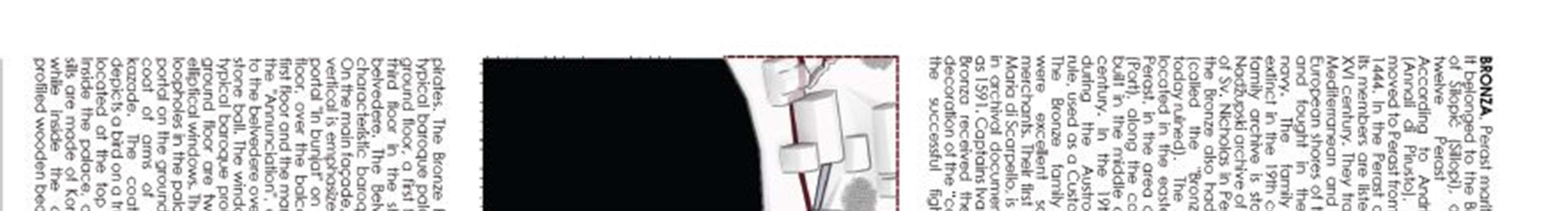
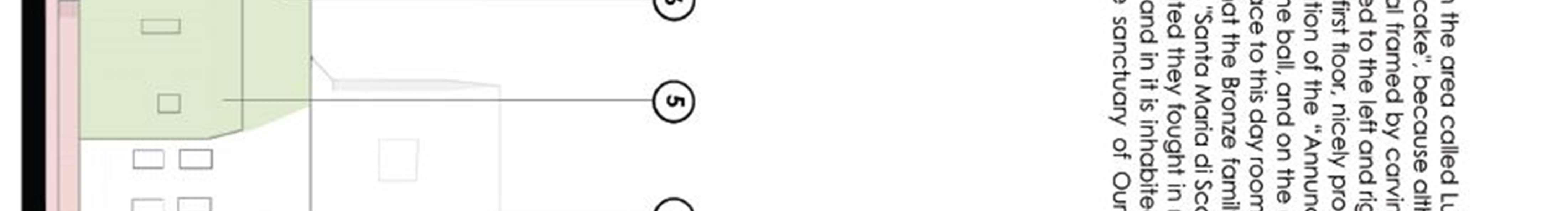
Bronze Palace (middle of the 18thcentury, parish office)
Balović Palace (middle of the 18th century, apartment)
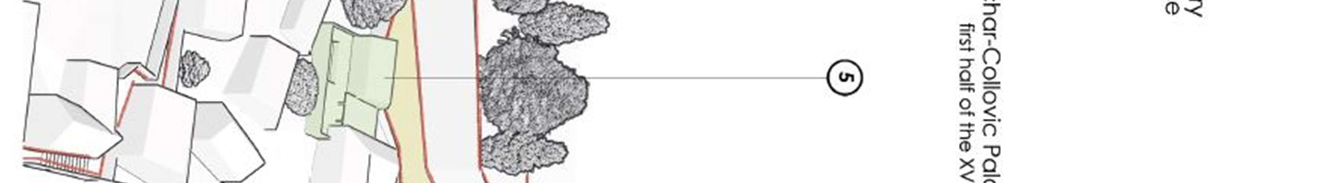
Vukasović Palace - Kolović (first half of the 18th century, apartment)
ŠestokrilovićiPalace (1691, apartment)
Palata Ĉizmaj Štukanović (housing)
Brajković Palace - Martinović (1623, apartment)
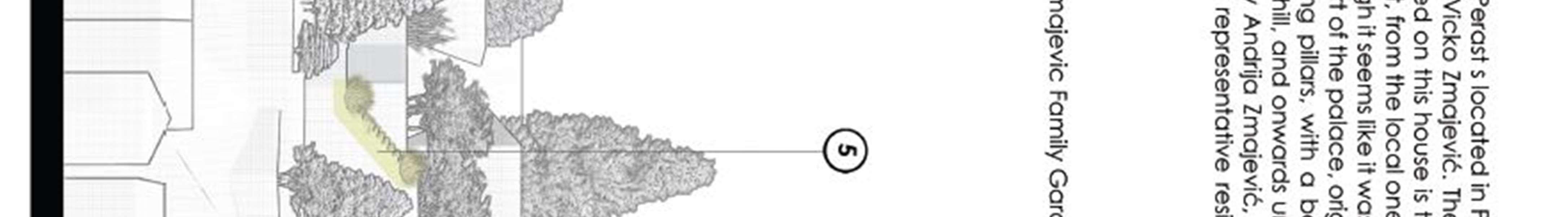
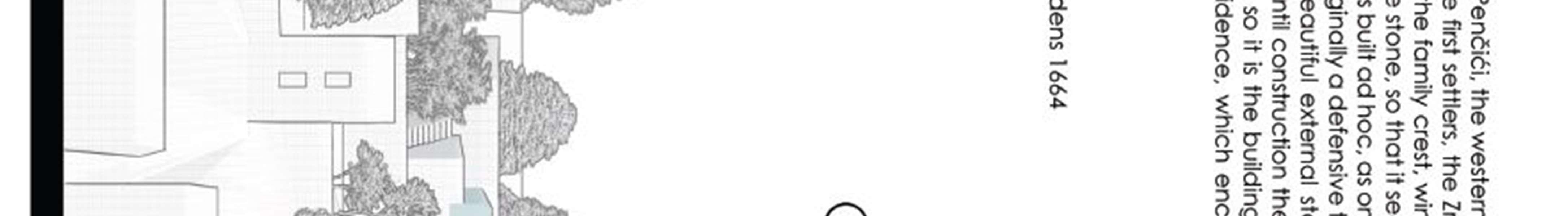
Zmajević Palace - "Biskupija" (1664, apartment)
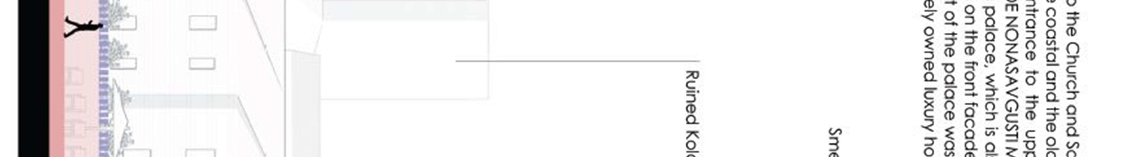
Visković Palace (around 1500, ruined)
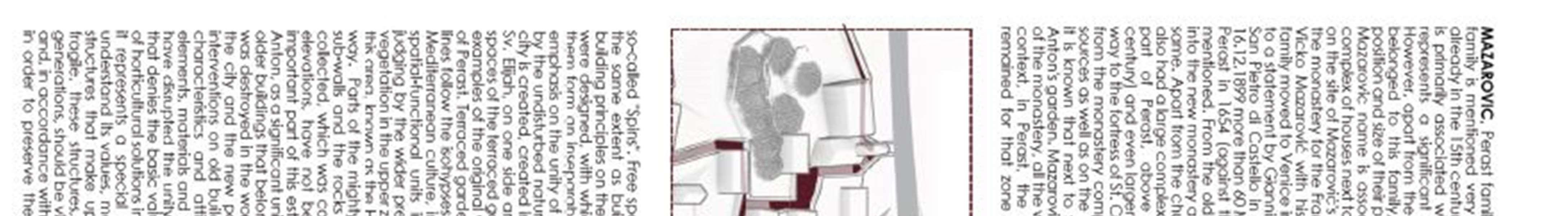
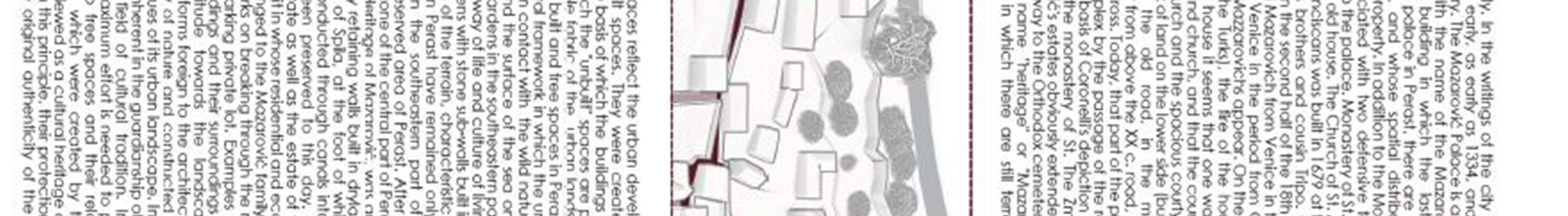
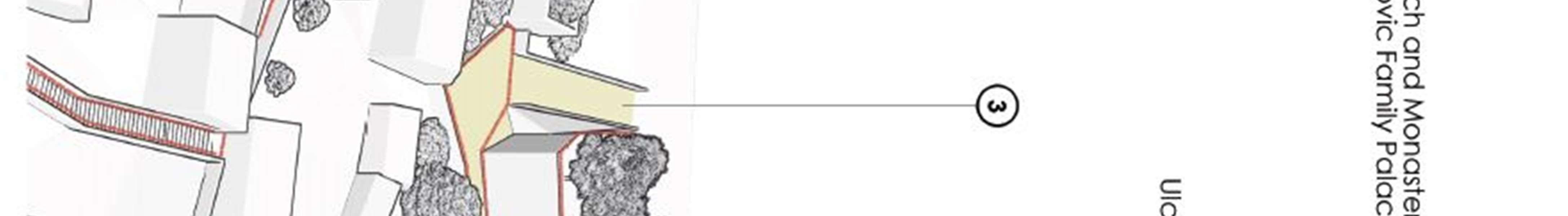
Mazarović Palace (middle of the 18th century, ruined)
Mrša Palace (apartment)
Martinović Palace (ruined)
Krilović Palace (ruined)
Internally, the city functions as an inhabited and increasingly tourist place, while in relation to the environment it was formed as an open-air museum because most visitors are interested in its architecture, tradition and individual significant objects. The stated purposes also determined the planner's attitude towards the possible future character and purposes of the space in Perast. In the first place, the settlement should come to life and be comfortable for both permanent residents and guests, whether stationed or in transit, which is ensured by the introduction of newpurposes (central, mixed and tourist).
2.4.2
Creditworthiness and number of storeys of buildings
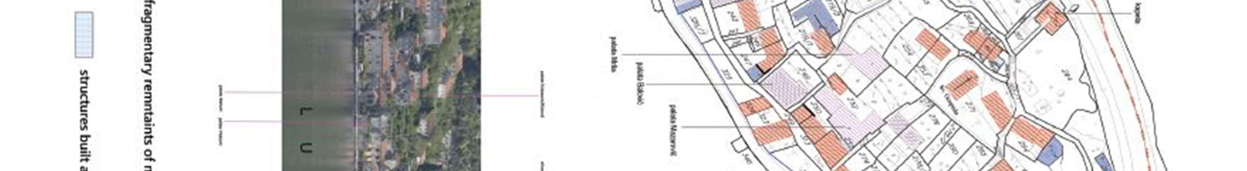
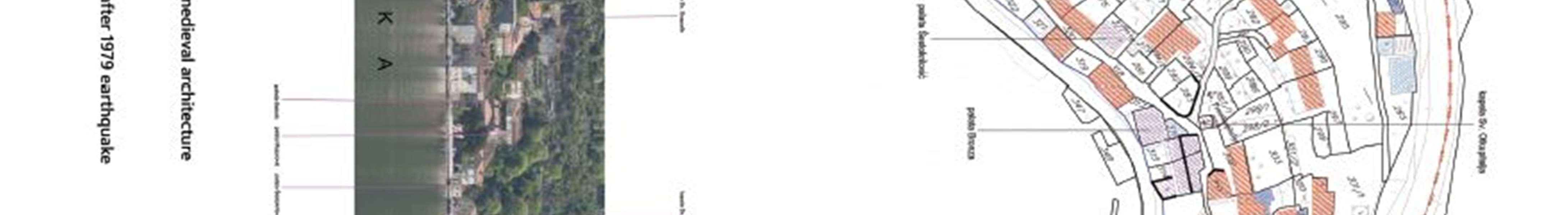
According to the credit rating, the buildings are classified into 4 categories, as follows:
facilities of good creditworthiness (reconstructed in the lastten years)
medium quality facilities (reconstructed after the 1979 earthquake and maintained);
bad - partially preserved buildings (most often preserved roof and structure but due to lack of maintenance in poor condition or thatno one lives in them and arethereforeneglected)
Vine ruins and ruined remains of buildings (partially or completely collapsed mezzanine structures and roof but with preserved walls in almost full height) and ruined remains of buildings (most often remains of horizontal dimensions of the building at the height of the foundation zone up to maxapprox. 1.5 m)
101 | Page
Having in mind the representation of the category ofauxiliaryfacilities, they are also treated with creditworthiness.
Despite thefact thatalarge numberofbuildings have beenrenovatedduringthelasttenyears,a numberofneglected buildings and more difficult to access ruins are still found, positioned in the central and upper part of the city (closer to themainroad)KrilovićandMartinović.Byanalyzingthenumberofstoreysofbuildings,takingintoaccounttheancillary buildings that are ground floor, it can be concluded that ¾ the storeys are P + 1, P + 1 + Pk and P + 2 (almost equally representedamongthemselves),andthattheyarebuildings+2+Pk,whicharerepresentativeexamplesoftraditional residential architecture of the city with stylistic features.
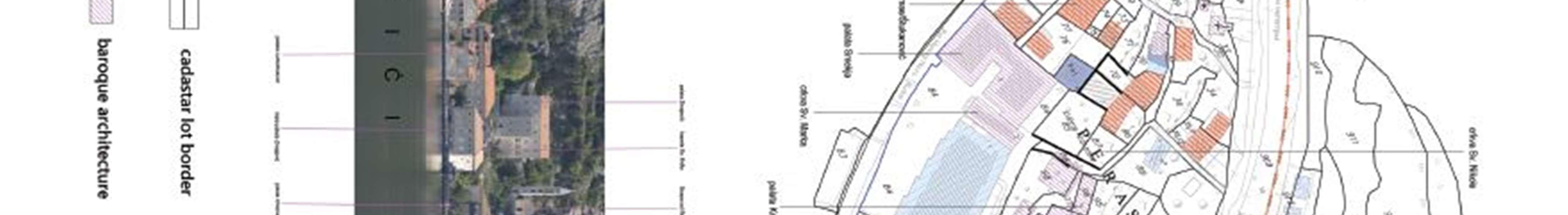
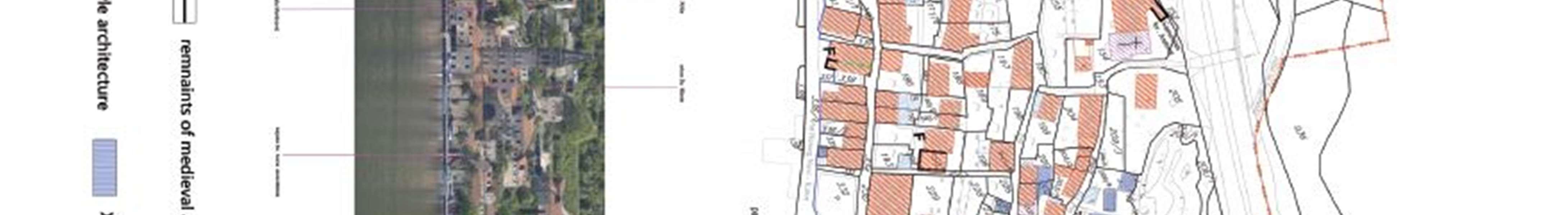
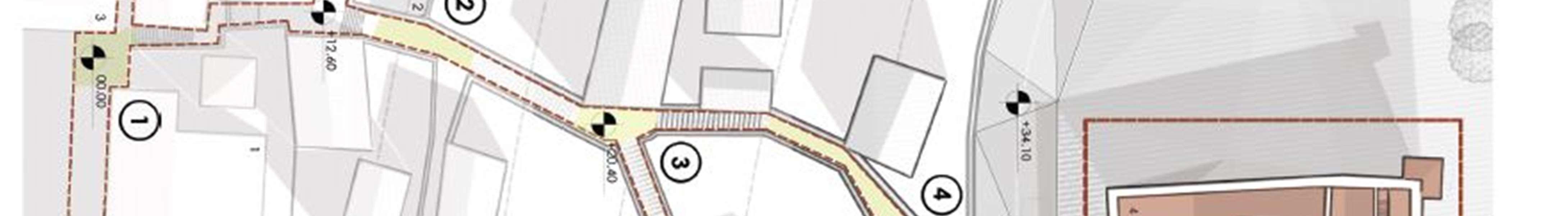
Ingraphicattachmentno.02-Creditworthinessofbuildingsandno.3-Physicalcharacteristicsoftheexistingfacilities, the condition of the building was analyzed and the built stock was assessed.
2.4.3 Valorization
If we keep in mind that the architectural heritage largely represents the economic power of its creators, it can be concluded that Perast was at the peak of its prosperity at the end of the 17th and the beginning of the 14th century. Bearing in mind that most of the architectural heritage has been preserved to this day, this is a direct impact on the value of the potential that Perast has. Since there is no developed planning document, Urban Project, for the city of Perast, and guided by the determinant from the Spatial Plan of the Municipality of Kotor, it was only possible to reconstructthebuildingsintheexistingdimensionsandexistingpurposes.Inthiscontext,theProtectionServiceissued conservation conditions for the reconstruction of existing buildings inthe existing dimensions, for residential purposes. The onlyinterventions were relatedto thepossibilityofreconstruction oftheatticspaceintoanattic for living,following the exampleof traditional solutionsrepresentedin the architectureof Perast.In addition to the conservationconditions and approval of the project documentation as well as the Decision on reconstruction, works on the reconstruction of buildings were performed, but there were often interventions to expand the dimensions of existing buildings. Interventionsareexplainedbytheneedforlargerandmorecomfortablelivingspaceandaremanifestedbyupgrading, upgrading,formingterracesandstairsalongthefacade,increasingthenumberandproportionsofopenings,reshaping the roof solution and roof openings, etc. In this way, the performed works, in addition to entrusted to unprofessional construction operations, appear irregularities in terms of design, stylistic inconsistencies and misused materials. The ignorance and incompetence of the contractors, as well as insufficientcontrol of the competent institutions have led to cases of devastation of buildings and the immediate environment that leave permanent traces in the urban fabric and degradetheurbanenvironment.Devastatedbuildingsaredefinedasbuildingsonwhichrecentinterventionshavebeen carried out that are inconsistent and inappropriate to the spirit of traditional architecture, ie that are not harmonized or endangerthearchitectureand/orambienceofthecity.Theruinsthatwereinspectedwerevalorized.Inaccessibleand inconceivable ruins as well as ruined remains were not valorized. No irregularities in design were singled out, such as completely inadequate urban furniture, street lamps, garbage cans, containers, although Perast deserves completely autonomous, design and artistic urban equipment.
2.5 REPORTS AND VIEWS
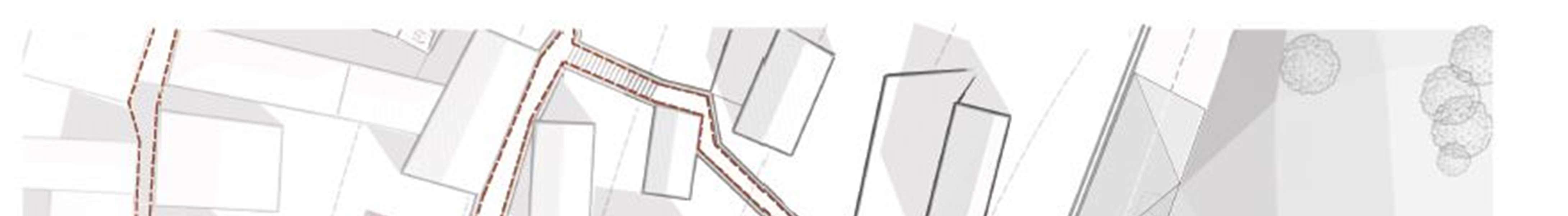
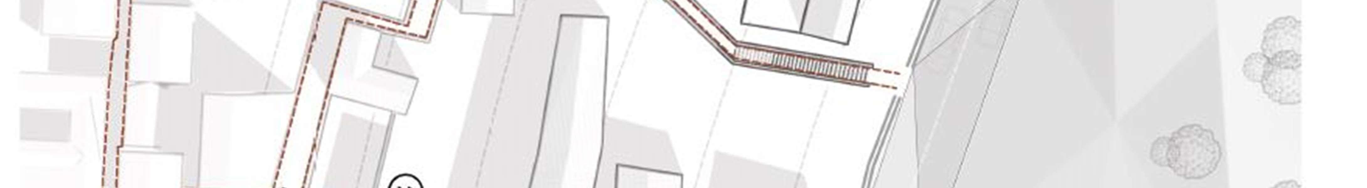
Perast is rich in attractive places and locations from which deep, diverse and dynamic views open up. It could be said that each position in the city represents a point of interesting and unique vision. Nevertheless, in this multitude it is possible to single out a few of the most significant points and benchmarks. From the coastal road, the islands of Sv. GeorgeandOurLadyofSkrpjelo,whoarealsothemainrappersandsymbolsofthecity.Mostofthecoastoftheisland is well visible and the exception is the eastern part of the bay "Luka", on the stretch between plots no. 326 and 360, where foresight is not possible. Fantastic views of the islands can be seen from the western part, Penčići Bay. Panoramic views from Perast on two islands blended with the panorama of the city or the undeveloped green background of Kostanjica on on one side or Stoliva on the other. Particularly attractive are the views of the city from the Chains when the islands are incorporated with the bell tower of the chapel of Our Lady of the Rosary, in the area of Penčić, next to the palace of Zmajević. Another important landmark, which dominates the silhouette of the city, and one of themost significant architectural features ofPerastisthe bell tower of the church ofSv.Nicholas. Itis55mhigh and can be seen from a large number of places in the city, especially in the part of Penčići. Almost along the entire Velja Street there is a view of the bell tower, and also on the path from the monastery of Sv. Antuna towards the intersectionwithVeljaStreet.Movingonthemainroad,healsostandsoutasasignificantbenchmark.Aspecialgroup ofviewsarethosethatareaimedatattractivearchitecturalcomplexes,aswellaslandmarksinthecity.Theseare,first of all, the most important palaces and churches, among which the Zmajević palace stands out. They are most often seen from the immediate vicinity, but also as dominant objects within a smaller architectural ensemble. There are a
102 | Page
large number of points in the city that are not directed towards an individual building but towards the panorama of the city,aninterestingarchitecturalgroup,aroundedambience,eithernaturalorbuilt.Suchplacesarethemostnumerous and refer to micro-ambiences, individual motifs (loophole, beautiful tree, flower ensemble, street extension) or views towards the natural environment (towards Lovćen, Orjen and Veriga). Of particular importance is a group of views of buildingswhosephysicalcharacteristics disrupttheharmoniousimageofthecityorurbanenvironment.This mayrefer to the building as a whole (factory hall "Jadrana", modern house on parcel 107 KOPerast) or, more often, to some extension or detail (facade treatment, position and proportions as well as the shape of the windowor visions, balcony, fence, etc.). There are quite a number of buildings that have some architectural and / or ambient negativity. Finally, it shouldbeaddedthatthecablenetwork(overheadelectricalnetwork)intheentirecitydisruptstheperceptionofspatial sequences and images of the city.
3.1 EXCERPT FROM THE SPATIAL PLAN OF THE MUNICIPALITY OF KOTOR
The Spatial Plan of the Municipality of Kotor from 1995 determines the development strategy at the level through 3 macro-units, separated on the basis of natural characteristics and created values:
coastal belt of the innerbay of Boka
Donji and Gornji Grbalj with part of the open sea and the contact area of the National Park "Lovćen"
mountain-hilly area
For each of the macro-units, an overview of the main directions of development is given with measures and activities for their implementation. Inland Gulf Coastal Belt This macro-unit comprises the hinterland coastline and part of the inland sea as an integral part of the coastal belt. It is a World Heritage Site. In the area of the bay there are a number of longitudinally developed settlements with an exceptional identity. Due to natural and created restrictions, the space for further expansion of the settlement has been reduced and it is difficult to equip it with infrastructure. The inland waters of the bay are still marginally and passively used for local maritime transport, nautical tourism and fishing. Unresolved wastewater drainage and poor natural water exchange threaten water quality. The main directions of development have been proposed for this macro-unit:
HIGH TOURISM - ACTIVE PROTECTION OF CULTURAL AND NATURAL HERITAGE - ACTIVATION OF THE MARINE PROPERTY
A number of activities are overlooked for their realization, and those that are especially related to the area of Perast are:
maximum rationalization ofsurfaces bystoppingany linearnewconstructionbytheseaand possibleconstruction in the hinterland through careful thickening of the existing tissue
development of high tourism (lux and A category) - without major construction of new accommodation capacities (except in selected locations) but with adaptation of "captain's palaces" and with re-categorization of existing facilities
controlled development of nautical tourism and overall traffic in the bay, which is treated as one large marina with smaller points, moorings and piers under a special program
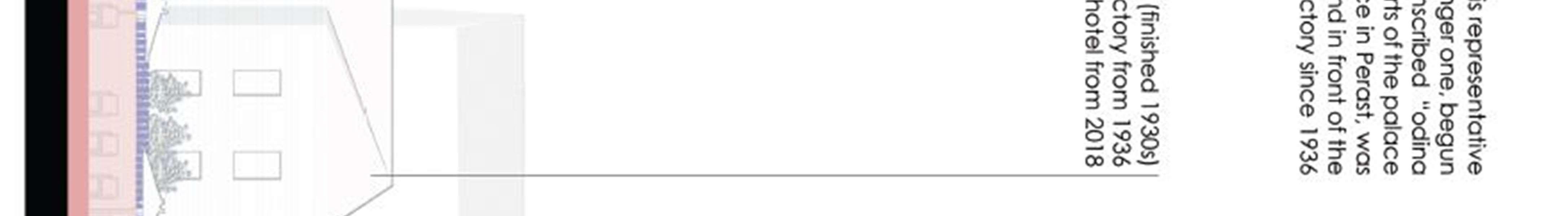
active protection of the city of Perast, as a whole, through the reconstruction of facilities with an exclusive purpose for business-congress and tourist center; as part of that, thedislocation of fashion clothing "Jadran"
development not only of stationary but also of transit-excursion tourism through designed programs, the basis of which is cultural and naturalheritage inthe bay butalso in the hinterland and the mountainous part of themunicipality
exclusive trade and catering offer as well as traditional crafts, especially in the old town of Kotor, Perast, Risan and Prcanj with the production and sale of characteristic souvenirs
locating replicas of old sailing ships in larger settlements of the bay
arrangement of archeological and speleological sites in the vicinity of Perast, Risan, Lipac and Kotor
holding high-renowned cultural and sports events
103 | Page
introduction of local maritime transport lines to facilitate the connection of settlements within the bay (smaller piers and ports)
lungo mare and bike path
connecting all settlements to a single sewage system
communal equipment and arrangement of beaches (installation of pontoons, repair of existing pontoons and mandrakes) ***
The basic setting in the development of tourism in the municipalityof Kotor is acomplete offer, in which great diversity has been created with special emphasis on high tourism.
Tourist facilities are classified into the following categories: hotels, villas, private accommodation, camps and other forms of accommodation. Specialcapacities are given in thebay, Grblja and the mountainous hinterland.
Stagedconstructionoractivationofindividual zonesandtouristfacilitiesisplanned.Onlyafewnewhotelsareplanned to be built in the Gulf, and hotels are planned to be housed in the existing Jadran factory building in Perast, and the possibilitiesofafortressabovethecityshouldbeconsidered.Allexistinghotelsareretainedwiththeirre-categorization. Aspecialcategoryconsistsofvillas,whichintheGulfincludeactivatedandadaptedcaptain'spalacesandmonumental buildingsfromtheperiodfromthe16thtothe19thcentury.Inthisway,itispossibletoimplementtheiractiveprotection inthefunctionoftourism.Privateaccommodationincludesstandarddomesticworkandprivateboardinghouses,which should be given increasing importance (on average 10-20 beds). The aim is to achieve the highest possible level of services here as well. Kotor-Risan Bay (with controlled use and traffic of vessels due to ecological limits) as one large natural marina, will havelargerpoints in Kotor, Prcanjand Risan,anda numberofmoorings in:Mula, Dobrota, Prcanj, Stoliv, Orahovac, Perast, Risan, Strpa, Morinja and Kostanjica. It is also possible to turn part of the mandrake into commercial bindings.
CONCEPT OF AREAPURPOSE, ARRANGEMENT AND USE OF SPACE
The territory of the Municipality of Kotor is divided globally into: urban zone, rural zone and natural environment. and smaller settlements (Muo, Orahovac, Kostanjica and Morinj). The rural zone contains old settlements on the slopes abovethecoastalbelt,theareaofKrivošijaandLedenica,aswellasGrbaljasthelargestruralareaofthemunicipality. The third zone includes the natural environment consisting of branches of the mountain massifs Lovćen and Orjen as well as the massif Vrmac with forest belts, maquis and bare cliffs. The basic division of themunicipal space was made into: built-up areas, agricultural areas, forest areas, traffic areas, water areas and karst. The built-up areas include spaces for the construction of residential and all other types of buildings. They are divided into: settlements, tourist settlements,sportsandrecreationalzones,industrialzone,communalareas.Theareasofthesettlementsareintended for the construction of residential, social and economic facilities, which do not produce negative effects on the environment, as well as for roads and various forms of urban greenery. Detailed elaboration of the boundaries of the constructionareawillbegivenintheplansofalowerorder,ieaccordingtotheprocedurefordeterminingtheboundaries of the construction area. The expansion of the urban construction area should be controlled and the maximum opportunities provided by vacant, neglected or underused land within existing settlements should be used, through careful interpolation procedures. The concept of spatial development of the municipality of Kotor requires the development and improvement of housing conditions, given that the existing housing stock is in poor condition due to age, the consequences of earthquakes and poor maintenance. In order to create a more balanced development, housing should be directed polycentrically, ie in zones that are satisfactory in relation to: seismic, natural conditions, proximitytojobs(inordertoreducedailymigration),thepossibilityofcommunalequipment,preservationofagricultural land. The creation of terraced surfaces is extremely important for preventing the washing away of flysch deposits and humus, and raising orchards on such raised terraces is equal to afforestation. In settlements, they are of great importance, due to the otherwise small areas under greenery.
104 | Page
PROTECTION AND IMPROVEMENT OF THE ENVIRONMENT
The concept of organization and arrangement of space in the municipality of Kotor implies nature protection and strengthening of ecosystems, and the main components are the expansion of protected areas and the concept of ecological corridors. The qualityof the natural environmentinthe municipality of Kotor is mostlyaffected bythe impact of pollutants on the sea of the inner bay, disturbance and devastation of the landscape, construction of facilities on agricultural land, waste pollution, etc.
The concept of environmental improvement envisages the following measures and recommendations:
to keep green and free spaces as much as possible in settlements, and great attention should be paid to terraced gardens and backyards -to preserve "green breaks and penetrations" in the built tissue
natural forests, which penetrate into built-up urban areas or surround them, should be specially protected and arranged as urban greenery
prevention of soil erosion byregulation of watercourses and torrents and afforestation
taking measures for landscape rehabilitation,
when planning facilities that by their activity or use may cause harmful consequences for the environment, it is necessary to perform impact analyzes with a proposal of protection measures
Conditionsinthefieldofprotectionoflandscapes,ambiencesandarchitecturalheritagearegivenbywiderspatialunits and represent a minimum of activities within the scope of this plan. The Gulf Zone is a cultural monument of the first category as a whole and implies the greatest caution in planning and construction, which includes the protection of nature, the sea, architectural, architectural and cultural heritage. General and individual conditions are mostly given limits for construction interventions. The principles of urbanization are given in general and reduced to the conditions of the following:
compliance with the principle that no new construction is planned in the bay zone except in segments, individual facilities orinsmallergroups ofsuitablefacilities. Maintainasmuch aspossiblethemorphologyofexistingsettlements bytheseaaswellasoldsettlementsinthehinterlandwithoutatendencytomergeandbuildtheminthezonesbetween;
possibleconstructionshouldfill thefreespaceswithinandalongtheperimeteroftheformedsettlementssothatthey form a complete wholewith them;
mostoftheinterventionsareplannedontheexistingbuildingsthroughreconstruction,adaptationandextension,and according to the Law and according to the conditions and guidelines of the Institute for the Protection of Cultural Monuments;
forconstructionandreconstructioninsettlementsbythe seaandtheirparts,itisobligatorytoworkonurbanprojects on the basis ofa spatial plan;
for specific units and settlements that are entirely a cultural monument or a valuable ambient unit, it is mandatory to work on urban projects (Perast and Gornji Stoliv)
inthebayitisnecessarytokeepandallowedtobuildmoorings,mandrakesandpostsinallplaceswherethefunction and architecture of the hinterland require it and in the form taught by the tradition of existing stone pontoons and mandrakes.
Special conditions for the Gulf zone:
the purpose of the facilities in the bay zone may be tourism, housing, housing with activities or activities (compatible with tourism oraccompanyingoffer)and exceptionallysocialfacilities andcultural facilities,depending onthespecifics of the environment;
in planning and design, primarily use existing facilities and activate them through reconstruction, depending on their creditworthiness;captain'spalacesandfacilitiesregisteredasmonumentsshouldbeprovidedformuseum,galleryand high tourism facilities; other facilities that contain elements typical for the area to be reconstructed and activated in accordance with the planned purposes, primarily housing and tourism.
105 | Page
design new residential or tourist construction in a secluded manner in relation to the regulation of the street along the coast with the obligatorypre-garden, on terraced plots in the hinterland and wider areasat higher elevations within the planned construction zone;
inherited tissue that includes horizontal and vertical regulation, retaining walls of terraced plots, valuable trees and spontaneously formed communications should be respected and fit into new urban and architectural solutions;
design all planned facilities up to the height of P + 2 + Pkor lower depending on the inherited environment;
in architecture, and especially in appearance, design new buildings in accordance with the principles of inherited architecture and authentic ortechnologically adapted modern materials.
(in indications this principle implies the program and space of a developed family house, simple size, gabled roof covered with shingles or tiles, stone or light painted facades, with smaller and proportional openings and shutters on them;pavedplateausandpergolasarealsoafeatureofthisarchitectureandtheyshouldbeappliedwheneverpossible, in design and construction as well as in reconstructions, cooperation with the Institute for the Protection of Cultural Monuments is mandatory);
for construction in the peripheral zones of settlements, as well as in settlements that are not homogeneous architectural and ambient units, it is possible to have a freer access in the design and adaptation to specific location conditions
Individual buildings in the hinterland registered as cultural monuments (mainly fortifications from the AustroHungarian period) are intended for revitalization depending on the capacity and the possibility of their inclusion in infrastructure systems from simple connection with footpaths to complete equipment. The method of protection and revitalization especially refers to the old roads from the Austro-Hungarian period that are in use today, but they should be properly valorized and reconstructedas a significantpartof the cultural and historical heritage.
GUIDELINES FOR THE DEVELOPMENT OF SETTLEMENT PLANS (URBAN SETTLEMENT PLANS)
Implementationandelaboration of the Spatial Plan of the Municipalityof Kotor isdonethrough: spatialplansof special purpose areas, detailed spatial plans, general and detailed urban plans, development plans for settlements and determinedforwhichnoplanswillbemade.Thedevelopmentplansofindividualsettlementswillelaboratethesettings oftheSpatialPlanofthemunicipality,andtheboundariesoftheprojectwillbedeterminedbythedevelopmentprogram. These plans should determine the conditions for construction, and in principle they relate to:
locating specific tourist, residential and service facilities on specific terrains;
strict regulation of surfaces, which enables proper and permanent management or care of the space, without zones that are "common good";
limits in the construction and use of land to which the future investor should and can consume space and burden it with infrastructure and superstructure;
method of construction, ie recommendations and obligations in design and construction so that the identity of the settlement is successively built and preserved in the conditions ofa specific location
instructions for arranging specific zones (tourist points, centers and recreation centers, ambient units, nautical centers, tourist villages ...)
specialconditionsintheorganizationandconstructionofspacethatoriginatedfromtraditionalformsandarchitecture. The plan provides construction zones that represent an assessment of the terrain on which construction will be concentrated. The proposed boundaries included areas bythe sea in order to regulate thecoastal area as well as free green zones. Perast Urban Project Perast is a valuable cultural and historical entity with a number of architectural heritage sites. A detailed urban elaboration of the entire settlement is needed, primarily in relation to the protection regimeandthepossibilityoforganizationandpurposeofspace.Giventhefactthatthebypasshaslimitedtheavailable space for the expansion of settlements, attention must be focused on reconstructions and interpolations in close cooperation with professional institutions in the field of protection of cultural monuments. Perast as a local center has the seat of the local community, local office, public safety station, post office, regional primary school, children's
106 | Page
institution,clinic, universal hallfor cultural activities. There isa museum and a specialized library in Perast. Social and public facilities are dimensioned for the needs of the assumed number of 500 inhabitants.
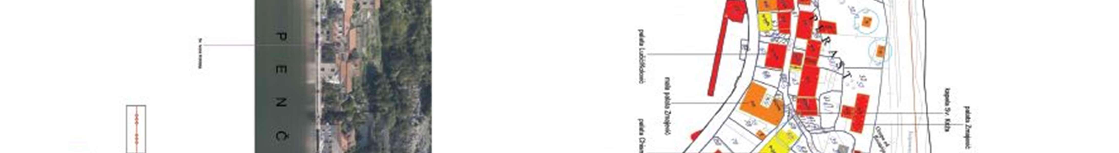
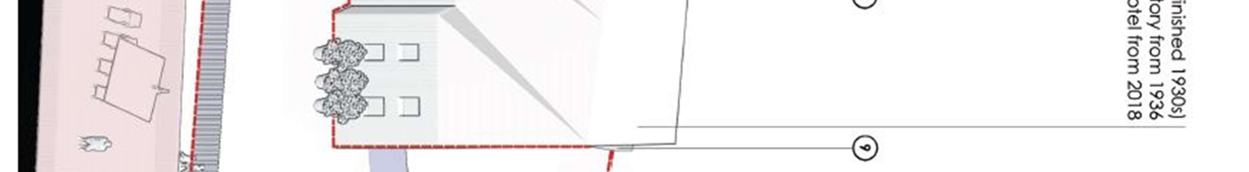
Small service-type economy as well as craft activity (clean and quiet) will be performed within the established service center. It is necessary to develop trade facilities, as well as locations for catering and specialized tourist facilities. The main purpose of the entire settlement would be the form of a city-hotel (with strictly prescribed construction interventions). The total touristaccommodation capacities are dimensioned at approximately 600 beds, as follows:
250bedsinsmallerhotel units (Villa"Perast",factorybuilding"Jadran";examinethepossibilityofaccommodationin the fortress above the city)
200 beds in renovated facilities (captain's houses)
about 150 beds in private accommodation ofa highercategory.
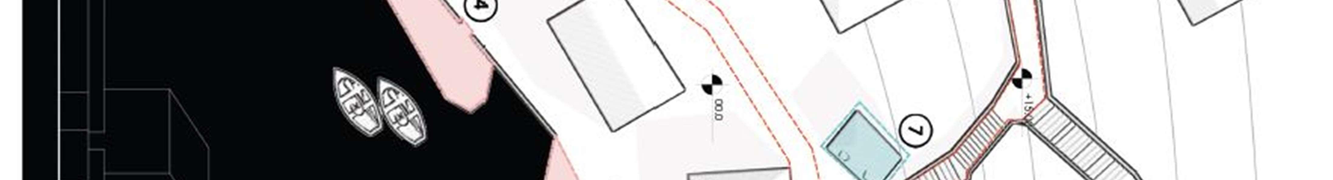
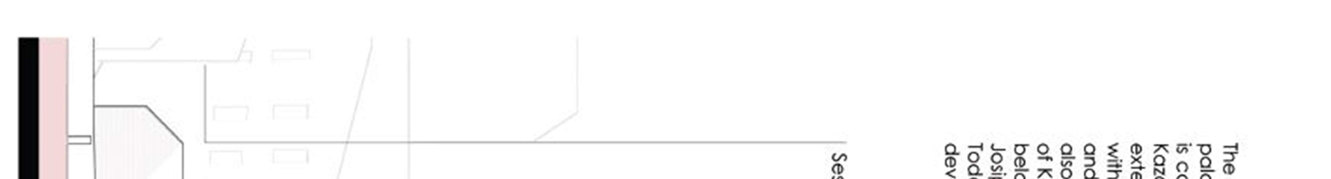
(The capacity of private accommodation depends on a number of elements, so this figure must be taken as a guide). Thepreconditionforsuchdevelopmentistherelocationofthetextileindustrytoanotherlocation(intheindustrialzone) as well as the restructuring ofemployees into service and catering activities. Among the valuablemonuments that can be activated for touristfacilities, the following areproposed: the palaces "Mazarović", "Visković", "Krilović", "Zmajević", the House of Culture with the neighboring building and house no. 84. The pier needs to be reconstructed to allow for the normal operation of future local shipping as well as the berthing of up to 20 yachts.
3.2 EXCERPT FROM THE SPATIAL PLAN OF MONTENEGRO
The first Spatial Plan of the Republic of Montenegro was adopted in 1986, and on two occasions, in 1991 and 1997, amendments were made. The new Spatial Plan of Montenegro (2008), as well as the previous one, defines three regions - Coastal, Central and Northern region. The coastal region consists of the development zones of the Bay of Kotor, the central coast and the southern coast. Relatively densely populated, this region has an economy based on tertiaryactivities, which provided the highest DPper capita inthe Republic,thehighest population rate and the highest standardofliving.Mostactivitiesaredistributedlinearlyalongthecoast,andincontinuouslyformedsettlements,urban centers do not stand out morestrongly. Policies for spatial development of the Primorska region include:
Harmonious development of cities in the Bay of Kotor should be ensured through an appropriate spatial plan and strong inter-municipal cooperation. The following cities are expected to establish a strong conurbation, based on wellcoordinateddevelopmentprograms:Kotorshouldbeacenterofcultural,businessandscientificactivities;Tivat,whose development will be related to the development of air transport and nautical tourism, as well as the center for the development of tourism in the area of Luštica with Herceg Novi; Herceg Novi, which will be the main tourist center, specializing in health tourism, with cultural functions as an importantcomponent of its development.
Rural settlements should be protected from further degradation, and those on the slopes should be revitalized, so that in addition to the agricultural population, they also accept housing and the population employed in settlements on the coast.
The qualityofcoastal sea watersshouldbecontrolled. In addition to themandatoryconstruction ofsewagesystems with wastewater treatment, it must be prevented from discharging wastewater from ships directly into the sea.
Inordertopreservetheenvironmentandspeciallandscapevalues,specialattentionshouldbepaidtotheecological corridor along the coastal mountains (Orjen, Lovćen and Rumija) and green corridors that connect it with the coast (parts of the Bay of Kotor - Orjen and Lovćen; parts of the coast between Budva and Petrovac - Pashtrovska gora; partsofthecoastbetweenBarandUlcinj-Rumija).Thegreatestdangerforendangeringthisvalueisthecurrenttrend of continuous construction (coasting), as well as the construction of the future highway for high-speed traffic on the coast.
Developmentzonesaredefinedonthebasisofcurrenttrendsandpatternsofdevelopment,andespeciallyonthebasis of local potentials and limiting factors. For each zone, the leading priorities of development, constraints, conflicts, environmental challenges, thresholds and preconditions for development are stated. Problems and components of development, which are common for all areas of development, such as: housing, social and communal infrastructure, services,regularenvironmentalprotection,etc.theyarenotsubjecttoconsiderationexceptinthosecaseswherethese
107 | Page
components playa leading strategic rolein the global development process. The development zones of the Primorska regionare:BOKAKOTORSKA, BUDVANSKO -PETROVAČKOPRIMORJEand BARSKO - ULCINJSKO PRIMORJE.
The development zoneBOKAKOTORSKA, homogeneousfrom thegeographical,ambientandcultural-historical point of view, includes the subzones Herceg Novi, Kotor and Tivat.
Sub-zone KOTOR
Withareasofspecificproblemsincludes:theinnerpartoftheBay,withthetownofKotorandothersettlements(Perast, Risan, Prčanj, etc.) (A); Resources and potentials: A large number of cultural and historical monuments, the city of Kotorwiththestatusofaculturalassetofworldimportanceandthecapacityofspecializedhealthinstitutions,technical building stone (A), formed production and social functions, services and equipment of the area, including ports capacities, and good connections with the airport in Tivat (A), fertile agricultural land complexes (B), available space for the industrial zone, which is being formed in Grbaljsko polje Kotormunicipality (B), picturesque surroundings of the village of Donji Grblja with undeveloped areas for development tourism, traditional Mediterranean-type agricultural production and sea fishing (C) Development priorities: Tourism, including spec physical form of health tourism in the areaofPrcanj;thefunctionsofaculturalandacademiccenterofwidersignificance,aswellasthefunctionsofaservice center; maritime and maritime economy, with technological improvement of the ports of Risan (passenger, tourist and limited goods traffic) and Kotor (for passenger and tourist traffic) and their specialization (A); technologically highly specialized and harmless industry, intensive agricultural production with an export orientation (using the proximity of Tivat airport) and the wider tourist market of Grbaljsko polje (B); tourism and specialized agriculture (C). Restrictions: Restriction of residential, tourist and other construction that endangers the recognized values of cultural and historical heritageandvalues.Furtherlimitingthe developmentofindustrialandprocessing functions, with theexceptionoflocal craftplants-smallbusinesses,limitingthedevelopmentoftheportsofRisanandKotortoactivitiesthatdonotendanger theelementsoftheenvironment(A).Restrictionofurbanizationintheindustrialzoneforallprograms,exceptindustrial (B). Restriction on housing construction - only for the needs of agricultural producers, as well as a ban on the construction of holiday homes (B). Restriction on the construction of facilities that in any way may jeopardize the high value of the natural and cultural landscape (C).Conflicts: In the entire subzone, there is a generalconflict between the needs of development, on the one hand, and the protection of the environment and the natural and cultural landscape of the Bay of Kotor, on the other hand. The conflict between the needs of traffic and the limitations of the construction of the main connections, on the one hand, and the landscape values of the Bay of Kotor, on the other hand. The development so far has established conflicts between: the intimacy of historical urban ensembles and the needs of transit traffic; conflicts between a unique mix of natural and historically created landscapes, on the one hand, and modern patterns of development and architectural / building forms, on the other; conflict between the requirements of protection of cultural-historical values (and forms) and modern functional requirements; conflict between the interests and emphasized desires of private owners of buildings and land, on the one hand, and wider social interests in terms of proper management and maintenance ofhistorical features, on the other; theconflictbetween the scarce amountof landandtheneeds(andambitions)ofdevelopment(A),theconflictbetweentheairportandtheeconomicinfrastructure built outside the industrial zone and especially in the Adriatic Highway and the protection of the environment (B). Inadequateandmassconstructionofweekendhousesdirectlyviolatestherecognizeddevelopmentpotentialintourism and agriculture of the picturesque surroundings of the village of Donji Grblja (C). Thresholds: Modernization and expansion of the entire urban system and development of priority functions, depends on the construction of a complex water supply and sewerage system - which directs wastewater to the open sea. The general threshold for the spatial and functionaldevelopment ofall systems inthe Bayof Kotoris reflected inthe capacity of the existing traffic network. This, very limited capacity, increases the seismic vulnerability of all coastal functional and economic systems. The operational needs of the airport impose thresholds in relation to the expansion and pattern of industrial zone development.
Environmental requirements: protection of sea water from pollution, protection of soil from waste contamination, reduction of noise levels and protection of natural and cultural landscape. Control of seismic risk, technical accidents and natural disasters: Application of all measures recommended for the Herceg-Novi sub-zone, and measures formulated by UNESCO, for the Old Town of Kotor and its immediate surroundings. Prerequisites: development of a program of a unified spatial development policy for the entire zone, covering the areas of all three subzones, solution of the issue of crossing the Boka Kotorska by road, as well as the traffic opening of Donji Grblje.
108 | Page
The concept of development and arrangement of settlements is based on strengthening the polycentric system of centers, with theaim of achieving the appropriate structure and functions of the settlement system inthe long run. The basis of the network of centers consists of:
centerof nationalimportance (Podgorica)
state center of special importance (Cetinje -the capital of Montenegro)
centersofregionalimportance(BarandUlcinj;BijeloPoljeandBerane;Nikšić;Pljevlja;HercegNovi, KotorandTivat; Budva)
centers of municipal importance (other municipal seats)
local centers (Risan, Perast and Radanovići in the municipality of Kotor)
Inmajorlocalcenters,whichareurban,ruralsettlementsortouristsettlements,thedevelopmentofappropriateservice and supply functions will be encouraged, as well as the creation of jobs for the population from that center and its surroundings. A major local center must enable the provision of basic educational, health and social services, as well asappropriatesportsandculturalactivities.Inmoreimportantlocalcenters,thedevelopmentoftertiaryandquaternary activities and employment in various activities should also be encouraged, with the aim of forming one's own basis for economic growth and development. *** The development of tourist accommodation on the coast should be planned verycarefully,becausethecarryingcapacityofmunicipalitiesinthisregionisalmostexhausted.Thenumberoftourists inthemainseasonfromJulytoAugustcreatesnegativeeffects,suchascongestionoftrafficinfrastructure,congestion of city centers, due to lack of parking spaces, water shortages, pollution of beaches and roads, etc. The development of tourist accommodation in the municipality of Kotor will be focused on locations Rtac (Risan), Raškov brijeg (Ljuta), on land near the open sea in Bigovo, locations above the cliffs from Čukotrlica to Trsteno in Donji Grblje, Gornji Stoliv, Perast and captain's palaces in the bay.
3.3 EXCERPT FROM THE SPATIAL PLAN OF THE SPECIAL PURPOSE AREA
FOR THE MARINE GOOD OF MONTENEGRO
The Spatial Plan for the Special Purpose Area of the Marine Property (2007) is applied by adequate elaboration at lower levels or by direct application of the provisions of this plan. For each of the 68 sectors of the Marine Property is given:
overviewof the basic purposes of the space with guidelines and notes;
guidelines for bathing types;
protection guidelines and guidelines forthe implementation of this plan.
In the zone of the Marine Estate, protected areas and individual objects of nature and culture and their status are also shown. The marine good also includes parts of the urban units of Herceg Novi, Perast, Kotor, Budva, Sveti Stefanam andUlcinj,whichareprotectedascategoryIgoods,whichinthecaseofPerastandKotor,ontheUNESCOWorld Heritage List.
Urban built coast Urban built type of coast is an urban and built coast, regardless of the character and function of the settlement, or regardless of whether it is a permanently inhabited settlement or occasionally inhabited - tourist. Part of suchacoastconsistsofwell-maintainedcitybeachesaswellasapromenadebythesea(lungomare).Port-operational coast The port-operational aspect of the built coast means the built port-operational infrastructure for the provision of simple (mandrakes, docks and moorings) or services of the highest level (marinas and ports). Posts are areas on the built-up shore that are used to pull out fishing nets. They are mainly represented in the Bay of Kotor. The tendency to usepartofthepostasapontoonwithmodificationsthatdisabletheirbasic functionshouldbestopped.Mandrakes are artificially fenced parts of the sea which, with theirsurface and depth of the water area,enable mooring and protection from storms to vessels that can use them in size and draft. They represent a specific ambient - architectural characteristic of the Bay of Kotor where they are almost exclusively represented. In addition to restoring the old ones,
109 | Page ***
it is possible to form newmandrakes. Ports are built parts of the coast that provide conditions for mooring vessels and performingsimpleportoperations(embarkationanddisembarkationofpassengersorsmallquantitiesofpackedcargo). Ports used to be used for mooring of liner ships, and now most often for excursion tours and reception of nautical vessels.Someports,inplaceswherenauticaltouristsareinterested(egPerast,etc.),shouldbeprovidedwithminimum conditions for nautical tourism facilities. Commercial moorings are specially built and arranged coastal areas for mooring vessels, with tourist complexes and facilities. Bathing areas Bathing areas are all suitable places, whether natural (gravelly, sandy, rocky, rocky) or artificial (built-up areas on and along the coast) where you can swim and sunbathe recreationally. The bathing area can have several bathing units, organized depending on the purpose, and each of them is individually equipped as a whole. According to the purpose of the baths are divided into the following categories: public, hotel and special.
A public swimming pool is one that can be used by everyone under equal conditions. It can be urban or excursion (outside the settlement) and fully or partially arranged. The city beach is the frontal part of the populated zone and its contact with the sea. In addition to the bathing character, it can also have the function of entertainment, sports, recreation, public events,etc.For thecapacityof the bathing area,thenormof 4to8 m2per bathingareaisused, and for hotel and exclusive bathrooms, even more. According to the degree of arrangement of the bathing area, they are divided into: arranged, partially arranged and natural - protected. Arranged bathing areas are those that fully meet the organizational, technical, infrastructural, hygienic, and safety requirements, in accordance with applicable regulations. Partially arranged bathing areas are those that fully meet the organizational and hygienic requirements, and partially infrastructuralandsafetyrequirements.Shellfish/fishfarms(mariculture)Themariculturefarmisaninterventioninthe sea where artificial shellfish or fish farming is performed. This most often involves floating shell parks or cages for fish farming. The locations are mainly in the Bay of Kotor, including the stretches between Dražin Garden and Perast and Perast and Risan. Preference in the Gulf, due to limited natural conditions, is given to shellfish farming. Zones where mariculture cannot be performed under any conditions are: settlements, port waters, shipyards, industrial centers, locations with inadequate water quality and hydrodynamics, zones of severe pollution, locations of tourist and recreational activities, zones of intensive maritime traffic, zones of military activities , protected areas and areas of special importance. *** The maritime good also covers parts of the urban units of Herceg Novi, Perast, Kotor, Budva, Sveti Stefan and Ulcinj, which are protected as Category I goods, which in the case of Perast and Kotor are on the UNESCOWorld Heritage List. *** In the area ofthe Marine Estate, which is very narrow, there are facilities of different typesthatcanbelocatedinthemarinearea:beaches,trafficfacilities,nauticalfacilities,seasonalfacilities,oldbuildings of traditional architecture, residential and ancillary facilities, groups new buildings of modern architecture, hotel and tourist complexes. Through the development and adoption of the Plan,itis necessaryto ensure the status of aspecial interestintheareaofthe Marine Property,ie thestatus ofcomplexandintegral protection. In anarrowstrip next to the sea, it is allowed to: - build maritime traffic facilities (mules, mandraće piers, pontes) and similar facilities which, according to the logic of their existence, must exist on the "foam of the sea". - reconstruction and rehabilitation of existingbuildingsoftraditionalarchitectureandarchitecturalheritage-protectionofauthenticlandscape,restorationof fires, preservation of Mediterranean macchia - protection of the seabed - plan defined upgrade of existing tourist facilities with the aim of modernizing and enriching and lower-order plans
3.4 EXCERPT FROM THE TOURISM MASTER PLAN AND THE BOKE REGIONAL MASTER PLAN
The innovated Tourism MasterPlan from 2008presents the strategic orientations of tourism in Montenegro until 2020.
Tourist clusters Montenegro, as a tourist destination, can be divided into six clusters: three on the coast, three in the continentalpart,aswellastwobinders,whichconnectthecoastwiththemountainsthroughNikšićandPodgorica.The boundariesofthe clusterarenot impermeable, butareopen to neighborsforbetternetworking andcooperation, which enrichestheoffer,createsabetterpriceforthedestinationandoftenimprovesthecost-benefitratio.Thesesixclusters differ in the characteristics of landscapes and cultures: 1. Steep, rocky coast from Luštica to Ulcinj, with numerous bathing bays, a beach tourism center with famous, often modern bathing places, such as Budva and Bečići. 2. Ulcinj, atown withatouchofOrientalism andthelongestsandybeachinthesouthernAdriatic,AdaBojanandValdanos.The big beach represents a great development potential of the Montenegrin tourist economy. 3. Bay of Kotor, framed by steep cliffs that rise high above sea level, with the remains of Venetian culture - is unique in the Mediterranean, most suitable for the development of high quality and diversified offer (nautical tourism, golf courses, etc.) in Tivat Bay and Lustica peninsula, provided that infrastructure problems are resolved. 4. The capital of Cetinje and Skadar Lake, also two unique due to their historical significance, diversity of flora and fauna and fascinating landscapes on the lake. 5. Mountain areas of Durmitor and Sinjajevina with the Tara canyon and the National Park. 6. Mountainous areas of Bjelasica, Komovi and Prokletije with one, soon two national parks, monasteries and mosques. Cluster 3 - Boka
110 | Page
Kotorska (beach tourism, cultural tourism, sports and health tourism) Current situation Boka Kotorska is one of the most beautiful bays in the world. In the Mediterranean, it is unique and thus destined for exceptional quality individual tourism.Itsculturalandnaturalpotentialisunlimitedandextremelysuitableforvarioustypesoftourism:beachtourism, sportstourism,regattasofallkinds,trainingforrowingduringthewinter,diving,hiking,climbing,etc.-nauticaltourism, cultural and health tourism. However, the full exploitation of the value of this potential is still hampered by certain obstacles: inadequately resolved traffic in Herceg Novi, as well as around the bay, shipyard and industrial port (Zelenika, Risan), unresolved issue of drainage and sewerage, which affects water quality. Advantages Breathtaking combination:fjordandbayconnectedtotheopenAdriaticSea,protectedarea-naturalmarina,watersportsareaTivat - Sveti Marko, cultural heritage from the Venetian period, with Kotor (UNESCO World Heritage Site) and Perast, Habsburg Fortress Ring along the edges of the mountains around the bay (world unique), the Mediterranean spirit of theLušticapeninsulaisbarelytouched.Lušticacanbebuiltintoanaturalandtouristparkwiththeintegraldevelopment of “mixed use” (multi-purpose) resorts. Mountain offer on Orjen. Weaknesses Poor road traffic, burden on the environment with industry, ports and inadequate infrastructure, unplanned construction of bays with inadequate care forculturalmonuments,traditionandstyleofconstruction,generallypoorqualityofthehotelindustryfornow.Chances For tourism throughoutthe year, cluster3 has certainly the best and most versatile potential, whichis strengthened by the proximity of Dubrovnik, opportunities for regional cooperation and better air connectivity thanks to the proximity of Cilipi Airport. Threats Land trade and a sharp jump in real estate prices, uncontrolled construction in Herceg Novi, Kotor, as well as on the Lustica peninsula. Objectives of the new positioning Cluster 3 becomes an extremely highquality destination throughout the year forindividual and flat-rate tourism.
Accommodation: top hotel management and small family hotels with 3-5 stars. Boka Kotorska has a DEG-concept for development, with planned model projects for different target groups. The region focuses exclusively on tourism requirements and needs. The focus is: nautical - yachting tourism, health tourism with light fitness activities, more demanding but on the other hand challenging sports (such as sailing, diving, rowing, mountain biking, then hiking), cultural programs, events and festivals. Herceg Novi, Kotor, Tivat and Budva are connected to the hinterland and the Luštica peninsula by hiking and biking trails, with the aim of: extending the season. The following is an overview of some operational goals and measures for their achievement, which are especially important for Perast and the Bay of Kotor. Operational goal: Creating the necessary tourist and supporting infrastructure in order to achieve the strategic goal "Quality instead of quantity" is already formulated goal of the 2001 Master Plan. years. Significant steps forward have been made over the past seven years. But still parts of the tourist infrastructure, accommodation capacities and services do not meet the requirements of a high-quality tourist destination. The global trend ofdemand for high-quality tourist destinations, which combine outstanding natural values and exciting activities with excellent infrastructure and services, offers a unique chance for Montenegro to use what it has in the best possible way. As the examples show, especiallyin the Mediterranean area, onlythrough high-quality tourismcan natural valuesbe bestprotected. Measure: Development of new high-quality accommodation capacities Hotel capacities must be significantly improved qualitatively and quantitatively. In addition, there is an urgent need for high-quality facilities with a diversified recreational offer and all the facilities for year-round operation. Due to limited space, all available spaces in the best positions, especially in the hinterland of beaches, should be dedicated to the construction of resorts of the highest standard, if in some cases this is not contrary to strong interest in public use or environmental values. It is crucial that the accommodation structure is harmonized with the economic needs of Montenegro with a focus on those types of supply that, in the long run, generate the highest benefits. These are tourist hotels and "resorts". For now, certain administrative instrumentsshouldsignificantlyslowdownthefurtherdevelopmentofthesecondaryhousingsector-at least on the coast and in otherareas of tourist concentration until a balanced relationship can be established between different types of accommodation, until the entire infrastructure meets the need. for energy and water supply, as well as for the elimination of waste and wastewater, and until excessive pressure on the beaches subsides thanks to alternative, artificial bathing options. The capacity forecast assumes such a slowdown in construction and under this premiseitstartsfromthefactthatpartofthesecondarydwellingsinthecomingyearswillturnintoaplaceofresidence inoldageandthusceasetobeasecondarydwelling.Privateroomsforrent,inrelationtomanysecondaryapartments, bringtheadvantagethatthetrafficgoesdirectlytothebenefitofdomesticcitizenswithlowerincomesandisnotrealized outside Montenegro. With regard to the social and economic goals of sustainable development, this sector should be treatedverycarefully.Therefore,thereductionofthesecapacities isnotbasedona"plan",butontheassumption:that with the growing standard in neighboring markets and in Montenegro itself, bothdemand and willingness to hand over a personally used room to a foreigner during the season open the family space to third parties. Notwithstanding this, private room renters and the public sector have an economic interest in registering this activity, setting standards for private accommodation, applying it and displaying it on home signs. This makes it easier for the seeking guest to choose a room. This can increase rental income. In addition, the attractiveness of the area of private accommodation can be optimized by the development of public tourism infrastructure, so that this area can be used out of season.
111 | Page
Measure: Increasing the standard of existing accommodation capacities Not only new and large hotels and touristcongress complexes shouldshowthe standard with 3, 4 or5stars, butalso existingsmall hotels, apartments, etc. The scene is still dominated by low-standard accommodation.
It is necessary to motivate and support the owners of existing accommodation capacities to invest in the improvement of standards. A crucial problem in the coastal area can be identified as the fact that so far even low-standard facilities have been fully filled during the peak season. The owners do not see the need to invest. As with new investments, upgrades must take into account nature protection, energy efficiency, the use of renewable energy and suitability for the disabled. Measure: Improving the harmony between architecture and the surrounding natural and cultural environment("creating a harmonious environment") Naturaland urban landscapes of exceptional beauty are the main criteriaofahighqualitydestination.Manyconstructionprojects,touristfacilitiesandnon-tourismfacilitiesdonotrespect the conditions that exist in their natural, urban and cultural environment, but contradict the landscape. It is necessary to consider the compliance of new and reconstructed buildings with the conditions of their wider context. Today, it is quitecommonfortouristarchitecturetoresorttostylisticelementsoflocaltradition.Thetrendofdemandclearlyshows the special popularity of historic buildings, which with the appropriate service promise better utilization and higher prices. St. Stephen is an example of this. Operational goal: Montenegro is known and accepted as a "year-round" tourist destination Oneof themostcritical aspects ofcurrenttourismistheconcentration for a relatively short period of the year. Successful and high quality tourism depends on the attractiveness of the destination throughout the year. Of course, there will still be a concentration of tourists in the usual seasons such as summer and winter holidays, but Montenegro must be recognized as a destination worth visiting during all periods of the year. Measure: Diversification of hotel offers (family offer, wellness, congress, etc.) and improvement of active-recreational and active leisure capacities Prerequisite for establishing "year-round" tourism is the existence of capacities that meet the needs of tourists during different seasons and needs of different target groups. Families with young children, congress organizers,olderpeoplelookingforwellnessvacationsareusuallynottiedtosummer;infact,theyreallywanttoavoid that time, but they need adequate capacity to work outside the summer. Measure: Development and improvement of specifictouristproductsInadditiontovariousadequatecapacities,itisalsoimportanttodevelopvarioustypesoftourist offersuchas:Nautical tourismandwatersportsTheterm"nauticaltourism"includesallrecreational tripsandthosefor leisure,whichareundertakenatsea,eitherbylargecruiseshipsorbymotoryachtsorsails,ifequippedwithovernight cabins.MICE(Meetings,Incentives,Conferences,Events)TheacronymMICEreferstothepartofthebusinesstourism sector that deals with the organization and implementation of meetings, motivational trips, conferences and various events. Holders of MICE activities are most often hotels of higher categories, which have both organizational and technical infrastructure for the implementation of such events. The mentioned infrastructure makes the necessary preconditions, but they are not enough for success in the MICE market. Historical cores can be used for the development ofcongress tourismiftheyarestagedinanattractiveway. Culturaltourismand religioustourismCultural tourism, together with educational tourism, is no longer something that fewer people are interested in - culture and education are making progress in tourism.
When realizing cultural tourism, it is necessary to adhere tothe following four principles:
1.Itisnecessarytoconceivetheofferssothattheysuitboththelocalpopulationandtourists.Thiswillnotonlyincrease the authenticity of offers fortourists, but also contribute to the capacity of these offers.
2. Cultural tourism should provide an authentic experience, specific to the area in question - in the place where the holiday is spent, it is necessary to get the opportunity to experience the culture "live". 3. It is necessary not only to use the cultural potential carefully but also to design the offer in such a way that it keeps pace with the living and social environment. 4. Offers in cultural tourism must be extremelyprofessional, thorough and imaginative. It is necessary to concentrate on what is exceptional and characteristic and combine it with other elements of the offer in the field of hiking, mountaineering, cycling, religion, etc. National Parks - UNESCO World Cultural and Natural Heritage National parks and world cultural heritage sites have been placed under protection due to their natural and cultural values. At thesamelevel,theyshouldcontributetotheeconomicdevelopmentoftheirregion.Thiscontributionshould,aboveall, bringgood to thelocalpopulation,createjobs andincreaseincome. Therefore,theymustbeincluded.The potentialof nature and culture is obvious in the Bays of Kotor and Risan. It has already been pointed out that Montenegro, having Boka, has a real uniqueness that can be the engine for the development of quality tourism throughout the year.
112 | Page
Following the development of the first Master Plan for Tourism Development in Montenegro, in 2003 the Regional Concept for Tourism Development in the Bay of Kotor was developed. The choice of certain typologies (eg large hotel complexinnature,hotelwithinthesettlement,oldtown,areaforsmallhotels/boardinghouses),whichwereprocessed as a model, shows the application of thecontents of the Master Plan for Tourism Development. That is howthe Model projectforPerastwasdone.Thegoal istoincludePerastinthetourismstrategy,asacarrierofidentityandasapicnic area. A nurtured holiday destination should be created, which is unique thanks to its cultural and historical ambience and which is economically attractive enough:
to make the citizens of Perast interested in engaging and improving the offerin tourism
to preserve the valuable building structure of the place and to renovate it in part as well.
Preservation oftheexisting housing stock is theprimarygoal, in ordertopreserve the created identityoftheplaceand not to abuse it as an open-air museum. At the same time, the attractiveness for one-day visitors will increase, in order to extend the length of stay, thus generating additional income for the local economy. The development of the city of Perast has its special challenges. On the one hand, it is the preservation of historically valuable buildings, which are underprotection,andwhichallowconversionandrenovationundercertainconditions.Ontheotherhand,development opportunities for new construction or new functions due to steep topographic conditions and dense urban structure remain limited. The poor condition of many staircases and buildings, the lack of communal infrastructure and the fact that many buildings have been abandoned make it difficult to be willing to invest. The structure, position and history of the city impose that Perast, as the cultural and architectural pearl of the Bay of Kotor, develops and that no attempt is madetomakeastandardtouristoffer.Accordingly,developmentinsuccessivestepsisadvised,whichwillencompass the potentials of the city and exploit them. Stimulating the private initiative of property owners plays a big role in this. The municipality must manage these initiatives through an ongoing development strategy. For this purpose, it is necessarytocreateashort-termconstructionplanandvisionofthefuturewithinthestrategyfortheentireBayofKotor. ThisconceptenvisagesthecarefuldevelopmentofPerast,inordertoincreasetheattractivenessofthecityasatourist destination. It is crucial that historically significant buildings, which are partly under protection, are not damaged. Because, in addition to its special natural position, this is themain potential of the city.
The concept envisages the following contents for this purpose.
At the beginning of development,emphasis should be given to the coastal promenade and the main street. in this coastal zone the buildings are easily accessible due to the flat terrain, so there will be the majority of tourist facilities
in higherandharder toreach locationsontheslope thereare private estates andhousesof residents with individual tourist uses.
When the tourist conversion of the coastal zone is completed and when there is a demand for other tourist purposes, the suitability of the facilities on the slope for hotels or boarding houses should be examined. The main road (Velja Street) will be rehabilitated, with unique paving, lighting and benches, which will turn it into an attractive road. Along the main street, the conversion of buildings for catering, retail (boutiques) and private boarding houses should be especially supported. The visitor should experience the main street as a diverse array of narrow passages, alleys, courtyards and gardens that call for discovery. The coastal road will be turned into a promenade. And it will get new stone paving, unique lighting, trees and benches. It will be closed to vehicle traffic, ie access will be provided only in specialconditionsoratcertaintimes.Thefunctionofthepromenadewillbeemphasizedbycertainmeans,e.g.wooden gates, roundabouts at the entrance to the place, paving, greenery. The goal is to turn these two streets, together with the stairs, into a system of squares and paths that encourage staying and discovering. In various places, rehabilitated staircases go from the main street and invite those curious visitors to explore the areas of the city that lie at higher elevations.Thecenterofthissystemisinfrontofthechurchsquare.Itwillbewidenedontheshoretogivearectangular appearance and will be rearranged according to the system of squares / paths. Another row of trees on the shore will divide the area into one inner and outer square. From there, boats would travel to the island with the monasteries and to the parkinglotontheoutskirts of thecity. Thesquareshould stillbeusedfor celebrationsandevents.Intheeastern part of the square there should be a cafe, in the western part a small boarding house (Inn). In order for visitors to be guided through the place and its history, a "historical trail" should be created. Markings with historical data, anecdotes and interesting facts about Perast and about the specific location should be placed in striking places. Thus, the visitor
113 | Page ***
can move from one sign to the next anddiscover the cityon his own. At thesame time, a "pathofart" should be made andstagedlikeahistoricalpath.Theconceptdoesnotenvisagetheconstructionofnewhotels,inordertoexhaustthe tourist potential of Perast. The construction of a newfacility would be a major intervention in the historical backdrop of the city, and due to the fact that for larger hotel complexes in Perast can not offer leisure facilities or services, e.g. beaches, several hotel pools, etc. Instead, the concept envisages the conversion of existing buildings into smaller city hotels, which will offer the guest a quality holiday in a culturally particularly interesting city. Due to their size and the fact that the protection ofmonuments allows for limited changes,only a fewexisting traditional houses are suitable for conversion into hotel facilities. The former factory west of the church square is suitable forconversion into a city hotel. The complex of buildings consists of one palace directly along the coastal road, which is connected to one building attachedtothepalace.Throughabaroquechapel,thesetwobuildingsareconnectedtothenewbuilding.Itisindented about 15 m behind the free surface of the promenade on the shore. Historic buildings are on 3-4 floors, and new buildings on 3 floors. The concept envisages that the new part and the upper floors of the front palace will be used as guestroomswithacapacityof50-100beds.Inthelowerfloorsofthefrontbuilding,andpartsofthebackpalace,there will be a restaurant, reception area, service rooms, etc. A square will be built in front of the chapel, which can be used as a representative place and meeting place, and which will be separated from the coastal promenade by a fountain and trees. The free area can also be arranged as a hotel terrace and garden or parking for about 20 guest vehicles. This depends ontherealization of parking for guests on theoutskirts ofthecity.The citymuseum will be locatedin the western part of the promenade, on the newly arranged square. It will serve as the beginning of a system of squares / pathsandwillinvitefountainsandtreestostay.Thetouristofferwillbesupplementedbyseveralsmallprivateboarding houses, mostly along the main street. They will be raised by private entrepreneurs. In order to guarantee that the requirementsfortheprotectionofmonumentswillbetakenintoaccount,contractorswillreceiveexpertadvicefromthe municipality.Thestateshouldalsoconsiderotherincentives-e.g.intheformoftaxreliefforcertainconversions.Along the promenade, retention opportunities will be offered in several places, e.g. cafes, benches, public gardens and squares. In addition, two new marinas will be built for boats and for yachting tourists. Furthermore, natural-looking bathing platforms willbe builton the eastern outskirts of the city. They will represent the coastal zone of anewpark on the outskirts of the city. In addition to a picnic area, a café and a square that marks the beginning of the promenade, theparkalsoofferssuitablechangingrooms.Asignificantelementofthedevelopmentconceptistheconceptofparking space. In order to make the stay of tourists as pleasant as possible and to make the experience of history adequately authentic, it is inevitable thatthere willbe no car traffic in the city. To achieve this, large parking lots need to be built at both ends of the city and above the highway. They would be made to fit into the area, not to disturb the view of the coast, like some foreign body. In order for them to be better accepted, parking lots will be provided. Both parking lots on the coast will also have an "information cafe" and a placefor boats to dock. Here visitors can wait forboats to drive to the island or to the main square. In the west, a parking lot for about 60 vehicles will be formed on the existing area. If necessary, a 2-storey car park can be created in that place. The approach is from the coastal road and ends in a roundabout. It emphasizes the entrance to the city and offers the opportunity to turn around. At the eastern exit from thecitytherewillbeanotherparkinglotforabout150vehicles.Parkingabovethehighwaywillservethecityandvisitors to the fortressandwouldhavespace forabout 125 vehicles.It can be realized graduallyandwill serve the residents of the city and as a permanent parking lot. The parking lots should look and fit into the area, and by using lattice stone slabs, they will look more natural with appropriate green areas, which will make them an attractive parking space. According to the information, the costs of construction on flat terrain amount to about 42 euros / m2 of lattice stone slabs and about 17 euros / m2 of green space. The ruins of the fortress will be turned into an open-air theater with gastronomicfacilities.TheBayofKotoritselfoffersvisitorstothetheaterabeautifulnaturalscenery.Inordertoincrease the accessibility of the parking lot and the fortress, a clearly visible pedestrian path will be made on the highway. A hiking trail would lead to a city park lying on a slope. This complex with terraces, in addition to a cafe with a terracelookout,wouldalsohavesmallnicheswithseats.PerastwillbenetworkedintheconceptofstayingintheBayofKotor. City festivities, theater days in the fortress, daily events (spiritual walks through Perast) will offer the visitor a program of activities in a historical atmosphere, with a beautiful natural backdrop. It is important to offer joint events with neighboring places.
3.5 EXCERPT FROM THE MANAGEMENT PLAN OF THE KOTOR AREA
KEYISSUES OFWORLDHERITAGE SITE MANAGEMENTAWorld Heritage Siteissensitive to change and growth, but both are inevitable and desirable for the development and life of the site. However, uncontrolled and inappropriate changesinthe characterandessence oftheprotected areamaybecomeadangerto the veryvaluesdue to which the natural and cultural-historical area of Kotor is included in the World Heritage List. Excessive and uncontrolled urbanization, which is already recognized as a risk by the UNESCO Mission and which could jeopardize the universal value of the Kotor World Heritage Site, can become a particular threat to the area. In contrast, controlled construction affects changes that can improve World Heritage sites. It is necessary to ensure that adequate protection and
114 | Page
management mechanisms are in place to avoid changes that would be detrimental to the World Heritage Site. There are alsomanyopportunities offeredby theWorldHeritagestatussuchas:improvingthemanagementandconditionof the area, improving its accessibility and use and contributing to the cultural and economic life of the local community andvisitors.Thespecificityofthenaturalenvironment,thebay,thelandscape,therichnessanddiversityofbiodiversity, in harmony with the authentic values of all created goods, both urban agglomerations and fragments of urban and settlement structures, give uniqueness to the whole area and make it unique. The millennial activity of a number of generations has left behind a synthesis of the natural, the rural and the urban.
Gradual loss of parts of traditional constructions changes the appearance of the landscape as a whole, thus permanently losing its characteristics. Hence, a timely understanding of the value of all types of elements in the repertoire of traditional architecture is very important. For although each of the elements is not in itself of exceptional value,it,togetherwithotherelementsofthesamekindandinitsoriginalorder,formsanintegralpartoftheharmonized whole, where each of the parts is an expression of the same architectural logic and architectural ideas of the past. IgnoranceandinsufficientrespectforthefactthattheWorldHeritageListincludestheentireareawithintheboundaries of the protected area, not just the Old Town of Kotor, and that theWorld Heritage protection regime covers all parts of the protected area, whether it is buildings, cultural landscape or wild nature, results in inadequate planning documentation. Documentation that is not in line with the principles of protection of world cultural heritage, on the one hand, as well as the scope of interventions, appearance and capacity of new buildings, changing the authentic landscape, on the other hand, threatens to jeopardize the basic values of the protected area. The urbanization of the protected area, which began in the middle of the last century, was especially intensified by the construction of new modern settlements, to house the population after the devastating 1979 earthquake, by building new family buildings, andbybuildingnewtourist,healthandotherfacilities.Thedegreeofchangesintheareaoftheprotectedarea,caused by the mentioned modern constructions, can be characterized as excessive and uncontrolled urbanization. The urbanization of the historic core of Perast took place in the 1970s, with the construction of the "Jadran" clothing hall, whichwas builtonthesiteoffivedemolishedhousesinthecentralpartofthecity.Apartfrom thefacade,whichislined with stone, all other facades and the roof of the hall were built with the characteristics of industrial architecture. The passage of a modern road above the settlement caused new disturbances of the urban structure, because the upper plots of the city, as well as the fortress of St. Crosses, intersected by the construction of the road and physically separated from the whole to which they belong. Due to the care of the expert services for the protection of cultural monuments and municipal administration bodies, the expansion of the city along the new road was brought under control. Also, the imaginary boundary of the settlement has been preserved together with the original urban matrix of the city. The doctrine of preservation and protection of natural and cultural heritage of today, requires a different approach, which implies a respectful attitude towards the characteristics of space, and the subordination of pragmatic goals to the conditions of protection ofinherited values. ***
Given the fact that the Kotor area is part of theWorld Cultural Heritage, recognized for its exceptional universal value, it is essential to ensure that its authenticity and cultural values are properly preserved. A detailed analysis of the value of this area has identified and defined the factors and risks that threaten it. Their identification is the basis for planning optimal protection, and using the potential of the protected area. The following is an overview of the Perast area in particular.
VALUE THREATENING FACTORS
Insufficientknowledgeandstudy ofthehistoricaldevelopmentofthearea,ie,thecharacteristicsofhistoricalepochs thatreflectedontheappearanceandmultipletransformationsofspace,whichnegativelyaffectstheabilitytorecognize values and potentials
Insufficient awareness of the values and potentials of the space as a whole as well as insufficient awareness of the architectural values of the architectural heritage
Inconsistency of the concepts of development of certain economic branches with the spatial potentials of the protectedareaandrestrictionssetbytheprotectioncriteria(largetouristcomplexes,trafficinfrastructure,infrastructure technologies: plants, stations, reservoirs, warehouses)
115 | Page
Inconsistency of the postulates of modern residential architecture with the spatial potentials of the area and the limitations imposed by the principles of respect for the values of traditional architecture
Non-compliance of standard planning concepts for the improvement of the state of inherited heritage with the prescribed protection criteria
Insufficient professional capacities for performing works in traditional techniques
Insufficient professional capacities in the study and protection of architectural heritage
Imprecise legal regulations regarding professional competence for planning, design and implementation of construction in the protected area
"Visual" devastation with inadequate architectural solutions, ie. incompatibility of construction with the natural environment
Inadequate construction of the coastal part Insufficient investment in infrastructure Direct discharge of sewage Population migration caused by the sale of realestate
Lack of incentives and facilities for owners of facilities in the protected area during rehabilitation, restoration or conservation of facilities
Lackof permanentsourcesand acontinuous wayof acquiring fundsfor the protectionand improvement ofthestate of architectural heritage
Non-collectionofassociatedcommunalrevenuesbasedontheuseofnaturalandculturalassets(land,water,public areas, residences).
RISKS THAT ENDANGER VALUES
AsahighlyseismicallyactiveareaofMontenegro,itispartoftheMontenegrincoast,whichamongotherareasincludes theseismogeniczoneoftheBayofKotor,andthustheareaofWorldCulturalHeritageofKotor,whichischaracterized by possible maximum E98 earthquake intensity. ); After the catastrophic earthquake in 1979, based on the inspection and analysis of all damaged objects, the concept of integrated consideration and control of seismic risk was defined. However, due to the absence of an appropriate institutional system, as well as non-compliance with adopted spatial and urban plans of lower order, prescribed seismic protection measures, the level of seismic risk increased compared to the early post-earthquake period. Illegal construction, illegal and unprofessionally performed conservation and restoration works on certain cultural monuments, as well as uncontrolled and excessive urbanization have contributed to this in particular unfavorably. In this context, the question remains as to how seismic the World Heritage Site, with the exception of the old monumental area of Kotor, is safe. The Kotor World Heritage Site is also at risk from other accidents, suchas fires, floods and accidents at sea. Fires on the Montenegrin coast, as well as in the protected area, occur mainly in the summer, as a result of high heat or irresponsible behavior of individuals. The cause of the fire can also be dilapidated or faulty electrical installations, which is especially dangerous for museums, archives and other facilities wheremovableculturalmonumentsareexhibitedorpreserved.Existingfireprotectionmeasuresandcontrols of fire protection devices and apparatus are not adequate. The World Cultural Heritage Site, ie some parts of it or individualculturalmonumentsarealsoexposedtotheriskoffloods,duetoinadequatedrainageandseweragesystem, as well as their insufficient maintenance and cleaning. A special problem is the backfilling or intersection of natural torrents, during the construction of new facilities. Since the entire aquatorium of the Bay of Kotor and Risan is within the protected area, these floristic and faunal values are exposed to the risk of various shipwrecks and environmental accidents.
116 | Page
POTENTIALS OF THE WORLD HERITAGE AREA
The development of the area should be marked through a single geographical area - therefore the product should be promoted as a single unit, as an authentic regional identity. Protected within that the area of Kotor (Kotor-Risan Bay) should be promoted using the UNESCO brand prefix. The modern economic value of the protected area should be predominantly manifested through cultural and natural heritage, science and education, tourism, maritime affairs, transport, fisheries, mariculture. A combination of numerous individual movable and immovable cultural monuments, ie.integrity,andthefactthattheyareinharmonywiththeuniquenessoftheGulfarea,whichareincludedinthefurther planning of settlements and cities that are of great value individually, is what contributes and makes them acceptable forthefuturedevelopmentofthisarea.KotorandPerastarethemostsignificantexamplesofpreservedauthenticcities with planning, well integrated into the place and improved by high quality architecture, and represent a significant potential for development. The KotorWorld Heritage Site has multiple potentials for the development of tourist values. The historic towns of Kotor, Perast and Risan are important places for the development of cultural tourism, while the coastal zone is suitable for bathing, nautical and sports tourism, the hinterland for rural tourism, and rich nature and mountain ranges for eco-tourism, hiking and mountaineering. The new investment cycle, which plans to improve the existing electrical, water, road and sewage infrastructure, creates realistic preconditions for the development of sustainable tourism. In order to alleviate traffic problems, especially during the tourist season, ie for the safety of pedestriansanddrivers,itisnecessarytoenvisagetheclosureofcoastalroadsinurbansettlementsformotorvehicles. In the area ofthe Bay of Kotor and Risan, there are characteristic ponte and mandraći, traditional facilities for mooring and mooring, mostly smallerboats. The way of construction and the material used for construction (stone)represent a specific ambient-architectural characteristic of the Bay of Kotor in which they are almost exclusively represented. The maintenance of these facilities is performed by the Public Company "Morsko dobro", in cooperation with the citizens, which provides material and approves the renovation and reconstruction in the existing dimensions, while through its annual investment programs this company performs reconstructions of larger piers and piers. These facilities are in publicuseandarenotleased.IntheprotectedareaareactivepiersSv.Matija,Orahovac,Perast,Risan,Stoliv,Prcanj andMuoandmooringinRisan.Activationofshortsealinesofregulartrafficwouldincreasetheirusevalueandreduce traffic congestion and the problem of parking,especially in the summer months.
VISION
“The areaofWorld CulturalHeritageof Kotor will,with awareness of thevalue of naturalandculturalheritage, prosperity based on a thoughtful policy of cultural and natural heritage management, to meet the needs of present generations, and pass it on to future generations in all its beauty, authenticity and diversity. The development of the protected area will be based on balanced and harmonious relations between cultural and natural heritage and new contents in the land and sea area - between social needs, economic activities and the cultural and natural environment. Due to the urban-architectural and natural values of the protected area of Kotor, spatial development will be planned based on the principles of integral protection, ie respect for traditional urban models, preservation of the cultural landscape of the protected area and its integrity and authenticity. The World Heritage Site will be an attractive destination for cultural tourism, as it will take care of all cultural monuments with a broader social consensus, with the renovation and restoration of palaces, old buildings, ramparts and other fortifications and rural ensembles. The wealth of archeological sites and finds will be in the function of tourism, presented as an archeological park, museum or an attractive archeological location in the seabed. Due to its unique geomorphological, climatic, biological and natural values, biodiversity conservation will be carefully planned and implemented in the protected area of Kotor. Ecosystem stability will be ensured, based on the cadastre of species and areas (ecosystems) on the List of Protected Species, with continuous improvement of its composition, structure and quality.
Maritime, as a traditional economic branch, will be a respectable activity, old crafts will be renewed, and service activities will reach the level of European and world standards. In the spirit of tradition and development, Kotor will be an educational center, with faculties for acquiring knowledge in the field of maritime affairs, tourism and protection of cultural heritage. Kotor and all settlements in the protected area will preserve, nurture and affirm its multiculturalism, numerous traditional events and festivities, its spirituality and uniqueness. The universal values of the World Cultural Heritage Site of Kotor will be the starting point for establishing cooperation with neighboring countries and countries in the region, on the path to European and wider integration. The World Heritage Site will continue to be a living area, in which all its inhabitants will live and work harmoniously and comfortably. "Every citizen of theworld will feel comfortable in it."
117 | Page
The vision of theWorld Heritage Site can beachieved by achieving the following general goals:
1. Strengthening the legal and institutional infrastructure in order to preserve and protect the universal values of the area,
2. Ensuring the effective application of laws and planning documentation, in order to preserve cultural and natural heritage from excessive and uncontrolled urbanization;
3. Valorization and revaluation of cultural heritage;
4. Integral protection of cultural and natural heritage through constant control of local urban development;
5. Economic development of the protected area through the use of potential on the principles of sustainable development;
6.Strengtheninghumanresourcesatalllevels,educationofnewandadditionaleducationofexistingprofessionalstaff;
The study of the protection of the architectural heritage of Perast is an essential part of the Urban Project with regard to its historical, urban-architectural and ambient value and significance. This study was conducted by the Regional Institute for the Protection of Cultural Monuments in Kotor in December 2002, and was supplemented by an annex in March 2006). The integral version of the Protection Study is part of the documentation basis of the UP, and is summarized here.
CHRONOLOGICAL – STULISTIC ANALYSIS
There isabigdifferencebetween the generalimpression ofthe architecturalheritage of Perast,formedonthebasisof obvious data, and the knowledge gained through deeper disclosure of data. Perast, despite the large, frequent and strong destruction caused by earthquakes and raids by pirates, has preserved many testimonies of its architectural past. They are still covered with earth, embankments, outbuildings of later origin, facade plasters. In the current state, the dominant younger building layers are also visible, and the older fragmented ones are covered with later additions if they are not completely destroyed. Based on the performed chronological-stylistic analyzes, the range of this architecture, according to the data discovered so far, is about six hundred years. Some parts of the buildings, built in the technique and forms of medieval architecture of the 14thcentury, have been preservedon parts of the buildings of theMartinović,BronzaandŠtukanovićfamilies.Theconditionofthecityafterthe1979earthquake,whenmanyhouses were abandoned by their previous occupants and occupants, made it possible to make the first architectural and photographic recordings of modest-scale residential buildings, and more careful field research was conducted during 2001and2002.IntheMiddleAges,thehousesofPerastcouldhavehadastandardsolutionofthespace,whichwould containthefollowingpartsinelementaryform:asingle-celledgroundfloor(tavern)whichwasusedfortradeorstorage, a living and sleeping room on the first floor. second, a kitchen with a fireplace in the attic.Where the terrain conditions allowed,astreetstaircasewas builtwithalandingforenteringthefirstfloor.From thatlevelupwards,aninternalsteep woodenstaircasewasformed.Asarule,thehousewasbuiltwithtwo,rarelythreesides,andorientedwiththenarrower side towards the sea, if it was not built on the corner of the block. More developed solutions belonging to wealthier artisanalormerchant maritime families could have two or more rooms on each floor, remaining at the samedescribed disposition.Itcanbesaidthatthegroundfloorandfirstfloorhouses,withagablefacingtheseaparalleltotheshoreline with gabled roofs, were the most numerous solution, although there used to be higher houses and even lower or ancillarybuildings.With the development of housing culture,especiallyamong the richer classes,the solutions gained in comfort and representativeness. In Perast, as in other cities of continuity and modest and limited spatial conditions, complexes of noble palaces were created by successive construction and adaptation of older architectural forms, connecting and adapting several neighboring houses around a common space. Large demolitions, successive alterations and additions to the floors buried many important elements of such spatial-architectural ensembles. Chronological - stylistic analyzes of the existing condition of residential buildings so farhave establishedthe existence of medieval phases of construction in a dozen houses. For the largest number, it will be possible to obtain a general picture of the former spatial structure with the application of analogy, while for some it will be possible to perform a graphic restitution of the basic phases of spatial development. Exceptionally, even after extensive research of each preservedremnant,itmaybepossibleinsomecasestorestitutetheoriginalspatialstructuresdatingbacktotheMiddle Ages.Several palaces have been preserved from the Baroque epoch, among which the complexes ofthe Štukanović, Smekja, Zmajević, Martinović, Visković, Mazarović, Bronze families stand out, created by successive construction
118 | Page
along the older medieval core of a residential-fortification character with a dominant Baroque phase. The almost undisturbed Baroque solution has been preserved on the examples of the palaces of the Šestokrilović, Mazarović, Visković families built in the late 17th and first half of the 18th century, as well as several other larger residential buildings erected after acquiring municipal status and corresponding self-governing rights in the 16th century.
Adaptations and upgrades of houses from the beginning of the 19th century to the present day have disturbed or completely changed the older spatial dispositions preserved until then. Division of larger buildings with several floors for apartments,iefragmentation ofownership units characteristicforthe period ofthe 19thcenturyandduring the20th century.Consideringthequalityoftheconstructionfund,thedegreeofpreservation,theconcealmentofimportantdata under themultiple layers oflater constructions,thecloggingof many spaces with things,etc. it was notpossibletosee all the essential facts. In the coming period, in which the largest number of radical renovations and adaptations of houses will be carried out, it will be possible to investigate and valorize each building in more detail.
4.2 VALUATION OF HERITAGE
Based on previous knowledge, the values of the city of Perast can be observed through several aspects.
4.2.1 Preserved urban matrix of the city
In the first place, it is a preserved urban matrixof the city with an urban structure whose oldest parts date from the XIII - XV century.Itsbasiccharacteristics are thestreet frontofthe buildingsparallel tothecoastlineinfrontofwhichstood aspaciousmostlyundevelopedcoastinthefunctionofaportandmanipulativespacewithinanimportantcontactspace betweenthecoastandthecoastalcity.Thiswideareaalsohadanimportantdefensiverole,judgingbytheestablished layout and almost regular rhythm of a series of defensive towers set up on the route along the coast. A number of buildings on the street front consisted of residential buildings facing the sea, as well as the main facades of church buildings. From the street front line began the streets that connected the coast with the upper elevations of the settlement formed by rows of buildings placed parallel to the isohypses as well as individual residential, monastic and fortificationensembles. Thesemostlyadministrativestreets forkedintheupper zones ofthe cityandformed anetwork that connected the entire settlement. The highest and centrally located point of Perast is the fortress, the position of which is associated with assumptions about the ancient fortress built on the same site as the church of St. Cross from the 11th century, the oldest in the settlement. Above the settlement high in the hill of St. Elijah there is a church dedicated toSt. Petka (St.Veneranda)whichispaintedwith frescoesatthebeginningof the15thcenturyatthe latest. A little lower is a newer chapel dedicated to Our Lady of Health. On the islands of St. Đorđe and Školja in front of Perast, sacral buildings were built. Island of St. George has also had a defensive role throughout history. The area in front of the streetfrontgotits present appearance starting from the second halfof the17thcenturyand duringthe18th centurywhenbaroquepalacesoffamousmaritimeandtradingPerašfamilieswerebuiltonthatplace(Bujović,Smekja, Zmajević, Visković, Krilović, etc.). palaces, there were also larger free spaces that belonged to them - as is still the case with the Balović and Visković palaces - where later, especially during the 18th and 19th centuries, residential buildings were built. Together with the Baroque palaces, they created a new street front facing the sea, set in front of anolderstreetrowthatremainedshelteredbehindtheyoungerbuildings.Betweentheoldstreetseriesandtheyounger oneformedontheareaoftheformeroperationalshoreandthewidepier,astreetwascreatedunderthepresentname Stari put, which probably contains the name of the original wide communication towards the coast (Strada maestra) whichexisteduntiltheendofthe17thcentury.Thebasiccharacteristicsoftheoriginalurbanstructureanddevelopment ofPerastpreservedtothisdayrepresentthemostsignificantcultural-historical,urbanandarchitectural-ambientvalues of Perast.
4.2.2 Preserved imaginaryboundaryof architectural heritage
Perast is characterized by a dense compact structure with clear boundaries beyond which the natural environment. Its agglomeration is the central motif at the entrance to the Bay of Kotor. Just as the viewof Perast is visible in a wide arc from the sea as well as from land approaches, so the sea surface with space along opposite shores is visible from almost allpointsin the settlement. Apart from the agglomeration ofthecityas a whole, Perast alsohas verysignificant architectural qualities contained within the residential, public,sacral and fortification architecture.
4.2.3 Residential architecture
The oldestpartsofresidentialarchitecturefrom the13th to the 15thcenturycanbeseenatseveralimportantlocations in the settlement. In the first place, these are locations in the bays of Luka and Penčići, which were built in the Middle Ages as the most favorable in the settlement. Significant remains of the oldest residential buildings have been
119 | Page
preserved within the Bronza and Mazarovići complexes; according to the stylistic characteristics, these parts of older buildings incorporated into later architecture could be classified in the period of the 13th - 15th centuries. The oldest period of Perast's city life, known on the basis of historical sources of the 14th century which mention the occupations ofitsinhabitants (boatmen,coopers,bricklayers,stonemasons,etc.),findsitsconfirmationintheremainsofresidential buildings in Luka and Penčići with the benefits provided by their location. in two bays. The commemoration of the ViskovićTowerattheendofthe15thcentury,preservedwithminoralterations,isstillanextremelyimportantdocument of the residential and defensive architecture of Perast over a period of several centuries. The residential complex of the Martinović family, on whose coat of arms on the facade towards Velja Street is written the year 1547 as the year that marks the youngest phase of construction of this spacious and chronologically stylistically very complex and layered whole indicates that the architecture of the mid-16th century in Perast which had to rely on the older stages of the city’s development. In this sense, this palace is a very important link in establishing the line of development of the city,sincewithinitsarchitecturetherearereliableremainsofarchitecturalphasesmucholderthan1547.Theresidential architecture of the 17thcenturyis representedin the form ofnumerous houses and palaces. Among the oldest are the residential complex Marković-Martinović from 1623 and Ĉizmai-Štukanović from 1621, and the most prominent examplesofthisperiodaretheZmajevićPalacefrom 1664,theŠestokrilovićPalacefrom1691andtheBujovićPalace from1694.Sincemanyofthesebuildingshavepreservedtheoriginalspatiallayout,interiordesignandattitudetowards the terrain, theyrepresent thearchitecture, way of life and housing culture of the 17thcenturyin Perast and the Bayof Kotor with their disposition, solution, rich architectural treatment and decoration. Residential architecture of the XVIII century. theyrepresent the palaces of Visković, Smekja, Mazarović, Balović, Ćorko, Krilović, Bronza. The repertoire of preserved solutions within these buildings provides a very significant insight into the residential architecture of the matureBaroque,whosestylisticfeaturesthesepalacesbear.Inadditiontotheserepresentativebuildingsofresidential architecture in Perast, during the XVII-XIX century, numerous buildings were created which, according to their disposition, spatial solution and processing, represent distinct examples of housing construction. The residential architecture of the 19th century is represented in the form of numerous residential buildings built along the coast and in the higher zones of the settlement. They are characterized by rich inherited values of traditional architecture, more modest architectural treatment and decoration of facades.
4.2.4 Sacral architecture
ThesacralarchitectureofPerastwascreatedinthespanoftheIXcenturywhenontheislandofSt.Georgeestablished a Benedictine monastery until the second half of the XIX century when the church of St. Gosoće and then the church of St. Michael in thecemetery.Althoughinsufficientlystudied,sincethenecessaryarchitectural researchhas notbeen conducted so far, the sacral architecture of Perast is a rounded and compact whole within which it is possible to trace itschronologicalandstylisticdevelopmentoverseveralcenturies.Theoldestbuildingsofchurcharchitecturewerebuilt on the island of St. George. For the church of St. Ana was found to have Gothic stylistic features and to have been painted in the 15th century at the latest. The oldest chapel on the island of Our Lady of Skrpjelo was built in the first halfofthe15thcentury,when,accordingtosources,theolderchurchofSt.Nicholas.Significantlyolderorigininrelation to the examples whose construction has been recorded in known historical sources shows the old cult place, the socalled."Cave"overwhicharesidentialdefensivetowerwasbuiltwithintheZmajevićPalace,onthesidefacingthesea. The exceptionally developed religious life of Perast was also reflected in the construction of numerous family chapels and churches of individual fraternities. The Church of Our Lady of the Rosary was built as the mausoleum of Andrija Zmajević.
In addition to architectural values, church buildings in Perast have a distinct cultural and historical significance as they created,collectedandpreservedvariousworksofartthatlargelyreflectthedevelopmentofartintheBayofKotorover a long period of centuries.
Inthatsense,themostexpressivemonumentisthesacralcomplexontheislandofOurLadyofSkrpjelo.Veryimportant are the monuments of the church of St. John the Evangelist, St. Marko and Our Lady of Carmen, within which the remains of older sacral buildings can be expected, incorporated into later Baroque constructions. A significant unit is the monastery of St. Antun, in whose residential and economic buildings the older buildings that belonged to the Mazarović family were incorporated. For the study of the way of life in Perast, the examples of family chapels and churches thatbelonged tocertainfraternities,suchas the ChapeloftheRedeemerthatbelongedtotheBronzefamily, the church of St. John the Evangelist who belonged to the Nikolić family, Our Lady of Carmen built by members of the Balović family and others.
120 | Page
4.2.5 Perast fortifications
ThehistoryofPerastisthehistoryofthestrugglesofthegreatempiresoversupremacyoverthestrategicallyimportant Boka. For centuries, the city, as well as the whole of Boka, as Bar and Ulcinj on the one hand, and Dalmatia on the other hand was the so-called.pre-wall of the"antemural" of the Venetian Republic of St. Brand. Theposition of Perast on the protruding cape between the Risan and Kotor bays, opposite the Straits of the Chain, imposed the role of protector and guardian. The first traces of the settlement show that there were fortifications and defense facilities at this place since ancient times. The oldest data refer to the remains ofthe Roman road Risan-Agruvium, which passed over today's settlement and where it is assumed that there was a smaller Roman fortress. The most turbulent periods of war (during the 14th and 15th centuries) found the settlement on the veryshore of the sea, without fortifications and without protection. The first defense system consisted ofseveral towers along the coast and the original fortress of St. The cross, erected in 1570, is believed to have stood on the site of a Roman fortress. It was an observation post from which the Strait of Chain was controlled and the last line of defense where the city's population retreated during major conflicts. With the development of the war strategy, the island of Sv. George (probably Our Lady of Skrpjela if necessary) and a small fortress on the Chains. In this part of the Bay of Kotor, Perast was the first to be attacked by the Turks who came from Herceg Novi, and except in a few cases (1571 and 1624), the citizens managed to defend themselveswithoutthecitywalls.ThedefensesystemconsistedofthefortressonVerige,theislandofSt.George,the fortress of St. Crosses above the city, city towers and individual houses. Due to the configuration of the terrain, the urbanmatrixandthemethodofconstruction,eachhousewasakindofdefensivestructure.Thismeantstrongstructural walls with as few, well-secured openings as possible, especially on the ground floor, machetes and similar shelters on higherfloors(inthecornersandtowardsthehill),cornerwatchtowers,numerousloopholesandthelike.Thecourtyards were enclosed byhigh fence walls, with loopholes insecluded placesso that theyhad goodvisibilityandcontrol of the streets and street staircases. At the site of "Kašun", which is assumed to be the site of an ancient Roman fortress, todayisthefortressofSt.Cross.Itwasnamedafterasmallchurchwhich,basedonarchivalmaterial,isknowntohave existed within today's fortress. Sources state that "there has always been a fortress" here, and it is assumed that its remains are below or in the foundations of a later building. "Mali kaštel" or "gornji kaštel" according to its conception, fortification properties and architectural opus, dates back to the second half or the end of the 16th century, and as written sources state, to the period from 1570-1583. Later, according to written sources, in1628, it was expanded with a lower rampart. After the Venetian conquest of Risan (1684) and Herceg Novi (1687), the Pera fortress lost its importance, although alterations and additions are still being made, as evidenced by historical sources and traces on thefortificationitself.Duetothelackofconditionsfortheconstructionofcontinuouscitywalls,theinhabitantsofPerast over time developed an alternative system of defense of the city with a series of free-standing towers called "čardaci". They were strategicallydeployed so that theyformed an effective protection network in theterritorytheycontrolled.By 1654, nine balconies had been built, and a year later another. They were named after the names of important Peraš families on whose estates theywere located. The architectural towers were simple in architectural terms, small in size and approximately square in base, with vaulted, rarely wooden ceilings. As a rule, they had a ground floor, in which there was a bistro, and two floors. The roof was usually single-pitched. They had doors on the first floor that could be reached by ladders, small windows on the first floors, numerous loopholes (standing and lying), and sometimes gunpowder.
Island of St. George is one of the two islands in front of Perast. From a defensive point of view, he has an exceptional position. Graves from the Illyrian and Roman periods were found on the island, as well as Roman inscriptions and tegulae, whichtestifies that itwas not only an old cult placeandnecropolis, but also that itcould have hada defensive functioninancienttimes.Inthe12thcentury,therewasaBenedictinemonasteryontheislandwithachurchdedicated toSt.George,whofoundedandmanagedthepeopleofKotor.Itisnotknowntowhatextentthemonasterywasfortified, but it must have had significant defensive properties due to its position and the fence wall. The people of Perast regularly, and especially after 1634, regularly organized guards on the island in the event of imminent danger. The Venetians, the French and the Austrians used the island of St. George as a fortification and even better fortified with ramparts with loopholes. Eventoday, the whole islandis fortified with defensive walls,andon thesouthwest sidethere is a small dock for boats. Within the ramparts south of the church there is a courtyard surrounded by monastery buildings, whileintheeasternpart oftheisland there is afree spacewith cypresses. In thispart thereare platforms for cannons from theAustrian era.
121 | Page
4.3 CONDITIONS FOR PROTECTION OF THE BUILDING HERITAGE OF PERAST
The basic attitudes for the protection of the architectural heritage of Perast derive from the assessments of its values and monumental potential. The valorization of the architectural heritage of Perast is directly dependent on the results of research of historical architecture, study of its cultural history and stylistic - chronological analyzes. Based on the study of architectural heritage,a basis forthe preservation ofits values can be provided andit is possible to form clear attitudes and criteria for the protection of inherited architecture. This creates a precondition for the application of scientifically based and objective criteria and excludes the possibility of subjective assessments and unreliable judgments. Based on the results of previous studies, it is necessary to significantly supplement the existing list of monumentallyvaluablebuildingsandensembles,andexpandthescaleofvaluesofthearchitecturalheritageofPerast to new categories. The architectural ensemble of Perast as a form and expression of a complex architectural tradition represents the highest degree on the scale of values. It is characterized by spatial roundness, undisturbed natural framework, preserved urban matrix as well as complex and layered architectural heritage. Individual monumental ensembles of residential, church and fortification architecture occupy the next place in the scale of values of Perast. Thiscategoryincludeschurchcomplexes ontheislandsandwithinthesettlements,representativepalacesofthe16th, 17thand18thcenturiesandthefortresscomplexofSt.Cross;italsoencompassestheunitswithinwhichthepreserved remainsofmedievalurbanismandarchitectureofPerastarelocated.Thecategoryofensemblesofarchitecturalvalues refers to a large number of buildings and units of distinct architectural qualities. The category of ambient values refers topreservedensemblesoftraditionalbuildingfeatureswithoutsignificantstylisticfeatures.Thecategoryofarchitecture disturbed by inappropriate solutions, interventions, upgrades, application of modern materials and construction techniques occupies the lowest place in heritage valorization. In addition to the protection criteria, the formation of the concept of protection of the space of the urban whole is influenced by the condition of buildings and free spaces, as well as the harmonization of existing functions with their spatial possibilities. One of the basic principles of protection of settlements as a whole as well as individual monumental ensembles or buildings is the basis of proposals for the implementation of protection measures on the results of research and detailed documentation of the current situation. To the extent provided bytheavailable data, a chronological- stylistic analysis was performed and the basic stages of construction of the architectural heritage were determined. Based on the restitution of construction phases and their assessment from the point of view of cultural-historical, architectural, urban, ambient, artistic and other monumental values, an intervention plan was conceived, which indicates: 1) spaces that need to be preserved and presented, 2) parts of the whole or individual elements that need to be established or renovated as well as 3) construction phases thatneedtoberemoved.Therangeofpossiblefunctionswillbedeterminedonthebasisofconsiderationoftheoriginal purpose, spatial possibilities and conditions of protection of an individual monumental ensemble or whole. Suitability foranewpurposeisassessedprimarilyinrelationtothecriteriafortheprotectionofmonumentalvaluesandpotentials.
The program of future functions needs to be adjusted to the available capacities and conditions of protection of the architectural complex and its individual parts, and to exclude functions whose non-compliance with the spatial possibilities of the monument and the conditions of its protection would cause damage to the monumental tissue. In the next phases of the preparation of investment-technical documentation, several steps should be done. At the level oftheconceptualdesignthatfollowstheresearch,valorizationofindividualphasesofconstructionandtheintervention plan, the spaces, architectural elements and their treatment will be considered, which must be respected during the renovation of architecture and landscaping. After considering and checking possible solutions for harmonizing the interventionplanwiththeprogramoffuturefunctionsandadoptingtheconceptualdesign,themainprojectisprepared, whichdefinestheprogramofprotectivemeasures aswellasthemodernfunctionenvisagedwiththeaim ofpreserving and presenting monumental qualities and potentials. Project documentation of all levels is subject to the obligation to obtaintheprior consentoftheInstitutefortheProtectionofCulturalMonuments.Executionofworksmustbeentrusted to specialized operatives for work on construction monuments; it is necessary that the implementation of protection measures during all phases of field work is monitored by the supervisory professional services for the protection of culturalmonuments. Monitoring the implementation of the works envisaged by the project documentation is of multiple importance since the work on the monuments cannot be predicted in advance and it is possible that the new findings will affect the changes in the adopted solutions. In that sense, the work of all participants in the project and during the implementationwiththecoordinationoftheservicefortheprotectionofculturalmonumentsisnecessary.Thepresence of the Monument Protection Service is necessary due to the preparation of accompanying documentation on the condition of monuments during certain phases of work as well as due to the continuation of the research procedure, which most often, especially in the case of layered monuments, lasts as long as the works.
122 | Page
4.3.1 Preservation of the imaginaryboundaryof the settlement
One ofthemostsignificantfeaturesoftheurban wholeofPerastisthepreserved panoramaofthecity imprintedinthe characteristic landscape that makes up its natural environment. The passage of a modern transit road between the settlementandthefortressofSt. The crossis asignificantlydisturbedsymbiosis established betweenthearchitectural heritage of Perast and its natural framework. The modern road, in addition to the already created negativities due to the violation of the natural characteristics of the terrain in the border zone of the city towards the hill, is a danger of breaking the imaginary border of the settlement as new building plots with garages and parking lots appear. It is necessary to neutralize the created terrain violation by passing a modern road by establishing a humus embankment overgrown with vegetation along the border towards the settlement. This will mitigate the negativities created in the areabycuttingtheformedplotsintoalowerandhigherpart,whichviolatestheirunity.Inthisway,thealreadynoticeable appearance of a series of modern fence walls and gates oriented towards the road would be avoided, which is not intendedforaccesstohousesinthehighestzoneofthecity,neither inurbannorintermsoftraffic.Itisalsonecessary to remove the rocks thatcollapsed during the penetration of the main road and repair the damaged environment.
4.3.2 Preservation of the urban matrix of the city
An important determinant of the architectural heritage of Perast is the preserved urban matrix of the city, the oldest parts of which date from the medieval period. The regulation lines of theblocks most often include the olderestates of someimportantPerašfamilies(kazades).Thecharacteristicspatial-functionalunitsthatbelongedtoindividualkazades stretchedfrom the seacoast to theborder ofarableland inthe hill.In theirlowest part there were houses withgardens and a pier with auxiliary buildings on the shore, and in the upper zones there were vineyards and arable land. Subsequent fragmentation and division of property into branches of older families resulted in changes that resulted in the current appearance of the city, whose matrix represents a treasury for further study of its history and urban development. Therefore, the basic characteristics of the Perast structure must be preservedwithout changes.
4.3.3 Continuation of architectural and archaeological research
Based on previous findings, observations and conclusions on the genesis of settlements from the Middle Ages to the present day, there is a need for further architectural and archaeological research. Archaeological probes should be planned in the area east of the Monastery of St. Anton on which the existence of a mosaic floor was established, as well as in the area of the fortress of St. Cross where the finds from ancient times and the remains of the church of St. A cross thataccording to some indicationsdates from the 9th century.Itisnecessarytoexploretheareaofthe "Cave" within the Zmajević Palace, which is supposed to be one of the oldest cult sites in Perast and where a tomb was discoveredonthesouthside.ProbesinthefieldneedtoexaminetheareaontheislandofSt.George.Probingresearch is necessary to verify the assumption of the remains of olderchurch buildings incorporated into the eastern part of the churchofOurLadyofCarmen,thechurchofSt.MarkandSt.JohntheBaptist.Furtherarchitecturalresearchisneeded to examine the existence of the remains of medieval architecture within the ground floor of buildings within the street front of the Old Road, within the monastery of St. Anton, the northwestern part of the Burović complex, on the ground floor of the Bronze complex, the Visković, Martinović, Štukanović complex and other locations. Special attention must be paid to the examination of the architectural complex next to the Mazarović tower (now the house of the Đurišić family). Through architectural research, it is necessary to examine the interior of the buildings in a row in front of the Mazarović Palace, where the remains of a house from the Gothic period have been identified. Architectural research should be envisaged within the ground floor in the northwestern part of the city, which is supposed to represent a medieval blacksmith's workshop (next to the house of I.Poluţanski).
4.3.4 Renovation of residential units of prominent Peraška families
Very significant monumental complexes of housing and defense architecture that belonged to prominent families of Perast,(Zmajević,Bronza,Balović,Visković,Burović,Ĉizmai-Štukanović,Ćorko,etc.)sofarinsufficientlyandunevenly researched,need toberestored inaccordance withthemethodology ofwork oncultural monuments.Inadditiontothe buildings themselves, the renovation of these residential units that represent the way of life and housing culture of the most important Peraški families over a period of several centuries (Visković Palace, Zmajević Palace, Burović Palace) should include thespace thatbelongedtothemwith fence walls, driveways, courtyards,houses chapels, gardens and outbuildings. The memorial significance, which is an important component of the overall monumental values of some
123 | Page
of thesecomplexes,shouldbeemphasizedduringtheir revitalization.Within thepalaces,itis necessarytopresentthe preserved furniture, books, weapons, paintings and family archives.
4.3.5 Restoration of ruined palaces
Several baroque palaces and rich houses from the end of the 17th or the beginning of the 18th century - Martinović, Štukanović,Šestokrilović,inwhichtheoriginalspatialassembliesandfacades,detailsofinteriordecorationhavebeen preserved, can and should be arranged and renovated with complete exclusion of subsequent interventions from the last two century. On a larger number of examples of houses, more detailed research and valorization will give more direct answers as to where and to what extent the former spatial solutions should be restored. Given the degree of research of residential architecture, it can already be said with certainty that the number of such buildings could be significantintermsofthedegreeofpreservationofauthenticelements,butwillultimatelydependoncurrentandfuture purposes and dispositions of space to be established in accordance. with needs. The long-term abandonment and dilapidatedconditionofthesepalacesclassifies themasa wholewhose restorationmust be approachedwith previous architecturalresearch,studyofsourcesandaccuraterecording of theexistingcondition,sinceduetotheunavailability ofinteriorspaces,theirexaminationcouldnotbeapproached.Ofparticularimportanceforthestudyoftheolderphases ofconstructioninthedevelopmentofthecityisthe Martinović Palace,whichwas built inthe middleofthe16thcentury and whose walls incorporate the remains of architecture from the medieval period of Perast.
It istherefore necessaryin theprocessofpreparing the project fortheworks to restitutethephases of theconstruction of the palace, after which the valorization will be performed and through study variants to examine the possibilities of reconstruction of the whole. The simpler problem of restitution of the original appearance is the Krilović and Mrša palaces, given that theyare ina betterstate of preservation than the Martinović palace, as well as thatseveralgraphic representations of their appearance have been preserved.
4.3.6 Revitalization of the fortress of St.Cross
At the site of "Kašun", which is assumed to be the site of an ancient Roman fortress, todayis the fortress of St. Cross. It was named after a small church which, based on archival material, is known to have existed within today's fortress. Sources state that "there has always been a fortress" here, and it is assumed that its remains are below or in the foundations of a later building. "Mali kaštel" or "gornji kaštel" according to its conception, fortification properties and architectural opus, dates back to the second half or the end of the 16th century, and as written sources state, to the period from 1570-1583. Later, according to written sources, in 1628, it was expanded with a lower rampart. Despite constant requests for funding from the Venetian authorities for the entire city perimeter, these small funds, although allocated on a couple of occasions, were not used for this purpose because, given that the city did not have medieval rampartstoadaptorexpand,theestimatedcostsweretoohigh.Thus,onlyasmallfortresswasbuilt"tobuildashelter forourfaithfulPerastanstosavetheirlives."Veryold,commonconstructiontechniqueswereusedonthefortress.Due to the modest possibilities, even according to the defense strategy, it could not be considered modern for its time. Nevertheless,it wasbuilt solidly, on good terrain, so throughoutits historyit hassurvivednumerous adversities almost without any damage. It is based on rock, which in the lower parts is in many places part of the wall canvas. During Napoleon's reign of Boka, until October 13, 1813, the fortress was used to house the French army. From 1814-1895. It was used by the Austrians, and when they left it, they took away cannons and other equipment. There are data that it was still in function until 1911, after which it was definitelyabandoned.
4.3.7 Renovation of churchbuildings
Although insufficiently studied since the necessary architectural research has not been conducted so far, the sacral architecture of Perast is a rounded andcompact whole within which it is possible to trace its stylistic and chronological development over several centuries. The oldest buildings of church architecture were built within the complex of the fortress of St. Cross and on the island ofSt. George. The oldest chapel on the islandof OurLady of Skrpjela was built inthefirsthalfofthe15thcenturywhen,accordingtosources,theolderchurchofSt.Nicholas.Significantlyolderorigin inrelationtotheexampleswhoseconstructionhasbeenrecordedinknownhistoricalsourcesshowstheoldcultplace, the so-called. "Cave" over which a residential defensive tower was built within the Zmajević Palace, on the side facing the sea.Church buildings also have a distinct cultural and historical significance, since various works of arthave been created, collected and preserved within them. In that sense, the most expressive monument is the sacral complex on the island of Our Lady of Skrpjelo. Very important are the monuments of the church of St. John the Evangelist, St. Marko and Our Lady of Carmen, within which the remains ofoldersacral buildings can be expected, incorporated into later Baroque constructions. A significant unit is the monastery of St. Antun, in whose residential and economic
124 | Page
buildingstheolderremainsofhousesbelongingtotheMazarovićfamilywereincorporated.Examplesoffamilychapels and churches that belonged to certain "kazades" - fraternities - are very important for the study of the way of life in Perast. The restoration of the monuments of church construction in Perast needs to be approached most carefully in accordance with the methodology of work on cultural monuments. Within the necessary interventions on sacral monuments, it is necessary to envisage the restoration of damaged elements of the interior and furniture of churches as well as their monumental presentation.
Establishmentofthefunctionof thechurchof St. St.Mark's ChurchThestamp represents arepresentativeexampleof church architecture of the second half of the 18th century in Perast. By turning it into a warehouse, almost all the elements of the interior decoration and the furniture of the church disappeared.With its disposition on a wide plateau alongthecoastandthefacadefacingthe sea,thefeaturesofarchitecturebuiltinthestyle ofmature Baroque,with the original floor and tombs of important Peras personalities, the church of St. The stamp represents a representative example of church architecture of the second half of the 18th century in Perast. By turning it into a warehouse, almost all the elements of the interior decoration and the furniture of the church disappeared. It is necessary, considering the distinct architectural and cultural-historical values of the church of St. The brand and the degree of its endangerment, as part of the works on the protection of the architectural heritage of Perast, conduct architectural research of construction phases with the collection of documentation on the appearance of the interior before converting the building into a warehouse. The project envisages the establishment of the original appearance of the interior with the presentation of the remains of the older church from 1671 as well as the presentation of the floor with original tombstones (membersof the fraternity of St. Mark, Matija Štukanović, Archbishop ofBar, Agneza Zmajević wife Matija Zmajević,etc.).thefaçadelooksliketheoriginalapproachfrom thesidetowardsthehillwheretherewas anolderdoor to access the bell tower.
4.3.8
Rehabilitation and adaptation ofthe premises of the clothing factory"Jadran"
The closure of the "Jadran" factory created the conditions for the improvement of urban and architectural solutions created by the construction of a modern industrial hall in the central part of the historical fabric of Perast. The establishment of the pedestrian street Stari put would achieve significant improvements in the disturbed urban values of the city. The conversion of the hall for the needs of tourism also requires major construction interventions within which it is necessary to adapt to the architectural and ambient values of the city a new roof solution and facade treatment.
4.3.9
Restoration of original curtains of streets and squares
Given the results of the latest sounding research, which confirmed the history of Perast, in addition to the hitherto evidentBaroqueperiod,fortheolder,medievalperiod,itisnecessarytoexaminepossibleearlier,lowerlevelsofstreets and squares. Most likely, this research will notshowa drasticdifferencebetween themedieval and today's levels from the Baroque period, given that Perast was authentically formed on the rocky terrain of the hill Sv. Elijah, but it is still possible that at a relatively shallow depth, practically below today's level of sidewalks, streets and squares, there will be older, medieval ones. Given the above possibility, it is necessary when performing future reconstruction works, as well as other communal works to act cautiously with the examination, reconnaissance and technical and photographic recordingofanypreservedelementsoftheformerstreetcurtains.Itispossiblethatinthearchivesthatareonlypartially studied,and whicharekeptinthe archivesof Herceg-Novi,and especiallyin the Museum of the cityof Perast,thereis documentationthattestifiestotheexecutionofworksonpavingstreetsandsquares,asinthecaseofKotor.However, the preserved sidewalks of Perastare, according to the technique of construction, concept and realization, much older than the ones in Kotor, which are in their present form from the second half of the 19th century. It is not excluded that itisalsoamatterofretardation,theapplicationofconstructionproceduresfromearlierepochs.Wecansaywithalmost certaintythattheold,medievalpavingtechniquesinPerast,anenvironmentwithaverystrongpreservationoftradition, have been preserved for much longer than in other settlements. Namely, the sidewalks of Peraška are characterized by the fact that, like street curtains in other settlements, they are not made of thin stone slabs (7, max 10 cm), but of stone blocks of relatively large thickness, placed at random, like a set of facade walls of houses. We have sidewalks similar in processing and thickness, for example, in Kotor and analogous cases on the parts of the fortress ramps that were used to pull out the cannons, where, for understandable reasons, a larger thickness of stone blocks had to be provided.
Duringtheexecutionofworksontherenovationoftheoriginalcurtainsofstreetsandsquares inPerast,itisnecessary to respect the stated authentic method of paving. It is not necessary, nor should the radical removal of the sidewalks of streets andsquares be approved, and thus the unforgivable mistake made on the example of Kotor and the square
125 | Page
in front of the church of Sv. Nikola in Perast, should already insist on ongoing maintenance and partial repairs of the existing pavement, in orderto preserve the continuity and originality of the old authentic paving.
4.3.10 Arrangement of free spaces
FreespacesreflecttheurbandevelopmentofPerasttothesameextentasbuiltspaces.Theywerecreatedbyapplying the building principles on the basis of which the buildings and their ensembles were designed, with which the "unbuilt" spaces are permeated and with them form an inseparable fabric of the urban landscape of Perast. The emphasis on the unityof built and free spaces in Perast is also contributedbythe undisturbed natural framework in which the urban structure of the cityis created, created in contact with the wildnature of the rockyhill of Sv.Elijah, on one side and the surface of the sea on the other. The free spaces of the terraced gardens in the southeastern part of the city are rarely preserved examples of the original way of life and culture of living of the inhabitants of Perast. Terraced gardens with stone sub-walls built in the dryland whose lines follow the isohypses of the terrain characteristic of the wide area of Mediterranean culture in Perast have remained intact only as part of two spatial-functional units in the southeastern part of the city, although judging by the preserved area of Perast (gardens of the Mazarović Palace, Mrša Palace, Šestokrilović Palace, etc.) After the removal of wild vegetation in the upper zone of the central part of Perast, it turned out that this area,known asthe Heritage of Mazarović, wasarranged inthesame way. From historical sources as well as on the basis of Coronelli's depiction of Perast from 1678, it is known that next to the monastery of St. The Zmajević Palace also had Anton's garden. Parts of the mighty retaining walls built in dryland, the route of the sub-walls and the rocks of Spila, at the foot of which fresh water was collected and carried through canals into the "jaže" at lower elevations, have been preserved to this day. The most important part of this estate as well as the estate of the monastery of St. Anton was destroyed in the works on breaking through the modern road above the city. The garden of theZmajevićPalace,built on a rock,although preservedonly in fragments, is the moststriking exampleofcomplete respectforthecharacterofthelandscapeonwhichthismonumentalbuildingwasfusedwithitssurroundings.Examples thatduringmoderninterventionsonoldbuildingsandtheirsurroundingsdeniedtheexistingcharacteristicsandattitude towards the landscape by introducing elements, materials and forms foreign to the architectural fabric of Perast have disrupted the unity of nature and constructed works to the extent that denies the basic values of its urban landscape. The range of horticultural solutions inherent in the guardianship of Perast is so rich that it represents a special field of culturaltradition.Inanefforttobestunderstanditsvalues,maximum effortisneededtopreservetheoriginalstructures that make up free spaces and their relationships. Although fragile, these structures, which were created by the efforts ofmanygenerations,shouldbeviewedasaculturalheritageofexceptionalvalueand,inaccordancewiththisprinciple, their protection should be ensured in order to preserve the authenticity of the space as a whole.
4.3.11 Renovation and protection of facades
A large part of the Peraška facades, as a rule street, or facades facing the sea, are treated in high stonemasonry techniques. As in other cases of rich maritime settlements in Boka, here are the main facades of the most important sacral, church, but also a number of residential buildings-palaces made in advance, in the quarry prepared precisely carvedstoneblocksfromtheislandofVrniknearKorcula(so-calledKorculastone).).Asarule,theentiresecond-level plastic of Peraški houses from the 16th to the 20th century was made of the same stone: door and window frames, balconies, staircases, balustrades, gutters and others. On the fragments of the reconnoitered façade walls of the medieval remains, several openings of Romanesque style and treatment have been noticed, made of stone blocks of Ćurić stone. The Đurići quarry in Kamenari belonged to the Peraš area and the people of Perast extracted and sold this stone in the area during the Middle Ages, and during the Venetian period it was exported to Venice in significant quantities. Certainly, already discovered and future reconnaissance Romanesque remains should be carefully preserved and adequately presented (on facades and in interiors), as they testify to a relatively little-known medieval period in the history of Perast. The possibility of restoring the missing medieval elements of secondary plastic should be considered. The eventual restoration depends on the degree of preservation of the medieval fragment preserved withinthepresentbuilding.IncaseswheretheRomanesquefindhasbeenpreservedtoagreaterextent,itisexpedient to restore a smaller missing part.When it comes to baroque, fully preserved facades, it is necessary to make an effort to restore the original original appearance, wherever there are remains "in situ" and / or in the documentation. Several examples show the original existence of baroque balconies, which were subsequently, due to the change of purpose, impoverishmentoftheownersofthebuildingsandsimilarly,completelyorpartiallyremoved(seeCoronelli'sengraving of Perast). Through conservation conditions, relevant project documentation and conservation supervision, carry out therestorationoftheseandothersimilarelements,whichwillreturntheindividualbuildingstotheiroriginalappearance and Perastasa wholetoemphasizethecharacterofthe Baroquecity.Theshapeanddetailsof theseelements,given that they are typed, prefabricated and almost uniform elements (there are onlya fewvariants that differ minimallyfrom each other) taken from nearby buildings in Perast or the surrounding area). Since from the conservation point of view it is not necessary, and it is unrealistic to expect the use of authentic stone in the process of this restoration, as a
126 | Page
completely acceptable, adequate and already applied method can be used pouring in artificial stone with adequate binderand aggregate.
4.3.12 Preservation of the interior of buildings of traditional architecture
Most of the buildings of traditional architecture of Perast have preserved the original spatial layout and interior design, whichtogetherwiththedegreeofpreservationoffreespacesandexteriorsisaverysignificantcomponentofitsoverall architectural values. When starting work on the renovation of traditional architecture buildings, it is necessary for the architect-conservator to look at their interior, examine the existence of older buildings whose remains may be incorporated into their fabric during successive constructions in the past and determine the elements to be preserved and presented. If the found elements of internal processing are preserved in good condition, it is necessary to provide the necessary protective works with the help of which their duration will be extended. If due to wear and tear some of the elements need to be replaced, they should be made according to the original model. The value of the original interiors of residential architecture in Perast is the original layout of the walls, position and appearance of the stairs, flooring, wall surfaces, ceilings, window niches, balcony openings, original carpentry and architectural details such as niches, loopholes, bistro doors, wall cabinets, fireplaces , kitchen installations, etc. In the entrance halls onthe ground floors of residential buildings, the floors are most often made of stone slabs of gray, ocher or reddish Ćurić limestone; plates of square or rectangular shape are arranged in regular rows or in the form of a checkerboard pattern. In the groundfloorroomsthatwereusedforpantriesandwarehouses,floorsmadeoflargerslabsorcobblestonefloorshave beenpreserved.Inpartsofthegroundfloorleaningagainsttherockyterrain,rockswereoftenfoundcarvedintheform of banks for storing objects or incorporated into the floor surfaces themselves. Stairs are also made of stone in places where there are denivelations. Many buildings also have baked earth floors ("tavele"). They need to be preserved and presented in the spaces to which they belong. Also, attic floors need to be restored in areas that are found to have originally existed. The walls and vaults on the ground floors of buildings of traditional architecture are treated with grouting or plastering. The surfaces of plastered walls are regularly whitewashed with a solution of slaked lime, and sometimesthesurfacesofstonewallstreatedwithgroutingarealsowhitewashed.Thewallsonthefloorsareplastered. In the interiors of houses of wealthier owners, decoration in plaster appears in the form of a geometric division of wall surfacesintosmallerfields,the layoutofwhichfollows thearchitecturalsolutionofthespace. Theceilingsin traditional architecturearewooden.Theceilingbeamsrestonedgebeamsrestingonstonebrackets.Withmoremodestsolutions, the beams rest directly on the walls. The ceiling beams are visible in space as are the edge beams on the stone consoles.
Kitchen installations such as stone dishwashing troughs ("cupboards"), fireplaces or masonry ovens with hoods, chimneys,wallnichesforstoringdishes,ventilationwindowsaremostoftenlocatedinattics,onthesidefacingthehill. Kitchensareoftensuitedtoaspeciallydesignedspaceundertheroof,designedintheformofamorespacious"viewing room" whose façade wall is flush with the façade. Floors in kitchens are most often made of fish in the style of "herringbone". Stone "throats" for water are also found in the interiors of Peraška houses. Their position depends on the position of the bistier itself, which is a necessary part of every house. It can be located in the hall, hallway, kitchen or in a room speciallydesignated forhouseholdmaintenancepurposes. More developed solutions ofhouses implythe extraction of water from the bistier from the first and second floors, as is the case with the solution of the bistier in the house of Consul Širović in Luka. Niches in thewalls regularlyaccompanied every auxiliary and economic spacein the architecture of Perast. The range of solutions represented ranges from small recesses in the wall to wall cabinets shaped with stone and with shelves made of wood and stone. Toilets are a special feature of the organization of a traditional house in Perast. In the lower parts of the city, toilets are formed on the ground floors of buildings, in niches in stone walls and with masonry verticals that are connected to storm sewers. A special value of the interior of the traditional architecture of Perast is the carpentry of doors and windows. Doors and windows as well as other wooden elements such as closet doors, stair railings, etc. they were made of quality types of wood, which is why they have beenpreserved inmost examplesto thisday. Although standardizedcarpentrysolutions represent aspecial branch of the architectural heritage of Perast. Therefore, it is necessary to preserve and protect all the original parts of the carpentryin the interior oftraditional buildings and tomake the newcarpentryanditsfittingsin everything according to the preserved examples. The use of plastic-coated joinery whose shapes, solutions and appearance completely devaluetheoverall values of the inheritedarchitecture is excluded. Almost all buildingsin Perasthave niche loopholes in their walls that were most often walled up during the last century. Loopholes in the form of elongated rectangular openings were built during the construction itself. On the inside, the niches for the loopholes are sloping. Loopholes in a specially designed stone block are represented in the architecture of Perast in several different variants. There are alsoloopholes whose nichesare larger and arched ontheinside. These loopholes appearintowers that,inaddition to
127 | Page
housing,alsohadadefensivefunction.Whenrenovatingnichebuildings,loopholesshouldbepreservedandpresented in the interior, since they represent an important characteristic of the traditional construction of Perast.
4.3.13 Preservation of coastal characteristics
In the repertoire of the architectural heritage of Perast, with the preserved urban matrix of the city, the oldest parts of which date from the medieval period, there are no preserved traces of the original arrangement of the coast. Judging by the oldest known art representation of Perast, the drawing of Agostino Alberti from 1624 as well as Coronelli's drawing from the second half of the 17th century along the coast in Perast there was a wide undeveloped area of STRADA MAESTRA. Starting from the second half of the 17th century, the area along the coastline was filled with representative Baroque and buildings with the characteristics of traditional architecture, which was reflected in the arrangement of the coast. The appearance of the coast adapted to the needs of the city, where traffic was mainly by sea and where houses primarily went directly to the coast, has been preserved in both old cadastral plans and art representationsofthecity(drawingsbyF.Karachaj,1838;oldpostcardsandphotographs).Today'sappearanceofthe coast was created after the breakthrough of the coastal road, which happened during the first decades of the 20th century. The breakthroughof the road caused the biggestchanges inthehistorical fabricofthecoastalareaofPerast, because then the natural connection of the city with the sea was broken. This connection was never re-established, which paid tribute to the development of road traffic. In the coastal area of the city, which is characterized by a system ofpontiandmandraća,todaythereareanumberoffragmentedpontiwhosedirectionisusuallyparalleltothecoastline. In the area of two bays (Luka and Penčići) large piers were built in the form of the so-called "Mandraća" within which there are shelters for boats. The original pontoon solutions are characterized by the use of stone, careful design of all surfaces, stairs, edge blocks and sides that are built in the sea.
Although the original characteristics of the coast of Perast are today greatly disturbed due to the mentioned changes, insufficient maintenance of existing pontoons and mandrakes as well as due to the construction of new pontoons that are mainly used for sunbathing during the summer season. It is therefore necessary to preserve the original solutions in the process of restoration and to remove all modern interventions that have violated the integrity of the inherited system of ponti and mandrake. It is also necessary to envisage the replacement of modern materials with which the upper surfaces and individual elements of the original ponts were treated and the establishment of the appearance as it existed before the intervention.
4.3.14 Recent upgrades
ThemostcommonformofinterventionsthathavecausedthedisruptionoftheurbanmatrixofPerastandthedisruption ofits inheritedbuildingvaluesareadditions.Asarule,additions weremadetoexistingbuildingsintheformofannexes or by expanding the dimensions of old buildings. Upgrades have taken place continuously over the last decades, but most of the houses have been extended after the 1979 earthquake, when many owners added facilities to renovate their housing or ancillary spaces as part of remediation. In the period that followed, additions were made to buildings that had undergone renovation for the needs of the new owners. Gradually all recent upgrades need to be removed. For each individual example, it is necessary to make special project studies in which the possibilities of improving the appearance of each of the disturbed spaces would be examined through study sketches. The most drastic examples concern the changes in the character of existing buildings and their vacant spaces. These interventions include the construction of an open loggia on the top floor of a two-story building. parc. 231, extension of the building on the first floor. parc. 42, 228, et al. Recent additions may include changes to the original curtains of two streets, namely the eastern branch of Velja Street (the road that leads from Velja Street next to the monastery of St. Anthony) and the street leading to the building on the first floor. parc. 26. In the first and second cases, a new road with a structure and a concrete curtain was built over the existing route of the road with a stone curtain. Through the new a.b. construction of the road level next to the monastery of St. Anton was raised in relation to the original elevations by approximately 0.80 cm. In the garden area on the first floor. parc. 229 the new owner of the building built a modern swimming pool withanaccesspathandasunbathingarea.Onthatoccasion,therewerechanges intheheightandappearanceofthe final crown of the fence wall of the plot, which also borders the public space of the street on the west side. The construction of a modern pool with the original values of a terraced cultivated garden on the subject plot, which was formed over a period ofseveral centuries andcontinuous efforts of several generations andwhich reflected the way of life and culture of its inhabitants, presupposes modern architectural and functional solutions (pool). preservation, protectionandpresentationofinheritedcultural,historicalandarchitecturalvaluesofPerast.Onanumberofresidential buildings built in the manner of traditional architecture, a.b. balconies or terraces on reinforced concrete pillars. The constructionofthebalconyinvolvedpunchingnewbalconyopenings,whichledtochangesinthefacades ofbuildings.
128 | Page
These openings are proportionally and in shape inconsistent with the standards of traditional architecture (additions to the buildings on cat. Parc. 203, 201, 199, 42, etc.). Drastic additions include newly erected annexes to two-story buildings. parc. 23, 77, 85, 192, 258, 161, 200-201, 129, 130, 237, 240 and all K.O. Perast I. Recent additions include newly built garages next to the new road above the city. The newly erected building in the terrain above the new road with an access staircase in concrete (north of par. Par. 7) is a warning sign that recent construction is also beginning in the area outside the settlement boundary. At the moment, the building was erected for the needs of a cattle barn, but with its size and construction technique, it is more reminiscent ofa residential building.
TheinterventionplaninPerastisbasedonthestatusofprotectionofarchitecturalheritage(protectedurbanensemble, culturalmonument of categoryI), previous researchand identified topicsof urban reconstruction, which resulted in the proposed types and scope of interventions.
5.1 PREVIOUS RESEARCH
Many years of research into the architectural heritage of Perast, which contains about 391 buildings, have included several parallel streams of analysis and documentation, including: chronology and building styles; materials and constructions; disaster remediation; remodeling and upgrading. As a basic source of acquaintance with the heritage, field analyzes of the current situation were performed, written sources and literature were studied, old situational and military plans from the archives were copied, projects for adaptations of houses from the funds of the Historical and Episcopal Archives of Kotor and Perast were recorded. Kotor, collected old and made current photos and more. For selected examples of the architectural type and typology of Perast, files were formed and classified according to religious, photographic and residential architecture as well as numbered according to cadastral parcels. Based on the extensivematerial,syntheticintroductionsweremadeforeachprocessedproblemarea,concludingwiththeprotection guidelines according to which the Regional Institute issued conservation conditions during the thirty years that have passed since the 1979-2009 earthquake. In the meantime, as one of the results of the urban renewal of the protected area and the architectural heritage of Perast, the fund of documentation prepared and systematized in the Regional Institute has been significantly enriched. This material was submitted to the working team of the Plan processors for furtherconsideration.
5.1.1 Chronological-stylistic analyzes of the current state of architecture
During field research after the 1979 earthquake, parts of medieval architecture were found on facades and interiors in situ, or fragments in secondary use used as exteriors, during numerous renovations and adaptations, which are the original elements for the current reconstruction and restoration of historic buildings. The centuries-old layering of buildings and alterations contains fragmented original assemblies and lateralterations with the remaining elements by which the chronological-stylistic affiliation is established. The stone facades of medieval palaces and houses, free of subsequent plaster cladding, enable graphic restitutions of the original architecture, on the basis of which stylistic elementscanbesuccessivelyrestored.Thewallsbetweentheneighboringhouses,whichcouldnotberemovedduring thereconstruction,areofgreatusefordatingthearchitecture.Atthecorneredgesofthedemolishedfaçade,thereare preservedcarvingsofthecarriagewiththebearingsoftheformerarchesoftheopeningsandthearchesofthepassage. Starting from the inherited situation of Perast, it must be accepted that the whole of the original architecture can be seenonlyonapproximategraphicrestitutions,andthatpreservedpartsinsitu,built-inexteriorsandscatteredfragments in the surrounding soil are available for real restoration.
5.1.2 Studyrestitutions of original structures
The conservation conditions issued so far for the restoration of historic buildings contain guidelines for the restoration of original solutions which only partially restore the disturbed original assemblies of full monumental potential. Exhaustivefieldanalyzesofthe historicalcoreof Perast,performedduring thelastdecade,established theknowledge that within the dense tissue and under the layers oflaterlinings, there aremany other elements of stylistic architecture intheseries:Romanesque,Gothic,RenaissanceandBaroque.Theyindicatethatthearchitecturalremainsoftheolder phases are more extensive than the directly observable fragments. In order to gain a more complete insight into the monumental potential of thecurrent state of heritage,it is necessary that the planned renovations and adaptations are based on building insulas as basic spatial units of urban tissue, in order to gradually restitute the authentic urban complexof Perast.
129 | Page
5.1.3 Restoration of baroque palaces
Ensembles of baroque palaces of nobles from the 17th and 18th centuries, and after the collapse of Venice, were mostly exposed to spatial degradation by dividing into several temporary housing units to accommodate newcomers during the 19th and 20th centuries. The least affected were those historic buildings where the changes were carried out by thin partitions between neighbors, without destroying the stone walls and interior decorations. Counting on the renovations that will be guided by the cultural values of the heritage and unhindered by the lack of funds, it will be possible to rehabilitate the original spatial and stylistic compositions of the baroque palaces in Perast. In addition to previoususes forpublic,especiallyculturalcontent,thereareopportunities fortheestablishmentofhigh-rankingsocial and residential functions in the possession of new wealthy users, very rarely descendants of founding families. Such buildings equipped with original furniture or stylistic replicas, with the remaining achievements of fine and applied arts of the Baroque era, can be included in organized visits.
5.1.4 Conservation and restoration of sacral buildings
Although insufficiently studied, since the necessary architectural research has not been conducted so far, the sacral architecture of Perast is a rounded andcompact whole within which it is possible to trace its chronological and stylistic developmentoverseveralcenturies.Examplesoffamilychapelsandchurchesthatbelongedtocertainfraternities (the Chapel of the Redeemer belonged to the Bronze family, the church of St. John the Evangelist belonged to the Nikolić family, Our Lady of Carmen to the Balović family, etc.) are very important for studying the way of life in Perast.
5.1.5 Reconstruction of fortifications
Fortress of St. The cross has not yet been fully explored, protected or valorised in the right way. Due to complete abandonment (after 1911) and lack of maintenance, most of it was devastated, damaged due to works on the main road, and the whole complex is in a dilapidated condition. The potential of this area was recognized by students of architecture and the Faculty of Tourism (the topic of numerous graduate theses), the local community, and the NGO Expeditio, which implemented actions to clear it and partiallyrecord it.
5.1.6 Renovation of residential buildings
Guided by the basic principles of preservation and protection of traditional architecture, it was insisted on preserving the basic disposition of the building with emphasis on the oldest parts of the assembly, shape and appearance, roof solution (number of waters, slope of roof planes, roof cornice of stone slabs and gutters). The aim is to preserve the disposition, proportion and appearance - processing of door and window openings, and the formation of new design elements with stylistic characteristics is excluded, e.g.balcony, Frenchbalcony, terraces, roof terraces, etc. (elements characteristic of the architecture of the younger period of origin). Also, several attempts have been made to remove late and architecturally worthless layers.When approaching the renovation of buildings of traditional architecture, their internal assembly is considered, examines the existence of older buildings whose remains may be incorporated into their fabric, during successive constructions and alterations in the past, and determines the elements to be preserved and presented. If the found elements of internal processing are preserved in good condition, the necessary protective works are planned, with thehelp of whichtheirduration willbe extended. If due to wear andtearsomeof the elements need to be replaced, its production was planned on the model of the original (in terms of shape, appearance and materialization). The value ofthe original interiors of residential architecturein Perastis theoriginal layout ofthe walls, position and appearance of the stairs, flooring, wall surfaces, ceilings, window niches, balcony openings, original carpentry and architectural details such as niches, loopholes, bistro doors, wall cabinets, fireplaces , kitchen installations, etc.
On traditional stone houses, for the installation of seismic structures, as a rule, dilapidated wooden structures are removed, except in cases when the original ceilings with relief and painted decoration have been preserved. In the liberated interior space, seismic structures composed of internal load-bearing walls were erected in both directions. Theyformeda rigid assemblywith ceilings,abpillars andcirclates onlypartiallyanchoredtothemassive façade walls, thusavoidingtheirweakeningofstructures.Theseprocedurespreventedtheconsequencesoftheapplicationofroutine construction methods with the use of reinforced shotcrete. All the interior surfaces of the old stone walls remained visible with the original forms of stone furniture and painted decorations.
130 | Page
5.1.7 Execution of coastal reconstruction
Today's appearance of the coast has existed since the first decades of the 20th century, when the coastal road was formed and the natural connection of the city with the sea was interrupted. The coastal belt is very narrow and the depthoftheseaisgreat, asaconsequence of the naturalconfiguration of the terrain, ie.steepdescent oflandinto the sea. In the area of this belt, there are numerous sources of fresh water, the so-called "colored". Given that the entire city gravitates to this narrow belt and that the overcrowding of the city with road traffic is evident, it is reasonable to assume that it is time to re-establish the city's connection with the sea. In the process of restoration of the inherited system of coastal planning, which consists of ponte / mula (15), mandraća (3), waterfront (1), bathing area (2), efforts were made to preserve the original structure and solution is to alleviate. In this regard, it is planned to replace modern materials with which the upper surfaces have been treated and / or to fix certain elements of the original pontoons (concreting the shore) and to establish the construction, shape and appearance modeled on the authentic solution. Namely, pontes ormules (moorings) and mattresses (shelters for boats and smaller ships) were built in the manner of dry borders, in the stone of large almost rocky blocks, without the use of binding material. This amortizes the effect of thewaves,butalsoenables thepreservationofthehabitatofthelittoralfauna.Byapplyingconcretetechnology,newly built bridges cause the so-called. "Threshing", ie. the overflow of waves over them, and even over the coastal road in someplaces,whilesomespeciesoflittoralfaunahavedisappeared,thinnedoutorchangedtheirhabitat.Inthecontext of the defense of the embankmentof the sea, the displacement of the coastline at the expense of the sea is excluded.
5.2 URBAN RECONSTRUCTION THEMES
In selecting the appropriate urban solution for Perast, the following topics were analyzed: Spaces and functions It is a mistake to try to consider the existing spatial structure and capacity a priori as a matrix of the future state. Every investment endeavor on a construction monument is an obligation and a chance for it to be at least partially restored toitsintegrityfreeofsuccessivedepositsandsterilealterations,butalsototheadditionsnecessaryinordertomaintain continuity.Theprojectofrestitutionofhistoricarchitecturemustbethefirstanddecisivestepinfindingacomprehensive solution that synthesizes two often conflicting tasks: -restoration of lasting values of traditional space and -placement of functions that are complementary to the historic building. Free spaces and green areas Two basic elements: the originalcharacteristicnatural landscapeandinheritedarchitecturewithelementsoftheculturallandscapemakeupthe urbanmatrixofPerast.Thefirstelementisstable,permanent,static.Othersarechangeableanddynamic.High,rocky, steep and mostly ungrown slopes of the hill of St. Elijah has remained almost undisturbed to this day in its original totality.Themergingofarchitecturalstructureswithgeologicalformationshasledtoakindofmimicry.Thesamepatina covers the rocks, the fortress, the buildings, the stairs - the construction has grown together with the natural pedestal. This "monumentality" of geological formations and the forms of human constructions fused with them is a source of strong impressions that can be experienced from various directions and from different positions of observation, and which is sought to be preserved.
This rarely achieved and even less often preserved duality and unity of the natural and the human certainly represent the greatest qualities and the basis of the monumental valorization of the urban whole and its placing under the protection regime. The value of this phenomenon by being inscribed on the UNESCO World Heritage List is ranked among the world's landmarks. Hence the obligations and great responsibility for establishing a regime of reliable protection of the urban landscape. Urban design The arrangement of the historic urban ensemble of the monumental potentialmustincludethedesignofcommunalequipmentandopenspacefurniture.Theseare,firstofall,theelements that inform about the function of the building or premises: companies, advertisements, graphic symbols of the activity and others. In general, they must not cover parts of the stylistic facades of architectural monuments and spaces of a protectedhistoricalensemble.Thesecondbuildingcontainscommunalequipmentandoutdoorfurniture(tables,chairs, benches; bulletin boards and poles; small waste bins, packaging for ecological garbage selection, etc.). Special importance is attached to the illumination, night lighting of the monumental complex of Perast with the fortress and mountain slopes. The topographical "photogenic" panorama of Perast offers various mise-en-scène lighting that can be projected through the already traditional program of sound and light. Structures and materials In the process of urban renewal, the predominant number of issues relate to the repair of building structures damaged by earthquakes. Already during the first attempts to stabilize a number of traditional structures, significant discrepancies between the physical properties of historic buildings and the applied methods of their strengthening were manifested. It was assessed that the types and scope of designed or performed procedures are often overemphasized and damage the integrity of historic buildings. The rule is that collapsed structures are rebuilt in related materials or in alternative industrial products according to today's norms of building physics. The percentage of dilapidated structures and
131 | Page
elementsmadeoftimber,especiallythosethatwereexposedtomoistureandwormholes.Amongthemarecarvedand paintedceilingsandstairs,fragmentsofwallpaintings,floorsandpartsofbuilt-infurniture.FacadesFacadesandother facadescontainthemost dataon the genesisand chronological-stylisticaffiliation of residentialbuildings. Onlya small number of palaces and houses have preserved their original integrity. One of the general conclusions of previous research at the level of the urban whole was that the global image of the city of Perast should reveal and present its comprehensivegenesisandancientlayerstotheextentthatallows thedegreeofpreservationofarchitecturalartifacts. InteriorsInthespontaneouswaveofroutinerepairs,cutinthelasttenyears,theoriginalbaroqueceilings,portals,stair railingsandstuccodecorationsweredisappearing.Thephysicalsurvivaloftheremainingfragmentsofhistoricinteriors is possible only on buildings that are being renovated on the basis of projects from the studio for the conservation of historical architecture and painting, whose participation is practically possible only on individually protected cultural monuments.
5.3 CONSTRUCTION HERITAGE STATUS
Measuresfortheprotection,preservationandpresentationofarchitecturalheritagederivefromitsstatus.Thefollowing cultural assets have been entered and categorized in the Central Register of Cultural Monuments ofMontenegro:
City of Perast, urban ensemble; construction monument, 1st floor;
Church and island of Our Lady of Skrpjela, sacral architecture; architectural monument, I cat., cat.parc. 401;
Church and island of Sv. George,sacral architecture, architectural monument, II floor; kat.parc. 400;
Church of the Nativitycomplex, sacral architecture; architectural monument, III cat., cat.parc. 271;
Birth house of Trip Kokolja,architecture; historicalmonument III cat., cat.parc. 103;
Maritime School Martinović, architecture; historical monument III cat., cat.parc. 8/1;
Theprocessofestablishingaregimefortheprotectionofculturalpropertyonotherbuildingsisunderway.Theproposal is systematized according to architectural types,as follows:
Religious architecture:
Church of St. Not; above Perast
Church of St. Mihovila with cemetery - cat.parc. 905/1
Church of St.John the Baptist - par. 47/1
Church of Our Lady of the Rosary - par. 33/1; 33/2
Church of St. Brand -cat.parc. 84/2
Monastery with the church of Sv. Antona - cat.parc. 154,155 th most common
Chapel with cemetery - cat.parc. 262/1
Chapel of St. Redeemer -cat.parc. 287/2
Our Lady of Carmen - cat.parc. 309
Church of St. Nikole - cat.parc. 141
Chapel of St. Kriţa - cat.parc. 41/3
Representative complexes and palaces
Bujović Palace - par. 17.18
Čorko Palace - cat.parc. 23/2; 23/3; 23/4;
Zmajević Palace Complex - par. 32, 33, 39,41
132 | Page
Chizmai-Štukanović Palace Complex - cat.parc. 68, 69, 73; 74; 75; 77
Brajković-Marković PalaceComplex- par. 116, 117
Smekja Palace Complex - cat.parc. 84
Krilović Palace - par. 95, 97
Martinović Palace Complex - par. 113; 114
Viskovic Palace Complex - cat.parc. 330, 331, 332
Vukasović-Kolović Palace - cat.parc.326-1,2,3
Balović Palace - cat.parc. 248
Mazarović Palace - par. 252
Mrša Palace - cat.parc. 255
Complex of the Bronze Palace - cat.parc. 314; 315; 316
Fortifications
Sv. Krsta - cat.parc. 919
House of Đurišić with the tower of Mazarović - cat. 338
Traditional architecture
Barracks - cat.parc. 8/2
House of Burović - cat.parc.19, 20
House Lučića-Kolović-Matikola - cat.parc. 65/1
Lower house of Zmajević - par. 78/1
and buildings of traditionalarchitecture on: cat.parc .: 120, 122, 123, 132, 133; 148, 149-1; 169, 170, 174, 175, 180; 323 and 324 - Bizetina; 355, 356 - through Brajković.
5.4 SCOPE AND TYPE OF INTERVENTIONS
To determine the scope and type of interventions, the basis was the valorizationof the architectural heritage, and then the analysis of physical structures and its characteristics was used. A graphic and analytical presentation was made, whichcontainstheassessmentofcreditworthinessandthestateofphysicalstructuresofallplotsonwhichthefacilities were built (ratio of free undeveloped and built space; disposition of the facility on the plot and the relationship to the environment,aswellasdesign,processingcondition,wayofprocessingfacades,roofcovering,etc.Thebasicfunctions of buildings and free spaces from the original assembly, through the phases of changes to the existing condition were analyzed.The conformity of today's functions with the original assembly was assessed.According to available sources and field analyzes of the existing condition valorization of architecture with the classification of its parts into three groups:
values for permanent protection, mitigation of thenegatives (possible interventions on adaptation),
removal of parts (upgrades and upgrades) that are architecturally and ambientally inconsistent.
Inthenextstage,acomparativeanalysisoffutureassemblyandlayoutvariantswasapplied.Thechosenvariantforms amatrixfordesigningthereconstructionofdestroyedanddamagedstylisticelements,especiallythoseonthefacades. Based on the status of protection, the experience of renewal and the following principles of urban reconstruction, and
133 | Page
based on the findings of previous analyzes, an intervention proposal was made that contains a selection of features and actions, systematized into three categories:
properties and qualities of the architectural solution that must bepreserved and permanently protected;
Possibilities of harmonization of the later performance with the traditional assembly as well as creation of preconditionsforplacementofnewcontentsintheexistingspaces,especiallythosewhichachievecomprehensiveand long-term revitalization;
negativities that need to be removed (additions and upgrades that permanently changed the original structure and endanger the cultural values of the building in question, the whole to which the overall ambience of the city belongs, but also when it comes to detail, for example - redesign , poor grouting and the like.
Pursuanttotheaforementionedcategoriesandaccordingtothescopeofintervention,theyaredefinedas:Maintenance isensuringthephysical durabilityofabuildingandimprovingtheconditionsofitsuseinawaythatdoesnotjeopardize itsvalue;Adaptationis theadaptationofabuildingtoanexistingornewpurpose,functionorstandards,theadaptation of the function and content to the existing purpose in the existing dimensions and the existing original appearance. Exceptionally, changes in appearance may occur in cases where there has been a breach of authenticity and when adaptation means interventions solely to improve the derived condition in accordance with the applied solutions in Perast. Conservation and restoration treatment is the restoration of the authenticity of a building, the restoration of damaged and restoration of missing elements and parts of architecture, in accordance with its original form and properties,ortheremovalofinauthenticpartsandlaterarchitecturallyworthlessadditions.Foreachindividualexample of a recentupgrade,upgradeorredesign,itisnecessarytomake projectstudies in which,through studysketches,the possibilities of improving the appearance of each of the damaged elements and parts would be examined. Reconstruction of ruins is the restoration of ruined buildings which establish the size and appearance as well as introduce the purpose and which do not endanger its architectural and environmental value. It also means the introduction of adequate infrastructure equipment.
Construction -renovation of the urban matrixin the area of the city of Perast implies the renovation of the construction fund on the basis of:
establishment of the urban matrix of the city (rectification of the modern cadastral basis and Austro-Hungarian cadastral mapfrom the endofthe 19thandthe beginning ofthe 20thcentury, photodocumentation,old postcards and other relevant documentationmaterial),
preserved material data in the field (ruined remains of the building),
acquired urban rights and principles of urbanization of space in terms of views, sunshine, ventilation, etc.
Demolition in the area of the city of Perast implies the removal of:
illegally constructed buildings in public areas (eg newly built garages and ancillary buildings along the main road or public passage);
illegally constructed buildings on private plots for which there are no grounds for establishing an urban matrixof the city;
recentadditions,upgradesandtransformations-modernlybuiltannexestobuildingsoftraditionalarchitecturewhich change the original architectural and ambient characterof the building and its free space.
BASIC PRINCIPLE
The lasting and binding attitude towards the panorama of the historical core of Perast is contained in the conservation principles of preservation, protection and presentation of integral heritage and reads: "The agglomeration of Perast stands out with its dense, compact structure and clear boundaries Perast leaves the impression of a medieval city constricted by the perimeter, which limited its physical scope.Unlike settlements with a long-standing urban tradition, which haveexpandedbeyondthe rampartsofthe rampartssincethelastcentury, Perast has preservedthisimaginary boundary. Perasta, which must notbe disturbed by anyconstructionsintheprotection zone.At theentranceto the Bay
134 | Page
of Kotor-Risan, either by sea through Verige or by roads on the coast, the panorama appears as the central motif of theurbanareaofPerast.Itsparentelementsarethedominantbelltowerinthecentercoast,thecomplexoftheZmajević family, the fortress on the pa dunes of the hill Sv. llija and the islands of st. George and Our Lady of Skrpjelo. If anywhere, thanks to thetopography, everydetailisequallyvisibleinthepanorama,thenthis hasbeenachievedtothe greatest extent in this position. One of the important driving motives for the formation of Perast is actually looking in both directions, towards the sea and from its surfaces and shores. The Baroque exposition, which was used in other placesintheconstructionofaristocraticpalaces,parishchurchesandmonasteries,encompassedtheentiresettlement here. The Perast art formation is a first-rate cultural heritage to which all future interventions must besubordinated. As part of the protection of the urban identity of Perast, all measures must be taken to prevent a new construction buffer from appearing between the settlement and the fortress, which would impose itself on the permanent values of the whole. There have alreadybeensuch attempts toturn tothenew. Givinginto theelementsofprivateinitiativesonthis stretch would mean sacrificing the most important qualities of Perast, which is characterized by a preserved original viewcreated mainly in the Baroque era of the 17th and 18thcenturies. The cited starting points must be transferred to thenewplanningdocumentsthroughtheirdirectivesandstrictcontrolbytheconservationserviceandlocalauthorities. ” Excerpt from the study "Treatment of immovable cultural property in the Spatial Plan and GUP of Kotor 2009", Svetislav Vučenović d.i.a., Belgrade 2009, unpublished paper.
Overthecenturies,gapsinthedensestructureofPerasthavegraduallyformedduetothecollapseoflong-abandoned buildings. In the search for an appropriate way to restore them, two alternatives areset as a possible solution: reconstruction ofthe original architecture, or interpolation of newbuildings.
In the dense structure of Perast made of sacral buildings and houses of the Baroque style, one of the solutions for restoration may be the establishment of original volumes with stone facades and frames of openings that do not reproduce stylistic forms but shape them in scale and traditional shapes, ie. without reproducing the stylistic elements of the original architecture. Applying this, the "middle" path of restoration, will establish a reliable restitution of the ensemble,insteadofacompletereconstructionofthedetails.Byanalyzingthephotographsbeforeandaftertheworks, it is found that such a directed method can give satisfactory results. The most important part of the relevant documentation for the development of this Plan is the Study of the Protection of the Architectural Heritage of Perast and the Annex to that study. As a monumental agglomeration, it is important to have a methodologically harmonized and developed basis with relevant data, from historical and topographical to stylistic and constructive, for a selected number of characteristic examples of architectural type and typology with assessments of physical condition and guidelines for future interventions. These are materials that operationally represent the basis for planning and spatial planning of the city as a whole and for each individual plot in it. Conservation analysis and accompanying documentation provide quality guidelines for future interventions. The preserved composition of the city, the body of buildingsandthecoast,cartographictracesoftheirstructureinthefieldandthetotalityofthecitytissuefirmlydetermine the conditions for each building and the city as a whole so that the task of the planning team projects future interventions. In this way, the thread of the urban matrix, which has been disturbed in places, will be established and all its tissue will begraduallyhealed, as well as the imageofthe citywill be restored. In thisrespect, the keydocument is the Plan ofthe City of Perast from 1838 (Bishops' Ordinariate of Kotor,archive of the Perast Office, not published).
6.2 SPATIAL ORGANIZATION
Perast has a very well-preserved urban ensemble, prominent examples of historic buildings and a preserved natural environment, integral, ie. at all these levels it represents the architectural heritage of the first category, a valuable and significant cultural-historical and natural environment. The fusion of the city with the sea and the mountains on the example ofPerast is a great example of the symbiosis of nature and culture, and theirvery good preservation so far is theframeworkinwhichtoplaceallsocialandspatialplansforthecity.Therefore,thetaskofthisPlanisthepreservation and restoration of the city at the level of individual buildings, groups and / or complexes, the image of the city with the coast asa whole and thenatural environment. Over the lastdecade, the answers to important questions regardingthe concept of the cityand what it is based on have crystallized, given that thestarting point is "sustainable development". The conceptual development of Perast as a city-hotel, or a city-museum, should not be discussed further, but it is necessary to look at and plan realistic how to develop central and tourist-catering activities to the level of acceptable and tolerable measure. The urban plan is based on the fact that the city of Perast, with its exceptional natural and cultural-historical heritage, has already reached the "limits of growth" and is not expanding beyond its current scope. The crucial position is that the housing function should be preserved in the city. In this regard, this Plan further
135 | Page
elaborates theprogram ofcontents,touristandcentral withinfrastructureandcommunalequipment,andtheregimeof road and water transport. It does not represent the development of a new development strategy, but respecting the principles of urban conservation, functional improvement of the existing structure with the addition of existing content with new compatible and defined capacities. The first step is the establishment of a traffic regime and equipping with communal infrastructure, as well as arranging public spaces. On the other hand, and regardless of the purpose, the priorityinterventions are the restoration and reconstruction of significant individual buildings andcomplexes that arein a dilapidated condition or are dilapidated remains.Rehabilitation alsooccupiesa significantplace ininterventions, and implies mitigation or elimination of negativity caused by unprofessionally performed interventions.
In order to ensure the permeation of housing with central activities and tourism formutual benefit, the basic models of restoration, protection and presentation of architectural heritage are defined, and they are:
maintainingtheoriginal purpose -forhousing, atestimonyto thecontinuityofthe durationand wayof lifeof thiscity;
Provotheoriginalpurposeprevails-forhousingwiththeintroductionofcompatibleactivities(trade,business,services and tourist accommodation facilities) in order to ensure the survival of life in the city;
Enje introduction of a new purpose - enrichment with new contents of central activities (museum department with thematiccollection,culturalcenter,gallery,touristinformationpoint,localcommunityoffice,kindergarten,school,health clinic, etc.) and tourist purposes (hotels whose capacities are subordinated) architectural heritage) when the architectural heritage is saved from furtherdecay and ensures the continuity of city life.
New contents prolong the life of the architectural heritage, and the planned interventions, viewed as another chronological-stylistic layer,maintain it, forexample:
buildings of fortification character with their position in the city, appearance and spatial environment, represent realisticframeworksforexpressedtendenciestoturnintotouristfacilities-informationpoints,galleryspaces,lookouts, etc. (Fortress of the Holy Cross);
buildings of traditional architecture provide opportunities for accommodation tourist facilities and thus become a complementary segment of the tourist offer while retaining the original purpose;
Representativecomplexesprovidethepossibilityofformingnewtouristfacilities(SmekjaPalacecomplex)orcultural facilities (Mazarović Palacecomplex) available to the public.
During the development of the plan, the practice of striving to formalize the existing situation was abandoned; priority is given to the restoration and rehabilitation of each segment of the architectural heritage in order to revitalize it as a developmental economic potential. Although the construction of completely new buildings is not envisaged, the emphasis is on the restoration of ruined buildings and construction through the process of reconstruction of ruined remains in the design, it is necessary to take into account the basic values and the need to preserve existing spatial relationsandeachexamplerequiresspecifictreatmentandprocedure.Thepurposeandcapacityofbuildingsaregiven according to the spatial and physicalparameters of urbanization in accordance with the conditions of theploton which they are located, acquired urban obligations of the environment and closer conditions of the Protection Service, and based on surveyed interestedusers and potential investors. The starting point for arranging free spacesshould be the factthat they have formed anambientqualitythatmustnotbe disturbed,but respected.Therefore, thebasicfeatureof any intervention in the squares and squares must be modesty in its approach and adaptation to existing solutions. In functional terms, the occupation of vacant spaces must be limited by the need for unimpeded pedestrian and supply traffic depending on its importance, entrances to residential buildings as well as the possibility to leave enough space to see valuable buildings andmonuments.The arrangementof freespaces mustbeacceptablefornewproposals and demands of the moment, there are certain restrictions that prevent excessive occupation of free spaces with catering facilities. It is mandatory to preserve the multifunctionality of the main city square, which is easily and quickly transformed into activities for gatherings of various purposes (cultural, religious, folklore, propaganda, etc.) so that all equipment mustbemobile. The coast of Peraststrives to bepreservedinitscurrent form and appearance, and its use dependsontheseasonaswellasthetimeofday.Inthecentralpart,itismostlyusedformooringboats andswimming is more massive in the localities Penčići (on the side towards Risan) and Luka (on the side towards Kotor). The developed length of the coast is about 2000m and newlargerbathing areas must be soughtin otherplaces in the bay and in the rest of the Montenegrin coast. For the purposeful use of the coast during the summer season, traffic regulation is of crucial influence, in orderto eliminate the negative impact of cars.
136 | Page
7.1 PURPOSE OF AREAS AND FACILITIES
Whendeterminingthepurpose,theprinciplewas adoptedtodeterminetheso-calledpredominantpurpose,contraryto the outdated methodology of fixed purposes. Having in mind the detail and scope of the Plan as well as the variability of the purpose when it comes to business activities, services, etc. that it is not advisable to firmly determine for each individual plot and facility a precise future purpose, without limiting the type of activity and limiting development. Such a rigid relationship is possible only for small-scale projects that are done for a known investor in real time and clear conditions for interventions on the plot. In addition, the modern approach to planning and the experience of similar environments have shown greater efficiency in implementation because they allow the realization of diverse content withinthedefinedlimitsinregulationandarchitecturalprocessing.Therefore,thepurposeofthespaceisnotprescribed tooprecisely,butitshouldbetheresultoftherelationshipbetweenneedsandopportunities,butwithrecommendations and restrictions that arein linewith the development goals ofthe city. Incentivesin the fieldof taxes, fees and charges could betaken by setting lower rates for all those potentialusers ofspace who would engage insome traditional crafts (which are obviously in short supply - for processing wood, stone, ropes, and etc.) as well as various cultural contents (galleries, antique shops, bookstores-paper mills, etc.), while a higher fee would be determined for catering facilities. In this way, enrichment with attractive contents would be enabled in order to activate the potentials of certain parts of the city thathave been abandoned or forgotten. The plan sets out the following purposes:
living space - S
mixed-use areas - MN
areas for central activities (local community, culturalcenter, gallery, info center) - CD
areas for tourism (hotels, motels, catering facilities) - T
areas for culture (museum, cultural center, gallery) - K
areas for religious buildings (monasteries, churches, chapels) - VO
areas for sports and recreation - SR
areas for landscaping (garden, terraced garden) - PU
areas for landscaping forpublic use (square) - PUJ
areas of traffic infrastructure(pedestrian road, stairs, passages) - IS
areas of communal infrastructure and facilities (substations) - EB
Areas for cemeteries - GP
other natural areas (rocky terrain with macchia) - OP
sea surface (port, pontoon,mandrać, arranged bathing area) - M
Livingareasarethosethatareintendedforpermanentandoccasionalhousinginthisplanningdocument.Livingareas are low density - up to 120 inhabitants / ha; The residential areas also provide facilities that do not interfere with the basic purpose, and which serve the daily needs of the inhabitants of the area, namely: shops, craft shops, business and service activities that can be performed in apartments, as well as for accommodation of tourists and catering, etc. .businessfacilities thatcanbelocatedonthegroundfloorsofresidential buildings;Areasofmixeduseareplannedas an extension of the center of the settlement, along part of the route of Stari put, coastal road and Velja ulica. Areas of this purpose are planned for housing and other purposes that do not represent a significant obstacle to housing, none of which is predominant. The following contents areenvisaged on mixed-use areas:
administration, culture, health and social protection,
sports, recreation andother social activities;
catering and trade;
for tourist accommodation;
137 | Page
for the economy and crafts, which do not represent a significant obstacleto the predominant purpose;
communal service facilities that serve the needs of the area's residents;
parking lots and garages for accommodation of user vehicles (employees and visitors);
infrastructure facilities and networks.
Areas forcentralactivitiesareareasthatthisplanningdocumentprovidesfortheaccommodationofcentral-business, commercial and service activities, central institutions of economy, administration and culture, and should be a feature of the city of Perast. The following contents can be foreseen on these areas: offices of administration, culture, social activities; business and office; craft andtrade shops; as well as accommodation. Areas for tourism -are areas that the planning document is intended primarily for tourism development. In these areas, complexes and facilities for tourist accommodationcanbeplanned:hotels,motels,for theprovisionoffoodandbeverageservices.Areasforculture-are areasthatareintendedbytheplanningdocumentforthedevelopmentofcultureandart.Thefollowingcanbeplanned in theseareas:culturalcenters, museums, galleries, libraries,theaters,cinemas, ethno-collections,archives,cinemas, archeological, ethnological and memorial parks, and other cultural facilities; institutions that, according to a special regulation, correspond to the characteristics of the area. Exceptionally from the predominant purpose and compatible with that purpose, the following may be planned: contents of business, commercial and service activities. Areas for religiousbuildingsareexistingareasthatareintendedbythisplanningdocumentforbuildingsandcomplexes inwhich religious rites and other religious activities are held. These areas include: temples and other buildings for religious purposes, as well as monastery buildings, cemeteries and other ancillary facilities for the needs of religious buildings. Areas for sports and recreation - are areas that are intended in the planning document for the development of sports and recreational facilities. Outdoor sports facilities can be planned on these areas, such as: outdoor sports fields (bowling,minigolf,etc.);naturalrocksforsportandfreeclimbing;trimtrailsand“healthtrails”;mountain(marked)trails; accompanying facilities that are in the function of sports and recreation (locker rooms, toilets, showers, pantries for sports equipment, etc.); catering facilities. Landscaping areas - are areas where construction is prohibited. The arrangement of the plot is enabled by planting greenery and equipping with small garden-architectural elements characteristic of the rich architectural heritage of this region, namely: sub-walls, stairs, pergola with vines - "steppe", stone bench - "pizza". Areas for landscaping for public purposes - are public areas whose ground floor is decorated with greenery, planters and garden - architectural elements, and in the function of the basic purpose of the building. These are the following areas: the area near the museum, the area around the freshwater source Bogliva, the public area in the function of a small square, Ćardin Visković, school and kindergarten yards and the area in front of the ŠestokrilovićPalace,theinnergardenoftheMazarovićPalace(terracedamphitheater-outdoorstage).Areasoftraffic infrastructure in this planning document are intended for road transport infrastructure corridors. In order to ensure the smoothfunctioningoftrafficinfrastructuresystemsandfacilities,aswellas theirprotection,alonginfrastructureroutes, protection belts,ie protection zones aredetermined and regulated.As a rule, wherever possible, the surfaces of traffic andotherinfrastructuresystemscoincideandharmonizewitheachother.Areasofcommunalinfrastructureareexisting andplanned areas whichareintendedby thisplanningdocumentandservefortheconstruction of telecommunication, electric power, hydro technicalinfrastructure, except for traffic infrastructure.
The following can be planned on these areas:
telecommunication infrastructure facilities: facilities, networks, base stations and antenna poles of fixed and mobile telephony, cable distribution systems, repeaters of RTV stations, PTT communication systems, communication systems of the police, army and otherstate bodies and services;
power infrastructure facilities: substations of all levels of transformation, overhead and underground transmission lines and lowvoltage network;
hydrotechnical infrastructure facilities: pressure pipelines, tanks, pumping stations, atmospheric sewage, fecal sewage;
fire station facilities;
parking lots and garages for accommodation ofuser vehicles (employees and visitors).
The surfaces of all infrastructure systems coincide and harmonize with each other. Areas for cemeteries - are areas that are intended by the planning document for the burial of the bodies of deceased people. The cemetery is built and
138 | Page
arrangedinaccordance withthe planningdocumentandspecialregulations. Othernaturalareas -areshrubs,maquis, areasofrockymountainslopes.Seaareasaretheareasofinlandwaters.Intheseareas,facilitiescanbeplannedthat are used for the purpose of mooring and mooring of vessels, bathing areas, rest and recreation. The purpose of the areas is presented in graphic attachment no. 08 "Area use plan". This Plan clearly delimits public areas from other areas. Public areas are public squares and squares, public green areas, pedestrian communications - Stari put and Velja streets, stairs, passages, and all are inherited urban matrix of the city. For the part of the route of the Old Road, which is located within UP 308 and which is privately owned, it is proposed to form a special agreement between the ownerand user onthe regimeofexercising the right ofpassage, forthe purpose of holdinga procession in Perast, on: 1. May ; May 15; July 16; A part of these areas is represented by road roads (main road above the place and roadpedestrian,ielocalcoastal)aswellasthecoastwheretheregimeofuseisdefinedbythecoverageoftheseaproperty. In terms of the functional organization of the city, zoning has been conditionally formed, in accordance with the accessibility to certain parts of the city. The degree of publicity (availability) can be conditionally determined according to theconfigurationoftheterrain,equipmentofpubliccommunicationsandpurpose.Given thatthestreetfrontdefines the facades of buildings and retaining walls of plots or fences of the Garden, as well as the fact that the ground floors of buildings are street extensions, the Plan proposed the possibility to put the ground floor space in the function of different contents. Thus, for example, all the capacities of physical structures positioned between the coastal roadpedestrian road and the pedestrian street "Stari put" can have business-commercial facilities on their ground floors, becausethis part of thecityisopenand accessible to everyvisitor.Whenthepredominantpurpose is housingand the ground floor is intended for activities, the defined purpose is "mixed". According to the intervention plan, the treatment of buildings and public spaces is stricter (mostly reconstruction in planning terms or adaptation when reported in the terminology of protection of cultural property) and the conditions are precise in terms of size and appearance. Commercial facilities (activities, catering, services, ...) are also planned along the more important pedestrian streets that descend to the coast, and especially along Velja Street. Facilities at higher elevations are mostly residential and residentialwithcomplementaryfacilitiesfortouristaccommodation.Allreconstructedandbuilt,ie.Renovatedbuildings should be intended for permanent residence or other purposes that seek to ensure presence and use throughout the year. One of the key conditions for the revitalization of thecityis the stimulation forthe purchase and reconstruction of ruins in order to turn them into permanent housing or boarding houses of high category. A way should be found to oblige the owners of existing temporary housing facilities to include them in the tourist offer throughout the year.
Overviewof significant facilities planned for conversion:
Smekja Palace Complex(with reconstructed surroundings)for tourism - hotel;
Martinović Palace Complex - tourism - hotel;
Krilović Palace Complex - tourism - hotel;
ViskovićPalacecomplex- centralactivities with thememorialroom of the Viskovićfamily, whereby effortsshouldbe madetoconnectthisunitwiththeneighboringbuildinginarowwherethelocaloffice,school,kindergartenarelocated;
Mazarović Palace Complex - central activities (cultural and artistic center);
Holy Cross Fortress Complex - central activities (exhibition information center of the city).
All the above-mentioned complexes have been elaborated to the level of urban-architectural solution, except for the complexes of the Martinović and Krilović palaces, for which there was insufficient data at this stage (inaccessible, inconceivableand unexplored).
7.2 ELEMENTS OF REGULATION AND LEVELING
Horizontal and vertical regulation of buildings in Perast was established during its centuries-long construction. The regulation thus found was respected by this Plan and all facilities were included in it. Dimensions, ie. the horizontal base and storeys, the shape and appearance of the ruins are known, so their reconstruction is planned in everything based on the original, existing structure. When it comes to construction, ie. the restoration of the ruined remains is planned to support the horizontal dimension in everything, ie. the basis of the ruined remains of the building, while the vertical gauge is defined to fitinto the ambience ofthe immediate environment. The number ofstoreys of the buildings ranges from P (ground floor) to the maximum P + 2 + Pk (ground floor, two floors and attic) which can only be in locations where the existing buildings are of the same number of storeys. Bearing in mind that the main access to the building was from the sea and that the facade from the sea is the one on which the total number of storeys of the buildingisconsidered,thisPlancalculatesthelowestusableareaofthebuildingforthegroundfloor.Onlyexceptionally, on a sloping terrain in a part of the building or building and the surrounding retaining walls, a basement floor can be
139 | Page
formed. It ends with the ground floor of the building, garden or terrace. This floor is accessed exclusively from the building, ie. there is no access from the public road, and there is no natural light. Instruments for defining the basic system of regulations: 1. Regulation line The regulation line divides the area of different purposes and contents from public areas - the area of roads. 2. Construction line The construction line frames the zone in which construction is allowed, ie. horizontal dimension of the object. 3. Altitude regulation Altitude regulation is defined by marked floors on all buildings. The height of the floor is defined according to the characteristic applied solution for Perast and for residential buildings it is from 2.4 to 2.8 m; exceptionally in the reconstruction of representative buildings, it may be higher, but onlyaccording to the data on the authentic height. 4.Leveling The leveling system is based on the existing leveling of the street network and terrain. Detailed leveling and regulation solutions are shown in the graphic appendix no. 11 "Plan for parcelling, leveling and regulation".
7.3 PARCELATION AND PREPARCELATION
The urban parcelling of Perast was formed on the basis of the existing cadastral parcelling, the condition that each parcel has access and the proposed urban solution. The shape and area of most parcels have been retained, as well as the achieved urban parameters. The numbering of plots is done according to the cadastre, and when several plots make up the urban numbering is determined according to the one with the largest area.
Public plots (road, pedestrian, staircase) do not have urban numbering.
Re-parcelling was performed only in exceptional cases, as follows:
when an intervention is planned to reconstruct an existing demolished building orcomplex;
when a construction intervention is planned, ie. reconstruction of the ruined remains of the building, according to reference data;
when a unique treatment of a significant architectural complexis planned;
when the existing parcel is functionally divided for different purposes, especially public;
when it was necessary to provide access to other plots;
The plots are indexed according to the following principle:
the parcel retains the number according to the cadastral numbering when its area and form do not change;
the plot receives a prefix - UP and Arabic numbering of 1 - n when interventions are planned on it which make changes in terms of capacity and / or purpose (upgrades, upgrades, restorations), as well as any other interventions (arrangements,adaptations).
Parceling and re-parcelling, regulation and leveling are shown in graphic attachment no. 11a and 11b "Plan of parcelling, leveling and regulation". Inspecting the submitted basis of the Plan, it was concluded that:
Theexistingcadastralre-parcellingwasnotrecorded(citizenssubmittedforinspectioncopiesofthesketchplanwith evident re-parcelling that was created in the meantime);
Some buildings still gobeyond theboundaries ofcadastralparcelsandenterneighboringones,and there arecases where buildings endanger public communication - which is not the case on the ground;
A considerable number of existing and older buildings have not been recorded, and some are more recent.
Having in mind the condition of the base, the urban plots areformed according to the following principle:
To unambiguously show the continuity of public passages, ie. the urban plot cannot interrupt or narrow public communication, which is the case when the passages are covered by a building;
That the facilities be included in the plot,ie. they cannot leave the plot and / or be on two plots at the same time;
Exceptionally when the facilities interrupt public communication, which is not the case in the field, then the facilities are reduced to showpubliccommunication -e.g. next to theKrilović complex (UP 98 and UP 96). Data on thebasis of the building from the substrate and not the object thus obtained were taken into account in the calculation of areas.
140 | Page
Note: numerical data on the size of plots and designations (indices)of plots, presented in this Plan,areprecise for the level of the urban project, but they cannot be the basis for property-legal and other relations. The Real Estate Administrationisresponsibleforthissegment,aftertheadoptionoftheUrbanProject,whichisthebasisforre-parcelling in the field.
7.4 TREATMENT OF EXISTING FACILITIES
Perastischaracterizedbyapreservedurbanmatrixandtheambienceofamedievalcoastaltown.Bearinginmindthat the constructionof newbuildings is not possibleandthenumber ofdilapidatedbuildings (37), as well as those that are dilapidated remains (30), and compared to buildings that are in operation (345), it is clear that this construction fund (20% of the total built fund) represents the development potential of the city. Interventions on their reconstruction and construction, ie. renewal of the urban matrix, were assessedas a priority.
All existing buildings thatarein operation andthatdonotgointothenewlyplanned regulations canbemaintained and treated - conservation - restoration, within the urban parameters prescribed by this Plan (position of the construction line and analytical data on max area of horizontal dimension, max storeys, max. BRGP and dr.), which are presented in graphic attachment no. 11 - Plan for parcelling, regulation and leveling as in the text part, Chapter 11 - Numerical indicators and area balances. For all buildings that are defined as ruins, an urban plot has been formed and reconstruction is planned. For the ruined remains of buildings, which were recorded in the field in accordance with the Perast Plan from 1838, an urban plot was formed and construction was planned, ie. restoration of the urban matrix. Within the scope of the Plan, numerous devastations have been registered, which are reflected in the extension of the annex (usually next to the existing building on the side of the hill in the width of the terraced garden) and upgrade (usually attic or loggia) of the basic building, all in order to provide greater spatial conditions. This form of intervention was most massive in the period 1980-1990. years, ie. after the 1979 earthquake. The interventions were performed in modern materials and without special attention in terms of design, so that the appearance and materialization are inconsistent with the architecture and ambience in relation to the basic building (to which they are attached) and the environment. Today, these annexes are mostly in poor condition. Namely, made of concrete and finished with a flat reinforced concrete slab, often unplastered, without thermal and hydro insulation, after thirty years they became unconditional for life. In order to mitigate the negatives and provide preconditions for the establishment of an architectural and environmentally acceptable contemporary intervention, an adaptation has been proposed. For the construction of newfacilities, regardless of the purpose, ancillaryfacilities and pools, this Plan does not form rules and urban parameters due to the fact that new facilities cannot be built in the city with the status of cultural property of the I category. Maintenance is planned for the existing auxiliary facilities.
Demolition in the area of the city of Perast implies the removal of:
illegally constructed buildings on public areas (including garages and auxiliary buildings) and private plots, and are not a category of buildings for construction, ie. urban matrixrenewal;
recent additions and upgrades that are spatially and stylistically inconsistent with the characteristic solutions of the traditionalarchitectureofthecityofPerast(themostdrasticexamplesconcernthechangesinthecharacterofexisting buildings and theirfree spaces).
7.4.1 GENERAL URBAN-TECHNICAL CONDITIONS FOR EXISTING FACILITIES Basic structure of the facility
The traditional house of Perast is characterized by a simple irregular base most often rectangular or square shape. Most of them are characterized by modesty architectural stylistic elements in stone.
In any intervention or renovation of the house must take care to preserve all its characteristics elements; position in space and attitude towards the environment, size, shape and appearance, as well as structural assembly, materialization, functional organization, proportions, etc.
Renovation of the house implies maintaining the basic horizontal and vertical dimensions of the building without upgrading andupgrading.
Constructive renovation of the house must not disturb its shape and appearance, as well as disrupt the basic relationshipsinthespace.Structuralelementsmaybealterediftheoriginalsarenolongerabletoperformtheirfunction
141 | Page
and cannot be repaired or strengthened. The position of the new constructive elements should be identical to the position of those that are changing. If additional structural reinforcements are required, they must not be visible in any way, either on the facades or in the interior. Wherever possible, preserve the original structural elements or renovate theminawaythatwillnotcompromisetheiroriginalappearance(egpreservetheexternalappearanceofthestructural element and strengthen the interior with modern load-bearing materials, in accordance with conservation practice).
Replacement ofinstallationsand introductionof newones in orderto providemodern living conditions is allowed in a way that does not disturb the internal or external appearance of the building.
Roofs
It is mandatory to maintain or restore the basic shape and roof pitch. The basic shape of the roof is on one water or two-water, with more complextypes the solution is four water, slope of 23 - 27 °.
Roof constructions are wooden.
The roof covering is a dark red channel.
Stone slabs so-called. The "boilers" form the roof cornice. With a small number of buildings, the roof cornice forms lyingstonegutterofsimpleprofile,andwhichsupportstonebracketsprofilingaquartercircle.Inplaceswheretheyare missing make an addition to all according to an authentic solution.
If the original solution of the attic floor with the so-called. "Visor" (central or angular on the longitudinal walls) or «lukjernom» deviation of part of the roof plane in in relation to the basic slope of the roof) they are needed renew, because they are a feature in the solution of the roof on this space. However, it cannot be used as solution model for all roofs in Perast.
The roof coverings, within which the adaptation for housing is possible, are shown in graphic appendices no. 09Plan of the fifth facade and no. 11a and 11b "Plan of parcelling, leveling and regulation".
Renovate chimneys and plan masonry chimney caps based on the solutions applied in Perast. The possibility of finishing the chimney with prefabricated elements is excluded.
Materialization
Preservation or renovation of the house implies the use ofthe samematerials usedin theconstruction of the house. Preferably is when replacing stone blocks to use stone from the same quarry or some other indigenous whose characteristics correspond to the stone originally used.
It is allowed to plaster only those facades that are they were originally plastered, the plastering of stone facades is not allowed.
Whenplasteringfacades,examinethecompositionandcoloroftheoriginallyusedmortarandprepareanewmortar similar in composition (taking into account the ratio of cement and lime and the color and structure of the aggregate) and analog paint. The colors on the facades are beige, gray-beigeandextremelyterracottatones on the side facades.
When replacing any worn or missing element (architectural, constructive, functional), the use of the same or related material is mandatory.
For all elements of secondary stone plastic on facades, use stone that will imitate the original in its structure, finish and color (frame openings, roof cornice, consoles, stairs, balustrades, etc ...).
The use ofbricks on the facade is not allowed.
Openings
Preservationorrenovationofthehouseincludestherenovationofthestoneframeoftheopeningdoorsandwindows.
Preserveorrestorethelayout, proportionsandtreatmentofhouseopenings.It'snotallowedtopunchnewopenings that would disturb the proportions and harmony of the facade.
142 | Page
Extremelynewopeningscanbeformedonthesidetowards thehillorsidepartiesonlyifthegardenofthesameowner is on those parties, adjacent building at least 6.0m away; otherwise consent should be sought neighbors. In terms of position, proportion and shape of the opening should be obtained closer conservation conditions.
In all respects, according to the authentic solution, renew the wooden shutters (exterior protection type full or feint shutters)orshutters(internal protection,full) Ipredicttheirstainingwith oilpaintina whitetone. The possibility ofusing blinds is excluded.
Other elements of the facade
Whenmaintainingorrenovatingahouse,itismandatorytorenovatetheexternalstaircase,consoles,balconiesand, balusters and other elements of secondary plastic, all in accordance with the original, authentic solution in terms of shape, appearance and materialization.
Renovate the balcony fence and the external staircase according to the model of authentic solution - made of stone balusters or iron profiling.
Exceptionally, ifthereis notenoughinformationabouttheauthenticsolution it is possibletoapplyastylizedsolutionof an analog authentic solution.
Formation of newbalconies, stairs or other elements secondary plastics are not allowed.
The gutters must not disturb the basic appearance of the building, ie they should be placed on the sides or backs; Exceptional can be placed around the corner of the mainfacade from the sea.
It is not allowed to place pillars and /or half-pillars on the facade.
Fencing and landscaping
Retain or retain stone masonry walls with elements of landscaping (hedge for several parts), a it is possible to form surrounding pills and enrich them with greenery (planting vines, laurels, citrus fruits, etc.). Fence walls follow the line of fall of the terrain, the possibility of their is excluded cascading descent. The wall finish can be made of of crushed stone drowned in mortar under the slope, the so-called "Cap", or stone slabs. The possibility is excluded canal coverage.
When maintaining or renovating a traditional house, it is also obligatory restoration of the ground floor with all preserved elements. Restore everything existing elements of the arrangement of the ground floor of the traditional coastalareahouses,whichincludespaving,stonebenches,scaffolding,pergolas,greenery,developedtreesandother coastal elements garden architecture.
Maintainorrestore(ifcollapsed)existingdisplacementsterrain,aswellasterracedsub-wallsandfencesintechnique "Dry".
Preserve the fences in the original dimensions or if the part has been destroyed, to add up to the original height, in accordance with the technique of masonry of dry stoneof the same type, color and dimension.
Preserveorrestoreinitsoriginalformclearwithcrownsandotherelementsoflandscaping,suchas"pills",scaffolding
Preservation of developed citrus trees, Japanese, is mandatory apples, lodges and olives.
The addition of preserved elements of the ground floor arrangement is allowed provided that the harmony of the original ground floor arrangement is not disturbed.
The materials used todecorate the ground floor must be in accordance with thematerialization of the mainbuilding. The materialization of the ground floor can be done with the use of traditional and modern materials that form a harmonious whole with the preserved elements of the ground floor.
When building pergolas, the use of concrete pseudo-imitations of one of the classic stylistic rows is not allowed.
Ancillary buildings When renovating traditional architecture buildings, it is desirable to renovate ancillary buildings, which in the area of Perast have traditionally been part of the residential plot. This Plan records all existing ancillary
143 | Page
facilities.Newauxiliaryfacilitiesarenotplanned,basedontheissuedconditionsforthepreservationandreconstruction of the city of Perast by the Protection Service.
Ancillary facilities are storage facilities, summer kitchens, garages, etc. and serve as a supplement to the spatial capacity of the basic facility.
The possibility of conversion of auxiliary facilities into residential purposes is excluded.
All ancillary facilities are included in the calculation of the occupancy and construction index.
An auxiliary building is a building that is far from the mainbuilding on the plot and is not inthe function of housing.
It basically has an area of max 20m² and is exclusively on the ground floor.
The design of the auxiliary facility should follow the principles of simple design and layout; intrusive and neutral. It can be made of modern materials, then it should be plastered, and have a roof covering made of gutters.
7.5 URBAN - TECHNICAL CONDITIONS FOR FACILITY MAINTENANCE
Maintenance is ensuring the physical durability of the building and adequate conditions for its use in a way that maintains its basic characteristic architectural and ambient value. Interventions of this type concern exclusively functionalchanges in the interior ofbuildingsandreplacement ofinstallationsanddevices inorder toensure adequate use. The scope of these interventions excludes changes in terms of: size, shape, appearance, capacity and purpose. Execution of these works is not considered construction. Conditions for maintaining the appearance of buildings (facades, roofs, etc.)
Preserve the basic layout of window and door openings (one, two or more window axes on the west façade - ie on the sea side), their proportions (size) and processing in stone frames (so-called thresholds).
Maintain the position of the roof cornice - boiler, the slope of the roof planes and provide a dark red channel for the roof covering.
Keepthebasic solutionofthe roofonone,eat - andby, two, threeormorewaters, theslopeineverythingaccording to the existing solution.
It is not allowed to form openings in the roof planes - type "vise" or "alcove", unless it is a found or original solution. It is allowed to install horizontal roof windows.
Clean the façade only by washing with pressurized water, the possibility of sandblasting is excluded.
Provide façade treatment by grouting with emphasis on different phases of construction. The possible addition of damagedjointsshould be providedin the plane ofthe façade,as drawn, made ofextensionmortar tonallyharmonized with the color of the stone.
Plan the solution of carpentry of doors and windows according to the model of existing solutions; double-winged openings with a division into two or three fieldsandsemi-glazed doors. For windows,provide protection with shutterstype full or feint shutters and for doors so-called. "Shutter" -protection from the inside. The use of blinds is excluded.
The color of the exterior carpentry is white.
By analyzing the existing condition, the facilities that have been reconstructed, in function and in good condition, in terms of quality and physical characteristics of the facilities, are planned for maintenance.
7.6 URBAN - TECHNICAL CONDITIONS FOR FACILITY ADAPTATION
Adaptation is the performance of works on the maintenance of the facility and works that do not affect the stability of the facility,orits individual parts, which is not consideredconstruction. Adaptation is the adaptation ofa building to the existing or new purpose, function, content and standards in the existing dimensions and authentic appearance. The subject of adaptation may also be a change in appearance, caused by works performed without or contrary to conservation measures or unprofessionally performed works, which impairs the authenticity. Adaptation implies interventions tomitigate theresultingnegativityin accordance with the characteristic applied solutionsof Perastand in accordancewiththetypologicalcharacteristicsofthebasicstructure(free-standing-single-celltypeordevelopedtype,
144 | Page
part of theseries,attheendoftheseries). These interventionscanbe,forexample:forming a roofover aflat concrete slab, replacing another typeofroofcovering with a channel; replacement ofhardware with carpentry; canopy removal; removal of terraces and balconies and fences from concrete balusters where this is not the original solution, etc. For eachindividual example of a recent upgrade, it is necessaryto make project studies in which, through study sketches, the possibilities of improving the appearance of each of the damaged elements and parts would be examined.
The plan documentation (Conservation Conditions, Expert Opinions and Opinions issued by the Protection Service of the Regional Institute for the Protection of Cultural Monuments) lists the buildings for which, to a greater or lesser extent, harmonization with the architectural and ambient characteristics of the city should be planned. Based on the stylistic-chronological analysisand valorizationof the facilities, an Intervention Plan was prepared (graphic attachment no. 07)where the facilities that need to be adapted arerecorded.
General conditions for adaptation of buildings
During the adaptation, it is obligatory to protect and present the degree of preservation of the traditional solution (basicsize,constructiontechniqueandmassiveconstruction,aswell asmaterialsusedinthefinalprocessing).Onthe parts that are being adapted,imitate the original technique and materials, all in accordance with the applied traditional solution on the object in question.
Materials to be used in the adaptation are: stone and wood, and only exceptionally in order to increase stability and stiffnessitispossibletousebrickproducts-gutterblock,steelorconcreteelementsthatinthefinalpresentationshould be coated with stone or mortar, ie. they must not remain visible.
Newlyformed openings on the facades of older buildings and buildings built after the 1979 earthquake, should be of the following proportions - rectangular, vertical, dimensions 70X100cm (typical for a traditional house) or less often 85X125cm(typicalforrepresentativebuildingsonthefirstandsecondfloors).Theopeningsshouldbeshapedinstone frames 15 cm wide. If the construction was in modern materials and the owner is not able to perform the cladding in stone blocks, a frame in mortar measuring 15 cm can be accepted as a transitional solution.
All balconies that do not represent the original solution characteristic of the typology of the building to which they belong should be removed.
Original stone balcony railings so-called. "Balustrades" that have been replaced by concrete modern pseudoimitations of classical stylistic rows, should be renewed in material, form and appearance modeled on the authentic solution (in stone, shaped according to traces on the facade wall or modeled on applied solutions in accordance with the building typology). The same applies to fences that are made of metal.
Adaptation of the attic floor into living space is possible provided that it is the original solution for the completion of the building. Attic lighting can be provided by window openings on the gable walls and / or roof windows of the type "lukjerna" or "viđenica" only if it is a damaged solution or approved reconstruction of the roof of the building, shown in graphic attachment 09 - Plan of the fifth facade of the city (roof solution) . In other cases, lighting can be provided by reclining skylights.
Adaptation of the attic floor to the attic forliving is possible only within the existing dimensions of the roof solution.
Forallbuildingsorpartsofbuildingsthatarefinishedwithaflatconcreteslab,itisplannedtocoverwithanadequate roof solution and covering. Adjust the roof solution to the roof solution of the basic building in terms of the position of the roof cornice (made of stone slabs, the so-called "boiler"), the slope of the roof planes (min 23%), the roof covering of the channel, etc ..
Adaptations according to the conditions of this Plan and the conditions of the Protection Service shall be performed in accordance with the approved project documentation.
7.7 URBAN - TECHNICAL CONDITIONS
FOR CONSERVATION - RESTORATION TREATMENT OF FACILITIES
Conservation-restoration treatment is an intervention to establish the authenticity of the building (in accordance with the typological characteristics of the architectural solution to which the building belongs), ie. restoration of damaged and restoration of missing elements and parts of architecture, in accordance with its original form and properties. The
145 | Page
degree and scope of conservation-restoration treatment is defined in more detail by the Conservation Conditions Protection Service for each building, because these are buildings of significant architectural and environmental values that are not adequately documented or studied and for some registration for cultural property is proposed. General conservation and restoration conditions
Maintain the basic disposition, size, shape and appearance of the existing building (the following is a description of the building in terms of typology - detached, semi-detached or in a row of houses; what foundations; which floors and with howmany windowaxes) Provide a dark red channel forthe roof covering.
Ifthebuildinghasanatticfloor,itispossibletoadaptitfortheneedsoflivingintheatticexclusivelywithinthe existing spatialcapacitiesofthebasicroofsolution,preservationoftheroofcorniceandtheroofridgeofthebuilding,ie.without overhang. The attic formed in this way can be illuminated by reclining skylights and window openings on the gable walls.
Adaptstatic rehabilitationmethods to the requirementsofpreserving the architectural and ambient characteristics of thebuildinginquestion(atypicalexampleofatraditionalfamilybuilding).Preservetheload-bearingsolidwallsinstone with possible grouting and other technical protection measures - horizontal and oblique circles in the tops of the walls, new mezzanine structures in the positions of the existing ones, tensions, etc.
Providefor thetreatmentof facades accordingtothe existingsolution -groutingorinmortar tonallyharmonized with thecolorofthestone.Alldamagedand/ ormissingstoneelements (windowanddoor openingframes,etc.)shouldbe provided in the stone in everything modeled onthe characteristic original elements.
The solution of carpentry of doors and windows should be planned according to the model of traditional solutions of application in the settlement - double-leaf windows and doors with division into fields and shutters full or with shutters. For windows where iron bars are installed, provide "shutters" on the inside. Exterior joineryshould be white.
Arrangement of the front yard, not with terraced plateaus, should be envisaged following the example of analogous solutions applied in the architecture of Perast - pergolas, pills, partial paving (instead of concreting) and enrichment with greenery. The fence of the terraced plateau can be replaced with a new one, made of wrought iron of stylized processing or built in stone with a planter or "pizza".
7.8 URBAN - TECHNICAL CONDITIONS FOR RECONSTRUCTION OF RUINS
Reconstruction oftheruins in the area ofthe cityof Perastimplies the renewal of theconstruction fundon the basis of: preserved material data in the field (ruined buildings on which the size,shape and appearance can be seen);
acquired urban rights of the neighborhood and the principles of urbanization of space in terms of views, sunshine, ventilation,etc.
Reconstruction of ruins is the restoration of ruined buildings which establish the size and appearance and introduce the purpose (new or original), without compromising their architectural and environmental value. This procedure involves the introduction of adequate infrastructure equipment. A necessary precondition is that the owners of the demolishedbuildingsmake the plotaccessibleandthe building visible fromallsides. Bearing inmindthatallimportant elements for their reconstruction are considered in the field (in terms of horizontal and vertical dimensions, roof solutions, shapes and appearance), their Plan identifies them and tabulates the maximum capacities on the basis of which conservation conditions can be issued for reconstruction. General conditions for the reconstruction of ruins
Maintain the basic disposition, size, shape and appearance of the existing, existing ruined buildings on the plot. Reconstructionofthedimensions,shapeandappearanceofthebuildingsshouldbeenvisagedineverythingaccording to the existing solution. Reconstruction of door and window openings should be provided in stone frames. The roof cornice is made of stone slabs, the so-called "Boiler", and for the roof cover to provide a channelof dark red color.
Adaptstatic rehabilitationmethods to the requirementsofpreserving the architectural and ambient characteristics of the buildings in question - retaining load-bearing massive stone walls and repairing them by grouting, installing steel tensions at the level of the mezzanine ceiling and other technical protection measures (horizontal and oblique constructions in positions of existing ones, etc.). The possibilityof torquetting of structural walls is excluded, as well as the installation of vertical circles in the corners of the walls.
146 | Page
Provide for the treatment of facades in everything according to the existing solution - grouting or mortar tonally harmonized with the color of the stone on the facade. All damaged and missing stone elements, frames Vora window and door openings, boilers, etc., should be provided in stone in everything modeled on the found characteristic elements. Cleaning of facades can be planned by washing with water under pressure; the sandblasting method is excluded.
Plan the solution of carpentry of doors and windows according to the model of the applied solution - double-leaf windows and doors with division into two fields and shutters full or with shutters. Exterior joinery should be white.
Adapt the functional solution as well as the treatment of the premises to modern needs. Provide a unique solution for new infrastructure equipment, and solve connections to the city infrastructure inside the building or on the side facades, whereby theirmasking should be envisaged.
The arrangement of the yard should be based on the existing and applied solutions - partial paving of the yard with stone blocks placed (or possible paving with stone slabs with a minimum thickness of 7-10 cm) in a previously wellprepared substrate (excluding the possibility ofconcreting).
Keep the fence walls built of stone with elements of landscaping (hedge for several parts), and it is possible to form the surrounding pills and enrich them with greenery (planting vines, laurels, citrus fruits, etc.). Fence walls follow the line of fall of the terrain, the possibility of their cascading descent is excluded. The finish of the wall can be made of crushed stone sunk into the mortar under the slope, the so-called. "Cap", or stone slabs. The possibility of canal covering is excluded.
In the graphic appendix to the Plan "Conceptual Solutions", models of reconstruction of dilapidated buildings of traditional architecture for housing and representative complexes for central activities and tourist purposes are presented. According to the developed conceptual solutions, and according to the established urban parameters for each plot, the numberof buildings that need to be reconstructed in accordance with the characteristics of the typology ofthearchitecturalsolutiontowhichtheybelongisstated.Conceptualsolutionsforthereconstructionmodel-theruins of the complex were made forthe following urban plots:
MR - UP 252 - Mazarović complex
MR - UP 330, 331 - Viskovic complex
MR - UP 920 - Sv. Cross
MR - UP 98 obj. 1,
MR - UP 98 obj. 2
MR - UP 98 obj. 3
MR - UP 99
MR - UP 174
MR - UP 180
For the Krilović (UP 95) and Martinović (UP 114) complexes, there was not enough data (due to inaccessibility and unexplored) to define the planned capacities, which is why archaeological and architectural research is considered a preconditionfortheirreconstruction.Onlyafterthat,itwillbepossibletomakeadequateconceptualsolutionsaccording to the models for complexes. Preliminarily determined purpose for these complexes is tourist, and the approximate BRGP is given in Chapter11 -Numerical indicators and balances of the Plan.
7.9 URBAN TECHNICAL CONDITIONS FOR CONSTRUCTION OF FACILITIES
- RENEWAL OF THE URBAN MATRIX
Construction -renovation of the urban matrixin the area of the city of Perast implies the renovation of the construction fund and excludes the construction of buildings in a place where they have never been. Construction - renovation is planned based on:
147 | Page
establishment of the urban matrix of the city (rectification of the modern cadastral base and Austro-Hungarian cadastral map of the first half (1838) and the end (1836) of the XIX, as well as the beginning of the XX century, photo documentation, old postcards and other relevant documentation material),
preserved material data in the field (ruined remains of the building),
acquired urban rights and principles of urbanization of space in terms of views, sunshine, ventilation, etc.
Therenovatedbuildingsareintermsofdimensions(horizontalandvertical-storeys)adaptedtotheexisting,ie.existing environmentinordertorepresentauniqueurbanwhole.Intherenovationprocess,adjusttheconstructiontotraditional techniquesandmaterials-stone,woodormodernmaterialsthatinthefinaltreatmentimitatethesolutionsoftraditional architecture of the coastal house Perast (stone house with a roof on two or one water, roof canal, window openings and doors in stone framework,etc.). If some facades (south -on the side towards Kotor or north - on the side towards Risan) are treated in mortar, choose the colors of the mortar that fit into the overall picture of the building and the immediate environment beţ,ocher).
The size, shape, form and appearance are simple, with a reduced cube, straight lines and the appearance of the façade, which in all its elements imitates the traditional solutions characteristic of Perast. Facades are reported in full wall canvases with smalleropenings at the level of the ground floor and attic. The disposition, shape and proportion of window and door openings have a special role.
Adjust window openings according to the number, layout and design to the traditional solution. The possibility of forming openings of large areas is excluded, round or square windows (panorama-windows) do not correspond to the buildings in the historical environment and negatively affect the overall appearance of the city. Provide openings in stone frames, and close them with carpentry. The carpentry is double-winged with a division into fields, and the door openings arefullorsemi-glazed.The possibilityof using locksmith orunique glass wingsaswell asblinds isexcluded.
Provide protection of the opening from the sun with wooden shutters.
It ispossibletouseonlysmallerbalconies on thefacades,with a wrought ironor stonefence. Theuse ofastandard balustrade is excluded. It is possible to form a central"bellveder" on larger objects.
The roof solution should be modeled on the traditional one, the roof on one, two or more waters. When it comes to representativeresidentialbuildings,thesolutioniscomplex,mostoftenonfourwaterswithaprominentcentralelevation of the vision, the so-called."Belvedere". The roof structure should be made of wooden girders, with a roof pitch of min 23ºtomax27º.Itisallowedtoincludetheatticfloorforhousing-attic,butonlywithinthespatialconditionsofthebasic roof solution. It is possible to open smaller visors and roof windows in the roofs, and depending on the typology of the architecture of the building and according to the conservation conditions of the Protection Service.
A dark red channel is provided for the roof covering.
In the graphic appendix to the Plan "Conceptual solutions", models of reconstruction of ruined remains of buildings of traditional architecture for housing are presented. According to the developed conceptual solutions, and according to the established urban parameters for each plot, the number of buildings that need to be reconstructed in accordance withthecharacteristicsofthetypologyofthearchitecturalsolutiontowhichtheybelongisstated.Conceptualsolutions for themodel of building construction - renewal of the urbanmatrixhave been developed for the following urban plots:
MIO - UP 7/2 MIO - UP 13/2
MIO - UP 44/3 MIO - UP 70 MIO - UP 101 MIO - UP 117 MIO - UP 147
148 | Page
MIO - UP 186
MIO - UP 213
MIO - UP 282
MIO - UP 302
MIO - UP 84 a, b, c - model of the Smekja var. a
MIO - UP 84 a, b, c - model of the Smekja var. b
7.10 GUIDELINES FOR URBAN PLANNING I ARRANGEMENT OF PUBLIC AREAS
Perast is a city of cultural property of the first category within the protected area of the Bay of Kotor and Risan (World Heritage) and open to the public. All architectural values, coastal houses, churches and palaces are exhibits on the stage made up of public spaces of the city. This scenography should therefore be chosen with particular care in such awaythatitdoesnotcompetewitharchitectureandtheambience,andthatitworthilysupportsandemphasizesvalues and thus points out the importance of architectural heritage. Roads, parking lots and other communal areas should be constructed with special curtains, according to technological requirements, but in accordance with the historical ambience.Pavedsurfaces workwithcoloradditives;parkingspacesinconcreterasters,orspecialcurtainsthatimitate natural materials. Parking lots are always possible with tree-lined avenues, under pergola-type canopies or shades. Enhance pedestrian paths along the roads with adequate furniture (rest benches, planters, protective fences ...). The coastal belt is regulated as a single integrated street which includes the lower road with coastal ambiences and a parallelpedestrianstreet (theso-called Old Road).Inthisway, safetyandcomfortaremultiplied,butalsothe aesthetic experience of the coastal zone and the city as a whole. The old road - a parallel pedestrian street is an extremely important city communication. It is planned for arrangement and activation in a commercial street with shops intended for catering, trade, services. Its newfunction includes opening parts of theground floor of buildings towards the street, forming shop windows, as well as special architectural and collected equipment. In the summer, the coastal road is closedforroadtraffic, exceptfor thesupplyofspecial vehicles and emergencyvehicles. Residentslivingin thecoastal zone are provided with car access in a special regime. Also, the coastal road should be finalized in curtains that suffer fromroadtraffic,insegmentsthatonlyhavethefunctionofastreetasphalt,andinsegmentswherethestreetbecomes part of a public square or square, other more modern and appropriate materials. Niches towards the sea, which are designed to be a public space in the summer to be treated with more luxurious materials and equipped with furniture (benches,planters,...)andduringthewinter,freeforparkingresidents.ThebuildingsandspacesbetweentheOldand thecoastalroadacquireanexclusiveandpubliccharacter.TheambiencesbetweenthepedestrianstreetStariputand the coastal street are public spaces - squares and are planned to be arranged as pleasant shady rest areas. These spaces, once the most precious piece of land that connected the city with the sea, became public spaces after the construction of the road. Their arrangement requires careful landscaping and horticultural solution. This Plan shows the models of public space arrangement (square, square, garden) - MJ: UP 18; UP 79; UP 342; UP 331: UP329; UP 319.
Terraces of catering facilities - must not endanger pedestrian flows; it is necessary to leave free space in front of religious and public buildings; entrances to buildings must not be endangered and therefore it is necessary to leave a route for passage in the width of at least 1.50 m in front of certain spaces; the width of the terrace corresponds to the width ofthefrontofthebuilding; ifthereareseveralterracesin onesquare,thenthetotal area underthe terraces must not exceed half of the area of the square or square; open gardens are located next to the buildings in order to reduce the need to use umbrellas and enable unobstructedviewof the buildings on the squares and squares.
All public spaces and significant facilities should be provided with unimpeded access to persons with special needs. Equip the furniture of public spaces (squares and squares, markets as well as public green areas) with adequate furniture, candelabra, info boards, waste baskets and other elements of the ground floor. For the city of Perast, it is necessary to announce a competition for the architectural solution of urban furniture (typical and specific elements of furniture) and afterthe adoption of the best solution to equippublic spaces. Urban lighting is also a veryimportant part of the equipment and arrangement of public spaces in Perast. Each individual location, depending on the function and form, requires specific architectural solutions. The lower road it is obligatory to illuminate the entire length with candelabra,thelowerpartofthecoastwithwalllighting,whilesignificantsquares,squaresandbuildingsareilluminated
149 | Page
with wall and floor lamps. Seasonal and permanent smaller facilities: points of sale, stalls, kiosks, as well as elements of sun protection (canopies, awnings, umbrellas) require special design and construction. For each individual intervention,itisnecessarytopreparetechnicaldocumentationandtheconsentofthecompetentProtectionandUrban Services. All these elements should be made mainly of natural materials, ormodern butneutral shapes and colors, so as not to compete with heritage and ambience. The coast is designed as a continuous promenade, in some parts in two levels. Namely, the existing bridges are integrated into this promenade, sometimes as a niche of the main road, and sometimes as part of the coast fortification - at a lower elevation. Like other areas in the city, the coastal part is used for many purposes: in summer as a promenade, lookouts, pontes, swimming pool and moorings, and in winter, for the needs of the population, as a lower road and moorings. The character of these areas is public, but only in a certain part of the year, according to a special regime adapted to an exclusive tourist place. In order not to lose the integrity of the coastal road, the processing of the coastal fortifications must be made of stone blocks in long strokes, whilesmallerbridgesandoutletscanbemadeofsmallerstonematerial.Publicbathsarearrangedatthenorth-western and south-eastern ends of the city. Capacity is defined by spatial and ambient constraints and cannot be increased. These two locations, without seasonal pontoons, provide about 500m of shoreline intended exclusively for bathers. Utilityequipment,provisionofgreeneryinthehinterlandandadequatetouristequipmentareplannedforbothlocations - with a service facility and accompanying facilities. Conceptual solutions for the model of landscaping of public areas have been developed for the following urban plots:
MJ - Viskovici garden and school yard and kindergarten
MJ - square
MJ - jardin in front of the Šestokrilović palace
MJ - source of fresh water “Bogliva”
MJ - square from the museum.
7.11 GUIDELINES FOR THE ARRANGEMENT AND USE OF THE COAST
ThecoastalareadefinedasaMarinePropertyhasthestatusofanareathatenjoysspecialprotection.Thespatialplan of the area of special purpose for theMarine Estate, in the area ofPerast in a narrowstrip next to the sea allows:
use of parts of the coast for bathing areas
construction of maritime transport facilities (mules, mandraće piers, pontes) and similar facilities which, according to the logic of theirexistence, must exist on the “foam of the sea”.
Today's appearance of thecoast hasexistedsince thefirst decades of the XXcentury- averynarrowcoastal belt with great depth of the sea and numerous sources of fresh water(so-called "colored"). In order to protect the embankment ofthesea,thedisplacementofthecoastlineattheexpenseoftheseaisexcluded.Havinginmindthattheconstruction fund of the city of Perast has been considerably renewed and that this Plan envisages its further reconstruction, which directly reflects on the narrow coastal belt (some facilities have been realized), the possibility of renewal and establishing a connection with the sea was considered. From the planning aspect, the established principles of reconstruction of the building structure on the mainland are adapted to the form of interventions on the coastal part. In the first place, these are already successfully completed renovations of the existing structure of the built-up coast system - pontoons and mandrakes with the purpose of mooring boats and bathing as well as the main pier, for which maintenance is planned (ensuring physical durability and improving conditions of use value). In the process of restoration of theinheritedcoastalsystem (consisting of ponte / mula, mandraći, waterfront,bathing areas), effortsare beingmadetopreservetheoriginalstructureandsolution,andtoalleviateallmoderninterventionsthathavedamaged the integrity of the heritage. The newly created physical structures were recorded and considered, which were architecturallyandambientallyintegratedintotheoriginalstructurewithmoreorlesssuccess.Adaptationinterventions are planned for them, ie. adaptation to authentic solutions, in terms of finishing (instead of "concreting the shore", we try to establish the shape and appearance on the model of an authentic solution). For each individual example, it is necessary to make project studies in which to examine the possibilities of improving the appearance of each of the damagedelements and parts.For a small numberofexisting,and toa large extent preserved structures,conservation and restoration treatment is planned, which implies the preservation of authenticity (missing elements in accordance with the original form). Reconstruction of ruined ponts is a restoration that establishes the size and appearance and introduces the purpose.With regard to the planned new structures on the coast, they are related and refer exclusively
150 | Page
to the contents necessary to maintain continuity. They completely imitate the coastline, ie. they follow her. They are positioned according to the purpose of the objects in the immediate environment and dimensioned according to the frequency. The first intervention of this kind is planned in front of the Smekja and Brajković-Martinović palace complexes. The other two spaces are intended for public swimming pools, positioned at the end points of the Penčići (towards Risan) and Luka (towards Kotor)sites. Atall the above locations, it is planned to form newstructures that are designed and shaped according to the characteristics of traditional, and in materialization represent modern, modern solutions of the pontoon type. When determining the technology of forming new structures, it is necessary to analyze the impact of winds, waves, sea currents, tides, impacts from land and the impact on environmental protection and choose the most favorable solution.
All interventions are shown in graphic attachment no. 07 - Intervention plan.
GUIDELINES FOR MULLAS AND MANDRACES
Mandrakesandpontes shouldbebuiltwithsemi-finishedstoneblocks,bestinthe"co-wall"technique,inordertoallow waves to pass through the pontoid and not damage it. Adapt the methods of static rehabilitation to the requirements of preserving the architectural and ambient characteristics of the bridge. All visible surfaces of the sides of the pontoon shouldbemadeoflargeunworkedstoneblocksarrangedinsuchawayas togivetheimpressionoftheso-called"Cowall".
Structural reinforcement in the foundation and foundation zone as well as the zone below the lowest sea level (at low tide) in concrete can be strengthened. Construction or cladding of visible parts with concrete is not acceptable. The finishing angleof the bridge should be at least 20 cm lower than the elevation of the coastalroad.
In the part of shaping and final processing, the improvement needs to be based on the choice of the type of stone, its processing and masonry technique as well as the final paving, as the primary for improving the pontoon space in historical units. A unique and complete solution of the space (monolithic - the impression of authentic) without its decorationbutarrangement(intermsofpreservingtheshape,formandimprovementofcontent)achievedbychoosing the type of stone - from local squares and colors (existing in the square, ocher and gray). Finishing the surface of the pontoons should be made of stone blocks, hives arranged in regular rows of different widths, from 18-26 cm, or slabs at least 7.0 cm thick, rectangular - 33-70 cm long, stacked in straight rows 33 cm wide, perpendicular to the direction ofmovement.Edgeblocksshouldbemadeoflargemonolithicblocks,roughlyshapedrectangularsquaresandroughly pointed finishing. All stairs should also be made of stone blocks, not concreting. In order to ensure the safety of the stay on the pontoon as well as the traffic on the coastal road, to envisage the renovation of the edge stone pillars or parapets in everything modeled on the existing ones in the city. Wherever possible, a zone of protective greenery should be provided longitudinally, along the parapet wall of the road on the side facing the sea, in a width of approx.
GUIDELINES FOR BATHS
The basic elements of spatial and organizational definition ofthe beach, as a rule, are the following:
A clearboundary encompasses the space belonging to the bathing area
spatialdefinitionofbeachinterventiononthemainlandby the coastalwall, apedestrian-car path andclearlydefined entrances to the beach.
sanitary, service and service facilities at the bathing area, as a rule, should be located along the coastal wall on the beach, or at the farend the hinterland of the baths.
the number of sanitaryfacilities is calculated according to the number of bathers one toilet is designed for every400 bathers; water fora drink with a shower is located every 200 m;
All facilities on the beach, as a rule, should be mobile and on at the end of the season they can be removed or preserved.
Minimal concreting of the upper rock surfaces is allowed to create a sundeck
pathsonthebathingareashouldbeformedofprefabricatedelements(concreteslabs,ceramics,woodenformwork).
151 | Page
It isalso proposedto raisepontoons -floating rafts as asupplementforbathingareas, whichcan bedismantled and removed at the end of the season
depending on the categoryof the beach, the norm of 6 to 10 m2 per bather applies
to regulate the maintenance of cleanliness and the introduction of pets in a paid manner
inordertoprotectbathers,itisnecessarytodefinetheboundariesofbathingareaswheremotorboats,speedboats, water scooters and othervessels may not be driven.
on the water side, a buoy fence is mandatory, which has the function of protecting bathers at a distance of 150 m from the shore;
provide unimpeded access to disabled persons
Observatoriesaremandatoryonthearrangedbathingarea,every200m,wherelifeguardssit;floatingraftsandbelts are also required.
GUIDELINES FOR TEMPORARY FACILITIES
A special Plan is adopted every year for the installation of temporary facilities in the coastal area. The plan for setting uptemporaryfacilitiesdetermines:location,area,purpose,materialfromwhichitcanbemadeandtheperiodforwhich thelocationisapproved.Effortsshouldbemadetoreducethelocationsandtypesoftemporaryfacilitiestoaminimum, andtodefinealldeterminantsextremelyrestrictively.Theareaofthelocationofthetemporaryfacilityshouldnotexceed 12m² (3x4m). The temporary structure must be constructed of lightweight materials and in such a way that it can be easily transferred from one location to another or removed without lasting consequences for the location where it was located. Locations of temporary facilities should be approved seasonally, which will also affect the choice of materials andconstructionmethods.Theterracesofcateringfacilitieshavethecharacteroftemporaryfacilities.Accordingtothe basicpurposeofthebuildingorthegroundfloorofthebuildinginthecoastalrowandaccordingtotheavailablespatial capacities, it is possible to use the pontoon or part of the pontoon as a terrace of a tourist-catering facility.
7.12 RECOMMENDATIONS AND GUIDELINES FOR URBAN EQUIPMENT
For thecity of Perast, it is necessary to announce a competition for the architectural solution of urbanfurniture (typical and specific elements of furniture) and after the adoption of the best solution to equip public spaces. The protection service participates in the formation of the conditions of the competition and the terms of reference. Complete arrangement of the historic space includes a thoughtful layout and stylization of urban utility equipment for various purposes (such as benches, trash cans, bulletin boards but also the names of streets and squares, numbering of buildings, etc.)… Also, unique solutions for tables can be considered and chairs on the summer terraces of cafes and restaurants, as well as umbrellas, planters,seasonal fences,gondolas in front ofshops,press shelves, etc. Thisset of useful objectsmakesanoccasional,mobilepartoftheambience,whichstandsoutwithitsshapes,colorsanddifferent compositions on the stable background of historical architecture. In addition to their useful role, all such pieces of equipment have an inevitable visual impression that can enhance or diminish the aesthetic experience of the whole. Theeffectofsuchelementsofurbanequipmentisoftenindirectdisproportiontotheirsignificance:theyarefirstnoticed and imposed on the view, degrading the perceived quality of the urban environment. As a rule, urban and other equipment arranged in free spaces should be made of light and resistant materials, in simple forms without pseudostylistic decorations. Modern stylization and modern materials clearly distinguish such objects of utilitarian purpose fromtheimmediateenvironment.Inordertoensurethesynthesisofpracticalroles,reliabletasteandcheapproduction, themostfavorablesolutionistodeterminethedesignofurbanequipmentthroughapreviouscompetitionforconceptual solutions, ie to entrust the production to a specialized organization. The invested funds can be reimbursed by serial production of standardized parts for the entire area of the city. It is recommended that a city planning committee be established, which would include representatives of local government, competent protection services as well as representatives of local owners, which would deal with current issues in this area, which cannot be anticipated in planning documents. In this way, it would be in constant contact with the real life and needs of both the users of the space and the local community, and at the same time it would help the competent authorities in solving certain problems.
152 | Page
The plan recommends the following elements of regulation:
Sets - Sets of tables and chairs that are placed on the terraces in front of restaurants are an important element of decoration. This projectdoes not definea certain type oftableandchair, but itstipulatesthatthe chosensolution must be incorporated into the environment without violating but emphasizing its monumental values. The color or design should be inharmony with theenvironment and the interior ofthe restaurantto which they belong.
Umbrellas -shouldbeofsimple constructionand with asingle-layercanvas.Thecolor ordesignshouldbeinharmony with the environment and with the interior and equipment of the restaurant to which they belong. It is recommended that the cover area should not be larger than 3.00 m and that the cover area should not exceed the area where tables andchairsareplacedbymorethan0.5m.Foldingumbrellasaremandatory.Thegroundconnectionmustnotbefixed.
Awnings - Cantilever flat awnings can be placed in front of restaurants, but with the condition that they do not overlap with umbrellas. Cylindrical or circular awnings can also be placed in front of other premises. The shape of the awning andthenumberofopeningsitcoversmustbeinaccordancewiththeappearanceofthefacadeofthebuilding,butalso the square or the square as a whole.
Colors - Awnings, parasols, tablecloths and upholstery chairs should be in pastel colors or patterns in harmony with eachother, but any otherindividual proposal that fits the ambience can be accepted.
Jardinieres - can be used to mark the boundaries of terraces, highlight entrances or refine areas that are not used for movement. They can be traditional saws or oysters or made of terracotta, but in accordance with the surrounding environment.
Waste bin - must be simple in shape, functional, free-standing and easy to handle and maintain.
Fountains - can be placed only in places where they once were and designs modeled on the former.
Protective grilles - the openings must be attached to the carpentry - must not be placed on stone frames and must be designed on the model of traditional ones. Roller grilles are only allowed on the inside. Full blinds are not allowed. Instead of grilles, traditional shutters can also be used for protection.
Timestamps - should be A5 size. If they are placed on a full door, they should be made of brass or bronze, and if they are placed onglass, they should be printed directly or made on transparent self-adhesive foil.
Advertisements - can be printed on special free-standing panels of size 50/80 which can be placed perpendicular to thefacadeandwhosehighestpointisnothigherthan1.10mfrom thepavement.Advertisements cannotbeprintedon shop windows, doors or on canvas. Neon signs are not accepted.
Company signs - as a rule, facades of houses and public buildings should be completely free of bulky signs. The company'sinscription canbe printedontheglass ofthe shopwindowor front dooror on aspecialboard measuring 60 / 40cm. The board cannotbemade of wood orplastic. It can be placed in the plane ofthe façade or perpendicular to it (so-called "roommate"). The company inscription can only be one. When placing the inscription, the stone frames of the openings must remain uncovered. Where necessary and possible, inscriptions may be affixed in individual metal letters.
Information boards - It is necessary to envisage the installation of boards with the scheme of the city, the layout of significantfacilitiesinthecity.Provideadequatemarkingofculturalmonumentsandmorevaluableensembles.Forthe purpose of informing about cultural events, special panels can be placed on the facades in accordance with the surrounding ambience. Significant events can be announced or accompanied by inscriptions on stretched or hung canvases.
Public lighting - The basis of public lighting consists of traditional lamps - lanterns, designed in the image of existing ones. In addition to permanent lighting in the area of the plan, occasional decorative lighting should be provided. Its role is to highlight the main architectural and natural motifs of the ambience. Several groups of lighting motifs are suitable - the islands of Our Lady of Skrpjela and Sveti Djordje, church bell towers, the facades of ensembles of representative palaces… as well as typical localelements (eg stone walls)or aesthetic elements (eg street lamps).
Air conditioning devices - The choice of these devices should be aimed at inconspicuousness, and the place of installation should be on one of the facades that is not visible from the squares, squares and main pedestrian communications.
153 | Page
7.13 CONDITIONS FOR UNINTERRUPTED MOVEMENT OF PERSONS WITH SPECIAL NEEDS
Enable the movement of persons with special needs by designing downed curbs at the place of pedestrian crossings, aswellasconnectingthelevelingofunevenspaceswitharamp,providingsufficientwidth,safeslopesandappropriate surface treatment. It is necessary to enable access of persons with special needs to all facilities and parts of facilities that by their function imply public access. Through facilities and parts of facilities in which the work of persons with specialneedsisenabled,itisnecessarytoprovideunhinderedmovementofwheelchairs,accesstoappropriatelysized elevators and sanitary facilities.
7.14 ENVIRONMENTAL PROTECTION MEASURES
The concept of optimal use of space, which should be the result of each plan, is basically an act of environmental protection. Namely, the environment is protected by an adequate way of use based on the principles of spatial sustainability, which means rationally and planned controlled and with the aim of preserving and improving the quality ofnaturalandcreatedvaluesoftheareaanditsfurtherdevelopment.Forthebasicrequirementsfromthispointofview are taken:
prevention of any form of water, soil and air pollution by providing the necessary preconditions for the quality functioning of space through the implementation of an adequate network of infrastructure and functional organization that does not provide for activities in the area ofUP that endanger the environment
to achieve an optimal ratio of built and free space to achieve optimal protection and the required amount of greenery
to protect frequency traffic corridors
to take advantage ofnatural benefits for the development of the area
The planned greening of vacant areas within urban plots with adequate types of greenery will also contribute to the improvement of conditions. In landscaping, mostly use indigenous plants. Environmental protection measures include regular removal of garbage from the planned point and adequate drainage of wastewater. For all facilities that are the subjectofthisPlan,andwhichcanleadtoenvironmentalpollution,itismandatorytoprepareanEnvironmentalImpact Assessment, in accordance with the provisions of the Law on Environmental Impact Assessment ("Official Gazette of the Republic of Montenegro" No. 80/05). ).
7.15 CONDITIONS FOR RATIONAL ENERGY CONSUMPTION
Inordertoreduceenergyconsumptionforartificialairconditioningagainstexcessiveinsolation,usetraditionalsolutions thathaveconfirmedthesustainabilityofthesystem ontheexampleofPerast(qualityconstruction,theratiooffullwalls andopenings,shadingshutters,architectural elements,greenery,etc.).Sustainableconstructioniscertainlyoneofthe most important segments of sustainable development, which includes:
Use of construction materials that are not harmful to the environment
Energy efficiency of buildings
Management of waste generated during the construction or demolition of facilities.
Reduce the influence of wind with tree lines and dense plantations and provide the necessary shade in the summer months. Sustainable energy consumption should be given priority through rational consumption planning, and the implementationofenergyefficiencymeasuresinallsegmentsoftheenergysystem.Intermsofrationalizationofenergy consumption, two basic measures are proposed: savings and the use of alternative, ie renewable energy sources.
The basic saving measure proposed by this Plan is to improve the thermal insulation of the premises, which does not allow overheating in the summer while retaining heat in the winter. In addition to appropriate thermal insulation, it is necessary to take into account the adequate size of the opening, taking into account the microclimatic conditions of this climate.
The climatic conditions of Perast allowthe use of solar energy, especially in the form of a passive solar system, which
154 | Page
is easiest to install in parking lots at the entrance and exit of the city. Due to the specific conditions and architectural heritage, theirplacement on buildings should be avoided.
7.16 ASSEMIC DESIGN GUIDELINES
Starting from the seismic characteristics of the area, proposed urban solutions, provisions of existing regulations, recommendations for architectural design are given, which should be applied as part of the necessary earthquake protection measures, and as part of the overall measures should contribute to comprehensive protection. Due to the highdegreeofseismichazard,allcalculationsofseismicstabilityofconstructionshouldbebasedonspeciallyprepared dataofmicroseismicregionalization,andfacilitiesofgeneralinterestshouldbecalculatedon1degreeofseismicscale higher than the general seismicity of the complex. Recommendations for planning and design of seismic facilities represent further elaboration of recommendations for urban planning and design and their concretization, connecting with them in the design process:
protection of human lives as a minimum level of safety in seismic design,
protection against partial or complete collapse of structures for very strong seismic effects
minimal damage for weak and moderately strong seismic effects.
Based on the general principles of designing seismic structures, the following is recommended:
in the subject area it is possible to build buildings of different storeys with the use of all standard building materials for construction and design of buildings.
various construction systems as well as their combination can be represented.
for wall constructions, it is recommended to use masonry, reinforced with horizontal circles and reinforced masonry of different types.
in addition to frame reinforced concrete structures, the construction of frame structural systems reinforced with reinforced concrete diaphragms (cores)can be applied, as well as structures with reinforced concrete sheets.
it is recommended to use sufficiently rigid mezzanine structures in both orthogonal directions, which should ensure the distribution of seismic forces in the structural elements according to theirdeformation characteristics.
Itispossibletouseavarietyofmaterialsandfillingelements.Preferenceisgiventolightprefabricatedfillings,which do not significantly affect the behavior of the basic structural system. If rigid and solid infill (bricks or blocks of various types) are used, the impact of the infill on the basic structuralsystem should be taken intoaccount.
7.17 CONDITIONS AND MEASURES OF PROTECTION AGAINST ELEMENTAL AND OTHER DISASTERS
AND CONDITIONS OF INTEREST FOR DEFENSE
The basic measure of civil protection is the construction of shelters in accordance with the Rulebook on technical standards for the construction of shelters (Official Gazette of SFRY No. 55/83) In order to protect against natural disasters to act in accordance with the Law on Protection and Rescue (Official Gazette of Montenegro no. 13/2007) andtheOrdinanceonmeasuresforprotectionagainstnaturaldisasters(OfficialGazetteoftheRepublicofMontenegro No. 8/1993). In addition to the protection measures achieved by the urban solution itself, these conditions impose obligationsduringthepreparationoftechnicaldocumentationinordertoachieveallthenecessarypreventivemeasures for protection against disasters and destruction.
Inordertoprotectagainstnaturalandothermajordisasters,duetothestateddisadvantagesofengineering-geological, hydrological and seismic soil conditions, all solutions for future construction and landscaping must be based on the findings andrecommendations of the study "Engineering-geological research with seismic micro-regionalization of the terrain."
It isnecessarytoconduct subsequent geotechnical surveys in terms of hydrologicalproperties of the soil,as wellas to identify other relevant elements for the foundation of facilities, construction of roads and utility infrastructure facilities. In order to reduce the risk of disturbing the existing balance of soil stability, as well as activating potential landslides, terrains assessed as unstable and conditionallystable should notbe used forthe construction of facilities withoutprior
155 | Page
remediation. For utility installations, especially water supply and electricity, it is necessary to provide supply from at least two sources. The communal infrastructure is planned so that all lines are available even before the demolition of the buildings, which should be taken into account during reconstructions or installation of newones in the later period. Whenplanningatransportnetworkorfacilitiesthatrequiremoreinterventionsinthesoil(depthgreaterthan2.0meters), it isnecessaryto perform appropriate remediation works, andspecial attention should bepaid to providemeasures for biological consolidation of soil by landscaping. The urban solution ensures the efficient intervention of all municipal vehicles by disposingof facilities, roads and arranging free areas, whichshould be especiallytaken into account when preparing technical documentation. With regard to construction protection measures, all supra- and infrastructure facilities should be designed and built in accordance with the applicable technical norms and standards for the appropriate content.
7.18 GUIDELINES FOR THE IMPLEMENTATION OF THE PLAN
Until it is brought to the planned purpose, it should be possible to use the subject space unhindered for the existing purposes,butnottoexpandorchangeitbeyondthoseprescribedbythePlan.Instructionsforuseandimplementation of the Urban Project:
Theprocedureofissuingurban-technicalconditionsforeachoftheplotsisprecededbytheissuanceofConservation Conditions, as required by the methodology, and good practice applies (example of protection, restoration and presentation of the urban core of Kotor).
The urban plot is the basic spatial element of the Plan on which the possibilities of a specific space can be seen in the most detail. Each plot is numbered separately.
The values of BGP, area under the building and floors shown in the tables, Chapter 11 - Numerical indicators and balances,arethemaximumvalues,whichmeansthattheycanbeless,inaccordancewiththeinterestsofspaceusers.
Urban-technical conditions are made according to conservation conditions and guidelines formed for individual buildings and complexes as well as according to purposes, which gives the possibility of simpler interpretation and application of the Plan (From the Study of protection of architectural heritage of Perast for church buildings, palaces, fortifications and residential buildings (building ruins and ruined remains of buildings).
As no change in dimensions and appearance or purpose is planned for church buildings, no urban-technical conditionshavebeenformedforthem,buttheconservationguidelinesexpressedinthefilesofthePerastArchitectural Heritage Protection Study are applied.
Conceptualsolutions inthe scale of 1: 500 and 1: 200 have been arranged
Conceptual solutions forthe reconstruction model- the ruins of the complex were made forthe following urban plots:
MR - UP 252 - Mazarović complex
MR - UP 330, 331 - Viskovic complex
MR - UP 920 - Sv. Cross
MR - UP 98 obj. 1
MR - UP 98 obj. 2
MR - UP 98 obj. 3
MR - UP 99
MR - UP 174
MR - UP 180
Conceptual solutions for the model of building construction -renewal of the urbanmatrix have been developed for the following urban plots:
MIO - UP 7/2
156 | Page
MIO - UP 13/2 MIO - UP 44/3 MIO - UP 70 MIO - UP 101 MIO - UP 117 MIO - UP 147 MIO - UP 186 MIO - UP 213 MIO - UP 282 MIO - UP 302 MIO - UP 84 a, b, c - model of the Smekja var. a MIO - UP 84 a, b, c - model of the Smekja var. b
Conceptual solutions forthe model of landscaping of public areas have been developed forthe following urban plots: MJ - Viskovici garden and school yard and kindergarten MJ - square MJ - jardin in front of the Šestokrilović palace MJ - source of fresh water Bogliva MJ - square from the museum
Ifthereisadiscrepancybetweentheofficialcadastreandtheplanattheexistingboundariesofthecadastralparcels, the official cadastre is relevant.
Numerical data on the size of plots and designations (indices) of plots, presented in this Plan, are precise for the level of theurbanproject butcannotbethebasis for property-legal andotherrelations.TheReal Estate Administration is responsible for this segment, after the adoption of the Urban Project, which is the basis for re-parcelling in the field.
8.1 CURRENT SITUATION
In Perast, one of the oldest architectural units on the east coast of the Adriatic, which has become synonymous with world-renownedmaritimeaffairs,theplayfulhumanimaginationmadestoneandstonelifebybuildingglitteringpalaces. The totality of the landscape is completed by: two small islands: Our Lady of Skrpjela and Sveti Djorde, unique architecturalandhorticulturalmonumentsonthispartofthecoast.Thereliefandconfigurationoftheterrainconditioned the construction of picturesque stairways and sub-walls of indigenous stone and the formation of narrow and long terracesfilledwithearth,whichwas usuallydeliveredbyships,inthesamewayasothermaterials for buildingpalaces. and steep stone steps (steps), carried to create gardens and gardens around family houses. The landscape of Perast consists of two basic elements: relief with vegetation and the urban complex of the city with islands. The panorama of the city imprinted in the characteristic landscape represents the characteristic image of Perast. The city structure is permeated by a series of stairs that lead or start from the sea, squares, squares, to palaces, spaces with amazing views, terraced gardens. On the west and east sides of Perast, by the sea and above the main road, there are plantationsofcoastalpine(Pinusmaritima)andcypress(Cupressussempervirens).Theunderlyingvegetationconsists of numerous specimens of macchia, such as laurel, pomegranate, fennel, black ash and other types of indigenous vegetation. Theconnectionbetween these two greenareason theoutskirts of thecityismade up of asmall numberof pine, cypress and palm trees, planted individually within private gardens or along squares and squares. As a consequence of the urban structure, the green fund in the area of Perast consists of private gardens and orchardsGiardini. Throughout history, gardens have been shaped as works of art. Most often, where living conditions allowed,
157 | Page
they were the subject of leisure and enjoyment of the privileged classes. Sometimes they are planned as an independent urban factor, and most often as accompanying elements with architectural compositions. An example of a garden for enjoyment is the garden of the Visković family. Terraced gardens, formed in the form of dry stone from autochthonous stone, were created due to the inaccessibility of the terrain and the deficit of fertile areas for growing plants to meet the basic needs of the household. The tall vegetation of the gardens thus formed consists for the most part of orange, lemon and some olive trees. The devastation of the landscape along the main road is evident, with various illegal connections to the highway, illegal auxiliary facilities, inadequate wire fences and gates.
8.2 PLANNED SOLUTION
Just as the city of Perast is a unique complex, so the greenery in it is impossible to divide into zones. The greenery was shaped following the way of life and the configuration of the terrain. In this regard, there are terraced gardens, gardens, greenery, publicareas such as squares,greeneryofreligious buildings and an area for sports andrecreation locatedattheentrancetoPerastbyKotor.Inordertoqualitativelyvalorizetheautochthonouslandscape,itisnecessary toenvisagetheintroductionofvegetation,primarilyvines,olives,figs,almonds,nespule,kakaandcypress,whichonce formed the basis of oldcoastalgardens and forgotten culturalheritage. A special qualityin the valorization of Perast is determined by terraced gardens that can serve as viewpoints from which to experience the diversity and beauty of natural and acquired values, not only Perast, but also most of the inner bay of the Bay of Kotor. Use elements of Mediterranean vegetation in the design of terraced gardens, which enhances the rusticity of the landscape, creates a pleasant shade under the canopy of coastal pines, restores the value of citrus fruits and olives with the use of other garden-architectural elements from the rich architectural heritage of this region. vine -"ladder", stone bench - "pitua").
In the narrow coastal zone on the existing squares and squares, as well as on the margins of mandrakes and lungo mare,theplantingofevergreenspeciesofbroadumbrellacanopies(ecologicalsunflowers)suchas:Pitosporumtobira, Nerium oleander, Tamaris, Pistacia lentiscus, which in addition to their significant (destruction of harmful insects and bacteria) have a very ameliorative effect on alleviating high insolation during the summer months. As a suitable vegetation under the canopy of trees use decorative shrubs and cacti, which are resistant to arid climates and lack of water during the summer, such as Callistemon citrinus, Laurus nobilis, Chaenomeles japonica, Feioja sellowiana, Lavandulla angustifolia, Pitosporum tob. Examples of arranging public areas are given in the graphic appendix Conceptual solutions of public areas, namely: arranging the space near the City Museum (next to the Bujović PalaceUP 18), the area around the Bogliva freshwater spring (in front of the Chizmai-Štukanović Palace - UP 79) function of a smaller square - UP 342), the garden of the Visković complex - UP 331, and the school and kindergarten yard - UP 329, in front of the Šestokrilović Palace - UP 319. As cover vegetation, instead of expensive and difficult to maintain lawns,useMediterraneanperennialgrasses.naturalresistanceandadaptationtothemostdifficultwaterlessconditions of the coastal karst and abundant flowering in all annual aspects, at the same time very healing. In addition to these species, cover plants of low creeping habitus should be used in the design of gardens, such as: Juniperuses, Cotoneasters, Hederas and other related species and horticultural varieties, which partially cover natural stone blocks and huge limestone rocks and achieve natural effects. relief and configuration of this site. In addition to facades and facades of sacral and profane architecture, avoid planting tall plants that disturb the monumentality of these buildings and reduce views to the lavishly crafted details of the facades and stone sculptures. The greenery of the backyard should besolved with groups of evergreen and deciduous shrubsof autochthonous vegetation, but also with elements of exotic species that fit perfectly into the existing landscape in terms of art and aesthetics. Directly along the road, ie the city road, as well as the whole area, vertical landscaping and covering of pergolas can be performed using local climbers: Boungaville, Tekoma and Wisteria, which functionally and aesthetically enhance the quality of antiques and recognizability of the coastal ambience. Every intervention in the city should bring with it the relations of natural and architectural elements, connection with the sea - access, terrain configuration, autochthonous vegetation, elements of ground floor arrangement - paving, paths, pergolas, stairs, clear. By keeping the yard as anintegral part of the house, even in cases when it is common to several families and the formation of public green areas in places of greatest circulationofpeopleandcontent,providebasichumanconnections withnature,eveninthetouristcenter.Atthesame time, these greenareas enhance the landscape and protect it from excessive sun exposure and inevitable pollution.
158 | Page