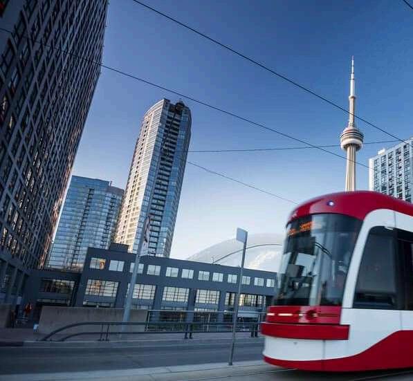
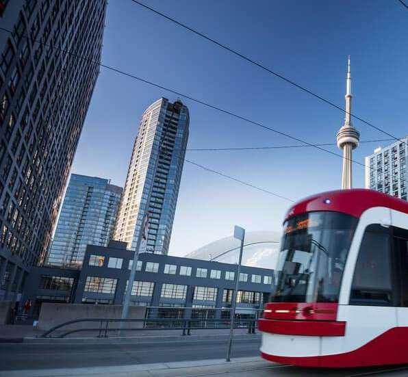
TORONTO TRANSIT
RUFFA AQUINO & ELENA
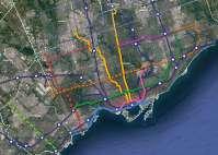
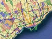
Public transit is fundamental to Toronto’s major population and its vitality The Greater Toronto Area (GTA) operates various transit systems that integrate a multi-model system, interconnecting both regional and local services (City of Toronto, 2023)
LocalTransitServices
TorontoTransitCommission(TTC): PublictransitagencyinTorontothat operatesdifferentmodesof transportation: Busses
BusRapidTransit(BRT)
Streetcar
Subways: Paratransit
RegionalTransitServices
Metrolinx:Aprovincialgovernment agencyresponsibleforthe “coordinationandintegrationofall modesoftransportationintheGreater TorontoandHamiltonArea”(Metrolinx, 2023)
GoTransit
UPExpress

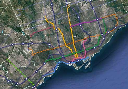
Both regional and local transit agencies are collaborating in building transit services and expanding existing lines Several transit expansions have been approved and are under construction Some are still in the planning phases These future transit developments will increase and elevate the rapid transit network as well as expand mobility options in Toronto (City of Toronto, 2023)
Procurement & Construction
- Line 5: Eglinton Crosstown LRT
- Line 6: Finch West LRT
- Scarborough Subway Extension
- Ontario Line
- Eglinton Crosstown West of Extension
- Hurontario LRT
Preliminary Design & Engineering
- Eglinton East LRT
- Waterfront Transit: East Station & West Station
- Yonge North Subway Extension
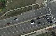
Even with the numerous options for transit in GTA, roughly 85% out of 15 million people working and residing within the GTA still depend on their car to get to and from work (Statistic Canada, 2023)
Overall Theme

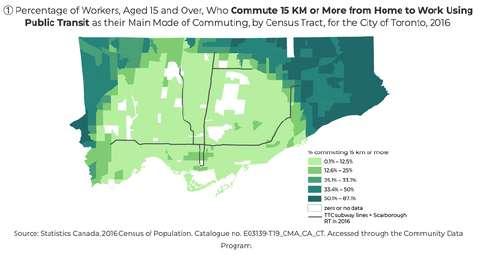
Higher percentages of workers commuting 15 KM and more are located near the northern city boundaries and away from downtown
Large percentages of workers commuting less than 15 km live and work near transit (subway) or downtown Toronto
Overall Theme
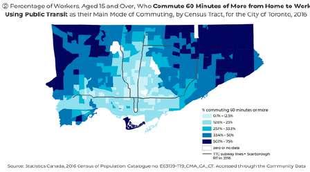
High percentage of workers living in downtown and along transit (subway) routes commutes significantly less than 60 minutes
Higher percentage of workers commuting 60 minutes and more are located near the northern city boundaries including the commute to the Toronto Island Park
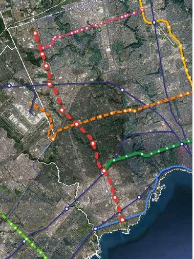
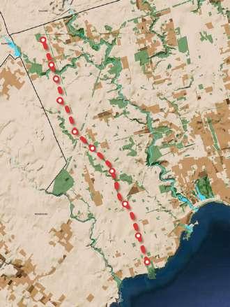
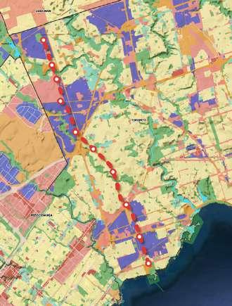
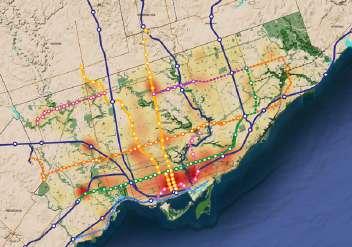
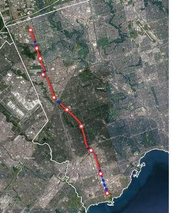
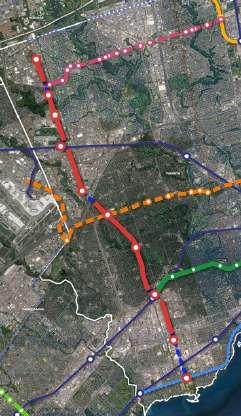
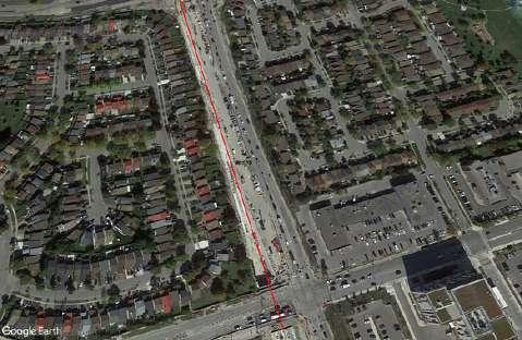
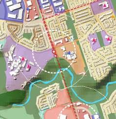
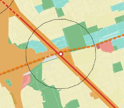
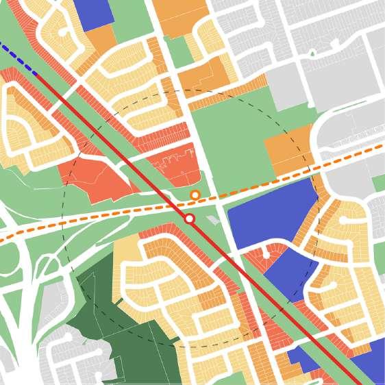
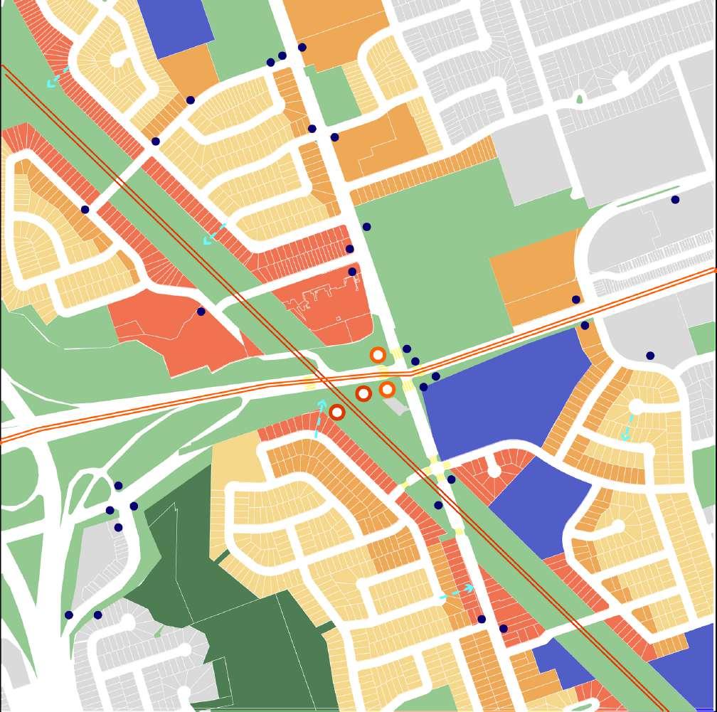
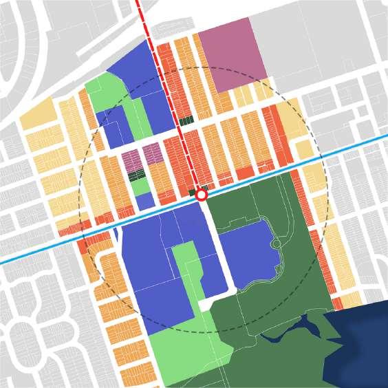
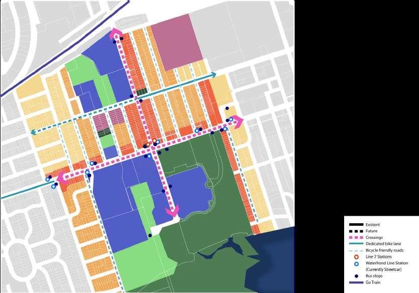
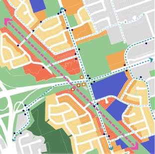
The newly proposed route (LINE 7) is located West of Toronto, closely bordering the city of Mississauga The new route is aligned in a North to South direction (vice-versa), which is integral to the connections of existing and future lines of both regional and local transit networks. The general design was based on the goal of connecting 6 transit lines and encouraging Transit Oriented Development (TOD) near employment areas
Network Connections
Theproposedroutewillbeintersectingwith existingandfuturetransitnetworksthat supports aconnectionbetween6transit linesandshareorbridge5transitstation
Transit Connection With
Existing: GO Transit UP Express LRT (Line 2)
Future: LRT Line 5 Line 6
Water Front Transit
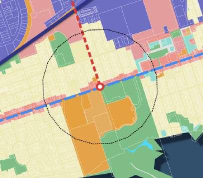
Bridge/Share Station With GO Transit
Etobicoke North Station
Kipling Station
LRT
Humber College Station (Line 6)
Martin Grove Station (Line 5)
Kipling Station
New Toronto Station
The proposed transit route (LINE 7) will provide transit on the West end of Toronto that travels from North to South (vice-versa) Various transit connections that travel from North to South (vice-versa) , moving towards downtown, are located on Central or East of Toronto Therefore, providing a West corridor that travels from North to South towards downtown with various connection to transit networks travelling West to East would be integral for those travelling 15 km and more (located north) and those commuting more than 60 minutes to and from work
The proposed route will not detour and stop at the airport due to the three existing transit connection that directly travel to the Toronto Pearson International Airport. However, Line 7 will share stops with transit networks that have direct routes to the Toronto Pearson International Airport Essentially, the new route’s main objective is to have a direct line travelling North to South (vice-versa)
Evidence shows that travelling from North to South by transit along the proposed route is extensive It takes 60 minutes and more to transit as well as needing to transfer buses in between Driving takes less time to travel south using major highways, however the roads could get congested which increases waiting and travel time Therefore, implementing Line 7 would decrease travel time and transfer, providing direct route for those travelling North to West (vice-versa)

The 2021 population of the Greater Toronto and Hamilton Area (GTHA) is 7,281,694, or 197% of Canada's population. Between 2016 and 2021, the GTHA's population increased by 4.7% or by 327,261 persons. (Statisque Canada, 2021).
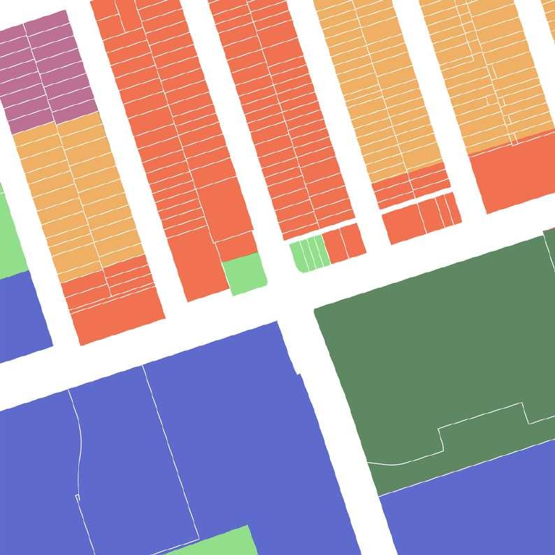
While the population density along the proposed route may not be as high, and the population growth can be less significant than in other areas of the GTHA, this is primarily due to the prevailing industrial and commercial employment, along with zoning regulations favoring single residential units This not only underscores the significance of the West Area of Toronto and East Mississauga as a Core Employment Area and its crucial role in daily commutes but also highlights the potential for densification. The concentration of industrial and commercial activities suggests a dynamic economic hub, and the existing zoning for single residential units presents an opportunity for thoughtful urban planning to promote sustainable growth and enhance the overall livability of the region Therefore, the proposed route not only addresses current transportation needs but also opens avenues for future development and urban optimization.
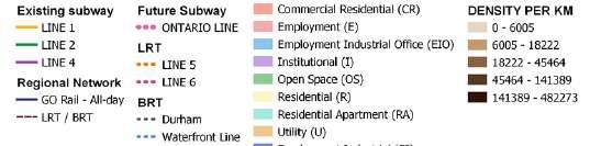
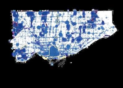
The Employment Areas are vital to Toronto’s future economy These are designated zones that “provide locations for diverse employment options” and “help achieve balance in the growth of population and employment” (City of Toronto, 2023) These includes Commercial, Manufacturing and Industrial Zones.
West of Toronto and East of Mississauga caters zoning to various Industrial and Commercial zones that are within the area of Line 7 The Industrial and Commercial zones in the area would all have connections with each other with the implementation of Line 7, providing residential/workers the necessary transit stops within these zones

There is a large population concentration around these Industrial and Commercial zones, justifying the use of the new route. Line 7 will serve the residents and workers within these Employments Area’s to cater to potential growth for future developments and increase ridership for transit use
The services align with the existing transit net predominantly in downtown and at line intersections The proposed route aims to ope new prospects for commercial activities and services, filling the gap in the western part of Toronto Improved accessibility may encourage the establishment of new shops, restaurants, or community services, contributing to a vibrant and dynamic environment.
There were many factors that led to utilizing Light Rail Transit for Line 7 One of the primary factors that shaped this line was integration and connectivity with the other East-West lines in Western Toronto All of the other lines currently under construction are either Light Rail or Light Metro (Ontario Line), so employing LRT for Line 7 made sense in terms of efficiently integrating our line with the other lines It also keeps things consistent with the future plans of the city
We could have also utilized heavy rail, but LRT just seemed more logical as there were few benefits to justify the significant increase in cost An LRT is also able to operate at a high capacity, which is critical for moving people North and South through Western Toronto and connecting these existing and future lines together LRT’s also enable us to integrate our line better with the public realm and works to activate streets and different spaces Using LRT also doesn’t limit us as much in terms of the mobility of the vehicles, as they are able to make tighter turns and change grades much more easily, which is important for transitioning between surface level and underground to properly integrate with already planned and existing transit lines, infrastructure, and various other obstacles.
The planned operations & maintenance garage for Line 7 is just North of Clairville Station, on a large empty lot by the intersection of Highway 27 and Steeles Ave W This location, however, won’t be constructed until phase 2 of construction as it is too far north of phase 1 to connect to
Until phase 2, Line 7 will share an operations & maintenance garage with Line 6, which is located on a lot on the north side of Finch Avenue West between York Gate Boulevard and Norfinch Drive
Given the 19-kilometer length of the route, implementing the project in phases becomes imperative to address the diverse needs and complexities of the infrastructure
The priority assigned to Phase 1 lies in its pivotal role as a connection between two major employment areas and its ability to establish four vital connections with existing transit networks, including two GO Rail lines, Subway Line 2, and LRT Line 6
Phase 2 arises from the critical need to connect the northwest area of Toronto, which currently lacks adequate transportation infrastructure with only one GO Rail line and the planned Finch West Line This phase will play a key role in diversifying transit patterns in the region, thereby improving
Accessibility and the planned Ontario Line This phase will play a key role in diversifying transit patterns in the region, thereby improving accessibility and mobility for residents and workers in the specified area
The decision to designate Phase 3 as the project's final stage is based on its technical complexity, primarily involving underground construction. However, its significance should not be underestimated due to its essential connection to the GO Rail line from Hamilton and the future Waterfront Line, elements that will contribute significantly to the expansion and overall efficiency of the transportation system.
In terms of future expansion, extending the line further north into Vaughan city, aligning with existing commercial and employment areas, seems both feasible and strategic This extension would necessitate effective collaboration between the two municipalities but, in the long run, would significantly strengthen our transportation network
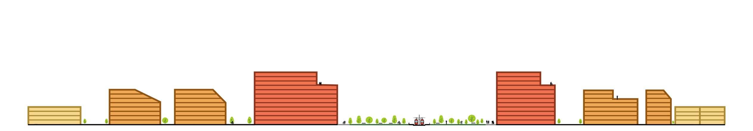
Phasing and future growth Intersections
On the other hand, the line's accessibility could be enhanced by incorporating additional stops through active community engagement and data analysis While the initial proposal with 10 stops ensures speedy service, introducing more stops through these methods would notably improve the overall reliability of the service, ensuring better coverage and addressing the specific needs of users along the route This approach not only optimizes the system's efficiency but also promotes inclusivity and adaptability to the changing demands of the community.
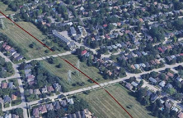
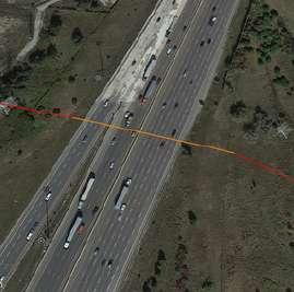
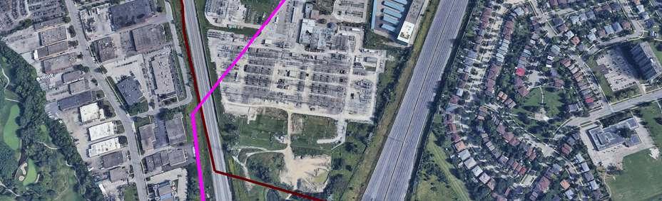
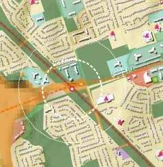
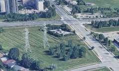
About 55km of Line 7 goes through a utility corridor called the Etobicoke Spine This corridor currently contains a series of high-voltage electricity transmission lines going along the entire corridor There are a lot of barriers that prevent an LRT line going along at street level through this corridor with these transmission lines also being there There are many regulations for both access for maintenance and the proximity to which you can build near these transmission lines, which is why they have such a wide corridor set aside for just these towers
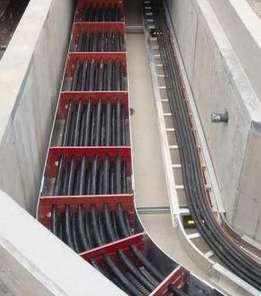
Furthermore, both the utilities for an LRT line and these transmission towers/lines emit a field, and if they are too close, they could interfere with each other So there were two options for this corridor: either move the transmission towers elsewhere, or build the LRT underground through the corridor While we could move the towers to follow along Highway 427 to the West of the corridor, it wouldn’t be logical as there are transmission stations for these lines at both ends of the corridor. So the verdict ended up being to employ newer technology and move the transmission lines underground through the corridor, and build Line 7 at surface level along the corridor This also frees up a great amount of space along the corridor for activation of this area
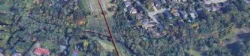
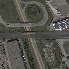
Line 7 intersects with both Humber River (right between Humber College Station and Fantasy Fair Station) We are taking the logical approach to these two obstacles and building bridges to cross over them
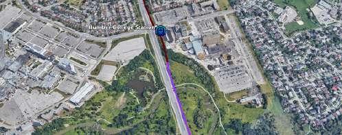
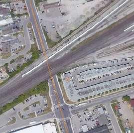
There’s a stretch on Highway 27 between Finch Ave W and Humber College Blvd where the tracks for the Line 6 LRT is below the street level in an uncovered trench. For this section of our line, we will cover up the trench and have our tracks on top of the Line 6 tracks leading to Humber College Station
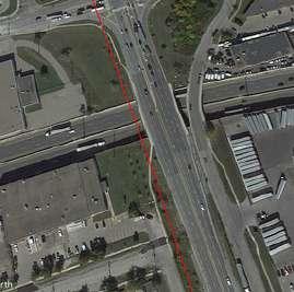
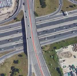
Line 7 intersects with many roads For major roads such as Highway 409 and the Gardiner Expressway, the tracks will follow the road it goes along and will go above, extending the pre-existing bridges for vehicles For Highway 401, we will be taking advantage of the areas valley-like topography, which leaves Highway 401 on somewhat of a mound We will take advantage of this factor by creating a tunnel underneath the highway, which will pretty much put us at surface level on each side of Highway 401
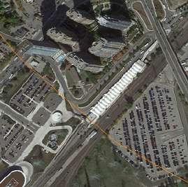
This line also intersects with 3 GO Train lines (Kitchener, Milton, and Lakeshore West) and 1 station (Kipling) To overcome these obstacles, our line will pass underneath these tracks and Kipling Station via underground segments of track
Our line crosses 3 pipelines, two owned by Trans-Northern Pipelines Inc, and one owned by Enbridge Pipelines (no further info found). The Trans-Northern Pipelines are 71 and 60 years old, so with the timeline for our project, these pipelines will be replaced during the time of construction for the line, as the lifespan for pipelines are generally 50-70 years, at which point they are replaced with new lines We will cooperate with the companies who own and operate these pipelines to modify the pipelines when they are rebuilt to ensure they don’t interfere with the LRT line
ExtendsLRTconnectionstothe northernedgeofToronto,truly providingacompleteNorthSouthconnection
Oneofthemostdisconnected high-employmentareasin
Toronto
Allowsimmediatetransit connectivitywithnorthern expansionofthecity,which allowsfortheopportunityto encouragehigher-density developmentsandworkto containurbansprawl 12schoolswithin2kmtotheEast ofthisstation
Connectstoalargemallwithan amusementpark,whichhas roughly230,000m2ofparking surroundingit,alongwitharetail districtEastofthemall
Oneofthemostdisconnected high-employmentareasin
Toronto
Severalhigh-densityresidential buildingstotheWestofthemall, oneofwhichisco-operative housing
Lotsofundevelopedlandaround thestation
Oneofthemostdisconnected high-employmentareasin
Toronto
Surroundingcommercialareais acoreemploymentarea,which hasoneofthehighest employmentconcentrationsin Toronto Severalnearbyhotels
Denseofficebuildingstothe North
Severalbuslinesbythestation Connectionto4schools, recreationfacilities,andthelarge parkspacealongMimicoCreek Manyhigh-densityresidential buildingsabout15kmtothe Westofthestation,3ofwhich aresocialhousingdevelopments Alsoservesanareawithahigh concentrationofsingle-detached homes
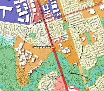
Humber College Station
ConnectsdirectlytotheNorth HumberCollegecampusonthe WestandtheEtobicokeHospital ontheEastofthestation
High-densityresidential buildingsdirectlytotheWestof HumberCollege(oneofwhichis socialhousing),aswellasthe residencebuildingsoncampus forstudents
Pathwaynetworksthatconnect totheHumberArboretumand theHumberRiver Connectionwiththelaststopof thenewFinchWestLRT(Line6)
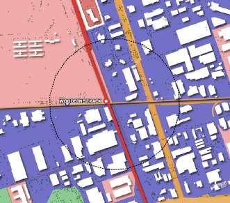
Woodbine Station
MassiveTOD(684acremegadevelopmentthatiscreating 29000homesforover60000 people,aswellas17,000 permanentjobs)
GOStationcurrentlybeingbuilt herethatwillconnecttothe KitchenerLine,aswellastheUP Expresswhichprovidesexpress transportationbetweenUnion StationandPearson InternationalAirport(about8 minutestoPearsonandabout15 minutestoUnionStation)
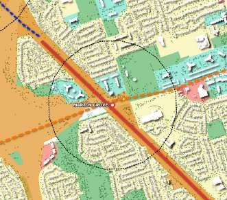
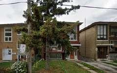
Martin Grove Station
Lotsofundevelopedlandinthe area
Connectionto4schools, numeroushigh-density residentialdevelopments(2of whicharesocialhousing developments),aswellassenior residences
ConnectswithMartinGrove StationoftheEglinton CrosstownLRT(Line5) Severalunderutilizedlotsaround thestation
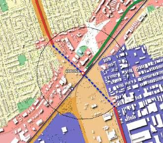
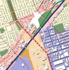
Kipling Station
ConnectstoKiplingstationof boththeMiltonGOLineandthe Bloor-DanforthLine(Line2) Areaaroundthestationfalls undertheEtobicokeCentre SecondaryPlan,whichhasmore detailedlocaldevelopment policiestoguidegrowthand change,makingitasignificant siteforTOD
Thisareaiscomprisedofhighdensitymixed-use developments,with6affordable housingdevelopmentsand3 subsidizedhousing developments
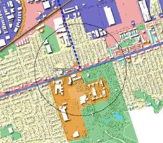
New Toronto Station
Largecommercialarea,withlowdensityresidentialdirectlytothe West
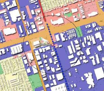
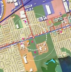
Severalhigh-densityresidential developmentstotheNorthofthe station oneofwhichbeingan affordablehousingdevelopment Evans Ave Station
ConnectstotheWaterfrontLRT andLakefrontStreetcarsystem Manyhigh-densityresidential developmentsinthearea, including11subsidizedhousing developmentsandanaffordable housingcomplex whichisthe largestconcentrationof subsidizedhousinginToronto outsideofthedowntowncore Therearemanylargevacantlots inthisarea ConnectstotheLakeshore
HumberCollegeCampusaswell asathleticfacilities
Numerous opportunities exist for creating transit-oriented developments, particularly at stops that intersect with other lines This setup allows for convenient multi-directional transportation access in a centralized location, making the most of existing commercial hubs, parks, and employment areas to enhance overall urban density.
Kippling Station New Toronto Station Humber College Station Martin Grove Station
ConnectionwithexistingLINE2 (transfershipstoEast)andGO Rail(transfershipsfrom MissisaugatoDowntown) EtobicokeCenterandMain employmentareas

ConnectionwithLRTWaterfront (ableconnectiontodowtownand GoRailtoHamilton) Mainlysinglefamilyareas Varietyofschoolslocations
ConnectionwithLINE6 (transfershipstoNorth-East) HumbercollegeandEtobicoke Riverfront Mainlysinglefamilyareas
ConnectionwithLINE5 (transfershipstotheCenter East ofToronto) Highdensityapartments Varietyofschoolslocations
19 km with 10 stops = approximately 7 billion for the track Underground/Surface Station = 7.4 Km to each station
Underground Stations
Humber College station
Woodbine Track Station
Evans Ave
New Toronto Station Kipling Station
Surface Stations
Clairville station Fantasy Fair Station
South Industrial Station
Martin Grove station Rathburn Station
The Surface Stations Clairville, Fantasy Fair. South industrial, Martin Grove, and Rathburn Station would each cost $80 - $90 million per kilometer each 2
The Underground stations Humber college, Woodbine Station, Evans Avenue, New Toronto Station, and Kipling would cost $130 to $230 million dollars per kilometer each
7 Connections to the existing and future network
Transit for the core employment areas
North to South public transit connection for the west area of City of Toronto
Using existing spaces by sharing stations with other modes (ei GO train)
Using existing utility corridors that are currently placed within our line of transit
100 meter buffer (ei green space) beside single family residential areas
Various bus routes that would intersect with our proposed transit stops
Hits major hot spots (nodes) that are dense, affordable, commercial and industrial spaces
Frequency and speed for utilizing an LRT
Encourage the densification and mixed use of the area for future redevelopment
Create a lineal park in the existing utility corridor
Diversify the routes to other directions rather than downtown
Connect people to the river and natural areas in the west
Encourage people from the West area of Toronto to use public transit
Current residential areas are low density, (could be improve for later developments)
Area along proposed transit route is heavily car-oriented, thus there is little focus on pedestrian friendly infrastructures (ei sidewalks that would connect to our station)
People living in the residential areas can be against having an LRT Line near to their houses (NIMBY’s mentality)
Utility corridor is currently used for electrical infrastructure
GovernmentofCanada,StatisticsCanada (2023,November2) Data https://www150statcangcca/n1/en/type/data?MM=1
Metrolinx-opendata (nd) https://wwwmetrolinxcom/en/about-us/open-data
GOTransit-AboutGO (nd) https://wwwgotransitcom/en/about-go
NewHomes (2018,February22) AmapofnewhomedevelopmentsintheGreaterTorontoArea https://newhomeslivingrealtycom/new-homes-map-search/ Toronto,C O (2023,March13) Opendata CtyofToronto https//wwwtorontoca/city-government/data-research-maps/open-data/ Toronto C O (2022 October3) Publictransit nToronto CtyofToronto https//wwwtorontoca/services-payments/streets-parking-transportation/transit-in-toronto/ Toronto C O (2023 September22) Transitexpansion CityofToronto https://wwwtorontoca/services-payments/streets-parking-transportaton/transit-in-toronto/transt-expansion/
KeyinformationabouttheTTC (nd) https://wwwttcca/about-the-ttc/Key-Informaton-About-the-TTC
WoodbineracetrackDevelopment|UrbanToronto (nd) https://urbantorontoca/database/proects/woodbne-racetrack-development26544 Distance-basedtransitfaresdon’tmeasureup:Apictureofinequityinfvemaps (nd) SocialPlanningToronto https//wwwsocialplanningtorontoorg/distance based transit fares
Metrolinx (nd) FinchWestLightRailTransit Retrievedfromhttps://wwwmetrolinxcom/en/projectsandprograms/transitexpansionprojects/finch westaspx
SWAGroup (nd) WoodbineMasterPlan Retrevedfromhttps://wwwswagroupcom/projects/woodbine-master-plan/
WoodbineCommunityPlan (nd) Home Retrevedfromhttps://woodbinecommunityplancom/
Metrolinx (nd) EglintonCrosstownLightRailTransit Retrievedfromhttps://wwwmetrolinxcom/en/projects-and-programs/eglnton-crosstown-lrt WoodbineEntertainmentGroup (nd) TransitEnvironmentalAssessment Retrievedfromhttps://woodbnecom/transit-ea/ GOTransit (nd) SystemMap Retrievedfromhttps://wwwgotransitcom/en/system-map
LnkedIn (nd) UnearthngFutureMarvels:UndergroundCableTransmssion Retrievedfromhttps//wwwlinkedncom/pulse/unearthng-future-marvels-underground-cable-transmisson-boldbg
CityofToronto (nd) SubsidzedHousingListings Retrievedfromhttps://wwwtorontoca/communty-people/employment-social-support/housing-support/rent-geared-to-ncome-subsidy/subsdizedhousing-listings/#locaton=&lat=43683988&lng=-79578188
CityofToronto (nd) AffordableRentalHousngMap Retrievedfromhttps//wwwtorontoca/city-government/data-research-maps/toronto-housing-data-hub/affordable-rental-housingmap/#location=&lat=43691674&lng=-79582291
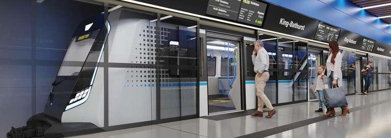
MarrottInternational Inc (2015 May) UPExpressHotelFAQ Retrievedfromhttps//wwwmarriottcom/marriottassets/marriott/YYZOT/PDF/UPExpress HotelFAQ May 2015pdf CanadianConsultngEngineer (nd) NGEEntersCanadawithOntarioLineRailProject Retrevedfromhttps://wwwcanadianconsultngengineercom/buildings/nge-enters-canada-wth-ontario-line-railproject/1003415996/attachment/kngbathurst/
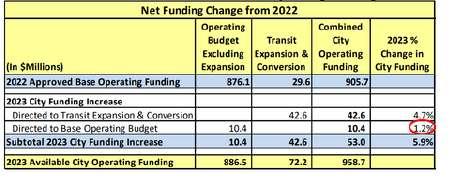
TorontoTransitCommisson (2023) TTCConventionalandWheel-TransOperatingBudgets Retrevedfromhttps://wwwttcca/-/media/Project/TTC/DevProto/Documents/Home/PublicMeetings/Board/2023/January-9/1 2023 TTC Conventonal and Wheel Trans Operating Budgetspdf?rev 1d65ed1418374527b7479584a9a06445&hash FB374C8ACB097C89E89B3409A45154B6
CityofToronto (2023) CityofToronto2023BudgetBackgroundFile Retrevedfromhttps://wwwtorontoca/legdocs/mms/2023/bu/bgrd/backgroundfile-231097pdf
Daxack (nd) LRTvsHRT-CostComparison Retrievedfromhttps//lrtdaxackca/LRTvsHRT/CostComparehtml
NowToronto (nd) LRTsbetterthansubwaysbymles Retrievedfromhttps://nowtorontocom/news/lrts-better-than-subways-by-miles/ CityofToronto (2023) 2023CityofTorontoBudgetSummary Retrievedfromhttps//wwwtorontoca/wp-content/uploads/2023/05/95f8-2023-City-of-Toronto-Budget-Summarypdf
UBST 461
City Building Business Case
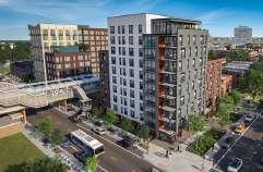
Situated in Toronto, LRT 7 is designed not only to link and offer alternative public transportation options for three key employment areas but also to establish a vital north-south axis on the city's western side, connecting with seven different transit lines
The potential for Transit-Oriented Development (TOD) has already been recognized at four of its shared stations with other lines due to their significant connectivity, enabling a larger population surrounding these stations to benefit from an affordable and sustainable transport alternative. This, in turn, is anticipated to boost ridership, curtail urban sprawl, and encourage vertical growth.
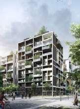
Martin Grove Station and New Toronto Station stand out as unique and distinctive cases, each possessing characteristics that, through changes in land use and urban design, could transform them into vibrant economic and livable hubs These hubs have the potential to decentralize and contribute to a more equitable metropolitan landscape
Martin Grove Station shares a station with Line 5 LRT, creating a dynamic movement pattern towards the north, south, and east of the city, including connections to the airport in the west Its strategic location, coupled with this connection, the 100-meter-wide utility corridor capable of transforming into a linear park, and its proximity to various educational institutions, positions it as a significant development opportunity.
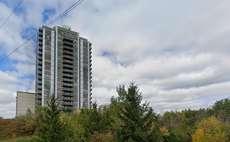
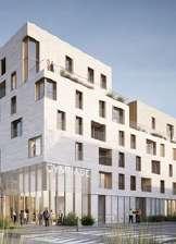
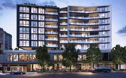
New Toronto Station shares a connection with the recently approved Waterfront LRT Line and the GoTrain from Hamilton, both directed towards Downtown It is in close proximity to natural parks and Lake Ontario, with a layout featuring short and grid-like blocks that facilitate easy access to the station These characteristics make it conducive to even more substantial vertical growth compared to Martin Grove
Land uses play a critical role in urban planning, influencing the physical and social dynamics of entire communities. The current land use at both New Toronto Station and Martin Grove Station varies based on factors such as location, economic development, and policy, reflecting the evolving needs and values of the community
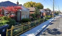
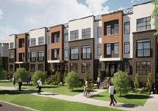
The communities surrounding Martin Grove Station were historically defined by a prevalence of Single Dwelling Units However, the recent approval of Line 5 LRT has ushered in a shift towards apartment-style residences, marked by higher densities and increased building heights Despite this transformation, low densities persist, along with the presence of utilities, institutions and open spaces such as the corridor, nearby schools and parks
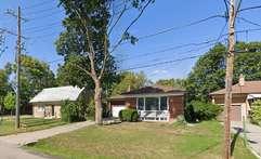
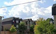
The neighbourhood features a variety of home types, predominantly consisting of older residences constructed from 1960's and onward (HoodQ, 2023). However, we can observe the shift to higher densities near to the Line LRT 5
Single
In South Etobicoke, these neighborhoods border a core employment area connected by the line 7 The northern part features industrial and commercial zones with Go Train lines. Closer to the waterfront, there's a shift to single dwelling units and the presence of Humber College. The Waterfront Line, presently a Streetcar line (future LRT), shows its influence in a commercial corridor intersecting with Line 7
The neighbourhood features a variety of home types, predominantly consisting of older residences constructed early 1900's that have been renovated since (HoodQ, 2023)
Single -detached house
Low-rise apartment/condo
High-rise apartment/condo Semi- detached house
house Duplex
Part of the strategies aimed at promoting and regulating Transit-Oriented Development involves establishing diverse densities, heights, and parking restrictions within a radius of 600 to 800 meters from the stations. These distances are approximate and reflect the range citizens are willing to travel to access transportation The objective is to capitalize on locations nearest to the stations with a higher concentration of residents and commercial activity, while concurrently preserving human scale and sunlight through medium and low densities in surrounding areas.
Although the prescribed distance* was determined with references to other cities like Vancouver, Calgary, and Sydney, it serves as a guide. The location of density types depends not only on their proximity to the stations but also on the potential to create corridors of high activity towards transportation, schools, or existing parks, as well as the grid's capacity to access vehicular services such as ambulances, garbage trucks, or police Land use regulations prioritize mixed-use, making it mandatory for highdensity areas and flexible for multi-residential developments. The latter have the option to incorporate businesses with active fronts, gaining advantages in terms of reduced lot and building setbacks to incentivize such integration
Height and Floor Area Ratio are set higher for New Toronto Station due to its proximity to Downtown, Lake Ontario, and its short, grid-like pattern. In contrast, the Martin Grove communities exhibit a more suburban pattern Lastly, parking minimums have been eliminated, and parking maximums implemented to encourage increased use of public transportation and optimize land use for additional housing and commerce in privileged areas of the city
This table serves as a guide and standardization for both TODs; nevertheless, its implementation will be contingent upon the existing characteristics, potential, and future specific needs of each site.
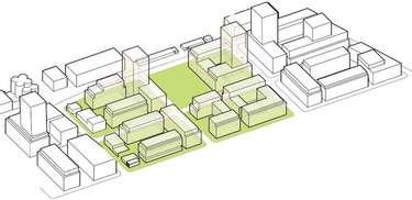
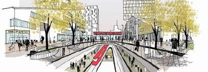
By utilizing the utility corridor, the existing power lines will be relocated underground, while the Light Rail Transit (LRT) system will be positioned at street level This dual approach aims to minimize excavation costs and enhance the overall safety of the area Simultaneously, it creates an opportunity to establish a linear park that seamlessly connects the community with nature, fosters commercial activities, and promotes active transportation.
In line with this vision, higher population densities will be concentrated around the linear park, forming a dynamic corridor of commercial and residential activity Taking advantage of the suburban block design, medium-density developments are strategically placed along existing streets, facilitating the creation of accessible and pleasant pathways to both transit stations, the park, and the school
Finally, lower population densities are designated at the extremities, where the streets lack the capacity or appropriate layout to accommodate increased foot and services traffic (See Figure 17). This approach, however, also ensures the preservation of natural sunlight The careful orientation of structures allows for optimal exposure to morning and evening sunlight, and maintaining a human-scale ambiance in the neighborhood
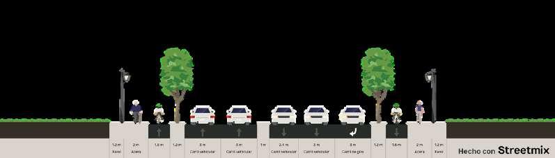
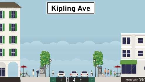
The access to the stations is facilitated through dedicated bicycle lanes on the broader and more heavily trafficked avenues, complemented by pedestrian crosswalks, curved extensions, traffic lights, and bollards that ensure a safe and intuitive crossing towards the stations along Eglinton Avenue (See Figure 19) To achieve this, proposed are new cross-sectional designs; however, both streets boast green spaces on their flanks, allowing for flexibility in urban design (Fig 20-21)
To reduce the distance to the stations, we are challenging block designs that prioritize automobiles, introducing rights of way on strategically chosen lots to facilitate the movement of pedestrians and cyclists. These will be regulated through new development permits, and compliance may result in an increased Floor Area Ratio (FAR).
The expansive dimensions of the corridor mitigate noise impact on neighboring structures Nevertheless, we plan to strategically place vegetation and urban art as a form of insulation, as constructing walls around the lines is impractical and could foster an atmosphere of division and insecurity Recognizing the need to ensure the safety of pedestrians and cyclists along the corridor, the LRT speed will be reduced, and various controlled crossings will be implemented around the park (Fig 19 and 24)
Ultimately, these interventions aim to foster a shared experience among nature, public transportation, commercial activity, safety, and the community.
In essence, the growth areas are situated where effective transit capacity can be ensured, particularly along frequent bus, streetcar and LRT routes and at transit stations of higher importance (City of Toronto, 2023) Therefore, a rezoning of land use designed for mixed-use with employment areas could accentuate residential development and prioritize job intensification, driving growth and transformation in the neighbourhood (City of Toronto, 2023)
Preserving the current land use, including schools, parks, and recreational spaces, is crucial for maintaining the fundamental amenities that contribute significantly to the distinctive characteristics of the community
Nevertheless, the neighbourhood's transformation through rezoning aims to convert various level of density of mixed-use zones This involves integrating commercial activities and introducing a variety of multi-residential spaces at high to medium to small scales, with the objective of providing a balance between home-ownership, rental, affordable and student housing This strategic adjustment is intended to cater to the expected increase in both population and job opportunities along the transit line
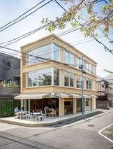
pment of new constructions in New Toronto, the emphasis is on projects that afety of the area. Criteria include designs with engaging features such as active windows, and balconies that foster community connectivity with the Additionally, these projects should demonstrate the ability to meet shade uirements and incorporate well-planned landscape areas, ensuring a lend of aesthetics, safety, and environmental considerations.
The rezoning of mixed-use residential areas seeks to create a seamless integration of highquality commercial, residential, and open space uses This strategy aims to reduce dependence on automobiles while addressing the distinct needs of the neighbourhood. Additionally, it intends to enhance the pedestrian capacity on the streets, fostering increased commercial and service activity at ground level
Furthermore, the area will strategically position and concentrate new constructions to facilitate a smooth transition between zones of varying development intensity, scale and height This is done by determining setbacks and gradually reducing heights, especially towards neighbourhoods with lower scales (City of Toronto, 2023)
The existing urban design of the area follows a grid-like pattern in blocks The grid network will be utilized to accomplish the development of diverse building designs that align with the urban layout of the neighbourhood
The constructions along the mixed-use residential corridor will adhere to the following regulations to align with the urban layout (City of Toronto, 2023):
Adherence to maximum density and height limits
Suitable massing, scale, and organization of the buildings
Adequate transitions of varying buildings to adjacent areas
Limitations on parking
Currently, the New Toronto neighbourhood encompasses various areas designated for parks and outdoor spaces, attributed to the presence of schools and recreational facilities. However, to enhance the surroundings of mixed-use residential developments, a plaza beside the transit access underground stations and commercial only spaces will be designed This plaza aims to complement and expand the role of public streets, parks, and open spaces as a central hubs for pedestrian activity (City of Toronto, 2023)
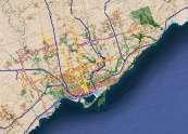
TransitStationAccess/Entrance
Line7(ProposedRoute)
LRTWaterfront (FutureTransitDevelopment)

Sidewalks and plazas will be designed to create safe, appealing, engaging, and comfortable environments for pedestrians by implementing well-designed features such as street furniture, amenity spaces, accessibility infrastructure/design, pedestrian-scale lighting, and decorative paving. Leveraging the grid network, the sidewalks will offer direct and uninterrupted pathways, featuring a suitable width to accommodate the heightened capacity of pedestrian traffic
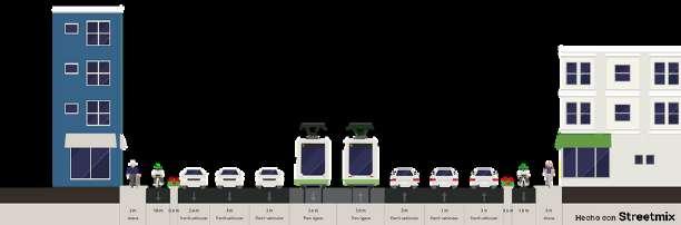
The New Toronto's transit stop is situated underground, emphasizing the significance of having well-connected sidewalks and roads in the vicinity Although there are currently bike-friendly roads, they are fragmented into sections Therefore, for upcoming developments, it is crucial to establish connectivity among these bikefriendly roads and construct continuous bicycle lanes These connections would contribute to a network that ultimately links all public spaces and parks, promoting pedestrian use and diminishing dependence on vehicles
Access to the transit station will be possible from both sides of the street Being the final stop of Line 7, users can use entrances on either street to access the northbound LRT heading towards Clairville Station Given that it is the last stop, the platform is shared, allowing anyone from other entrances to access the LRT as it transitions tracks to travel north
Adequate and affordable priced housing stands as a fundamental necessity for everyone It is imperative that both present and future residents have the means to attain and sustain housing that is adequate, affordable, and suitable to their needs (City of Toronto 2023) Housing expenses in Toronto have risen, and residents' options for housing have progressively narrowed Both rental and home-ownership costs have surged considerably, outpacing the growth of incomes (City of Toronto, 2023) Therefore, it is crucial to utilize the city's housing resources to fulfill a variety of housing needs and objectives
It is essential to build various housing types to balance the distribution of ownership housing and affordable housing This includes the developments of purpose-built rental housing, affordable rental options and low-rise ownership housing that is affordable and suitable for larger household
In collaboration with CreateTO, a real estate agency initiated by the City of Toronto, we aim to deliver services that foster community needs and economic benefits (CreateTO, 2023). To safeguard against the displacement of vulnerable populations, particularly within our Transit-Oriented Development (TOD) sites, we intend to leverage the city's Housing Now initiative through CreateTO This approach aims to address the diverse spectrum of housing needs
We will advocate for the inclusion of our Transit-Oriented Development (TOD) sites in the Housing Now initiative, encouraging city councils to approve these locations This effort is geared towards constructing properties for mixed-use and mixed-income developments (Housing Now, 2022) Through such initiatives, we aim to promote opportunities for private and non-private housing partnerships, facilitating the provision of rental and affordable homes within our TOD sites and offering a variety of new housing options that allow residents to access quality homes in close proximity to transit (City of Toronto, 2023)


Ensuring universal accessibility for individuals with disabilities is at the heart of our approach to both station design and street access We incorporate practical elements such as ramps, tactile paving, audible signals, and escalators (Figure 44-48) Our focus is on creating a public transportation system that is not just compliant but genuinely userfriendly We listen to diverse communities and stay updated on accessibility standards to make transit welcoming and independent for everyone
Responsible CreateTO, Toronto Transit Commision (TTC), Metrolinx
Accountable City of Toronto Government, Toronto Hydro Corporation, Developers
Consulted
Informed
Community Residents of proposed TOD, City Councils, Entire Toronto residents, Engineers, Schools around TOD, Province of Ontario, Ontario Hydro
GTAH residents outside Toronto
Responsible: As part of the project execution team, the Toronto Transit Commission plays a pivotal role as the primary entity overseeing the design and construction of the LRT line, as well as the urban design in its vicinity Metrolinx is also involved, sharing stations and intersections with regional lines such as Go Train CreateTO is tasked with developing the affordable housing strategy to ensure accessible living spaces
Accountable: The City of Toronto government is accountable for permits and approvals, making their involvement crucial Toronto Hydro Corporation's participation is vital to ensuring the safe construction of the line along the utility corridor. Developers will also play a significant role by proposing constructions that adhere to new regulations
Consulted: Community engagement is integral to this project, involving input from neighboring communities and the broader city of Toronto, also with residents expressing their opinions to City councils Key consultations will include engineers to assess excavations and nearby schools along the line and stations
Informed: Given the substantial impact of the line not only on the city of Toronto but also on the Greater Toronto and Hamilton Area (GTAH), residents from all municipalities will be kept informed throughout the process, including opportunities for growth and development in the area
Through this holistic approach to transportation, integrating considerations of land use, densities, heights, affordability, and urban design, we can not only establish efficient connections but also reshape the urban identity of Toronto towards one that is more equitable and sustainable
By adhering to the aforementioned recommendations, we can effectively tackle the project's challenges and weaknesses, such as low-density areas and exclusive car infrastructure In doing so, we unlock numerous advantages and opportunities, including seven connections to other lines, the establishment of a new northsouth axis in the western part of the city, and improved transportation access for three core employment areas
This approach not only addresses immediate concerns like urban sprawl, the housing crisis, and traffic congestion but also marks the initial step in a broader transformation, promising substantial and lasting benefits for the city.
Strengths
7Connectionstotheexistingandfuturenetwork
Transitforthecoreemploymentareas
NorthtoSouthpublictransitconnectionforthewestareaofCityofToronto
Usingexistingspacesbysharingstationswithothermodes(eiGOtrain)
Usingexistingutilitycorridorsthatarecurrentlyplacedwithinourlineof transit
100meterbuffer(eigreenspace)besidesinglefamilyresidentialareas
Various busroutesthatwouldintersectwithourproposedtransitstops Hitsmajorhotspots (nodes)thataredense,affordable,commercialand industrialspaces
dspeedforutilizinganLRT edensificationandmixeduseoftheareaforfuture t parkintheexistingutilitycorridor outestootherdirectionsratherthandowntown etotheriverandnaturalareasinthewest oplefromtheWestareaofTorontotousepublictransit
Currentresidentialareasarelow density,(couldbeimproveforlater developments)
Areaalongproposedtransitrouteis heavilycar-oriented,thusthereis littlefocusonpedestrianfriendly infrastructures(eisidewalksthat wouldconnecttoourstation)
Peoplelivingintheresidentialareas canbeagainst havinganLRTLine neartotheirhouses(NIMBY’s mentality)
Utilitycorridoriscurrentlyusedfor electricalinfrastructure
City of Toronto (2023) Toronto Official Plan Retrieved December 12, 2023, from https://www toronto ca/city-government/planning-development/official-plan-guidelines/official-plan/chapters1-5/
CreateTO (2022, December 20) Retrieved December 12, 2023, from https://createto ca/about-us/ Greater Cities Comission & NSW (2018) GREATER SYDNEY REGION PLAN A Metropolis of Three Cities – connecting people In Greater Cities Comission Retrieved October 2, 2023, from https://greatercities au/strategic planning/region-plans/metropolis-three-cities HoodQ (2023a) Neighborhood: Willowridge-Martingrove-Richview HoodQ Homebuyer Hub https://hoodq com/explore/toronto-on/willowridge-martingrove-richview HoodQ (2023b) Neighbourhoods: New Toronto HoodQ Homebuyer Hub Retrieved December 12, 2023, from https://www hoodq com/explore/toronto-on/new-toronto Housing Now (2023, June 27) Retrieved December 12, 2023, from https://createto ca/housingnow/ Neighbourhood Guide - Toronto and The GTA (2020, August 26) New Toronto - Neighbourhood guide Neighbourhood Guide https://www neighbourhoodguide com/toronto/etobicoke/new-toronto/ The City of Calgary (2019) Transit-Oriented Development In Calgary City Planning Retrieved December 7, 2023, from https://www calgary ca/planning/transit-oriented-development html Transit-Oriented communities (n d ) TransLink https://www translink ca/plans-and-projects/strategiesplans-and-guidelines/transit-oriented-communities