CaseStudiesinGeospatial Applicationsto GroundwaterResources
Editedby PravatKumarShit
DepartmentofGeography,RajaN.L.KhanWomen’sCollege(Autonomous), Midnapore,WestBengal,India
GouriSankarBhunia
DepartmentofGeography,NaliniPrabhaDevRoyCollege, Bilaspur,Chhattisgarh,India
ParthaPratimAdhikary
ICAR-IndianInstituteofWaterManagement,Bhubaneswar, Odisha,India
Elsevier
Radarweg29,POBox211,1000AEAmsterdam,Netherlands
TheBoulevard,LangfordLane,Kidlington,OxfordOX51GB,UnitedKingdom 50HampshireStreet,5thFloor,Cambridge,MA02139,UnitedStates
Copyright©2023ElsevierInc.Allrightsreserved.
Nopartofthispublicationmaybereproducedortransmittedinanyformorbyanymeans,electronicormechanical, includingphotocopying,recording,oranyinformationstorageandretrievalsystem,withoutpermissioninwriting fromthepublisher.Detailsonhowtoseekpermission,furtherinformationaboutthePublisher’spermissionspolicies andourarrangementswithorganizationssuchastheCopyrightClearanceCenterandtheCopyrightLicensingAgency, canbefoundatourwebsite: www.elsevier.com/permissions.
ThisbookandtheindividualcontributionscontainedinitareprotectedundercopyrightbythePublisher(otherthan asmaybenotedherein).
Notices
Knowledgeandbestpracticeinthisfieldareconstantlychanging.Asnewresearchandexperiencebroadenour understanding,changesinresearchmethods,professionalpractices,ormedicaltreatmentmaybecomenecessary.
Practitionersandresearchersmustalwaysrelyontheirownexperienceandknowledgeinevaluatingandusingany information,methods,compounds,orexperimentsdescribedherein.Inusingsuchinformationormethodsthey shouldbemindfuloftheirownsafetyandthesafetyofothers,includingpartiesforwhomtheyhaveaprofessional responsibility.
Tothefullestextentofthelaw,neitherthePublishernortheauthors,contributors,oreditors,assumeanyliabilityfor anyinjuryand/ordamagetopersonsorpropertyasamatterofproductsliability,negligenceorotherwise,orfromany useoroperationofanymethods,products,instructions,orideascontainedinthematerialherein.
ISBN:978-0-323-99963-2
ForInformationonallElsevierpublicationsvisitourwebsiteat https://www.elsevier.com/books-and-journals
Publisher: CandiceGJanco
AcquisitionsEditor: PeterLlewellyn
EditorialProjectManager: MariaElaineDDesamero
ProductionProjectManager: R.VijayBharath
CoverDesigner: VickyPearsonEsser
TypesetbyAptara,NewDelhi,India
Contributorsxv
1.PrincipleofGIScienceandgeostatisticsingroundwater modeling1
GouriSankarBhuniaandPravatKumarShit
1.1Introduction1
1.2GISandgroundwater2
1.3Remotesensingandgroundwater3
1.4Geostatisticsandgroundwater4
1.5Geocomputationalmodelingandgroundwater5
1.6Geospatialintelligenceandgroundwatermodeling6
1.7WebGISandgroundwaterresource7
1.8Conclusionandfuturedirection8 References8
2.Indicatorkriginganditsusefulnessinassessingspatial suitabilityofgroundwaterfordrinking11
ParthaPratimAdhikary,Ch.JyotipravaDash,BiswaranjanBehera, S.MohantyandPravatKumarShit
2.1Introduction11
2.2Basictheoryofindicatorkriging12
2.3Criticismsofindicatorkriging13
2.4Meritsofindicatorkriging14
2.5Practicalcorrectionstouseindicatorkriging15
2.6Applicationsinwaterscience16
2.7Conclusions23 References24 v
3.GIScienceapplicationforgroundwaterresources managementanddecisionsupport27
GouriSankarBhunia,PravatKumarShitandSoumenBrahma
3.1Introduction27
3.2Hydrosphere–geosphere–anthroposphereinterlinked dynamics29
3.3Spatialandmachinelearningmodelforgroundwater mapping29
3.4Bigdataanalyticsandgroundwatermapping30
3.5Geospatialintelligenceandinformationcommunication technology32
3.6ExpertknowledgeandGIScience33
3.7Dataimbalancesandnewprofessionalism34
3.8Conclusion34
References35
4.Roleofgroundwaterpotentialityandsoilnutrient statusonagriculturalproductivity:Acasestudyin PaschimMedinipurDistrict,WestBengal39 SwatilekhaParihari,NilanjanaDasChatterjee,KousikDas andRajKumarBhattacharya
4.1Introduction39
4.2Studyarea40
4.3Datasourceandmethodology42
4.4Resultanddiscussions49
4.5Conclusion62 Conflictofinterest63 References63
5.Groundwaterpotentialzonesidentificationusing integratedremotesensingandGIS-AHPapproachin semiaridregionofMaharashtra,India67 SumedhR.Warghat,SatishS.KulkarniandSandipanDas
5.1Introduction67
5.2Studyarea68
5.3Methodology69
5.4Results&discussion72
5.5Conclusion86 References87
6.GIS-basedgroundwaterrechargepotentialityanalysis usingfrequencyratioandweightsofevidencemodels91 SurajkumarMallick,BiswajitMaity,PritiranjanDasandSomnathRudra
6.1Introduction91
6.2Studyarea92
6.3Databaseandmethodology93
6.4Resultsanddiscussion99
6.5Conclusion104 Conflictofinterest105 References105
7.Delineationofgroundwaterpotentialzonesinthe hardrockterrainofanextendedpartofChhotanagpur plateauapplyingfrequencyratio(FR)model109 ArijitGhoshandBiswajitBera
7.1Introduction109
7.2Methodsandmaterials110
7.3Frequencyratiomodel115
7.4Resultanddiscussion116
7.5Groundwaterpotentialzone123
7.6ValidationofFRmodel123
7.7Conclusion127 References127
8.Assessmentofgroundwatersalinityriskincoastalbelt ofOdishausingordinarykriginganditsmanagement133 Ch.JyotipravaDash,ParthaPratimAdhikaryandJotirmayeeLenka
8.1Introduction133
8.2Materialandmethod135
8.3Resultsanddiscussion140
8.4Conclusion146 References148
9.IntegratedGIS-basedMCDAapproachforsuitability zoningofirrigationwaterqualityinsemiarid Kansairiverbasin,Puruliadistrict,WestBengal151 AmitBera,PujaChowdhuryandAnanyaChakraborty
9.1Introduction151
9.2Studyarea153
9.3Methodology154
9.4AHPtechnique154
9.5Resultsanddiscussion157
9.6Studyofmajorcationsandanionsinthearea158
9.7Groundwaterqualityforirrigationbasedonthe physicochemicalparameters159
9.8pH160
9.9Totaldissolvedsolids(TDS)160
9.10Totalhardness(TH)160
9.11Salinityhazard160
9.12Sodiumabsorptionratio(SAR)161
9.13Sodiumpercentage(Na%)161
9.14Magnesiumadsorptionratio(MAR)163
9.15Residualsodiumcarbonate(RSC)164
9.16Kelly’sratio(KR)164
9.17Permeabilityindex(PI)164
9.18Groundwaterirrigationsuitabilityzone166 9.19Conclusion167 Acknowledgment167 Competinginterests167 References167
10.Field-basedspatio-temporalmonitoringofhydrograph networkstationstopredictthelong-termbehavioral patternofgroundwaterregimeanditsimplications inIndia:Areview171 AnadiGayen 10.1Introduction171 10.2Methodology174 10.3Discussion180 10.4Conclusions181 Acknowledgments181 References182
11.GroundwaterresourcesinNigeria:Casestudy ofdistributionandqualityatamedium-sizeurban settlement-scale183 AdebayoOluwoleEludoyinandAdewoleAbrahamFajiwe 11.1Introduction183 11.2Researchproblem185 11.3Studyarea186 11.4Materialsandmethods189 11.5Results189 11.6Discussion200 References202
12.AssessinggroundwaterpotentialzoneofOngriver basinusinggeospatialtechnology207
SanjoyGarai,SkMujibarRahaman,MasjudaKhatun, PulakeshDasandSharadTiwari
12.1Introduction207
12.2Studyarea208
12.3Materialsandmethods209
12.4Resultanddiscussion210
12.5Conclusion225 References226
13.Innovativetrendanalysisofgroundwaterresources underchangingclimateinMaldadistrict,India229
TapashMandalKunalChakrabortyandSnehasishSaha
13.1Introduction229
13.2Studyarea231
13.3Databaseandmethodology232
13.4Resultsanddiscussion234
13.5Conclusion245 Acknowledgments245 Conflictofinterest245 References245
14.Assessingvulnerabilityofgroundwaterresourcein urbanandsub-urbanareasofSiliguri,NorthBengal (India):AspecialreferencetoLULCalteration249
MantuDas,BaiduryaBiswasandSnehasishSaha
14.1Introduction249
14.2Briefdescriptionofthestudyarea250
14.3Studymaterialsandmethodology250
14.4Resultsanddiscussion263
14.5Groundtruthvalidationofthegroundwatervulnerability map267
14.6Conclusion269 Acknowledgement270 Conflictoftheinterest270 References270
15.Groundwaterfluctuationandagriculturalinsecurity: AgeospatialanalysisofWestBengalinIndia275 SantuGuchhait,GourDolui,SubhrangsuDasandNirmalyaDas
15.1Introduction275
15.2StudyArea276
15.3Dataandmethods277
15.4Resultsanddiscussion278
15.5Conclusion283 References286
16.Assessmentofgroundwaterqualityforirrigation purposes:AcasestudyofHooghlyDistrict, WestBengal,India289 SadikMahammad,Md.MofizulHoque,AznarulIslam andArijitMajumder
16.1Introduction289 16.2Studyarea290 16.3Datasetsandmethodology292 16.4Resultsanddiscussion296
16.5Conclusion309 References310
17.Geo-spatialassessmentofgroundwaterdroughtrisk duetodroughtpropagationintheUpper DwarakeshwarRiverBasin(UDRB),WestBengal315 UjjalSenapati,DebasishTalukdar,DipankarSahaandTapanKumarDas
17.1Introduction315
17.2Studyarea318
17.3Methodology318
17.4PhysicalGWDrisk321
17.5Meteorologicaldroughtrisk(Mr)321
17.6Parametersusedinmeteorologicaldroughtrisk assessment323
17.7Hydro-geologicalexposure(He)324
17.8Socio-economicGWDvulnerability327 17.9Result329
17.10IntegratedGWDRmap332 17.11Discussion334
17.12Validation334
17.13Conclusion336 Acknowledgement337 Conflictofinterest337 Reference338
18.Assessmentofgroundwaterlevelfluctuationsinand aroundRanchidistrict,Jharkhandusinggeospatial datasetsandmethods341 PranavPratikandPriyankPravinPatel
18.1Introduction341
18.2Thestudyarea342
18.3Objectives343
18.4Datasetsandmethods343
18.5Resultsandfindings345
19.Groundwaterconservationandmanagement: Recenttrendsandfutureprospects371 GouriSankarBhunia,PravatKumarShitandSoumenBrahma 19.1Introduction371
20.Seasonalfluctuationofgroundwatertableandits impactonrurallivelihood:Avillagelevelstudyat coastalbeltofPurbaMedinipurDistrict,India385 SubrataJanaandSriparnaJana 20.1Introduction385
Contributors
ParthaPratimAdhikary
ICAR-IndianInstituteofWaterManagement,Bhubaneswar,Odisha,India
BiswaranjanBehera
ICAR-IndianInstituteofWaterManagement,Bhubaneswar,Odisha,India
BiswajitBera
DepartmentofGeography,Sidho-Kanho-BirshaUniversity,Purulia,India
AmitBera
DepartmentofEarthSciences,IndianInstituteofEngineeringScienceandTechnology, Howrah,WestBengal,India
RajKumarBhattacharya
DepartmentofGeography,VidyasagarUniversity,Midnapore,WestBengal,India
GouriSankarBhunia
DepartmentofGeography,NaliniPrabhaDevRoyCollege,Bilaspur,Chhattisgarh,India
BaiduryaBiswas
DepartmentofGeographyandAppliedGeography,UniversityofNorthBengal,Raja Rammohunpur,Darjeeling,WestBengal,India
SoumenBrahma
DepartmentofGeography,NaliniPrabhaDevRoyCollege,Bilaspur,Chhattisgarh,India
AnanyaChakraborty
DepartmentofEarthSciences,IndianInstituteofEngineeringScienceandTechnology, Howrah,WestBengal,India
KunalChakraborty
DepartmentofGeographyandAppliedGeography,UniversityofNorthBengal,Darjeeling, India
PujaChowdhury
DepartmentofEarthSciences,IndianInstituteofEngineeringScienceandTechnology, Howrah,WestBengal,India
KousikDas
DepartmentofGeography,VidyasagarUniversity,Midnapore,WestBengal,India
MantuDas
DepartmentofGeographyandAppliedGeography,UniversityofNorthBengal,Raja Rammohunpur,Darjeeling,WestBengal,India
SandipanDas
SymbiosisInstituteofGeoinformatics(SIG),SymbiosisInternational(DeemedUniversity), Pune,India
PritiranjanDas
DepartmentofGeography,VidyasagarUniversity,Midnapore,WestBengal,India
PulakeshDas
WorldResourcesInstituteIndia,NewDelhi,India
SubhrangsuDas
DepartmentofGeography,UtkalUniversity,Odisha,India
NirmalyaDas
DepartmentofGeography,PanskuraBanamaliCollege(Autonomous),Panskura,WestBengal, India
TapanKumarDas
DepartmentofGeography,CoochBeharCollege,CoochBehar,WestBengal,India
NilanjanaDasChatterjee
DepartmentofGeography,VidyasagarUniversity,Midnapore,WestBengal,India
Ch.JyotipravaDash
ICAR-IndianInstituteofSoilandWaterConservation,ResearchCentre,Koraput,Odisha,India
GourDolui
DepartmentofGeography,PanskuraBanamaliCollege(Autonomous),Panskura,WestBengal, India
AdebayoOluwoleEludoyin
DepartmentofGeography,ObafemiAwolowoUniversity,Ile-Ife,Nigeria
AdewoleAbrahamFajiwe
DepartmentofGeography,ObafemiAwolowoUniversity,Ile-Ife,Nigeria
SanjoyGarai
InstituteofForestProductivity,Lalgutwa,Ranchi,India
AnadiGayen
CentralGroundWaterBoard,EasternRegion,Kolkata,DepartmentofWaterResources, RiverDevelopmentandGangaRejuvenation,MinistryofJalShakti, GovernmentofIndia,India
ArijitGhosh
DepartmentofGeography,Sidho-Kanho-BirshaUniversity,Purulia,India
SantuGuchhait
DepartmentofGeography,PanskuraBanamaliCollege(Autonomous),Panskura,WestBengal, India
Md.MofizulHoque
DepartmentofGeography,AliahUniversity,Kolkata,India
AznarulIslam
DepartmentofGeography,AliahUniversity,Kolkata,India
SubrataJana
DepartmentofGeography,BeldaCollege,Belda,PaschimMedinipur,India
SriparnaJana
DepartmentofGeography,BajkulMilaniMahavidyalaya,Bajkul,PurbaMedinipur,India
MasjudaKhatun
InstituteofForestProductivity,Lalgutwa,Ranchi,India
SatishS.Kulkarni
DepartmentofGeology,BharatiyaMahavidyalaya,Amravati,India
JotirmayeeLenka
ICAR-IndianInstituteofSoilandWaterConservation,ResearchCentre,Koraput,Odisha,India
SadikMahammad
DepartmentofGeography,AliahUniversity,Kolkata,India
BiswajitMaity
DepartmentofGeography,VidyasagarUniversity,Midnapore,WestBengal,India
ArijitMajumder
DepartmentofGeography,JadavpurUniversity,Kolkata,India
SurajkumarMallick
DepartmentofGeography,VidyasagarUniversity,Midnapore,WestBengal,India
TapashMandal
DepartmentofGeographyandAppliedGeography,UniversityofNorthBengal,Darjeeling, India
S.Mohanty
ICAR-IndianInstituteofWaterManagement,Bhubaneswar,Odisha,India
SwatilekhaParihari
DepartmentofGeography,VidyasagarUniversity,Midnapore,WestBengal,India
PriyankPravinPatel
DepartmentofGeography,PresidencyUniversity,Kolkata
PranavPratik
DepartmentofGeography,PresidencyUniversity,Kolkata
SkMujibarRahaman
InstituteofForestProductivity,Lalgutwa,Ranchi,India
SomnathRudra
DepartmentofGeography,VidyasagarUniversity,Midnapore,WestBengal,India
SnehasishSaha
DepartmentofGeographyandAppliedGeography,UniversityofNorthBengal,Darjeeling, India
DipankarSaha
DepartmentofGeography,CoochbeharPanchananBarmaUniversity,CoochBehar, WestBengal,India
UjjalSenapati
DepartmentofGeography,CoochbeharPanchananBarmaUniversity,CoochBehar, WestBengal,India
PravatKumarShit
DepartmentofGeography,RajaN.L.KhanWomen’sCollege(Autonomous),Midnapore, WestBengal,India
DebasishTalukdar
DepartmentofGeography,CoochbeharPanchananBarmaUniversity,CoochBehar, WestBengal,India
SharadTiwari
InstituteofForestProductivity,Lalgutwa,Ranchi,India
SumedhR.Warghat
DepartmentofGeology,BharatiyaMahavidyalaya,Amravati,India
PrincipleofGIScienceand geostatisticsingroundwater modeling
GouriSankarBhunia a andPravatKumarShit b a DEPARTMENTOFGEOGRAPHY,NALINIPRABHADEVROYCOLLEGE,BILASPUR, CHHATTISGARH,INDIA b DEPARTMENTOFGEOGRAPHY,RAJAN.L.KHANWOMEN’S COLLEGE(AUTONOMOUS),MIDNAPORE,WESTBENGAL,INDIA
1.1Introduction
TheoriginsofGISciencecanbetracedbacktotwokeynotespeechesbyMichaelF.Goodchild oftheUniversityofCalifornia,SantaBarbaraataconferenceinEurope.“ProgressoftheGIS ResearchAgenda”atthe2ndEuropeanGISConferenceheldinBrussels,BelgiuminJuly1990 andApril1991.GIScienceisanexistingtechnologyandresearchfieldofgeographicinformationsystem(GIS),mapping(mapping),geodesy(measurementoftheearthitself),surveying (measurementofnaturalandman-madefeaturesontheearth),orphotographs(measurements usingphotographs),globalpositioningsystemsorGPS(accurateandaccuratepositioningofthe groundsurfaceusingsatellites),digitalimageprocessing(processingandanalysisofimagedata), remotesensing(RS)(observationoftheEarthfromspaceorunderwater),quantitativespatial analysisandmodeling(RouhaniandHall,1989).Therefore,GISciencecoversissuessuchas spatialdatastructure,analysis,accuracy,meaning,cognition,andvisualization,sometraditional dealingswiththephysicalprocessesoftheearth,andtheinteractionbetweenhumansand theearth.Overlappingareasofthediscipline(e.g.,geography,geology,andgeophysics,marine science,ecology,environmentalsciences,appliedmathematics,spatialstatistics,physics),and mutualbetweenhumansandcomputertechnology.Fieldsdealingwithaction(e.g.,computer science,informationscience,cognitivescience,cognitivepsychology,artificialintelligence).
ItisimportanttodistinguishbetweenGISandGIScience.WhileGISisprimarilyconcerned withhardwareandsoftwareforcapturing,manipulating,anddisplayinggeographicdataand information(e.g.,GISasacontainerfordata,maps,andsoftwaretools),GIScienceisessentially “ThesciencebehindGIS”or“thesciencebehindthesystem.”Inaddition,startingwiththe basicquestionsthatoccurusingGIS(suchastrackingerrorsthroughthesystem),asystematic surveyofgeographicinformationfromscientificmethods(scale,accuracy,andquantitative analysisofgeospatialdata).ScienceperformedusingGIS(e.g.,developingspatialmodelsto predictsusceptibilitytolocallandslides,ordevelopingagent-basedmodels)simulatingvehicle
movementsorinteractionswithintransportationnetworksAmodel,table,orspatialstatisticthat representstheenvironmentalimpactthatresultsfromadecisiontocommercializeaproperty.
Thescienceofgeostatisticshasgrownenormouslyfromitsrootsinminingaround50years agoandencompassesawiderangeofdisciplines.Geoscientistsoftenhaveinterpolationand estimationproblemswhenanalyzingsparsedatafromfieldobservations.ortemporaryphenomena.GeostatisticsoriginatedintheminingandoilindustriesstartingwiththeworkofDanie Krigeinthe1950sandwasdevelopedbyGeorgesMatheroninthe1960s.Mostgeologicaldata (e.g.,rockproperties,pollutantconcentrations)oftendonotmeettheseassumptions,asthey canbeheavilybiasedand/orhaveaspatialrelationship(i.e.,datavaluesforlocationsthat areclosertogethertendtobemoresimilartodatavaluesforlocationsthatarefurtherapart locations).Comparedtoclassicstatistics,whichexaminethestatisticaldistributionofasample dataset,geostatisticstakeintoaccountboththestatisticaldistributionofthesampledataand thespatialcorrelationbetweenthesampledata.Becauseofthisdifference,severalgeosciencerelateddifficultiescanbemoreefficientlyimplementedusinggeostatisticalmethods.Sincethen, geostatisticshasexpandedtomanyotherareasrelatedtothegeosciences,suchashydrogeology, hydrology,meteorology,oceanography,geochemistry,geography,soilscience,forestry,landscapeecology.
Geostatisticsrequiresasignificantamountofcomputationalwork,includingtwoimportant andtime-consumingprocesses:estimatingthesemivariogramanddeterminingtheoptimal semivariogrammodel.However,geostatisticsoftenprovidesthemostaccurateestimatesbecausetheytakeintoaccountthespatialstructureofthevariablesandalsoallowthequantificationofthecorrespondingestimationerror.Geostatisticsusuallyincludesdifferenttypes ofkrigingmethodssuchassimple,universal,probability,indicator,disjunctive,andkriging. Krigingquantifiesthespatialcorrelationofdata,calledvariography,andpresentspredictionsof wherethereisnomeasurementdata.Theintentionofgeostatisticsistoexpecttheviablespatial distributionofaproperty.Suchpredictionregularlytakestheshapeofamaporasequenceof maps.Twosimplesortsofpredictionexistestimationandsimulation(Leeatal.,2010).Onthe otherhand,thesimulationcreatesmanysimilarmaps(sometimescalled“images”)ofthepropertydistributionusingthesamespatialcorrelationmodelthatisrequiredforkriging.Basedon theabovediscussion,thepresentchapterdescribedabouttheroleofGIScienceandgeostatistics ingroundwatermappingandmodeling.
1.2GISandgroundwater
Withthedawnofgeographicinformationsystems,especiallyafterthe1990s,ithasgreatlyimprovedthedisplay,interpretation,andpresentationofgroundwaterqualityassessmentsatlarge spatialscales(LoandYeung,2003).GISiscapableofcollecting,storing,analyzing,manipulating, retrieving,anddisplayinglargevolumesofspatialdataforrapidorganization,quantification, andinterpretationfordecision-makinginareassuchasscienceandtechnology,engineering, andenvironment.Ithasproventobeapowerfultoolforanalyzingandmappinghydrogeological/hydrogeologicaldataonspatialandtemporalscalestoprovideusefulinformationon
Chapter1 PrincipleofGIScienceandgeostatisticsingroundwatermodeling3 spatialvariability,helpingultimatebenefitindecision-making(MachiwalandJha,2014).GIS applicationsareusefulforstudiesassessinggroundwaterquality,especiallymappingspatial variationinwaterquality,modelinggroundwaterflowandpollution,anddesigninggroundwater qualitymonitoringnetworks(Jhaetal.,2007).Inaddition,GIS-basedwaterqualitymappingis essentialforpollutionhazardmodeling,assessment,andconservationplanning,anddetection ofenvironmentalchanges(Chenetal.,2004).
Infact,waterqualitycanbedefinedfordifferentuses(drinkingwater,agriculturalirrigation, livestock,industry,etc.),atdifferenttimesandspaces,andbydifferentparameters(chemical, physical,microbiological,radioactive).Someparametersaremoreproblematicthanothers intermsofhealthissues.WhencalculatingWQIusingGIS,youcanimplementanumberof applicationsthatleadtotheproperandsustainablemanagementofwaterresources.Thenext subsectionhighlightstheapplicationofWQIinthefieldofhydrogeology.Here,thegroundwater qualityindex(Machiwaletal.,2011),thepollutionindex(Backmanetal.,1998),andthemetal pollutionindex(Girietal.,2010),andtheaquiferwaterqualityindex(MelloulandCollin,1998) weredevelopedtodefinethewaterqualityofgroundwater.Withthefurtherdevelopmentofcomputingsystems,WQIisnowintegratedintoGISandprovidesquantitativemapsofgroundwater qualityindifferentgeographicregionsandsizes(SadatNoorietal.,2014).
Inanefforttoprovideageneraloverviewofgroundwaterpollutioninanarea, Backman etal.(1998) testedtheapplicabilityofgroundwaterpollutionindex(Cd )mappinginFinlandand inSlovakia.Overthepastdecade,anumberofstudieshaveintegratedtheGWQIconceptintoGIS tosupportdifferentgroundwaterqualityassessmentstrategies,aswellaspropermanagement andmonitoringofaquifersandgroundwaterresources. Babikeretal.(2007) proposedaGISbasedGWQIwiththeaimofsummarizingavailablewaterqualitydataineasy-to-understand maps.TheyusedGIStoimplementtheproposedGWQIandtotestthesensitivityofthemodel.In theirGIS-basedGWQIspace-timestudy, Machiwaletal.(2011) developed,followingtheGWQI map,anoptimalindexfactor(OIF)togenerateapotentialGWQI(PGWQI)mapofwesternIndia. VulnerabilitymapscanbecalculatedusingGIS,whichenablesspatialdataacquisition,while providingaveragevaluesfordataprocessingsuchasgeoreferenced,integration,aggregation, orspatialanalysis(BurroughandMcDonnell,1998).Manyapproacheshavebeendevelopedto assessaquifervulnerabilityandcanbedividedintothreecategories:(1)overlayandindexing techniques,(2)amethodusingaprocess-basedsimulationmodel,and(3)astatisticalmethod (Tesorieroetal.,1998).ManymethodsofGMMcandistinguishthedegreeoffragilityatthe regionallevelwherevariouslithologyexistsandaremainlyusedforgroundwaterprotectionof porousaquifers.DRASTIC(Alleretal.,1987),GOD(Foster,1987),AVI(VanStempvoortetal., 1993)andSINTACS(Civita,1994).AcompleteoverviewofexistingmethodscanbefoundinVrba andZaporozec(1994)andGoguandDassargues(2000).
1.3Remotesensingandgroundwater
Theavailabilityofgroundwaterinanyterrainislargelydeterminedbytheprevalenceand orientationoftheprimaryandsecondaryporosity.Theexplorationofgroundwaterincludes
thedelineationandmappingofvariouslithological,structural,andgeomorphologicalunits. Satellite-basedRSdatafacilitatethecreationoflithological,structural,andgeomorphological maps,especiallyattheregionallevel.RStypicallyproducesdataintheformofgridsorregions, whichcanbetransmutedintodistributionmodelsthroughnumerousprocessingapproaches, suchasmachinelearningalgorithms.ByapplyingthefeaturesofRSdatatogroundwaterresources,thepointhydrologicalmodelofgroundwatercanbeextendedglobally.
VisualexplanationofRSimagesisattainedinacompetentandeffectivemannerusingkeys orbasicinterpretationelements(Sabins,1987).Investigationsofthespectralreflectivityofrockformingmineralsdeliverthephysicalbasisfortheremotepurposeofterrestrialmaterials.Data areanimperativepartofinvestigationsassociatedwithtectonics,engineering,geomorphology, andtheinvestigationofnaturalresourcesforinstancegroundwater,oil,andminerals.ThemappingoflineamentsfromdifferentRSimagesisafrequentlyusedstepingroundwaterexploration inhardrockareas,takingtheformoflineamentsinaerialimagesorRSdata.Thesurface appearanceofgeologicalstructures,forexample,fissures(faults,joints,dikes,andveins),shear zones,andfoliationsareoftenexposedorcharacterizedaslineamentsinaerialphotographsor RSdata.
1.4Geostatisticsandgroundwater
Geostatisticshasplayedagrowingroleinthecharacterizationandmodelingoftheoiltank andmodeling,mainlypromotedbyrecognitionthatheterogeneityinpetrophysicalproperties (i.e.,permeabilityandporosity)dominatesthewaterflowofthewaterflow,thetransportof solderedandmultifocalmigrationinthesubstrate. RouhaniandHall(1989) appliedspacetimekrigingtogeohydrologybyusingintrinsicrandomfunctions(polynomialspace-timecovariance)forspatiotemporalgeostatisticalanalyzesofpiezometricdata.Morerecently,spatiotemporalkriginghasbeenusedtoestimatethewaterleveloftheQuerétaro-Obrajueloaquifer (Mexico)usingaproductsummodelwithsphericalcomponentsinalargespatio-temporal dataset(JúnezFerreiraandHerrera,2013)andtheseasonalfluctuationsinwaterdepths.In Dutch,naturereservesusinganexponentialspace-timevariogrammetricmodel(Hoogland etal.,2010).Inaddition,thespace-timeordinarykrigingwasusedtodesignprecipitationnetworksandtoanalyzeprecipitationvariationsinspaceandtime(Biondi,2013; Rajaetal.,2016) andwastestedinacomparativestudytoestimaterunofftimeseriesatuncalibratedlocations (SkøienandBlöschl,2007).
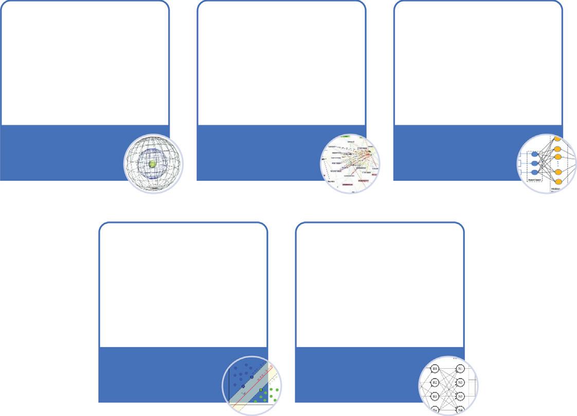
Sparselymonitoredwatershedsarenotfrequentlymonitoredviaareaandtime,andconsequently,statisticsavailabilityisathingrestrictinginsimpletermsspatialortemporalanalysis (Fig.1.1).Thisproblemandtherelateddemandingsituationsrounduncertaintyofboundary conditions,thewaythatitisdifficulttosetupadynamicnumericalmodel.GIS-basedgeostatisticaltechniqueshelptocreatesurfacesthatincorporatethestatisticalpropertiesofthedatabeing measured.Manymethodsareassociatedwithgeostatistics,buttheyallbelongtotheKriging family.Simple,universal,probability,indicators,anddisjunctivekrigingareusuallysomeofthe availablegeostatisticalmethods(ESRI,2016). Chaudhryetal.(2019) usedintegratedexploratory
Geostatisticalmethodsandtechniquesusedingroundwaterestimation.
factoranalysisandconventionalkriging(OK)approachestoidentifysourcesofgroundwaterpollutionintheLupunagardistrictofPunjab.Afive-factormodelhasbeenproposedthatexplains morethan89.11%ofthetotalvariationingroundwaterquality.Threesemivariogrammodels, exponent,gauss,andsphere,fitthedatasetwellandarecross-validatedwithpredictivestatistics. TheASCE TaskCommittee(1990) hasapplied(1)mapping,(2)simulationofhydrologicalvariables,(3)estimationusingflowequations,and(4)samplingoftheapplicationofgeostatistical modelingtechniquesingroundwaterhydrology.Reviewedinfivemajorsectionsofdesign,and (5)geostatisticsmodelingapplicationingroundwatersystemsmanagement.
1.5Geocomputationalmodelingandgroundwater
Groundwatermanagementmodelsarepowerfulforaquifermanagementusingoptimization andsimulationmethodssuchaslinearprogrammingandquadraticprogrammingthatcombinegroundwaterregulatedflowsandtransportequationstosolvegroundwatermanagement problems.Formanyyears,groundwaterhydrogeologistshavetriedtoappraisegroundwater resourcesusingnumericalimitationmodels.Theapplicationofnumericalsimulationmodelsby researchersinthefieldofgroundwaterhydrologyhasfacilitatedtoimprovetheunderstanding ofaquiferfunctionsintheregionregardingspecificaspectsofthegroundwatersystemand totestthehypothesis.Thegroundwatermanagementmodelcanbedividedintotwomain groups.Theseareaphysicalclassificationmodelandadata-drivenclassificationmodel.Physical classificationmodelsarereliantupontheuseofphysicalconstraintsofthegroundwaterbed togovernchangesinwaterlevel;however,thesemodelsaredifficulttoimplement,expensive, andmustbesharedtoobtainnumericalinformation.Thegroupsofdata-drivenmodelsare differentiatedaccordingtotheobjectivefunction,wherebythedecisionisbasedonlyonthe hydraulicfunctionsofthegroundwaterandtheother,whosemanagementdecisionisbasedon theevaluationofthepolicy,aswellasanassignmentoftheeconomyofthegroundwater.The groundwatermodel,basedondatainitsprimitivestructure,hasfourbasiccomponents:itis notlinearintermsofitsdecisionvariables;requiresthesolutionofnonlinearpartialdifferential equationstodescribegroundwatertransportandflow;itisstochasticasitsprimaryuncertain sourceisrelatedtotheaquifersimulationmode,and;itisamixed-integerprogrammingdecision becauseitcontainsbothdiscreteandcontinuousobjectivefunctions(Yeh,2015; Wada,2016).
FIGURE1.1
• Simulation modeling methods in groundwater resource management
Improved random forest regression
• Solve the problem of data scarcity on a site and low dimensional data
Canonical correlation forest algorithm
• To overcome the variation in ground water level prediction
Support Vector Machine
• To provide accurate predictions without an increase in costly computational time
Artificial Neural Network (ANN)
• To overcome the challenges with both ANN and SVM models
Thelatestdata-basedclassificationmodels,suchasartificialneuralnetworktechnology, geneticprogramming,theAdaptiveNeuroFuzzyInferenceSystemandadaptiveneuro-fuzzy inferencesystemandthesupportvectormachineaswellastimeseriesmethodssuchasthe autoregressiveintegratedmovingaverage,themulti-objectivefunctionapproachandtheautoregressivemovingaveragearealternativestestedonphysicalmodelsandtreatedasstandard nonlinearestimatorsthatcanovercomethedifficultiesassociatedwithphysicalmodelsandare lessexpensive(Diersch,2005; Aderemietal.,2021).Inaddition,therearenumericalgroundwater modelsthathavebeendevelopedfromaconceptualmodel.However,thesemodelsoftenignore thecomplexityandfocusonlyonthebasicrationaleofgroundwatersystems(Hosseiniand Mahjouri,2016).Withtheadvancesindataminingformodeling,optimization,andsimulation techniquesforgroundwaterresourcemanagement,theuseoffinitedifferencesandfiniteelementshasincreasedexponentially(LeeandCheng,1974;TysonandWeber,1963).Consequently, boththefiniteelementmodelingtechniqueandfinite-differencemodeltechniquewerewidely usedforthegroundwaterflowmodel,thehydro-economicmodel,calibration(C),sensitivity analysis,aswellasvalidation/verification(V). Fig.1.2 showsasummaryofthelatestdata-driven modelingmethodsforgroundwaterresourcemanagement.
1.6Geospatialintelligenceandgroundwatermodeling
Theeffectivemanagementofthegroundwaterresources,aswellasthemodeling,dependson theavailabilityofhigh-qualitydataontheobservationwellinformation.Informationaboutthe aquiferpropertiesmayincludechangesinthewatertable,storage,flowrate,replenishment,and runoff,amongothers.Furthermore,informationongroundwaterresourcesislackingduetoa dearthofproperintegrationbetweentheequipmentdeployed,irrelevant,andinconsistentdata
Adaptive NeuroFuzzy Inference System (ANFIS)
FIGURE1.2 Data-drivengroundwaterresourcemanagementmodelingmethods.
Chapter1 PrincipleofGIScienceandgeostatisticsingroundwatermodeling7
duetothelackoflarge-scalestationaryflowobstacles,aprocessofnonautomatedgroundwater analysis,andabsenceofinteroperabilityinprevioussystems(Suetal.,2020; Laraichietal., 2016).Thereareseveralsystemsformonitoringthewatertable.Thesesystemsdifferinterms oftechnology,monitoring,andmanagementtasks,scalability,thesolutiontheyprovide,and theimpactoncosts.Inaddition,thereisariskthatmostofthegroundwaterlevelmonitoring networkswillberegularlyabandonedduetoadeclineinglobalgroundwatermonitoring.
Inthepastfewyears,theInternethaschangedthewaypeoplelive.ThisconceptofIoThas beenadoptedinmanyareasofhumanactivity,includingintelligentwaterlevelandgroundwatermanagement.Hence,thetechniquesoftheIoTareusedtocollect,transmit,andanalyze necessarydataaboutwatertabledata.ThemainadvantageofIoTimplementationisthatit canbecombinedwithvarioustechnologiessuchaswirelesssensors,cloudcomputing,ubiquitouscomputing,RFIP,andsoftwaretomanagegroundwaterleveldatainoneenvironment. IoTinvolvesthecombinationofintelligenttechnologies,suchassensorsforcollectingdata inanetworkareawithacombinationofIDEsoftwareonthecloudserver(Vijayakumarand Ramya,2015).
RSisanexampleofaclassicwayofobtainingurgentlyneededhydrologicaldataforgroundwaterlevelmeasurementsviatheInternet.AlthoughSRcanbeusedtoobtaincertainparameters ofgroundwaterresources(Zhouetal.,2013),theseparametersareusuallynotusefulformodelinggroundwatermanagement.Asaresult,anothermodelisrequiredtomanipulatethecaptured dataintousableorverifiabledataasinputintospatiallydistributedmodels.Theessentialand mostrelevantdataformodelinggroundwaterresourcemanagementisinformationonrecharge andrunoff(Xiaoetal.,2017).IoTandmachinelearningtechniquescanbeusedtosolvethese challenges(Fauntetal.,2010).However,thedifferenceineachmeasurementwelldependsonthe technologyusedandthefrequencyofthemeasurementdata.TheapplicationofIoTtomonitor thedailyfluctuationsinthewatertableandthesafetyqualityintheminingenvironmentwas carriedoutby Reddyetal.(2016) usingsensortechnologies.Inaddition, Neyensetal.(2018),the qualityandquantityofthegroundwaterfromadesktopusingtheIoT-enabledenvironmental datamanagementinterface(EMI)technology.
1.7WebGISandgroundwaterresource
Startingwiththedevelopmentofwebtechnologiesin1993,variousdatabaseadministrators havebeguntodevelopweb-basedgeographicinformationsystems(WebGIS)tostorereal-time, aggregated,high-speeddatastreams.Hence,theWebGIStechniqueworksbestintermsofuser qualityofService,usablebyseveralusers,costreduction,globalreach,andcross-compatibility. TheGISsoftwareisknownasArcViewandtheGroundwaterModel(MODFLOW)wascombined forthenumericalmodelingofgroundwaterresourcesbyChennaiandMammou(Cheniniand Mammou,2010).Thecombinationofmanagedaquiferrechargeandtheglobalgroundwater informationserviceoftheInternationalGroundwaterResourcesAssessmentCenter(IGRAC’s GGIS)hasbeensuccessfullyimplementedusingadvancedhistoricaldatafromapproximately 1200sitesurveysinapproximately62countries(StefanandAnsems,2018).
