NonwoodPlantFibers forPulpandPaper
ConsultantPulp&Paper,Kanpur,India
PratimaBajpai
Elsevier
Radarweg29,POBox211,1000AEAmsterdam,Netherlands
TheBoulevard,LangfordLane,Kidlington,OxfordOX51GB,UnitedKingdom 50HampshireStreet,5thFloor,Cambridge,MA02139,UnitedStates
Copyright©2021ElsevierInc.Allrightsreserved.
Nopartofthispublicationmaybereproducedortransmittedinanyformorbyanymeans,electronicor mechanical,includingphotocopying,recording,oranyinformationstorageandretrievalsystem,without permissioninwritingfromthepublisher.Detailsonhowtoseekpermission,furtherinformationaboutthe Publisher’spermissionspoliciesandourarrangementswithorganizationssuchastheCopyrightClearance CenterandtheCopyrightLicensingAgency,canbefoundatourwebsite: www.elsevier.com/permissions .
ThisbookandtheindividualcontributionscontainedinitareprotectedundercopyrightbythePublisher (otherthanasmaybenotedherein).
Notices
Knowledgeandbestpracticeinthisfieldareconstantlychanging.Asnewresearchandexperiencebroadenour understanding,changesinresearchmethods,professionalpractices,ormedicaltreatmentmaybecome necessary.
Practitionersandresearchersmustalwaysrelyontheirownexperienceandknowledgeinevaluatingandusing anyinformation,methods,compounds,orexperimentsdescribedherein.Inusingsuchinformationor methodstheyshouldbemindfuloftheirownsafetyandthesafetyofothers,includingpartiesforwhomthey haveaprofessionalresponsibility.
Tothefullestextentofthelaw,neitherthePublishernortheauthors,contributors,oreditors,assumeany liabilityforanyinjuryand/ordamagetopersonsorpropertyasamatterofproductsliability,negligenceor otherwise,orfromanyuseoroperationofanymethods,products,instructions,orideascontainedinthe materialherein.
BritishLibraryCataloguing-in-PublicationData
AcataloguerecordforthisbookisavailablefromtheBritishLibrary
LibraryofCongressCataloging-in-PublicationData
AcatalogrecordforthisbookisavailablefromtheLibraryofCongress
ISBN:978-0-12-821800-6
ForInformationonallElsevierpublications visitourwebsiteat https://www.elsevier.com/books-and-journals
Publisher: SusanDennis
AcquisitionsEditor: KostasKIMarinakis
EditorialProjectManager: SamanthaAllard
ProductionProjectManager: KumarAnbazhagan
CoverDesigner: VickyPearsonEsser
TypesetbyMPSLimited,Chennai,India
4.2Agriculturalresidues
4.2.1Sugarcanebagasse(Saccharumofficinarum
4.2.2Cornstalks(Zeamays)
4.2.3Cottonstalks(Goossypium)
4.2.4Ricestraw(
4.2.5Wheatstraw(
4.2.6Cerealstraw
4.3Naturalgrowingplants
4.3.1Bamboo(
4.3.2Esparto(Stipatenacissima
4.3.3Reeds(
4.3.4Papyrus(
4.4Nonwoodcropsgrownmainlyfortheirfibercontent
4.4.1Bastfibers
4.4.2Leaffibers
Chapter5:Problemsassociatedwiththeuseofnonwoodfibersandhow
Chapter6:Handling,storage,andpreparationofnonwoodrawmaterials
7.1Pulpingpropertiesofnonwoodyrawmaterials
7.2Pulpingofnonwoodyrawmaterials
7.2.1Alkalinepulping
7.2.2Sulfitepulping
7.2.3Organosolvpulping
7.2.4Chemimechanicalpulpingandotherpulpingmethods
7.3Washing,screening,andpurificationofnonwoodpulp
Chapter9:Chemicalrecovery
9.1Thechemistryofsilica
9.1.1Mineralcomposition,especiallysilica
9.2Desilicationofblackliquor
9.2.1Partialdesilicationbyrawmaterialcleaning
9.2.2Spontaneouspartialdesilicationofblackliquorbystoring(ageing)
9.2.3Desilicationofblackliquorbylimeaddition
9.2.4Desilicationbyblackliquorbycarbonation
9.3Desilicationofgreenliquor ...............................................................................177
9.4Sodarecovery ....................................................................................................178
9.5Alternativerecoveryprocesses
9.5.1Directalkalirecoverysystem
Chapter10:Beating/refiningandpapermaking
10.1Beating/refiningcharacteristicsofnonwoodpulp
10.2.1Thestrengthpropertiesofwetpaper ...................................................196
10.2.2Theadhesionpropertiesofwetpaper ..................................................197
10.2.3Drainagepropertiesofnonwoodpulps ................................................197
Chapter11:Useofnonwoodplantfibersinspecificpaperand
Chapter12:Advantagesanddisadvantagesofusingnonwoodfiberfor
Preface
Inrecentyears,thethreemajorproblemsthatarecontinuingtopuzzlethedevelopmentof thepaperindustryaretheshortageofresources,contaminationofenvironment,andthe leveloftechnicalequipment.Themostdominatingfactoristheshortageofrawmaterial resources,whichislargelyduetothecontradictionbetweenthestructureoftheraw materialandthestructureofthefiberresources.Therebynonwoodfiberspossessarich varietyofexcellentpropertiesinphysicalandopticalaspects,whichcouldbeusedto improvetheirproducts.However,throughouttheworld,nonwoodfiberaccountsforonlya smallfractionoftherawmaterialofpaperandpaperboard.Butinsomedeveloping countries,about60%ofthecellulosefibercomesfromnonwoodmaterials,suchasbagasse, cornstraw,bamboo,reed,grass,jute,flax,andsisal.ParticularlyinChinaandIndia,70% oftherawmaterialsusedinthepulpindustrycomefromnonwoodplantsincludingcereal strawandbagasse,andthesetwocountriesown80%ofthetotalnonwoodpulpproduction. Aroundtheworld,multitudinousnonwoodfibersareusedinthefieldofpulpand papermaking,whichincludeannualagriculturalwasteandnaturalgrowthorartificial cultivationgrassandsoon.
Thisbookexaminesthebackgroundtouseofnonwoodplantfibersforpulpand papermaking;worldwidepulpingcapacityofnonwoodfibers;categoriesofnonwoodyraw materials;problemsassociatedwiththeutilizationofnonwoodfibersandhowtheyare approached;pulping,bleaching,chemicalrecovery,andpapermakingofnonwoodraw materials;useofnonwoodplantfibersinspecificpaperandpaperboardgrades;and advantagesanddrawbacksofusingnonwoodfiberforpapermakingandfutureprospects. Thisbookwillprovideprofessionalsinthefieldwiththemostup-to-dateand comprehensiveinformationonthestate-of-the-arttechniquesandaspectsinvolvedinpulp andpapermakingfromnonwoods.
Acknowledgments
Iamgratefulforthehelpofmanypeople,companies,andpublishersforproviding informationandgrantingpermissiontousetheirmaterial.Deepestappreciationisextended toElsevier,Springer,WileyVCH,Appita,Hindawi,MDPI,Intech,andotheropen-access Journalsandpublications.MyspecialthankstoRobertW.Hurter,President,HurterConsult Incorporatedforprovidinginformationonuseofnonwoodplantfibersinspecificpaperand paperboardgrades.
ListofFigures
Figure1.1Worldpaperandpaperboardproductionandconsumption (10,000tons). 2
Figure1.2Portionsofatypicalmonocotstem(left)andherbaceousdicotstem (right,50 3 ). 13
Figure1.3Stemcrosssectionsof Cannabis (left,100 3 )and Linum (right,40 3 ). 13
Figure1.4Fibersofbamboo(left,withparenchyma,60 3 ),linen (center,150 3 ),andcottonseedhairs(right,150 3 ).
14
Figure1.5Stemcrosssectionofwheat(withpartofaleaf,50 3 ).15
Figure4.1SEMimagesofbagassesamples:(A)wholebagasse,(B)fiber, and(C)pith. 38
Figure4.2SEMofcornstalkfiber(withdifferentmagnification).41
Figure4.3SEMimageofcottonstalk.42
Figure4.4Ricestrawfiber.43
Figure4.5SEMimageofwheatstrawfiber.45
Figure4.6SEMimageofryestraw.46
Figure4.7SEMofbamboofiber.47
Figure4.8Scanningelectronmicrographsofespartograssfibers.50
Figure4.9Morphologyofreedfibersunderopticalmicroscope.53
Figure4.10Cross-sectionalimageofSabaigrassfiber.55
Figure4.11SurfaceimageofSabaigrassfiber.55
Figure4.12(A)Longitudinalview(5000 3 magnification)and(B)cross-section (180 3 magnification)ofjutefiber.
Figure4.13(A)Longitudinalviewand(B)cross-section(100 3 magnification) oframiefiber.
58
60
Figure4.14SEMofSunnhempfiber.60
Figure4.15(A)Longitudinalview(10,000 3 magnification)ofhempfiber (Smoleetal.,2013).(B)Cross-section(200 3 magnification) ofhempfiber.
61
Figure4.16Scanningelectronmicrographofkenafbastfiber.64
Figure4.17(A)Longitudinalview(10,000 3 magnification)and (B)cross-section(30 3 magnification)offlaxfiber.
65
Figure4.18ManilaHemp/Abaca.69
Figure4.19SEMimageofSisalfiber.70
Figure4.20(A)Longitudinalview(5000 3 magnification)and (B)cross-sectionofcottonfiber.
71
Figure4.21SEMimagesofcottonlinters.72
Figure7.1Processflowdiagramforpulpandpaperproduction.112
Figure7.2StructuresofanthraquinoneandsolubleAnthraquinone.116
Figure7.3Cyclicactionofanthraquinone.117
Figure7.4Sideviewdiagramofthepulpingextruder.134
Figure8.1Reactionbetweenphenolicligninunitsandchlorinedioxide.154 xivListofFigures
ListofTables
Table1.1Chemicalcompositionofhardwoodandsoftwood.4
Table1.2Percentageoftypesofnonwoodpulpusedinpaper production. 5
Table1.3Comparisonofnonwoodandwoodresourcesforpulp andpapermaking. 6
Table1.4Usersofnonwoodfibersinpapermaking.8
Table1.5Averagepulpyieldsofdifferentpapermakingrawmaterials.9
Table1.6Fiberpropertiesofsomenonwoodfibers.10
Table1.7Fiberpropertiesofsomewoodyrawmaterials.10
Table1.8Chemicalpropertiesofnonwoodfibersandtheircomparison withwoodyrawmaterials. 11
Table1.9Chemicalcomposition(%)ofcerealstraws.11
Table2.1Reasonsforuseofnonwoodfibers.20
Table3.1Distributionofnonwoodpulpproductionintheworld.26
Table3.2Estimatedproductionofnonwoodpulpindifferentparts oftheworld. 27
Table3.3Availabilityofnonwoodfibersindifferentpartsoftheworld.28
Table3.4Production/consumptionofnonwoodpulp.28
Table3.5Imports/exportsofnonwoodpulp.28
Table3.6NonwoodfibersproductioninChina(Milliontons).29
Table4.1Estimatedannualcollectableyieldsofvariousnonwood rawmaterials. 34
Table4.2Lengthandwidthofsomecommonnonwoodfibers.34
Table4.3Chemicalcompositionofsomecommonnonwoodfibers andcomparisonwithwoodfibers. 35
Table4.4Categoriesofnonwoodrawmaterials.36
Table4.5Usesofabacafiber.68
Table5.1Drymatteryieldsfornonwoodfibercrops.84
Table5.2Deteriorationduringstorageofwoodandsomenonwoods.85
Table5.3Problemsinwetdepithing.87
Table5.4Generationofpollutantsinwetdepithing.88
Table5.5Short-periodcontinuouspulpingofdifferentrawmaterials.89
Table5.6Typicalpapermachinespeedsfordifferentfurnishes.91
Table5.7Sizeofnonwoodpulpmills.93
Table5.8Reductioninpollutionloadafterimplementationofwaste minimizationmeasures. 93
Table6.1Sodapulpingofwheatstrawwith C. subvermispora Strains1 and2atreducedalkalicharges.
Table6.2Effectofcookingtimeonsodapulpingof C.subvermispora treatedwheatstraw.
Table7.1Delignificationstagesofstrawandsoftwood.109
Table7.2Reasonsforfastersolubilizationofligniningramineous strawmaterials. 109
Table7.3Pulpingmethodsfornonwoodyplants.113
Table7.4Propertiesofpulpproducedwithdifferentalkalinepulping methods.
Table7.5Propertiesofpulpproducedwithdifferentsulfitepulping methods.
Table7.6SolventsusedinOrganosolvpulping.123
Table7.7AdvantagesofOrganosolvprocess.124
Table7.8Propertiesofpulpproducedwithdifferentalcohol pulpingmethods.
128
Table7.9Propertiesofpulpproducedwithdifferentorganicacids.130
Table7.10Propertiesofpulpproducedwithdifferentchemi-mechanical pulpingmethods. 131
Table7.11Benefitsfrompulpwashing.136
Table8.1Chemicalsusedinbleachingprocesses.148
Table8.2Functionsofdifferentbleachingagents.149
Table8.3Advantagesanddisadvantagesofdifferentbleachingagents.150
Table8.4Classificationofbleachingchemicals.151
Table8.5Physicalstrengthpropertiesofbleachedwheatstrawpulps byanOQPosequence.
158
Table8.6Propertiesofwheatstrawpulpsfromdifferentstages.158
Table8.7ECFbleachingofnonwoodpulps.160
Table8.8TCFbleachingsequencesusedforwheatstrawpulp.161
Table9.1Environmentalandeconomicbenefitsofchemical recoveryprocess.
167
Table9.2Presenceofligninandsilicainmainnonwoodyrawmaterials inpercentage. 168
Table9.3Problemsassociatedwiththepresenceofsilicateionsin blackliquor. 168
Table9.4Effectofstorageondesilicationofblackliquor.172
Table9.5Desilicationofblackliquoratdifferenttemperatures.175
Table9.6Desilicationofblackliquorofvariousrawmaterials.175
Table9.7Advantagesofdesilicationofgreenliquorwithlime.178
Table9.8Effectoftwo-stagecausticizationofgreenliquor.178
Table9.9Advantagesoffluidizedbedreactor.180
Table9.10Costcomparisonofthecostofconventionalandferrite recoveryprocesses. 183
Table9.11Solubilityofsilicainregeneratedalkali.183
Table10.1Responseoffibersduringbeatingandrefining.189
Table10.2Factorsaffectingrefining.190
Table10.3Majoreffectsofrefining.191 Table10.4Factorsinfluencingtheresponseofpulpfiberstorefining.191 Table10.5PFI-refiningofenzyme-treatedandcontrol(noenzymetreatment) LF-3pulps. 194
Table10.6Thewetstrengthpropertiesofnonwoodpulps.197 Table11.1Paperproducedfromnonwoodpulps.204 Table11.2PaperproducedfromBagasse.205 Table11.3PaperproducedfromStraw(cerealandrice).206 Table11.4Paperproducedfrom Phragmites communisReeds.206 Table11.5PaperproducedfromBamboo.206 Table11.6PaperproducedfromKenaf(wholestalk).207 Table11.7PaperproducedfromKenaf(bastfiber).207 Table11.8PaperproducedfromEsparto.207 Table11.9PaperproducedfromFlax(bastfiber).208 Table11.10PaperproducedfromtrueHemp(bastfiber).208 Table11.11PaperproducedfromJute(bastfiber).208 Table11.12PaperproducedfromSisal.208 Table11.13PaperproducedfromAbaca.209 Table11.14PaperproducedfromCotton.209 Table11.15PaperproducedfromEkara,Knagra&Nalgrassmixed.209 Table12.1Advantagesofusingnonwoodfiber.212 Table13.1Interestintheuseofagriculturalresiduesforpapermaking.219
Another random document with no related content on Scribd:
Faults, inherent in the character of the Afghans and particularly prominent in the present Amir, have thus measured the success which befel Abdur Rahman by the span of that ruler’s life, until it is really but little more than the shell of the former edifice which now remains.

Deprived of the inspiring genius of Abdur Rahman, within the five years which have elapsed since his death there is every ground to believe that the army has fallen away in efficiency as well as in numbers, and that the work of reorganisation largely requires to be repeated. In a measure, the Afghans retain at the present time their old characteristics—their love of their own country and their hatred of alien races; but, through lapse of time and their intercourse on the one hand with the Russians and in the other direction with India, they are liable to flock to the standard of the Amir less than they were. It must not be forgotten that to-day Afghanistan reproduces the condition of a settled country, possessing a population much more peaceful than were the inhabitants a generation ago. Moreover through the penetrating associations of prosperity and through many years of peace the warlike instincts of the tribes have become numbed, while their martial ardour has evaporated, requiring constant amelioration of the conditions of service by way of stimulating their military zeal. Increases of pay and more generous rations have been conceded in the past and, lately, attempts have
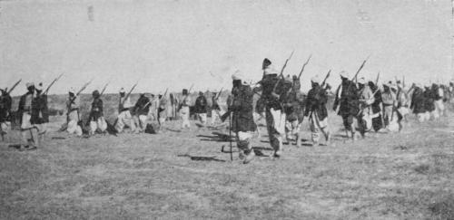
PATROL OF HOUSEHOLD TROOPS
been made to soothe the susceptibilities of the officers. Habib Ullah has ordained that for the future promotions will go by seniority, although the system of selection, where it is concerned with posts which are hereditary in families connected with the Royal House, will not be altered. As a sop to the feelings of the rank and file the classcompany system is to be enforced, the men of the different tribes being incorporated regimentally under their own tribal leaders. In this direction, too, it is of interest to note that every cantonment will be provided with a garrison mullah who, on Fridays, will read prayers before the assembled troops and address them on Saints’ Days, while teachers in religious instruction are to be attached to each regimental company.
Lately, Habib Ullah has shown signs of awakening to the responsibilities of his position; and it is to be hoped that, under pressure from recent political circumstances, he may abandon the foolish indulgence to which hitherto he has been a slave. Indications of this spirit are not very pronounced, but their manifestation does not come a moment too soon. In the main they are associated with military matters, although certain measures deal exclusively with the administration. Among the former, orders have been given to the leather factories in Kabul to manufacture 300,000 sets of infantry equipment and an agent has been despatched to India to purchase gear for the mounted branches of the service. At best these activities are no promise of an abiding interest in his service and, indeed, they are discounted by his refusal to hearken to advice. At the present time the army of Afghanistan, in its existing condition, admittedly possesses in a high degree the qualities of endurance, courage and mobility; but, in spite of its modern guise, it lacks discipline and cohesion and, as a fighting machine, is liable upon these grounds to be thrown quickly out of gear. Under these circumstances the observation may perhaps be hazarded that it would be as well before equipping it with first-class material to make sure that the men were sufficiently organised to understand its use. At present modern weapons are unknown to the great bulk of the forces of Afghanistan; and it cannot be denied that the absence of
this quality makes it more of a menace to itself than to an enemy. Hitherto, there has been greater variety than method in the Afghan military equipment, irregularity of pattern distinguishing alike rifle, field-piece and ammunition, while the education of the officers and the training of the men has been neglected.
The continuation of these imperfections is due primarily to the inability of the Amir of Afghanistan to rely upon the loyalty of his troops. At the same time, their existence appertains to every Oriental army which is placed solely in native custody. They have always been a feature of the Afghan service. The condition of the garrison in the capital perhaps reveals some little superiority over those which are placed further afield, but it can be affirmed quite truly that the military qualities of Afghanistan proceed entirely from the inborn fanaticism of its people and not from the practical organisation of its active state. Nevertheless under conditions applicable to mountain warfare the Afghan army could become an invaluable auxiliary; although its capacity, as well as its determination, to offer any prolonged resistance are matters of doubt. Defects could be removed by re-organisation; good qualities enhanced by careful training under British officers or by the despatch of selected Afghan officers and men for training with our own troops.
In spite of the obduracy of Habib Ullah over this point, he has made known his intention of falling back upon the support of the Indian Government when his own arms have been defeated. This contingency, which is liable to arise at the outset of a war with any foreign power, imposes upon the Government of India a thankless burden, in no way lessened by the proposal of the Amir to create in Kabul an Afghan Staff College, and the determination of the Imperial Government to avoid insistence upon what is, by no means, an unreasonable precaution. As matters rest at present unless change is introduced the preposterous conceit, which distinguishes the Afghans, is destined to receive an unwelcome shock. Nevertheless the Amir cannot be persuaded to place his military affairs in the hands of the Indian Government; since, now that the Japanese have
beaten the Russians and, in the mind of the Amir, the Imperial Government is frightened at the Russian Government, the Afghans argue, having defeated British arms, that they are now superior to the Japanese. Therefore, they deny us the possession of any point of advantage in their country, a consummation which, while not quite that towards which our diplomacy has been directed, may be ascribed to the results, in combination, of a policy of friendly missions and half measures. Now that we have given Habib Ullah permission to import without check unlimited supplies of arms and ammunition the disadvantages of such a situation increase rather than diminish; as it exists so close to the Indian frontier and in a way in which it cannot be controlled by the Indian Government, it behoves the Imperial Government to come to a definite decision at once with regard to its line of action in relation to Afghanistan.
Abdur Rahman did not confine his work of reorganisation solely to the military system of Afghanistan. He devoted great attention to the military roads of the state, realising that a system of communications was as important as a well-equipped and efficientlyorganised army. Kabul, as the capital, was united with Badakshan on the east, with Turkestan on the north and with Kandahar and Herat on the south and west. Prior to these works certain native roads did exist between the several centres; but it was due to the activity and
INFANTRY ON THE MARCH
initiative of the late Amir that improvements were introduced, or altogether new lines of communication opened. Undeterred by the difficulties which beset his engineers and as an index to the consistent vigour with which he assisted the development and execution of his policy, he threw roads across the Hindu Kush, facilitating by these means not only the trend of inter-provincial trade, but the pacification and administration of his provinces. In addition to these strategic roads, he improved the trade routes which led into the country from the Trans-Oxus, India and Persia. In the south the Khyber, Kurram and the Gomul routes received notice; in the north there were the routes from Russian Turkestan leading through well-known centres to points of admission upon the Afghan border. After the subjugation of Kafiristan he took the precaution of making a military road through that country from north to south, thus opening up communication with the Kunar Valley, and Jelalabad, where considerable numbers of troops are always stationed. Further, he directed that it should eventually be carried over the western Hindu Kush so as to give a better route to Kataghan, Badakshan, and the upper Oxus Valley. This portion of the work was finished in March 1904. The northern terminus of the road is at Faizabad, the principal town of Badakshan, where caravan routes meet from Bokhara on the north-west, the Pamirs and Kashgar on the north-east. The Afghan Government have constructed serais at all the halting-places, and caravans are encouraged to use the road in preference to that through Chitral.
Curiously enough in another direction, the construction of fortresses, Abdur Rahman was more neglectful. If he improved the lines of communication and re-organised the state of the army he built but few forts, relying almost entirely upon those which already had been constructed. Nowadays with the exception of the Kabul positions, Dehdadi, Mazar-i-Sharif and Baldak Spin, the two latter of which he built to command the approaches to Balkh and Kandahar, there are no modern forts in the kingdom. Those that do exist are made of mud and are of insufficient strength to withstand
bombardment. The great majority serve merely as garrison depôts and are without interest save as interesting ruins.
The list is as follows:
KalaAfghan. A fort in the Kunduz district, on the east side of the Lataband Pass, and on the road to Badakshan. It is famous for its springs, of which there are 450 in the neighbourhood.
Kala Asin.—A fort 33 miles south-east of Kabul on the route from Kabul to Jelalabad by the Karkacha Pass.
KalaAzimKhan. A square mud fort, 73 miles from Kalat-iGhilzai, 16 miles from Kandahar. Provisions and fuel very scarce. Good water.
Kala-i-Babakar . A fort in good repair, inhabited by Karotis, 6 miles east of the Kotal-i-Sarwandi Pass, over the Suliman range, and at the source of the Gomul river.
KalaBadal.—A fort in the Murghab river basin.
Kala-i-Bhak.—A fort in the Ghilzai country, south-east of Kalat-i-Ghilzai, situated upon the plain. It contains 400 to 500 houses, and belongs to the Ohtak Ghilzais.
Kala-i-Bist.—A fort 30 miles south of Girishk, situated upon an island of the Helmund river, just above its confluence with the Tarnak.
Kala-i-Dukhtar . A small fort 3 miles south of Sabzawar, upon the left bank of the Adraskand.
Kala Fatula. A small square mud fort with bastions upon each corner about 90 miles from Quetta and 57 miles from Kandahar. Forage and grass are procurable but the water is brackish. The place contains some 40 houses and shops.
Kala Haji. A fort 10 miles north of Kabul, upon a small stream which drains to the Panjsher river.
Kala Ibrahimi.—The centre group in a number of small forts situated in the eastern extremity of the Bakwa plain, about 95 miles from Girishk and 66 miles from Farah.
Kala Kaisar .—A fort in the Taimani country, north-east of Teivereh.
Kala-i-Karoti.—A fort 102 miles south-east of Ghazni and at the west end of the Ghwalari Pass. It contains 30 houses of Karoti Afghans and its water is procured from the Gomul river.
KalaKasim. A deserted fort 13 miles from Kabul upon the Ghazni road. It is situated in a beautiful and highly cultivated valley in the basin of the Kabul river.
Kala Kazi.—A fort 20 miles north of Kabul, south-east of Istalif.
Kala Kazi.—A fort 3 miles south-west of Kabul. It is enclosed by walls and lies upon an eminence. The inhabitants are Tajik. Water and supplies procurable.
KalaKhanum. A fort in the Ghilzai district, situated in the hills, 12 miles from Kala-i-Bhao and south-east of Kalat-iGhilzai. The garrison is usually 50 men; and 2000 tribal levies can be mustered in the vicinity.
Kala Khan Taraki.—A fort in the Ghilzai country, about 20 miles from Mukur, and upon the direct road to Shalkot. It is situated in the centre of a populous region. The garrison, composed of levies from the Taraki Ghilzais, numbers 200 horse and 100 foot. Four thousand men can be called up in the neighbourhood.
KalaKhoja.—A fort in Afghan-Turkestan, north of Bamian, upon the road to Kamard and between Saighan and Dasht-iSufed. Kala Khoja is the largest of several forts, all situated in this district.
KalaKhoja.—A village and fort in Wakhan, on the bank of the Panja.
Kala Khushk-i-Jamburan.—A small fort 16 miles north-east by east of Sabzawar. It is situated in a fertile plain, 20 miles in breadth, enclosed by hills upon three sides.
KalaKhan.—A fort 30 miles south of Lake Abistada.
Kala-i-Langar .—At this point, which is 222 miles from Dera Ismail Khan and 68 miles from Ghazni on the Ghwalari road, there are two forts, each containing about 80 houses. The larger fort is a square, 100 yards in length with mud walls 20 feet high and 6 feet thick, flanked by towers. It is one of the strongest forts in Katawaz. The inhabitants belong to the Suliman Khel Ghilzais.
KalaMahomedHusen. A fort in the Jelalabad district and situated 15 miles from Jelalabad.
Kala Mama. A fort in Wazikhwah district of the Ghilzai country. It lies on the road from the Kundar to Kandahar, 12 miles from Khan Taraki, and some 32 miles from Mukur. The fort contains mounted lines besides quarters for infantry. It contains two wells and a few shops. The walls are pierced by three gateways.
Kala Mir Alam. A fort in Shorawak, on the road from Kandahar to Kalat. It is capacious and neatly constructed of mud, with eight towers on each face besides the corner bastions. Close by there is a canal from the Lora river.
Kala-i-Nadar .—An abandoned fort 52 miles from Kandahar upon the road to Herat. It is of large dimensions, with a good supply of water; the adjacent country is well cultivated.
Kala Najil. A fort 88 miles from Jelalabad and 41 miles from Farakhan, containing 300 houses.
Kala Nao. A fort 20 miles north-east of Herat, and north of the Serabund mountains. Once a place of some importance and a depôt for caravans going from Persia to Bokhara; it is
surrounded now only by the encampments of nomadic Hazaras.
Kala Panj.—A fort in Wakhan, upon the left bank of the Panja just below the junction of the Sar-i-Kol and Langar Kisht branches.
Kala Rahim Khan.—A fort 60 miles south of Ghazni, and west of Lake Abistada.
KalaRamzan Khan.—A fort 3 miles south of Kalat-i-Ghilzai, on the road from Ghazni to Kandahar.
KalaSangi. An uninhabited fort a few miles north-east of Teivereh, in the Taimani country. It is built of large roughlycut stones piled together without cement.
KalaBarSang. A fort in Afghan-Turkestan, commanding a defile south of the Saighan valley. The fort is a rude, shapeless building, with no pretensions to strength save what it derives from its site.
KalaTakah. A fort in Afghan-Turkestan, 42 miles south of Sar-i-Pul.
Kala Wasil. A fort in the Kah Dara division, north-west of Kabul.
Kala Kamard. A fort of Afghan-Turkestan upon the road from Balkh to Kabul, and about 110 miles south of Khulm. It is inhabited by Hazaras and Tajiks, and draws its water from the Surkhab, a tributary of the Kunduz river. At this point the Surkhab possesses a width of 24 feet, a mean depth of 2 feet, and an average current of 4½ miles an hour. Its source is at the head of the valley, where it issues from a cleft in the rock. Kamard fort stands 5600 feet above the sea in a gloomy narrow valley, containing orchards of apricots which extend for many miles. The rocks rise upon either side of the valley to a height of 3000 feet; the valley itself is not more than 300 yards in width.
The following routes indicate briefly the principal lines of communication in Afghanistan.
I. BALKH TO HERAT.
1. Aktapa (10 miles).—A fort in ruins, 150 houses; forage plenty; road level; intersected by canals and watercourses; four canals bridged.
2. Meilik (10 miles—20 miles).—A town of 2500 souls, surrounded by a mud wall; water and forage plentiful; cultivation scarce; road level, with no impediments.
3. Shekhabad (10 miles—30 miles). A village of 50 houses; water and forage plentiful; cultivation very partial; road over a level plain; no impediments from canals.
4. Akcheh (10 miles—40 miles).—A town containing 4000 or 5000 souls; supplies, forage and water abundant; road over a level plain, crossing 10 or 11 canals, all having wooden bridges about 12 feet broad. Any amount of supplies procurable.
5. Airagli (10 miles—50 miles).—A small mud fort, 80 to 100 houses; supplies, forage and water abundant; road level, crossing two bridged canals.
6. Shibirghan (10 miles—60 miles).—A town and fort containing 1500 to 2000 houses; supplies, water and forage abundant; road excellent, crossing one bridged canal.
7. Khorasanguzar (10 miles—70 miles). A halting place; forage and water alone procurable; road level, but slightly sandy.
8. Takht-i-Rustam Khan (20 miles—90 miles).—A halting place; forage and water alone procurable; road sandy; for want of water this stage cannot be shortened.
9. Tekeh Marakht (10 miles—100 miles).—A halting place by a river; forage procurable; road good, over a desert; one bridged canal and three small watercourses.
10. Khairabad (10 miles—110 miles).—A village of 150 houses; road level and good.
11. Islim (10 miles—120 miles).—An encampment of shepherds, with a small mud fort; a river, fordable, kneedeep; partial cultivation.
12. Maimana (10 miles—130 miles). A city and fort cross the Sangalak river; fordable, ankle-deep.
13. Almal (20 miles—150 miles). Five small forts, containing 500 houses; a weekly fair here; a road, 4 miles longer than the direct road which crosses nine different hills, turns off to lead over three hills, easy of ascent and descent. This stage can be divided by halting at Iskat Baru, where there is plenty of water.
14. Kisir (10 miles—160 miles).—A village of 200 houses and tents and a small fort; river bridged; road good over one hill, easy of passage.
15. Mahri (10 miles—170 miles).—A camp of 20 tents; no cultivation; water and forage abundant; the Kabr-i-Shutr hill at starting.
16. Char Shanbi (10 miles—180 miles). A camp of 50 or 60 tents; partial cultivation; water and forage abundant; level good road.
17. PanjGuzar(10 miles—190 miles).—A camp of 60 tents; cultivation extensive; water and forage abundant; road good.
18. KaorMach(10 miles—200 miles).—A camp of 10 tents; no cultivation; water and forage abundant; level good road.
19. Gali Chasm (10 miles—210 miles).—Two old deserted forts; no cultivation; camel forage and water abundant; road
runs between hills.
20. BalaMurghab(20 miles—230 miles). A village of 200 houses and tents and a fort; cultivation abundant; 8 miles from Gali Chasm is a steep hill, practicable for guns with some labour. There is not sufficient water at any intermediate place for more than 200 persons with cattle.
21. Karnachi(10 miles—240 miles).—No habitations; camel forage plentiful; the only water is from a small cut 2 feet wide from the Murghab river; road along the water-course; no impediments.
22. Chasm-i-Mangur(10 miles—250 miles).—A camp of 15 or 20 tents; forage and water abundant; level good road.
23. Koh-i-Duzd (20 miles—270 miles).—No habitations here; the river water brackish, but there are 30 or 40 springs near at hand; at 3 miles there is an ascent for half a mile, and then a long descent for 4 miles, after which the road is good and level.
24. Kala-i-Nao (20 miles—290 miles).—A town of 1500 houses with a mud fort; cultivation abundant; road level and good. This stage can be divided by halting half-way at Postalak, where there are springs of fresh water.
25. Aushara (10 miles—300 miles). A camp of 30 or 40 tents; and good water and encamping ground; forage abundant.
26. Khushk-i-Zard (10 miles—310 miles).—A camp of 40 tents; no cultivation; forage and water abundant; one hill difficult of descent.
27. Band-i-zer-Mast (20 miles—330 miles).—No dwellings; forage and water abundant; an ascent of 6 miles, very stony and difficult.
28. Kharoke (20 miles—350 miles).—A military post; cultivation, forage, and water abundant; road level and good.
There is water in the middle of this stage, but no forage.
29. Herat(20 miles—370 miles).—Good level road, through a well populated country, the whole way.
N.B. The first numbers in this and following routes give the length of the stage, the second the total distance from the commencement of the route.
KANDAHAR TO HERAT (BY THE NORTHERN ROUTE)
1. Kokaran (7 miles). The river Argandab runs within 500 yards of the high road; an irrigation channel also furnishing an abundant supply of water. Small quantities of forage procurable. For the first 3 miles the road passes through the enclosed gardens surrounding the city and crosses the several canals drawn from the Argandab for irrigating the valley of Kandahar.
2. Jangeri (5 miles—12 miles).—Water procured from an irrigation canal drawn from the Argandab, the river one mile distant south-east; forage for camels and horses procurable. The road stony in some places but generally good; there is an abrupt descent into the bed of the Argandab river, which is easily fordable.
3. Haoz-i-Madat Khan (14 miles—26 miles).—Watered by the same canal which supplies Jangeri; grass plentiful about 5 miles to the southward; several villages and much cultivation in the vicinity; large flocks of sheep and goats. The march lies across a hard and level plain. Water is found close to the road, a short distance from the village of Badwan, 2½ miles from Jangeri.
4. Khushk-i-Nakhud (15 miles 6 furlongs—41 miles 6 furlongs). Abundant supply of good water from two artificial watercourses. Grass scarce, and little cultivation. A hard level road.
5. Khak-i-Chopan(9 miles 5 furlongs—51 miles 3 furlongs).
Water procurable in sufficient quantity. Road generally good and level; sand lies rather deeply on it for a short distance, and some slight undulations in the ground are met with towards the end of the march. Cultivation and villages lie 2 or 3 miles to the south.
6. Left Bank of Helmund River (22 miles 5 furlongs—74 miles).—Water abundant, from irrigation channels and from the river. Very little cultivation on this side of the river and but few dwellings. Road generally good and hard.
7. Girishk(1 mile 4 furlongs—75 miles 4 furlongs). Water from irrigation channels abundant. The river a mile distant to the south-east; ground somewhat broken by water-courses and damp spots. Forage both for camels and horses excellent and most abundant. Many small villages and much arable land, but comparatively little cultivated ground.
8. Zerak(20 miles 7 furlongs—96 miles 3 furlongs). Water good and abundant; forage for both camels and horses plentiful; some cultivation in the vicinity. The dried bushes found on the plains form almost the sole fuel procurable at most of the stages. The first 6 miles of the road on this stage stony and undulating, the beds of several torrents which drain the desert plain crossing the line; after this it becomes level and easy till the fort of Sadat, 18 miles from Girishk, is reached. Beyond Sadat the road again passes over undulating ground with one or two steep slopes till Zerak is close at hand. There is an abundant supply of water at Sadat.
9. Doshakh (12 miles 7 furlongs—109 miles 2 furlongs).— Water abundant; one or two villages and some cultivation in the vicinity; the road hard and level the whole way. At the village of Sur, 6 miles from Zerak, forage is procurable, and if Sadat were made a halting-place Sur would form another at a distance of 8½ miles from it.
10. Khushk-i-Sufed (21 miles 7 furlongs—131 miles 2 furlongs). The first part of the road good and level; excellent water from a reservoir at a distance of 3 miles from encamping-ground. At 10½ miles from Doshakh the march is through a range of hills, the path leading over which shortly afterwards contracts in several places, so that a laden camel
can barely pass. The ascent gradual, no steep slopes; the road broken and stony.
11. Washir(9 miles 5 furlongs—141 miles).—Abundance of water. The road is hard and good with a gentle descent the whole way till within a mile or two of Washir, when it is undulating and stony in some places.
12. Left Bank of Khash Rud (12 miles 2 furlongs—153 miles 2 furlongs).—Excellent water from the river; forage for camels not abundant on the banks of the river; the grass not plentiful nor of good quality; no village in sight and the country on either side dry, stony and almost a desert. The road stony and uneven.
13. IbrahimJui(16 miles 7 furlongs—170 miles 1 furlong). —Water abundant. The road leads across a hard level plain for about 9 miles without any obstacle. At the termination of the plain it enters a range of hills of moderate elevation, the path being in some places narrow, difficult, and crossed in many places by the dry beds of mountain torrents.
14. Nalak (13 miles 4 furlongs—183 miles 5 furlongs).— Water from a running stream good and abundant; forage for camels and horses plentiful; very little cultivation. The road lies among hills for a mile, then debouches on a plain. Skirting a range of precipitous and lofty hills on the right for 3½ miles road good again, twining into another mountain gorge and ascending the valley for 5 miles to a spot called Ganimargh, where villages are seen. The road continues to thread a succession of mountain valleys.
15. Tut-i-Kasarman (6 miles 5 furlongs—190 miles 2 furlongs).—Good water from a “karez”; forage for both camels and horses abundant; fuel procurable but no supplies. Road among hills all the way, gradually ascending but not difficult.
16. Lajward Karez (15 miles—205 miles 2 furlongs).— Water from the ‘karez’ good and abundant. The road pursues a northerly direction for about 2 miles, and then turns to the westward and follows a mountain valley from three-quarters of a mile to 2 miles wide, bounded by lofty and rugged peaks on either side. At 5½ miles from Tut-i-Kasarman, the summit of the pass, a height of 1200 feet is gained. The path then descends to the foot of the slope, where water is found in the bed of a stream completely overgrown by long grass, bushes and reeds; here the valley widens out from 3 to 4 miles, and the road continues tolerably level till a “karez” is reached. The road over the pass is much broken.
17. Shaharak (15 miles—220 miles 2 furlongs). Abundance of good water; grass plentiful; villages and cultivation near.
18. Shahiwan(15 miles—235 miles 2 furlongs).—Numerous canals for irrigation.
19. RightBankofFarahRud(1 mile 3 furlongs—236 miles 5 furlongs).—Water of great purity from the river; forage not plentiful.
20. Ab-i-Khurmah(21 miles 3 furlongs—258 miles). Water from a spring not very wholesome; ground very irregular; fuel scarce; forage for camels sufficient. For 14 miles the road traverses a hard stony level plain; it then enters among low hills, and follows for some time the bed of a mountain stream.
21. Chah-i-Jahan (17 miles 2 furlongs—275 miles 2 furlongs).—Water tolerably good from spring; forage for both camels and horses abundant; vegetation in the bed of the watercourse very luxuriant; no villages or cultivation near; the road rough and stony.
22. Aisabad (20 miles 1 furlong—295 miles 3 furlongs). Abundance of water. The plain is rather marshy; forage for
both horses and camels abundant; fuel scarce.
23. Left Bank of the Adraskand (21 miles 2 furlongs—316 miles 5 furlongs).—Water from the river; forage and fuel abundant; no signs of cultivation or inhabitants near the river, nor are any villages seen between the valley of Sabzawar and that of Herat, a fatiguing and difficult march. High peaks rise to the eastward, the summits of which are judged to exceed 10,000 feet in height above the level of the sea. The tableland is 2½ miles across, where there is a further slight ascent, the elevation reached being considered 1500 feet above the level of Sabzawar. The descent into the valley of the Adraskand is steep, rocky, and tortuous.
24. Robat-i-Shah Bed (22 miles 2 furlongs—338 miles 7 furlongs).—Forage for camels and horses abundant; no supplies of any description procurable. For 19 miles from the Adraskand the road ascends among hills, the elevation being 6500 feet above sea-level. Forage and water procurable the whole way. The road stony.
25. Rosabagh (21 miles—359 miles 7 furlongs).—Good water from numerous artificial channels. Road attains elevation 7200 feet above sea-level falling further 2000 feet, and is good the whole way from the foot of the hills. The Rosabagh is a Royal garden planted with Scotch firs, now of great size and beauty.
26. Right Bank Hari Rud (4 miles 4 furlongs—364 miles 3 furlongs). Water good. This spot is but 3 miles from Herat and within reach of the bazaars of the city. The road fords the Hari Rud river running in several channels over a wide shingly bed.
27. Herat(3 miles 180 yards—367 miles 3 furlongs).
III
KANDAHAR TO HERAT BY GIRISHK, FARAH AND SABZAWAR (THE SOUTHERN ROUTE).
As far as Girishk (7 marches, 75 miles 4 furlongs), see route II. page 331.
8. Haoz(a reservoir) (17 miles—92 miles 4 furlongs).—The reservoir, which is 20 feet square, is built in a broad ravine, through which there is a considerable stream after the snow begins to melt; forage and grass scarce; a few ravines crossed; the road, generally good, is over a hard, level, and arid plain.
9. Shorab (23 miles—115 miles 4 furlongs).—Water plentiful in the winter and spring; later in the year it is brackish, but the supply is susceptible of great improvement; forage and grass generally plentiful; road over a desert plain, somewhat uneven, and in places stony.
10. Dalhak (8 miles—13 miles 4 furlongs).—A ruined fort; water rather scarce, but might be increased with care from a spring; forage and grass scarce.
11. HasnGilan(15 miles—138 miles 4 furlongs).—A ruined fort; water, forage, and grass scarce. The Darwaza pass is crossed about the third mile.
12. Dilaram (13 miles—151 miles 4 furlongs). Water, forage, and grass abundant; the road fords the Khash Rud at the end of the march; the bed of the river is 300 yards broad, with a small clear stream in the dry season about 2½ feet deep. There are villages all the way; the left bank is high and steep.
13. IbrahimJui(14 miles—165 miles 4 furlongs).—Forage, water, and grass scarce.
14. KalaIbrahimi(5 miles—170 miles 4 furlongs).
15. Chiagaz(14 miles—184 miles 4 furlongs). A small fort near Siahab; water, forage, and grass abundant. Road crosses the Bukwa plain.
16. Karez (15 miles—199 miles 4 furlongs).—Water bad; road good, over a level plain.
17. Khormalik (16 miles—215 miles 4 furlongs).—Water good and plentiful; cultivation in the neighbourhood; the road crosses two ranges of hills, one pass being stony and difficult for camels.
18. Haoz-i-Kalsa (10 miles 4 furlongs—226 miles). Water, forage and grass good and plentiful.
19. Farah(10 miles 4 furlongs—236 miles 4 furlongs). All supplies procurable.
20. Karez (9 miles—245 miles 4 furlongs).—Road over a fine plain, crossing the Farah Rud soon after leaving Farah. The river is about 400 yards broad, with a stream in the dry season of 150 yards, and 2 feet deep. Water clean and rapid.
21. AWell(8 miles—253 miles 4 furlongs).
22. MulaMustafa’sWell(7 miles—260 miles 4 furlongs).
23. Jeja(13 miles—273 miles 4 furlongs).—A village on the left bank of the Adraskand. Road for the most part tortuous, rocky, and bad.
24. Water among Hills (9 miles—282 miles 4 furlongs).— Road crosses the Adraskand on leaving Jeja, and soon afterwards ascends a short pass.
25. Adraskand River (9 miles—291 miles 4 furlongs). Water.
26. Adraskand River (8 miles—299 miles 4 furlongs). Water.
27. Sabzawar (8 miles—307 miles 4 furlongs).—The road follows the right bank of the Adraskand until Sabzawar is reached, and crosses the Gudar Khana pass.
28. Ziarat (12 miles—319 miles 4 furlongs).—Few supplies procurable. Water sufficient; forage and grass abundant; the road lies over a plain.
29. Sherbakhsh (17 miles 4 furlongs—337 miles).—Water plentiful but brackish; forage and grass abundant.
30. Gandatsu(9 miles 4 furlongs—346 miles 4 furlongs).— Water scarce; forage and grass abundant.
31. Shorak(10 miles 4 furlongs—357 miles).—Water scarce except in the spring, when it is abundant; forage and grass plentiful; the road skirts the Shah Bed range.
32. WaterinaRavine(7 miles—364 miles). Water scarce; forage and grass plentiful; the road winds round the northwestern extremity of the Shah Bed range.
33. Ghor-i-Sufed (8 miles—372 miles).—Water, forage and grass sufficient: succession of rolling undulations, which the road crosses at right angles; soil hard and gravelly.
34. Kala-i-Mula Yasin (9 miles 4 furlongs—381 miles 4 furlongs). Water plentiful; forage and grass abundant; a few small villages in the vicinity; road over undulating ground.
35. Rozeh Bagh (11 miles 4 furlongs—393 miles). Water plentiful from canals; grass very scarce.
36. HariRud(4 miles 4 furlongs—397 miles 4 furlongs).
37. Herat(3 miles—400 miles 4 furlongs).
1. Kala Mohmand (6 kos).—Over the Kandahar plain. The water here is from springs, but brackish. A little cultivation in the neighbourhood.
2. Taruk(6 kos—12 kos).—Over a sandy plain; encampingground on the bank of the Tarnak river, from which water is
IV
KANDAHAR TO DERA ISMAIL KHAN.
procurable.
3. Wilgai (5 kos—17 kos). In this day’s march a small “pass” has to be crossed. No provisions procurable here, and water only from springs.
4. Jandar Madat Khan (5 kos—22 kos).—A village in the midst of a well cultivated tract on the banks of the Arghesan; road good.
5. Lora (6 kos—28 kos).—Road along the bed of the Arghesan; here also are villages and cultivation, and Lora itself is situated at the junction of a stream coming down from above the Mukur with the Arghesan.
6. Sarghaz Kotal (6 kos—34 kos).—Still up the bed of the stream, the road is broken and rugged; there are a few small villages in the neighbourhood surrounded by small patches of cultivation. The country generally is mountainous and barren; camping-ground at the foot of the Kotal.
7. Camp (6 kos).—Long tedious march. The ascent and descent of the Sarghaz mountain takes the greater part of a day. The encamping-ground is at a spring on the remote side of the range; no village, but trees.
8. Camp (6 kos).—Over an undulating broken country, gradually descending again to the bed of the Arghesan, on the bank of which is the spot for encamping.
9. Shirkzai (6 kos).—Over a country undulating and hilly; the banks of the Arghesan are here and there cultivated, and have a good sprinkling of villages.
10. Katt (6 kos).—Road resembles previous march. A Ghilzai encampment near some springs; the road leaves the bed of the Arghesan and crosses the Ghwauza Kotal, which is neither high nor difficult; this is the last halting-place in the Kandahar district.
11. Surkhel (7 kos).—A village belonging to the Tokhi Ghilzais; country tolerably well cultivated; water brackish from springs.
12. Sturanisa (7 kos).—Over an undulating plain; no cultivation; villages deserted; water procurable from wells; this spot belongs to the Tokhi Ghilzais.
13. Kirshutu ke Kala (6 kos).—Road good, country level, but only inhabited by wandering Babars; water from “karez.”
14. Topan (6 kos).—Over a plain; here is one well but no cultivation. The country belongs to Babars.
15. LowanaKarez(7 kos).—Over a plain; Lowana is a small village surrounded by cultivation.
16. GharabiDara (6 kos).—Halting-ground at the entrance to the pass; water procured by digging in the bed of a ravine where it is always to be found close to the surface.
17. Lari (6 kos).—The name of a plain occupied by a tribe of Kakars. Road through a long darah flanked by low hills; water from springs.
18. Trikhghaz (7 kos). This place consists of 30 or 40 houses of the Jhunirian tribe. Country hilly and barren.
19. Mukhal (6 kos). An encamping ground; road passes through a long defile; water procured from a small stream, a tributary of the Gomul.
20. Mamukhani (8 kos).—A long and tiresome march, for five kos through a narrow defile, commanded by lofty heights; the path then debouches on the Mamukhani plain, occupied by Mandukhels and Nasrs.
21. Kharkhandi (6 kos).—Here are a few villages in the midst of cultivation belonging to Mandukhels and Nasrs. Road generally through a hilly country along the bed of the Kundar stream.
22. Gasta (6 kos).—Still along the bed of the stream; this spot which is only an encamping-ground without houses belongs to the Mandukhels.
23. Husen Nika (7 kos).—A halting-place at the Ziarat of Husen, where the Kholdad Khel and Suliman Khel Ghilzais come down to trade and barter with the Lohanis. From here two roads strike off, one to Ghwalari and the other to Zhob.
24. Damandar (7 kos). A halting-place watered from a spring on the water-shed line between the Kundar and Gomul streams; this day’s march is a difficult one, through a rugged dara, at the end of which a high kotal has to be ascended.
25. Kanzur. The first halting-place in the Waziri country on the banks of the Gomul. Caravans are frequently attacked by the Waziris in all the routes through their portion of the country, where there are no villages, but only well-known halting-places, named as here shown. The road in this march is down a steep descent, and then along the bed of the Gomul river.
26. Ramtaj(7 kos).—Along the bed of the Gomul.
27. Kotghai(7 kos). Along the bed of the Gomul.
28. Kirkani (9 kos). Along the bed of the Gomul; 2 kos from Kotghai is the Tol dara, a narrow but well cultivated glen, inhabited by Taftani Povindahs, who are on friendly terms with the Waziris.
29. Ghwalari (14 kos).—The road leaves the bed of the Gomul and crosses a very difficult kotal. Water is scarce at this stage.
30. Mashkanai (10 kos). Through low barren hills; water from a brackish spring.
31. Zernarikah (8 kos). Through low barren hills; water from a brackish spring.
32 Manjigarh (9 kos).—At the fourth kos the road passes out of the hills and crosses to Manjigarh. From there the road lies through the Derajat to Dera Ismail Khan, 49 miles.
V
KANDAHAR TO KABUL.
1. Abdul Aziz (5 miles 7 furlongs).—Grass for horses and forage for camels very scarce.
2. Kala Azim (9 miles 7 furlongs—15 miles 6 furlongs).— Over a hard stony road, considerably undulating and intersected by beds of nullahs; plenty of excellent camel forage but little grass; fuel scarce; a few wells of sweet water; ruined village near the fort.
3. Khel-i-Akhun(16½ miles—32¼ miles).
4. Shahr-i-Safa(11 miles—43¼ miles).
5. Tir-andazMinar(10¼ miles—53½ miles).
6. Tut(11½ miles—65 miles).
7. AsiaHazara(10 miles—75 miles).
8. Kelat-i-Ghilzai(12¾ miles—87¾ miles).
9. Sar-i-Asp(10¼ miles—98 miles).
10. Nurka(9½ miles—107½ miles).
11. Tazi(8¾ miles—116¼ miles).
12. Shaftal(6½ miles—122¾ miles).
13. Chasma-i-Shadi(10½ miles—133¼ miles).
14. Pangak(6½ miles—139¾ miles).
15. Ghojan(12 miles—151¾ miles).
16. Mukur(12¼ miles—164 miles).
17. ObaKarez(14 miles—178 miles).
18. Jamrud(12 miles—190 miles).
19. Mashaki(9 miles—199 miles).
20. AhmadKhel(9½ miles—208½ miles).
21. Nani(7½ miles—216 miles).
22. Ghazni(15¾ miles—231¾ miles).
23. Shashgao(13 miles—244¾ miles).
24. HaftAsia(8½ miles—253¼ miles).
25. HaidarKhel(10¾ miles—264 miles).
26. Shekhabad(9½ miles—273½ miles).
27. Maidan(18½ miles—292 miles).
28. Kabul(26 miles—318 miles).
VI
KABUL TO THE OXUS BY BAMIAN, TAHKT-I-PUL AND BALKH.
1. Argandab (14 miles).—Supplies procurable in small quantities; water plentiful; grass scarce. Road tolerably good.
2. Rustam Khel (8 miles—22 miles).—Supplies and water procurable; grass plentiful but coarse.
3. Jalrez (10 miles—32 miles).—A village; supplies and water procurable, grass rather scarce. Road generally rough and stony, passing through a well cultivated valley.
4. Sar-i-Chasma (10 miles—42 miles). A spring of water, one of the sources of the Kabul river. Road very rough, stony, and narrow.
5. Unai Pass (Foot of—9 miles—51 miles).—Water procurable, grass scarce. Road fair, occasionally running along the slopes of hills; very stony.
6. Urt (5 miles—56 miles).—Water procurable, grass scarce. The road consists of a succession of very steep ascents and descents.
7. Gardan-i-Diwar (6 miles 4 furlongs—62 miles 4 furlongs). Water and grass plentiful; road tolerably good, passes over four rather high spurs, and crosses the Helmund.
8. Siah Kala (7 miles—69 miles 4 furlongs).—Grass and water plentiful.
9. Kahzar (6 miles—75 miles 4 furlongs). A few supplies, water and grass plentiful; road indifferent.
10. Irak Pass (5 miles 4 furlongs—81 miles). Water procurable. Road passes over rocky and boggy stretches.
11. Ab-i-Irak (6 miles 4 furlongs—87 miles 4 furlongs). Water procurable; the ascent over the kotal is not steep. The road is straight and tolerably free from rock, the descent is steeper. For camels the road is not good.
12. Irak (4 miles—91 miles 4 furlongs). Water and grass procurable. Road very bad, leading through a rugged stony valley, and descending rapidly the whole way.
13. Zohak(6 miles—97 miles 4 furlongs). Water and grass procurable; road difficult.
14. Bamian (9 miles 4 furlongs—107 miles; Elev. about 8000 feet).—All supplies abundant.
15. Akrabat(15 miles—122 miles).
16. Saighan (20 miles—142 miles)—Well cultivated valley; water and grass plentiful.
17. Kamard (18 miles—160 miles)—Water, supplies and forage procurable. The road is difficult.
18. Mother(18 miles—178 miles)—Road tolerable.
19. Doah(18 miles 4 furlongs—196 miles 4 furlongs).
20. Roi(20 miles—216 miles 4 furlongs).
21. Kuram(20 miles—236 miles 4 furlongs).
22. Sar-i-Bagh(13 miles 4 furlongs—250 miles).
23. Aibak(20 miles—270 miles).
24. HazratSultan(17 miles—287 miles).
(19 to 24 are well-watered populous districts. They contain villages and are under cultivation.)
25. Khulm or Tashkurghan (20 miles—307 miles).— Supplies and water plentiful; a road to Kunduz, 70 miles.
26. Mazar-i-Sharif (34 miles—341 miles).—Supplies and water abundant. Route traverses a plain and crosses the Abdul Kotal; a road runs from there to Bamian.
27. Takht-i-Pul (8 miles 4 furlongs—349 miles 4 furlongs) —.A town; supplies and water abundant; plain, open country.
28. Balkh (8 miles—357 miles 4 furlongs). Supplies and water procurable.
29. Manlik (20 miles—377 miles 4 furlongs). Supplies scarce.
30. Turcoman Kala (20 miles—397 miles 4 furlongs). Supplies scarce.
31. OxusRiver Bankof(27 miles—424 miles 4 furlongs). —The banks of the Oxus; water and forage abundant; supplies procurable.
VII
KABUL TO PESHAWAR.
1. BhutKhak(8½ miles).
2. KhurdKabul(9 miles 1 furlong—17 miles 5 furlongs).
3. Tezin(12⅞ miles—30 miles 4 furlongs).
4. TheGiant’sTombontheTezin(8½ miles—39 miles).
5. Rud-i-KataSang(4¾ miles—43 miles 6 furlongs).
6. Jagdalik(7½ miles—51 miles 2 furlongs).
7. Surkhab(13 miles—64 miles 2 furlongs).
8. SufedSang(9¾ miles—74 miles).
9. Fatehabad(12 miles—86 miles).
10. Sultanpur(7½ miles—93 miles 4 furlongs).
11. Jelalabad(9 miles—102 miles 4 furlongs).
12. AliBaghan(6¾ miles—109 miles 2 furlongs).
13. ToChar-deh(14 miles—123 miles 2 furlongs).
14. Hazarnao(11¾ miles—135 miles).
15. Dakka(9 miles—144 miles).
16. LundiKhana(9 miles—153 miles).
17. AliMasjid(13¾ miles—166 miles 6 furlongs).
18. Kadam(10 miles—176 miles 6 furlongs).
19. Koulsir(7 miles—183 miles 1 furlong).
20. Peshawar(8¾ miles—191 miles 7 furlongs).
VIII
GIRISHK TO SEISTAN.
1. Chah-i-Dewala(20 miles).—One well on the road.
2. Chah-i-Karki (20 miles—40 miles).—One well on the road.
3. Chah-i-Kasadi (20 miles—60 miles).—One well on the road.
4. Khash (16 miles—76 miles).—400 houses of Arbabzais on the Khash river.
5. Kadeh(46 miles—122 miles).—300 houses of Arbabzais on the Khash river.
6. Chakhnasur (16 miles—138 miles).—500 houses of Mir Tajiks on the Khash river.
7. Janabad(16 miles—154 miles).—400 houses.
8. Jelalabad(10 miles—164 miles).—400 houses of Seistani Kayanes on the Helmund.
9. Afzalabad Ford (16 miles—180 miles).—200 houses of Arbabzais on the Helmund.
10. Koh-i-Khoja(10 miles—190 miles).
1. Parwana (11 miles).—The road crosses mountains; village of 40 houses.
2. Khushk-i-Rabat(11 miles—22 miles).—The road crosses a plain of clayey soil; no provisions or houses.
3. Kushk-i-Assaib(24 miles—46 miles).—The road is stony, and lies across mountains and valleys, and is frequently cut up by torrents very dangerous to pass after heavy rains. Good water; no houses or provisions.
4. Changurek (24 miles—70 miles).—No houses; good water.
5. Turchik(24 miles—94 miles)—Cultivated district.
6. Mingal (14 miles—108 miles).—Crosses plain; water supplies.
7. Murgab (14 miles—122 miles). The road leads along a fertile valley, through a well-cultivated populous country.
8. Kala-i-Vali(24 miles—146 miles). Villages and supplies.
HERAT TO MAIMANA.