JohnA.Richards RemoteSensingDigital ImageAnalysis
SixthEdition
JohnA.Richards ANUCollegeofEngineering andComputerScience
TheAustralianNationalUniversity Canberra,ACT,Australia
ISBN978-3-030-82326-9ISBN978-3-030-82327-6(eBook) https://doi.org/10.1007/978-3-030-82327-6
1st –5th editions:©Springer-VerlagBerlinHeidelberg1986,1993,1999,2006,2013 6th edition:©TheEditor(s)(ifapplicable)andTheAuthor(s),underexclusivelicensetoSpringer NatureSwitzerlandAG2022
Thisworkissubjecttocopyright.AllrightsaresolelyandexclusivelylicensedbythePublisher,whether thewholeorpartofthematerialisconcerned,specificallytherightsoftranslation,reprinting,reuse ofillustrations,recitation,broadcasting,reproductiononmicrofilmsorinanyotherphysicalway,and transmissionorinformationstorageandretrieval,electronicadaptation,computersoftware,orbysimilar ordissimilarmethodologynowknownorhereafterdeveloped.
Theuseofgeneraldescriptivenames,registerednames,trademarks,servicemarks,etc.inthispublication doesnotimply,evenintheabsenceofaspecificstatement,thatsuchnamesareexemptfromtherelevant protectivelawsandregulationsandthereforefreeforgeneraluse.
Thepublisher,theauthorsandtheeditorsaresafetoassumethattheadviceandinformationinthisbook arebelievedtobetrueandaccurateatthedateofpublication.Neitherthepublishernortheauthorsor theeditorsgiveawarranty,expressedorimplied,withrespecttothematerialcontainedhereinorforany errorsoromissionsthatmayhavebeenmade.Thepublisherremainsneutralwithregardtojurisdictional claimsinpublishedmapsandinstitutionalaffiliations.
ThisSpringerimprintispublishedbytheregisteredcompanySpringerNatureSwitzerlandAG Theregisteredcompanyaddressis:Gewerbestrasse11,6330Cham,Switzerland
Thisbookisdedicatedtothememoryofthe lateDavidLandgrebe,ProfessorEmeritusof PurdueUniversity.
Asateacher,mentor,friendandcolleagueto generationsofengineersandscientistsin remotesensing,Davetouchedandinfluenced thelivesandcareersofmanytheworldover.
Thedevelopmentofquantitativemethodsfor theanalysisofremotesensingimagedata owesmuchtoDave’sleadership.Helaidthe foundationsfortheapplicationof classificationtechniquestotheearthsciences thatweusetoday.
DavidLandgrebewasoneofthetrueand inspirationalpioneersofourfield.
Preface
Inafieldlikeremotesensingimageanalysis,whichchangessoquickly,revisinga long-standingtextbookisachallenge.Itisimportanttoincorporatecontemporary techniques,whilenotdiscardingproceduresfromthepastwhich,whileapparently supersededbynewermethods,neverthelessretainvalueandareoftensimplertouse. Also,someprocessingoperationsfromthepastcanbecomeimportantagainasdata typesandvolumeschange.Streamingmethodsforclusteringareanexamplewith thetrendnowtoverylargedatasets.
Aswiththepreviousedition,judgementshavehadtobemadeaboutwhattoleave out,whattoretainandwhattoadd.Thosejudgementshavebeenmadeagainstthe intendedpurposeofthebook.Fromthebeginning,ithasbeendesignedasateaching textfortheseniorundergraduateandpostgraduatestudent,andasafundamental treatmentforthoseengagedintheapplicationofdigitalimageanalysisinremote sensingprojectsorinremotesensingimageprocessingresearch.
Thepresentationlevelisforthemathematicalnon-specialist.Becausemostoperationalusersofremotesensingcomefromtheearthsciencescommunities,thetext ispitchedatalevelcommensuratewiththeirbackground.Thatisimportantbecause therecognisedauthoritiesindigitalimageanalysisandmachinelearningtendto befromengineering,computerscienceandmathematics.Althoughfamiliaritywith acertainlevelofmathematicsandstatisticscannotbeavoided,thetreatmenthere progressesthroughanalysescarefully,withmanyhand-workedexamples,sothatany lackofdepthinmathematicalbackgroundshouldnottakeawayfromunderstanding theimportantaspectsofimageanalysisandinterpretation.
Althoughtheprincipalfocusofthetreatmentisondigitalimageinterpretationand theanalyticaltechniquesthatmakethatpossible,thematerialislocatedwithinthe domainofremotesensingapplications.Thatmeansprojectobjectivesareasimportantasfindingthebest-performingalgorithm.Algorithmsneedtobeincorporated intomethodologiesthatcangenerateoptimalresultsfromacarefulcombinationof procedures,andinwhichthestepsofchoosingreferencematerialtosupportthe processandforassessingaccuracy,maybejustasimportantasalgorithmperformance.Whilealgorithmperformanceisakeyobjectiveinthemachinelearning
remotesensingresearchcommunity,itisprojectoutcomesthatdrivetheremote sensingapplicationsspecialist.Thatisakeyemphasisofthisbook.
Althoughthechapterscanbeusedindividually,thematerialispresentedina sequentialmanner.Apersonwithlittleornobackgroundinremotesensingimage interpretationcanstartwiththeearlychaptersinordertoappreciatekeyconceptsin remotesensingandimageformation,howerrorsariseinrecordedimageryandhow theycanbecorrected.Theremainingchaptersthenworkprogressivelythroughthe majoranalyticalmethodsfundamentaltodigitalimageanalysis,finishingupwith meansbywhichmethodologiescanbedevisedtotackleremotesensingprojects.
Overtheyears,manypeoplehaveeitherdirectlyorindirectlycontributedtothis book.ThelateDavidLandgrebe,towhomthiseditionisdedicated,wasafriendand colleaguewhodidmuchtoshapemythinkingabouttheapplicationofquantitative methodsinremotesensing.Hepioneeredmanyoftheideasthatendedupinone wayoranotherinpartsofthisbook.
MycolleagueAssociateProfessorXiupingJiahasbeenagreatcollaboratorover theyears,commencingwhensheundertookherPh.D.Manyofthemethodspresented herehavebeentheresultofafruitfulresearchpartnershipforwhichIexpressmy sinceregratitudetoher.
Dr.TerryCocks,formerManagingDirectorofHyVistaCorporationPtyLtd, Australia,kindlymadeavailableHyMaphyperspectralimageryofPerth,Western Australia,toallowmanyoftheexamplescontainedinthisandthepreviousedition tobegenerated.
IamindebtedtoJasonBrownofCapellaSpacewithwhoseencouragementthis sixtheditionwasprepared;otherwise,itmaynothavehappened.Healsokindly providedtheradarimageryusedinChap. 1
Lastly,Iacknowledgethededication,supportandencouragementofmywife Glenda.Herperseveranceandunderstandinghavebeenenormouslyimportant, andhavemadethejobofwritingthisneweditionfulfillingandsatisfying, notwithstandingthedemandsitmadeonfamilytime.
Canberra,Australia June2021
1SourcesandCharacteristicsofRemoteSensingImageData .......1
1.1EnergySourcesandWavelengthRanges....................1
1.2PrimaryDataCharacteristics..............................5
1.3RemoteSensingPlatforms................................6
1.4WhatEarthSurfacePropertiesAreMeasured?...............11
1.4.1SensingintheVisibleandReflectedInfrared Ranges........................................11
1.4.2SensingintheThermalInfraredRange............14
1.4.3SensingintheMicrowaveRange..................14
1.5SpatialDataSourcesinGeneralandGeographic InformationSystems.....................................18
1.6ScaleinDigitalImageData...............................21
1.7DigitalEarth...........................................21
1.8HowThisBookIsArranged..............................23
1.9BibliographyonSourcesandCharacteristicsofRemote SensingImageData.....................................25
2.2SourcesofRadiometricDistortion.........................32 2.3InstrumentationErrors...................................32
2.4EffectoftheSolarRadiationCurveandtheAtmosphere onRadiometry..........................................35
2.5CompensatingfortheSolarRadiationCurve................37
2.6InfluenceoftheAtmosphere..............................38
2.7EffectoftheAtmosphereonRemoteSensingImagery........42
2.8CorrectingAtmosphericEffectsinBroadWaveband
2.9CorrectingAtmosphericEffectsinNarrowWaveband Systems...............................................45
2.10Empirical,DataDrivenMethodsforAtmospheric Correction.............................................49
2.10.1HazeRemovalbyDarkSubtraction...............50
2.10.2TheFlatFieldMethod...........................50
2.10.3TheEmpiricalLineMethod......................51
2.10.4LogResiduals..................................52
2.11SourcesofGeometricDistortion...........................53
2.12TheEffectofEarthRotation..............................54
2.13TheEffectofVariationsinPlatformAltitude,Attitude andVelocity............................................56
2.14TheEffectofSensorFieldofView:PanoramicDistortion.....56
2.15TheEffectofEarthCurvature.............................59
2.16GeometricDistortionCausedbyInstrumentation Characteristics..........................................60
2.16.1SensorScanNonlinearities.......................61
2.16.2FiniteScanTimeDistortion......................61
2.16.3AspectRatioDistortion..........................61
2.17CorrectionofGeometricDistortion........................62
2.18UseofMappingFunctionsforImageCorrection.............62
2.18.1MappingPolynomialsandtheUseofGround ControlPoints..................................63
2.18.2BuildingaGeometricallyCorrectImage...........64
2.18.3ResamplingandtheNeedforInterpolation.........65
2.18.4TheChoiceofControlPoints.....................67
2.18.5ExampleofRegistrationtoaMapGrid............68
2.19MathematicalRepresentationandCorrection ofGeometricDistortion..................................70
2.19.1AspectRatioCorrection.........................70
2.19.2EarthRotationSkewCorrection..................71
2.19.3ImageOrientationtoNorth–South................72
2.19.4CorrectingPanoramicEffects....................72
2.19.5CombiningtheCorrections.......................72
2.20ImagetoImageRegistration..............................73
2.20.1RefiningtheLocalisationofControlPoints.........73
2.20.2ExampleofImagetoImageRegistration...........75
2.21OtherImageGeometryOperations.........................78
2.21.1ImageRotation.................................78
2.21.2ScaleChangingandZooming....................78
2.22BibliographyonCorrectingandRegisteringImages..........79
2.23Problems...............................................80
3InterpretingImages ...........................................87
3.1Introduction............................................87
3.2Photointerpretation......................................88
3.2.1FormsofImageryforPhotointerpretation..........89
3.2.2ComputerEnhancementofImagery forPhotointerpretation..........................90
3.3QuantitativeAnalysis:FromDatatoLabels.................91
3.4ComparingQuantitativeAnalysisandPhotointerpretation.....93
3.5TheFundamentalsofQuantitativeAnalysis.................94
3.5.1PixelVectorsandSpectralSpace..................94
3.5.2LinearClassifiers...............................98
3.5.3StatisticalClassifiers............................98
3.6Sub-classesandSpectralClasses..........................101
3.7UnsupervisedClassification..............................103
3.8BibliographyonInterpretingImages.......................103
3.9Problems...............................................104
4RadiometricEnhancementofImages ...........................107
4.1Introduction............................................107
4.1.1PointOperationsandLookUpTables.............107
4.1.2ScalarandVectorImages........................108
4.2TheImageHistogram....................................108
4.3ContrastModification....................................109
4.3.1HistogramModificationRule.....................109
4.3.2LinearContrastModification.....................110
4.3.3SaturatingLinearContrastEnhancement...........111
4.3.4AutomaticContrastEnhancement.................112
4.3.5LogarithmicandExponentialContrast Enhancement..................................113
4.3.6PiecewiseLinearContrastModification............113
4.4HistogramEqualisation..................................113
4.4.1UseoftheCumulativeHistogram.................113
4.4.2AnomaliesinHistogramEqualisation.............120
4.5HistogramMatching.....................................122
4.5.1Principle......................................122
4.5.2ImagetoImageContrastMatching................123
4.5.3MatchingtoaMathematicalReference............126
4.6DensitySlicing.........................................126
4.6.1BlackandWhiteDensitySlicing..................126
4.6.2ColourDensitySlicingandPseudocolouring.......127
4.7BibliographyonRadiometricEnhancementofImages........129
4.8Problems...............................................131
5GeometricProcessingandEnhancement:ImageDomain Techniques ...................................................135
5.1Introduction............................................135
5.2NeighbourhoodOperationsinImageFiltering...............136
5.3ImageSmoothing.......................................138
5.3.1MeanValueSmoothing..........................138
5.3.2MedianFiltering................................139
5.3.3ModalFiltering................................140
5.4SharpeningandEdgeDetection...........................140
5.4.1SpatialGradientMethods........................141
5.4.1.1TheRobertsOperator..................143
5.4.1.2TheSobelOperator....................143
5.4.1.3ThePrewittOperator...................144
5.4.1.4TheLaplacianOperator................145
5.4.2SubtractiveSmoothing(UnsharpMasking).........147
5.5EdgeDetection.........................................147
5.6LineandSpotDetection..................................150
5.7ThinningandLinking....................................150
5.8GeometricProcessingasaConvolutionOperation...........151
5.9ImageDomainTechniquesComparedwithUsing theFourierTransform....................................153
5.10GeometricPropertiesofImages...........................154
5.10.1MeasuringGeometricProperties..................155
5.10.2DescribingTexture..............................156
5.11MorphologicalAnalysis..................................159
5.11.1Erosion.......................................161
5.11.2Dilation.......................................162
5.11.3OpeningandClosing............................163
5.11.4BoundaryExtraction............................164
5.11.5OtherMorphologicalOperations andApplications...............................166
5.12ObjectandShapeRecognition............................166
5.13BibliographyonGeometricProcessingandEnhancement: ImageDomainTechniques...............................167
5.14Problems...............................................168
6SpectralDomainImageTransforms .............................171
6.1Introduction............................................171
6.2ImageArithmeticandVegetationIndices...................172
6.3ThePrincipalComponentsTransform......................174
6.3.1TheMeanVectorandtheCovarianceMatrix........174
6.3.2AZeroCorrelation,RotationalTransform..........179
6.3.3TheEffectofanOriginShift.....................184
6.3.4ExampleandSomePracticalConsiderations........185
6.3.5ApplicationofPrincipalComponentsinImage EnhancementandDisplay.......................187
6.3.6TheTaylorMethodofContrastEnhancement.......189
6.3.7UseofPrincipalComponentsforImage Compression...................................193
6.3.8ThePrincipalComponentsTransform inChangeDetectionApplications.................194
6.3.9UseofPrincipalComponentsforFeature Reduction.....................................198
6.4TheNoiseAdjustedPrincipalComponentsTransform........198
6.5TheKauth-ThomasTasseledCapTransform................201
6.6TheKernelPrincipalComponentsTransform................205
6.7HSIImageDisplay......................................208
6.8PanSharpening.........................................210
6.9BibliographyonSpectralDomainImageTransforms.........211 6.10Problems...............................................212
7.1Introduction............................................217
7.2SpecialFunctions.......................................218
7.2.1TheComplexExponentialFunction...............218
7.2.2TheImpulseorDeltaFunction...................220
7.2.3TheHeavisideStepFunction.....................221
7.3TheFourierSeries.......................................222
7.4TheFourierTransform...................................224
7.5TheDiscreteFourierTransform...........................227
7.5.1PropertiesoftheDiscreteFourierTransform........229
7.5.2ComputingtheDiscreteFourierTransform.........230
7.6Convolution............................................230
7.6.1TheConvolutionIntegral........................230
7.6.2ConvolutionwithanImpulse.....................231
7.6.3TheConvolutionTheorem.......................231
7.6.4DiscreteConvolution............................232
7.7SamplingTheory........................................233
7.8TheDiscreteFourierTransformofanImage................236
7.8.1TheTransformEquations........................236
7.8.2EvaluatingtheFourierTransformofanImage......237
7.8.3TheConceptofSpatialFrequency................238
7.8.4DisplayingtheDFTofanImage..................238
7.9ImageProcessingUsingtheFourierTransform..............239
7.10ConvolutioninTwoDimensions...........................241
7.11OtherFourierTransforms................................242
7.12LeakageandWindowFunctions...........................243
7.13TheWaveletTransform..................................244
7.13.1Background....................................244
7.13.2OrthogonalFunctionsandInnerProducts..........245
7.13.3WaveletsasBasisFunctions......................246
7.13.4DyadicWaveletswithCompactSupport...........247
7.13.5ChoosingtheWavelets..........................248
7.13.6FilterBanks...................................248
7.13.6.1SubBandFiltering, andDownsampling....................248
7.13.6.2ReconstructionfromtheWavelets, andUpsampling.......................252
7.13.6.3RelationshipBetweentheLow andHighPassFilters...................253
7.13.7ChoiceofWavelets.............................254
7.14TheWaveletTransformofanImage.......................256
7.15ApplicationsoftheWaveletTransforminRemote SensingImageAnalysis..................................257
7.16BibliographyonSpatialDomainImageTransforms..........259
7.17Problems...............................................260
8SupervisedClassificationTechniques
8.1Introduction............................................263
8.2TheEssentialStepsinSupervisedClassification.............264
8.3MaximumLikelihoodClassification.......................267
8.3.1Bayes’Classification............................267
8.3.2TheMaximumLikelihoodDecisionRule..........267
8.3.3MultivariateNormalClassModels................269
8.3.4DecisionSurfaces..............................270
8.3.5Thresholds....................................271
8.3.6NumberofTrainingPixelsRequired..............273
8.3.7TheHughesPhenomenonandtheCurse ofDimensionality..............................274
8.3.8AnExample...................................276
8.4GaussianMixtureModels................................278
8.5MinimumDistanceClassification..........................284
8.5.1TheCaseofLimitedTrainingData................284
8.5.2TheDiscriminantFunction.......................285
8.5.3DecisionSurfacesfortheMinimumDistance Classifier......................................286
8.5.4Thresholds....................................286
8.5.5DegenerationofMaximumLikelihood toMinimumDistanceClassification...............286
8.5.6ClassificationTimeComparison oftheMaximumLikelihoodandMinimum DistanceRules.................................287
8.6ParallelepipedClassification..............................288
8.7MahalanobisClassification...............................289
8.8Non-parametricClassification.............................290
8.9TableLookUpClassification.............................291
8.10 k NN(NearestNeighbour)Classification....................291
8.11TheSpectralAngleMapper...............................292
8.12Non-parametricClassificationfromaGeometricBasis........293
8.12.1LinearClassificationandtheConcept ofaWeightVector..............................293
8.12.2TestingClassMembership.......................294
8.13TrainingaLinearClassifier...............................295
8.14TheSupportVectorMachine:LinearlySeparableClasses.....295
8.15TheSupportVectorMachine:OverlappingClasses...........300
8.16TheSupportVectorMachine:NonlinearlySeparable DataandKernels........................................303
8.17Multi-categoryClassificationwithBinaryClassifiers.........306
8.18ApplyingtheSupportVectorClassifier.....................307
8.18.1InitialChoices.................................307
8.18.2GridSearchingforParameterDetermination........308 8.18.3DataCenteringandScaling......................309
8.18.4Examples......................................309
8.19CommitteesofClassifiers................................312
8.19.1Bagging.......................................313
8.19.2BoostingandAdaBoost.........................313
8.20NetworksofClassifiers:TheArtificialNeuralNetwork.......315
8.20.1TheProcessingElement.........................316
8.20.2TrainingtheNeural Network—Backpropagation......................317
8.20.3ChoosingtheNetworkParameters................323 8.20.4Example......................................323
8.21TheConvolutionalNeuralNetwork........................326
8.21.1TheBasicTopologyoftheConvolutional NeuralNetwork................................328
8.21.2DetectingSpatialStructure.......................332
8.21.3Stride.........................................332
8.21.4PoolingorDown-Sampling......................333
8.21.5TheReLUActivationFunction...................333
8.21.6HandlingtheOutputsofaCNN...................334
8.21.7MultipleFiltersintheConvolutionLayer..........335
8.21.8SimplifiedRepresentationoftheCNN.............336
8.21.9MultispectralandHyperspectralInputs toaCNN......................................336
8.21.10ASpectral-SpatialExampleoftheUse oftheCNN....................................339
8.21.11AvoidingOverfitting............................340
8.21.12Variations.....................................341
8.22RecurrentNeuralNetworks...............................343
8.22.1Multi-temporalRemoteSensing..................343 8.22.2ImportanceofMemory..........................343
8.22.3TheRecurrentNeuralNetwork(RNN) Architecture...................................344
8.22.4TrainingtheRNN..............................346
8.23ContextClassification....................................346
8.23.1TheConceptofSpatialContext...................346
8.23.2ContextClassificationbyImagePre-processing.....348
8.23.3PostClassificationFiltering......................349
8.23.5HandlingSpatialContextbyMarkovRandom
8.24BibliographyonSupervisedClassificationTechniques........359
9.2SimilarityMetricsandClusteringCriteria...................370
9.3 k MeansClustering......................................372
9.3.1The k MeansAlgorithm.........................373 9.4IsodataClustering.......................................374
9.4.1MergingandDeletingClusters...................375
9.4.2SplittingElongatedClusters......................375
9.5ChoosingtheInitialClusterCentres........................375
9.6Costof k MeansandIsodataClustering....................376
9.7UnsupervisedClassification..............................376
9.8AnExampleofClusteringwiththe k MeansAlgorithm.......377
9.9ASinglePassClusteringTechnique........................378
9.9.1TheSinglePassAlgorithm.......................379
9.9.2AdvantagesandLimitationsoftheSinglePass Algorithm.....................................380
9.9.3StripGenerationParameter......................381
9.9.4VariationsontheSinglePassAlgorithm...........381
9.9.5AnExampleofClusteringwiththeSinglePass Algorithm.....................................381
9.10HierarchicalClustering..................................383
9.10.1AgglomerativeHierarchicalClustering............383
9.11OtherClusteringMetrics.................................383
9.12SomeAlternativeClusteringTechniques....................385
9.12.1HistogramPeakSelection........................385
9.12.2MountainClustering............................385
9.12.3kMediansClustering...........................386
9.12.4kMedoidsClustering...........................386
9.13ClusteringLargeDataSets...............................388
9.13.1TheKTreesAlgorithm..........................389
9.13.2DBSCAN.....................................393
9.14ClusterSpaceClassification..............................395
9.15BibliographyonClusteringandUnsupervised Classification...........................................399
10.1TheNeedforFeatureReduction...........................403
10.2ApproachestoFeatureReduction..........................405
10.3FeatureReductionbySpectralTransforms..................406
10.3.1FeatureReductionUsingthePrincipal ComponentsTransform..........................406
10.3.2FeatureReductionUsingtheCanonical AnalysisTransform.............................409
10.3.2.1Within-ClassandAmong-Class Covariance...........................409
10.3.2.2ASeparabilityMeasure................411
10.3.2.3TheGeneralisedEigenvalue Equation.............................411
10.3.2.4AnExample..........................413
10.3.3DiscriminantAnalysisFeatureExtraction (DAFE).......................................415
10.3.4Non-parametricDiscriminantAnalysis(NDA)......417
10.3.5DecisionBoundaryFeatureExtraction(DBFE).....421
10.3.6Non-parametricWeightedFeatureExtraction (NWFE).......................................422
10.4FeatureReductionbyBlockDiagonalisingtheCovariance Matrix.................................................423
10.5FeatureSelection........................................429
10.5.1MeasuresofSeparability........................429
10.5.2Divergence....................................430
10.5.2.1Definition............................430
10.5.2.2DivergenceofaPairofNormal Distributions..........................432
10.5.2.3UsingDivergenceforFeature Selection.............................432
10.5.2.4AProblemwithDivergence.............433
10.5.3TheJeffries-Matusita(JM)Distance...............433
10.5.3.1Definition............................433
10.5.3.2ComparisonofDivergenceandJM Distance.............................435
10.5.4TransformedDivergence.........................436
10.5.4.1Definition............................436
10.5.4.2TransformedDivergence andtheProbabilityofCorrect Classification.........................436
10.5.4.3UseofTransformedDivergence inClustering..........................437
10.5.5SeparabilityMeasuresforMinimumDistance Classification..................................437
10.6DistributionFreeFeatureSelection—ReliefF................438
11.2AnOverviewofClassification............................448
11.2.1SupervisedClassification........................448
11.2.1.1SelectionofTrainingData..............448 11.2.1.2FeatureSelection......................449
11.2.1.3ClassifierOutputsandAccuracy Checking.............................450
11.2.2UnsupervisedClassification......................450
11.2.3Semi-supervisedClassificationandTransfer Learning......................................452
11.3EffectofResamplingonClassification.....................453
11.4AHybridSupervised/UnsupervisedMethodology............454
11.4.1OutlineoftheMethod...........................454
11.4.2ChoosingtheImageSegmentstoCluster...........455
11.4.3RationalisingtheNumberofSpectralClasses.......456
11.4.4AnExample...................................456
11.4.5HybridClassificationwithOtherSupervised Algorithms....................................459
11.5ClusterSpaceClassification..............................461
11.6AssessingClassificationAccuracy.........................462
11.6.1UseofaTestingSetofPixels.....................462
11.6.2TheErrorMatrix...............................463
11.6.3QuantifyingtheErrorMatrix.....................464
11.6.4TheKappaCoefficient..........................467
11.6.5NumberofTestingSamplesRequired forAssessingMapAccuracy.....................472
11.6.6NumberofTestingSamplesRequired forPopulatingtheErrorMatrix...................476
11.6.7PlacingConfidenceLimitsonAssessed Accuracy......................................478
11.6.8CrossValidationAccuracyAssessment andtheLeaveOneOutMethod...................479
11.7DecisionTreeClassifiers.................................479
11.7.1CART(ClassificationandRegressionTrees)........482
11.7.2RandomForests................................485
11.7.3ProgressiveTwo-ClassDecisionClassifier.........487
11.8ImageInterpretationThroughSpectroscopyandSpectral LibrarySearching.......................................488
11.9EndMembersandUnmixing..............................490
11.10IsThereaBestClassifier?................................492
11.10.1SegmentingtheSpectralSpace...................492
11.10.2ComparingtheClassifiers........................494
11.11BibliographyonImageClassificationinPractice.............497
11.12Problems...............................................500
12MultisourceImageAnalysis
12.2StackedVectorAnalysis..................................504
12.3StatisticalMultisourceMethods...........................505
12.3.1JointStatisticalDecisionRules...................505
12.3.2CommitteeClassifiers...........................507
12.3.3OpinionPoolsandConsensusTheory.............508
12.3.4UseofPriorProbabilities........................509
12.3.5SupervisedLabelRelaxation.....................510
12.4TheTheoryofEvidence..................................510
12.4.1TheConceptofEvidentialMass..................511
12.4.2CombiningEvidencewiththeOrthogonalSum.....513
12.4.3DecisionRules.................................515
12.5Knowledge-BasedImageAnalysis.........................515
12.5.1EmulatingPhotointerpretationtoUnderstand KnowledgeProcessing..........................516
12.5.2TheStructureofaKnowledge-BasedImage AnalysisSystem................................517
12.5.3RepresentingKnowledgeinaKnowledge-Based ImageAnalysisSystem..........................518
12.5.4ProcessingKnowledge—TheInferenceEngine.....520
12.5.5RulesasJustifiersofaLabellingProposition.......521
12.5.6EndorsingaLabellingProposition................522
12.5.7AnExample...................................523
12.6OperationalMultisourceAnalysis.........................525
12.7BibliographyonMultisourceImageAnalysis................528 12.8Problems...............................................530
AppendixA:SatelliteAltitudesandPeriods ..........................535
AppendixB:BinaryRepresentationofDecimalNumbers
AppendixC:EssentialResultsfromVectorandMatrixAlgebra
AppendixD:SomeFundamentalMaterialfromProbability andStatistics ......................................................551
AppendixE:PenaltyFunctionDerivationoftheMaximum LikelihoodDecisionRule ...........................................555
1.2PrimaryDataCharacteristics
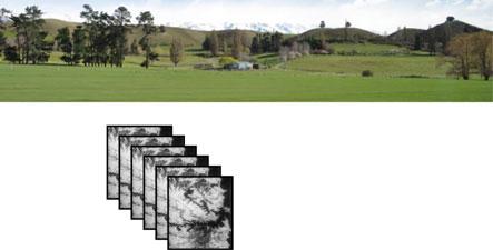
Thepropertiesofdigitalimagedataofimportanceinimageprocessingandanalysis arethenumberandlocationofthespectralmeasurements(bandsorchannels),the spatialresolutiondescribedbythepixelsize,andthe radiometricresolution.These areshowninFig. 1.4.Radiometricresolutiondescribestherangeanddiscernible numberofdiscretebrightnessvalues.Itissometimesreferredtoas dynamicrange andisrelatedtothesignal-to-noiseratioofthedetectorsused.Frequently,radiometricresolutionisexpressedintermsofthenumberofbinarydigits,orbits, necessarytorepresenttherangeofavailablebrightnessvalues.Datawithan8bit radiometricresolutionhas256levelsofbrightness,whiledatawith12bitradiometricresolutionhas4096brightnesslevels.2
Thesizeoftherecordedimageframeisalsoanimportantproperty.Itis describedbythenumberofpixelsacrosstheframeor swath,orintermsofthe numbersofkilometrescoveredbytherecordedscene.Together,theframesizeof theimage,thenumberofspectralbands,theradiometricresolutionandthespatial resolutiondeterminethedatavolumegeneratedbyaparticularsensor.Thatsetsthe amountofdatatobeprocessed,atleastinprinciple.
Imagepropertieslikepixelsizeandframesizearerelateddirectlytothetechnicalcharacteristicsofthesensorthatwasusedtorecordthedata.The instantaneous fieldofview (IFOV)ofthesensorisits fi nestangularresolution,asshownin Fig. 1.5.Whenprojectedontothesurfaceoftheearthattheoperatingaltitudeofthe platform,itdefinesthesmallestresolvableelementintermsofequivalentground metres,whichiswhatwerefertoaspixelsize.Similarly,the fieldofview (FOV)of thesensoristheangularextentoftheviewithasacrosstheearth’ssurface,againas
Fig.1.4
Fig.1.5 Definitionofimage spatialproperties,with commonunitsindicated
seeninFig. 1.5.Whenthatangleisprojectedontothesurfaceitdefinestheswath widthinequivalentgroundkilometres.Mostimageryisrecordedinacontinuous stripastheremotesensingplatformtravelsforward.Generally,particularlyfor spacecraftprograms,thestripiscutupintosegments,equalinlengthtotheswath width,sothatasquareimageframeisproduced.Foraircraftsystems,thedatais oftenleftinstripformatforthecomplete flightline flowninagivenmission.
1.3RemoteSensingPlatforms
Remotesensingcanbecarriedoutusingsatellites,aircraftordronesasplatformsto carrytheimaginginstruments.Inmanywaysthoseinstrumentshavesimilar characteristicsbutdifferencesinthealtitudeandstabilityoftheplatformcanleadto differingimageproperties.
Therearetwobroadclassesofsatelliteprogram:thosesatellitesthatorbitat geostationaryaltitudesabovetheearth’ssurface,generallyassociatedwithweather andclimatestudies,andthosewhichorbitmuchclosertotheearthandthatare generallyusedforearthsurfaceandoceanographicobservations.Thelowearth orbitingsatellitesareusuallyinasun-synchronousorbit.Thatmeansthattheorbital planeisdesignedsothatitprecessesabouttheearthatthesameratethatthesun appearstomoveacrosstheearth’ssurface.Inthismannerthesatelliteacquiresdata ataboutthesamelocaltimeoneachorbit.
Lowearthorbitingsatellitescanalsobeusedformeteorologicalstudies. Notwithstandingthedifferencesinaltitude,thewavebandsusedforgeostationary andearthorbitingsatellites,forweatherandearthobservation,areverycomparable. Themajordistinctionintheimagedatatheyprovidegenerallyliesinthespatial resolutionavailable.Whereasdataacquiredforearthresourcespurposeshaspixel
sizesoftheorderof1–10morso,thatusedformeteorologicalpurposes(bothat geostationaryandloweraltitudes)hasamuchlargerpixelsize,oftenoftheorderof 1km.
Theimagingtechnologiesusedinsatelliteremotesensingprogramshaveranged fromtraditionalcamerastoscannersthatrecordimagesoftheearth’ssurfaceby movingtheinstantaneous fieldofviewoftheinstrumentacrossthesurfaceto recordtheupwellingenergy.Typicalofthelattertechniqueisthatusedinthe Landsatprograminwhichamechanicalscannerrecordsdataatrightanglestothe directionofsatellitemotiontoproducerasterscansofdata.Theforwardmotionof thevehicleallowsanimagestriptobebuiltupfromtherasterscans.Thatprocessis showninFig. 1.6.Adispersiondevice,suchasaprismordiffractiongrating, integratedwiththesensor,separatestherecordedsignalintoanumberofwavebandsbydispersingtheradiationontosetsofdetectors;thereareasmanyseparate imagesrecordedoftheregionoftheearth’ssurfaceastherearedetectorsandthus wavebands.
Someweathersatellitesscantheearth’ssurfaceusingthespinofthesatellite itselfwhilethesensor ’spointingdirectionisvariedalongtheaxisofthesatellite. Theimagedataisthenrecordedinarasterscanfashion.
Withtheavailabilityofreliabledetectorarraysbasedonchargecoupleddevice (CCD)technology,analternativeimageacquisitionmechanismutiliseswhatis commonlycalleda “push-broom” technique.InthisapproachalinearCCDimaging arrayiscarriedonthesatellitenormaltotheplatformmotionasshowninFig. 1.7 Asthesatellitemovesforwardthearrayrecordsastripofimagedata,equivalentin widthtothe fieldofviewseenbythearray.Eachindividualdetectorrecordsastripin widthequivalenttothesizeofapixel.Becausethetimeoverwhichenergyemanatingfromtheearth’ssurfaceperpixelcanbelargerwithpushbroomtechnology thanwithmechanicalscanners,betterspatialresolutionisusuallyachieved.
TwodimensionalCCDarraysarealsoavailableand findapplicationinsatellite imagingsensors.However,ratherthanrecordatwo-dimensionalsnapshotimageof theearth’ssurface,thearrayisemployedinapushbroommanner;thesecond dimensionisusedtorecordsimultaneouslyanumberofdifferentwavebandsfor eachpixelviatheuseofamechanismthatdispersestheincomingradiationby wavelength.SuchanarrangementisshowninFig. 1.8.Oftenabout200channels arerecordedinthismannersothatthereflectioncharacteristicsoftheearth’s surfacearewellrepresentedinthedata.Suchdevicesareoftenreferredtoas imagingspectrometers andthedataisdescribedas hyperspectral,asagainst multispectral whenoftheorderof10wavebandsisrecorded.
Aircraftscannersoperateessentiallyonthesameprinciplesasthosefoundwith satellitesensors.BothmechanicalscannersandCCDarraysareemployed.
ThelogarithmicscaleusedinFig. 1.3 hidesthefactthateachofthecurves shownextendstoinfinity.Ifweignoreemissionsassociatedwithaburning fire,itis clearthattheemissionfromtheearthatlongerwavelengthsfarexceedsreflected solarenergy.Figure 1.9 re-plotstheearthcurvefromFig. 1.3 showingthatthereis continuousemissionofenergyrightouttothewavelengthswenormallyassociate withradiotransmissions.Inthemicrowaveenergyrange,wherethewavelengths
rota ng or oscilla ng scanning mirror
signals out at different wavelengths
pixel size swath width
Fig.1.6 Imageformationbymechanicallinescanning,showingthereceivedsignaldispersedinto severaldifferentwavelengths(orwavebands)
Fig.1.7 Imageformationbypushbroomscanning
arebetween1cmand1m,thereis,inprinciple,measurableenergycomingfrom theearth’ssurface.Asaresult,itispossibletobuildremotesensinginstruments thatformmicrowaveimagestheearth.Ifthoseinstrumentsdependonmeasuring thenaturallyoccurringlevelsshowninFig. 1.9,thenthepixelstendtobevery largebecauseoftheextremelylowlevelsofenergyavailable.Largepixelsare necessarytocollectenoughsignalsothatnoisefromthereceiverelectronicsand theenvironmentdoesnotdominatetheinformationofinterest.
Fig.1.8 Imageformationbypushbroomscanningwithanarraythatallowstherecordingof severalwavelengthssimultaneously
Fig.1.9 Illustrationofthelevelofnaturallyemittedenergyfromtheearthinthemicrowaverange ofwavelengths
Moreoften,wetakeadvantageofthefactthattheverylownaturallyoccurring levelsofmicrowaveemissionfromthesurfacepermitsustoassumethattheearth is,forallintentsandpurposes,azeroemitter.Thatallowsustoirradiatetheearth’s surfaceartificiallywithasourceofmicrowaveradiationatawavelengthofparticularinterest.Inprinciple,wecoulduseatechniquenotunlikethatshownin Fig. 1.6 tobuildupanimageoftheearthatthatwavelength.Technologically,
Fig.1.10 Syntheticapertureradarimaging;astheantennabeamtravelsoverfeaturesonthe groundmanyechoesarereceivedfromthepulsesofenergytransmittedfromtheplatform,which arethenprocessedtoprovideaveryhighresolutionimageofthosefeatures
however,theprincipleofsyntheticapertureradarisusedtocreatetheimage.We nowdescribethattechniquebyreferencetoFig. 1.10.
Apulseofelectromagneticenergyatthewavelengthofinterestisradiatedtothe sideoftheplatform.Itusesanantennathatproducesabeamthatisbroadinthe across-trackdirectionandrelativelynarrowinthealong-trackdirection,asillustrated.Thecross-trackbeamwidthdefinestheswathwidthoftherecordedimage. Featuresareresolvedacrossthetrackbythetimetakenforthepulsetotravelfrom thetransmitter,viascatteringfromthesurface,andbacktotheradarinstrument. Alongthetrack,featuresareresolvedspatiallyusingtheprincipleofaperture synthesis,whichentailsrecordingmanyreflectionsfromeachspotontheground andusingsignalprocessingtechniquestosynthesisehighspatialresolutionfroma systemthatwouldotherwiserecordfeaturesatadetailtoocoarsetobeofvalue. Thetechnicaldetailsofhowtheimageisformedarebeyondthescopeofthis treatmentbutcanbefoundinstandardtextsonradarremotesensing.3 Whatis importanthereisthestrengthofthesignalreceivedbackattheradarplatform becausethatdeterminesthebrightnessvaluesofthepixelsthatconstitutetheradar image.Aswithopticalimaging,theimagepropertiesofimportanceinradar imagingincludethespatialresolution,butnowdifferentinthealongandcrosstrack directions,theswathwidth,andthewavebandsatwhichtheimagesarerecorded. Whereastheremaybeasmanyas200wavebandswithopticalinstruments,there arerarelymorethanthreeorfourwithradaratthisstageofourtechnology. However,thereareotherradarparameters.Theyincludetheanglewithwhichthe
3 SeeRichards,loc.cit.,I.H.Woodhouse, IntroductiontoMicrowaveRemoteSensing,Taylorand Francis,BocaRaton,Florida,2006,F.M.HendersonandA.J.Lewis,eds, Principlesand ApplicationsofImagingRadar,ManualofRemoteSensing, 3rded.,Volume2,JohnWileyand Sons,N.Y.,1998,andF.T.UlabyandD.G.Long, MicrowaveRadarandRadiometricRemote Sensing,TheUniversityofMichiganPress,AnnArbor,2014.
1.3RemoteSensingPlatforms11
earth’ssurfaceisviewedoutfromtheplatform(theso-called lookangle)andthe polarisationofboththetransmittedandreceivedradiation.Asaconsequence,the parametersthatdescribearadarimagecanbemorecomplexthanthosethat describeanopticalimage.Nevertheless,oncearadarimageisavailable,the techniquesofthisbookbecomerelevanttotheprocessingandanalysisofradar imagedata.Thereare,however,somepeculiaritiesofradardatathatmeanspecial techniquesmoresuitedtoradarimageryareoftenemployed.4
1.4WhatEarthSurfacePropertiesAreMeasured?
Inthevisibleandinfraredwavelengthrangesallearthsurfacematerialsabsorb incidentsunlightdifferentiallywithwavelength.Somematerialsdetectedby satellitesensorsshowlittleabsorption,suchassnowandcloudsinthevisibleand nearinfrared.Ingeneral,though,mostmaterialshavequitecomplexabsorption characteristics.Earlyremotesensinginstrumentation,andmanycurrentinstruments,donothavesufficientspectralresolutiontobeabletorecognisethe absorptionspectraindetail,comparedwithhowthosefeaturesmightappearin laboratory-recordedspectra.Instead,thewavebandsavailablewithsomedetectors allowonlyacruderepresentationofthespectrum,butneverthelessonethatismore thansufficientfordifferentiatingamongmostcovertypes.Evenoureyesdoacrude formofspectroscopybyallowingustodifferentiateearthsurfacematerialsbythe colourswesee,eventhoughthecoloursarecompositesofthered,greenandblue signalsthatreachoureyesafterincidentsunlighthasscatteredfromthenaturaland builtenvironment.
Moremoderninstrumentsrecordmany,sufficiently fi nespectralsamplesover thevisibleandinfraredrangethatwecangetverygoodrepresentationsofreflectancespectra,aswewillseeinthefollowing.
1.4.1SensingintheVisibleandReflectedInfraredRanges
Intheabsenceofburning fires,Fig. 1.3 showsthattheupwellingenergyfromthe earth’ssurfaceuptowavelengthsofabout3 lmispredominantlyreflectedsunlight.Itcoverstherangefromtheultraviolet,throughthevisible,andintothe infraredrange.Sinceitisreflectedsunlighttheinfraredisusuallycalledreflected infrared,althoughitisthenbrokendownintothenear-infrared,shortwavelength infraredandmiddle-infraredranges.Together,thevisibleandreflectedinfrared rangesarecalledopticalwavelengthsasnotedearlier.Thedefinitionsandthe
4 SeeRichards,loc.cit.,forinformationonimageanalysistoolsspeci ficallydesignedforradar imagery.

