Advances in Remote Sensing Technology and
the Three Poles
Edited by Manish Pandey
Chandigarh University, Department of Civil Engineering, Mohali, India
Prem C. Pandey
School of Natural Sciences, Shiv Nadar Institution of Eminence, Center for Environmental Sciences & Engineering, Greater Noida, Uttar Pradesh, India
Yogesh Ray
National Centre for Polar and Ocean Research, Headland Sada, Vasco-da-Gama, Goa
Aman Arora
Bihar Mausam Seva Kendra, Planning and Development Department, Bihar, India
Shridhar D. Jawak
University Centre in Svalbard, Longyearbyen, Norway
Uma K. Shukla
Banaras Hindu University, Institute of Science, Varnasi, Uttar Pradesh, India
This edition first published 2023
© 2023 John Wiley & Sons Ltd
All rights reserved. No part of this publication may be reproduced, stored in a retrieval system, or transmitted, in any form or by any means, electronic, mechanical, photocopying, recording or otherwise, except as permitted by law. Advice on how to obtain permission to reuse material from this title is available at http://www.wiley.com/go/permissions.
The right of Manish Pandey, Prem C. Pandey, Yogesh Ray, Aman Arora, Shridhar D. Jawak and Uma K. Shukla, to be identified as the editorial material in this work has been asserted in accordance with law.
Registered Office(s)
John Wiley & Sons, Inc., 111 River Street, Hoboken, NJ 07030, USA
John Wiley & Sons Ltd, The Atrium, Southern Gate, Chichester, West Sussex, PO19 8SQ, UK
Editorial Offices
9600 Garsington Road, Oxford, OX4 2DQ, UK
The Atrium, Southern Gate, Chichester, West Sussex, PO19 8SQ, UK
For details of our global editorial offices, customer services, and more information about Wiley products visit us at www.wiley. com.
Wiley also publishes its books in a variety of electronic formats and by print-on-demand. Some content that appears in standard print versions of this book may not be available in other formats.
Trademarks: Wiley and the Wiley logo are trademarks or registered trademarks of John Wiley & Sons, Inc. and/or its affiliates in the United States and other countries and may not be used without written permission. All other trademarks are the property of their respective owners. John Wiley & Sons, Inc. is not associated with any product or vendor mentioned in this book.
Limit of Liability/Disclaimer of Warranty
While the publisher and authors have used their best efforts in preparing this work, they make no representations or warranties with respect to the accuracy or completeness of the contents of this work and specifically disclaim all warranties, including without limitation any implied warranties of merchantability or fitness for a particular purpose. No warranty may be created or extended by sales representatives, written sales materials or promotional statements for this work. The fact that an organization, website, or product is referred to in this work as a citation and/or potential source of further information does not mean that the publisher and authors endorse the information or services the organization, website, or product may provide or recommendations it may make. This work is sold with the understanding that the publisher is not engaged in rendering professional services. The advice and strategies contained herein may not be suitable for your situation. You should consult with a specialist where appropriate. Further, readers should be aware that websites listed in this work may have changed or disappeared between when this work was written and when it is read. Neither the publisher nor authors shall be liable for any loss of profit or any other commercial damages, including but not limited to special, incidental, consequential, or other damages.
Library of Congress Cataloging-in-Publication Data
Names: Pandey, Manish (Assistant professor), editor.
Title: Advances in remote sensing technology and the three poles / edited by Manish Pandey [and five others]
Description: Hoboken, NJ : John Wiley & Sons, 2023.
Identifiers: LCCN 2022028873 | ISBN 9781119787723 (hardback) | ISBN 9781119787730 (pdf) | ISBN 9781119787747 (epub) | ISBN 9781119787754 (ebook)
Subjects: LCSH: Remote sensing--Polar regions. | Remote sensing--Hindu Kush-Himalayan Region.
Classification: LCC G70.5.P73 .A38 2023 | DDC 621.36/780911--dc23/eng20221013
LC record available at https://lccn.loc.gov/2022028873
Cover image: © LEONELLO CALVETTI/Getty Images
Cover design by Wiley
Set in 9.5/12.5pt STIXTwoText by Integra Software Services Pvt. Ltd, Pondicherry, India
Indra Bir Singh (1943–2021) Department of Geology, University of Lucknow, Lucknow, Uttar Pradesh, India
Prof I.B. Singh was an eminent scholar of international repute, a dedicated geoscientist, and an ideal teacher. He was born on 8 July 1943 in Lucknow, Uttar Pradesh, India. Prof Singh breathed his last in the morning of 11 February 2021 after a brief illness. He completed his secondary education from the Lucknow Christian College in 1956. For higher education, he joined the Lucknow University, from where he obtained a BSc (1961) and MSc (1962) in Geology. This was the time when his classmates noticed in him an exceptional ability to look at the subject of Geology in a more common way relating to natural processes at work. After completing his post graduation, he joined the Oil and Natural Gas Corporation of India for a brief period and being unsatisfied with the job he left. He went to Germany to obtain a Dr.Rer.nat. degree from Technical University, Stuttgart, Germany in 1966 under the supervision of H. Aldinger. He then worked as a research associate at Senckenberg Institute, Wilhelmshaven, Germany in 1966. He spent two years (1967–1968) as a Post-doctoral fellow at the Oslo University, Norway. Later, he returned to Senckenberg Institute, Wilhelmshaven, as Alexander von Humboldt Fellow and worked from 1969 to 1972 on modern shallow marine sediments.
In 1972, Prof Singh returned to India and started working in the Department of Geology, University of Lucknow, from where he retired as Head of the Department in 2008. He brought out qualitative changes in teaching and research of the Department. He headed the department in the most democratic way and raised it to the level of Centre of Advance Studies in Geology. Returning to India, he started working on the sedimentary sequences of the Himalaya and central India ranging in age from the Precambrian to Holocene. Applying his experience of working on modern sediments of marine
and fluvial origin, Prof Singh was able to interpret the depositional environments of the Himalayan rock sequences precisely in terms of physical processes and age. He reinterpreted the Krol belt of Himalaya as Upper Proterozoic, which had been considered to be of Mesozoic age for over a century. This study changed the stratigraphy and evolutionary history of the Himalaya. He made many significant contributions for understanding rock sequences of the Kashmir, Kachchh, Gondwana, and Himalaya, east coast delta. These studies provided an in-depth understanding of the depositional processes based on field-based Facies Analysis.
In the early 1990s, Prof Singh established a very strong group with his students and adopted a multiproxy approach including Facies Analysis supported by OSL dating, geochemistry, and isotopic signatures to study the Ganga Plain of Himalayan Foreland Basin. He worked on the landform evolution, architectural element analysis of channel bars. and floodplain deposits. His group identified the contribution of interfluves (doab) processes in the fluvial domain which was a new discovery. This study provided insights into the nature of river systems, chronology to the Late Quaternary landform evolution, tectonic events, and climate changes in the Ganga Plain. He emphasized geoarchaeological aspects of the Ganga Plain and has been able to establish palaeovegetation, human settlement patterns, and agricultural activity, particularly the domestication of rice. Working on different aspects, Prof Singh guided 15 doctoral theses and published about 200 research papers in journals of national and international repute. His students have now established themselves as leaders in their own right and are a tribute to the training he imparted. With Prof H.E. Reineck, he co-authored the book, “Depositional Sedimentary Environments,” published in 1973. This is a
classic book on depositional environments and has been translated into Russian and Chinese. With A.S.R. Swamy, he also wrote the book entitled “Delta Sedimentation: East Coast of India.”
Prof Singh was elected as Fellow of Indian National Science Academy, New Delhi in 1995. He was a recipient of the National Mineral Award, Government of India (1996) and National Award for excellence in Earth System Science in 2013. He also received the L. Rama Rao Birth Centenary Award of the Geological Society of
India. He was honored with Fellow of Alexander von Humboldt Foundation, Germany in 1988–1989. Prof Singh was visiting Professor at Louisiana State University, USA (1984–1986) and at the University of Erlangen–Nuremberg, Germany (1998–1999). He has served as a board member of governing bodies on several committees dealing with research and teaching and is easily placed among those few who have impacted Indian geosciences, research, and teaching in a fundamental way and with indigenous resources and ideas.
Contents
About the Editors xvii
Notes on Contributors xx
Foreword xxv
Preface xxvi
List of Acronyms xxviii
Section I Earth Observation (EO) and Remote Sensing (RS) Applications in Polar Studies 1
1 The Three Poles: Advances in Remote Sensing in Relation to Spheres of the Planet Earth 3
Manish Pandey, Prem C. Pandey, Yogesh Ray, Aman Arora, Shridhar Digmabar Jawak, and Uma Kant Shukla
1.1 Introduction 3
1.1.1 Earth as a System and Components of the Earth System 4
1.1.2 Role of the “Three Poles” and the Three Poles Regions in the Earth System 4
1.1.2.1 Defining the Three Poles, Three Poles Regions, and Their Geographical Extent 4
1.1.2.2 Interaction Among Components of the Earth System and Role of the Three Poles 5
1.1.3 Advancement of RS Technologies in Relation to Their Application in the Three Poles Regions 6
1.1.3.1 Remote Sensing Technology Advancements 6
1.1.3.2 Role of Remote Sensing (RS) in Mapping/Monitoring/Quantitative Analysis of Sub-Systems of Our Planet in the Three Poles Regions 7
1.2 Aim of the Book and Its Five Sections 11
1.3 Overview of the Contributing Chapters Covering Research About Different Aspects of the Sub-Systems of Our Planet in the Three Poles Regions 11
1.4 Summary and Recommendations 14
References 15
2 Continuous Satellite Missions, Data Availability, and Nature of Future Satellite Missions with Implications to Polar Regions 24
Jagriti Mishra, Takuya Inoue, and Avinash Kumar Pandey
2.1 Introduction 24
2.1.1 Types of Orbit 24
2.1.1.1 High Earth Orbit (HEO) 25
2.1.1.2 Medium Earth Orbit (MEO) 25
2.1.1.3 Semi-Synchronous Orbit 25
2.1.1.4 Molniya Orbit 25
2.1.1.5 Low Earth Orbit (LEO) 25
2.1.1.6 Polar Orbit and Sun-Synchronous Orbit 25
2.1.1.7 Lagrange’s Point 26
2.2 Satellite Missions and Data Availability 26
2.3 Future Satellite Missions 26
2.4 Applicability of Satellite Products in Three Poles Regions 32
2.5 Challenges and Limitations 33
2.6 Summary 34
Acknowledgments 34
References 34
3 Assessing the Accuracy of Digital Elevation Models for Darjeeling-Sikkim Himalayas 36 Prodip Mandal and Shraban Sarkar
3.1 Introduction 36
3.2 Study Area 37
3.3 Materials and Methods 38
3.3.1 Generation of Cartosat-1 DEM and Orthoimage 38
3.3.2 TanDEM-X 40
3.3.3 ALOS PALSAR 40
3.3.4 DGPS Survey for Obtaining Ground Control Points (GCPs) 40
3.3.5 Datum Transformation 40
3.3.6 Accuracy Assessment Methods 40
3.3.6.1 Vertical Accuracy 41
3.3.6.2 Spatial Accuracy 41
3.4 Results and Discussion 41
3.4.1 Vertical Accuracy Assessment: Comparison of DEMs With Reference to GCPs 41
3.4.2 Vertical Accuracy of DEMs for Different Land Use Classes 41
3.4.2.1 Dense Forest 41
3.4.2.2 Open Forest 43
3.4.2.3 Tea Garden 43
3.4.2.4 Built-up Area 43
3.4.3 Spatial Accuracy Assessment: Comparison of DEMs With Reference to Stream Networks 43
3.5 Conclusions 45 Acknowledgments 46 References 46
4 An Overview of Morphometry Software Packages, Tools, and Add-ons 49
Satarupa Mitra, Shailendra Pundir, Rahul Devrani, Aman Arora, Manish Pandey, Romulus Costache, and Saeid Janizadeh
4.1 Introduction 49
4.2 Overview of Morphometry Tools and Toolboxes 50
4.3 Stand-Alone Tools 52
4.4 Tools that Run within Coding Bases 54
4.5 Conclusion 55 References 55
5 Landscape Modeling, Glacier and Ice Sheet Dynamics, and the Three Poles: A Review of Models, Softwares, and Tools 58
Satarupa Mitra, Rahul Devrani, Manish Pandey, Aman Arora, Romulus Costache, and Saeid Janizadeh
5.1 Introduction 58
5.2 Taxonomy 59
5.2.1 Geomorphic Process-Based Models 60
5.2.2 Classification Based on Process of Modeling 60
5.2.2.1 Based on Geomorphic Processes 60
5.2.2.2 Based on Modeling Process 60
5.3 Working Principles for Geomorphological Models 61
5.3.1 Soil Production 61
5.3.2 Hillslope Transport 62
5.3.3 Land Sliding 62
5.3.4 Fluvial Incision and Transport 62
5.3.5 Glacial Erosion 62
5.4 Landscape Evolution Models 63
5.4.1 DEM-Based Models 63
5.4.2 SIBERIA 63
5.4.3 GOLEM 64
5.4.4 CASCADE 64
5.4.5 ZScape 64
5.4.6 CHILD 64
5.4.7 CAESAR 65
5.4.8 APERO 65
5.4.9 SIGNUM (Simple Integrated Geomorphological Numerical Model) 65
5.4.10 TTLEM (TopoToolbox Landscape Evolution Model) 1.0 65
5.5 Other Models 65
5.5.1 DELIM 65
5.5.2 EROS 66
5.5.3 Landscape Evolution Model Using Global Search 66
5.5.4 eSCAPE 66
5.5.5 r.sim.terrain 1.0 66
5.6 Combined/Application-Specific Models 66
5.7 Machine Learning Models 66
5.8 LEMs Developed for Glaciated Landscapes 66
5.9 Some Significant Glacier Evolution Models 68
5.10 Models Developed for Alpine Regions 71
5.11 Models Developed for the Arctic Regio 72
5.12 Models Developed for the Antarctic Region 72
5.13 Conclusion and Future Prospects 75
Acknowledgment 75
Declaration of Competing Interest 75
References 76
6 Spectral Indices Across Remote Sensing Platforms and Sensors Relating to the Three Poles: An Overview of Applications, Challenges, and Future Prospects 83
Mallikarjun Mishra, Kiran Kumari Singh, Prem C. Pandey, Rahul Devrani, Avinash Kumar Pandey, KN Prudhvi Raju, Prabhat Ranjan, Aman Arora, Romulus Costache, Saeid Janizadeh, Nguyen Thuy Linh, and Manish Pandey
6.1 Introduction 83
6.2 Database and Methodology 84
6.3 Rationale of Different Spectral Indices Across RS Sensors and Platforms 85
6.4 RS Sensors and Platforms: Characteristics (Spatial, Temporal, Spectral, and Radiometric Resolutions) 87
6.5 Most Widely and Popularly Used Spectral Indices 87
6.5.1 Spectral Indices and Lithosphere 87
6.5.2 Spectral Indices and Hydrosphere 88
6.5.3 Spectral Indices and Atmosphere 90
6.5.4 Spectral Indices and Biosphere 91
6.5.5 Spectral Indices and Anthroposphere 103
6.6 Thematic Evolution and Trends 105
6.6.1 Thematic and Network Maps 105
6.7 Summary and Recommendations 110 Acknowledgments 111 References 111
Section II Antarctica: The Southernmost Continent Having the South Pole Environment and Remote Sensing 117
7 Glacier Dynamics in East Antarctica: A Remote Sensing Perspective 119 Kiledar Singh Tomar, Sangita Singh Tomar, Ashutosh Venkatesh Prasad, and Alvarinho J. Luis
7.1 Introduction 119
7.2 Satellite Remote Sensing of Glacier Dynamics in East Antarctica 120
7.3 Glacier Velocity Estimation Using Remote Sensing 121
7.3.1 Glacier Velocity Estimation Using SAR Interferometry 121
7.3.2 Glacier Velocity Estimation Using Offset Tracking 121
7.4 Remote Sensing Based Dynamics of PRG: A Case Study 122
7.4.1 Data and Methods 123
7.4.2 Results and Discussion 123
7.4.2.1 Ice Front Location 123
7.4.2.2 Glacier Velocity Over the Period of 2016–2019 124
7.4.3 Summary and Conclusion 124 References 125
8 Terrestrial Deglaciation Signatures in East Antarctica 128
Uday Sharma, Yogesh Ray, and Manish Pandey
8.1 Introduction 128
8.2 Geomorphology 128
8.2.1 East Antarctica 129
8.3 Landform Variation Concerning Various Sectors and Elevation 132
8.3.1 Dronning Maud Land 132
8.3.2 Enderby Land 133
8.3.3 Mac. Robertson Land, Amery Ice Shelf, and Prince Elizabeth Land 133
8.3.4 Wilkes Land 135
8.4 Chronology 135
8.4.1 Dronning Maud Land 136
8.4.2 Enderby Land 137
8.4.3 Mac. Robertson Land, Amery Ice Shelf ’s and Princess Elizabeth Land 137
8.4.4 Wilkes Land 138
8.5 Discussion 138
8.6 Conclusion 139
Acknowledgments 140 References 140
9 Geospatial Tools for Monitoring Vertebrate Populations in Antarctica With a Note on the Ecological Component of the Indian Antarctic Program 144
Anant Pande, Ankita Anand, Shailendra Saini, and Kuppusamy Sivakumar
9.1 Introduction 144
9.2 Novel Geospatial Tools for Biodiversity Monitoring in Antarctica 145
9.2.1 Unmanned Aerial Vehicles 145
9.2.2 Satellite Imagery 147
9.3 Spatial Mapping of Seabirds Under the Indian Antarctic Program 149
9.4 Recommendations to Incorporate New Tools for Antarctic Wildlife Monitoring Program 151
9.5 Conclusion 152
Acknowledgments 152
References 152
10 Bryophytes of Larsemann Hills, East Antarctica and Future Prospects 155
Devendra Singh
10.1 Introduction 155
10.2 Study Area 156
10.3 Materials and Methods 156
10.4 Taxonomic Treatment 156
10.5 Phytosociological Studies 174
10.6 Results and Discussion 175
10.7 Future Prospects 175
Acknowledgments 177
References 177
11 Antarctic Sea Ice Variability and Trends Over the Last Four Decades 179
Swathi M., Juhi Yadav, Avinash Kumar, and Rahul Mohan
11.1 Introduction 179
11.2 Datasets and Methods 180
11.2.1 Sea Ice Extent Analysis 180
11.2.2 Analysis of Physical Parameters 181
11.3 Results and Discussion 182
11.3.1 Sea Ice Variability in the Southern Ocean 182
11.3.2 Sea Ice Distribution With Respect to Ocean-Atmospheric Temperature 182
11.4
Summary and Conclusions 187
12
Acknowledgments 188
References 189
Section III Himalayas: The Third Pole Environment and Remote Sensing 191
Some Unresolved Problems in the Himalaya: A Synoptic View 193 Om N. Bhargava
12.1 Introduction 193
12.2 Stratigraphic Ages, Basin Configuration, and Palaeontology 193
12.3 Sedimentology 195
12.4 Tectonics and Structure 195
12.5 Magmatism and Geochronology 196
12.6 Metamorphism 196
12.7 Mineral Deposits 196
12.8 Palaeomagnetic Studies 197
12.9 Glaciological Studies 197
12.10 Geomorphological Studies 197
12.11 Conclusion 198
Acknowledgments 198
References 198
13 Fluctuations of Kolahoi Glacier, Kashmir Valley, Its Assessment With Tree-Rings of Pinus wallichiana and Comparable Satellite Imageries and Field Survey Records 203 Uttam Pandey, Santosh K. Shah, and Nivedita Mehrotra
13.1 Introduction 203
13.2 Tree-Ring Sampling Site and Data Acquisition 204
13.3 Tree-Ring Chronology and Its Assessments 206
13.4 Fluctuations of Kolahoi Glacier: Existing Records and Its Assessment With Tree-Rings 207
13.5 Conclusions 210
Acknowledgements 210
References 210
14 Applications of ICESat-2 Photon Data in the Third Pole Environment 213 Giribabu Dandabathula
14.1 Introduction 213
14.2 Brief Background About NASA’s ICESat-2 Mission 214
14.3 Terrain Profiling From ICESat-2 Photon Elevations Over a Mountainous Region 216
14.4 Longitudinal Profiling of Rivers in a Mountainous Region 216
14.5 Inland Water Level Detection in Mountainous Regions Using ICESat-2 Photon Data 216
14.6 Inferring Annual Variations of Water Levels in Mountain Lakes Using ICESat-2’s ATL13 Data Product 218
14.7 Inferring Lake Ice Phenology in Mountainous Regions Using ICESat-2 Photon Data 221
14.8 Estimating Tree Heights in Mountain Regions Using ICESat-2 Photon Data 223
14.9 Utilization of ICESat-2 Photon Data to Generate Digital Elevation Models 223
14.10 Conclusion 225
Acknowledgments 226
References 226
15 Extreme Hydrological Event-Induced Temporal Variation in Soil Erosion of the Assiganga River Basin, NW Himalaya 230
Rohit Kumar, Rahul Devrani, Astha Dangwal, Benidhar Deshmukh, and Som Dutt
15.1 Introduction 230
15.2 Study Area 231
15.3 Methodology and Dataset 233
15.3.1 Soil Erodibility (K Factor) 234
15.3.2 Rainfall Erosivity (R Factor) 234
15.3.3 Slope Length and Steepness Factor (LS Factor) 235
15.3.4 Crop Management (C Factor) and Support Practices (P Factor) 237
15.4 Results and Discussion 239
15.4.1 Pre-Post R, C, and P Variation 239
15.4.2 Soil Loss Spatial Pattern and Extent 240
15.5 Conclusion 243
Acknowledgments 243
References 243
16 Understanding the Present and Past Climate-Human-Vegetation Dynamics in the Indian Himalaya: A Comprehensive Review 247
Mehta Bulbul, Yadav Ankit, Aljasil Chirakkal, Ambili Anoop, and Praveen K. Mishra
16.1 Introduction 247
16.2 Study Site 248
16.3 Climate Vegetation Interaction in the Indian Himalaya 248
16.3.1 Present-Day Conditions 248
16.3.2 The Holocene Epoch 249
16.3.2.1 Western Himalaya 249
16.3.2.2 Eastern Himalaya 252
16.3.2.3 Central Himalaya 253
16.4 Conclusions 253
References 254
17 Flash Flood Susceptibility Mapping of a Himalayan River Basin Using Multi-Criteria Decision-Analysis and GIS 257
Pratik Dash, Kasturi Mukherjee, and Surajit Ghosh
17.1 Introduction 257
17.2 Study Area 258
17.3 Data and Methodology 259
17.3.1 Data 259
17.3.2 Multicriteria Analysis 259
17.3.3 Selection and Classification of Flood Predictors 259
17.3.4 Flood Hazard Index 260
17.3.5 Validation 260
17.4 Results and Discussion 260
17.4.1 Flood Controlling Factors 260
17.4.2 Multicriteria Analysis 264
17.4.3 Flood Susceptibility Mapping 264
17.4.4 Validation 265
17.5 Conclusion 266 References 266
18 The Role of Himalayan Frontal Thrust in the Upliftment of Kimin Formation and the Migration of Sedimentary Basin in Arunachal Himalaya, Around Bandardewa, Papumpare District, Arunachal Pradesh 268 Mondip Sarma, Sajeed Zaman Borah, Devojit Bezbaruah, Tapos Kumar Goswami, and Upendra Baral
18.1 Introduction 268
18.2 Geology 269
18.2.1 Siwaliks of Arunachal Himalaya 269
18.2.2 Geology of the Study Area 269
18.3 Materials and Method 272
18.4 Study of Alluvial Fan 273
18.4.1 Description of Lithosections 273
18.4.1.1 Kimin Formation 273
18.4.1.2 Terrace Deposits 274
18.4.2 Grain Size Analysis 275
18.4.3 Cumulative Curve 275
18.4.4 Calculation of Size Parameters 275
18.4.4.1 Graphic Mean 275
18.4.4.2 Graphic Standard Deviations 275
18.4.4.3 Graphic Skewness 275
18.4.4.4 Graphic Kurtosis 275
18.4.5 Inter-Relationship of Size Parameters 275
18.4.6 CM Plot 278
18.5 Discussion and Conclusions 279
Acknowledgments 280
References 280
19
Himalayan River Profile Sensitivity Assessment by Validating of DEMs and Comparison of Hydrological Tools 283
Rahul Devrani, Rohit Kumar, Maneesh Kuruvath, Parv Kasana, Shailendra Pundir, Manish Pandey, and Sukumar Parida
19.1 Introduction 283
19.2 Study Area 284
19.3 Methodology (LSDTopoTools) 284
19.4 Details of DEM Datasets Used 286
19.4.1 ALOS-PALSAR 286
19.4.2 ASTER 286
19.4.3 CartoDEM 287
19.4.4 Copernicus DEM 287
19.4.5 NASA DEM 287
19.4.6 SRTM 289
19.5 Result and Discussion 289
19.5.1 Assessment of DEMs Generated Watershed Boundary and Slope 289
19.5.2 Sensivity of Longitudinal River Profiles Using Different DEMs 289
19.6 Conclusion 295
Acknowledgments 295
References 295
20 Glacier Ice Thickness Estimation in Indian Himalaya Using Geophysical Methods: A Brief Review 299
Aditya Mishra, Harish Chandra Nainwal, and R. Shankar
20.1 Introduction 299
20.2 Geophysical Methods for Estimation of Glacier Ice Thickness 300
20.2.1 Gravity 300
20.2.2 Magnetic 300
20.2.3 Resistivity 300
20.2.4 Seismic 300
20.2.5 Ground Penetrating Radar 300
20.3 Geophysical Methods in the Indian Himalaya Region 300
20.4 GPR Surveys in the Debris Covered Glaciers 302
20.5 A Case Study on Debris-Covered Satopanth Glacier 303
20.6 Conclusions and Future Prospects 304
Acknowledgments 304
References 305
21 Landscapes and Paleoclimate of the Ladakh Himalaya 308
Anil Kumar, Rahul Devrani, and Pradeep Srivastava
21.1 Introduction 308
21.2 Geology of the Ladakh Himalaya 308
21.2.1 Karakoram Region 310
21.3 Past Climate Variability 310
21.3.1 Early Holocene (~11.7 to 8.2 ka) 310
21.3.2 Mid-Holocene (~8.2–4.2 ka) 310
21.3.3 Late-Holocene (~4.2 ka–Present) 311
21.4 Modern Climatic and Vegetation 311
21.5 Landscapes in the Ladakh Region 312
21.6 Glaciation and Associated Landforms 315
21.7 Flood History and Disaster 315
21.8 Conclusion 316
Acknowledgment 316 References 316
22 A Review of Remote Sensing and GIS-Based Soil Loss Models With a Comparative Study From the Upper and Marginal Ganga River Basin 321
Rohit Kumar, Rahul Devrani, and Benidhar Deshmukh
22.1 Introduction 321
22.2 Geospatial Models 323
22.2.1 USLE (Universal Soil Loss Equation) 324
22.2.2 RUSLE (Revised Universal Soil Loss Equation) 324
22.2.2.1 Rainfall Erosivity Factor “R” 325
22.2.2.2 Soil Erodibility “K” 325
22.2.2.3 Slope Length and Steepness “LS” 325
22.2.2.4 Crop Management (C) 326
22.2.2.5 Support Practices “P” 326
22.2.3 MUSLE (Modified Universal Soil Loss Equation) 326
22.3 A Case Study in Upper and Marginal Ganga River Basins Using RUSLE Model 326
22.3.1 Study Area (Upper and Marginal Ganga River Basins) 326
22.3.2 Dataset and Methodology 327
22.3.3 Rate of Soil Loss in Rishiganga Basin (RG) 328
22.3.4 Rate of Soil Loss in Lower Chambal Basin (LC) 329
22.4 Discussion 331
22.5 Conclusion 333
Acknowledgments 334 References 334
23 Wetlands as Potential Zones to Understand Spatiotemporal Plant-Human-Climate Interactions: A Review on Palynological Perspective from Western and Eastern Himalaya 340 Sandhya Misra, Anupam Sharma, Ravi Shankar Maurya, and Krishna G. Misra
23.1 Introduction 340
23.2 Importance of Wetlands 340
23.3 Climate of Himalaya 341
23.4 Vegetation Types in the Himalayan Region 341
23.5 Wetlands as Sites for Floristic Analysis 341
23.6 Wetlands as Sites for Past Vegetation-Climate-Human Interaction 342
23.7 Conclusions 347 Acknowledgments 348 References 348
24 Investigation of Land Use/Land Cover Changes in Alaknanda River Basin, Himalaya During 1976–2020 351
Varun Narayan Mishra
24.1 Introduction 351
24.2 Materials and Methods 352
24.2.1 Study Area 352
24.2.2 Data Used 352
24.2.3 Methods 353
24.2.3.1 LULC Classification Scheme 353
24.2.3.2 LULC Change Investigation 353
24.3 Results and Discussion 353
24.3.1 LULC Status 354
24.3.2 LULC Change 354
24.4 Conclusions 355
References 355
Section IV The Arctic: The Northernmost Ocean Having the North Pole Environment and Remote Sensing 357
25 Hydrological Changes in the Arctic, the Antarctic, and the Himalaya: A Synoptic View from the Cryosphere Change Perspective 359
Shyam Ranjan, Manish Pandey, and Rahul Raj
25.1 Introduction 359
25.2 Cryosphere and Its Influence on Socio-Ecological-Economical (GLASOECO) System 360
25.2.1 Cryospheric Change and Its Influence on Agriculture and Livestock 360
25.2.2 Cryospheric Change and Its Influence on Ecosystem and Environment 361
25.2.3 Cryospheric Change and Its Influence on the Economy 362
25.2.4 Cryospheric Change as a Risk to Energy Security 362
25.3 Hydrological Changes in the Arctic and the Antarctic Regions 363
25.3.1 Hydrological Changes in the Arctic 363
25.3.2 Hydrological Changes in the Antarctic 363
25.4 Hydrological Changes in the Third Pole (Himalaya) 363
25.4.1 Runoff Flooding 364
25.4.2 Future Hydrological Change in the Third Pole 364
25.5 Conclusion 365
Acknowledgments 365 References 365
26 High-Resolution Remote Sensing for Mapping Glacier Facies in the Arctic 371 Shridhar Digambar Jawak, Sagar Filipe Wankhede, Alvarinho J. Luis, and Keshava Balakrishna
26.1 Introduction 371
26.1.1 Glacier Facies Mapping Using Multispectral Data 372
26.1.2 Image Classification 372
26.1.3 Training Samples and Operator Skill 373
26.1.4 The Test of Operator Influence 373
26.2 The Geographical Area and Geospatial Data 374
26.3 Methodology 374
26.3.1 Radiometric Calibration and Digitization 375
26.3.2 Operator Selections 376
26.3.3 Classification and Reference Point Selection 376
26.4 Results and Discussion 376
26.5 Inferences and Recommendations 378
26.6 Conclusion 378 References 378
27 Supraglacial Lake Filling Models: Examples From Greenland 381 Prateek Gantayat
27.1 Introduction 381
27.2 Methods 381
27.2.1 Supraglacial Lake FillING (SLING) 381
27.2.2 Surface Routing and Lake Filling Model (SRLF) 383
27.2.3 Surface Routing and Lake Filling With Channel Incision (SRLFCI) 384
27.3 Study Area 384
27.4 Data Used 384
27.5 Results 386
27.5.1 Results For SLING Model 386
27.5.2 Results For SRLF Model 387
27.5.3 Results For SRLFCI Model 387
27.6 Discussion 387
27.7 Conclusions 388
Acknowledgments 388
References 388
28 Arctic Sea Level Change in Remote Sensing and New Generation Climate Models 390 S. Chatterjee, R.P. Raj, A. Bonaduce, and R. Davy
28.1 Introduction 390
28.2 Remote Sensing of Arctic Ocean Sea-Level Changes 390
28.3 Results and Discussion 392
28.3.1 Observed Trend and Variability 392
28.3.2 Arctic Ocean Sea Level and Large-Scale Atmospheric and Ocean Circulation 392
28.3.3 Arctic Ocean Sea Level in CMIP6 395
28.4 Conclusions 396
Acknowledgments 398 References 398
29 Spatio-Temporal Variations of Aerosols Over the Polar Regions Based on Satellite Remote Sensing 401 Rohit Srivastava
29.1 Introduction 401
29.2 Data and Methodology 402
29.3 Results and Discussion 403
29.3.1 Seasonal Variations of Relative Humidity (RH) Over Northern and Southern Polar Regions 403
29.3.1.1 Arctic 403
29.3.1.2 Antarctic 403
29.3.2 Seasonal Variations of Winds over Northern and Southern Polar Regions 404
29.3.2.1 Arctic 404
29.3.2.2 Antarctic 405
29.3.3 Seasonal Variations of Global Fire Activities 405
29.3.4 Aerosol Variations Over the Northern and Southern Polar Region 407
29.3.5 Seasonal Aerosol Variations Over the Northern and Southern Polar Regions 407
29.3.5.1 Arctic 407
29.3.5.2 Antarctic 408
29.4 Conclusions 409 Acknowledgments 410 References 410
Section V The Research Institutions on the “Three Poles,” Data Pools, Data Sharing Policies, Career in Polar Science Research and Challenges 413
30 Multi-Disciplinary Research in the Indian Antarctic Programme and Its International Relevance 415 Anand K. Singh, Yogesh Ray, Shailendra Saini, Rahul Mohan, and M. Javed Beg
30.1 Introduction 415
30.2 India in the International Bodies for Antarctica 415
30.3 Multi-Disciplinary Antarctic Research in the Last Decade 416
30.4 International Relevance 417
30.5 Concluding Remarks 418 References 418
31 Indian and International Research Coordination in the Arctic 420 Archana Singh, David T. Divya, and K.P. Krishnan
31.1 The Changing Arctic and Inherited Interest 420
31.2 International Research Coordination 421
31.3 Arctic Research Coordination at the National Level 422
31.4 Coordination Among Students, Young Researchers, and Educators 424 Acknowledgments 425 Declaration of Competing Interest 425 References 425
About the Editors
Dr Manish Pandey currently works at the University Center for Research & Development (UCRD), Chandigarh University located in Mohali, Punjab, India. He earned his graduation (Geography honors) and post-graduation (Geography) from the University of Allahabad located in Allahabad, Uttar Pradesh, India. He has been awarded a research grant as Junior Research Fellow (JRF) and Senior Research Fellow (SRF) for carrying out his doctoral research by the Council of Scientific and Industrial Research (CSIR), Ministry of Human Resource Development, Government of India. After earning his PhD degree in the field of Geomorphology, he has been engaged in post-doctoral research (at different research positions) for more than five years. His research interests are in Geography, Fluvial and Glacial Geomorphology, Glaciology, and Remote Sensing & Geoinformatics (GIS). Recently, he discovered his new area of interest in the application of artificial intelligence, machine learning, and deep learning algorithms in the domains of natural hazards, and how their application can be extended for exposure of land to future natural hazards. His simple interest is in understanding the process–form relationship in diverse environmental settings. He is an experienced research associate with a demonstrated capability of working in the research industry, skilled in Cartography, Geomorphology, well versed in GIS packages like ArcGIS, QGIS, ERDAS Imagine, and Data Analysis, and is a strong research professional with a Doctor of Philosophy (PhD) in Fluvial Geomorphology from Banaras Hindu University. His exposure to glaciological field work and
training by India’s elite government institutions like the Geological Survey of India, and geospatial training provided to him by institutions like ISRO, has infused some very important skills in the respected fields of research needed to carry out this project to finality. Dr Manish has been in the field training groups carrying out research in the study of the Himalayan Foreland Basin deposits, ancient Neogene Siwalik sequences and their modern analogs like the Gangetic Foreland Basin sediments facies, to understand the role of synsedimentary processes in the evolution of one of the world’s most important foreland basin systems on the planet. He has published high-quality peer reviewed research articles in national/international scientific journals and books including Ecological Indicators, Science of the Total Environments, Advances in Space Research, Frontiers in Earth Science, etc.

Dr Prem C. Pandey received PhD from the University of Leicester, United Kingdom, under Commonwealth Scholarship and Fellowship Plan. He did his Post-Doctoral from the Department of Geography and Human Environment, Faculty of Exact Sciences, Tel Aviv University Israel. Currently, he is working as Assistant Professor at the School of Natural Sciences, Center for Environmental Sciences & Engineering, Shiv Nadar Institution of Eminence (erstwhile, Shiv Nadar University), Uttar Pradesh, India. Previously, he has been associated with Banaras Hindu University India as a SERB-NPDF
fellow. He received his BSc and MSc degrees (Environmental Sciences) from Banaras Hindu University and his M.Tech degree (Remote Sensing) from Birla Institute of Technology, India. He has worked as a Professional Research fellow on remote sensing applications in the National Urban Information System funded by the NRSC Government of India. He has been a recipient of several awards including Commonwealth Fellow United Kingdom, INSPIRE fellow GoI, MHRD-UGC fellow GoI, Malviya Gold Medal from Banaras Hindu University, SERB-NPDF from the Government of India, and Young Investigator Award. Dr Pandey is working on three projects related to Monitoring of wetlands/chilika lakes, mainly focusing on ramsar sites along with other natural resourcesbased research work funded by the NGP and SERB Government of India. Dr Pandey is also working with science collaborators in real-time disaster monitoring in the Himalayan regions. He has published more than 45 peer reviewed journal papers , 6 edited books, several book chapters, and presented his work at national and international conferences. He is a serving member (associate editor) of the editorial board for Geocarto International Journal, Taylor & Francis, and acted as guest editor for Remote Sensing, MDPI. Additionally, he is also a member of ISG (Indian Society of Geomatics), ISRS (Indian Society of Remote Sensing), IUCN-CEM (2017–2025), Society of Wetland Scientists (2021–2022), SPIE, and AAG. Dr Pandey focuses his research on remote sensing for natural resources including forestry, agriculture, urban studies, environmental pollutant modeling. and climate change.
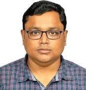
Dr Yogesh Ray is presently working as Scientist-E at National Centre for Polar and Ocean Research, Ministry of Earth Sciences (Government of India) Goa, India. He earned his PhD from Wadia Institute of Himalayan Geology, MoU with HNB Garhwal University. He has published several papers in peer-reviewed journals and chapters in edited volumes. Research interests lie in Clastic Sedimentology, Geomorphology, Himalayan Geology, and the evolution of the Antarctic landscape in the Pliestocene-Holocene. Actively involved with the Indian Antarctic programme. Dr Ray participated in the 33rd, 35th, 37th, and 40th Indian Scientific expeditions to Antarctica (ISEA) and was entrusted with the responsibility of “Voyage Leader” during the 37th and 40th ISEA. He was bestowed with the Young Researcher Award 2010, Ministry of Mines, Government of India, Foundation day best research paper award 2010–2011 from the Wadia Institute of Himalayan Geology, Dehradun, India, the Shri PV Dehadrai Memorial Gold Medal, and Prof MS Srinivasan Gold Medal from Banaras Hindu University, Varanasi, India.
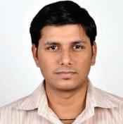
Dr Aman Arora has completed his doctorate (PhD) in Geography, specializating in Remote Sensing (RS) and Geographic Information System (GIS) and has more than twelve years experience in different public and private organizations. He also holds a master’s degree as well as a postgraduate diploma in RS & GIS. Dr Aman Arora has core expertise in change detection analysis, urban planning, network analysis, flood frequency analysis, hydrometeorological trend analysis, and spatial modeling. His current research interests are in the fields of risk map analysis for different natural hazards by utilizing satellite images and advanced statistical algorithms including machine learning models in GIS environment. He had received awards and travel grants from different organizations/institutes of international repute such as the National Science Foundation, USA; United Nations Office for Outer Space Affairs, Vienna, Austria; Council of Scientific Industrial Research, India; and Sun Yat-sen University, China; for research work presentations, participation in conferences, and training programs.
In his current role as a Scientific Officer/Scientist (RS & GIS) at Bihar Mausam Sewa Kendra, Planning & Development Department, Government of Bihar, Dr Aman Arora is leading his team in providing support to others by performing accurate and timely delivery of weather maps to the stakeholders and officials for Bihar. Also, he and his team are actively involved in monitoring, assessment, and forecast of hydrological extreme events (floods/droughts) and meteorological extreme events (heat waves/cold waves).
In addition to his professional and academic achievement, Dr Aman Arora is an active International Rated Chess Player recognized by The Fédération Internationale des Échecs (FIDE), Switzerland.
Dr Shridhar D. Jawak is currently working as a Senior Adviser in Remote Sensing at the Svalbard Integrated Arctic Earth Observing System (SIOS), Longyearbyen, Norway. He is on the advisory/evaluation board of three European projects focusing on Earth observation activities. He has chaired more than 14 sessions in international conferences, published more than 40 peer-reviewed articles, and presented more than 100
conference presentations in the past 12 years. He has participated in three summer expeditions to Antarctica and one field campaign to Svalbard during his doctoral research. He has acted as a co-principal investigator (CoPI) of four projects peer-reviewed by national referees. He has guided/co-guided around 90 master’s students for their master’s thesis/summer training projects in the field of Earth observation and Remote Sensing in Polar Regions. He is the recipient of five prestigious awards/fellowships: 1) Emerging leadership grant: 2022 by the Arctic Frontiers; 2) International Mentorship Award: 2021 by the Association of Polar Early Career Scientists (APECS); 3) Indian National Geospatial Award: 2018 by the Indian Society of Remote Sensing (ISRS); 4) International Arctic Science Committee (IASC) Fellow: 2017; and (5) Recipient of Young Geospatial Scientist: 2017 by the Geospatial World Forum. His research interests include remote sensing of the cryosphere, specifically focusing on the usage of multisatellite (SAR/Optical/LiDAR) and airborne data for spatiotemporal changes in the cryosphere of the Arctic, Antarctic, and Himalayas.
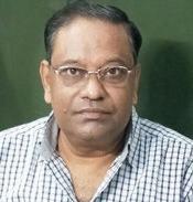
Professor Uma Kant Shukla is currently an Alexander von Humboldt Fellow at the Center for Advanced Study in Geology, Institute of Science, Banaras Hindu University, Varanasi. He is a sedimentologist with 30 years of doctoral and postdoctoral research experience. His research interest hinges on facies analysis of ancient and modern deposits of fluvial, marine, and lake origin. For more than one decade, he has been using modern tools such as architectural element analysis, palaeocurrent, trace fossil, etc., in the study of the Himalayan Foreland Basin deposits, including ancient Neogene Siwalik sequences and modern Gangetic Foreland Basin sediments to generate facies models for various
depositional domains, and to evaluate the role of synsedimentary tectonics and palaeoclimate influencing the mode of sedimentation through Neogene-Quaternary times. Study of modern fluvial processes has been helpful to understand the river dynamics in the past. The incised valley system of Gangetic Plain Rivers has also been compared to the Stuttgart Formation (Carnian, Late Triassic) of Germany, which is believed to have been formed under similar climatic settings. Palaeolake deposits of Ladakh and paleoflood sediments have been investigated and the interpretation of palaeoclimate and tectonic evolution of the Trans-Himalayan terrain. Glacial history of the Suru-sub-Basin of Kashmir Himalaya has been studied and an inventory of paleoclimatic response of glaciers has been proposed.
Recently, it has been realized that Geoarchaeological studies of ancient settlements may have societal implications and can help masses to understand existing myths and traditions in a more scientific way. Therefore, a collaborative attempt has been made involving experts from the Archaeology and Geography Departments of BHU to unravel the settlement history of Varanasi city and its possible evolution with the dynamics of River Ganga through the ages. This work has resulted in an authored book titled Varanasi and Ganga, published by Aryan Books International, New Delhi. Study of the Cretaceous Lameta and Bagh Formation of Central India, Precambrian sequences of Kumaun Lesser Himalaya, and the Vindhyan basin has helped to understand the processes of sedimentation, facies models, and palaeogeographic reconstruction of these basins. The Permian-Triassic Boundary in Spiti Himalaya has been studied and a major catastrophe has been deduced.
Professor Shukla has, to his credit, authored more than 90 national and international peer reviewed papers, book chapters, and has presented his research findings in different conferences and seminars, both in India and abroad. He has been a member of expert committees in MoES, Government of India, and SERB, a statutory body under the Department of Science and Technology, Government of India.
Notes on Contributors
Avinash Kumar Pandey
Department of Chemistry, GLA University, Chaumuhan, Mathura, Uttar Pradesh, India
Email ID: avinash.pandey@gla.ac.in
Benidhar Deshmukh
Discipline of Geology, School of Sciences, Indira Gandhi National Open University, New Delhi, India.
Email ID: bdeshmukh@ignou.ac.in
Maneesh Kuruvath
Kuruvath House, Muttathukulangara, Vellikulangara P.O
Thrissur, Kerala, India
Email ID: maneeshkuruvath@gmail.com
Manish Pandey
University Center for Research & Development (UCRD), Chandigarh University, Mohali, Punjab, India
Email ID: manish07sep@gmail.com
Rahul Devrani
Wadia Institute of Himalayan Geology, Dehradun-248001, India; University School of Environment Management, Guru Gobind Singh Indraprastha University Delhi, India
Email ID: rahuldevrani18@gmail.com
Rahul Mohan
ESSO National Centre for Polar and Ocean Research, Ministry of Earth Sciences, Government of India, Headland Sada, Vasco-Da-Gama, Goa, India
Email ID: rahulmohan@ncpor.res.in; rahulmohan@ ncpor.res.in
Rohit Kumar
Discipline of Geology, School of Sciences, Indira Gandhi National Open University, New Delhi, India.
Email ID: rohitkumargeologist@gmail.com
Romulus Costache
Department of Civil Engineering, Transilvania University of Brasov, Brasov, Romania
Email ID: romuluscostache2000@yahoo.com; romulus. costache@icub.unibuc.ro
Satarupa Mitra
University Center for Research & Development (UCRD), Chandigarh University, Mohali, Punjab, India
Email ID: ruupa86@gmail.com
Yogesh Ray
ESSO-National Centre for Polar and Ocean Research, Ministry of Earth Sciences, Government of India, Headland Sada, Vasco-Da-Gama, Goa, India
Email ID: yogeshray@gmail.com; yogesh@ncpor.res.in
Aditya Mishra
Hemvati Nandan Bahuguda Garhwal University, Srinagar, Uttarakhand, India
Email ID: mishraaditya557@gmail.com
Aljasil Chirakkal
Indian Institute of Science Education and Research Mohali, Manauli, Punjab, India
Email ID: jasilchirakkal@gmail.com
Alvarinho J. Luis
ESSO-National Centre for Polar and Ocean Research, Ministry of Earth Sciences, Government of India, Headland Sada, Vasco-Da-Gama, Goa, India
Email ID: alvjuis@gmail.com
Aman Arora
Bihar Mausam Seva Kendra, Planning and Development Department, Government of Bihar, Patna, Bihar, India
Email ID: aman.jmi01@gmail.com
Ambili Anoop
Indian Institute of Science Education and Research
Mohali, Manauli, Punjab, India
Email ID: anoop.ambili85@gmail.com
Anand K. Singh
ESSO-National Centre for Polar and Ocean Research, Ministry of Earth Sciences, Govt. of India, Headland Sada, Vasco-Da-Gama, Goa, India
Email ID: singhaaks@gmail.com; aks@ncpor.res.in
Anant Pande
Department of Endangered Species Management, Wildlife Institute of India, Dehra Dūn, India
Email ID: anantpande1984@gmail.com; anant@wii.gov.in
Anil Kumar
Wadia Institute of Himalayan Geology, Dehradun, India
Email ID: anilwihg@gmail.com
Antonio Bonaduce
Nansen Environmental and Remote Sensing Centre, Norway
Email ID: Antonio.Bonaduce@nersc.no
Anupam Sharma
Birbal Sahni Institute of Palaeosciences, Lucknow, India
Email ID: anupam110367@gmail.com
Archana Singh
ESSO-National Centre for Polar and Ocean Research, Ministry of Earth Sciences, Govt. of India, Headland Sada, Vasco-Da-Gama, Goa, India
Email ID: archanasingh@ncpor.res.in; archana. singh199101@gmail.com
Ashutosh Venkatesh Prasad
ESSO-National Centre for Polar and Ocean Research, Ministry of Earth Sciences, Government of India, Headland Sada, Vasco-Da-Gama, Goa, India
Email ID: venkatesh.ashu@gmail.com
Astha Dangwal
Discipline of Geology, School of Sciences, Indira Gandhi National Open University, New Delhi, India.
Email ID: asthamahima@gmail.com
Avinash Kumar
National Centre for Polar and Ocean Research, Ministry of Earth Sciences (Govt. of India) Headland Sada, Vascoda-Gama, Goa, India; India & Department of Geography, University of Calgary, Calgary, AB, Canada
Email ID: avinash@ncaor.gov.in; kumaravinash13@ gmail.com
Chandra Prakash Singh
Department of Endangered Species Management, Wildlife Institute of India, Dehra Dūn, India
Email ID: cpsingh@sac.isro.gov.in
Devendra Singh
Botanical Survey of India, Acharya Jagadish Chndra Bose
Indian, Botanic Garden, Howrah, India
Email ID: singhdrds@rediffmail.com
Devojit Bezbaruah
Department of Applied Geology, Dibrugarh University, Dibrugarh, Assam, India
Email ID: devojit.bezbaruah@gmail.com
Divya David T.
ESSO-National Centre for Polar and Ocean Research, Ministry of Earth Sciences, Government of India, Headland Sada, Vasco-Da-Gama, Goa
Email ID: divya@ncpor.res.in
Giribabu Dandabathula
Regional Remote Sensing Centre (West), NRSC, Indian Space Research Organization, Jodhpur, India
Email ID: dgb.isro@gmail.com
Harish Chandra Nainwal
Hemvati Nandan Bahuguda Garhwal University, Srinagar, Uttarakhand, India
Email ID: nainwalhc@yahoo.co.in
Jagriti Mishra
School of Environmental Sciences, Jawaharlal Nehru University, New Delhi, India; Civil Engineering Research Institute for Cold Region, Sapporo, Japan
Email ID: jagritimp@gmail.com
Juhi Yadav
ESSO-National Centre for Polar and Ocean Research, Ministry of Earth Sciences, Government of India, Headland Sada, Vasco-Da-Gama, Goa, India
Email ID: juhi@ncpor.res.in
K. P. Krishnan
ESSO-National Centre for Polar and Ocean Research, Ministry of Earth Sciences, Government of India, Headland Sada, Vasco-Da-Gama, Goa, India
Email ID: kpkrishnan@gmail.com
Kasturi Mukherjee
Associate Professor, Department of Geography, Adamas University, Kolkata. India
Email ID: kasturi.mukherjee@adamasuniversity.ac.in
Keshava Balakrishna
Department of Civil Engineering, Manipal Institute of Technology, Manipal Academy of Higher Education, Manipal, Karnataka, India
Email ID: k.balakrishna@manipal.edu
Kiledar Singh Tomar
ESSO-National Centre for Polar and Ocean Research, Ministry of Earth Sciences, Government of India, Headland Sada, Vasco-Da-Gama, Goa, India
Email ID: kdsingh108@hotmail.com; kiledarsingh108@ gmail.com
Kiran Singh
Department of Geography, Central University of Punjab, Bathinda, Punjab, India
Email ID: kiran.singhgeo@gmail.com; kiran.singh@cup. edu.in
KN Prudhvi Raju
Banaras Hindu University, Varanasi, Uttar Pradesh, India
Email ID: knpraju1954@gmail.com
Krishna G. Misra
Birbal Sahni Institute of Palaeosciences, 53-University Road, Lucknow, India
Email ID: kg_misra@bsip.res.in
M. Javed Beg
ESSO-National Centre for Polar and Ocean Research, Ministry of Earth Sciences, Government of India, Headland Sada, Vasco-Da-Gama, Goa, India
Email ID: javed.beg@gmail.com; mjbeg@ncpor.res.in
Mallikarjun Mishra
Banaras Hindu University, Varanasi, Uttar Pradesh, India
Email ID: mallikarjungeobhu2016@gmail.com
Mehta Bulbul
Indian Institute of Science Education and Research Mohali, Manauli, Punjab, India
Email ID: bulbulmehta11@gmail.com
Mondip Sarma
Department of Applied Geology, Dibrugarh University, Dibrugarh, Assam, India
Email ID: mondip_sarma@yahoo.com
Neelam Verma
Amity School of Earth & Environment Sciences, Amity Education Valley Gurugram, Manesar, Panchgaon, Haryana, India
Email ID: neeelverma@gmail.com
Nguyen Thuy Linh
Institute of Applied Technology, Thu Dau Mot University, Binh Duong Province, Vietnam
Email ID: nguyenthuylinh@tdmu.edu.vn
Nivedita Mehrotra
Birbal Sahni Institute of Palaeosciences, Lucknow, India
Email ID: nivedita_mehrotra23@hotmail.com
ON Bhargava
Honorary Professor, Geology Department, Panjab University, Chandigarh, INSA Honorary Scientist
Email ID: onbhargava@gmail.com
Parv Kasana
Department of Geology, University of Delhi, Chattra Marg, Delhi, India
Email ID: kasanaparv009@gmail.com
Prabhat Ranjan
Central Pollution Control Board, Ministry of Environment, Forest and Climate Change, Parivesh Bhawan, East Arjun Nagar, Shahdara, Delhi, India
Email ID: prabhatranjan.jnu@gmail.com
Pradeep Srivastava
Indian Institute of Technology, Roorkee; Wadia Institute of Himalayan Geology, Dehradun, India
Email ID: pradeep71s@rediffmail.com
Prateek Gantayat
Lancaster Environment Centre, Lancaster University, UK
Email ID: gantayat.prateek@ymail.com
Pratik Dash
Assistant Professor, Department of Geography, Khejuri College, West Bengal, India
Email ID: pratik.bidyut@gmail.com
Praveen K. Mishra
Wadia Institute of Himalayan Geology, Dehradun, Uttarakhand, India
Email ID: pk.geobhu@gmail.com
Prem Chandra Pandey
Center for Environmental Sciences & Engineering (CESE), School of Natural Sciences (SoNS), Shiv Nadar Institution of Eminence, Gautam Buddha Nagar, Uttar Pradesh, Delhi, India
Email ID: prem26biT@gmail.com
Prodip Mandal
Department of Geography, Cooch Behar Panchanan Barma University, Cooch Behar, West Bengal, India
R. Shankar
The Institute of Mathematical Sciences, Chennai, Tamil Nādu, India
Email ID: shankar@imsc.res.in; shankar.chennai@gmail. com
Rahul Devrani
Wadia Institute of Himalayan Geology, Dehradun, India; University School of Environment Management, Guru Gobind Singh Indraprastha University Delhi, India
Email ID: rahuldevrani18@gmail.com
Rahul Raj
Centre for Korean Studies, School of Language, Literature & Culture Studies Jawaharlal Nehru University, New Delhi, India
Email ID: rahulrajkorean@gmail.com
Ravi S. Maurya
Birbal Sahni Institute of Palaeosciences, 53 University Road, Lucknow, India
Email ID: ravishankarmaurya94@gmail.com
Richard Davy
Nansen Environmental and Remote Sensing Centre, Norway
Email ID: Richard.Davy@nersc.no
Rohit Srivastava
ESSO-National Centre for Polar and Ocean Research, Ministry of Earth Sciences, Government of India, Headland Sada, Vasco-Da-Gama, Goa, India
Email ID: rohits@ncpor.res.in; rohitphy@gmail.com
Roshin P. Raj
Nansen Environmental and Remote Sensing Centre, Norway
Email ID: roshin.raj@nersc.no
Saeid Janizadeh
Department of Watershed Management Engineering and Sciences, Faculty in Natural Resources and Marine Science, Tarbiat Modares University, Tehran, Iran
Email ID: janizadehsaeid@modares.ac.ir
Sagar F. Wankhede
Department of Geoinformatics, Mangalore University, Mangalore, Karnataka, India
Email ID: swankhede436@gmail.com
Sajeed Zaman Borah
Techno Canada Inc., Barmer, Rajasthan, India
Email ID: sajeedborah28@gmail.com
Sandhya Misra
Birbal Sahni Institute of Palaeosciences, 53 University Road, Lucknow, India
Email ID: sandhyabsip@gmail.com; sandhya.sharma@ bsip.res.in
Sangita Kumari
Department of Civil Engineering, Indian Institute of Technology Bombay, Powai, Maharashtra, India
Email ID: singh.sangita15@gmail.com
Santosh K. Shah
Birbal Sahni Institute of Palaeosciences, Lucknow, India
Email ID: santoshkumar_shah@bsip.res.in
Shailendra Saini
ESSO-National Centre for Polar and Ocean Research, Ministry of Earth Sciences, Government of India, Headland Sada, Vasco-Da-Gama, Goa, India
Email ID: shailendra.saini@gmail.com; shailendra@ncpor.res.in
Shraban Sarkar
Department of Geography, Cooch Behar Panchanan Barma University, Cooch Behar, West Bengal, India
Email ID: shraban.sarkar@yahoo.com
Shridhar D. Jawak
Svalbard Integrated Arctic Earth Observing System (SIOS), SIOS Knowledge Centre, Longyearbyen, Svalbard, Norway
Email ID: shridhar.jawak@gmail.com
Sukumar Parida
Physical Research Laboratory, Navrangpura, Ahmedabad, India
Email ID: paridasukumar@gmail.com
Shyam Ranjan
School of Environmental Sciences, Jawaharlal Nehru University, New Delhi, India
Email ID: shyamrockranjan@gmail.com
Siddhi Garg
Wadia Institute of Himalayan Geology, Dehradun, Uttarakhand, India
Email ID: g.siddhi86@gmail.com
Som Dutt
Wadia Institute of Himalayan Geology, Dehradun, Uttarakhand, India
Email ID: somduttmudgil1@gmail.com
Sourav Chatterjee
National Centre for Polar and Ocean Research, Ministry of Earth Sciences (Government of India) Headland Sada, Vasco-da-Gama, Goa, India
Email ID: sourav@ncpor.res.in
Surajit Ghosh
International Water Management Institute, Colombo, Sri Lanka
Email ID: surajitghosh.ind@gmail.com
Swathi M.
ESSO-National Centre for Polar and Ocean Research, Ministry of Earth Sciences, Government of India, Headland Sada, Vasco-Da-Gama, Goa, India
Email ID: mswathi@ncpor.res.in
Takuya Inoue
Civil Engineering Research Institute for Cold Region, Sapporo, Japan
Email ID: inouetakuya@hiroshima-u.ac.jp
Tapos Kumar Goswami
Department of Applied Geology, Dibrugarh University, Dibrugarh, Assam, India
Email ID: taposgoswami@gmail.com
Uday Sharama
ESSO-National Centre for Polar and Ocean Research, Ministry of Earth Sciences, Government of India, Headland Sada, Vasco-Da-Gama, Goa, India
Email ID: uday@ncaor.gov.in; udaysharmaofficial@ gmail.com
Uma Kant Shukla
Center for Advanced Study in Geology, Institute of Science, Banaras Hindu University, Varanasi, India
Email ID: shukla_umakant@yahoo.com
Upendra Baral
Key Laboratory of Continental Collision and Plateau Uplift, Institute of Tibetan Plateau Research, Chinese Academy of Sciences, Beijing China; Kathmandu Center for Research and Education, Chinese Academy of Sciences, Tribhuvan University, Kirtipur
Email ID: upendrabaral@gmail.com
Uttam Pandey
1-Birbal Sahni Institute of Palaeosciences, Lucknow-226007, India; 2-Graduate School of Environmental Studies, Nagoya University, Nagoya, Japan
Email ID: uttampandeygeo@gmail.com
Varun Narayan Mishra
Centre for Climate Change and Water Research (C3WR), Suresh Gyan Vihar University, Jaipur, Rajasthan, India
Email ID: varun9686@gmail.com
Yadav Ankit
Indian Institute of Science Education and Research Mohali, Manauli, Punjab, India
Email ID: ankitvrishm22@gmail.com
Foreword
The polar regions of the world comprise the Antarctic, the Arctic, and the regions of Hindukush-Karakorum-HimalayaTibet jointly referred to as the three poles of our planet. These distinct geographical locations, separated from each other are the natural laboratories of the earth to study and quantify the effects of climate change. Additionally, the regions of the three poles are remote and have extreme conditions, and possess challenges to study in detail. With the advent of satellites and remote sensing technology, these regions can be studied like never before.
This book provides the latest information about the techniques, advances, and wide-ranging applications of remote sensing on all three poles. The degradation of polar ice sheets and the Himalayan glaciers to natural
and anthropogenic forcing on local, regional, and global scales is elucidated in dedicated chapters. Additionally, chapters related to flora and fauna, landscape changes, and multidisciplinary research activities undertaken at Indian research stations in the Antarctic and Arctic are also briefly touched up.
All the editors have done a commendable task to pool up the present understanding related to the recent advances in the field of remote sensing along with the case studies from the experts and the leading scholars. I am sure the book will serve a useful purpose for academicians, researchers, and students.
M. Ravichandran
Preface
Poles are the most sensitive to climate change and their impacts on different components of the earth system in the polar regions are becoming prominently more visible. Owing to the intense focus of the research community on the study in all the three polar regions, and the allocation of proportionately high funds for research by international and national organizations of various countries in these sensitive regions of our planet, we now have a better understanding of the three pole environments.
While working on a theme paper that involved the Himalayas, the Arctic, and the Antarctic, members of the present group of editors have noticed that, though there is an abundance of research work going on in different spheres of the three poles using geospatial data and technology, it is dispersed and not compiled. And also, there is a dearth of books that systematically account for research works relating to themes on any of the spheres of our planet, such as remote sensing technology. Aiming at filling that gap, we, in this publication, seek to provide an insight into advancements in geospatial techniques, relating to multidisciplinary study of the three poles, namely Antarctica, the Arctic, and the Himalayas. This book provides both traditional as well as advanced geospatial techniques used in lithospheric, atmospheric, hydrospheric, biospheric, and anthropospheric contexts of the three poles along with their strengths, limitations, and gap areas.
The importance of this book is also because there is geological evidence that proves the existence of several supercontinents like Columbia, Rodinia, Pangea, and Gondwana, which provide clues about the connectedness of all the continental landmasses at some points in time of the history of planet Earth. This book brings together research works on different aspects of all the spheres of all the three poles into one place. Even though the breaking up of the most recent supercontinent Pangea and the
drifting away of continents have created the present-day Himalayas, the Arctic, and Antarctica, they are connected through different subsystems like atmospheric and oceanographic components. The two distinctive poles, the North Pole and the South Pole of our planet, are situated in the Arctic and Antarctica respectively. Whereas the Arctic is an ocean surrounded by continents, in contrast, Antarctica is a continent surrounded by oceans and due to its immense altitude and being the youngest orogeny on Earth, the Himalaya is fondly referred to as the third pole. Not only are these landmasses peculiar in their own physical, climatic, and ecosystem components, but are interconnected by the teleconnections of the atmosphere, hydrosphere, lithosphere, biosphere, and cryosphere through different feedback systems.
Recent developments in satellite remote sensing, geoinformatics, and landscape evolution modeling techniques have made it possible to trace the harsh effects of climate change on the three poles, two of them being the icy continent surrounded by oceans and the partially frozen ocean surrounded by continents. The increased resolution of the satellite data has aided in the quantification of ever-changing landforms and surface processes. This book attempts to understand the subtle link between climate change and its effects on the cryospheric and related processes. There are a total of five subsections in the book that aim to include chapters dealing with the Quaternary geology and geomorphology of Antarctica, Arctic, and the Himalaya, GPS, geodesy, geodynamics, glacier monitoring, glacier dynamics, sea–ice interaction with the continent, hydrology aquatic and terrestrial floral and faunal dynamics, etc., depending upon the availability of contributions and the book size-related constraints.
The five sections, Section I to Section V, comprise original and review research articles on various aspects of our
planet’s systems under the boundaries of the three poles regions. Section I, entitled “Earth Observation (EO) and Remote Sensing (RS) Applications in Polar Studies” includes six chapters that encompass a critical review of past, present, and future satellite missions, their data characterizes, and availability; data accuracy assessments, and various software packages, tools, add-ons for morphometry and landscape evolution modeling; and finally reviews of various spectral indices used for identification and assessment of the health of respective elements of identification (EOI) for all the spheres of our planet, such as lithosphere, hydrosphere, biosphere, atmosphere, and anthroposphere. Section II of this book has five chapters dedicated to “Antarctica: The Southernmost Continent having the South Pole, Environment and Remote Sensing” dealing with glacial dynamics, terrestrial quaternary deglaciation, Antarctic biodiversity relating to geospatial technology, prospects of Bryophytes in the Larsemann Hills, and seaice variability relating to physical forcing. Section III, focusing on “Himalayas: The Third Pole Environment and Remote Sensing” has 13 chapters covering all the spheres, i.e., lithosphere, hydrosphere, biosphere, atmosphere, and anthroposphere. In Section IV, five chapters on “The Arctic: The Northernmost Ocean Having the North Pole Environment and Remote Sensing” focus on gaps in polar research, glacier facies evaluation with high-resolution satellite products, supraglacial lakes impact on Greenland Ice Sheets dynamics, and aerosol variation over space and time
in the polar regions. The last section, Section V, has two chapters covering research collaboration efforts among national and international polar research organizations, and an overview of the multi-disciplinarity of the National Antarctic Programs of India.
Since the book covers a very wide spectrum of the research scope, we could not include chapters on all the aspects of all the spheres of the three poles. For example, there is an absence of chapters on lithospheric, atmospheric, and anthropospheric contexts in Section II dealing with Antarctic Environments. Similarly, Section IV lacks chapters on topics falling within the lithosphere, biosphere, and anthroposphere. Though Himalayan environments are dealt with in Section III that also covers chapters on all the five spheres, there is great scope for including quality chapters on different specific topics, e.g., relating modeling and remote sensing of different elements of those five systems of our planet. Hopefully, these topics will be covered in separate books under this special series called “Advancements in Remote Sensing Technology and The Three Poles.”
Dr Manish Pandey
Dr Prem Chandra Pandey
Dr Yogesh Ray
Dr Aman Arora
Dr Shridhar D. Jawak
Prof Uma Kant Shukla
List of Acronyms
Chapter 1
TPR: Third Pole Region
NPR: Northern Polar Region
SPR: Southern Polar Region
AMOC: Atlantic Meridional Overturning Circulation
ENSO: El Niño Southern Oscillation
EMS: Electromagnetic Spectrum
RADAR: Radio Detection and Ranging
HFT: Himalayan Frontal Thrust
GEE: Google Earth Engine
MHD: Mahalanobis Distance classifier
Chapter 2
EO: Earth Observation
NASA: National Aeronautics and Space Administration
HEO: High Earth Orbit
GSO: Geosynchronous Orbit
LEO: Low Earth Orbit
GRACE: Gravity Recovery and Climate Experiment
ICESat: Ice, Cloud, and land Elevation Satellite
Chapter 3
ALOS: Advance Land Observing Satellite
ASF: Alaska Satellite Facility
ASTER GDEM: Advanced Spaceborne Thermal Emission and Reflection Radiometer Global Digital Elevation Model
DEM: Digital Elevation Model
DGM: Digital Ground Model
DGPS: Differential Global Positioning System
DHM: Digital Height Model
DSM: Digital Surface Model
DTM: Digital Terrain Model
EGM: Earth Gravitational Model
EI: Error Index
ERDAS: Earth Resources Data Analysis System
GCP: Ground Control Point
GPS: Global Positioning System
ICESat:Ice, Cloud and land Elevation Satellite
IDEM: Intermediate Digital Elevation Model
InSAR: Interferometric Synthetic Aperture Radar
JAROS: Japan Resources Observation System Organization
JAXA: Japan Aerospace Exploration Agency
LiDAR: Light Detection and Ranging
LPS: Leica Photogrammetric Suite
MAE: Mean Absolute Error
ME: Mean Error
MERIT: Multi Error Removed Improved-Terrain
METI: Ministry of Economy, Trade and Industry
PALSAR: Phased Array L-band Synthetic Aperture Radar
PPP: Public Private Partnership
RMSE: Root Mean Square Error
RPC: Rational Polynomial Coefficient
RTC: Radiometric Terrain Correction
RTK-GNSS: Real Time Kinematic-Global Navigation
Satellite System
SAR: Synthetic Aperture Radar
SOI: Survey of India
SPI: Stream Power Index
SRTM: Shuttle Radar Topography Mission
TWI: Topographic Wetness Index
UTM: Universal Transverse Mercator
WGS: World Geodetic System
Chapter 4
GIS: Geographical Information System
DEM: Digital Elevation Model
GUI: Graphical User Interface
LiDAR: Light Detection and Ranging
ALM: ACME-Accelerated Climate Modeling for Energy
TAK: Topographic Analysis Toolkit
ITC: Inter Tropical Convergence
ILWIS: Integrated Land and Water Information System
CERL: Construction Engineering and Research Laboratory
TAS: Terrain Analysis System
SAGA: System for Automated Geoscientific Analyses
TIN: Triangular Irregular Network
TAPES: Terrain Analysis Programs for Environmental Sciences
Chapter 5
LEM: Landscape Evolution Modeling
GEM: Global Environmental Monitoring
TIN: Triangular Irregular Network
Chapter 6
LiDAR: Light Detection and Ranging
UAVs: Unmanned Aerial Vehicles/Uncrewed Aerial Vehicles
VIS: Visible
NIR: Near Infra-Red/Near Infrared
MIR: Middle Infrared
RS: Remote Sensing
EO: Earth Observation
SPOT: Satellite Pour l’Observation de la Terre
RADAR: Radio Detection and Ranging
MODIS: Moderate Resolution Imaging Spectroradiometer
LAI: Leaf Area Index
EoD: Elements of Detection
Chapter 7
AIS: Antarctic Ice Sheet
ASTER: Advanced Spaceborne Thermal Emission and Reflection Radiometer
COMNAP: Council of Managers of National Antarctic Programs
DEM: Digital Elevation Model
DInSAR: Differential SAR Interferometry
EAIS: East Antarctic Ice Sheet
GCP: Ground Control Point
GRD: Ground Range Detected
HH: Horizontal transmit and horizontal receive
InSAR: Interferometric SAR
IW: Interferometric Wide
MIMC: Multi Image Multi Chip
PRG: Polar Record Glacier
PS-InSAR: Permanent Scatterer Interferometry
REMA: Reference Elevation Model of Antarctica
SAR: Synthetic Aperture Radar
SLC: Single Look Complex
Chapter 8
LGM: Last Glacial Maximum
EAIS: Eastern Antarctic Ice Sheet
Ka: Kilo years
Ma: Million Years
BP: Before Present
CRN: Cosmogenic Radionuclides
OSL: Optically Stimulated Luminescence
DML: Dronning Maud Land
MIS: Marine Isotope Stage
Chapter 9
APIS: Antarctic Pack Ice Seal program
CMFRI: Central Marine Fisheries Research Institute
CSIR: Council of Scientific and Industrial Research
ERDAS: Earth Resources Data Analysis System
ESRI: Environmental Systems Research Institute
ETM: Enhanced Thematic Mapper
GIS: Geographic Information System
MLC: Maximum Likelihood Classification
NIO: National Institute of Oceanography
OBIS: Ocean Biodiversity Information System
RPAS: Remotely Piloted Aircraft Systems
SPOT: Satellite pour l’Observation de la Terre
UAS: Unmanned Aerial System
UAV: Unmanned Aerial Vehicle
VHR: Very High Resolution
VTOL: Vertical Take-Off and Landing
WII: Wildlife Institute of India
Chapter 10
BSIP: Birbal Sahni Institute of Palaeobotany
CAL: Central National Herbarium
GSI: Geological Survey of India
IITM: Indian Institute of Tropical Meteorology
KM: Kilometer
KV: Kilowatt
LH: Larsemann Hills
NCPOR: National Centre for Polar and Ocean Research
NHO: National Hydrographic Office
OS: Schirmacher Oasis
SAC: Space Application Centre
SEM: Scanning Electron Microscope
SOI: Survey of India
WII: Wildlife Institute of India
Chapter 11
ACW: Antarctic Circumpolar Wave
AMJ: April, May, June
AT: Air Temperature
ECMWF: European Centre for Medium-Range Weather Forecasts
ENSO: El Niño–Southern Oscillation
JAS: July, August, September
JFM: January, February, March
NSIDC: National Snow and Ice Data Center
OND: October, November, December
SAM: Southern Annular Mode
SIC: Sea Ice Concentration
SIE: Sea Ice Extent
SMMR: Scanning Multichannel Microwave Radiometer
SSM/I: Special Sensor Microwave Imager
SSMIS: Special Sensor Microwave Imager/Sounder
SST: Sea Surface Temperature
Chapter 12
DZ: Detrital Zircons
ONGC: Oil and Natural Gas Corporation
OSL: Optically stimulated luminescence
Chapter 13
ARU: Aru Valley
GTA: Green Top of Aru
MS: Mean sensitivity
SD: Standard deviation
AC-1: First-order autocorrelation
EPS: Expressed Population Signal
Chapter 14
ICESat-2: Ice, Cloud, and land Elevation Satellite-2
GDEM: Global Digital Elevation Model
SAR: Synthetic Aperture Radar
NASA: National Aeronautics and Space Administration
ATLAS: Advanced Topographic Laser Altimeter System
GLAS: Geoscience Laser Altimeter System
NSIDC: National Snow and Ice Data Centre
GT: Ground Track
DAAC: Distributed Active Archive Centre
RGT: Reference Ground Tracks
ATBT: Algorithm Theoretical Basis Document
CWC: Central Water Commission (India)
REDD: Reducing Emissions from Deforestation and forest Degradation
SRTM: Shuttle Radar Topography Mission
ACE: Altimeter Corrected Elevation
GCPs: Ground Control Points
TIN: Triangulated Irregular Network
Chapter 15
EHE: Extreme Hydrological Event
GEE: Google Earth Engine
GIS: Geographical Information System
CHRS: Center for Hydrometeorology and Remote Sensing
DEM: Digital Elevation Model
NBSS-LUP: National Bureau of Soil Survey and Land Use
planning
NW: North West
NE: North East
RUSLE: Revised Universal Soil Loss Equation
MMF: Morgan-Morgan-Finney
SWAT: Soil and Water Assessment Tool
WEPP: Water Erosion Prediction Project
USLE: Universal Soil Loss Equation
LOF: Lake Outburst Flow
LULC: Land Use Land Cover
NE–SW: North East-South West
Chapter 16
HCO: Holocene Climate Optimum
IPCC: Intergovernmental Panel on Climate Change
ISM: Indian summer monsoon
GHGs: Greenhouse gases
NDVI: Normalized difference vegetation index
NEH: Northeast Himalayas
ENSO: El Niño-Southern Oscillation
IOD: Indian Ocean Dipole
NAO: North Atlantic Oscillation
MAP: Mean annual precipitation
MWP: Medieval Warm Period
LIA: Little Ice Age
ACC: Abrupt climate change
Chapter 17
AHP: Analytical Hierarchy Process
AUC: Area Under Curve
CI: Convergence Index
CR: Consistency Ratio
DEM: Digital Elevation Model
FHI: Flood Hazard Index
LULC: Land Use Land Cover
MCDA: Multi Criteria Decision Analysis
ROC: Receiver Operating Characteristics
TPI: Topographic Position Index
TWI: Topographic Wetness Index
Chapter 18
SRTM DEM: Shuttle Radar Topography Mission and Digital Elevation Model.
MBT: Main Boundary Thrust.
HFT: Himalayan Frontal Thrust.
A.S.T.M: American Standard Test Sieve Series.
CT: coarse truncation.
FT: fine truncation
C.M.: “C”–Coarser one percentile value in micron and “M” median value in micron on log-probability scale
