


Historia de Barbate
Zahora a Zahara
de Zahora
Trafalgar
Tómbolo de Trafalgar
Playa Caños de Meca
Parque natural de La Breña y Marismas del Barbate
Palomar de La Breña
Ermita de San Ambrosio
Playa de la Hierbabuena
Deportivo
Centro Urbano. Antigua Lonja
Playa Nuestra Señora del Carmen
Desembocadura del río Barbate
de Barbate
de Cañillos
de Pajares
del Retín
de Zahara
de los Atunes
Ayuntamiento de Barbate / Delegación de Turismo.

History of Barbate
The almadraba tunna fishing
From Zahora to Zahara
Zahora Beach
Trafalgar Cape
Trafalgar Isthmus
Caños de Meca beach
La Breña National Park and Barbate marshes
La Breña dovecoat
San Ambrosio Chapel
Hierbabuena Beach
Leisure port
City Center. Old fish market
Nuestra Señora del Carmen beach
Barbate river mouth
Barbate marshes
Cañillos beach
Pajares Beach
Retín mountain range
Zahara beach
Zahara de los Atunes
Paseo Marítimo, 5. 11.160 Barbate (Cádiz). RTA nº OT/CA/OOO28.
Teléfono: +34 956 063 613. turismo@barbate.es.
https://www.facebook.com/BarbateTurismo • https://twitter.com/Barbate_Turismo
Textos: Mariló Malia Fernández y Paco López (Guía Conmemorativa de la VII Edición de la Semana Gastronómica del Atún de Barbate). Fotos: Juan Daza
Hablar de Barbate es hablar de hermosas playas de fina arena blanca, aguas limpias y cristalinas en plena Costa de la Luz o de un faro, donde en sus alrededores tuvo lugar en 1805 una de las batallas navales más famosas de la historia, Trafalgar, que inmortalizó en sus Episodios nacionales Benito Pérez Galdós, iniciando la colección de cuarenta y seis novelas históricas Dos siglos después adquirió protagonismo con el libro Cabo Trafalgar, de Arturo Pérez-Reverte.
Pero Barbate es también parque natural, torres, bosques, arqueología, submarinismo, senderismo, surf, dunas, marismas, salinas, acantilados, avistamiento de cetáceos y pescado, mucho pescado, donde el rey es el atún rojo, capturado en su almadraba (laberinto de redes) utilizando un arte de pesca con más de mil años de antigüedad y que puede prepararse de múltiples maneras. Barbate es lugar de paso de los atunes hacia el estrecho de Gibraltar.
If we discuss Barbate we must include descriptions of the beautiful beaches of fine white sand and the clean, crystalline waters shimmering in the natural daylight of the Coast of the Light (Costa de la Luz) or in that of the lighthouse where one of the most famous naval battles of history took place in 1805, Trafalgar
The Spanish author Benito Pérez Galdós immortalized the battle in his Episodios nacionales, which were the beginning of a collection of forty-six historical novels Two centuries later Trafalgar was again the focal point of the novel Cabo Trafalgar, by Arturo Pérez-Reverte.
We must however, also include natural parks, ancient towers, forests, archeology, deep sea exploration, hiking, surf, dunes, marshes, salt flats, cliffs, whale sightings, and a lot of fishing, where the blue fin, or red tuna, is king. It is caught in the “almadraba”, using an artisan method of fishing with a labyrinth of nets, that is more than one thousand years old.
This delicious tuna can be prepared in a myriad of ways. Barbate is a stopping point for the blue fin tuna on its journey towards the Straits of Gibraltar.
Perfecto para disfrutar con intensidad y perder los sentidos con los ricos tesoros del mar
Perfect to enjoy with intensity and lose your consciousness with the rich treasures from the sea

En definitiva, lugares para disfrutar con intensidad, donde el sol, las playas y sus monumentos, naturales o hechos por la mano del hombre, son el reclamo para los numerosos visitantes que se acercan cada año a una zona que cuenta con todos los predicamentos para volver más veces. Y perder los sentidos con los ricos tesoros del mar como sardinas, caballas, salmonetes, chocos y el atún rojo.
In addition, there are numerous Summer celebrations In short, the many visitors who are lured to the area by the intense enjoyment of sunshine, beaches, natural or man-made monuments do all they can to return again And as a bonus, they can lose themselves in the delicious treasures of the sea such as sardines, mackerel, mullet, cuttlefish, and of course, the blue fin tuna.

Barbate conserva un laborioso y milenario arte de pesca dedicado a la captura del atún: La Almadraba.
Desde el siglo V a. C. se conoce en Atenas el garum, relacionado con la pesca, el comercio y las salazones. Esta técnica pesquera, heredada por fenicios, romanos y árabes, llega a su esplendor a finales del s. XIX con la familia Romeu. En 1928 se establece un consorcio entre el Estado y los almadraberos, que desapareció en 1971.
El Estrecho es lugar de paso obligado para esta codiciada especie capturada entre dos líneas de redes colocadas por varias embarcaciones, lo que crea un “pasillo” que lleva el atún hasta el copo, desde donde se suben a bordo en la característica “levantá”, un impresionante espectáculo.


The strait is an obligatory cross place to the coveted tuna species
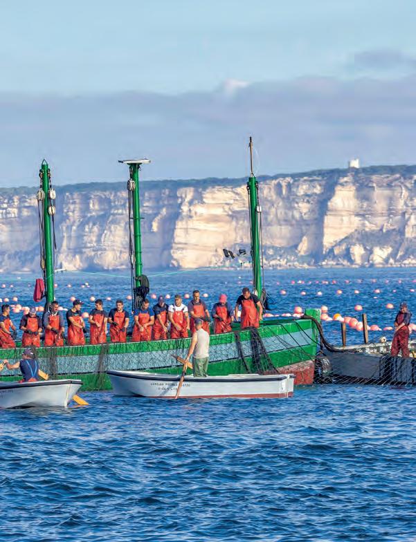
Barbate preserves a painstaking, centuries-old tunafishing tradition called the Almadraba.
As early as the 5th Century, garum - a fish paste derived from the fishing trade and salting businesswas known in Athens. This fishing technique inherited from the Phoenicians, Romans and Moors, had its heyday at the end of the 19th Century with the Romeu family. In 1928, a consortium was established between the State and the almadraba fishermen that later disappeared in 1971.
The Strait of Gibraltar is a necessary waypoint for this prized species of tuna which is captured using lines of nets set by a number of different boats to create a pasaje that funnels the tuna up to the surface where they are brought on board in the characteristic “levantá” (raising), an impressive spectacle.
De oeste a este: espléndidas playas, historia y belleza

En esta guía les mostramos el litoral de Barbate con un recorrido fotográfico por sus espléndidas playas y los lugares más representativos del término municipal, llenos de historia y belleza. Partiremos de la Playa de Zahora hasta alcanzar Zahara de los Atunes, siguiendo la costa de oeste a este.
In this guide we will show you the coast of Barbate including a photographic tour of its splendid beaches and the most representative areas of the municipality which are full of history and beauty. We’ll begin at the beach of Zahora and end in Zahara de los Atunes, following the coast from west to east.
From East to West: splendid beaches, history and beauty
baño (1jun-30sep)
Animals are prohibited on the beaches during summer time (1jun-30sep)
Comenzamos nuestro recorrido con la primera playa de Barbate, la Playa de Zahora. Ésta empieza donde termina la playa de El Palmar hasta llegar al Faro de Trafalgar. Es una playa virgen con unos 3 kilómetros de longitud. Está más protegida de los vientos que otras del litoral barbateño y es ideal para el baño.
We start our tour at the first beach of Barbate, the beach of Zahora. It begins where the beach of El Palmar ends, and continues until we reach the lighthouse of Trafalgar. It is a pristine beach about 3 kilometers long, more protected from the winds than other beaches of Barbate and is thus ideal for swimming.

Located next to los Caños de Meca, Cabo Trafalgar is a small island connected to the mainland by a double isthmus of sand. There is a lighthouse dating from 1860, a watch tower, and archaeological remains of both the Romans and the Muslims. On October 21, 1805 the famous battle of Trafalgar took place, when the Spanish-French fleet was defeated by the British under Admiral Nelson.
Está situado al lado de Los Caños de Meca. Se trata de un pequeño islote unido al continente por un doble tómbolo de arena. En él hay un faro, construido en 1860, una torre vigía, restos arqueológicos romanos y musulmanes. El 21 de octubre de 1805 tuvo lugar la batalla de Trafalgar, donde la escuadra franco-española fue derrotada por la inglesa al mando del almirante Nelson.


Cerca de Los Caños de Meca se encuentra este monumento natural. La arena arrastrada por las mareas hace miles de años, crearon dos tómbolos o lenguas que unieron el islote donde está el faro con la costa. El área que lo rodea tiene un vasto sistema dunar que alberga un ecosistema propio de la zona, con vegetación típica de las dunas y aves marinas.
En la zona del faro hay yacimientos arqueológicos romanos, así como los restos de una torre vigía.
Near los Caños de Meca we find this natural monument. Sand carried by tides thousands of years ago created two isthmuses or strips of land that join the island with the coast where the lighthouse is located. The surrounding area has a vast dune system that has its own ecosystem, including typical vegetation and seabirds.
In the area of the lighthouse are Roman archaeological sites and the remains of a watchtower.
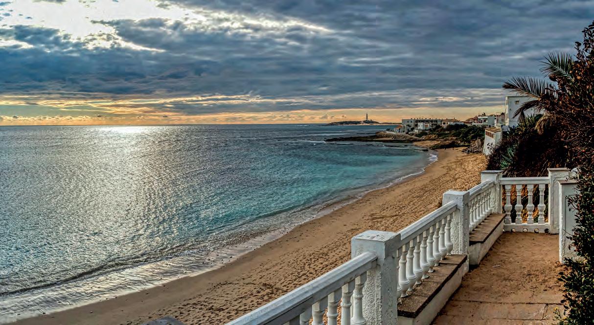
Es una de las más conocidas, ya que desde hace décadas es el lugar de residencia de muchos famosos que buscaron un sitio tranquilo, con buenas playas naturales. Dentro de Los Caños hay playas para todos los gustos: arenosas, rocosas, con oleaje, tranquilas, nudistas, familiares, deportivas, etc.
Si buscas una playa salvaje y con fuerte oleaje, la mejor opción es la zona del Faro de Trafalgar. Los que busquen playas más familiares y de aguas tranquilas pueden optar por la playa del Varadero, cercana al faro o por la más concurrida playa del Pirata. Ambas cuentan con bastantes servicios, están resguardadas de las corrientes y tienen fondos principalmente arenosos. En dirección a Barbate se encuentra la playa nudista, las calas de los chorros y el acantilado
This beach is one of the best known as for decades it has been the refuge of many celebrities searching for a tranquil place with good, natural beaches. Within the Caños there are beach areas for everyone: sandy, rocky, with heavy waves, calm, nudist, family, sport, etc.
If you prefer a wild beach with strong waves, the best option is the area around the lighthouse of Trafalgar. Those who prefer family-type beaches and calmer waters could choose between the beach of Varadero, near the lighthouse, or the popular and more populated beach of the Pirate. Both provide good services, are protected from the currents and have mostly sandy bottoms.
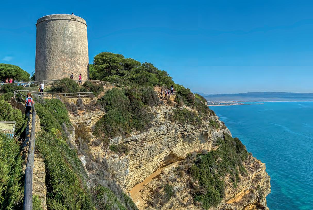
Es un parque natural de acantilado y pinar cercano a Barbate. Es un bosque artificial que nació por una reforestación realizada a finales del siglo XIX para retener unas tierras arenosas y secas. Comprende una franja marítima de gran valor natural y paisajístico y acantilados de 100 metros de altura. Fue declarado Parque Natural en 1989. El Parque tiene 5.077 hectáreas. El árbol característico es el pino piñonero.
A natural area near Barbate consisting of cliffs and pines, the park is a result of reforestation which occurred at the end of the XIX century in an attempt to retain dry and sandy land. It consists of a natural and scenic coastal strip of great value and cliffs reaching 100 meters. It was declared a Natural Park in 1989 and includes 5,077 hectares. The characteristic tree is the pinion pine.

Se encuentra en el Parque Natural de La Breña, es del siglo XVIII y tiene 400 metros cuadrados de superficie. Tiene 7.770 nidos y en plena actividad anidaban cinco mil parejas, lo que proporcionaba alrededor de dos mil pichones a la semana Todo esto proporcionaba a su vez la palomina (desechos de las palomas), unas 15 toneladas al año, que se utilizaban para abono de cultivos o para hacer pólvora Actualmente no hay palomas, aunque sí cernícalos y lechuzas.
The pigeon loft is located in the Natural park of La Breña, dates from the XVIII century and consists of 400 square meters It contains 7.770 nests which in full production housed around 5000 nesting pairs producing around 2000 chicks a week This is turn provide approximately 15 tones of palomino (pigeon waste), which was used to fertilize crops or to make powder
Currently, there are no pigeons, although there are kestrels (a type of hawk) and owls.
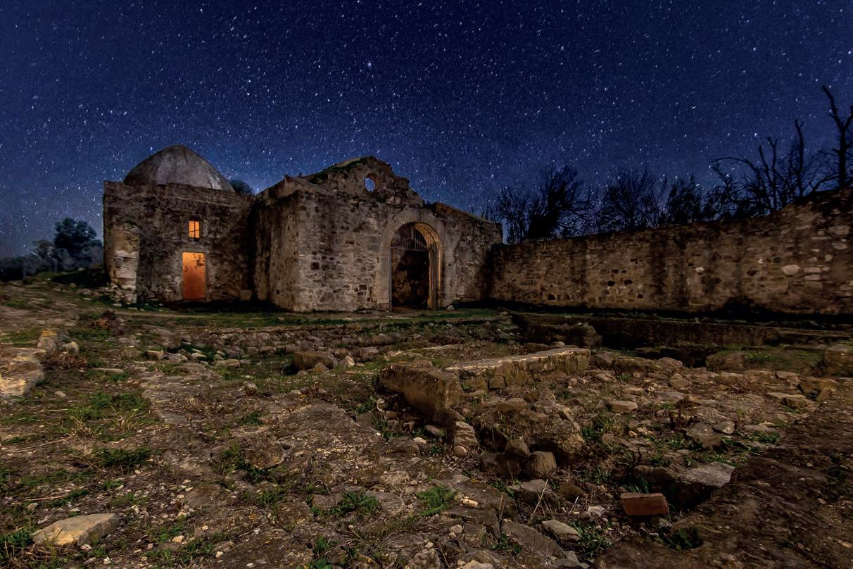
Es de época visigoda aunque su origen es romano. Se encuentra cerca del Parque Natural de La Breña, es un yacimiento arqueológico y también arquitectónico. Fue declarada Bien de Interés Cultural y pertenece al Obispado de Cádiz y Ceuta.
Dating from the Visigoth era, although of Roman origin and located near the Natural park of La Breña, it is both an archaeological and architectural site It was declared of Cultural Interest and belongs to the Diocese of Cádiz and Ceuta.
Se encuentra entre el Puerto de Barbate y los acantilados del Parque Natural de La Breña. Es una de las más salvajes de la provincia. Tiene dunas con vegetación y pinos. Cuenta con una longitud que sobrepasa el kilómetro. Muy apta para la práctica de deportes acuáticos.
It is located between the Port of Barbate and the cliffs of the natural park of La Breña. It is one of the wildest of the area with dunes, vegetation and pine trees. It is over one kilometer in length and is very suitable for water sports.

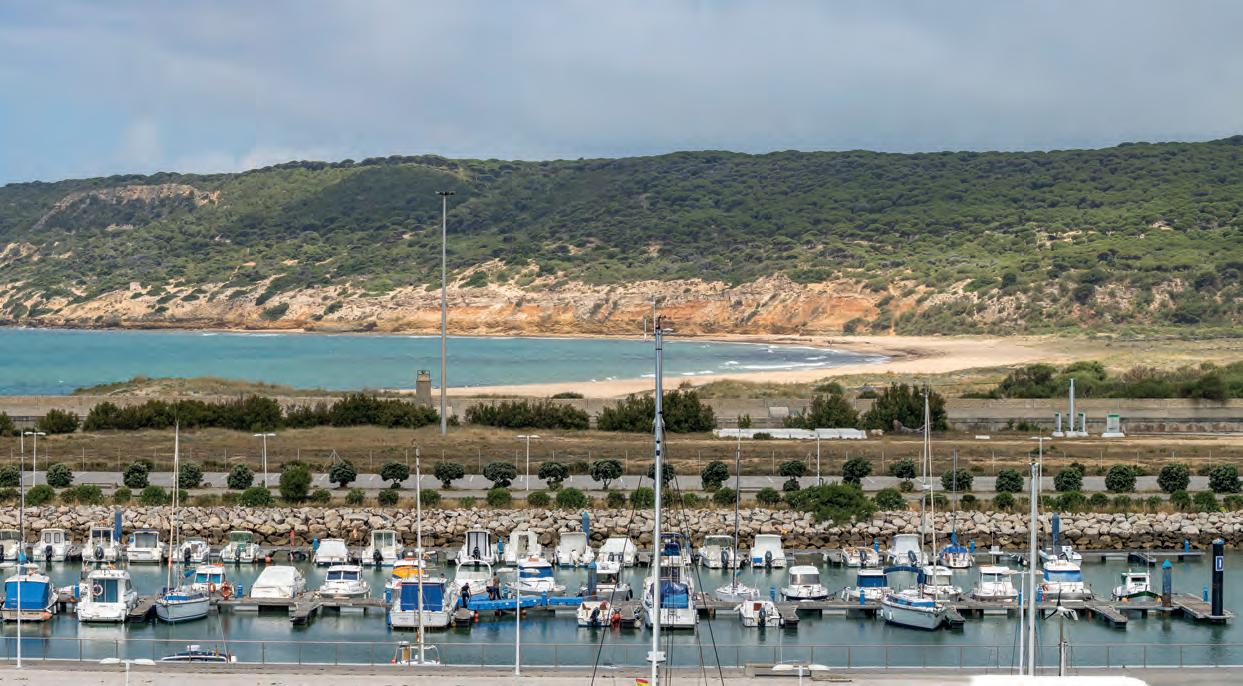
Está situado en el puerto pesquero de Barbate. En él atracan yates que vienen del norte de Europa y se dirigen al Mediterráneo. Lugar apropiado para refugiarse en días de fuerte viento de Levante. Su enclave es también uno de sus atractivos.
The sporting port or yacht port is located in the fishing port of Barbate. Yachts or sporting boats that travel from northern Europe to the Mediterranean find refuge here when the Levante, a strong easterly wind is present. Its location is one of its attractions.
Antes de la desembocadura del río Barbate se encuentra la antigua Lonja. Se construyó en 1943 y el arquitecto fue Casto Fernández-Shaw. Estuvo abierta hasta la entrada en funcionamiento del Puerto de la Albufera.
Actualmente y tras su reconstrucción, es un centro turísticocultural, donde se celebran exposiciones.
Before reaching the mouth of the Barbate river, you will find The old Lonja, or market. It was built in 1943 by the architect Casto Fernandez-Shaw and was operational until the Puerto de la Albufera replaced it.
It was reconstructed and is currently a touristic-cultural center where exhibitions are held.

La playa se caracteriza por su paseo marítimo, repleto de bares y restaurantes, uno de los centros gastronómicos de la ciudad. Ha sido popularmente dividida en dos partes: «Playa Chica», entre el dique de escollera de levante y el Faro del paseo marítimo, y «Playa Grande», a lo largo del resto del paseo marítimo. Cabe señalar que se extiende además por una barra o flecha litoral, sin edificar, conocida popularmente como «La Barra». Dispone de una gran variedad de equipamientos y servicios para la comodidad y ocio de los usuarios.
The beach is known for its long sea promenade, replete with bars and restaurants and one of the primary gastronomic centers of the city. It has been colloquially divided into two sections: The Small Beach, between the rock -filled dam and the lighthouse of the promenade, and the Large Beach, along the rest of the Promenade. The beach extends into a sandy strip which is not developed known popularly as “La Barra”. The beach offers a variety of facilities and services for the comfort and leisure of beach users.

El río Barbate pasa por los términos municipales de Alcalá de los Gazules, Benalup-Casas Viejas y Vejer de la Frontera, finalizando su trayecto en Barbate, donde desemboca en el Atlántico formando unas marismas. Es de una gran belleza y son magníficas sus puestas de sol. El río era la antigua entrada al muelle pesquero.
The Barbate river runs through the towns of Alcalá de los Gazules, Benalup-Casas Viejas and Vejer de la Frontera, ending in Barbate where it empties into the Atlantic forming marshes. They are quite beautiful and offer magnificent sunsets. The river used to be the ancient entrance to the fishing dock.

Tanto la marisma del río Barbate, humedal de extraordinaria riqueza, como su entorno estepario, son un lugar excepcional para la observación de aves debido a su privilegiada situación en las rutas migratorias.
Las aves se multiplican en marismas y lagunas, pues es zona de nidificación y paso migratorio con presencia de ánade real, focha común, garza real e imperial o grulla común -última población nidificante en el sur de Europa-.
Both the incredibly rich wetlands of the marshes of the Barbate river, and the area surrounding the marshes, offer an exceptional bird-watching environment due to their privileged location in the midst of migratory routes.
The birds reproduce in the marshes and lagoons as they are a nesting zone and migratory route. Mallards, coots, royal and imperial herons are present as well as the common crane-the last breeding population in southern Europe.

Extensa playa de arena que se extiende desde las marismas del río Barbate. Tiene una longitud de 3.950 metros. Al fondo se encuentra la sierra del Retín. Playa rústica y salvaje de arena dorada y fina. Tiene vientos fuertes, con oleaje moderado.
An extensive sandy beach stretching from the marshes of the Barbate river, it is 3 950 meters long with the Sierra Retín in the background. The beach is a rustic and wild beach of fine golden sand with strong winds and moderate swell.
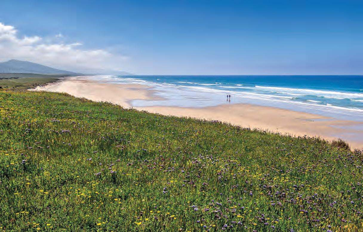
Continuación de Canillos, se caracteriza por la mayor proximidad a la sierra del Retín. Arena blanca y aguas limpias. Es una playa natural de 3.700 metros.
Past the beach of Cañillos and close to the sierra of Retín is the beach of Pajares. With its white sand and clean waters. It is a natural, pristine beach about 3.700 meters long.

Se encuentra colindando con Zahara de los Atunes, pertenece al Ministerio de Defensa. Es una zona de alto valor ecológico, en la que se encuentran especies como el Ibis Eremita, un ave en vías de extinción y que desde hace algo más de diez años el Ministerio y la Junta de Andalucía colaboran en la cría, consiguiendo recuperar esta especie, que se reproduce en libertad y que puede verse por muchos lugares de la provincia. Hay otras especies como el zorro, el tejón o el gato montés, siendo zona de paso de las aves hacia África, por lo que se pueden ver diversas águilas, halcones o milanos. Es rica en restos arqueológicos de diferentes épocas, encontrándose dólmenes, pinturas rupestres en varias cuevas, tumbas, etc.

Adjacent to Zahara de los Atunes, we find an area of great ecological value that belongs to the Ministry of Defense. There are species such as the bald ibis, an endangered species that the Ministry of Defense and the Junta de Andalusia have been protecting and breeding for more than ten years. The species now breeds in the wild and can be spotted in many parts of the province. There are other species that can be seen such as the fox, badger or mountain cat. Since the area is in a migratory bird zone between Europe and Africa, many eagles, falcons or kites (milanos) can also be spotted. The area is rich in archaeological remains from different periods and it is possible to find dolmens, prehistoric cave paintings, tombs, etc.
Fabulosa playa de arena blanca ideal para familias con niños. Está perfectamente equipada con puestos de socorrismo y varios chiringuitos ya sean en la misma arena o en el paseo frente a ésta, duchas públicas, aseos públicos, quioscos, alquiler de hamacas, accesos para minusválidos y carritos de bebé mediante una serie de pasarelas de madera que llegan hasta escasos metros de la orilla del mar.
Fabulous white sandy beach, ideal for families with children. It is a fully equipped beach with first aid stations and various bars either on the sand or on the promenade of the beach. There are public showers, restrooms, kiosks, hammocks for rent, disabled and baby carriage access through a series of wooden walkways that reach just a few meters from the sea.

Tiene sus orígenes en tiempos de los fenicios, debe su nombre a este pez. Es otra de las almadrabas de la zona y de las más importantes de Andalucía. Hasta el siglo XVI no empezó a poblarse, aunque un siglo antes ya hubo habitantes en la zona para trabajar en la almadraba, concesión que dio Guzmán el Bueno para pescar atunes, siguiendo sus descendientes, los Duques de Medina Sidonia, la explotación de la almadraba. En el siglo XVI se hicieron las primeras casas, al instalarse allí almadraberos, comerciantes y militares.
The area dates from Phoenician times and takes its name from the tuna fish. It’s another of the Almadraba zones (the areas where Phoenicians established a form of fishing with nets) and one of the most important of Andalusia. Until the sixteenth century it was not settled although there were already inhabitants in the area who worked the Almadraba, a concession that Guzmán el Bueno (the Good) made to fish for tuna, and whose descendants, the Dukes of Medina Sidonia, exploited in subsequent years. In the XVI century the workers of the Almadraba, merchants and military established the first houses.


