
Streets as a tool for urban and social recovery
02

Master’s degree thesis school Architecture Urban Planning Construction Engineering Sustainable architecture and Landscape design supervisor Prof. Matteo Umberto Poli student Edera Kana 951713
AY 2021-2022

Theoretical reflection History
- The origin of public space - The beginning & evolution of public space - History of the sidewalk element
The pandemic Covid-19 - The impact of pandemic Covid-19 in public space - Accelerator - Post-Covid - The momentum
The DUAL CASE STUDIES - Street moves | Stockholm, Sweeden - Car-Free livability | Oslo, Norway - Superillas | Barcellona, Spain - Toward 15 min city | Paris, France - The Urban living room | Anywhere
Introduction | The City of Milan Milan towards a more sustainble city
ANALYSIS | city scale
- Green & Blue infrastructure - Transportation - Slow Mobility - UHI Urban heat island effect in Milan - Air & Acoustic pollution - Demographic data
CASE STUDIES MILAN
- Introduction of sites | City scale analysis - The human experience - Sight perception - Drift map - Analysis:
a. Area “Università Bocconi” b. Area “Università statale-Largo Richini” c. Area “Piazzale Bacone” - Conclusion | Comparison
VIA CLAUDIO MONTEVERDI Analysis
- The threat Corso Buenos Aires - Accesses - Function & Services - Green, open spaces | Tree species - Transportation
Vision & Goals
Phase 1 | masterplan, axonometric views
Phase 2 | masterplan, axonometric views
Phase 3 | masterplan, axonometric views
PART II 44 46 50 52 54 58 62 64 66 74 76 78 82 82 88 94 100 102 104 106 108 112 116 120 124 128 134 140 142 146
Phase 4 | masterplan, section | vegetation & green infrastructure | materials | building design | views

Foremost, I would like to express my sincere gratitude to my thesis supervisior Prof. Matteo Umberto Poli for the continuous support during my thesis work and research, for his patience, motivation, enthusiasm, and immense knowl edge. His guidance helped me all the way with precise and clear advice.
Besides my supervisor, the completion of this project could not have been accomplished with out the support of my family supporting me with immense patience and my daughter for allowing me time away from her to research and write.
Last but not least, I would like to thank my class mates and friends, Dielleza and Enkelejda; my “travel” companions during these two intense years, for supporting and spending quality time together.
This thesis consists of two parts. The first part is a theoretical reflection. It starts with the history and evolution of the public space and the street element. How was the public space born and for which need? The shift in urban design and planning, from designing a public space for peo ple to designing for vehicles. Arriving to nowadays, to the emergen cy situation of the covid-19 pandemic. How the pandemic becomes the accelerator towards sustainability and a slow city. It has changed our way of life and with that also the indoor and outdoor environment. When cities reopened following months of lockdowns, they were no longer the same; citizens were different. Restaurants, bars, and clubs were invading sidewalks and even streets or parking spaces at times. Outdoor activities increased exponentially while parks were filled with all sorts of events: yoga classes, political meetings, and actual outdoor education. Similar phenomena have occurred, at different times and in different ways, in almost every city across Europe and the world. It was a consequence of several months indoors. The pandemic was like a shock that forced people to rethink their way of living and highlighted the contradictions affecting their lives. The same applies to urban sys tems: new ways of moving around and conceiving public spaces are now under discussion, with historic cities being regenerated and new neighbourhoods redesigned. It is the time for action, before people re turn to old habits. The final project is a proposal about transforming a street in Milan, taking it from vehicle circulation to pedestrian and bike users. Three strategic case studies were taken into consideration. After a general analysis of each one the most appropriate area for urgent intervention was chosen. Its transformation takes place gradually, using the tool of “tactical urbanism” . In the end, assuming that the feedback is always positive (experience in other similar projects has always con firmed it), a long-term solution is proposed. The project aims to combat the urban heat island effect, by adding greenery and using the right materials, to foster human interaction and to help small businesses.
italiano
Questa tesi si compone di due parti. La prima parte è una riflessione teorica. Inizia con la storia e l’evoluzione dello spazio pubblico e dell’el emento strada. Come è nato lo spazio pubblico e per quale esigenza? Il cambiamento nella progettazione e pianificazione urbana, dalla pro gettazione di uno spazio pubblico per le persone alla progettazione per i veicoli. Arrivando ai giorni nostri, alla situazione di emergenza dalla pandemia Covid-19. Come la pandemia diventa l’acceleratore verso la sostenibilità e una città lenta. Come ha cambiato il nostro modo di vivere e con ciò anche l’ambiente interno ed esterno. Quando le cit tà hanno riaperto dopo mesi di lockdown, non erano più le stesse; i cittadini erano diversi. Ristoranti, bar e locali a volte invadevano i mar ciapiedi e persino le strade o i parcheggi. Le attività all’aperto sono au mentate in modo esponenziale mentre i parchi erano pieni di ogni tipo di evento: lezioni di yoga, incontri politici ed educazione all’aria aperta. Fenomeni simili si sono verificati, in tempi e modi diversi, in quasi tutte le città d’Europa e del mondo. È stata una conseguenza di diversi mesi di quarantena. La pandemia è stata come uno “shock” che ha costretto le persone a ripensare al proprio modo di vivere e ha messo in evidenza le contraddizioni che affliggono le loro vite. Lo stesso vale per i sistemi urbani: si stanno discutendo nuovi modi di muoversi e concepire gli spazi pubblici, con la rigenerazione delle città storiche e il ridisegno di nuovi quartieri. È il momento di agire, prima che le persone tornino alle vecchie abitudini. Il progetto finale è una proposta di trasformazione di una via a Milano, portandola da circolazione veicolare a pedonale e ciclabile. Sono stati presi in considerazione tre casi studio strategici del la città. Dopo un’analisi generale di ciascuno di essi è stata scelta l’area più opportuna per l’intervento urgente. La sua trasformazione avviene gradualmente, utilizzando lo strumento dell’urbanistica tattica. Alla fine, supponendo che il feedback sia sempre positivo dopo ogni step (l’es perienza in altri progetti simili lo ha sempre confermato), si propone una soluzione a lungo termine. Il progetto mira a combattere l’effetto isola di calore urbano, aggiungendo verde e utilizzando i materiali giusti. Vuole favorire l’interazione umana e aiutare la crescita delle piccole imprese.
street /stri:t/ a public road in a city, town, or village, typically with houses and buildings on one or both sides. "the narrow, winding streets of Edinburgh" square /skwε:/ an open, typically four-sided, area surrounded by buildings in a village, town, or city. "a market square"
Cities are hubs for the exchange of goods, culture, knowledge and ide as. The city street is the stage where this exchange takes place: it is the access to the home and the company, and the passage to other places within and outside of the city. For centuries city streets had a natural vibrancy and dynamic, where various functions came together. Until mid 20th century the street was an integrated system of movement and social and economic life. This changed in the 1960s and 1970s when large-scale interventions in the urban fabric emphasized traffic, and put the importance for exchange in second place.
The first cities ever existed were founded in Mesopotamia around 7500 BCE. Cities such as Eridu, Ur and Uruk. Uruk had it blossom around 3200 BCE by the development of other city-states and empires. That’s the moment when the need for interaction was born. As cities were evolving, humanity was progressing. People craved social relationships and as a result, space for this to occur was needed. The public space!

Mohenjo-daro is the city that left us an important heritage of some of the first streets. Them were built to connect and exchange between city-states and merchants, created as a result of urban development. Like the other cities of the Indus civilization, Harappa, Kâlîbangan or Lothal, reveals a studied and planned urbanization in the layout of the roads, which form a grid in which at least a 10 meter wide avenue di vided the lower city into two areas. Indeed, as in the other Indus sites, there is a division of the city into two parts traditionally called the citadel or upper city and the lower city

Reconstruction of the Ancient Greek Agora in Athens

Reconstruction of The Roman Forum

The greek Agora
The roman forum
The Greek Agora was the beginning of the public space which was located in the center of the polis and was also the focal point of the town which functioned as a market as well as gathering space for the political assembly. Thus, it had social, political as well as economic im portance. It also acted as a formal and informal meeting space for the citizens. In the beginning, the Agora was surrounded by private houses but temples and sanctuaries were later built bordering it along with the stoas, porticoes, and covered walkways. Open-air gymnasia and thea tres were also developed later in the Greek civilization.
The functions of the Greek acropolis and agora were brought together in “forum” during the Roman Empire. It was a contained, semi-enclosed, and open space where commerce, religious and political activities, ath letics, and informal meetings were carried out. The forum was a public space dominated by the citizens in the same way as Agora. Forums were rectangular in shape, in the proportion of 2 to 3, which was sur rounded by Porticoes. The forums contained temples, basilicas, shops, and markets which resulted in the blend of civic as well as religious fabric. It also housed other significant recreational areas like the theatre, public baths. Also, it was home to curia as well as comitium, meaning the city council meetings and political meetings respectively.


The medieval market square
The renaissance plaza
The marketplace was first evolved around the 11th century and be came a crucial public space during medieval times. It was mainly lo cated in the center of the town, in front of the castle or cathedral, and also at the intersection of the two main roads. The work activities like workshop and storage facilities as well as business places like inns, taverns were situated. Inhabitants of the city often came together along with the visitors which were attracted to the place.
The Renaissance Plaza contained important buildings like the cathe dral, the town hall, etc. It was a place where people gathered and pub lic celebrations took place. Also, plays and stage proceedings were carried out in Plazas. The local social order where ethnic, religious, and political identities were revealed in the renaissance plaza. It was most ly planned in a symmetrical geometry. The buildings surrounding the Plaza and squares had a uniform facade that showcased the impor tance of proportion and harmony in the design. Further, this design feature evolved into residential quarters, generally of the upper class, around the squares, making a way for an innovative semi-public char acter. Also, this new way of designing and restricting public access to the square became more popular among developers of new residential areas.
The public space in modernism
The era of the modernism is stigmatized with the motto: “Form Follows Function”. The functionalism of modernists, therefore, gave priority to cars and fast movement urban space, a notion that undermined the close relationship between open spaces and the building surrounding them. The city and its public space were designed as an organized system, where development ensued according to functionalist rules. Despite their emphasis on the primary of public interests in the city, the modernists paid little attention to the historically created public spac es. The new vision of the city was expanded open spaces where high buildings were erected, but with no other connection to the rest of the city. A “lost space” where sociability was impossible.
PHOTO
Students protesting in Paris, May ’68.

Photograph: Serge Hambourg. Courtesy of Hood Museum of Art
The Grand Central Shopping Mall in Birmingham

Contemporary public space
During times of political instability, the public space is charged as a vortex of social discontent. In the 1960’s social and political turmoils were frequently played out in public spaces, which were decorated with the language of protest (banners, murals, graffiti). Protestors frequently appropriated public spaces, and sometimes private ones, to voice their dissent. The notion that citizens can and should take control of open spaces was very vivid in these times, establishing the “right to the city”
Public spaces in contemporary cities are under the pressure of capital and privatization. This is gradually transforming their social and physical form, leading to a significant reduction of the public realm and the loss of public space. Green parks, open-air squares, and riverside paths be come victims of private ownership. A place of a hybrid character starts to emerge. It’s a place where there’s no clear distinction between public and private, a “gray area”. These non-places don’t bear any symbolic expression, they are devoid of identity and usually places of consump tion, such as coffee shops and shopping malls.
The proper shaping of an urban public space reflects the proper func tioning of a democratic governance. After so many transformations over the centuries, we are now at a point where we need to deal with these leftovers of public space. They are the key focus in the trans formation of the cities. The success of a particular public space is not solely in the hands of the architect, urban designer or town planner; it relies also on people adopting, using and managing the space – people make places, more than places make people.
Pompeii sidewalk Italy


late 19th century, sidewalks as a space for social congregation and activity. New York City today sidewalks play a crucial role in activating neighborhoods New York City
https://nacto.org/docs/usdg/active_ design_shaping_the_sidewalk_experience_nycdot.pdf
noun
a paved path for pedestrians at the side of a road; a pavement.
Dedicated spaces for pedestrians to walk within the roadway have ex isted for thousands of years. While sidewalks are designed primarily to allow safe pedestrian movement separated from moving traffic, they have always been about much more. Sidewalks provide a fundamental network of public open space that allows pedestrians to negotiate their way through the built environment at safe remove from moving vehicles while simultaneously contributing to a healthy and active lifestyle. They can also be places of personal interaction and engagement, social spaces to see and be seen, places of economic trade, and platforms for collective speech and gatherings. Sidewalks can be ambiguous zones between public and private spaces. In the late eighteenth cen tury, once the construction of sidewalks became increasingly common in urban areas, they were generally associated with their adjacent uses within the buildings. Property owners were often asked to construct and maintain the sidewalks in front of their buildings, and since the pav ing was generally cheaper and therefore comple ted prior to the neigh boring roadbed, it increased its distinction from the moving traffic.2
Adjacent building users could blur this boundary between public and private space by envisioning sidewalks as physical extensions of their shops and businesses and as social extensions of their living rooms. With objects and activities that enlivened the edges of the walking path, these extensions, when appropriate, could contribute to special char acteristics and unique urban conditions. The sidewalk became one of the most active and vibrant elements of the city, helping shape a neigh borhood’s identity.
Streets as a tool for urban and social recovery
Covid-19


People forced to stay at home Social distancing risk of infection
Smart WorkingLeisure
Less/No of Cars Unsafe transport Reduce space for cars


Home Neighborhood More space people

Tranquillity | People could hear the birds Increased slow mobility 1m


Social distance needed in order to reduce the risk of infection.
Innactive life increased the need of exercise. Cycling and walking turn out to be a good option.
Public transport does not meet safety standards.
Non busy roads made people feel safe to cycle.
People found tranquility in urban environment and had spare time to listen to nature’s sounds.
People still feel unsafe using public transport. Private cars, would cause high traffic.
People still have memories of that calm and safe environment.
Environmental benefits (air, noise temperature ecc.) came up to light.
Due to the Covid-19 pandemic, many changes have taken place, not only in the economic and health sector but also in the labor market. Many workers had to shift to work from home regard less of their previous experience in having a home office, bringing many challenges and possible benefits and drawbacks. The 2 main phases of the pandemic can be organized into 2 important categories. The first is the phase during the pandemic which in cludes quarantine and a series of drastic changes in the lives of all people. The second one is the Re-opening, going toward the normality. Going forwards by looking back.
During lockdown there have been a significant drop in downtown activities. The overall mobility decreased while pedestrian move ment increased. People were using the public space in a differ ent way. The city is used for recreation, play and exercise. Public places that offer activities such as playgrounds were very popular. More children and senior citizens are using the public space. The need for essential outdoor and climatic needs is more valuable. Social distance was needed to reduce risk of infection. The public transport wasn’t safe. Cycling and walking turned out to be the best option to respond the needs not only of transport but also for exercise.
Although it was a return to normallity, many changes occured during the lockdown. There was redistribution of users in public spaces (increase number of children and elderly), redistribution of activities like play an d exercise. People talking nd gathering in public spaces seem it has become normal to talk and bond with strangers. There is still the will to use the car but the will is higher to walk or cycle. People enjoyed the tranquillity during lockdown and the sounds of nature. They still have memory of that atmosphere. The environemental benefits are plenty, like cleaner air, calm city.
The first phase was a catalyst thats accelerated the implemen tation of the program (already existing) leading to a slower, more inclusive city that prioritizes people and slow mobility, the environ ment and climate change.
What is the most resiliant form of space allocation for our cities? Allocating space in proper way for :
1. People to move around quickly 2. People walking and queing
Offering a proper infrastructure, a well-connected network of cycle lanes and sidewalks contributes to better movement of people. People want firstly to feel safe and secondly to enjoy the experience of moving around the city. The right infrastructure would significantly reduce jour ney time and invite people to get out of the car. As for the experience, trees and plants, protection from the sun, a comfortable microclimate would for sure improve it.
About the second point, there are needed more open space for people to gather. Spaces equipped and flexible that can be adapted to various activities, using natural and sustainable materials that do not pollute and do not bother the eye. A relaxing atmosphere, good for mental health and that reduces the everyday life stress.
-
Changes in infrastructure can be temporary or long-term. A temporary investment means low cost of investment while as for maintainance the cost is very high. It is because the materials are light, they degrade easily and quickly if maintenance is not adequate. On the other hand there are long-term investment, which have a low cost of maintenance. Furthermore the ROI (return of investments) is pretty high. This kind of investment give opportunities for local commercial activities (example: The neighborhood of El Born, superilles Barcelona).
Change in mindset is better to come through transition process. Firstly slow mobilty should be proposed to citizens as a serious mode of trans port. Low speed limit, proper infrastructure, availability of slow monbility vehicles and safety are the key elements to start with. Furthermore is useful to tackle the users, starting with public transport users and sec ond the car travellers. The public transport users, usually are the one
who have a lower income, so showing them a cheaper and helthier option is a good. The car travellers are the hardest to deal with, since it is a question of dealing with a category of people that does not want to leave the comfort zone of their daily life. In these case, Push&Pull meas ures are a possible solution. Offering incentives to buy bikes, scooter meanwhile amking difficult and stressfull to drive.
Dealing with the authorities is always an issue but with the Covid-19 pandemic many problematics have come up. The public outdoor space has therefore proved again to be a downright common, even the most inalienable, fundamental one of essential importance for the balance of urban metabolism. Furtherly, the pandemic has brought back to the attention of the urban agenda the role of public outdoor space in terms of psycho-physical wellbeing of citizens, together with a renewed im portance of health itself, not only as an indispensable asset to the life of the individual, but as shared public good. Never before, if not in the face of a pandemic, has the issue of health been so participated among communities where the possibility of safety for one is dependent on the good health of their neighbor and on the correct hygienic behavior of each and anyone, or, in other words, on a common agreement to follow the same, specific good practices inside a social cluster.
Streets as a tool for urban and social recovery
1. Monetary problems
2. Politics - convincing the people that that is the right thing to do - the RISK of returning to previous habits
Change the mindset (through transition process)
The users to tackle
1
Temporary
Low-cost of investing
High-cost maintainance
Let people see and understand what happens
Slow mobility a serious mode of transport Road
Public transport users
Car travellers
rush on bye bikes (ex. incentivi)
Show Push
2
Long - term
Capital cost of investing very high
Road change
Return of investment (ROI) is incredibily high
More mobility Opportunities for local commerce
low speed limit (ex. 30 km/h)
bicycle routes & pedestrian paths (brand it)
Show them another option | make it possible
Push & Pull measures
difficult & stressfull to drive


“Transition process” was proven to be a more efficient way for the change to be accepted. From various case studies in Europe and throughout the planet can classify 3 kinds of Tactical Urbanism projects:
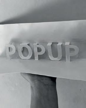
The Pop-Up projects ususally have a duration of 1 day in a week. It has been experimented in many cities. The most famous to mention is the “Park(ing) day”. It is a global participatory project launched for the first time by Rebar in 2005. It is a day where people temporarily repurpose the parking spaces and convert them into social spaces (small parks, various activities). The aim is to advocate for safer, greener and more equitable streets for people. There is also an open source online map where each year can upload park(ing) day projects worldwide. https://www.myparkingday.org/
Many European cities, such as Barcelona, Paris and Milan, have opted for the Pilot projects. These projects introduce modifications that alter the public organism significantly. Popular examples such as closing a road, interrupting road traffic for a whole day or more, installation of urban furniture such as benches, ping pong tables, etc. They can last a few weeks or months. Enough to be able to gather convincing feed back and to study people’s behavior. This kind of project was proven to be more efficient, as in a short time the feedback was positive, giving the municipality the green light to proceed with long-term investments, bringing important improvements for the public space and the commu nity.
Semi- permanent project are similiar intervention as Pilot ones. They have longer duration in time. It might reach to a number of years before getting the feedback.
CASE STUDIES EUROPE


I. Street moves Stockholm, SWEEDEN
- rethink and makeover of every street in the country, so that every street in Sweden is healthy, sustainable and vibrant by 2030,” - stereotypes in the use of space - public space as infrastructure

- public spaces activated by small groups - Ark Des + Vinnova agency
- Via workshops and consultations, residents can control how much street space is used for parking, or for other public uses.
mobility : parking / charging - e bike - e scooter
The Street Moves project is a solution to a wider national mission to drive the transformation of Stockholm streets. The Swedish urban experiment known as the “one-minute city”. They’ve been appear ing around the country as part of a government project called Street Moves, which aims to investigate what happens when cars are dis placed, and how every street in Sweden could be healthy, sustainable and vibrant by 2030. They are using temporary interactive modules de signed to respond to the specific needs of the street. Local authorities or citizens can create space for play, urban agriculture, outdoor gyms, social hubs or anything else that brings life to the street. The prototypes hosting th various activities, are mainly made of wood. Among all the activities they include also, bike and scooter parkings, charging spots. Many activities that in our mentallity are ment to activate indoor spaces, according to this proposal can activate also outdoors public spaces.


- A better urban environment a greener and more inclusive city with room for everyone

- stereotypes in the use of space/car users - public space as infrastructure


- public spaces activated by small groups - Municipality
- Ongoing communication between municipality, organisations and citizens, about changes to make for everyone’s need
trees
municipality businesses inhabitants
urban planters
urban garden
mobility : parking / charging - e bike - e scooter
outside dining culture activities | art
organizations outdoor gym
social hubs
events playground
mobility : parking / charging - e bike - e scooter
The Car-free LivabilityProgramme is all about giving the streets back to people. Wanting to populate the public space ,they made a survey asking inhabitants of Oslo what changes they would like to see in order to use the city centre more? The answer was about having more green areas, more benches and free seating, more culture and more human activity in the streets. The inhabitants of Oslo would also like better roads that accommodate cyclists, better public transport and fewer cars in the city centre. They want to feel safe and comfortable while cycling or riding the scooter. The municipallity is opting to foster the social interaction also by involving in different activities the citizens, that is why they are trying to offer all the essential services while spending time in the streets (including quality potable water). Tackleing the users first, then offering activities and increasing the greenery in the city.
This project is also about events, organizing festivals (like City Life routes and car-free events), that invite people to gather and spend time together. Opting so for a helthier comunity.


- open the superblocks, reducing space for car to give it to pedestrian / bicycle users / gatherings

- Some business owners and car drivers claim that this projectwill lead to “deterioration” of the street/neighborhood - issues of coexistence between everybody who shares roads and public space
- public spaces activated by small groups
- Municipality
- Positive attitude towards the proposal, various proposals and suggestions given by residents
“Any historical process, even a gradual one, which ends
order”.
The urban plan born in the eighties from the mind of Salvador Rue da is the result of an understanding of what were the solutions to lead the city to the international standard levels of 65 decibels. To reduce the use of cars, Rueda devised the so-called superilles, a set of 9 small blocks that created a space that could only be traveled by pedestrians and cyclists. Behind the superilles there are two basic objectives: to reduce noise and restore life to the neighborhoods that can thus recover a social centrality. The first example of superilles dates back to 1993. The neighborhood of El Born started out from a poor condition, but over time it has managed to attract tourists, becoming a perfect commercial area for hotels and shops. The result of this project was that journeys on foot increased by 10%, while those by bicycle increased by 30%. Car traffic, on the other hand, decreased at 26%.
up determining the change of a social or political
protecting schools
extension of terraces
400 m
mobility : parking / charging - promoting journeys by foot - promoting journeys by bicycle - improve public transport - measures for private motor vehicles
In 2015 the real transformation started.Communication with citizens was an issue, since they initially felt part of an experiment, not un derstanding if this was a temporary or permanent program. Some began to protest. After 6 months of controversy, in the light of the sudden transformation of Poblenou, the municipality came to meet the citizens, starting to build green areas with picnic tables inside. They started from “tactical urbanism” to “structural urbanism”. The first is a quick and low-cost process, and the results are of great impact, with the risk, however, of incurring resistance from the population. The sec ond instead uses large investments after hearing the opinions of the in habitants, creating a productive and effective relationship with them. All this makes sense if first the direction to take is clear, which applies both to the institutions and to the citizens, who must feel part of this change.

The Poblenou pilot project also exposed some important issues for the future: traffic management; and the gentrification of the urban area. In the first case, the first step to be implemented is an increase in public services, accompanied by policies that encourage walking. In this re spect, we are thinking of creating green corridors, in order to connect more superilles at the same time, cycle paths and a more frequent transport line that covers fewer routes.

IV. Towards 15 mins city Paris, FRANCE 15 MIN CITY concept
GOAL
OBSTACLES SOCIAL DIMENSION SPONTANEITY COMUNITY PARTECIPATION
CASE STUDIES EUROPE high


- A better urban environment a greener and more inclusive city with room for everyone
- stereotypes in the use of space/car users - public space as infrastructure
- public spaces activated by small groups - Municipality
- Ongoing communication between municipality, organisations and citizens, about changes to make for everyone’s need


The “ville du quart d’heure” plans to reorganize urban spaces so that citizens can find everything they need to live within 15 minutes on foot from home: work (including co-working), shops, health facilities , schools, sports facilities, cultural spaces, bars and restaurants, meeting places. In this way, people do not have to take the car or public trans port, reducing traffic and pollution, regaining possession of the time lost in travel and rediscovering the sociability in their neighborhood.
- 60,000 street parking lots removed replacing with : greenery/playground ecc.
- one Sunday a month -> cars banned along River Seine


- + 50 km new bike lanes (during Covid-19)
Faced with the saturation of roads and public transport, cycling is a solu tion. On one condition: make it accessible to everyone by offering resi dents of the Ile-de-France region quality and continuous cycling facilities. 39 associations are opting to build a Regional Express Cycling Network based on the model of public transport, the RER V. Its 9 cycle lines will connect the major centers of the Île-de-France of France. It is also a “branding strategy”, which presents cycling as a serious mode of transportation.

- Change the way public space is treated. Make the city feel like home and foster human interaction
- stereotypes in the use of space - public space as infrastructure

- public space activated by small groups

- collaboration between designer Bas Kortmann and artist and organizer Studio ID Eddy - trying to work on a bottom up approach
- worshops for everyone interested to collaborate
The Urban Living room is an combination of urban and social project. The programme in the heart has the concept of hospitallity and also challenging the way which public space is treated. Why not treating and feeling it as home? It is an installation, an international traveling exhibition of Dutch design.
URBAN LIVING ROOM offers hospitality, and small-scale meeting plac es in the big city. URBAN LIVING ROOM makes the city feel like home.
It is an interesting way to attract and make people interact, organizing small meetings in the big city.

Kitty O’Meara (2020) And the people stayed home.
And they listened, and read books, and rested, and exercised, and made art, and played games, and learned new ways of being, and were still.
And they listened more deeply. Some meditated, some prayed, some danced. Some met their shadows. And the people began to think differently.
And the people healed.
And, in the absence of people living in ignorant, dangerous, and heartless ways, the earth began to heal.
And when the danger passed, and the people joined together again, they grieved their losses, and made new choices, and dreamed new images, and created new ways to live and heal the earth fully, as they had been healed.
The city of Milan
Milan is an Italian town of 1 373 517 inhabitants, the capital of the Lombardy region and of the metropolitan city of the same name, and the center of one of the most populous metropolitan areas in Europe. With over 1 million and 370 thousand inhabitants, it is the most popu lous city in the region, the second most populous municipality in Italy after Rome and one of the twenty most populous cities in Europe.
Milan,is also the world capital of fashion and design. Headquarters of the Italian Stock Exchange, it is a financial center also famous for its exclusive restaurants and shops. The Gothic-style Cathedral and the convent of Santa Maria delle Grazie, which houses the fresco “The Last Supper” by Leonardo da Vinci, testify to the artistic and cultural heritage of the city.
Milan towards a more sustainnable city
The Government Plan of the Territory of Milan, sets targets towards Milan 2030 in a phase of demographic growth of the city (the city has just passed 1,400,000 inhabitants), economic (growth of 2% of the disposable income, with overcoming of the pre-crisis data), tourism (+ 10% of visitors per year after Expo). Milan today has a clear vision of its future. This growth phase is destined to continue, however it was decided to update rules and regulations in order to make growth more equitable, widespread and sustainable. The three points up which the plan strongly innovates the vision of the city, also from a perspective subway, are herefore:
- Environment and climate change
- Suburbs and neighborhoods
- Right to housing and calm rents
Milan also was chosen to access European funds for the develop ment of increasingly intelligent and sustainable cities. It will be able to participate in “Cities Mission - 100 smart and climate-neutral cities by 2030”. The project will initially benefit from funds from the European research and innovation program Horizon which provides territories with over 360 million euros in funding to develop and implement ac tions and proposals that allow cities to achieve carbon neutrality by 2050.

Milan is not know for being a city rich of water elements yet “Mediolanum” would mean “the city in the middle” of the rivers. It does not have any large river that flows through it, but it is still full of streams. There are five rivers that lap it or run through it: Olona, Lambro, Seveso, as well as Ticino and Adda. In addition to these rivers there are other water elements. Famous ones are The Navigli system. Around the fifteenth century the canals known as “Navigli” were built (Naviglio Grande instead was started as early as 1152 ). Naviglio Grande is a navigable canal that originates from the Ticino near Tornavento, a hamlet of Lonate Pozzolo and which dies in the Darsena, the ancient port of Milan. Born as an irrigation and navi gable canal in 1177, it has a length of 50 kilometers with a vertical drop of 34 meters. The Naviglio Grande is the first of the canals that make up the Milanese Navigli System, the oldest and most impor tant. The canals are five and arise from a system of navigable canals that connected the city with the surrounding rivers. Today’s canals are mainly identified with the two uncovered sections of the Naviglio Grande and Pavese, south of the city, and the ring road that follows the ancient course of a canal is called “Cerchia dei Navigli”. Then there is also the ancient Riviera of Milan, the Martesana canal, northeast of the city, which leads to three visible sections of the canals.
Regarding green infrastructure the most important scenarios are the South Milan Agricultural Park, along the southern, eastern and western arch of the city, and the North Park, which represents the wedge of green left between the Milan-Meda route and Valassina. The South Milan Agricultural Park is characterized by the presence of a dense agricultural network with its road system. It has a con siderable water supply among : the historic rivers, the artificial ca nals for irrigation, the Grande and Pavese canals and the numerous fountains. There are mainly cultivated cereals, followed by rice and grass. The park covers a third of the provincial territory, involving 61 municipalities, and only 9% of its surface is located within the mu nicipal boundaries of Milan. Having a considerable size, the Park is a strategic resource for the future of Milan and the municipalities of the first belt both in terms of territorial organization and for the environ mental system. The main goal of the of the Park is to limit the urban expansion and thus preserve the lungs of agricultural areas outside the city, protecting the natural places and preserving the historical


Streets as a tool for urban and social recovery
Milan has three airports, Linate, Malpensa and Bergamo, with almost 45 million passengers in transit every year. It represent the second busiest airport system in Italy after Rome.
The Municipality of Milan has 23 stations and railway stops in use: of these, 17 are managed directly by the Italian State Railways, while 6 are managed by the FerrovieNord Group (FN).
With its 4 lines (and a fifth under construction), 111 stations and 94.5 kilometers of tracks, the Milan metro is the largest in Italy, surpassing that of Rome by extension.
Line M1 (red): It reaches the Fiera di Milano. Pass through the Duomo and San Babila. Line M2 (green): Stops at Milan Central Station. Line M3 (yellow): It stops at the Duomo, in Via Montenapoleone (the most important shopping area in Milan) and in the Central Station. Line M4 (blue): It is a line currently under construction, which in the future will connect Linate Airport with the city center. It will cross the M1 line in the San Babila station and the M2 line in the Sant’Ambrogio station. Line M5 (lilac): This line integrates the regional train service. Stops in the San Siro Stadium and in the Garibaldi station. It must be said that, unless you are staying in the center, it is likely that you will not need to take the metro except to get to the hotel from the various stations.
Milan has 18 tram lines that run through the city until after midnight: this is the means of transport with the widest timetable. The trams are numbered from 1 to 33. Cause of its extension of the network and convenience, the tram is one of the best ways to get around Milan.
Regarding buses, in Milan circulate100 bus lines and 4 trolleybus lines. Given the limited extension of the metro, the bus is one of the best means of getting around Milan during night. On Fridays and Saturdays Milan offers night buses that run every hour, between 2:00 and 5:00. Night buses stop in the eight areas of the city with the greatest nightlife. The night bus ticket is the same as for the other means of transport and can be purchased directly on board. Line 73 connects the airport with the San Babila metro station for the price of an ordinary ticket: a much cheaper solution than other transport alternatives.


“In Milan, 60% of all urban journeys are less than 3 kilometers (distance that can be covered by bike in just 12 minutes), but the Milanese who use the bike as their main means of travel are only 6% of the total. Why are there so few cyclists? Because there are too many cars.” -2018
“Milan, queen of bicycles, for having created more cycle paths in a year as a response to Covid. And other cycle and pedestrian paths will come” -2020
The Covid-19 pandemic totally twisted the approach of the city of Milan regarding slow mobility, more precisely cycling. The emergency situation gave a push to make the decision to build pop-up bike lanes in a relatively short time. Nearly 50 km of cycle paths just by the of end 2020. An increasingly cycling-green Milan. The city is working on a plan to encourage the use of bicycles and bike-sharing. A way to encourage ecological travel without creating excessive crowds on public transport. Furthermore it is considered that cycling is not only a necessity to move, but one of the most beautiful leisure activities to explore the city and its surroundings (within the municipallity). There are many panoramic cycle paths like, Naviglio Grande, Martesana, Parco delle Cave ect. With the sustainable mobility bonus incentive and during the lockdown & re-opening, in Milan using a bike or a scooter was the first choice for many citizens. Nevertheless, the panoramic of the cycle network still is very frag mented. In some places the lanes simply stops without giving the cyclists an option to continue safely. Many of the bike lanes are still at level of Pop-Up bike lanes. After a first phase there was a big slowdown in the realization of them. Bike lanes are not safe and even in some glimpses you can find the cars parked above the lanes. Road bike accidents are on the rise. According to data from Areu, the regional emergency urgency agency, in 2021 had 31% percent increase in interventions by 118 on accidents involving cyclists in Mi lan: 446 more than in 2019 (2020 is considered a year statistically abnormal due to the pandemic). With a total of about two thousand people fallen or hit. The beginning of 2022 confirms the same data. There is problem of civility and road education, there is great ag gression on the part of car travellers. Although the number of cars circulating in Milan has slightly reduced there is it is always too much space occupied by vehicles, which is why the roads are not safe.
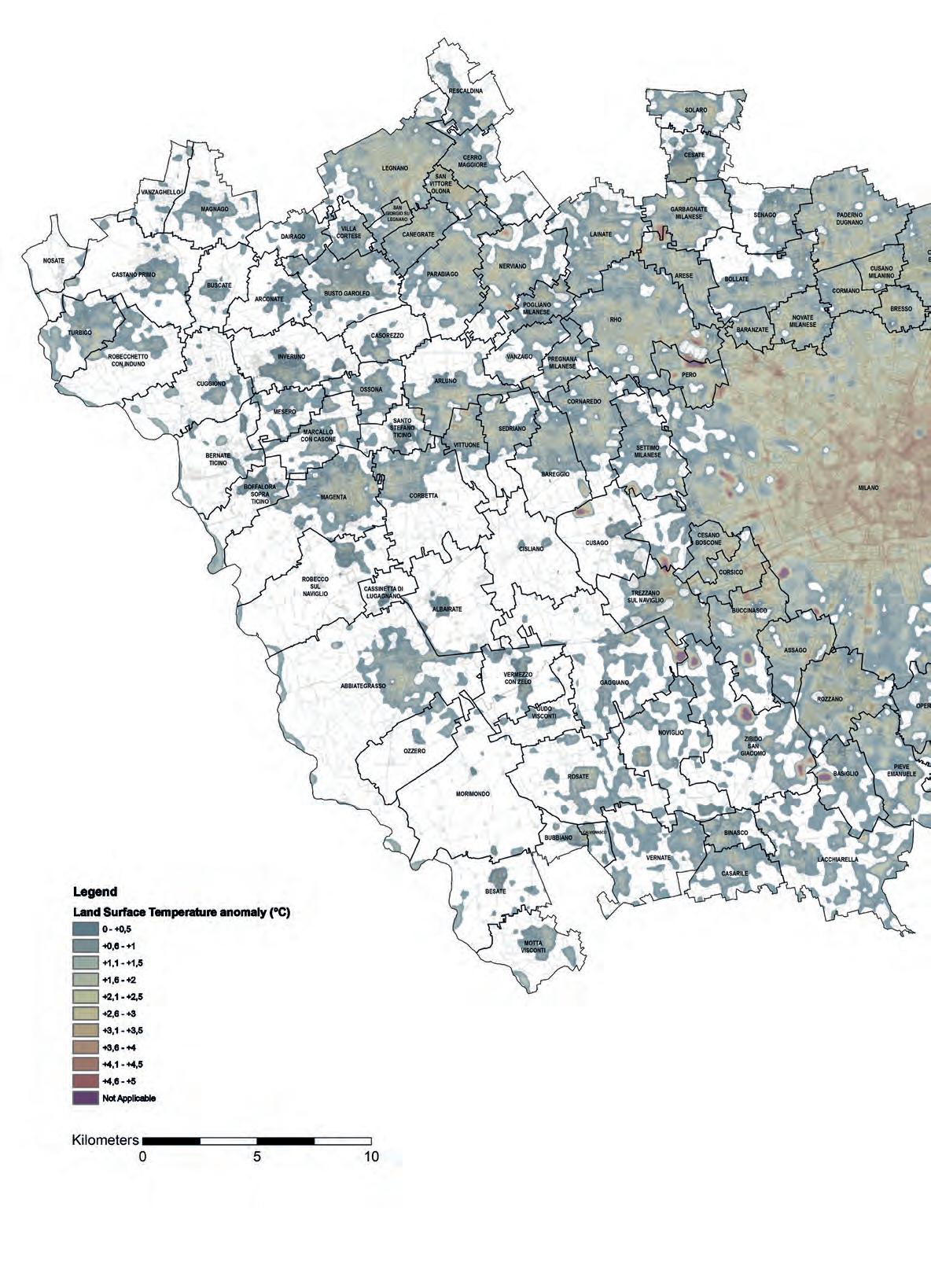
The Urban Heat Island (UHI) is a phenomenon that affects many mil lions of people worldwide. The higher temperatures experienced in urban areas compared to the surrounding countryside has enormous consequences for the health and wellbeing of people living in cities. The increased use of manmade materials and increased anthropo genic heat production are the main causes of the UHI. This has led to the understanding that increased urbanisation is the primary cause of the urban heat island. The UHI effect also leads to increased energy needs that further contribute to the heating of our urban landscape, and the associated environmental and public health consequences. Pavements and roofs dominate the urban surface exposed to solar irradiation. Asphalt Concrete (AC) is one of the most common pave ment surfacing materials and is a significant contributor to the UHI. Densely graded AC has low albedo and high volumetric heat capacity, which results in surface temperatures reaching upwards of 60 °C on hot summer days. Increasing the prevalence of green spaces through the installation of street trees, city parks and rooftop gardens has con sistently demonstrated a reduction in the UHI effect. Green spaces also increase the cooling effect derived from water and wind sources.


UHI - Urban Heat Island
According to the recording data in July 2022, there is a disparity be tween the central northern area of Milan and the southern one. The highest peaks have been reached by the: - North Milan ->Bovisa station (35.4 degrees) - Milano Sud -> via Noto (35.3 degrees) - North of Sempione park ->Sarpi (35.4) - NorthEst Milan ->Bicocca (35).
The lowest maximum temperatures in the city were instead reached at: - the San Siro station (34.2) - the Armed Forces (34.4).
The heat island occurs if there are particular conditions: in situations of atmospheric stability, when there is poor ventilation and in the presence of a clear sky. In these circumstances, in the most cemented areas, the heat is held.On the contrary, in the areas with more presence of green, the heat is released and these areas cool down faster.
Generally the northern and central area of Milan remains the hottest. In all areas, without exception, July 2022, recorded a record of socalled “tropical nights” with minimum temperatures that did not fall below the 20 degrees.The climatic differences between one area and another in Milan also concern rainfall. There are areas that are rainier than others. The Bovisa station holds the record, with an average of 1,145 mm of rain in a year. Milan Center, on the other hand, has an annual average of 997 mm of rain and the southern area stops at 873 mm.
Other causes that contribute to this phenomenon, are the massive use of asphalt and concrete, the height of the buildings, the scarcity of green spaces, and, in general, the presence of dark surfaces. The latter tend to absorb and store heat, which is thus concentrated in restricted but densely populated areas. The hot air expelled from the air conditioners and car traffic, then, aggravate the problem.
foto font : ESA | 18 June 2022


as a tool for urban and social recovery
- Lden (day-evening-night level) representive descriptor of global exposure during midnight hours.
- Lnight (night level) representive descriptor of the exposure in the night period from 10:00 pm to 06:00 am.
The results of the development of the Strategic Acoustic Map are expressed in terms of the estimated number of citizens residents, residential buildings, schools and hospitals exposed to specific ranges of Lden and Lnight for the different types of sources.
20% of Milan population is surrounded by traffic noises every day .Taking into account the warning levels indicated by the World Health Organization, the number of citizens annoyed or disturbed by disturb ing noises of all kinds and intensities , is around the double. An anal ysis conducted by the Bicocca University confirms that by monitoring the sounds of the city, it was found that at least 42% of the Milanese population is exposed, every day, to a threshold which exceeds 65 decibels during the day and 50 at night. 22% of residents experience even more than 70 during the day (or 60 at night). At peak times, in some streets, even 80 decibels are reached, a tolerance threshold unthinkable even on motorway junctions.
The main cause (80% is estimated to be responsible) is traffic, espe cially in the city center. During the night the main cause is nightlife, as well as commercial activities that use music, or, during the day, indus trial activities that use particularly noisy machinery.
The highest levels are on the ring roads, near the airports and railways and along the main traffic arteries (Viale Ful vio Testi, via Palmanova, via Fermi are among the worst). The average level are recorded in via Spadari, via Moscova, via Ar iosto, corso Garibaldi, corso di Porta Romana or piazza Wagner. In these are areas on average, during the day, more than 70 decibels are detected. Fortunately, there are also areas where there are very low levels of noise incidence, for example behind viale Sarca, at Mag giolina, or in via Arganini, Pratocentenaro area, or in some corner of Niguarda, where greenery prevails. Some parallels streets of Corso Buenos Aires, where the buildings act as a protective screen, block ing the passage of most of the decibels and making this area a true and unexpected oasis of peace.
Polveri sottili - PM10
di azoto - NO3
- O4
Totale sorgenti
Infrastrutture stradali (strade urbane o extraurbane, autostrade)
Attività temporanee (cantieri, manifestazioni)
Attività di servizio - commerciali (discoteche, pubblici esercizi e circoli privati, attività commerciali, professionali e di servizio)
Air pollution has forever been a serious problem of the city. In the last years, only in 2020 was recorded lowest values regarding air pollu tion. Current levels of nitrogen dioxide are high and its rise means that the situation is having a serious deterioration, especially with the resumption of normal activities after the lookdown. The inhabitants have begun to use the private of transport to go to work or to move. After the 57% drop in No2 in April 2020, the increase in pollutants in 2021 was 17%. Smog caused by the use of means of transport is one of the factors that affects the problem the most and for this reason, in recent years there has been a progressive increase in the use of ecological and non-polluting vehicles. According to estimates by the European Environment Agen cy, in 2019 the victims of exposure to fine dust in Italy were 49,900. The impacts of these numbers on people’s quality of life and health are enormous. Dying from pollution is symbol of a country that has a long way to go on the environmental issue. Pollution in Milan as in other cities of Italy should not be underestimat ed, because the air we breathe could be the same that makes us sick. The quantities of fine particles in the city of Milan vary according to the area and represent one of the most dangerous pollutants for our health. In Milan, the concentration levels of fine dust al lowed by European regulations have exceeded the 35 days a year. The harmful effect of fine particles causes serious damage to the health of the population as the toxic gas contained in them is respon sible for many respiratory diseases, allergies and irritations. PM10s also have deleterious effects on the environment as well as on the crops and vegetation of the territories. The concentration of PM1O in Milan is always too high. The fine particles in the city, despite all the green initiatives undertaken by the municipality and citizens, have not achieved the desired results. The air quality in Milan remains very bad and not even the lookdown caused by the pandemic has curbed the serious situation.
In conclusion, with this research again is to blame vehicular transport as the main culprit not only of acoustic pollution but also of air pollu tion.
Non italian 18,2 % Asia Africa Europe America Oceania Stateless
Non italian people living in Milan | 1° January 2020 Tot : 256.448
Ethnic Age
256,448 residents at the begining of 2020, 18,2% of the total number of residents are non italian. The foreign population is an increasingly visible face of the city. The process started in the 90s with the progres sive increase in migratory flows from abroad has come to maturity; a path of rapid change that has brought out, together with the typical criticalities of multi-ethnic integration, the opportunities to be seized for a city that focuses on all forms of social innovation and which it strongly orientates - with its initiatives, vocations and ambitions - towards an international dimension.
It is well known that foreigners represent a key resource in terms of demographic vitality. The contribution of migratory flows is decisive in containing and countering the risks associated with established trends such as the decline in birth rates, deurbanization processes, reduction of generations of working age, aging of the population.
The study of the different age relationships is important to evaluate some impacts on the social system, for example on the labor or health system. Milan’s data is about a population that is no longer growing and ag ing. Istat offers us an obvious photograph with the 2018/2019 Cen sus, the first of the new series of permanent censuses that from now on will allow the Institute to disseminate the results annually. Except for the news that at the end of 2018 we had already fallen below the threshold of 60 million, given that compared to the last census the resident population fell to 59,816,673, with a balance lower than the first calculations of over 124 thousand citizens. Compared to 2011, the last year in which a traditional Census was carried out, the population grew by 0.3%, 207,774 individuals in all, passing from 59,443,744 to 59,641,488 residents. Dominating are people aged 45-59, about 23 %.


PORTA
PORTA
PORTA
PORTA


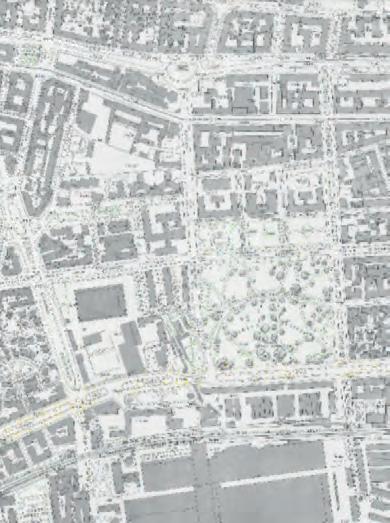
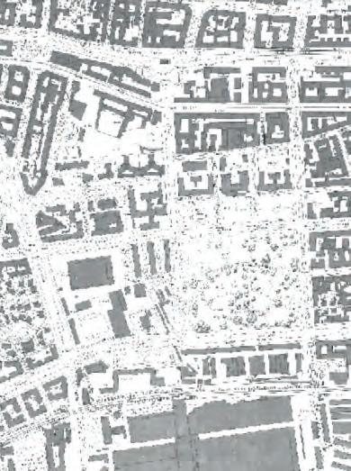
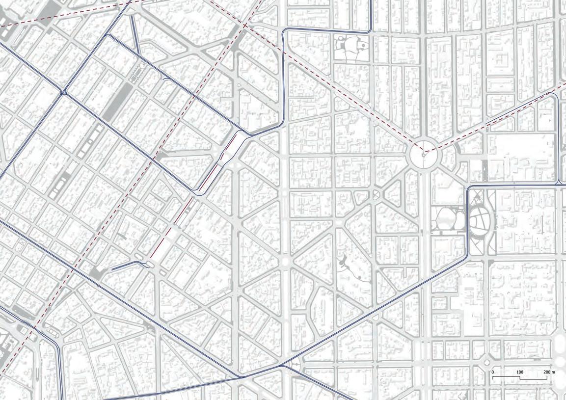
The analysis of the city has directed us towards the choice of repre sentative case studies, taking into consideration important aspects such as the environment, the main protagonists of everyday life, the way they move around the city. Zooming in into street scale, further analysis are made on three important cores:
1. Bocconi university - southern part of the city
2. Largo Richini - State university of Milan
3. Piazzale Bacone - School pole Bacone
Strategic areas choosen
Strategic City spots
Historical entrances
Main vehicular infrastructure
Acoustic pollution & Protagonists
It is not by chance that these three cases were chosen. They repre sent 3 important areas of the city, and at their heart lies an educa tional institution. In the first two, the university and the third the ele mentary & secondary school. The protagonists are the students and children, the generation that is the catalyst of innovation and change. The map displayed previously shows a general overview of the 3 strategic chosen areas. The relationship between distance traveled on foot or by bike and time was calculated to understand how they relate to each other and the city. Largo Richini is located in the historic center. By walking only 5 min away from the Dome square. The other two are more peripheral but the historic center is still only 10 minutes away (by foot or bike). In this 10 to 15 min, all essential services can be reached, reconnect ing to the concept of 15 min city. Bocconi university is located in the sothern part of the city, just next to viale Isonzo, between Naviglio Grande and Porta Romana. The area recently is facing many chang es in its urban structure. An innovative approach is being used that will reduce traffic, set speed limits and turn roads into fully pedestri anized areas.
Piazzale Bacone is parallel to Corso Buenos Aires, the most impor tant commercial street in Milan. Similiar to Bocconi university, this area is next to Viale Abbruzzi, a very busy large section road. It is very cloce to Città studi, which also justifies the presence of univer sity students. Their presence in the area is often linked to work or housing reasons.
Regarding noise pollution, all three areas suffer. The highest levels are presented at Largo Richini. Main causes of it are the public & private transport and commercial activities.
As for the residents or people who frequent these areas, we can say that there is a lot of diversity, considering the age and occupation as pect. The main protagonists are the students. Subsequently young families, and therefore children (age 0-4) and the senior citizens. In all three areas, every day, there is this kind of “struggle” between res idents and students to coexist. Sharing spaces properly to please everyone.
Adding proper/safe cycle path on large section roads
Cycle path on RING ROAD
TRAM AND CYCLE LANE COMBINED: these gives cyclers priority on cars, making driving stressful
Cycle path along Naviglio Martesana
In the previous map, the existing fragmented cycle paths of Milan are represented in light colored strokes. On the other hand, those proposed are darker in color, are the pieces that create a cycle path network instead of pieces of lanes here and there. There are repre sented the most important ones that connect the chosen areas to each other and with the most strategic points of the city. Creating this network is quite feasible on some roads given the large section of the road. In others more problematic, mentioning here the narrow streets of the historic center. One thing is certain, that in order to carry out these interventions, space must be stolen from cars and vehicular transport.
The 4 sections represented on the left are the most typical of the Milanese streets. The situation before and after was represented through sections. In the “before situation”, it is pretty clear the at tention that has been given to the cars when designing them. In the “after situation”, the focus shifts towards a more human-sized space, focusing on people and slow mobility.
Section one is a typical large-section-road of the city. Section two is the ring road. In both removing the parking lot along the road, a cycle path can be created. In areas where parking is essential, the path enters the road, giving bikes priority and the power to regulate the speed of other vehicles. The central green space of the street in section one is totally left to pedestrians, in safety even from bicycles. Adding the cycle path there more that a solution would be an added problem, given the times they have to turn and deal with pedestrian.
Section three is located in the old city town. Where the street section is often small. In this case, the tramline con be combined with the cycle path. Given the reduced speed of the tram it is a feasible thing. Also other vehicles through signs would clearly understand that tram and bicycles have priority.
Section four is along one of the Navigli canals. The proposal is to to tally remove the parking lots along the street. Leaving the panoramic path to pedestrians only.
Perception of surrounding
not simply classical Lat2000 years at Hampup one of consectetur, from a the cites discovered the unfrom secBonorum et by Cicero, on the theRenaissance. 1.10.32. not simply classical Lat2000 years at Hampup one of consectetur, from a the cites discovered the unfrom secBonorum et by Cicero, the theRenaissance. 1.10.32.
It is a fact that we often underestimate but the environment around us has a direct influence on our mood and mental health.
The internal environment is that inner world made up of hormones, genes, cells but also of emotions, thoughts, desires, disappointments, joys and anxieties. - The external environment is that world on which we move and interact, made up of people, animals, objects, natural and artificial environments.
“It is interesting to note that shops and booths in active, thriving commercial streets all over the world often have a façade length of 5 or 6 meters (16–20 feet), which corresponds to 15–20 shops or other eye-catching options per 100 meters (328 feet). At an ordinary walking speed of about 80 seconds per 100 meters (328 feet), the façade rhythm on these streets means that there are new activities and sights to see about every 5 seconds.”
Contrary to popular belief, Lorem Ipsum is not simply random text. It has roots in a piece of classical Latin literature from 45 BC, making it over 2000 years old. Richard McClintock, a Latin professor at Hampden-Sydney College in Virginia, looked up one of the more obscure Latin words, consectetur, from a Lorem Ipsum passage, and going through the cites of the word in classical literature, discovered the undoubtable source. Lorem Ipsum comes from sections 1.10.32 and 1.10.33 of “de Finibus Bonorum et Malorum” (The Extremes of Good and Evil) by Cicero, written in 45 BC. This book is a treatise on the theory of ethics, very popular during the Renaissance.
amet..”, comes from a line in section 1.10.32.
The internal or intrapsychic reality is basically more real than the ma terial reality as the perception of the external reality is considerably influenced by the psychic reality and acts more on us. Epigenetics and Neuroscience affirm that both environments influence man from conception. In a comunity the unhappiness and stress can threaten work, social relationships and health. Many studies have shown how an environment with more natural elements has a better effect on people: increased performance and reduced stress. The natural en vironment has the ability to activate the autonomic nervous system and inhibit the parasympathetic, thus producing a relaxation effect. Research by Baird & Bell (1995) has shown that healing and hospi tal stays are also related to the presence of "green" elements. Our senses receive stimuli at every moment that impact on our training and everyday behavior. It may seem trivial, but seeing the obscene car invasion of public space, experiencing traffic situations every day when you go to and from work, walking miles without finding a tree or a shadow, never having a deep conversation with the people around you, are all stimuli that affect us. Might seem light but in time they be come serious issue for people’s health. Envolving the study of senses in architecture and urban design is fundamental. Form and material is the physical aspect in direct contact with the eyes and touch. On the other hand, sound and flavour are stimuli for listening and for smell. Our brain needs one stimulus every 4 second, so one in a 6m walk ing distance, in order to remain alert and on curious mode. Through this, we can better allocate physical and itangible elements in the public space and walking/ cycling areas in order to have a relaxing, safe and pleasant experience.
Contrary to popular random text. in literature old. Richard den-Sydney the more obscure Lorem Ipsum of the word doubtable source. tions 1.10.32 Malorum” (The written in 45 ory of ethics, amet..”, comes Contrary to popular random text. in literature from old. Richard den-Sydney the more obscure Lorem Ipsum of the word doubtable source. tions 1.10.32 Malorum” (The written in 45 ory of ethics, amet..”, comes
Area Bacone


Above is what we see while walking around the three areas. In red is the area that our brain normally doesn’t consider at all. In the area of Bocconi and piazzale Bacone, the normal landscape of the stree is distorted by the car park, on both sides, sometimes even double parking lines. On some roads you can also find them on the flower beds, stuck in between the trees. Traffic is heavy in some areas but in many during working hours is quiet. The cars seem to have been parked there for an eternity because them are always the same, which means that they remain stationary for the longest time. In fact, a re cent study says that the Milanese car spends 80% of its life parked on the street. In Largo Richini the situation is slightly better. This all thanks to the location in the historic center, where the historic build ings and the natural stone flooring and the misterious narrow corners offer satisfaction to the eye. However involving the other senses the situation changes. Noise caused by means of transport reigns. In this case the public transport. Also here, many areas provided for park ing motorcycles have been violated by parking cars. Regarding green infrastructure the situation is average. Ravizza Park near the Bocconi university center and the Margheritta gardens in Largo Richini balance the urban landscape a bit.
DRIFT MAPThe drift map is a different approach to understand the urban en vironment. This drift map is an expression of personal feelings and perception of the space. While drifting all the attention is on “the now”, involving all the senses as much as possible. My trip starts from the Milan Polytechnic, which is very close to Pi azzale Bacone. From there, around the school, through the square imerged in the trees and then along Corso Buenos Aires . Next Stop is Bocconi university and from there towards Largo Richini. This ex perience helps to fully, deeply understand the urban environment, in all its dimensions. This compression clarifies the ideas on what and how to improve and which of the areas is actually experiencing more difficulties.
peace of mind uncomfortable feeling (non human size) pleasant route (satisfying all the senses) displeasure of smell displeasure of hearing route disconnection from the metropolis atmosphere


This area has a very rich heritage of large-scale green infrastructures. They are the Ravizza park, the park of Industrial Memories and the park of the Resistance. The streets are lined with trees on both sides, and it is in good condition. The green helps not to perceive the prob lem of traffic and noise very much. Parco Ravizza, among the es sences are: the American maple, the ailanthus, the deodara cedar, the Atlas cedar, the plane tree, various species of oak, the sophora, the lime tree, the black poplar, the hackberry, the hornbeam, the elm and the thorn of Judas. The Industrial Memories park is characterized by important plantings and green arrangements with numerous tree species, among which maple, English oak and paulonie stand out. These areas are enriched by the presence of squares, play areas, an orchard, pools with water features and pedestrian paths such as the particularly suggestive one that runs along the Vettabia.
ANALYSIS
TRAFFIC
medium heavy
Transport The area where Bocconi University is located is 2.1 km from the historic center and 1.3 km from Naviglio Grande. Regarding pub lic transport it is well served by surface public transport buses and trams. The metro station (Porta Romana), M3 yellow line which is probably the most interesting line for tourists. It stops at the Duomo, in Via Montenapoleone (the most important shopping area in Milan) and in the Central Station. It is just 5 minutes walking distance away. Regarding the traffic, it is more intense and towards viale Toscana and via Roberto Sarfatti. The latter are also the noisiest. Wandering around the neighborhood, other means of transport widely used by people are bicycles and scooters. It should be emphasized that the latter do not have proper cycle paths available. They are almost 0 in this area. As for bike / scooter sharing points there are many avail able.
LEGEND pedestrian area private vehicle metro tram line metro stop bus stop M


As seen in the historical maps, the first buildings in the Bocconi area arrive in the 1930s. Among the most important interventions are : The Ravizza park area . It was foreseen in one of the first attempts to expand the city of Milan which took place at the end of the nineteenth century. The area was already intended as a public park by the Beruto master plan of 1889, but was only built in 1902, when the demolition of the Camporicco farmhouse that occupied the space was completed. The park became very popular as a daytime meeting place for stu dents starting in the 1940s after the new Bocconi University (19381941) was built near it, construction of the new headquarters, archi tecture of Italian Rationalism (Giuseppe Pagano and G. Predeval), in via Sarfatti. The Bocconi center occupies a large space : the university buildings, the library and housing. In addition there is also the vel odrome and sport center. Thus he establishes the character of the area, which is of an educational nature. Except Bocconi University, in this area there are many other educa tional and training institutes. It is a lively area of the city but the main protagonists are still the students.


Than main green areas in Largo Ricchini are the “Camilla Cederna gardens”. It is a lovely garden where you can admire the beautiful leafy plants and large rose bushes of every color. The atmosphere is evocative, quiet and relaxing. Another importat area is the park next to San Nazaro in Brolo church. It is a somewhat neglected space but the trees are in good condition. Lacking in urban furniture. However, it plays an important role for the residents, who complain that they need more space for a healthy coexistence between themselves and students of the Milan university. Another important infrastructure is the Guastalla gardens. A historic garden, located between the University of Milan, the Ospedale Mag giore and the Central Synagogue and offers students, residents and anyone who wishes it the possibility of a soothing stop in the green, among centenary trees, a large lawn and important architectural ele ments.

TRAFFIC
medium heavy
MTransport Largo Richini is located almost in the heart of the city, very close to the most important historical attractions of the city. It is well served by surface public transport, by bus and tramway. It is also in between the two important Metro stops (Crocetta and Missori), stops of the M3 yellow line which is probably the most interesting line for tourists. It stops at the Duomo, in Via Montenapoleone (the most important shopping area in Milan) and in the Central Station.The most intense traffic is encountered in a stretch of via Santa Sofia and Corso Porta Romana. This area is an example of a 15 minute city, being close to essential services. Easily accessible on foot. Vehicular transport is reduced since it is located in the historic center.
LEGEND pedestrian area private vehicle metro tram line metro stop bus stop M

The most important architecture in this areas is Milan’s university. It is considered an institution by all Milanese. It is the architecture that overlooks via Festa del Perdono 7, in the Milanese capital. Since the postwar period it has housed one of the largest Italian universities, the University of Studies, but in reality it was born with the function of a hospital. In April 12, 1456 when Duke Francesco Sforza laid the first stone of the Ospedale Maggiore, also known as Ca ‘Granda, precise ly the “great house” of the Milanese. It was defined a hundred years later by Giorgio Vasari: “a place so well done and orderly that I do not think it is another in the whole of Europe for similar”. Another build ing of great importante is the basilica of the Santi Apostoli e Nazaro Maggiore (original paleochristian name basilica apostolorum), com monly known as the basilica of San Nazaro in Brolo which is one of the oldest churches in Milan. It is the oldest Latin cross church in the history of Western art. Torre Velasca is a skyscraper for commercial and residential use. Built between 1955 and 1957 on a project by Studio BBPR, the building represents one of the few Italian exam ples of post-rationalist brutalist architecture. Its name derives from the homonymous square in which it is located, a toponym deriv ing from the name of the Spanish politician Juan Fernández de Velasco who in the seventeenth century ruled the Duchy of Milan. Due to its historical and artistic interest in 2011 the building is part of the architectural heritage subject to restriction by the Superintend ence of Cultural Heritage. The rest of the buildings are of a residen tial or mixed nature (having commercial activities mainly on the lower floors).


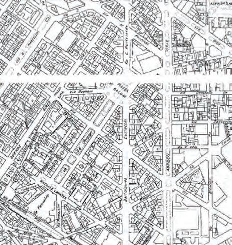

1884 1910 1972
1930 1990 1965


buildings open spaces
Some streets in this area are aligned both sides by tree lines which apparently seem in good condition. But majority are not. Corso bue nos aires there are no trees, neither urban planters. lThe main green infrastructure is the axis of piazzale Bacone, which is a serie of spaces that host different activities for all generations. In general the area is poor in green infrastructure. Often in cases of bad weather there have been cases of fallen trees. There are Leonardo da Vinci’s gardens near the polytechnic. But in fact not close it is to be reached on foot for an afternoon walk by a resident of piazzale bacone. Main tree species we can find here are : Acer platanoides, Platanus x acerifolia, Prunus armeniaca ect.

TRAFFIC
medium heavy
LEGEND pedestrian area private vehicle metro tram line metro stop bus stop M
Piazzale Bacone is located in a strategic area of Milan, 1km away from the central station. It is parallel to Corso Buenos Aires, an im portant commercial street in Milan. Just 1,1 km away from Città Stu di. It is close by three important metro stops , Lima, Loreto and Piola. Lima and Loretto stop of M1 red line, especially interesting for whom travel for business or who have to reach the Milano Fiera. It passes through the Duomo and San Babila. Loretto and Piola stops of M2 green line (leads from Abbiategrasso or Assago Milanofiori Forum to Gessate or Cologno Nord). It stops at the central station. It is well served by surface public transport too. By bus through line 92, 81 and the tram line. The traffic is moderate, it intensifies in a small stretch of via Morgagni.


Milan is full of palaces and houses built in the early twentieth centu ry, an era of the floral style also known as liberty. Among the thou sands of buildings built in this style, some are located in Piazzale Bacone. This part of the city is quiet although parallel to corso Bue nos Aires. Buildings and trees shield them. It is a mainly residential area, where many young families and senior citizens live. The liveli est node is the Santa Caterina school complex (previously this area was the tram depost) where there is also the Bacone swimming pool. There are many commercial activities such as shops, bars and res taurants all around the area. The area is well served from essential

high
medium
low
UniversitàBocconiLargoRichiniPiazzaleBacone
high
medium
low
Comfort of pedestrian & slow mobility users
UniversitàBocconiLargoRichiniPiazzaleBacone
high
medium
low
UniversitàBocconiLargoRichiniPiazzaleBacone
high
medium
low
Large scale green infrastructure
UniversitàBocconiLargoRichiniPiazzaleBacone
As a result of the urban, environmental analysis and personal percep tion we came to a conclusion. The three sites were compared consir ing 4 main aspects, as described on the previous page: In Bocconi University, even if there are many problems that coexist, the situation in general presents itself well for various reasons. Re garding the issue of greenery, the existing trees are in good con dition (result obtained by simple observartion on site). There is the Ravizza park which hosts many activities. Furthermore, togeth er with the new Bocconi headquarters, there are many works in progress concerning new limites traffic areas (30 km/h), cy cle paths and road closures to subsequently become pedestrian. There are safe, green spaces for people to get together in considerable quantities. The university offers some of them. Since this division of spac es, coexistence between residents and students also becomes easier.
Regarding Largo Richini, the situation is also quite good. By remov ing the cars that are now invading the space dedicated to pedes trians and motorcycles, using simple dividers, you can get a nice big square for various activities. The Margherita garden is consid ered a potential, also due to the fact that it is located in the histor ic center. The thing is rare in italian historic centers. The dog area problem has currently been solved by using the park next to the “San Nazaro” church, which even if it is in fair condition, is fenced and the door can be closed and opened by citizens. For traders, the area is very lively, again due to the fact that we are in the center.
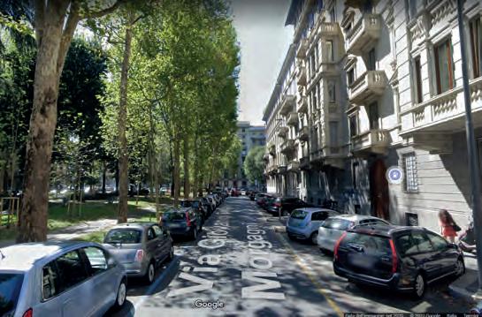
Piazzale Bacome as a location is great. And a well-served area which can also be an excellent example of 15 min neighborhoods. All services can be reached within 15 min using soft mobility vehicles. The axis of the Bacone square is well equipped. It hosts a series of spaces that offer different activities (sport and recreation) for all gen erations, from the youngest to seniors. Entering the piazzale you have the feeling of being outside Milan. The problematic part of this area is at the top of the square. There is located the school complex and the Bacone municipal swimming pool. A very common area for children, ages 3-14. Via Monteverdi, where the school and the swimming pool overlook, is underestimated. It lacks identity as well as the many prob lems. Another problem is the future thread, such as the pedestriani zation of Corso Buenos Aires. Being frequented by fragile people like children, it seems to be the most urgent to undergo changes.


Corso Buenos Aires around 1,6 km
Piazzale Loreto
Porta Venezia
VIA C. MONTEVERDICorso Buenos Aires is an important commercial street in Milan, with over 350 points of sale for various types of goods, an over all daily turnover among the highest in the world and an average of one hundred thousand people passing through it every day. Developing over 1600 meters, with a north-south orientation, it is one of the longest commercial promenades in Europe. Its conformation recalls the American typology, especially New York’s Fifth Avenue. The road extends from Porta Venezia to Piazza Oberdan, a straight continuation of Corso Venezia, up to Piazzale Loreto. The entire Cor so Buenos Aires is part of the City Hall 3.
The president of the City Hall 3 council Caterina Antola intervened on the issue, hinting that the direction is precisely to close Buenos Aires to traffic, even if perhaps not completely.
“I think we have to go towards a more livable city, more citi zen-friendly, with sustainable and gentle mobility” Corso Bue nos Aires “is an artery of a commercial nature, with an under ground line and therefore easily accessible”
The plan is to proceed step by step through pi lot projects (the weekly closures, on weekends). She concluded - on the timing for Corso Buenos Aires we need to work well over the span of 5 years, a commitment that must be carried out throughout the mandate. From the previ ous studies that this paper previously expounded, the prob ability of a positive feedback is very high. As a result it should not be assumed that this project will remain a “UTOPIA”. Via Monteverdi and the school, being located parallel to it, are strong ly threatened by this project for the main reason “traffic”. Corso Bue nos Aires currently plays an important role in connecting the two ring roads. A total closure would lead to the conveyance of traffic towards secondary roads.


The accesses on this street are mainly pedestrian. Carabble access es are the courtyard (for residents only), the supermarket depot and access to the supermarket customer parking on the terrace. On this stree is present the entrance of the school and Bacon swimming pool, exclusively pedestrian.

A very well served area, located at a distance of no more than 10 min utes on foot, supermarkets, schools, religious buildings, sports center, helthcare etc. the school complex houses the primary and secondary school. In the same node there is the municipal swimming pool. The Polytechnic of Milan just 12 minutes away on foot. Parallel to corso buenos aires enjoys the availability of various shops and facilities.


-green and open spaces
LEGEND built-up Piazzale Bacone sport facilities (property of the school) courtyards trees
-public transport & parkings


LEGEND bus stop bus line bike parking bike sharing point parking cycle path tram line


Trees in Milan have to live with a series of constraints that often compromise their growth in particular: -scarce attention to avoid damage to the roots -limited spaces for growth to be shared with man -“difficult” growth sites, often stressed by interventions in the subsoil -road and construction sites Especially in the urbanized area, trees must coexist with the technological systems present in the subsoil: an important factor both in the design phase for the insertion of new trees and in the maintenance phase or interventions concerning the same technological systems. This street is aligned both sides by tree lines which apparently seem in good condition but suffer all of the point mentioned before. The main species present in the area are deciduous trees : Fraxinus excelsior, Prunus armeniaca, Quercus robur, Tilia platyphyllos, Acer saccharinum.

In via Monteverdi there are no public transport stops.However, near the intersection with via Piccinni there is the bus stop and in Corso buenos aires the closest metro stop and that of Lima, followed by Lo reto.The road is characterized by wide pavements (concrete gratings along the tree line) on both sides, positive for size but not for mainte nance. Regarding the latter, they are quite neglected. The street lacks of character. Although there are buildings such as the school and the swimming pool, they are not noticeable to the eye of the non-resident. Both sides of the street are conolized by car parks. Previously was possible to park between the trees above the sidewalk. The square is well equipped with ease for slow mobility such as bike parking and bike sharing points. Bike paths have recently been traced, but the fact remains that they are sections without real continuity.
-tree species


LEGEND
tree species Fraxinus excelsior
Acer platanoides Platanus x acerifolia Ginkgo biloba Tiglia argentata
Acer saccharium Quercus robur Populus nigra Picea abies Prunus spp
Aesculus hippocastanum
Cedrus deodara
Celtis australis


The Goals are set, considering the multiple analysis that this paper previously exposed, listing the issues. Moreover, had to consider the Sustainable development goals from 2030 Agenda which provides a shared blueprint for peace and prosperity for people and the planet, now and into the future. At its heart are the 17 Sustainable Devel opment Goals (SDGs), an urgent call for action by all countries in a global partnership. In conclusion our 3 main goals are improvement of 3 apects:
1. Social (11)
2. Mobility (9)
3. Sustainability (3)

Challenging the so called “Normality”
HOW?
The final goal we have set ourselves goes beyond the expectations of “today’s normality”. The aim is to transform via Monteverdi into an open public space for pedestrians only and soft mobility, offering spaces for aggregation and support for small businesses. In this way, the surrounding streets will also undergo similar changes, since they are perceived as a continuity of the road and not a detached reality. As mentioned before, “Transition process” was proven to be a more efficient way for the change to be accepted. The strategy consists precisely in this, to transform by phases, with the approach of tactical urbanism .Tactical urbanism has proven to be a very efficient method. These are temporary investments, that last long enough to collect strong feedback that can assure us that it is worth investing for longterm projects.
Why can’t go ahead always with the tactical urbanism tool? Because despite being so “miraculous” it remains an investment that degrades quickly over time. Long-term investments on the other hand, although the costs are higher, are more lasting and ROI (return of investment) witness that it is worthwhile.

-Traffic safety
30
1. Offset the road though chicane 2. Highly visilble road signs 3. Limited velocity and priority on bikes (Bike defines the velocity of other vehicles if in front or them)
-Services/Building’s safety1. Creating square entrance (school, Bacone swimming pool, small businesses)
-> Increases distance from vehicular transportation space -> Increases visibility of the building
-Comunity gathering Walking experience
1. Reduce parking spaces to create room for gathering ones
2. Add cheap urban furniture 3. Propose creative activities/games such as ground games
4. New crossing/reduce walking distance and connect
-Environmental benefits
1. Water retention / bioswale (starting removing partially the existing tiles on the sidewalk) 2. New tree pots and urban planters 3. Foster slow mobility offering sharing services and enough parking spots
Tactical urbanism interventions can inspire progressive placemaking and long-term change. Transition process is very efficient when the purpose istransforming totaly an area. This change will certainly have an influence on ways of living and relating to the environment around us. Human beings have this incredible ability to adapt to changes and novelties. This adaptation, however, needs time in order to take place in a calm and as natural way as possible.
For the transformation of via Monteverdi is important to proceed with caution. The vision is to transform via Monteverdi into a pedestrian area, since its role in vehicular traffic is not so essential. on the other hand, it is essential for the school’s security and its users. Give the residences public spaces where they can meet and foster interaction among them. Emphasize the sports center and take advantage of the space for the growth of small businesses.
Phase 1
Phase 1, is about 3 interventions, scheduled every 6 months. Intervention at the start and finish of the road, arrangement of two important intersections. Two pedestrian squares are created. There is a noticeable reduction in the carriageway and parking spaces. An additional pedestrian crossing is added.
Phase 2 Phase 3
Phase 2, other parking lots become a continuation of the sidewalk hosting another area for people to gather. In the node with piazzale Bacone the road closes to create kind of a continuity with the Bacone axis. The private courtyard is equipped with plants and benches so that it can be used for other reasons than just parking the car. The customers parking terrace is partly transformed in community gardes.
Phase 3, the last remaining pieces of the road are taken.The area is used exclusively by pedestrians, slow mobility, and public transport (tram).

1. 2. 3
On the northern part, the intervention consists on arrangement of the crossroad, by reducing considerabily the space for vehicular circula tion. Furthermore a huge square is created on the front of the Sport Center “ Piscina Bacone”, enhacing the entrance and also creating a safe environment for the users who apparently are mostly children and young generation.
The area has been equiped with: - bike parkings - tree pots (in prespective of being planted on ground in the nearest future) - urban planters - board games and ping pong table - sitting area - picnic table
The second intervention is in front of the school entrace. It is about the creation of a small entrance square, again too enhance the en trace and make it visible from a considerable distance. Also to create a gathering space for the students, teachers and their parents. In this part it is being removed the fence located between the street and the sidewalk, which role was to guarantee safety but in the mean time contributing to complicate pedestrian circulation.Furthermore, at this point was added a new crossing area, facilitating the connection between both sides of the street at almost midline of via Monteverdi. The first and the second intervention were designed using “Chicane strategy”. Misaligning the road, adding the new crossing and with the right road signs would force vehicles to moderate their speed.
The third intervention, is the existing situation. It also consist on the arrangement of the crossroad and adding facilities for slow mobility users and space for community gathering and leisure.


1. 2. 3
The rooftop of Pam supermarket is currently being used as a car park ing, which is an underestimated space given the architectural poten tial it has. It is covered by these huge beams which also act as pots where trees and various plants are planted. It is an interesting and beautiful space from an architectural point of view. The only flaw it could be the hight, that would make it difficult to allocate the right function. From various consideration, it could be convinient hosting some community gardens, given that in Milan there is hardly space for this activity. Having said that, on phase two the terrace is being partially given to this kind of activity.
Second, the courtyard is being equipped in such a way as to create space for residents to stay outside their homes. Kind of private home garden.
The next move regards the area on the other side of the courtyard, completing so this horizontal axis of the street. It consist on the cre ation of another queing area. On the east side of the road, there is a direct visualy connection with the pool inside the sport center. The proposal consist on creating this area that would host more tree pots and bike/scooter parkings. Furthermore a platform with a puppet show facility and an “diy aperitif” area. The aim is to bring closer the neighbors and increase interaction.
On the south, via Piazzale Bacone that connects via Spontini, Mat teucci e Paracelso, is being closed, leaving the necessary space for cars to turn around and refuel in the present distributor.The new area hosts recreational activities.


1. 2. 3. 4.
Ideally tha last phase of the project would be transforming this area in totally a pedestrian/slow mobility use one. By this it means the via Monterverdi is accessible by vehicle just on a short section to permit the supply of the supermarket.
The rooftop turns completely into a community garden area and the cars are not allowed to enter anymore.
The courtyard is getting mixed with the public space by removing fences, as a symbol also of a healthy and united community.
Via Spontini, is hosting new areas that serve small businesses located along it.
The southern part, is a “fake” extention of Piazale bacone, through tree pots and urban planters. Furthermore it is added a new con cept area, an open air library, furnished with chargind stations and bookshelves for sharing books. The cheap shading elements make it easier to frequent the area.
Summing up the intervention are:
- Painting the ground (colors: blue, white and yellow)
- adding new cheap urban furniture (benches, activities, tree pots)
- adding enought bike parking
- make pedestrian and slow mobility users safe (by istalling dividers)
It is planed to make it possible with the help of volunteers .Work in comunity and interaction between people is proven to be efficient in building a healthy, less stessful environment to live. Furthermore, it would help also on maintaining the area and all of the light interven tions. Fostering human interaction, educating them to consider the public space as a home and as a result taking care of it properly.


The PAM terrace new didactic garden
Aromatic plants |
DIDACTIC GARDEN |
Lavender
Common lilac
Cuban oregano
Lemon balm
Feverflew
Basil Rosemary
Summer savory Mint
Giant golden
In this phase of the project the rooftop, which is no longer ac cessible by cars, turns completely into a didactic garden area for children. It is characterized by high biodiversity in terms of vegetation such as veggies and aromatic herbs.

Taking for granted that the feedback after each of the phases is pos itive and all of the interventions are welcome, this could be a final proposal of long term investment for the area. Saving it from the risk of Corso Buenos aires pedestrianization and directing vehicular traffic entirely towards viale Abruzzi, mainly passing through via Piccinni on the north.
Overhauling plants and trees of the rooftop, opting to improve and add more vegetation for the purpose of clearing the air and reducing UHI.
The square is being paved with permeable, rough, light materials, such as eco-cobble, idrodrain, gravel. The trees on the pots are grounded. There are added some light structure that would host a Pop-Up store and a bike check point.
The stone paving on the courtyars is being partially removed to cre ate space for new vegetation and trees planted on ground. This area remains property of the residents of the building, eventhough it is ac cessible to the public.
The square is paved with idrodrain material, new quality urban furni ture are added in light concrete and wood.
In via Spontini is reacitvated the exsting tramline, fostering so the pub lic transport.
Other Pop-Up store in light structures are being hosted. This is area, being just next to Corso Buenos Aires is seen as an opportunity for small businesses and creators that nowdays are developing rapidly on the online platforms.
The creative boxes are spread in the Piazzale Bacone “bosco”. Them are small spaces that aim to offer comfort, inspiration and an alterna tive place to work remotely, study or simply create.
This area is equiped with gym equipment for outdoor activities. Locat ed in front of the school which in this phase is open to communit in defined timetable, for sharing its sport facilities (fields ecc.)
It is an accessible area by the bus line, bicycle and scooters.


Wet zone
Moderate zone
Dry zone
Carex grayi Lythrum salicaria Lysimachia punctata
prepaired soil mixture
sand
gravel bed
50-60 % sand 20-30 % compost 20-30 % topsoil
Eupatorium maculatum Filipendula vulgaris Moench Saponaria officinalis
Malva sylvestris Knautia arvensis Salvia pratensis


Wild flowers
Streets as a tool for urban and social recovery
Papaver rhoeas Centaurea cyanus Nemophila menziesii
gravel MATERIALS

The urban building materials, such as concrete and asphalt, can ab sorb heat during the day and radiate it back at night, much more than areas covered with vegetation do. This ia part of the phenomenon known as urban heat island. Solar reflectance and thermal emissivity are key parameter for the thermal response of the surface subjected to solar radiation; their combination is the solar reflection index (SRI): the higher the SRI, the lower the overheating to which the surface irra diated by the sun is subject. The use of specific cool pigments allows the surfaces to be kept cooler, increasing the amount of solar energy reflected, especially in the near infrared (NIR) range where the thermal radiation is concentrated.
In the 2008 EPA report “Reducing Urban Heat Islands: Compendium of Strategies: Cool Pavements” it is emphasized that “the reflected energy is dispersed by convection and cooling through evaporation” To increase these two processes, the surface of the Cool pavements must be rough.
Waterproofing is identified as the main cause of soil degradation in Europe since 2006 (European Commission, 2006) and represents the most evident form of land consumption. Soil sealing carries an in creased risk of floods and water scarcity, contributes to global warm ing, threatens biodiversity and is of particular concern when fertile agricultural land is covered.
For these reasons we have decided to take into consideration three important characteristics for the choice of materials: roughness, light color and permeable.
The materials mostly used are:
- ECO Cobble is on of the most versatile Permeable Interlocking Con crete Pavement providing benefits in installation time and cost sav ings. It offers an almost unlimited range of pattern and edging options.
- Idro DRAIN is an innovative cement formulation for continuous floor ing with a very high drainage capacity. An accurate aggregate and the action of the cement binder allows it to reach a draining capacity 100 times higher than that of a normal soil. It can be used in gray, white, colored or pigmented colors. Floors made with i.idro DRAIN have the ability to permeate water 100% over their entire surface.
In our project, particular attention is paid to small business activities. To those existing on site and beyond. Existing ones gain more outdoor space to increase their service and to advertise their products. Furthermore, considering the fact that online commerce is evolving with giant steps, it was decided to offer a solution such as the Pop-up store to small companies in order to advertise and drag them a little off the net. Most of these activities are struggle of young people. Supporting them has benefits for both parties. Being located very close to Corso Buenos Aires is an advantage for the trade and the advertising of new companies. For the creative boxes, the design concept is almost the same. Form is born from functionality. The materials chosen are of natural origin, recycled and durable over time. They do not require much maintenance and labor costs are acceptable. They are simple wooden frame structures. Coating in zintek. Covered with a double pitched roof. One side of 33 degrees to accommodate the photovoltaic panels and the other as a consequence of the latter having a comfortable height.
The surface is 4 square meters. It has a restroom and a small storage room. The interior is not plastered. The Osb panels are left exposed and treated to be as smooth as possible.
Wall
-OSB panel 1cm -thermal insulation -wooden structure10cm -OSB panel 1cm -zinc-titanium laminate 1,5cm

-glass -frame -wooden structure
-wooden ramp
Roof
-OSB panel 1cm -wooden structure10cm -thermal insulation -breathable membrane -OSB panel 1cm -zinc-titanium laminate 1,5cm
Creative box detailed isometric view
The “creative box” is a space large enough for 1 to 2 people. It has an area of about 4.5 square meters. Glazed on 3 sides and surrounded by trees. Covered by a single pitch roof inclined by about 30-35 degrees, for the simple fact that it will house the photovoltaic panel. The inclination of 30-35 degrees was the most efficient, con sidering the climatic characteristics of the city of Milan. The structure has a wooden frame, insulated with wood fiber and covered with zintek panels (titanium zinc). A material with a simple appearance and durable in time. We tried to make it become a space to stay and reflect or work in peace (remote working or studying). A space that inspires. A space that also aims to give birth to ideas, which today are the only way towards the progress of any society.
Wall

-OSB panel 1cm -thermal insulation -wooden structure10cm -OSB panel 1cm -zinc-titanium laminate 1,5cm
-glass -frame -wooden structure
-wooden ramp
Roof
-OSB panel 1cm -wooden structure10cm -thermal insulation -breathable membrane -OSB panel 1cm -zinc-titanium laminate 1,5cm

View from the south of Via C. Monteverdi, transformed into a completely pedestrian street. New paving made of materials which features meet the needs of the future, such as permea bility, light colours and of natural origin.

Piazzale Bacone enriched with new trees, thus transforming itself into a small “urban woodland”. A space to relax, study and gain inspiration in the middle of the city.


Transformation of the courtyard from car parking area into a garden and a gathering space for neighbours. It becomes part of public space as a symbol of connection and interaction be tween citizens.


