This catalogue is part of a collection published by the Edinburgh School of Architecture and Landscape Architecture (ESALA), Edinburgh College of Art, University of Edinburgh. It documents student design work produced in the Master of Architecture (MArch) programme in 2024-25. Each catalogue describes one of the following design studios in the MArch programme. The full collection is available to view online at issuu.com/eca.march.
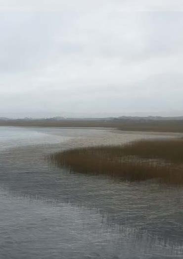
Catalogues 2024-25:
Architecture as Support Structure, Vol. 2
Crossing Tangier, Vol. 2
Daire’s Airc, Vol. 2
Doing Enough with Less: Leith Moving Water: Esbjerg
Radical Harvest: Earth/Care/Reuse, Vol. 2
Published in 2025 by The University of Edinburgh, under the Creative Commons Attribution Non-Commercial Non-Derivative 4.0 International License (CC BY-NC-ND 4.0).
Andrea Faed and Jack Green. MovingWater:NorthSeaEdge. Edinburgh: University of Edinburgh, 2025.
NORTH SEA EDGE ARCHITECTURE OF ENTANGLED ECOSYSTEMS
ENTANGLED ECOSYSTEMS
Hedgerows and ditches are linear ecosystems, rich in biodiversity. Through exploring these landscape devices and mapping their physicality, we can learn how to assist and encourage diversity and take this knowledge into the creation of an Architecture of Entangled Ecosystems. Ecosystems are dynamic entities that are always recovering from some form of disturbance. As humans take on the role of custodians of the planet, we need careful stewardship and responsible management of its resources for all its organisms. As biology professor and citizen of the Potawatomi Nation Robin Wall Kimmerer suggests, to address the increasingly urgent question of How are we to live? we must start paying more attention to the world around us. Pay attention to those living and non-living others who share the planet with humans – and who make it possible for humans to survive. Coexist with more-than-humans.
These lines in the landscape are buffers, transitions, places where nature and urbanity can merge. Anthropologist Tim Ingold believes that everything is interwoven with an interconnected line, weaving paths, through an anthropological archaeology of the line. Within the chapter The Mountain and the Skyscraper, Ingold describes the ground as a sheet of paper that lifts to form a crease, registering the line of the crease.1
Hedges, ditches, dykes, embankments and dry-stone walls have been around in the British Isles since the first settlers to manage the land, fields,
1 Tim Ingold, The Life of Lines, Routledge, 2014
their defences and their crops. Ditches (and banks – they are usually found together for obvious reasons) are long-lived structures, still existing today, evidenced as watercourses through aquatic and bankside species such as watercress being present. Drainage schemes of varying quality and success have been attempted throughout history because of how boggy the British landscape is. Ditches are the simplest form of drainage but much of our agriculture depends on field drains (sub-surface drains historically made of ceramic but now mostly plastic) which discharge into these ditches.2 Hedges could be seen as green barricades, enclosures to keep stock contained and mark the boundaries between fields and properties. If hedges are biologically rich there is a good reason to conserve them, however wide ditches can support aquatic ecosystems and may be a better boundary feature. 5m uncropped strips around fields are financially supported by the UK government to support and maintain wildlife corridors - in New Zealand a technique of contouring pastures called hump and hollow or ‘flipping’ is practiced, improving productivity. This technique, used on peat soils and in areas of high rainfall, allows for faster water runoff and lowers the level of the water table.
Richard Mabey in his book The Accidental Garden believes plants are argumentative beings – we/humans create gardens, ‘outdoor rooms’, frameworks in which natural forces, uninvited organisms improvise their own landscape and make the vital processes of succession and decay.3 Don’t fight it in the manner municipal parklands tend to with their mono-cultured cut grass – allow biodiversity. The ancient provenance of ‘common land’ was for a place belonging or affecting the community with exceptional wildlife and a habitat for humans. Hamstead Heath in London being a prime example with its ponds and woodlands. How much do we intervene – do we preserve or conserve? Environmental philosopher John Muir advocated for the preservation of the wilderness, protecting it from human impact.
Philosopher Henry Thoreau’s vision was to bundle all the hedgelets into a single parish treeland: ‘Every town should have a park, or rather a primitive forest of 500 or 1000 acres, where a stick should never be cut for fuel, a common possession forever, for instruction and recreation. We have cowcommons and ministerial lots, but we want men-commons and lay lots,
2 John Wright, A Natural History of the Hedgerow and ditches, dykes and dry-stone walls, Profile Books, 2017
3 Richard Mabey, The Accidental Garden, Profile Books, 2024
inalienable forever’. Trees lock up carbon dioxide, filter pollution, refresh urban landscapes and provide habitats for many living things. Seedlings, self-sown trees can also require managing. Rewilding is not necessarily leaving the wilderness alone – lowland habitats would become too woody.
WATER
With more frequent flash floods across the planet, drought and water scarcity, water is an element of extreme contemporary relevance for us to consider, manage and control. With these climatic challenges we are also noting sea levels rising and coastal erosion from increased tides. In architecture we need to consider the micro to the macro impact of water: from the route of the rain drop landing on the roof, to our personal water needs and the flooded ground beneath our feet. The way we build, what materials we build with and where we build are all factors to consider in assisting living with these flood and drought climate challenges. Tokyo is prepared for floods with huge, cathedral-like underground flood tunnels to attenuate the water – temporarily storing the storm water for a period, to then release it back into a watercourse or sewer network after the storm. The city has built over the existing rivers burying them underground in culverts, subterranean waterways, lost rivers, breaking the natural cycle of water dispersal. At the other extreme but equally concerning is the globally common problem of subsidence from water extraction – when taking out ground water or draining soils, the land tends to subside.
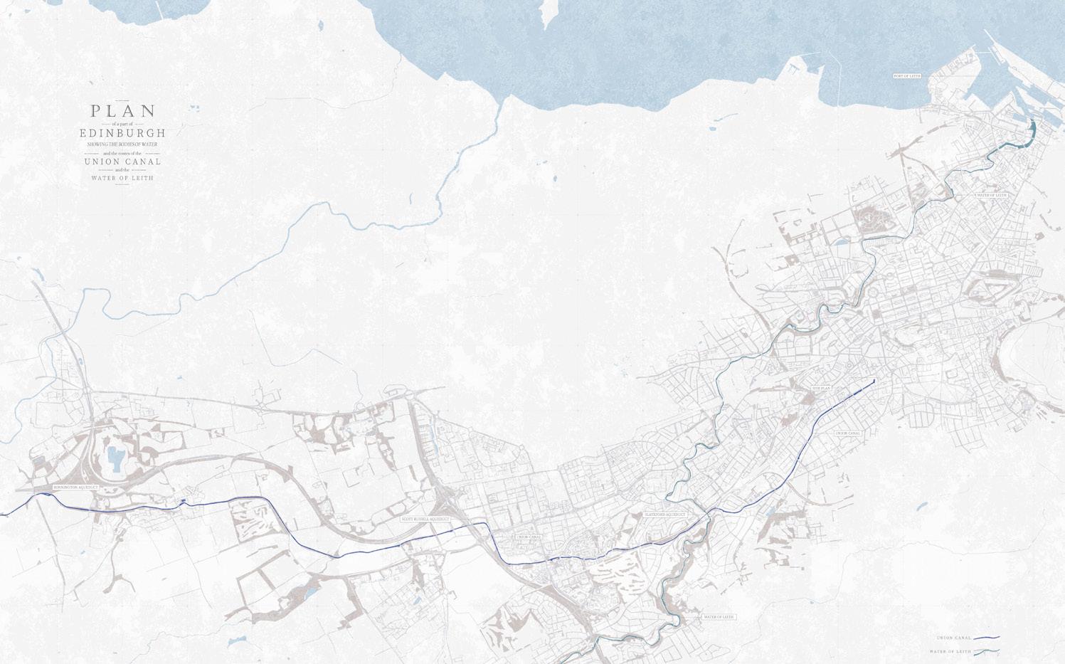
The year began by researching bodies of water within the city of Edinburgh, observing, logging, mapping, surveying, recording, and collecting landscape flotsam. Water bodies come in various forms, either man-made or naturally occurring - aqueducts, reservoirs, loch/lake/ponds/pools/lidos, wetlands, canal/ditches, river/stream/burns. These bodies have beds and banks, weirs/waterfalls, lades, springs/wells. There is water at the beach for swimming and play, and at harbours for docking boats. Water can create cooling, reflection and well-being, and supports an essential watery ecosystem. Water is a friend of light and sounds, clearly revealed in the architecture of Carlo Scarpa and Louis Kahn. Around 1510 Leonardo Da Vinci stated the importance of water with his famous quote: ‘Water is the vehicle of nature’. A recurring theme in Leonardo’s work was the movement of water.
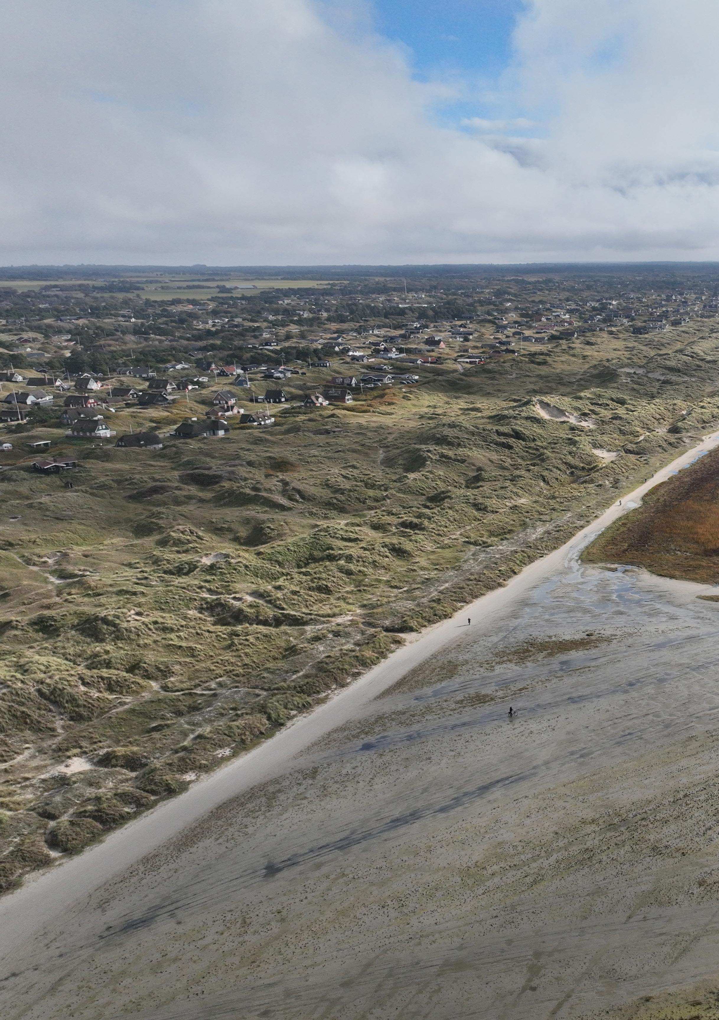
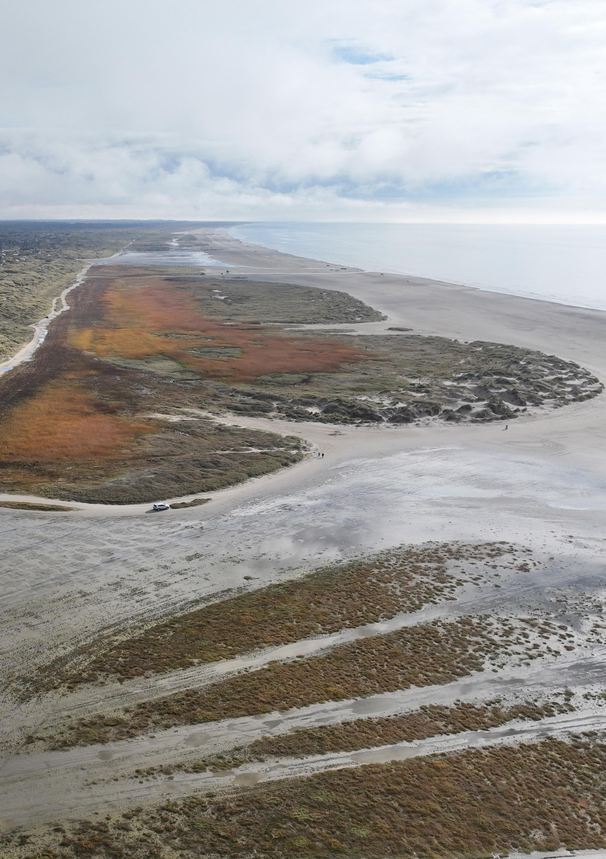
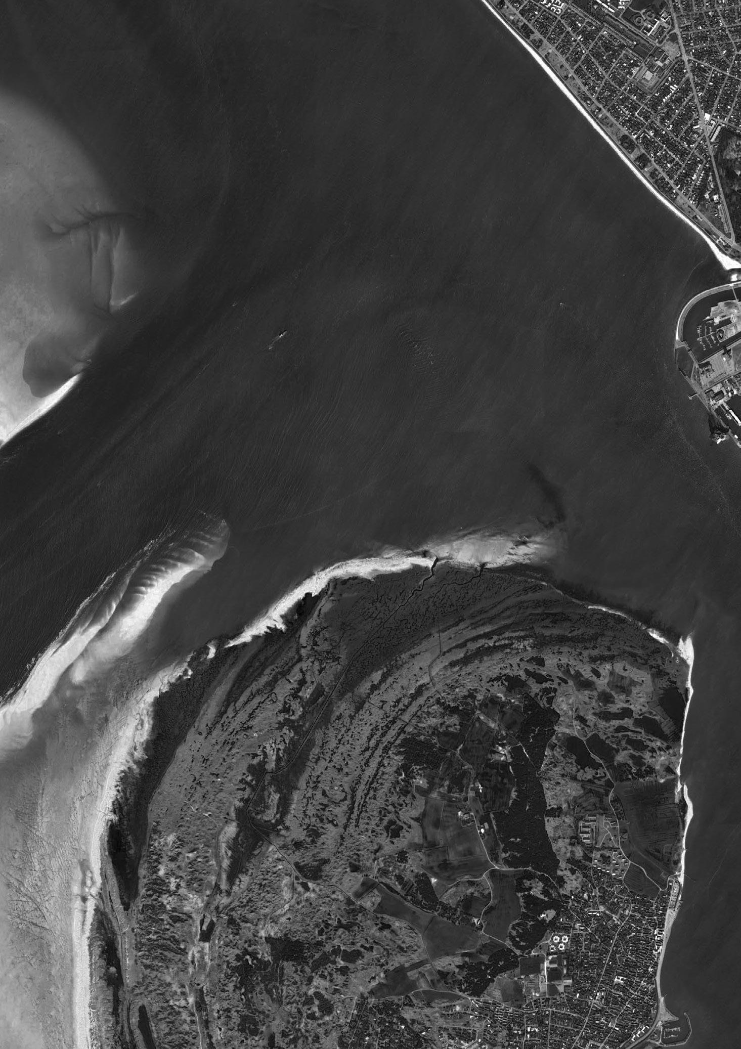
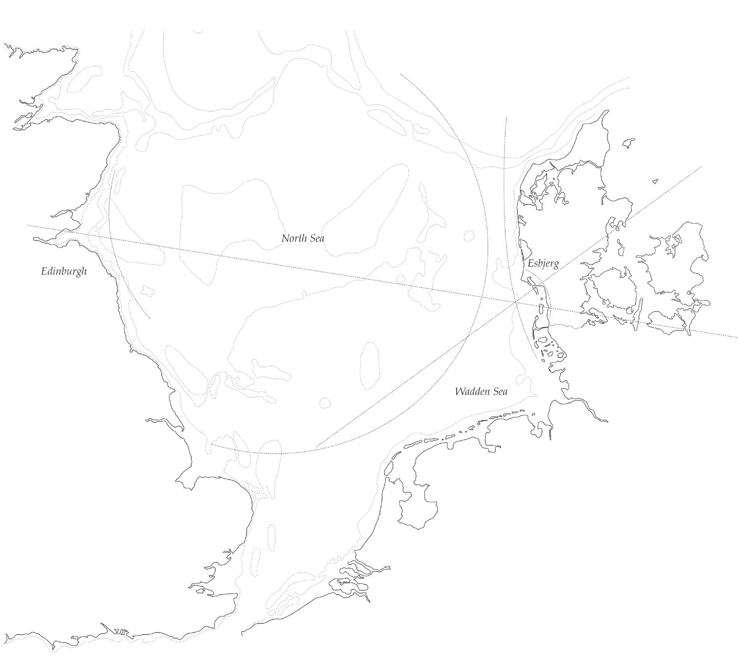
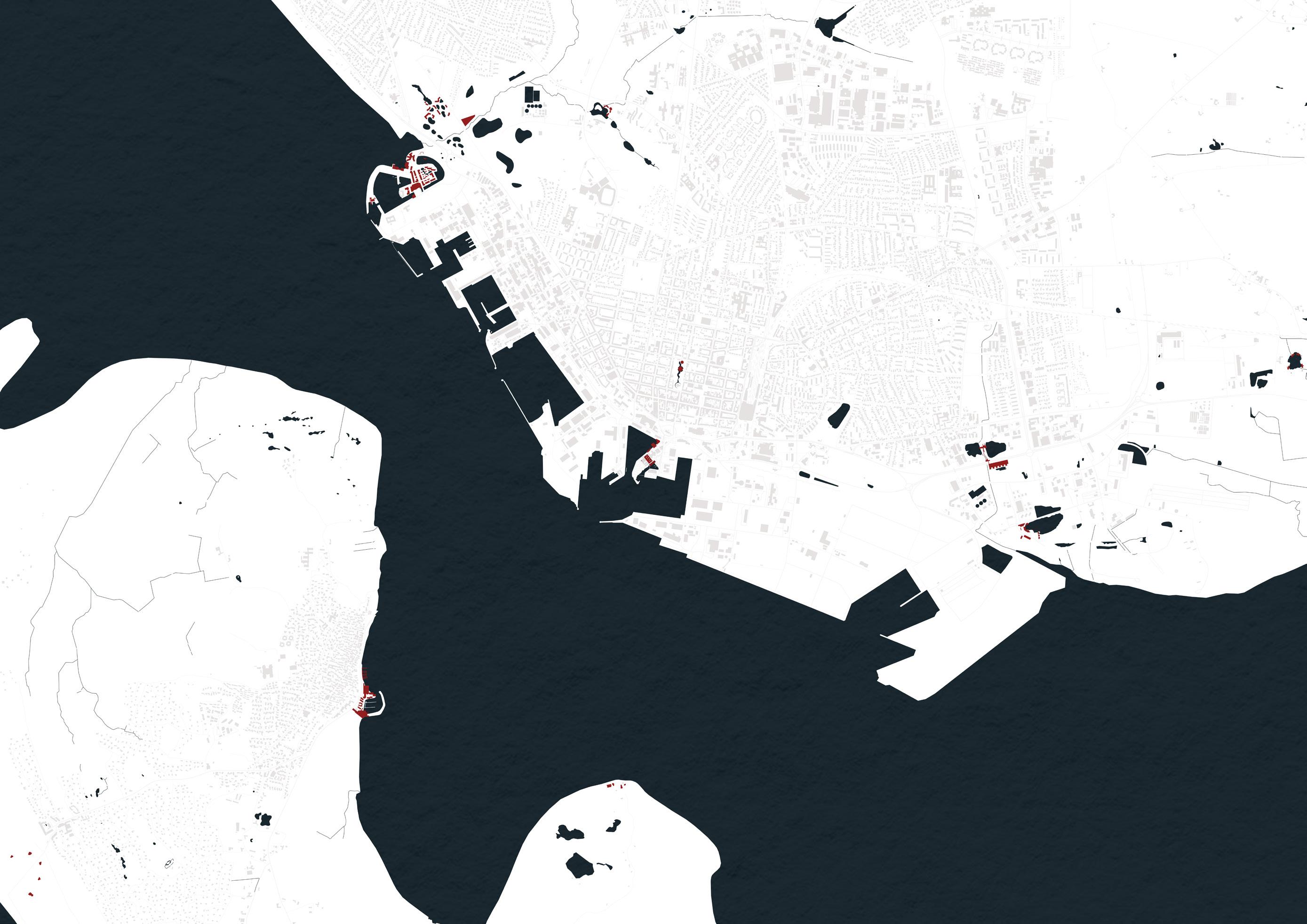
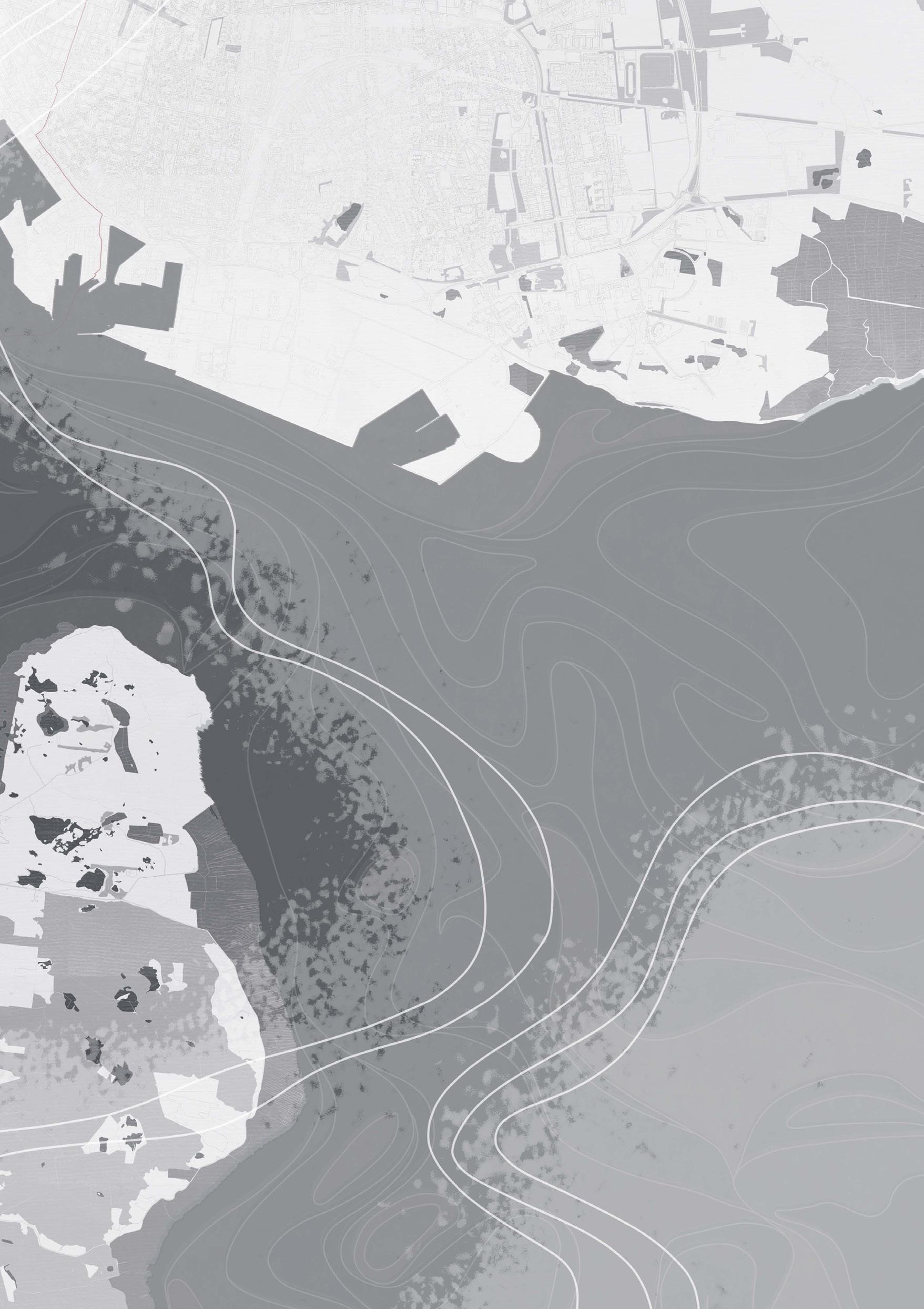
The studio then focused on the lowland coast of the southeastern part of the North Sea, the Wadden Sea. The Wadden Sea has the largest unbroken system of intertidal sand and mud flats in the world. It is a large, shallow body of water, rich in biological diversity - a multitude of transitional habitats with tidal channels, sandy shoals, sea-grass meadows, mussel beds, sandbars, mudflats, salt marshes, estuaries, beaches and dunes.4 The north coast of the North Sea has rugged uplands, but this studio focused on the lowland coasts of the south - the marshy and sandy areas with low offshore islands. Historically, the coastal regions were subjected to large floods, significantly changing the coastline. Ditches and causeways have been built to reduce destruction from floods, making it among the most humanaltered habitats on the planet. It is now a UNESCO World Heritage Site. On this lowland coast, the studio focused on the Danish port, Esbjerg as a testing ground to explore the intertwining of human societies and natural ecosystems in this watery landscape.
LAND PRODUCTION
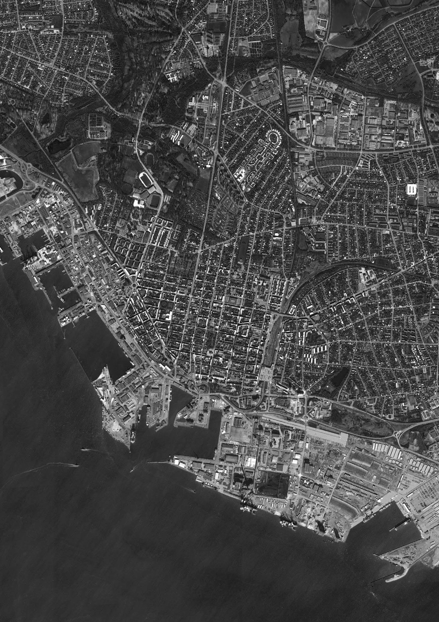
In Esbjerg, before a decision was made to establish a harbour in 1868, the area consisted of only a few farms. In addition to its fishing and shipping activities, it became an important centre for agricultural exports. Currently the harbour facilities are being expanded to respond to the needs of the wind-turbine industry and container shipping traffic. Opposite Esbjerg, across Fanø bay, is the island of Fanø and to the east the town boundary is defined by several streams.
There was a field trip across Denmark where the studio carried out a range of observatory and data collecting research, returning to the studio to make speculations in and around the city of Esbjerg for a hybrid set of buildings between land and water. The projects address harvesting produce from the land to make future cities greener through self-sustaining energy, water and food systems. Soil is Denmark’s most important raw material with approximately half of the land intensively exploited and extensively
4 Wadden Sea, World Heritage Convention Unesco, accessed 17.07.2024
fertilised. More than half of the cultivated land is devoted to cereals, with barley and wheat accounting for a large percentage of the total grain harvest. Sugar beets are another leading crop. In western Jutland, surrounding the city of Esbjerg, oats, rye, turnips and potatoes are grown where the soil is less fertile.
Drawing from the readings of environmental and political activist George Monbiot, who has pointed out that farming is the most destructive human activity on the planet, the studio explored the landscape of Denmark, known for its agriculture, livestock of pigs and crops of grass. According to Monbiot, farming has caused the extinction of many species. We must feed the world without devouring the planet, rewild the land released from farming, and restore a balanced living ecosystem. With the smaller resulting farmland area, we would need to eat differently - farm-free proteins and fat – fermenting with microbes from the soil and consuming locally-grown and seasonal produce powered by clean electricity.5 At the end of the 19th century, a time of poverty and economic depression, Danish farmers survived by establishing agricultural and dairy cooperatives. Farms are generally small family-owned enterprises and are heavily subsidised by the EU. The fishing industry remains economically important, and Denmark is among the world’s largest exports of fish products.
Some programmes consider food sovereignty – the growing, storage, preservation, and distribution of food resulting in buildings/landscapes that raise questions about our relationship with the environment, the natural world and the changes that this relationship has undergone or must undergo. Timescales are considered, reacting to the seasons or the crop rotations on a 2- or 3-year cycle. Drawing from Bruno Latour’s account of the entangled co-dependence of all planetary beings within the confines of a thin, shared ‘Critical Zone’6 the studio goal is to develop architectures that support novel methods of interspecies coexistence. In so doing, taking a broad view of collective urban life – one that encompasses both human and nonhuman entities as equally deserving agents.
5 George Monbiot, Feral: Rewilding the Land, Sea and Human Life. Penguin, 2014
6 Bruno Latour and Peter Weibel, eds., Critical Zones: The Science and Politics of Landing on Earth, MIT Press, 2020
To the Rain, Ursula K. Le Guin
Mother rain, manifold, measureless, Falling on fallow, on field and forest, On house-roof, low hovel, high tower, Downwelling waters all-washing, wider Than cites, softer than sisterhood, vaster Than countrysides, calming, recalling: Return to us, teaching our troubled Souls in your ceaseless descent
To fall, to be fellow, to feel to the root, To sink in, to heal, to sweeten the sea.
The Wadden Sea within the North Sea context (above)
THE NORTH SEA
The North Sea lies between Great Britain, Norway, Denmark, Germany, The Netherlands, Belgium and France. An epeiric, inland sea on the European continental shelf, it connects to the Atlantic Ocean through the English Channel in the south and the Norwegian Sea in the north. It is more than 970 kilometre long and 580km wide, covering 570,000km2.7 Few parts are more than 90m deep and in the south, depths are less than 35m – shallow shifting banks of glacial deposits reworked by tidal currents. The extent of the North Sea and the level of its water surface have varied considerably over geologic time – the basin south of Dogger Bank, a large glacial deposit, a sandbank now known as a productive fishing bank, was once part of mainland Europe. Ice sheets advanced and retreated several times, leaving a thick layer of clay deposit on the seafloor with its final retreat about 8,000 years ago. The sea rose and finally broke the land bridge that had linked Britain with France to create the English Channel.8
The North Sea coastline is constantly changing with erosion caused by wind and water. In the Netherlands there has been a long history of land reclamation, draining the land and building dikes to protect their settlements and farms – a considerable area of their country would be under water at high tide if it were not for dikes, dunes and pumps – they have created polders – low-lying land reclaimed from the sea and protected by dykes. It was the Dutch engineer Sir Cornelius Vermuyden who introduced Dutch land reclamation methods to England. In the 1650s, the British crown was preoccupied with the fertile agricultural land beneath the floodwaters. They longed to bring that land to the surface, to profit from it economically, and to demonstrate their power to defeat nature, to manipulate earth and water alike. The Fens in eastern England, a naturally marshy area is now tamed, with water having been drained away through a complex system of ditches and drains leaving only flat land for farming. Over 70% of the Fens is involved in environmental stewardship schemes, under which 270 miles of hedgerow and 1,780 miles of ditches are managed, providing large wildlife corridors and habitat for endangered animals such as the water vole. However, people remain vigilant for floods to strike at any moment. As sea levels rise the land will be submerged more and more often. Once
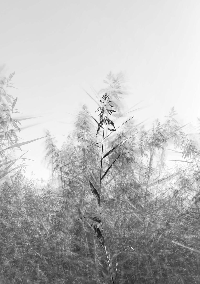
these fields had been a peaty, waterlogged marshland, where huge beds of sedge and reeds alternated with willow trees. There were eels and herons among the tall grasses. Historically humans lived around the edges of the marsh, on the fen islands and the silt banks, fishing, gathering reeds, hunting waterfowl and carving out chunks of peat.9
We should envy the otter, the dolphin and the whale, our mammal cousins who are so much better adapted to water than we are. Otters’ outer fur traps air in an insulating layer much like a wetsuit, and the inner fur is so fine and tight that the water never penetrates it. However, the sensuality of water touching your own skin beats swimming in a wetsuit .10
The Wadden Sea, the southeastern part of the North Sea, stretches from the Netherlands, past the river estuaries of Germany, to the north, Denmark. The constant mixing of waters in the shallow sea basin provides a rich supply of nutrient salts upon which the lower forms of marine organisms depend. This abundance of plant and animal plankton creates a valuable fishing resource. In 1959 natural gas was discovered under the sea floor in the northeastern part of the Netherlands, and over the decade’s discoveries stretched north.
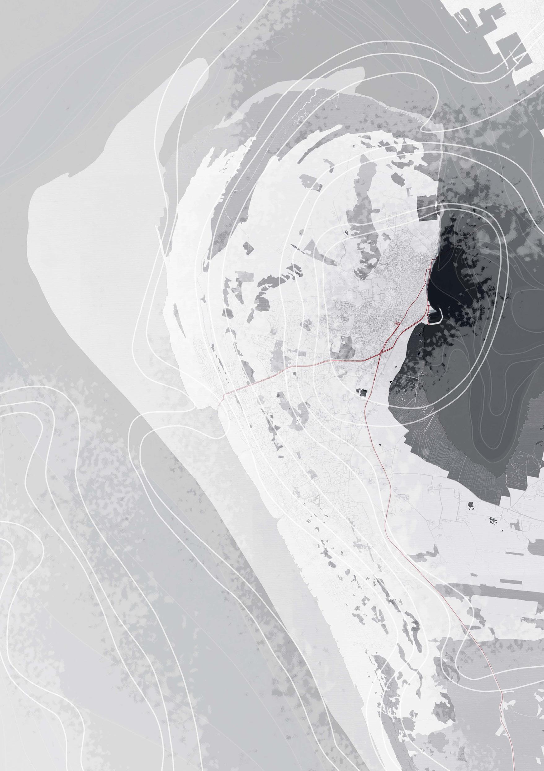
Esbjerg stretching along the east coast of the Wadden Sea, is a seaport city on the west coast of the Jutland peninsula in southwest Denmark, 298km west of Copenhagen. It has an urban population of 71,505, 5thlargest city in Denmark. The town is built on top of the steep slopes leading down to the flatlands of the harbour area. An iconic, red-brick water tower, completed in 1897 is a landmark of Esbjerg. Also in red brick, with waveshaped folds on the north and east walls, is Saedden Church designed by Inger and Johannes Exner.
9 Noreen Masud, A Flat Place, Penguin, 2024
10 Roger Deakin, Waterlog, Vintage, 2000
MATERIALS AND ARCHITECTURE OF NORTHERN LATITUDES
Kengo Kuma notes when looking at the Finnish Architects OOPEAA, architecture and cooking have something in common. The expression of each material is determined by how it is cut. It is what defines the relationship between body and the material.11 Carlo Scarpa looks at the skills of the carpenter, stonemason and weaver to give form to architectural motifs. Material joints reconstitute the whole.
Reeds, willow, hazel, earth, clay, timber, stone…natural materials are explored in this studio. The timber species known. Aspen and poplar wood are used in the manufacture of wooden matches. Tennis racquets were made of Ash due to it being easy to bend when cut along the grain. What timber suits the making of your building landscape? How is it cut and how is it jointed? Does the timber come from a sustainable source? (During the initial exercise in researching water bodies in Edinburgh it was noted that Willow has been planted on the banks of the Water of Leith to support the ground from being washed away).
Which parts of the architecture are ephemeral and which parts have permanence, and therefore what materials are each part of the building made from? What will leave its mark for future archaeologists to find, like the young Kathleen Jamie in her chapter Woman in the field within her book Sightlines.
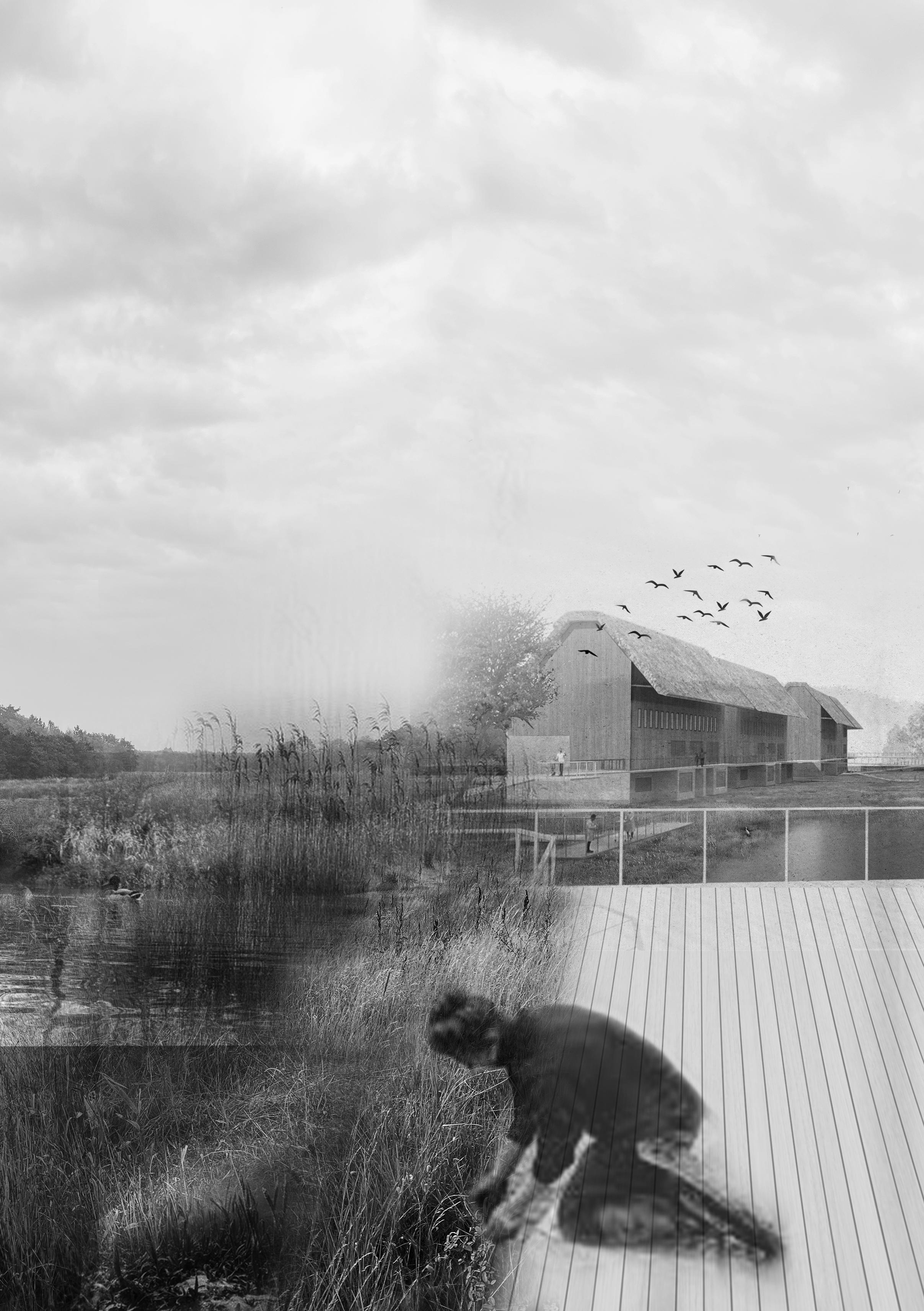
While in Denmark, Study Trips were taken to learn from the local, contemporary architectural references – the Wadden Sea Centre by Copenhagen-based Architects Dorte Mandrup. With its big, thatched roof, inspired by the regional material and traditional craftmanship, it sits in its marshy landscape where the tide has come and gone over millions of years.12 The House of Grain by Reiulf Ramstad which celebrates Denmark’s production of grain, clad in clay using light-well forms to represent baker’s ovens was looked at. Many of Danish kindergartens ensure that they have an ‘outdoor room’ where children can play and jump in the mud believing that its essential for their sensory development. When children get messy in
11 Julie Cirelli, OOPEAA Office for peripheral architecture, Arvinius+Orfeus, 2014
mud, they engage all their senses: touch, sight, smell, and even sound. From the squishy feel between their fingers to the earthy scent that fills the air.
Other Danish architects/firms including Jorn Utzon, Arne Jacobsen, BIG, Henning Larsen, Cobe, Norm, Nord, Jan Gehl, Olafur Eliasson, Fin Juhl were all researched. A visit to Copenhagen helped to learn from the way in which the architecture there incorporates many ecosystems and considered materials – in BIG’s Copenhill project, Whitearkiteker’s Kastrup sea bath, Cobe’s Opera Park, Vandkunsten’s homes in the old torpedo boat workshop, and to the major regeneration project in Malmo by Kjellander Sjoberg Architects where the old shipyards have been converted into a sustainable new mixed urban district, where glulam timber and CLT have been added to the existing steel framed buildings.
Work in Semester 1 initially focused on an exploration of water bodies as a vehicle to investigate the intertwining of human societies and natural ecosystems in a watery urban setting. This exploration gradually developed into a spatial, technical and environmental architectural language, which informed the design of a series of small urban interventions that unpacked previously obscured dimensions of the North Sea’s urban nature.
Work in Semester 2 consolidated the body of research on moving water acquired during semester 1. The studio mobilised this knowledge to address the architectural aspects of ‘living’ – eating, working, playing, sleeping - in a period of floods, drought and water scarcity, for humans and more-thanhumans. Projects developed across the scales, expanding on the making of the single ‘room’ into a complex architectural assemblage within the city of Esbjerg, a city on the edge of the North Sea. This ‘assemblage’ has been thoroughly explored and documented, responding to all aspects of waterfloors resist ground water, roofs shed rainwater, building materials weather, internal atmospheres breath to stabilise humidity, and water is harvested for reuse.
Andrea
Faed and Jack Green
Moving Water group with David Sim in Malmö (Yuchen Cai, Yiding Chen & Chuyue Li not present)
Moving Water group in Koldinghus (Yuchen Cai, Yiding Chen & Chuyue Li not present)
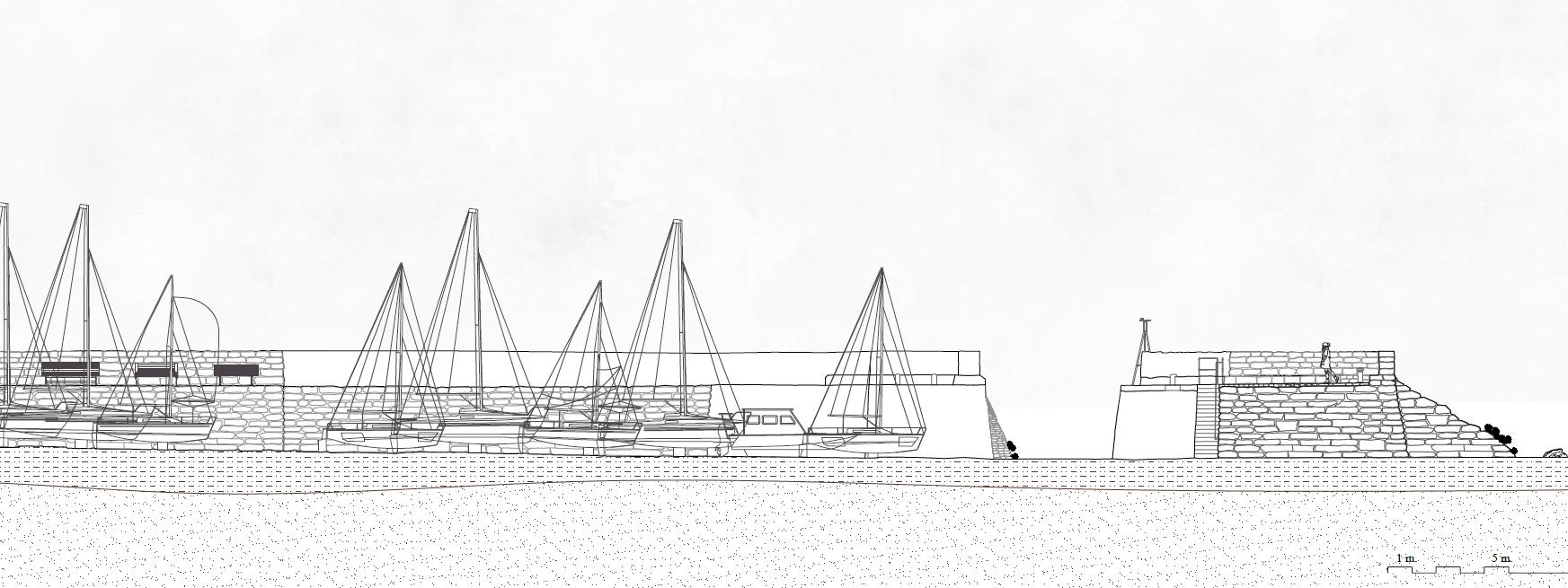
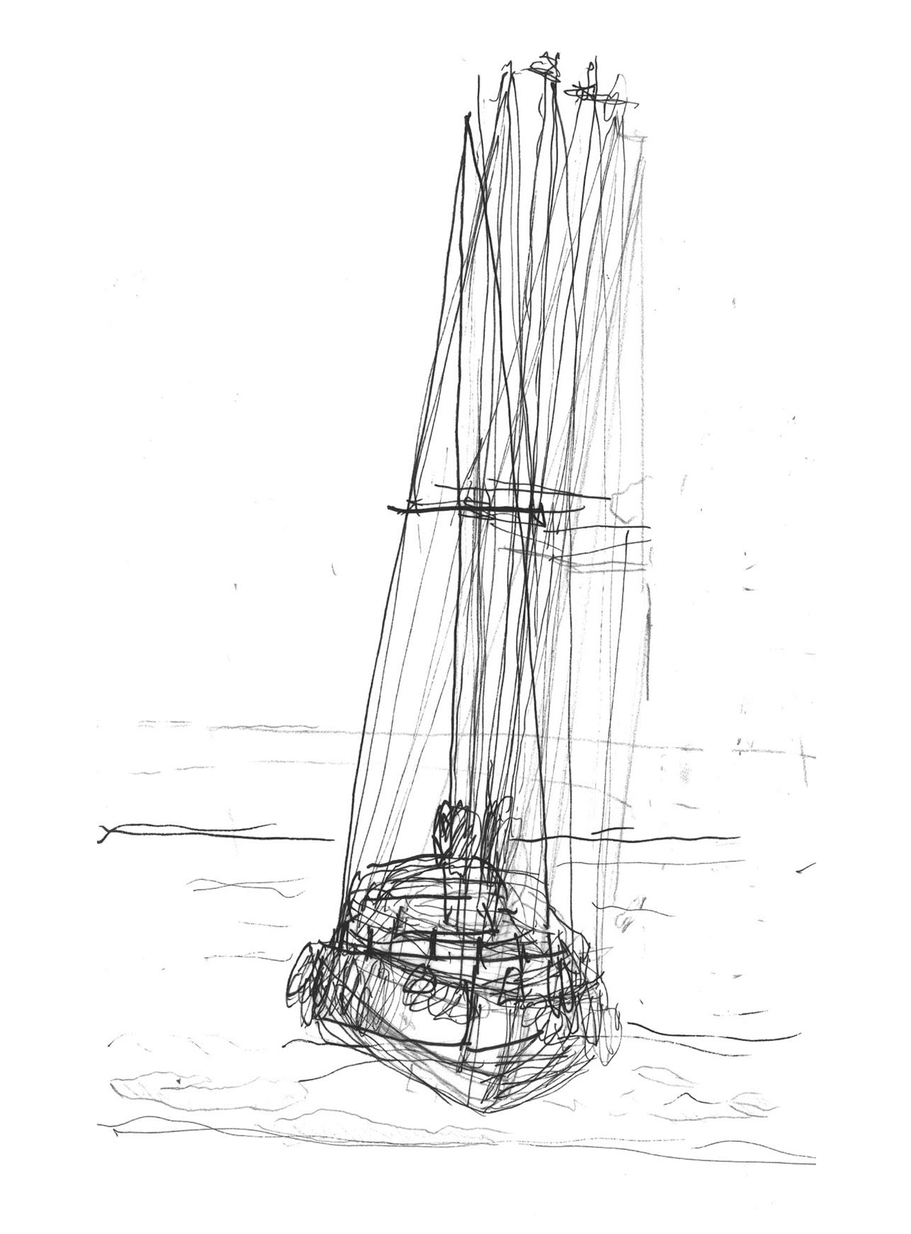
MUSSELBURGH HARBOUR
EDINBURGH BODIES OF WATER
ALEXANDRA GRÖNBERG SHAN LIANG WILLIAM MAXWELL
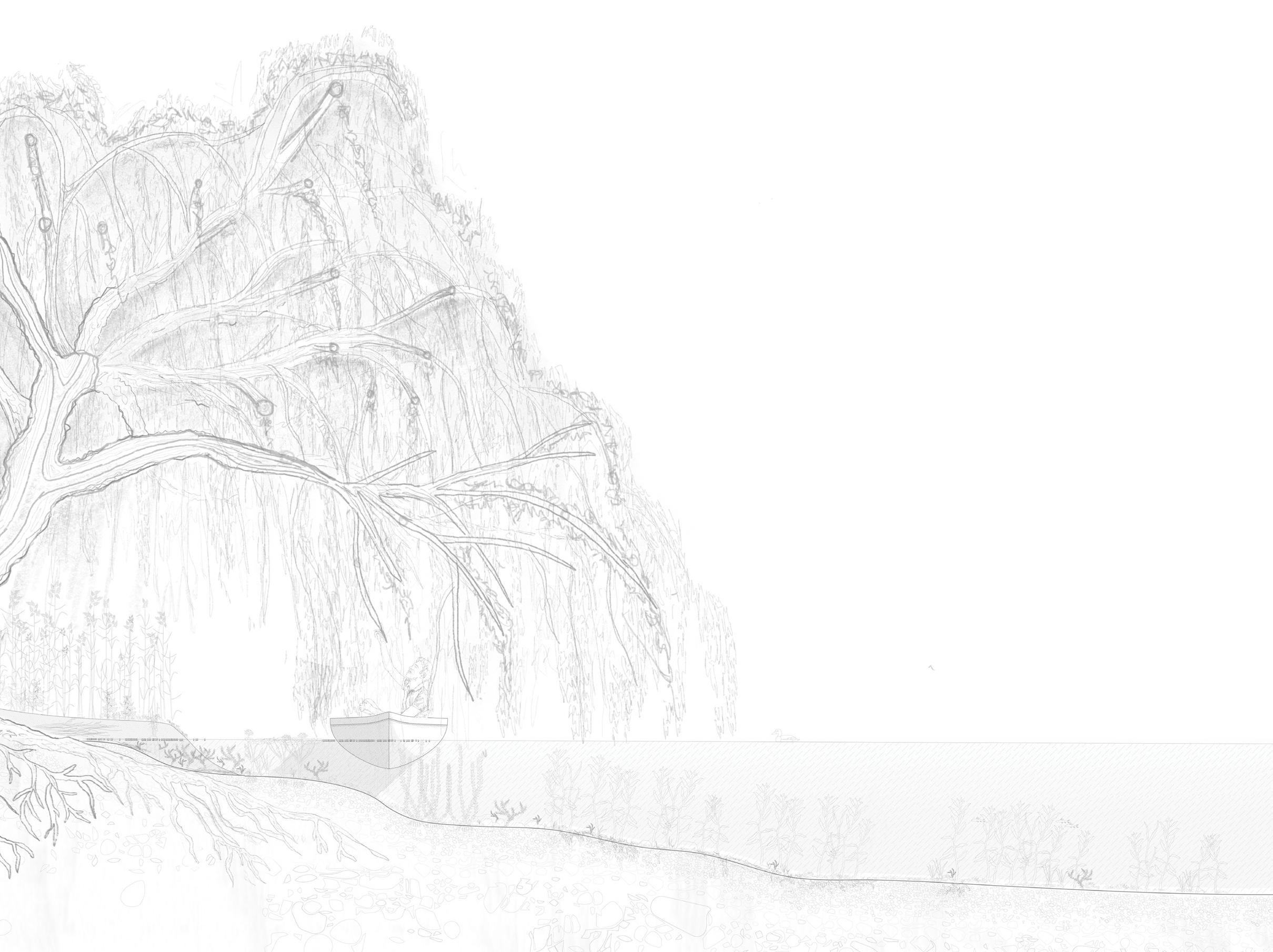
Harbour site section (above left)
Hand drawing, boat study (right)
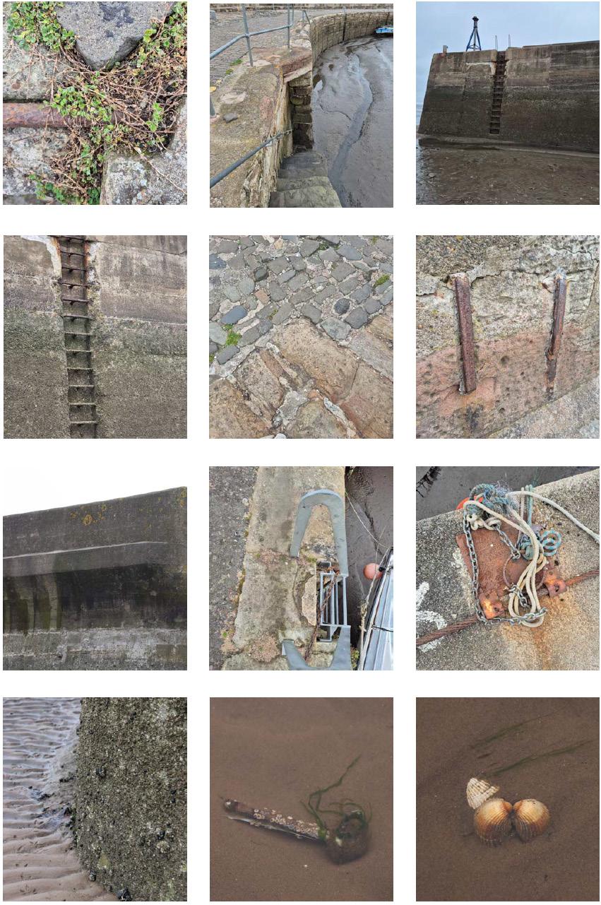
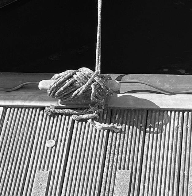
Fragment photos (far right)
PORTOBELLO BEACH
EDINBURGH BODIES OF WATER
DIANA HUYNH YUCHEN CAI
MATS BORGEN
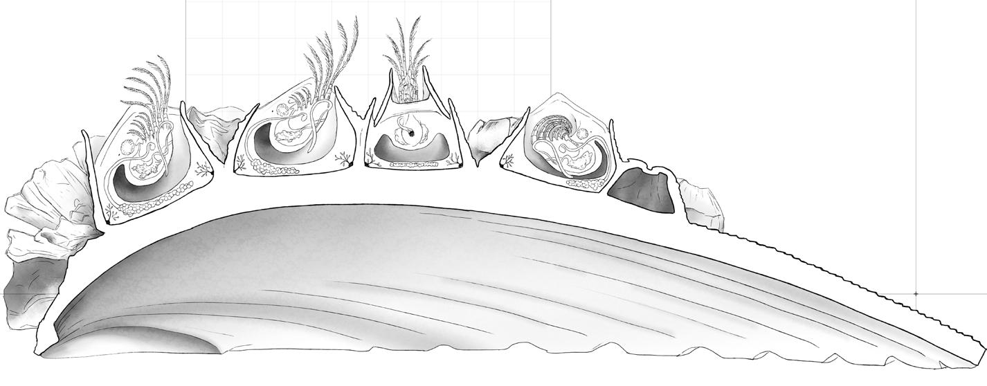
Barnacle section (above)
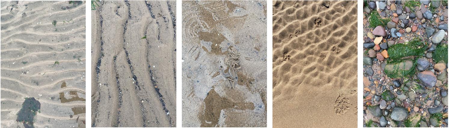
Texture photos (below)
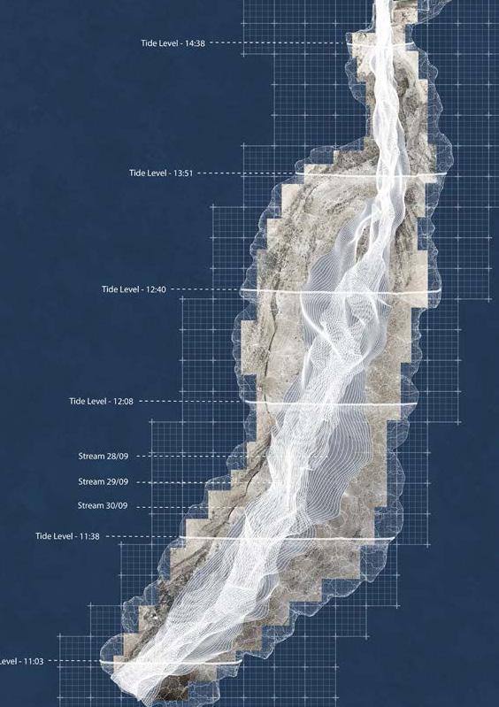
Tidal plan (right)
DUDDINGSTON LOCH
EDINBURGH BODIES OF WATER
MOLLY AGNEW ANNA BOX AMY GRAHAM
Water plan (above)
Photograph (right)
Section (below)
LOCHRIN BASIN
EDINBURGH BODIES OF WATER
HARRIET JOHNSON YIDING CHEN CHUYUE LI
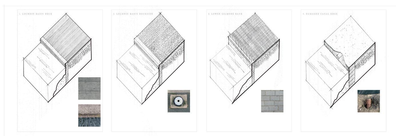
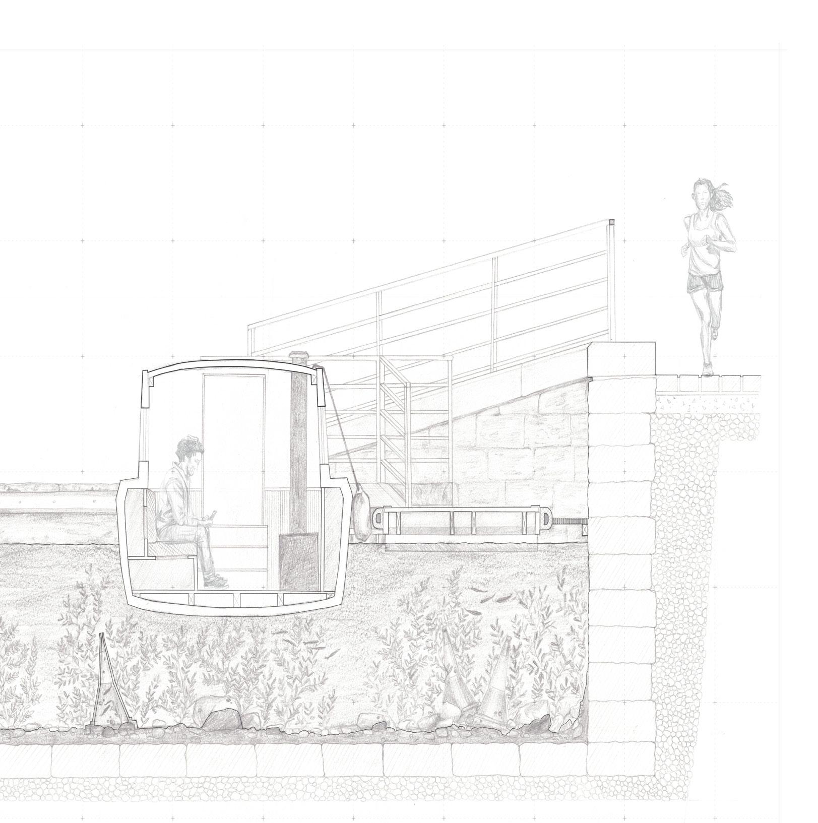
Axonometric (above)
Plan (top right)
Site photo (right)
Section (below)
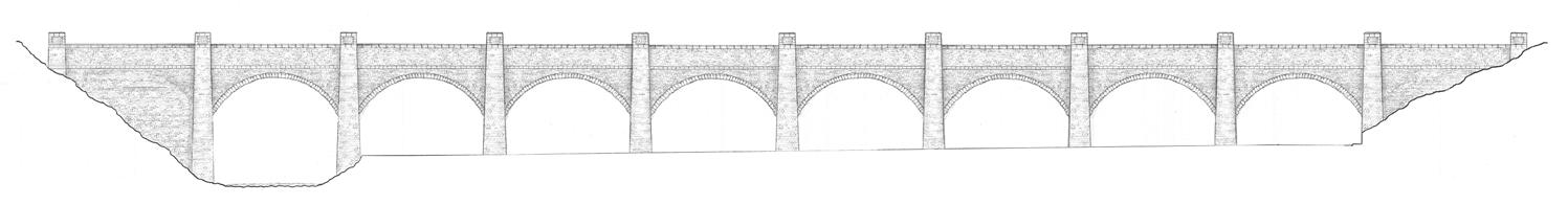
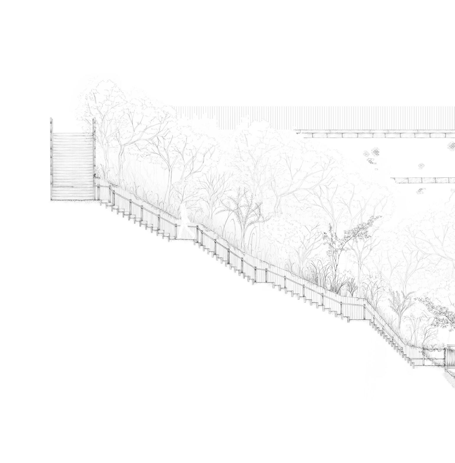
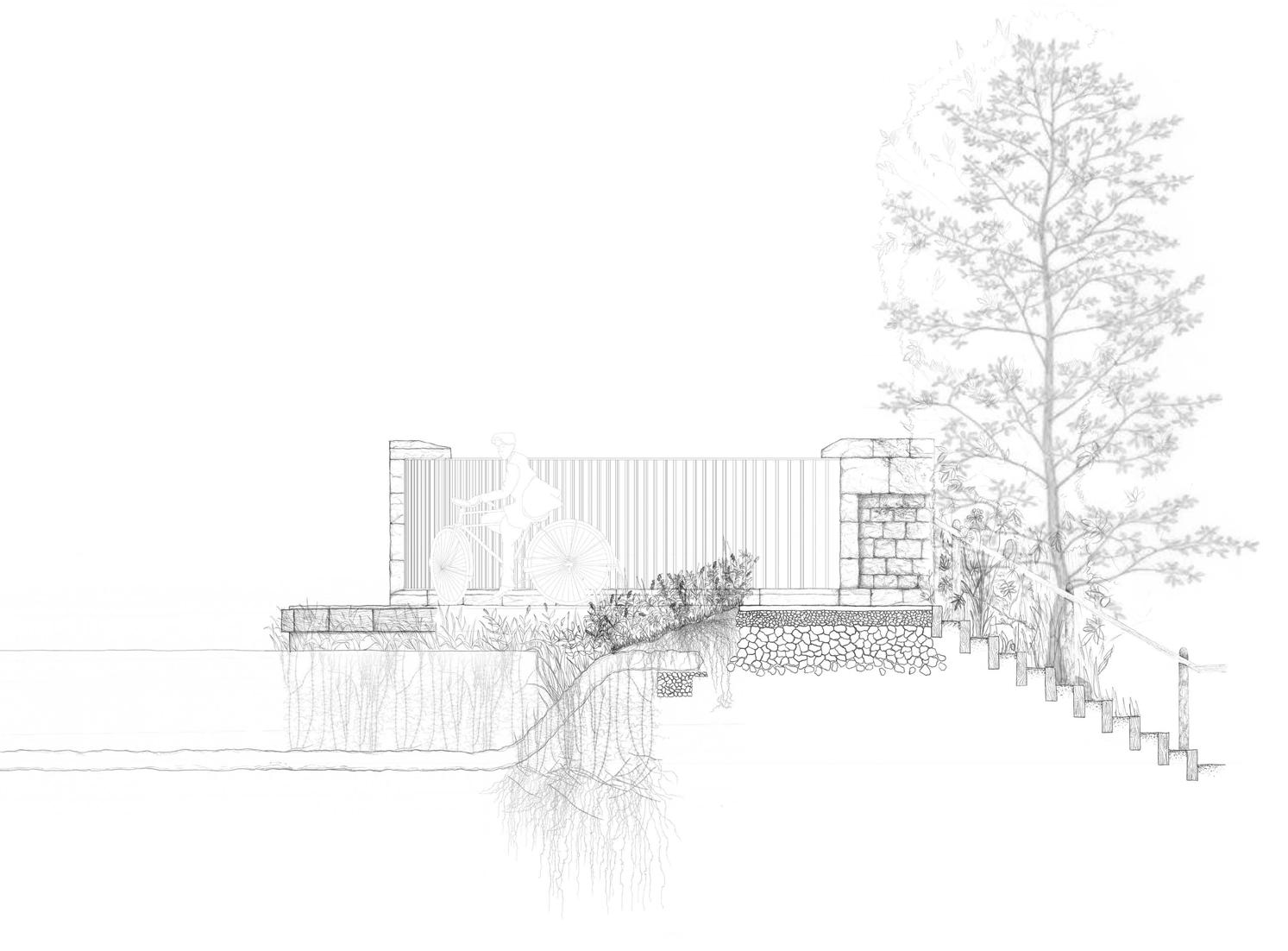
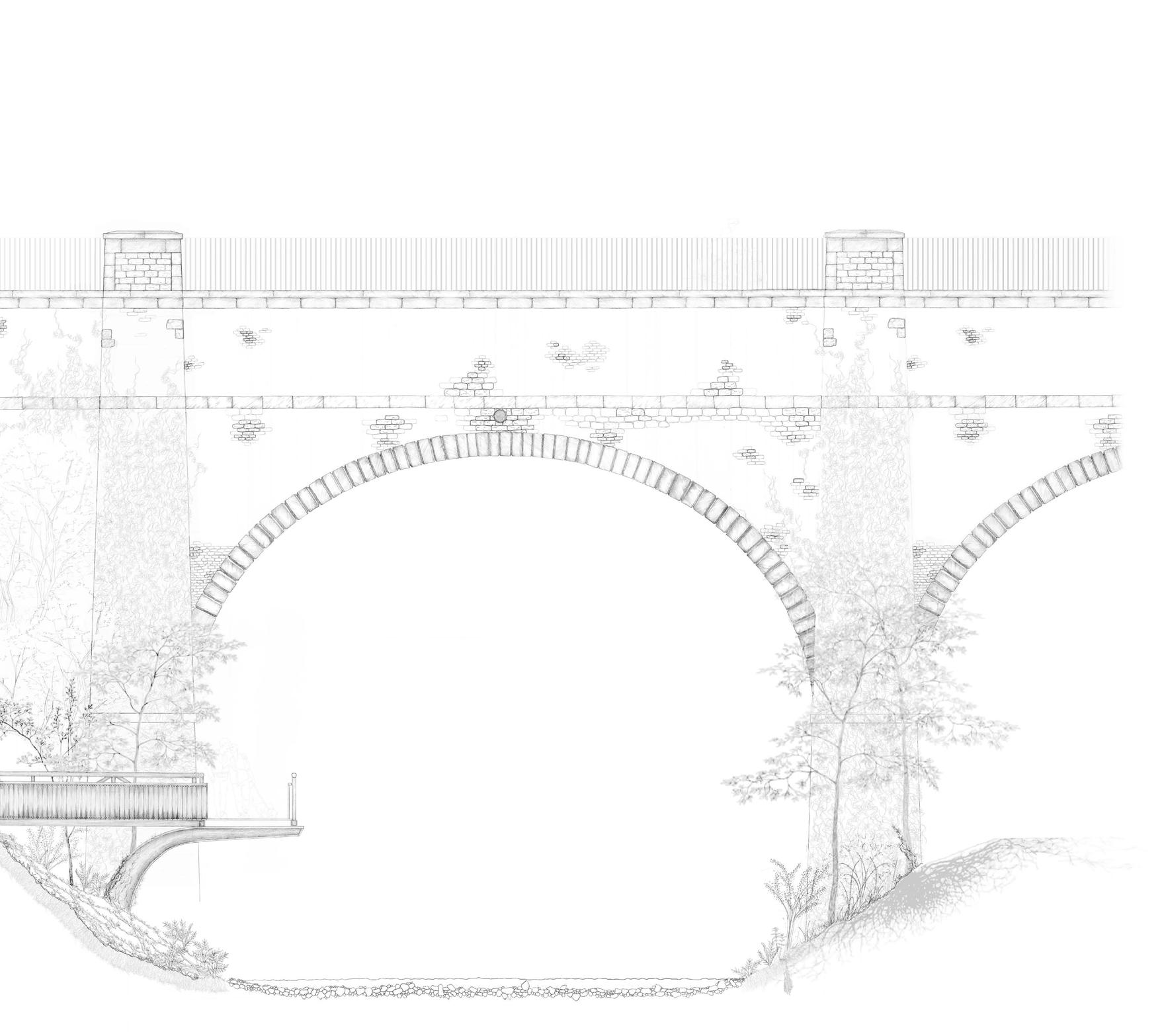
SLATEFORD AQUEDUCT
EDINBURGH BODIES OF WATER
JEMIMA HARRISON HOLLY NG NATALIA MIKULSKA
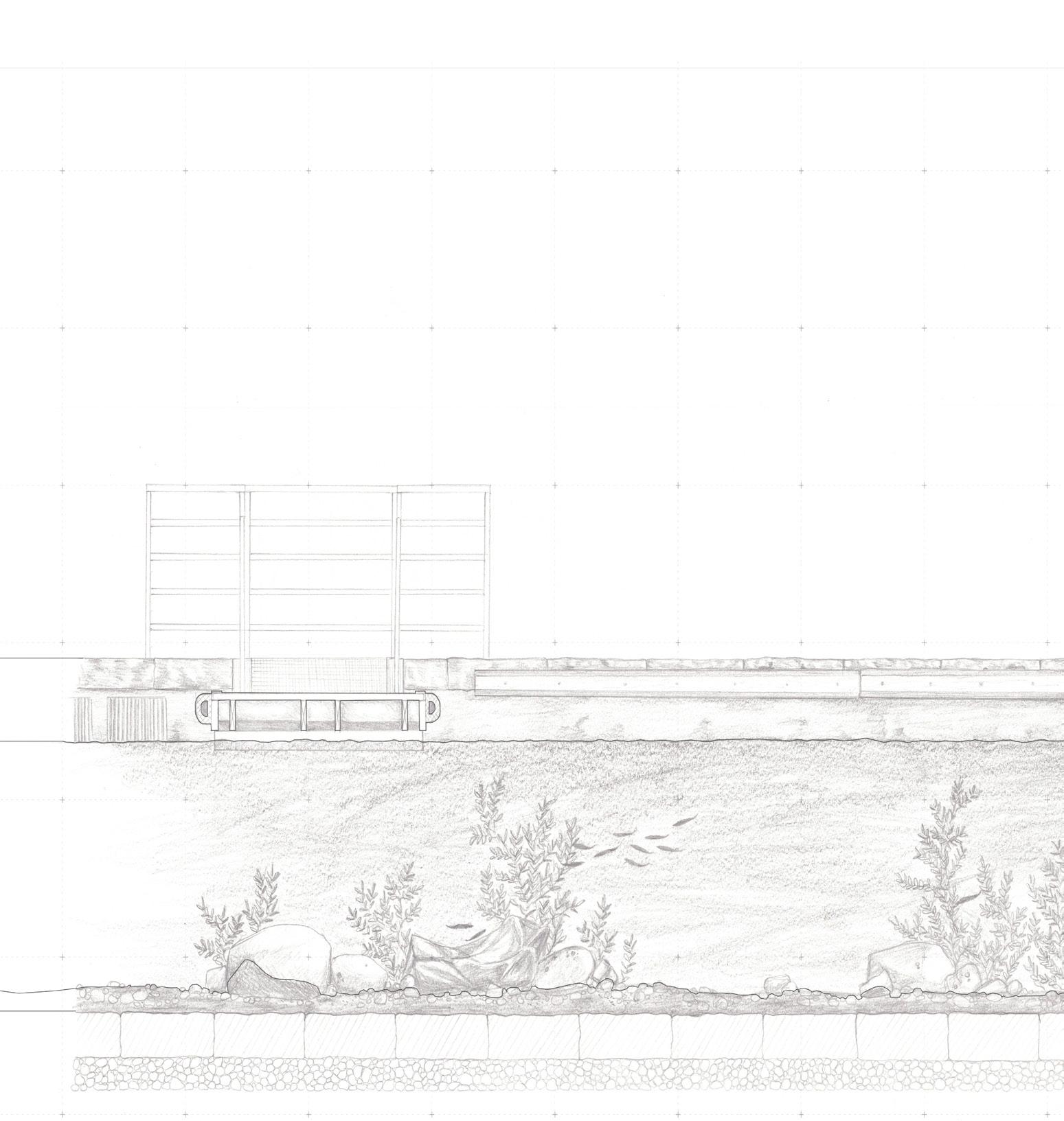
Elevation (above)
Section (top right)
Section (below)
ST BERNARD’S WELL
EDINBURGH BODIES OF WATER
JODIE HORSBURGH
MOLLY SINCLAIR
LUCAS THEIS
Section (right)
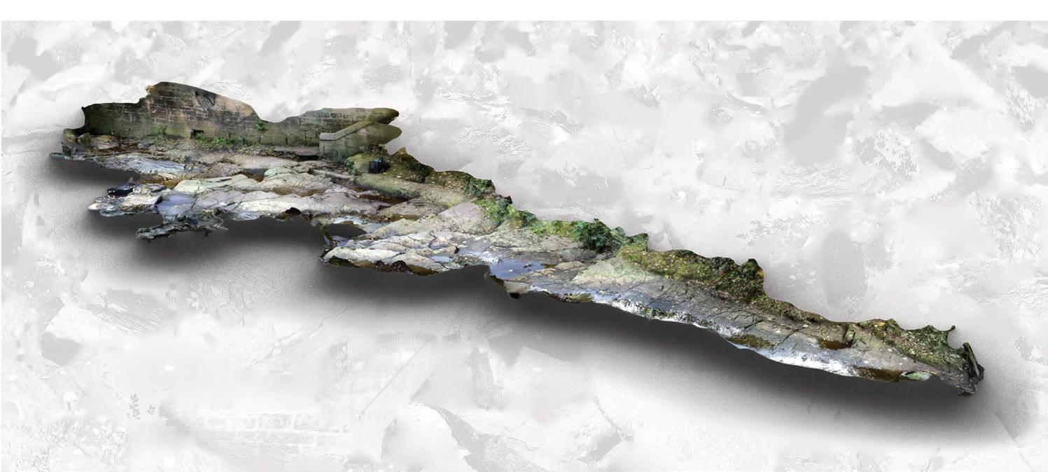
Water's edge 3D scan (below)
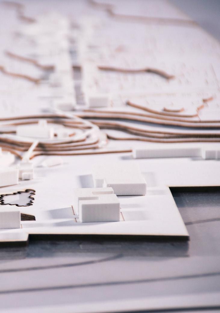
Locations of speculations in Esbjerg, Denmark
MOLLY AGNEW ANNA BOX AMY GRAHAM
JEMIMA HARRISON HOLLY NG YUCHEN CAI DIANA HUYNH ALEXANDRA GRÖNBERG
SHAN LIANG YIDING CHEN CHUYUE LI
JODIE HORSBURGH MOLLY SINCLAIR LUCAS THEIS
NATALIA MIKULSKA HARRIET JOHNSON WILLIAM MAXWELL MATS BORGEN
Group projects map (left)
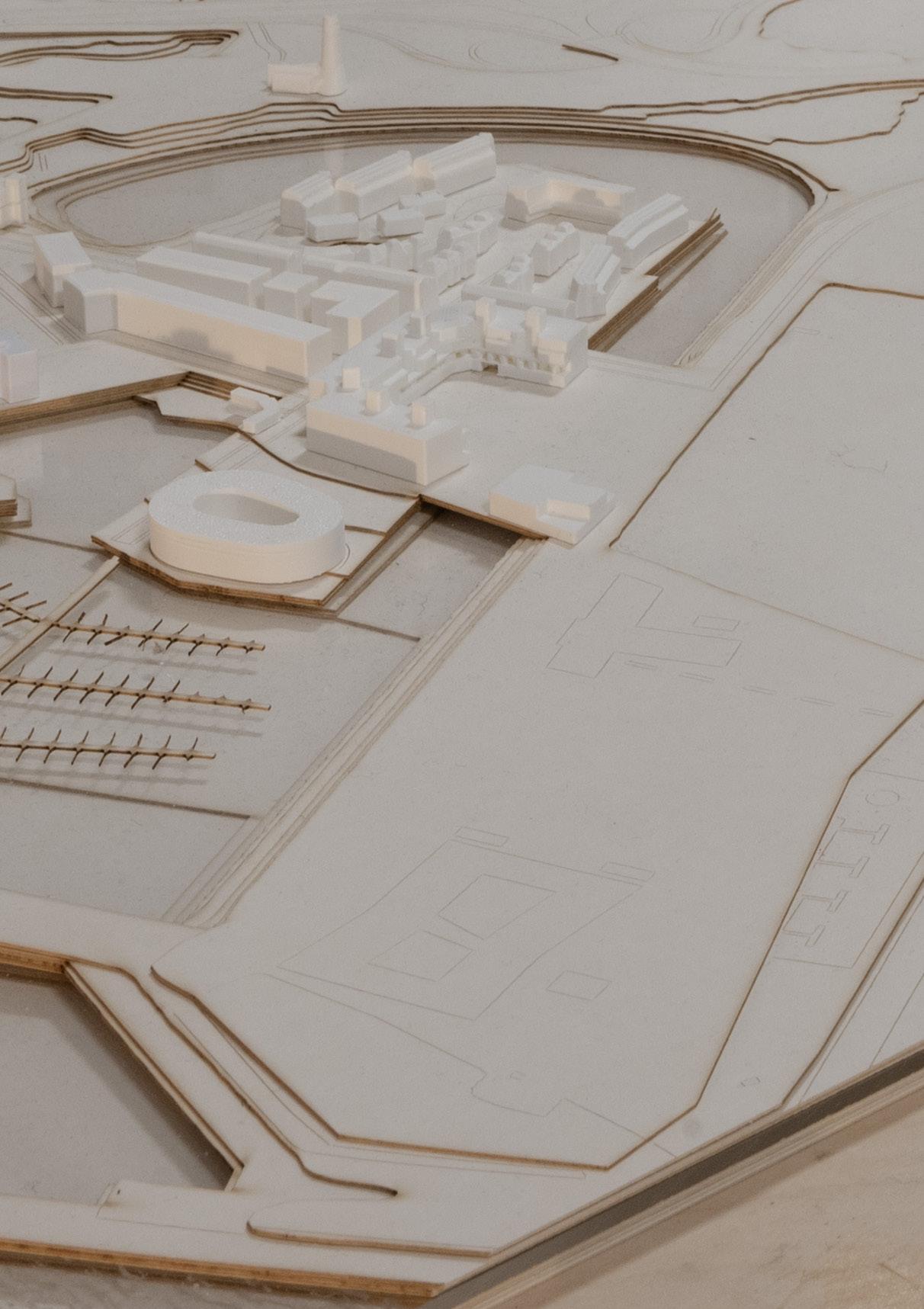
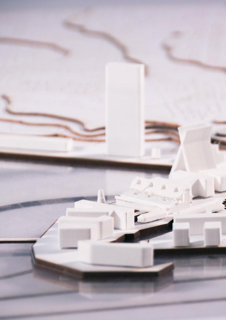
NORTH EDGE ESBJERG
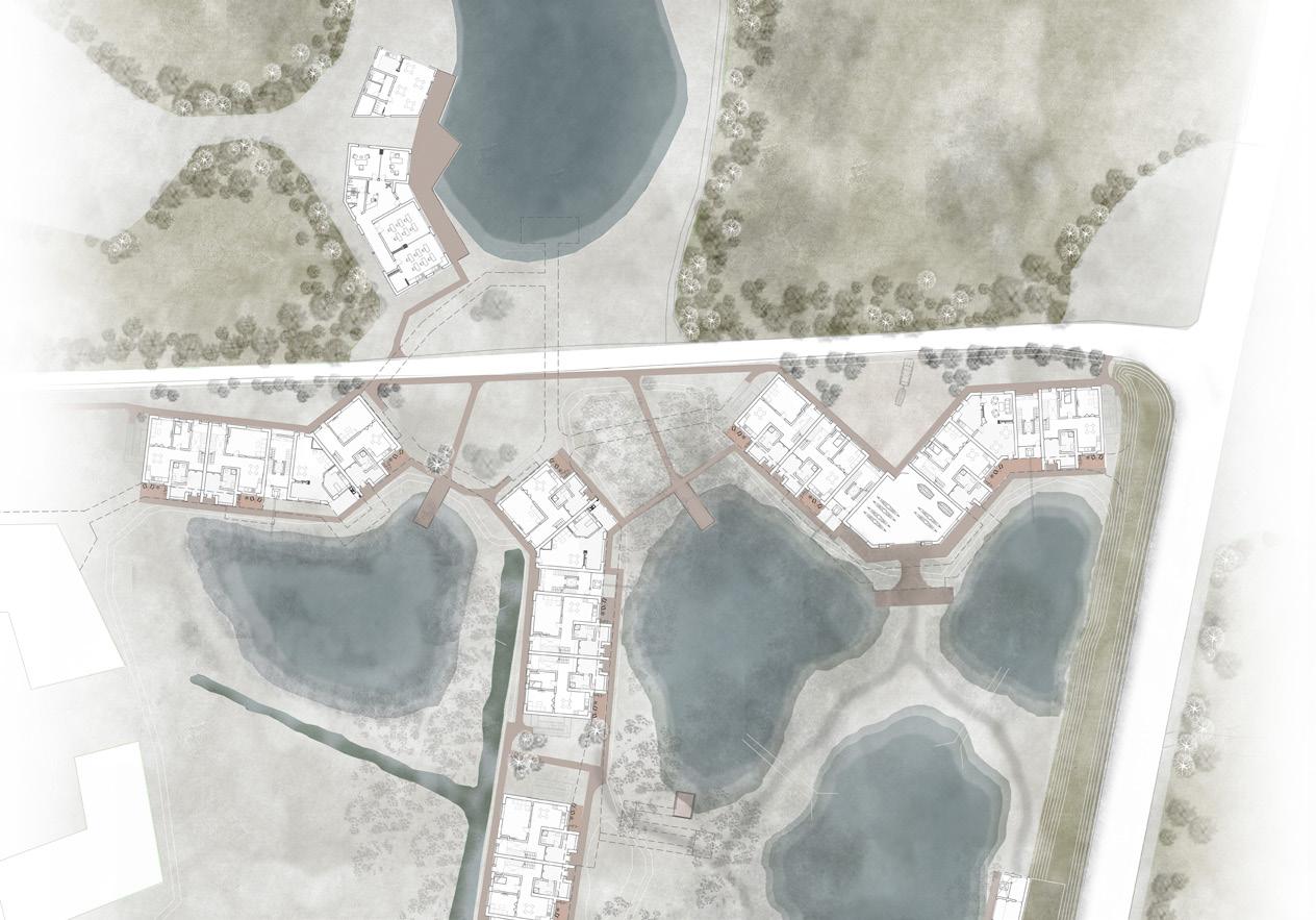
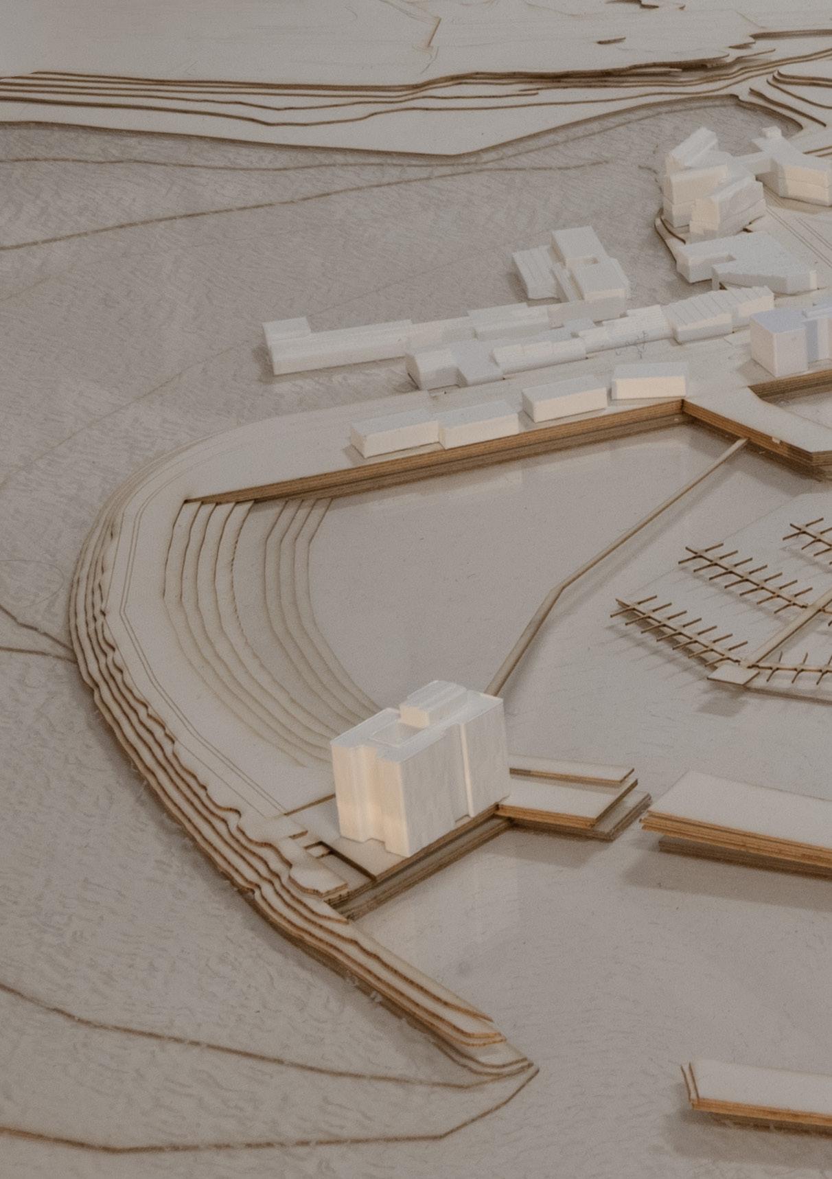
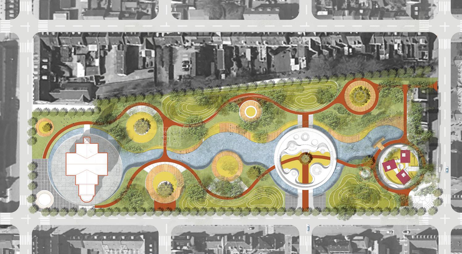
Masterplan
Site: North Edge, Esbjerg Programme: Healthcare
01 a
REWILDING HEALTHCARE
HEALTH AND NATURE
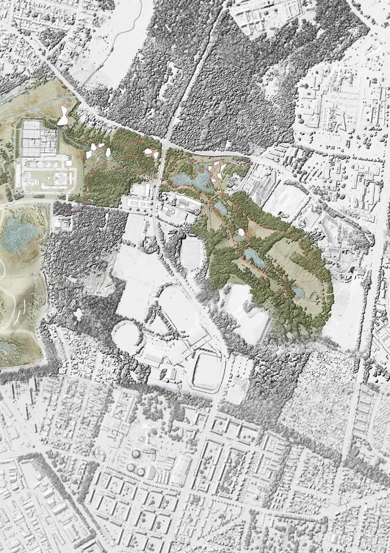
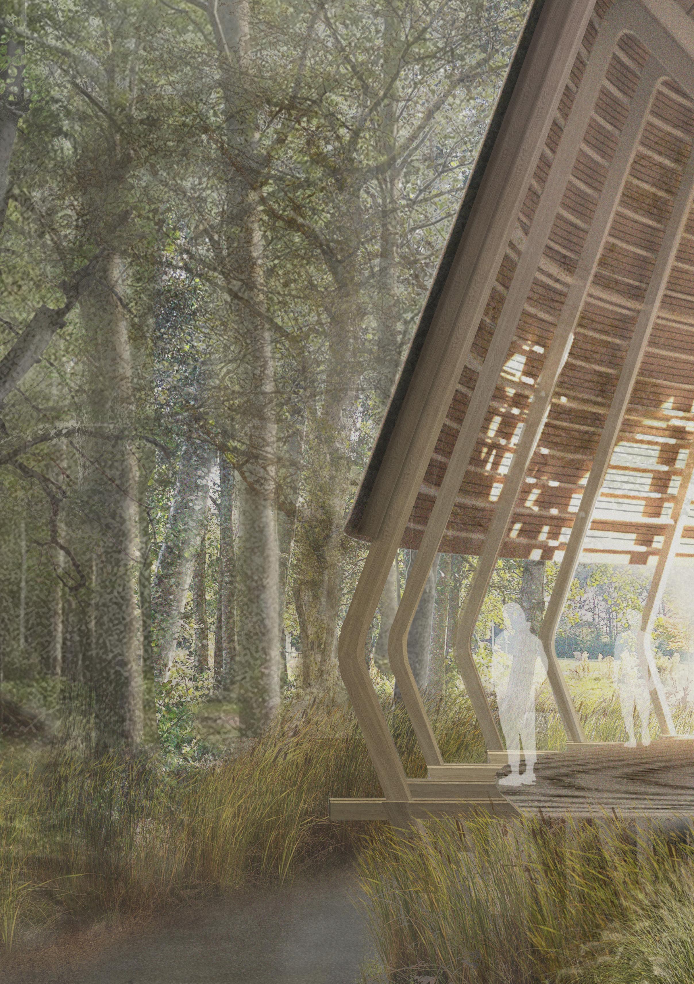
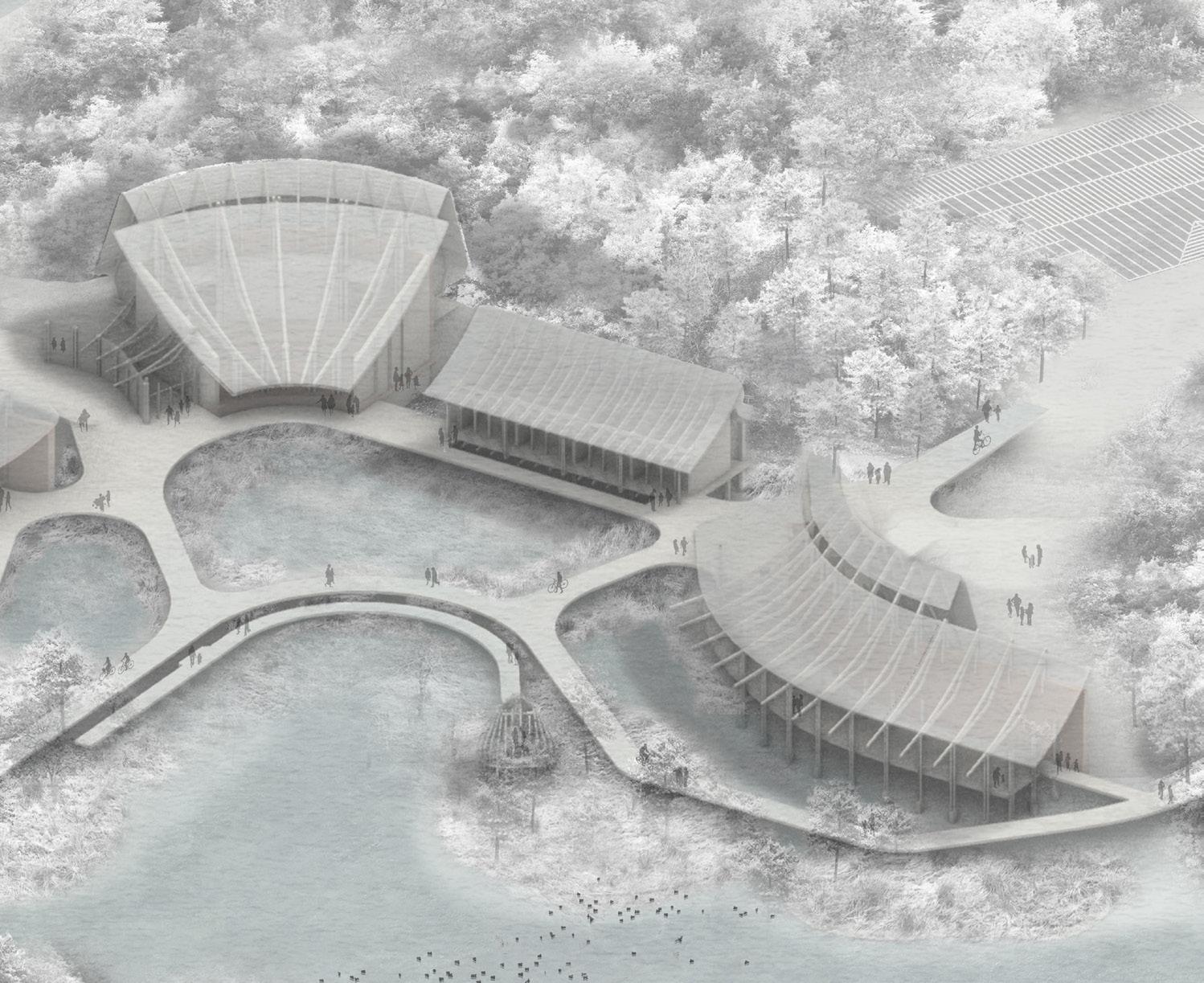
MOLLY AGNEW
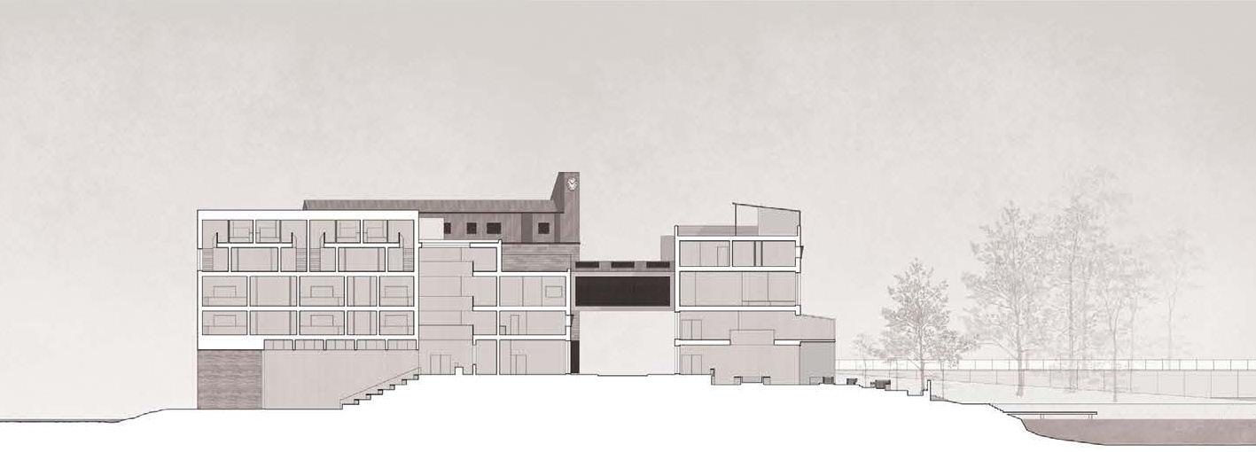
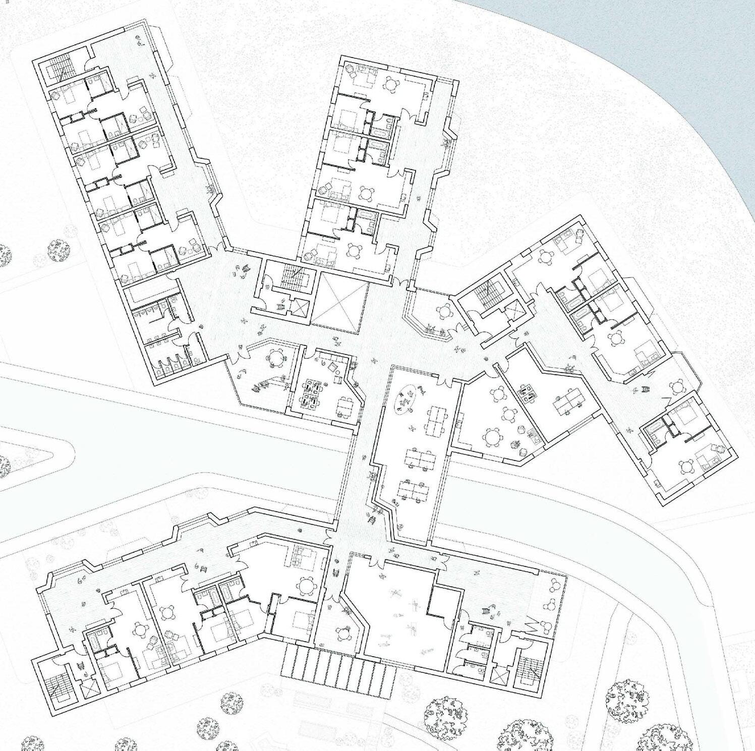
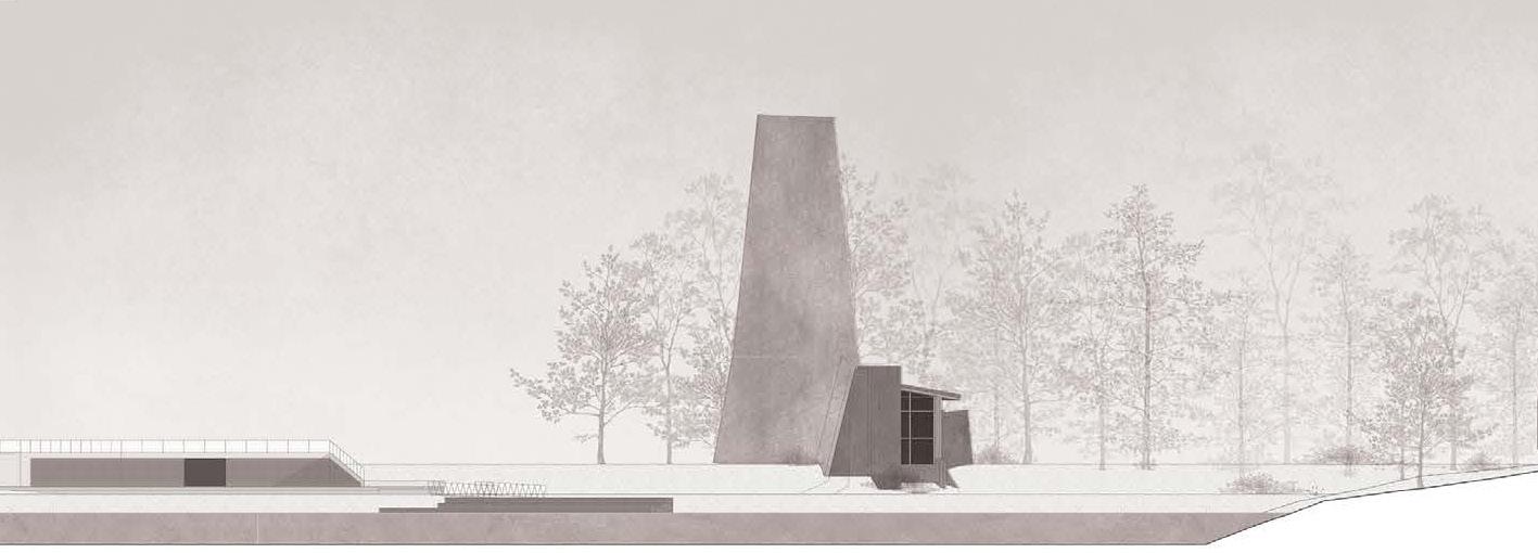
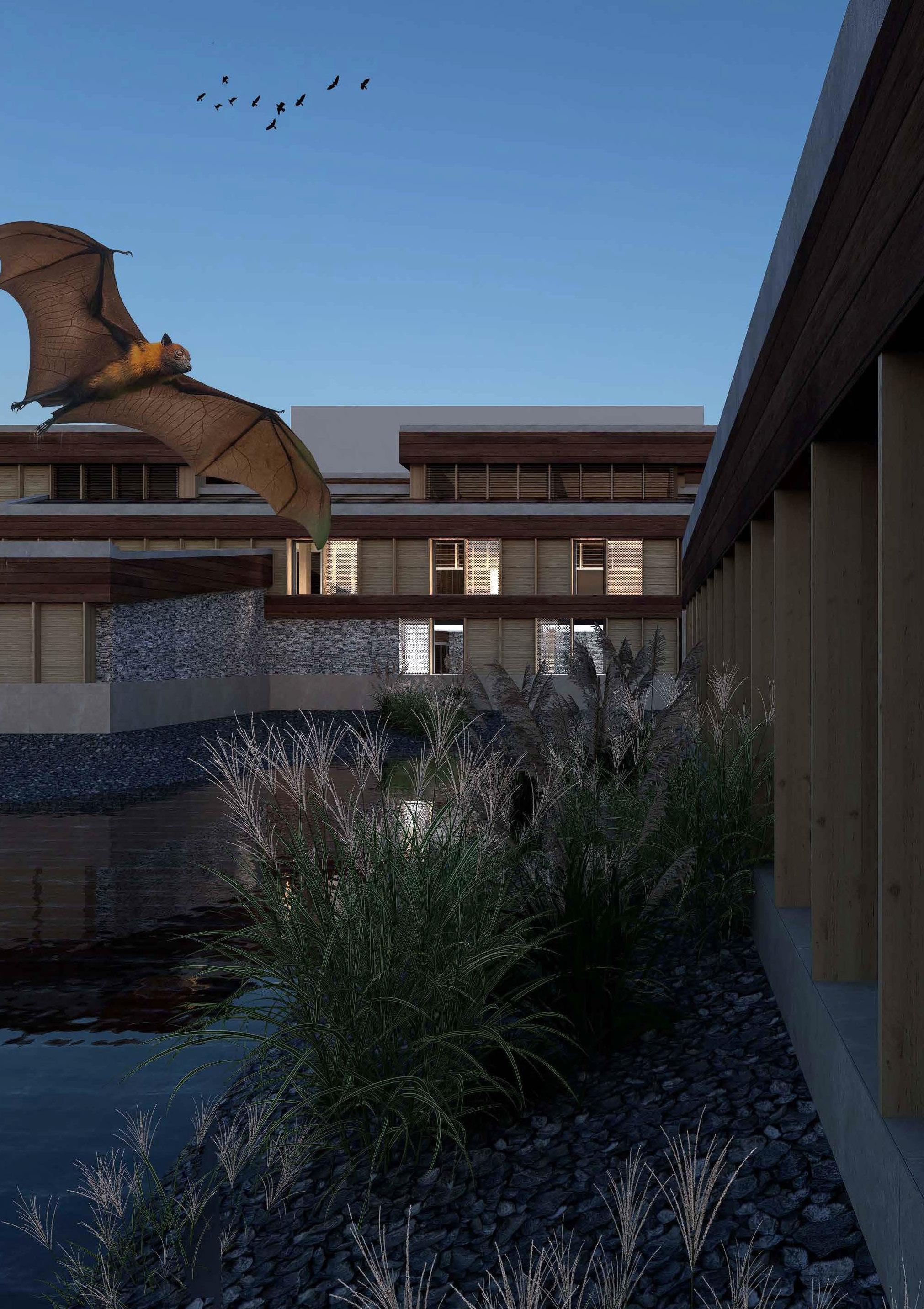
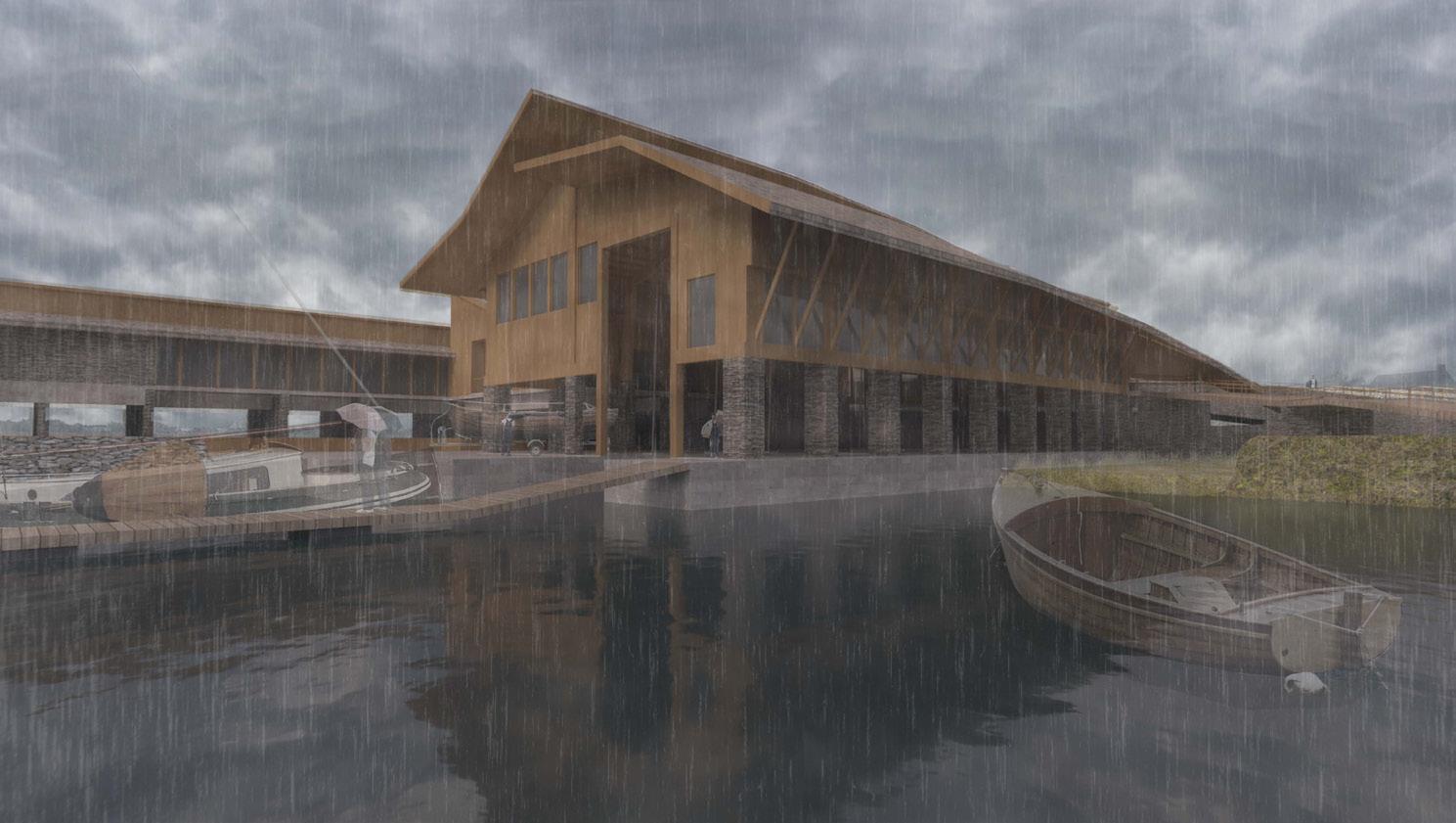
Fostering the deep human connection between health and nature, this proposal advocates for means of preventative health, facilitating an alternative healthcare approach nestled on the edges of Esbjerg’s watery landscape. Rooted in the principles of health equity and education, the project embraces the core pillars of physical, mental, nutritional, and social wellbeing to offer a holistic prescription for health and healing. Located within the city’s largest parkland, Vognsbølparken offers a diverse landscape and a natural escape from the expanding urban fabric, where ancient woodlands and open meadows meet the tangled reed edges of its lakes. A naturally dammed watercourse meanders slowly through the site, flowing into open streams and eventually merging with the wetlands and brackish waters beyond. Climatic projections clearly indicate that the Esbjerg landscape will be significantly affected by sea-level rise, placing Vognsbølparken and the surrounding wetlands at risk, disrupting local ecosystems, and threatening the livelihoods of communities in low-lying areas. To mitigate these future impacts, the masterplan proposes a managed retreat strategy, expanding water bodies and creating new opportunities for wetland plants and species to migrate further inland into the parklands of Vognsbølparken. Embracing these inevitable changes, the healthcare programme is designed to grow alongside the shifting boundaries of the wetlands, adopting a slow development approach that responds to the evolving needs of the natural systems, local community, and infrastructure across the landscape.
Exterior visual (previous)
Aerial view (above)
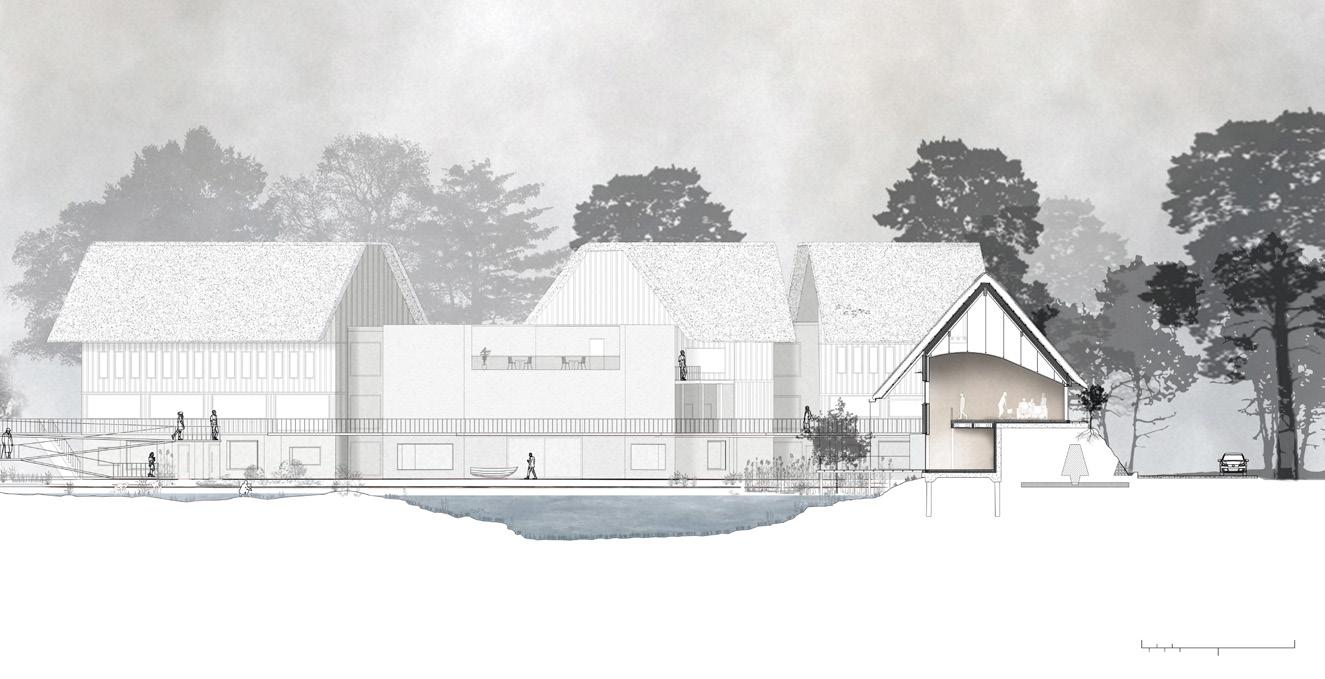
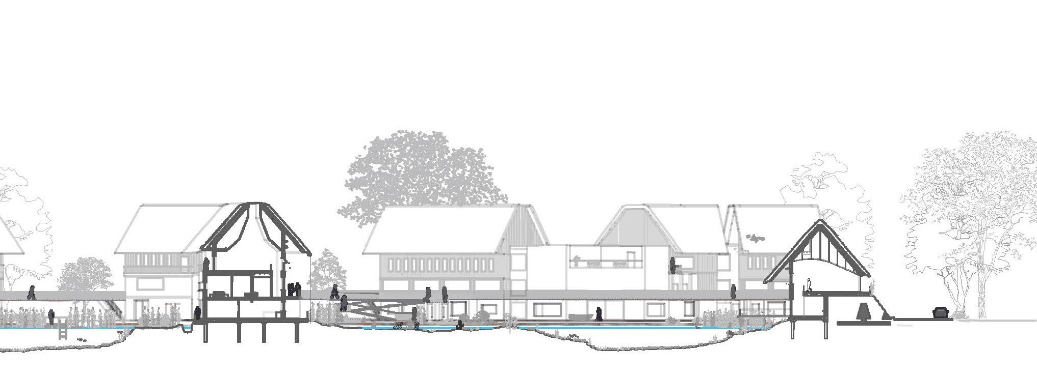
Sectional sketch (right)
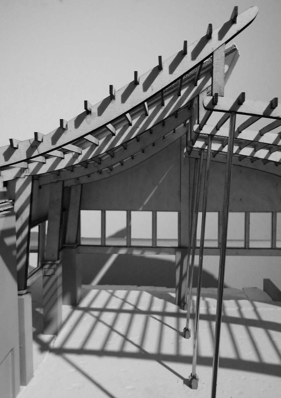
Tectonic Artefact (top right)
Section (below)
Site: North Edge, Esbjerg Programme: Housing & Allotments
01 b
FROM THE HAND, TO THE EARTH, TO THE MOUTH
A LIVING LANDSCAPE
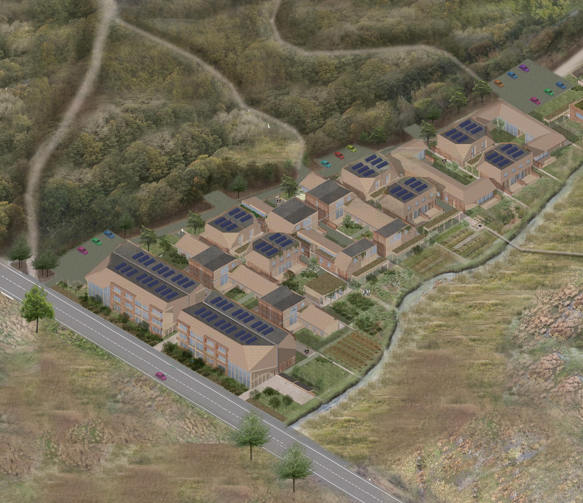
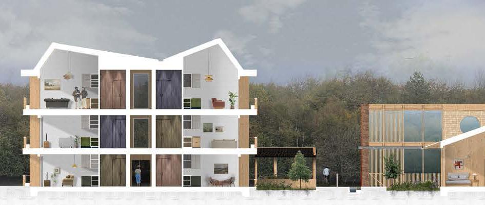
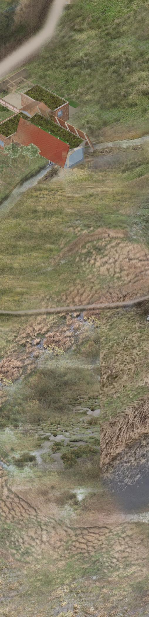
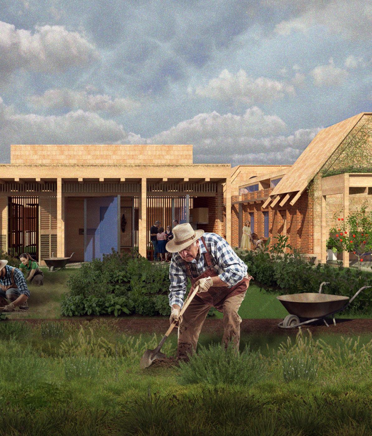
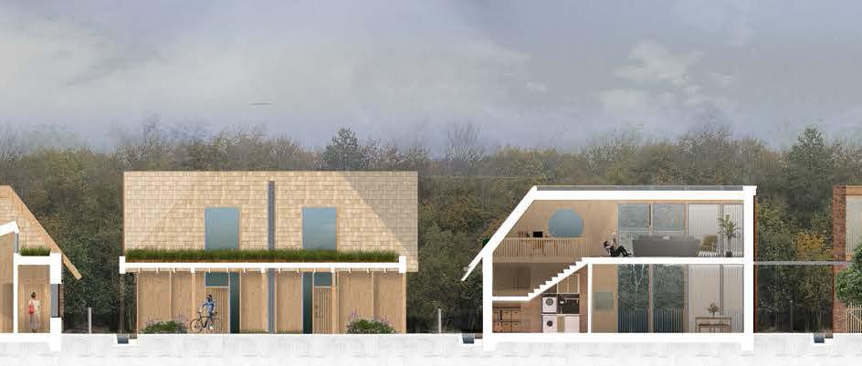
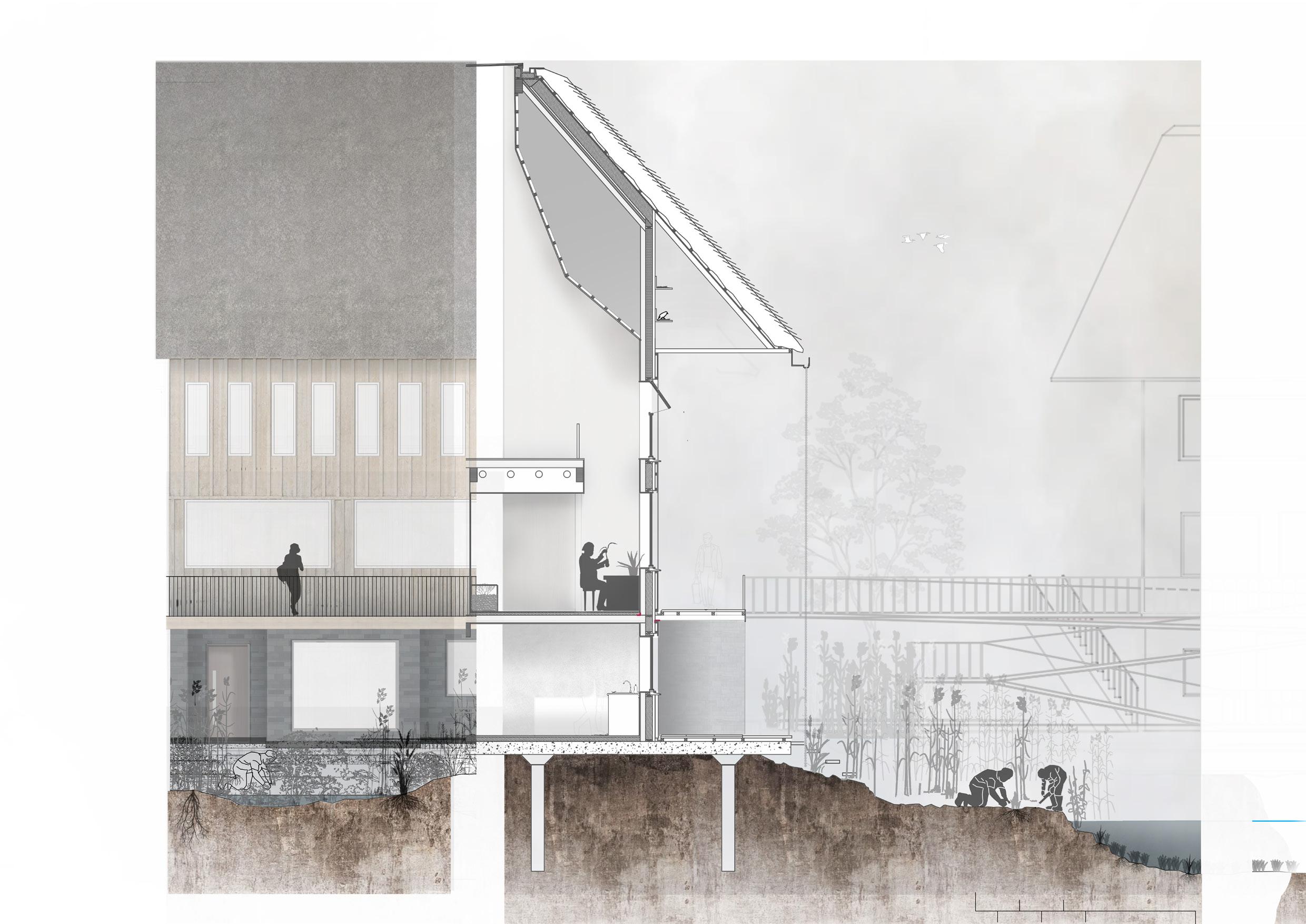
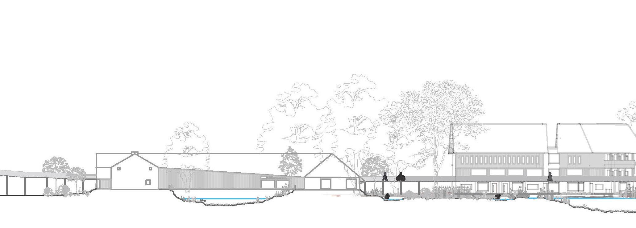
ANNA BOX
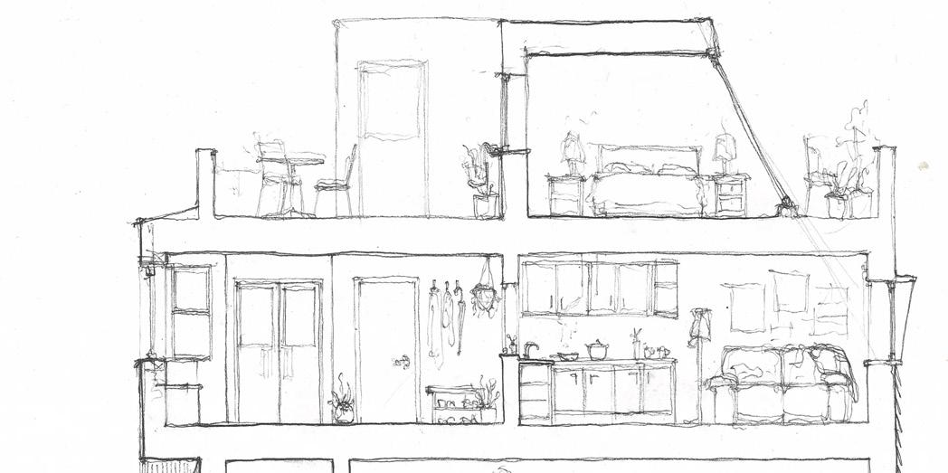
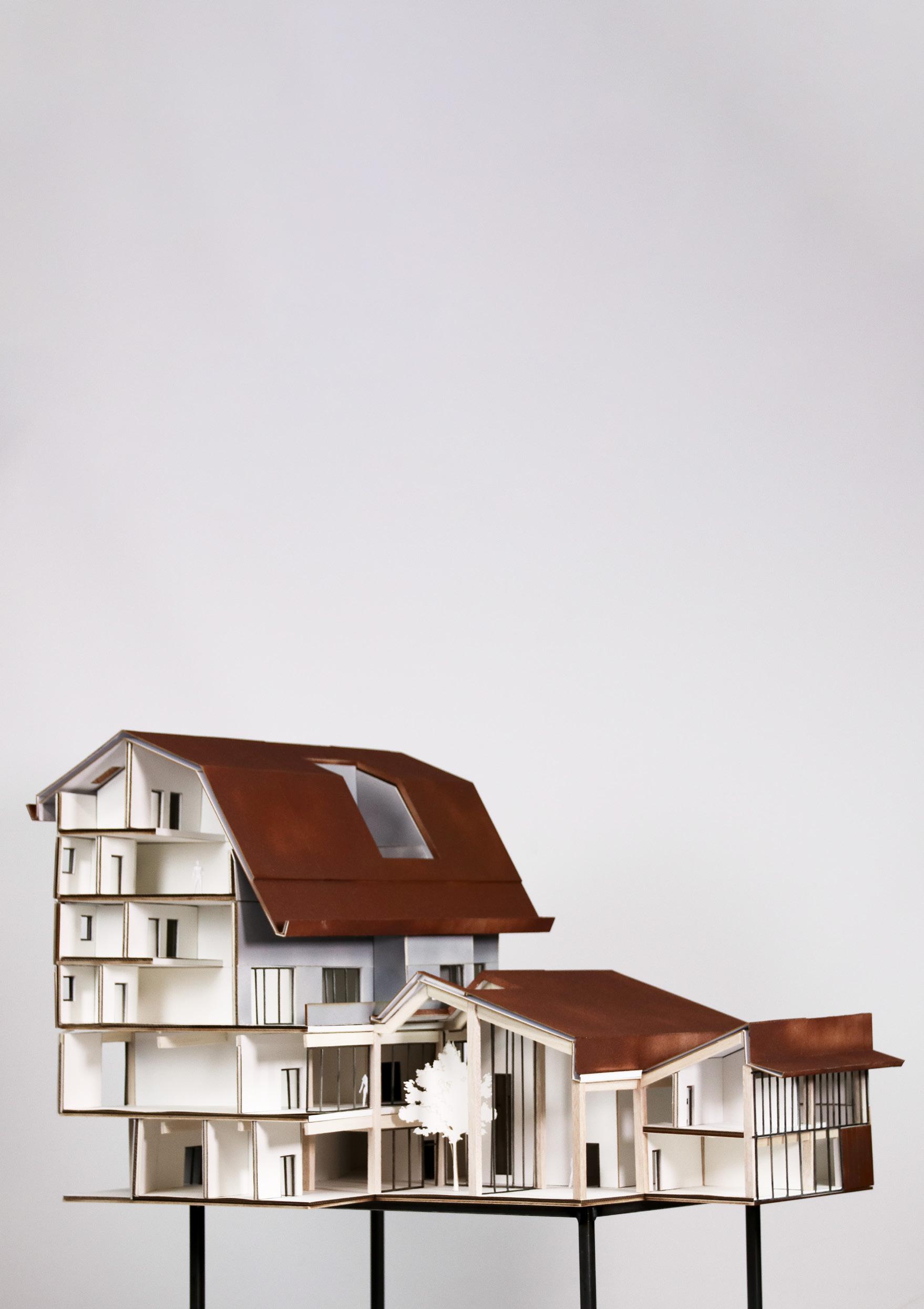
In an age where ageing too often leads to separation, this project roots its foundations in connection between generations, between person and place, between water and land. Rooted in Denmark’s tradition of later-life independence, yet responding to its social consequences, the proposal offers a new model: a living landscape of multigenerational cohousing, nourished by slow water systems and shared soil. A slow irrigation system divides the site like a circulatory network, guiding rainwater into planted beds, feeding shared gardens, and softening the built edge into the land. These waterways become both infrastructure and invitation - feeding food systems, anchoring movement, and offering space for interaction to unfold naturally. Along their banks, residents cultivate vegetables, herbs, and medicinal plants. The architecture is humble, tactile, and attuned to the landscape. Homes are designed to evolve with their inhabitants. Accessible ground floors, generous thresholds, and flexible interiors support ageing in place. Communal kitchens, sheds, and courtyards foster interdependence rather than reliance. Clusters of dwellings form social clearings, balancing privacy with sociability. Here, green space is transformed into a network of positive nodes pockets of daily interaction that nurture connection and support. The scheme becomes a regenerative ecology. A place shaped by water, time, and care, where community is not constructed but cultivated.
Detailed axonometric (previous)
Aerial view (top left)
Exterior visual (above)
Section (bottom)
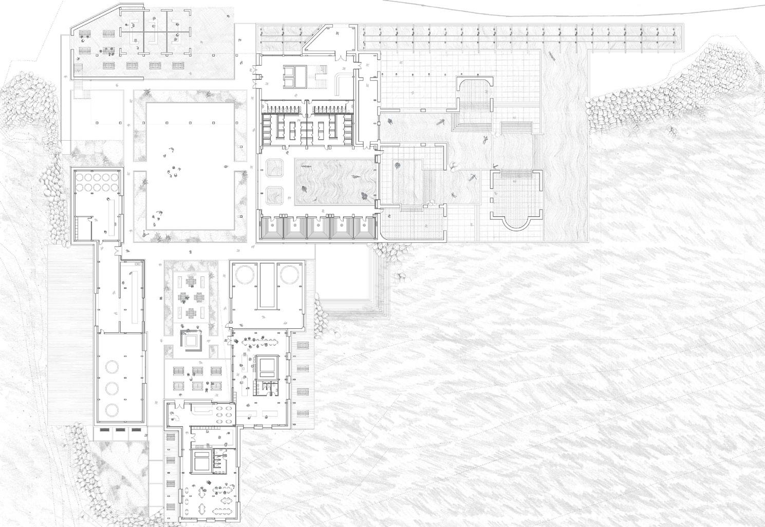
Site: North Edge, Esbjerg Programme: Marine Research Labs, Seagrass Nurseries, Marine Education Centre, Marine Researcher’s Housing, Classrooms, Fieldwork Storage
01 c
SEACHANGE
AN ARCHITECTURAL RESPONSE TO MARINE HABITAT LOSS
AMY GRAHAM
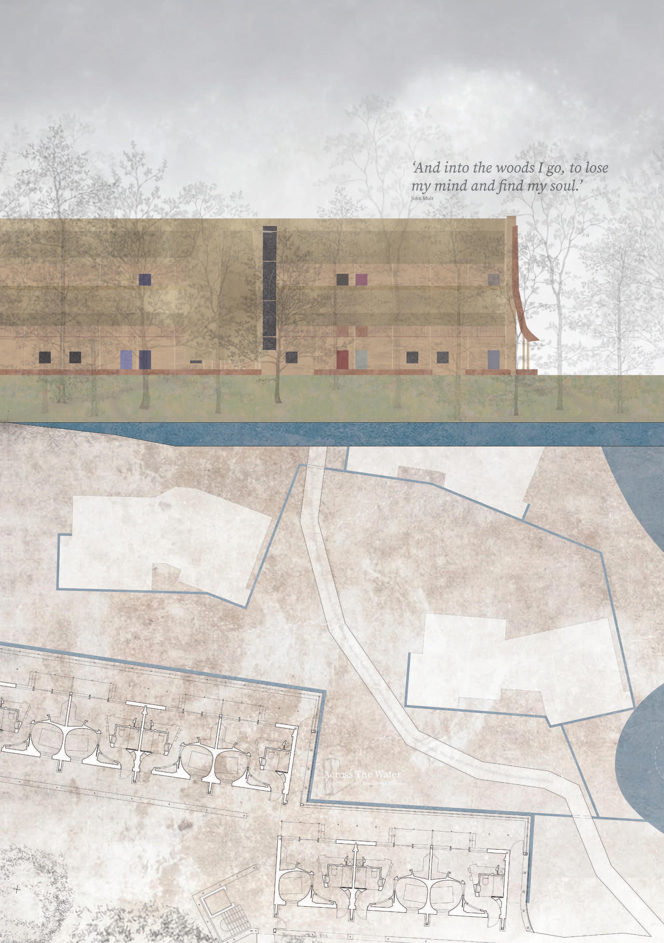
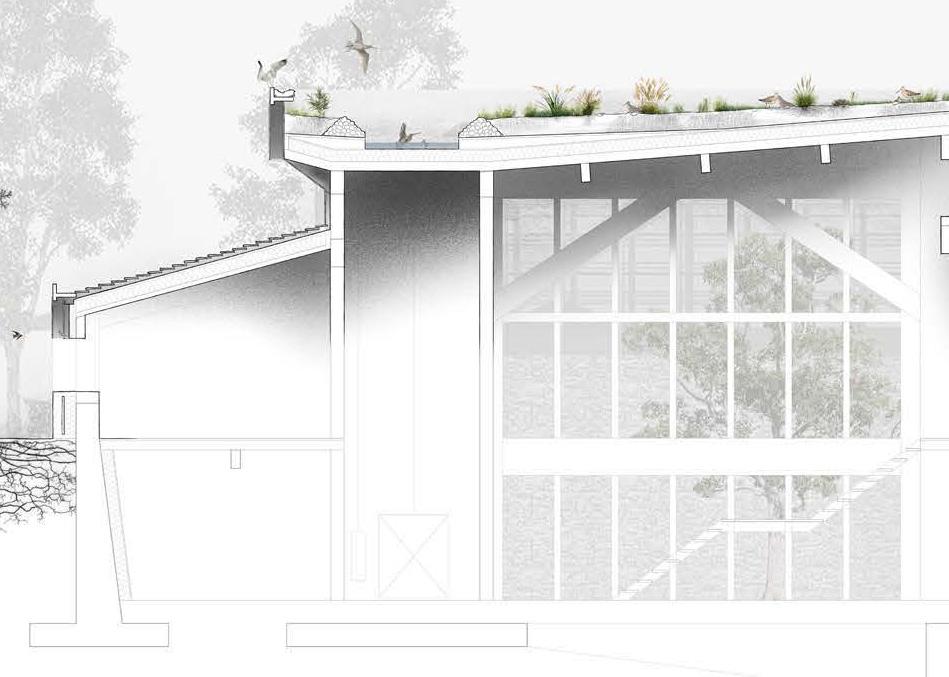
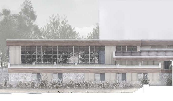
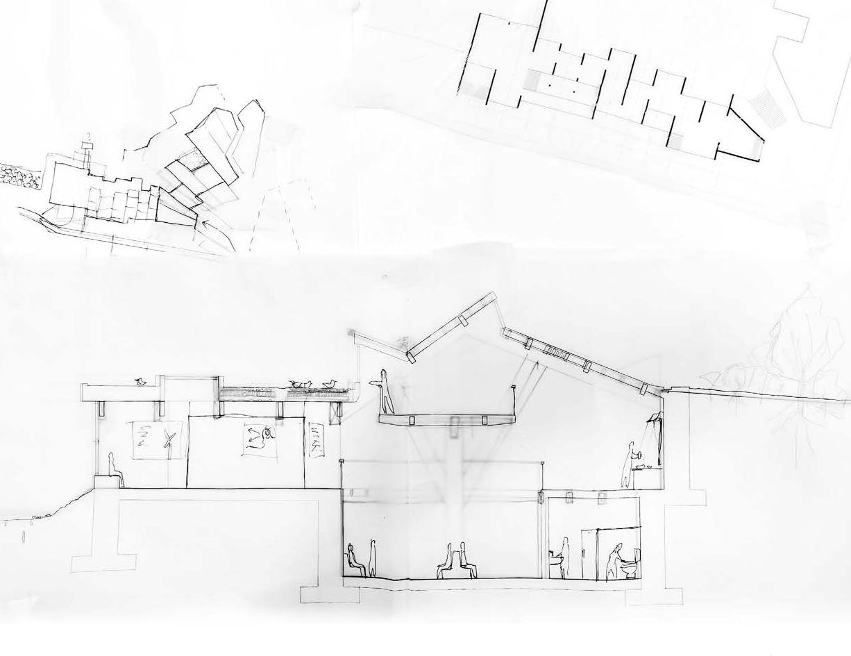
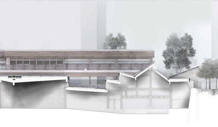
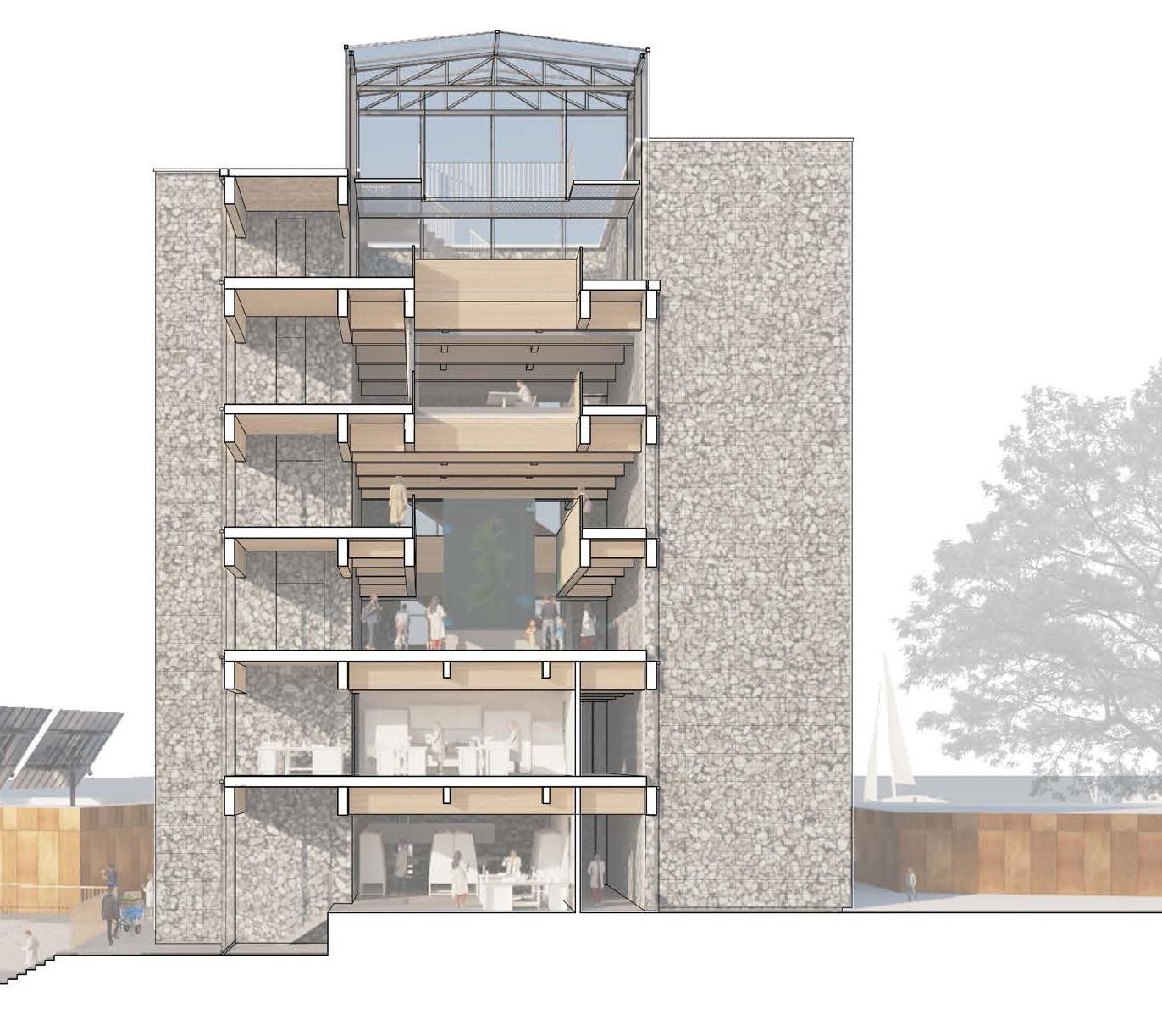
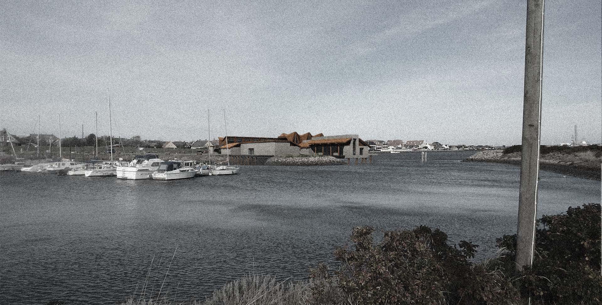
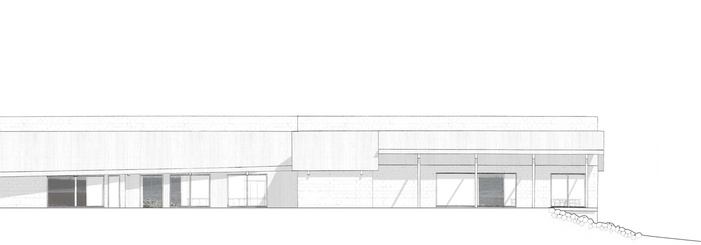
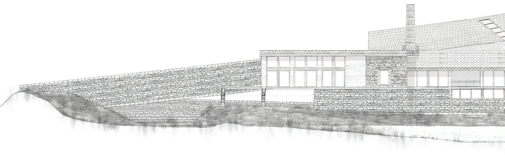
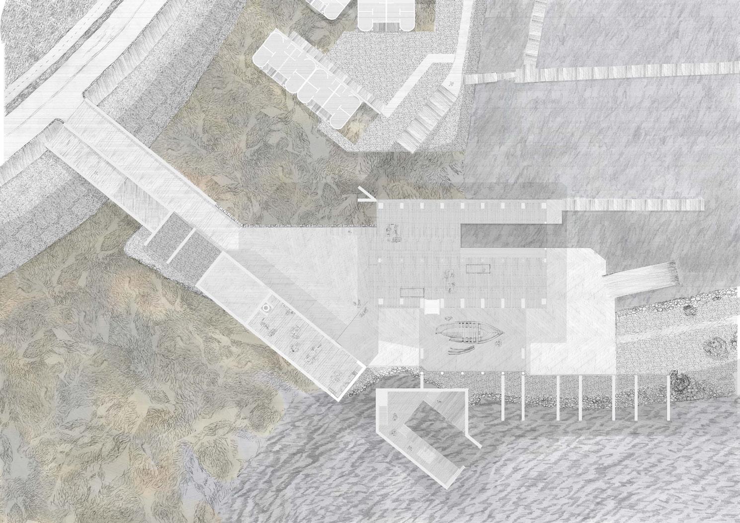
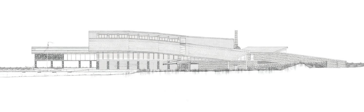
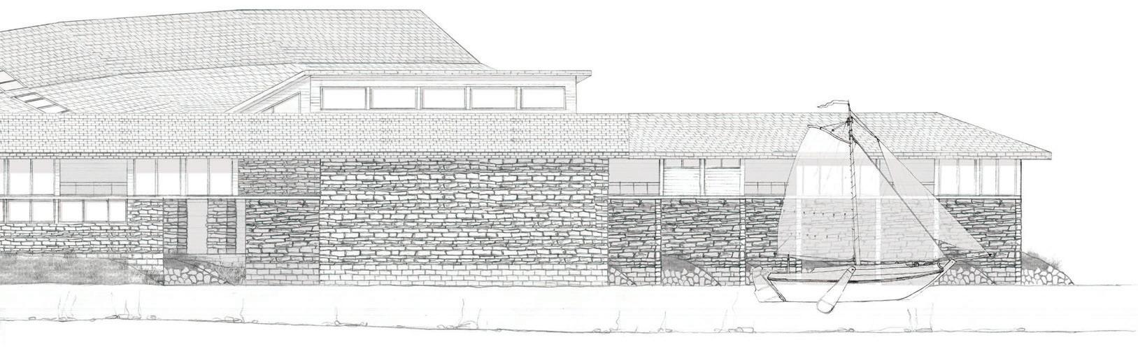
This architectural project addresses the ecological decline of the Wadden Sea along Esbjerg’s coast, where once-thriving meadows of Zostera marina and Zostera noltei have nearly vanished. These seagrass species play a crucial role in marine ecosystems - improving water quality by trapping sediments and absorbing excess nutrients, storing large amounts of carbon, and reducing coastal erosion through their stabilising root systems. Despite covering less than 0.2% of the ocean floor, seagrass meadows store around 10% of the ocean’s annual carbon and are vital for biodiversity and climate resilience. However, in the Wadden Sea up to 95% of these ecosystems have been lost, largely due to human-caused shoreline disturbance and pollution. The proposal introduces a coastal research and restoration hub that supports seagrass regeneration. Located just behind the seafront, it includes facilities for marine researchers to stay and work on-site, alongside spaces dedicated to the extraction, cultivation, and monitoring of seagrass seeds. The aim is to replant these along the degraded coastline, restoring ecological function and resilience.
Blending environmental science with architecture, the project envisions a space that not only supports scientific efforts but also symbolises a broader commitment to marine restoration. It seeks to help return the Wadden Sea to the dynamic, life-supporting ecosystem it once was.
Exterior visual (previous)
Section and corresponding elevation (above)
Plan (top right).
Section elevation (middle right)
Section (bottom)
02
BEACH/NORTH HARBOUR
ESBJERG
JEMIMA HARRISON
HOLLY NG
YUCHEN CAI
DIANA HUYNH
ALEXANDRA GRÖNBERG
Group Masterplan
Site: Beach/North Harbour, Esbjerg Programme: Supportive Spaces for Offshore Workers and Transient Communities, NonHuman Ecologies and Constructed Wetlands
02 a SOFTSCAPES
CULTURES OF RECURSIVE NESTING
JEMIMA HARRISON
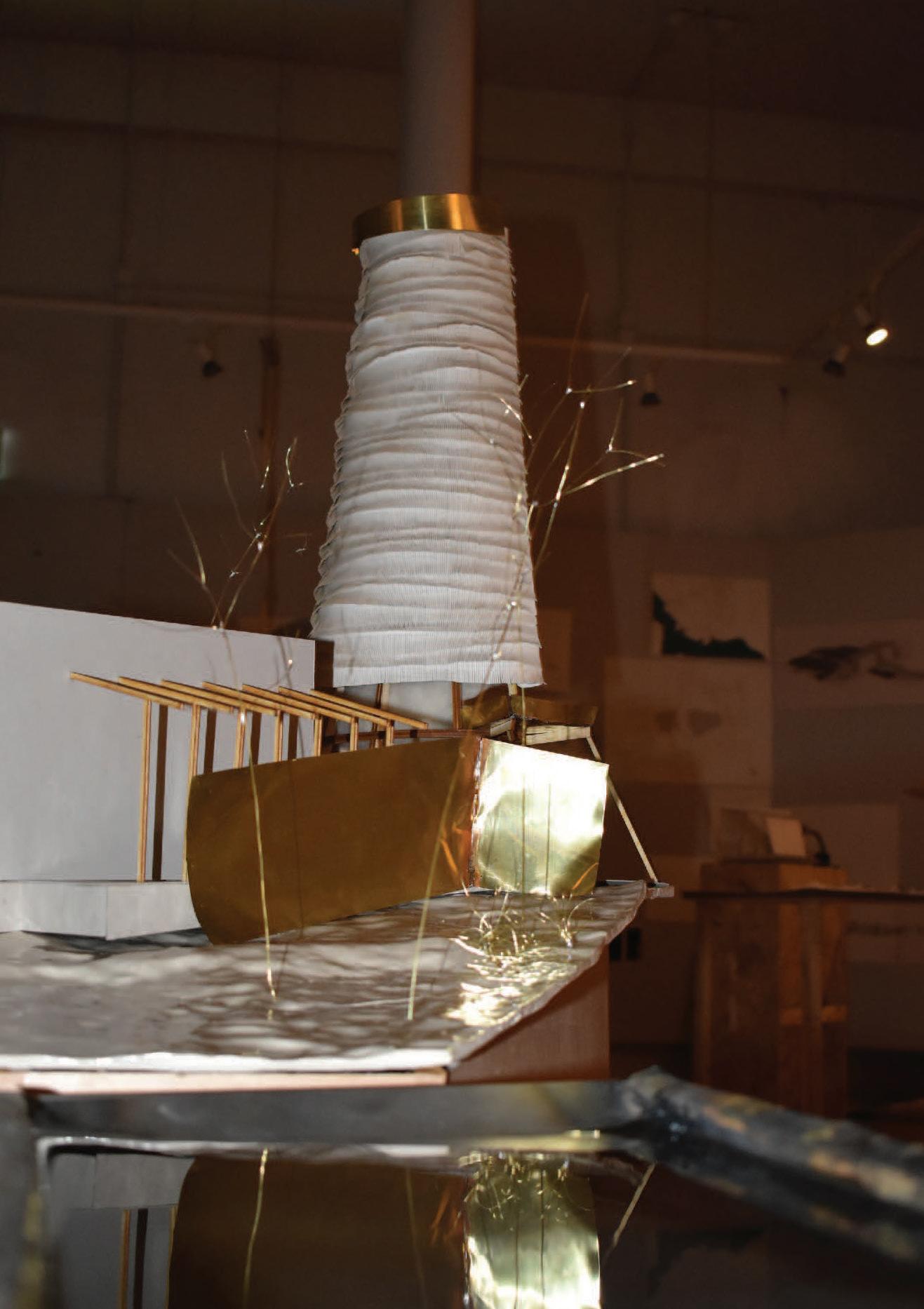
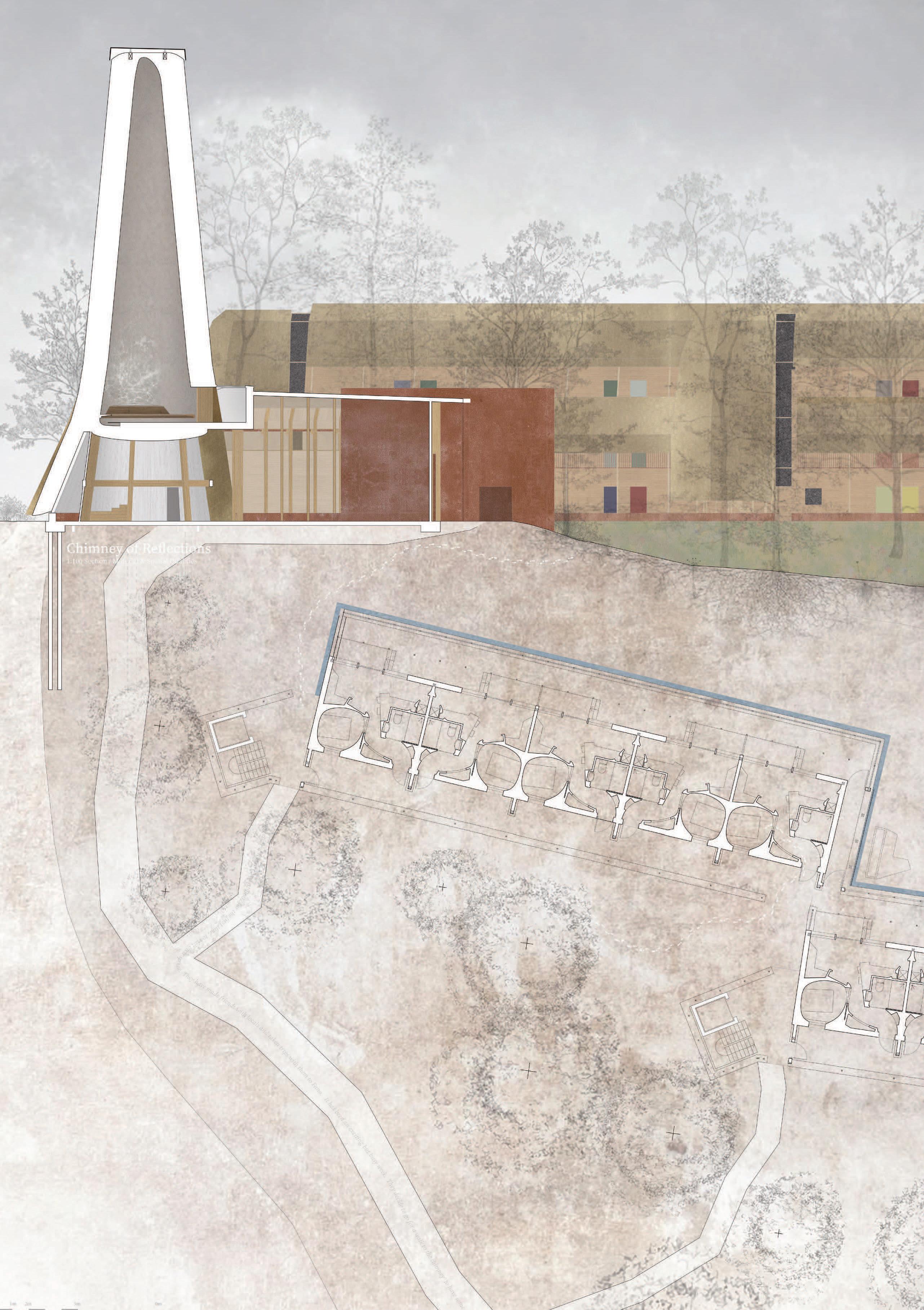
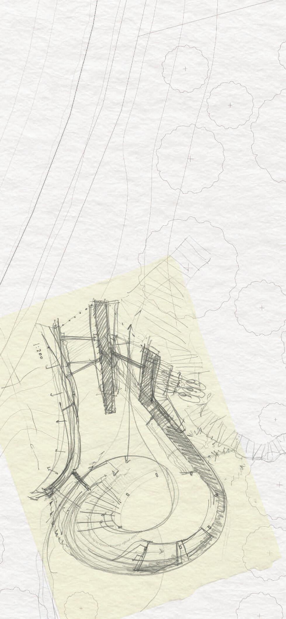
An inspiring tour of the Bo01 residential community in Malmö - named after the Swedish word bo, meaning to live, to dwell, to nest - led to the development of a new ‘Bo’ within Esbjerg’s Constructed Wetlands. Responding to Esbjerg’s socio-political context, the proposal is deeply rooted in the cultural and social impacts of offshore working. It offers a spatial framework for healing and connection through recursive nestinglayers of being, nested like matryoshka dolls. The project fosters ecological, cultural, and spiritual exchange through soft, layered environments that support both long-term residents and transient offshore workers. Emerging from this ethos, ‘Bo02’ offers permanent housing for locals and short-stay accommodation for offshore families seeking respite and reconnection. Carefully designed communal spaces encourage integration and intercultural gathering. Beyond the dwellings, across the water, a thatched chimney of reflections rises - a quiet beacon among the trees. This multi-faith commons invites all visitors into a space of stillness, prayer, or contemplation. Here, rain is welcomed. A drum roof amplifies its rhythm; gutters do not reject it, but channel it into open troughs that create reflections within the interior. Water trickles down façades and through channels, feeding a system of urban wetlands that nurture both human and non-human nesting cultures. Through architecture that softens, gathers, and holds, Bo02 explores new ways of living together - woven spaces where care, ecology, and coexistence are central.
Material testing model (previous)
Section and plan
Development sketch (bottom left)
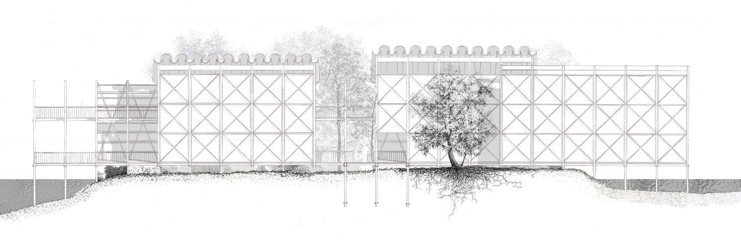
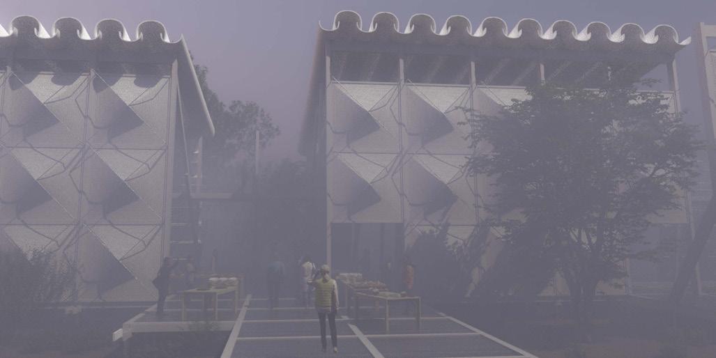
Site: Beach/North Harbour, Esbjerg Programme: Intergenerational Day Centre, Library, Grocers Shop, Learning Kitchen and Garden
02 b
FLUID-BOUNDARIES
CURRENTS OF CONNECTION
HOLLY NG
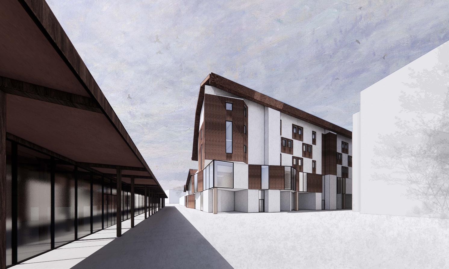
Grounded in the tidal ecologies of Esbjerg’s coastal landscape, the project sits within a larger masterplan proposal on a recently reclaimed piece of land, forming the new “Esbjerg Strand”. Situated on a key access point, the project acts as a gatehouse to the wider neighbourhood with an activated ground floor that houses a tool library, grocery store, educational kitchen, library and nursery, for different generations and residents to access and use. Clad with a Danish handmade clay tile product, the proposal is modern whilst using a vernacular product with a solid appearance. Complimenting this, parts of the cladding are composed of timber to correspond to the gathering spaces internally, with a lighter appearance. Exploring how soft boundaries, sensory-driven design, and spatial flexibility can foster meaningful connections across generations, the architecture allows elderly residents and children to interact within different parts of the public programme, including a shared educational kitchen and garden, art and exercise workshops, and library, and within circulatory spaces; the ‘in-betweens’. The thesis draws from research into the benefits of intergenerational architecture and non-institutional models of care to propose a more interconnected alternative. Fluid-Boundaries proposes an architectural framework that responds to and fosters a new model of living across ages and needs within the environmental rhythms. This thesis envisions a built environment that fosters exchange between the young and old, where learning, support, and care coexist fluidly both within this architecture and the wider masterplan.
For a long time, we have been trying our best to prevent birds from constructing on our constructions – in other words, many people usually attempt to prevent birds from nesting upon buildings, although sometimes it is us who have occupied their original habitats. What if a building does not dislodge but welcomes them instead? What do architectural elements, such as roofs and walls, mean to other species than us humans? This project investigates the concept of creating a second landscape upon an architecture for humans to create an architectural environment for the birds, the indigenous inhabitants of the tidal zone on the western shore of Esbjerg which turned into a large artificial maritime activity centre recently. The project aims to design for five main kinds of bird species that are resident within the region, with their nesting and residential habits considered for the design of the roofs – or the “ground” to the birds. The core goal of the project is not, however, expecting a large population of the five species of birds to nest upon it. As humans, we would never know exactly whether the birds would truly appreciate this design. Rather, it is proposing a possibility, and a new perspective, that certain architectural elements may obtain completely different meanings and values to other species than to us humans. This project calls for a rethink on many human-centric programmes and consider a more entangled architectural ecology, where the building is not only designed for humans, but also for more-than-humans.
Exterior visual (previous)
Section (top left)
Development sketches (top right)
Section (below)
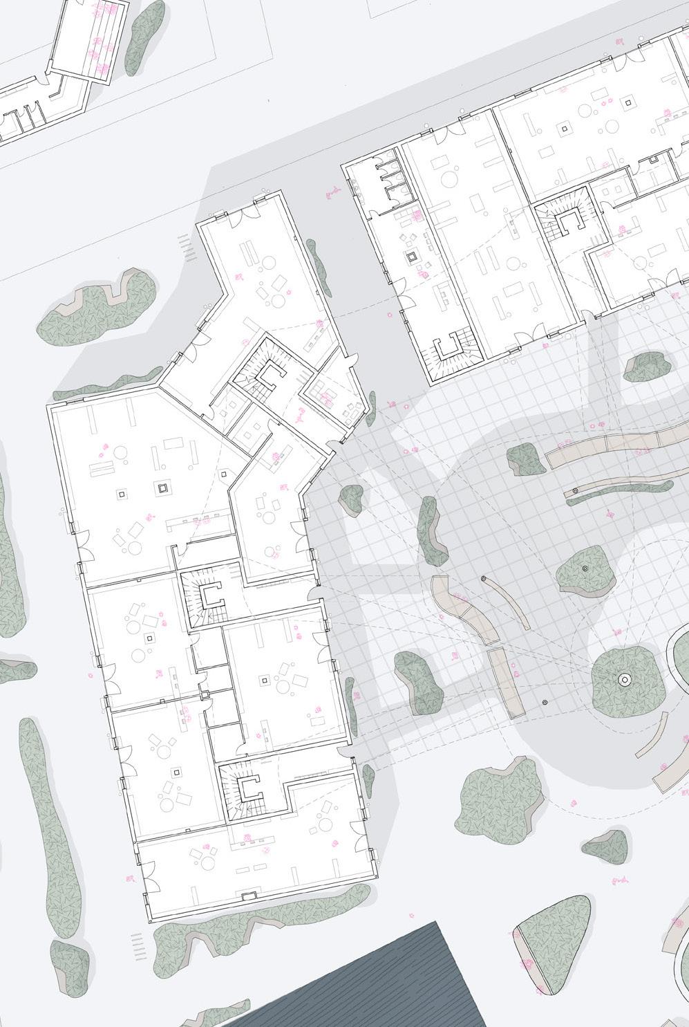
Site: Beach/North Harbour, Esbjerg Programme: Maker’s Studios, Central Market Space, Active Communal Residential, Inter-woven Growing Spaces
02 d
ESBJERG MAKER’S MARKET
A SPACE FOR FOOD CULTIVATION AND SELLING
DIANA HUYNH
This project centres around a cultivated field, a previously brownfield site where local makers can cultivate plants to use to make products and sell these products within the market and shops created on site. This field extends the existing green corridor of Esbjerg. The crops can also stock the grocery stores and restaurants/cates within the new ‘neighbourhood’ masterplan.
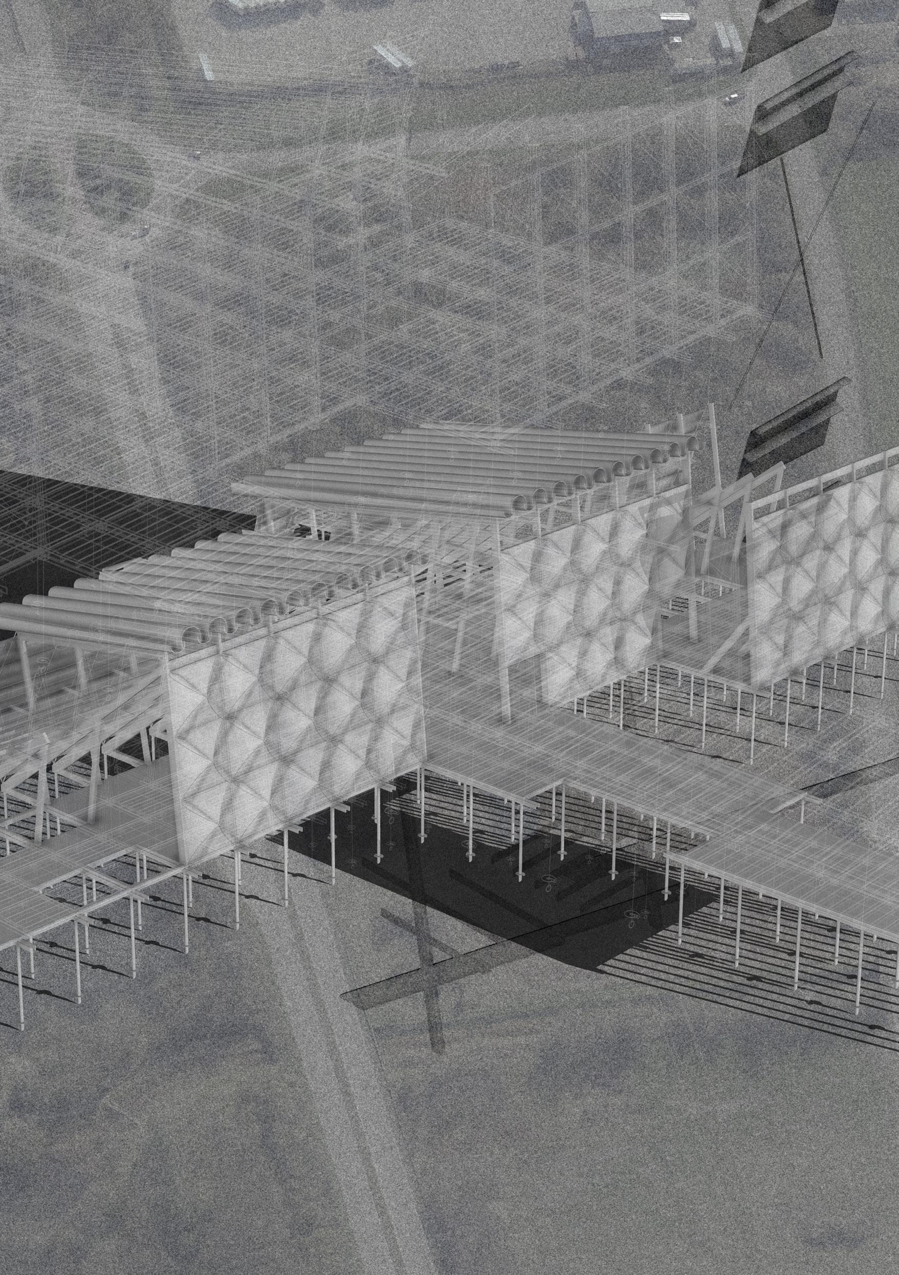
Also on the site, above the shops and market space is residential accommodation. This housing has communal external balcony spaces that face the market leading to a lively and active shared space. The external balconies have bridges that connect to a central ‘island’ above the market space, which creates further communal spaces for the residents to look over the vast growing fields south of the site.
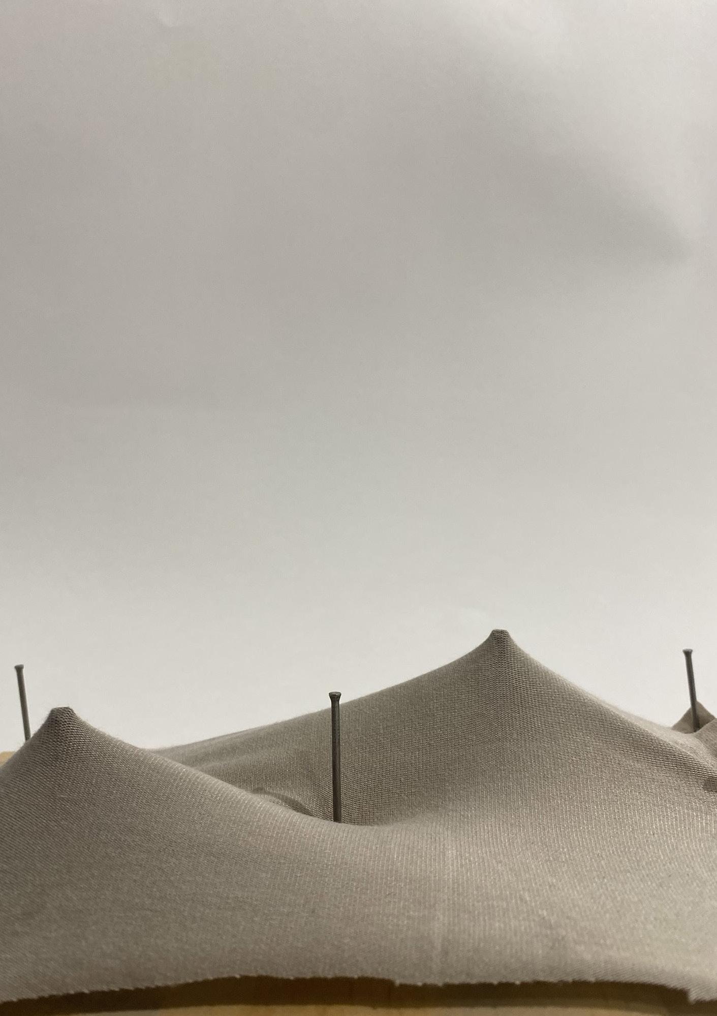
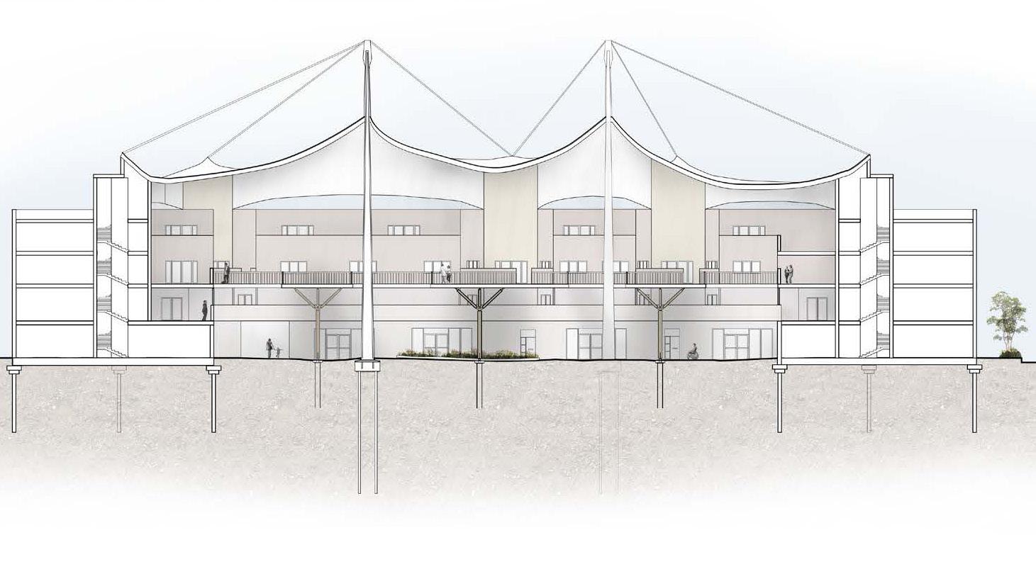
The open market space is covered by a cable mesh tension canopy, topped with a transparent plastic membrane. This allows light through to the central market space as well as protecting the space from rainwater. The canopy will collect rainwater that will be used for flushing toilets and servicing the building.
Esbjerg marker’s market aims to invite local makers to create their products on site as well as cultivating an engagement to nature for the building users and the makers. This is enabled through the strong connection to growing, as the larger growing fields to the south extend over the bridge to the central market spaces.
Material testing model (previous) Plan (left)
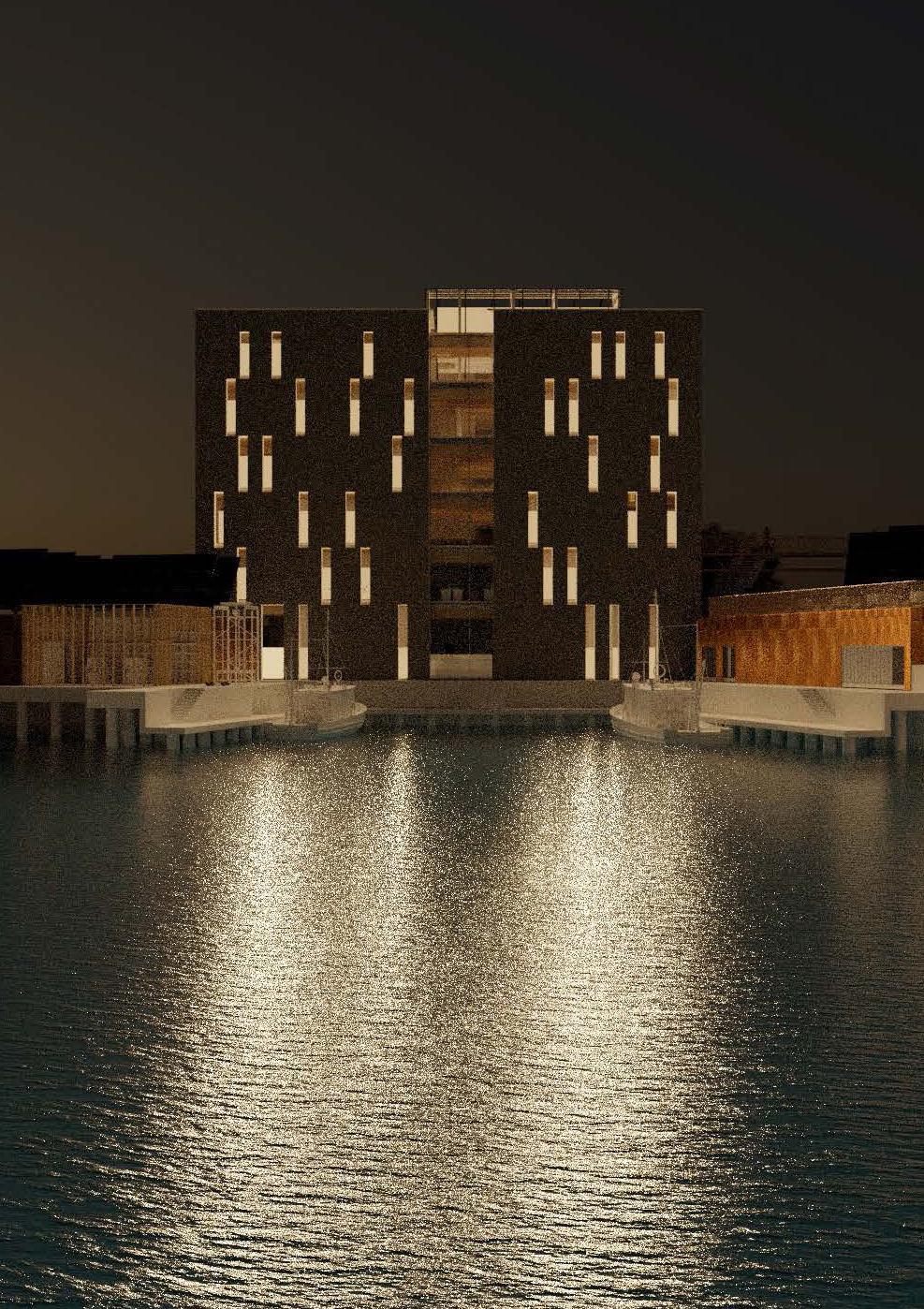
Exterior visual (above) Section (below)
DIANA HUYNH
Site: Beach/North Harbour, Esbjerg Programme: Research Facilities, Laboratories, Exhibition Spaces, Educational Facilities, Boat Dock, Short-Term Accommodation, Conference Centre
02 e
MARINE ALGAE RESEARCH INSTITUTE
CENTRE FOR MARINE ECOLOGY
ALEXANDRA GRÖNBERG
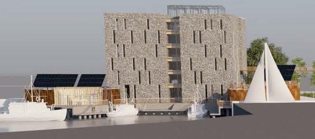
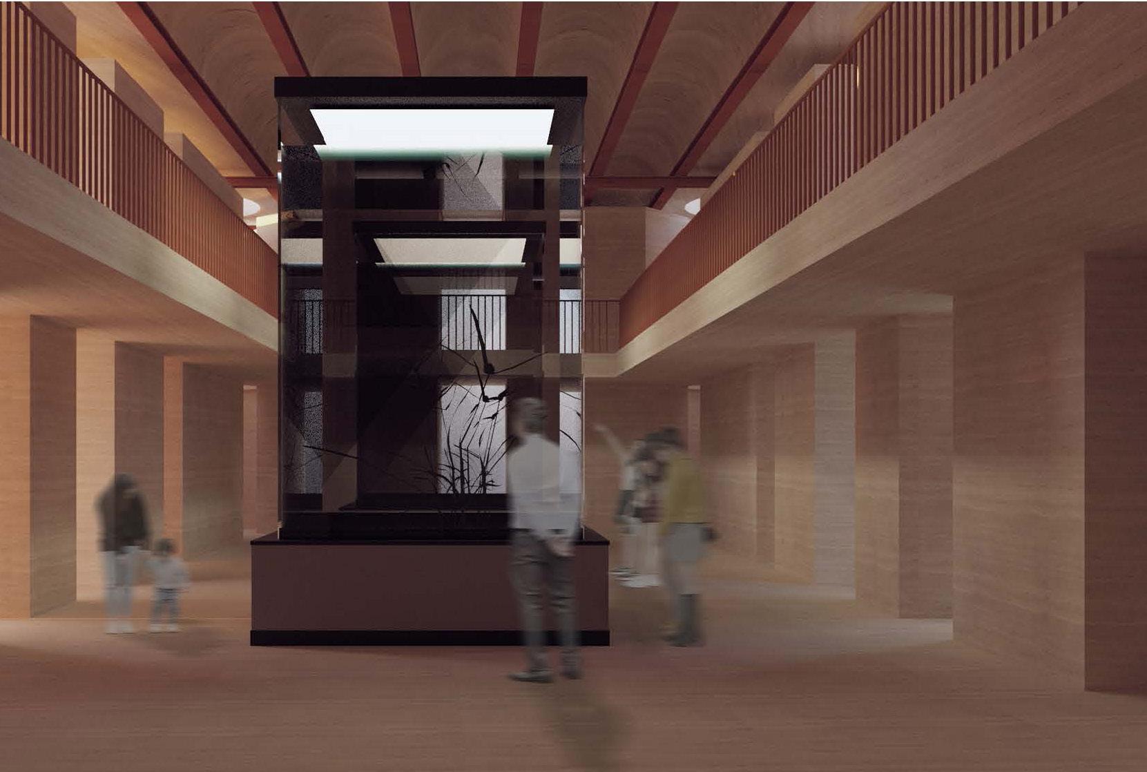
The Marine Algae Research Institute emerges as an architectural response to the climate emergency, addressing the environmental impact of Denmark’s agriculture. As a net exporter of pork, contributing with approximately 7% of the European Union’s total pork production, Denmark’s agricultural sector accounts for around 27% of the country’s total carbon emissions. Yet, as a cornerstone of Danish economy, agriculture cannot be radically dismantled or changed overnight. To propose a new trajectory, this project explores and encourages a shift from agriculture to aquaculture, specifically the cultivation and research of macroalgae as a sustainable alternative protein source in human diets. The result is a Research Centre supporting this transition. While similar research initiatives exist along the coastlines of Scandinavia, none are located on Denmark’s west coast with direct access to the Wadden Sea. This makes Esbjerg an ideal site for further expanding the collaboration and aspiration for marine-based sustainability. The Research Centre is designed not only as a hub for scientific research and innovation, but also as a public destination, drawing inspiration from the lighthouse as a symbol for guidance and knowledge sharing. The project puts the research as the core, while integrating exhibition halls, a restaurant and a conference centre to invite the public to the conversation. Powered by its location and integration with the existing harbour, the Centre allows for seamless harvest and processing of seaweed which anchors the project both physically and symbolically at the threshold between land, sea and future possibilities.
Exterior visual (previous)
Exterior visual (above)
Internal visual (left)
Section (right)
CENTRAL ESBJERG & HARBOUR
ESBJERG
Group Masterplan
SHAN LIANG YIDING CHEN CHUYUE LI
Site: Central Esbjerg & Harbour
Programme: Fish Market, Marine College (Classrooms, Offices, Material and Tool Shops, Library) and Seaman’s Temporary Living Space
03 a
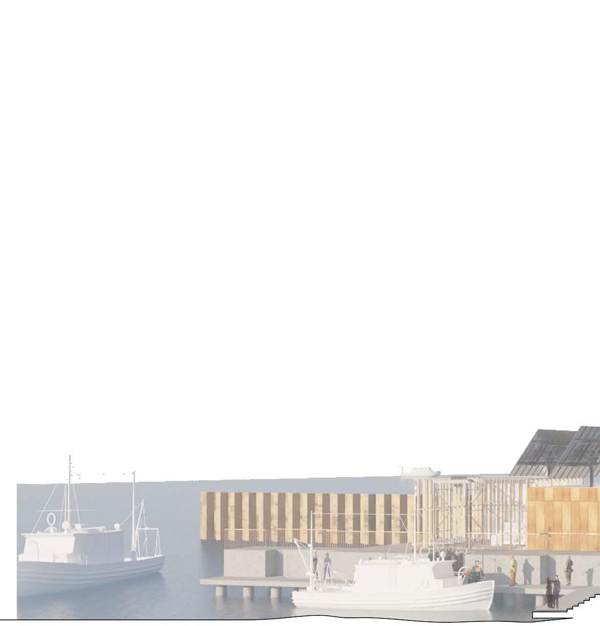
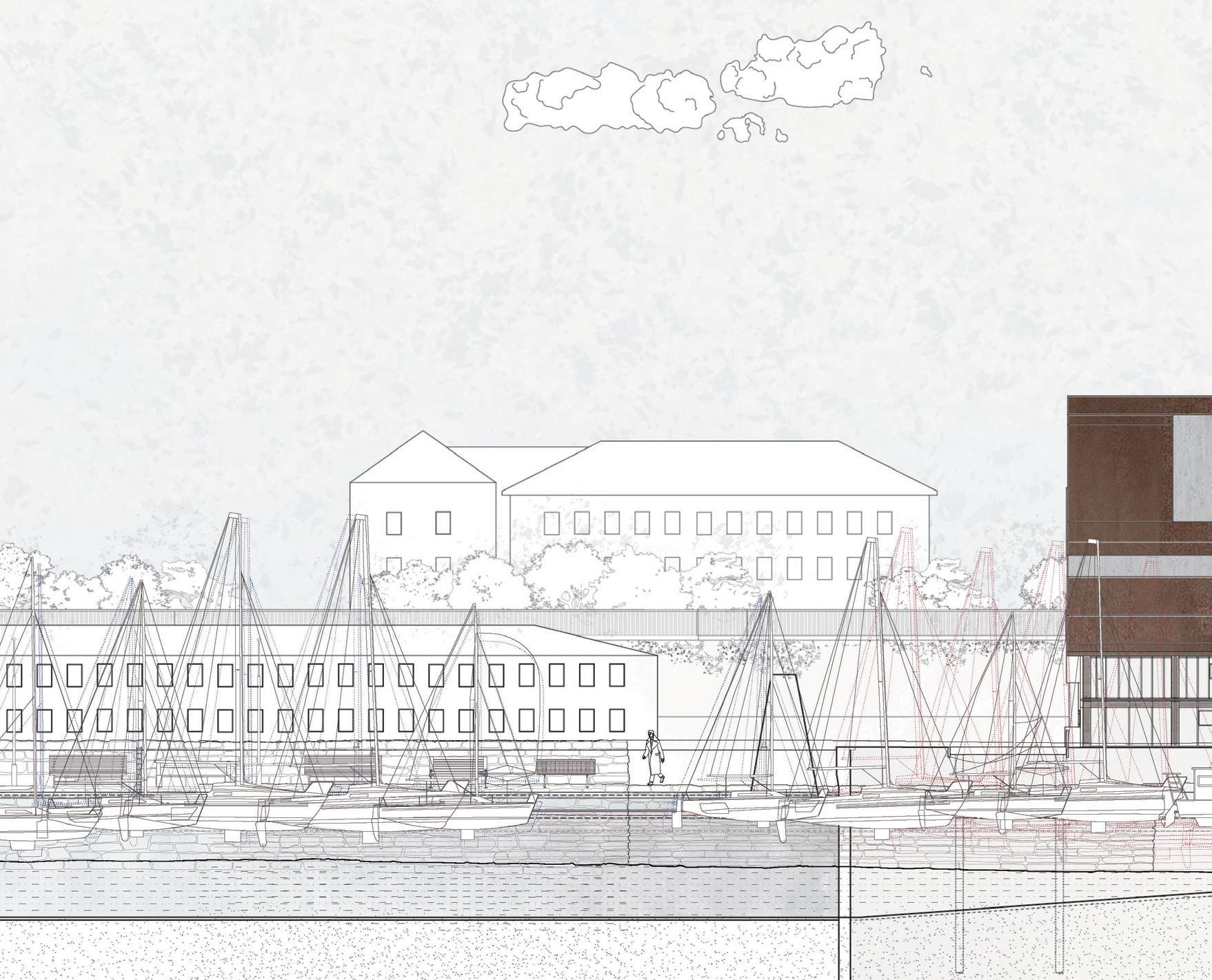
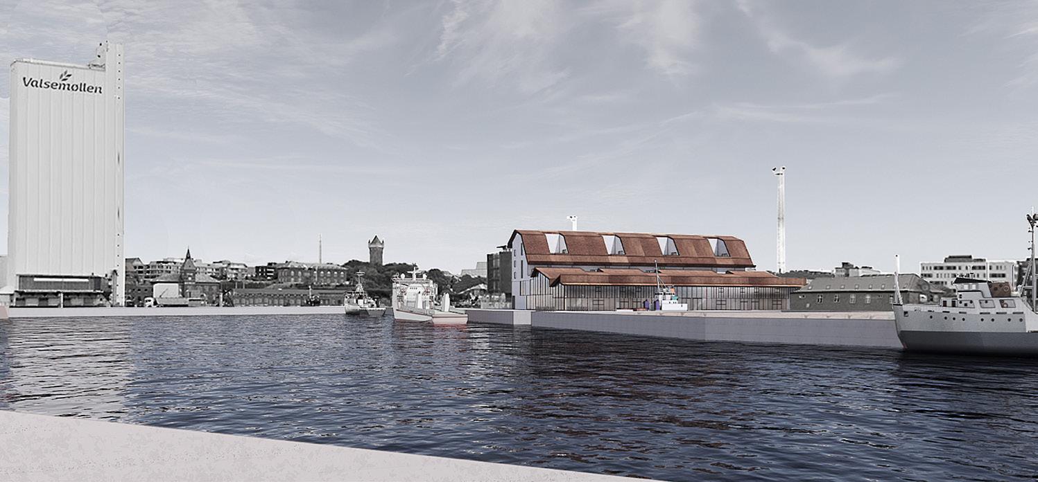
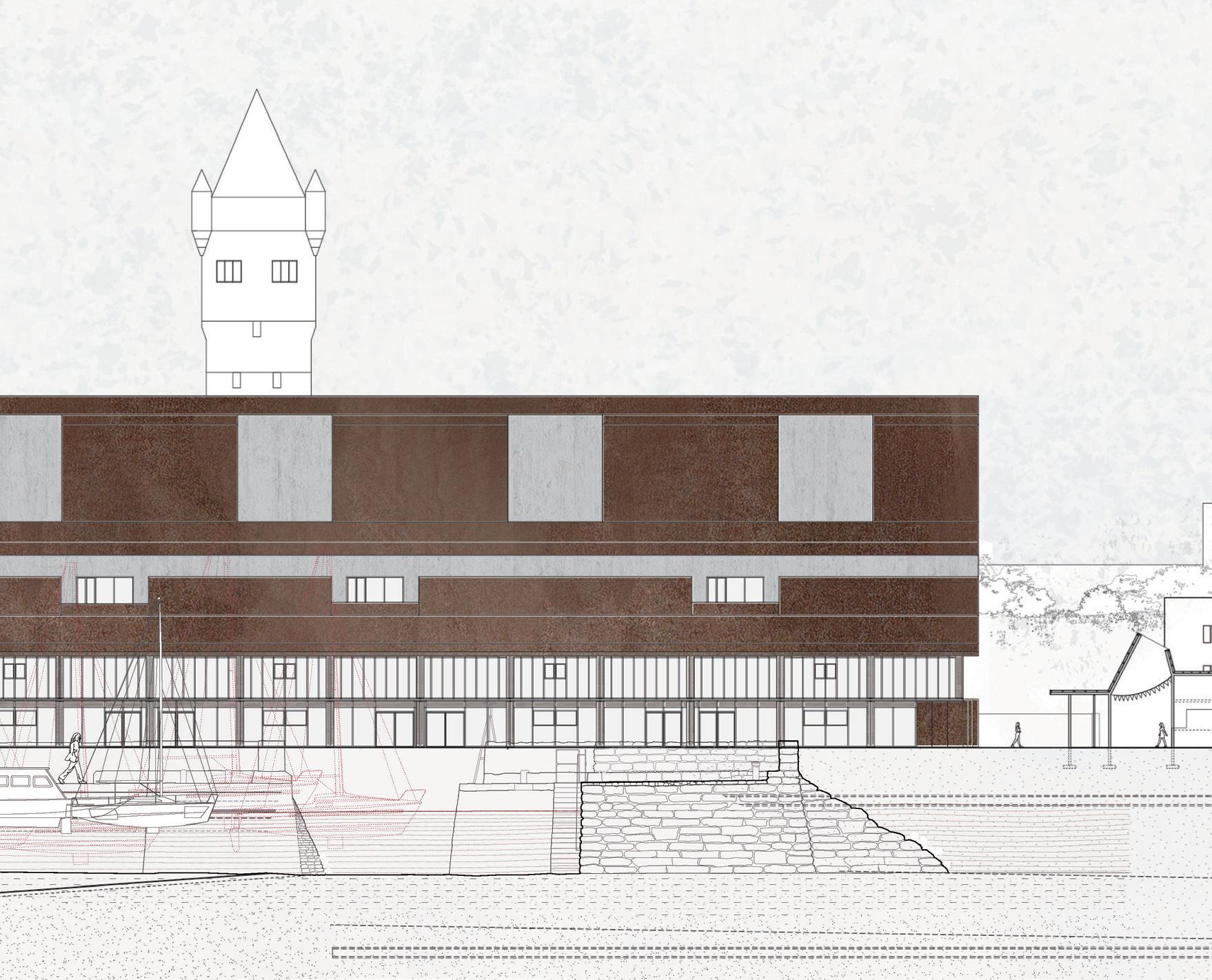
HARBOURS FROM SEA TO THE CITY
SHAN LIANG
The project represents a shifting edge between land and water, aiming to redefine the relationship between the port of Esbjerg and the city it shaped. The edge reflects the changing of water’s boundaries into different new water bodies and the process of land reclamation responding to these shifting edges. With the existing industrial functions, the project redesigns the port where industry, urban space and ecological systems can coexist along a newly designed water edge. A new harbour, a SuDS system, and a waterfront are introduced to the site, forming a new coastline. The architecture along these water edges plays a role in a bridge to connect different groups of humans and non-humans, including the seafarers, citizens, and Wadden Sea Creatures.
The first part of the project is a fish market between the new harbour and the SuDS system; it provides a space for citizens and fishermen to engage in fishing and processing activities. Then, next to the new waterfront, the marine college aims to increase the educational space for the study of nautical and maritime related skills, as well as the future renewable energy development. With the water, these architectures illustrated the story of this port - the fish market celebrates the fishing heritage, and the marine college is for the current and future situation.
The changes on site intertwine the water and land, as well as the sea and the city.
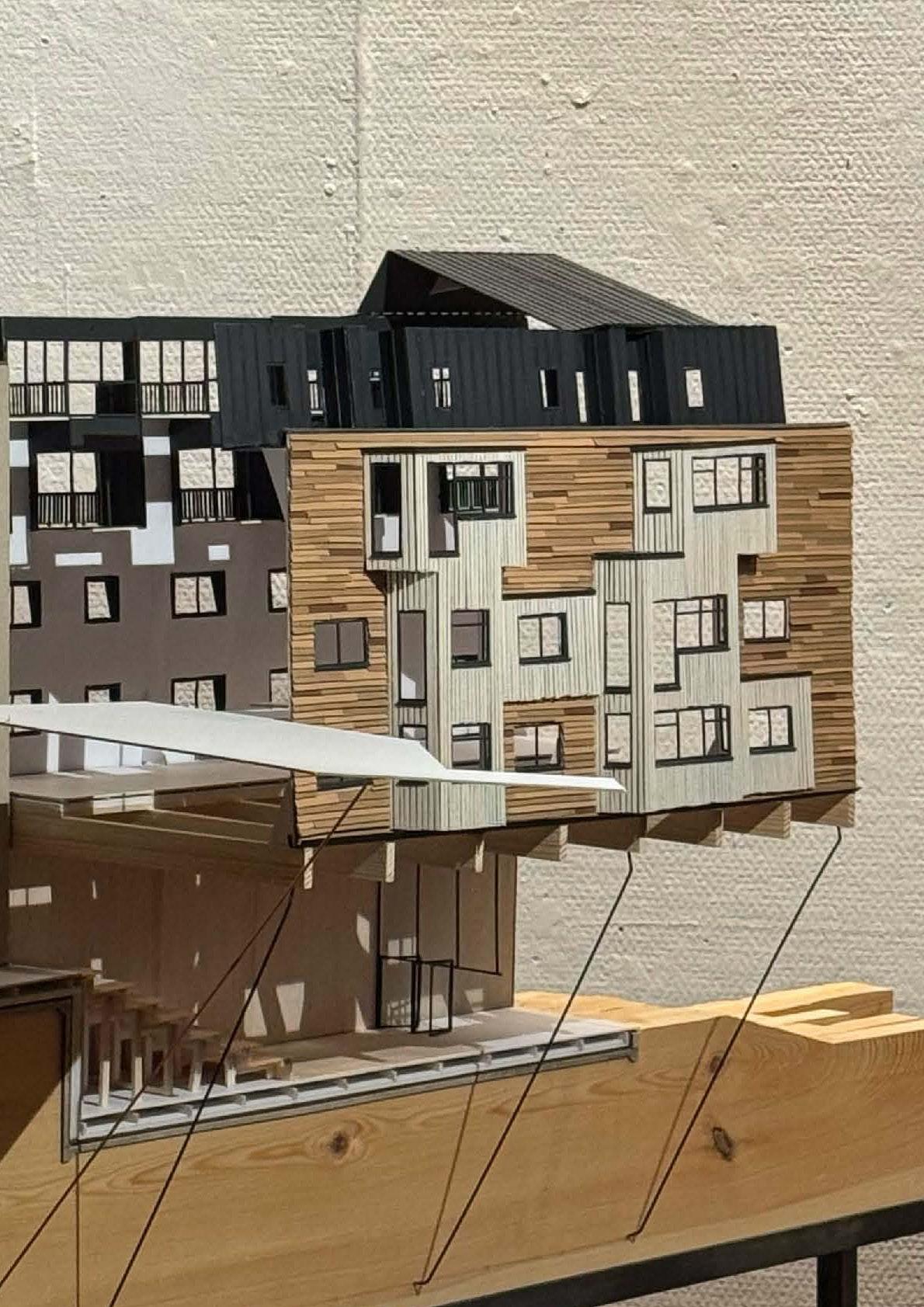
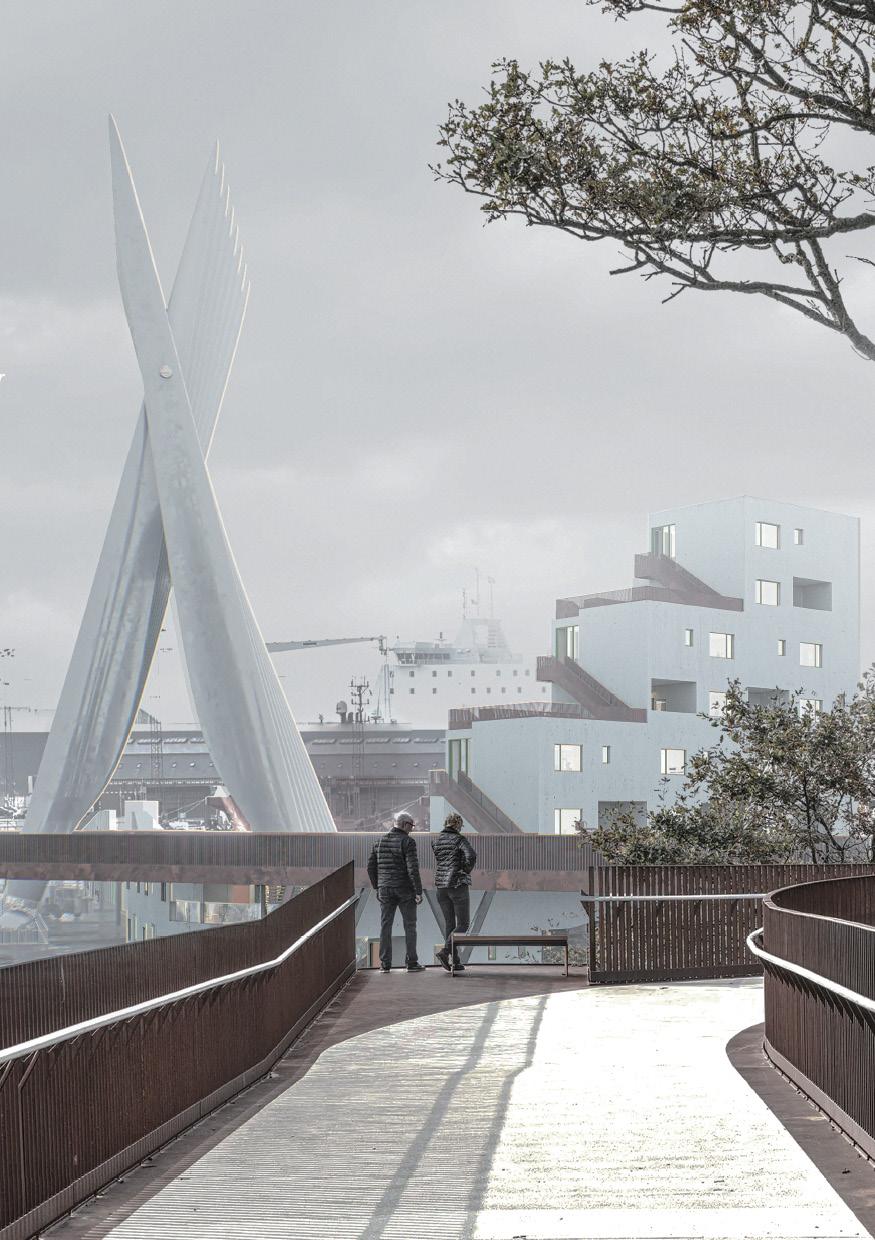
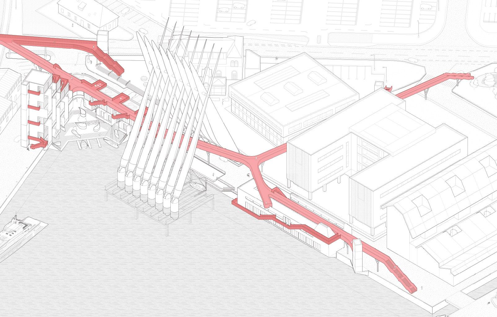
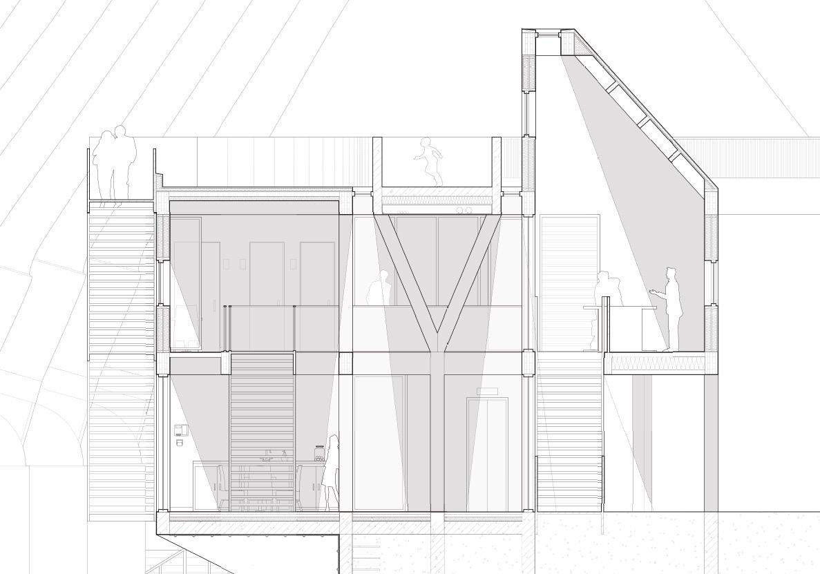
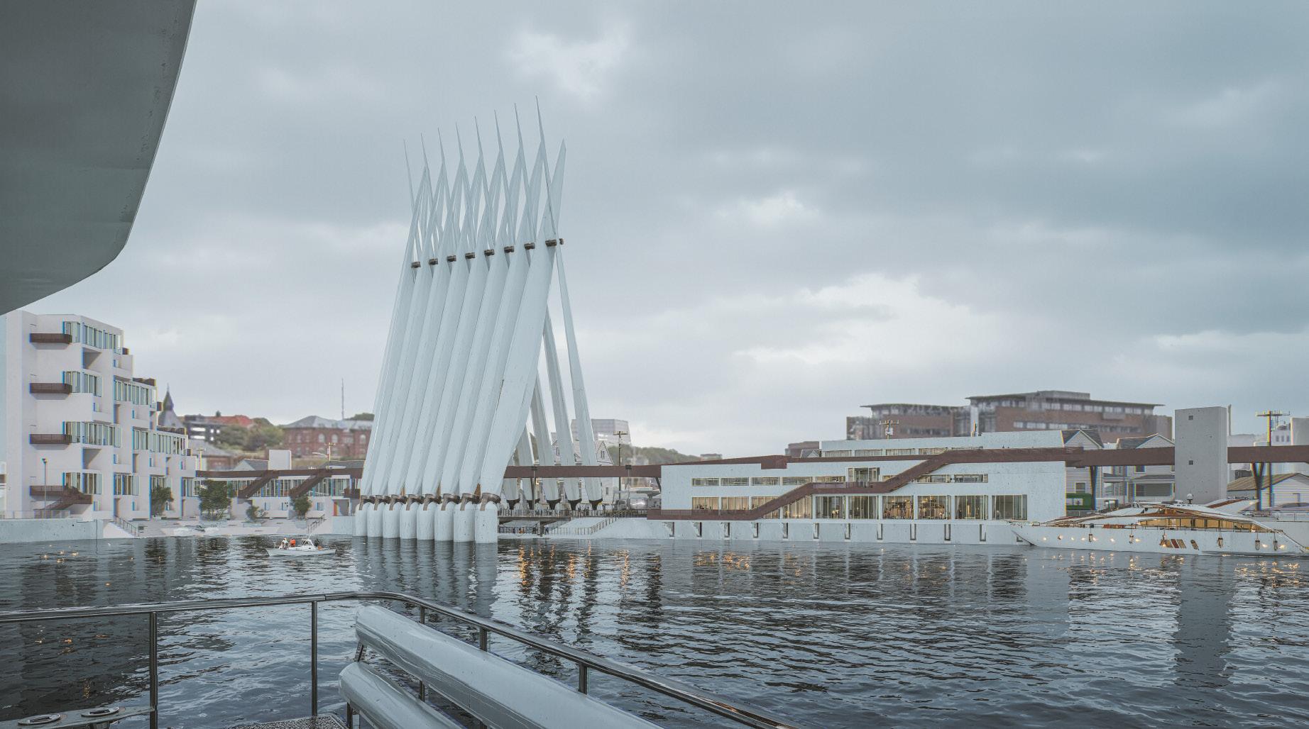
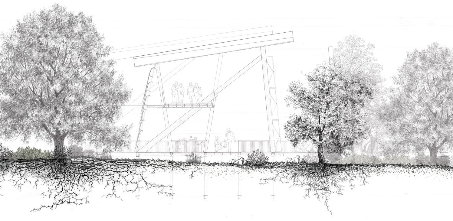
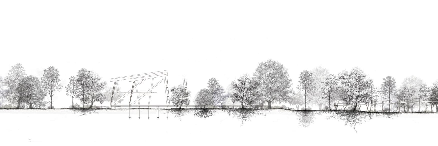
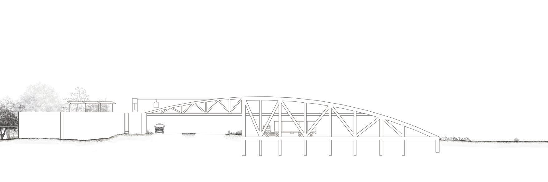
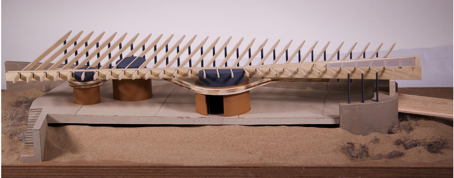
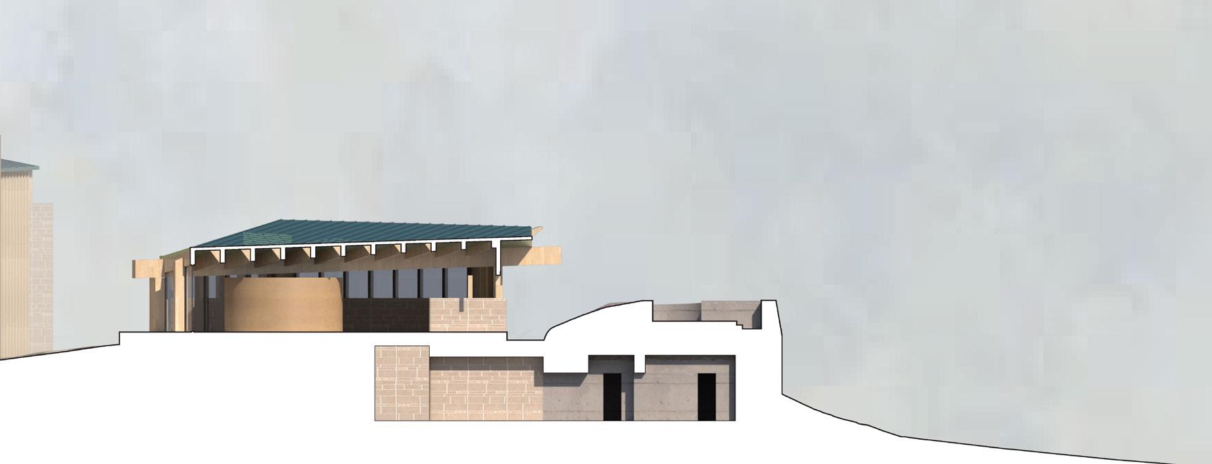
The Bridge Moves with Water reimagines a pedestrian bridge as more than an infrastructure; proposing it as a framework for spatial experience and urban renewal. The project is set in Esbjerg, Denmark, where an existing red weathering steel bridge currently allows pedestrians to cross over the road dividing the city from its harbour.
This design extends the bridge, carrying it into the lower dock area to connect with a shifting waterfront. As Esbjerg’s harbour transitions from industrial use to civic space, the bridge becomes a tool for drawing public life toward the edge of the water.
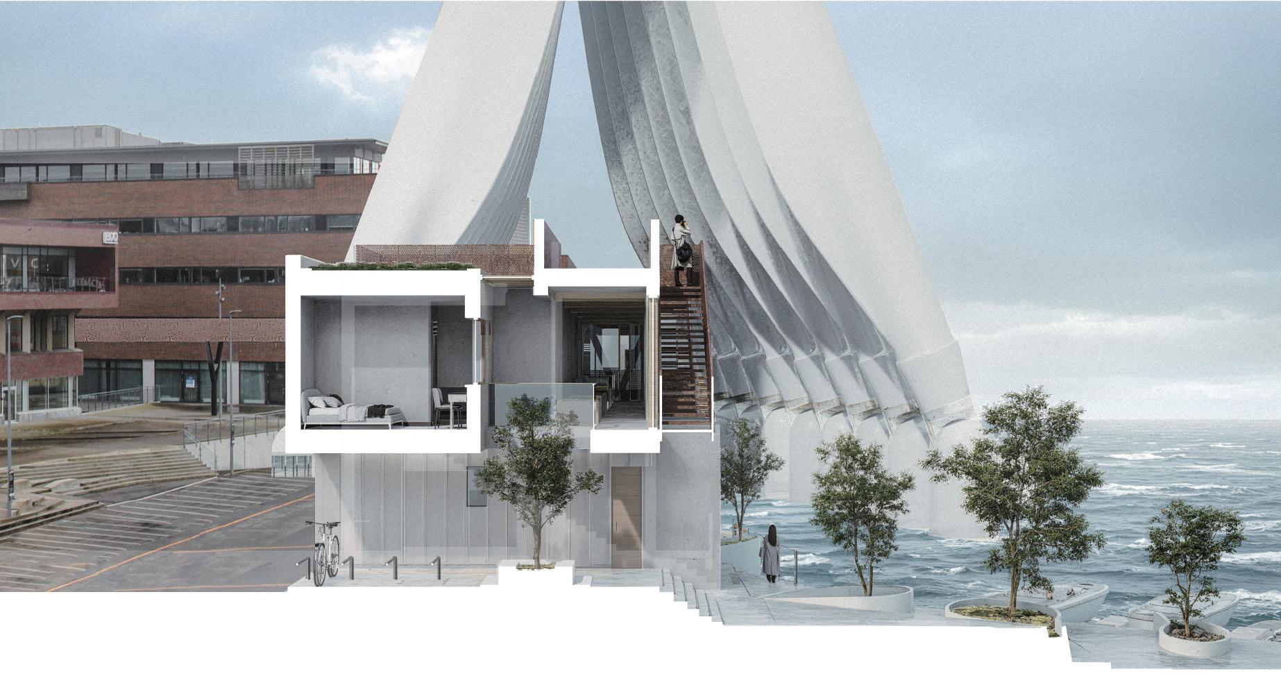
Three new buildings emerge along this extended path: a V-shaped coastal housing block, a kinetic structure made from reused wind turbine blades, and a waterfront office space. These buildings do not merely coexist with the bridge—they are shaped by it. Spatially, they wrap around or beneath the bridge; structurally, they adapt to its logic; socially, they activate its route with new types of occupation.
The bridge is designed as a sequence of spatial conditions rather than a single linear passage. It widens to form viewing platforms, narrows to pass between buildings, and lifts to frame new perspectives. Underneath, semipublic courtyards and shaded zones respond to human scale.
In this way, the bridge becomes a quiet but powerful urban device— threading together housing, work, movement, and water. It does not simply connect places. It creates a reason to move between them.
Exterior visual (previous)
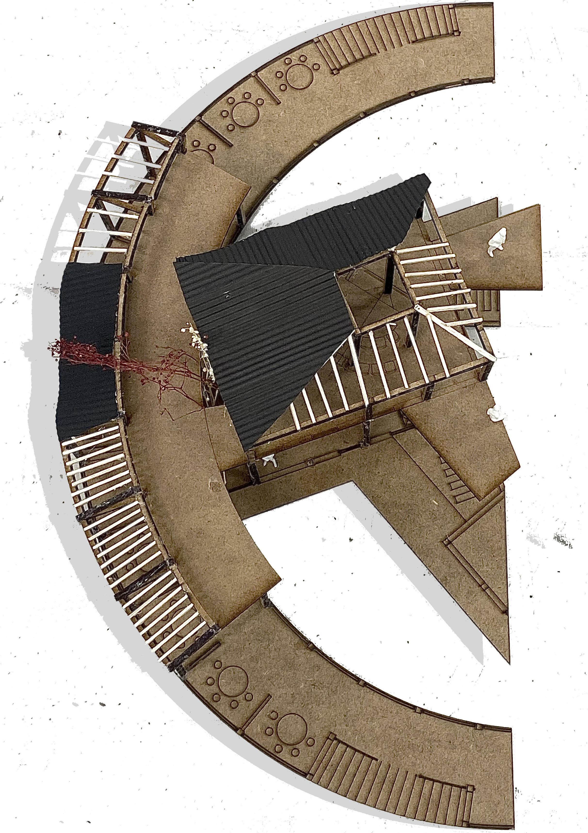
Axonometric (top left)
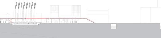
Section (top right)
Exterior visual (right)
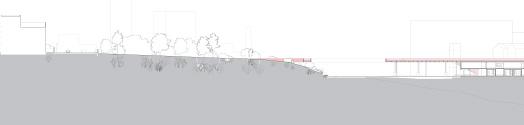
Section (above)
Section (below)
Site: Triangular Harbour/Central Esbjerg Programme: Kindergarten, Library & Public Park
ESBJERG CENTRAL PARK
OPEN, ECOLOGICAL & DIVERSE
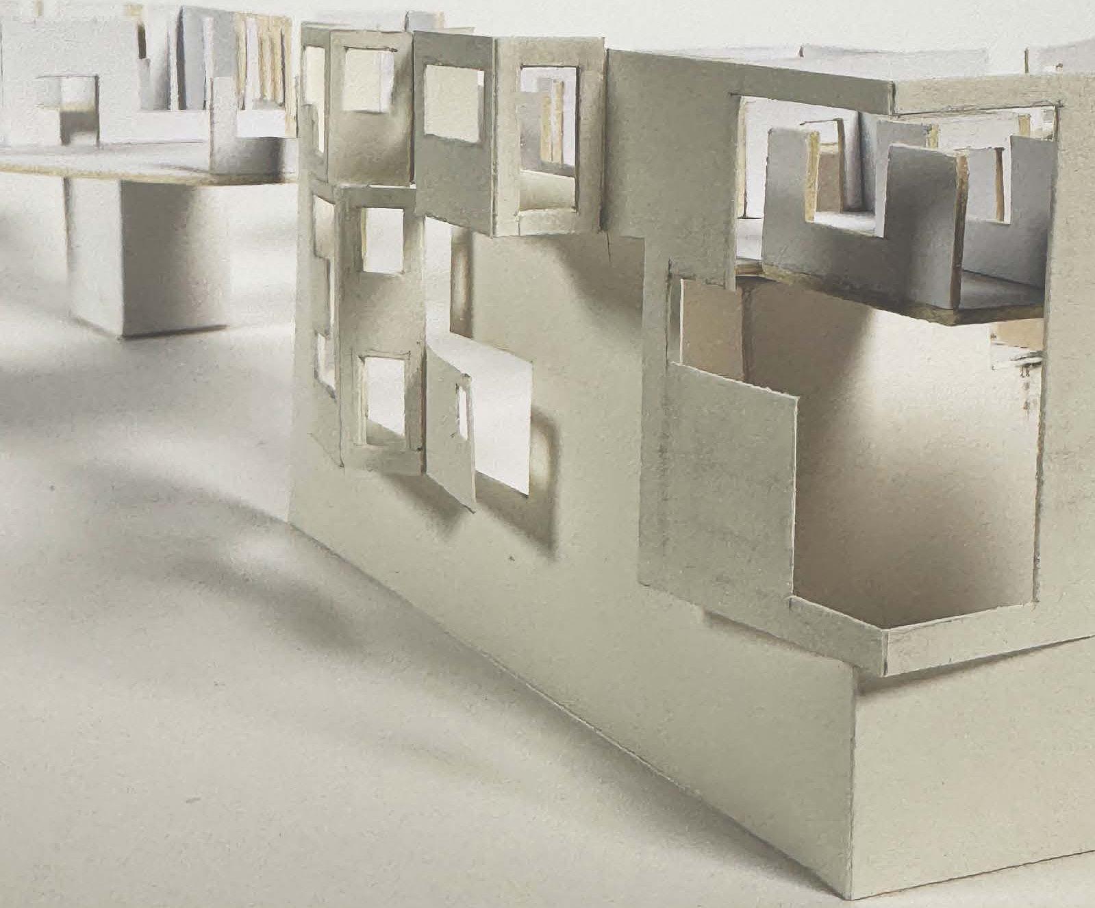
CHUYUE LI
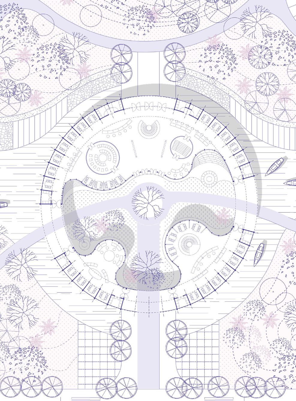
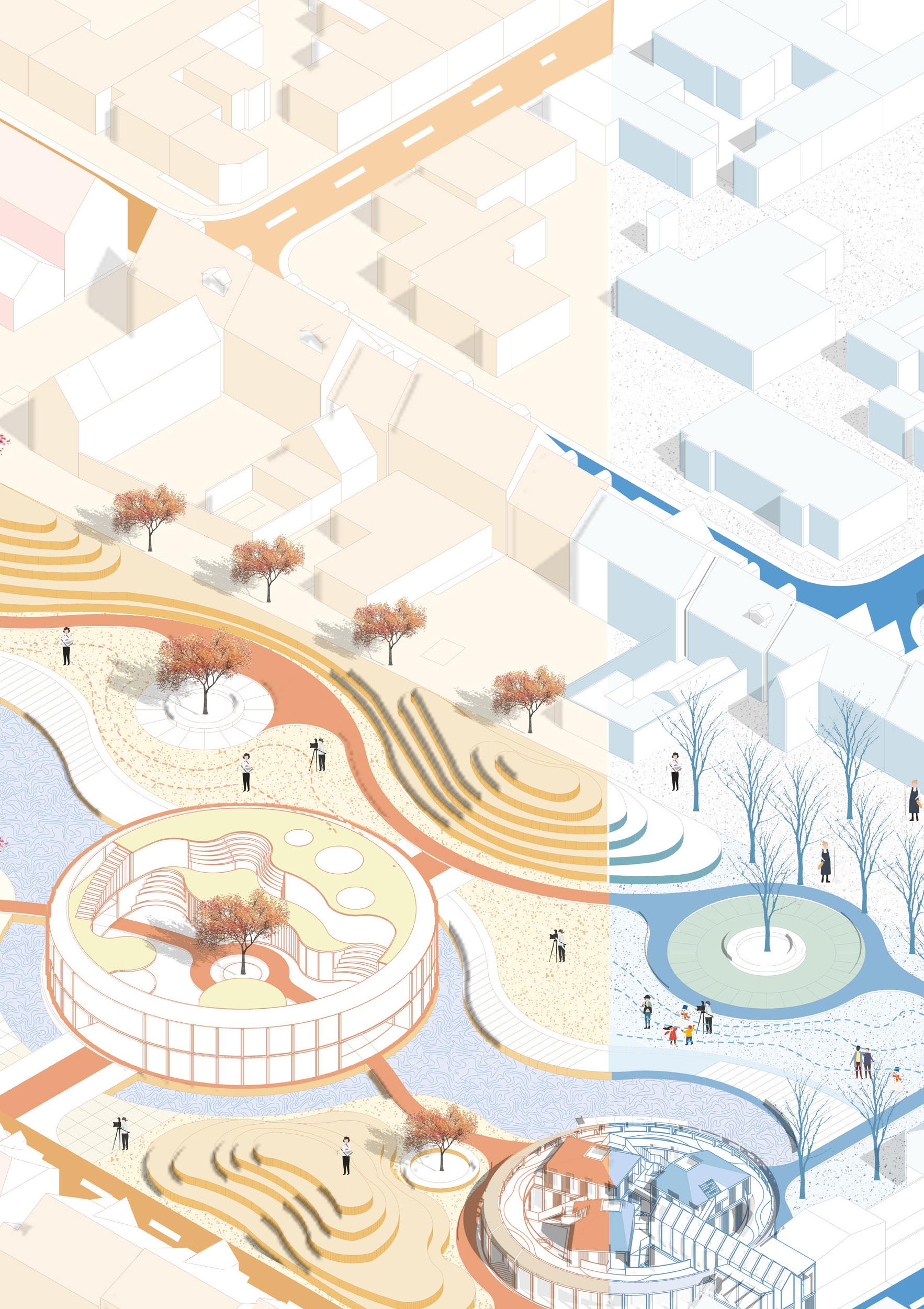
The project is in Møller Park, a central green space in Esbjerg. Surrounded by a dense urban fabric, the park acts as a natural breathing space for the city. Its flat topography, scattered vegetation and proximity to the important urban infrastructures make it an ideal site for a children’s activity centre. The design aims to integrate seamlessly into the park’s natural setting, enhancing the connection between nature, education, and community life. Inspired by the site’s open landscape and proximity to the waterfront, the design introduces new water systems into the urban fabric, enhancing the connection between city and sea. Two new public buildings, a community centre and a kindergarten are added along the new waterways. They serve as lively hubs that bring nature, education, and social activities together, creating a vibrant and integrated urban environment.
The design of Esbjerg Central Park follows the principles of “openness, ecology, and diversity.”
The strategy systematically reorganizes the site and its surroundings by removing the boundary walls, reconnecting the park with urban streets and adjacent communities, and allowing the land to breathe once again.
The revitalised Central Park becomes a dynamic hub for socializing, resting, family activities, exercising, and hosting various community events. The ecological approach emphasizes the long-term vision of sustainability, integrating features like sponge city sections, vertical greening on building facades, and rain gardens to create a living, breathing urban environment.
Fragment model (previous)
Masterplan (top left)
Plan (middle)
Axonometric (right)
Axonometrics (top right)
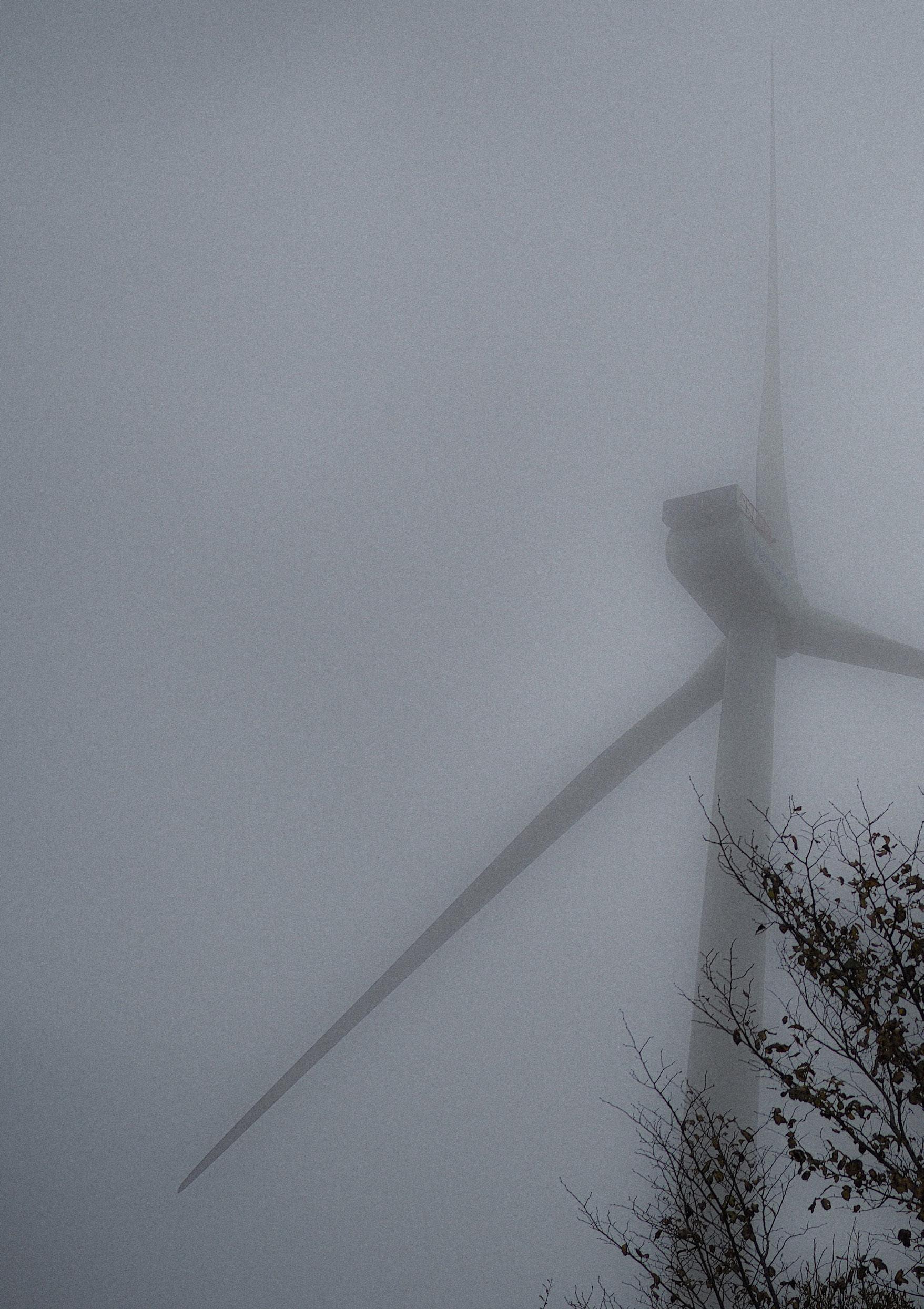
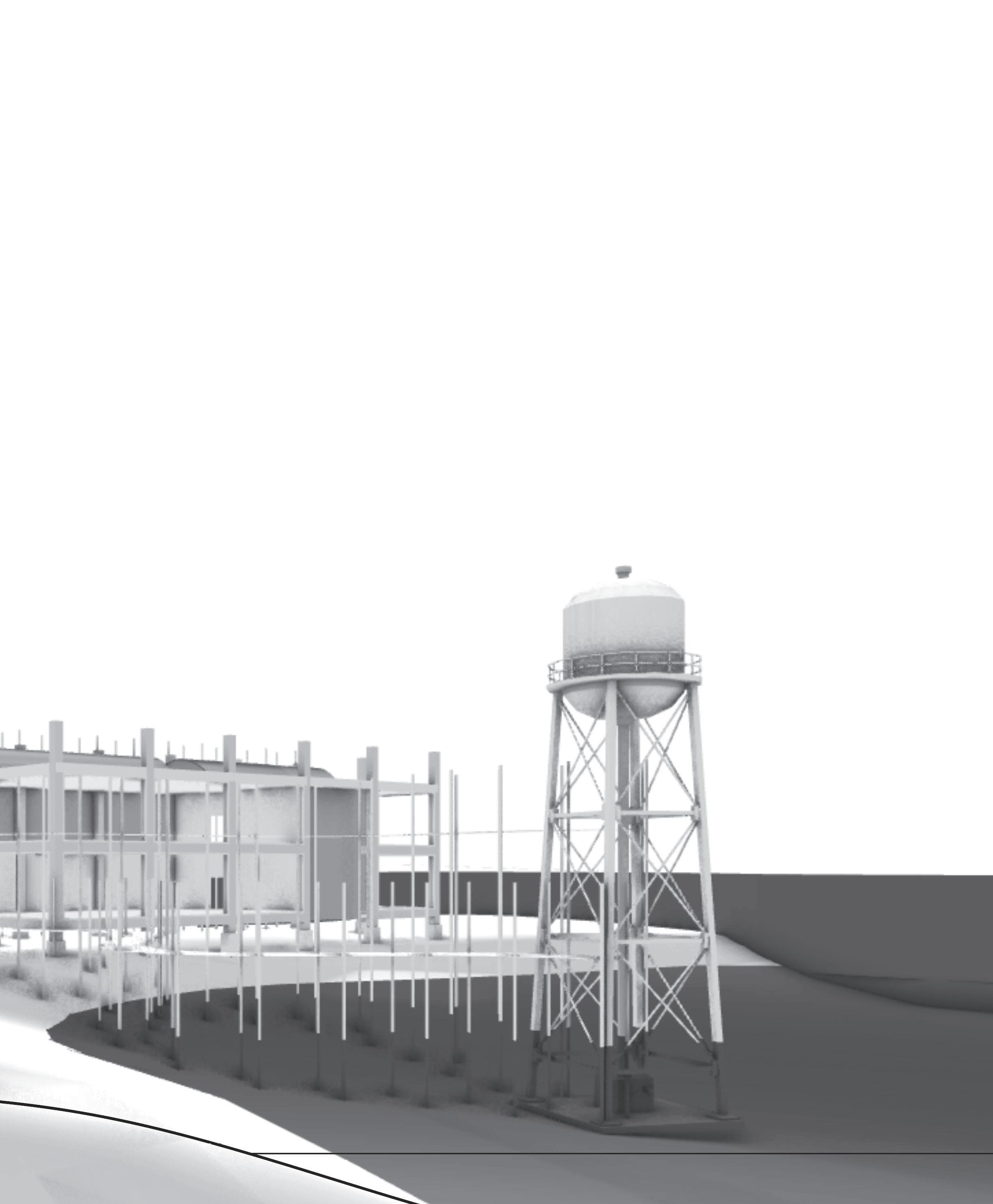
View of wind turbine on Esbjerg’s south edge
SOUTH EDGE ESBJERG 04
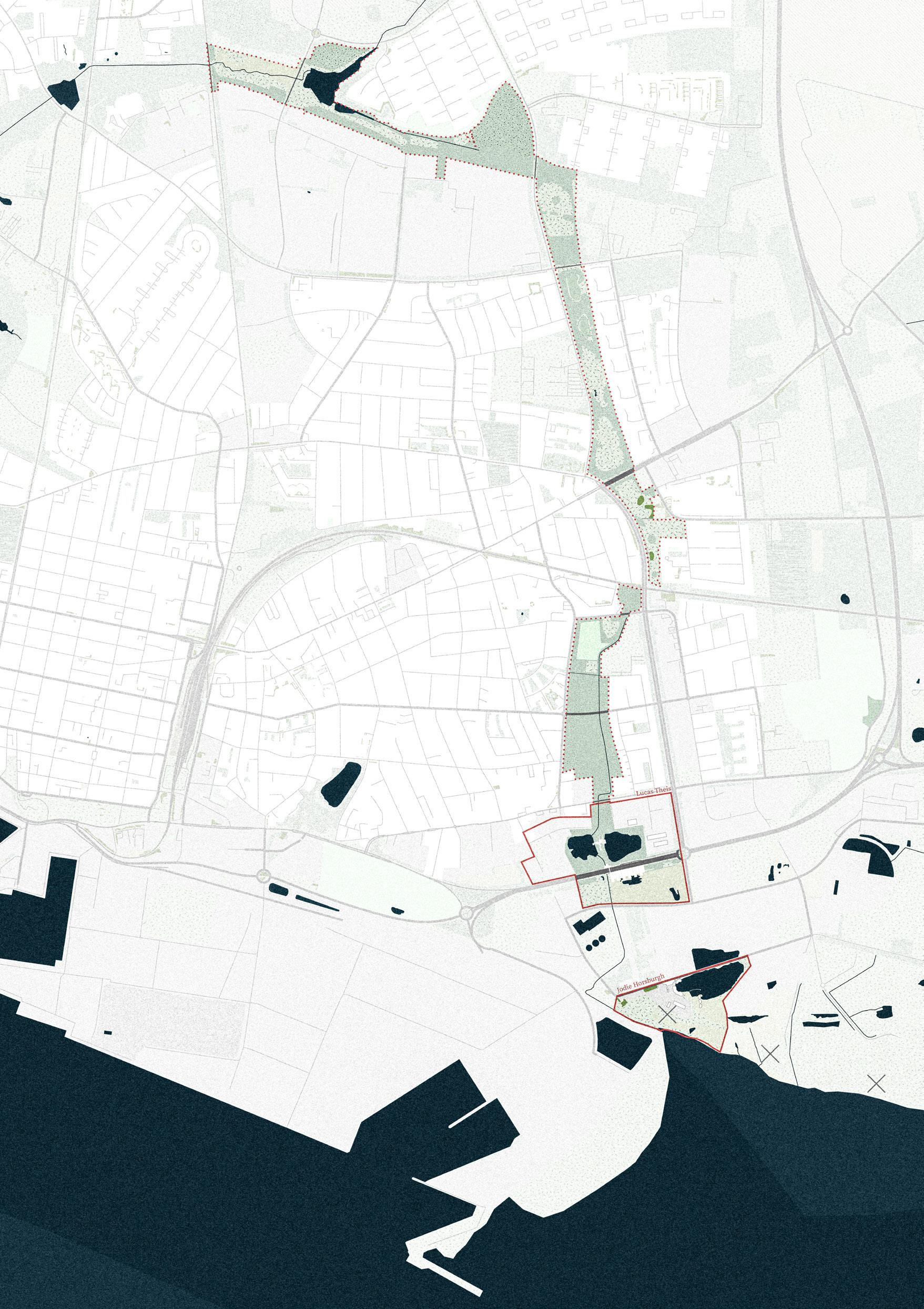
MOLLY SINCLAIR
LUCAS THEIS
Group Masterplan
JODIE HORSBURGH
Site: South Edge, Esbjerg Programme: Distillery & Guest Residences
04 a
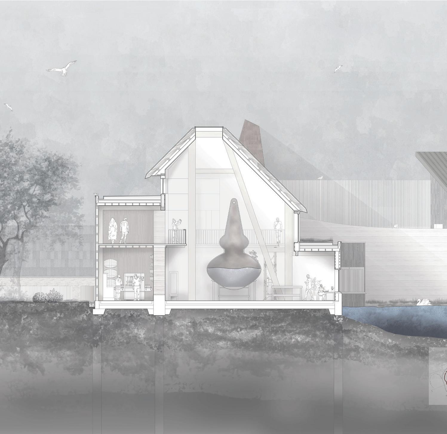
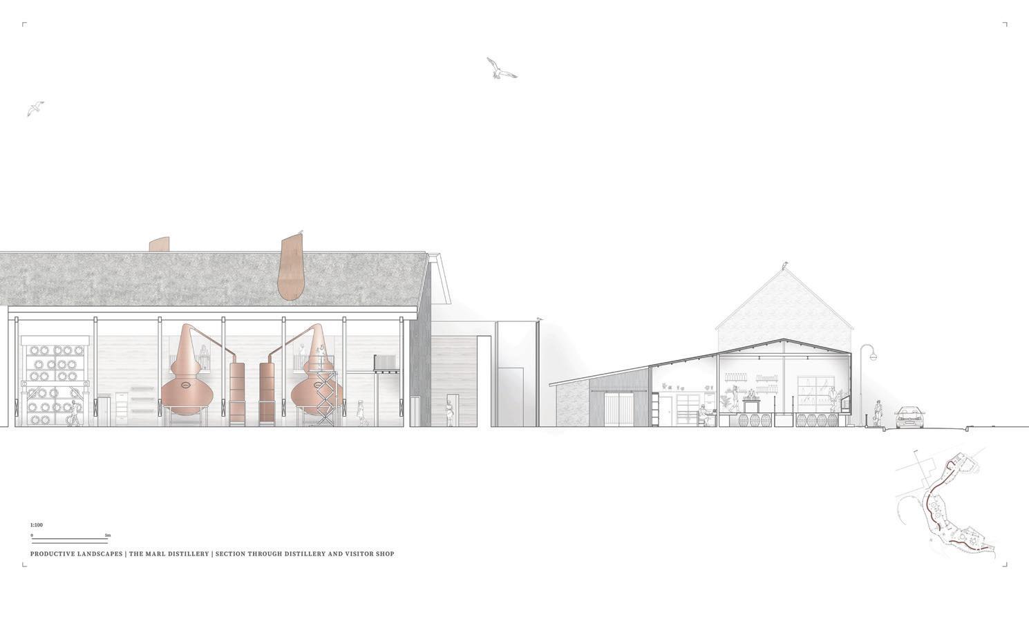
PRODUCTIVE LANDSCAPES
A JOURNEY OF DISTILLING ACROSS ESBJERG’S WET TERRAIN
JODIE HORSBURGH
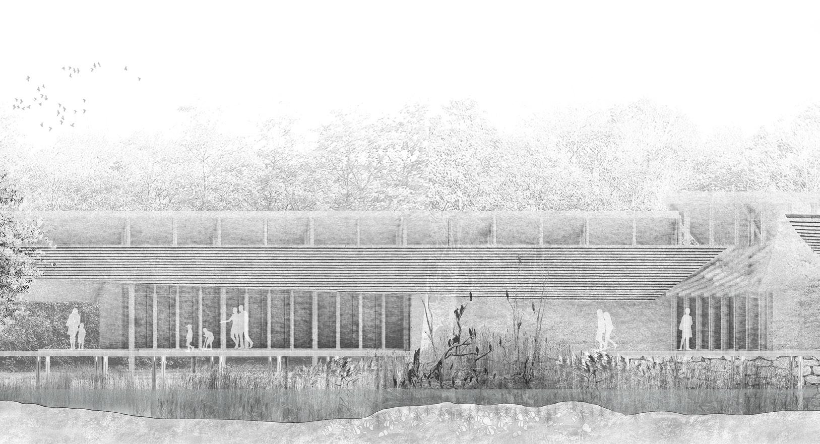
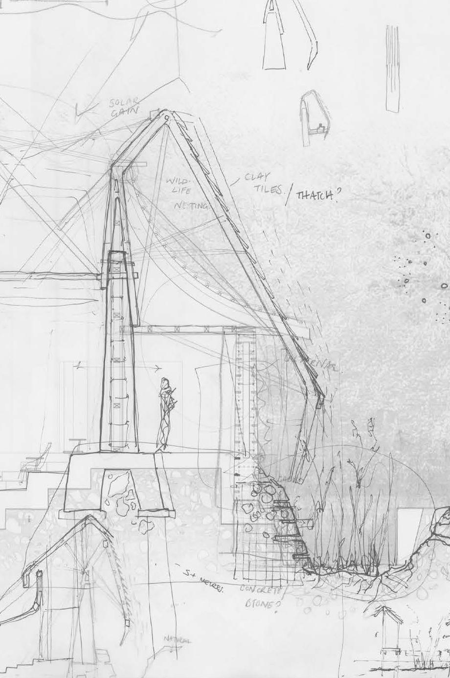
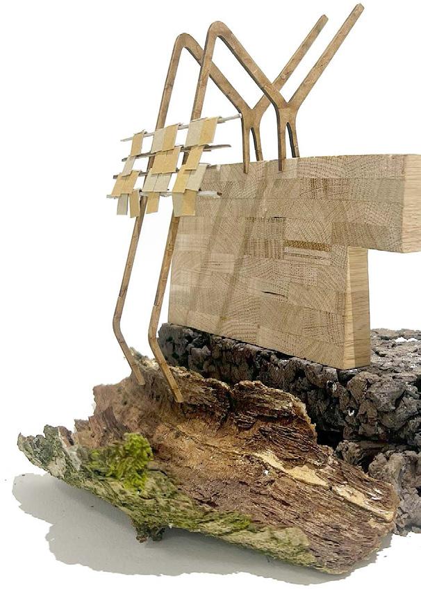
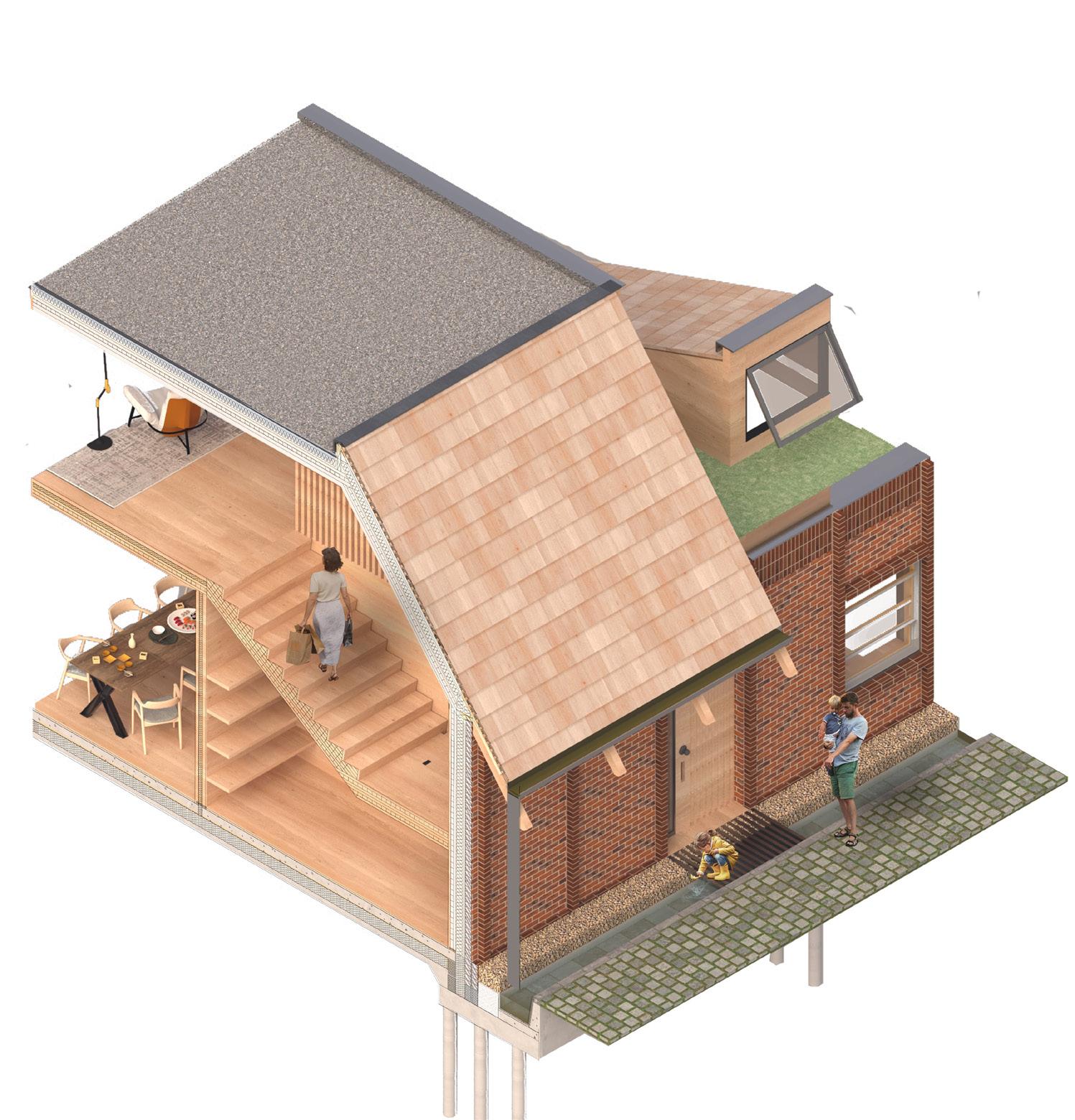
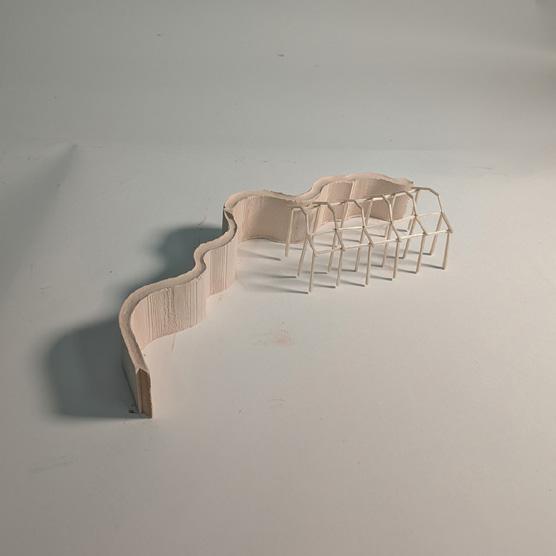
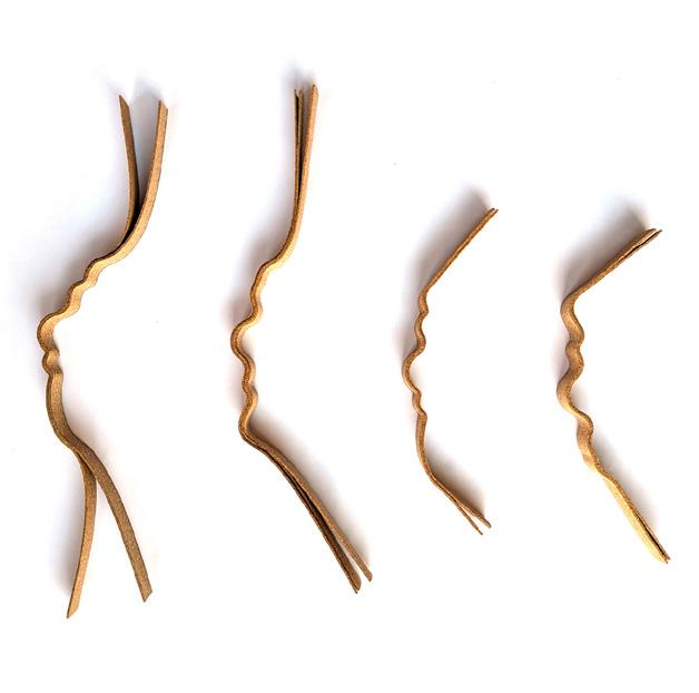
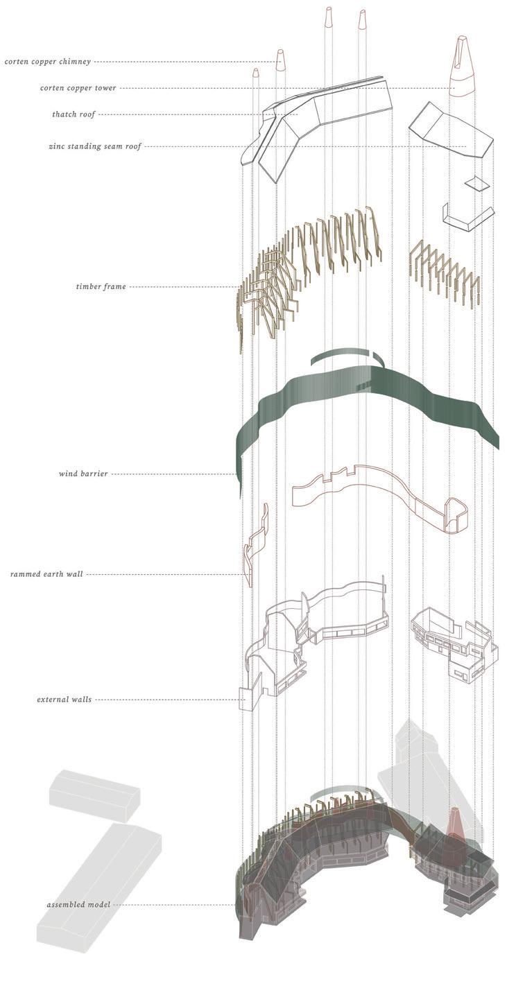
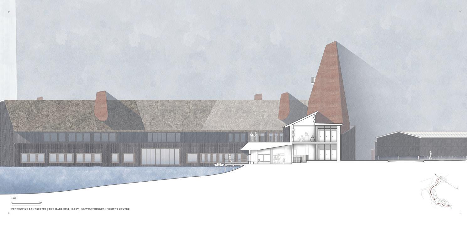
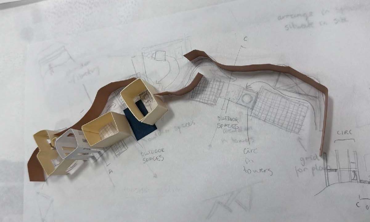
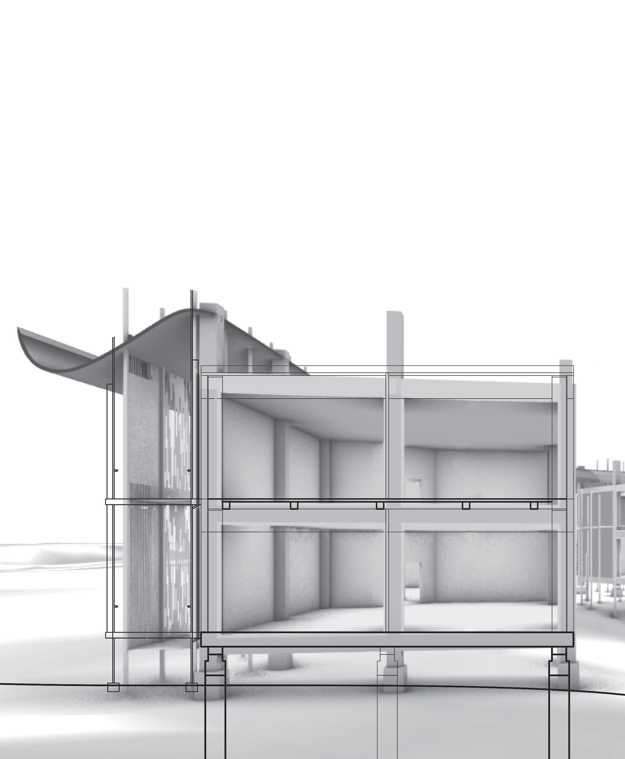
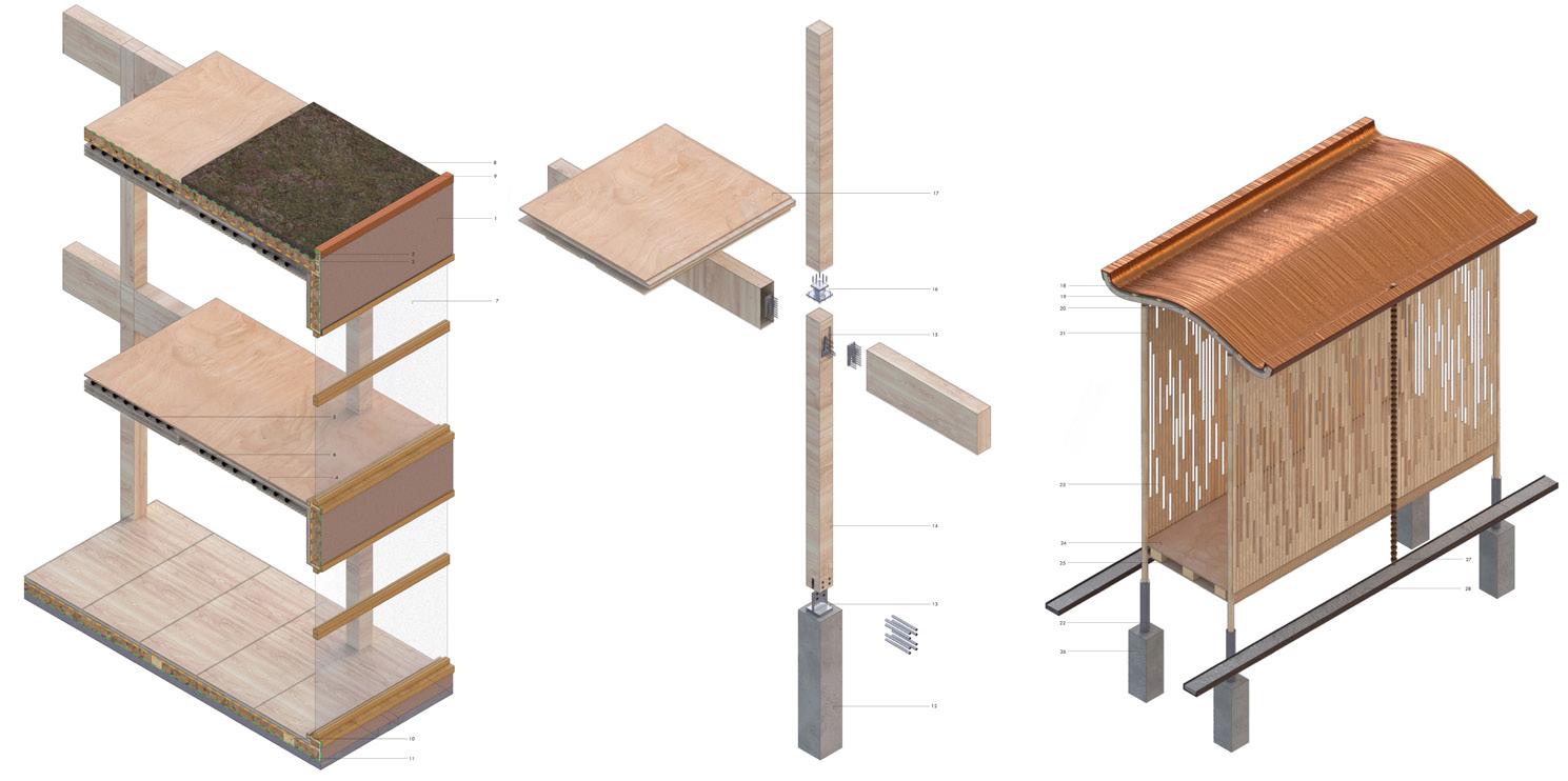
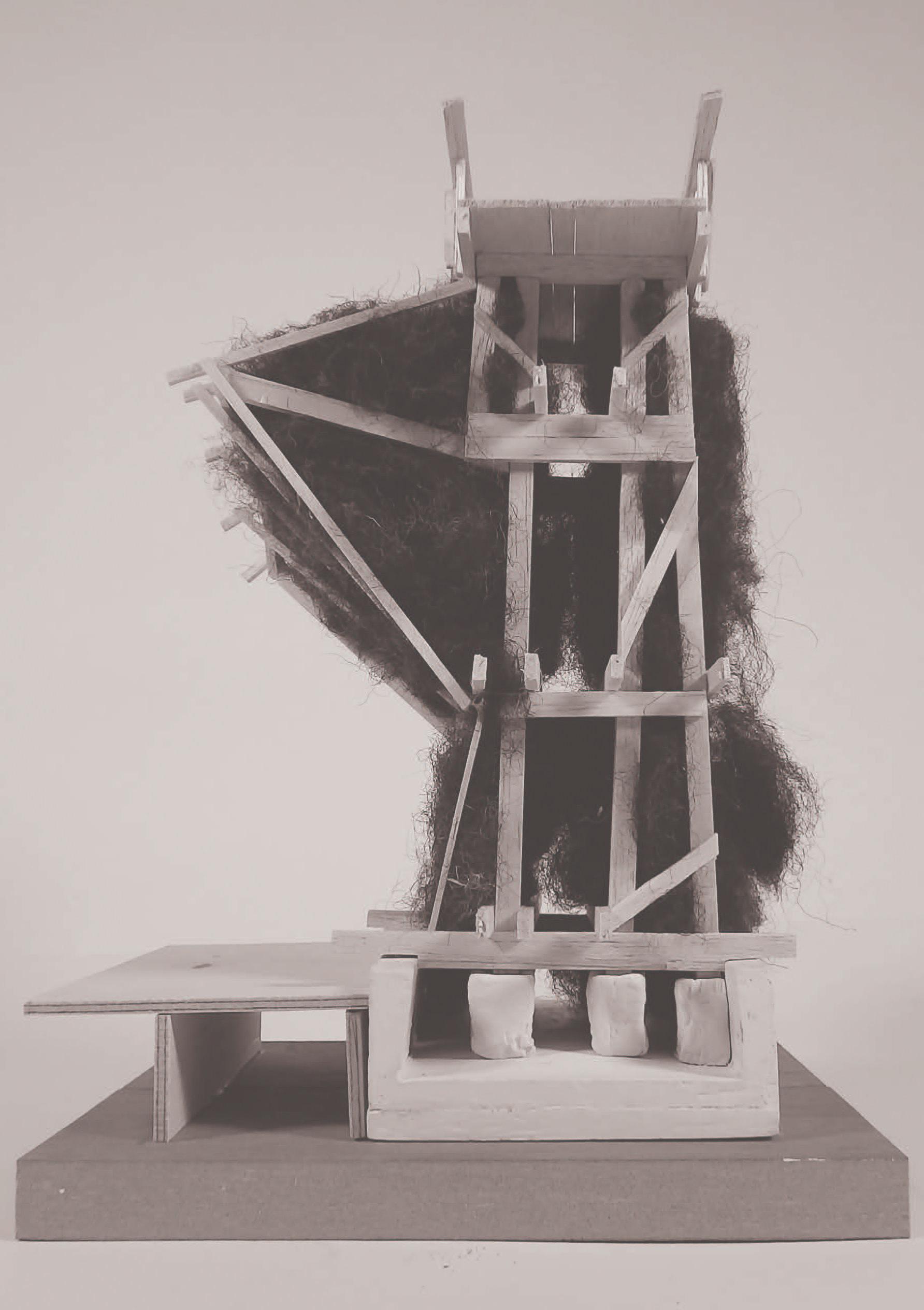
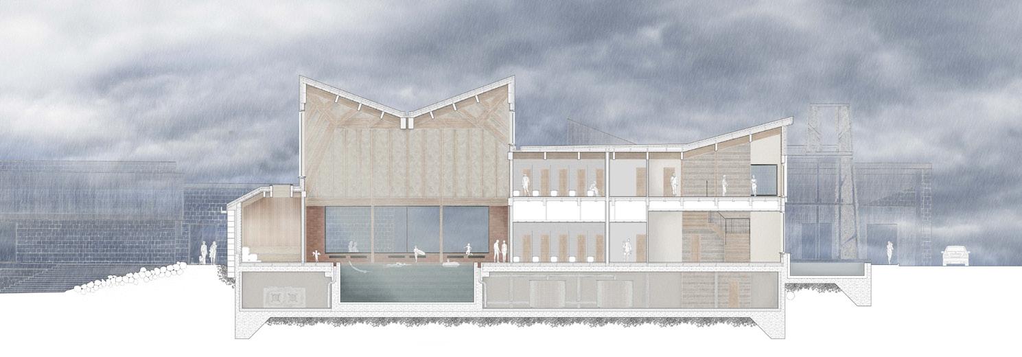
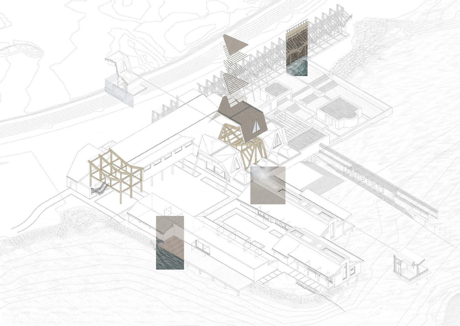
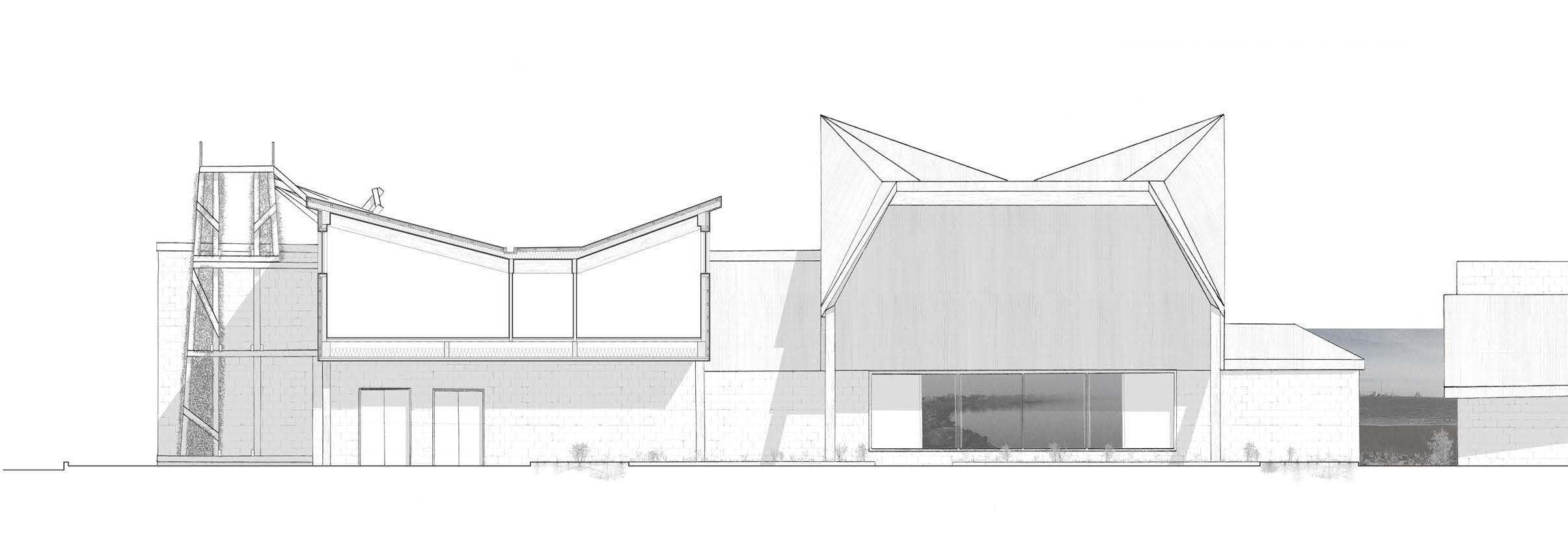
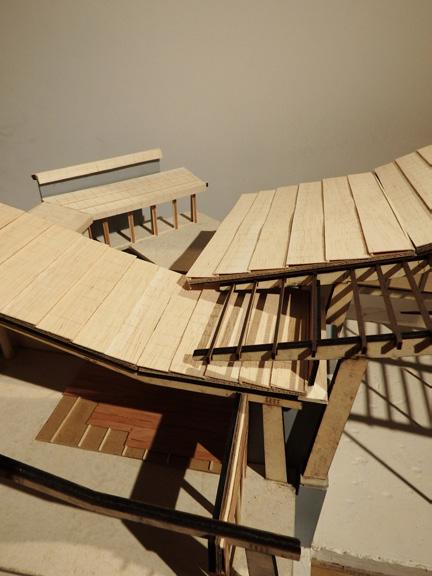
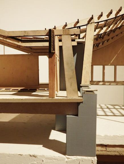
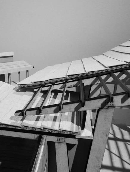
Productive Landscapes is a scheme that develops a disused brickworks within Mergelgravene, an industrial area in the port city of Esbjerg. Acknowledging the existing sheds onsite, the project looks at transforming the area into a productive and ecologically conscious space, rewilding the land of the former brickworks, allowing for nature to seep into the city from the sea coastline. This thesis proposes an Akvavit Distillery (Scandinavian spirit) with space for growing botanicals and staff accommodation. Considering the 100m radial boundary for new construction surrounding the wind turbine, existing buildings located within this will be redeveloped, allowing for storage and other back-of-house processes, with the new buildings positioned by the waters’ edge of the lake, once excavated for its clay and marl resources. Enhanced by the journey taken throughout the site of both public and productive processes, the scheme aims to utilise the site’s positioning close to the city centre, while being accessible by farmlands to the north-east for grain intake. A series of three walls (wind barrier, rammed earth heat-store and timber insulated) act as a guide for people and product through the scheme, functioning as a spine for the various processes of living, growing, distilling and enjoying. The Marl Distillery includes a copper-clad tower providing views across to the neighbouring island of Fanø, while acting as a waymarker in the flat Danish landscape. Vernacular thatch is used for the distillery roof, supported by an exposed timber structure, allowing the weaving of different materials to echo the journey taken by both people and the production of akvavit.
Plan (previous top)
Fragment model (previous bottom)
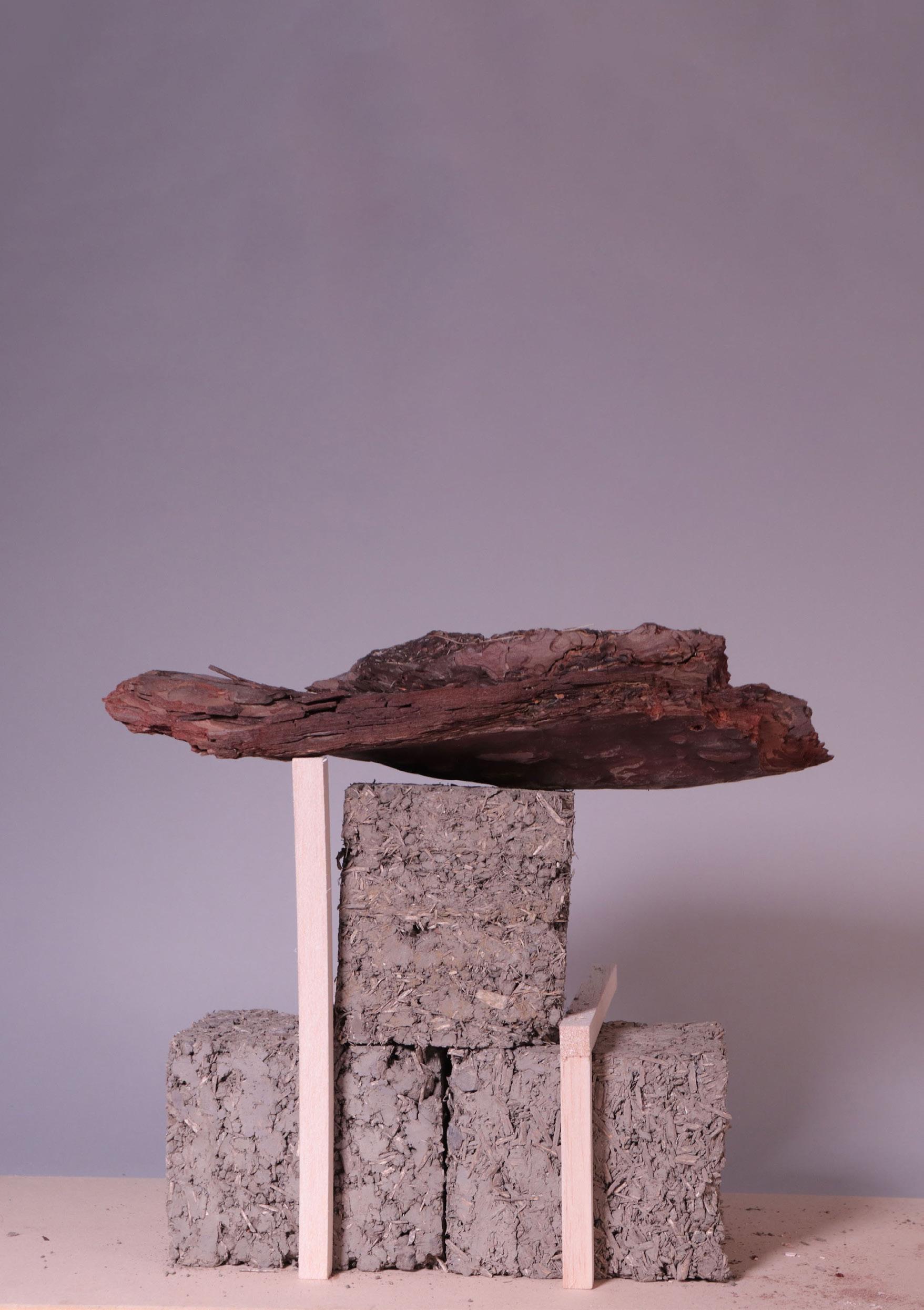
Tectonic Artefact (top left)
Form testing model (above)
Exploded axonometric (right)
Section (below)
Section (above)
Section (below)
Site: South Edge, Esbjerg
Programme: Soil Testing Laboratory & Education Centre
04 b
AMBIENT AGROECOLOGY
NOVRUP AGRO-ENVIRONMENTAL RESEARCH CAMPUS
MOLLY SINCLAIR
Soil is a vast natural ecosystem fundamental to support a multitude of species, both human and non-human. Situated in the rural surroundings of South Esbjerg, the project centres a soil research facility. Soil samples, dug from below ground, are processed and analysed to assess their chemical properties - which aids in understanding of how soil can support production of food, protection of local environments and preservation of biodiversity. The soil research facility and wider campus surrounds a lake which connects into an intricate system of agricultural drainage channels. These channels feed into the coastline of the UNESCO World Heritage, Natura 2000 Protected Habitat of the Wadden Sea. The campus ties into this unique setting with architectures that facilitate research on environmentally conscious agricultural production and holistically sustainable harvesting of resources from the land.
The proposal seeks to create architectures which touch the rural ground lightly, with modular units comprised of natural building materials providing scope for adaptation and expansion, as well as ease of re-use and recycling of materials. The units are connected via a network of walkways and towers which spread across the landscape, serving a variety of functions related to the protection and enhancement of the local climate. The towers, in company with the South Edge wind turbines, create vertical landmarks emphasising the environmental preservation works of the campus in the flat landscape.
Tectonic Artefact (previous)
Development drawing (top left)
Detail axonometrics (top right)
Section (below)
Site: South Edge, Esbjerg Programme: Community Market & Events Pavillion
04 c
SOWING THE THREAD
SUSTENANCE FOR THE GRØNNE RING
LUCAS THEIS
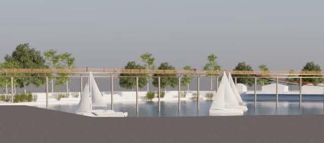
Catalysing the introduction of sustainable growing practices, in order to support local food security surrounding Esbjerg's Grønne Ring, 'Sowing the Thread' instigates a fresh perspective on the consumption of produce. Nestling a variety of sustainable food-based programmes, such as public orchards and agroecological forests, within the extents of the Ring, the project begins with a masterplan that focuses on bringing people closer to the food they eat.
At the foot of the Ring, the idyllic setting of the Paradise Islands (Paradissøerne) hosts the proposed community market and pavillion. Sensitively placed within the existing woodland landscape, the structure aims to leave as little impact as possible through minimal foundation disruption. Nature is invited to evolve and inhabit the market alongside humans, with openness a key ethos for the project.
Inspired by the monolithic overlooking wind turbines situated nearby to the site, the material reuse of wind turbine blades drives the tectonic approach. Turbine blade elements which are near-impossible to recycle, and typically go to landfill at the end of their 20-25 year lifespans are utilised as a key component in the façade design.
Sections of blade are arranged in shingle-like formations along the northern length of the pavillion, and a gutter roof system is formed by the interlocking of long tubular sections of the blades. The project aims to catalyse the use of these extraordinary elements in future sustainable architectures.
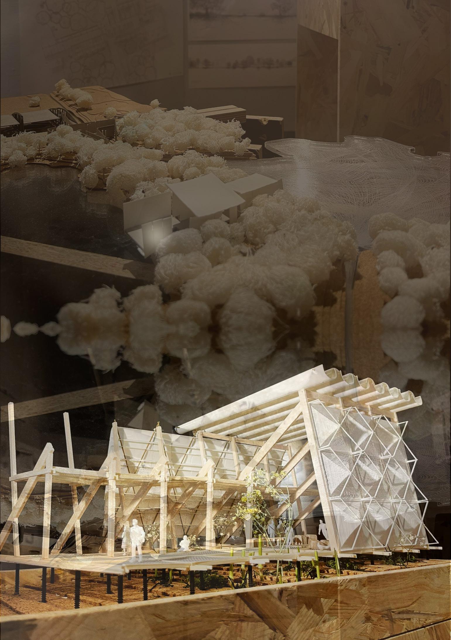
Site model (previous top)
Fragment model (previous bottom)
Section (top left)
Elevation (above)
Exterior visual (right)
Section (below)
Axonometric (far right)
External render (previous)
External visual (above)
Internal visual (left)
Scheme section (right)
05
FANØ ISLAND
FANØ
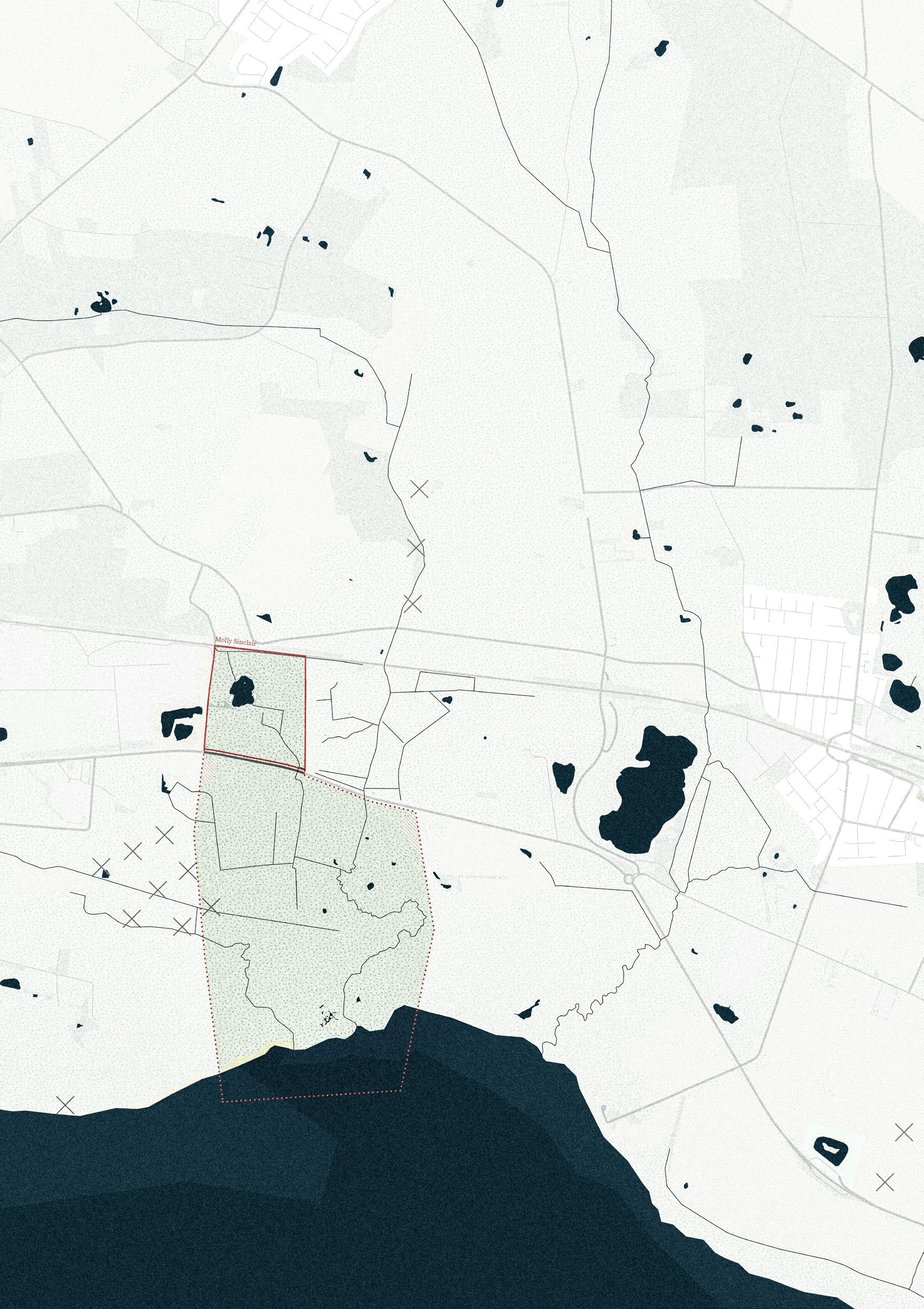
NATALIA MIKULSKA
HARRIET JOHNSON WILLIAM MAXWELL MATS BORGEN
Group Masterplan
Site: Fanø Island
Programme:
Sea Salt Graduation Towers, Health Spa, Community Kitchen, Restaurant & Bakskuld Workshops
05 a
SALTHAVN
SALT, WIND & SEA
NATALIA MIKULSKA
Off the west coast of Denmark, in the shallows of the Wadden Sea, lies the windswept island of Fanø. Offshore from Esbjerg, the unique landscape draws visitors with its rich and colourful heritage. The project focuses on the regeneration and reimagination of the traditional, time-honoured craft of air-drying salted fish known as bakskuld. Rooted in local history, this practice becomes the heart of a new place by the harbour in Nordby. A series of salt graduation towers rise, their peaks reaching through the foggy mornings. Extracting and producing salt from the sea, they are breath itself - inhaling the sea wind and exhaling it nourished with the healing powers of salt.
Beyond the towers, a health and spa centre, series of external pools, community kitchen, restaurant and bakskuld workshops emerge. The buildings stand on a solid, stone base, protecting the architecture from the Fanø sea, while above sits a timber frame, mirroring the graduation towers. Like fingers reaching into the sea, the community kitchen and restaurant extend beyond the shoreline. This is where the sea wind and salt shape the flavours of Nordby. They are places where the community gathers, not only to cook but to connect and create.
Between the buildings a series of courtyards creates sheltered spaces for the public to reunite with the sea and engage in the ritual of breathing the saltladen air. The entire programme becomes a celebration of salt, wind, and sea. It is a place where the past and the present become one.
Graduation tower model (previous)
Section (top left)
Exploded axonometric (middle left)
Section (below)
Plan (top right)
Exterior visual (middle right)
Site: Fanø Island Programme: Boatyard & Workshops
05 b
KILDEARK
RECONCILING SURFACE TO SEABED
HARRIET JOHNSON
KildeArk exists as an amalgamation of tradition and modernity, drawing on Fanø’s shipbuilding history to address future climate challenges. With rising sea levels and increasingly frequent storm surges, the project looks to the traditional Evert (a flat-bottomed sailing barge) in its goal to both combat fear of the ocean and develop techniques for flood proof architecture that may be used on Fanø and beyond.
To protect the coast and encourage habitat growth, the saltmarsh has been extended into the old harbourside area. KildeArk’s entrance bridges over this new terrain via two parallel ramps cutting carefully through the existing dike. The lower, road-access ramp leads to a flood-resilient working zone, built to withstand violent storms and reflecting the tectonics of the grounded Evert through its solid connection to the earth. Timber elements are elevated, and the construction hall’s design echoes ship architecture and woodworking techniques.
The upper pedestrian ramp leads to a flexible, CLT-constructed public teaching zone, anchored to a solid spine of stone walls. These spaces are elevated above projected storm surge levels to provide protection from flooding; in turn this reflects the nature of the Evert when floating on the water's surface. Initially, the site will focus on building Everts to reconnect locals with the sea and revive knowledge in shipbuilding techniques. Later, the skills developed will be adapted for the creation of experimental flood proof housing to be tested in the new salt marsh site, with the eventual goal to utilise successful typologies across the Jutland coast.
Fragment model (previous)
External visual (top)
Fragment model (above)
Elevation (below)
Plan (top)
Elevation (above)
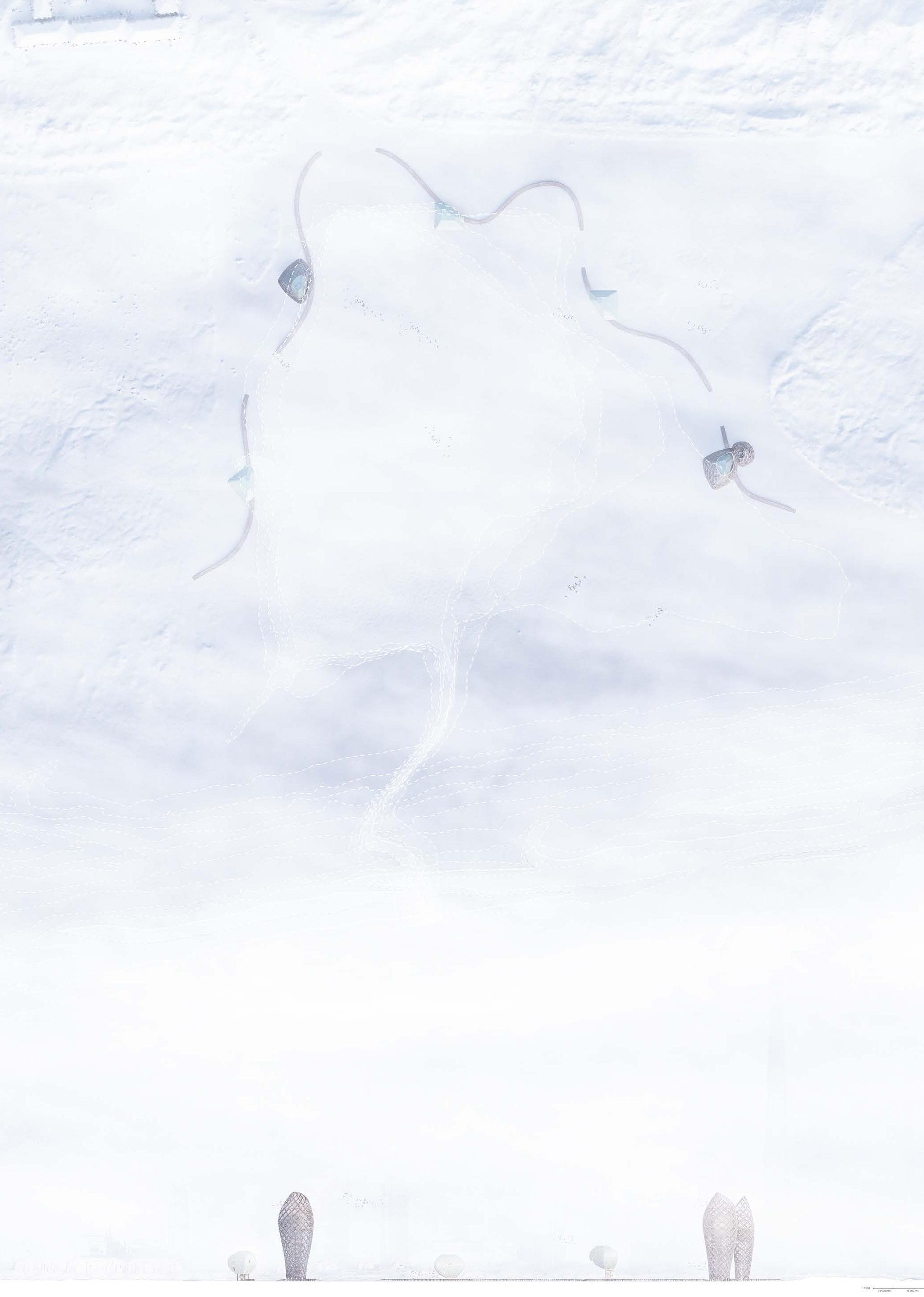
Site: Fanø Island
Programme: Farm & Slaughterhouse
05 c
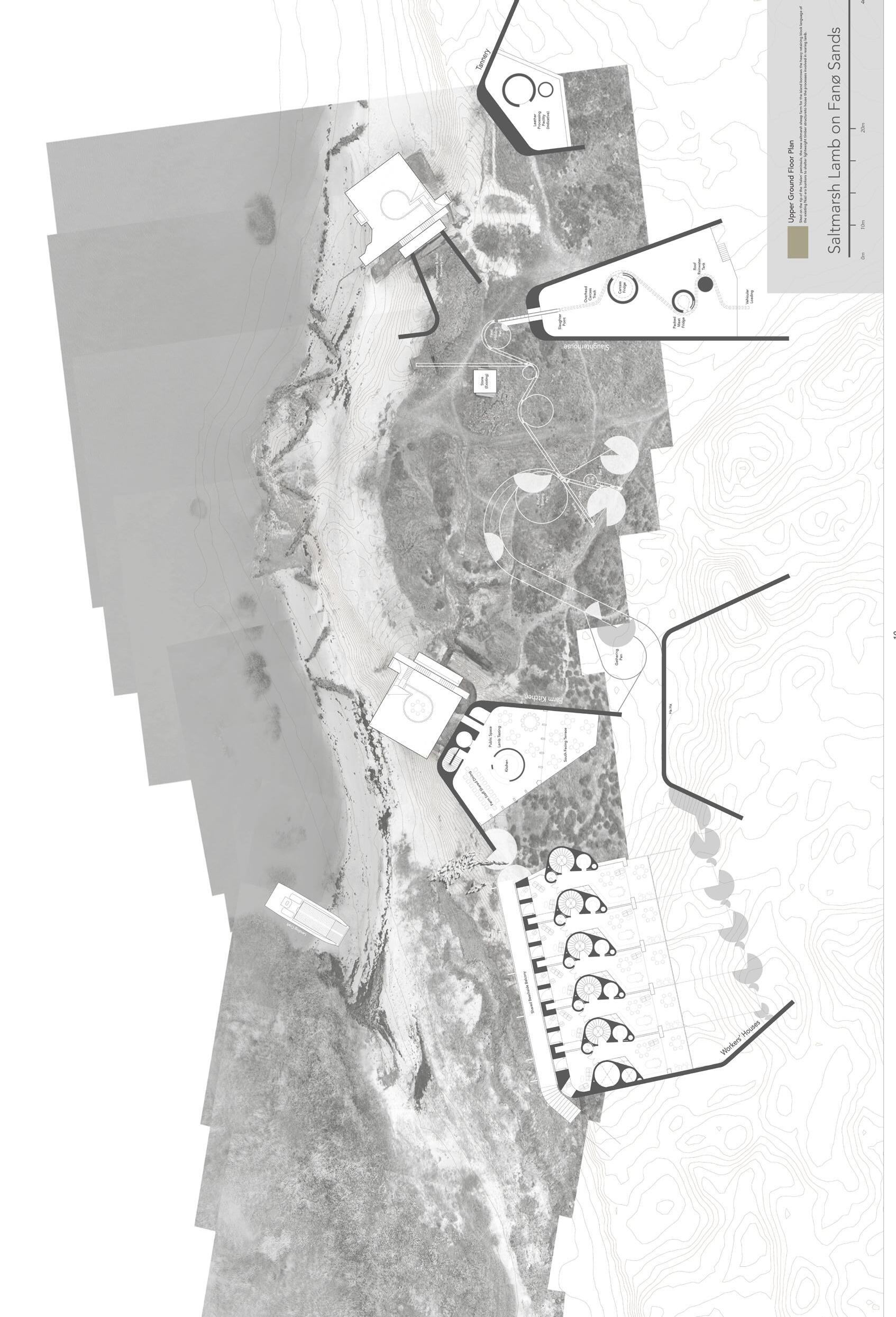
SALTMARSH LAMB
ON FANØ ISLANDS
WILLIAM MAXWELL
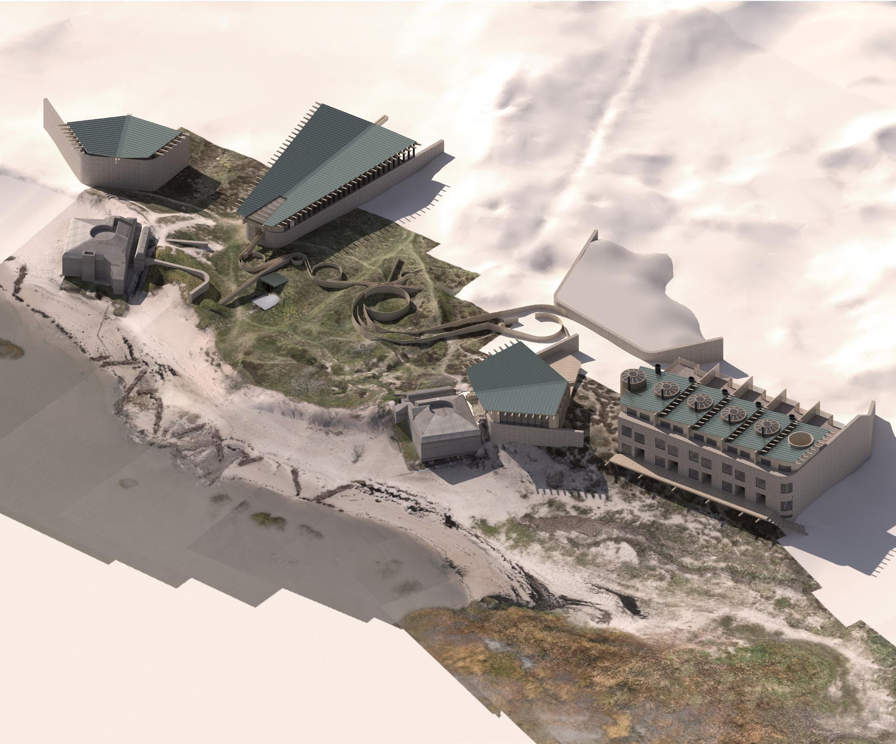
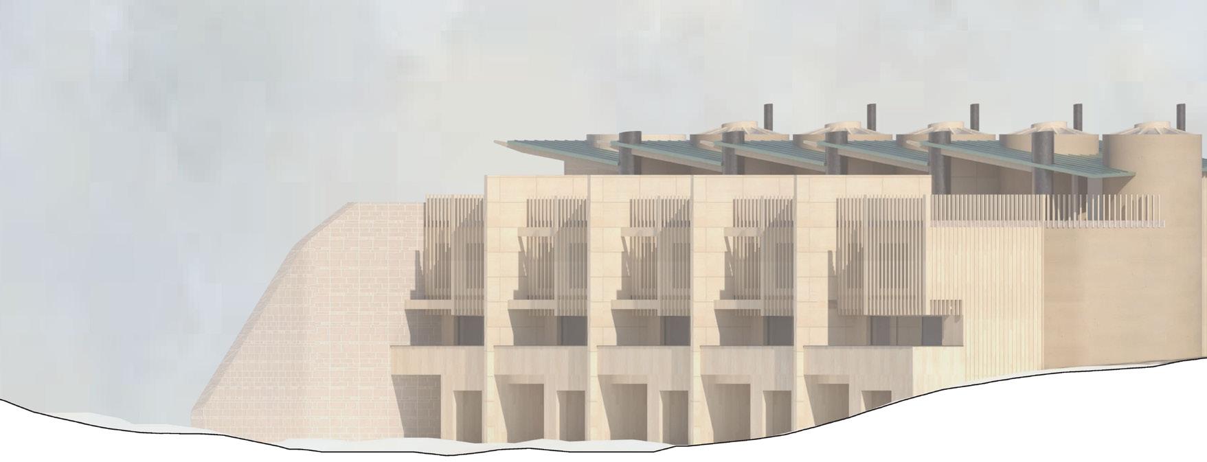
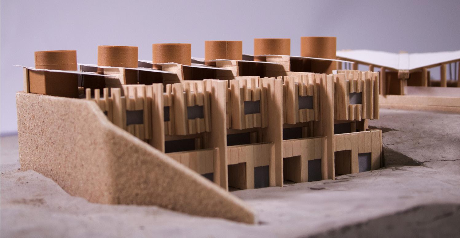
There is an unique nutrient environment where the tide pulls the shallow, salty Wadden Sea in to meet and mix with the freshwater runoff from the streams on the Danish island of Fanø. The wet and shifting territory of these marshes creates the ideal habitat for saltmarsh lamb. This sort of grazing has disappeared on Fanø due to the lack of scalability available to farmers. The distinctiveness of the samphire and salt flavoured meat, and the habitat-induced scarcity of this type of farming, befits a truly individual architecture to accommodate the built requirements of a farm on this territory. This programme reflects the uncommon circumstances of the meat production with on-site processing of all associated sheep products – a slaughterhouse and meat packing facility, a tannery for sheep leather, and a processing area for lanolin and wool. The site will be served by a small collection of dense community housing for staff and their families. Whilst the houses are private to each family, shared dining space also doubles as public restaurant space for farm produce tasting. The farm is located on a peninsula of Fanø alongside Nazi occupation era Atlantikwall bunkers. The landscape is loose and sandy, and the Wadden Sea is very gradually shifting the beach down the island, exposing sides of two of the poured concrete bunkers. The architectural intervention of the farm buildings draws from the retaining mass of these structures, and adds lightweight forms, circles, and radiused corners inspired by the animal psychology and sheep handling diagrams of the US ethologist Temple Grandin.
Plan (previous)
Aerial view (top left)
Fragment model (top right)
Fragment model (above)
Section (below)
Site: Fanø Island
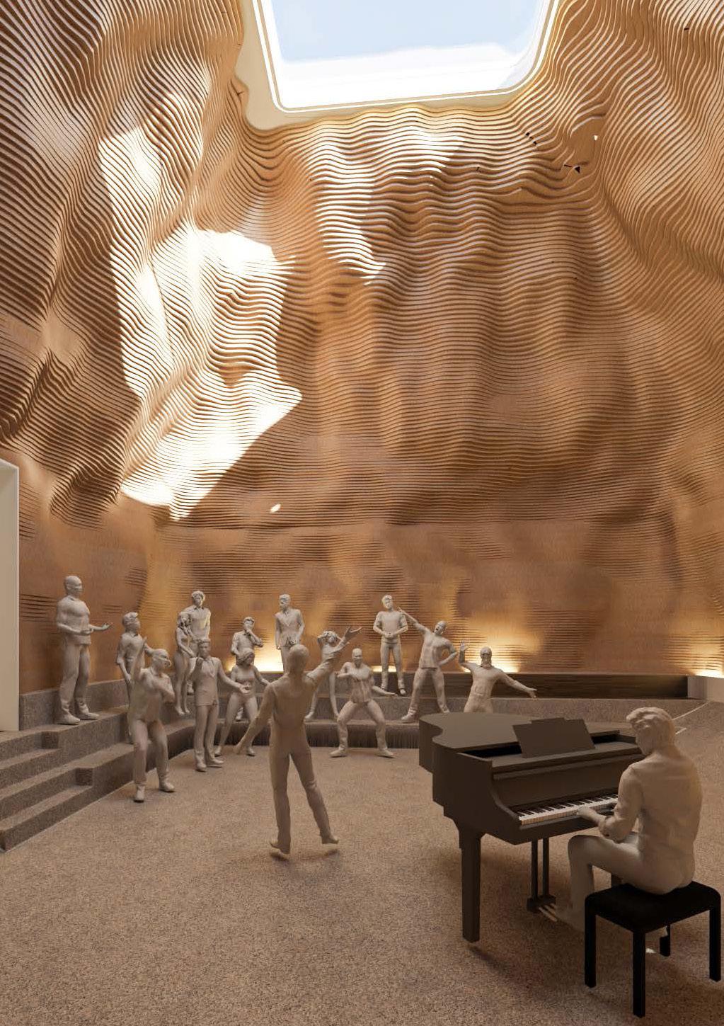
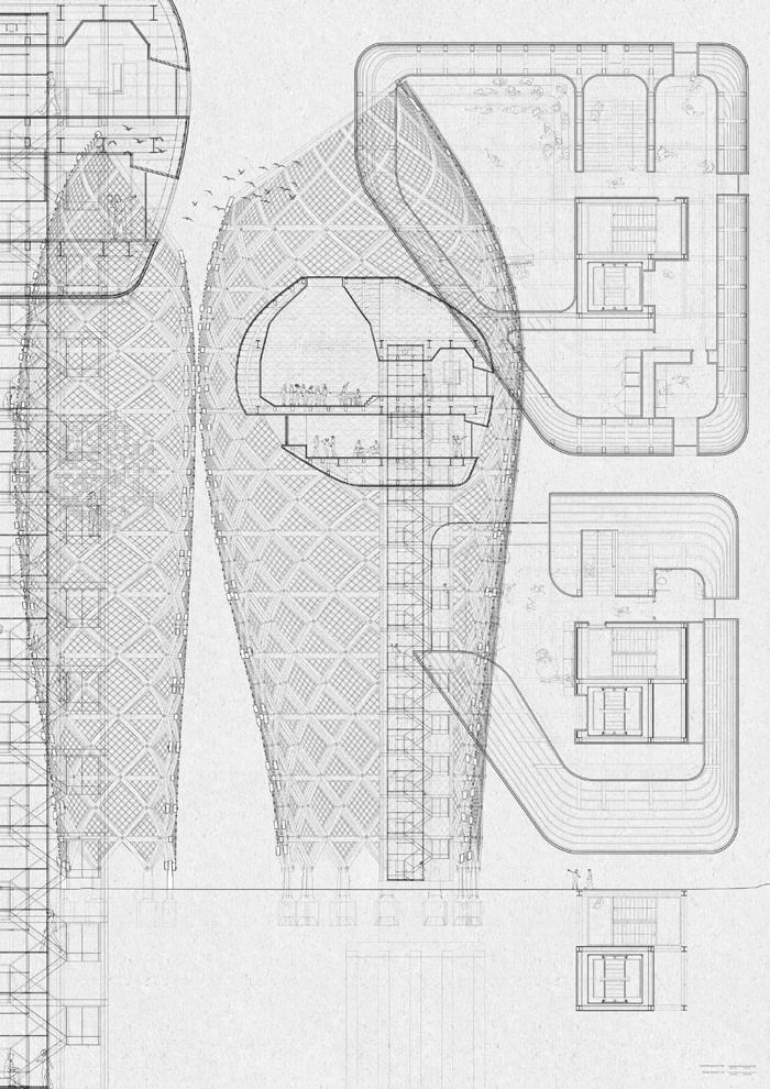
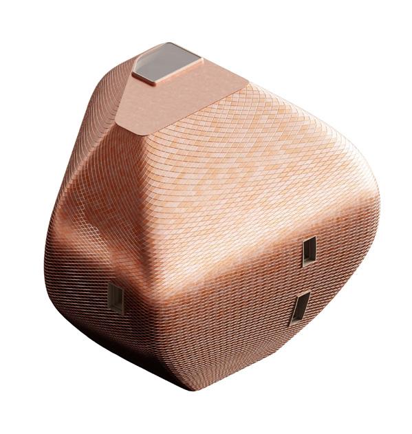
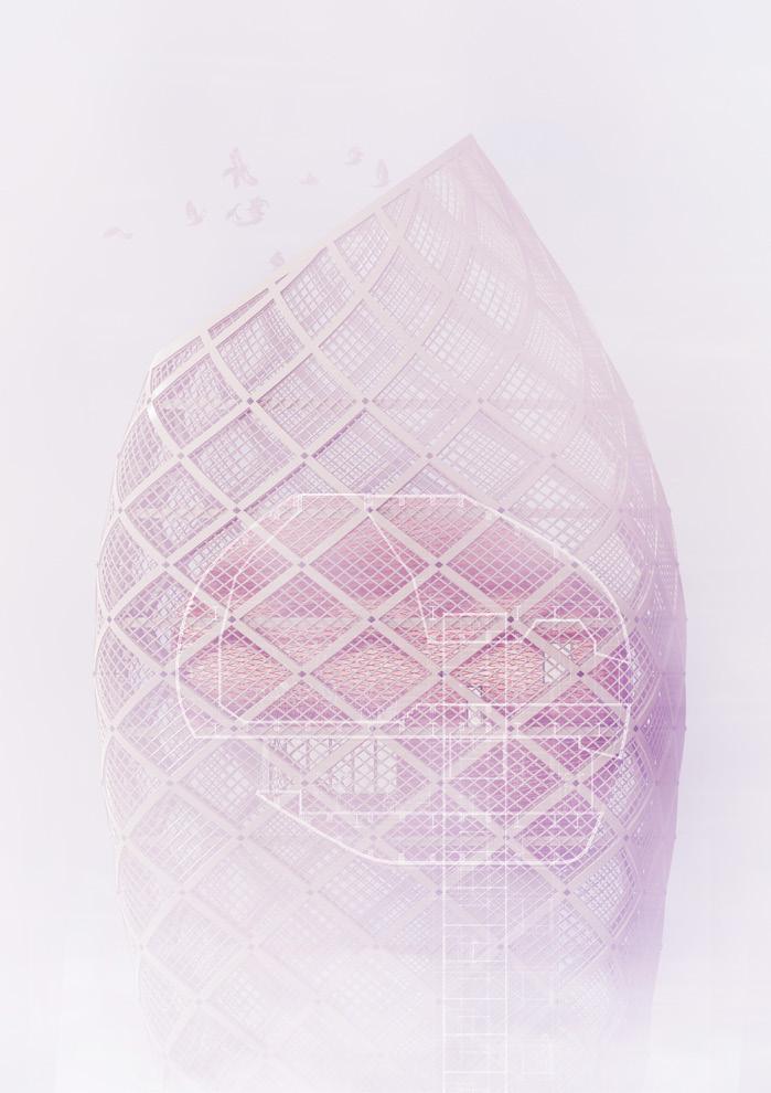
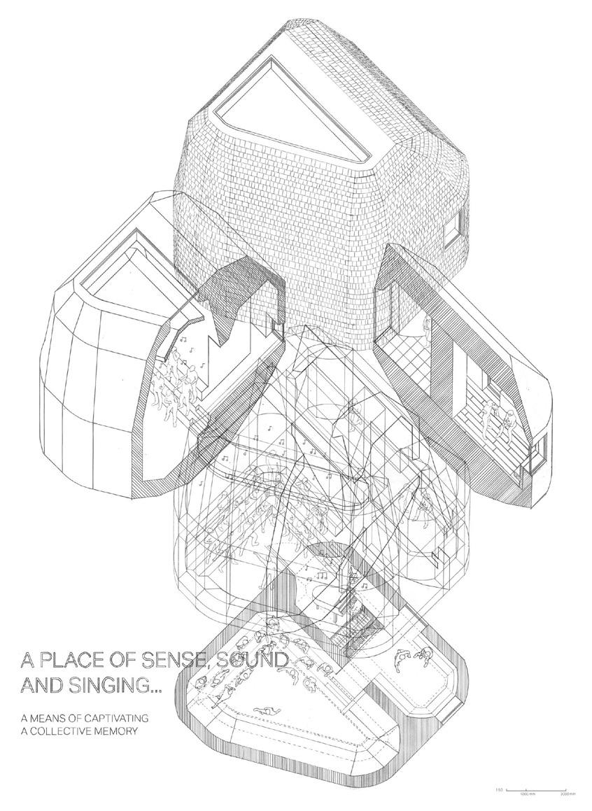
Programme: Choir Performance & Rehearsal Spaces
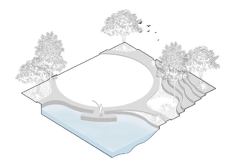
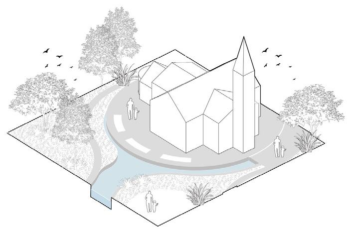
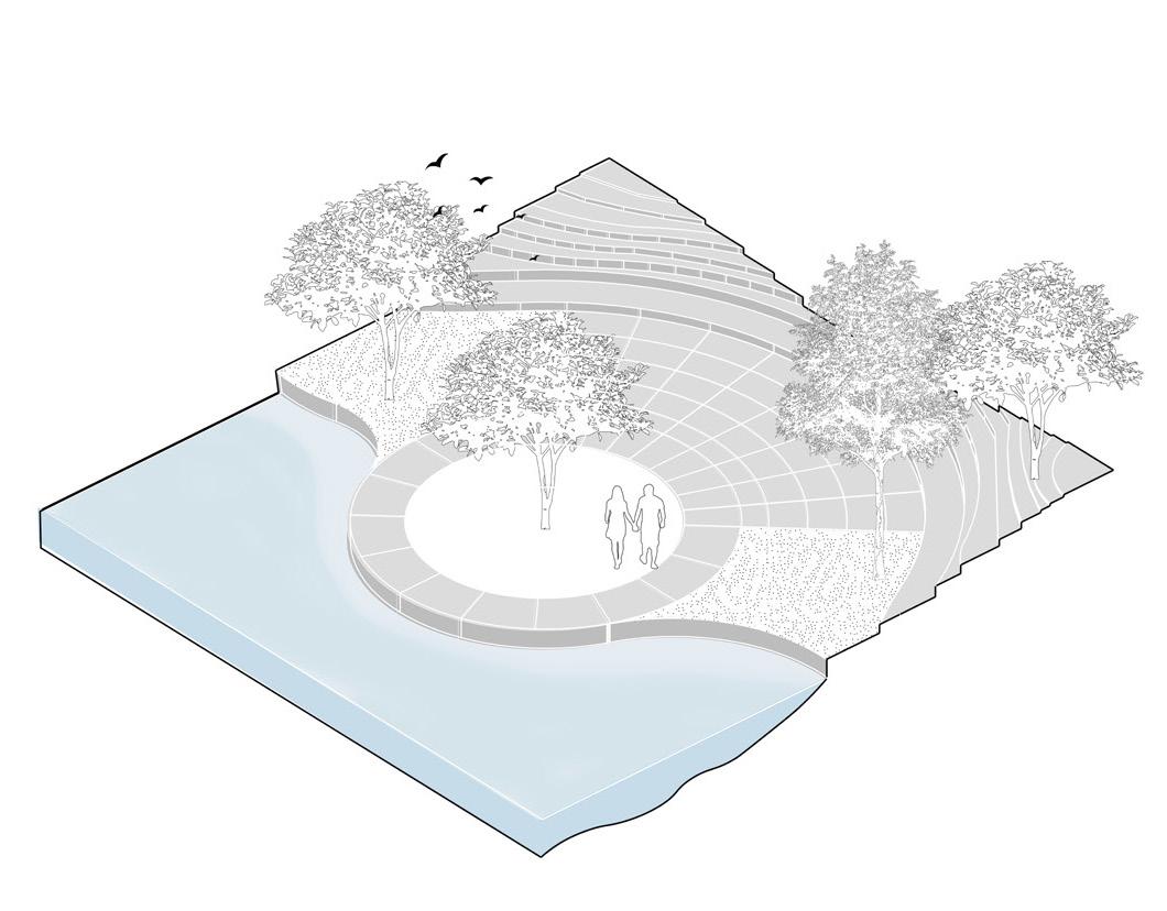
A PLACE OF SENSE, SOUND AND SINGING
A MEANS OF CAPTIVATING A COLLECTIVE MEMORY
MATS BORGEN
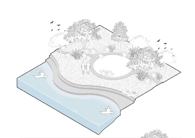
The architecture is envisioned as a vessel for remembrance - a sanctuary for those who have experienced the loss of memory. Through the shared act of collective choir singing, the project invites inhabitants into a space of gathering, healing, and hope. While the return of past recollections remains uncertain, the act of singing in unison fosters connection and belonging. Within these resonant spaces, hymns become architecture, and melodies echo as fragments of memory. The site is defined by two large sand dunes that frame a natural corridor. Between them lies a shallow, rain-fed pool - its edge constantly shifting, surrounded by pockets of thriving vegetation and wildlife. An elevated walkway traces the edge of the water, offering a sensory experience while maintaining openness and permeability across the beach. Along the walkway, varied vessels are positioned- some elevated to provide views and adaptable spaces, others resting closer to the ground for ease of access. The project embraces natural weathering, allowing time and climate to shape its materials and soften its presence in the landscape. In doing so, it becomes part of the coastal ecologyinviting vegetation to take root, birds to nest, and people to linger. The vessels stand as beacons of hope above the dunes - an elevated presence within the vast beachscape. Its towering form, clad in copper, casts light across the horizon, guiding those seeking solace from lost recollections. As the copper glows beneath the sun, it opens a path - a bridge to recovery - for those navigating the fog of forgotten memories.
Interior visual (previous)
Plan & elevation (left)
Elevation (top right)
Plan & section (top left)
Rendered visual (above)
Axonometric (bottom right)
BIBLIOGRAPHY
Roger Deakin, Waterlog, Vintage, 2000
Robert Macfarlane, Landmarks, Penguin, 2016
Richard Mabey, The Accidental Garden, Profile Books, 2024
Kathleen Jamie, Sightlines, Sort of Books, 2012
George Monbiot, Feral, Penguin, 2014
Tim Ingold, The life of lines, Routledge, 2015
Bruno Latour, Critical Zones: the science and politics of landing on earth, MIT Press, 2020
Anna Lowenhaupt Tsing, The Mushrooms at the end of the world, Princeton University Press, 2015
Frederique Ait-Touati, Terra Forma: A book of speculative maps, MIT Press, 2022
Jan Gehl, Life between Buildings: Using Public Space, Island Press, 2011
Peter Zumthor, Thinking Architecture, Birkhauser, 2010
Moises Puente, 2G Essays: Flores & Prats: Drawing without erasing and other essays, Verlag der Buchhandlung
Walther Konig, 2023
Noreen Masud, A Flat Place, Penguin, 2024
IMAGE REFERENCES
Cover
- Tidal fluctuation overlays on Fanø's coast. Harriet Johnson.
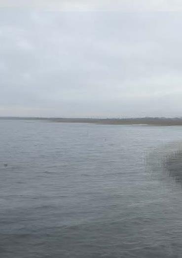
Prologue
- Aerial view of Fanø sandbar. William Maxwell
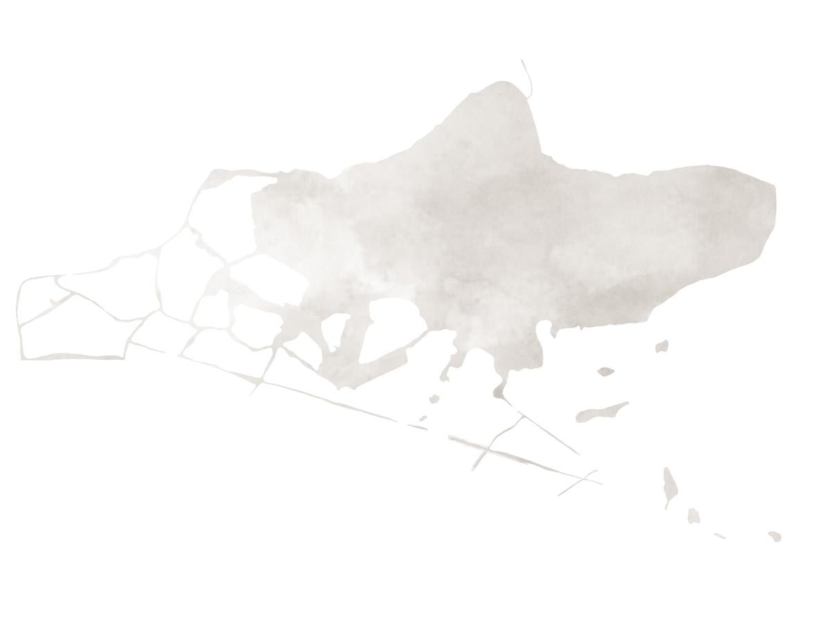
- Satellite view of Esbjerg & Fanø
Moving Water: North Sea Edge
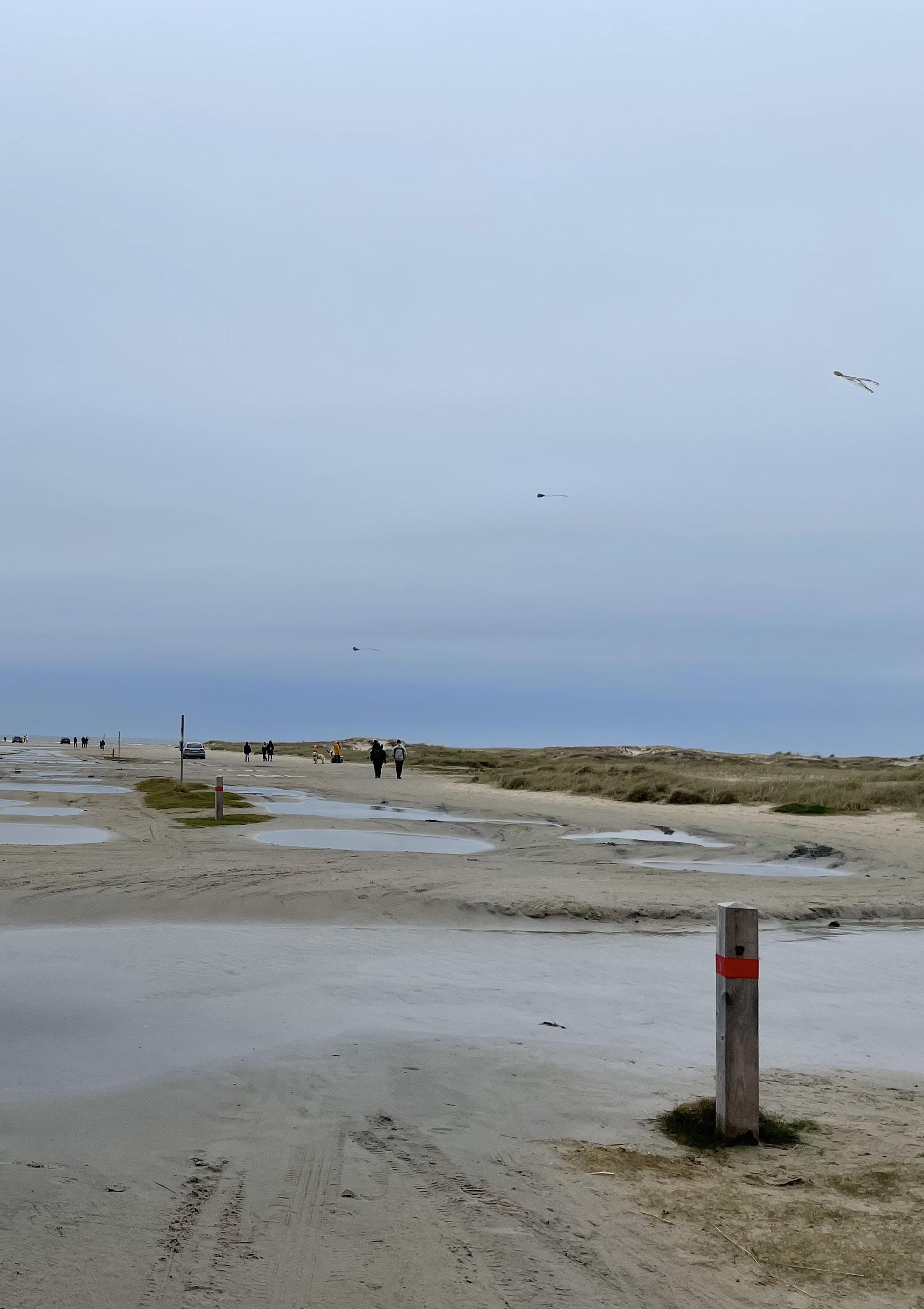
1, Sand dunes on Fanø. Andrea Faed
6, The Wadden Sea within the North Sea context. Shan Liang 11, Moving Water group in Koldinghus (Yuchen Cai, Yiding Chen & Chuyue Li not present). Andrea Faed 11, Moving Water with David Sim in Malmö (Yuchen Cai, Yiding Chen & Chuyue Li not present) Author unknown 77, View of wind turbine on Esbjerg’s south edge. Jodie Horsburgh
Epilogue
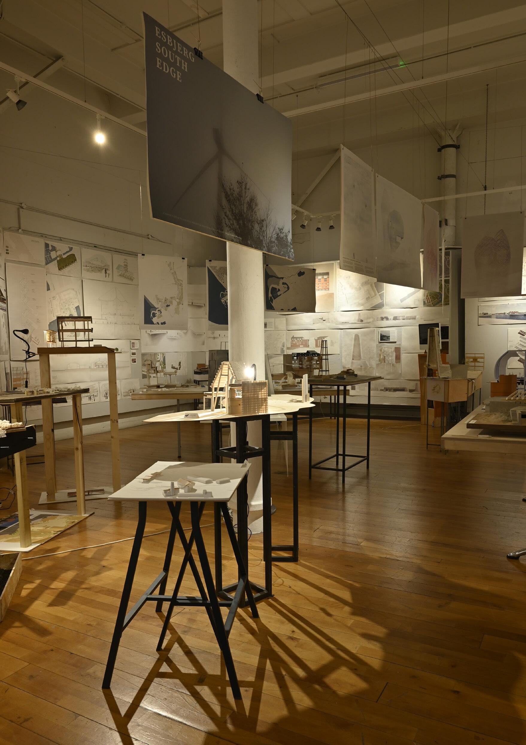
- Studio exhibition in the Matthew Gallery, Minto House. Jack Green
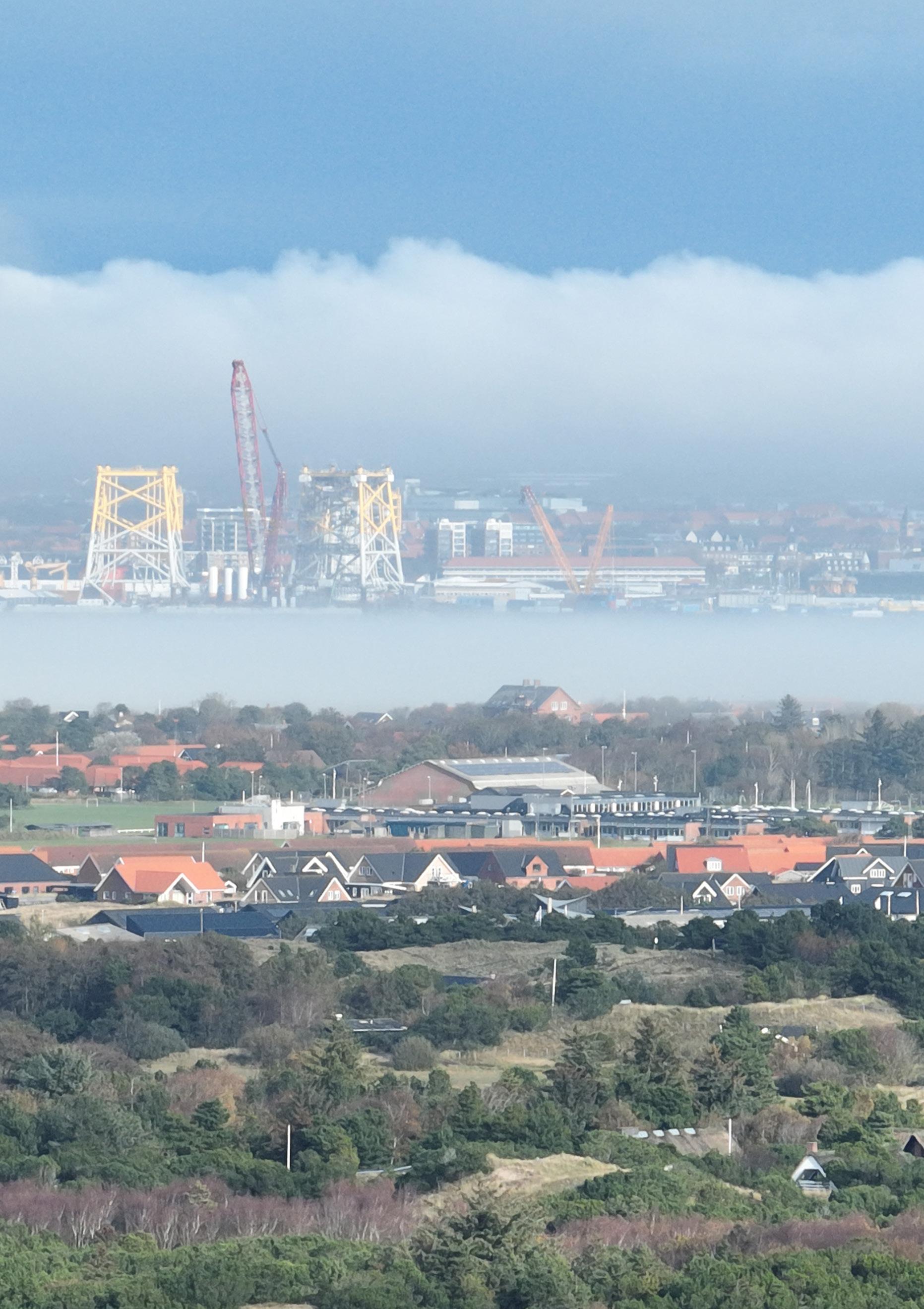
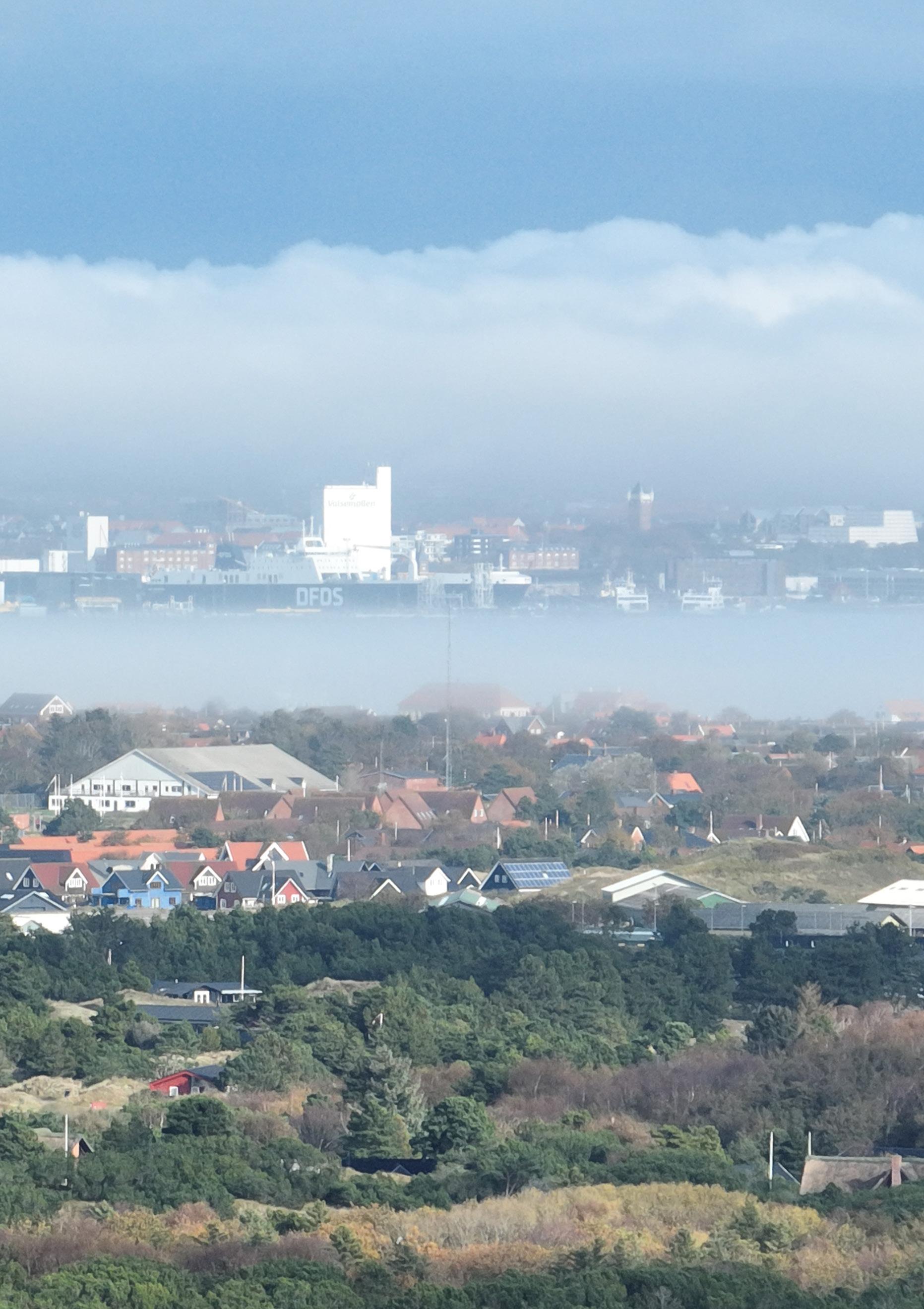
- View of Esbjerg's port infrastructure from Fanø. William Maxwell
Studio exhibition in the Matthew Gallery, Minto House
ACKNOWLEDGEMENTS
Tutors
Andrea Faed
Jack Green
Students
Alexandra Grönberg, Amy Graham, Anna Box, Chuyue Li, Diana Huynh, Harriet Johnson, Holly Ng, Jemima Harrison, Jodie Horsburgh, Lucas Theis, Mats Borgen, Molly Agnew, Molly Sinclair, Natalia Mikulska, Shan Liang, William Maxwell, Yiding Chen, Yuchen Cai
Visitors
Susanne Ewing, Daniel Lomholt-Welch, Guy Morgan, Susanna Boreham, Colin Harris, Dorian Wiszniewski, Andy Bow, Hernan Diaz Alonso
Consultants
Narro Associates - Ben Connolly & Greig Sandilands
Max Fordham - Jo John & Andrea Hong
Liam Ross, Kevin Adams, David Seel
Technicians
Rachel Travers, Malcolm Cruickshank, Paul Diamond, Paul Charlton
Special Thanks
David Garcia, Royal Danish Academy
David Sim, Gehl Architects
Nel Jan Schipull, Vandkunsten Paula Szturc
Moving Water - North Sea Edge edited by Lucas Theis and Amy Graham
The format of this catalogue has developed annually, evolving from the inaugural catalogue series produced for the ESALA MArch studios 2017-18, designed by Emma Bennett and Rachel Braude.
Printed by J Thomson Colour Printers Ltd., Glasgow