view from the Wall, Derry/Londonderry Photograph, Ching-En Lin.
This catalogue is part of a collection published by the Edinburgh School of Architecture and Landscape Architecture (ESALA), Edinburgh College of Art, University of Edinburgh. It documents student design work produced in the Master of Architecture (MArch) programme in 2024-25. Each catalogue describes one of the following design studios in the MArch programme. The full collection is available to view online at issuu.com/eca.march.
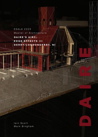
Catalogues 2024-25: Architecture as Support Structure, Vol. 2
Published in 2025 by The University of Edinburgh, under the Creative Commons Attribution Non-Commercial Non-Derivative 4.0 International License (CC BY-NC-ND 4.0).
Published in 2025 by The University of Edinburgh, under the c:EdgeEffects:
Scott, Iain, and Bingham, Mark. Eco-tones&theEcologicalCondenser(Derry/Londonderry,NI).
Installation, Walled City Model. Photograph, Lucy Guo
URBAN i NFOBAHN ELLIE WILKES
THE EDGE OF THE RU i N: MEMOR i ES OF LANDSCAPE CHRIS PIRRIE
FOUNTA i N GREEN CORR i DOR & ECOLOG i CAL PATHWAY XIANG GAO WENHAO SUN THE REST i TUT i ON OF ‘STANLEY’S WALK’ & MARY BLUES BURN ASTRID MCINTYRE MATTHEW JOHNSON
HEALiNG SPACES: COMMUNiTY & CiviC RENEWAL iN DAiRE’S FOUNTAiN
XIANG GAO
DAiRE & THE ‘ANTi-MONUMENT’ WENHAO SUN
BRiDGiNG THE BOGSiDE TOBIA GRAZIANI
REGiSTERiNG THE ANTHROPOCENE HANNAH ORD
FROM FORTRESS TO FRAMEWORK: RECLAiMiNG THE WALLED CiTY CHING-EN LIN VIVI HSIA
COMPACTiNG DAiRE
CHING-EN LIN
CURATiNG DAiRE
VIVI HSIA
[CURATiNG] CONNECTiONS
LUCAS JONES
NATURE’S EMBRACE: MENDiNG THE BOGSiDE DiviDE BERAT UGUR
Flow.
Field Model Installation. MDF, timber, card, steel. Lucy Guo
DAiRE’S AiRC ii
EDGE EFFECTS: ECO-TONES & THE ECOLOGICAL CONDENSER (DERRY/LONDONDERRY, NI).
Th is two-year Master of Architecture studio invited students to propose a carefully researched and constructed environmental thesis for a series of architectural and landscape projects, which we term ‘ecological condensers’. Drawing poetic inspiration from the myth of a global flood that destroys ‘all life’, described in the book of Genesis we employed the Irish Gaelic word ‘Airc’ (English: ‘Ark’) as our neo-mythical term for the ecological condenser. During this two-year academic journey, we have operated across geographical and architectural scales from the metropolitan to the body-scale, revealing and enhancing natural and urban eco-tones while proposing sustainable indigenous ecologies and habitats for both human and non-human species in the context of a radically changing climate.
In year 1 of the two-year program, we ‘flooded’ the studio with our speculations in the city of Daire/Doire/Derry/Londonderry, Northern Ireland. A core concept of the studio being the ‘Edge Effect.’ (Changes in species population and natural structures that occur at the boundary of two or more habitats) and the ‘in-between’ they generate, referred to in ecology as the ‘eco-tone’ (a region of transition between two biological communities). We believe that the edge effect occurs in human constructed environments in similar ways to the natural world.
We began with a thorough and exhaustive mapping exercise called ‘the WEAP’ (Water, Earth, Air, People), to uncover existing ‘edge effects’ or eco-tones in the city and its surrounding landscape. Immersive fieldwork methods allowed a deeper understanding of ontological forces of place and allowed for speculations around a small-scale structure that transformed an existing edge effect and enhanced biodiverse relations between human
Compacting Daire.
Render encountering Daire Haven from the Bay Road Natural Reserve towards the Walled City Ching-En Lin
and non-human species. A ‘test-bed,’ laboratory project, or prototype for the spatial, material and environmental prerogatives of the later projects. In the second half of year 1 we concerned ourselves principally with ‘The Field.’ The early development of an ecological spatial strategy, operating across the scales of city and neighbourhood, within which an ‘Airc’ project, with a carefully researched and place enhancing programme, could exist in a fundamental relationship to the elements of water, earth, air, and people.
Year 2:
At the opening of the third semester of the programme we returned to Daire for a more detailed and thorough survey and investigation of our ‘fields’ and sites of interest, related to our emerging architectural projects. These more detailed measurements and impressions would be used to enrich and accurately represent our revealed spatial contexts throughout the semester. Also at the outset we worked to defi ne more clearly our project programmes, including the use-pattern of inside and outside spaces in our projects. We more clearly and accurately defi ned the ‘quantitative and qualitative’ parameters of this programme, including volumetrics, structural requirements, material possibilities, environmental hazards and responses, along with more phenomenological drivers related to desired sensorial qualities and atmosphere. Th is programmatic drawing or series of drawings, was to be read in conjunction with a ‘technical brief’, which defi ned the thesis-driven, technical issues to be addressed by the project, along with the spatial, material and tectonic response to these issues.
Following a short and intensive period of ‘design development’ where we re-addressed the spatial and material arrangement of the programme in context, we began an extended series of iterations of research and design synthesis, driven by the rationale(s) of the project thesis and its attendant technical issues and requirements. The fi rst of these iterations was presented explicitly through the brief, to clearly reveal the desired working pattern of research, analysis, transformation and synthesis as a working methodology. A core output for this stage of the studio programme was a special drawing of the material assembly of a part or series of parts of projects which clearly demonstrated the full complexity of the architectural assembly and its thetic prerogatives and concerns. The drawing also often displayed key elements of the environmental systems employed and the constructed atmosphere(s) they helped to produce. Study models, two and three dimensional architectural and technical drawings were also employed intensively as
The People’s Archive.
Sectional Field Model, Overlaid. MDF, plaster, card, steel. Hannah Ord
critical tools to reveal the architectures. Original combinations of technical sections, contextual photography, sectional models and atmospheric renders allowed students to explore the potential for rich installations of work in studio. This required a continual re-negotiation of the studio not just as a working environment, but also as a critique and exhibition space of continuous production and curation as the work of the group increased in volume and complexity. In developing the structural, material and environmental design of our projects, students engaged with a number of visiting specialists during semester 3, along with a series of critical reviews with guest critics.
The final semester drew the architectural thesis to a close through a critical convergence of the three architectural projects pursued over the studio programme. The Edge Structure, the Field & the Airc (and the relationship between all three) was re-articulated thematically, contextually and architecturally through a curated series of drawings and models in the studio. Students were invited to clearly consider the relationship between all three projects to best articulate the concerns of the individual thesis. We asked each student and groups of students to consider the overall trajectory of their projects, and to address the question of what was required to bring them to a successful conclusion. This requirement varied for each student, depending on the ideas and agendas driving their projects and their state of development. For some it was about addressing aspects of the design that as yet had not been fully considered. For others it became about reintegrating the work within the larger city and field intentions of the project. We wanted to consider this completion in the context of an agreed common exhibition strategy, involving carefully planned individual and group curation from the outset, with the design of the final exhibition envisaged at an early stage of the semester.
The final semester was thus organised around three principal investigations. Firstly, as a studio we ‘Returned to the Field’, providing the opportunity to more fully develop both shared and individual field proposals beyond the more strategic intentions developed in the first half of semester 2. The opportunity to construct an ecological, socio-spatial, infrastructural and environmental assemblage of architectures and landscape. This generated the potential to further develop both the Airc’s ‘situation’ within the field and to consider in greater detail the arrangement of the field’s spatial and
The Harvest Bow Exhibition of the Harvest Hall, Isabella Innocenzi
The Urban infobahn Studio Exhibition Installation, Ellie Wilkes
formal features, including the habitats and the ecologies it was to sustain and promote. Particular elements of thetic importance could be more fully realised such as wall, enclosure, burn, bridge, pond, meadow, oyster-bed, woodland, berm, gate, dam and others.
‘Returning to the Edge’: In the second part of the opening semester, we selected a particular edge or eco-tone where we carefully sited an ‘edgestructure’ which contained a manipulation of the contextual elements of the WEAP, subverting or transforming the existing edge-effect. The structure did not require to have any pre-determined human use pattern but was designed to enable an encounter between human and non-human occupants as part of a sustainable micro-ecology on the selected site. In being the fi rst design task undertaken the siting, formal and spatial arrangements of the edge structure were proposed at a time when the thesis was still in its initial development. Now, in semester 4, with the concerns and goals of each student’s thesis being much clearer and more focussed, it was a good moment to return and re-structure that assembly to be a much more articulate expression of thesis opening. The opportunity also existed for the edge structure to become part of a ‘family’ of related architectures, further defi ned by our Field and Airc projects.
Curation & Exhibition: Following our mid-semester review of the fi nal semester, the remaining studio time was dedicated to the curation and exhibition of the work of the thesis in a rich and compelling way, including an installation in studio, along with a selection of further exhibited artefacts in the ECA Graduate Show at Lauriston Place. We began this last exercise with a repeat of an early curatorial exercise, defi ning a carefully curated territory for each studio group, incorporating shared and individual artefacts at various scales. Utilising the existing studio drawing, each student carefully scaled and defi ned the extent of their own individual exhibition, including drawings and models to be presented and installed. Each student was required to set their own agenda for this fi nal section of the studio project. Ideally the spatial interplay of the exhibited pieces together was to convey the conceptual and spatial concerns of the individual thesis propositions.
In a place as contested as the city of Daire, students have worked intensively to generate a thesis that responds to the issues which have presented
Flow: Architecture + Proximity
Studio Exhibition Installation.
Lucy Guo
themselves and been revealed through careful and painstaking research and propositioning. A particularly rich series of theses and projects in a series of charged and contested locations have emerged including:
A series of theses which re-imagine in the city’s relationship with its founding, yet largely forgotten element, the River Foyle; Proposing a new ‘archi-digital’ typology allowing data centres (or Architectural ‘Para-Sites’) to provide spatial responses to the contextual needs of their host, whilst renewing the historic human-river agency through a dynamic engagement with a replenished indigenous ecology; advocating for a future Daire city model fostering denser, well-connected neighbourhoods in harmony with natural space and a rewilded riverside which includes spaces to regenerate both human and non-human well-being; encouraging Daire to look to the past to reinterpret and revitalize its relationship with water for a postAnthropocene future, through the active conservation of marine crafts and the preservation of important riverine historical and ecological artefacts; As a group we investigated the potential for the restitution of Mary Blues burn through the city’s Bogside as both a solution to the area’s problem of consistent flooding and a new ecological element, which could provide home to indigenous botanical and animal ecologies.
Theses relating to this proposition included restoring a lost city pathway linking ‘the City of the Living’ and ‘the City of the Dead’ which rethreads lost ecologies of wetland and meadow back into the urban weave, establishing a ‘landscape of reverence’ pulsing with historical and ecological significance; supporting a ‘regenerative-return’ to a new Bogside, urban-landscape paradigm of cascading civic spaces with green and blue connectivity through which water moves, rushes, is slowed, and retained, for the health and well-being of human and non-human citizens as part of community gathering and ‘maker-space’; interrogating the opportunities of architecture in nurturing learning in diverse ecological surroundings by situating an Irish language school within a shared urban wetland strategy which emphasises embodied learning in the landscape.
A number of our theses were driven by re-conceptions of the city’s engagement with its monumental walled enclosure, abandoned buildings and artefacts of remembrance, through the lens of ‘city-curation’, the ‘anti-monument’ & human and ecological interaction, stitching together
segregated urban spaces, to weave continuous civic space dedicated to community cohesion and the display of Irish art. A series of projects deal with Daire’s surface water flooding issues through projects which engage with a renewed civic, water-based infrastructure of ecological affordance, including integrating community, agricultural plots to promote sustainable living and food production, woven with regenerated sacred, green and civic gathering spaces to enhance community cohesion and health; reinvigorating a journey along the historic St. Columb’s Park burn, uncovering lost historic moments of well, ruin, pond, and pier; and combining the daily activities of the citizens of Daire’s Water-side with hydrological and ecological restoration as part of a new, Ebrington, urban ‘aqua-ecology’.
Architectural projects include laboratory and ecological enhancement programmes centred on indigenous species and habitat regeneration within enriched water-based landscapes; centres of material re-use and recycling; a centre for ‘recovery and regeneration’ with a future skills hub and community gathering place; a new city crematorium employing a new process of water-cremating, creative arts display and exhibition spaces that recalibrate the civic relationship to historic walls within the city; programmes related to food production and consumption in the shape of markets, community kitchens, and an urban farm; community archives and knowledge exchange space with various programmess contributing to the well-being of both human and non-human inhabitants of Daire.
Iain Scott & Mark Bingham
1:1000 Field Proposal Model, Ellie Wilkes
1:50
Sectional Model Composition, Lucy Guo
Sectional Model Posed with Historical Shipquay Image Projection, Ellie Wilkes
Site: The Foyle embankment: Derry’s historic Shipquay and Strand Road
Programme:
THE URBAN iNFOBAHN
‘PARASITES OF AFFORDANCE’
ELLiE WiLKES
Forming a response to the age of AI, its emerging spatial requirements and inherently parasitic reliance on environmental resources, this thesis seeks to bridge the gap between society and technological frameworks in Derry/ Londonderry, Northern Ireland. By utilising remains of the city’s neglected infrastructure to foster new educational and economic opportunities, the resultant architecture culminates in a new ‘reactive’ urban typology, utilising spatialised forms of energy to promote exchange and collective identity through telecommunications and data storage.
“Technicity”, a neologism coined by Gilbert Simondon, references the relationship between ecology, society and technology, and the extent to which technologies mediate, supplement and augment societal exchange. This thesis aims to recalibrate Derry/Londonderry’s anthropological relationships within the realm of changing technological advancements, addressing wider emerging issues around the spatiality of data centres and their growing pressure on global energy sources. As such, this thesis forms a new typology, allowing data centres (or architectural ‘parasites’) to provide spatial responses to the contextual needs of their host. This methodology is applicable to broader issues faced by shrinking cities, addressing the intricate challenges of power, exchange, technology, space-ownership, and
Mixed-use energy production with data storage, a clinical research facility, a bioinformatics faculty, university teaching spaces, oyster cultivation areas, and public access to the riverfront. addressing wider emerging issues around the spatiality of data centres and the global energy crisis.
Re-establishing Rossdowney Primary School as early-years learning facility and introducing a programme of community dining and gathering, kitchens, library and learning spaces at the head of a landscape of regenerative planting plots, wild grass field, sustainable urban drainage and water tower.
THE HARvEST BOW
‘A CULTIVATION OF LAND AND COMMUNITY’
iSABELLA iNNOCENZi
The city of Daire is characterized by significant community disparities and widespread food insecurity, highlighting a pressing need for community cohesion and accessible nutrition. This thesis proposes the integration of regenerative agricultural plots within Daire’s urban core to enhance food security and promote sustainable living. Daire’s landscape will bud with nodes of planting, cultivated by the residents enabling direct engagement with sustainable food production. This new landscape not only reconnects the people of Daire with the land but also fosters ecological unity through the cohabitation of humans, cultivated land, and rewilded green spaces. Anticipated future flooding is incorporated into the design, transforming water challenges into assets by creating a water-based civic public realm. These spaces will channel water to community planting plots, optimising agricultural production and enhancing urban drainage.
Architectural interventions within this network are designed to cultivate a sense of belonging and community cohesion, providing Daire’s community with necessary programme in depleted areas of high population. By merging the built environment with these natural elements, the project aims to unite Daire’s residents around the themes of sustainable food production and communal living. It also envisions a forward-looking Daire where community-focused urban planning and sustainability in food production and consumption are at the heart of the city’s future development strategy.
Revealing the Harvest Hall
Photograph, 1:50 Sectional Composition
Isabella Innocenzi
Site: St. Columb’s Park, Daire.
Programme:
03
Intergenerational ‘Parkitecture’ comprising cafe, day-care, youth hall, library, and co-working facilities with shared external amenity
ON THE EDGE OF THE RUiN: MEMORiES OF LANDSCAPE
ST COLUMB’S PARK GATEHOUSE
CHRiS PiRRiE
The Anthropocene era has been defined by a significant human impact on the planet, prompting reflection on society’s fascination with ruins. ‘On the Edge of the Ruin’ explores this concept through the lens of the peripheral Boomhall Estate, which serves as an early and pivotal influence. The estate, located on the north-west bank of the river Foyle, 2.4 miles northeast of Derry’s historic City Walls, played a strategic role during the Siege of Derry in 1689. Today, it comprises ancient oak woods and agricultural lands that form the ruins of an 18th-century Georgian Classical house and stables. These ruins, gradually reclaimed by nature, offer a rich tapestry of history and ecology. A key question emerges as to whether the techniques and materials of contemporary place-making will provide future generations with a similarly romantic and rich spatial experience?
St Columb’s Park Gatehouse creates a new gateway to the park introducing intergenerational ‘parkitecture’ comprising cafe, day-care, youth hall, library, and co-working facilities with shared external amenity. The Gatehouse reinvigorates a journey along the park’s burn, a rich geological landmark, uncovering lost historic moments of well, ruin, pond, and pier. These architectural proposals celebrate natural thresholds and landscapes, fostering a vision for a healthy, ecologically vibrant Northern Irish parkscape.
and Re-purposing
Re-plenishing
Daire’s Landscapes of (the) Ruin massing model, posed.
Photography, Chris Pirrie
Landscape Foyer 1:100 Physical Model Visualisation Studio installation Staged
Right Above
The Urban infobahn RenderCollage, View towards the Airc
Ellie Wilkes
G1
THE RESTiTUTiON OF ‘STANLEY’S WALK’ & MARY BLUES BURN
ASTRiD MCiNTYRE MATTHEW JOHNSON
Running south-west and to the eastern side of Daire’s walled city runs a fractured ecological corridor in the form of poorly maintained green spaces, sports playing fields, depleted woodland and cemetery; a semi-urban landscape profoundly lacking in ecological diversity. This shared Field Strategy is centred around reinstating the historic route from the south end of the Walled City, west toward Daire City Cemetery, previously named ‘Stanley’s Walk. To mitigate surface water flooding and direct flood water away from the lowest lying areas of the Bogside, the strategy also involves the reinstatement of Mary Blue’s Burn, a historic stream left behind after Daire Island was connected to its surrounding landscape through the draining of the historic bog and wetland. Stanley’s Walk crosses Mary Blue’s Burn, intersecting at a new civic, urban square with SUDS pond and supporting ecologies, forming the portal to a new Gaelic-speaking School for Daire and Daire crematorium.
The burn forms part of a connected green and blue network, allowing the free movement of humans and other species, complementing the Airc projects which sit within its ecological corridor.
Site: The historic wetlands, woodlands and bluebell hill from Stanley’s Walk, between Celtic Park and the restored Mary Blue’s Burn.
Programme: A city crematorium for Daire. A water-based crematorium with the associated chapels, auxiliary spaces and processing.
ARCHiTECTURES OF REvERENCE:
A PROCESSiON OF THiN PLACES
DAIRE’S
CREMATORIUM
ASTRiD MCiNTYRE
Throughout Daire there is a procession of thin places [a Celtic notion, where heaven and earth are only separated by a thin veil.] These sacred moments emerge across the landscape, forming a quiet procession that echoes life, death, and everything in between.
Inspired by the tradition of Irish funeral processions, this thesis explores the concept of water cremation—or resomation—set within Daire’s reclaimed Wetlands. This gentle, earth-conscious process reflects a return to the natural elements: to land, water, and air, offering a meaningful reconnection with the world we leave behind.
The journey begins in Daire’s Walled City—the city of the Living—and moves toward the city of the Dead, Daire City Cemetery. Along this route, each stop reveals layers of personal memory and collective history. These spaces become Architectures of Reverence, where the physical and spiritual intersect, inviting reflection: Where does the City of the Dead exist within the City of the Living? Perhaps it’s in these thin places, where the veil lifts, that we find the answer.
At the heart of the project lies The Procession—a ceremonial path embedded in the returned Wetlands of the Bogside. Here, the Crematorium becomes a threshold, both rooted in place and elevated in meaning. It honours death not as an end, but as a transition—an intimate journey shaped by place, ritual, and the enduring connection between body, earth, and spirit.
Previous Left Previous Right Above
The viewing Tower
Photograph, Physical Installation
Lucy Guo
Site: Lecky Road, Bogside
Programme: A single-stream, seven-year Gaelic language primary school to replace an existing cluster of substandard portable cabins.
05
EMBODiMENT, EDUCATiON, AND ECOSOPHY GAELSCOIL ÉADAIN MHÓIR
MATTHEW JOHNSON
‘Embodiment, Education & Ecosophy’ emerges from early analysis of fractured ecological and socio-spatial networks, extending from the historic walled city to its south-west edge, identifying two valuable community assets: the Gasyard Centre and a ‘Gaelscoil,’ an Irish-language primary school. Situated between a woodland and Lecky Road, these institutions occupy a liminal site of cultural and ecological potential. The Gasyard Centre is sited on historic gasometer infrastructure and provides critical social care and support such as a childcare facility and services for cancer patients. Meanwhile, the adjacent Gaelscoil comprises a cluster of inadequate prefabricated, portable cabin units that fail to meet contemporary pedagogical and technical standards and are isolated from the woodland due to defensive boundary fences.
In response, this specific scenario suggests an ‘Airc’ programmatic framework for a new Gaelscoil, interrogating the opportunities of architecture in nurturing learning in diverse ecological surroundings. The project situates a school within a shared urban wetland strategy and emphasises embodied learning in and around the landscape. ‘Ecosophy,’ a philosophy of ecological connection, understands how social and environmental, thus human and non-human ecologies are interlinked. Through this lens, the project argues that architectural form and spatial organisation must actively support modes of learning that are deeply attuned to cultural identity, ecological awareness, and the rhythms of place.
Site: On the southwest side of Daire City and the north bank of the River Foyle, located at the terminal of the Bishop Street and the former Mary Blue’s Burn.
Programme: An Ecological Institute with laboratory spaces, cultivation spaces, research rooms, offices, eco-exhibition, lecture auditorium, wetland workshops, cafe, foyer and designated outdoor ecological spaces.
(E)MERGiNG & (SUB)MERGiNG
RIVER FOYLE’S NEW CIVIC, ECOLOGICAL EDGE
Daire City, Northern Ireland, is marked by a stark conflict between its urbanised artificial structures and natural landscapes, a tension exacerbated by looming climate change and urban expansion. The River Foyle, a historic cultural and ecological pathway, faces persistent flooding challenges. Historically, Mary Blue’s Burn fragmented the landscape into what was known as Daire Island, fostering extensive wetlands and a rich ecological tapestry. Urban development is centred around the densely populated Walled City, with the “Diamond” at its heart, extending through Bishop Street towards the river—an axis symbolising the push of urbanisation.
‘Emerging & Submerging’ explores the evolving conflict at the crucial intersection of Bishop Street and Mary Blue’s Burn by the River Foyle. It examines how this convergence of historically significant elements— urbanisation, natural landscapes, and water bodies—navigates the dual pressures of flooding and urban growth. The research anticipates the emergence of “ruins” in spaces where neither urban nor natural elements take precedence due to the oscillating boundaries driven by flooding and city expansion.
The envisioned future landscape includes the speculative development of a semi-public ecological institute situated in the new wetland area. This institute aims to facilitate public engagement with wetland ecosystems, embodying a civic-minded architectural response to local environmental and ecological challenges and creating a new civic ecological edge towards the Foyle. As Bishop Street risks submersion, the re-emergence of Mary Blue’s Burn could redefine the urban and ecological landscape of Daire.
KE WANG
Physical Sectional Model Photograph Collage 1:200
Axonometric South-East Airc Axonometric Drawing Edge of The Airc Perspective Render of the Affordance Edge between Airc & Nature Central Water Space Perspective Render of the Central Rainwater Sensorial Space
Bishop’s Gate - Bishop Street - Airc Perspective from Bishop’s Gate looking to Field & Airc
G2
FOUNTAiN GREEN CORRiDOR & ECOLOGiCAL PATHWAY
XiANG GAO WENHAO SUN
This project explores Daire’s urban neighbourhood traditionally known as ‘The Fountain’, marked by historical industrial success followed by sharp decline from the 1980s. This decline has led to widespread building abandonment and depopulation, neglect and decay, with high levels of unemployment, homelessness and mental illness and the resultant crime and decline in community spirit this inevitably brings.
To counter these negative, historic urban forces, we propose the development of a ‘Fountain Green Corridor’ running from the walled city to the River Foyle, anchored around two abandoned factory sites (incorporating new spatial programmes for rehabilitation and skills acquisition), to help revitalize the Fountain’s urban life and ecology and to prepare for future flooding that is predicted to reshape the city’s landscape. Integrating a series of design strategies such as moveable edge structures, bridges, the greening of urban pathways and the restoration of the historic built fabric, this proposal will merge with the riverside and its water-based ecologies, forming a new civic gateway to the centre of the city.
Green Corridor & Ecological Pathway
Site: Tillie & Henderson abandoned factory site at Hugh Craigavon bridge, River
Foyle
HEALiNG SPACES: COMMUNiTY & CiviC
RENEWAL iN DAiRE’S FOUNTAiN
XiANG GAO
WILD GRASS REHABILITATION & REGENERATION CENTRE
Programme: Rehabilitation Centre with medical facilities, community care, educational programmes, temporary-supported housing and associated outdoor spaces. sites become ecological anchors, transforming emptiness into opportunity.
Wild Grass is a social regeneration project rooted in the heart of ‘The Fountain’, a post-industrial neighbourhood once known for shirt manufacturing and rail transport. In the aftermath of World War II, the area suffered economic collapse, social segregation, and decaying infrastructure. The 21st-century arson of the historic Tillie & Henderson’s shirt factory deepened the sense of loss. The disused Craigavon Bridge became an emblem of broken community ties and urban neglect. Drawing on the metaphor of wild grass—resilient, persistent, and adaptive—the project reimagines forgotten spaces as catalysts for renewal. Modular structures bring life to derelict land near the bridgehead, incorporating green infrastructure, water recycling, and shared community spaces. These sites become ecological anchors, transforming emptiness into opportunity. At its core, a central rehabilitation hub provides essential services: medical care, temporary housing, and social support for vulnerable and marginalized individuals. Skill-building programmes offer paths to empowerment and social reintegration, particularly for those disconnected from society.
Wild Grass aims to heal both place and people. By establishing selfsustaining systems that foster collaboration between humans and the natural environment, it bridges spatial and social divides. The renewed bridgehead becomes a physical and symbolic link, connecting fractured communities and restoring a sense of shared purpose. Through environmental restoration and community empowerment, Wild Grass cultivates a sustainable, inclusive future for ‘The Fountain’ and its people.
Airc Detailed Model 1:50 Photograph
Garden Render
Site: The abandoned industrial complex of Carlisle House, Carlisle Road Methodist church and surrounding buildings.
Wme: Foyle ‘Future-Skills Hub’ and Community Gathering Place comprising digital metal, wood and textile workshops, tool shop, lecture theatre, classrooms, offices, cafe, dining hall, auditoriums, library, health centre, meditation rotunda, landscape street, landscape pools, courtyard, Cargo Delivery etc
DAiRE & THE ‘ANTi-MONUMENT’
FOYLE FUTURE SKILLS CENTRE
WENHAO SUN
Daire & the Anti-Monument explores the layered dynamics of power, belonging, and exclusion within the urban landscape. Traditionally, monuments reflect dominant cultural narratives and celebrate collective achievements. Yet, anti-monuments—less permanent, more poetic— emerge in the form of graffiti, music, protest, and gathering. These challenge mainstream ideologies and reimagine memory and identity in public space.
This project proposes an urban intervention rooted in the concept of the anti-monument. It disrupts conventional city planning with a new axis— both architectural and symbolic—that redefines movement, connection, and purpose within the urban block. Rather than reinforcing static ideals, this structure invites interaction, adaptability, and ecological integration. Set in Derry’s Fountain neighbourhood, the intervention addresses the visible scars of industrial decline: vacant buildings, social fragmentation, and unemployment. As a direct response, the proposal envisions a Future-Skills Hub and Community Gathering Space within the abandoned Carlisle House, former Methodist church, and adjacent structures on Carlisle Road.
This design is not just about architecture—it’s about people. It creates a spatial framework where sound, light, and human presence shape the environment. Through active connections and inclusive volumes, the space fosters learning, social cohesion, and urban regeneration. The antimonument becomes a catalyst for empowerment, not commemoration.
Aerial view of Courtyard 1:500 Airc Model Above
Physical Installation Composition
On the Edge of the Ruin
Chris Pirrie
FLOW
Site: Foyleside Shopping Centre & Orchard Street, Londonderry
Programme: Maker Space, Galleries, Workshops, Information Centre, Civic Blue and Green Space, Urban Orchard.
GROUNDWATER ARCHITECTURE OF ‘ECO-SOCIAL’
AFFORDANCE
LUCY GUO
Flow reimagines the heart of Daire, transforming the decline of brickand-mortar retail into an opportunity for urban renewal and reconnection with ecology, community, and place. Set at the critical junction between Ferryquay Gate and the Foyleside Shopping Centre, the project challenges a space currently dominated by car traffic and commercial transactions. Instead of channeling people into a closed-off mall, Flow opens the city back up. By shifting the entrance to the shopping centre, removing road access along Orchard Street, and introducing a vibrant new programme, the design reclaims public space for the people of Daire. The proposal introduces markets, maker spaces, reuse workshops, a community gallery, and cafés - reviving the social fabric lost during the rapid development of the urban landscape during the industrial and digital age. At the heart of the design is The Airc, a space that reconnects the urban core with its elemental roots: water, earth, air, and human presence. Sloped workshop roofs guide rainwater into blue spaces, flowing into a proposed orchard, blending ecological cycles with civic life.
Looking fifty years ahead, the vision sees the bones of the shopping mall giving way to a new, integrated landscape where green and blue spaces are inseparable from the built environment. The mall’s internal circulation is reimagined as open public realm, and its once-impermeable waterfront softened and reabsorbed into the city’s living footprint.
Programme:
Site: Free Derry Museum, Bogside, Daire.
Material workshop hub, café, exhibition space and associated wet landscape.
BRiDGiNG THE BOGSiDE
TOBiA GRAZiANi
BREAKER SPACE + MAKER SPACE
‘Bridging the Bogside’ focuses on the Bogside community in Daire, Northern Ireland—an area shaped by conflict, spatial marginalisation, and ecological loss. Historically defined by Mary’s Blue Burn and an extensive bogland, the site once acted as a natural urban and carbon sink, managing rainfall and forming a critical ecological edge. These features have been gradually erased by non-descript urban development, leaving a fragmented urban fabric lacking spatial hierarchy and legibility.
Daire’s walled city, a symbol of colonial authority, continues to dominate the city’s spatial structure, reinforcing the Bogside community’s marginalisation. This thesis proposes a rebalancing of these conditions through urban formalisation and ecological repair, reconnecting the Bogside to Derry’s cultural, spatial and environmental foundations.
The project’s Field proposal introduces a continuous pedestrian route from the Diamond—Derry’s civic heart—through Butcher’s Gate down into the Bogside. A canopy wraps the Diamond’s edge, reinforcing its civic role and encouraging pedestrian use. This gesture is extended into the Bogside to form a civic landing space, framing the entrance to the Airc site. An urban pier weaves through this terrain, enhancing walkability and establishing a pedestrian-oriented landscape in response to surface flooding.
1:100 Field Drawing Bridging the Bodside
Staged Model Photos
Airc isometric Render South-East View
Northern Facade Section + Canopy Overlap Previous Left
1:500 Field Model
Photograph, Physical Installation
Tobia Graziani
Site: Shipquay Square and the Peace Park
Programme: Community archive and exhibition space supplemented by a boathouse.
REGiSTERiNG THE ANTHROPOCENE
HANNAH ORD
THE PEOPLE’S ARCHIVE OF THE FOYLE
Since the founding of Derry, the Foyle has been a vital source of sustenance for its human and non-human inhabitants, flora, and fauna. In earlier agrarian times the city engaged directly with the river as an arterial connection which supported its life, trade and growth. However, in the current Anthropocene epoch Derry has progressively distanced itself from the Foyle, erecting hard barriers which disrupt this natural connection and diminish its once vibrant riparian habitats. Registering the anthropocentric shift from the natural connection between the city and water, this thesis confronts the river’s present state of alienation, drawing on a rich archive of historical studies to envision a future where Derry re-establishes its bond with the water.
Initial research focused on the diminishing habitats of Atlantic salmon, using this species as a proxy to investigate the broader decline of riparian ecologies and the city’s estrangement from the river as human activity became the dominant force shaping the environment. This present disconnection is underscored by the endangerment of vernacular artefacts associated with riverine activities and fishing, once central to local culture but now facing obsolescence. To counter this trend, the thesis proposes the establishment of a new People’s Archive of the Foyle. Situated within a rearticulated Shipquay Square, this initiative aims to provide the citizens of Derry with a dedicated space to curate and re-engage with their historical ties to the river.
G3
FROM FORTRESS TO FRAMEWORK: RECLAiMiNG
THE WALLED CiTY
CHiNG-EN LiN vivi HSiA
The Walled City of Daire is a historically fortified settlement shaped over centuries by geography, defence, and civic life. Once a natural island enclosed by river and bogland, its first man-made boundary—a defensive wall—marked a decisive moment when nature and human habitation were separated. At its heart stood a vibrant civic town hall, now replaced by the Diamond, a residual plaza echoing the city’s lost centrality. In recent decades, the Walled City has experienced civic and spatial erosion. Streets prioritize vehicles over people, buildings stand vacant, and the wall—once protective—has become a backdrop to disconnection. No longer a space of collective life, the city’s core now functions as a corridor of transit and tourism, detached from daily inhabitation.
This project envisions a renewed urban framework that reclaims the Walled City as a dynamic civic landscape. By unlocking existing blockages and re-stitching fragmented edges, it transforms the city’s fabric into an interconnected sequence of urban thresholds—civic spaces that encourage movement, interaction, and continuous use. Vacant plots and architectural obstacles are recast as spatial opportunities, while the Diamond is returned to a raw, rewilded state: an unprogrammed commons that resists fixed purpose and invites flexible occupation. Rather than preserving the wall as an artefact of containment, the Walled City is reactivated as a porous and inclusive core where heritage, ecology, and everyday life are once again interwoven.
From Fortress to Framework: Reclaiming the Walled City FieldStrategyDrawing
Site: Quay Docks (former Fort George site), Daire, Northern Ireland Programme: Art galleries, workshops, performance hall, psychotherapy clinic, civic square
DAiRE HAvEN
TOWARDS A RESILIENT DUO-CITY: ENHANCING ECOLOGICAL ATMOSPHERE, SOCIAL RELATIONS, AND WELLBEING
LiN
This thesis reimagines Derry as a resilient “duo-city,” defined by the tension between the historic Walled City and a newly proposed, discrete settlement designed to accommodate and care for its inhabitants. In the wake of civic erosion, spatial segregation, and persistent mental health struggles—etched into the River Foyle’s high suicide rates—Derry’s traumatic legacy remains deeply embedded in its urban fabric. In response, this project explores how built edges can be softened to foster a more empathetic co-existence with nature—distilling its ecological atmosphere to create spaces for healing, contemplation, relaxation, and interaction.
Three key sites are examined and addressed through architectural interventions operating across multiple timescales. Each reflects a rupture in Derry’s socio-spatial landscape—and a latent potential for repair. At Pennyburn, a compact city model is introduced within a post-industrial void, countering monocultural housing estates and reintegrating natural spaces to foster denser, more connected communities. At Fort George Waterside, Daire Haven—the heart of this vision—emerges as a civic pier that frames resilience through architectural, ecological, and cultural lenses. Drawing from the density of the Walled City, it proposes an ‘intelligent ruin’ typology—adaptive, inhabitable, and enduring. At the Diamond War Memorial, a micro-urban intervention revives this neglected civic core, tracing it back to its natural and social origins to restore its identity as an inclusive urban anchor.
Architecture becomes a mediator between damage and care, interweaving mental health, ecology, and public life into a more empathetic and resilient future for Derry.
CHiNG-EN
Walking Towards Daire Haven On The Ecological Boardwalk, Proposed Fort George Water Edge Atmospheric Render
The Framework Of An intelligent Ruin 1:100 framework model of Daire Haven
A Civic Platform With Oak Tree in the Big Planter Final 1:100 Framework Model
Exterior view Of Wellbeing Consultant Chamber Collage Visual 1:100 Framework Model
Exterior view Of Wellbeing Consultant Chamber 1:100 Framework Model
Above Right Top Right Bottom
13
CURATiNG DAiRE
CIVIC RENEWAL & ADAPTIVE RE-USE THROUGH A CONNECTED ARTS BASED TOWNSCAPE
vivi HSiA
Site: 1-4 Shipquay Street, 1-17 Foyle Street, Bank Place & Guildhall Square Programme: Art Gallery, Sculpture Court, Auditorium, Library, Artwork maintenance, workshop through socio-cultural divides.
‘Curating Daire’ explores the dynamic tension between urban architecture and the natural environment, with a focus on the critical loss of green spaces. The project proposes unlocking and transforming fortified barriers, reimagining urban space to improve its permeability—particularly in a ‘city of walls,’ where free movement becomes a natural outcome. This is especially relevant in Daire, where disconnection between the City and Waterside areas is expressed not only through physical barriers but also through socio-cultural divides.
The thesis identifies a series of key moments, referred to as ‘The Field,’ aiming to reintegrate fragmented urban landscapes from the historic Diamond in the walled city centre and across the Peace Bridge to St Columb’s Park. It advocates for urban planning that opens, existing city blocks to establish new pedestrian pathways. These interventions are complemented by the greening of public spaces and the adaptive reuse of neglected structures for artistic endeavours, enhancing the civic and ecological value of the urban fabric.
blocks to establish new pedestrian pathways. These interventions are
New Water’s Edge Airc Ground Floor Site Plan
Through Sculpture Court 1:50 Sectional Model
Re-Entered Ground Section from Auditorium through sunken garden & Stair Tower to Guildhall Plaza
Through Sculpture Court 1:100 Section
The Lantern volume at Night 1:100 model of Auditorium Transforming The Depleted Wing 1:100 Sectional Model Through Auditorium & Library from City Wall towards Water’s Edge 1:100 Sectional Model
Above Right Top Right Bottom
LUCAS JONES
Site: The Derry Wall, Shipquay Place through into Waterloo Place
Programme:
A Series of curated urban spaces for the display of Irish art, a sculpture walk, gallery and urban garden.
[CURATiNG] CONNECTiONS
A CULTURAL RE-ROUTING OF DAIRE’S WALLED CITY
‘Thin Places’ author, Kerri ni Dochartaigh believes those born during ‘The Troubles’ in Ireland carry their trauma bone deep. The city and the land carry it even more deeply.
A city defined by conflict - encapsulated by its well-worn defences, established by those who first conquered it by force, walls that have been re-used to repeat the cycles of violence on its people over and over. What is purported now as a tourist attraction of historic significance is preserved with a militant precision. Workers maintain the wall to eliminate any sign of ecological growth or life taking hold within its cracks.
Tourists listlessly circle the old town, looking down on the old sites of violence and spectacle, taking endless photos of memorials and graves, eyes flicking over the living and breathing in favour of the buried and broken. As they do so the living inhabitants of the city try to move on - seeking the renewal of their connections and communities.
While the people of Daire breathe new life into their city, this blooming cultural renaissance is constricted by the obligation of preserving the walls that enclose it. A re-purposing of the Derry Walls is proposed through a series of discrete, connected interventions culminating in a sculpture walk, gallery and garden at Waterloo Place celebrating Irish art and landscape.
While the people of Daire breathe new life into their city, this blooming
Site: Bogside, Daire, Northern Ireland.
Programme: Bogside Community Learning and Well-being Hub
NATURE’S EMBRACE: MENDiNG THE BOGSiDE DiviDE
DAIRE’S ‘LIVING’ ROOM
BERAT UGUR
‘Nature’s Embrace’ unfolds within the historic and ecological layers of Daire’s Bogside, once a thriving wetland ecosystem, now fragmented by centuries of urbanisation and socio-political division. The project reimagines this dormant landscape as a site of regenerative potential, where ecological restoration and civic healing intersect.
Inspired by the kinetic waterscapes of Lawrence Halprin, the proposal envisions a dynamic landscape of green and blue ecological systems threading through the Bogside. Existing culverts, reservoirs, and flood-prone zones are reinterpreted as an interconnected urban ecosystem, reawakening the long-buried Foyle tributary and surrounding wetlands. This ecological infrastructure not only addresses environmental degradation but also serves as a catalyst for social cohesion, mending fractured relationships across divided communities.
At the heart of the scheme lies a north-facing green hillside, where architecture is embedded within replenished aquatic terrain. Here, cascading spaces support the movement and retention of water while nurturing native vegetation. The built environment becomes a vessel for ecological stewardship and collective well-being, offering flexible civic spaces that encourage interaction between human and non-human life.
Site: Ebrington, Waterside, Daire.
Programme: Ecological Water Institute with associated Community Spaces as part of a new civic, hydro-ecological route.
CiviC WATER
DAIRE’S LANDSCAPES OF ‘HYDRO-INFRASTRUCTURAL’ AFFORDANCE
YUHE GE
‘Civic Water’ revisits the colonisation of Northern Ireland’s Ulster region by the London guilds in the 17thC, traditionally viewed through the lens of religious conflict between Catholics and Protestants. It introduces an alternative perspective that attributes the British colonisation to resource depletion from climatic shifts during the Little Ice Age (1590s-1850s) rather than religious motivations.
Taking our gaze from the past to the future, the world faces another moment of climate emergency—global warming (since the 1850s), leading to a new global crisis of vital survival resources, principally freshwater. Historical and field research in Daire predicts not only rising river levels but significant surface water flooding of the city over the next 50 years and beyond.
Addressing this anticipated fresh-water crisis, this thesis proposes a decolonial approach to freshwater harvesting and sustainable hydrology aimed at restoring lost rivers and their ecological agency. It explores the integration of citizens’ daily interests and activities with hydrological and ecological restoration as part of a new, urban ‘aqua-ecology’. By considering waterbased landscapes as urban infrastructure, the project seeks to align civic performativity with ecological water-regeneration.
The core architectural project is situated in the Waterside neighbourhood of Daire, taking in part as it’s canvas the historic conflict infrastructure of the former military barracks, Ebrington Square. Spatial programmes focused on water, ecology, and community gathering along with the replenishment of local indigenous flora and fauna form part of water-based landscapes illustrating the contribution urban and architectural design can make to addressing the climate emergency.
Uexkull, J V. (2010). A Foray into the World of Animals and Humans. Minnesota Gibson, J. J. (1979). The Ecological Approach to Visual Perception. Boston: Houghton Mifflin Hall, E. T. (1966). The Hidden Dimension. Garden City, NY: Doubleday &Co. Mostafavi, M. (2010). Ecological Urbanism. Lars Muller Zumthor, P. (2006) Atmospheres: Architectural Environments, Surrounding Objects. Birkhauser Pallasmaa, J. (1996) The Eyes of the Skin: Architecture & the Senses. J. Wiley & sons. Ni Dochartaigh, K. (2021) Thin Places.
Further Reading
Barnes, J. (1989) A History of the World in 10 ½ Chapters. Ch.1 ‘The Stowaway’. (A Novel) Friel, B. (1973) The Freedom of the City (A play set in Daire during ‘The Troubles’). Friel, B. (1980) Translations (A play about language and landscape in 19thC Ireland).
Book Chapters & Journal Articles
Fonseca, M. F. (2008) Edge Effect. In ‘Encyclopaedia of Ecology’. Pp 1207-1211. Ed. Jorgensen & Fath. Academic Press.
Kelly, L. (2003) Language, Memory & Conflict: Acts of Interrogation. In ‘De-territorialisations: Revisioning Landscape & Politics’. Pp 309-320. Ed. Dorrian & Rose. Blackdog Publishing.
Web-links
Derry & Strabane Strategic Growth Plan 2017-2032. https://www.derrystrabane.com/Subsites/CommunityPlanning/An-Update-on-Our-Community-Plan
Derry & Strabane Local Development Plan LDP (2032) draft documents. Particularly Part F (Place-making & Design Vision), Includes Derry & Strabane settlement studies part A & B. https://www.derrystrabane.com/Subsites/LDP/LDP-draft-Plan-Strategy-(dPS)/LDP-Plan-Documents
Web-site of The Great Parchment Book by the Honourable Irish Society. A fantastic resource on the history of the Ulster Plantations. Films text and fantastic images. Managed by the London Metropolitan Archive. https://www.greatparchmentbook.org/
Irish Government – Department for Communities: Historic Environment of Ireland web-page. Full information on the Derry Walls Conservation plan and Management Plan. Relevant policy documents. Also contains a link to the Historic Environment Record of Northern Ireland (HERoNI). https://www.communities-ni.gov.uk/articles/ derry-walls#toc-3
videos
Built Ecologies: Architecture and Environment | MoMA https://www.moma.org/research/ambasz/built-ecologies
i MAGE REFERENCES
Cover
- The Harvest Hall Isabella Innocenzi
Prologue
- view from the Wall Ching-En Lin
- Studio Exhibition installation Ellie Wilkes
- Field Model installation Lucy Guo
Daire’s Airc
1 Flow installation Lucy Guo
2-3 Compacting Daire Ching-En Lin
4-5 The People’s Archive Hannah Ord
7 The Harvest Bow Isabella Innocenzi
8 The Urban infobahn Ellie Wilkes
9-10 Flow: Architecture + Proximity Lucy Guo
11-12 The Heat Sink Ellie Wilkes
13-14 The viewing Tower Lucy Guo
[Edge Effects || ]
16-17 The Urban infobahn Ellie Wilkes
24-25 Textured Landscapes Isabella Innocenzi
38-39 The Urban infobahn Ellie Wilkes
46-47 The viewing Tower Lucy Guo
66-67 On The Edge Of The Ruin Chris Pirrie
Epilogue
108-109 Compacting Daire Ching-En Lin
112 Semester 2 Brief Sketch Mark Bingham
114-115 ECA Graduate Show Exhibition Lucy Guo
Semester 2 Brief Sketch
Mark Bingham
ACKNOWLEDGEMENTS
Tutors
iain Scott
Mark Bingham
Students
Xiang Gao, Yuhe Ge, Tobia Graziani, Lucy Guo, Vivi Hsia, Isabella Innocenzi, Matthew Johnson, Lucas Jones, Ching-En Lin, Astrid McIntyre, Hannah Ord, Chris Pirrie, Wenhao Sun, Berat Ugur, Ke Wang, Ellie Wilkes.
Visitors
Ana Bonet-Miro, Susana Do Pombal Ferreira, Killian Doherty, Jack Green, Adrian Hawker, Mark Dorrian, Mark Hilley, David Seel, Neil Cunning, Ruta Turcinaviciute, Dorian Wisniewski, Kevin Adams, Suzanne Ewing, Ana Miret-Garcia.
Technical Consultants
Malcom Cruikshank, Paul Diamond, Paul Charlton & Rachel Collie.
Daire’s Airc: Edge Effects ||| edited by Lucy Guo, Ellie Wilkes, iain Scott and Mark Bingham.
The format of this catalogue has developed annually, evolving from the inaugural catalogue series produced for the ESALA MArch studios 2017-18, designed by Emma Bennett and Rachel Braude.
Printed by J Thomson Colour Printers Ltd., Glasgow.