Built Heritage Townscape Visual Impact Assessment 3
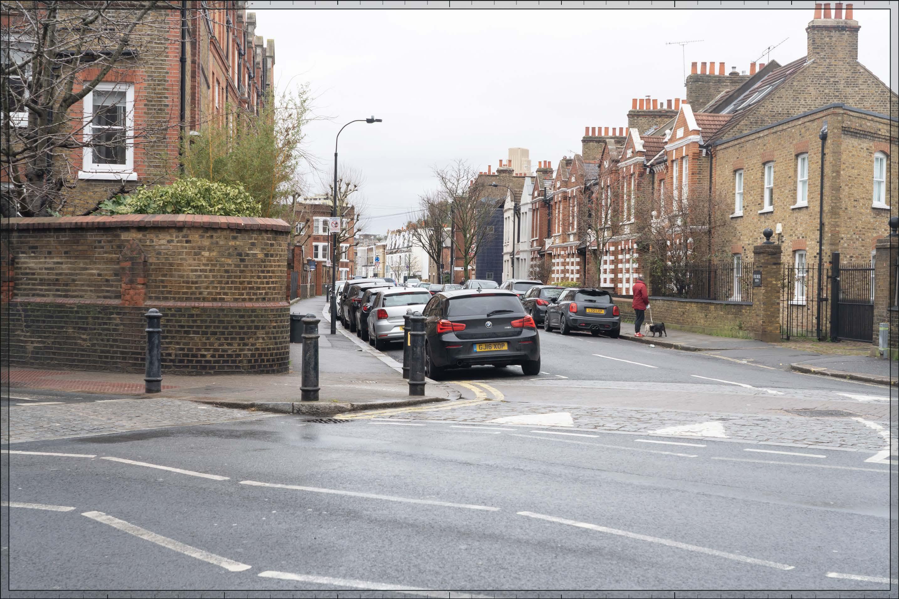
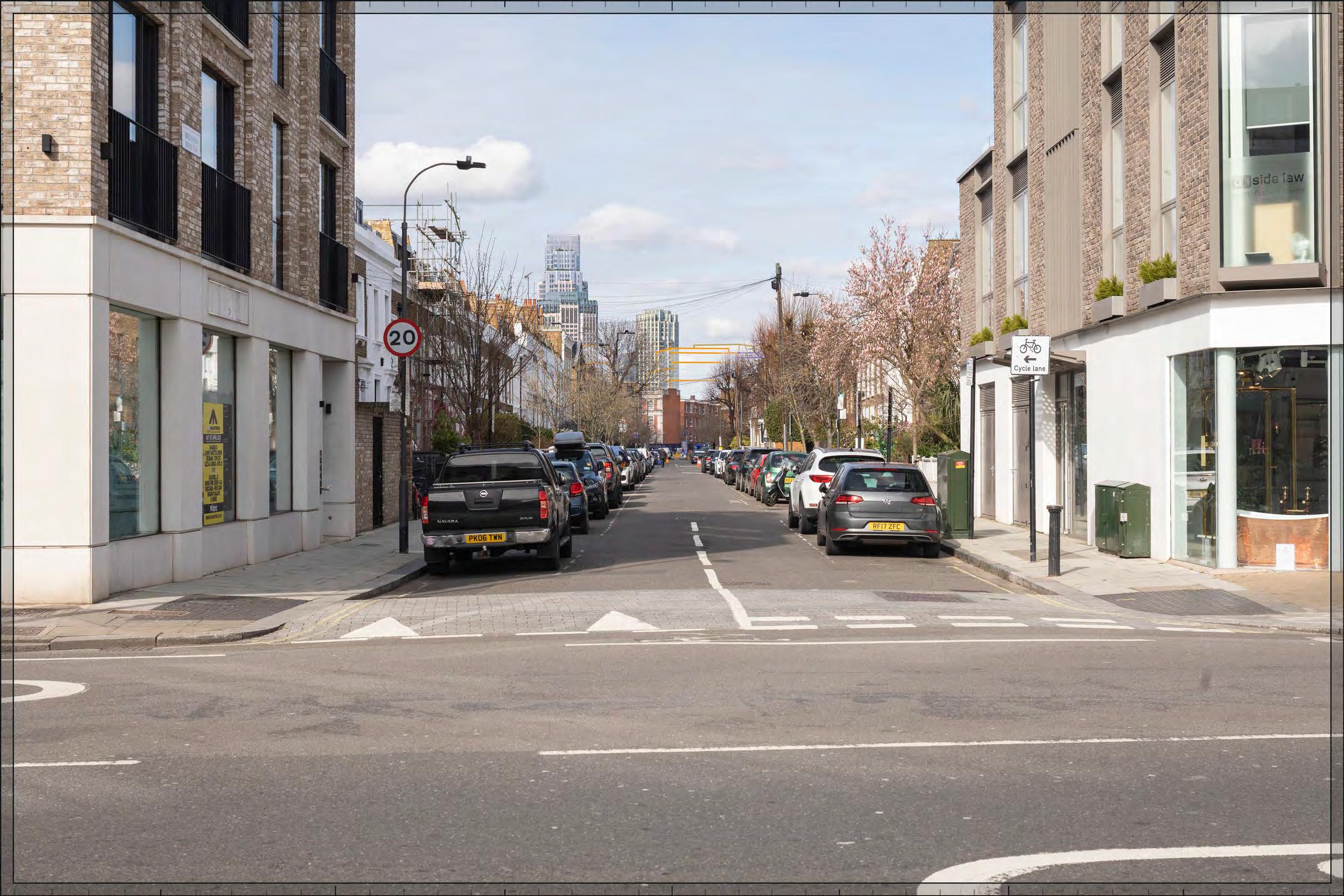
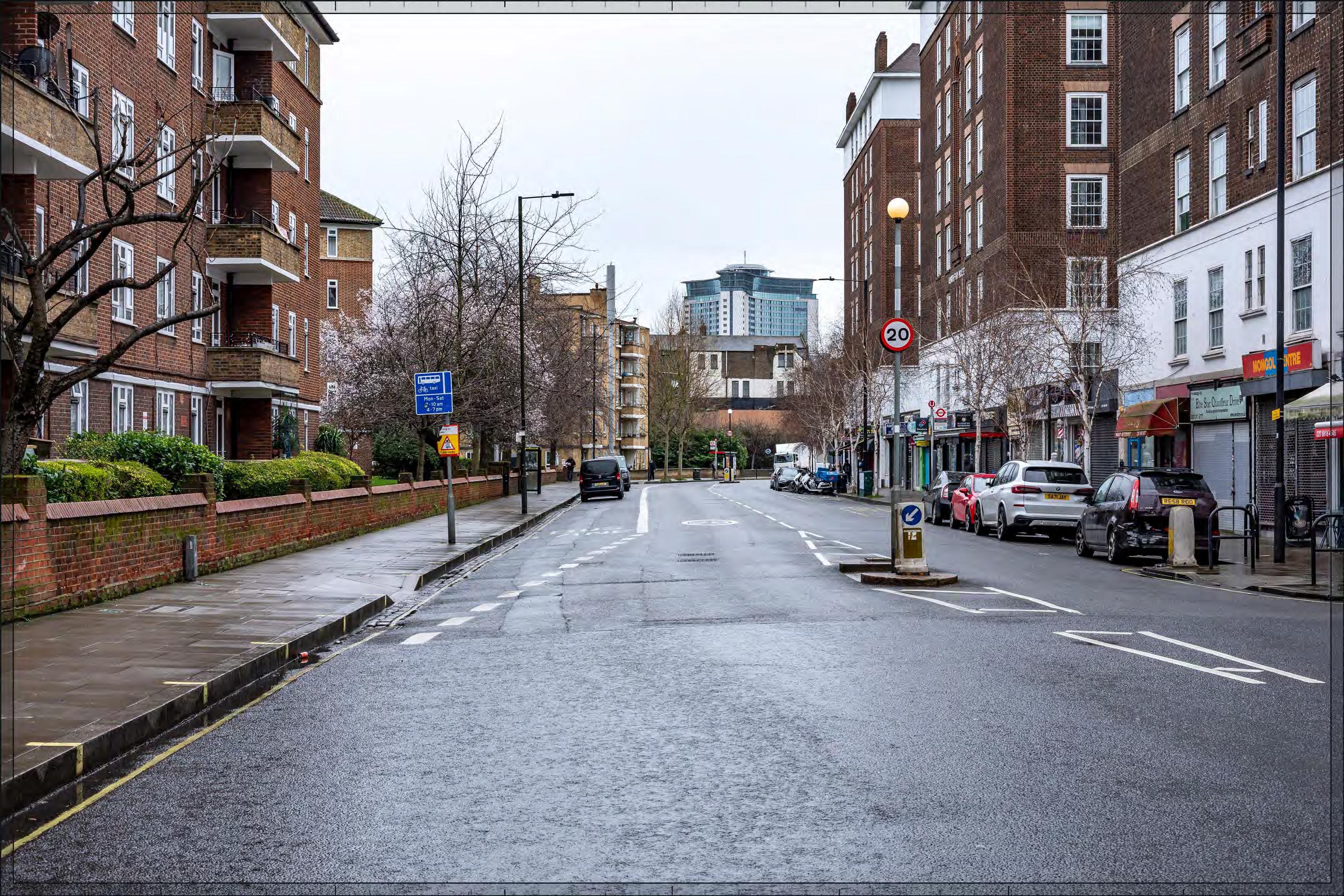
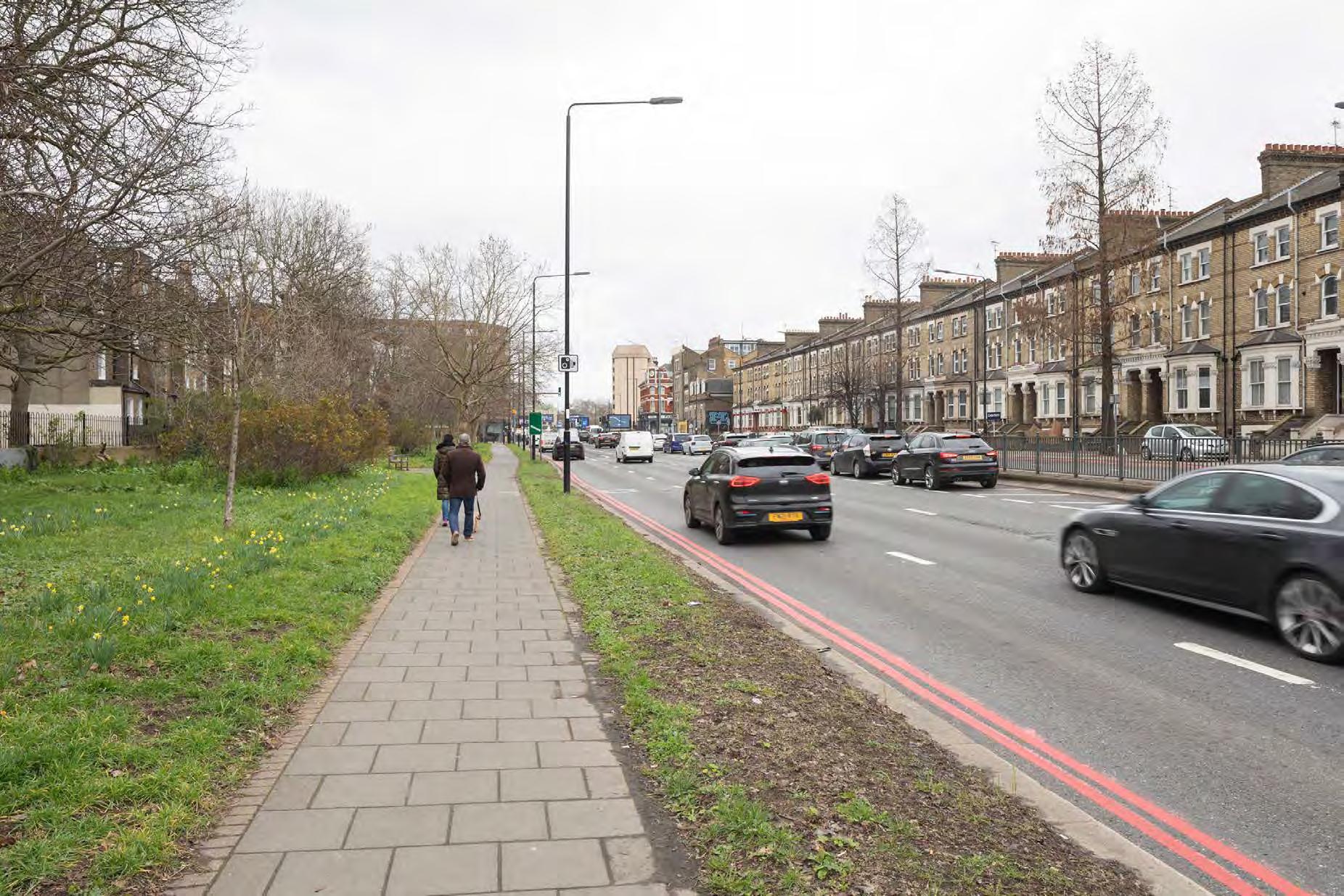
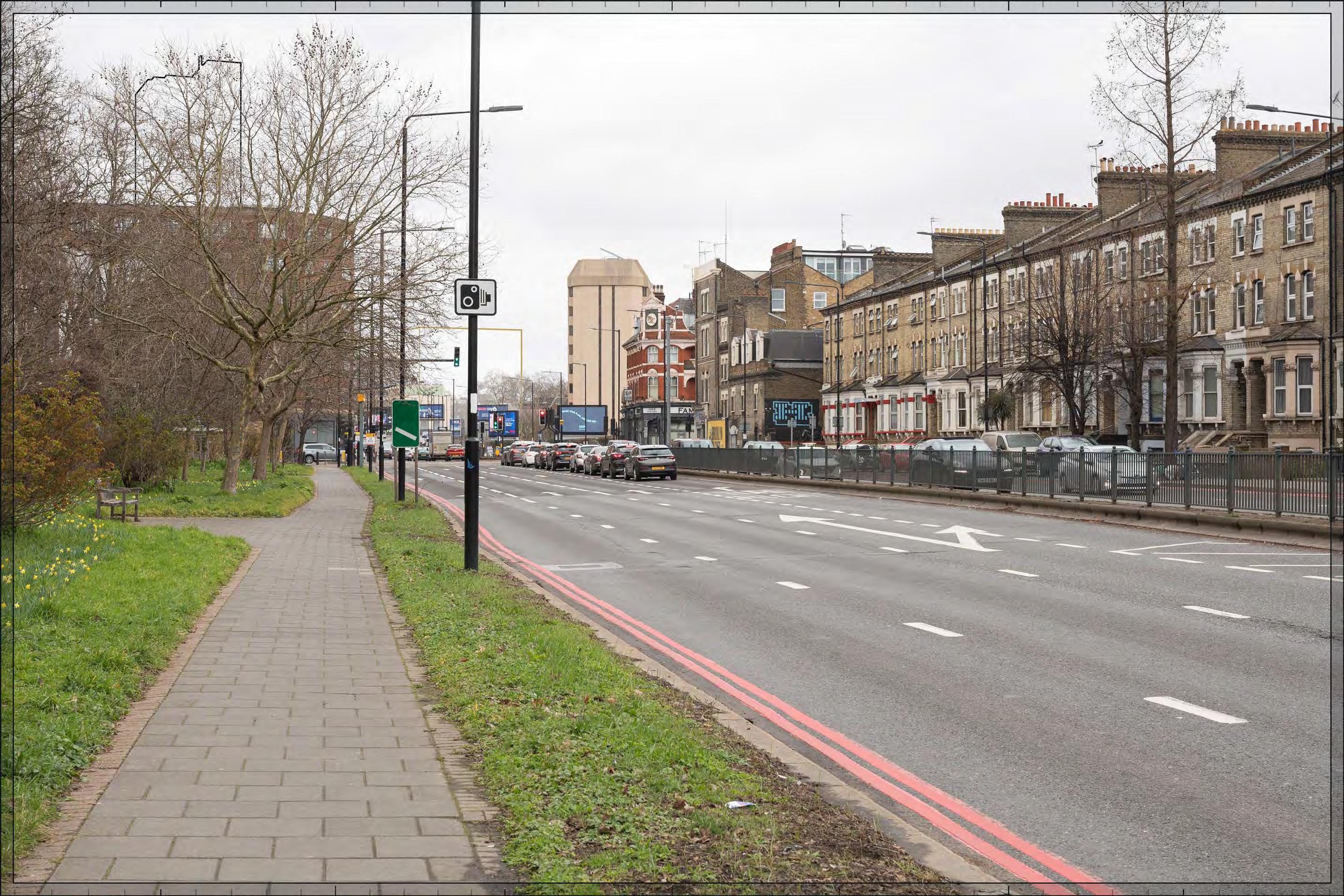
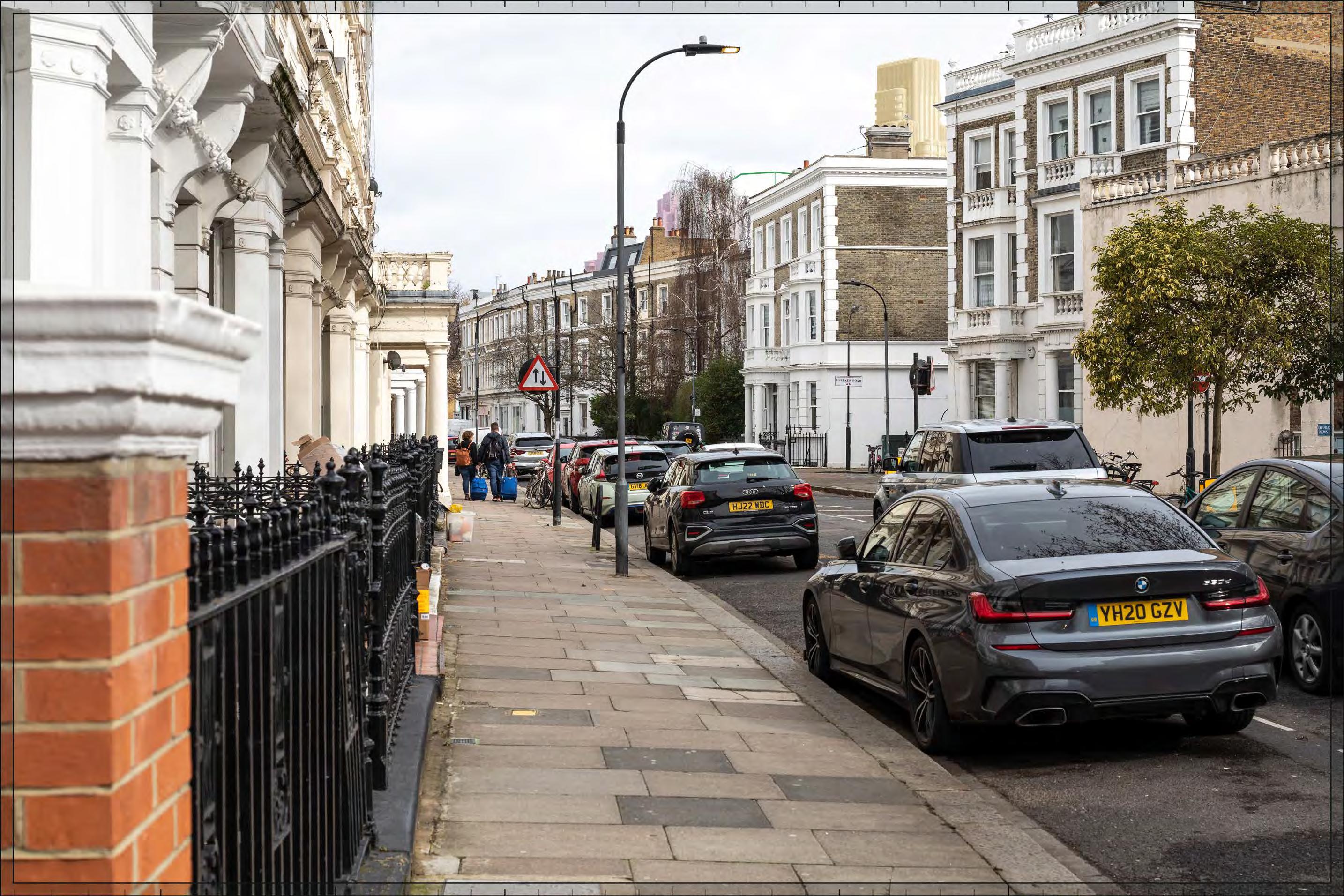
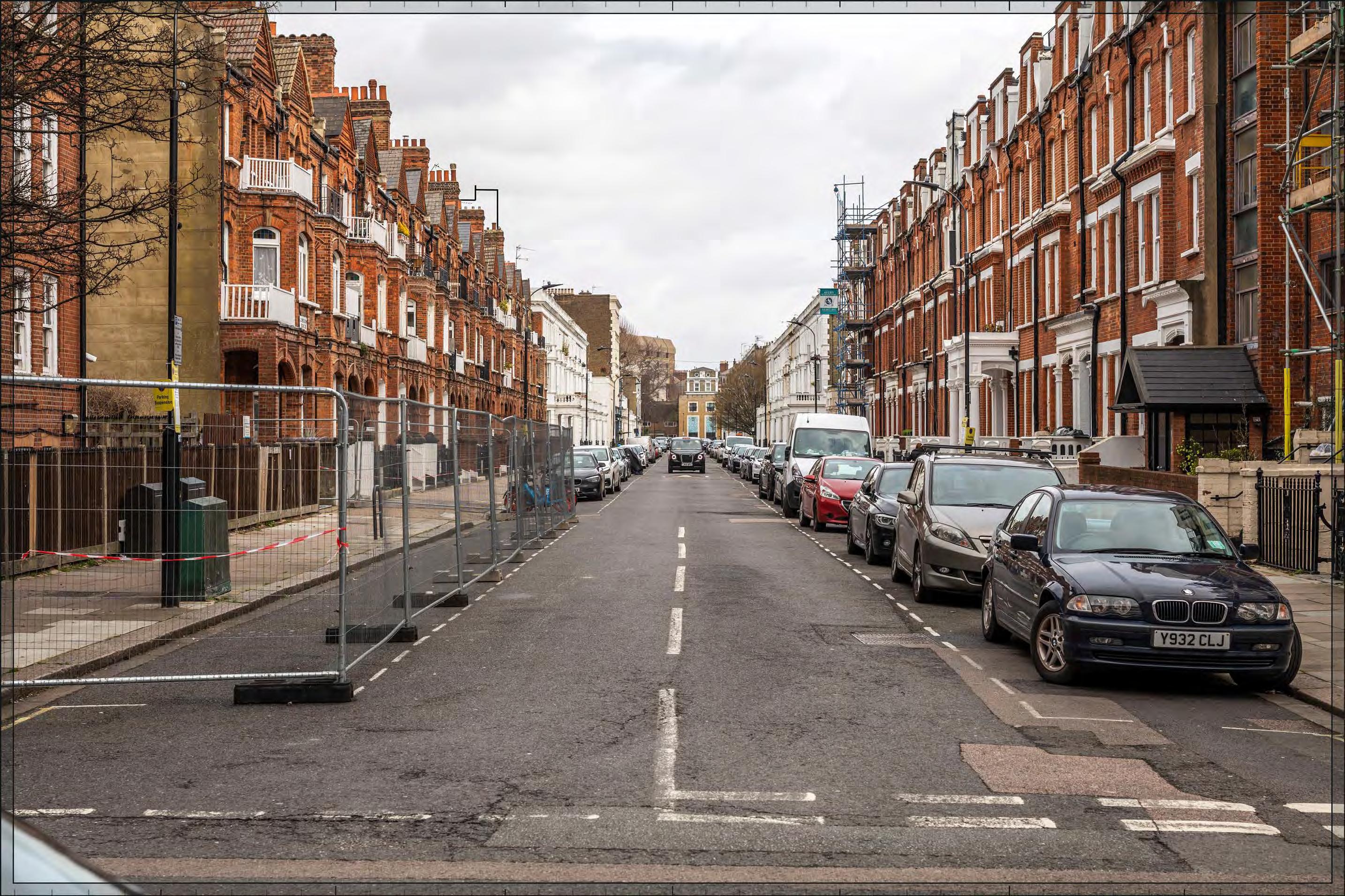
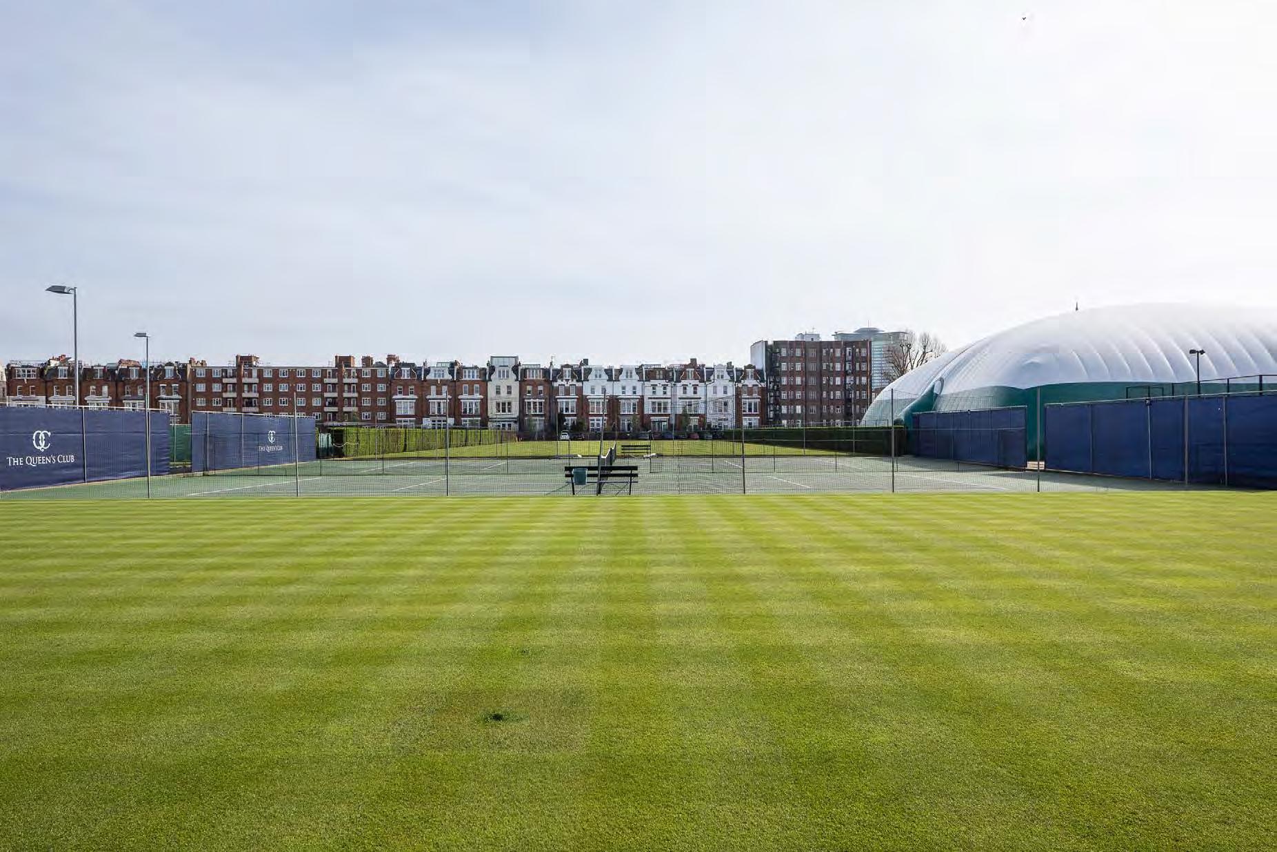
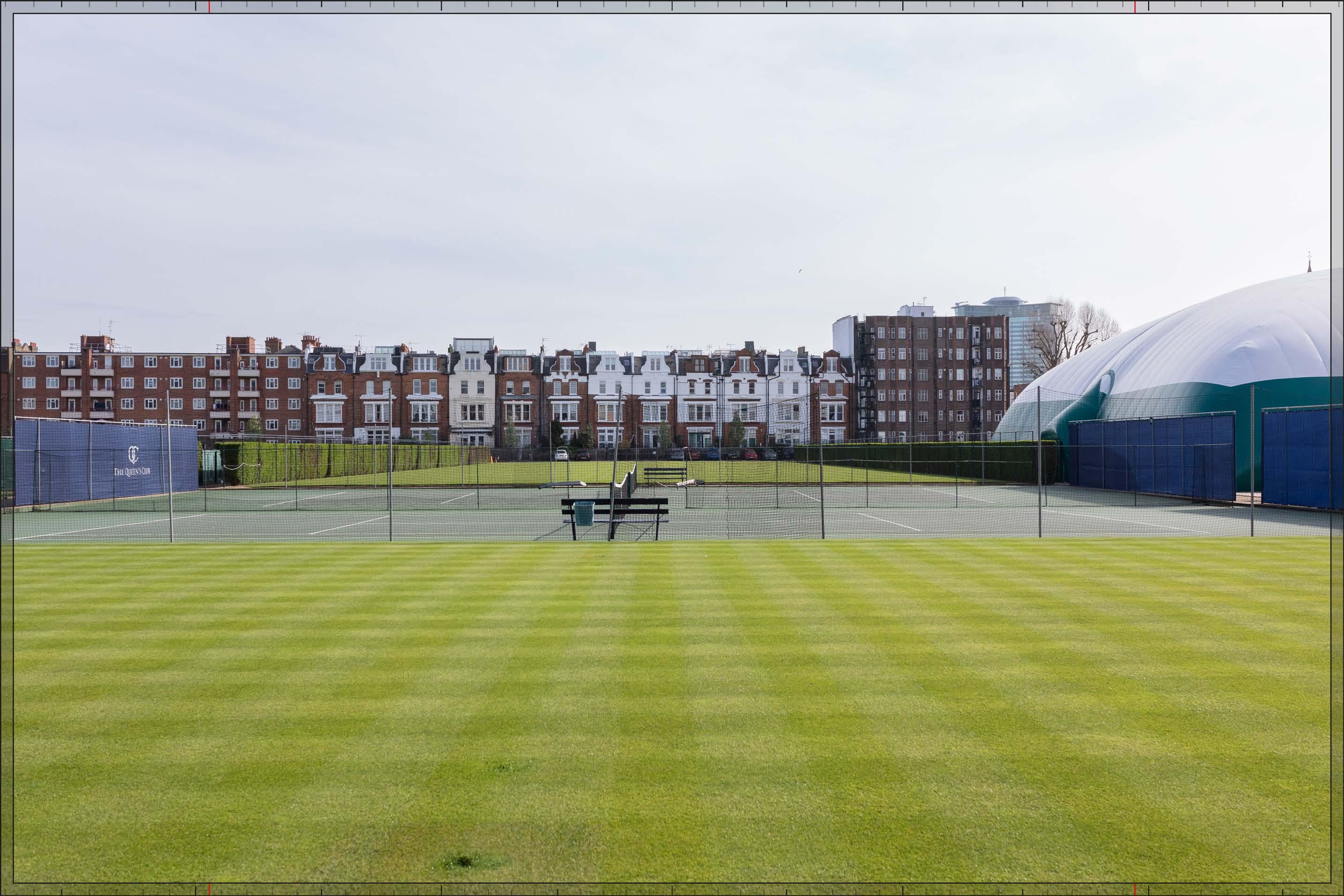
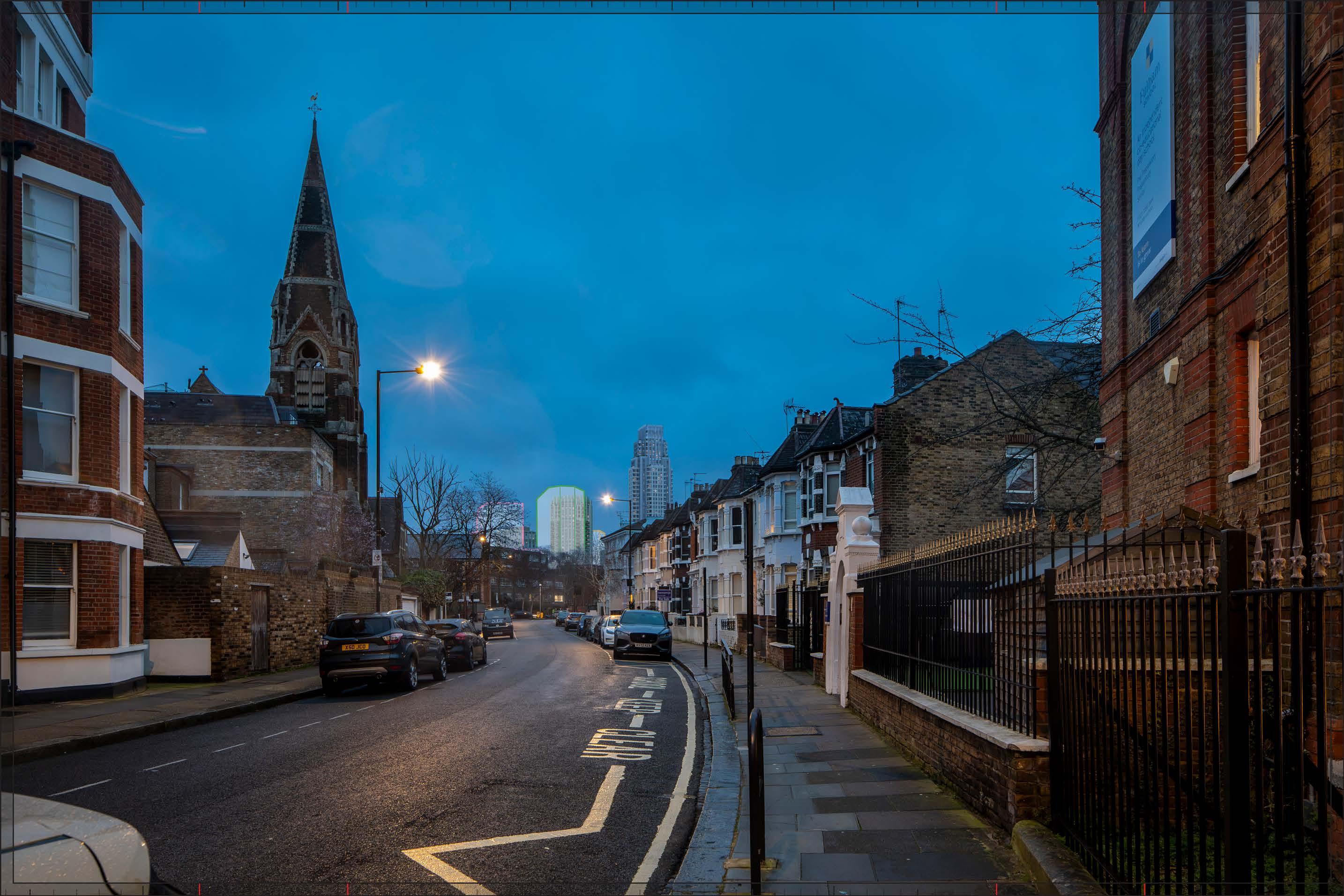
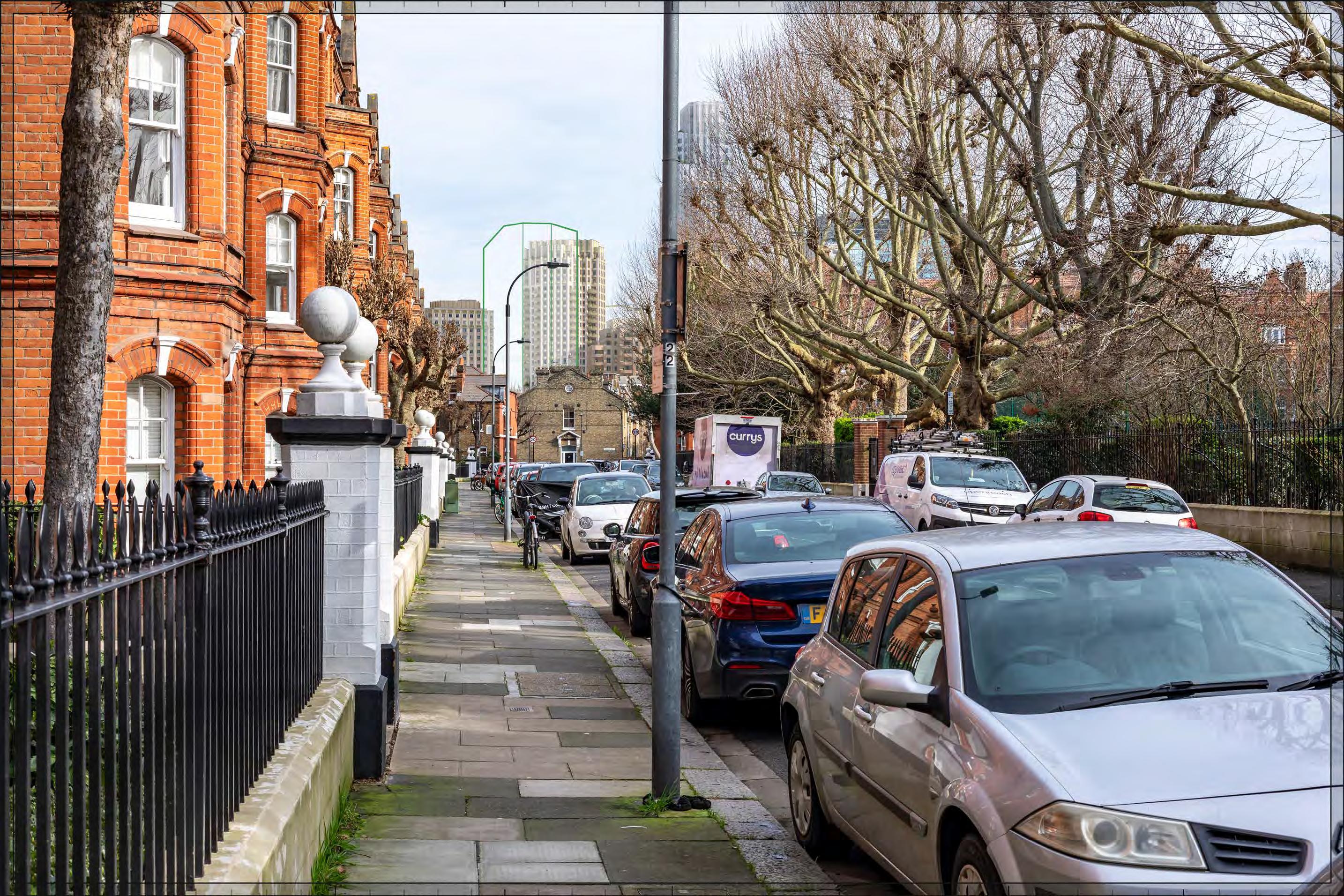
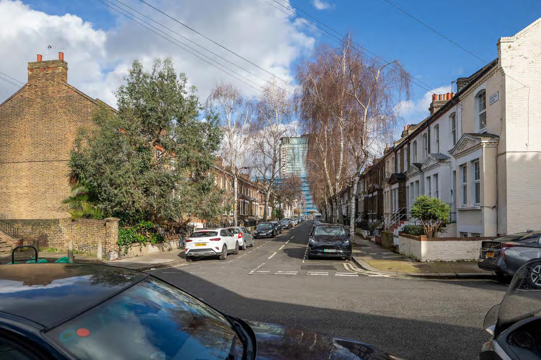
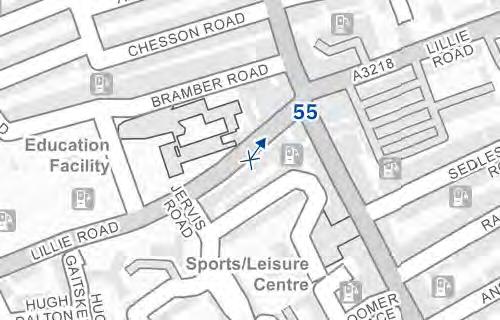
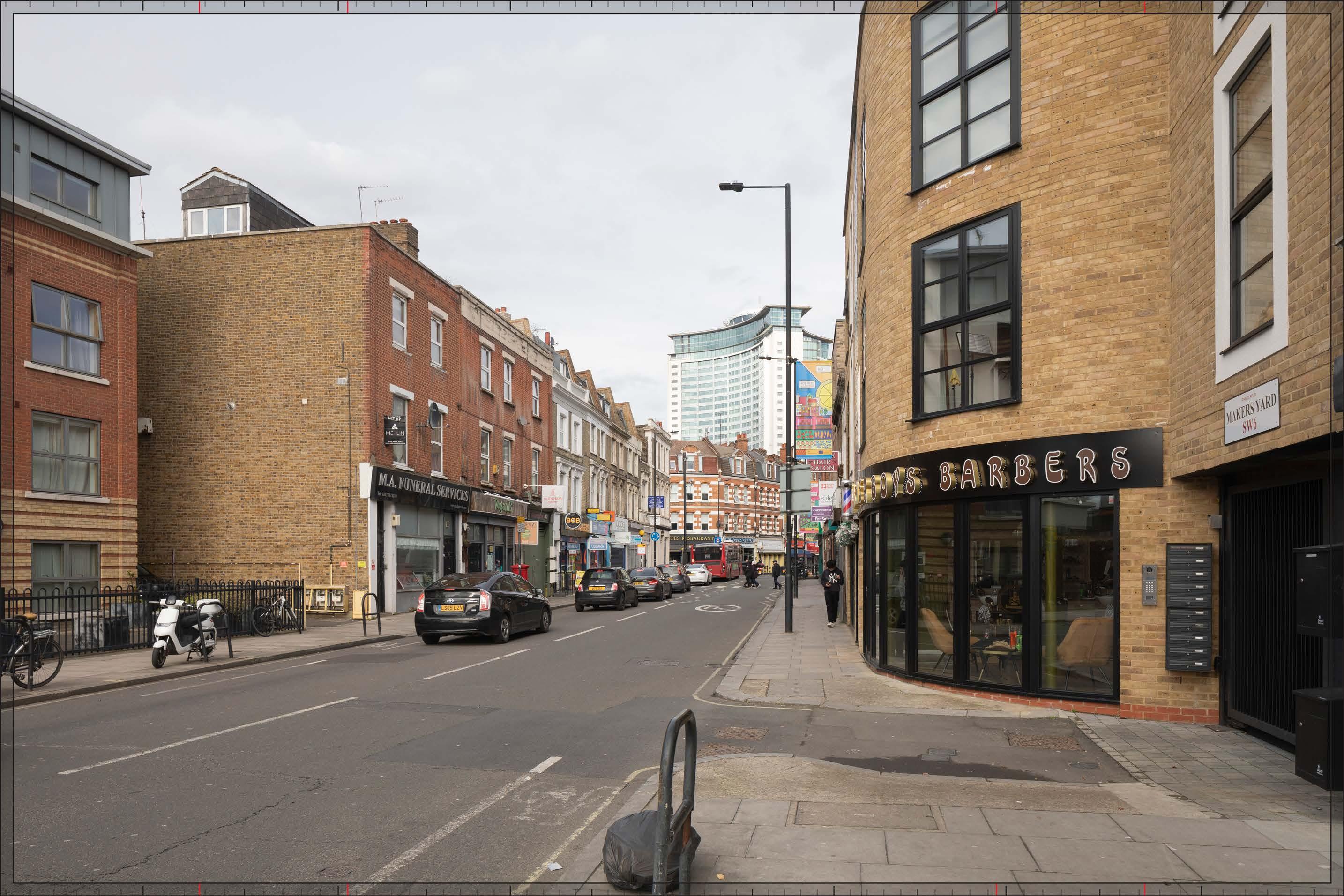
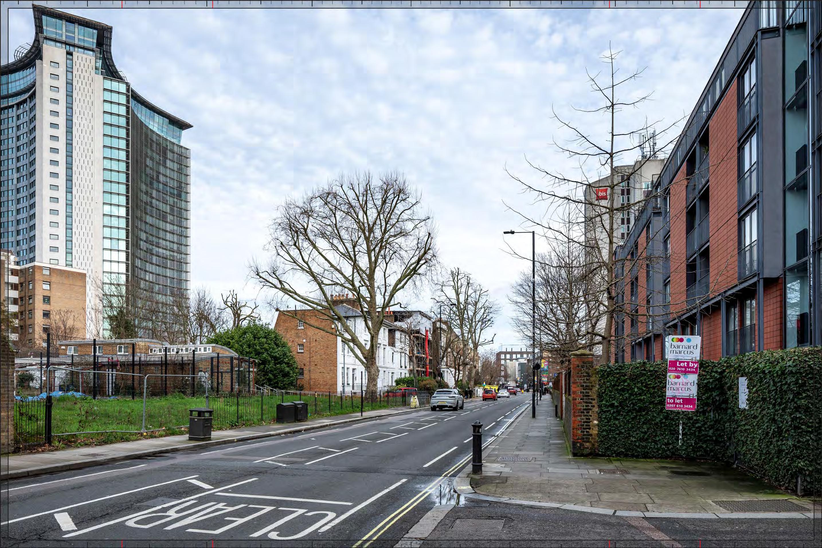
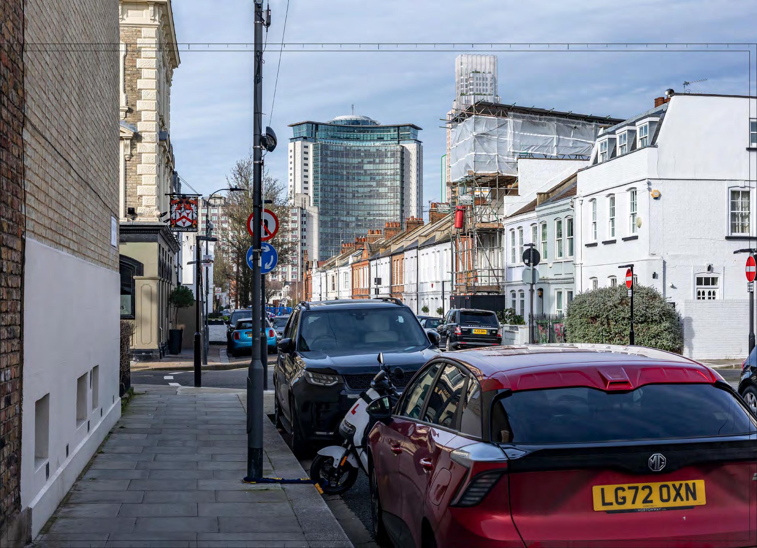
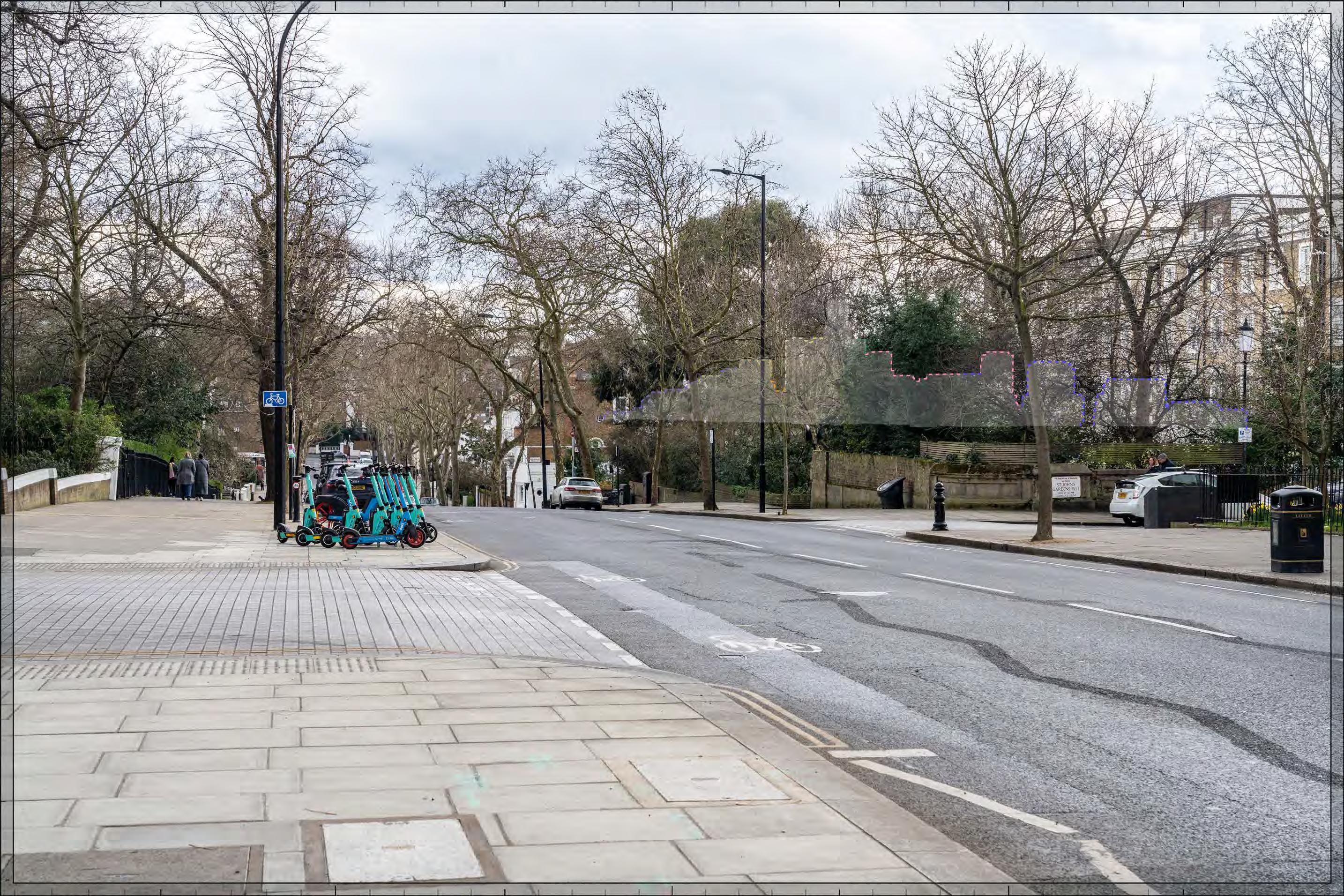
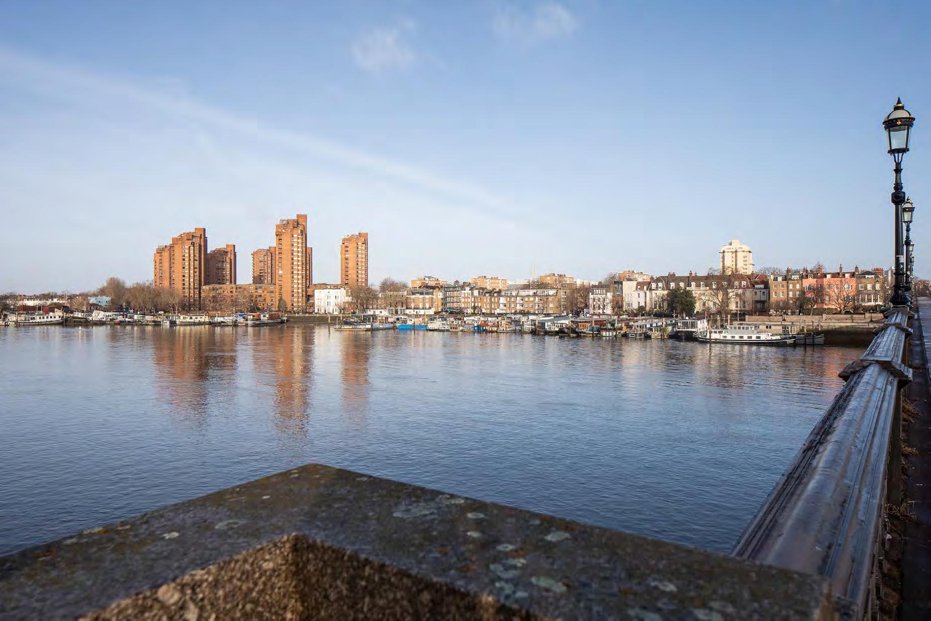
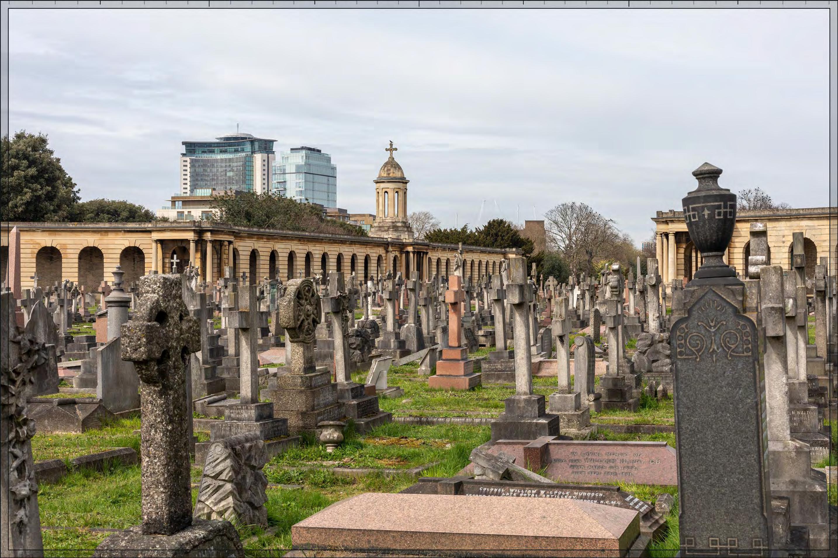
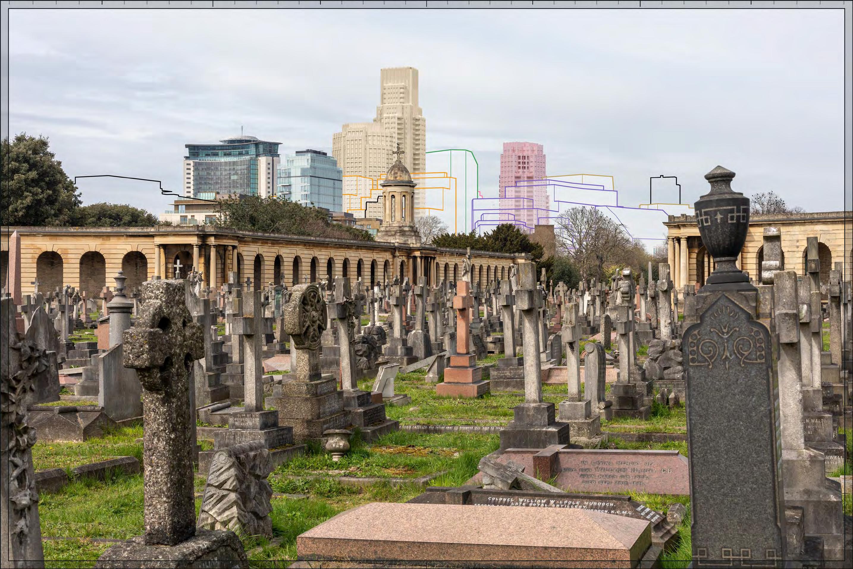
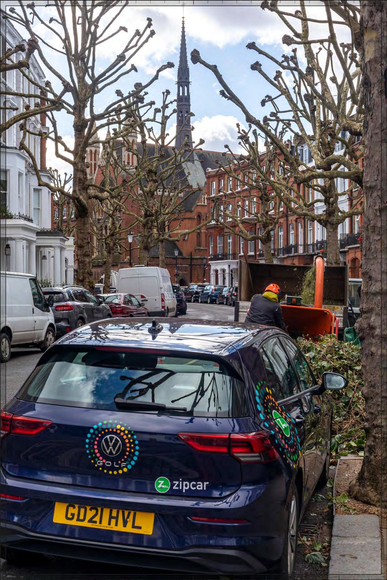
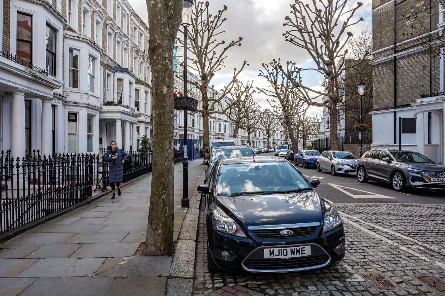
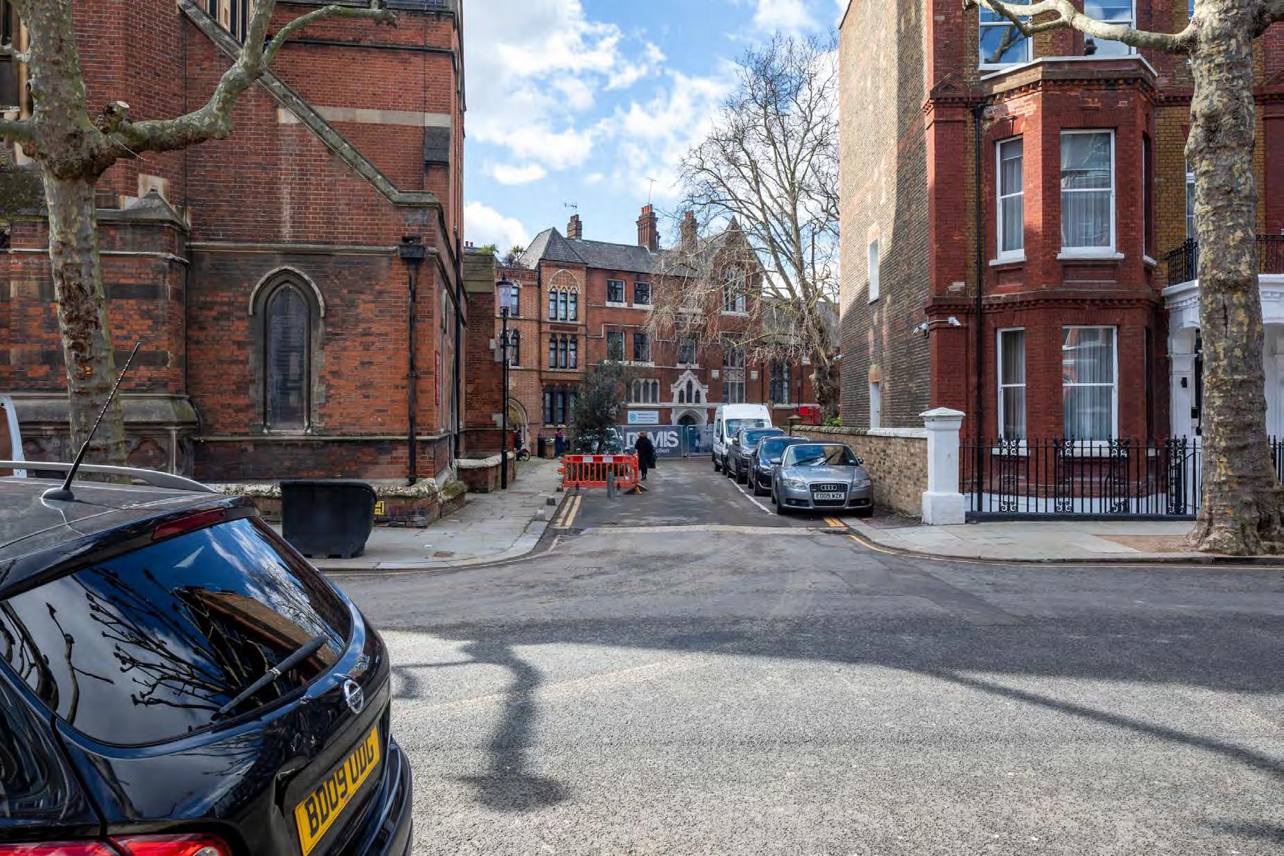
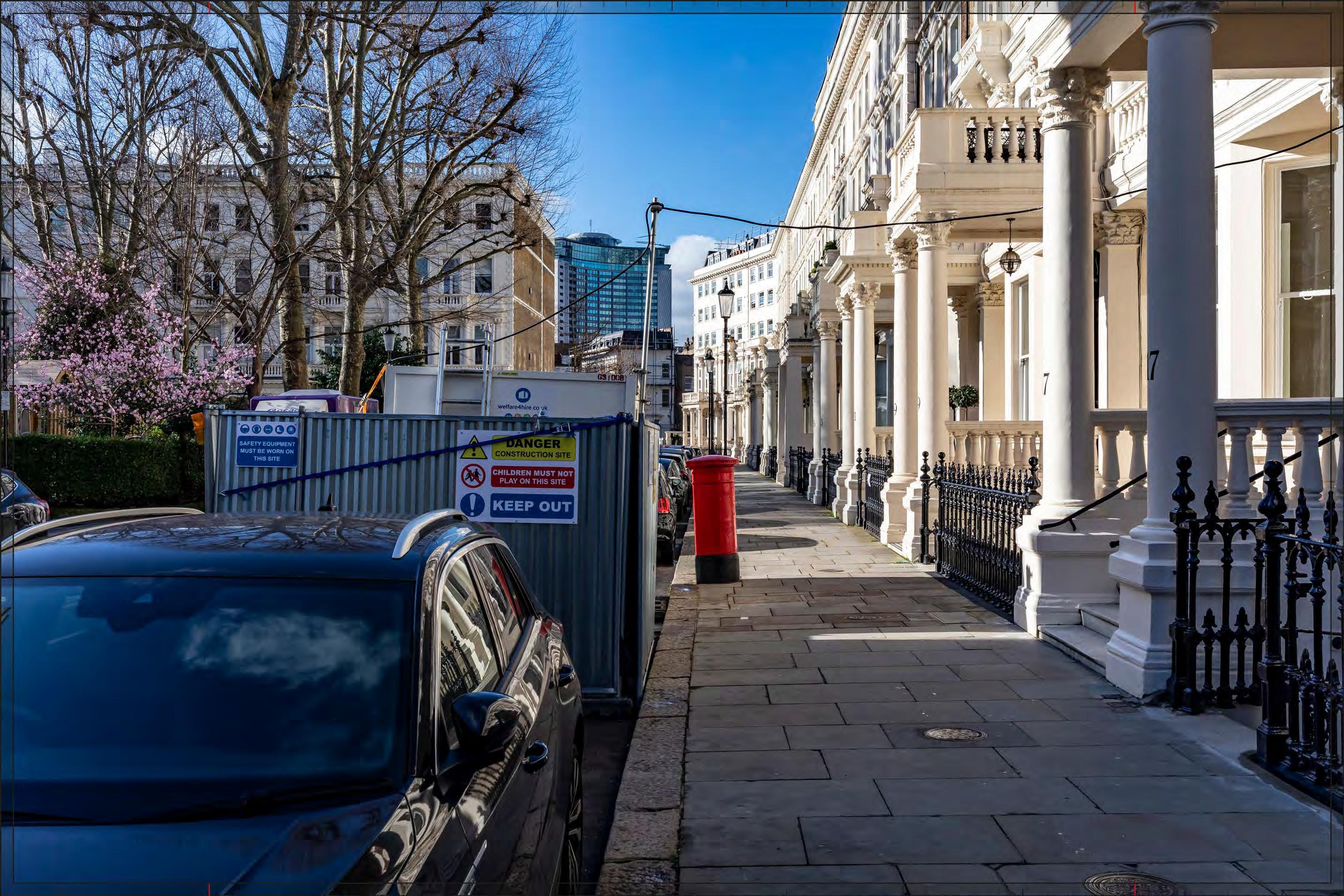
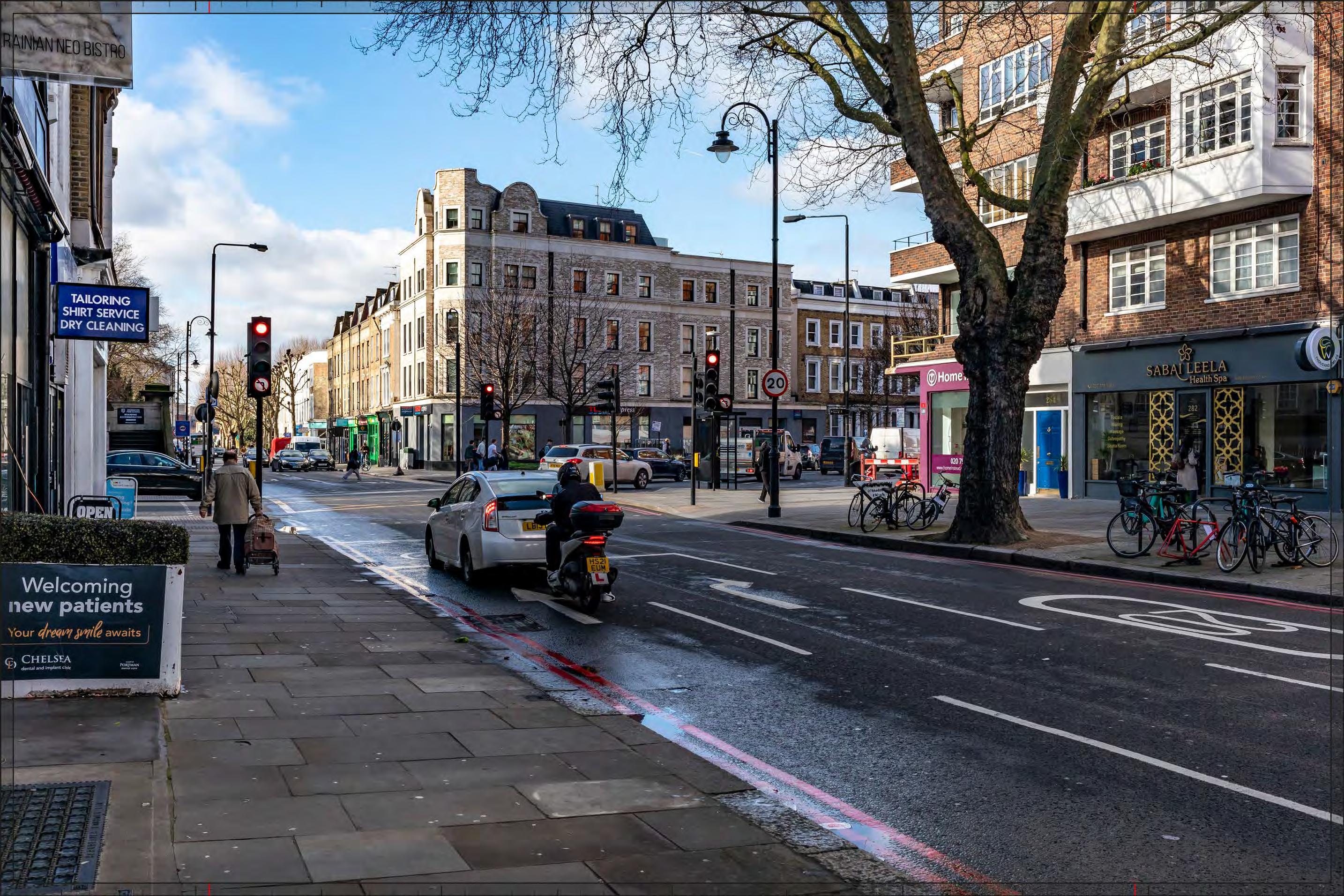
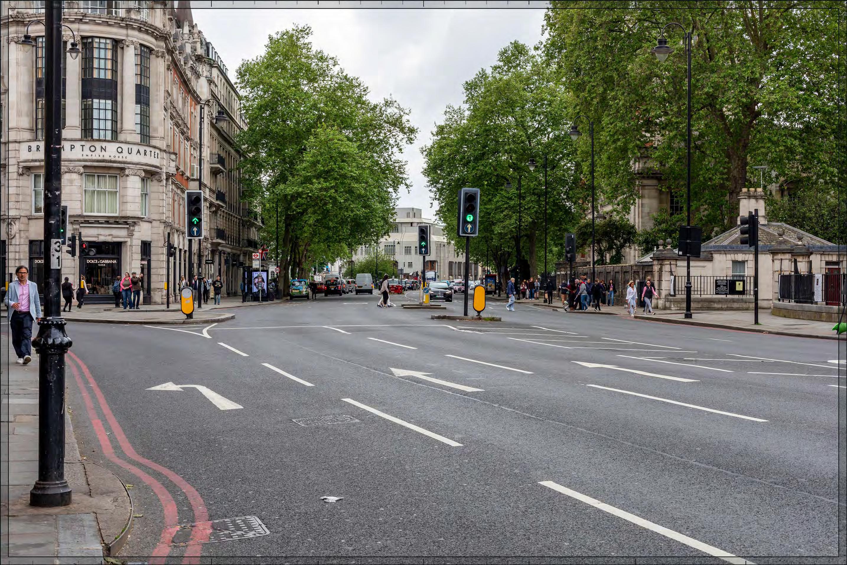
Filmer Road
D28051x50 / 50mm 09/03/23 15:45
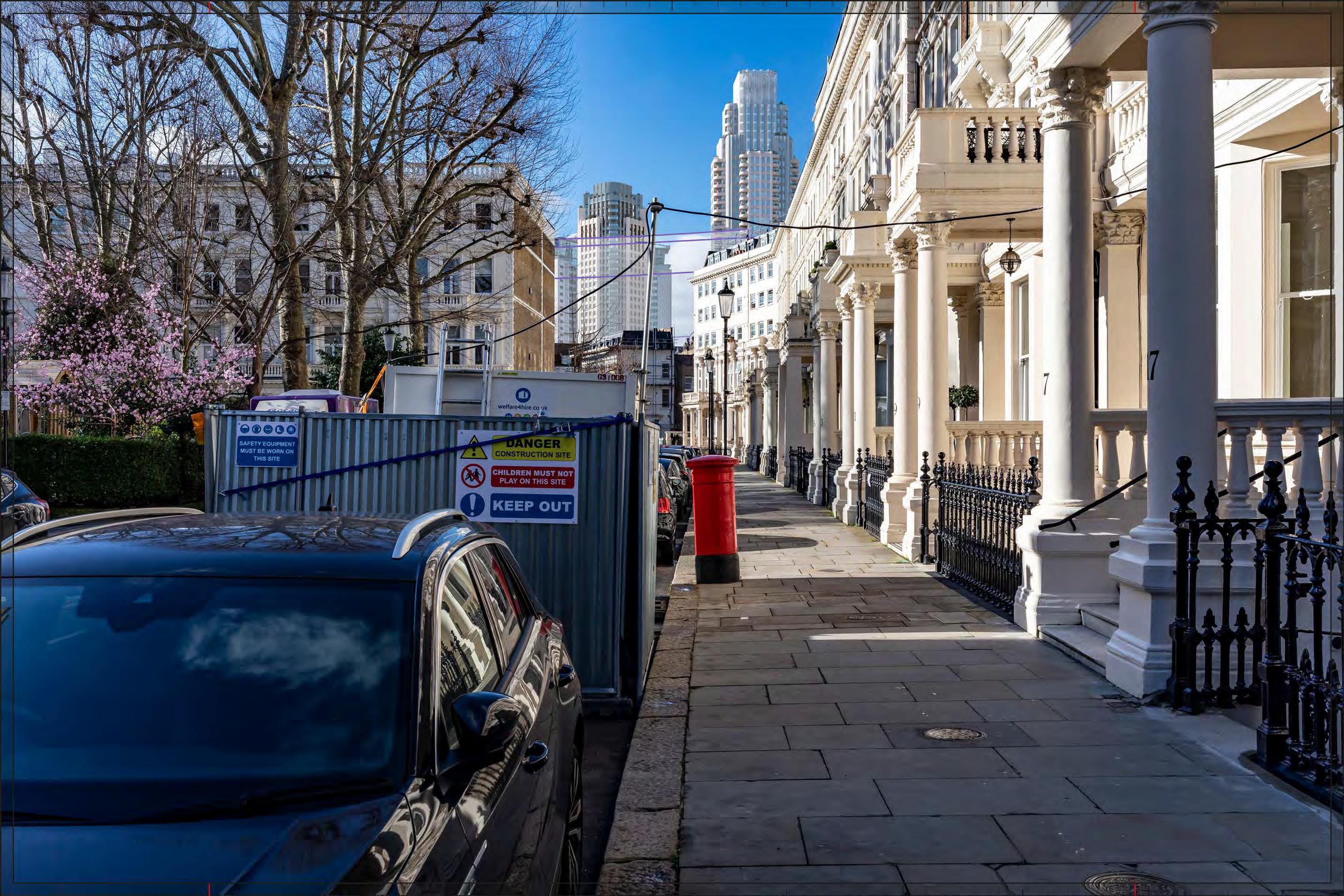
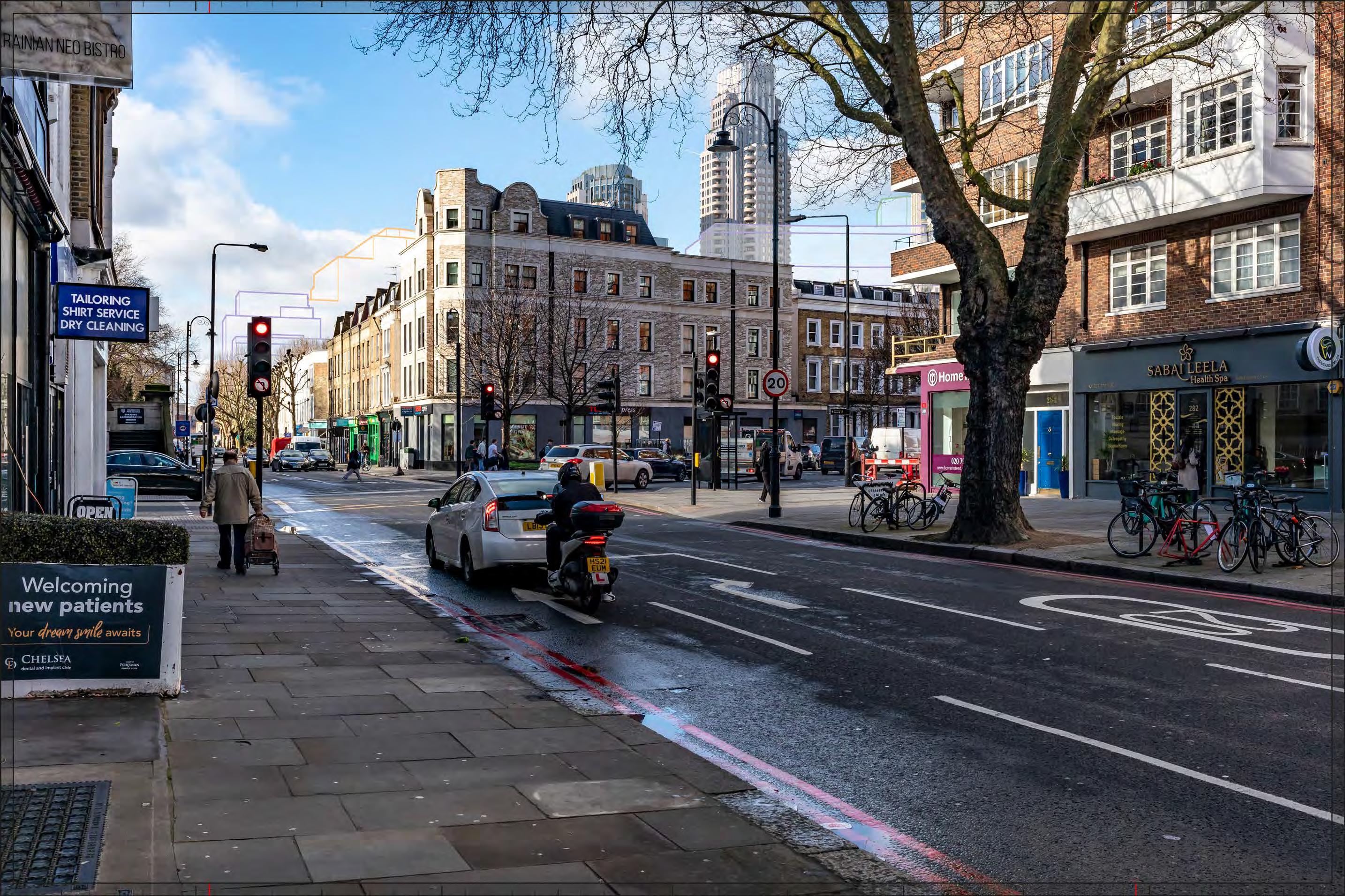
Completed Development - Early Phases
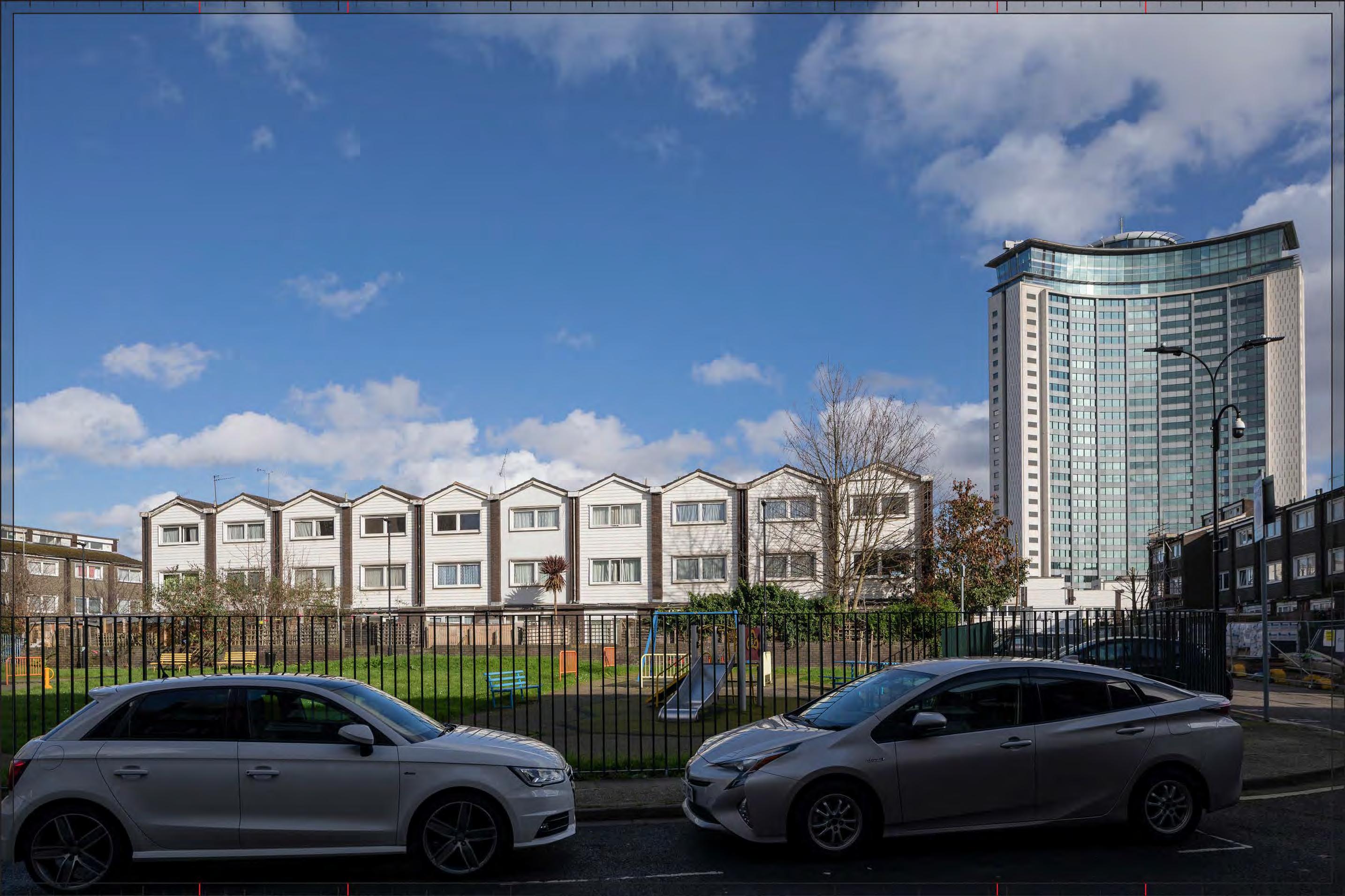
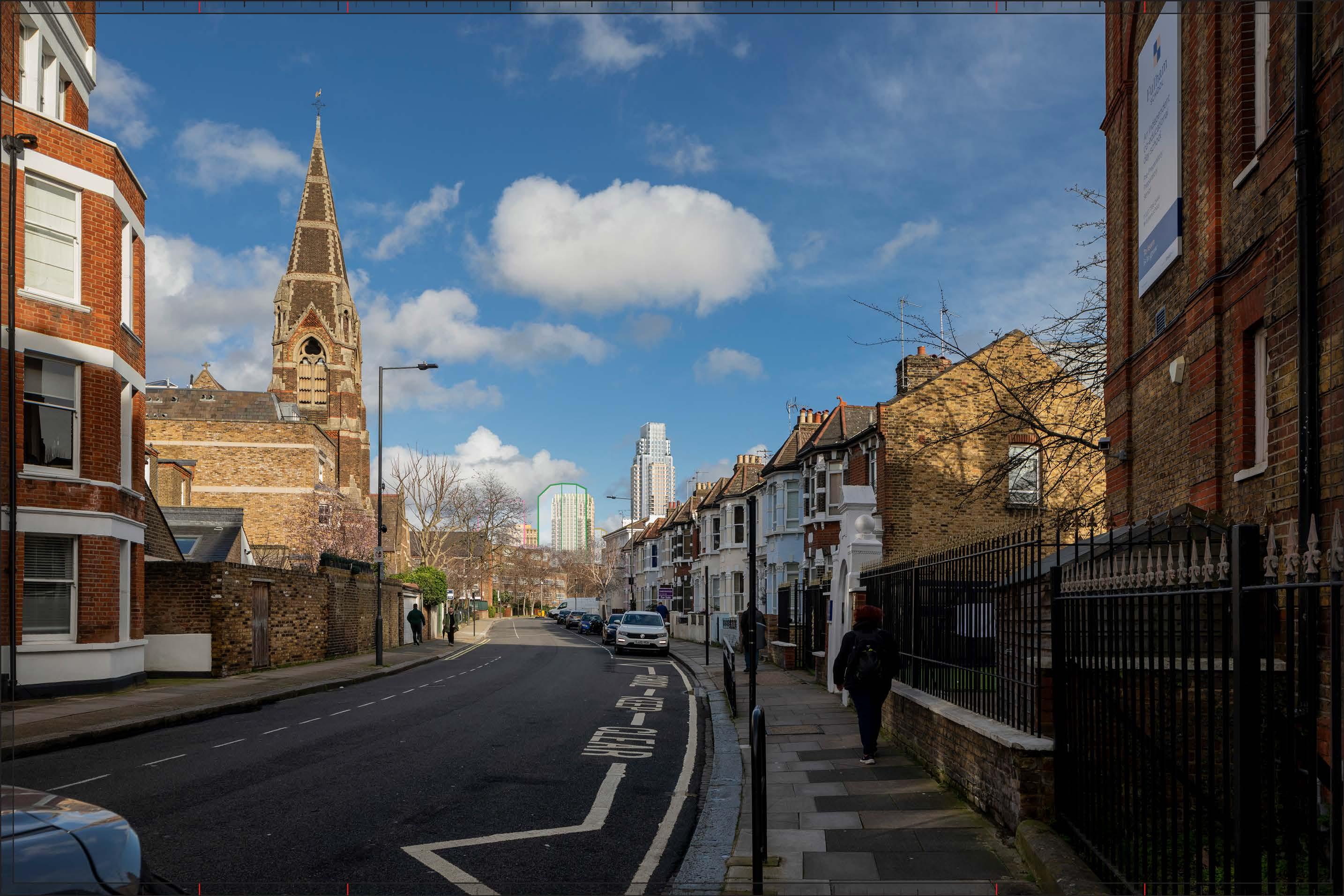
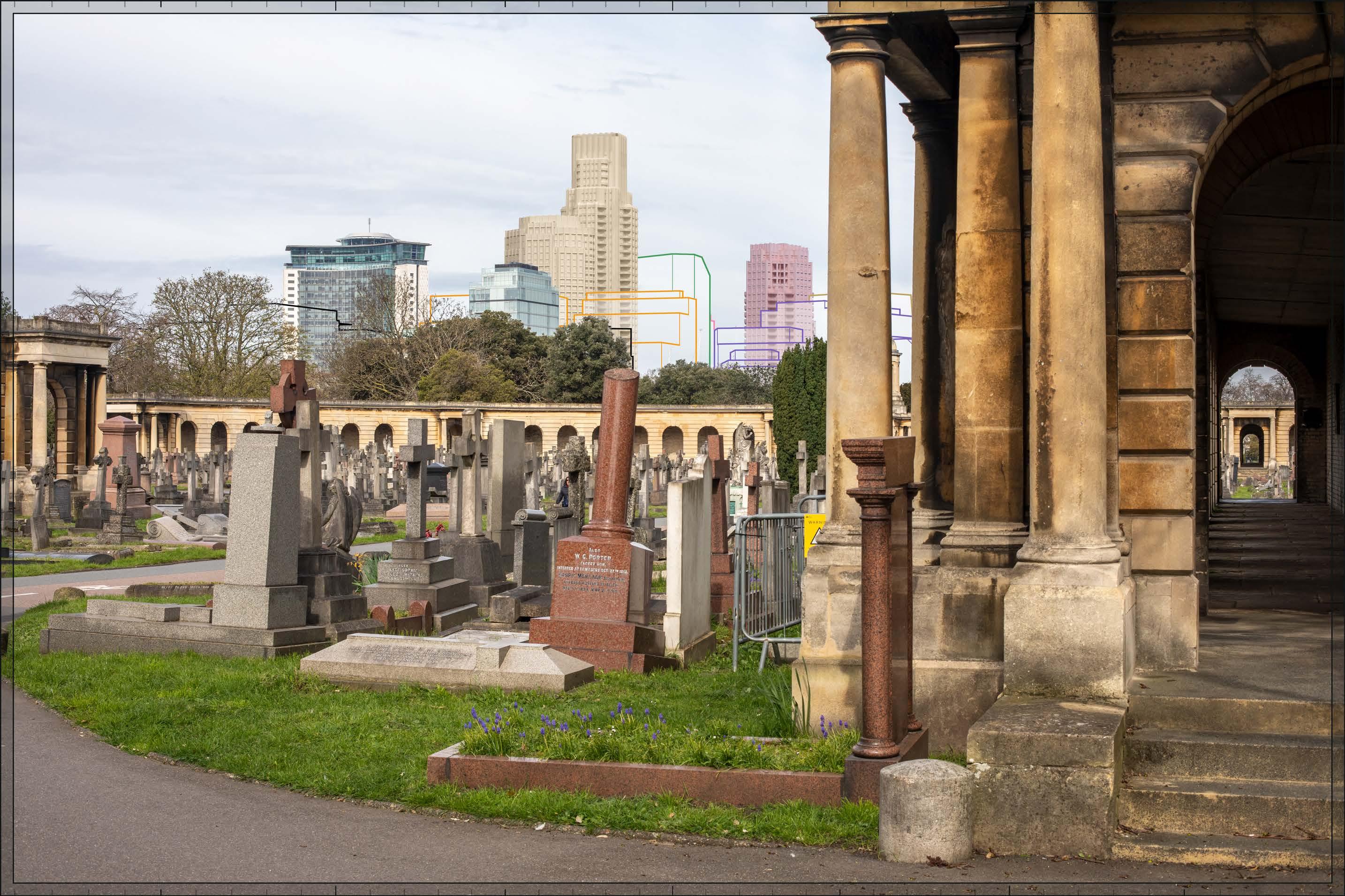
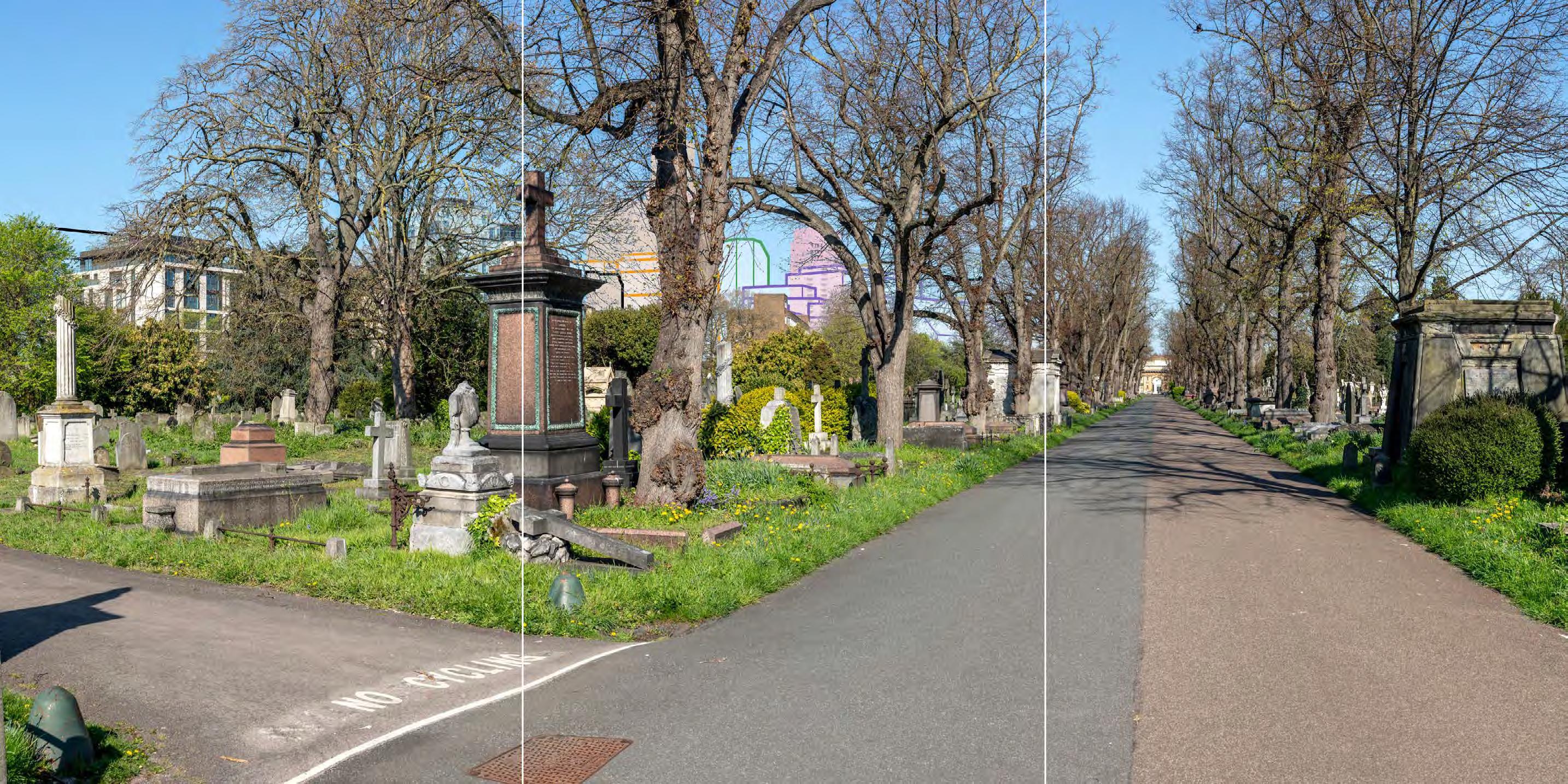
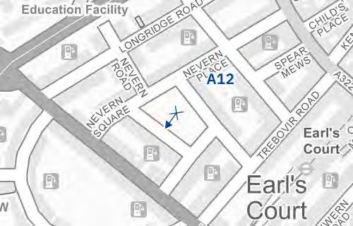
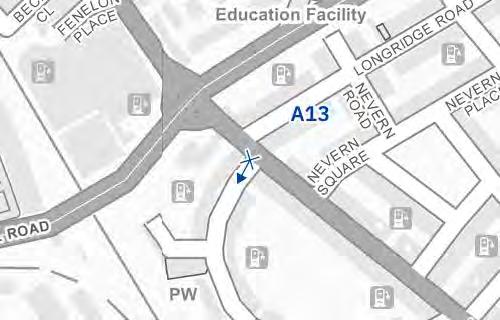
The top of Detailed Component Plot WB04 would appear to the right of centre in the view above the roofline of the foreground terraces, seen at a distance of approximately 1.5km. A very small part of Outline Plot WB06 would be visible to its left, screened by trees. This would be a relatively fleeting incidental impact on visual amenity resulting from the particular alignment of Filmer Road, with the Early Phases otherwise not widely visible in views from this part of Fulham, as demonstrated by the ZVI in Appendix G. The Detailed Component of the Early Phases is modelled in chalk render, which shows the scale form and articulation of the Detailed Component Plots, but not the proposed materials or the effects of distance on their visibility.
Plot WB04 would be visibly distant, distinct and separate from the housing within the conservation area in the foreground. Its top would have a distinctive visually interesting form, with a series of shoulders stepping up symmetrically to a slender central ‘crown’. The reduction in massing would be reinforced by the change in materiality, from stone-like solid materials, to lighter, more transparent and reflective materials at the crown.
The minor visibility of the Early Phases in the distant backdrop would have a Low magnitude of impact. The limited incidental visibility of the Early Phases would preserve the visual amenity of Filmer Road and the nature of the effect would therefore be Neutral Magnitude of impact: Low
Effect: Minor in scale, Neutral in nature (not significant).
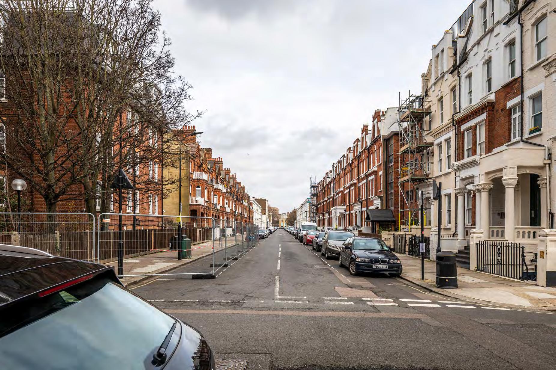
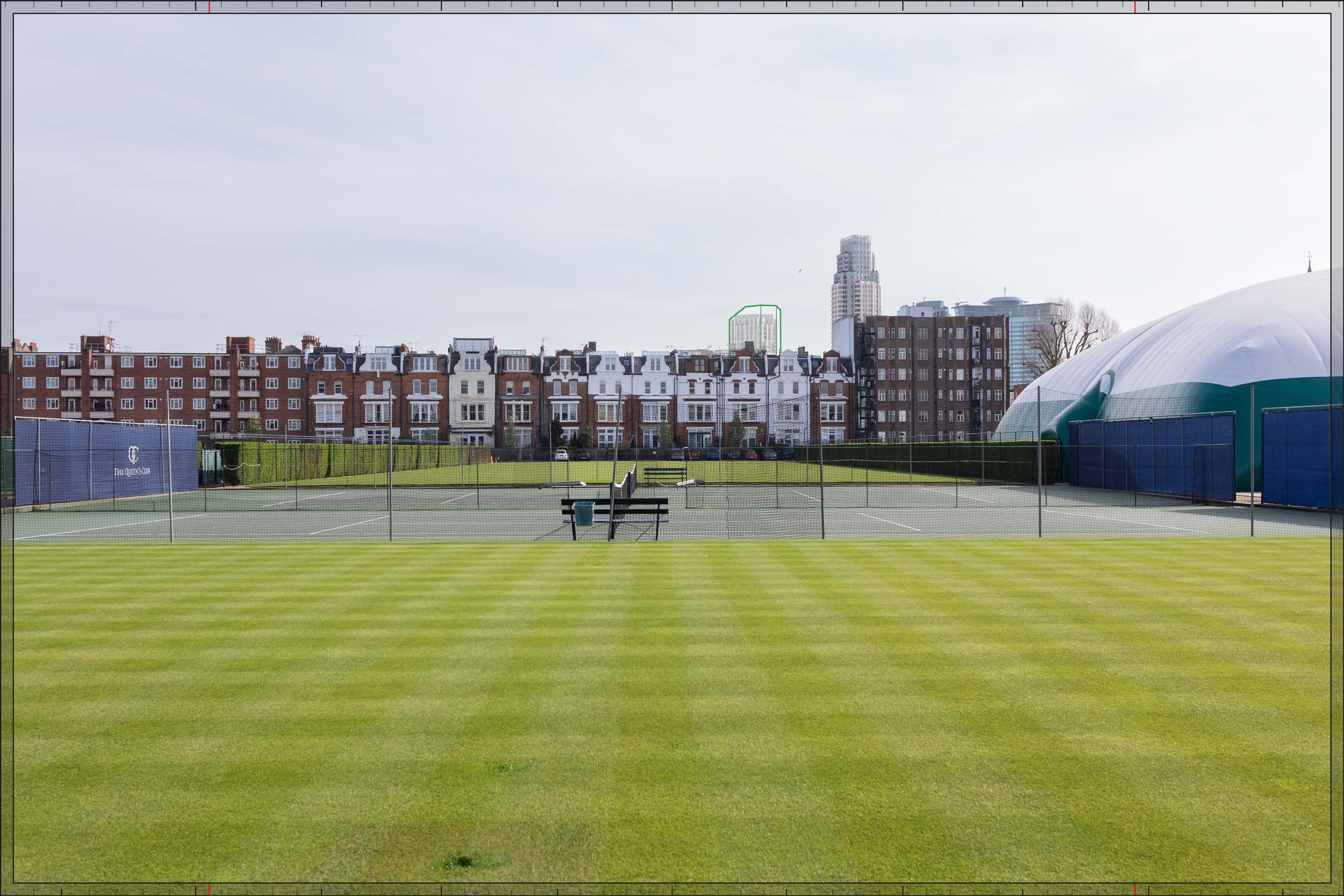
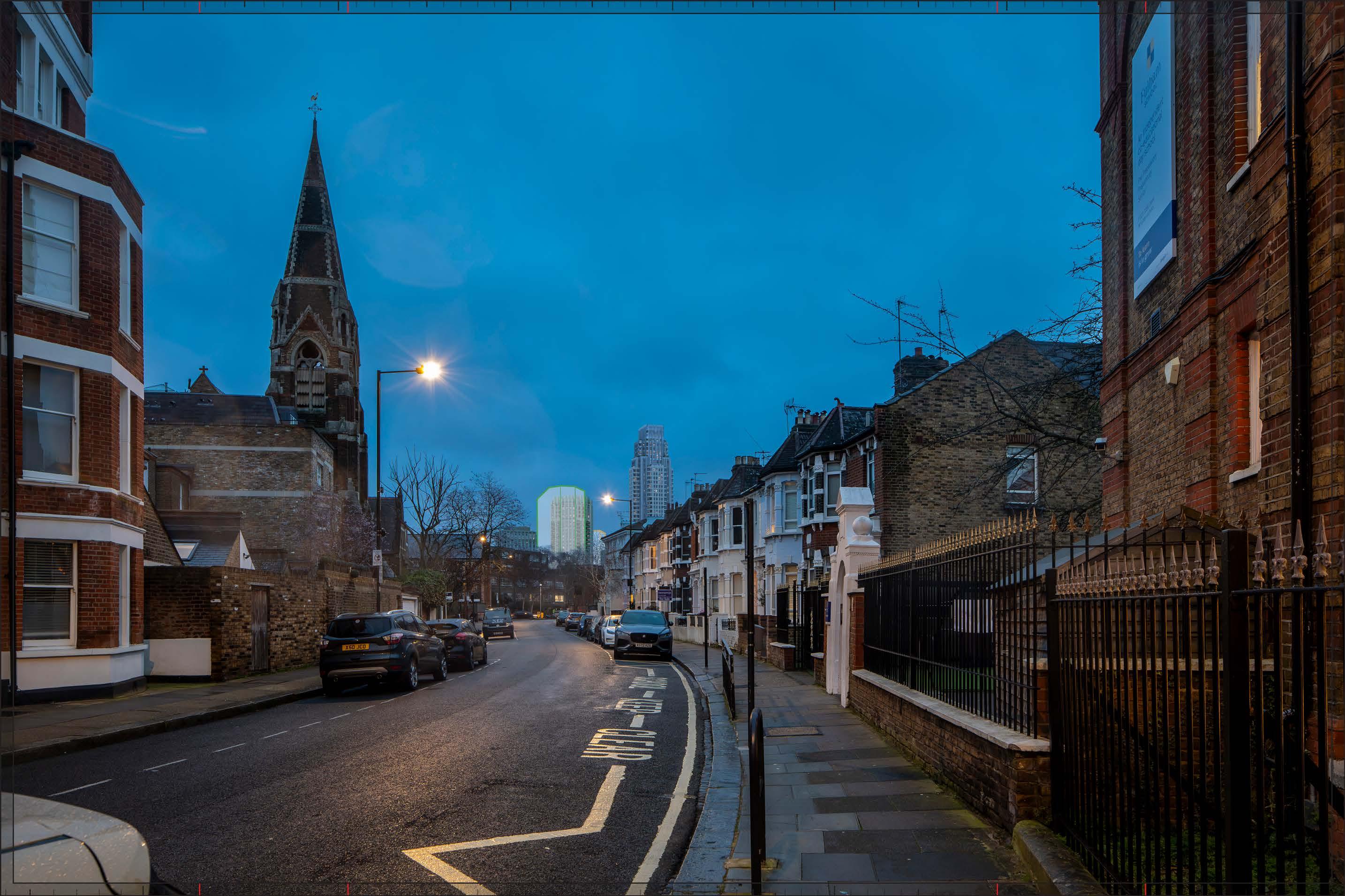
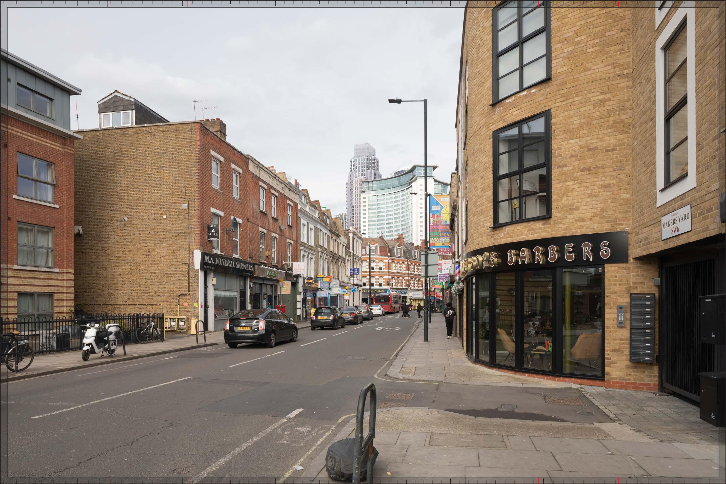
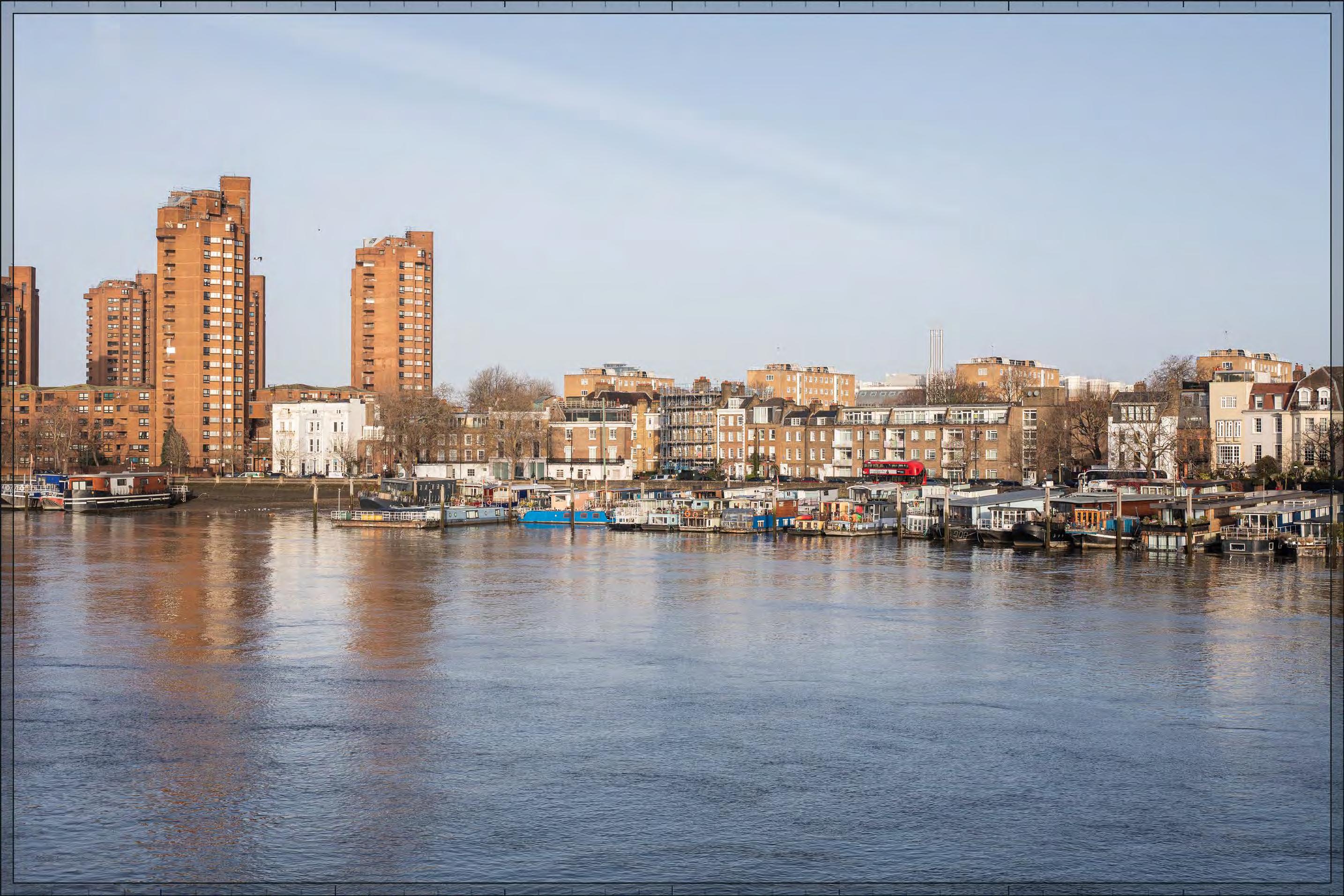
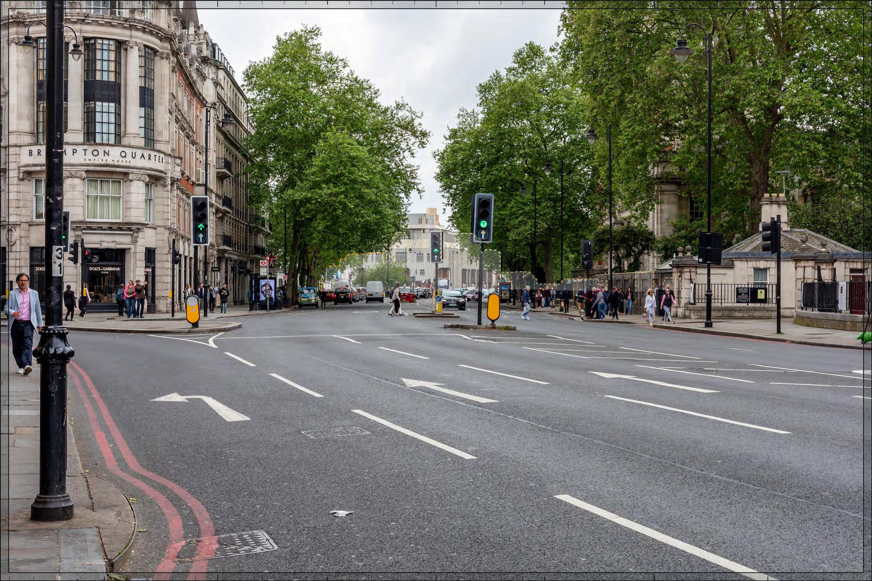
Development - Early Phases
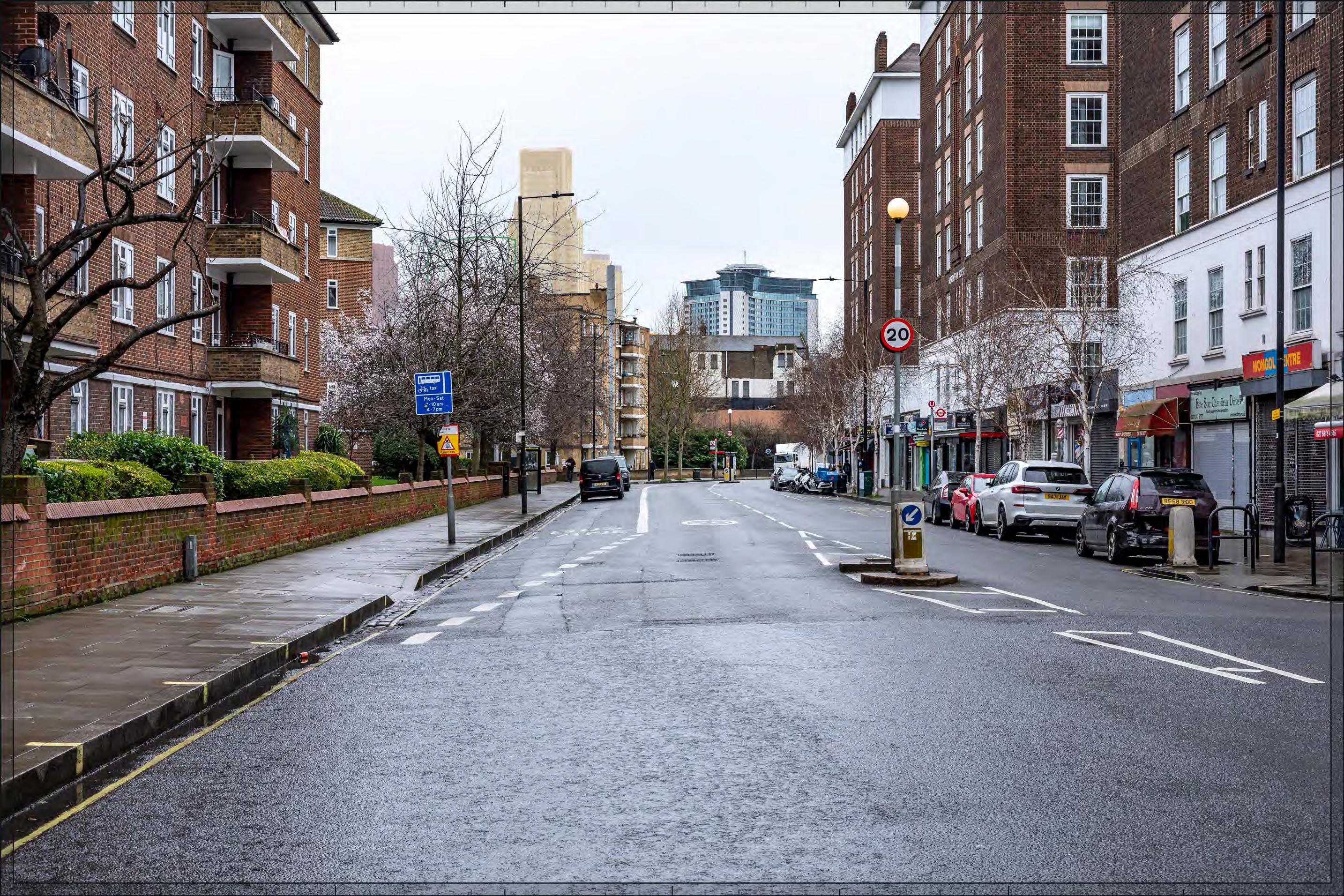
Filmer Road
D28051x50 / 50mm 09/03/23 15:45
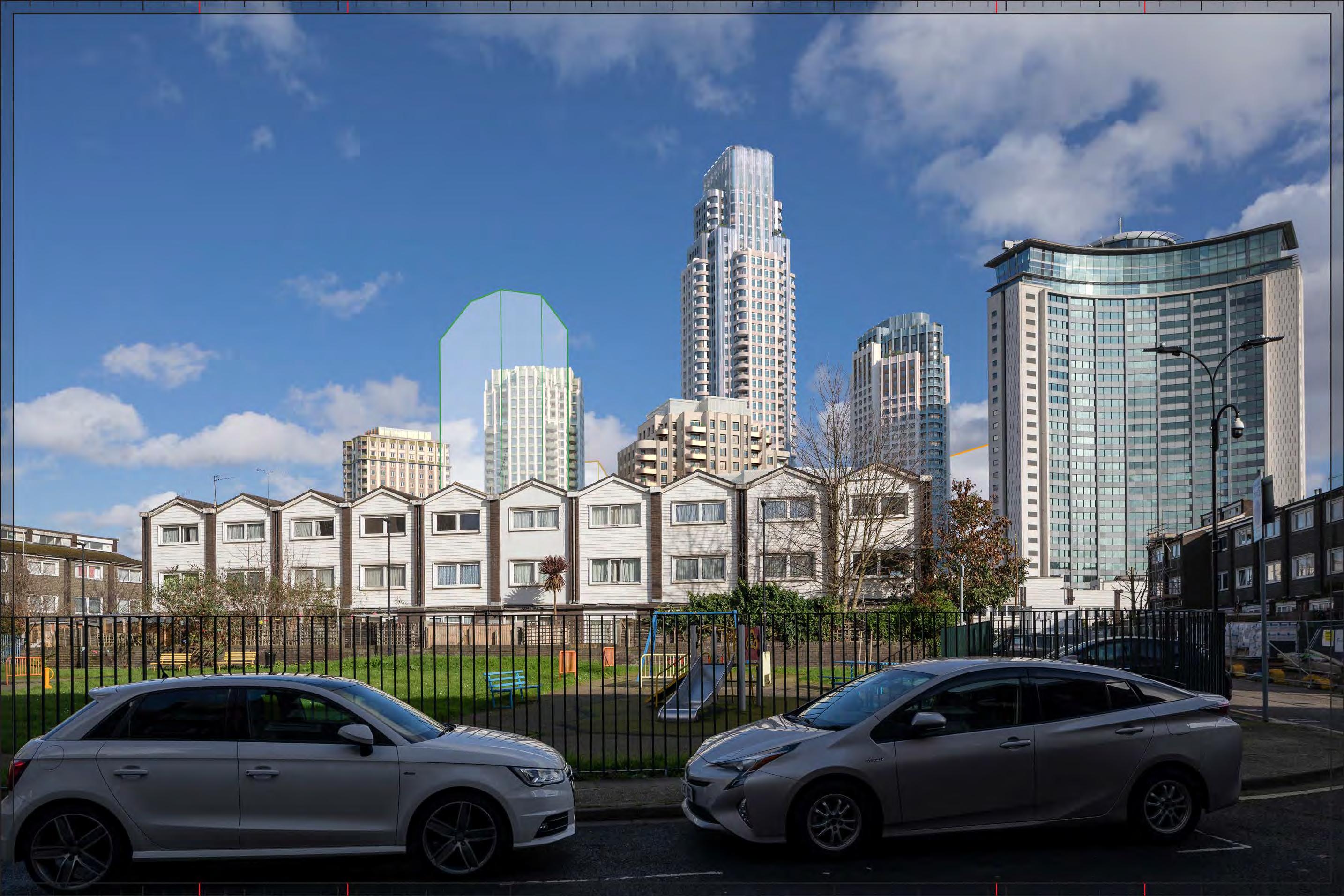
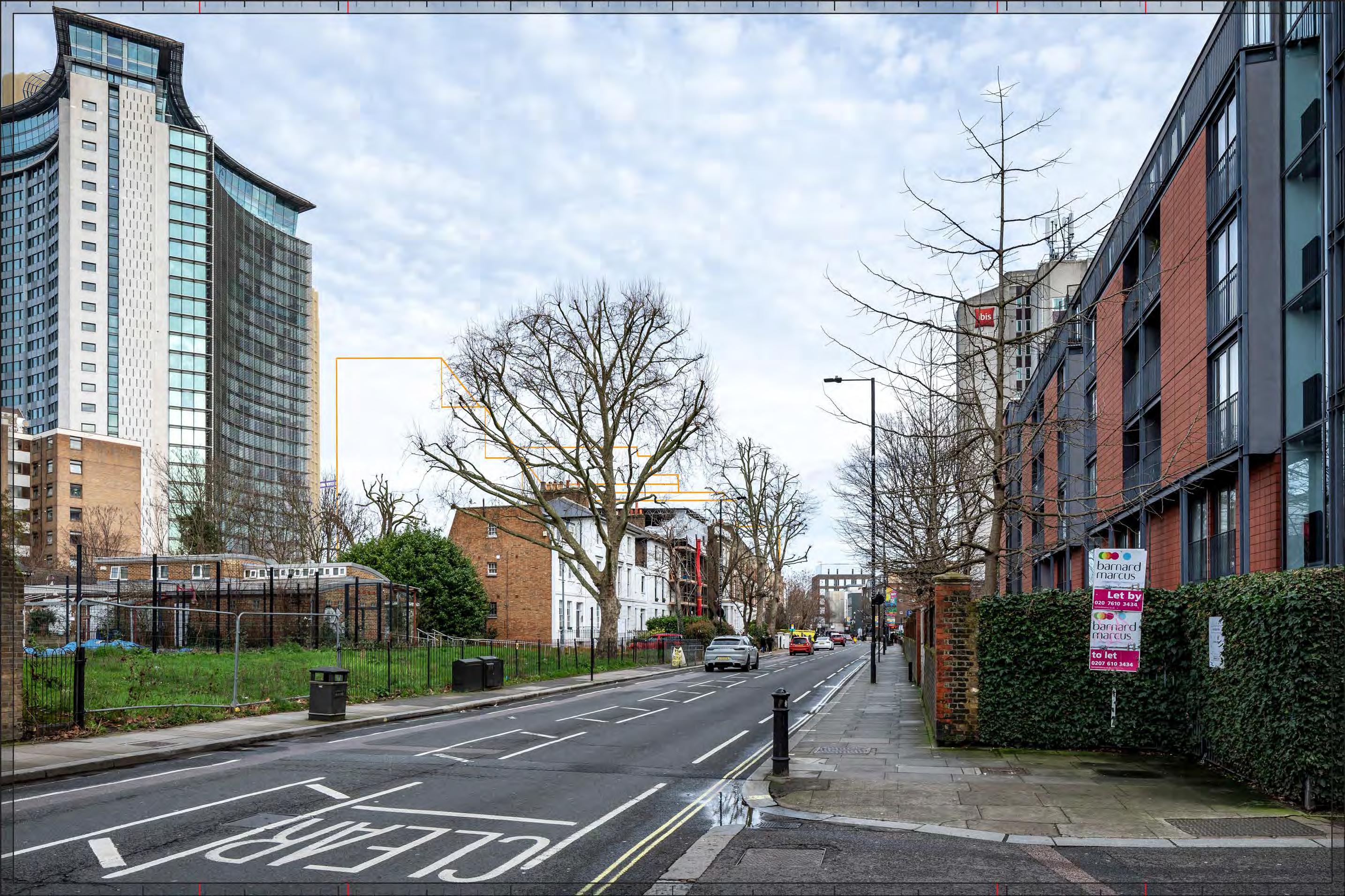
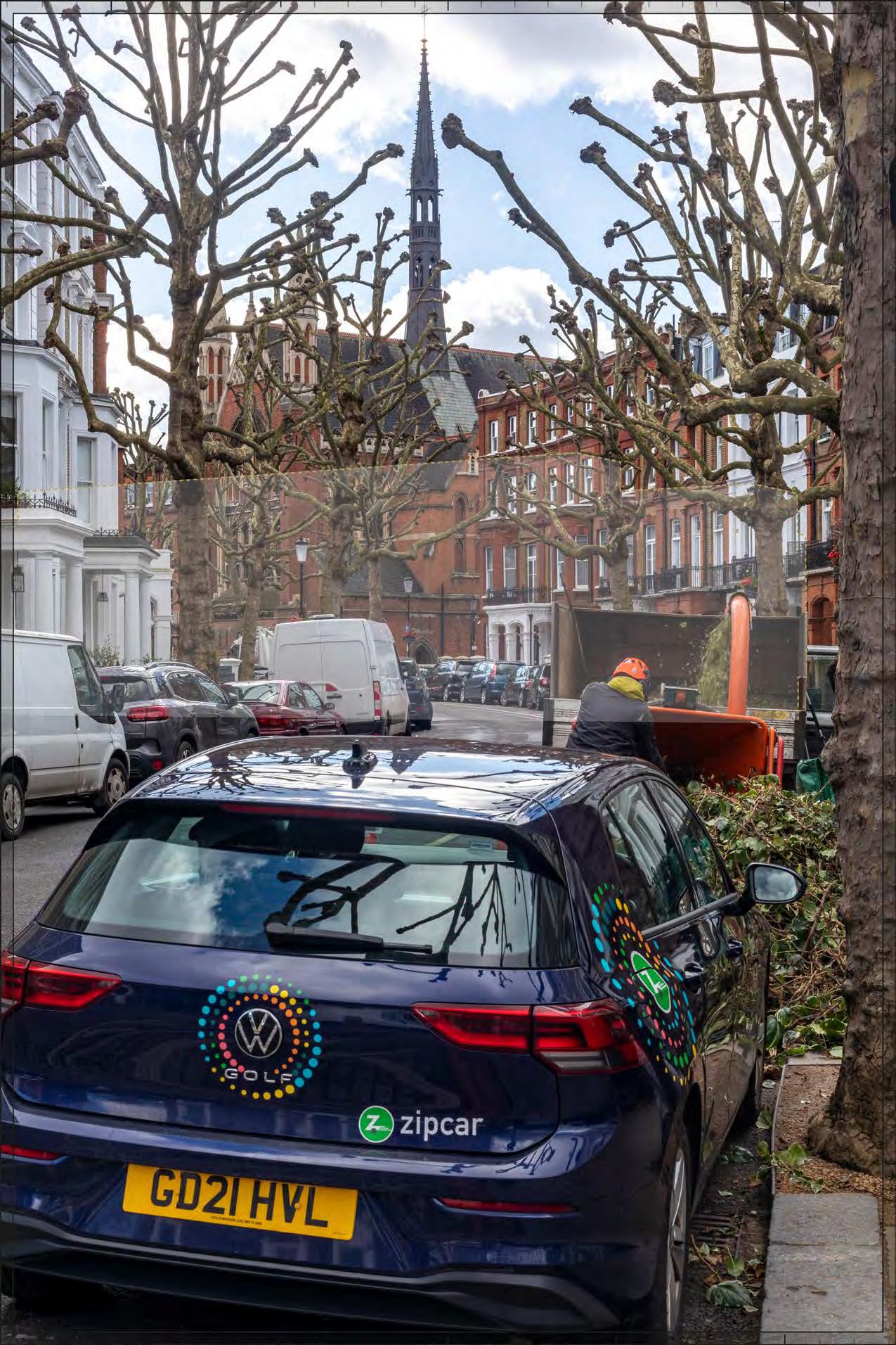
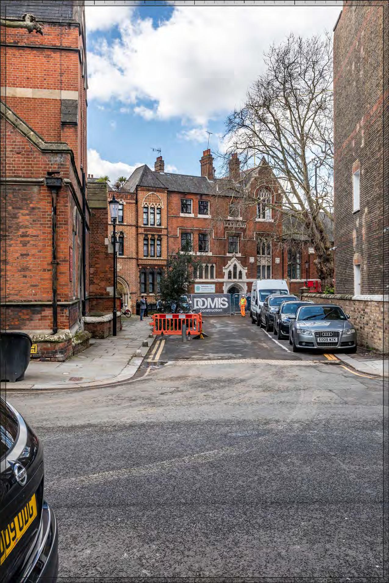
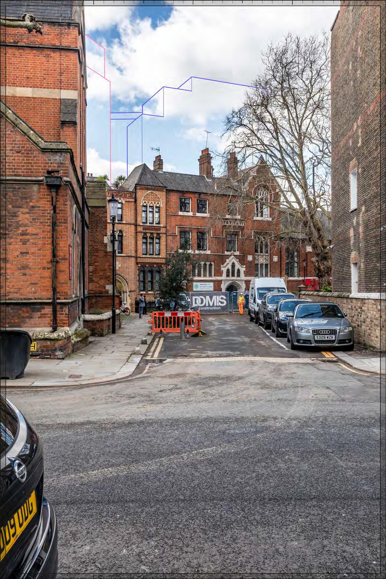
Completed Development - All Phases
Part of Outline Plot WK09 would appear to the north (left in this image) of the Early Phases. It would appear at a lower apparent height than Early Phases, at a slightly greater distance, screened by trees to a considerable extent in winter and obscured by foliage in summer from this position. The magnitude of impact and the scale and nature of the effect would not alter in comparison to the assessment of the Early Phases.
Magnitude of impact: Low
Effect: Minor in scale, Neutral in nature (not significant).
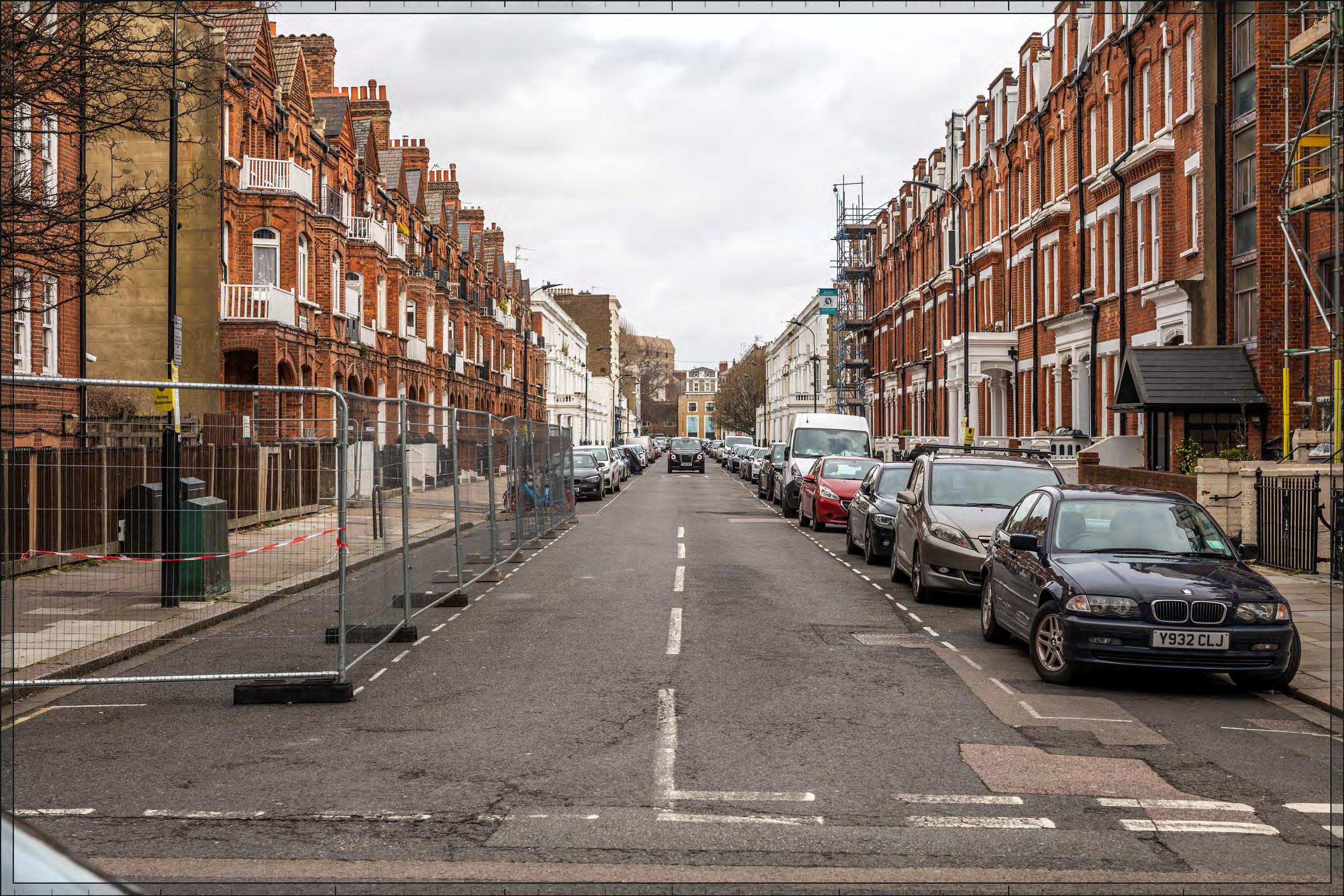
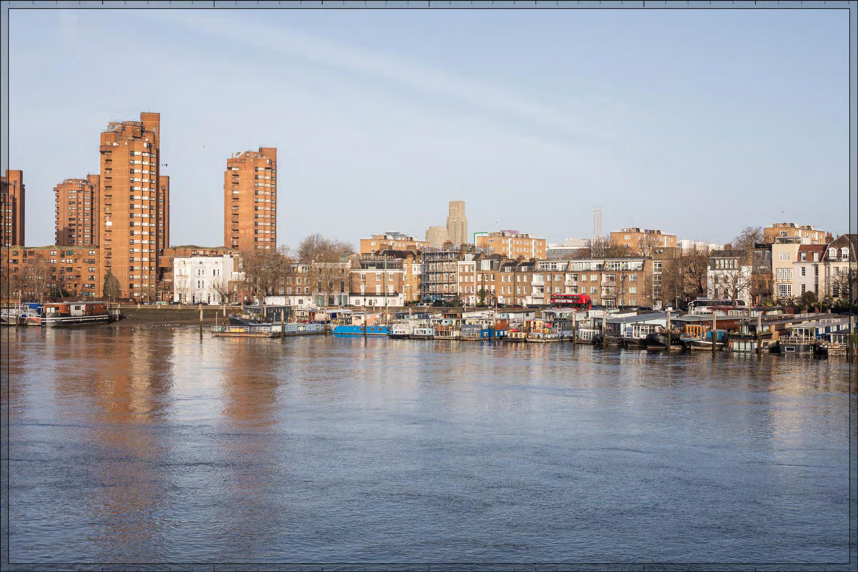
Completed Development - All Phases
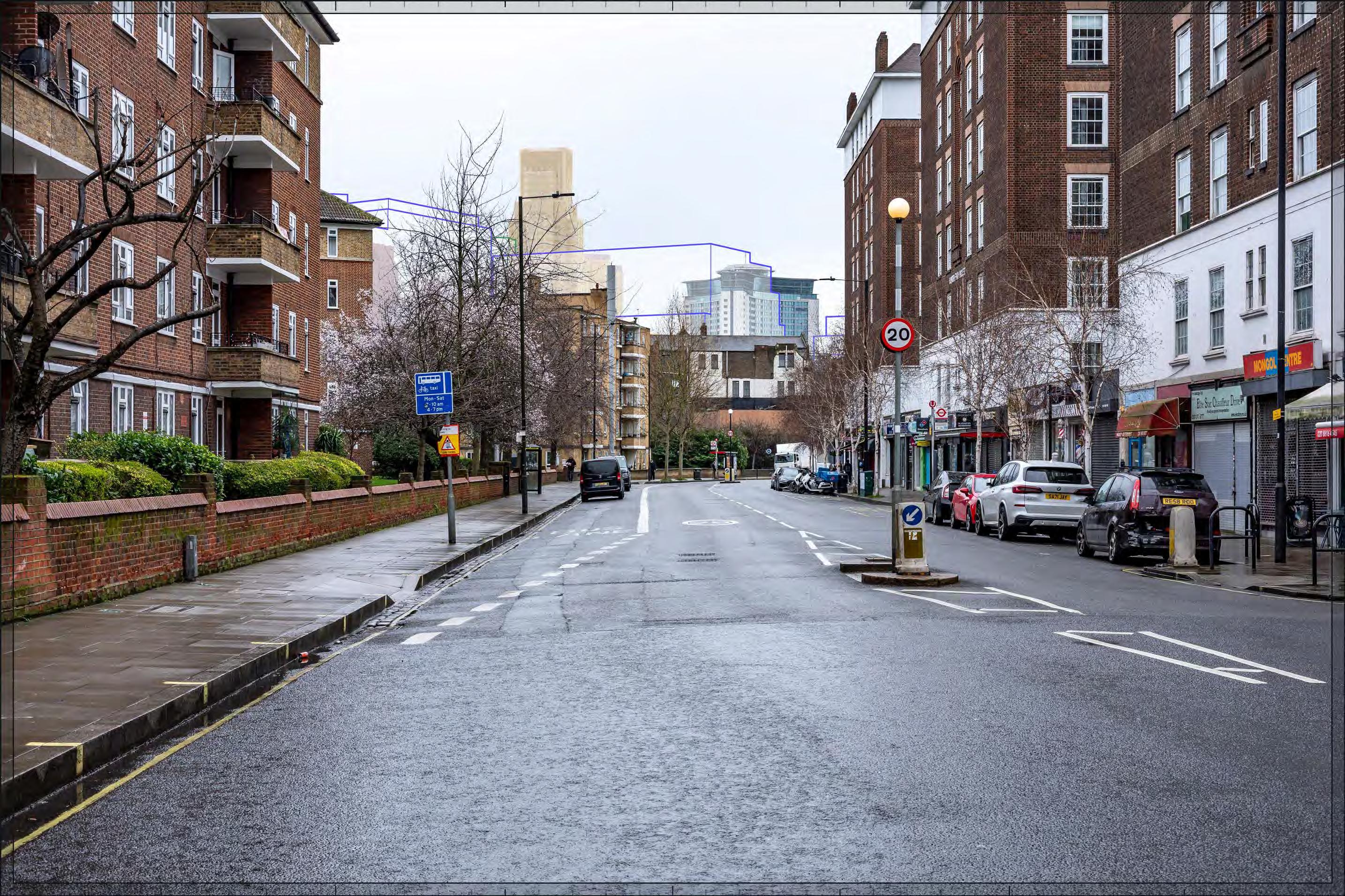
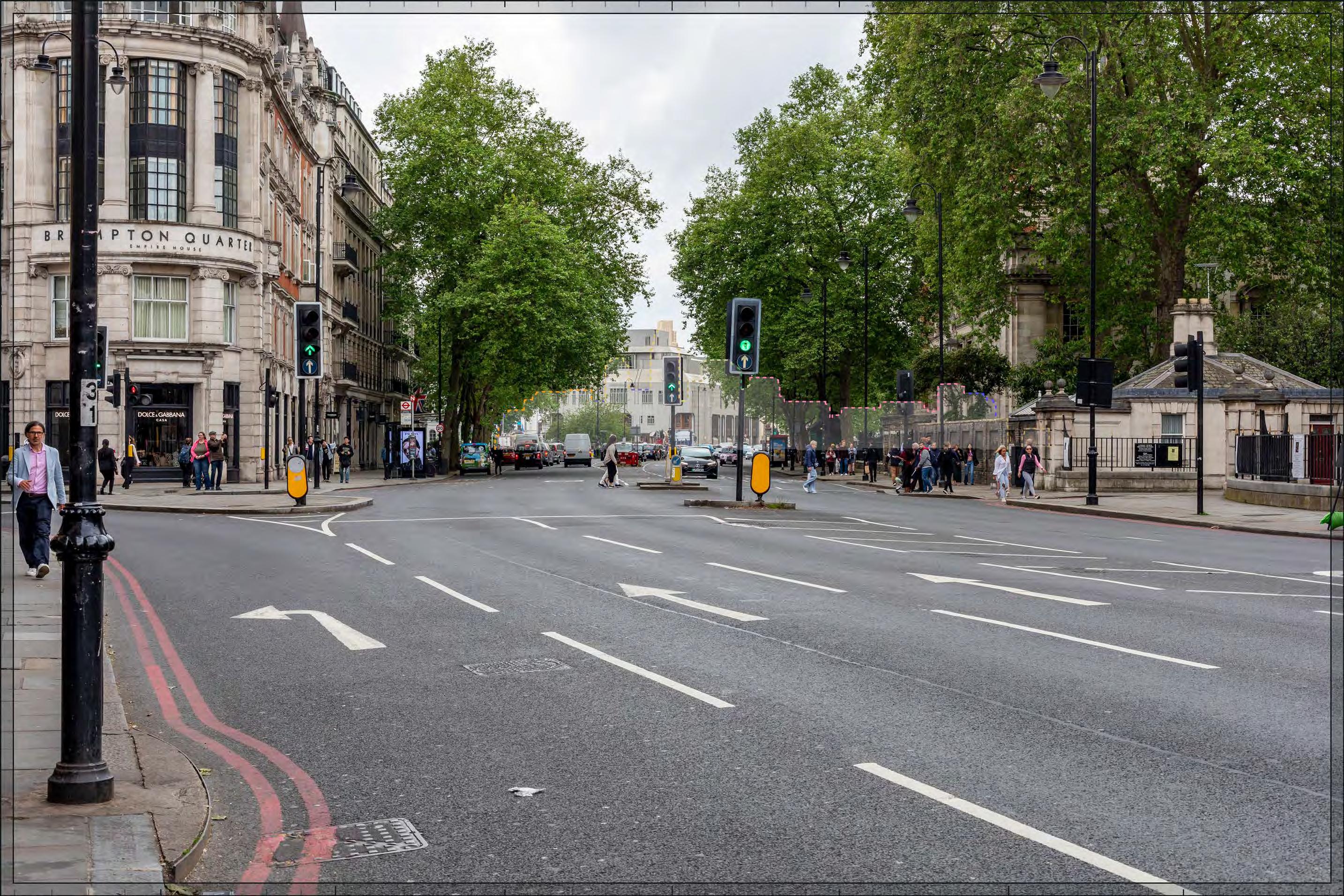
Filmer Road
D28051x50 / 50mm 09/03/23 15:45
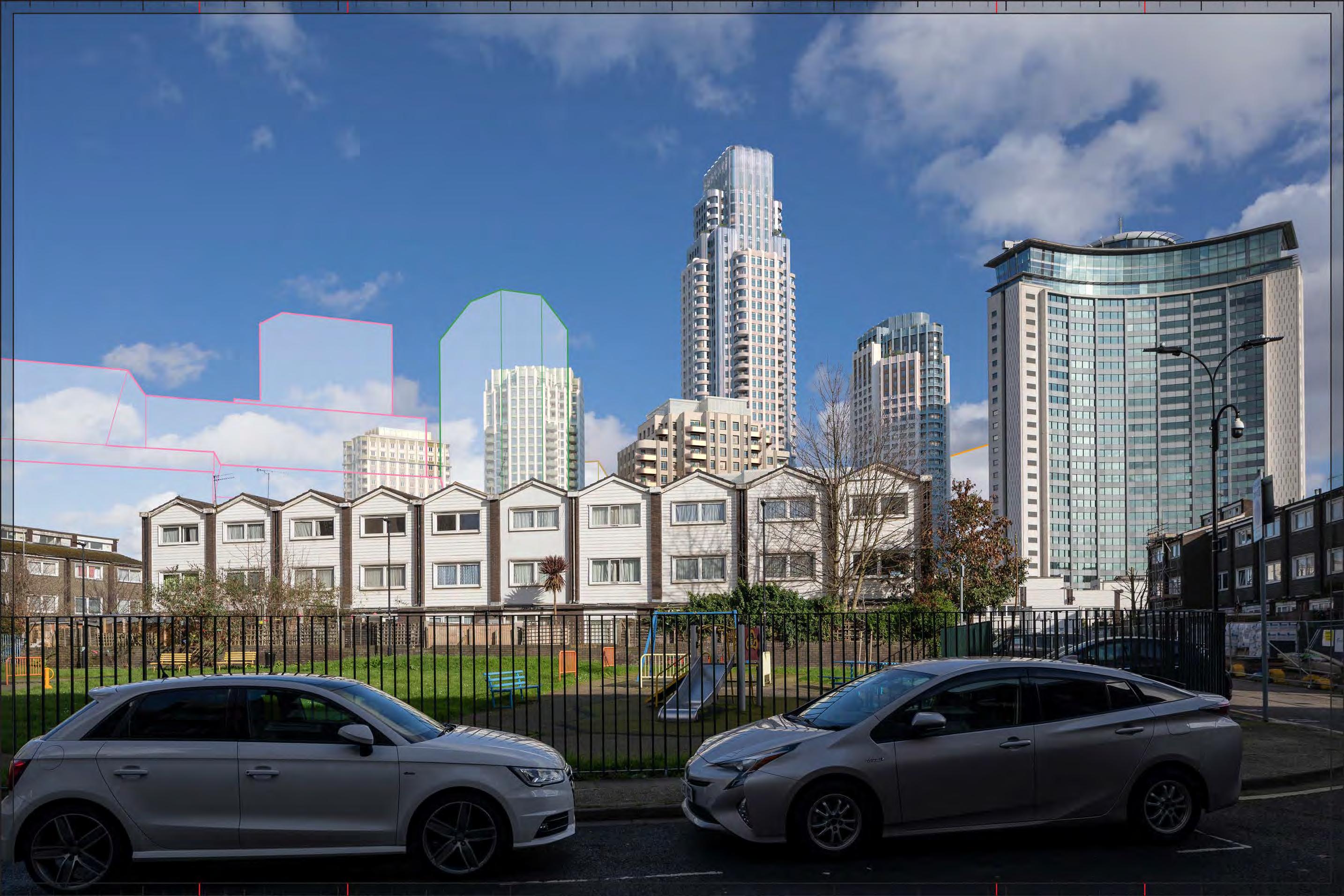
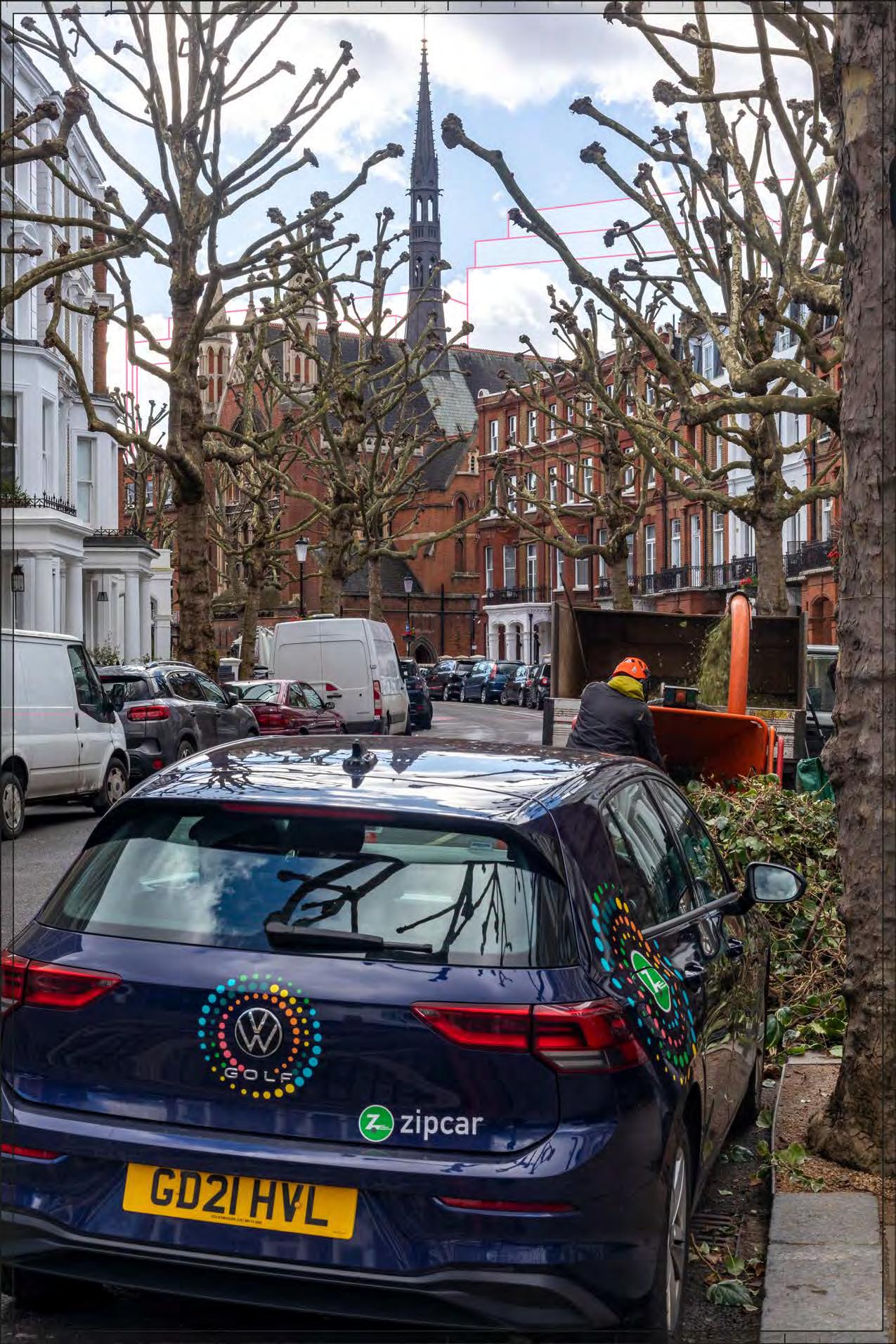
Completed DevelopmentEarly Phases and cumulative schemes
The cumulative scheme at Edith Summerskill House would appear in front of Detailed Plot WB04, obscuring much of it from sight. The magnitude of impact and the scale and nature of the effect would not alter in comparison to the assessment of the Early Phases in isolation.
Magnitude of impact: Low
Effect: Minor in scale, Neutral in nature (not significant).
Completed Development - Early Phases and cumulative schemes
Filmer Road
D28051x50 / 50mm 09/03/23 15:45
Completed DevelopmentAll Phases and cumulative schemes
The cumulative scheme at Edith Summerskill House would appear in front of Detailed Plot WB04, obscuring much of it from sight. The magnitude of impact and the scale and nature of the effect would not alter in comparison to the assessment of the All Phases in isolation.
Magnitude of impact: Low
Effect: Minor in scale, Neutral in nature (not significant).
Completed Development - All Phases and cumulative schemes
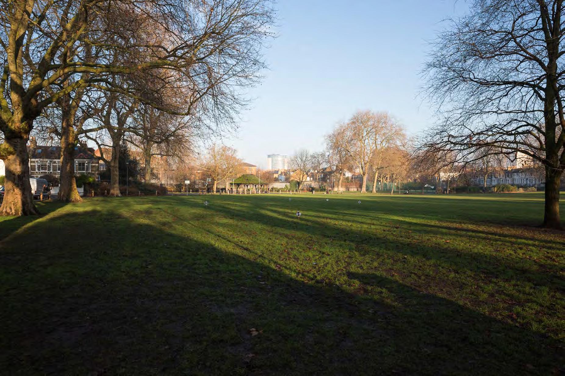
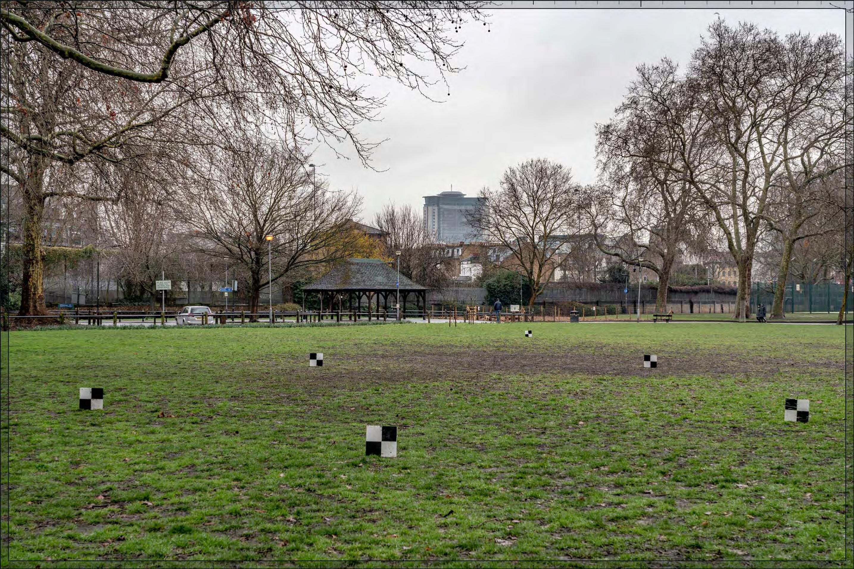
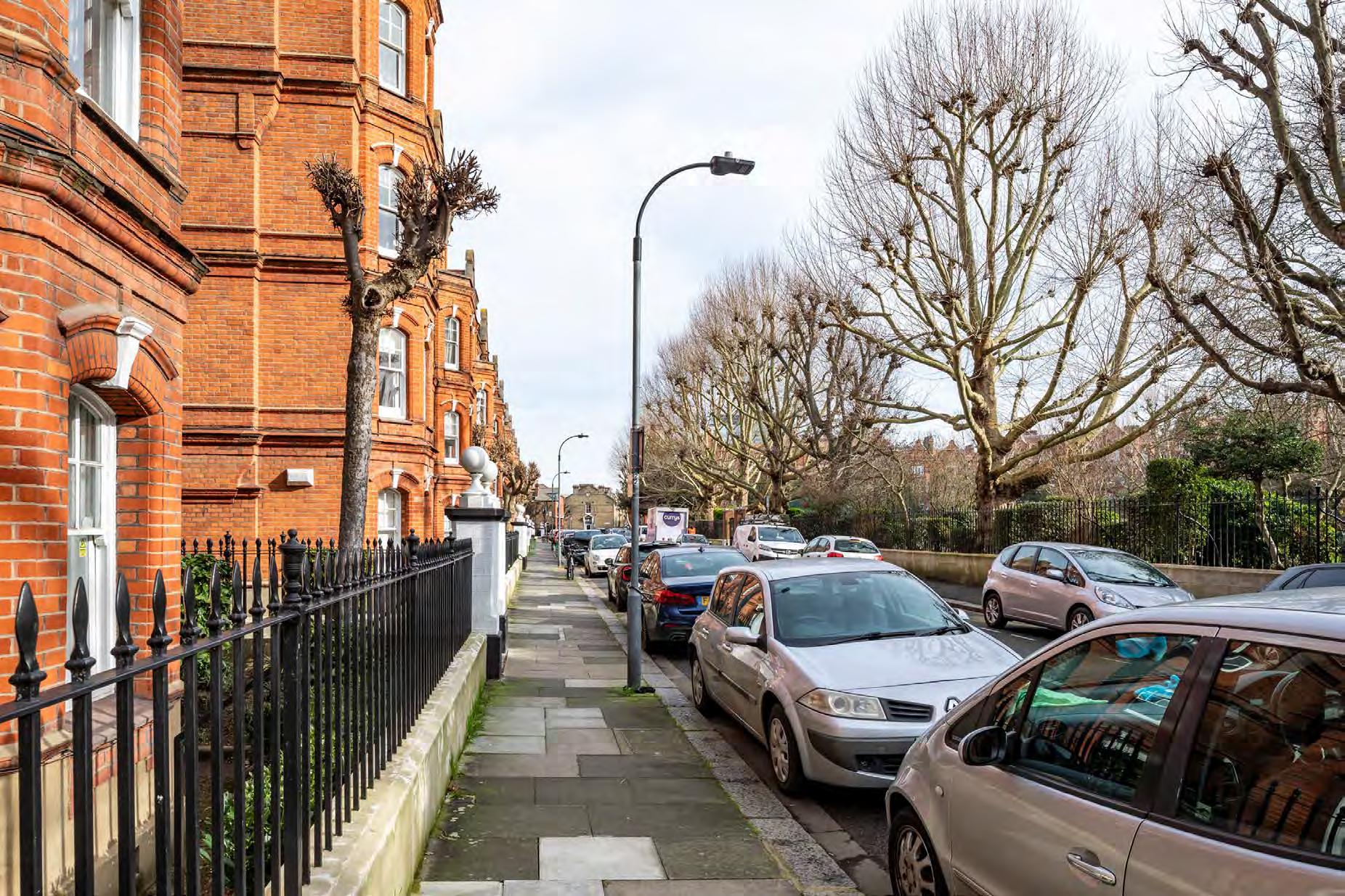
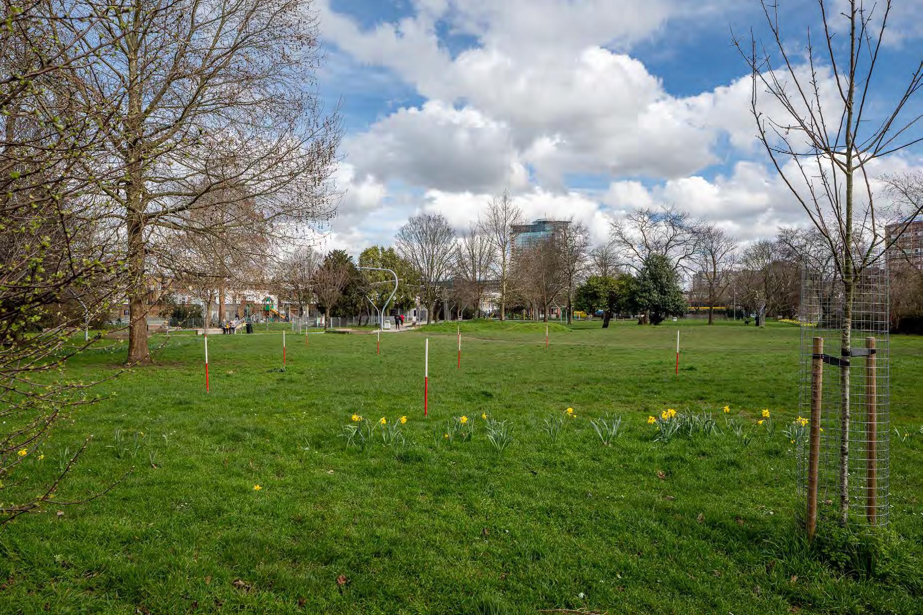
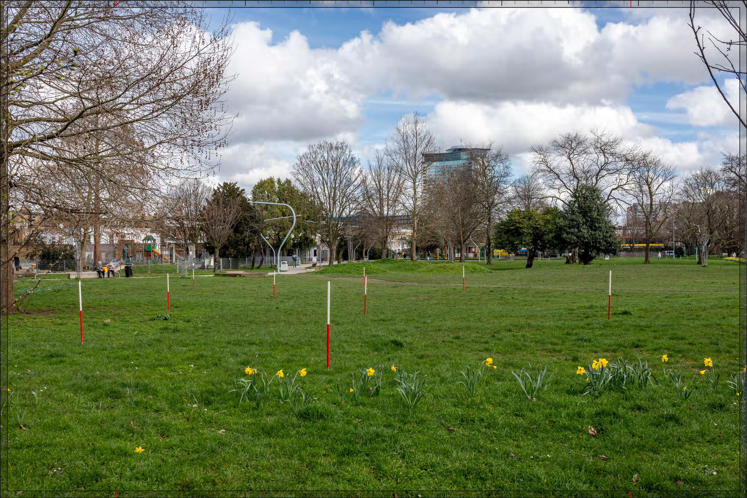
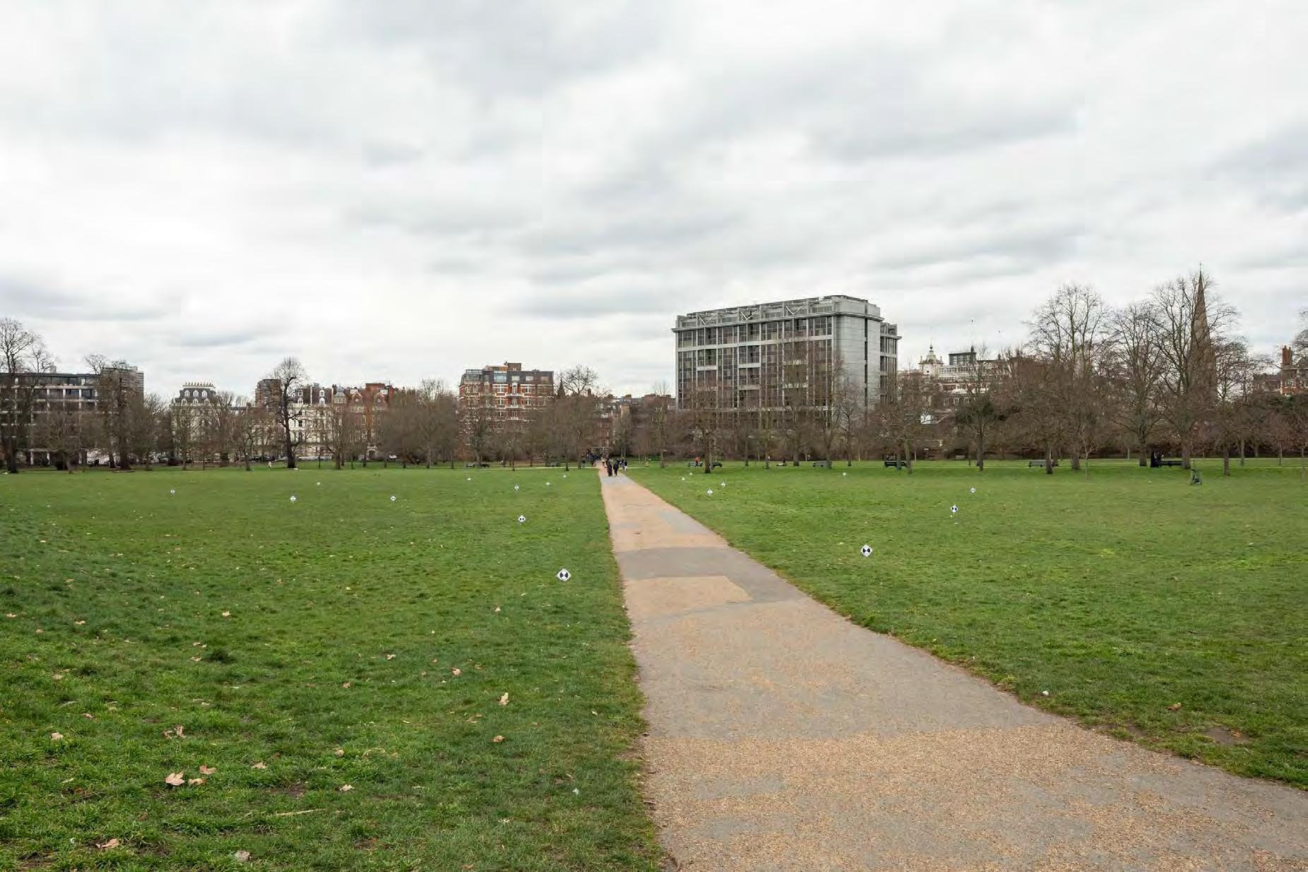
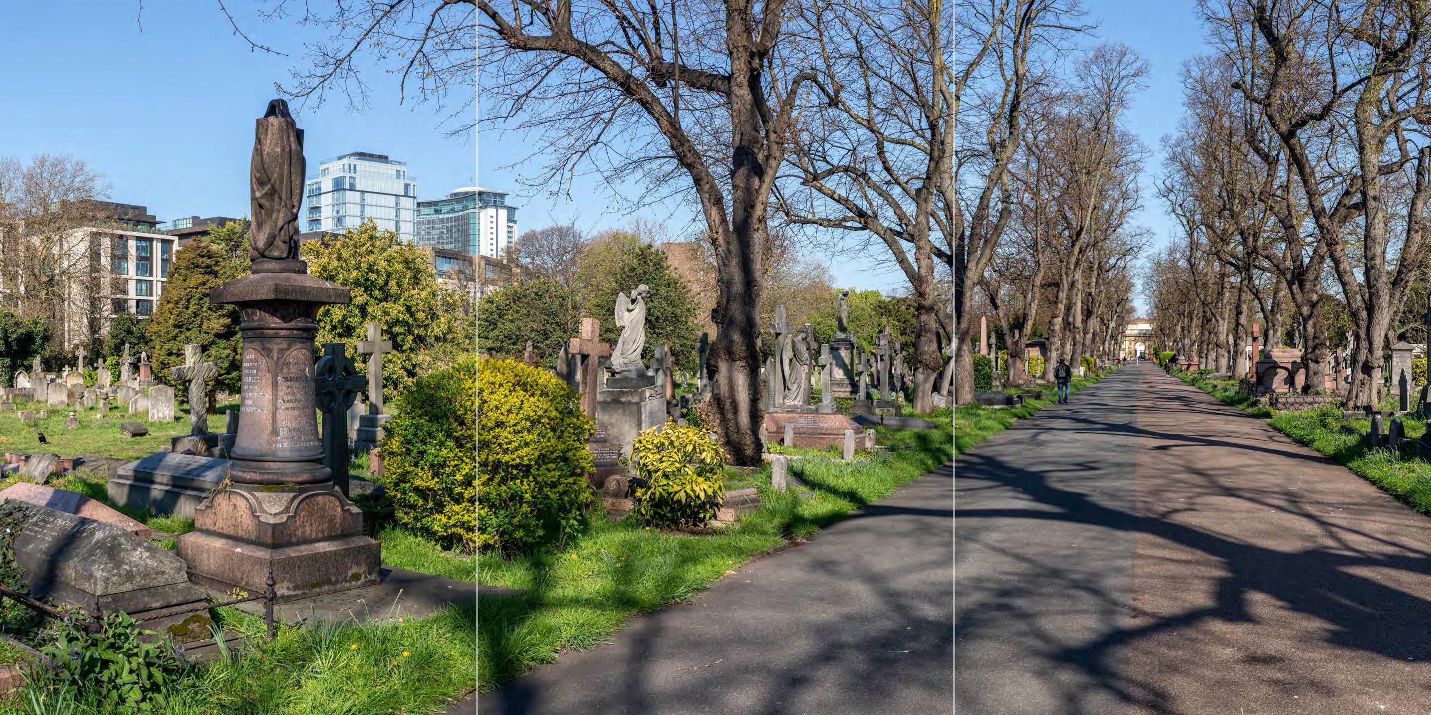
Eel Brook Common
D28046x50 / 24mm 09/03/23 12:26
Existing
The view is taken from the western edge of Eel Brook Common, which is within the Parson’s Green Conservation Area. The park is not a RPGSHI and does not contain any listed structures. Eel Brook Common was formerly used for pasture and informal recreation; it became a public park in 1881. A bandstand was built by 1894, cricket and football pitches provided by 1921 and in the late 1920s two tennis courts were added. The modern common still contains sports pitches, and children’s play facilities have been added.
In the foreground of the view is the open grass of the northern part of the common. In the centre of the view seen above the Victorian terrace on Barclay Road and the bandstand within the park is the Empress State Building which projects taller above the close residential roofscape to the immediate north of the park as a singular tall modern building, seen at a distance of more than 1km. The tree-ed edges of the park in the foreground soften views of the surrounding development helping to enclose the open space, and the Empress State Building does not rise above the treeline on the northern edge of the common. Therefore in summer foliage conceals much of the development beyond the park, including the Empress State Building, which comes in and out of view, visible where it aligns with gaps in the perimeter tree line.
Value attached to the view: the view is not taken from a specific viewing position of recognised importance but this is a representative viewpoint from the park, which is an important element of the conservation area. The value of the view is judged to be Medium
Visual receptors affected: moderate numbers of local residents engaged in outdoor recreation, mainly using the park for sports and fitness activities, dog walking and children’s play.
Susceptibility to change of visual receptors: although much of the park is used for activities that do not depend on appreciation of views, being at the central point within the park this view is taken from a natural orientation point at which views of the surroundings are likely to contribute to some extent to the observer’s scenic experience.
Susceptibility to change overall is therefore judged to be Medium
Sensitivity: Medium
24mm Reference image
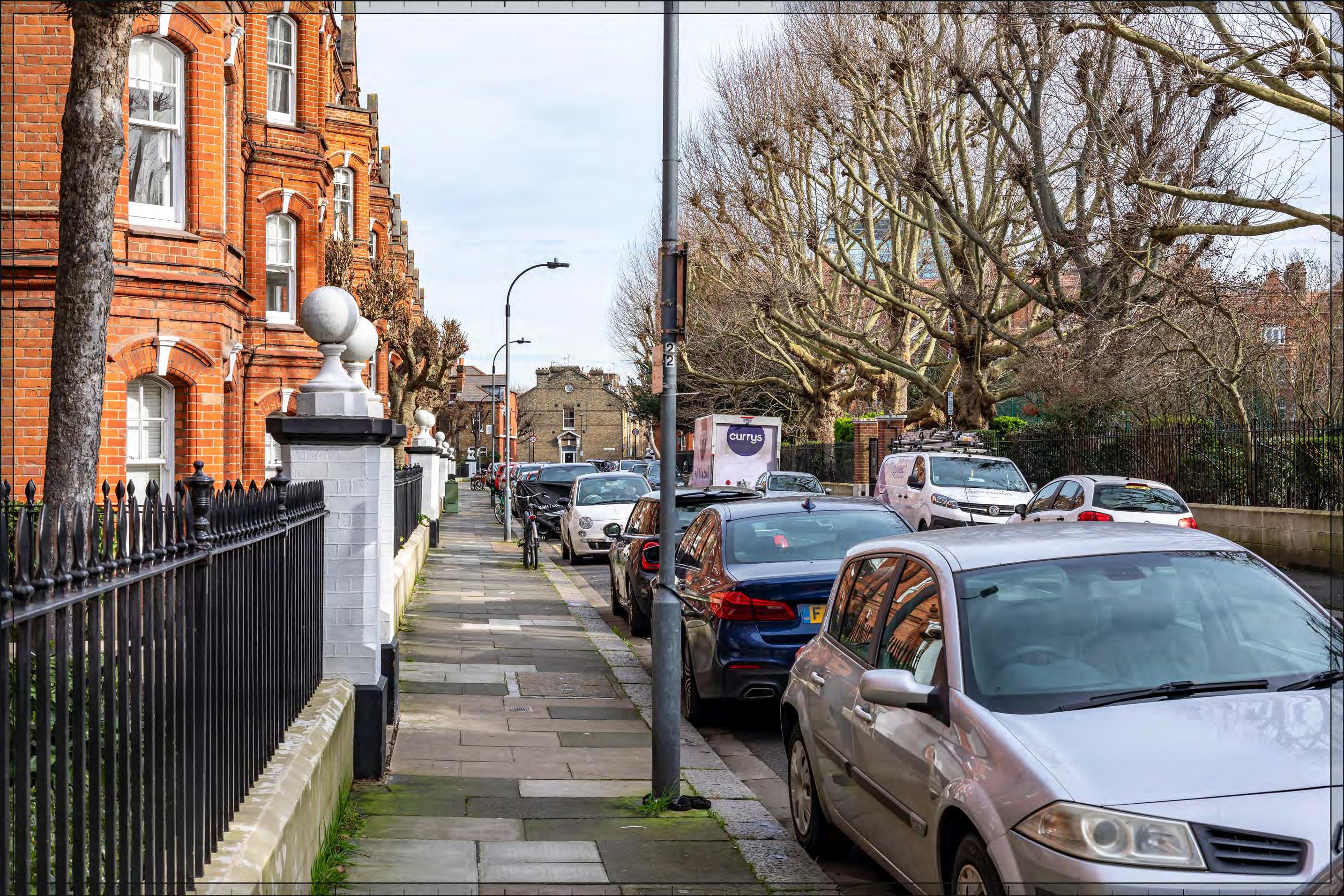
Eel Brook Common
D28046x50 / 50mm 09/03/23 12:26
Existing
See assessment text on previous page.
Eel Brook Common
D28046x50 / 50mm 09/03/23 12:26
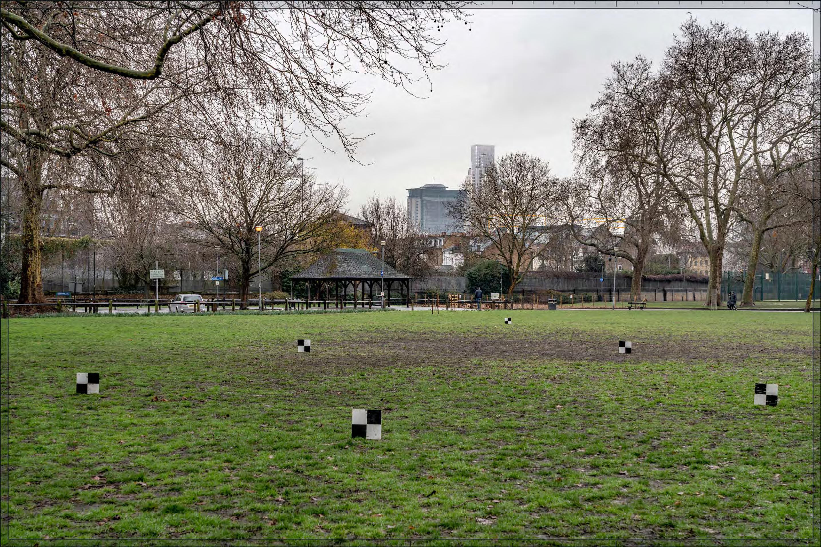
Completed Development - Early Phases
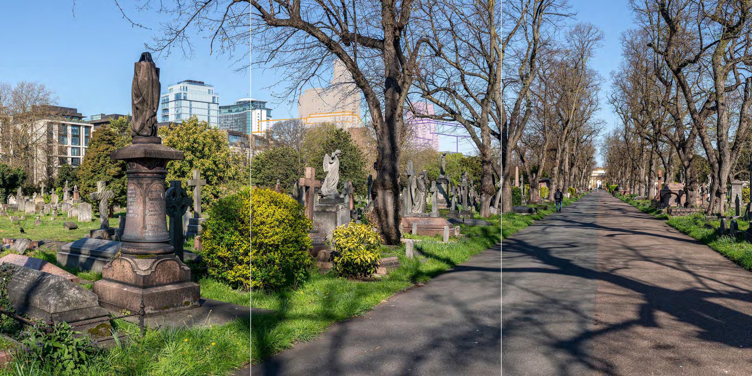
Detailed Component Plots WB04, WB03 and EC05 within the Early Phases would appear in the middle distance, approximately 1km to the north and seen clustered to the immediate right of the existing Empress State Building. Outline Plots WB01/02, and WB07/08, would be seen at a much lower apparent height in front of Plot EC05 and extending to the right of the Empress State Building and mediating the change in scale from the residential middle ground beyond the park. The visible parts of the Proposed Development would form part of a secondary background layer of townscape together with the Empress State Building, screened and softened by trees even in winter. In spring, summer and autumn, only the top of Plot WB04 would be visible due to the screening effect of foliage from this position but in views north across the open area of the park more generally the Early Phases would come in and out of view, clearly visible only where it aligns with gaps in the perimeter tree line.
Plot WB04 would appear as the tallest building within the Proposed Development and there would be a balanced composition to either side of it from this viewpoint, with Plots WB03 and EC05 stepping down in height to its right and the Empress State Building stepping down to its left. Plot WB03 would have a similar height to that of the Empress State Building, and the latter would be well integrated as part of a coherent skyline composition together with the Proposed Development.
Detailed Component Plot WB04 would appear as a new focal point in the background of the view. It would have elegant proportions and a visually interesting form, with a series of shoulders stepping up symmetrically to a central ‘crown’. The reduction in massing would be reinforced by the change in materiality, from stone-like solid materials, to lighter, more transparent and reflective materials at the crown. The stepped crown, curved corners and vertical emphasis would provide Plot WB04 with an elegant, Art Deco-inspired appearance that could be appreciated to some extent at this distance. Plots WB03 and EC05 would both have a well-articulated tops that would share a familial Art Deco-style appearance with Plot WB04.
Completed Development - Early Phases
Eel Brook Common
D28046x50 / 50mm 09/03/23 12:26
Completed DevelopmentEarly Phases (continued)
The Early Phases would change the skyline composition of the view’s backdrop adding a new distant focal point with a Lowmedium magnitude of impact in winter reduced to Low by foliage in spring, summer and autumn. Although the composition of the distant skyline would be altered by the Early Phases, and the taller modern character of the backdrop would be slightly intensified, the scale and character would appear broadly consistent with the existing setting to the north of the park. It is therefore not considered that the Early Phases would have an inherently adverse effect on visual amenity. The Early Phases would form a coherent wellarticulated cluster that would integrate the Empress State Building on the secondary skyline. The slender top of Plot WB04, juxtaposed with the broader form of the existing Empress State Building, would act as a distinctive and attractive new marker for Earls Court in the view. The nature of the effect would be Beneficial
Magnitude of impact: low (spring, summer, autumn) to low-medium (winter),
Effect: Minor (spring, summer, autumn) to Moderate (winter) in scale, Beneficial in nature (significant)
Completed Development - All Phases
No further Plots would be visible in the All Phases scenario compared to the Early Phases The magnitude of impact and the scale and nature of the effect would not alter in comparison to the assessment of the Early Phases.
Magnitude of impact: low (spring, summer, autumn) to low-medium (winter),
Effect: Minor (spring, summer, autumn) to Moderate (winter) in scale, Beneficial in nature (significant)
Eel Brook Common
D28046x50 / 50mm 09/03/23 12:26
Completed DevelopmentEarly Phases and cumulative schemes
While a small part of the cumulative scheme at 1-9 Lillie Road would appear to the south of Plots WB01/02 (right in this image), it would be barely discernible through the trees and would have no meaningful visual impact. The effect of the Early Phases would remain the same in the cumulative scenario as for the Early Phases considered in isolation.
Magnitude of impact: low (spring, summer, autumn) to low-medium (winter),
Effect: Minor (spring, summer, autumn) to Moderate (winter) in scale, Beneficial in nature (significant)
Completed Development - Early Phases and cumulative schemes
Eel Brook Common
D28046x50 / 50mm 09/03/23 12:26
Completed DevelopmentAll Phases and cumulative schemes
As no further Plots would be visible in the All Phases scenario compared to the Early Phases, the assessment of effect of All Phases in the cumulative scenario would remain as set out above for the Early Phases in the cumulative scenario.
Magnitude of impact: low (spring, summer, autumn) to low-medium (winter),
Effect: Minor (spring, summer, autumn) to Moderate (winter) in scale, Beneficial in nature (significant)
Kings Road
D28059x50 / 24mm 11/03/23 / 12:27
Existing
This viewpoint is located on King’s Road and the view looks north in the direction of the Site, along Britannia Road. It is located within the Moore Park Conservation Area, which includes the earliest residential estate development built in Fulham, constructed in the 1850s and 1860s.
King’s Road, a significant east-west retail street in this part of London, occupies the foreground of the view. Two modern apartment blocks with ground floor retail units can be seen on each corner of the junction between King’s Road and Britannia Road. Britannia Road runs on a straight alignment from King’s Road, such that the view has a directional quality, and it is lined on both sides by two or three storey terraced housing, some above a basement level, with a coherent appearance. The view is terminated by red brick housing adjacent to Stamford Bridge football ground, north of Fulham Road, and a small part of the Grade II listed Sir Oswald Stoll Foundation southern block.
Value attached to the view: this is a representative view from within a conservation area, of some compositional quality. It is of Medium value.
Visual receptors affected: local residents, and people travelling along the busy thoroughfare of King’s Road, and those shopping or working on Kings Road.
Susceptibility to change of visual receptors: shoppers, workers and those traveling along King’s Road would have a low susceptibility to change. Local residents in a community where views contribute to the setting of a high-quality designated townscape have a high susceptibility to change. Overall susceptibility to change is judged to be Medium.
Sensitivity Medium
24mm Reference image
Kings Road
D28059x50 / 50mm 11/03/23 / 12:27
See assessment text on previous page.
Kings Road
D28059x50 / 50mm 11/03/23 / 12:27
Completed Development - Early Phases
Detailed component Plots WB04, WB03, EC05, and EC06, and Outline Plots EC04, WB01/02, WB07/08, and EC02/ 03, within the Early Phases would be seen in the middle distance, in the background of the view at a distance of approximately 1.3km, and distinct and separate from the buildings within the Moore Park Conservation Area in the foreground of the view. Visibility from King’s Road would be limited to gaps in its enclosure where side streets like this one align with the Early Phases, with more consistent visibility along the aligned routes.
The cluster of tall buildings within the Early Phases – primarily Detailed Plots WB04, WB03, and EC05, and to a lesser extent Outline Plot EC04 - would terminate the long view north along Brittania Road. The lower, broader forms of the buildings on Outline Plots WB01/02, WB07/08, and EC02/03 would appear to the south and east of this central group of tall buildings. As a result, the Early Phases would be seen to step down towards the viewpoint and the townscape in the foreground of the view, helping to mediate the change in scale between the Early Phases and the existing development on Britannia Road.
Plot WB04 would appear as the tallest building and would form a distinct focal point for the Proposed Development as a whole. Plot WB03 would appear in front of Plot WB04 at a lower apparent height, with the tall building at Plot EC05 set slightly to the right (east) of these plots, to the east of the railway lines and with a clear sky gap between them reflecting the location of the Table Park within the Early Phases. The top of the tall building on Outline Plot EC04 would be set at a lower height to its right (east), and that of Detailed Plot EC06 would be set at a lower height to its left (north), such that they would form another distinct group of tall buildings within the overall composition.
Considering the appearance of the Phase 1 detailed plots, the top Plot WB04 would have a visually interesting form, with a series of shoulders stepping up symmetrically to a slender central ‘crown’. The reduction in massing would be reinforced by the change in materiality, from stone-like solid materials, to lighter, more transparent and reflective materials at the crown. The stepped crown, curved corners and vertical emphasis would provide Plot WB04 with an elegant, Art Deco-inspired appearance. The form of Plot WB03, visible in front of Plot WB04, would be based on a faceted plan incorporating ‘bullnose’ elements on the eastern and western frontages The lower Plot EC05 to its left would have an octagonal plan, and a stepped crown. While different in their detailed articulation and treatment, each of the tall buildings designed in detail would share a familial Art Deco-inspired appearance.
The massing of the lower Outline Plots WB01/02, WB07/08, as defined by the Parameter Plans and Design Code, would result in these plots having stepped maximum parameter envelopes that would help break down their massing. The Design Codes would further require the detailed design of these plots to take views from King’s Road into consideration as follows: buildings on Plots WB02, WB07/08 should provide an intermediate layer between the existing foreground and proposed tall buildings behind through use of colour materiality or architectural expression (Design Code EP.B.38) and should be distinguishable from the foreground to reduce to maintain the legibility of the historic townscape (Design Code EP.B.40).
The illustrative scheme (not assessed but shown for reference in Appendix E) shows an architectural approach to the outline plots, designed in accordance with the Design Codes, resulting in a regular and ordered elevational approach with articulated massing within these Plots that would form a calm backdrop seen in relation to the lower scale buildings on King’s Road and Britannia Road that would reinforce their mediating role.
The Early Phases would make a noticeable change to the view, introducing a tall modern backdrop to the views north along Brittania Road. The magnitude of impact would be Medium. Spring, summer and autumn foliage would obscure and soften the impact of the Early Phases at their lower levels but would not alter the magnitude of impact.
Due to its contrasting scale and architectural character seen in relation to an area of historic architectural homogeneity, the Early Phases is not considered to contribute positively to visual amenity. However, neither is the visibility of tall modern development in a historic context considered to have an inherently adverse effect on visual amenity. The Early Phases would appear distinct and separate from the historic townscape in the foreground and would be seen at a distance of over 1km. The Early Phases would form a coherent composition on the skyline and would include high quality buildings (either within the Detailed Component or Outline Component Plots to be developed in line with the Design Codes, and expected to achieve the same level of quality), which would mitigate any potential negative impact and preserve the quality of the visual amenity. The nature of effect is therefore assessed as Neutral
Magnitude of impact: Medium
Effect: Moderate in scale, Neutral in nature (significant)
Kings Road
D28059x50 / 50mm 11/03/23 / 12:27
Completed Development - Early Phases
See assessment text on previous page.
Completed Development - Early Phases
Kings Road
D28059x50 / 50mm 11/03/23 / 12:27
Completed Development - All Phases
No further Plots would be visible in the All Phases scenario compared to the Early Phases. The magnitude of impact and the scale and nature of the effect would not alter in comparison to the assessment of the Early Phases.
Magnitude of impact: Medium
Effect: Moderate in scale, Neutral in nature (significant)
Kings Road
D28059x50 / 50mm 11/03/23 / 12:27
Completed DevelopmentEarly Phases and cumulative schemes
The cumulative scheme at 100 West Cromwell Road would appear to the left of Plot EC05, at a lower apparent height and screened by trees to a considerable extent, such that it would have a limited visual presence. The effect of the Early Phases in the cumulative scenario would remain the same as that for the Early Phases considered in isolation.
Magnitude of impact: Medium
Effect: Moderate in scale, Neutral in nature (significant)
Kings Road
D28059x50 / 50mm 11/03/23 / 12:27
Completed DevelopmentAll Phases and cumulative schemes
As no further Plots would be visible in the All Phases scenario compared to the Early Phases, the assessment of effect of All Phases in the cumulative scenario would remain as set out above for the Early Phases in the cumulative scenario.
Magnitude of impact: Medium
Effect: Moderate in scale, Neutral in nature (not significant)
Completed Development - All Phases and cumulative schemes
Avonmore Road
D29784x50 / 24mm 13/02/24 09:15
Existing
This view looks south from the northern end of Avonmore Road at the junction with Earsby Street within the Olympia and Avonmore Conservation Area. On the left of the view are five-storey late 19th century mansion blocks and a modern block of similar scale while the right side of the view - looking across a brick wall enclosing the post-war Avonmore Primary School in the foreground - is more open. A terrace along another section of Avonmore Road/ Lisgar Terrace, also within the conservation area, terminates the view southwards. Out of view looking eastwards from Avonmore Road recent tall modern development to the east of the WLL on Warwick Road, within northern section of the ECWKOA, is visible at close proximity where streets align. To the north of Kensington High Street (also out of view) is the large scale of the Olympia Exhibition Centre. A varied wider setting of tall and large-scale development characterises the visual amenity of this area.
Value attached to the view: while this is a representative viewpoint from the Olympia and Avonmore Conservation Area, it has limited coherence or scenic and compositional quality. It is not a view identified in the Olympia and Avonmore Character Profile (Ref. 2-28). The value of the view is judged to be Low-medium.
Visual receptors affected: low numbers of local residents living on the street or in the wider local area.
Susceptibility to change of visual receptors: local residents in a community where views contribute to the setting of a high-quality designated townscape have a High susceptibility to change.
Sensitivity: Medium
24mm Reference image
Avonmore Road
/ 50mm 13/02/24 09:15
See assessment text on previous page.
Avonmore Road
D29784x50 / 50mm 13/02/24 09:15
Completed Development - Early Phases
The tops of Detailed Component Plots WB04 and EC03, and Outline Plot WB06, would be visible beyond the terminating terrace on Avonmore Road/Lisgar Terrace at a distance of approximately 1km, altering the skyline of the view and the character of its backdrop –but appreciated in relation to the wider modern setting to the east. Detailed Plot WB04 would be the tallest of the buildings and would act as the focal point, with the other Plots appearing at a similar height to each other. Trees would screen elements of the Proposed Development, and more so in summer, although not to the extent that the magnitude of impact would be altered. The Detailed Component of the Early Phases is modelled in chalk render, which shows the scale form and articulation of the Detailed Component Plots, but not the proposed materials or the effects of distance on their visibility.
Detailed Plot WB04 would have a visually interesting form, with a series of shoulders stepping up symmetrically to a slender central ‘crown’. The reduction in massing would be reinforced by the change in materiality, from stone-like solid materials, to lighter, more transparent and reflective materials at the crown. The stepped crown, curved corners and vertical emphasis would provide Plot WB04 with an elegant, Art Deco-inspired appearance. Detailed Plot EC05 would have a well-articulated top just visible to the left. The top of Outline Plot WB06 would be seen in front of Plot WB04.
The Early Phases would make a noticeable change to the view, introducing a contrasting tall modern backdrop to the views south along Avonmore Road. The magnitude of impact would be Medium.
Completed Development - Early Phases
Avonmore Road
D29784x50 / 50mm 13/02/24 09:15
Completed DevelopmentEarly Phases (continued)
Due to its contrasting scale and architectural character seen in relation to an area of historic architectural homogeneity, the Early Phases is not considered to contribute positively to visual amenity. However, neither is the visibility of tall modern development in a historic context considered to have an inherently adverse effect on visual amenity. The Early Phases would appear distinct and separate from the historic townscape in the foreground and would be seen at a distance of over 1km. It would be appreciated in relation to the varied wider setting that already includes tall modern development in the ECWKOA to the east. The Early Phases would form a coherent composition on the skyline and would include high quality buildings (either within the Detailed Component or Outline Component Plots to be developed in line with the Design Codes, and expected to achieve the same level of quality), which would mitigate any potential negative impact and preserve the quality of the visual amenity. The nature of effect is therefore assessed as Neutral.
Magnitude of impact: Medium
Effect: Moderate in scale, Neutral in nature (significant)
Completed Development - All Phases
In addition to the Early Phases, the tops of Outline Component Plots WK04 and WK05 would be visible in front of Plot WB04 at a distance of approximately 500m, lower but in closer proximity than the Early Phases. The Design Code for Plots WK03 and WK04, requires harmonising architectural features that would allow them to be read as part of familial cluster of buildings (WK.B.17), with distinct articulation of the building crowns (WK.B.14). The Proposed Development would enrich the layering of the backdrop, integrating the tops of Plots WB04 and EC05 in a stepped composition, but would not materially change the contrasting visual impact of new development to the south. The magnitude of impact and the scale and nature of the effect would not alter in comparison to the assessment of the Early Phases.
Magnitude of impact: Medium
Effect: Moderate in scale, Neutral in nature (significant)
Avonmore Road
D29784x50 / 50mm 13/02/24 09:15
Completed DevelopmentEarly Phases and cumulative schemes
There would be no cumulative schemes visible, and the effect of the Early Phases in the cumulative scenario would remain as set out above for the Early Phases considered in isolation.
Magnitude of impact: Medium
Effect: Moderate in scale, Neutral in nature (significant)
Avonmore Road
D29784x50 / 50mm 13/02/24 09:15
Completed DevelopmentAll Phases and cumulative schemes
There would be no cumulative schemes visible, and the effect of All Phases in the cumulative scenario would remain as set out above for All Phases considered in isolation.
Magnitude of impact: Medium
Effect: Moderate in scale, Neutral in nature (significant)
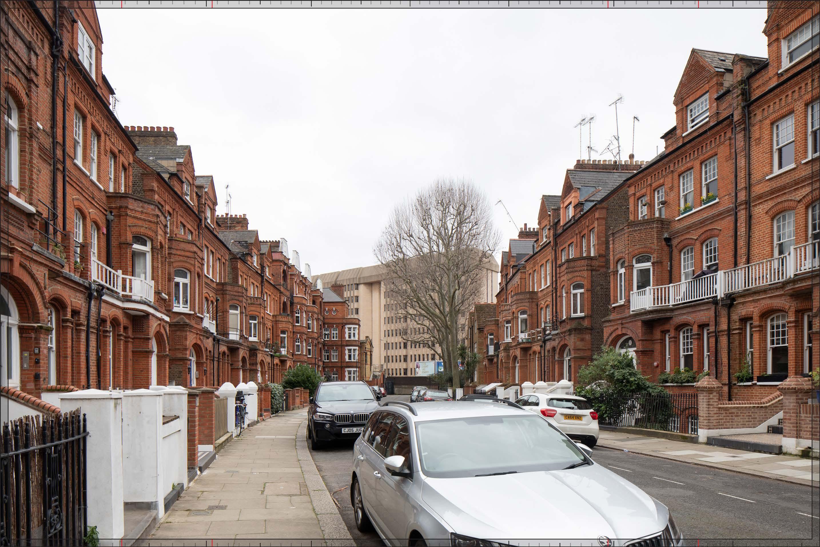
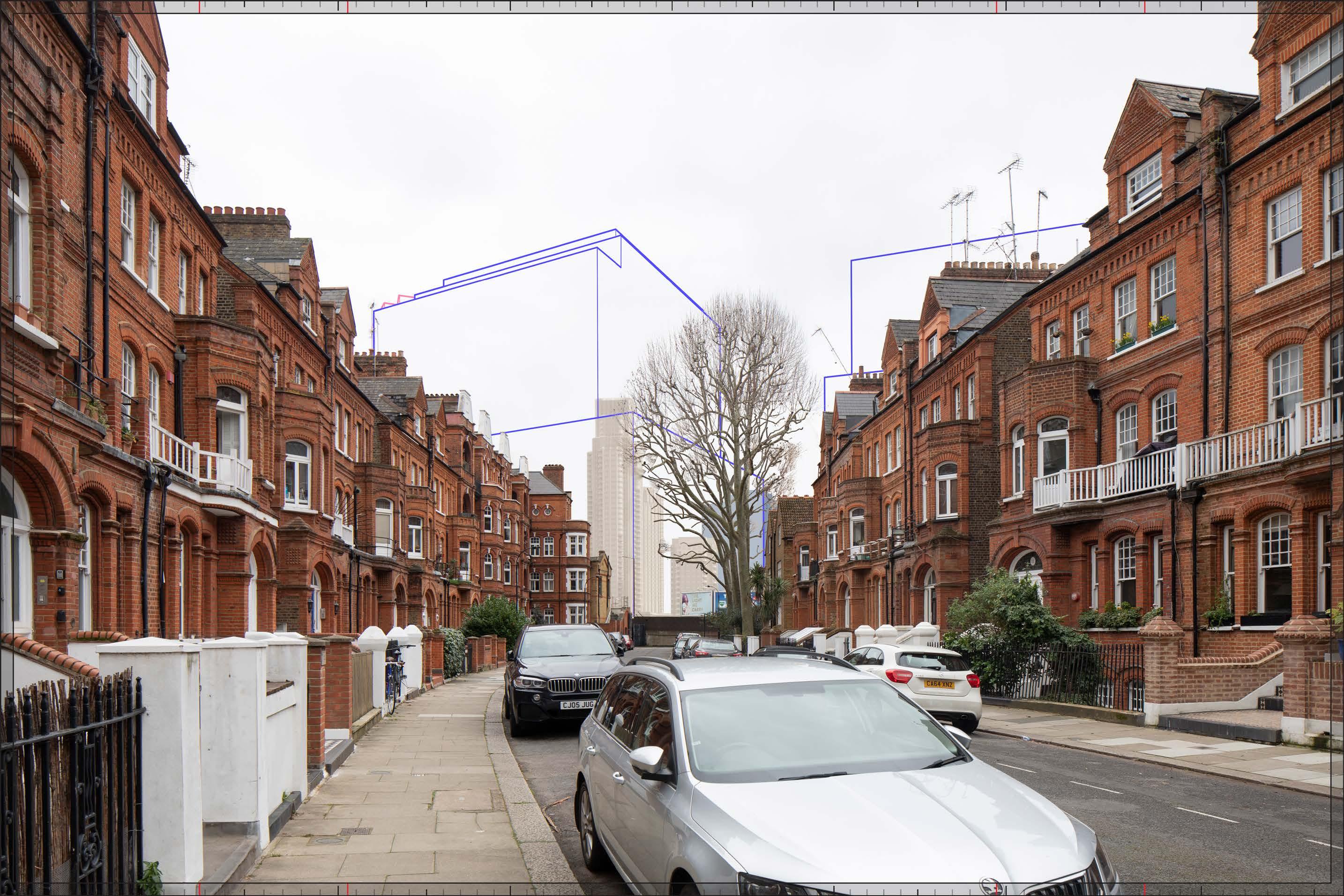
Mornington Avenue
D28058 24mm 12/03/23 / 15:41
Existing
This viewpoint is located on the eastern side of Mornington Avenue and the view is looking south in the direction of the Site. It is located in the Olympia and Avonmore Conservation Area. Both sides of the road are lined by red brick semi-detached houses from the late 19th century, three main storeys above a basement and with an attic floor. A mansion block of similar appearance and age, Mornington Avenue Mansions, appears at the end of the road. The buildings have a robust character and the near uniformity of their appearance provides the townscape with a high degree of coherence. None of the buildings in the view are listed. The western gable end of the locally listed Whiteleys Cottages at the southern end of the street is just visible in stock brick.
From Mornington Avenue there is a clear appreciation of the proximity of West Cromwell Road (the A4), which separates the conservation area from the existing LBD on the Site to the south. West Cromwell Road is slightly elevated where it passes the southern end of Mornington Avenue and there is no direct physical connection between them. The post-war office building of Ashfield House, which is located on the Site, can be seen in the middle distance, on the southern side of West Cromwell Road. It terminates the view with a townscape feature that contrasts in scale and character with the foreground reflecting the presence of the busy A4 route from the west into central London. The uncompromising utilitarian design of Ashfield House turns its back on West Cromwell Road and does not positively address its visual impact on the historic townscape to the north.
Mornington Avenue
D28058 24mm 12/03/23 / 15:41
Existing (continued)
Value attached to the view: although it includes the contrasting terminating feature of Ashfield House outside the conservation area, this is otherwise a well-composed representative viewpoint from the Olympia and Avonmore Conservation Area. It is not a view identified in the Olympia and Avonmore Character Profile (Ref. 2-28). The value of the view is judged to be Low-medium
Visual receptors affected: low numbers of local residents living on the street or in the wider local area.
Susceptibility to change of visual receptors: local residents in a community where views contribute to the setting of a high-quality designated townscape have a High susceptibility to change.
Sensitivity: Medium
Completed Development - Early Phases
The top of Detailed Component Plot WB04 would be visible behind Ashfield House. The Detailed Component of the Early Phases is modelled in chalk render, which shows the scale form and articulation of the Detailed Component Plots, but not the proposed materials or the effects of distance on their visibility. It would be visibly more distant and would not be a noticeable new feature of the view. Moving southwards along Mornington Avenue Plot WB04 would recede and disappear from view behind Ashfield House. The magnitude of impact for the Early Phases would be Low. The limited incidental visibility of the Early Phases would preserve the visual amenity of Mornington Avenue and the nature of the effect would therefore be Neutral
Magnitude of impact: Low
Effect: Minor in scale, Neutral in nature (not significant)
Mornington Avenue
D28058 24mm 12/03/23 / 15:41
Completed Development - All Phases
Outline Component Plots WK04 (to the left) and WK03 (to the right) at the northern edge of the Proposed Development would replace Ashfield House at the termination of the view southwards. Part of the top of Outline Plot WK05 would be seen behind Plot WK04 to the left. The Outline Component in the later phases of the Proposed Development would block views of the Early Phases in these close views.
While Plots WK04 and WK03 would be taller than the existing Ashfield House, a broad gap between them would break up the previously continuous building line, introducing a clear sky gap and view into the Proposed Development, signalling the greater connectivity and permeability of the redeveloped LBD to the south. The maximum parameter envelope for these predominantly commercial Outline Plots would have a stepped form to break up mass on these plots and introduce a lower shoulder that would relate to the lower scale of the historic townscape to the north of West Cromwell Road.
The illustrative scheme (not assessed but provided in Appendix E for information) shows an architectural approach to these Plots that would be in line with the Parameter Plans and Design Codes. In respect of Plots WK03 and WK04, for example, there are harmonising architectural features that would allow them to be read as part of familial cluster of buildings (WK.B.17), with a continuous intermediate shoulder (WK.B.13), tripartite composition (WK.B.26) and distinct articulation of the building crown (WK.B.14). The Design Code notes that the gap between plots WK03 and WK04 should be clearly legible from Mornington Avenue to reinforce the visual link (Design Code WK.B.12).
The Proposed Development would make a noticeable change to the termination of the view, replacing Ashfield House, with a Medium-high magnitude of impact.
Mornington Avenue
D28058 24mm 12/03/23 / 15:41
Completed DevelopmentAll Phases (continued)
The Proposed Development would replace Ashfield House with new development that would address West Cromwell Road while also acknowledging the greater sensitivity of the historic townscape to its north. The larger scale of the Proposed Development on its northern edge would reflect the importance of this major route into central London from the west. However, it would also repair the fragmented streetscape to the north of the LBD improving the pedestrian experience and the visual amenity of West Cromwell Road. Gaps between the Outline Plots would reflect the enhanced permeability and connectivity of the Proposed Development and break up the larger scale of the development. As demonstrated by the illustrative view in Appendix E, buildings coming forward on the northern plots fronting West Cromwell Road would appropriately address sensitive views from the north and the Proposed Development would enhance the visual amenity of the townscape close to the north of the Site. The nature of the effect would be Beneficial.
Magnitude of impact: Medium-high
Effect: Moderate-major in scale, Beneficial in nature (significant)
Completed DevelopmentEarly Phases and cumulative schemes
There would be no cumulative schemes visible, and the effect of the Early Phases in the cumulative scenario would remain as set out above for the Early Phases considered in isolation.
Magnitude of impact: Low
Effect: Minor in scale, Neutral in nature (not significant)
Mornington Avenue
D28058 24mm 12/03/23 / 15:41
Completed DevelopmentAll Phases and cumulative schemes
There would be no cumulative schemes visible, and the effect of All Phases in the cumulative scenario would remain as set out above for All Phases considered in isolation.
Magnitude of impact: Medium-high
Effect: Moderate-major in scale, Beneficial in nature (significant)
North End Road, near junction of Fitzjames Ave
D29783x50 / 24mm 13/02/24 11:18
Existing
This viewpoint is located on North End Road, near the junction with Fitzjames Avenue (seen on the right side of the image), and the view is looking south in the direction of the Site. It is located within the Olympia and Avonmore Conservation Area.
Burne Jones House, a five storey post-war apartment block within the Lytton Estate, lies on the eastern side of North End (left in this image), outside any conservation area. On the western side of the road are Nos. 1-30, 31-60 and 61-90 North End House, which comprise three 1930s apartment blocks linked by single storey retail blocks, built in brick with the ground, first and eighth storeys rendered and painted white. These are not listed or locally listed but are included within the Fitzgeorge and Fitzjames Conservation Area.
The broadly similar mid-rise scale of the apartment blocks on both side of the road and their shared use of brick contributes to a balanced foreground but the architectural and scenic quality of North End Road is unremarkable. The straight alignment of this part of North End Road lends the view a directional quality. The top of the Empress State Building appears as a contrasting focal point seen at a distance of almost 1km and is visible from the majority of the northern section of North End Road.
Value attached to the view: this is an incidental view from the edge of the Olympia and Avonmore Conservation Area and an incidental view of the edge of the Fitzgeorge and Fitzjames Conservation Area; it has limited compositional or scenic quality. The value of the view is judged to be Low.
Visual receptors affected: local residents living on the street or in the wider local area, as well as some people travelling along North End Road, workers and users of local businesses.
Susceptibility to change of visual receptors: local residents in a community where views contribute to the setting of a high-quality designated townscape have a high susceptibility to change. People travelling working or shopping have a low susceptibility to change.
Susceptibility to change overall is therefore judged to be Medium.
Sensitivity to change: Low-medium
24mm Reference image
North End Road, near junction of Fitzjames Ave D29783x50 / 50mm 13/02/24 11:18
North End Road, near junction of Fitzjames Ave
D29783x50 / 50mm 13/02/24 11:18
Completed Development - Early Phases
Detailed Component Plots WB04, WB03, EC05 and Outline Plot WB06 of the Early Phases would be apparent in the background of the view seen at a distance of approximately 900m. They would be appreciated as lying in the middle distance, at a similar distance from the viewpoint as the existing Empress State Building, and there would be a clear sense of separation between them and the foreground buildings within the Olympia and Avonmore and the Fitzgeorge and Fitzjames Conservation Areas. The Detailed Component of the Early Phases is modelled in chalk render, which shows the scale form and articulation of the Detailed Component Plots, but not the proposed materials or the effects of distance on their visibility.
The Early Phases would create a balanced cluster composition on the skyline. Detailed Plot WB04 would be the tallest of the buildings, with Detailed Plot WB03 seen to step down to its right beyond. Detailed Plot EC05 and Outline Plot WB06 seen to step down progressively in height to its north and east (left). The existing Empress State Building would appear at a similar height to that of Detailed Plot WB03 and would therefore be integrated within the overall composition.
Detailed Plot WB04 would have a visually interesting form, with a series of shoulders stepping up symmetrically to a slender central ‘crown’. The reduction in massing would be reinforced by the change in materiality, from stone-like solid materials, to lighter, more transparent and reflective materials at the crown. The stepped crown, curved corners and vertical emphasis would provide Plot WB04 with an elegant, Art Deco-inspired appearance. While Detailed Plot WB05 would have a different appearance - with a vertical emphasis, fluted cladding and a well-articulated top - it would share a familial Art Deco-style appearance with Plot WB04. Outline Plot WB06 would be heavily screened by trees and difficult to discern in detail, even in this winter view.
The Early Phases would add to the existing visibility of the Empress State Building in the background of views from the northern section of North End Road, resulting in a Medium magnitude of impact. It would be consistent with the existing character of the background of the view and would appear separate and distinct from the townscape of the conservation area in the foreground. While the Early Phases would intensify the contrasting taller modern backdrop of views from North End Road, it would form a coherent composition on the skyline integrating the existing Empress State Building and marking the new Earl’s Court destination to the south. The Early Phases would include high quality buildings (either within the Detailed Component or the Outline Component Plots to be developed in line with the Design Codes, and expected to achieve the same level of quality. The nature of the effect would be Beneficial Magnitude of impact: Medium
Effect: Moderate in scale, Beneficial in nature (significant)
North End Road, near junction of Fitzjames Ave
D29783x50 / 50mm 13/02/24 11:18
Completed Development - All Phases
Outline Component Plots WK03 and WK04 at the northern end of the Site, approximately 430m away so closer to the viewpoint than the Early Phases, would appear in front of Detailed Plot WB04. A small part of Outline Plot WK01, would be visible at a considerably lower apparent height to the west (right). Plot WK03 would partly block the view of the Empress State Building. Plots WK03 and WK04 would have predominantly commercial use. Outline Plots WK03 and WK04 would have a large gap between them, WK03 would step down in height in comparison to WK04, and both Plots would have a stepped maximum parameter envelope, all of which would help to break up the massing at the northern end of the Site. The illustrative scheme (not assessed but provided in Appendix E for information) shows an architectural approach to these Plots that would be in line with the Parameter Plans and Design Codes. In respect of Plots WK03 and WK04, there are harmonising architectural features that would allow them to be read as part of familial cluster of buildings (Design Code WK.B.17), with a continuous intermediate shoulder (Design Code WK.B.13), tripartite composition (Design Code WK.B.26) and distinct articulation of the building crown (Design Code WK.B.14).
The visibility of the large scale predominantly commercial plots at the northern end of the Site would further intensify the contrasting backdrop to views from the northern section of North End Road and would increase the magnitude of impact to Medium-high
The larger scale of the Proposed Development on its northern edge would reflect the location of West Cromwell Road and the importance of this major route into central London from the west. As demonstrated by the illustrative views in Appendix E, buildings coming forward on the northern Outline Plots fronting West Cromwell Road would appropriately address views from the north. These plots would therefore create a layered townscape backdrop to views south along North End Road that would integrate the existing Empress State Building and the All Phases and help to mediate between the lower scale context to the north and the proposed tall building cluster. The nature of the effect would be Beneficial
Magnitude of impact: Medium-high
Effect: Moderate in scale, Beneficial in nature (significant)
North End Road, near junction of Fitzjames Ave
D29783x50 / 50mm 13/02/24 11:18
Completed DevelopmentEarly Phases and cumulative schemes
There would be no cumulative schemes visible, and the effect of the Early Phases in the cumulative scenario would remain as set out above for the Early Phases considered in isolation.
Magnitude of impact: Medium
Effect: Moderate in scale, Beneficial in nature (significant)
North End Road, near junction of Fitzjames Ave
D29783x50 / 50mm 13/02/24 11:18
Completed DevelopmentAll Phases and cumulative schemes
There would be no cumulative schemes visible, and the effect of All Phases in the cumulative scenario would remain as set out above for All Phases considered in isolation.
Magnitude of impact: medium-high
Effect: Moderate in scale, Beneficial in nature (significant)
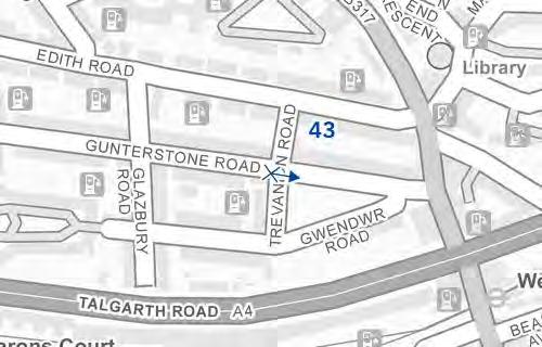
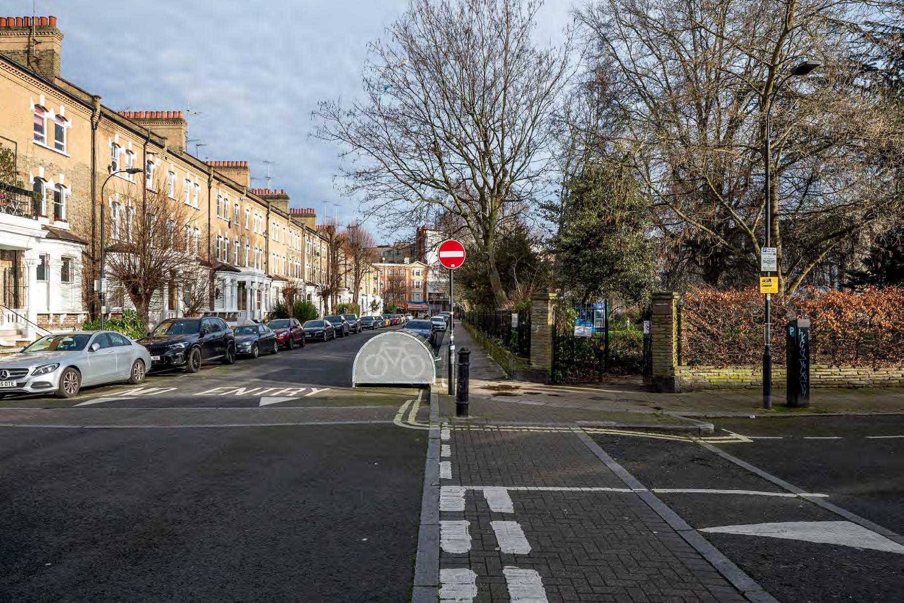
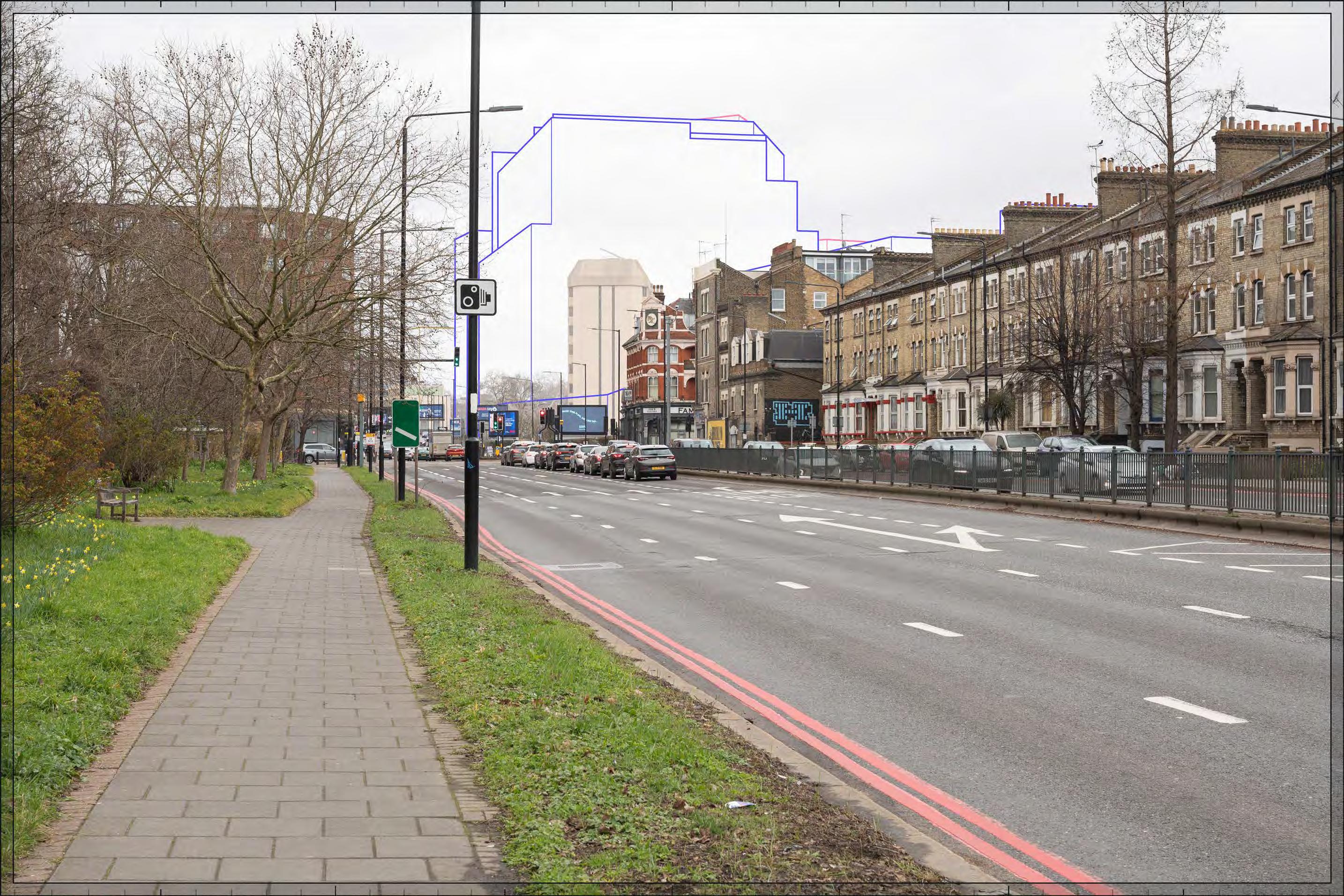
Trevanion Road overlooking Gwendwr Gardens
D29785x50 / 24mm 15/02/24 14:58
Existing
This viewpoint is located at the junction of Trevanion Road with Gunterstone Road, and the view is looking east in the direction of the Site. It is located within the Gunter Estate Conservation Area. None of the buildings in the view are listed.
A coherent terrace of brick and stone houses, three storeys above basement lines the northern side of Gunterstone Road, on the left side of the view. The open space of Gwendwr Gardens, dedicated as a war memorial, can be seen on the southern side of the road and east of Trevanion Road, on the right side of the view. It is densely planted with mature trees and shrubs such that views across it are heavily screened, even in this winter view, although the terrace on Gwendwr Road is glimpsed through the trees. The view is terminated to the left of the garden by Wellesley Mansions on North End Road and part of the rear of the taller West Kensington Court at the junction with West Cromwell Road can be seen beyond it.
Value attached to the view: this is a well-composed representative viewpoint from the Gunter Estate Conservation Area. The value of the view is judged to be Medium
Visual receptors affected: low numbers of local residents living on the street or in the wider local area.
Susceptibility to change of visual receptors: local residents in a community where views contribute to the setting of a high-quality designated townscape have a High susceptibility to change.
Sensitivity: Medium-high
24mm Reference image
Road overlooking Gwendwr Gardens
Trevanion
Trevanion Road overlooking Gwendwr Gardens
D29785x50 / 50mm 15/02/24 14:58
Completed Development - Early Phases
The top of Detailed Component Plot EC05 would be glimpsed through the trees, to the right of centre within the view. It would be screened to a considerable extent by evergreen foliage and branches, and would not be noticeable. It would be even more screened by foreground foliage in summer. The magnitude of impact would be Low in winter, reduced to Very low by foliage in spring, summer and autumn. The limited incidental visibility of the Early Phases would preserve visual amenity and the nature of the effect would therefore be Neutral
Magnitude of impact: Very low (spring, summer, autumn) to Low (winter)
Effect: Negligible (spring, summer, autumn) to Minor (winter) in scale, Neutral in nature (not significant)
Trevanion Road overlooking Gwendwr Gardens
D29785x50 / 50mm 15/02/24 14:58
Completed Development - All Phases
In addition to the Early Phases, Outline Component Plots WK03 and WK04 at the northern end of the Site, would appear at a distance of approximately 300m in the backdrop of the buildings on North End Road to the left, with a very small part of Outline Plot WK05 behind them. They would be screened and softened by foreground trees in Gwendwr Gardens in winter and screened to a more considerable extent by foliage in spring, summer and autumn. The illustrative scheme (not assessed but provided in Appendix E for information) shows an architectural approach to these Plots that would be in line with the Parameter Plans and Design Codes. Design Codes that would apply to Plot WK04 and are reflected in the illustrative design include, for example, distinct articulation of the building crown (WK.B.14).
The visibility of the large scale predominantly commercial plots at the northern end of the Site would create a contrasting larger scale modern backdrop. The extent of the Proposed Development seen beyond the conservation area would be limited and seen in relation to the larger scale West Kensington Court but it would be seen in relatively close proximity and would increase the magnitude of impact to Low-medium in winter reducing to Very low in spring, summer and autumn.
The scale of the Proposed Development on its northern edge would reflect the location of West Cromwell Road and the importance of this major route into central London from the west. As demonstrated by the illustrative views in Appendix E, buildings coming forward on the northern plots fronting West Cromwell Road would appropriately address sensitive views from the north. As for the Early Phases the limited incidental visibility of All Phases would preserve visual amenity and the nature of the effect would therefore be Neutral
Magnitude of impact: Very low (spring, summer, autumn) to Low-medium (winter)
Effect: Negligible (spring, summer, autumn) to Moderate (winter) in scale, Neutral in nature (not significant)
Trevanion Road overlooking Gwendwr Gardens
D29785x50 / 50mm 15/02/24 14:58
Completed DevelopmentEarly Phases and cumulative schemes
The top of the cumulative scheme at 100 West Cromwell Road would appear behind the terrace on the northern side of Gunterstone Road to the far left. It would not be very noticeable and there would be no meaningful visual relationship with the Early Phases. The effect of the Early Phases would remain as set out above for the Early Phases considered in isolation.
Magnitude of impact: Very low (spring, summer, autumn) to Low (winter)
Effect: Negligible (spring, summer, autumn) to Minor (winter) in scale, Neutral in nature (not significant)
Completed Development - Early Phases and cumulative schemes
Trevanion Road overlooking Gwendwr Gardens
D29785x50 / 50mm 15/02/24 14:58
Completed DevelopmentAll Phases and cumulative schemes
The top of the cumulative scheme at 100 West Cromwell Road would appear behind the terrace on the northern side of Gunterstone Road to the far left. It would not be very noticeable and there would be no meaningful visual relationship with the Early Phases. The effect of All Phases in the cumulative scenario would remain as set out above for All Phases considered in isolation.
Magnitude of impact: Very low (spring, summer, autumn) to Low-medium (winter)
Effect: Negligible (spring, summer, autumn) to Moderate (winter) in scale, Neutral in nature (not significant)
Completed Development - All Phases and
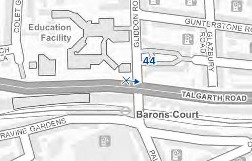
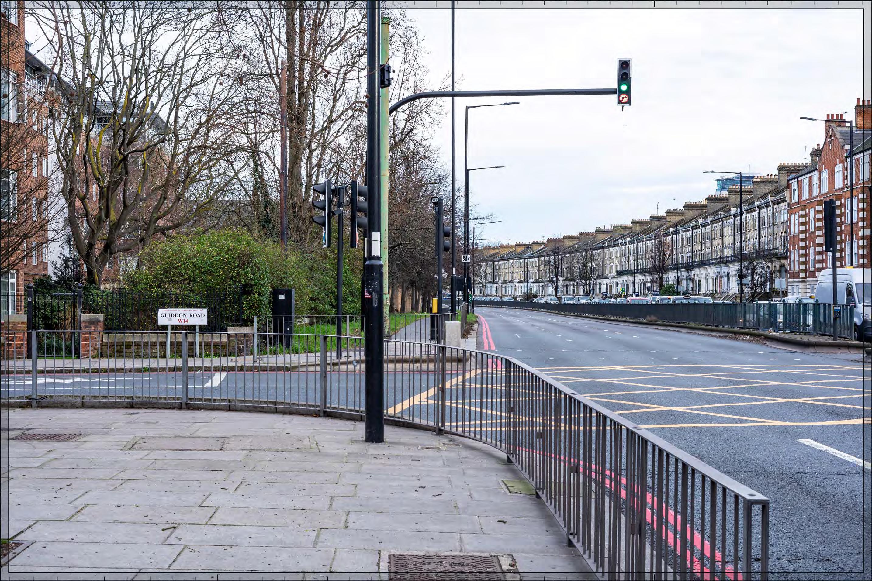
Talgarth Road, junction with Gliddon Road
D29790x50 / 24mm 15/02/24 15:30
Existing
The A4 was the main road into London from the west of England from 17th century until the construction of the M4 in 1971, and remains an important route into central London from Heathrow Airport. The view looks eastwards across the eight lanes of the A4, this section of which (to the west of the junction with North End Road) is known as Talgarth Road, with the planted verge and pavement on its north side on the left of the view. The viewing position is within the Gunter Estate Conservation Area. An apartment block known as Baron’s Keep is set back from the northern side of the road, left side of image.
The Gunter Estate Conservation Area extends to the south of Talgarth Road and includes the unlisted long three-storey terrace, Nos.1-109 Talgarth Road, with ground floor bay windows and broad chimney stacks articulating the roof line, extending across the right-hand side of the view in the 50mm image. The terrace forms a visually coherent built edge to this part of Talgarth Road but it fronts the modern busy highway infrastructure of Talgarth Road, opposite a more fragmented townscape of varied scale and form to the north of the road. Beyond the terrace the top of the Empress State Building is visible to the right. Looking westwards from this position large scale buildings at Hammersmith including the Ark and the post-war point block, Linacre Court, punctuate the view along Talgarth Road.
Value attached to the view: this is an infrastructure dominated, incidental view of the Gunter Estate Conservation Area; it is not taken from a specific viewing position of recognised importance. The value of the view is judged to be Low.
Visual receptors affected: a mixture of low numbers of local residents, local workers and high numbers of travellers using the busy A4 route into central London.
Susceptibility to change of visual receptors: the majority of the identified receptors would generally be travelling in a vehicle and this view would therefore be experienced as part of a continuous dynamic with the noise and views of traffic an intrusive element of the scene; this is not an identified scenic route and awareness of views is not likely to be high. Susceptibility to change is therefore judged to be Low.
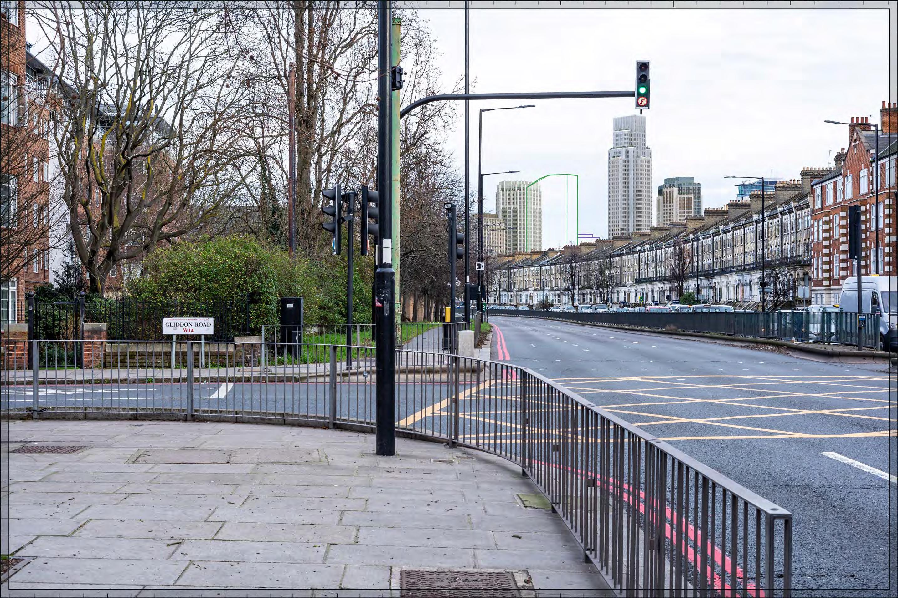
Detailed Component Plots WB04, WB03, EC05 and EC06 within the Early Phases, together with Outline Plot WB06, would taller appear behind the terrace on the southern side of Talgarth Road (within the Gunter Estate Conservation Area), see in relation to the top of the existing Empress State Building. The Early Phases would extend this backdrop of taller modern townscape seen beyond the foreground buildings lining Talgarth Road to create a dramatic juxtaposition that would signal the new destination that would be created by the Early Phases seen on this important approach to Earls Court from the west.
Detailed Plot WB04 would appear as the tallest building and would form a distinct focal point for the Proposed Development as a whole. There would be a well-balanced composition of tall buildings around Plot WB04, with Plots WB06, EC05 and EC06 stepping down to its north (left) and Plot WB03 stepping down in height to its south (right). The existing Empress State Building would appear at a similar height to Plot WB03, as well as Plot EC05, and would be well integrated within the overall cluster form.
Detailed Plot WB04 would have a slender visually interesting form, with a series of shoulders stepping up symmetrically to a central ‘crown’. The reduction in massing would be reinforced by the change in materiality, from stone-like solid materials, to lighter, more transparent and reflective materials at the crown. The stepped crown, curved corners and vertical emphasis would provide Plot WB04 with an elegant appearance, inspired by the Art Deco architecture of the now-demolished Earls Court Exhibition Centre. The lower Detailed Plot EC05 to its left would be based on an octagonal plan with a stepped crown. Detailed Plots WB03 and EC05 would have vertical emphasis fluted cladding and a well-articulated top. While different in their detailed articulation and treatment, each of the tall buildings designed in detail would share a familial Art Deco-inspired appearance.
Plot WB06, as defined by the Parameter Plans and Design Code, would sit within a triangular shaped envelope and is defined as a ‘pivot’ plot (Design Code SW.B.6): “a marker building which can be viewed in the round and is strongly integrated with the landscape.” As a ‘tall building’ within the Design Code it must also be part of a harmonious tall building cluster (Design Code SW.B.48) and be attractive from all angles (SW.B.49) with a clearly articulated top (Design Code SW.B.51). The illustrative design for Plot WB06 (not assessed but shown for reference in Appendix E) shows that, designed in accordance with the requirements of the Parameter Plans and Design Codes, the building within Plot WB06 could have a distinctive three-sided form and a familial Art Deco style character with the other tall buildings within the Early Phases.
Talgarth Road, junction with Gliddon Road
D29790x50 / 50mm 15/02/24 15:30
Completed DevelopmentEarly Phases (continued)
The Early Phases would noticeably intensify the existing visibility of larger-scale modern development in the background of the view, with a High magnitude of impact. It would contrast with the townscape of the long 19th century terrace in the foreground to create a distinctive new skyline. The Early Phases would also be appreciated in relation to the varied scale and quality of the townscape along the A4 between Hammersmith and Earls Court more generally. It would form a coherent composition on the skyline integrating the Empress State Building and marking the new Earl’s Court destination to the south. The Early Phases would include high quality buildings (either within the Detailed Component or the Outline Component Plots to be developed in line with the Design Codes, and expected to achieve the same level of quality). The nature of the effect would be Beneficial Magnitude of impact: High
Effect: Moderate in scale, Beneficial in nature. (significant).
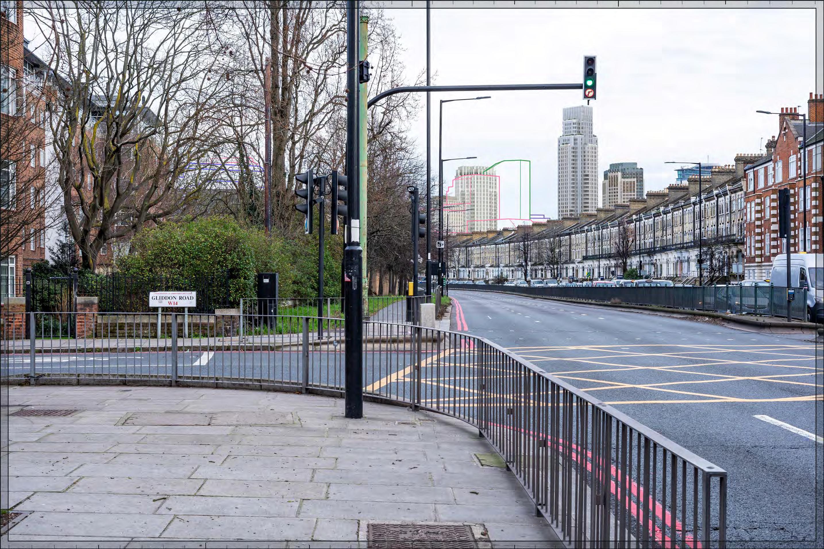
Completed Development - All Phases
In addition to the Early Phases, Outline Component Plots WK09, WK08, WK10, WK04 and WK05 would be visible. Outline Plot WK09, together with Outline Plots WK08 to its north and WK10 to its west, would appear in front of Outline Plot WB06 and Detailed Plots EC05 and EC06 in the centre of the view concealing parts of the Early Phases, complementing the skyline composition created by the Early Phases. Outline Plots WK09, WK08 and WK10 would step down in scale from the tall buildings to create a layered composition and manage the change in scale between the tall building cluster and the existing lower townscape in its wider context. Outline Plots WK04 and WK05 would be visible further north, on the right side of the image, and screened heavily by trees such that they would be difficult to discern even in this winter view. Where visible in the backdrop, they would integrate with the scale of the context to the north of Talgarth Road.
While the visible Outline Plots at the northern end of the Site would slightly increase visibility and consolidate the skyline created by the Early Phases, the magnitude of impact and the scale and nature of the effect would not alter in comparison to the assessment of the Early Phases.
Magnitude of impact: High
Effect: Moderate in scale, Beneficial in nature. (significant).
Completed Development - All Phases
Talgarth Road, junction with Gliddon Road
D29790x50 / 50mm 15/02/24 15:30
Completed DevelopmentEarly Phases and cumulative schemes
There would be no cumulative schemes visible, and the effect of the Early Phases in the cumulative scenario would remain as set out above for the Early Phases considered in isolation.
Magnitude of impact: High
Effect: Moderate in scale, Beneficial in nature. (significant).
Talgarth Road, junction with Gliddon Road
D29790x50 / 50mm 15/02/24 15:30
Completed DevelopmentAll Phases and cumulative schemes
There would be no cumulative schemes visible, and the effect of All Phases in the cumulative scenario would remain as set out above for All Phases considered in isolation.
Magnitude of impact: High
Effect: Moderate in scale, Beneficial in nature. (significant).
Talgarth Road A4, junction with Trevanion Road
D28091x50 / 24mm 12/03/23 15:14
Existing
The A4 was the main road into London from the west of England from 17th century until the construction of the M4 in 1971, and remains an important route into central London from Heathrow Airport. The view looks eastwards across the eight lanes of the A4, this section of which is known as Talgarth Road, with the planted verge and pavement on its north side on the left of the view. The viewing position is within the Gunter Estate Conservation Area, to the east of View 44.
The red brick residential block, West Kensington Court, dating from the early 20th century, outside the conservation area, is screened by planting on the left-hand side of the view. The Gunter Estate Conservation Area extends to the south of Talgarth Road and includes the long three-storey terrace, Nos.1-109 Talgarth Road, with ground floor bay windows and broad chimney stacks articulating the roof line, the eastern part of which extends across the right-hand side of the view. In the centre of the view are buildings at the junction with North End Road within the Barons Court Conservation Area, including the four-storey Famous Three Kings Public House in red brick, which is locally listed as a Building of Merit, seen in relation to the existing Ashfield House.
The A4 is known as West Cromwell Road to the east of the junction with North End Road. Beyond the junction marked by the pub is the taller form of Ashfield House fronting the West Cromwell Road, which is on the northern edge of the Site.
Value attached to the view: this is an infrastructure dominated incidental view of both the Gunter Estate and Baron’s Court Conservation Areas; it is not taken from a specific viewing position of recognised importance. The value of the view is judged to be Low.
Visual receptors affected: a mixture of low numbers of local residents, local workers and high numbers of travellers using the busy A4 route into central London.
Susceptibility to change of visual receptors: the majority of the identified receptors would generally be travelling in a vehicle and this view would therefore be experienced as part of a continuous dynamic with the noise and views of traffic an intrusive element of the scene; this is not an identified scenic route and awareness of views is not likely to be high. Susceptibility to change is therefore judged to be Low
Sensitivity: Low
24mm Reference image
Talgarth Road A4, junction with Trevanion Road
D28091x50 / 50mm 12/03/23 15:14
See assessment text on previous page.
Talgarth Road A4, junction with Trevanion Road
D28091x50 / 50mm 12/03/23 15:14
Completed Development - Early Phases
Outline Component Plot EC20 would be visible at a distance of approximately 500m, between West Kensington Court and Ashfield House. It would appear at a lower apparent height than both those existing buildings and screened from sight by trees to some extent. The Early Phases would make a minor change to the backdrop of the view, at a scale that would integrate with the existing townscape and would not be immediately noticeable, and therefore with a Low magnitude of impact. The limited incidental visibility of the Early Phases would preserve visual amenity and the nature of the effect would therefore be Neutral
Magnitude of impact: Low
Effect: Negligible in scale, Neutral in nature (not significant)
Completed
Talgarth Road A4, junction with Trevanion Road
D28091x50 / 50mm 12/03/23 15:14
Completed Development - All Phases
The predominantly commercial Outline Component Plots in the later phases at the northern end of the Proposed Development would be seen to the east (left) of the viewpoint in close proximity Outline Plot WK03 would be the most prominent, with small parts of the Outline Plots WK04, WK05, WK06, WK01 also visible beyond. The Early Phases would remain partly visible at a lower scale to the east (left). The Proposed Development would replace Ashfield House, noticeably increasing the scale of the backdrop to the Famous Three Kings Public House, and other smaller scale buildings along the southern side of Talgarth Road, within the Gunter Estate and Baron’s Court Conservation Areas, but creating a more coherent edge to West Cromwell Road. The scale of the Proposed Development would be seen in relation to the varied northern edge of Talgarth Road and the A4 as a whole which is punctuated by taller development at intervals along its route.
While Plot WK03 would appear larger in comparison to the existing Ashfield House, its stepped maximum parameter envelope would help to break up the scale of buildings coming forward on this plot. The illustrative scheme (not assessed but provided in Appendix E for information) shows an architectural approach to these Plots that would be in line with the Parameter Plans and Design Codes. Design Codes that would apply to Plot WK03 and that are reflected in the illustrative design include, for example, that there are harmonising architectural features that would allow them to be read as part of familial cluster of buildings (Design Code WK.B.17), with a continuous intermediate shoulder (Design Code WK.B.13), tripartite composition (Design Code WK.B.26) and distinct articulation of the building crown (Design Code WK.B.14).
The Proposed Development would make a noticeable change to the easterly view along the A4 with a High magnitude of impact.
Completed Development - All Phases
Talgarth Road A4, junction with Trevanion Road
D28091x50 / 50mm 12/03/23 15:14
Completed DevelopmentAll Phases (continued)
The larger scale of the Proposed Development on its northern edge would reflect the importance of this major route into central London from the west and would mark the Proposed Development as a new destination on this approach. The Proposed Development would also repair the fragmented streetscape to the north of the LBD improving the pedestrian experience and the visual amenity of West Cromwell Road. As demonstrated by the illustrative views in Appendix E, as required by the Design Code, buildings coming forward on the northern plots fronting West Cromwell Road would be of high quality design and would appropriately address sensitive views from the townscape to the north of the Site in their articulation and materiality. As a result, the Proposed Development would enhance the visual amenity of to the north of the Site along the A4. The nature of the effect would be Beneficial
Magnitude of impact: High
Effect: Moderate-major in scale, Beneficial in nature (significant).
Completed DevelopmentEarly Phases and cumulative schemes
The tower within the scheme at 100 West Cromwell Road would appear behind West Kensington Court, on the left side of the image. It would have no meaningful visual relationship to the considerably lower volume of Outline Plot EC20 on the Site. The effect of the Early Phases in the cumulative scenario would remain as set out above for the Early Phases considered in isolation.
Magnitude of impact: Low
Effect: Negligible in scale, Neutral in nature (not significant)
Talgarth Road A4, junction with Trevanion Road
D28091x50 / 50mm 12/03/23 15:14
Completed DevelopmentAll Phases and cumulative schemes
The tower within the scheme at 100 West Cromwell Road would appear behind West Kensington Court, on the left side of the image. It would appear at a slightly greater apparent height than Outline Plots WK03 and WK04, and together with them would reinforce the definition of this part of West Cromwell Road, reinforcing the legibility of the A4 as a major route into central London and consolidating the beneficial effect of the Proposed Development. The effect of All Phases in the cumulative scenario would remain as set out above for All Phases considered in isolation.
Magnitude of impact: High
Effect: Moderate-major in scale, Beneficial in nature (significant).
Barons Court Road, west
D28153x50 / 24mm 12/03/23 14:12
Existing
The view is from a position halfway along Barons Court Road, within the Baron’s Court Conservation Area. The northern side of the road, on the left side of the view, is lined by brick and stucco terraced houses of three storeys above basement (identified as Buildings of Merit in the CAA Ref. 2-29). On the right edge of the view is the locally listed entrance arch to Comeragh Mews in stucco. To its east (left in the image), are three-storey, stock brick Italianate terraces dating from the 19th century, which are also locally listed Buildings of Merit. Further east within the view are short sections of terrace either side of the junction with Vereker Road; the easterly block is a Building of Merit. Further east towards the centre of the view, on the narrow tapering site between Barons Court Road and Comeragh Road, is the rear elevation of terraces on Comeragh Road (Buildings of Merit), partially obscured by planting in their private gardens on Barons Court Road. A pair of party walls rise above the parapet line of the terrace. The streetscape is coherent and relatively homogeneous in its historic character.
Value attached to the view: this is a well-composed representative view from the Baron’s Court Conservation Area. The value of the view is judged to be Medium
Visual receptors affected: low numbers of local residents living on the street or in the wider local area.
Susceptibility to change of visual receptors: local residents in a community where views contribute to the setting of a high-quality designated townscape have a High susceptibility to change.
Sensitivity Medium-high
24mm Reference image
Barons Court Road, west
See assessment text on previous page.
Barons Court Road, west
D28153x50 / 50mm 12/03/23 14:12
Completed Development - Early Phases
The tops of Detailed Component Plots WB04, EC05 and EC06, and Outline Plot WB06, would be visible in the backdrop of views from the length of Barons Court Road, appearing behind the buildings on the south side of the road. Due to the lack of alignment of long views towards the Site, the visibility of the Early Phases would be limited from here. The tops of the tallest buildings in the Early Phases would be seen at a distance of approximately 700m, and would appear distinct and separate from, and contrasting in character to, the buildings within the Baron’s Court Conservation Area in the foreground of the view. However, as a result of their limited visibility, the Early Phases would not noticeably change the character of the townscape. The Detailed Component of the Early Phases is modelled in chalk render, which shows the scale form and articulation of the Detailed Component Plots, but not the proposed materials or the effects of distance on their visibility. While visibility as a whole would be limited, Detailed Plot WB04 would be the tallest and most prominently visible of the buildings within the Early Phases, on the right side of the image, with Outline Plot WB06, Detailed Plot EC05 and Detailed Plot EC04 stepping down progressively in height to the north (left in this image).
Enough of Detailed Plot WB04 would be visible for a viewer to appreciate its visually interesting form with a series of shoulders stepping up symmetrically to a slender central ‘crown’. The reduction in massing would be reinforced by the change in materiality, from stone-like solid materials, to lighter, more transparent and reflective materials at the crown. The stepped crown, curved corners and vertical emphasis would provide Plot WB04 with an elegant, Art Deco-inspired appearance. The visible top of Detailed Plot EC05 would be well-articulated. While different in their detailed articulation and treatment, each of the tall buildings designed in detail would share a familial Art Deco-inspired appearance. There would be a limited but noticeable change to the visual amenity of this part of Barons Court Road with a Low-medium magnitude of impact. Due to its contrasting character seen in relation to an area of historic architectural homogeneity, the Early Phases is not considered to contribute positively to visual amenity. However, neither is the visibility of tall modern development in a historic context considered to have an inherently adverse effect on visual amenity. The visibility of the Early Phases would be limited and peripheral to the directional views looking east and west along the street and therefore relatively incidental. The Early Phases would include high quality buildings (either within the Detailed Component or Outline Component Plots to be developed in line with the Design Codes, and expected to achieve the same level of quality). The quality of the visual amenity would therefore be preserved. The nature of effect is therefore assessed as Neutral
Magnitude of impact: Low-medium
Scale: Moderate in scale, Neutral in nature (significant)
Completed Development - Early Phases
Barons Court Road, west
D28153x50 / 50mm 12/03/23 14:12
Completed Development - All Phases
In addition to the Early Phases, Outline Component Plots WK09 and WK08, to the north of the Early Phases, would be visible beyond the south side of Barons Court Road further to the left in the view, obscuring Plots WB06, EC05 and EC06 of the Early Phases to some extent. Outline Plots WK09 and WK08 would have stepped maximum parameter envelopes that would break up the mass of buildings coming forward within these plots. The illustrative scheme (not assessed but provided in Appendix E for information) shows an architectural approach to these Plots that would be in line with the Design Codes. Design Codes that would apply to Plot WK08 and WK09 include, for example, that the upper levels of the plots should be designed to be distinct form the lower parts (LS.B.14), and the façade design should include visual richness (LS.B.16).
While the visible Outline Plots at the northern end of the Site would slightly increase visibility and consolidate the skyline established by the Early Phases, the magnitude of impact and the scale and nature of the effect would not alter in comparison to the assessment of the Early Phases.
Magnitude of impact: Low-medium
Scale: Moderate in scale, Neutral in nature (significant)
Barons Court Road, west
D28153x50 / 50mm 12/03/23 14:12
Completed DevelopmentEarly Phases and cumulative schemes
There would be no cumulative schemes visible, and the effect of the Early Phases in the cumulative scenario would remain as set out above for the Early Phases considered in isolation.
Magnitude of impact: Low-medium
Scale: Moderate in scale, Neutral in nature (not significant)
Barons Court Road, west
D28153x50 / 50mm 12/03/23 14:12
Completed DevelopmentAll Phases and cumulative schemes
There would be no cumulative schemes visible, and the effect of All Phases in the cumulative scenario would remain as set out above for All Phases considered in isolation.
Magnitude of impact: Low-medium
Scale: Moderate in scale, Neutral in nature (significant)
Palliser Road, junction with Comeragh Road
D28057x50 / 24mm 12/03/23 13:45
Existing
This viewpoint is located on the western side of Palliser Road, looking east along Comeragh Road in the direction of the Site. It is located within the Baron’s Court Conservation Area.
Comeragh Road has a straight alignment and is lined by terraced houses of a consistent scale of three to four storeys on both sides, such that it has a coherent and enclosed character, and this view along it has a channelled quality. The three to four storey late 19th century red-brick terraced houses closest to the viewpoint are buildings of robust appearance. Further along the street, earlier terraces in brick and stucco are more ornate in appearance (and are identified as Buildings of Merit in the CAA, Ref. 2-29). At the end of the view, part of Ashfield House on the Site is visible beyond buildings on the east side of Challoner Street that terminate the view in the middle distance.
Value attached to the view: this is a well-composed representative view from the Baron’s Court Conservation Area. The value of the view is judged to be Medium.
Visual receptors affected: low numbers of local residents living on the street or in the wider local area.
Susceptibility to change of visual receptors: local residents in a community where views contribute to the setting of a high-quality designated townscape have a High susceptibility to change.
Sensitivity: Medium-high
24mm Reference image
Palliser Road, junction with Comeragh Road
Palliser Road, junction with Comeragh Road
D28057x50 / 50mm 12/03/23 13:45
Completed Development - Early Phases
The Early Phases would not be visible.
Magnitude of impact: None
Effect: No effect
Palliser Road, junction with Comeragh Road
D28057x50 / 50mm 12/03/23 13:45
Completed Development - All Phases
The later phases at the northern end of the Proposed Development would create a prominent new termination to the views eastwards along from aligned streets within the northern part of the Baron’s Court Conservation Area, for example Comeragh Road; a similar but lesser impact is shown in View A30 in Appendix C, looking east along Charleville Road to the south.
The Proposed Development would make a noticeable change to the character of views from Comeragh Road. From Comeragh Road Outline Component Plots at the northern end of the Site would terminate the view. Plot WK04 would be the most prominent element of the Proposed Development, with part of Outline Plot WK05 seen behind it. Outline Plot WK04, seen at a distance of approximately 600m, would appear noticeably larger in scale than the existing Ashfield House. Its scale and breadth of form would contrast with the fine grain of the residential townscape in the foreground conservation area. Parts of Outline Plots WK03 to the left and WK01 to the right, both lower and closer to the edge of the conservation area, would be seen in front of them layering the scene and therefore managing the change in scale and mediating between the substantial scale predominantly commercial Plot WK04, which marks the northern entrance to the Proposed Development on the A4, and the existing historic townscape to the west of the Site. Moving forward the scale of the Proposed Development would recede and appear lower in the backdrop of the view.
The illustrative scheme (not assessed but provided in Appendix E for information) shows an architectural approach to these Plots that would be in line with the Parameter Plans and Design Codes. Design Codes that apply to Plot WK05 require that a building coming forward on this plot should have a distinct building crown (Design Code LS.B.49) and a calm architectural expression that would complement local character (Design Code LS.B.45) and minimise distraction from the foreground of the conservation area townscape (Design Code LS.B.48). Buildings coming forward within Plots WK01/03/04 must create a well-articulated composition seen from Comeragh Road that would minimise visual coalescence (Design Codes WK.B.35 and WK.B.37).
Palliser Road, junction with Comeragh Road
D28057x50 / 50mm 12/03/23 13:45
Completed DevelopmentAll Phases (continued)
The Proposed Development would represent a prominent change to visual amenity, introducing a large scale modern backdrop to the view. The magnitude of impact would be High. The proximity and high level of contrast in scale and form with the designated historic townscape in the foreground, the loss of clear sky, and the consistent nature of the impact from this aligned route has the potential to produce an adverse nature of effect on the viewer. Potential mitigation of adverse effects on visual amenity has therefore been considered during the design development process. The cluster of taller development would be well articulated by variety in scale between the plots. The architectural quality of the Detailed Component of the Early Phases would be high. The Parameter Plans and Design Codes for the Outline Plots would ensure that the form and architectural treatment of the Outline Component Plots would respond appropriately to the sensitive historic context in the foreground and the character of the Proposed Development as a whole. Through these measures, adverse effects on visual amenity have therefore been reduced and minimised. Nonetheless, on balance, due to the scale and proximity of the Proposed Development, and the high level of sensitivity, it is considered that the potential for an adverse effect on the viewer would not be completely mitigated by these factors. The nature of the effect would be Adverse Magnitude of impact: High
Effect: Major in scale, Adverse in nature (significant)
Completed DevelopmentEarly Phases and cumulative schemes
The top of 100 West Cromwell Road would appear behind the terrace on the northern side of Comeragh Road. As when considered in isolation the Early Phases would have no effect.
Magnitude of impact: None
Effect: No effect
Palliser Road, junction with Comeragh Road
D28057x50 / 50mm 12/03/23 13:45
Completed DevelopmentAll Phases and cumulative schemes
The top of 100 West Cromwell Road would appear behind the terrace on the northern side of Comeragh Road. Its relationship to the Proposed Development would be limited. The effect of All Phases in the cumulative scenario would remain as set out above for All Phases considered in isolation.
Magnitude of impact: High
Effect: Major in scale, Adverse in nature (significant)
North End Road, junction with Mund Street
D28101 24mm 11/03/23 16:45
Existing
This viewpoint is located on the western side of North End Road, close to its junction with Mund Street. It is located on the eastern edge of the Baron’s Court Conservation Area looking into the post-war Gibbs Green Estate and West Kensington Estates in the foreground of the view (outside the Baron’s Court Conservation Area). Although they are outside this narrow image, a viewer in this location would be able to see red-brick 19th century buildings to the north (left) on the eastern side of North End Road, within the Baron’s Court Conservation Area. The Gibbs Green Estate comprises four storey linear blocks, set perpendicular to Mund Street (on the left side of image). Fairburn House, within the West Kensington Estate, is 11 storeys tall and is set back from North End Road and Mund Street behind an open green space. It adjoins an identical tower, Churchward House, set to its south (out of shot in this image). The estates create a fragmented incoherent street frontage to North End Road that allows longer views north-eastwards between the residential blocks on the estate from this position.
The rear of the Grade I listed Church of St. Cuthbert is visible but barely discernible in the middle distance, at a much lower apparent height than the foreground buildings and screened substantially by foreground trees. It is not a noticeable landmark in views from this part of North End Road.
North End Road, junction with Mund Street
D28101 24mm 11/03/23 16:45
Existing (continued)
Value attached to the view: this is an incidental view from the Baron’s Court Conservation Area, dominated by post-war buildings and with no particular compositional or scenic quality. It is of Low value.
Visual receptors affected: residents of the local area, including the Gibbs Green and West Kensington Estates, workers, shoppers and users of local businesses on North End Road and those travelling along North End Road.
Susceptibility of visual receptors: local residents in a community where views contribute to the setting of a high-quality designated townscape have a high susceptibility to change. People travelling working or shopping have a low susceptibility to change. Susceptibility to change overall is therefore judged to be Medium
Sensitivity Low-medium
Completed Development - Early Phases
Outline Component Plots EC19 and EC20 would appear in the middle distance beyond the estate, with a considerably lower apparent height than foreground buildings and substantially screened from view by trees and barely discernible. Although they are seen partly in front of the Grade I listed Church of St. Cuthbert the church is itself barely discernible in the existing view. The magnitude of impact would be Very low. The limited incidental visibility of the Early Phases would preserve visual amenity and the nature of the effect would therefore be Neutral
Magnitude of impact: Very low
Effect: Negligible in scale, Neutral in nature (not significant)
Completed Development - Early Phases
Proposed Development key
North End Road, junction with Mund Street
D28101 24mm 11/03/23 16:45
Completed
Development - All Phases
Outline Component Plots WK01, WK03, WK04, WK05, WK10, WK11, WK12, WK07 and WK08, seen to varying extents beyond the estates in the near to middle distance, would extend across most of the frame consolidating the modern townscape of the foreground estates. The later phases of the Proposed Development would block the Early Phases from view.
The visible elements of the Proposed Development would contribute to a varied skyline in the backdrop of the estates and would infill gaps, consolidating the backdrop and adding coherence to the scene. The scale of the Proposed Development would appear taller than lower-rise parts of the estate but would remain lower than the 11-storey blocks to the right. The illustrative scheme (not assessed but provided in Appendix E for information) shows an architectural approach to these Plots that would be in line with the Parameter Plans and Design Codes.
The Proposed Development would consolidate the existing visibility of larger scale modern development to the east of North End Road, in comparison to the finer grain and scale of the Baron’s Court Conservation Area to its west, resulting in a Medium magnitude of impact. Although the foreground trees would screen parts of the Proposed Development when in leaf this would not materially alter the magnitude of impact. The Outline Component Plots would be developed in line with the Design Codes to achieve high quality and an appropriate response to sensitive aspects of their wider context. While the Proposed Development would intensify the modern townscape to the east of North End Road, it would enrich the unremarkable post-war townscape of the estates in their immediate easterly setting. The nature of the effect would be Beneficial.
Magnitude of impact: Medium
Effect: Moderate in scale, Beneficial in nature (significant)
North End Road, junction with Mund Street
D28101 24mm 11/03/23 16:45
Completed DevelopmentEarly Phases and cumulative schemes
The cumulative scheme at 100 West Cromwell Road would appear in the middle distance, above the Gibbs Green Estate, with no meaningful relationship to the Early Phases. The effect of the Early Phases in the cumulative scenario would remain as set out above for the Early Phases considered in isolation.
Magnitude of impact: Very low
Effect: Negligible in scale, Neutral in nature (not significant)
Completed Development - Early Phases and cumulative schemes
North End Road, junction with Mund Street
D28101 24mm 11/03/23 16:45
Completed DevelopmentAll Phases and cumulative schemes
A sliver of the cumulative scheme at 100 West Cromwell Road would be visible behind and to either side of Outline Plot WK05 in the middle distance. It would appear as part of a distinct background layer of tall and modern townscape together with the Proposed Development. The effect of All Phases in the cumulative scenario would remain as set out above for All Phases considered in isolation.
Magnitude of impact: Medium
Effect: Moderate in scale, Beneficial in nature (significant)
Ivatt Place
D29850 24mm 04/03/24 / 14:27
Existing
This viewpoint is located on the western side of Ivatt Place to the east of North End Road within the West Kensington Estate. The West Kensington Estate, dating from the 1970s, was built on the former West Kensington Coal & Goods Depot. This large area of post-war townscape includes a variety of contrasting scales and residential typologies and is separated from the Site to its immediate east by a perimeter wall.
Ivatt Place is a cul-de-sac around the play area in the foreground of the view, with a row of three storey post-war houses with white timber cladding, seen beyond. Other three and four storey residential buildings can be seen to the north and south of the terrace in the centre of the image. The Empress State Building to the right appears at a distance of approximately 250m, contrasting dramatically with the smaller scale of the housing in the foreground.
A viewer in this location would be aware of the paired 11-storey blocks of Churchward House and Fairburn House, out of shot in this image but immediately north of the viewpoint (beyond the left side of the image).
Value attached to the view: this is a representative view through townscape of limited historic or scenic quality, outside any conservation area. It is of Low value.
Visual receptors affected: local residents of the West Kensington Estate.
View location
Ivatt Place
D29850 24mm 04/03/24 / 14:27
Existing (continued)
Susceptibility to change of visual receptors: local residents in a community where views contribute to the setting of a high-quality designated townscape have a high susceptibility to change but in areas of lower townscape quality, susceptibility to change is considered to be Medium
Sensitivity Low-medium
Completed Development - Early Phases
The Early Phases would be seen at close proximity beyond the buildings on Ivatt Place in relation to the existing Empress State Building, intensifying the taller close backdrop to the estate. While the apparent scale of the Early Phases would be large and would contrast markedly with the scale of buildings on Ivatt Place, this would not introduce a wholly new character to the view given the existing presence of the Empress State Building, which is closer to the viewpoint: with the Empress State Building the Early Phases would form a dramatic contrasting juxtaposition with the low-rise post-war character of the foreground housing.
Detailed Component Plots WB03, WB04, WB05, EC05 (to a small extent), EC06, and Outline Plot WB06 would create a cluster of tall development marking the proposed east-west route across the WLL from the estate to Warwick Road in RBKC and the location of the new Table Park within the Early Phases. A small part of Outline Plot WB08 would also be visible between Detailed Plot WB03 and the Empress State Building. Plot WB04 would appear as the tallest building within the Early Phases and there would be a balanced composition to either side of it from this viewpoint, with Plot WB03 stepping down in height to its right and Plot WB06, Plot EC05 and EC06 stepping down to its left. The Empress State Building would become a well-integrated part of a coherent cluster of tall buildings.
Only Plot WB04 would appear taller than the Empress State Building and none of the Plots within the Proposed Development would have a comparable breadth to that of the Empress State Building: all would appear slender. The visible elements of the Early Phases would have different heights and massing, such that they would form a varied well composed skyline in the backdrop of the estate. Seen from the west
the cluster would preserve sky space between most plots also helping to minimise coalescence. Plot WB04 would have a visually interesting form, with a series of shoulders stepping up symmetrically to a central ‘crown’. The reduction in massing would be reinforced by the change in materiality, from stone-like solid materials, to lighter, more transparent and reflective materials at the crown. The stepped crown, curved corners and vertical emphasis would provide Plot WB04 with an elegant, Art Deco-inspired appearance echoing that of the now-demolished Exhibition Centre. Plot WB03 would be based on a faceted plan incorporating ‘bullnose’ elements on the eastern and western frontages, and a stepped crown would provide a distinctive top for the building. The use of pilasters would provide a vertical emphasis. Plot EC06 would have a slender, broadly triangular form and its architecture would have an ordered and regular quality, with a clearly defined double-height crown. Plot WB05, close to the edge of the estate would step down in height to manage the change in scale from the tall building cluster proposed within the Early Phases to the existing lower estate. While different in their detailed articulation and treatment, each of the tall buildings designed in detail would share a familial Art Deco-inspired appearance.
Outline Plot WB06 would be seen in front of Plot EC05. Plot WB06, as defined by the Parameter Plans and Design Code, would sit within a triangular shaped envelope and is defined as a ‘pivot’ plot (Design Code SW.B.6): “a marker building which can be viewed in the round and is strongly integrated with the landscape.” As a ‘tall building’ within the Design Code it must also be part of a harmonious tall building cluster (Design Code SW.B.48) and be attractive from all angles (Design Code SW.B.49) with a clearly articulated top (Design Code SW.B.51) The illustrative design for Plot WB06 (not assessed but shown for reference in
Appendix E) shows that, designed in accordance with the requirements of the Parameter Plans and Design Codes, the building within Plot WB06 could have a distinctive three-sided form and a familial Art Deco style character with the other tall buildings within the Proposed Development.
The Early Phases would consolidate the existing visibility of the Empress State Building to the east of the West Kensington Estate with a High magnitude of impact in this close view.
While the Early Phases would intensify the close modern townscape to the east, it would be consistent with the existing character of the view and would help to mitigate the effect of the existing singular Empress State Building by integrating it in a layered backdrop of buildings and using lower development to mediate between the taller buildings and the lower scale of the estate at their interface. The Early Phases would form a coherent composition on the skyline and would enrich the unremarkable post-war townscape of the estates with new Detailed Component Plots of high architectural quality and Outline Component Plots to be developed in line with the Design Codes, and expected to achieve the same level of quality. The visibility of the Early Phases would mark the proposed east-west route to Warwick Road in RBKC and the Table Park and other destination uses within the Early Phases. The nature of the effect would be Beneficial Magnitude of impact: High
Effect: Major in scale, Beneficial in nature (significant)
Proposed Development key
Ivatt Place
D29850 24mm 04/03/24 / 14:27
Completed Development - Early Phases
See assessment text on previous page.
Development - Early Phases
Completed
Ivatt Place
D29850 24mm 04/03/24 / 14:27
Completed Development - All Phases
In addition to the Early Phases, Outline Plots WK10 and WK09, to the north of the Early Phases would extend the new backdrop to the estate to the north (left in this image), partly obscuring the Plot EC06 within the Early Phases.
Outline Plots WK10 and WK09, defined as ‘perimeter block’ in the Design Code, would be predominantly residential and considerably lower than the visible parts of the Early Phases, though they are closer to this viewing position than the tall building cluster. The stepping in scale of the plots from east to west would mediate the scale of the Proposed Development at its interface with the estates. The illustrative scheme (not assessed but provided in Appendix E for information) shows an architectural approach to the Outline Plots that would be in line with the Parameter Plans and Design Codes. For example, that the perimeter blocks addressing Aisgill Lane should respond to the existing context through the articulation of the massing of the façade expression (Design Code LS.B.14) and should have familial visual coherence with the adjacent proposed buildings (Design Code LS.B.23).
While the Outline Plots in the later phases at the northern end of the Site would increase visibility and consolidate the new backdrop to the estates created by the Early Phases, the magnitude of impact, which is already high, and the resulting scale and nature of the effect, would not alter in comparison to the assessment of the Early Phases.
Magnitude of impact: High
Effect: Major in scale, Beneficial in nature (significant)
Completed Development - All Phases
Ivatt Place
D29850 24mm 04/03/24 / 14:27
Completed DevelopmentEarly Phases and cumulative schemes
There would be no cumulative schemes visible, and the effect of the Early Phases in the cumulative scenario would remain as set out above for the Early Phases considered in isolation.
Magnitude of impact: High
Effect: Major in scale, Beneficial in nature (significant)
Completed Development - Early Phases and cumulative schemes
Ivatt Place
D29850 24mm 04/03/24 / 14:27
Completed DevelopmentAll Phases and cumulative schemes
There would be no cumulative schemes visible, and the effect of All Phases in the cumulative scenario would remain as set out above for All Phases considered in isolation.
Magnitude of impact: High
Effect: Major in scale, Beneficial in nature (significant)
Completed Development - All Phases and cumulative schemes
The Queens Club
D30161x35 / 24mm 26/02/24 09:36
Existing
This viewing position is located within the grounds of the Queen’s Club, a 14 acre private tennis club. It lies within the Queen’s Club Gardens Conservation Area. The Queen’s Club was established in 1886 on the Queen’s Field, a former market garden. The Queen’s Club includes an original complex of buildings dating from 1888 and noted as Buildings of Merit in the CAA (Ref. 2-30); these buildings are behind the viewer in this location.
The view looks east in the direction of the Site, across lawned areas and tennis courts such that the foreground of the view has an open quality, except to the right where a temporary winter dome structure (in place from October to March each year) has been erected over some of the courts. In the middle ground of the view, the backs of four-storey houses on Gledstanes Road and two apartment blocks –Robert Gentry House to the north (left) and the taller Baron’s Court Mansions to the south (right) - form a continuous building line which provides a high degree of enclosure to the view. The Empress State Building is visible behind and to the right of Baron’s Court Mansions and is visibly more distant, approximately 850m from the viewpoint.
The top of the spire of the Church of St. Andrew, built in 1874, is visible on the far right edge of the view, rising above the temporary winter dome within the Queen’s Club grounds. This view is noted in the CACP: “The view from within the grounds of Queen’s Club towards the spire of St Andrew’s Church is also an important one…” (Ref. 2-30, para.6.72). It is however otherwise not a view of particular compositional or scenic quality.
Value attached to the view: this is a view noted in the Queen’s Club Gardens CACP. The value of the view is judged to be Medium
Visual receptors affected: low numbers of users of the Queen’s Club’s facilities. The viewpoint is not publicly accessible.
Susceptibility to change of visual receptors: viewers in this location are likely to be engaged in sport and not focused on views. Susceptibility to change is therefore judged to be Low.
Sensitivity: Low-medium
24mm Reference image
The Queens Club
D30161x35 / 35mm 26/02/24 09:36
Existing
See assessment text on previous page.
The Queens Club
D30161x35 / 35mm 26/02/24 09:36
Completed Development - Early Phases
Detailed Component Plots WB04 and WB03, and Outline Plot WB06, would appear behind Baron’s Court Mansions and the rear of the terrace on Gledstanes Road, to the left of the existing Empress State Building. With the Empress State Building they would form part of a taller modern townscape backdrop to the tennis club. The Early Phases would change the skyline composition of the view’s backdrop adding a new focal point. The clear view of the spire of St Andrew’s some distance to the right, and a broad expanse of open sky around it, would be preserved in summer when the Queen’s Club’s winter dome in the foreground is not in place. Due to the alignment of the Early Phases in relation to the spire, its legibility would also be preserved in other views from the club where it is possible to see the spire over or beyond the dome.
Detailed Plot WB04 would be the tallest most prominent element of the Early Phases. It would have a visually interesting form, with a series of shoulders stepping symmetrically to a slender central ‘crown’. The reduction in massing would be reinforced by the change in materiality, from stone-like solid materials, to lighter, more transparent and reflective materials at the crown. The stepped crown, curved corners and vertical emphasis would provide Plot WB04 with an elegant, Art Deco-inspired appearance. The very top of Detailed Plot WB03 would be just visible to its right at a similar apparent height to the adjacent Empress State Building Outline Plot WB06 to the left of Plot WB04 (seen in front of Detailed Plot EC05), would also appear equivalent in height to the Empress State Building. Plot WB06, is defined as a ‘pivot’ plot (Design Code SW.B.6): “a marker building which can be viewed in the round and is strongly integrated with the landscape.” As a ‘tall building’ within the Design Code it must also be part of a harmonious tall building cluster (Design Code SW.B.48) and be attractive from all angles (SW.B.49) with a clearly articulated top (Design Code SW.B.51). The illustrative design for Plot WB06 (not assessed but shown for reference in Appendix E) shows that, designed in accordance with the requirements of the Parameter Plans and Design Codes, would have a distinctive three-sided form and a familial Art Deco style character with the other tall buildings within the Early Phases.
The Queens Club
D30161x35 / 35mm 26/02/24 09:36
Completed DevelopmentEarly Phases (continued)
There would be a noticeable change to the skyline backdrop and the visual amenity of the Queen’s Club with a Medium magnitude of impact. Although the composition of the distant skyline would be altered by the Early Phases, and the taller modern character of the backdrop would be intensified, the character would appear broadly consistent with the existing middle distance setting to the east, and the clear view of the spire of St Andrew’s would be preserved. It is therefore not considered that the Early Phases would have an inherently adverse effect on visual amenity. The Early Phases would form a coherent well-articulated cluster that would integrate the Empress State Building on the secondary skyline. The slender top of Plot WB04, juxtaposed with the broader form of the existing Empress State Building, would act as a distinctive and attractive new marker for Earls Court in the view. The Early Phases would include high quality buildings (either within the Detailed Component or Outline Component Plots to be developed in line with the Design Codes, and expected to achieve the same level of quality). The quality of the visual amenity would therefore be preserved. The nature of effect is assessed as Neutral
Magnitude of impact: medium
Effect: Moderate in scale, Neutral in nature (significant)
Completed DevelopmentAll Phases (continued)
In addition to the Early Phases, Outline Component Plots WK09, WK05, WK04 and WK03 in the later phases would be visible further adding to the background layer of townscape established by the Early Phases and the Empress State Building. Plot WK09 would appear lower to the left of Outline Plot WB06, consolidating the central tall building cluster established by the Early Phases by continuing the coherent steps down in height from the peak formed by Plot WB04. Further north (left), the tops of Outline Plots WK03, WK04 and WK05 would rise above the foreground roofline marking a secondary, much less prominent cluster of predominantly commercial plots that reflect the location of the busy A4 route into central London to the north of the Site. The height of the Outline Plots at the northern end of the Proposed Development would step down towards the conservation areas to the west of the Site such that the visible closest Plot WK03 would appear the lowest mediating between the tallest parts of the northern edge of the Proposed Development and the more sensitive historic context.
Completed Development - All Phases
The Queens Club
D30161x35 / 35mm 26/02/24 09:36
Completed DevelopmentAll Phases (continued)
The illustrative scheme (not assessed but provided in Appendix E for information) shows an architectural approach to these Plots that would be in line with the Parameter Plans and Design Codes. Design Codes that would apply to Plot WK09 include, for example, that the upper levels of the plots should be designed to be distinct form the lower parts (LS.B.14), and the façade design should include visual richness (LS.B.16). Similarly, Design Codes for Plot WK04 include for example, that the façade expression of WK04 has features such as larger aperture sizes (WK.B.26), that it has massing steps of two storeys or more (WK.B.27) and there is a distinct articulation of the building crown (WK.B.14).
While the Outline Plots in the later phases would increase visibility and consolidate the new backdrop to the Queen’s Club created by the Early Phases, the magnitude of impact, and the resulting scale and nature of the effect, would not alter in comparison to the assessment of the Early Phases.
Magnitude of impact: Medium
Effect: Moderate in scale, Neutral in nature (significant)
Completed DevelopmentEarly Phases and cumulative schemes
The cumulative scheme at 100 West Cromwell Road would appear to the north of the Proposed Development, left in this image. While there would be a considerable skygap between them, a visual dialogue between 100 West Cromwell Road and the visible tall buildings within the Early Phases would be evident, and together they would form a distinct background layer of townscape. The effect of the Early Phases in the cumulative scenario would remain as set out above for the Early Phases considered in isolation.
Magnitude of impact: Medium
Effect: Moderate in scale, Neutral in nature (significant)
Completed Development - Early Phases and cumulative schemes
The Queens Club
D30161x35 / 35mm 26/02/24 09:36
Completed DevelopmentAll Phases and cumulative schemes
The cumulative scheme at 100 West Cromwell Road would appear behind the Outline Plots WK04 and WK03 on the skyline forming the peak of a new cluster of taller development on West Cromwell Road. The effect of All Phases in the cumulative scenario would remain as set out above for All Phases considered in isolation.
Magnitude of impact: Medium
Effect: Moderate in scale, Neutral in nature (not significant)
Greyhound Road
D29849 24mm 04/03/24 / 14:55
Existing
This viewpoint is located on the southern pavement of Greyhound Road, a historic route through the area. The view looks east along Greyhound Road, and its continuation Star Road, in the direction of the Site. The junction with St Andrew’s Road lies behind the viewer in this location. The viewpoint is within the Queen’s Club Gardens Conservation Area. A view of the spire of the Grade II listed Church of St Andrew is noted in the CACP as a view through the conservation area of particular importance. The CACP notes “the view east along Greyhound Road towards the junction with St Andrew’s Road and Church” (Ref. 2-30, para.6.72). This view is taken further to the east in order to capture better views of the church in relation to the Proposed Development. The CACP also notes “Greyhound Road is particularly rich in important views… The presumption should be to retain these views, and any new development should enhance not impair them.” (para.6.72) The legibility of the church spire contributes to wayfinding and visual amenity of the conservation area.
On the left of the view in red brick is the five-storey St Andrew’s Mansions. The Grade II listed church lies beyond it with its spire seen in close proximity against clear sky. The edge of the Fulham School building (Building of Merit, Ref. 2-30, p.31) frames the image at its right edge. Beyond it modest two storey terraced houses continue the definition of the southern side of the street, with a larger villa, Normand Lodge (Building of Merit, Ref. 2-30, p.31), terminating the terrace further in the middle distance. Further in the distance, in the centre of the view, post-war blocks on the north side of Star Road are visible albeit screened by trees to a
Greyhound Road
D29849 24mm 04/03/24 / 14:55
Existing (continued)
considerable extent. From other points along Greyhound Road, particularly to the west of the junction with St Andrew’s Road, the Empress State Building is a prominently visible termination to the views eastwards but the Church of St Andrew is much less prominent. From this point, due to the change in the alignment of Greyhound Road, the Empress State Building is hidden behind the terraced houses on the south (right) side of the street.
Value attached to the view: this is a well-composed representative view of St Andrew’s Church from the Queen’s Club Gardens Conservation Area. The value of the view is judged to be Medium.
Visual receptors affected: predominantly local residents living on the street or in the wider local area; also visitors to the church and parents, children and staff of the adjacent school.
Susceptibility to change of visual receptors: local residents in a community where views contribute to the setting of a high-quality designated townscape have a High susceptibility to change.
Sensitivity Medium-high
Completed Development - Early Phases
Detailed Component Plots WB04, EC05 and EC06 and Outline Plot WB06 within the Early Phases would terminate the view at a distance of approximately 700m, together with a small part of Outline Plot EC04. With the Empress State Building visible in the views further west, the Early Phases would form a backdrop of taller modern townscape, separate and distinct and relatively distant from the buildings within the conservation area in the foreground. The clear legibility of the spire of the Church of St Andrew would be preserved from this position -- and also in views to the west of the junction with St Andrew’s Road. The Early Phases would add a second more distant focal point to the view, echoing the verticality of the spire, to mark the new destination and enhanced east-west connectivity through the Early Phases. However, the prominence of the church would be retained and it would remain the primary focal point on Greyhound Road.
Detailed Plot WB04 would appear as the tallest building within the Early Phases set within a coherent composition with Outline Plot WB06 and Detailed Plots EC05 and EC06 stepping down to the north (left) of Plot WB04. Plot WB04 would have a substantially lower apparent height than the spire of St. Andrew’s, and all the visible elements of the Proposed Development would sit well to the side of the spire on the skyline.
Completed Development - Early Phases
Greyhound Road
D29849 24mm 04/03/24 / 14:55
Completed Development - Early Phases (continued)
Detailed Plot WB04 would have a visually interesting form, with a series of shoulders stepping up symmetrically to a slender central ‘crown’. The reduction in massing would be reinforced by the change in materiality, from stone-like solid materials, to lighter, more transparent and reflective materials at the crown. The stepped crown, curved corners and vertical emphasis would provide Plot WB04 with an elegant, Art Deco-inspired appearance.
Plot WB06, as defined by the Parameter Plans and Design Code, would sit within a triangular shaped envelope and is defined as a ‘pivot’ plot (Design Code SW.B.6): “a marker building which can be viewed in the round and is strongly integrated with the landscape.”
As a ‘tall building’ within the Design Code it must also be part of a harmonious tall building cluster (Design Code SW.B.48) and be attractive from all angles (SW.B.49) with a clearly articulated top (Design Code SW.B.51). The illustrative design for Plot WB06 (not assessed but shown for reference in Appendix E) shows that, designed in accordance with the requirements of the Parameter Plans and Design Codes, the building within Plot WB06 could have a distinctive three-sided form and a familial Art Deco style character with the other tall buildings within the Early Phases. Plot EC06, lower to the left and more visually integrated within the existing roofscape, would have architecture with an ordered and regular quality, with a clearly defined double-height crown.
There would be a noticeable change to the skyline backdrop and the visual amenity of Greyhound Road with a Medium magnitude of impact. Although the composition of the distant skyline would be altered by the Early Phases, and the taller modern character of the easterly backdrop to Greyhound Road would be intensified, the clear view of the spire of St Andrew’s would be preserved. It is therefore not considered that the Early Phases would have an inherently adverse effect on visual amenity. The Early Phases would form a coherent well-articulated cluster. Where the existing Empress State Building is visible in views experienced kinetically from further west its broad singular form would be integrated on the secondary skyline. The slender top of Plot WB04, would act as a distinctive and attractive new marker for Earls Court signalling the location of a new eastwards route across the WLL through the Early Phases to Warwick Road in RBKC. The Early Phases would include high quality buildings (either within the Detailed Component or Outline Component Plots to be developed in line with the Design Codes, and expected to achieve the same level of quality). The quality of the visual amenity of Greyhound Road would therefore be preserved. The nature of effect is assessed as Neutral. Magnitude of impact: Medium
Effect: Moderate in scale, Neutral in nature (significant).
Greyhound Road
Completed Development - All Phases
In addition to the Early Phases, Outline Plot WK09 would be visible to the left of Outline Plot WB06 partly obscuring Detailed Plot EC06. It would consolidate the coherent composition created by the Early Phases, stepping down in height from Plot WB06, and with limited additional impact. Like the Early Phases, it would not impair views of the spire of St Andrew’s Church.
While the Outline Plots in the later phases would increase visibility and consolidate the new backdrop to the conservation area created by the Early Phases, the magnitude of impact, and the resulting scale and nature of the effect, would not alter in comparison to the assessment of the Early Phases.
Magnitude of impact: Medium
Effect: Moderate in scale, Neutral in nature (significant).
Completed DevelopmentEarly Phases and cumulative schemes
There would be no cumulative schemes visible, and the effect of the Early Phases in the cumulative scenario would remain as set out above for the Early Phases considered in isolation.
Magnitude of impact: Medium
Effect: Moderate in scale, Neutral in nature (significant).
Completed Development - Early Phases and cumulative schemes
Greyhound Road
D29849 24mm 04/03/24 / 14:55
Completed DevelopmentAll Phases and cumulative schemes
There would be no cumulative schemes visible, and the effect of All Phases in the cumulative scenario would remain as set out above for All Phases considered in isolation.
Magnitude of impact: Medium
Effect: Moderate in scale, Neutral in nature (significant).
Completed Development - All Phases and cumulative schemes
Greyhound Road (Dusk)
D29813x24 / 24mm 28/02/24 17:49
Existing
After dark streetlights are the most notable source of light within the view, with some internal lighting seen in the school on the right side of the image and residential properties along Greyhound Road. The spire of St Andrew’s Church on the left remains dark, silhouetted against the dusk sky.
Value attached to the view: this is a well-composed representative view of St Andrew’s Church from the Queen’s Club Gardens Conservation Area. The value of the view is judged to be Medium.
Visual receptors affected: predominantly local residents living on the street or in the wider local area; also visitors to the church and parents, children and staff of the adjacent school.
Susceptibility of visual receptors: local residents in a community where views contribute to the setting of a high-quality designated townscape have a High susceptibility to change.
Sensitivity to change: Medium-high
Greyhound Road (Dusk)
D29813x24 / 24mm 28/02/24 17:49
Completed Development - Early Phases
As by day, the Early Phases would make a noticeable but visibly distant change to the visual amenity of Greyhound Road, albeit that the architectural treatment of the Detailed Component Plots would be less clearly seen after dark. This dusk view is indicative, and levels of lighting would change with time and by season depending on the occupation of the buildings after dark. The apartments within the Detailed Component Plots would be internally illuminated, with the inconsistent levels of illumination between the windows, reflecting their predominantly residential use. The effect of the Early Phases after dark would not alter materially in comparison to the effect assessed by day for View 51.
Magnitude of impact: Medium
Effect: Moderate in scale, Neutral in nature (significant).
Greyhound Road (Dusk)
D29813x24 / 24mm 28/02/24 17:49
Completed Development - All Phases
While the Outline Plots in the later phases of the Proposed Development would increase visibility and consolidate the new backdrop to the conservation area established by the Early Phases, the magnitude of impact, and the resulting scale and nature of the effect, would not alter in comparison to the assessment of the Early Phases.
Magnitude of impact: Medium
Effect: Moderate in scale, Neutral in nature (significant).
Completed Development - All Phases
Greyhound Road (Dusk)
D29813x24 / 24mm 28/02/24 17:49
Completed DevelopmentEarly Phases and cumulative schemes
There would be no cumulative schemes visible, and the effect of the Early Phases in the cumulative scenario would remain as set out above for the Early Phases considered in isolation.
Magnitude of impact: Medium
Effect: Moderate in scale, Neutral in nature (significant).
Greyhound Road (Dusk)
D29813x24 / 24mm 28/02/24 17:49
Completed DevelopmentAll Phases and cumulative schemes
There would be no cumulative schemes visible, and the effect of All Phases in the cumulative scenario would remain as set out above for All Phases considered in isolation.
Magnitude of impact: Medium
Effect: Moderate in scale, Neutral in nature (significant).
Queen’s Club Gardens, north side
D29789x50 / 24mm 15/02/24 11:57
Existing
This viewpoint is located on the street on the northern side of Queen’s Club Gardens and the view looks east in the direction of the Site. It lies within the Queen’s Club Gardens Conservation Area. The CACP notes important views in the conservation area including “the panorama from the private garden that is the centrepiece of Queen’s Club Gardens” (Ref. 2-30, p.28). The view from the private garden shared by the residents of the buildings surrounding the square is included in Appendix C as View A31. The view from the street on the southern side of Queen’s Club Gardens is included as View A32. Together these views demonstrate the range of visual effects that would be experienced from Queen’s Club Gardens and a dynamic appreciation of what would be seen as a pedestrian moves through the square.
Queen’s Club Gardens is a rectangular open space, surrounded on all sides by unlisted late 19th century red-brick mansion blocks. The mansion blocks were all developed at the same time and in the same style, and are all four storeys tall above basement resulting in high townscape homogeneity to the square. Those mansions blocks lining the northern side of the square are seen on the left side of this image; they form a particularly coherent element of townscape and provide considerable enclosure to the view. Looking out of the square to the left the view is terminated by the gable wall of a house facing onto Normand Road relatively distant from the viewing position.
The private central garden, enclosed at lower level by a brick wall with a wrought iron fence above, is seen on the southern side of the road, on the right side of the image. Mature trees line the central garden, providing a degree of enclosure and screening views of the mansion blocks on the east side of the square, and the Empress State Building beyond, to a considerable extent. The top of the Empress State Building is visible through the winter trees as a contrasting townscape feature at a distance of approximately 700m. The Empress State Building is glimpsed through trees from Queen’s Club Gardens but in spring, summer and autumn foliage conceals it from the majority of the square.
Value attached to the view: this is a well-composed representative viewpoint from the Queen’s Club Gardens Conservation Area. The value of the view is judged to be Medium
Visual receptors affected: low numbers of local residents living on the square.
Susceptibility to change of visual receptors: local residents in a community where views contribute to the setting of a high-quality designated townscape have a High susceptibility to change.
Sensitivity: Medium-high
24mm Reference image
Queen’s Club Gardens, north side
Queen’s Club Gardens, north side
D29789x50 / 50mm 15/02/24 11:57
Completed Development - Early Phases
The Early Phases would appear in the middle distance, in relation to the existing Empress State Building and screened by trees to some extent, even in winter. Detailed Component Plots WB04, WB05, EC05 and EC06, and Outline Plot WB06, would be the most visible plots. A small part of Outline Plot EC04 would also be visible. The Early Phases would appear distinct and separate from the mansion blocks and open space closer to the viewpoint, which lie within the Queen’s Club Gardens Conservation Area, and the townscape coherence of the mansion blocks arranged around the central open space would not be interrupted.
Plot WB04 would appear as the tallest building within the Early Phases and there would be a coherent cluster form on the skyline, with Plots EC05, WB06 and EC06 stepping down in height progressively to the north (towards the left in this image). Detailed Plot WB04 would have a slender form, with a series of shoulders stepping up symmetrically to a central ‘crown’. The reduction in massing would be reinforced by the change in materiality, from stone-like solid materials, to lighter, more transparent and reflective materials at the crown. The stepped crown, curved corners and vertical emphasis would provide Plot WB04 with an elegant, Art Decoinspired appearance. The form of Plot EC05 would be derived from its octagonal plan, with a stepped crown providing a distinctive top for the building. The use of pilasters would provide a vertical emphasis to its appearance and balconies, including round ‘opera box’ balconies, would contribute depth and articulation. The architecture of Plot EC06, lower to its left, would have an ordered and regular quality, with a clearly defined double-height crown. While different in their detailed articulation and treatment, each of the tall buildings designed in detail would share a familial Art Deco-inspired appearance.
Plot WB06, as defined by the Parameter Plans and Design Code, would sit within a triangular shaped envelope and is defined as a ‘pivot’ plot (Design Code SW.B.6): “ .” As a ‘tall building’ within the Design Code it must also be part of a harmonious tall building cluster (Design Code SW.B.48) and be attractive from all angles (SW.B.49) with a clearly articulated top (Design Code SW.B.51). The illustrative design for Plot WB06 (not assessed but shown for reference in Appendix E) shows that, designed in accordance with the requirements of the Parameter Plans and Design Codes, the building within Plot WB06 could have a distinctive three-sided form and a familial Art Deco style character with the other tall buildings within the Proposed Development.
Queen’s Club Gardens, north side
D29789x50 / 50mm 15/02/24 11:57
Completed Development - Early Phases (continued)
The Early Phases would represent a noticeable change to views from Queen’s Club Gardens, intensifying the existing taller modern backdrop visible to the east of the square. The magnitude of impact from the north side of the square would be Medium-high. The Early Phases would be screened to a greater degree when the trees are in leaf, reducing the magnitude of impact to Medium From other parts of the square impacts in winter and summer would be reduced (as demonstrated by Views A31 and A32).
Due to its contrasting scale and architectural character seen in relation to an area of historic architectural homogeneity, the Early Phases is not considered to contribute positively to visual amenity. However, neither is the visibility of tall modern development in a historic context considered to have an inherently adverse effect on visual amenity. The Early Phases would appear distinct and separate from the conservation area in the foreground and would be seen at a distance of almost 800m in relation to the existing Empress State Building, though from the northern part of the square it would be less heavily screened than the existing tall building. The Early Phases would form a well-spaced coherent composition on the skyline and would include high quality buildings (either within the Detailed Component or Outline Component Plots to be developed in line with the Design Codes, and expected to achieve the same level of quality), which would mitigate any potential adverse effect. The nature of effect is therefore assessed as Neutral
Magnitude of impact: Medium (spring, summer, autumn) to Medium-high (winter)
Effect: Moderate (spring, summer, autumn) to Major (winter) in scale, Neutral in nature (significant)
Completed Development - All Phases
In addition to the Early Phases, Outline Plot WK09 would be partially visible to the left of Outline Plot WB06 contributing further to the coherent cluster composition established by the Early Phases, stepping down in height from Plot WB06. Outline Plot WK09 would partly obscure Detailed Plot EC06. The illustrative scheme (not assessed but provided in Appendix E for information) shows an architectural approach to Outline Plot WK09 that would be in line with the Parameter Plans and Design Codes. Design Codes that would apply to Plot WK09 for example, that the upper levels of the plots should be designed to be distinct from the lower parts (LS.B.14), and the façade design should include visual richness (LS.B.16).
Completed Development - All Phases
Queen’s Club Gardens, north side
D29789x50 / 50mm 15/02/24 11:57
Completed DevelopmentAll Phases (continued)
While the Outline Plots in the later phases of the Proposed Development would slightly increase visibility and consolidate the new backdrop to the conservation area created by the Early Phases, the magnitude of impact, and the resulting scale and nature of the effect, would not alter in comparison to the assessment of the Early Phases.
Magnitude of impact: Medium (spring, summer, autumn) to Medium-high (winter)
Effect: Moderate (spring, summer, autumn) to Major (winter) in scale, Neutral in nature (significant)
Completed DevelopmentEarly Phases and cumulative schemes
There would be no cumulative schemes visible, and the effect of the Early Phases in the cumulative scenario would remain as set out above for the Early Phases considered in isolation.
Magnitude of impact: Medium (spring, summer, autumn) to Medium-high (winter)
Effect: Moderate (spring, summer, autumn) to Major (winter) in scale, Neutral in nature (significant)
Completed Development - Early Phases and cumulative schemes
Queen’s Club Gardens, north side
D29789x50 / 50mm 15/02/24 11:57
Completed DevelopmentAll Phases and cumulative schemes
There would be no cumulative schemes visible, and the effect of All Phases in the cumulative scenario would remain as set out above for All Phases considered in isolation.
Magnitude of impact: Medium (spring, summer, autumn) to Medium-high (winter)
Effect: Moderate (spring, summer, autumn) to Major (winter) in scale, Neutral in nature (significant)
Archel Road
D30163x35 / 24mm 01/03/24 14:46
Existing
The view is taken from Turnville Road looking north-west along Archel Road within the Turnville/Chesson Conservation Area. Modest twostorey residential terraces constructed in the 1890s line both sides of the street and channel the view north-eastwards. Archel Road has a consistent architectural character of raised ground floors, stock brick (some of which has been painted) and pedimented ground floor bay windows; the pitched roof line is articulated by chimney stacks. Archel Road is lined with birch trees that softly screen the visibility of buildings beyond the conservation area. At the western end of the street in the centre of the view the contrasting form of the Empress State Building is visible at a distance of approximately 500m behind the 11-storey brown brick blocks of the West Kensington Estate on North End Road (under scaffolding at the time of this photography) through the foreground trees. Although the Empress State Building appears as a significantly taller object seen at relatively close proximity at the end of the vista, it is not seen above the trees which considerably soften its impact on the eastern setting of the conservation area and almost completely conceal it in summer.
Value attached to the view: this is a well-composed representative viewpoint from the Turnville/Chesson Conservation Area. The value of the view is judged to be Medium.
Visual receptors affected: low numbers of local residents living on the street or in the wider local area.
Susceptibility to change of visual receptors: local residents in a community where views contribute to the setting of a high-quality designated townscape have a High susceptibility to change.
Sensitivity to change: Medium-high
24mm Reference image
See assessment text on previous page.
Archel Road
Archel Road
D30163x35 / 35mm 01/03/24 14:46
Completed Development - Early Phases
Detailed Plot WB04 within the Early Phases would appear beyond the West Kensington Estate, to the north-east (left) of the Empress State Building as a noticeable addition to the view. A small part of Detailed Plot WB03 would appear to its right, largely hidden by the Empress State Building, and a small part of the top of Detailed Plot EC05 would be visible to its left. Neither of these plots would have a significant visual presence. The Early Phases would be screened and softened to a significant extent by foreground trees even in winter Plot WB04 would have a slender form, with a series of shoulders stepping up symmetrically to a central ‘crown’. The reduction in massing would be reinforced by the change in materiality, from stone-like solid materials, to lighter, more transparent and reflective materials at the crown. The stepped crown, curved corners and vertical emphasis would provide Plot WB04 with an elegant, Art Deco-inspired appearance and would create a dramatic juxtaposition with the existing broader form of the Empress State Building. It would enhance the composition of the view’s modern backdrop, integrating the singular Empress State Building into a richer overall composition. The Early Phases would mark the new destination and enhanced east-west connectivity through the Early Phases through the West Kensington Estate close to the east.
There would be a noticeable change to the backdrop and the visual amenity of Archel Road with a Medium-high magnitude of impact, which would be reduced by screening foliage to Low. Although the composition of the close skyline would be altered by the Early Phases, and the taller modern character of the backdrop would be intensified, the character would appear broadly consistent with the existing setting to the east. It is therefore not considered that the Early Phases would have an inherently adverse effect on visual amenity. Seen in relation to the existing broad Empress State Building, the taller slender form of Plot WB04 would act as a distinctive and attractive new marker for Earls Court signalling the location of a new eastwards route through the Early Phases to Warwick Road. The quality of the visual amenity of Archel Road would therefore be enhanced. The nature of effect is assessed as Beneficial
Magnitude of impact: Low (spring, summer, autumn) to Medium-high (winter),
Effect: Minor (spring, summer, autumn) to Major (winter) in scale, Beneficial in nature (significant)
Completed Development - Early Phases
Archel Road
D30163x35 / 35mm 01/03/24 14:46
Completed Development - All Phases
No further Plots would be visible in the All Phases scenario compared to the Early Phases. The magnitude of impact and the scale and nature of the effect would not alter in comparison to the assessment of the Early Phases.
Magnitude of impact: Low (spring, summer, autumn) to Medium-high (winter),
Effect: Minor (spring, summer, autumn) to Major (winter) in scale, Beneficial in nature (significant)
Archel Road
D30163x35 / 35mm 01/03/24 14:46
Completed DevelopmentEarly Phases and cumulative schemes
There would be no cumulative schemes visible, and the effect of the Early Phases in the cumulative scenario would remain as set out above for the Early Phases considered in isolation.
Magnitude of impact: Low (spring, summer, autumn) to Medium-high (winter),
Effect: Minor (spring, summer, autumn) to Major (winter) in scale, Beneficial in nature (significant)
Completed Development - Early Phases and cumulative schemes
Archel Road
D30163x35 / 35mm 01/03/24 14:46
Completed DevelopmentAll Phases and cumulative schemes
There would be no cumulative schemes visible, and the effect of All Phases in the cumulative scenario would remain as set out above for All Phases considered in isolation.
Magnitude of impact: Low (spring, summer, autumn) to Medium-high (winter),
Effect: Minor (spring, summer, autumn) to Major (winter) in scale, Beneficial in nature (significant)
Normand Park
Existing
Normand Park was created in 1952 on the site of the 17th century Normand House, which was damaged by WWII bombing. The park includes a sports centre built in 2002 and outdoor sports facilities, and formal and informal children’s play facilities. The park is not a RPGSHI and it is outside any conservation area designation.
The view is taken from the west of the park in front of the sports centre, looking eastwards across the central grassed area with a children’s play area on the left and a line of metal sculptures marking the path. On the left of the view, visible through trees in winter are the rears of mansion blocks on Queen’s Club Gardens, not designed to be seen and only visible as a result of the removal of bomb-damaged buildings to their south that allowed the park to be created. On the right of the view seen through trees on the southern edge of the park is the Clem Atlee Estate, designed by J Pritchard Lovell and built in 1955, south of Lillie Road, also on a WWII bomb clearance site. In the centre of the view the Empress State Building is visible above the 11-storey blocks of the West Kensington Estate. Prior to its demolition the roof of the Earls Court Exhibition Centre was visible on the skyline to its left. In summer the edges of the park are strongly defined by mature tree foliage; the very top of the Empress State Building is just visible above the tree line and the Clem Atlee Estate on the right is heavily screened. The view is characterised by the open green space and outside the treeline that defines the park, the scale is varied and the townscape quality, generally unremarkable.
Value attached to the view: this is a representative view point from the park; it is not taken from a specific viewing position of recognised importance or landscape quality and the value of the view is judged to be Low.
Visual receptors affected: moderate numbers of local residents engaged in outdoor recreation, mainly using the park for sports and fitness activities, dog walking and children’s play.
Susceptibility to change of visual receptors: the park is used for recreational and sports activities that do not depend on appreciation of views. Susceptibility to change is therefore judged to be Low.
Sensitivity: Low
Proposed Development key
24mm Reference image
Normand Park
D29855x35 / 35mm 04/03/24 11:54
Existing
See assessment text on previous page.
Normand Park
D29855x35 / 35mm 04/03/24 11:54
Completed Development - Early Phases
Detailed Component Plots WB04, WB05, EC05, EC06 and Outline Plot WB06 within the Early Phases would appear to the left of the Empress State Building on the skyline and Plots WB01 and WB02 would appear to its right on the skyline at a lower scale. The Early Phases would lie in the middle distance, approximately 700m from the viewing position, integrating the Empress State Building in a broader tall modern backdrop beyond the foreground trees on the perimeter of the park. The Early Phases, with the existing Empress State Building, would be well screened by trees even in winter, adding to the sense of separation from the heart of the park. In summer its impact would be further reduced with only the very top of Plot WB04 likely to remain clearly visible above the treeline.
Plot WB04 would appear as the tallest building within the Early Phases and there would be a balanced composition to either side of it from this viewpoint, with Plots WB06 and EC05 stepping down in height to its left and the Empress State Building stepping down to its right, with Plots WB01 and WB02 stepping down further to the right. Plot WB06 and EC05 would each have a similar height to that of the Empress State Building, and the latter would become part of a coherent skyline composition together with the Early Phases. Plots EC06 and WB05 would have a substantially lower apparent height than other tall buildings within the Early Phases, and would have a limited visual impact.
Plot WB04 would have a slender form, with a series of shoulders stepping up symmetrically to a central ‘crown’. The reduction in massing would be reinforced by the change in materiality, from stone-like solid materials, to lighter, more transparent and reflective materials at the crown. The stepped crown, curved corners and vertical emphasis would provide Plot WB04 with an elegant, Art Deco-inspired appearance and would create a dramatic juxtaposition with the existing broader form of the existing Empress State Building. It would enhance the composition of the view’s modern backdrop, integrating the existing singular Empress State Building into a richer overall composition. The Early Phases would mark the new destination and enhanced east-west connectivity via the West Kensington Estate in the Early Phases.
Completed Development - Early Phases
Normand Park
D29855x35 / 35mm 04/03/24 11:54
Completed DevelopmentEarly Phases (continued)
There would be a noticeable change to the backdrop and the visual amenity of Normand Park with a Medium-high magnitude of impact, which would be reduced by screening foliage to Low. Although the composition of the close skyline would be altered by the Early Phases, and the taller modern character of the backdrop would be intensified, the character would appear broadly consistent with the existing scale and character of the backdrop to the park. The skyline composition of the Early Phases would be attractive and would integrate the existing Empress State Building; the juxtaposition of the broad Empress State Building with the taller slender form of Plot WB04 would act as a distinctive and attractive new marker for Earls Court signalling the location of a new eastwards route through the Early Phases to Warwick Road. The quality of the visual amenity of Normand Park would therefore be enhanced. The nature of effect is assessed as Beneficial
Magnitude of impact: Low (spring, summer, autumn) to Medium-high (winter)
Effect: Minor (spring, summer, autumn) to Moderate (winter) in scale, Beneficial in nature (significant)
Completed Development - All Phases
In addition to the Early Phases, Outline Plot WK09 would be partially visible to the left of Outline Plot WB06 in the Early Phases, stepping down in scale and consolidating the coherent composition established by the Early Phases. Outline Plot WK09 would obscure part of Detailed Plot EC06 of the Early Phases. The illustrative scheme (not assessed but provided in Appendix E for information) shows an architectural approach to Outline Plot WK09 that would be in line with the Parameter Plans and Design Codes. Design Codes that would apply to Plot WK09 include, for example, that the upper levels of the plots should be designed to be distinct form the lower parts (LS.B.14), and the façade design should include visual richness (LS.B.16).
Further to the north (left in the view) Outline Plots WK08, WK07, WK05 and WK04 would be just discernible through the winter trees but with a very limited impact on the visual amenity of the park
While the Outline Plots in the later phases of the Proposed Development would slightly increase visibility and consolidate the new backdrop to the conservation area established by the Early Phases, the magnitude of impact, and the resulting scale and nature of the effect, would not alter in comparison to the assessment of the Early Phases.
Magnitude of impact: Low (spring, summer, autumn) to Medium-high (winter)
Effect: Minor (spring, summer, autumn) to Moderate (winter) in scale, Beneficial in nature (significant)
Completed Development - All Phases
Normand Park
D29855x35 / 35mm 04/03/24 11:54
Completed DevelopmentEarly Phases and cumulative schemes
The cumulative scheme at 1-9 Lillie Road would appear in the distance to the south of Plots WB01/02 and adjacent to the Hotel Ibis on the skyline, at a lower apparent height than that existing building. It would be screened by trees and would have minimal visual impact. The effect of the Early Phases in the cumulative scenario would remain as set out above for the Early Phases considered in isolation.
Magnitude of impact: Low (spring, summer, autumn) to Medium-high (winter)
Effect: Minor (spring, summer, autumn) to Moderate (winter) in scale, Beneficial in nature (significant)
Completed Development - Early Phases and cumulative schemes
Normand Park
D29855x35 / 35mm 04/03/24 11:54
Completed DevelopmentAll Phases and cumulative schemes
It would remain the case that the cumulative scheme at 1-9 Lillie Road would appear in the distance to the south of Plots WB01/02 and adjacent to the Hotel Ibis on the skyline, at a lower apparent height than that existing building. It would be screened by trees and would have minimal visual impact. The effect of All Phases in the cumulative scenario would remain as set out above for All Phases considered in isolation.
Magnitude of impact: Low (spring, summer, autumn) to Medium-high (winter)
Effect: Minor (spring, summer, autumn) to Moderate (winter) in scale, Beneficial in nature (significant)
Completed Development - All Phases and cumulative schemes
Lillie Road, west of North End Road
D28061 24mm 11/03/23 14:53
Existing
This viewpoint looks east from the southern side of Lillie Road to the west of the junction with North End Road, and close to the entrance to Maker’s Yard. The townscape character of Lillie Road is varied. Relatively modern buildings frame the foreground, with late 19th century terraced buildings lining the northern side of the street (left side of image) as the road heads east. Red brick Edwardian buildings turn the north-eastern corner of the junction with North End Road in the middle distance. The Empress State Building rises prominently above them, lying approximately 300m north-east.
Value attached to the view: this is an incidental view through townscape of generally unremarkable quality, outside a conservation area. It is of Low value.
Visual receptors affected: residents of the local area, workers and users of local businesses, and those travelling along this important route.
Susceptibility to change of visual receptors: local residents in a community where views contribute to the setting of a high-quality designated townscape have a high susceptibility to change but in areas of lower townscape quality, susceptibility to change is considered to be medium. Travellers, workers and users of local businesses would have a low susceptibility to change. Susceptibility to change overall is assessed as Low-medium
Sensitivity: Low
Lillie Road, west of North End Road
D28061 24mm 11/03/23 14:53
Completed Development - Early Phases
Detailed Component Plot WB04 within the Early Phases would appear in the background of the view, to the north-east (behind and left) beyond the Empress State Building. A small part of the top of Detailed Plot EC05, and a smaller part of the top of Outline Plot WB06, would be visible further north and east of Plot WB04 (left) with more limited impacts on the visual amenity of this part of Lillie Road. The Early Phases would be tightly clustered with existing Empress State Building intensifying the taller modern character at the termination of the view.
Plot WB04 would have a slender, visually interesting form, with a series of shoulders stepping up symmetrically to a central ‘crown’. The reduction in massing would be reinforced by the change in materiality, from stone-like solid materials, to lighter, more transparent and reflective materials at the crown. The stepped crown, curved corners and vertical emphasis would provide Plot WB04 with an elegant, Art Deco-inspired appearance. It would enhance the composition of the view’s modern backdrop by creating a dramatic juxtaposition with the broader form of the existing Empress State Building as a high quality focal point for the view, integrating the existing singular Empress State Building into a richer overall composition. The Early Phases would mark the new destination within the Early Phases.
To the small extent it would be visible, the top of Plot EC05 would form a complementary townscape element with a different architectural approach but sharing a familial Art-Deco inspired appearance. Outline Plot WB06 would be barely noticeable.
There would be a noticeable change to the backdrop and the visual amenity of Lillie Road with a Medium magnitude of impact. Although the composition of the close skyline would be altered by the Early Phases, and the taller modern character of the backdrop would be intensified, the character would appear broadly consistent with the existing scale and character of the townscape beyond Lillie Road. Seen in relation to the existing broad Empress State Building, the taller slender form of Plot WB04 would act as a distinctive and attractive new marker for Earls Court signalling the development of the cleared brownfield site of the now-demolished exhibition centres. The quality of the visual amenity of this part of Lillie Road would therefore be enhanced. The nature of effect is assessed as Beneficial
Magnitude of impact: Medium
Effect: Minor-moderate in scale, Beneficial in nature (not significant)
Completed Development - Early Phases
Lillie Road, west of North End Road
D28061 24mm 11/03/23 14:53
Completed Development - All Phases
No further Plots would be visible in the All Phases scenario compared to the Early Phases. The magnitude of impact and the scale and nature of the effect would not alter in comparison to the assessment of the Early Phases.
Magnitude of impact: Medium
Effect: Minor-moderate in scale, Beneficial in nature (not significant)
Completed Development - All Phases
Proposed Development key
Lillie Road, west of North End Road
D28061 24mm 11/03/23 14:53
Completed DevelopmentEarly Phases and cumulative schemes
There would be no cumulative schemes visible, and the effect of the Early Phases in the cumulative scenario would remain as set out above for the Early Phases considered in isolation.
Magnitude of impact: Medium
Effect: Minor-moderate in scale, Beneficial in nature (not significant)
Lillie Road, west of North End Road
D28061 24mm 11/03/23 14:53
Completed DevelopmentAll Phases and cumulative schemes
There would be no cumulative schemes visible, and the effect of All Phases in the cumulative scenario would remain as set out above for All Phases considered in isolation.
Magnitude of impact: Medium
Effect: Minor-moderate in scale, Beneficial in nature (not significant)
Lillie Road, outside Beaufort Court
D29786 24mm 15/02/24 / 12:31
Existing
This viewpoint is located on the southern side of Lillie Road, adjacent to the modern apartment block of Beaufort Court. The view is taken to the east of the junction with North End Road and to the east of View 57 looking north-east across Lillie Road, in the direction of the Site.
The townscape of Lillie Road is of varied coherence and townscape quality. Open space including a play area, associated with the West Kensington Estate, appear on the northern side of the road (left side of image). Sharnbrook House, a nine-storey post-war apartment block on the West Kensington Estate, appears behind the open space, with the Empress State Building appearing taller behind that (approximately 150m from the viewpoint). To the east of the open space is the Grade II listed Nos.62-68 Lillie Road, two connected pairs of early to mid-19th century houses. Beyond them to the east the terrace at Nos.30-60 Lillie Road are locally listed Buildings of Merit. Beaufort Court on the southern side of the road is a modern residential block primarily in metal and terracotta panelling. The 13 storey post-war Ibis hotel appears beyond it.
Value attached to the view: this is an incidental view through townscape of unremarkable quality. It is of Low value.
Visual receptors affected: receptors in this location would be residents of the local area, including the adjacent Beaufort Court and West Kensington Estate, users of local businesses including the hotel, and those travelling along this important route.
Lillie Road, outside Beaufort Court
Existing (continued)
Susceptibility to change of visual receptors: local residents in a community where views contribute to the setting of a high-quality designated townscape have a high susceptibility to change but in areas of lower townscape quality, susceptibility to change is considered to be medium. Travellers, workers and users of local businesses would have a low susceptibility to change.
Susceptibility to change overall is assessed as Low-medium
Sensitivity: Low
Completed Development - Early Phases
Outline Component Plots WB01 and WB02 of the Early Phases would appear to the north of Lillie Road, on the left side of the image. They would be seen in close proximity at a distance of approximately 200m, with a small part of Plots WB07 and WB08 visible behind them. A small sliver of Detailed Plot WB03 would appear to the north of the Outline Plots, beyond the Empress State Building, and a small part of Outline Plot EC03 would be visible at a low level, with minimal visual impact. A small part of the top of Detailed Component Plot WB04 would be visible behind the Empress State Building. Plots WB03, WB04 and EC03 would not be very noticeable. The Early Phases would be screened and softened by foreground street trees in winter, and would be further obscured by foliage in spring, summer and autumn. The Detailed Component of the Early Phases is modelled in chalk render, which shows the scale form and articulation of the Detailed Component Plots, but not the proposed materials or the effects of distance on their visibility. The massing of Plots WB01 and WB02 as defined by the Parameter Plans and Design Codes (and that of Plots WB07 and WB08 to the limited extent they would be seen) would step down progressively towards Lillie Road, managing the change of scale between the tallest buildings within the Early Phases to the lower scale of Lillie Road. The visual presence of these plots would also effectively signal the location of an entrance to the Early Phases from Empress Place. The Design Code defines Plots WB01 and WB02 as ‘large footprint’ plots and states that massing and architectural expression for buildings in these plots will be used to create a sense of arrival into the Site (Design Code SW.B.5). A building coming forward within Plot WB01/2 should have a rhythm and composition that differs from other buildings (Design Code EP.B.44) and appear as a distinct marker, achieved through colour, materiality or architectural expression (Design Code EP.B.41). The illustrative scheme for these plots shows an architectural approach in line with the Design Codes (not assessed but provided for information in Appendix E).
Completed Development - Early Phases
Lillie Road, outside Beaufort Court
D29786 24mm 15/02/24 / 12:31
Completed Development - Early Phases (continued)
There would be a noticeable change to the backdrop and the visual amenity of Lillie Road with a Medium magnitude of impact in winter which would be reduced to Low to medium in spring, summer and autumn by the foreground foliage.
Although the composition of the close skyline would be altered by the Early Phases, and the taller modern character of the backdrop would be intensified, the character would appear broadly consistent with the existing scale and character of the townscape to the north of this part of Lillie Road. The scale of the Early Phases at its southern edge would reflect the importance of this entrance into the Early Phases from Lillie Road and signal the southern end of a new northsouth route between West Brompton and West Kensington LUL stations. However, the scale would be carefully mediated by the stepping form. The Early Phases would also repair the fragmented streetscape to Lillie Road to the east of the locally listed terrace improving the pedestrian experience and the visual amenity of Lillie Road. As demonstrated by the illustrative views in Appendix E, as required by the Design Code, buildings coming forward on the southern plots fronting Lillie Road would be of high quality design and would appropriately address views from the townscape to the south of the Site in their articulation and materiality. As a result, the Proposed Development would enhance the visual amenity of this part of Lillie Road. The nature of the effect would be Beneficial.
Magnitude of impact: Low (spring, summer, autumn) to Medium (winter)
Effect: Negligible (spring, summer, autumn) to Minor-moderate (winter) in scale, Beneficial in nature (not significant)
Completed Development - All Phases
No further Plots would be visible in the All Phases scenario compared to the Early Phases. The magnitude of impact and the scale and nature of the effect would not alter in comparison to the assessment of the Early Phases.
Magnitude of impact: Low (spring, summer, autumn) to Medium (winter)
Effect: Negligible (spring, summer, autumn) to Minor-moderate (winter) in scale, Beneficial in nature (not significant)
Completed Development - All Phases
Lillie Road, outside Beaufort Court
D29786 24mm 15/02/24 / 12:31
Completed DevelopmentEarly Phases and cumulative schemes
The cumulative scheme at 1-9 Lillie Road would appear in the middle distance, forming a complementary taller development opposite the Early Phases. The closer cumulative scheme at 70-80 Lillie Road would infill the open space on northern side of the road in the foreground, obscuring the lower levels of the Empress State Building and much of Outline Plot WB02 and creating stronger enclosure and balance to this part of Lillie Road. As a consequence the magnitude of impact of the Early Phases would be reduced to Low in winter and Very low in spring summer and autumn. The nature of effect would remain Beneficial.
Magnitude of impact: Very low (spring, summer, autumn) to Low (winter)
Effect: Negligible in scale, Beneficial in nature (not significant)
Completed Development - Early Phases and cumulative schemes
Proposed Development key
Lillie Road, outside Beaufort Court
D29786 24mm 15/02/24 / 12:31
Completed DevelopmentAll Phases and cumulative schemes
As no further Plots would be visible in the All Phases scenario compared to the Early Phases, the assessment of effect of All Phases in the cumulative scenario would remain as set out above for the Early Phases in the cumulative scenario.
Magnitude of impact: Very low (spring, summer, autumn) to Low (winter)
Effect: Negligible in scale, Beneficial in nature (not significant)
North End Road, junction with Dawes Road
D29815x35 / 24mm 28/02/24 16:13
Existing
This viewpoint is located on the western side towards the southern end of North End Road, at its junction with Dawes Road, looking north in the direction of the Site. The viewpoint is located within the Walham Green Conservation Area.
North End Road is a busy route with a High Street character, with development containing ground floor retail units and residential or commercial accommodation above lining both sides of the road for much of its length. Development is largely a mixture of 19th century and more modern development, all at a similar, mostly three-four storey scale, as can be seen on the western side of the road beyond the junction, and further into the middle distance. The Grade II listed Church of St. John (dating from 1828), its churchyard and adjoining open space are a notable exception to this prevailing form of development. The church is a prominent local landmark within this part of North End Road due to the height of its tower and its island setting within open space at the junction of North End Road, Farm Lane and Vanston Place.
Looking northwards, the Empress State Building is visible towards the centre of the view rising above the foreground roofscape of North End Road, approximately 700m to the north of the viewpoint. It is screened by foreground trees and is less visible in summer when the trees are in leaf adding to the sense of separation between the church and its wider setting.
Value attached to the view: this is a representative, characterising view from the heart of the conservation area. It is of Medium value.
Visual receptors affected: predominantly local workers and users of local businesses and those travelling along this important route, plus limited numbers of local residents and church visitors.
Susceptibility to change of visual receptors: shoppers, workers and those moving along this main thoroughfare would typically not be focused on views. Susceptibility to change is Low
Sensitivity: Low-medium
Proposed Development key
Table
View location
24mm Reference image
North End Road, junction with Dawes Road
See assessment text on previous page.
North End Road, junction with Dawes Road
D29815x35 / 35mm 28/02/24 16:13
Completed Development - Early Phases
Detailed Component Plots WB04 and WB03, together with Outline Plots WB01 and WB02, would be visible in the distance, behind and to the right of the Empress State Building within the image. These plots would be tightly clustered with the Empress State Building, distinct and separate from the buildings within the Conservation Area in the foreground. The Early Phases would be screened by tree branches to a considerable extent in winter from this position, adding to the sense of separation, and much of it would be indiscernible when the trees are in leaf. The Detailed Component of the Early Phases is modelled in chalk render, which shows the scale form and articulation of the Detailed Component Plots, but not the proposed materials or the effects of distance on their visibility.
Detailed Plot WB04 would appear as the tallest building within the Early Phases, and somewhat taller than the Empress State Building. It would have a substantially lower apparent height than the church tower in the foreground, and would be set well to the side of it on the skyline, such that the legibility and prominence of the church tower would be unaffected. Detailed Plot WB03 would step down in height from Plot WB04, and Outline Plots WB01 and WB02 would step down further in the direction of the viewpoint, forming a coherent composition on the skyline and integrating the Empress State Building.
Plot WB04 would have a slender, visually interesting form, with a series of shoulders stepping up symmetrically to a central ‘crown’. The reduction in massing would be reinforced by the change in materiality, from stone-like solid materials, to lighter, more transparent and reflective materials at the crown. To the extent that it would be visible, it would enhance the composition of the view’s modern backdrop by creating a tightly clustered wellarticulated composition with the existing Empress State Building.
There would be a barely noticeable change to the backdrop and the visual amenity of the southern end of North End Road with a Low magnitude of impact that would be reduced to Very low by the foreground trees when in leaf. Although the distant backdrop of views would be altered by the Early Phases, and the taller modern character of the backdrop would be intensified, the character would appear broadly consistent with the existing scale and character of the townscape. The Early Phases would be heavily screened, even in winter. The limited incidental visibility of the Early Phases would preserve visual amenity and the nature of the effect would therefore be Neutral
Magnitude of impact: Very low (spring, summer, autumn) to Low (winter)
Effect: Negligible (spring, summer, autumn) to Minor (winter) in scale, Neutral in nature (not significant)
Completed Development - Early Phases
North End Road, junction with Dawes Road
D29815x35 / 35mm 28/02/24 16:13
Completed Development - All Phases
A small part of Outline Plot WK05 would be visible to the left side of the Empress State Building, at a considerably lower apparent height, and with minimal visual impact on the view. The magnitude of impact and the scale and nature of the effect would not alter in comparison to the assessment of the Early Phases.
Magnitude of impact: Very low (spring, summer, autumn) to Low (winter)
Effect: Negligible (spring, summer, autumn) to Minor (winter) in scale, Neutral in nature (not significant)
Completed Development - All Phases
North End Road, junction with Dawes Road
D29815x35 / 35mm 28/02/24 16:13
Completed DevelopmentEarly Phases and cumulative schemes
The very top of the cumulative scheme at 100 West Cromwell Road would appear to the north of the Early Phases, left in this view, behind the terrace on the eastern side of North End Road. It would be a minimal visual presence, and the effect of the Early Phases in the cumulative scenario would remain as set out above for the Early Phases considered in isolation.
Magnitude of impact: Very low (spring, summer, autumn) to Low (winter)
Effect: Negligible (spring, summer, autumn) to Minor (winter) in scale, Neutral in nature (not significant)
Completed Development - Early Phases and cumulative schemes
North End Road, junction with Dawes Road
D29815x35 / 35mm 28/02/24 16:13
Completed DevelopmentAll Phases and cumulative schemes
The top of the cumulative scheme at 100 West Cromwell Road would appear to the north of the Proposed Development, left in this view, behind the terrace on the eastern side of North End Road. It would be a minimal visual presence, and the effect of All Phases in the cumulative scenario would remain as set out above for All Phases considered in isolation.
Magnitude of impact: Very low (spring, summer, autumn) to Low (winter)
Effect: Negligible (spring, summer, autumn) to Minor (winter) in scale, Neutral in nature (not significant)
Completed Development - All Phases and cumulative schemes
D29793x50 / 24mm 15/02/24 13:27
Existing
This view is from Farm Lane within the Sedlescombe Road Conservation Area looking northwards through its western edge. On the left of the view is the Harwood Arms Public House, which is outside the conservation area. The residential development within the conservation area, visible on the northern side (right) of Farm Lane began in around 1900 and is characterised by a plain Arts and Crafts style. The corner building on the right hand edge of the view is given emphasis with the addition of a third storey. The channelled view along Farm Lane is terminated by the 10-storey Hotel Ibis on Lillie Road and to its right the Empress State Building, just over 500m to the north. Both are significantly taller than the terraces on Farm Lane and their scale, form and architectural appearance contrasts with the smaller scale and finer grain of the buildings in the foreground. That part of the 50mm image above the frame is an unverified sky extension, added to allow the full height of the Proposed Development to be appreciated.
Value attached to the view: this is an incidental view on the edge of the Sedlescombe Road Conservation Area and is not taken from a position of recognised importance. The value of the view is judged to be Low
Visual receptors affected: low numbers of local residents living on the street or in the wider local area.
Susceptibility to change of visual receptors: local residents in a community where views contribute to the setting of a high-quality designated townscape have a High susceptibility to change.
Sensitivity: Medium
24mm Reference image
Farm Lane
D29793x50 / 50mm 15/02/24 13:27
See assessment text on previous page.
Farm Lane
D29793x50 / 50mm 15/02/24 13:27
Completed Development - Early Phases
Detailed Plot WB04 within the Early Phases would appear in the background of the view, to the north-east (right) of the Empress State Building, partly concealed by foreground scaffolding in the photography. Detailed Component Plot WB03 would be visible to some extent when the scaffolding in the foreground is removed. Outline Plots WB01/02 would be visible to a small extent in front of it when the scaffolding in the foreground is removed, and Outline Plot WB06 would be visible to a small extent behind Plot WB04. All the plots would be appreciated as lying slightly further from the viewpoint than the Empress State Building and the Hotel Ibis, together forming a distinct background layer of townscape, and appearing separate from the lower scale terraced development in the foreground of the view.
Plot WB04 would have a slender form, with a series of shoulders stepping up in symmetrically to a central ‘crown’. The reduction in massing would be reinforced by the change in materiality, from stone-like solid materials, to lighter, more transparent and reflective materials at the crown. The stepped crown, curved corners and vertical emphasis would provide Plot WB04 with an elegant, Art Deco-inspired appearance and would create a dramatic vertical counterpoint to the broader form of the existing Empress State Building. It would enhance the composition of the view’s modern backdrop, integrating the existing Ibis Hotel and Empress State Building into a richer overall composition, as would Plot WB03, which would be seen at a lower apparent height than Plot WB04 when the scaffolding is removed and with a familial Art-Deco inspired appearance. The Early Phases would mark the new destination uses within the Early Phases and signal the southern end of a new north-south route between West Brompton and West Kensington LUL stations created by the Early Phases.
There would be a noticeable change to the backdrop and the visual amenity of Farm Lane with a Medium magnitude of impact (assuming removal of the foreground scaffolding). Although the composition of the close skyline would be altered by the Early Phases, and the taller modern character of the backdrop would be intensified, the character would appear broadly consistent with the existing setting to the north. It is therefore not considered that the Early Phases would have an inherently adverse effect on visual amenity. Seen in relation to the existing broad Empress State Building, the taller slender form of Plot WB04 would act as a distinctive and attractive new visual focal point and marker for Earls Court signalling the regeneration of the long vacant brownfield site of the former exhibition centres. The quality of the visual amenity of Farm Lane would therefore be enhanced. The nature of effect is assessed as Beneficial
Magnitude of impact: Medium
Effect: Moderate in scale, Beneficial in nature (significant)
Completed Development - Early Phases
Farm Lane
D29793x50 / 50mm 15/02/24 13:27
Completed Development - All Phases
In addition to the Early Phases, Outline Plot WK09 would appear further north of Outline Plot WB06. It would have a lower apparent height than Plot WB04 and WB06, consolidating the layered backdrop to the view but with little additional impact on visual amenity. The magnitude of impact and the scale and nature of the effect would not alter in comparison to the assessment of the Early Phases.
Magnitude of impact: Medium
Effect: Moderate in scale, Beneficial in nature (significant)
Farm Lane
D29793x50 / 50mm 15/02/24 13:27
Completed DevelopmentEarly Phases and cumulative schemes
There would be no cumulative schemes visible, and the effect of the Early Phases in the cumulative scenario would remain as set out above for the Early Phases considered in isolation.
Magnitude of impact: Medium
Effect: Moderate in scale, Beneficial in nature (significant)
Completed Development - Early Phases and cumulative schemes
Farm Lane
D29793x50 / 50mm 15/02/24 13:27
Completed DevelopmentAll Phases and cumulative schemes
There would be no cumulative schemes visible, and the effect of All Phases in the cumulative scenario would remain as set out above for All Phases considered in isolation.
Magnitude of impact: Medium
Effect: Moderate in scale, Beneficial in nature (significant)
Ongar Road
D28071 24mm 11/03/23 14:25
Existing
This viewpoint is located on the western side of Ongar Road, at the junction with Sedlescombe Road, outside the Sedlescombe Road Conservation Area, and the view looks north in the direction of the Site.
Ongar Road has a straight alignment and is lined by buildings with a consistent scale and building line, providing the view with a channelled directional quality. The development along Ongar Road, seen in the foreground and middle ground of the view, is coherent in character, comprising brick and stucco terraced housing, typically three storeys tall above basement. Further in the middle ground, brown brick postwar buildings interrupt this coherent historic character marking the junction with Lillie Road. The Empress State Building, seen in close proximity at a distance of approximately 200m, provides a contrasting taller modern termination to the views north from Ongar Road.
Value attached to the view: this is a representative view from Ongar Road, this part of which is outside any conservation area. It is of Low value.
Visual receptors affected predominantly local residents.
Susceptibility to change of visual receptors: local residents in a community where views contribute to the setting of a high-quality designated townscape have a high susceptibility to change but in areas of lower townscape quality, susceptibility to change is considered to be Medium
Sensitivity Low-medium
Ongar Road
D28071 24mm 11/03/23 14:25
Completed Development - Early Phases
Outline Component Plots WB01 and WB02 would appear to the north of Lillie Road, to the right of centre within the image, and Detailed Plots WB03 and WB04 would be seen behind them, together with a small part of the top of Detailed Plot EC05. The Early Phases would be seen in close proximity in relation to the existing Empress State building to the north of Lillie Road. The Early Phases would be screened by trees to some extent in winter and impacts would be reduced by foliage.
The top of Plot WB04 would have a slender form, with a series of shoulders stepping up symmetrically to a central ‘crown’. The reduction in massing would be reinforced by the change in materiality, from stone-like solid materials, to lighter, more transparent and reflective materials at the crown. In front of it Detailed Plot WB03 would have a visually interesting form, based on a faceted plan incorporating ‘bullnose’ elements on the eastern and western frontages, and a stepped crown would provide a distinctive top for the building. It would have a familial Art Deco-style appearance with Plot WB04 (and EC05, to the small extent that the top of that Plot would be visible).
In front of Plots WB03 and WB04, the massing of Outline Plots WB01 and WB02, as defined by the Parameter Plans and Design Codes, would step up progressively away from Lillie Road towards the taller Detailed Components, managing the change of scale proposed within the Early Phases in relation to lower scale townscape context to the south of the Site.
The Design Code defines Plots WB01 and WB02 as ‘large footprint’ plots and states that massing and architectural expression for buildings in these plots will be used to create a sense of arrival into the Site (Design Code SW.B.5). A building coming forward within Plot WB01/2 should have a rhythm and composition that differs from other buildings (Design Code EP.B.44) and appear as a distinct marker, achieved through colour, materiality or architectural expression (Design Code EP.B.41). The illustrative scheme for these plots shows an architectural approach developed in line with the Design Codes (not assessed but provided for information in Appendix E) demonstrating how buildings coming forward within these Outline Plots could appropriately address views from the townscape to the south of the Site in their articulation and materiality.
Completed Development - Early Phases
Ongar Road
D28071 24mm 11/03/23 14:25
Completed DevelopmentEarly Phases (continued)
There would be a noticeable change to the backdrop and the visual amenity of Ongar Road with a Medium-high magnitude of impact, which would be reduced to Low by foreground foliage. Although the composition of the close skyline would be altered by the Early Phases, and the taller modern character of the backdrop would be intensified, the character would appear broadly consistent with the existing setting to the north. The stepping maximum parameter envelope of Plots WB01 and WB02 would effectively mediate between the tall Detailed Component Plots and the lower townscape context. The component parts of the Proposed Development (either designed in detail or outline plots to be developed in line with the Design Codes, and expected to achieve the same level of quality) would be of high quality. Seen in combination with the existing broad Empress State Building, the Early Phases would act as a distinctive and attractive new visual focal point and marker for Earls Court signalling the development of the long vacant brownfield site of the former exhibition centres. The quality of the visual amenity of Ongar Road would therefore be enhanced. The nature of effect is assessed as Beneficial
Magnitude of impact: Low (spring, summer, autumn) to Medium-high (winter)
Effect: Minor (spring, summer, autumn) to Moderate (winter) in scale, beneficial in nature (significant)
Completed Development - All Phases
In addition to the Eary Phases, there would be some limited visibility of Outline Plots in later phases of the Proposed Development to the north of the Early Phases, most notably WK09, between Plot WB04 and the Empress State Building with minimal additional impacts. The magnitude of impact and the scale and nature of the effect would not alter in comparison to the assessment of the Early Phases.
Magnitude of impact: Low (spring, summer, autumn) to Medium-high (winter)
Effect: Minor (spring, summer, autumn) to Moderate (winter) in scale, beneficial in nature (significant)
Completed Development - All Phases
Ongar Road
D28071 24mm 11/03/23 14:25
Completed DevelopmentEarly Phases and cumulative schemes
There would be no cumulative schemes visible, and the effect of the Early Phases in the cumulative scenario would remain as set out above for the Early Phases considered in isolation.
Magnitude of impact: Low (spring, summer, autumn) to Medium-high (winter)
Effect: Minor (spring, summer, autumn) to Moderate (winter) in scale, beneficial in nature (significant)
Completed Development - Early Phases and cumulative schemes
Proposed Development key
The Table
Ongar Road
D28071 24mm 11/03/23 14:25
Completed DevelopmentAll Phases and cumulative schemes
There would be no cumulative schemes visible, and the effect of All Phases in the cumulative scenario would remain as set out above for All Phases considered in isolation.
Magnitude of impact: Low (spring, summer, autumn) to Medium-high (winter)
Effect: Minor (spring, summer, autumn) to Moderate (winter) in scale, beneficial in nature (significant)
Assessment of Residual Effects Early Phases
Additional Mitigation
Demolition and Construction Stage
2.280 No additional mitigation is proposed or required.
Completed Development Stage
2.281 Most of the effects in the assessment of the townscape and visual effects of the Early Phases are neutral or beneficial in nature, and no unacceptably adverse effects have been identified. As such, no additional mitigation beyond the inherent design development set out earlier under ‘Introduction – Proposed Development Description’ is required.
Enhancement Measures
2.282 No enhancement measure are required in respect of townscape and visual effects.
Demolition and Construction Residual Effects
2.283 As no additional mitigation would be required, the residual demolition and construction effects remain as reported in the assessment of effects section.
Completed Development Residual Effects
2.284 As no additional mitigation would be required, the residual completed development effects remain as reported in the assessment of effects section.
Additional Mitigation
Demolition and Construction Stage
2.285 No additional mitigation is proposed or required.
Completed Development Stage
2.286 Most of the effects in the assessment of the townscape and visual effects of All Phases are neutral or beneficial in nature, and no unacceptably adverse effects have been identified. As such, no additional mitigation beyond the inherent design development set out earlier under ‘Introduction – Proposed Development Description’ is required.
Enhancement Measures
2.287 No enhancement measure are required in respect of townscape and visual effects.
Demolition and Construction Residual Effects
2.288 As no additional mitigation would be required, the residual demolition and construction effects remain as reported in the assessment of effects section.
Completed Development Residual Effects
2.289 As no additional mitigation would be required, the residual completed development effects remain as reported in the assessment of effects section.
Summary of Residual Effects
2.290
Table 2.15 provides a tabulated summary of the outcomes of the townscape and visual assessment of the Early Phases and All Phases. Where a seasonal range of effects has been identified for a receptor during the Demolition and Construction stage, the residual effect recorded in Table 2.15 is the maximum effect within that range. Where a seasonal range of effects has been identified for a receptor as a result of the Completed Development, the categorisation of the effect as significant or not significant has been based on the maximum effect within that range.
Table 2.15: Summary of Townscape and Visual Residual Effects
Demolition and Construction Visual Amenity
Views 7 – Brompton Cemetery, Central Avenue, southern end outside Chapel,
8 – Brompton Cemetery, Central Avenue, southern end of Arcade,
9
Brompton Cemetery, Central Avenue, centre of Arcade,
11
16
Brompton Cemetery, south of the Anglican Chapel,
Kenway Road,
17 – Collingham Place,
18 – Bramham Gardens,
22 – Nevern Square, north-east corner,
23 – Nevern Square, south side,
24 – Trebivor Road,
24N – Trebivor Road (dusk),
26 – Philbeach gardens, outside No. 61,
29 – Penywern Road,
49 – Ivatt Place,
52
Queens Club Gardens, north side, 53
Archel Road.
Holland Park,
The Round Pond,
Chelsea Bridge, 10
Brompton Cemetery, Central Avenue, north of Arcade position 3, 19
20
27
Bolton Gardens,
Harrington Gardens,
Philbeach Gardens, south end junction with Warwick Road,
30 – Outside No. 40 Earls Court Square,
31
Thames Path west of Hammersmith Bridge,
31N - Thames Path west of Hammersmith Bridge (dusk),
38
39
40
42
Eel Brook Common,
Kings Road,
Avonmore Road,
North End Road, near junction of Fitzjames Avenue,
Demolition and Construction
Amenity
44 – Talgarth Road, junction with Gliddon Road,
46 – Barons Court Road, junction with Barton Road,
50 – The Queen’s Club,
51 – Greyhound Road,
51N – Greyhound Road (dusk),
54
Normand Park, 58
Farm Lane, 59
Ongar Road.
Views 6 – Albert Bridge,
6N – Albert Bridge (dusk),
12 – Royal Hospital Chelsea,
28 – Eardley Crescent, junction with Warwick Road.
33 – Putney Bridge, west pavement, southern end,
55 – Lillie Road, west of North End Road,
56 – Lillie Road, outside Beaufort Court.
Views 2
Barn Elms Playing Fields, 13 – Holland Park Avenue, 21 – Longridge Road, 25 – Philbeach Gardens, Outside No. 65.
32 – Hammersmith Bridge,
34 – Lillie Road Recreation Ground,
35 – Stevenage Road, junction with Kenyon Street,
36 – Fulham Palace Gardens,
37 – Filmer Road,
41 – Mornington Avenue,
43 – Trevanion Road overlooking Gwendwr Gardens,
57 – North End Road, junction with Dawes Road.
Views 45 – Talgarth Road A4, junction with Trevanion Road,
Scale: Moderate (spring, summer, autumn) to Major (winter)
Scale: Minor (spring, summer, autumn) to Major (winter)
Scale: Minor (spring, summer, autumn) to Moderate (winter)
Receptor Description of Residual Effect Additional Mitigation
Scale and Significance of Residual Effect **Nature of Residual Effect*
Change to visual amenity
None proposed or required
Scale: Minor-moderate
Not significant
Scale: Negligible (spring, summer, autumn) to Minor-moderate (winter)
Not significant
Scale: Negligible (spring, summer, autumn) to Minor (winter)
Not significant
Scale: Moderate
Significant
Scale: Minor (spring, summer, autumn) to Moderate (winter)
Significant
Notes:
* - = Adverse/ + = Beneficial/ +/- = Neutral; D = Direct/ I = Indirect; P = Permanent/ T = Temporary; R = Reversible/ IR = Irreversible; St = Short-term/ Mt = Medium-term/ Lt = Long-term.
**Negligible/Minor/Moderate/Major Table 2.15: Summary of Townscape and Visual
View 55 - Lillie Road, west of North End Road
View 56 - Lillie Road, outside Beaufort Court
View 57 - North End Road, junction with Dawes Road
View 58 - Farm Lane
View 59 - Ongar Road
Cumulative Effects
Intra-Project Effects
2.291 As explained in Chapter 2: EIA Process and Methodology, intraproject cumulative effects are discussed in Chapter 18: Cumulative Effects.
2.292 As with assessment of the Early Phases and All Phases considered in isolation, the scale of effect and nature of effect for the Early Phases and the All Phases in the cumulative scenarios are separate judgements; this is different to other parts of the ES, in which the scale and nature of effect are presented as a single assessment. This is because the assessment of the nature of effect for townscape and visual amenity involves judgements on qualitative matters (such as architectural quality or townscape composition) which are based on professional opinion and are not necessarily related to the size of the impact. The scale and nature of effect therefore do not qualify each other and an effect that is, for example, of ‘major’ scale with an ‘adverse’ nature of effect is not necessarily ‘majorly adverse’, because an impact could be very large in scale but only adverse to a small degree. The presentation of the scale of effect and nature of effect as separate therefore avoids reporting of townscape and visual effects in a manner that could be misleading and suggest worse outcomes than would be the case in reality. However, for the sake of consistency, the scale and nature of townscape and visual effects have been combined in the intra-cumulative assessment presented within Chapter 18 of ES Volume 1.
Inter-Project Effects
2.293 The likely cumulative effects resulting from the Proposed Development and the cumulative developments are set out below. The potentially relevant cumulative schemes are as follows:
• Car, coach and Lorry Park and 20 Seagrave Road, Diary House and Adjoining Electricity Substation, Roxby Place;
• 1-9 Lillie Road;
• 43 Brook Green;
• 68-72 Hammersmith Road;
• Kensington Centre, 66 Hammersmith Road;
• Landmark House;
• The Triangle and Britannia House; and
• 70-80 Lillie Road.
2.294 Consideration of the cumulative effects is provided below in narrative form, rather than the tabulated form used elsewhere in the ES; this is to allow for a more nuanced approach which acknowledges that, while a cumulative scheme may be visible within a view or form part of the townscape together with the Early
Phases or All Phases, this does not necessarily mean that the scale of effect and nature of effect of the Early Phases or All Phases would change as a result.
Early Phases
Demolition and Construction Cumulative Effects
2.295 Given the length of the programme for Demolition and Construction Activities for the Early Phases, and the difficulty in ascertaining the demolition and construction programmes of cumulative schemes with any certainty, it is a considered appropriate to take a ‘worst-case’ approach of assuming all cumulative demolition and construction would take place during the Early Phases Demolition and Construction programme.
Townscape Effects
2.296 While the presence of the 100 West Cromwell Road demolition and construction activities would block sight of the Early Phases demolition and construction activities to some extent in TCA 4A, this would be a small impact given the limited visibility of the Early Phases in isolation. The overall ‘low’ magnitude of impact considered for the Early Phases in isolation would remain valid. Similarly, while there would be some obscuration of the Early Phases demolition and construction activities due to Edith Summerskill House in respect of TCA 14, 70-80 Lillie Road and 1-9 Lillie Road in respect of TCA 10, and of Car, Coach, and Lorry Park and 20 Seagrave Road in respect of TCA 13, these would be small in the context of the TCAs in question, and insufficient to change the overall magnitude of impact in each case. The consequent scale and nature of effect of the Early Phases in respect of these TCAs would therefore be the same as for the Early Phases considered in isolation. In the cases of other TCAs, the distance of the cumulative schemes and relevant TCAs from the Site is such that there would be no meaningful interaction between them and the Early Phases demolition and construction, and therefore the effect of the Early Phases would remain the same in the cumulative situation as for the Early Phases considered in isolation.
Visual Effects
2.297 As with the Completed Development – Early Phases, the effect of the Early Phases during the demolition and construction phase would generally be the same as that for the Early Phases considered in isolation. In the case of View 13 from Holland Park Avenue, 100 West Cromwell Road would obscure sight of the Early Phases and reduce the scale of effect in winter from ‘minor’ to ‘negligible’, and changing the nature of effect from ‘adverse’ to ‘neutral’ in nature. In the case of View 56 from Lillie Road outside Beaufort Court, the blocking effect of 70-80 Lillie Road is such that the scale of effect would be reduced to ‘negligible’ compared to ‘minor-moderate’ for the Early Phases considered in isolation, and changing the nature of effect from ‘adverse’ to ‘neutral’ in nature.
Completed Development Cumulative Effects
Townscape Effects
2.298 While the presence of the 100 West Cromwell Road cumulative scheme would block sight of the Early Phases to some extent in TCA4A, this would be a small impact given the limited visibility of the Early Phases in isolation. The overall ‘low’ magnitude of impact considered for the Early Phases in isolation would remain valid.
2.299 Similarly, while there would be some obscuration of the Early Phases due to Edith Summerskill House in respect of TCA 14, 7080 Lillie Road and 1-9 Lillie Road in respect of TCA 10, and of Car, Coach, and Lorry Park and 20 Seagrave Road in respect of TCA 13, these would be small in the context of the TCAs in question, and insufficient to change the overall magnitude of impact in each case. The consequent scale and nature of effect of the Early Phases in respect of these TCAs would therefore be the same as for the Early Phases considered in isolation. These cumulative schemes would be consistent with the scale and form of parts of the Early Phases, such that the Early Phases would complement them and the Early Phases would reinforce the existing and emerging townscape character of their respective TCAs.
2.300 In the cases of other TCAs, the distance of the cumulative schemes and relevant TCAs from the Site is such that there would be no meaningful townscape interaction between them and the Early Phases, and therefore the effect of the Early Phases would remain the same in the cumulative situation as for the Early Phases considered in isolation.
Visual Effects
2.301 In the case of many views, no cumulative schemes would be visible together with the Early Phases. Those cumulative schemes which would be visible with the Early Phases to a notable extent in some views are 100 West Cromwell Road, Edith Summerskill House, 1-9 Lillie Road, Car, coach and Lorry Park and 20 Seagrave Road, and 70-80 Lillie Road.
2.302 The cumulative scheme at 100 West Cromwell Road would be the most significant in respect of the effect of the Early Phases in the cumulative scenario. Its position to the immediate north of the Site and inclusion of a tower is such that it would be seen together with the tall buildings of the Early Phases in some medium and long-range views. In many cases, there would be no strong visual relationship between the Early Phases and the 100 West Cromwell Road tower, due to the distance between them on the skyline and/ or limited extent of the visibility. In some views, a visually interesting visual dialogue would be established e.g. View 50 from the Queen’s Club. In views from Brompton Cemetery, the Early Phases would appear in front of the tower at 100 West Cromwell Road in some views, and at an intermediate scale between it and the bell tower within the western arcade, thereby mitigating the change of scale that the 100 West Cromwell Road tower would represent.
2.303 The cumulative scheme at Edith Summerskill House would be seen together with the Early Phases to a limited extent in some longrange views, primarily from the River Thames where the distance
between them on the skyline would be such that there would be no meaningful visual relationship (e.g. View 5 from Chelsea Bridge and View 6 from Albert Bridge). In the case of some views from streets aligned on the Site within LBHF, such as View 37 from Filmer Road, Edith Summerskill House would be visible in front of the Early Phases, albeit the overall scale and nature of the effect of the Early Phases would not be altered in this case.
2.304 The cumulative schemes at 1-9 Lillie Road and Car, coach and Lorry Park and 20 Seagrave Road, Diary House and adjoining substation (Phase 3) would be visible with the Early Phases in some short-medium range views, particularly from within Brompton Cemetery, in which they would be seen to a small extent and forming a coherent composition with the Early Phases. In View 28 from Eardley Crescent, the scheme at 1-9 Lillie Road would be seen to the south of the Early Phases, forming part of a coherent background layer of townscape with it.
2.305 The cumulative scheme at 70-80 Lillie Road would be visible in relatively short-range views with the Early Phases, notably from the west along Lillie Road, and in particular it would block sight of much of the Early Phases in View 56 from Lillie Road outside Beaufort Court.
2.306 The overall effects of the Early Phases in the context of these cumulative schemes would typically remain the same as that for the Early Phases considered in isolation. In the case of View 13 from Holland Park Avenue, 100 West Cromwell Road would obscure much of the Early Phases from sight and reduce the scale of effect in winter from ‘minor’ to ‘negligible’, remaining neutral in nature. In the case of View 56 from Lillie Road outside Beaufort Court, the blocking effect of 70-80 Lillie Road is such that the scale of effect would be reduced to ‘negligible’ compared to ‘minor-moderate’ for the Early Phases considered in isolation, with the nature of effect remaining beneficial. All Phases
Demolition and Construction Cumulative Effects
2.307 Given the length of the programme for Demolition and Construction Activities for the All Phases, and the difficulty in ascertaining the demolition and construction programmes of cumulative schemes with any certainty, it is a considered appropriate to take a ‘worstcase’ approach of assuming all cumulative demolition and construction would take place during the All Phases Demolition and Construction programme.
Townscape Effects
2.308 While the presence of the 100 West Cromwell Road demolition and construction activities would block sight of the All Phases demolition and construction activities to some extent in TCA 4A, this would be a small impact given the limited visibility of the All Phases in isolation. The overall ‘low’ magnitude of impact considered for the All Phases in isolation would remain valid. Similarly, while there would be some obscuration of the All Phases demolition and construction activities due to Edith Summerskill House in respect
of TCA 14, 70-80 Lillie Road and 1-9 Lillie Road in respect of TCA 10, and of Car, Coach, and Lorry Park and 20 Seagrave Road in respect of TCA 13, these would be small in the context of the TCAs in question, and insufficient to change the overall magnitude of impact in each case. The consequent scale and nature of effect of the All Phases in respect of these TCAs would therefore be the same as for the All Phases considered in isolation. In the cases of other TCAs, the distance of the cumulative schemes and relevant TCAs from the Site is such that there would be no meaningful interaction between them and the All Phases demolition and construction, and therefore the effect of the All Phases would remain the same in the cumulative situation as for the All Phases considered in isolation.
Visual Effects
2.309 As with the Completed Development – All Phases, the effect of the All Phases during the demolition and construction phase would generally be the same as that for the All Phases considered in isolation. In the case of View 13 from Holland Park Avenue, 100 West Cromwell Road would obscure sight of the All Phases and reduce the scale of effect in winter from ‘minor’ to ‘negligible’, and changing the nature of effect from ‘adverse’ to ‘neutral’ in nature. In the case of View 56 from Lillie Road outside Beaufort Court, the blocking effect of 70-80 Lillie Road is such that the scale of effect would be reduced to ‘negligible’ compared to ‘minor-moderate’ for the All Phases considered in isolation, and changing the nature of effect from ‘adverse’ to ‘neutral’ in nature.
Completed Development Cumulative Effects
Townscape Effects
2.310 While the presence of the 100 West Cromwell Road cumulative scheme would block sight of All Phases to some extent in TCA 4A, this would be a small impact given the limited visibility of All Phases in isolation, and the overall ‘low’ magnitude of impact considered for All Phases in isolation would remain valid. The 100 West Cromwell Road would complement the All Phases in respect of repairing and defining the streetscape of West Cromwell Road, reinforcing the already beneficial effect arising from the All Phases considered in isolation.
2.311 Similarly, while there would be some obscuration of the Early Phases due to Edith Summerskill House in respect of TCA 14, 7080 Lillie Road and 1-9 Lillie Road in respect of TCA 10, and of Car, Coach, and Lorry Park and 20 Seagrave Road in respect of TCA 13, these would be small in the context of the TCAs in question, and insufficient to change the overall magnitude of impact in each case. The consequent scale and nature of effect of the Early Phases in respect of these TCAs would therefore be the same as for the Early Phases considered in isolation. These cumulative schemes would be consistent with the scale and form of parts of the Early Phases, such that the Early Phases would complement them and the Early Phases would reinforce the existing and emerging townscape character of their respective TCAs.
2.312 In the cases of other TCAs, the distance of the cumulative schemes and relevant TCAs from the Site is such that there would be no meaningful townscape interaction between them and the All Phases, and therefore the effect of the All Phases would remain the same in the cumulative situation as for the All Phases considered in isolation.
Visual Effects
2.313 The effects of the All Phases would be largely the same as for the Early Phases in the context of cumulative schemes. A noticeable difference would arise for some views at short to medium range looking east-west along West Cromwell Road and Talgarth Road, in which the tower of 100 West Cromwell Road and the medium-large scale blocks within it on the north side of the road would be seen to provide compositional balance for the All Phases on the southern side of the road. There would be no change to the scale and nature of the effect of All Phases as a result, however, compared to the All Phases considered in isolation.
2.314 The overall effects of All Phases in the context of these cumulative schemes would typically remain the same as that for the All Phases considered in isolation, other than for the same two views as set out for the Early Phases as follows. In the case of View 13 from Holland Park Avenue, 100 West Cromwell Road would obscure much of the All Phases from sight and reduce the scale of effect in winter from ‘minor’ to ‘negligible’, remaining neutral in nature. In the case of View 56 from Lillie Road outside Beaufort Court, the blocking effect of 70-80 Lillie Road is such that the scale of effect would be reduced to ‘negligible’ compared to ‘minor-moderate’ for the All Phases considered in isolation, with the nature of effect remaining beneficial.
Summary of Assessment Background
2.315 The townscape and visual assessment has considered the potential impacts and effects of the Early Phases and All Phases (Demolition and Construction, and Completed Development) on townscape character, and visual amenity. The townscape and visual assessments have been carried out in line with the guidance set out in the Guidelines for Landscape and Visual Impact Assessment: Third Edition (2013) (GLVIA3), and taking into account relevant planning policy and guidance.
2.316 In accordance with standard practice, the baseline study area has been defined in relation to the scale and massing of the Early Phases and All Phases and the scale, character and layout of the existing townscape context around the Site. A theoretical Zone of Visual Influence (ZVI, a method of testing the potential visibility of the Early Phases and All Phases in a computer model), threedimensional view testing and site observation have been used to determine the study area for each assessment topic within which significant effects could be expected on the identified townscape or visual receptors. The resulting study areas are set out in Figures 2.7 and 2.9.
2.317 The visual assessment study area has not been defined by a radius from the Site boundary because differences in the scale and alignment of the existing townscape result in variation in the distance from which the Early Phases and All Phases would be visible, for example there is usually greater visibility along aligned routes and across open spaces. The verified views for assessment in the TVA, together with the split of wireline and render modelling, have been agreed with LBHF and RBKC officers during the preplanning process. Views from a total of 59 viewpoint locations have been provided as verified images for individual assessment. The selected views allow a methodical 360-degree view analysis of near, middle and distant views of the Early Phases and All Phases on representative visual receptors in the area likely to be affected by the visibility of the Early Phases and All Phases. The visual assessment is not intended as an exhaustive assessment of all potential visual effects but rather an assessment of a sufficient number of views from a variety of distances and directions that allow a proportionate assessment of changes to visual amenity. Additional verified and non-verified views (not individually assessed), located in Appendices C and D respectively, have also informed the townscape and visual assessments.
2.318 The existing townscape character of the Site and its surroundings has been appraised and divided into areas of broadly similar character and quality; these ‘townscape character areas’ (TCAs), are the townscape receptors for assessment. A total of 16 TCAs were identified, two of which have been subdivided where they cross the borough boundary. The sensitivity of the townscape receptors has taken account of sensitive areas and features such as designated townscapes/ landscapes (i.e. conservation areas and registered parks and gardens) and other designated heritage assets such as listed buildings.
2.319 In terms of the townscape baseline, the townscape to the east of the railway line within RBKC largely comprises historic residential townscape with a fine grain, arranged in a regular highly legible
and well-connected layout of streets and garden squares (TCAs 2, 5, 6, 7, 8, 9). The townscape dates predominantly from the mid to late 19th century. It is largely within conservation area designations through there are relatively few individually listed buildings.
2.320 To the west of the WLL in LBHF the townscape is more varied. As to the east, there are large areas of attractive historic residential townscape reflecting the 19th century westward expansion of London’s suburbs (TCAs 12, 14 and 15). Much of the historic residential townscape is within designated conservation areas, but again with relatively few individually listed buildings. To the west of the railway the historic townscape tends to be later 19th century in date, less formally laid out with fewer set piece garden squares and is generally more modest in scale and quality. Large pockets of discontinuous post-war redevelopment (TCAs 11 and 16) punctuate the more regular historic street layout.
2.321 West Cromwell Road is a broad busy highway (A4) with an elevated section to the north of the Site, which is an important route into central London from the west. It forms a significant detracting feature running east-west through both boroughs creating strong visual and physical separation between the townscape to its north and south, particularly to the west of Earls Court Road. Lillie RoadOld Brompton Road, the east west route passing to the south of the Site, is less heavily trafficked and creates less severance in the townscape.
2.322 Much of the townscape lining the railway line forms part of a seam of industrial and post-industrial townscape containing larger scale modern development that extends well beyond the study area, and includes the Site itself (TCAs 1A and 1B). To the north and south of the Site are ribbons of taller or larger scale modern development on former railway land along the railway (TCA 4A and 13). The Site itself is occupied by railway land in the north and north-west and the cleared site of the Earls Court Exhibition Centres to the east, south and south-east and adjacent to the Site is the 31-storey Empress State Building.
2.323 The quality of the historic residential townscape is generally good, with strong townscape structure, coherence, integrity and attractiveness. The gridded street layout of the historic townscape creates aligned views towards the Site from the east and west of the Site in which development of the scale and density proposed would be potentially highly visible, though the existing Empress State Building is already an established taller modern contrasting element of the townscape where views align with it.
2.324 The tall modern 20th and 21st century townscape on former railway land along the railway line and the townscape of the postwar developments is of lower townscape value than the historic residential townscape, and is generally denser and larger scale. The townscape on and adjacent to the Site in TCAs 1A and B is of very low quality, with no existing permeability or connectivity eastwest or north-south, fragmented edges, and making no material contribution to the quality of the townscape of the wider area. It has considerable capacity for enhancement.
2.325 In terms of the visual baseline, the study area is generally flat and densely built-up such that the greatest visibility towards the Site is at short to medium range, and there are limited opportunities
for long range views towards it, other than from streets aligned on the Site and areas of open space such as Brompton Cemetery, Normand Park and some points along the River Thames. Mature street trees are common within the study area, and these frequently screen short and medium range views towards the Site to a considerable extent. A total of 59 viewpoint locations have been chosen for the provision of verified images for individual assessment, allowing a methodical 360-degree view analysis of near, middle and distant views.
2.326 The townscape and visual assessments include consideration of the magnitude of impact in relation to the sensitivity of each receptor, resulting in a judgement on the significance of effect. The Visual Assessment, as recommended in the GLVIA3, has considered the visual receptors to be the people experiencing each view.
2.327 Different detailed elements of methodology apply to townscape assessment and visual assessment, but each has followed the same assessment sequence:
1. Identify the receptors;
2. For each receptor consider its ‘value’ and ‘susceptibility to change’ and combine those judgements to assess its Sensitivity;
3. For each receptor consider the size and scale of the change and its geographic extent to assess the Magnitude of Impact as the result of the Proposed Development;
4. Combine the judgements of Sensitivity of the receptor and Magnitude of Impact as a result of the Proposed Development to assess the Scale of the Effect; and assess the qualitative Nature of the Effect.
2.328 Given the hybrid nature of the Hybrid Planning Applications (part Detailed and part Outline), the assessment of the Outline Component has been based on the maximum footprint and height of each development zone and plots within, representing the maximum envelope parameters (‘maximum parameters’) within which the buildings could be constructed (which are represented in wireline form within the AVRs, while the Detailed Component Buildings have been shown as photorealistic renders, or chalk models).
2.329 There has been extensive engagement with stakeholders during the pre-application design evolution that has included iterative visual impact testing and design development. This has resulted in embedded design mitigation that has reduced or eliminated adverse effects on townscape and visual amenity.
2.330 Following identification of potential impacts and likely effects, it was considered that no additional mitigation is required, and therefore the residual effects of the Completed Development (summarised below) are the same as the potential impacts and likely effects of the Early Phases and the All Phases.
Early Phases
Demolition and Construction Effects
2.331 During demolition and construction works, there would be significant effects (moderate scale or above) in respect of the following –
RBKC
• TCAs 1A, 2, 3 and 5; and
• Views 3 (Holland Park), 4 (The Round Pond), 5 (Chelsea Bridge), 7 (Brompton Cemetery, Central Avenue, southern end outside chapel), 8 (Brompton Cemetery, Central Avenue, southern end of Arcade), 9 (Brompton Cemetery, Central Avenue, centre of Arcade), 10 (Brompton Cemetery, Central Avenue, north of Arcade position 3), 11 (Brompton Cemetery, south of the Anglican Chapel), 16 (Kenway Road), 17 (Collingham Place), 18 (Bramham Gardens), 19 (Bolton Gardens), 20 (Harrington Gardens), 22 (Nevern Square, north-east corner), 23 (Nevern Square, south side), 24 (Trebivor Road, including 24N dusk), 26 (Philbeach Gardens, outside No.61), 27 (Philbeach Gardens, south end junction with Warwick Road), 29 (Penywern Road), and 30 (Outside No. 40 Earls Court Square).
LBHF
• TCAs 1B, 10, 11, 12; and Views 31 (Thames Path west of Hammersmith Bridge including 31N dusk), 38 (Eel Brook Common), 39 (Kings Road), 40 (Avonmore Road), 42 (North End Road, near junction of Fitzjames ave), 44 (Talgarth Road, junction with Gliddon Road), 46 (Barons Court Road, junction with Barton Road), 49 (Ivatt Place), 50 (The Queen’s Club), 51 (Greyhound Road including 51N dusk), 52 (Queen’s Club Gardens, north side), 53 (Archel Road), 54 (Normand Park), 58 (Farm Lane), 59 (Ongar Road).
2.332 While these effects would be adverse in nature, such effects are commonplace in London and would be temporary.
Completed Development Effects
2.333 The Early Phases would be based on a coherent landscape-led design with a legible movement framework that would stitch an existing underused brownfield site into its townscape context to the south, east and west by creating new routes through an area with no existing permeability or connectivity. Within the Early Phases a distinctive new elevated open space ‘Table Park’, would be located at the heart of the Site, and smaller pieces of new or enhanced public realm would be created at key locations of orientation on the edges of the Early Phases at its interfaces with the surrounding context to the south, east and west. The Early Phases would repair the edges of the Site where it interfaces with the adjacent townscape, better defining existing fragmented streetscapes to Lillie Road and West Cromwell Road.
2.334 The tallest buildings within the Early Phases would be located close to the existing 31-storey Empress State Building, to the west and north of the new Table Park, at the crossing of new east-west route and a connection from Lillie Road-Old Brompton Road to the south, marking this as a new destination and crossing point between RBKC and LBHF. The tall building cluster would have a single taller focal point on Plot WB04 of 42-storeys. Plot WB04 would have a distinctive stepped crown and would form the peak of the cluster seen from all directions. A lower datum of tall buildings of equivalent height to the Empress State Building would integrate the existing tall building in the new cluster. The dramatic juxtaposition of the existing Empress State Building with the slender vertical counterpoint on Plot WB04 would create a distinctive form on the skyline. The tall building cluster would visibly signal the development of the long-vacant brownfield site of the former exhibition centres and mark the new east-west route through the Early Phases, the new Table Park and destination cultural uses within the Early Phases. Lower development would step down in scale towards the edges of the Early Phases Site to manage the change in scale from the tall building cluster to the existing smaller scale townscape context around the Early Phases Site.
2.335 As demonstrated by the illustrative views in Appendix E, as required by the Design Code, buildings coming forward within the Outline Component would be of high-quality design and would appropriately address sensitive views from the townscape surrounding the Early Phases Site in their articulation and materiality.
2.336 There would be some localised adverse effects on visual amenity and townscape character due to the high contrast in scale and form of the Early Phases seen in close proximity to parts of the low scale fine grain townscape of its surrounding context, particularly where this existing townscape is designated townscape of high homogeneity and high sensitivity, with limited appreciation of a taller modern setting. With the potential for adverse effects in mind, the Early Phases has been designed over a long process of iterative testing and design development to reduce and minimise adverse effects on townscape character and visual amenity wherever possible, while balancing these considerations with the strategic requirements for the Early Phases Site to optimise its capacity to deliver new homes and jobs.
2.337 The Townscape Assessment has assessed the likely long-term significant effects of the Early Phases on townscape character and quality in the vicinity of the Early Phases Site. This assessment has been informed by verified views of the Early Phases in the Visual Assessment, Appendix C and Appendix D. Other than in the TCAs identified below, effects would not be significant.
2.338 Townscape effects would be significant (moderate in scale or above) in respect of the following –
RBKC
• TCAs 1A (beneficial in nature), 2 (adverse in nature), 3 (neutral in nature), and 5 (neutral in nature).
LBHF
• TCAs 1B (beneficial in nature), 10 (beneficial in nature), 11 (beneficial in nature), and 12 (neutral in nature)
2.339 In the Visual Assessment, the effects of the Early Phases on visual amenity have been assessed using 59 viewing positions, which were selected in consultation with LBHF and RBKC officers. These views permit the Early Phases to be assessed in the round and its effect on visual amenity to be tested. As the assessed verified views demonstrate, significant effects for the Early Phases would arise from 35 of the 59 assessed viewpoints (some only in winter conditions), comprising the following -
RBKC
• Views 3 (Holland Park), 4 (The Round Pond), 5 (Chelsea Bridge), 7 (Brompton Cemetery, Central Avenue, southern end outside chapel), 8 (Brompton Cemetery, Central Avenue, southern end of Arcade), 9 (Brompton Cemetery, Central Avenue, centre of Arcade), 10 (Brompton Cemetery, Central Avenue, north of Arcade position 3), 11 (Brompton Cemetery, south of the Anglican Chapel), 16 (Kenway Road), 17 (Collingham Place), 18 (Bramham Gardens), 19 (Bolton Gardens), 20 (Harrington Gardens), 22 (Nevern Square, north-east corner), 23 (Nevern Square, south side), 24 (Trebivor Road, including 24N dusk), 26 (Philbeach Gardens, outside No.61), 27 (Philbeach Gardens, south end junction with Warwick Road), 29 (Penywern Road), and 30 (Outside No. 40 Earls Court Square).
LBHF
• Views 31 (Thames Path west of Hammersmith Bridge including 31N dusk), 38 (Eel Brook Common), 39 (Kings Road), 40 (Avonmore Road), 42 (North End Road, near junction of Fitzjames ave), 44 (Talgarth Road, junction with Gliddon Road), 46 (Barons Court Road, junction with Barton Road), 49 (Ivatt Place), 50 (The Queen’s Club), 51 (Greyhound Road including 51N dusk), 52 (Queens Club Gardens, north side), 53 (Archel Road), 54 (Normand Park), 58 (Farm Lane), 59 (Ongar Road).
2.340 In three cases – Views 24N, 31N and 51N - significant effects have been assessed from the same viewpoints at night as well as during the day.
2.341 The effects on 53 of the 59 views would be beneficial or neutral. There would be significant adverse effects on six views (Views 11, 23, 24 (and 24N), 26, 27 and 29). Potential mitigation of likely adverse effects on visual amenity was identified and embedded mitigation measures considered throughout the pre-application design development process. The architectural quality of the Detailed Component of the Early Phases would be high. The Parameter Plans and Design Codes for the Outline Component Plots would ensure that the form and architectural treatment of the Outline Component would respond appropriately to the sensitive historic contexts. As a result, the Early Phases would create a layered townscape in views, managing the increase in scale, and would achieve a good balance of familial character, local distinctiveness and architectural coherence, and enough visual variety to minimise any potential visual coalescence between the individual plots. Through these measures, adverse effects on visual
amenity have been iteratively reduced and minimised. Nonetheless, on balance, due to the scale and proximity of the Early Phases, in a limited number of views, it is considered that the potential for an adverse effect on the viewer would not be completely mitigated and the nature of the effect would be Adverse.
2.342 The Early Phases would have no effects on regionally designated LVMF views. The Early Phases would have significant effects on RBKC Borough views from Holland Park, Kensington Gardens, Brompton Cemetery and across the River Thames. It would have significant effects on LBHF Borough views from the Thames path towards Hammersmith Bridge. All significant effects on borough level designated views would be neutral or beneficial. Impacts on other Borough designated views would be insignificant.
Cumulative Effects
2.343 While a number of the cumulative schemes – primarily 100 West Cromwell Road, Edith Summerskill House, 70-80 Lillie Road, 1-9 Lilllie Road and Car, Coach, and Lorry Park and 20 Seagrave Road – would be visible in conjunction with the Early Phases from within particular TCAs or within particular views, the extent of the resulting impact in townscape and visual terms would not be sufficient to change whether any effects are considered significant or not significant. The significant effects of the Early Phases on TCAs and views in the context of cumulative schemes would therefore be the same as for the Early Phases considered in isolation.
All Phases
Demolition and Construction Effects
2.344 During demolition and construction works, there would be significant effects (moderate scale or above) in respect of the following –
RBKC
• TCAs 1A, 2, 3 and 5; and
• Views 3 (Holland Park), 4 (The Round Pond), 5 (Chelsea Bridge), 7 (Brompton Cemetery, Central Avenue, southern end outside chapel), 8 (Brompton Cemetery, Central Avenue, southern end of Arcade), 9 (Brompton Cemetery, Central Avenue, centre of Arcade), 10 (Brompton Cemetery, Central Avenue, north of Arcade position 3), 11 (Brompton Cemetery, south of the Anglican Chapel), 16 (Kenway Road), 17 (Collingham Place), 18 (Bramham Gardens), 19 (Bolton Gardens), 20 (Harrington Gardens), 21 (Longridge Road), 22 (Nevern Square, north-east corner), 23 (Nevern Square, south side), 24 (Trebivor Road, including 24N dusk), 25 (Philbeach Gardens, outside No. 65), 26 (Philbeach Gardens, outside No.61), 27 (Philbeach Gardens, south end junction with Warwick Road), 29 (Penywern Road), and 30 (Outside No. 40 Earls Court Square).
LBHF
• TCAs 1B, 4B, 10, 11, 12 and 15; and
• Views 31 (Thames Path west of Hammersmith Bridge including 31N dusk), 38 (Eel Brook Common), 39 (Kings Road), 40 (Avonmore Road), 41 (Mornington Avenue), 42 (North End Road, near junction of Fitzjames ave), 43 (Trevanion Road overlooking Gwendwr Gardens), 44 (Talgarth Road, junction with Gliddon Road), 45 (Talgarth Road A4, junction with Trevanion Road), 46 (Barons Court Road, junction with Barton Road), 47 (Palliser Road, junction with Comeragh Road), 48 (North End Road, junction with Mund Street), 49 (Ivatt Place), 50 (The Queen’s Club), 51 (Greyhound Road including 51N dusk), 52 (Queen’s Club Gardens, north side), 53 (Archel Road), 54 (Normand Park), 58 (Farm Lane), 59 (Ongar Road).
2.345 While these effects would be adverse in nature, such effects are commonplace in London and would be temporary.
Completed Development Effects
2.346 All Phases would be based on a coherent landscape-led design with a legible movement framework that would stitch an existing underused brownfield site into its townscape context by creating new routes through an area with no existing permeability or connectivity. Within the All Phases a distinctive new elevated open space would be located at the heart of the Site, and smaller pieces of new or enhanced public realm would be created at key locations of orientation both within and on the edges of the All Phases at its interfaces with the surrounding context. The All Phases would repair the edges of the Site where it interfaces with the adjacent townscape, better defining existing fragmented streetscapes to Lillie Road and West Cromwell Road and creating a softer more permeable edge with the Gibbs Green and West Kensington Estates to the west.
2.347 The tallest buildings within the All Phases would be located close to the existing 31-storey Empress State Building, to the west and north of a new central park, at the crossing of new east-west and north-south routes, marking this as a new destination and crossing point between RBKC and LBHF. The tall building cluster would have a single taller focal point on Plot WB04 of 42-storeys. Plot WB04 would have a distinctive stepped crown and would form the peak of the cluster seen from all directions. A lower datum of tall buildings of equivalent height to ESB would integrate the existing tall building in the new cluster. The dramatic juxtaposition of the existing Empress State Building with the slender vertical counterpoint on Plot WB04 would create a distinctive form on the skyline. The tall building cluster would visibly signal the development of the long-vacant brownfield site of the former exhibition centres and mark the new east-west and north-south routes through the All Phases, the new Table Park and destination cultural uses within the All Phases. Lower development would step down in scale towards the edges of the Site to manage the change in scale from the tall building cluster to the existing smaller scale townscape context around the All Phases Site.
2.348 A secondary cluster of predominantly commercial large-scale Outline Plots would be located at the northern end of the All Phases Site. The larger scale of the All Phases on its northern edge would reflect the importance of the A4 route into central London from the west and would mark the All Phases as a new destination on this approach.
2.349 As demonstrated by the illustrative views in Appendix E, as required by the Design Code, buildings coming forward within the Outline Component would be of high-quality design and would appropriately address sensitive views from the townscape surrounding the All Phases Site in their articulation and materiality.
2.350 There would be some localised adverse effects on visual amenity and townscape character due to the high contrast in scale and form of the All Phases seen in close proximity to parts of the low scale fine grain townscape of its surrounding context, particularly where this existing townscape is designated townscape of high homogeneity and high sensitivity, with limited appreciation of a taller modern setting. With the potential for adverse effects in mind, the All Phases has been designed over a long process of iterative testing and design development to reduce and minimise adverse effects on townscape character and visual amenity wherever possible, while balancing these considerations with the strategic requirements for the site to optimise its capacity to deliver new homes and jobs.
2.351 The Townscape Assessment has assessed the likely long-term significant effects of All Phases on townscape character and quality in the vicinity of the All Phases Site. This assessment has been informed by verified views of All Phases in the Visual Assessment, Appendix C and Appendix D.
2.352 Townscape effects would be significant (moderate in scale or above) in respect of the following –
RBKC
• TCAs 1A (beneficial in nature), 2 (adverse in nature), 3 (neutral in nature), and 5 (neutral in nature)
LBHF
• TCAs 1B, (beneficial in nature), 4B (beneficial in nature), 10 (beneficial in nature), 11 (beneficial in nature), 12 (neutral in nature), and 15 (beneficial) in LBHF.
2.353 In the Visual Assessment, the effects of All Phases on visual amenity have been assessed using 59 viewing positions, which were selected in consultation with LBHF and RBKC officers. These views permit All Phases to be assessed in the round and its effect on visual amenity to be tested. As the assessed verified views demonstrate, significant effects for All Phases would arise from 42 of the 59 assessed viewpoints (some only in winter conditions), comprising the followingRBKC
• Views 3 (Holland Park), 4 (The Round Pond), 5 (Chelsea Bridge), 7 (Brompton Cemetery, Central Avenue, southern end outside chapel), 8 (Brompton Cemetery, Central Avenue, southern end of Arcade), 9 (Brompton Cemetery, Central
Avenue, centre of Arcade), 10 (Brompton Cemetery, Central Avenue, north of Arcade position 3), 11 (Brompton Cemetery, south of the Anglican Chapel), 16 (Kenway Road), 17 (Collingham Place), 18 (Bramham Gardens), 19 (Bolton Gardens), 20 (Harrington Gardens), 21 (Longridge Road), 22 (Nevern Square, north-east corner), 23 (Nevern Square, south side), 24 (Trebivor Road, including 24N dusk), 25 (Philbeach Gardens, outside No. 65), 26 (Philbeach Gardens, outside No.61), 27 (Philbeach Gardens, south end junction with Warwick Road), 29 (Penywern Road), and 30 (Outside No. 40 Earls Court Square).
LBHF
• Views 31 (Thames Path west of Hammersmith Bridge including 31N dusk), 38 (Eel Brook Common), 39 (Kings Road), 40 (Avonmore Road), 41 (Mornington Avenue), 42 (North End Road, near junction of Fitzjames ave), 43 (Trevanion Road overlooking Gwendwr Gardens), 44 (Talgarth Road, junction with Gliddon Road), 45 (Talgarth Road A4, junction with Trevanion Road), 46 (Barons Court Road, junction with Barton Road), 47 (Palliser Road, junction with Comeragh Road), 48 (North End Road, junction with Mund Street), 49 (Ivatt Place), 50 (The Queen’s Club), 51 (Greyhound Road including 51N dusk), 52 (Queens Club Gardens, north side), 53 (Archel Road), 54 (Normand Park), 58 (Farm Lane), 59 (Ongar Road).
2.354 In three cases – Views 24N, 31N and 51N - significant effects have been assessed from the same viewpoints at night as well as during the day.
2.355 The effects on 51 of the 59 views would be beneficial or neutral. There would be significant adverse effects on eight views (Views 11, 21, 23, 24 (and 24N), 26, 27, 29 and 47). Potential mitigation of likely adverse effects on visual amenity was identified and embedded mitigation measures considered throughout the design development process. The architectural quality of the Detailed Component of the All Phases would be high. The Parameter Plans and Design Codes for the Outline Component Plots would ensure that the form and architectural treatment of the Outline Component would respond appropriately to the sensitive historic contexts. As a result, the All Phases would create a layered townscape in views, managing the increase in scale, and would achieve a good balance of familial character, local distinctiveness and architectural coherence, and enough visual variety to minimise any potential visual coalescence between the individual plots. Through these measures, adverse effects on visual amenity have been iteratively reduced and minimised. Nonetheless, on balance, due to the scale and proximity of the All Phases, in a limited number of views, it is considered that the potential for an adverse effect on the viewer would not be completely mitigated and the nature of the effect would be Adverse.
2.356 All Phases would have no effects on regionally designated LVMF views. The All Phases would have significant effects on RBKC Borough views from Holland Park, Kensington Gardens, Brompton Cemetery and across the River Thames. It would have significant
effects on LBHF Borough views from the Thames path towards Hammersmith Bridge. All significant effects on borough level designated views would be neutral or beneficial. Effects on other Borough designated views would be insignificant.
Cumulative Effects
2.357 While a number of the cumulative schemes – primarily 100 West Cromwell Road, Edith Summerskill House, 70-80 Lillie Road, 1-9 Lilllie Road and Car, Coach, and Lorry Park and 20 Seagrave Road – would be visible in conjunction with the Completed DevelopmentAll Phases from within particular TCAs or within particular views, the extent of the resulting impact in townscape and visual terms would not be sufficient to change whether any effects are considered significant or not significant. The significant effects of All Phases on TCAs and views in the context of cumulative schemes would therefore be the same as for All Phases considered in isolation.
Consideration against Relevant Planning Policy
2.358 The Early Phases and All Phases aims to optimise site capacity through a design-led approach in accordance with London Plan Policy D3. Its scale and massing has been informed by iterative visual impact testing and analysis throughout the design development process. The Early Phases and All Phases Sites are within an opportunity area, well connected to jobs, services, infrastructure and amenities by public transport. The Early Phases and All Phases Sites are considered to be a ‘Transform Area’, defined in the GLA’s Characterisation and Growth Strategy LPG as “areas that have low-quality development of ill-defined character, and where an opportunity exists to establish a newly coherent character”. The Early Phases and All Phases would therefore respond to local character and distinctiveness where appropriate, improving the physical character of the Early Phases and All Phases Sites through place making, but would create a new urban character within the Early Phases and All Phases Sites that reflects the higher density development required to optimise site capacity in accordance with London Plan Policy D3.
2.359 In accordance with London Plan Policy D9, both boroughs identify the Early Phases and All Phases Sites as potentially appropriate for tall buildings. This volume includes an assessment of visual impacts on long range views, mid-range views from the surrounding neighbourhood and immediate views from the surrounding streets as required by London Plan Policy D9. The assessment demonstrates that the Early Phases and All Phases would reinforce the special hierarchy of the emerging Opportunity Area. The Detailed Component would be of high architectural quality and the Design Code would ensure that tall buildings within the Outline Component would integrate with the tall building cluster created by the Detailed Component. The design has evolved through a process of comprehensive design scrutiny by the Design Review Panels of both boroughs, and the GLA’s London Review Panel, in accordance with London Plan Policy D4.
2.360 In the adopted RBKC 2019 Local Plan, the part of the Early Phases and All Phases Sites within RBKC is allocated as Site CA4: Earls Court Exhibition Centre. In the new RBKC New Local Plan Review
the part of the Early Phases and All Phases Sites within RBKC is allocated as Site SA2: Earls Court Exhibition Centre and is considered to be a suitable location for tall buildings. While the maximum heights proposed on plots within RBKC exceed those set out for Site Allocation SA2, the draft policy for draft Site Allocation SA2 provides guidance on “Appropriate Height Parameters” (Ref. 2-32, MM284, MM294) with “Precise locations and heights for tall buildings will be the subject of a full and proper testing process through detailed masterplanning work taking into account those parts of the site within the London Borough of Hammersmith and Fulham, and an assessment of impact in line with Policy D9 (C and D) of the London Plan, the need to take into account site constraints and other factors such as legibility, sunlight and daylight.” (Ref. 2-32, MM283). The detailed assessment in this volume demonstrates that there would be some localised adverse effects on townscape character and visual amenity that would need to be weighed against the benefits of the Early Phases and All Phases in the planning balance (refer to the Planning Statement).
2.361 In the adopted LBHF Local Plan (2018), the part of the Early Phases and All Phases Sites in LBHF is within the Fulham Regeneration Area and is identified as Strategic Site Policy FRA1 and it is noted that “In principle, some tall buildings may be appropriate” (Ref. 2-6, 5.93). Local Plan Policy DC3 Tall Buildings notes that in the ECWKOA “tall buildings may be appropriate”. As required by the Local Plan this TVA (and the separate Built Heritage Assessment) assess the impact of the Early Phases and All Phases on the rest of the Opportunity Area and Conservation Areas in the surrounding area in both boroughs. As demonstrated by this TVA the design, layout, massing and density of the Early Phases and All Phases has regard to the local context and had carefully considered the potential effects on Brompton Cemetery.
References
2-1
2-2
2-3
2-4
2-5
2-6
2-7
2-8
2-9
2-10
2-11
Planning (Listed Buildings and Conservation Areas) Act 1990 (as amended)
National Planning Policy Framework (NPPF) (2023)
The London Plan: Spatial Development Strategy for Greater London (2021)
London View Management Framework Supplementary Planning Guidance (LVMF SPG) (2012)
Character and Context Supplementary Planning Guidance (2014)
Hammersmith and Fulham, Local Plan (February 2018)
Hammersmith and Fulham, Background Paper: Tall Buildings (2016)
Royal Borough of Kensington and Chelsea, Local Plan (2019)
Royal Borough of Kensington and Chelsea, New Local Plan Review Publication (2022) incorporating Main and Minor Modifications (2023)
Royal Borough of Kensington and Chelsea, Building Height in the Royal Borough SPD (2010)
GLA, Royal Borough of Kensington and Chelsea and the London Borough of Hammersmith and Fulham: Earls Court and West Kensington Joint Supplementary Planning Document (2012).
Relevant views: Refer to illustrative views of the Proposed Development in the DAS
This TCA extends from West Cromwell Road to the north, to Lillie Road at the south; it straddles the railway and the borough boundary between RBKC and LBHF. The majority of TCA1A is within the Early Phases Site and All Phases Site. TCA 1A within RBKC is largely a cleared site, formerly occupied by the 1930s Earls Court Exhibition Centre (Earls Court 1), which was accessed from Warwick Road to the east and demolished between 2015 and 2017. Prior to the construction of Earls Court 1, the area between the railway lines was occupied by an outdoor Exhibition Ground utilising the triangular open space created between the railway lines laid out in the 1860s. It has historically been disconnected from the finer grain streetscape to the east of the TCA (the rears of Philbeach and Eardley Crescent) and lacks any public permeability. West Cromwell Road similarly provides a clear visual and physical barrier to the north. The townscape quality is therefore judged to be poor by virtue of the negative townscape impact of the empty cleared Early Phases Site and All Phases Site awaiting redevelopment.
TCA 2: Townscape designations: Philbeach CA, Nevern Square CA, Earl’s Court Square CA, Courtfield CA (part); Key Designated structures: Church of St Cuthbert and St Matthias (Grade I), St Cuthbert’s clergy house (Grade II), Earls Court Station (Grade II), Nos.30-52 Earls Court Square (Grade II), The Boltons Public House (Grade II), Prince of Teck Public House (Grade II), West Brompton Station (Grade II); the conservation areas and listed buildings are separately assessed in the Built Heritage Assessment.
Relevant views: 22, 23, 24, 25, 26 and 27 in the Visual Assessment; A12, A13, A14 and A15 in Appendix A; B3 in Appendix B.
TCA 2 largely aligns with the boundaries of several RBKC conservation areas – the Philbeach CA, Nevern Square CA and Earl’s Court Square CA, it also includes a small portion of the Courtfield CA on Earl’s Court Road at the eastern edge of the TCA. It broadly aligns with RBKC Character Area 33 (Ref. 2-21, p.6). It is a bustling residential area with commercial use Earl’s Court Road. The townscape is predominantly 19th century residential development, which architecturally comprises mid-19th century terraces in Italianate style in stock brick or stucco, and later 19th century Queen Anne style terraces and taller mansion blocks in red brick. The TCA has a legible gridded layout based on residential streets and squares with high coherence and visual richness; it is representative of the residential development which expanded London’s boundary westwards in the 19th century. Churches, for example the Grade I listed Church of St Cuthbert adjacent to the Early Phases Site and All Phases Site, and landscaped garden squares, including Nevern Square and Earls Court Square, create local landmarks aiding legibility and creating a strong sense of place within a townscape of overall aesthetic coherency and scenic quality. There are some weaker elements within the TCA, including poorly maintained buildings and unsympathetic alterations, but in general the townscape quality is good, as recognised by the conservation area designations which cover most of the TCA. Garden squares and street tree planting across the TCA provides greenery and softening to a TCA, which is otherwise characterised by a dense hard urban landscape.
As the Nevern Square CAA notes character of the townscape is contained: “There are views to the garden square and from it to the surrounding houses. The gridlike pattern has meant that in some places a view to the end of one street is stopped by a vista of houses in a neighbouring street” (Ref. 2-22, p.56). Likewise, the Earl’s Court Square CAA notes that views within the CA “are generally confined to short streets looking onto terraces in other streets that bisect them” (Ref. 2-23, p.43). In each of these sub-areas of the TCA, views within the townscape are localised and there are few opportunities where the wider townscape is seen and appreciated. However, there are long aligned westerly views through this TCA towards the Early Phases Site and All Phases Site. The pre-existing exhibition centres were visible from the western part of the TCA prior to their demolition. In some aligned westerly views, the existing broad 31-storey Empress State Building (ESB) is a prominent contrasting feature of the setting of the TCA seen to the west. Due to its scale, ESB is visible from aligned streets but is not visible above the roofline of terraces enclosing the west side of garden squares. New tall residential development in the northern part of the ECWKOA is visible to the north of the TCA.
Value: An undesignated townscape of a poor quality; comprising railway infrastructure and land cleared for redevelopment; its value is judged to be Very low
Susceptibility to change: The poor quality of the existing townscape, its varied setting which includes tall buildings, its planning designation within an Opportunity Area which recognises a high capacity for change, and site allocation noted as appropriate for tall buildings, results in a Low susceptibility to change.
Value: The majority of the townscape lies within designated CAs with listed buildings and positive contributors to the CAs, which form a highly legible and coherent townscape with high architectural and scenic qualities. The value is judged to be High
Susceptibility to change: The TCA is adjacent to the Early Phases Site and All Phases Site. The setting of the TCA includes some elements of taller modern development to the west and north. The setting in the area of the Early Phases Site and All Phases Site includes the broad 31 storey ESB. The Proposed Development includes new tall buildings of greater height, closer to the TCA and over a larger area of the westerly setting of the TCA. Therefore, while the visibility of the existing ESB means that the TCA has some capacity to accommodate change, the susceptibility to change of the TCA to development of the scale and extent proposed would be Medium to high
Townscape Character Area (TCA)
RBKC
Description
TCA 3: Townscape designations: Brompton Cemetery CA; Key Designated structures: landscape of Brompton Cemetery (Grade I), Church of England Chapel (Grade II*), Entrance gates and screen on Old Brompton Road (Grade II*), Arcades forming circle and avenue (Grade II*); the conservation areas and listed buildings are separately assessed in the Built Heritage Assessment.
Relevant views: 7, 8, 9, 10, 11 in the Visual Assessment; A5, A6, A7, A8 and A9 in Appendix A; B4 in Appendix B.
TCA 3 broadly aligns with RBKC Character Area 3 (Ref. 2-21, p.6) and encompasses the Grade I listed formally laid out landscape of Brompton Cemetery, opened in 1840, and one of the ‘Magnificent Seven’ cemeteries; it remains largely in its original form today. Within the landscape of the cemetery the Anglican chapel is Grade II* listed as are the entrance gates and arcades at the northern end; several of the tombs, mausolea and gravestones are also individually listed at Grade II. The CAA notes that: “The Cemetery is a single entity, distinct from its surroundings and with varying but generally strong degrees of enclosure its boundaries.” (Ref. 2-24, p.19).
Whilst the cemetery itself has changed little, its surrounds and setting have. Today, there are views to the north, south and west of modern development, including tall buildings – in particular, the Empress State Building to the north-west, the more recently constructed Lillie Square tower and associated mid-rise, residential developments on the opposite side of the railway to the west, the large-scale Stamford Bridge football stadium to the south-west and the tall buildings of the Lots Road redevelopment and Imperial Wharf further to the south located on the River Thames. The cemetery is heavily treed, and for much of the year views towards the wider townscape are screened by dense foliage, but the taller buildings within the setting form a secondary background element to the cemetery. The cemetery is experienced as a tranquil pocket of 19th century landscape, set apart from the city, but within a clearly legible wider modern setting; the contrast between the landscape and its visible modern setting contributes to the distinctive quality of the landscape of TCA 3.
The conservation area, listed landscape and listed structures within the cemetery are separately assessed in the Built Heritage Assessment.
Value: A Grade listed, mid-19th cemetery landscape, one of London’s Magnificent Seven, also designated as part of the Brompton Cemetery CA, and containing highly listed structures, its value is considered to be High
Susceptibility to change: The setting of the TCA includes some elements of taller modern development to the west. The setting in the area of the Early Phases Site and All Phases Site includes the broad 31-storey ESB and the Lillie Road tower. The Proposed Development includes new tall buildings of greater height, closer to the TCA and over a larger area of the westerly setting of the TCA. Therefore, while the visibility of the existing ESB means that the TCA has some capacity to accommodate change, the susceptibility to change of the TCA to development of the scale and extent proposed would be Medium to high.
TCA 4 is divided by the borough boundary and the railway but forms an area of industrial and post-industrial townscape alongside the railway, which spans the borough boundary. TC4A lies to the east of the railway tracks, within RBKC; It broadly aligns with the northern part of RBKC Character Area 11 (Ref. 2-21, p.6). It is bound by Kensington High Street to the north, West Cromwell Road to the south and the historic residential streets of TCAs 7 and 8 to its east. There are no designated heritage assets in the TCA. The townscape is coarse grained, occupied by large scale 20th and 21st century buildings including the four large sites of the Warwick Road masterplan within the ECWKOA between the rail line and Warwick Road; the masterplan has been built out at its northern end with 8 to 11-storey perimeter blocks and 17-storey towers. The large Tesco Superstore site at the southern end of the masterplan is currently under redevelopment, and has planning consent for a 29-storey residential tall building (100 West Cromwell Road; Planning Ref.: PP/19/00781). Development to the east of Warwick Road is lower and earlier, generally dating from the 20th century and including 7 and 8 storey mansion blocks at its northern end and the large post-war courtyard block, Chesterton House. It is separated in townscape terms from the Early Phases Site and All Phases Site by the busy West Cromwell Road and there is no existing relationship between the two TCAs, although they are both part of the wider rail corridor. The townscape of TCA 4A is largely very recently built or awaiting construction but it has an emerging strong well connected legible townscape structure – though connectivity to the west is limited by the rail line which forms a strong boundary. The historic value and scenic quality is limited and the quality of the architecture is unremarkable with limited local distinctiveness. A coherent sense of place has not yet been established.
Value: Modern townscape of large scale and grain with limited heritage value, architectural quality or scenic interest. The townscape is judged to be generally unremarkable in quality with a Low value.
Susceptibility to change: The existing townscape is itself of large scale and grain and has limited intervisibility with the Early Phases Site and All Phases Site to its south. The majority of the TCA is within the ECWKOA which recognises its high capacity to accommodate change. Susceptibility to change is therefore Low
Townscape Character Area (TCA)
RBKC
Description
TCA 5: Townscape designations: Courtfield CA; Key Designated structures: Church of St Jude (Grade II*), 1-8 Collingham Gardens (Grade II*), 9-18, 11A and 18A Collingham Gardens (Grade II*), 45 Harrington Gardens (Grade II*), 43 Harrington Gardens (Grade II*), 41 Harrington Gardens (Grade II*), 39 Harrington Gardens (Grade II*), 35 and 37 Harrington Gardens (Grade II*); the conservation areas and listed buildings are separately assessed in the Built Heritage Assessment.
Relevant views: 17, 18, 19 and 20 in the Visual Assessment; A11 in Appendix A.
TCA 5 largely aligns with RBKC’s Courtfield CA and RBKC Character Area 8 (Ref. 2-21, p.6). The TCA is bound to the north by Cromwell Road and to the south by Old Brompton Road. To the west is Earl’s Court Road and to the east, Gloucester Road. TCA 5 is a quiet residential area, developed predominantly between 1870 to 1890. The vast majority of the buildings are noted as positive contributors to the CA in the CAA (Ref. 2-25) and there are a small number of statutorily listed buildings. Buildings vary in scale across the various speculative developments, but broadly range from two to three storey terraces, rear mews developments, to larger seven storey mansion blocks on the west side of the TCA. The buildings are predominantly red or yellow brick with stucco or stone dressings, or wholly stucco; there is a resulting overall cohesivity to the palette of the broadly contemporaneous 19th century residential buildings within the TCA. Churches and landscaped garden squares create local landmarks aiding legibility and creating a strong sense of place within a townscape of overall aesthetic coherency and scenic quality. There are some weaker elements within the TCA, and unsympathetic alterations to some of the buildings, but in general the townscape quality is good as recognised by the conservation area designation. The garden squares and street tree planting across the TCA provides greenery and softening to the TCA.
Due to its scale, ESB is visible from aligned streets in westerly views at a distance of at least 700m but is not visible above the roofline of terraces enclosing the west side of garden squares. Just outside north and north-east boundary of the TCA are the taller, post-war developments on West Cromwell Road, which are visible in views north and north-eastward through the TCA, most notably the 29-storey former Kensington Forum Hotel (Richard Seifert and Partners, 1972), Point West, the former West London Air Terminal (Sir John Burnet Tait and Partners, 1963) and the Cheval Gloucester Park Hotel adjacent to Gloucester Road Underground Station. The character of the TCA contrasts with these taller mid to late 20th century buildings.
The conservation area and listed buildings are separately assessed in the Built Heritage Assessment.
TCA 6: Townscape designations: Earl’s Court Village CA; Designated structures: None; the conservation area is separately assessed in the Built Heritage Assessment.
Relevant views: 16 in the Visual Assessment.
TCA 6 broadly aligns with the Earl’s Court Village CA designation and RBKC Character Area 12 (Ref. 2-21, p.6). It is a small triangular-shaped pocket of fine grained historic residential townscape, between the busy throughfares of Earl’s Court Road and Cromwell Road. Its boundary closely follows the area which was developed here before the mid-19th century – earlier than much of the surrounding townscape. The historic village of the early 18th and 19th century centered on a few rows of small houses and shops set within farmland. Many buildings from this period were redeveloped in the Victorian era but some older cottages survive on Child’s Street and Kenway Road. The intimate informal village scale and character of the townscape survives, with modest, small scale houses following the street alignment of the historic village centre, in contrast to the formal rectilinear terraces and squares of the surrounding later Victorian townscape. The lack of a vehicular through route has maintained a quiet, residential character, which contrasts with the surrounding busy streets. The buildings within the TCA are predominately two to three storeys in height and date from the 19th century. Beyond the boundaries of the TCA taller later 19th century terraces and larger blocks of twentieth century flats, and busy heavily traffic streets, form the immediate setting. The townscape structure is informal but strong and legible. The built fabric is broadly coherent in scale, form, age and architectural style; greening of the public realm is limited. The buildings are not of an exceptional quality, and there are no notable landmark buildings, but there is strong group value as a result of their complementary characters.
The distinct village character of the TCA and visible contrast with the wider later Victorian urban townscape provides high distinctiveness and a strong sense of place. The TCA is experienced as a tranquil pocket of less formal townscape, with a somewhat village character, set apart from the surrounding taller more formal urban layout of the wider townscape, and its visibly distinct setting contributes to the character and quality of TCA 6. Many of the vistas within the TCA are short range, as a result of the dense urban landscape, experienced within the legibly taller later Victorian close townscape setting. There are longer range views out of the TCA towards Earl’s Court Road along Kenway Road, in which the existing ESB forms a visibly distant but contrasting taller modern feature seen at a distance of at least 800m.
The conservation area and listed buildings are separately assessed in the Built Heritage Assessment.
Value: The majority of the townscape lies within a designated CA with listed buildings and positive contributors to the CA, which form a highly legible and coherent townscape with high architectural and scenic qualities. The value is judged to be High
Susceptibility to change: The setting of the TCA includes some elements of taller modern development to the west and north. The setting in the area of the Early Phases Site and All Phases Site includes the broad 31-storey ESB. The Proposed Development includes new tall buildings of greater height, closer to the TCA and over a larger area of the westerly setting of the TCA. However the visibility of the existing ESB (and other modern development beyond the TCA) and the distance from the Early Phases Site and All Phases Site and resulting depth of the intervening townscape means that the TCA has some capacity to accommodate change of the scale and extent proposed and the susceptibility to change of the TCA is judged to be Medium
Value: The majority of the townscape lies within a designated CA with listed buildings and positive contributors to the CA, which form a highly legible and coherent townscape with high architectural and scenic qualities. The value is judged to be High
Susceptibility to change: The TCA is experienced as a tranquil pocket of less formal townscape, with a somewhat village character, inward focused and set apart from the surrounding taller more urban layout of the wider townscape and busy streets. Its visibly distinct setting contributes to the character and quality of TCA 6. Changes to the more distant setting of the TCA of the form and scale proposed in an area of the setting already characterized by the visibility of ESB result in a Low susceptibility to change.
Medium to high
Medium
Townscape
RBKC
TCA 7: Townscape designations: Lexham Gardens CA; Designated structures: None; the conservation area is separately assessed in the Built Heritage Assessment.
Relevant views: 15 in the Visual Assessment
The TCA lies mainly north of West Cromwell Road and Cromwell Road, although at the junction with Earls Court Road and to its east it includes the buildings that front onto Cromwell Road to its south. If forms the southern part of RBKC Character Area 13 (Ref. 2-21, p.5). The eastern part of TCA 7 is largely within RBKC’s Lexham CA; the western part closest to the Early Phases Site and All Phases Site is not within a CA. The townscape of the TCA has some variation and scale and age but is based on the legible gridded historic 19th century layout and is largely residential in character. The Lexham Garden’s CA comprises speculatively built mid to late-19th century residential buildings in classical Italianate style, focused around Lexham Gardens and demonstrating a typical 19th century townscape hierarchy with generous 4 to 5-storey townhouses and small scale rear mews. More modern, 20th century redevelopments along Cromwell Road and the southern end of Lexham Gardens, have larger floor plates, but follow the 19th century scale of the earlier townscape. Where the townscape of the TCA lines Cromwell Road buildings are of a slightly larger scale and with more commercial use. There are no public open spaces, but there is some greening provided by street trees and within the private garden square of Lexham Gardens.
Overall, the townscape has a relatively coherent character comprising the designated townscape of fine grain 19th century-built fabric alongside well-maintained and similar scale early 20th century mansion blocks. However, the busy West Cromwell Road is a significant detracting element which, due to its proximity and the frequent views and connections through the TCA, is appreciated from almost all parts of the TCA limiting its quality and scenic value. The existing setting to the south-west is very poor, comprising the elevated section of West Cromwell Road crossing the railway line where the road is not defined by street frontages as it is passing through the TCA.
TCA 8: Townscape designations: Edwardes Square, Scarsdale and Abingdon CA; Key Designated structures: Edwardes Square RPGSHI (Grade II*) and Nos.1-23 and 25-48 Edwardes Square (Grade II), The Hansom Cab PH (Grade II); the conservation areas and listed buildings are separately assessed in the Built Heritage Assessment.
Relevant views: 14 in the Visual Assessment
TCA 8 lies to the north of Pembroke Road and TCA 7, further to the north of the busy West Cromwell Road. It forms the northern part of RBKC Character Area 13 (Ref. 2-21, p.5). It is a quiet residential area which is largely designated within the Edwardes Square, Scarsdale and Abingdon CA. The CA itself is split into three character areas: ‘Squares and Villas’, ‘Scarsdale and Abingdon Villas’ and ‘Mansion Flats’ (Ref. 2-26, p.8), demonstrating the variation in age and typology across the TCA, but the area is laid out on a typically legible gridded historic 19th century layout and has coherence of character, a generally consistent 2-3 storey scale and high levels of connectivity and legibility. It is generally quieter, more consistent and finer in scale and grain than TCA 7 to its south. The TCA includes two garden squares which form focal points to the western part of the TCA: Edwardes Square developed between 1812 and 1823 with a large rectangular garden and bordered to the north by the rear gardens of terraces fronting Kensington High Street and Pembroke Square, dating from 1825-1835, a more typical well defined rectangular urban square. To the east of the TCA, the Scarsdale and Abingdon villas form a consistent, gridded area of residential streets, east of Earl’s Court Road, the buildings themselves dating from the mid-19th century At Pembroke Gardens and Pembroke Gardens Close there are also later 20th century neo-Georgian developments that echo the scale and grain of the historic townscape and are included in the CA designation.
Overall, the TCA is characterised by buildings, in a variety of architectural styles, ages and scales, there is however, a cohesive sense of a fine grain 19th century historic residential townscape with visual richness and scenic quality and few detracting features. To the north of the TCA larger scale mansion blocks and commercial uses at ground level line Kensington High Street and the southern end of Holland Park includes modern mid-rise development surrounding the Design Museum (Grade II* listed).
Value: This TCA is characterised by well-preserved late-19th and early 20th century townscape with a legible generally attractive and somewhat coherent character -- though the presence of West Cromwell Road is a significant detracting feature at its southern edge. Its value is judged to be Medium
Susceptibility to change: The setting of the TCA includes taller modern development to the west and south east. The Proposed Development includes new tall buildings of greater height and over a larger area of the south easterly setting of the TCA. However, as a result of the intervening West Cromwell Road and the lack of aligned views, the susceptibility to change of the TCA to development of the scale and extent proposed would be Medium
Medium
Value: This TCA is characterised by small scale fine grained late-19th and early 20th century townscape with a legible generally attractive and coherent character, the majority of which is within designated CAs. Its value is judged to be High
Susceptibility to change: The setting of the TCA includes some elements of taller modern development to the north, south-east and south-west. As a result of the intervening townscape and the lack of aligned views, the susceptibility to change of the TCA to development of the scale and extent proposed would be Medium.
TCA 9: Townscape designations: The Boltons CA; Key Designated structures: Church of St Luke (Grade II), Church of St Mary (Grade II), Nos.1-17 The Boltons (separately listed all at Grade II); the conservation areas and listed buildings are separately assessed in the Built Heritage Assessment.
Relevant views: A18 in Appendix A; B5 and B6 in Appendix B
TCA 9 covers the designated townscape of The Boltons CA and aligns with RBKC Character Area 2 (Ref. 2-21, p.6). It is a 19th century townscape of largely Italianate style buildings dating from 1850-1876, and includes two set-piece developments – The Boltons and Redcliffe Square. Redcliffe Square is a grand group of terraced townhouses built between 1869 and 1876. The centre of the development includes Redcliffe Square Gardens and the Grade II listed Church of St Luke. The Boltons to the east of Redcliffe Square comprises paired stucco houses enclosing an ellipse shaped central garden within which sits the Grade II listed Church of St Mary. There are several other set piece developments leading to The Boltons in a similar architectural style, such as The Little Boltons, Gilston Road and Boltons Place. A small, older pocket of townscape within TCA 9 is that of Seymour Walk, which dates from the 1790s-1820s, and which was originally known as Little Chelsea. It is a cul-desac of Georgian buildings, distinct from much of the rest of the designated CA in its smaller scale, predominately stock brick character. Within the TCA there are also streets of later 19th century housing, most of these terraces are in stock brick with stucco dressings. Larger-scale mansion blocks of late Victorian flats and Arts and Crafts style houses, such as Coleherne Court and Drayton Gardens are concentrated to the north and east of the TCA. There is a small amount of publicly accessible green space within the TCA at Redcliffe Square, however the overall townscape is greened by the gardens and private garden squares and mature street trees.
There are formal planned views towards the Church of St Mary at The Boltons in the approaches from Gilston Road and Boltons Place, and several views within the CA are noted as important in its CAA (Ref. 2-27, p.52). There is limited appreciation of the wider townscape outside the TCA from TCA 9. The scale and arrangement of the 19th century development is such that views are channeled with minimal longer-rage visibility that aligns with existing taller modern development.
Relevant views: Refer to illustrative views of the Proposed Development in the DAS
This TCA extends from West Cromwell Road to the north, to Lillie Road at the south; it straddles the railway and the borough boundary between RBKC and LBHF. TCA 1B lies to the west of the railway within LBHF. The majority of the TCA is within the Early Phases Site and All Phases Site boundary, but also includes the 31-storey Empress State Building to the west of the Early Phases Site and All Phases Site. The northern part of the TCA is largely TfL land which includes buildings and structures associated with the Lillie Bridge Depot, including most notably the 9-storey Ashfield House to the immediate south of West Cromwell Road. The elevated section of West Cromwell Road provides a clear visual and physical barrier with the adjoining townscape to the north. The modern depot comprises railway sidings and sheds. The TfL land is not publicly accessible; it offers no permeability or connectivity and no meaningful relationship to the surrounding townscape context. The southern part of the TCA was in the late 19th century part of Lillie Bridge depot, but occupied from 1991 by the distinctive arched form of Earls Court Two, which straddled the railway. Earls Court Two was demolished in 2015 and the site is now cleared for redevelopment. The cleared Early Phases Site and All Phases Site is not generally accessible to the public though it has meanwhile uses accessed from Empress Place. To its west, the Empress State Building, dates from 1962, and was extended in 2002-03. It is designated as a Building of Merit by LBHF and, as a result of its scale, is a contrasting local landmark within the townscape of both boroughs. To the west there is no connectivity between the West Kensington Gibbs Green Estate (within TCA 11) and the TCA. To the east is the cleared site of Earls Court One and railway land within TCA 1A.
The quality of the townscape is poor: the TCA is disconnected from its context, without permeability or connectivity as a result of its historic industrial/ infrastructure use. Aside from the ESB there are no buildings worthy of conservation and significant detracting features.
Value: The majority of the townscape lies within a designated CA, with listed buildings and positive contributors to the CA, which form a highly legible and coherent townscape with high architectural and scenic quality. The value is judged to be High
Susceptibility to change: The appreciation of modern development within the wider setting of the TCA is limited. The TCA has limited capacity to accommodate change and its susceptibility to change in relation to tall modern development of the scale and extent proposed is judged to be High.
High
Value: An undesignated townscape of a poor quality, it includes the locally listed and 31 storey Empress State Building, but is otherwise characterised by a utilitarian railway depot and land cleared for redevelopment, its value is judged to be Very low
Susceptibility to change: The poor quality of the existing townscape, which includes an existing tall building, its varied setting, its planning designation within an Opportunity Area which recognises a high capacity for change, and site allocation noted as appropriate for tall buildings, results in a Low susceptibility to change.
Very
Townscape
LBHF
TCA 4B: Townscape designations: Olympia and Avonmore CA; Designated structures: None; the conservation area is separately assessed in the Built Heritage Assessment.
Relevant views: B12 in Appendix B.
TCA 4 is divided by the borough boundary and the railway but forms an area of industrial and post-industrial townscape alongside the railway, which spans the borough boundary. TCA 4B lies within LBHF, to the west of the railway in the area known as Kensington Village (previously the Avonmore Trading Estate), which is within the Olympia and Avonmore CA. In townscape terms it is distinct from the fine grain 19th century residential townscape that adjoins it to the west in TCA 15, and within the CA Character Profile it forms subarea D: ‘Avonmore Trading Estate (now known as Kensington Village) (Ref. 2-28, p.13). The townscape is characterised by a group of large footprint commercial office buildings, former late-19th century warehouses, adjacent to the railway and north of West Cromwell Road, with smaller buildings to the rear – the former laundry and stable blocks, and later 20th century office buildings. The campus includes large floor plate, five storey 1890s warehouse buildings - Warwick Building, Avon House, and Beaumont House; first built as a furniture depository for Whiteley’s Department Stores, repaired and refurbished after a 1970s fire and are now conjoined. The TCA also includes two later 1980s post-modern buildings to the south of the TCA, Gloucester and Pembroke. Together all these buildings form the cluster of buildings now known as Kensington Village. It is described in the Olympia and Avonmore Character Profile as “…probably the largest and most complete area of Victorian warehousing in West London” (Ref. 2-28, p.13). The buildings are not listed but several of them are noted as ‘Buildings of Merit’ in the CAA. The later 20th century additions are of an unremarkable quality but echo the scale and architectural character of their neighbours. The group focuses inwards away from the busy West Cromwell Road enclosing small green spaces and limiting the impact of the main road to the south on the appreciation of the townscape. The townscape structure is strong, though connectivity is limited by the elevated section of West Cromwell Road immediately to the south, and the railway to the east. The existing setting in the area of the Early Phases Site and All Phases Site to the south comprises the elevated section of the busy West Cromwell Road crossing the railway line where the road is not well defined, Ashfield House and the site of the Lillie Bridge Depot forming a fragmented very poor quality setting to the south. The existing ESB is visible on the skyline beyond the low scale of the depot. The setting to the east in TCA 4A includes tall modern development to the east of the railway line.
TCA 10: Townscape designations: None; Key Designated structures: 62-68 Lillie Road (Grade II); the listed buildings are separately assessed in the Built Heritage Assessment.
Relevant views: 56 in the Visual Assessment; A33 in Appendix A; B20 in Appendix B
TCA 10 centers on Lillie Road, to the south of the Early Phases Site and All Phases Site and TCA 1. It includes Empress Place which is within the Early Phases Site and All Phases Site boundary. It is a small TCA extending from the junction with North End Road to the west, to the borough boundary at the railway to the east, beyond the railway the road turns into Old Brompton Road but captures a distinct pocket of townscape between these boundaries. The townscape is varied, with some surviving historic buildings and terraces on the northern side of Lillie Road, 62-68 Lillie Road are Grade II listed and 30-58, 60, 62A, 88-90 Lillie Road are locally listed by LBHF. 62-68 are a pair of connected early 19th century houses, painted stucco with sash windows with glazing panes and slate roofs, they are set back from the road with maturely planted front gardens adding greenery to the TCA. However, fewer pre-20th century buildings remain on the southern side of Lillie Road, only The Lillie Langtry PH (also locally listed) and the terraces close to the junction with North End Road inform a more historic character. The TCA is also informed by large floor plate, 20th century infill buildings. The Peabody Estate of four long-range four to six storey mansion blocks to the west of the TCA opened in 1912, one of the blocks addresses Lillie Road, with the other three located to its south extending back from Lillie Road. These blocks altered the traditional narrow plot terraced frontages to Lillie Road, and introduced a new character to the TCA. Neighbouring the Peabody Estate are more modern additions: Beaufort Court, with Carmel Lodge, Hermitage Villas and a sports court to the rear, informs a similar height context to Lillie Road. These blocks are located on the site of a former 19th century school and the walls with separate entrances survive on Lillie Road. The IBIS hotel is built on a monumental, mid-20th century scale, with a large podium and cross-wings set back from Lillie Road. It disrupts the more regular rhythm of street frontages to Lillie Road, and is a tall building of 13-storeys. Smaller scale infill to the east of the TCA includes the late-20th century brown brick Hotel Lily and the more recent 21st century redevelopments either side of Seagrave Road. The 19th century terraces at the northern end of Ongar Road, to the south of Lillie Road also lie within TCA 10. The modest terraces at Empress Place likewise inform a smaller scale set back from the terraces on Lillie Road, alongside the prominent 20th century pub, The Prince. The TCA is separated from the townscapes of RBKC to the east by the railway. The empty landscape within TCA 1 to the north, forms a negative part of the neighbouring townscape, Empress Place formerly led to the exhibition centre but is today truncated by the large, cleared area of the Early Phases Site and All Phases Site. The landmark Empress State Building forms a prominent backdrop to the whole TCA and in particular the terraces on the northern side of Lillie Road. Greenery in the TCA is found in the front gardens of the buildings lining Lillie Road, and a pocket of greenery adjacent to the sports courts adjacent to 80 Lillie Road.
The overall townscape structure is weak and there is no overriding character, the built fabric is very varied in scale, form, age and architectural style. The buildings are not predominantly of a high quality, and as such the TCA lacks any sense of distinction or overall architectural interest. There are few buildings worthy of conservation and the public realm quality is weak. The townscape quality is judged to be average, in some places, poor by virtue of negative townscape elements and a lack of a cohesive sense of any overriding townscape distinctiveness or attractiveness. It is a typical urban environment alongside a busy main road, with some historical elements and a long evolution of infill and change.
Value: This TCA is characterised by a broad area of well-preserved late-19th century townscape with a generally attractive and somewhat coherent character within a designated CA -- though the presence of West Cromwell Road is a significant detracting feature at its southern edge. As such, its value is judged to be Medium
Susceptibility to change: The TCA is adjacent to the Early Phases Site and All Phases Site, the existing Ashfield House and ESB lies within its southern setting, providing the established contrasting and poor quality backdrop to the lower scale locally listed buildings within the TCA. Although taller development is proposed on the Early Phases Site and All Phases Site in close proximity to the TCA, due to the enclosure and inward focus of the TCA, and the existing established quality and scale of the setting, the TCA has some ability to accommodate change and the susceptibility to change of the TCA to development of the scale and extent proposed would be Medium
Value: An area of very varied unremarkable townscape lining the busy throughfare of Lillie Road, outside of any designated CAs. While there are listed buildings there are also significant detracting features. The townscape is fragmented and lacks a coherent character and the value is judged to be Low
Susceptibility to change: The TCA is adjacent to the Early Phases Site and All Phases Site. It includes tall buildings, and the existing ESB lies within its close northern setting, providing the established contrasting backdrop to the lower scale listed and locally listed buildings within TCA 10, on the northern side of Lillie Road. The susceptibility to change of the TCA to development of the scale and extent proposed would be Low
Relevant views: 49 in the Visual Assessment; B18 and B19 in Appendix B.
TCA 11 is characterised by the post-war residential developments of limited architectural and urban design quality to the immediate west of the Early Phases Site and All Phases Site, on either side of the busy throughfare of North End Road. To the east of North End Road, is the West Kensington and Gibbs Green Estate, built on the former West Kensington Coal & Goods Depot, and dating from the 1970s. This large area of post-war townscape includes a variety of contrasting scales and residential typologies: ten-storey buildings in brown brick set back from North End Road; four-storey maisonette blocks to the north of the TCA close to the railway depot; elsewhere predominantly two-three storey straight and staggered terraces. The layout, typically for residential development of this era, and further constrained by the Lillie Bridge Depot and Earls Court Exhibition Centres to the north and east, has very low connectivity and poor legibility; the land forming the Early Phases Site and All Phases Site to the east of the TCA is impermeable from the estate and marked by a wall and level change. There is limited visual and architectural coherence of the individual buildings and terraces in the TCA. Much of the open space is poorly defined and occupies left over space between the layout of the built form. However, small grassed areas and trees provide a relatively high degree of greening. On the western side of North End Road is the Star Road (Maystar) Estate, dating from the 1950s to 1970s. The three to five storey blocks in pale brown brick are arranged in courtyards. Where the estate meets the surrounding 19th century street layout on Star Road and North End Road, and at the rears of Perham Road and Lanfrey Place, it is laid out at an angle to the existing streets and fails to integrate comfortably with the earlier townscape. The character of the estate is inward looking and self-contained, with very low connectivity and poor legibility. Shared green courtyard spaces are well defined but the public realm on the outer edges is poorly defined left-over space – though it adds a degree of softening and greening to the streetscape. Running through the TCA is North End Road, a main thoroughfare and route within the wider area, the section within TCA 11 is more residential in character than to the north and south of the TCA, with the shops confined to the western side of the road where the finer grain terraces survive in front of the earlier parts of the Star Road Estate. The distinctive locally listed 1930s former pub, The Seven Stars, acts as a local landmark within the TCA. The existing ESB adjacent to the SE corner of the WKGG Estate is a notable landmark seen in views towards the east from the majority of the TCA.
TCA 12: Townscape designations: Baron’s Court CA, Queen’s Club Gardens CA; Turnville/Chesson CA; Key Designated structures: St Andrew’s Fulham Fields (Grade II); the conservation areas and listed buildings are separately assessed in the Built Heritage Assessment.
Relevant views: 46, 47, 50 in the Visual Assessment; A30 in Appendix A; B16 in Appendix B.
TCA 12 is a large area of late 19th and early 20th century residential streets, covered in large part by two designated LBHF conservation areas - the Baron’s Court CA, Queen’s Club Gardens CA and the small Turneville Chesson CA. The TCA extends north to the railway, east to North End Road and the rear of the Maystar Estate (within TCA 11), south to the boundary with the post-war townscape of TCA 16 at Lillie Road and west to Hammersmith Cemetery at the northern end, and the post-war estates at Abbey Gardens and Lampeter Square. It also includes the North End Road streetscape and includes surviving older buildings on an island site at its eastern side and West Kensington Underground Station and the Famous Three Kings PH to the north at West Cromwell Road.
The townscape of the TCA is broadly contemporaneous and coherent in scale and layout though the typology and architectural style of buildings varies. The Baron’s Court Character Profile notes that “The character of the Baron’s Court Conservation Area is defined by the variety of residential developments which form cohesive groups within the conservation area…” (Ref. 2-29, p.5). It includes a series of mansion blocks, stucco townhouse terraces of a broadly three to five storey datum. The Queen’s Club Gardens CA comprises two distinct elements: Queen’s Club Gardens, a consistent townscape of four-storey, red brick mansion blocks around a large, shared garden to the south and the private Queen’s Club tennis club to the north. The CA Character Profile notes of Queens Club Gardens that “the appearance of this group is one of a well-maintained, quiet, residential square of remarkable homogeneity.” (Ref. 2-30, p.6). More varied elements of the CA lie with the Musard Road group of artisanal cottages dating from the 1880s, the diverse collection of buildings on Greyhound Road and St Andrews Road, that run between Queens Club Gardens and the Queen’s Club, and a further group at Normand Road, further late 19th century mansion blocks and terraces associated with the Queen’s Club. The smaller pocket to the south-east, designated as the Turnville/Chesson CA, contains attractive two-storey residential terraces constructed in the 1890s, with a consistent architectural character. Outside of the three areas of designated townscape within the TCA, the townscape follows the 19th century grain of gridded terrace street patterns characteristic of wider Fulham. Greenery in TCA 12 is confined to the private gardens of the residential streets, the private Queen’s Club Gardens with perimeter trees, and street trees to the north of the TCA along Vereker Road for example. There are no public open spaces within the large TCA. There are few notable landmarks; the Church of St Andrew is Grade II listed and its spire is an important local landmark and views of it from Greyhound Road and the Queens Club are noted as important in the Queens Club Character Profile (Ref. 2-30, p.28). Overall, the TCA is good quality residential townscape representative of 19th century speculative development in west London occurring during the later 19th century as the Underground extended further west. It is a largely coherent townscape with a strong and legible structure and few detracting features; most of the TCA is designated townscape, though with few listed buildings or notable landmarks. The TCA has some variety in quality and character but a relatively strong local distinctiveness and sense of place. The majority of the views within the townscape are short and localised and there are few opportunities where the wider townscape beyond the TCA is appreciated, and much of the surrounding townscape is low scale and broadly contemporaneous; this cohesivity is a key characteristic of TCA 12. However, there are long aligned easterly views through this TCA towards the Early Phases Site and All Phases Site. The pre-existing exhibition centres were visible from the eastern part of the TCA prior to their demolition. In some aligned westerly views, the existing ESB is a prominent contrasting feature of the setting of the TCA seen to the east, with the closer 10-storey blocks on the western edge of the West Kensington Gibbs Green Estate in the adjacent TCA11. Other tall modern development is visible from the TCA: the tall broad form of the Charing Cross Hospital and associated hospital accommodation towers to the west and the Clem Atlee Estate to the south in the adjacent TCA 16.
Value: An area of ordinary to poor quality townscape outside of any designated CAs and containing no listed buildings. Its value is judged to be Low
Susceptibility to change: The poor quality of the existing townscape setting to the east and the presence of large-scale modern development within and close to the TCA, and to its east and south-east in TCA 1 and TCA 10, results in a Low susceptibility to change.
Value: This TCA is characterised by a broad area of well-preserved late-19th century townscape with a generally attractive and somewhat coherent character. As such, its value is judged to be Medium
Susceptibility to change:The setting of the TCA includes some elements of taller modern development to the south east and west. The easterly setting the West Kensington and Gibbs Green Estate and the broad 31 storey ESB. The Proposed Development includes new tall buildings of greater height and over a larger area of the easterly setting of the TCA. As a result of the intervening tall modern townscape the TCA has some ability to accommodate change and susceptibility to change of the TCA to development of the scale and extent proposed would be Medium.
TCA 13: Townscape designations: none Key Designated structures: Fulham Broadway Underground Station: former entrance building and trainshed (Grade II), Sir Oswald Stoll Foundation southern block (Grade II); the listed buildings are separately assessed in the Built Heritage Assessment.
Relevant views: 39 in the Visual Assessment.
TCA 13 lies adjacent to the railway, and much of it is former railway or industrial land, now characterized by disparate larger scale or footprint developments that are distinct from the coherent historic character and finer grain of the residential townscape of wider Fulham in TCA 14 and further to south outside the study area. To the east, separated by the railway tracks is Brompton Cemetery in TCA 3. Closest to the Early Phases Site and All Phases Site at the northern end of the TCA is the recently redeveloped Seagrave Road car park site associated with the former exhibition centres, originally the site of the Brompton & Fulham Goods and Coal Station, now characterised by the varied scales of the Lillie Square residential development. In the middle of the TCA, Brompton Park is surrounded by late 20th century gated residential development, formerly the site of the Western Fever Hospital. To the south, and beyond the district line tracks, is Chelsea FC’s Stamford Bridge stadium. Fulham Broadway, the large-scale over station shopping centre development, dating from the early 2000s, sits to the north of Fulham Broadway. To the north of Fulham Broadway and set back from the road, is the large residential Samuel Lewis Trust Dwellings estate, dating from the early 1920s, comprised of ten red brick mansion blocks of four storeys. The area around Fulham Broadway, including the Samuel Lewis Trust Dwellings, and the townscape to the immediate south of Fulham Broadway is part of the designated Walham Green Conservation Area. Overall, the TCA lacks coherence. There is no connectivity across the railway line to the east and so the individual large scale developments lack north south connectivity, have been separately developed and feel distinct from one another.
TCA 14: Townscape designations: Central Fulham CA, Walham Green CA, Walham Grove CA, Sedlescombe Road CA, Colehill Gardens CA; Key Designated structures: Church of St Thomas of Canterbury (Grade II*), Church of St John (Grade II), Fulham Baths Entrance Block (Grade II), The Cock Public House (Grade II), Fulham and South Kensington Institute (Munster Branches), Fulham Library including area railings (Grade II), Fulham Fire Station (Grade II) the conservation areas and listed buildings are separately assessed in the Built Heritage Assessment.
Relevant views: 37, 57, 58, 59 in the Visual Assessment.
TCA 14 is a large townscape of 19th century residential streets comprising several designated conservation areas, the Sedlescombe Road CA to the north-east of the TCA lies just to the south of TCA 10 and Lillie Road, Walham Grove CA and part of Walham Green CA occupy the eastern part of the TCA to at and around Fulham Broadway and the junction with North End Road, and the large Central Fulham CA occupies much of the western part of the TCA. The small Colehill Gardens CA also lies to the south-west of the TCA at its boundary with Fulham Palace Road. The character of this large TCA is informed by regimented streets of residential terrace housing, dating from the late 19th century to the early 20th century in most part. As noted in the Sedlescombe Road Conservation Area Character Profile, “The conservation area has a genteel charm. The initial impression is of coherence created by the simplicity of the buildings, repetition of detail and a limited pallet of buildings materials” (Ref. 2-31, p.5); this appraisal can be broadly extended to describe much of the wider TCA with regard to the simple coherence of this broadly contemporaneously developed, large area of west London. Within the TCA are also the commercial high streets of North End Road, the wider shopping area and centre towards Fulham Broadway (and TCA 13) and along the main route to the south of the TCA at Fulham Road.
Overall, the TCA is a residential townscape of regimented terrace development laid out on streets marked out in the 19th century on former market garden land. It is typical of its era and modestly attractive in its architectural cohesivity and simplicity.
Value: Modern townscape of large scale and grain with limited heritage value, architectural quality or scenic interest. The townscape is judged to be generally unremarkable in quality with a Low value.
Susceptibility to change: The existing townscape is itself of large scale and grain and has limited intervisibility with the Early Phases Site and All Phases Site to its north. Susceptibility to change is therefore Low
Value: This TCA is characterised by a broad area of generally wellpreserved late-19th century, part designated townscape with a generally attractive and coherent character. Its value is judged to be Medium
Susceptibility to change: The setting of the TCA includes some elements of taller modern development to the north and east. The northerly setting includes the Clem Atlee Estate, Hotel Lillie, West Kensington and Gibbs Green Estate and the broad 31 storey ESB. While the Proposed Development includes new tall buildings of greater height and over a larger area of the northerly setting of the TCA, as a result of the intervening tall modern townscape the susceptibility to change of the TCA to development of the scale and extent proposed would be Medium
TCA 15: Townscape designations: Olympia and Avonmore CA, Gunter Estate CA, Fitzgeorge and Fitzjames CA; Key Designated structures: Former West London County Court (Grade II); the conservation areas and listed buildings are separately assessed in the Built Heritage Assessment.
Relevant views: 40, 41, 42, 43, 44 and 45 in the Visual Assessment; B14 and B13 in Appendix B.
TCA 15, to the east of the railway and TCA 4, includes parts, or all, of three designated LBHF conservation areas – Olympia and Avonmore Conservation Area, Fitzgeorge and Fitzjames Conservation Area and the Gunter Estate Conservation Area. It also includes pockets of undesignated townscape. The TCA lies in most part to the north of the townscape truncating West Cromwell Road but does include the long row of terraces to the south of the road, but north of the east west railway line. The TCA extends to Gliddon Road to the west, and bounds the commercial buildings of TCA 4 to the west of the north-south railway lines which truncate TCA 4 either side of the borough boundary. The Former West London County Court, towards the north of the TCA is Grade II listed. TCA 15 has a broadly residential character and is representative of the longer evolution of this part of west London as a residential area, with buildings dating from many eras, including more densely developed 1930s and post-war residential accommodation. It extends as far north as the rears of the buildings which front onto the main thoroughfare of Hammersmith Road/Kensington High Street. The older buildings within the TCA, those within the Gunter Estate CA and the Olympia and Avonmore CA are broadly terraces of three to four storeys, although with basements and attics, and mansion blocks of an equivalent scale. The Fitzgeorge and Fitzjames CA is comprised of taller residential mansion blocks dating from the late 19th and early 20th century. The CA includes three late 19th century red brick mansion blocks and two eight storey 1937-38 blocks on a cruciform plan. The scale and grain of development along the southern edge of the TCA to West Cromwell Road and North End Road is varied.
Overall, TCA 15 is an ordinary, late 19th century and post-war residential townscape with modest integrity but lacking in special interest or remarkable architecture and landscape, it includes designated areas of townscape alongside average quality townscape and built fabric.
Relevant views: 54 and 55 in the Visual Assessment
TCA 16 is a small pocket of post-war townscape to the west of North End Road, that lies outside of any designated CA. It replaced bomb damaged residential streets similar to those which survive across the neighbouring TCAs. Lillie Road passes through the TCA. To the south of Lillie Road the TCA comprises the post-war Clem Attlee Estate, built in the 1950s and 1960s, with buildings ranging in height from 4 to 17 storeys. To the north of Lillie Road it includes the post-war open space of Normand Park and its neighbouring leisure facilities and the post-war Normand Croft Community School. This post-war townscape includes a variety of contrasting scales and residential typologies. The layout, typically for residential development of this era, has low connectivity and poor legibility. There is limited visual and architectural coherence of the individual buildings. Where the estate meets the surrounding 19th century street layout on Lillie Road, and at the rears of Rylston Road, Haldane Road and North End Road, it fails to integrate comfortably with the earlier townscape. The character of the estate is inward looking and self-contained. Shared green courtyard spaces are relatively well defined but public realm on the outer edges and around the Y-shaped blocks on Lillie Road is poorly defined left-over space – though it adds a degree of softening and greening to the streetscape. Overall, TCA 16 is a post-war townscape of modest integrity and poor to unremarkable townscape quality.
Value: This TCA is characterised by a broad area of generally well-preserved late-19th century, part designated townscape with a somewhat coherent character. The scale and grain is more varied along its southern edge to West Cromwell Road and along North End Road. Its value is judged to be Medium
Susceptibility to change: The southern end of the TCA is close to the north of the Early Phases Site and All Phases Site. The setting in the area of the Early Phases Site and All Phases Site includes Ashfield House and the broad 31-storey ESB. The larger scale and grain of the TCA along its southern edge and the visibility of existing tall modern development in the area of the Early Phases Site and All Phases Site means that the TCA has some ability to accommodate change and the susceptibility to change of the TCA to development of the scale and extent proposed would be Medium. Medium
Value: An area of ordinary to poor quality townscape outside of any designated CAs and containing no listed buildings. Its value is judged to be Low
Susceptibility to change: The low quality of the existing townscape and the presence of large-scale modern development within and close to the TCA, results in townscape with the ability to accommodate change; it has a Low susceptibility to change.
TCA
Appendix B Assessment TCA Table
Townscape
RBKC
TCA 1AVery Low to low Early Phases
The Early Phases would introduce new development on the existing cleared site of Earls Court 1. The Early Phases would create a new route through the TCA that would form part of a new east-west route across the WLL between Warwick Road (in TCA 2) and Aisgill Avenue (in TCA 11). New crescent routes behind Philbeach Gardens and Eardley Crescent, and a connection northward to West Cromwell Road, Philbeach Gardens and the northern end of Warwick Road would also be created, further enhancing the permeability and connectivity of the TCA. New gateway public open spaces at the entrances into the Early Phases on Warwick Road and Lille Road would reinforce the legibility of the TCA and enhance the public realm at its interfaces with TCAs 2 and 10. A new space to the west of the Grade I listed Church of St Cuthbert, that would enhance the townscape setting of the church.
The Early Phases would include new tall buildings located around the Table Park (in the adjacent TCA 1B), The Early Phases within TCA 1A would step down in scale to the east to manage the transition in scale from the taller development in TCA 1B to the west, to the existing 4-storey terraces on Philbeach Gardens and Eardley Crescent (in TCA 2 to the east).
As part of the Detailed Component (EC05 and EC06), Plot EC05 would have a visually interesting form, based on an octagonal plan, and a distinctive stepped crown. At its base Plot EC05 would provide active café use onto the upper ground level of Table Park. The residential entrances would be from the lower ground level on Warwick Crescent, which is proposed as a calm, tree-lined residential street. Plot EC06 would have a broadly triangular form at the prow of development at the northern end of Warwick Crescent and its architecture would have an ordered and regular quality, with a clearly defined double-height top. It would provide active community uses at the ground level to Warwick Crescent. The Early Phases would repair and reinforce the existing street edge of the TCA to Lillie Road-Old Brompton Road in TCAs 2 and 10, with buildings at the southern edge of the TCA stepping down in scale to manage the transition from the lower scale townscape to the south of the TCA.
Outline Component Plots EC20 and EC21 of the Early Phases would repair and reinforce the existing street edge of the TCA to West Cromwell Road. However, the scale of any future buildings coming forward on these plots, which are located behind Philbeach Gardens, would be limited by the maximum parameter envelopes proposed to minimise their impact on the setting of TCA 2 to the east.
The Early Phases would make a wholesale change to the character and quality of TCA 1A.
Magnitude of impact: High
All Phases
No part of the later phases of the All Phases would be within TCA 1A. Wholesale redevelopment of the northern part of TCA 1B to the west of the WLL would complement the redevelopment of TCA 1A. The magnitude of impact for All Phases would not be altered in comparison to that assessed for the Early Phases.
Magnitude of impact: High
Early Phases
While the magnitude of impact would be High, the sensitivity of the existing TCA is Very low to low and the scale of the effect would therefore be Moderate
As part of the Early Phases would be within the TCA the effect would be Direct
The Early Phases would introduce connectivity and permeability to the TCA. It would introduce coherent new public realm and built form and would repair existing fragmented or hoarded Site edges at the interfaces with adjacent TCAs, embedding the TCA within its context. New built form has been designed to respond the existing context with heights stepping down to mediate between taller development proposed on the western edge of the TCA and the more sensitive historic townscape in TCA 2 to the east.
The Detailed Component (EC05 and EC06) would be of high architectural quality and would contribute to a coherent massing composition and streetscape across the Early Phases as a whole. While different in their detailed articulation and treatment, each of the tall buildings designed in detail would share a familial Art Deco-inspired appearance.
The nature of the effect on the TCA would be wholly Beneficial
All Phases
The scale and nature of effect for All Phases would not be altered in comparison to that assessed for the Early Phases.
As part of the All Phases would be within the TCA the effect would be Direct
Permanent, longterm, direct
Scale: Moderate
Nature: Beneficial Significant
Permanent, longterm, direct
Scale: Moderate
Nature: Beneficial Significant
Townscape
RBKC
TCA
2High Early Phases
The majority of the TCA is adjacent to the west of the Early Phases with a small section of the Early Phases at the southern end of Eardley Crescent (the site of the consented 344 Old Brompton Road within this TCA. The Early Phases would create a new east-west route through TCAs 1A (RBKC) and 1B (LBHF) that would connect TCA 2 to the West Kensington and Gibbs Green Estates in TCA11 enhancing the connectivity of TCA 2 westwards. A new gateway public open space on Warwick Road at the former forecourt of the Earls Cout Exhibition Centre, located at the entrance into the new east-west route would enhance the public realm at its interface with the Early Phases. The Early Phases would bookend Eardley Crescent at the junction with Old Brompton Road repairing the street frontage at this interface.
As demonstrated by Views 26, 24 and 29, where views through the TCA align with the proposed central tall building cluster, due to the relatively low scale of the townscape of TCA 2 and its street alignment, the Early Phases would be a prominent new addition to the close setting of the TCA. As demonstrated by Views B3 and A12, the Early Phases would not be visible to an equal degree from all parts of the TCA and would not alter the north, south or westerly setting.
The existing Empress State Building (ESB) is a tall modern building already visible in the westerly setting of the TCA and is designated by LBHF as a Building of Merit; on this basis it is judged that, while it contrasts with the character of TCA 2, it is a building with some architectural quality as a valuable local landmark in views from the TCA. The tall building cluster of the Early Phases would integrate the existing ESB in a more extensive taller modern backdrop to the TCA. Lower Outline and Detailed Component Plots in the Early Phases would create a layered transition in scale between the proposed tall building cluster and the scale of TCA 2 that would help to mitigate the impact of the taller buildings on the setting of TCA 2.
The Early Phases would be largely outside the TCA and would not alter the fabric of its townscape. The Early Phases would make an immediately noticeable change to the scale and character of the close westerly setting of the TCA, extending and amplifying the tall modern character of the westerly setting of the TCA created by the established visibility of the existing ESB.
Magnitude of impact: Medium to high
All Phases
In addition to the Early Phases, as demonstrated by Views 21, 25 and A15, the later phases of the All Phases would be a prominent new addition to the close setting of the northern part of the TCA. Plots on the existing LBD would be visible from Longridge Road, Nevern Square and Philbeach Gardens. The maximum parameter envelopes of Outline Component Plots WK08 and WK09 of the All Phases would limit the scale of development visible in the backdrop of the Grade listed Church of St Cuthbert to ensure that its roofline would remain legible against open sky in Views 25 and 26 from Philbeach Gardens so that the landmark role of the church within TCA 2 would be preserved.
All Phases would be largely outside the TCA and would not alter the fabric of its townscape. It would make an immediately noticeable change to the scale and character of the close westerly setting of the TCA, extending and amplifying the tall modern character of the westerly setting of the TCA created by the established visibility of the existing ESB. The impact for All Phases would not be altered in comparison to that assessed for the Early Phases.
Magnitude of impact: Medium to high
Early Phases
As the sensitivity of the TCA is High for a Medium to high magnitude of impact, the scale of the effect would be Major
As a small part of the Early Phases lies within the TCA, the effect would be Direct
The Early Phases would have a distinct contrast in form, scale and appearance with the townscape of TCA 2, and would be seen at close proximity from large parts of the TCA. While the visibility of new tall development in the westerly setting of the TCA is not new, the Early Phases, closer to the TCA than the existing ESB, would noticeably increase the scale and extent of the taller modern backdrop. The change in character would be appreciated from the majority of the TCA.
This effect is considered to be potentially adverse in nature. Lower plots and steps in the massing located towards the Site’s edges would help to create some transition in scale between the taller development within the Early Phases and the smaller scale townscape of the TCA to an extent. The architecture of the Detailed Component buildings would be of high quality, with a shared elegance and familial Art Deco style appearance, and the Design Codes would ensure that the Outline Component Plots would be expected to be of similarly high quality. The Early Phases would stitch in and enhance the coherence of the street scape at its interface with TCA 2 on Old Brompton Road and Eardley Crescent. A new east-west route and new gateway public open space on Warwick Road stitching the TCA into its wider context to the west. The enhancements to streetscape and public realm and deliberate layering and mediation of the scale of development towards the edges of the Early Phases and its anticipated high quality, would mitigate the potentially adverse effects of the Early Phases on the townscape of TCA 2 to an extent. However, due to the proximity and high level of the contrast and extensive visibility, a level of Adverse effect would remain.
All Phases
The scale of effect for All Phases would not be altered in comparison to that assessed for Early Phases.
As a small part of the All Phases lies within the TCA, the effect would be Direct
In addition to the Early Phases, the Design Codes for the Outline Component Plots on the LBD would help to ensure that the form and architectural appearance of the All Phases visible from the TCA would have regard to the historic character of the TCA. However, as for the Early Phases, due to the proximity and high level of the contrast and extensive visibility, a level of Adverse effect would remain.
Permanent, longterm, direct
Scale: Major
Nature: Adverse Significant
Permanent, longterm, direct
Scale: Major Nature: Adverse Significant
3High Early Phases
Brompton Cemetery is close to the south-east of the Early Phases. As demonstrated by Views 7, 8 and 9, due to the openness of views across the cemetery, the Early Phases would be a noticeable new addition to in its north-westerly backdrop. As demonstrated by Views A8, A9 and 10 the Early Phases would not be prominent to an equal degree from all parts of the TCA. The Early Phases would not alter the east or southerly setting of the TCA. The existing ESB and Lille Bridge tower are tall modern buildings visible above the treeline in the north-westerly setting of the cemetery. The central tall building cluster within the Early Phases would integrate the existing ESB in a more extensive taller modern backdrop to the TCA. The central tall building cluster has been designed to create an attractive skyline form with a single focal tall building at its apex (Plot WB04) and lower surrounding tall buildings stepping down from the apex, echoing the scale of the existing ESB. The tallest buildings would be clustered with the existing ESB and would be peripheral to axial views along the Central Avenue of the cemetery, which is the most well used route through the TCA.
The Early Phases would be outside the TCA and would not alter the fabric of its landscape. The Early Phases would make an immediately noticeable change to the scale and character of the north-westerly setting of the TCA, extending and amplifying the tall modern character of the north westerly setting of the TCA created by the established visibility of the existing ESB.
Magnitude of impact: Medium to high
All Phases
The All Phases would not materially increase the impact on TCA 3. The magnitude of impact for All Phases would not be altered in comparison to that assessed for the Early Phases.
Magnitude of impact: Medium to high
Early Phases
As the sensitivity of the TCA is High for a Medium to high magnitude of impact, the scale of the effect would be Major
As the Early Phases would be outside the TCA the effect would be Indirect
The Early Phases would form a distinct contrast in form, scale and appearance with the historic landscape of TCA 3 but would be appreciated in the context of an already taller modern setting to the west seen beyond the mediating softening treeline of the cemetery.
The cemetery is already experienced as a tranquil pocket of 19th century landscape, set apart from the city, but within a clearly legible wider modern setting; the contrast between the landscape and its visible modern setting contributes to the distinctive quality of the landscape of TCA 3 and this would be accentuated by the Early Phases.
The composition of the Early Phases, with its tallest buildings located towards the west of the Site, would help to mitigate its visual impact on the openness of views along the main axial route through the TCA and on the appreciation therefore of the formal layout of the historic cemetery. The skyline composition of the tall building cluster would be attractive with a single focal point (Plot WB04) and Detailed Component buildings and Outline Component Plots stepping down incrementally from this point, and would integrate the existing tall buildings in the new cluster. The architecture of the Detailed Component buildings would be of high quality, with a shared elegance and familial Art Deco style appearance, and the Design Codes would ensure that the Outline Component Plots would be expected to be of similarly high quality.
While the taller modern character of the visual backdrop to the cemetery would be intensified by the Early Phases, this would not alter the experience of the cemetery as a tranquil pocket of landscape within a clearly urban context. The nature of the effect would be Neutral
All Phases
The scale and nature of effect for All Phases would not be altered in comparison to that assessed for the Early Phases.
As the All Phases would be outside the TCA the effect would be Indirect.
Permanent, longterm, indirect
Scale: Major
Nature: Neutral Significant
Permanent, longterm, indirect
Scale: Major
Nature: Neutral Significant
4ALow Early Phases
As demonstrated by the ZVI in Appendix G, visual impacts on the TCA would be limited.
The majority of the Early Phases on the cleared sites of the Earls Court Exhibition Centres, well to the south of the TCA, would have almost no impact on the TCA. Closer to the TCA, Plots EC20 and EC21 of the Early Phases would repair and reinforce the existing street edge of the TCA to West Cromwell Road to the south of the TCA.
Magnitude of impact: Low
All Phases
The Outline Component Plots of the All Phases lining West Cromwell Road would extend the repair and reinforcement of the streetscape of West Cromwell Road to the south-west of the TCA. As demonstrated by the ZVI in Appendix G, due to the street alignment of the TCA the All Phases would not be widely visible. However, from Warwick Road and the southern edge of the TCA, the enhanced coherence of the townscape of West Cromwell Road would be appreciated. The impact for All Phases would not increase in comparison to that assessed for the Early Phases.
Magnitude of impact: Low
TCA 5 Medium to high Early Phases
The TCA is at least 500m from the Early Phases, separated by the intervening townscape of TCA 2. As demonstrated by Views 17, 18, 19 and 20, where views through the TCA align with the proposed central tall building cluster, the Early Phases would be a noticeable new addition to the westerly setting of the TCA, though often seen in relation to the existing ESB. As demonstrated by the ZVI in Appendix G, the Early Phases would not be visible to an equal degree from all parts of the TCA and would not alter the north, south or easterly setting. Due to the channelled nature of most views through the TCA the visibility of the Early Phases would generally be relatively contained in comparison to the closer views from TCA 2, and it would often be screened and softened by foreground trees. The central tall building cluster in the Early Phases would integrate the existing ESB in a taller and sometimes visibly more extensive modern backdrop to the TCA.
The Early Phases would make a change to the scale and character of the mid-distance south-westerly setting of the TCA. It would be visible where long views align, replacing or augmenting the existing ESB as a local landmark. While the Early Phases would make a noticeable change to some aligned views, due to the distance of TCA 5 from the Site beyond TCA 2, its wider impact on the setting of the TCA would be less extensive and less prominent than that experienced in the closer TCA 2.
Magnitude of impact: Medium
Scale and Nature of Effect
Early Phases
As the sensitivity of the TCA is Low, for a Very low magnitude of impact, the scale of the effect would be Minor
As the Early Phases would be outside the TCA the effect would be Indirect.
Plots EC20 and EC21 of the Early Phases would repair and reinforce the existing street edge of the TCA to West Cromwell Road with a Beneficial effect.
All Phases
As the sensitivity of the TCA is Low, for a Low magnitude of impact, the scale of the effect would be Minor
As the All Phases would be outside the TCA the effect would be Indirect.
The later phases of the All Phases would introduce new built form to repair the existing fragmented edges of TCA 1A (RBKC) and 1B (LBHF) to the south. The scale of the northern edge of the All Phases on West Cromwell Road has been designed to respond the scale of the existing context, stepping down in scale to the east and west. The effect would remain Beneficial
Early Phases
As the sensitivity of the TCA is Medium to high, for a Medium magnitude of impact, the scale of the effect would be Moderate
As the Early Phases would be outside the TCA the effect would be Indirect.
The Early Phases would have a distinct contrast in form, scale and appearance with the townscape of TCA 5. The visibility of new tall development in the westerly setting of the TCA is not new but the broader cluster within the Early Phases, closer to the TCA than the existing ESB, would noticeably increase the scale and extent of the taller modern backdrop.
As demonstrated in the Visual Assessment, from some locations the Early Phases would be a prominent new addition to views or would intensify the existing tall building impact of the ESB and could be potentially adverse in nature. However, the change in character would be relatively localised to channelled aligned views and the majority of TCA 5 is more distant from the Early Phases than TCA 2, often screened and channelled by the intervening townscape of TCA 2, and with the proximity of the Early Phases decreasing further with greater distance. The architecture of the Detailed Component buildings would be of high quality, with a shared elegance and familial Art Deco style appearance, and the Design Codes would ensure that the Outline Component Plots would be expected to be of similarly high quality. The deliberate layering and mediation of the scale of development towards the edges of the Early Phases and the anticipated high quality of the Early Phases, together with the distance from the TCA and the localised nature of high levels of impact, would mitigate the potentially adverse effects of the Early Phases on the townscape of TCA 5. The effect would therefore be Neutral
Permanent, longterm, indirect
Scale: NegligibleMinor
Nature: Beneficial Not significant
Permanent, longterm, indirect
Scale: NegligibleMinor
Nature: Beneficial
Not significant
Permanent, longterm, indirect
Scale: Moderate Nature: Neutral Significant
Townscape
RBKC
TCA 5 Medium to high
All Phases
Due to the street alignment of the TCA, views are channelled towards the Early Phases at the southern end of the Site and there would be no material additional impact on the TCA for All Phases. The magnitude of impact for All Phases would not be altered in comparison to that assessed for the Early Phases.
Magnitude of impact: Medium
TCA 6 Medium Early Phases
The TCA is at least 580m from the Early Phases, separated by the intervening townscape of TCA 2. As demonstrated by View 16 from Kenway Road, where views through the TCA align with the proposed tall building cluster, the Early Phases would be a noticeable new addition to the westerly setting of the TCA, though seen in relation to the existing ESB. As demonstrated by the ZVI in Appendix G, the Early Phases would not be visible to an equal degree from all parts of the TCA and would not alter the north, south or westerly setting. Due to the channelled nature of views through the TCA the visibility of the Early Phases would be relatively contained -- in comparison to the closer views from TCA 2. Where visible, the central tall building cluster within the Early Phases would integrate the existing ESB in a taller broader modern tall building cluster in the mid-distance backdrop to the TCA and replacing or augmenting the existing ESB as a local landmark.
The Early Phases would make a change to the scale and character of the mid-distance south-westerly setting of the TCA. However, the TCA is experienced as a tranquil pocket of less formal townscape, inward focused and set apart from the surrounding taller more urban layout of the wider townscape and busy streets. The additional visibility of tall buildings of the Early Phases would accentuate this existing characteristic and would therefore have a relatively limited impact on the quality and character of the TCA itself.
Magnitude of impact: Low
All Phases
Due to the street alignment of the TCA, views are channelled towards the Early Phases at the southern end of the Site and there would be no material additional impact on the TCA from All Phases. The magnitude of impact for All Phases would not be altered in comparison to that assessed for the Early Phases.
Magnitude of impact: Low
As demonstrated by the ZVI in Appendix G, visual impact on the TCA would be limited.
The majority of the Early Phases on the cleared sites of the Earls Court Exhibition Centres, well to the south of the TCA, would have almost no impact on the TCA. Closer to the TCA, Plots EC20 and EC21 of the Early Phases would repair and reinforce the existing street edge of the TCA to West Cromwell Road at the closest point to the TCA but would be distant from the majority of the TCA.
Magnitude of impact: Low
All Phases
The Outline Component Plots in the later phases at the northern end of the All Phases lining West Cromwell Road would extend the repair and reinforcement of the streetscape of West Cromwell Road to the south-west of the TCA. As demonstrated by the ZVI in Appendix G, while due to the street alignment of the TCA the All Phases would not be widely visible, from West Cromwell Road and Cromwell Road, the enhanced coherence of the townscape of West Cromwell Road would be appreciated. The impact for All Phases would not increase in comparison to that assessed for the Early Phases.
Magnitude of impact: Low
Scale and Nature of Effect
All Phases
The scale and nature of effect for All Phases would not be altered in comparison to that assessed for the Early Phases.
As the All Phases would be outside the TCA the effect would be Indirect
Early Phases
As the sensitivity of the TCA is Medium, for a Low magnitude of impact, the scale of the effect would be Minor
As the Early Phases would be outside the TCA the effect would be Indirect
Where visible the Early Phases would form a distinct contrast in form, scale and appearance with the townscape of TCA 6, though this would be seen in relation to the existing ESB. The architecture of the Detailed Component buildings would be of high quality, with a shared elegance and familial Art Deco style appearance, and the Design Codes would ensure that the Outline Component Plots would be expected to be of similarly high quality. While the taller modern character of the visual backdrop to the TCA would be intensified this would not alter the experience of the TCA as a tranquil pocket of townscape within a clearly taller urban context. The nature of the effect would be Neutral.
All Phases
The scale and nature of effect for All Phases would not be altered in comparison to that assessed for the Early Phases.
As the All Phases would be outside the TCA the effect would be Indirect
Early Phases
As the sensitivity of the TCA is Medium, for a Low magnitude of impact, the scale of the effect would be Minor.
As the Early Phases would be outside the TCA the effect would be Indirect
Plots EC20 and EC21 of the Early Phases would repair and reinforce the existing street edge of the TCA to West Cromwell Road with a Beneficial effect.
All Phases
As the sensitivity of the TCA is Medium, for a Low magnitude of impact, the scale of the effect would be Minor
As the All Phases would be outside the TCA the effect would be Indirect
The All Phases would introduce new built form to repair existing fragmented Site edge to West Cromwell Road enhancing the townscape character to the south-west with a Beneficial effect.
Permanent, longterm, indirect
Scale: Moderate
Nature: Neutral Significant
Permanent, longterm, indirect
Scale: Minor Nature: Neutral Not significant
Permanent, longterm, indirect
Scale: Minor Nature: Neutral Not significant
Permanent, longterm, indirect
Scale: Minor
Nature: Beneficial Not significant
Permanent, longterm, indirect
Scale: Minor
Nature: Beneficial Not significant
TCA 7 Medium
Townscape
RBKC
TCA 8 Medium to high Early Phases
As demonstrated by the ZVI in Appendix G, visual impact on the TCA would be limited. There is potential for greater visual impact across Edwardes Square but, as demonstrated by View 14, the distance of the Early Phases the limited alignment of streets and spaces and mature planting that screens views out of the TCA would result in almost no impact on the TCA
Magnitude of impact: Very low
All Phases
There would be no material additional impact on the TCA from the later phases. The magnitude of impact for All Phases would not be altered in comparison to that assessed for the Early Phases.
Magnitude of impact: Very low
Early Phases
As demonstrated by the ZVI in Appendix G, visual impact on the TCA would be limited to the very northern edge of the TCA. As demonstrated by Views A18, B5, and B6, there would be no material impact on the character and quality of the TCA.
Magnitude of impact: Very low
All Phases
There would be no material additional impact on the TCA from the later phases. The magnitude of impact for All Phases would not be altered in comparison to that assessed for the Early Phases.
Magnitude of impact: Very low
Scale and Nature of Effect
Early Phases
As the sensitivity of the TCA is Medium to High, for a Very low magnitude of impact, the scale of the effect would be Negligible
As the Early Phases would be outside the TCA the effect would be Indirect.
All Phases
The scale and nature of effect for All Phases would not be altered in comparison to that assessed for the Early Phases.
As the All Phases would be outside the TCA the effect would be Indirect
Early Phases
As the sensitivity of the TCA is High, for a Very low magnitude of impact, the scale of the effect would be Minor
As the Early Phases would be barely perceptible from this TCA but would have wider benefits on the connectivity of the townscape to the northwest of the TCA the nature of the effect is judged to be Beneficial.
As the Early Phases would be outside the TCA the effect would be Indirect
All Phases
The scale and nature of effect for All Phases would not be altered in comparison to that assessed for the Early Phases.
As the All Phases would be outside the TCA the effect would be Indirect
Permanent, longterm, indirect
Scale: Negligible
Nature: Neutral Not significant
Permanent, longterm, indirect
Scale: Negligible
Nature: Neutral Not significant
Permanent, longterm, indirect
Scale: Minor Nature: Beneficial Not significant
Permanent, longterm, indirect
Scale: Minor Nature: Beneficial Not significant
1BVery low to low Early Phases
The Early Phases would introduce new development on the existing cleared site of Earls Court Exhibition Centre 2. The Early Phases would create a new route through the TCA that would form part of a new east-west route across the WLL from Warwick Road to Aisgill Avenue. It would create a new route that would form part of a new north-south route from Lillie Road (via Empress Place) to West Kensington Station, enhancing the permeability and connectivity of the TCA. New public open spaces would be created: the new central Table Park, and smaller gateway public open spaces at the entrances into the Early Phases on Aisgill Avenue and Lille Road would reinforce the legibility of the TCA and enhance the public realm at its interfaces with TCAs 10 and 11.
The Early Phases would include new tall buildings in a central cluster located around Table Park. The Early Phases would step down in height to the west to manage the transition in scale from the central cluster of tall buildings to the existing West Kensington and Gibbs Green Estates (in TCA 11). Detailed Component Plot WB04 would be the tallest building within the Early Phases and the focal point of the cluster from within and outside the Early Phases. It would be located at a pivotal point in the Early Phases where new east-west and north-south routes cross at the Table Park. The plinth shared by Plots WB03 and WB04 would have strong horizontal expression, that would act as a counterpoint to the verticality of the tall buildings and continue the height datum of the existing Empress Place streetscape. The design of Detailed Plot WB05 would mediate between the estates and the Early Phases to the east through their massing and this would be reinforced by their architectural treatment. Outline Plot WB06, as defined by the Parameter Plans and Design Code, is defined as a ‘pivot’ plot (Design Code SW.B.6): “a marker building which can be viewed in the round and is strongly integrated with the landscape.” As a ‘tall building’ within the Design Code it must also be part of a harmonious tall building cluster (Design Code SW.B.48).
The Early Phases would repair and reinforce the existing street edge of the TCA to Lillie Road-Old Brompton Road in TCA 10, partly retaining and integrating existing buildings on Empress Place and with plots at the southern edge of the Early Phases stepping down in scale to manage the transition from the lower scale townscape to the south in TCA 10. The Early Phases would make a wholesale change to the character and quality of TCA 1B.
Magnitude of impact: High
All Phases
In addition to the Early Phases, All Phases would introduce new development on the existing LBD to the west of the WLL. The All Phases may retain part of Lillie Bridge Depot but would otherwise replace the existing industrial and infrastructure related townscape in the northern part of TCA 1B. The new north-south route through the TCA from Lillie Road, created in the Early Phases, would be extended northwards to connect to Beaumont Avenue and North End Road, enhancing the permeability and connectivity of the TCA. New public open spaces would be created: the new Lillie Sidings Square, and a smaller gateway space at the entrance into the All Phases on Beaumont Avenue, reinforcing the legibility of the All Phases and enhancing the public realm at the edges of the TCA. The All Phases would repair and reinforce the existing street edge of the TCA to West Cromwell Road creating a secondary group of taller buildings which would act as a landmark for the All Phases visible from the important approach into London along the A4. The All Phases would step down in scale at the interface with the West Kensington Gibbs Green Estate to the west to manage the transition from the lower scale of the existing estate (in TCA 11) and stitching into the existing townscape on Beaumont Avenue and at the northern end of North End Road (in TCA12). The All Phases would make a wholesale change to the character and quality of TCA 1B. The impact for All Phases would not be altered in comparison to that assessed for the Early Phases, which is already High.
Magnitude of impact: High
The majority of the Early Phases on the cleared sites of the Earls Court Exhibition Centre, would be well to the south of the TCA, and would have limited impact on the TCA. Closer to the TCA, Plots EC20 and EC21 of the Early Phases would repair and reinforce the existing street edge of the TCA to West Cromwell Road to the south-east of the TCA. As demonstrated by View A29 (taken outside the TCA to its north with greater visibility than experience within the TCA itself), the proposed tall buildings in the Early Phases would be visible at a distance of at least 400m from within the TCA above the roofline of the existing buildings at the southern edge of the TCA and at the gap in the enclosure of the southern edge of the TCA. The Early Phases would not alter the east, west or northerly setting of the TCA.
Magnitude of impact: Low
Early Phases
While the magnitude of impact would be High, the sensitivity of the existing TCA is Very low to low and the scale of the effect would therefore be Moderate
As part of the Early Phases would be within the TCA the effect would be Direct
The Early Phases would introduce connectivity and permeability to the TCA. It would introduce coherent new public realm and built form and would repair existing fragmented or hoarded edges of the TCA at its interfaces with adjacent TCAs embedding the TCA within its context. New built form has been designed to respond the existing context with heights stepping down to mediate between taller development proposed in the central tall buildings cluster and the lower existing townscape in TCAs10 and 11 to the south and west. The Detailed Component (Plots WB03, WB04 and WB05) would be of high architectural quality and would contribute to a coherent massing composition and streetscape across the Early Phases as a whole. While different in their detailed articulation and treatment, each of the tall buildings designed in detail would share a familial Art Deco-inspired appearance.
The nature of the effect on the TCA would be Beneficial
All Phases
The scale of effect for All Phases would not be altered in comparison to that assessed for the Early Phases.
As part of the All Phases would be within the TCA the effect would be Direct.
The nature of the effect on the TCA would be Beneficial
Permanent, longterm, direct
Permanent, longterm, direct
Scale: Moderate
Nature: Beneficial Significant
Early Phases
As the sensitivity of the TCA is Medium, for a Low magnitude of impact, the scale of the effect would be Minor
As the Early Phases would be outside the TCA the effect would be Indirect
While the taller modern character of the visual backdrop to the TCA would be slightly intensified this would not alter the experience of the TCA as a inward focused pocket of large scale commercial townscape. The nature of the effect would be Neutral.
Permanent, longterm, indirect
Scale: Minor
Nature: Neutral Not significant
All Phases
As demonstrated by View A29 where views through the TCA align with the later phases in the northern part of the All Phases, the All Phases would be a noticeable new addition to the close setting of the TCA along West Cromwell Road to the south of the TCA. The Outline Component Plots of the Proposed Development lining West Cromwell Road would repair and reinforce the streetscape of West Cromwell Road to the south of the TCA. A generous gap between Plots WK04 and WK06 closest to the TCA on West Cromwell Road would create layering of future buildings and minimise coalescence of the frontage to West Cromwell Road seen at the gap in the enclosure of the southern edge of the TCA.
The All Phases would be outside the TCA and would not alter the fabric of its townscape. The All Phases would make an immediately noticeable change to the scale and character of the close southerly setting of the TCA, replacing Ashfield House with a finer grain of development that would create a more continuous coherent street frontage to West Cromwell Road. Due to the proximity of the All Phases, the magnitude of impact for All Phases would be increased in comparison to that assessed for the Early Phases.
Magnitude of impact: Medium
As demonstrated by Views B20 and 56, the Early Phases at the north-eastern edge of the TCA, and to the immediate north of the TCA, would make a limited change to the setting of the western end of the TCA where the Early Phases would be seen beyond the closer existing ESB. As demonstrated by Views 59 and A33, the Early Phases would make an immediately noticeable change to the north-east edge of the TCA and its immediate setting to the north. New gateway public open spaces at the entrances into the Early Phases on Empress Place within the TCA, and at West Brompton Square to the east of the TCA, would reinforce the legibility of the TCA and enhance the public realm at its interfaces with TCA 1A.
The Early Phases would include new tall buildings to the north of the TCA clustered with the existing ESB in the close northerly setting of the TCA, that would be experienced in relation to the existing varied scale and grain of the TCA, and the existing ESB in its close setting. The impact would echo the contrasting scale of the pre-existing Earls Court Exhibition Centre 2 in the immediate setting of the TCA prior to its demolition.
The Early Phases would repair and reinforce the existing street edge of the TCA to Lillie Road, partly retaining and integrating existing buildings on Empress Place within the TCA within Plots WB01 and WB08 and with Plots WB01, WB02, WB07 and WB08 at the southern edge of the Early Phases stepping down incrementally in scale to manage the transition from the tall building cluster in the setting of the TCA to the lower scale townscape of TCA 10.
Magnitude of impact: Medium to high
All Phases
There would be no material additional impact on the TCA in the later phases. The magnitude of impact for All Phases would not be altered in comparison to that assessed for the Early Phases.
Magnitude of impact: Medium to high
All Phases
As the sensitivity of the TCA is Medium, for a Medium magnitude of impact, the scale of the effect would be Moderate
As the All Phases is outside the TCA the effect would be Indirect
Where visible from within the TCA the All Phases would form a secondary layer of taller predominantly commercial townscape that would complement the scale and grain of the TCA itself. The All Phases would enhance the coherence of West Cromwell Road to the immediate south of the TCA. The architecture of the Detailed Component buildings would be of high quality, with a shared elegance and familial Art Deco style appearance, and the Design Codes would ensure that the Outline Component Plots would be expected to be of similarly high quality. The nature of the effect would be Beneficial.
Early Phases
As the sensitivity of the TCA is Low, for a Medium to high magnitude of impact, the scale of the effect would be Moderate.
As part of the Early Phases would be within the TCA the effect would be Direct
While the Early Phases would introduce townscape of a larger scale and grain at the north-east edge within the TCA and its immediate northerly setting, this would be appreciated in the context of a fragmented existing townscape of varied scale and grain. The Early Phases would repair and reinforce the townscape of Lillie Road and enhance its public realm. Lower Outline Component Plots with massing stepping down towards the south would mitigate the change in scale between the central tall building cluster within the Early Phases to the north of the TCA, and the TCA itself to an extent. The architecture of the Detailed Component buildings would be of high quality, with a shared elegance and familial Art Deco style appearance, and the Design Codes would ensure that the Outline Component Plots would be expected to be of similarly high quality. The nature of the effect would be Beneficial
All Phases
The scale and nature of the effect for All Phases would not be altered in comparison to that assessed for the Early Phases.
As part of the All Phases would be within the TCA the effect would be Direct
Permanent, longterm, indirect
Scale: Moderate
Nature: Beneficial Significant
Permanent, longterm, direct
Scale: Moderate Nature: Beneficial Significant
Permanent, longterm, direct
Scale: Moderate
Nature: Beneficial Significant
Early Phases
The majority of the TCA is adjacent to the west of the Early Phases but the Early Phases includes a small triangular play area on the eastern edge of the estate. The Early Phases would create a new east-west route, across the WLL through TCAs 1A (RBKC) and 1B (LBHF), that would connect Aisgill Avenue in TCA 11 to Warwick Road to the east in TCA 2, enhancing the connectivity of the TCA. A new gateway public open space on Aisgill Avenue at the entrance into the new east-west route would enhance the public realm at its interface with TCA 1B and would improve the legibility of both.
As demonstrated by Views 49, B18 and B19, due to the low scale of the western part of the TCA adjacent to the Site and openness of the layout the Early Phases would be a prominent new addition to the close easterly setting of the Early Phases. Where the distance of the TCA from the Site is greater and scale and density of the TCA increases along North End Road and to the west of North End Road, the impact of the Early Phases would be much reduced. The Early Phases would not alter the north, south or westerly setting of the TCA. The tall building cluster of the Early Phases would integrate the existing ESB in a taller, more extensive modern backdrop to the TCA. The existing ESB is a tall modern building visible in the westerly setting of the TCA and is designated by LBHF as a Building of Merit; on this basis it is judged that, while it contrasts with the character of TCA 11, it is a building with some architectural quality as a valuable local landmark in views from the TCA. The tall building cluster of the Proposed Development would integrate the existing ESB in a more extensive taller modern backdrop to the TCA, tightly clustered with the existing ESB. The lower building on Plot WB05-T2 on the western edge of the Early Phases, would create a softer transition in scale that would help to mitigate the impact of the tall building cluster on the immediate setting of the TCA.
The Early Phases would be largely outside the TCA and would not alter the fabric of its townscape. The Early Phases would make an immediately noticeable change to the scale and character of the westerly setting of the TCA, extending and amplifying the tall modern character of the westerly setting of the TCA created by the established visibility of the existing ESB and the taller buildings in the West Kensington Gibbs Green Estate.
Magnitude of impact: Medium to high
All Phases
As demonstrated by View 48, lower scale Outline Component Plots of the later phases of the All Phases on the northern part of the Site would replace the existing industrial and infrastructure uses on the northern part of TCA 1B with predominantly residential uses that would address the eastern edge of the TCA and create a more permeable interface between TCAs 11 and 1B. Plots WK10, 11 and 12 of the All Phases along the western edge of the All Phases would be lower in scale than those in the centre of the All Phases to manage the transition in scale to the smaller scale existing townscape in TCA 11. Similarly at Plot WK01 the scale would be lower to manage the transition from the taller plots WK03 and 04 along West Cromwell Road. The impact for All Phases would not increase in comparison to the Early Phases, which is already High.
Magnitude of impact: Medium to high
The majority of the TCA is at least 250m from the Early Phases, separated by the intervening townscape of TCA 11, which itself includes some existing 10-storey buildings. The ZVI in Appendix G indicates that the Early Phases would be visible in easterly views through the TCA. As demonstrated by Views 50, 51 and 52, where views through the TCA align with the proposed central tall building cluster, the Early Phases would be a noticeable new addition to the eastern setting of the TCA, though often seen in relation to the existing ESB. The Early Phases would not alter the north, south or westerly setting of the TCA. The central tall building cluster within the Early Phases would integrate the existing ESB in a taller and sometimes more extensive modern backdrop to the TCA.
The existing ESB is a tall modern building visible in the westerly setting of the TCA and is designated by LBHF as a Building of Merit; on this basis it is judged that, while it contrasts with the character of TCA 12, it is a building with some architectural quality as a valuable local landmark in views from the TCA. The tall building cluster of the Early Phases would integrate the existing ESB in a more extensive taller modern backdrop to the TCA and augment its visibility as a local landmark. Lower plots on the western edge of the Early Phases, and in some locations the intervening townscape of the post-war townscape of TCA 11, would create a layered transition in scale between the proposed central tall building cluster and the scale of TCA 12 that would help to mitigate the impact of the taller buildings on the setting of the TCA.
The Early Phases would be outside the TCA and would not alter the fabric of its townscape. The Early Phases would make an immediately noticeable change to the scale and character of the westerly setting of the TCA, extending and amplifying the tall modern character of the westerly setting of the TCA created by the established visibility of the existing ESB and the taller buildings in the West Kensington Gibbs Green Estate.
Magnitude of impact: Medium
Early Phases
As the sensitivity of the TCA is Low, for a Medium to high magnitude of impact, the scale of the effect would be Moderate
As a small part of the Early Phases lies within the TCA, the effect would be Direct
The Early Phases would enhance the connectivity, legibility and public realm of the TCA through the introduction of a new-east west route to Warwick Road and a new public open space in place of the existing blank wall. Where visible the Early Phases would be seen in relation to the existing ESB and tall buildings within TCA 11 itself; while there would be an increase in the extent of the tall backdrop to the TCA the proposed tall buildings in the Early Phases would be tightly clustered with the existing ESB, and would be seen beyond the existing tall building, and the change in scale managed by the lower building on the western edge of the Early Phases (Plot WB05-T2). The architecture of the Detailed Component buildings in the Early Phases would be of high quality, with a shared elegance and familial Art Deco style appearance, and the Design Codes would ensure that the Outline Component Plots would be expected to be of similarly high quality. The nature of the effect would be Beneficial
All Phases
The scale and nature of the effect for All Phases would not be altered in comparison to that assessed for the Early Phases.
As a small part of the All Phases lies within the TCA, the effect would be Direct
Permanent, longterm, direct
Scale: Moderate
Nature: Beneficial Significant
Permanent, longterm, direct
Scale: Moderate
Nature: Beneficial Significant
Early Phases
As the sensitivity of the TCA is Medium, for a Medium magnitude of impact, the scale of the effect would be Moderate
As the Early Phases would be outside the TCA the effect would be Indirect
The Early Phases would have a distinct contrast in form, scale and appearance with the townscape of TCA 12. The visibility of new tall development in the easterly setting of the TCA is not new but the broader tall building cluster in the Early Phases, seen beyond the existing ESB, would increase the scale and extent of the taller modern backdrop. As demonstrated in the Visual Assessment, from some locations the Early Phases would be a prominent new addition to views or would intensify the existing tall building impact of the existing ESB and could be potentially adverse in nature. However, the tall building cluster would appear well composed on the skyline, the architecture of the Detailed Component buildings would be of high quality, with a shared elegance and familial Art Deco style appearance, and the Design Codes would ensure that the Outline Component Plots would be expected to be of similarly high quality. A new east-west route to Warwick Road stitching the Site into its wider context, the deliberate layering and mediation of the scale of development towards the edges of the Early Phases and the anticipated high quality of the Early Phases would mitigate the localised potentially adverse effect on the TCA as a whole and the nature of the effect would be Neutral
Permanent, longterm, indirect
Scale: Moderate
Nature: Neutral Significant
At its northern end the TCA would be adjacent to the north-western corner of the All Phases and a small part of the Site boundary of the All Phases at the junction of North End Road and Beaumont Avenue would be within the TCA. The All Phases would step down in scale at Plots WK01 and WK02 to the north-west to manage the transition in scale from the taller plots proposed along West Cromwell Road to the smaller scale existing townscape on North End Road and Beaumont Avenue immediately adjacent to the TCA.
The Outline Component Plots of the Proposed Development lining West Cromwell Road to the east of the TCA would repair and reinforce the streetscape of West Cromwell Road.
As demonstrated by Views 45, 47 and A30, the lower scale Outline Component Plots in the later phases on the northern part of the All Phases would be visible in aligned views through the northern part of TCA 12, increasing the impacts on the setting of the TCA.
The impact for All Phases would increase in comparison to that assessed for the Early Phases.
Magnitude of impact: Medium to high
As demonstrated by the ZVI in Appendix G, the Early Phases would be visible in aligned views northwards, seen in relation to the large-scale coarsegrained modern foreground of the existing townscape of the TCA itself. Its impact on the character and quality of the TCA would therefore be limited.
Early Phases on the cleared sites of the Earls Court Exhibition Centres, well to the south of the TCA, would have a limited impact on the character of the TCA.
Magnitude of impact: Low
All Phases
There would be no material additional impact on the TCA in the later phases. The magnitude of impact for All Phases would not be altered in comparison to that assessed for the Early Phases.
Magnitude of impact: Low
The TCA is closest to the Early Phases at its eastern edge, separated by the intervening townscape of TCA 10 and as demonstrated by Views 38, 57 and 58, in this localised area where streets or open spaces in the TCA are aligned, impacts on its northerly setting would be noticeable, with the Early Phases seen in relation to the existing ESB. However, the majority of the TCA is separated from the Early Phases by the intervening townscape of TCAs 10, 11 and 16, which themselves include tall contrasting post-war townscape. Additionally in the majority of the TCA routes do not align with the Early Phases and, as demonstrated by the ZVI in Appendix G, and by View 37, there would be very limited visibility of the Early Phases.
The Early Phases would make a localised change to the setting of the eastern edge of the TCA but would not change the setting of the majority of the TCA.
Magnitude of impact: Low
All Phases
As the sensitivity of the TCA is Medium for a Medium to high magnitude of impact, the scale of the effect would be Moderate-Major
As a small part of the Site boundary of the All Phases would be within the TCA the effect would be Direct.
All Phases would form a contrasting larger scale modern backdrop to easterly views along aligned streets through the northern part of the TCA, which could be adverse in nature. The Design Codes for these Outline Component Plots which would ensure an appropriate architectural response to specific visual impacts on the TCA. The deliberate layering and mediation of the scale of development towards the edges of the All Phases, its anticipated high quality controlled through the Design Codes, and the enhancement of the coherence and quality of the interface of the northern end of the All Phases with this TCA on North End Road, Beaumont Avenue and West Cromwell Road would mitigate the localised potentially adverse effects of the All Phases and the nature of the effect on the TCA as a whole would be Neutral.
Early Phases
As the sensitivity of the TCA is Low, for a Low magnitude of impact, the scale of the effect would be Negligible-Minor.
As the Early Phases would be outside the TCA the effect would be Indirect
As the Early Phases would have wider benefits on the connectivity of the townscape to the north of the TCA the nature of the effect is judged to be Beneficial
All Phases
As the sensitivity of the TCA is Low, for a Low magnitude of impact, the scale of the effect would be Negligible-Minor
As the All Phases would be outside the TCA the effect would be Indirect
Early Phases
As the sensitivity of the TCA is Medium for a Low magnitude of impact, the scale of the effect would be Minor
As the Early Phases would be outside the TCA the effect would be Indirect.
Where visible the Early Phases would form a distinct contrast in form, scale and appearance with the townscape of TCA 14, seen in relation to the existing ESB. The architecture of the Detailed Component buildings would be of high quality, with a shared elegance and familial Art Deco style appearance, and the Design Codes would ensure that the Outline Component Plots would be expected to be of similarly high quality. The Early Phases would have wider benefits to the connectivity of the townscape to the north of the TCA. The nature of the effect would be Neutral.
Permanent, longterm, direct
Scale: ModerateMajor Nature: Neutral Significant
Permanent, longterm, indirect
Scale: NegligibleMinor Nature: Beneficial Not significant
Permanent, longterm, indirect
Scale: NegligibleMinor
Nature: Beneficial Not significant
Permanent, longterm, indirect
Scale: Minor
Nature: Neutral Not significant
There would be no material additional impact on the TCA in the later phases. The magnitude of impact for All Phases would not be altered in comparison to that assessed for Early Phases.
Magnitude of impact: Low
Early Phases
As demonstrated by Views 41, 42, 44 and A29, the proposed tall buildings in the Early Phases would be visible at a distance of at least 400m, in relation to the existing ESB from within the TCA. The Early Phases would be taller and closer to the TCA than the existing ESB, seen beyond the existing foreground of the TCA or across the LBD from the southern part of the TCA. Closer to the TCA, Plots EC20 and EC21 of the Early Phases would repair and reinforce the existing street edge of the TCA to West Cromwell Road well to the south-east of the TCA with limited impact. As demonstrated by View B13 the Early Phases would not be visible to an equal degree from all parts of the TCA: the Early Phases would not alter the east, west or northerly setting of the TCA.
Magnitude of impact: Low to medium
All Phases
The TCA is adjacent to the north of the All Phases. As demonstrated by Views 41, 42, 43, 44, A29 and B13, where views through the TCA align with the All Phases, it would be a noticeable new addition to the close setting of the TCA along West Cromwell Road. All Phases would be outside the TCA and would not alter the fabric of its townscape. The Outline Component Plots lining West Cromwell Road would repair and reinforce the streetscape of West Cromwell Road to the south of the TCA. The tallest plots at the northern end of the All Phases (WK03 and WK04) would replace the existing Ashfield House; these plots have been shaped to ensure that a generous gap between future buildings within them would be created in aligned views through the TCA (View 41) that would minimise coalescence of future buildings and allow views through into the All Phases from the north. Lower plots to their east and west along West Cromwell Road would create an incremental transition in scale along West Cromwell Road.
All Phases would be outside the TCA and would not alter the fabric of its townscape. It would make an immediately noticeable change to the scale and character of the close southerly setting of the TCA, replacing Ashfield House with a finer grain of development that would create a more continuous street frontage to West Cromwell Road. From most parts of the TCA, the closer All Phases would largely conceal the more distant Early Phases. Due to the proximity of the All Phases, the magnitude of impact for All Phases would be increased in comparison to the Early Phases.
Magnitude of impact: Medium
All Phases
The scale and nature of effect for All Phases would not be altered in comparison to that assessed for the Early Phases.
As the All Phases would be outside the TCA the effect would be Indirect
Early Phases
As the sensitivity of the TCA is Medium, for a Low to medium magnitude of impact, the scale of the effect would be Minor-Moderate
As the Early Phases would be outside the TCA the effect would be Indirect
Where visible the Early Phases would form a distinct contrast in form, scale and appearance with the townscape of TCA 15 seen in relation to the existing ESB. The architecture of the Detailed Component buildings would be of high quality, with a shared elegance and familial Art Deco style appearance, and the Design Codes would ensure that the Outline Component Plots would be expected to be of similarly high quality. The nature of the effect would be Neutral
All Phases
As the sensitivity of the TCA is Medium, for a Medium magnitude of impact, the scale of the effect would be Moderate
As the All Phases would be outside the TCA the effect would be Indirect
The All Phases would enhance the coherence of West Cromwell Road to the immediate south of the TCA. The architecture of the Detailed Component buildings would be of high quality, with a shared elegance and familial Art Deco style appearance, and the Design Codes would ensure that the Outline Component Plots would be expected to be of similarly high quality. The nature of the effect would be Beneficial
Permanent, longterm, indirect
Scale: Minor Nature: Neutral Not significant
Permanent, longterm, indirect
Scale: MinorModerate Nature: Neutral Not significant
Permanent, longterm, indirect
Scale: Moderate
Nature: Beneficial Significant
16Low Early Phases
The TCA is at least 350m from the Early Phases, separated by the intervening townscape of TCA 10 or 11, which themselves include some tall buildings. As demonstrated by View 54 and 55, at the northern edge of the TCA there would be long open views across Normand Park and channelled views along part of Lillie Road towards the proposed tall building cluster in the Early Phases, seen in relation to the existing ESB.
The existing ESB is a tall modern building visible in the westerly setting of the TCA and is designated by LBHF as a Building of Merit; on this basis it is judged that it is a building with some architectural quality as a valuable local landmark in views from the TCA.
The tall building cluster of the Early Phases would integrate the existing ESB in a taller cluster making a noticeable change to the composition of the easterly backdrop to the TCA but not changing the established taller modern character of the setting.
To the south of Lillie Road routes in the Clem Atlee Estate do not align with the Early Phases and, as demonstrated by the ZVI in Appendix G, there would be limited visibility of the Early Phases. Where visible it would be seen in relation to the large-scale townscape of the TCA itself.
The Early Phases would make a localised change to the setting of the northern half of the TCA but would not materially change the setting of the southern part of the TCA.
Magnitude of impact: Low to medium
All Phases
There would be no material additional impact on the TCA in the later phases. The magnitude of impact for All Phases would not be altered in comparison to that assessed for the Early Phases.
Magnitude of impact: Low to medium
Early Phases
As the sensitivity of the TCA is Low, for a Low to medium magnitude of impact, the scale of the effect would be Minor
As the Early Phases would be outside the TCA the effect would be Indirect
Where visible the Early Phases would consolidate the existing visibility of the existing ESB as a local landmark with a well composed tall building cluster seen in the context of the existing tall modern character of the TCA, with a Beneficial effect.
All Phases
The scale and nature of effect for All Phases would not be altered in comparison to that assessed for the Early Phases.
As the All Phases would be outside the TCA the effect would be Indirect
Permanent, longterm, indirect
Scale: Minor Nature: Beneficial Not significant
Permanent, longterm, indirect
Scale: Minor Nature: Beneficial Not significant
Appendix C Supplementary
Verified Views
Ladbroke Grove opposite St John’s Church
West Brompton Empress Place Warwick Crescent Aisgill Gardens
View location
Proposed Development key The Table
Ladbroke Grove opposite St John’s Church D27769x50 / 50mm 06/03/23 13:12
Ladbroke Grove opposite St John’s Church
D27769x50 / 50mm 06/03/23 13:12
Completed Development - Early Phases
Ladbroke Grove opposite St John’s Church
D27769x50 / 50mm 06/03/23 13:12
Completed Development - All Phases
Ladbroke Grove opposite St John’s Church
D27769x50 / 50mm 06/03/23 13:12
Completed DevelopmentEarly Phases and cumulative schemes
Ladbroke Grove opposite St John’s Church
D27769x50 / 50mm 06/03/23 13:12
Completed DevelopmentAll Phases and cumulative schemes
At the end of the path behind Holland House
Warwick Crescent
Aisgill Gardens
Lillie Sidings West Kensington
View location
Proposed Development key
The Table West Brompton Empress Place
24mm Reference image
At the end of the path behind Holland House
D30137x50 / 50mm 21/03/24 09:45
At the end of the path behind Holland House
D30137x50 / 50mm 21/03/24 09:45
Completed Development - Early Phases
Completed Development - Early Phases
At the end of the path behind Holland House
D30137x50 / 50mm 21/03/24 09:45
Completed Development - All Phases
Completed Development - All Phases
At the end of the path behind Holland House
D30137x50 / 50mm 21/03/24 09:45
Completed DevelopmentEarly Phases and cumulative schemes
At the end of the path behind Holland House
D30137x50 / 50mm 21/03/24 09:45
Completed DevelopmentAll Phases and cumulative schemes
Top Corner of the Diagonal Approach to the Broadwalk
Warwick Crescent
Aisgill Gardens
Lillie Sidings West Kensington
View location
Proposed Development key The Table West Brompton Empress Place
24mm Reference image
Top Corner of the Diagonal Approach to the Broadwalk
D28096x50 / 50mm 03/03/23 10:45
Top Corner of the Diagonal Approach to the Broadwalk
D28096x50 / 50mm 03/03/23 10:45
Completed Development - Early Phases
Top Corner of the Diagonal Approach to the Broadwalk
D28096x50 / 50mm 03/03/23 10:45
Completed Development - All Phases
Top Corner of the Diagonal Approach to the Broadwalk
D28096x50 / 50mm 03/03/23 10:45
Completed DevelopmentEarly Phases and cumulative schemes
Top Corner of the Diagonal Approach to the Broadwalk
D28096x50 / 50mm 03/03/23 10:45
Completed DevelopmentAll Phases and cumulative schemes
Battersea Bridge - South upstream pavement
Aisgill Gardens
View location
Proposed Development key
The Table West Brompton Empress Place Warwick Crescent
Lillie Sidings West Kensington
24mm Reference image
Battersea Bridge - South upstream pavement
D28146x50 / 50mm 12/03/23 07:41
Battersea Bridge - South upstream pavement
D28146x50 / 50mm 12/03/23 07:41
Completed Development - Early Phases
Completed Development - Early Phases
Battersea Bridge - South upstream pavement
D28146x50 / 50mm 12/03/23 07:41
Completed Development - All Phases
Battersea Bridge - South upstream pavement
D28146x50 / 50mm 12/03/23 07:41
Completed DevelopmentEarly Phases and cumulative schemes
Battersea Bridge - South upstream pavement
D28146x50 / 50mm 12/03/23 07:41
Completed DevelopmentAll Phases and cumulative schemes
Brompton Cemetery Circuit Entrance
View location
Proposed Development key
24mm Reference image
Brompton Cemetery Circuit Entrance
Brompton Cemetery Circuit Entrance
Completed Development - Early Phases
Completed Development - Early Phases
Brompton Cemetery Circuit Entrance
Completed Development - All Phases
Brompton Cemetery Circuit Entrance
D28241x50 / 50mm 05/04/23 10:40
Completed DevelopmentEarly Phases and cumulative schemes
Brompton Cemetery Circuit Entrance
D28241x50 / 50mm 05/04/23 10:40
Completed DevelopmentAll Phases and cumulative schemes
Brompton Cemetery Circuit
View location
Proposed Development key
The Table West Brompton Empress Place Warwick Crescent
Aisgill Gardens
Lillie Sidings West Kensington
24mm Reference image
Brompton Cemetery Circuit
D28238x50 / 50mm 05/04/23 13:09
Brompton Cemetery Circuit
D28238x50 / 50mm 05/04/23 13:09
Completed Development - Early Phases
Brompton Cemetery Circuit
D28238x50 / 50mm 05/04/23 13:09
Completed Development - All Phases
Brompton Cemetery Circuit
D28238x50 / 50mm 05/04/23 13:09
Completed DevelopmentEarly Phases and cumulative schemes
Brompton Cemetery Circuit
D28238x50 / 50mm 05/04/23 13:09
Completed DevelopmentAll Phases and cumulative schemes
Brompton Cemetery Circuit
View location
Proposed Development key
Table
Brompton
Lillie Sidings West Kensington
24mm Reference image
Brompton Cemetery Circuit
D28239x50 / 50mm 05/04/23 12:52
Brompton Cemetery Circuit
D28239x50 / 50mm 05/04/23 12:52
Completed Development - Early Phases
Brompton Cemetery Circuit
D28239x50 / 50mm 05/04/23 12:52
Completed Development - All Phases
Brompton Cemetery Circuit
D28239x50 / 50mm 05/04/23 12:52
Completed DevelopmentEarly Phases and cumulative schemes
Brompton Cemetery Circuit
D28239x50 / 50mm 05/04/23 12:52
Completed DevelopmentAll Phases and cumulative schemes
Brompton Cemetery, Central Avenue, position 1
D29417x360 50mm 20/04/23 / 09:54
Empress Place
Warwick Crescent
Aisgill Gardens
View location
Proposed Development key
The Table
West Brompton
Lillie Sidings
West Kensington
Brompton Cemetery, Central Avenue, position 1
D29417x360 50mm 20/04/23 / 09:54
Existing
Brompton Cemetery, Central Avenue, position 1
D29417x360 50mm 20/04/23 / 09:54
Completed Development - Early Phases
Completed Development - Early Phases
Brompton Cemetery, Central Avenue, position 1
D29417x360 50mm 20/04/23 / 09:54
Completed Development - All Phases
Completed Development - All Phases
Brompton Cemetery, Central Avenue, position 1
D29417x360 50mm 20/04/23 / 09:54
Completed DevelopmentEarly Phases and cumulative schemes
Completed Development - Early Phases and cumulative schemes
Brompton Cemetery, Central Avenue, position 1
D29417x360 50mm 20/04/23 / 09:54
Completed DevelopmentAll Phases and cumulative schemes
Brompton Cemetery, Central Avenue, position 2
Empress Place
Warwick Crescent
Aisgill Gardens
View location
Proposed Development key
The Table
West Brompton
Lillie Sidings
West Kensington
Brompton Cemetery, Central Avenue, position 2
D29416x360 50mm 20/04/23 / 09:31
Brompton Cemetery, Central Avenue, position 2
D29416x360 50mm 20/04/23 / 09:31
Completed Development - Early Phases
Completed Development - Early Phases
Brompton Cemetery, Central Avenue, position 2
D29416x360 50mm 20/04/23 / 09:31
Completed Development - All Phases
Completed Development - All Phases
Brompton Cemetery, Central Avenue, position 2
D29416x360 50mm 20/04/23 / 09:31
Completed DevelopmentEarly Phases and cumulative schemes
Completed Development - Early Phases and cumulative schemes
Brompton Cemetery, Central Avenue, position 2
D29416x360 50mm 20/04/23 / 09:31
Completed DevelopmentAll Phases and cumulative schemes
Barkston Gardens, junction with Courtfield Gardens
View location
Proposed Development key
The Table West Brompton Empress Place Warwick Crescent
Aisgill Gardens
Lillie Sidings West Kensington
24mm Reference image
Barkston Gardens, junction with Courtfield Gardens
D27688x50 / 50mm 09/03/23 14:06
Barkston Gardens, junction with Courtfield Gardens
D27688x50 / 50mm 09/03/23 14:06
Completed Development - Early Phases
Barkston Gardens, junction with Courtfield Gardens
D27688x50 / 50mm 09/03/23 14:06
Completed Development - All Phases
Barkston Gardens, junction with Courtfield Gardens
D27688x50 / 50mm 09/03/23 14:06
Completed DevelopmentEarly Phases and cumulative schemes
Barkston Gardens, junction with Courtfield Gardens
D27688x50 / 50mm 09/03/23 14:06
Completed DevelopmentAll Phases and cumulative schemes
Corner of Gloucester Road and Wetherby Gardens
View location
Proposed Development key
Table
Brompton
24mm Reference image
Corner of Gloucester Road and Wetherby Gardens
Corner of Gloucester Road and Wetherby Gardens
D27686x50 / 50mm 09/03/23 15:07
Completed Development - Early Phases
Corner of Gloucester Road and Wetherby Gardens
D27686x50 / 50mm 09/03/23 15:07
Completed Development - All Phases
Corner of Gloucester Road and Wetherby Gardens
D27686x50 / 50mm 09/03/23 15:07
Completed DevelopmentEarly Phases and cumulative schemes
Corner of Gloucester Road and Wetherby Gardens
D27686x50 / 50mm 09/03/23 15:07
Completed DevelopmentAll Phases and cumulative schemes
Nevern Square sequence, centre of the garden
D28264 24mm 13/04/23 / 14:17
Nevern Square sequence, centre of the garden
D28264 24mm 13/04/23 / 14:17
Completed Development - Early Phases
Nevern Square sequence, centre of the garden
D28264 24mm 13/04/23 / 14:17
Completed Development - All Phases
Nevern Square sequence, centre of the garden
D28264 24mm 13/04/23 / 14:17
Completed DevelopmentEarly Phases and cumulative schemes
Nevern Square sequence, centre of the garden
D28264 24mm 13/04/23 / 14:17
Completed DevelopmentAll Phases and cumulative schemes
Philbeach Gardens, north pavement at junction with Warwick Road (north end)
Place
Warwick Crescent
Aisgill Gardens
Lillie Sidings
West Kensington
View location
Proposed Development key
The Table West Brompton Empress
24mm Reference image
Philbeach Gardens, north pavement at junction with Warwick Road (north end)
Philbeach Gardens, north pavement at junction with Warwick Road (north end)
Completed Development - Early Phases
Completed Development - Early Phases
Philbeach Gardens, north pavement at junction with Warwick Road (north end)
Completed Development - All Phases
Completed Development - All Phases
Philbeach Gardens, north pavement at junction with Warwick Road (north end)
Completed DevelopmentEarly Phases and cumulative schemes
Completed Development - Early Phases and cumulative schemes
Philbeach Gardens, north pavement at junction with Warwick Road (north end)
Completed DevelopmentAll Phases and cumulative schemes
Philbeach Gardens south pavement at junction with Warwick Road (south end)
Warwick Crescent
Aisgill Gardens
Lillie Sidings
West Kensington
View location
Proposed Development key
The Table West Brompton Empress Place
24mm Reference image
Philbeach Gardens south pavement at junction with Warwick Road (south end)
D27721x35 / 35mm 14/03/23 14:14
Existing
Philbeach Gardens south pavement at junction with Warwick Road (south end)
D27721x35 / 35mm 14/03/23 14:14
Completed Development - Early Phases
Philbeach Gardens south pavement at junction with Warwick Road (south end)
D27721x35 / 35mm 14/03/23 14:14
Completed Development - All Phases
View A14
Philbeach Gardens south pavement at junction with Warwick Road (south end)
D27721x35 / 35mm 14/03/23 14:14
Completed DevelopmentEarly Phases and cumulative schemes
Philbeach Gardens south pavement at junction with Warwick Road (south end)
D27721x35 / 35mm 14/03/23 14:14
Completed DevelopmentAll Phases and cumulative schemes
Philbeach Gardens - opposite St Cuthberts Church
View location
Proposed Development key
Philbeach Gardens - opposite St Cuthberts Church
Philbeach Gardens - opposite St Cuthberts Church
Completed Development - Early Phases
Completed Development - Early Phases
Philbeach Gardens - opposite St Cuthberts Church
Completed Development - All Phases
Philbeach Gardens - opposite St Cuthberts Church
Completed DevelopmentEarly Phases and cumulative schemes
Philbeach Gardens - opposite St Cuthberts Church
Completed DevelopmentAll Phases and cumulative schemes
Eardley Crescent, south end, at junction with Old Brompton Road
Warwick Crescent
Aisgill Gardens
Lillie Sidings
West Kensington
View location
Proposed Development key
The Table West Brompton Empress Place
24mm Reference image
Eardley Crescent, south end, at junction with Old Brompton Road
D27702x35 / 35mm 10/03/23 14:58
Existing
Eardley Crescent, south end, at junction with Old Brompton Road
D27702x35 / 35mm 10/03/23 14:58
Completed Development - Early Phases
Eardley Crescent, south end, at junction with Old Brompton Road
D27702x35 / 35mm 10/03/23 14:58
Completed Development - All Phases
Eardley Crescent, south end, at junction with Old Brompton Road
D27702x35 / 35mm 10/03/23 14:58
Completed DevelopmentEarly Phases and cumulative schemes
Eardley Crescent, south end, at junction with Old Brompton Road
D27702x35 / 35mm 10/03/23 14:58
Completed DevelopmentAll Phases and cumulative schemes
Earls Court Square, north side
View location
Proposed Development key
24mm Reference image
Earls Court Square, north side
Development - Early Phases
Earls Court Square, north side
Completed Development - Early Phases
Development - All Phases
Earls Court Square, north side
Earls
Court Square, north side D29715x35 / 35mm 16/02/24 11:01
Completed DevelopmentEarly Phases and cumulative schemes
Earls Court Square, north side
Southeast corner of Finborough Road and Old Brompton Road
View location
Proposed Development key
Table
24mm Reference image
Southeast corner of Finborough Road and Old Brompton Road D29717x35 / 35mm 16/02/24 10:41
Southeast corner of Finborough Road and Old Brompton Road
D29717x35 / 35mm 16/02/24 10:41
Completed Development - Early Phases
Southeast corner of Finborough Road and Old Brompton Road
D29717x35 / 35mm 16/02/24 10:41
Completed Development - All Phases
Southeast corner of Finborough Road and Old Brompton Road
D29717x35 / 35mm 16/02/24 10:41
Completed DevelopmentEarly Phases and cumulative schemes
Southeast corner of Finborough Road and Old Brompton Road
D29717x35 / 35mm 16/02/24 10:41
Completed DevelopmentAll Phases and cumulative schemes
Brompton Road/Thurloe Place
Lillie Sidings
24mm Reference image
Brompton Road/Thurloe Place
Brompton Road/Thurloe Place
Completed Development - Early Phases
Brompton Road/Thurloe Place
Brompton Road/Thurloe Place
Completed DevelopmentEarly Phases and cumulative schemes