Hawkins\Brown & Studio Egret West EC.PA.08 July 2024
We are creating a place the world will watch with wonder, on London’s iconic site of human ingenuity. Through our masterplan, we will reimagine the very fabric of living, working and urban wellbeing for London and future spaces.
Attracting the world’s most inventive, imaginative and extraordinary minds. That place is Earls Court.
Our four place pillars underpin our vision and set the ambitions for the place we want to create.
Nature
A celebration of nature and its ability to connect and revive.
Innovation
A showcase for climate and clean innovation and skills. Culture
A cultural ecosystem for the future of talent.
Neighbourhood
An inspiring neighbourhood designed for all stages of life.
Foreword
After four years of deep consideration and collaboration with stakeholders and local people, The Earls Court Development Company (ECDC) is delighted to present the ambitious future plans for this iconic Site.
We formed in 2021 during the lockdown imposed by the first global pandemic in a century, an era which was both disruptive and formative, demanding that we reflect and reassess how we will be living in the future. There could be no more engaging mission for a team specifically assembled to design a place fit for the 22nd century.
As a team, ECDC shares a passion for transformational inner-city projects, and collectively have wide-ranging experiences from diverse international projects. Together, we are driven to fulfil the opportunities of this complex strategic site for London and rightfully put Earls Court as a place back on the global map.
Our intent from the very beginning, was to take a different approach to community involvement in shaping design. Setting up as a local business and being right next to Site everyday, working closely with both local authorities, the Mayor’s office, local businesses and our neighbours has been fundamental in shaping our plans for the Site, which we believe are more relevant and exciting for it.
We have listened and taken huge inspiration from Earls Court’s heritage, as a place that dared — to showcase, to entertain and celebrate the spectacular. A place that was so clearly cherished for being bold and brave, welcoming people from across the globe.
Our plans retain that innovative spirit that embraces future thinking — an approach we believe has become more important now than ever before. An approach that continues to drive us to create a global exemplar of sustainability.
We understand our responsibility to deliver much needed homes and employment opportunities for London. Critical to achieving these aims is creating a place with personality, a place that once again becomes a destination with a broad cultural appeal and is fully inclusive to all that come to experience it.
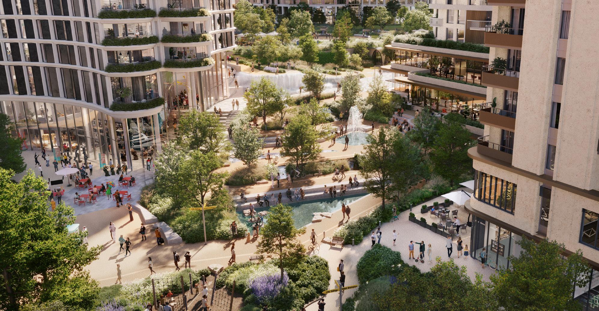
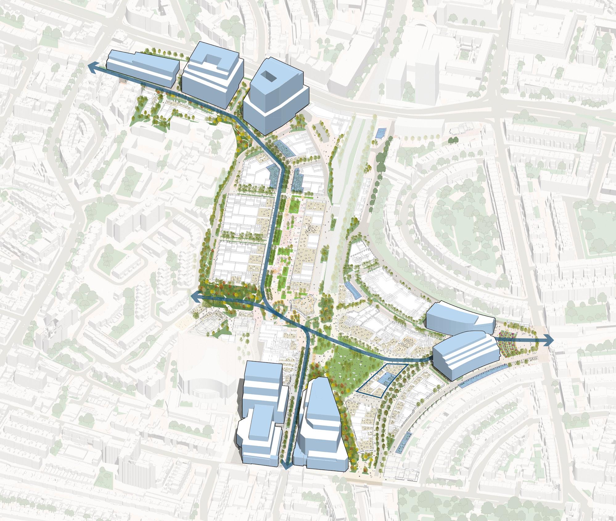
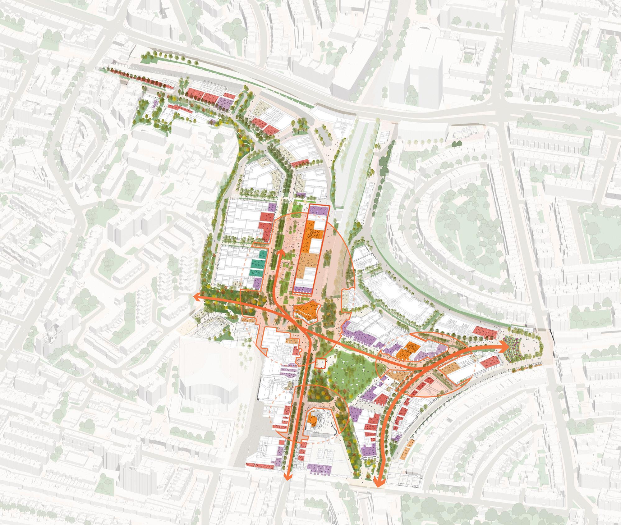
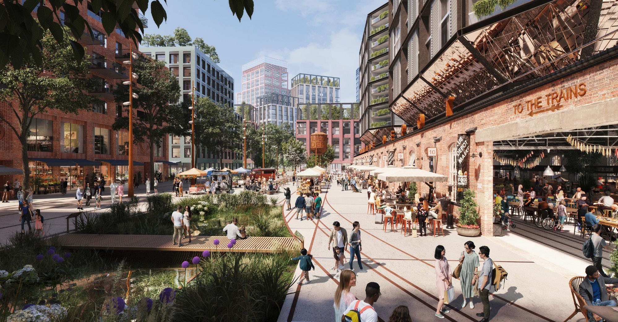
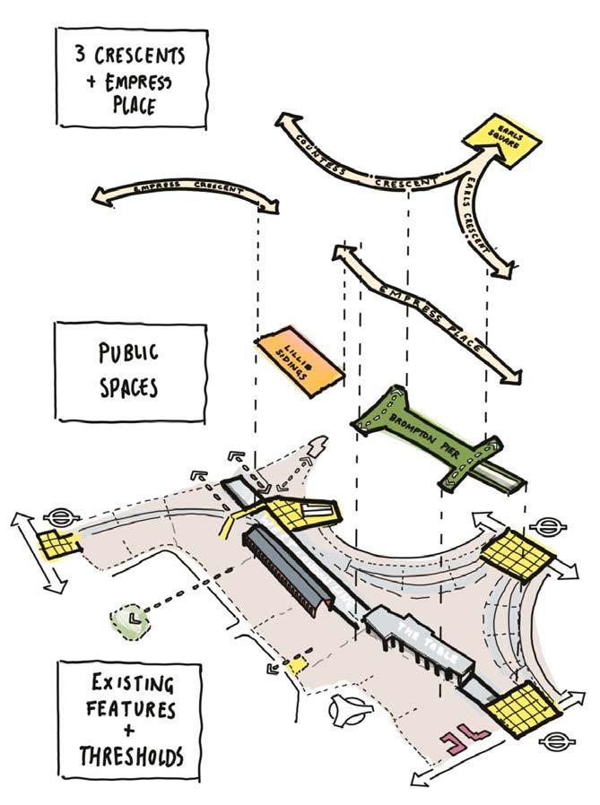
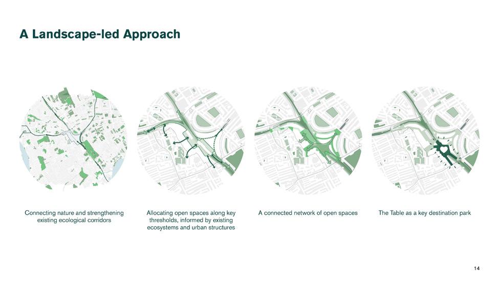
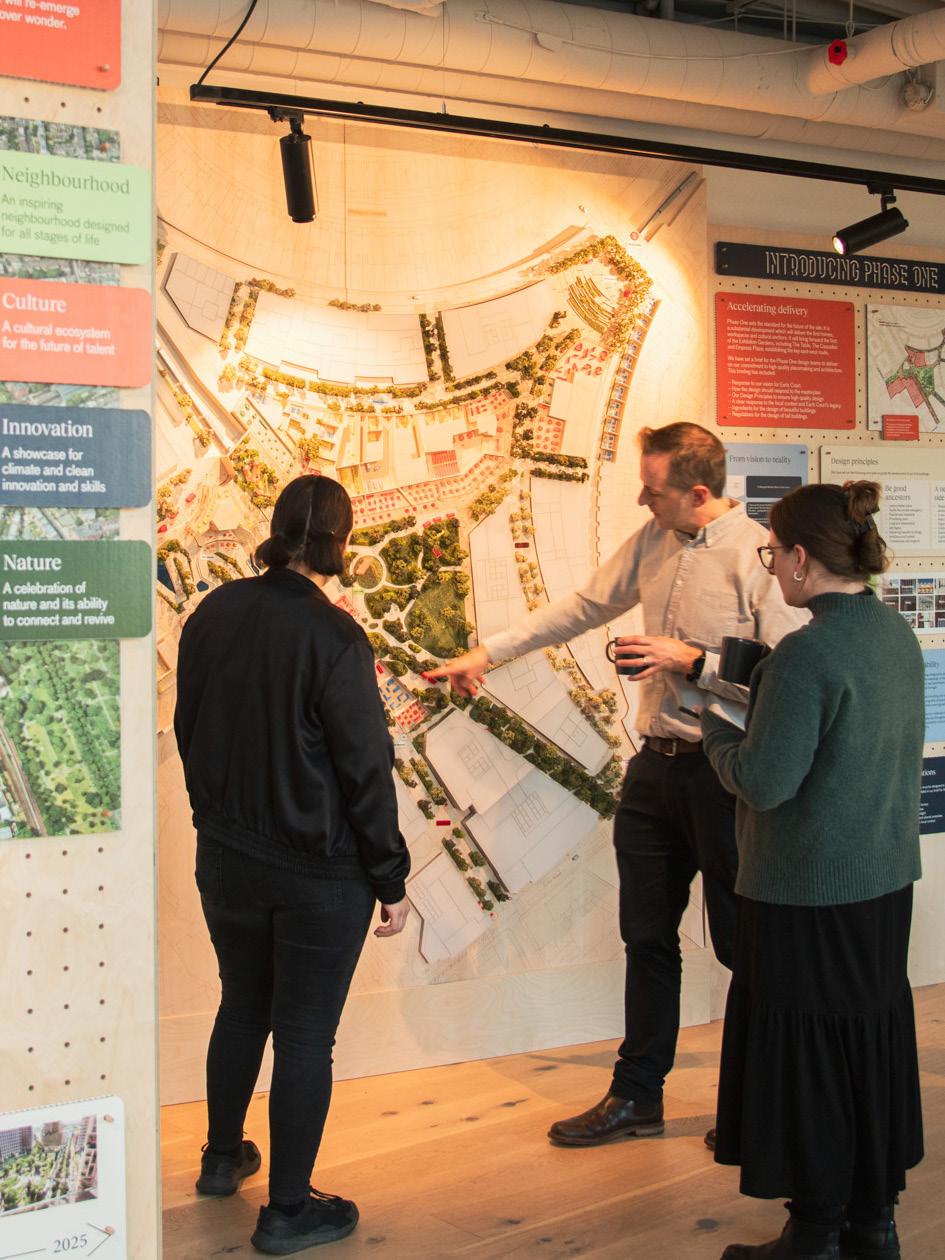
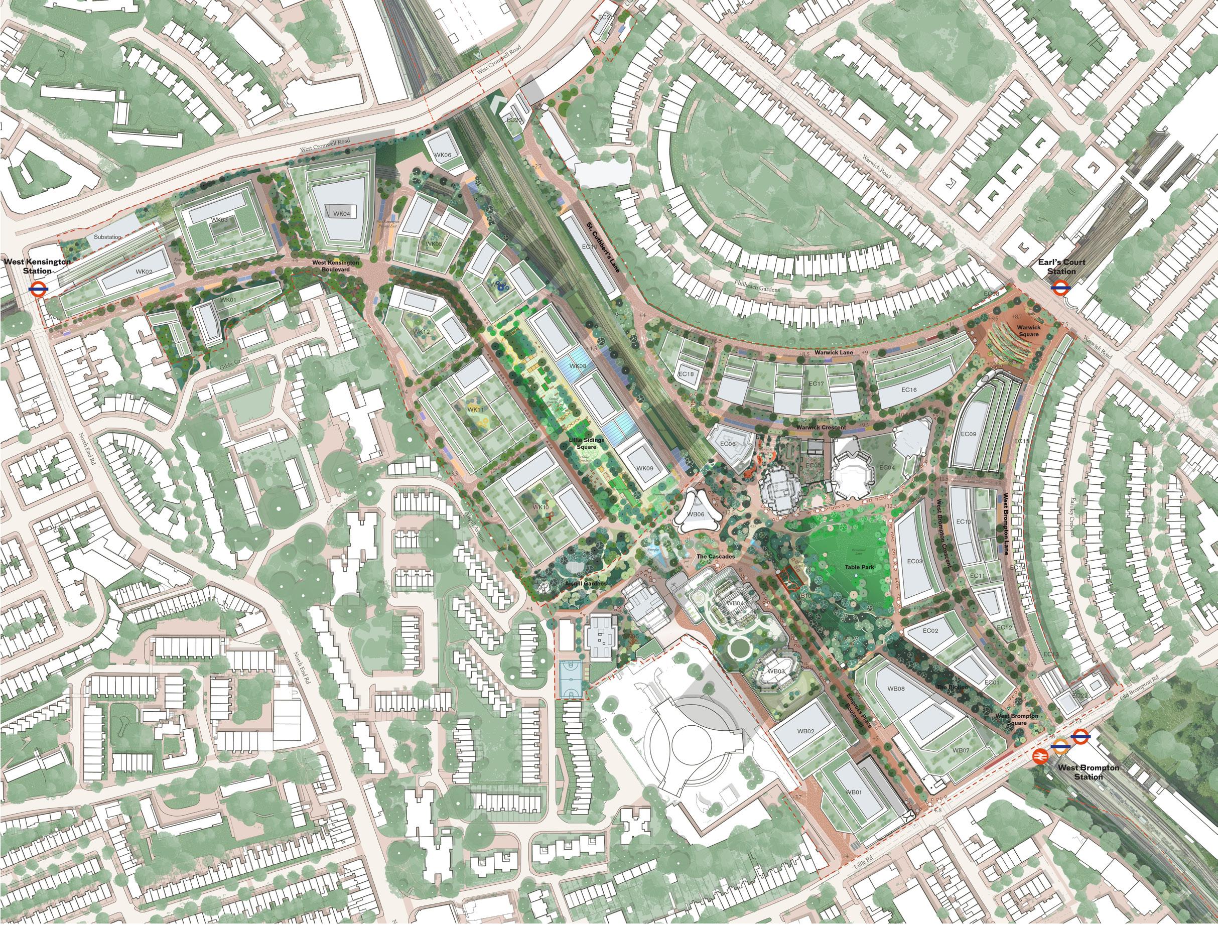
The masterplan has been created to prioritise urban wellbeing and includes a network of Exhibition Gardens that will be open and accessible for everyone to enjoy. We’re creating a pedestrian-first environment alive with daytime and evening active uses. This generosity of open space is evident at key arrival points as well as the unique Table Park and Lillie Sidings.
Our commitment to create a better piece of city has been evidenced over the last three years as we have
welcomed over 500,000 people back onto Site to enjoy a programme of events that nod to the past and point to the future of Earls Court.
ECDC began with a mantra ‘to make haste slowly’ and ensure we took the time to both listen and appreciate the world of Earls Court, which helped to establish the early vision to bring the wonder back to Earls Court.
Now, after over four years of consideration, we are proud to present our hybrid planning submission to the authorities for determination — a key milestone to enable the future of Earls Court as a place, once again, to discover wonder.
Rob Heasman CEO
The Earls Court Development Company
1 Introduction
1.1 Introduction
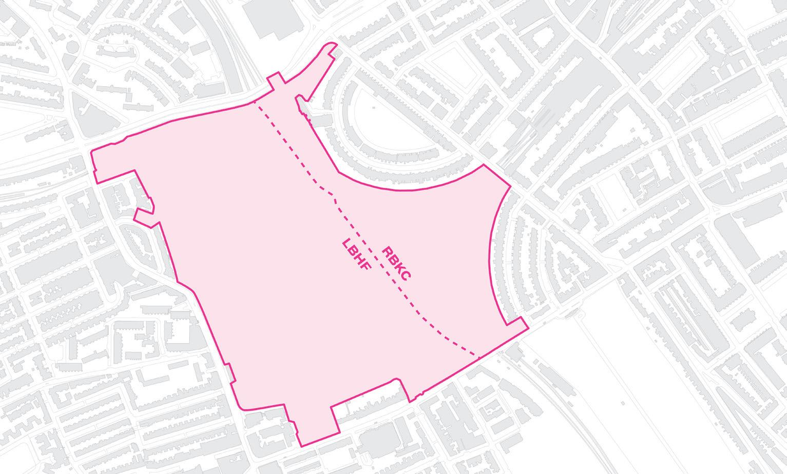
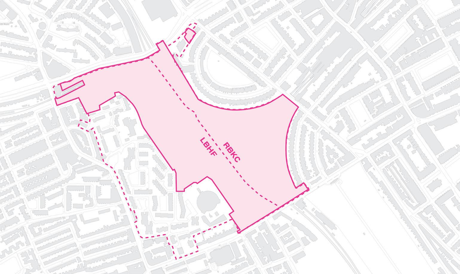
This Design and Access Statement has been prepared by Hawkins\Brown and Studio Egret West. It is submitted as part of two Hybrid Planning Applications, one submitted to the London Borough of Hammersmith and Fulham (‘LBHF’) and one submitted to the Royal Borough of Kensington and Chelsea (‘RBKC’).
The Hybrid Applications have been submitted on behalf of the Earls Court Partnership Limited (‘ECPL’),(“The Applicant”). Together the RBKC and LBHF Proposed Developments form the Earls Court Development which comprises the redevelopment of the Site.
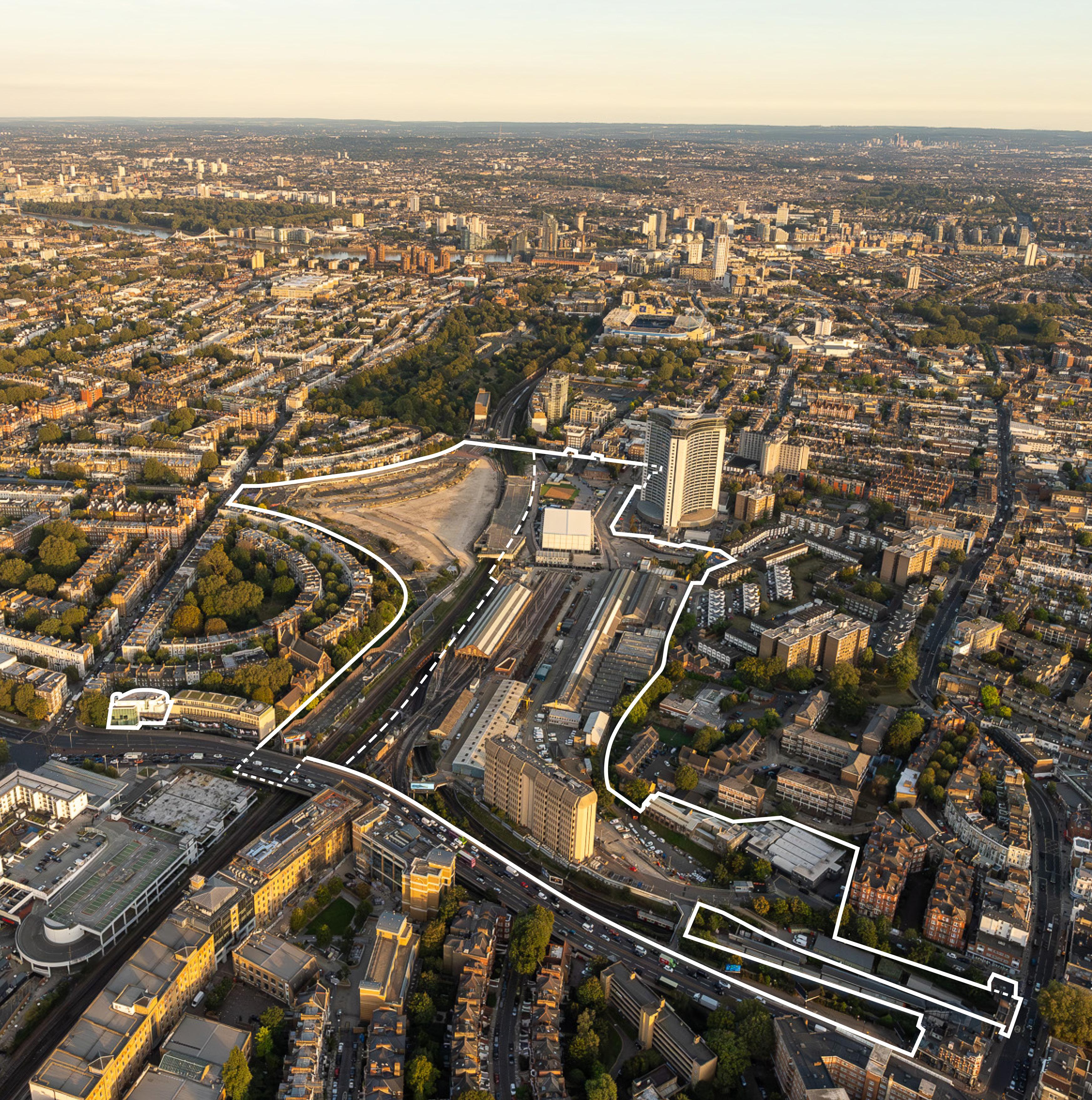
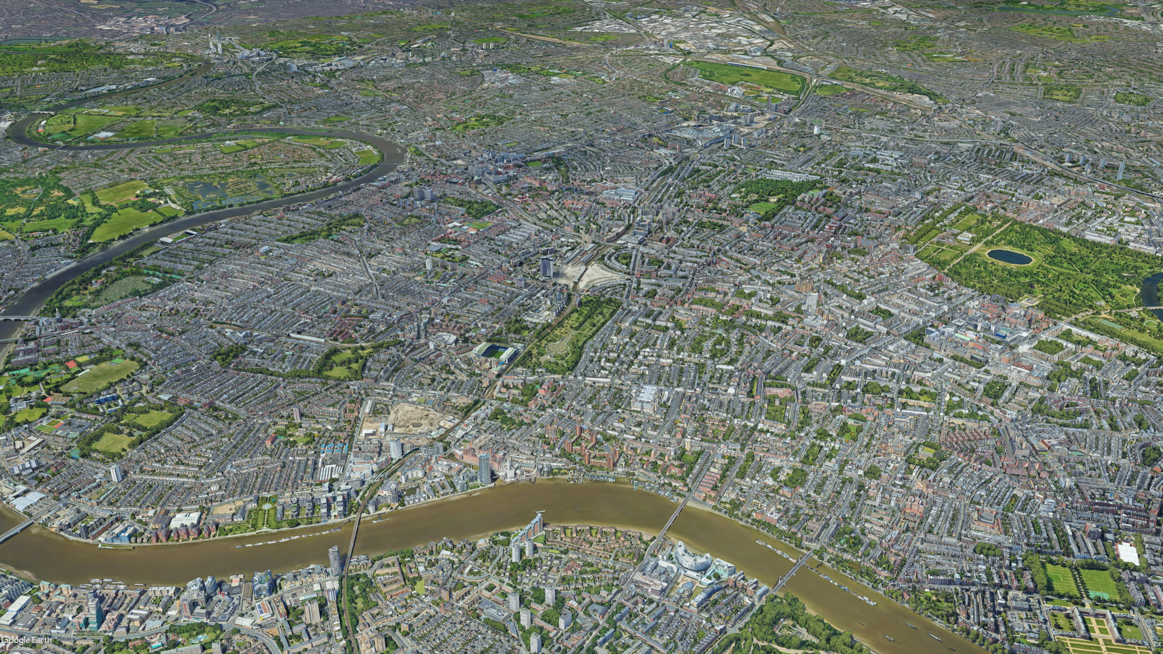
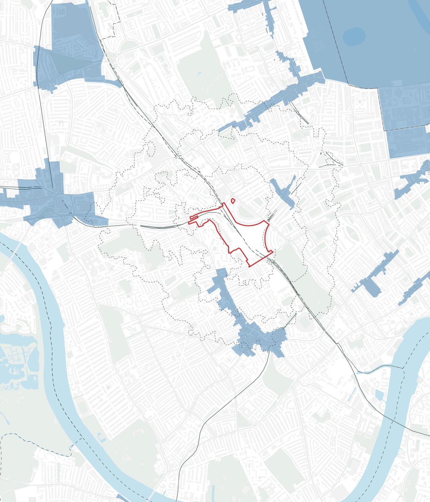
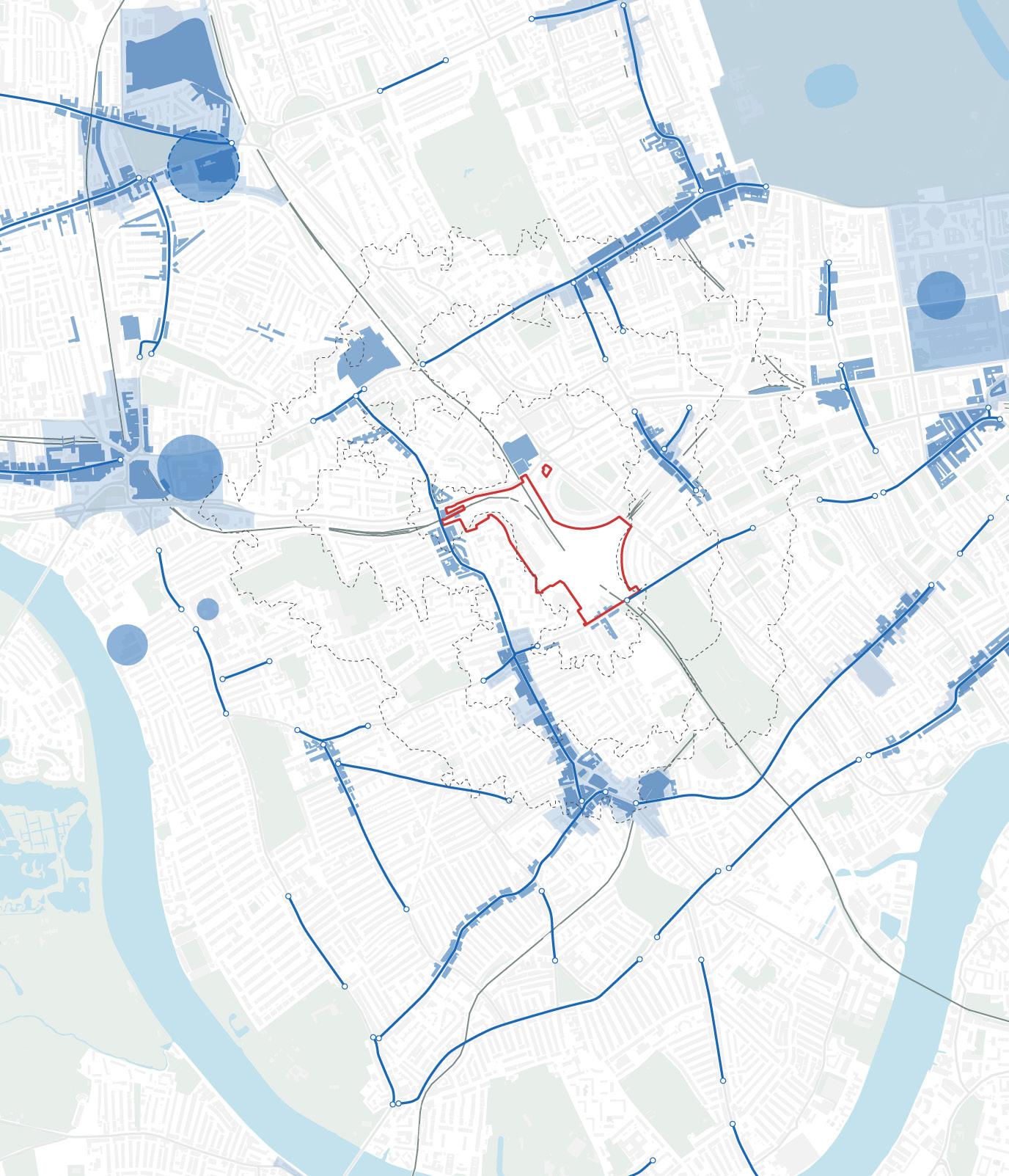
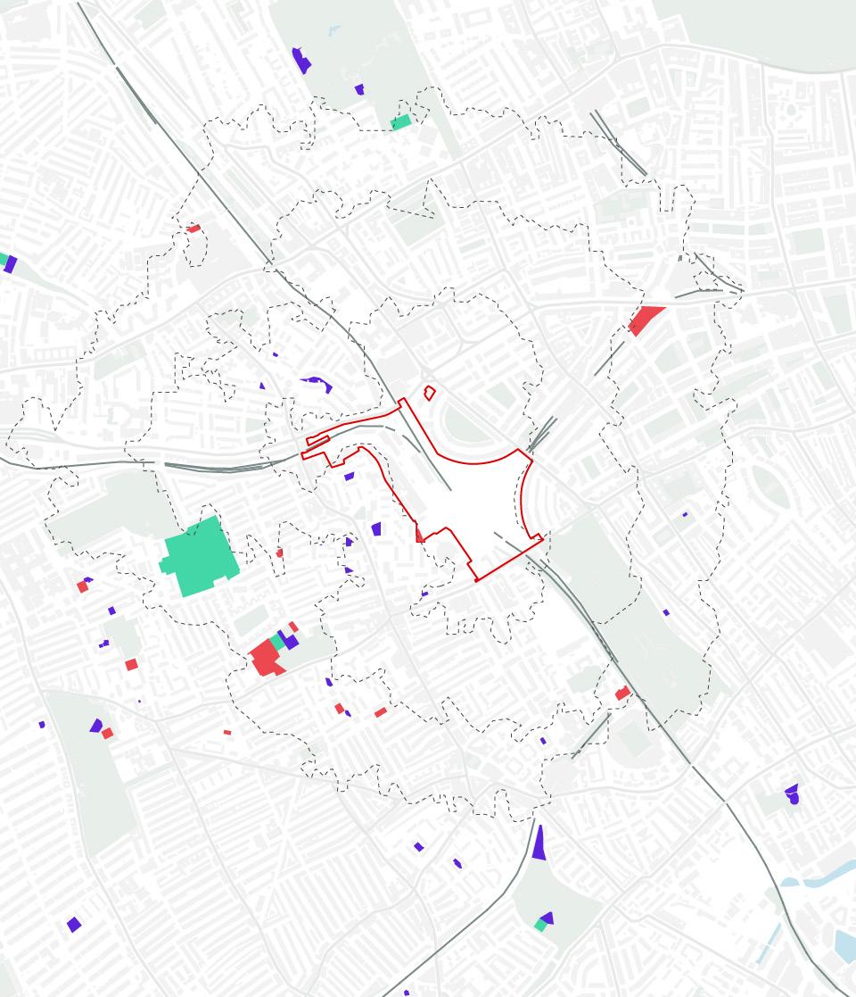
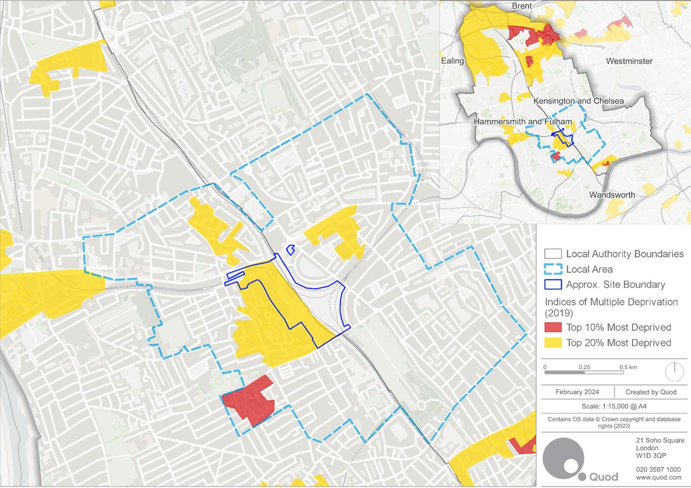
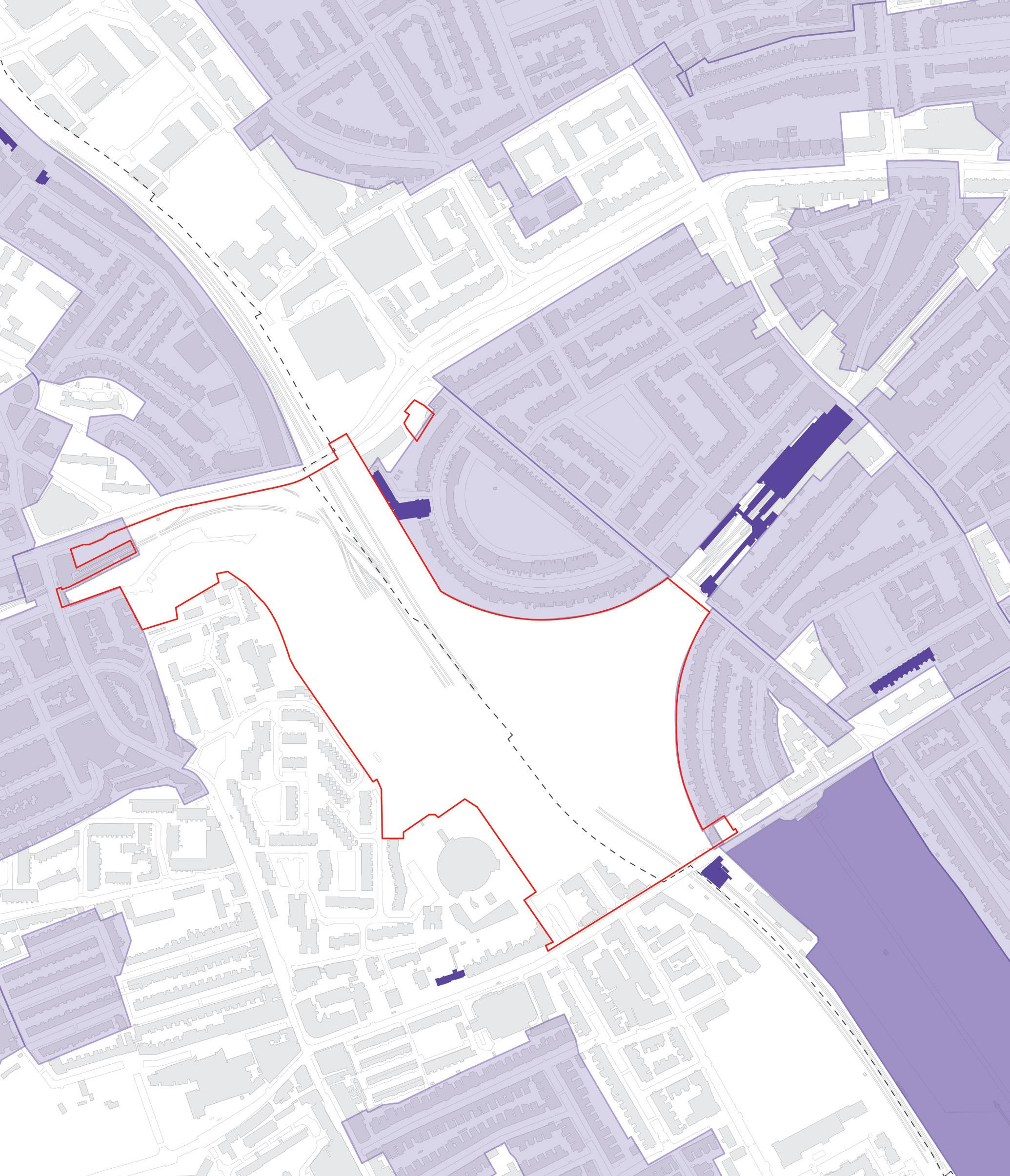
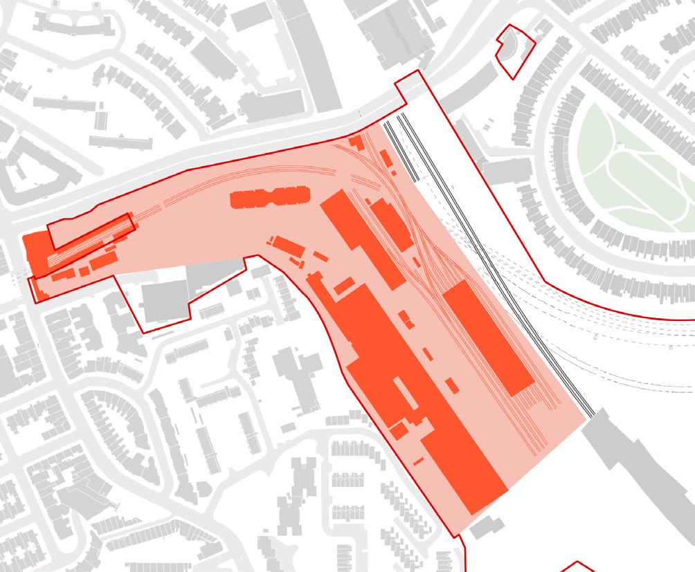
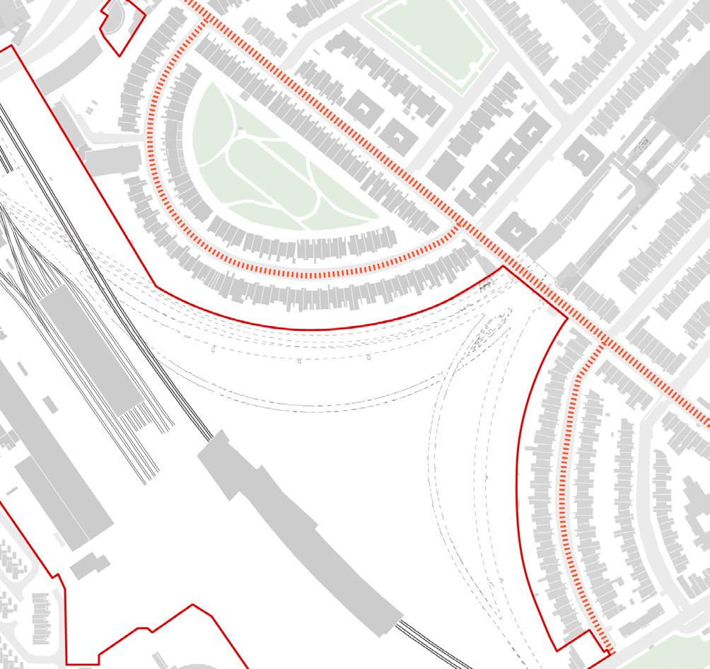
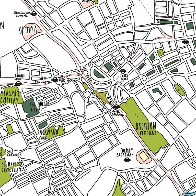
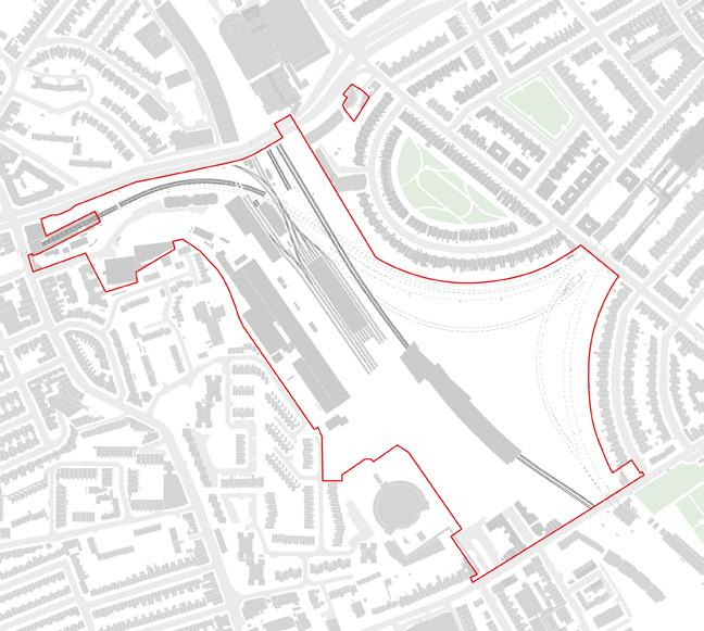
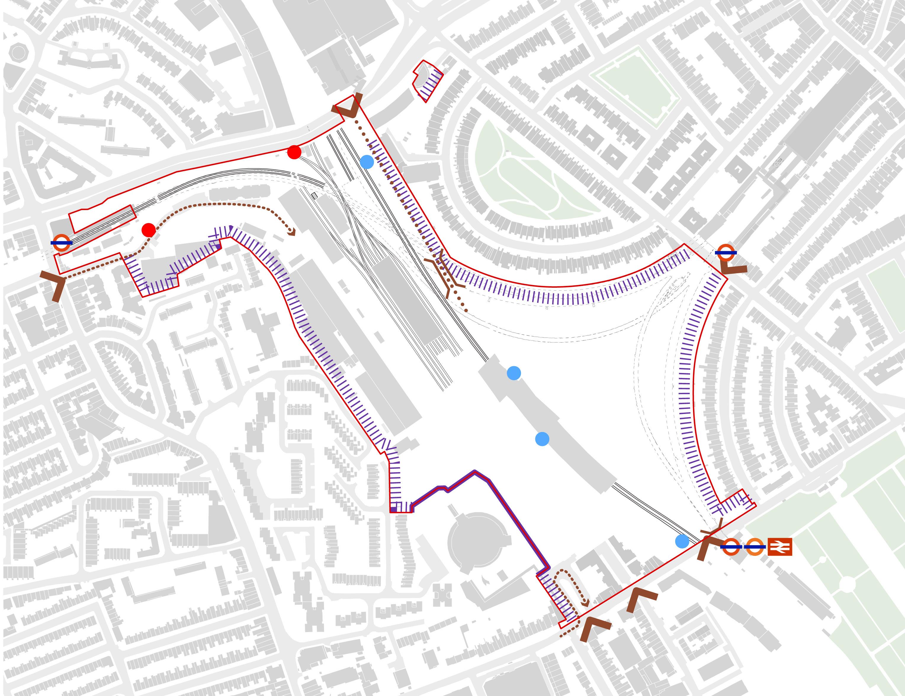
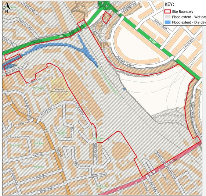
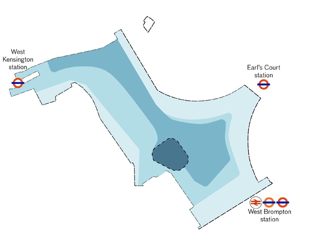
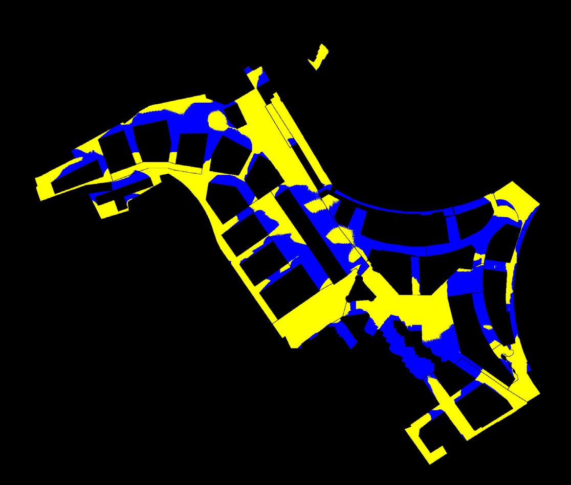
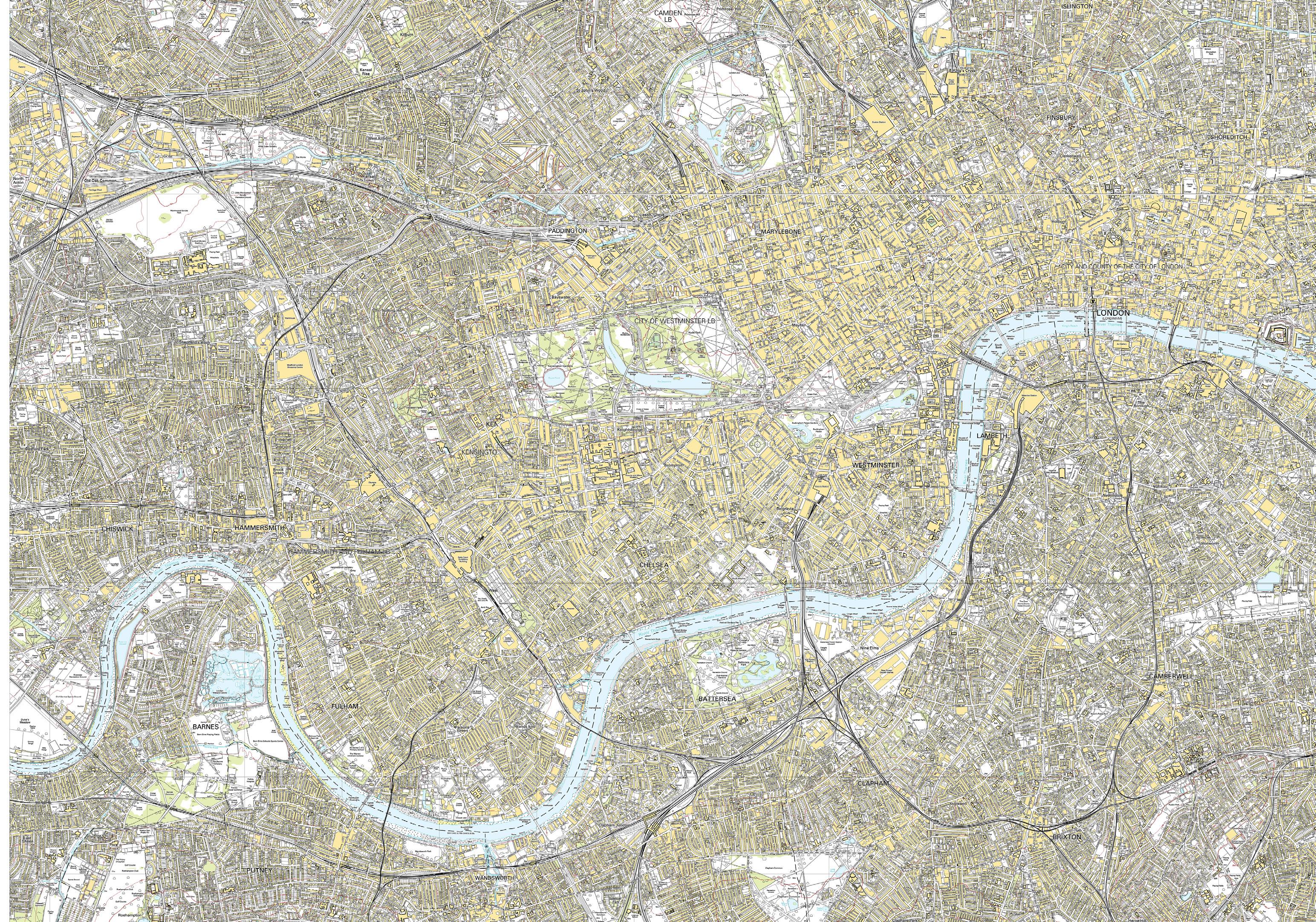
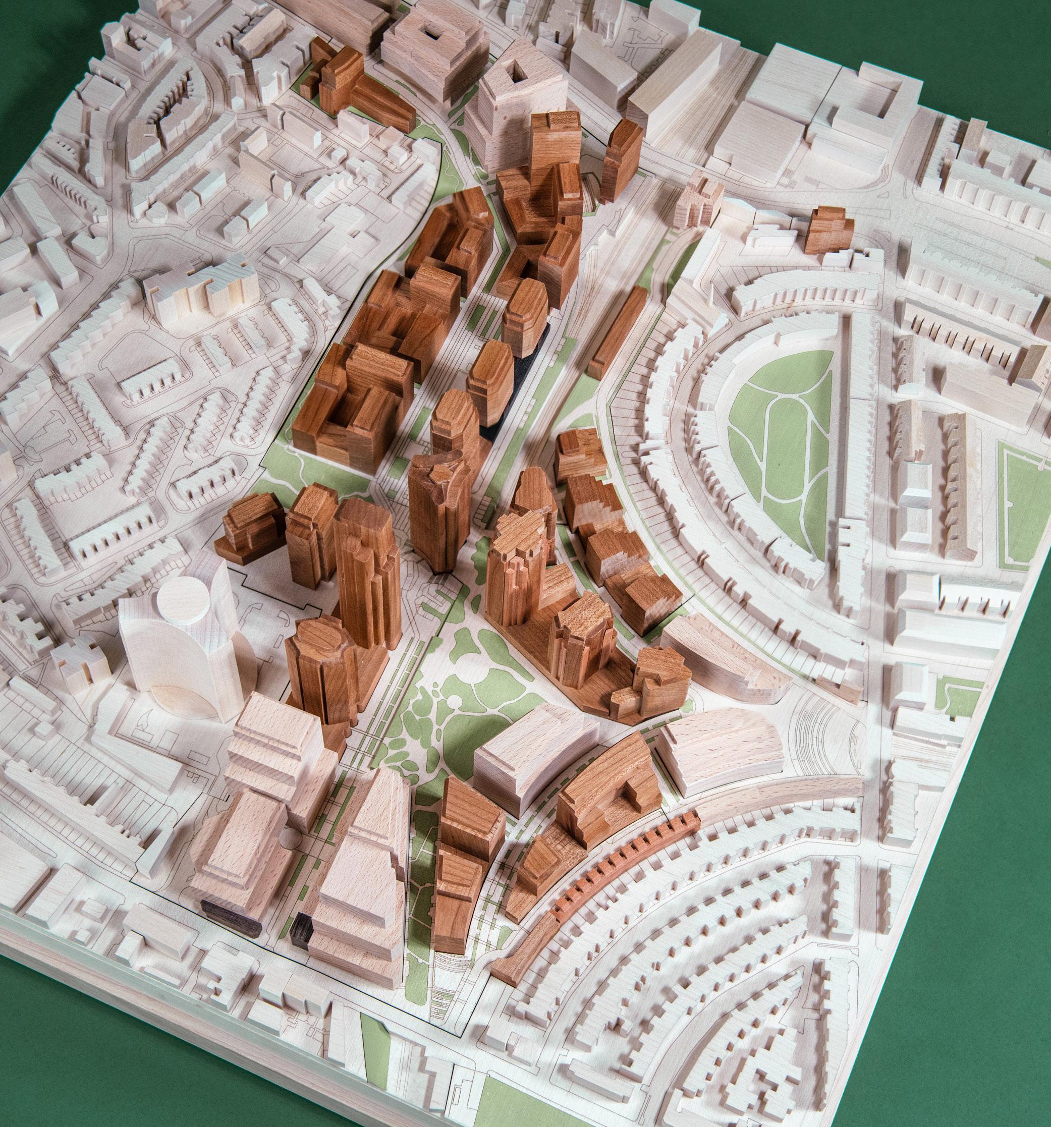
The Site, located within the wider Earl’s Court and West Kensington Opportunity Area (London Plan 2021) occupies an area of approximately 18 hectares (approximately 179,965sqm) and is located in both LBHF and RBKC, in West London.
The Site area associated with the RBKC Hybrid Application is 8 hectares (approximately 78,561sqm) and the Site area associated with the LBHF Hybrid Application is 10 hectares (approximately 101,395sqm).
The Earls Court Development will provide residential dwellings, purpose-built student accommodation, assisted living, workspace, culture, community, retail and leisure facilities alongside high quality public realm and open spaces. With an ambition to be a global exemplar of sustainable development, it will be a neighbourhood designed for all stages of life and a landscape-led development.
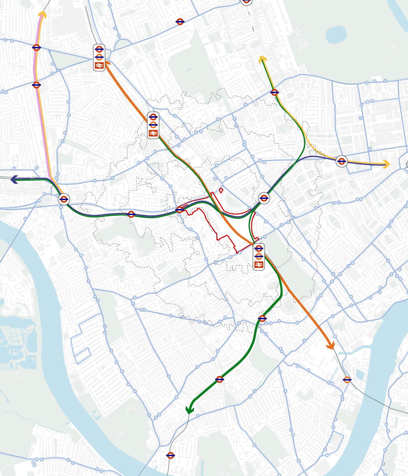
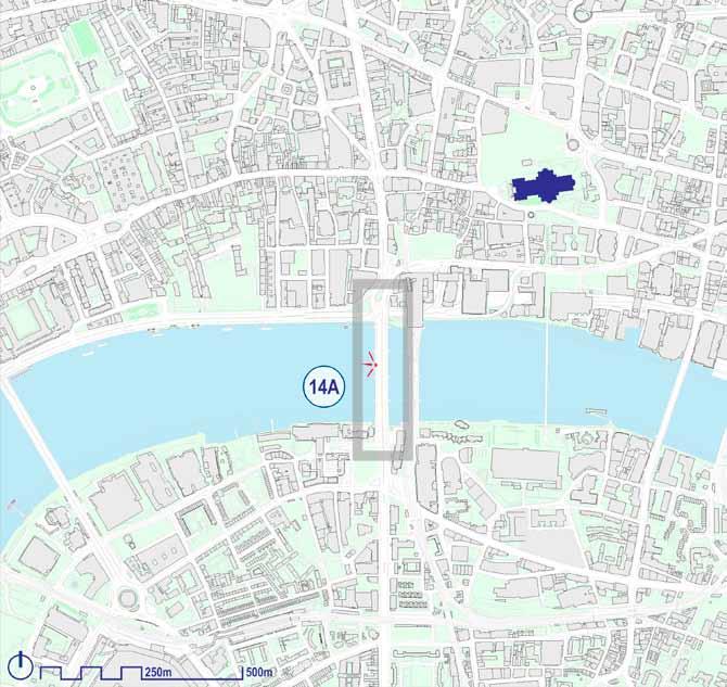
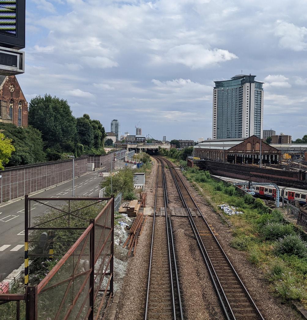
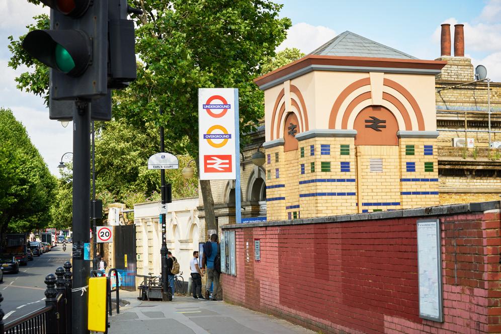
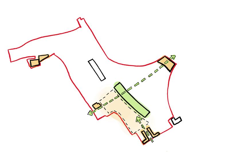
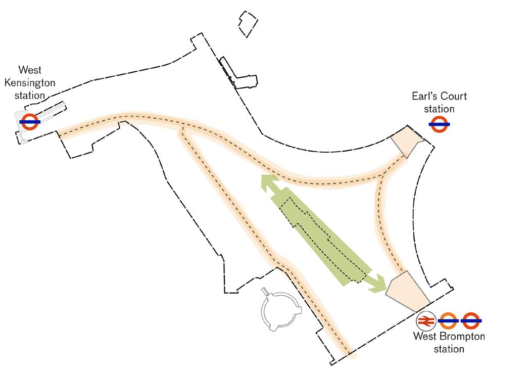
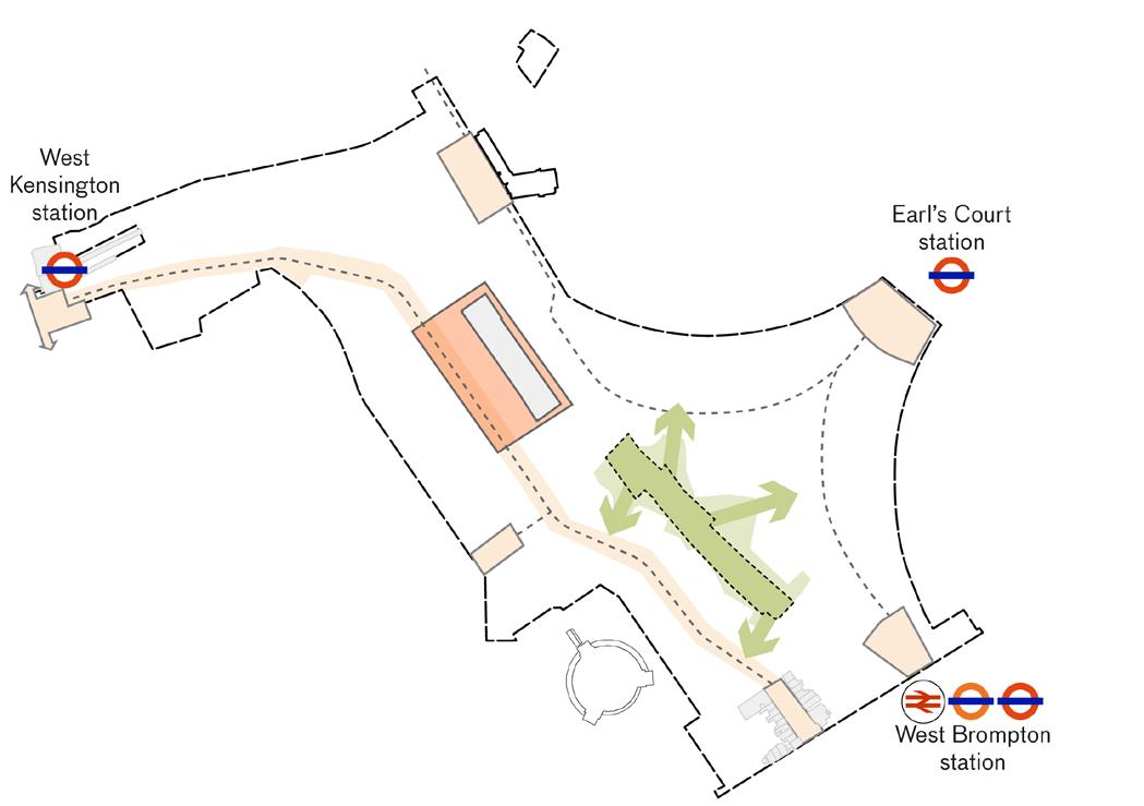
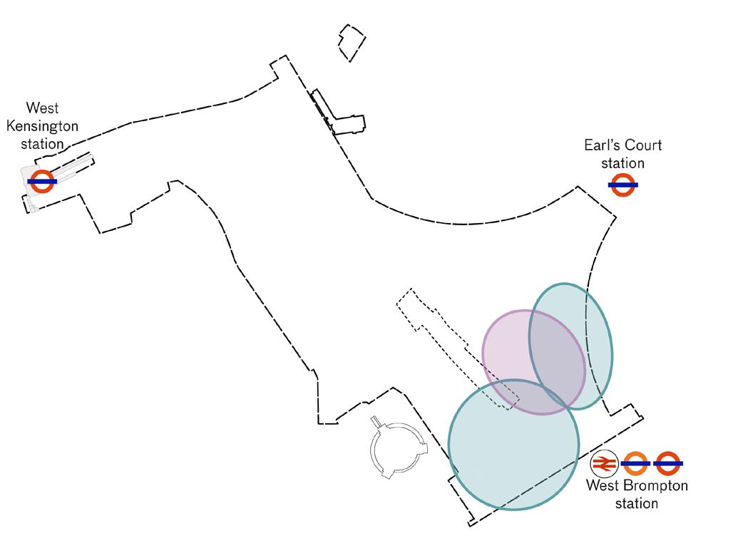
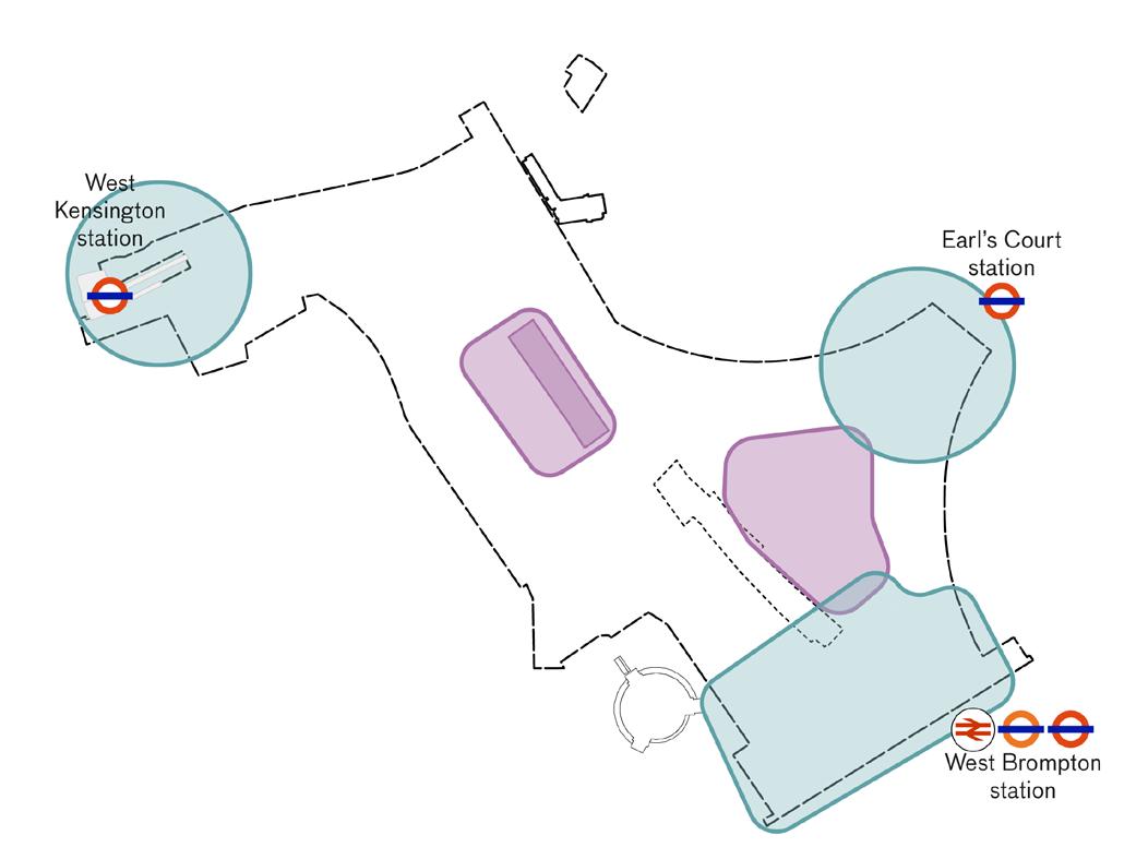
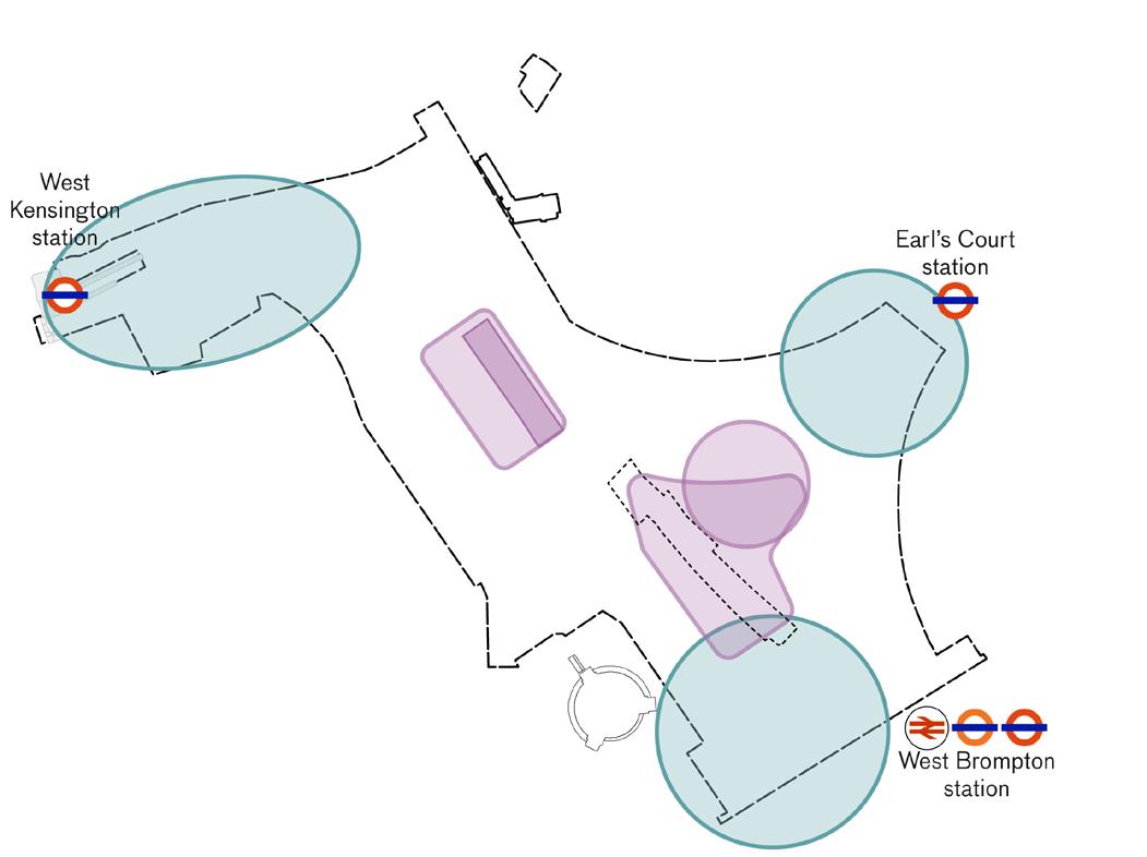
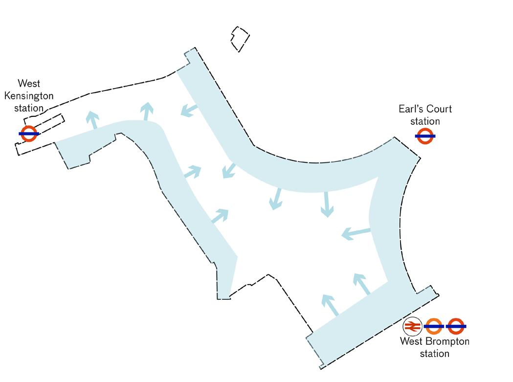
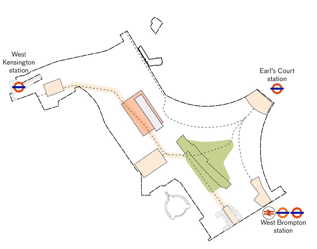
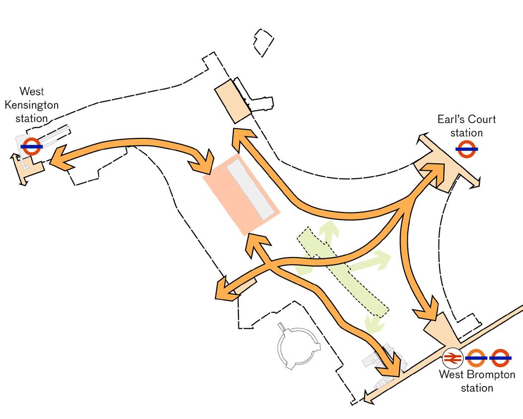
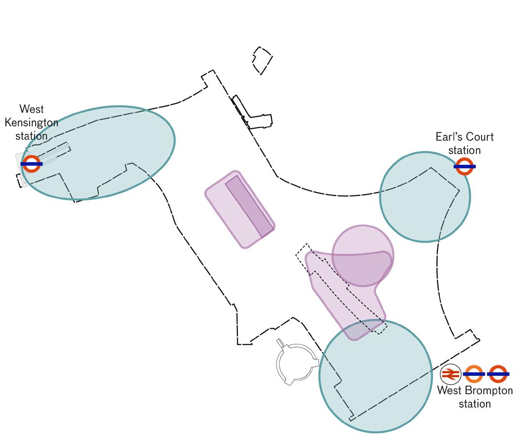
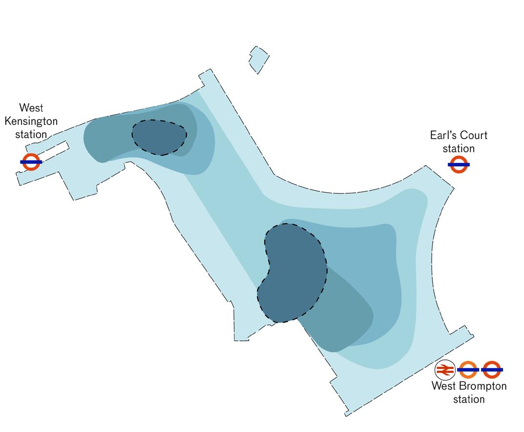
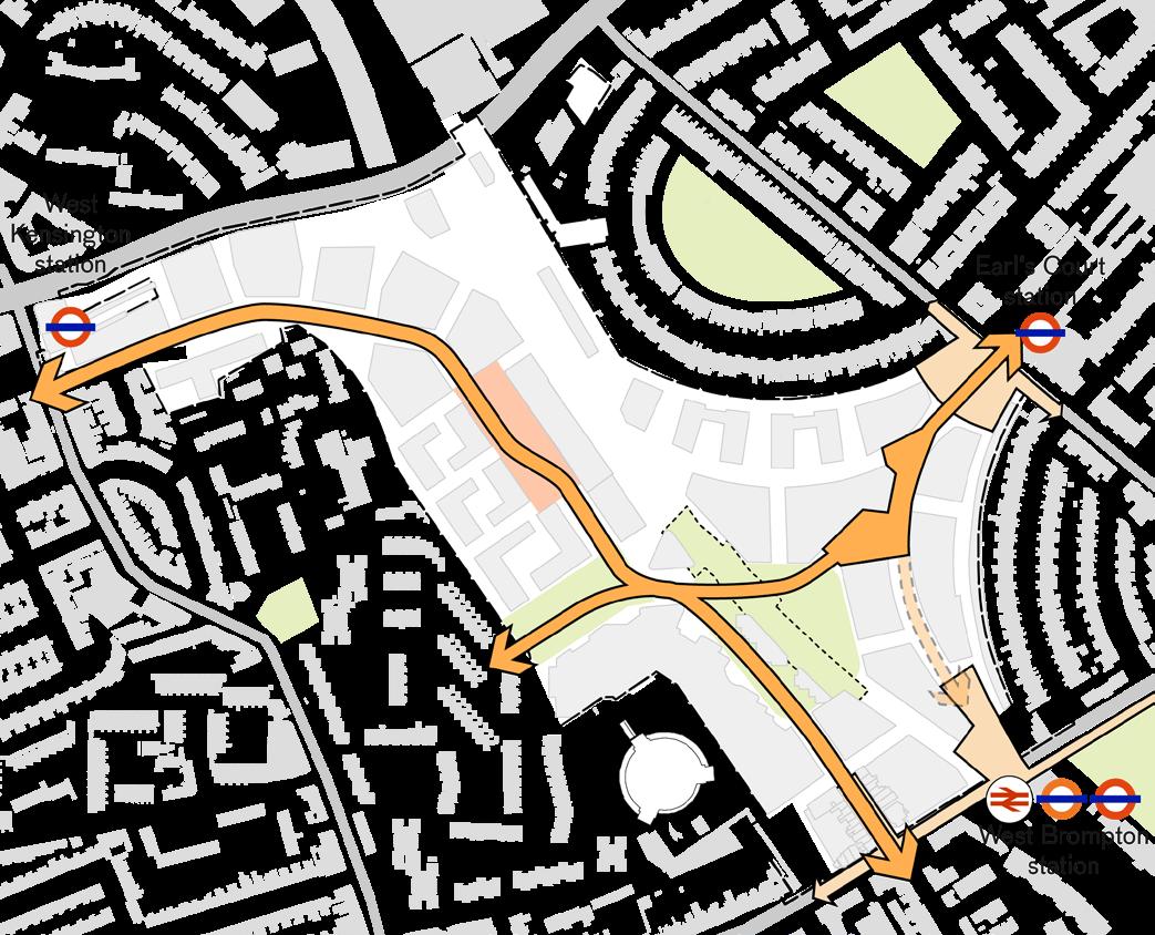
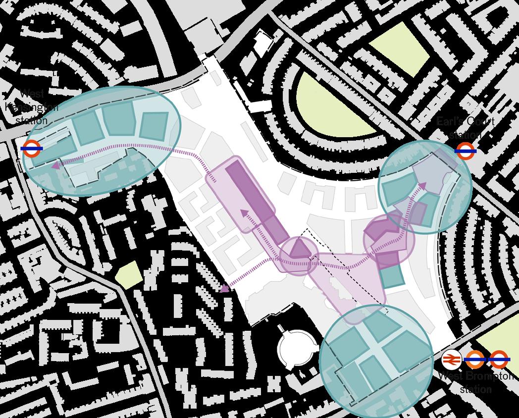
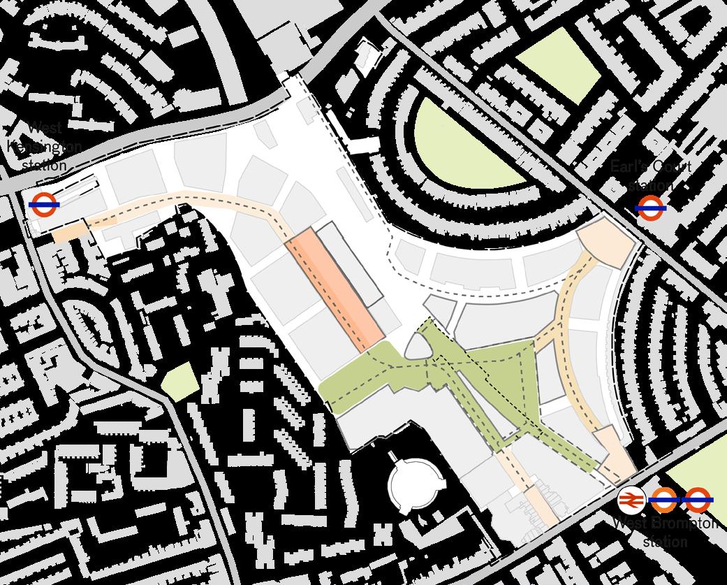
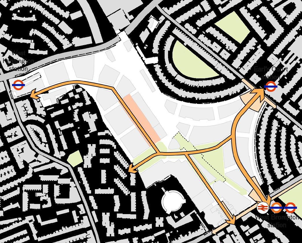
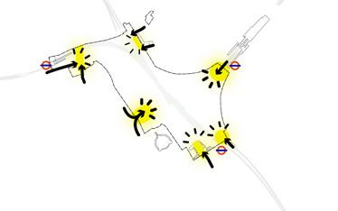
Earl’s Court station
West Brompton station
West Kensington station
Royal Borough of Kensington and Chelsea (RBKC)
London Borough of Hammersmith and Fulham (LBHF)
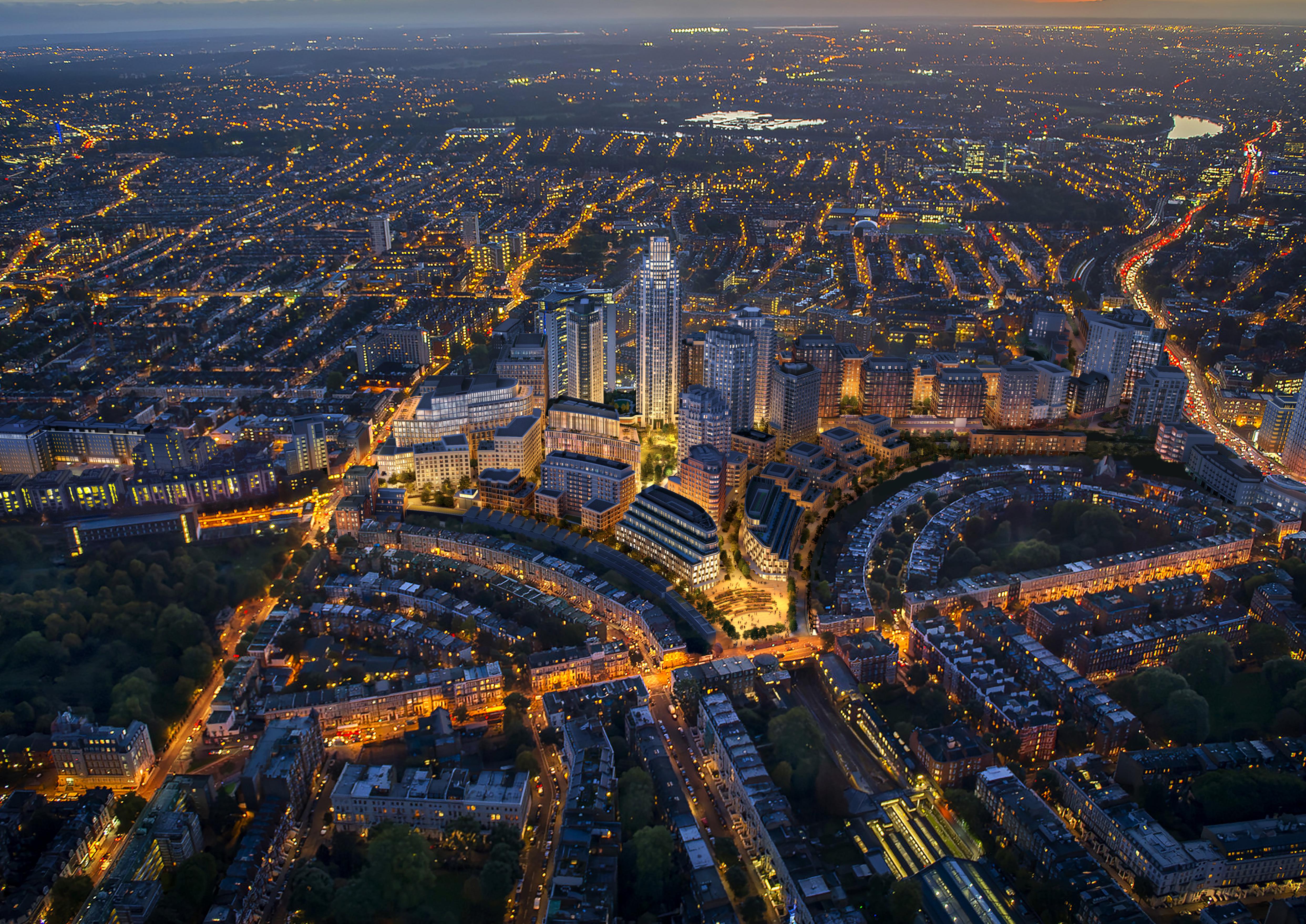
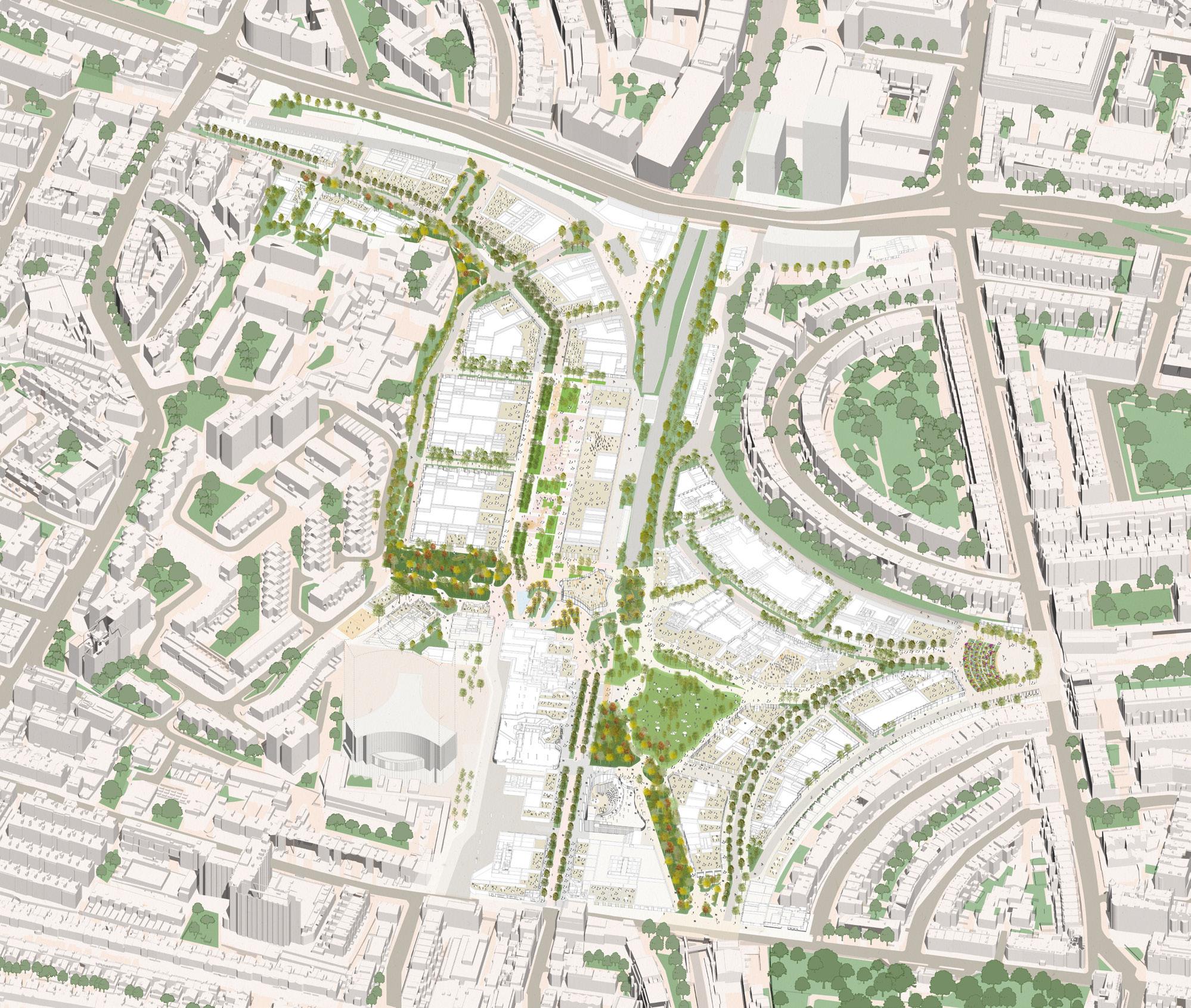
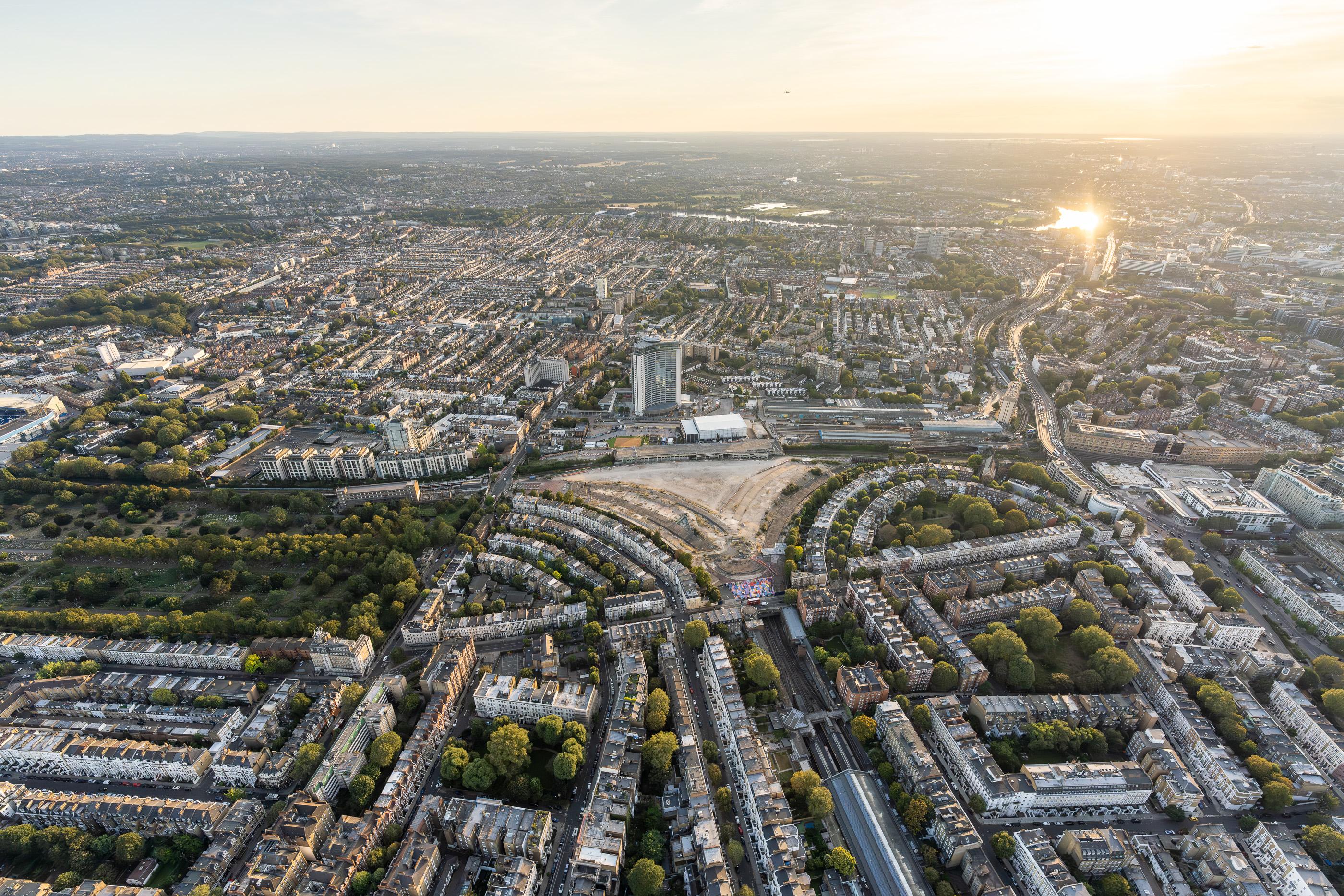
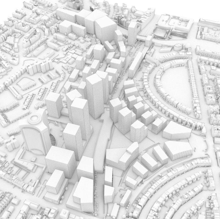
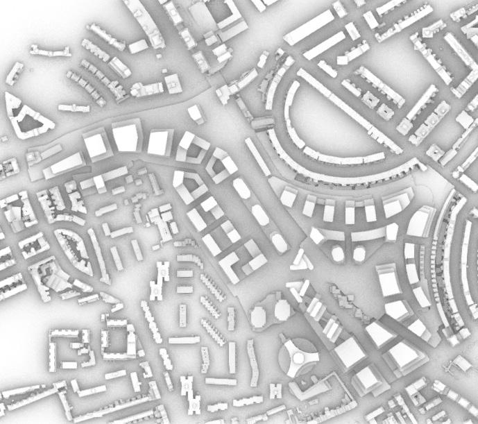
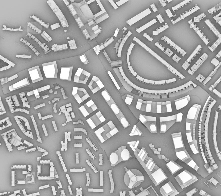
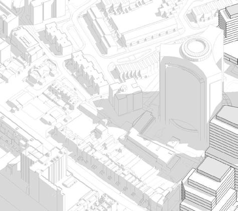
Aerial view of the Earls Court Site
1.2 An Extraordinary Opportunity
The Earls Court Development is part of the Earl’s Court and West Kensington Opportunity Area. The Opportunity Area is identified as having the potential to provide substantial numbers of new employment and housing, with a mixed and intensive use of land, assisted by good public transport accessibility.
This designation signifies the Site’s crucial role in helping London to accommodate its growing population in sustainable, healthy and inclusive communities. London has a finite supply of developable land and few opportunities are left to unlock development potential on such a considerable scale.
The Earl’s Court and West Kensington Opportunity Area is a 38 hectare area identified in the Mayor’s London Plan (London Plan 2021) with the potential to deliver 6,500 new homes and 5,000 new jobs by 2041.
The Earls Court Development covers c.18 hectares of the Opportunity Area and is one of the largest brownfield sites within central London. The Site has the potential to deliver homes and employment on a strategic scale, and to provide a truly inspiring new London district and destination. Earl’s Court and
The Earls Court Development has the potential to deliver strategic benefits for London and be a benchmark for sustainable growth—driven by high aspirations for social value, economic prosperity and growth, and environmental resilience defined by exemplary placemaking and a unique cultural identity.
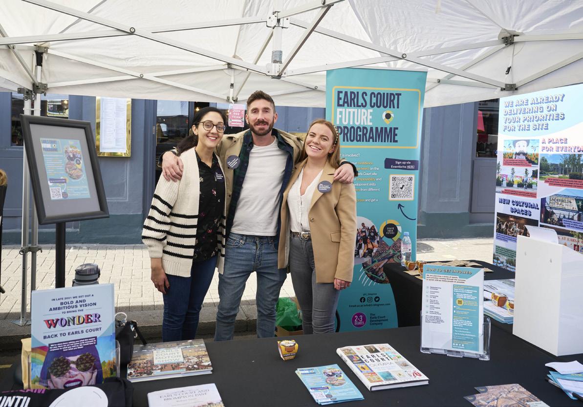
1.3 A Team Embedded in the Local Community
The Earls Court Development Company (ECDC) is responsible for driving the transformation of the c. 18 hectare, former Earls Court Exhibition Centres Site on behalf of the Earls Court Partnership Limited (ECPL).
ECPL, the Applicant, is a joint venture between Delancey (on behalf of its client funds) and the Dutch pension fund manager, APG and Transport for London (TfL) that was formed in December 2019.
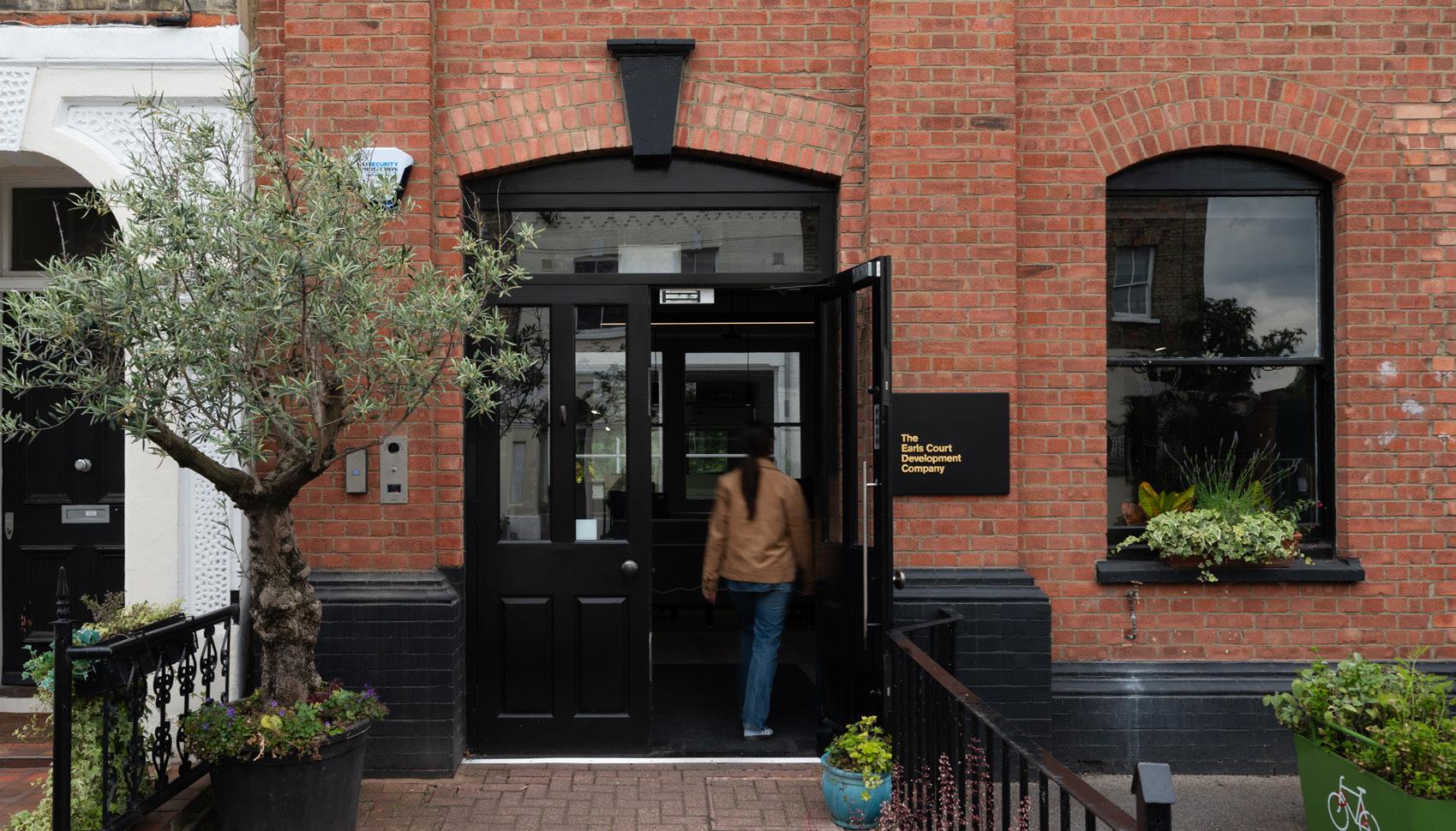
Based on Site at Empress Place since late 2020, ECDC is a proud local business responsible for driving the transformation of the former Earls Court Exhibition Centres Site, Central London’s largest cleared development opportunity.
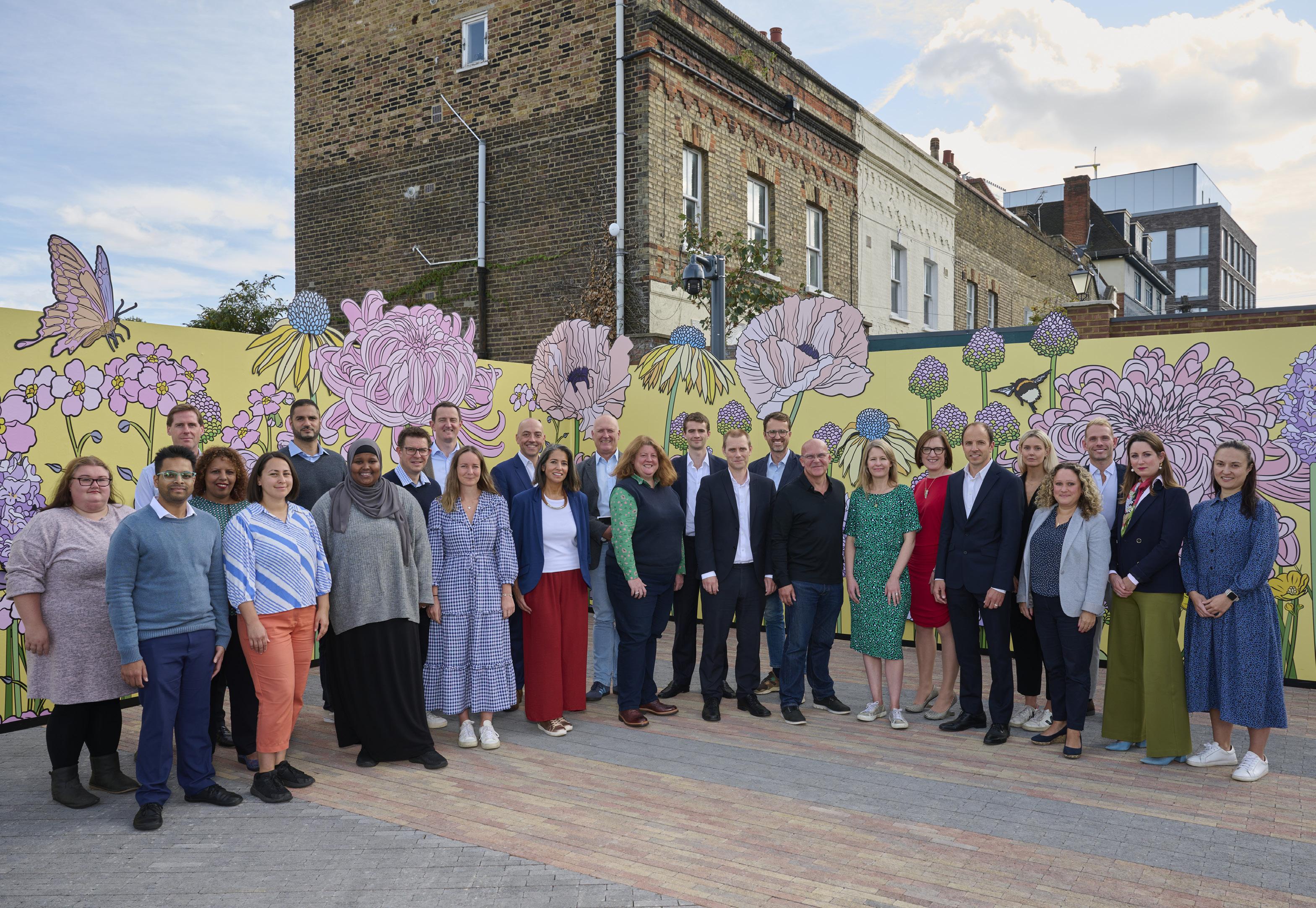
The Earls Court Development Company (ECDC) Team
1.3 A Team Embedded in the Local Community
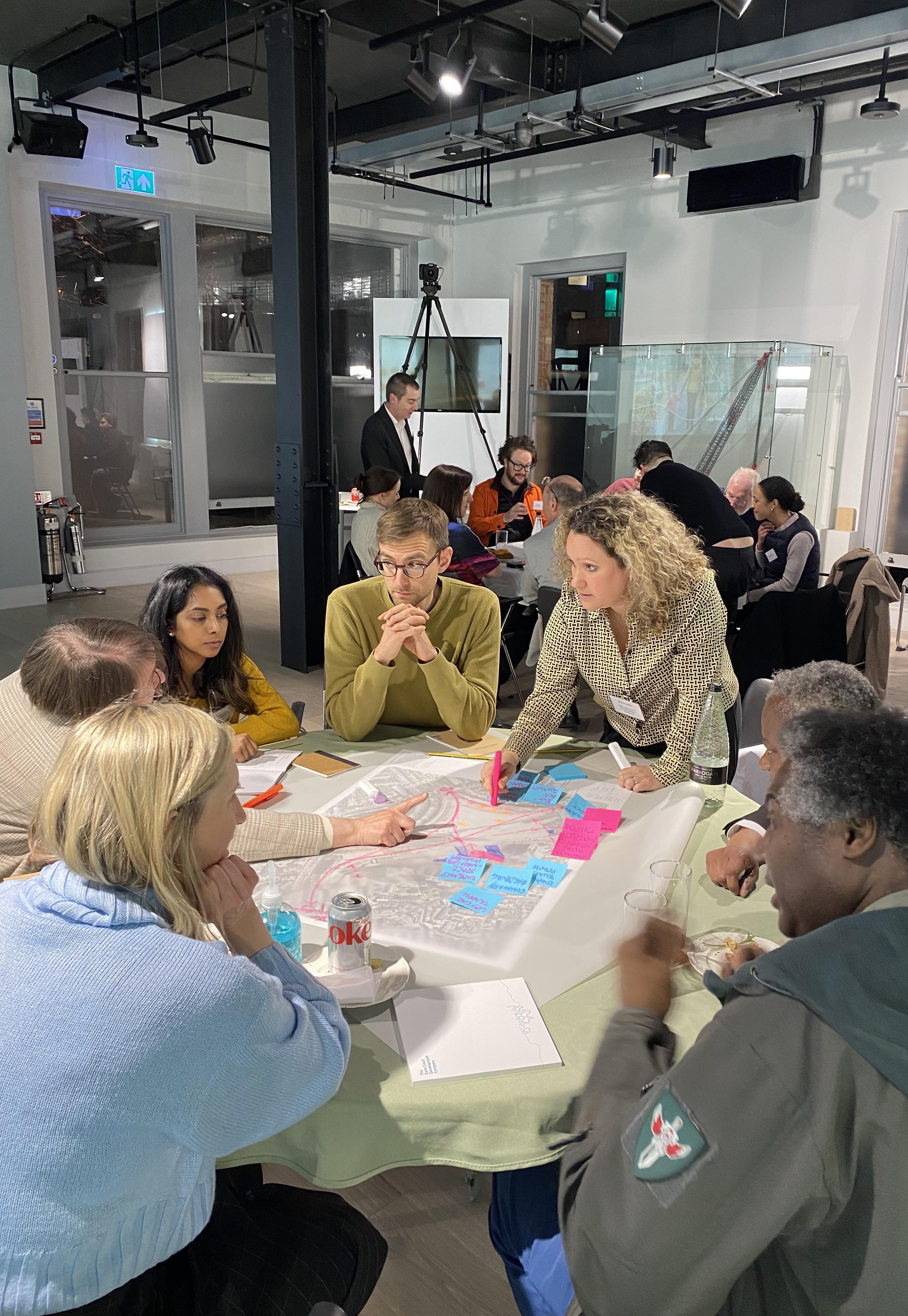
It has been important to work with local communities to understand the lived experiences, priorities and aspirations of those who live, work, and go to school in the area. Over the past four years, this careful listening has been central to the design evolution of the masterplan proposals for Earls Court.
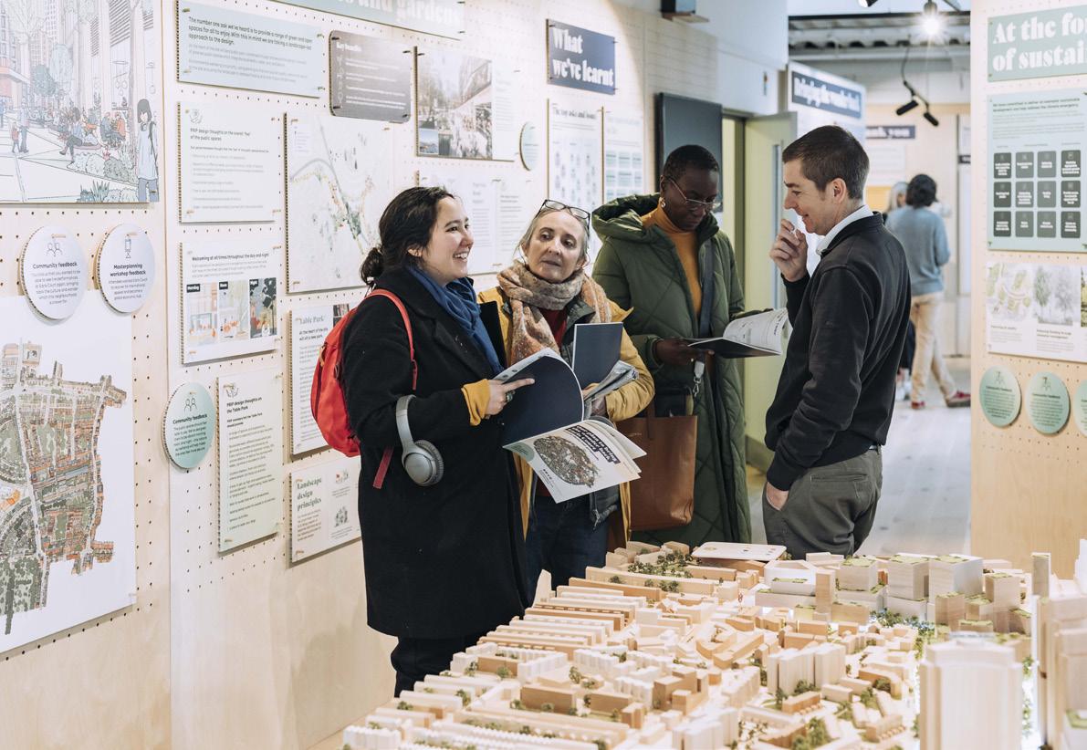
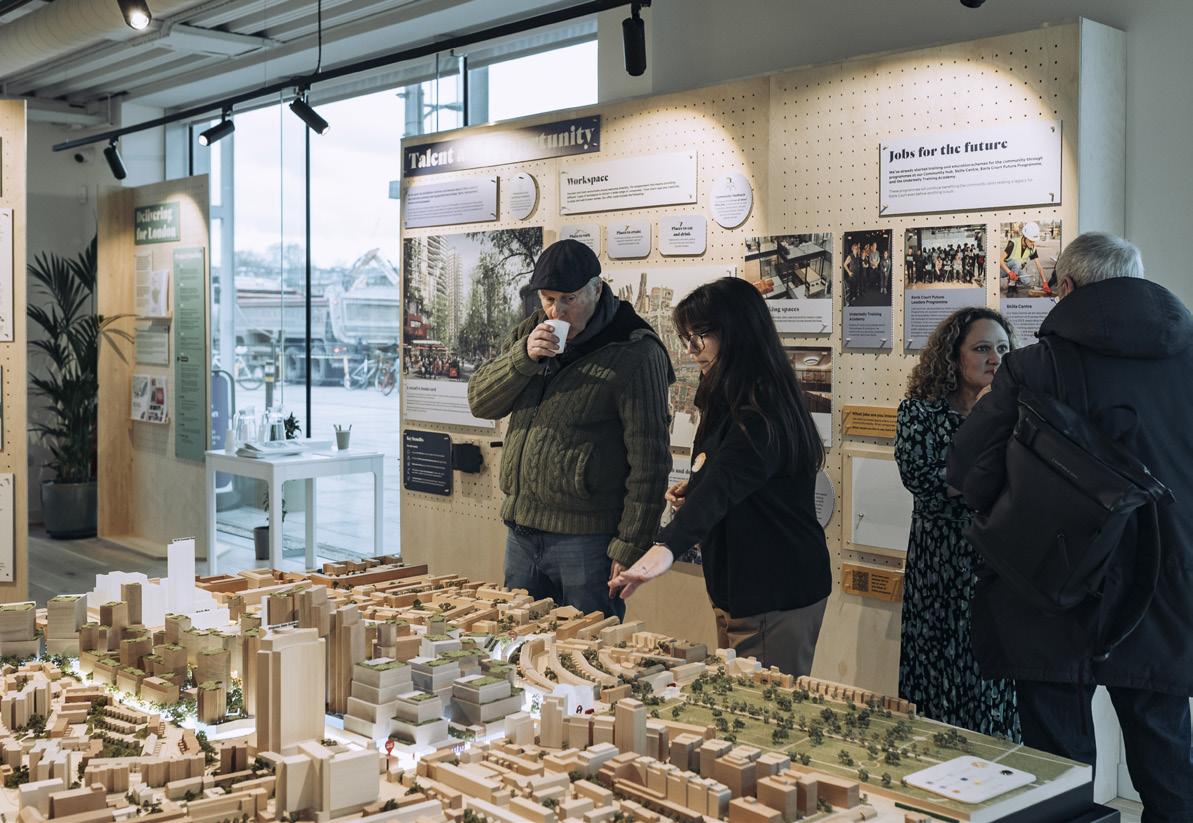
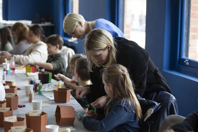
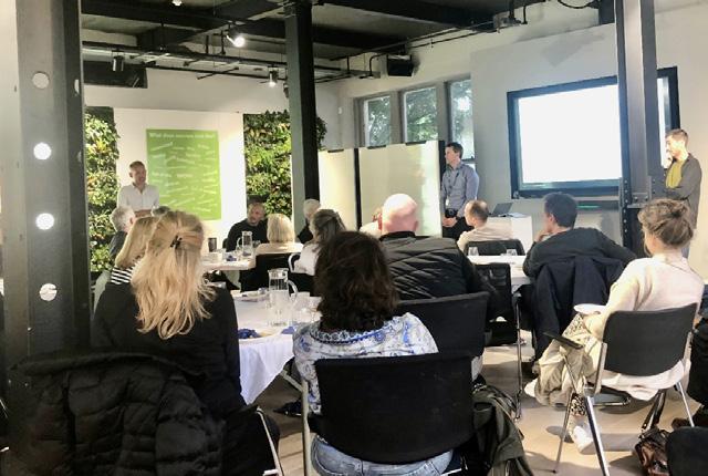
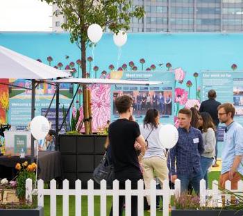
The Earls Court Community Hub, staffed entirely by team members recruited from the local area, has allowed strong relationships to be established with its thousands of users. ECDC’s approach to engagement has involved working with resident associations, local amenity groups, charities, businesses and people from around all sides of the Site and across both boroughs. Feedback and input received has proved invaluable to the Design Team who have over multiple iterations, amended and refined the proposals based on what was heard.
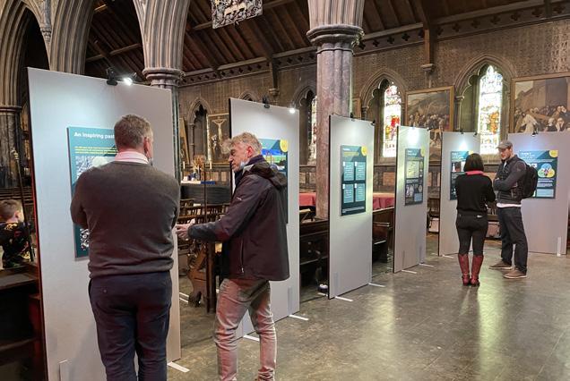
Images from ECDC’s engagement programme
1.4 Opening Up the Site to Temporary Activations
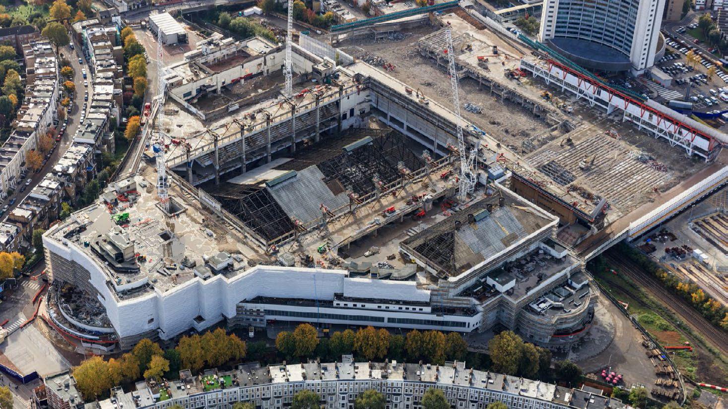
ECDC took on the stewardship of a largely underused and forgotten Site, along with 66 derelict properties. This had contributed nothing to the local community since the closure and demolition of the Exhibition Centres in 2015.
From the outset, ECDC recognised the importance of embedding culture, creativity and collaboration through an early activation strategy.
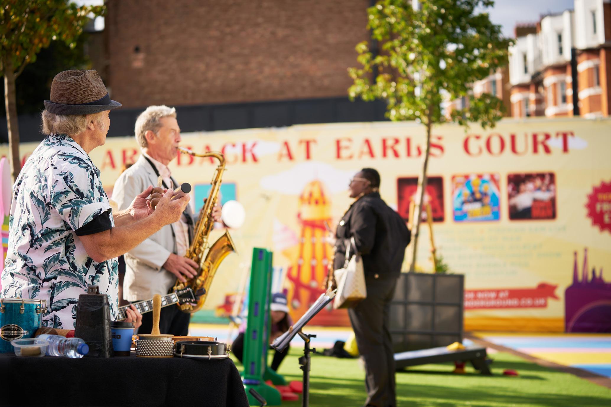
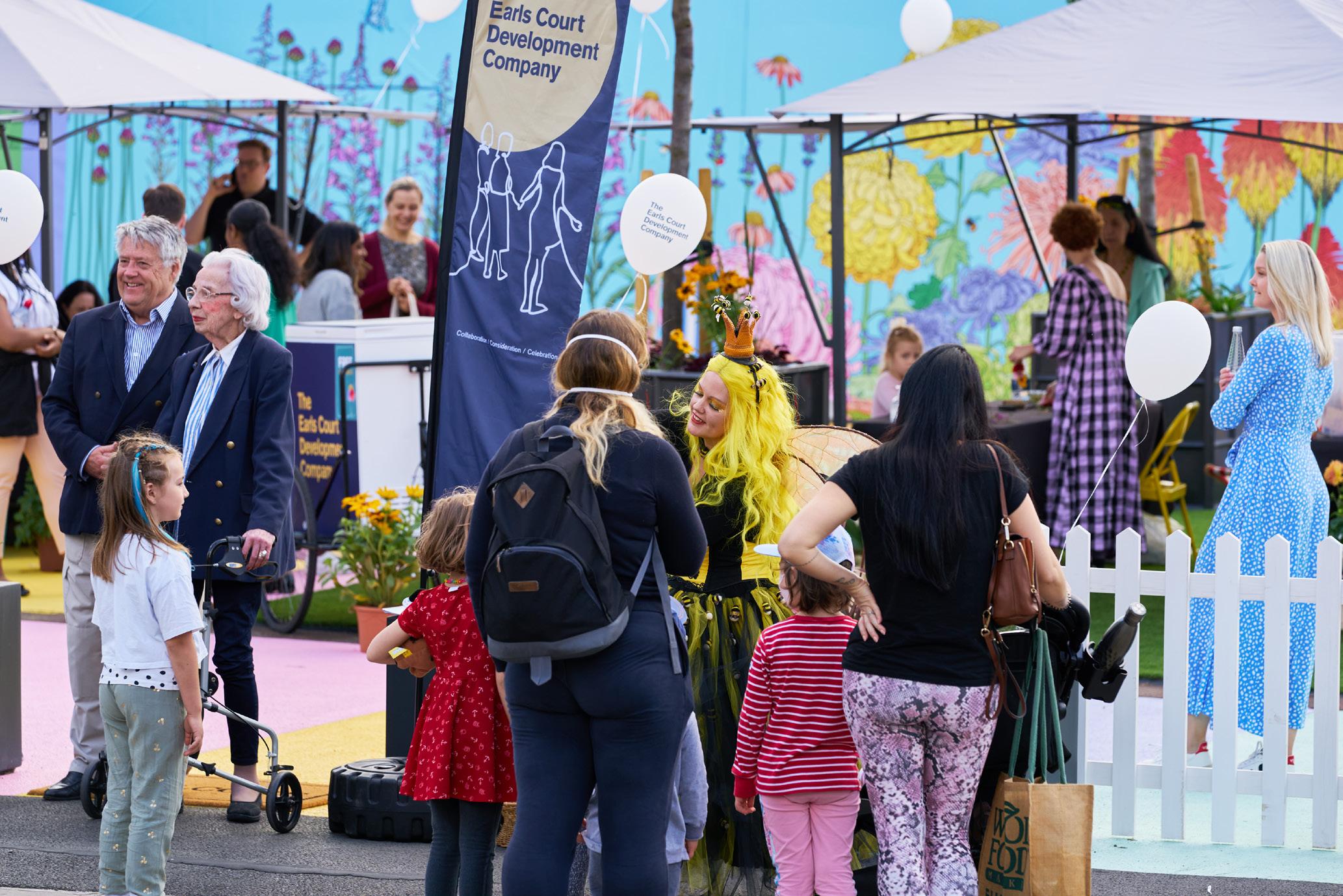
Through the focus on reinstating Earls Court as a destination from day one, the illustrious history of sport, fun and spectacle has been brought back. Festivals, events, art, creative studios, community uses, jobs and training have seen over 675,000 people welcomed to the Site.
Everyday on average c. 2000 people live, work or are entertained in the spaces curated by ECDC. This is central to the commitment to transform this extraordinary Site, putting it back into economic use, delivering social impact and bringing the wonder back to Earls Court.
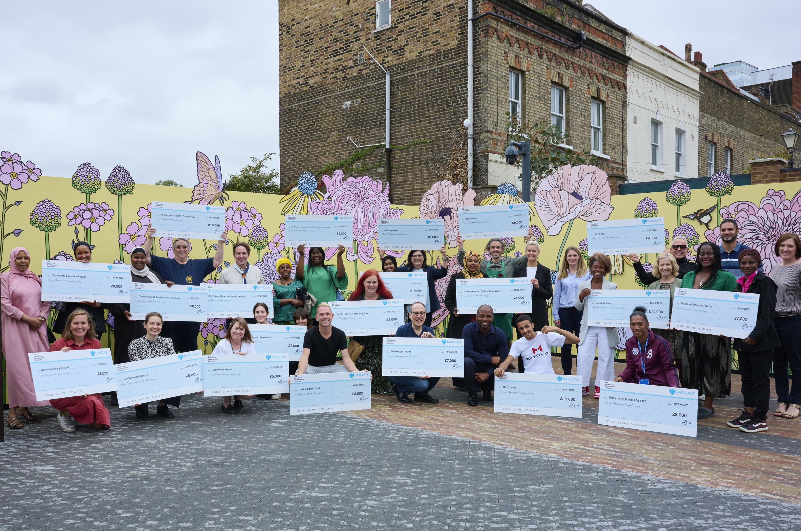
In 2022, ECDC’s community investment programme generated £7.8 million of social value, £2.7 million of net additional expenditure as well as £2.1 million of additional Gross Value Added (GVA) within the local area.
In 2023, ECDC’s community investment programme generated over £7.9 million of social value, £25.7 million of net additional expenditure as well as £11.9 million of additional GVA within the local area.
Earls Court Community Fund 2023 beneficiaries
1.4 Opening Up the Site to Temporary Activations
Summer of Art - public art activations
July 2021 – ongoing
Partnerships with a variety of cultural partners including London Design Festival, Kensington and Chelsea Art Week and photographer Alison Jackson, have bought public art installations and exhibitions to Site.
Guardianship homes
Summer 2021 – ongoing
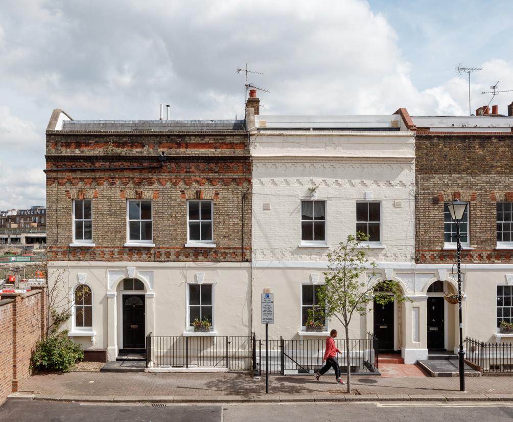
In partnership with LOWE Guardians, ECDC refurbished and brought homes on Empress Place and in Seven Stars, North End Road back into use at discounted rents for key workers and people on low incomes. The homes are at full occupation.
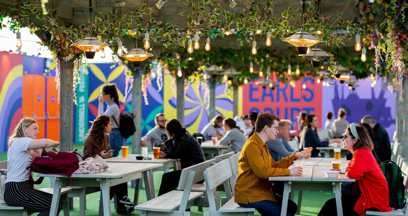
The London Wonderground at Earls Court in partnership with Underbelly
Summer 2021 & 2022
Over 160,000 people visited the free to enter festival across both summers to see a range of theatre, circus and comedy, alongside food stalls and fairground rides.
Empress Studios
March 2022 – ongoing
In partnership with This is Projekt, ECDC turned six derelict Victorian townhouses on Empress Place into 46 affordable creative studios designed for the community.
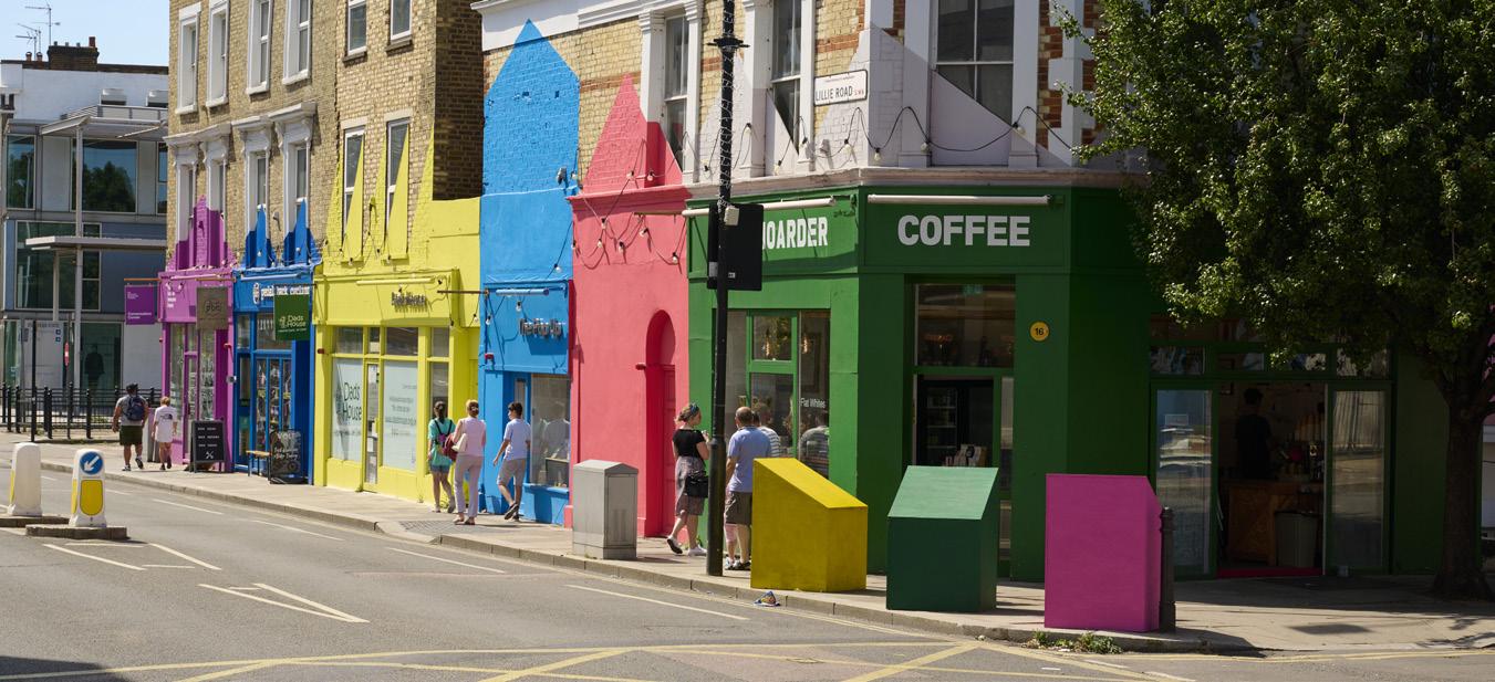
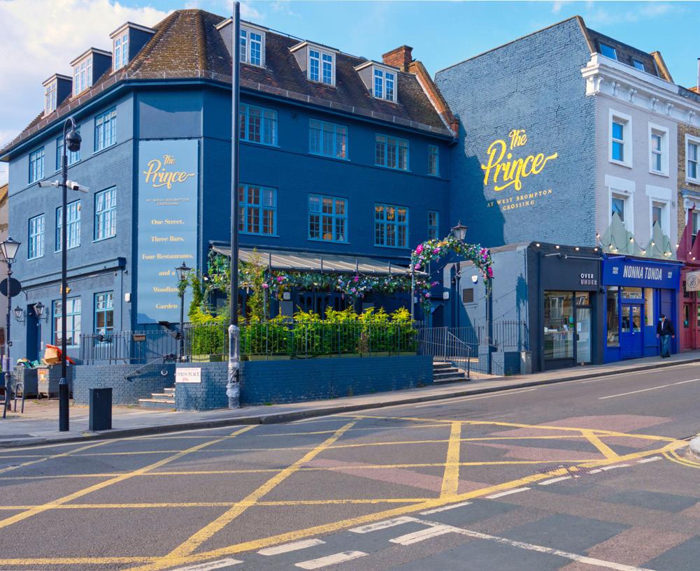
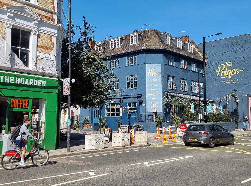
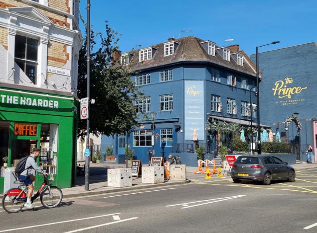
Lillie Road shops
Summer 2021 – ongoing
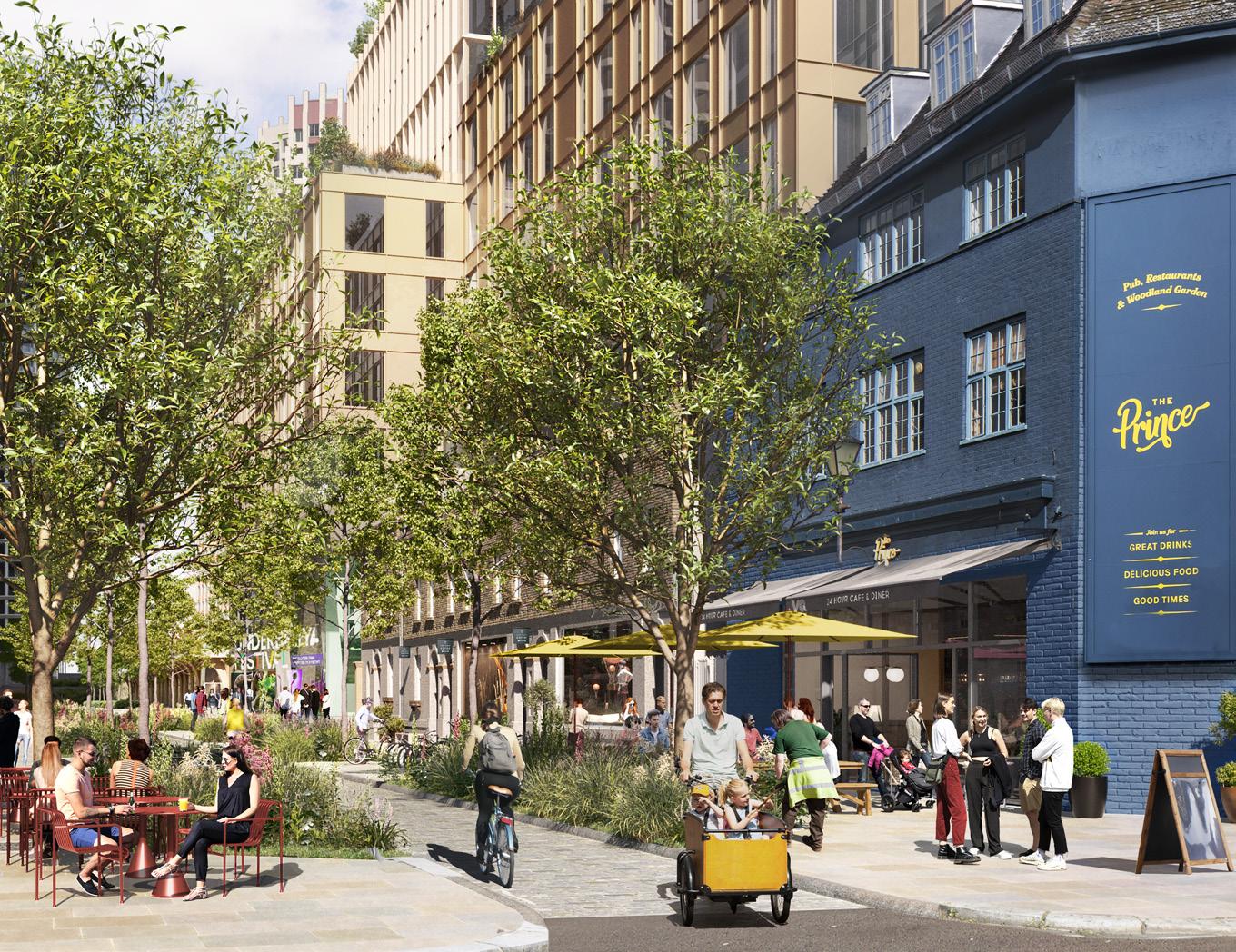
The pop-up high street on Lillie Road is home to The Prince which hosts a line-up of London’s most in demand street food brands and a huge pub garden, alongside a curated mix of independent retailers.
Community Hub
June 2022 – ongoing
A social haven for the community to enjoy, with a range of free activities alongside a serene garden managed by Hammersmith Community Gardens Association and supported by a residentled gardening club. Each week hundreds of local residents take advantage of the range of classes and happenings at the Hub, which is also home to the 10th Fulham Scouts.
1.4 Opening Up the Site to Temporary Activations
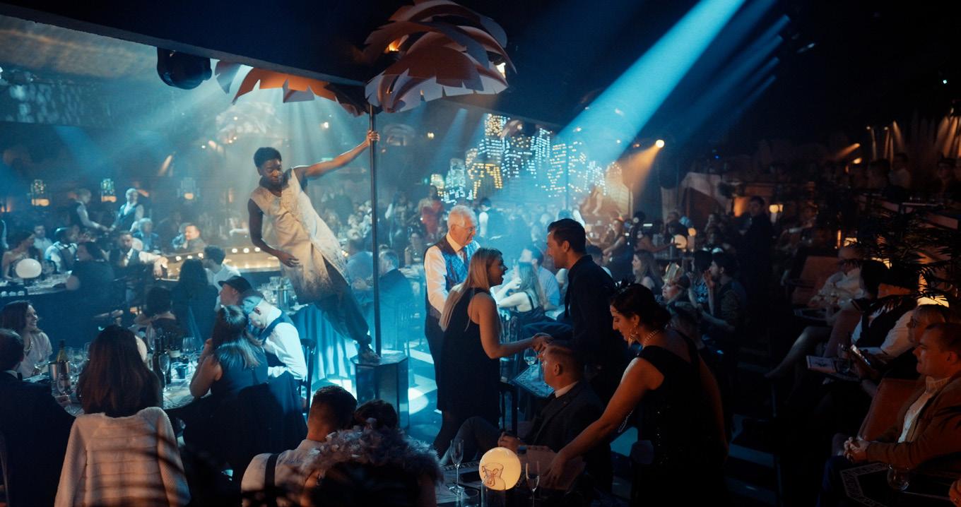
The Lost Estate at the former Mannequin Factory
July 2022 – ongoing
A temporary visionary and immersive theatre experience that brings well known stories to life through world-class performances and themed dining.
Padel and Beach Rugby
October 2023 – ongoing
ECDC launched an outdoor Padel showcase court in collaboration with Padel Social Club. A city beach was also installed on Empress Space, programmed with free tag rugby tournaments and children’s rugby coaching sessions. In spring 2024, the Padel Social Club expanded to a further four courts, a club house and bar, and wellness facilities.
Artist in Residence programme
January 2023 – ongoing
In partnership with the National Portrait Gallery, ECDC launched an Artist in Residence programme selecting twelve artists to work with the local community over a three year period to deliver portraits and community arts projects.
Earls Court Skills Centre
November 2023 – ongoing
Together with Places for London and the Skills Centre, ECDC opened West London’s newest cross-borough centre for future education. This will be a central point for training and enterprise throughout the lifetime of the project, working with community groups and future employers to upskill local people.
BBC Earth Experience
March 2023 – January 2024
A world-first, ground breaking new experience narrated by Sir David Attenborough took visitors on an audio-visual experience featuring footage from the series Seven Worlds, One Planet. It was visited by over 375,000 people in 10 months.
The existing structure has been repurposed and this autumn will be home to the first global immersive experience of ‘Come Alive, The Greatest Showman Circus Spectacular’.
1.5 Listening to the Community
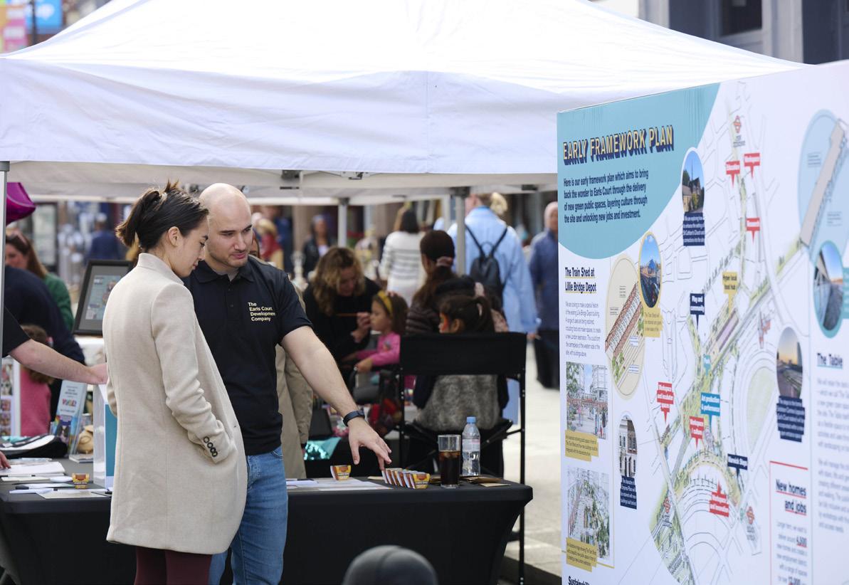
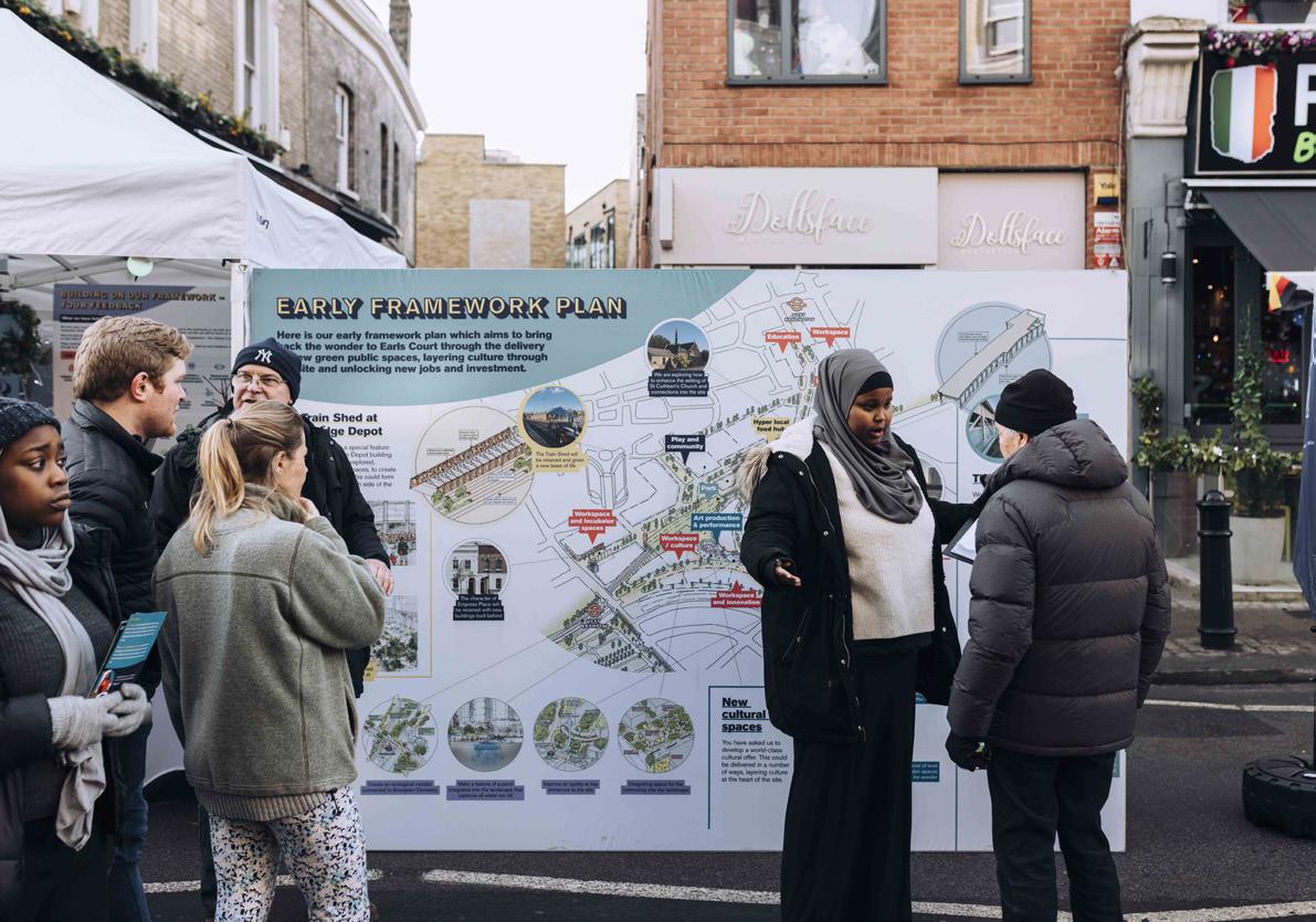
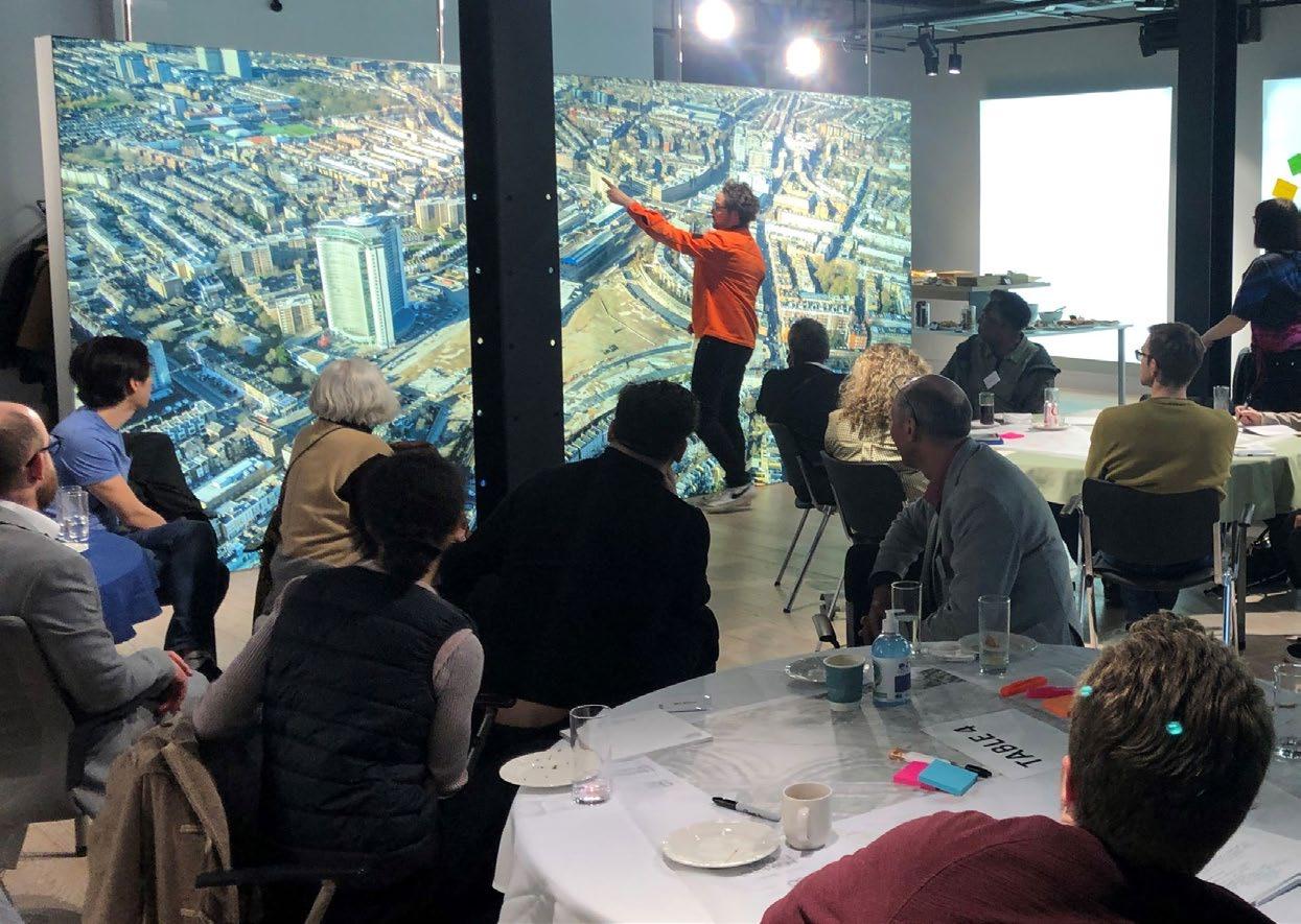
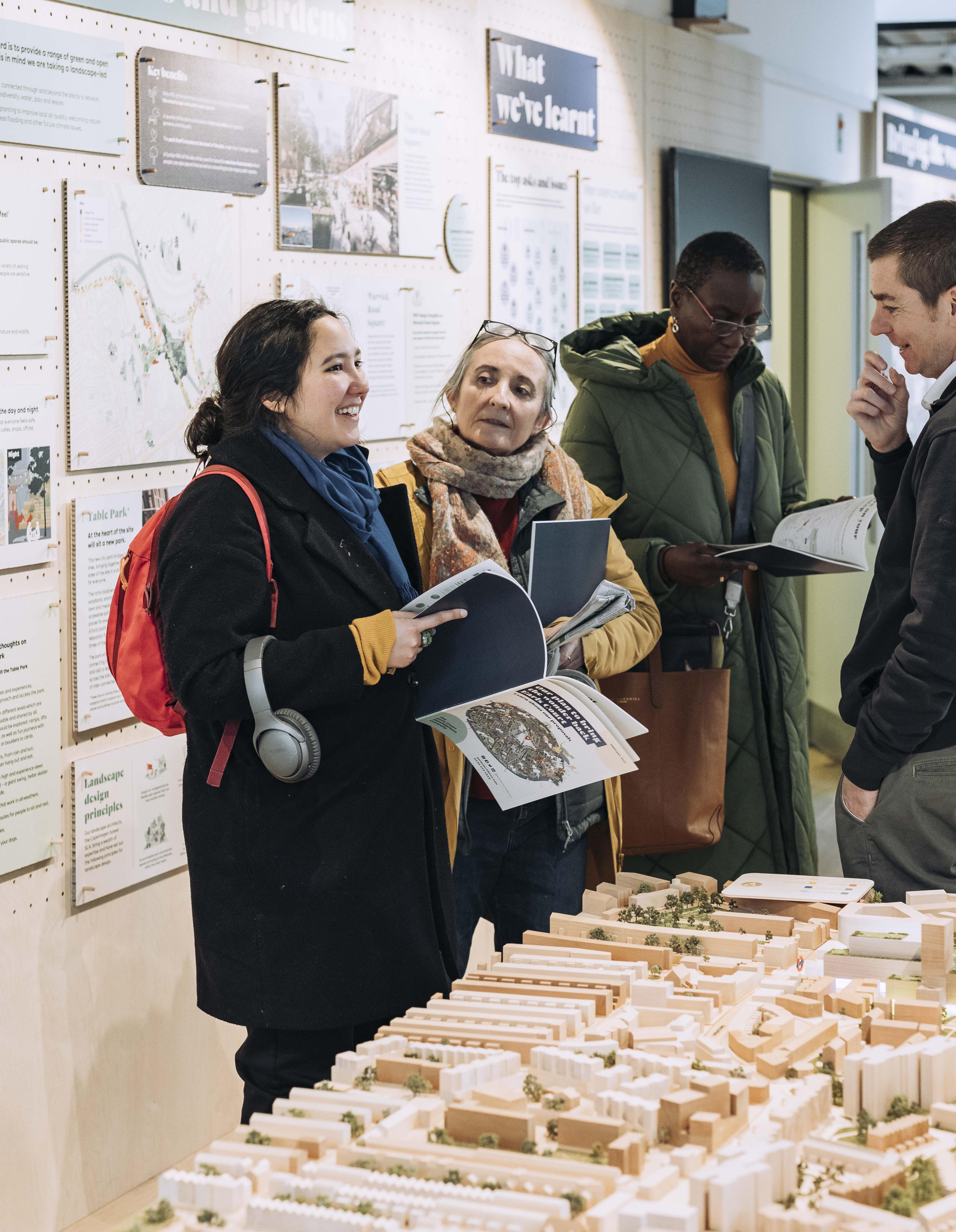
Over the past four years, ECDC has worked collaboratively with local residents, businesses, stakeholders and interest groups to understand their ambitions for the Earls Court masterplan. Recognising the Site holds a special place in the memories of local people, the vision and the masterplan has been shaped by working with our communities.
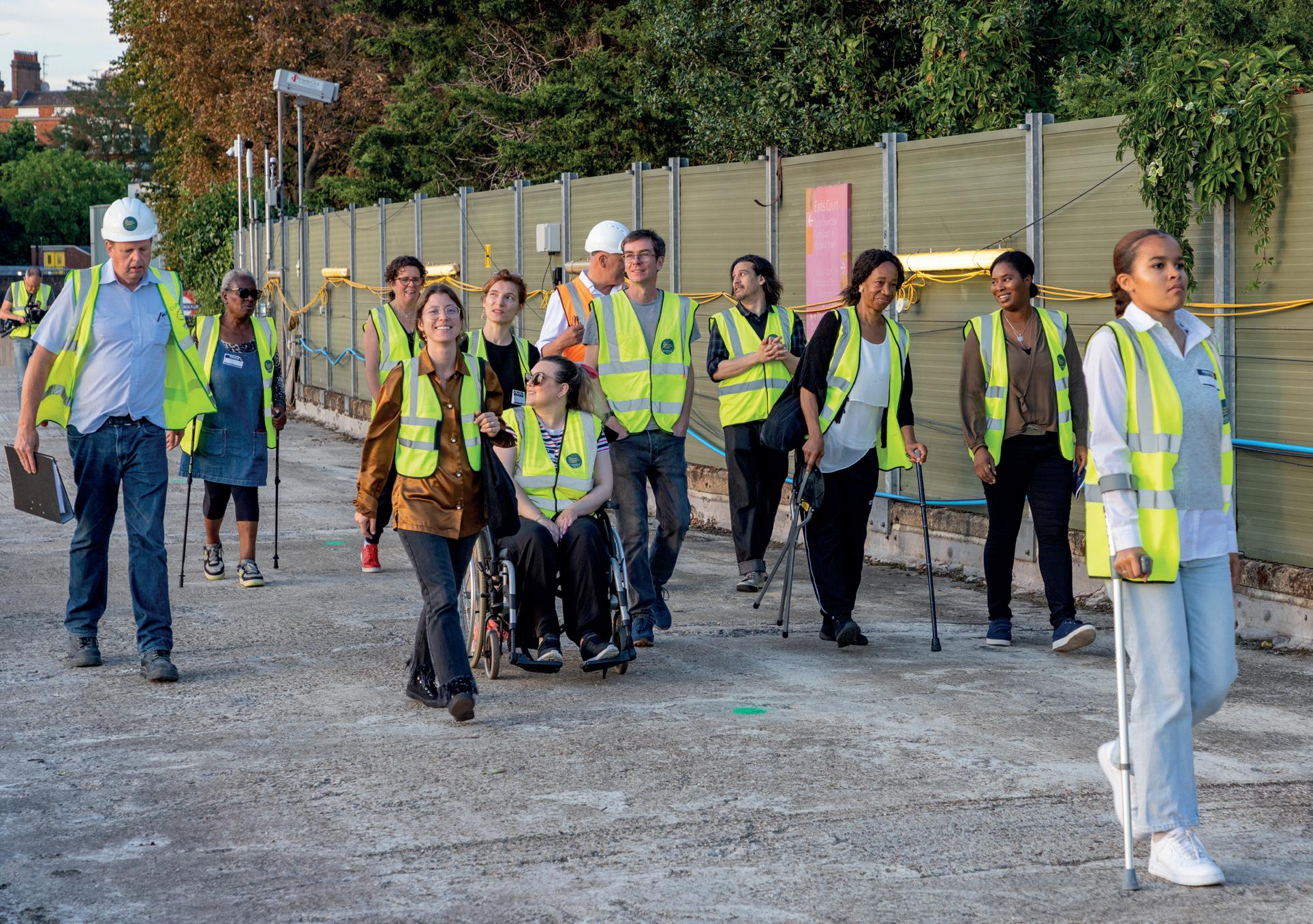
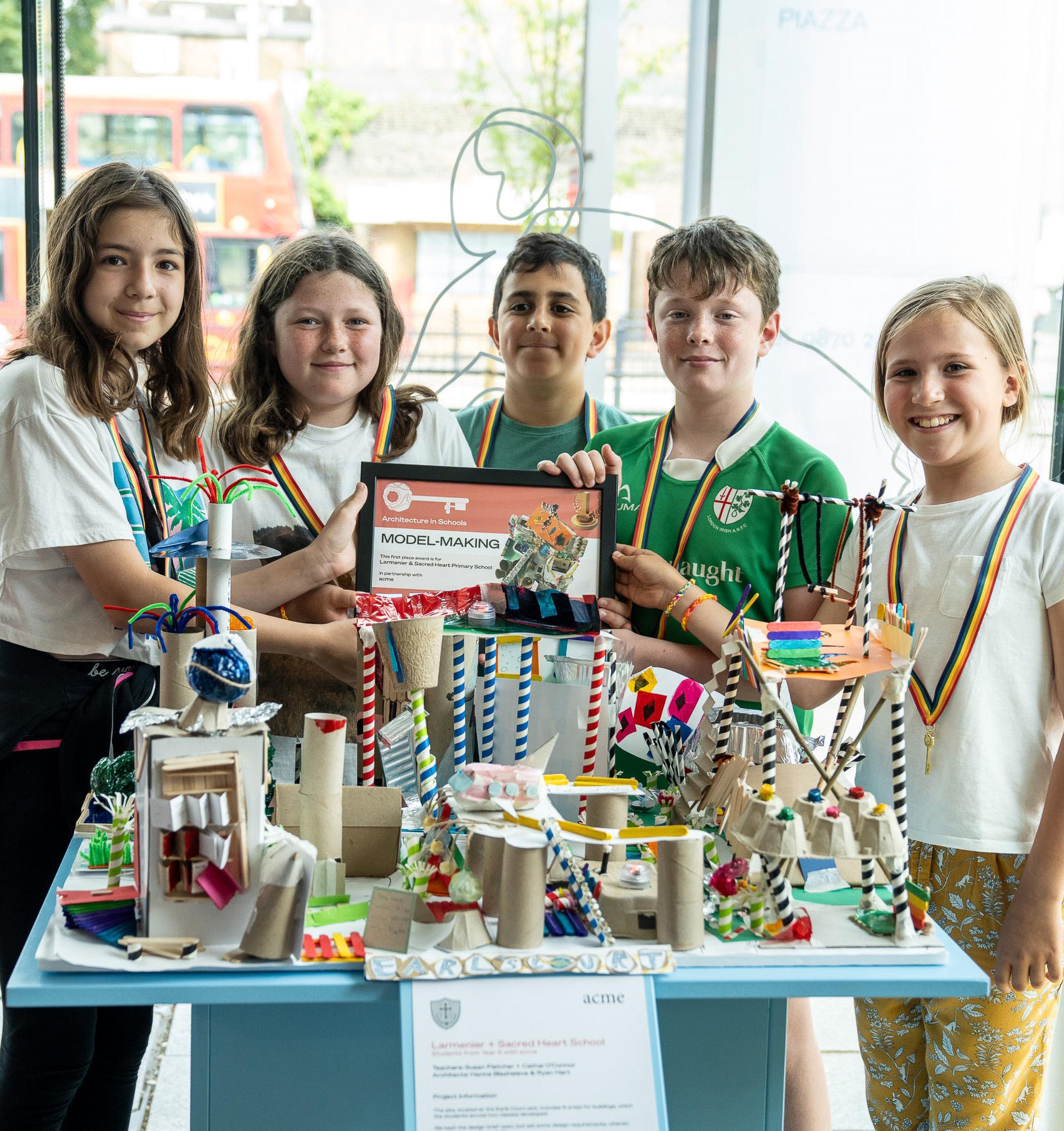
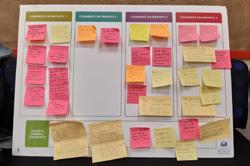
Through listening and engaging, as well as activities ranging from family fun-days to street stalls, exhibitions, workshops, door-knocking and sentiment surveys, thousands of people have given their views. A particular focus was on outreach to people whose voices are less often heard, and the Design Team worked through panels and forums to facilitate more in depth discussions. Out of workshops with young people, older people and those with disabilities, the Public Realm Inclusivity Panel (PRIP) was established.
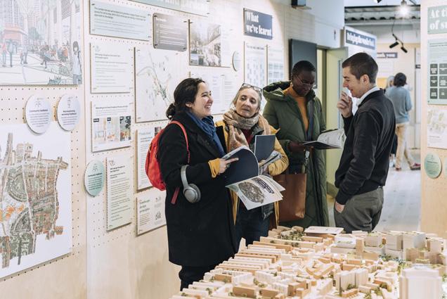
Each iteration of the masterplan was publicly exhibited and staffed by members of ECDC and the wider Project Team, with thousands of residents attending in person or submitting feedback. The changes made following feedback were then tested through surveys with a high rate of return and 76% of respondents supporting the ongoing iteration of the masterplan.
Total engagement since 2020
2,707 2,562 1,917 800+ 722 493 50+ 76% 17,000+
unique visits to the Commonplace consultation microsite
survey contributions from 1,518 respondents
people emailed regular updates
visitors to ECDC’s exhibitions
hours of PRIP members’ time spent with the Design Team over 25 PRIP and Safety Panel meetings and carrying out homework/ research
school children and young people taking part in workshops and programmes
of survey respondents expressed support for the masterplan exhibited in November 2023 to April 2024
hours of the ECDC and Project Team members’ time engaging residents and lesser heard groups over 39 walks and workshops
organised site tours for local residents, groups and stakeholders
Earls Court Project Rooms, ECDC Head Office ► For additional information, refer to the Statement of Community Involvement (SCI) submitted as part of this planning application.
Listening to the Community
2020
Community open day held at Earls Court Project Rooms
Autumn 2021
Stakeholder tours leading to the development of the vision and emerging guiding principles
Spring 2022
Community masterplanning workshops begin
Spring 2023
Consultation on draft masterplan, including exhibition and survey as well as continuing PRIP and community masterplan workshops
Spring 2020
Opinion polling research, interviews with stakeholders and residents survey
Summer 2021
Series of pop-up engagement events and family fun days in the local area
Winter 2021
Emerging vision launched to ‘bring the wonder back’ and four key priorities for the site
Exhibition held a survey on the priorities for the masterplan framework and workshops with young people, those with disabilities and older people
Summer 2022
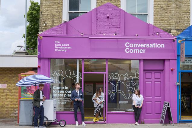
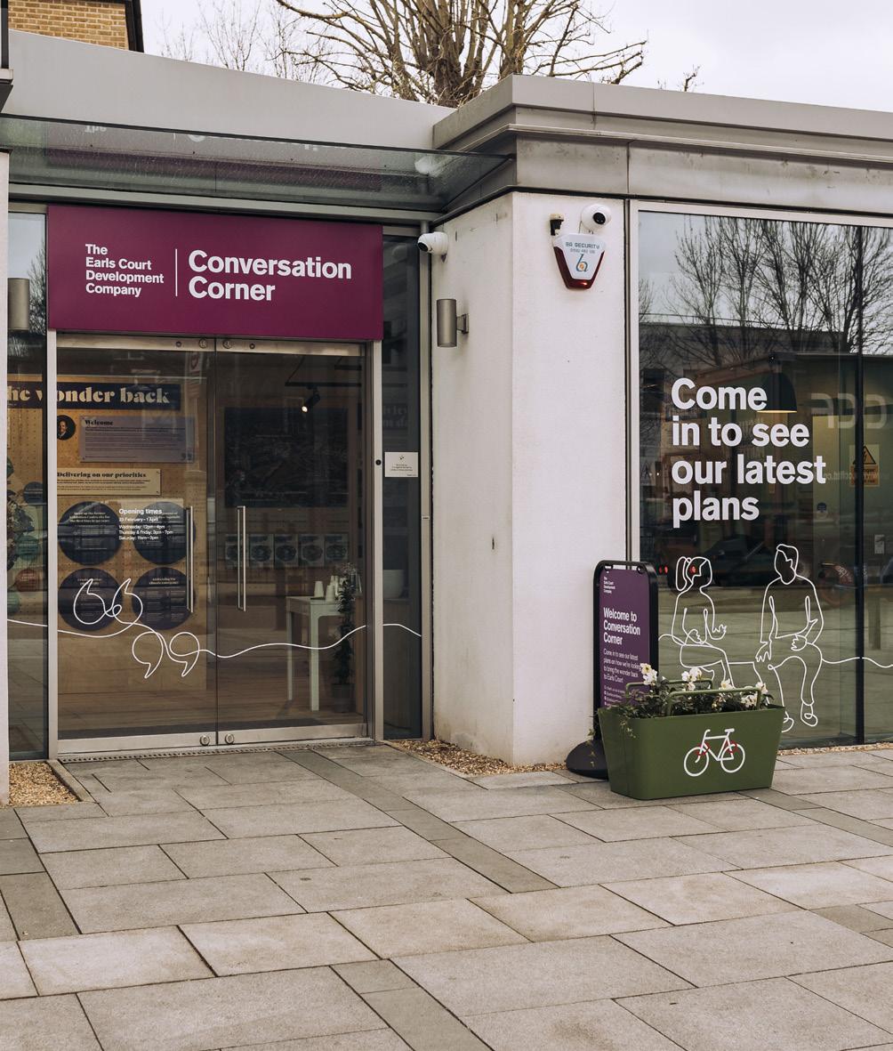
Consultation on Framework Principles, exhibited at Conversation Corner
First meeting of the Public Realm Inclusivity Panel (PRIP)
Street stalls and pop-ups across the wider area and multiple community workshops with local residents and businesses
Spring 2024
Outlining proposals on detailed Phase 1 building designs and inviting feedback on the approach to design coding
Continued PRIP, masterplan and area-based workshops with the local community
Winter
2023
Consultation on updated masterplan in response to feedback and inviting feedback on the Character Areas and initial Phase 1 design proposals
PRIP sub-group focusing on safety
Series of area based workshops with nearby neighbours
Doorstep engagement with neighbouring residents
Summer
Inclusive Design
A key initiative has been working in more depth through community workshops and stakeholder engagement to discuss a wider range of topics. This has involved putting people at the heart of the design process, celebrating and incorporating diversity and difference. The masterplan reflects the needs of different groups including older people, children, those with disabilities and carers.
“I wasn’t expecting to be listened to as much as we are, but I’ve seen how the things we’ve discussed on the panel have been considered and implemented into the design plans which is amazing.”
Niamh Faleye PRIP member
“Having PRIP members in mind when making the case for inclusive design has been really impactful. It gives a face to the people we are designing for and a clear sense of purpose when we are weighing up design decisions.”
Laurence Neal, Design Manager The Earls Court Development Company
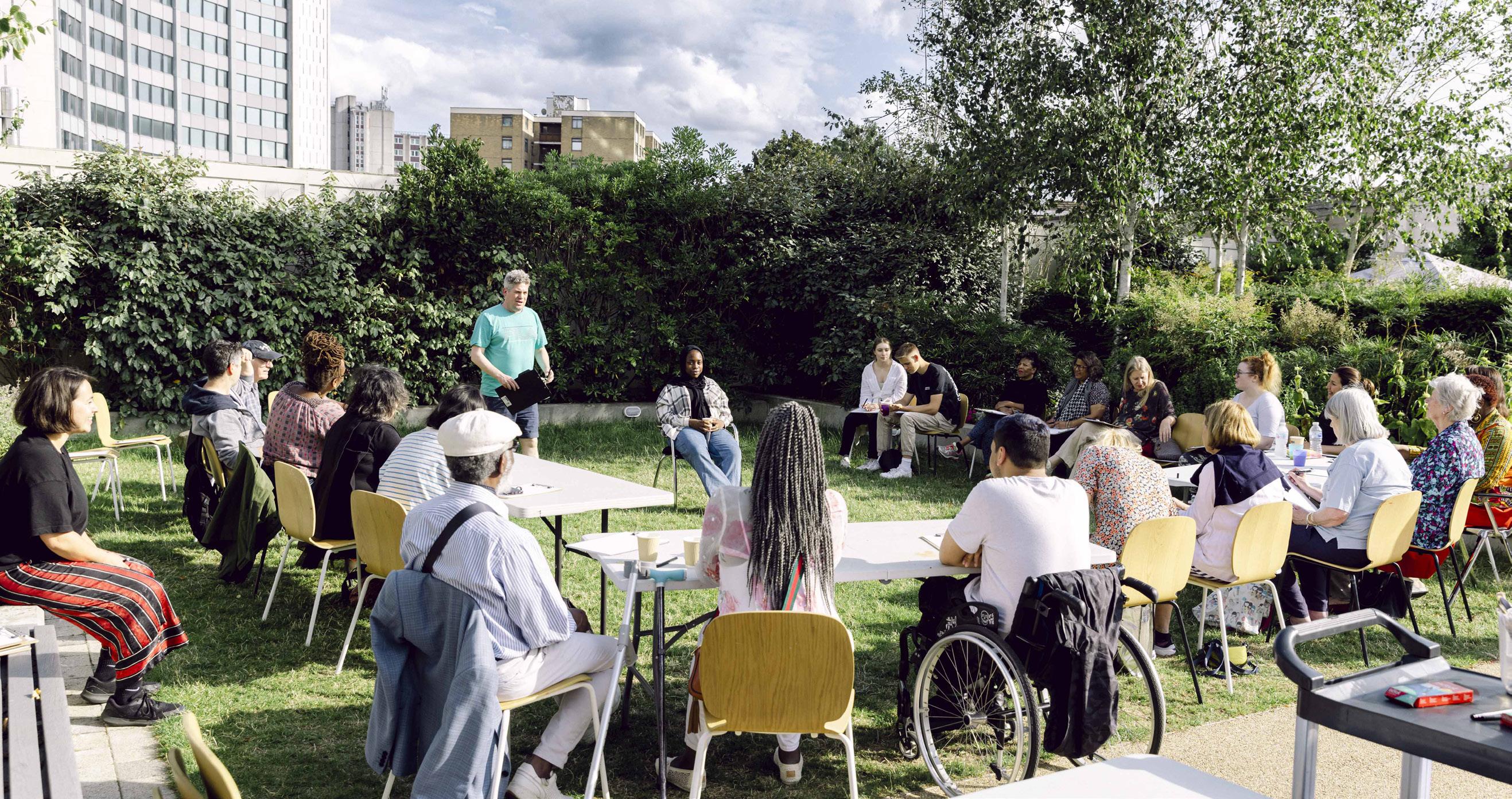
This has included dedicated outreach to those whose voices are less often heard. Out of workshops with young people, older people and those with disabilities, the Public Realm Inclusivity Panel (PRIP) was established. This group of 15 people of varying backgrounds and abilities from the local area aged 15-80 has, and is continuing to play a key role in shaping the accessible, inclusive and ambitious proposals for the public spaces within the masterplan.
The PRIP has played a pivotal role in amplifying the voices of people typically excluded from the decision making process of development projects.
In its first 16 months, the panel served as a critical friend, contributing to the public realm design brief and reviewing the draft design proposals. As the panel members developed the skills to understand and engage with the complexity and the challenges of a masterplan, as well as the planning process, their work became more detailed.
Between November 2023 and June 2024, they worked in a more advisory capacity, reviewing and providing input on the Design Code for access and movement, street furniture, lighting, signage, materiality, and design and management elements around safety.
The work of the PRIP continues and ECDC is committed to working with the group through future detail design phases of the development.
“I cannot overstate just how good the process has been and it is all down to the innovative and inclusive ways in which the sessions are being run; well done all.”
Floyd Wilson PRIP member
“The PRIP has enabled me to understand different concerns and issues with the way in which people use and experience streets than would be the case had we just been working with a group of built environment professionals.”
Justin Sherlock, Technical Director WSP
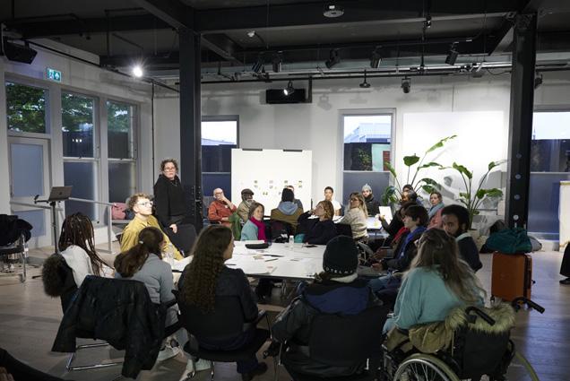
Photographs of the Public Realm Inclusivity Panel on Site and in workshops
1.7 The Masterplan Team
The importance of the Earls Court Site as an Opportunity Area in London, together with the collective ambition for a new approach, resulted in an international competition for a masterplan architect.
Following over 50 expressions of interest, and a two-stage design competition, a masterplan architect team composed of Hawkins\Brown (HB) and Studio Egret West (SEW) was selected in early 2020.
The Danish landscape consultancy SLA was also appointed in 2022 and, together with SEW, further developed the vision for a landscape-led approach, whilst establishing the environmental aspirations and ensuring a welcoming place for all.
Alongside this core team, over 30 consultants have also been involved in preparing the Outline Component of the Hybrid Planning Applications. Throughout the evolution of the masterplan, members of the Design Team have been at the forefront of engagement alongside ECDC. They have staffed public events, attended workshops and have been present at the Conversation Corner dropin space, allowing local residents the opportunity to engage with the Design Team, and give their views and suggestions directly.
Quod
Lead consultant and masterplan architect
Lead consultant, masterplan architect and landscape architect
Bonnett Associates
Factory Fifteen
Gordon Ingram Associates
Haworth Tompkins
Hoare Lea
Iceni Projects JLL Kanda Knight Frank Leslie Jones
Maccreanor Lavington
MindFolio
Montagu Evans
Pilbrow & Partners
Hawkins Brown
Studio Egret West
1.8 The Planning Applications
Two Hybrid Planning Applications
Whilst the masterplan has been developed for the Site as a whole, the administrative boundaries of the two local authorities bisect the Site. Separate Hybrid Applications are therefore submitted to each borough (in duplicate) and form the planning applications.
The RBKC Hybrid Application is formed of detailed development proposals in respect of plots EC05 and EC06 for which no matters are reserved (“RBKC Detailed Component”), and outline development proposals for the remainder of the RBKC Site, with all matters reserved (“RBKC Outline Component”). The RBKC Detailed Component and RBKC Outline Component together are referred to as the “RBKC Proposed Development”.
The LBHF Hybrid Application is formed of detailed development proposals in respect of plots WB03, WB04 and WB05 for which no matters are reserved (“LBHF Detailed Component”), and outline development proposals for the remainder of the Site, with all matters reserved (“LBHF Outline Component”).
LBHF Detailed Component and LBHF Outline Component together are referred to as the “LBHF Proposed Development”.
The Proposed Development is currently anticipated to be delivered in a number of phases over an estimated programme of approximately 19 years to completion.
No significant delay is anticipated between the phases. However, realising vacant possession of the Lillie Bridge Depot is complex and whilst an indicative programme has been agreed with London Underground Limited (LUL), it is subject to ongoing review, detailed preparation, and additional consents. It may change and could delay vacant possession beyond the timescales currently anticipated.
Due to the above, the Hybrid Planning Applications consider and assess two different scenarios. These are:
1. All Phases: comprising the entirety of the Proposed Development. This is currently anticipated for completion by 2043.
2. Early Phases: Phases 1-4 (the ‘Early Phases’) are completed, but the Depot remains operational and is delivered to a different programme from that currently anticipated in the All Phases scenario.
► For more information on the structure of the planning applications refer to the Planning Statement (EC.PA.04).
► For more information on phasing refer to the Design and Access Statement Volume 1: Outline Component / Phasing and Delivery (EC.PA.08).
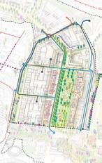
Total area of 18 hectares, of which 10 hectares are in LBHF and 8 hectares in RBKC.
B LBHF Detailed Component (Plots WB03/04/05) Development Zones
London Borough of Hammersmith and Fulham (LBHF)
Royal Borough of Kensington and Chelsea (RBKC)
1.8 The Planning Applications
Structure of the application
The planning submissions are Hybrid Applications, meaning they contain both a Detailed Component and an Outline Component.
Outline Component
Outline proposals cover the extent of the Earls Court Site, excluding the Detailed Component. The Outline Component sets a robust Strategic Framework for development, but leaves room for flexibility so as not to overly constrain the delivery of future Development Plots. The Outline Component reserves all matters for future planning submissions known as applications for Reserved Matters Approval (RMAs).
Detailed Component
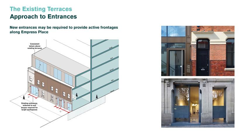
In contrast, the Detailed Component provides design certainty through detailed drawings that comply with the overarching principles established by the Control Documents. This has the added benefit of showcasing how the principles laid out in the Control Documents can be delivered successfully.
This is a standard approach for a masterplan of this scale—combining a comprehensive framework for development with a significant proportion of the Proposed Developed as a fully detailed application. This approach secures both a sitewide long-term vision and early detailed delivery on-site.
In addition to this masterplan Design and Access Statement (DAS), separate DAS’ have been prepared for the Detailed Component in each borough.
► For more information on how the read the application material refer to the Application User Guide (EC.PA.05).
► For more information on the structure of the planning applications refer to the Planning Statement (EC.PA.04).
approval (the Control Documents)*
1.8 The Planning Applications
The DAS is arranged into the following chapters which cover assessment, process, explanation and description of the proposals as follows:
Chapter 1: Introduction
This Design and Access Statement (DAS) explains the rationale, evolution and masterplan framework for the Earls Court Development, communicating the scale of ambition and the robust design-led approach.
The purpose of this DAS is to communicate the sitewide framework strategies and character specific design responses. It demonstrates how these have evolved based on a detailed understanding of the Site’s character and context in line with planning policy and the design-led approach.
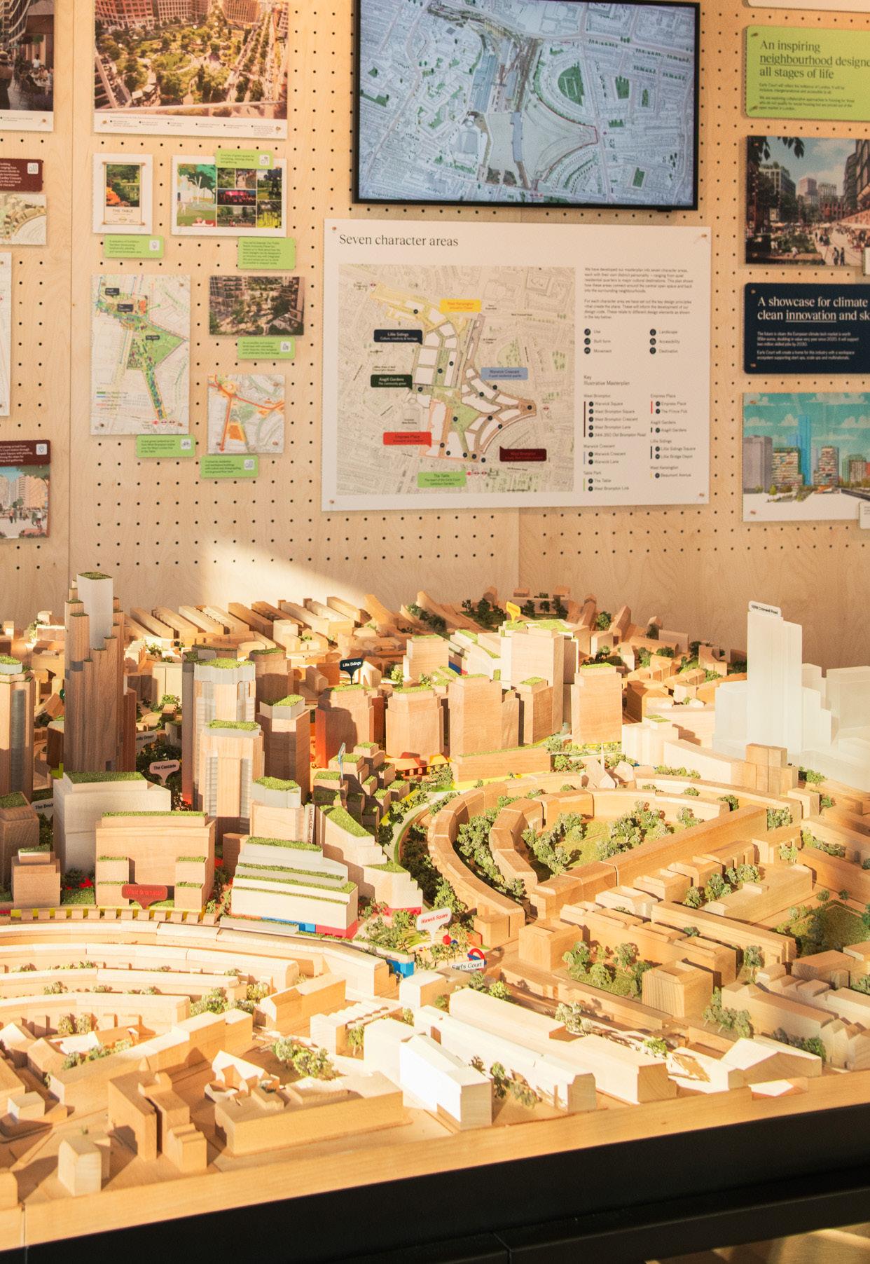
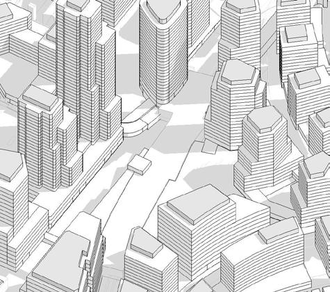
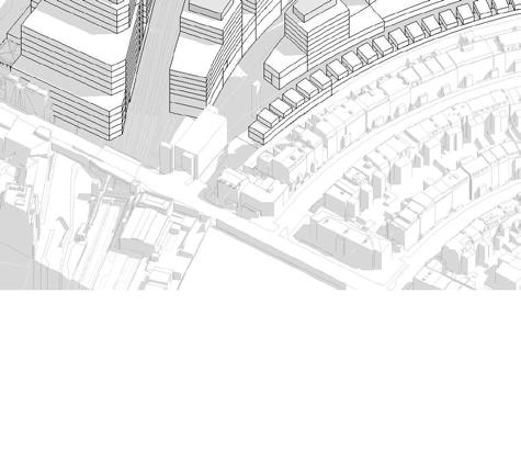
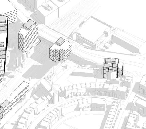
This DAS includes an Illustrative Masterplan as one scenario that complies with the Control Documents. It also illustrates the identity of individual Character Areas and helps to demonstrate the effectiveness of the Design Code. Each design principle is explained, illustrated and cross-referenced to the relevant Control Document (Parameter Plans, Design Code and Development Specification).
Chapter 2: A
Vision for Earls Court
Chapter 3: Site Context and Analysis
Chapter 4: Design Evolution and Engagement
Chapter 5: The Strategic Framework
Chapter 6: The Illustrative Masterplan
Chapter 7: Spatial Strategies
Chapter 8: Phasing and Delivery
Chapter 9: Conclusion
Explains the context and purpose of the planning application, the role of the DAS, and presents the team behind the application.
Explains the vision for the Earls Court Site, establishing the opportunity, the core priorities and placemaking principles.
Assesses the attributes of the physical, social, economic and site context which have guided the design proposals.
Describes the collaborative process behind the evolution of the proposals. Captures how the ECDC team and the Design Team worked with the community and stakeholders.
Explains the design principles for the masterplan which underpin the Development Control Documents.
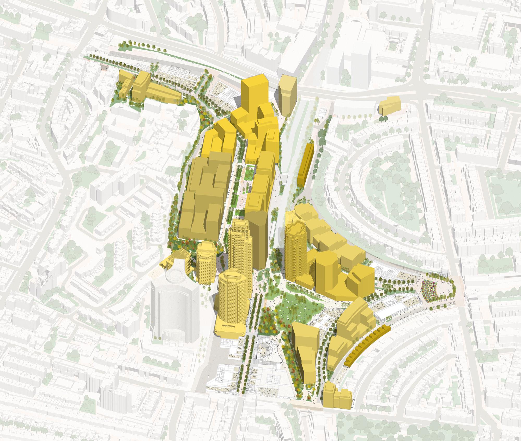
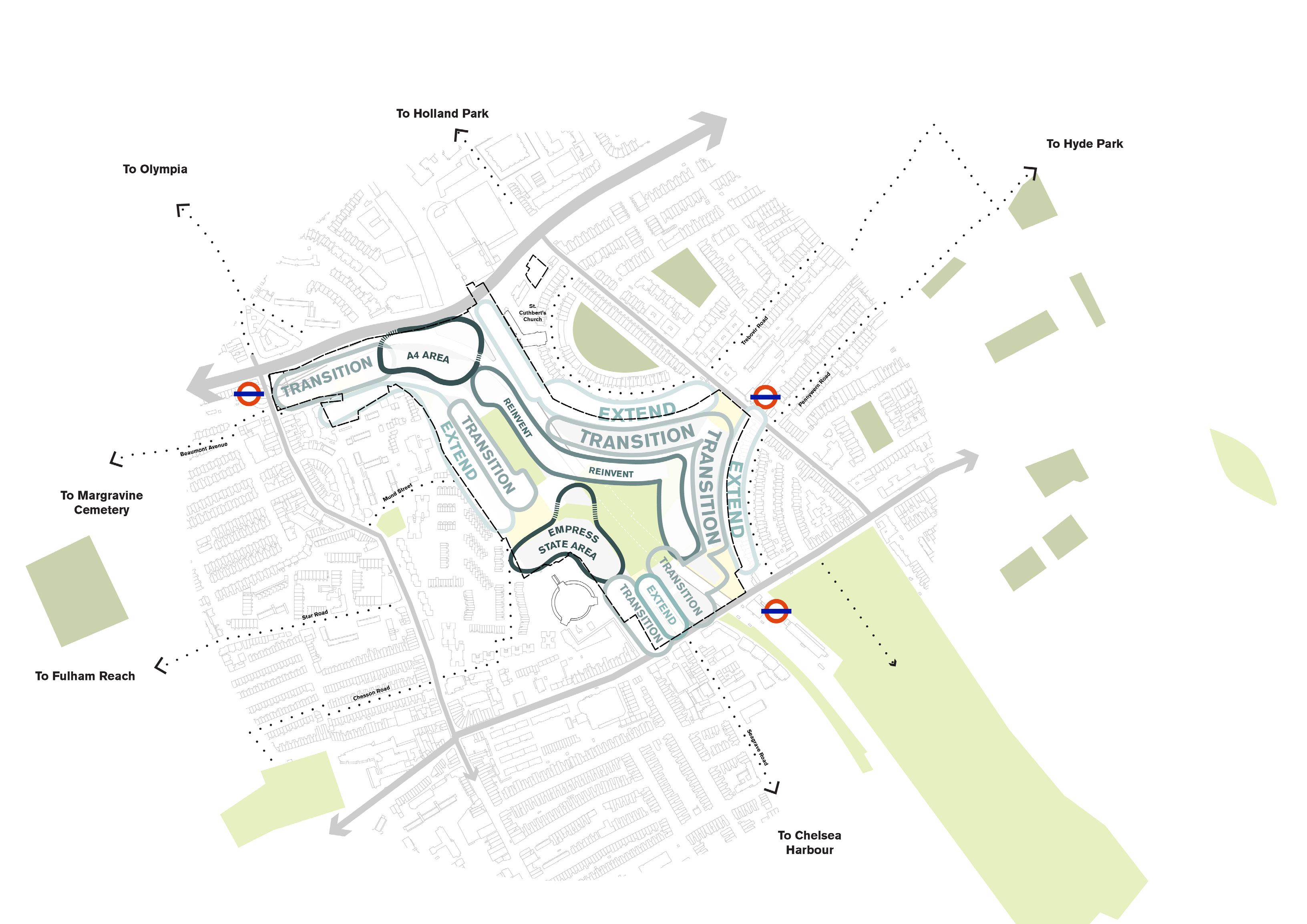
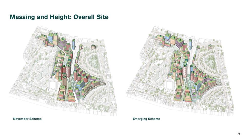
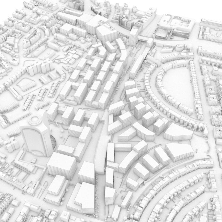
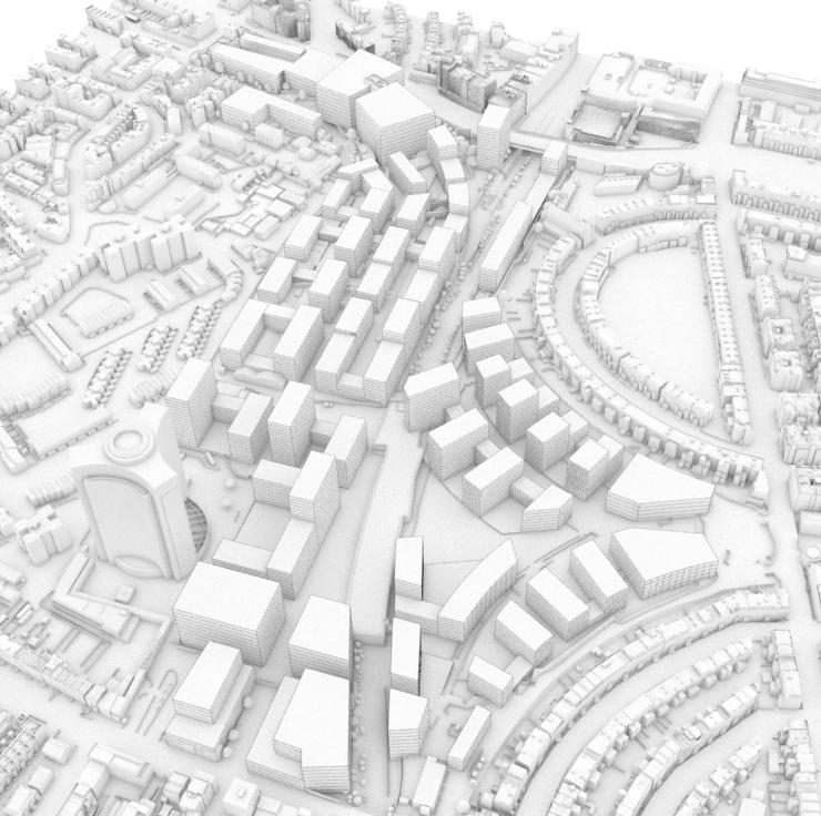
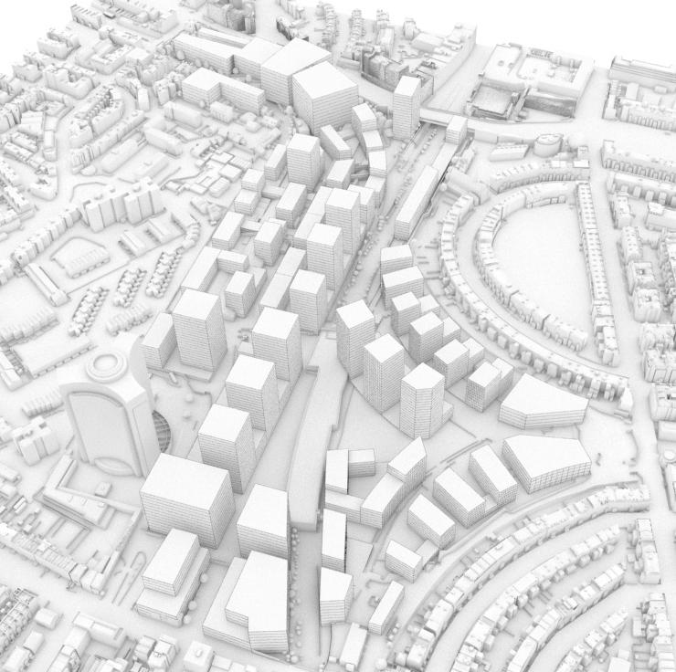
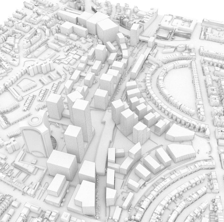
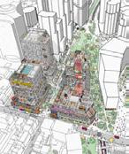
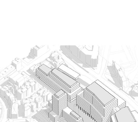
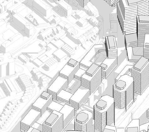
Describes and illustrates one possible scenario of development within the parameters to communicate the vision. Informed and tested in-line with the Control Documents, it demonstrates design proposals for each Character Area.
Sets out additional technical supporting material, expanding on themes including landscape, access and infrastructure.
Offers additional information about the delivery of the masterplan, temporary uses and proposed phasing of construction.
Summarises the design process, the masterplan’s placemaking approach and key spatial moves discussed across this document.
The Design and Access Statement (DAS) should be read in conjunction with the Design Code and Parameter Plans
Planning Policy Framework | N ational
Achieving sustainable development
The National Planning Policy Framework (NPPF) (most recently updated in 2023) establishes the government’s planning policies for England.
• An economic objective – to help build a strong, responsive and competitive economy, by ensuring that sufficient land of the right types is available in the right places and at the right time to support growth, innovation and improved productivity; and by identifying and coordinating the provision of infrastructure.
National Planning Policy Framework - Key sections
Section 2
Paragraph 10
The National Planning Practice Guidance (PPG) is an extensive online resource of detailed policy guidance provided by the Ministry of Housing, Communities and Local Government. Along with the National Planning Policy Framework (NPPF), the PPG sets out how the government envisages the day to day working of the planning system in England to operate.
At the heart of the NPPF is the presumption in favour of sustainable development, achieved through meeting the three ‘overarching aims’ set out in paragraph 8 of the NPPF.
• A social objective – to support strong, vibrant and healthy communities, by ensuring that a sufficient number and range of homes can be provided to meet the needs of present and future generations; and by fostering welldesigned, beautiful and safe places, with accessible services and open spaces that reflect current and future needs and support communities’ health, social and cultural well-being.
• An environmental objective – to protect and enhance our natural, built and historic environment; including making effective use of land, improving biodiversity, using natural resources prudently, minimising waste and pollution, and mitigating and adapting to climate change, including moving to a low carbon economy.
Section 5
(Delivering a sufficient supply of homes)
Section 6
(Building a strong, competitive economy)
Section 8
(Promoting healthy and safe communities)
Section 11
(Making effective use of land)
At the heart of the Framework is a presumption in favour of sustainable development which means ‘approving development proposals that accord with an up-to-date development plan without delay’.
Sets out the objective of “significantly boosting the supply of homes”, including different sizes, types and tenures for different groups including those requiring affordable housing.
Supports economic growth through the investment, expansion and adaptation of businesses.
Planning policies and decisions should aim to achieve healthy, inclusive and safe places and beautiful buildings.
Requires decisions to promote an effective use of land in meeting the need for homes and other uses, while safeguarding and improving the environment and ensuring safe and healthy living conditions. Paragraph 123 requires as much use as possible of previously-developed or ‘brownfield’ land.
Section 12
(Achieving well-designed and beautiful places)
Section 16
(Conserving and enhancing the historic environment)
Sets out that the creation of high quality, beautiful and sustainable buildings and places is fundamental to what the planning and development process should achieve.
Where a development proposal will lead to less than substantial harm to the significance of a designated heritage asset, this harm should be weighed against the public benefits of the proposal including, where appropriate, securing its optimum viable use.
1.9 Planning Policy Framework | Regional
Delivering ‘Good Growth’
The London Plan 2021 is the Spatial Development Strategy for Greater London. It sets out a framework for how London will develop over the next 20-25 years and the Mayor’s vision for Good Growth.
The London Plan’s ‘Chapter 1: Planning London’s Future - Good Growth’ objectives are set out in the following policies:
The London Plan defines good growth as ‘growth that is socially and economically inclusive and environmentally sustainable’ which ‘underpins the whole of the London Plan and each policy.’ Furthermore it ‘is the way in which sustainable development in London is to be achieved’.
Key Policies that have informed the proposals are:
Policy GG2 – sets out that to create successful sustainable mixed-use places that make the best use of land, those involved in planning and development must apply a design–led approach to determine the optimum development capacity of sites.
The Site is located within the wider Earl’s Court and West Kensington Opportunity Area. Policy GG2 requires that those involved in planning and development must enable the development of brownfield land, particularly in Opportunity Areas.
Policy GG4 – states that to create a housing market that works better for all Londoners, those involved in planning and development must (Part A) ensure that more homes are delivered.
Policy GG5 – sets out that to conserve and enhance London’s global economic competitiveness and ensure economic success is shared amongst all Londoners, those involved in planning and development must (Part B) seek to ensure that London’s economy diversifies and that the benefits of economic success are shared more equitably across London and (Part C) plan for sufficient employment and industrial space in the right locations to support economic development and regeneration.
1.9 Planning Policy Framework | Regional
Design, characterisation and growth
Chapter 3 (Design) of the London Plan sets out how Good Growth is delivered through good design.
Policy D1 (London’s form, character and capacity for growth) sets out:
• The importance of understanding the characteristics, qualities and value of different places within the plan area to develop an understanding of different areas’ capacity for growth.
Policy D2 (Infrastructure requirements for sustainable densities) sets out that the density of development proposals should:
• Consider, and be linked to, the provision of future planned levels of infrastructure rather than existing levels.
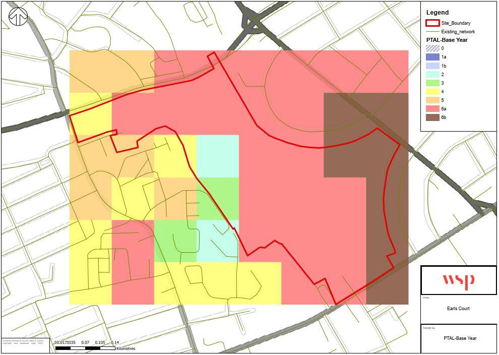
• Be proportionate to the site’s connectivity and accessibility by walking, cycling, and public transport to jobs and services (including both PTAL and access to local services).
Policy D3 (Optimising site capacity through the design-led approach) sets out that:
• Development must make the best use of land by following a design-led approach that optimises the capacity of sites, including sites within Opportunity Areas and subject to site allocations, such as at Earl’s Court.
• Higher density developments should generally be promoted in locations that are well connected to jobs, services, infrastructure and amenities by public transport, walking and cycling.
• Requires consideration of design options to determine the most appropriate form of development that responds to a site’s context and capacity for growth, and existing and planned supporting infrastructure capacity.
Policy D4 (Delivering good design) sets out that:
• Masterplans and Design Codes can be used to help bring forward development and ensure it delivers high quality design and place-making. It requires Design and Access Statements to be submitted with development proposals to demonstrate that the proposal meets the design requirements of the London Plan.
Policy D5 (Inclusive design) sets out that:
• Development proposals should achieve the highest standards of accessible and inclusive design.
The GLA’s Characterisation and Growth Strategy, London Plan Guidance (LPG) was adopted in June 2023. This guidance supports the objectives identified in Policy D1 and sets out the first step to a character-based, design-led approach to planning for development, and managing how a place changes over time.
The LPG sets out requirements for assessing an area’s characteristics and the steps for using this information to establish the capacity for growth to ensure sites are developed to an optimum capacity that is responsive to its context and infrastructure.
Stage one: Character survey and analysis
Stage two: Character evaluation
This involves the collation and analysis of character elements listed in Policy D1, part A, through engagement with local communities. This information and data should be used to identify and define the character types, Character Areas and tall building definitions within the plan area.
This involves the evaluation and appraisal of local character to understand its sensitivity to change.
Stage three: Growth strategy
In consultation with local communities, and through the evaluation of character at stage two, the level of change and capacity for growth should be determined for different areas. Area-wide design visions, policies and codes should be developed, and locations identified where tall buildings may be appropriate.
1.9 Planning Policy Framework | Regional
The ‘Design-led approach’
Good Growth across London requires development to optimise site capacity, rather than maximising density’ (Optimising Site Capacity: a Design-led Approach LPG 2023).
• London Plan Policy D3 sets out that `All development must make the best use of land by following a design-led approach that optimises the capacity of sites, including site allocations’.
• The Optimising Site Capacity: A Design-led Approach LPG was adopted in 2023. This sets out how the design-led approach, set out in Policy D3 of the London Plan, should be used to determine the most appropriate form of development on a site.
• ‘This means responding to the existing character and distinctiveness of the surrounding context and balancing the capacity for growth, need for increased housing supply, and key factors such as access by walking, cycling and public transport, alongside an improved quality of life for Londoners’ (Optimising Site Capacity: A Design-Led Approach LPG).
• Optimising Site Capacity: A Design-Led Approach LPG sets out the five stages that form the design-led approach.
Stage 1: Site analysis
A site’s design must be based on the findings of a thorough site analysis and an area’s characterisation assessment and growth strategy (see the Characterisation and Growth Strategy LPG), This should be used to inform the site design vision.
Stage 2: Design vision
This Design and Access Statement sets out that the Earls Court Development has been informed by the design-led approach ‘Stages of Assessment’ identified by the LPG. Five stages to the design-led approach, outlined in the Optimising Site Capacity: A Design-led Approach London Plan Guidance
Stage 3: Draft site-based design parameters
The design of a site should be based on a clear, site-specific design vision for how the site will be developed. This should be developed in collaboration with local communities, and accord with the areawide vision and design aspirations.
The five stages to the design-led approach
Stage 1: Site analysis
• Chapter 3 provides an analysis of the Site and its surrounding context. It reflects findings from boroughwide characterisation assessments, as well as a more detailed analysis of the Site’s opportunities and constraints.
• Chapter 3 analysis sets out the`Capacity for Growth’ at the Site and has informed the Earls Court Development vision, including the proposed approach to scale and character.
Stage 2: Design vision
• Chapter 2 sets out the ECDC vision, which has been informed by the Site analysis set out in Chapter 3.
Stage 4: Testing site capacity
A draft layout and set of draft parameters should be produced for the site, reflecting the design vision. This should be based on good design principles and analysis completed during stage one.
• Chapter 4 identifies the extensive community and stakeholder engagement, collaboration and design evolution undertaken to refine and ensure the appropriateness of the vision.
Stage 3: Draft site-based design parameters
A site’s indicative site capacity must be based on the draft layout and parameters developed in Stage 3. An indicative site capacity calculator has been included to assist in this process (although alternatives can be used).
Stage 5: Finalise site-based design code
Once a final site layout has been determined, the site-based design parameters should be finalised. When undertaken by the local authority, these should be detailed in the Local Plan documents and become a site’s high-level Design Code, which should be used to assess future planning applications.
• Chapter 4 and 5 set out the design evolution of the proposals, framing principles that both reflect the vision and can provide the framework to bring it to life.
Stage 4: Testing site capacity
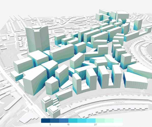
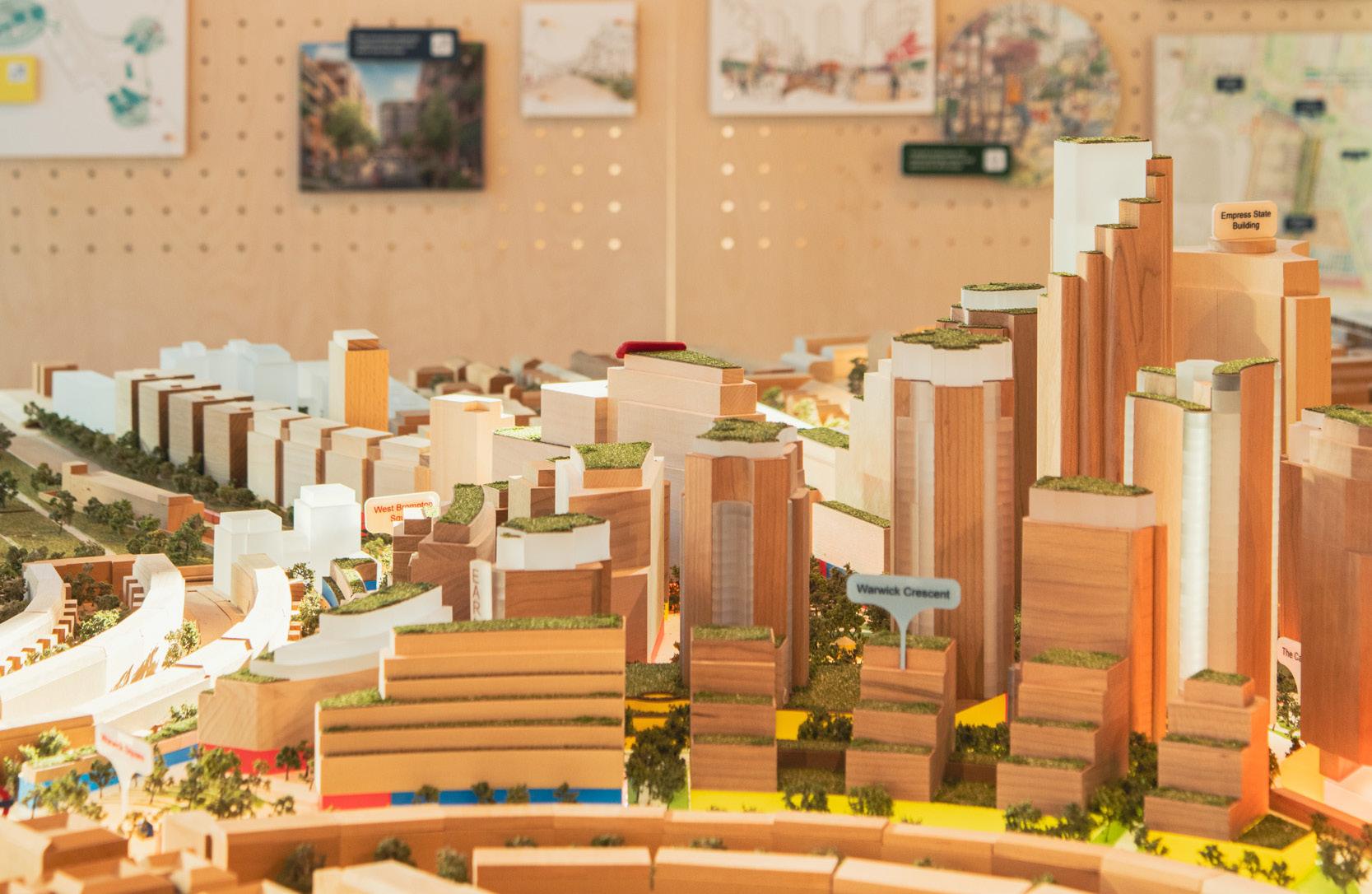
• Chapter 4 sets out the rigorous testing of the Site’s capacity, including 3D modelling that has been undertaken based on the draft layout and parameters developed in Stage 3.
Stage 5: Finalise site-based Design Code
• Chapters 5 and 6 sets out the Strategic Framework and Illustrative Masterplan with a potential development scenario that complies with the now finalised sitewide based Control Documents.
1.9 Planning Policy Framework | Local
Meeting local need in LBHF and RBKC
The Development Plans identify the Site’s potential to contribute a strategic quantum of homes and jobs for London.
LBHF Local Plan 2018
The LBHF Local Plan identifies the wider Earl’s Court and West Kensington Opportunity Area (which the Site forms part of) as having the ability to deliver:
• 6,500 homes.
• 8,500 jobs.
* the later 2021 London Plan sets figures as 6,500 indicative homes and 5,000 indicative jobs
• A rich mix of land uses, including housing, employment, hotels, leisure and associated facilities, retail and cultural facilities.
• Social, physical, environmental and transport infrastructure to support the needs of the area as a whole.
• Green corridors and public open spaces, including a centrally located local park of at least two hectares.
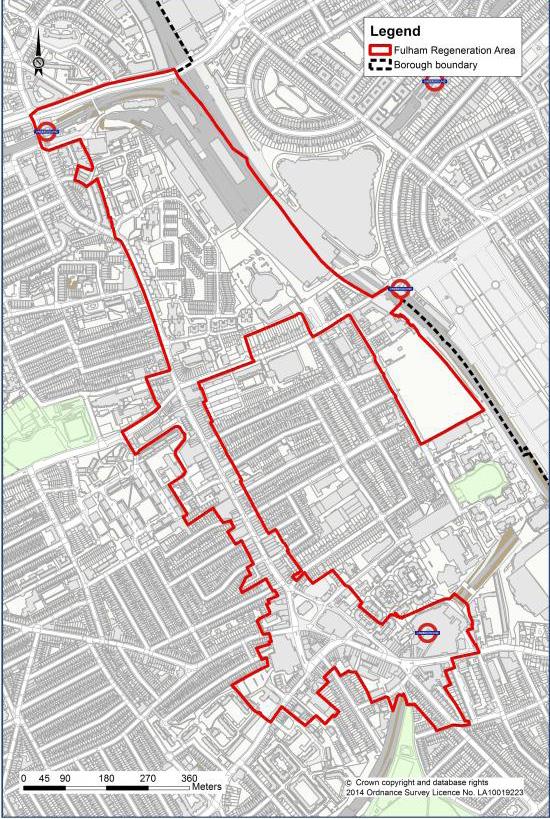
The LBHF Local Plan identifies the Site within the Fulham Regeneration Area, a substantial opportunity for regeneration with an indicative capacity for:
• 7,000 homes.
• 9,000 jobs.
RBKC Local Plan 2019
The RBKC Local Plan identifies the opportunity for the Site to deliver (Policy CA4) the following:
• A minimum of 900 (C3) homes
• A minimum of 10,000 sqm of office floor space.
• A range of retail and other non-residential uses as critical to serve the day-to-day needs of the new development.
• A significant cultural facility to retain Earl’s Court’s long-standing brand as a global cultural destination.
• Hospitality and leisure uses, social and community uses.
• On-site waste management facilities, and onsite renewable energy sources.
RBKC New Local Plan Review 2024
The RBKC New Local Plan Review is an emerging policy document that updates the adopted Local Plan. It establishes the aspiration for an optimised residential-led mixed use development on the RBKC portion of the Site(Policy SA2), delivering:
• A minimum of 1,050 (C3) homes within the Borough.
• A minimum of 40,000 sqm non-residential floorspace, of which a minimum 20,000 sqm should be Class E(g) office, research and development or light industrial
• A significant world-class cultural facility
• Retail and other uses within Class E sufficient to serve the day-to-day needs of the new development and supplement existing facilities in the immediate area
• Other non-residential uses required to deliver a sustainable and balanced mixed-use development.
• Social and community uses to meet the needs of new residents and to improve health, social and cultural well-being for all sections of the community.
• A series of interlinked public green spaces to provide a place for people to rest, interact and play along with providing opportunities for potential SuDS and biodiversity benefits.
• A new public park to provide a focal point for the development to meet the needs of those who will visit, work and live in the new development.
• An on-site early-years education facility.
Both the existing and emerging RBKC Local Plan identifies the Site’s potential to contribute a strategic quantum of homes and jobs for the area as part of a residential-led, mixed use development that is integrated with the surrounding neighbourhood and with culture at its heart, to restore the area’s distinctive identity.
RBKC - The Earl’s Court Opportunity Area – Placemaking Framework, adopted in April 2023.
The framework focuses on setting the placemaking criteria (4 priorities) to shape the development of the Site so that it is delivered at the highest quality to meet the priorities of the council, local residents and businesses.
► For more information on local planning policy in relation to the Site refer to the Planning Statement (EC.PA.04).
1.9 Planning Policy Framework | Local
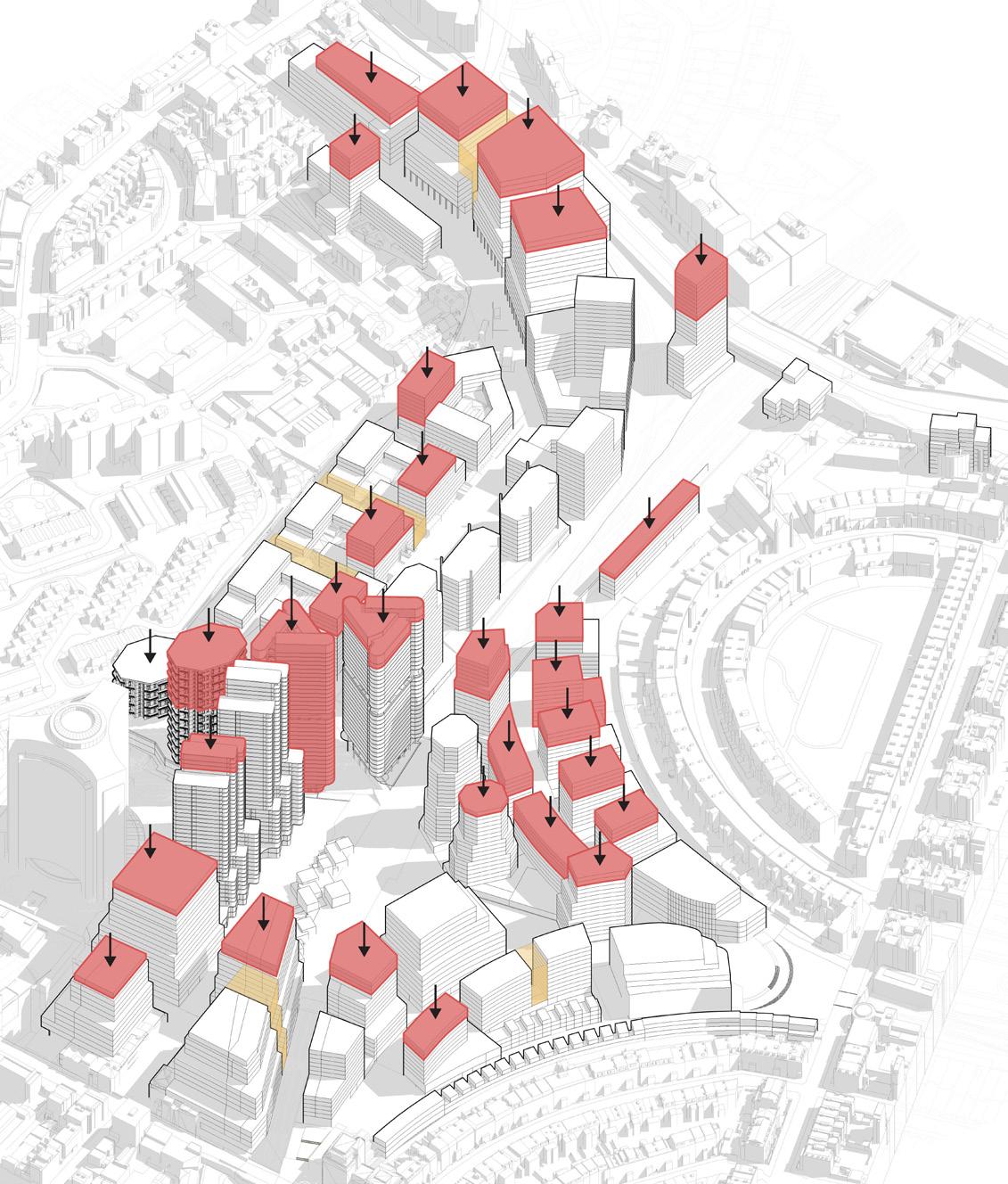
Plan-led approach to tall buildings
As set out in the London Plan (Policy D9), tall buildings can form part of a plan-led approach to facilitating development opportunities and managing future growth, contributing to new homes and economic growth.
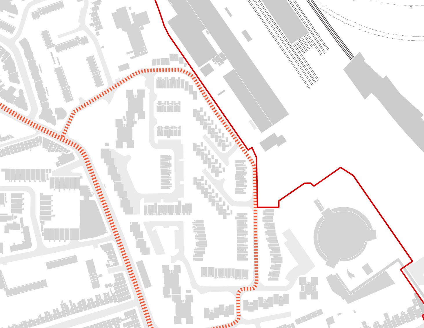
Earl’s Court and West Kensington Opportunity Area
Other Opportunity Areas (adopted boundaries)
Emerging Opportunity Area boundaries
Opportunity Area boundary yet to be defined
RBKC and LBHF boroughs
of London Opportunity Areas
This particularly includes the following:
• Tall buildings can make optimal use of the capacity of sites that are well-connected by public transport and have good access to services and amenities.
• Tall buildings can help people navigate through the city by providing reference points and emphasising the hierarchy of a place such as its main centres of activity, and important street junctions and transport interchanges.
• Tall buildings that are of exemplary architectural quality, in the right place, can make a positive contribution to London’s cityscape, and many tall buildings have become a valued part of London’s identity.
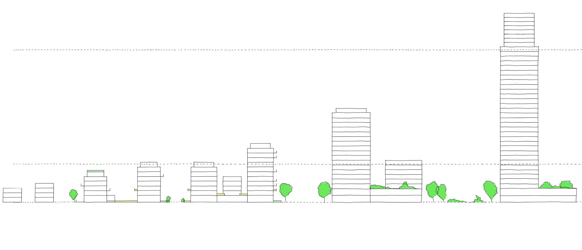
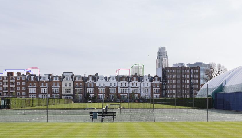
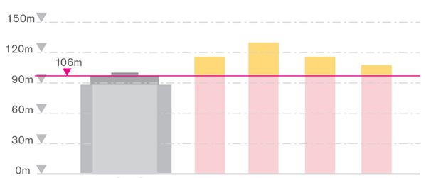
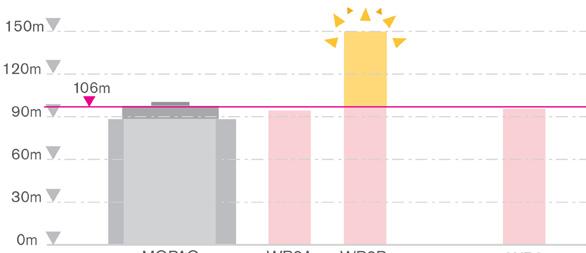
The London Plan sets out that ‘Tall buildings are generally those that are substantially taller than their surroundings and cause a significant change to the skyline. Boroughs should define what is a ‘tall building’ for specific localities, however this definition should not be less than 6 storeys or 18 metres measured from ground to the floor level of the uppermost storey (The GLA threshold for referral under the Mayor of London Act 2028 is 30 metres). The LBHF Tall Buildings Background Paper (2016) sets out that tall buildings are ‘those that are substantially taller than their neighbours and/or which significantly change the skyline’. The RBKC NLPR confirms that a tall building is defined as 30 metres or more at the subject Site.
London Plan Policy D9 (Part B – Locations) sets out that:
1) Boroughs should determine if there are locations where tall buildings may be an appropriate form of development, subject to meeting the other requirements of the Plan. This process should include engagement with neighbouring boroughs that may be affected by tall building developments in identified locations.
2) Any such locations and appropriate tall building heights should be identified on maps in Development Plans.
3) Tall buildings should only be developed in locations that are identified as suitable in Development Plans.
Both the existing and emerging Development Plans for the Site (LBHF Local Plan Policy DC3 and RBKC NLPR Policies CD7 and SA2) set out that the principle of tall buildings in this location are acceptable.
This Design and Access Statement will demonstrate, in respect of the approach to tall buildings, that the Earls Court Development has adopted the design-led approach as required by London Plan Policy D3, the Optimising Site Capacity LPG (2023) and is informed by the Characterisation and Growth LPG (2023).
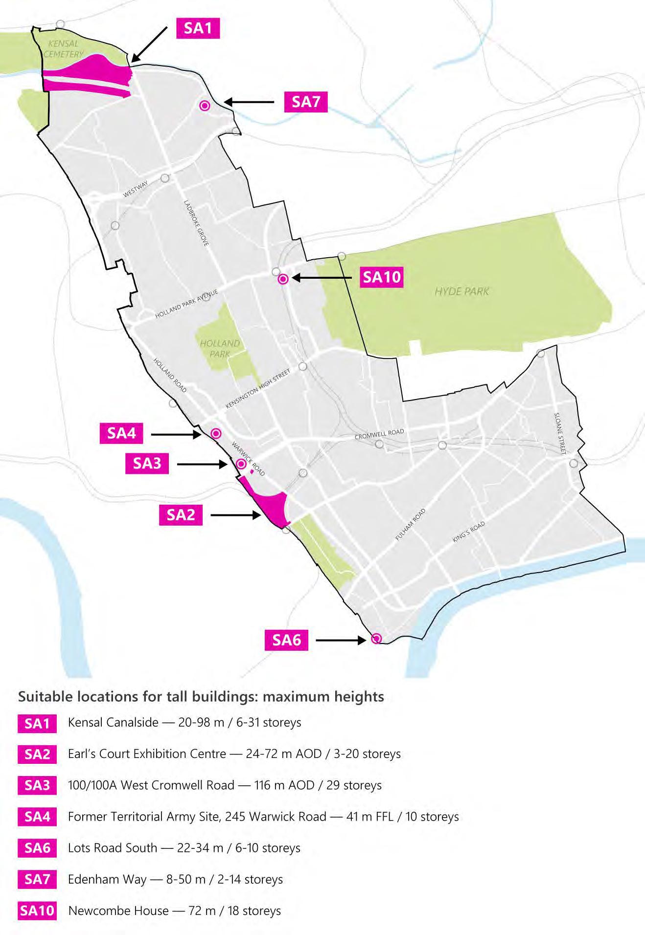
Suitable locations for tall buildings identified in the RBKC New Local Plan Review (identifying SA2 Earls Court Exhibition Centre Site allocation as a suitable location)
Fulham Regeneration Area identified in the LBHF Local Plan
Map
2 The Vision for Earls Court
A Global Legacy
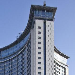
For 150 years Earls Court has been known as a global showcase for innovation, entertainment and excitement. A place known for wonder. A source of entertainment, employment and excitement, the Earls Court Exhibition Centres were alive with activity.
It started when a cabbage patch was transformed into the America Fair, a grand exhibition that brought the Wild West to West London. In the following decades the Exhibition Centres welcomed thousands to global exhibitions and fairs, held seminal rock concerts and global events, and twice played host to events for the Olympic Games.
events and activities that were held at the Exhibition Centres
2.2 How the Vision Has Developed
The vision has been informed by the requirements of the Planning Policy Framework, alongside a detailed character assessment and growth strategy for the Site, following the approach set out by the Characterisation and Growth LPG (2023) and as demonstrated in Chapter 3 of this DAS.
Through early engagement, an understanding of what the Earls Court Site and its history meant to people was established. The days of Buffalo Bill and the Great Wheel at the World Fair Exhibitions, and Pink Floyd at the Exhibition Centres have passed but the legacy and memories of those times live on.
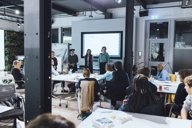
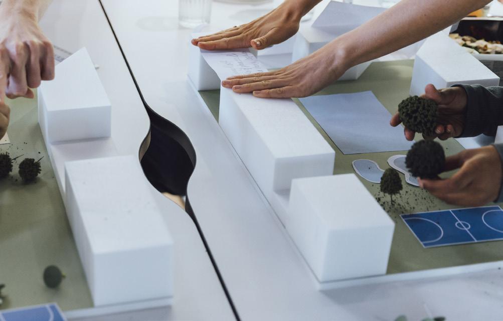
Through a series of collaborative workshops with local residents, community organisations and amenity groups, alongside round-tables with arts, cultural and stakeholder groups—hundreds of people have shared their stories, recollections of the past, thoughts of the present and hopes for the future. Masterplanning Workshops – developing a framework
Photographs from masterplan workshops
2.2 How the Vision Has Developed
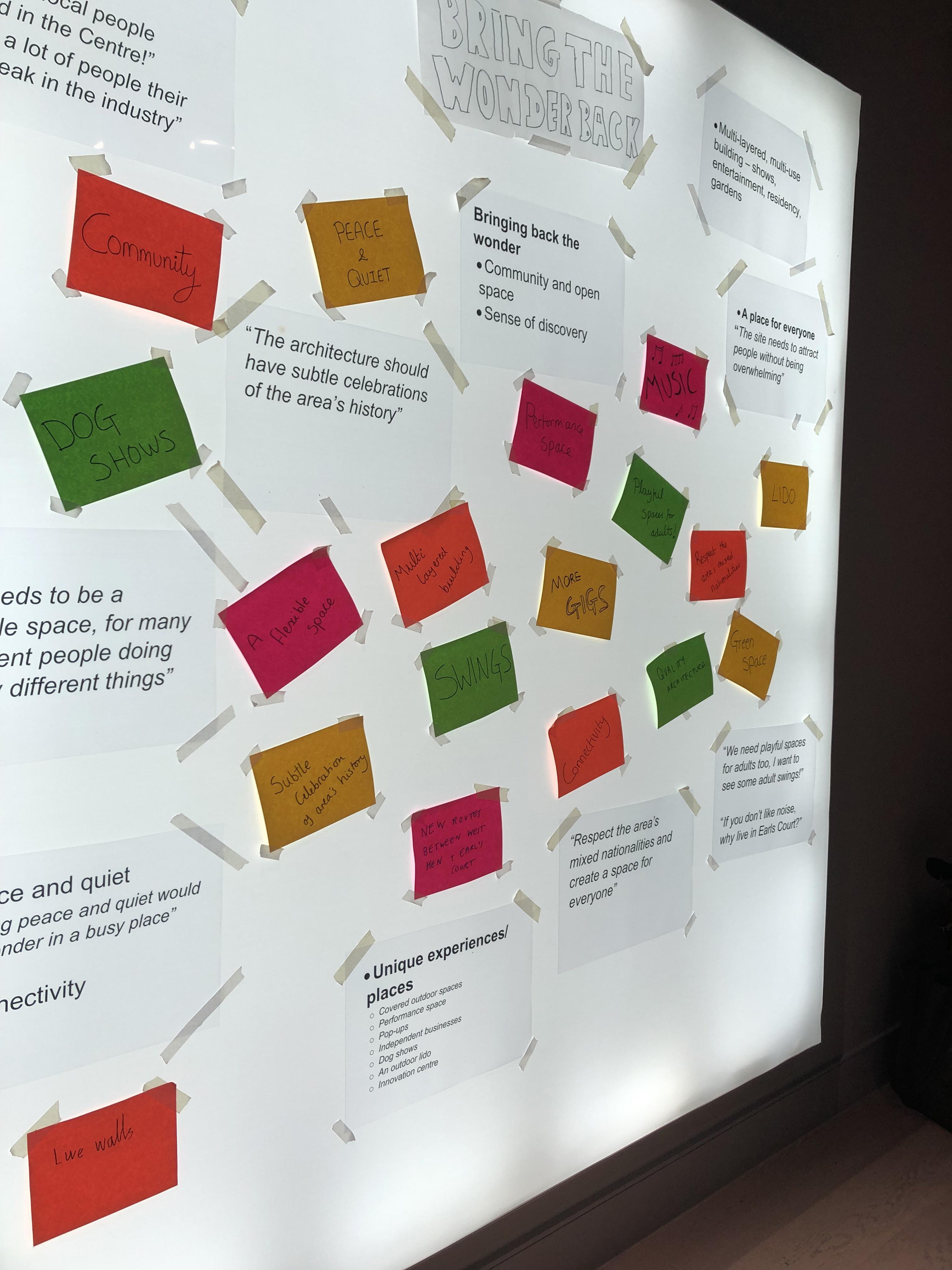
The overwhelming feedback was clear — that Earls Court had been a place of excitement, spontaneity and diversity. The myriad of shows and concerts at the Exhibition Centres brought a buzz to the area that is greatly missed. As important were the skills and training opportunities and the economic impact which the Exhibition Centres had on the local area.
For younger people, for whom the Exhibition Centres had not been part of their past, the conversations focused on what the Site could become in future.
One word came up again and again – wonder.
Community listening: Wonder emerges Responses gathered during the February and March 2022 masterplan workshops. Words have been scaled to be indicative of the level of importance given at the events.
2.3 The Vision: To Bring the Wonder Back
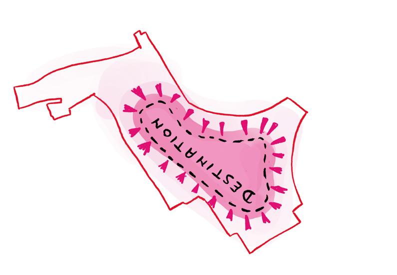
Reinstating the wonder Earls Court was known for will reflect its rich cultural heritage and the sense of excitement which so many experienced.
The vision to bring the wonder back is based on four priorities which emerged through public consultation. These set out the ambition and helped shape the emerging masterplan approach.
Open up the former Exhibition Centres Site for the first time in 150 years — giving back to local communities.
Create a better piece of city — a blueprint for future generations.
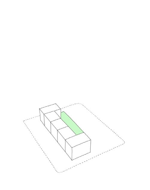
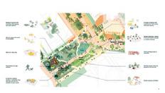
2.4 The Four Place Pillars of Earls Court
Setting the standard for future urban development, Earls Court will re-emerge as London’s place to discover wonder.
During consultation, the question ‘why would you come here’ was repeatedly asked. This led to the evolution of four place pillars which will create the identity for Earls Court.
The vision evolved into a masterplan based around four place pillars:
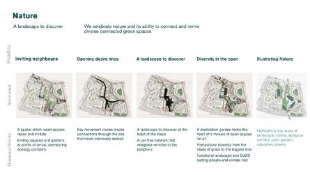
A celebration of nature and its ability to connect and revive
2.4 The Four Place Pillars of Earls Court
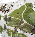
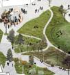
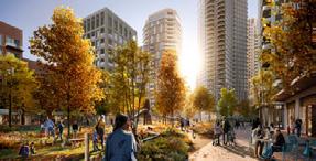
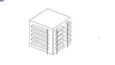
A celebration of nature’s ability to connect and revive
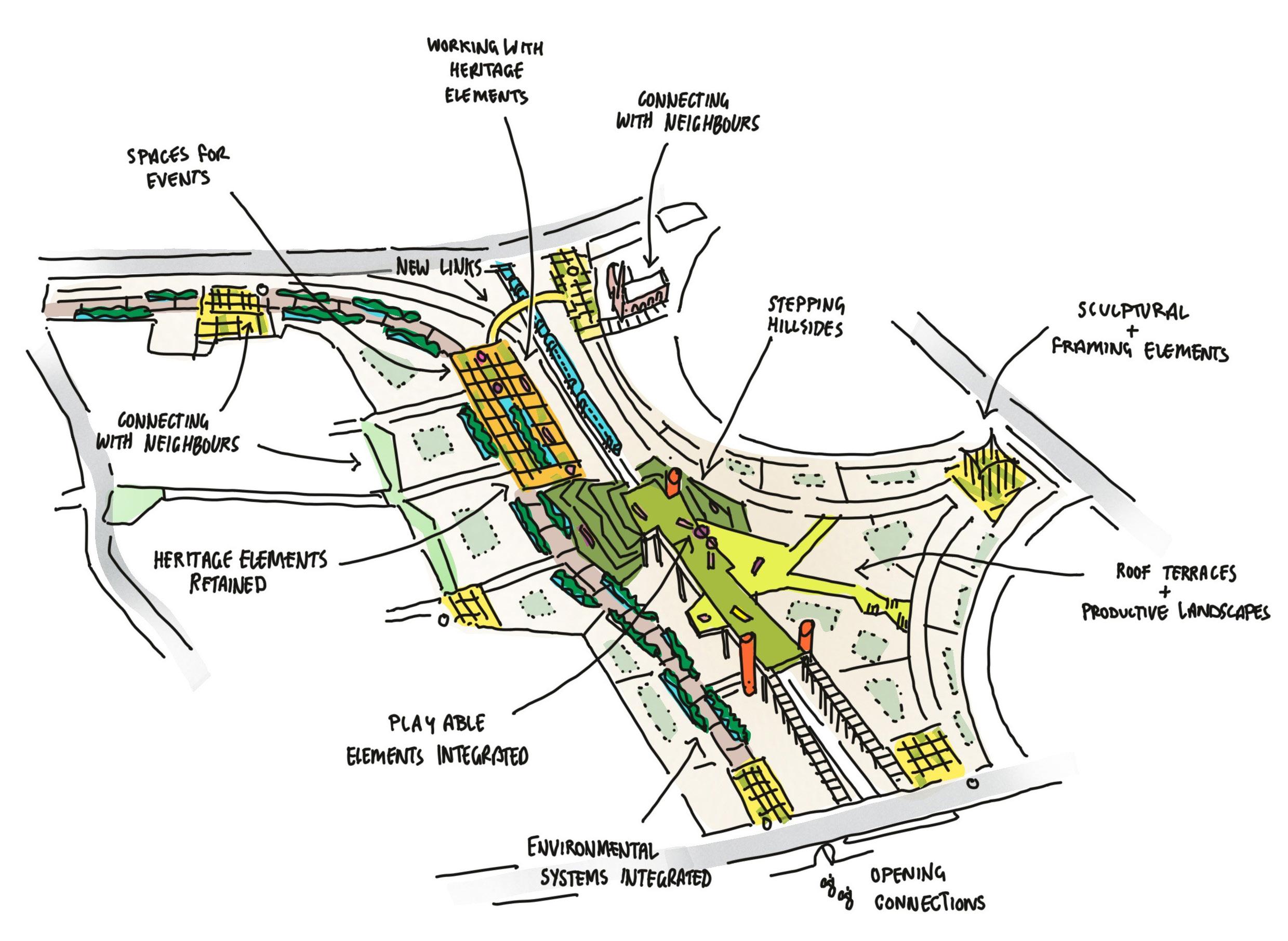
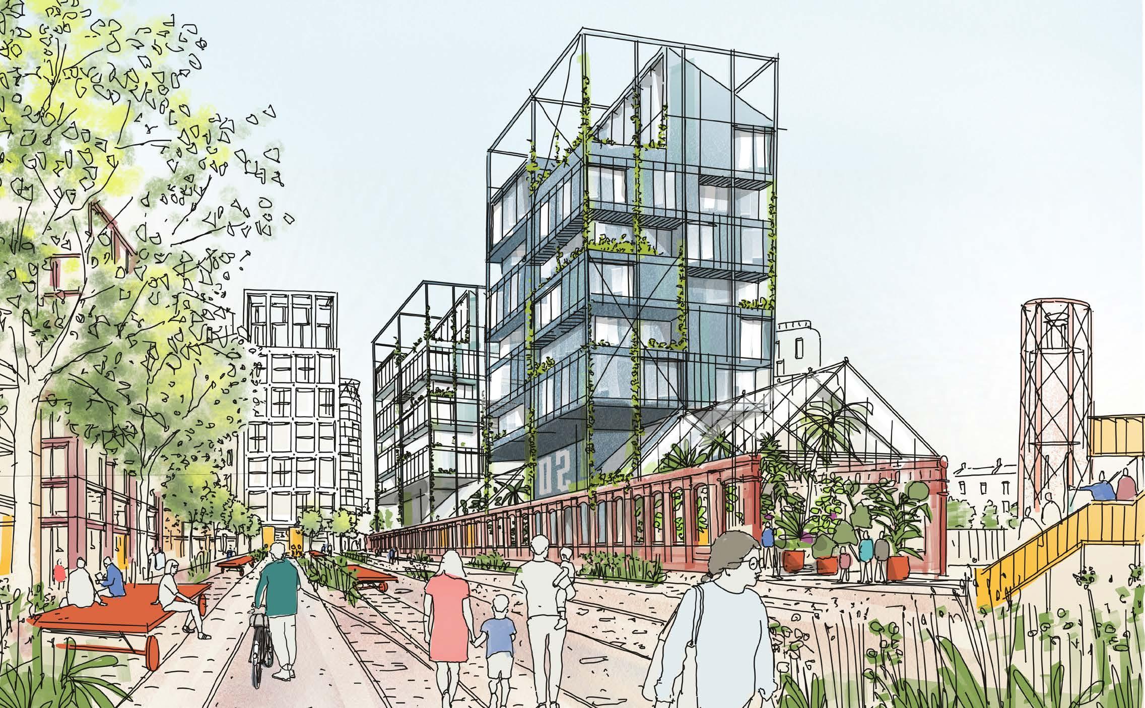
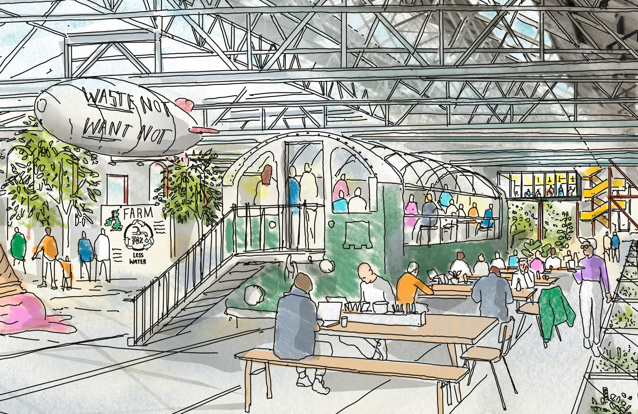
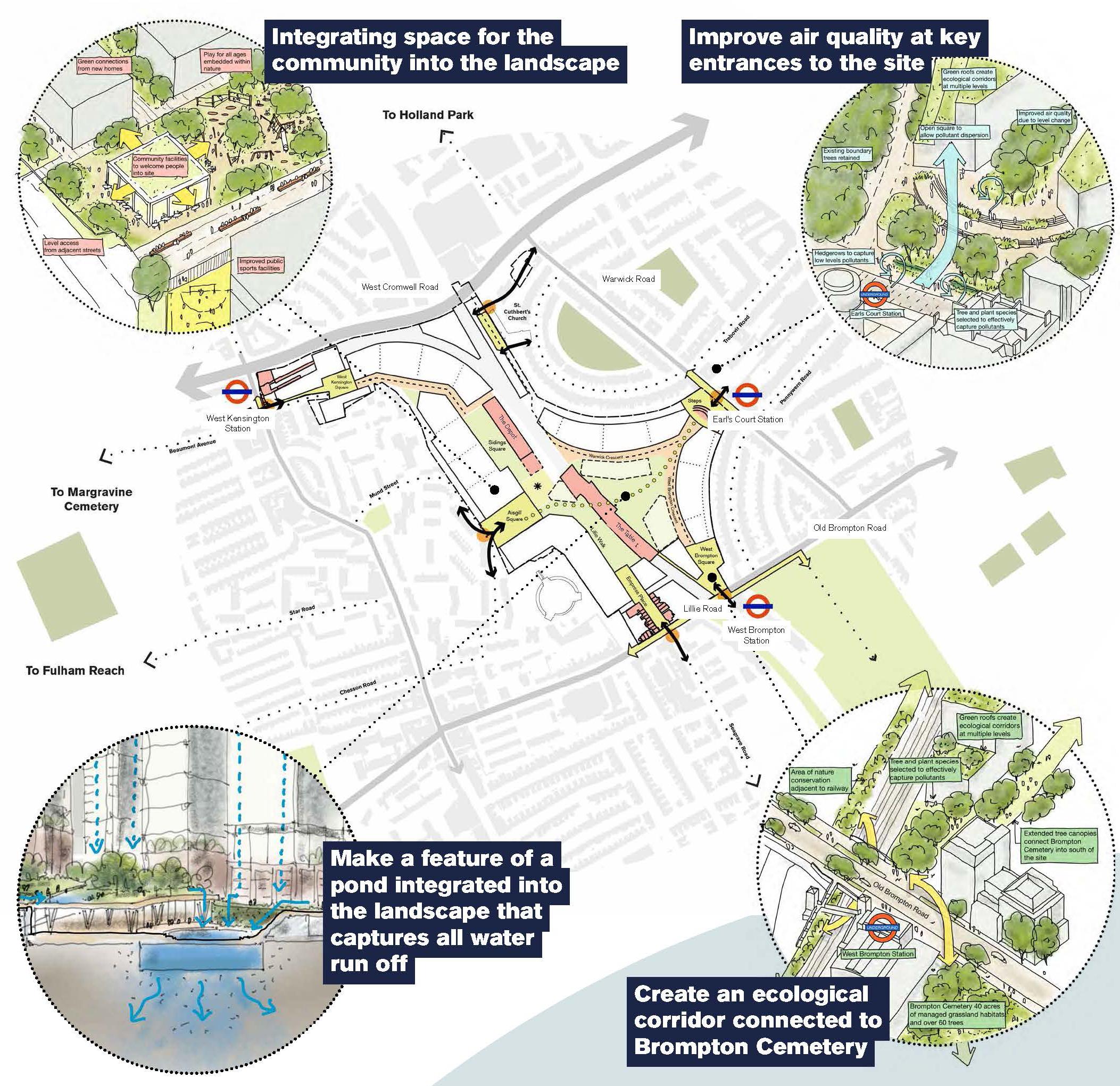
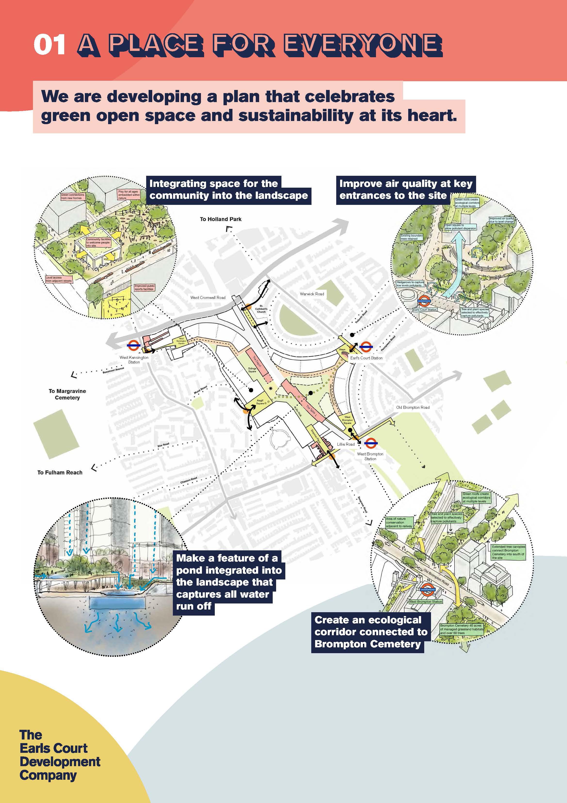
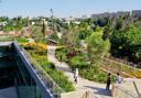
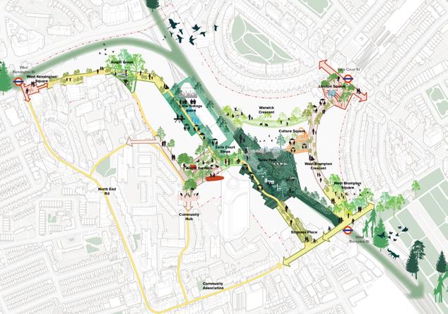
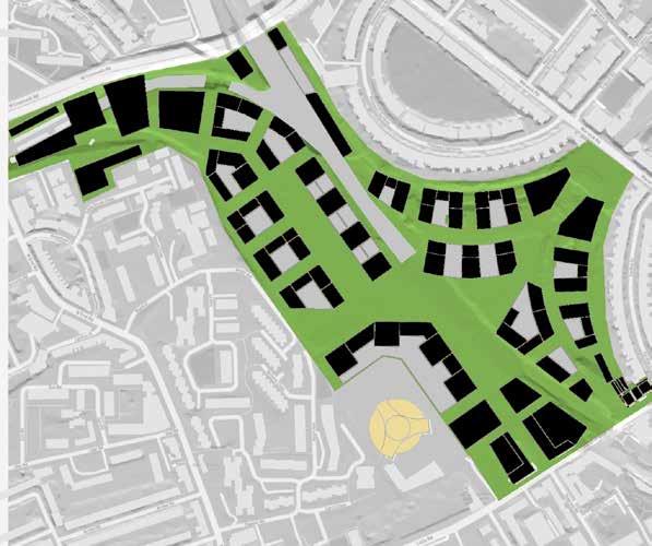
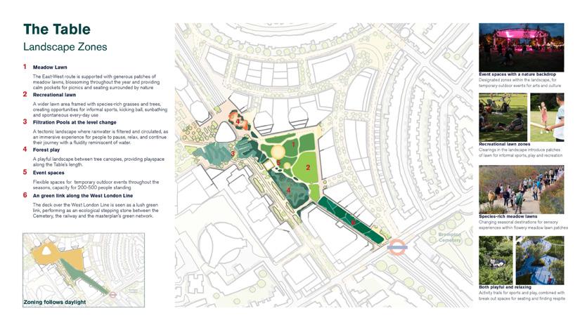
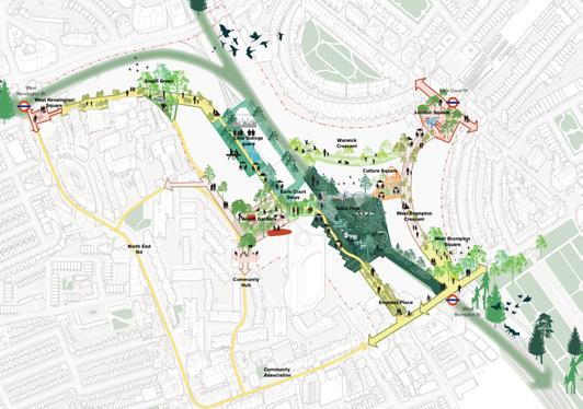
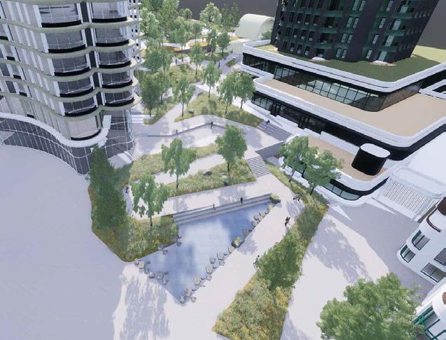
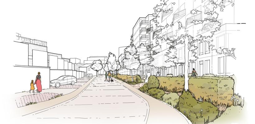
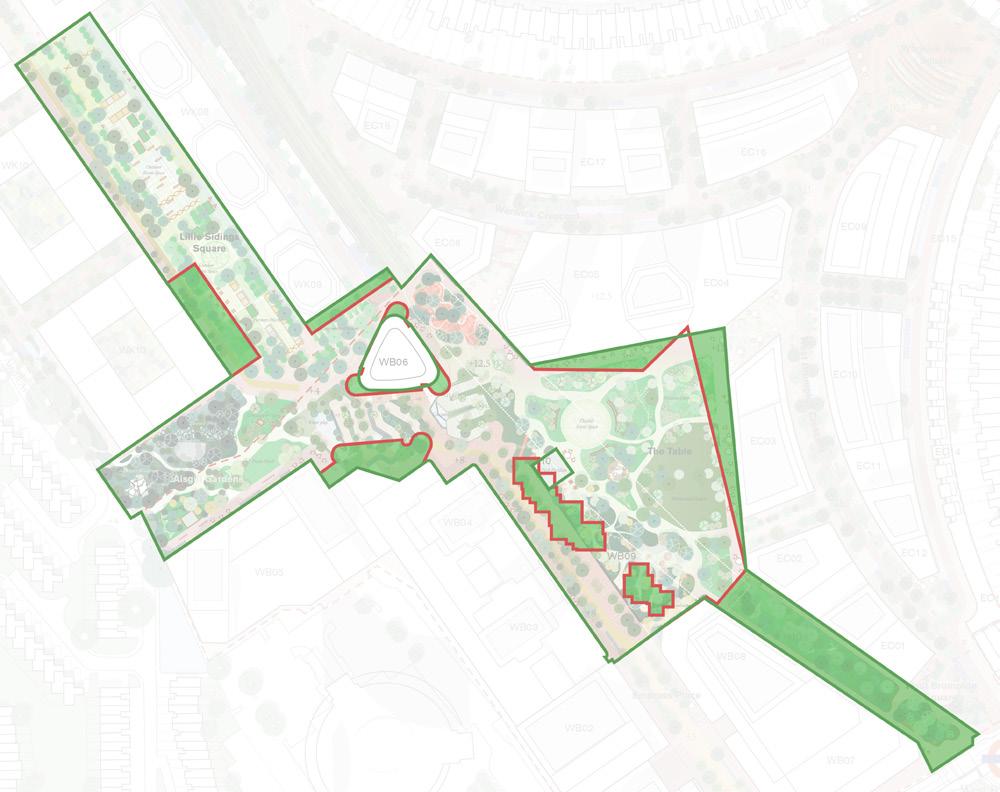
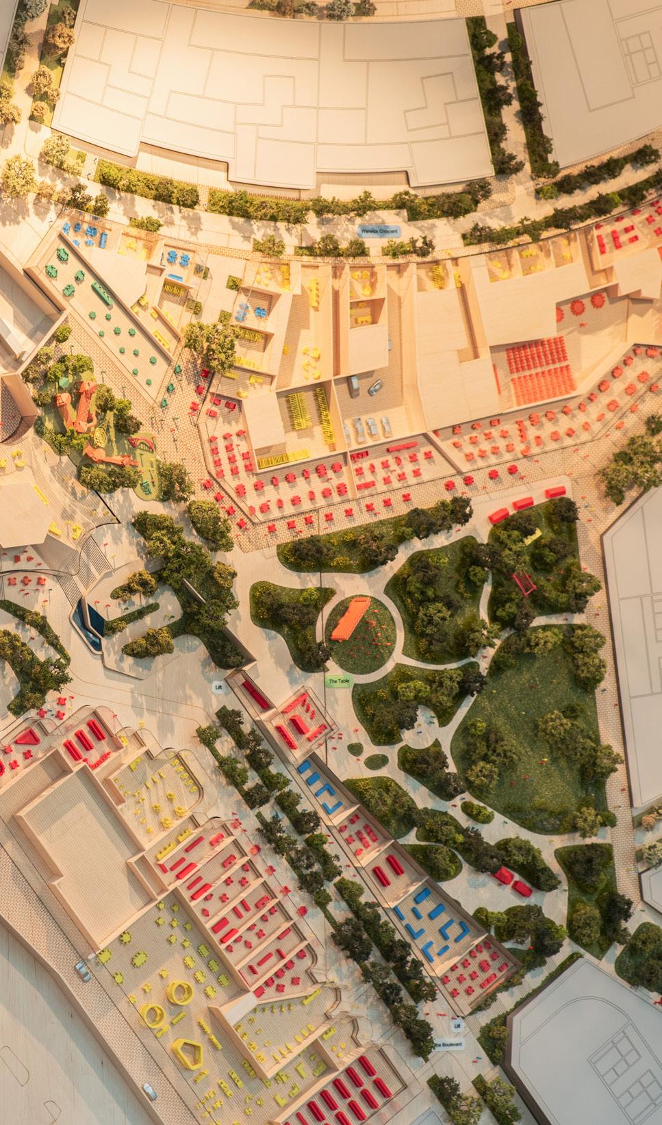
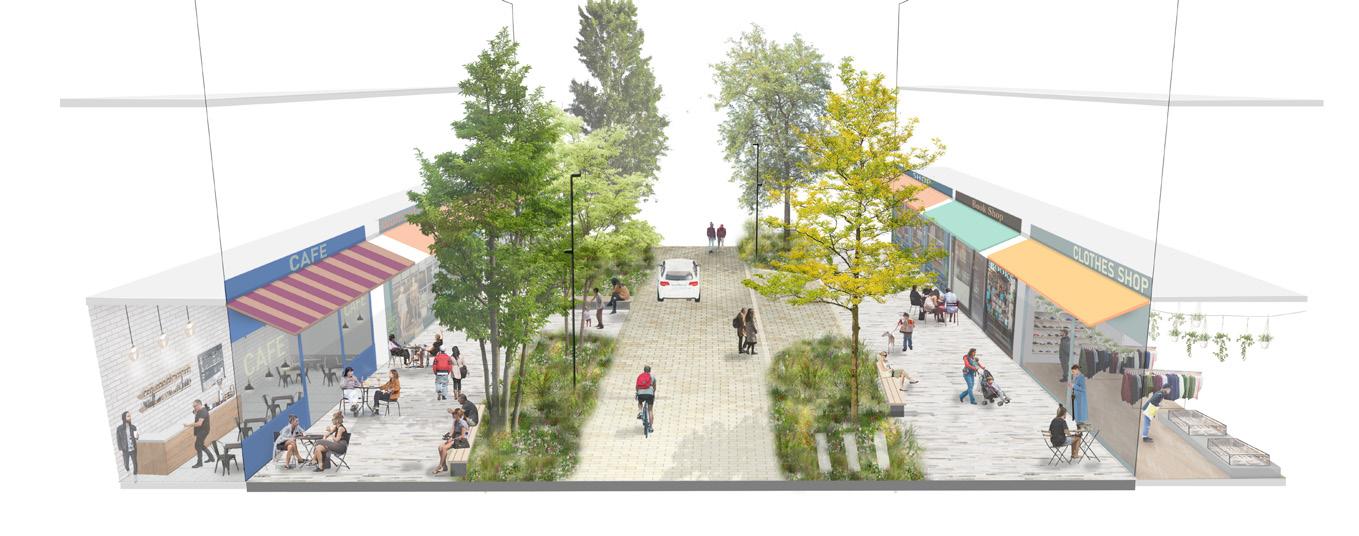
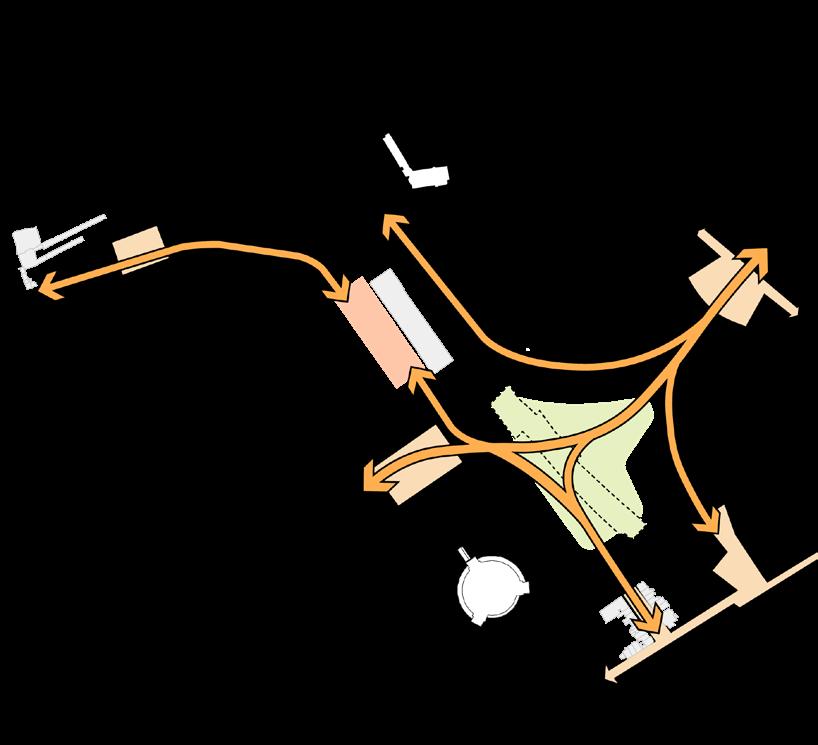
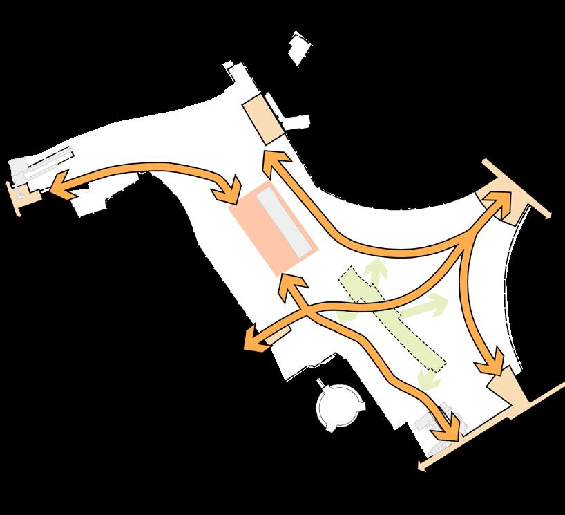
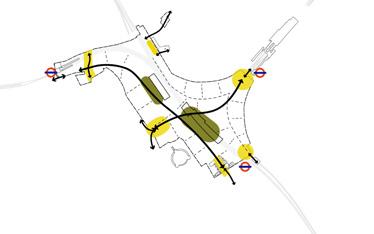
Nature is the golden thread through the masterplan; conversations locally emphasised how important this is. Earls Court will consist of a network of Exhibition Gardens; a series of areas with changing character, connected through landscaped pedestrian routes taking you across the Site and embedding climate resilience.
c. 20 acres of public realm and green space for all to enjoy
Over 1,000 new trees will be planted throughout the Site
Connecting biodiversity east-west and north-south for planting and wildlife
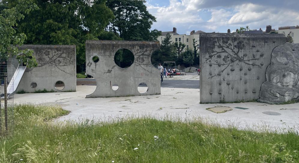
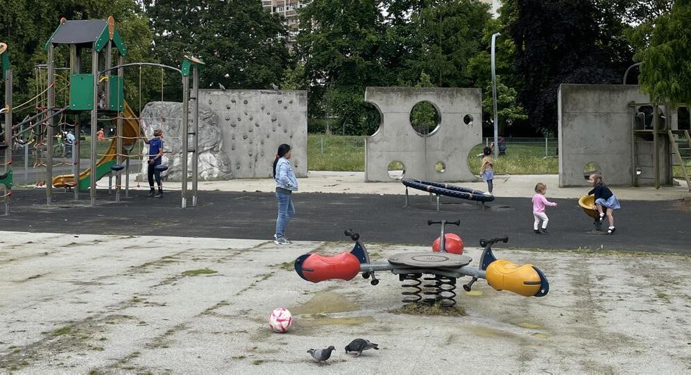
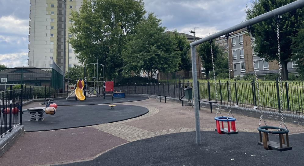
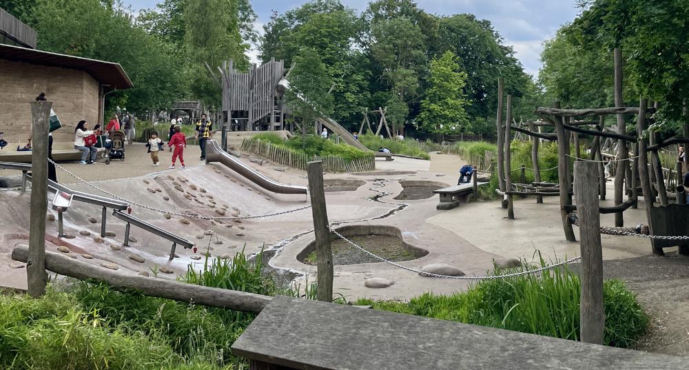
c. 2.75 acres of new play space for all ages
Climate resilient planting for all seasons in landscapes and buildings
Reusing water to irrigate, interact and cool
Accessible landscapes to navigate the 8 metre level change
Includes a c. 4.5 acre urban park Improved air quality
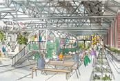
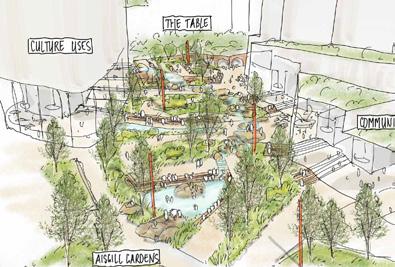
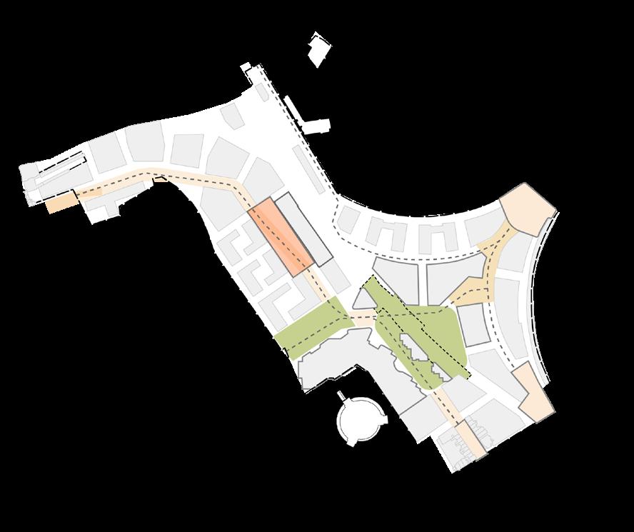
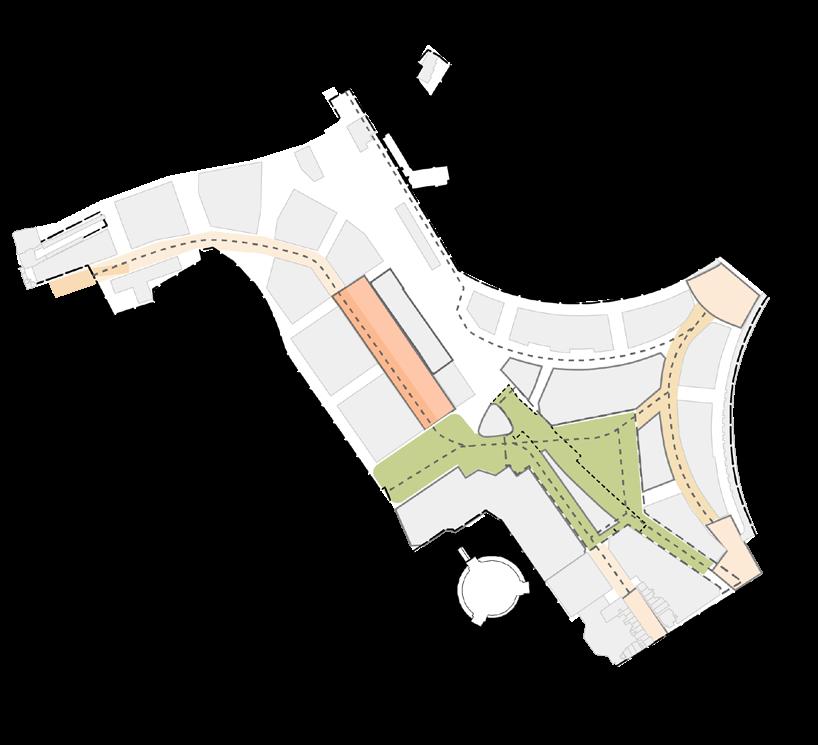
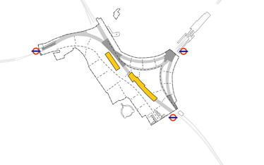
The Cascades linking the Table Park, Empress Place, Aisgill Gardens and Lillie Sidings
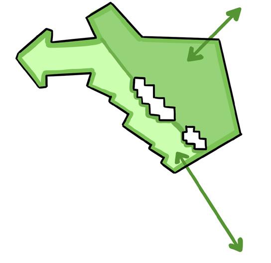
Place Pillar Axonometric: A network of Exhibition Gardens
2.4 The Four Place Pillars of Earls Court
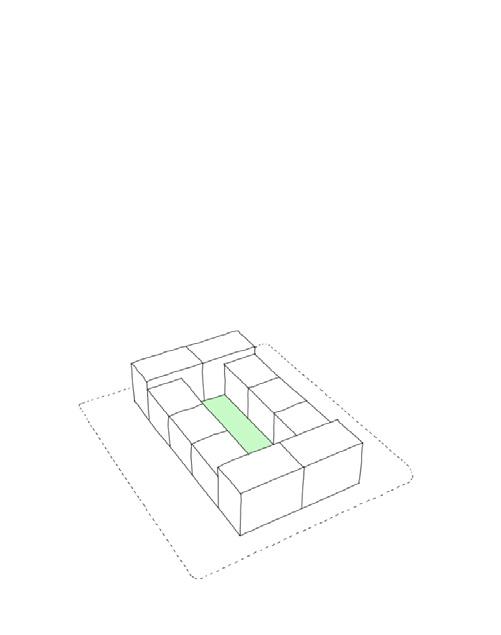
A showcase for climate and clean innovation and skills
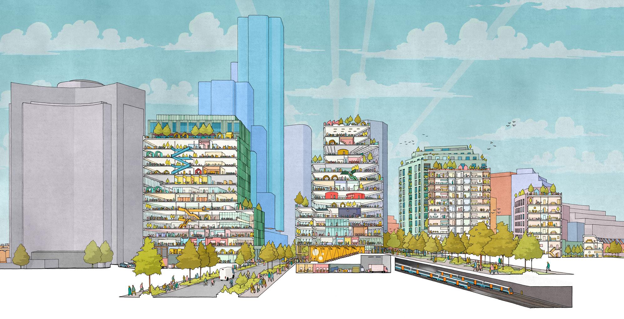
The future is clean: the European climate tech market is worth €95bn, doubling in value every year since 2020. It is anticipated to support two million skilled jobs in the UK by 2030. The Earls Court Development will endeavour to create a home for this industry with a workspace ecosystem supporting start ups, scale ups and multinationals, designed to foster collaboration and innovation.
ECDC will work with partners to equip the next generation with vital skills in STEAMMM (Science, Technology, Engineering, Arts, Maths, Media and Medicine), bringing over 12,000 jobs to Earls Court.
Co-working space enabling start up and scale up businesses
A sustainable development improving air quality and water management on the site Up to 2.5 million sq ft of workspace across three locations Bespoke lab / office / research and development space, to meet high demand
Working with partners to equip the next generation with vital skills bringing c. 12,000 jobs Zero carbon
Place Pillar Axonometric: A network of innovation clusters
2.4 The Four Place Pillars of Earls Court
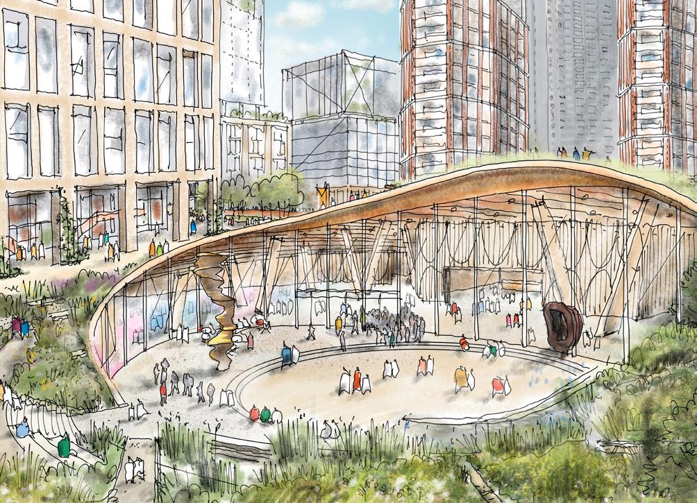
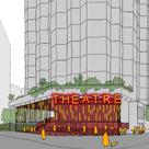
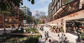
A cultural ecosystem for the future of talent
Earls Court has a magnificent heritage of live events. The area is famous for creativity and performance. Culture is central to re-establishing Earls Court as a destination for arts and entertainment once more.
The masterplan will provide a range of cultural venues, such as performance spaces, production studios and pop ups to support the creative community and attract world-class talent. This cultural ecosystem will benefit local cafés, shops and restaurants and enliven streets all day and into the evening.
3 main cultural venues, around which culture and creatives can cluster
2.4 The Four Place Pillars of Earls Court
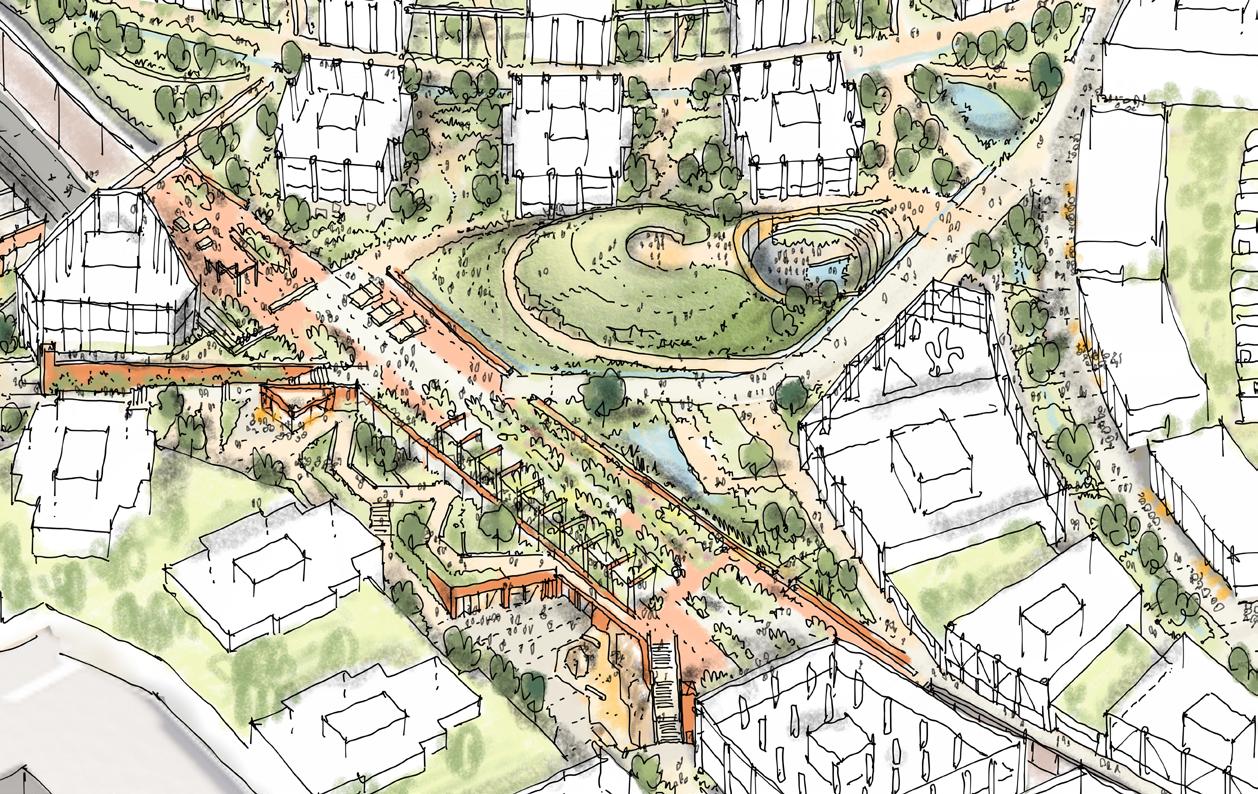
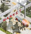
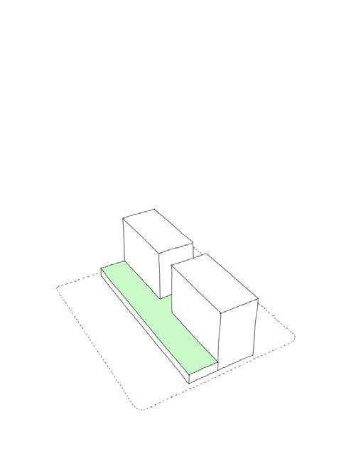
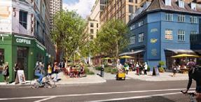
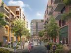
An inspiring neighbourhood designed for all stages of life.
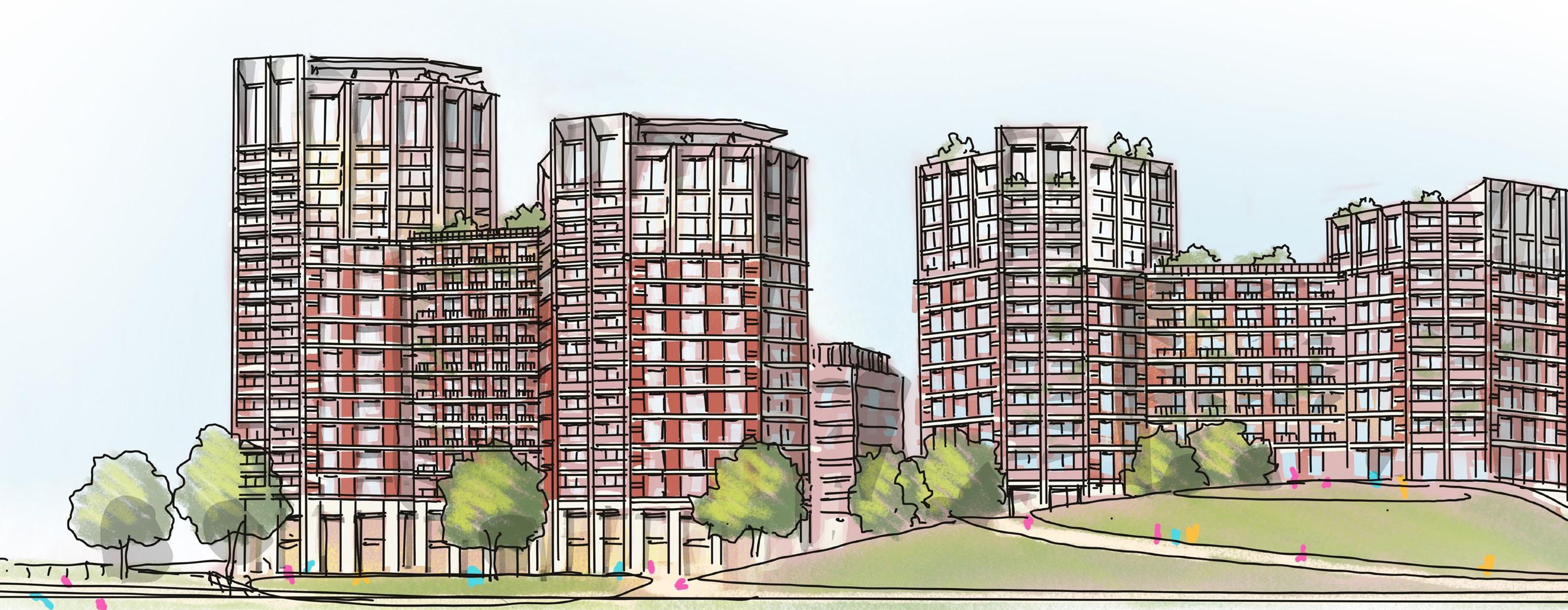
Earls Court will reflect the brilliance of London. It will be inclusive and accessible to all. A full range of housing types and tenures will be provided to enable people at all stages of their life to find a home in Earls Court, creating an intergenerational community. These homes will be operational net zero and designed for long term climate resilience.
c. 3,900 new homes
Targeting 35% affordable homes across the Site
Homes for sale, for rent, for older people, for students and for post-grads
Up to 2 childcare facilities
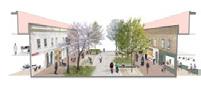
Lively streets with local amenities for residents
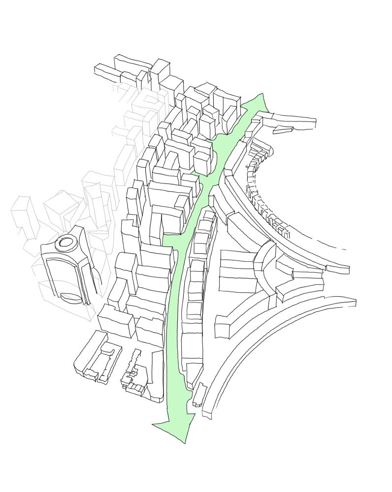
A new Community Hub and 8,000 sq ft of additional community and healthcare facilities
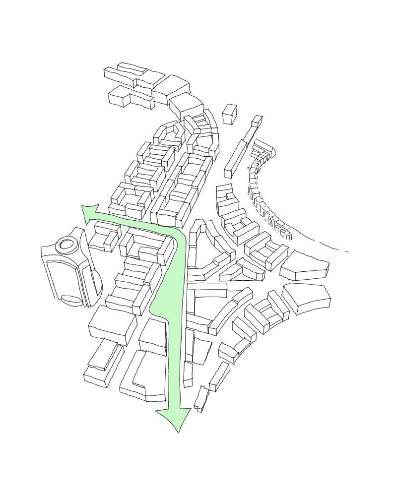
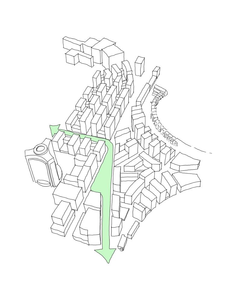
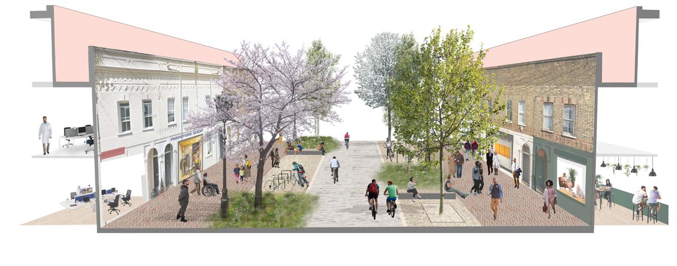
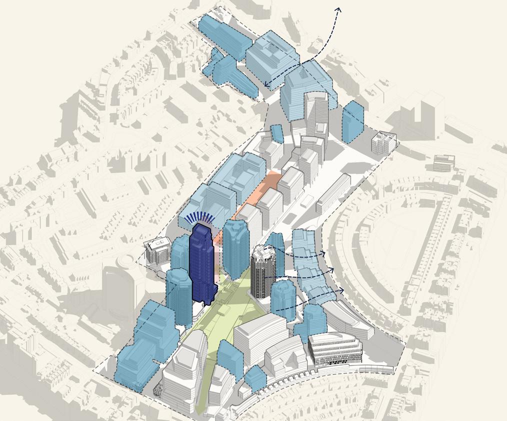
An 850m long active boulevard (the length of Regent Street, from
c. 100 retail, dining and leisure spaces
Zero carbon, low cost energy for all homes
Lillie Sidings Square will form the heart of the neighbourhood to the north of the development
Piccadilly Circus to Oxford Circus)
Place Pillar Axonometric: An inspiring neighbourhood with a wide variety of housing types and tenures
2.5 A Commitment to Design Excellence
Building on the place pillars, ECDC has set out design principles to guide the development of the first buildings and deliver on a commitment to design excellence.
ECDC is focussed on enabling future trends and delivering a positive legacy. The Design Team’s role is to design a solution for the Site which delivers a global exemplar of sustainable development.
The ambition is to create a place with personality which is accessible and welcome to all, a blueprint for future generations. This will be ensured by applying these design principles throughout the evolution of the development.
A New West Side Story
To celebrate the heritage of a place that has always embraced the opportunity to be different and made a strategic contribution to the future of this great city through innovation and entertainment; creating a new destination which puts Earls Court confidently back on the map and changes perceptions of West London.
Be Good Ancestors
Constantly thinking beyond today, working collaboratively to leave a better piece of city for existing and future communities, delivering the ambition to create the heritage of the future through exemplary design and sustainability.
An Earls Court for Everyone
The opportunity, privilege and responsibility of designing this new neighbourhood, one with people at its heart. A neighbourhood that brings people together, where they feel welcome, safe and included, a sense that this is truly for everyone.
2.6 The Sustainable Development Charter
ECDC is committed to delivering an exemplar development at Earls Court, a blueprint for future living, creating a resilient masterplan, considering the future, through sustainability and exceptional design. This means delivering innovative buildings and spaces, enhancing the environment, producing economic benefits for the widest number of people, and creating significant social and economic value for the local area. The development aspires to have a positive sustainable impact not just within the Proposed Development but beyond the boundaries of the Site.
The focus on sustainability has run through and informed all aspects of the development proposals and processes. From dayone to in use, across ECDC’s own internal operations to meanwhile uses, and the way in which the team works with all stakeholders –from suppliers and contractors, to tenants, occupiers, partners and neighbours. These are ECDC’s principles for future living: to be people-centric and planet-conscious.
The Sustainable Development Charter (SDC), ‘Principles for Future Living’ sets out goals and objectives for three focus areas: social value, economic inclusion and environmental wellbeing. The goals underpin the vision and key priorities. Each goal has a clear set of metrics and targets that will allow measurement of performance and support continuous improvement, all with the aim of driving the best sustainable outcomes for all.
The purpose of the Charter is to:
• Show how ECDC intends to build a sustainable Earls Court from meanwhile activities through development and during occupancy.
• Provide the basis for the way ECDC will measure and report on progress.
• As a result, establish the means to improve performance yearon-year for the good of the Earls Court community.
• Provide a mechanism by which those who live, work, and visit Earls Court can assess the extent to which ECDC has delivered.
It is not intended to be a ‘fixed‘ statement, but a Charter that will adapt and develop over time to suit the shifting programme of the development, and to better suit the changing needs of the communities and stakeholders.
PRINCIPLES FOR FUTURE
The Sustainable Development Charter, ‘Principles for Future Living’
A Sustainability Charter for Earls Court
2.6 The Sustainable Development Charter
Social Value
The generation of social value is, and will continue to be, a core driver in everything ECDC does. In the context of Earls Court, social value is defined as ‘the importance that people (and society) place on changes to their lives caused by the actions and activities of ECDC.’ The social value created will be measured and reported on a regular basis. This measurement will be governed by the 11 OECD Dimensions of Wellbeing, and the guidelines set out for Social Return on Investment.
Economic Inclusion
ECDC’s mission is to deliver the very highest standards of economic inclusivity, to involve and benefit the widest number of people and local communities in and around Earls Court who are directly and indirectly affected by the project throughout its lifetime. Economic inclusion will be achieved when the widest range of people benefit from the advantages created by the development. This commitment will apply during design and construction as well as in the longer-term; through postoccupation and operation.
Environmental Wellbeing
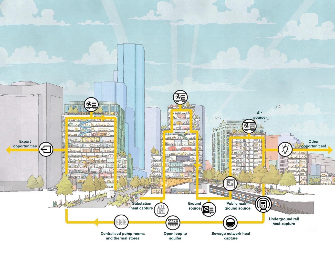
ECDC’s aim is clear – to ensure impacts are climate positive, to respect and live within collective environmental limits, now and for tomorrow. One of the goals is to go beyond net zero carbon: simply put, to remove more carbon emissions from the atmosphere over the lifetime of the development than are emitted during the design, construction and operation of the scheme.
To ensure this is verifiable, ECDC will measure progress against independent and internationally recognised environmental assessment methodologies to evidence and validate the outcome. For a first step ECDC has signed up to the UN Race to Zero campaign, aligned with Science Based Targets to guide and validate this ambition.
► For more information on the sustainability strategy refer to Sustainability Strategy (EC.PA.21).
► For more information on sustainability within the Illustrative Masterplan refer to Design and Access Statement Volume 1: Outline Component / Spatial Strategies / Sustainability (EC.PA.08).
► For more information on the socials values of the project refer to Social Value Statement (EC.PA.45).
The goals are as follows:
A safe, inclusive and supportive place for everyone
Involving local people A wonderful place to live, work and visit
Maximise appropriate economic growth in the local area
net zero carbon
Provide access to economic opportunities for all
Create an affordable community
neutral Celebrating and enhancing our natural environment
3 Site Context and Analysis
3.1 The Opportunity
Characterisation and capacity for growth assessment
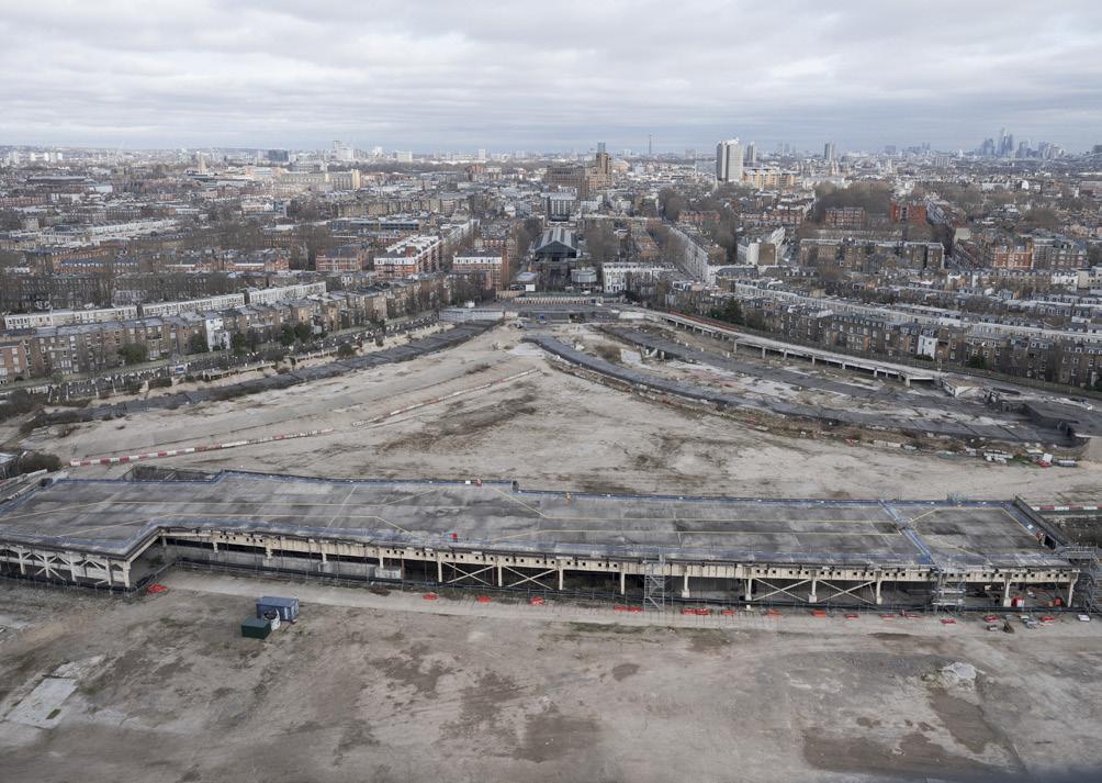
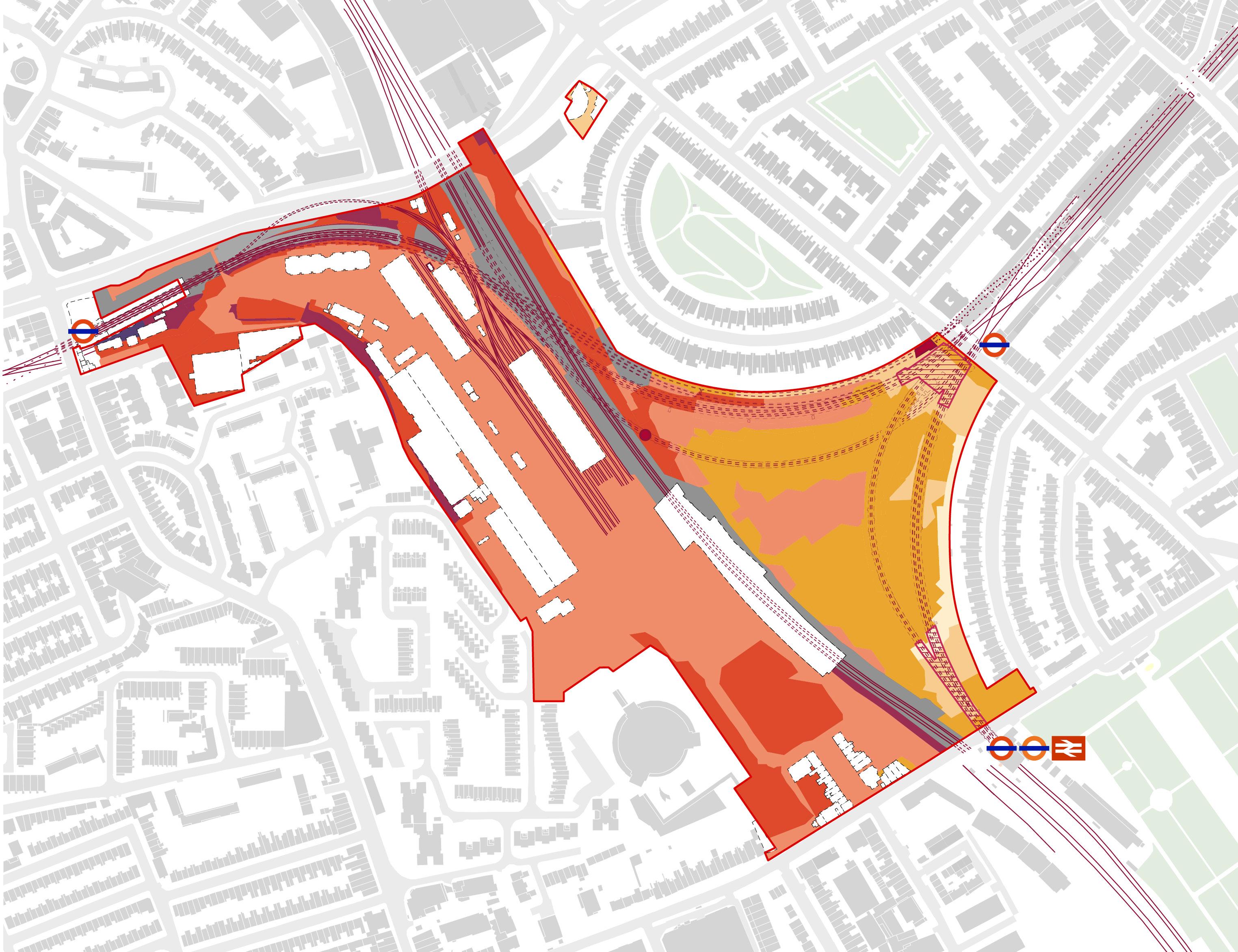
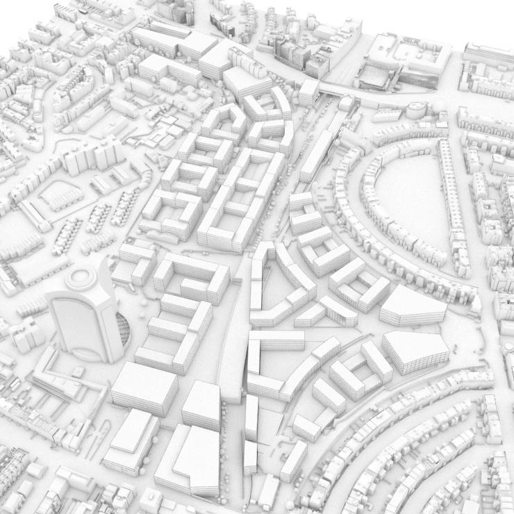
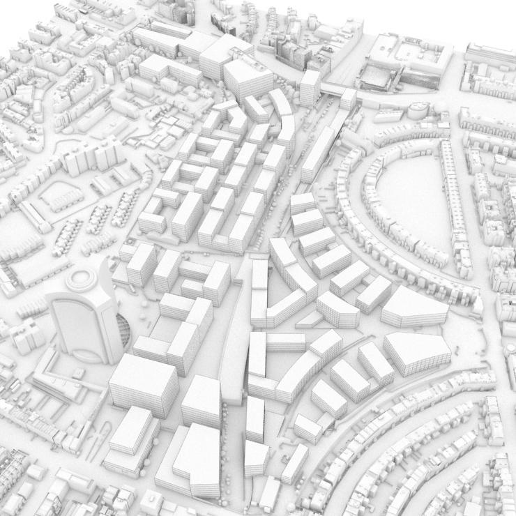
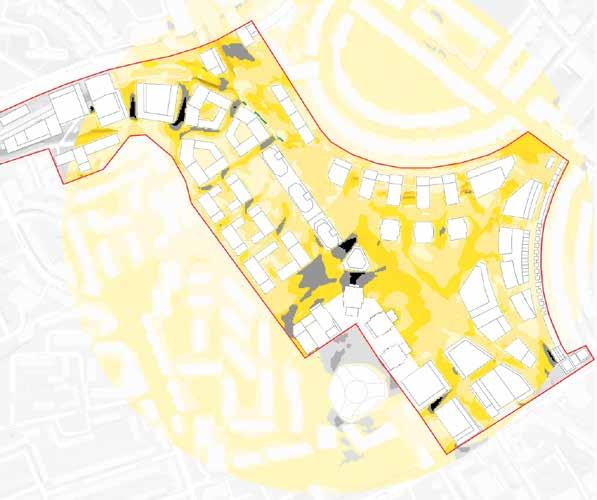
A decade after the demolition of the Exhibition Centres, the Earls Court Site is a gap in the urban fabric of West London. The infrastructure that shaped it as well as its extraordinary legacy have helped inform the proposals for its future.
A thorough strategic and contextual analysis and technical understanding of the Site has informed the design-led response. This chapter summarises the key considerations that have informed the approach to the framework, following the process outlined in the Characterisation and Growth Strategy LPG (2023). This includes:
• Character survey and analysis of the wider area and the Site itself
• An evaluation and appraisal of local character to understand the Site’s sensitivity to change
• Setting out the level of change and capacity for growth for the Site
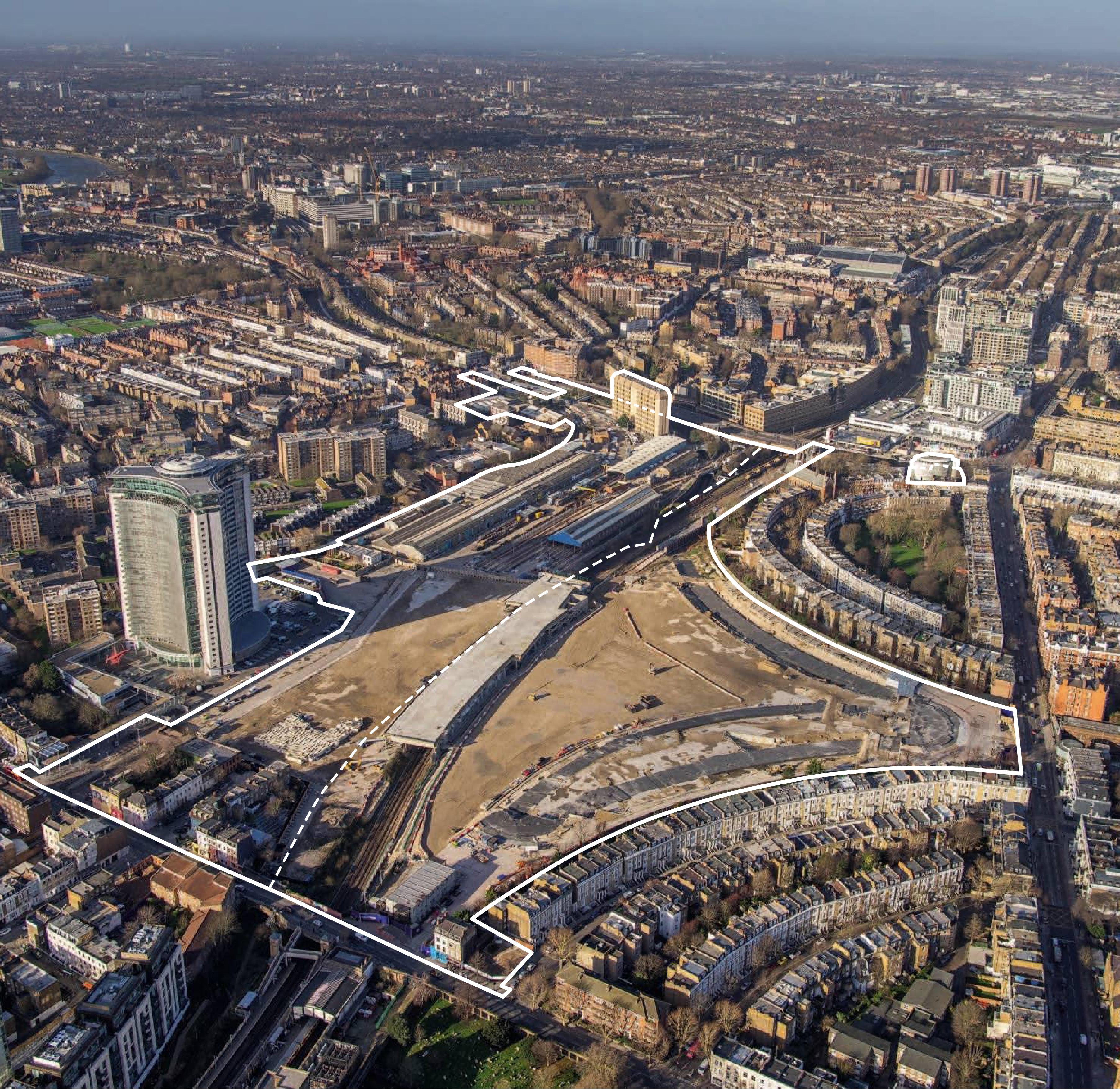
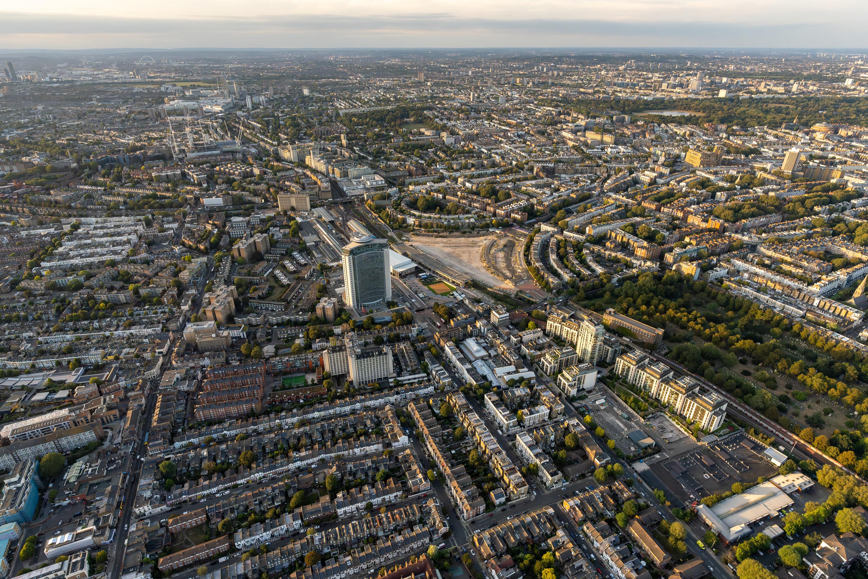
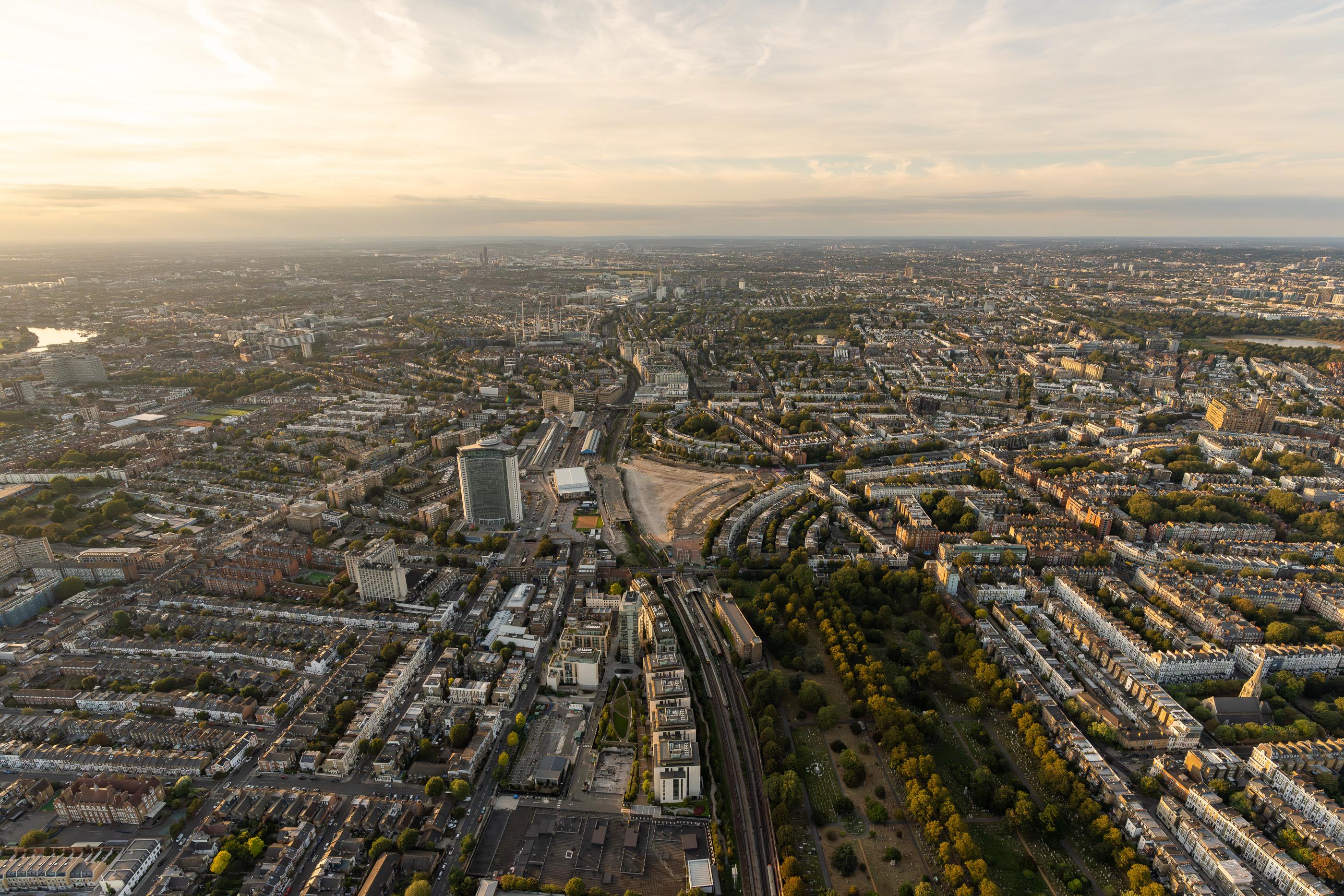
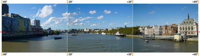
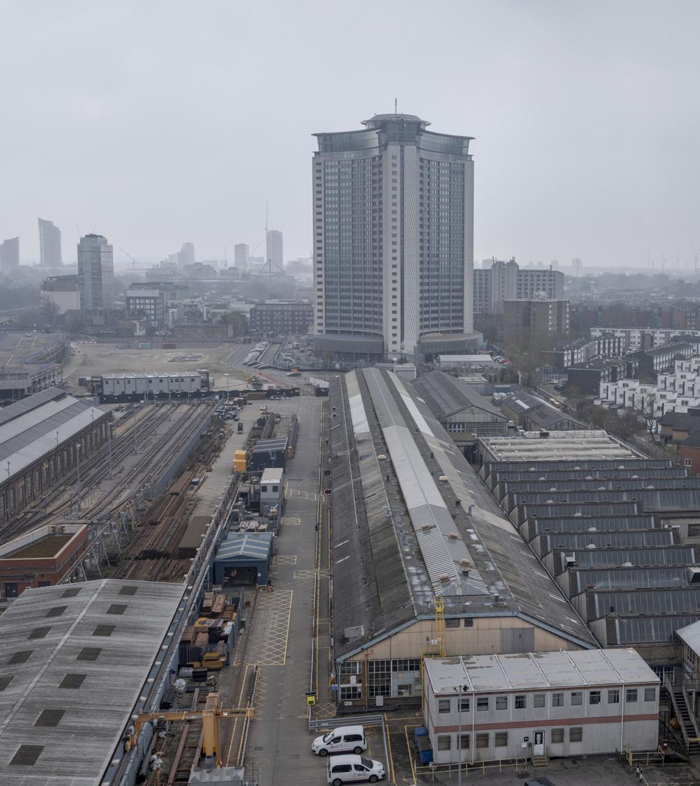
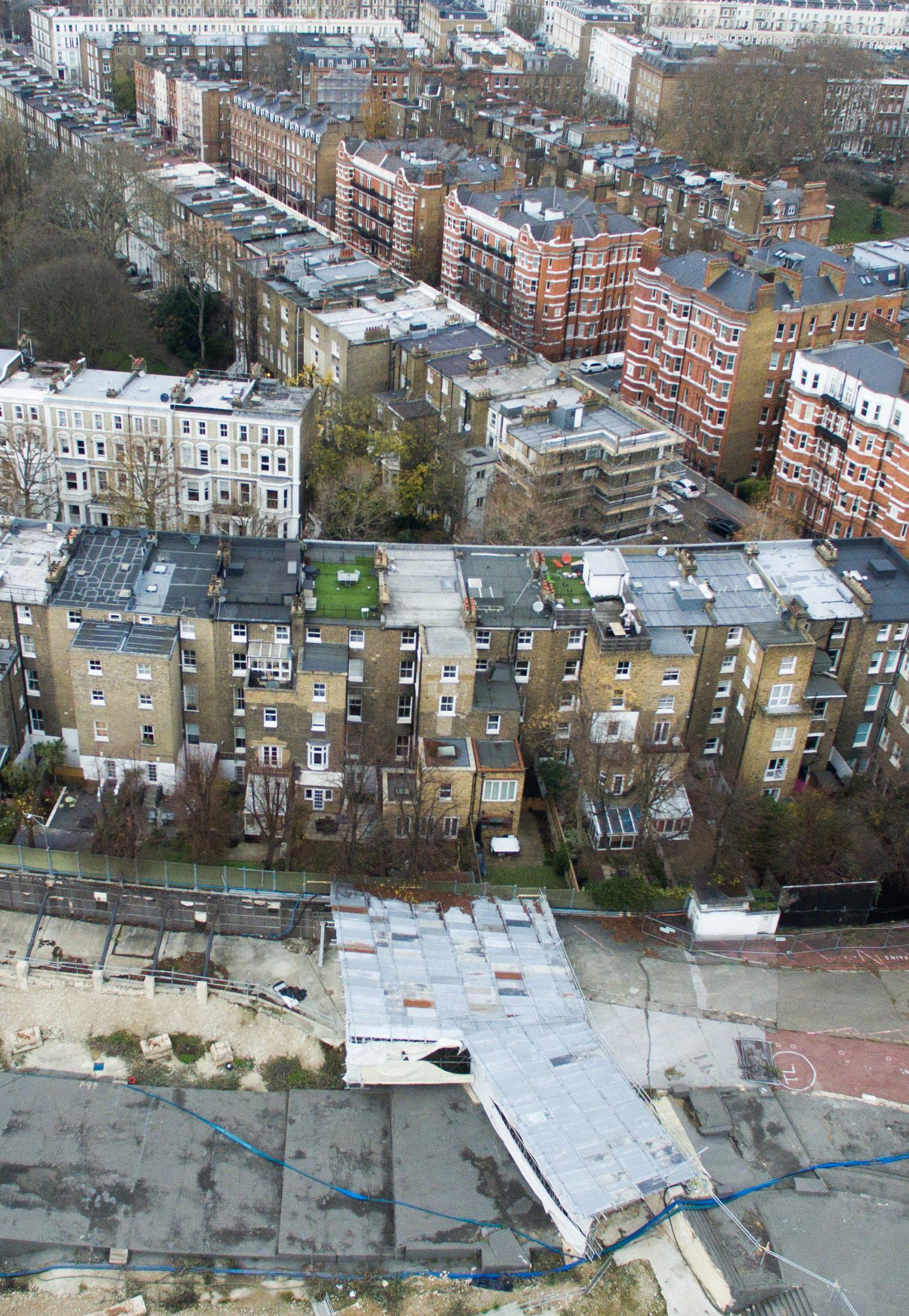
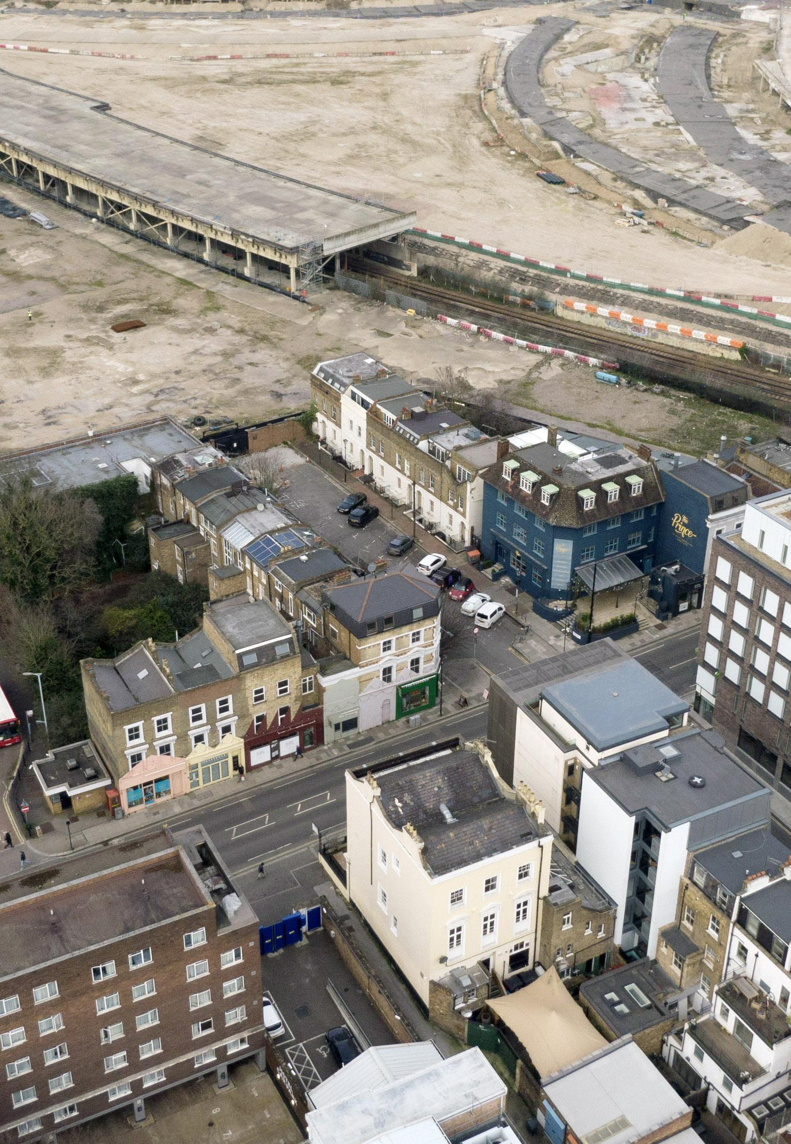
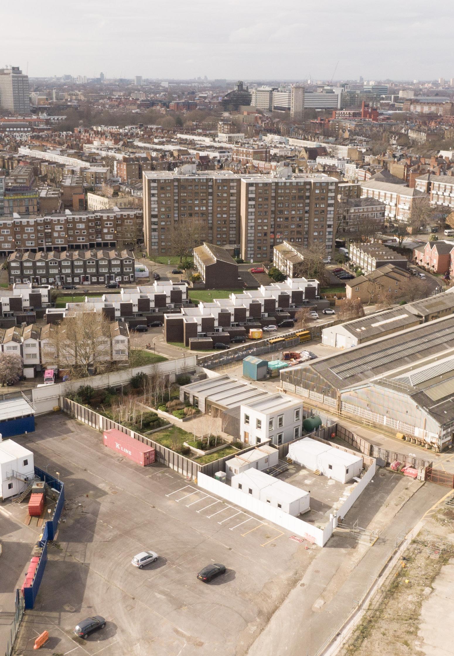
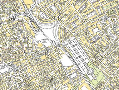
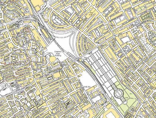
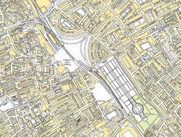
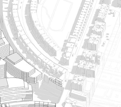
Aerial view of the Earls Court Site from the north in September 2023
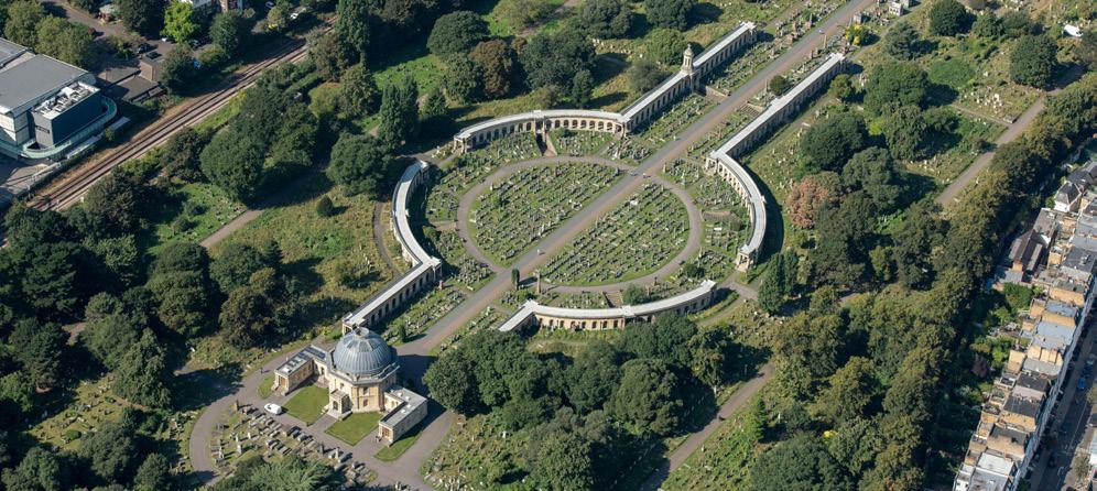
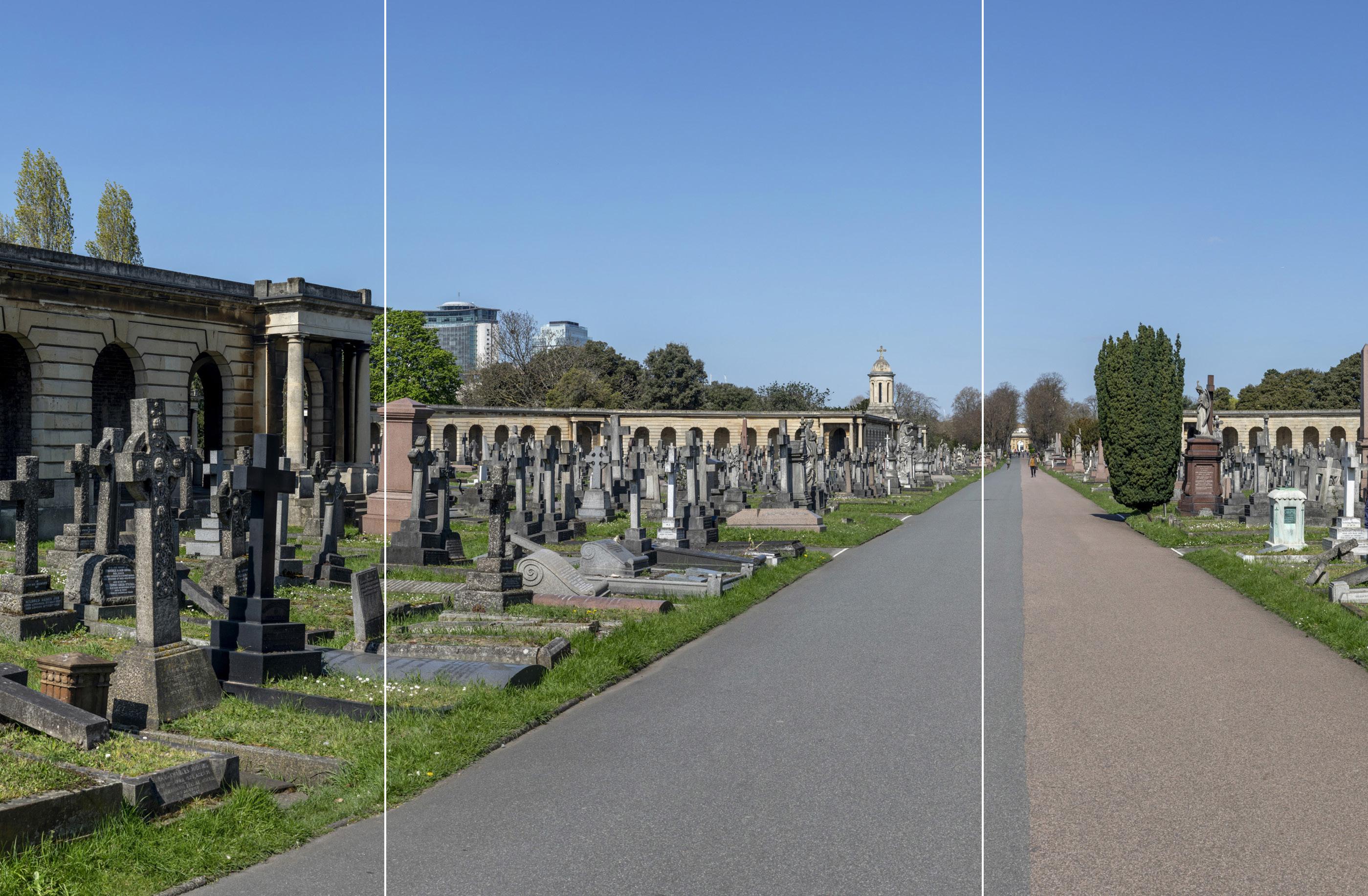
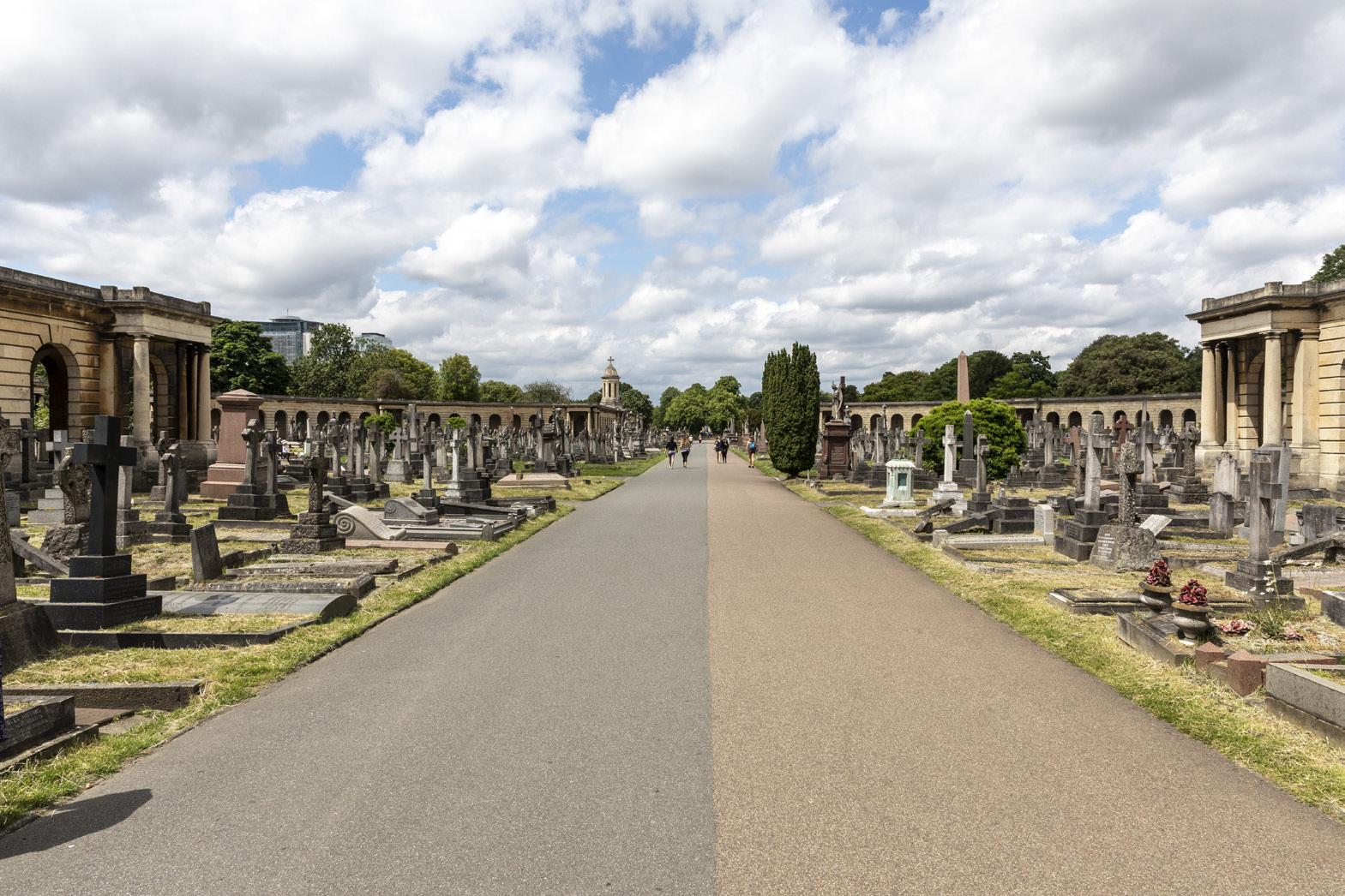
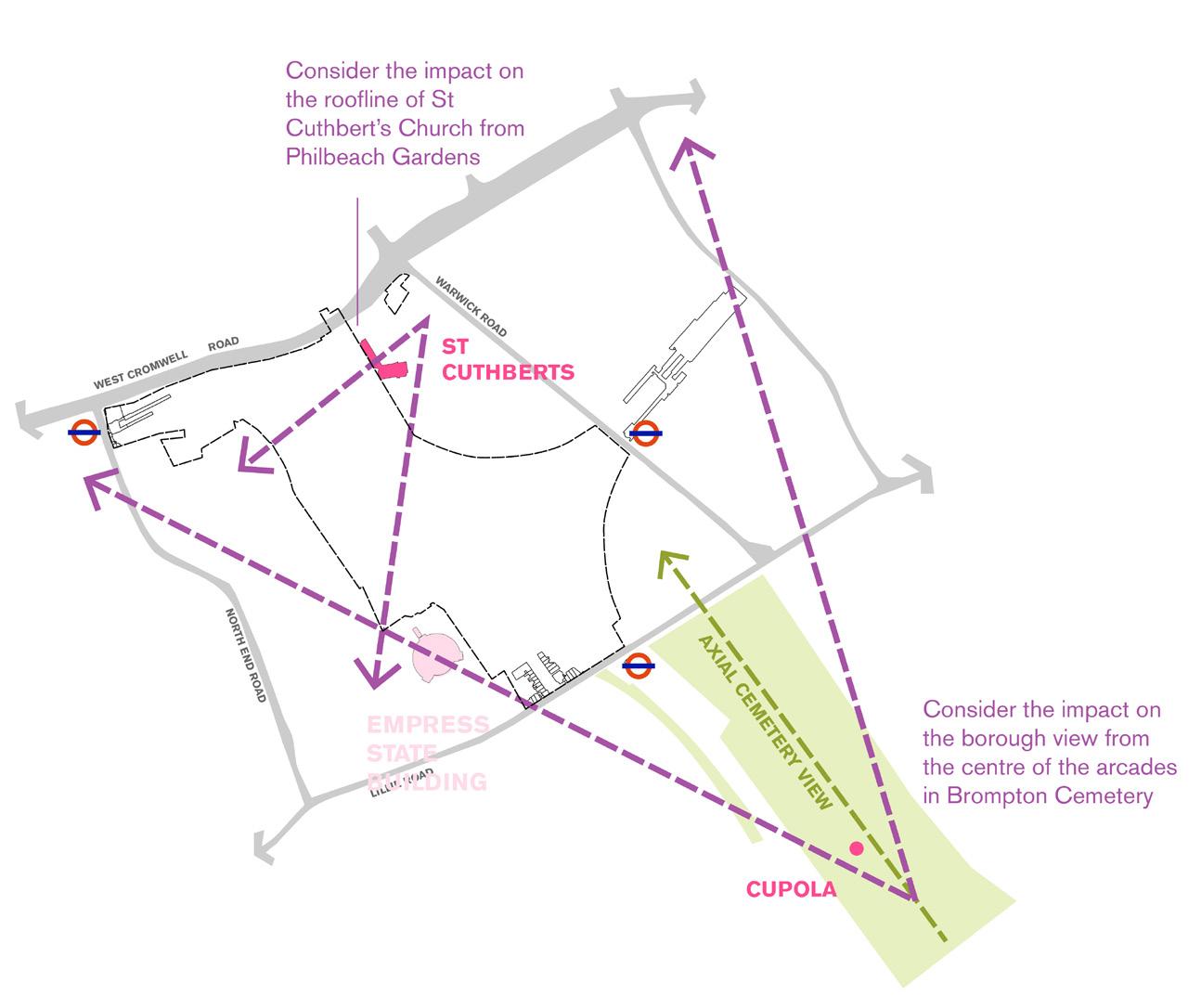
Brompton Cemetery Chelsea Harbour
Battersea Park
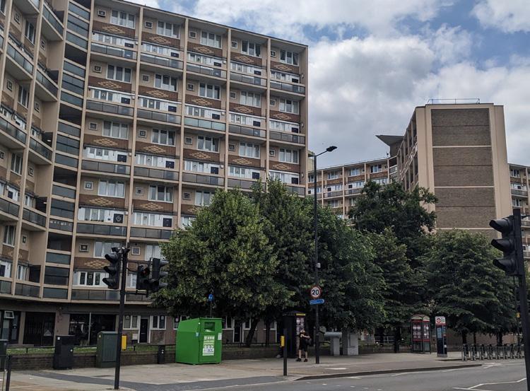
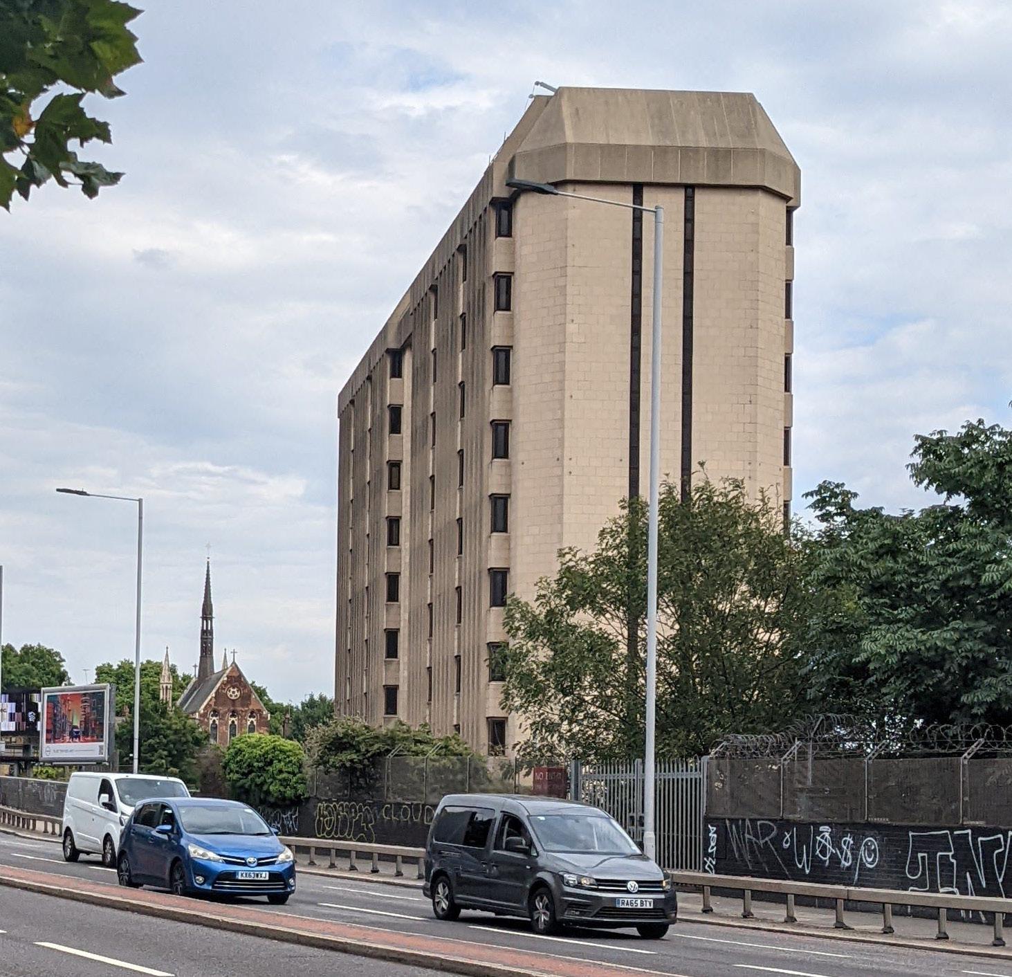
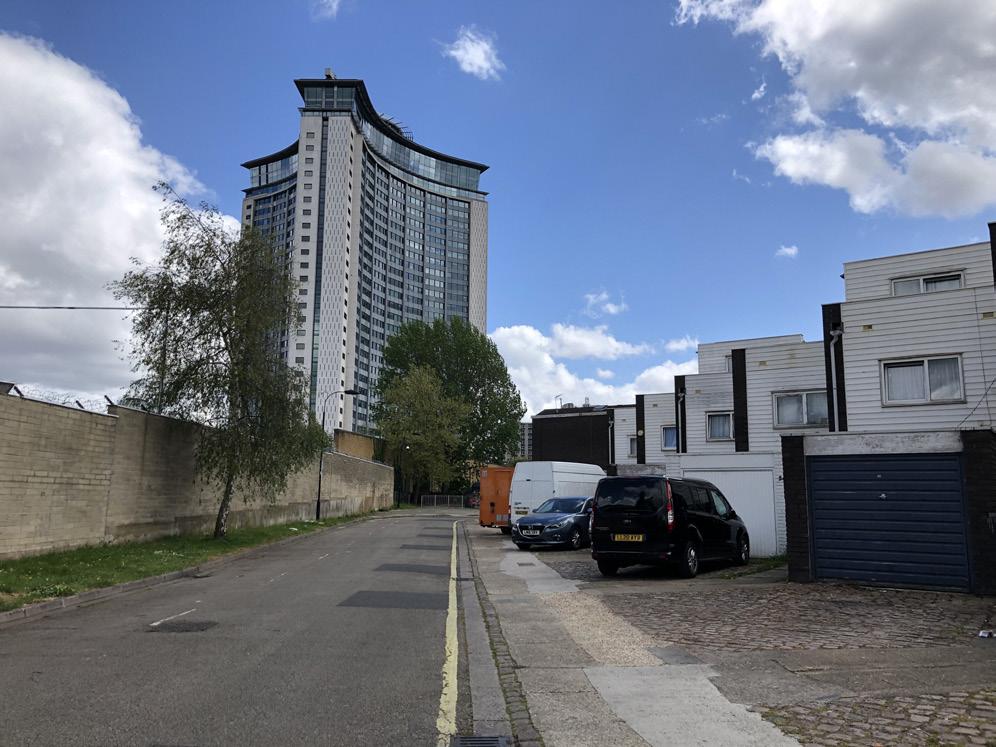
Empress State Building
Lillie Bridge Depot
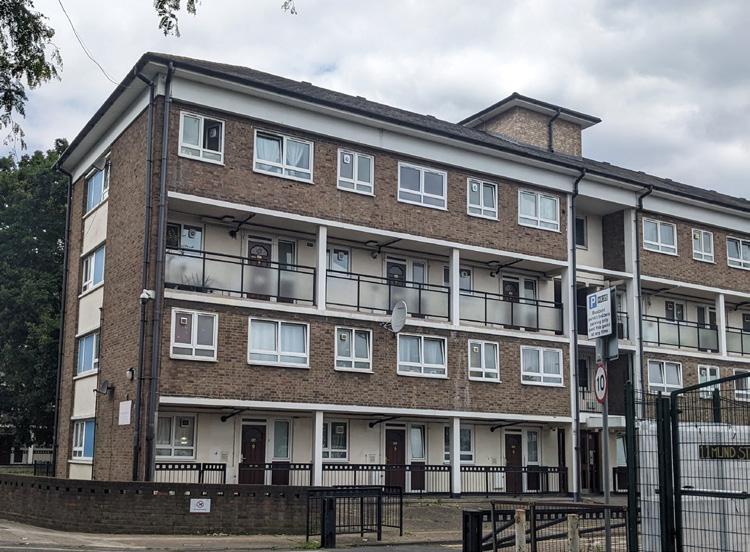
West Kensington and Gibbs Green Estates
Philbeach Gardens
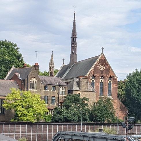
Earl’s Court station
West Brompton station
West Kensington station
Eardley Crescent
North End Road
West Cromwell Road (A4)
Warwick Road
Stamford Bridge
Kensington Village
Wandsworth Common
Ashfield House
Royal Borough of Kensington and Chelsea (RBKC)
London Borough of Hammersmith and Fulham (LBHF)
A strategic brownfield opportunity for London
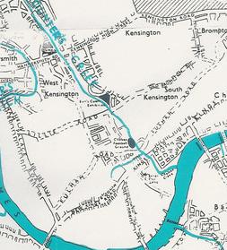
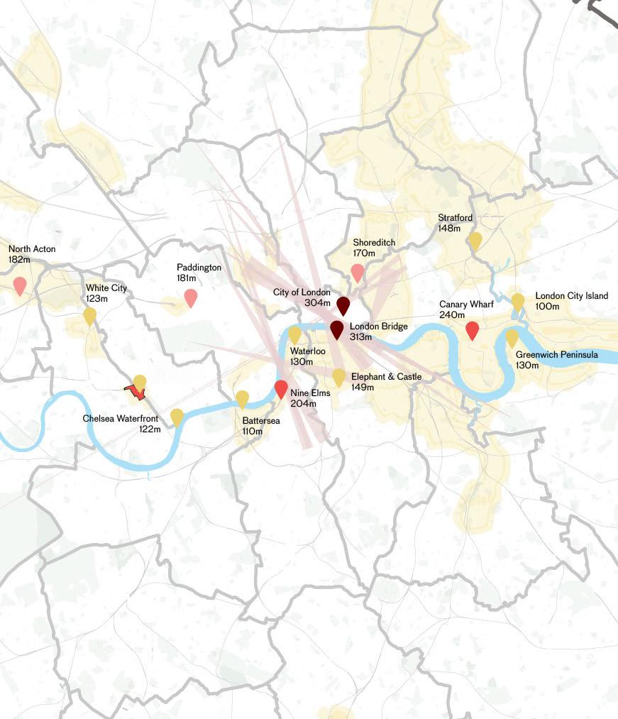
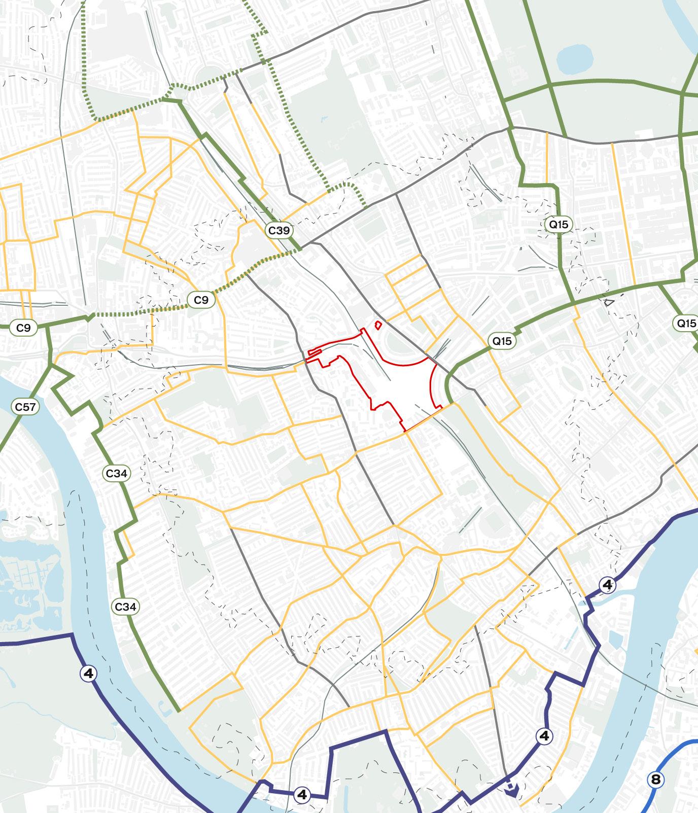
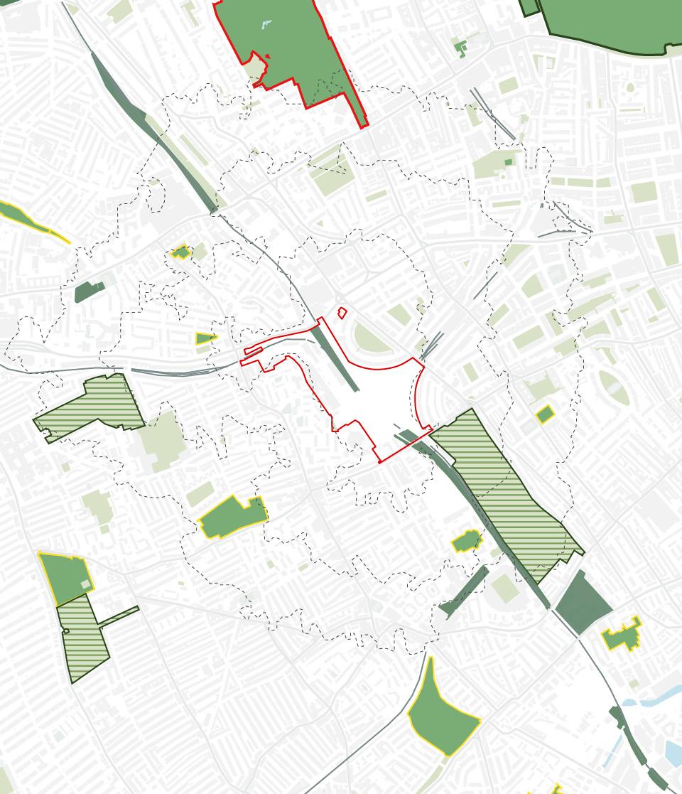
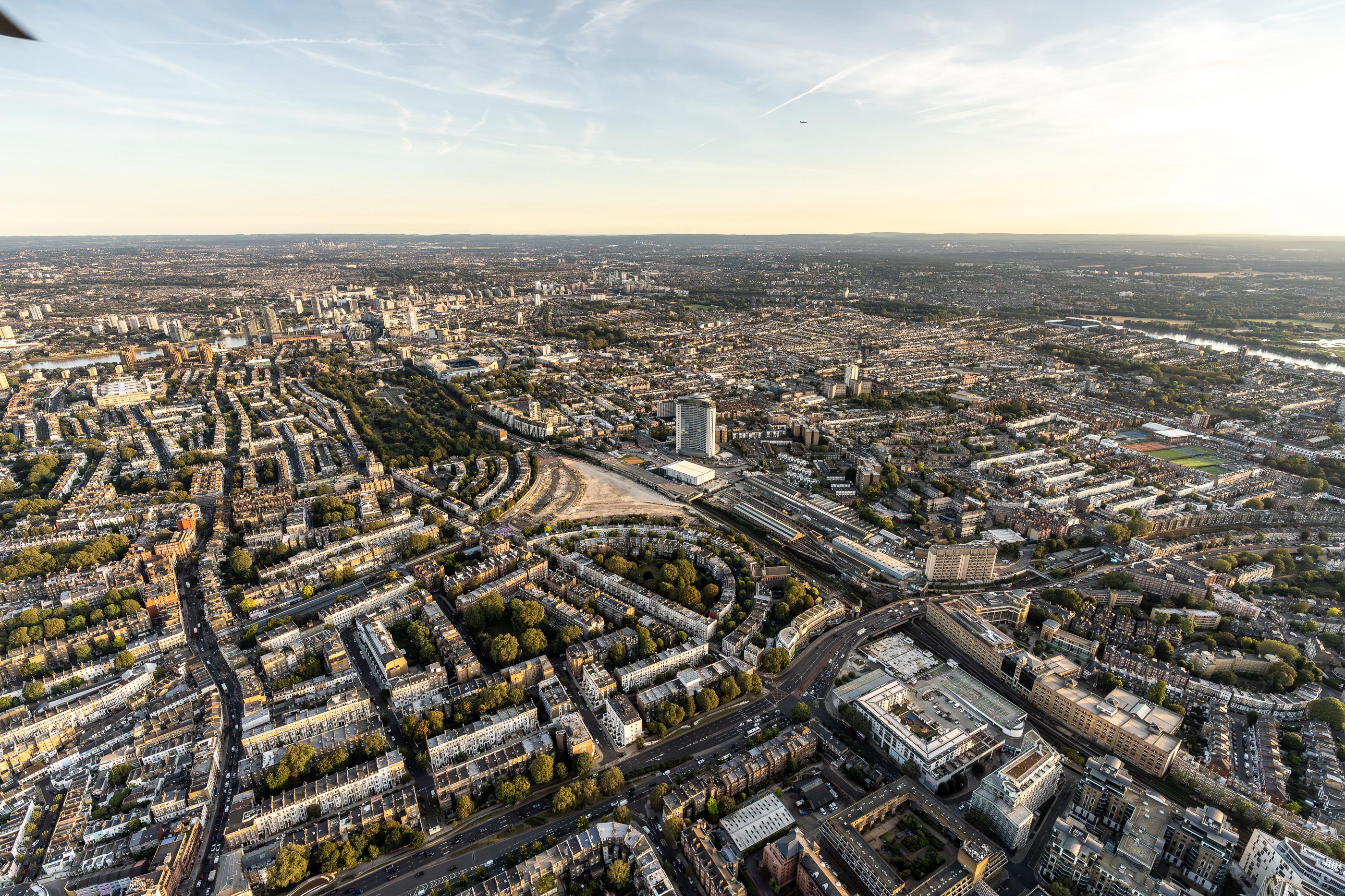
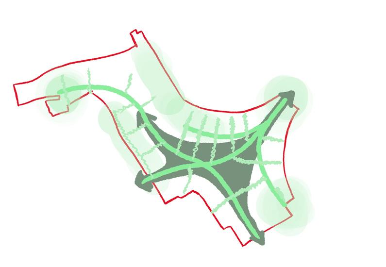
The Earls Court brownfield Site occupies a strategic location in London and the magnitude of the development opportunity reflects its role in delivering benefits for Londoners.
Straddling zones 1 and 2, the Site is highly connected with links to citywide hubs of culture, commerce, business and innovation.
Its location on the A4 makes it an important point along the M4 corridor, to Heathrow Airport, and the Thames Valley to the west.
To the east, it interfaces with London’s hub of museums and culture and has direct links with the City.
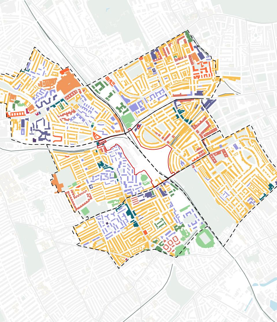
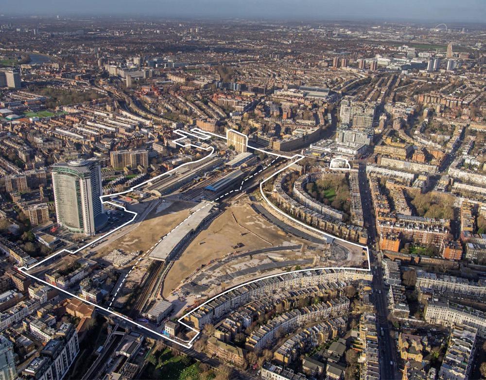
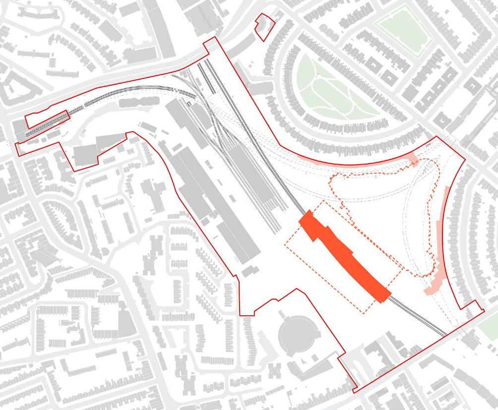
3.1 The Opportunity
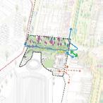
c. 18 hectares of developable area in West London
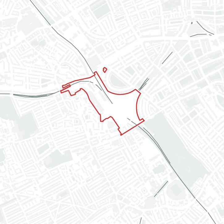
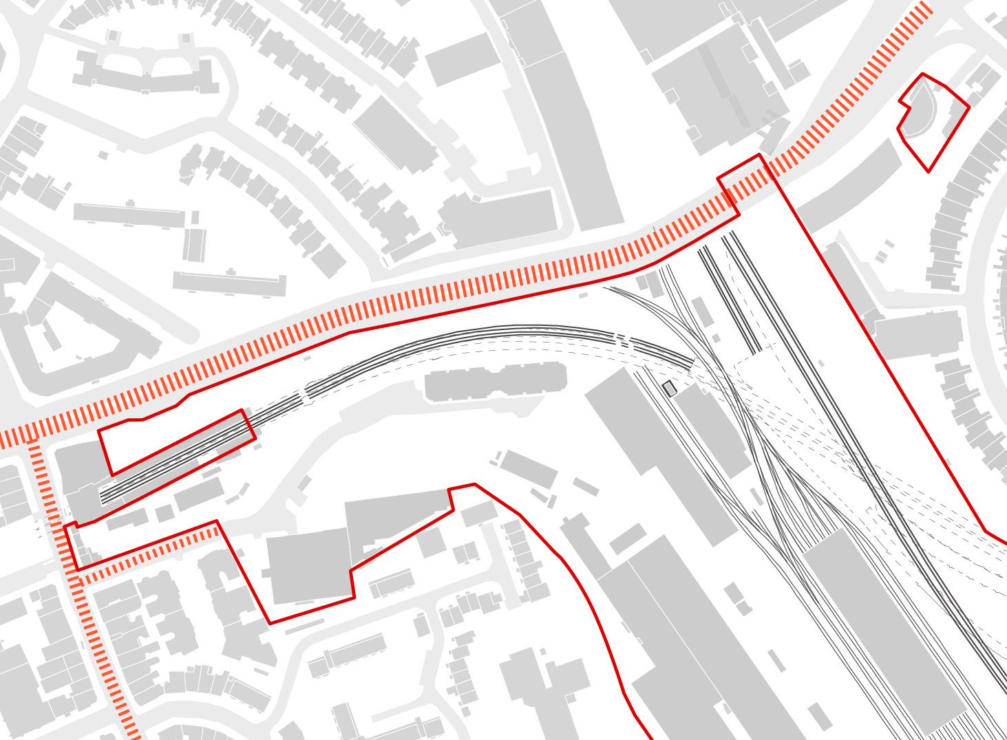
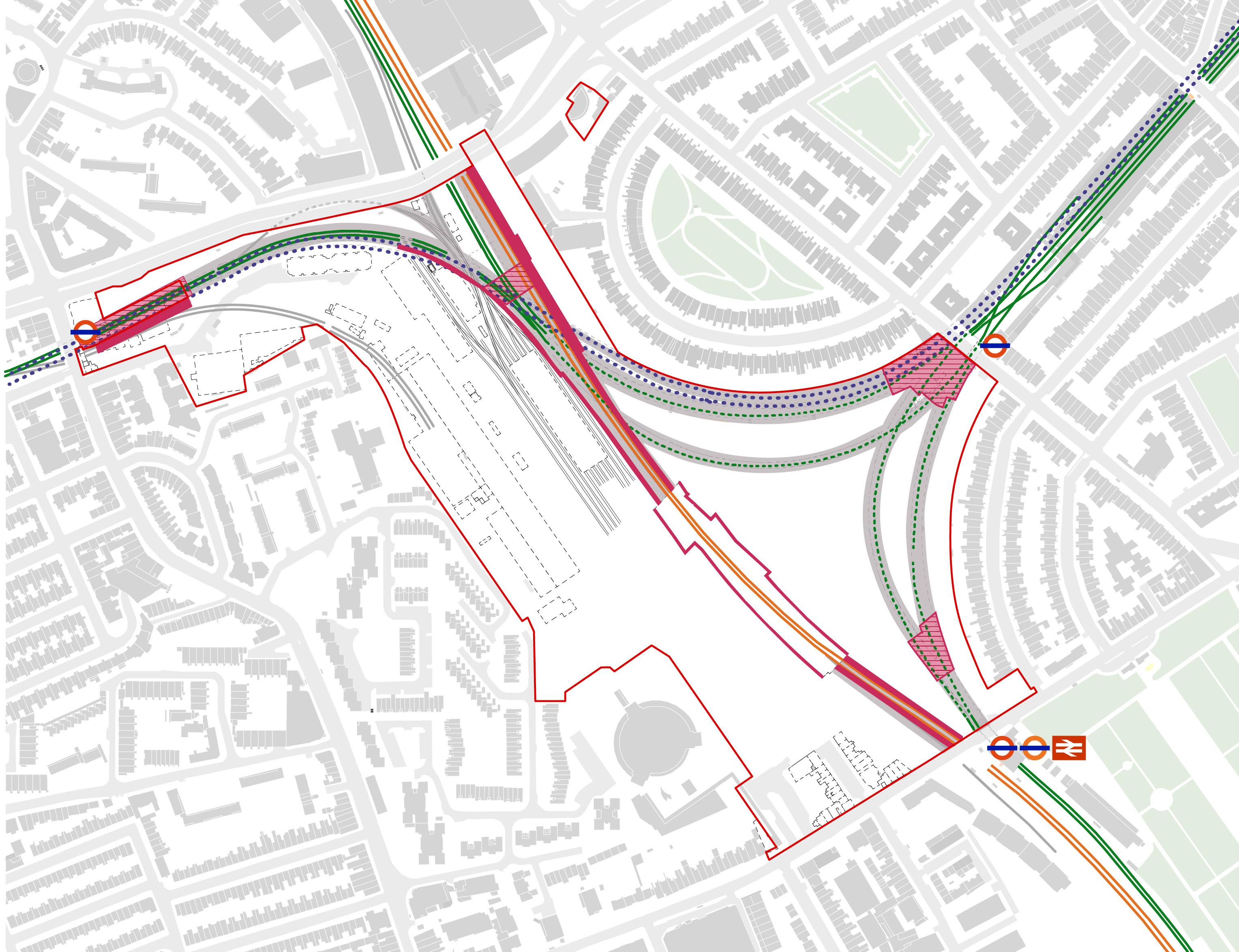
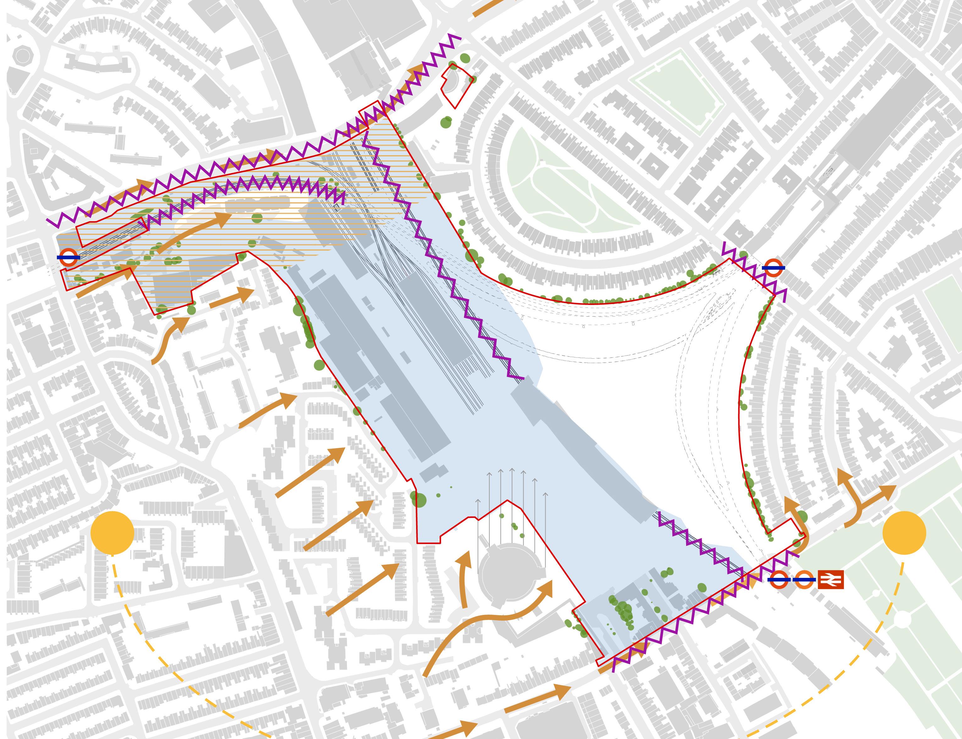
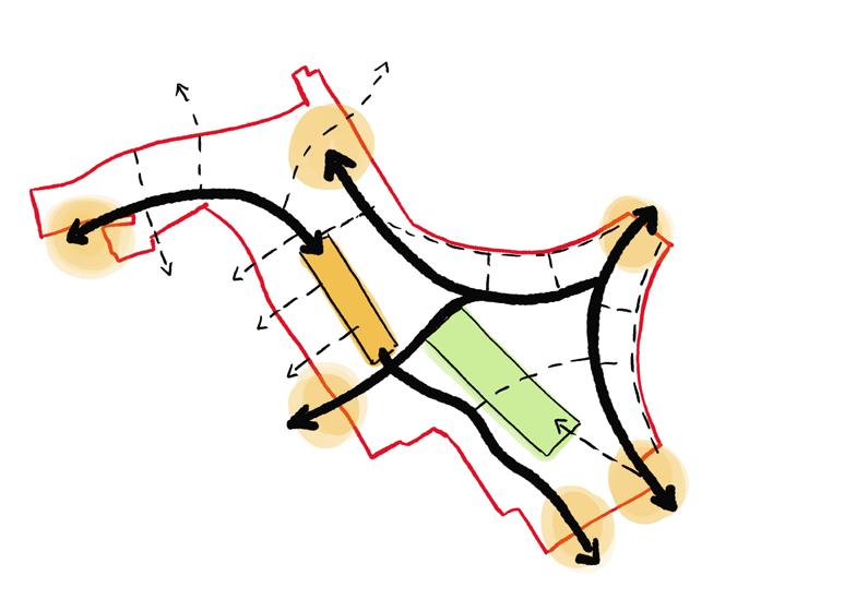
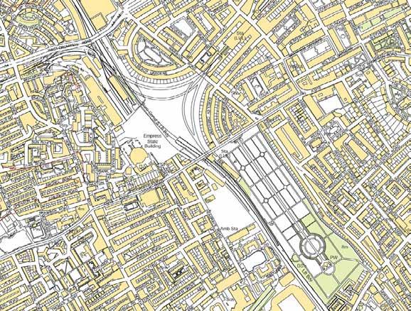
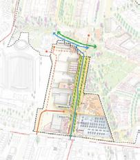
The LBHF and RBKC administrative boundary bisects the Site along a north-west / south-east axis from West Cromwell Road to Lillie Road.
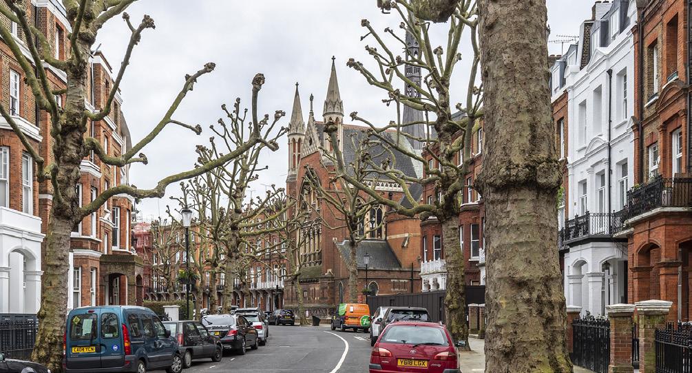
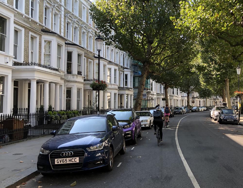
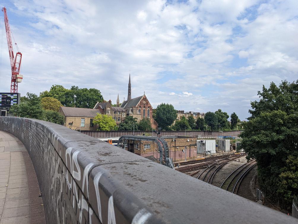
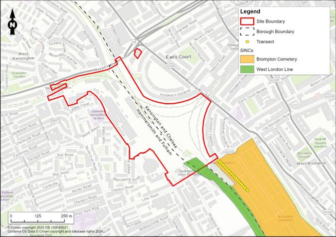
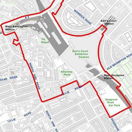
The RBKC Site is bound to the north by West Cromwell Road, to the east by Warwick Road, Philbeach Gardens (including 1 Cluny Mews) and Eardley Crescent, to the south by Lillie Road and Old Brompton Road and to the west by the West London Railway Line (WLL).
The LBHF Site is bound to the west by North End Road, Beaumont Avenue, the former Gibbs Green School, properties fronting Dieppe Close, to the north by West Cromwell Road, to the east by the West London Railway Line (WLL), to the south by Lillie Road and to the south-west by land comprising the Empress State Building and Aisgill Avenue.
The Site area associated with the RBKC Hybrid Planning Application is approximately 8 hectares (78,561sqm) and the Site area associated with the LBHF Hybrid Planning Application is approximately 10 hectares (101,395sqm).
The scale of the Earls Court Site overlaid onto other major London site allocations and emerging schemes
Royal Borough of Kensington and Chelsea (RBKC)
London Borough of Hammersmith and Fulham (LBHF)
3.2 Site History
An exceptional history
The Earls Court Site has always been a unique, complex and fascinating part of London. Throughout history, it has been at the forefront of economic and societal change.
Earls Court has evolved over the centuries as the growth of London expanded to the west.
From rural farmland and horticultural gardens, to the arrival of 19th century railway and underground lines, the Site became a showground for exhibitions, spectacle and innovation.
As the transport network expanded, residential areas developed around the Site. Despite this growth, the Site has been under a single ownership with a unified vision for the last 150 years, which has contributed to the enduring legacy and sense of wonder at Earls Court.
The following pages describe key stages in the evolution of the Site, from the medieval period to the demolition of the Exhibition Centres.
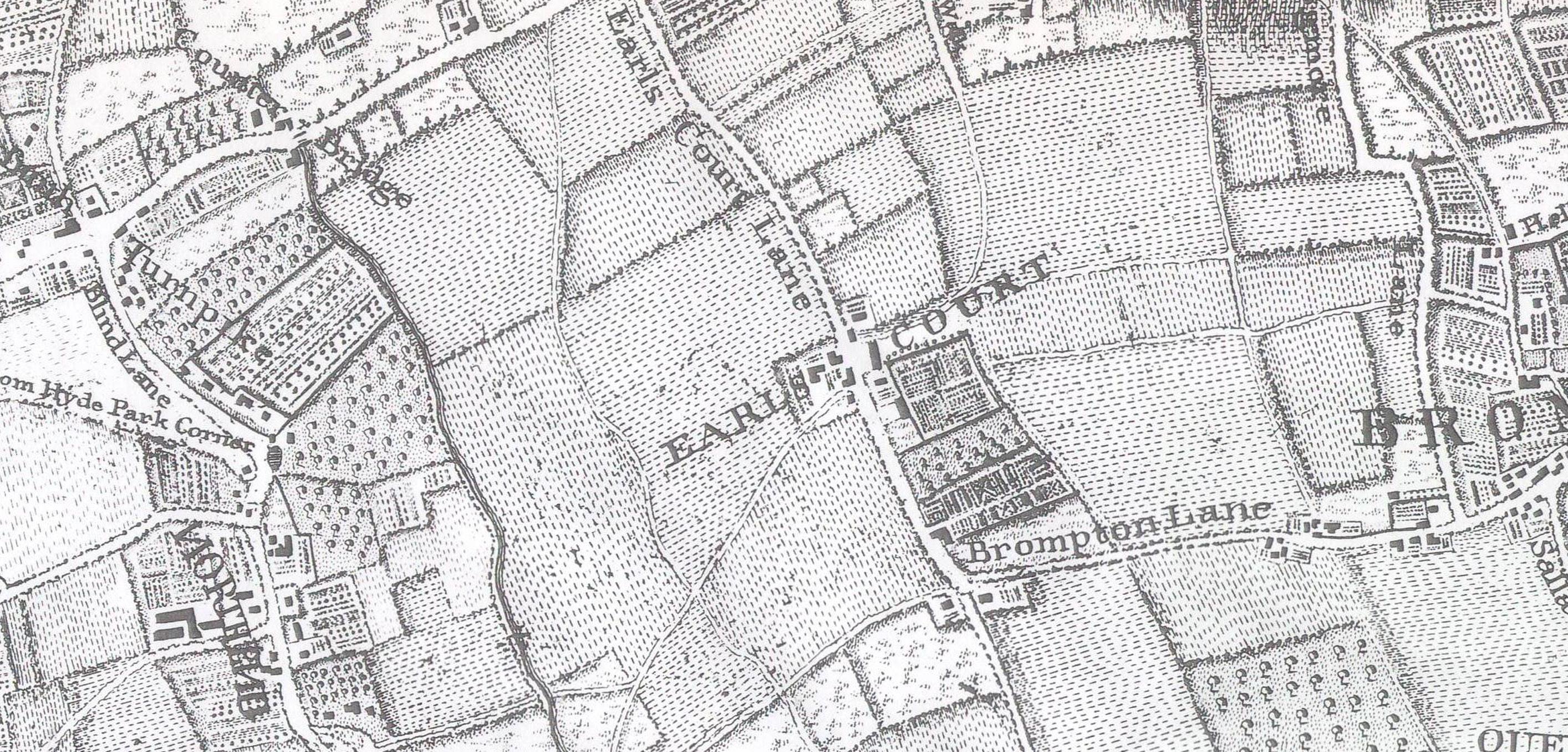
From the medieval period through to the early 18th century, the Site was largely used as farmland, run and owned by aristocratic families.
The name ‘Earl’s Court’ derives from the area’s historic association with the Earls of Warwick. The area was primarily used for farming, with scattered hamlets and small villages. It was far removed from the densely populated centre of London. Until 1887, the farmland was attached to Earl’s Court Manor, which consisted of a small cluster of buildings in a field called the Three Little Piglets.
A ‘lost river’, Counter’s Creek, sets the course for changes to come
Counter’s Creek was a natural watercourse running north-south through the Site. In 1828, it was transformed by Lord Kensington into a canal to ferry goods to and from the Thames. As railways gained in popularity, the canal was sold to railway entrepreneurs. In 1859, the West London Railway Line replaced the Kensington Canal and connected to the developing railway system south of the Thames at Clapham Junction.
The river has been culverted below Warwick Road and North End Road, but continues to inspire aspirations to reinstate water on the Site.
Map of London’s lost rivers, Nicholas Barton, The Lost Rivers of London, 1962
Roque Map, 1746, with approximate Site boundary
The Earl’s Court Farm was demolished in 1878 to make way for Earl’s Court Underground station.
Kensington Canal by William Cowen (1791-1864)
3.2 Site History
A place shaped by 19th century transport
Mid-19th century industrialisation transformed the Earls Court Site and defined the extent of development around it. It would remain different from its immediate context thereafter.
The Metropolitan Railways, 1850-1870
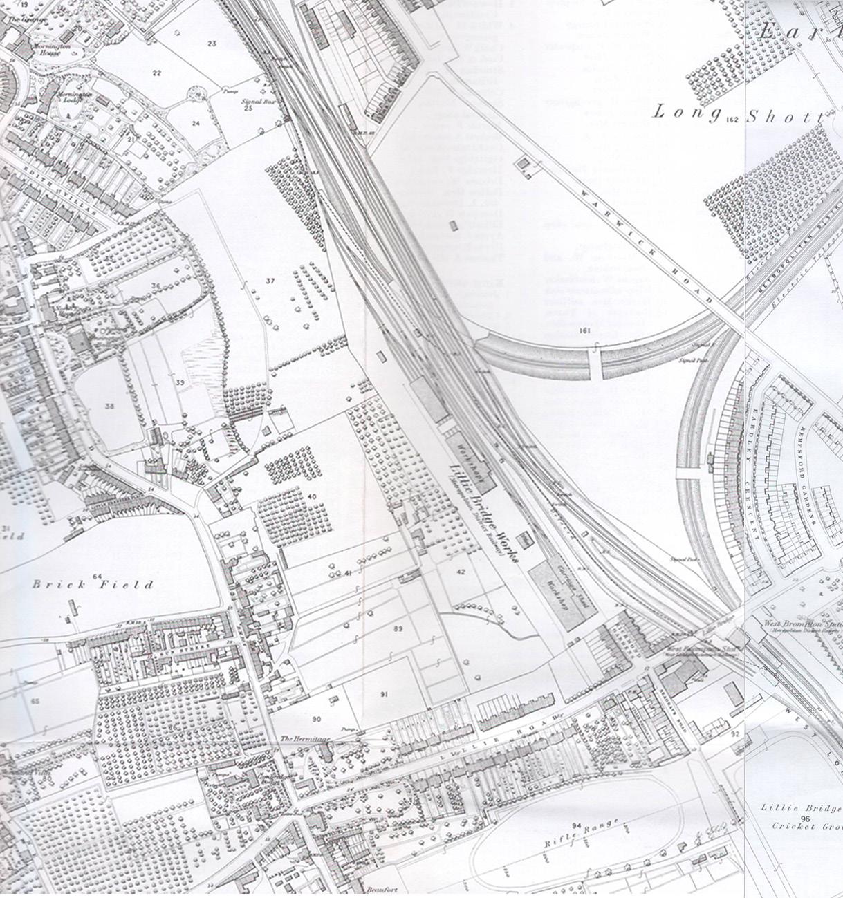
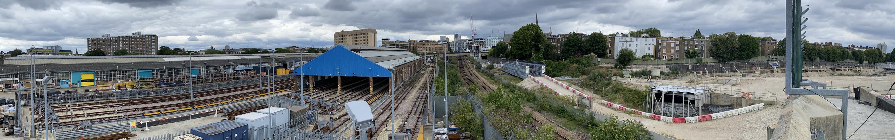
By the late 1860s, the Metropolitan and District Railways had extended to Earls Court and the Site became an intricate confluence of tracks that severed it from its context and constrained development.
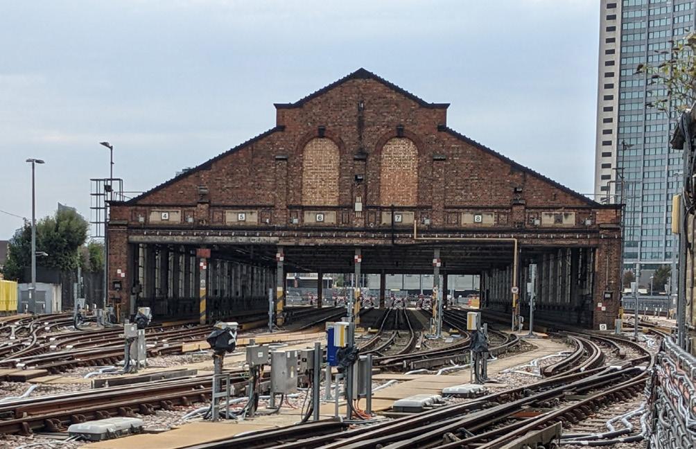
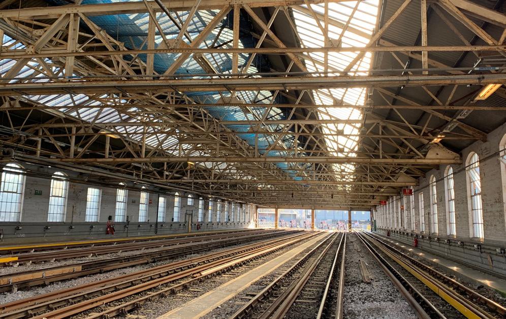
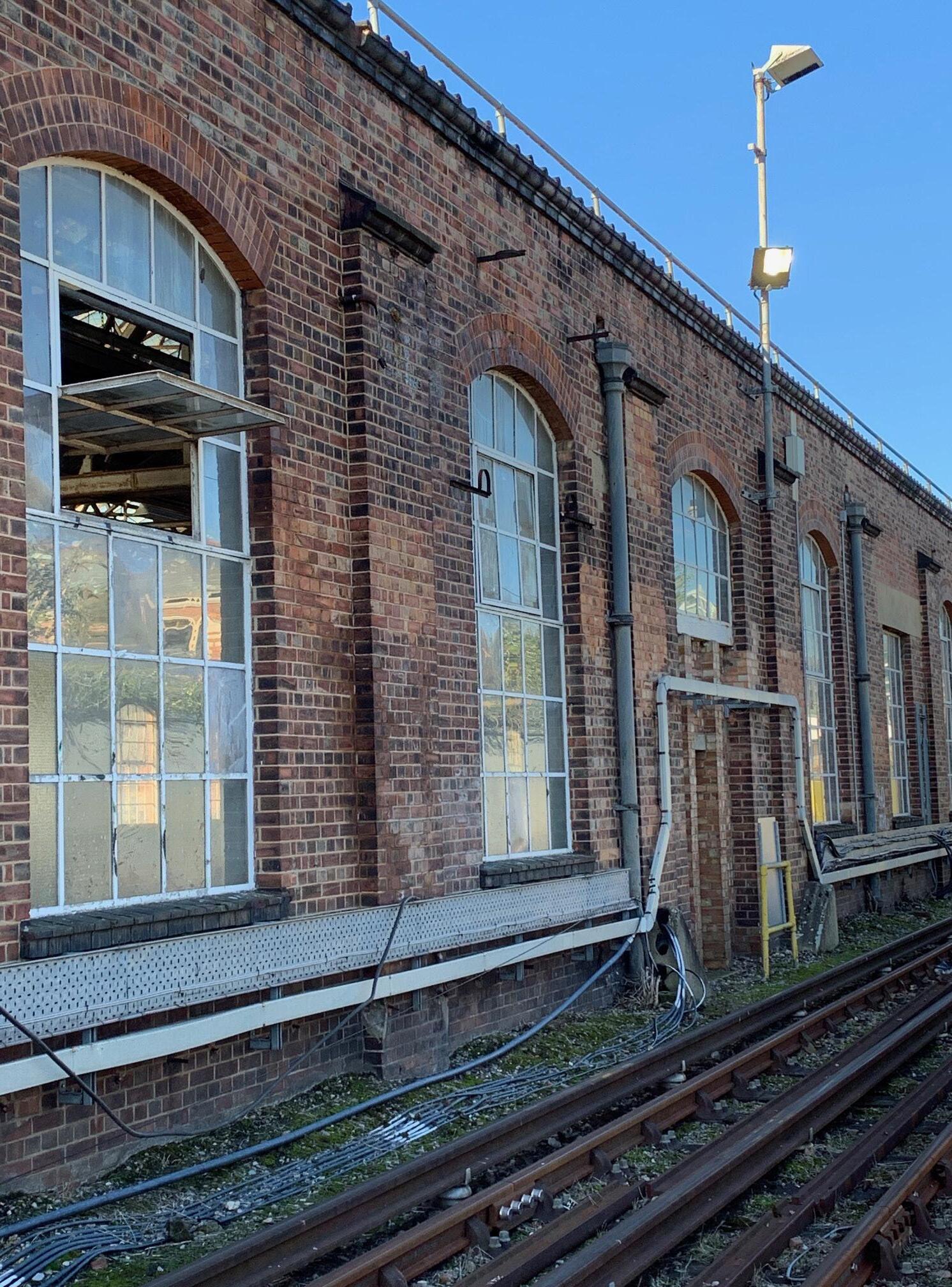
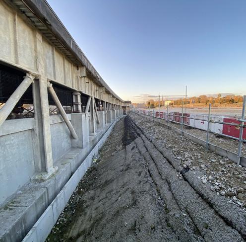
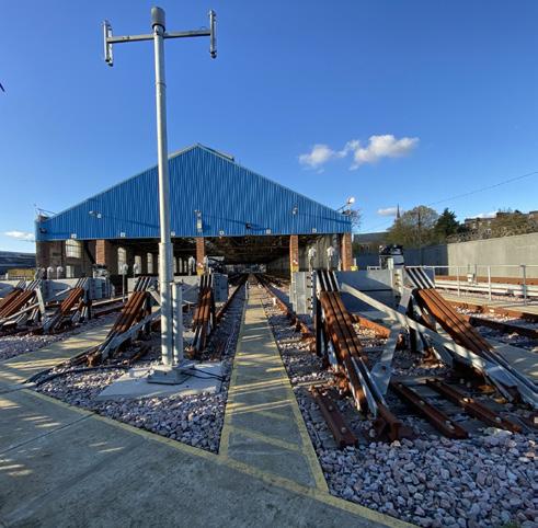
In 1870, the District Railway established Lillie Bridge Works, now known as Lillie Bridge Depot, and constructed a 400m long Train Shed some time between 1894 and 1912. Its length was later reduced, but it remains in use as a Transport for London (TfL) maintenance facility.
The land became constrained by infrastructure
By the 1890s, the Piccadilly Line connected Earl’s Court and West Kensington stations through the Site. The multiple competing railway companies built their tracks independently from one another, resulting in the remaining land forming an unusable ‘waste ground’ which was unfit for residential development.
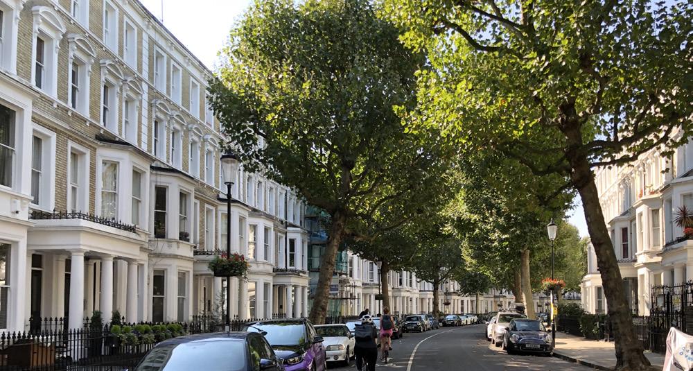
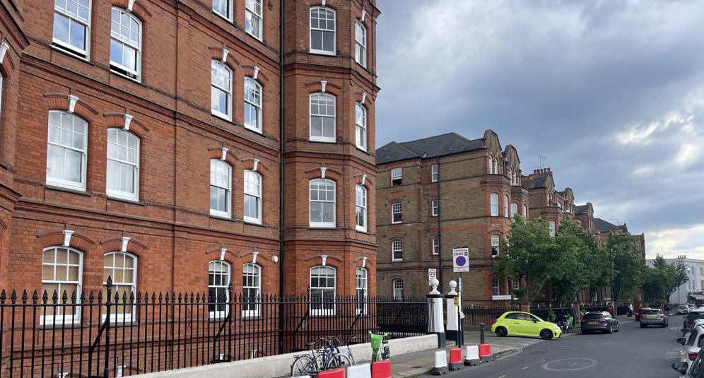
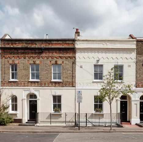
A new West London neighbourhood grew around the Site
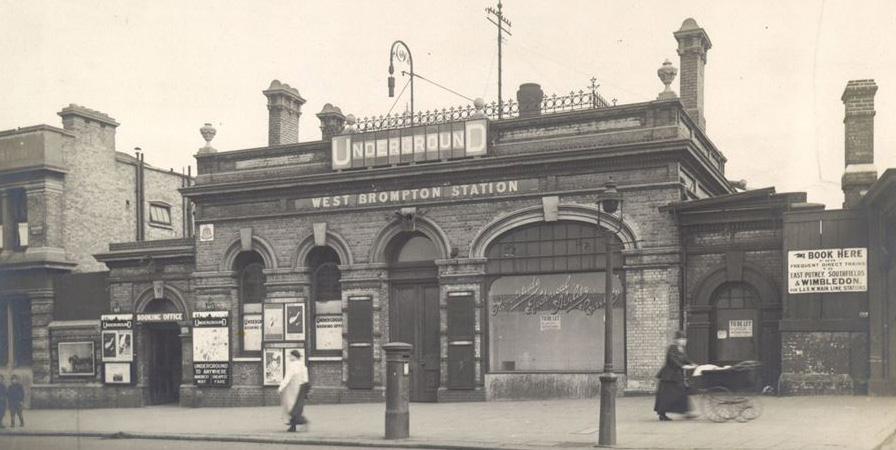
The opening of Earl’s Court station in 1871 facilitated easier access to central London, making the area more attractive for residential development.
Large estates began to be subdivided and sold, making way for terraced housing and mansion blocks. This transformed the area into a fashionable suburb for the middle and upper classes. Their popularity resulted in the dense fabric that now characterises West London.
A series of visionary owners brought entertainment to the Site through large scale public exhibitions, ushering in a new era of spectacle.
1887-1908 Exhibitions and spectacle
The great exhibitions held at Earls Court were international events that showcased advancements in technology, industry, and culture, attracting visitors from around the world.
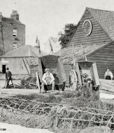
A celebration of nature and horticulture
The idea to launch the Earls Court Exhibition Grounds is credited to the entrepreneurial spirit of John Robinson Whitley, whose desire to emulate the great exhibitions of Paris and London led him to a bold new concept, focused on showcasing one nation at a time. He negotiated with railway companies to lease him a vacant 24 acre area of land - then a cabbage patch - to establish his venture.
In 1887, he successfully launched the America Fair and its ‘Wild West Show’. The success of his later exhibitions did not match early levels of enthusiasm but set the scene for the use of the site in decades to come.
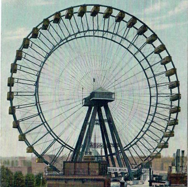
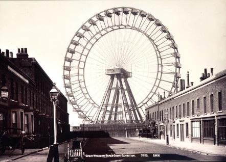
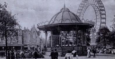
In 1894, Imre Kiralfy took over the Site and rebuilt the Exhibition Grounds in a Mughal Indian Style, to launch his Empire of India Exhibition. Under his ownership, spectacles became increasingly ambitious. The Empress Hall auditorium was constructed, able to seat 6,000 people. The notorious 300-foot Great Wheel was completed in 1895.
By 1905, Kiralfy looked to further expand his reach to new exhibition grounds at White City, prior to the Olympic Games in 1908.
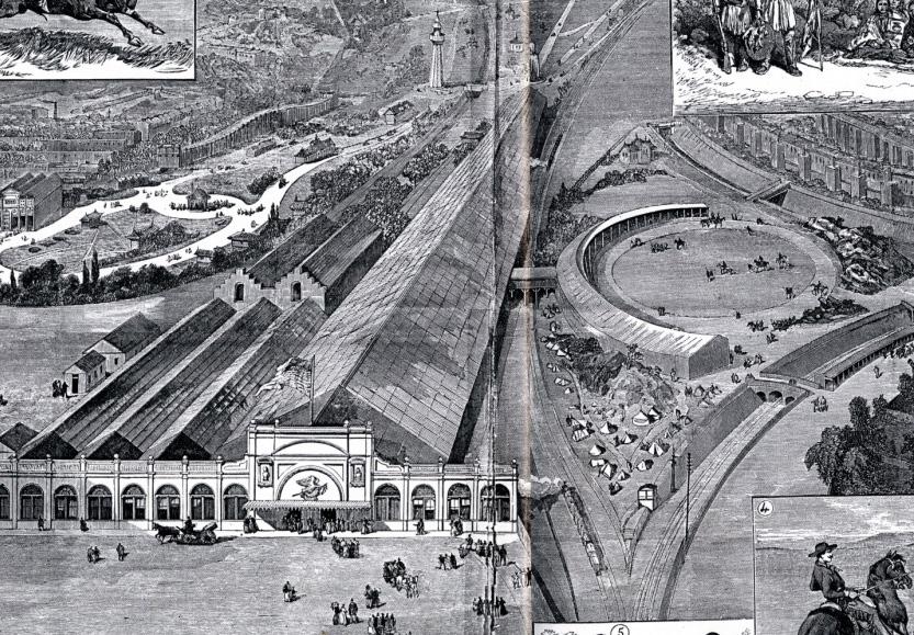
The Earls Court Exhibition of 1887 and the Franco-British Exhibition of 1908 not only celebrated innovation and progress but also served as platforms for cultural exchange, showcasing the arts, sciences, and industries of participating nations.
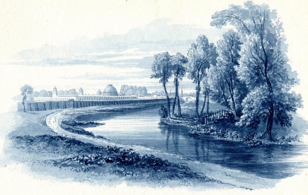
Earls Court’s legacy of wonder extends to its role in celebrating nature. From the late 19th to the early 20th centuries, Earls Court hosted horticultural exhibitions that provided a platform for gardeners, landscape designers, and horticulturists to showcase their work and share innovations in plant cultivation and garden design.
America Exhibition at the Exhibition Grounds shown from the south Lillie Road entrance, 1887, extending over both LBHF and RBKC.
A cultural pioneer in the context of Imperial Britain
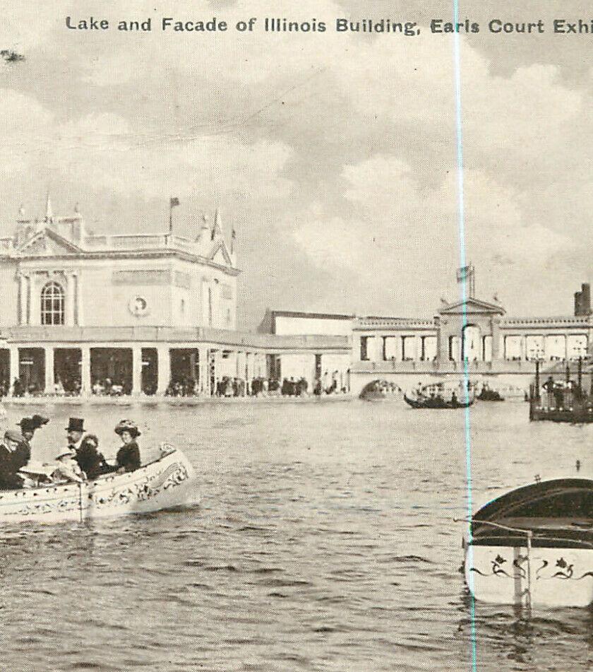
Temporary structures such as the Great Wheel and a manmade lake were erected to host events and showcase some of the most pioneering inventions and achievements of the time. Arenas, grandstands, pleasure gardens, theatres and warehouses established the Site as a destination for discovery and delight.
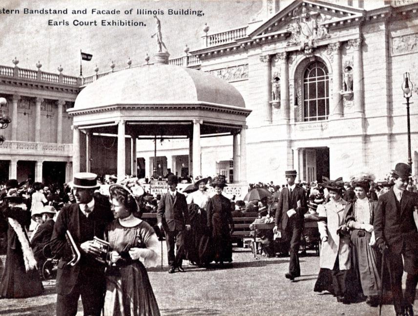
Eastern bandstand and facade of the Illinois building at the Chicago Exhibition, c.1893
The man-made lake in front of the Illinois building at the Chicago Exhibition, c.1893
3.2 Site History
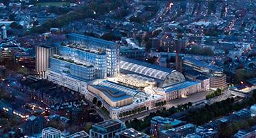
The Exhibition Centres 1935-2015
The 20th century Exhibition Centres staged unforgettable events at a global scale and cemented the legacy remembered today.
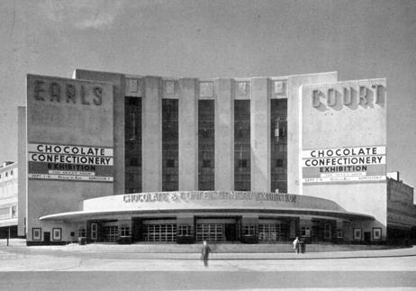
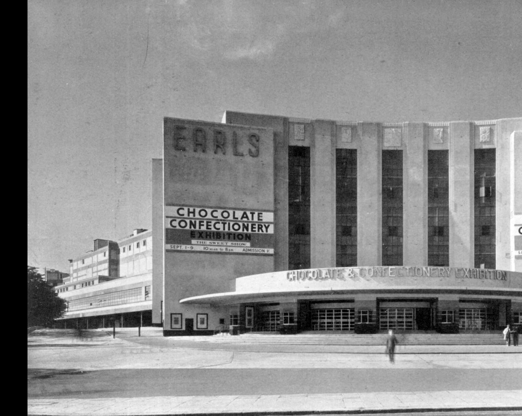
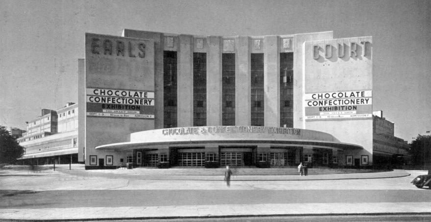
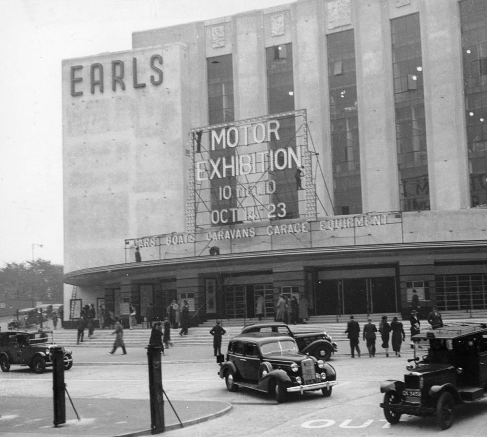
In 1935, following wartime decline, the Earls Court Exhibition Grounds were sold and in 1937, a new state-of-the-art Exhibition Centre was erected, with an ambition to rival the nearby Olympia Exhibition Hall. The architect, Howard C. Crane, maximised the triangular site with the biggest column-free indoor space in Europe. The space occupied over 40,000 sqm of space spread across two levels. Shortly after its opening, the Exhibition Centre hosted the Chocolate and Confectionery Exhibition.
Exhibitions showcasing innovation
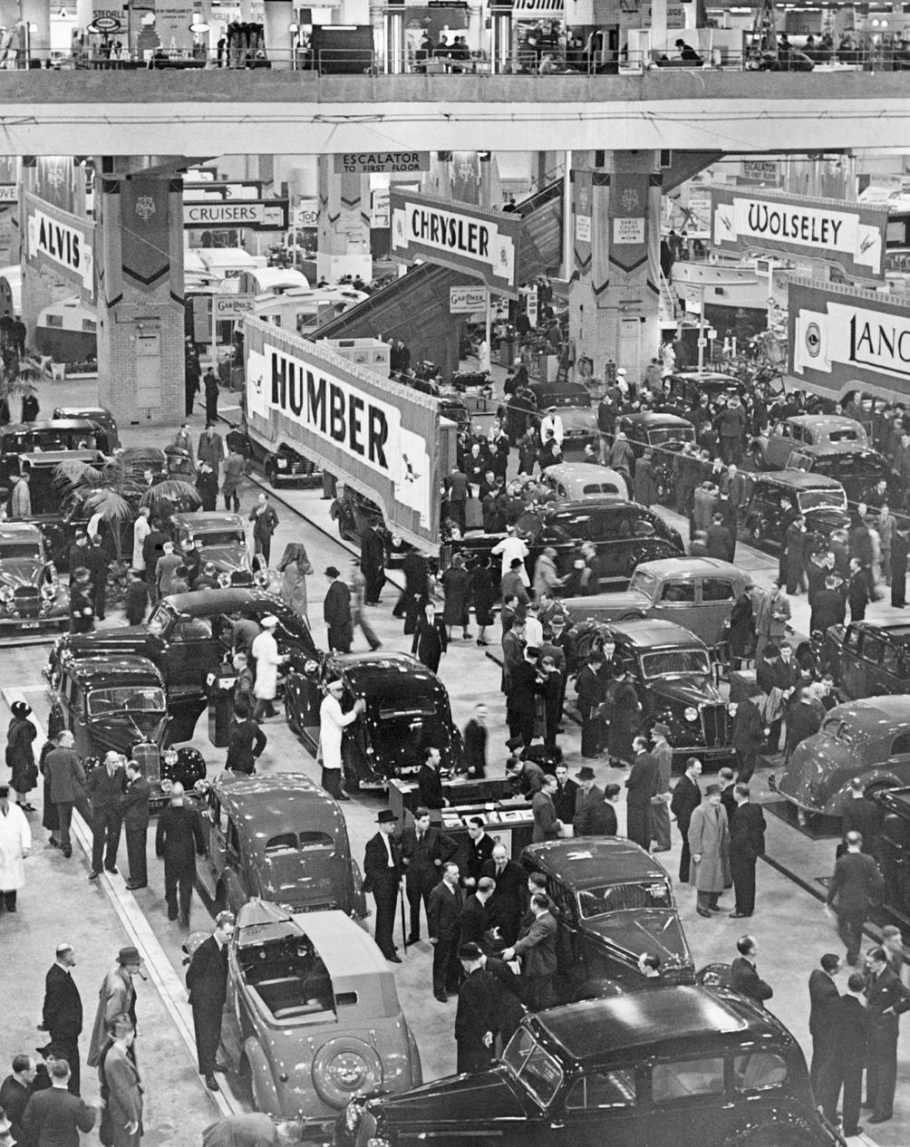
Earls Court went on to host international exhibitions, showcasing innovations in technology, industry, and the arts. For many years it played host to the British Motor Show, where iconic cars were officially unveiled to the public, as well as the London Boat Show.
Following a period of decline in the early 20th century, Earls Court re-emerged as a cultural destination through the construction of the permanent Exhibition Centres. Its reputation as an entertainment and innovation hub grew, attracting visitors from far and wide.
The Exhibition Centre, known as Earls Court One, soon became known as one of London and the UK’s top exhibition venues. A large internal pool, 60m long and 30m wide, with a hydraulicpowered retractable floor, allowed the space to be used in a myriad ways, from boat exhibitions to performances.
The venue became renowned for displaying new products, machinery and services across various industries, showcasing new ways of living and working to Londoners.
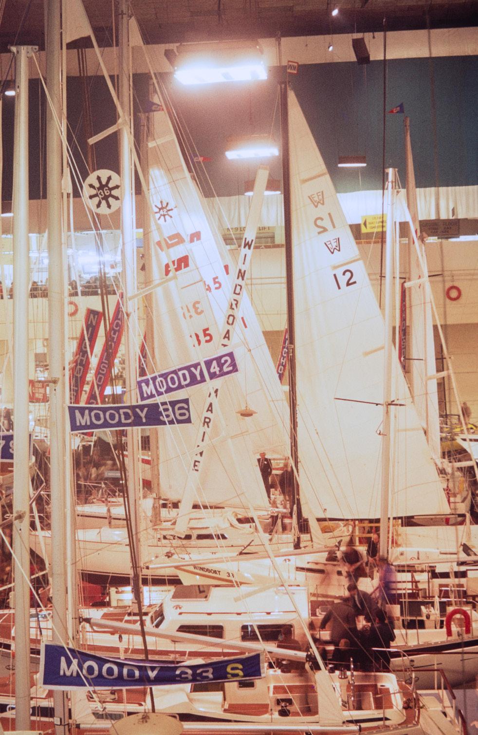
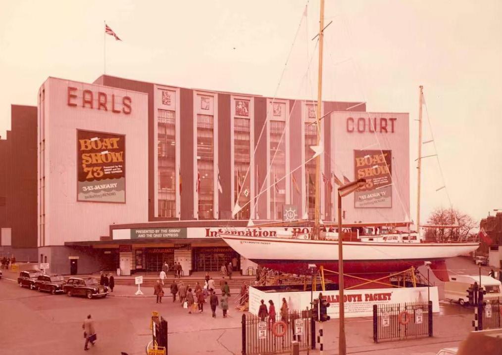
The Earls Court Boat Show, 1973. This ran annually from 1960 until 2003, and again in 2007 and 2008
British International Motor Show, which ran from 1937 to 1976
Earls Court Motor Exhibition, c. 1950s
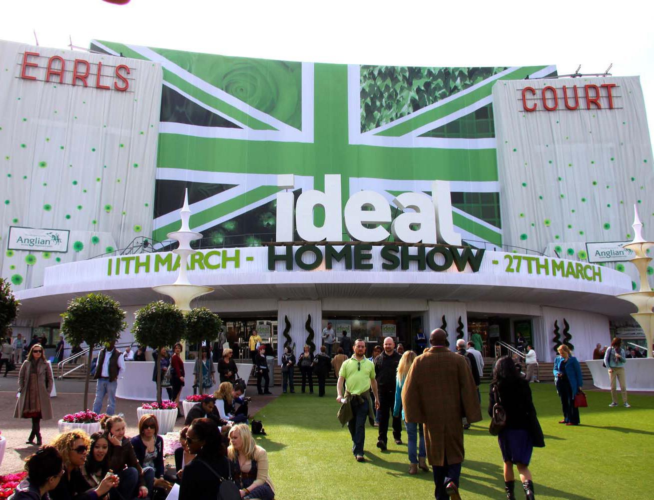
The Ideal Home Show at Earls Court, 2011. The internal pool was used as a feature within this exhibition
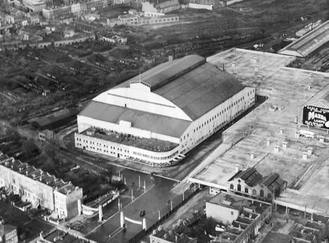
expansion of the Exhibition Centres made the venue suitable for larger events.
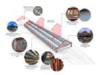
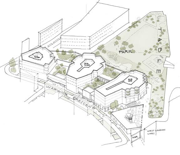
In 1985, part of the Lillie Bridge Depot land was sold to P&O who opted to expand the Exhibition Centre to include a large, barrel-roofed hall, connected to Earls Court One, to increase its capacity and make the venue more competitive nationally. The new venue added 17,000 sqm of column-free floorspace. The hall was opened by Diana, Princess of Wales on 17 October 1991.
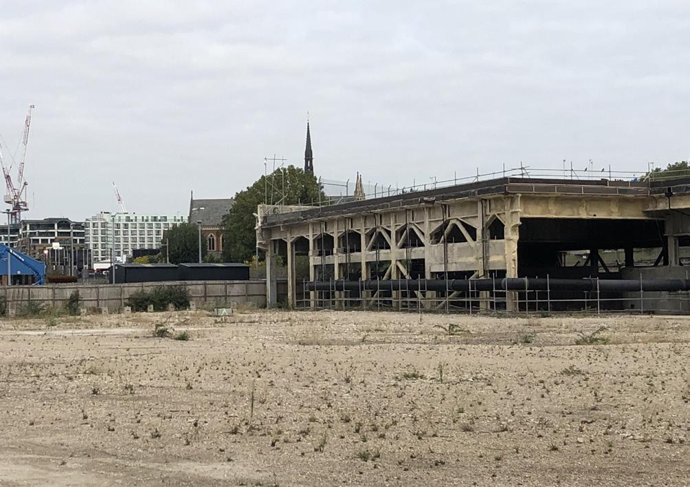
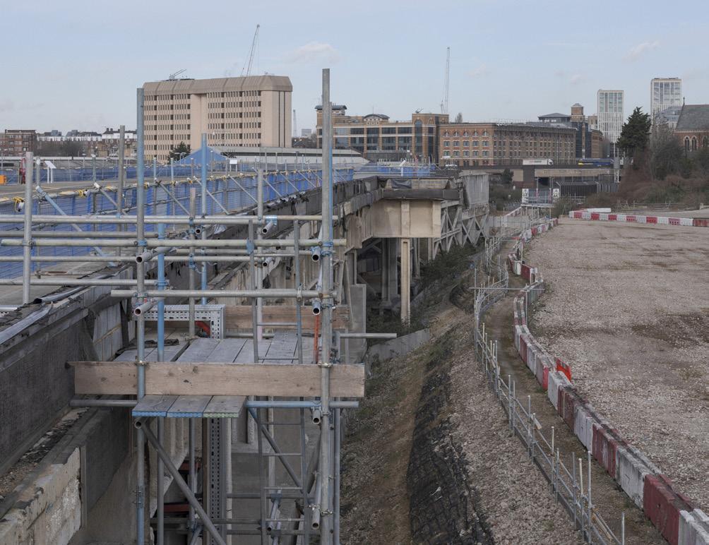
Earls Court Two used the large Table structure spanning the West London Railway Line to extend into LBHF land. Its form contrasted the existing Art Deco Exhibition Centre, making it a landmark locally in its own right.
An
iconic venue for music and sporting events
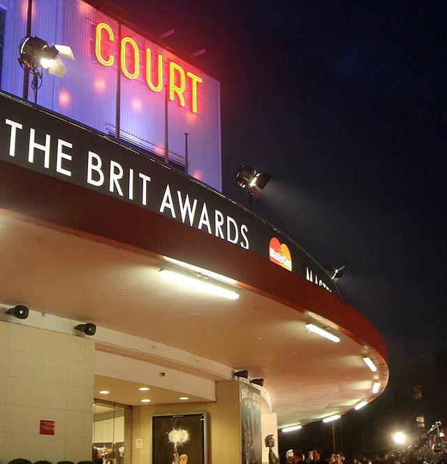
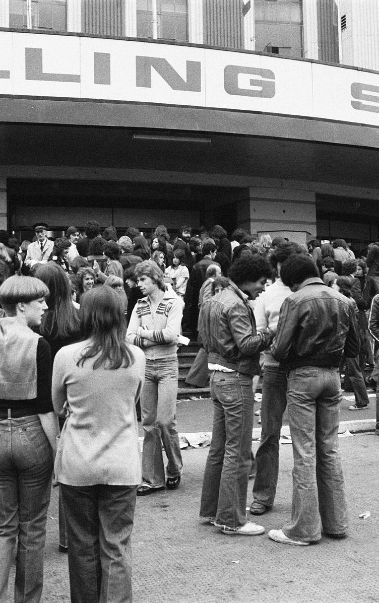
The Exhibition Centres hosted world-class concerts, theatrical performances and awards ceremonies - from David Bowie to the Rolling Stones, from the BRIT Awards to Take That.
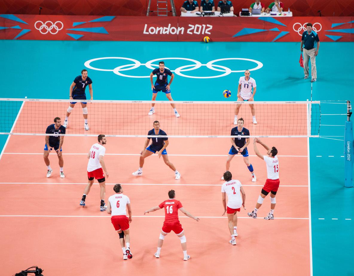
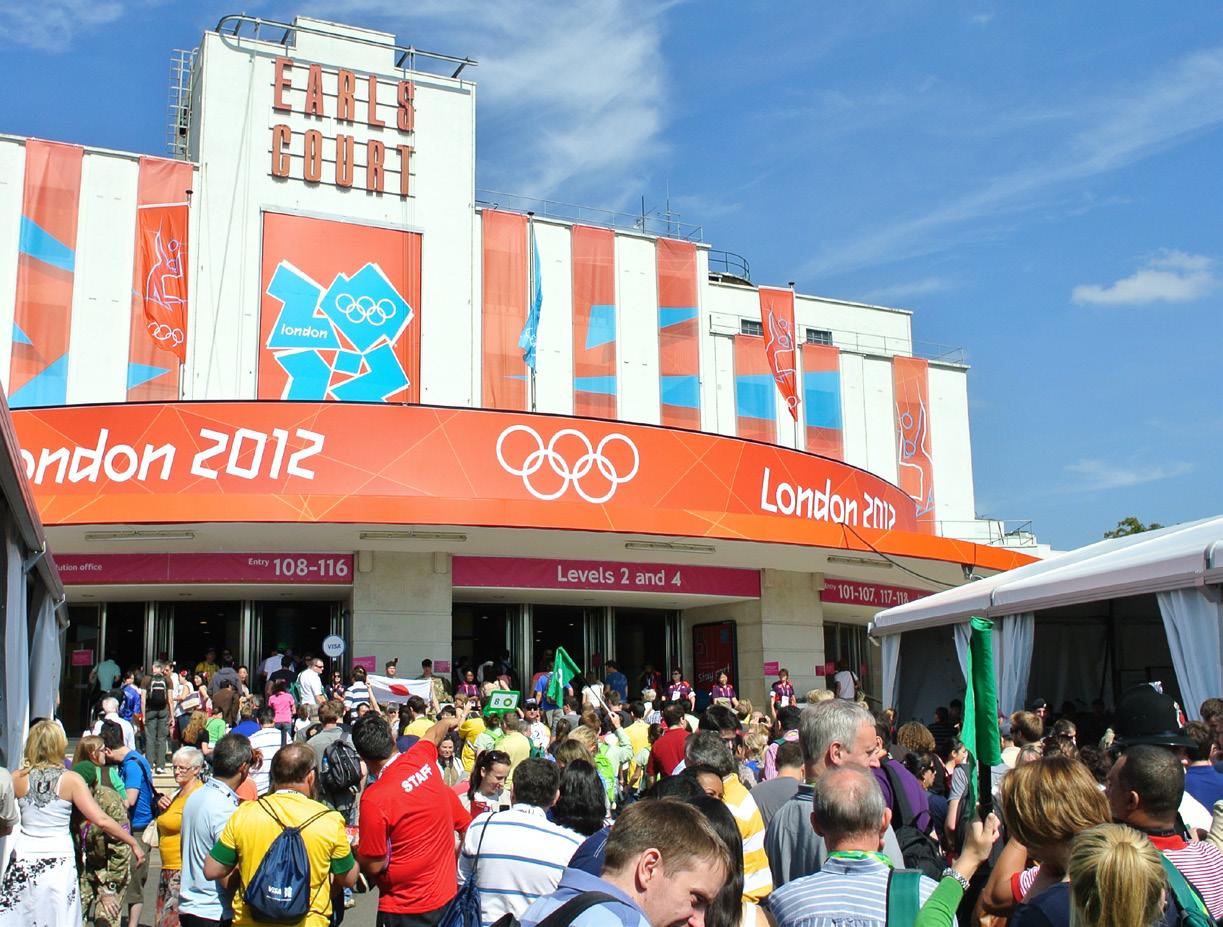
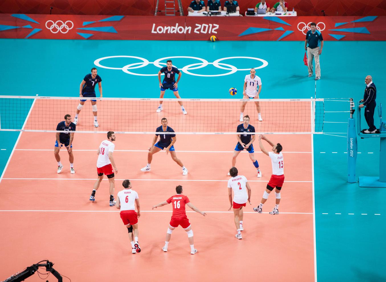
Sporting competitions and events were also held at Earls Court, ranging from boxing matches to motor racing events. The Exhibition Centre was also used during the London Olympics, in 1948 for boxing, weightlifting, wrestling and gymnastics, and in 2012 for volleyball.
Muhammad Ali at Earls Court in 1966
David Bowie at Earls Court in 1978
Volleyball at the 2012 London Olympics
The Rolling Stones at Earls Court in 1976
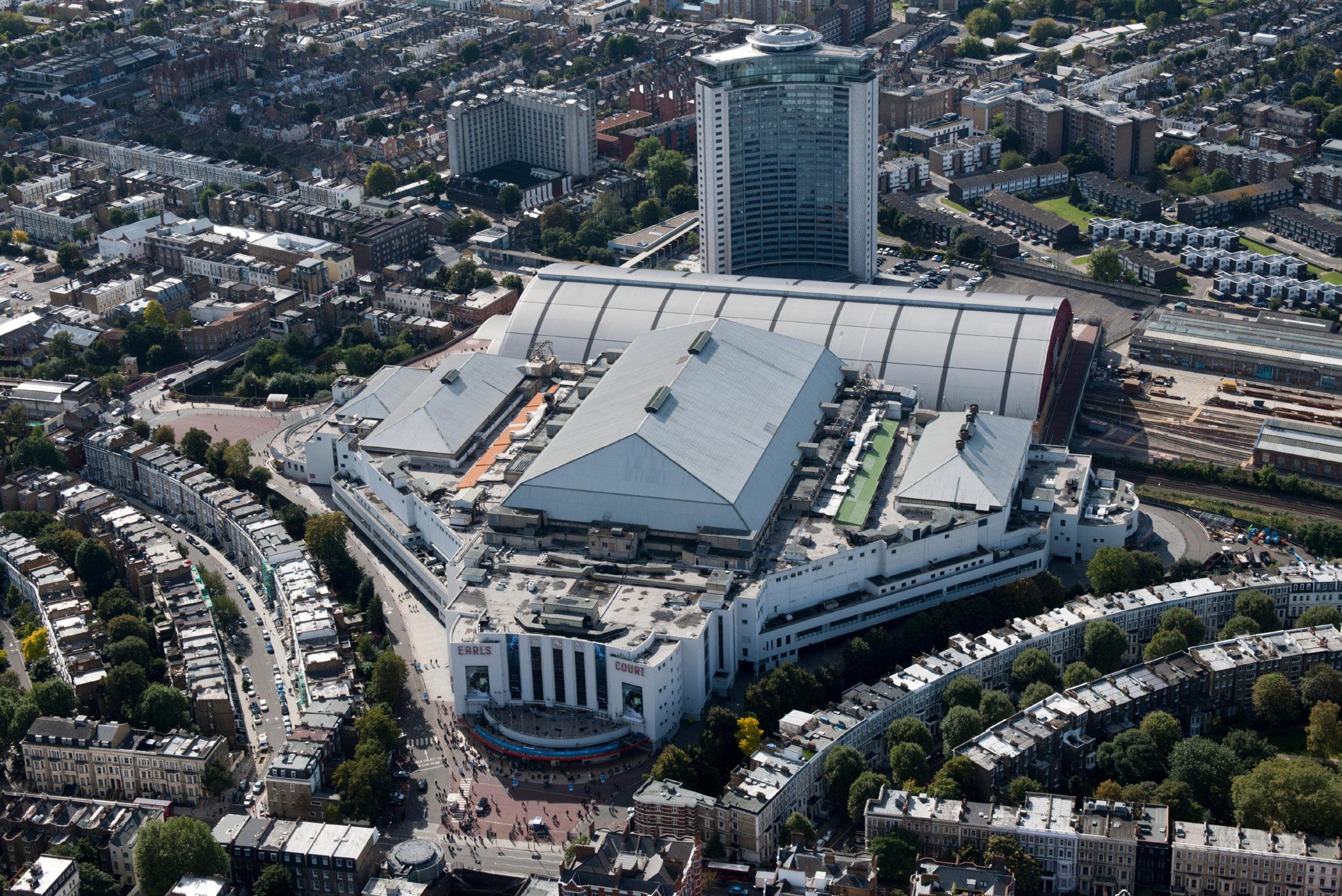
3.2 Site History
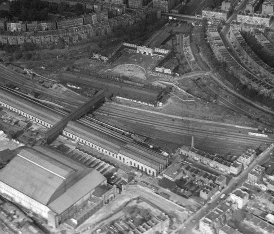
Remembering the scale and presence of the Exhibition Centres
Whilst the Exhibition Centres were demolished in 2015, the Site has been left with a legacy of innovation, difference and experimentation. Although they are gone, the Exhibition Centres have left a longlasting impression on the Site.
In 2015, the Earls Court Exhibition Centres were demolished as part of the previous 2013 planning consent. The demolition had a large economic impact on the wider area, and was felt as a cultural loss by local residents and businesses alike.
Even though they are no longer there, the grand scale and importance of the Exhibition Centres have not been forgotten. Their recognisable rooflines and tall, wide entrances created a sense of excitement as crowds approached them in anticipation of a concert or an event. Their shape and proximity to residential streets were a careful response to the context and, despite their scale, they were considered anchors to the local community.
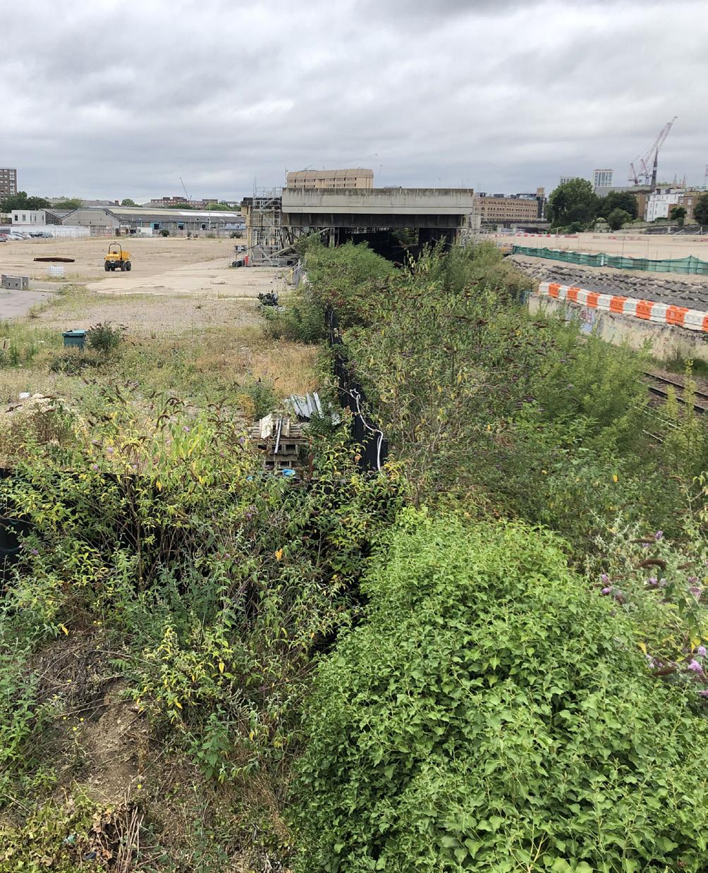
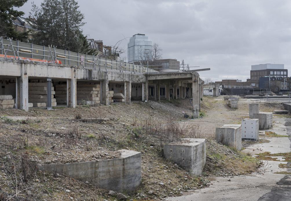
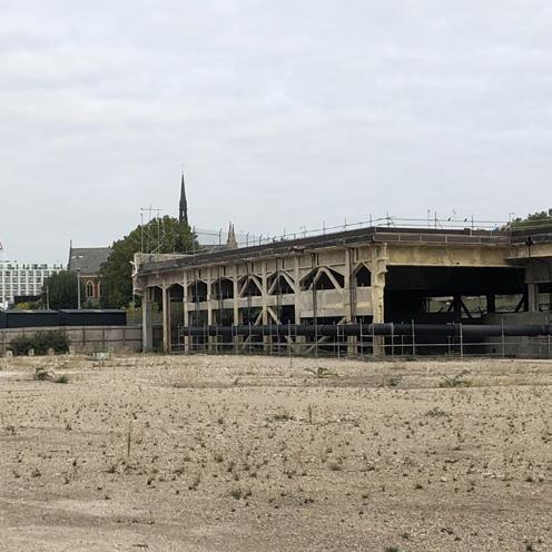
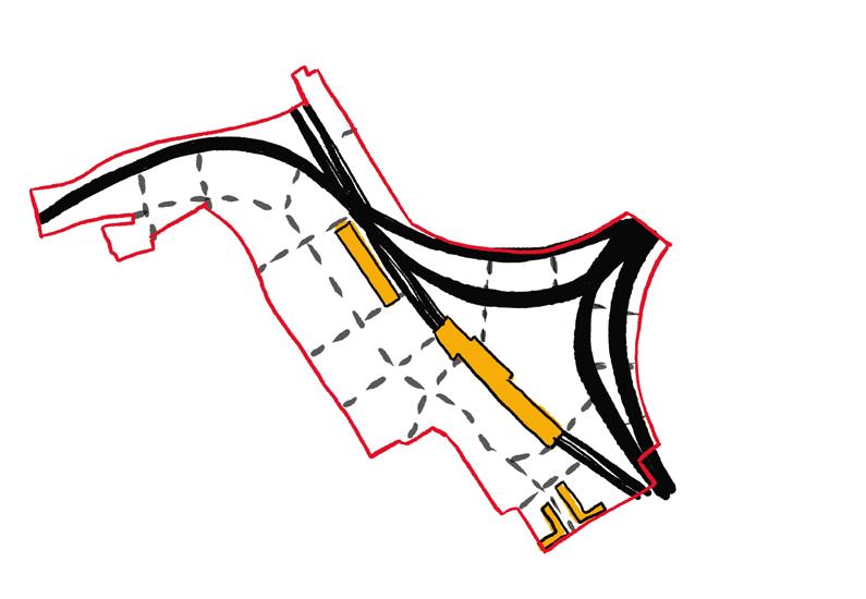
Today, all that physically remains on the Site is the existing deck structure spanning the West London Railway Line, known as the Table structure.
Aerial view of the Earls Court Exhibition Centres before demolition
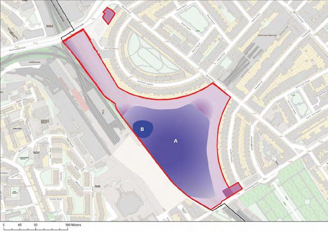
View from West Cromwell Road of the former Exhibition Centres, with approximate AODs
3.2 Site History
2013 - Consent is granted for a scheme submitted by Capital and Counties
Planning history
The Site has an extensive planning history, including a previously consented masterplan in 2013 for a larger area.
In 2013, plans to redevelop the Earls Court Site formed part of a consented Outline Planning Application with associated approvals for Reserved Matters Applications (RMAs) by Capital and Counties (Capco). The Site area was c. 69 acres and included the West Kensington and Gibbs Green Estates.
2019 - The Earls Court Development Company (ECDC) is formed to drive the transformation of the Site
ECDC is responsible for the c. 40 acres former Earls Court Exhibition Centre Site on behalf of the Earls Court Partnership Limited – a joint venture between Delancey (on behalf of its client funds) and the Dutch pension fund manager, APG and Transport for London (TfL).
2024 - The new Hybrid Planning Applications are submitted for the Site by ECPL
Current Planning Application boundary
3.2 Site History
The Site today
Years after the demolition of the Exhibition Centres, the history and legacy of the Earls Court Development Site continue to influence aspirations for what is to come.
The Site presents a significant opportunity to stitch into the context and legacy of the wellestablished neighbourhoods around it whilst also addressing modern-day challenges to help secure its future. The success of temporary uses, artwork and events in and around the Site have given a hint of what is to come, and how the Site will complement and add to the character of these communities.
The following pages analyse the local context in which the Site is being re-imagined and the role that the Earls Court Development plays in responding to that context.
Panoramic view of the Site, looking north from the top of the Table structure
Lillie Road frontage
Earls Court Beach at London Wonderground Consultation event held at Warwick Road Apron
Hoardings on Old Brompton Road
West London Railway Line tracks with Underbelly festival in the background
Hoarding along Old Brompton Road
3.3 Local Context
West London context
The Earls Court Development needs to respond to the issues of today, celebrating the wonder of the Site’s history whilst leading the way for future change.
This section assesses the Site in the local context under the following themes:
• Wider London and West London context
• Retail, culture and workspace
• Public transport and cycling
• Parks, open space and play
• Built form and architectural character
• Socio-economic makeup and community infrastructure
• Heritage and townscape
Earl’s Court station
West Brompton station
Kensington station
Brompton Cemetery
Empress State Building
Lillie Bridge Depot
West Kensington and Gibbs Green Estates
Philbeach Gardens
Eardley Crescent
North End Road
West Cromwell Road (A4)
Lillie Square
Seagrave Road
Empress Place
Lillie Road
Holland Park
Hyde Park
White City Olympia
Warwick Road
Royal Borough of Kensington and Chelsea (RBKC)
London Borough of Hammersmith and Fulham (LBHF)
Aerial photo looking north over the Site
3.3 Local Context
Evolving density clusters around London
Development at Earls Court is situated within the broader landscape of new development emerging across London’s Opportunity Areas. The Site does not fall within any strategic views defined by the London View Management Framework (LVMF).
Policy GG2 and Policy D3 of the London Plan encourage the optimisation of Site capacity through a design-led approach, and Policy D9 recognises that tall buildings can form part of a plan-led approach to facilitating regeneration opportunities and managing future growth
The Earls Court Development is a key opportunity to deliver on these aspirations while being informed by a number of comparable schemes that have emerged across the city.
The well-established tall building clusters in the City of London and the area around London Bridge are examples of where buildings have shaped London’s identifiable skyline.
New height clusters, such as those in Vauxhall, Nine Elms, and Battersea, have emerged within the context of low-scale buildings, creating a contrast to the surrounding context, except where they scale down to protect the prominence of Battersea Power Station.
These principles can also be found in West London, with the emergence of high-density, tall building developments adjacent to low-rise residential neighbourhoods at White City and Chelsea Waterfront.
Tall buildings mapped over London Opportunity Areas and LVMF view corridors. Heights shown are approximate AODs.
City of London
Nine Elms
The Earls Court Development Site LVMF View Corridors London Opportunity Areas
The Earls Court Development can optimise the use of this brownfield Site in line with strategic policies including GG2 and D3 of the London Plan.
Earls Court 147m
Chelsea Waterfront
3.3 Local Context
A strategic location in West London
The Earls Court Development Site plays a key role as one of the emerging schemes along the West London Railway Line corridor.
Old Oak and Park Royal
Olympia Shepherd’s Bush White City
Imperial Wharf
Chelsea Waterfront
Brompton Cemetery
Eel Brook Common
Holland Park
Wormwood Scrubs
Hyde Park
Earls Court Development Site
Local Context
Emerging context
New developments around the Earls Court Development Site demonstrate various approaches to density optimisation in well connected brownfield sites. They establish precedents for the integration of contemporary building typologies within the local area and highlight the range and scale of transformation already under way.
Opportunity Areas and centrally located brownfield sites along the West London Railway Line respond to the GLA’s Good Growth Principles, making best use of available land by delivering sustainable new homes and employment in high-density developments. This forms London’s next wave of growth, introducing contemporary typologies to the local context.
A spine of dense residential development is emerging along the West London Railway Line corridor, characterised by contemporary proposals, each which respond to the scale and character of their local context. These developments present an opportunity for the Earls Court Development Site to be a coherent addition to this growth by optimising density with complementary building typologies which are informed by their immediate context.
The Earls Court Site is located at the confluence between two boroughs and six wards within West London. This missing piece of urban fabric has the opportunity to create new connections and stitch into the rich tapestry of the area.
The Site presents an opportunity to make new local connections in all directions, allowing wider access to a variety of open spaces, town centres and high streets. Some of these opportunities are summarised below:
• The Site sits within walking distance of two vibrant local high streets, Earls Court Road to the east, and North End Road to the west.
• Further afield, the district centres of Hammersmith Town Centre, Fulham Broadway, and Kensington High Street provide more established amenity provision for the wider area.
• The Site presents an opportunity to open up new east-west and north-south connections that facilitate access to these local and district centres.
2. North End Road and Fulham Broadway
4. Kensington
3. King Street, Hammersmith Town Centre
1. Earls Court Road
3.3 Local Context
Retail and culture
The Site is located at the centre of an existing ecosystem of retail centres, cultural venues, and amenities. The GLA Opportunity Area recognises the importance of the Site in contributing to this provision.
North End Road, Fulham Broadway and Earls Court Road all provide access to local shops, cafés and restaurants within a short distance. At a wider scale, the Site is also close to Hammersmith Town Centre, Shepherd’s Bush, Chelsea, and Kensington High Street.
A number of cultural venues are located on neighbouring high streets of North End Road, Hammersmith and Lillie Road. The Museum Quarter in South Kensington forms a cultural hub to the east.
Smaller venues and supporting service industries such as hotels remain locally despite the closure of the Exhibition Centres. A need to extend and support this existing network has been established in the Retail and Cultural Strategy.
► Refer to Town Centre Impact Assessment (EC.PA.29).
► Refer to Retail Strategy (EC.PA.30).
► Refer to Cultural Strategy (EC.PA.31).
There is an opportunity to complement the local cultural offer in line with the London Plan principles of ‘Good Growth’ and Policy HC5.
2. Design Museum, Kensington
4. Fulham
3. V&A Museum, part of the Museum Quarter 1. Lyric Square, Hammersmith
3.3 Local Context
Workspace
The Opportunity Area, LBHF’s Industrial Strategy and RBKC’s New Local Plan Review (NLPR) identify Earls Court’s potential to complement the local workspace and innovation network.
While LBHF and RBKC both have a good provision of affordable workspace, flexible workspace, accelerator space and co-working space, there is little of this within a 10-minute walk from the Site. This is likely to be because the area is predominantly residential and retail focused, and because the existing building typologies do not easily lend themselves to open and modern workspace schemes.
There is potential to deliver new commercial floorspace and affordable workspace to assist in delivering new jobs, and creating a vibrant place and inclusive community in line with London Plan Policies GG5, E1 and E3 and the Site Allocations.
The Site is served by three London Underground stations and a number of bus routes. West Brompton station additionally offers access to Overground and National Rail services, providing a good range of local public transport options.
The majority of the Site has a 6a Public Transport Accessibility Level (PTAL) rating, indicating optimal public transport connectivity.
Parts of the Site have PTAL ratings of 2 and 3 (adjacent to the Lillie Bridge Depot), and 4 and 5 (next to North End Road and around West Kensington). This is due to the distance from the stations and current lack of pedestrian connectivity.
The stations located adjacent to the Site provide a range of public transport services that operate frequently.
► Refer to Transport Assessment (EC.PA.13).
Policy GG2 of the London Plan states: ‘To create successful sustainable mixed-use places that make the best use of land, those involved in planning and development must prioritise sites which are well-connected by existing or planned public transport’
London Underground, Overground and National Rail
• Earl’s Court station operates District Line services and provides access to the Piccadilly Line.
• West Brompton offers access to the District Line and National Rail services and has direct access to the Southern Rail and London Overground network. Southern serves destinations such as Hemel Hempstead, Watford, Clapham Junction, and Croydon.
• West Kensington station offers access to the District Line, albeit with a different level of service compared to Earl’s Court.
Step-free access
• Earl’s Court station has step-free access via lifts to Piccadilly line services and using miniramps to District Line trains.
• There is step-free access at West Brompton station via lifts to eastbound District line services and using additional ramps to board London Overground services.
• West Kensington station is not wheelchair accessible.
Bus network
The Proposed Development will also benefit from the number of bus services operating near the Site with the Route 190 also featuring a terminating bus stop within the Lillie Road Bus Facility.
3.3 Local Context
Cycle network
The Site has the opportunity to enhance and complete the local cycle network by creating links to key routes.
The Site can link into a number of key routes:
• Quietway 15 (Q15) – originating on Kempsford Gardens
• Cycleway 39 (C39) – originating on Russell Road
• Sustrans local routes along Warwick Road, Lillie Road and Old Brompton Road
London’s Cycleways and the national cycle network currently provide established east-west connections within 15 minutes to the south of the Site, using the Cycle superhighway (CS8) and the National Cycle Route 4 (NCR4) along either side of the river.
There are opportunities to improve the cycling experience along the southern boundary of the Site and connect into the surrounding cycle network.
► Refer to Transport Assessment (EC.PA.13).
The Earls Court Development Site
National Cycle Route 4 (NCR4)
Cycle superhighway (CS8)
TfL Cycleways and Quietways
Proposed TfL Cycleways and Quietways
Local routes identified by boroughs and Sustrans
Main roads connecting cycle routes 10 and 15 minute cycling isochromes
The Site has the potential to play an important role in the connectivity of the area assisting in extending, connecting and improving the local pedestrian and cycling networks in line with London Plan Policy T2 (Healthy Streets), LBHF Local Plan Policy T1 and RBKC Local Plan Policy CT1.
3. Cycle crossing at Old Brompton Road connecting to TfL Quietway 15
2. Narrow cycle routes along Lillie Road
1. Junction to Baron’s Court Road, connecting to western cycle routes
4. Brompton Cemetery’s central axis forms a key southern connection
3.3 Local Context
Parks and open space
The local area offers a wide variety of open spaces. However, there is a lack of publicly accessible, usable green space within the Site’s immediate vicinity.
The local area is characterised by a patchwork of semi-private Victorian and Georgian squares and gardens as well as larger parks with varying amenity. Key spaces include:
• Normand Park located 10-15 minutes walk to the west offers a mix of recreational spaces, which are modest in contrast to Holland Park, a 20-minute walk north from the Site.
• Holland Park to the north offers a variety of public outdoor amenities, including sports areas, large wooded spaces, and children’s facilities.
• Brompton Cemetery to the south is a Grade I listed public open space (including Grade II and II* structures), one of London’s Magnificent Seven Victorian cemeteries. It offers a contemplative setting that is popular with walkers and birdwatchers.
• Brompton Park to the south offers open space contrasting the neighbouring cemetery, including some small sports and play facilities
• Local sites of ecological significance include the embankments of the West London Railway Line, which provide an important north-south biodiversity corridor stretching to the Thames.
There is opportunity to address the shortfall in the diversity of local open space that caters for everyone in line with the aspirations of London Plan Policy G4, LBHF Local Plan Policy OS1, RBKC Local Plan Policy CR5 and NLPR Policy GB16.
Opportunities to connect ecology corridor
2. Brompton Park (10 minute walk)
3. Normand Park (10-15 minute
1. Brompton Cemetery (5 minute walk)
3.3 Local Context
Play provision
Play provision nearest the Site can be found in the West Kensington and Gibbs Green Estates and Normand Park. Play areas are small and cater primarily to younger children.
Whilst there are a variety of play areas within a 15-20 minute walk of the Site, there are few play areas within a 10 minute walk. Play areas closest to the Site are predominantly fixed play facilities contained within housing developments, rather than within parks and open spaces. These are not large enough to accommodate the anticipated increase in residents following development.
Notable play provisions within a 15-20 minute walk include the following:
• Normand Park provides contemporary play facilities for a variety of ages, a bowling green, an outdoor gym and a skate park.
• Eel Brook Common is a newly renovated park containing dedicated play facilities and a football pitch
• The Clem Attlee playground is modest and has fixed play equipment for small children
• The Holland Park Adventure Playground is a large, contemporary play area for multiple age groups
The adjacent diagram identifies these facilities and the opportunity for the Site to positively contribute to the play provision for both existing and emerging communities.
The Site can supplement the local play offer and bring play for all ages closer to nearby communities, in line with the aspirations of London Plan Policy S4.
1. Normand Park Playground (10-15 minute walk)
4. Holland Park Adventure Playground (20 minute walk)
2. Eel Brook Common Football (20 minute walk)
3. Clem Attlee Playground (10-15 minute walk)
6. The triangular MUGA on Aisgill Avenue is compromised by an irregular geometry
5. Play equipment on the Mund Street open space
3.3 Local Context
Socio-economic makeup of the local area
Both boroughs have strong, established communities surrounding the Site. Some socioeconomic challenges have been identified that could be addressed by the Earls Court Development.
The factors identified as highly sensitive receptors includes:
Local economy:
• The LBHF part of the Site falls within the 1020% most deprived areas in England.
• The RBKC part of the site sits adjacent to two areas that sit within the 20% most deprived areas in England.
An analysis of the local area around the Site has demonstrated several highly sensitive ‘receptors,’ or factors, relating to current socioeconomic conditions. Whilst both boroughs face challenges, the area around the Site within the LBHF borough is in greater need of employment, new homes and more open space than RBKC, highlighting the economic divide between these two areas.
The Earls Court Development is an opportunity to improve the current challenges of the surrounding communities in both boroughs whilst creating a well-considered, long-term social infrastructure for its new residents that will provide employment, homes and social support for generations.
► Refer to Environmental Statement (EC.PA.12).
• In January 2024, the unemployment rate in the LBHF part of the Site is higher than RBKC and slightly lower than wider London.
Delivery of housing:
• Whilst both LBHF and RBKC have made significant additions to their housing supply, they both have struggled to meet annual targets.
Open Space:
• LBHF’s Parks and Open Space Strategy (2008) identifies a particular need along the boundary with Fulham and a lack of playspace suitable for children 0-12 years old.
• RBKC’s open space audit identifies the Earl’s Court ward as particularly deficient in access to public open space and identifies significant gaps in access to playspace in Abingdon and the Earl’s Court wards.
Map of Indices of Multiple Deprivation 2019
Map of Indices of Multiple Deprivation at borough-wide scale, 2019
3.3 Local Context
Social and community amenities
Existing amenities will be supported alongside new provision to meet the needs of new and existing communities.
Analysis suggests the existing provision of schools is adequate in the local area although secondary schools have the ability to accommodate higher numbers of pupils depending on changes in the local population.
There is an under provision of Early Years Centres in the area. The location of these Centres should be close to the areas of greatest need for childcare.
The Earls Court Development will need to accommodate flexibility for a variety of social and community uses, depending on the changing needs.
► Refer to Social Value Statement (EC.PA.45).
There is an opportunity to complement and enhance the local social infrastructure offer in line with Policy GG1 and S1 of the London Plan, Policy CF1 of the LBHF Local Plan, and policies within Chapter 18 of the RBKC Local Plan and Chapter 7 of the NLPR, meeting the needs of the existing and new communities.
Residential neighbourhoods
The local area is made up of a number of smaller residential communities, each with a distinct character. This is informed by the range of building typologies locally, access to social and community assets and the corresponding different socio-economic makeup of the wards.
There is opportunity for the Proposed Development to demonstrate how the mix, of dwelling types, sizes and tenures meet strategic and local need and are appropriate to the location, in line with the London Plan and Local Plans.
Earl’s Court station
West Brompton station
West Kensington station
Brompton Cemetery Empress State Building
Lillie Bridge Depot
West Kensington and Gibbs Green Estates
Philbeach Gardens
Eardley Crescent
North End Road
Lillie Square
Seagrave Road
Lillie Road
Holland Park Hyde Park
White City Olympia
Warwick Road
Aerial view looking north over the Site
Hammersmith
Queen’s Club
Earls Court Road
3.3 Local Context
Defining an area’s character is important in understanding its capacity for growth (London Plan Policy D1)
Built form in the local area
The Site is surrounded by a variety of built form characters and streetscape typologies that reflect the rich architectural tapestry of West London.
A fine grain of Victorian housing forms the overarching building typology, with terraces and mews forming a distinct streetscape that varies from traditional homes to elaborate mansion blocks. Other built form characteristics of the adjacent context include:
• Post-war mid-century housing estates offer a contrasting typology that establishes a different street grain, material palette and open space character.
• More recent developments along the West London Railway Line occupy larger footprints and integrate taller elements.
• This diverse mix of styles, periods, and typologies lends a unique quality to the Site’s context and offers many material and built form references to inform the proposals.
► Refer to Design and Access Statement Volume 1: Outline Component/ Appendix (EC.PA.08).
Post-war
Post-war
New developments (post-2000)
3. West Kensington and Gibbs Green Estates
2. Queen’s Club Gardens mansion blocks
1. Philbeach Gardens Victorian terraces
4. Lillie Square, one of several new developments along the West London Railway Line
Outline map of indicative and predominant built form typologies around the Earls Court Development Site, assessed via an initial desktop study
3.3 Local Context
Local architectural character
The architectural variety of the surrounding neighbourhoods includes a range of styles and materials reflecting different periods of development.
19th century development
These styles can be broken into three periods:
19th century development
• Mansion blocks feature a distinctive red brick elevation characterised by rhythm, symmetry, and the visual complexity of stone ornamentation and ironwork. The façades are richly detailed with decorative cornices, pilasters, and balconies, lending a sense of grandeur.
• Terraced houses in areas such as Philbeach Gardens showcase a Victorian architectural style using yellow or red brick, often with stucco or stone detailing. Their uniform and rhythmic appearance creates a cohesive streetscape.
20th century development
• In contrast, mid-century housing estates such as Clem Attlee Court, West Kensington and Gibbs Green Estates adopt simpler and more functional forms with little ornamentation. Concrete structural components and balcony railings contrast with the brickwork and emphasise a modernist aesthetic.
• West of the Site, the Empress State Building represents the forward-looking spirit of midcentury modernist architecture. Completed in 1961 and designed by Stone, Toms & Partners it has since undergone various refurbishments and change of uses.
21st century development
• Emerging developments add another layer to the varied architectural context of Earls Court, often with contemporary interpretations of historic typologies.
The Site is adjacent to a number of conservation areas and historic assets that require a considered response.
The following heritage considerations are of particular significance:
• The Philbeach Conservation Area reflects the Victorian architectural and historical characteristics of this neighbourhood.
• Within it, the Grade I listed St Cuthbert’s Church is a notable example of Gothic Revival architecture.
• Grade I listed Brompton Cemetery is one of London’s ‘Magnificent Seven’ cemeteries. It was established in 1840 and designed by Benjamin Baud in a grand neoclassical style. Its history, architecture, and diverse flora and fauna make it a significant cultural, historical, and ecological site.
• Earl’s Court and West Brompton stations both contain Grade II listed buildings opened in 1871 and 1869 respectively. They are emblematic of the Victorian architectural style, and are recognised for their architectural and historic interest.
► Refer to Environmental Statement (EC.PA.12).
The Earls Court Development should enhance and utilise the heritage assets and architectural features that contribute towards the local character, in line with Policy D3 and HC1 of the London Plan.
Earls Court Development Site
2. Grade I listed Brompton Cemetery, which includes Grade II* and II listed structures.
1. Grade I listed St Cuthbert’s Church and Grade II listed Clergy House.
3. Grade II listed Earl’s Court and West Brompton stations (1871 and 1869).
West Brompton is one of the first Underground stations in the world and retains its original booking hall. Earl’s Court was the first to have escalators (from 1911).
Map of conservation areas and statutory listed buildings around the Earls Court Development Site
Nevern Square
Philbeach
Philbeach
Earl’s Court Square
Courtfield
Earl’s Court Village
The Boltons Brompton Cemetery
Sedlescombe Road
Baron’s Court
Olympia and Avonmore
Lexham
Edwardes Square/ Scarsdale & Abingdon
Turneville/ Chesson
Local Context
The approach to scale and massing at the Site will need to take account of potential impacts upon strategic and local views in accordance with Policies D9, HC3 and HC4. The Site is not subject to strategic views defined by the LVMF.
Townscape views
A wide range of views have been identified at varying distances and locations around the Site to inform the townscape impacts of the Proposed Development.
Key townscape views, identified in local planning documents, have significantly influenced the massing and layout of the Proposed Development. These include views from Brompton Cemetery, Philbeach Gardens, Mornington Avenue, and the Queen’s Club. Detailed descriptions of these views are provided on the following pages.
The Site is not subject to strategic views defined by the London View Management Framework (LVMF). This is also dealt with in following pages.
► Refer to Environmental Statement (EC.PA.12).
► Refer to Design and Access Statement Volume 1: Outline Component / Design Evolution & Engagement (EC.PA.08).
St Cuthbert’s Church
Brompton Cemetery
Queens Club Mornington Avenue
3.3 Local Context
Key townscape views
Views 07 to 09 Brompton Cemetery
In this dynamic view along the central axis of Brompton Cemetery, the bell tower with its cupola frames the perspective looking north. Development will need to maintain the prominence of the cupola by locating taller elements closer to the Empress State Building and stepping heights down towards the east. Buildings to the east and west of the cupola will need to appear peripheral to these axial views.
The Grade I listed St Cuthbert’s Church breaks the uniform height of the residential crescent and acts as an important local landmark. The legibility of the picturesque roofline of the church on the skyline should be maintained.
View 25 St Cuthbert’s Church
Cupola of bell tower
Central axis
Empress State Building
St Cuthbert’s Church
State Building
Dynamic view of Brompton Cemetery, looking north towards the cupola
View 25, St Cuthbert’s Church
Local Context
Key heritage views
The view ends at Ashfield House, which contrasts with the smaller, historic buildings of the conservation area in the foreground. This highlights the presence of the A4, a key route into London from the west.
This view consists of a residential datum that rises to the south with a taller apartment building and the Empress State Building beyond. The spire of St Andrews Fulham Fields Church is prominent in this view and the clear legibility of its spire on the skyline should be preserved.
View 41 Mornington Avenue
View 50 Queens Club
Spire of St Andrews Fulham Fields Church is obscured in this image by the temporary tennis structure
Ashfield House West Cromwell Road (A4)
Approximate location of St Andrews Fulham Fields Church spire
Empress State Building
View 41 - Mornington Avenue
View 50 - The Queens Club
3.3 Local Context
In line with London Plan Policy HC4, the Site does not have any strategic viewing corridors crossing it.
Development of this scale on the Earls Court Site would not impact LVMF views
The Site does not have any strategic viewing corridors crossing it.
The narrow viewing corridor of LVMF View from King Henry’s Mound, Richmond (Assessment Point 9A.1), passes to the south of Earls Court.
At this scale there would be no impact on the skyline of Whitehall Court in the River Prospect from Blackfriars Bridge (Assessment Point 14A.1).
KINGHENRY’SMOUND
Map of LVMF viewing corridors across West and Central London
The Earls Court Development Site
LVMF View Corridors
King Henry’s Mound, Richmond
Local Context
The panoramic River Prospect view upstream from Blackfriars Bridge has informed maximum building heights
The panoramic River Prospect view upstream from Blackfriars Bridge at Assessment Point 14A.1 has been used to assess the potential impact of tall development on the Earls Court Site.
Blackfriars Bridge runs in a north south orientation. Designed by Joseph cubitt and h. carr it was opened in 1869 and widened on the west side in 1907-10. It is now the widest river bridge in central London. To the west, buildings in Westminster rise beyond Temple Gardens. To the north and east, the view is becoming dominated by the new development of Blackfriars Thameslink Station and the top of the dome of St Paul’s cathedral is only just visible. To the southwest there are views to the South Bank.
The view from this Assessment Point does not include a Protected Vista or a Protected Silhouette that would preclude the visibility of new development in any part of the view. Testing needs to be undertaken during the design development to establish if the Proposed Development is visible behind Whitehall Court from this view, and be assessed accordingly.
Panorama from assessment Point 14a.1 Blackfriars Bridge: upstream – at the centre of the bridge
Location of Assessment Point on Blackfriars Bridge, looking west towards the Site
Panorama from Assessment Point 14A.1 Blackfriars Bridge: upstream – at the centre of the bridge
3.4 The Site
A complex, threedimensional puzzle
Existing infrastructure and buildings together with sensitive edge conditions inform the potential development of the current Site.
The following pages set out the existing physical attributes, constraints and opportunities of the Earls Court Site, including:
• Historic buildings and structures on the Site.
• Open rail lines, tunnels and apron structures that pose significant constraints to development.
• Site edges that vary in character, and limited access points.
• Air and noise pollution caused by the A4 and West London Railway Line.
• Limited biodiversity and interruptions in the local ecological network.
• Location of the Site in Flood Zone 3.
Brompton Cemetery Empress State Building
Lillie Bridge Depot
West Kensington and Gibbs Green Estates Philbeach Gardens North End Road
Lillie Road
Warwick Road
Aerial view looking south over the Site
Nevern Square
West Cromwell Road (A4)
The Train Shed
The Table structure
Bishops Park
Earl’s Court station
West Brompton station
West Kensington station RBKC LBHF
3.4 The Site
9 Beaumont Avenue
Existing Site features
The historical evolution of the Site has brought with it railway infrastructure, the Lillie Bridge Depot, and remnants of the now demolished Exhibition Centres.
1
2
3
4
5
6
7
Mews
A 2 storey building located in the far northwestern part of the Site. This is currently activated as a temporary use.
West Cromwell Road (A4)
The far northeastern part of the Site comprises a commercial building at 5 storeys, an annex building which comprises 3 storeys of residential flats and associated paved roads with parking. This is currently activated as a temporary use.
North End Road
Lillie Bridge Depot (LBD)
Lillie Bridge Depot (LBD) – The western, northern and northwestern part of the Site comprise the LBD. The LBD is currently used as a maintenance facility by London Underground Ltd (LUL) and as a TfL training facility. The LBD uses and on-Site structures comprise office buildings, rail tracks, road to rail vehicle (RRV) delivery and access point, articulated lorry access and delivery area, carpenter/ rail workshops, storage buildings, train stabling box, associated infrastructure and parking.
The western, northern and northwestern part of the Site comprise the LBD. The LBD is currently used as a maintenance facility by London Underground Ltd (LUL) and as a TfL training facility. The LBD uses and on-site structures comprise office buildings, rail tracks, road to rail vehicle (RRV) delivery and access point, articulated lorry access and delivery area, carpenter/ rail workshops, storage buildings, train stabling box, associated infrastructure and parking.
Land formerly home to the Earls Court Exhibition Centres
The eastern and southeastern parts of the Site (roughly triangular shaped and to the east of the WLL) and the southwestern part of the Site (to the west of the WLL) comprise extensive areas of open hardstanding. These areas of hardstanding were previously occupied by the Earls Court Exhibition Centres which were demolished between 2015 and 2017.
Empress Place
The southern and southwestern parts of the Site comprise 3-4 storey terrace buildings fronting Empress Place and Lillie Road. These are currently activated with temporary uses. The Earls Court Development Site
Table structure
A steel and concrete decking structure that spans the West London Railway Line between areas of hardstanding. This allowed the Exhibition Centres to straddle the railway.
Lillie Road Bus Facility
To the west of Empress Place is a bus turning and waiting facility accessed from Lillie Road. This area comprises a bus layover area with capacity for up to four buses and a small standalone structure that includes welfare facilities for bus drivers.
Royal Borough of Kensington and Chelsea (RBKC)
London Borough of Hammersmith and Fulham (LBHF)
1 Cluny Mews
Philbeach Gardens
Aerial photo of the Site
The Site today
The Site is largely vacant but some structures remain. The Table structure is the only significant remnant of the Exhibition Centres and bridges the West London Railway Line.
Some of the concourse structures that led up to Exhibition Centre 1 remain bordering Eardley Crescent and Philbeach Gardens. Other than this, the majority of the Site is formed of crushed concrete, created and levelled through the demolition process, exposing the tops of three of the four Underground tunnels.
The large structural deck (‘the Table structure’) over the West London Railway Line remains from the demolition of the centres in 2015. It is an encapsulated steel structure supporting a concrete slab and sits roughly 6-8m higher than ground level.
1. View looking east across the Table structure and District Line tunnels
8. Remaining concourse structure adjacent to Eardley Crescent
7. Remaining structures adjacent to District Line tunnel
5. View looking north from the road bridge at Lillie Road
2. View looking north showing the western side of the Table structure
3. View looking north showing the eastern side of the Table structure
6. Remaining steps of former Exhibition Centres entrance
4. View looking south along the Northern Access Road and West London Railway Line
The Site
Lillie Bridge Depot and the Train Shed
A number of TfL and rail assets currently support the maintenance and operations of the London Underground. The remaining portion of the original Train Shed reflects the industrial character of the Site.
Lillie Bridge Depot is occupied by industrial sheds and Ashfield House, a ten-storey brutalist office building that is visible from the A4 and surrounding streets.
The Train Shed is one of the oldest buildings on the Site, built between 1894 and 1912. It once measured 400m but was cut back in the 1940s to make way for Earls Court 2. Its northern gable and brick façades are still original.
There is an opportunity to celebrate the industrial heritage of the Site, in response to Policy D3’s guidance on Quality and Character.
1. View looking south over the Lillie Bridge Depot
7. Existing TfL operational building
5. Internal view of the Train Shed looking south
3. View of Ashfield House from West Cromwell Road
2. View looking east below the A4 along the Underground train tracks
4. View of the northern gable of the Train Shed
6. View of the western facade of the Train Shed
The Site
Empress Place and the Lillie Road Bus Facility
Formerly an entrance to the Exhibition Grounds and Lillie Bridge Depot, this characterful Victorian street forms the southern access to the Site.
Empress Place features a cohesive collection of late Victorian terraced houses, characterised by ornate detailing, stucco façades and decorative elements typical of the period.
The Project Rooms building was purpose-built in 1907 by the Brompton & Piccadilly Railway Company and is where the Piccadilly Line was designed and engineered.
The Lillie Road Bus Facility includes two bus stops, layover spaces and staff facilities. It provides pedestrian and vehicular access to the Empress State Building. The former Metropolitan Police Heritage Centre has been transformed by ECDC into ‘Conversation Corner’ for public consultation. In the 1890s, this part of the Site was the main entrance to the Exhibition Grounds.
1. View of the eastern terraced houses on Empress Place
3. Empress State Building, with the ‘Project Rooms’ in the foreground
6. View of the western terraced houses on Empress Place
5. The former Metropolitan Police Heritage Centre, currently used as ‘Conversation Corner’
4. The Prince Pub, on the corner of Lillie Road and Empress Place
2. View to the rear of the Empress Place terraced houses
3.4 The Site
Warwick Road
To the east, Warwick Road serves as an important historic entrance to the Site.
Warwick Road is a busy access route leading to the A4, with a pedestrian exit from Earl’s Court station forming a key arrival point. Noise and sound pollution along this edge affect existing residents and visitors.
This used to be the primary entrance to the Exhibition Centres. There is potential to capitalise on the previous sense of arrival here, and reinstate the primary entrance to the Site.
As part of the programme of temporary uses, ECDC has pulled back the hoarding line and recreated a public space on Warwick Road. A series of art installations, landscape interventions and public events have allowed it to be open once more.
1. Warwick Road looking south
2. Warwick Road looking north
3. Warwick Road looking south to Penywern Road
Key plan of eastern part of the Site
Aerial View of the Warwick Road Apron and pedestrian crossing from Earl’s Court station into the Site.
The Site
The crescents
Philbeach Gardens and Eardley Crescent are Victorian residential streets that form part of the Philbeach Conservation Area to the east of the Site.
Both crescents feature late-Victorian terraced houses and Philbeach Gardens has a communal garden at its centre. The crescent shape of these streets is a distinctive urban form shaped by the railway lines which arrived in the 19th century. Many of the properties retain original architectural features, maintaining the historic character of the neighbourhood.
1. Philbeach Gardens
2. Eardley Crescent
3. St Cuthbert’s Church along Philbeach Gardens
Aerial View, looking north at the boundary condition with houses along Philbeach Gardens.
3.4 The Site
Lillie Road
The southern boundary of the Site is formed by Lillie Road, a street with a variety of building scales and typologies which culminates at West Brompton station.
Lillie Road serves as a vital link for both vehicles and pedestrians, connecting Fulham and South Kensington. The array of building uses and architectural periods has resulted in a diverse streetscape lacking a cohesive height or architectural style, and creating an indistinct edge condition. The vacant Site further exacerbates this and creates a gap in the streetscape.
Pedestrians can currently view the entire extent of the Site from Lillie Bridge and access it via Empress Place. Developing this edge presents an opportunity to reintroduce a defined building line along Lillie Road.
1. Entrance to West Brompton station
3. Retail frontage along Lillie Road and into Empress Place
2. View looking east along Lillie Road
Aerial View, looking north at Lillie Road and the Empress Place terraced houses within the Site.
The Site
The West Kensington and Gibbs Green Estates
The boundary with the Gibbs Green and West Kensington Estates consists of a walled edge and provides an opportunity to mediate between different urban scales.
A 3 metre high brick wall separates the Site from the Estates to the west. The wall is interrupted by an entrance gate into the ECDC run Community Hub which welcomes residents from the local area.
Low-rise and medium-rise residential blocks contrast with the Victorian street pattern found further west of North End Road.
The Empress State Building is a prominent feature that introduces a different scale and typology to the area.
1. Aisgill Avenue looking south
2. The boundary wall between West Kensington and Gibbs Green Estates, and the Site
3. The existing triangular MUGA on Aisgill Avenue
Key plan of western part of the Site
Aerial View, looking north-west towards West Kensington and Gibbs Green Estates. The Community Hub in the foreground was opened by ECDC in 2022.
3.4 The Site
North End Road
The North End Road interfaces with the Site at West Kensington station and is accessed via the West Kensington and Gibbs Green Estates to the west.
North End Road is a bustling high street lined with a variety of shops, markets and eateries. It offers a mix of local businesses, including grocery stores, clothing shops and independent boutiques. The road is popular for its street market, which operates six days a week, providing fresh produce, household goods and street food. This shopping destination serves as a hub for the local community.
The Site is accessed along Beaumont Avenue to the north-west, which is a more domestic scale.
West Cromwell Road
The West Cromwell Road (A4) is a strategic arterial route that runs along the northern edge of the Site. It forms an important gateway to Earls Court but also creates a hostile divide from the areas to the north.
This major six-lane arterial route connects central London to Hammersmith Town Centre to the west, and beyond to the M4 motorway. Buildings along this edge typically consist of larger footprints, and are pulled back from the street to respond to the noise and air pollution. The Site here is also highly visible, as the level change allows people to see in from their vehicles.
2. St Cuthbert’s Church from West Cromwell Road
3. West Cromwell Road, looking west from 1 Cluny Mews
1. West Cromwell Road looking east
3. North End Road shops
2. Beaumont
Site Analysis
Existing habitats
The Earls Court Site is home to a limited number of habitats with some Sites of Importance for Nature Conservation (SINCs) along the West London Railway Line.
Existing habitats on the Site include:
• Poor semi-improved grassland and introduced scrub form the majority of the Site’s habitats along the railway corridors and Site boundaries.
• Most trees are located along the shared boundary with Philbeach Gardens and Eardley Crescent.
• The Brompton Cemetery SINC extends into the Site along the West London Railway Line. It is then interrupted and continues again north of the Table structure. There is an opportunity to connect the SINC and create a north-south ecological link through the Site. Sites of Importance for Nature Conservation (SINCs) Poor semi-improved grassland
Rail infrastructure bisects the Site and London Underground District and Piccadilly Line tunnels create areas where loading capacity is highly constrained. There are key considerations associated with development above or near railway assets and infrastructure. These include:
• The District and Piccadilly Line tunnels run along the Site’s northern boundary and east of the Table. Building over them is subject to tunnel strengthening and transfer structures.
• Areas where tracks converge as they approach the stations are covered by large spanning bridging structures known as ‘aprons’. Their loading capacity is limited, and the erection of new buildings above them would require extensive works or large transfer structures.
• Construction near rail lines and assets requires offsets that are subject to negotiation and agreement with Network Rail and/or TfL. Utility routes and connections may also require diversions prior to development.
Earl’s Court station
The complexity of the infrastructure at Earls Court drives the layout of the Proposed Development in a fundamental way.
St Cuthbert’s Church
The Table structure
Cromwell Road (A4)
3.5 Site Analysis
Site topography
Railway infrastructure creates considerable changes in levels across the Site.
Level changes on the Site are affected by the following:
• Rail infrastructure runs through the Site at different levels. Deep cuts and decking creates significant barriers to movement and bridging.
• The convergence of Underground lines results in apron structures above, close to Earl’s Court and West Brompton stations. These cause the levels to rise to +10m and +8.2m.
• The Table structure, which decks over the West London Railway Line, rises up to 12.3m, forming a notable promontory at the heart of the Site.
AOD
3.5 Site Analysis
Site topography
Existing Site sections
Sections 1 and 2 describe the existing Site levels and highlight notable features and aspects of the current condition to consider through design development.
Section 2 - West Cromwell Road (A4) to Empress Place St. Cuthbert’s Church Interface with West Cromwell Road (A4)
Site Analysis
Above ground considerations
The approach to development will need to consider adjacent properties and address the access and security requirements associated with live rail facilities and the Empress State Building.
Above ground considerations relate to edge conditions and the safeguarding of access to key TfL assets. These include:
• Residential properties that are adjacent or in close proximity to the Site boundary require a considered and appropriate response in terms of built form and public realm.
• Development along the shared boundary with the Empress State Building is subject to the security requirements of the Mayor’s Office for Policing and Crime (MOPAC), who occupy the building.
• Several access points to the TfL and Network Rail infrastructure will need to be retained and enabled.
Brompton Cemetery
Empress State Building
Lillie Bridge Depot
West Kensington and Gibbs Green Estates
Philbeach Gardens
Eardley Crescent North End Road
West Cromwell Road (A4)
Warwick Road
Ashfield House
Queen’s Club
Hammersmith
Bishop’s Park
Margravine Cemetery
Nevern Square
Earl’s Court Square
Lillie Square
Lillie Road
Empress Place
Old Brompton Road
Earl’s Court station West Brompton station
West Kensington station
3.5 Site Analysis
Environmental considerations
There are a number of environmental factors, including air quality, noise, sunlight, overshadowing, wind and flood risk, which will impact the design response.
Key factors impacting the Site include:
• The A4 and West London Railway Line are major sources of noise and air pollution. The vacant Site allows the spread of pollution and contributes to dust in the air. There is a significant opportunity to enhance air quality and reduce noise pollution through the orientation of buildings and design of public spaces.
• The Empress State Building overshadows the Site considerably from the afternoon onwards. Wind channelling also occurs around the Empress State Building, resulting in higher winds and down draughts in this location.
• The Site partially falls within Environment Agency Flood Zone 3, creating a risk of localised flooding and surface water discharges into the sewer network. An integrated water management strategy based upon surface infiltration will minimise discharge to the sewer network and reduce the risk of localised flooding.
► Refer to Environmental Statement (EC.PA.12).
The approach to density at Earls Court needs to address environmental impacts established under Policies D9 and D13 of the London Plan.
Environmental considerations
Noise and air pollution from A4/West Cromwell Road and railways through Site
South-westerly prevailing wind
Afternoon overshadowing from ESB
The Earls Court Development Site
Sun path direction
Areas within Environment Agency Flood Zone 3
Predominant sources of noise and air pollution
Air
Prevailing wind direction and channelling
Existing trees
Wind channelling around ESB
The Table structure
The Train Shed
North End Road
West Cromwell Road (A4)
3.5 Site Analysis
Air quality
The Site’s air quality has been assessed as part of the wider analysis of key environmental indicators.
This considers the suitability of the Site for the proposed uses and the likely effects of both demolition, construction and the completed development.
The assessment has been undertaken in line with the relevant national, regional and local policies, guidance and regulations.
Key contextual factors include:
• The Site is located within the Ultra Low Emission Zone (ULEZ) which was launched in April 2019 and extended in August 2023.
• The north-west of the Site is located within a LBHF air quality focus area, and the east of the Site is located within a RBKC air quality focus area, indicating potential for high air pollutant concentrations in these areas.
• Potential emission sources have been identified and assessed in the context of existing air quality and the nature and location of receptors.
The Site has been assessed for noise and vibration, considering the existing condition and possible impacts throughout construction and at completion.
The Site is subject to existing noise and vibration from the West London Railway Line, the London Underground, Heathrow flight path and surrounding road network, particularly from the A4 to the north. A baseline characterisation study based on transport data analysis and noise surveys (2021 and 2024) was developed to quantify the prevailing ambient and background noise levels during daytime and night-time periods.
The assessment has considered:
• Effects due to changes in operational road traffic noise occurring on the local road network.
• Effects due to sound of an industrial and commercial nature (including noise from building services plant).
• Effects due to noise from commercial activity.
• Effects due to sound of an industrial nature.
Areas closest to the highest noise and vibration sources such as the West London Railway Line will need to consider additional mitigation measures.
► Refer to Design and Access Statement Volume 1: Outline Component / Spatial Strategies (EC. PA.08).
To establish the suitability for development, and to evaluate potential approaches to Water Resources, a comprehensive Flood Risk Assessment (FRA) has been carried out to evaluate another critical environmental indicator.
The Site sits partially within Flood Zones 2 and 3, largely contained in LBHF land. This has been considered throughout design development, implementing sitewide strategies such as increased planting and incorporating Sustainable Drainage Systems (SuDS) to absorb water runoff and reduce localised flooding.
The appraisal process has combined desktop studies and on-site investigations including topographical surveys, utilities and drainage surveys, and geotechnical site investigations.
The assessment has considered:
• The site levels and topography.
• The existing geological and hydro-geological conditions and any existing watercourses and sewers.
• The baseline flood risk to the Site and study area (with reference to GOV.UK’s online Long-Term Flood Maps and ‘Flood Map for Planning’ services).
Extract from gov.uk ‘long term flood risk information’ showing extent of flooding (reservoirs)
Risk of flooding from rivers and the sea
3.6 Conclusion
Character Evaluation Summary
An appraisal of the evidence and information collated has been utilised to determine the current quality of the Site and its sensitivity to change based on four key indicators in line with the design-led approach and the Characterisation and Growth LPG:
Surrounding area: High value
• Close proximity to Grade I and II listed assets, including St Cuthbert’s Church, Earl’s Court and West Brompton Underground stations and Brompton Cemetery.
• Adjacent to Philbeach, Brompton Cemetery and Olympia and Avonmore Conservation Areas and the north western corner of the Site is within the Barons Court Conservation Area.
• Not affecting any protected viewing corridor. Long-range LVMF view from Blackfriars Bridge has informed the height of the tallest building.
• Key townscape views transect the site including from Queens Club, Brompton Cemetery, Philbeach Gardens and Mornington Avenue. This has informed the placement of tall buildings.
• The surrounding area is incredibly varied in terms of architectural period, style, material and detail. The historic urban grain is apparent in the local area, particularly to the east. To the west this is fractured by more modern developments.
Surrounding area: Moderate value
• The local area contains a range of green spaces, parks and gardens, mature street trees and other rich and varied biodiversity. However many of these spaces are small semi-private gardens, lacking public amenity areas and play space. There is also a noticeable difference in character of open spaces between the boroughs.
• Brompton Cemetery is the most significant green open space in the Site’s immediate vicinity, and is a registered park and garden with rich and varied biodiversity.
• A number of smaller local open spaces and pocket parks are within walking distance, however larger district open spaces and areas of Metropolitan Open Land are all 20 to 30 minutes walk away. Public access and play features are also limited within local green spaces, limiting use and variety.
• Heritage value - This relates to the coherence and extent of the historic environment, and can be split into evidential, historical, aesthetic and communal value.
• Environmental value - This relates to the coherence, quality and extent of the local environment, people’s sensory experience of a place, and its natural assets.
• Social value - This relates to the tangible and less tangible cultural and social characteristics and landscape that contribute to a sense of place.
• Economic value - This relates to the scale and diversity of economic activity and businesses in an area.
Assessment in line with the indicators identified in the Characterisation and Growth Strategy LPG – Stage 2 Step 1 and Step 2
The Site: Low value
• The Site contains no statutory or locally listed assets, and has been largely vacant since the demolition of the Earls Court Exhibition Centres in 2015.
• The Train Shed at Lillie Bridge Depot has been identified as having some historic value. It is the oldest building on the Site and retains many of its original features.
• The Site contrasts the existing use, scale and grain of the surrounding area, and has done so since the inception of the Exhibition Grounds in the mid-1800s. It does not form part of the existing urban grain or architectural language of the surrounding context.
• Limited recognisable remnants of the former Exhibition Centres remain on the Site, other than structural components such as the front steps, portions of the concourse and the Table structure which decks over the West London Railway Line.
• An existing ecological corridor connects north to south from the Thames to Brompton Cemetery, forming a significant habitat corridor for plants and wildlife along the former Counter’s Creek.
The Site: Low value
• The Site is of low ecological value, containing limited existing green open space. Trees and planting are contained to gardens along the edges, behind the terraced buildings at Empress Place, within the Community Hub and along verges of the railway lines.
• Some Sites of Importance for Nature Conservation (SINCs) extend along the West London Railway Line into the Site, but are separated by the Table structure. Potential for local improvements through the Site would unlock wider ecological connections.
• The Site is bound by busy roads on all sides. The A4 and West London Railway Line are major sources of noise and air pollution. The vacant Site allows the spread of pollution and contributes to dust in the air locally.
3.6 Conclusion
Character Evaluation Summary
Social value
Surrounding area: Moderate value
• The local area is well served with a range of small and medium-sized cultural venues, located along neighbouring high streets. The need to extend and support this local network has been established in the Retail and Cultural Strategy. Larger venues are located further afield towards the Museum Quarter, Kensington Olympia and Hammersmith Town Centre.
• Local social infrastructure provision has been assessed in the Social Value Statement. There is a good level of local community assets, with an adequate provision of schools. An underprovision of Early Years Centres has been identified in the local area.
• An underprovision of access to leisure, sport and play facilities within open spaces has been identified, which is noted in Section 3.3 of this chapter.
• The local area has a well developed street network with good pedestrian routes and access to public transport nodes. The Site in its current form however creates severance and limits local connectivity. Opportunities to improve local pedestrian and cycle connections has been identified
• The Site sits between two local high streets, Earls Court Road to the east, and North End Road to the west, providing a range of retail and workspace offers. The need for additional services to complement local employment and economics has been established in the Retail Strategy.
• The Site borders six wards, each with unique socio-economic characteristics. An analysis of the local area has demonstrated several highly sensitive ‘receptors,’ indicating current socio-economic conditions. While both boroughs are displaying these ‘receptors’, the area around the Site within LBHF is in particularly great need of employment, new homes and open space, highlighting the economic divide between the two boroughs.
• As identified in the London Plan, there is a city-wide need for more homes, which has led to borough-specific targets. Of the last ten years, LBHF has met its target in five of those years and has had targets increased to deliver housing in strategic locations. RBKC has met is target in two of those years.
The Site: Low value
• The unique legacy of the former Exhibition Centres fosters a sense of identity to the Site and the local area.
Economic value
Surrounding area: Moderate value
• The Site neighbours two vibrant high streets, providing a localised economy. North End Road particularly hosts a weekly market and events throughout the year and is supported by Fulham Broadway and Stamford Bridge Football Stadium. Earls Court Road provides a diverse range of shops and supports a night-time economy.
• Further afield, Hammersmith Town Centre and Shepherds Bush host numerous cultural venues to the west and north. The Site is also in walking distance to the Kensington Cultural Quarter and Central Activities Zone to the east, providing access to museums and educational institutions.
• The Site is well-connected to further shopping hubs, along Kensington High Street and Westfield in White City
• The Site is well-connected to strategic locations within London, connecting Strategic Industrial Land at Old Oak and Park Royal to growth sites at Battersea and Clapham Junction, and on to Heathrow.
The Site: Low value
• The Site itself is largely vacant so offers limited economic value to the surrounding area. The TfL Lillie Bridge Depot however provides a key employment area contrasting the local area, hosting workshops and training facilities.
Assessment in line with the indicators identified in the Characterisation and Growth Strategy LPG – Stage 2 Step 1 and Step 2
• The Site is currently largely vacant and closed to neighbouring communitieslimiting access across it and opportunities for integration into the surrounding area.
• Spaces including 9 Beaumont Avenue and the Community Hub provide community services locally, as part of a wider programme of Meanwhile Uses activating the Site.
3.6 Conclusion
Initial growth strategy
The Characterisation and Growth Strategy LPG (Para 4.2) sets out that the findings from the Site character assessment and evaluation should be used to identify a strategy for change in which the suitable level of change for the Site is defined.
Based on the evaluation of character and the conclusions of the sensitivity assessment, the Site is considered to represent a Transform area. This is defined in the LPG as areas ‘that have a low quality development of ill-defined character and where an opportunity exists to establish a newly coherent character:
The completion of this process and conclusion that the Site represents a Transform area has also allowed for an assessment of the ‘Capacity for Growth’ at the Site (as identified in the Characterisation and Growth Strategy LPG –Paragraph 4.3):
The LPG sets out that the Site can be categorised into one of the three scales of change: conserve, enhance or transform.
• Conserve: areas that have a high-quality, well-established and coherent character that is sensitive to change
• Enhance: areas that have a medium-quality, mixed character that would benefit from sensitive improvement through intervention
• Transform: areas that have a low-quality, poorly defined character and/or where an opportunity exists to establish a new coherent character by enhancing positive elements
• New development should both enhance positive elements, where they exist, and improve the physical character through placemaking to create attractive new places.
• The new character should reflect the areawide vision, which may be significantly different from the existing character. It should not result in car-dependent, sprawl-type development – indeed, there are important opportunities to change such developments that currently exist.
• Transform areas should intensify land use when accommodating change – and it is vital that the approach to higher-density development reflects good urban design principles.
Capacity for growth
• Site benefits from an excellent PTAL and connectivity
• Site is located within an Opportunity Area
• Site is allocated for development within the Development Plan
• Site is currently not optimising its potential with low economic, social and environmental values
• Site has potential to assist in addressing socio-economic challenges in the area
• Environmental constraints have been identified and can be addressed through sensitive development
• Site has a high sensitivity to change (positive potential)
• Site is identified as a Transform area
• Site can support tall buildings in line with the plan-led approach;
Assessment in line with Stage 3 process identified in the Characterisation and Growth Strategy LPG.
• Transform areas will not necessarily be locations where tall buildings may be appropriate. Where an area includes heritage assets, or is within the setting of heritage assets, this does not exclude it as a transform area.’
• Site is of a scale where it can both respect surrounding context and create its own in terms of scale and mass
Evaluation: extensive capacity for growth
3.6 Conclusion
Extensive analysis of the Site’s context established a clear understanding of its constraints and opportunities. This process has informed the vision and design proposals for the Earls Court Development.
The Earls Court Development needs to:
Strategically, deliver on the ambitions of the London Plan and the Development Plans for LBHF and RBKC.
As required by London Plan Policies D1, D3 and D4, the Earls Court Development has employed the Design-led approach and been informed by the guidance contained within the Characterisation and Growth Strategy LPG and Optimising Site Capacity LPG (2023). The approach adopted involved:
• Undertaking extensive analysis of the Site’s context and character.
• Evaluating and appraising the Site character and sensitivity to change.
• Identifying the Site as a ‘Transform’ area.
• Setting out an initial ‘Growth Strategy’ demonstrating extensive capacity for growth.
• Understanding and responding to sensitivities.
In line with the NPPF, London Plan and both LBHF and RBKC Local plans, the Earls Court Development has the potential to transform the Site to deliver Sustainable Development and Good Growth by adhering to the following design principles:
• Making the best use of land and optimising the use of this brownfield, well connected Site, to provide new homes and jobs (London Plan GG2 and D3).
• Employing the Design-led approach to ensure the capacity of the Site is optimised whilst ensuring development is contextual and embraces local character (London Plan Policy D1 and D3).
• Applying a considered approach to land intensification, using an impact-tested and plan-led strategy for taller buildings (London Plan D4 and D9).
Locally, create a piece of city that opens up this brownfield site for the first time in 150 years, reinstating its legacy of wonder, and delivering significant benefits for the local communities.
In response to the Site Character assessment, the Earls Court Development has the potential, by adopting innovative responses, to positively respond to both the Site’s constraints and opportunities. At a local level, this includes:
• Enhancing connectivity and permeability for the surrounding area.
• Taking a sensitive and considered approach to edge conditions and neighbouring properties informed by daylight/sunlight analysis.
• Being sensitive to existing heritage assets in the surrounding context.
• Not impacting upon any LVMF view.
• Delivering much needed new homes, including affordable homes.
• Delivering new retail and commercial uses and jobs.
• Delivering new cultural and leisure opportunities for the area.
At the Site level, optimise land use by adopting innovative responses to Site constraints, prioritising landscape and nature at the heart of the scheme.
At a Site level, this includes:
• Prioritising landscape and nature at the heart of the development delivering new public spaces and play opportunities.
• Exploring opportunities to retain and transform existing structures where possible.
• Harnessing level changes and areas where loading is limited to deliver a varied public realm.
• Responding to underground constraints in the detailed layout of the development.
• Responding to environmental factors through good design principles.
The Earls Court Development has the potential to deliver on the ambitions of the London Plan and the Development Plans for LBHF and RBKC by transforming the Site to deliver benefits for the local community.
4 Design Evolution & Engagement
4.1 Introduction
Design evolution process
This chapter demonstrates the extensive design iteration process over the last four years as a response to public consultation and stakeholder engagement.
The evolution of the Strategic Framework and Illustrative Masterplan have been informed by principles established during this period, in line with the ‘Design-led approach’ outlined in the Optimising Site Capacity: A Design-led Approach LPG.
There has been an extensive and collaborative process throughout with a variety of statutory bodies, community groups, and local stakeholders which is beyond traditional engagement.
The design evolution is described in three stages:
• Stage 1: Framing priorities
• Stage 2: Design development
• Stage 3: Refining the masterplan
For each stage, this chapter summarises key engagement events as follows:
• Public engagement
• Local Authority and statutory body engagement
The design response is summarised through four spatial measures that assess the success of key moves:
Nature and open space
How the destination park and green spaces evolved.
Movement and hierarchy
How key routes and the movement strategy were formalised.
Uses and clusters
How the mix of residential, commercial, cultural and workspace uses is distributed.
Built form and townscape
How character, typologies and densities were tested to respond to the context.
Workshop with the PRIP held at Earls Court Project Rooms
4.1 Introduction
A collaborative process
The design evolution is the outcome of an iterative journey, informed by a broad range of stakeholders, and shaped by extensive conversations held with community groups.
Local Authorities and statutory bodies
The Hybrid Planning Application spans the jurisdiction of two Local Authorities, LBHF and RBKC.
Emerging proposals were also presented to Historic England’s London Advisory Committee in September 2023. Early engagement addressed the vision and aspirations for the Site. As the layout evolved, detailed proposals and the emerging Design Code were also presented.
Public consultation and engagement
At the point of acquisition in 2019, the West Kensington and Gibbs Green Estates were given back to the London Borough of Hammersmith & Fulham (LBHF). A new team, led by The Earls Court Development Company (ECDC) was established in 2020, adopting a fresh approach to bringing forward proposals for the Earls Court Site.
In 2020, the COVID-19 pandemic brought new priorities to the fore and a deep rethink of what it means to live and work in an urban setting. Additionally, there was a growing frustration in the community at the lack of progress on the Site. These factors compelled ECDC to prioritise honest dialogue, community collaboration and the opening of the Site.
ECDC implemented an extensive and broad community outreach and engagement programme across both LBHF and RBKC. Through this process, and over a four year period, the vision, priorities and place pillars of the masterplan were developed and refined.
Pre-application meetings were held with RBKC, LBHF, the Greater London Authority (GLA) and Transport for London (TfL) over the past four years, allowing officers to collaboratively engage in shaping the proposals. Meetings with LBHF and RBKC were held monthly or fortnightly, and during intense periods increased to weekly workshops. Other meetings included:
• Joint LBHF and RBKC meetings on technical topics, held in addition when appropriate.
• Borough meetings including the GLA on a monthly basis.
• Monthly transport meetings attended by both boroughs, the GLA and TfL. Meetings covered a range of topics, which are set out in the Planning Statement.
The emerging proposals were presented to the Local Authorities’ Design Review Panels. In addition, as the scale of the Site makes the Planning Application referable to the GLA, a London Review Panel was set up to examine and assess the proposals. The Design Teams presented evolving proposals to the following review panels over the four years:
• GLA’s London Review Panel (LRP) x6
• RBKC’s Quality Review Panel (QRP) x5
• LBHF’s Design Review Panel (DRP) x5
• LBHF’s Inclusive Design Review Panel (IDRP) x4
Engagement with statutory consultees has also informed the design process and has included:
• Royal Parks
• Health and Safety Executive
• Transport for London
• Network Rail
• London Underground Limited
• Secured by Design
• Thames Water
• National Air Traffic Services
• Metropolitan Police (MOPAC)
► Refer to the Planning Statement (EC.PA.04).
ECDC and the Design Team involved the local community in the masterplanning process from the outset. Open dialogue, engagement and consultation through a variety of forms and methods has continued throughout, ensuring that the masterplan responds to local feedback and aspirations.
The engagement strategy sought to reach all segments of the community, including those typically under-represented in the planning process. This inclusive approach has informed a considered response in the development of the proposal. A range of activities has been undertaken, including:
• Community masterplan and themed workshops
• Specific area focused resident workshops
• Consultation exhibitions
• Surveys (written and online)
• Public Webinars (online)
• Drop in events
• Regular tours of the Site for the public and local amenity groups
• Engagement with local primary and secondary schools and youth clubs
► Refer to the Statement of Community Involvement (EC.PA.33).
4.1 Introduction
Beyond traditional engagement
As part of ECDC’s priority to invite meaningful feedback, a wide variety of bespoke platforms and accessible strategies were developed to engage with the community.
Over 100 online, in-person, and hybrid consultation events, activities and exhibitions were held across the local area and on the Site throughout development of the proposals. ECDC has been keen to reach seldom-heard voices. Involving young people, older people, people with disabilities and those from diverse backgrounds in the process has ensured broad representation and a genuine listening process.
Conversation Corner
Between 2020 and 2021, the community’s input informed the vision and masterplan guiding principles. A dedicated consultation hub, Conversation Corner, was opened in 2022 to serve as a permanent space to display emerging designs and prompt community feedback.
Following its success in 2022, Conversation Corner moved to a larger venue in 2023 and continued to showcase the emerging proposals through exhibition boards, models, animations,
visual aids and brochures. Staffed by members of the ECDC and the wider Project Team, it proved instrumental in encouraging thousands of local residents to drop in and engage with the proposals.
Community Hub
In 2022, ECDC opened a new Community Hub adjacent to the Site on Aisgill Avenue. Beyond its community functions, the Hub hosts pop-up events both during and outside consultation periods to gather local feedback and direct people to Conversation Corner for more detailed conversations.
4.1 Introduction
In order to engage meaningfully with the local community, ECDC created a host of consultation opportunities for people to input and shape the emerging proposals. These are outlined below:
Public Realm Inclusivity Panel (PRIP)
Formed out of an initial series of workshops with dozens of young people, older people and those with disabilities, since July 2022 the PRIP has met monthly with the Design Team to shape proposals for public space across the Site.
Members of ECDC and the Design Team have to date spent almost 200 hours working directly with the PRIP and safety panel members, in workshops and Site visits.
Community masterplan workshops
From March 2022 onwards, 18 collaborative workshops were held, focusing on eight different topics such as:
• What was the wonder?
• The emerging masterplan framework
• Future living, working and playing
• Culture
• Architectural design and context
• Beauty
• Being inclusive
Due to high demand, each workshop in the initial series was run twice, followed by additional workshops on the Phase 1 designs as well as transport and movement. These workshops were open to everyone and attended by a diverse range of voices and representatives from across the local area.
Focused resident workshops
These workshops included local residents and provided a focus on specific aspects of each of the Site’s western, southern, and eastern edges. Each session, run separately, allowed residents to engage in more detailed discussions with the Design Team about how the emerging proposals could meet specific local needs and requests.
Earls Court Future Programme
This allowed 81 young people, aged 16 to 21, to take part in fun, engaging, activity-based development and employability workshops to improve confidence, communication and skills. They were also invited to give feedback on plans and took part in a design challenge, pitching innovative ideas such as ‘The Night Garden’ directly to the ECDC team. A number of the programme participants became ECDC Ambassadors, supporting the running of consultation events with the wider team.
Community masterplan workshop
4.1 Introduction
Young City Makers
In partnership with Open City and as part of the Young City Makers challenge, Design Team members led workshops and site visits during 2023 and 2024.
Several of the consultant practices volunteered to work with 11 primary schools across LBHF and RBKC. The objective was to encourage the students to think creatively and explore ideas for the future of Earls Court.
Over 600 students participated, culminating in a remarkable exhibition showcasing models and drawings. Prizes were awarded to teams that demonstrated exceptional skills and innovative ideas.
First Place for ModelmakingLarmenier & Sacred Heart Primary School working with Acme
4.1 Introduction
Overview of design evolution stages
The design evolution of the masterplan can be summarised in three stages. This timeline captures the sequence of design milestones and engagement events that have shaped the evolving proposals.
Stage 1: Framing priorities
Stage 1 was focused on the Site and context analysis, investigating retention, options testing, and the development of the brief. Principles that underpin the project were developed iteratively through engagement events and community masterplanning workshops, as well as through pre-application meetings with the Local Authorities and statutory bodies. These led to the formulation of the vision, masterplan guiding principles, and key priorities for the Site.
Stage 2: Design development
Stage 2 formalised the principles of the masterplan into a concept layout that was shared with the public for the first time in Summer 2022. Engagement continued to feed into the emerging design. The Public Realm Inclusivity Panel was launched, and Conversation Corner opened to help shape the emerging designs. Plot architects were appointed for the Phase 1 detail designs and a more evolved masterplan, including proposed Character Areas, was presented to the public in February 2023.
Stage 3: Finalising the masterplan
In Stage 3, the Character Areas were refined and plot designs were integrated into the wider Illustrative Masterplan. These were shown again to the public in November 2023, and March 2024. More detailed pre-application meetings and regular Design Review Panels took place during this time.
May 2020 - June 2022
4.2 Stage 1: Framing Priorities
Public engagement
Early listening and extensive conversations helped define the vision and key priorities to bring back the wonder to Earls Court, open up the Site, create a showground of ingenuity, and a better piece of city.
Initial listening exercise
March 2020 - July 2020
A number of initiatives were undertaken at this stage to better understand local sentiment. Global placemaking consultancy Wordsearch Place conducted a series of interviews with various stakeholders and community representatives. Communication agency Comres undertook opinion polling among local residents. ECDC held introductory stakeholder meetings, a community open morning, and workshops. Feedback during this stage revealed top local priorities included open green space and planting, followed by cultural facilities, places to eat and drink, and improved walking and cycling routes.
Summer fun days
August 2021
Three family-oriented outdoor events were held at Warwick Road Apron and Mund Street Green to collect community feedback in a fun and relaxed setting. These included outdoor games, live music and children-oriented events.
These events were an opportunity to showcase emerging masterplan guiding principles for the
Site. An online survey helped ECDC and the Design Team understand local priorities and inform the community about the Site’s potential. Open green space continued to feature as a key priority, along with housing, leisure, and retail. Connectivity was also highlighted as a crucial local issue.
Stakeholder tours
September 2021 - May 2022
Given that many had not seen the Site since the Exhibition Centres were demolished, various local community and amenity groups were invited to visit the ‘Table structure’ (the deck covering the West London Railway Line). This allowed people to experience panoramic views of the Site, understand the complex level changes, and see the benefits of improved local connections. The groups were then asked to comment on the eight masterplan guiding principles, which were established through collected local feedback.
Developing the vision, online and in-person activities
November 2021 - May 2022
During this period, ECDC worked with placemaking consultant MindFolio to help establish a vision for the Site in line with stakeholder and community feedback. Four inperson events, a webinar, and an online survey introduced ECDC’s vision and four key priorities, refined from the initial eight masterplan guiding principles. Feedback showed strong support for the vision “To bring the wonder back,” emphasising the desire for new open green spaces, improved east-west connections, and the inclusion of cultural activities such as creative art, food, music, and theatre.
Summer fun day at Warwick Road Apron
4.2 Stage 1: Framing Priorities
Community masterplan workshops
February 2022 - May 2022
From February 2022, community masterplan workshops were held to gather aspirations for the Site. An average of 30 people attended each session, including local residents and business owners.
Community workshops and focused group sessions
January 2022 - June 2022
Led by Kanda/Iceni as a facilitator and attended by ECDC and the Design Team, the workshops focused on different themes such as the future of living, working, culture and public space. Guest speakers were invited to provoke the discussion and break out groups carried out focused tasks
Workshops – developing a framework
Within this phase of engagement, Design Team member ZCD Architects was appointed by ECDC to facilitate and lead workshops with invited older people, young people, those with a range of access needs and parents of children with severe disabilities. The sessions focused on understanding the local area through mapping exercises and helping to shape the emerging public realm and landscape brief. This allowed the group to discuss and define the range of activities and uses that could be hosted within the park, places and open spaces, informing early landscape designs.
This process led directly to the establishment of the Public Realm Inclusivity Panel, with a number of the PRIP members coming directly from the groups that were engaged.
Masterplan workshop participation, March 2022
4.2 Stage 1: Framing Priorities
Local Authority and Statutory Body engagement
Initial meetings held between 2020 and the summer of 2022 invited feedback and early thoughts from the Local Authorities and key stakeholders.
Early pre-application engagement with RBKC and LBHF
September 2020 - December 2022
Initial pre-application meetings with RBKC and LBHF introduced ECDC and the Design Team, provided an overview of the early aspirations for the Site and encouraged the officers to share their views for future development.
Separate pre-application meetings were held with RBKC and LBHF. These were focused on the evolving vision alongside the massing principles, heritage considerations, open space delivery, the land use mix, and cultural offer.
Engagement with the GLA
October 2020
Initial pre-application meetings with the GLA focused on strategic matters and the key design principles. These meetings evolved into joint meetings with the two boroughs in attendance. Discussions focused on the evolving land use mix, the building heights strategy and the open space quantum.
Transport for London (TfL)
March 2022
Engagement with TfL as a statutory body established early principles for movement through the Site, maintenance of rail lines, and options for improving the setting of the Lillie Road Bus Facility. Engagement also confirmed the requirements for access to TfL assets throughout earlier construction phases to maintain operations.
London Review Panel (LRP) meetings
15 December 2021 / 25 May 2022
In 2021 and 2022, the GLA’s London Review Panel (LRP) convened to review progress on the emerging ‘masterplan guiding principles’. The LRP expressed broad support for the emerging principles and encouraged a unified approach to the Site that reflected a borough-blind design response. The design-led approach and the aspiration to provide a wide variety of uses, extensive green open space and a variety of cultural venues across the Site, were supported.
Mayor’s Office for Policing and Crime (MOPAC)
October 2020 - November 2021
Engagement with the Mayor’s Office for Policing and Crime (MOPAC), the occupiers of the Empress State Building, helped establish security constraints associated with any proposals alongside the south-western boundary of the Site. Their feedback informed a considered approach to access from the Lillie Road Bus Facility.
Four ‘priorities’ emerged, centred around a vision to bring the wonder back to Earls Court
1. Open up the former Exhibition Centres Site for the first time in 150 years - giving back to local communities.
2. A showground of world-class ingenuitycelebrating its legacy and history.
3. Create a better piece of city - a blueprint for future generations.
4. Addressing the climate emergency - an ambition to go beyond net zero.
4.2 Stage 1: Framing Priorities
Eight emerging ‘masterplan guiding principles’ started to shape the layout of the masterplan.
Over the course of Stage 1, The Earls Court Development Company (ECDC) and the Design Team formulated a set of eight masterplan guiding principles. These principles helped to underpin the masterplan design process and formed the basis of emerging proposals. The principles were discussed and developed alongside conversations with Local Authorities and the GLA.
1. Create an exceptional place that maximises benefits for all
5. The most connected place, open and accessible, helping to make city life more equitable
2. Amplify nature, our emotional hero, our golden thread
6. A continued heritage of world-class ingenuity for Earls Court, London and the UK
3. A blended use environment, spaces working hard to deliver economic, social and environmental responsibility
7. Welcome and surprise, bringing back the Earls Court wonder
4. A resilient Strategic Framework that can adapt to future needs and deliver principles of a circular economy
8. Creating a sense of place from day one, living our values
4.2 Stage 1: Framing Priorities
Nature and open space
During this period of design evolution, the ambition for a landscape-led approach was established. A network of public open green space were embedded along key routes.
Early engagement highlighted the significance of public open space, and initial design studies began to identify the components of the early public realm strategy, as follows:
• Threshold squares emerged as important gateway moments that open up the Site and address air quality and microclimate at key entrances.
• The proposal for green space above the reused Table structure evolved from a linear park into a focal green space at the heart of the scheme, known as the ‘Table Park’.
• Early aspirations to retain and reuse structures where possible were well received by the local community. The proposed transformation of the Train Shed at Lillie Bridge Depot inspired the proposal to create Lillie Sidings Square.
• The importance of creating an inviting interface with the West Kensington and Gibbs Green Estates influenced the creation of a community-focused park at Aisgill Gardens.
Lillie Sidings Square next to the retained Train Shed.
Gardens mark the interface with
Kensington and Gibbs Green Estates
Gardens
Public feedback identified two key routes, and the desire for a central green open space.
Lillie Sidings
Sketch exploration of the public realm framework and ways to harness landscape to navigate the Site’s levels
4.2 Stage 1: Framing Priorities
buildings within the site refer to this space as Sidings. It not only has the become a post industrial references the rail terminated here, learning from the success spaces across London
Movement and hierarchy
Engagement feedback highlighted the desire for an east-west and north-south public route to be provided through the Site.
Early engagement helped establish the importance of weaving the Site into its context. Hundreds of conversations were held with local residents around all edges of the Site and beyond, and key priorities emerged, including:
Granary Square at Kings these key public spaces, opportunity to establish memorable threshold interfacing with the three Cuthbert’s Church. Square, Earls Square, Square and North Square can all play a role public into the site and contributing to the existing and neighbourhoods.
• The creation of a clear east-west connection between Earl’s Court station and the West Kensington and Gibbs Green Estates.
• Connectivity along a north-south axis from West Kensington station, through Empress Place to Lillie Road and West Brompton station.
• Enabling movement across different levels and over the Table, which became a core feature of the Proposed Development in later stages.
Empress Place could extend from the existing terrace to South and connect Lillie Road With Empress Sidings. Further North, the sweeping route to North Kensington Square forms Empress Crescent, with opportunities to connect below the A4 and across the tracks to St Cuthbert’s. From Earls Square, two crescents branch out into the development site, working with the geometry of the adjacent Philbeach Gardens and Eardley Crescent. The first we have named Earls Crescent, which forms a route between Earls Square and Brompton Square, connecting the two stations with a potentially highfootfall environment. The second crescent we have called Countess Crescent. This slightly quieter route connects Earls Square to St Cuthbert’s Square, from which
Lillie Sidings Square became
4.2 Stage 1: Framing Priorities
Uses and clusters
In tandem with public engagement, early design studies explored the location and size of cultural venues, and the nature of the workspace offer.
The community’s interest in seeing culture revived at Earls Court was backed by planning officers and led to an audit by the Design Team of the existing cultural provision in West London. Collaborating with the cultural consultant, Sound Diplomacy, discussions were held with local cultural groups and stakeholders, resulting in the exploration of different cultural venue locations and sizes.
The following design evolution took place:
• An indoor / outdoor venue associated with the Table structure, featuring a sunken amphitheatre.
• The repurposing of the Train Shed at Lillie Bridge Depot and its transformation into a hub for culture, leisure and food.
• Early exploration on establishing a variety of residential typologies and tenures for the Site.
• Commercial clusters emerging near the stations to maximise access to public transport.
Illustrative
4.2 Stage 1: Framing Priorities
Built form and townscape
Following extensive contextual analysis of the Site and its surroundings, a stepped approach to built form emerged.
The approach to height evolved as a response to engagement with the community and Local Authorities, as follows:
• Different massing arrangements were tested on the site to meet the brief.
• The principle of stepping up heights incrementally from sensitive edges was tested through extensive technical analysis.
• Townscape and heritage consultants identified principle-defining views and heritage assets. The Design Team used these insights to test the impacts of massing options.
Two locations were identified as being most appropriate for taller buildings.
• A primary cluster for height was established east of the Empress State Building (ESB), the height of which was used as a benchmark.
• A second cluster emerged along the A4 where the opportunity as a gateway into London enabled a bolder response to height.
Concept sketch of two tall building clusters and tapering heights, comparing the extant consent height diagram with the emerging approach resulting from new Site extents
The approach to density evolved in response to new Site extent and the sensitive edge conditions. In comparison to the existing consent, the reduced Site boundary, now excluding the West Kensington and Gibbs Green Estates, shifted mass westward and into the heart of the Site.
The principle of stepping heights was formalised
Heights shifted towards the Empress State Building
Two height clusters emerged, near the Empress State Building, and along the A4 corridor
4.2 Stage 1: Framing Priorities
Built form and townscape
Key townscape views were defined to inform massing principles.
During Stage 1, the Design Team identified a series of key principle-defining views that were used throughout the course of the project to assess townscape impacts of emerging proposals. This page presents early principles associated with the Brompton Cemetery, Philbeach Gardens, Queens Club and Mornington Crescent views.
Proposed Development should break up the massing terminating the view and respond the shoulder heights of the existing foreground
Taller development in LBHF clustered with the existing ESB
Potential for greater height subject to testing and careful consideration with reference to the historic cupola
100 West Cromwell Road will be visible behind and to the left of the cupola; it will therefore not be wholly appreciable against open sky in the future
The former Exhibition Centres were visible above the treeline
Rear elevation of houses on Gledstanes Avenue
Proposed Development to be clustered with the existing Empress State Building (ESB) to minimise impact on houses on Gledstanes Road.
Spire to remain legible in the view (when the temporary winter dome in the foreground is removed)
Potential for greater height subject to sensitivity testing and careful consideration with reference particularly to the historic Church’s distinctive roofline.
Ensuring that massing does not compete with the skyline of St Cuthbert’s Church
View from Brompton Cemetery - principles
Map of townscape views across LBHF and RBKC
View of St Cuthbert’s Church - principles
View from Mornington Crescent - principles
View from Queen’s Club - principles
Ashfield House
West Cromwell Road (A4)
4.2 Stage 1: Framing Priorities
Built form and townscape
A design-led approach to built form distribution emerged from the Design Team’s contextual analysis and was informed by policy and stakeholder engagement.
Respond to primary heritage receptors
Respond to sensitive edge conditions
Influenced by the townscape impact, local context, policy, and stakeholder engagement, the Stage 1 process included a thorough and focused evaluation of scale and massing across the Site. This process led to the six principles illustrated on this page. These guided the evolution during the next stages of design.
Frame the northern gateway
Create a central cluster
Mark important destinations A stepped approach
4.2 Stage 1: Framing Priorities
Built form and townscape
The testing of building typologies resulted in the following architectural approach to the Site:
EXTEND: new buildings that respond to the height and context of existing neighbouring buildings.
TRANSITION: buildings of differing heights that provide a stepped transition between the lowerrise and taller buildings on the Site.
REINVENT: re-purpose existing structures on the Site and introduce taller buildings with a distinct architectural language into the heart of the Site.
EMPRESS STATE AREA: a group of taller buildings near the Empress State Building.
A4 AREA: a group of taller buildings near the West Cromwell Road.
Diagram outlining the approach to stepped heights across the Site
4.2 Stage 1: Framing Priorities
Built form and townscape
Learning from local architecture in LBHF and RBKC informed the approach to contextual typologies.
The following sketches demonstrate some of the extensive analysis carried out of existing building typologies and architectural character, to inform the approach across different parts of the Site.
Illustrative sketch of the plots adjacent to Eardley Crescents
Illustrative sketch of the plots framing the central open space
Examples of process sketches capturing key features of local building typologies, such as the mansion block and terrace houses.
4.2 Stage 1: Framing Priorities
Summary of design evolution
The masterplan guiding principles and priorities were established collaboratively, in response to early engagement feedback, resulting in key moves summarised below.
Early public consultations and meetings with planning officers and the GLA highlighted the need for well-considered public open space, with landscape arranged to encourage community gathering and flexible uses. This resulted in the following:
• A Table Park that uses the retained Table structure to create a publicly accessible level change.
• The repurposed Train Shed and the creation of Lillie Sidings Square to create anchors north of the Table.
• Threshold squares to mark the entrances into the Site, creating a key role in inviting people in and improving air quality.
• Aisgill Gardens as a vital interface with the West Kensington and Gibbs Green Estates.
There was a clear interest from local residents and planning officers to create a north-south and east-west connection that would stitch into neighbouring communities and link to transport hubs. This resulted in the following:
• A primary north-south connection between Empress Place and West Kensington station.
• An east-west connection that navigates the levels and linked Earl’s Court station to Aisgill Avenue.
• Retention of the Table structure to enable movement across the Site and over the West London Railway Line.
• A pedestrian focused public realm.
• A peripheral street network for vehicular movement and servicing while enabling a car free public realm to be realised in the key open spaces of the Site.
The vision to bring back the wonder, alongside policy support for a provision of culture and commercial uses on the Site, led to the following:
• Two cultural venues located adjacent to the Table and Lillie Sidings Square.
• Three workplace clusters establish key gateways next to the stations.
• Early development of the location and type of housing mix.
• Exploring variation of housing typologies across the Site.
Contextual and technical analysis influenced the emerging approach to the distribution of different building typologies across the Site as follows:
• A stepped approach from the sensitive neighbouring context informing the distribution of built form.
• A variety of building typologies based on local and technical analysis.
• Two clusters of taller buildings, framing the Table and along West Cromwell Road.
• Alternative massing and height distribution studies, balancing density and open space, in response to microclimate testing and townscape views.
Uses & clusters
Built form & townscape Movement & hierarchy
Nature & open space
May 2020 - June 2022
4.2 Stage 1: Framing Priorities
Stage 1 Summary
This stage culminated in the production of the Strategic Framework layout that marked the start of Stage 2, and formed the basis of public engagement in the summer of 2022.
4.3 Stage 2: Design Development
Public engagement
The primary focus during this period was consulting on the initial Strategic Framework for the Site. This was the first time the emerging proposals were shared with the public, and feedback informed development going forward.
Consultation on Framework Principles
June 2022 - October 2022
The first public consultation exhibition of the Strategic Framework took place in Conversation Corner, initially located in a retail unit on Lillie Road and staffed by ECDC and the Design Team. The exhibition invited the public to see the emerging conceptual layout for the Site and ensure that the priorities identified in the first period of engagement had been addressed.
ECDC also ran pop-up events, activities and an exhibition to reach the community. 31 events were undertaken in June and July 2022 at various locations such as North End Road market and local stations, culminating in 754 conversations and 1,500 copies of exhibition materials given to members of the public.
One of the exhibition boards presented within Conversation Corner, June 2022
June 2022 - February 2023
4.3 Stage 2: Design Development
Community masterplan workshops
June 2022 - December 2022
The workshops, facilitated by Kanda, focused on specific themes with guest speakers to provoke more in-depth conversations. Community masterplan workshops continued to feed into emerging designs. Key outcomes include:
• Discussion on how the history of the Site could influence a new culture offering and included proposals by cultural consultant, Sound Diplomacy.
• Desire for a refined cultural strategy that evoked wonder and brought a range of cultural uses into buildings and the landscape.
• A discussion on green space.
• Approach to height clusters.
• Excitement at the prospect of something happening on the Site.
Meetings with groups and societies
Ongoing throughout all stages
Throughout this period, ECDC and the Design Team regularly met groups representing local residents such as The Earl’s Court Society, The Friends of Brompton Cemetery, The Fulham Society, The Earl’s Court Area Action Group, The Hammersmith Society and The Kensington Society.
The team also met with local business groups such as The Earls Court Business Forum, Kensington, Chelsea & Westminster Chambers of Commerce, West London Chambers, Fulham BID and others to share the latest proposals,
gather feedback directly and answer questions. Members of the team also attended group’s committee meetings and organised multiple visits to the Site.
Public Realm Inclusivity Panel (PRIP)
July 2022 onwards
ECDC wanted to create a welcoming and inclusive forum where diverse and seldom-heard voices could participate in the design process. ECDC decided to bring these voices, needs and wishes together to inform the design of the public spaces.
In July 2022, an open invitation was made for applicants to join a new community-led panel which would help to shape the public open spaces on the Site. The Public Realm Inclusivity Panel (PRIP) is formed from a diverse panel of local people with a wide range of lived experiences, requirements and support needs.
The PRIP serves as a community review panel working closely with the Design Team to help develop the built form and public realm proposals. The group met on a monthly basis and helped to created the brief for the public realm through collaborative discussion, modelmaking and design exercises. PRIP panel members have expressed the need for a public realm that is:
• An everyday place and an exciting destination.
• Inclusive, fully accessible and works well for people with disabilities, young people, older people and carers.
• Welcoming and embraces difference.
What makes a good park or open space?
a multi-use open space for people to sit or enjoy concerts and plays.
It is not easy to include everyone. Nature sometimes might not work with disability. So I created a series of separate spaces:
Lucy’s Nadine’s and Natasha’s collage poster
A space for cyclists, skateboarders, and younger people to climb.
13
The Table [on site] would be used as a multi-use open space for people to sit or enjoy concerts and plays.
A space for cyclists, skateboarders, and younger people to climb.
A communal garden for people to share fruit and vegetables, with accessible routes for people with disabilities.
A communal garden for people to share fruit and vegetables, with accessible routes for people with disabilities.
Quiet spaces for people prone to sensory overload.
Quiet spaces for people prone to sensory overload.
Nadine
Nadine
Isaac’s & Natasha’s collage
4.3 Stage 2: Design Development
Local Authority and Statutory Body engagement
As the Design Team engaged with Local Authorities and the GLA, key aspirations in both placemaking and ‘look and feel’ of buildings and open spaces emerged, taking cues from local and London context, as well as more global examples of great places.
RBKC Draft Placemaking Framework Workshops
From May to August 2022, ECDC were invited to input into RBKC’s emerging Placemaking Framework. This was an opportunity to align priorities for the Earls Court Site, focusing on public open space principles and spatial hierarchy.
Workshops were held to discuss RBKC’s emerging Placemaking Framework, focusing on themes that stemmed from community conversations: ‘landscape-led’, ‘culture and character’, as well as ‘sustainability and use’.
Four placemaking priorities emerged for RBKC identified in the Placemaking Framework, including aspirations to be: ‘Public realm first’, an ‘Exemplar of environmental sustainability’, a ‘Part of the city’, and contain a ‘Varied and rich urban life’.
RBKC Pre-application meetings
Key topics explored with case officers included:
Public realm network
• Refining the definition of a landscape-led approach to the Site and the scheme.
• Establishing a clear public realm strategy that creates places and connects into and across the Site.
Neighbourhood structure
• Developing a strategy for the network of streets and spaces within RBKC.
• Establishing busy vs. quiet zones within the neighbourhood, informing the roles and hierarchy of spaces.
• Identifying familiar street typologies in scale and type locally and city-wide.
Landscape character
• Reframing key concepts of the landscapecreating a mosaic of interconnected open spaces and journeys across the Site.
• Learning from London squares to develop initial concepts for Warwick and West Brompton squares.
Environmental sustainability
• Discussing exemplar ways to go above and beyond policy targets, and setting them out in a ‘sustainability charter’.
• Exploring how an energy strategy could be developed for the Site; considering how energy could be harnessed, shared and potentially connected beyond the Site.
RBKC’s
RBKC’s Placemaking Framework for the Earl’s Court Opportunity Area.
4.3 Stage 2: Design Development
LBHF Pre-application meetings
Key topics explored with case officers included:
Character of key public spaces
• Establishing the ‘creative boulevard’, which links commercial innovation clusters at Empress Place and West Kensington with a legible route and continuous active Ground Floor uses.
• Ongoing development of the Table Park edge area, incorporating level change and activating the route using pavilions along it.
• Exploring connections to Mund Street and Aisgill Avenue, and developing Aisgill Gardens as destination play space.
Uses and the commercial strategy
• Developing the commercial strategy, exploring industry partnerships as well as research and innovation clusters within concept plans.
• Articulating the housing mix and early ideas to create variety of typologies and tenures.
Massing and articulation of buildings
• Exploring the distribution of heights and open spaces alongside aspiration for world-class culture and innovation.
• Testing the approach to tall buildings against the principles set out in Stage 1.
• Testing the approach to massing and height distribution - balancing density, open space, microclimate and townscape.
• Considering and testing London and European placemaking examples.
GLA Pre-application meetings
Key topics explored with case officers included:
A Landscape-led approach
• Creating a connected network of spaces.
• Developing an approach to ecological corridors and considering the provision of less programmed spaces.
• Integrating play within the landscape.
Character of key public spaces
• Developing clearer hierarchy of routes and spaces.
• Establishing a varied landscape character and mix of uses activating the public realm.
• Using pavilions to activate the Table Park edge.
• Framing the ‘creative boulevard’ as a street.
Height and massing strategy
• Establishing and refining the approach to two height clusters.
• Exploring feedback for more variation and bolder forms for taller buildings.
• Continuing discussion and refinement of taller buildings in relation to townscape views.
• Ongoing discussion and development of overall height strategy; legibility around open spaces and approach to edge conditions.
Sustainability strategy
• Developing the sustainability approach, including a 5th generation energy sharing network (a low-temperature ambient loop).
the
Exploring activation of edge conditions and key routes
Evolution of height and massing
Visioning for the activation of the Table Edge
Exploring mix of uses and public realm
Plan optioneering on the ‘Creative Boulevard’
LBHF Innovation and economic growth vision
Stitching in
landscape-led approach
4.3 Stage 2: Design Development
Optimising Site Capacity
LBHF and GLA Pre-application meeting on Site Optimisation July 2022
The emerging masterplan was presented in the context of Good Growth aspirations for site optimisation set out in the London Plan 2021, with an emphasis on policies D3 and D9 (an overview is included within Chapter 1 of this document).
Key topics explored with officers included:
• Establishing the policy context for density and tall buildings.
• Setting the Site within the emerging context for density clusters in London.
• Outlining the townscape assessment process employed at Earls Court, and highlighting the absence of strategic view corridors impacting heights on the Site.
• Establishing key height principles and articulating the rationale for tall building clusters.
• Presenting the iterative process of density testing, typology testing, and design development involved in achieving optimum capacity at Earls Court. This process is outlined on the following pages of this section.
RBKC Quality Review Panels
17 November 2022 / 2 February 2023
Two RBKC Quality Review Panel meetings were held to review the emerging masterplan layout. Panel members commended the aspiration to bring the wonder back to Earls Court and to go beyond net zero, deliver a destination green space, and embrace a landscape-led approach. They encouraged the team to increase the scale of the central park in conjunction with a rich mix of landscape areas to support a range of activities.
Leadership meetings
With both boroughs
The LBHF leadership team reviewed emerging proposals including a blend of London and European-inspired streetscapes, inclusive spaces and exemplary sustainable high rise buildings. The leadership encouraged uses that complement existing innovation clusters in the borough and alignment with LBHF’s Industrial Strategy.
Discussions with the RBKC leadership team focused on the priorities from the borough for open space, culture and housing within the Site. A diverse housing mix and balanced distribution of open space were discussed with both boroughs.
London Review Panel
18th January 2023
Key topics explored with panel members included:
• Explaining the process of community engagement.
• Establishing the sustainability ambitions of the masterplan
• The development of a connected network of spaces and routes, including the strengthening of the ecological corridor.
• Distributing community amenities and recreational facilities throughout the landscape and into the park.
• Activating the Table Edge with further development of pavilions
• Presenting the approach to heights and height clusters.
The panel was supportive of the approach to community engagement and sustainability. Panel members encouraged further characterisation of routes and spaces, and clarity on groundfloor activation. The approach to heights was supported, and variations in massing encouraged, underpinned by microclimatic evaluation.
4.3 Stage 2: Design Development
An appropriate Site for tall buildings
As set out in the London Plan (Policy D9), tall buildings can form part of a plan-led approach to facilitating regeneration opportunities and managing future growth, contributing to new homes and economic growth.
Both the existing and emerging Development Plans for the Site (LBHF Local Plan Policy DC3 and RBKC emerging Local Plan Review Policy CD7) set out that the principle of tall buildings in this location are acceptable.
• Earl’s Court and West Kensington Opportunity Area designation
• Tall buildings can optimise the capacity of the Site
• Ability to deliver tall buildings that have no impact upon LVMF views
• Site character analysis identified the Site is not optimising its potential in its current form
• Earl’s Court Site allocations for RBKC and LBHF support the principle of tall buildings
• Identified as Site for a significant mixed-use development and tall buildings can optimise the capacity of the Site
• Can assist with placemaking including legibility and wayfinding
The London Plan identifies the potential contribution of tall buildings, particularly:
• Tall buildings can make optimal use of the capacity of sites which are well connected by public transport and have good access to services and amenities.
• Tall buildings can help people navigate through the city by providing reference points and emphasising the hierarchy of a place such as its main centres of activity, and important street junctions and transport interchanges.
• Tall buildings that are of exemplary architectural quality, in the right place, can make a positive contribution to London’s cityscape, and many tall buildings have become a valued part of London’s identity.
This Site has consequently been identified as a site that is suitable in principle for tall buildings. During the pre-application process, emerging proposals for tall buildings have been rigorously tested using the Policy D9 alongside the more recent London Planning Guidance (LPGs) as a guide to inform wider site optimisation and decision making in order to develop a design-led analysis and response.
The principle of tall buildings being included in the Proposed Development has been supported by RBKC, LBHF and GLA officers throughout pre-application discussions, which have then focussed on the potential number, height and location of tall buildings across the Site.
The adjacent summary identifies the context that makes Earls Court particularly appropriate in principle for tall buildings.
Existing height
• Public transport connections and strategic connection hub
• PTAL 6 - Excellent
• Established density and residential quantum of existing consent
• Taller cluster and dense mid-rise principles established
• Former Exhibition Centres and Empress State Building height and scale
4.3 Stage 2: Design Development
The typology-testing process
Reflecting the approach as set out in Optimising Site Capacity: A DesignLed Approach LPG, the emerging building typologies are the result of a rigorous design-led process.
This process explored the residential quality, density and environmental performance of a range of building typologies.
This informed the adoption of a hybrid approach across the Site. Building scale and typology were adjusted to respond to the context and create streets and open spaces that complement the existing and emerging built form.
As described in both the London Plan and the LPG, it is helpful to consider different building typologies in terms of plot ratio, plot coverage and Dwellings per Hectare (dph). This gives a rounded impression of the balance of floorspace and public realm.
4.3 Stage 2: Design Development
Capacity for growth
A series of design-led massing studies explored how building typologies could respond to the principles set out in the London Plan Policy D1, D3 and D4, including their impact on the surrounding community.
Key findings of this process were as follows:
• A low/mid-rise residential typology across the Site would not optimise the residential opportunity, would provide a limited spatial variety of buildings and would limit the opportunity to deliver generous open space and a mixture of uses that would create a successful place.
• Conversely, a consistent tall building typology that simply distributed high-rise development across the Site would similarly limit spatial variety but also introduce potential townscape impacts and microclimate issues.
• A denser mid-rise development might increase floorspace, but would still limit open space opportunity and potentially create sunlight/ daylight issues, privacy concerns, amenity constraints.
After much rigorous testing and consultation, the most successful approach was one which created a stepped approach to the massing — stepping up from the lower edges towards the middle of the Site, and up to a cluster of taller buildings.
Not optimising Site opportunity
• Familiar scale to neighbouring existing context
• Responding to sensitive edges
• Not maximising use of Site and range of possible uses
• Limited generosity of public realm
• Moderate scale of buildings in relation to neighbouring context
• Not maximising use of Site / range of possible uses and limited generosity of public realm
• Potential for adjacency / amenity / sunlight / daylight issues with denser courtyards
Design testing
• Moderate scale of buildings in relation to neighbouring context - increasing density but still respecting local sensitivities
• Not maximising use of Site / range of possible uses and limited generosity of public realm
• Potential for adjacency / amenity / sunlight / daylight issues with denser courtyards
2-6 floor courtyard typology in low/mid-rise courtyard configuration
2-10/20/30/40 floor varied building configurations (clustered taller buildings)
2-10/20/30/40 floor varied building configurations (tall buildings and landmark)
• Varied building typologies - enhancing spatial diversity and residential mix / range of uses
• Increasing scale but still respecting local sensitivities at edges and enlarging public realm
• Townscape impact of uniform distribution of taller building height across Site
• Varied building typologies - enhancing spatial diversity and residential mix / range of uses
• Refining scale distribution and still respecting local sensitivities and generous public realm
• Clustering tall buildings adjacent to existing height
• Detailed townscape considerations required
• Varied building typologies - enhancing spatial diversity and residential mix / range of uses
• Refining scale distribution and still respecting local sensitivities and generous public realm
• Clustering tall buildings adjacent to existing height and creating landmark focus
• Responding to townscape considerations
4.3 Stage 2: Design Development
Optimising the Site
In summary, the Site is optimised for capacity and quality by creating a clear cluster of tall buildings, complemented by a variety of typologies.
This enhances both the spatial diversity and residential mix of the Site, whilst respecting local sensitivities, townscape considerations and creating a generous public open space.
4.3 Stage 2: Design Development
Testing emerging proposals: microclimate
The approach to scale and massing evolved through the testing of key environmental criteria to assess the optimum balance of height distribution, public realm provision, pedestrian comfort and residential quality including:
Scenario 02
Scenario 03a
Proportion of open space
With a landscape-led focus, optimisation of the public realm and open space was tested and balanced against the location of built form and height.
Sunlight within the public realm
Built form was tested and shaped to achieve the best configurations of buildings to enhance the sunlight to public open spaces.
Daylight potential on façades
The arrangement and proximity of buildings was tested and refined to enhance daylight potential on façades.
Wind comfort within the public realm
Options testing considered pedestrian comfort factors including wind intensity.
► Refer to the Environmental Statement (EC. PA.12).
Benchmark - MP02 framework
4.3 Stage 2: Design Development
Testing emerging proposals: sunlight and wind
Further evaluation of massing options tested during this period resulted in a preferred option at the end of Stage 2. Key environmental considerations such as sunlight and wind comfort were refined to achieve:
Illustrative Masterplan: Sunlight hours on ground
• The optimal proportion and distribution of public open space across the Site.
• The best possible sunlight exposure and overshadowing results of key public open space through the year (Spring and Autumn equinox in line with BRE guidelines).
• Good microclimate conditions with comfort levels predominantly meeting sitting or strolling conditions throughout the year.
The impact of soft landscape did not form part of the testing at this stage as landscape integration typically improves pedestrian comfort level which is retested during later design stages.
Illustrative Masterplan: Wind testing
February 2023: Pedestrian comfort wind testing - Summer
February 2023: Pedestrian comfort wind testing - Spring
Stage 2: Design Development
*The consented 100 West Cromwell development has been implemented and is part of the cumulative assessment.
Brompton Cemetery - February 2023 illustrative massing
Philbeach Gardens - February 2023 illustrative massing
4.3 Stage 2: Design Development
Testing emerging proposals: townscape
Key mitigation measures undertaken during the design development period are illustrated here using two of the key LBHF views. They included the following considerations:
Queen’s Club (LBHF)
The height and massing of the proposal were refined in response to stakeholder feedback. This involved:
• Modifying the emphasis of visible clusters to one primary cluster around the existing Empress State Building, with the second cluster to the north clearly subservient.
• Exploring overall height reduction.
• Explore a flatter, more gradual stepping in the height profile of the taller building cluster.
• Emphasise the slender profile of some of the taller buildings.
Mornington Avenue (LBHF)
• Reducing the height of the commercial building cluster at West Kensington.
• Reducing overall height is balanced against creating larger more flexible commercial floorplates, which terminate the view along Mornington Avenue, ensuring a meaningful break between plots WK03 and WK04.
*The consented 100 West Cromwell development has been implemented and is part of the cumulative assessment.
4.3 Stage 2: Design Development
Design response
The Strategic Framework evolved through various iterations, influenced by continuous stakeholder engagement and an ongoing process of technical testing.
the north-south
A network of contiguous and connected open spaces continued to define the public realm strategy through:
• The ongoing development of an inclusive public realm network including the Table Park, the level changes between the Table Park and Aisgill Gardens, and the Table Edge activating Empress Place Boulevard.
• The development of Aisgill Gardens as a focal community space and key connector to the Estates. The PRIP played a key role in defining the brief for this space.
• Greater refinement of inclusive and diverse open spaces, as well as the ecology and biodiversity strategy.
• The north-south boulevard became a key route enlivened by the Table Edge and Lillie Sidings Square.
• The east-west route took shape as the Design Team iterated approaches to the level change.
• The street hierarchy was refined to support a carfree inner network with vehicular movement limited to peripheral routes.
Culture and workplace principles established in the previous stage were further developed as follows:
• Cultural venues were located at the base of buildings visible along key routes, as well as within the Train Shed.
• Discussions with the boroughs and input from the commercial consultants informed the scale and nature of the three commercial clusters.
Ongoing discussions with the public and input from the Local Authorities and the GLA led to a thorough density optimisation exercise. Key activities included:
• Balancing height distribution across both boroughs.
• Creating a triangular ‘Pivot’ building, forming a tall building landmark.
• Massing and height distribution studies, balancing density and open space, in response to townscape and heritage analysis and views testing.
• Detail plot architects brought more specificity to the design of tall buildings and Ground Floor uses along key public spaces. The key routes that bisect the Site were supported and their function and character were refined as follows:
West Kensington
Earls Court
Empress Place
June 2022 - February 2023
4.3 Stage 2: Design Development
Stage 2 Summary
This stage culminated in the production of an emerging Illustrative Masterplan layout that formed the basis of public engagement from February 2023.
February 2023 Illustrative Masterplan Drawing February 2023 Illustrative Masterplan Model
4.4 Stage 3: Finalising the Masterplan
Public engagement
The Illustrative Masterplan and designs for the first Detail Plots were presented in greater detail during consultation periods. Feedback validated the key decisions and informed the specifics of the Strategic Framework and Control Documents.
• Prioritising provision of open green spaces and acknowledgment the local area lacks publicly accessible green space.
Consultation and engagement feedback informed a series of moves undertaken to reduce density, improve daylight, and mitigate townscape impact. Focus shifted to developing the character of subareas, leading to seven distinct Character Areas which transition and blend seamlessly to form one cohesive neighbourhood.
Consultation on draft Illustrative Masterplan and Strategic Framework February 2023 - May 2023
The emerging Illustrative Masterplan was shown in more detail within a larger Conversation Corner exhibition space created at the former Metropolitan Police Heritage Centre on Lillie Road. Feedback included:
• 76% of people expressed satisfaction with the vision and its four priorities.
• Many were glad to see progress on the Site.
• Support for accessible London streets prioritising pedestrians and cyclists - most supported reduced car use and requested more information on routes and connections.
• Desire for high quality design with general support for emerging proposals.
• Building heights were often a concern, but many respondents supported the proposed balance of heights, affordable housing and green space.
Over the course of this exhibition, 374 survey responses were collected, in addition further community masterplan workshops and ongoing PRIP meetings.
Community masterplan workshops April 2023 - May 2023
Workshops continued to interrogate key drivers of the masterplan design and additional workshops were held. The first workshop on ‘Beauty’ asked participants to define what makes beautiful architecture, including the importance of well designed tall buildings.
The second workshop on ‘Belonging’ was an opportunity for the PRIP to present their priorities and workshop urban design strategies that could enhance a sense of inclusion in the masterplan. Participants identified themes such February 2023 -
4.4 Stage 3: Finalising the Masterplan
Public engagement (continued)
November 2023 Consultation on the updated Illustrative Masterplan
The updated consultation exhibition showcased the amended Illustrative Masterplan, presenting five key design moves (the ‘big moves’) developed in response to previous public and Local Authority feedback. ECDC shared four place pillars which create an identity and purpose for the Earls Court Development. Information was also shown on the Character Areas, emerging Design Code and initial designs for the Phase 1 part of the masterplan.
Over 600 individuals shared their views, assessing the ‘big moves’ and offering feedback on the proposed Character Areas. The majority of responses were positive with 76% of respondents stating they were ‘happy’ or ‘satisfied’ with the principles of the masterplan. Specific feedback was gathered on preferred uses within the public realm and for the buildings.
March 2024 Consultation on Phase 1 and Detailed Plots
Responding to requests for more detail on Phase 1 designs, as well as additional detail on how the Design Code reflects the Illustrative Masterplan, the exhibition was revised and reopened in March 2024. A series of neighbouring area based workshops were held, with local residents invited by post to attend. Questions / concerns expressed were addressed directly by the Design Teams, with input resulting in design changes including the approach to the Cluny Mews Plot.
► Refer to Statement of Community Involvement / Design Code (EC.PA.33).
4.4 Stage 3: Finalising the Masterplan
Local Authority and Statutory Body engagement
During this stage, stakeholder engagement intensified and informed the refinement of proposals with a focus on landscape, massing, sustainability and character.
Pre-application meetings
The focus shifted to Parameter Plans, the Design Code and the Illustrative Masterplan design for the Outline Components. Designs for the Detail Components evolved following the appointment of Plot architects. Key topics included:
Character Areas
• Meetings held with each borough on Character Areas invited officers to examine emerging proposals and agree the place-shaping principles.
Design Code and Parameter Plans
• Regular pre-application meetings allowed planning officers early input into the Control Documents.
• Intensive Design Code workshops we held to cover each Character Area and related code.
Phase 1 Detailed Components
• Detailed Components were discussed in parallel with the development of the Design Code and Parameter Plans.
Outline Components
• Iterative testing informed the development of the Design Code.
• Helped evidence that the Design Code is achieving the aspirations set out in the vision and Illustrative Masterplan.
RBKC Pre-application meetings
Key topics explored with case officers included:
The character of key public open spaces
• Warwick Square - establishing the Exhibition Centres steps as an inclusive and welcoming entrance.
• West Brompton Square - creating a local and multifunctional square that reinforces wider ecological connections.
The refinement of the Table Character Area
• Rationalising the programming of the Table Park to allow for fewer routes, more flexible open spaces and wider vistas.
• Establishing the principles of sitewide ecological corridors and exploring the integration of the Bioline.
• Developing and agreeing guiding principles for built form character onto the Table through key views and illustrations.
The massing and articulation of buildings
• Ongoing microclimate testing of the refined massing against key assessment criteria.
• Translating agreed built form and public realm principles into the Design Code to capture the extensive testing and design process.
The potential connection to Cluny Mews
• Enabling an accessible pedestrian link from St Cuthbert’s Lane into Cluny Mews, to be provided through land outside of the Site.
• Establishing an approach to the landscape and built form that enhances the setting of St Cuthbert’s Church.
4.4 Stage 3: Finalising the Masterplan
Local Authority and Statutory Body engagement
LBHF Pre-application meetings
Key topics explored with case officers included:
Character Areas and the public realm
• Ongoing refinement of Ground Floor uses and public realm along the boulevard and wider open space network.
• Agreeing an approach to the edge of the Table Park that frames Empress Place Boulevard with active frontages below the Table Park.
• Extending Empress Place to create a carefullydefined and familiar street character.
• Agreeing uses along primary routes that complement the existing high street offer on North End Road.
• Developing street sections to establish a clear hierarchy of street characters.
• Agreeing and incorporating principles established by the PRIP to foster inclusivity and access for all.
Level Changes Across the Site
• Extensive iteration and design reviews established the Cascades as a destination public realm celebrating water management and sustainability, while navigating the complex level change.
Massing and articulation of buildings
• Altering the skyline composition of the central tall building cluster to increase the height of WB04 and lower the remaining tall buildings in the cluster to be similar in height to the Empress State Building.
Existing buildings and retention
• Options for the retention of existing building fabric were explored extensively.
• A key focus for the illustrative Plot testing along Empress Place was integrating the existing façades with new built form.
• The studies revealed that many options could be explored as part of a future RMA, which informed the Design Code. The principles established safeguarding flexibility on the level of future retention while protecting the integrity of any retained façade character.
Edges and connections to and from the Estates
• Exploring ways to address the boundary with Aisgill Avenue, from the retention of the existing wall to its replacement with a linear landscape. Positive feedback was received on establishing an open public realm approach that connects and stitches in with the adjacent Estates.
• Exploring the opportunity to reconfigure the existing MUGA to provide a more rational and usable space for all.
Building height and density
• Creating an opportunity to stitch West Kensington Boulevard into Gibbs Green Estate through a potential pedestrian link. Built form and public realm were reconfigured to enable this potential future connection, which is contingent on LBHF land outside of the Site.
Developing the principles of The Cascades to navigate the level change
4.4 Stage 3: Finalising the Masterplan Strategic Authority
Design Review Panels
During this stage, engagement with the Design Review Panels continued with increasing focus on refinement of the proposals.
The process culminated in final design reviews held in late spring 2024, which included comprehensive material on the Design Codes and Illustrative Masterplan together with the designs of Detailed Components.
RBKC Quality Review Panels (QRP)
The design reviews held during this stage informed the ongoing refinement of proposals in RBKC. The QRP supported the general direction of the emerging scheme on landscape, cultural strategy, sustainability, the evolving plot designs as well as the height and massing strategy. Feedback included to:
• Reduce the intensity of programming of the Table Park as a destination space.
• Reduce density through exploration of the microclimatic impacts of the buildings.
• Continue exploring the integration of the Bioline to extend the ecological corridor and enhance connectivity.
• Continue testing microclimate across the scheme. It was accepted that final detail will from part of the submission.
• Create a robust Design Code to embed principles of distinct Character Areas.
LBHF Design Review Panels (DRP)
The design reviews held during this stage informed the ongoing refinement of emerging proposals in LBHF. The DRP supported the general direction of the scheme on landscape, cultural strategy, sustainability, the evolving plot designs as well as the height and massing strategy. Feedback included:
• Reinforcing the importance of the Table Park as a key central space and agreed with rationalising the programming of the space.
• Encouraged the character development of key routes and spaces as part of the Exhibition Garden approach.
• Welcomed the design evolution, reduction in height and massing, and the potential to deck over the West London Railway Line.
• Agreed to the framing of Empress Place Boulevard with a clearly defined edge along the Table Park.
• Commended the approach to resolving the level change with The Cascades and its integration within the public realm.
LBHF Inclusive Design Review Panels (IDRP)
The IDRP praised the team’s efforts to integrate inclusivity into the design and requested more information on public realm detail and building interfaces. Feedback included:
• Further detailed design of ramps and lifts to resolve the level changes around the Site.
• Review of Detailed Plot proposals and response to access within the buildings
• Encouragement for the provision of more resting places throughout the proposals and agreeing that more information will come forward in the detailed design proposals.
GLA London Review Panel (LRP)
The updated masterplan was presented three times to the LRP and covered the ‘big moves’, refinements to the Character Areas and Phase 1 designs. The panel supported the scheme and commended the thoroughness of the proposals and evolution of the Design Code. Feedback included:
• Positive response to a vibrant, mixed-use neighbourhood with an ambitious public realm and movement network.
• Commended overall approach to landscape design including the approach to the Cascades level change.
• Commended the reduction in density addressed before the November 2023 consultation.
• Supported the revised approach to massing and height distribution, with a single landmark building.
• Supported the development of three cultural anchors and three innovation clusters.
Historic England’s London Advisory Committee (LAC)
Three meetings with Historic England took place during this stage, including a presentation to the LAC in September 2023. Feedback included:
• Welcomed the quantum reduction and clearer legibility of the skyline with a single landmark building.
• A request for further exploration of massing reduction.
• A suggestion that some buildings coalesced in key townscape views, prompting a need to further refine the massing. This led to key principles being added to the Design Code, that specifically addressed the legibility of buildings in key townscape views.
Pre-applications with the GLA
Monthly pre-application meetings allowed the GLA to review the progress of masterplan, Detailed Plot designs, as well as the Design Code. Key feedback included:
• Supported the reduction in density and increased size of the Table Park and possible introduction of the Bioline.
• Welcomed the refinement to the height strategy and articulation of a single, clearly legible landmark building for the Site.
• Supported the Exhibition Gardens approach and characterisation across the masterplan.
• Welcomed the hybrid approach to the masterplan, which provided detail on the tallest buildings demonstrating how exceptional design could be delivered.
• Expressed strong support for the cultural strategy, and encouraged ECDC to carefully consider flexibility and engage with potential operators early to understand demand.
• Expressed support for the approach to the Design Code.
Stage 3: Finalising the Masterplan
Five big moves
Changes to the Illustrative Masterplan between February and November 2023 can be summarized through ‘five big moves’: increasing open space, reducing density, infrastructure commitments, and enhancing both the sense of place and the character of public spaces.
The moves were informed by engagement with boroughs and the public and were shown in public consultation, pre-application meetings and design review panels.
1. 20% more open space
Open space was the most important element raised by people during consultation. The Design Team worked to increase this by over 20% in the revised masterplan by:
• Moving buildings back on the Table Park, The Cascades and at Lillie Sidings Square.
• Proposing a new pedestrian and ecological link from West Brompton station to the Table Park (subject to Network Rail agreement).
Increase in park area
>2,190 sqm
Increasing the main public spaces and the potential to deck over the West London Railway Line + 15%
4.4
Stage 3: Finalising the Masterplan
2. Reducing density
In response to engagement feedback, the total amount of development was reduced by 10%. This included the removal of one of the taller buildings as well as reducing three others to be of similar height to the Empress State Building. One strategically located building was increased in height to clearly define a landmark for the Site.
10% less development
A single landmark building of exceptional quality
scheme in figures
4.4 Stage 3: Finalising the Masterplan
3. Infrastructure for long-term sustainability
4. Maturing a sense of place
5. Creating London streets
ECDC developed a strategy for the systems and infrastructure to distribute energy around the development using a low temperature, ambient loop network that will deliver zero operational carbon from the outset. Starting with air and ground source heat pumps and solar panels, the system is designed to allow for the addition of new technologies and low or zero carbon energy sources as they become available. By planning for future innovation within the present framework, the strategy safeguards low carbon aspirations of the development, whilst delivering energy security.
Homes will be designed to Passivhaus principles – the most sustainable housing standard – using high levels of insulation, air tightness and energy saving technology.
The evolution of place pillars has helped to layer in a mix of uses and spaces which bring the masterplan to life. Throughout this process ECDC has defined a strategy to attract creativity and innovation to Earls Court through a variety of cultural spaces, as well as three innovation clusters targeted at clean and climate technology industries, attracting new jobs and opportunities. This layering of the public realm and uses has driven the development of distinct Character Areas within the masterplan which provide a deeper sense of purpose and place to the emerging masterplan proposals and Strategic Framework.
The character of the local context was analysed to determine what makes streets in RBKC and LBHF feel familiar, which informed the approach to street typologies and character within the masterplan. Through testing and refining, the Illustrative Masterplan has responded to this analysis and identified the key aspects of contemporary streets, lanes, crescents and larger public open spaces that feel local and recognisable, but of its time with its own identity. This included considerations for the car-free public realm and landscape-led spaces within the masterplan.
4.4 Stage 3: Finalising the Masterplan
Refining emerging proposals: microclimate
The refinement of the scheme from February onwards, including reducing density, opening up gaps between buildings and increasing open space, resulted in improved impacts on the microclimatic testing and a preferred option at the end of Stage 3.
Illustrative Masterplan: Overshadowing assessment
This testing process helped identify the optimum balance between the public realm provision, pedestrian comfort, residential quality as well as massing and height distribution. Key adjustments compared to the February 2023 scheme included:
• A significant reduction in overall quantum, re-distribution of massing, and the removal of one of the taller buildings improved sunlight exposure in all of the key public open spaces.
• Reduction in building height along existing residential edges as well as increased distances between taller buildings improved the daylight/sunlight to neighbouring properties.
• Creating wider gaps between taller buildings around The Cascades improved pedestrian comfort conditions further.
► Refer to the Environmental Statement (EC. PA.12).
Baseline Scheme - MOPAC
February 2023 - June 2024
Daylight on Façades (VSC) Risk
Fig. 15: VSC Diagram
4.4 Stage 3: Finalising the Masterplan
Design with
Baseline/Consultation MOPAC Cluster
Refining emerging proposals: microclimate
Façades receiving inadequate direct daylight. Issues identified pertaining to orientation and proximity of tall buildings. Problems with tenure strategy with failing units.
Ongoing daylight potential assessments on façades of residential typologies was undertaken and informed a number of key adjustments at this stage.
Baseline/Consultation MOPAC Cluster inadequate direct daylight. pertaining to orientation buildings. Problems with failing units.
This testing process helped to improve the amount of daylight on façades within the masterplan, refining the placement and geometries of residential buildings. Key adjustments compared to the February 2023 scheme included:
tobe
vertical sky on façades enables whether adequate daylighting levels will achievable, based on BRE and for which LBHF will expect a high of homes to pass, within affordable impossible to
VSC FAÇADE ASSESSMENT
Fig. 16: VSC Diagram
Illustrative Masterplan: Daylight on façades assessment
Option 2A - MOPAC Cluster
Design with care in orderto achieve good levels of daylight. Balconies will need to be situated so as not to furtherreduce the levels ofdaylight seen bythe windows below. Windows will need to be generallylargerthan normal and room depths ought to be minimised where possible. Behind recessed balconies and below pop-out balconies, onlybedrooms with maximised windows are likelyto achieve the recommended levels of daylight. We would generallydiscourage the use of recessed balconies in these areas. In particular, care ought to be taken when designing recessed balconies. A deepliving/kitchen/diningroombehind a recessed balconyis unlikelyto workin any situation. Bolt-on balconies in these areas can normallyallowthe windowsbelowto receive adequate daylight but matters can be improved through staggering the balconies up the building. GIA
Cluster improved direct daylight. increased separation buildings. Cluster improved direct daylight. increased separation buildings. Further iterative
Façades receiving improved direct daylight. Orientation and increased separation between tall buildings.
• Reducing the number of tall buildings in the building cluster adjacent to the Empress State Building and Table Park, increasing daylight potential onto façades.
• Widening gaps between buildings and establishing slimmer building profiles, creating better internal building layouts with more potential for daylight.
Oranges (levels ofVSC at 15%-27%)
• Re-orienting buildings to increase the amount of sun penetrating through building clusters, increasing the amount of daylight and sunlight casting onto the Table Park.
Ifthis is not possible, no living rooms oughttobepositionedinthese areas and onlybedrooms with maximised glass could receive adequate daylight. No rooms behind recessed balconies orbelowpop-out balconies will see any meaningful daylight. Reds (levels ofVSC at 5%-15%) It is verydifficult to get good levels ofdaylight within these areas ofthe scheme. It is possible but requiresverylargewindows and no furtherobstruction ofthe sky(such as that caused bybalconies). Room depths also need to be minimised. No rooms behind recessed balconies orbelow pop-out balconies are likelyto see good levels of daylight.
► Refer to the Environmental Statement (EC. PA.12).
Fig. 45: VSC Diagram
Fig. 17: VSC Diagram
Fig. 51: VSC Diagram
VSCFAÇADEASSESSMENT ZOnE WB Fig. 46: VSC Diagram
Option 3A - MOPAC Cluster
Façades receiving improved direct daylight. Orientation and increased separation between tall buildings. Further iterative review could make 3A (with tweaks) a viable option moving forward
Fig. 52: VSC Diagram
February 2023: Daylight potential assessment across the masterplan
51: VSC Diagram
16: VSC Diagram Fig. 17: VSC Diagram
impossible to achieve
of
Option 3A - MOPAC Cluster Façades receiving improved Orientation and increased between tall buildings. Further review could make 3A (with option moving forward
Fig. 52: VSC Diagram
Fig. 53: VSC Diagram
September 2023: Daylight potential assessment across the masterplan
Fig. 45: VSC Diagram
Fig. 46: VSC Diagram
Fig. 47: VSC Diagram
Fig.
February 2023: Daylight on façades assessment on the cluster of tall buildings adjacent to the Table Park
September 2023: Daylight on façades assessment on the cluster of tall buildings adjacent to the Table Park
Daylighting Vertical Sky Component (VSC) Guidance
4.4 Stage 3: Finalising the Masterplan
*The consented 100 West Cromwell development has been implemented and is part of the cumulative assessment.
Philbeach
Philbeach
Stage 3: Finalising the Masterplan
Key
*The consented 100 West Cromwell development has been implemented and is part of the cumulative assessment.
Stage 3: Finalising the Masterplan
4.4 Stage 3: Finalising the Masterplan
Design response summary
The Illustrative Masterplan was refined through a deepening level of engagement, and in line with the aspirations set out by the place pillars.
The public realm strategy became more ambitious in response to engagement and microclimate testing. Key moves included:
• 20% increase in green space. Buildings were pulled back from the Table Park and Cascades
• Designing The Cascades to create a picturesque transition between Aisgill Gardens and the Table Park.
• The possibility of decking over the West London Railway Line as a potential pedestrian and ecological link (subject to third party agreements).
• Extending the footprint of Lillie Sidings Square.
• Straightening the edges to Empress Place Boulevard to create a clearly defined north/south street.
Street character was enhanced and influenced by a fast-paced frequency of meetings with the local authorities. Key moves included:
• Creating streetscapes that referenced local and London-wide streets.
• Refining the character of the crescents and lanes to distinguish the seven Character Areas.
• Clarifying the movement network to demonstrate the potential of a vehicle-free inner scheme.
• Reinforcing the West Brompton Crescent as an important local retail street.
• Introducing a small element of visitor parking to respond to local resident’s suggestions and a desire to see local tradespeople and small businesses supported.
The sense of place matured through a thorough refinement of non-residential uses in response to borough comments. Key moves included:
• A cultural strategy that explored the potential of a series of three flexible venues.
• A large cultural venue identified along the southern edge of the Table.
• Three innovation clusters targeting clean and climate tech industries.
The reduction in density allowed the scheme to respond to engagement and address the requirements of London Plan Policies D3 and D9 through:
• A 10% reduction in overall floor area and removal of one of the tall buildings alongside the creation of a single landmark building.
• More daylight and sunlight penetrated between buildings and onto the public realm.
• More legible skyline and clearer hierarchy between the tall buildings framing the Table Park.
• Improved approach and response to townscape and heritage and the legibility of heights across the masterplan.
• Increased daylighting and opportunities for dualaspect homes. Massing lowered and orientated to optimise daylight and views out.
Creating destination playspace at Aisgill Gardens
Enlarging and opening up Lillie Sidings Square
Developing designs for the Table Park at the Table
Nature & open space
4.4 Stage 3: Finalising the Masterplan
Design response summary
The Illustrative Masterplan was refined through a deepening level of engagement, and in line with the aspirations set out by the place pillars.
The journey in numbers
From 2019 to now, ECDC and the Design Team have undertaken an ambitious process of engagement to shape the Earls Court Development. These are some key figures relating to the people, groups and authorities we spoke to.
76% 116
pre-application meetings with LBHF, RBKC, the GLA and TfL
Design Review Panels, including LBHF, RBKC, and the GLA
2,562
people surveyed said they were ‘happy’ or ‘satisfied’ with the latest version of the masterplan shown days of exhibitions people signed up for email updates on the proposals
young people directly involved in educational programmes 722
Statutory consultees
c. 200 16 + 12 50+
Site tours for members of the public and local groups
2,707
comments received from over 1,518 unique survey respondents
1,917
people visited Conversation Corner and pop-up exhibitions
25
Public Realm Inclusivity Panel and Safety Panel meetings
27
community masterplan and focused resident workshops
The journey in design moves
Public feedback identified two key routes, and the desire for a central green open space.
Movement & Hierarchy
Further options testing explored ways to maximise the green space, addressing opportunities to create a square next to the Train Shed. The east-west link over the Table structure emerged as a fundamental new connection.
The threshold squares marking entrances were refined and Aisgill Gardens became a vital interface with the community of the West Kensington and Gibbs Green Estates.
Developing a network of continuous and connected open spaces, defining their respective Character Areas.
Lillie Sidings Square became a focal point on the north-south axis.
4.5 Conclusion
The journey in design moves
Clusters
4.5 Conclusion
The journey in outputs
During the design evolution of the project, the Proposed Development has been shaped through intensive, iterative testing and analysis of microclimate, townscape, heritage, and daylight/sunlight, along with stakeholder feedback.
The engagement, and testing process shaped the refinement of the Illustrative Masterplan including the Detailed Components that are part of the Hybrid Application. This process informed the development of the Control Documents that form the basis for the Environmental Impact Assessment (EIA).
The Proposed Maximum Height envelope and Detailed Components have been tested throughout the design process, and refined to address townscape views and neighbouring context. The Illustrative Masterplan, including illustrative plot testing provided additional detail on the likely proposals that could come forward within the Proposed Maximum Height envelope. These principles have been embedded within the Design Code using a selection of key views that add specificity to the framework and provide clear guidelines.
The design development of the project has culminated in the production of the Control Documents, which provide specific guidance for future RMAs. They address the volume, location, legibility, articulation, layering, and materiality of design elements, offering direction on how to respond to the specific context and conditions of the Site and deliver the vision for Earls Court.
Maximum envelope
Extracts of built form Design Code outlining design principles
4.5 Conclusion
The journey to the vision
The Illustrative Masterplan and Strategic Framework proposals have evolved in tandem with stakeholder engagement and the refinement of priorities defined for the Site. The vision for Earls Court embeds the aspirations expressed over the course of the design process.
Priorities
Four ‘priorities’ were developed as part of the original Site response, brief, and preliminary consultation.
They helped shape and guide early design studies, and develop an understanding of the opportunity and uniqueness of the place.
Masterplan Guiding Principles
Place Pillars
Vision
Through consultation with the public, Local Authorities, and statutory bodies, ECDC formulated a vision statement, ‘To bring the wonder back to Earls Court’
8 masterplan ‘guiding principles’ emerged from the engagement process and captured the Design Team’s response to the many conversations and shared aspirations for the site.
Four ‘place pillars’ form the culmination of the engagement and design development process.
8 guiding principles underpin this ambition Fundamental spatial moves and aspirations driving the design process
They underpin the vision and set the ambitions for the place ECDC wants to create.
1. Create an exceptional place that maximises benefits for all 8 guiding principles underpin this ambition
Fundamental spatial moves and aspirations driving the design process
Nature
8 guiding principles underpin this ambition
1. Open up the former Exhibition Centres Site for the first time in 150 years - giving back to local communities.
Fundamental spatial moves and aspirations driving the
2. Amplify nature, our emotional hero, our golden thread
3.
2. A showground of worldclass ingenuity - celebrating its legacy and history.
A celebration of nature and its ability to connect and revive
Innovation
A showcase for climate and clean innovation and skills
8 guiding principles underpin this ambition
Fundamental spatial moves and aspirations driving the design process
4. A resilient Strategic Framework that can adapt to future
guiding principles underpin this ambition Fundamental spatial moves and aspirations driving the design process
3. Create a better piece of city - a blueprint for future generations.
4. Addressing the climate emergency - an ambition to go beyond net zero.
Culture
A cultural ecosystem for the future of talent
5. The most connected place, open and accessible, helping to make city life more equitable
6. A continued heritage of world-class ingenuity for Earls Court, London and the UK
7. Welcome and surprise, bringing back the Earls Court wonder
8. Creating a sense of place from day one, living our values
Neighbourhood
An inspiring neighbourhood designed for all stages of life