Ethos Heritage CIC
High Hunsley Deserted Medieval Village (DMV) Summer 2022 excavations Interim report
In Memory of Mr R. M. Mowforth 1959 to 2022
Without his vision and insight this project would not have existed

Background and Introduction.
The site of the Ethos Heritage CIC community excavations at High Hunsley (Map 1: UK location High Hunsley), lies at a prominent point at the southern end of the East Yorkshire Wolds. The area has both a known prehistoric and Romano-British archaeological presence (Dennison & Richardson 2022; 4. Stoertz 1997; Map 4). Supporting evidence for activity in the area has also been provided by metal detectorists finds from the local fields.
At its highest point the site is c.154m above sea level sitting on soils of the Swaffam Prior association. “The soils are mostly freely drained and contain chalk and flint stones.” and are extensive in Humberside.. there is considerable variation in depth to chalk or chalk rubble..”(Jarvis et. al. 1984; 284.)
The site location commands views in all directions and would have been an ideal location for a signal station.The original location of the Hunsley Beacon, at the crossroads only a few hundred metres to the west, was a muster point for the 1536 Pilgrimage of Grace. The beacon “...was maintained until c.1820.” (Allison 1979, 142; Cox 1903; 89). Excavations in the 1960s by Bartlett and Mackey at the Ling Howe long barrow c.1300m to the north-east provides evidence of early prehistoric and Roman activity (Bartlett & Mackey 1973). To the south-west of this site excavations of Bronze age barrows, by Bartlett & Mackey, revealed inhumation burials some of which were decapitated (Bartlett & Mackey 1973; 24), However more recent radio-carbon analysis dating indicate that they relate to “...an Anglo-Saxon execution cemetery,...,” (Buckberry & Hadley 2007; 309)
Map 2: Location of High Hunsley, EastYorkshire

A settlement may have been on the site from as early as 6th or 7th century which is supported by its name. An interpretation for the name ‘Hunsley’ relating to a “hund” or dog is suggested (Nicholson 1926; 63).

There is documented evidence of a settlement from the 11th Century in the Doomsday book (Dennison & Richardson 2022; 4) through to the 16th , which is supported by tax rolls and the archive at Durham priory who owned the land (Allison 1979; 140-54). Later records show that in 1743 there were only two families living at Hunsley (Allison 1979; 143).
Documentary evidence for the village is patchy, which we believe may be due to the lack of research of the site. The site of the deserted village and remaining earthworks is recorded on the 1855 six-inch ordnance survey map and there is a brief summary of the village in Vol. 4 Victoria County History of York (Allison 1979; 140-54)
Previous work
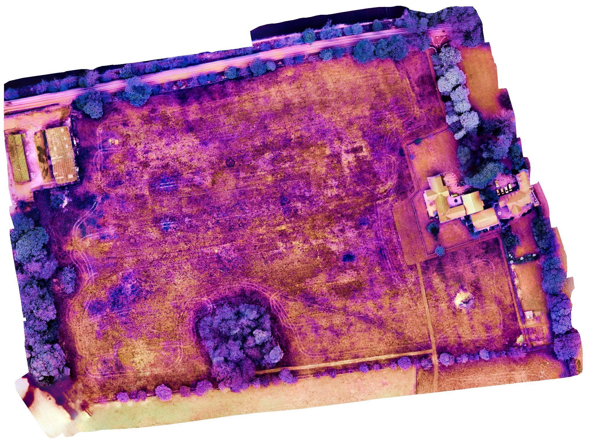
From 2019 to 2022, a variety of surveys were undertaken by the East Riding Archaeology Society (ERAS), FWAPP, Ethos Heritage CIC in association with the Roman Roads Research Association (RRRA) and led by James Lyall, Historic England and Tony Hunt. These surveys included; magnetometry, resistivity and drone surveys in addition Lidar images have also been analysed. A detailed earthwork survey and report was carried out by Ed Dennsion (Dennison & Richardson, 2022) which showed that the site is a lot bigger than was originally believed.
Pic. 2: Magnetometry High Hunsley
All the surveys provided an outline of the layout of the Deserted Medieval Village (DMV) however none are able to provide accurate specific information of the village, which is why excavations are required. However, the survey results do indicate around 19 building platforms and associated yards aligned along either side of the central east-west hollow

way It is believed that the site of the DMV has never been deep ploughed apart from light farming during WW2 (Landowner Pers Com).
Pic 3: LIDAR and interpretation High Hunsley
The 2022 Excavations.
The aims of this year’s excavations were to gather sufficient information to enable an assessment to be made of the potential preservation of the archaeology, the significance of the site and for the retrieval of dating evidence.
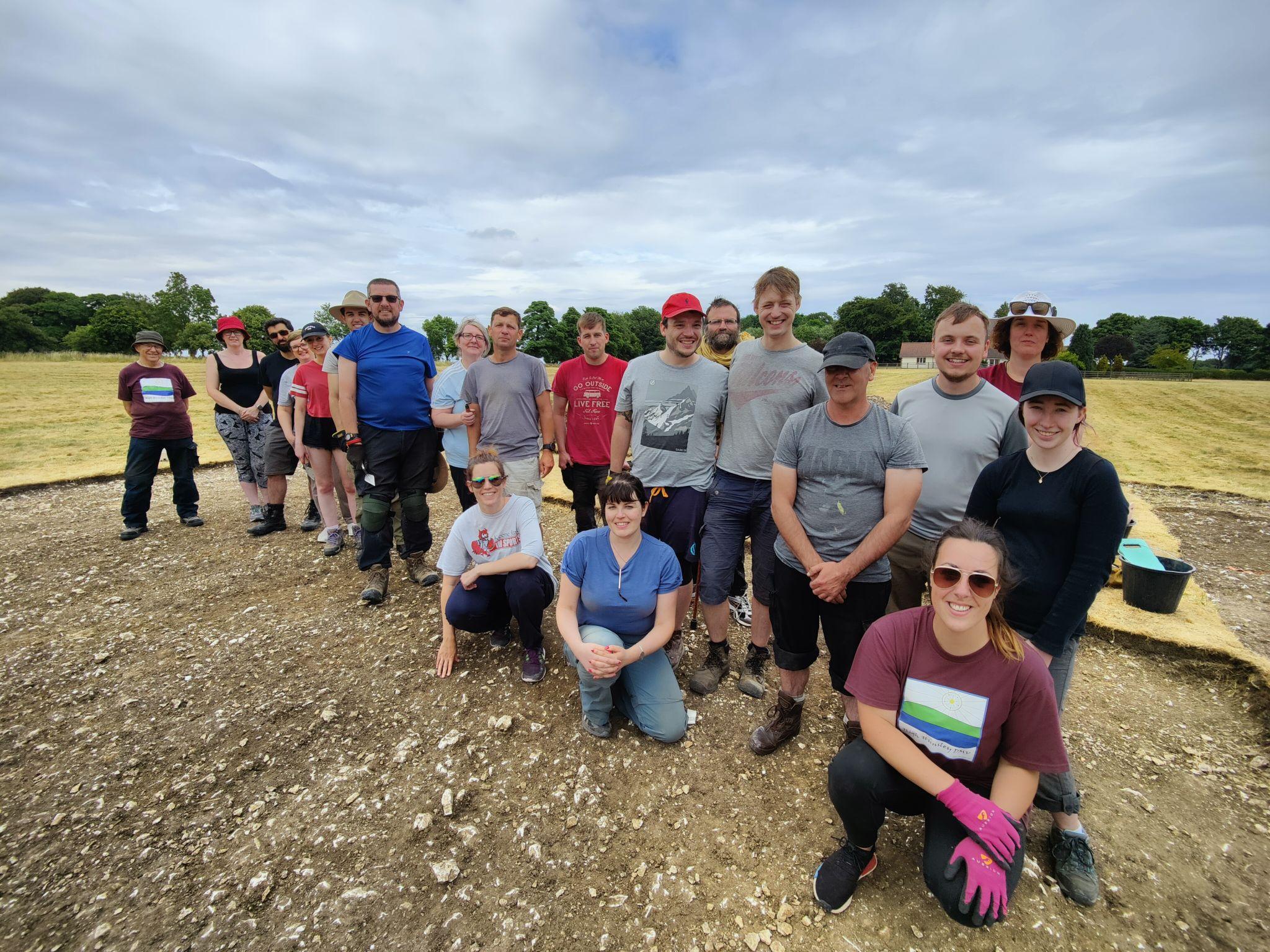
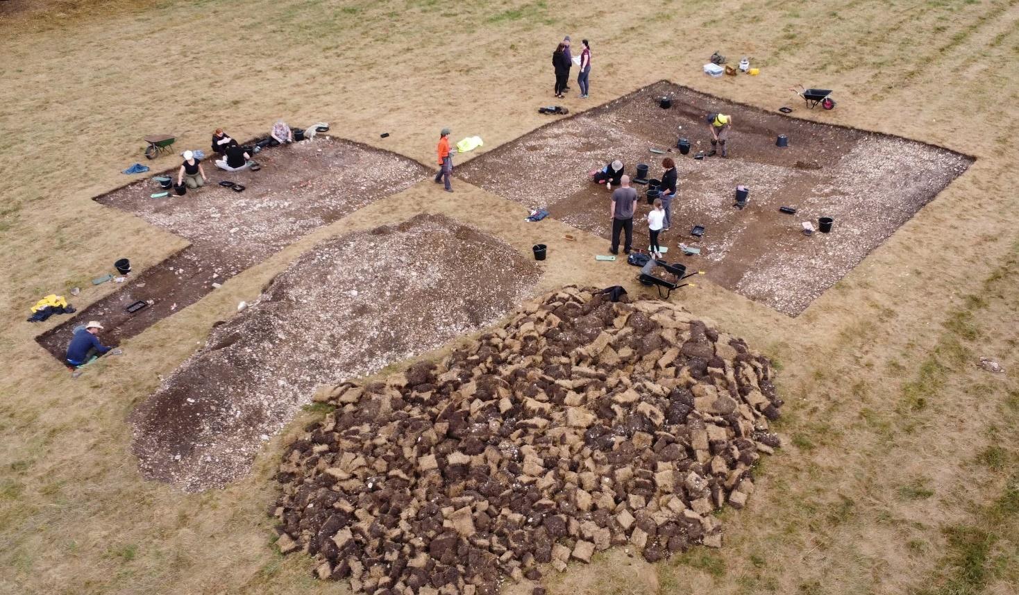
Based on the survey results the excavations targeted one of the building platforms along the southern side of the hollow way that runs through the centre of the village. Over three weeks during the summer of 2022, 153 community volunteers plus local Special Needs Schools, Trench 1 (T1) and

Although the east, west and very dry

conditions and thickness of the turf the use of mechanical equipment was impractical and the turf was removed by hand.
Trench One
The trench measures 10 x 10 metres; the ground surface in this area slopes down east to west from 153.02m OD at the north-east to 152.85m OD at the south-west corner The turf and topsoil removal revealed at c.152.96 - 152.91m OD an artificially raised platform of compacted irregular shaped pieces of local chalk and flint in a clay matrix. (See Appendix 1, Fig 1 and 2)
Near the northern edge was a deposit of compacted light brown clay, possibly a beam slot levelling deposit, that extended eastward beyond the excavation. However this linear feature has also been suggested to be a division between the building and a chalk path running parallel to the road running through the village.
A few metres to the south and roughly parallel is a second similar compacted light brown clay that may represent the bedding deposit of a southern beam slot, photos HH24 and HH25, which also appears to have less chalk than areas to both the north and south.

Between these deposits and along both the northern and southern edges was a silty light brown clay deposit with abundant irregular shaped pieces of local chalk and flint.
Due to time constraints and extreme heat which baked the ground, it was not possible to reduce any of these surface deposits. In order to gain more information a narrow trench was excavated along the north-eastern edge of T1.
This excavation revealed three, possible pits or east-west ditches, cut into a natural layer of chalk and flint (Appendix 1; Fig 2; S 4). Due to the absence of post packing we have ruled these “pits” out as Post Holes. Four other features were investigated, two of these appear to be geological anomalies the other two (Appendix 1; Fig 2; S 1, 2) may be postholes however no post packings were recorded.
To the south-west, where the ground falls away, three deposits were excavated (Appendix 1; Fig 2; S3).
These deposits were less compact than those to the east and north and the excavations reduced the surface in this area down to 152.38m OD at the lowest point. These three deposits were all of friable grey-brown silty clay with abundant small pieces of stone, not local to the area, flint and chalk. (See Pic 6: opposite right, participants excavating the area)
Many of the finds from the site were recovered from these deposits. The finds consisted of abundant animal bones, predominantly cow, some with cut marks relating to butchery. There was also a very large assemblage of pottery mainly dating to the mediaeval period. In addition a significant number of both ferrous and copper alloy objects were recovered. These included parts of horse shoes, dress accessories and a large quantity of nails. This large assemblage provides an insight to the diet of the people and the occupation of the site. Due to the abundance and types of finds we can conclude that the site was occupied between the late 12th to early 16th Century.
Trench Two
This ‘L’ shaped trench was 10m east-west x 6m north-south. The ground surface in this area sloped away quite steeply from 153.07m OD at the north-west corner to 152.43m OD at the south and to the east to 152.32m OD .(SeeAppendix 1, Fig 1 and 2)
Time constraints and the extreme heat which baked the ground, limited the excavations in this trench to the removal of thick turf and topsoil.
Below the turf and extending over the whole trench was a loose to firm deposit of irregular shaped pieces of local chalk and flint. This may have been bedding material for the structure on the building platform. This deposit was similar to the upper surface in T1 but less compacted and looser.


At the north-eastern edge of this trench, extending beyond the limit of excavation to the north and south, the remains of chalk and cobble wall or revetment were exposed (Appendix 1, Fig 2; S5).
The construction of this wall was poor having no bonding material
and we do not believe it was part of the building. The dating is unknown, but a piece of possible late 15th to early 16th Century pottery was found in a section close to the structure. This dating would fit in with the dating evidence from Trench 1.
The function of the wall is currently unknown and work in 2023 will target this area to attempt to establish its purpose and extent.
(Pic 8: Shows the wall as uncovered by our participants)
The Finds
Trench 1
A very large assemblage of predominantly medieval type pottery and animal bone, some with butchery cut marks was recovered. The majority of the finds were from the topsoil and the underlying deposits, which was a grey brown soil at the southwest area of excavation.
Additional finds from these contexts included a small assemblage of snail and oyster shells, a few pieces of brick, daub and a small quantity of charcoal. Several ferrous and copper alloy objects were also recovered.
Only very occasional finds were recovered from the lowest deposit at the eastern area of the trench where the building was located.
(Pic 9: Glaze pottery from T1)
Trench 2
The finds from this trench were all recovered from the topsoil deposit and included medieval type pottery, animal bone, snail shells, flint and a small number of both ferrous and copper alloy objects.

A single unfinished Neolithic flint arrowhead was recovered along the north-eastern edge of the excavation. (Pic 10: opposite right:: Coarse Ware pottery from T2)


from or glazing building.; In addition, 22 Copper Alloy objects we uncovered, the majority connected with personal clothing, were uncovered, including 3 pins, 3 strap ends, clothing clasps and other personal function is currently unknown.
Among and very interestingly 2 stone working chisels (See Pic 12).
(Pic 12: Stone working chisel T1)
In addition there was a large assemblage of iron nail fragments which will be connected with the structure been investigated


The total amount of bone found during the excavations amounted to c.7Kg with the majority found in T1 coming to 6.5K. Trench 2 accounted for much smaller amounts (0.5Kg.) which can be explained in that we had not excavated into the mound nor extended the trench down to the lower ground where any finds would accumulate.
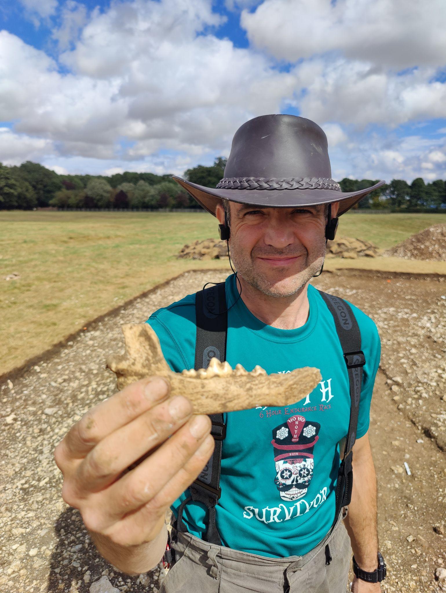
An interesting observation was the amount of teeth uncovered which came to 2.2Kg comprising 1.9Kg from T1; and 0.25Kg from T2. Among these bones were the lower jawbones of both a cow and a dog (See Pic 13), and large amounts of toe and knuckle bones which may indicate butchery at the site.
Pic 13: Sam holding the jaw bone of a dog uncovered in the south west area of T1

Pottery
In total and from all contexts c.15.8kg of pottery was recovered (13.7Kg T1; 2.1Kg T2), The majority, over 11.7kg, being from the upper two deposits in Trench 1 and just over 2kg from the upper deposit in Trench 2.
The majority of the pottery was medieval in date, probably mainly from local pottery kilns. However there was also some post medieval in date that could be dated to the early part of the 16th Century
Trench 1: The majority (c.95%) of the total c.12.7Kg identified pottery falls into six types by order these are:-
1. Medieval Green glaze (2.559Kg,)
2. Medieval Glazed (2.508Kg),
3. Coarse Ware (1.697Kg),
4. Grey slip ware (1.486Kg),
5. Shell tempered (1.118Kg),
6. Humber ware (0.855Kg).
Trench 2: The majority (c.96.9%) of the total c.1.9Kg of the identified pottery falls into six types by order these are:-

1. Grey slip ware (0.416Kg),
2. Coarse Ware (0.389Kg),
3. Oxsied ware (0.336Kg),
4. Medieval Green glaze (0.287Kg),
5. Shell tempered (0.214Kg),
6. Medieval Glazed (0.175Kg).
Summary

The excavations confirmed the presence of a large artificially raised chalk building platform.
(Pic 15: Drone picture using a thermal camera showing the building platforms. Copyright Tony Hunt)
The source of the chalk to raise the platform may have originated from the areas of lower ground to the east, west and south of the platform.
This would explain the cuts into the chalk in the Eastern part of Trench 1. It has also been suggested that the chalk may have been brought in from a nearby quarry site which dot the surrounding area.
Dating evidence from the pottery recovered indicates that the platform is associated with the medieval occupation of the site. The finds from the southeast quadrant of T1 may be related to the occupation of the building. Alternatively, if the chalk from this area had been excavated and used to raise the building platform then these deposits could relate to the backfilling or levelling of the area.
The village and buildings would have gone through several phases of development and change over the centuries of occupation. These phases of both expansion and contraction would have involved remodelling, demolition and rebuilding until the final abandonment and decay of the village and buildings.
Evidence from the various non invasive geophysical surveys appears to depict very clear rectangular patterns that have been interpreted as the ‘footprint’ of the building's foundations. It is likely that the buildings at High Hunsley would be of a cruck frame construction probably with a beam slot rather than a stone bedding trench. The chalk in the area is very close to the surface and all that would be required is a clay deposit to provide a solid level surface on to which the beam could rest.
The excavations in T1 exposed an artificial > 6m east-west x c.0.8m wide flat shallow clay surface and a similar parallel deposit c.3.6m to the south which we believe to be the bedding layer for a cruck frame building. Both of these will be investigated in more detail as part of the 2023 excavations.

Summary
The main archaeological aims this year were:-
1. To ascertain the state of preservation of any of the identified structures: The building was probably of cruck frame construction with beam slots, and demolished.in the late to early Post-Med period
2. The type and purpose of these structures: The finds are clearly indicating that this was a domestic structure.
3. Dating evidence relating to the date of occupation and abandonment of the DMV: The medieval pottery evidence indicates a date of occupation between 14th to late 15th century, with reduced activity in the early 16th century. There is no evidence for later occupation.
4. The significance of the location of the DMV and its place in the wider landscape context: The location alongside a hollow way that extended to both east and west could indicate a stopping place between Beverley and towns to the west.
5. The type of farming practised and the economy: The animal bone assemblage, predominantly cattle indicate the diet was of a pasture type supplemented by tillage in the surrounding area.