4 minute read
Tornadoes rare but still possible on Superior’s shores


By Peter Passi ppassi@duluthnews.com
Lake Superior can be both blamed and blessed for the influence it has on weather here in the Northland.
It plays a well-known role in producing dense fog and copious quantities of snow, but the same body of water also has a calming effect on other types of weather systems.
For instance, tornadic activity is a rarity in close proximity to the big lake, and its typically frigid water is the reason why, said Dan Miller, a meteorologist for the National Weather Service office in Duluth.
“One of the ingredients that is necessary (for a tornado) almost all the time is a source of really warm, moist, unstable air right at the surface. So, in terms of temperature and dew point, we’re talking about air masses that have temperatures maybe in the 70s to lower 80s, with dew points in the mid60s to lower 70s — not really oppressively hot and humid but a warm, sultry kind of thing. Obviously, if the Lake Superior marine layer and lake breeze surges inland, you simply don’t have that. You can still get thunderstorms, but they might be rooted in
Continued on page 6 an air mass a couple thousand feet above the surface, above that cold, dense marine layer that surges inland during the afternoon and evening hours,” he said.

“So when we do get thunderstorms on those days, in meteorological terms, we say they become elevated. In other words, the parcels of air that are actually driving the thunderstorm and ascending into the updraft of that storm are not originating from right near the ground. They’re originating from 1,000 or 2,000 feet above the surface, and it’s very difficult, if not even impossible, to get tornadoes to form when you have that shallow layer of cool and stable air right near the surface, because that’s what the lake generates,” Miller explained.

Geoff Coulson, a meteorologist for Environment Canada in Thunder Bay, Ontario, concurred.


“When we talk about low-level storms — thunderstorms that have developed from surfacebased instability — when those storms move across the much cooler waters of Superior it’s a brake on that activity,” he said.

“The thunderstorms themselves need that warm, moist air in the lower levels of the atmosphere to feed them. They’re the fuel that they need to continue to form and to grow. But when they encounter the much cooler waters of Lake Superior, that’s like literally dousing them with cold water. They lose a lot of the energy and warmth and moisture that they need from the lower level as they go across the cooler water of the lake,” Coulson said.
While uncommon, tornado-producing systems still can and do form in the Twin Ports, however.
On Aug. 9, 2012, a waterspout was sighted a couple miles offshore from Duluth’s Sky Harbor Airport. The relatively weak F-0 twister crossed Minnesota Point, the harbor and then dissipated at Barker’s Island in Superior.
Also, on May 26, 1958, a tornado touched down in Duluth Heights, tracking nearly seven miles to the northeast before lifting back into the sky just south of Arnold Road.
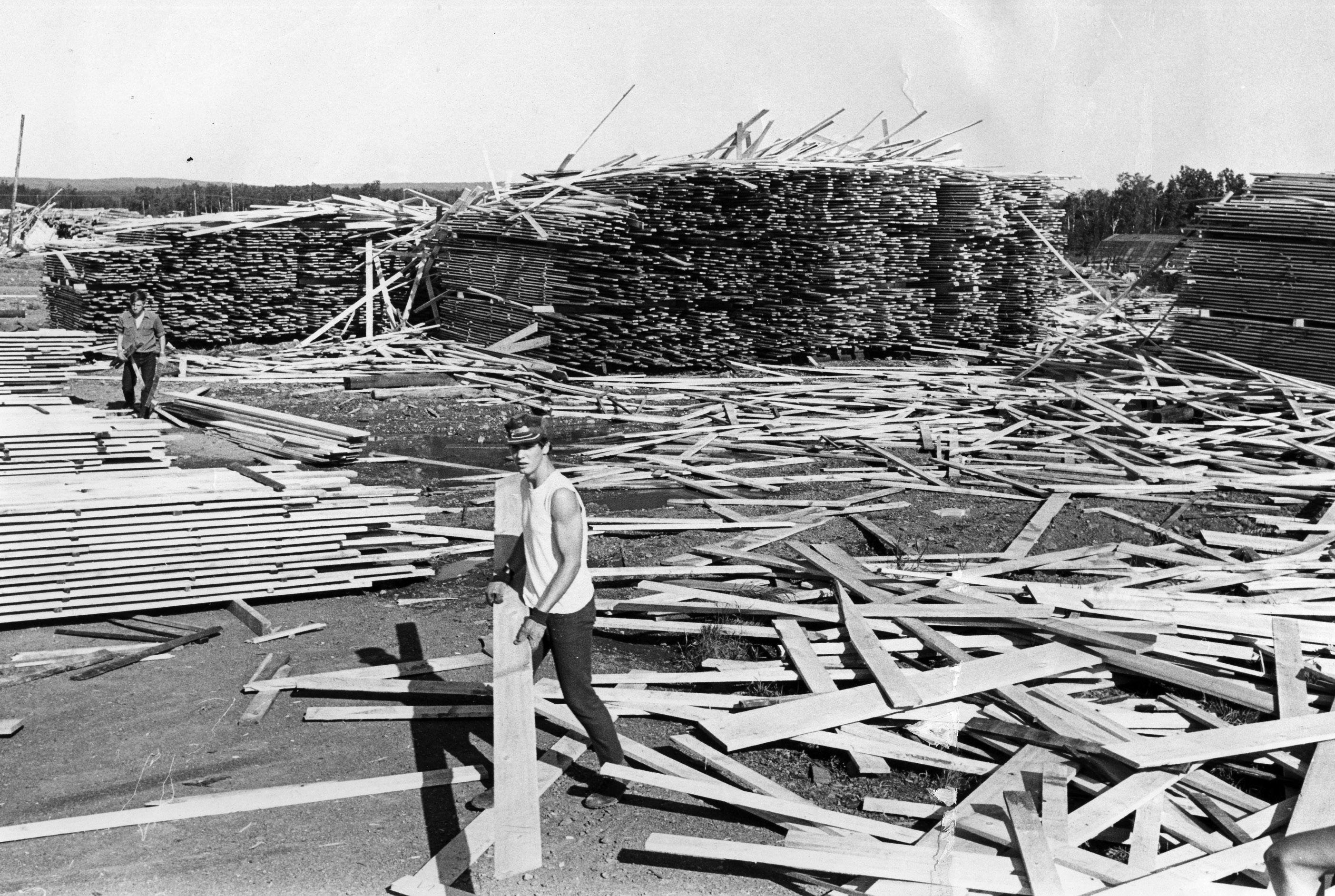
But Miller points to the Aug. 6, 1969 tornado outbreak as the best evidence that a severe tornado could bear down on the Twin Ports some day. That powerful system produced 13 tornadoes in
Continued on page 8

Today
Minnesota, including an F-3 twister which touched down near Boulder Lake, north of Duluth, and traveled more than 17 miles to Two Harbors, claiming the lives of two people and decimating a lumber mill.
“I always go back to that event in terms of public education and safety preparedness,” Miller said.
“To me, the lesson from that Aug. 6, 1969 event is that yes, even though Lake Superior and the generally cool, stable marine layer does have a tendency to prevent significant tornadic storms from affecting the Twin Ports, if it can happen in Two Harbors, at some point there probably will come a day — that could be next summer or 200 years from now — when something similar to that could happen in Duluth or Superior, despite their close proximity to the lake.
Coulson said the large lake exerts a year-round influence on the weather of the Great Lakes region.
“Due its size and depth, Lake Superior is more like an inland sea than a lake,” he said.

While the marine influence of Lake Superior can suppress some kinds of weather, Coulson said it also can have just the opposite impact. In places inland from the lake, Coulson said the lake breeze can spawn turbulent weather.
“On summer afternoons, we’ve got the land warming up fairly substantially. That air is rising over the land, and it’s replaced by cooler air coming in from the lake itself. And where what we call these lake breeze fronts form — that’s where the lake breeze penetrates inland to a certain distance and then meets another flow of air. Where they meet, we can get lifting occurring. So these lake breeze fronts, as we refer to them, can be areas where thunderstorms will fire up — not right near the lake itself but some distance inland. Maybe 5, 10 or 15 miles from the shore, we can see these lines of storms forming,” Coulson explained.
And while lake-effect and lake-enhanced snow can occur just about anywhere around the lake, certain places see a lot more of it than others. Among those locales are Gile and Hurley in Iron County, Wis., where cold northwest winds moving across the relatively warm waters of Lake Superior meet land — and drop a lot of snow.
Gile saw more than 50 inches of lake-effect snow in less than four days in November 2014.
Duluth may not see as much lake-effect snow — but it can happen, sometimes in unusual ways.
A narrow band of lake-effect snow dropped 13 inches of snow on the Morgan Park neighborhood in March 2017. And in December 2007, another narrow band of intense lake-effect snow dropped up to 17 inches of snow from downtown to West Duluth in about six hours, while other parts of the city saw minimal snowfall. u