City of Austin in partnership with Downtown Austin Alliance
Design Team
Sasaki
Altura Solutions
Asakura Robinson
Alliance Transportation Group
Beverly Silas & Associates
Cotera+Reed Architects
DAVCAR Engineering
Dunaway Associates
Garza Program Management
Jose I. Guerra
Lady Bird Johnson Wildflower Center
McCann Adams Studio
Public City
INTRODUCTION
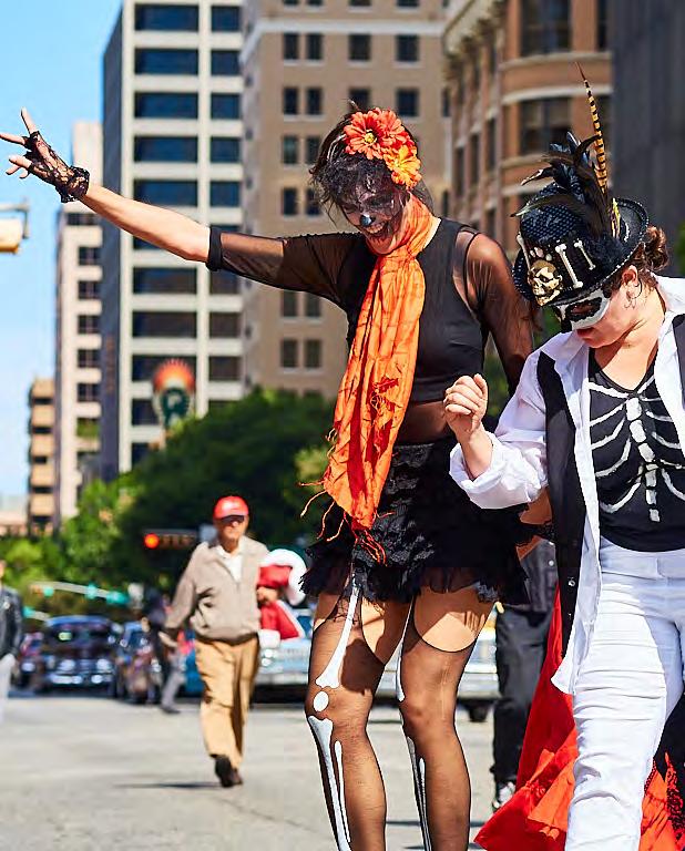
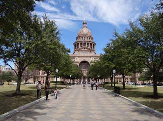
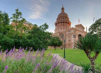
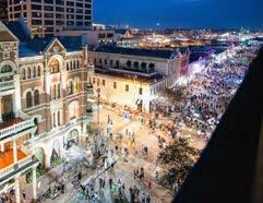
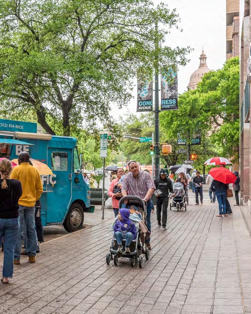
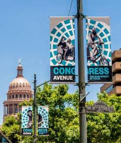
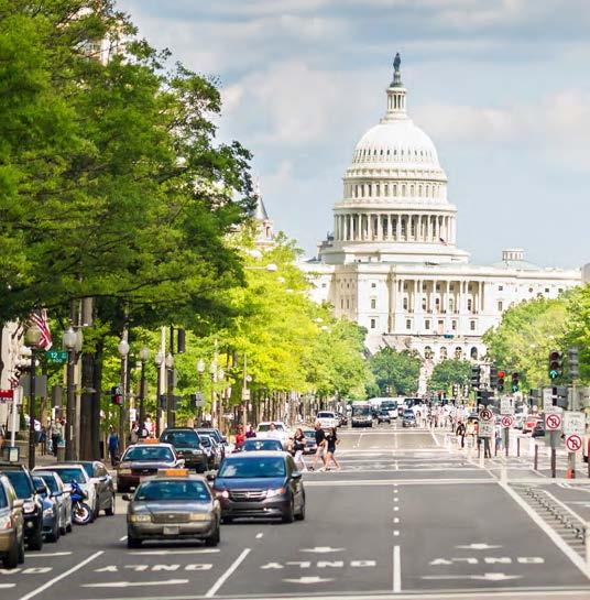
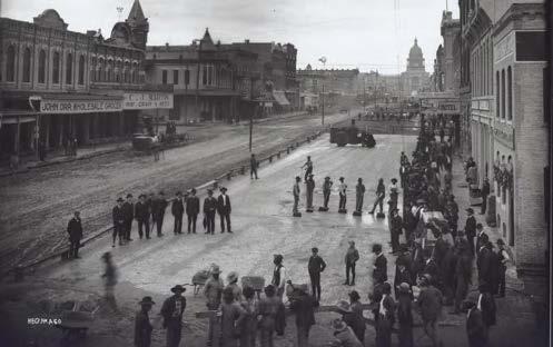
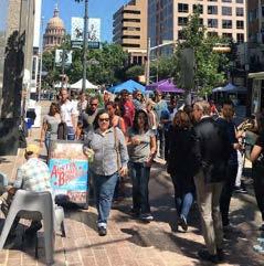
Congress Avenue, often called the “Main Street of Texas,” is one of the most iconic, historic and lively streets in Austin. The Congress Avenue Urban Design Initiative (CAUDI) envisions a transformative urban design, placemaking, and implementation strategy for Congress Avenue between Riverside Drive and 11th Street. The goal of this effort is to create a multifunctional complete street with a dynamic public realm that contributes to Downtown Austin’s evolution as a sustainable mixed-use downtown and supports Austin’s identity as a unique and iconic cultural city.
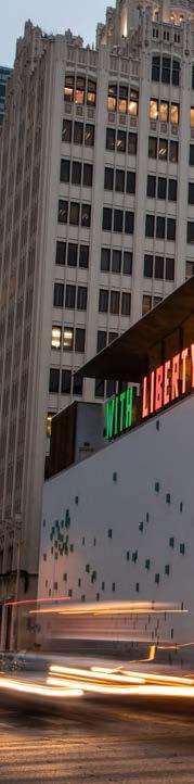
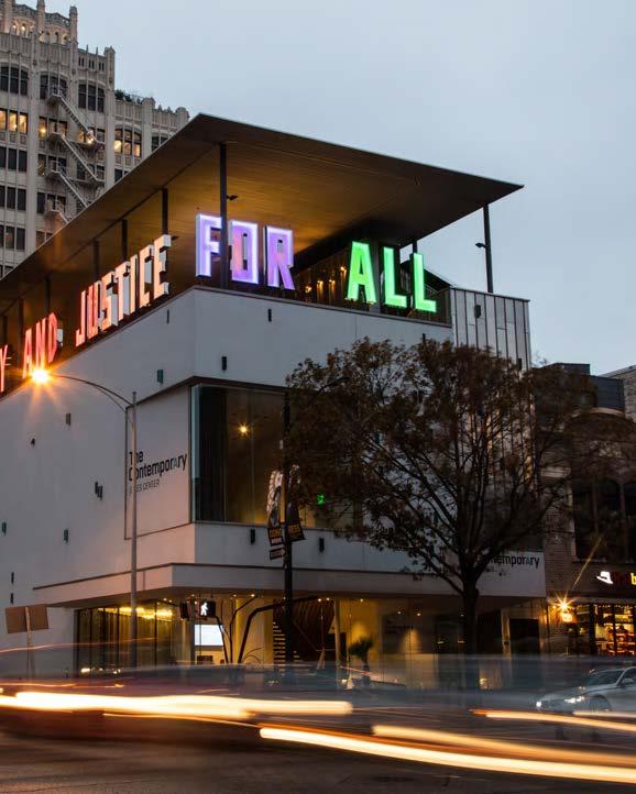
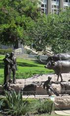
Right: Austin Museum of Contemporary Art.
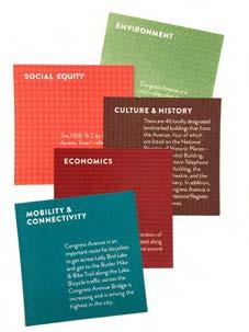
SOCIAL EQUITY
Ensure a welcoming, accessible, and representative space
CULTURE & HISTORY
Enhance Congress Avenue
ECONOMICS
Amplify the economic strength and diversity of Congress Avenue
ENVIRONMENT
Celebrate biodiversity and urban habitat in a functional, resilient streetscape design
is a great Texas people place - the cultural, historic and commercial spine of downtown
The Vision will be achieved and maintained through loyalty to a set of Values related to Character, Function and Management. A great street needs to do many things well but a street asked to perform too many tasks is likely to perform none of
them well. Our efforts to achieve the Congress Avenue Vision will adhere to these Values that will guide what we ask of the Avenue and how we direct our work.
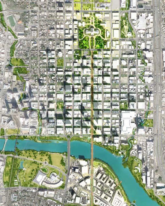
URBAN CONTEXT
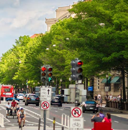
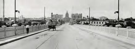
While Austin has continued to grow and evolve as a global hub for culture and technology, the streetscape of Congress Avenue has remained relatively static since the 1980s. Congress Avenue is one of three National Register Historic Districts in Downtown Austin and holds great importance historically to the Austin community. The Avenue’s vitality comes from its location at the heart of one of North America’s fastest growing cities, and its public realm needs to be updated to support the evolution of Austin’s downtown.
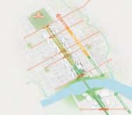
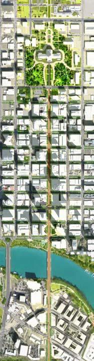
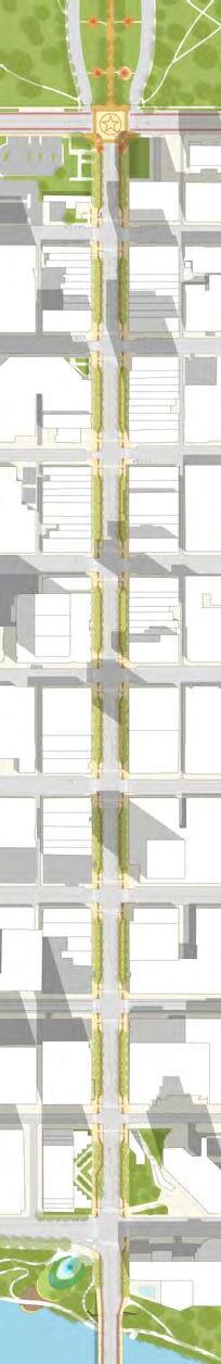
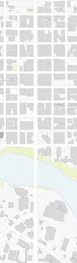
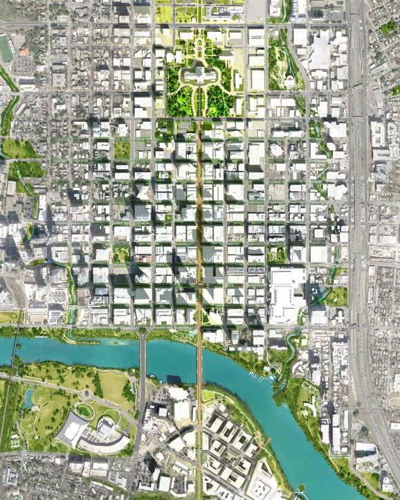
This study focuses on the 1.25 mile stretch of Congress Avenue that runs through the heart of Austin from the Capitol to the intersection with Riverside Drive.
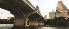
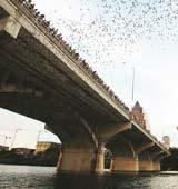
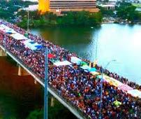
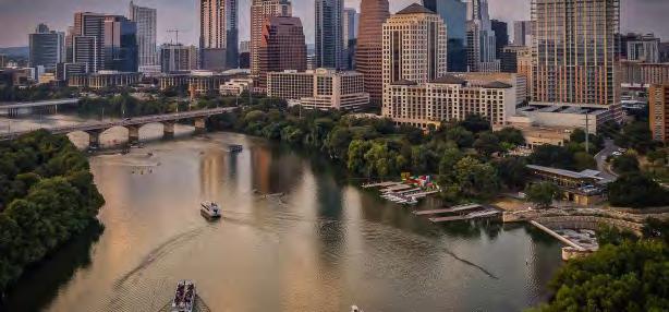
From the Texas Capitol to Lady Bird Lake, the Avenue serves as the spine of Downtown Austin’s cultural, economic, and civic heart. As Congress Avenue crosses Lady Bird Lake, the Ann Richards Congress Avenue Bridge is home to one of the world’s largest urban bat colonies, and the Ann and Roy Butler hike and bike trail connects to regional system of creeks and green space. As the Avenue continues south, it continues to be a major corridor
that serves as a gateway to south Austin.
From roadway alignment to paving textures, the overall design of Congress Avenue should reflect its significance as an iconic and historic destination. Furthermore, the allocation of space and design of the public realm should respond to the varying land use and urban character along the Avenue. The public realm around the Texas Capitol, for example, should support civic events and cultural tourism, while other parts of the streetscape might be designed specifically to accomodate the nightlife and crowds attracted by the proximity of Sixth Street and Austin’s Convention Center.
Waller
PLANNING CONTEXT
The Congress Avenue Urban Design Initiative is a joint effort undertaken by the City of Austin and the Downtown Austin Alliance. The study is part of a years-long effort to re-imagine Congress Avenue as a human-centric place and a preeminent civic destination, which has already produced a guiding vision and a set of values related to Character, Function, and Management. Many of the previous relevant plans are summarized in the Appendices of this document.
Throughout the process of developing these recommendations the CAUDI team reviewed over 20 previous planning documents, recieved feedback from a number of boards and commissions, and coordinated with members of relevant departments within the City of Austin. These recommendations and design concepts are an integral part of a coordinated effort to plan and design Congress Avenue and Downtown Austin.
DOWN AUSTIN PARKING STRATEGY TOWN
Downtown Austin Plan
Adopted by the Austin City Council December 8, 2011
Our Austin Story, 2018
XYZ Atlas: Congress Avenue, 2017
Downtown Austin Plan, 2011
Great Streets Standards, 2001
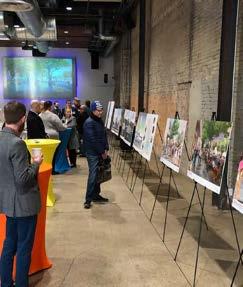
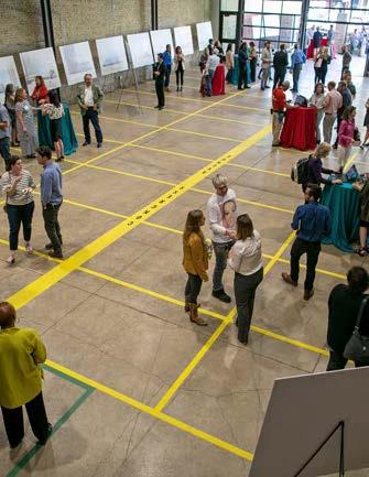
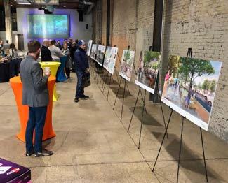
PUBLIC ENGAGEMENT
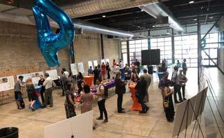
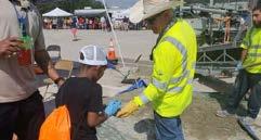
Beginning with the project launch in 2017, the Congress Avenue Urban Design Initiative has engaged over 500 stakeholders and members of the public through a series of public meetings and focus group discussions.
The first public meeting, LAUNCH, demonstrated the existing conditions and challenges of the corridor today. The second public meeting, TRANSFORM, invited the public to test different strategies for Congress Avenue through a series of activities and full-scale tactical interventions. The
P1 LAUNCH
Demonstrated the existing conditions and challenges of the corridor today
third public meeting, IMAGINE, sought input from the public on high level concepts for the design and configuration of Congress Avenue.
In the fourth and final public meeting, ENVISION, draft recommendations were presented to the public for feedback. The overall consensus was overwhelmingly positive and recieved significant coverage in the media.
P2 TRANSFORM
Public invited to test different strategies for Congress Avenue
P3 IMAGINE
Initial design goals and concepts presented for feedback
Next Steps
In fall 2020, City of Austin voters approved funding for an initial phase of the Congress Urban Design Initiative. The Austin Strategic Mobility Plan (ASMP) is currently being amended to incorporate this Vision Plan. While the reconstruction of the full Avenue will likely be phased over several years, the initial funding from the 2020 Active Transportation and Safety Bond will support detailed engineering studies needed to develop design concepts to bring back the community for further feedback.
Draft recommendations presented to the public for feedback
LAUNCH
Public Event # 1
Demonstrated the existing conditions and challenges of the corridor today
161
Attendees
2,320+
Comment Cards
517 in person
1,830+ online
Comment Cards
The comment cards for Public Event 1 are grouped under five thematic categories. On each card, participants are invited to provide opinions about Congress Avenue’s current conditions, and are encouraged to offer ideas for its future. These comment cards also contain interesting “factoids” that are meant to intrigue and educate the public about the Avenue.
Do you work on or near Congress Avenue? If so, how do you rate the quality of Congress Avenue as a working environment? 15
Do you or someone you know ever experience difficulties physically navigating Congress Avenue?
successful do you think Congress Avenue’s historic heritage is being preserved and respected?
Which transportation options do you use to get to and around Congress Avenue? How can we demonstrate that we care about conserving water and promoting a sustainable environment?
Mobility & Connectivity
Comment Cards
The comment cards asked respondents to assess existing conditions and initiatives, describe how they interact with Congress Avenue, and elicit ideas for improving the Avenue. The cards to the left represent a small sample of the questions asked.
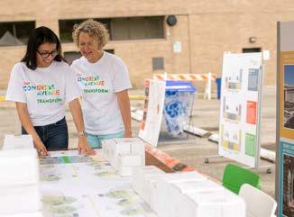
TRANSFORM
Public Event # 2
Activations and pop-up events along the Avenue demonstrated potential streetscape design elements.
180
Attendees
829+
Comment Cards
248 in person
572 online
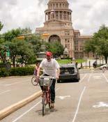
Test Bike Lane Options
The public tested various potential bike lane configurations
Material Demo
The public learned about various plant and paving material options and their impact on microclimate.
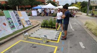
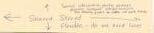
STREET MODELS
Each participant was able to “build” their own street section. They chose how to allocate space to cars, pedestrians, vegetation, bikes etc., given the 120’ right-ofway limitation. Most responses reduced parking and driving lanes, and allocated more space to pedestrians, bikes, and vegetation.
MODEL BASE, EXISTING STREET:COMPONENTS PROVIDED:
Proposed changing diagonal parking to parallel
COMPONENTS MADE BY PARTICIPANTS:
IMAGINE
Public Event # 3
The third public event, held in May 2018, asked the public to respond to a number of design concepts for the roadway and character of Congress Avenue.
Attendees
Station 5: BALANCE THE AVENUE
input opportunity
WHICH OPTION PROVIDES THE BEST OVERALL BALANCE FOR THE AVENUE? HOW WOULD YOU IMPROVE THESE OPTIONS?
A clear preference arose for an Avenue that space for pedestrians over vehicles. Ultimately, the option with the widest sidewalks and flex parking was the most popular.
More Trees
More Vehicular Lanes
Bigger Sidewalks
Improve Safety
Add Transit
Reduce Parking
Flex Parking
More Bike Lanes
Eliminate Left Turns
AgreeNeutralDisagree
How would you improve these design concepts?
Parking was the issue mentioned most frequently, with a majority suggesting reduced parking. A significant majority suggested increasing transit, sidewalk widths, and bike lanes would improve these concepts overall.
Design Character
Overall, design elements that prioritized accessibility, proximity to the lake, and places for seating were ranked highly. Respondents seemed to favor the more dynamic designs that related to the landscape context over more formal design elements.
Accessible Ramp & Terraces
Stormwater Terraces
Deck Overlooks
Flexible Seating
Deck at Water’s Edge
ENVISION
Public Event # 4
In March 2019, preliminary recommendations, concepts, and renderings were presented to the public.
Attendees
106+
Comment Cards
76 in person
30+ online
In your opinion, how well do the recommendations address the goals established by the community for the future of Congress Avenue?
The overwhelming majority of respondents felt that the preliminary recommendations addressed each goal very well and were excited about CAUDI’s vision for the Avenue.
ENVIRONMENT
CULTURE & HISTORY
SOCIAL EQUITY MOBILITY
ECONOMICS
BALANCE THE AVENUE
As the spine of Austin’s mixed use downtown, Congress Avenue is a destination for Austinites and visitors, whether driving, on foot, bicycle, or scooter.
The Avenue’s current configuration heavily favors vehicles at the expense of pedestrian activity. The recommendations in this section lay the foundation for a more balanced distribution of space that accomodates a variety of mobility options, and creates more space for pedestrian activities.
MOBILITY OVERVIEW
Congress Avenue is an integral part of Downtown Austin’s growing multimodal transportation network. It will be crucial for any proposed design to respond to current regional mobility patterns, as well as to provide for multiple modes of transportation that can help absorb Central Austin’s growing population.
AN URBAN AVENUE
Congress Avenue is a walking street for 12,000 Downtown residents, an iconic destination for 24 million annual visitors, and a regional distributor for 93,000 employees.
North of Cesar Chavez, Congress Avenue primarily serves as a feeder road to Austin’s commercial core and relies on the Downtown street grid to disperse peak-hour traffic. South of Cesar Chavez, the Avenue serves as a regional gateway to Downtown, connecting Riverside Drive and points south.
North of sixth street, Congress Avenue has excess vehicular capacity and could benefit from an expanded public realm.
While multimodal options are currently limited, a more diverse mode split will be necessary to serve new developments, including the South Central Waterfront.
BUILDING MULTIMODAL CAPACITY
With no room to expand Congress Avenue’s Right of Way or the Congress Avenue Bridge, it will be vital to increase the capacity for non-vehicular modes of transportation. A successful design must accommodate the Avenue’s dual function as a regional connector, especially south of Cesar Chavez, and as a downtown avenue.
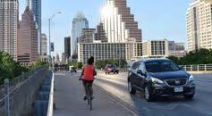
The recommended configuration is able to significantly increase person carrying capacity across the bridge in peak hour and peak direction by expanding and improving the efficiency of the space for people traveling by foot, bicycle, and scooter.
Locating new development close to downtown and implementing transportation demand management programs in conjunction with having safe multimodal mobility choices can mitigate new trips generated by 30% to 60%.
The 2014 Austin Bicycle Plan envisions that 15% of trips less than 3 miles and 7% of trips less than 9 miles will be by bicycle.
Typically, people will choose to walk rather than drive for distances between 1/4 and 1/2 mile. The Congress Avenue Bridge is ~ 1/4 mile long.
A frequent circulator route could link all parts of Congress Avenue together, as well as connect to city-wide high capacity transit proposed in the CapMetro Project Connect Plan.
Motor Vehicle TransitBike / Scooter Pedestrian
As Downtown Austin and the surrounding neighborhoods continue to attract more residents and jobs, strategies to mitigate congestion will become even more important. As part of this initiative, a study was commissioned to determine how regional trends and future development would affect traffic along Congress Avenue.
The study carefully weighed the impacts of the recommended lane configuration on vehicular traffic alongside the need to create multimodal capacity. The study projected travel demand in
2040 for a ‘no-build scenario,’ as well as three scenarios with varying degrees of mode-shift encouraged by the recommended improvements. Travel demand is projected to increase by 0.5% each year, plus trips generated by new development. Without any improvements, most of these trips will be by vehicle. However, improved bike, scooter, pedestrian, and transit facilities could mitigate congestion by shifting up to 12% of trips to alternative modes of transportation in 2040.
AM Northbound from Riverside to 11th. Travel times are comparable to the no-build scenario depending on the degree of mode shift
PM Southbound from 11th to Riverside. Travel time impacts may be significant, but could be mitigated at higher levels of mode shift.
Today’s
Peak hour Travel Times
IMPACT ON PM PEAK HOUR TRAFFIC IN 2040
Existing Conditions
2040 traffic with no improvements
2040 traffic with improvements and low mode shift
2040 traffic with improvements and medium mode shift
2040 traffic with improvements and high mode shift
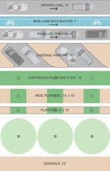
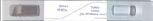
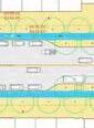
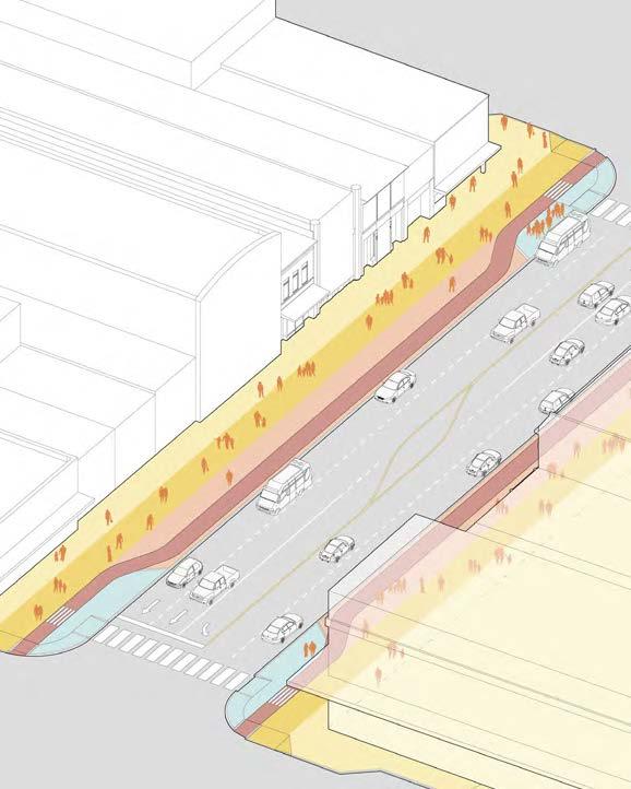
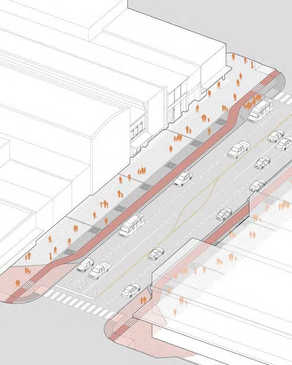
STREET SPACE ALLOCATION:
EXISTING
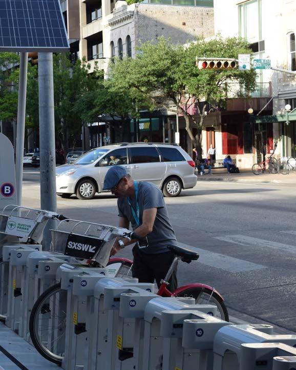
Prior to the summer of 2020, approximately 80% of the right of way along Congress Avenue was dedicated to cars. As spatial needs significantly changed in the onset of the COVID-19 pandemic, City Council directed staff to reconfigure Congress Avenue between 11th Street and Riverside Drive to open street space to people on bicycles or scooters, moving those modes off of sidewalks to make space for pedestrians, retail and restaurant use. Currently the street is configured with two general travel lanes in each direction, opening up at Riverside Drive, Barton Springs Road, Cesar Chavez, 5th and 6th streets with additional dedicated turn lanes. The outside lane has been repurposed as a protected bike and scooter lane. Diagonal parking and parallel parking bays remain. This configuration shows the potential for rebalancing street space as called for in this Vision Plan.
Parking: ~ 12 permanent spaces per block
Allocation of Space
10’
10’
Travel Lane / Turn Lane Travel Lane
Parking & Amenity Zone
Pedestrian Zone
Travel Lane / Turn Lane Travel Lane
Interim Protected Bike Lane
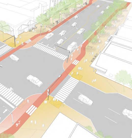
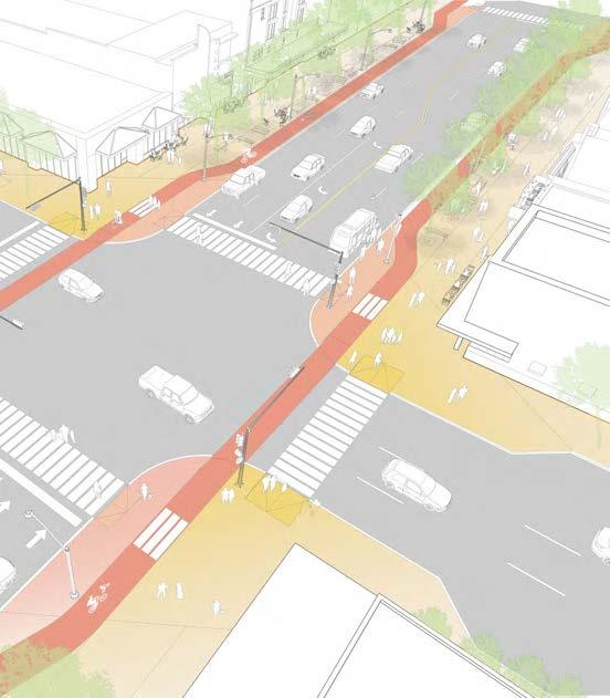
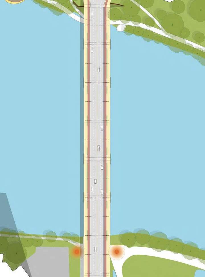
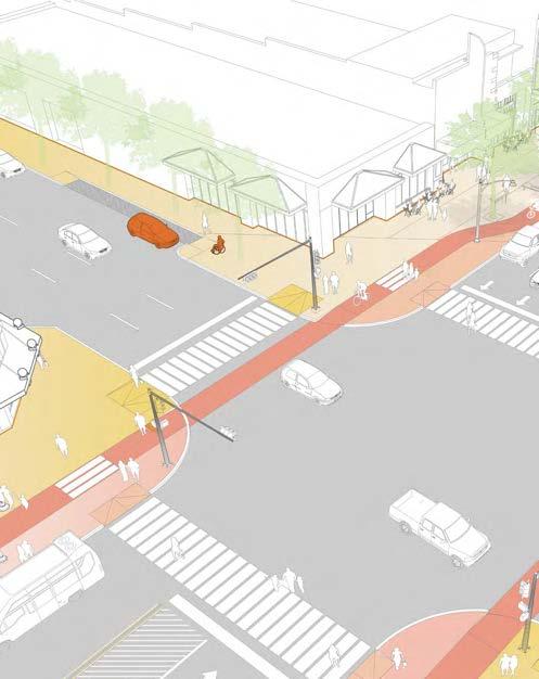
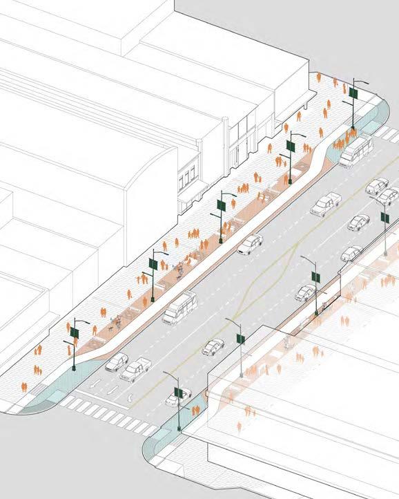
STREET SPACE ALLOCATION: RECOMMENDED
The space along Congress Avenue should be allocated to create a more equitable balance between vehicular lanes, active transportation, and pedestrian activities and amenities. This lane configuration allows the space allocated for pedestrians, amenities and active transportation to increase from 20% to nearly 60% of the Avenue’s overall width.
Left Turns:
Allowed with dedicated lane
Parking:
~ 16 spaces per block at off-peak times
Allocation
Travel Lane
Bike / Scooter Zone
Travel Lane Turn Lane
Pedestrian Zone Amenity Zone
Parking / Travel Lane / Circulator Lane
Flex Parking / Travel Lane / Circulator Lane
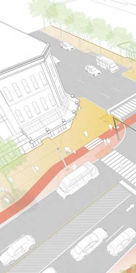
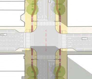
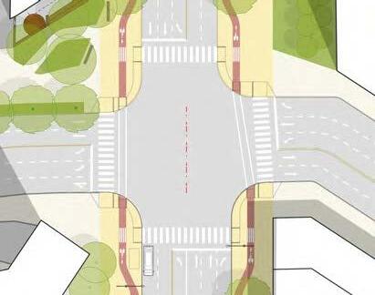
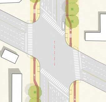
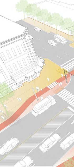
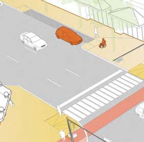
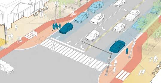
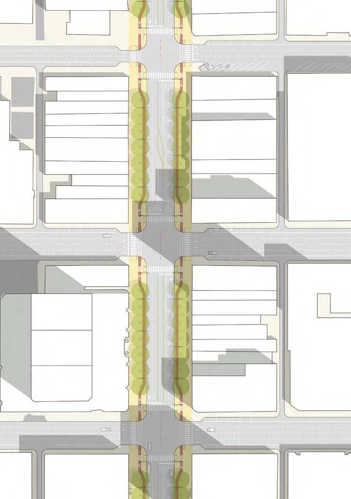
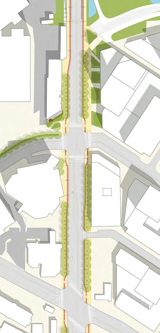
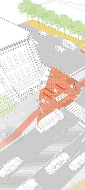
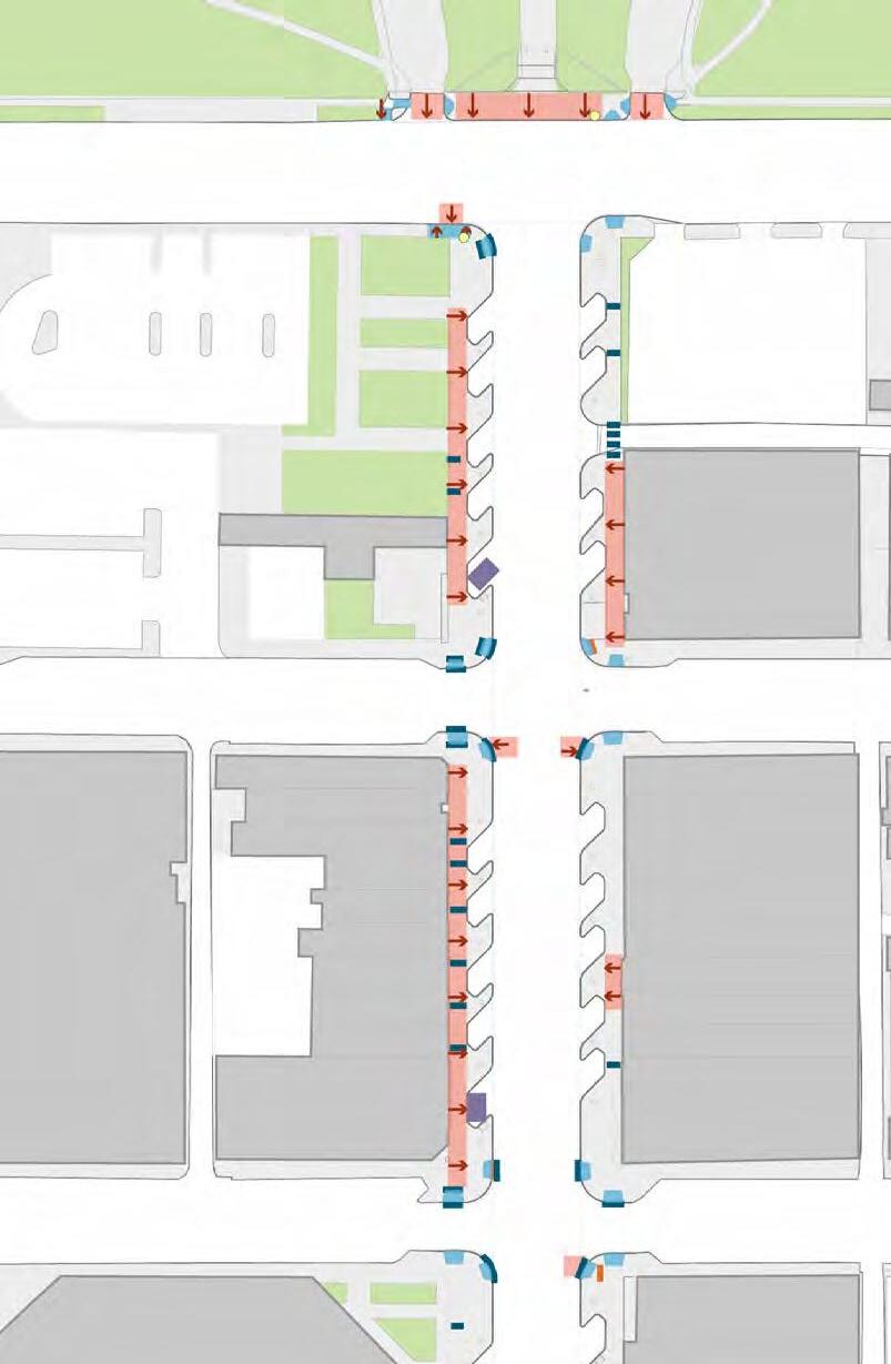
INTERSECTIONS
The alignment and design of each intersection along Congress Avenue will have a significant impact on mobility, safety and the overall character of the Avenue. At most intersections, the center lane serves as a dedicated left turn lane, keeping the overall width at five lanes.
Pedestrian crosswalks and bike / scooter lanes should be fully integrated and compliant with ADA standards. At each street corner, bike lanes should be offset away from the roadway, allowing space for cyclists to queue at red lights, creating an area for pickup and drop-off zones and, ensuring an ADA compliant 5’ clearance at pedestrian crossing ramps. Pedestrian crossings should be clearly indicated both on the roadway and on bike/scooter lanes.
An adequate amount of ADA parking spaces must be provided on cross streets. These spaces should be as close to Congress Avenue as possible. More detail on ADA parking is provided on page 110.
52’ crossing distance
Dedicated left turn lanes
Separate ramps for bike / scooter lanes & pedestrians
ADA compliant 5’ clearance
KEY INTERSECTIONS
As part of the Congress Avenue Urban Design Initiative, a mobility study was commissioned to analyze and recommend configurations for several key intersections: 11th Street, 6th Street, 5th Street, Cesar Chavez Street, Barton Springs Road, and Riverside Drive. The study modelled the waiting time for cars during peak hours at each intersection for five scenarios:
Existing Conditions
2040 traffic with no improvements
2040 traffic with improvements and low mode shift
2040 traffic with improvements and medium mode shift
2040 traffic with improvements and high mode shift
Eleventh Street @ Congress
This intersection has more than enough capacity for both existing and projected traffic volumes. Any improvements should focus on placemaking and on creating a safer environment for pedestrians and cyclists.
The study looked as each intersection separately, as well as their function as a series. Overall, the study found that the intersection of Cesar Chavez St and Congress Ave was the most significant cause of delays. While there is no space to expand the overall roadway, the mobility study recommended adding turn lanes at strategic locations to mitigate traffic to the greatest extent possible. The full mobility report is available online through the City of Austin.
Sixth Street @ Congress
This intersection will most likely experience a slight increase in delay time. This increase could be mitigated by a dedicated northbound left-turn lane, especially if there is a significant mode shift away from singleoccupancy vehicles.
Fifth Street @ Congress
This intersection has excess capacity during the AM peak hours. A dedicated southbound left-turn lane is recommended for this intersection, and should mitigate congestion during the PM peak hours.
The intersection of Cesar Chavez Street and Congress Avenue has the most significant impact on congestion within the study area. At the same time, this intersection is the gateway into Downtown Austin, and it will be crucial to find an appropriate balance between multimodal mobility and placemaking.
The recommended addition of a dedicated southbound right-turn lane should significantly reduce congestion at this intersection. This additional turn lane will, however significantly reduce the amount of space dedicated to other modes of travel. To allow adequate space for pedestrians, bicycles and scooters, the Southbound roadway should be shifted 4’ to the east, and the northbound roadway should be shifted 2’ to the west, creating a total offset of 6’. This configuration would allow at least 13’ wide sidewalks on each side.
New southbound turn lane
Narrow sidewalks
Cesar Chavez
Barton Springs Road
The intersection at Barton Springs Road should have adequate capacity to accomodate AM peak traffic. A dedicated southbound right turn lane is recommended to mitigate PM peak traffic.
Riverside Drive
A northbound right turn lane is recommended for the intersection at Riverside Drive to mitigate congestion during the AM peak hours.
ANN W. RICHARDS
CONGRESS AVE BRIDGE
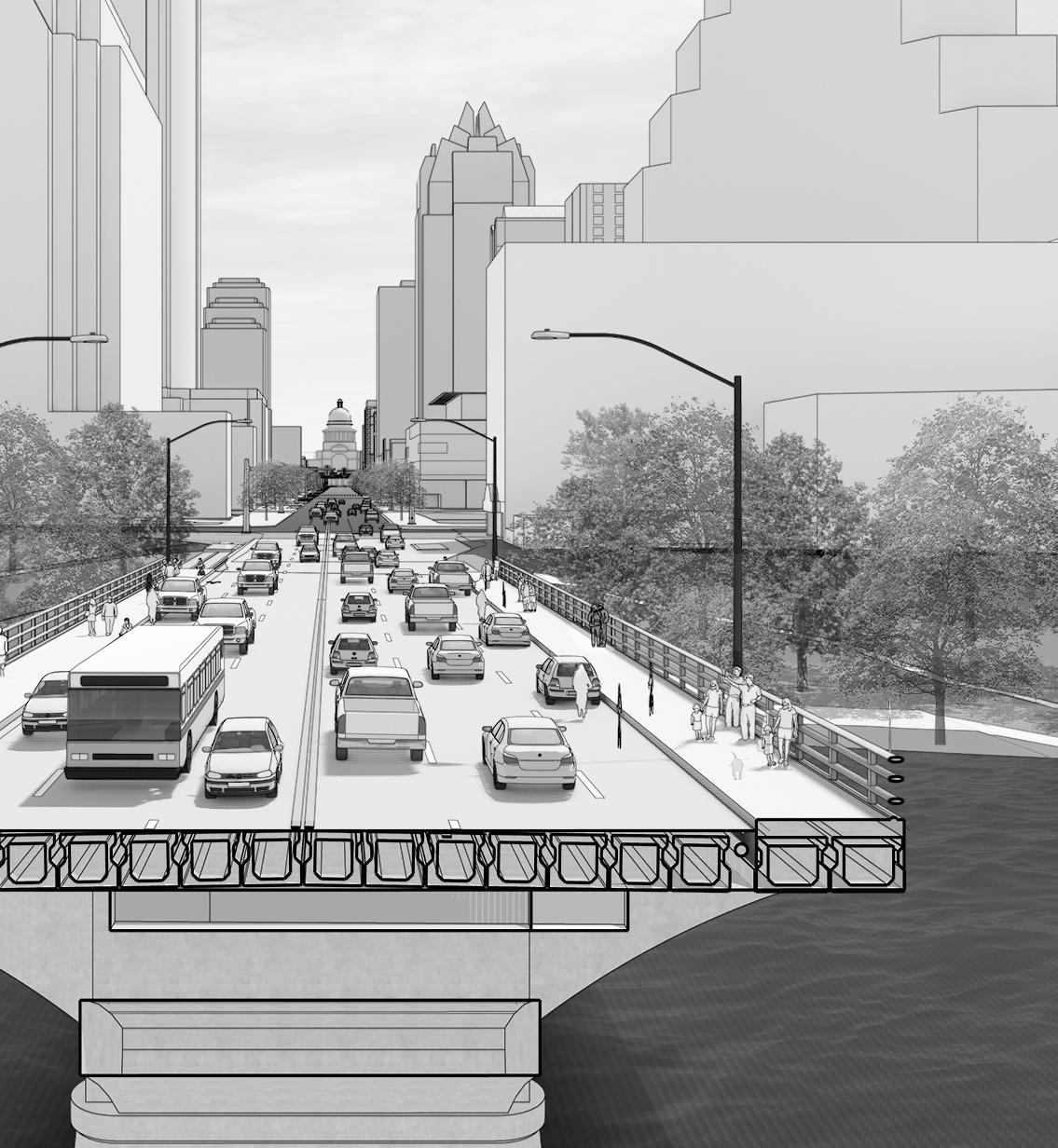
Existing Conditions
The Ann W. Richards Congress Avenue Bridge is the main gateway into Downtown Austin and a destination in its own right for crowds of batwatchers. Prior to 2020, three-quarters of the bridge was dedicated to vehicular traffic, with narrow sidewalks that were inadequate for the volume of people dwelling and crossing the bridge on foot, bike or scooter. Following direction under Resolution 20200521-067, street space was reconfigured to provide for protected bicycle lanes designed to remove conflicts between people walking and bicycling on the sidewalks and provide for greater comfort and safety for everyone.
This rebalancing of street space beings to unlock the potential for a more comfortable, safer and multimodal street envisioned through this plan.
Allocation of Space
Interim Protected Bike Lane
Sidewalk
Interim Protected Bike Lane
Recommended Alignment
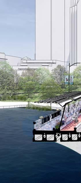
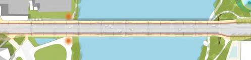
In the recommended street space allocation, four general travel lanes implemented in 2020 remain on the bridge and the remaining space is reconstructed to provide for a permanent barrier between cars and bicycles or scooters as well as space for seating, planting and shade elements.
Allocation of Space
Bike & Scooter
Vehicular 50%
Bike / Scooter 25%
Sidewalk 25%
Sidewalk
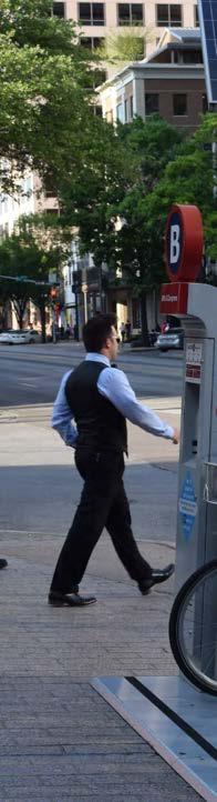
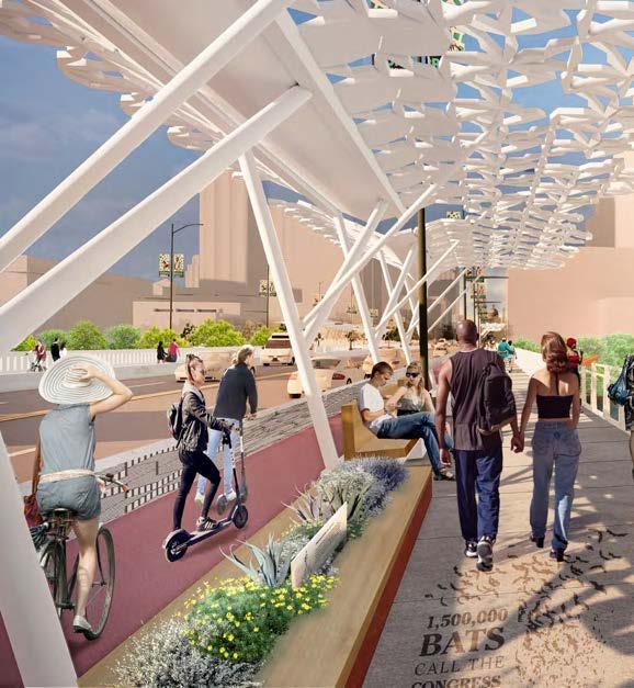
BICYCLE AND SCOOTER LANES
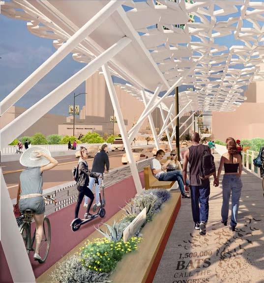
Congress Avenue is a heavily used route for people riding bicycles. The Avenue intersects numerous urban bike routes as well as the trail system around Lady Bird Lake. Dockless scooters have also become a significant mode of transportation. The introduction of grade-separated bike lanes that draw on national best practices will create a safer route for cyclists of all ages and ability levels, strengthening the Avenue’s role as central spine of Austin’s bike network.
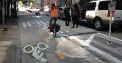
People on scooters ride in the interim protected bike lane installed in the Fall of 2020
Queuing area for bikes + scooters
Offset bike lane at corners
Designated pickup / dropoff spaces
Pedestrian crosswalks
ADA landing
Space for queuing at intersections
2’ Wide Buffer
6.5’ lane wide enough for passing
The above-curb cycle track recommended along Congress Avenue adheres to national and international best practices. This configuration will reduce conflicts among cyclists, scooters, pedestrians, and vehicles.
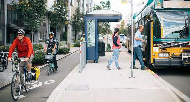
Dexter Avenue, Seattle: Dedicated bike lanes at the same level as the sidewalk are protected from vehicles.
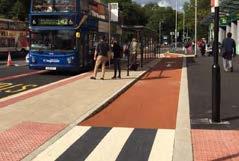
Manchester, UK: Safe pedestrian crossings where circulator stops are located near bus stops.
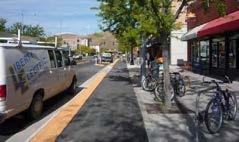
Missoula, Montana: Amenity zones provide a buffer between pedestrians and an above-curb cycle track.
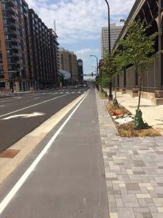
South Washington Ave, Minneapolis: A new above-curb cycle track in Downtown Minneapolis
CURBSIDE MANAGEMENT & FLEX
PARKING
The outermost travel lane can be designated as a flex lane, meaning that it functions as a travel lane during peak hours and as on-street parking during non-peak hours. This flexible configuration allows the roadway’s vehicular capacity to be dynamically adjusted as conditions change over time.
These flex lanes should be clearly demarcated with signage and striping and enforced consistently. While there may be an initial adjustment period, flex lanes have been successful in Houston, Washington DC, and numerous other cities.
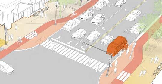
At the corners of each block, space has should be allocated for pickup and drop-off zones that can be used by a circulators or TNCs. Ample parking that meets ADA standards must be provided on cross streets adjacent to Congress Avenue (See page 110).
Parking during off-peak hours
Pickup and drop-off zone
Travel lanes during peak hours A
Potential for Circulator Stop A
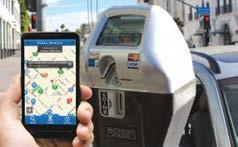
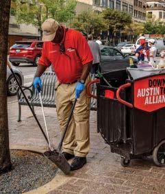
Cities across the country are increasingly recognizing the value of curb space and piloting new strategies to manage this valuable and flexible public space more efficiently. The Austin Downtown Parking Strategy specifically recommends that Austin “create a dynamic inventory and adjust on-street regulations to maximize flexibility at the curb.”
While a specific policy for Austin has not been fully developed, parking meters and smartphone apps are two existing tools that can be used to introduce dynamic pricing and flex parking. The electronic meters already used in several parts of Downtown Austin, should be seen as an integral aspect of communicating and enforcing flex parking policies. During peak hours, when parking is not permitted, these meters would not issue parking stickers.
Wayfinding is another key aspect of curbside management. Some cities rely on pavement markings to indicate flex zones, while others primarily use signage to indicate parking regulations.
Seattle, WA: Pickup and drop-off area with safe pedestrian crosswalk
Santa Monica, CA: Smart parking meters facilitate dynamic pricing and other parking management strategies
Washington, DC: time-of-day parking restrictions reduce congestion and increase safety in nightlife areas
OFF-PEAK PARKING CAPACITY
On a typical block, the recommended strategy for flex-parking lanes would provide approximately 16 parking spaces per block during non-peak hours. At each corner, space would be reserved for pickup and drop-off areas for TNCs and potentially small circulators. While the specific hours designated as peak vs off-peak could be set according to demand, these parking spots would likely be available during the hours of highest parking demand for retail: weekends, and evenings.
Pickup / drop-off area
Off-peak parking space
crossing distance
Los Angeles: New signage clearly explains when and for how long parking is permitted on particular blocks.
SUMMARY OF RECOMMENDATIONS
Existing: Typical Block
In the existing alignment, diagonal parking bays allow for a limited public realm activation. The diagonal parking bays are often awkwardly and inefficiently spaced, reducing the amount of on-street parking and resulting in areas of unuseable space that is difficult to maintain.
12 permanent spaces per block, on average
Recommended: Typical Block
In the recommended alignment, the roadway is consolidated into five lanes. The alignment maintains two travel lanes and a turning lane in each direction while providing space for a larger pedestrian realm and above-curb lanes for bikes and scooters. A strategy for flexible parking during off-peak hours is recommended.
Allocation of Space
Parking: ~ 16 spaces per block at off-peak times
Allowed with dedicated lane
Left Turns:
SUMMARY OF RECOMMENDATIONS
Three alternate cross sections north of Cesar Chavez Street were evaluated as part of the Congress UDI and documented in detail in the study’s mobility report. Each of the alternatives evaluated would keep the same lane configurations at major intersections (Cesar Chavez, 5th, 6th and 11th streets) and generally provide the same traffic capacity with differences in turn lanes at minor intersections that relate to local access and the balance between space for motor vehicles versus sidewalk, bicycle lane, and amenity space within the right-of-way. The recommended cross section presented in the P4 public engagement (4th public meeting) was a continuous 5 lane cross section which received stakeholder feedback that pedestrian, bicycle and amenity space should be further prioritized. Additionally, in response to the pandemic, interim lane changes were implemented in 2020 that rebalanced the avenue in better alignment with Congress UDI study goals.
This interim change remained within the curbs of the existing street that north of Cesar Chavez Street and included 5 motor vehicle lanes at major intersections and 4 lanes at minor intersections, protected bicycle lanes, and improved pedestrian crossings. Given public feedback in response to the P4 recommended alternative and the current motor vehicle lane configuration in place, further study of the best alternative will be conducted in the design phase which will include traffic modeling, analysis of the current lane configuration, and public engagement that will be finalized at the 30% design. The early design phase will also be an opportunity to look at the best options for implementing festival and flexible street space as suggested in the Civic Stage and through stakeholder feedback generally north of 7th Street where there is less motor vehicle traffic and further flexibly may be explored.
A construction worker travels southbound on Congress Avenue in the interim protected bicycle lanes installed in Fall of 2020.
SUMMARY OF RECOMMENDATIONS
01 The configuration and design of Congress Avenue should reflect its role as both a regional connector and an urban destination.
02 The configuration and design of Congress Avenue should reflect increasing patterns of urban density in Central Austin. Designs should be evaluated by their ability to increase multimodal capacity, rather than simply vechicular throughput.
03 Further modeling will be done in the detailed design phase to best understand optimal cross section that support overall balance of street space
04 The outer lanes should be wide enough to accomodate a circulator and as well as off-peak flex parking.
05 Consider the need to include ADA parking spaces as cross streets are repaved or repainted
06 Ensure that bike / scooter lanes feature ADA compliant crosswalks and landings at all intersections and other crossing points
07 Maintain the same lane configurations at Cesar Chavez, 5th, 6th and 11th streets and generally provide the same traffic capacity with differences in turn lanes at minor intersections that relate to local access and the balance for all modes and amenity space.
08 Reconstruct the roadway across the Ann W. Richards Congress Avenue Bridge to include two travel lanes in each direction and protected bike / scooter lanes.
09 Bike / scooter lanes should be above the curb at the same level as the sidewalk to allow flexibility during events.
10 Crash barriers should separate travel lanes from the bike/scooter lanes. The design of these barriers should be sensitive to the urban character of the bridge.
11 Bike and Scooter lanes should be raised to the level of the sidewalk and protected from the roadway by a 2’ wide buffer. The lanes should be wide enough to allow passing and riding side-byside.
12 At the corners of each block, the lanes may be offset farther away from the curb to allow cyclists to queue at red lights, create an ADA compliant landing at crosswalks and spaces for circulator or TNC pickups and dropoffs.
13 Pedestrian crossings at bike lanes should be included to minimize pedestrian / cyclist conflicts.
14 Ensure that the design and engineering of each intersection provides the flexibility to incorporate pickup and drop-off zones for TNCs and to accomodate potential far-side circulator stops at key intersections.
15 Curb-cuts and loading should be prohibited along Congress Avenue
16 Develop a curbside management strategy for Congress Avenue that includes areas and times for flex parking, drop-off zones.
17 This strategy should build upon the Downtown Austin Parking Strategy and include integrated parking meters, wayfinding and signage, and appropriate pavement markings.
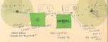
DESIGN CONCEPT & PLACEMAKING
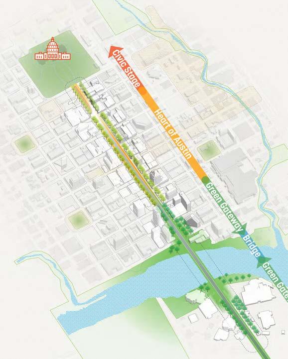
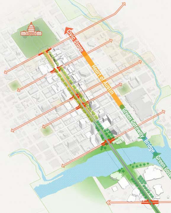
The design of Congress Avenue must reflect the vibrant culture and history it represents as the Main Street of Texas and the heart of Austin’s Downtown. It must also function as a Civic Stage for events and festivals and as a Green Gateway from Lady Bird Lake into Downtown Austin.
DESIGN CONCEPT
The context and character of Congress Avenue changes along its length from the Capitol grounds to Riverside Drive. To reflect and enhance the unique qualities of each zone, the proposed intervention is made up of three distinct character areas:
The Civic Stage – a threshold to the Capitol and a backdrop for festivals and civic events
The Heart of Austin – where cafés, restaurants, stores, museums, and theaters showcase the beating heart of Austin at its best
The Green Gateways – where the environmental and recreational assets of Lady Bird Lake extend into the city along Congress Avenue both north and south of the lake
The Bridge – the iconic entry to downtown and destination where pedestrians, cyclists, vehicles, and bats move alongside one another
Civic Stage strengthens the connection to the Texas State Capitol and provides a platform for civic engagement and events.
Heart of Austin builds on the small-scale retail and historic fabric of Congress Avenue between Third and Eighth Streets
Gateways enhances visibility and connection to Lady Bird Lake and Austin’s network of trails and waterways
The Bridge incorporates protection barriers, shade structures, and vegetation to offer pedestrians and cyclists a safe and comfortable connection to downtown
Green
State Capitol
Auditorium Shores ShoalCreek
LADY BIRD LAKE
Republic Square
Brush Square
Wooldridge Square
CIVIC STAGE
CIVIC STAGE
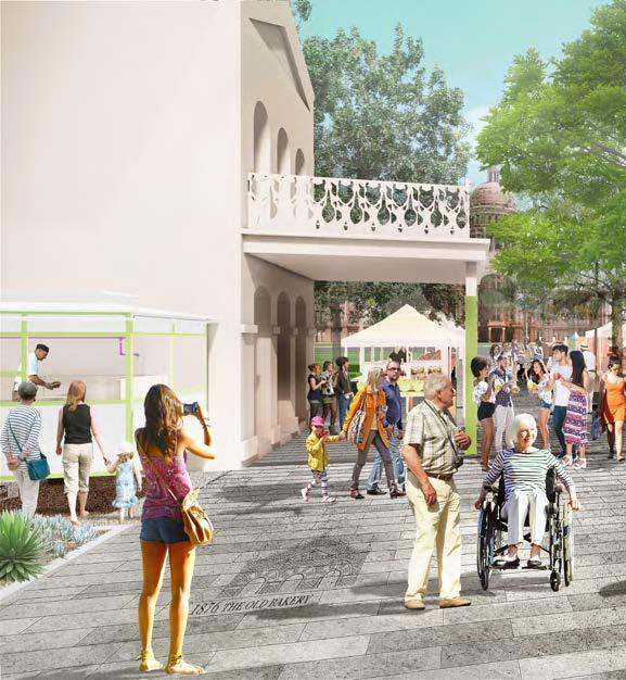
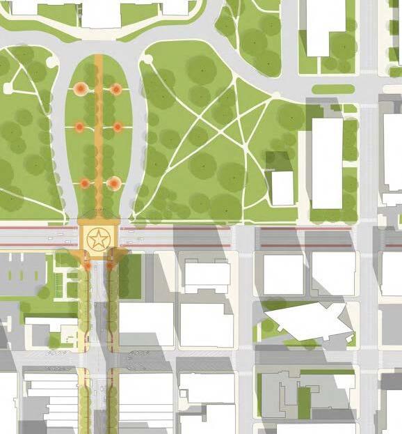
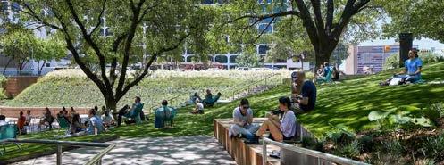
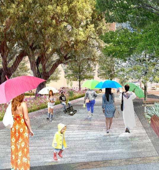
The streetscape design concepts for the “Civic Stage” acknowledges the many exciting events, parades, and spontaneous celebrations that take place along Congress Avenue throughout the year. It is meant to be a place to display civic pride and to come together as a community at the foot of the Capitol.
The Civic Stage area encompasses the northernmost blocks of Congress Avenue. Here, the ground plane should allow for maximum flexibility by incorporating flush grates for the trees and movable furnishing. During events that draw large crowds, furnishing can be rearranged to allow for easy pedestrian movement. During festivals, additional furnishing can be brought in to support the needs of the event.
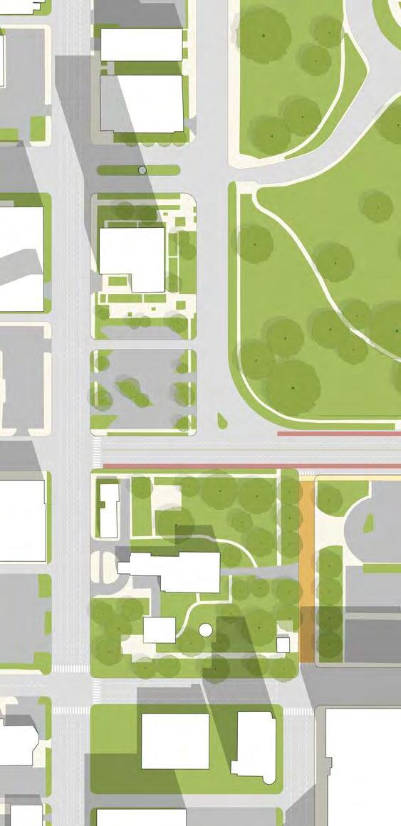
The northern-most block between 10th and 11th street presents a special opportunity to create a seamless connection to the capitol grounds and provide additional amenities for small-scale, frequent events.
STREET CLOSURE ZONE FESTIVALS ON CONGRESS AVENUE
WITHIN PROJECT SCOPE
11TH STREET TO CESAR CHAVEZ STREET
ANN W. RICHARDS CONGRESS AVENUE BRIDGE
BARTON SPRINGS ROAD TO RIVERSIDE DRIVE
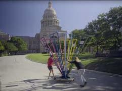
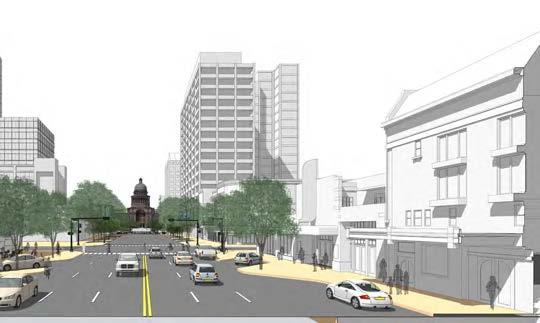
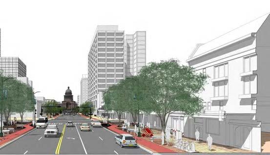
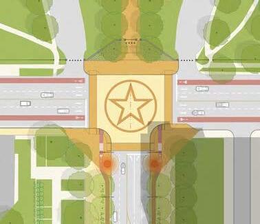
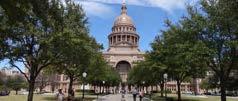
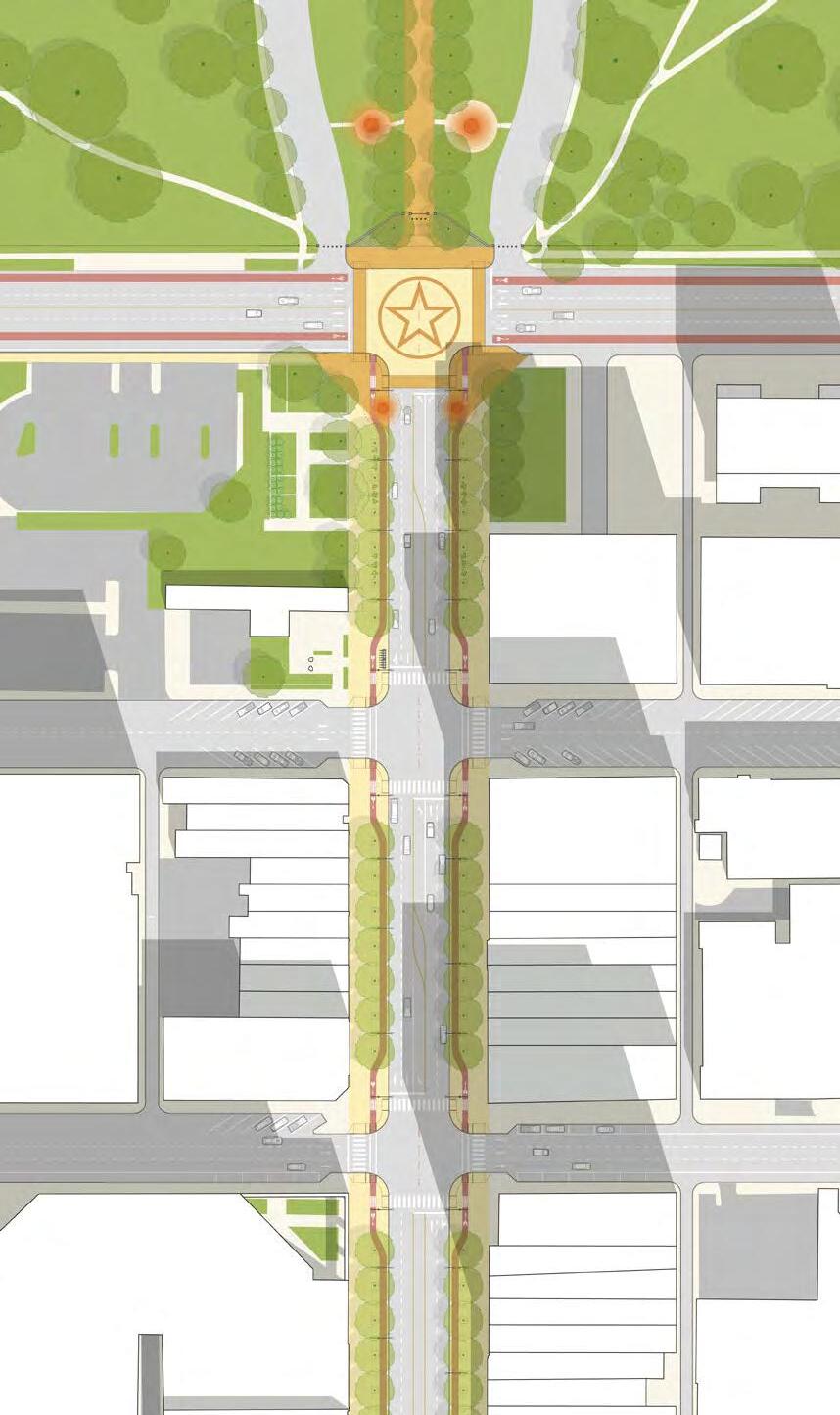
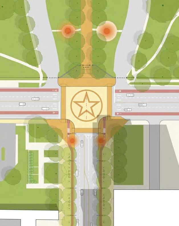
Along Congress Avenue from 9th to 11th street, a stately allée of oak trees should frame the view of the Capitol, visually connecting the Avenue to the central walking path on the Capitol grounds. At the crossing of 11th Street and Congress Avenue, special paving can help to demarcate the continuity between the Avenue and the Capitol. Additionally, the sequence of commemorative sculptures leading to the Capitol could extend south across 11th street, further reinforcing this continuity.
The expanded sidewalk zone can comfortably accommodate larger groups of people. During events, the bike/scooter path may be closed to through traffic to function as an extension of the sidewalk, expanding the gathering space. Fixed furnishings are kept to a minimum in this area, creating greater flexibility for a large number of events that may require different configurations of elements on the ground plane. Additional electric power outlets and tent anchors can be incorporated into the underground infrastructure to further enable events.
Attention to supportive policies and procedures that reduce the burden of hosting regular street events and encourage such events to occur more often, for broader range of time periods, and with wider programmatic variety should be pursued.
Strengthen Relationship with Governor’s Mansion
Reference Capitol Grounds
the “Green Frame” of the Capitol Complex
Reinforce the connection from Congress Avenue to the capitol grounds and guide pedestrians by extending the paving motifs within the capitol grounds out toward the intersection of Congress Avenue and 11th Street.
Extend the planting palette of the capitol grounds into the green spaces on 1000 block.
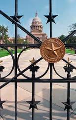
Incorporate the star motifs in the existing fence and vertical elements into the paving.
Introduce sculptures inspired by the history of Texas into the streetscape.
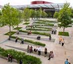
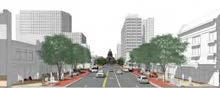
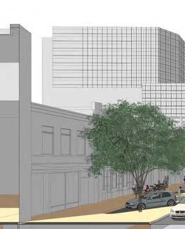
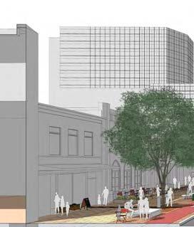
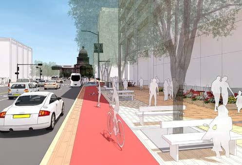
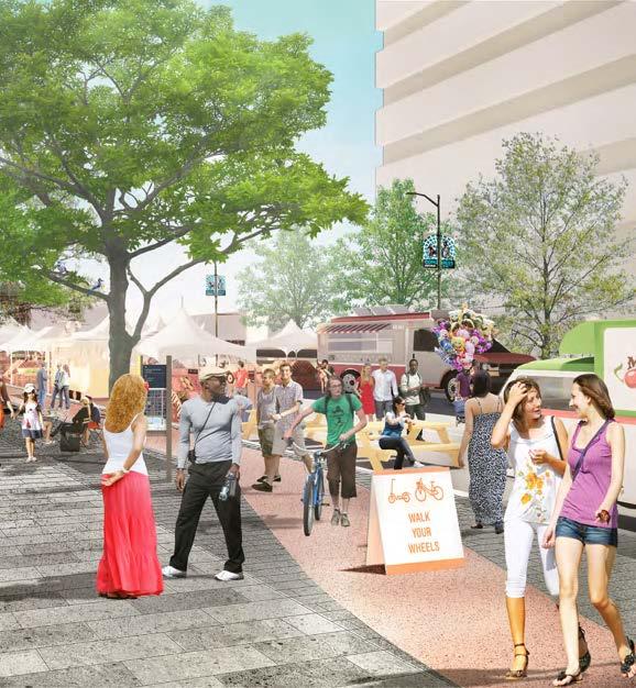
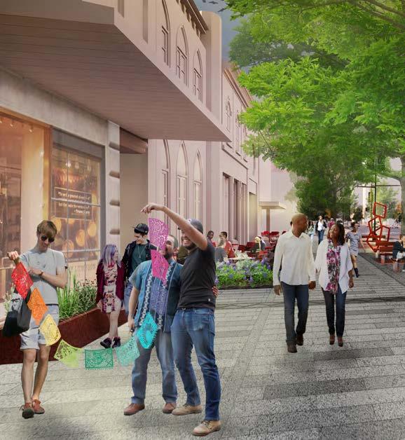
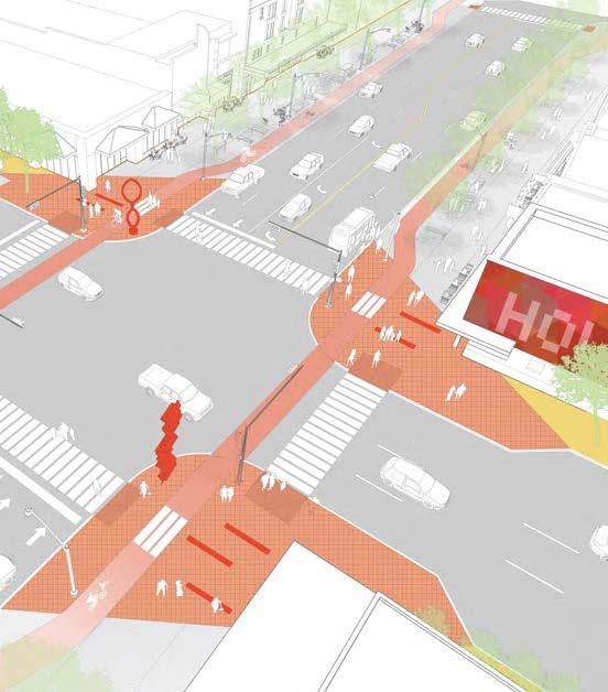
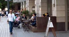
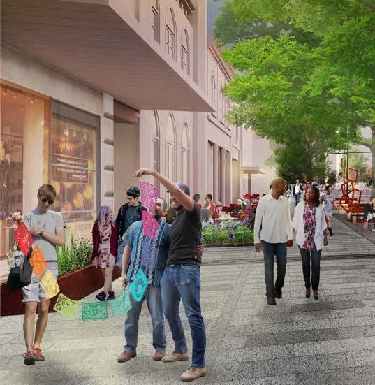
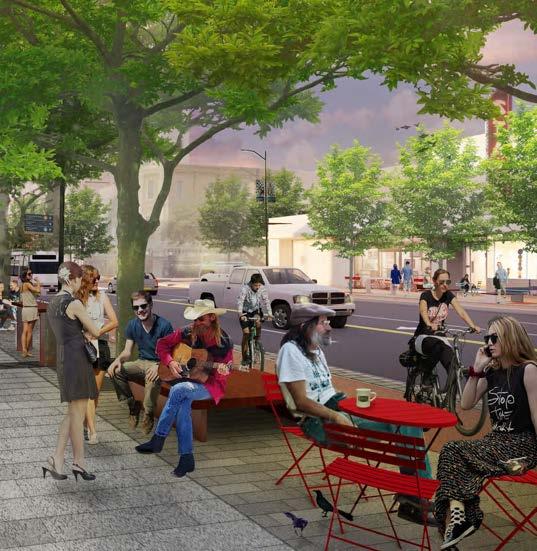
HEART OF AUSTIN
HEART OF AUSTIN
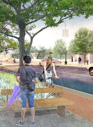
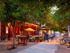
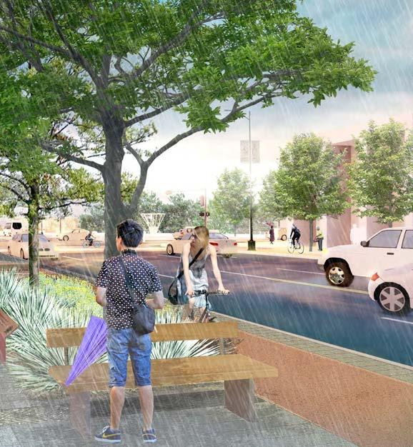
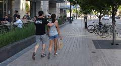
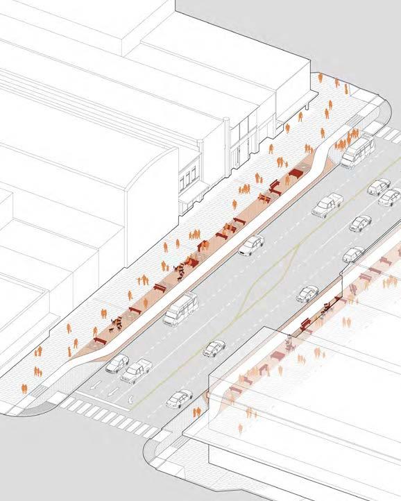
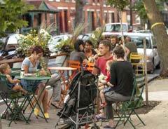
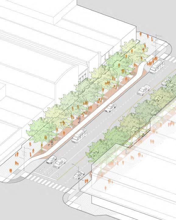
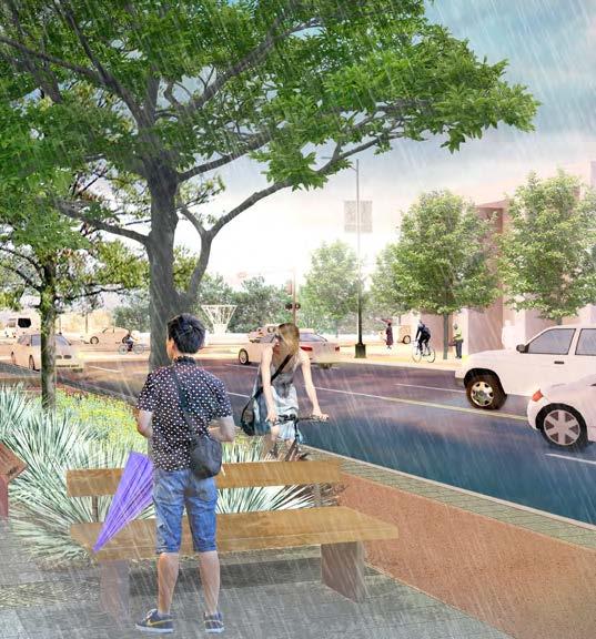
The streetscape design concepts for the “Heart of Austin” envision a vibrant people place that is active and interesting at all times of the day and night. In the blocks between 9th and 3rd streets, Congress Avenue should come alive with art installations, cafés, restaurants, stores, cultural venues and museums. The vitality of existing and new ground floor uses can be supported by wider sidewalk widths, spill-out space for retail and outdoor eating, and an engaging, flexible mix of seating options.
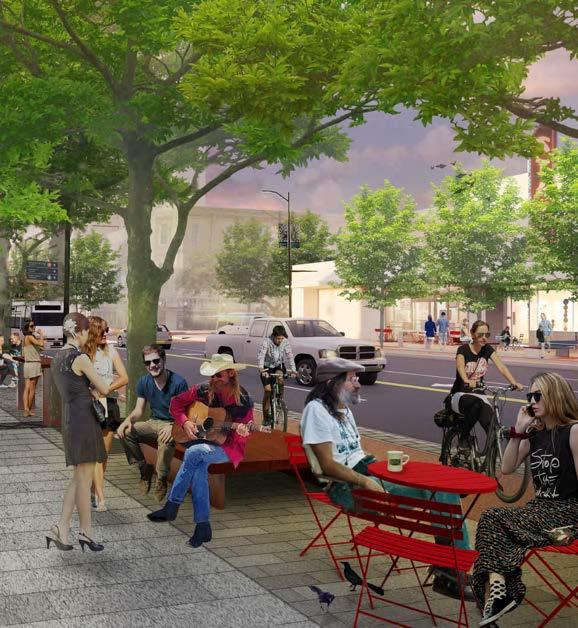
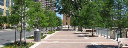
Example of typical roadway alignment and streetscape design for the Heart of Austin Character Zone
GROUND FLOOR USE
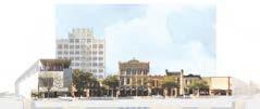
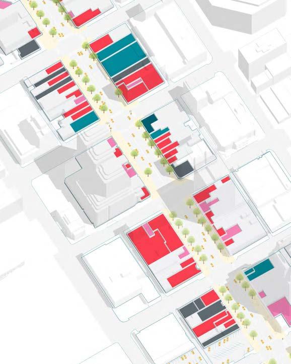
The urban fabric around Congress Avenue between 4th and 7th Streets is defined by a mix of small historic storefronts anchored by larger institutions like the Paramount Theater and the Contemporary Austin Museum. Within this finer grain, smaller scale retail tenants create an ideal rhythm and scale for pedestrian activity, with many opportunities for outdoor seating and storefront displays. While many of the blocks towards north and south of this stretch have been developed as larger properties, the Congress Avenue’s status as a National Register Historic District makes it more likely that this area will retain its architectural integrity.
Ground Floor Use
Retail / F & B / Service
Hotel / Office Lobby
Cultural Use
Vacant Property
W8th
E8th
W6th
E7th
W5th
E6th
E5th
Royal Blue Grocery
Hideout Theater
Paramount Theater
The Contemporary Austin
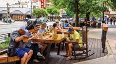
Along this section of Congress Avenue, the shaded amenity area beneath the tree canopy should feature generous public seating designed to support current and future businesses. These seating areas could be organized into various “rooms” and configured for different activities and seating arrangements. Featuring amenities like free public wifi or a public performance series, the Heart of Austin can become an attraction in itself, drawing visitors and generating foot traffic for local businesses.
At the same time, a dedicated storefront area in front of each business can become spillover space for tables, seating, signs, planters, pop-up events, temporary art installations, depending on the needs of each establishment. Roughly 4,400 square feet of flexible store frontage and 3,500 square feet of public amenity space can be provided per block. This additional space could, for example, accomodate six to eight cafe tables along the width of a typical storefront, significantly expanding the capacity of a small local business.
This combination of proprietary space and public amenities should be designed and managed to reinforce each other, activating the Heart of Austin along Congress Avenue.
4,400 square feet of store frontage
3,500 square feet of public amenity space
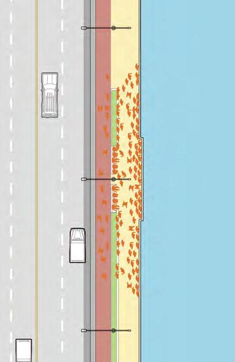
Sidewalk space allocation
Store Frontage
Clear Walk Zone
Amenity Space
Bicycle / Scooter Lane
Example of possible furnishing arrangements at each storefront and in the amenity area. See seating and furnishing section for more information and precedent images.
GREEN GATEWAY
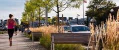
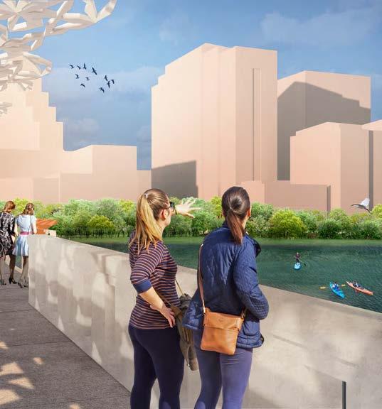
The design concepts for the “Green Gateway” celebrate Congress Avenue’s connection to Austin’s network of trails and open space. The design elements seek to bring urban ecology into the public consciousness by highlighting the movement of water and strengthening the relationships between the Avenue and the green spaces along Lady Bird Lake.
In the blocks closest to the lake, the streetscape is characterized by an amplified presence of landscape and green infrastructure. As opposed to the underground rain gardens along most of the Avenue, this area features generous planters that support the greenery along Lady Bird Lake and the privately-owned plazas between Cesar Chavez and Second Street.
The design should make use of interpretive elements to help explain the story of stormwater flows along Congress into Lady Bird Lake and reinforce Congress Avenue’s role in the Austin’s overall ecological systems. Planting beds should be carefully designed to slow and filter stormwater before it reaches the lake. Runnels incorporated into the paving system should be designed as distinct features that reveal the movement of stormwater from the sidewalks into the planting beds, and eventually into the Lake.
W 3rd
W 2nd
W Cesar Chavez
3rd E 2nd
E Cesar Chavez
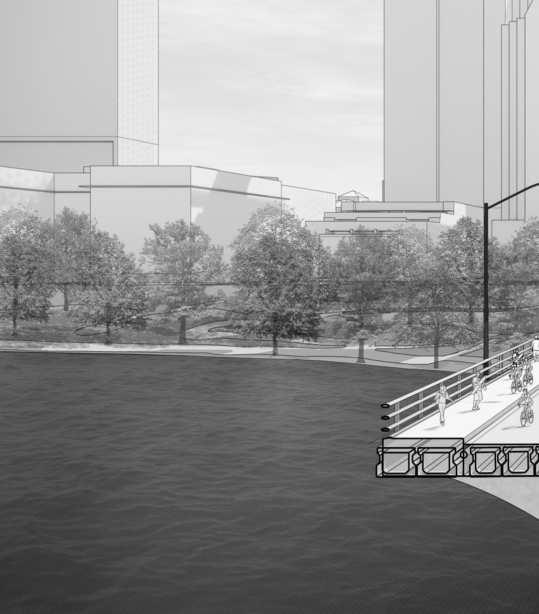
The “Green Gateway” zone extends over the bridge, across Lady Bird Lake, to Riverside Drive. Here, the existing urban fabric changes drastically, from blocks with many building facades and activities, to blocks with one or two buildings. Here, the larger block scale, widening road, and discontinuity of tree canopy increases exposure to heat and noise, creating an uncomfortable pedestrian experience. In order to bring a sense of human scale, thermal comfort, and rhythm to the sidewalk, the street tree canopy should be continuous and regular, incorporating runnels and other interpretive elements.
As this area redevelops, the ability of this “Green Gateway” to position Lady Bird Lake as a central feature, rather than a dividing element, will be a crucial part of creating a strong connection to Downtown Austin.
WRiversideDr
BartonSpringsRd
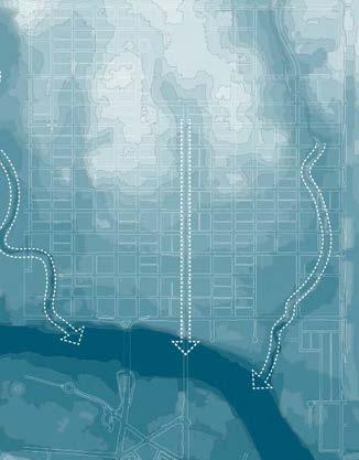
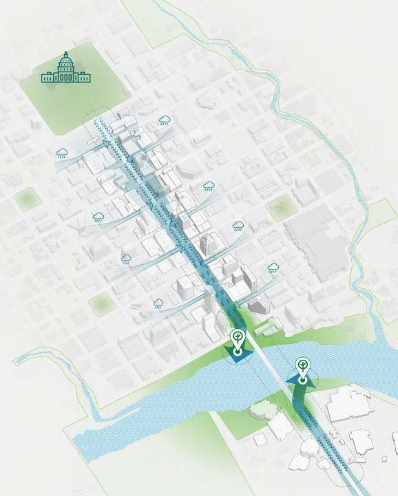
Congress Avenue sits in a depression that runs from the State Capitol toward Lady Bird Lake, collecting water from the surrounding disctrict and conveying it toward the water’s edge. The design of the Avenue has the opportunity to model green infrastructure best practices within a dynamic, civic environment to help tie together existing green spaces.
Existing watershed and stormwater flows
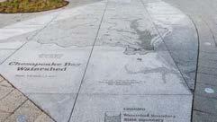
As a former streambed, Congress Avenue is a natural conduit for stormwater flowing from higher ground towards Lady Bird Lake. Along with Shoal and Waller Creeks, the Avenue is one of three major pathways for stormwater in Downtown Austin.
While innovative underground rain gardens are proposed along the entire study area, the “Green Gateway” features the most visible stormwater treatment infrastructure.
State Capitol Congress Avenue
WallerCreek
ShoalCreek
Local Precedent: Cesar Chavez Esplanade
Local Precedent: Fareground
Local Precedent: Pfluger Bridge Circle
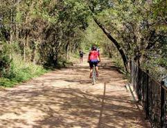
Local Precedent: Ann and Roy Butler Hike and Bike Trail
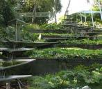
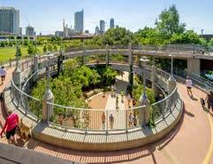
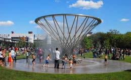
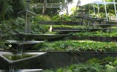
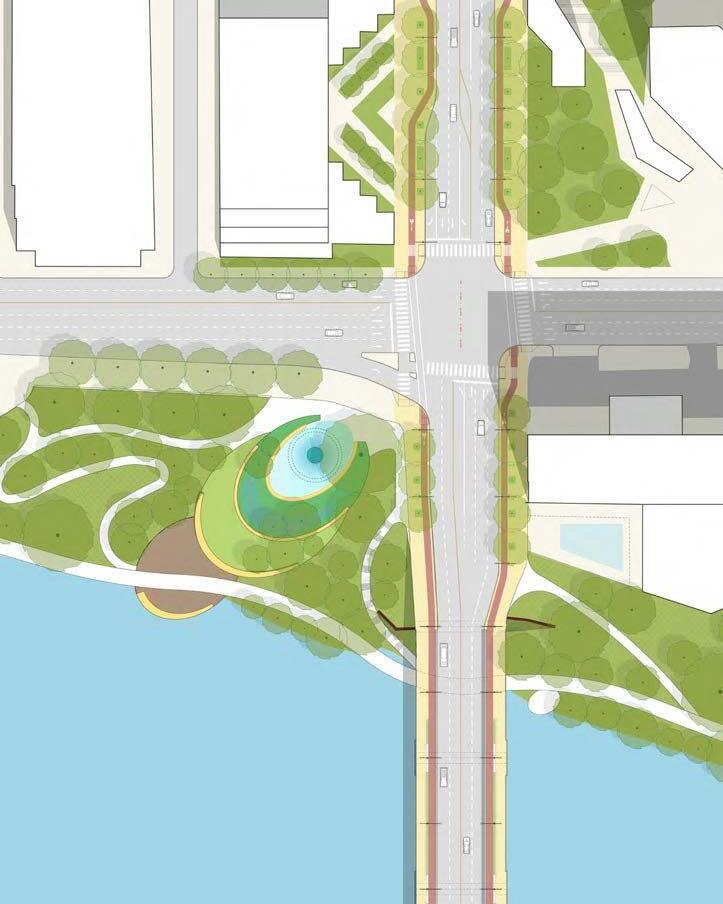
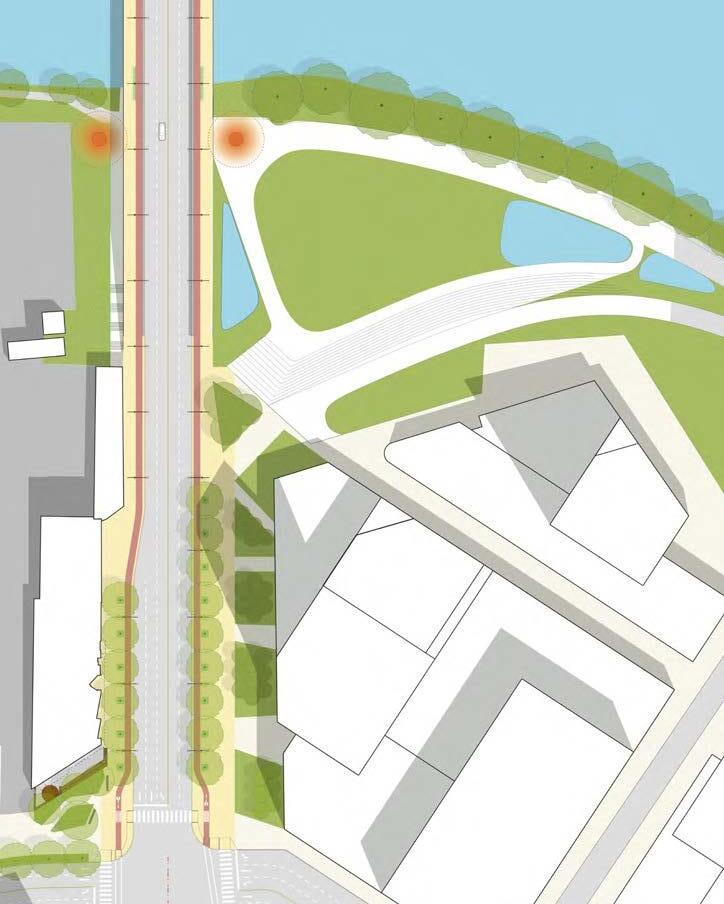
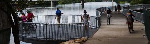
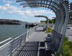
A series of stormwater terraces are envisioned at the northwest landing of the Ann W. Richards Bridge. This enhanced public landscape would offer an accessible path to the waterfront and filter collected stormwater, slowing runoff and improving water quality. A moumental “rain catcher” water sculpture could mark a gateway to the Ann and Roy Butler Hike and Bike Trail, become a place for gathering and play, and reveal how stormwater is treated before it enters Lady Bird Lake.
Precedent: Stormwater sculpture
Precedent: Deck at edge of the lake
Precedent: Stormwater terraces
Openviewtothelake
CHAVEZ ST
ANN W. RICHARDS CONGRESS AVENUE BRIDGE
E CESAR CHAVEZ ST
LADY BIRD LAKE
Ann and Roy Butler Hike
andBike Trail
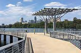
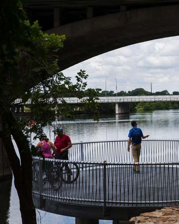
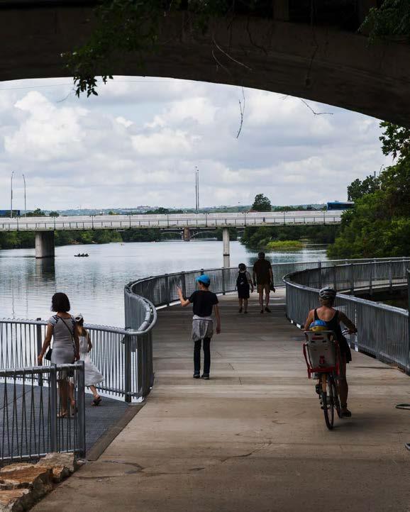
The southeast landing of the Ann W. Richards bridge features an amphitheater and bat viewing lawn linked to the redevelopment proposed in the South Central Waterfront Framework Plan.
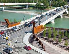
The improvements to the Bridge provide an opportunity to create a monumental gateway into Downtown Austin and ensure a smooth transition to South Austin. Two new beacons can emphasize the bridge as a gateway into downtown Austin and mark the bridge as a public place of gathering. The beacons should be designed to minimize impact on the bat colony. They should be inspired by existing interepretative elements and public art, as well as by the unique site character, where natural and urban elements come together.
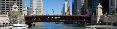
Precedent: Michigan Avenue Bridge, Chicago
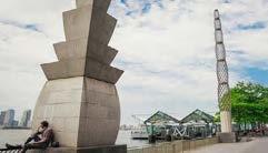
Precedent: Poppy Plaza, Calgary
Precedent: Pylons, Battery Bark, New York City
Connection to water
W. RICHARDS CONGRESS AVENUE BRIDGE
Public Plaza
Gateway Monuments
Bat Viewing Lawn Water Retention Water Retention
Connectiontowater
Accessible Path to Water
Amphitheater Steps and Stairs
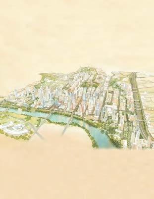
SOUTH CENTRAL WATERFRONT
SOUTH CENTRAL WATERFRONT
YETI
ANN
Stairs
ANN W. RICHARDS
CONGRESS AVENUE BRIDGE
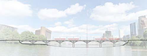
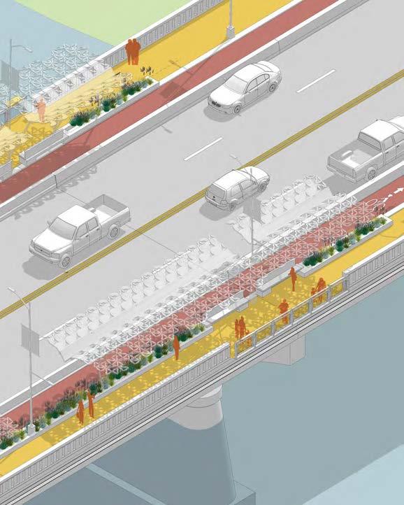
The Ann W. Richards Congress Avenue Bridge functions as an iconic gateway into Downtown Austin and a destination in its own right. However, the experience of crossing the bridge lacks elements to break up the journey across the bridge. The reconstruction of the roadway across the bridge brings an opportunity for design interventions that reinforce the history, the rhythm and character of the bridge as an iconic gateway into Downtown Austin, provide shelter and moments to break up the crossing, and to provide places for gathering.
The design of these interventions should be simple, complementing the monumental elegance of this historic bridge. The structure of the bridge is close to its maximum load and cannot be widened significantly. Thus, any design should be carefully engineered to avoid damaging the structure and maximize the available width of the bridge.
Intervention Opportunities
LADY BIRD LAKE
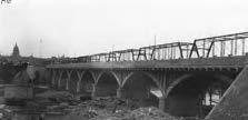
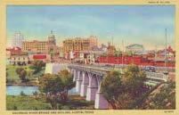
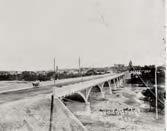
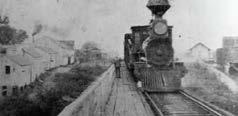
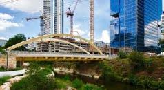
Congress Avenue has been the main gateway into Austin since the 1880s, when a pontoon bridge was constructed across the Colorado River. The current concrete arch structure of the historic Ann W.Richards Congress Avenue Bridge is over 100 years old. In the 1970s, the bridge was widened by adding outrigger supports and box beams, unintentionally creating an ideal habitat for an urban bat colony.
South Central Waterfront
Perceived Center of Brige over the Water
Downtown Austin
First bridge constructed
Wooden bridge constructed
Iron bridge constructed
Texas Capitol Completed
Current concrete arch bridge constructed
Longhorn Dam built, creating a consistent water level
Bridge Widened, “outrigger” supports and box beams added
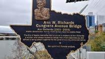
Renamed in honor of Ann W. Richards, 45th Governor of Texas
VIBRANT CROSSINGS
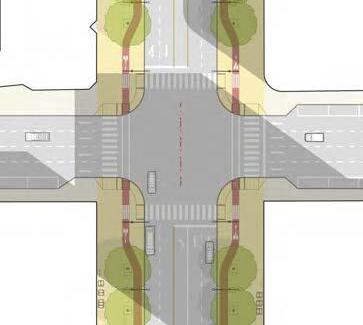
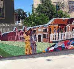
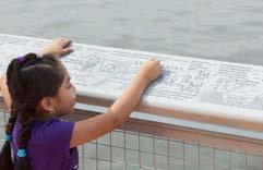
Congress Avenue is linked to many historic points of interest and major cultural corridors around Austin by way of its cross-streets. These destinations can be revealed at key intersections, or “vibrant crossings,” building on the narrative created by “Our Austin Story.” At these intersections, interpretive elements, public art, and a distinctive pallate of streetscape materials communicate the diverse historic and contemporary narratives of Austin.
The vibrant crossings at 11th Street, 9th Street, 6th Street, 5th Street, Cesar Chavez, and Riverside Drive should be informed by the narrative “Our Austin Story,” commissioned by the Downtown Austin Alliance, which highlights the many historic events and stories of Congress Avenue and its surroundings.
Wooldridge Square and other Historic Squares
East Austin African American Cultural & Heritage District
Houston & Texas Central Railroad Depot (1871)
Mexican American Cultural Center
The cultural significance of the “Vibrant Crossing” intersections are highligted by a series of design elements. A special paving treatment draws attention to each intersection and creates a consistent narrative along the Avenue. Interpretive markings and signage, murals, and public art provide opportunities for local institutions, communities, and artists to create a unique narrative for each Vibrant Crossing. The individual approach to these significant intersections provide a unique and quintessentially Austin flavor that complements the symmetry of the formal streetscape and monumentality of the Texas Capitol.
Local Precedent: Intersection between 6th and Brazos Streets
Mural Opportunity
PEDESTRIAN REALM ELEMENTS
The recommendations in this section outline a series of elements that will reinforce the character and functionality of Congress Avenue, from seating and amenities to paving textures. Design guidelines, standards and precedents describe a cohesive language to convey the overarching design concept and placemaking strategy for Congress Avenue.
CONGRESS AVENUE FOR ALL
From paving materials to parking spaces, the recommendations throughout this vision ensure that Congress Avenue is accessible and welcoming to all. One of the most pressing reasons to comprehensively redesign the Congress Avenue streetscape is the current lack of accessibility. Some of these issues are relatively simple to fix,
while other are not feasible without significant assessment. The Congress Urban Design Initiative (CAUDI) recommendations are informed by a detailed accessibility assessment, seek to holistically address this lack of accessibility, and help to ensure that Congress Avenue meets the federal standards set by the American Disabilities Act. A full assessment of accessibility is included in the Existing Conditions Report.
Sample of accessibility challenges found along Congress Avenue. See existing conditions analysis report for full length of the street.
Cross-slope exceeds 2%
Curb ramp slope exceeds 8.3%
Horizontal opening exceeds 1/2”
Accessible parking is non-compliant
Push button reach range or level clear floor is non-compliant
Existing Condition
Proposed Condition
Typical section cut between 7th and 8th streets
The sidewalks along Congress Avenue consistently fail to meet the ADA’s standard for ‘cross slopes.’ This means that the slope perpendicular to the direction in which pedestrians normally travel, in this case from the building facades to the roadway, is greater than 2%. As shown in the diagram above, the current cross slope is so severe that fixing this issue and achieving full accessibility will require significant investment to regrade the sidewalk, alter the crown of the road, and modifying the current storm drains. The full depth reconstruction and realignment of Congress Avenue presents an ideal opportunity fix this problem.
Today, Congress Avenue provides 10 handicap accessible parking spaces, some of which are outdated and do not meet current standards. In order to comply with TAS guidelines, the proposed design must meet requirements to replace or exceed the existing number of handicap accessible parking spaces.
To allow the possiblility of flex parking along Congress Avenue, permanent accessible parking spaces should be provided on cross streets in close proximity to the Avenue. A Preliminary analysis reveals several constraints that must be considered. For instance, some cross streets may be too steep to accommodate accessible parking, while other streets lack the width to accomodate proper landings. Existing diagonal parking spaces are easier to retrofit as ADA spaces in the short term. Parallel parking spaces require some curb reconstruction, but are preferred in the long term and better align with the Great Streets Standards. By strategically locating accessible parking at the cross-streets best suited for it, the design can provide more than double the existing number of handicap accessible parking spaces.
Existing parking on cross streets
Parallel parking No street parking
Diagonal parking
Running slope exceeds requirements
W Cesar Chavez
E Cesar Chavez
Accessible Parking Space
CONGRESS AVENUE
DEFINING THE SIDEWALK
The Pedestrian Realm of Congress Avenue must be more than simply a sidewalk for pedestrian circulation. The public realm also plays a vital role by supporting local businesses, providing a public space for gathering and relaxation, and showcasing local art and culture. In order to reinforce the multifunctional nature of Congress Avenue, the pedestrian realm should be organized into legible sidewalk areas.
An 8-foot wide storefront area creates spaces for local business to introduce planters, cafe tables, and retail displays, encouraging ground floor activities to flow into the pedestrian realm. This area should be consistent along the entire Avenue, ensuring that each storefront has access. Individual businesses should be responsible for design, funding, and maintaining any elements in the storefront area. These elements should be supported and informed by clear guidelines developed by the City of Austin, and the Downtown Alliance.
A 9.5’ walking area provides enough space for pedestrians to comfortably walk alongside and pass each other, accomodating busy weekends and evening. This area should remain clear of street furniture, seating, and any other obstruction.
An 8’ public amenity area features trees, lighting, a variety of street furnishings, and opportunities for art, performances, and interpretive elements. While this space will certainly support adjacent retail tenants, the possibility of designing portions of this area to be flexible to curate a balance of revolving commercial and non-commercial purposes to include art displays, performance spaces, children’s activities, visitor information, police services and much more should be explored further in the design phase.
Congress Avenue Precedent: Amenity Area
Congress Avenue Precedent: Walking Area
Congress Avenue Precedent: Storefront Area
Storefront Area WalkingAreaAmenityArea
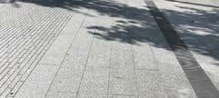
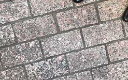
PAVING
All ground surface materials should be elegant, timeless, and durable. Within a unified material palette, the design can use material changes to differentiate between areas of movement and areas of rest. Within these areas, interpretive markers and other unique elements can be integrated to highlight the history, culture, and ecology of Congress Avenue.
Guidelines for walking and storefront areas:
Î Stone pavers or pre-cast concrete unit pavers
Î Light, neutral color to deflect light and heat
Î Highly durable
Î Large paver size
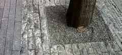
Guidelines for amenity area:
Î Permeable pre-cast concrete unit pavers
Î Light, neutral color to deflect light and heat
Î Highly durable
Î Small paver size
Î Include embeded markers and other treatments that reveal the underground rain gardens, soil volume, and stormwater story
Accents and highlights:
Î Embed interpretative markers or wayfinding signage on the paving
Î Reuse Texas Granite pavers at strategic locations.
Î See section on Vibrant Crossings for more information
Integrate interpretative markers on the ground surface
Large unit pavers in storefront and walking areas
Distictive Highlights at Vibrant Crossings
Visible elements highlight stormwater system
Larger, neutral paving in walking and amenity areas
Pervious paving in amenity area
8’ Storefront Area 9.5’ Walking
Large Unit Pavers in Storefront and Walking Areas
Opportunities for cafe seating in Storefront Area
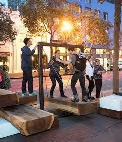
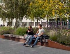
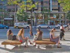
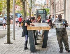
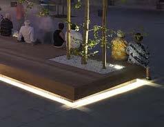
SEATING AND FURNISHING
A diverse mix of seating types and amenities— including chairs, benches, leaning rails, platforms and standing height tables—can support the range of activites that happen within Congress Avenue’s public realm. Furnishing should enable people to meet, eat, work, perform, and tell stories on the Avenue in unique ways.
This variety of seating opportunities should support the needs and preferences of people of all ages, abilities, and cultures.
Precedent: Mix of furnishing types to accommodate a wide range of demographics and activities
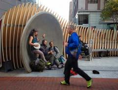
A variety of chairs and benches can be arranged in different ways to create ‘rooms’ for families and groups to sit together, as well as spaces for individuals to work, reflect, or relax.
Some of these ‘rooms’ may, for example, be configured as workstations with free wi-fi. Others may be configured as performance areas with a small platform that can be used by buskers with space for a small audience to gather.
Spaces for art and interpretive elements will be carved out of the amenity zone to tell the Avenue’s rich history and express the vibrance of Austin today.
In order to create a cohesive identity, each of these furnishing elements should share a distinct palate of materials and colors that reflect both the historic importance and contemporary character of Congress Avenue.
This family of furnishing elements should include, at a minimum:
Î Public Wi-fi
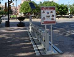
Î Parking for bikes and scooters and bikeshare stations
Î Removable furnishing and seating in the Civic Stage character area
Î Fixed seating and furnishing that accomodates a diverse range of uses in the Heart of Austin character area
Î Seating integrated with rain gardens in the Green Gateway character area
Î Space for local art and interpretive elements
Î Way-finding and signage elements
Precedent: Temporary installations to encourage play Access to public restrooms and drinking fountains have been identified as a priority for the corridor. Existing drinking fountains exist at 6th and 11th streets. Existing public restrooms are located along the corridor at the State Capitol (north of 11th Street) and The Old Bakery and Emporium (at 10th Street). Inclusion of additional drinking fountains and public restrooms should be considered at a reasonable interval along the corridor during the design phase.
Precedent: Movable seating
Precedent: Fixed seating
Precedent: Fixed seating or stage
Precedent: Bicycle share station
Precedent: Standing table
Precedent: Performance space
Precedent: Wi-fi and charging stations
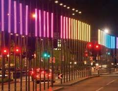
LIGHTING
The lighting along Congress Avenue should reinforce both the history and contemporary dynamism of the Avenue. The detailing and dark green color of the current signature light poles north of Lady Bird Lake reflect Congress Avenue’s history and build on elements of the Texas Capitol. These fixtures can be preserved as a key element of the district character while enhancing the pedestrian experience throughout the day and night.
The historic fixtures should be retrofitted to a consistent standard. A second, lower arm should be inorporated to provide comfortable, safe light levels to the sidewalk and the bicycle/scooter path as well as the roadway. The orientation and type of lighting elements should conform to dark-skies standards. Banners attached to the fixtures should continue to promote the rich cultural offerings of Austin.
These light poles should be used consistently throughout the study area, extending across the Ann W. Richards Congress Avenue Bridge to create a uniform cadence and consistent experience all along the Avenue.
Congress’ historic streetlights updated for the 21st Century with incorporated signage
In addition to standardizing the historic light fixtures, Secondary light elements can be added to enhance the character of the Avenue, expressing unique moments and uses along Congress Avenue. These may include:
• Illuminated sculptures and interactive elements
• Illuminated furnishings
• Tree lighting
Best practices should be developed and enforced to ensure that any lighting supported by trees does not detract from their health or growth. In particular, care should be taken to prevent the girdling that is seen in some instances along the Avenue today.
Electric utilities should be updated along the avenue to provide the flexibility and capacity to incorporate diverse types of lighting, anticipate future lighting technologies and accomodate additional lighting and other elements for events, programming and art installations.
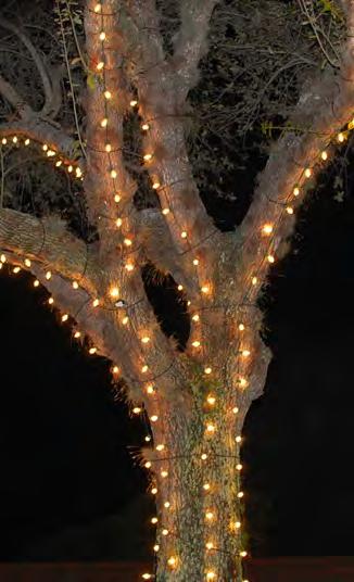
Congress Avenue Precedent: Historic Christmas lights
Precedent: Best practices for tree lighting
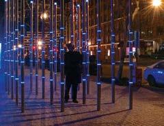
Precedent: Light installation on roadway
Precedent: Interactive light installation on sidewalk
Precedent: Incorporated lighting in seating
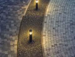
Precedent: Incorporated lighting in bollards
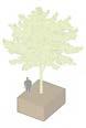
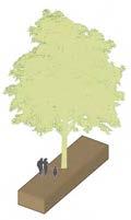
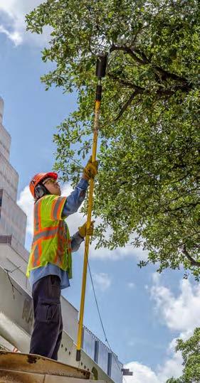
TREES
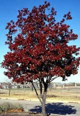
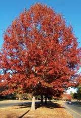
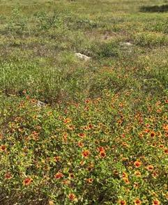
Texas is home to one of the largest and most diverse populations of oak (Quercus) species in North America. Many Heritage Oaks throughout the city have witnessed the history that makes Austin what it is today. The streetscape should celebrate Texas’ rich oak ecological heritage by incorporating a diverse mix of stately oaks into the planting palette.
These trees should be spaced closely and consistently to shade the public realm, create a consistent rhythm along the Avenue, and frame views of the Texas Capitol. The selection of Oaks should include trees of similar shapes and sizes, but include enough biodiversity to create resilience to droughts, diseases and other environmental risks. Tree selection will also be informed by previous studies such as the tree assessment completed by the Downtown Austin Alliance that speak to particular varietals and soil requirements.
Texas red oak (Quercus buckleyi)
Shumard oak (Quercus shumardii)
Chinkapin oak (Quercus muehlenbergii)
Precedent: Strong tree line on Pennsylvania Avenue, Washington D. C.
SOIL AND TREE HEALTH
The City of Austin cherishes its urban forest and the ecosystems that it supports. Throughout the project, public engagement consistently revealed an almost unanimous desire for healthy trees and a robust system of green infrastructure. Creating a lasting canopy of healthy trees along Congress Avenue is among the highest priorities of the Congress Avenue streetscape improvements.
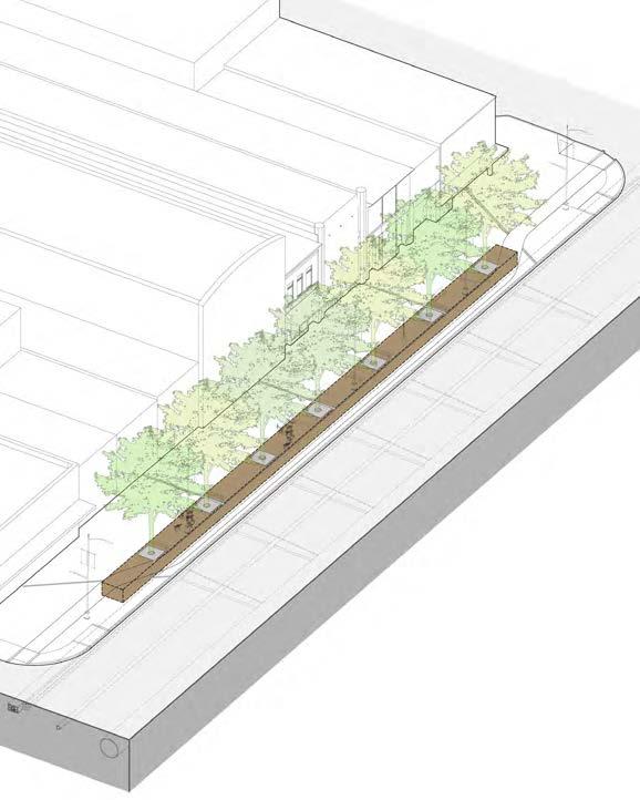
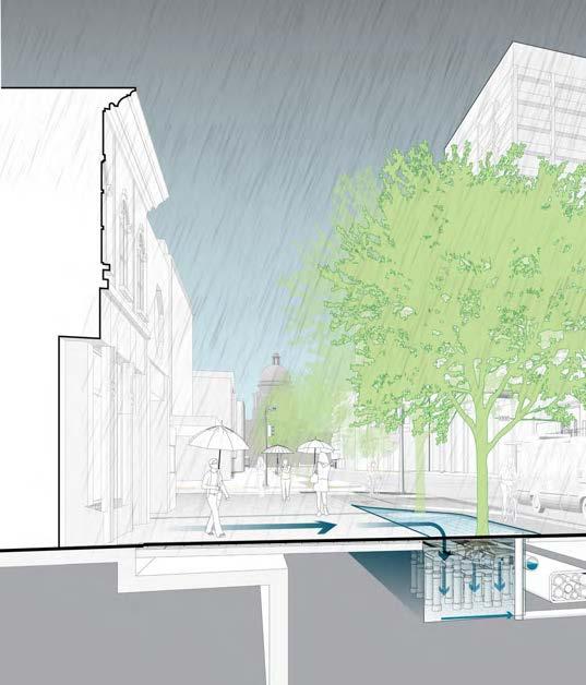
Along most of the Avenue, green infrastructure is incorporated as a series of underground raingardens. This innovative strategy facilitates stormwater treatment and provides the space and soil quality needed for healthy mature trees, while minimizing O&M costs, and creating the flexibility to incorporate seating and other amenities.
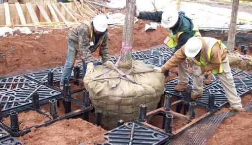
One of the greatest challenges facing urban street trees is insufficient soil volume and soil compaction. The underground raingardens along Congress Avenue feature a suspended paving system that supports the weight of pedestrians and vehicles on the avenue and incorporates water treatment. This design provides generous, continuous, and uncompacted soil volume to help trees thrive and mature to their full size. A soil volume of 9001100 cubic feet per tree is recommended, as shown on the diagram on the right.
Example installation of underground structure supporting a paving system (Silva Cell)
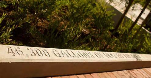
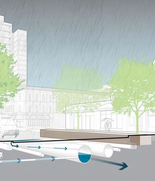
The raingardens and structured soil are part of a more comprehensive system of green infrastructure and utilities designed to slow and treat stormwater along Congress Avenue. In addition to supporting the tree canopy, these systems will help to reduce flash flooding and improve the quality of stormwater before its release into Lady Bird Lake. These elements are designed to express the story of stormwater in Austin and emphasize the ecological value of Congress Avenue as part of the larger hydrological system of Austin.
Water runnels and impervious pavers integrated into the pedestrian realm catch and direct stormwater towards street trees, reducing irrigation demands and filtering the water through soil and
plant material. In the predominantly hardscaped portions of the Avenue, sidewalk runoff can be treated underground using filter media or similar technologies.
Runoff from the roadway and any excess sidewalk runoff not absorbed by vegetation is conveyed for filtration to a larger set of stormwater terraces near Lady Bird Lake. In addition to their performative value, these stormwater terraces define a series of new open spaces at the waterfront.
This infrastructure may be enhanced by the installation of a purple pipe network connected to the city’s reclaimed water supply and facilitating sustainable, low maintenance irrigation of trees and plant beds.
Precedent: Water treatment information on planter edge
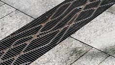
Precedent: Flush grate carrying water runoff
Precedent: Watershed information in pavement
Precedent: Local vegetation
Precedent: Flush grates and drains connected to planters
Runnels Reveal Water Movement, Telling the Story of Hidden Systems
Permeable Pavers Allow Stormwater to Infiltrate
Distribution
Structured Soil Prevents Soil Compaction and Promotes Healthy Roots
Reclaimed
‘Purple Pipe’
Stormwater infrastructure as part of a full depth reconstruction of the roadway
Curb Inlet Collects Road
Stormwater Runoff
Stormwater Conveyed for Treatment Near Lady Bird Lake
The story of stormwater in Downtown Austin can be told through interpretive elements describing Congress Avenue’s role in the city’s hydrology. These elements can showcase the water quantity and quality improvements accomplished through this streetscape redesign.
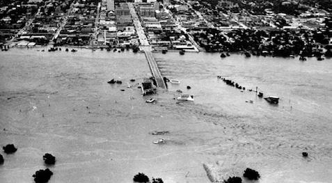
Historic Flooding in the 1930s
Waller Creek
Lady Bird Lake
Restoration of Shoal Creek at Austin Central Library
Interpretative Elements
Rain Gardens Treat Sidewalk Runoff
Stormwater Runnels
Public Art & Rain Gardens
ANN W. RICHARDS
CONGRESS AVENUE BRIDGE
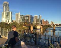
Just like the rest of Congress Avenue, the bridge across Lady Bird Lake supports a diverse range of uses and functions as a critical link in Austin’s multimodal mobility network. The structure of the bridge is home to one of North America’s largest bat colonies, attracting daily crowds and transforming a piece of infrastructure into a celebrated destination.
The realignment of the bridge is meant to create a stronger connection to Downtown Austin for all modes of travel and should include elements that strengthen the bridge’s identity and improve safety and comfort.
Along the length of the bridge, the visual form and aesthetic of the crash barrier should enhance the experience of bicycles and scooters, while conforming to safety standards and remaining sensitive to the historic nature of the bridge. The pedestrian railing at the edge of the bridge should create a consistent rhythm and reference the bridge’s original railing.
Key areas should incorporate shade structures, seating, and drought-tolerant plantings to provide a shaded respite for those crossing the bridge. These placemaking opportunities should include a subtle bump-out with interpretive signage, creating comfortable places to sit, gather, and enjoy the view.
Plan view diagram of pedestrians spilling over into the bicycle/ scooter lane on bat viewing events
Vehicular Barrier
Shade Structure
Planting Area
Pedestrian & Roadway Lighting
Balcony
Seating
Railing Referencing Original Bridge Railing
Bike & Scooter Path
Shade structures, guard rails, and crash barriers along the bridge should be elegant and informed by the historical aspects of the bridge.
The crash barriers should have the lowest profile possible while conforming to safety standards appropriate for the design speed of the roadway. Murals, stamped patterns, or similar enhancements will improve the experience of crossing the bridge by bike or scooter.
The pedestrian railings at the edges of the bridge should reference the original bridge design from the early 1900s. At viewpoints and bump-outs, a more transparent distinctive railing can be incorporated, featuring interpretive elements.
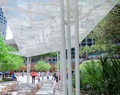
The shade structures themselves should be substantive enough provide respite from the summer sun. However, the geometry, materials, and scale of the structures should be carefully designed to avoid blocking views of the capital or conflicting with the overall aesthetic of the bridge. These shade structures may also be designed to catch and redirect rainwater into planters, reducing the need for irrigation and continuing to tell the ‘stormwater story.’
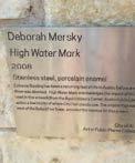
Local Precedent: High Water Mark public art
Local Precedent: Signage at Pfluger Pedestrian Bridge
Historic Congress Avenue Bridge Railing
Precedent: Interpretative elements at guardrail
Local Precedent: Ann and Roy Butler Hike and Bike Trail
Local Precedent: Shade canopy at Pfluger Pedestrian Bridge
Precedent: Shade canopy
Local Precedent: Shade canopy at the Fareground
Protective Barrier
Seating & Planting
Structure Directs Rainwater to the Planters
Interpretative Elements
Viewpoints & Interpretative Elements
SUMMARY OF RECOMMENDATIONS
CONGRESS AVENUE FOR ALL
01 Make Congress Avenue universally accessible, ensuring that the roadway and pedestrian realm comply with all ADA standards.
02 A full reconstruction of the roadway should ensure that cross-slopes are less than 2%.
03 Coordinate improvements with cross streets to ensure that an adequate amount of ADA parking can be located adjacent to Congress Avenue.
DEFINING THE SIDEWALK
04 Create three legible sidewalk areas allowing ample space for the life and activity of the Avenue.
05 Every property should have access to an 8’ storefront area, where cafe seating, retail displays, planters, and other proprietary uses are encouraged.
06 A 9.5’ walking area should remain clear of all obstacles.
07 A variety of street furnishings, street trees, and opportunities for art and performance should be incorporated into an 8’ public amenity area.
PAVING
08 Adopt a unified palette of elegant, timeless and durable materials.
09 Use material changes to differentiate between areas of movement and areas of rest and interpretative markers to tell ecological and cultural stories.
10 Permeable paving should be used for the amenity areas.
11 Stone pavers or pre-cast concrete pavers should be used for the walking and storefront areas.
SEATING AND FURNISHING
12 Provide a diverse mix of seating types and amenities—from chairs, to benches, to leaning rails, to platforms and standing height tables.
13 These amenities should be built and maintained by the City of Austin and considered as an integral part of the public realm.
14 A cohesive familiy of furnishing elements should include, at a minimum, public Wi-Fi, parking for bikes and scooters, bikeshare stations, space for local art and interpretive elements, wayfinding and signage elements.
15 In the Civic Stage character area, furnishings should be flexible and removable for large events. In the Green Gateway character area furnishings should be integrated with rain gardens.
LIGHTING
16 Upgrade utilities to provide adequate power.
17 Preserve the signature light poles that characterize Congress Avenue today. Upgrade the fixtures to include a second, lower arm to light pedestrians.
18 Continue the use of these poles across the Ann W. Richards Bridge to strengthen the connection between Downtown and South Congress.
TREES
19 Select a mix of oaks with similar shapes and sizes to provide resiliency and achieve a consistent tree canopy.
20 Trees should be spaced closely and consistently to shade the public realm.
SOIL AND TREE HEALTH
21 Use a suspended paving system that supports the weight of pedestrians and vehicles on the avenue, incorporates water treatment, and provides 900-1100 cubic feet of continuous, uncompacted soil volume to ensure healthy trees.
STORMWATER SYSTEMS
22 Use water runnels in the sidewalk, perpendicular to travel movement, to catch and direct stormwater to the trees, reducing irrigation demands, filtering the water through soil and plant material, and expressing the “water story” along the Avenue.
23 In the Civic Stage and Heart of Austin character areas, stormwater infrastructure should be located below ground.
24 In the Green Gateways character area, aboveground rain gardens should be incorporated.
25 Along the Ann Richards Congress Avenue Bridge, shade canopies should direct stormwater into planters to reduce the need for irrigation.
26 At the Bridge Landings, larger stormwater treatment systems should filter stormwater before releasing it into Lady Bird Lake.
ANN W. RICHARDS CONGRESS AVENUE BRIDGE
27 A low, visually appealing vehicular barrier should protect cyclists and pedestrians from traffic.
28 Designated placemaking opportunities should create a rhythm and provide a refuge for pedestrians crossing the bridge.
29 These placemaking opportunities should
include shade structures, drought-tolerant planting, seating, and viewing areas.
30 The design of bridge railings and shade structures should reference the historic structure of the bridge and avoid disrupting views of the bridge from the river and surrounding neighborhoods.
31 Along the length of the bridge, barriers and grade changes between pedestrian and bike areas should be avoided, allowing overflow space for crowds gathering to watch the bats on the eastern side of the bridge.
IMPLEMENTATION & PHASING
The recommendations presented in the Congress Avenue Urban Design Initiative are intended to be flexible and forward-looking. The recommendations are also specific and detailed to allow preliminary engineering and financing efforts to begin immediately. The scale of the project, however, demands an implementation strategy that can draw on a variety of partnerships and funding sources over multiple phases. The recommendations and vision of this report will serve as the guiding document for that process.
This section describes the next steps envisioned for the project.
PHASING & COORDINATION
The full reconstruction of Congress Avenue from 11th Street to East Riverside Drive should be phased to prioritize pedestrian and bicycle safety, facilitate the transition to a more balanced mode share, and reduce the disruption to commerce and vehicular traffic flow. All phases described below will be further developed in the detailed design work enabled through the initial 2020 bond funding.
Initial Phases (1A & 1B):
The reconstruction of the Ann Richards Congress Avenue Bridge, with an emphasis on safety for pedestrians, bikes, and scooters should come first. This should be closely followed by the full reconstruction of Congress Avenue between 4th Street and Riverside Drive, including major intersections.
These improvements will provide a highly visible and iconic indication of progress. Creating a strong multimodal connection early on between the 4th Street bike route in Downtown Austin and the South Central Waterfront will encourage greater mode shifts. Addressing the three major intersections in this portion of the Avenue will mitigate traffic concerns and facilitate continued support for the project. Finally, this portion of the project has a relatively low cost per block, and financing can be coordinated with a potential South Central Waterfront TIF.
Interim strategies should be further explored to achieve short-term changes that better realign the Avenue to the CAUDI vision and complement portions that are funded for construction.
Later Phases (2 & 3):
The full reconstruction of Congress Avenue and streetscape improvements north of 4th street.
Roadway Reconstruction
Short-term Realignment Streetscape Improvements
Phase 1A: Green Gateways
Reconstruction of Ann Richards Congress Ave Bridge as a four lane roadway with raised cycle track and pedestrian amenities. Bridge landings and trail connections improved in coordination with South Central Waterfront Development.
CONGRESS
Phase 1B: Multimodal Avenue
Reconstruction of intersections at Riverside Drive, Barton Springs Road, and Cesar Chavez Street. Full reconstruction of roadway from Riverside Drive to 4th Street. Maintain protected bike and scooter lane north of 4th Street.
Phase 2: Heart of Austin
Full reconstruction of roadway, cycle track and streetscape improvements from 4th Street to 9th Street.
Phase
3: Civic Stage
Full reconstruction of roadway, cycle track and streetscape improvements from 9th Street to Texas Capitol.
Central Waterfront
LADY BIRD LAKE Cesar Chavez
Central Waterfront LADY BIRD LAKE
Cesar Chavez
CAPITAL COSTS & FINANCING
The recommendations for Congress Avenue go deeper than landscape and streetscape improvements. A full depth street reconstruction will ensure that the Avenue fully meets ADA standards for accessibility. Utility reconstruction will facilitate the city’s ability to treat stormwater and futureproof lighting and communications infrastructure. Bridge improvements will increase multimodal capacity and connection to the South Central Waterfront. Finally, Landscape and Streetscape improvements will create a more vibrant pedestrian realm to support retail, office and residential uses.
Economic Feasibility
Is the tool financially sustainable? Will the tool fund a significant portion of the project?
Capital Improvement Funding
Fairness Who pays for the tool, and who benefits from the projects?
Legality
Is the tool legal in the state of Texas?
Political Acceptability
How likely are elected officials and the public at large to support the funding source?
Vitality Index
To what extent does the tool complement the City’s broader goals?
The scale, timeframe, and nature of this project mean that multiple funding sources will need to be coordinated. The above table evaluates several potential sources of funding for capital improvements.
Left: Congress Avenue was first paved in 1905.
projects by City of Austin Public Works Department.
PROGRAMMING, OPERATIONS & MAINTENANCE
The operations and maintenance of Congress Avenue will be critical to ensure the vitality and attractiveness of the public realm. A sustainable funding strategy for operations & maintenance will likely draw on different types of funding sources than the capital improvements.
The physical design of the streetscape takes into account the needs of day-to-day operations and will make tasks like street cleaning and tree maintenance more efficient. As the design is refined through a more detailed engineering phase, specifications for pavers, tree grates, and other streetscape components should take into account the requirements of operations & maintenance.
Economic Feasibility Is the tool financially sustainable? Will the tool fund a significant portion of the project?
Fairness
Who pays for the tool, and who benefits from the projects?
Legality Is the tool legal in the state of Texas?
Political Acceptability
How likely are elected officials and the public at large to support the funding source?
Vitality Index
To what extent does the tool complement the City’s broader goals?
Clockwise from top left: Downtown Alliance ambassadors cleaning streets and sidewalks. Public Works Department crews prune street trees. Downtown Austin Street Market.
ECONOMIC IMPACT
OVERVIEW
All over the country, there is a growing awareness of the value that street improvement projects create for their users and communities. In addition to serving as venues for recreation and civic life, vibrant streetscapes and complete streets can attract and sustain healthy residential and business communities, increase the competitive advantage of downtown real estate, support the city’s vibrant tourism economy, and provide tangible health and safety benefits.
The impacts of a complete reconstruction and redesign of Congress Avenue will be reflected in many different ways – from increased multimodal mobility and an enhanced pedestrian experience, to greater opportunities for retail and commercial activity. This analysis describes and quantifies, to the extent possible, the high-level economic costs and benefits of CAUDI’s recommendations in order to facilitate a clear decision-making and implementation process and realize the long-term urban design vision for Congress Avenue.
The analysis focused on quantifying the potential economic impact of recommended improvements on two key areas: land value and job creation.
LAND VALUE
The impact of the recommended streetscape improvements on property values over a 10 year period was analyzed using the assessed valuations for the existing land and improvements. A medium case scenario expects cumulative property values within approximately 3 blocks of Congress Avenue to increase by $215 million over 10 years. In year 10, the increase in property values associated with the Congress Ave improvements would be responsible for $4.7 million of additional annual revenue.
The study tested three scenarios for property value increase attributable to CAUDI. The improvements are expected to generate a significant annual increase in property tax revenues.
JOB CREATION
Improvements to the Congress Avenue streetscape will be phased over several years, costing approximately $70 million, including project management and engineering. The capital improvements alone are expected to cost $48 million and generate almost 700 jobs.
Given that projects including bike and pedestrian facilities create more jobs per dollar than those designed only for vehicles, this project will generate a higher amount of jobs than a typical roadway reconstruction project. A significant amount of planning and construction jobs will be generated by the street reconstruction work and by the landscape and streetscape improvements.
of Improvements
Within Downtown Austin, the analysis assumed that streetscape improvements would create an incremental increase in value, but not catalyze any new large scale development. South of Lady Bird Lake, however, the improvements are expected to have a larger impact because of the increased connectivity from the South Central Waterfront to Downtown destinations created by improvements to the Congress Avenue bridge.
*expected cost does not include contingencies
In addition to direct construction and planning jobs, the increased retail and event capacity generated by these streetscape improvements will likely generate a significant amount of retail and service jobs.
IMPACTS & METRICS
The impact of these these investments will be significant and wide reaching, touching on all of the critical issues identified by Austin Strategic Direction 2023. The Strategic Direction functions as a single playbook for the City of Austin, building on the priorities set in Imagine Austin and using an outcome-based approach to establish a framework for effective governance and budgeting. Specific
metrics should be developed that align the project goals with the critical issues idenitified by Austin Strategic Direction 2023. These metrics can be used to track the progress and impact of improvements to Congress Avenue, coordinate funding sources, and build partnerships. In some cases, baseline data already exists, but in other cases, the City will need to collect new data.
Culture
Î Strengthen the national register historic district and historic interpretation
Î Increased visibility and viability of existing cultural institutions
Safety
Î All sidewalks and ramps ADA compliant with minimal trip hazards
Î Increased pedestrian safety
Î Increased bicycle and scooter safety
Î Improved wayfinding and interpretive opportunities
Î Increased capacity for programming and events
Î Increased opportunities for “streetlife”
Î More street activity, lighting and better conditions for a 24/7 neighborhood
Health & Environment
Î Increased walkability and pedestrian activity for all ages and abilities
Î Improved stormwater management
Î Increased shade, comfort, and areas of respite
Î Increased biodiversity, habitat, and a healthier urban tree canopy
Î Decreased asphalt areas — reduction in urban heat island effect
Mobility
Î Move more people
Î Full ADA accessibility
Î Minimize vehicular traffic impacts through efficient design
Î Increased pedestrian, bicycle, and scooter space and connectivity
Economic Opportunity and Affordability
Î Designed for future flexibility and potential connector transit
Î Simplified curbspace management
Î Increased opportunity for small, local businesses through markets and events
Î Increased foot traffic and retail sales
Î More mobility choices and connections offer more affordable transportation
Î Increased land value and “value capture” for new and existing businesses