Opportunities & Constraints Report
A Community Project for Enhancing the Public Realm
SEPTEMBER 2020


Austin
Source:
American-Statesman

Opportunities & Constraints Report
A Community Project for Enhancing the Public Realm
SEPTEMBER 2020
Austin
The Downtown Austin Alliance engaged Overland Partners, ARUP, Lionheart, and Public City (the consultant team) to articulate preliminary opportunities and constraints with respect to both physical surface improvements and the policy landscape in conjunction with the reconstruction of the I-35 corridor (the corridor) through central Austin from Holly Street to Airport Boulevard (the geographical scope area).
The focus on Downtown Austin Alliance’s I-35 People and Place Program (the Program) is to identify opportunities for surface-level improvements in conjunction with TxDOT’s reconstruction of I-35 (the Capital Express Central project) that will benefit the local community, as well as the state’s capital city. The intent is to build on TxDOT’s Capital Express Central project investment with enhancements such as constructing green space over the highway and/or creating more robust east-west connections. The Program is being coordinated with TxDOT and is independent of TxDOT’s Capital Express Central project. TxDOT is not obligated to integrate any of these concepts into their schematic design, but has expressed a willingness to consider concepts that are feasible with the engineering design, assuming the Austin community can determine a way to pay for and maintain these enhancements.
Through this Opportunities & Constraints Report (the Report), the consultant team is assisting the Downtown Austin Alliance with preparing for a National ULI Advisory Panel conversation (the ULI panel) focused on a new future for I-35.
Following the ULI panel, the consultant team will continue to support the Downtown Austin Alliance through a collaborative public process intended to build consensus towards a shared vision for the future of the corridor among community members, city leaders, and TxDOT.
This Report is prefaced by a set of critical questions for the ULI panel to consider. Spanning a broad set of issues to address beyond vehicular mobility, the questions explore the potential for socially equitable outcomes that a project of this scale has the potential to unlock for Austin.
The consultant team studied the planned context of Austin from the broader city scale down to a stretch of the corridor from downtown to the University of Texas. The study included reviewing existing policy frameworks for growth, transit, gentrification and displacement mitigation, arts and culture, historic districts, parks and open space along with neighborhood plans, business districts, and key projects/emerging developments immediately surrounding the corridor.
Building on the critical questions, the opportunities and constraints throughout this Report along with maps and diagrams were created for the purpose of posing additional questions for the ULI panel to consider. While all maps have unintended consequences in the messages they convey, these graphics are not meant to be reviewed as proposals but are included here for the ULI panel to have constructive conversations about the future.
In addition to the opportunities and constraints, this Report articulates a possible toolkit of strategies and scenarios. Strategies refer to potential tools for policy change and equitable development that can be put into place in tandem with the project. Scenarios refer to physical design interventions that can be integrated into the TxDOT I-35 reconstruction to enhance existing connections to the urban grid, foster new connections, and create new open spaces for gathering and unlocking economic development opportunities. Each scenario is paired with benchmark examples and potential strategies that can be leveraged. They can be combined in various ways depending on the context and desired outcomes.
The community voices engaged to date in preparation for the ULI panel have only begun to scratch the surface of perspectives that need to be heard throughout this process. It is our hope this information helps shape the Panelist’s understanding of the social and physical context while opening the door to a new future for I-35 that is co-created by the community it will serve for generations to come.


CITY CONTEXT
• Planning & Policy Context
• Transportation Analysis: Regional Scale


• Transportation Analysis: Corridor Alternatives EAST12THSTREET MANORROAD
• Planned Networks
• Open Space Network
• Emerging Development
• Development toolkit:
• Strategies
• Cap Typologies
• Scenarios & Benchmarks
The consultant team is comprised of Overland (urban design), ARUP (public realm & transportation planning), Lionheart (landscape & urban planning), and Public City (community engagement).
Overland is leading the study of the physical context of the I-35 corridor including emerging development patterns in relationship to transit opportunities, parks & open space networks, and surrounding cultural districts.
ARUP is leading the study of the I-35 corridor including the review of local and regional mobility opportunities and alternative proposals for the corridor including Great Street “stitches”, “caps” that could span over the corridor per the 2014 Downtown Working Group Report, and the Reconnect Austin “boulevard” scheme with integrated transit. In addition, ARUP explored how various cap typologies could facilitate interaction between I-35 and the grid of the city.
Lionheart is leading the study of in-process and completed plans and reports in the City of Austin (in collaboration with Public City) for the purposes of developing of a set of programmatic and policybased strategies that can be used to support equitable development and planning practices.
Public City is leading the engagement efforts (in collaboration with Lionheart and DAA) with the East Austin Community Brain Trust (a growing mix of activists, social justice advocates and community leaders) and others in the city to ensure that community benefits and equitable outcomes are prioritized and address the community’s needs and desires for an inclusive future.
Analysis of physical context, development of scenario toolkit.
Review of transportation context, development of cap typology toolkit.
Analysis of planned context, development of strategy toolkit.
Community engagement, analysis of planned context, development of strategy toolkit.
The critical questions were derived through interviews with stakeholders. As the public outreach associated with this project continues these questions will be refined. Emerging indicators of success represent a preliminary set of metrics. These should evolve as conversations with the community continue.


Acknowledging the division and disinvestment that I-35 has created in our community for decades, has the I-35 project prioritized ways of healing the trauma and physical impediments that it has allowed to fester? Does the project celebrate, prioritize, and directly benefit the communities that have survived and thrived even under these conditions, and those that have not?
Has the project considered the health and safety (from injury, crime, hazards, and other mistreatment) of all people in the vicinity of I-35? Do all people, regardless of physical or financial ability have convenient access to recreational and healthcare facilities in and around I-35? Do people feel as safe traveling by modes that offer mental, emotional, and physical benefits (bicycle and on foot) as they do by car?
Does the project reflect the best experience for all travelers of all modes, especially those that are the most vulnerable (i.e. pedestrians, bicyclists, and transit-riders)? How does the project enhance the experience of sitting or standing - so that people are able to comfortably spend time along I-35? Does the project make connections where possible, but reduce car congestion especially in the surrounding neighborhoods?
Has the project leveraged the opportunity that an investment of this scale creates to equitably invigorate opportunities within all communities that surround I-35 to improve the health, environment, economic conditions and cultural resonance for the people that are there today as well as in the future and even those who have been displaced with a desire to return? Are the trade-offs within the project understood and are policies and programs to address unintended consequences being considered on the front end?
During the project, has there been time to build meaningful relationships and earn the trust of the communities most effected by the project to truly co-create a shared vision? Has the project been approached with the highest degree of respect for all stakeholders, an earnest desire for collaboration and co-creation, and a cohesive pursuit for an outcome that makes our community more resilient and ready for the future?
Barrier (Height and Width) Created by Right of Way
Incorporation of Existing Plans and Strategies
Better Lighting for All Modes
Reduced Tricky Maneuvers
Air Quality, Drainage, Noise, and Smell
Views
Heat Island and Tree Canopy
Vehicular Connections and Experience
Transit Connections and Experience
Bicycle Connections and Experience
Pedestrian Connections and Experience
Contributions to Affordable Housing
Contributions to Business Retention and Job Creation
Ability for Existing Residents to Stay or Return
Distribution and Quality of Parks and Programming
Contributions to the Arts and Culture
Fiscal Viability (for any Future Caps)
Geographic and Demographic Spread of Engagement
Number of Organizations Included in Process
Number of Other Points of Contact
Proportion of Comments Supporting Project Outcomes
The consulting team conducted a review of adopted and in-process plans and reports that were discovered and/or shared with the team. This preliminary review and analysis may not include all plans conducted within the study area.
Key strategies from each plan were pulled out and grouped according to themes. Strategies were then derived by distilling the key elements of each of the themes as they relate to the potential impacts of the I-35 project.
Palm District Planning Initiative - In Progress
Austin Community Climate Plan - Update In Progress
Urban Renewal Plan for East 11th and 12th Streets - 2020
Reconnect Austin Briefing Booklet - 2020
Strategic Mobility Plan - 2019
Texas Anti-Displacement Toolkit - 2019
Eureka Plan - 2019
Our Parks Our Future - 2018
Manor Road Economic Strategy - 2018
Uprooted - 2018
MACC Master Plan - 2018
Strategic Housing Blueprint - 2018
Waller Creek District Master Plan - 2018
East 12th Street District Economic Strategy - 2018
Red River Economic Strategy - 2018
People’s Plan - 2017
Economic Impact of Music Study - 2016
Vision Zero Action Plan - 2016
Building an Age Friendly Austin - 2016
Bicycle Master Plan - 2014
Cultural Tourism Plan - 2014
Imagine Austin - 2012
Heritage and Windsor Hills Plan - 2011
Downtown Austin Plan - 2011
MLK Blvd TOD Station Plan - 2008
Plaza Saltillo Station Plan - 2008
Create Austin Cultural Master Plan - 2006
Airport Boulevard Corridor Development Program - 2014
North Loop Neighborhood Plan - 2002
East Cesar Chavez Neighborhood Plan - 1999
Central E. Austin Neighborhood Plan - 1999
This East 11th and 12th Streets Urban Renewal Plan (“URP” also referred to as the East 11th and 12th Streets Community Redevelopment Plan or “CRP”), is the official policy for redevelopment in compliance with Texas Local Government Code, Chapter 374.
The URP’s original conceptual approaches were part of the Central East Austin Master Plan prepared in 1999 by representative members of the community with technical assistance and the Austin Revitalization Authority (ARA). The vision set by the community and adopted by Council was to: re-establish corridors as a thriving mix of commercial, retail and housing; preserve or rehabilitate historic and cultural assets; spur private investment and create sustainable community that includes businesses, jobs, and services; and establish regulatory controls intended to assure quality, compatible, mixed-use development.
As of August 2020, the plan seeks to further identify and facilitate the development of mix use projects with affordable residential options for the 11th and 12th Street corridors that does not accelerate displacement, and enhance where people work, live and play (e.g. entertainment) around neighborhood oriented and pedestrian friendly retail, and office space.
While many accomplishments have been made in the URP area, it has not yet fulfilled its mixed-use potential. East 11th Street has experienced improvements whereas, East 12th Street still has parcels and/or buildings that remain underutilized and somewhat inconsistent with the community vision.
In December 2018, Austin City Council extended the Urban Renewal Plan’s expiration date until 2028. In June 2020, an amendment was approved on consent to extend the Agreement Concerning Implementation of the East 11th and 12th Streets Urban Renewal Plan between the City and the Urban Renewal Agency (URA).
Strategies (NOT IN ORDER OF PRIORITY)
1. Maximize the creation of new affordable housing.
2. Support efforts to reduce homelessness.
3. Reduce displacement impacts due to lack of affordability.
4. Use a transparent data-driven planning process.
5. Plan collaboratively with historically under served and vulnerable populations.
6. Ensure a complimentary relationship with adjacent district and neighborhoods.
7. Celebrate the historical and cultural assets and identity of the community.
8. Enhance local arts and culture industries.
9. Support small local business.
10. Support workforce development and education.
11. Create quality public spaces that better public health.
12. Prioritize the protection of human life in roadway design.
13. Integrate sustainability initiatives and conservation principles.
14. Maximize the useful life of infrastructure and ensure longterm, viable funding models.
15. Leverage partnership opportunities with private development and adjacent community investments and interests.
16. Expand and prioritize opportunities for transit.
17. Improve travel time and reliability for all modes of transportation and freight.

The consulting team conducted a case study review of various built and unbuilt examples for spanning across a highway including “stitches”, “caps” and “boulevards”.
Key characteristics were derived from the benchmark examples and used to create individual scenarios (S-1, S-2, C-1, C-2, etc.).
Opportunities and constraints for integrating the scenarios into the I-35 corridor are listed along with possible strategies to leverage for development, programming, planning, and policy in support of each intervention.
A toolkit of community-identified strategies is included in this document for your reference.


The consultant team mined City of Austin and partner websites to create a detailed list of in-process and completed plans and reports. Plans and reports were then reviewed, and key observations were grouped into physical, programmatic, and policy-based implications for I-35. The physical implications of plans were used to develop the opportunities and constraints chapter of this document. Program and policy based implications were used to develop the toolkit section of this document.


CITY OF AUSTIN - IN PROGRESS
The Palm District planning process will develop a comprehensive, focused small area plan for the eastern portion of downtown adjacent to I-35. The Palm District Plan provides an opportunity for partnerships in programming and design of the I-35 project.
CITY OF AUSTIN - UPDATE IN PROGRESS
The Community Climate Plan sets Austin’s target to reach net-zero community-wide greenhouse gas emissions by the year 2050. The I-35 project should align with and further the overall strategies in this plan to curb emissions and increase equity.
CITY OF AUSTIN, URBAN RENEWAL AGENCY (URA), AUSTIN
REVITALIZATION AUTHORITY (ARA) - 2020
This Urban Renewal Plan is the official policy for redevelopment in the Urban Renewal Plan area along these corridors. The future of I-35 should enhance where people work, live and play around neighborhood oriented and pedestrian friendly retail, and office space.


RECONNECT AUSTIN - 2020
This briefing booklet explores the key benefits of the Reconnect Austin vision, and ways in which Austin can achieve a more safe, healthy, and people-friendly I-35 that reconnects the community.
CITY OF AUSTIN - 2019
The Austin Strategic Mobility Plan is a comprehensive multimodal transportation plan for the future of Austin’s transportation network. The future state of I-35 should reflect the mobility goals documented in Austin’s Strategic Mobility Plan.
CITY OF AUSTIN - 2019
The Anti-Displacement Toolkit serves as a guide to help Texas communities combat residential displacement in gentrifying neighborhoods. The I-35 project can implement elements of the anti-displacement toolkit along the corridor.
DOWNTOWN AUSTIN ALLIANCE - 2018
The Downtown Austin Vision is the north star to guide the future of downtown toward the community’s values and aspirations for a thriving, welcoming, vibrant and connected downtown. The I-35 project is located directly adjacent to Downtown Austin.


CITY OF AUSTIN - 2018
Our Parks, Our Future is the City of Austin Parks and Recreation Department (PARD)’s Long Range Plan (LRP) for Land, Facilities, and Programs. The I-35 project has the opportunity to enhance Austin’s park system in alignment with the long range plan.
CITY OF AUSTIN - 2018
The Manor Road Business Strategy is intended to galvanize leadership around a shared vision for the future of Manor Road. The district is located directly adjacent to the I-35 project.
UNIVERSITY OF TEXAS - 2018
The Uprooted report provides a framework for 1) identifying gentrifying neighborhoods and 2) matching strategies to the needs of these neighborhoods. The reconstruction of I-35 has the potential to impact identified neighborhoods; incorporating these strategies to the project is critical to avoid further gentrification and displacement.
CITY OF AUSTIN - 2018
The Master Plan for the Emma S. Barrientos Mexican American Cultural Center plans for the future facility and programming needs of the space. The MACC is located just West of I-35 along Lady Bird Lake and represents a partnership opportunity.


CITY OF AUSTIN - 2018
The Strategic Housing Blueprint addresses the City’s growing housing affordability challenges. The I-35 project provides an opportunity to align with the goals of the Housing Blueprint by providing land or funding to create and preserve affordable housing.
CITY OF AUSTIN - 2018
Th Waller Creek District Master plan envisions the restoration of the ecological functions and its role as a living element that can contribute significantly to the identity and livability of the city. This district runs parallel and adjacent to the I-35 project.
CITY OF AUSTIN - 2018
The 12th East Business District Strategy is intended to galvanize and guide business and property owner leadership around a strategy for East 12th Street. The district is located directly adjacent to the I-35 project.
CITY OF AUSTIN - 2018
The Red River Cultural District Business Strategy is intended to galvanize leadership around a shared vision for the future of the Red River Cultural District (RRCD). The district is located directly adjacent to the I-35 project.


COMMUNITY MEMBERS - 2017
The “People’s Plan,” is a series of resolutions drafted by community members aimed at preventing displacement in gentrifying neighborhoods. The I-35 project will impact these neighborhoods.
CITY OF AUSTIN - 2016
The Economic Impact of Music is a study of the connection between culture, creativity, and economic activity as a foundation of local economic development in Austin. The I-35 project is located adjacent to several cultural arts districts.
CITY OF AUSTIN - 2016
The Vision Zero two year action plan recommends strategies to reduce the number of traffic fatalities on Austin streets to zero by 2024. Fatalities within the Downtown I-35 corridor are among the highest in the City.
CITY OF AUSTIN - 2016
The Building an Age Friendly Austin Plan is a five year action plan with the purpose of transforming Austin into an age friendly community. The I-35 project provides an opportunity for both age friendly infrastructure and programming focused on older residents.


CITY OF AUSTIN - 2014
The Bicycle Master Plan envisions Austin as a place where people of all ages and abilities bicycle comfortably and safely for transportation, fitness and enjoyment. The plan includes a number of high priority connections across I-35.
CITY OF AUSTIN - 2014
The Cultural Tourism Plan lays out the economic value of a place-based approach to cultural tourism in Austin. The I-35 project has the opportunity to promote and enhance Austin’s unique sense of place in design and programming.
CITY OF AUSTIN - 2012
Imagine Austin is the Comprehensive Plan for the City of Austin. The plan establishes the vision and goals for how Austin will grow over the next 30 years. The I-35 project should align with Imagine Austin’s vision and goals.
CITY OF AUSTIN - 2011
The Downtown Austin Plan is a guide for the City and the community in achieving a shared vision for Downtown. Aligning the I-35 project with these goals is critical to the success of downtown Austin.


CITY OF AUSTIN - 2008
The MLK Blvd. TOD station area plan was initiated during construction of Austin’s Metro Red Line to develop station area plans around MetroRail stops. The I-35 project has the opportunity to provide more robust connections to planned TOD areas.
CITY OF AUSTIN - 2008
The Plaza Saltillo station area plan was initiated during construction of Austin’s Metro Red Line to develop station area plans around MetroRail stops. The I-35 project has the opportunity to provide more robust connections to the planned TOD areas.
CITY OF AUSTIN - 2007
The purpose of the University Hills/ Windsor Park Neighborhood Plan is to provide direction around projects that affect the neighborhood. The I-35 project will impact this neighborhood.
CITY OF AUSTIN - 2006
The Create Austin Cultural Plan identifies Austin’s creative assets and challenges, defines goals, and establishes recommendations to invigorate Austin’s Culture of Creativity. The I-35 project has the opportunity to build on the cultural and creative aspects of Austin’s culture.


CITY OF AUSTIN - 2003
The purpose of the Austin Bergstrom International Airport Master Plan is to identify facility and infrastructure improvements needed to grow and sustain the Austin Airport. The I-35 project will influence the movement of goods along the corridor.
CITY OF AUSTIN - 2002
The purpose of the North Loop Neighborhood Plan is to provide direction around projects that affect the neighborhood. The I-35 project will impact this neighborhood.
CITY OF AUSTIN - 1999; UPDATED 2008
The purpose of the East Cesar Chavez Neighborhood Plan is to provide direction around projects that affect the neighborhood. The I-35 project will impact this neighborhood.
CITY OF AUSTIN - 1999
The purpose of the Central East Austin Neighborhood Plan is to provide direction around projects that affect the neighborhood. The I-35 project will impact this neighborhood.
ver Br dge
200,000 201,000
201,000198,000
2002232,000211,000200,000
2003223,000206,000190,000
2004218,000200,000192,000
2005222,720204,220194,880
2006192,000177,000153,000
2007230,000219,000220,000
2008227,000204,000183,000
2009196,000198,000177,000
2010202,000185,000175,000
2011196,000183,000177,000
2012214,000189,000178,000
2013206,685190,473164,177
2014204,258168,432216,040 2015210,000176,455252,075
2016215,955182,216202,378
2017207,725178,918204,235
2018218,960178,106198,084
The existing I-35 corridor serves as the primary highway to and through Downtown Austin. The route experiences significant congestion throughout typical weekdays; Texas A&M Transportation Institute rated I-35 between US 290W / SH 71 and US 290E as the second most congested roadway segment in Texas (I-35 Capital Area Improvement Program (Mobility 35) December 2014).
2019 Capital - Alamo Connection Study identified key trends among users of the I-35 corridor:
• A large number of local and short trips using I-35 occur within Austin.
• A significant number of trips only use I-35 to travel between one or two consecutive interchanges.
• Most I-35 trips originating at downtown interchanges are destined to other interchanges in downtown, US 290 (to the west, south of Downtown, or US 183.
Over the past 30 years, annual average daily traffic volumes along I-35 have been relatively consistent through the downtown area ranging from 150,000 to 250,000 vehicles per day. Continued significant growth in local population is likely to put additional strain on I-35 and associated road infrastructure unless a range of transportation solutions are adopted.
The image opposite has been generated from publicly available data from TxDOT. It shows regional daily volume-to-capacity (v/c) ratio, this is a measurement of the operating capacity of a roadway or intersection where the number of vehicles passing through it is divided by the number of vehicles that could theoretically pass through it when at capacity. The areas shown in red, including I-35 as it passes the downtown, show that these stretches of road are likely to experience congestion and delays to user journey time. Green areas suggest available road capacity.
Source: Calculated using data from TxDOT Open Data Portal (http://gis-txdot.opendata.arcgis.com/)
Source: TxDOT Open Data Portal http://gis-txdot.opendata.arcgis.com/


• Undertake a regional multimodal transportation study to identify opportunities for enhanced public transit integration (including regional connectivity to local and last mile mobility), efficient & intelligent highway utilization, transit oriented development (TOD) opportunities, and environmental enhancements.
• Enhance driver experience (fewer delays, faster travel times) by distributing traffic to underutilized highways and reinforcing the functionality of the city beltway.
• Create a ‘gateway’ experience to the city from regional connectors through highway beautification, public realm enhancements, and sensitive visual integration of highway infrastructure along the I-35 corridor.
• SH 360, US 183, and SH 130 (toll road) have lower daily volume-tocapacity ratios than I-35 indicating these roads are able to carry more trips than they are currently carrying. Some longer trips on I-35 (not destined for downtown Austin) or freight trips could potentially be encouraged to redistribute to these other roadways during the construction period and in the future.
• Enhance multimodal connectivity to downtown through local connectors / arterial routes.
• During the construction period, traffic will be displaced onto other roads which will relieve pressure on the highway and may influence long term driver behavior Removal of ramps on I-35 is likely to divert more traffic to frontage roads and the urban street grid.
• The environmental impact (air & noise) of road construction should be considered.
• SH 130 is a tolled highway thus changing its designation in an effort to divert additional I-35 traffic may be challenging.

Source: TxDOT Open Data Portal http://gis-txdot.opendata.arcgis.com/


The diagrams at right illustrate the existing roadway configuration of I-35 between River Street/Holly Street and Airport Boulevard. Horizontal widths are exaggerated to better illustrate network topology. The following are high-level observations of the existing conditions:
• Complex network configuration, featuring frequent ramps to/from adjacent frontage roads and a mixture of vertical alignments (above and below grade).
• Confusing driving experience as a result of multiple mainline facilities, and irregular ramp configurations (esp. north of Martin Luther King, Jr. Blvd).
• Limited provision for pedestrian and bike users.
• Limited space for landscape integration (provision of trees.
• Physical connectivity across the highway is limited and the street grid is severed.
• The TxDOT-proposed scheme would add two managed lanes in each direction in the project corridor.
• The exact geometric configuration of proposed I-35 facilities (including mainline lanes, managed lanes, ramps, and frontage roads) are currently under development.

STATUS QUO LOWERED HIGHWAY STITCH


Additional opportunities beyond status quo and TxDOT proposals CAP BOULEVARD


The corridor alternatives matrix (opposite) considers the high level opportunities and constraints of five potential futures of the I-35 corridor. These futures are not mutually exclusive and could be integrated with each other in full or in part.
The matrix (right) uses a traffic light system to identify whether the potential opportunity has a high, moderate or low level possibility of achieving the highlighted opportunity. If a low level is identified, then this is considered a constraint.
Integrate public realm enhancements (i.e. landscape, lighting, open space)
Enhance safety for all road users
Integrate dedicated, protected bike paths and pedestrian routes
Improve driver experience through highway beautification
Integrate highway with street grid and strengthen east / west connectivity
Enhance connectivity to existing and planned public transit systems
Integrate overbuild and/or programmable space
Integrate stormwater management / green infrastructure
Separate regional and local traffic
High possibility of achieving
Moderate possibility of achieving
Low possibility of achieving
Phase delivery to align with budget and market demand for development land
Safeguard space for future transit facilities and utility infrastructure
There is a pattern of strong north-south connectivity for pedestrian and bike travel in the central city, with a less connected east-west network.
• Project Connect
• Downtown Great Streets Master Plan
• Plaza Saltillo TOD Station Area Plan
• Austin Convention Center: Long Range Master Plan

• Enhancing east-west connections across I-35 with active mobility elements will enable more people to get around the city without vehicles; reducing vehicle trips per day and overall car congestion in downtown, East Austin, the Capital, and on the UT campus.
• Integrating a continuous protected pedestrian and bike route within the I-35 right-of-way will enhance regional active mobility; encouraging walking, jogging, and cycling city-wide.
• Linking future north-south pedestrian and bike routes within the I-35 right-of-way to the Butler Trail with safe connections unlocks the potential to connect to the Violet Crown Trail (a regional hike and bike trail that reaches as far south as New Braunfels).

The existing and planned public transit network will service downtown with good coverage of bus, rapid transit, and commuter rail.
• Project Connect
•

How can
expand upon planned transit networks to reduce congestion and encourage transit use?
• Strengthening the mobility network of central Austin and the region by increasing access to transit through enhancements to key east-west corridors across I-35.
• Safeguarding I-35 for regional connectivity to allow future inter-modal hubs along the corridor to connect to existing and future Capital Metro lines.
• Providing more options to connect neighborhood hubs and business clusters in East Austin by enhancing mobility corridors with public realm improvements such as upgraded walkways with safer crosswalks, lighting, connections to trails, protected bikeways and amenities (bike share stations, e-scooters), and better bus/transit facilities such as safe/comfortable bays with seating, shade, and access to reliable, real-time travel information.

Austin’s parks, trails, and greenways
Austin’s parks and neighborhoods are connected along several northsouth networks west of I-35; these same north-south networks don’t exist east of I-35. In East Austin, there is a general lack of connection between parks, Boggy Creek, and Lady Bird Lake.
• Waller Creek District Master Plan
• Frameworks for Placemaking: Alternative Futures for The Austin Convention Center District
• Palm School Historic Structure Report
• Brush Square Master Plan
• Uprooted
• Eureka Plan
• MACC Master Plan
• Central Health Brackenridge Master Plan
• University of Texas Landscape Framework Plan and Athletics Master Plan
Park/ Greenway

How can the I-35 Community Project extend access to the city’s beloved open space network to more Austinites?
• Creating enhanced connections across I-35 can connect Shoal Creek, Waller Creek, and Boggy Creek; opening up more access to the Capitol Grounds, Waterloo Park, and Waterloo Greenway.
• Connect Huston-Tillotson University and Waterloo Greenway and Lady Bird Lake.
• Connect Palm Park and East Austin.
• Enhance the connection between the Mexican American Cultural Center and East Austin.
• Collaboration with TxDOT to coordinate enhanced connections with operations, required vertical clearances, ramping, structural support, utilities coordination, and irrigation for street trees/ landscaping.

Austin planning policy from the early 20th century to today
• The 1928 plan of Austin: adopted by an all-white, all-male City Council, this segregationist policy forced black residents to live within a six squaremile area of East Austin. Nonwhites who tried to settle in areas outside of the six-square district were denied basic public services such as utilities, parks and schools, unless they moved to the designated “Negro district.”
• The 1935 plan of Austin: Segregation was intensified through the practice of “redlining” East Austin neighborhoods, a policy of the Federal Housing Administration to refuse to insure mortgages to residents of African American neighborhoods. Most Whites lived to the west of the avenue, while most Mexican Americans and African Americans lived to the east. Redlining was a barrier to opportunity for minorities that further worsened the effects of Austin’s discriminatory land use and transportation policies on its communities of color.
• The 2018 vulnerability maps of Austin depicted in the Austin Uprooted report reveal the impact of the practice of redlining on East Austin neighborhoods today.
The vulnerability map (far right) reveals the tracts—drawn in varying shades of red—that are home to unusually high proportions of vulnerable people as measured by the five vulnerability factors (people of color, lack of higher education, low income, renters, and children in poverty).
The tracts that are shown as vulnerable are classified as Vulnerable (salmon), More Vulnerable (pink), and Most Vulnerable (dark red). In general, the geographic pattern closely follows what has come to be known as the “eastern crescent.”
The eastern crescent has come to be known as the new geographic pattern of social disadvantage in Austin, supplanting to some degree the conception of the city’s advantaged and disadvantaged areas as lying to the west and east, respectively, of Interstate 35. It is noteworthy that in spite of many years of intensive gentrification immediately east of downtown in Central East Austin, disadvantaged populations remain in these areas.
Source: Uprooted (p.28)


Source: The University of Texas http://legacy.lib.utexas.edu/maps/texas/austin-redlining-large-1935.jpg
Source: Uprooted (p.30) https://austin.maps.arcgis.com/apps/MapSeries/index.html?appid=2287ef7c16dc476ca0c7d4a10ae690ce
displacement as described in “Uprooted” (see inset, page 26 of this Report).

• Emerging and proposed development to the east of I-35 are in an area of the city that is rapidly becoming more and more vulnerable. Some development sites are not yet permitted/ approved, and may be inconsistent with the community visions and plans in place for the area.
• UT Campus Master Plan (East Campus, Athletics, Medical District)
• Innovation District
• Central Health Brackenridge Master Plan
• East 11th and 12th Streets Urban Renewal Plan
• Eureka Plan
• Plaza Saltillo Station Area Plan
• Palm District Plan
• Austin Convention Center: Long Range Master Plan
• Downtown Austin Plan
• Austin Strategic Direction 2023
• Imagine Austin
• Cultural Asset Inventory
• Uprooted
• Strategic Housing Blueprint
• Create Austin Cultural Master Plan

• Meet community needs with equitable development.
• Address Austin’s deficit in affordable housing.
• Invest in Austin’s cultural assets and local small business economy.
• Raise awareness for cultural heritage through public realm enhancements.
• Enhance local business with better access, wayfinding and connections to cultural districts via improvements to I-35.
• There are limited opportunity sites for public programs.
• Property values are escalating throughout central Austin.
• Local businesses are often “priced out” when adjacent to new development.
• Capitol View Corridors impact development opportunities


The consultant team conducted a review of adopted and in process plans and reports that were discovered and/or shared with the team. This preliminary review and analysis may not include all plans conducted within the study area. Key strategies from each plan were pulled out and grouped according to themes. Strategies were then derived by distilling the key elements of each of the themes as they relate to the potential impacts of the I-35 project. The strategies identified in this report will require a robust system of community partnerships in order to implement.
1. Maximize the creation of new affordable housing.
2. Support efforts to reduce homelessness.
3. Reduce displacement impacts due to lack of affordability.
4. Use a transparent data-driven planning process.
5. Plan collaboratively with historically under served and vulnerable populations.
6. Ensure a complimentary relationship with adjacent district and neighborhoods.
7. Celebrate the historical and cultural assets and identity of the community.
8. Enhance local arts and culture industries.
9. Support small local business.
10. Support workforce development and education.
11. Create quality public spaces that better public health.
12. Prioritize the protection of human life in roadway design.
13. Integrate sustainability initiatives and conservation principles.
14. Maximize the useful life of infrastructure and ensure longterm, viable funding models.
15. Leverage partnership opportunities with private development and adjacent community investments and interests.
16. Expand and prioritize opportunities for transit.
17. Improve travel time and reliability for all modes of transportation and freight.
From 1970 to 1990, Austin was one of the most affordable cities in the country. However, Austin has rapidly become less affordable for many residents, including Austinites who embody the city’s character and who provide critical services in the community. The city’s growing economy and vibrant cultural assets continue to attract businesses and families, creating a steady population increase. Subsidies alone cannot close the growing affordable housing gaps or provide households with more affordable housing and transportation choices. The City of Austin has a goal of creating 60,000 housing units affordable to households at 80% median family income (MFI) and below, and another 75,000 units for households earning greater than 80% MFI.
Supporting Plans and Reports: City of Austin Strategic Direction Plan; City of Austin Strategic Housing Blueprint; Peoples Plan; Downtown Austin Plan; Imagine Austin, Uprooted
• Construction of new affordable housing on top of a cap or stitch.
• Increased development potential of adjacent property where new affordable housing can be required.
• Assist in provide housing for individuals at lower levels of affordability.
• Encourage density bonuses.
• New land created on top of I-35 will necessitate complicated negotiation and sale or lease of air rights.
• Significant infrastructure and related quality of life improvements are needed to make the corridor suitable for residential living.
• New affordable housing projects should be planned and coordinated with adjacent neighborhoods to ensure that new development is compatible and complimentary with its surroundings.
Air rights are defined as the rights vested in the ownership of all the property at and above a certain horizontal plane as well as the elements essential to contain the structural supports of the air rights improvement. This means in effect a horizontal division of real property, with the parts under separate ownership and involving an allocation of responsibilities and rights.
One of the first examples of a highway project selling air rights for development was in New York City in 1962. Four 32-story apartment buildings and a modernistic bus station were constructed on air rights above the George Washington Bridge approach in New York City. The bridge (upper left) crosses the Hudson River, linking Manhattan Island with New Jersey.
Source: https://www.planning.org/pas/reports/report186.htm

Source: Google Earth

Source: https://www.planning.org/pas/reports/report186.htm
Across the country, homelessness has decreased by 15% since 2007; since 2017, homelessness has declined in 31 states. However, in Austin, the homeless population has seen consecutive annual increases of 5% over the last two years. The issue has grown into a central focus for local policymakers. The I-35 corridor represents a large swath of public land running through the middle of Downtown Austin where many members of the homeless community reside.
Often referred to as the most talked about neighborhood in Austin, Community First! Village is a 51- acre master planned development that provides affordable, permanent housing and a supportive community for men and women coming out of chronic homelessness. As a result of the multitude of connections made with our homeless neighbors, Community First! Village learned that the single greatest cause of homelessness is a profound, catastrophic loss of family. It’s from this understanding that Mobile Loaves and Fishes (MLF’s) vision emerged to build Community First! Village to welcome home those who had been pushed to the fringe of society.
Source: https://mlf.org/community-first/
OPPORTUNITIES
• Set aside funds resulting from increased property values along the corridor to assist in reducing homelessness in Austin.
• Facilitate the construction of new permanent or temporary housing for Austinites experiencing homelessness on I-35 or other available TxDOT land.
• Provide employment opportunities during the project and after through Workforce Development Programs.
• Address the displacement of people currently living under the bridges along the I-35 corridor.
• Addressing broader social issues is a new approach when planning for infrastructure projects.

Source: https://mlf.org/community-first/
Buying a home in Austin during a time of rising homes prices is out of reach for most lowincome families, and being able to continue to afford property taxes, especially in central Austin, has become very challenging. That means it is even more critical to prevent displacement of existing low- and moderate-income renters and homeowners. The City will continue to explore ways to help stabilize low-income homeowners, build on the success of existing repair and weatherization programs, and pursue policies to provide assistance to homeowners with financial hardships that threaten their housing.
The Guadalupe neighborhood is located just east of Austin’s Central Business District, bounded by I-35. Due to Austin’s rapid growth the area is now in a dynamic stage of gentrification. The Guadalupe Neighborhood Development Corporation was created in the early 1980’s with a goal of preventing displacement of residents from the Guadalupe Neighborhood. Some of the key outcomes of this work include the creation of over 100 long-term affordable units and 8 affordable homeownership units including the first Community Land Trust home in Texas.
Source: https://www.guadalupendc.org/
• Address and mitigate negative impacts of increased property values by proactively employing displacement prevention tools such as a Land Bank or Community Land Trust.
• Account for past displacement of people and institutions resulting from the construction of I-35.
• Proactively utilize homestead preservation districts.
• Adequate sources of consistent funding are needed to make a meaningful impact in preventing displacement.
• A unified and community based organization is needed to organize and operate displacement prevention activities.

Source: https://www.guadalupendc.org/
We know that transportation is expensive and that transportation improvements can affect displacement, both for people and for businesses. We must acknowledge and confront these affordability issues by working with all our communities to retain the unique character of our neighborhoods within the growing city. Utilizing a data-driven planning process incorporates education and accountability into the planning process where all alternatives are analyzed against a common set of metrics. To properly learn from and support our community we must proactively listen to and work with our community.
• A data-driven approach can lead to greater equity in decision making.
• Increase the potential for partnerships.
• Heal some of the division between east and west Austin.
• Data-driven planning and benchmarking provides accountability.
• Develop a shared system of metrics that represent community goals and vision before the design of the project so that all alternatives can be evaluated.
• Overcoming decades of disinvestment and division that I-35 created in the community.
• Limits of the project would need to expand to City streets and systems.
Working collaboratively with community members and stakeholders, government officials, business owners and policy experts, the Bridge Park is committed to changing the narrative of how development typically takes place. It is well known that the construction of signature public parks can significantly change land values and uses in surrounding areas. Indeed, a recent HR&A economic impact study found that property values in comparable park developments increased by 5 to 40 percent. The goal of the Bridge Park’s Equitable Development Plan is to ensure that the park is a driver of inclusive development— development that provides opportunities for all residents regardless of income and demography. By following a community-driven and vetted process, it is our hope that other cities can look to the Bridge Park as a prime example of how the public and private sectors can invest in and create world-class public space in an equitable manner.
Source: https://bbardc.org/wp-content/uploads/2018/10/Equitable-Development-Plan_09.04.18.pdf


Source: https://bbardc.org/wp-content/uploads/2018/10/Equitable-Development-Plan_09.04.18.pdf
Leading with a lens of racial equity and healing will advance equitable outcomes. Austin’s Strategic Directions Plan recognizes that race is the primary predictor of outcomes and that it is time to recognize, understand, and address racism at its various levels: personal, institutional, structural, and systemic. Equity is the condition when every member of the community has a fair opportunity to live a long, healthy, and meaningful life. Equity embedded into a project or entity’s values system means ensuring that all community members share in the benefits of community progress.
Supporting Plans and Reports: Austin Strategic Mobility Plan; Austin’s Strategic Direction Plan; Our Parks Our Future; Imagine Austin; People’s Plan
OPPORTUNITIES
• Generate additional tax revenue that can be set aside and targeted towards historically under served or vulnerable populations.
• Involve adjacent vulnerable populations early in the planning process to better understand how the project can be designed to benefit these communities.
• Ensure that arts and culture are included in the design of the project.
• Apply a preference policy for residents that have been displaced or are at risk of displacement.
• Provide education to vulnerable populations that can facilitate informed decision making.
• Determine a methodology for fair distribution of potential TIF dollars or other direct and indirect project benefits.
• Lack of community trust and time to provide for meaningful engagement.
• Poor implementation of past planning efforts.
Community preference policies are typically created at a neighborhood scale and provide priority placement for affordable units in a neighborhood or group of neighborhoods to lowincome applicants who have been displaced from their neighborhood, are current residents at risk of displacement, or are descendants of displaced residents. Preference policies do not actually produce affordable units but instead provide preference for units that are produced by other means. The City of Portland’s N/NE Neighborhood Housing Strategy employs a community preference policy in several neighborhoods of N/NE Portland, with a focus on remediating displacement based on urban renewal, which displaced more than half of the area’s Black community. The City uses a system of preference points to move people to the top of the wait-list.
Source: https://www.portlandoregon.gov/phb/72705

Source: https://www.portlandoregon.gov/phb/72705
Ensure a complementary relationship with adjacent districts and neighborhoods.
The Imagine Austin Comprehensive Plan and numerous neighborhood and district plans call for harmonious and compatible transitions between neighborhoods and more intense development areas. Each neighborhood and district in Austin has its own unique sense of place. Plans and studies identify the need for infrastructure and improvements to complement the character of each place as they travel through.
Supporting Plans and Reports: Austin Strategic Mobility Plan; Austin’s Strategic Direction Plan; Our Parks Our Future;
• Reduce cut-through traffic in neighborhoods.
• Include parking management strategies that are complementary to adjacent neighborhoods.
• Use this project to implement past planning efforts.
• Include gateways and other place-based approaches instead of a one-size fits all approach.
• Use district or neighborhood branding.
• Ensure that benefits and opportunities resulting from the project benefit the local districts and economy.
• Lack of implementation on previous plans.
• Limits of the project would need to expand to City streets and systems.
In 2010, the City of New Orleans initiated the design process for the Lafitte Greenway, a plan to convert the abandoned 54-acre corridor from a barrier which caused urban separation into a sustainable and connective landscape. Led by landscape architect Kurt Culbertson of Design Workshop, the project resulted in a 2.6-mile linear park, which includes a bicycle and pedestrian trail connecting the Vieux Carré to Bayou St. John and New Orleans City Park, and borders seven historic neighborhoods.
Various portions of the landscape reinterpret historic layers of the site, while also providing services to the community. A bald cypress grove and rain garden located along the Lafitte Avenue side of the park follows the historic footprint of the Carondelet Canal, and also acts to mitigate stormwater drainage issues of the surrounding neighborhoods. Meadow plantings were chosen to reintroduce the area’s native ecology. A crushed red-brick path, which traces the line of the 200-year-old pedestrian promenade, makes up the new Carondelet Walk and facilitates secondary movement along the park’s central amenities. The city broke ground on the project in 2014, with the greenway opening the following year.
Source: https://www.tclf.org/lafitte-greenway

Source: https://www.tclf.org/lafitte-greenway
A review of Austin plans and reports shows that cultural and historical vitality in our built environment should be prioritized because it reflects the spirit of who we are as Austinites. Native people, pioneers, immigrants, artists, entrepreneurs, politicians, academics, inventors and more formed a strong culture and shaped our identity as a community. I-35 is at the center of the city’s place in local and global affairs. Locally, I-35 it was used to divide a community based on the color of skin and ethnic makeup. Globally it makes Austin connected to a vast network of mobility options spanning North America.
Supporting Plans and Reports: Create Austin; East Cesar Chavez Neighborhood Plan; Central East Austin Neighborhood Plan; Plaza Saltillo & MLK Blvd TOD Station Area Plans; Downtown Austin Plan; Imagine Austin
OPPORTUNITIES
• I-35 presents opportunities to showcase local history, arts and culture to a global audience with inclusion of public art.
• Signage and wayfinding on I-35, its frontage roads, and key nodes along the way can connect travelers to Austin’s historic and cultural assets.
• I-35 could consider local events on or around I-35 (e.g. Martin Luther King Jr. Parade) in its design and make a better, safer and more enjoyable environment for participants.
• An opportunity to research historic and cultural assets that once existed on the land now occupied by I-35 will allow them to be inventoried and interpreted for future generations.
• Seeking state and federal designation of historic and cultural assets near I-35 will help keep these assets available for future generations.
• Street furniture and landscaping should be culturally appropriate.
• So much history was lost with the initial development of I-35 that it may make documenting these assets difficult.
• Strong community partnership and programs are needed.
• Limits of the project would need to expand to City streets and systems.
Metro Arts is also addressing racial disparities in arts funding. Recognizing that grants did not reach communities that lacked experience, awareness, and language capabilities to compete for funding, the commission developed the Thrive program. It awards contracts of up to $4,000 directly to artists and neighborhood culture activators, without the formal, often cumbersome reviews of the standard grant process. Contract decisions are made monthly, and while limited to one contract a year, applicants can apply in as many years as they wish. There is a simple two-page application, and the agency provides online tutorials, coaching sessions, language support, and neighborhood “shop talks” at community centers and other gathering spots that seek to meet residents where they are to cultivate their participation. The Thrive process has become a form of professional development, with help provided to applicants to refine their applications until they are selected. The pilot has supported over 200 artists, with 67 percent of them artists of color. Most contracts supported arts and culture in neighborhoods where Metro Arts had not previously made grants. Begun as a $40,000 pilot, Thrive has proven to be so successful that the city council increased funding to $100,000 for 2016.
Source: https://www.metroartsnashville.com/thrive

Source: https://www.metroartsnashville.com/thrive
A review of Austin plans and policies points to a desire to employ actions that focus on breaking the cycle of poverty so that as the economy in Austin continues to thrive all residents have the opportunity to experience economic mobility. As the cost of living rises in Austin, increasing opportunities for small businesses, developing an inclusive workforce, and supporting the creative class will build economic resiliency. Enhancing the local arts and culture industry can support adjacent neighborhoods and communities with services and opportunities for residents.
Since 2010, Art on the BeltLine has served as a gateway for Atlanta’s arts community, highlighting remarkable talent in a wide range of mediums, and bringing together artists from communities across the City in a spirit of collaboration and creative expression. Atlanta BeltLine, Inc. commissions over 100 artists in contribution to and support of the arts industry, which has a $20 billion impact in Georgia.
Source: https://art.beltline.org/
OPPORTUNITIES
• Construction of new affordable and creative spaces to serve adjacent neighborhoods and support Austin’s small business and creative workforce.
• Facilitate local artists with incentives such as reduced rents and other incentives.
• Create an active 24 / 7 environment where pop up spaces can thrive.
• Coordinate and pursue State designation for adjacent cultural districts. https://www.arts.texas.gov/
• Target engagement and marketing funds to local artist and cultural organizations with demonstrated records in serving diverse language, cultural, and disability communities.
• Create streamlined permitting processes for musicians and artists.
• Proactively brand and market adjacent cultural districts through the I-35 project.
CONSTRAINTS
• Strong partnerships with the local artist community and workforce programs are necessary for the success of these new spaces.
• Creative spaces thrive in vibrant mixed use areas. Significant placemaking improvements are needed along the corridor to create a vibrant and activated space for small creative spaces to thrive.
Source: https://art.beltline.org/


Source: https://art.beltline.org/

Source: https://art.beltline.org/
A review of Austin plans and reports indicates a strong need to support local businesses. As Austin continues to grow many of the small local businesses that established the vibrancy of the area are finding it hard to remain and thrive. A resilient business environment supports a climate of innovation, entrepreneurship, and investment and reflects our community values by optimizing City processes and regulations to improve affordability and timeliness.
• Proactively employ tools and incentives such as long term rentals that mitigate the risks to business owners.
• Support the preservation of local businesses that may be impacted through displacement or gentrification by the I-35 project.
• Create a vibrant space with 24/7 activity to support a diverse environment for small and local businesses.
• Utilize local small businesses on all aspects of the I-35 project from communication and marketing to construction.
• Support small concession businesses for people of color within newly created public spaces.
• Simplify the process for small and minority businesses to be awarded contracts with TxDOT and the City.
• Would require new programs and structures within the City of Austin and/or TxDOT.
• Limits of the project would need to expand to City streets and systems.
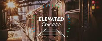
Elevated Chicago launched in 2017 to present collaborative, community-led solutions to neighborhood displacement and inequities using an underutilized asset: our public transit system. Historically, trains have connected people to places; we believe transit can also connect people to ideas, innovations and capital, both within and outside of their communities. Elevated Chicago work is done with a very keen point-of-view – a perspective we call our lenses. Just as wearing a pair of eyeglasses helps us see things from a certain perspective or shaded a certain tint, our lenses help us see the intent and impact of our work through these four lenses: Racial Equity, Health, Climate change and environmental issues, Arts and culture.
With this focus, we are working to improve the built environment (the physical structures and spaces available to people) for greater climate resiliency, to increase exposure to arts and culture, and to improve public health outcomes for residents, without residential displacement, for people of color in ways that acknowledges racial inequities that have long existed in opposition to this work.
Source: http://www.elevatedchicago.org/
Source: http://www.elevatedchicago.org/
Austin can harness its strong economy to expand opportunity and social equity for all residents. Developing new economic sectors through partnerships between the business community, city government, and institutions will help employ a diverse workforce and expand opportunities for young and old. To ensure our economic strength, it is critical to preserve Austin’s mix of large and small businesses, local entrepreneurs, major employers, clean industries, educational institutions, and government jobs. Growing our economic base should provide jobs and career paths for workers of all education and skill levels. Prosperity for all means reducing the number of people living in poverty by providing workforce training and services to help residents attain living-wage jobs. It also means capitalizing on the city’s creative industries, cultural heritage, and diverse population to position the city as a national and international center for innovation and knowledge-based industries.
Supporting Plans and Reports: Austin’s Strategic Direction Plan; Create Austin; East Cesar Chavez Neighborhood Plan; Downtown Austin Plan; Red River District Economic Strategy
• Support the connection of Huston-Tillotson with Dell Medical Center through an innovation corridor.
• Acquire property prior to the project along the corridor and use for business.
• Create a strategic business toolkit with the purpose of retaining small businesses.
• Support local workforce development through project hiring processes.
• High cost of land and programming.
• Limits of the project would need to expand to City streets and systems.
Established in 2008, TXRX Labs is a non-profit hacker space for the greater Houston area. Housed in the East End District, we offer courses in and access to our rapid prototyping lab, wood shop, machine shop, electronics lab, and a wide variety of other tools. Our goal is to educate the public about technology and show how seemingly complex techniques can be used by anyone. Many innovation ecosystems fall short in the area of manufacturing. TX/RX Labs wants to expand the physical resources available to Houston innovators, redefining the “Maker space” concept to include innovators, startups and small business. It offers 60,000 square feet of maker space that includes equipment access and support for prototype creation; education space for youth programs and professional development; and a community outreach function. And it’s working! TX/RX will expand its space to 300,000 square feet in 2020
Source: https://www.txrxlabs.org/


Source: https://www.txrxlabs.org/ Source: https://www.txrxlabs.org/
Every community member deserves opportunities to live a full, healthy life and a key foundation for that is a healthy environment. This strategy intends to address disparities within our community, building on successful programs. By building stronger community connections and protecting people and the environment from long-term effects of a changing climate and population growth, we can become a healthier, more resilient community.
A study prepared by community assessment of freeway exposure
The Community Assessment of Freeway Exposure and Health (CAFEH) study is a series of community based participatory research projects studying localized pollution near highways and major roadways in the Boston area and developing design approaches to protecting human health. It is likely that people living near highways are at risk of adverse health effects caused by exposure to elevated levels of traffic-related air pollution. The report outlines design tactics developed from empirical research that looked at the reduction of exposure in real-life applications.
Some of the design approaches included are:
• Vegetative buffers
• Trees
• Building design and land use
OPPORTUNITIES
• Provide positive health outcomes from improvements that expand access, activate streets and public places, and include trees, benches, programming and public art.
• Utilize the principles of Crime Prevention through Environmental Design (CPTED)
• Ensure all streets adjoining the corridor are walkable and bike-able.
• Ensure that public spaces are designed as SITES or LEED Certified spaces.
• Transforming the I-35 corridor will require partnerships to provide the substantial up-front funding as well as ongoing operations and maintenance.
• Limits of the project would need to expand to City streets and systems.
• Decking over the highway Source: https://sites.tufts.edu/cafeh/files/2011/10/CAFEH-Report-Final-2-26-15-hi-res1.pdf
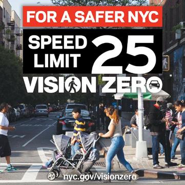
Vision Zero refers to a traffic safety concept that aims to reduce fatalities and serious injuries on roadways to zero. On November 20, 2014, the Austin City Council approved Resolution 20141120-103 calling for the City Manager to create a Vision Zero Task Force to study this policy and to produce a plan. The plan is underpinned by several key principles: 1) Traffic deaths and injuries are a preventable, public health issue. 2) People will make mistakes; the transportation system should be designed so those mistakes aren’t fatal. 3) Safety is the primary consideration in transportation decision-making. 4) Traffic safety solutions must be addressed holistically, through: Education, Enforcement, Land use, and Engineering.
NYC has had two of its safest years on record since adopting Vision Zero. As a part of Vision Zero efforts, NYC pushed awareness through media, made safety improvements to streets, lowered speed limits to 25 mph, and increased enforcement of traffic violations. High speed is one of the main causes of injury and death on Austin Roads.
Source: https://www1.nyc.gov/content/visionzero/pages/
OPPORTUNITIES
• Reduce fatalities and serious injuries by lowering speeds on frontage roads.
• Reduce fatalities and injuries by improving pedestrian infrastructure on frontage roads and cross streets.
• Address high injury streets and intersections through enhanced streetscapes and cross sections.
• Partner with TxDOT’s Vision Zero plan to enhance safety on the I-35 corridor.
CONSTRAINTS
• Reduction in speed can lead to less throughput.
• Increased amounts of objects like trees in the right-of-way.
Source: https://www1.nyc.gov/content/visionzero/pages/
Integrate sustainability initiatives and conservation principles.
Austin and San Antonio lie in the heart of North America’s “Flash Flood Alley” and has experienced historic flood events over the last several years. There are numerous connections between the mobility, stormwater, drinking water, reclaimed water, and wastewater systems. In addition to stormwater integrating trees, ecological benefits and pollution abatement into the design of roadways is a key goal of the Strategic Mobility Plan.
The Todd Lane improvement project added 6.8 acres of new and redeveloped impervious cover to Austin’s existing transportation network. In order to mitigate the impacts of this impervious cover and to comply with City code, the City of Austin worked to develop a water quality control strategy for the Todd Lane project. For the Todd Lane project, however, multiple green stormwater infrastructure controls were implemented, including seven rain gardens and two partial sedimentation/ biofiltration ponds. The rain gardens and biofiltration ponds capture, filter, and help infiltrate stormwater into the soil. They also remove pollutants including suspended particles, oil, heavy metals, and other chemicals, and enhance the baseflow to the nearby Country Club West and Williamson Creeks. Todd Lane is Austin’s first completed Greenroads Project and achieved a silver certification by Greenroads Project standards.
Source: https://www.greenroads.org/141/102/todd-lane-improvements.html
• Mitigate the water quality impacts of transportation related infrastructure on adjacent creeks and Lady Bird Lake.
• Reduce impacts from flooding.
• Plan and design for 100 year storm events.
• Incorporate green infrastructure such as pervious paving, or rain gardens.
• Increase shade and reduce reflectivity to minimize the heat island effect.
• Employ techniques to reduce air pollution.
• Increased complexity in design and maintenance of transportation infrastructure.

Maximize the useful life of infrastructure and ensure longterm, viable funding models.
Maximizing the useful life of transportation infrastructure means that we make sure an asset lasts as long as intended. Doing so reduces taxpayer dollars needed to prematurely replace infrastructure that should have lasted longer. By proactively maintaining transportation infrastructure, we can maximize its useful life. Infrastructure that is in poor condition can result in closures, or other failures, that can compromise the reliability and safety of our network. Long-term viable funding models are essential to ensuring maintenance and upkeep of infrastructure.
The concept of building a deck park over Woodall Rodgers Freeway may have originated in the 1960s when Dallas Mayor J. Erik Jonsson decided to recess the freeway. Many years later in 2002, the idea resurfaced in the real estate community and John Zogg began to rally support for the project. In 2004, Grant, Zogg and Linda Owen formed The Woodall Rodgers Park Foundation, the organization that led the project from design to completion. Many city and civic leaders contributed to the park throughout the process.
The $110 million project was funded through a public-private partnership. Public support included $20 million in bond funds from the City of Dallas, $20 million in highway funds from the state and $16.7 million in stimulus funds. The balance of funding is through individual donors directly to the Woodall Rodgers Park Foundation. Klyde Warren Park is owned by the City of Dallas and privately operated and managed by the private Woodall Rodgers Park Foundation. The Foundation studied great public parks across the country and plans to bring best practices to the park’s operations, programming and maintenance.
Source: https://www.klydewarrenpark.org/about-the-park/
OPPORTUNITIES
• Design to withstand changing environments and climate change impacts like increased flooding.
• Reduce the need for road closures due to maintenance.
• Create local partnerships that can assist with operations and maintenance of the space.
CONSTRAINTS
• Competing interests amongst potential partners and stakeholders.
• Timing of the project.

Source: https://www.klydewarrenpark.org/about-the-park/
Leverage partnership opportunities with private development and adjacent community investments and interests.
DESCRIPTION
The community will need many partners to achieve its comprehensive vision. Austin’s strong private sector, institutions, and non-profit organizations share responsibility for shaping the future. These groups have significant resources and relationships and can do many things city government cannot. Where the right organization does not exist, a new one may need to be created. Implementation will require strong partnerships among government, institutions, businesses, and community groups.
At the turn of the century, Midtown Houston, known as Southside Place, flourished as the second residential neighborhood in Houston, developing with single-family Victorian homes on small lots. The homes were generally 4000 – 6000 square feet in size and occupied by families of the original founders of the Humble Oil & Refinery Company. The subdivision flourished through the mid-1940s and began to decline into the 1980s and 1990s as a result of the sudden decline in oil production.
The make-up of the neighborhood after 1990 was comprised of vacant land, abandoned buildings, a few single family residences, and a few prosperous businesses. In 1992, the rector of Trinity Episcopal Church started a grassroots effort to revitalize Midtown Houston, bringing together urban planners, property owners, and residents to form the Midtown Redevelopment Authority (MRA). The MRA petitioned the City to make Midtown Houston a Tax Increment Reinvestment Zone, which was finalized in 1995. Not long after, Midtown began to flourish into the thriving and revitalized area that exists today.
Source: https://midtownhouston.com/
OPPORTUNITIES
• Partnerships lead to greater local public benefits.
• Partnerships are more responsive to local programming needs.
CONSTRAINTS
• Competing interests.
• Adds complexity.

Source: https://midtownhouston.com/
To make public transportation a viable option, we must work with our public transportation partners and enhance services to create an experience that attracts and retains riders. Capital Metro’s Connections 2025 Service Plan has already made progress towards increasing ridership by streamlining routes and increasing frequency of service on Austin’s busiest streets. Project Connect, Capital Metro’s high capacity transit planning effort, can continue the trend by investing in a system that operates congestion-free, separate from traffic where possible.
Completed in 1959, the Embarcadero Freeway was originally intended to directly connect the Bay and Golden Gate Bridges via the waterfront. San Francisco’s “Freeway Revolt” left it as a roughly one mile connector between the Bay Bridge approach, Chinatown and North Beach. Like Seattle’s Alaska Way Viaduct, it separated downtown San Francisco from its waterfront. Like the demolished segment of the Central Freeway in San Francisco, it was a double-deck, elevated highway, resulting in a physical and visual barrier between downtown and the waterfront. At its peak, the Embarcadero Freeway carried more than 60,000 cars per day. As of 2000, traffic on the Embarcadero was approximately 26,000 vehicles per day, or less than half that on the old freeway. Removing the freeway allowed new forms of reliable and dedicated public transit routes to absorb some of the trips. Since extension of the F-Market along the Embarcadero and replacement of the old bus route on the street, transit ridership in the corridor has increased several times over. Ferry service and ridership has also increased in recent years.
OPPORTUNITIES
• Prioritizing and enhancing local east west transit routes, which will lead to more reliability in the system and ultimately increased ridership especially for those that need it most.
• Prioritizing public transportation with managed or dedicated lanes can reduce reliance on personal vehicles.
• Increasing transit capacity can shift local trips to transit and reduce dependency on and around I-35 for local trips reducing traffic and congestion in East Austin.
• Incorporate a circulator to serve local districts.
• Transit connections from managed lanes to employment centers / destinations.
CONSTRAINTS
• Shifting local trips to transit will require a comprehensive and holistic approach to improving public transit in Austin.
Source: https://www.cnu.org/sites/default/files/Nashville%20Case%20Study%202%20-%20Seattle.pdf


Source: https://www.cnu.org/sites/default/files/Nashville%20 Source: https://www.cnu.org/sites/default/files/Nashville%20
Austin’s transportation network is made up of the infrastructure for many individual transportation systems. These systems, our sidewalks, roadways, public transportation services, bicycle facilities, and urban trails, among others, are supplied to our community to ensure we can use our transportation network to move around our community when and how we wish. Austin’s roadway system has not kept up historically with the amount of growth our region has experienced. More importantly, the roadway system was never built to manage today’s population size which continues to grow. This insufficient investment in our roadway system and the number of people that use it are largely responsible for the congestion and unreliable travel times we experience today.
Supporting Plans and Reports: Austin Strategic Mobility Plan; Plaza Saltillo & MLK Blvd TOD Station Area Plans
Corridor Mobility Reports were first created leading up to a successful 2010 Mobility Bond that funded the study of seven major corridors in Austin. These studies resulted in the identification of short-, medium-, and long term recommendations that were designed to improve the safety, mobility, and connectivity of each corridor. Additional corridors were funded for study as part of the 2012 Mobility Bond, and reports for these corridors were subsequently used to develop the 2016 Mobility Bond, which partially funded construction improvements. Continuing to use Corridor Mobility Reports to identify mobility and safety improvements on additional corridors will help prepare us to construct improvements when funding becomes available in the future for design and construction.
Source: City of Austin Strategic Mobility Plan
OPPORTUNITIES
• Safe pedestrian access to and from the I-35 corridor.
• Expand the use of all modes of transportation.
• Reserve a location for regional transit along the corridor.
• Shift trips from personal vehicles to alternate modes.
• I-35 is not currently a vibrant walkable place where transit stops are most successful.

Source: City of Austin Strategic Mobility Plan
• Frontage roads
• Bridge extensions

• Frontage roads
• Freeway caps above “simple” segments only

SIMPLE CAPS & RAMPS
• Frontage roads
• Freeway caps above simple segments and ramp segments

MINIMAL RAMPS
• Frontage roads
• Freeway caps above simple segments and ramp segments

• Discontinuous frontage roads
• Driveway access restricted
• Center-aligned boulevard (above freeway) functions as frontage roads

DIAMONDS AND GRID
• Limited frontage roads (driveway access restricted)
• Diamond interchanges
• Surrounding street grid distributes traffic

The cap typologies diagrams (previous page) illustrate six potential cap and stitch configurations. These are not mutually exclusive and could be integrated with each other depending on localized constraints and interface with the city.
The opportunities & constraints matrix (right) reviews these configurations with a traffic light system to identify whether the scenario has a high, moderate or low level possibility of achieving the highlighted opportunity. If a low level is identified, then this is considered a constraint.
Integrate public realm enhancements (e.g. Landscape, lighting, open space)
Enhanced user experience (all road users)
Integrate protected bike paths and pedestrian routes
Enhanced visual and environmental integration (e.g. landscape treatments, screening of road )
Integrate highway with street grid and strengthen east / west connectivity
Enhance connectivity to existing and planned public transit systems
Integrate overbuild and/or programmable space
Integrate stormwater management / green infrastructure
Separate regional and local traffic
Phase delivery to align with budget and market demand for development land
Safeguard space for future transit facilities and utility infrastructure

A stitch with enhanced streetscape is built on the concept of Great Streets which prioritize street rights-of-way for pedestrians and people taking advantage of other modes of getting around the city such as bicycles and scooters. It introduces wider sidewalks and improved crosswalks to encourage walkability along with safety features incorporated into the street section that support active mobility. The street is further enhanced with trees that provide shade for pedestrian comfort and increased tree canopy which mitigates the urban heat island effect and humanizes an otherwise auto-dominant environment.
• The I-35 Project is an opportunity to enhance east-west connectivity by implementing initiatives already adopted by the City of Austin and TxDOT such as Great Streets and Vision Zero.
• Stitches can transform existing highway bridges into complete urban streetscapes, strengthening the fabric of the city.
• Collaboration with TxDOT to coordinate operations, required vertical clearances, ramping, structural support, utilities coordination, and irrigation for street trees/ landscaping.
Great Streets Master Plan, Austin Strategic Mobility Plan, Austin Bicycle Master Plan, Downtown Austin Design Guidelines, Imagine Austin, Austin Strategic Direction 2023, Downtown Austin Plan
STRATEGY #11: Create quality public spaces that better public health.
STRATEGY #12: Prioritize the protection of human life in roadway design. STRATEGY #16: Expand and prioritize opportunities for transit.
PROJECT INFORMATION
I-71, Columbus, OH
Completed 2014
0.64 Acres, (70’ X 400’)
Connects King-Lincoln to downtown and Discovery District (1 of 12 bridges to be upgraded in the city)
TOTAL COST
The Bridge is part of the $200M I-70/I-71 Innerbelt Design Enhancement Project (Phase 1). Total $1.6 Billion reconstruction of the I-70/71 corridor. Bridge paid for by City of Columbus, ODOT, and Mid-Ohio Regional Planning Commission.
FEATURES/PROGRAM
Noise Screen Wall, Enhanced Streetscape
DESIGN TEAM
MKSK
OWNERSHIP
Ohio Department of Transportation
MAINTENANCE & OPERATIONS
City of Columbus
STRATEGIES USED
• Community-driven design process
• Pedestrian scale design improves comfort and safety
• Screening with panels mitigates noise and visual impact


Source: https://www.mkskstudios.com/projects/i70-i71-innerbelt

A stitch with enhanced streetscape and partial cap prioritizes pedestrian walkability and active mobility and includes a small civic gathering space for neighborhood and community events.
• The I-35 Project presents an opportunity to include partial caps to provide new open spaces in the city as assets for various community uses such as public gathering, recreation and play, and for the expression of local arts.
• Provides opportunities for pedestrians of all abilities to rest on the long walk across I-35.
• Provides an opportunity to interpret the history of Huston College, East Avenue, businesses owned by the community, and other sites that were demolished for original I-35 construction.
• Collaboration with TxDOT to coordinate operations, required vertical clearances, ramping, structural support, utilities coordination, and irrigation for street trees/ landscaping.
• Need for a right-of-way use agreement with TxDOT.
Great Streets Master Plan, Austin Strategic Mobility Plan, Austin Bicycle Master Plan, Downtown Austin Design Guidelines, Imagine Austin, Austin Strategic Direction 2023, Downtown Austin Plan, Parks and Open Space Master Plan, the Cultural Asset Mapping Project, Cultural Master Plan, Cultural Tourism Plan
STRATEGY #2: Support efforts to reduce homelessness.
STRATEGY #4: Use a transparent data-driven planning process.
STRATEGY #5: Plan collaboratively with historically underserved and vulnerable populations.
PROJECT INFORMATION
I-71, Columbus, OH
Completed 2014
1.5 Acres, (165’ X 450’)
Connects King-Lincoln to downtown and Discovery District (1 of 12 bridges to be upgraded in the city)
TOTAL COST
The Bridge is part of the $200M I-70/ I-71 Innerbelt Design Enhancement Project (Phase 1). Total $1.6 Billion reconstruction of the I-70/71 corridor. Bridge paid for by City of Columbus, ODOT, and Mid-Ohio Regional Planning Commission.
FEATURES/PROGRAM
Culture Wall, Park, Enhanced Streetscape, On-street Parking
DESIGN TEAM
MKSK
Local Artists: Kojo Kamau and Larry Winston Collins
OWNERSHIP
Ohio Department of Transportation
MAINTENANCE & OPERATIONS
City of Columbus
STRATEGIES USED
• Community-driven design process
• Pedestrian scale design improves comfort and safety
• Screening with panels mitigates noise and visual impact
• Art competition showcases local artists and neighborhood history

Source: https://www.mkskstudios.com/dialogue/bringing-people-and-communities-together-by-inspired-transportation-design

A stitch with partial cap and buildings prioritizes pedestrian walkability and active mobility and includes buildings along both sides of the stitch street, resulting in the continuation of the urban fabric.
• The I-35 Project presents an opportunity to include partial caps with economic development opportunities that can support local businesses.
• Opportunity to activate streets continuously east-west.
• Opportunity to bring back local businesses that once were located where I-35 is today.
• Collaboration with TxDOT to coordinate operations, required vertical clearances, ramping, structural support, utilities coordination, and irrigation for street trees/ landscaping.
• Need for a right-of-way use agreement with TxDOT.
Great Streets Master Plan, Austin Strategic Mobility Plan, Austin Bicycle Master Plan, Downtown Austin Design Guidelines, Imagine Austin, Austin Strategic Direction 2023, Downtown Austin Plan, Parks and Open Space Master Plan, the Cultural Asset Mapping Project, Cultural Master Plan, Cultural Tourism Plan
STRATEGY #3: Reduce displacement impacts due to lack of affordability.
STRATEGY #6: Ensure a complimentary relationship with adjacent district and neighborhoods.
STRATEGY #7: Celebrate the historical and cultural assets and identity of the community.
STRATEGY #8: Enhance local arts and culture industries.
STRATEGY #9: Support small local business.
STRATEGY #10: Support workforce development and education.
PROJECT INFORMATION
I-670, Columbus, OH
Completed 2005
1.12 Acres (215’ x 285’)
Reconnects Downtown Columbus to Short North Arts District
TOTAL COST = $9.4M
$1.3M Ohio Department of Transportation
$7.8M Private Funds (development)
$300 City of Columbus (utilities)
FEATURES/PROGRAM
25,500 sf Mixed-Use/ Retail
OWNERSHIP
Right of Way Use Agreement between Private Developer, the Federal Highway Administration, and the Ohio Department of Transportation (ODOT)
MAINTENANCE & OPERATIONS
Continental Real Estate Companies
STRATEGIES USED
• Utilization of Air Rights and Right-of-Way Use Agreement

Source: https://divisionsevenroofing.com/gallery/aerial-003/

A pedestrian bridge prioritizes walk-ability and active mobility and connects significant parts of the city to one another across I-35.
• The I-35 Project presents an opportunity to unlock a connection that may have been lost due to the original I-35 construction.
• The pedestrian bridge is an opportunity to create a gateway to mark a significant district of the city.
• The pedestrian bridge is an opportunity to remove conflicts between people and cars, seamlessly connecting to an adjacent land use.
• Collaboration with TxDOT to coordinate operations, required vertical clearances, ramping, structural support, utilities coordination, and irrigation for street trees/ landscaping.
• Need for land acquisition/ right-of-way use agreement with TxDOT.
• The pedestrian bridge is a long distance for people to walk, making it perhaps more suitable for bikes.
Great Streets Master Plan, Austin Strategic Mobility Plan, Austin Bicycle Master Plan, Downtown Austin Design Guidelines, Imagine Austin, Austin Strategic Direction 2023, Downtown Austin Plan, Parks and Open Space Master Plan, the Cultural Asset Mapping Project, Cultural Master Plan, Cultural Tourism Plan
POTENTIAL STRATEGIES TO LEVERAGE FROM TOOLKIT
STRATEGY #7: Celebrate the historical and cultural assets and identity of the community.
STRATEGY #8: Enhance local arts and culture industries.
STRATEGY #15: Leverage partnership opportunities with private development and adjacent community investments and interests.
South Columbus Drive, Chicago, IL
Completed 2004
13,500 sf, (925’ long)
Connects Maggie Daley and Millennium Parks
TOTAL COST = $14.5M
Funded by Millennium Park Foundation
$5M Donation by BP
OWNERSHIP
City of Chicago
MAINTENANCE & OPERATIONS
Chicago Department of Cultural Affairs

Source: https://en.wikipedia.org/wiki/BP_Pedestrian_Bridge

A cap park with frontage roads and buildings prioritizes pedestrian walkability and active mobility and includes the creation of a full cap park or open space between two or more city blocks. The buildings can activate the park with concessions. Concessions provide daily eyes on the space which helps with operations, maintenance, and people feeling safe in public spaces in addition to provide a revenue-generating opportunity to offset operations & maintenance costs.
• The I-35 Project presents an opportunity to cap portions of the highway to connect significant parts of the city to one another.
• Caps can create new open spaces in the city for various community uses such as public gathering, recreation and play, the expression of local arts, along with opportunities to support local businesses and accommodate programs the city is in great need of such as affordable housing.
• The buildings are opportunities for local small businesses.
• Collaboration with TxDOT to coordinate operations, required vertical clearances, ramping, structural support, utilities coordination, and irrigation for street trees/ landscaping.
• Need for a right-of-way use agreement with TxDOT.
Imagine Austin, Downtown Austin Plan, Parks and Open Space Master Plan
POTENTIAL STRATEGIES TO LEVERAGE FROM TOOLKIT
STRATEGY #5: Plan collaboratively with historically underserved and vulnerable populations.
STRATEGY #9: Support small local business.
STRATEGY #11: Create quality public spaces that better public health.
STRATEGY #13: Integrate sustainability initiatives and conservation principles.
PROJECT INFORMATION
Woodall Rogers Freeway, Dallas, TX
Completed 2012
5.4 Acres, (225’ X 1,000’, 3 city blocks)
TOTAL COST = $110M
$20M City of Dallas
$20M State and Federal Hwy Funds (TxDOT)
$50M Private Donations
$16.7M Stimulus Funds for Transportation Enhancement
FEATURES/PROGRAM
Restaurant (6,000sf)
Children’s Park
Reading Room
Great Lawn
Performance Pavilion
Fountain Plaza
Games Area
Urban Dog Park
Botanical Garden
Pedestrian Promenade
OWNERSHIP
City of Dallas
MAINTENANCE & OPERATIONS
Woodall Rodgers Park Foundation
STRATEGIES USED
• Utilization of Air Rights and Right-of-Way Use Agreement
• Public-Private Partnership (P3) Development
• Federal Stimulus Funds

Source: https://www.hraadvisors.com/project-category/practice-area/

A cap with full blocks of buildings and frontage roads introduces dense development with buildings defining the edges of all blocks, resulting in the continuation of the urban fabric.
• The I-35 Project presents an opportunity to cap portions of the highway to connect significant parts of the city to one another.
• A concentration of new development is a great opportunity to implement frameworks into the development deal that support local businesses and accommodate programs the city is in great need of such as affordable housing.
• The full block of buildings is an opportunity to fully remove I-35 as a visual and physical barrier.
• New cap and development puts land into the tax rolls.
• Collaboration with TxDOT to coordinate operations, required vertical clearances, ramping, structural support, utilities coordination, and irrigation for street trees/ landscaping.
• Need for a right-of-way use agreement with TxDOT.
Imagine Austin, Downtown Austin Plan, Parks and Open Space Master Plan
STRATEGY #1: Maximize the creation of new affordable housing.
STRATEGY #9: Support small local business.
STRATEGY #14: Maximize the useful life of infrastructure and ensure long-term, viable funding models.
PROJECT INFORMATION
I-395, Washington, DC
Under Construction
9.5 Acres (360’ X 1,200’, 3 city blocks)
Reconnects Capitol Hill + East End Neighborhoods
TOTAL COST = $1.57B
$270M Private funds (Third Street Tunnel Project)
$1.03B Private funds (Capitol Crossing Real Estate)
PROGRAM 2.2M SF
• Mixed-Use Ecodistrict (LEED Platinum Buildings/ co-gen plant/ rainwater capture/ eco-chimney exhaust filtration)
• Office/ Retail/ Housing/ Hotel
• 4-level Underground Parking Garage
OWNERSHIP
Right of Way Use Agreement between Property Group Partners, the District of Columbia, and District Department of Transportation
MAINTENANCE & OPERATIONS
N/A
STRATEGIES USED
• Environmental Impact Study - environmental justice/ mitigation strategies
• Community-focused design process
• Funds earmarked for affordable housing


Source: https://www.som.com/projects/capitol_crossing

A cap park with modified frontage roads introduces a cap park to create a contiguous open space with an adjacent block by eliminating the barrier of a frontage road.
OPPORTUNITIES
• The I-35 Project presents an opportunity to cap portions of the highway to allow a significant cultural asset to expand its footprint and relevance in the city to accommodate various community uses such as public gathering, recreation and play, and for the expression of local arts.
• The cap park with modified frontage roads is an opportunity to remove conflicts between people and cars, seamlessly connecting to an adjacent land use.
CONSTRAINTS
• Collaboration with TxDOT to coordinate operations, required vertical clearances, ramping, structural support, utilities coordination, and irrigation for street trees/ landscaping.
• Need for a right-of-way use agreement with TxDOT.
Imagine Austin, Downtown Austin Plan, Parks and Open Space Master Plan, Convention Center Master Plan, Mexican American Cultural Center Master Plan
POTENTIAL STRATEGIES TO LEVERAGE FROM TOOLKIT
STRATEGY #5: Plan collaboratively with historically underserved and vulnerable populations.
STRATEGY #6: Ensure a complimentary relationship with adjacent district and neighborhoods.
STRATEGY #11: Create quality public spaces that better public health.
STRATEGY #12: Prioritize the protection of human life in roadway design.
PROJECT INFORMATION
Central I-70E, Denver, CO (Proposed Concept)
4 Acres Reconnects Neighborhoods
TOTAL COST
The cap park is part of the larger Central I-70 Project ($1.2B)
PROGRAM
Safe + active recreation space for the community Soccer field, outdoor concerts, farmers market, splash park Renovation to elementary school, local neighborhood houses
OWNERSHIP
City/ County/ Denver Public Schools
shared use/maintenance agreements
MAINTENANCE & OPERATIONS
N/A
STRATEGIES USED
• Environmental Impact Study - environmental justice/ mitigation strategies
• Funds earmarked for affordable housing

Source: https://www.codot.gov/projects/i70east/snapshot-dec2018-engspa_v2.pdf

A boulevard prioritizes the continuation of the urban grid by capping the highway over several city blocks and establishing a streetscape that prioritizes walkability, active mobility, aesthetics, environmental enhancement, and transit. It introduces new buildings along both sides of the boulevard resulting in less disruption of the urban fabric that was lost when the highway was originally constructed.
• The I-35 Project presents an opportunity to cap a major segment of the highway through the city to connect downtown to East Austin.
• The boulevard better reflects the history of East Avenue and the business districts that existed before the construction of I-35
• The current right-of-way can be reduced which unlocks new developable land for housing and other productive uses and establishes new tax base for the city.
• The opportunity exists to expand the educational program offerings of Huston-Tillotson University to former location of Huston College
• Collaboration with TxDOT to coordinate operations, required vertical clearances, ramping, structural support, utilities coordination, and irrigation for street trees/ landscaping.
• Need for a right-of-way use agreement and/or sale of excess (right-ofway) land would need to be agreed to with TxDOT.
Great Streets Master Plan, Reconnect Austin, Austin Strategic Mobility Plan, Austin Bicycle Master Plan, Project Connect
STRATEGY #1: Maximize the creation of new affordable housing. STRATEGY #3: Reduce displacement impacts due to lack of affordability. STRATEGY #14: Maximize the useful life of infrastructure and ensure long-term, viable funding models.
PROJECT INFORMATION
I-93, Boston, MA
Completed 2008
17 Acres (75% dedicated open space), 1.5 mi of linear parks (150’ avg. width) Connects Downtown to North End, Long Wharf, South Station, and Chinatown.
TOTAL COST (PARK)= $35.2M
(Central Artery Tunnel Project = $15B)
$2.3M Endowment
$14.1M Government Support
$18.2M Private Philanthropy
$500K Other
FEATURES/PROGRAM
Landscaped Gardens, Promenades, Plazas, Fountains, Public Art Carousel, Harbor Island Pavilion, Zipline
OWNERSHIP
Massachusetts Department of Transportation (MassDOT)
MAINTENANCE & OPERATIONS
Rose Kennedy Greenway Conservancy ($5M/year)
STRATEGIES USED
• Utilization of Air Rights and Right-of-Way Use Agreement
• Public-Private Partnership (P3) Development

Source: https://www.rosekennedygreenway.org/history/

A boulevard prioritizes the continuation of the urban grid by capping the highway over several city blocks and establishing a streetscape that prioritizes walkability, active mobility, aesthetics, environmental enhancement, and transit. It introduces new buildings along both sides of the boulevard resulting in less disruption of the urban fabric that was lost when the highway was originally constructed. Integration of a transit hub allows the boulevard to become a local and regional connector.
• The I-35 Project presents an opportunity to cap a major segment of the highway through the city to connect downtown to East Austin.
• The boulevard better reflects the history of East Avenue and the business districts that existed before the construction of I-35
• The current right-of-way can be reduced which unlocks new developable land for housing and other productive uses and establishes new tax base for the city.
• The opportunity exists to expand the educational program offerings of Huston-Tillotson University to former location of Huston College.
• Transit integration allows managed lanes (in the TxDOT schematic) to be appropriately dedicated to (local and/or regional) transit.
• Collaboration with TxDOT to coordinate operations, required vertical clearances, ramping, structural support, utilities coordination, and irrigation for street trees/ landscaping.
• Need for a right-of-way use agreement and/or sale of excess (right-ofway) land would need to be agreed to with TxDOT.
Great Streets Master Plan, Reconnect Austin, Austin Strategic Mobility Plan, Austin Bicycle Master Plan, Project Connect
STRATEGY #1: Maximize the creation of new affordable housing. STRATEGY #3: Reduce displacement impacts due to lack of affordability. STRATEGY #16: Expand and prioritize opportunities for transit.
PROJECT INFORMATION
I-980, Oakland, CA (Proposed)
17 Acres of new developable land from existing 560’ R.O.W Reconnects West Oakland to Downtown by reestablishing 12 city streets
TOTAL COST
N/A
FEATURES/PROGRAM
• Multi-way boulevard with rapid transit lines under ground
• 5,000 Residential Units
• 1.5M SF of Commercial Space (910K SF Office and 600K SF Retail/ Neighborhood-Serving Commercial)
OWNERSHIP
Create new land for private development
MAINTENANCE & OPERATIONS
N/A
STRATEGIES USED
• Use of revenue from public land to repair inequities caused by the creation of I-980
• Yields a large quantity of publicly-owned land that could be used for public benefit including housing, improved streets, and open space.
• Supports walking, biking, and transit


Note: There is no built example with a direct correlation to the opportunities within the I-35 corridor, but this example shows how you could layer a boulevard on top with a highway below (in this case shown as a level dedicated to transit).

Source: http://www.connectoakland.org/2016/09/19/the-role-of-i-980-in-the-oakland-downtown-specific-plan/
Community-desired program and open spaces
Community-desired program and open spaces
Community-desired program and open space

Community-desired program
On-street parking opportunity providing access to open space
This page intentionally left blank
As a first step in a new process for I-35, the Downtown Alliance engaged the Urban Land Institute’s (ULI) national advisory services. ULI brought a panel of diverse experts to Austin in February 2020, where they talked and worked with the community, gathering input and ideas for the future of the I-35 corridor. The panel presented preliminary recommendations for the future of I-35 at Huston-Tillotson University on February 28.
Prior to, and in preparation for these ULI events, the Downtown Austin Alliance compiled a list of sources that could be used by the ULI panelists. Since ULI Panel week, and through continued dialogue with the community, we’ve learned and acknowledge that our initial list of existing plans and efforts was not comprehensive.
The purpose of this supplement is to:
• Add new information (since the Opportunities and Constraints report was released); and
• Clarify omissions and errors in the report that have been brought to our attention.
An additional key observation is that it remains critical that civic dialogue and next steps in our process for the future of I-35 acknowledge community trauma and present opportunities for healing, for rebuilding trust and connections, and for capturing opportunities and value for Austin community members who have historically been excluded.
PAGES 4-6, 10-11: Updated to reflect that the Urban Renewal Plan for East 11th and 12th Streets, the Austin Community Climate Plan, and Reconnect Austin Briefing Booklets are references for all future I-35 efforts.
PAGE 5: Updated to reflect additional questions and potential indicators of success. Removed indicator related to inperson meetings (during Covid-19).
PAGE 19, 53: Adjusted symbols to be more easily distinguishable for all readers and to reflect that the Lowered Highway option does not demonstrate how it will enhance safety for those walking and bicycling along or across I-35.
PAGES 27-29: Updated map to include neighborhoods and various planning areas. Clarified that some development sites are not yet permitted/ approved, and may be inconsistent with the community visions and plans in place.