Drones in Infrastructure
to you by: Produced by Diversified Communications
SNAPSHOT:
Brought
SECTOR
Sector Snapshot: Drones in Infrastructure
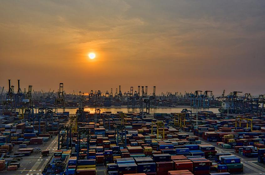
By Scott Howe, Commercial UAV NewsThe world invests over $2.5 trillion a year in the transportation, power, water, and telecom systems on which businesses and populations depend.
(McKinsey)
Energy and construction two sectors closely related to infrastructure—are among the top three industries for drone applications.
(Drone Industry Insights)
57% agree with the statement, “as a country we are not doing enough to meet our infrastructure needs.”
(Ipsos)
INTRODUCTION
The commercial UAV market is expected to reach $55.8 billion by 2030
(Drone Industry Insights)
30% of citizens surveyed were dissatisfied with the infrastructure in their country
(Ipsos)
FROM BRIDGES TO ROADWAYS AND WATER SUPPLIES TO TELECOMMUNICATIONS NETWORKS, all parts of our infrastructure can benefit from the increased efficiency, safety, and sustainability offered by drones and related systems. That’s why governments and public agencies around the world are incorporating UAVs into their infrastructure operations.
In this Sector Snapshot, Commercial UAV News examines the current state of the infrastructure industry, investigates how drones are currently being deployed in infrastructure operations, and looks to the future as the integration of artificial intelligence and other advanced technologies aims to improve the effectiveness of drones in infrastructure work.
SECTOR SNAPSHOT: DRONES IN INFRASTRUCTURE 2
WHAT IS INFRASTRUCTURE?
The Corporate Finance Institute defines public infrastructure as the “facilities, systems, and structures that are developed, owned, and operated by the government,” including “all infrastructure facilities that are open to the general public for use.” The group also says that infrastructure is comprised of “all essential systems and facilities that allow the smooth flow of an economy’s day-to-day activities and enhance the people’s standard of living.”
Providing more detail, the US Federal Emergency Management Agency (FEMA) calls public infrastructure “at a minimum, the structures, facilities, and equipment for roads, highways and bridges; public transportation; dams, ports, harbors and other maritime facilities; intercity passenger and freight railroads; freight and intermodal facilities; airports; water systems, including drinking water and wastewater systems; electrical transmission facilities and systems; utilities; broadband infrastructure; and buildings and real property; and structures, facilities and equipment that generate, transport and distribute energy including electric vehicle (EV) charging.”
Others have a broader definition of infrastructure, expanding it to include other foundations of organized society, such as courts of law, regulatory bodies, police and fire departments, schools, hospitals, public parks, historical sites, and nature preserves.
THE CURRENT STATE OF PUBLIC INFRASTRUCTURE
Because infrastructure covers such a broad range of systems and assets, it is difficult to truly define the “state” of the sector. Still, a look at government investment in infrastructure around the world provides a clearer picture.
According to the McKinsey Global Institute, “Today the world invests some $2.5 trillion a year in the transportation, power, water, and telecom systems on which businesses and populations depend.” Despite this massive commitment, McKinsey states that “this amount continues to fall short of the world’s ever-expanding needs, which results in lower economic growth and deprives citizens of essential services.”
The problems with the world’s infrastructure systems are well documented. Crumbling bridges, abandoned railways, outdated airports, lack of broadband in rural areas, poor sanitation, and more are recognized as critical issues the world over. The Global Infrastructure Index 2023 from Ipsos surveyed citizens in 31 countries and collected their views on their particular country’s transportation infrastructure, energy and water systems, communications networks, and more. On average, 30% of respondents were dissatisfied with the infrastructure in their country, and 57% agreed with the statement, “as a country we are not doing enough to meet our infrastructure needs.”
In response, many countries have stepped up investments in infrastructure. S&P Global Commodity Insights cites data from the National Bureau of Statistics stating, “China’s infrastructure investment in 2023 increased 5.9% on the year, having grown 9.4% year on year in 2022.” Similarly, infrastructure spending has grown in many countries in Europe in recent years. According to Statista, France spent $66.37 billion, the UK spent $58.99 billion, and Germany spent $55.46 billion on infrastructure projects in 2020 alone.
Perhaps the most significant news concerning infrastructure investment has come from the United States. In 2021, President Biden signed the “Bipartisan Infrastructure Law,” which “directs $1.2 trillion of federal funds towards transportation, energy, and climate infrastructure projects, most of which is distributed via state and local governments.” As of last fall, according to the Biden administration, the bill had led to the distribution of more than $448 billion in funding “to states, Tribes, territories and local governments.” The money is being spent on 51,000 projects, ranging “from repaving roads and water system upgrades funded through formula grants to states to competitive funding for massive bridge and transit projects.”
SECTOR SNAPSHOT: DRONES IN INFRASTRUCTURE 3
HOW DRONES ARE BEING USED IN INFRASTRUCTURE PROJECTS
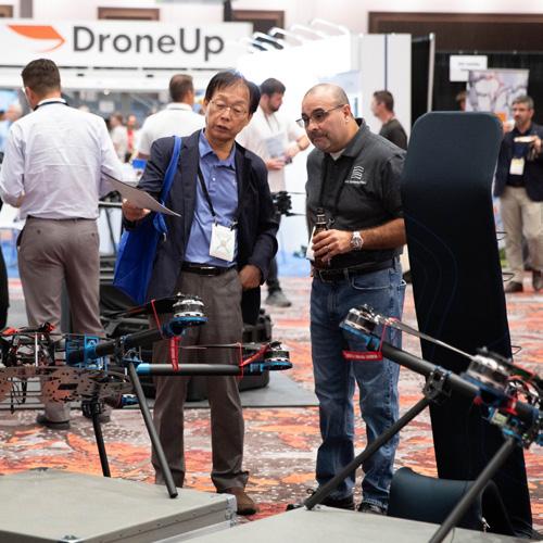
In recent years, drones have increasingly been deployed to bring enhanced efficiency, accuracy, and safety to a wide variety of infrastructure-related projects. They are being used to monitor the progress of constructing a police station, a bridge, an airport, a subway line, a dam, or a transmission plant. In addition, they help to survey and map areas in and around these assets, and they can be deployed to help maintain security and safety. So, while these individual projects might be characterized as part of the “transportation,” “energy,” “public safety,” or “construction” sectors, they all easily fall under the broader category of “infrastructure.”
Given the growth of drone adoption in these related sectors, it’s safe to say that drone adoption will grow in the field of infrastructure. According to Drone Industry Insights’ Drone Application Report, the commercial market is expected to reach US$55.8 billion by 2030, and energy and construction—two sectors closely related to infrastructure—are among the top three industries for drone applications.
So, how are infrastructure professionals deploying drones? Overall, the most common application is inspection work. A 2023 article in The Drone Life explained that drones can “reach inaccessible areas and capture 360° angles relatively quickly.” Drones can also be used to keep workers “away from dangerous equipment and heights,” thus increasing “worker safety and overall health.” Moreover, the piece said, “Because drone inspections are so time and cost efficient, you can afford to perform them more frequently. This gives you a better chance of spotting developing infrastructure issues early on and allows you to perform better preventative maintenance to make sure everything stays safe and up to code.”
Christian Stallings, Vice President of BAAM.Tech, a geospatial solutions firm that works on many infrastructure projects, explains that drone inspections can help “create awareness about something difficult to get a human to observe easily or safely.” For example, he explained, “The top of a utility tower would typically need to be observed from an airplane. Now it can be done from the ground.” Drone infrastructure inspections, he stated, also help “create a record of time for historical purposes in the event of some liability claims in the future.”
Given the effectiveness of uncrewed vehicles for infrastructure inspection work, many governments can be expected to increase their investments in the technology, and companies that do business with public entities would be wise to incorporate drones in their operations.
This move toward greater adoption may receive a boost in the US with the passage of the Drone Infrastructure Inspection Grant Act. Introduced in 2022, the bill would establish “programs within the Department of Transportation (DOT) to support the use of drones and other small, unmanned aircraft systems when inspecting, repairing, or constructing road infrastructure, electric grid infrastructure, water infrastructure, or other critical infrastructure.” In addition, the bill would direct the DOT to “award grants to state, tribal, and local governments; metropolitan planning organizations; or groups of those entities to purchase or otherwise use drones to increase efficiency, reduce costs, improve worker and community safety, reduce carbon emissions, or meet other priorities related to critical infrastructure projects.”
SECTOR SNAPSHOT: DRONES IN INFRASTRUCTURE 4
DRONES IN ACTION IN THE INFRASTRUCTURE SECTOR
Here’s a look at some of the many ways the infrastructure sector has embraced drone technology over the past year—and how uncrewed systems are delivering real value.
Uncrewed Innovations Improve Transportation Projects in Colombia
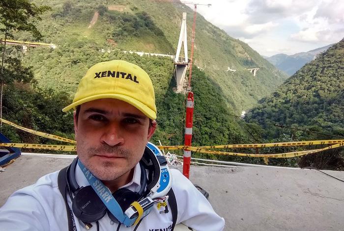
The Bogota-based engineering company Xenital is helping the Colombian government complete an ambitious project to add more rural paved roads and bridges and give access to isolated communities while enhancing public transportation networks. Flying drones, Xenital is “helping the engineers building the Bogota Metro with constant volumetric calculations in order to keep track of excavations and earth movements,” said Sebastian Uribe, company founder and CEO. “It is forecasted that the excavation for the metro will move 1.6 million cubic yards of dirt that needs to be accounted for, and the traditional method of using multiple ground crews was becoming unviable as the construction became more complex. Our proposal to do it constantly from the air without interfering with ground operations was received with enthusiasm by the building company, and now we are constantly flying and calculating with a high degree of accuracy daily earth movements around the excavation sites.”
DronePort Rotterdam Expands Drone-Based Port Management Program
Long a leader in drone-based port management, Holland’s DronePort Rotterdam announced last fall it would test the use of drones to perform a wide range of inspection, logistics, and maintenance tasks. A report explained that the port—one of the busiest in the world—aimed “to find out if the drones are suitable for supporting inspectors and shipping masters in their work.” To this end, DronePort Rotterdam began trials “focused on sea-going and inland shipping inspections by the Harbor Master’s Division on bunkering, water pollution, ship-to-ship transfer, zoning for hazardous substances, shore-to-ship transfer, air pollution (smoke or soot), and repairs on board vessels.”
More recently, DronePort Rotterdam announced a partnership with Drone Fusion, an international platform for drone researchers and schools, and Saxion University of Applied Sciences to develop a “platform to drive innovation, research, business, and excellence in the field for autonomous and uncrewed intelligent systems.” According to reports, “this curriculum, covering the entire drone ecosystem, is tailored for both regular and professional education levels. It encompasses a range of drone-related educational content, from regulatory frameworks and safety protocols to practical applications, technological innovations, and policy implications.”
SECTOR SNAPSHOT: DRONES IN INFRASTRUCTURE 5
Ultrasonic Technology for Infrastructure Inspections
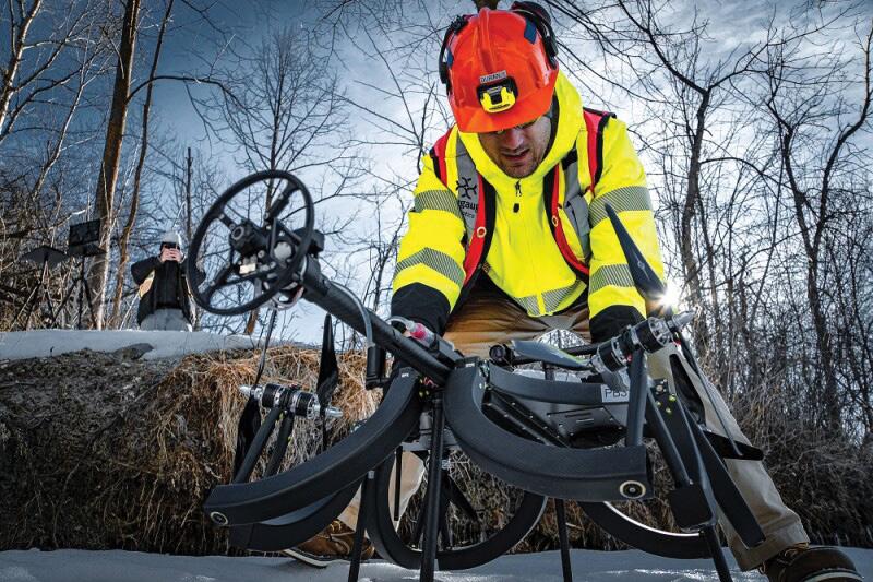
Last year, Skygauge Robotics entered into a $1 million contract with Transport Canada to use its Skygauge Inspection Drone to perform inspection projects in Canada. A key feature of the drone is its use of ultrasound. “In the same way doctors use ultrasound to check people’s health, inspectors use industrial ultrasound to check the health of the structures,” said Nikita Illiushkin, Chief Commercial Officer and Co-Founder of Skygauge Robotics. “With ultrasonic testing, we can measure metal wall thickness on things like ships, pressure vessels, storage tanks, piping, and other industrial infrastructure. We can detect corrosion and erosion overtime on the inside of the structure.” “Traditionally, drones have not been able to perform this type of work, primarily because of the stability limitations associated with conventional drone design,” Iliushkin stated. “Also, most drones today are doing visual work. They’re focused on visual data collections running on the surface. The Skygauge Inspection Drone lets inspectors see what’s happening underneath the surface.”
Drones for Traffic and Incident Management in Ohio
Recently, the Ohio Department of Transportation announced plans to fly a 20-pound Censys Sentaero drone over a stretch of highway outside Columbus to support traffic monitoring and incident management. The drone is the first of its size in the country to be approved for that specific purpose. For the operation, Ohio DOT received special permission from FAA officials to fly the aircraft out of view of its on-the-ground pilot. The flight will be conducted across a stretch of highway that’s been referred to as a “Smart Mobility Corridor,” allowing ODOT and other organizations in DriveOhio to explore how drones and other innovative pieces of technology can create efficiencies in the present and future.

THE FUTURE OF DRONES IN THE INFRASTRUCTURE SECTOR
Drones have proven to be effective in saving time and money and increasing safety and efficiency in a wide range of infrastructure projects. As the examples above illustrate, public officials and private sector companies are finding new and innovative ways of integrating uncrewed systems in infrastructure-related operations related to transportation, energy, public safety, and more. Increased spending on infrastructure projects around the world, coupled with regulatory changes, could spur further drone adoption across the sector.
SECTOR SNAPSHOT: DRONES IN INFRASTRUCTURE 6
Based on his experience using drones for infrastructure projects, BAAM.Tech’s Christian Stallings sees tremendous potential for the future of uncrewed systems in the industry. “The more interesting next iteration of this is to remove the human in the loop,” he said. “This is more than just taking the pilot away but also removing them from the decision process. This is still very young but will increase as machine learning and AI techniques improve.”
Stallings believes that “the next iteration of inspection will have the drone observe phenomena and then create an action based on that. For example, a tree strikes a utility line in a remote location. The drone observes it and determines what happened and what the follow-up actions need to be, and then a series of follow-up events spring into action.”

WANT MORE INSIGHTS?
Get in touch with our team to explore how these topics will be explored at our upcoming event!
September 3-5, 2024

SECTOR SNAPSHOT: DRONES IN INFRASTRUCTURE 7
Caesars Forum
• Las Vegas