Environmental Design Studio
360 Diana Pugliese 2024

2
3 Contents W1-3 Abstract Grid Project 4 W5 Observation/Diagramming 12 W6 Infographics 14 W7 Site Mapping 16 W9-14 Design Project 18 01 02 03 04 05 W4 Spatial Diagramming/Mapping 10 06
Abstract Grid Project
In this project, we explored the use of grids and lines in developing graphic designs as a means of enhancing graphic communication and establishing a clearer legibility and system of order.
Initially, I developed a rough sketch forming abstract shapes with the use of a grid. Then taking that shape and using the grid, I turned the shape into an infinite pattern which was created digitally through Adobe Illustrator.
Once that pattern was created, I began to experiment making different pattern variations using black and white fill and stroke to develop a more unique and abstract-looking design.
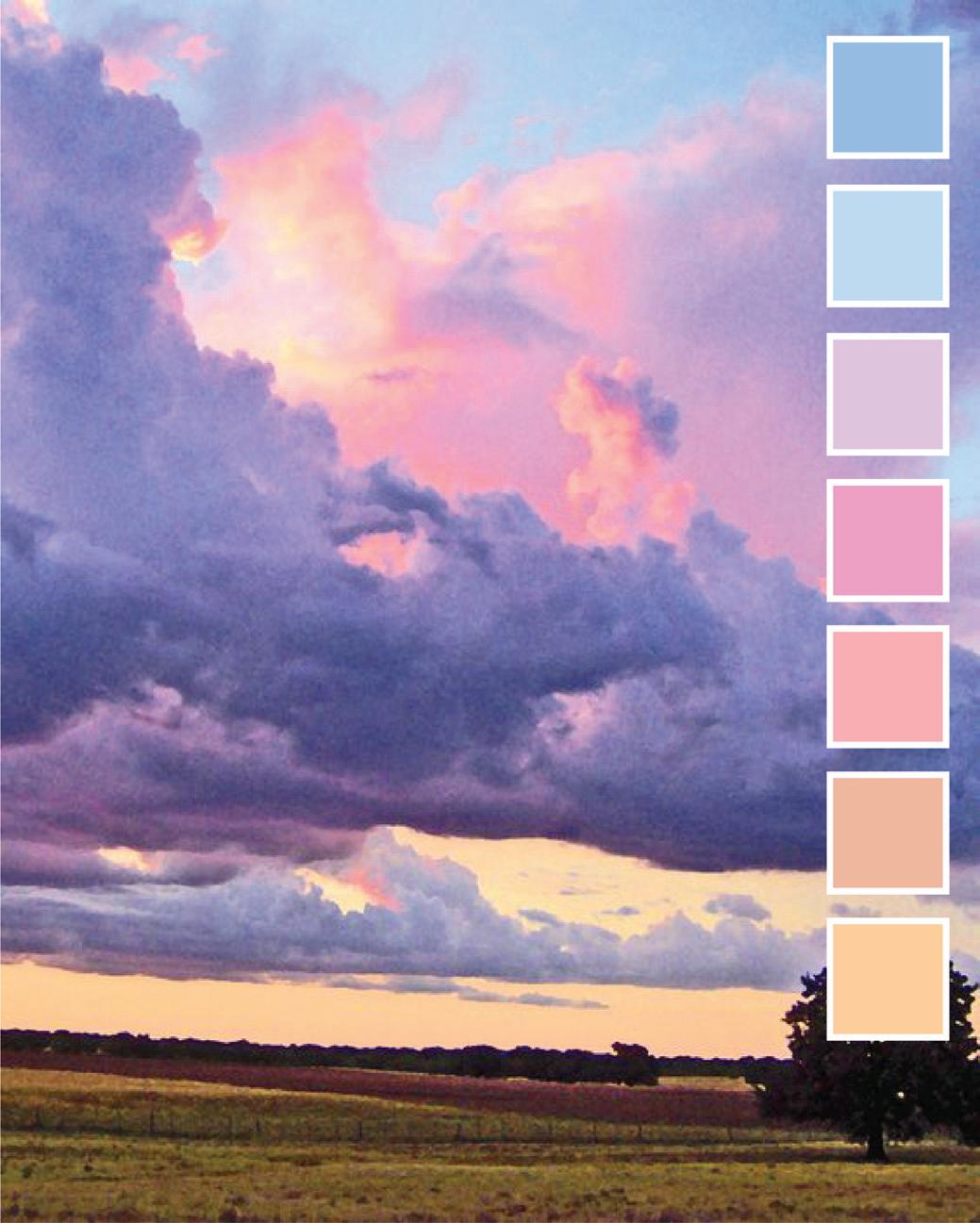
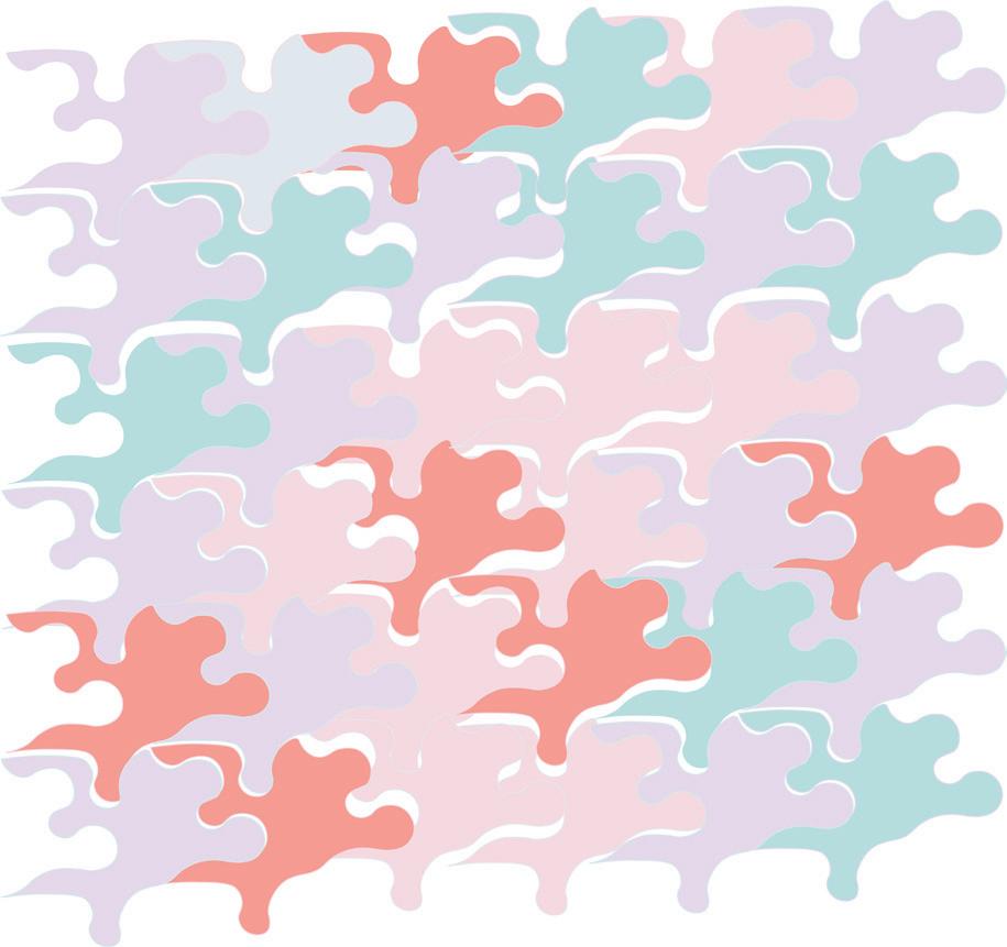
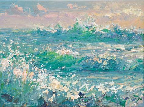
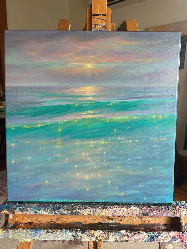
Taking it a step further, I experiemented with more variations using color. I established a color palette with the theme in mind of trying to replicate color elements of nature, like a sunset showing clouds and the ocean.
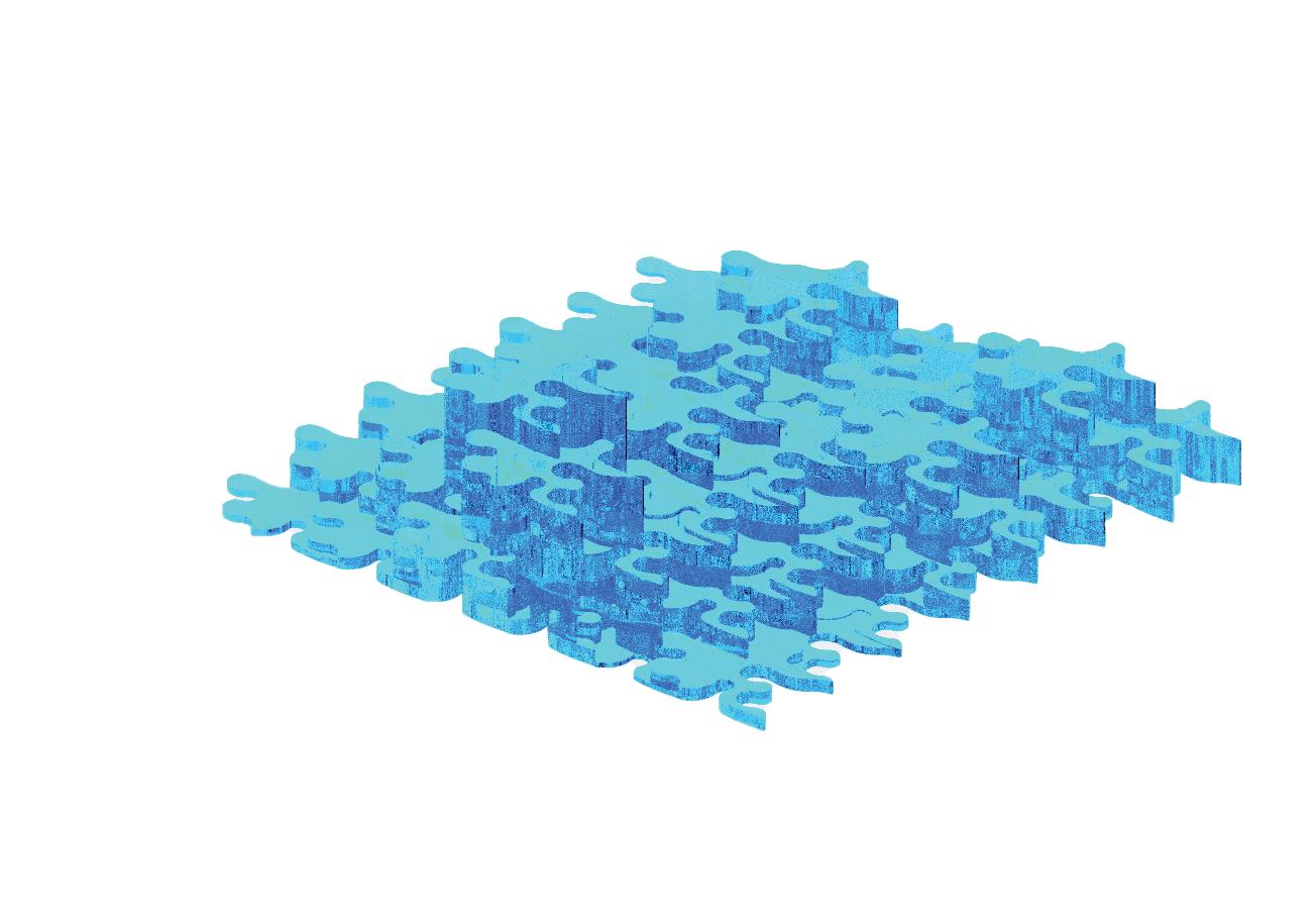
Lastly, I developed a 3D isometric model in Rhino using my pattern to best emulate the reflectivity and waves of the ocean by changing the material property to glass and adding gloss and shine effects when rendering.
4
01
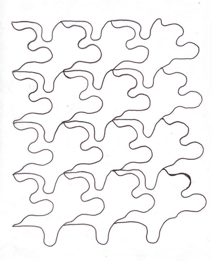
Grid Pattern Drawing
Grid Pattern Digital Drawing
5
Grid Pattern Black and White Digital Drawing

6
Grid Pattern Color Palette
Grid Pattern Colored Digital Drawing
Grid Pattern Monochrome Digital Drawing

7
Grid Pattern 3D Digital Rendering

Grid Pattern 3D Isometric Model
8


Experimenting with various arrangements of the same shape in repetition, I developed patterns using different color schemes to discover which allowed most for an oceanic effect.
Developing the idea further, I drafted a three-dimensional model and changed the material to glass to allow for more reflectivity and glow, emphasizing its watery appearance.
The design first originated using a single shape, which I designed primarily using curves with the intent to emulate a flowy and more abstract look meant to replicate water or clouds.
Grid
Pattern Concept Poster Board
Spatial Mapping
After developing and strengthening my basic knowledge in visual organization, I implemented those skills into this next project with the purpose of analyzing space and visually communicating my observations and findings.
Using UB’s South Campus as the site, I developed a base site map highlighting South Campus showing the walking paths, roads, buildings, and the overall background site context showing the major roads adjacent to the site and streets in the surrounding area.
When observing the contents of the site, I noticed how spread apart each building is from another and the abundance of open green space between pathways. I took note of my experience as a freshman first exploring the campus and trying to navigate my classes. I found it difficult to figure out where I was supposed to go for my classes since the pathways are more sporadic and curvilinear rather than a rectilinear grid pattern.
Taking that into consideration, I developed a diagram calling out the main buildings on campus containing courses and spaces most heavily utilized by Environmental Design and Architecture students.
10
02
11
Hayes Hall
Crosby Hall
Abbott Hall
Harriman Hall
UB South Campus Spatial Mapping
Observational Diagramming
In this project, we used diagrams as a means to record our observations. The goal was to strengthen and further develop skills in visual communication in our observations of our environment that are otherwise unseen or less effectively verbally communicated.
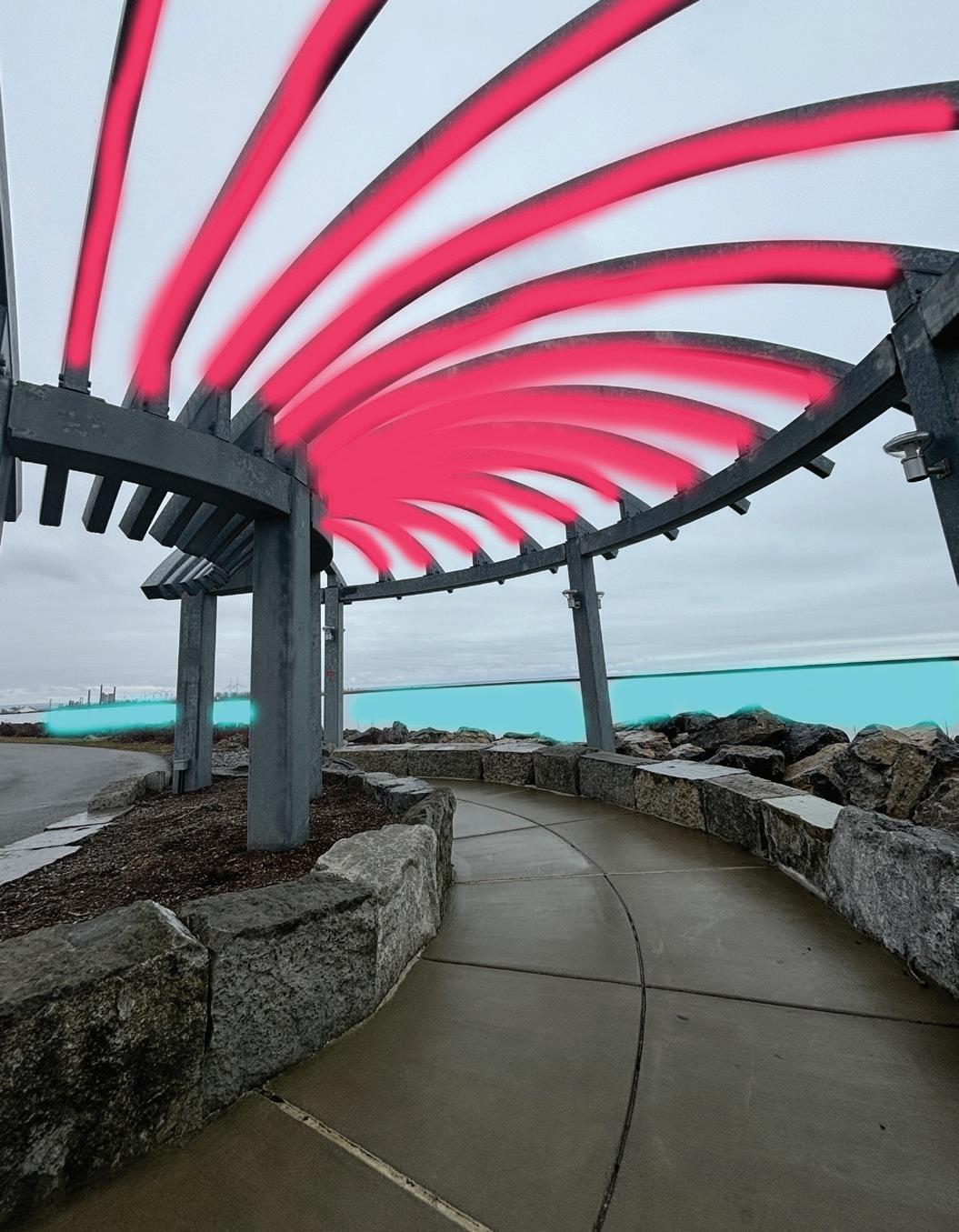
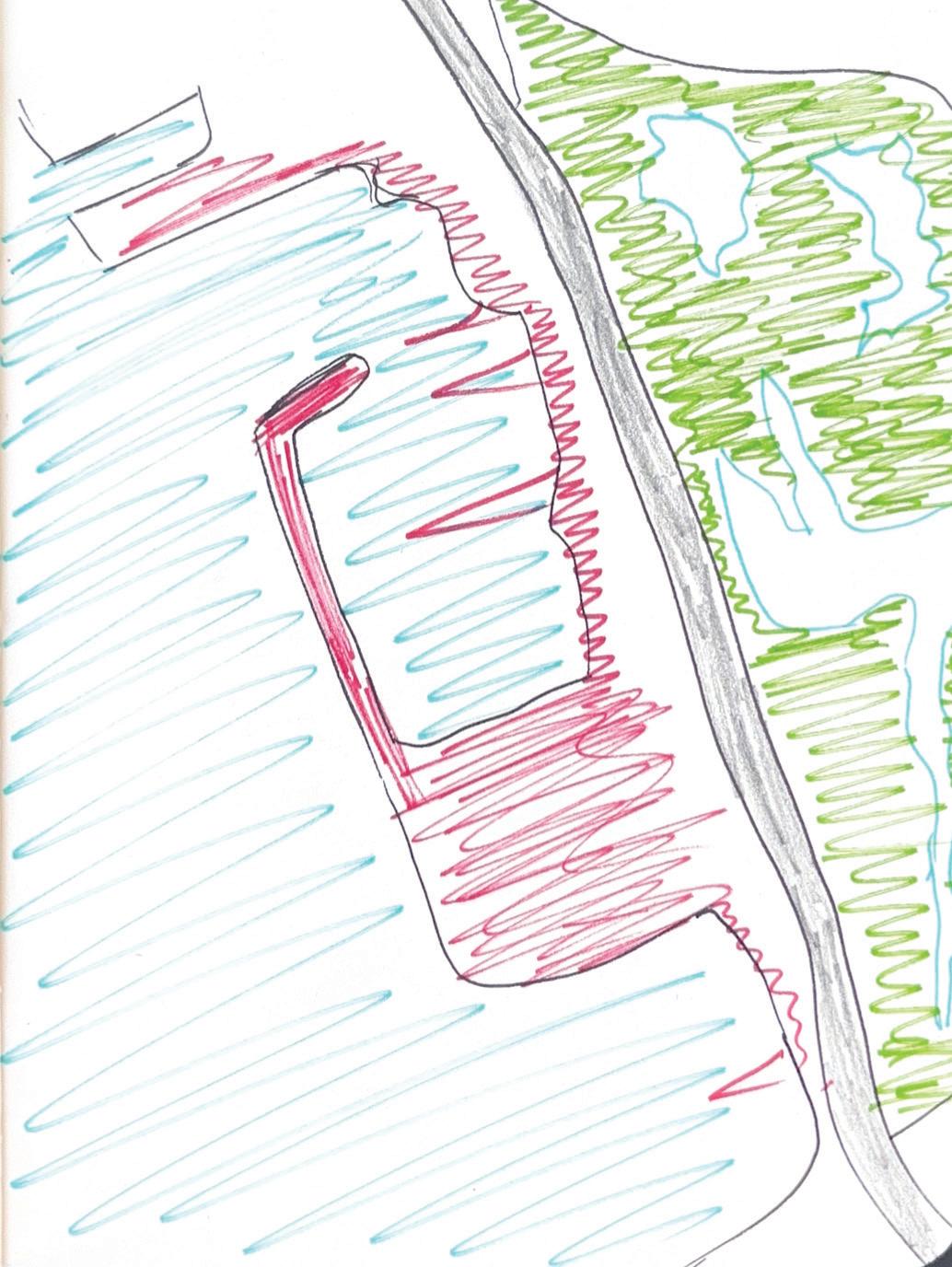
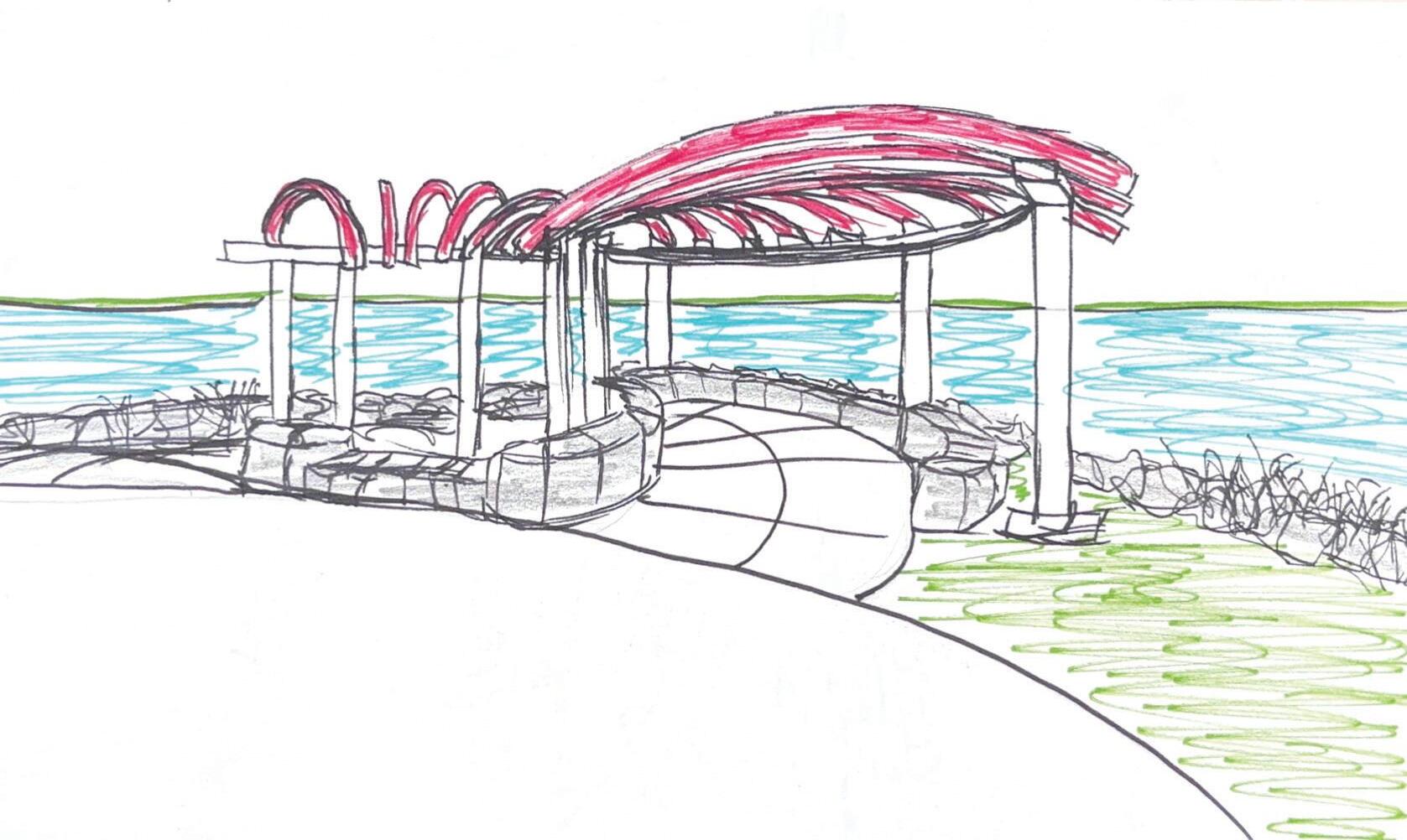
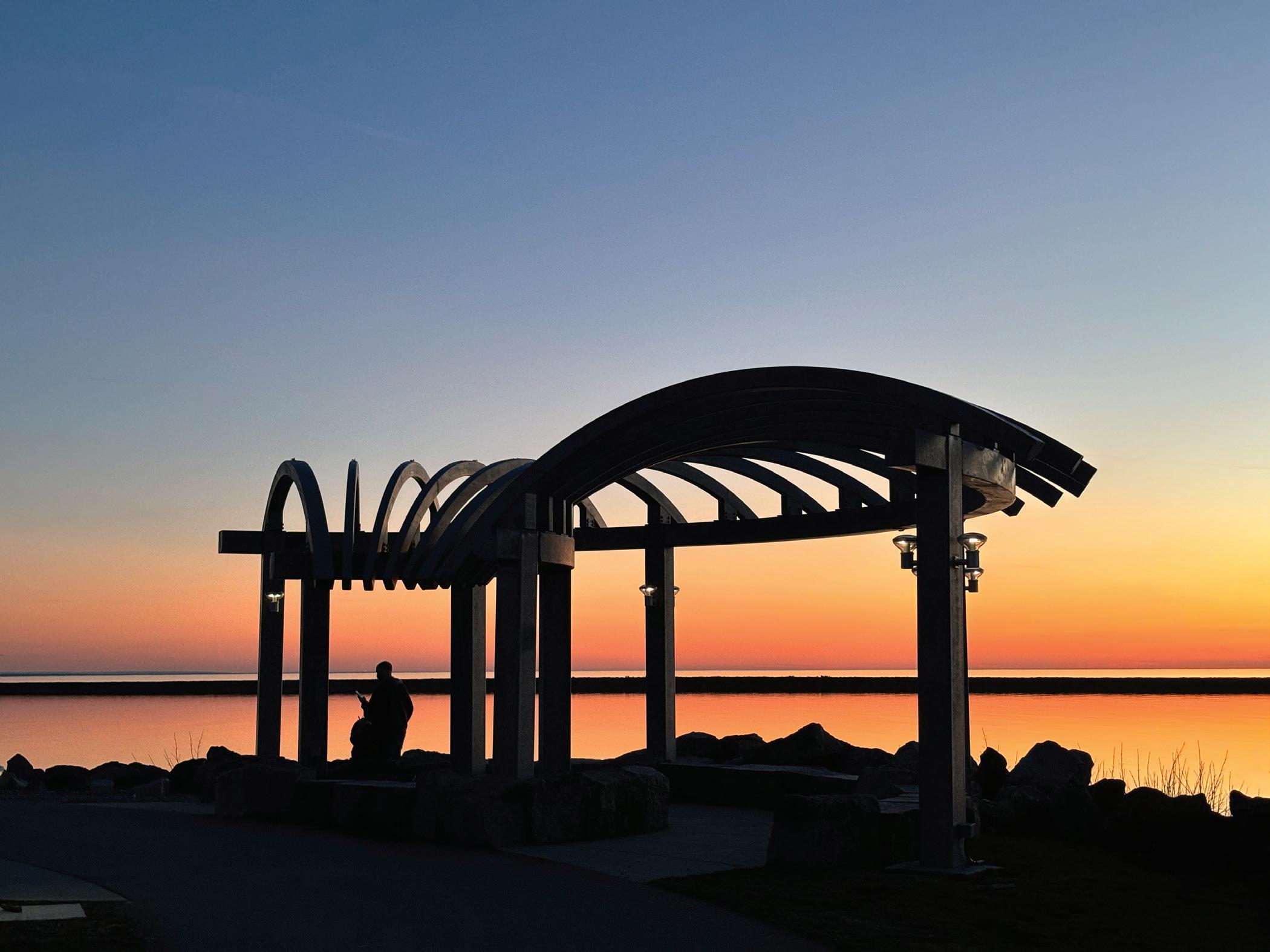
The premise of the observations was to discover what visual aspects stood out most to us when visiting the site. During my visit at Buffalo’s Outer Harbor, what stood out to me immediately were the pavilions on the walking paths. I noticed the people at the site were mostly concentrated at these pavilions, overlooking the view of the lake. They seemed to be the most prominent feature of the site in terms of areas where people gathered.
After noticing the high levels of pedestrian activity at these spots, I took photographs and drew sketches conveying to me what stood out to me most about these pavilions and the site. When walking through them, I found that the long curved features on top captured my attention the most as they were aesthetically pleasing. Then, I drew a general base site-plan sketch showing an aeriel view of the site and used color to highlight its main features, with red showing the most heavily used areas by pedestrians whether that be walking, biking, or simply relaxing and overlooking the view of the lake.
The main concept behind my sketches and diagrams was to portray the viewsheds and visual significance of the site, as people primarily seem to use it as a means to have visual access to the waterfront.
12
03
13
Outer Harbor Pavilion Highlight Diagram
Outer Harbor Diagrammatic Sketch
Outer Harbor Pavilion Area Diagram
Infographics
In this project, we developed infographics as a means to effectively visually portray data and information in a meaningful and aesthetically pleasing manner. Visualizing data allows for us to enhance the display of our information by adding value and for it to be more interactive and immersive for the viewer. This not only makes it a more enjoyable experience for the viewer, but it also allows them to absorb the information more readily and effectively, which benefits us as the designer by allowing our information to be easily perceived.

Buffalo Outer Harbor
Averagelevelsofactivitythroughout the week
Outer Harbor Activity Levels Infographic
14
10 am 6 am 7 am 8 am 11 am 9 am 12 pm 1 pm 2 pm 3 pm 4 pm 5 pm 6 pm 7 pm 8 pm 9 pm 10 am- u sually as busy as it gets Monday Tuesday Wednesday Thursday Friday Saturday Sunday 40 people 30 people 20 people 10 people Sundays- Typically slowest
Diana Pugliese
Buffalo Outer Harbor
SpatialBreakdownandActivities

This infographic shows the various activities and purposes of the site users utilizing the space on Buffalo’s Outer Harbor. Through the use of 3D renderings of models representing my statistics of the spatial breakdown of the site, I developed 3D icons corresponding to each activity to allow the viewer to better comprehend the uses of the site. Each spatial breakdown was accompanied with brief text to aid in giving context to each site usage.
This infographic represents the male and female demographics of the users within my site municipality. It is almost split right in the middle. This visual complements the above infographic, using a 3D model to represent my statistical data as a means to allow to viewer to absorb the information in a way that is enjoyable and visually appealing. It also makes use of concise and brief text to maintain simplicity and allow the rendering to dominate the visual.

15 04
Tift Nature Preserve Walking and Biking Trails MiscellaneousConcerts, Farmer’s market Playgrounds Wind Turbine Farm Boat Launches Canoeing Kayaking Paddle boarding Windsurfing Pergolas and Pavillions for scenic viewing overlooking the harbor Outdoor Seating Areas Restaurant Picnic tables and outdoor dining Community spaces for gathering Boat Docks Diana Pugliese Female Male 50.9 % 49.1 % 1,288 1,333 Census
Total Population : 2,621 people Diana Pugliese
Tract 1.10; Erie County, New York
Outer Harbor Male/Female Demographic Chart
Outer Harbor Spatial Chart
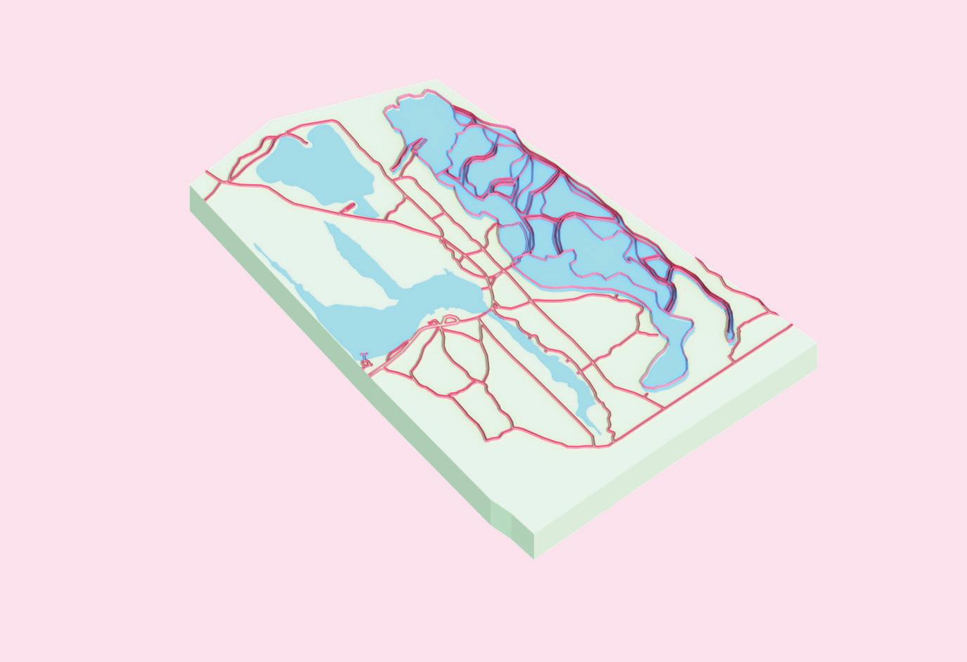
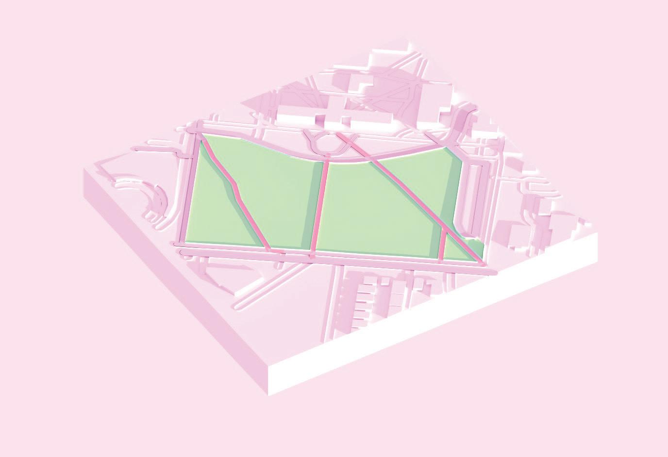
Site Mapping
In this project we used our chosen site as a base for developing digitally produced mappings.
My concept for this project was to develop a map in a way that was simple, yet visually appealing. For the aeriel-view site-plan digital drawing, I found that using a mocochromatic color palette personally allowed me to process the site information more cohesively.
For the 3D isometric mapping of the site, I decided to use colors replicating the natural landscape the distinguish these features from the aeriel map and make them more legible, with exception to the walking paths which were highlighted in pink.
16
05
Outer Harbor Site Map
17
Outer Harbor 3D Isometric Model
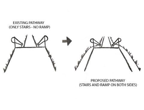
Green Space Redesign
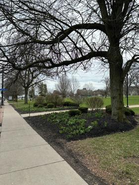
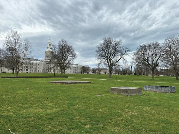
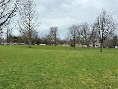
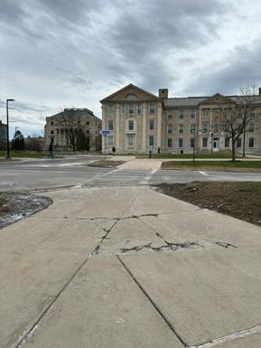
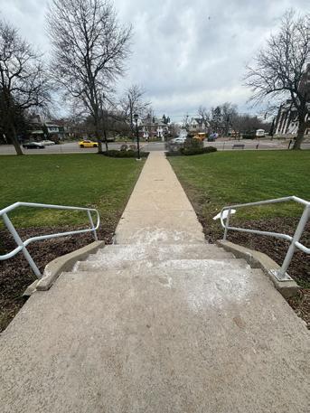
This project proposes a redesign of the open green space on UB’s South campus between Hayes Hall and Main St.
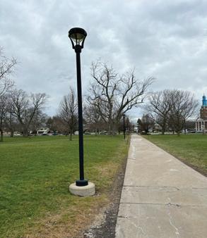
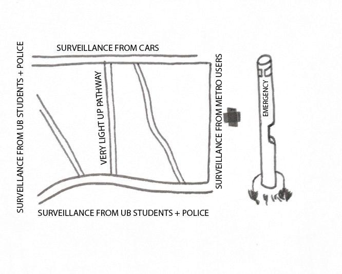
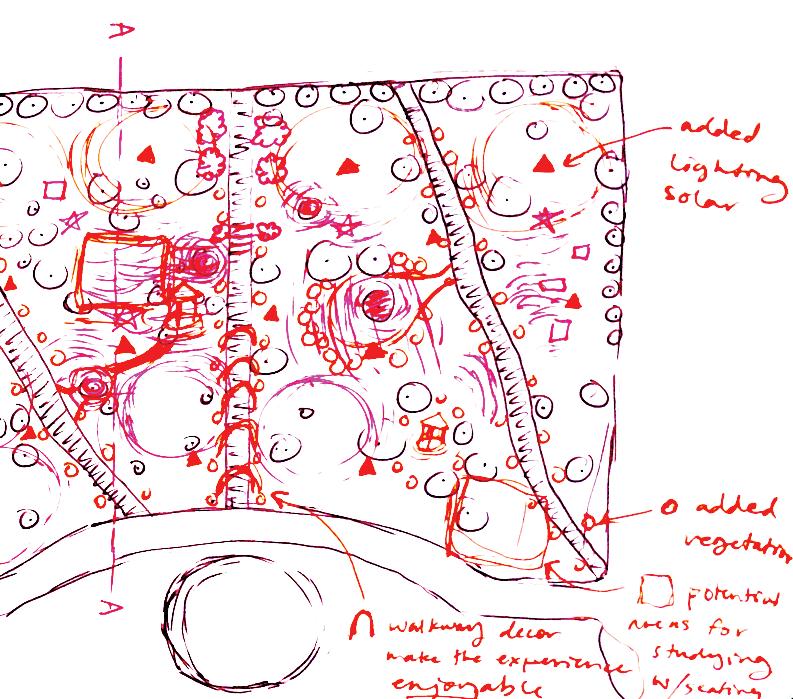
Beginning with a site analysis, we observed the site by analyzing its current key issues. We determined its primary issue was the overall lack of accessibility and usage. With this in mind, we wanted to better understand why this may be and documented various aspects of the site, such as lack of lighting, lack of seating, limited walking paths, lack of occupiable spaces, and lack of maintenance and visual appeal.
We determined that the site was not being used to its full potential and could beneift from a number of design improvements. By analyzing its flaws, we developed concceptual diagrams and sketches showing design solutions and means for implementing them. The primary concern was, how do we get students to occupy and utilize the space other than simply using it as an area for passing thrrough to get to class?
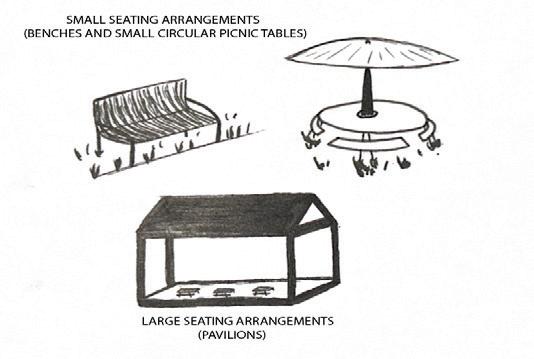
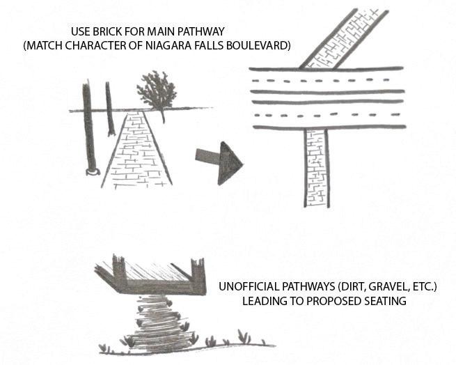
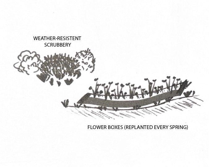
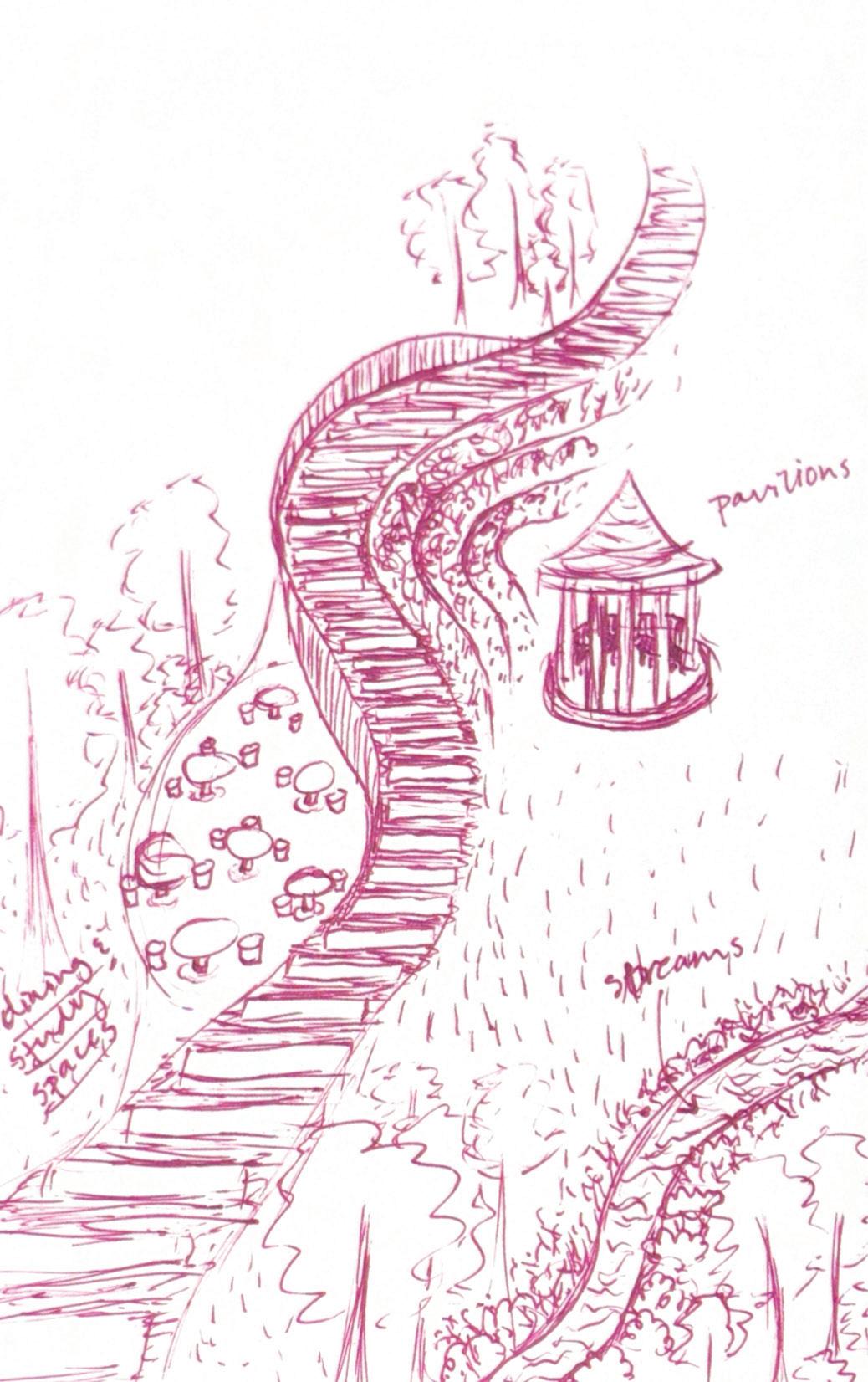
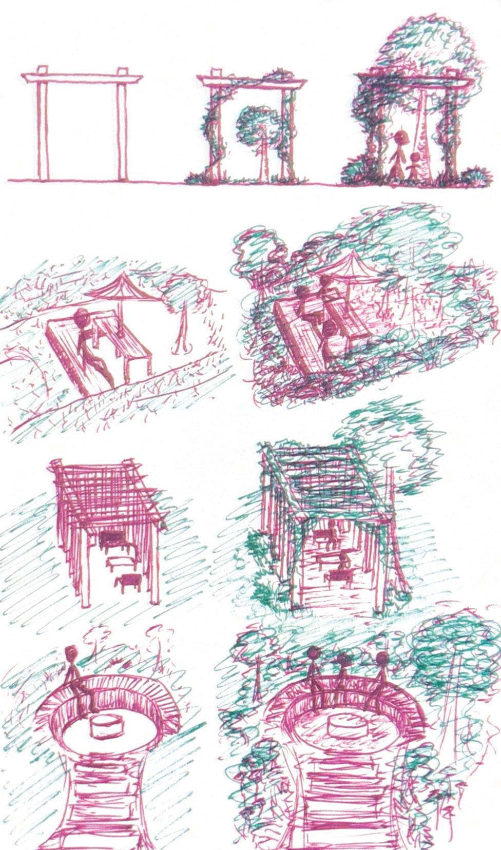
We used conceptual sketches and diagrams to convey our proposed seating areas, spaces for gathering, study spaces, and spaces with a wide variety of uses ranging from leisure to physical activity, like shaded areas underneath trees for students to relax and picnic or sit in the grass with friends, or sports and areas for organizations to host events as well as contribute with maintenance of the site features.
The goal is to integrate nature as a means to promote gathering and attract users to occupy the space. From a psychoogy and biological perspective, humans are innately drawn to nature. We want to be surrounded by nature as it has proven to have immensely positive effects on our mental and physical health. The nature itself serve as a space for students to gravitate to the space and use it for different purposes, whether that be meditation, sunbathing, relaxing in the shade, or walking and biking through the nature paths.
18
06
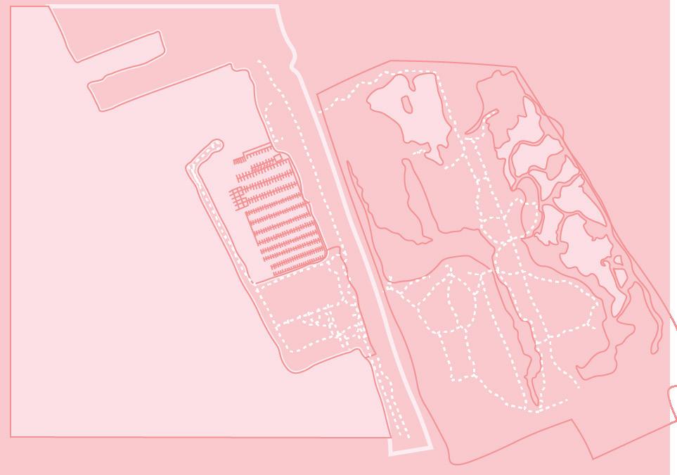
Phase 2 - Site Analysis
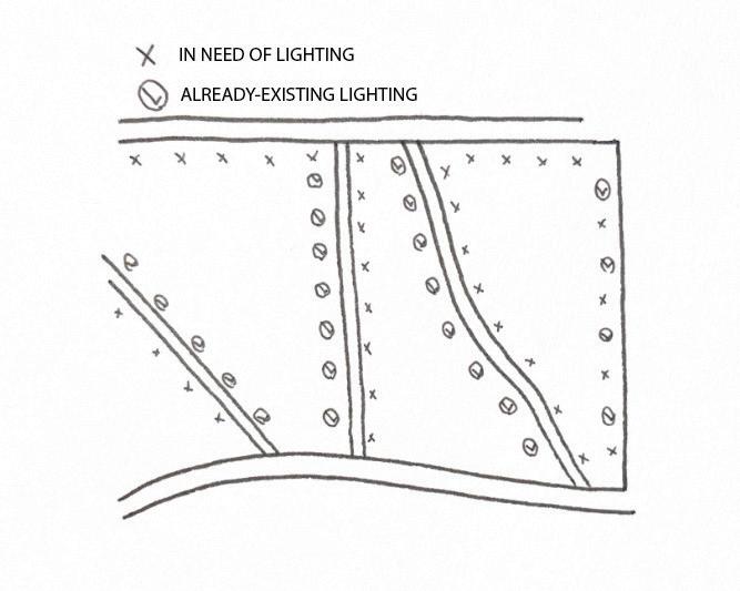
The core issues we identified from the site were lackofusage,lackofaccess,lackofadequatelighintg,lackofpropermaintenance,andoveralllackofvisualappeal. These key factors have a general negative impact on the usability of the site. People are less inclined to use a space when there are few means to access it or little means of utilizing the space for various purposes. Without access to seatingoptions,communalspaces, or different means of social activity like sports, leisure,dining,biking,walking, etc, the space will remain unoccupied without serving a greater purpose other than taking up a large portion of campus-property. Also, without the implementation of adequatelighting,propermaintenance,orvegetation , people will be even less inclined to utilize the space because it doesn’t feel safe especially during darker hours and it lacks visual appeal. Kevin Lynch’s Image of the City demonstrates key fundamentals that contribute to the overall success of a communal space which include a cohesive network of nodes,paths,districts,landmarks,andjunctions.Implementing these fundamentals into the redesign of the site can greatly improve siteusabilityand attract students to gather and promote socialengagement.
UB South Campus Green Space Site Analysis Visual
19 LANDMARKS HEAVILY USED PATHWAYS
Diana Pugliese and Alyssa Iacovitti
Case Study 1 - UCLA
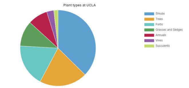
UCLA currently has over 160 native plants scattered around their campus. annuals and four vines.
Usability
Rather than confronting the issue of individuals not occupying a space, it confronts the issue of the space itself being occupied by in-
Connection
30,000-35,000).
while Los Angeles’ main concern is extremely high temperatures.
considerate to the natural environment
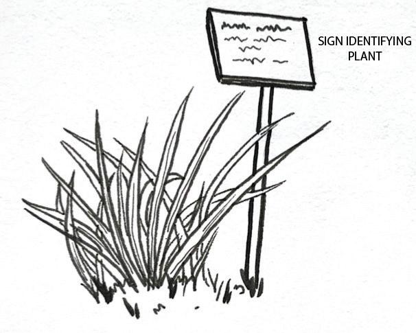
“UCLA is saving about 5 millionplacing past grass and turf areas with native plants”
“As of 2022, UCLA is home to 10 times more native plants than non-native plants”
with over 70% of the species being native species”
Sustainability
Sustainability is the main priority for UCLA regarding both ser ving natural environments and resource-use down. In fa the two core reasons for these changes occurring on campu
-
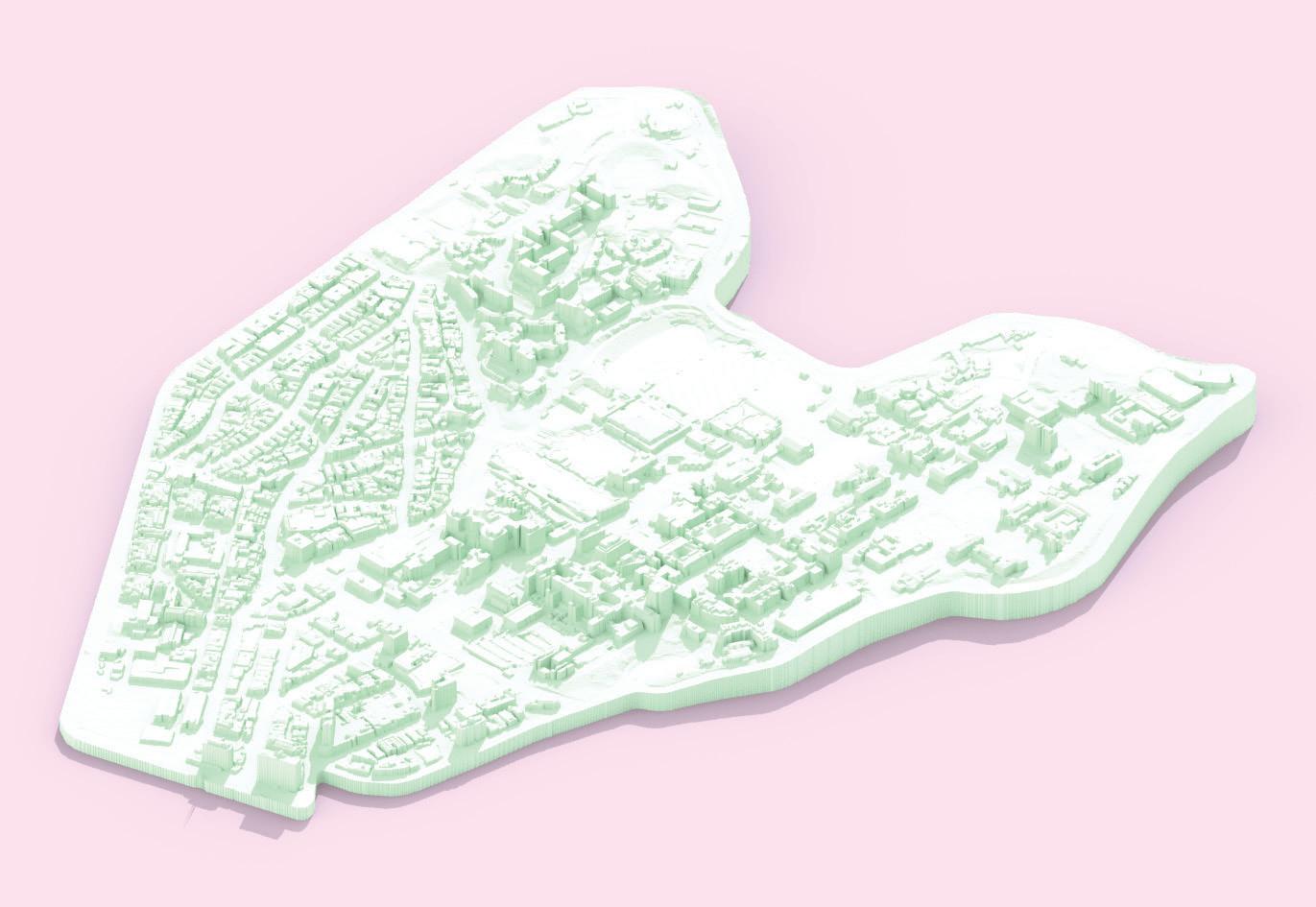
UCLA Site Axonometric Diana Pugliese
Sketch drawn by Alyssa
Case Study 1 Visual
Infographic from UCLA website Diana and Alyssa
Case Study 2The Design of 6 Feet Under
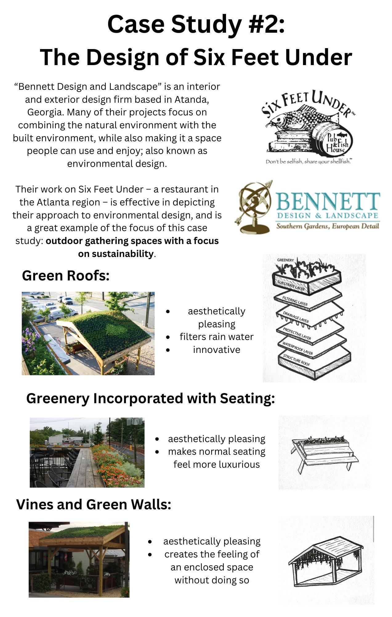
to environmental design, and is a great example of the focus of this case study : outdoor gathering spaces with a focus on sustainability
“Bennett Design and Landscape” is an interior and extheir projects focus on combining the natural environment with the built environment, while also making it a space people can use and enjoy ; also known as environmental design.
Green Roofs
aesthetically pleasing innovative
Greenery Incorporated with Seating
aesthetically pleasing makes conventional seating feel luxur y
Vines and Green Walls
aesthetically pleasing embodies the feeling of an enclosed space
21
-
Diana and Alyssa
Case Study 2 Visual
Sketches drawn by Alyssa Photos extracted from Bennet Design and Landscape and Six Feet Under websites
Case Study 3- TifftNatu
nature preserve
programs to learn about the natural characteristic of the preser ve (such as the geolog y and local biotic ecosystem)
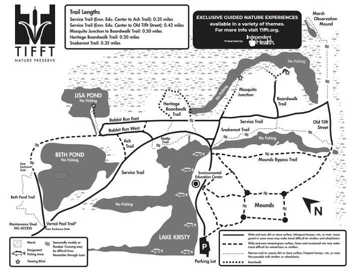
What makes these place-makingunsuccessful?
placemaking
abilities, but the limitations of users listed on their website can be seen as hindering this ability
- they don’t want users to jog or bike (seems to be both excessive and a waste of an opportunity to engage more users)
- the use of kites and motorized toys is not permitted (reduces the chances of children using the site)
- they don’t want dogs in the park (makes sense for ecologically sensitive areas, but probably doesn’t need to apply to the entire park)
Case Study 3 Visual
22
Ti Diana
Ti t Nature Preserve Site Map from Ti t website
urePreserve
successful?
tween prioritizing the needs of nature and prioritizing the needs of users
* From individual activities such as enjoying the trails or boardwalks on the site, to taking advantage of the opportunities provided by the parks (such as group activities related to learning about rocks, insects, and plants located on the site)
users through highlighting the preser ve ’ s current conditions, without having to disturb these conditions.
Nature Preserve Site Axonometric
23
-
t
Diana Pugliese
Sketch drawn by Alyssa Diana and Alyssa
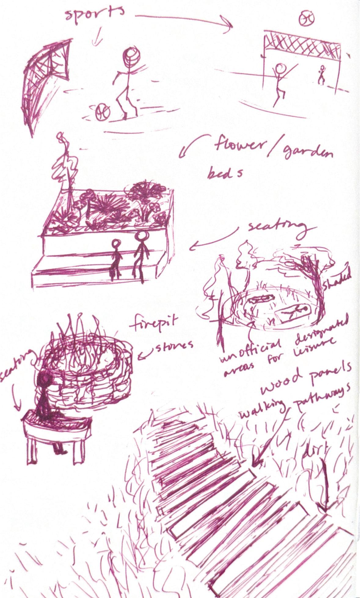
Site Spatial Use Proposal Sketch
Site Walking Paths Proposal Sketch
24
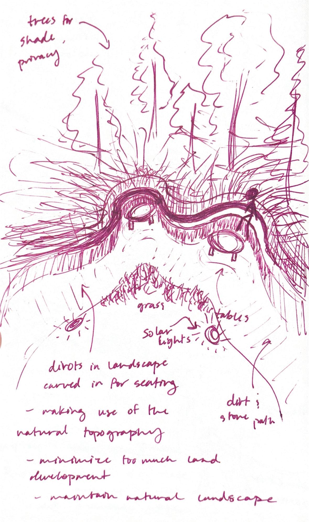
Site Seating Area Proposal Sketch
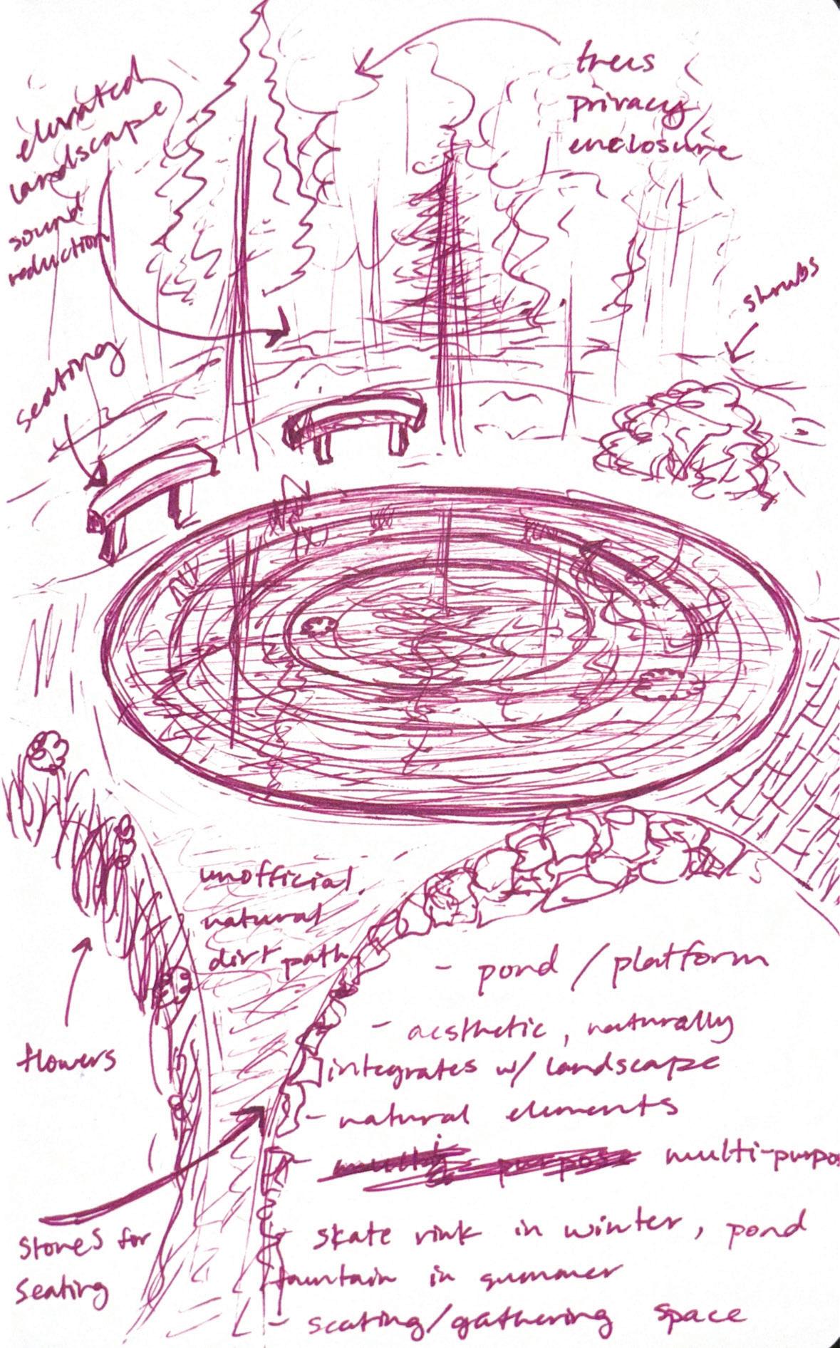
Site Recreational Use Proposal Sketch
25
Site Key Theme Proposal Notes
Site Map Diagram Proposal Sketch
26
27
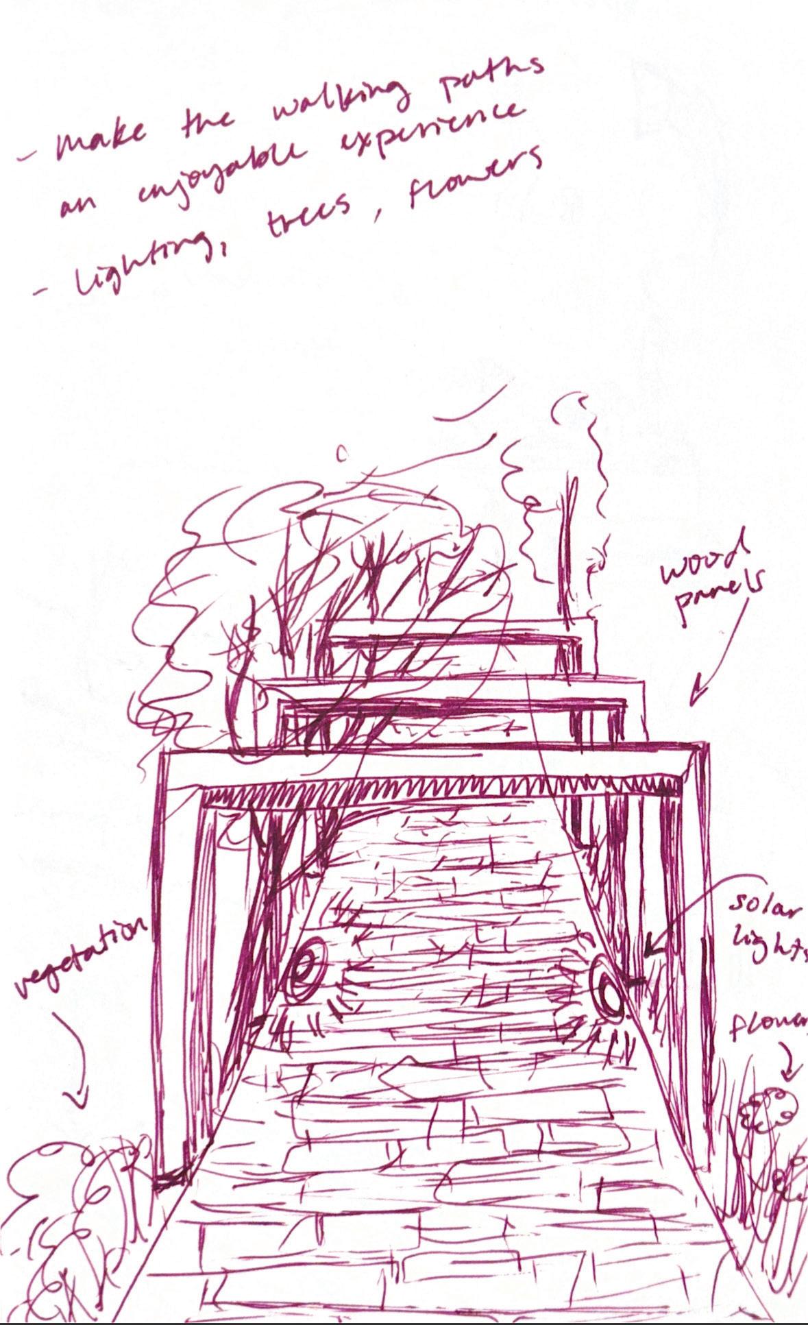
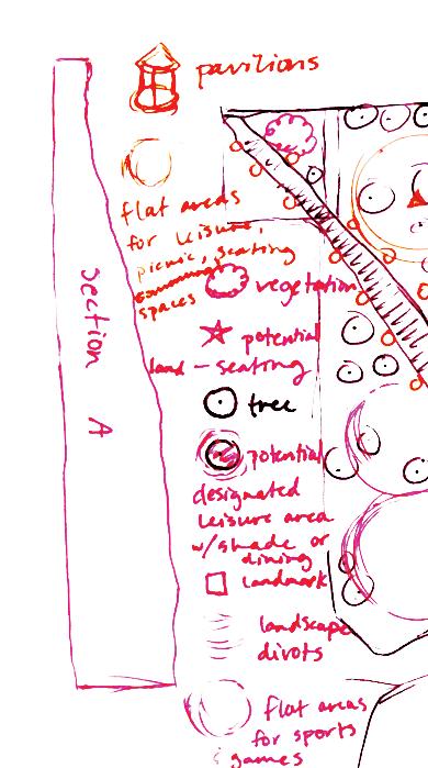
Site Area Proposal Sketch
28
Site Individual Elements Proposal Sketch
29
Green Space Site Callouts
Axonometric Diagrams
Each space is meant to be saturated with greenery and vegetation through a gradual progression over time as a means to enhance each gathering space. To promote site usage, the concept of integrating several categories of space such as leisure, physical activity, social engagement, dining, studying, and engaging with nature were introduced to attract a wide variety of different users to the site. In addition, integrating more sources for lighting allows the space to be able to be enjoyed for longer periods of time as well as promote a sense of safety.
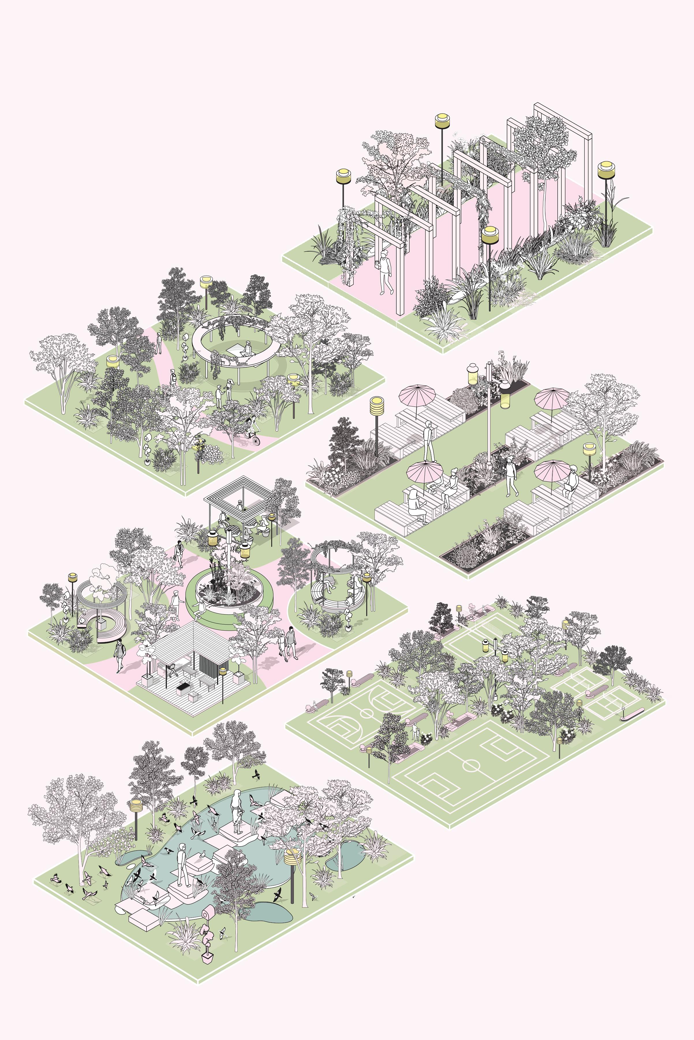
The concept of integrating nature over time allows for a more sustainable approach to maintnance as the vegetation and nature itself is meant to be self-staining and contribute to long-term results and visual appeal to the spaces. Rather than obstructing the aural landscape by imposing too many a lterations, it is important to prioritize and enhance the natural landscape and vegetation currently present on the site. Not only does it allow for flexibility for future changes as necessary, but it also akes the spaces more enjoyable for users as it enhances visual appeal and brings an added sense of vibrancy and life to each space.
30
Axonometric Diagram Callout Spaces Proposal Board
31
UB South Campus Green Space Site Plan
Green Space Implementation Over Time
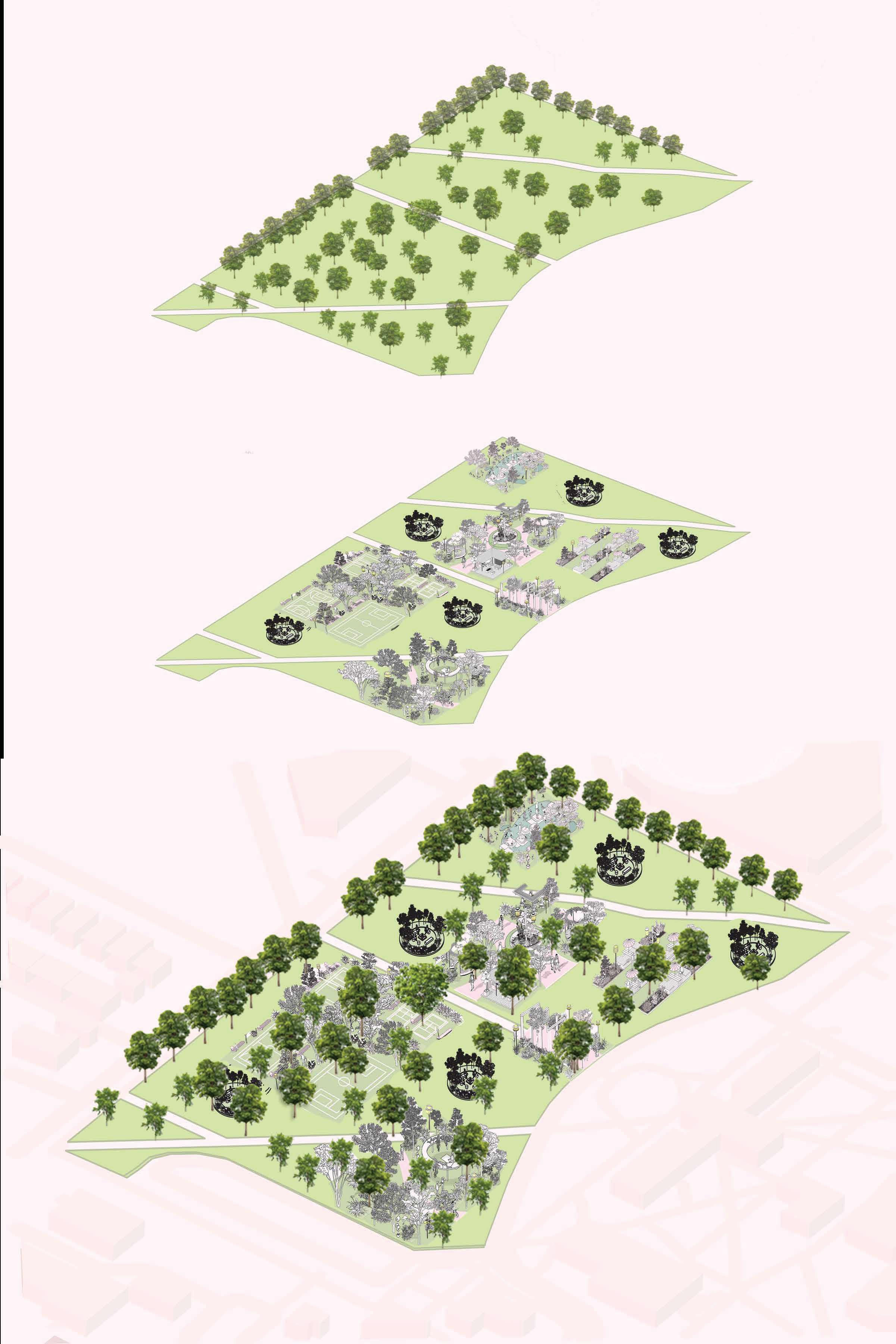
Existing Site Vegetation
Site Axonometric Diagram Proposal Board
32
Integration of addition Green Spaces for gathering
Full Site Progression with existing greenery and additional spaces
Green Space Redesign
Our green space redesign consists of the main purpose of integrating nature as a means to transform the site to a nature-preserve-esque space for students to gather.
By using native plants from the local area, the site vegetation can evolve through a gradual progression over time and be selfsustaining.
Not only do maintenance costs significantly decrease as a result of the sustainaibility of the vegetation, but the need to constantly mow the area is eliminated and promotes the health of the landscape without the persistent use of pesticides and chemicals being distributed throughout the site, further repelling students and fostering a poor relationship with the wildlife and native species on the site.
Local organizations have the opportunity to host events and establish community gardens that students can participate in, furthering strengthening a sense of community on-campus by giving students an outlet to cultivate positive relationships through benefitting the environment.
Integrating nature enhances the visual appeal of the site, attracts users to occupy the space, provides opportunities for students to gather and have an enjoyable experience during their daily commute to classes, and promotes a positive relationship with the environment in a way that is self-sustaining and long-lasting.
33
END
Diana Pugliese
360
