Landscape Architecture Portfolio

Diana Pugliese 2024

2
3 Contents Hiking Trail Guide Design 4 Spatial Diagramming/Mapping 8 Infographics 14 Site Mapping 16 Green Space Redesign 18 01 02 03 04 05 ArtPark Site Redesign 10 06

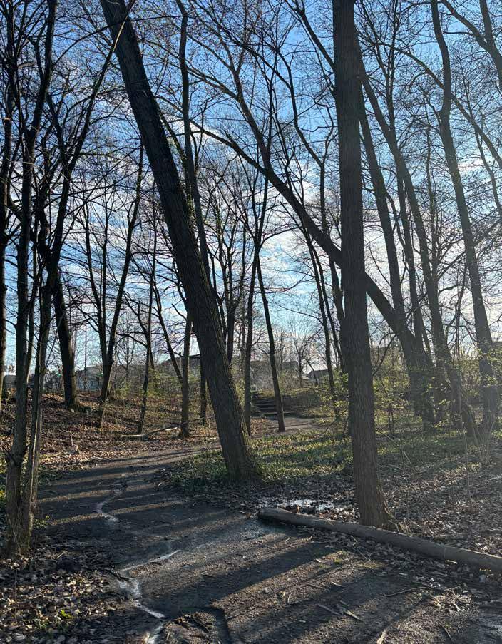
4 01
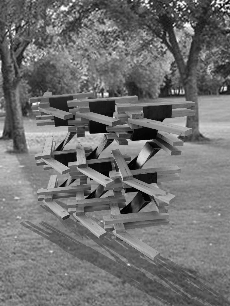
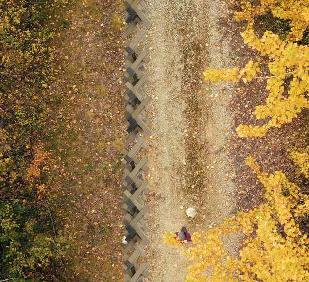
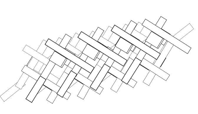
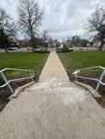
Hiking Trail Guide
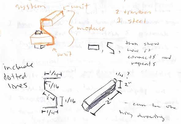
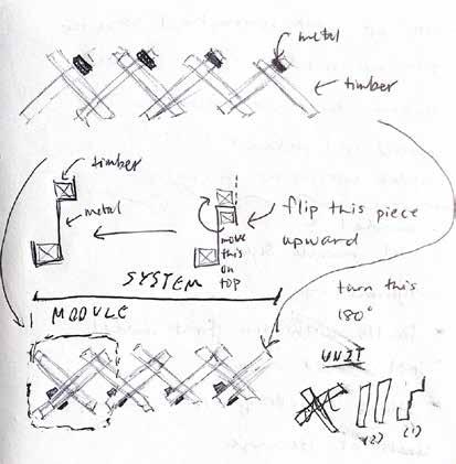
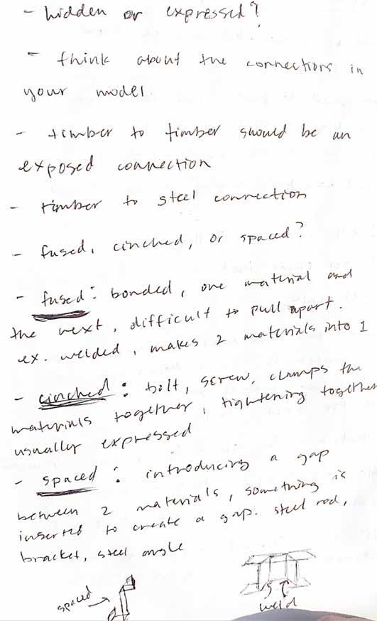
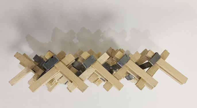
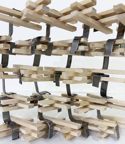
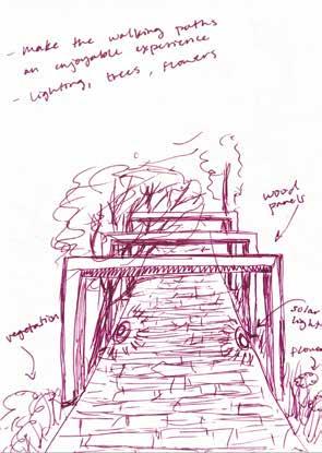
The purpose of this project was to develop a design that allowed for a more inclusive and accessible hiking trail in which the elderly could be assisted with guides throughout their hike.
We wanted to develop a rail-like structure that was easy for people to grasp onto and provide stability whilst also not obstructing the view of the surrounding nature. The design is inclusive for people of all heights with varying handles for people to grasp at different heights.
We also wanted to develop a design that allowed for easy integration into the natural landscape, allowing for infinite variations in direction as well as height to accommodate for curved paths and steep slopes.
We kept in mind that since this structure will be heavily touched by people, we designed it in a way that allowed for maximum comfort by using wood, smoothing it with a sander, and using a temperature resistant finish.
5
CONNECTION SKETCH 2
6
7
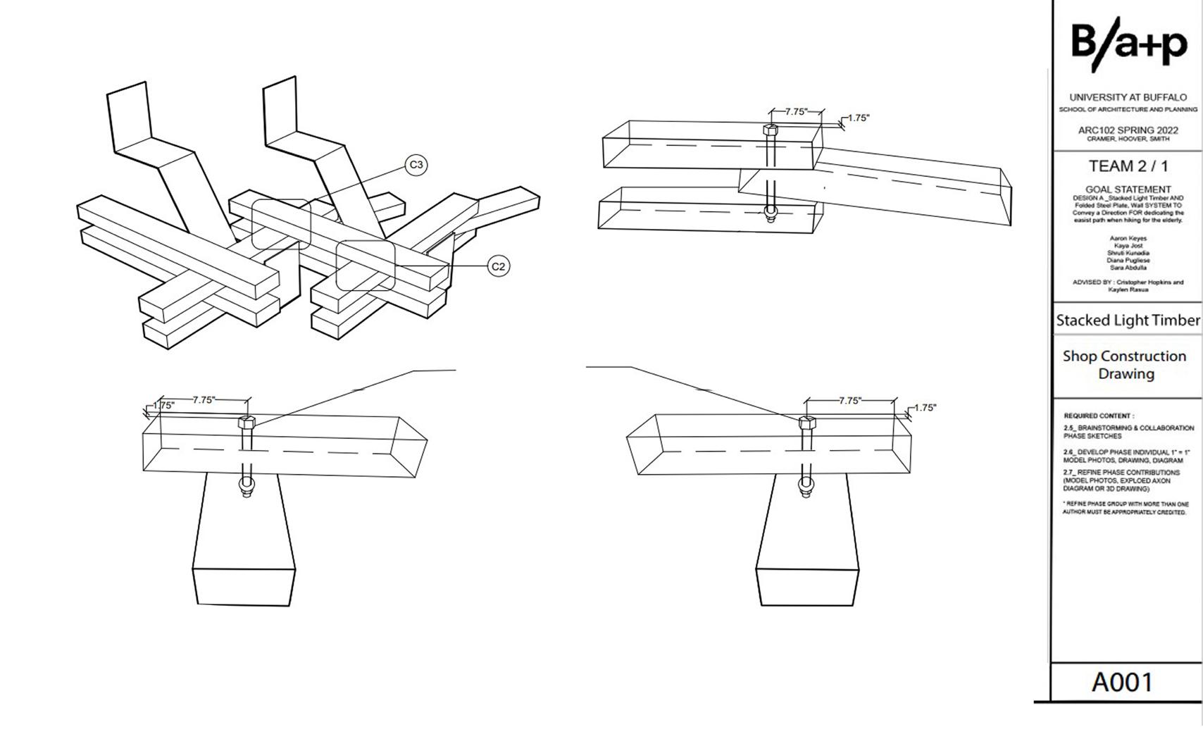
C3 Assembly Connection Detail
NTS- Not To Scale
8
Assembly Connection Detail
NTS- Not To Scale
Assembly Connection Detail
NTS- Not To Scale
Material
C1 C2
A003
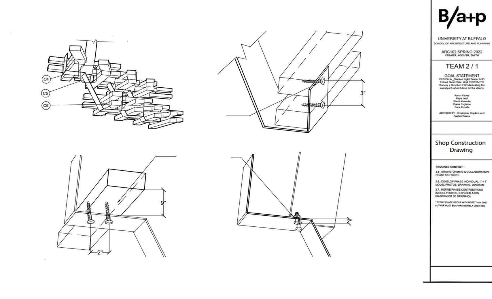
C4 Assembly Connection Detail
NTS- Not To Scale
10
1/2” PILOT HOLE
1/2” PILOT HOLE
C6
1/2” THREADED 9”
Assembly Connection Detail
NTS- Not To Scale
Assembly Connection Detail
NTS- Not To Scale
HOLE
1/2” LUG SCREW
ROD
A004
1/2” BOLT
C5
Modluar
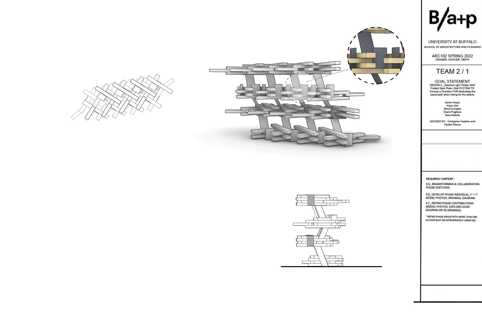

used.
Model Rendering
SCALE : 1” = 1’
14
15
16
17
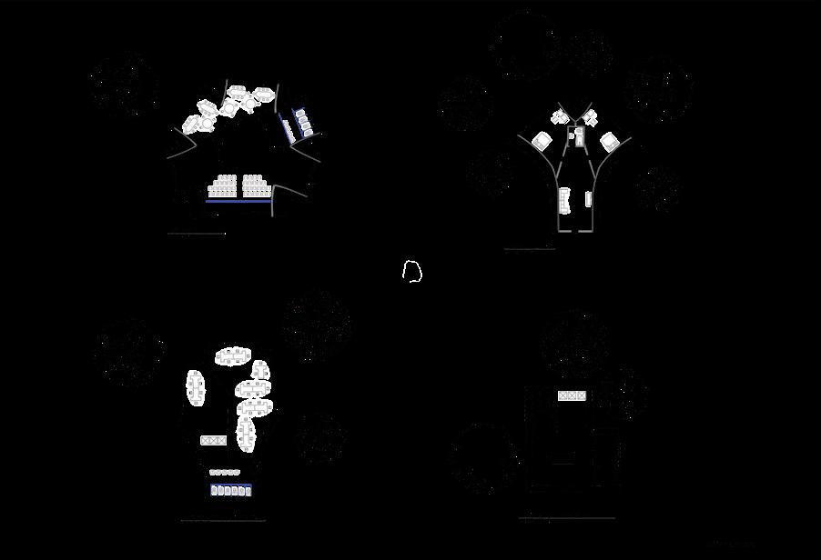
ArtPark Site Redesign
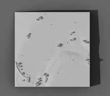
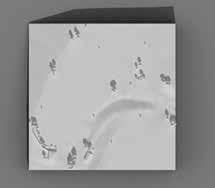
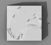
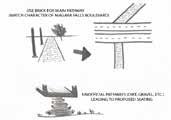
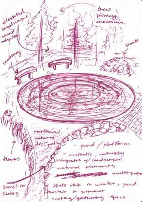
This project explores a more sustainable redesign of a site within ArtPark in Buffalo. Overall, the goal was to better understand the site conditions and develop a design that navigated the current contamination issues within the site. Also, the goal was to develop a design that enhanced the natural landscape rather than creating excessive development that altered its natural beauty.
The site is very hilly with a lot of non-flat topographic elements throughout. I wanted to take advantage of this rather than flattening the area for development. During my site visits, my favorite part about walking through the site were the views from the top of these hills of the nature and wooded areas in the distance below.
I wanted to redesign the site in a way that incorporated more pathways to maximize these pleasant views for people to enjoy, as there was a lack of pathways and I found myself creating my own paths naturally through the tall grass to explore the other vegetation currently on the site. I also wanted these views to be visible from the proposed building designs so that the users can enjoy the view not only on their walking paths but also from within the building.
The primary goal was a redesign that allowed for the users to have a pleasant and enjoyable visual experience throughout their entire stay.
18
02

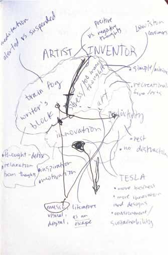
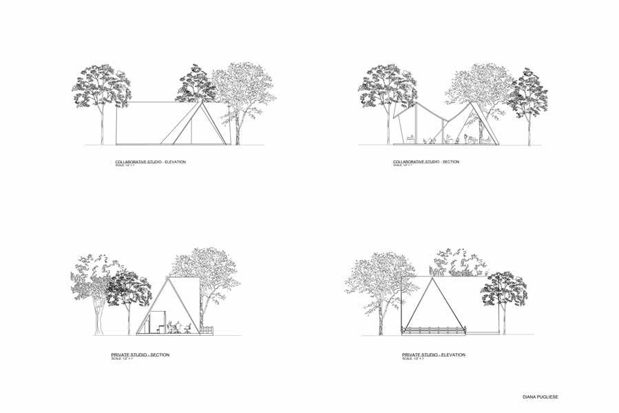
Rest Stop for All
This “Rest Stop for All,” project promotes a more reflective thinking about a broader way of considering the notion of inclusivity. This project encouraged critical analysis behind what exactly rest is, who is it for, and in what circumstances. In the context of my design, rest is meant to be explored primarly within our thouhgts. A commono struggle for artists and creative thinkers is brain fog, writer’s block, artist’s block, and lack of motivation when one is struggling creatively. This project explored rest as a shift or reset in creative mindset or creative energy.
19
Site Material Decomposition Sketch
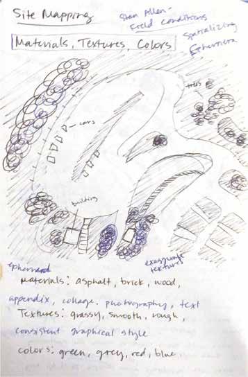
Site Mapping Concept Sketch
20
21
Site
Site Elements Sketch
Redesign Concept Sketch
SITE AXONOMETRIC
SITE PLAN
SCALE: 1/16" = 1'
22
A A B B
DIANA PUGLIESE
DIANA PUGLIESE
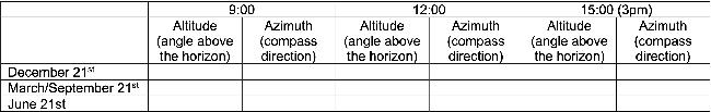

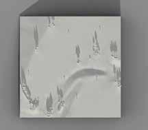

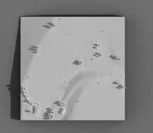
ARTPARK SITE B SHADOW DIAGRAM SCALE - NTS

23 9.92 DECEMBER 21 JUNE 21 MARCH/SEPTEMBER 21 9AM 12PM
17.68 34.10 135.72 106.81 88.63 23.35 43.37 64.55 176.42 150.73 135.55 13.35 42.14 61.19 218.57 213.53 235.00
3PM
PLAN


STORMWATER DIAGRAM
SITE AREA SUITABLE FOR CONSTRUCTION
24
SITE
SITE


25
AREA SUITABLE FOR CONSTRUCTION
SUITABILITY DIAGRAM STORMWATER DIAGRAM
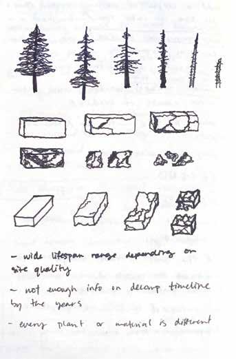
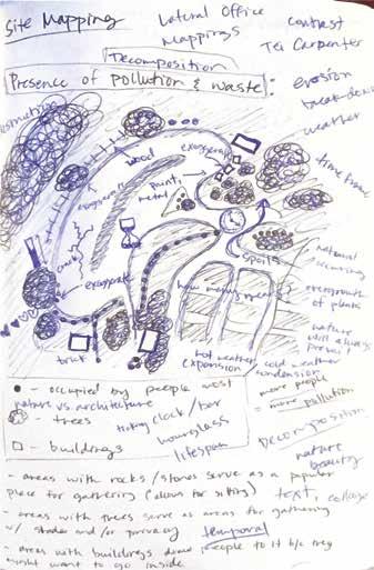
For this site, I researched decomposition processes for various materials because I wanted to implement my design in a way that was sustainable and allowed for the most seamless blend into the landscape as possible. During my site visit, I recorded which materials were currently present on-site and the stage of decomposition it was in to better understand how these materials responded to its surrounding environment on the site. I came to find that most materials were already maturely decomposing, which led me to believe the site lacks consistent maintenance.
26 sunlight insects ice water plants humans paint Areas
with Mature Decomposition metal wood brick asphalt
On-Site
Site Decomposition Analysis Diagram
Path Connection Network Diagram
This diagram represents the spatial network and pathways between various proposed elements on the site. Taking the natural landscape features into consideration, I wanted to prevent as much man-made development as possible in order to maintain the natural landscape. Taking this into consideration, I developed pathways between the proposed elements in a way that allowed for easier access without obstructing the current landscape. Viewsheds were also something I considered important when developing these pathways because I wanted to allow for an enoyable experience for the users experiencing the nature on the site as they walk from place to place.
27 workshops/studios mindfulness paths meditation central hall exhibitions reading residence dining restrooms performance private studio 9 5-7 4/5 3 TC: 9 Visual: 6 Physical: 3 TC: 3 Visual: 2 Physical: 1 TC: 5 Visual: 3 Physical: 2 TC: 6 Visual: 5 Physical: 1 TC: 7 Visual: 6 Physical: 1 TC: 6 Visual: 4 Physical: 2 TC: 4 Visual: 2 Physical: 2 TC: 3 Visual: 2 Physical: 1 TC: 5 Visual: 4 Physical: 1 TC: 5 Visual: 4 Physical: 1 TC: 5 Visual: 4 Physical: 1 TC: 6 Visual: 5 Physical: 1 TC: 7 Visual: 5 Physical: 2 TC: 4 Visual: 3 Physical: 1 TC: 3 Visual: 3 Physical: 0 TC: 1 Visual: 1 Physical: 0 TC: 1 Visual: 1 Physical: 0 TC: 2 Visual: 2 Physical: 0 Visual Connections Physical Connections 5-7 4-6 1-3 TC: 5 Visual: 4 Physical: 1
Building

28
SITE SECTION A SCALE: 1/16” = 1’
SITE SECTION B SCALE: 1/16” = 1’
DIANA
PUGLIESE

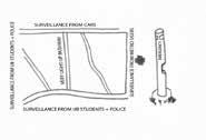
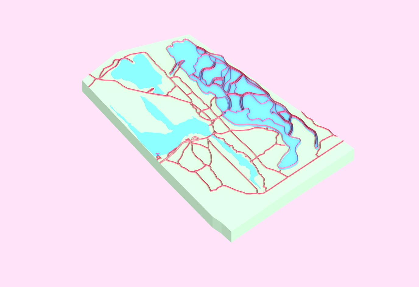
Spatial Mapping
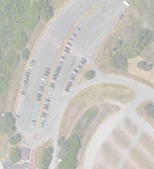
Using UB’s South Campus as the site, I developed a base site map highlighting South Campus showing the walking paths, roads, buildings, and the overall background site context showing the major roads adjacent to the site and streets in the surrounding area. When observing the contents of the site, I noticed how spread apart each building is from another and the abundance of open green space between pathways. I took note of my experience as a freshman first exploring the campus and trying to navigate my classes. I found it difficult to figure out where I was supposed to go for my classes since the pathways are more sporadic and curvilinear rather than a rectilinear grid pattern. Taking that into consideration, I developed a diagram calling out the main buildings on campus containing courses and spaces most heavily utilized by Environmental Design and Architecture students.
30
03
Hayes Hall
Crosby Hall
Abbott Hall
Harriman Hall
UB South Campus Spatial Mapping
Infographics
In this project, we developed infographics as a means to effectively visually portray data and information in a meaningful and aesthetically pleasing manner. Visualizing data allows for us to enhance the display of our information by adding value and for it to be more interactive and immersive for the viewer. This not only makes it a more enjoyable experience for the viewer, but it also allows them to absorb the information more readily and effectively, which benefits us as the designer by allowing our information to be easily perceived.
Buffalo Outer Harbor
Averagelevelsofactivitythroughout the week
Outer Harbor Activity Levels Infographic
31
10 am 6 am 7 am 8 am 11 am 9 am 12 pm 1 pm 2 pm 3 pm 4 pm 5 pm 6 pm 7 pm 8 pm 9 pm 10 am- u sually as busy as it gets Monday Tuesday Wednesday Thursday Friday Saturday Sunday 40 people 30 people 20 people 10 people Sundays- Typically slowest
Diana Pugliese
04
Buffalo Outer Harbor
SpatialBreakdownandActivities

This infographic shows the various activities and purposes of the site users utilizing the space on Buffalo’s Outer Harbor. Through the use of 3D renderings of models representing my statistics of the spatial breakdown of the site, I developed 3D icons corresponding to each activity to allow the viewer to better comprehend the uses of the site. Each spatial breakdown was accompanied with brief text to aid in giving context to each site usage.
This infographic represents the male and female demographics of the users within my site municipality. It is almost split right in the middle. This visual complements the above infographic, using a 3D model to represent my statistical data as a means to allow to viewer to absorb the information in a way that is enjoyable and visually appealing. It also makes use of concise and brief text to maintain simplicity and allow the rendering to dominate the visual.

32
Tift Nature Preserve Walking and Biking Trails MiscellaneousConcerts, Farmer’s market Playgrounds Wind
Farm Boat Launches Canoeing Kayaking Paddle boarding Windsurfing Pergolas and Pavillions for scenic viewing overlooking the harbor Outdoor Seating Areas Restaurant Picnic tables and outdoor dining Community spaces for gathering Boat Docks Female Male 50.9 % 49.1 % 1,288 1,333 Census Tract 1.10; Erie County, New York Total Population : 2,621 people
Turbine
Diana Pugliese
Outer
Male/Female Demographic
Outer Harbor Spatial Chart
Harbor
Chart
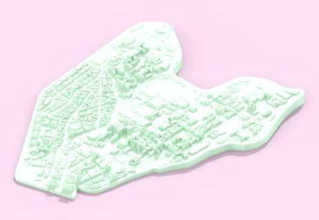
05 Site Mapping
In this project we used our chosen site as a base for developing digitally produced mappings.
My concept for this project was to develop a map in a way that was simple, yet visually appealing. For the aeriel-view site-plan digital drawing, I found that using a mocochromatic color palette personally allowed me to process the site information more cohesively.
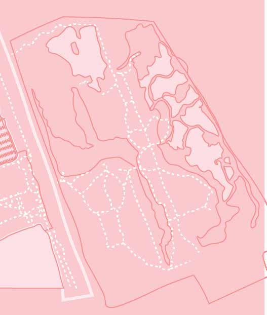
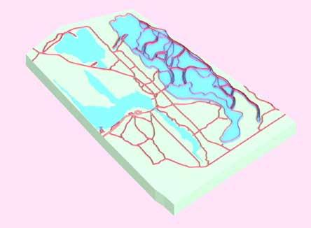
For the 3D isometric mapping of the site, I decided to use colors replicating the natural landscape the distinguish these features from the aeriel map and make them more legible, with exception to the walking paths which were highlighted in pink.
33
Outer Harbor Site Map
Outer Harbor 3D Isometric Model
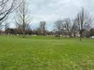
Green Space Redesign
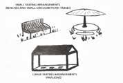
This project proposes a redesign of the open green space on UB’s South campus between Hayes Hall and Main St.
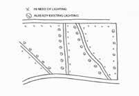
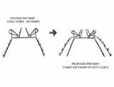
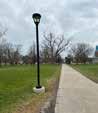
Beginning with a site analysis, we observed the site by analyzing its current key issues. We determined its primary issue was the overall lack of accessibility and usage. With this in mind, we wanted to better understand why this may be and documented various aspects of the site, such as lack of lighting, lack of seating, limited walking paths, lack of occupiable spaces, and lack of maintenance and visual appeal.
We determined that the site was not being used to its full potential and could beneift from a number of design improvements. By analyzing its flaws, we developed concceptual diagrams and sketches showing design solutions and means for implementing them. The primary concern was, how do we get students to occupy and utilize the space other than simply using it as an area for passing thrrough to get to class?
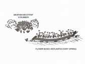
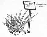
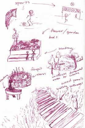
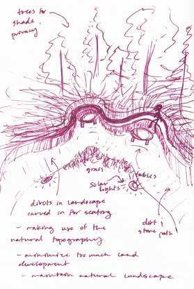
We used conceptual sketches and diagrams to convey our proposed seating areas, spaces for gathering, study spaces, and spaces with a wide variety of uses ranging from leisure to physical activity, like shaded areas underneath trees for students to relax and picnic or sit in the grass with friends, or sports and areas for organizations to host events as well as contribute with maintenance of the site features.
The goal is to integrate nature as a means to promote gathering and attract users to occupy the space. From a psychoogy and biological perspective, humans are innately drawn to nature. We want to be surrounded by nature as it has proven to have immensely positive effects on our mental and physical health. The nature itself serve as a space for students to gravitate to the space and use it for different purposes, whether that be meditation, sunbathing, relaxing in the shade, or walking and biking through the nature paths.
34
06
Phase 2 - Site Analysis
The core issues we identified from the site were lackofusage,lackofaccess,lackofadequatelighintg,lackofpropermaintenance,andoveralllackofvisualappeal. These key factors have a general negative impact on the usability of the site. People are less inclined to use a space when there are few means to access it or little means of utilizing the space for various purposes. Without access to seatingoptions,communalspaces, or different means of social activity like sports, leisure,dining,biking,walking, etc, the space will remain unoccupied without serving a greater purpose other than taking up a large portion of campus-property. Also, without the implementation of adequatelighting,propermaintenance,orvegetation , people will be even less inclined to utilize the space because it doesn’t feel safe especially during darker hours and it lacks visual appeal. Kevin Lynch’s Image of the City demonstrates key fundamentals that contribute to the overall success of a communal space which include a cohesive network of nodes,paths,districts,landmarks,andjunctions.Implementing these fundamentals into the redesign of the site can greatly improve siteusabilityand attract students to gather and promote socialengagement.

UB South Campus Green Space Site Analysis Visual
35 LANDMARKS HEAVILY USED PATHWAYS
Diana Pugliese and Alyssa Iacovitti
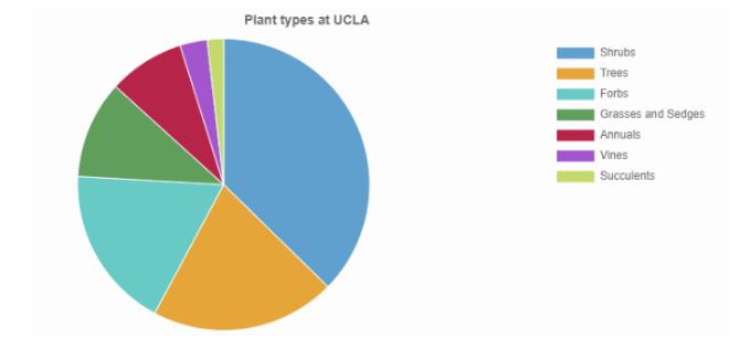
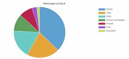
Case Study 1 - UCLA
UCLA currently has over 160 native plants scattered around their campus. annuals and four vines.
Usability
Rather than confronting the issue of individuals not occupying a space, it confronts the issue of the space itself being occupied by in-
Connection
30,000-35,000).
while Los Angeles’ main concern is extremely high temperatures.
considerate to the natural environment
“UCLA is saving about 5 millionplacing past grass and turf areas with native plants”
“As of 2022, UCLA is home to 10 times more native plants than non-native plants”
with over 70% of the species being native species”
Sustainability
Sustainability is the main priority for UCLA regarding both ser ving natural environments and resource-use down. In fa the two core reasons for these changes occurring on campu
-
UCLA Site Axonometric Diana Pugliese
Sketch drawn by Alyssa
Case Study 1 Visual
Infographic from UCLA website Diana and Alyssa
Case Study 2The Design of 6 Feet Under
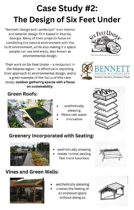
to environmental design, and is a great example of the focus of this case study : outdoor gathering spaces with a focus on sustainability
“Bennett Design and Landscape” is an interior and extheir projects focus on combining the natural environment with the built environment, while also making it a space people can use and enjoy ; also known as environmental design.
Green Roofs
aesthetically pleasing innovative
Greenery Incorporated with Seating
aesthetically pleasing makes conventional seating feel luxur y
Vines and Green Walls
aesthetically pleasing embodies the feeling of an enclosed space
37
-
Diana and Alyssa
Case Study 2 Visual
Sketches drawn by Alyssa Photos extracted from Bennet Design and Landscape and Six Feet Under websites
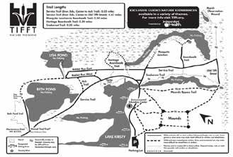
Case Study 3- TifftNatu
nature preserve
programs to learn about the natural characteristic of the preser ve (such as the geolog y and local biotic ecosystem)
What makes these place-makingunsuccessful?
placemaking
abilities, but the limitations of users listed on their website can be seen as hindering this ability
- they don’t want users to jog or bike (seems to be both excessive and a waste of an opportunity to engage more users)
- the use of kites and motorized toys is not permitted (reduces the chances of children using the site)
- they don’t want dogs in the park (makes sense for ecologically sensitive areas, but probably doesn’t need to apply to the entire park)
Case Study 3 Visual
38
Ti Diana
Ti t Nature Preserve Site Map from Ti t website
urePreserve
successful?
tween prioritizing the needs of nature and prioritizing the needs of users
* From individual activities such as enjoying the trails or boardwalks on the site, to taking advantage of the opportunities provided by the parks (such as group activities related to learning about rocks, insects, and plants located on the site)
users through highlighting the preser ve ’ s current conditions, without having to disturb these conditions.
Nature Preserve Site Axonometric
39
-
t
Diana Pugliese
Sketch drawn by Alyssa Diana and Alyssa
Site Spatial Use Proposal Sketch
Site Seating Area Proposal Sketch
Site Walking Paths Proposal Sketch
Site Recreational Use Proposal Sketch
40
Site Area Proposal Sketch
Individual Elements Proposal Sketch
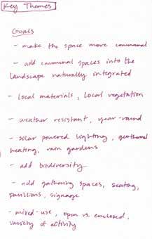
Site Key Theme Proposal Notes
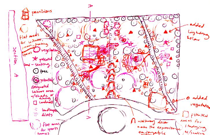
Site Map Diagram Proposal Sketch
41
Green Space Site Callouts
Axonometric Diagrams
Each space is meant to be saturated with greenery and vegetation through a gradual progression over time as a means to enhance each gathering space. To promote site usage, the concept of integrating several categories of space such as leisure, physical activity, social engagement, dining, studying, and engaging with nature were introduced to attract a wide variety of different users to the site. In addition, integrating more sources for lighting allows the space to be able to be enjoyed for longer periods of time as well as promote a sense of safety.
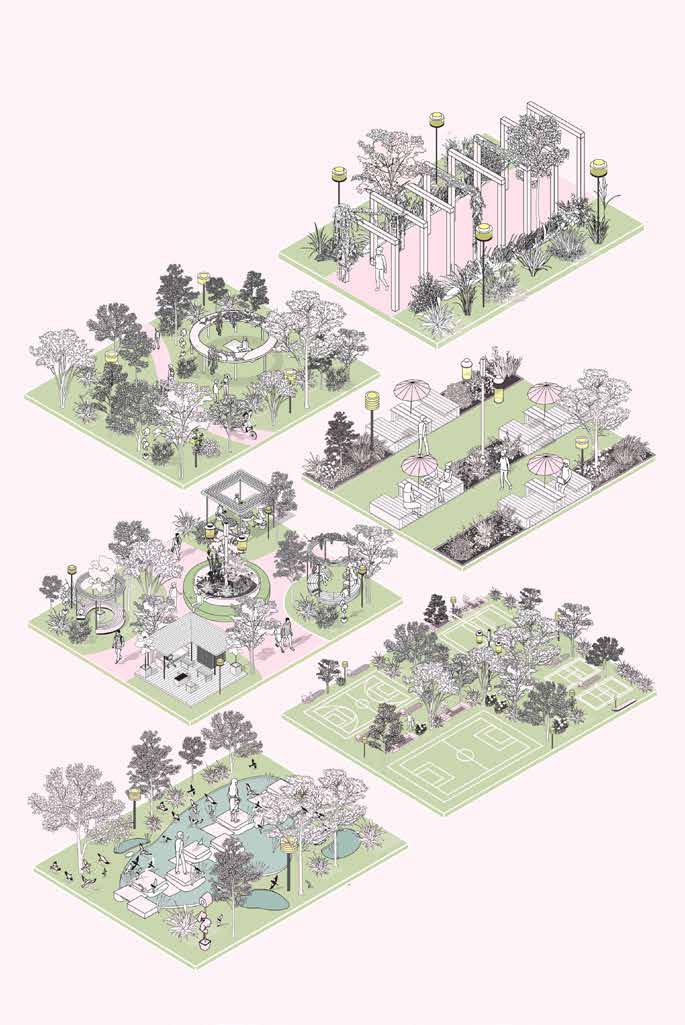
The concept of integrating nature over time allows for a more sustainable approach to maintnance as the vegetation and nature itself is meant to be self-staining and contribute to long-term results and visual appeal to the spaces. Rather than obstructing the aural landscape by imposing too many a lterations, it is important to prioritize and enhance the natural landscape and vegetation currently present on the site. Not only does it allow for flexibility for future changes as necessary, but it also akes the spaces more enjoyable for users as it enhances visual appeal and brings an added sense of vibrancy and life to each space.
42
Axonometric Diagram Callout Spaces Proposal Board
43
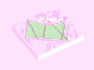
UB South Campus Green Space Site Plan
Green Space Implementation Over Time
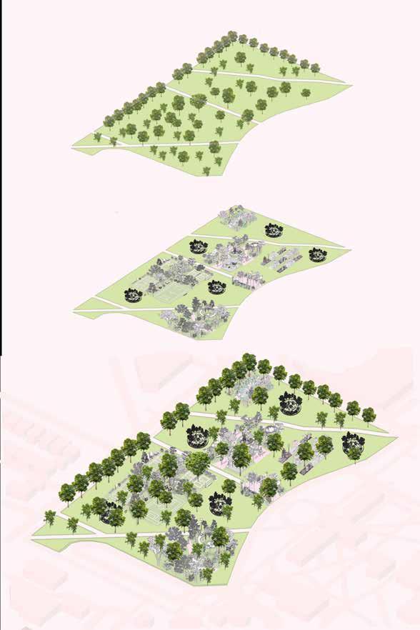
Existing Site Vegetation
Site Axonometric Diagram Proposal Board
44
Integration of addition Green Spaces for gathering
Full Site Progression with existing greenery and additional spaces
Green Space Redesign
Our green space redesign consists of the main purpose of integrating nature as a means to transform the site to a nature-preserve-esque space for students to gather.
By using native plants from the local area, the site vegetation can evolve through a gradual progression over time and be selfsustaining.
Not only do maintenance costs significantly decrease as a result of the sustainaibility of the vegetation, but the need to constantly mow the area is eliminated and promotes the health of the landscape without the persistent use of pesticides and chemicals being distributed throughout the site, further repelling students and fostering a poor relationship with the wildlife and native species on the site.
Local organizations have the opportunity to host events and establish community gardens that students can participate in, furthering strengthening a sense of community on-campus by giving students an outlet to cultivate positive relationships through benefitting the environment.
Integrating nature enhances the visual appeal of the site, attracts users to occupy the space, provides opportunities for students to gather and have an enjoyable experience during their daily commute to classes, and promotes a positive relationship with the environment in a way that is self-sustaining and long-lasting.
45
Landscape Architecture Portfolio
Diana Pugliese
