
RETHINKINGCONVENTIONALBARRAGE,SURAT.
by DhruvUmrigar
EnrollmentNo.201603101710052
Athesissubmittedinpartialfulfillmentoftherequirementsforthedegreeof
BACHELOROFARCHITECTURE [B.Arch.]
RamanBhaktaSchoolofArchitecture UkaTarsadiaUniversity,MalibaCampus
2020-21
ThesisGuide: Ar.SumeshModi Director
RamanBhaktaSchoolofArchitecture UkaTarsadiaUniversity

CERTIFICATE
ThisistocertifythatMr.DhruvUmrigar hassubmittedtheFinalThesisReportonthesubject:
RethinkingConventionalBarrage,Surat.
asamandatoryrequirementforcompletionofthe
BachelorofArchitectureprogramme atthe

RamanBhaktaSchoolofArchitecture, UkaTarsadiaUniversity fortheacademicyear 202021.

Hisworkisfoundtobesatisfactory.

Ar.SumeshModi Director

RamanBhaktaSchoolofArchitecture UkaTarsadiaUniversity


RamanBhaktaSchoolofArchitecture UkaTarsadiaUniversity
Ar.SumeshModi Director
RamanBhaktaSchoolofArchitecture UkaTarsadiaUniversity
 Ar.HatimKhapra ThesisCoordinator
DISCLAIMER
Thisdocumentdescribesworkundertakenaspartofaprogrammeofstudy attheRamanBhaktaSchoolofArchitecture,UkaTarsadiaUniversity.All views,opinionsandstatementsexpressedthereinremainthesole responsibilityoftheauthor,anddonotnecessarilyrepresentthoseofthe institute.
NameoftheStudent:Mr.DhruvUmrigar
EnrolmentNo.:201603101710052
DISCLAIMER
ACKNOWLEDGEMENT
IdeeplythankAr.SumeshModiforbeingmyThesisGuideand supportingmethroughoutandtotheFacultiesatRamanBhaktaSchoolof Architecture.IalsowishtoacknowledgeAr.DhrutishahandAr. ShaunakDesaifortheirvaluablesupportandguidanceduringresearch andshapingthisThesis.
Ar.SumeshModihasbeentrulyinspiring,visionary,andhelpful motivationandguidancehashelpedsailthisthesis.
IalsowanttoappreciatethehelpfromtheSuratMunicipalCorporation fortheirco-ordinationinthepandemic(COVID-19)and,thetechnical detailedprovidedbythemwhichhelpedmythesis.
IwishtospeciallythankourthesismentorAr.PunitaMehtafortheir inputsandadvice,alsoIamgratefultoourthesisco-ordinatorAr.Hatim Khapra.
Lastly,Iwouldliketothankmyfriendsandmyfamilyfortheirconstant supportthroughoutthejourneyofanarchitecturestudent.
ACKNOWLEDGEMENT
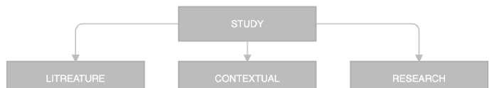
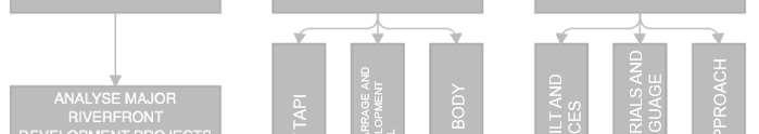
TABLEOFCONTENT TABLEOFCONTENT CERTIFICATE.............................................................................................................i DISCLAIMER...............................................................................................................i ACKNOWLEDGEMENT...........................................................................................ii TABLEOFCONTENT.............................................................................................iii TABLEOFFIGURES................................................................................................vi GLOSSARY.................................................................................................................ix 1.ABSTRACT........................................................................................................10 2.INTRODUCTION..............................................................................................12 2.1AreaofInterest..................................................................................................13 2.2CentralIdea........................................................................................................13 2.3HistoricalandCulturalContext.........................................................................14 2.4AddressingtheIssue..........................................................................................15 2.5Overviewoftheproject.....................................................................................15 2.6Methodology......................................................................................................15 3.RESEARCHANDBACKGROUNDSTUDY.................................................16 3.1ResearchPremise...............................................................................................17 3.2ContextualPremise............................................................................................18 3.2.1Macrolevel(Citylevel)..............................................................................18 3.2.2Microlevel(PrecinctLevel).......................................................................18 4.NEEDOFTHEPROJECT...............................................................................20 4.1Purpose...............................................................................................................21 4.2Co-Relationwithareaofinterest.......................................................................21 4.3Coreissue...........................................................................................................21 5.AIM&OBJECTIVES.......................................................................................22 5.1AIM....................................................................................................................23 5.2OBJECTIVES....................................................................................................23 6.SCOPE.LIMITATION&STATEMENTS....................................................24 6.1Scope..................................................................................................................25 6.2Limitation...........................................................................................................25 6.3ProgramStatement.............................................................................................25 6.4SiteStatement....................................................................................................25 7.SITESTUDY......................................................................................................26
TABLEOFCONTENT 7.1Location.............................................................................................................27 7.2SiteImages.........................................................................................................27 7.3UrbanStudyLayers...........................................................................................28 7.4ClimateAnalysis................................................................................................29 7.5S.W.O.CANALYSIS........................................................................................30 7.6Site.....................................................................................................................31 7.7UrbanGrain.......................................................................................................32 7.8RoadNetwork....................................................................................................32 7.9TrafficNodes.....................................................................................................33 7.10SunPath...........................................................................................................33 8.CASESTUDIES.................................................................................................34 8.1OpaBarrage,Goa...............................................................................................35 8.1.1Inferences....................................................................................................38 8.1.2Spaces(withArea)derived.........................................................................38 8.2NamamiGange..................................................................................................39 8.3PonteVecchio,Italy...........................................................................................41 8.4PonteRialto,Italy..............................................................................................42 8.5GalataBridge,Istanbul......................................................................................43 8.6ComparativeAnalysis........................................................................................44 8.7Inferences...........................................................................................................44 8.8ProjectReferenceforQualitativeProgramExploration....................................45 8.8.1AustrianExpoPavilion2020,ChrisPrecht................................................45 8.8.2AarhusHarborBath,Bjarkeingles.............................................................45 8.8.3LuckyKnot,NEXTArchitects...................................................................45 9.PROGRAM........................................................................................................46 9.1Idea.....................................................................................................................47 9.2IdentifiedFamousFoodZones..........................................................................48 9.2.1Rander.........................................................................................................48 9.2.2Dumas.........................................................................................................48 9.2.3Khaudra-gali...............................................................................................48 9.2.4RailwayStation...........................................................................................48 9.3IdentifiedFamousWorks...................................................................................49 9.3.1Textilework................................................................................................49 9.3.2JariWork.....................................................................................................49 9.3.3.Diamondwork...........................................................................................49
TABLEOFCONTENT 10.CONCEPT..........................................................................................................51 11.DESIGN..............................................................................................................57 12.3DVISUALIZATION.......................................................................................64 BIBLIGRAPHY.........................................................................................................67
TABLEOFFIGURES TABLEOFFIGURES Figure1IllustrationofBarrage....................................................................................10 Figure2PonteVecchio,Italy......................................................................................11 Figure3CitySceneofSongdynast.............................................................................11 Figure4AustrianPavilion2020,PretchArchitects....................................................12 Figure5Componentsoftheproject.............................................................................13 Figure6UmraOvaro...................................................................................................14 Figure7Umrah,aMuslimPilgrimage........................................................................14 Figure8MethodologyFlowchart................................................................................15 Figure9TopicIllustration...........................................................................................16 Figure10BridgemapoverTapiriver.........................................................................18 Figure11Newsarticleonnewproposedbarrage........................................................18 Figure12BarrageLocation.........................................................................................19 Figure13SquanderedRiverfront.................................................................................19 Figure14MisusedRiverfront......................................................................................19 Figure15TidalsiltingandIndustrialeffluentpollutingriverwaterintothecity.......21 Figure16Illustrationshowingconnection..................................................................23 Figure17Issuesv.opportunities.................................................................................23 Figure18Diagramshowinglocationofbarrage.........................................................27 Figure19SiteImages..................................................................................................27 Figure20BasemapandContourmap.........................................................................28 Figure21LanduseandAreadiagram.........................................................................28 Figure22SiteSection(Topography)...........................................................................28 Figure23WaterTemperatureStudy............................................................................29 Figure24WeatherTemperatureStudy........................................................................29 Figure25AnnualAverageClimateStudy...................................................................30 Figure26S.W.O.C.Analysis.......................................................................................30 Figure27SitePlan.......................................................................................................31 Figure28Landmarksimages.......................................................................................31 Figure29UrbanGrainDiagram..................................................................................32 Figure30RoadNetworkDiagram...............................................................................32 Figure31TrafficNodesIdentification........................................................................33 Figure32SunPathDiagram........................................................................................33 Figure33LocationmapofOpaBarrage.....................................................................35 Figure34OpaBarrage.................................................................................................35 Figure35SicgatesofOpabarrage..............................................................................36 Figure36Maintenancelevel........................................................................................36 Figure37Maintenancegate.........................................................................................36 Figure38RailtrackforMaintenancecrane................................................................37 Figure39MotorsBridge..............................................................................................37 Figure40ControlRoom..............................................................................................37
TABLEOFFIGURES Figure41Needfordebriscollector.............................................................................38 Figure42Diagramshowingalllevelplan...................................................................38 Figure43Gangariverfrontdevelopment,Morphogenesis..........................................39 Figure44ProposedSchematicGhatLayout...............................................................39 Figure45GhatArielview...........................................................................................40 Figure46StepstowardsSustainableapproach............................................................40 Figure47LocationofPonteVecchio..........................................................................41 Figure48ElevationofPonteVecchio.........................................................................41 Figure49Builtmassdiagram......................................................................................41 Figure50LocationofPonteRialto..............................................................................42 Figure51Builtmassdiagram......................................................................................42 Figure52LocationofGalataBridge...........................................................................43 Figure53GalataBridge...............................................................................................43 Figure54Builtmassdiagram......................................................................................43 Figure55ComparativeAnalysis.................................................................................44 Figure56ComparativeBuiltmassdiagram................................................................44 Figure57Rethinkingoftheform................................................................................45 Figure58Extendingpublicplaceonwater.................................................................45 Figure59Formexplorationforpedestrians.................................................................45 Figure60BridgeCultureinSuratCity........................................................................47 Figure61IdeaFlowchart.............................................................................................47 Figure62Identifiedzonesmap....................................................................................48 Figure63RanderChowk.............................................................................................48 Figure64DumasBeach...............................................................................................48 Figure65Khaudra-galiFoodStreet............................................................................48 Figure66RailwayStationCircle.................................................................................48 Figure67SuratTextileWork......................................................................................49 Figure68SuratJariWork............................................................................................49 Figure69SuratDiamondWork...................................................................................49 Figure70ProgramMatrix...........................................................................................50 Figure71LayeringofProgram....................................................................................52 Figure723DFormExploration...................................................................................52 Figure73Context........................................................................................................53 Figure74BarrageSite.................................................................................................53 Figure75GuideBundLocation..................................................................................53 Figure76BarrageExtrusion........................................................................................53 Figure77Compressiontoblockwaterflow................................................................53 Figure78FragmentationofCompression...................................................................53 Figure79Over-bridgeaboveBarrage.........................................................................53 Figure80DevelopmentofUrbanPark........................................................................53 Figure81FlippedprofileofbarragetoaccommodateCityManifesto.......................54 Figure82AllLevels....................................................................................................54 Figure83Axonometricview.......................................................................................55 Figure84ServiceCores(Humanandvehicles)..........................................................55 Figure85ServiceCores(GoodsandWastewater)......................................................55 Figure86ShearWalls..................................................................................................56
TABLEOFFIGURES Figure87Columgrids.................................................................................................56 Figure88ProgrammaticZoneDiagram......................................................................56 Figure89ProposedSitePlan.......................................................................................58 Figure90BarrageLevelPlan......................................................................................59 Figure91MaintenanceLevelPlan..............................................................................59 Figure92Over-BridgeLevelPlan...............................................................................60 Figure93CityManifestoLevelPlan...........................................................................60 Figure94CrossSection01..........................................................................................61 Figure95CrossSection02..........................................................................................61 Figure96CrossSection03..........................................................................................61 Figure97CrossSection04..........................................................................................62 Figure98SectionalElevation01(East)......................................................................62 Figure99SectionalElevation02(West).....................................................................62 Figure100LongitudinalSection.................................................................................63 Figure101UrbanEdge................................................................................................65 Figure102M.L.Parking..............................................................................................65 Figure103Barrage......................................................................................................65 Figure104BarrageOffice...........................................................................................65 Figure105JoggingTrack,...........................................................................................65 Figure106Viewfromland..........................................................................................65 Figure107Drop-off.....................................................................................................65 Figure108UrbanPark.................................................................................................65 Figure109ServiceCore..............................................................................................65 Figure110KhaudraGaliZone....................................................................................65 Figure111ChautaBazaarZone..................................................................................66 Figure112DumasZone...............................................................................................66 Figure113RanderZone..............................................................................................66 Figure114RailwayStationZone,...............................................................................66 Figure115ExhibitionGallery.....................................................................................66 Figure116RetailShops...............................................................................................66 Figure117Ghat...........................................................................................................66 Figure118ArielView1..............................................................................................66 Figure119ArielView2..............................................................................................66 Figure120ArielView3..............................................................................................66
GLOSSARY
Barrageanartificialbarrieracrossariverorestuarytopreventflooding,aid irrigationornavigation,ortogenerateelectricitybytidalpower.
Embankmentawallorbankofearthorstonebuilttopreventariverfloodingan area.
Ovaro(Ghats)aflightofstepsleadingdowntoariver.
GuideBundareprovidedforthispurposeofguidingtheriverflowpastthediversion structurewithoutcausingdamagetoitanditsapproaches.Theyareconstructedon eitherorbothontheupstreamanddownstreamofthestructureandononeorboththe flanksasrequired.
R.L.isanabbreviationoftechnicalwordtomeasureelevationpointinRiverLevel.
GLOSSARY
1.ABSTRACT
1https://encrypted-tbn0.gstatic.com/images?q=tbn:ANd9GcTQNSNu0AGIC_q2A0oLQM3tJY-p7ye3aCtSYw&usqp=CAU
RETHINKINGCONVENTIONALBARRAGEPROJECT,SURAT.
10|Page ABSTRACT
[1]
Figure1IllustrationofBarrage.
Keywords:Barrage;publicrealm;Umra;Embankment;Recreational;Food-street; Identity;Heritage;Port;Ghats;pedestrian;Automobile-centric;Bridges.
Thepaucityofthecurrentgrowthisthelackofpedestrianpathwaysandsocial interactionspaces.WhicharecompletelyneglectedbyAutomobilecentric developmentthatourcitiesareundergoing.toaddressthisissue,weneedtore-lookat Infrastructuraldevelopmentinourcitieswhichaddressesonlytoeasevehicular movement,theyalsoneedtorethinkatthesocialdevelopmentalongourcityroads.
OneofthekeyinfrastructuraldevelopmentsinourcitiesistheBridgesandflyovers. Wehavebeenthroughlongprocessofevolutionofbridgefromtheancienttimes,the firstbridgesweremadebynatureitselfassimpleasalogfallenacrossastreamor stonesintheriver.WeHavecomealongway.Towardstheendof20thcentury,we havebuiltbridgesspanningseas(TheLakePontchartrainCauseway),butoneofthe shortfallsisthatitisalwaysautomobilecentric.
Oneoftheearliestexamplesofbridgebeingthesocialcondenserofoursocietycanbe foundinChinawhichisdepictedinthemasterpiecebyancientChinesepainterZhang zeduan,inwhichhetriestodepictthecitysceneofSongdynasty.Thisgivesaclear understandingofhowbridgeshadsocialrelevanceinthehistoricalcitythanitistoday, wherearchitectureturnsintoapartfromthewholeurbanlandscape,creatingavibrant socialcorridorbetweentheriverbarriers.
11|Page ABSTRACT
RETHINKINGCONVENTIONALBARRAGEPROJECT,SURAT.
Figure2PonteVecchio,Italy.
Figure3CitySceneofSongdynast
2https://www.precht.at/austrian-expo-pavilion-2020/
RETHINKINGCONVENTIONALBARRAGEPROJECT,SURAT.
12|Page INTRODUCTION
[2]
2.INTRODUCTION
Figure4AustrianPavilion2020,PretchArchitects.
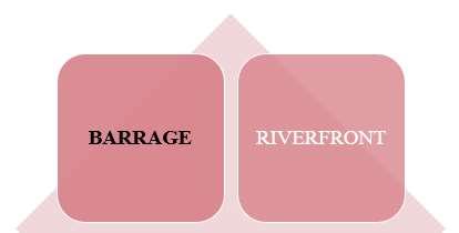
Thisprojectisacombinationoftwoprogramswhichistheriverfrontdevelopmentof TapiRiverandthebarragedevelopmentovertheTapiriver.Riverfrontdevelopment aimstocreateapublicrealm/leisurespacewhicharescarceindenseurbancitylike Surat.Alongwiththis,theBarragedevelopmentovertheTapiRiverwillaimtokeep thesalinewateroftheArabianSeaawayfromthecityandstoretheSweetwaterofthe riverinitsbasin.Here,theprojectonlyfocusesondevelopingtheriverfrontedgeof theUmraprecinctwhichharmonizeswiththebarrage.Umravillagewhichholdsrich socialandculturalheritagehaslostitspeculiarityandthisproposalaimstogiveback itslostidentity.
2.1AreaofInterest.
ARiverisoneamongthepreciousnaturalresources,especiallyforhumanlifeandits environment.Theevolutionofriverssincethestartofcivilizationhaveshowntheir importanceinshapingandinfluencingtheeventofhumansettlements,which successivelyhaveledtothedevelopmentoflargecitiesaroundtheworld.InIndia, Riversholdsignificantrolesfrom,basicsourceofwatertoreligiousandcultural importance.
2.2CentralIdea.
UmravillageisasmallpartofSuratcity,situatedinsouthernpartoftheGujaratstate, India.ThevillageisbasedonTapibasin.IthasarichHistoricalandCultural backgroundrelatedwiththeriverTapiadjacenttoit.Theriveredgeoftheareaholdsa greatpotentialofbecomingapublicrealm,anurbancentreforthecity.But,observing andanalysingpreviousmajorriverfrontdevelopmentprojectsinIndia,bringsthe
13|Page INTRODUCTION RETHINKINGCONVENTIONALBARRAGEPROJECT,SURAT.
Figure5Componentsoftheproject.
Missinglink3]tonotice.So,thisthesiswillfocusonunderstandingthosemissing points.
2.3HistoricalandCulturalContext.
LookingatthehistoryoftheUmravillageitsuggestsitwasaGatewaytoMuslim vities carriedoutontheGhatsoftheriver.[4]TheRiverfronthasMajorCulturalcontexts, consistingoffestivalscelebratedalongtheriverbanklike,GaneshVisarjan,Navratri, theriver,whichisfishing,sailing,etc.
3 https://www.academia.edu/32219232/Riverfront_Development_in_Indian_Cities_The_Missing_Link 4 https://www.arabnews.com/sites/default/files/2020/09/24/2283501-703170971.jpg
RETHINKINGCONVENTIONALBARRAGEPROJECT,SURAT.
14|Page INTRODUCTION
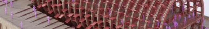
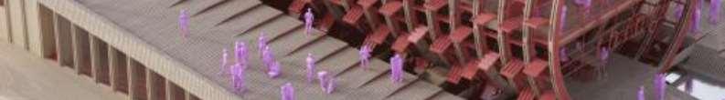
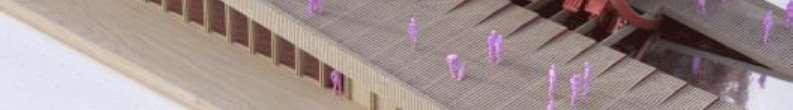
Figure6UmraOvaro.
Figure7Umrah,aMuslimPilgrimage
2.4AddressingtheIssue.
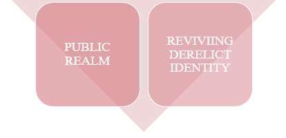
Thisthesiswillfocusonaddressingthemissingaspectswhichareneglectedbythe otherriverfrontdevelopmentsinthenation,whichneedstobetakenintoconsideration i.e.,theEcologicalAspectofriverfrontsandPropellingBody(publicparticipation) whileplanningandcreatingtheurbanspacesalongtheriverbanks,therebyindirectly promotingurbansustainabilitywithintheurbancities.
2.5Overviewoftheproject.
RiverandRiverfrontbothhasaspecialvalueinlivesofthecitizens.Andthedesigners, developers&urbanplannersmusthaveanarchitecturalconcernaboutit.As,itholds potentialofgeneratingthelivelinessinthecitiesandcreatingidentityandapublic realmforthecities.Itcanrestorethenaturalandecologicalaspects,bycreating recreationalspacesforleisure,replenishingwater,andmaintainingthequalityofit, plushavingsafetyforanycontingenciesfromtheriver,alsoemphasisingongreen spacesovertheconcretejunglesofthecityandthushelpinginurbandevelopmentof cultural,andeconomicdevelopment.Hence,by understandingthosemissingaspectsofsustainableriverfrontdevelopmentand revitalisingthehistoryandcultureoftheimmediatecontextandcreatinganurbanrealm forthepublic,whichcanbeanidentitytothecityiswhattheprojectaims.Andfor that,thisthesiswillderiveobservationswhichwillfulfiltheaimoftheproject.
2.6Methodology.

15|Page INTRODUCTION RETHINKINGCONVENTIONALBARRAGEPROJECT,SURAT.
Figure8MethodologyFlowchart.

Figure9TopicIllustration.
5https://www.vippng.com/png/full/64-641938_research.png
3.RESEARCHAND
16|Page RESEARCHANDBACKGROUNDSTUDY RETHINKINGCONVENTIONALBARRAGEPROJECT,SURAT.
[5]
BACKGROUND
STUDY
3.1ResearchPremise
CASE:1Thedemiseofrivers.[6]
ThisArticleparticularlytalksabout RiverfrontDevelopmentsinIndiaand howitisdispatchingtheeco-system fromtherivers.Hencethearticlea realitychecksonhowtheRiverfront developmentprojectsareexecutedin thenation.Andhowtheyshouldbe executed,bynotignoringanyaspects whichmightaffecttheeco-systemof therivers.Thisarticlehashelpedto understandstheaspectsandimpactsof eco-systemandhowriversmaketheir ownwaterfronts;plannersshould investinecologicalwell-beingand mustnotcreateecosystemscontingentupontheirdestruction.
CASE:2RiverfrontDevelopmentinIndianCities:TheMissingLink.[7]
ThisArticleparticularlytalksabout twoissuesforriverfrontdevelopments inIndiathatappeartobethemissing linksfortheprojectsfromplanningand organisationalperspective.Public participationandfurtherapropelling bodyidentifiedfromthestakeholders whichcanutilisetheirspecific expertiseforsupervision, implementation,andmaintenanceof theseprojectstobringfastand effectiveresults.Also,howtodirect thedevelopmenttowardabovementionedgoalspublicparticipation andpropellingbodyhavebeen identifiedastheglaringmissinglinks inplanningprocessandorganisation.A valuecentredplanningprocesshasalsobeensuggestedfortheinclusionofthese missinglinks.
6https://www.downtoearth.org.in/news/water/the-demise-of-rivers-59881
7https://www.academia.edu/32219232/Riverfront_Development_in_Indian_Cities_The_Missing_Link
17|Page RESEARCHANDBACKGROUNDSTUDY RETHINKINGCONVENTIONALBARRAGEPROJECT,SURAT.
3.2ContextualPremise
3.2.1Macrolevel(Citylevel)
SuratisalargecitywiththeTapiRiverinthewestIndianstateofGujarat.TapiRiver flowsacrossthecityanddividesthecity.Suratisoneofthemajordevelopingcities andhasundertakenmanydevelopmentprogramstoleadtheraceofdevelopment. Amongthosedevelopmentprogram,Suratcityistryingtodeveloptheriverfrontareas. Anunavailingwalkwayandanadequateriverfronthavealreadybeenobservedinthe city.Also,numbersofbridgesovertheriverhavebeenconstructedoverthetimeand arestillinprocess.
3.2.2Microlevel(PrecinctLevel)
Tapiisaperennialriver whichcrossesoverSuratcity andservestoapopulationof approx.6.5millionincity.It isalifelineofthecity.It becomesverydynamicin natureattheendofitscourse whenitmeetswiththe ArabianSea.Itthusbrings thesalinetidalbackflowsin cityduringhigh/lowtides allthewayuptothe Singanporeweir.Itfaces seriouschallengeoffloods forwhichSMChasplanned variousfloodembankmentschemesalongtherivertoaccommodaterisinglevelsof floodssince1976.Otherissuesaredischargeofcontaminatedsewagefromstormwater outfalls,watermanagementafterconstructionofSinganporeweiranddevelopmentof slumsatriverbankswhichneedstoberesolved.Therehavebeenmanyrecreational facilitieswhichhavebeendevelopedonbanksofriver.Solutionsoftheissuesand previouseffortsofdevelopmentneedtobeintegratedindevelopingtheproject.[8]
8https://www.suratmunicipal.gov.in/Departments/ProjectsUnderPlanningTendering
18|Page RESEARCHANDBACKGROUNDSTUDY RETHINKINGCONVENTIONALBARRAGEPROJECT,SURAT.
Figure10BridgemapoverTapiriver.
Figure11Newsarticleonnewproposedbarrage.
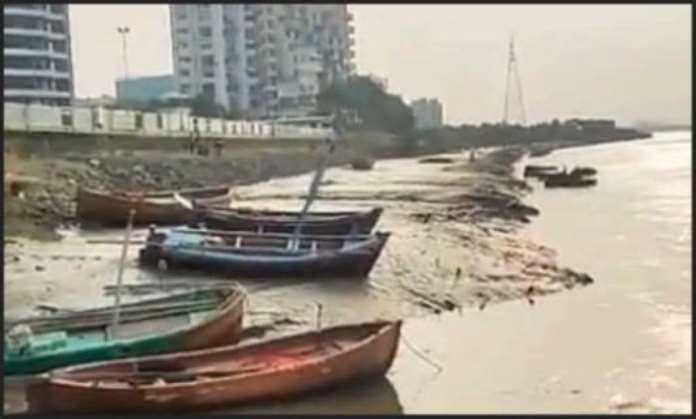
(S.M.C)isproposingaconventionalbarrageovertheriverTapineartheRundharea i.e.,Umra.TheriverfrontlandofUmraissquanderedandmis-usedandcanbe redesignedtohaveapublicrealmwhichcanbenefitthecity.


19|Page RESEARCHANDBACKGROUNDSTUDY RETHINKINGCONVENTIONALBARRAGEPROJECT,SURAT.
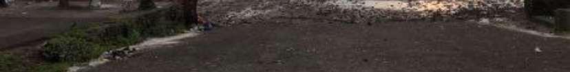
Figure12BarrageLocation.
Figure14MisusedRiverfront.
UMRAPALBRIDGE
Figure13SquanderedRiverfront.
20|Page NEEDOFTHEPROJECT RETHINKINGCONVENTIONALBARRAGEPROJECT,SURAT.
4.NEEDOFTHE PROJECT
4.1Purpose.
Observingtheincrementinurbanisationandindustrialisation,numerousurban cities/townsfaceleastavenuesforentertainmentandopenspaces.Adeveloped waterfrontgivesopportunitiestonewentertainmentopeningsandconsciousnessof normalpartsofstreamlifetooccupants.Thisutilitywillpullinremarkablenew exclusiveexpectationventures,androuseindividualstomovetowardwaterthatwas oncelostduringthehundredyearsofindustrialisation.Afocalandlivelywaterfront performadministrationstoinhabitantandguestsinsharedundertakingsofthecity.
4.2Co-Relationwithareaofinterest.
Connectingbacktothenature,bycreatinganurbanpublicrealmovertheriverfrontsis atrendingphenomenonobservedinthenation,Similarly,thedevelopmentofthe riverfrontofUmravillage,alsohasthepotentialofcreatinganurbanpublicrealm whichwillrevitalisethesocial,economic,andculturalaspectsofthecontext.But Corelatingthisdevelopmentwiththemissingissueshighlightedinthepaperand proposinganewframeworkwhichincludesalltheaspectsofriverfrontdevelopment withthemissingEcologicalandPropellingBodyaspectstoit.
4.3Coreissue.
As,seeninthefigure10above,DuetotidesfromtheArabiansea,salinewatercomes intocitythroughriverandhenceturningsurroundinglandbrackish.Plus,thefreshriver waterflowsintoseawhichcanbestoredintoareservoirbydevelopingabarrage. AlongsidewithsalinewaterharmfulindustrialeffluentfromSachinG.I.D.CandHazira ispollutingthefreshriverwater,whichcanbepreventedbystoppingthetidesentering deepintocityareabydevelopingabarrageandhaveariverwaterreservoir.
21|Page NEEDOFTHEPROJECT RETHINKINGCONVENTIONALBARRAGEPROJECT,SURAT.
Figure15TidalsiltingandIndustrialeffluentpollutingriverwaterintothecity.
22|Page AIM&OBJECTIVES RETHINKINGCONVENTIONALBARRAGEPROJECT,SURAT. 5.AIM&
OBJECTIVES

5.1AIM.
Enhancingasimpleconnectionfromoneriverbanktootherbycreating captivatingpublicinteractivespaces.
5.2OBJECTIVES.
ToconserveexcesswaterflowingawayfromWeir-cum-Causeway
LongtermwatersupplyrequirementoftheSuratCityandsurroundingarea.
TopreventtidalsiltingandpollutioninTapiriverdownstreamofWeir-cumCauseway
TopreventsalinityintrusioninarealikeAdajan,Athwa,Umaraetc.located downstreamofWeir-cum-Causeway.
GroundwaterrechargefromSweetwaterreservoirandimprovementofground waterquality
Developmentofwatersportslike,Boating,Swimming,Cruise,Parasailing etc.
Riverfrontdevelopmentlikesteppedgarden,riverdriveroad, cycle/jogging/walkingtracks
Developmentofamusementparkandrecreationalspots.
Toimproveenvironmentandaestheticbeautyofthecity.
AlternativeNetworkforPedestrianMobility.
SocialinteractivespacesalongthePedestrianNetwork.
IntegratingthePedestrianNetworkwiththePublicTransportNetwork
Proposingastructurethatcanevolve,Adopt,andgrowovertheperiod.
AdoptingMiesvanderRoheTheoryonGildingSpacestoaccommodate changingfunction.
23|Page AIM&OBJECTIVES RETHINKINGCONVENTIONALBARRAGEPROJECT,SURAT.
Figure16Illustrationshowingconnection.
Figure17Issuesv.opportunities.
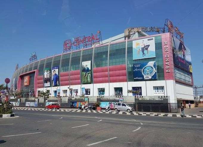
24|Page SCOPE.LIMITATION&STATEMENTS. RETHINKINGCONVENTIONALBARRAGEPROJECT,SURAT. 6.SCOPE. LIMITATION& STATEMENTS.
6.1Scope
Theprojectwillfocusonrethinkingthewholeconventionalmethodofbarrageand aimstocreatehumaneformwhichcanservenotjustasabarragebutasapublicspace withseriesofinteractivespacesalong.
6.2Limitation
Thecoreideaoftheprojectistorethinkandcreateauniquestructureofabarragewhich canbeapublicrealm,sothedevelopmentoftheriverfrontpartislimitedtothatof barrage.
6.3ProgramStatement
Theprojecttendstoenhanceasalarge-scaleurbandesignproject,whichwillturnout tobeacitylevelpublicspaceandtouristattraction.Theprojectwillconsistof Restaurants,cafes,foodcourtsandsimilarkindspaceswhichwillserveallfamous fooditemSuratcityisfamousforandwillshowthearchitectureofthesame.Also, exhibitionhallsandgalleryofitemsSuratcityisfamousfor,eventuallyitwillacity manifesto.WholecitycanbeperceivedbyjustgoingthroughpointAtopointBon thebridge.Openandsemi-opennegativespacesinthestructurewillbeprogrammed asurbanparkandwillserveasurbandailyretreatspaceforthecity.
6.4SiteStatement
SitewillbedeterminedbythelocationofbarragewhichisatRundhareashownin figure18.OpenlandnexttoKrishnahavelionthesouthernriverbankwillbeusedto landthebarragetotheroadlevelonRahulRajmalljunction.
25|Page SCOPE.LIMITATION&STATEMENTS. RETHINKINGCONVENTIONALBARRAGEPROJECT,SURAT.
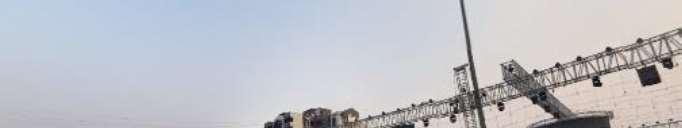
26|Page SITESTUDY RETHINKINGCONVENTIONALBARRAGEPROJECT,SURAT. 7.SITESTUDY
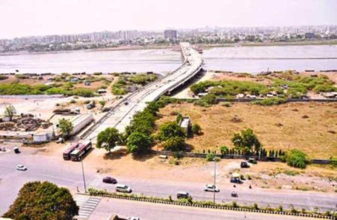
7.1Location
LocationofthebarragewassuggestedbytheSuratMunicipalCorporation,whichwill connecttobhatagamonthenorthernbankandGauravpathatRahulrajmalljunction onsouthernbank.Barragewillbeapproximately1212.5Mt.longconnectedwitha curvedguidebundhwhichwilleventuallyendatPal-HaziraRoadonthenorthernside.
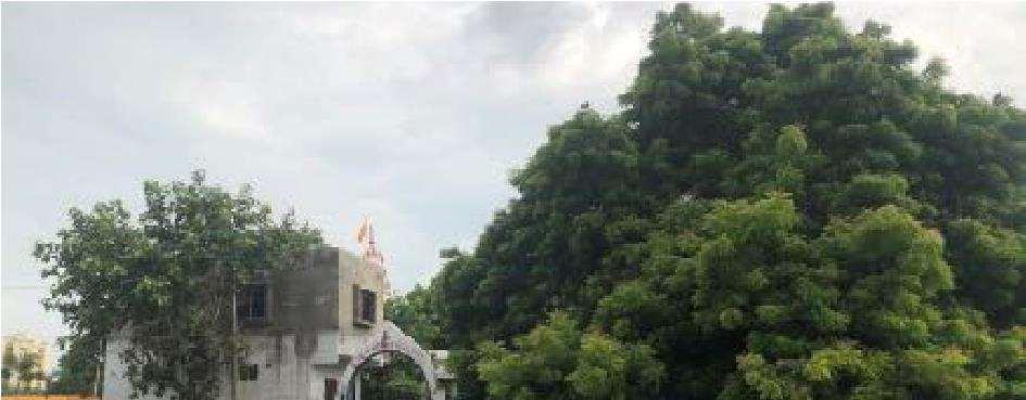
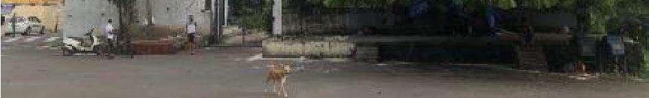
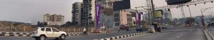
7.2SiteImages.
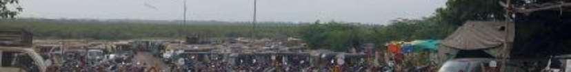
Oneendofthebarrageonthesouthernendconnectsatoneofthebusiestjunctionson Gauravpathmainroadwhichconnectscitytodumasbeach.Ontheothersideon northernriverbankbarragelandsintofarmlandswithbareminimumvehicularaccess.
27|Page SITESTUDY RETHINKINGCONVENTIONALBARRAGEPROJECT,SURAT.
Figure18Diagramshowinglocationofbarrage.
Figure19SiteImages.
7.3UrbanStudyLayers.
Tostudytheurbanfabricofthesurroundingcontextofthesite,theselayerswere documentedwhichhelpsinunderstandingtypologyofbuildingsandtopography.


28|Page SITESTUDY RETHINKINGCONVENTIONALBARRAGEPROJECT,SURAT.
Figure20BasemapandContourmap
Figure21LanduseandAreadiagram.
Figure22SiteSection(Topography)
7.4ClimateAnalysis.
Fortheseprojectstudyofwatertemperaturewasalsodonewithweathertemperature becausethebarragestructurewillalwaysbeincontactwithwaterofTapiriver.
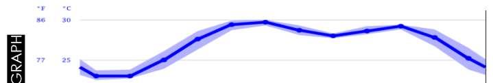
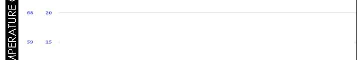
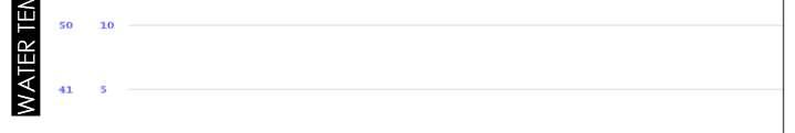
Suratlieson7mabovesealevelSurat'sclimateisclassifiedastropical.Thesummers herehaveagooddealofrainfall,whilethewintershaveverylittle.Accordingto KöppenandGeiger,thisclimateisclassifiedasAw.InSurat,theaverageannual temperatureis27.0°C|80.6°F.Theannualrainfallis989mm|38.9inches.
29|Page SITESTUDY RETHINKINGCONVENTIONALBARRAGEPROJECT,SURAT.
Figure23WaterTemperatureStudy.
Figure24WeatherTemperatureStudy.
Atanaveragetemperatureof30.2°C|86.4°F,Mayisthehottestmonthofthe year.Januaryisthecoldestmonth,withtemperaturesaveraging22.5°C|72.5 °F.
Betweenthedriestandwettestmonths,thedifferenceinprecipitationis359mm |14inches.Throughouttheyear,temperaturesvaryby7.8°C|46.0°F.
Anaverageof27.10°C|80.78°FwatertemperaturesisreachedinSurat(Gulf ofKhambhat)overtheyear.
At30.00°C|86.00°F,theaveragemonthlywatertemperaturereachesitshighest valueintheyearinJune.WhereasinJanuarythelowestvalueismeasuredwith about22.50°C|72.50°F.
ConcludingfromS.W.O.Canalysis,aneedforpublicspacewithleisurespacescanbe determined.
30|Page SITESTUDY RETHINKINGCONVENTIONALBARRAGEPROJECT,SURAT.
Figure25AnnualAverageClimateStudy. 7.5S.W.O.CANALYSIS.
Figure26S.W.O.C.Analysis.
Asshowninthefigure22,thebasicprofileofbarragecanbedeterminedandits connectionwithguidebundhonnorthernriverbank.


31|Page SITESTUDY
RETHINKINGCONVENTIONALBARRAGEPROJECT,SURAT.
7.6Site.
1.Tapiriver
2.ProposedBarrage
3.ProposedGuidebund
4.Pal-HaziraRoad
5.RahulRajMalljunction
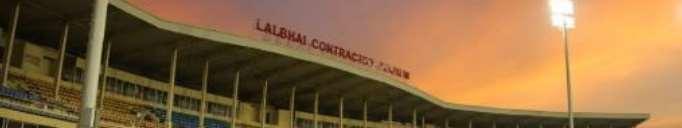
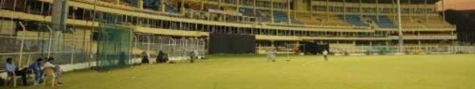
6.Lal-bhaiStadium
7.CentralMallJunction.
Figure28Landmarksimages.
1.
3.
2.
6.
4.
5.
7.
Figure27SitePlan
7.7UrbanGrain.
Urbangrainindicatedthesouthernriverbankhasadenseurbanfabriccompared tonorthernbankwhichismostlyfarmlandsandsomedevelopmentalongthe Pal-HaziraRoad.
Whereasthesouthernbankiswelldevelopedurbanareawithmalls,schools, stadium,andmanyotherurbaninfrastructures.
Southernbankhasreachedcertainsaturationindevelopment,incontrast northernbankhasmoregreencoverwhichcanactasanurbanpullfactorfor riverfrontdevelopment.
7.8RoadNetwork.
B.R.T.S.lanepassesthroughtheroadwhichincreasemobilityinpublic transporthenceenhancingsiteapproach.
Barragewillendonnorthernsidetoguidebundconnectingittoanotherprimary -
Theover-bridgewillcontinueovertheprimaryroadonsouthernsideandend onsecondaryroadnexttoRahulrajmall.
32|Page SITESTUDY RETHINKINGCONVENTIONALBARRAGEPROJECT,SURAT.
Figure29UrbanGrainDiagram.
Figure30RoadNetworkDiagram.
7.9TrafficNodes.
Southernbankhasthegreatestnumberofmallsforthecity,alsoacricket stadium,withschoolsandothercommercialandresidentialinfrastructureso thereistrafficcongestiononpick-uphours.Henceaffectstheprojectdirectly. Toavoidtrafficcongestiontheoverbridgedwill,endratheronsecondaryroad thandirectlyonprimaryroad.
OnnorthernsidethenodesarebusyduetoR.T.O.andschoolaroundit.
7.10SunPath.
Thebarragestructurewillstretchonnorth-southaxis,slightlytiltingtowards west.
Thestructurewillbeexposedtowestandeastsides,whichisnotidle.
Theinterventionoverbarragewillfocusonprovidingclimateresponsive spaces.
33|Page SITESTUDY RETHINKINGCONVENTIONALBARRAGEPROJECT,SURAT.
Figure31TrafficNodesIdentification.
Figure32SunPathDiagram.
34|Page CASESTUDIES RETHINKINGCONVENTIONALBARRAGEPROJECT,SURAT.
8.CASESTUDIES
8.1OpaBarrage,Goa.
OpawaterworksissituatedatOpawardinKhandeparvillageofPondataluka.It enablesthesupplyofwaterbyforceofgravitytoalmost95%oftheareaofPondaand Tiswaditalukas.ThisincludesthePanajicity,Bambolim,Taleigao,Ribandarand wholeofPondataluka.TheOpaweirwasconstructedin1972toraisethewaterlevel andasastoragereservoirduringtheleanperiodfromMarchtoJune.Theweirheight is2.42mtswithatotallengthofabout82mtsacrosstheriver.ThemainsourceofOpa waterworks,riverKhandepar,originatinginKarnataka,flowsthroughDudhsagar waterfall.TheothertributarywhichjoinstheriverKhandeparisKalemriverwhich flowsfromSanguem.
35|Page CASESTUDIES RETHINKINGCONVENTIONALBARRAGEPROJECT,SURAT.
Figure33LocationmapofOpaBarrage.
Figure34OpaBarrage.
36|Page CASESTUDIES RETHINKINGCONVENTIONALBARRAGEPROJECT,SURAT.
Figure35SicgatesofOpabarrage.
Figure36Maintenancelevel
Figure37Maintenancegate.
37|Page CASESTUDIES RETHINKINGCONVENTIONALBARRAGEPROJECT,SURAT.
Figure38RailtrackforMaintenancecrane.
Figure39MotorsBridge.
Figure40ControlRoom.
8.1.1Inferences.
Basicfunctioning
Componentunderstanding
Relatedrequiredspaces.
Additionalinputsmissingincase(i.e.,Coveredservicebridgeanddebristrap)
8.1.2Spaces(withArea)derived.
Cranetrack-5mt.Width
Servicebridge-3.5mt.Width
Controlroom-15Sq.MT.
Office-15Sq.MT.
RETHINKINGCONVENTIONALBARRAGEPROJECT,SURAT.
Restroom-30Sq.MT.
Toiletblock-5Sq.MT.
Generator-15Sq.MT.
Staircase-15Sq.MT.
38|Page CASESTUDIES
Figure41Needfordebriscollector.
Figure42Diagramshowingalllevelplan.
urbanintervention,toaddressthesepressingissues,aimsto sustainablyredesign whilesimultaneouslyturningthecityinsideouttoprovideriversidecivicspaces. Morphogenesisworkedonatotalof33Ghatsand20crematoriaalongthestretchof theriverbetweentheholycitiesofAllahabadandVaranasi.
39|Page CASESTUDIES RETHINKINGCONVENTIONALBARRAGEPROJECT,SURAT. 8.2NamamiGange.
Figure43Gangariverfrontdevelopment,Morphogenesis.
Figure44ProposedSchematicGhatLayout. differentlevelscatertodifferent activities.Thissegregationisbasedonflood-levels.
Theprovisionissuchthatallactivitiesusewaterinacontrolledway,henceleadingto reducedpollution:Platformsweredesignedtobesupportedbycolonnadestomakesure thattheriverflowremainsuninterrupted.Inaddition,changingquarterswereprovided closetotheritualbathingpond.
TheGhatswillalsorunalmostentirelyonsolarpower:Solarpanelsareinstalledatop
essentialfunctionsofprovidingdrinkingwaterandinternetconnectivity.Furthermore, locallyavailable,andlow-maintenancematerialswereusedtoreduceecological impact:theflooringwillutilizeporousstonetoenablewatertopercolatethrough,while thestructureswillbepredominantlybuilt-inbrick.
40|Page CASESTUDIES RETHINKINGCONVENTIONALBARRAGEPROJECT,SURAT.
Figure45GhatArielview.
Figure46StepstowardsSustainableapproach.
8.3PonteVecchio,Italy.
BuiltinFlorence,Italybetween996-1345bythearchitectTaddeoGaddi.Thebridgeis Europe'soldestwholly-stone,closed-spandrelsegmentalarchbridge.Toenforcethe prestigeofthebridge,in1593theMediciGrandDukesprohibitedbutchersfromselling there;theirplacewasimmediatelytakenbyseveralgoldmerchants.Thecorporative associationofbutchershadmonopolizedtheshopsonthebridgesince1442.
41|Page CASESTUDIES RETHINKINGCONVENTIONALBARRAGEPROJECT,SURAT.
Figure47LocationofPonteVecchio.
Figure48ElevationofPonteVecchio.
Figure49Builtmassdiagram.
8.4PonteRialto,Italy.
TheRialtoBridgeisoneofthefourbridgesspanningtheGrandCanalinVenice,Italy. ItistheoldestbridgeacrossthecanalandwasthedividinglineforthedistrictsofSan MarcoandSanPolo.ThefirstdrycrossingoftheGrandCanalwasapontoonbridge builtin1181byNicolaBarattieri.ItwascalledthePonteDellaMoneta,presumably becauseofthemintthatstoodnearitseasternentrance.Thedevelopmentand importanceoftheRialtomarketontheeasternbankincreasedtrafficonthefloating bridge,soitwasreplacedin1255byawoodenbridge.Thisstructurehadtwoinclined rampsmeetingatamovablecentralsection,thatcouldberaisedtoallowthepassage oftallships.Theconnectionwiththemarketeventuallyledtoachangeofnameforthe bridge.Duringthefirsthalfofthe15thcentury,tworowsofshopswerebuiltalongthe sidesofthebridge.TherentsbroughtanincometotheStateTreasury,whichhelped maintainthebridge.
42|Page CASESTUDIES RETHINKINGCONVENTIONALBARRAGEPROJECT,SURAT.
Figure50LocationofPonteRialto.
Figure51Builtmassdiagram.
8.5GalataBridge,Istanbul.
TheGalataBridgeisabridgethatspanstheGoldenHorninIstanbul,Turkey.Fromthe endofthe19thcentury-inparticular,thebridgehasfeaturedinTurkishliterature, theater,poetry,andnovels.ThefirstrecordedbridgeovertheGoldenHorninIstanbul wasbuiltduringthereignofJustiniantheGreatinthe6thcentury,closetothearea neartheTheodosianLandWallsatthewesternendofthecity.
43|Page CASESTUDIES RETHINKINGCONVENTIONALBARRAGEPROJECT,SURAT.
Figure52LocationofGalataBridge.
Figure53GalataBridge.
Figure54Builtmassdiagram.
8.6ComparativeAnalysis.
Themassingofthesebridgesprobablyplaysthemostsignificantroleinhowthey operateinternallyforthepedestrian.ThePonteVecchioandPonteRialto,forexample: sharemanysimilarities,buteachessentiallyinvertsthemassingstrategyoftheother.

8.7Inferences.
UsingthetermsofKevinLynch,thePonteVecchiomaybeconsideredamonument (oneplacedbetweenthetwoothermonumentsoftheUffiziGalleryandPittiPalace). ThePonteRialtomightalsobeamonument(onethathappenstospanbetweentwo edges).TheGalataBridge,however,wouldprobablybedefinedasapath(onethat connectsbetweenlargenodes).TheGalataBridgeisnotarchitecturallyattention grabbinginthesamemannerasPonteVecchioandPonteRialto.Itisnotmonumental inthesamesense.Itsgreatlengthnecessitatesaflatterproportion,andtheimageofits topsurfaceisdominatedbycartraffic.Theactionistuckedunderneathorhidden behindawallofcars.Yet,theGalataBridgesucceedsasahabitablebridgeinaway thatthetwoItalianbridgesdonot.Itcombinesdiverseandactivepro-gramsina thoughtfullayeringthatbringsoutthebestineach.Thisisthetrueopportunityofthe urbanwaterfront:thechancetosynthesizethecomplexneedsanddesiresofthecityin acoherentfashion.Itisachancetoharmonizecompetingurbanconditionsina prominentplace.Itisthearmatureforimageability.
44|Page CASESTUDIES RETHINKINGCONVENTIONALBARRAGEPROJECT,SURAT.
Figure55ComparativeAnalysis.
Figure56ComparativeBuiltmassdiagram.
8.8ProjectReferenceforQualitativeProgramExploration.
8.8.1AustrianExpoPavilion2020,ChrisPrecht.


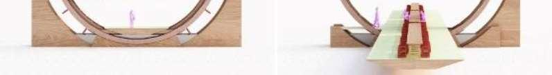
45|Page CASESTUDIES RETHINKINGCONVENTIONALBARRAGEPROJECT,SURAT.
Figure57Rethinkingoftheform.
8.8.2AarhusHarborBath,Bjarkeingles.
Figure58Extendingpublicplaceonwater.
8.8.3LuckyKnot,NEXTArchitects.
Figure59Formexplorationforpedestrians.