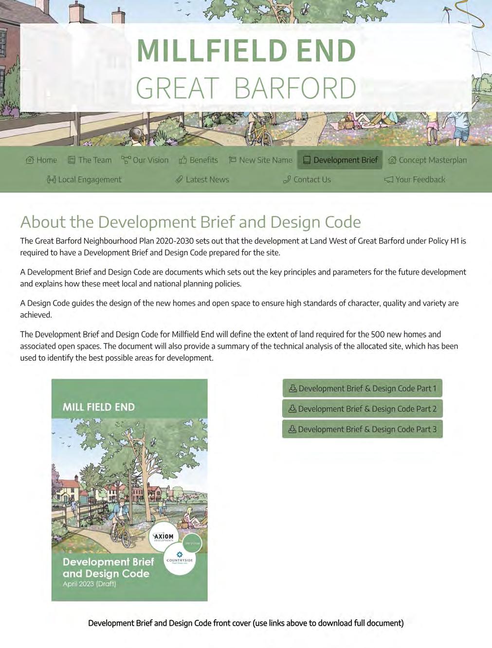
Millfield End Development Brief and Design Code - October 2024
MILLFIELD END Development Brief and Design Code
September 2024
Prepared by:
“MILLFIELD END”
The Great Barford Neighbourhood Plan allocates the land known as “Great Barford West” for up to 500 new homes and associated open space. Following feedback from Great Barford Parish Council, and as part of Vistry (previously Countryside) and Axiom Development’s consultation process, it was decided that it was important that Great Barford West should be renamed to better represent its history and help create a stronger identity for the new neighbourhood.
A research exercise, which included dialogue with Great Barford Parish Council and Councillor Stephen Moon (Ward Councillor), drew out a number of local connections and characteristics specific to Great Barford. Credible naming options uniquely related to the Site are very limited. The identified site specific characteristics were:
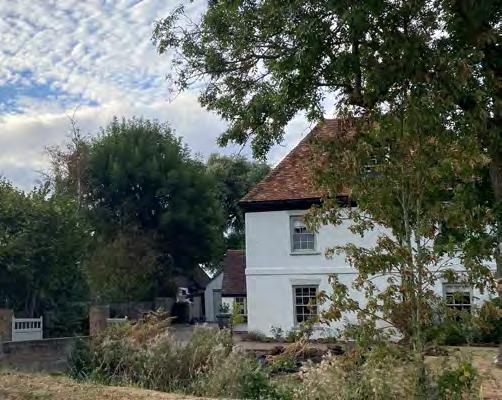
• Green End Farm, located on the northern entry of the site. The site is in private ownership and is listed as a Grade II building; and
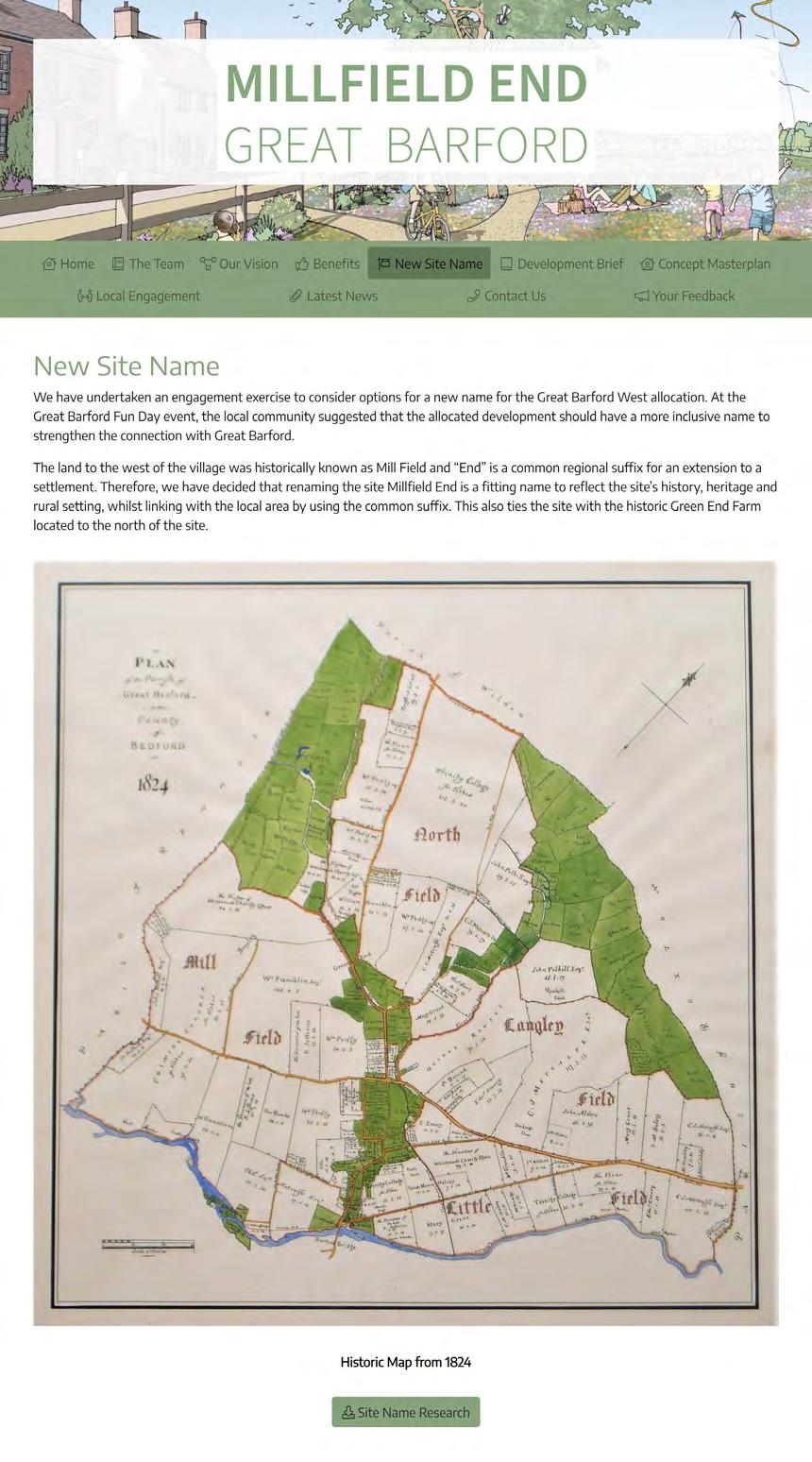
• The Great Barford West site is on land formerly known as Millfield – as per maps from the 19th century.
The suffix ‘End’ was suggested by the Heritage Officer at Bedford Borough Council as a common local / regional term for a hamlet or extension to a settlement. ‘Millfield’ represents the historic name of a field that once formed part of the Great Barford West site. Therefore, the name “Millfield End” was settled upon, as this option reflects the heritage of the Site and its history, whilst linking with the local area by using the common Suffix, which also ties the site with the historic Green End Farm to the north of the site.
Office Address:
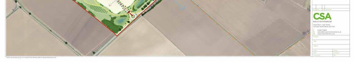
CSA Environmental
Dixie’s Barns, High Street, Ashwell, Hertfordshire, SG7 5NT
Office Telephone Number: 01462 743 647
On behalf of: Copyright All OS plans are Crown Copyright 2012. All rights reserved. Licence number 100020449
Fifth
Sixth Issue
Seventh Issue
Eighth Issue
Ninth
Tenth
CONTENTS
INTRODUCTION
VISION
PLANNING POLICY CONTEXT
SITE CONTEXT AND ANALYSIS
DESIGN INFLUENCES
APPENDIX A: TREE CONSTRAINTS PLAN
APPENDIX B: TRENCH LOCATION PLAN
AND AREAS OF ARCHAEOLOGICAL SIGNIFICANCE (AAS)
APPENDIX C: STATEMENT OF COMMUNITY INVOLVEMENT
AXIOM DEVELOPMENTS
Axiom Developments Limited is an independent strategic land promotion company operating across the Oxford to Cambridge Arc.
We work in partnership with landowners, councils, and local communities to promote sustainable new settlements through the local plan process to outline consent. We then work with appropriate partners to deliver the necessary infrastructure, high quality placemaking and new homes.
VISTRY
Vistry (previously Countryside) has a great reputation throughout the industry and has received more housing design awards than any other developer, reflecting our dedication to delivering high-quality and well-designed new communities.
We have over 60 years’ experience and always make sure we deliver schemes which benefit the existing community by delivering new facilities in discussion with local people.
As a developer seeking to create new communities, we place importance on the delivery of infrastructure and ensuring that our schemes evolve in partnership with the local community.
01 | INTRODUCTION
1.1 Purpose of Document
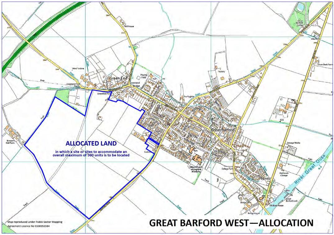
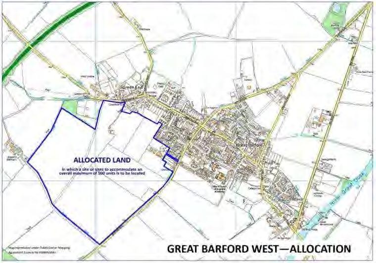
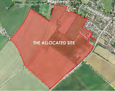
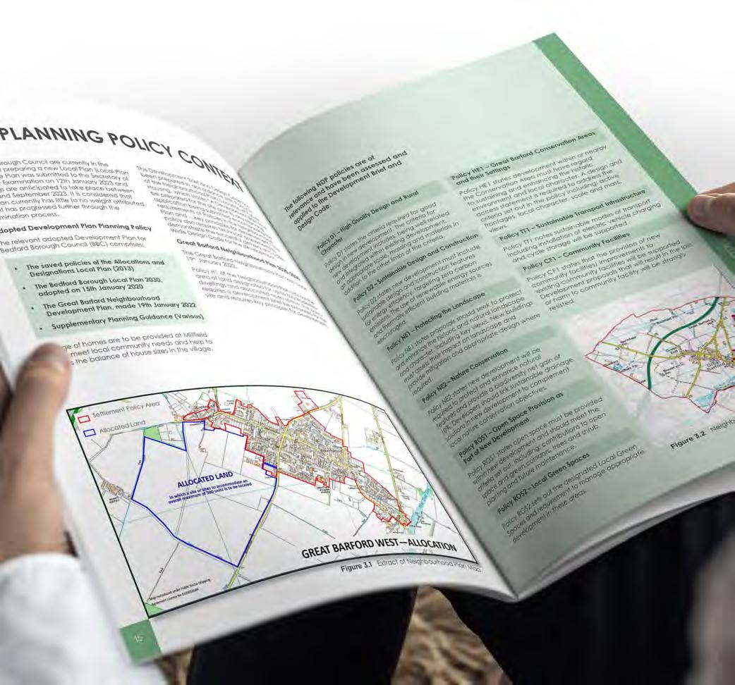
The Great Barford Neighbourhood Plan 20202030 (“the Neighbourhood Plan”) was made on 19th January 2022. Policy H1 (Location for Future New Housing Development) sets out the area of land designated for up to 500 new homes and associated open space. This land is referred to as Land at Great Barford West (“the allocated site”) in the Neighbourhood Plan. The policy requires a Development Brief and Design Code be prepared for the Site, which encompasses the requirements of Policies in the Neighbourhood Plan and the key principles for development at Great Barford West (to be developed as Millfield End) as set out by Policy H1.
The allocated site is greater than the land area required to deliver 500 homes. The Millfield End Development Brief and Design Code (“the Development Brief and Design Code”) will define the exact extent of land required for the 500 new homes and associated open spaces. The
View south from Green End Road, looking into the allocated site.
1.3 Land Ownership
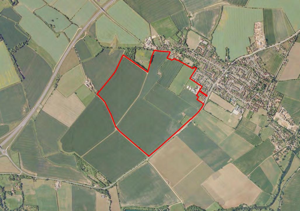
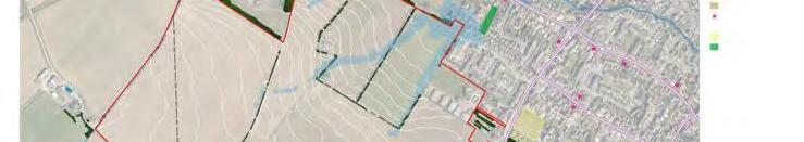
The allocated site is under four separate land ownerships as summarised in the plan (Figure 1.2) and table (Figure 1.3) below. The eastern 28% (18.1Ha) of the site is controlled by Axiom Developments and the remaining 72% (46Ha) to the west is controlled by Vistry.
ROADBIRCHFIELD BARFORDROAD
GREENENDROAD HIGHSTREET
BEDFORDROAD
Figure 1.2 Land Ownership Plan.
Figure 1.3 Land Ownerships.
1.4 Social Value
Millfield End is to be underpinned by the processes of Social Value. At its heart, Social Value is about creating successful new places that meet the evolving needs and aspirations of the people that live in and use the places and spaces created. It should also deliver places that allow communities to thrive, and that protect and enhance the natural environment.
At Millfield End, this means maximising the benefits of the new homes and open spaces for Great Barford’s existing and new residents alike. Therefore, the Development Brief and Design Code has been prepared to meet a defined
HEALTH, WELLBEING & THE
ENVIRONMENT
Good accessibility and sustainable transportation
Resilient buildings and infrastructure
High-quality public and green spaces
Good mental health
Good physical health
Healthy local air quality
Limit resource use and waste
list of social value outcomes to ensure the new neighbourhood of Millfield End makes a genuinely positive contribution to Great Barford and the wider area.
The Development Brief and Design Code concludes in Chapter 8 by providing an assessment of the defined list of social value outcomes. This defined list draws upon the recommendations set out in the document “Social value in new development: An introductory guide for local authorities and development teams”, which was published by the UK Green Building Council in March 2018.
STRENGTH OF COMMUNITY
Strong local ownership of the development
Existing social fabric is protected from disruption
The new community is well integrated into the surrounding area
Thriving social networks
Vibrant diversity of building uses and tenures
Strong local identity and distinctive character
Figure 1.4 Summary of Social Value outcomes.
JOBS & ECONOMIC GROWTH
Local people with the right skills for long-term employment
School leavers with career aspirations of the industry
The local supply chain is supported and grown
Future residents have comfortable homes which are affordable to operate
Thriving local businesses
The assessment of Social Value outcomes will be assessed against the development lifecycle of Millfield End:
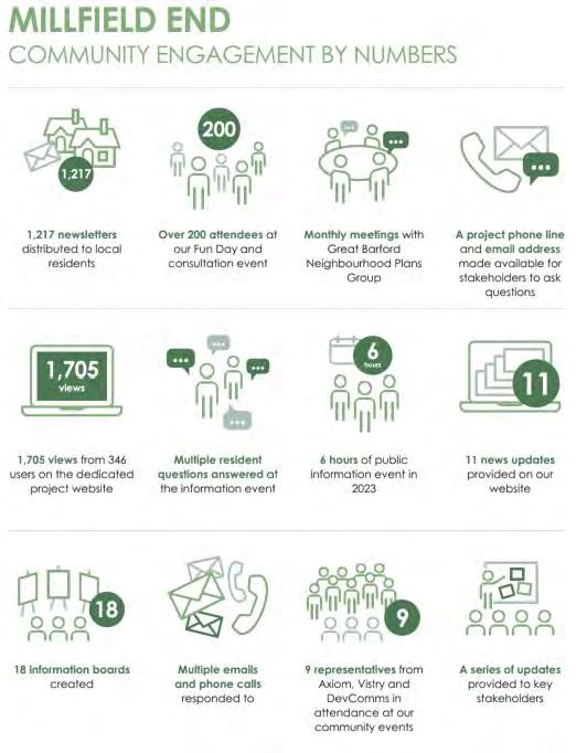
1.5 Community Engagement
The project team have engaged extensively with the local community of Great Barford to propose a development at Millfield End that reflects and complements the surrounding area, and responds to the desires of the local community. A range of methods have been used to communicate with the local community and local politicians, which has ensured that a collaborative approach has been taken in drafting this Development Brief and Design Code.
Opposite provides an overview of the community engagement that has taken place in numbers since 2019.
The full Statement of Community Involvement, which summarises the engagement undertaken and feedback received, can be found at Appendix C.
Source: Social value in new development: An introductory guide for local authorities and development teams (https://www.ukgbc.org/wpcontent/uploads/2018/03/Social-Value.pdf)
Figure 1.5 Development life cycle of Millfield End.
02 | VISION
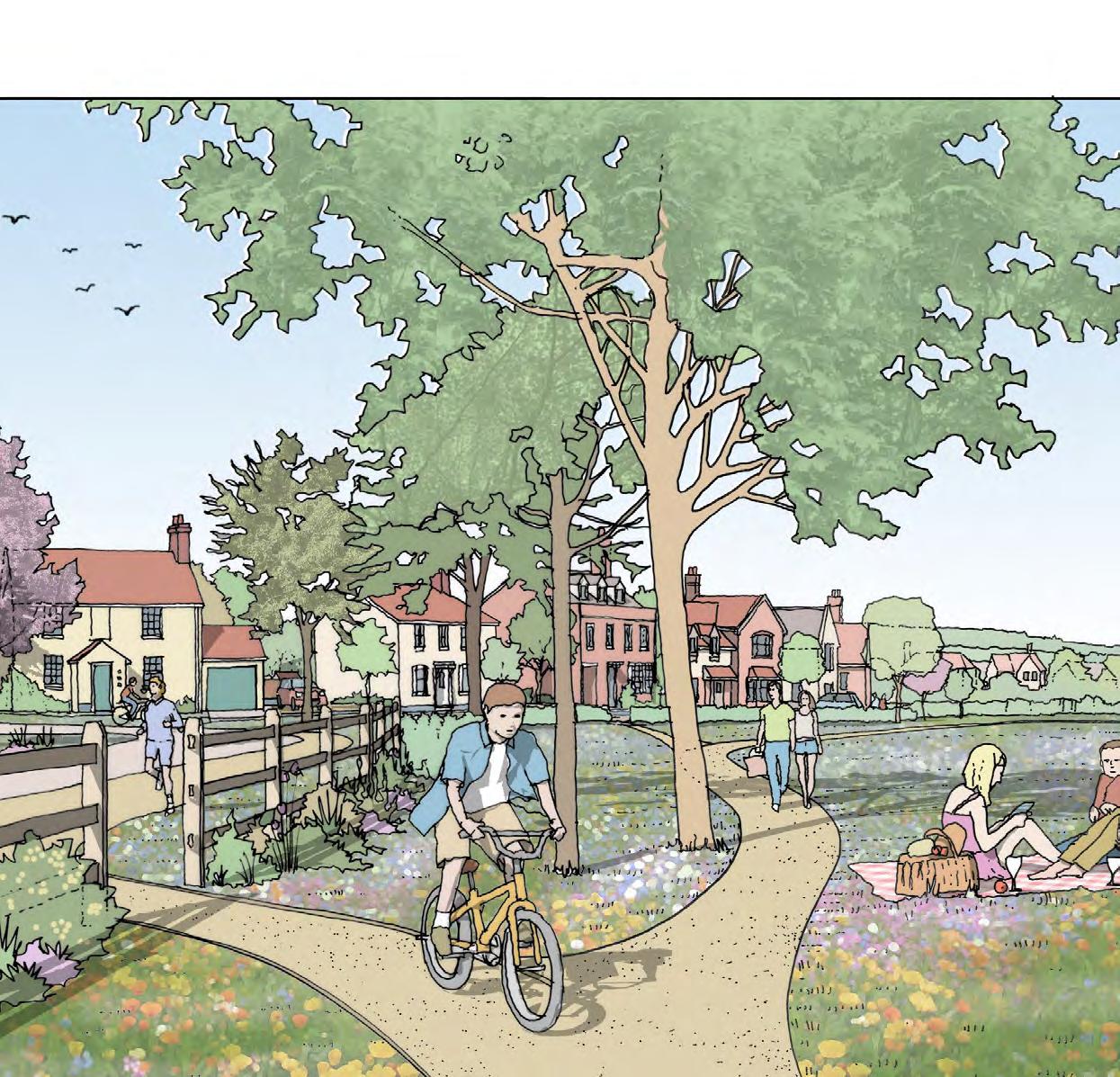
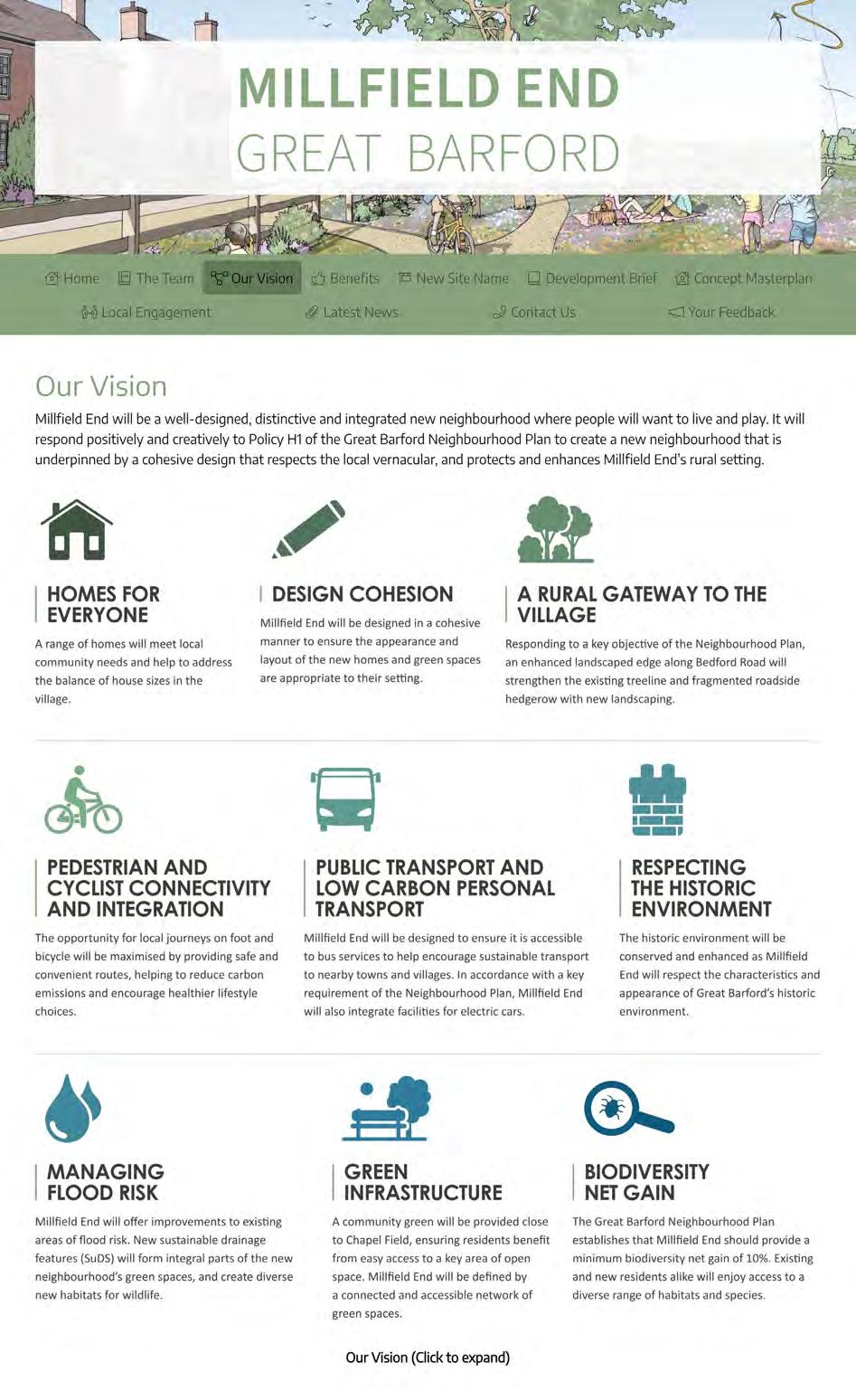
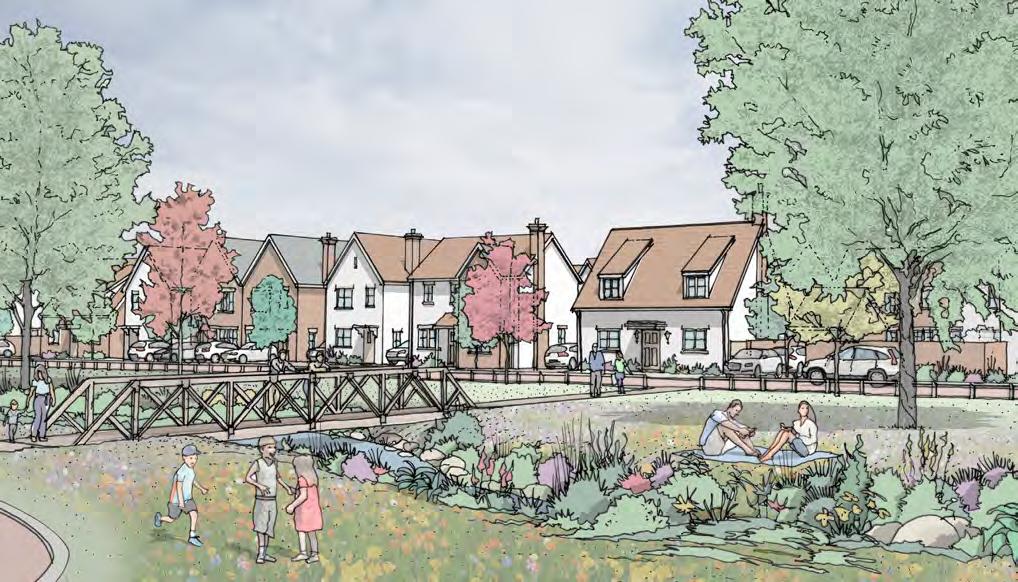
Millfield End will be a well-designed, distinctive and integrated new neighbourhood where people will want to live and play. It will respond positively and creatively to Policy H1 of the Great Barford Neighbourhood Plan to create a new neighbourhood that is underpinned by a cohesive design that respects the local vernacular, and protects and enhances Millfield End’s historic and landscape setting.
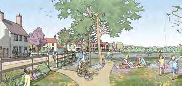
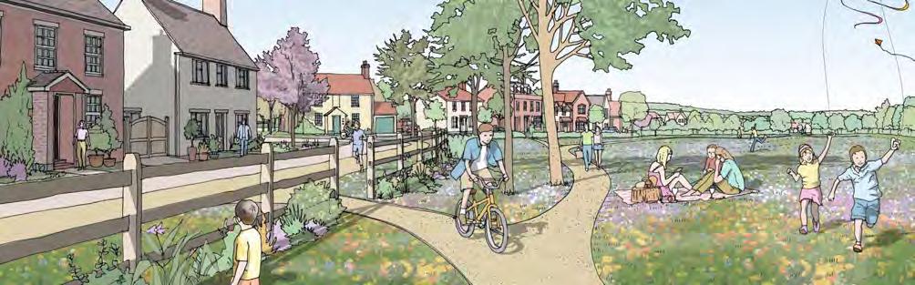
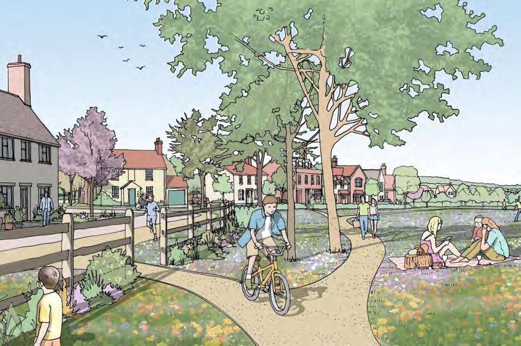
An accessible landscape framework will connect places and spaces and incorporate new sports and recreation provision. Attractive, welcoming and convenient walking and cycling routes for all ages and abilities will prioritise active travel and successfully integrate the new neighbourhood of Millfield End with the existing village. Millfield End will stand the test of time, meeting the needs of current and future generations.
The Vision and images on the following pages are a visual and written declaration of the place that Millfield End will be in order to create a lasting legacy that existing and new residents will be proud of for many generations to come.
VISION PRINCIPLES
HOMES FOR EVERYONE
DESIGN COHESION
A RURAL GATEWAY TO THE VILLAGE
PUBLIC TRANSPORT AND LOW CARBON PERSONAL TRANSPORT PEDESTRIAN AND CYCLIST CONNECTIVITY AND INTEGRATION
RESPECTING THE HISTORIC ENVIRONMENT
MANAGING FLOOD RISK AND BLUE INFRASTRUCTURE
GREEN INFRASTRUCTURE
BIODIVERSITY NET GAIN
HOMES FOR EVERYONE
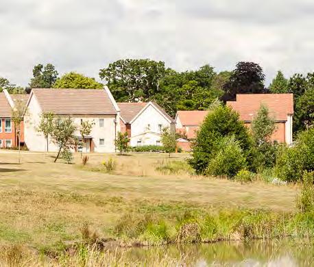
A range of homes are to be provided at Millfield End to meet local community needs and help to redress the balance of house sizes in the village.
• To ensure the potential for families to continue to thrive within Great Barford, the new neighbourhood will comprise a full range of market and affordable housing.
• Recognising a key objective of the Neighbourhood Plan, many of the new homes will comprise smaller types, including many 1 and 2 bedroom homes, provided for both market sale and affordable tenures.
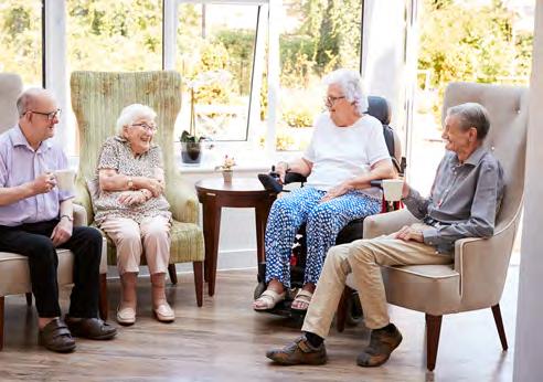
• Addressing a key local need, Millfield End will explore the potential to provide extra care housing, allowing those in need to remain in the village. The extra care housing would also provide a source of local employment
• Millfield End is to include plots for self-build and custom housing.
• New homes will be designed to significantly reduce carbon emissions through energy reduction, energy efficiency and renewable/ low carbon energy.
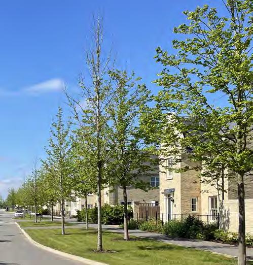
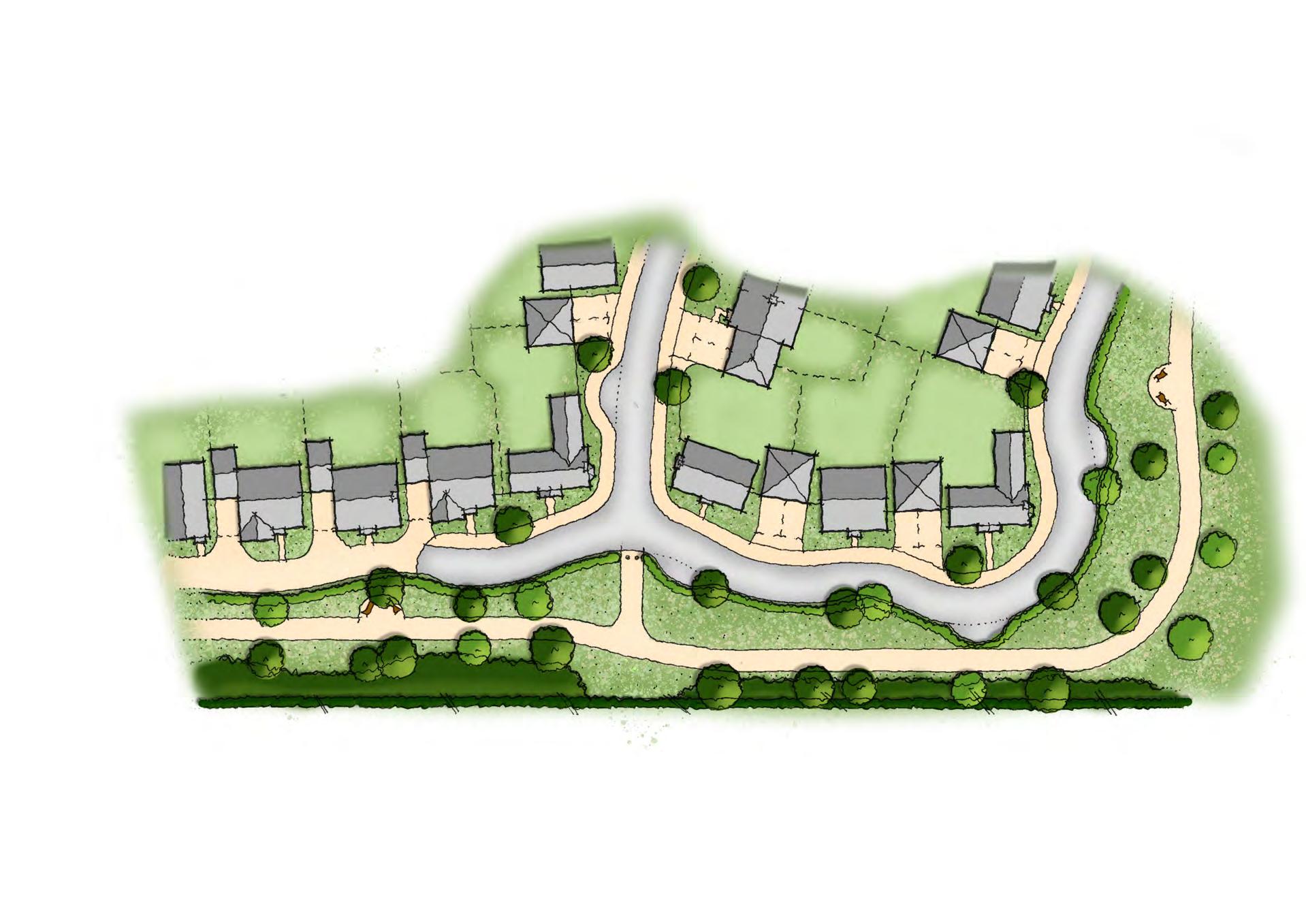
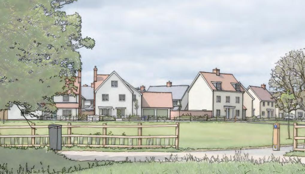
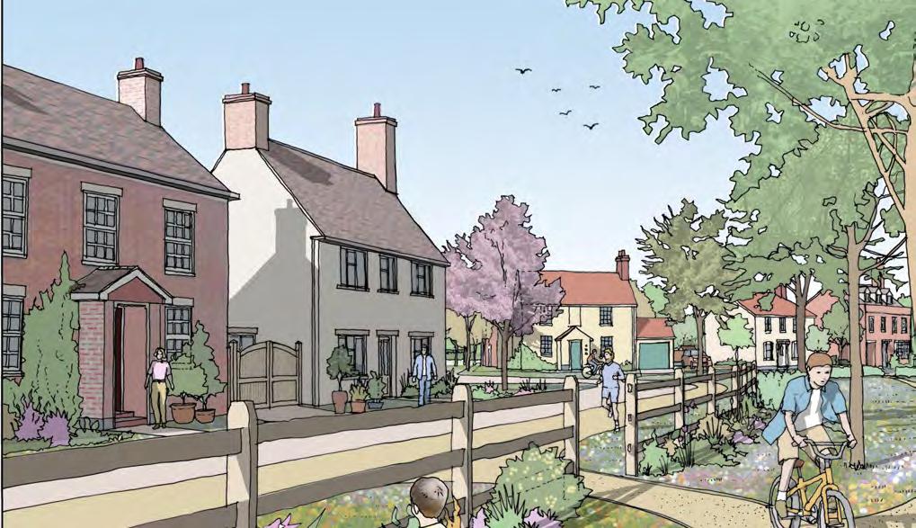
DESIGN COHESION
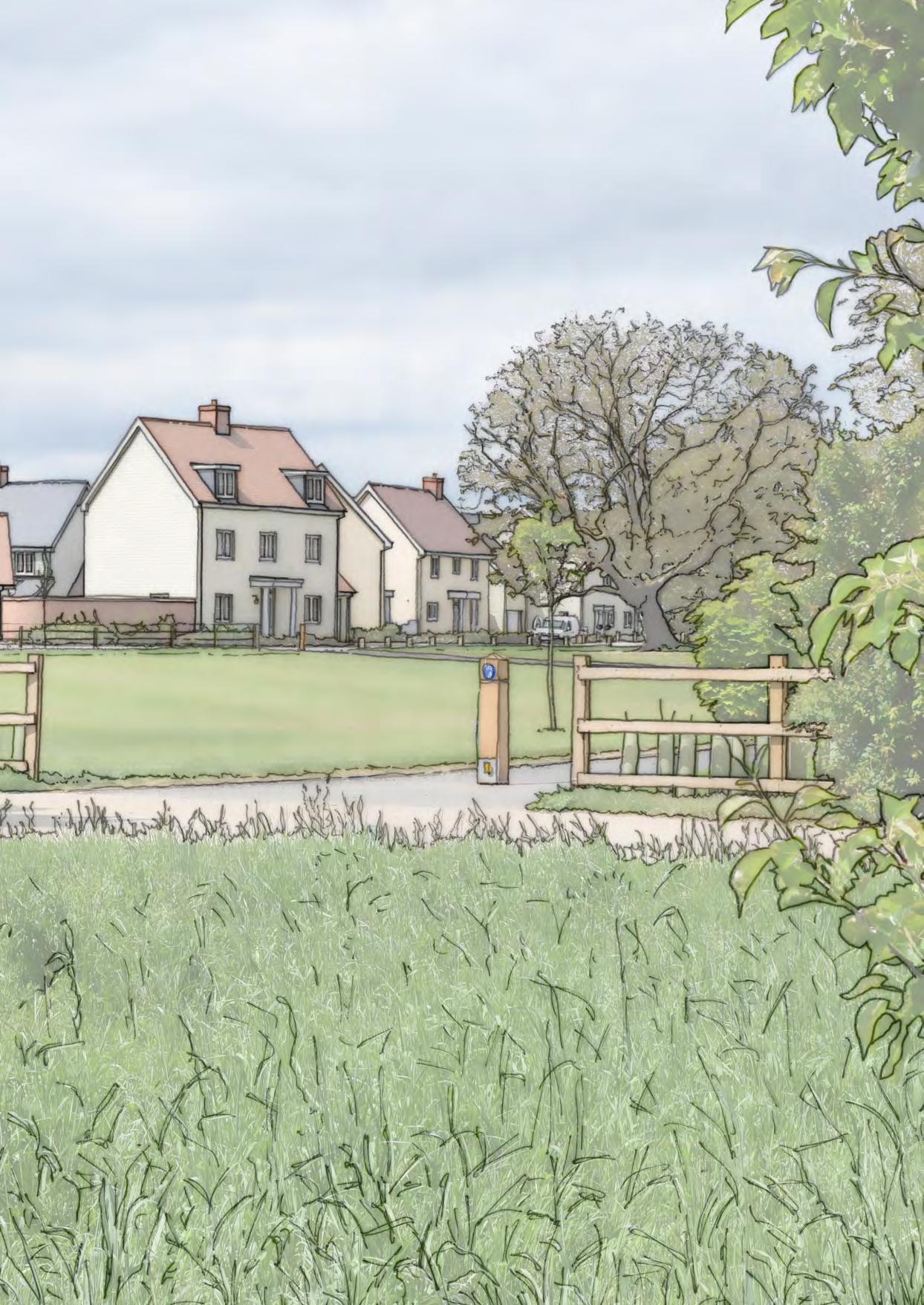
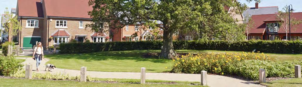
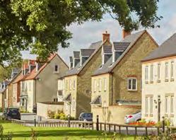
Millfield End will be designed in a cohesive manner to ensure the appearance and layout of the new homes and green spaces are appropriate to their setting.
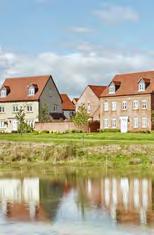
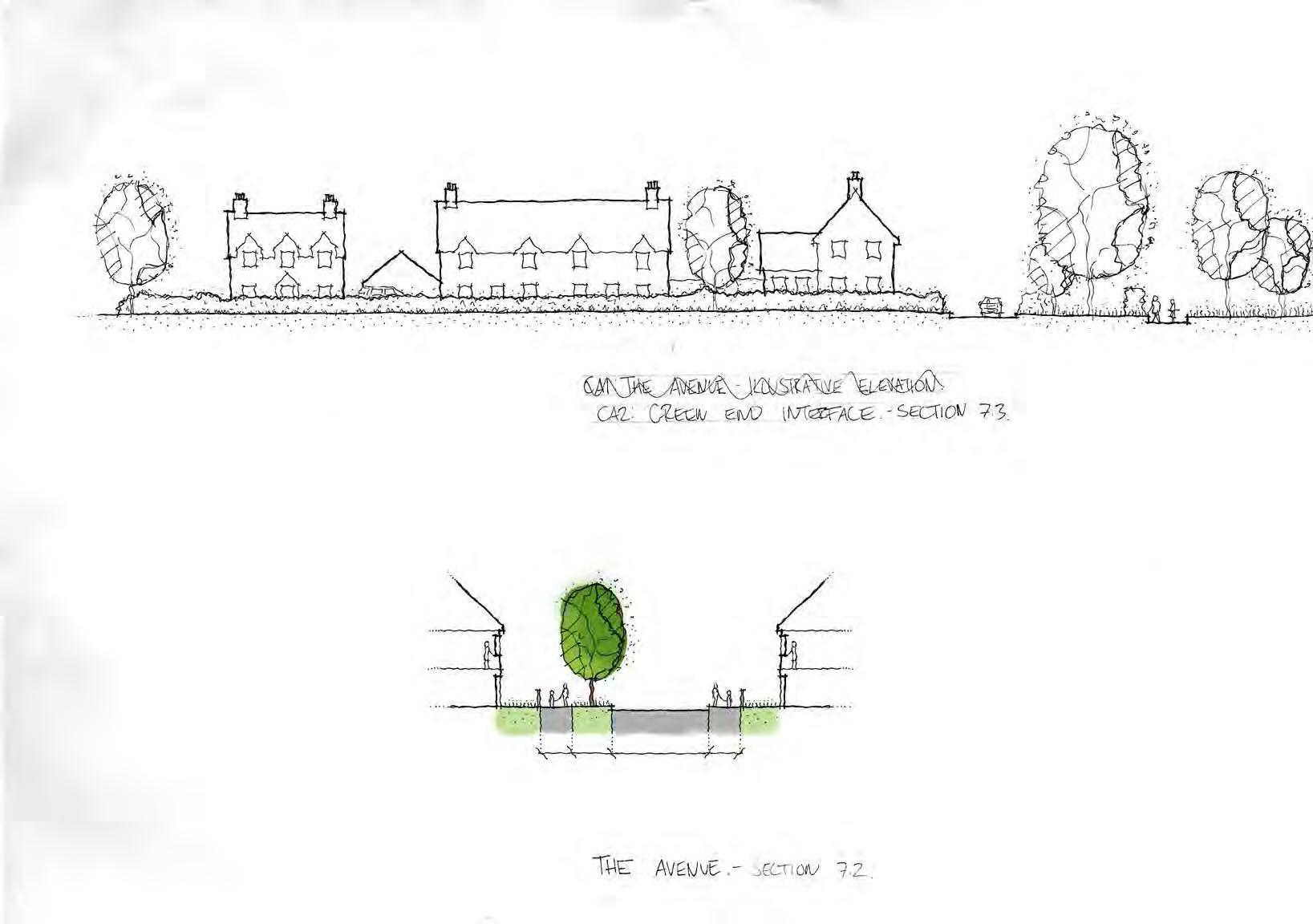
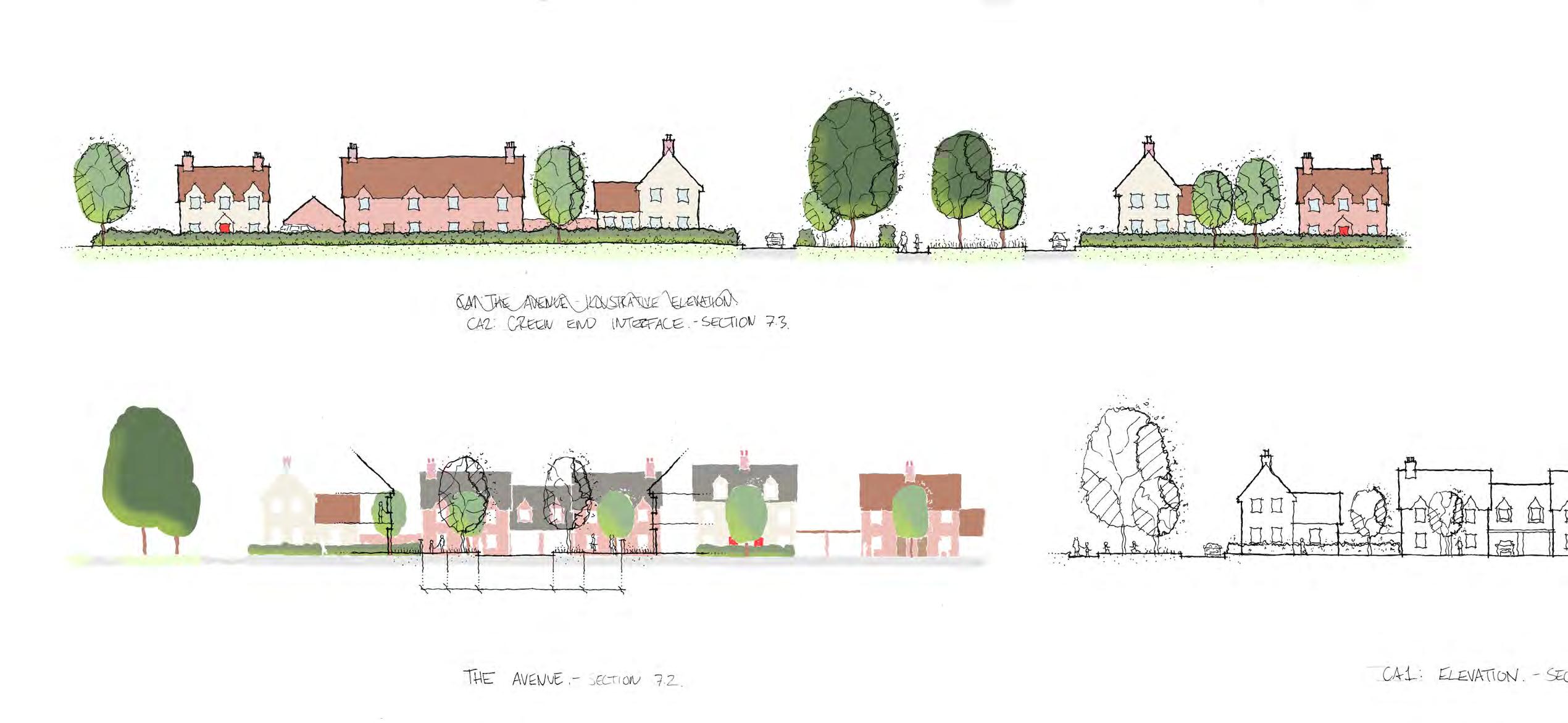
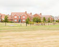
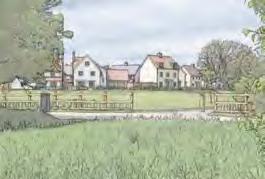
• The new homes will draw upon the vernacular of Great Barford. Within the areas closest to the Green End Conservation Area, the new homes will be designed to be more traditional in character Equally, the areas of open space within this area will be designed to be informal and pastoral in character to respect the setting of the Conservation Area.
• Elsewhere, the design of the new homes will explore more contemporary architectural approaches that interpret the local vernacular and character in a modern way.
• The Design Code clearly sets out how the design of the new homes and open spaces will achieve this vision for design cohesion.
A RURAL GATEWAY TO THE VILLAGE
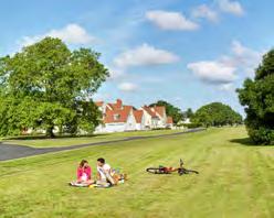
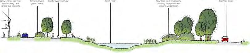
Responding to a key objective of the Neighbourhood Plan, an enhanced landscaped edge along Bedford Road will strengthen the existing treeline and fragmented roadside hedgerow with new landscaping.
• The new homes will be setback from Bedford Road, creating a more positive and gradual transition between the wider rural localised landscape setting and the emerging settlement edge. This approach will also help to visually integrate the new neighbourhood within views from the setting of the Great Barford Conservation Area and the Ouse Valley Way to the south east.
• The new homes will be designed to be traditional in character and be limited in height to mostly two storeys.
• The Design Code provides specific guidance on the detailed design requirements of the Bedford Road frontage.
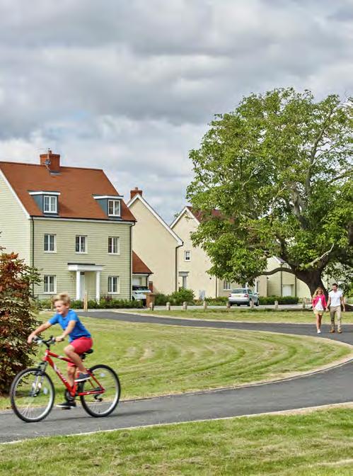
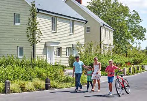
PEDESTRIAN AND CYCLIST CONNECTIVITY
AND INTEGRATION
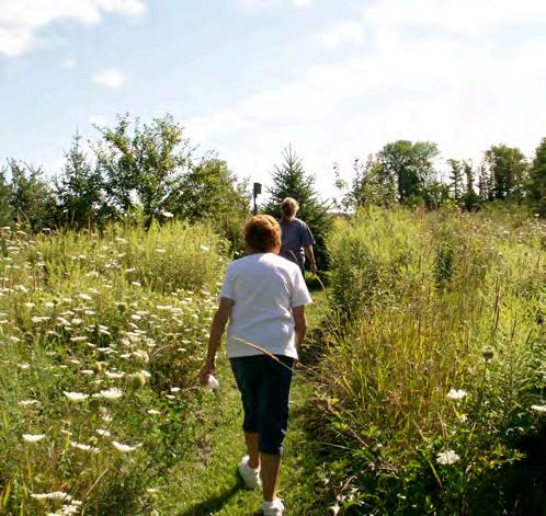
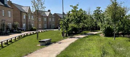
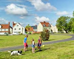
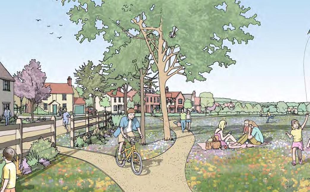
The opportunity for short trips for local journeys on foot and bicycle will be maximised by providing safe and convenient routes for walking and cycling, helping to reduce carbon emissions associated with transport, and maximise and encourage healthier lifestyle choices.
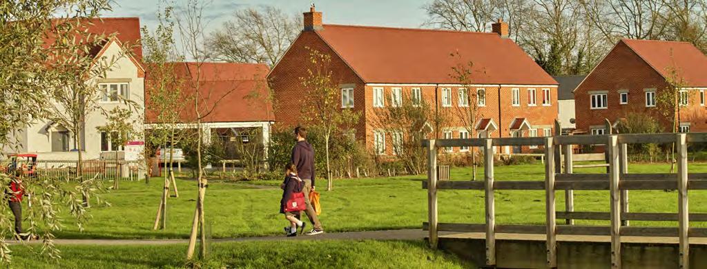
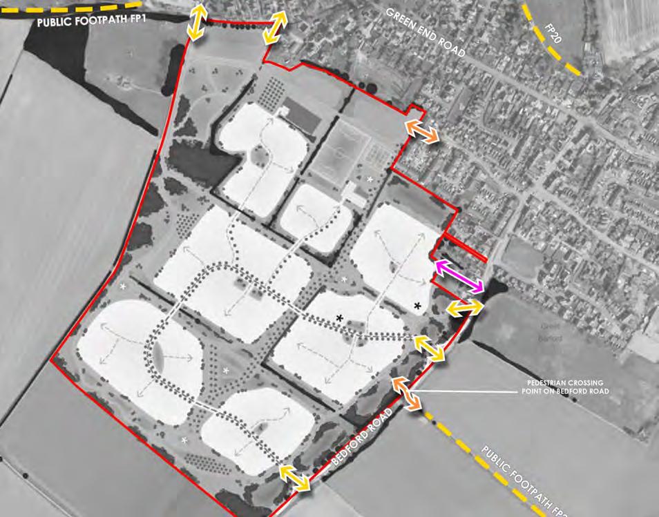
• A network of safe, convenient and direct pedestrian and cycle paths, which follow desire lines, will be provided. This includes a path which will provide a traffic-free connection between the existing public footpaths just to the east and north west of the site, creating a near continuous route between the settings of the River Great Ouse and Great Barford Bridge to the south east, and Green End to the north. A pedestrian crossing point on Bedford Road will facilitate safe access to public footpath 21 to the east.
• A new pedestrian connection to Chapel Field, and pedestrian and cycle connections to Green End Road and Bedford Road, will maximise connectivity with neighbouring areas of the village.
• A safer and more attractive street environment will be created along Bedford Road within the existing built-up areas of the village. This will encourage walking and cycling, and reduce vehicular trips within Great Barford for both residents of the new neighbourhood and existing residents. This will be complemented by new pedestrian and cycle crossing points across Bedford Road to provide safe access to the school and village services.
• 20mph design speeds, designations and traffic calming will create safe new streets which encourage walking and cycling. Shared surfaces, street furniture and landscaping will help to provide a safe environment.
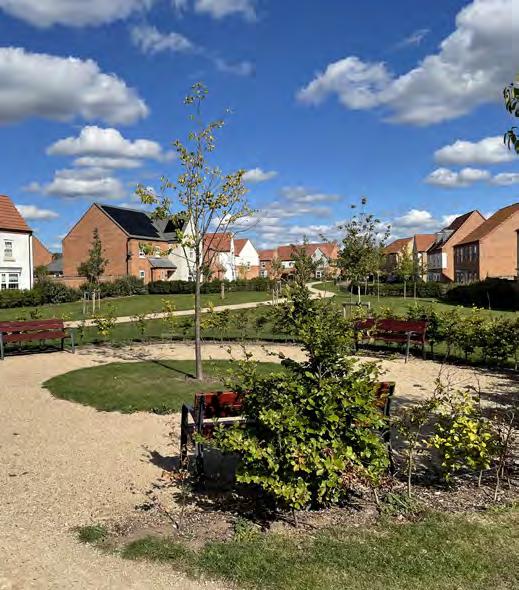
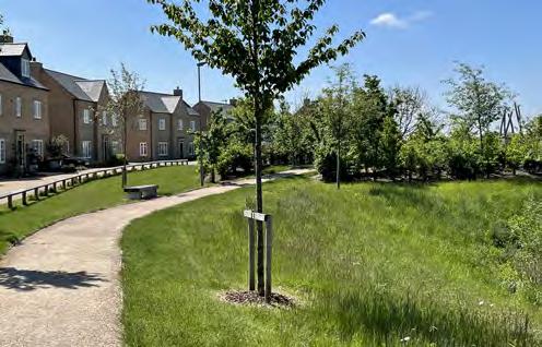
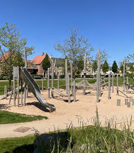
• ‘Play on the way’ – informal play elements are to be located on key routes within Millfield End making car free trips more fun for children.
• Carefully located benches along key routes, including to the existing settlement edge, will provide resting places for residents with mobility difficulties to walk more easily between places.
• Signage along the pedestrian and cycle routes will help to direct residents and visitors to on-site destinations such as the community green and children’s play area, as well as nearby destinations, including public footpaths and existing facilities in the village.
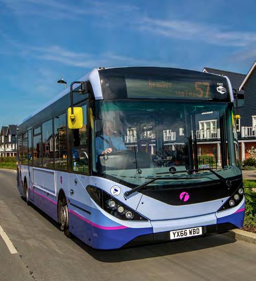
PUBLIC TRANSPORT AND LOW CARBON PERSONAL TRANSPORT
Millfield End will be designed to ensure it is accessible to bus services to help encourage sustainable travel patterns to nearby towns and villages. In accordance with a key requirement of the Neighbourhood Plan, Millfield End will also integrate facilities for electric cars.
• The main street through Millfield End will be designed so that it can accommodate buses, allowing bus services to potentially divert into the site.
• Should bus providers decide not to divert their services through the site, new bus stops will be provided along Bedford Road.
• Electric vehicle charging points will be provided for every home and within communal parking areas.
RESPECTING THE HISTORIC ENVIRONMENT
The historic environment will be conserved and enhanced with Millfield End respecting the characteristics and appearance of Great Barford’s historic environment.
• A swathe of open space will be located alongside Green End Conservation Area to respect its setting, together with the listed building located within it. The open space will be landscaped to have an informal and pastoral character, creating a continuation in character of the existing paddocks that lie immediately to the west on Green End Road.
• The design of the new homes closest to the Conservation Area will draw upon the historic character evident within the Conservation Area and elsewhere within Great Barford.
• Wherever possible, existing trees and hedgerows will be retained and incorporated into the landscape design of the green spaces to respect field patterns. Opportunities to reinstate former hedgerows will be explored to respect field patterns.
MANAGING FLOOD RISK AND BLUE INFRASTRUCTURE
Millfield End will not increase flood risk within the village, and will offer improvements to existing areas of flood risk wherever possible. New sustainable drainage features (SuDS) will form integral parts of the new neighbourhood’s green spaces, and create diverse new habitats for wildlife.
• Surface water will be managed sustainably with sufficient capacity to accommodate the more frequent higher intensity rainfall events expected because of climate change.
• Recognising a key aspiration of the Neighbourhood Plan, the drainage strategy will redirect existing on-site surface water run-off away from Green End Road, instead taking it to Bedford Road. This will reduce existing flow rates to the Brook along Green End Road. Flows from Bedford Road will replicate existing rates so as not to increase flood risk.
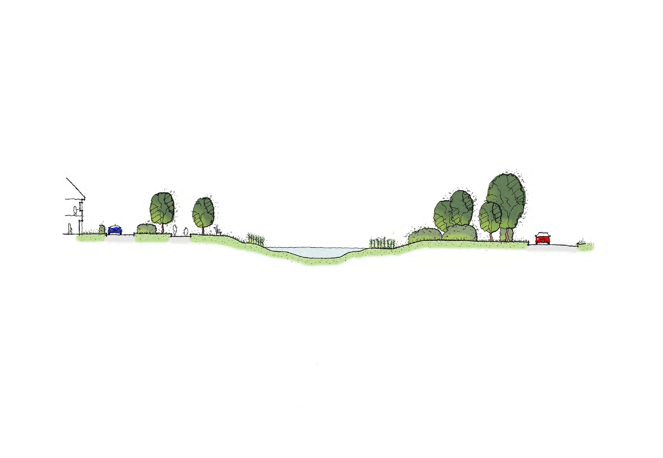
• The drainage features will be designed to reflect the character of the wider open spaces they sit within. To the north, they will be designed as shallow, dry basins seeded with a wildflower mix, so that they reflect the informal, pastoral character of open spaces alongside the Green End Conservation Area. Towards Bedford Road, the drainage features will be designed with visible open water to create the character of a series of village ponds that form an integral part of the gateway to the village.
• Shallow banked swales will run through the new neighbourhood’s open space corridors as a sustainable and attractive means of conveying surface water run-off.
GREEN INFRASTRUCTURE
Using the Great Barford Green Infrastructure Plan as an important starting point, the masterplan proposals for Millfield End are to be landscapeled. The new neighbourhood offers a unique opportunity to create a development that will be fully integrated with the existing community and receiving landscape, through the introduction of high quality green corridors and accessible green spaces.
This will provide a robust natural framework for opportunities relating to pedestrian and cyclist movement, recreation, community spaces, children’s play areas, biodiversity enhancements, blue infrastructure and structural landscaping.
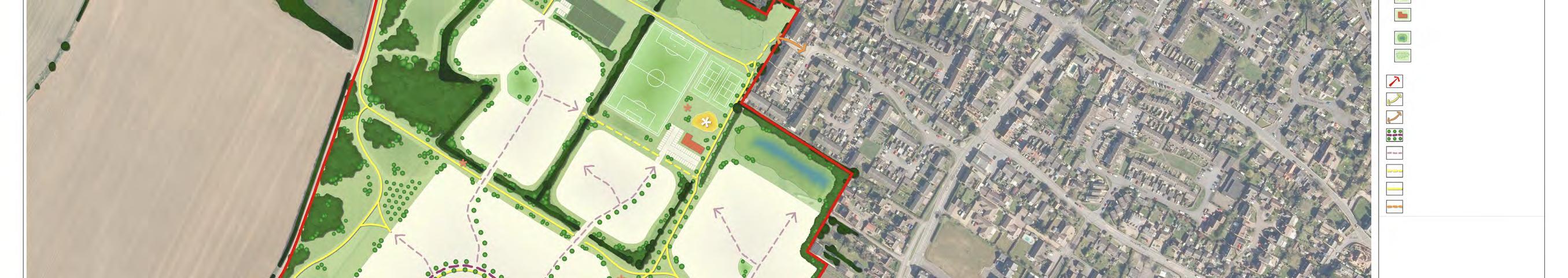
• Following dialogue with the local community, a community green will be provided alongside the existing settlement edge, close to Chapel Field. This green will ensure existing residents benefit from easy access to a key area of public open space, helping to integrate the existing and new communities.
• Elsewhere, public open spaces will serve a wide variety of different purposes and functions through the provision of a range of open space typologies, such as amenity open space, natural and semi-natural greenspace, sports pitches and allotments.
• The structure of Millfield End will be defined by a connected and accessible network of green spaces. This will provide habitat connectivity, wildlife movement and feeding corridors. This will provide plentiful opportunities for residents and visitors alike to interact with nature on a day-to-day basis.
• The existing internal hedgerows will be retained and bolstered within the green corridors and open spaces, maintaining a sense of the historic field pattern and sense of place.
• Pockets of new woodland and thicket planting, along the peripheral areas of Millfield End will assist in integrating the development with the existing settlement edge and the localised landscape fabric.
• Incorporation of internal native woodland blocks and treelines will draw in the influence of these features from the peripheral areas of the development, and will visually break up the scale and massing of the new homes from within longer distance views.
BIODIVERSITY NET GAIN
The Great Barford Neighbourhood Plan establishes that Millfield End should provide a minimum biodiversity net gain of 10%. Existing and new residents alike will enjoy access to a diverse range of habitats and species.
• The retained hedgerows and trees will be generously buffered by the creation of a mosaic of biodiverse habitats to create strong green corridors running through Millfield End.
• New areas of structurally diverse native woodland will reflect plant communities that are characteristic of the local area.
• New areas of structurally diverse native scrub will feature open areas and scalloped edges to maximise the development of the scrub to grassland ecotone.
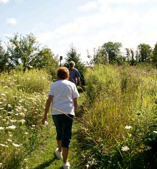
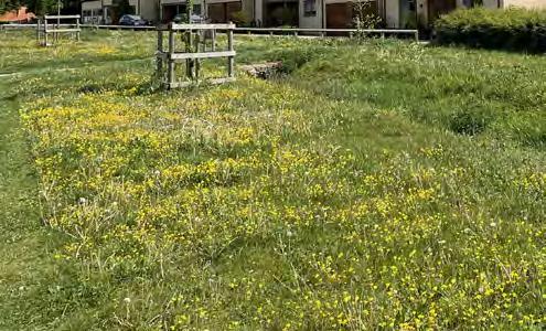
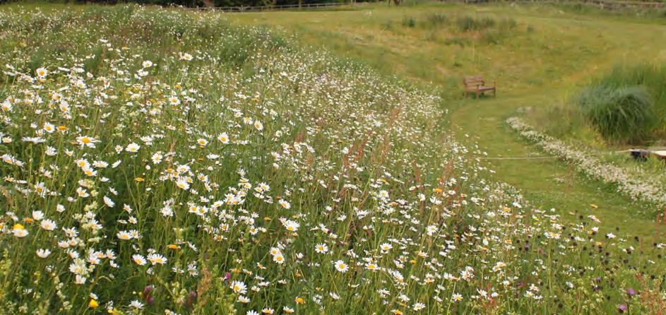
• New areas of wildflower meadow will create herb rich neutral grassland communities and employ traditional management measures to create a diverse sward of variable heights.
• The SuDS basins and swales will support wet grassland, created by the sowing of appropriate herb rich wet grassland mix.
• Areas of short amenity grassland will be sown with a ‘short’ flowering mix to provide a diverse mix of flowers for pollinators.
• Street trees and ornamental shrubs will prioritise native species to support diverse assemblages of invertebrate species.
03 | PLANNING POLICY CONTEXT
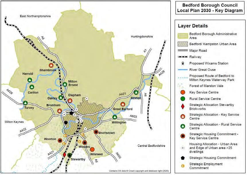
Bedford Borough Council are currently in the process of preparing a new Local Plan (Local Plan 2040). The Plan was submitted to the Secretary of State for Examination on 12th January 2023. The Block 1 hearings commenced 13th June and closed on the 23rd of 2023. Block 2 hearings are to commence in September. It is considered that this plan currently has little to no weight attributed, until it has progressed further through the Examination process.
Adopted Development Plan Planning Policy
The relevant adopted Development Plan for Bedford Borough Council (BBC) comprises:
• The saved policies of the Allocations and Designations Local Plan (2013)
• The Bedford Borough Local Plan 2030, adopted on 15th January 2020
• The Great Barford Neighbourhood Development Plan, made 19th January 2022
This Development Brief and Design Code has been prepared in accordance with Policy H1 of the Neighbourhood Plan: Location of Future Housing, which states “A Development Brief must be prepared for the site prior to any planning application being submitted encompassing the requirements of Policies in the Neighbourhood Plan and …key principles for development.” The policy also requires technical assessments to demonstrate the successful delivery and a SiteWide Design Code for the development.
Great Barford Neighbourhood Plan 2020-2030
The Great Barford Neighbourhood Plan was made 19th January 2022.
Policy H1 of the Neighbourhood Plan sets out the area of land designated for up to 500 residential dwellings and associated open space. The policy requires a development brief be prepared for the site and requires key principles for development.
The following NDP policies are of relevance and have been assessed and applied to the Development Brief and Design Code:
Policy D1 – High Quality Design and Rural Character
Policy D1 states the criteria required for good design in new development. The criteria for new development includes: being well related and integrated within existing development, an appropriate scale, massing and materials in addition to the other limbs of the criteria.
Policy D2 – Sustainable Design and Construction
Policy D2 states new development must include sustainable design and construction features for energy efficiency, targeting zero carbon emissions. The use of renewable energy sources and thermally efficient building materials is encouraged.
Policy NE1 – Protecting the Landscape
Policy NE1 states proposals should seek to protect and enhance the historic and natural landscape and character, including key views. New buildings must assess their impact on landscape and provide mitigation and appropriate design where required.
Policy NE2 – Nature Conservation
Policy NE2 states new development will be required to protect and enhance natural features and provide a biodiversity net gain of 10%. Developers should link sustainable drainage solutions in new development to complement local nature conservation objectives.
Policy ROS1 – Open Space Provision as Part of New Development
Policy ROS1 states open space must be provided within new development and should meet the criteria set out, including: contributions to open space and green corridors, trees and shrub planting and future maintenance.
Policy ROS2 – Local Green Spaces
Policy ROS2 sets out the designated Local Green Spaces and requirement to manage appropriate development in these areas.
Policy HE1 – Great Barford Conservation Areas and their Settings
Policy HE1 states development within or nearby the Conservation Area must have regard to sustaining and enhancing the historic environment and local character. A design and access statement is required to address the criteria set out in the policy including: active frontages, local character, scale and mass, views.
Policy TT1 – Sustainable Transport Infrastructure
Policy TT1 notes sustainable modes of transport including installation of electric vehicle charging and cycle storage will be supported.
Policy CF1 – Community Facilities
Policy CF1 states that the provision of new community facilities/ improvements to existing community facilities will be supported. Development proposals that will result in the loss or harm to community facility will be strongly resisted.
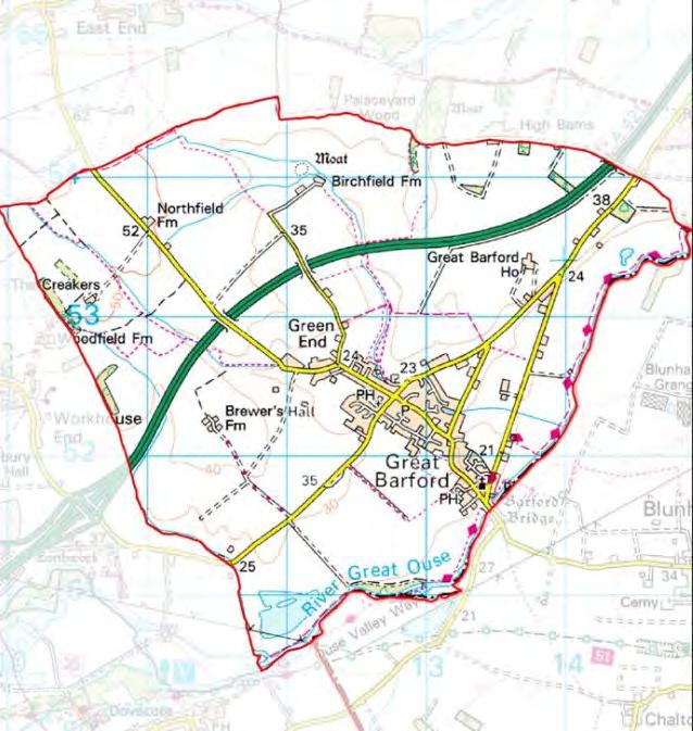
Figure 3.2 Neighbourhood Plan Parish Area.
POLICY
H1: Location of Future New Housing Development
New development has been designed within the areas at least risk of flooding and surface water will be managed sustainably to not increase the risk of flooding. This will protect the National Site Network sites downstream of Great Barford.
The development will provide around high quality homes with a mix of types and sizes, including affordable homes and extra care housing.
A Design Code has been produced to ensure the appropriate appearance of layout of development.
A gateway to the village has been designed for along the Bedford Road frontage reflecting the rural village location and character.
Provision of additional secondary school capacity.
Provision of new footpath, cycle ways and pedestrian connection to Chapel Field and on Bedford Road to provide safe access to the school and village amenities.
POLICY H1:
The cycle links will integrate to wider cycle networks and neighbouring development, encouraging walking, cycling and reduced vehicular use.
A transport assessment detailing highways and appropriate mitigation alongside a flood risk assessment will be provided at planning application stage.
The character of place will respond positively to the surrounding heritage and archaeological assets.
Contributions to community facilities to include a new medical centre, recreational and community centres.
Provision of on-site green infrastructure including a new community green, connected public open spaces will enhance the character of the village and provide a definitive planted edge to development within the landscape.
The Bedford Borough Local Plan 2030
While the plans should be read as a whole, the following policies are considered of particular relevance to this site in respect to the nature and context of the allocation and the requirement behind NDP Policy H1:
Policy 3S: Spatial Strategy
To deliver sustainable development and growth that enhances the vitality of the borough’s urban and rural communities, all new development will be required to contribute towards achieving the stated objectives and policies of this plan through a number of strategies, including Delivering the majority of rural growth through neighbourhood plans.
Local Plan 2030 Planning for the future
Policy 4S: Amount and Distribution of Housing Development
A minimum of 3,169 new dwellings will be allocated and distributed through a number of strategies based upon the settlement hierarchy including 500 Homes in the Key Service Centre of Great Barford.
Figure 3.3 Location of
The following list of related core policies are provided as listed below so we can consider the size of this section within the wider document for which if any we include specifically]
The following Local Plan Policies are considered to be the core policies of relevance to the principles of a development framework for the site:
• Policy 29: Design of New Developments
• Policy 35S: Green Infrastructure
• Policy 37: Landscape Character
• Policy 41S: Historic Environment and Heritage Assets
• Policy 43: Enhancing Biodiversity
• Policy 54: Energy Efficiency
• Policy 58S: Affordable Housing
• Policy 59S: Housing Mix
• Policy 92: Flood Risk
• Policy 93: Sustainable Drainage Systems (SuDS)
Supplementary Planning Documents (SPDs) and Guidance
The following are considered to be relevant to this document and will be assessed in accordance with future proposals:
• Bedford Borough Design Guide: Settlements and Streets SPD (2023)
• Sustainable Drainage System SPD (2018)
• Open Space SPD (2013)
• Planning Obligations SPD (2013)
• Parking Standards for Sustainable Communities: Design and Good Practice SPD (2014)
• Technical Guidance: Waste and Recycling in New Developments (2021)
• Technical Guidance: Waste Audits for New Developments (2021)
The Bedford Borough Design Guide: Settlements and Streets Supplementary Planning Document (SPD) was adopted at Executive Meeting held on 8th March 2023. The document provides design guidance for residential development in the Borough.
National Planning Policy Guidance
The National Planning Policy Framework (NPPF) (July 2021) and National Planning Practice Guidance (NPPG) (2014, as amended) is the most relevant national planning policy and guidance and will be material to the preparation of a future planning application(s).
04 | SITE CONTEXT AND ANALYSIS
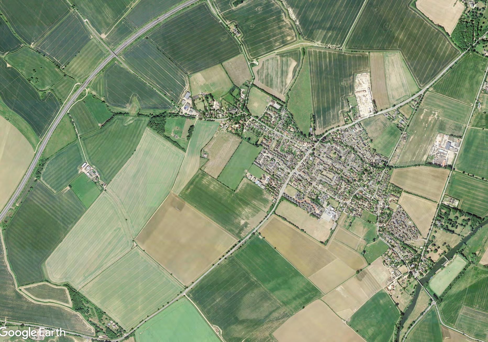
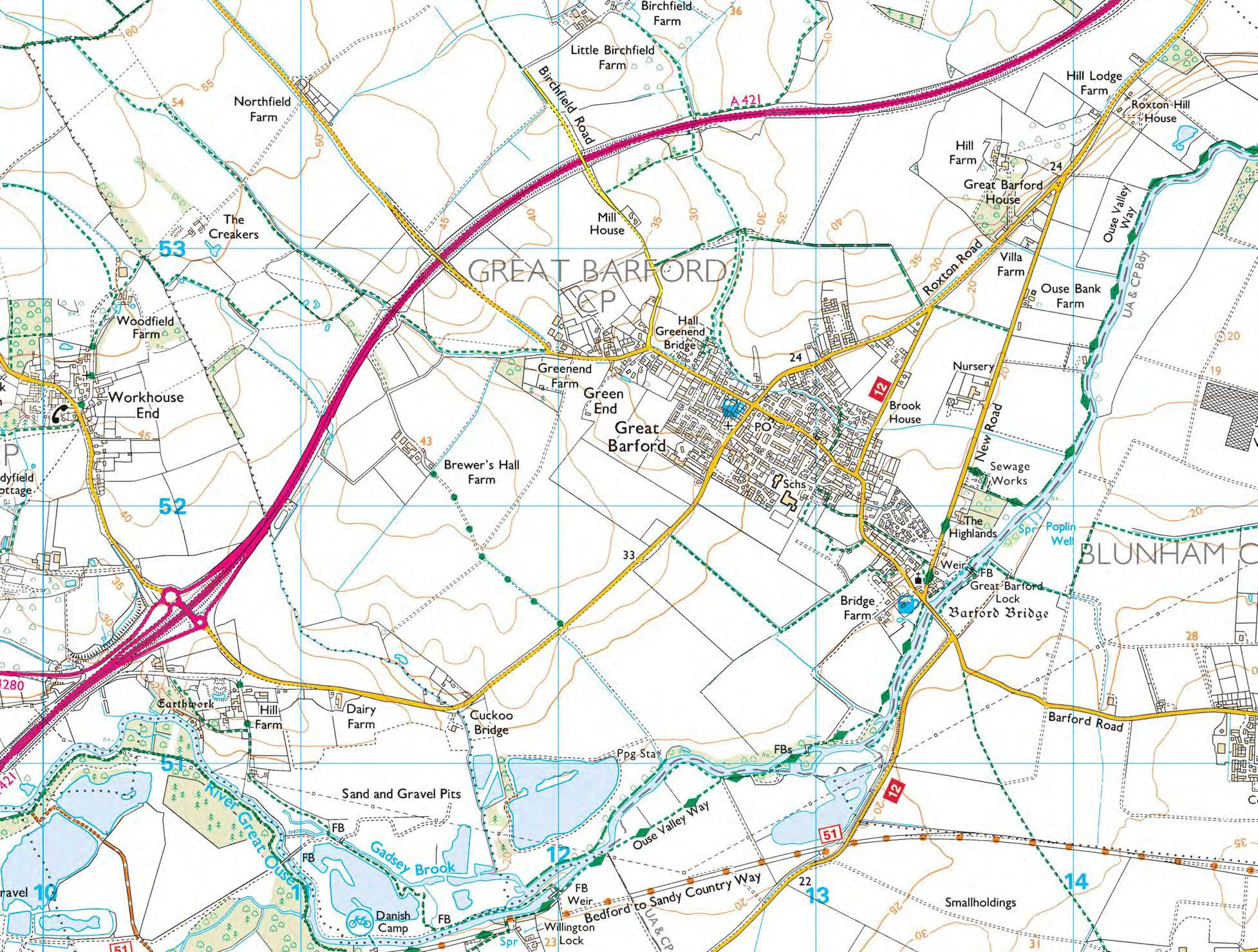
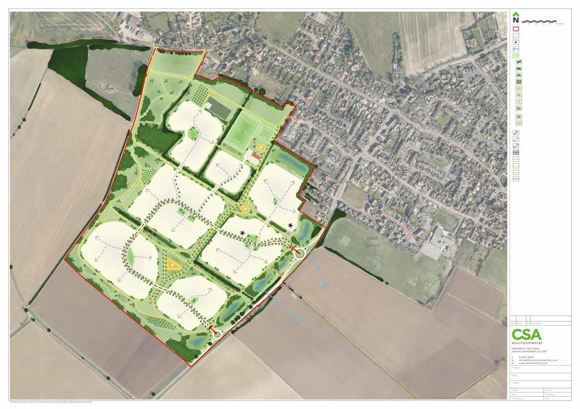
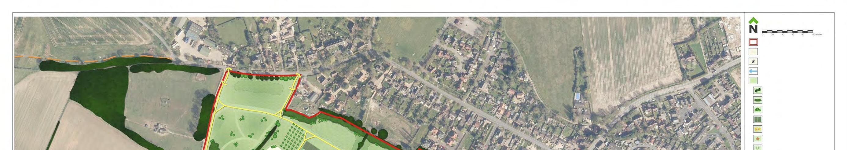
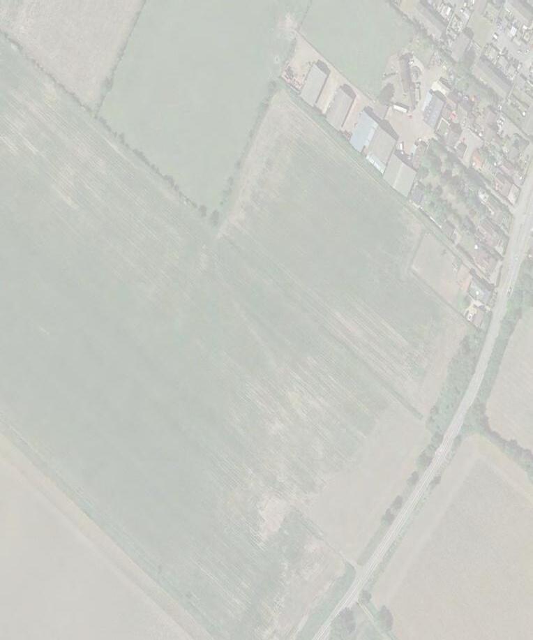
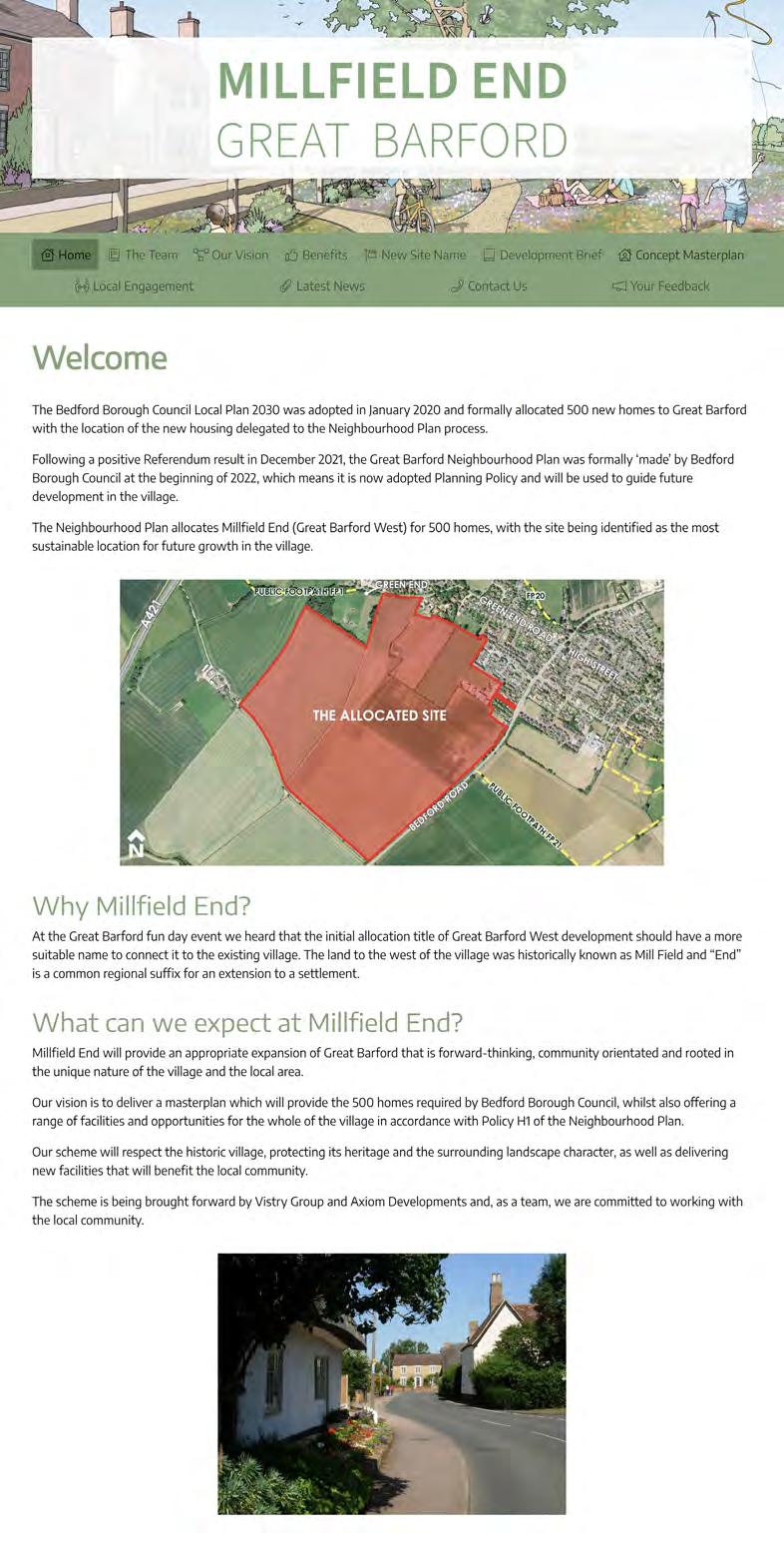
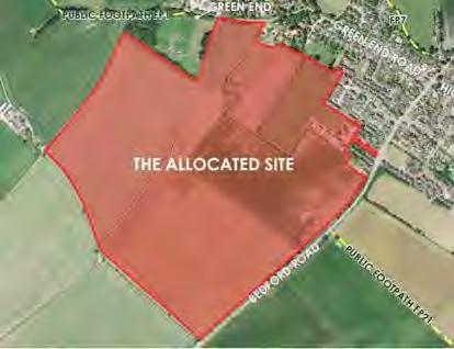
4.1 The Allocated Site
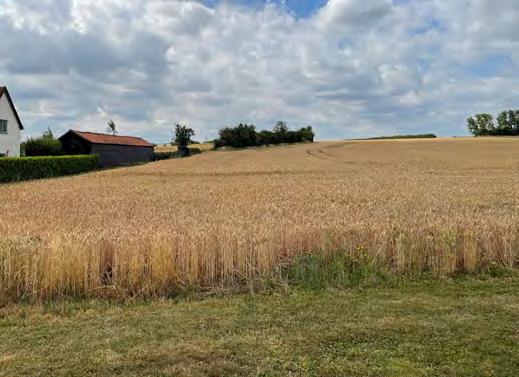
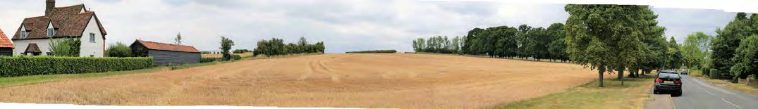
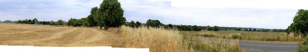
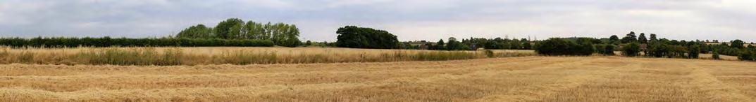
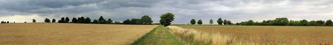
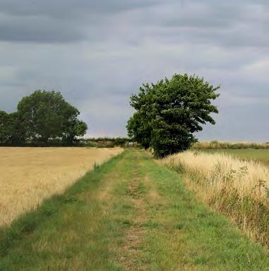
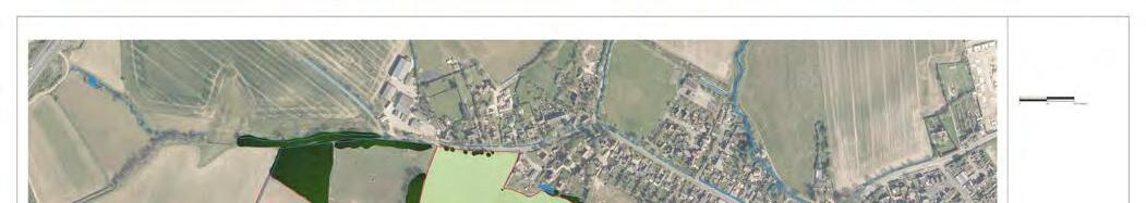
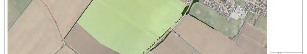
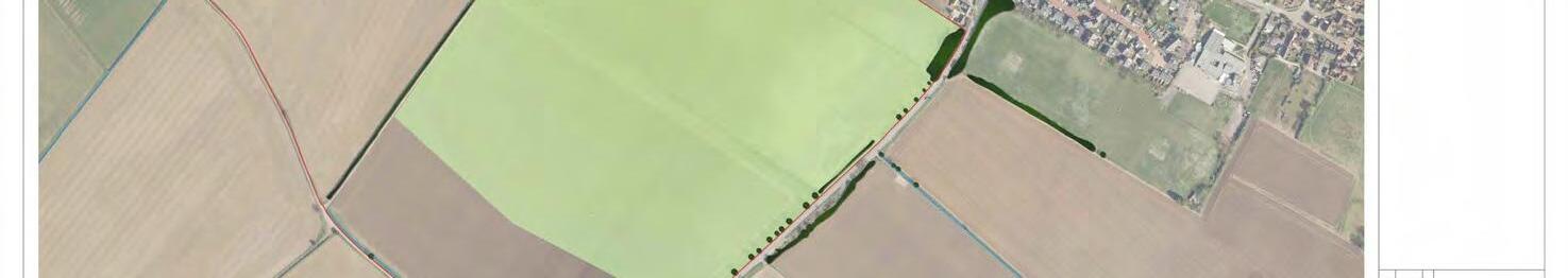
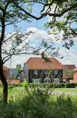
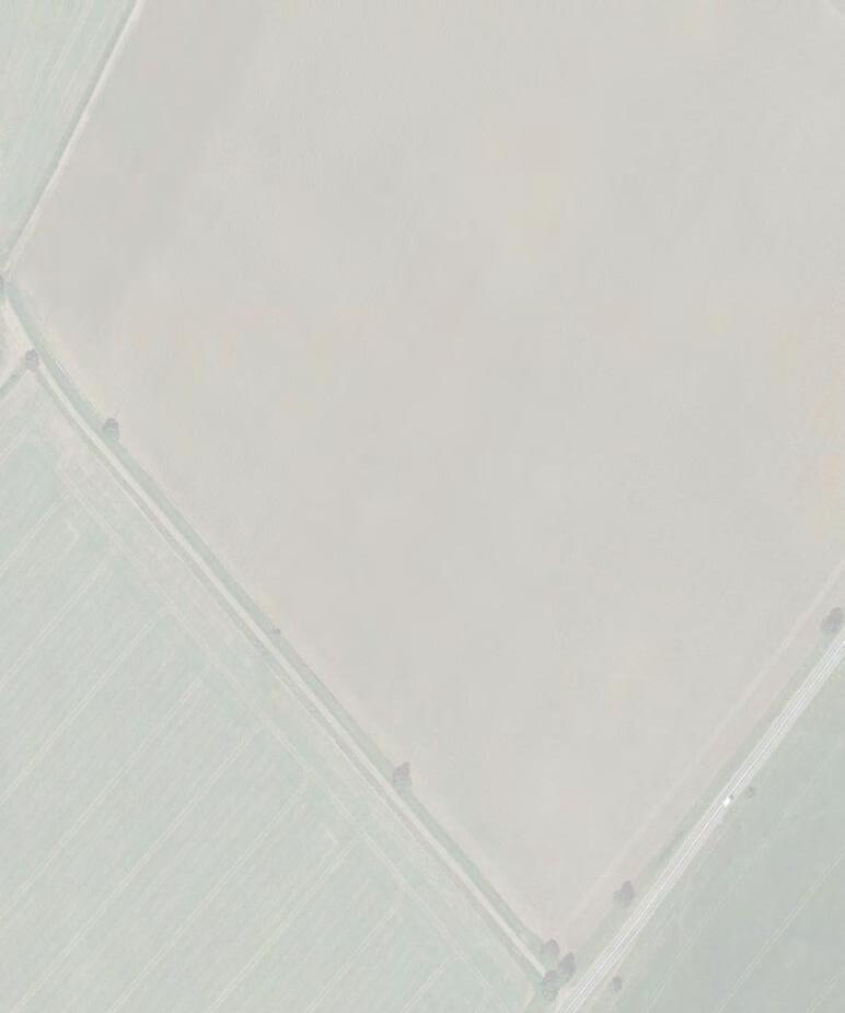
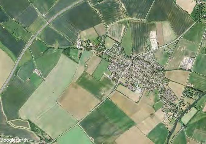
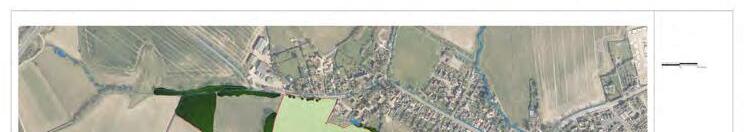
The allocated site lies on the western edge of Great Barford, to the north west of Bedford Road and to the south west of Green End Road. The existing built up areas of Great Barford bound the allocated site to the north east and east. The northernmost part of the Site is indented by a series of small scale pastoral fields and a small area of woodland. These pastoral fields can be seen to form part of the attractive western gateway to Great Barford as one approaches the village along Green End Road from the north west.
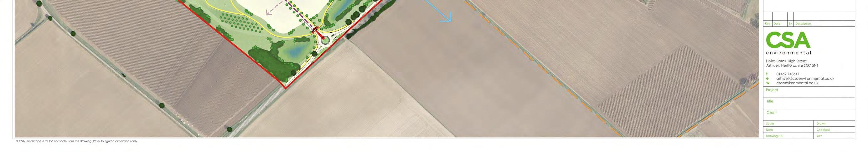
To the north west the allocated site is bound by arable fields, with the A421 dual carriageway located approximately 480m from the allocated site’s north western boundary.
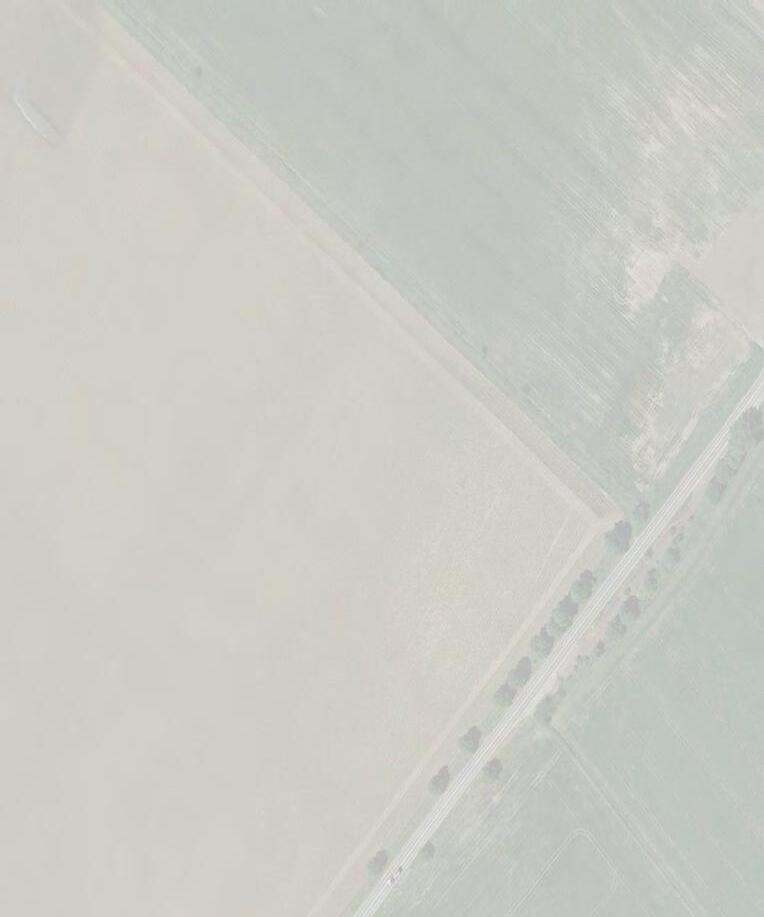
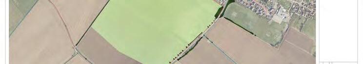
The allocated site’s south western boundary is bound by a made track which leads from Bedford Road to a small grouping of residential and agricultural buildings at Brewer’s Hall Farm, located immediately adjacent to the western corner of the allocated site. Beyond the aforementioned track are further arable fields. To the south east the allocated site is bound by the single carriageway of Bedford Road, beyond which lies further arable fields. The River Great Ouse is located some 1km (0.62 miles) to the south east of the Site.
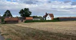
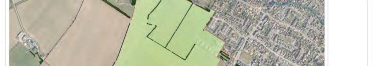
The allocated site itself measures some 64 hectares. It mostly comprises a series of arable fields bound by a mix of hedgerows and ditches. The easternmost part of the Site comprises two residential properties, a butcher’s and agricultural buildings associated with Home Farm.
BREWER’S HALL FARM
GREEN END ROAD
CHAPEL FIELD
DOTHANS CLOSE
CHAPEL CLOSE COOPERS CLOSE
ALLOCATED AREA UNDER GBNP POLICY H1
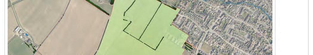
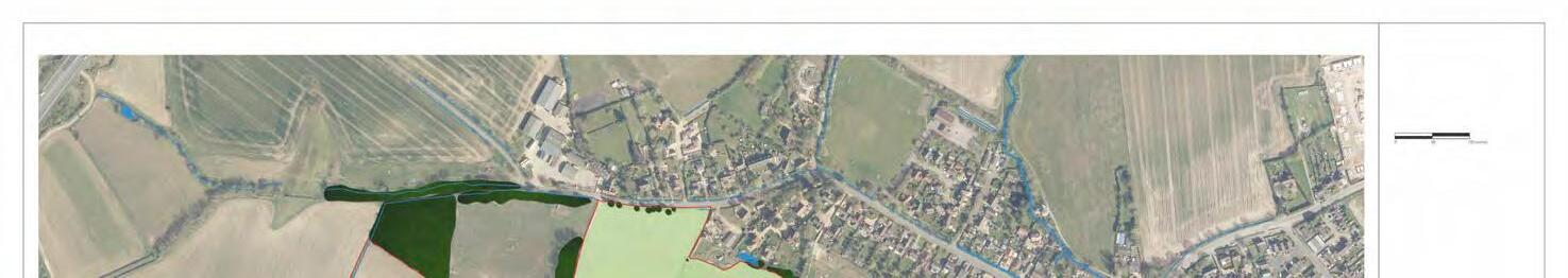
4.2 Surrounding Land Uses
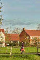
Great Barford is surrounded by open countryside, the majority of which comprises large scale arable fields. The predominant built land use in Great Barford is residential.
There are a range of amenities in the village. These include:
• Great Barford Village Hall and playing field
• Great Barford Primary Academy
• Bowls Club
• Post Office
• Two public houses
• Two shops
• Small industrial units
Village Hall
Playing field
Great Barford Primary Academy
Great Barford Bowls & Petanque Club
Anchor Inn
The Golden Cross
Coffee Shop Takeaway Shop
Employment Area
All Saints Church
Post Office & Shop
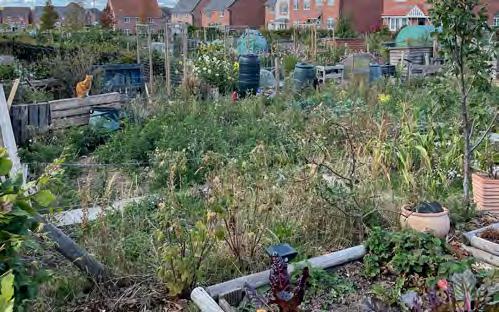
Allotments
BARFORDROAD
BIRCHFIELD ROAD
GREENENDROAD
HIGHSTREET
ROXTONROAD
ADDINGTONS ROAD
NEW ROAD
GREENENDROAD HIGHSTREET
THE ALLOCATED SITE
BEDFORDROAD
View south west from Green End Road, looking into the allocated site’s northern corner.
View north across the eastern quadrant of the allocated site.
View from centre of the allocated site looking north towards Green End.
View west from Bedford Road standing adjacent to public footpath 21.
View from public footpath 21 approaching the allocated site and Bedford Road from south east.
4.4 Landscape Setting
The allocated site falls within the Bedfordshire and Cambridgeshire Claylands National Character Area (NCA 88), whilst at a smaller scale the allocated site associates with the Clay Farmland Landscape Type (LT) and ‘Renhold Clay Farmland’ Landscape Character Area (LCA 1E). Typical characteristics associated with the LT and smaller scale LCA, and which are considered to inform the localised setting of Great Barford, include:
• A large scale landscape.
• Gently undulating landform.
• Large scale, intensive arable crop production dominates the land cover.
• Dispersed woodland (some ancient) –predominantly mixed and deciduous.
• Significant hedgerow loss leaving variable and inconsistent field and roadside boundaries.
• Hedgerow trees are prominent in the level landscape, many of them mature, including remnant trees within fields.
• Hedgerows are in mixed condition with some low flailed and gappy or lost leaving areas of open, featureless, arable land.
• Scattered woods give variety to distant views.
Whilst the allocated site’s close relationship to the settlement edge is evident, the localised setting is considered to reflect some of these more rural characteristics, with notable opportunities to repair and enhance features, such as the fragmented hedgerows and trees that characterise the allocated site, and which are in a declining condition as a result of intensive farming practices.
Due to the surrounding enclosed valley landform, views of the allocated site are relatively localised, with the surrounding vegetation structure and intervening settlement ensuring that the allocated site is never perceived in its entirety from a singular location. Key views are considered to include:
• The village approach from Bedford Road.
• Cross valley views from the Ouse Valley Path (long distance PRoW) to the south west, where the Site’s south eastern boundary informs the localised skyline.
• Views from within the adjacent Conservation Area at Green End Road and more filtered views from the pastoral fieldscape setting as it meets the High Street within the eastern end of the village.
• Views from the elevated PRoW routes to the north of Great Barford, where the southern and western parts of the allocated site are perceived.
The allocated site experiences a limited degree of intervisibility from beyond the setting of the localised road network (the A421, Saint Neots Road and Bedford Road) and the mature and intact landscape setting which characterises the heavily treed River Great Ouse.
Overall, the allocated site is considered to reside within a transitional landscape between the smaller more enclosed settings established within the settlement edges and a broader, larger scale landscape that characterises the setting within the surrounding countryside. Beyond the internal fieldscape, the allocated site is comprised of relatively few notable landscape features, established by a fragmented network of internal field hedgerows and open ditches. A more intact treescape and positive woodland blocks, are generally perceived within the periphery of the Site’s localised setting along the course of the River Great Ouse and beyond the A421 corridor, within the wider landscape to the north west. A small block of woodland is a notable exception to this, formed along a narrow watercourse, perceived upon exiting the Green End Conservation Area as you head to the west out of the village.
4.5 Green Infrastructure
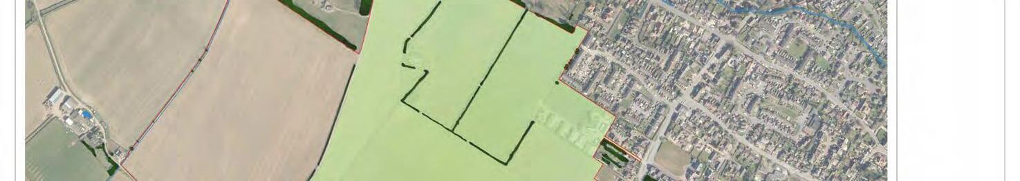
Existing Landscape Features
• The majority of allocated site comprises a series irregular shaped large and small scale arable fields, formed within a shallow valley, established along the River Great Ouse, some 1km to the south east.
• The easternmost part of the allocated site comprises two residential properties, a butcher’s and agricultural buildings associated with Home Farm.
• Many of the internal boundaries are defined by well-managed hedgerows and intermittent trees, with field ditches running along many of the hedgerows.
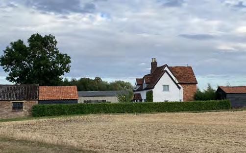
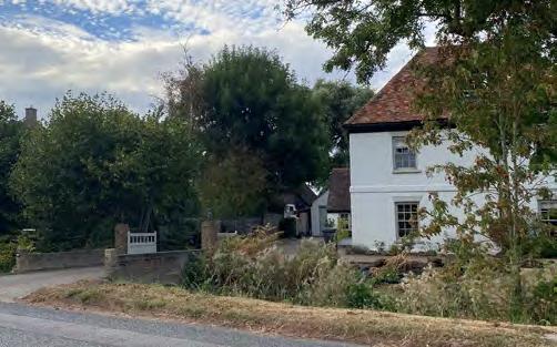
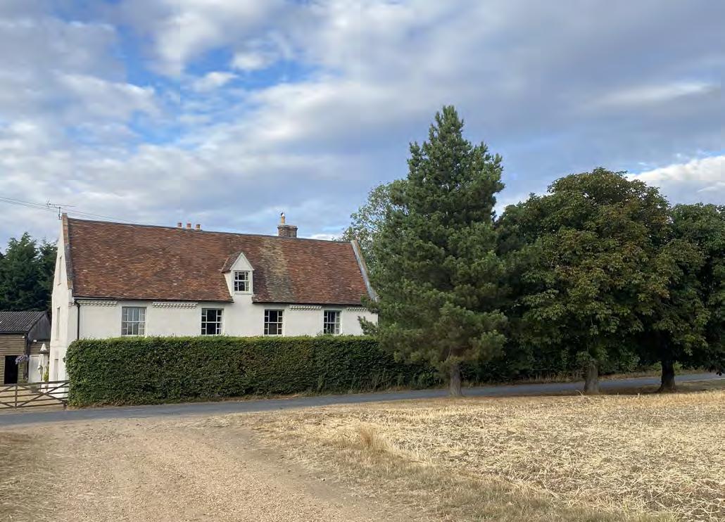
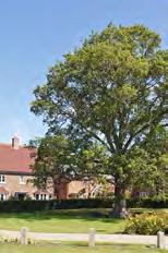
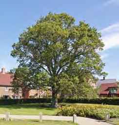
• The western section of the northern boundary is bound by an existing area of woodland and a tree grouping contiguous with the woodland (both off-site). This creates a wooded backdrop to the northern corner of the allocated site. Immediately to the east, the allocated site is bound by a group of mature English oak and ash trees (off-site).
• The western section of the boundary with Green End Road comprises a mix of Scots pine and horse-chestnut trees planted at regular intervals. The eastern section of this part of the boundary lacks any notable landscape features.
• The north eastern boundary is defined by a mix of tree groupings and individual trees. To the west, they tend to be stronger and denser, being associated with the rear gardens and paddock alongside this part of the north eastern boundary. To the west, where the homes on Chapel Field, Dothans Close and Chapel Close front onto the allocation boundary behind small front gardens, the existing vegetation become distinctly less dense and more open.
• The Bedford Road frontage comprises a mix of mature hedgerows, individual trees and tree groupings. The majority of the trees along this boundary are lime. Much of the boundary lacks any vegetation of note.
• The south western boundary is defined by an existing field ditch and track leading to Brewer’s Hall Farm. The boundary is open to the countryside beyond save for a small number of sporadic trees mostly comprising ash.
• The north western boundary is defined by a gappy hedgerow. There are also a small number of trees located along the boundary.
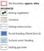
KEY:
KEY:
Site Boundary
Tree Numbers 15
Site Boundary
Site Boundary
Tree Numbers 15
Tree Numbers
Category ‘U’ Trees
[8] Category 'U' Trees
Category 'A' RPA
Category ‘A’ Trees
[8] Category 'U' Trees
Category 'B' RPA
Category 'A' RPA
Category ‘B’ Trees
Category 'C' RPA
Category 'B' RPA
Category ‘C’ Trees
Shading Arc
Category 'C' RPA
Shading Arc
Shading Arc
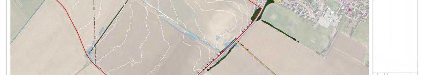
Note: Trees 1-9, 11, 27, 31, 32, 41, 45-76, 78, 86, 106, Groups G1, G2, G4, G6, G7, G10-G15, G17 and Hedgerows H1, H3 & H6-H8 have been plotted using measurements onsite in conjunction with aerial imagery. Their locations were not recorded on the topographical survey of the site.
Note: Trees 1-9, 11, 27, 31, 32, 41, 45-76, 78, 86, 106, Groups G1, G2, G4, G6, G7, G10-G15, G17 and Hedgerows H1, H3 & H6-H8 have been plotted using measurements
THE ALLOCATED SITE
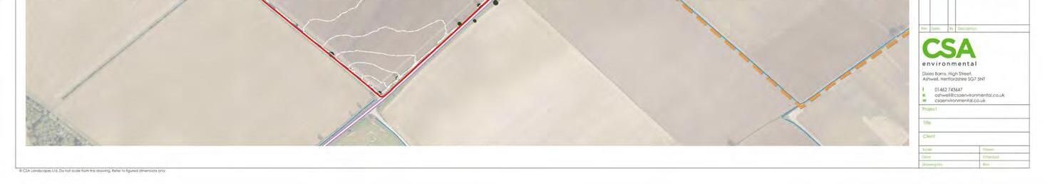
Please refer to Tree Constraints Plans in Appendix A
4.6 Utilities
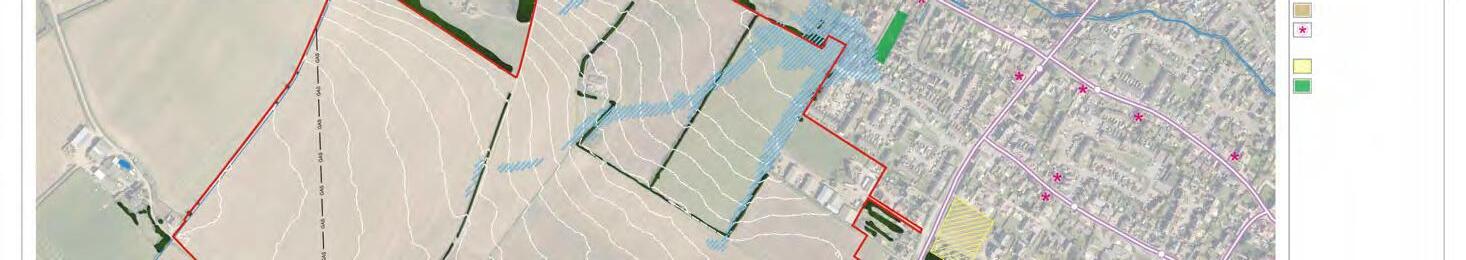
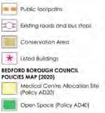
A high-pressure underground gas pipeline passes through the western part of the allocated site, and requires a buffer to the development.
High-pressure Gas Main
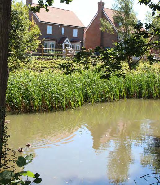
4.7 Existing Blue Infrastructure & Flood Risk
Flood risk and drainage assessment work has been carried out for the allocated site. The results of which can be summarised as follows:
• Most of the allocated site lies within Flood Zone 1 (less than 1 in 1,000 annual probability of flooding from either a river or the sea) and therefore is at low risk of fluvial flooding.
• A small section of the allocated site alongside Green End Road lies within an area of fluvial flood risk (Flood Zone 2). This area of flood risk is associated with the Brook that runs alongside Green End Road and extends eastwards away from the Site along Green End Road.
THE ALLOCATED SITE
Figure 4.5 Route of underground high-pressure gas main.
• Flood mapping shows some parts of the allocated site to be at risk from surface water flooding (pluvial). Most of these areas are considered to be at low risk, and therefore can be mitigated through the application of a comprehensive drainage strategy as an integral part of the masterplan proposals.
In general terms, the assessment work finds that subject to the implementation of a suitable SuDS strategy, development at Millfield End will not increase the risk of flooding elsewhere.
The opportunity exists for Millfield End to provide some potential improvements and appease concerns with the existing frequency of flooding along Green End Road. This is likely to consist of landscaped attenuation features which could be used to redirect some of the water from the watercourse and store it, before discharging it slowly back into the water course. It is considered that such an approach should help reduce the frequency of flooding.
The adjacent built up areas include a network of footways running along the streets, whilst there are existing pedestrian crossing points on Bedford Road, which facilitate connections to the areas of Great Barford to the east. Adjacent to the northern edge of the allocated site, there is a footway present on the southern side of Green End Road, which leads eastwards towards the heart of the village. The footway terminates adjacent to the allocated site’s northern boundary opposite to Green End Farm. Approximately 105m further to the west is a public footpath (FP1), which runs westwards from Green End Road to the countryside beyond. The public footpath passes underneath the A421 via an underpass, providing connections to further rights of way beyond.
To the east at Chapel Field, there is a pedestrian linkage serving the homes which overlook this part of the allocated site. Subject to land ownership considerations, the opportunity may exist to provide a pedestrian or a pedestrian/cycle connection to Chapel Field at this point.
There are no footways running along the allocated site’s Bedford Road frontage. However, a public footpath (FP21) extends south eastwards
from the opposite side of Bedford Road. This public footpath provides direct connections to the south eastern parts of the villages, where there are a number of further public rights of way within close proximity.
There are no public rights of way crossing the allocated site. There are also no cycle routes running adjacent to or through the allocated site. However, National Cycle Route 12 passes through the eastern part of Great Barford.
Public Transport
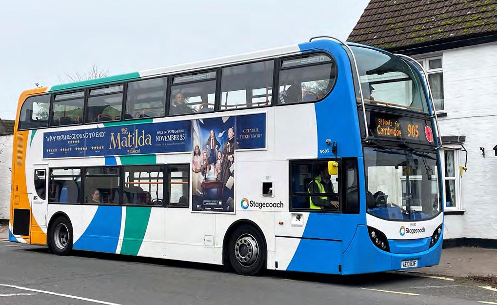
The nearest bus stops to the allocated site are located on Bedford Road to the south west of the Bedford Road / Green End Road / Roxton Road / High Street crossroads. These stops are served by Route 905, which operates between Bedford and Cambridge via St Neots. From Bedford the service continues to Oxford via Milton Keynes and Buckingham as Route X5.
As of December 2022, between Mondays and Saturdays Route 905 operates between 5am and 11pm and for most of the day provides a half hourly service reducing to an hourly service during the early morning and evening periods and for a short period during the middle of the day. An hourly service is provided on Sundays and Public Holidays between 7am and 7pm.
Further bus stops are provided on Silver Street and High Street. These serve occasional bus routes to surrounding towns and villages.
None of the aforementioned bus stops are within 400m of the majority of the allocated site. As such, measures will need to be implemented to make Millfield End more accessible to bus services.
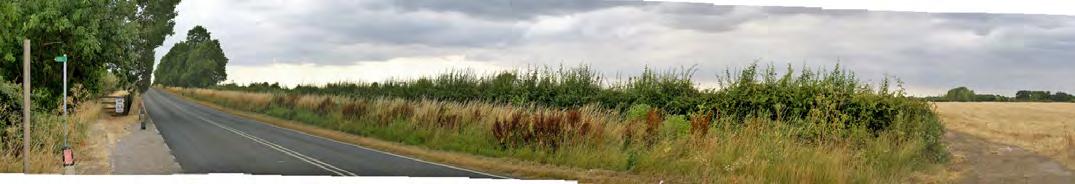
Surrounding Highway Network
Green End Road is a narrow single carriageway road with a semi-rural character created by the relationship of the existing farm and the open character of the allocated site to the south. As a consequence, this section of Green End Road forms an attractive gateway to the village as one approaches from the north west. The road has a 30mph speed limit where it passes the allocated site.
To the east, Green End Road’s character changes where it is fronted on both sides by existing homes, albeit it has a verdant character created by good levels of mature tree planting within the gardens of the adjacent residential properties. Green End Road meets Bedford Road at a crossroads junction some 575m to the east of the allocated site’s Green End Road frontage.
The single carriageway Bedford Road was formerly the A428 Trunk Road. Since de-trunking, little has been achieved in the way of changing the context of the road back to its original function as a local road within a village setting. Although it is acknowledged that some through trips still occur, for example to / from the A1 north at Roxton and east at Blunham, traffic flows have reduced and Trunk Road standards are no longer appropriate, encourage speed, and do little to deter non-local through trips. Speed cameras have been installed to enforce compliance with the 30mph speed limit. The development of Millfield End may present the opportunity to create a safer and more attractive street environment along Bedford Road.
There are various smaller roads in the wider area providing access to local residential areas, and the services and facilities within the village.
Figure 4.9 Surrounding Highway Network and Public Transport.
THE ALLOCATED SITE
ROUTE 905
GREEN END ROAD
HIGH STREET
ROXTON ROAD
BIRCHFIELD ROAD
1.
3.
4.
5.
6.
7.
8.
9.
The Allocated Site
Grade II Listed Building
Grade II* Listed Building
Conservation Areas
Viewpoints
Scheduled Monument Barford Bridge (Barford Bridge and Causeway Grade I)
ROXTONROAD ADDINGTONS ROAD
NEW ROAD
4.9 Heritage & Archaeology
The Great Barford Green End Conservation Area lies immediately to the north of the allocated site, with its south western corner covering the allocated site’s Green End Road frontage.
The Conservation Area contains several Grade II Listed Buildings, including 65 Green End Road, which sits adjacent to a section of the allocated site’s northern boundary, and Green End Farmhouse and 106 Green End Road, which are located on the northern side of Green End Road and overlook the northern part of allocated site. There are several other listed buildings in the locality, as shown on Figure 4.10 opposite.
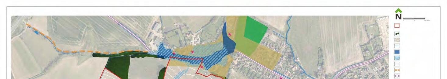
Archaeological investigations undertaken in 2021 revealed evidence for past occupation at the allocated site and provided an opportunity to gain a better understanding of the local heritage resource.
Trial trenching indicated that the majority of the site is devoid of significant archaeological remains. However, there were four Areas of Archaeological Significance (AAS) identified within the allocated site, the largest of which is AAS 1 in the southern part of the allocated site closest to Bedford Road. This area revealed evidence of Iron Age and Roman settlement activity in the form of multiple enclosures, ditches and other features along with artefacts, suggesting continued occupation over a prolonged period. Immediately northeast of this, along the eastern site boundary, AAS 2 revealed an Iron Age settlement clustered along a trackway, as well as Iron Age pottery and animal bone. Further small areas of Iron Age activity were discovered towards the north west of the site, with a series of enclosures present at AAS 3 and a small area of possible domestic activity within AAS 4, with both producing Iron Age pottery.
The Areas of Archaeological Significance described above will require further investigation if they are to form part of any future development proposal. No further investigations will be required within the rest of the site where trenching has identified no significant archaeology. These results have informed the iterative masterplan proposals for Millfield End. Appendix B contains a plan showing the location of the trial trenches and AAS.
Figure 4.10 Location of Great Barford Green End Conservation Area and nearby Listed Buildings.
THE ALLOCATED SITE
BEDFORDROAD
GREENENDROAD
ROXTONROAD
The Allocated Site
3 Storey
2½ Storey
2 Storey
1 & 1½ Storey
BEDFORD ROAD
CHAPELFIELD
SILVERSTREET
GREENENDROAD
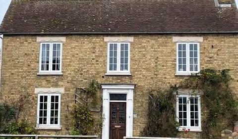
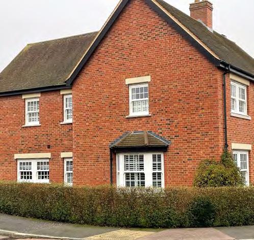
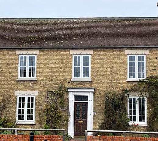
LOCAL VERNACULAR
Together, the Great Barford Neighbourhood Plan and the Bedford Borough Design Guide (2022) provide a comprehensive analysis of the Great Barford vernacular. These documents have been referenced to gain a full understanding of the local vernacular. The following summarises the analysis contained in the two aforementioned documents, together with additional observations collected during the preparation of the Development Brief and Design Code.
STREET TYPOLOGY
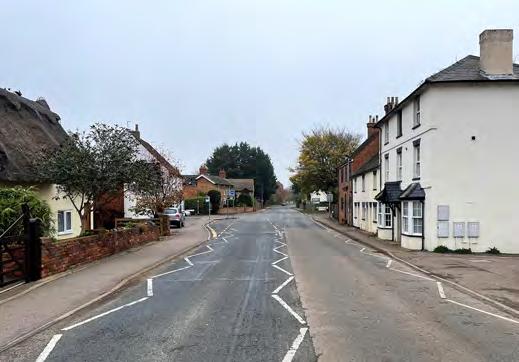
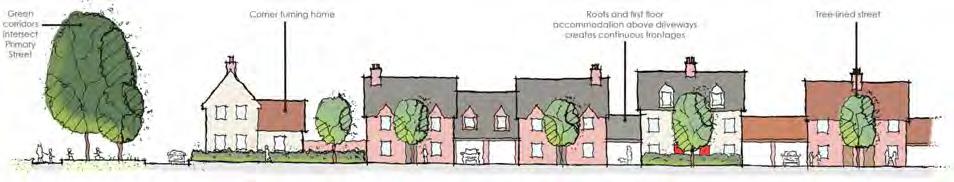
• Bedford Road is the principal thoroughfare, passing through the village in a broadly north east to south west direction. It is fronted by a mix of detached, semi-detached and terraced homes of varying ages and styles.
• Green End Road and the High Street are subservient only to Bedford Road, and passes through the village in a north west to south east direction. Close to the allocated Site’s northern boundary, Green End Road is fronted by mostly detached homes sitting in large plots, together with some farmsteads. Further to the south east, Green End Road is fronted by mostly detached homes.
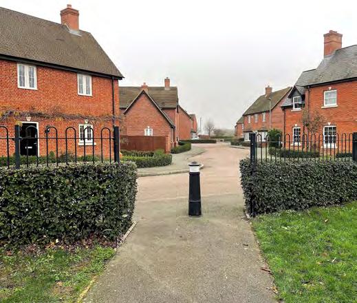
• Chapel Field, Dothans Close and Chapel Close comprise three cul-de-sacs following Radburn layout principles whereby many of the back gardens and parking/garaging face the streets, and the homes overlook communal areas of open space and the allocated site’s boundaries.
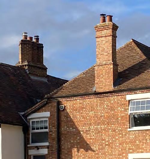
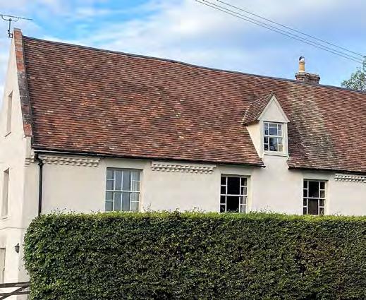
ROOFSCAPE
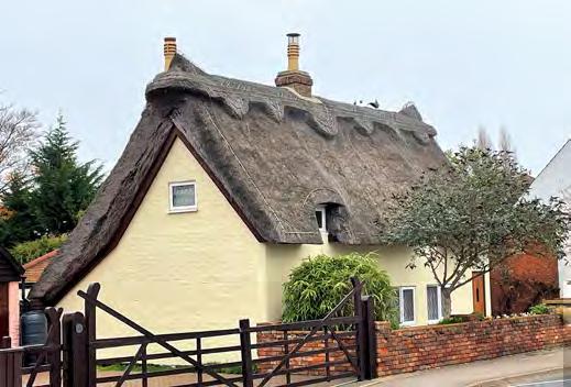
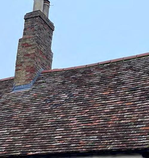
• Most roofs are pitched, although there are a good number of hipped roofs on the homes in the Green End Conservation Area.
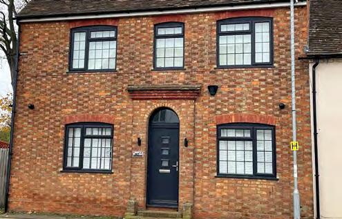
• Chimneys on traditional cottages and houses are often, but not always prominent features. Expressed chimney stacks are not a common feature on these traditional buildings.
• Mid 20th Century homes, such as those along Chapel Field, do not have chimneys.
• Many of the more recent homes incorporate chimneys, including examples of expressed chimney stacks, which provide articulation to gables.
• Wherever used, chimneys provide articulation and interest to the roofscape.
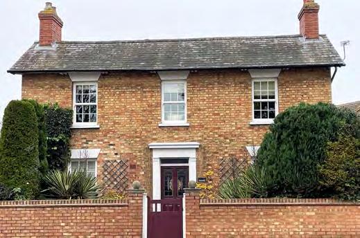
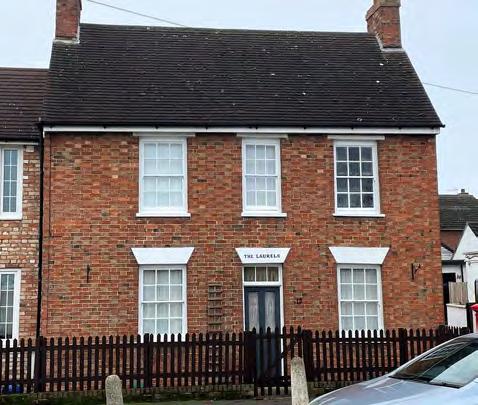
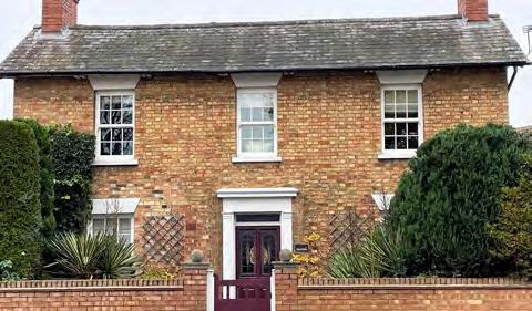
SYMMETRY
• A significant number of historic homes have a strong formality and symmetry. This is a particularly distinctive characteristic of both Great Barford and the wider locality.
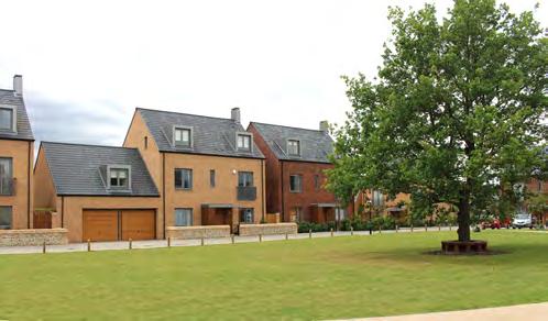
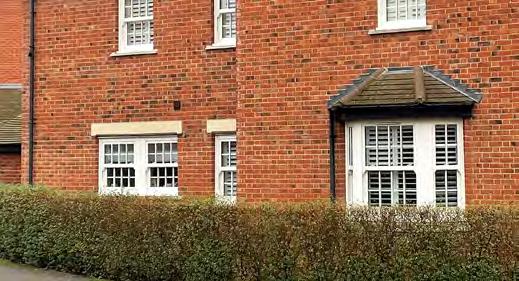
• This formality and symmetry is also evident on more recently built homes. The recently built development at Hare Meadow is a particularly good example.
• The Bedford Borough Design Guide advises that if done well, symmetry can provide a distinct feature of new development.
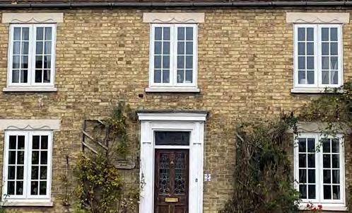
DETAILING
• Detailing tends to be simple and discreet. Interest can be found in the stone cills and stone or brick headers where the brick is exposed or painted.
• Green End Farmhouse exhibits some interesting detailing, including parapet walls at either end of the roof rising up above the roofline, and decorative saw tooth eaves detailing.
• New homes at Hares Meadow exhibits discreet detailing, including the use of stone cills and brick arches above windows.
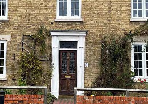
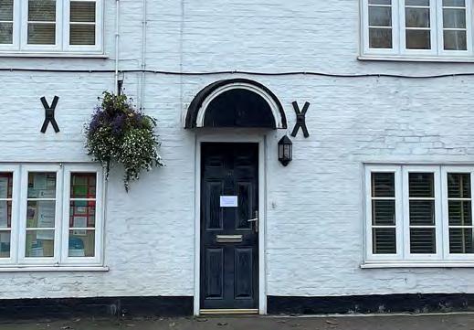
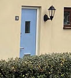
DOORWAYS
• On traditional homes, doorways are typically understated, often with a flat roof or pitched roof canopy above the door. Many of the traditional homes only have a brick arch above the front door.
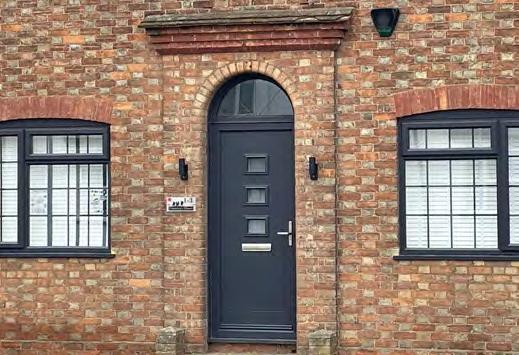
• The new homes at Hare Meadow have simple flat roof porch canopies above the front doors.
WINDOWS
• Traditionally, windows tend to be limited to sliding sash windows on more prominent houses, and simple casement windows on cottages.
• Handful of buildings incorporate projecting splayed bay windows which provide articulation to the façade.
• The homes at Hares Meadow use casement style windows with a multi-paned effect.
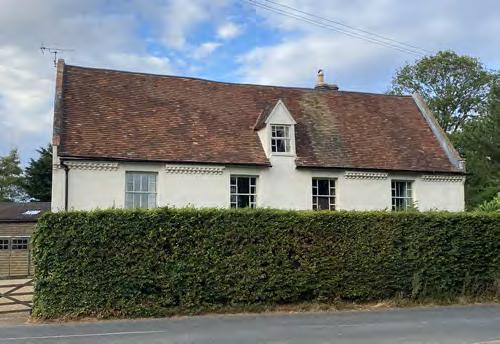
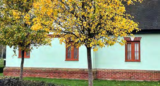
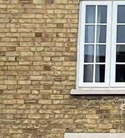
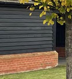
MATERIALS
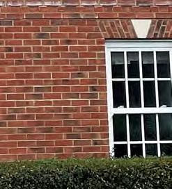
• Traditional brick comprises red and buff shades, with some homes having a variety of colours on the same façade.
• Smooth white render is prominent on many older buildings.
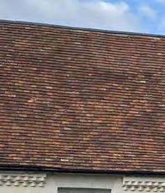
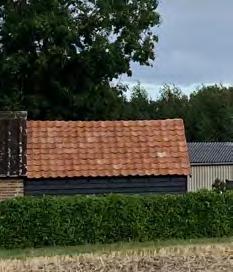
• Roofs of traditional homes are typically covered with red plain tiles or slates tile.
• Some examples of orange pantiles evident, such as on outbuildings at 65 Green End Road.
• Mid 20th Century homes typically constructed in buff brick with grey concrete tiles.
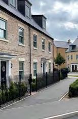
• Homes at recently built development at Hare Meadow are built in buff and red bricks, with roofs covered in slate tile.
05 | DESIGN INFLUENCES
The baseline studies, taken together, have informed the identification of the design influences for development of the allocated site. These design influences are important as they will help to shape the masterplan proposals for the new neighbourhood, which in turn is critical to defining the exact extent of land required for the 500 new homes and associated open space.
These design influences include the need to maximise the retention of existing landscape features, to respect the setting of the Green End Conservation Area and associated listed buildings, and to ensure the new development does not exacerbate existing flood risk issues.
Many of the policies contained within the Great Barford Neighbourhood Plan set out specific design principles that will influence the masterplanning of Millfield End. These include the need to incorporate green corridors running between the village and the countryside, and to create a rural gateway along Bedford Road.
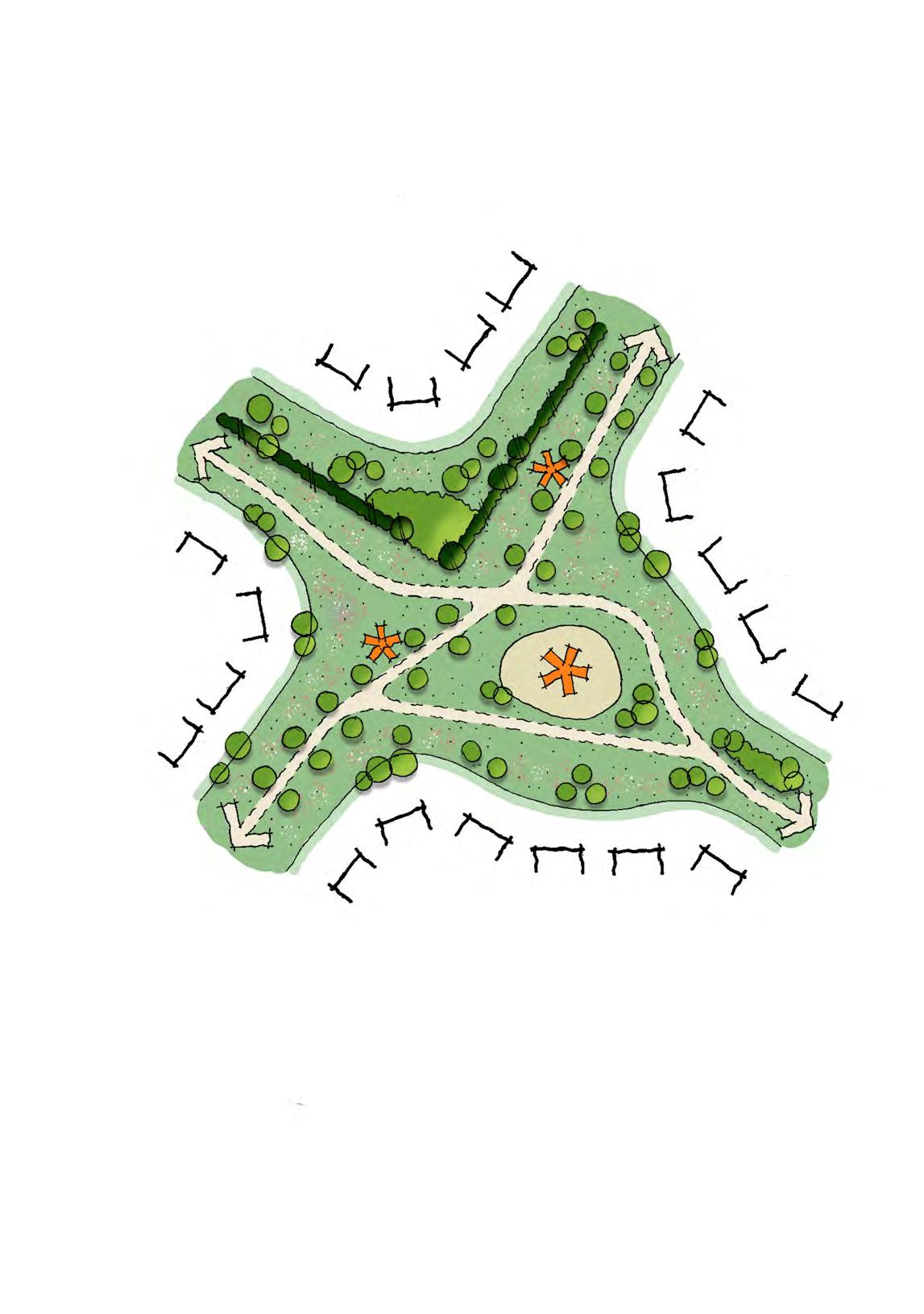
The influences are illustrated on a Design Influences Plan (Figure 5.1). The plan is supported by a table which describes the influences and the suggested design responses and opportunities these create. Together, the table and plan provide a clear set of key parameter design principles to inform the subsequent design strategy and Concept Masterplan set out in Chapter 7: Design Strategy.
Respect the setting of the Green End Conservation Area
Bedford Road improvements
Bedford Road – Opportunity for a gateway to the village
Respect local character
Retention and enhancement of existing landscape features
DESIGN INFLUENCE DESIGN RESPONSE
1. Topography & Hydrology
The topography of the allocated site will dictate the location of the SuDS features.
2. Green Infrastructure and Landscape
The allocated site has relatively few notable landscape features, comprising a fragmented network of field hedgerows. Even so, the vast majority of the existing landscape features should be retained and enhanced wherever possible.
Policy ROS1 of the Neighbourhood Plan sets out that new development should create green corridors between the village and the countryside, whilst Policy D1 highlights the need to respect existing landscape features. Policy H1 establishes that on-site green infrastructure should be used to enhance the character of the village.
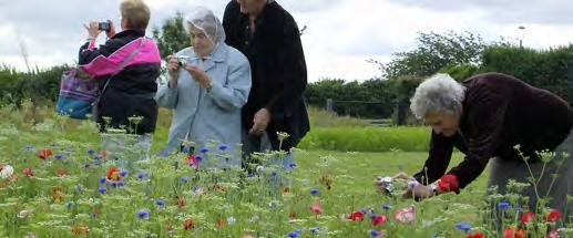
Feedback received at the Great Barford Fun Day highlighted strong support for locating a community green close to the existing settlement edge to maximise the benefits of new public open space for existing residents.
3. Biodiversity Net Gain
Policy NE2 of the Neighbourhood Plan sets out that new development should provide a biodiversity net gain (BNG) of 10%.
4. Flood Risk
The allocated site has a very small area that is at risk of fluvial flooding on the northern boundary adjacent to Green End Road. There are also some small areas of surface water risk in extreme rainfall events in parts of the allocated site.
Policy H1 of the Neighbourhood Plan sets out that new development at Millfield End must avoid areas at risk from fluvial flooding and that measures should be employed to reduce existing surface water runoff to the Brook alongside Green End Road.
To provide a network of SuDs features, where possible and/or appropriate, located at the low points to manage surface water run-off, and designed to maximise landscape and biodiversity benefits.
A robust network of green corridors and open spaces incorporating the existing hedgerows and trees should be provided to create scope for the retention and significant enhancement of the existing landscape features, including providing connectivity between the fragmented sections of hedgerow.
Many of the green corridors should provide open space connections between the existing settlement edge and the countryside beyond Millfield End.
New blocks of woodland planting should be provided in the northern and western areas to build upon the existing off-site woodland near Green End Road, which in turn will create a wooded backdrop to Millfield End.
This overall approach will help to deliver a significant increase in tree and hedgerow cover, which is to comprise native and local species.
A new community green, containing new sports and children’s play facilities should be located close to the existing settlement edge, in a location where it will be readily accessible by existing and new residents alike.
The landscape-led approach outlined above creates the basis for a new neighbourhood that will have sufficient green spaces to achieve a minimum BNG of 10%. The Concept Masterplan for Millfield End is to be underpinned by a BNG assessment to ensure it provides sufficient green spaces to achieve a BNG of 10%.
The area within Flood Zone 2 should remain free from built development. Opportunities exist to provide a flood compensation / improvement area towards the northern boundary to help better manage existing flood risk along Green End Road, including reducing surface water runoff to the Brook.
Throughout Millfield End, a system of swales and basins are to be used to convey and store water during periods of heavy and persistent rainfall. These will manage and mitigate flood and pollution risks as a consequence of the new development.
The SuDS features should be creatively designed to form integral parts of Millfield End’s green infrastructure to enrich the public realm and help improve a sense of wellbeing and offer an interaction with nature. As the richest habitat for a range of flora and fauna, they are also to play a key role in achieving the net gain in biodiversity.
Pedestrian and cycle connectivity
5. Existing Blue Infrastructure
There are several existing ditches within the allocated site.
6. Pedestrian and cycle connectivity
Policy TT1 of the Neighbourhood Plan sets out that the use of sustainable modes of transport should be maximised. Therefore, to encourage active travel and more sustainable movement patterns, safe and direct pedestrian and cycle connectivity should be achieved across Millfield End.
7. Bus Connectivity
As per the provisions of Neighbourhood Plan Policy TT1, means of access to public transport is a key consideration for encouraging more sustainable movement patterns.
8. Existing heritage features
The Green End Conservation Area covers a small section of the northern part of the allocated site and extends north eastwards, abutting a section of the allocated site’s north eastern boundary. There are also several listed buildings located within the Conservation Area, close to the allocated site.
Policy HE1 of the Neighbourhood Plan states that new development that is likely to affect the setting of a Conservation Area must make a positive contribution to local character and distinctiveness.
The existing ditches should be retained, enhanced and brought into favourable management as a key part of the proposed green and blue infrastructure network.
New pedestrian and cycle routes across the new neighbourhood should be provided, including a trafficfree route running between Green End Road and Bedford Road to facilitate a traffic-free connection between the two nearby public footpaths.
In addition to a pedestrian/cycle connection to Green End Road, a new pedestrian connection to Chapel Field and a new pedestrian/cycle connection to Bedford Road should be provided to maximise physical integration with the existing fabric of Great Barford.
A main street running through the heart of Millfield End should be designed to be capable of accommodating buses to make the new neighbourhood accessible to bus services.
The main street should run between two vehicular access points from Bedford Road.
A swathe of open space should be located adjacent to the Conservation Area to minimise harm, and maintain an attractive gateway to Great Barford when approaching from the north west along Green End Road. The landscape design of this open space should be agricultural (i.e. pastoral fields) in character, with SuDS features within these areas to be designed to also reflect this agricultural character.
The new homes overlooking this open space should be sensitively designed to reflect the traditional Great Barford vernacular to make a positive contribution to local character and distinctiveness.
9. Appropriately scaled and designed buildings
Policy D1 of the Neighbourhood Plan sets out that new development should be designed to reflect local character and respond to the local context.
Appropriately scaled buildings should be designed to create a series of character areas based upon their location within Millfield End and their relationship with the wider context. For example, lower densities and lower building heights (e.g. maximum of 2 storeys) should be located adjacent to the countryside edges and the Green End Conservation Area, whilst higher densities and increased building heights (e.g. maximum of 2½ storeys) should mark the more central areas of Millfield End. When combined with landscape and building form, this will assist in creating different areas of recognisable character. This variety of character will reinforce a sense of place and aid legibility.
2½ storey homes are to be avoided on the higher ground in the north west of Millfield End.
Key buildings and groupings should create new gateways throughout Millfield End, such as to mark the entrances points from Bedford Road, overlooking key open spaces and providing attractive aspects at key locations along the new cycle and pedestrian paths.
The new homes throughout the new neighbourhood should reflect the local vernacular. The areas closest to the Conservation Area will be traditional in design, whilst in other parts of the new neighbourhood the opportunity exists to interpret local building styles and character in a more contemporary manner.
10. Bedford Road Gateway
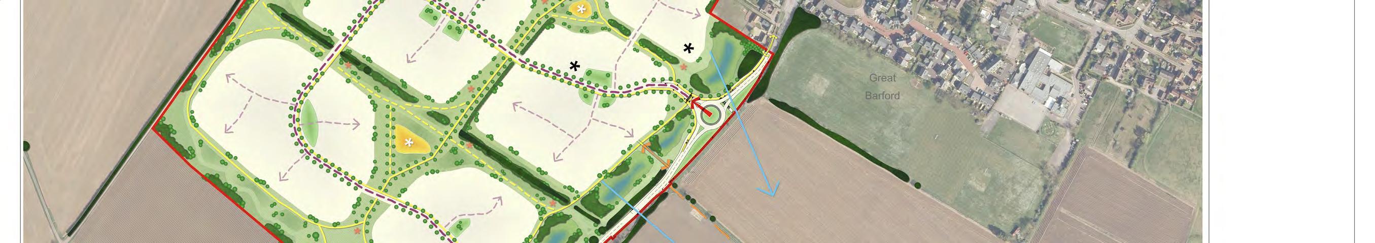
Policy H1 of the Neighbourhood Plan requires that the appearance of development along Bedford Road reflects the rural village location.
A significant area of open space should be located alongside Bedford Road. The open space will provide significant scope for the existing trees and hedgerows to be supplemented with significant area of new landscaping to create a well-landscaped edge along Bedford Road.
Topographical considerations dictate that new SuDS features will be located towards Bedford Road. These features should form an integral part of the landscape design of the Bedford Road frontage, reflecting the rural characteristics of the frontage.
The new homes should be mostly 2 storeys in height and be designed to reflect the traditional local vernacular.
Appropriately scaled and designed buildings
SWATHE OF OPEN SPACE ALONGSIDE GREEN END CONSERVATION AREA
NEW PEDESTRIAN AND CYCLE ROUTE THROUGH THE SITE.
OPPORTUNITY FOR COMMUNITY GREEN
OPPORTUNITY FOR GATEWAY ALONG BEDFORD ROAD TO REFLECT RURAL VILLAGE LOCATION
NEW PEDESTRIAN AND CYCLE ROUTE THROUGH THE SITE ACCOMMODATED WITHIN A GREEN CORRIDOR.
Access points
Bus route through the development
Existing bus routes and bus stops
Sensitive area to become pastoral fields
Conservation Area
06 | DESIGN EVOLUTION
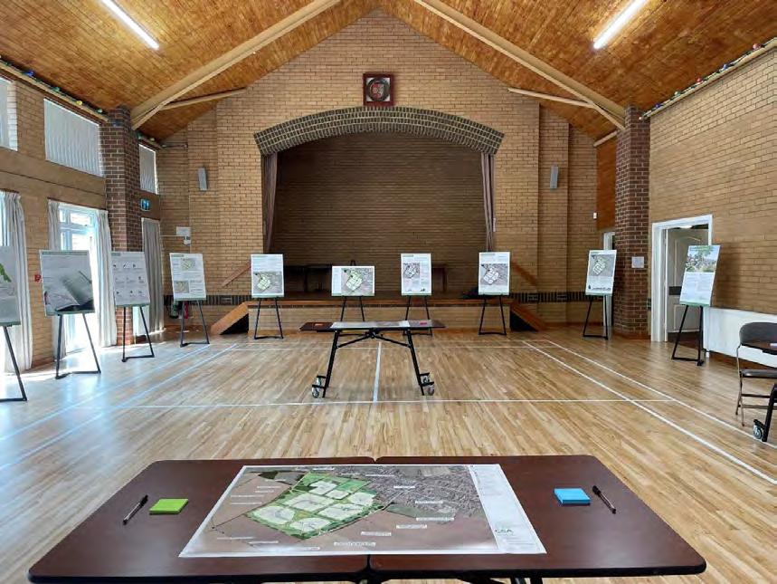
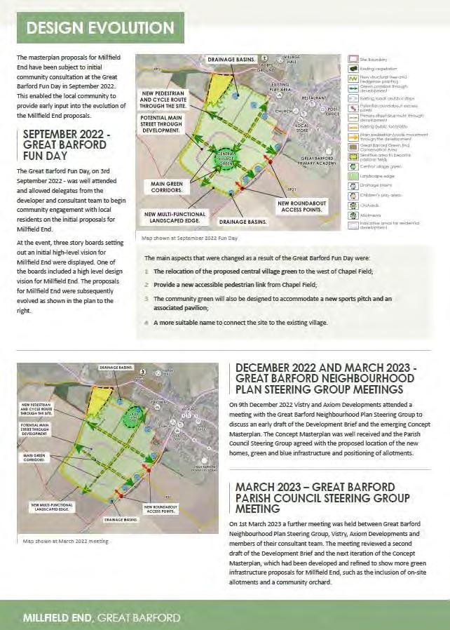
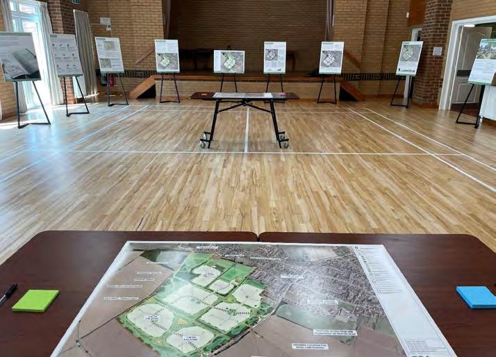
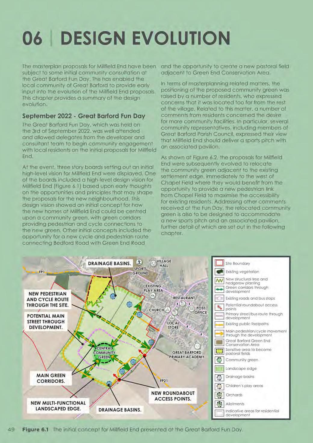
The masterplan proposals for Millfield End have been subject to some initial community consultation at the Great Barford Fun Day. This has enabled the local community of Great Barford to provide early input into the evolution of the Millfield End proposals. This chapter provides a summary of the design evolution.
September 2022 - Great Barford Fun Day
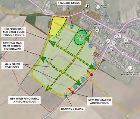
The Great Barford Fun Day, which was held on the 3rd of September 2022, was well attended and allowed delegates from the developer and consultant team to begin community engagement with local residents on the initial proposals for Millfield End.
At the event, three story boards setting out an initial high-level vision for Millfield End were displayed. One of the boards included a high-level design vision for Millfield End (Figure 6.1) based upon early thoughts on the opportunities and principles that may shape the proposals for the new neighbourhood. This design vision showed an initial concept for how the new homes at Millfield End could be centred upon a community green, with green corridors providing pedestrian and cycle connections to the new green. Other initial concepts included the opportunity for a new cycle and pedestrian route connecting Bedford Road with Green End Road
and the opportunity to create a new pastoral field adjacent to Green End Conservation Area.
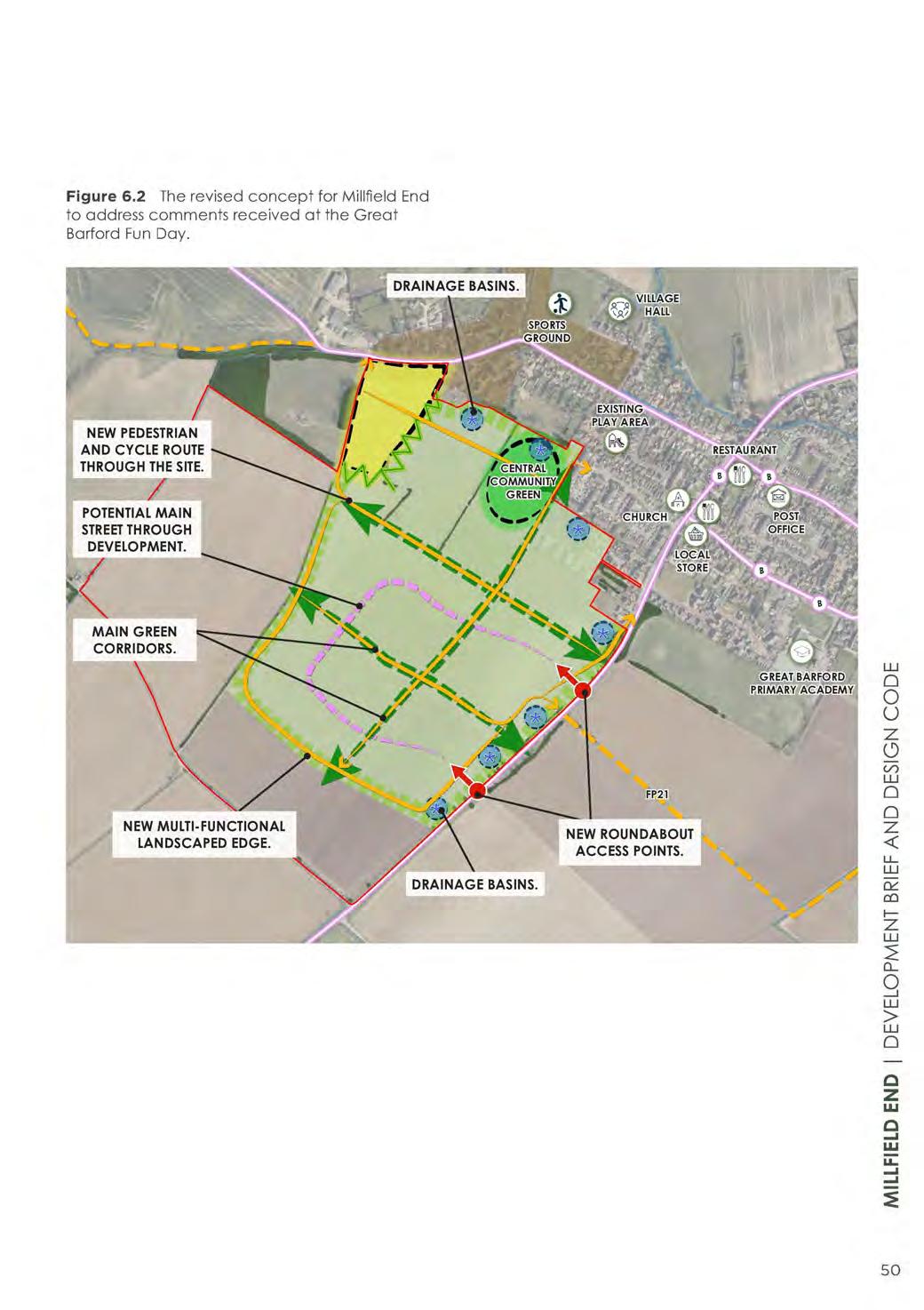
In terms of masterplanning related matters, the positioning of the proposed community green was raised by a number of residents, who expressed concerns that it was located too far from the rest of the village. Related to this matter, a number of comments from residents concerned the desire for more community facilities. In particular, several community representatives, including members of Great Barford Parish Council, expressed their view that Millfield End should deliver a sports pitch with an associated pavilion.
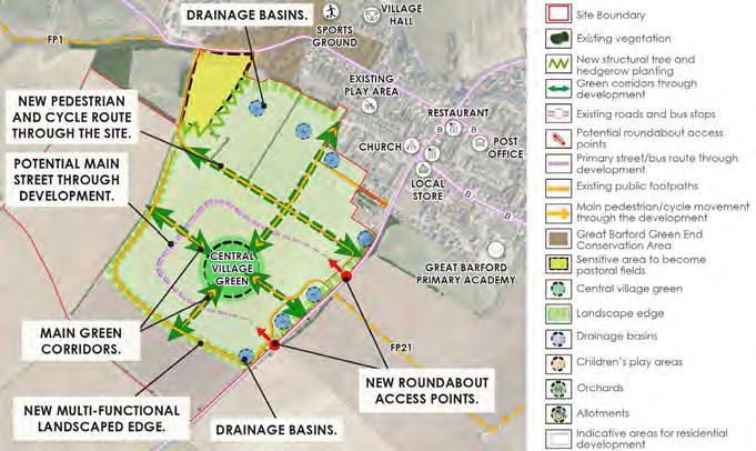
As shown at Figure 6.2, the proposals for Millfield End were subsequently evolved to relocate the community green adjacent to the existing settlement edge, immediately to the west of Chapel Field where they would benefit from the opportunity to provide a new pedestrian link from Chapel Field to maximise the accessibility for existing residents. Addressing other comments received at the Fun Day, the relocated community green is also to be designed to accommodate a new sports pitch and an associated pavilion, further detail of which are set out in the following chapter.
Existing vegetation
New structural tree and hedgerow planting Green corridors through development
Existing roads and bus stops
Potential roundabout access points
Primary street/bus route through development
Existing public footpaths
Main pedestrian/cycle movement through the development
Great Barford Green End
Conservation Area
Sensitive area to become pastoral fields
Community green
Landscape edge
Drainage basins
Children’s play areas
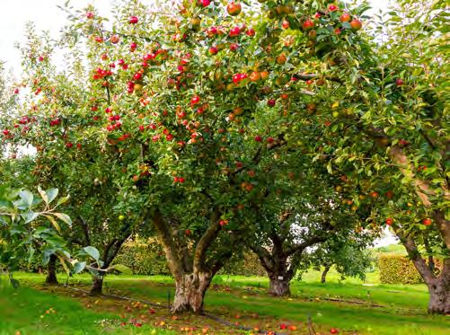
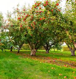
Orchards
Allotments
Indicative areas for residential development
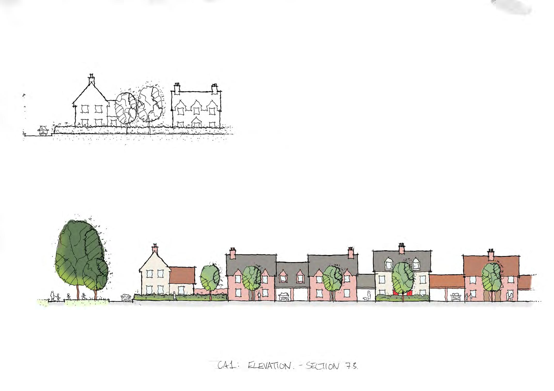
Figure 6.1 The initial concept for Millfield End presented at the Great Barford Fun Day.
Figure 6.2 The revised concept for Millfield End to address comments received at the Great Barford Fun Day.
NEW PEDESTRIAN AND CYCLE ROUTE THROUGH THE SITE.
POTENTIAL MAIN STREET THROUGH DEVELOPMENT.
DRAINAGE BASINS.
MAIN GREEN CORRIDORS.
NEW MULTI-FUNCTIONAL LANDSCAPED EDGE.
DRAINAGE BASINS.
NEW ROUNDABOUT ACCESS POINTS.
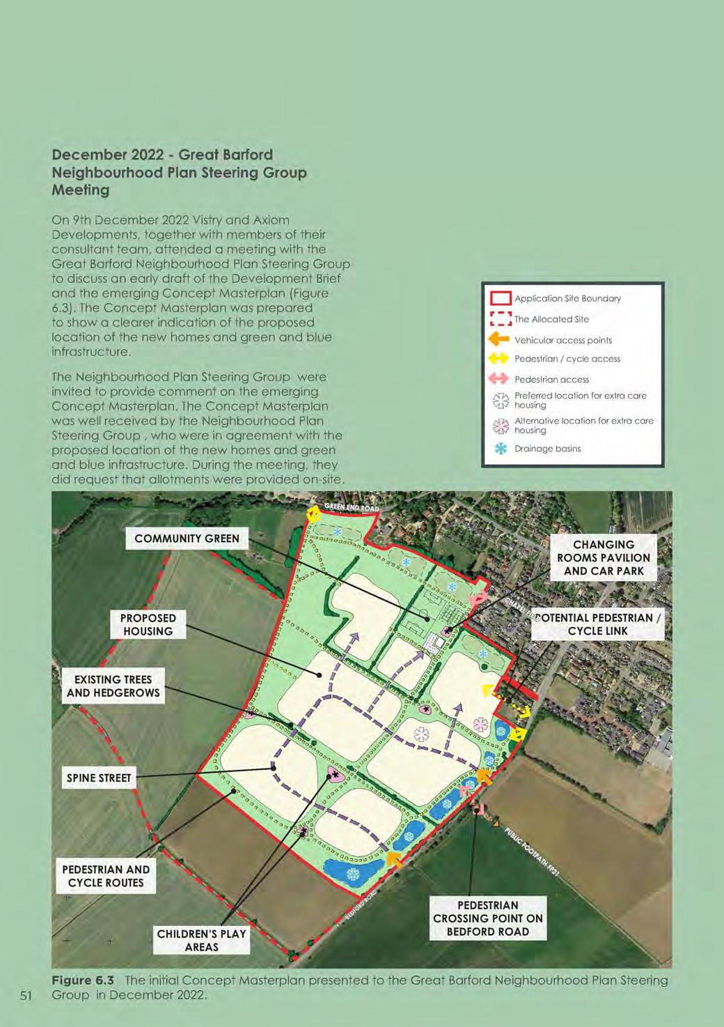
December 2022 - Great Barford Neighbourhood Plan Steering Group Meeting
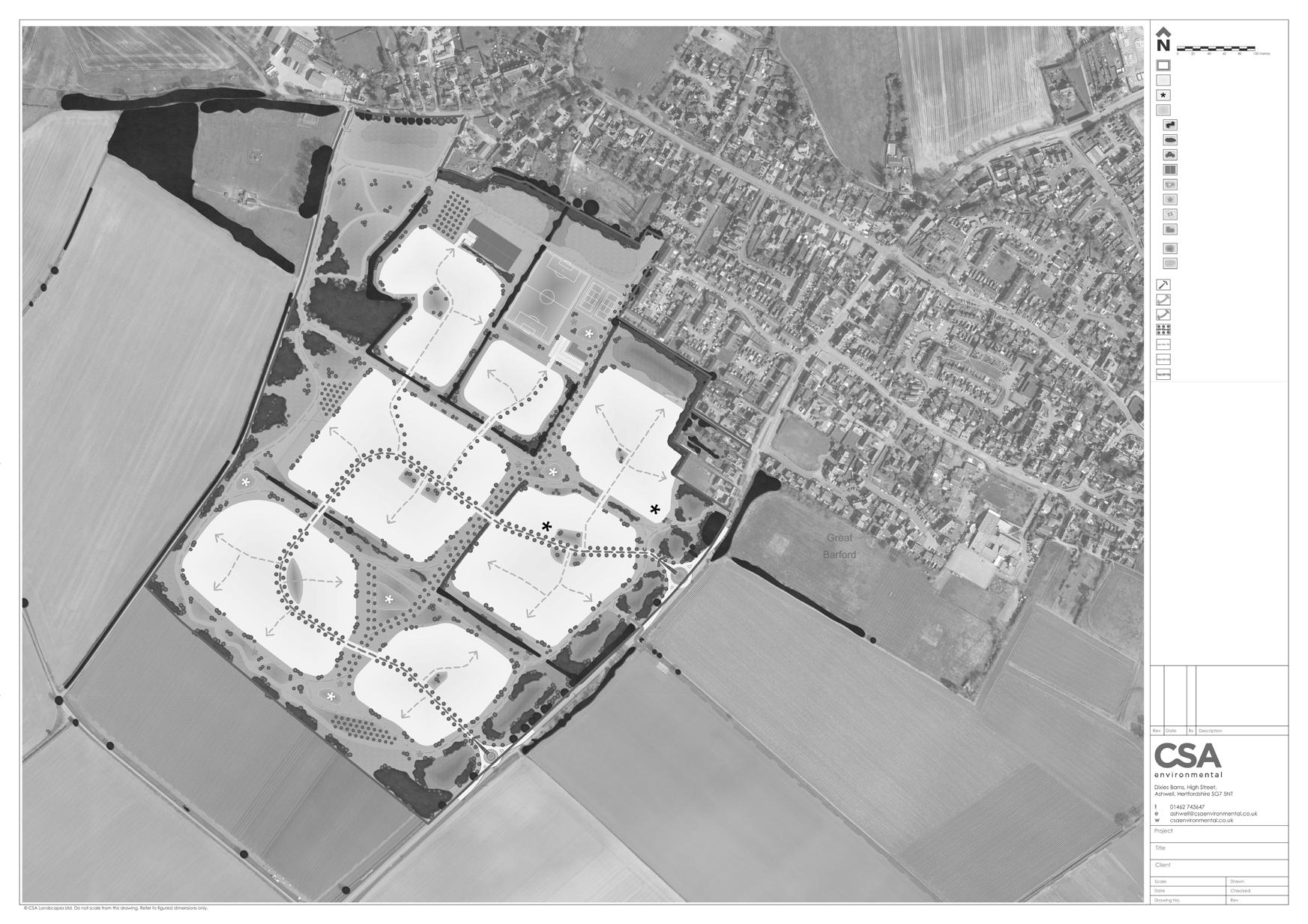
On 9th December 2022 Vistry and Axiom Developments, together with members of their consultant team, attended a meeting with the Great Barford Neighbourhood Plan Steering Group to discuss an early draft of the Development Brief and the emerging Concept Masterplan (Figure 6.3). The Concept Masterplan was prepared to show a clearer indication of the proposed location of the new homes and green and blue infrastructure.
The Neighbourhood Plan Steering Group were invited to provide comment on the emerging Concept Masterplan. The Concept Masterplan was well received by the Neighbourhood Plan Steering Group , who were in agreement with the proposed location of the new homes and green and blue infrastructure. During the meeting, they did request that allotments were provided on-site.
CHAPELFIELD
Site Boundary
Application Site Boundary
Allocated Site
The Allocated Site
Vehicular Access Points
Vehicular access points
Pedestrian / cycle access
Pedestrian / cycle access
Pedestrian access
Pedestrian access
Preferred location for extra care housing
Preferred location for extra care housing
Alternative location for extra care housing
Alternative location for extra care housing
SuDS Features
Drainage basins
Figure 6.3 The initial Concept Masterplan presented to the Great Barford Neighbourhood Plan Steering Group in December 2022.
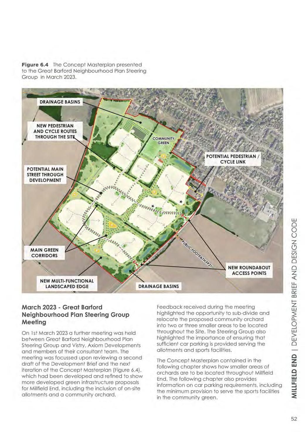
Figure 6.4 The Concept Masterplan presented to the Great Barford Neighbourhood Plan Steering Group in March 2023.
NEW PEDESTRIAN AND CYCLE ROUTES THROUGH THE SITE DRAINAGE BASINS
POTENTIAL MAIN STREET THROUGH DEVELOPMENT
POTENTIAL PEDESTRIAN / CYCLE LINK
MAIN GREEN CORRIDORS
NEW MULTI-FUNCTIONAL LANDSCAPED EDGE
March 2023 - Great Barford Neighbourhood Plan Steering Group Meeting
DRAINAGE BASINS NEW ROUNDABOUT ACCESS POINTS
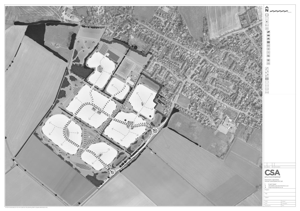
On 1st March 2023 a further meeting was held between Great Barford Neighbourhood Plan Steering Group and Vistry, Axiom Developments and members of their consultant team. The meeting was focussed upon reviewing a second draft of the Development Brief and the next iteration of the Concept Masterplan (Figure 6.4), which had been developed and refined to show more developed green infrastructure proposals for Millfield End, including the inclusion of on-site allotments and a community orchard.
Feedback received during the meeting highlighted the opportunity to sub-divide and relocate the proposed community orchard into two or three smaller areas to be located throughout the Site. The Steering Group also highlighted the importance of ensuring that sufficient car parking is provided serving the allotments and sports facilities.
The Concept Masterplan contained in the following chapter shows how smaller areas of orchards are to be located throughout Millfield End. The following chapter also provides information on car parking requirements, including the minimum provision to serve the sports facilities in the community green.
07 | DESIGN CODE
7.1 Using the Design Code
The Design Code should be used as a reference document by Bedford Borough Council, individual developers and their respective design teams. It will help to ensure the coordinated high quality design and delivery of Millfield End.
The Design Code has been carefully constructed to be concise and accessible, and easy to use by those involved in formulating and assessing planning applications on the Site. The information contained within the Design Code is, therefore, specifically focused on providing a clear set of design rules.
The Design Code has been designed to be read as a whole. Text should not be read in isolation.
The Design Code is ordered in the following way:
• Site Wide Instruction: A series of site wide instructions based upon a clear hierarchy of streets and pedestrian and cycle routes. Also includes guidance on building heights. Introduces the Regulatory Plan as the main Design Code control tool.
• Character Areas: Design guidance in relation to five distinctive character areas to create a locally responsive new development with a strong sense of place.
• Detailed Design Guidance: Guidance on detailed design matters, including building materials and car and cycle parking.
Design Code Compliance
All future planning applications submitted on the Site must demonstrate compliance with the Design Code by submitting a Design Code Compliance Statement as part of the application. This Statement can form part of the Design and Access Statement/s accompanying the planning applications. A draft Design Code Compliance Statement must also be submitted by developers during the pre-application process to assist Officers tasked with providing feedback on emerging scheme designs.
Mandatory Items
MThis symbol is used where text, diagrams and tables set out mandatory design elements which must be provided by designers and developers at the detailed design stage. These include street typologies, street dimensions, and the need to create different character areas.
If mandatory elements are challenged by designers and developers, it is their responsibility to demonstrate that their proposal does not conflict with the overall aim of this Design Code.
Where no symbol is used, then the text or diagrams set out discretionary design proposals which serve to illustrate how mandatory elements could be arranged.
Where photographs are shown, these are illustrative and are for guidance only.
Design Code Flowchart
This Flowchart demonstrates the stages and structure of the Design Code. It allows the reader to navigate their way through the Design Code with section headings and page numbers.
Stage 1: Site Wide Instructions 7.2 Concept Masterplan Page 55
Stage 3: Detailed Design Guidance 7.8 Car and Cycle Parking Page 111 7.9 Built Form Character and Building Materials Page 113
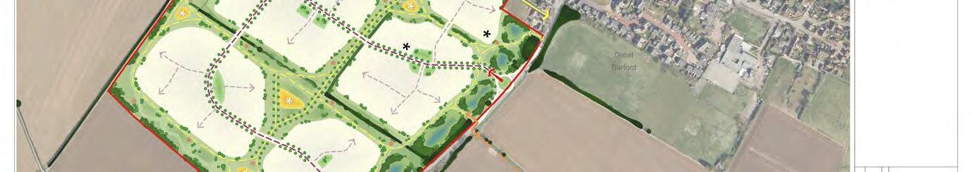
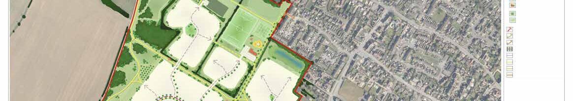
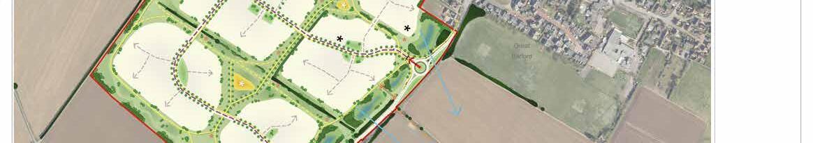
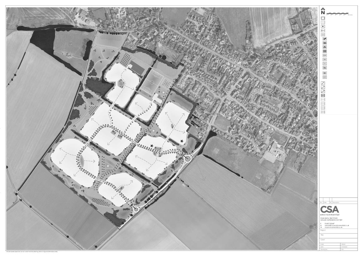
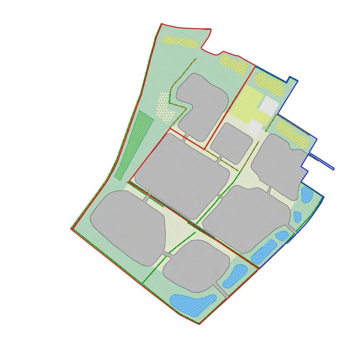
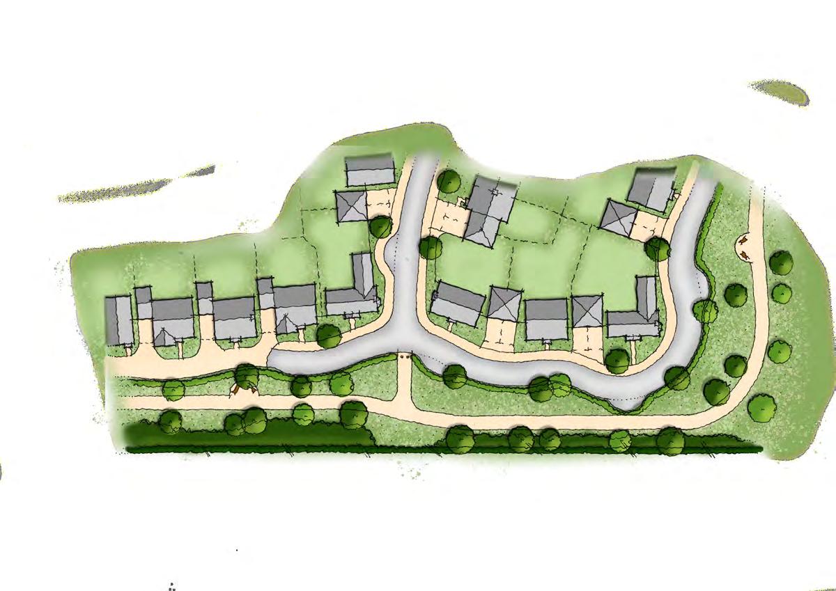
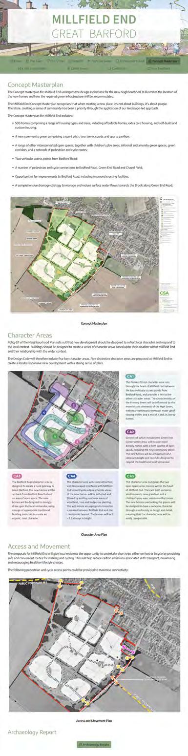
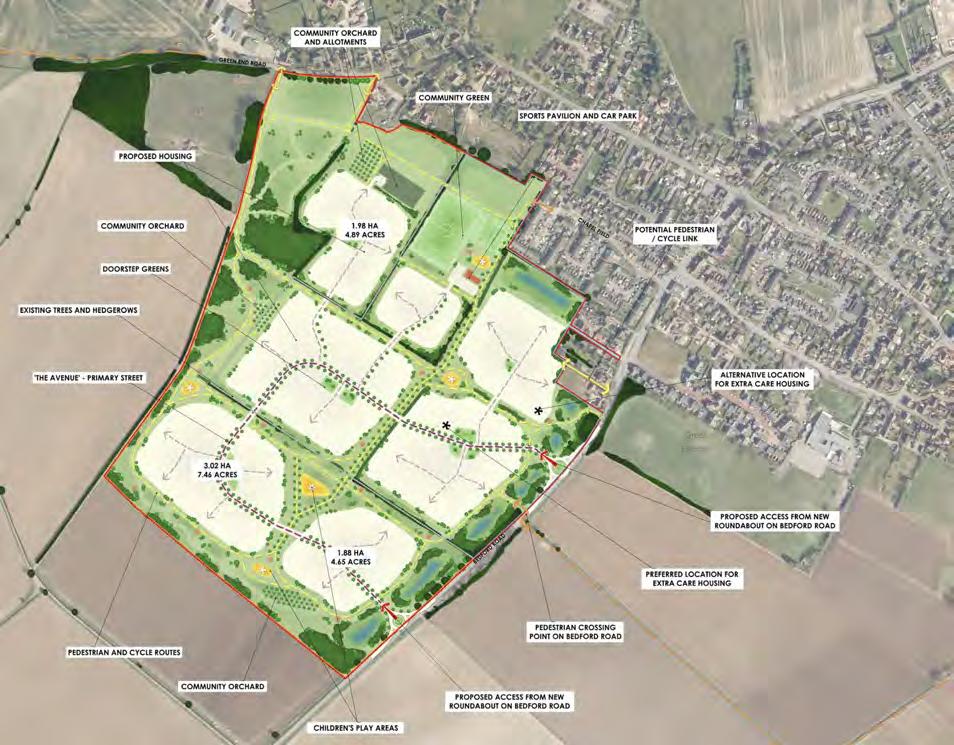
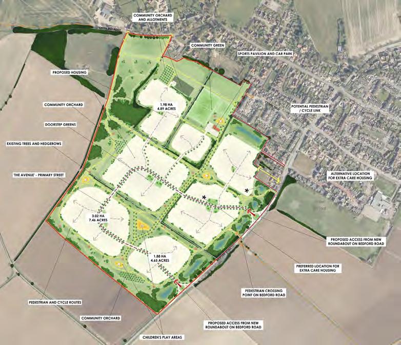
7.2 Concept Masterplan
The Application Site Boundary
An indicative Concept Masterplan establishes the Application Site Boundary, which measures some 40ha*. The Application Site Boundary is based upon a thorough understanding of the technical analysis of the allocated site, planning policy requirements, and a full review and understanding of the green infrastructure requirements and Biodiversity Net Gain (BNG) requirements. These considerations are summarised as follows:
• Land required to accommodate 500 new homes, including potential extra care housing.
• Land required to meet the open space standards as required by Policy ROS1 of the Great Barford Neighbourhood Plan and Policy AD28 of the Bedford Borough Council Allocations and Designations Local Plan, with a focus on providing a new community green adjacent to the existing settlement edge.
• Land required to achieve a minimum of 10% biodiversity net gain increase from the pre-development biodiversity value.
• Land required for new drainage features.
• Provision of open spaces alongside the Green End Conservation Area.
• Provision of generous green open spaces alongside the countryside edges and the Bedford Road frontage.
• Provision of a connected network of open space corridors accommodating new and existing landscaping, wildlife connectivity, and new routes for walking and cycling.
As illustrated in Figure 7.1, the Application Site does not extend to the entirety of the land allocated for residential development within the Neighbourhood Plan. The extent of the allocated land reflect the boundaries of historic site promotions in which the land was identified as suitable, available and deliverable. The land was considered through the Bedford Borough Local Plan (2030) Call for Sites process, before being assessed in finer detail through the preparation of the Neighbourhood Plan. A decision was then made to select this land as the favoured location for development in the village.
BALANCE OF THE ALLOCATED SITE
THE APPLICATION SITE BOUNDARY
MFigure 7.1 The Application Site Boundary.
* Application Site Boundary subject to review.
The full extent of the allocation was always greater than that necessary to deliver the allocation of 500 dwellings and all necessary infrastructure, however, by identifying the full extent of land available, the Neighbourhood Plan provided a high degree of flexibility for the design and development of a suitable scheme. The Site Application Boundary has therefore been derived from a careful design-led assessment of the site’s opportunities and constraints, to make the best use of the land and deliver the allocated 500 dwellings under this application . The balance of the allocated land is identified for completeness demonstrating this application’s relationship to the allocation.
The planning applications to be brought forward by the developers are to accord with the Application Site Boundary established by the Concept Masterplan. However, it is recognised that the red lines of the applications will differ slightly as they will need to include all of the land necessary for the access points (i.e. third party land within the adoptable highway). This will be subject to detailed plans being prepared at the Transport Assessment / planning application stage.
Land Use Budget
The Concept Masterplan (Figure 7.2 overleaf) underpins the design aspiration for Millfield End. The land uses proposed by the Concept Masterplan are as follows:
LAND USE
LAND TAKE NOTES
Residential Gross: 17.09ha Net: 15.38ha (+0.0375ha for remaining infrastructure)
Sports pavilion 1.4ha
Sports pitches
Equipped Play
Remaining POS/ SuDS/Green/Blue Infrastructure
500 homes, including potential extra care housing. Net area excludes 10% for principal street infrastructure (Primary Street) and incidental open space.
Sports pavilion and pitches combine to create a new community green. Sports pitches of sufficient size to accommodate a full-sized adult pitch and two tennis courts.
Comprising 1x Neighbourhood Equipped Area for Play (1,000sq.m), 2x Local Equipped Areas for Play (800sq.m @ 400sq.m each) & 525sq.m of play trails along footways/ cycleways to create “play on the way”.
Including various open space typologies, existing and proposed vegetation/trees, existing ditches and proposed drainage features. Includes sufficient open space to deliver a minimum of 10% BNG.
GREEN END ROAD
The Concept Masterplan
The Concept Masterplan for Millfield End underpins the design aspirations for the new neighbourhood. It illustrates the location of the new homes and how the required green infrastructure will be accommodated.
Application Site Boundary: 39.65ha
Proposed developable area: 17.09ha (500 new homes @ 30 dph)
Preferred and alternative location for extra care housing
Potential to provide viewing points from within the Site across Ouse Valley
Proposed new areas of public open space
Existing vegetation
Proposed areas of woodland/ hedgerow planting
Proposed areas of tree planting
Proposed community allotments
COMMUNITY ORCHARD AND ALLOTMENTS
PROPOSED HOUSING
Proposed equipped play facilities (2x LEAPs & 1x NEAP)
Proposed trim trail stations
Proposed sports pitches
Proposed sports pavilion SUDS
Proposed basins incorporating permanent bodies of water
Proposed wetland scrapes
ACCESS & MOVEMENT
Proposed vehicular access points
DOORSTEP GREENS
EXISTING TREES AND HEDGEROWS
Proposed location for new pedestrian and cycle links
Proposed location for new pedestrian links
Proposed primary street
Proposed secondary streets
Proposed recreational routes
Proposed shared pedestrian/cycle routes
Existing public footpaths
PEDESTRIAN AND CYCLE ROUTES
CHILDREN’S PLAY AREAS
7.2 The Concept Masterplan.
Figure
PRIMARY STREET
CHARACTER OF OPEN SPACE ADJACENT TO GREEN END ROAD TO BE INFORMAL PASTORAL GRASSLAND
COMMUNITY GREEN
SPORTS PAVILION AND CAR PARK
CHAPELFIELD
NEW LANDSCAPING TO REINFORCE EXISTING VEGETATION ALONG BOUNDARIES WITH EXISTING PROPERTIES
ALTERNATIVE LOCATION FOR EXTRA CARE HOUSING
BEDFORDROAD
EXISTING HEDGEROWS TO BE ENHANCED AND CONNECTED THROUGH NEW HEDGEROW PLANTING
PROPOSED ACCESS FROM NEW ROUNDABOUT ON BEDFORD ROAD
PREFERRED LOCATION FOR EXTRA CARE HOUSING
PROPOSED ACCESS FROM NEW ROUNDABOUT ON BEDFORD ROAD
POTENTIAL VIEW POINTS FROM WITHIN THE SITE ACROSS OUSE VALLEY
PEDESTRIAN CROSSING POINT ON BEDFORD ROAD
PUBLICFOOTPATHFP21
7.3 The Regulatory Plan
The Regulatory Plan (Figure 7.3) is the main Design Code control tool. It establishes the framework for the design and development of Millfield End by building upon the design principles established by the Concept Masterplan.
Regulatory Plan Fixes
The Regulatory Plan establishes the following design principles to be adhered to at the planning application stage:
• Broad location and extent of land uses, including children’s play areas, surface water drainage features and open space typologies.
• Access and street hierarchy, including pedestrian and cycle access.
• Pedestrian and cycle routes.
• Character Areas.
Whilst the Regulatory Plan sets out an overall framework for Millfield End, it is acknowledged that a degree of flexibility will be required in the design of the detailed proposals. It does not prescribe or set the exact location of any given street type or character area. Rather, it sets indicative zones for the location of the street types and character areas to avoid stifling responsible design innovation.
Site Boundary: 39.65ha
Streetscape Character Frontages
Primary Street (indicative route)
Indicative zones for Secondary Streets
Indicative zones for Lanes
Indicative zones for Green Edges
Indicative recreational routes
Indicative shared foot/cycleway
Green Infrastructure
Children’s Play Areas
Natural Play Trail
Proposed basins incorporating permanent bodies of water
Proposed wetland scrapes
Uses
Allotments
Orchards
Sports pitches
Changing rooms pavilion
Preferred/alternative extra care housing location
CHAPELFIELD
ALTERNATIVE LOCATION FOR EXTRA CARE HOUSING
PREFERRED LOCATION FOR EXTRA CARE HOUSING
Figure 7.3 The Regulatory Plan.
MStreet Hierarchy Matrix
The Regulatory Plan establishes the broad location for the following street types:
• Primary Street
• Secondary Streets
• Lanes
• Green Edges
Highest order street type.
PRIMARY STREET
SECONDARY STREETS
Tree-lined street with near continuous frontages. Refer to CA1 and CA5 (pages 91 - 94 and 107 - 110) for more detail.
LANES
Second highest street typeless formal than the Primary Street but not as informal as the Lanes.
Subtle variation in building setbacks and building lines to create a subservient character compared to the Primary Street.
Mix of dwellings types, including terraced, semidetached and detached.
Shared surface streets where traffic movements are relatively low.
Less formal in character than the higher order streets.
Mix of dwelling types, including focal buildings to create a varied townscape.
Informal character typically comprising larger dwelling types overlooking both the peripheral and internal areas of open space.
New and existing landscaping will form an important part of the overall character.
Refer to CA 1-5 for more detail (pages 89 - 110).
The Street Hierarchy Matrix on the page opposite provides design guidance on the street design and the character of each street type.
Minimum 6.1m wide carriageway with tree-lined 2.5m wide verges to both sides. 2.0m wide footway to one side and 3.0m wide footway/ cycleway to other side.
Provides direct access to homes.
Target design speed of 20mph.
5.5m wide carriageway. 2.0m wide footways to either side of carriageway, or on one side of the carriageway where fewer than 25 homes are served.
Target design speed of 15mph.
Refer to CA1 and CA5 (pages 91 - 94 and 107 - 110).
Overall 7.5 - 7.8m shared surface corridor to include services.
Target design speed of 15mph.
Restrained mix of boundary treatments permissible.
Shrub and hedgerow planting should form an important part of the character.
Side garden boundaries: 1.8m high brick walls, with brickwork matching adjoining house.
Limited palette of materials and colours. Refer to CA1 and CA5 (pages 91 - 94 and 107110) for more detail.
Target design speed of 15mph where adoptable and 10mph where private drives.
Variety of boundary treatments permissible.
Formal boundary treatments to mark key buildings.
Side garden boundaries: 1.8m high brick walls, with brickwork matching adjoining house.
Emphasis on soft landscaping.
Side garden boundaries: 1.8m high brick walls, with brickwork matching adjoining house.
Broader palette of materials and detailing to support a character subservient to the Primary Street.
Architectural character to be underpinned by the Great Barford vernacular.
New homes to strongly draw upon the local vernacular, using a range of building materials and detailing reflective of the Great Barford vernacular, albeit homes to be grouped in a coherent manner.
Refer to CA 1-5 for more detail (pages 89 - 110). A variety of forms and an architectural vernacular that reflects/interprets the local characteristics.
Refer to CA 1-5 for more detail (pages 89 - 110).
GREEN EDGES
Pedestrian and Cycle Hierarchy Matrix
The Regulatory Plan establishes the broad location for pedestrian and cycle movement, as follows:
• Recreational Routes (pedestrian only)
• Shared foot/cycleways
RECREATIONAL ROUTES
SHARED FOOTWAYS/ CYCLEWAYS
Appropriately lit and overlooked by adjacent homes.
Safe and inclusive.
Surfaced to allow yearround use.
Appropriately lit and overlooked by adjacent homes.
Safe and inclusive.
Surfaced to allow yearround use.
Clear definition between pedestrian and cycle use.
Minimum of 2.0m wide. N/A
MATERIALS
Limited palette of materials and colours. Refer to CA3/ CA4/CA5 (pages 99 – 110) for more detail.
Minimum of 3.0m wide. Routes will clearly indicate separate surfaces intended for cycle and pedestrian use.
‘Share with Care’ signs used along all of shared foot/ cycleways.
Shared foot/cycleways to facilitate cycle links to Bedford Road, in line with Bedford Borough Council’s aspiration for a long distance cycle route between Wyboston / Little Barford and Bedford.
N/A
Limited palette of materials and colours. Refer to CA1/ CA2/CA3/CA4/CA5 (pages 91 – 110) for more detail.
7.4 Access and Movement
Vehicular Access
Access is to be provided via two new roundabout junctions with Bedford Road. It is envisaged that the 30mph speed limit and village gateway will be relocated to the south west of these roundabouts.
The south western roundabout is to be located to coincide with the land under the control of Vistry. The north eastern roundabout is to be located to coincide with the land under the control of Axiom Developments.
The design of these roundabouts, together with the approach from Bedford Road to the south west and the section between the two roundabouts, will need be considered in detail as part of the preparation of the Transport Assessments accompanying the planning applications.
Bus Services Provision
To maximise the attractiveness of buses as a potential mode of travel for future residents of Millfield End, the design of the Primary Street is to be sufficient to accommodate buses. Based on Bedford Borough Council guidance, the carriageway of the Primary Street is to be a minimum of 6.1m wide, with bus stops provided at regular intervals.
This will allow buses operating on the existing Route 905, and potentially other local services, to divert into Millfield End, if agreed with bus providers. Bus diversions will be subject to further discussions with Bedford Borough Council’s Public Transport Team and bus operators, including Stagecoach. The location of the potential bus stops within Millfield End will be located so that they are at nodal points where the proposed shared footway/ cycleways cross the main primary street. Bike/ scooter parking facilities could be located near to the bus stops.
Should the decision be made not to divert buses via Millfield End, new bus stops will be provided on Bedford Road along the site frontage. From these bus stops, the majority of the new homes would be within 400m walking distance.
Street tree planting
New homes front the Primary Street
Indicative location of bus stops within
Proposed locations of bus stops along Bedford Road
Figure 7.5 Vehicular Access and indicative location of the Primary Street.
Primary Street
Millfield End
Footway
Footway/Cycleway
PUBLICFOOTPATHFP21
Pedestrian and Cycle Access
The following pedestrian and cycle access points could be provided to Millfield End to maximise connectivity with the wider context:
• One pedestrian access point from Chapel Field.
• Two pedestrian and cycle access points from Green End Road.
• One pedestrian and cycle access point from Bedford Road.
• One pedestrian access point from Bedford Road to coincide with public footpath 21 opposite.
• Pedestrian and cycle access associated with vehicular access points from Bedford Road.
Pedestrian and cycle access
Pedestrian access
PEDESTRIAN CROSSING POINT ON BEDFORD ROAD
MPedestrian and Cycle Routes
The new pedestrian routes running through the open spaces are to be 2.0m wide surfaced paths. In accordance with LTN1/20, the width of the new pedestrian/cycle routes will be determined by the projected peak hour cycle flow rates. This will be determined at the planning application stage.
‘Share with Care’ signs will be used along all of the pedestrian/cycle routes to indicate them as shared routes. In accordance with LTN1/20, such signs must not be used along the public highway as they are not prescribed traffic signs.
In terms of wider cycle linkages to Bedford, it is noted that Bedford Borough Council’s emerging 2040 Local Plan contains an aspiration for a long distance cycle route between Wyboston / Little Barford and Bedford. This includes connections to potential employment allocations at the A421 at Renhold. Whilst the development of Millfield End cannot deliver this route in isolation, the intention is that the permeable nature of the onsite cycle routes could potentially form part of a longer distance route in the future, thus helping to facilitate the aspirations of the Local Plan.
General design principles for pedestrian and pedestrians/cycle routes:
• In accordance with LTN1/20, the busier pedestrian/cycle routes may need to be 5.0m wide. To accord with the segregation requirements of LTN1/20, these routes are to incorporate a surface texture that clearly indicates separate surfaces intended for cycle and pedestrian use. The surface of the 5.0m wide routes will be fully level. A raised strip (trapezoidal in cross section), or some other textured material, will be used so that it may be readily detectable by visually impaired people.
• To be surfaced to allow year-round use and be usable by wheelchair users and people with pushchairs.
• Access controls that require the cyclist to dismount are to be avoided. Instead, good sightlines and path marking will be used to so that cyclists clearly understand the need to take care and give way to pedestrians and other traffic at the points the routes intersect the public highway.
• Filtered permeability will be achieved, particularly at vehicular turning heads, whereby access is restricted for motor vehicles, but movement continues for pedestrians and cyclists through strategically located bollards and street furniture (Figure 7.7).
• They will be appropriately lit to assist in offering a good degree of personal security. Towards the peripheral areas of the Site, and where the routes pass alongside tree belts and hedgerows, low level lighting on bollards or solar LED studs will be used to balance the needs of personal safety and impact on wildlife.
CYCLE ROUTES
BEDFORD ROAD AREA OF CONSIDERATION
ROAD CROSSING POINTS
Figure 7.10 Area for consideration for new crossing points on Bedford Road.
BEDFORD
Future Role of Bedford Road
Millfield End presents the opportunity to create a safer and more attractive street environment along Bedford Road that encourages walking and cycling, and reduces vehicular trips within the village for both Millfield End and existing residents. Of particular significance are trips to the north and east to local facilities such as the existing school, church, shops, and pubs.
Discussions have been held with Bedford Borough Council’s highway officers regarding the potential removal of right turn lanes and hatching within the centre of the carriageway on Bedford Road to provide additional space within the highway which could be used to improve pedestrian facilities and potentially provide facilities for cyclists. Bedford Borough Council has indicated initial support for this approach.
The existing parking restrictions on Bedford Road in the vicinity of the existing retail units will also be reviewed in line with the aspiration to return it to its original function as a local road.
The extent of Bedford Road to be considered in detail is shown in Figure 7.9.
There is an existing signal-controlled pedestrian crossing on Bedford Road approximately 60m south west of the Bedford Road / Green End Road / Roxton Road / High Street crossroads, and a pedestrian refuge island approximately 40m south west of Chapel Field. The provision of crossing points on Bedford Road between Millfield End and Silver Street will be reviewed with amended and/or additional crossings provided. Both controlled and uncontrolled crossing points will be considered. The exact positions are to be determined, but the purpose is to improve the level of connectivity between Millfield End and existing local facilities, including the school and shops.
The likely locations of new crossing points will be in the area shown in the Figure 7.10. It is likely that as a minimum of one controlled crossing will be provided, potentially with additional uncontrolled crossing points.
Based upon the above, the Transport Assessment/s accompanying subsequent planning applications will provide further detail of how Bedford Road will be improved to create a safer and more attractive street environment.
RESIDENTIAL AREAS
M7.5 Residential Parameters
Housing Mix and Tenure
Millfield End will deliver 500 homes, which will include the provision of extra care housing in line with the requirements of Policy H1 of the Neighbourhood Plan. Also in accordance with Policy H1, a mix of housing types and tenures that suit the needs of the local community are to be provided, a proportion of which are to include 1 bedroom homes for both affordable and market homes. In accordance with Policy 58S of the Bedford Borough Local Plan, 30% of the homes are to be provided as affordable housing. It is likely that many of the 1 bedroom homes will be provided as part of the extra care housing. Affordable homes are to be distributed evenly across Millfield End and limited to groups of no more than 15. The development will be tenure blind. The proposed housing mix for market and affordable homes will be fully agreed with the Housing Officer at Bedford Borough Council prior to submission.
Millfield End is to include plots for self-build and custom housing. The number of plots is be agreed at the planning application stage.
Locational Considerations
The Millfield End Concept Masterplan recognises that when creating a new place, it’s not about creating it for buildings, it’s about creating it for people. Therefore, creating a sense of community has been a priority through the application of a landscape-led approach. The landscape-led approach has resulted in a masterplan whereby the creation of a connected network of green infrastructure based upon existing vegetation and landscape features forms the framework within which the new homes will sit.
Coupled with the need to maintain a swathe of open space alongside the Green End Conservation Area, create well-landscaped edges alongside the countryside and the Bedford Road frontage, and provide a new community green as a key interface between the existing and new homes, this approach means that all the new homes will be located within easy reach of open spaces where residents and visitors alike can meet, where children can play and where wildlife can flourish. Furthermore, health and wellbeing benefits will also be maximised and Millfield End will become a new destination in its own right. Figure 7.11
Sustainable Building Design
In accordance with Policy D2 of the Great Barford Neighbourhood Plan, the design of Millfield End’s new homes will include sustainable design and construction features. At the detailed design stage, Millfield End’s new homes are to comply with and where possible exceed the local and national standards for sustainable development. This includes mitigating and adapting to climate change, increasing local resource efficiency, minimising carbon emissions, and promoting decentralised and renewable or low carbon energy.
The detailed layout of the development will encourage the sustainable and safe management of waste in each individual household, whilst minimising visual and pollution impacts. The use of recycled materials in the construction of the development and consideration of the Circular Economy will be supported.
Extra Care Housing
In accordance with Policy H1 of the Neighbourhood Plan, a proportion of the new homes are to be provided as ‘extra-care housing’. Extra Care housing is defined in the Bedford Borough Older Persons’ Accommodation Strategy 2018-2023 as ‘self-contained housing with facilities provided on-site to enable independence to be maintained. This may include domiciliary or personal care provision, but would not include nursing care’. The strategy goes on to state, ‘Extra Care Housing is a form of provision that sits between sheltered housing and residential or nursing care homes. It offers older persons a wide range of facilities and access to onsite care while allowing them to retain ownership or a tenancy of a self-contained apartment within the development. This supports a higher level of independence for longer and a more gradual transition as care needs increase. The support of a community and the informal provision of care by residents are also important.’
Policy 59S of the Bedford Borough Local Plan 2030 states: ‘All developments of 500 dwellings or more in suitable locations, will be required to include self-contained older persons housing, and/or supported living accommodation in accordance with the Council’s most up to date statement of need on older person’s accommodation’. The support text in paragraphs 10.20 and 10.21, explains the interpretation between specialist housing (C3) and care homes (C2), highlighting that: ‘Extra care schemes will generally have a more flexible approach offering self-contained homes to residents who may need care at the time that they take up occupation or may develop a need for care over a period’.
In discussions with the Parish Council it has been clarified that this term was used in the policy in a much broader sense than defined in the Older Persons’ Accommodation Strategy and is to cover all forms of ‘older persons specialist accommodation’, which includes sheltered housing, be read more in line with the Local Plan definition to allow for a more flexible type of accommodation. It is, therefore, the aspirations of the Parish that this component of the policy is interpreted in that broader sense and delivers on the objectives of meeting the needs of the community through all suitable forms of supported and sheltered housing including formal ‘Extra Care Housing’ should that type of facility be appropriate and viable on this site. At the same time, the term should not be used as a barrier to delivering other suitable and appropriate forms of older persons specialist accommodation.
The term ‘extra care housing’ has therefore been used throughout this Development Brief for consistency with the policy but should be interpreted as set out above.
The extra care housing at Millfield End is to be designed for people who require help and support with daily living, while retaining the privacy of their own property. They can either be provided as apartments or bungalows, or a mix of both. The apartments should be accommodated in a carefully designed building/s, which draws upon the local vernacular in an appropriate manner.
The exact land take of the extra care housing will be dependent on the exact mix of accommodation to be provided.
The Concept Masterplan proposes a preferred location for the extra care housing adjacent to the Primary Street, where a bus stop can be located so that residents benefit from connections to nearby towns and villages provided by the bus services. This location also ensures that extra care housing is located at the heart of Millfield End where residents will benefit from easy access to two new footways/ cycleways and the nearby community green. The Concept Masterplan also indicates an alternative location close to Bedford Road. This alternative location would be suitable for the extra care housing should the decision be made not to divert buses via Millfield End (see also Section 7.4), with new bus stops instead be provided on Bedford Road along the site frontage.
The preferred location for the extra care housing would see it located within the CA5 Green Heart character area, whilst the alternative location would see it located within the CA1 The Gateways character area. Therefore, the design of the extra care housing is to complement that of the character area it is located within, recognising that a degree of flexibility is required due to the specialised nature and requirements of extra care housing, particularly with regards to building footprints.
GREENENDROAD
RESIDENTIAL AREAS
PREFERRED LOCATION FOR EXTRA CARE HOUSING
BEDFORDROAD
ALTERNATIVE LOCATION FOR EXTRA CARE HOUSING
Figure 7.12 Preferred and alternative locations for extra care housing.
The design principles for the extra care housing are:
• Scale and massing – should positively contribute to coding requirements of the corresponding character area.
• Boundaries – to accord with requirements of the corresponding character area.
• Siting should not adversely affect neighbouring homes.
• Car parking area should incorporate tree planting to break up spaces.
• Should act as a reference point within the neighbourhood, positively contributing to a strong sense of place and aiding way-finding.
• Outdoor spaces should be designed to maximise sensory and seasonal interest.
• If located in CA5 Green Heart, bus stops are to be located close to the main entrance.
Maximum 2 storey homes
BEDFORDROAD
GREENENDROAD
Mostly 2 storey homes with considered mix of 2 ½ where appropriate
Building Heights
The Building Heights Plan sets out the following:
• Building heights are predominantly 2 and 2½ storeys.
• Maximum of 2 storey homes closest to the existing settlement edge in order to respect the setting of the Green End Conservation Area and the amenity of nearby existing homes.
• Mostly 2 storey homes are to be used along the north western, south western and south eastern boundaries to create an appropriate transition with the countryside beyond. However, the considered use of 2½ storey homes will allow for variation in height, adding interest and articulation to the roofscape.
The use of an increase in storey heights could be used where it would be appropriate to aid legibility and provide articulation within the street scene, or to define the following key elements of Millfield End:
• Landmark buildings forming the Bedford Road gateways.
• Key buildings along the Primary Street to provide a varying roofscape.
• Key buildings terminating vistas and views along the streets and open space corridors.
Figure 7.13
Building Heights Plan.
7.6 Green Infrastructure
In accordance with Policy AD28 of the Bedford Borough Council Allocations and Designations
Local Plan 2013, Millfield End is to provide the open space typologies as shown below. OPEN SPACE TYPOLOGY
Outdoor Sports Space
• Synthetic Turf Pitches
• Grass Pitches
• Bowls/tennis
• Total
1 Population calculated at 2.5 persons per household.
Parks and Gardens
Accessible Natural Green Space
Equipped/Natural Play Areas
Informal & Amenity Green Space
Outdoor Sports Space
Allotments and community orchards
*Shortfall in equipped/natural play area has been agreed upon with Bedford Borough Council and will be met through financial contributions.
The Concept Masterplan accommodates over 22 hectares of green infrastructure across all open space typologies, which meets and exceeds the overall quantity requirements of Policy AD28, as shown on the tables opposite and above, and Figure 7.14 below.
Parks & Gardens
Strategy
This open space typology comprises areas that provide accessible and high quality opportunities for informal recreation. They will typically accommodate Millfield End’s children’s play areas, with the spaces providing complimentary areas for children to play. These spaces will be landscaped to have an informal parkland character to complement the wider landscaped characteristics of Millfield End’s peripheral open spaces and green corridors.
The two southernmost areas of this typology correspond with CA5: Central Heart (pages 107110).
Key Characteristics
• Informal parkland character comprising a mix of amenity grass and swathes of species rich meadow.
• Mix of mown grass and hoggin self binding gravel (or similar) paths will complement the informal parkland character.
• Existing trees and hedgerows to be retained and supplemented with new landscaping to create the informal parkland character.
• In key locations, new landscaping will allow for views to countryside beyond.
• Signposts are to be used assist with waymarking.
• Seating areas located along the pedestrian/cycle routes are to provide places to sit, rest and chat.
• Will include a series of pocket parks located along the green corridors to create defined outdoor spaces that will be a celebration of colour, providing focal points for people to meet.
Figure 7.15 Parks and Gardens.
Accessible Natural Green Space Strategy
In accordance with Bedford Borough Council’s Open Space SPD, accessible natural green space covers the areas of Millfield End to be managed primarily for wildlife value, but which are also open to public use and enjoyment. These areas include the new areas of woodland, meadow and SuDS features.
Key Characteristics
• Areas of woodland to be located on more elevated parts of Millfield End to help create a treed backdrop to the new neighbourhood.
• Landscape character of open space alongside Green End Conservation Area will comprise informal pastoral grassland, with new tree planting evenly spaced along Green End Road, extending the existing tree planting.
• In other areas spaces to comprise swathes of species rich meadow.
• Mix of mown grass and hoggin self binding gravel (or similar) paths will complement the informal character.
• Existing trees and hedgerows to be retained and supplemented with new landscaping.
• Timber benches and picnic tables will encourage passive enjoyment of the spaces.
• Interpretation boards will describe the ecology and habitats present.
Equipped/Natural Play Areas
Strategy
A number of children’s play areas are to be located throughout Millfield End. Within the green infrastructure, a total of 2no. Local Equipped Areas for Play (LEAP) and 1no. Neighbourhood Equipped Area for Play (NEAP) will be provided. The LEAPs will have an activity zone of 400sq.m each and the NEAP an activity zone of 1,000sq.m. This will equate to a total of 1,800sq.m of equipped play areas. The play areas will provide facilities for local catchments throughout Millfield End, with the NEAP providing a large, focal area associated with the open space it sits within.
The balance of 1,325sq.m of required equipped play space is to met partly through financial contribution (agreed upon with Bedford Borough Council) and the provision of informal, naturalistic features located along the new footway and cycleway network to create a series of incidental ‘play on the way’ features providing interest and encouraging use of the pedestrian and cycle network. Some of these play on the way features will be located on the routes to the existing areas of Great Barford to help make car-free trips more fun for children making them want to walk or cycle to the village school.
Key Characteristics
• Play equipment is to consist of a mix of styles and activities, but will provide interesting and stimulating environments for children.
• Some traditional equipment is to be provided in certain areas with a more formal character, but will be constructed of timber to fit with the overall character of Millfield End.
• Other areas will contain more informal features such as logs for jumping or boulders for scrambling, to be in keeping with the more informal landscape character of some of the public open spaces.
• All play areas will be designed to offer disabled children the same play opportunities as other children.
• Play areas to include appropriate fencing and gates to create a safe play environment, keep dogs from entering the play areas, and to give children a sense that it is their area and separate from the surroundings.
LEAP
LEAP
NEAP
Informal & Amenity Green Space Strategy
As per the requirements of the Bedford Borough Council Open Space SPD, the informal and amenity green spaces are to be open to free and spontaneous use by the public, but neither laid out or managed for a specific formal function such as a park, playing field or playground, nor managed as natural or semi natural habitat. Specifically, these open spaces are to be designed to allow informal play, passive recreation, and other outdoor requirements.
Key Characteristics
• Informally landscaped character comprising a mix of amenity grass and swathes of species rich meadow.
• Mix of mown grass and hoggin self binding gravel (or similar) paths will complement the informal parkland character.
• Existing trees and hedgerows to be retained and supplemented with new landscaping to create the informal parkland character.
• In key locations, new landscaping will allow for views to countryside beyond.
• Signposts will be used to assist with waymarking .
• Seating areas located along the pedestrian/cycle routes are to provide places to sit, rest and chat.
Figure 7.18 Informal and Amenity Green Space.
Outdoor Sports Space (Community Green) & Sports Pavilion
Strategy
The sports provision is to be provided in the form of the community green located in the north eastern part of Millfield End, immediately to the west of the existing village edge at Chapel Field. The new pedestrian access point from Chapel Field will ensure the community green is accessible for existing residents of Great Barford, whilst the new network of pedestrian and cycle routes within Millfield End will maximise the community green’s accessibility for the new residents.
The community green has been conceived to supplement existing facilities in the village, such as the existing Village Hall and Playing Field, and not to replace them.
It is envisaged that the community green will comprise of a senior football pitch and two tennis courts, together with a children’s play area in the form of a LEAP. However, the size of the community green is such that there is flexibility for a range of configurations. The tennis courts are to be a MUGA surface to incorporate a netball use.
The community green will be served by a sports pavilion and a dedicated area for car and cycle parking. The sports pavilion is to be sensitively designed to complement the wider Green End Meadows character area (CA3). The car park is to include at least one electric car charging point capable of charging two cars at a time. In accordance with Sports England’s Clubhouse Design Guidance Note (2016 Update), the pavilion is to be located at the southern perimeter of the community green so that it can be overlooked by the adjacent homes.
Changing rooms pavilion
The detailed design of the pavilion is to accord with Sports England’s Design Guidance Note, and should typically comprise the following:
• Entrance lobby
• Changing rooms
• Showers
• Toilets (including wheelchair accessible toilets) for the public, and separate toilets for changing areas
• Separate changing area for officials
• Club room
• Kitchen
• Electrical meter/boiler room
• Cleaner’s store
• Sports equipment, grounds maintenance and waste storage
Allotments & Community Orchard
Strategy
The allotments and a community orchard are to be located adjacent to the north west of the community green, so that together they create a vibrant hub of community activity. Additionally, a further two community orchards will be located along the north western and south western edges of the development.
The allotments are to be demarcated with hedgerows, following the landscape principles for hedgerows set out for Character Area 2: Green End Interface (pages 95-98). The allotments will also include a dedicated parking area and a water supply. The community orchards here will lie adjacent to the north western side of the allotments to create an attractive interface with the adjacent areas of wildflower meadow.
The other two areas of community orchard will sit within the peripheral areas of open space, adjacent to new recreational routes. They will comprise species appropriate to the local area and will provide further opportunities for existing and new residents alike to harvest local produce.
Key Characteristics
Allotments:
• Paths between plots.
• Water supply (potential to use recycled water from surrounding roofs and hard surfaces).
• Parking: provision for a small number of spaces close to the entrance to allotments.
• Lockable, gated access.
• Notice board for community use.
Community Orchards:
• Large standard fruiting trees on rootstock suitable for their species.
• Should be planted in rows no closer than 6m apart.
• Grassland areas within the orchard should be maintained to ensure establishment and sustained growth of the fruit trees whilst providing longer, meadow grass areas for ecological benefits.
M
Biodiversity Net Gain
What is biodiversity net gain?
Biodiversity Net Gain (BNG) is an approach to development that leaves biodiversity and habitats in a measurably better state than before the development took place. Under the Environment Act 2021 all new developments will need to deliver a minimum 10% Biodiversity Net Gain across the development.
Strategy
Aspect Ecology are the acting ecological consultants providing advice with regard to the proposed Axiom and Vistry development at Millfield End. Input to the scheme design is centred on sound ecological principles and a conservative approach to achieving in excess of a 10% biodiversity net gain. Given that the site currently comprises a number of intensively managed arable fields and marginal features of relatively poor habitat condition and limited ecological value, a notable opportunity exists to enhance the site for biodiversity. The proposed scheme will deliver a rich landscape of biodiverse habitats, which will contribute to the objectives of the Local Biodiversity Action Plan and integrate green space within the built environment to maximise benefits to wildlife, and deliver a gain in biodiversity in excess of 10%.
Habitats
A proposed ‘Ecology Area’ (the bulk of public open-space) will be created around the core development areas to maximise ecological benefits. This will be achieved by creating a mosaic of diverse habitats which are sensitively managed for wildlife, including an extensive block of mixed deciduous woodland, traditional orchard (a Priority Habitat), expanses of wildflower grassland set amongst pockets of native speciesrich scrub, tree, and hedgerow planting, as well as ponds. The vast majority of these habitats are currently absent from the site, and their inclusion within the proposals will not only provide opportunities for wildlife, but will function as stepping stones across the wider landscape and link currently fragmented pond and woodland networks.
In addition, opportunities are maximised within the proposed ‘Residential Area’ in the form of discrete areas of wildflower grassland and flowering amenity lawn, as well as within the core ‘Development Area’ through the provision abundant street trees, all contributing to the botanical and structural diversity of even the developed areas of the site.
Where practicable, the scheme retains and enhances the sites existing hedgerows, which will be bolstered with additional native species to increase species diversity and improve connectivity. The linking of existing hedgerows with new native species-rich hedgerows throughout the scheme will generate several green corridors to permeate the site’s open-space and developed areas, creating green links through the proposed development.
Fauna
The diversity and quality of the proposed habitats will far exceed the current position at the Site, creating a variety of opportunities for wildlife in the form of access to resources, including foraging, nesting and sheltering opportunities. Invertebrates will primarily benefit from the cessation of agricultural intensive management (including the application of pesticides and herbicides, and the frequency of habitat manipulation), in favour of a sensitive management regime to maximise ecological benefits (e.g. by maximizing shrub/tree flowering, fruiting and budding between cuts as forage to birds). Invertebrates will greatly benefit from the diversity and successional availability of seasonal floral resources (particularly of nectar sources to pollinators). The diversity of flower, seed and fruit bearing species and the invertebrates which rely on them will also form a food source to birds, small mammals, reptiles and amphibians.
As the structural interest of the habitats within the Site develops with time, so too will the nesting and sheltering potential of these habitats to support birds, small mammals, amphibians, reptiles and invertebrates. As conduits of colonisation, the proposed green corridors (hedgerows, scrub and tree planting) and stepping stones (woodland and wetland habitat) will facilitate the movement and settlement of wildlife within the site, and to/from habitats within the local landscape. Some species likely to benefit from this includes Song Thrush, Common Linnet, Common Bullfinch and Great Crested Newts, all of which are identified within the Local Biodiversity Action Plan for Bedfordshire.
Summary
Overall, the proposed scheme has been designed around ecological principles and will deliver a network of highly valuable habitats which will benefit a variety of faunal species and species groups. The scale and quality of the proposed habitat provision is such that a 10% gain in biodiversity will be delivered and will be a notable contribution to local fauna and flora.
The following section sets out the 7 key principles identified to achieve a net-gain in biodiversity across Millfield End.
1. New native and species-rich broadleaved woodland will be created within the proposed ecology area. The woodland will be developed from a diverse tree stock to withstand pressures from disease and climate change, and will provide a valuable source of food and cover to a variety of wildlife. The value of the woodland will be maximised under a sensitive management regime and will form a functional link (‘a stepping stone’) with other woodland blocks in the wider landscape.
2. A new traditional Orchard under-seeded with wildflower grassland will be created within the proposed ecology area at the west of the site adjacent to the proposed woodland and hedgerows to maximise habitat connectivity and local habitat diversity. Traditional Orchard is a Priority Habitat and the creation of new tradition orchard at the site will contribute to LPA objectives to create new traditionally managed orchards in Bedfordshire. Additionally, the community orchard will raise awareness of the biodiversity and heritage value through engagement in fruit-picking.
3. New areas of wildflower grassland will be created within areas of open-space. The areas of wildflower grassland will provide rich and varied nectar sources to pollinating invertebrates, and will also provide muchneeded ground cover (shelter) and source of forage to a variety of birds, reptiles, amphibians and small mammals. A seed mix which includes and / or is supplemented with Corn Buttercup and Cornflower (species listed under the local biodiversity action plan) will be selected, whilst Yellow Rattle (a semi-parasitic species that restricts grass vigour) will also be included to ensure a diverse grassland sward.
4. Retained hedgerows are to be bolstered with additional native species and any gaps planted up. Existing hedgerows will also link with proposed native species-rich hedgerows to develop a network of green corridors which permeate the site’s developed and openspace areas. This will increase and improve the ecological connectivity of this Priority Habitat within the site compared to the existing position, which is currently dominated by intensively managed arable fields. Increasing the extent and connectivity of hedgerows onsite will also provide new nesting and foraging opportunities for Song Thrush, Common Linnet and Common Bullfinch (species listed under the local biodiversity action plan). The BNG will contribute to the LPA objectives to maintain and where possible expand the network of hedgerows throughout the county in line with the Luton Biodiversity Action Plan with objectives.
5. Within the proposed ‘ecology areas’ a mix of wildflower grassland, scrub and flowering amenity lawn will be created and set amongst the proposed woodland, traditional orchard and hedgerows. This mix of habitats will produce a mosaic of structural and floristic variety within the open space. The diversity of habitats will create notable gains for biodiversity at a landscape level and deliver a range of opportunities for wildlife.
6. Within the ‘residential areas’ a higher proportion of the built environment is expected, though nonetheless opportunities for wildlife have been maximised in the form of wildflower grassland and flowering amenity grassland creation, as well as new hedgerow creation.
7. Sustainable Urban Drainage Systems (SUDS) will be created in open space at the east and north of the development, seeded and managed with an appropriate wildflower seed mix. The SUDS will form temporary wetland habitat during periods of high rainfall, thereby providing opportunities for a range of species including for Great Crested Newt (a local biodiversity action plan species and European Protected Species) which are known to be present in the local area. The SUDS will form invaluable wetland habitat, presenting as stepping stone habitats within the site and strengthening habitat connectivity within the wider landscape.
Site Boundary - Vistry
Site Boundary - Axiom Land
Proposed development area
Proposed ecology area: wildflower grassland, amenity grassland and mixed scrub
Proposed hardstanding
Proposed amenity grassland
Proposed residential area: amenity grassland, wildflower grassland and hardstanding
Proposed wet SuDS
Proposed wildflower grassland
Proposed broadleaved woodland
Proposed orchard
Proposed native hedgerow
Retained native hedgerow
Retained ditch
7.7 Key Character Areas
Five key character areas are to be provided at Millfield End. The following sub-section includes some preliminary suggestions for the architectural and landscape approach to these character areas. The proposed key character areas are:
CA1 The Gateway
CA2 Home Farm
CA3 Green End Meadows
CA4 Millfield Edge
CA5 Green Heart
The proposed key areas will be particularly critical to the appearance and assimilation of Millfield End. Specific attention is to be paid to the landscape and massing within these areas and how they frame key spaces and streets to ensure their design contributes towards creating a high quality and cohesive development in accordance with the requirements of Policies D1 and H1 of the Neighbourhood Plan.
Throughout this sub-section, words such as ‘informal’ and ‘formal’ will be used to describe certain character areas and characteristics of Millfield End. A formal character will be defined by a more uniform style, such as wider streets with grass verges and street planting, and consistent set back distances defining the edges. Informal areas will appear more intimate and relaxed, with narrower streets, more sinuous street alignments, and varying set back distances complemented by a wider range of different styles of buildings.
“The identity or character of a place comes from the way that buildings, streets and spaces, landscape and infrastructure combine together and how people experience them. It is not just about the buildings or how a place looks, but how it engages with all of the senses.”
Para. 50, NDG 2021
The Gateway Key Characteristics
Meeting a key requirement of Policy H1 of the Neighbourhood Plan, The Gateway character area is to be designed to create a rural gateway to Great Barford. The new homes will be set back from Bedford Road behind a generously proportioned area of open space containing existing and new landscaping, a series of drainage ponds and a new pedestrian/ cycle route. The existing roadside hedgerow, is noticeably fragmented and is entirely absent for long stretches. This will be reinforced with new hedgerow planting, to provide a more consistent and high quality landscape frontage along Bedford Road. The setting back of development is important to ensure a verdant landscape frontage is established along Bedford Road and to maintain the existing treeline within views from the east.
At north east end, closest to the existing settlement edge, there will be a greater predominance of narrow fronted homes corresponding with more formal arrangements, including where they will be overlooking the north easterly Bedford Road access point. Supplementary tree planting will be thinned out to indicate the approach into the suburban area. Further to the south west, tree planting will be more dense, suggesting
a more rural character and reflecting the small scale pockets of woodland established within the wider landscape. There is to be a greater predominance of wider fronted homes to create a more informal, lower density character, with mostly L-shaped building to address corners.
Throughout the character area, a varied roofline is to be created by discrete changes to building orientation. The majority of the homes will be 2 storeys in height, although the occasional 2½ storey home will provide interest and articulation to the roofscape, particular where they overlook the two vehicular access points.
The new homes will be designed to strongly draw upon the local vernacular, using a range of appropriate traditional building materials to create an organic, rural character.
Landscape Characteristics
The existing trees and hedgerows alongside Bedford Road will be substantially reinforced with new woodland and native hedgerow planting, with a formal tree avenue introduced as you head north east along Bedford Road. The attenuation zones will form a unifying feature along the full length of the character area, with permanent water allowing for emergent planting and wet meadow grassland to be introduced. This will create a strong, well-landscaped character to the Bedford Road frontage when approaching Great Barford.
Figure 7.26 Illustrative Section (Not to scale).
SuDS basin
The new landscaping will be at its widest to the south west to visually integrate views of the new homes fronting the character area in this location. To the north east, the new landscaping will become gradually less dense so that filtered views of the homes are possible as one approaches the existing settlement edge. Views from within the Site looking south eastwards over the Ouse Valley will be afforded through appropriately scaled and planted landscaping.
Many of the new drainage features located in this character area will have wet bases to create the character of a series of ponds, creating a high quality setting along the proposed cycleway.
The boundaries between the new homes and the open spaces will be defined by new hedgerows and trees, which will complement the strong landscaped character created by the new and existing landscaping alongside Bedford Road. The trees will be planted at irregular intervals, and in clusters, to reinforce the informal, rural character of the frontage. New tree and hedgerow species will be chosen for their seasonal interest and varying heights/girths.
Bedford Road
New tree and hedgerow planting to supplement existing vegetation
Character Area 1.
CA1
The Gateway Coding
CA1 CODE CATEGORY DEFINITION
1 Built Form
2 Building typology
3 Building lines
4 Height
5 Roofscape
6 Building detail
7 Landscape
8 Street types
9 Boundary treatments
Soft, well-landscaped development edge to create a rural gateway to Great Barford. More formal arrangement of new homes to north east gradually giving way to more informal arrangements further to the south west marked by a greater variation in building footprint shapes and sizes. Larger front gardens encouraged to complement rural gateway characteristics.
Predominantly detached and semi-detached types. Opportunity to use garages and car ports to reflect rural, ancillary style buildings should be fully explored, particularly towards the south west of the character area.
More informal and uniform to the north east gradually becoming more informal and staggered to the south west.
Generally, up to 2 storeys. Considered use of 2½ homes to provide articulation and interest.
Varied eaves and ridge heights.
Roofscape broken up by changes in building orientation at corners. L-shaped homes with subservient wings to rear will provide additional interest, particularly to the south west.
Simple architectural detailing.
More formal, regular tree planting in north, gradually becoming more wooden in appearance in the south.
Perceptibly thinner landscaping in north to allow for filtered views of new homes.
Typical agricultural hedgerow frontage and planted drainage basins form consistent unifying features.
New landscaping to complement and reinforce existing vegetation. Setting new homes back to retain prominence of existing landscape features.
Drainage basins designed to maximise biodiversity value. Basins to have wet base to create character of a series of ponds.
Green Edges.
Front gardens: low hedges.
Side garden boundaries: 1.8m high brick walls. Tree and hedgerow planting along side walls where space allows. Brickwork to match adjoining house and to incorporate articulation.
Landscape Specification
MPlanting Design Principles:
• Structural tree planting along the road frontage to be planted at semi-mature sizes and to provide a diverse mix of species including at least one large tree species.
• Existing gaps along boundary to be filled with new native trees and hedgerows.
• SuDS features - planting design should take naturalistic form to provide visual and ecological enhancement.
• SuDS features - native plant species/ assemblages/communities tolerant of wet and dry conditions should be used.
• Planting species should be locally prevalent and native, to reinforce the rural character and agricultural land use that is typical of the localised / wider landscape setting.
• A perceived wooded character in the south should give way to a more formal avenue of trees in the north, to indicate a transition to a more suburban character.
• The roadside hedgerow and planted attenuation zones should act as consistent unifying features alongside Bedford Road.
• Connect retained internal hedgerows to the reinforced roadside hedgerow where possible, to create a more robust and connected landscape framework.
Suggested Tree Species:
• Acer campestre
• Alnus glutinosa
• Corylus avellana
• Amelanchier lamarckii ‘Robin Hill’
• Sorbus aucuparia ‘Cardinal Royal’
• Tilia cordata ‘Greenspire’
• Native hedgerow with locally prominent species
Suggested Shrub Species:
• Hydrangea sp (Hydrangea Macrophylla)
• Hebe sp (Hebe ‘Blue Gem’)
• Rock Rose (Cistus purpureus)
• Escallonia (Escallonia ‘Iveyi’)
• Hornbeam (Carpinus betulus)
• Hebe (Hebe raikensis)
• Rosemary (Rosmarinus officianalis)
• California lilacs (Ceanothus repens)
• Periwinkle (Vinca minor)
CA2
Home Farm
Key Characteristics
The Home Farm character area covers the area of the new neighbourhood which adjoins existing
Street trees will be incorporated where appropriate, and incidental open spaces will be used to break up the built form of the development.
along peripheral parts of character area.
Corner turning home
Character Area 2.
Landscaping
Figure 7.23 Illustrative Elevation (Not to scale).
The northern boundary, will be buffered by a reinforced mixed species native hedgerow new thicket and native tree planting along the shared boundary with the existing properties, as part of the ecological enhancements and provision for residential amenity. Planting species and long term management will consider privacy and ensure the strategy does not cause problematic overshadowing issues.
Single-sided street tree planting
Roofs and first floor accommodation above driveways creates continuous frontages
Street trees used in appropriate locations break up the built form of development.
Footway
Home Farm Coding
CA2 CODE CATEGORY DEFINITION
1 Built Form
2 Building typology
3 Building lines
4 Height
5 Roofscape
6 Building detail
7 Landscape
8 Street types
9 Boundary treatments
Semi-formal street structure with varying building set backs. Important for proposed homes along the developable edge to provide overlooking aspects to the open spaces.
Predominantly link detached and semi-detached. Corner turning detached homes overlooking open space corridors.
Varying building lines to help create a semi-formal character. Setback typically 3.0m–6.0m.
2 storeys to be in-keeping with the existing properties.
Varying roof forms to add interest and articulation to the roofscape. Use of chimneys and dormer windows will add additional interest.
Generally, to be simple and discreet. Key buildings to typically incorporate bay windows and simple door surrounds. Dormer windows to front elevations of 2½ storey homes.
Clusters of tree planting in pocket parks to create verdant character. Low level ornamental planting to small front gardens.
Ecological enhancement transition zone to establish diverse / sensitive transition with existing built form.
Secondary street providing main access to character area, with lanes and green edges running off it to other parts of the character area.
Front gardens: low brick walls or hedges.
Side garden boundaries: 1.8m high brick walls. Brickwork to match adjoining house and to incorporate articulation.
Landscape Specification
MPlanting Design Principles:
• Structural tree planting to comprise a mix of semi-mature and young species to provide variation in sizing.
• Trees planted at irregular intervals to reinforce informal character.
• Double staggered species rich native hedgerow and thicket planting along interface between new homes and open space beyond.
• Open space to provide a semi-natural, ecological enhancement zone as a natural transition between existing built form and the proposed development.
• Hedges should be used to avoid cars parking informally along grassed edges.
• SuDS features - to be designed as dry, naturalistic features which are in keeping with pastoral character of wider open spaces.
Suggested Tree Species:
• Acer campestre
• Alnus glutinosa
• Corylus avellana
• Amelanchier lamarckii ‘Robin Hill’
• Sorbus aucuparia ‘Cardinal Royal’
• Tilia cordata ‘Greenspire’
• Native hedgerow with locally prominent species
Suggested Shrub Species:
• Hydrangea sp (Hydrangea Macrophylla)
• Hebe sp (Hebe ‘Blue Gem’)
• Rock Rose (Cistus purpureus)
• Escallonia (Escallonia ‘Iveyi’)
• Hornbeam (Carpinus betulus)
• Hebe (Hebe raikensis)
• Rosemary (Rosmarinus officianalis)
• California lilacs (Ceanothus repens)
• Periwinkle (Vinca minor)
Green End Meadows
Key Characteristics
This character area is to be designed to sensitively relate with the existing settlement edge at Green End, which includes the Green End Conservation Area. The homes within this lower density area will front a swathe of open space, including the new community green, allotments and a traditional orchard. These community areas will transition into a semi-natural swathe of open space, that will perceptibly link to the Home Farm character area. Within this zone, the proposed landscaping will be implemented around seasonally wet attenuation ponds and scrapes and will be focused on enhancing ecological biodiversity. Typical planting will seek to establish native scrub, tree groups and meadow grassland habitats, to create an ecological enhancement zone, that will impart a semi-natural / wild character, that informs the setting to footpaths and cycle routes that pass through it.
The northern boundary will be buffered by a reinforced mixed species native hedgerow / treeline and new thicket and native tree planting along the shared boundary with the existing properties and pocket greenspace, as part of the ecological enhancements and provision for residential amenity.
When viewed from the north, the character area will have the appearance of three clusters of homes broken up by two green corridors. These green corridors will ‘bleed’ into the wider areas of Millfield End to the south, following existing hedgerows, linking to the new neighbourhood’s wider areas of open space.
The new homes will be a maximum of 2 storeys in height and be carefully designed to respect the traditional local vernacular. Dormer bungalows are to be used in the north westernmost part of the character area closest to the Conservation Area to relate with the existing settlement edge even more sensitively. A mix of locally distinctive materials will help to create an informal character.
Sports pavilion to be located and addressed within Green End Meadows character area. Sports pavilion will be sensitively designed and must not exceed the equivalent height of the 2 storey homes. Simple architectural detailing will be used so that it assimilates well into its setting.
Landscape Characteristics
The interface between the new homes and the open spaces to the north will be defined by new hedgerow, tree and thicket planting, which will connect with the existing hedgerows running through the intersecting green corridors. The existing hedgerows will be reinforced with new tree and hedgerow planting. This will also create a soft development transition with the adjacent open spaces and communal landscape areas, with the green corridors and informal areas of open space having an informal semi-natural character where seasonal colour, wildflower and scrub provide a more diverse wild edge. The new drainage features located within these areas are to be carefully designed to also have an informal character with shallow slopes that enhances the semi-natural / wild character within the ecological enhancement zones.
Lower density homes carefully designed to respect local character
Figure 7.25 Illustrative Elevation (Not to scale).
Hedgerow frontage
The Site’s north western corner has a strong and open relationship with Green End Road and the Conservation Area. The open pastoral character within this area will be retained, with informal grass paths winding through. New treelines will be planted along the western boundary, to future proof the rural pastoral character. A woodland area is proposed to mitigate views from Green End Road and integrate the western edge of the proposed built form. A small group of specimen pines could act as a central focal point, reflecting specimen pines already introduced within the Conservation Area.
The trees will be planted at irregular intervals, and in clusters, to create a more informal character within the adjoining open spaces, including the community green and green corridors. New tree and hedgerow species are to be chosen for their seasonal interest and varying heights/girths.
Corner turning home
Green corridors help to break up built form
Character Area 3.
Green End Meadows Coding
CA3 CODE CATEGORY DEFINITION
1 Built Form
2 Building typology
Soft, well-landscaped development edge. Small runs of homes intersected by the well-landscaped open space corridors. Lower densities and more informal character. Greater variation in building footprint shapes and sizes. Larger front gardens encouraged to complement adjacent open spaces.
Predominantly detached and semi-detached types. Opportunity to use garages and car ports to reflect rural, ancillary style buildings should be fully explored.
3 Building lines Informal and staggered.
4 Height
5 Roofscape
Generally, up to 2 storeys. Use of some 1½ storey homes (dormer bungalows) will help to create interest.
Varied eaves and ridge heights.
Roofscape broken up by changes in building orientation at corners and use of L-shaped homes with subservient wings to rear, together with the use of chimneys.
6 Building detail Simple architectural detailing.
Informal, irregular planting.
Ecological Enhancements within buffer transition zone.
7 Landscape
Traditional Orchard and Sports Pitch within community open space. Strong pastoral character to front onto Green End Road, with opportunity for feature specimen pine tree group. Low hedgerows as boundary treatments.
8 Street types Green Edges.
Front gardens: low hedges.
9 Boundary treatments
Side garden boundaries: 1.8m high brick walls. Tree and hedgerow planting along side walls where space allows. Brickwork to match adjoining house and to incorporate articulation.
Landscape Specification
MPlanting Design Principles:
• Structural tree planting to comprise a mix of semi-mature and young species to provide variation in sizing.
• Trees planted at irregular intervals to reinforce informal character.
• Double staggered species rich hedgerow along interface between new homes and open space beyond.
• Orchard to form key part of landscape character.
• Hedges should be used to avoid cars parking informally along grassed edges.
• SuDS features to be treated as dry, forming part of an ecological enhancement zone that informs a semi-natural / wild character, to enhance the setting to the cycle links and footpaths that pass through this zone and establish a robust buffer to the adjacent areas of built form.
• The ecological enhancement zone will provide a continuity in character with the Home Farm open space area.
Suggested Tree Species:
• Acer campestre
• Alnus glutinosa
• Corylus avellana
• Amelanchier lamarckii ‘Robin Hill’
• Sorbus aucuparia ‘Cardinal Royal’
• Tilia cordata ‘Greenspire’
• Native hedgerow with locally prominent species
Suggested Shrub Species:
• Hydrangea sp (Hydrangea Macrophylla)
• Hebe sp (Hebe ‘Blue Gem’)
• Rock Rose (Cistus purpureus)
• Escallonia (Escallonia ‘Iveyi’)
• Hornbeam (Carpinus betulus)
• Hebe (Hebe raikensis)
• Rosemary (Rosmarinus officianalis)
• California lilacs (Ceanothus repens)
• Periwinkle (Vinca minor)
Millfield Edge
Key Characteristics
This character area is to be designed to create attractive, well-landscaped interfaces with Millfield End’s countryside edges whereby views of the new homes will be softened, screened and filtered by existing and new areas of woodland, tree and hedgerow planting. This will ensure an appropriate transition is created between Millfield End and the countryside beyond.
The green corridors running through the rest of Millfield End will open out on the countryside edge, creating the interconnected network of open spaces which help to break up the built form, with ample space for new tree planting to help create treed horizons.
The homes within this character area will have a low density character and front onto areas of welllandscaped open space located between the new homes and the countryside beyond. Varied set distances and building orientations will further complement the informal characteristics of the area.
The vast majority of the homes will be a maximum of 2 storeys in height, but some 2½ storey homes are to be used to provide interest and articulation to the roofscape. The design of the new homes should draw upon the traditional rural local vernacular with regards to architectural styles and
Landscape Characteristics
Millfield Edge forms an important interface with the wider countryside, with the western boundary forming a high point within the Site. However the existing field boundaries lack sufficient definition to adequately integrate the proposed development within the surrounding agricultural fields. As such a series of small scale woodland blocks and retained / enhanced hedgerows are proposed, to define the new settlement edge, providing a robust buffer, but with adequate spacing between woodland blocks to maintain some degree of openness and avoiding uncharacteristic screening of development. This treatment extends along the Millfield End’s western and southern boundaries and open spaces. Given the elevated position of the Site’s eastern boundary, it is anticipated that the woodland planting in this location will mature to establish a characteristic and positive treed backdrop on the horizon within long distance views across the Ouse valley.
New routes for walking and cycling will meander through the open spaces, which will feature areas of amenity grassland for informal recreation and swathes of meadow grassland, scrub and native trees, to enhance the woodland edges. These spaces will connect with the routes running through the adjacent green corridors. New tree and hedgerow planting will flow from the countryside edges into the green corridors to create the feeling of interconnected and seamless open spaces which frame the new homes.
Outside of the woodland planting, new trees will be planted at irregular intervals, and in clusters or as specimens, to create an informal character appropriate to a countryside edge and act as focal points within the open spaces. The new species will be chosen for their seasonal interest
New and existing landscaping to screen, soften and filter views of new homes
Frequent connections to the recreational route allow for “filtered permeability”, a useful technique which creates pleasant low traffic environments
Seating areas provide places to sit, rest and chat
Soft, well-landscaped development edge to create a rural gateway to Great Barford. More formal arrangement of new homes to north east gradually giving way to more informal arrangements further to the south west marked by a greater variation in building footprint shapes and sizes. Larger front gardens encouraged to complement rural gateway characteristics.
Predominantly detached and semi-detached types. Opportunity to use garages and car ports to reflect rural, ancillary style buildings should be fully explored, particularly towards the south west of the character area.
More informal and uniform to the north east gradually becoming more informal and staggered to the south west.
Generally, up to 2 storeys. Considered use of 2½ homes to provide articulation and interest.
Varied eaves and ridge heights.
Roofscape broken up by changes in building orientation at corners. L-shaped homes with subservient wings to rear will provide additional interest, particularly to the south west.
Simple architectural detailing.
Informal, irregular planting gradually becoming thicker towards the south west. To the north east landscape to allow filtered views of new homes from Bedford Road.
Low hedgerows as boundary treatments. New landscaping to complement and reinforce existing trees and hedgerows. Drainage basins to be designed to maximise amenity and biodiversity value. Many of the basins are to have a wet base to create the character of a series of ponds.
8 Street types Green Edges.
Front gardens: low hedges.
9 Boundary treatments
Side garden boundaries: 1.8m high brick walls. Tree and hedgerow planting along side walls where space allows. Brickwork to match adjoining house and to incorporate articulation.
Landscape Specification
MPlanting Design Principles:
• Small scale woodland planting, with adequate spacings, to define the new settlement edge, without uncharacteristic screening.
• Enhanced woodland edges.
• Amenity grassland for informal play.
• Retained hedgerows to form visual links between Millfield Edge open spaces and the internal green corridors.
• Structural tree planting to comprise a mix of semi-mature and young planting to provide variation in planting widths and sizing.
• Specimen trees and smaller groups planted at irregular intervals to reinforce informal character and also act as focal points.
• A varied palette of species should be included to create variety and interest along the corridor.
• Low timber bollards or low hedges should be used to avoid cars parking informally along grassed edges.
Suggested Tree Species:
• Acer campestre
• Alnus glutinosa
• Corylus avellana
• Amelanchier lamarckii ‘Robin Hill’
• Sorbus aucuparia ‘Cardinal Royal’
• Tilia cordata ‘Greenspire’
• Native hedgerow with locally prominent species.
Suggested Shrub Species:
• Hydrangea sp (Hydrangea Macrophylla)
• Hebe sp (Hebe ‘Blue Gem’)
• Rock Rose (Cistus purpureus)
• Escallonia (Escallonia ‘Iveyi’)
• Hornbeam (Carpinus betulus)
• Hebe (Hebe raikensis)
• Rosemary (Rosmarinus officianalis)
• California lilacs (Ceanothus repens)
• Periwinkle (Vinca minor)
Green Heart
Key Characteristics
The Green Heart character area comprises the two main open space areas located within the heart of Millfield End, and the centrally located homes which overlook the green spaces, corridors and pocket parks. The two central greens are to be multi-purpose, informally supervised spaces. They will both comprise predominantly new grassland and a children’s play area, overlooked by the proposed homes. The two spaces will inherently form community hubs for residents and visitors alike.
Both greens will seamlessly connect with Millfield End’s wider network of open spaces, and include new routes for walking and cycling to provide direct active travel connections with the rest of the new neighbourhood.
The new homes overlooking the greens will be designed to have a cohesive character through a uniformity in design and detail, meaning that the character area will be easily recognisable from the greater degree of variation and informality that will be evident towards Millfield End’s peripheral areas.
Should the extra care housing be required and located in this character area, it shall be designed to respond positively to the central green space which it sits alongside. The layout of the extra
Landscape Characteristics
The two greens are to be informal and open in design to allow flexibility for a range of open space uses and activities but will integrate more formal features such as regularly centred tree planting along footpaths and cycle routes. Sensory and seasonal interest is to be provided through pockets of wildflower grassland and spring bulb planting, which will enhance the linear green spaces as well as the two green space hubs within the northern and southern ends of the proposed development. Within the linear green fingers running roughly north - south, there are opportunities to integrate new mixed species native hedgerow, that would link to the retained hedgerows that run east – west, provide a direct physical and perceptual link with the perimeter open spaces. This would embed some semblance of the existing agricultural landscape, within the development area, to inform a sense of place within the Green Heart. Areas of amenity grass will reinforce that these are suburban green spaces and will provide balance to the areas of more naturalistic meadow grassland and native hedgerows.
Native hedgerows will define the boundary with the adjacent private drives to delineate public and private space, contribute to verdant street scenes, and provide visual and ecological connectivity to the network of open spaces. Timber bollards should be used around the edges of the two greens, particularly adjacent to the shared street spaces of the green lanes where there are no pavements to restrict vehicular movement and parking.
The play areas form the primary focal points within the Green Heart and incorporate natural play features to integrate them within the areas of POS. Both greens are to include seating to encourage natural surveillance and opportunities for impromptu social meetings.
Seating area
Existing hedgerow supplemented with new landscaping
Play trail
Children’s play area
Figure 7.28 Illustrative Layout of Central Greens (Not to scale).
Green Heart Coding
CA5 CODE CATEGORY DEFINITION
1 Built Form
Cohesive, orderly planned character achieved by restrained variation of common design features within a limited palette. Homes to be regularly spaced.
2 Building typology Mix of mostly detached and semi-detached homes.
3 Building lines
4 Height
5 Roofscape
Consistent set backs. Good sized, well-landscaped front gardens.
Generally, up to 2 storeys. Considered use of 2½ homes to provide articulation and interest.
Principal ridge running parallel with the edge of the greens. Projecting gables to front will add interest to the roofscape.
6 Building detail Feature front gables to detached homes. Bay windows.
7 Landscape
Informal parkland character. Also refer to Parks and Gardens typology on page 79.
8 Street types Green Edges.
Front gardens: low hedges.
9 Boundary treatments
Side garden boundaries: 1.8m high brick walls. Tree and hedgerow planting along side walls where space allows. Brickwork to match adjoining house and to incorporate articulation.
Landscape Specification
MPlanting Design Principles:
• Some large tree species along the edges of the greens will provide shade and contribute to the streetscenes.
• Medium-sized tree species should be used throughout the remainder of the central greens to provide visual and seasonal interest.
• Existing hedgerows should form an integral part of the landscape design and be strengthened with new tree and hedgerow planting.
• Potential for new hedgerows within the linear green fingers to enhance landscape framework and provide direct linkages with the two play areas and perimeter open spaces.
• Playspaces to incorporate natural features and planting to create high quality, pleasant landscaped play areas.
Suggested Tree and Hedge Species:
• Native hedgerow with locally prominent species
• Box hedgerow (Buxus supervens)
• Privet hedgerow (Ligustrum ovalifolium)
• Escallonia hedgerow (Escallonia ‘Iveyi)
• Acer campestre ‘Fastigiata’
• Carpinus betulus
• Pyrus calleryana ‘Chanticleer’
7.8 Car and Cycle Parking
Residential Parking Strategy
Allocated parking will predominantly be provided on plot, within the curtilage, either to the front or side of the homes.
In accordance with Bedford Borough Council’s Supplementary Planning Document Parking Standards for Sustainable Communities: Design and Good Practice1, the following minimum parking standards are to be achieved:
• 1 bedroom home – 1 space per home
• 2/3 bedroom home – 2 spaces per home
• 4+ bedroom home – 3 spaces per home
• Unallocated visitor spaces – 0.4 per home
The Parking Standards for Sustainable Communities: Design and Good Practice SPD should be referred to with regards to the required minimum dimensions and standards for garages and car ports to count as parking spaces, together with other standards and dimensions of parking spaces.
Extra Care Housing
The car parking requirements for the extra care housing will be dependant on the type of accommodation to be provided, recognising that it may comprise a mix of independent living accommodation, sheltered housing and accommodation where additional personal care and household assistance may be provided. At the planning application, the level of car parking is to have due regard to Bedford Borough Council’s parking SPD. It is also advised the applicant liaises with Bedford Borough Council to agree the required parking provision.
Car parking spaces reserved for disabled people are to be provided in accordance with Bedford Borough Council’s parking SPD. These spaces are to be located adjacent to the entrance, be convenient to use and have dimensions that conform to Bedford Borough Council’s parking SPD.
The car parking will be broken up by careful landscape design. This is likely to include trees, other planting and varied porous surface materials to avoid expansive, monotonous surfaces.
Community Green
The car parking requirements for the community green will be provided in accordance with Bedford Borough Council’s parking SPD, except for the requirements associated with the sports pitch to provided as a maximum standard. Rather, the parking standard for the sports pitch is expressed as a minimum and the designer is strongly encouraged to provide additional spaces to avoid overspill parking onto the adjacent streets within Millfield End and the adjacent existing residential streets. Therefore, the following standards apply:
• Sports pitch – minimum of 20 spaces, including 2 disabled spaces.
• Tennis courts – 4 spaces per court.
The disabled spaces are to be located adjacent to the changing rooms pavilion, be convenient to use and have dimensions that conform to Bedford Borough Council’s parking SPD.
The car parking will be broken up by careful landscape design. This is likely to include trees, other planting and varied porous surface materials to avoid expansive, monotonous surfaces.
Electric Vehicle Charge Points
Electric vehicle charging points are to be provided for every home and within the communal parking areas/s serving the extra care housing.
Cycle and Scooter Parking
Cycle parking for all uses is to be provided in accordance with Bedford Borough Council’s parking SPD. Consideration should be given to the provision of some cycle and scooter parking facilities in relation to the children’s play areas. It is envisaged that some cycle parking will be provided at the bus stops.
Cycle and scooter parking for houses and flats should form a mix of long stay secure covered parking, and short stay stands or hoops provided in convenient locations by the entrance to the property. Cycle and scooter parking facilities should be designed to be discreet, but accessible. For more information on cycle and scooter parking, reference should be made to Chapter 5.0 Cycle Parking Design Guidance of the adopted Parking Standards for Sustainable Communities: Design and Good Practice SPD.
3 Perpendicular Onplot Yes, although may be scope to incorporate some visitor spaces.
Parking located within the verge.
Parking located alongside the carriageway.
Parking located perpendicular to the street.
Used for informal visitor parking. Easily accessible. Primary Street
Used for informal visitor parking. Easily accessible. Maximum row of 2 bays.
Easily accessible. Maximum rows of 4 bays to be broken up with tree and shrub planting.
CA1/CA2/CA3/ CA4/CA5
Secondary Streets/Lanes/ Green Edges
Secondary Streets/Lanes
4 Attached/ integral garage Onplot Yes
Private garage adjoining or integral part of dwelling, often allowing access directly to house2
Garage to be set back minimum of 6m from public domain to allow parking in front. Attached garage may allow for room above.
CA1/CA2/CA3/ CA4/CA5
Secondary Streets/Lanes/ Green Edges
5 Drive through Onplot Yes
6 Driveway Onplot Yes
7 Detached garage2 and car ports Onplot Yes
Parking bays, driveway and/ or garage accessed via a covered car port.
Helps to avoid a car dominated environment, whilst providing secure onplot parking. Architectural treatment can reflect that of a traditional outbuilding.
Parking bay located next to dwelling.
Private garage located next to dwelling.
Can be joined to neighbouring parking bay.
Garage to be set back minimum of 6m from public domain to allow parking in front.
CA1/CA2/CA3/ CA4
Secondary Streets/Lanes/ Green Edges
CA1/CA2/CA3/ CA4/CA5
Secondary Streets/Lanes/ Green Edges
CA1/CA2/CA3/ CA4/CA5/ Secondary Streets/Lanes/ Green Edges
7.9 Built Form Character and Building Materials
MBuilt Form
The character of the built form within Millfield End should reflect the Great Barford vernacular to ensure the new neighbourhood respects and builds upon the traditional local identity. The local vernacular should inform the massing and form, and use of details, materials, colour and texture to achieve an appropriate built form.
Great Barford’s traditional buildings have a strong character. Whilst the new homes should not try to slavishly replicate these traditional buildings so as to be pastiche, the key characteristics should be brought into the design of them. These include well-proportioned, simple building façades with a strong sense of regularity. Many of the homes should also have symmetrical frontages to pick up on a key characteristic of the village.
Millfield End’s new homes should be underpinned by a distinctive architectural vocabulary using a restrained palette of materials which are reflective of the local vernacular to reinforce a sense of legibility and coherency through the new development. High quality architecture is encouraged.
There will be a range of dwelling types, sizes and tenures across Millfield End. Whilst there may be differences in terms of detailing, materiality and fenestration, there should be an overall continuity of architectural style through Millfield End, enhancing the sense of place. Critically, the new homes are to be designed to be tenure blind.
MMaterials
Building materials should be reflective of the traditional Great Barford vernacular, whilst ensuring they are high quality, durable and sustainable. Appropriate materials are as follows:
Walls
Materials will be used to complement the defined character areas using a variety brick choices and render. Occasional weatherboarding will be used to provide added interest and variety to garages and carports to reflect the character of traditional outbuildings.
Stock brick materials are to include the following shades:
• Red
• Gault
• Yellow
Render shades are to include:
• White
• Green
• Light terracotta
• Cream
Roofs
Roofs will be mostly a mixture of plain tiles and slate substitute. Pantiles will be used selectively on garages and car ports where the walls are covered by weatherboarding. Rainwater goods, copings and trims will generally be black and white to complement the wall and roof materials.
Predominant materials include the following:
• Plain clay – brown
• Slate substitute
• Pantiles - orange
The principles of how materials are to be used in each character area is discussed on pages 91 - 110.
| DEVELOPMENT STRATEGY
8.1 Phasing and Delivery
Phasing and prerequisites to delivery
The Application Site falls under the control of both Axiom Developments and Vistry, as shown by Figure 8.1.
Axiom and Vistry are working on a cohesive masterplan for the whole site to deliver the 500 dwellings allocated at Millfield End.
The 500 homes will be apportioned with 300 homes on the Axiom controlled land and 200 homes on the Vistry controlled land as agreed in terms of their collaboration.
This collaboration includes the creation of a comprehensive Development Brief and Design Code and Concept Masterplan for the entire Millfield End site. Once the Development Brief and Design Code is endorsed by the community it is likely that planning permission will be secured by separate planning applications submitted by the two developers and these planning applications will be in accordance with the Development Brief and Design Code.
The development of Millfield End will build upon on the continued working partnership between the local community, Great Barford Parish Council, Bedford Borough Council, the landowners and developers, and other key stakeholders to ensure the delivery of a high-quality new development.
There are fundamentals principles to the delivery of homes and infrastructure which will be coordinated between the developers to ensure development by one developer is not inhibited by the other should they come forward at different times.
To achieve a comprehensive and coordinated development, Bedford Borough Council, as Local Planning Authority, will require the provision and coordination of the following as part of the planning application process. Relevant planning conditions and/or obligations will be imposed to secure the timely delivery of this necessary infrastructure. These are:
• Surface water drainage (SuDS) - The drainage of the development will require an integrated solution and implementation will need to be coordinated between the landowners/developers. A site-wide Flood Risk Assessment and drainage strategy for the whole of Millfield End will be required to be submitted in support of the planning applications.
• Delivery of the community green - The delivery of open space and recreation facilities will be timed to meet the needs of existing and new residents.
• Site Access - Bedford Borough Council (BBC) have confirmed that a maximum of 300 homes can be delivered from a single point of access. An access and movement strategy for the whole site will be agreed between the developers and Bedford Borough Council.
• Connectivity within Millfield End - The development will be required to ensure that pedestrian, cycle and vehicular linkages between the two application areas are constructed up to the boundaries to ensure that they are not subject to a “ransom” position.
• Education - Contributions towards the expansion of existing educational provision, including secondary school provision, will be in accordance with BBC’s CIL requirements and site specific s106 agreement.
Management and maintenance of public open space
The developer is required to design and implement Millfield End’s public open space to adoptable standards.
The public open space is to be either transferred to Bedford Borough Council or by agreement, to Great Barford Parish Council once it is in an adoptable condition, after an agreed period of maintenance. Alternatively, a private management company or community land trust is to be set up to manage and maintain the public open space. The most appropriate form of future manangement for Millfield End will be determined through the future planning applications.
Infrastructure
The essential on-site infrastructure that must be provided requires a co-ordinated programme. The following facilities are considered essential:
• Community green and other open space areas and children’s play areas –planning applications will be expected to deliver these facilities in conjunction with associated housing.
• Affordable Housing – Provision will be commensurate with the scale of development proposed and in accordance with the policies of Bedford Borough Council.
Planning Obligations / Community Infrastructure Levy
The Community Infrastructure Levy (CIL) is a levy that local authorities can choose to charge on most new built development in their area in order to raise funding to carry out infrastructure projects. The CIL Charging Schedule was brought into effect in Bedford Borough on 1 April 2014. It applies to a range of new development, including that for new homes.
As the Great Barford Neighbourhood Plan is adopted, the Parish Council will receive 25% of Community Infrastructure (CIL) receipts to spend on local neighbourhood items from the Community Infrastructure Levy Regulation 123 list. Great Barford is located in Rural Area 3, meaning that new homes have a CIL charge of £100 per sq.m plus indexation of floorspace created. Current indexation 2023 for Rural Area 3 (Great Barford) is £149 per sq.m
This is in addition to site specific local mitigation identified under future planning applications that will require contributions and or obligations for mitigation at a local level.
Under the CIL Regulations CIL payments must be increased or decreased (index linked) to reflect changes in the costs of delivering infrastructure between the year that CIL was introduced to the year that planning permission is granted.
09 | SUMMARY
9.1 Summary of the Proposals
This Development Brief and Design Code provides a framework for future planning applications at Millfield End for the following:
• 500 homes comprising a range of housing types and sizes, including affordable homes, extra care housing, and plots for self-build and custom housing.
• A new community green comprising a sport pitch, two tennis courts and sports pavilion.
• A range of other interconnected open spaces comprising existing and new landscaping, together with children’s play areas, drainage features, informal and amenity green spaces, green corridors, and a network of pedestrian and cycle routes.
• Two vehicular access points from Bedford Road.
• A number of pedestrian and cycle connections to Bedford Road, Green End Road and Chapel Field.
• Opportunities for improvements to Bedford Road within existing areas of the village, including improved crossing facilities.
• A comprehensive drainage strategy, which includes a strategy to reduce surface water flows towards the Brook along Green End Road.
9.2 Next Steps
Key Outcomes
The Development Brief and Design Code establishes an Application Site Boundary measuring 39.65 hectares. This Application Site Boundary is of sufficient size to accommodate 500 new homes and supporting green spaces, including land required to achieve at least a 10% biodiversity net gain increase from the pre-development biodiversity value.
The planning applications to be brought forward by the developers are to accord with the Application Site Boundary established by the Concept Masterplan. However, it is recognised that the red lines of the applications will differ slightly as they will need to include all of the land necessary for the access points (i.e. third party land within the adoptable highway). This will be subject to detailed plans being prepared at the Transport Assessment / planning application stage.
The Application Site falls under the control of both Axiom Developments and Vistry. This document recognises that it is likely that the Application Site will be subject to separate applications from the developers. The Development Brief and Design Code provides a framework for both developers to work together collaboratively to ensure Millfield End is developed in a coordinated and timely manner. Critically, the Development Brief and Design Code establishes how matters of drainage, open space connectivity and vehicular, cycle and pedestrian linkages are to be delivered to ensure that development by one developer does not inhibit the other and that potential ‘ransom’ positions are avoided which could otherwise prejudice the effective delivery of common infrastructure and/or its long-term community benefit.
The Development Brief and Design Code also provides a design framework to ensure that the development of Millfield End is appropriate to its setting. This includes how the new neighbourhood will sensitively relate to the Green End Conservation Area, how an attractive rural gateway will be created along Bedford Road, and how the new homes will successfully assimilate with the countryside beyond. The Development Brief and Design Code also demonstrates how the design approach will be cohesive across the whole new neighbourhood through the creation of a number of key character areas.
Figure 9.2 Application Site showing land under control of the two developers.
Key Planning Application Documents
The future planning applications must include the relevant plans and documents in accordance with Bedford Borough Council’s validation requirements, including those on their ‘Local Validation list’. Following feedback received at the public consultation events, the following documents are considered to be particularly important:
• Construction Management Plan - Will address the way in which impacts associated with the construction of Millfield End will be mitigated and managed, including details of how the developers will regularly liaise directly with local residents to ensure any of their concerns are addressed.
• Transport Assessment - Will illustrate accessibility to Millfield End by all modes of transport, and the likely modal split of journeys to and from the Site. It will also give details of proposed measures to improve access by public transport, walking and cycling, to reduce the need for parking associated with the proposal, and to mitigate transport impacts.
• Flood Risk Assessment - Will identify and assess the risks of all forms of flooding to and from the development and demonstrate how these flood risks will be managed, taking climate change into account. It will also identify opportunities to reduce the probability and consequences of flooding, and include details of the design of surface water management systems including Sustainable Drainage Systems (SUDs).
Future engagement on planning applications
Vistry and Axiom Developments are committed to engaging with Great Barford Parish Council, the local community and the local planning authority, Bedford Borough Council, to ensure that key identified stakeholders are fully informed of the proposals submitted as part of a planning application for this site.
As extensive engagement has been undertaken on the Development Brief and Design Code, including endorsement from Great Barford Neighbourhood Plans Group, we believe that light touch engagement on a planning application will be appropriate, and we plan to engage with local stakeholders on how this comes forwards in the coming months.
We will of course continue to update local stakeholders and the local community of our progress in the following ways:
• Ongoing liaison with Great Barford Neighbourhood Plans Group on proposals as they progress;
• Frequent updates to the local community through editions of The Bugle magazine;
• Key updates to the project website (found at: www.millfieldend.co.uk) at key project intervals.
9.3 Compliance with the Great Barford Neighbourhood Plan
Key Outcomes
The following table shows how the proposals for Millfield End set out in the Development Brief and Design Code accord with the relevant policies contained within the Great Barford Neighbourhood Plan.
NEIGHBOURHOOD PLAN POLICY DEVELOPMENT BRIEF AND DESIGN CODE RESPONSE
Policy D1: High Quality Design and Rural Character The Development Brief and Design Code provides a design framework to create a high quality new development at Millfield End, in accordance with the criteria set out by Policy D1. This includes in relation to respecting topography and existing landscape features, incorporating views, and creating a well-connected development. The Development Brief and Design Code provides design guidance on how the new homes and green spaces will combine to create a high quality development, including how the new homes will be inspired by the local vernacular, how car parking will be sensitively designed, and how bin storage will be carefully considered.
Policy D2: Sustainable Design and Construction Millfield End’s new homes are to be designed to comply with and where possible exceed the local and national standards for sustainable development
Policy H1: Location for Future New Housing Development
• Design Code: This document fulfils the Design Code requirement to ensure that the appearance and layout of Millfield End will be appropriate to its setting, and ensure a cohesive design approach will be created across the entire development.
• A gateway to the village: A specific character area is proposed along the Bedford Road frontage to ensure the appearance of the new neighbourhood reflects the rural village location.
• Housing mix: The Development Brief and Design Code explains how a mix of housing types and sizes, including affordable housing, are to be provided.
• Extra care housing: Millfield End is to provide extra care housing.
• Bedford Road connectivity: The Development Brief and Design Code sets out how pedestrian and cyclist connections will be made to Bedford Road, including the opportunity for new crossing points, and other potential improvements to the existing road.
• Pedestrian and cyclist connectivity: In addition to the connections to Bedford Road, a pedestrian connection is to be provided to Chapel Field and a pedestrian and cyclist connection is to be provided to Green End Road.
• Relationship with Green End Conservation Area: The Development Brief and Design Code establishes a specific character area detailing how appropriately designed new homes will be set behind a swathe of open space located alongside Green End Conservation Area.
• Flood risk and drainage: The Development Brief and Design Code provides an overview of how Millfield End’s drainage strategy will mitigate potential flood risk as a consequence of the new development, and how the drainage strategy will reduce surface water flows towards the Brook along Green End Road.
• Contributions to recreation, community and educational facilities: The Development Brief and Design Code sets out that the planning applications will be required to demonstrate provision of acceptable on and off site financial contributions.
• Green Infrastructure: Millfield End is to include a wide range of open spaces, including a new community green incorporating a sports pitch and tennis courts, new children’s play areas, and a range of open space typologies. The Development Brief and Design Code establishes a specific character area related to creating a well-landscaped interface with the adjacent countryside.
Policy NE1: Protecting the Landscape Millfield End’s existing hedgerows and trees are to be retained within areas of open space, where they will be significantly enhanced with new landscaping and their long-term maintenance ensured. Well-landscaped countryside edges will screen, soften and filter views of the new homes so that it is fully integrated with the receiving landscape. A swathe of open space, landscaped to create an informal pastoral character, is to be located alongside Green End Conservation Area in order to respect its setting.
Policy NE2: Nature Conservation The landscape-led approach of Millfield End means that a network of connected open spaces will be created. These open spaces means that the existing landscape features will retained and enhanced to create a series of interconnected feeding corridors for wildlife. The new SuDS features will be landscaped to maximise their biodiversity value. Overall, the generous green spaces will achieve at least a 10% biodiversity net gain increase from the predevelopment biodiversity value.
Policy ROS1: Open Space Provision as Part of New Development
Policy HE1: Great Barford Conservation Areas and their Settings
The overall amount of open space to be provided meets and exceeds the overall open space requirements for new development.
The Development Brief and Design Code establishes a specific character area detailing how appropriately designed new homes will be set behind a swathe of open space located alongside Green End Conservation Area.
Policy TT1: Sustainable Transport Infrastructure Millfield End’s main street, the Primary Street, is to be designed to be capable of accommodating buses. The Development Brief and Design Code sets out that electric vehicle charging points will be provided for every home and within communal parking areas, including that serving the extra care housing.
Policy CF1: Community Facilities Millfield End will provide a new community green, comprising a sports pavilion, a sports pitch and tennis courts. It has been located adjacent to Chapel Field to create a central community focal point for existing and new residents alike.
Policy LE1: Supporting Local Employment and Business
The provision of extra care housing will provide a new source of local employment.
9.4 Social Value Assessment
The following social value assessment shows how the proposals for Millfield End, as set out in the Development Brief and Design Code, are underpinned by the processes with Social Value in order to create a successful new place that meet the evolving needs and aspirations of Great Barford’s existing and new residents.
A. Jobs and economic growth
The construction of Millfield End provide a real opportunity to increase skills and employment in the area, providing a boost the local economy and stability for individuals. The new extra care housing will provide a new source of local employment.
Outcome: Decent jobs for local people, including hard to reach groups
All new job opportunities be advertised locally and the developers are committed to interviewing local people who meet the criteria.
The developers will work with recruitment agencies and charities which find work opportunities and short-term paid work experience for vulnerable groups.
As a minimum, the Living Wage will be paid.
Outcome: Local people with the right skills for long-term employment
The developers will aim to provide a range of traineeships at different levels (apprenticeships, internships) during the construction of Millfield End.
The traineeships present the opportunity to lead to long-term employment in association with the construction of future developments elsewhere.
Outcome: The local supply chain is supported and grown
The developers will engage with local supply chain early on to identify how their services could be incorporated into the construction process.
The developers will identify works packages that can be delivered by SMEs and social enterprises, and will consider splitting larger packages.
The developers will mentor SMEs and social enterprises to help them understand and meet the requirements of the procurement process.
Outcome: Future residents have comfortable homes which are affordable to operate
The new homes will be designed to significantly reduce in-use carbon emissions through energy reduction, energy efficiency and renewable/low carbon energy.
The new homes will use water saving appliances.
Each new home will include an information pack providing guidance for residents to ensure they are operating the buildings as designed.
Outcome: Thriving local businesses
The development of 500 new homes will provide additional support and expenditure for local businesses.
B. Health, wellbeing and the environment
Millfield End will deliver a wide of range of open spaces, which will provide both health and wellbeing benefits for existing and new residents alike. These open spaces will be within easy reach of the new homes, and new connections with the existing areas of Great Barford will ensure they are accessible for existing residents.
Outcome: Good accessibility and sustainable transportation
Millfield End will be well-connected to the existing areas of the village via new pedestrian and cycle connections to Green End Road, Chapel Field and Bedford Road.
The Primary Street is to be designed to be capable of accommodating buses, whilst the new homes will be served by a network of traffic-free routes for walking and cycling. Electric vehicle charging points will be provided for every home and within communal parking areas, including that serving the extra care housing.
The developers will explore the viability of car sharing clubs and bicycle hire schemes at Millfield End.
Outcome: Resilient buildings and infrastructure
The SuDS strategy is to be designed to ensure it is resilient to future climate change.
The SuDS strategy will reduce surface water flows from the site to the Brook along Green End Road.
The new SuDS features are to be designed as integral parts of Millfield End’s green infrastructure and will deliver a range of landscape and ecological benefits.
Outcome: High-quality public and green spaces
Millfield End will deliver a new community green, located to form a focal point between the existing areas of the village and the new development. The community green will accommodate a range of open space uses.
Axiom and Vistry have selected a design and consultant team known for their high-quality place-making.
Appropriate arrangements will be made to secure the long-term maintenance of Millfield End’s open spaces.
The developers will work with the Parish Council and other local groups and charities to ascertain whether they wish to take an active role in the longterm stewardship of Millfield End’s open spaces.
Outcome: Good mental health
At the detailed design stage, the new homes will be designed to allow for proper ventilation and optimises natural light.
The developers will work with money to local initiatives and third sector organisations that work to tackle social exclusion or loneliness in the area.
Outcome: Good physical health
The interconnected nature of Millfield End’s open spaces mean that new and existing residents will have easy access to a range of open spaces.
Millfield End’s open spaces and streets will be well-overlooked by its new homes to ensure the public realm is a safe and inviting place for the local community to use for recreation and exercise.
Axiom and Vistry will work with the Parish Council to devise an education program to continually raise awareness and knowledge within the local community of good physical health by encouraging the local community to use Millfield End for more active outdoor lifestyles.
Millfield End’s new buildings will be designed to ensure thermal, acoustic and visual comfort is taken into account.
Outcome: Healthy local air quality
Millfield End has been designed to encourage sustainable transport options such as cycling, walking, buses and electric cars to reduce pollution from transport.
Existing trees and hedgerows are to be substantially enhanced to maximise their ability to absorb pollutants.
The use of materials which could be harmful for future occupiers of the building, for example products which emit harmful levels of Volatile Organic Compounds, is to be minimised.
Outcome: Limit resource use and waste
Wherever possible, materials are to be sourced locally and sustainably.
Any valuable un-used construction materials will be donated to the local community, especially under-resourced community projects.
C. Strength of community
Millfield End will strengthen community life through the provision of a range of open spaces that will benefit existing and new residents alike. Axiom and Vistry have already liaised closely with the local community, which has resulted in tangible changes to their proposals for Millfield End, such as the relocation of the community green. Axiom and Vistry will continue to engage with the local community as proposals for Great Barford continue to develop so that they feel ownership of the success of the new neighbourhood.
Outcome: Strong local ownership of the development
Axiom and Vistry are working closely with the local community, including the Parish Council.
The developer have and are continuing to engage the local community with regular engagement opportunities.
Axiom and Vistry will work with the Parish Council to develop mechanisms for local stakeholders to discuss the ongoing success of the development, such as community governance structures or forums.
Outcome: Existing social fabric is protected from disruption
A Construction Management Plan will be submitted to and approved by Bedford Borough Council to ensure local exposure to noise pollution and other disruption is minimised during the construction of Millfield End.
Outcome: The new community is well integrated into the surrounding area
Axiom and Vistry will set up a community investment fund for local groups to apply to for initiatives which address the needs of Great Barford.
The design of Millfield End will maximise physical linkages with the existing areas of Great Barford.
Outcome: Thriving social networks
The new community green will allow existing sports groups to expand and flourish within Millfield End.
With its range of open spaces, Millfield End is to be designed to encourage social interaction.
The provision of the community green reflects a key need for Great Barford, as identified during the public consultation process.
As part of its opening, there will be a programme of events at Millfield End to help kickstart community interaction.
Outcome: Vibrant diversity of building uses and tenures
A range of housing types, sizes and tenures are to be provided at Millfield End, including extra care housing.
There will be no external distinction between different tenure types, so that they are well integrated.
Outcome: Strong local identity and distinctive character
Millfield End is to be designed to be sensitive to the historical context and reflect the vernacular of the local architecture.
APPENDICES
KEY:
Appendix A: Tree Constraints Plan
Site Boundary
Tree Numbers 15
Site Boundary
Site Boundary
Tree Numbers 15
Tree Numbers
Category ‘U’ Trees
[8] Category 'U' Trees
Category 'A' RPA
Category ‘A’ Trees
[8] Category 'U' Trees
Category 'A' RPA
Category 'B' RPA
Category ‘B’ Trees
Category 'C' RPA
Category 'B' RPA
Category ‘C’ Trees
Shading Arc
Shading Arc
Category 'C' RPA
Shading Arc
Note: Trees 1-9, 11, 27, 31, 32, 41, 45-76, 78, 86, 106, Groups G1, G2, G4, G6, G7, G10-G15, G17 and Hedgerows H1, H3 & H6-H8 have been plotted using measurements onsite in conjunction with aerial imagery. Their locations were not recorded on the topographical survey of the site.
Note: Trees 1-9, 11, 27, 31, 32, 41, 45-76, 78, 86, 106, Groups G1, G2, G4, G6, G7, G10-G15, G17 and Hedgerows H1, H3 & H6-H8 have been plotted using measurements onsite in conjunction with aerial imagery. Their locations were not recorded on the topographical survey of the site.
Note: The RPA footprint for Trees 5, 9, 15-24 & 75 have been displaced to allow for the effect of the adopted highway. The surface area of the RPA has not been reduced.
Note: The RPA footprint for Trees 5, 9, 15-24 & 75 have been displaced to allow for the effect of the adopted highway. The surface area of the RPA has not been reduced.
Cited from Google Earth
Cited from Google Earth
2/7 3/7
4/7 5/7
6/7 7/7
Iain Leslie, Tori Guy, Jackie Wells
Albion Archaeology St Mary’s Church St Mary’s Street BEDFORD, MK42 0AS 15-11-2021 Albion Archaeology report 2021/102
Figure 1:
This page has been intentionally left blank.
MILLFIELD END
VISTRY GROUP AND AXIOM DEVELOPMENTS
STATEMENT OF COMMUNITY INVOLVEMENT
JULY 2023
Appendix C: Statement of Community Involvement
Document Production Record Name Signature / Initials Date Prepared by: Kiran Nijhar 29 June 2023
Checked / approved by: Emily Taylor 29 June 2023
A Screenshots of the project website
B Fun Day September 2021 Display
C Fun Day September 2022 Newsletter and Display
D Archaeology Letter August 2021
E Bugle Magazine Updates
F Summary of Parish Meetings on the Development Brief and Design Code (taken from the Development Brief)
G Site Name Research Report
H May 2023 Exhibition Event Newsletter, Consultation Area and Board Display
1. Introduction and Background
This Statement of Community Involvement Report has been prepared by Development Communications Ltd (DevComms) in support of the Development Brief and Design Code submitted by Vistry Group and Axiom Developments for 500 dwellings plus local amenities on the allocated land west of Great Barford, now renamed to Millfield End.
DevComms is a political and stakeholder engagement consultancy specialising in the property development sector and has undertaken community and stakeholder engagement for Vistry Group and Axiom Developments in respect of the Development Brief and Design Code for the site.
The land at Millfield End is allocated in the Great Barford Neighbourhood Plan for 500 new dwellings under Policy H1 – Great Barford West. Vistry Group and Axiom Develo pments have been working in close collaboration with the Great Barford Neighbourhood Plan Steering Group to create the draft Development Brief, Design Code and Concept Masterplan for Millfield End. These documents incorporate much of the useful feedback we have obtained during engagement with the local community.
The Masterplan submitted by Vistry Group and Axiom Developments’ includes the following features:
• 500 new dwellings varying in size, tenure and character;
• Community green space;
• Sports pitches and sports pavilion;
• Equipped play facilities;
• Enhanced landscape edges and tree and hedgerow planting;
• Sustainable pedestrian and cycle connectivity routes;
• Biodiversity net gain in excess of 10%;
• Improvement to the existing areas of flood risk.
The project team are committed to engaging with the local planning authority, Bedford Borough Council, and the local community to ensure that the key identified stakeholders are fully informed of the proposals submitted as part of this Development Brief and Design Code.
This report provides an overview of the consultation activities undertaken, and the methods used to engage with stakeholders.
2. Policy Background to Consultation
2.1
National Policy
The updated 2021 National Planning Policy Framework (NPPF) r ecommends that developers engage with local communities during the pre -application stage, referred to as ‘frontloading’. Paragraph 39 of the NPPF states: ‘Early engagement has significant potential to improve the efficiency and effectiveness of the plannin g application system for all parties. Good quality preapplication discussion enables better coordination between public and private resources and improved outcomes for the community’.
2.2 Local Policy
Bedford Borough Council’s Statement of Community Involvem ent (SCI), 2019, encourages applicants to involve local communities in the planning process. The SCI encourages:
‘Those submitting proposals for larger schemes or schemes of a sensitive nature to undertake consultation with the local community and other stakeholders before submitting a planning application, even if not required’.
Vistry Group and Axiom Developments have sought to engage proactively during the Development Brief and Design Code process by providing briefing newsletters to local residents, undertaking ongoing dialogue with Great Barford Neighbourhood Plans Group and the local ward members, providing updates to the dedicated project website and organising an information event for the local community.
2.3 Best Practice
In addition to the requirements and advice set out in the NPPF and Bedford Borough Council’s SCI, DevComms, Vistry and Axiom have sought to ensure that all the material relating to the Development Brief and Design Code proposals has been prepared to reflec t the following best practice principles:
• Prepare clear, concise and understandable briefing material in “plain English”.
• Make information and material accessible to the local community.
• Contact with key individuals likely to have most interest in the proposals to explain the approach to consultation and provide a briefing on the proposals.
3. Community Engagement by Numbers
4. Rationale and Approach to Stakeholder Engagement
The project team have been committed to approaching key stakeholders throughout the Development Brief process, including information briefings and engagement on evolving aspects of the proposals.
4.1 Project Website, Phoneline and Email
A dedicated project email address, phone number and website were set up, so that the local community could view and provide comments on the proposals. These details were provided in the newsletter, which invited residents to comment on the proposals as part of the public consultation.
Screenshots of the project website can be found at Appendix A.
4.2
Great Barford Fun Days
Our attendance at the Fun Day started in September 2021 and at the event, 4 exhibition boards were displayed. The display set out the vision for Great Barford West, opportunities and influences of the site, redline site plan of the allocated land and next steps
The exhibition display can be found at Appendix B.
A second Fun Day was held on 3 rd September 2022 and at the event three exhibition boards setting out an initial high-level vision for Millfield End were displayed with an opportunity to provide feedback. A total of 41 completed feedback forms were received which helped inform the next stage of the Masterplan and initial draft of the Development Brief.
Feedback was also collected via an interactive key issues tables where large maps allowed for comments via sticky notes.
The exhibition display materials can be found at Appendix C.
4.3
Liaison with local residents on technical works
On 13 August 2021, a letter was issued to residents informing them of the archaeology work that was undertaken by Albion Archaeology. The letter informed residents when and why this work was taking place.
This letter can be found at Appendix D.
4.4 Information provided in Bugle articles
A series of project updates and information were published in the Bugle Magazine as a way of informing a larger number of residents of the proposals and any project updates. These updates can be found at Appendix E.
4.5 Political Representatives
Vistry and Axiom have had ongoing engagement with Great Barford Parish Council and the ward members for Great Barford throughout the Development Brief and Design Code preparation process.
Monthly meetings with the Parish Council
During the progression of the proposals, the development team met monthly with the Parish Council via Teams to discuss the progress of the development and update members on surveys and other works taking place on the site. In addition to this, updates we re also issued to key members of Bedford Borough Council including the ward members for Great Barford.
At these meetings, key issues such as surveys, the progress on the Development Brief, and community engagement were discussed.
Design workshops with the Parish Council
Vistry and Axiom have also arranged and attended design workshops with the Great Barford Neighbourhood Plan Steering Group in December 2022 and March 2023. During these meetings, drafts of the Development Brief and the emerging Concept Mas terplan’s were discussed. As a result, both the Development Brief and Masterplan were revised.
A summary of these meetings is included in the Development Brief Document, which can be found at Appendix F.
New Site Name
Vistry and Axiom engaged with key political stakeholders on a new name for the development, as this was something that was raised frequently at the Fun Day event in September 2022.
An email was sent to 8 local groups in Great Barford and Bedfordshire and 2 Coun cillors, informing them of the proposed scheme name change and asking for suggestions on historical context for the new name.
A Site Name Research report can be found at Appendix G.
4.6 May 2023 Consultation Event
Vistry and Axiom held a public consultation event on 25th May 2023 from 1pm – 7pm at Great Barford Village Hall, in partnership with the Great Barford Neighbourhood Plan team to discuss the emerging Development Brief and Design Code for Millfield End.
The exhibition was attended by approximately 140 attendees, and 15 feedback forms were filled out on the day and handed to a member of the team. Attendees had the opportunity to speak with members of the team in more detail and ask any questions.
12 exhibition display boards, which were also made avail able on the project website, were displayed at the exhibition along with A1 plans. These detailed a range of important information about the scheme:
1) Welcome
2) The Site
3) New Name for the Site
4) About the Development Brief and Design Code
5) Design Evolution
6) Our Vision
7) Concept Masterplan (1)
8) Concept Masterplan (2)
9) Character Areas
10) Access and Movement
11) Primary Street
12) Your Feedback and Next Steps
A copy of the newsletter and exhibition display from the May 2023 event can be found at Appendix H.
5. Feedback and Comments Received from the May 2023 consultation event
Through the consultation period of Thursday 25 May to Thursday 15 June, a total of 27 feedback forms were received. 15 of these forms were completed and handed in at the public exhibition event, 9 forms were received in the post, 2 were received online an d 1 form was emailed to the project email address. The public exhibition was attended by 139 people.
Below is a breakdown of feedback received:
1. To what extent do you support the design principles outlined in the Development Brief?
Responses to Question 1 shows a split in support of the design principles set out in the Development Brief, with 29% (8/27) of respondents showing support and 29% (8/27) respondents being unsupportive. The remaining respondents either left this question blank or were undecided on the matter 40% (11/27).
2. To what extent do you support the different character areas identified by the Development Brief?
Responses to Question 2 also shows a split in support for the different character areas identified in the Development Brief, with 29% (8/29) of respondents supporting the identified character areas and 29% (8/29) of respondents not supporting the proposed areas. 40% (11/27) of respondents either left this question blank or remain undecided on the matter.
3. How important is it that the proposed houses reflect their different character areas and local surroundings?
The response to Question 3 displays high important on the proposed housing reflecting their different character areas, with 70% (19/27) of respondents ticking ‘support’ or ‘strongly support’. 7% (2/27) of respondents do not support and 22% (6/27) either remain undecided on the matter or left this question blank.
4. To what extent do you support the different types of open space within the development?
Question 4 received a positive response with 59% (16/27) of respondents supporting the different types of open spaces proposed, 11% (3/27) do not support the open spaces and 29% (8/27) of respondents either left this question blank or are undecided on the matter.
5. How important is it that Millfield End includes sustainable connectivity and transport measures?
70% (19/27) of respondents support the sustainable connectivity measures included in the proposals and 11% (3/27) did not support these measures. 18% (5/27) of respondents either left this question blank or remain undecided on the matter.
6. To what extent do you support the new name of Millfield End?
In response to Question 6, 33% (9/27) of respondents support the new name for the development, 18% (5/27) of respondents do not support the new name and 48% (13/27) of respondents either left this question blank or were undecided.
Summary of Feedback Received
Feedback was received from a total of 27 local residents either through the post, from the exhibition day, via the project website and email address. The project website was viewed 1,705 times from 346 users and the invite consultation letter was issued to c.1000 residential and business addresses.
The information outlined above displayed the majority of local residents who were made aware of the proposals did not feel the need to provide feedback and were likely apathetic towards the proposals.
Overall, the feedback showed that respondents were most supportive of the different types of open spaces being proposed. Respondents also felt that the proposed housing reflecting their different character areas and the inclusion of sustainable connectivity and tran sport measures are important aspects of the development. There was a split response regarding the design principles set out in the development brief, support for the different character areas and the new name of Millfield End for the development.
Residents also raised comments regarding traffic and speed limit measures, the impact the new development will have on the existing infrastructure in Great Barford and the potential devaluation of existing surrounding properties. These comments will be responded to as part of the outline planning application which will be progressed later this year.
6. Conclusion
Axiom Developments and Vistry Group have undertaken significant engagement with the local community throughout the Development Brief and Design Code process.
This included regular updates via the Parish Council Bugle magazine, attendance at multiple community events, the provision of a regularly updated project website, and ongoing liaison with the Great Barford Neighbourhood Plans Steering Group.
The dedicated email address and phone number provided on the project website has been used by local residents to engage with the project’s community representatives via email and telephone to discuss the development. All questions have been responded to with detailed information and in a timely manner.
A letter was issued in August 2021 to residents informing them of the archaeology work that was undertaken by Albion Archaeology.
Initially, Vistry and Axioms wider community engagement started with their attendance at the village Fun Day in September 2021, making the local community aware that the land has been allocated in the Neighbourhood Plan to provide 500 new homes and set out their initial vision for the development
A second Fun Day was held in September 2022 and at the event, three exhibition boards setting out an initial high-level vision for Millfield End were displayed and there was a n opportunity to provide feedback. A total of 41 completed feedback forms were received which helped inform the next stage of the Masterplan and initial draft of the Development Brief.
Vistry and Axiom have had ongoing engagement with Great Barford Parish Council and the ward member for Great Barford. This includes monthly meetings and design workshops with the Neighbourhood Plan Steering Group, published project updated in the Bugle Magazine and updates to relevant Bedford Borough Councillors. A new site name was also decided in collaboration with key local stakeholders.
A community consultation event was held in May 2023 to discuss the revised Development Brief and Design Code for Millfield End, following engagement with the Neighbourhood Plan Steering Group. The event was attended by approximately 140 attendees, and by the end of the consultation period 27 feedback forms were received.
These steps, alongside the comprehensive engagement undertaken by Axiom Developments and Vistry Group, demonstrate extensive public engagement in relation to the Millfield End development in Great Barford to date.
APPENDIX A
SCREENSHOTS OF THE PROJECT WEBSITE
APPENDIX B
FUN DAY SEPTEMBER 2021 DISPLAY
DESIGNED FOR THE FUTURE
The Great Barford West site has been identified in the emerging Great Barford Neighbourhood Plan as the most sustainable location for future growth in the village.
ABOUT GREAT BARFORD WEST
Great Barford West will provide an appropriate expansion of Great Barford that is forward-thinking, community orientated and rooted in the unique nature of the local area.
We are carefully considering the history, landscape and local issues, to make sure that the scheme will not only meet local housing requirements but substantially enhance the village for the long-term.
Our vision is to deliver the 500 homes required by Bedford Borough Council, and the Great Barford Neighbourhood Plan, within a masterplan which also offers a range of facilities and opportunities for the whole of the village.
Our scheme will respect the historic village, protecting its heritage and the surrounding landscape character, as well as delivering new facilities that the local community want.
WORKING WITH LOCAL PEOPLE
The scheme is being developed by Countryside Properties and Axiom Developments and, as a team, we are committed to working with the local community throughout this process.
We have recently launched a website which will provide up to date information on the scheme, and we look forward to consulting further with the local community.
If you have any thoughts at this stage, we’d love to hear them, so please do talk to us today or get in touch using the contact details at the bottom of this information board.
RESPECTING LOCAL HISTORY
Since publication of the Neighbourhood Plan, we have been undertaking relevant technical surveys, which are required in order to progress plans for the site.
ARCHAEOLOGICAL INVESTIGATIONS
An essential first phase of investigative work, before we can start considering more detailed layout options for the future masterplan, involves archaeological surveys of the site.
We have recently agreed a strategy with Bedford Borough Council to undertake this work, which involves digging trenches on the site.
It is currently being undertaken by a local Bedford-based company, Albion Archaeology, and should be completed in October.
There are two diggers on-site, excavating the trenches, and a number of archaeologists undertaking assessments of those trenches. Once this work has been completed, the trenches will be backfilled and no materials will be removed from the site.
INVOLVING THE LOCAL COMMUNITY
We understand the importance of respecting, protecting and enhancing local history, and we recognise that local people would like to learn more about what we discover on the site.
We will therefore work with Great Barford Parish Council, and the Neighbourhood Plan Group, to agree a suitable time in the future when we will be able to invite local groups onto the site and tell you more about the history of the Great Barford West site.
If you would like to receive video and photographs as we progress through the archaeological investigations, please let us know today or get in contact with us using the details below and we would be happy to share these with you as we move forward.
BENEFITS AND NEXT STEPS
Once the archaeological investigations have been completed, we will be in a position to begin considering layout options for the site.
After that, we will undertake a full consultation with the local community to understand your views on the proposals.
OPPORTUNITIES AND BENEFITS
At this early stage we have already been exploring the wide range of benefits that Great Barford West could deliver:
Comprehensive sustainable drainage plans, which will help to relieve pressure on the network.
Minimise vehicle movements through Great Barford via a carefully designed highways scheme.
Sporting and recreational facilities for local people.
Substantial areas of green open space, including parkland, play areas and allotments.
Contributions towards healthcare and education.
Improved access to the surrounding countryside.
KEEPING YOU UP TO DATE
Please do feel free to get in touch with us at any time if you have any questions, however there are a number of other ways that you can keep up to date with our progress:
Archaeology updates
We will be sharing photographs and videos of the archaeology works as they move forward. Do let us know if you would like to receive these updates.
Latest news
Visit our website where we will provide regular updates and downloads on the latest news page.
The Bugle
You may have seen our recent article in The Bugle and we will continue to contribute articles going forward.
This page has been intentionally left blank.
APPENDIX C
FUN DAY SEPTEMBER 2022 NEWSLETTER AND DISPLAY
GREAT BARFORD WEST
Great
Great Barford West is being developed by Countryside Partnerships and Axiom Developments and, as a team, we are committed to working with the local community throughout this process.
GREAT BARFORD WEST
The plan above represents some early thoughts on the influences that may shape the proposals for Great Barford West.
SITE INFLUENCES
Flood risk: We understand that issues around flooding are of great importance to local people and that there have been problems with flooding in parts of the village in recent years. In particular, the areas of the site alongside Green End Road are prone to flooding. Drainage proposals at Great Barford West will look at controlling the flow of surface water within and out of the site, with a scheme to be designed to provide betterment to existing flooding issues along Green End Road.
Topography: Great Barford West broadly slopes from higher ground in the west to lower ground in the east and north. We will work with the natural topography of the site in order to determine where new drainage features should be provided.
Heritage: A large part of Green End Road is a Conservation Area, with the boundary of the Conservation Area overlapping the northern extent of the site. We are looking at how any proposed development should respect the historic character of that conservation area, how it should be set back from it, and landscaping proposals.
Relationship to the existing settlement: Our vision is to ensure that Great Barford West positively integrates with the existing village of Great Barford. This will be achieved through sensitive planning and design considerations when developing close to the existing settlement boundary, but also through providing pedestrian and cycle connections to Great Barford West’s new areas of public open space.
APPENDIX D
ARCHAEOLOGY LETTER AUGUST 2021
13 August 2021
Dear Resident
Great Barford West – archaeology work
We are writing to you regarding our site at Great Barford West which, as you may know, has been allocated under Policy H1 of the emerging Great Barford Neighbourhood Plan as the most sustainable location for future growth in the village The plan below shows the Great Barford West allocation
Since publication of the Neighbourhood Plan, we have been undertaking relevant technical surveys, which are required in order to progress plans for the site. We have recently agreed a strategy with Bedford Borough Council to undertake archaeological investigations on the site which are essential before we can start considering more detailed layout options for the future masterplan.
This work, which involves digging trenches on the site, will be undertaken by a local B edfordbased company , Albion Archaeology. The work is expected to start during the week commencing Monday 16th August, although is weather dependent, and should be completed in October. If there are any delays to the work, we will make sure to update you.
There will be two diggers on-site, excavating the trenches, and a number of archaeologists undertaking assessments of th ose trenches, with no more than 12 people expected to be on-site at any one time. Once this work has been completed, the trenches will be backfilled and no materials will be removed from the si te.
The work will take place between 8am and 5pm on weekdays. Although this work is not expected to be disruptive in any way to residents, as a neighbour of the site we wanted to provide you with prior notice. Please note that, due to Health and Safety regulations, members of the public are not able to access the site whilst this work is being undertaken.
We hope that this update has been helpful however, if you have any queries at all, please do not hesitate to get in touch with our community representatives, DevComms, on 0800 080 3175 or by email at great-barford-west@devcomms.co.uk.
Yours faithfully
Steve Price
Nigel Street
Countryside Regional DirectorPlanning Axiom Developments Commercial Director
This page has been intentionally left blank.
APPENDIX E
BUGLE MAGAZINE UPDATES
APPENDIX F
SUMMARY OF PARISH MEETINGS ON THE DEVELOPMENT BRIEF AND DESIGN CODE (TAKEN FROM THE DEVELOPMENT BRIEF)
This page has been intentionally left blank.
APPENDIX G
SITE NAME RESEARCH REPORT
GREAT BARFORD WEST
SITE NAME RESEARCH
APRIL 2023
Document Production Record Name Signature / Initials Date Prepared by: Emily Taylor 04/04/2023
A 1824 map provided by Great Barford Parish Council
B Heritage of Great Barford book
C History of Great Barford book
D Map of Great Barford provided by BBC officer
E Green End in 1883
F Green End in 1901
G Main part of the village in 1901
H Great Barford Field Names in 1902
1. Introduction
Vistry Group and Axiom Developments have been working together to progress the proposals for Great Barford West, which is allocated for 500 new dwellings under Policy H1 of the Great Barford Neighbourhood Plan.
As part of this process, we have been working to bring forward a Development Brief and Design Code for the site, which sets out the key principles and parameters for the future development and explains how these meet local and national planning policies.
Ongoing engagement with the local community has been undertaken during the process of preparing the Development Brief and Design Code, which included our attendance at the Great Barford Neighbourhood Fun Day on Saturday 3 rd September 2022.
As a result of the feedback obtained throughout this consultation period, we are now undertaking a process to determine a name and identity for the site and scheme.
A key consideration is to ensure that the name sits well with the surrounding communities and rural environment. As such, we have undertaken comprehensive local research, which includes seeking information directly from those key stakeholders who live and work in the area.
This report details some of the information that we have gathered as part of this consultation process, and suggestions for the naming of the site and Development Brief and Design Code.
2. Individual local stakeholders
The stakeholders below were contacted as part of our consultation to name the Great Barford West site. This was to help understand key local priorities and aspirations for the name, as well as to understand further the local heritage and history of the site and Great Barford as a settlement.
2.1 Bedford Borough Council (BBC)
a. Elected members
o Cllr Charles Royden, Portfolio Holder for Environment, Highways and Transport
o Cllr Henry Vann, Portfolio Holder for Town Centres and Planning
o Cllr Stephen Moon, Ward Member for Great Barford
b. Officers
o Vanessa Clarke, Senior Archaeologist
o Matthew Tuohy, Historic Environment Record Officer
2.2 Great Barford Parish Council
o Graham Pendrey, Chairman at Great Barford Parish Council, as well as other members of the Neighbourhood Plans team, including Mr Duncan Edgar
2.3 Local amenity groups
o Bedford Architectural. Archaeological and Local History Society
o Albion Archaeology
o The Wildlife Trust for Beds, Cambs and Northants
o CPRE Bedfordshire – The Countryside Charity
o Bedfordshire Rural Communities Charity
o Great Barford Scout Group
o Great Barford Girl Guides – Bedfordshire Girlguiding
o Great Barford Women’s institute
3. Responses from individuals contacted
This section sets out the responses that we received from individuals contacted. The response level was relatively low, however those who did provide information included very helpful knowledge of the local area, and a number of maps which can be found in the appendices.
3.1 Elected representatives
a. Great Barford Parish Council
The responses from Great Barford Parish Council suggested that any place name should include the name ‘Millfield’ as much of the development is on land which was once named Mill Fields. The Parish Council provided a map from the 19th century where this is shown. This can be found at Appendix A.
Mr Duncan Edgar, Parish Councillor and member of the Neighbourhood Plans Group, highlighted that there is also a Mill Brook on the other side of Bedford.
Mr Graham Pendrey, Chairman of the Parish Council, provided two books regarding the heritage and history of Great Barford (extracts of these can be found at Appendix B and Appendix C).
Within these books, it refers to the crop rotation in three main fields, which includes Mill Field (now the Great Barford West allocation area). In ‘The Heritage of Great Barford’, it also refers to the “Hundreds” of Bedfordshire, and the five “Manors” of Great Barford. These could be useful suggestions as part of a name for the site.
b. Councillor Stephen Moon (Ward Councillor)
Councillor Stephen Moon reverted with some suggested names that reflect local heritage and history:
o Mill Fields
o Manor End
o A reference to birds, as per other new developments in the local area
3.2 BBC Officers
a. Matthew Tuohy (Historic Environment Record Officer )
Matthew Tuohy provided a historic map of Great Barford, which can be found at Appendix D, alongside some useful information on the history of the area:
o The location of the development is in the area which was known as Mill Field in the open-field system prior to the Parliamentary Enclosure
o The Green End to the north of Great Barford highlights the “End” suffix which is a common local / regional term for a hamlet or extension to a settlement.
He concluded that ‘Millfield End’ may be a good name given the geography of the site and local naming conventions in Bedford.
4.1
Brief History
o There were prehistoric and Roman settlements along the river valley before the parish of Great Barford was established in the late Saxon period.
o Great Barford is a village which historically owes its location to the Ouse River crossing and its proximity to the “Great North Road”.
o One meadow situated along the High Street shows traces of an old medieval ridge and furrow field, probably the only one to be found within the village confines.
o There is a mention of Great Barford in the Doomsday Book. Local administration was divided into 'Hundreds', and 'The Hundred of Bereforde' was one of nine in ‘Bedefordscire’.
o Several buildings in the village are of significant interest and listed. There are three Conservation Areas in the parish – Great Barford Conservation Area; Great Barford Green End Conservation Area and Great Barford Hill Conservation Area.
4.2 Origin of name
o The name Barford is thought to originate from Norman culture, as a name for someone who often went shoeless.
o This is of religious significance in the local area, likely linked to the All Saints church near to the River Great Ouse.
o Great Barford castle was a Norman Castle located in Great Barford.
o The first names of Great Barford are noted in the Doomsday Book as: Bereforde (1086); Berford (1257); Berfford (1542); and Bareford )(1545).
4. Great Barford Evidence Base
4.3
Notable sites
There are a number of notable site features across Great Barford and the wider area:
o All Saints Church, with 15th century tower
o Great Barford bridge
o Green End farmhouse and other local listed buildings
o The Anchor Inn
o The White Hart pub
o The Crown Pub
o Great Barford Green End Conservation area
o Great Barford Old Vicarage
4.4 Archaeology
o There were remains of Iron Age and Roman settlement activity on site
o Iron Age pottery and animal bone found along trackways
5.1 Bedfordshire Archives website
o A number of maps are provided at Appendices E-H, which show the local history of the geography of Great Barford
o Great Barford has a wealth of Stone and Bronze Age sites, discovered from aerial photographs of cropmarks and isolated finds
o Four separate holdings for Great Barford are mentioned in the Domesday Book
o One holding contained a mill. At this date a mill meant a watermill, as there yet were no windmills in the country. This is believed to have resided in the area of Mill Field
o Bedfordshire and Luton Archives and Records Service has no further record of the watermill at Great Barford other than the name of the area around the island in the river near the point at which its course alters from running broadly west -east to broadly south-north - Old Mills
o The entry for a watermill at Great Barford, at Old Mills reads: “The site of a medieval watermill recorded in Domesday Book. The latest mill was probably demolished in the 19th century, prior to the construction of a navigation lock. Its foundations, including the wheel-pit, were revealed during navigation improvements in 1974”.
o Green End Farmhouse, immediately to the north of the site, was listed by the former Department of Environment in 1983, as Grade II.
o Great Barford lies in the Barford Hundred.
6. Summary
Information on the site largely surrounded one topic, the history and heritage of ‘Mill Field’, which is the area which includes the site. This occurred across multiple sources and were mentioned by multiple individuals. This is worthy of consideration for inclusion as part of the scheme name and some details of this are highlighted below.
o Green End heritage – found in web based research and on historic maps
o Watermills in Great Barford – noted in the Doomsday book
o Suggestions that Millfield End would be the best name given the heritage of the site and the use of the “end” suffix elsewhere in the local area – noted in a series of local maps
o Great Barford lies in the Barford Hundred.
7. Conclusions and naming recommendations
7.1 Research overview
The research exercise drew out a number of local connections and characteristics specific to Great Barford. Credible naming options uniquely related to the site are very limited. The identified site specific characteristics are as follows:
o Green End Farm, located on the northern entry of the site. The site is in private ownership and is listed as a Grade II building.
o The site is on land formerly known as Mill Field – as per maps from the 19th century
7.2 Potential scheme name options and rationale
The sites characteristics and connections have led to the below name option which has been preferred by most parties engaged with.
Scheme name option: Millfield End
The suffix ‘End’ was suggested by the Herit age Officer at BBC as a common local / regional term for a hamlet or extension to a settlement.
‘Millfield’ represents the historic name of the field as per the information set out in this report.
This option reflects the heritage of the site and its history, whilst linking with the local area by using the common Suffix, which also ties the site with the historic Green End Farm at the north of the site.
ENDS
APPENDIX A
1824 MAP PROVIDED BY GREAT BARFORD PARISH COUNCIL
APPENDIX B
HERITAGE OF GREAT BARFORD BOOK
This page has been intentionally left blank.
APPENDIX C
HISTORY OF GREAT BARFORD BOOK
This page has been intentionally left blank.
APPENDIX D
MAP OF GREAT BARFORD PROVIDED BY BBC OFFICER
APPENDIX E
GREEN END IN 1883
APPENDIX F
GREEN END IN 1901
APPENDIX G
MAIN PART OF THE VILLAGE IN 1901
APPENDIX H
GREAT BARFORD FIELD NAMES IN 1902
APPENDIX H
MAY 2023 EXHIBITION EVENT NEWSLETTER, CONSULTATION AREA AND BOARD DISPLAY
MILLFIELD END, GREAT BARFORD
May 2023
Dear Resident,
Invitation to the Millfield End Development Brief and Design Code consultation event
Vistry Group, Axiom Developments and the Great Barford Neighbourhood Plan team are delighted to invite you to attend the public consultation events on our emerging Development Brief and Design Code for Millfield End (Great Barford West).
As you may already be aware, The Great Barford Neighbourhood Plan allocated 500 new dwellings to the west of the village under Policy H1- Great Barford West. Policy H1 requires a Development Brief and Design Code to set out the key principles and parameters for the future development.
We have been working in close collaboration with the Great Barford Neighbourhood Plan team to create the draft Development Brief, Design Code and Concept Masterplan for Millfield End, which incorporates much of the useful feedback we have obtained during our previous engagement with the local community.
Now that we have the emerging Millfield End Development Brief and Design Code ready to share with the local community, we are keen to hear your views on our proposals for a well-designed, distinctive and integrated new neighbourhood for the whole community of Great Barford to enjoy.
Why Millfield End?
At the Great Barford fun day event we heard that the Great Barford West development should have a more suitable name to connect it to the existing village. The land to the west of the village was historically known as Mill Field and “End” is a common regional suffix for an extension to a settlement.
Consultation details
We would like to invite you to meet with members of our team where we will be available to answer questions and discuss the plans on:
Thursday 25th May 1-7pm
Great Barford Village Hall, Fishers Close, Bedford. MK44 3HA
If you are unable to make the consultation event, copies of the exhibition boards, and further information will be available for you to view on our project website, from Thursday 25th May, which you can access via the following link: www.millfieldend.co.uk
You can also contact DevComms, our community representatives freephone at 0800 080 3164 or via email at millfield-end@devcomms.co.uk
We hope that this information has been helpful and look forward to hearing your views.
Vistry Group and Axiom Developments welcome you to our public consultation event on our emerging Development Brief and Design Code for Millfield End.
The Great Barford Neighbourhood Plan has allocated 500 new dwellings to the west of the village under Policy H1 – Great Barford West. Policy H1 requires a Development Brief and Design Code for the site, to set out the vision, layout and key principles and parameters for the future development.
We have been working in close collaboration with the Great Barford Neighbourhood Plan team to create the draft Development Brief, Design Code and Concept Masterplan for Millfield End. These documents incorporate much of the useful feedback we have obtained during our previous engagement with the local community.
ABOUT AXIOM DEVELOPMENTS
Axiom Developments Limited is an independent strategic land promotion company. We work in partnership with landowners, councils, and local communities to promote sustainable new settlements. We then work with appropriate partners to deliver the necessary infrastructure, high quality placemaking and new homes.
ABOUT VISTRY GROUP (COUNTRYSIDE)
Vistry Group’s (previously Countryside) success in creating new communities has given us a reputation which sets us apart. We have promoted and delivered successful new developments for more than 40 years. Our considerate developments have received more housing design awards than any other developer, reflecting our dedication to delivering high-quality and well-designed new communities.
ABOUT CSA ENVIRONMENTAL
CSA Environmental is a multidisciplinary environmental consultancy practice that has been working to prepare the draft Development Brief and Design Code, and Concept Masterplan for Millfield End, which are central to this consultation.
THE SITE
The allocated site at Millfield End totals approximately 64 hectares and adjoins the western settlement edge of Great Barford.
Most of the allocated site comprises a series of arable fields bounded by a mix of hedgerows and drainage ditches. The eastern part of the site comprises two residential properties, a butcher’s and agricultural buildings at Home Farm. The site allocated in the Great Barford Neighbourhood Plan 2020-2030 is greater than the area of land required to deliver 500 homes. The technical work that underpins the Development Brief and Design Code for Millfield End defines the exact extent of land required for development and the best possible area for the 500 new homes and associated open spaces.
OPPORTUNITIES AND INFLUENCES
Millfield End has been designed to integrate within the existing village so that both new and existing residents will benefit from the spaces and places we create.
We have undertaken a series of surveys and assessments that have helped us define the development area and underpin the Concept Masterplan, Development Brief and Design Code.
The following factors have influenced the Concept Masterplan:
• Flood risk: We understand there have been problems with flooding in parts of the village in recent years and we have included measures to control the flow of surface water within and out of Millfield End.
• Topography: We have worked with the natural topography of the site and have determined where it would be best to provide new drainage features.
• Heritage: We have characterised the proposed housing to reflect and respect the historic character of the conservation area.
• Relationship to the existing settlement: We have sensitively designed Millfield End to provide pedestrian and cycle connections to the new areas of open space.
The Millfield End site therefore provides us with the opportunity to:
• Provide a range of homes to meet the needs of the local community;
• Appropriate appearance and layout of the new homes and green spaces;
• Enhance the landscaped edge along Bedford Road;
• Maximise sustainable and active travel;
• Conserve and enhance the surrounding historic environment;
• Improve the existing areas of flood risk;
• A landscape-led masterplan proposal;
• Provide a minimum biodiversity net gain of 10%
MILLFIELD END, GREAT BARFORD
NEW NAME FOR THE SITE
At the Great Barford fun day event, the local community suggested that the initial allocation title of Great Barford West should have a more inclusive name to strengthen the connection with the existing village. We have undertaken an engagement exercise to consider options for a new name for the Great Barford West allocation.
The land to the west of the village was historically known as Mill Field and “End” is a common regional suffix for an extension to a settlement. Therefore, we have decided that renaming the site Millfield End is a fitting name to reflect the site’s history, heritage and rural setting, whilst linking with the local area by using the common suffix. This also ties the site with the historic Green End Farm located to the north of the site.
“ The location of the development is in the area which was known as Mill Field in the open-field system which existed prior to the Parliamentary Enclosure. There is also a Green End to the northwest of Great Barford, the ‘End’ suffix being a common local/ regional term for a hamlet or extension of a settlement from its original core. This name reflects both the geography of the site and the local naming conventions in Bedfordshire.”
1824 Map of Great Barford
MILLFIELD END, GREAT BARFORD
ABOUT THE DEVELOPMENT BRIEF AND DESIGN CODE
The Great Barford Neighbourhood Plan 2020-2030 sets out that the Land West of Great BarfordPolicy H1 is required to have a Development Brief and Design Code prepared for the site.
A Development Brief is a document which sets out the key principles and parameters for the future development and explains how these meet local and national planning policies.
The Development Brief and Design Code for Millfield End will define the extent of land required for the 500 new homes and associated open spaces. The document will also provide a summary of the technical analysis of the allocated site, which has been used to identify the best possible areas for development.
MILLFIELD END, GREAT BARFORD
DESIGN EVOLUTION
The masterplan proposals for Millfield End have been subject to initial community consultation at the Great Barford Fun Day in September 2022. This enabled the local community to provide early input into the evolution of the Millfield End proposals.
SEPTEMBER 2022GREAT BARFORD FUN DAY
The Great Barford Fun Day, on 3rd September 2022 - was well attended and allowed delegates from the developer and consultant team to begin community engagement with local residents on the initial proposals for Millfield End.
At the event, three story boards setting out an initial high-level vision for Millfield End were displayed. One of the boards included a high level design vision for Millfield End. The proposals for Millfield End were subsequently evolved as shown in the plan to the right.
The main aspects that were changed as a result of the Great Barford Fun Day were:
1 The relocation of the proposed central village green to the west of Chapel Field;
2 Provide a new accessible pedestrian link from Chapel Field;
3 The community green will also be designed to accommodate a new sports pitch and an associated pavilion;
4 A more suitable name to connect the site to the existing village.
DECEMBER 2022 AND MARCH 2023GREAT BARFORD NEIGHBOURHOOD PLAN STEERING GROUP MEETINGS
On 9th December 2022 Vistry and Axiom Developments attended a meeting with the Great Barford Neighbourhood Plan Steering Group to discuss an early draft of the Development Brief and the emerging Concept Masterplan. The Concept Masterplan was well received and the Parish Council Steering Group agreed with the proposed location of the new homes, green and blue infrastructure and positioning of allotments.
MARCH 2023 – GREAT BARFORD PARISH COUNCIL STEERING GROUP MEETING
On 1st March 2023 a further meeting was held between Great Barford Neighbourhood Plan Steering Group, Vistry, Axiom Developments and members of their consultant team. The meeting reviewed a second draft of the Development Brief and the next iteration of the Concept Masterplan, which had been developed and refined to show more green infrastructure proposals for Millfield End, such as the inclusion of on-site allotments and a community orchard.
Map shown at September 2022 Fun Day
Map shown at March 2022 meeting
MILLFIELD END, GREAT BARFORD
OUR VISION
Millfield End will be a well-designed, distinctive and integrated new neighbourhood where people will want to live and play. It will respond positively and creatively to Policy H1 of the Great Barford Neighbourhood Plan to create a new neighbourhood that is underpinned by a cohesive design that respects the local vernacular, and protects and enhances Millfield End’s rural setting.
HOMES FOR EVERYONE
A range of homes will meet local community needs and help to address the balance of house sizes in the village.
DESIGN COHESION
Millfield End will be designed in a cohesive manner to ensure the appearance and layout of the new homes and green spaces are appropriate to their setting.
A RURAL GATEWAY TO THE VILLAGE
Responding to a key objective of the Neighbourhood Plan, an enhanced landscaped edge along Bedford Road will strengthen the existing treeline and fragmented roadside hedgerow with new landscaping.
PEDESTRIAN AND CYCLIST CONNECTIVITY AND INTEGRATION
The opportunity for local journeys on foot and bicycle will be maximised by providing safe and convenient routes, helping to reduce carbon emissions and encourage healthier lifestyle choices.
PUBLIC TRANSPORT AND LOW CARBON PERSONAL TRANSPORT
Millfield End will be designed to ensure it is accessible to bus services to help encourage sustainable transport to nearby towns and villages. In accordance with a key requirement of the Neighbourhood Plan, Millfield End will also integrate facilities for electric cars.
RESPECTING THE HISTORIC ENVIRONMENT
The historic environment will be conserved and enhanced as Millfield End will respect the characteristics and appearance of Great Barford’s historic environment.
MANAGING FLOOD RISK
Millfield End will offer improvements to existing areas of flood risk. New sustainable drainage features (SuDS) will form integral parts of the new neighbourhood’s green spaces, and create diverse new habitats for wildlife.
GREEN INFRASTRUCTURE
A community green will be provided close to Chapel Field, ensuring residents benefit from easy access to a key area of open space. Millfield End will be defined by a connected and accessible network of green spaces.
MILLFIELD END, GREAT BARFORD
BIODIVERSITY NET GAIN
The Great Barford Neighbourhood Plan establishes that Millfield End should provide a minimum biodiversity net gain of 10%. Existing and new residents alike will enjoy access to a diverse range of habitats and species.
CONCEPT MASTERPLAN
The Concept Masterplan for Millfield End underpins the design aspirations for the new neighbourhood. It illustrates the location of the new homes and how the required green infrastructure will be accommodated.
The Millfield End Concept Masterplan recognises that when creating a new place, it’s not about buildings, it’s about people. Therefore, creating a sense of community has been a priority through the application of our landscape-led approach.
This approach has resulted in a masterplan whereby the creation of a connected network of green infrastructure based upon the existing vegetation and landscape features forms the framework within which the new homes and other facilities will sit.
The Concept Masterplan for Millfield End includes:
• 500 homes comprising a range of housing types and sizes, including affordable homes and extra care housing;
• A new community green which could comprise a sport pitch, two tennis courts and sports pavilion;
• A range of other interconnected open spaces, together with children’s play areas, informal and amenity green spaces, green corridors, and a network of pedestrian and cycle routes;
• Two vehicular access points from Bedford Road;
• A number of pedestrian and cycle connections to Bedford Road, Green End Road and Chapel Field;
• Opportunities for improvements to Bedford Road, including improved crossing facilities;
• A comprehensive drainage strategy to manage and reduce surface water flows towards the Brook along Green End Road.
MILLFIELD END, GREAT BARFORD
The Concept Masterplan maps out the emerging application site area of focus within the allocated site.
MILLFIELD END GREAT BARFORD
CHARACTER AREAS
Policy D1 of the Neighbourhood Plan sets out that new development should be designed to reflect local character and respond to the local context.
Buildings should be designed to create a series of character areas based upon their location within Millfield End and their relationship with the wider context.
The Design Code will therefore include five key character areas. Five distinctive character areas are proposed at Millfield End to create a locally responsive new development with a strong sense of place.
The proposed key Character Areas are:
CA3
The Bedford Road character area is designed to create a rural gateway to Great Barford. The new homes will be set back from Bedford Road behind an area of open space. The new homes will be designed to strongly draw upon the local vernacular, using a range of appropriate traditional building materials to create an organic, rural character.
CA4
This character area will create attractive, well-landscaped interfaces with Millfield End’s countryside edges whereby views of the new homes will be softened and filtered by existing and new areas of woodland, tree and hedgerow planting. This will ensure an appropriate transition is created between Millfield End and the countryside beyond. The houses will be 2 – 2.5 storeys in height.
CA1
The Primary Street character area runs through the heart of Millfield End between the two vehicular access points from Bedford Road, and provides a link to the other character areas. The characteristics of the Primary Street will be influenced by the more historic elements of the High Street, with near continuous frontages made up of varying widths and a mix of 2 and 2½ storey homes.
CA2
Green End, which includes the Green End Conservation Area, will include lower density homes with a front swathe of open space, including the new community green. The new homes will be a maximum of 2 storeys in height and carefully designed to respect the traditional local vernacular.
CA5
This character area comprises the two open space areas located within the heart of Millfield End. They will both comprise predominantly new grassland and a children’s play area, overlooked by homes. The new homes overlooking the greens will be designed to have a cohesive character through a uniformity in design and detail, meaning that the character area will be easily recognisable.
Illustration of CA3
Map of Indicative Character Areas
MILLFIELD END, GREAT BARFORD
ACCESS AND MOVEMENT
The proposals for Millfield End will give future residents the opportunity to undertake short trips either on foot or bicycle by providing safe and convenient routes for walking and cycling. This will help reduce carbon emissions associated with transport, maximising and encouraging healthier lifestyle choices.
PEDESTRIAN AND CYCLE CONNECTIVITY
Millfield End will provide a network of safe, convenient and direct pedestrian and cycle paths. This includes a path which will provide a traffic-free connection between the existing public footpaths to the east and north west of the site, creating a near continuous route between the River Great Ouse and Great Barford Bridge and Green End.
• Pedestrian access from Chapel Field
• Pedestrian and cycle access and crossing points from Green End Road and Bedford Road
• Potential pedestrian and cycle access point to the existing field
• Safer street environment for Bedford Road
• Traffic calming measures
• Informal play elements on key routes making car free trips fun for kids
• Benches along key routes
• Signage along all routes
The following pedestrian and cycle access points could be provided to maximise connectivity:
Map of Pedestrian and Cycle Routes
MILLFIELD END, GREAT BARFORD
PRIMARY STREET
SUSTAINABLE PUBLIC TRANSPORT
Millfield End will be designed to ensure it is accessible to bus services to help encourage sustainable travel to nearby towns and villages.
• The main street through Millfield End will be designed to accommodate buses, allowing bus services to potentially divert into the site if there is interest from bus providers;
• Should bus providers decide not to divert their services through the site, new bus stops will be provided along Bedford Road;
• Electric vehicle charging points will be provided for every home and within communal parking areas.
Vehicular Access and indicative location of the Primary Street
Indicative drawings of Primary Street
MILLFIELD END, GREAT BARFORD
YOUR FEEDBACK AND NEXT STEPS
Thank you for taking the time to join us for our community consultation event.
We hope that it has been useful to see further information on our plansincluding the Concept Masterplan and Design Code.
Vistry and Axiom Developments are committed to engaging with the local community to ensure you are fully informed about and can influence the proposals for Millfield End.
The Development Brief and Design Code will provide a framework for both developers to work together collaboratively to ensure Millfield End is developed in a coordinated manner. This will provide an overarching framework to inform two, separate but coordinated planning applications by Vistry and Axiom for their respective parts of the site in due course.
We will continue to update the local community of our progress in the following ways:
• Ongoing liaison with Great Barford Neighbourhood Plan Steering Group on proposals as they progress;
• Frequent updates to the local community through editions of The Bugle magazine;
• Key updates to the project website (www.millfieldend.co.uk).
We have provided a feedback form, which is also available on our dedicated project website, where you can provide your thoughts to help us evolve our Concept Masterplan and Design Code.
We ask that all feedback is submitted by Thursday 15 June. More information, including these exhibition panels can be found at: www.millfieldend.co.uk
Your feedback will be incorporated into a final Development Brief and Design Code that will be endorsed by residents and Great Barford Parish Steering Group. This document will also form the basis of our subsequent planning applications.
CONTACT US
If you have any questions or would like to speak to a member of our team, please get in touch at: