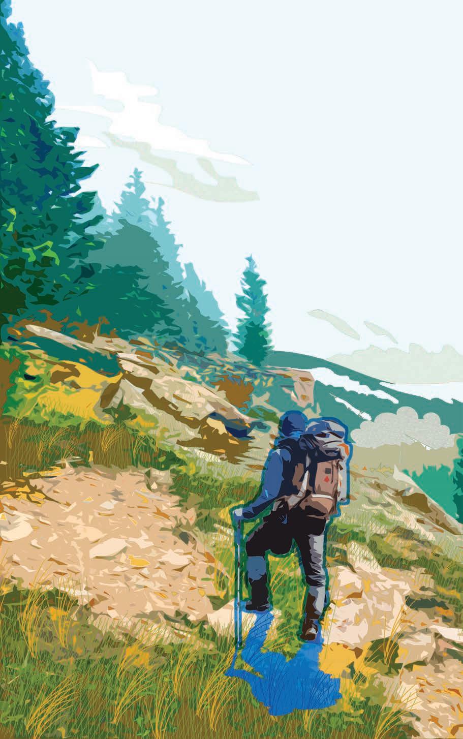
DANIEL CÔTÉ
L A N D S C A P E A R C H I T E C T U R E P O R T F O L I O
DANIEL CÔTÉ
EDUCATION
MacEwan University Edmonton,AB, Canada
University of Calgary Calgary,AB,Canada Major: Anthropology Minor: French GPA Sum Total: 3.707
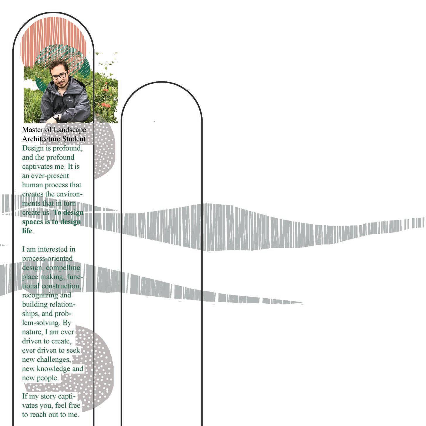
Master of Landscape Architecture M2 (third year)
EXPERIENCE
Adept Landscape and Construction Inc. Seasonal Sustainable Calgary Calgary,AB,Canada Calgary,AB,Canada Landscaper & Landscape Technologist Activation Lead
ATCO Land Department Edmonton,AB, Canada
ATCO, Customer Care & Billing Edmonton,AB, Canada
RCAC Villeneuve
Villeneuve,AB, Canada
LANGUAGES
LINKEDIN
www.linkedin.com/in/daniel-côté-b8095a260 EMAIL daniel.cote@ucalgary.ca

TECHNICAL SKILLS
AutoCAD drafting,constructiondocuments
Lumion 3drendering
Adobe Photoshop graphics,rendering
Adobe Illustrator graphics,linework
Adobe Indesign projectpresentations,document
Sketchup modeling
Rhino 3D modeling
ArcMap mapping,siteanalysis,censusdata
Hand Graphics drafting,rendering,siteanalysis,
Microsoft Office Suite documentpreparation,data
Shop Skills modelbuilding,woodworking,3dprinting organization manipulation,charts&
2014 - 2020 2021
-
Summer 2023 Summer 2022 November 2023
March 2024 English
-
French Native proficiency Basic proficiency
Land
Summers 2016
2018
Administrative Coordinator
-
Summer 2015
Back Office Clerk
Pilot & flying centre support staff 2013 - 2016
Flying Site
WARM
THOUGHTFUL
FLEXIBLE
DETAIL ORIENTED
INQUISITIVE ARTISTIC DEPENDABLE
PEOPLE PERSON DILIGENT PASSIONATE
ACTIVE
CREATIVE


CONTENTS A STORIED LANDSCAPE 5 - 9 10 - 11 12 14 13 HAT TRICK BOW HEIGHTS PLANT CULTIVATION RENDERING GRADING CONSTRUCTION DETAILS 15 16 7 6 5 3 2 1 THE PORCUPLAN 17-19 8 4

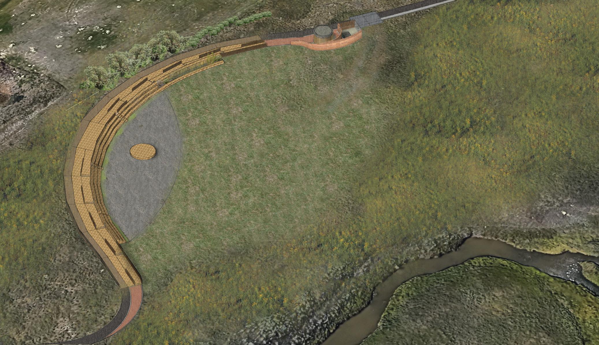
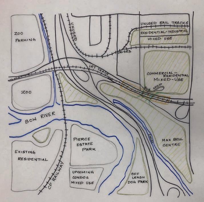
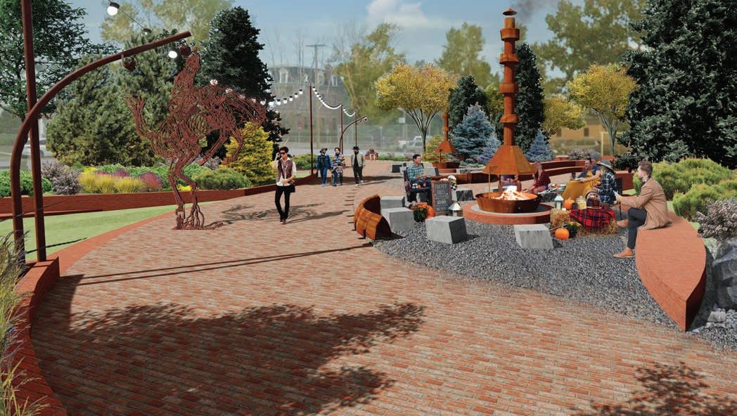
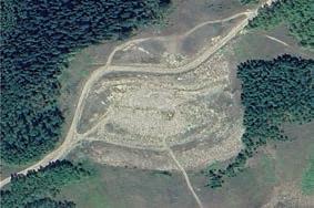
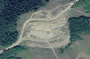
1 A STORIED LANDSCAPE
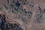
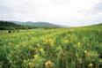
N. NOSE CREEK, CALGARY AB
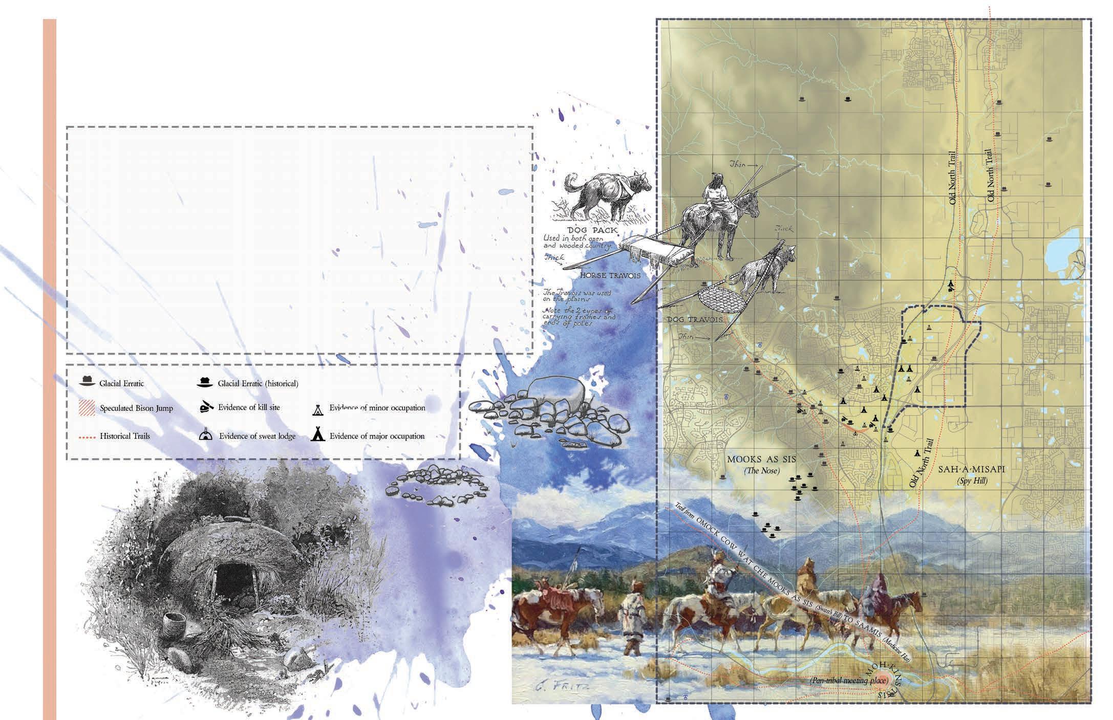
Under the Revised Stoney Industrial Area Structure Plan, North Nose Creek is set to see intense and transformative development. Yet, in our haste to write a new story, we run the risk of many more irrevocably being silenced. Nose Creek holds important parts of our cultural heritage. Even without a comprehensive inventory, within the area, about 100-150 pre-contact and historic period sites have been recorded.
This proposal acts as an expression of contemporary place-keeping and place-making, leveraging development to elevate stories embeded within the landscape and its communities by providing tangible stages and platforms for real engagement and presence.
Parkwide Programming Interpretive Framework
Engagement Facilitated Themes

Interperative elements
Take in the Story
Enter the Story
Experiential elements
Interactive elements
Take up the Story
A set of story themes are recognized in the landscape and provide an interpretive framework.
Of these, First People’s Stories are ubiquitous, restoring indigenous presence within the landscape and facilitating cross-cultural engagement.
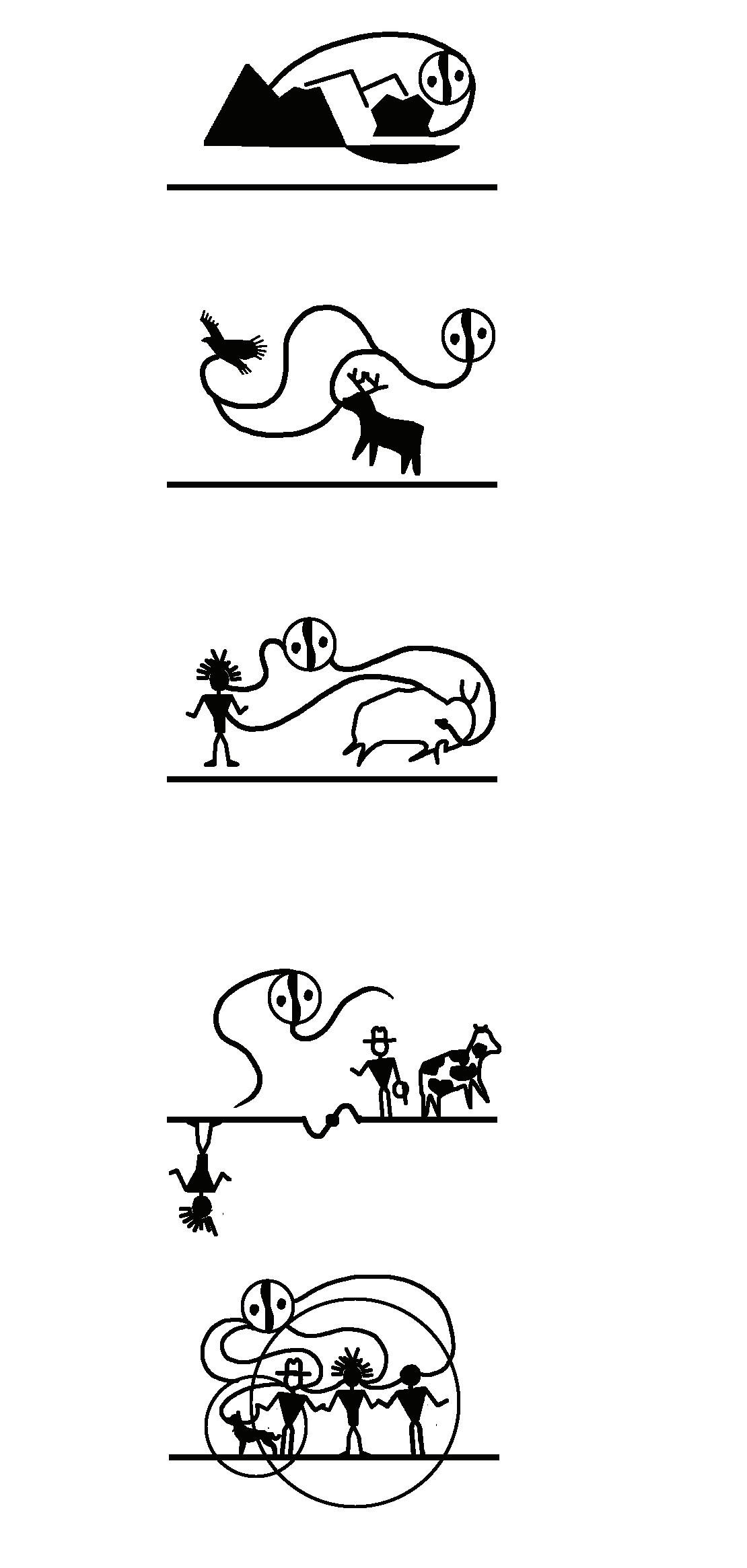


Stories Latent & Hidden Give Stories a Platform Stories Elevated & Shared Geoglacial Story Lifeweb Story First People’s Story Homestead Story Home Story I. II. III. IV. V. Activate SenseofPlaceSenseofCommunity SenseSenseofStewardship ofUnderstanding
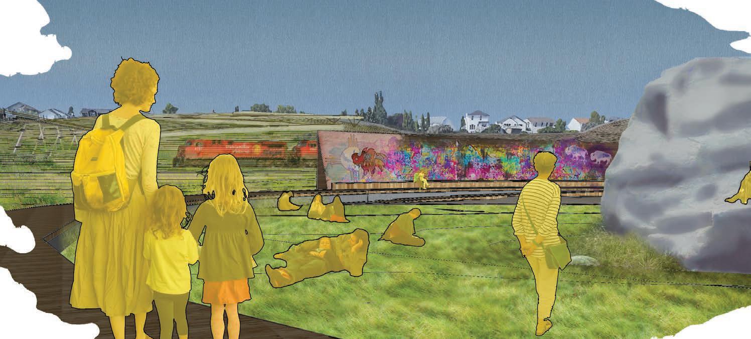
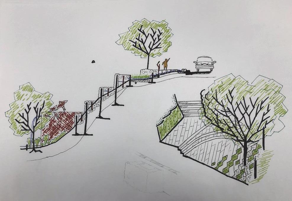
Ampitheatre: Performing in the Landscape
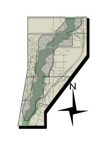
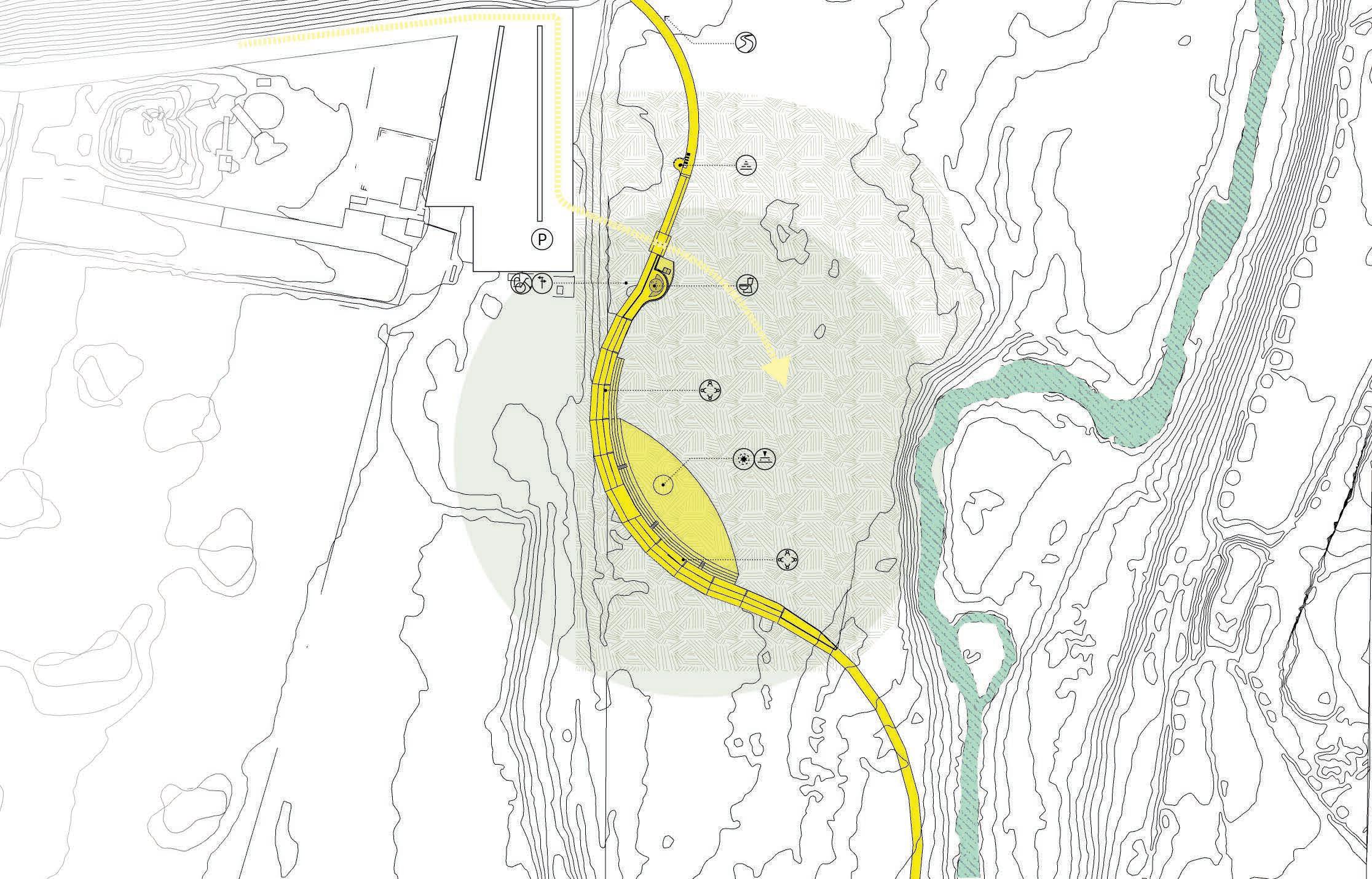
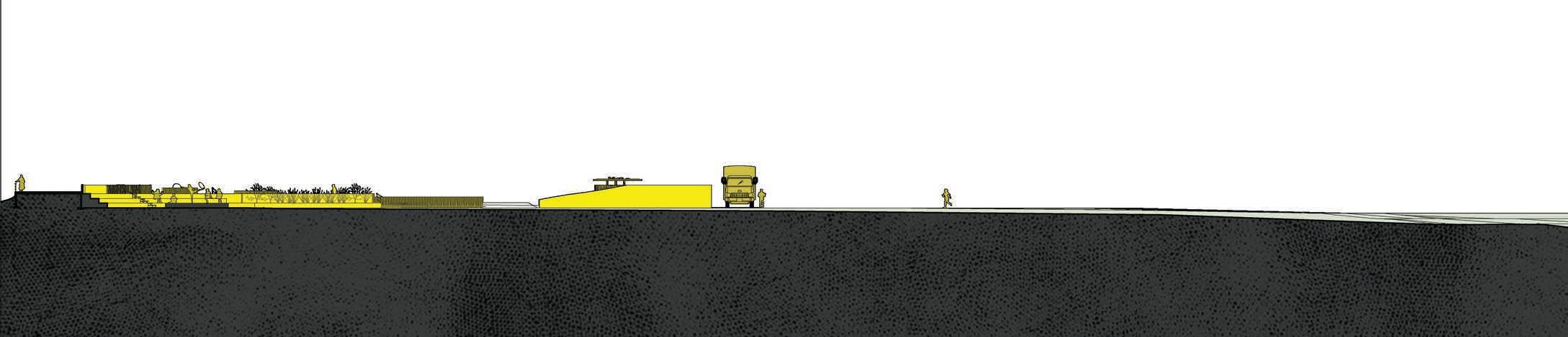
SECTION scale: 1:400 P Platform Pause Point Thematic Cairn Story Stone Activity Point Loukout Point Social Point Parking Bike Parking Public Restrooms Interpretive sign Wayfinding Point
Ampitheatre: Performing in the Landscape
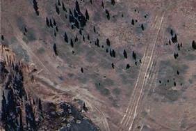
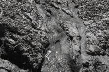
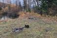
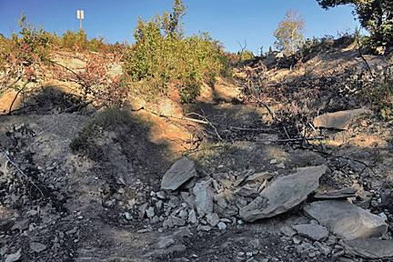
Historical Elements
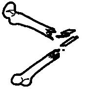

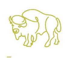
Bison Bone Fragments
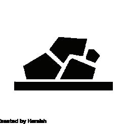
Tools & lithic debitage

Key Design Strategies
Elevating Natural features of the landscape to initiate engagement with their stories.
Give the community a sanctioned creative outlet to engage with.
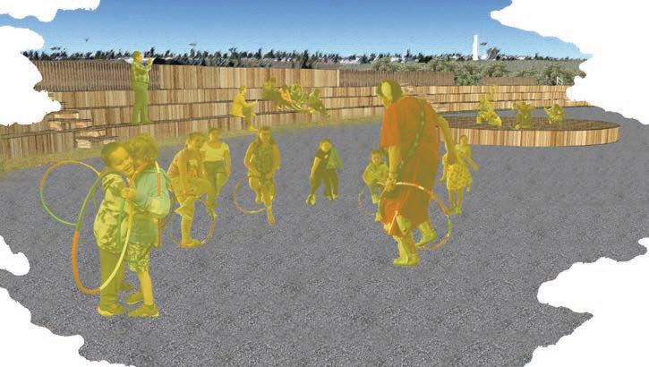
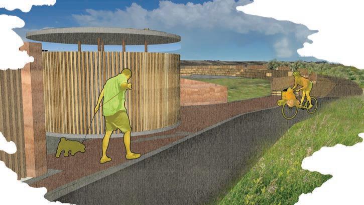
Take Up the Story
Cairns
Performance Space Public Washroom Vehicle Access
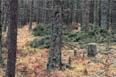
Tipi Rings
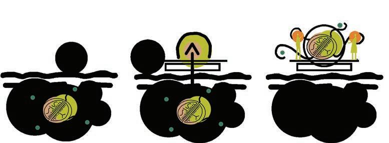
Beddington Erratic: History Set in Stone
Historical Elements

Bison Bone Fragments
Fire Cracked Rocks
Glacial Erratic Pasturage
Key Design Strategies
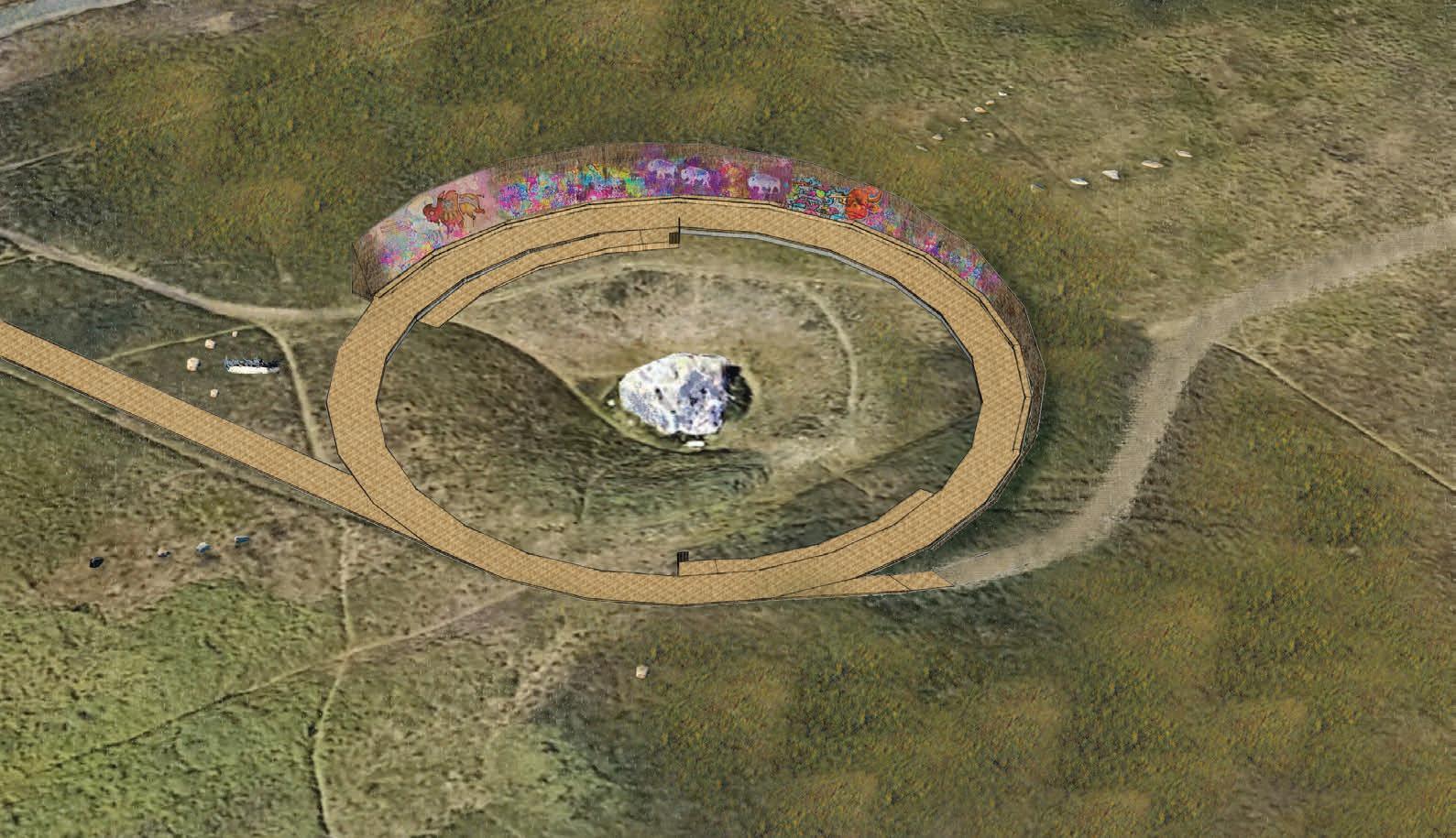
Elevating Natural features of the landscape to initiate engagement with their stories.
Give the community a sanctioned creative outlet to engage with.
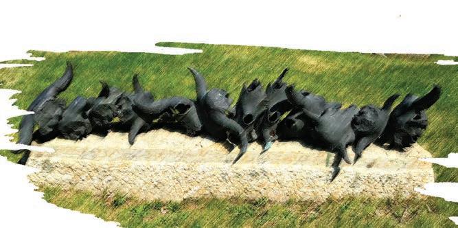
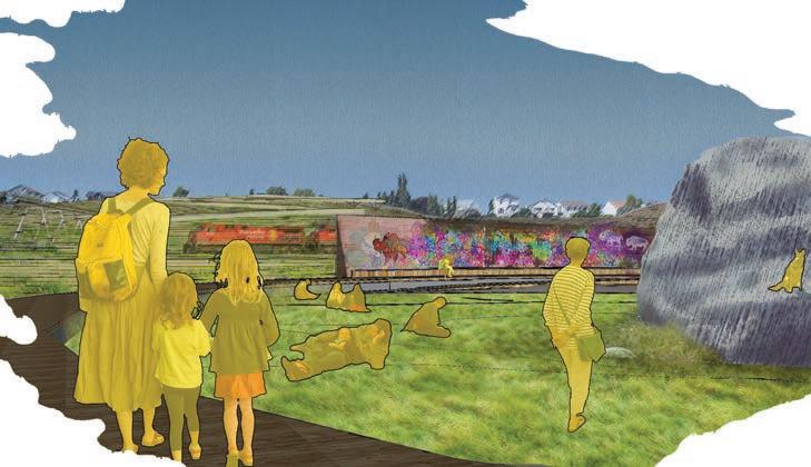
Memento: Bronze casts of Bison bones found on-site

Community Mural
Beddington Erratic
Distant
Proximate
Intimate Take in the Story
Enter the Story
 e.g. Wascana Centre

HAT TRICK
MODULAR BARRIER SYSTEM
A series of interlocking precast concrete traffic barriers with planters and siding.
Goals


Provide safe separation for seating and pedestrian uses from the travel lane, providing coverage for all three sides of the platform perimeters.
Provides greatest impact for least cost.
Components are movable using a forklift / small crane.
Components are easy to store, use & repurpose.
Design supports the LID stormwater system goals.
The design enhances the character of the area.
Considers all seasonal requirements. What is it?
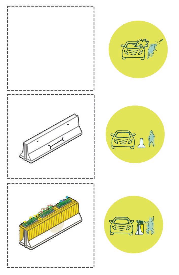
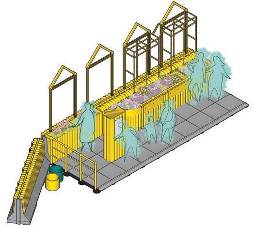


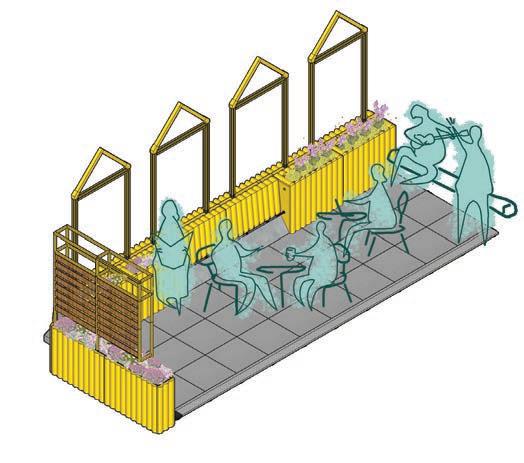


1 2 3 Public Parklet CONFIGURATIONS Semi-Private Patio
2
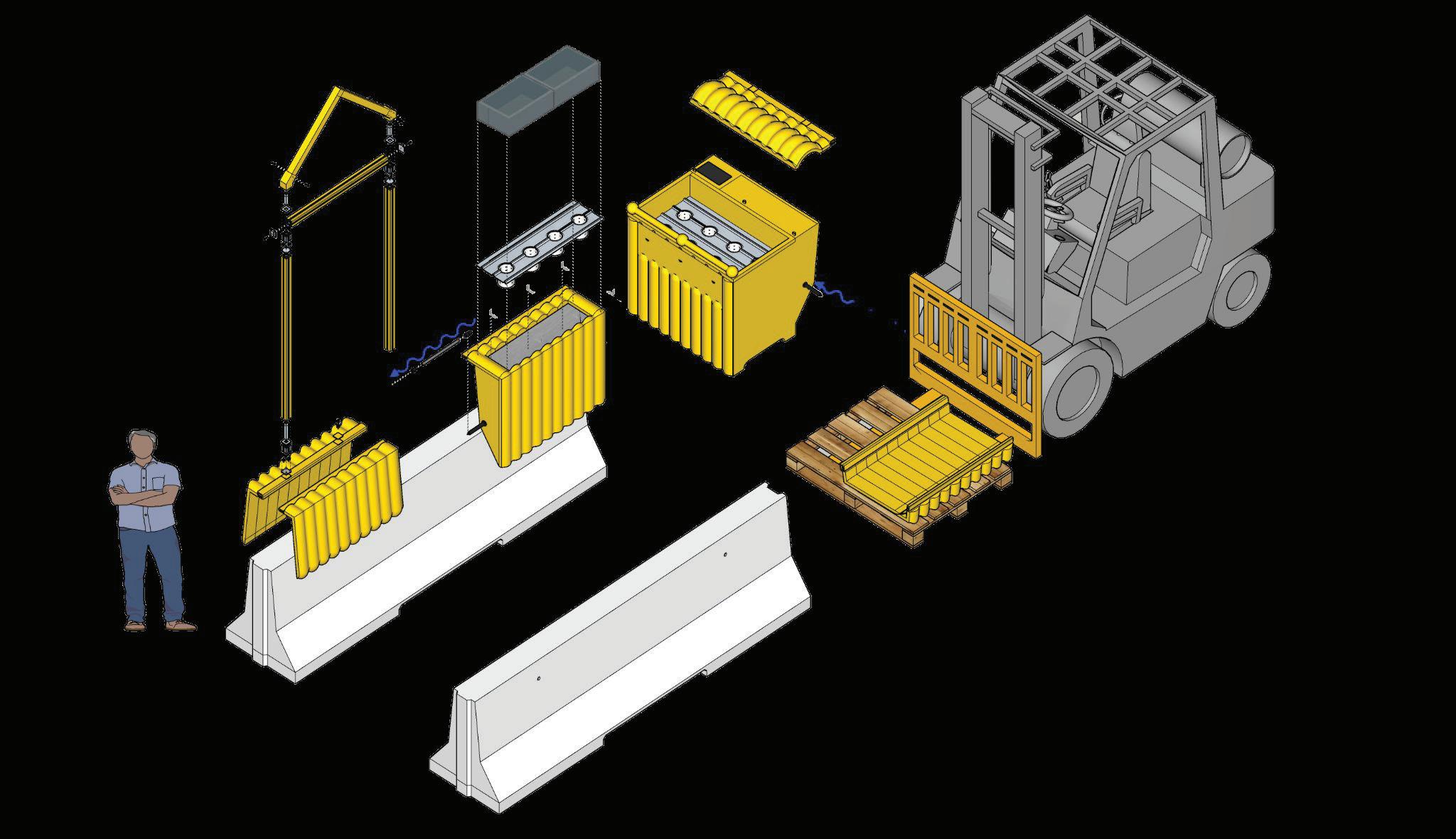
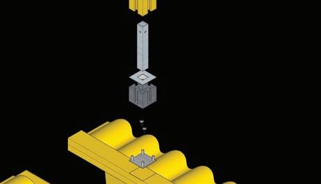

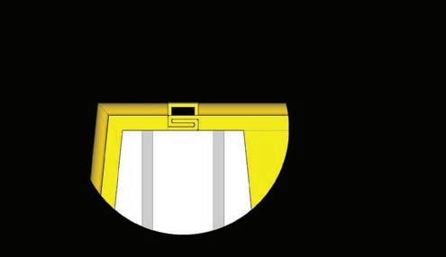
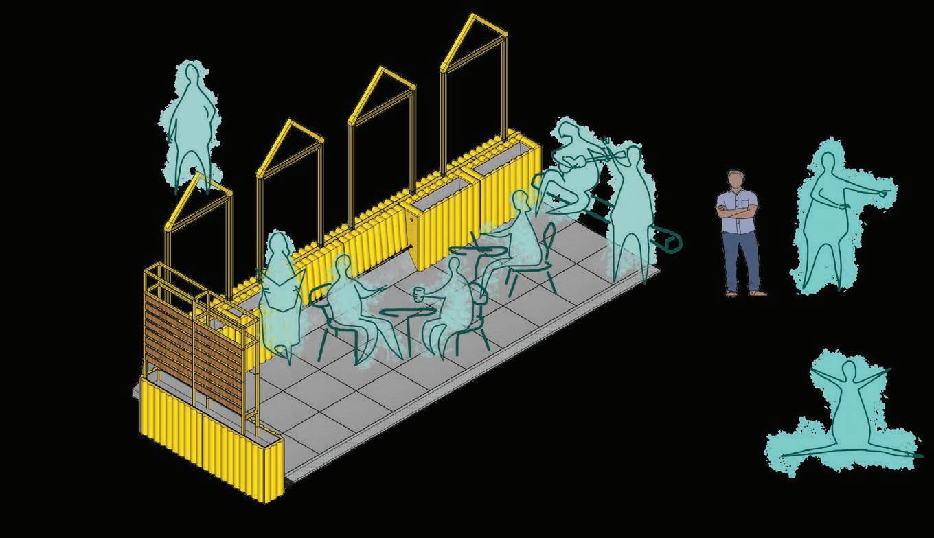
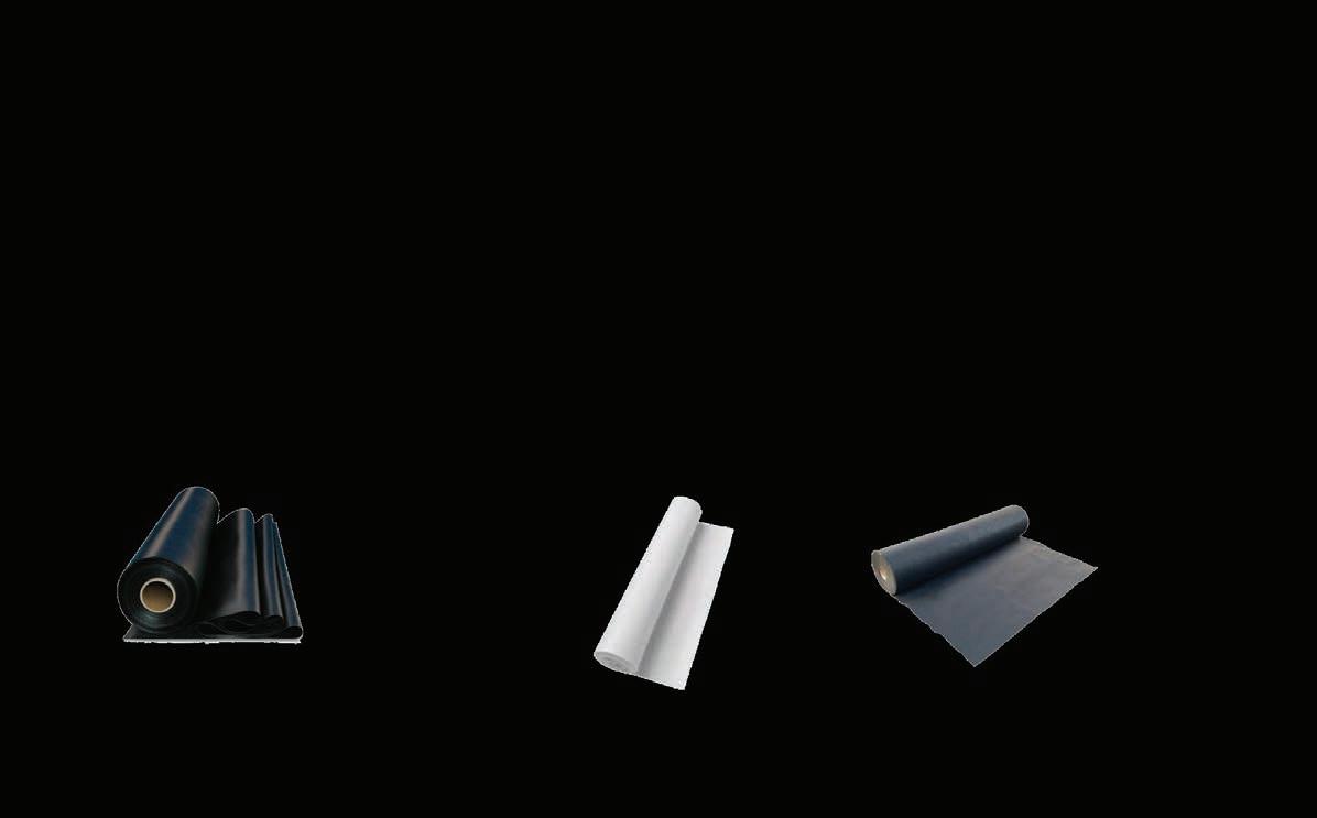

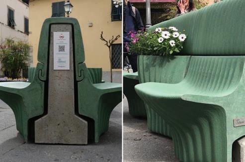

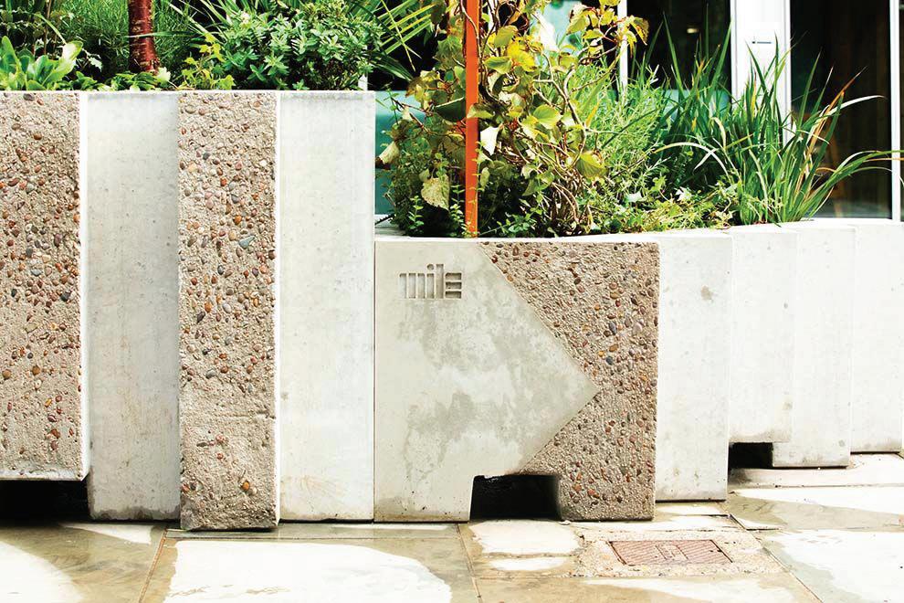
DESIGN SCHEMEDESIGN CONCEPT 50mm 350mm 300mm 120mm 50mm 250mm 420mm 120mm Sub-Irrigation System
R3direct & Giulia Grande
Materiality
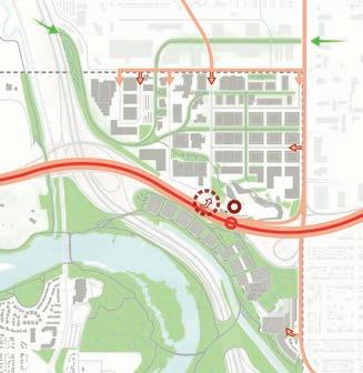
Bow to Bluff
Link System
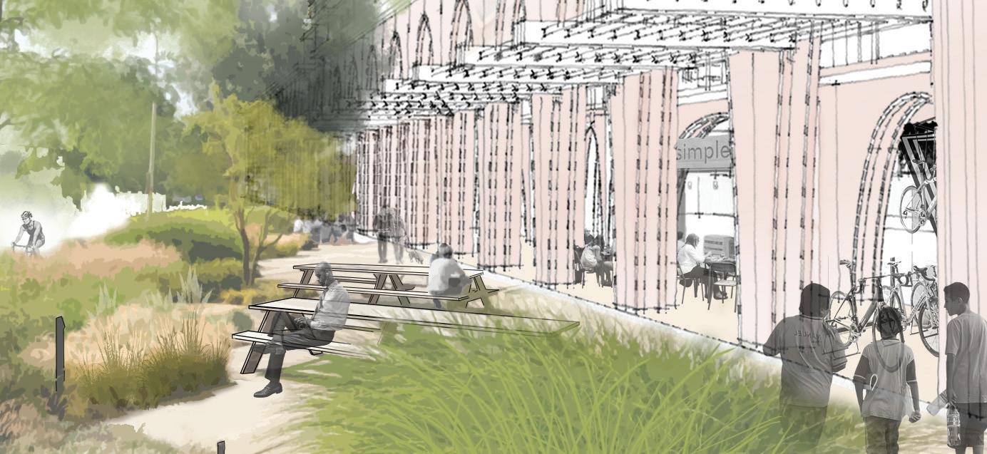
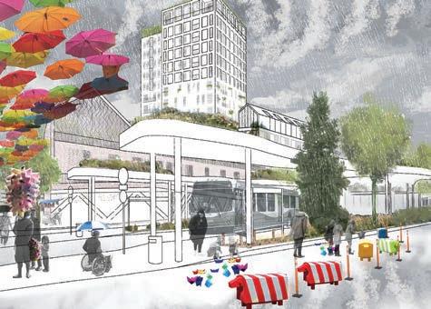
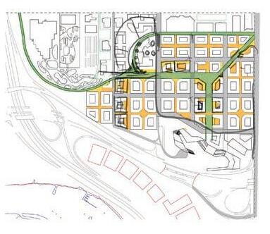
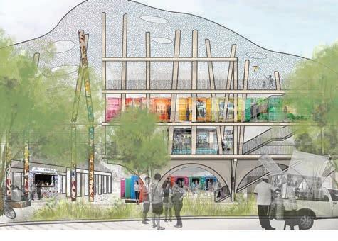
BOW HEIGHTS
ADVANCED URBAN PLANNING STUDIO

The product of focused development in a group of 3 Landscape Architecture students and 4 Planning students, this project engaged new and emerging tools guiding urban development in urban areas around the world. Using a human focused, Baukultur approach, our aim was to create a complete community informed by the area’s current condition and character. My role was in detailed and landscape design, and rendering scenes that convey the experiences we wish to facilitate with our design.
EXPLORATION OF PROGRAMMING + SPACE IDEATION + ITERRATION
RENDERS
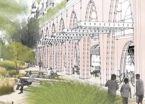
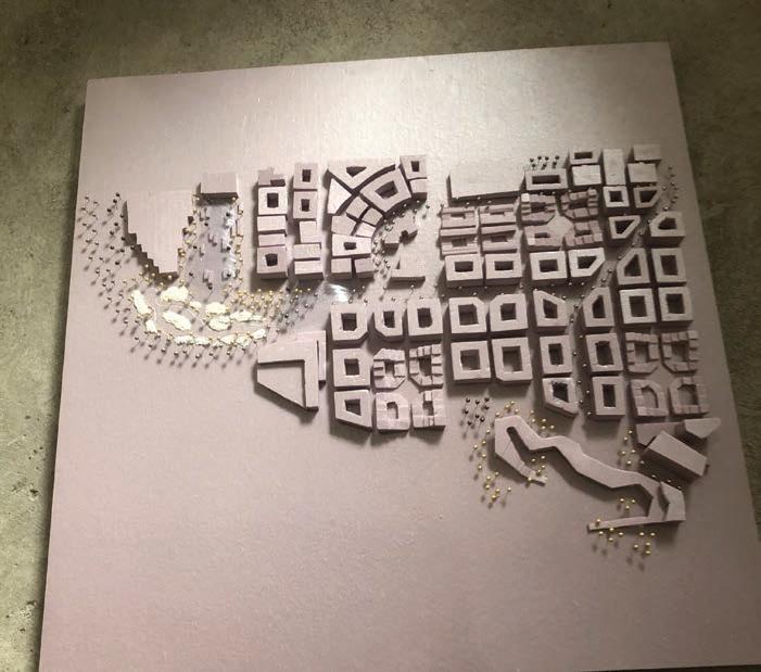
Final model collaborative
EXPLORATION OF FORMS + DESIGN LANGUAGE LAYOUT ITTERATING

Conceptswithsubsequentannotationsbyteammates
 CONCEPT
Sketchbyme
CONCEPT
Sketchbyme
Collaborativemapping
Rendersbyme
3
RENDERING
4
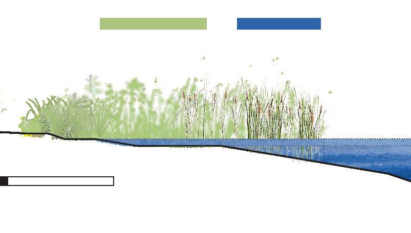
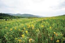
PLANT CULTIVATION
DESIGN OVERVIEW
The principle goals that guided the design decisions for the littoral communities:
i. Vegetate & enhance littoral zones with native plant communities.
ii. Provide a naturalized buffer, at least 5 meters perimeter from the waterline, to prevent free movement of geese between the pond and the public lawn.
iii. Improve water quality in Hawrelak Lake.
iv. Utilize only native plantings.
To this end, the design was broken down into two parts:
i. Wet Meadow Zone - A wetland plant community zone dominated by narrow-leaved graminoids (grasses) that tolerate only temporary flooding.
ii. Emergent Aquatic Zone - A wetland plant community which can tolerate variable and sometimes prolonged flooding; generally pertains to robust, erect graminoids such as cattails, rushes, sedges and grasses.
SEEDING & PLANTING
i. Wet Meadow planting will be applied by full broad-cast with seed mix 2 detailed in the seed mix 2 table. Then roll or cultipack after seeding.
ii. Emergent planting will be installed using plugs to bring shore stability. These must have a high root to shoot ratio
iii. Plant materials should be planted and distributed randomly within the specific plant community following natural grouping, spacing and distribution patterns.
iv. The two planting zones are expected, and encouraged to overlap to some extent.
v. Cattail plugs are not to be planted until it is observed that other species are sufficiently established.
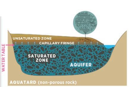
SITE PREPARATION
e shall be regraded in accordance with the grading plan. Cut-and-fill techniques shall be used and, to the extent they are suitable, excavated materials are to be used in the permanent fill. New fill should closely match the alluvial silty
ompaction should be avoided to sustain acceptable
iii. Blanket treatment and Pre-Planting Sod Solarization to prevent weeds.
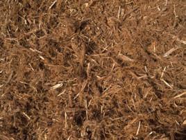
iv. Coconut coir rolls may be used to prevent overinundation and washing away of new seeds (Braun, 2023).
Subregion: Central Parkland Soil: silty-loam to sandy loam
Daniel Côté
WILLIAM
HAWRELAK PARK
SEED MIX II. Species AvailabilitySupplierTarget Cover% by weightkg/ha Required Bluejoint grass Calamagrostis canadensis Commercial DLF 43%30.80%0.508274 Fowl bluegrass Poa palustrisCommercial DLF 33%28.75%0.474342 Showy asterEurybia conspicua Commercial ALCLA 17%37.44%0.617874 Wild mint Mentha arvensis Commercial ALCLA 7% 3.01%0.049612 100%100%0.865796 PLANT MATERIAL II. Species AvailabilitySupplierTarget CoverSpacingMaterial Size Carex atherodes Awned sedgeCommercial ESRS 35%max. 1m on centre Plug Schoenoplectus tabernaemontani Softstem bulrush Commercial ESRS 25%max. 1m on centre Plug Typha Latifolia Common cattail Commercial ESRS 40%max. 1m on centre Plug 100%100% Sou Esr Maxar, GeoEye, Ea hstar Geographics, CNES/Air DS, USDA, USGS, AeroGRID, IGN, and the GI User Community 250 500 125 M
1 2.5m 5
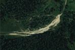
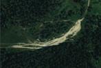
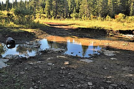
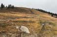
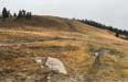
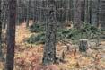
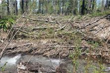
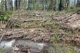
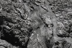
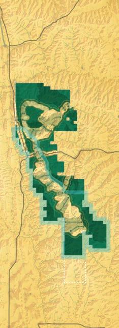
6 GRADING LAND ART PROJECT


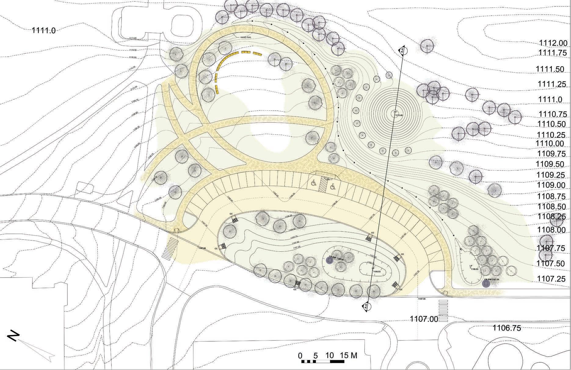
Vertical Scale: 1:120 Horizontal Scale: 1:300 Scale: 0 5 10 15M Proposed Trees Existing Trees High Point Low Point Stormwater Curb Cut Stormwater catch Basin Rim HP LP Curb Cut CB RIM LEGEND ExistingRoad CurbCut InteriorRoad ParkingStallBioswale MoundEarthen FeatureStormwater

CONSTRUCTION DETAILS

7
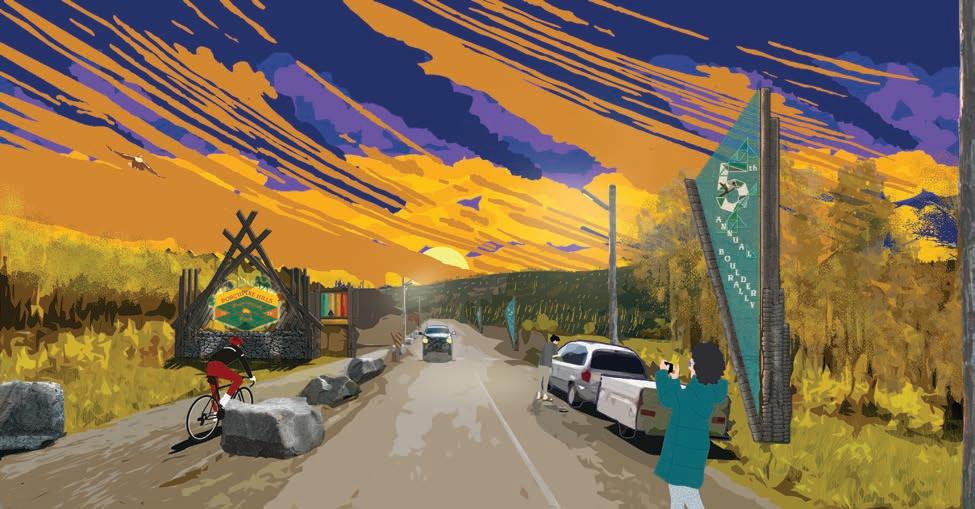
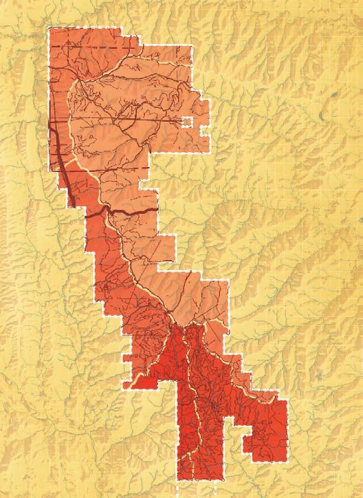
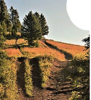
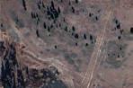
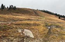
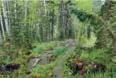
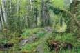
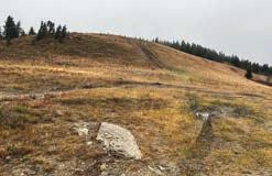
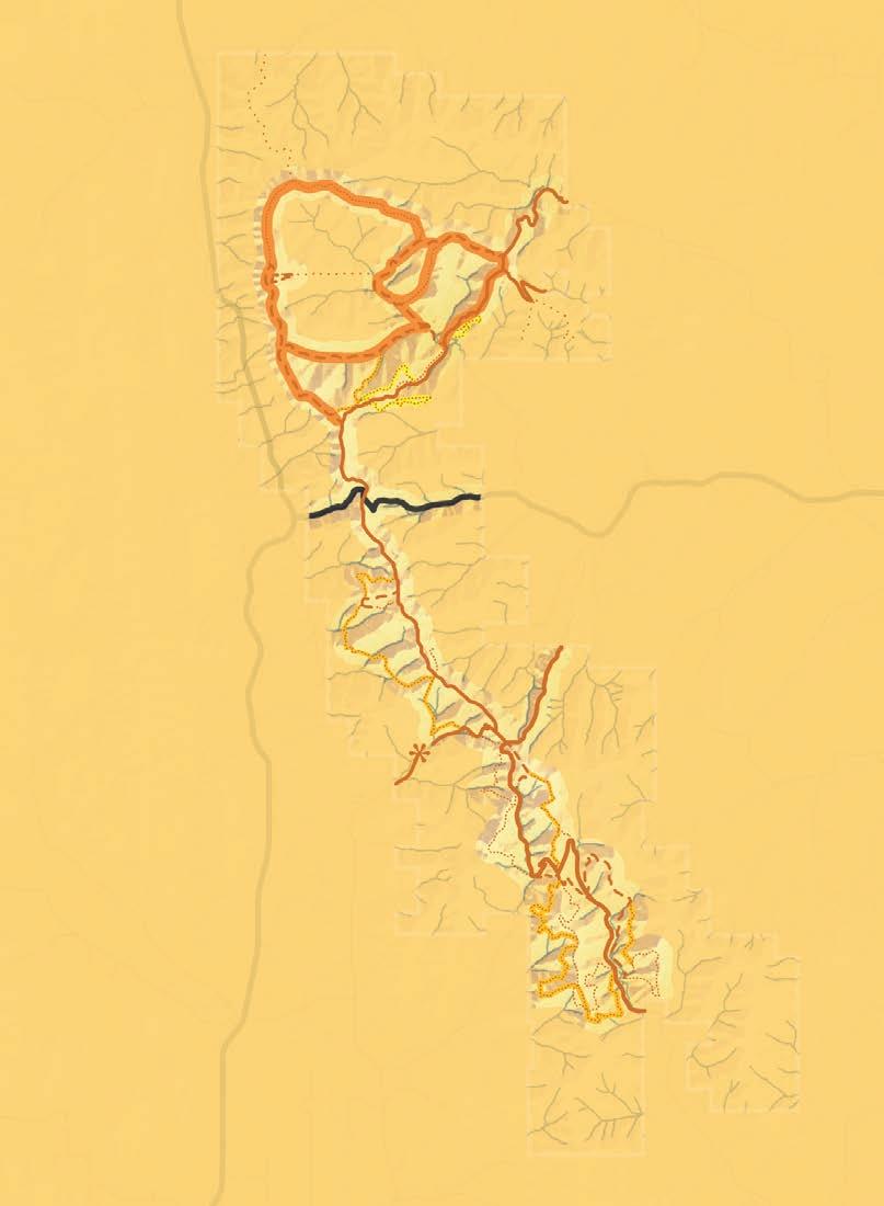
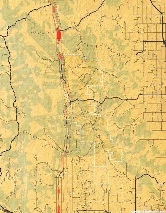
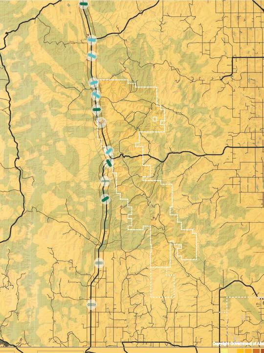
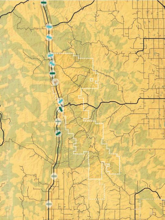
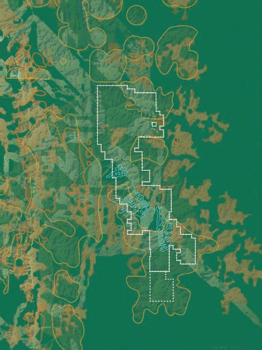
THE PORCUPLAN
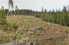
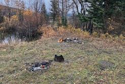
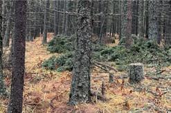
The “anything goes” management strategy of PLUZs have proven to be an ineffective. The wrong kinds of activities in the wrong places lead to displacement of wildlife, degraded waterways, damaged habitat and conflicts between people. Following the example of Castle Provincial Park, the porcuplan calls for thoughtfull land use planning where activity, road and trail limits will be used to create recreational opportunities for all Albertans in appropriate places and at appropriate levels of use.

Yield Food Chain 8% 13% % To Parking To Layover Trail To Parking To Damon Trail To Singing Bowls Trail Red Keep Trail 2.4 km 14 Boulder Way 1.1 km 15 P Singing Bowl Trail Damon Trail Strawberry Fields DAY USE 12 13 R RANDOM CAMPING AREA NEXT 2 km ROAD AHEAD D I S M O U N T
PROJECT STATEMENT
8
Bull Trout
Grizzly Bear
Grizzly Bear


P ILLS Prov ncial i 20 26 Furthest east Grizzly habitat north of Castle and south of Swann Optimum Refuge Secure Habitat At-Risk Threashold Extirpation Threashold Ideal Threashold Ideal Threashold LOW PRESSURE BEAVER CREEK MEADOW CREEK HEATH CREEK CALLUM CREEK TROUT CREEK SOUTH WILLOW CREEK MODERATE PRESSURE HIGH PRESSURE 0.6 km/km 0.6 km/km2 1.9 km/km 2.1 km/km 2.2 km/km 5.2 km/km 3.4 km/km 5 km/km2 1.2 km/km2 3 km/km2 0.5 km/km 1.2 km/km 0.6 km/km 1.0 km/km2 Natural Functioning Threashold
Elk
Beaver Creek AVG. LINEAR DISTURBANCE PORCUPINE HILLS WATERSHED SUB-BASINS HABITAT PRESSURE WILDLIFE EFFECTS Callum Creek Heath Creek Meadow Creek South Willow Creek Trout Creek CLEARCUTTING This sets my quills aquiver! Whatever shall be done? PORCUPINE HILLS PORCUPINE More info Enhance day-use Enhance entries Enhance rockclimbing & bouldering 5km Park Furthest east Grizzly habitat north of Castle and south of Swann Hills. Optimum Refuge Human conflict Incidents Grizzly Bear Secure Habitat Patches At-Risk Threashold Extirpation Threashold Ideal Threashold Ideal Threashold LOW PRESSURE BEAVER CREEK MEADOW CREEK HEATH CREEK CALLUM CREEK TROUT CREEK SOUTH WILLOW CREEK MODERATE PRESSURE HIGH PRESSURE 0.6 km/km 0.6 km/km2 1.9 km/km 2.1 km/km 2.2 km/km 5.2 km/km 3.4 km/km 5 km/km 1.2 km/km2 3 km/km2 0.5 km/km 1.2 km/km 0.6 km/km 1.0 km/km Natural Functioning Threashold Bull Trout Elk Grizzly Bear Beaver Creek AVG. LINEAR DISTURBANCE PORCUPINE HILLS WATERSHED SUB-BASINS HABITAT PRESSURE WILDLIFE EFFECTS Callum Creek Heath Creek Meadow Creek South Willow Creek Trout Creek This sets my quills aquiver! Whatever shall be done? Low watershed Wildlife desire PORCUPINE PORCUPINEHILLS PORCUPINEHILLS BearAware Alberta More info i Agricultural Camping Equestrian Fishing Forestry Guiding/Outfitting Hiking Hunting/Trapping Off-Highway Religious Research Traditional Other CURRENT Enhance day-use areas Enhance entries Enhance rockclimbing & bouldering Mountain Bike Camping X-CountryBike X-CountrySki Horseriding Nature Walk Hiking Horse Around Take Hike Be Boulder Be In Tents Ride Seek 5km Furthest east Grizzly habitat north of Castle and south of Swann Hills. Optimum Refuge Winter Range Human conflict Incidents Grizzly Bear Secure Habitat Patches At-Risk Threashold Extirpation Threashold Ideal Threashold Ideal Threashold LOW PRESSURE SOIL RILL EROSION & ROCK DISPLACEMENT SKID TRACK RUTS MUDDY FORD BEAVER CREEK MEADOW CREEK HEATH CREEK CALLUM CREEK TROUT CREEK SOUTH WILLOW CREEK MUDDY SKID TRACKS MODERATE PRESSURE HIGH PRESSURE 0.6 km/km 0.6 km/km2 1.9 km/km 2.1 km/km 2.2 km/km 5.2 km/km 3.4 km/km 5 km/km 1.2 km/km 3 km/km2 0.5 km/km 1.2 km/km 0.6 km/km 1.0 km/km Natural Functioning Threashold Bull
Elk
Trout
Beaver Creek AVG. LINEAR DISTURBANCE PORCUPINE HILLS WATERSHED SUB-BASINS HABITAT PRESSURE WILDLIFE EFFECTS Callum Creek Heath Creek Meadow Creek South Willow Creek Trout Creek EXTREME TRAIL WIDENING GAS WELL SITE CLEARCUTTING HAPHAZARD PERSONAL TIMBER HARVEST UNRESTRAINED RANDOM CAMPING INFORMAL TRAIL WIDENING This sets my quills aquiver! Whatever shall be done? Low watershed impact recreation mandate Core wildlife refugia Wildlife desire paths through recreation zone Potential seasonal closures TRAIL CLOSURES & RECLAMATION Corridor Wild Corridor Agricultural Camping Equestrian Fishing Forestry Guiding/Outfitting Hiking Hunting/Trapping Off-Highway Religious Research Traditional Other CURRENT Enhance day-use areas Enhance entries Enhance rockclimbing & bouldering Mountain Bike Camping X-CountryBike X-CountrySki Horseriding Nature Walk Hiking Horse Around Take Hike Be Boulder Be In Tents Ride Seek 5km PORCUPI Prov Park i 20 X Host to a resident herd of 450-700 Elk. That’s larger than Banff’s, smaller than Jasper’s. Bull Trout, Alberta’s official fish, who once called this range home, is now extirpated from it. Furthest east Grizzly habitat north of Castle and south of Swann Hills. Optimum Refuge Winter Range Sensitive Fish Habitat Human conflict Incidents Grizzly Bear Elk Fish Secure Habitat Patches Overpass Large underpass/ viaduct Smaller underpass Riparian-terrestrial culvert Shared underpass BEAVER CREEK MEADOW CREEK HEATH CREEK CALLUM CREEK TROUT CREEK MUDDY SKID TRACKS PORCUPINE HILLS WATERSHED SUB-BASINS EXTREME TRAIL WIDENING HAPHAZARD PERSONAL TIMBER HARVEST UNRESTRAINED RANDOM CAMPING INFORMAL TRAIL WIDENING This sets my quills aquiver! Whatever shall be done? Low watershed impact recreation mandate Core wildlife refugia Secondary wildlife refugia OVERPASS ELIPTICAL UNDERPASS ELIPTICAL UNDERPASS SHARED-USE TERRESTRIAL RIPARIAN CULVERT SMALLER UNDERPASS VIADUCT 50-80m 4.5m 15-20m 15-20m 20m 12m or less 4.5m 4.6-5.6m 5 10km 10km 5km Park 20 26 X Host to a resident herd of 450-700 Elk. That’s larger than Banff’s, smaller than Jasper’s. Bull Trout, Alberta’s official fish, who once called this range home, is now extirpated from it. south of Swann Hills. Winter Range Sensitive Fish Habitat Human conflict Incidents Grizzly Bear Elk Fish Secure Habitat Patches Low watershed impact recreation mandate Core wildlife refugia Wildlife desire paths through recreation zone Potential seasonal closures Secondary wildlife refugia CONTROLLED BURNS WILDLIFE REFUGIA CREEK RESTORATION STRATEGIC GRIZZLY ATTRACTANT REMOVAL GRASSLAND MANAGEMENT ELIPTICAL UNDERPASS ELIPTICAL UNDERPASS SHARED-USE TERRESTRIAL RIPARIAN CULVERT SMALLER UNDERPASS VIADUCT 50-80m 4.5m 15-20m 15-20m 20m 12m or less 4.5m 4.6-5.6m D M O U N T Corridor 10km PORCUP NE HILLS I Prov ncial Park i 20 26 X Host to resident herd of 450-700 Elk. That’s larger than Banff’s, smaller than Jasper’s. Bull Trout, Alberta’s official fish, who once called this range home, is now extirpated from it. Furthest east Grizzly habitat north of Castle and south of Swann Hills. Optimum Refuge Winter Range Sensitive Fish Habitat Human conflict Incidents Grizzly Bear Elk Fish Secure Habitat Patches Overpass Large underpass/ viaduct Smaller underpass Riparian-terrestrial culvert Shared underpass BEAVER CREEK MEADOW CREEK HEATH CREEK CALLUM CREEK TROUT CREEK PORCUPINE HILLS WATERSHED SUB-BASINS Low watershed impact recreation mandate Core wildlife refugia Wildlife desire paths through recreation zone Potential seasonal closures Secondary wildlife refugia CONTROLLED BURNS WILDLIFE REFUGIA OVERPASS ELIPTICAL UNDERPASS ELIPTICAL UNDERPASS SHARED-USE TERRESTRIAL RIPARIAN CULVERT SMALLER UNDERPASS VIADUCT 50-80m 4.5m 15-20m 15-20m 20m 12m less 4.5m 4.6-5.6m ANIMAL High Animal Vehicle Collision Index Ungulate fatalities Ungulate fatalities RANDOM Corridor NEXT Equestrian optimized shared-use trail Access Roads X-country bike optimized Main, shared-use trails Hiking Trails R G Orienteering Mountain Bike Camping Random Camping WinterCamping X-CountryBike Fat-tireBiking MotorCamping X-CountrySki Interpretive Birding Horseriding Hunting Bouldering Nature Walk Hiking RockClimbing Horse Around Take Hike Boulder Be In Tents 10km 10km 10km 5km
Downhill MTB & Free-Ride Equestrian optimized shared-use trail Access Roads X-country bike optimized Main, shared-use trails Hiking Trails Downhill MTB & Free-Ride Equestrian optimized shared-use trail Access roads X-country bike optimized Main, shared-use trails Hiking Trails Enhanced entries Enhanced rockclimbing & bouldering Enhanced day-use areas R G M Orienteering Mountain Bike Camping Random Camping GroupCamping WinterCamping X-CountryBike Fat-tireBiking MotorCamping X-CountrySki Interpretive Birding Horseriding Hunting Bouldering Nature Walk Hiking RockClimbing R G M Orienteering Mountain Bike Camping Random Camping GroupCamping WinterCamping X-CountryBike Fat-tireBiking MotorCamping X-CountrySki Interpretive Birding Horseriding Hunting Bouldering Nature Walk Hiking RockClimbing Horse Around Take a Hike Be Boulder Be In Tents Ride & Seek PORCUP NE HILLS I Prov ncial Park i 20 26 X Host to resident herd of 450-700 Elk. That’s larger than Banff’s, smaller than Jasper’s. Bull Trout, Alberta’s official fish, who once called this range home, is now extirpated from it. Furthest east Grizzly habitat north of Castle and south of Swann Hills. Optimum Refuge Winter Range Sensitive Fish Habitat Human conflict Incidents Grizzly Bear Elk Fish Secure Habitat Patches Overpass Large underpass/ viaduct Smaller underpass Riparian-terrestrial culvert Shared underpass BEAVER CREEK MEADOW CREEK HEATH CREEK CALLUM CREEK PORCUPINE HILLS WATERSHED SUB-BASINS EXTREME TRAIL WIDENING CLEARCUTTING HAPHAZARD PERSONAL TIMBER HARVEST UNRESTRAINED RANDOM CAMPING Low watershed impact recreation mandate Core wildlife refugia Wildlife desire paths through recreation zone Potential seasonal closures Secondary wildlife refugia TRAIL CLOSURES RECLAMATION CONTROLLED BURNS WILDLIFE REFUGIA CREEK RESTORATION STRATEGIC GRIZZLY ATTRACTANT REMOVAL GRASSLAND MANAGEMENT OVERPASS ELIPTICAL UNDERPASS ELIPTICAL UNDERPASS SHARED-USE TERRESTRIAL RIPARIAN CULVERT SMALLER UNDERPASS VIADUCT 50-80m 4.5m 15-20m 15-20m 20m 12m or less 4.5m 4.6-5.6m High Animal Vehicle Collision Index Ungulate fatalities Ungulate fatalities RANDOM NEXT Access Roads X-country bike optimized Main, shared-use trails Hiking Trails M Orienteering Mountain Bike Camping Random Camping WinterCamping X-CountryBike Fat-tireBiking MotorCamping X-CountrySki Interpretive Birding Horseriding Hunting Bouldering Nature Walk Hiking RockClimbing Be Boulder Be Tents M 10km 10km 10km 5km
PORCUPLAN
Ungulate fatalities

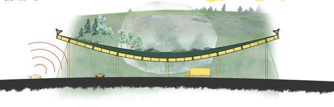
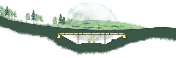
Furthest east Grizzly habitat north of Castle and south of Swann Optimum Refuge Secure Habitat Overpass Ideal Threashold SOIL RILL EROSION & ROCK DISPLACEMENT SKID TRACK RUTS MUDDY FORD BEAVER CREEK MEADOW CREEK TROUT CREEK SOUTH WILLOW CREEK MUDDY SKID TRACKS 0.6 km/km2 1.2 km/km 3 km/km2 EXTREME TRAIL WIDENING GAS WELL SITE CLEARCUTTING HAPHAZARD PERSONAL TIMBER HARVEST UNRESTRAINED RANDOM CAMPING INFORMAL TRAIL WIDENING This sets my quills Whatever shall be PORCUPINE HILLS PORCUPINE HILLS OVERPASS 8% 3% 89% 36% 9% 55% 47% 11% 42% 51% 12% 37% 34% 63% 3% 2002 rural road 2012 2022 AVOIDANCE COLLISION CROSSING AVERAGE DAILY TRAFFIC ANIMAL VEHICLE COLLISIONS major highway Grizzly Bear fatalities High human safety risk High Animal Vehicle Collision Index Ungulate fatalities High Animal Vehicle Collision Index Ungulate fatalities Ungulate fatalities of total costs related to animal-vehicle collisions on Highway 22, along Porcupine Hills AB Open Data Miistakis Institute, Tracy Lee and Holly Kinas, 2019 $650,000 Overpass Large underpass/ viaduct Smaller underpass Riparian-terrestrial culvert Shared underpass BEAVER SMALLER UNDERPASS 12m or less Collision Index Ungulate fatalities 10km 5 5km Optimum Refuge Winter Range Sensitive Fish Habitat Human conflict Incidents Grizzly Bear Elk Fish Secure Habitat Patches Overpass Large underpass/ viaduct Smaller underpass Riparian-terrestrial culvert HEATH CALLUM CREEK PORCUPINE HILLS WATERSHED ELIPTICAL UNDERPASS ELIPTICAL UNDERPASS SHARED-USE TERRESTRIAL RIPARIAN CULVERT SMALLER UNDERPASS VIADUCT 50-80m 4.5m 15-20m 15-20m 20m 12m or less 4.5m 4.6-5.6m ANIMAL
High Animal Vehicle Collision Index
5 X Host to a resident herd of 450-700 Elk. That’s larger than Banff’s, smaller than Jasper’s. Bull Trout, Alberta’s official fish, who once called this range home, is now extirpated from it. Furthest east Grizzly habitat north of Castle and south of Swann Hills. Optimum Refuge Winter Range Sensitive Fish Habitat Human conflict Incidents Grizzly Bear Elk Fish Secure Habitat Patches Overpass Large underpass/ viaduct Smaller underpass Riparian-terrestrial culvert Shared underpass LOW PRESSURE SOIL RILL BEAVER CREEK MEADOW CREEK HEATH CREEK CALLUM CREEK TROUT CREEK SOUTH WILLOW CREEK MODERATE PRESSURE HIGH PRESSURE 0.6 km/km2 1.2 km/km 3 km/km PORCUPINE HILLS WATERSHED SUB-BASINS HABITAT PRESSURE EXTREME TRAIL WIDENING CLEARCUTTING HAPHAZARD PERSONAL TIMBER HARVEST Low watershed impact recreation mandate Core wildlife refugia Wildlife desire paths through recreation zone Potential seasonal closures Secondary wildlife refugia TRAIL CLOSURES & RECLAMATION CONTROLLED BURNS WILDLIFE REFUGIA CREEK RESTORATION STRATEGIC GRIZZLY ATTRACTANT REMOVAL GRASSLAND MANAGEMENT OVERPASS ELIPTICAL UNDERPASS ELIPTICAL UNDERPASS SHARED-USE TERRESTRIAL RIPARIAN CULVERT SMALLER UNDERPASS VIADUCT 50-80m 4.5m 15-20m 15-20m 20m 12m or less 4.5m 4.6-5.6m 3% 9% 11% 12% 63% AVOIDANCE COLLISION ANIMAL VEHICLE COLLISIONS
Bear fatalities High human safety risk High Animal Vehicle
Index
fatalities High Animal Vehicle
Index Ungulate fatalities Ungulate fatalities 5 10km 10km 5km
Ungulate fatalities
Grizzly
Collision
Ungulate
Collision