cradle to cradle to coastlines coastlines

Page 3 New Staff
Page 4
Page 5
Page 6
Page 7
Page 8
Page 9
Page 10
Page 11
Page 12
Page 13
Page 14
Page 16
Page 17
Page 18
Page 19
Creatures of the Cradle
NAIDOC Week celebrations
Guide Falls Tree Planting
Promising News for Three Hummock Island
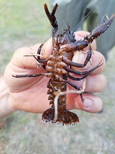
Caring for Crayfish along Seabrook and Penguin Creeks
Biosecurity Corner
Project launch: Our Natural Advantage
Tasmanian Climate Change Act: Have your say
How controlling weeds on King Island can benefit threatened species
National Science Week
Early Warning Signs at Ocean Beach
Climate Clarity
Media and Communications Intern
Impacts on our Shorebirds
Position Vacant: Chair of the NRM Committee
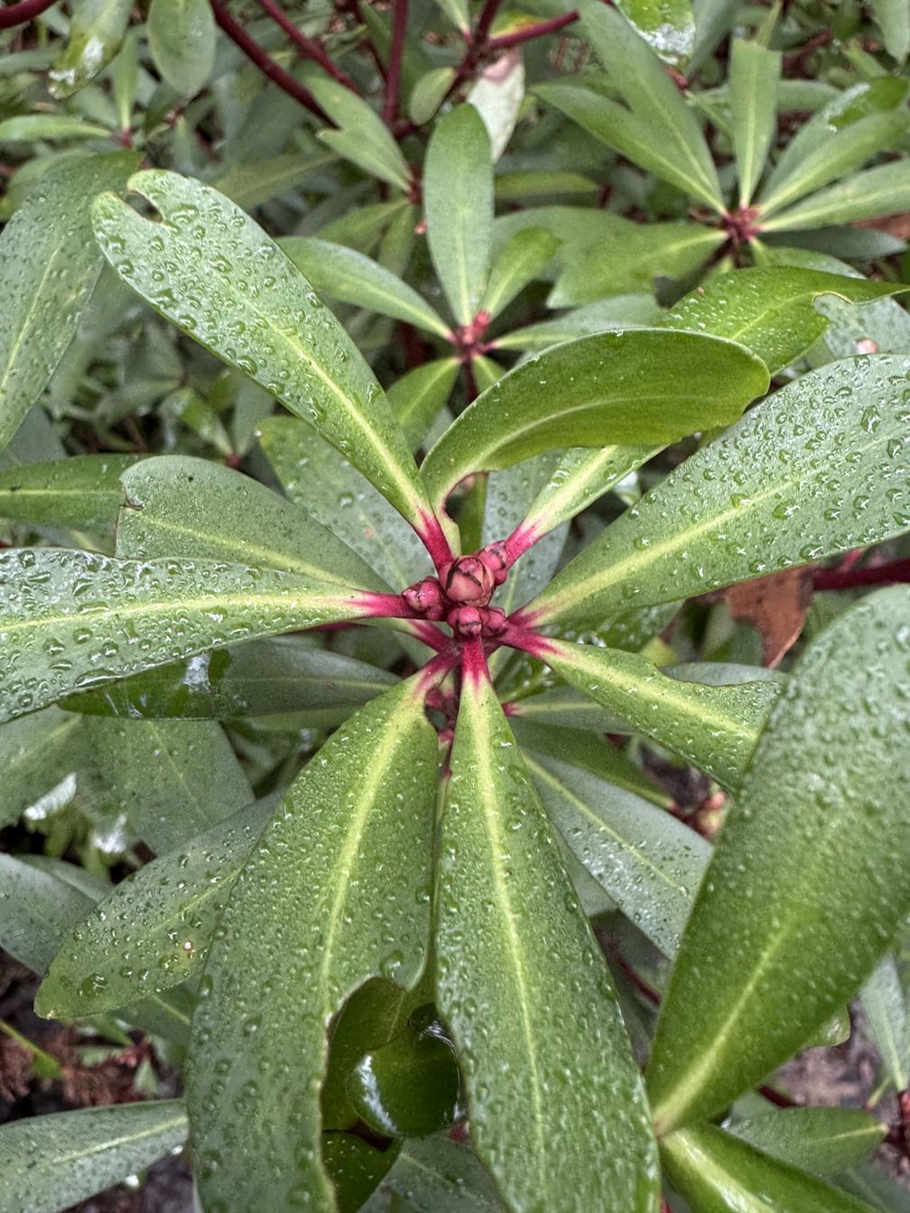
Front cover: Budding Tasmanian pepperberry (Tasmannia lanceolata) by Isabella Kingston.
LIKE OUR FACEBOOK PAGE CRADLE COAST NRM FOR ALL THE LATEST NEWS, EVENTS AND NRM ACTIVITIES.
1-3 Spring St, Burnie Tasmania 7320 03 6433 8400
www.cradlecoast.com
www.facebook.com/CradleCoastNRM/
Joseph joined CCA in July 2025 as a Biodiversity Coordinator, responsible for overseeing the Giant Freshwater Crayfish Recovery project
Joseph has a Masters in Environmental Science from the Australian National University and a PhD from the Federation University focused on improving vegetation restoration in arid environments Joseph also has previously worked for an NRM group in Queensland where he worked on a variety of environmental projects including invasive species control, threatened species and ecological community rehabilitation, and wetland protection
Juliette joined Cradle Coast Authority in August 2025 as an NRM Field Officer Juliette holds a Bachelor of Natural Environment and Conservation, majoring in Natural Resource Management. She is passionate about protecting Tasmania’s unique landscapes and biodiversity and has practical experience in emergency management and fieldwork.
Prior to this role, Juliette worked as a Fire Fighter for Tasmania Parks and Wildlife Service, where she responded to bushfires, conducted prescribed burns, and supported incident management teams in remote and high-pressure environments. Outside of work, she enjoys snorkeling, painting, hiking and exploring the outdoors
Digging through damp soil of Tasmania is a group of industrious crustaceans named Engaeus, more commonly called burrowing crayfish
Unlike most other species of crayfish, like the enormous Giant Freshwater Crayfish, burrowing species do not live in waterways Instead, they burrow into areas of damp soil, such as stream banks and seepages, where they construct a series of moist tunnels which can extend 2 metres down to the water table. The tunnel entrances are marked by mud ‘chimneys’ which can reach heights of 40 cm.
Burrowing crayfish are a fair bit smaller than their stream-dwelling relatives, growing to a maximum length of 10 cm. A life underground has also led to the development of a narrower body, reduced tail, and claws that open vertically rather than horizontally allowing them to be used in confined spaces
Burrowing crayfish are found across the temperate areas of south-east Australia with north and west Tasmanian being a species hotspot containing 15 species, 13 of which are unique to the island Some species are widespread across Tasmania Others are found only in a limited area and due to their localised
distribution are particularly vulnerable to soil disturbance from stock, waterway pollution and development activities. The Central North Burrowing Crayfish (Engaeus granulatus) is only found between Mersey River and Port Sorell and is listed Endangered under state and federal legislation The Burnie Burrowing Crayfish (Engaeus yabbimunna) is only found in a small area around the city of Burnie and is listed Vulnerable.
The most recently discovered burrowing crayfish is also a Cradle Coast local. Thanks to the great work of Alastair Richardson, Brian French and Mark Wapstra, Engaeus excavator was studied and described in 2024 It has a restricted range around Latrobe, where it may coexist with E. granulatus. Its conservation status is unknown.
If you identify potential crayfish burrows in your area, record the location and report it to the Natural Values Atlas Avoid disturbing the location and consider activities such as revegetation and fencing off streamside vegetation
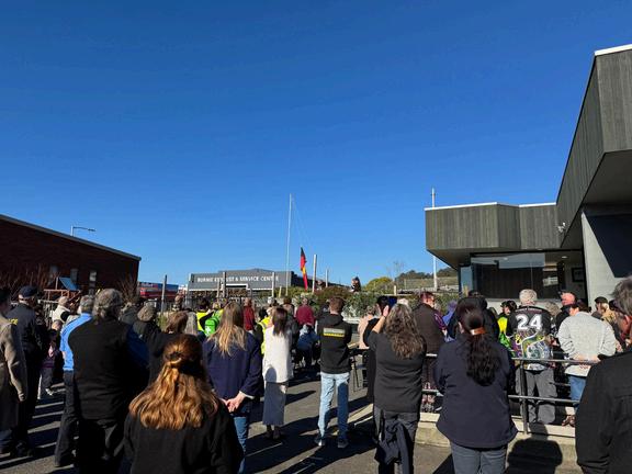
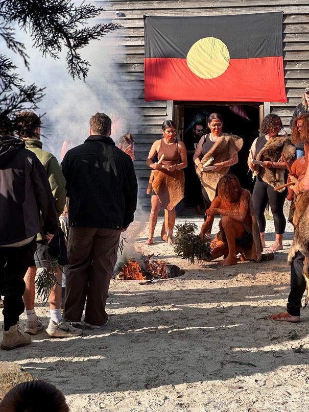
In July, NRM staff were pleased to attend four NAIDOC events across the Cradle Coast region.
The week kicked off with two flag raising ceremonies, with staff attending both the Tasmanian Aboriginal Centre's Pataway / Burnie flag raising as well as a flag raising at Tiagarra Tasmanian Aboriginal Cultural Centre with the Six Rivers Aboriginal Corporation.
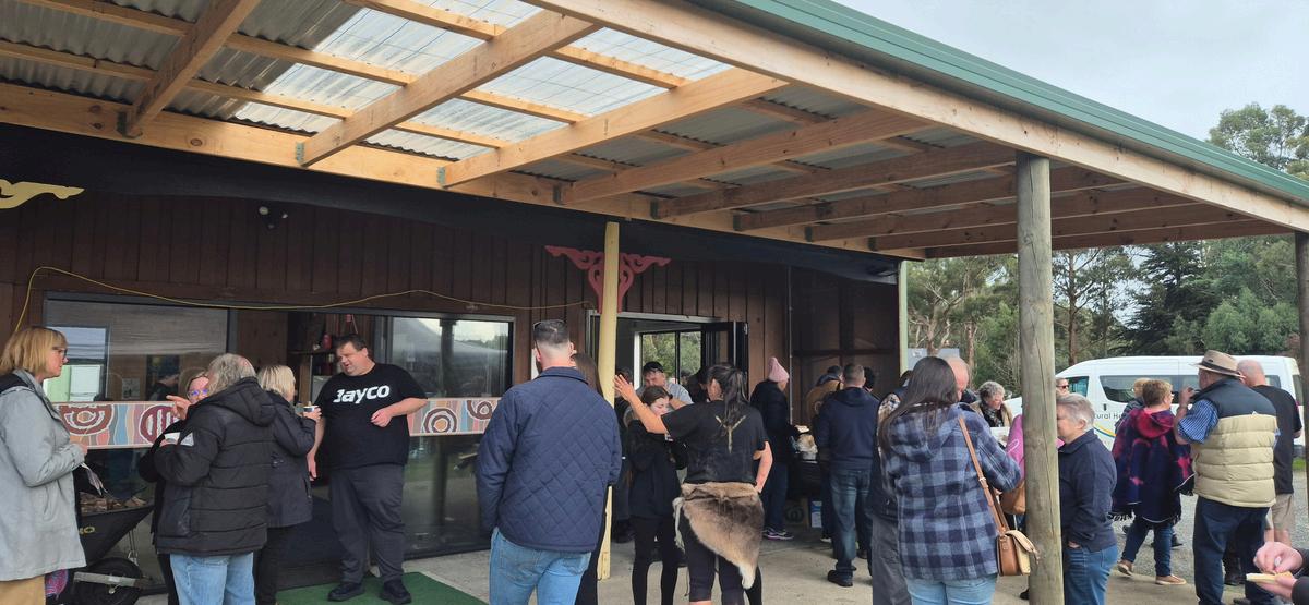
On Wednesday, some of the team adventured out a little further to Trawmanna, just outside of Smithton, to join the Circular Head Aboriginal Corporation and the local community for a full day of activities and tasty food Other team members remained closer to home, attending a morning tea hosted by the University of Tasmania's Riawunna Centre in Pataway / Burnie.
This year’s NAIDOC Week theme was "The Next Generation: Strength, Vision & Legacy " The theme celebrates the achievements of the past while focusing on a bright future
Do you know what NAIDOC stands for?
Have a guess and then check the back cover of this edition for the answer!
By Lewis Jaffray, Media and Communications Intern from Swinburn University
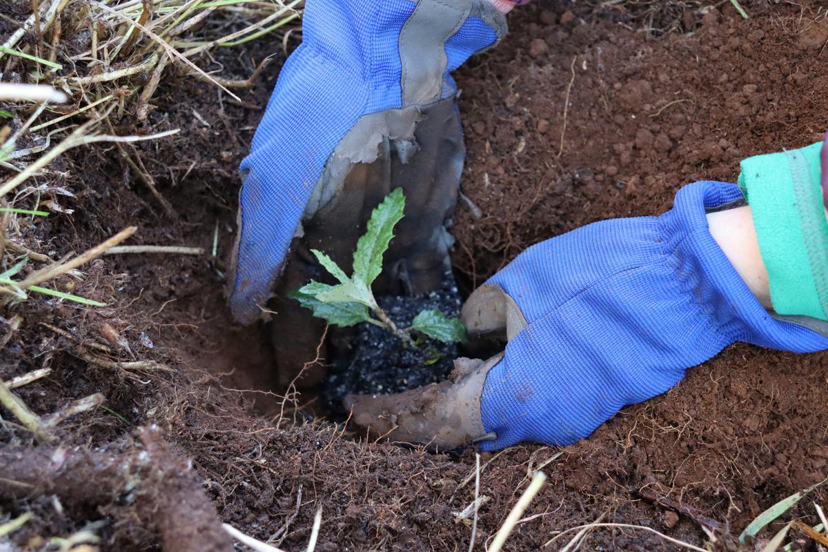
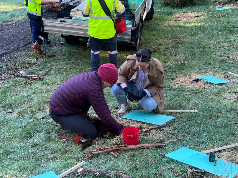
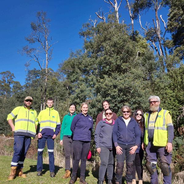
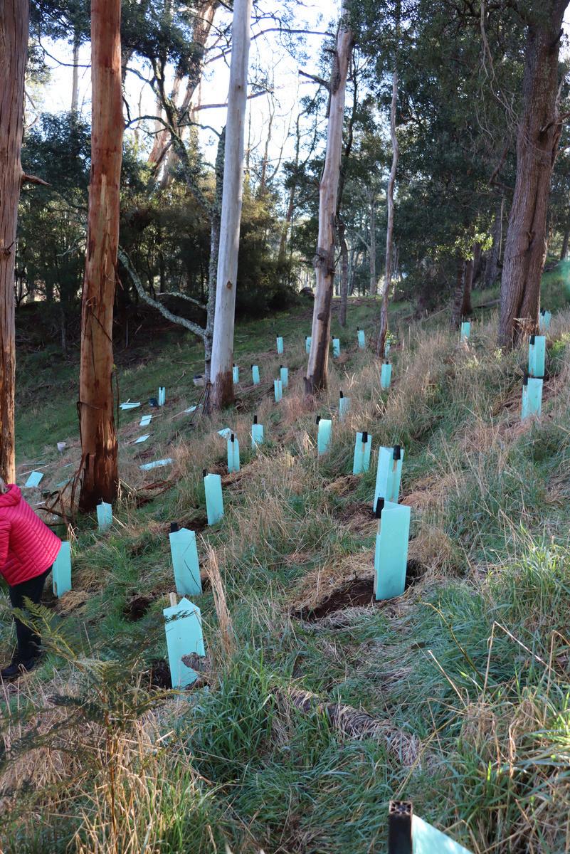
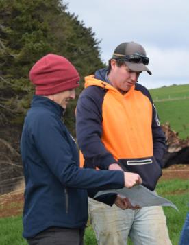
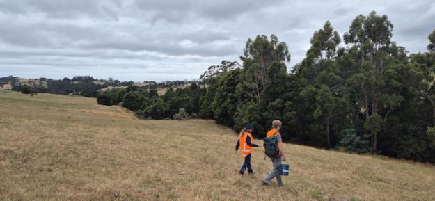
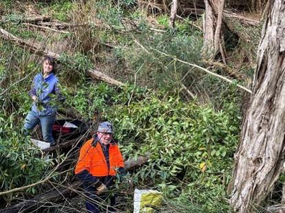
In celebration of National Tree Day on July 27th, some of our team braved the cold morning air along with members of the Burnie City Council team to go tree planting at Guide Falls.
Overall, it was a successful day with 280 trees planted The trees used were native to Tasmania, chosen to support local biodiversity, ecosystem health and soil quality.
When planting the trees, a gel was used to hold moisture in the roots, keeping the trees hydrated. In around three hours, all trees were securely in the ground and protected with guards thanks to a strong team effort.
National Tree Day was put in place to help encourage people to get their hands dirty and plant trees for the environment. Since its conception in 1996, Planet Ark has coordinated the planting of over 28 million trees for National Tree Day!
Communications Intern from Swinburne University, Lewis Jaffray, attended the event to capture photo and video footage, which was a hit with our Facebook fans We had a great day out and can’t wait to watch the trees grow up!
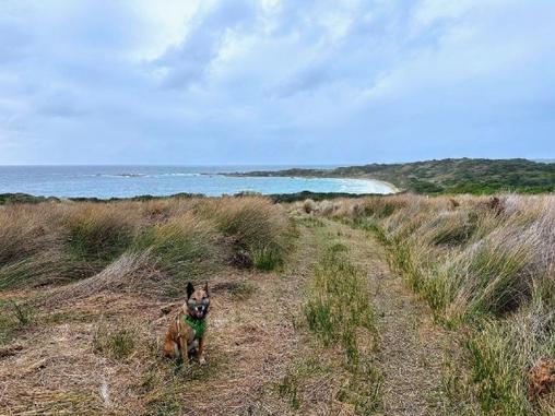
We recently had a special guest on Three Hummock Island, Kalinka the conservation dog. Kalinka is a highly trained expert at sniffing out signs of cats (and other feral species when required) Kalinka, accompanied by her handler, Dr Sue Robinson from Forest Hill Conservation Dogs, was there to check for signs of feral cats as part of our Creating a Hooded Plover Stronghold project She reportedno such signs from her explorations around the island, which amounted to 88km!
This follows the news from Dr Alex Paton's most recent camera data analysis, finding no cats detected by remote wildlife cameras since April 2024.
It's too early to get excited, but project leads Biosecurity Tasmania and Cradle Coast NRMare pleased with the progress of the project so far. We will continue to work towards cat eradication on Three Hummock Island until December 2026, with funding from the Australian Government's Saving Native Species Program Special thanks to Alex and the team at North West Boat Charters for exceptional assistance on this (and every) island trip.
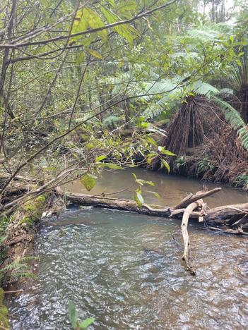
Cradle Coast NRM’s “Giant Freshwater Crayfish Recovery 2” project has recently found giant crayfish in Seabrook and Penguin Creeks where we want to work with landholders to improve conditions for crayfish
These colossal crustaceans are the largest freshwater invertebrates in the world and are unique to the creeks and rivers of northern Tasmania. However, past over-fishing and degradation of their freshwater habitats has seen their numbers decline and they are now recognised as threatened under federal legislation Fortunately, the crayfish have managed to survive in the waterways of north-west Tasmania including in the reaches of Seabrook and Penguin Creeks, but there is more that can be done to help them thrive.
In autumn and spring of last year, Seabrook and Penguin Creeks were surveyed for Giant Freshwater Crayfish Sites with good quality habitat such as intact riparian vegetation, lots of in-stream logs, and rocky substrate had healthy crayfish numbers Other sites that displayed lower quality habitat such as cleared vegetation, bank erosion and high instream sediments generally had smaller crayfish numbers.
As part of the Giant Freshwater Crayfish recovery project funded by the Australian Government’s Natural Heritage Trust, Cradle Coast NRM is looking to further improve upon the quality of Seabrook and Penguin Creeks as habitat for crayfish by working with neighbouring landholders to protect and improve riparian areas on their properties. Support is available to landholders to improve crayfish habitat by excluding stock from creeks by fencing and installing alternative water sources, controlling weeds such as willows and blackberry, and planting creek-lines with native plants that help stabilise banks and improve water quality These activities aim to not only help crayfish but also provide benefits to landholders such as updating farm infrastructure and improving livestock management.
If you own property along Seabrook or Penguin Creeks or their tributaries and would like to be involved, please contact Joseph at jstapleton@cradle coast.com or via phone on (03) 6433 8423.
Biosecurity Tasmania recommends following these four principles, known as the Biosecurity Basics, to help protect Tasmania’s productive and natural landscapes.

Check your bags: whether you are travelling or returning to Tasmania, be sure to check your bags! Ensure that you do not accidentally carry or import any restricted or prohibited materials into Tasmania by checking your bags. For a full list of restricted items, visit the Biosecurity Tasmania website

Come in clean: shoes, clothes and equipment are hiding places for infectious materials, seeds or pests. Be sure to thoroughly clean all clothing and equipment before arriving in Tasmania, between working on different farm properties, and before entering protected areas like National Parks

Stay on the path: If you are trekking through Tasmania’s many scenic parks and reserves, it is vital that you stay on the existing paths and tracks Similarly, gain permission before entering private properties such as farms and private natural areas.

Report anything unusual: Keep an eye out for anything that may be unusual or out of place If you see something that looks out of place, such as sick wildlife or insect larvae in your fresh food, note the location, take a photo, and secure or isolate the suspected concern, if possible, before immediately reporting to Biosecurity Tasmania
We’re excited to officially launch Our Natural Advantage - Building the benefits of biodiversity on farms project.
As farmers are increasingly exposed to variable climate conditions and changing market expectations around sustainability, it can be hard to decide on the best course of action to ensure farm resilience and profitability – Our Natural Advantage aims to support farmers to make future-focused decisions with confidence by delivering a range of handy resources, tailored events and one-on-one support.
A diversity of project activities will be delivered through to June 2028, including:
Natural Capital Accounting Demonstration at the Tamanian Institute of Agriculture (TIA) Dairy Research Facility in partnership with TIA and supported by Fonterra and Dairy Tas. Multi-species cover crop demonstration in partnership with Harvest Moon
On-farm Natural Capital Incentive
Supporting farmers across the Cradle Coast region to identify on-farm natural capital risks and opportunities through one-on-one advice and on-ground works
Funding available to support protecting and enhancing native vegetation on farmsguidelines will be released soon.
Biological Farm Skills Mentorship
Opportunity for a limited number of King Island farmers to work with a mentor to progress their biological farming aspirations - EOI will be opening soon
The best way to keep up to date with the project is by subscribing to the Our Natural Advantage newsletter Once a month, you'll receive an email of relevant resources, local events, and tips and tricks to support farm decision making.
Subscribe to the Our Natural Advantage newsletter via the QR code, or visit http://eepurl com/cSWzf1
Learn more on the Our Natural Advantage project page via the QR code, or visit https://cradlecoast com/proje cts/climate-smart-agriculture/
This project is supported by the Australian Government through funding from the Natural Heritage Trust under the Climate-Smart Agriculture Program and delivered by Cradle Coast NRM, a member of the Commonwealth Regional Delivery Partners panel.
The 2024-25 Independent Review of the Tasmanian Climate Change (State Action) Act 2008 (the Act) has commenced. Community members and stakeholders can have their say on the review until Sunday 7 September 2025.
There are many ways to get involved and provide your input to the review Refer to the 'Have your say' section of the following webpage to find out more
Climate Change Act Review 2024-25 | Engage with the Department of State Growth
Cradle Coast NRM’s ‘Community Action for King Island Bird Recovery’ project is working with KI Landcare and landholders to reduce threats to critically endangered birds, the King Island Scrubtit and King Island Brown Thornbill. Weeds such as Asparagus Fern (Asparagus scandens) pose a significant threat to the habitat of these threatened birds and other native animals on King Island, adding further to loss of habitat from past forest clearing. The project, funded by the Australian Government’s Natural Heritage Trust, has identified priority bird habitat areas on the island, and is currently working with neighbouring landholders in one of these priority areas near Naracoopa to tackle a significant infestation of Asparagus Fern in prime bird habitat This planned, strategic approach to weed control aims to restore important bird habitat across a large forest area spanning multiple properties.
Asparagus Fern is a declared Weed of National Significance and is regarded as one of the worst forest weeds in Australia, with a legal requirement for landholders to contain it on their properties It was introduced into Australia from Africa as an ornamental plant It is very invasive, growing and spreading fast, mainly by seed and a mature plant has hundreds of berries which birds and small animals love to eat and can inadvertently spread long distances. The stems twine to form dense impenetrable thickets that smother the ground and climb up to three meters in trees.
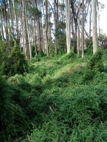
A dense infestation of Asparagus fern.
Asparagus Fern is prevalent on King Island. It prefers shady locations and so invades and grows well in threatened forest communities such as Eucalyptus globulus King Island Forest where it poses a significant threat to the habitat of threatened birds. If left unchecked, Asparagus Fern can smother native ground plants and shrubs and prevent their germination and establishment, effectively displacing them. Diverse native understorey plants provide important food resources and nest sites for the threatened birds and other native animals Asparagus Fern also smothers and restricts access to other important habitats such as logs on the forest floor and insect foods in the ground leaf litter layer. Where this occurs, forest habitats quickly become unsuitable for many native animals
Controlling such an invasive weed is critical for regeneration of the native forests on King Island.
The project is supporting landholders with native vegetation on their properties to control weeds such as Asparagus Fern and revegetate with native plants species to restore forest habitat for King Island’s threatened birds. Ongoing control of weeds over many years is an important part of the solution, as is working with neighbouring landholders to improve forest habitat and connectivity across larger areas.
In collaboration with King Island Landcare Group, Cradle Coast NRM have created fact sheets, social media and newspaper articles that have been circulated amongst the King Island community to increase community awareness of this and other invasive weeds. Landcare members have also recently formed local Asparagus Fern Eradicator neighbour groups to help combat the problem. These groups are also on the watch for other invasive weeds such as Inkweed.
King Island Landcare Group have mapped Asparagus Fern and Inkweed on the island and rely on community members to notify them of any new sightings. Mapping to date shows that Asparagus fern covers 1597 ha across the island, but it is expected that the area is a lot larger than this. Asparagus Fern is a serious threat to the King Island native vegetation and forest birds, covering and smothering more area than any other weed on the island, with a huge capacity to spread and invade other areas
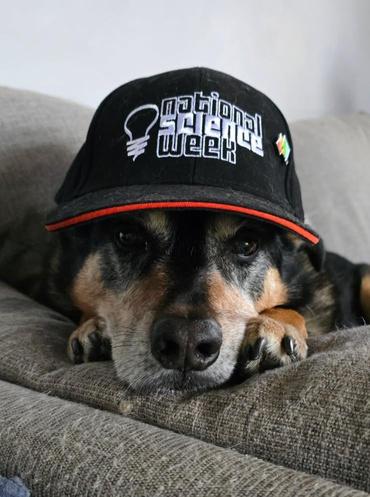
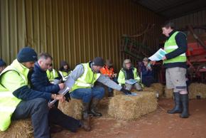
This year’s National Science Week brought many fun times for the team at Cradle Coast NRM
Our staff team, ‘Mycelium Delirium’, put in a great effort at a science-themed trivia night at the Penguin Beer Co. The team placed second, taking home a variety of science-themed prizes, such as the cap modelled by Rocky (left)
National Science Week is also an annual highlight on our community engagement calendar, with staff attending the Circular Head Science Gig in Smithton and the BIG Science Fair in Burnie
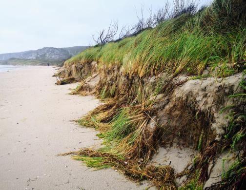
Those who have walked along Ocean Beach on Tasmania’s West Coast will have undoubtedly witnessed the dramatically eroding coastline that often crumbles before your eyes, bringing down large clumps of vegetation and exposing the dark peaty layers underneath Researchers at UTAS analysed 70 years of aerial photos and beach profiles to reveal that the coastline has been receding approximately 1 m inland per year, with up to 35 m of recession between 1980 and 2010.
Ocean Beach is shaped by the roaring forties - winds that travel across the longest uninterrupted stretch of ocean in the world before smashing
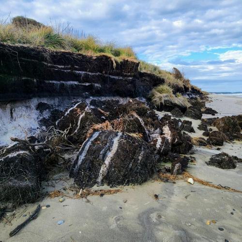
into the western Tasmanian coastline These winds generate powerful swells and waves over 20 m tall that hit the steep foredunes, pulling sand back into the ocean as the waves recede. In the past, this same natural process also replenished the dunes, carrying sand from the ocean back onshore.
Around 1980, however, this replenishment stopped Without fresh sand to replace what was lost, the coastline became increasingly vulnerable to ongoing erosion The UTAS researchers examined the ancient peat layers which have been exposed due to erosion, revealing that recent shoreline recession exceeds anything seen in the past 1,800 years. Investigations into the potential causes reveal recent-onset sea-level rise as the likely driver for tipping the balance, resulting in a ‘sand budget’ deficiency. The beach is receding at a faster rate due to the combination of increased sea-levels and higher onshore wind speeds generating increased wave setup, in turn increasing the frequency of sand removal without replenishment.
While sea-level rise threatens coastlines worldwide, researchers believe Ocean Beach is an early indicator site. The conditions driving rapid shoreline retreat on the West Coast could help identify other beaches that may respond quicker to climate-driven changes, such as rising sea levels and shifting wind patterns
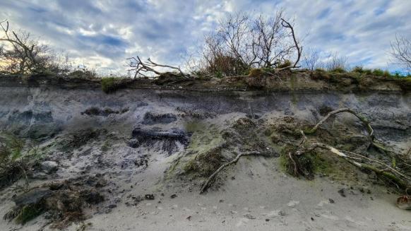
Another factor in coastal erosion is the presence of Marram Grass (Ammophila arenaria), a European grass that was deliberately introduced to stabilise sandy coasts and is now invasive.
Marram Grass invades the foredunes, displacing native vegetation It traps sand quickly which builds higher and steeper dunes. Its root networks are very dense, which causes the dunes to calve off in sheer blocks during storm and wave events.
Because of the increased recent erosion, Marram Grass on Ocean Beach has reduced in extent, but in other places along the Tasmanian coastline it is a threat to native coastal plant and bird species.
The Healthy Harbour Project works in Strahan and the Macquarie Harbour catchments to connect the community with local environmental issues Learn more at https://cradlecoast.com/ projects/healthy-harbourproject/.
Climate change is different to weather Weather is what you experience when you step outside on any given day. Climate is the average of the weather patterns in a location over a longer period of time, usually 30 years or more. Data has shown that our climate has warmed rapidly over the last hundred years. Greenhouse gases (GHGs) accumulate in the atmosphere and trap the sun’s heat, causing our oceans and atmosphere to warm up at a rate our natural systems are struggling to cope with Some GHGs form naturally, while others are released from human activities In Australia and around the world, the largest source of GHG emissions is extracting and burning coal, oil and gas for energy. You may have heard this referred to as carbon emissions.
On-farm emissions for north-west Tasmanian farmers:
Farms also emit GHGs This can look like methane from livestock (especially ruminants), nitrous oxide from fertilisers, carbon dioxide from fuel, gas and electricity consumption, carbon dioxide from clearing native vegetation and nitrous oxide and methane from burning vegetation.
All industries need to rapidly reduce and where possible eliminate polluting GHG emissions to help prevent further warming. Every bit of GHG pollution that we don’t create today means a better tomorrow for farmers and future generations.
What are the risks to north-west Tasmanian farmers?
North-west Tasmania has been hit with some shocking seasons and weather impacts in recent years which are consistent with projections of our changing climate future These include extreme dry seasons on King Island and the West Coast, prolonged damaging windstorms in Spring across the entire state, and isolated heavy rainfall events causing flash flooding, erosion and severe frosts.
Tasmania’s Risk Assessment for Climate Change 2024 has identified that these climate risks are likely to exacerbate food and water security issues and increase pressure on infrastructure, transport and emergency services and other areas essential to human health and wellbeing.
For farms, impacts might include:
Changes in water availability
Loss or damage to crops, pasture or livestock due to extreme weather
Damage to farm infrastructure (such as sheds and pivots) in natural disasters
Production impacts of extended power outages and damaged roads following extreme weather events
Disrupted supply chains, including import and export delays
It is important for farmers and agri-businesses to acknowledge these risks and challenges and look for opportunities to proactively build resilience into our farms and farm businesses For more information on emissions reduction and resilience risks, opportunities and tools for north-west farmers check out the Our Natural Advantage newsletter Edition 2: Climate clarity You can sign up to receive the monthly newsletter direct to you inbox by visiting http://eepurl.com/cSWzf1
Cradle Coast Authority had the opportunity to host an internship for Lewis Jaffray. Lewis is in his final teaching period of study with Swinburne University of Technology Online where he has studied a Bachelor of Media and Communications with a major in Media. He has loved being able to study his degree remotely whilst working part-time on the north-west coast. The media and communications internship at CCA has allowed Lewis to learn how his studies are applied practically in an organisation. He has enjoyed the mentorship and insight from Jess Berechree, Media and Communications Manager at CCA.
Lewis has had the opportunity to create industry standard outputs that will aid in building his professional portfolio. While interning at CCA Lewis has written engaging articles and media content tailored for CCA's stakeholders and community. Lewis has used professional programs to design graphics, documents, and visual diagrams for both internal and public use He has also created social media content that aligned with CCA’s strategic goals Lewis has had the benefit of attending and contributing to team meetings about some of the content that needed to be created. He has crafted communication plans that feature clear objectives, audiences, and key messaging. He has also been able to capture professional photographs of environmental initiatives such as tree planting, showcasing the region’s commitment to sustainability
“I’ve loved my time here; it’s been an invaluable experience. Pursuing a career in Media and Communications from the northwest Coast of Tasmania has required determination and resilience. In regional areas, the profession is often misunderstood or undervalued, and opportunities can be limited for new graduates. But these challenges have only strengthened my desire to succeed and prove the value of strong media and communications, especially in communities like my own” says Lewis
“Also, that it is possible to have a career you love whilst living in the place you love. This internship has given me complete confidence in the career path that I have chosen. After interning at Cradle Coast, I am incredibly excited about my future career and all that it will encompass I have learnt so much and have taken a lot away from this experience.”
Lewis has loved his internship experience at Cradle Coast Authority and is excited for the completion of his degree and getting a role in corporate media and communications He has been a great attribute to our team, binging enthusiasm, fresh ideas, and a collaborative tenacity to the CCA As he approaches graduation, we’re excited to see where his media journey takes him next.
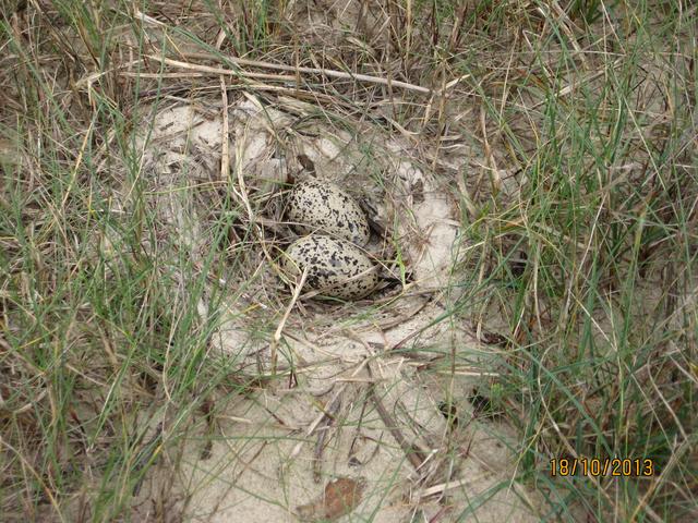
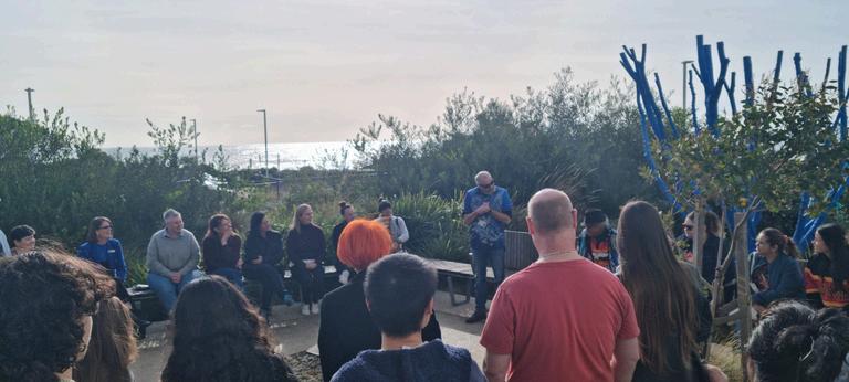
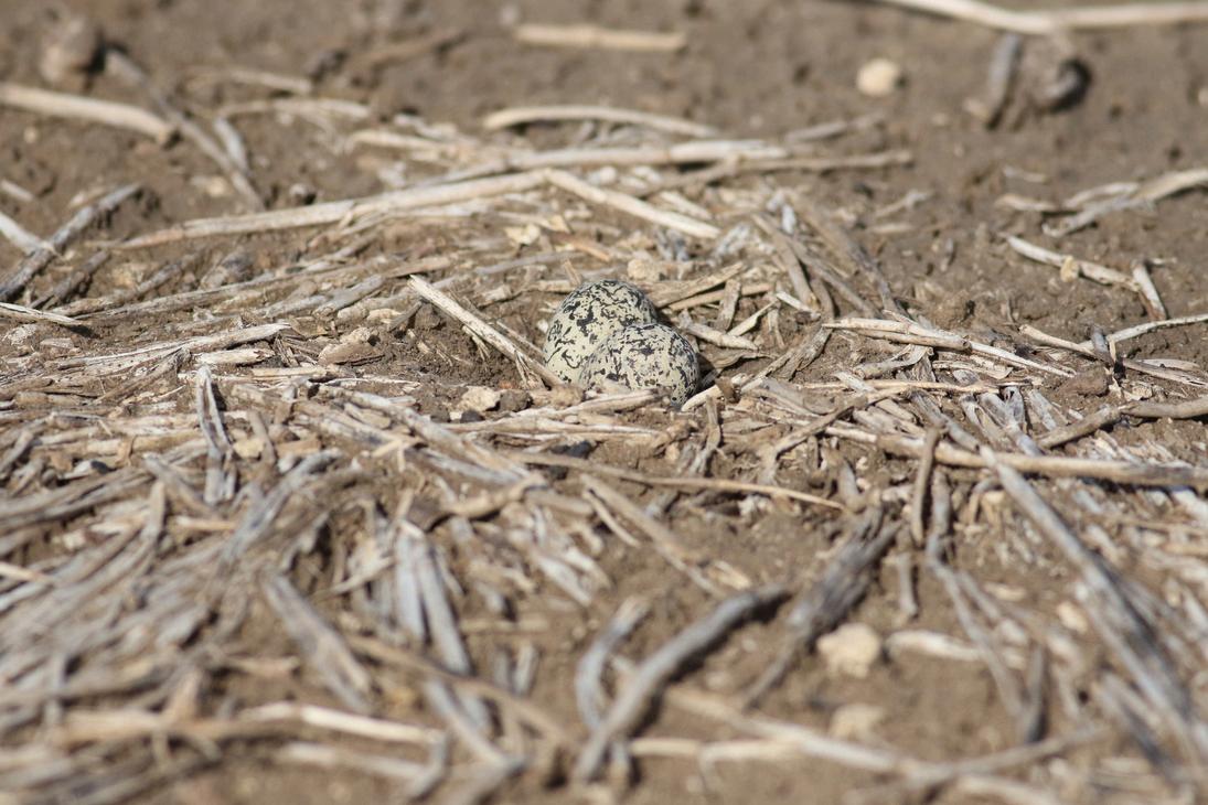
In the lead-up to Spring, CCNRM staff recently participated in a workshop run by BirdLife Australia’s Beach-nesting Birds and Migratory Shorebirds teams
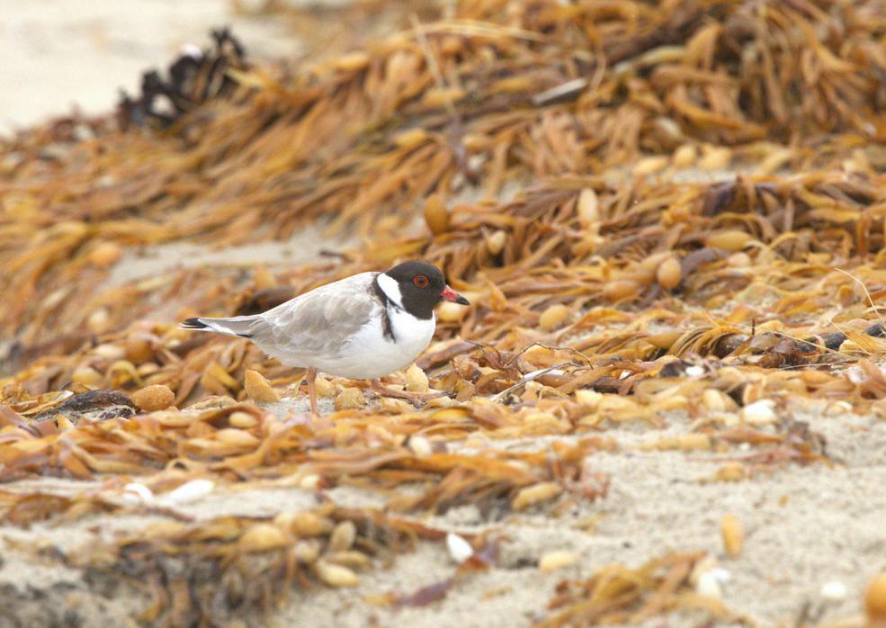
There are 17 species of migratory shorebird that visit the Cradle Coast in the summer. These birds can travel up to 20,000 km in a year. The Red-necked Stint is the smallest, weighing about the same as two AA batteries when it is well-fed and ready to migrate.
We also have six species of “resident” shorebirds, who breed on our beaches. Pied and Sooty Oystercatchers, Red-capped Plovers, Hooded Plovers, and less common, Fairy and Little Terns.
The threats to both groups of birds are similar: Human recreation activities on beaches, dogs, cats, weeds and pollutants
As you’re visiting the beach this summer, remember to stick to the wet sand because birds may be nesting above the high tide line Avoid driving on beaches during nesting time October to February, make sure you follow Council regulations regarding dogs, and report any cat sightings using Feral Scan.
At the workshop, we heard about some of the engaging programs BirdLife Australia delivers on the mainland with the help of community shorebird champions and discussed how we can raise awareness of these birds, their threats and how we can monitor change in their populations
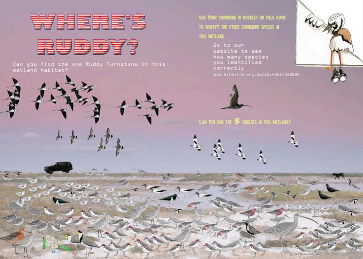
For a range of fantastic resources, check out their website at https://birdlife.org.au/migratory-shorebirdeducation-kit/ To get you started, have a go at finding the Ruddy Turnstone on the next page!
Cradle Coast Authority (CCA) is seeking applicants for the role of Chair of the Regional NRM Committee.
The Chairperson will lead the Committee in supporting the delivery of the region’s NRM Strategy and also serve as a Director on the CCA Board The position requires strong knowledge of NRM principles, leadership experience, and the ability to connect with diverse stakeholders across the community, government and industry.
This role expects independence from CCA’s Member Councils, a strong commitment to the Cradle Coast region, and the ability to contribute to the growth and sustainability of north-west Tasmania.
Applications close Sunday 7 September 2025.
To learn more, visit https://cradlecoast com/news/cca-news/chairpersons/
Threatened Species Bake-Off
Burnie Show & Agri-Expo
National NRM Knowledge Conference
Wynyard Tulip Festival
Landcare Tasmania Farm Dam Enhancement Grants
https://www dcceew gov au/about/news/re ady-set-bake-off-back-2025
1 to 14 September
https://agriplex com au/ 3 to 4 October, Burnie
https://nrmregionsaustralia.com.au/conferen ce/9th-national-nrm-knowledge-conference/
8 to 12 September, Cairns
https://wynyardtulipfestival.com.au/ 11 October, Wynyard
https://www.landcaretas.org.au/catchment connect 2025 2030 launch
Submit your EOI by 14 September
From page 5:
Question: Do you know what NAIDOC stands for?
Answer: National Aboriginal and Islanders Day Observance Committee
1-3 Spring St, Burnie, Tasmania, 7320 03 6433 8400 www.cradlecoast.com www facebook com/CradleCoastNRM/