SURFACE MATTERS
[Ex]Posing Paradigms for a Shifting Ground
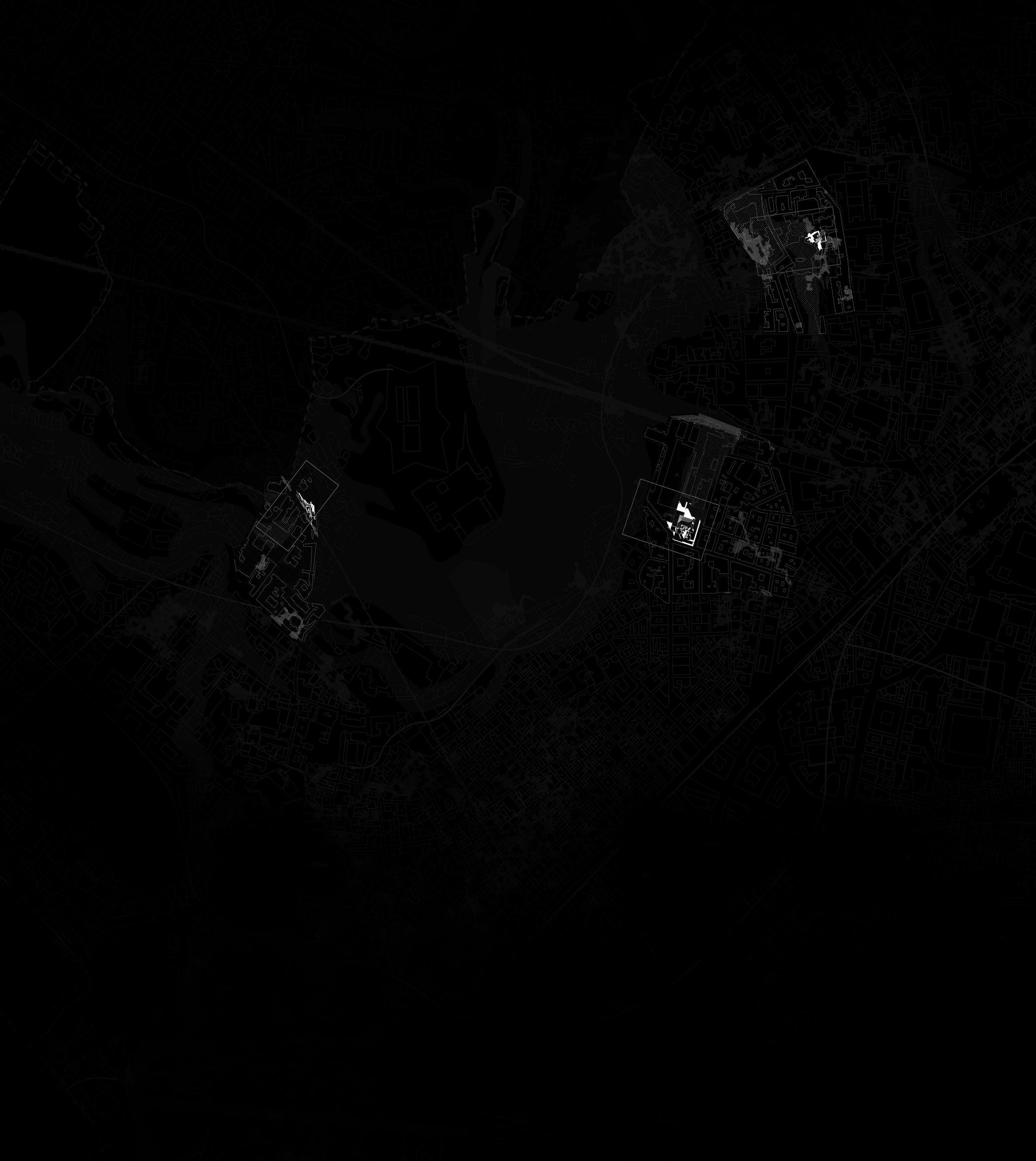
Grounding Naples [2022-2024]
Cormac Lunn
“Surface should be understood neither as a merely structural, nor as a merely decorative aspect of building. Rather, the creation of surfaces organises a programme which allows for a reading of the space of architecture.”
Andrew Benjamin
SURFACE MATTERS
[Ex]Posing Paradigms for a Shifting Ground
Grounding Naples [Integrated Studio Pathway]
[2022-2024]
Cormac Lunn





10 |
ABSTRACT
Surface Matters explores approaches to Neapolitan ground which reflect the intensely material nature of the city. Through a collection of projects along the ridge extending from the Belvedere di Sant’Antonio a Posillipo at Mergellina where J.M.W. Turner sketched Vesuvius, to the north of Chiaia and up the west of the Quartieri Spagnoli to Parco Ventaglieri, architecture is positioned as a device through which the interplay between structure and substrata is made manifest. Developing Andrew Benjamin’s concept of the “double register” of architecture—where architecture is understood as both something which effects and affects, and something that is the effect of material concerns—it explores how the consistent material surface which unifies the city’s walls, streets, and ground is not only a surface upon, from or with which to build, but also an agent that shapes and is shaped by broader ecological and architectural conditions. Surface materials are re-conceived as Surface Matters; the materials which surface the city become (ecologically, economically, if not always structurally) precarious and contingent, unstable in a manner which extends beyond the friability of the compressed volcanic dust and ash aggregates which make up the tufo. As Surface Matters, material surfaces become things for which we must exhibit due concern .
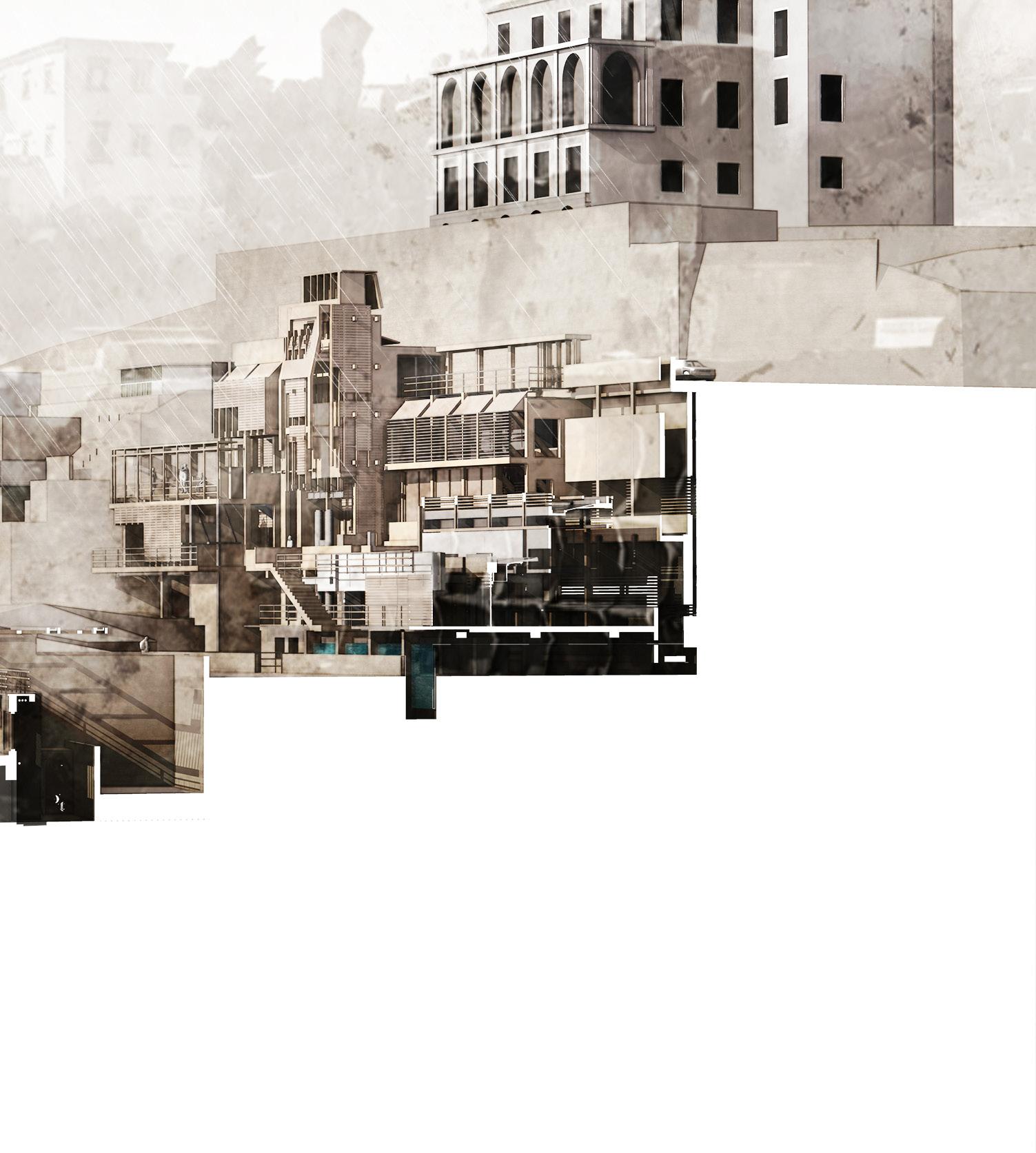
This reconsideration of surface—recalling Benjamin’s double register—affects the architecture which is constructed above . As an invitation to exhibit concern, Surface Matters occupies several ruins within the UNESCO World Heritage site, proposing a series of architectures which serve as stewards for Naples’ historic fabric. Occupying sites in Montecalvario, Posillipo, and the Quartieri Spagnoli where the intensity of unpredictable ground movements is evident, facilities for the management of water runoff, the surveying and recording of vulnerable sites, and the preparation of replacement stones for conservation work seek to reimagine the relationship between ground and building fabric in areas where an increasing number of buildings are at risk of collapse. These monitoring sites develop a series of architectural typologies emanating from a central site at the Belvedere at Mergellina, where water is harvested, Turner’s Neapolitan paintings are exhibited, and local Greco di Tufo wines are aged and served. A series of basins, cut into, cast onto and constructed from the tuff, manage rain and surge water to relieve the pressure caused by soil erosion, and provide irrigation for planting. Above, cooling towers take advantage of the presence of the water to generate passive ventilation, aiding in reducing energy demands. At an urban scale, positioned along the ridge these cooling towers generate currents which encourage the movement of air in the city’s canopy layer, which currently acts as a barrier preventing the escape of heat and suppressing airborne pollutants. As a set of interconnected programmes for monitoring, retaining and stabilising a set of shifting ground conditions, these isolated but related architectures are understood as capable of considerable affect, and as rearticulations of the urban surfaces that they activate and by which they are activated.
| 11

12 |
| 13

14 |

| 15
16 |
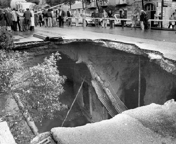
Sinkhole in Corso Amedeo di Savoia, 1979
CONTENTS
SURFACE MATTER
[Ex]Posing Paradigms of a Shifting Ground
CHAPTER THREE | DISREPAIR
Inhabiting a Ruin
XI. Buildings at Risk
XII. Decay of Chiesa SS. Trinata
XIII. Preservation of Craft
XIV. Surveying a Ruin
XV. The Stone Masons Yard
GLOSSARY
CHAPTER ONE | SUBSTRATE
Characterising Precarity
I. Volcanic Substratum
II. Unstable Ground
III. Geology of the City
IV. Urban Cavities
[Reflection - Group Working]
CHAPTER TWO | PARTICULATE
Capturing Suspended States
V. Constructing a Studiolo
VI. Taxonomy of Materials
VII. A City Ravine
VIII. Turner in Naples
IX. The Urban Canopy Layer
X. The Meteorological Observatory
[Reflection - Crafting]
XVI. Occupying the Nave
[Reflection - Surveying]
CHAPTER FOUR | RIDGE
Mediating Uncertain Ground
XVII. A Hydrological Crisis
XVIII. A Shifting Surface
XIX. Traversing the Ridge
XX. The Hydrological Guild
XXI. Inhabiting a Belvedere
XXII. Stabilising the Ridge
XXIII. A Network of Monitoring
[Reflection - Drawing]
CHAPTER FIVE | DETAIL
Defining Architectural Footings
XXIV. Framing
XXV. Embedding
XXVI. Transecting
[Reflection - Exhibiting]
| 17

18 |

| 19

20 |
| 21
Surface Effects
Surface Effects, as proposed by Andrew Benjamin, go beyond just structural or decorative aspects in buildings. They play a key role in organising architectural programs and interpreting architectural space. This space carries a “double register”, relating to specific buildings and their impact, and also to a broader concept that architecture arises from the potential within the materials used in surface construction.
Urban Canopy Layer
The Urban Canopy Layer is the atmospheric layer in urban areas, from ground level to average rooftop height. It includes natural and built features like vegetation and buildings, influencing the urban microclimate and ecology. Shaped by human activities and urban design, it affects heat retention, air quality, and biodiversity. Managing this layer is crucial for addressing urban heat islands, reducing air pollution, and enhancing urban ecological resilience.
Material Reciprocity
Material Reciprocity refers to the symbiotic relationship between materials and their environment, highlighting a dynamic exchange of resources. It suggests that materials are not passive, but actively shape and respond to their surroundings. This concept underscores the interconnectedness between materials and their ecosystems, promoting sustainability within the built environment.
22 |
[SURFACE MATTERS] GLOSSARY
[SURFACE CHARACTERISTICS]
Tufo
Tufo is a volcanic rock formed from consolidated volcanic ash and debris. Abundant in the region due to volcanic activity, especially from Mount Vesuvius, this porous, lightweight stone is easily workable, making it a popular building material in Naples for centuries. Used in various architectural applications, its porous nature also makes it suitable for water storage and filtration, playing a significant role in the city’s infrastructure and urban development.
Aquifer
An aquifer is a subsurface layer of permeable material containing water for human use. It’s a vital freshwater source, providing drinking water, agricultural irrigation, and ecosystem support. Naples’ aquifers are replenished by rainfall and surface water, filling underground spaces. Given their importance to the region’s water supply, sustainable management and conservation are crucial for their long-term viability amidst urban development and environmental pressures.
Substrata
Substrata refers to the geological formations underpinning the city’s landscape and urban development. It includes a network of rock, soil, and volcanic deposits, reflecting Naples’ proximity to Mount Vesuvius. The substrata also encapsulates the city’s historical, cultural, and social foundations, contributing to Naples’ unique identity and character.
| 23
GLOSSARY
[SCALES OF OPERATION]
Neapolitan Ground
Vitruvius’ description of the construction of a wall folds together material, constructional and environmental concerns. “Since the stones used are soft and porous,” he writes, “they are apt to suck the moisture out of the mortar... But when there is abundance of lime and sand, the wall, containing more moisture, will not soon lose its strength, for they will hold it together.” With a sustained interest in Neapolitan surfaces and through the scale implied by ‘Neapolitan Ground’, this thesis explores the broader ecological territory and material reciprocities that underpin this notional wall. It explores how the constituents of the wall—the tufo, lime and sand—belong to broader, an often problematic, conditions and ecologies.
Groundings
A grounding evolves into a potent point of interaction, necessitating the reconfiguration of the ground and building to facilitate an architecture that operates to the mutual advantage of that ground. These groundings influence the flow and alleviation of pressures. This thesis suggests a network of groundings that participate in beneficial exchanges and investigate the technical and environmental potentials of the city’s material consituents.
Zone
A Zone, following Bruno Latour, denotes a space characterised by “no established meaning... marked by ambiguity, still in the process of delineation, exuding an unsettling ambiance.” It focuses on the contingent and the elusive, encompassing phenomena that are either not easily categorizable or remain undocumented. In this interpretation, architectures become interwoven with the structural and underlying material conditions. In the domain of critical zone science, a Zone functions as a porous interface connecting the upper canopies of trees to the groundwater below. This thesis address emanations, atmospheres, and impacts that extend beyond ground level, such as the effects of concrete in hilly suburbs and dense urban landscapes, contributing to the urban heat island effect.
24 |
[PROTAGONIST]
J.M.W. Turner
[Joseph Mallord William Turner] (born April 23, 1775, London, England-died December 19, 1851, London), English Romantic landscape painter whose expressionistic studies of light, colour, and atmosphere were unmatched in their range and sublimity. Turner visited naples in 1819 after being made aware of Vesuvius recent activity and hoped to witness and eruption.
| 25
26 |

| 27
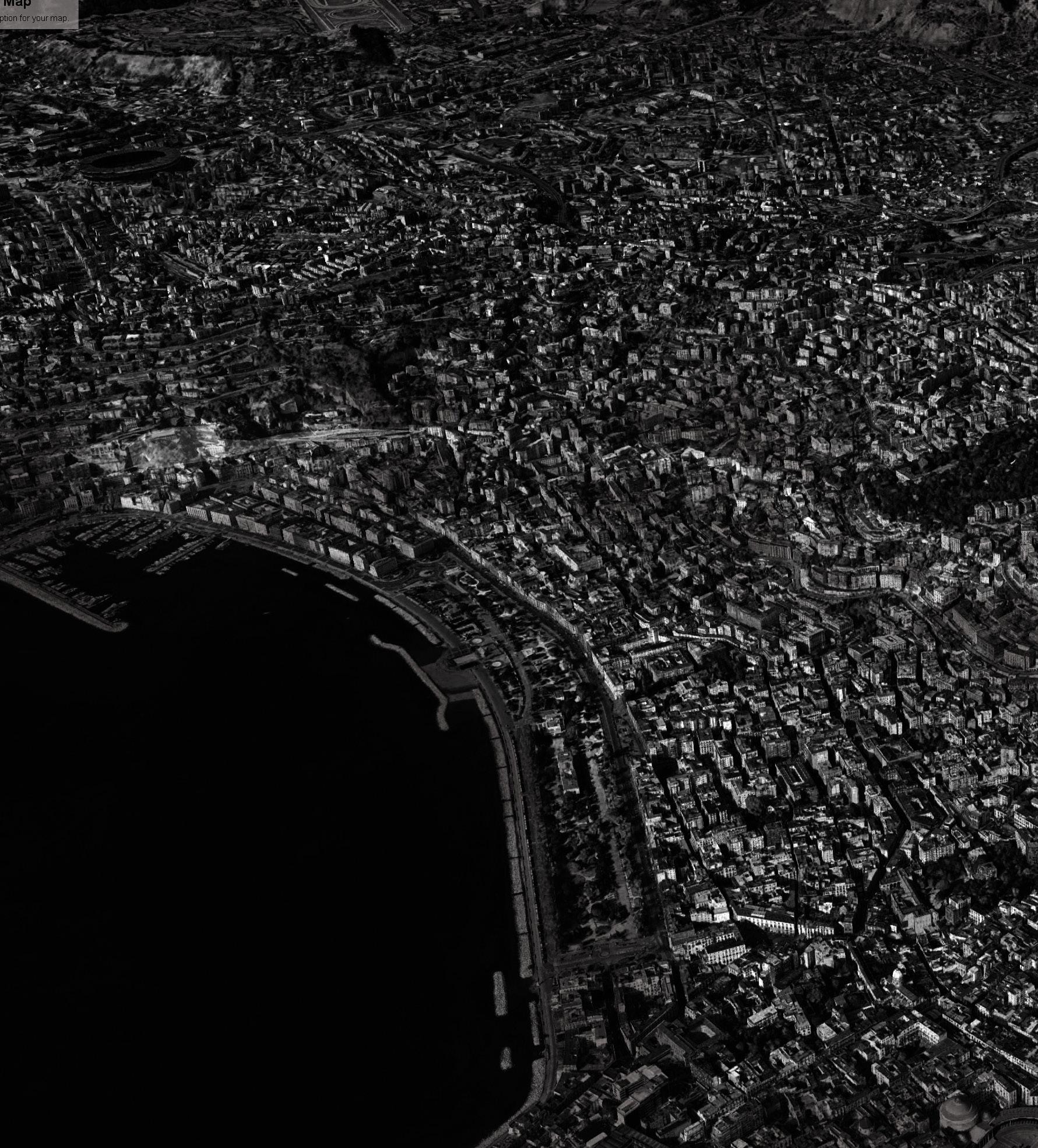
City of Naples
28 |

| 29

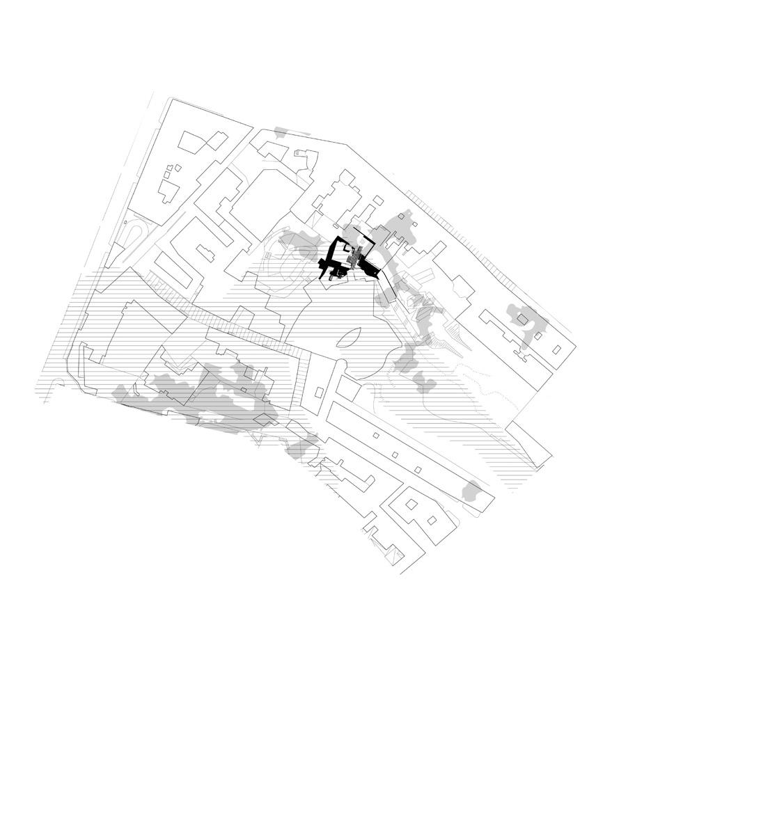
[Zone 1 ]
Parco dei Ventaglieri
Meteorological Observatory
Painting Studio
Belvedere
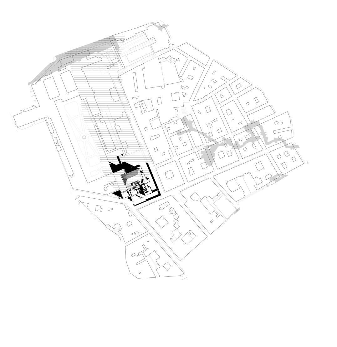
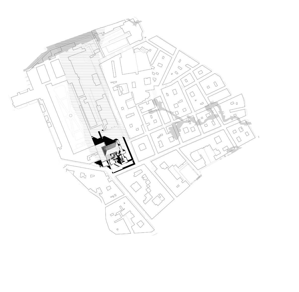
[Zone 2]
Stone Yard
Drawing Office
Belvedere
30 |
Chiesa della SS. Trinità delle Monache

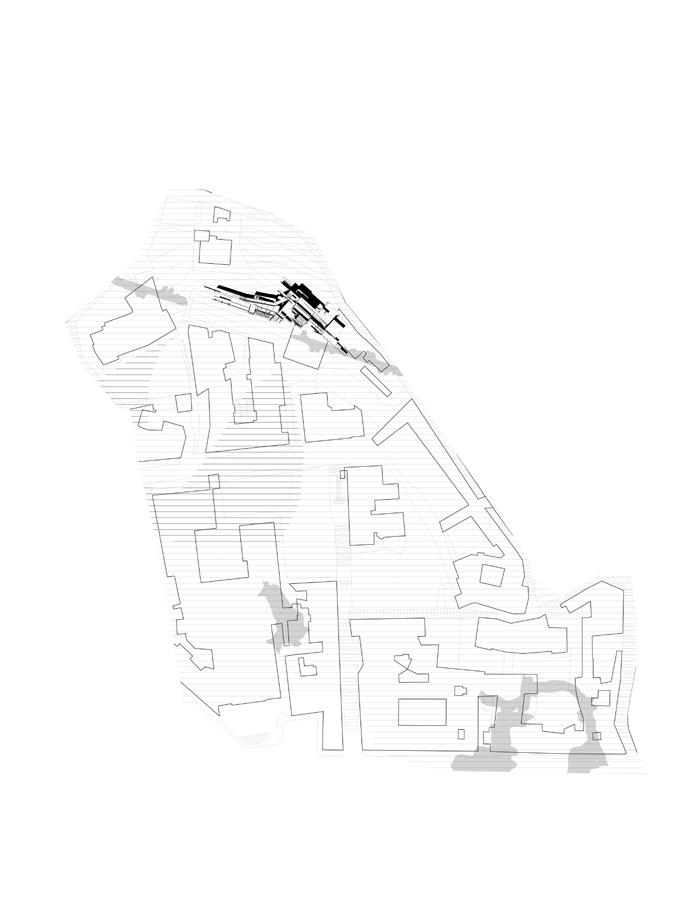
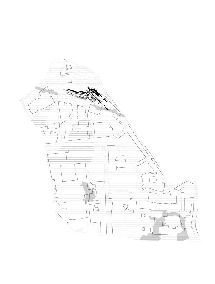
[Zone 3]
Largo Petraio
Funicular Station
Water Commission Office
Tabbacci
Belvedere
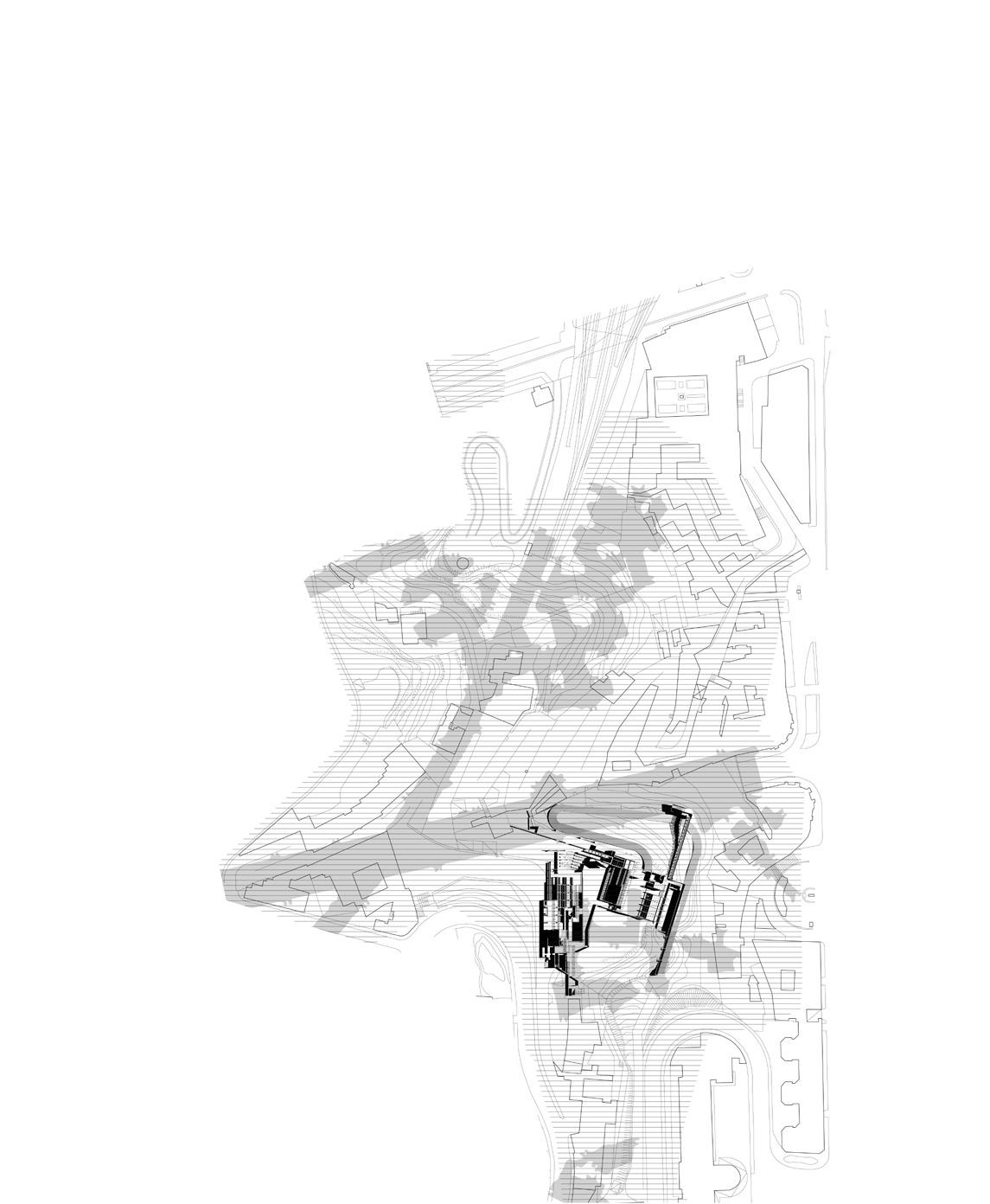
[Zone 4]
Belvedere di Sant'Antonio
Hydrological Laboratory
Gallery
Winery
Refectory
Belvedere
| 31
 [left] abondoned cavity in mergellina, cut out of the tufo ridge
32 |
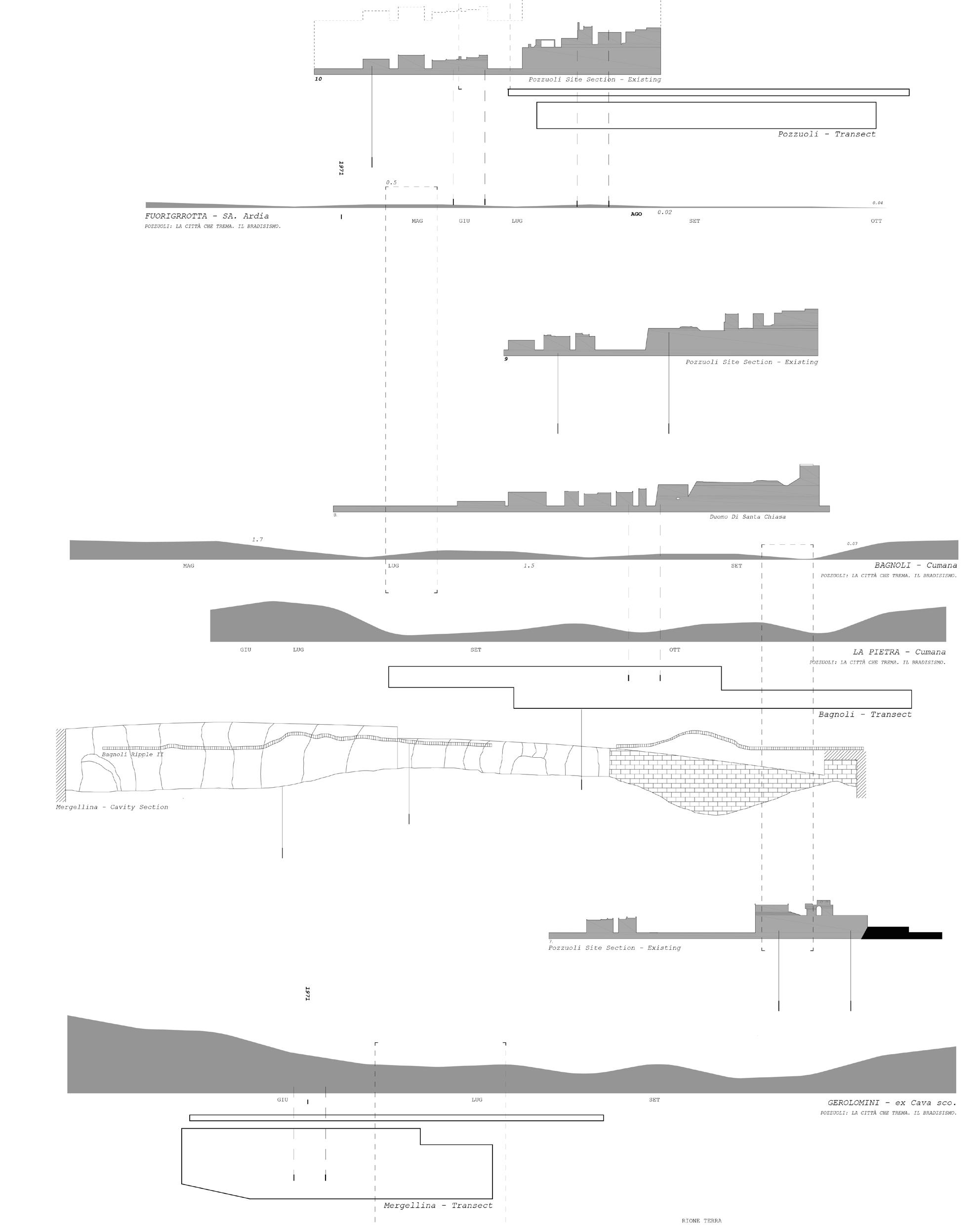
[right] transects of the unstable ground condition across the bay of naples
| 33


[top] the Poggioreale cemetery after the collapse of a four-storey wall in the graveyard left at least a dozen coffins hanging precariously from a considerable height.
[bottom] Part of the facade of a , Santa Maria del Rosario alle Pigne in central Naples collapse due to degradation and ground movement
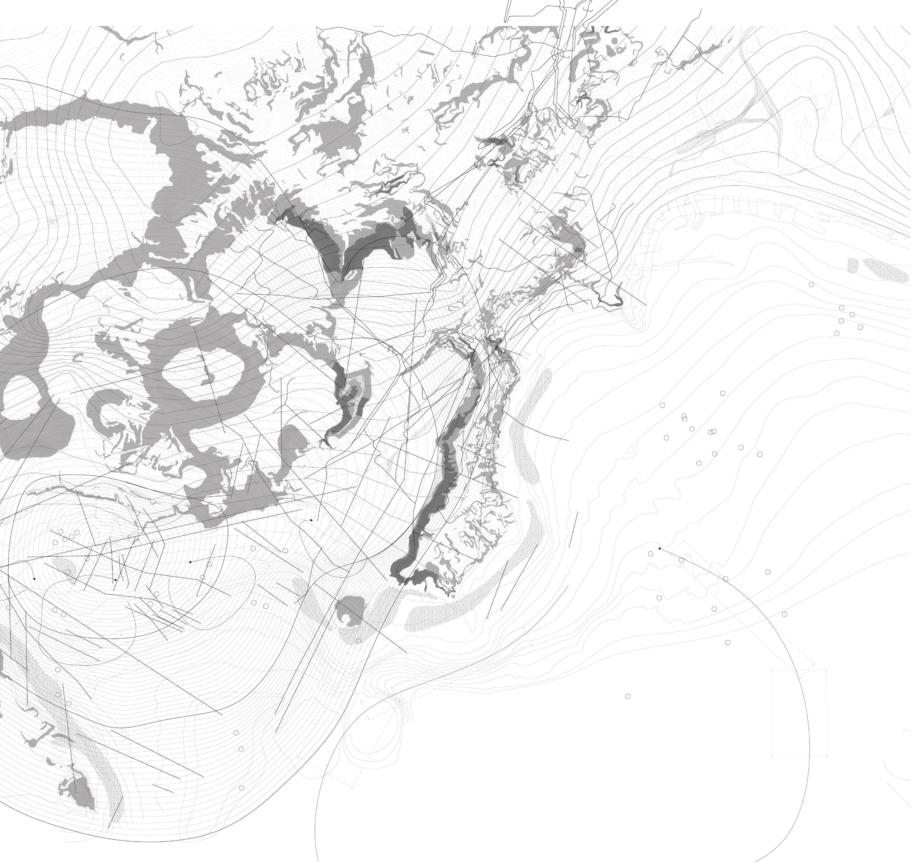
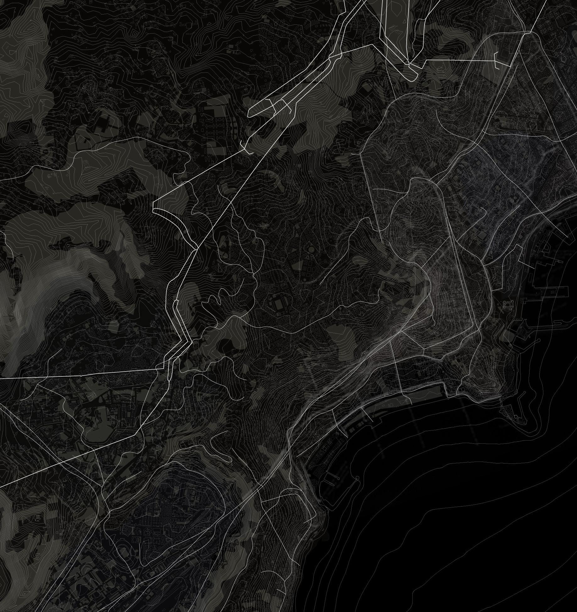
[right] surface movement within naples UNESCO boundary
34 |

| 35

36 |
ONE. SUBSTRATE
CHARACTERISING PRECARITY
I. Volcanic Substratum
II. Unstable Ground
III. Geology of the City
IV. Urban Cavities
| 37
I. RECORDING PRECARITY
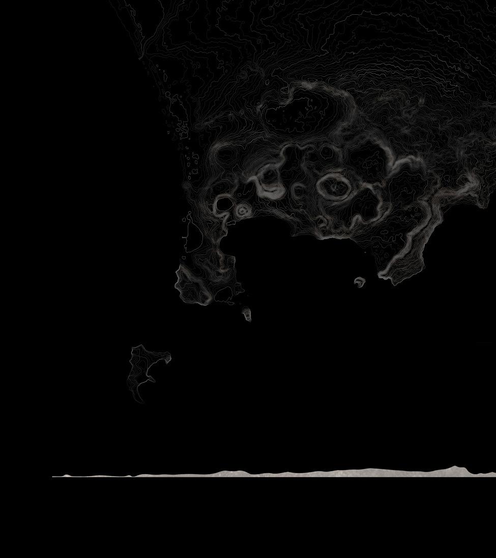
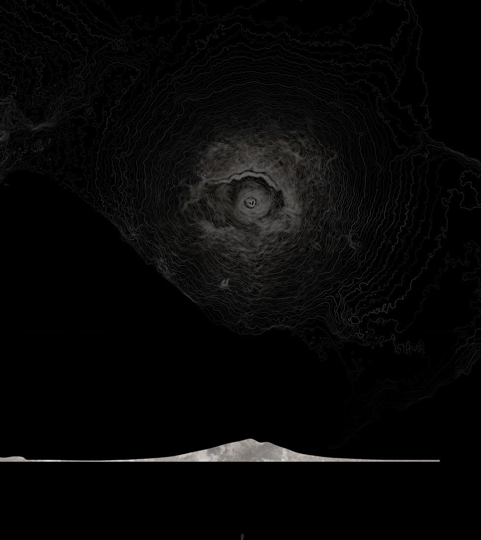
Naples, the capital of Italy’s Campania region, is strategically located within the Campanian Volcanic Arc, bordered by Mount Vesuvius to the East and the volcanic craters of Campi Flegrei (Phlegrean Fields) to the West.[1] The cityscape of Naples has been moulded by the volcanic activities and eruptions from both areas, leading to the creation of tuff, a porous rock that forms from the solidification of volcanic dust and ash, which serves as the city’s foundation. This geological base, with a depth of at least ten meters in Naples’ historic centre, [2] has had a significant impact on the city’s physical and social evolution, affecting building methods, materials, and ground conditions.
[1] Carlo Gerundo, Valerio Di Pinto, and Vincenzo Stefano, ‘Naples and Its Parallel City’, 2015, 35.
[2] Gerundo, Di Pinto, and Stefano, 35.

[above] vesuvius eruptions and lava flows from 1631 to 1872. From Meyers Konversations - 1885.
79
The eruption of Mount Vesuvius in 79 AD destroyed the Roman cities of Pompeii, Herculaneum, Oplontis, Stabiae, and several other settlements. The eruption ejected a cloud of stones, ashes and volcanic gases to a height of 33 km (21 mi), erupting molten rock and pulverized pumice
38 |
172 203 6 November 472 512 26 February 685 787 968 991 993 999 1007 1036 27 January 1037 1068 1078 29 May 1139 1305
5 July of 1913.
A prolonged period of permanent activity begins, characterized by quiet effusion of lava and minor explosion from a small conelet, slowly filled the 80 million m3 crater left by the eruption of 1906.
3 June 1929
A lava flow toward Terzigno. The lava flow emission was followed by a phase of lava fountaining accompanied by sustained seismic tremor.
18 March 1944
A lava flow invades Massa and S. Sebastiano. On 6 January, 1944 there was a lava flow from the conelet that rapidly reaches the border of the rim and outflows.
The small lava flows continues until 26 January outside the rim and until 23 February within it. The villages of San Sebastiano al Vesuvio, Massa di Somma, Ottaviano and part of San Giorgio a Cremano are destroyed.
This was the last eruption recorded.
| 39 1500 16 December 1631 1649 3 July 1660 1680 1682 1685 1689 13 April 1694 28 July 1707 1714 1717 1723 1725 1728 1730 20 May 1737 1751 1752 1755 23 December 1760 19 October 1767 1771 1776 8 August 1779 1785 15 June 1794 1805 1810 1812 1813 1817 1820 22 October 1822 1831 23 August 1834 1839 6 February 1850 1 May 1855 1858 8 December 1861 1867 15 November 1868 1871 24 April 1872 1884 1891 1895 1899 May 1905 - 4 April 1906

40 |
[Campi Flegrei]
[above ] magma chamber below the cities suspended morphology
| 41
[Mount Vesuvius]
II. UNSTABLE GROUND

The geological formation of the volcanic bedrock, combined with the area’s rugged terrain, seismic events, bradyseism, and other natural occurrences, contribute to an inherently unstable ground condition for the city’s foundation, independent of any human alterations. This instability is exacerbated by the susceptibility of the volcanic bedrock to erosion by water.
Aquifers and the fluctuation of the water table infiltrate the layers of pyroclastic flows, leading to the degradation of the surrounding bedrock and consequent instability.[3] These factors affecting the resilience of the volcanic substratum underscore the fragility of the layers of subsoil and urban infrastructure positioned above it.
[3] Paolo M. Guarino and Stefania Nisio, ‘Anthropogenic Sinkholes in the Territory of the City of Naples (Southern Italy)’, Physics and Chemistry of the Earth, Innovative modelling approaches for disaster risk reduction, 49 (1 January 2012): 93, https://doi.org/10.1016/j.pce.2011.10.023.
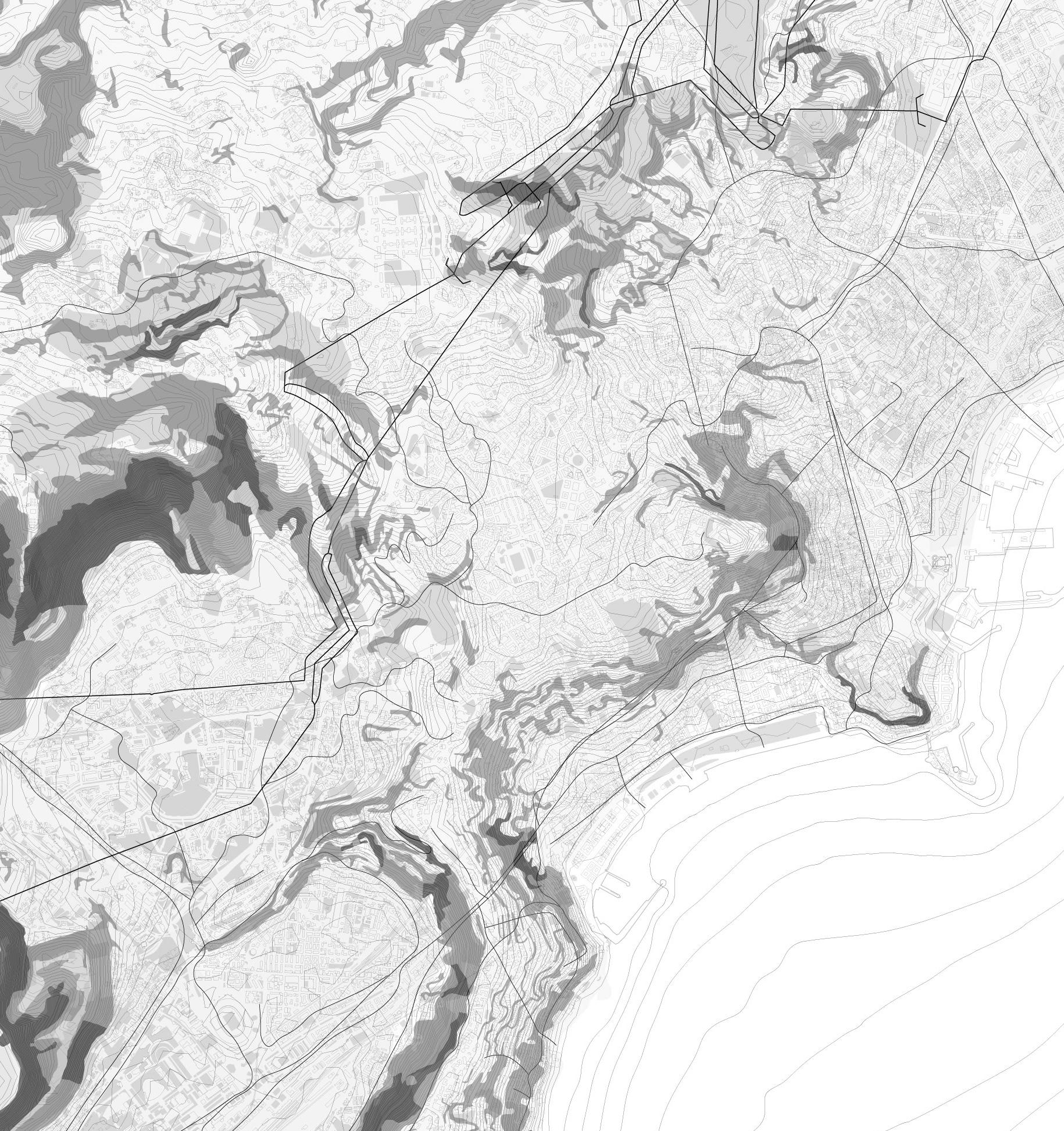
[right] surface mapping of ground movement within the bay of naples
42 |
| 43
44 |
III. GEOLOGY OF THE CITY
The subterranean strata of Naples serve as a geological chronicle of the city, preserving records of past volcanic activities and eruptions from neighbouring regions. The layered bedrock, in conjunction with the overlying soil strata, is composed of several compacted pyroclastic flows, leading to the unique varieties of tuff found in the area. Despite the common belief that a city founded on rock would be inherently stable, Naples exhibits a different scenario.
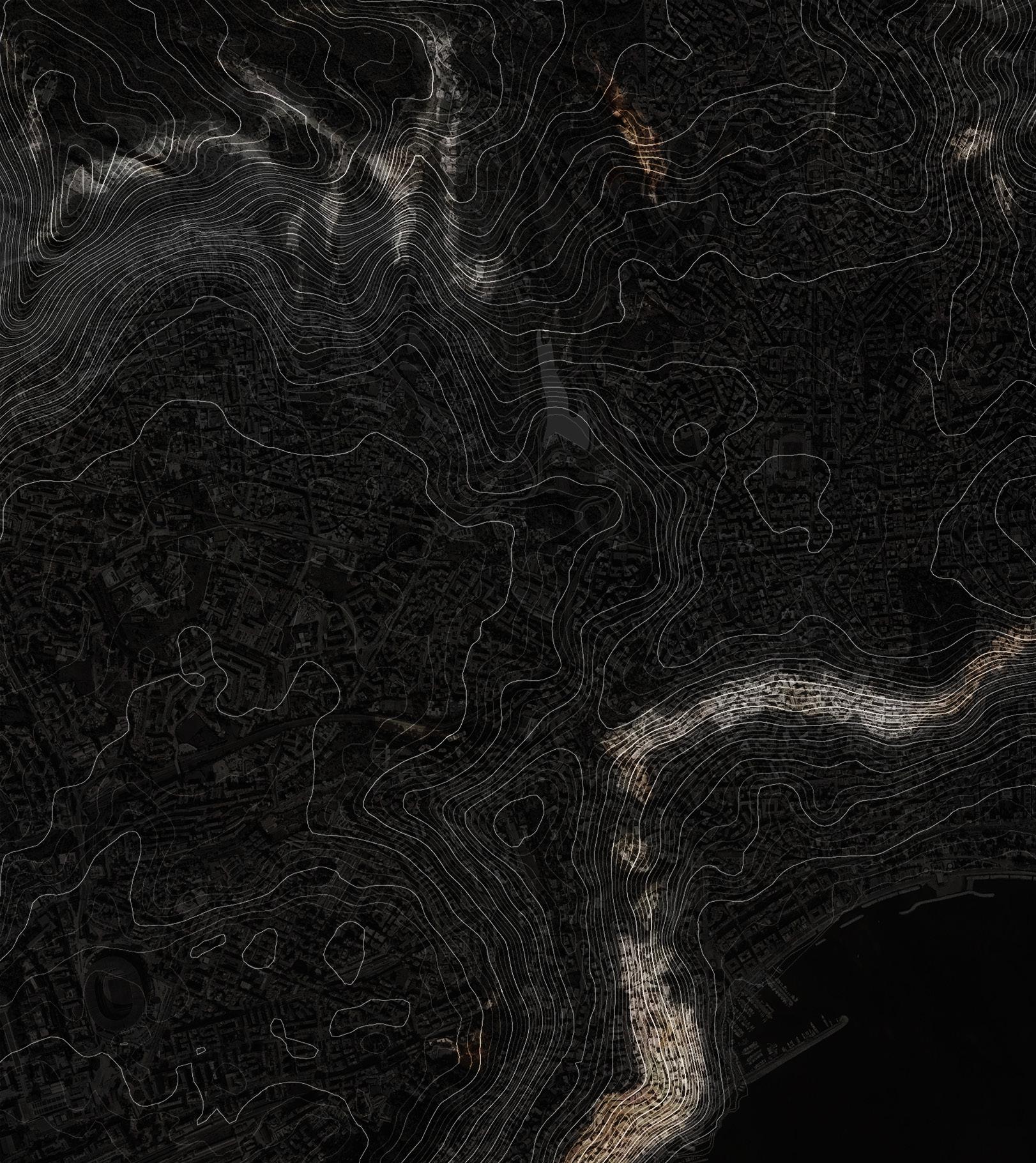
A pronounced tuff ridge cuts through the city, marking a shift in the city’s geological base, from thick pyroclastic sediments on the ridge’s crest to friable pyroclastic deposits at its base. This disparity in sediment structure leads to varying erosion rates. Districts such as Montecalvario, Quartieri Spagnoli, Vomero, and Posillipo are located on this less stable foundation, rendering them prone to erosion due to water infiltration and runoff along the ridge.
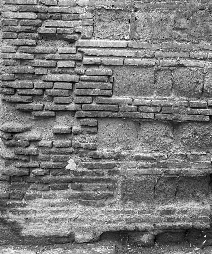
Neapolitan Yellow Tuff, the most common type of tuff in Naples, is renowned for its ease of cutting, lightness, and durability. It has been extensively used in a variety of buildings, from residential structures to iconic landmarks like Castel dell’Ovo, Castel Nuovo, and Castel Sant’Elmo. Tuff has significantly influenced the architectural character of the region. Its porous nature and ability to retain moisture, contribute to the weathered look and progressive decay of Naples’ building fabric, both above and beneath the ground, bestowing a unique allure to its visible surface.
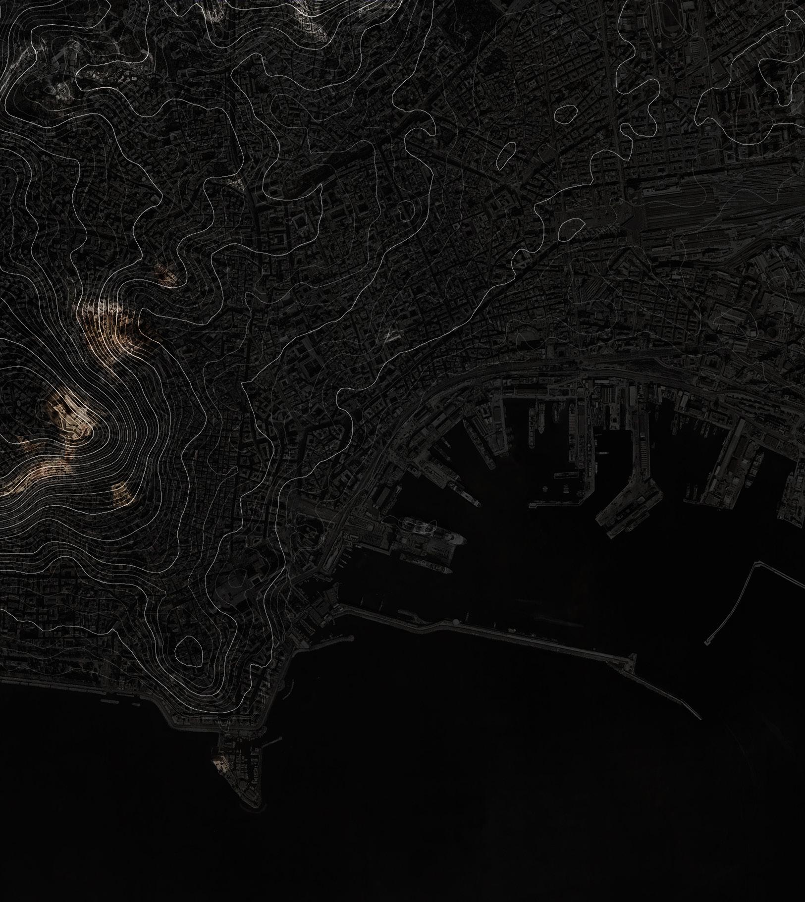
[above ] superimposed mapping of tuff with the cities topography
| 45
46 |
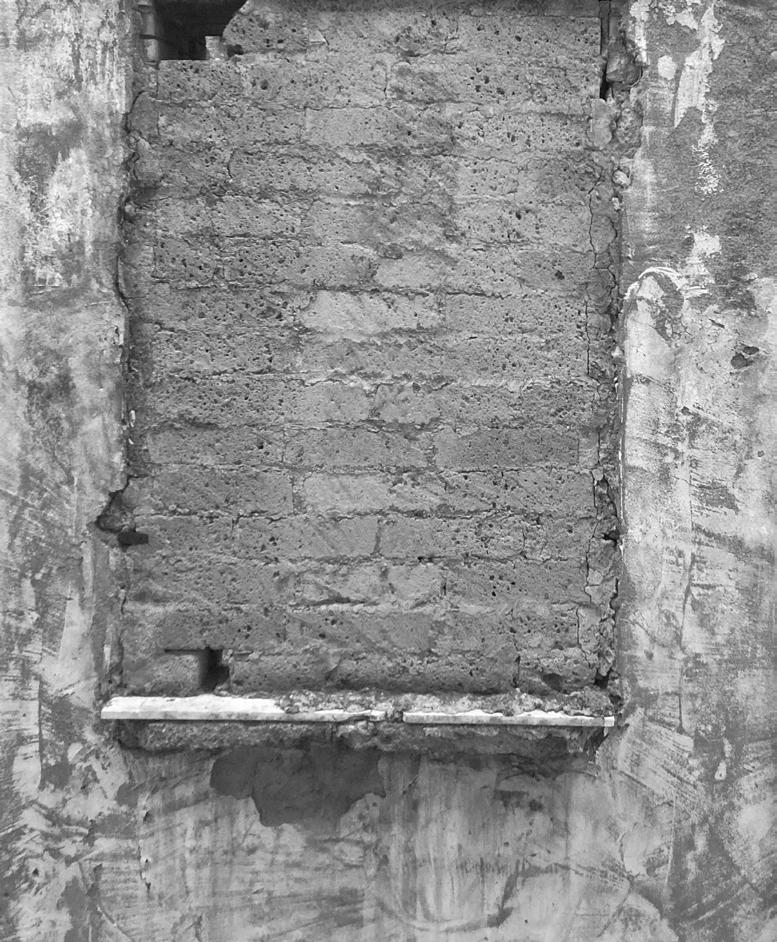
window infill using tufo masonry on via domenico cirillo
brick coursing between tufo blocks to reduce rising damp

weathered

supporting tufo arches at the galleria borbonica
“… an infinitely porous, spongy, or cavernous texture without emptiness, caverns endlessly contained in other cavers: no matter how small, each body contains a world pierced with irregular passages…” [4]
[4] Gilles Deleuze and Jonathan Strauss, ‘The Fold’, Yale French Studies, no. 80 (1991): 80, https://doi.org/10.2307/2930269.
| 47
tufo wall on the west face of castel dell’ovo

IV. URBAN CAVITIES
For many centuries, the inhabitants of Naples favoured the extraction of tuff from subterranean locations for construction purposes, leading to the formation of a complex network of cavities beneath the city, as opposed to using embankments or open-air quarries which would have necessitated significant material transportation.[5]
The techniques used for extraction led to the creation of large voids within the rocky substratum, typically hidden from sight at ground level. Tuff, once extracted from the quarries, was often used near its source, resulting in a direct relationship between the city’s growth and the increase in these underground cavities.[6] Areas such as Montecalvario, Posillipo, and the Quartieri Spagnoli (Spanish Quarters) experienced extensive tuff extraction, thereby housing the greatest density of subterranean voids. This increased occurrence of underground cavities makes these districts especially prone to subsidence in the overlying subsoil.
[5] Relazione della Commissione di studio, a cura del Comune di Napoli, Il Sottosuolo di Napoli, trans. Jeff Matthews, (Napoli: A Cure Del Comune, 1967), 54.
[6] Relazione della Commissione di studio, a cura del Comune di Napoli, Il Sottosuolo di Napoli, 123.
48 |
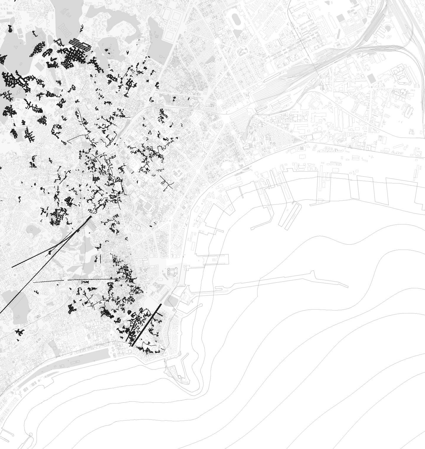
[above] distribution of common cavities found in naples in relation to the urban morphology above.
| 49
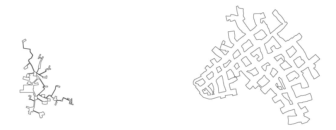
[above] survey of common cavities found in naples
50 |
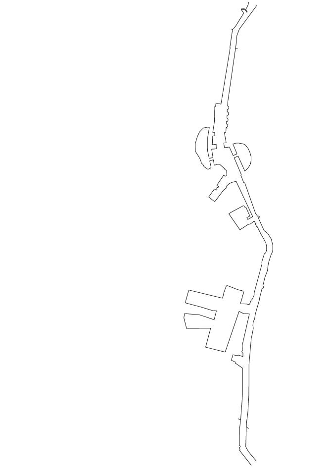
Bottle or Bell Gallery

| 51
Catacombs Crypta


REFLECTION GROUP WORKING
| 53
REFLECTION
GROUP WORKING

Throughout the two-year integrated pathway, I have had the privilege of collaborating with numerous talented individuals whose contributions have significantly influenced both the installed work and individual outputs. This group work has facilitated the exchange of ideas and allowed each member to learn from the strengths and interests of others.
In the first year of the course, my working group focused on a critical theoretical foundation of this thesis – surface effects. The city’s framing through the lens of Andrew Benjamin provided a focal point for the material conditions of the city. Upon reflection, this focus has driven a thesis that views architecture as both an effector and an affected entity, and as a consequence of material concerns.
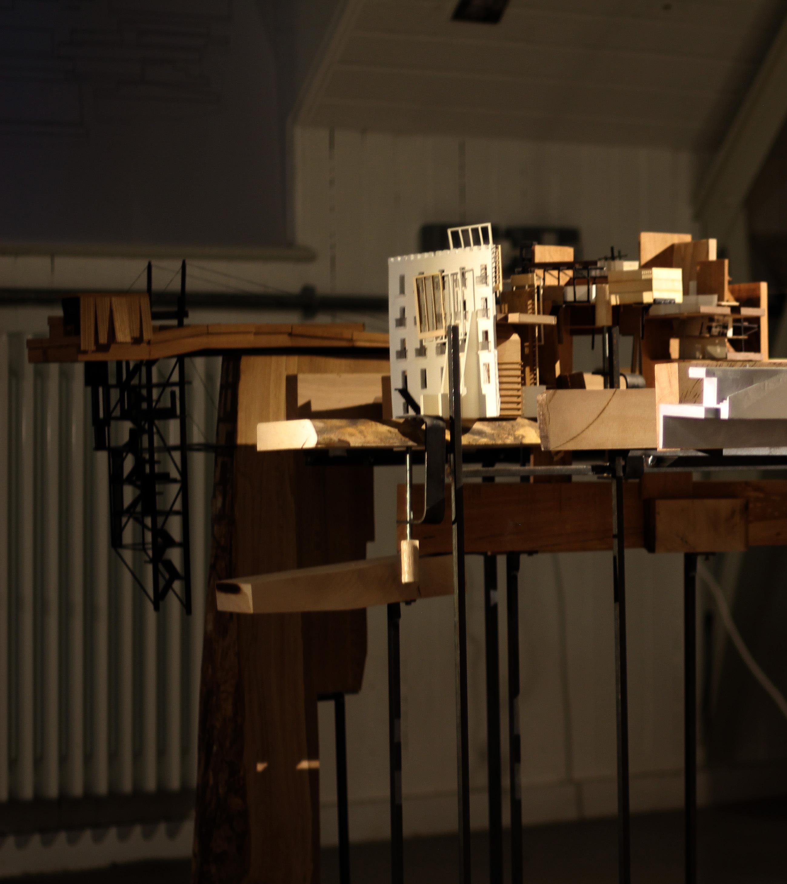
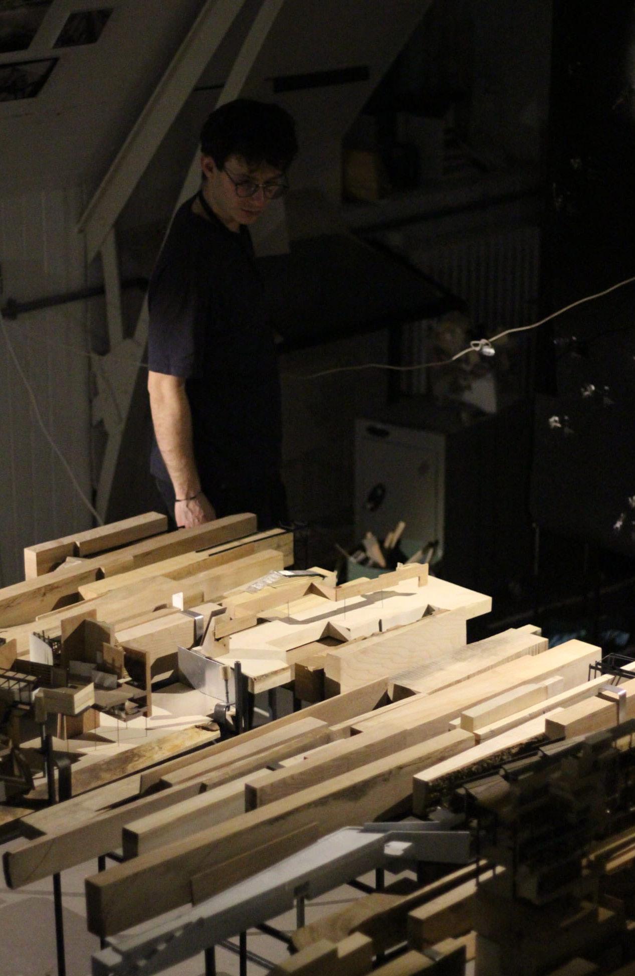
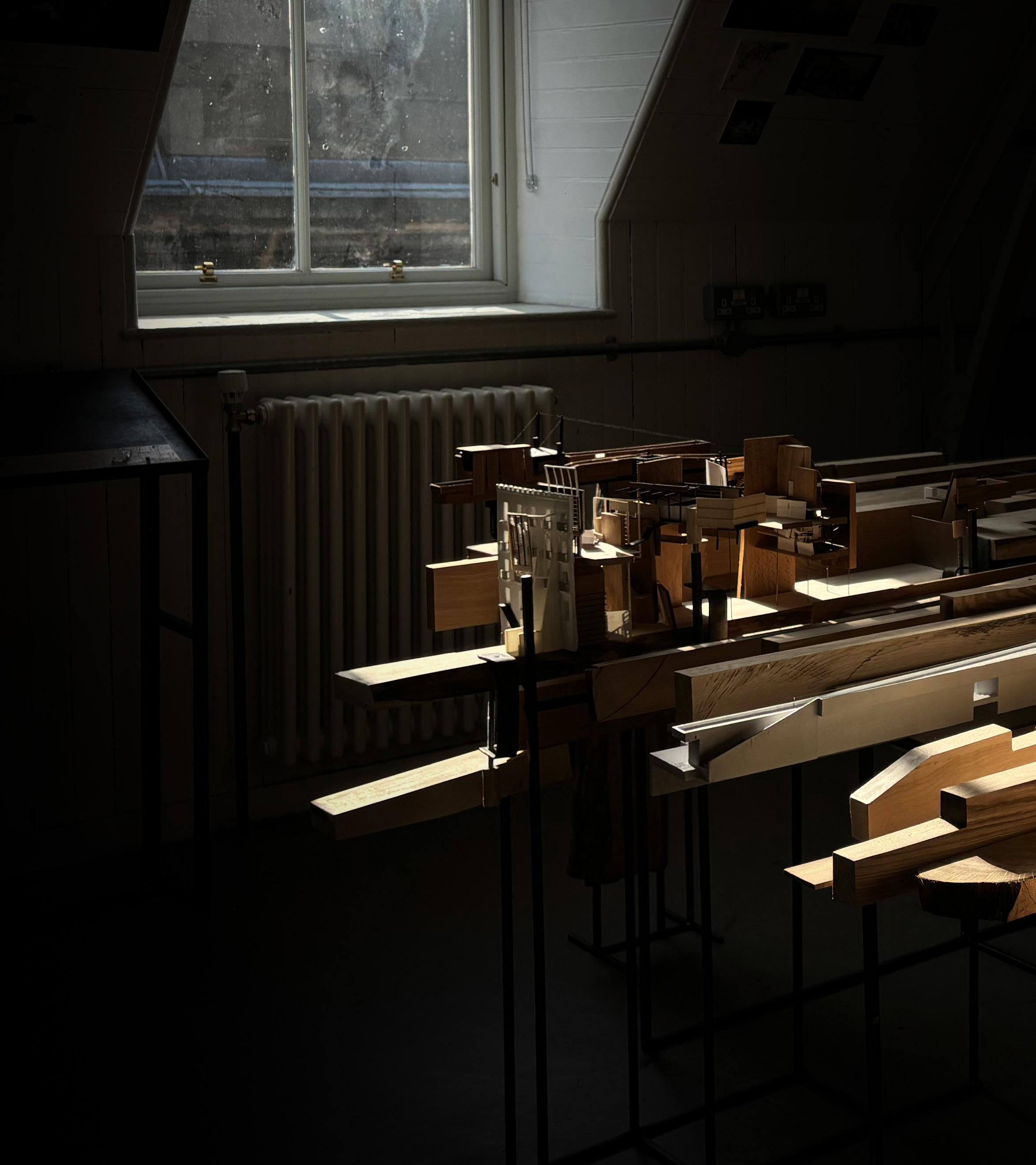
During my final semester, we were offered conversation groups where we could share overlapping research that had been conducted. This evolved into a working group where we developed extensive mappings of surface movement across the bay, tested a series of hybrid architectures and tectonics that had been explored in Studio A, and constructed a shared zone model of the bay. This model served as a sort of worktable that housed individual 1:100 models.
I firmly believe that collaborative work in the studio has not only enhanced the enjoyment of the course but also resulted in a more productive output. The regular discussions we had leading up to and following tutorials maintained an understanding of each other’s projects and ensured the best balance for group outputs. The final installation transcended the display of individual pieces to become a celebration of a collective interpretation of a shifting ground condition.
54 |

| 55

56 |

| 57
58 |

| 59

60 |
TWO. PARTICULATE
CAPTURING SUSPENDED STATES
V. Constructing a Studiolo
VI. Taxonomy of Materials
VII. A City Ravine
VIII. Turner in Naples
IX. The Urban Canopy Layer
X. The Meteorological Observatory
| 61
V. CONSTRUCTING A STUDIOLO
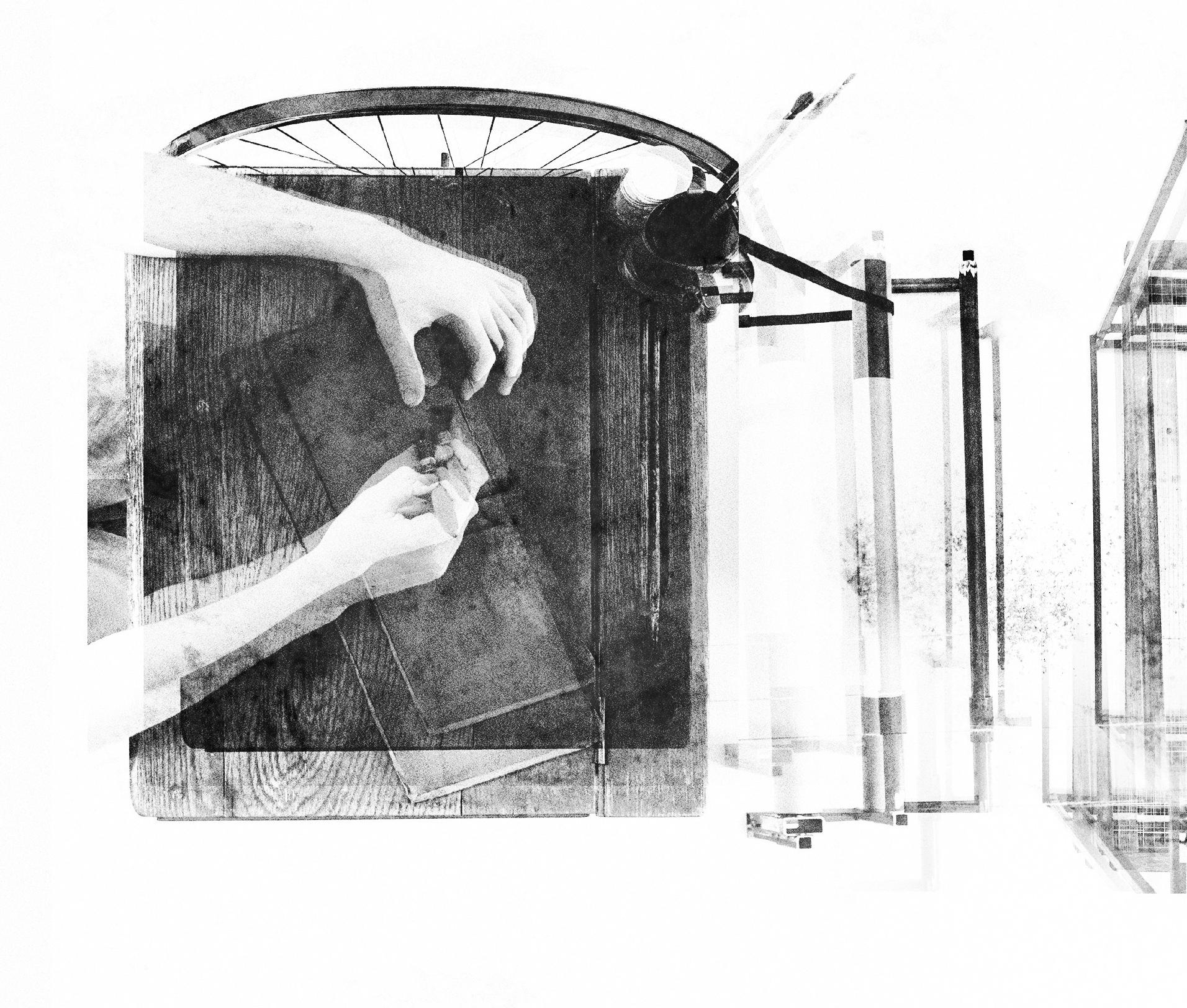
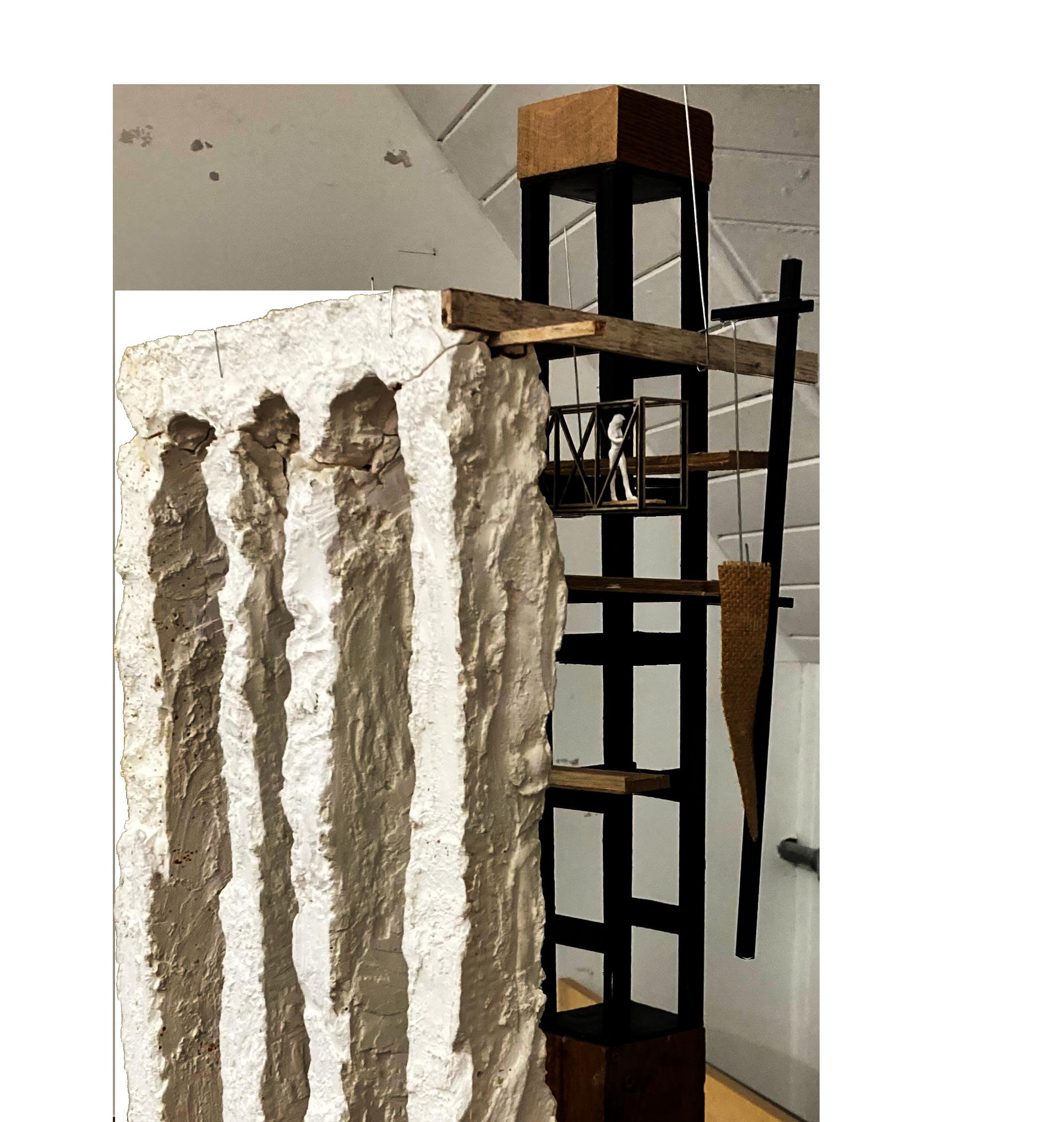
The studiolo is emblematic an archaeological device, where a series of layers come to represent the sequential process of making and un-making precarity. In order to continue the cycle of markmaking through the disruption and undoing of the surface, we propose a device that may register tremors and movement and, in turn, respond by tapping and chipping away at the surface.
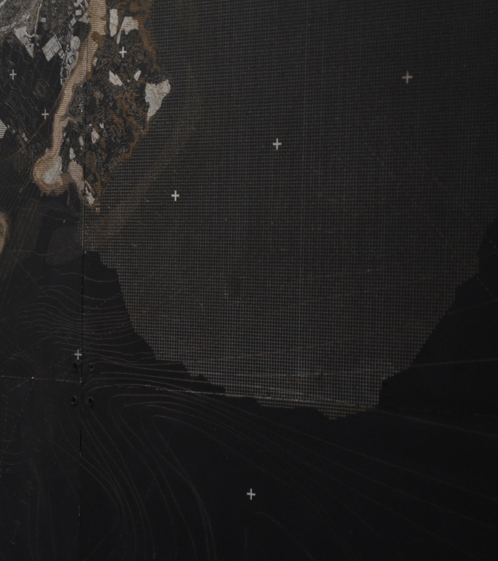
The surface created is intentionally fragile, so as to create unpredictable conditions, through mark making. We projected geological information gathered, and chiselled out areas of the cast surface specific to the layer of projected information, i.e. sinkholes that have arisen from subterranean undoings. In doing so, we hoped to register a convergent condition, representative of a surface and its constituents. It is an intentionally uneasy surface, unworkable, unrepairable and unstable. In essence, however, it becomes a sketchbook, or a wall; a Neapolitan surface behaving geologically to describe a perplexing landscape. Drawings or workings deface themselves, becoming performative pieces, collected in trays, vials, scrolls, and stored in the desk to create an ever-evolving archive of pigment, deposit, sediment, and dust.

The captured surfaces can be thought of as registers of material conditions, or rather as a sort of “double register,” in the words of Andrew Benjamin, where walls and landscapes are at once surfaces but also the surface effects in question.[7] Using the logic of ‘Terroir,’ which can be used to encapsulate the range of investigations necessary to re-engage the theme of capturing surface effects within a larger set of questions and interrelations, the first part of the fieldwork begins to contextualise our findings at the urban scale. What had been captured when at Naples, including mineralogical samples, building fragments, rock dust, rubbings, photographs of surface conditions etc., are used to construct a set of material studies and taxonomies that then re contextualize materiality within a wider set of landscapes, following the logic of Jane Hutton’s ‘Reciprocal Landscapes.’
[7] Andrew Benjamin, ‘Surface Effects: Borromini, Semper, Loos’, The Journal of Architecture 11, no. 1 (1 February 2006): 1, https://doi. org/10.1080/13602360600636099.


62 |

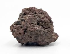
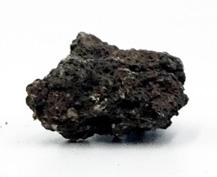
[above] studiolo acting as both a landscape and 1:1 reading of the city’s surface [left] collected rock samples from the accent of Vesuvius during the field trip
| 63
64 |
[1] [2]
Writers Desk Paper Roll
[2] [3] [4]
Surrogate Surface Sifting Trays
[1]

[above] annimated drawing of the studiolo
| 65
[3]
[4]
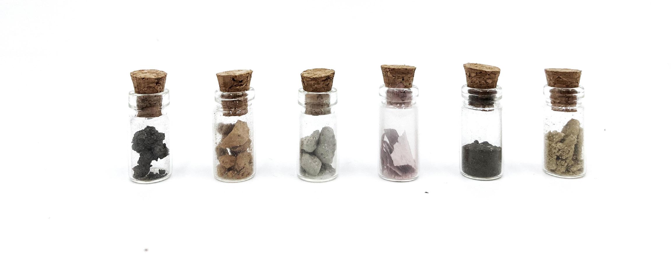
VI. TAXONOMY OF MATERIAL
Buildings “should be constructed with the smallest stones so that the walls, fully saturated with mortar made of lime and sand, will bound together for longer. For since these stones are soft and thin in consistency, they dry out the mortar absorbing the moisture. But when the amount of lime and sand is great and plentiful, the wall will not give way quickly since it contains more moisture, but is held together by these material.” [8]
[8] Vitruvius, Ingrid D. Rowland, and Thomas Noble Howe, Vitruvius: ‘Ten Books on Architecture’ (Cambridge University Press, 1999), 50, https://doi.org/10.1017/ CBO9780511840951.
66 |
[1] [2] [3] [4] [5] [6]
Brick Piperno Paint Ash Tufo [1] [2] [3] [4] [5] [6]
Andesite

| 67
[above] wall study of parco ventaglieri

68 |
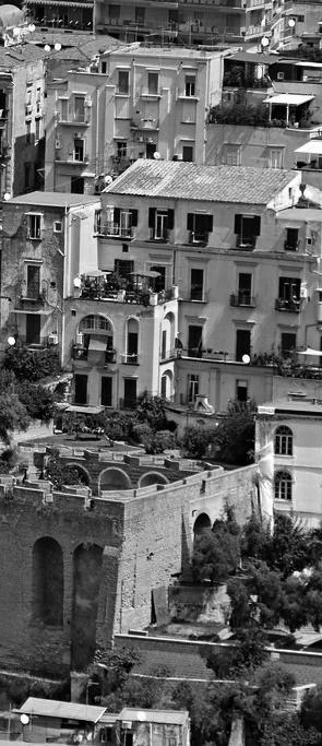
VII. A CITY RAVINE
A series of ravines are present in the city, situated along and in proximity to the tuff ridge, and were formed due to the effects of water erosion. Portions of the urban structure were constructed around these ravines or directly against their boundaries, complicating the determination of whether the dramatic terrain or the buildings came into existence first. The destabilizing factors of the Neapolitan terrain - the geological composition and transformations, tufo mining, hydrological activities, and topography - are interrelated and mutually influence each other, resulting in this ambiguous, overlooked terrain.
First observed from the elevated perspective of Castel Sant’Elmo, Parco Ventaglieri presents itself as a void in the city, a ravine of sorts that sits as a materially charged space, particularly relevant to our various material investigations. Atmospheric effects, such as smog, dust, clouds and an undulating topography blur distinctions between surfaces, landscapes and buildings.
This unstable substratum became the setting for an observatory that seeked to explore and provoke material investigation, whilst generating novel material possibilities. In conjunction with the vulnerability posited by the fragile Neapolitan landscape, the observatory developed a tectonic language that attempt to contend with this state of fragility, whilst also thinking about the material states at work.
| 69
[left] aerial view of parco ventaglieri

Location Plan
The Meterological Observatory
70 |

“As porous as this stone is the architecture. Building and action interpenetrate in the courtyards, arcades, and stairways. In everything they preserve the scope to become a theater of new, unforeseen constellations.” [9]
- Walter Benjamin
Situated on tuff, loose top soils, and a series of old quarries, the park remains susceptible to movement from external triggers like significant rainfall events.
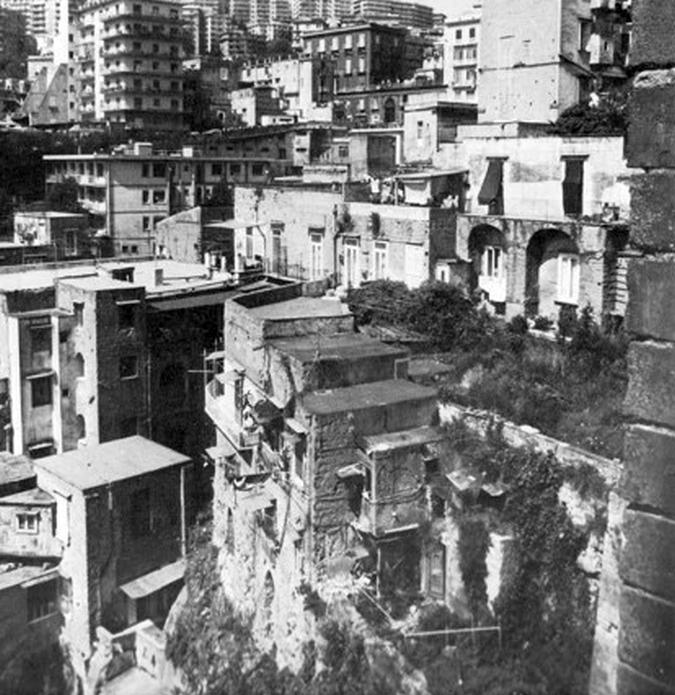
[above] Photo from Strada Nuova in 1980. Parco Ventaglieri non-existent. Prior to the Iripinia earthquake in 1980, the full landscape was at the level of what we are now considering ‘the upper park.’
| 71
[9] Sophie Wolfrum, Porous City: From Metaphor to Urban Agenda / Editors, Sophie Wolfrum [and 6 Others]. (Basel: Birkhäuser, 2018), 27.

72 |
[above] zone drawing of parco ventaglieri showing the network of cavities and steep drop of the ravine

| 73

“‘First, he receives a true impression from the place itself, and takes care to keep hold of that as his chief good ... and then he sets himself as far as possible to reproduce that impression on the mind of the spectator of his picture”
- John Ruskin, Modern Painters
[10] A. J. Finberg, The Life of J.M.W. Turner / by A.J. Finberg; with a Supplement by Hilda F. Finberg., Second edition revised. (Oxford: Clarendon Press, 1961), 262.
[11] James Hamilton, Turner and the Scientists / James Hamilton. (London: Tate Gallery Pub., 1998), 12.
VIII. TURNER IN NAPLES
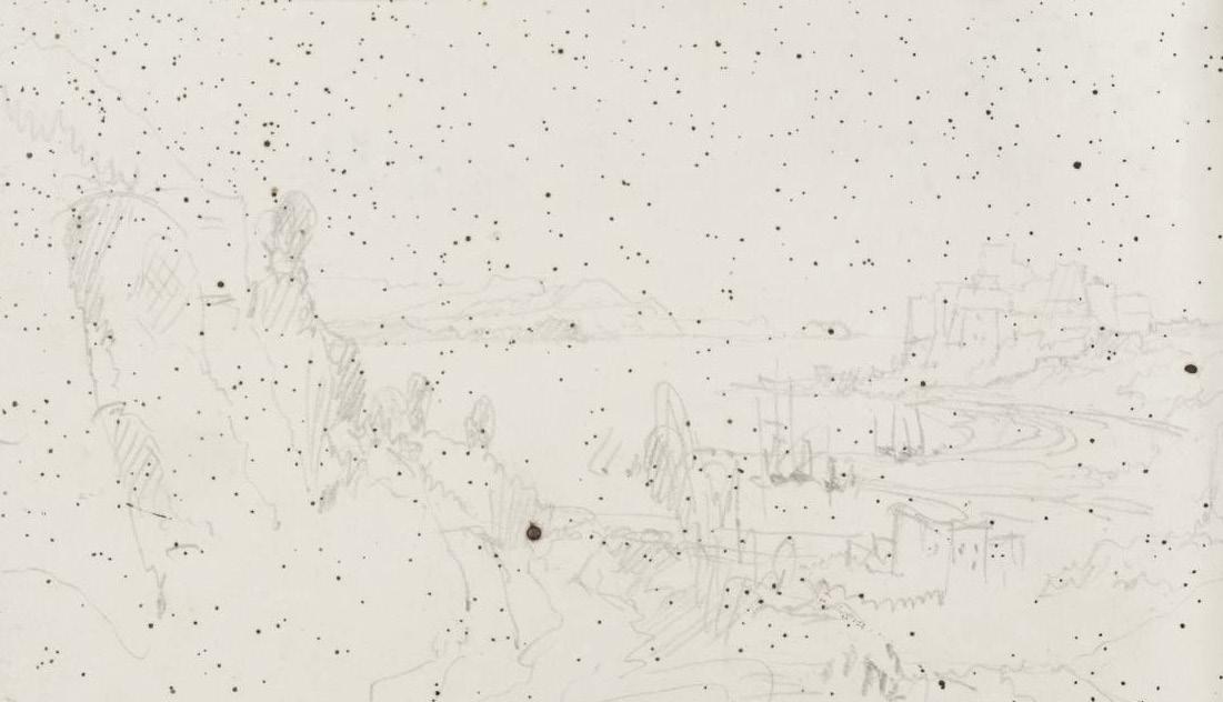
Integral to the exploration of the Naples has been the analysis and interpretation of J.M.W. Turner’s 1819 visit to the city, as documented in his sketchbook ‘Gandolfo to Naples’. These sketches serve as invaluable windows into the historical, social, and ecological tapestry of Naples before the onset of modern urban development.
Turner’s fascination with atmospheric phenomena, his observations of an active Vesuvius, and his portrayal of the city amidst looming danger resonate profoundly with the architecture of this thesis.
The selected pages from Turners sketchbook offer an initial surface to read the city, a temporal register of a precarious ground, a city in the wake of danger, and corporeal reading of the city that offers as series of belevederes to record the surface.
Turner’s sketchbooks, of which nearly 300 survived, were mostly filled with pencil sketches, as this was the artist’s preferred method of working outside. ‘It would take too much time to colour in the open air,’ he once said, noting that he ‘could make 15 or 16 pencil sketches to one coloured’. Back in his lodgings, he usually coloured up the day’s pencil sketches.Turner’s sketchbooks show that during his 1819 tour of Italy, he relied heavily on pencil point work. For him, pencil sketches served a single purpose: to record facts and serve as a repository of topographical information. He painted seven watercolour studies of Naples, but only a small proportion of these, if any, were done in the open air; the rest were done from memory after the pencil sketches were completed. [10]
Turner had a keen sense of light and atmosphere, and the immediacy of the watercolour medium was ideal for his artistic goals. Light and atmosphere surpassed topography in his works as his career progressed. Turner famously stated in an 1818 lecture, “Light is therefore colour.” The fact that so many of his elemental studies remained unfinished in his studio suggests that
74 |
he was content with them in their unfinished, purely atmospheric state. Such experimental studies were not displayed, but were kept as reference material for specific light effects and weather conditions.
Turner obsessively studied cumulonimbus clouds, which are associated with torrential downpours, hail storms, and lightning. His increased interest in cloud and sky studies can be seen around 1820. His skill in rendering dramatic weather effects is highlighted here by the varied application of broad brushstrokes and the opposing areas of light and dark.
Turner’s artistic interest in industry and energy coincided with scientific and climatic research. The Royal Society, which promoted science, was located directly across the street from the Royal Academy, which promoted the arts. Because of their
proximity, members of one institution were encouraged to attend meetings of the other. [11] Turner was a frequent visitor to the Royal Society, where he met with a number of distinguished scientists.
Sir Humphry Davy, Professor of Chemistry at the Royal Institution, is a notable acquaintance; Turner was not present at Sir Davy’s dinner party on October 31, 1819. Vesuvius had erupted a few days before, and he had rushed to Naples to see it.
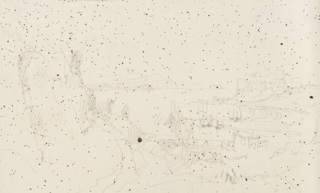
A page from his sketchbook illustrates his inquisitive nature and eagerness to register such a sublime event. A number of scholars have followed John Gage’s suggestion that these were made by a shower of hot volcanic ash during Turner’s ascent of Vesuvius.
| 75
[above] page from turners sketchbook showing ash captured from his assent of vesuvius
IX. THE URBAN CANOPY
The state of the atmosphere and the direction of its currents necessitate frequent observations, which result in experiences. Because experience is consigned to the possessor’s memory, relaying verbally can be misleading.
To allow meteorologists to quantify the experience of others, Luke Howard published the first systematic investigation of cloud formations through a methodical nomenclature, applicable to the various forms of suspended water, or rather the Modifications of Cloud. [12] The Nomenclature is drawn from Latin to create a universal language, with each Term immediately conveying the objects being defined.
Later, Howard focused on the way in which the city creates its own clouds, titled The Climate of London, with On the modification of clouds as the introduction. Howard recognised that pollution from all over London contributed to the formation of city-wide fogs, similar to what can be seen in Naples. Here, the weather is the city. Howard’s discusses the instruments and methods used to measure weather and climate, including a Hygrometer, which measures moisture content.
Howard discovered a ‘pool’ of warmer air in the built-up area. The magnitude of this urban heat island grows toward the settlement’s core, where building density is highest.
Howard is describing the urban ‘canopy layer’ effect on air temperature. The canopy layer may be defined as the air that lies below roof level. The outdoor canopy layer acquires its properties through interaction with the adjacent surfaces (building walls and street surface) and through exchanges of air with indoor (across building openings and gaps) and outdoor (between streets and with the overlying atmosphere) spaces. He identifies four causes for the observed differences in air temperature:
The geometry of urban surfaces which ‘traps’ radiation and obstructs ‘free radiation to the sky’.
The effect of urban ‘roughness’ in impeding the passage of ‘the light winds of summer’.
The availability of moisture for evaporation in the country.
2.
76 |
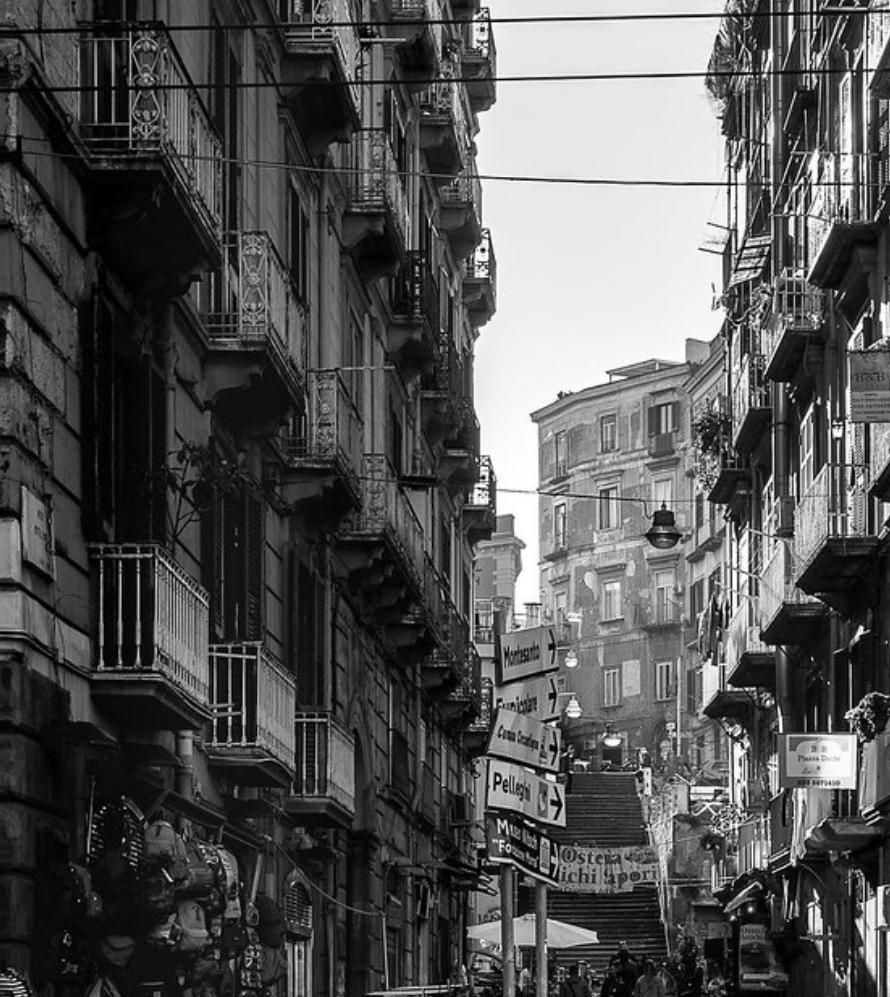
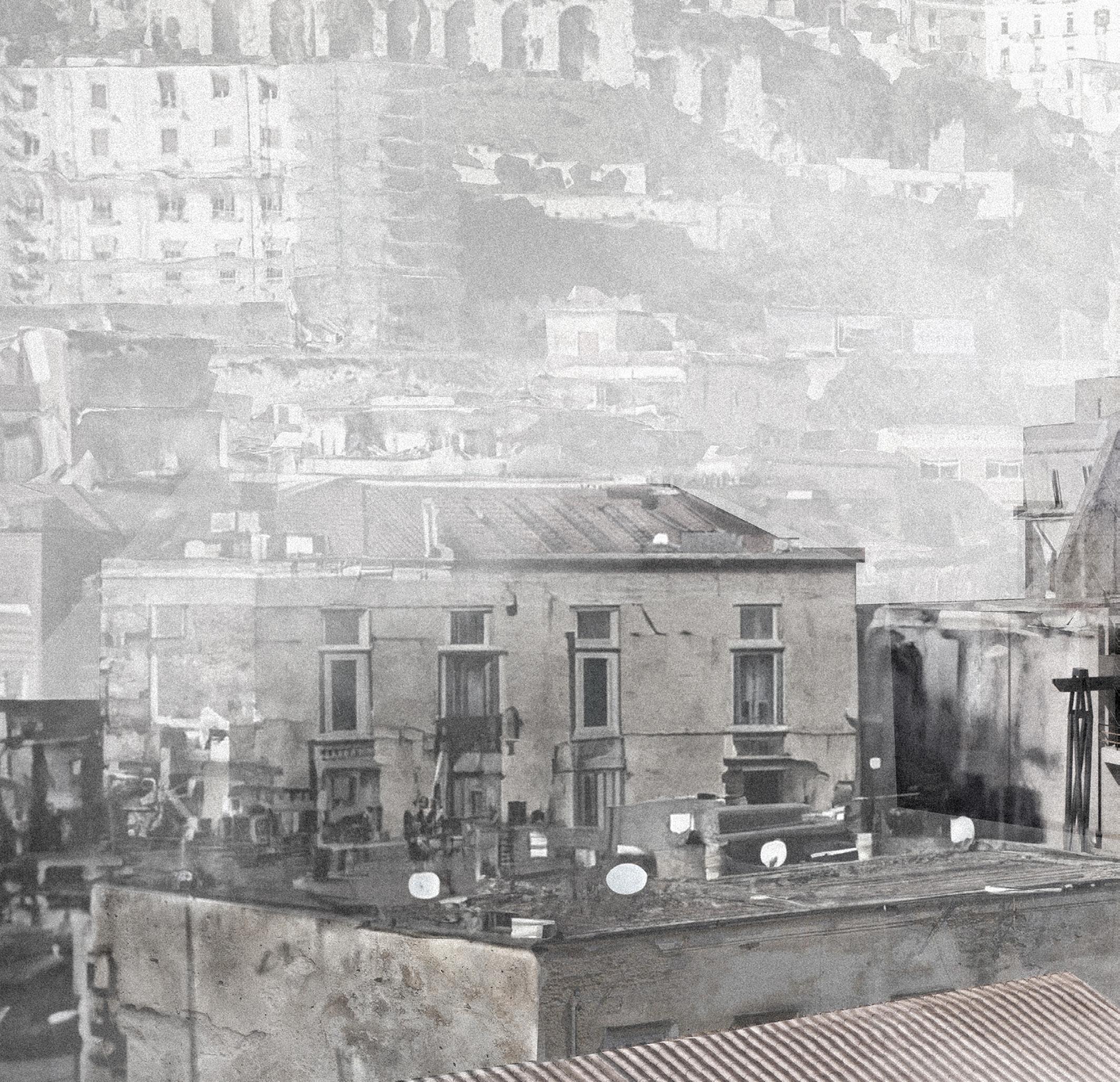
[right] view across rooftops in quartieri spagnoli with vesuvius in the background
[12] Luke Howard, Essay on the Modifications of Clouds / Luke Howard., Cambridge Library Collection. Earth Science (Place of publication not identified: publisher not identified, 1865),
[1] [2] [3]
X. THE METEOROLOGICAL OBSERVATORY
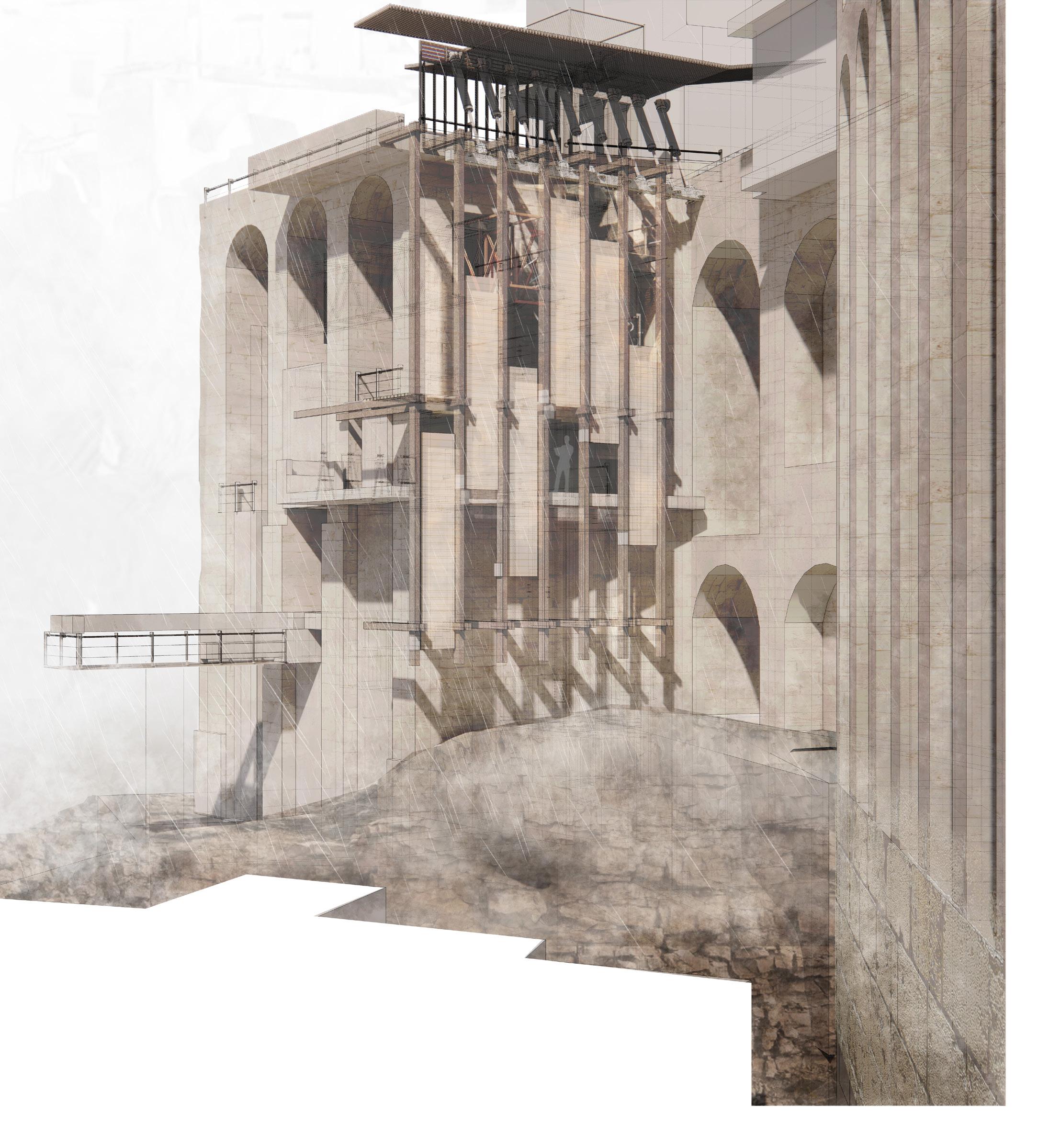
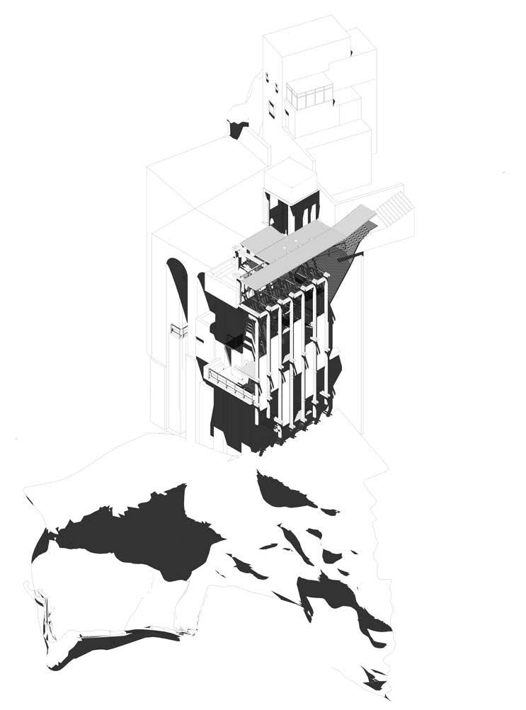
In conjunction with the vulnerability posited by the fragile Neoplolitan landscape, the observatory seeks to develop a novel tectonic language that attempts to contend with the recognised Neopolitan state of fragility. The design of the observatory evokes a range of questions from materiality to tectonics and how architecture begins to occupy it telluric substrate. It speaks to a much larger landscape, and to develop, to borrow from Jane Hutton, material reciprocities. If sites are real and physical and non-sites are abstract, the in-between becomes the territory that this observatory occupies.[13]
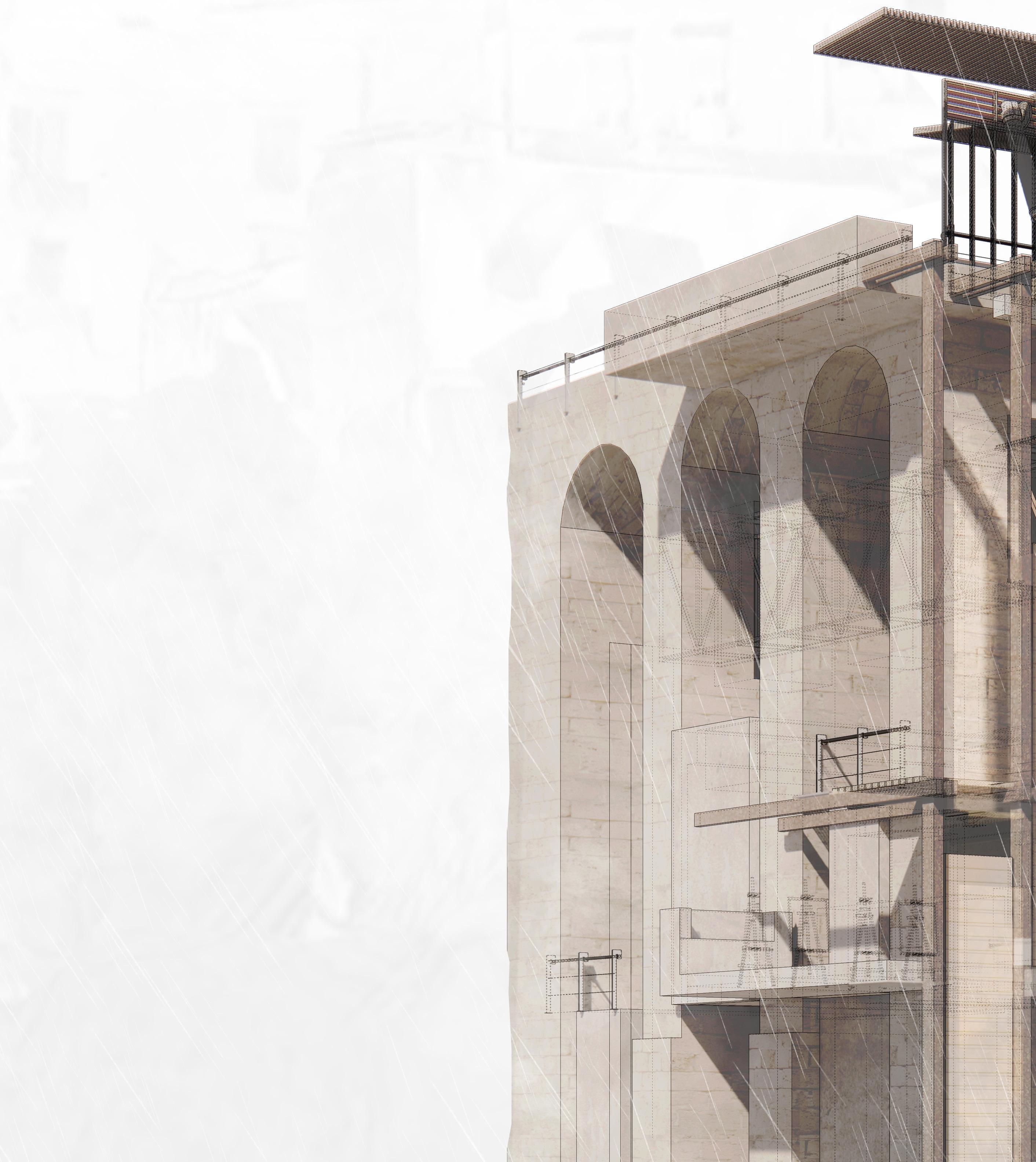
The structure serves as a meteorological observatory, providing a place to measure, record and monitor atmospheric conditions. Such conditions are brought to a degree of visibility through a ‘twitching’ architecture that moves and shifts in response to the surrounding environment.
Perched amidst the elevated position of Parco Ventaglieri, the Meteorological Station monitors weather conditions such as rainfall intensity, temperature and humidity. This data can be correlated with ground movement patterns for better understanding of landslide and sinkhole triggers.

78 |
[right] view of the meteorological observatory form the park
[13] Jane Elizabeth Hutton, Reciprocal Landscapes: Stories in Material Movements / Jane Hutton. (Abingdon, Oxon ; Routledge, Taylor & Francis Group, 2020).
| 79

80 | [1] [2] [3] [5] [6] [7] [4]
Perspective Section cutting through connecting bridge, painting balconies & studio
[1]
[2]
[3]
[4]
[5]
[6]
[7]
[8]

entrance terrace lift
connecting bridge painting balconies
painting studio
drying hall
urban canyon parco ventaglieri
| 81
[8]
82 |
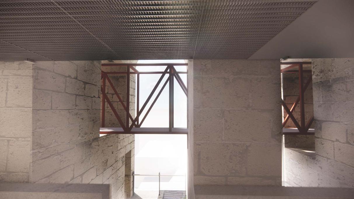
[above] connecting bridge through tufo arches between hygrometer and paiting balconies

[above] painting studio for J.M.W. Turner
[left] isometric of meteorological observatory
| 83

84 | [2] [1] [3] [4] [5] [7]
[6] [9]
[8]
Gallery Plan at Level +2
cutting through control room, water collection tanks and study
[1]
[2]
[3]
[4]
[5]
[6]
[7]
[8]
[9]
paint store room
hygrometer
connecting bridge studio lift
staircase to gallery
staircase to balcony
canvas store room
lower painting balcony
| 85
‘A meaningful architectural experience is not simply a series of retinal images. The elements of architecture are not visual units, they are encounters, confrontations that interact with memory. In such memory the past is embodied in action. Rather than being contained separately somewhere in the mind or brain, it is actively an ingredient in the very bodily movements that accomplish a particular action,’ [14]
[14] Edward S. Casey, Remembering, Second Edition: A Phenomenological Study, 2nd ed. (Indiana University Press, 2000).
[above & right ] 1:50 model exploring the principle circulation of the observatory
86 |
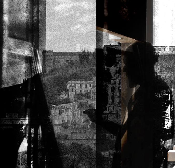
| 87
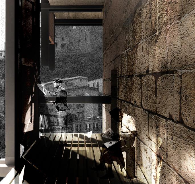
88 |
[above] painting balconies looking out towards the steep tufo ridge, at the top of which is Castel Sant’Elmo.
| 89


90 |

REFLECTION CRAFTING
| 91
REFLECTION
CRAFTING

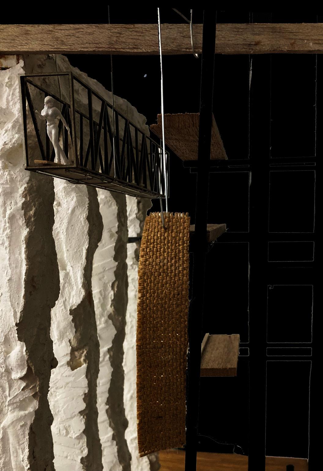
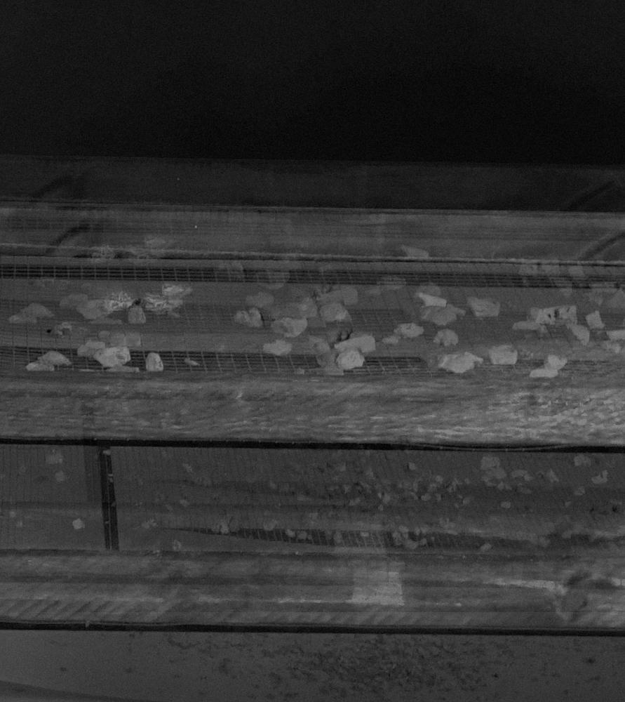
From constructing a studiolo to the final installation of the worktable for the exhibition, craftsmanship has been a consistent instrument employed throughout the design process. This approach has not only tested my proficiency in working across various scales, ranging from 1:1 to 1:1000, but it has also enhanced the overall design, rendering the proposal more tactile and imbued with materiality.
The creation of these larger installed pieces, achieved through a combination of manual craftsmanship and digital tools, as opposed to solely relying on digital fabrication methods, augmented their utility to the project. The aspiration to render objects to a degree of visibility through the studiolo was reflected in the observatory’s dynamic façade, and the evolving worktable of the final semester resulted in an architecture meticulously calibrated to a deteriorating ruin in Quartieri Spagnoli.
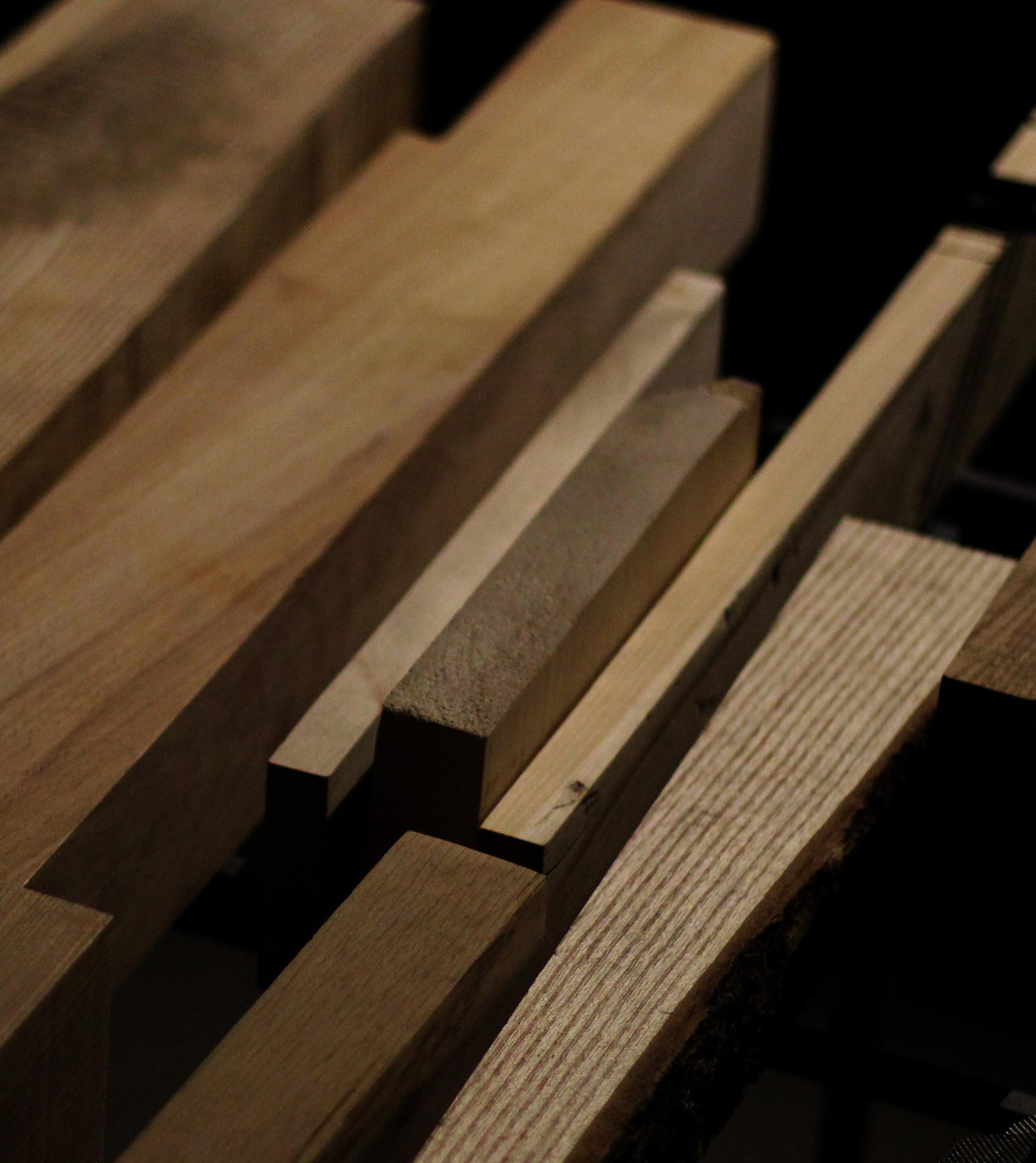
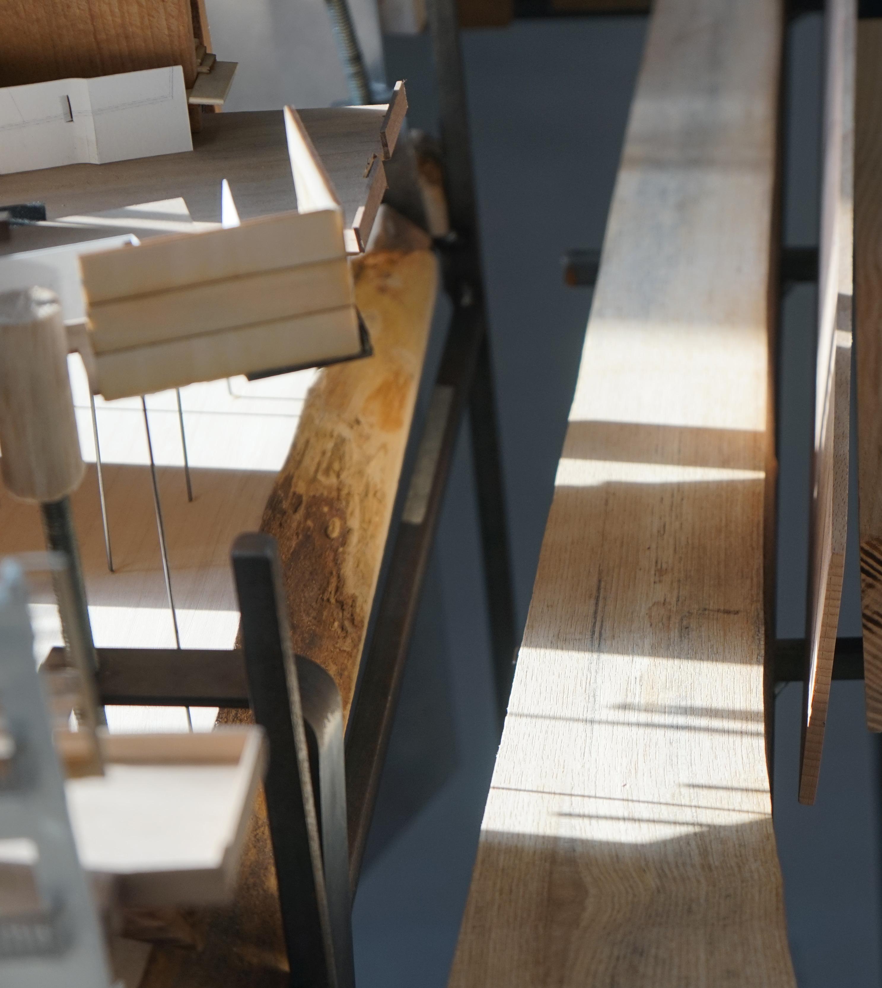
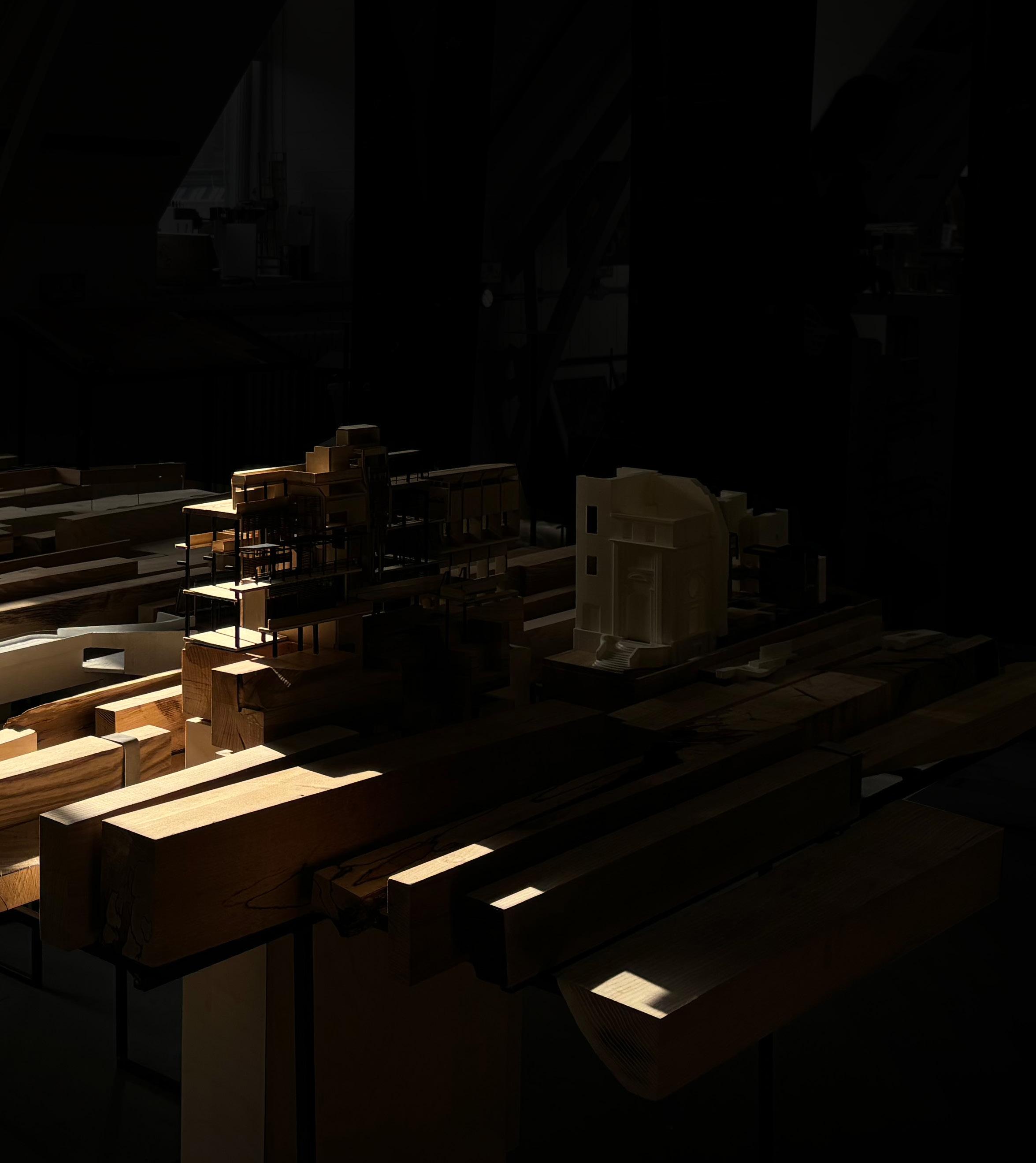
The final collection of models produced for the degree show underscore this physical craftsmanship, wherein carefully chosen beech and oak pieces were machined and hand-finished for display. The machining process necessitated these pieces to be digitally modelled, which required meticulous consideration when accounting for the constraints of the CNC and the material.
Balancing physical craftsmanship with digital modelling and drawing presented a challenge, yet it was essential for conveying the tectonic and material interpretation of Naples’ shifting ground. Investing time in the development of these physical models ensured that the final installation was populated and engaging, inviting a closer examination and a comprehensive appreciation for the work undertaken throughout the integrated pathway.
92 |

| 93

94 |
| 95

96 |

| 97

98 |
THREE. DISREPAIR
INHABITING A RUIN
XI. Buildings at Risk
XII. Decay of Chiesa SS. Trinata
XIII. Preservation of Craft
XIV. Surveying a Ruin
XV. The Stone Masons Yard
XVI. Occupying the Nave
| 99
XI. BUILDINGS AT RISK
The historic urban core of Naples, which was inscribed on the UNESCO World Heritage List in 1995, is populated by a wealth of centuries-old religious structures—cathedrals, chapels, and churches built in an array of architectural styles—numbering roughly 500 in total.[15] New findings from a team based at the Department of Earth, Environmental, and Resource Sciences at the University of Naples Federico II illustrated how vulnerable the landmark churches that compose a bulk of the real estate in Naples’s center are.[16]
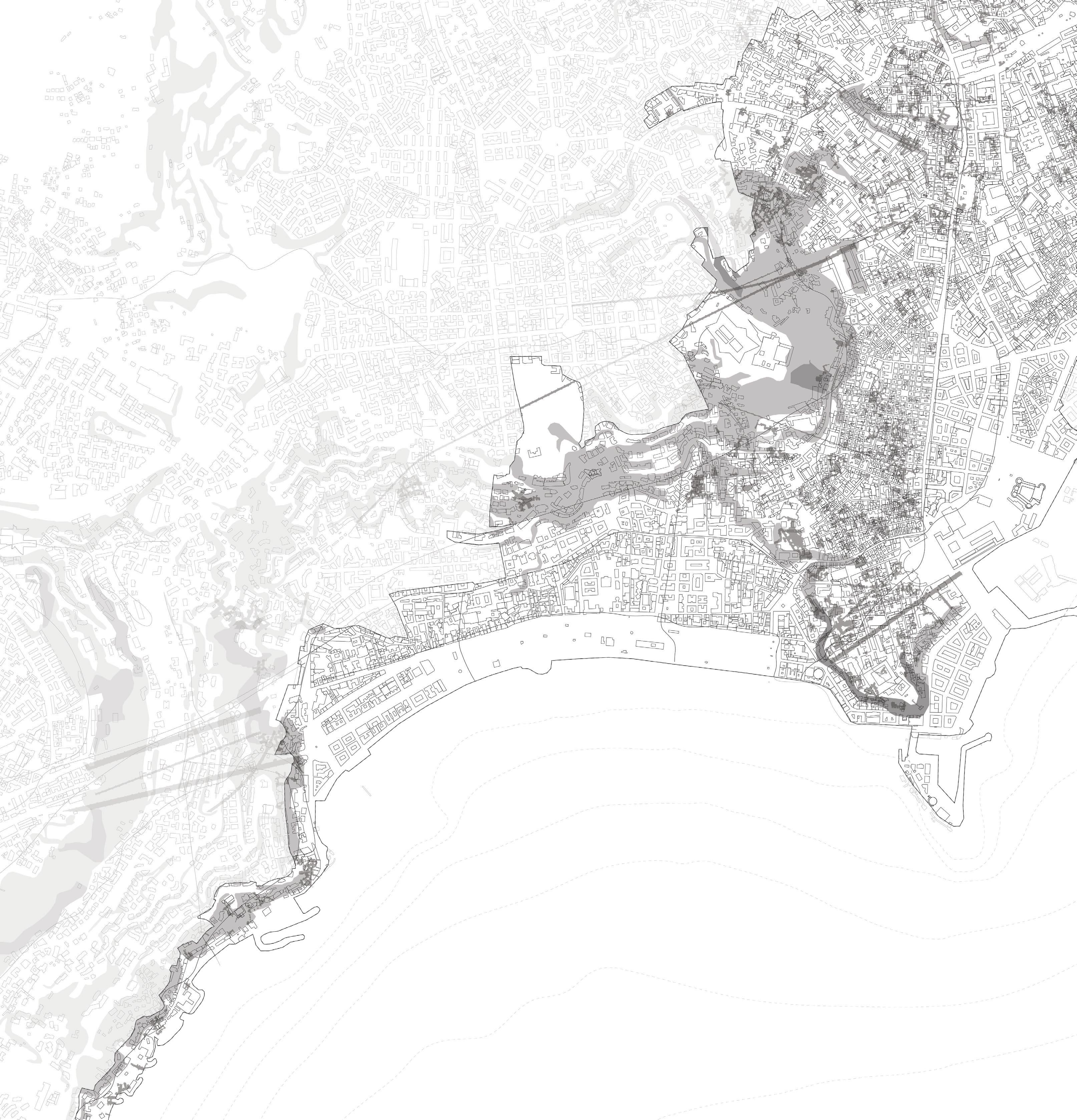
As detailed in research published the Journal of Cultural Heritage, 95 historic places of worship within Naples’s World Heritage Site zone are at risk of being damaged or destroyed by sinkholes caused by the collapse of underground cavities.Using map data and satellite imagery that tracked small but important shifts in ground levels, the team created a citywide inventory of sinkholes, cavities, and places of worship and concluded that nine historic Naples churches are built directly above underground cavities and are at high risk of collapse. Another 57 places of worship are susceptible to “potential future cavity collapses” per the Art Newspaper.[17]
[15] Concetta Rispoli et al., ‘Sinkholes Threatening Places of Worship in the Historic Center of Naples’, Journal of Cultural Heritage 46 (1 November 2020): 1, https://doi.org/10.1016/j.culher.2020.09.009.
[16] Rispoli et al., ‘Sinkholes Threatening Places of Worship in the Historic Center of Naples’.
[17] Rispoli et al.
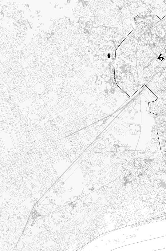
[right] place of worship requiring a quick response and continuous monitoring.
100 |

| 101
Basilica di Santa Maria della Pazienza
San Giuseppe delle Scalze a Pontecorvo
Basilica dello Spirito Santo
Basilica di San Francesco di Paola
Chiesa della Nunziatella
Chiesa di Santa Maria della Sapienza
Chiesa di Santa Maria Maddalena delle Convertite Spagnole
Chiesa di Santa Rita alla Speranzella
102 |

| 103 High Landmovment Risk Medium Low UNESCO Boundary Sewerage
Cavities
Network
XII. DECAY OF CHIESA SS. TRINATA
In 1732, Naples was hit by a severe earthquake, causing damage to both Chiesa SS. Trinata and the Monastery. The nuns had to exhaust all their resources for the restoration of the entire structure, but it was insufficient. They had to seek financial assistance from the Vicariate of Naples, borrowing 5000 ducats for the second phase of the works. To repay this debt, they sold the entire marble floor and the altars to complete the church’s restoration, which was finished in 1743.[18]
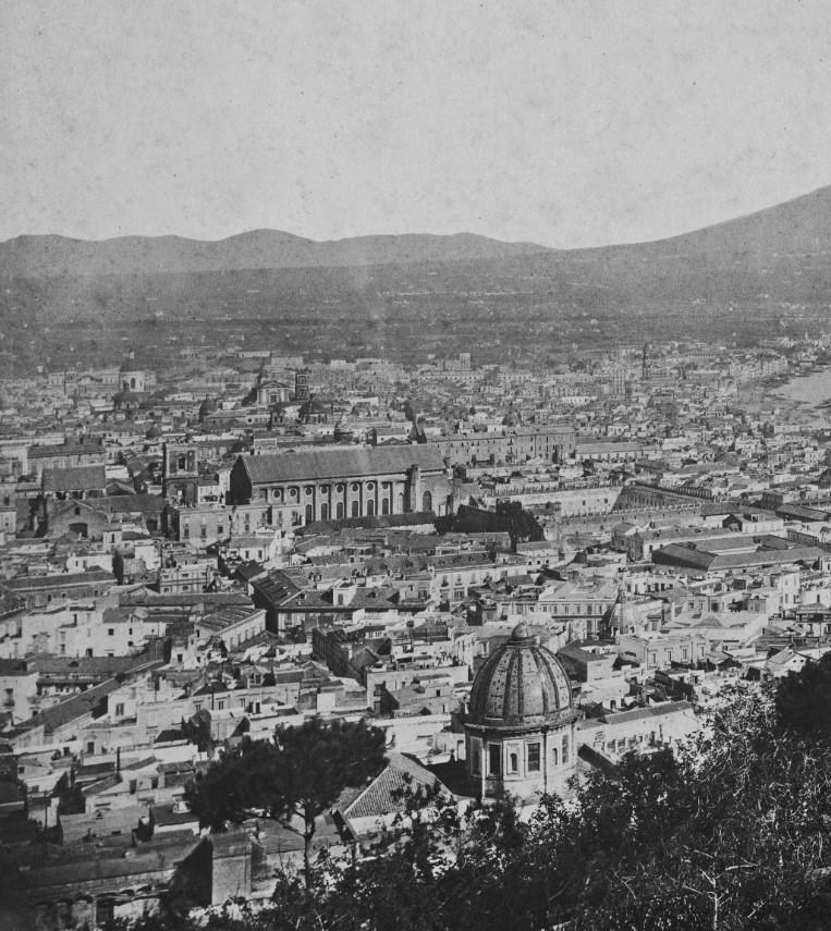
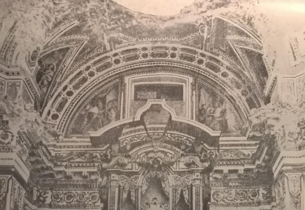
In 1815, King Ferdinand IV entered Naples and initiated various restoration works in the city. However, the Trinity Complex was left to decay. The church dome’s collapsed in 1897 and marked the beginning of the restoration work on the entire building. Consequently, the hospital adopted its current appearance, with the church serving as a military pharmacy. Regrettably, only a few of the paintings, frescoes, and sculptures that once adorned the entire structure remain today. In 1992, the structure was decommissioned as a hospital and has since been left to the ravages of time and total neglect.[19]
[18] webmaster, ‘Il Parco Dei Quartieri Spagnoli, Un Polmone Verde Nel Centro Di Napoli’, Articolo45, 16 November 2015, https://www.articolo45.it/il-parco-deiquartieri-spagnoli-un-polmone-verde-nel-centro-di-napoli/. [19] webmaster.

104 |
[right] In the foreground you can see the dome (no longer existing) of the church of the Santissima Trinità delle Monache.
[above] The Quartieri Spagnoli park, a green lung in the center of Naples
XIII. PRESERVATION OF CRAFT
The church was once a sanctuary for the artworks of renowned artists such as Battistello Caracciolo, Jusepe de Ribera, Giovanni Luigi Rodrigo, and Fabrizio Santafede. The frescoes adorning the church’s interior are attributed to the artistic prowess of Giovanni Bernardino Siciliano. Cosimo Fanzago orchestrated the creation of sculptures and ornaments, with remarkable pieces encompassing specific doors, the pulpit, and the floor. Sculptors Andrea Lazzari and Vitale Finelli, along with marble artisans like Domenico Agliani, made significant contributions under Fanzago’s guidance.
One notable artwork is “Saint Jerome and the Angel of Judgement,” an oil on canvas painting by Jusepe de Ribera, signed and dated by the artist in 1626. This masterpiece was created for display in a side chapel adjacent to the church’s high altar, which also housed Ribera’s “Earthly Trinity.” Following the suppression of the religious order managing the building in 1813, the canvas was incorporated into the Bourbon Collection and is currently displayed at the National Museum of Capodimonte in Naples.[20]
[20] webmaster, ‘Il Parco Dei Quartieri Spagnoli, Un Polmone Verde Nel Centro Di Napoli’, Articolo45, 16 November 2015, https://www.articolo45.it/il-parco-deiquartieri-spagnoli-un-polmone-verde-nel-centro-di-napoli/.
106 |

 Saint Jerome and the Angel of Judgement
| 107
The Earthly Trinity with Saints
XIV. SURVEYING A RUIN
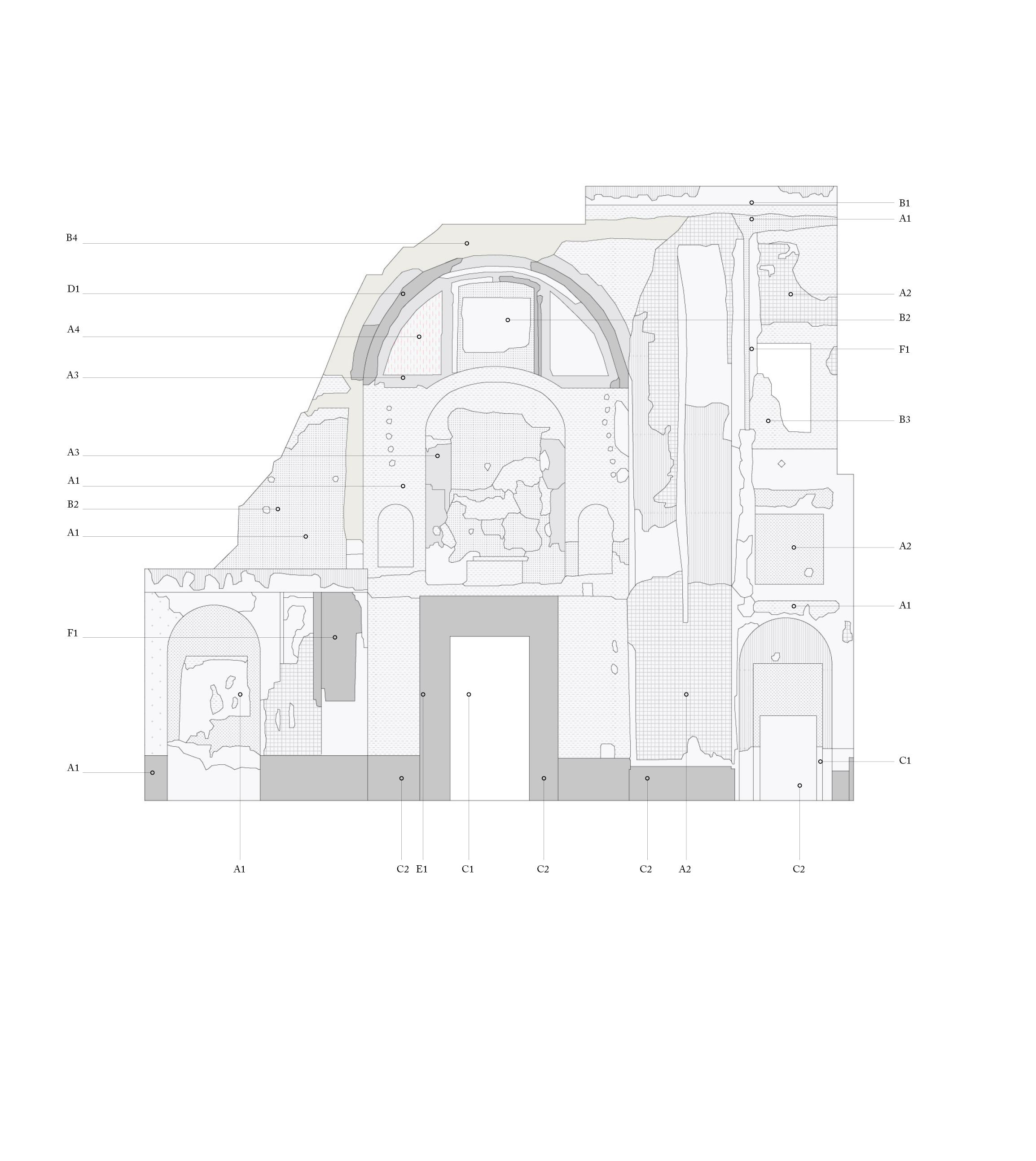
Surveying is a fundamental component in shaping the proposal for the ruin, leading to the development of spaces that interact with the city’s materials - plaster, stone, and dust.
The assessment of the level of degradation forms an archetype and a material taxonomy for other ruins within the city. This knowledge informs suitable interventions and support mechanisms for the city’s architectural fabric.
These fragments of the city articulate a broader material condition within Naples. They represent a reciprocal relationship between the city’s materials, its architectural structures, and the ground, thereby contributing to a comprehensive understanding of the city’s material ecology.
A - Plasters and Mortars
A1 - Cement Mortar
A2 - Lime-based Plaster
A3 - Stucco
A4 - Frescoes
A5 - Lime-based Mortar
B - Brickwork
B1 - Brick
B2 - Tuff Masonry
B3 - Stone Facing
B4 - Tuff Blocks
C - Wooden Elements
C1 - Fixtures
C2 - Boards against agents
D - Stone Elements
D1 - Marble
E1 - Metal Elements
E1 - Metal Wedge Nails
F - Plastic Elements
F1 - Electrical Conduits
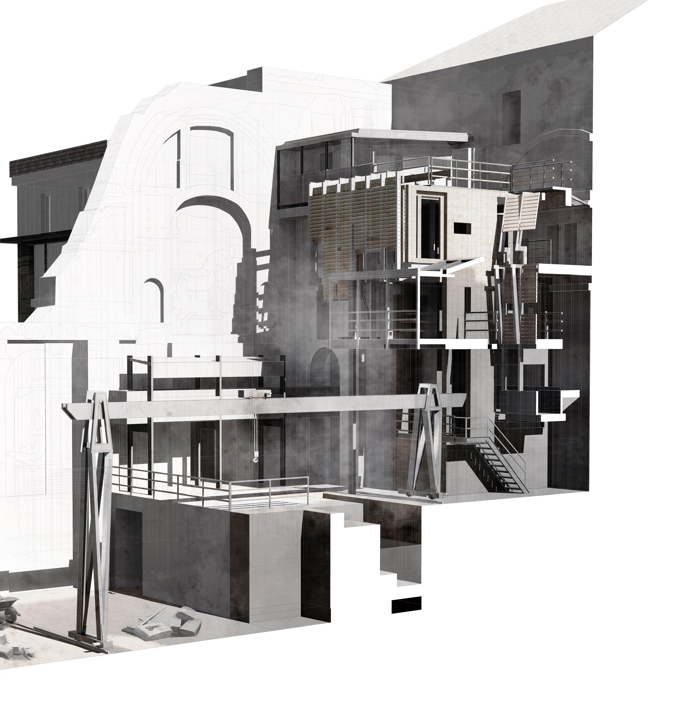
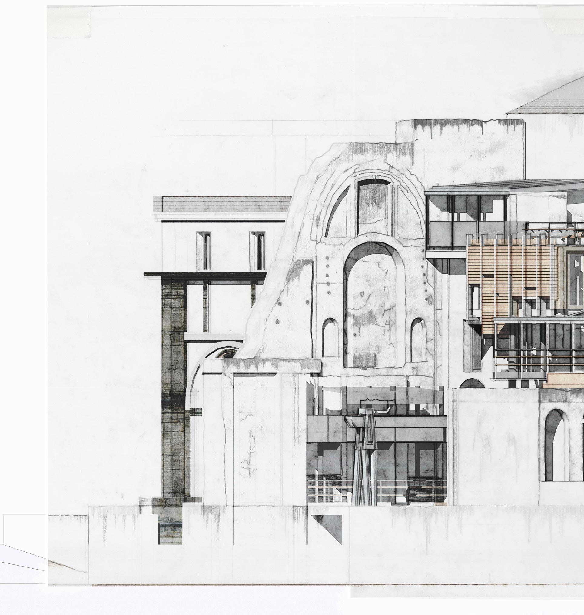
Nestled within the historic Chiesa della SS.Trinità delle Monache, the stone mason’s yard emerges as a bastion safeguarding Naples’ cherished craftsmanship and reverence for heritage. This initiative reflects an acute understanding of the city’s architectural history and the imperative for meticulous conservation - a commitment to stone that requires careful stewardship. The vision extends to the renovation of the churches Nave and altar, once adorned with frescos and the artwork of Ribera.
Strategically positioned, the masons yard offers an elevated perspective to the south while utilising the existing church structure as both a backdrop and a sanctuary for the artisans diligently at work. Beneath a sprawling canopy of timber screens, designed to combat the relentless Neopolitan sun, workers find respite from its harsh rays, while the structure ingeniously collects and channels rainwater during huge deluge.
chiesa trinita
drawing office
terrace
draughtsmans office
water collection gutters
gantry control room
ventilated
drafting
gantry

110 |
bridge gallery walkway
gallery
arm
cutting yard water collection basin stone delivery yard [1] [2] [3] [4] [5] [6] [7] [8] [9] [10] [11] [12] [13]
stone
XV. THE STONE MASONS YARD
[1]
[11]
[12]
[10]
[9]
[2]
[4]
[3]
[6] [7] [5]
[8]
[13]
112 |

| 113
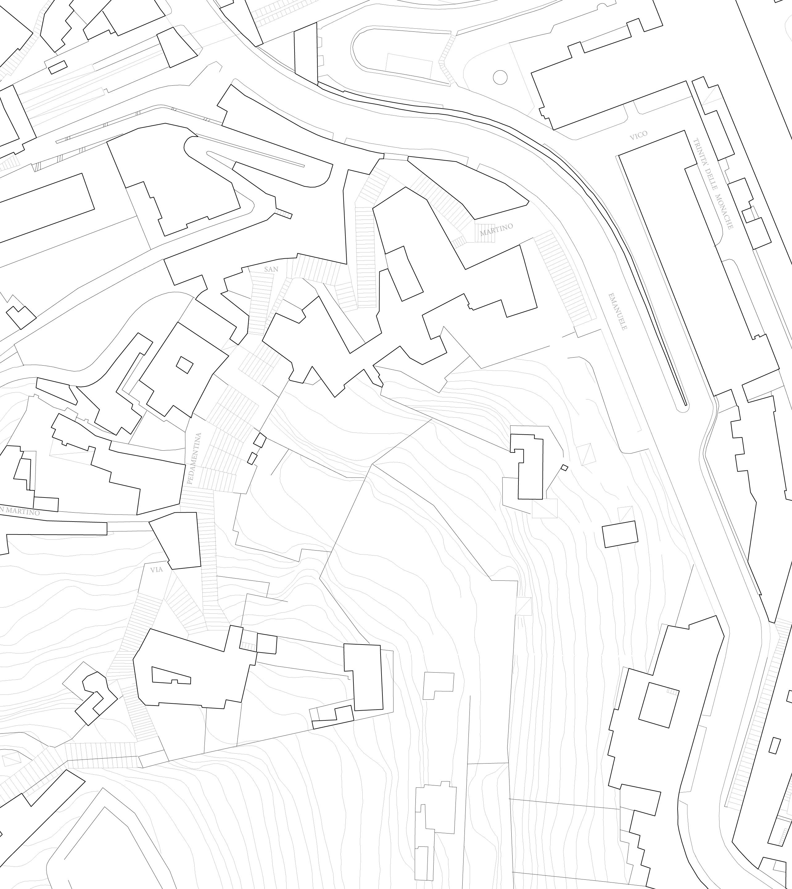
Location Plan
The Mason’s Yard
114 |

| 115
116 |
[1]
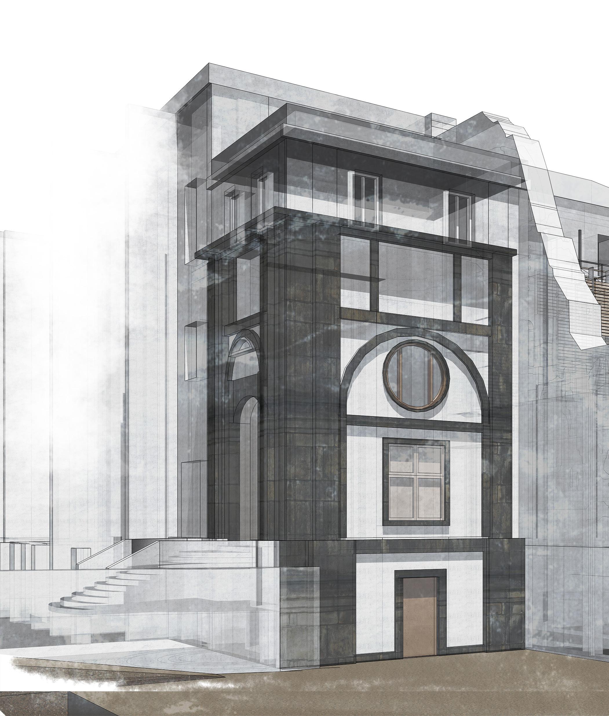
Perspective View Yard Entrance
[1]
[2]
[3]
[4]
[5]
[6]
Chiesa della SS. Trinità
Drawing Office
Draftsmans Gallery
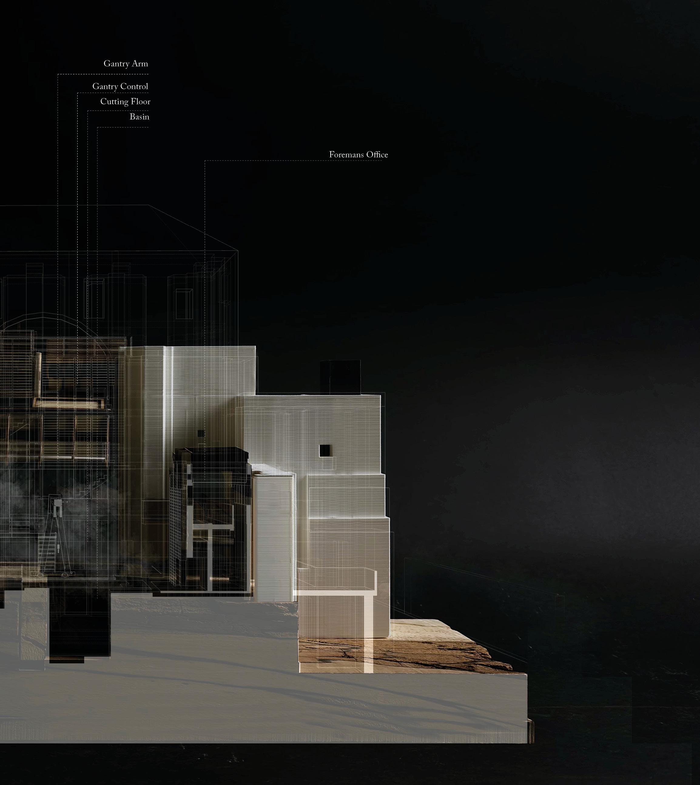
Gantry Control Room
Foremans Office
Cutting Floor
| 117
[2]
[3]
[6]
[4] [5]
[6]

XVI. OCCUPYING THE NAVE
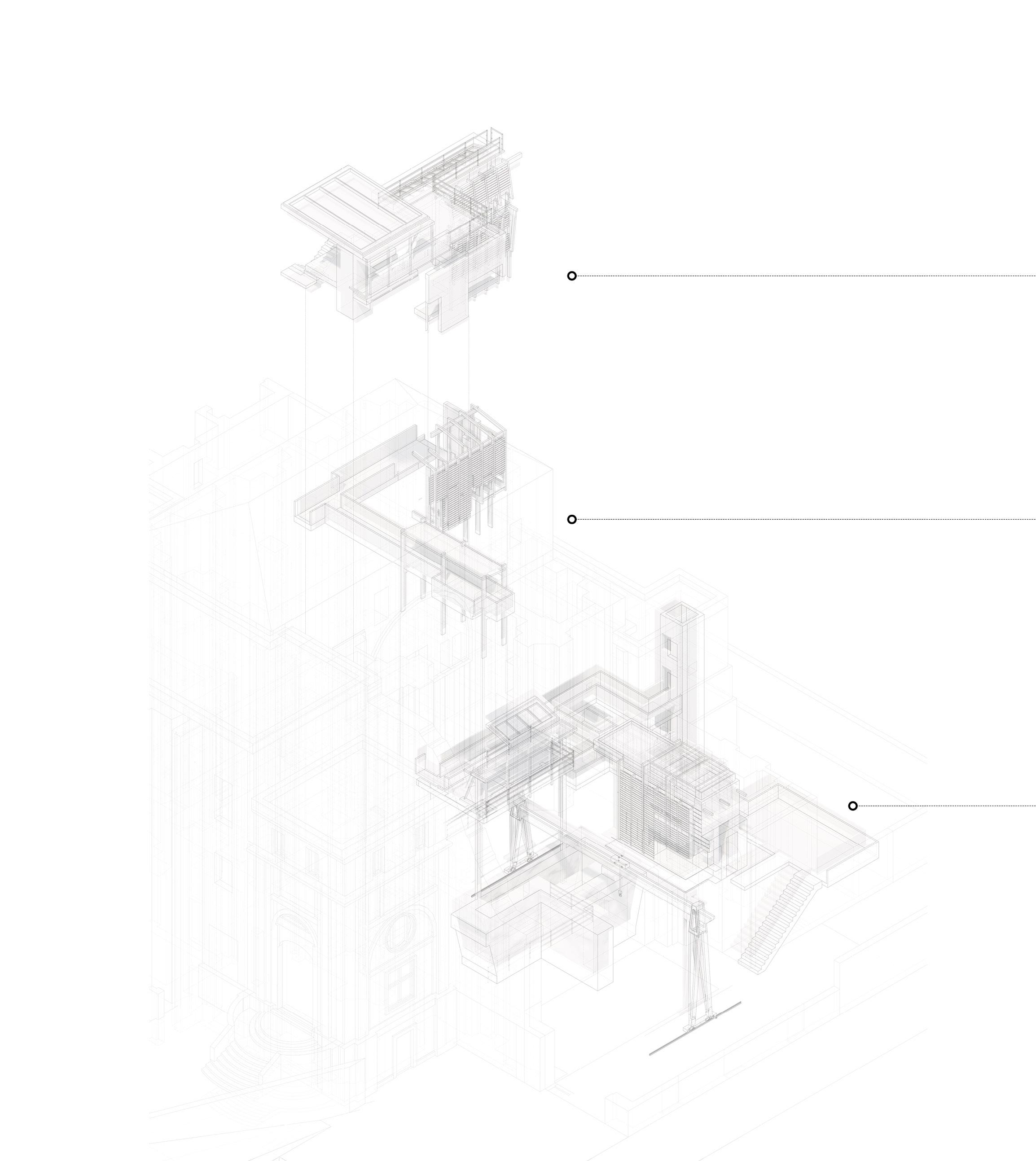
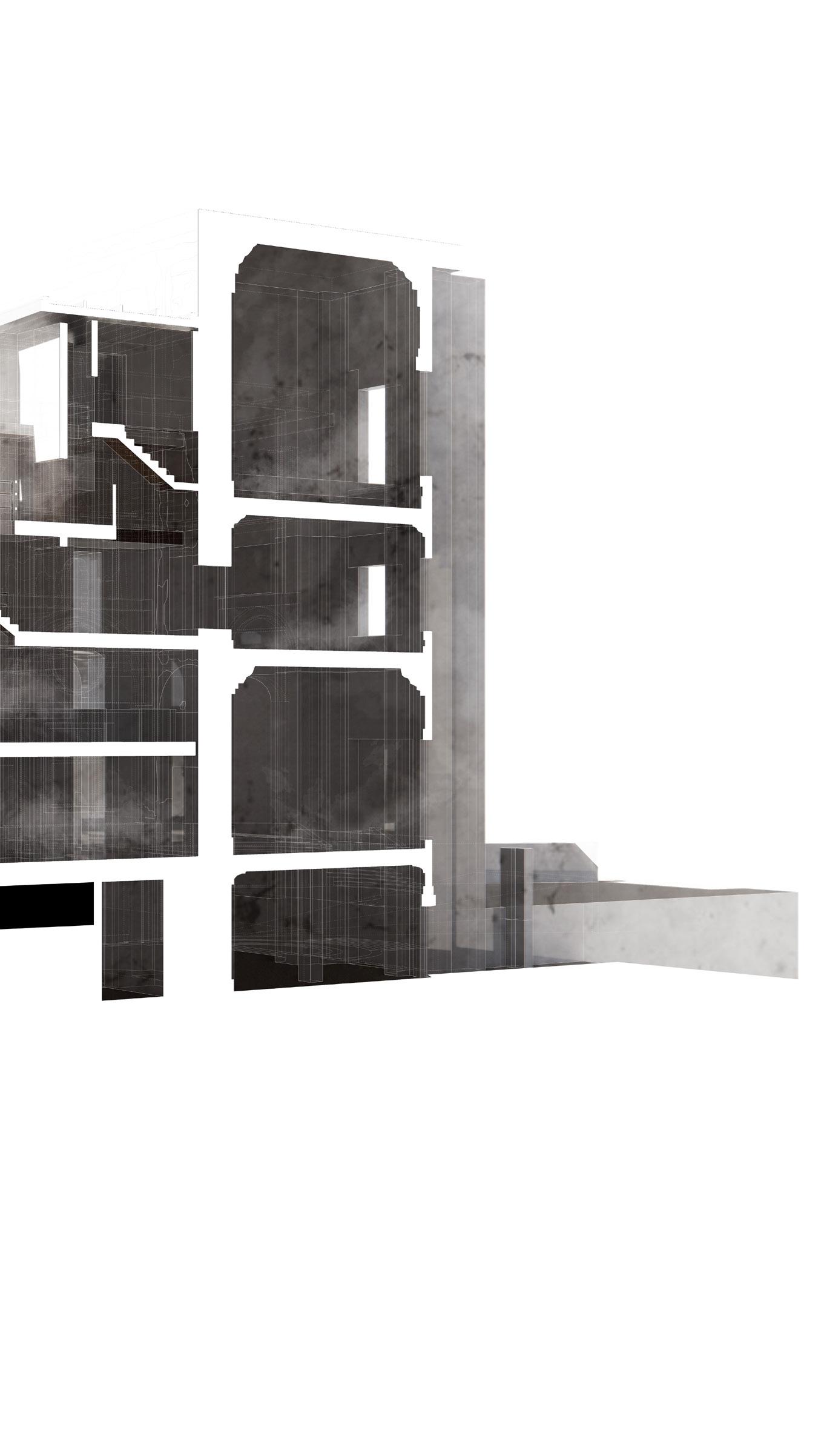
The Drawing Office provides a series of condition spaces in which drawings, sketchbooks and archival material are stored. The elevated position within the nave of the church allows for a view across the city and a birds eye view of the stone being prepared below. It operates over two levels, the lower serving as an office space, the upper providing a ventilated store room for delicate material. It is here that the draughtsman can escape the dust of the stone yard, wash their hands in the water collection sinks, and file working or found drawings.
The Drafting Gallery and cutting floor offer architectural draughtsmen a unique space to meticulously prepare full-scale drawings of intricate church stone details. Elevated above the cutting floor and situated in front of the Chiesa Trinita altar, adorned with frescoes and masterpieces by Ribera, drafters and visitors gaze down upon the fragments of the city sculpted in stone and etched from stone dust. These intricate forms are replicated on drawing boards above. Safely housed in The Drawing Office, these drawings are shielded from the harsh Neapolitan sun, dust, and smog, preserving them for posterity.
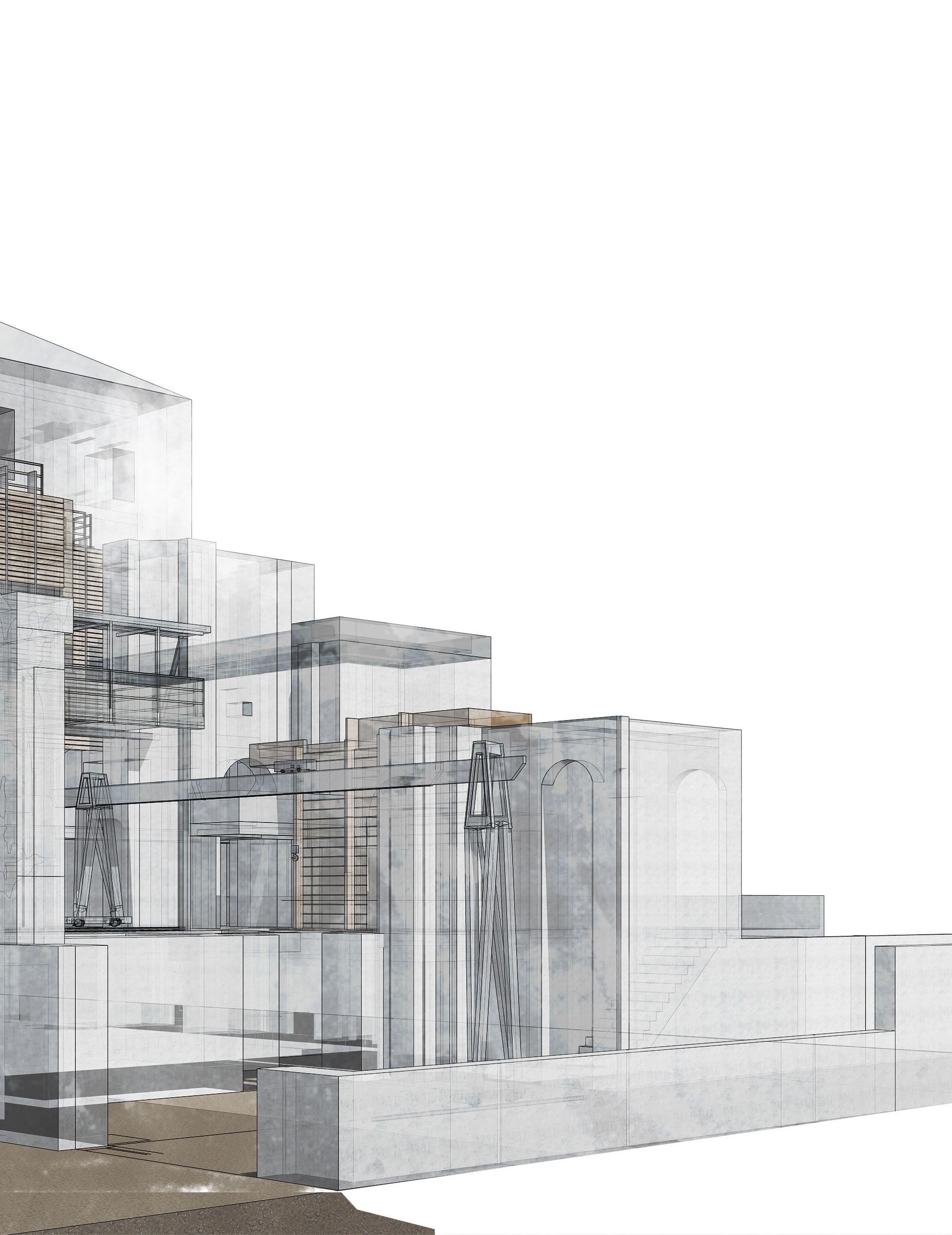
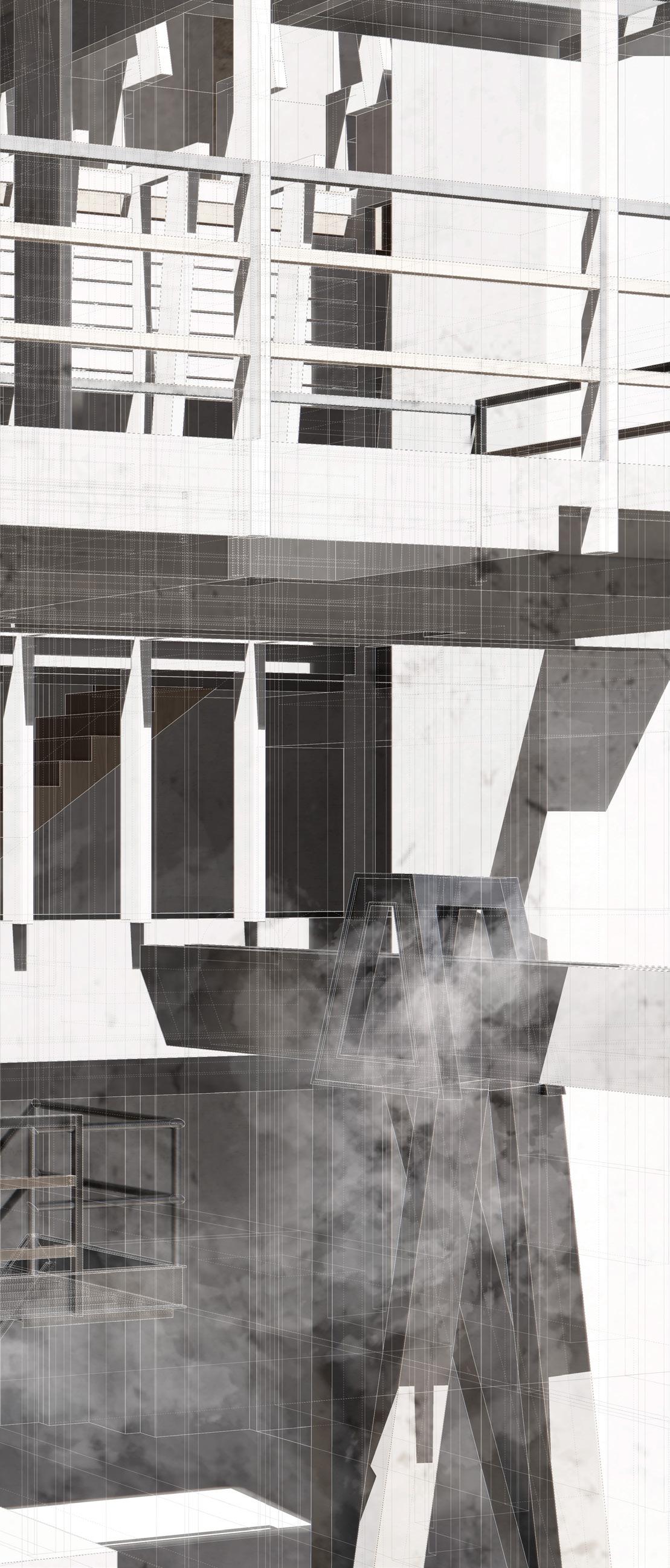
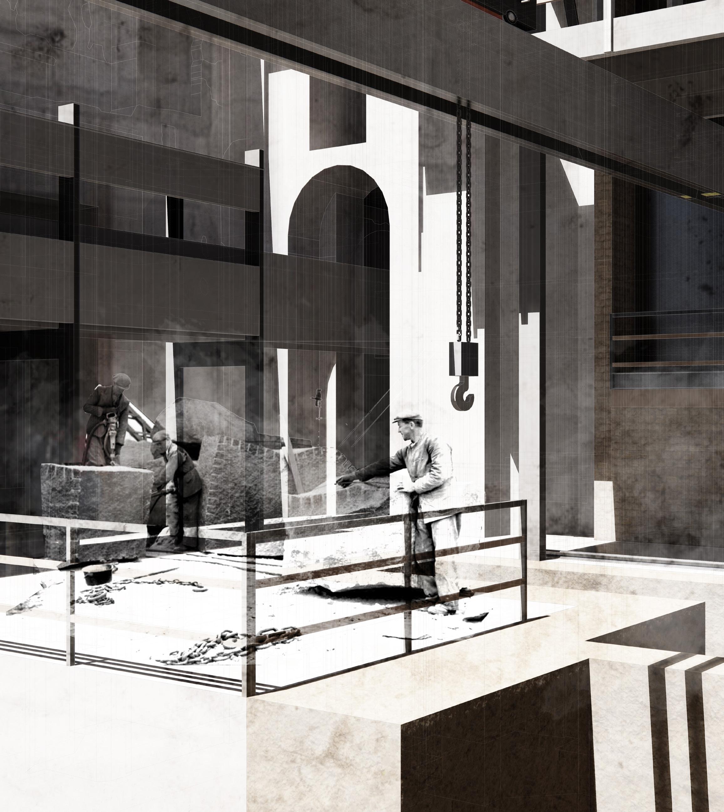
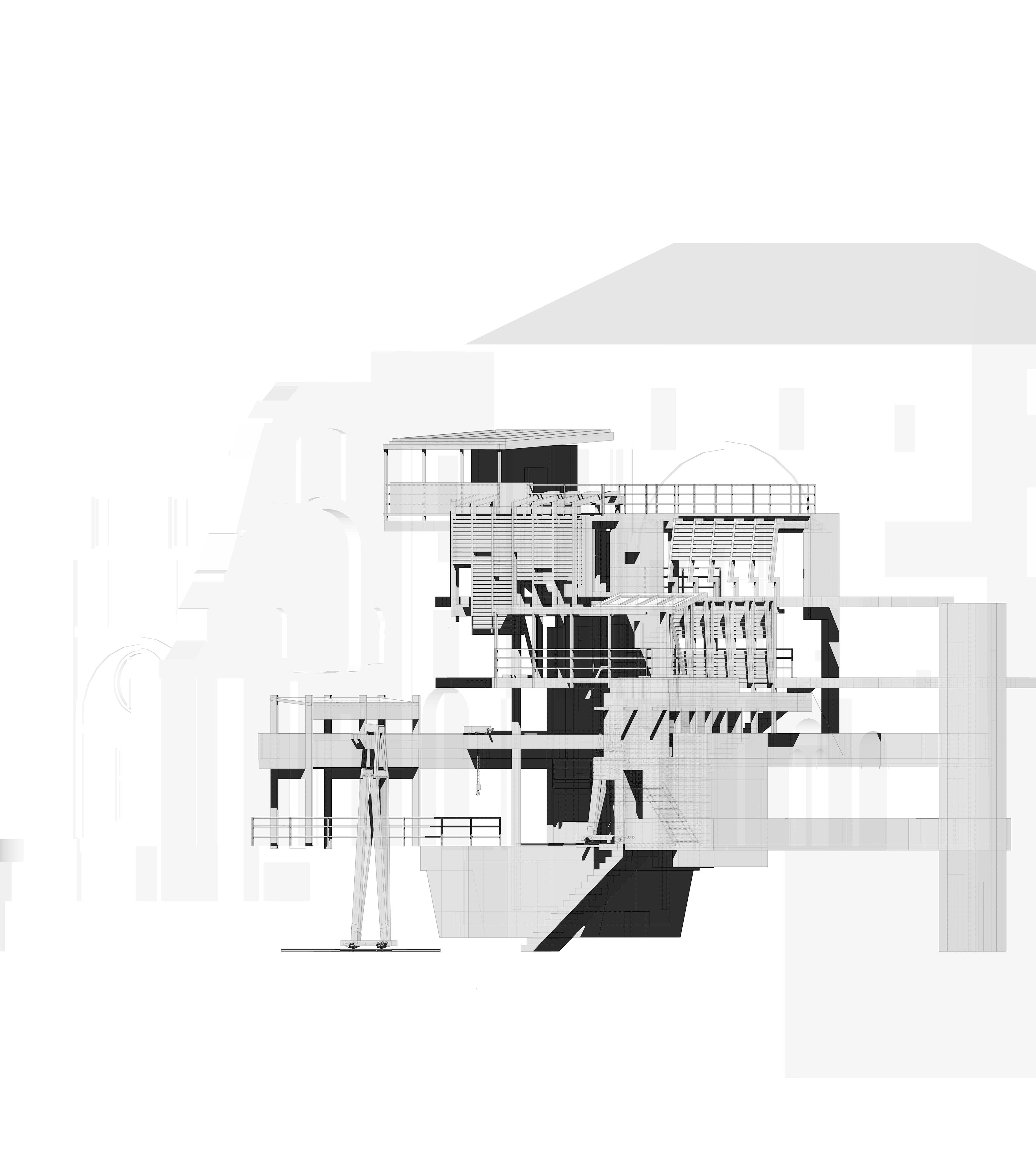
The Stone Yard is rooted in the rich traditions of stone masonry, understanding the surface of Naples as the effect of material concerns. Towering over the yard is a gantry arm, lifting tufo and piperno into position for cutting. Below, a water basin collects the spray from the cutting jets and sludge of the stone dust. Amidst the industrious atmosphere, the Foreman’s Mess beckons, offering a shelter for workers to convene, plan and eat during a days work. From the rhythmic clinks of chisels to the camaraderie Italians share over a meal, The Stone Yard embodies the timeless artistry of craftsmanship.
[left] exploded isometric of the stone masons yard


122 |
[left] view from the draughmans gallery overlooking the stone cutting yard where inricate stone details are replicated on drawing boards above.
| 123
124 |
[4] [5]
[3] A
B
[1] [2]
[6]
[7] [8] [9]
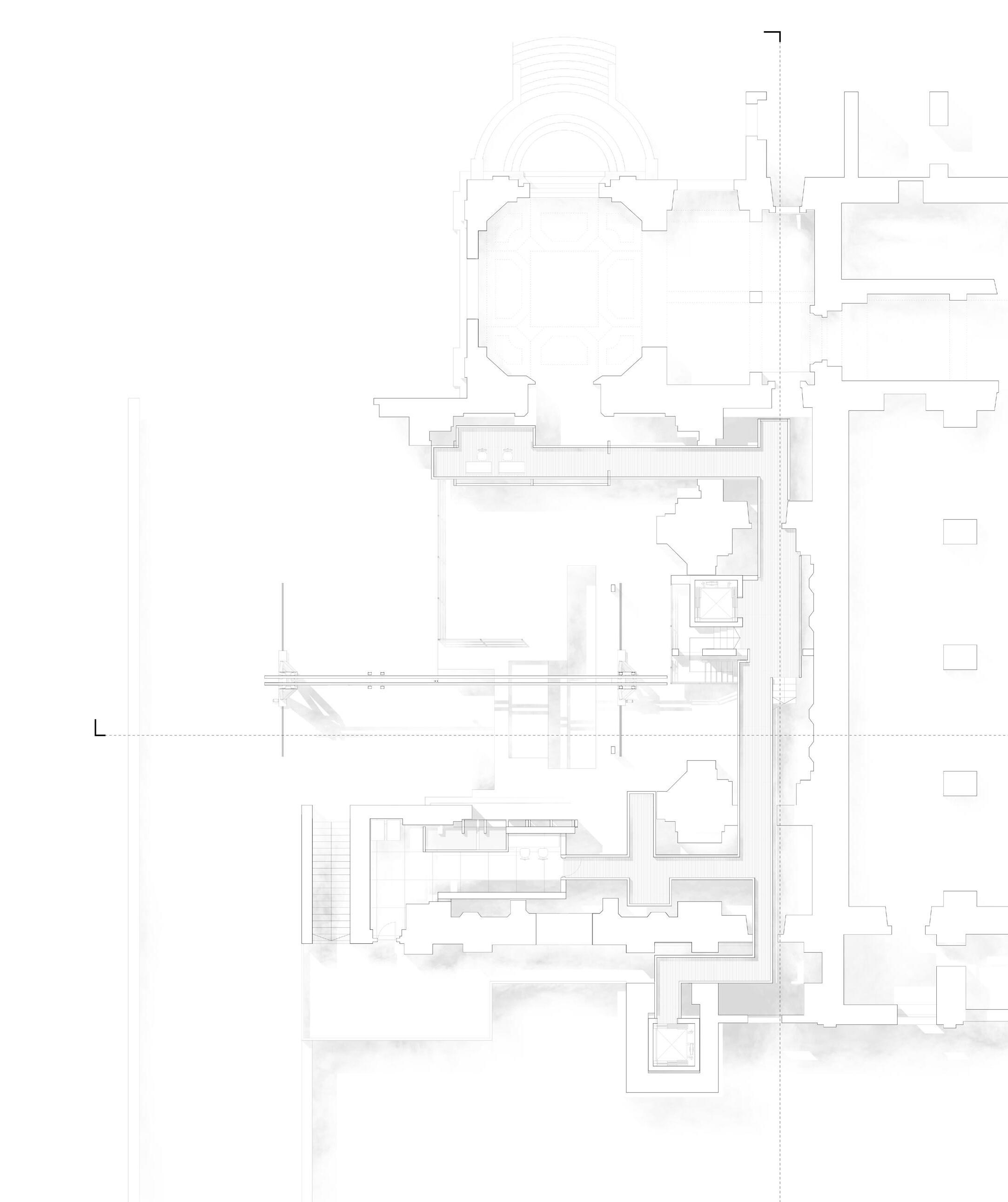
Gallery Plan at Level +1
cutting through drafting gallery, stone yard and foremans mess
[1]
[2]
[3]
[4]
[5]
[6]
[7]
[8]
[9]
chiesa trinita
drafting gallery
Stone delivery yard
stone cutting yard
gantry arm
water collection basin
stairs to gantry control room
ventilated bridge over stone detailing yard foremans mess
| 125
A
[above] detail of the dome after the collapse

126 |
[1]
[2]
[3]
[4]
[5]
[6]
[7]
[8] [9]

Gallery Plan at Level +2
cutting through control room, water collection tanks and study
[1]
[2]
[3]
[4]
[5]
[6]
[7]
[8]
[9]

chiesa trinita toilets
stairs to drawing office
terrace overlooking stone yard
gantry control room
water collection tanks
store room
tool store
study overlooking vesuvius
| 127
[above] stone mason carving an architrave detail in a stone yard.
 [1]
[2]
[3]
[4] [5]
[6]
[7]
128 |
[8]
Perspective Section through drawing room, detailing yard & drawing office
[1]
[2]
[3]
[4]
[5]
[6]
[7]
[8]
[9]
rear access to stone yard
drawing store room
water misting jets for stone dust
stone detailing yard
water attenuation basins
ventilated bridge
water collection gutters & sink
terrace overlooking quartieri spagnoli
drawing office
[9] | 129
130 |

[left] masons in the stone yard moving tufo blocks into position using a gantry arm. These blocks are then cut to size and water is collected in the basin below.
| 131
132 |
[above] roof top view overlooking the masons yard
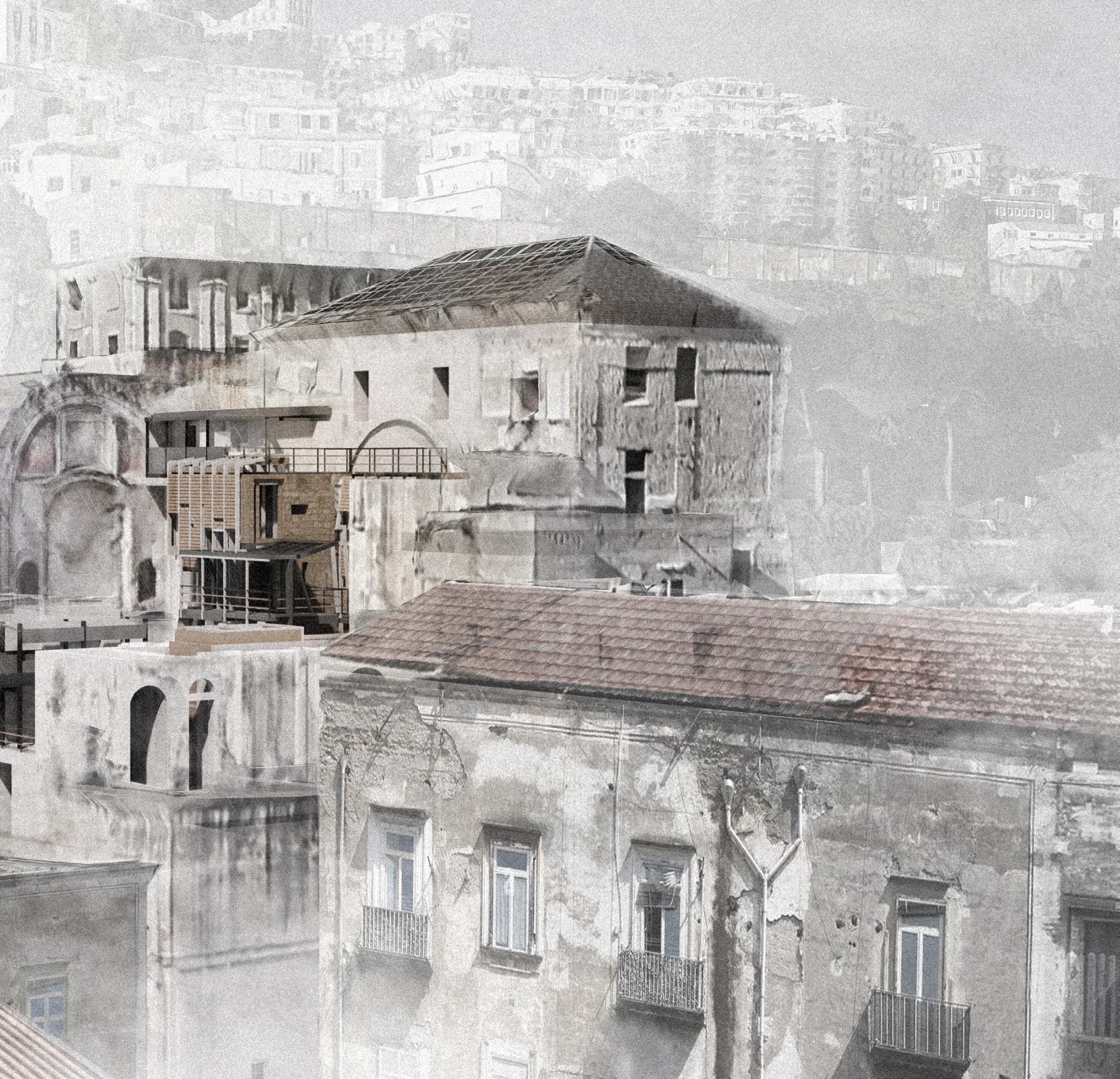
| 133
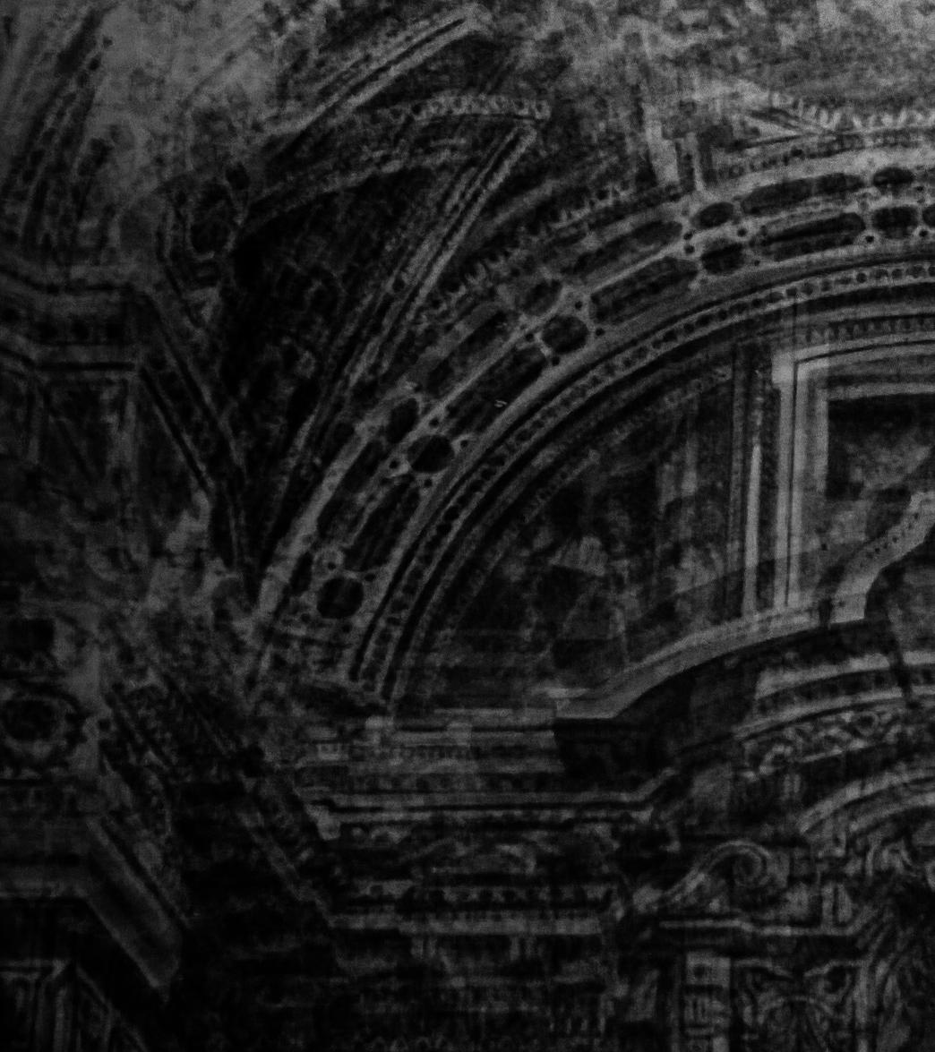
134 |

REFLECTION SURVEYING
| 135
REFLECTION
SURVEYING

To thoroughly understand the palimpsest nature of Naples and the elements of its uncertain ground, it was essential to excavate its numerous layers through rigorous surveying of discovered material related to geology and history of the cities fabric.
In the first semester, this process commenced with the examination of J.M.W. Turner’s sketchbook ‘Gandolfo to Naples’, where one page captures ash from an ascent of Vesuvius. These sketches served as invaluable portals into the historical, social, and ecological fabric of Naples prior to the advent of modern urban development, and fostered a reading of the city through the lens of precarity.
Following this, surface surveys of both walls and the broader landscape were conducted, recognising that the material constituents of the city were part of a much larger reciprocal landscape. This methodology assumed even greater significance in Studio A, where these ground surveys began to inform a tectonic for mediating such unstable terrain. The mappings of cavities, landslides, fault lines, and aquifer depths began to unfold a series of zones along the city’s tufo ridge where these uncertainties are most prominent. Here, cavity drawings, façade degradation surveys, and landslide risk assessments became a generator of potential interventions.
This surveying process was further scrutinised when establishing a set of transects across the bay, where a collective reading of surface movement generated a more nuanced understanding of the sites we occupied.
136 |


| 137

138 |


| 139


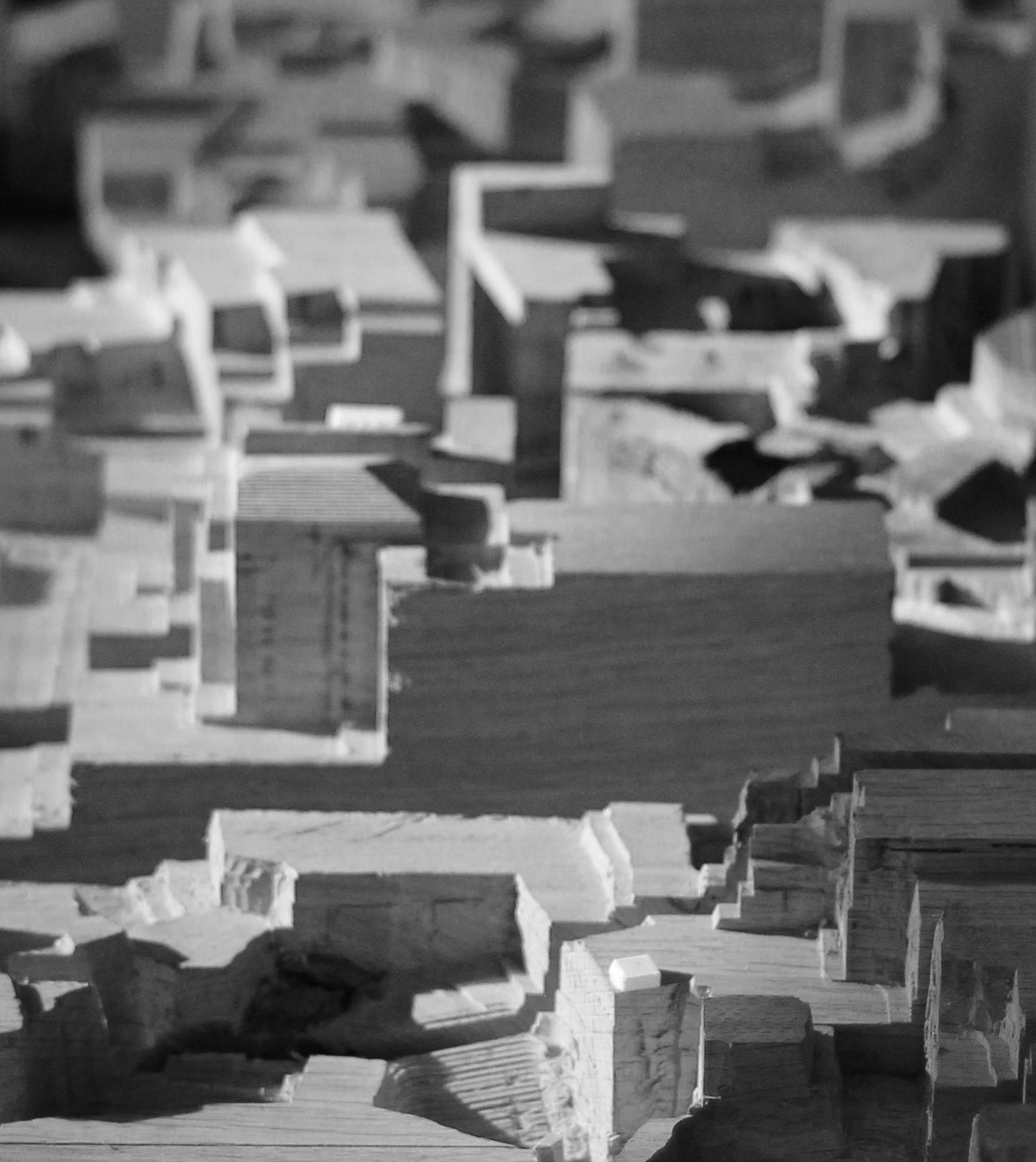
FOUR. RIDGE
MEDIATING UNCERTAIN GROUND
XVII. A Hydrological Crisis
XVIII. A Shifting Surface
XIX. Traversing the Ridge
XX. The Hydrological Guild
XXI. Inhabiting a Belvedere
XXII. Stabilising the Ridge
XXIII. A Network of Monitoring
| 143
XVII. A HYDROLOGICAL CRISIS
Heavy rainfall can strain Naples’ water system, leading to water seeping into the subsoil. This infiltration softens the pyroclastic layer, triggering collapses, settlements, and sinkholes. The city’s sewage infrastructure is undersized and not well-maintained.[18]
In Italy, aqueducts lose about 40% of their water, and in Naples, the daily water consumption per person is approximately 155 litres, while the system experiences a 34% water loss. It’s clear that Naples requires a comprehensive approach to tackle its infrastructure issues.[19]
The primary elements of Naples’ water system are those constructed following the cholera outbreak in 1884. The route of the affluent network, or collection network, was designed to align with the city’s layout and to make use of as many existing sewers as possible for cost-effectiveness. The city was divided into three zones: high, middle, and low. All points of the affluent network converged at Piedigrotta, located in the far west of the city, within the tuffaceous formation of the Posillipo hill.[20]
[18] ‘Anthropogenic Sinkholes of the City of Naples, Italy: An Update’, https:// core.ac.uk/reader/541676150.
[19] ‘Naples Life,Death & Miracle’, http://www.naplesldm.com/aqueduct.php.
[20] ‘Naples Life,Death & Miracle’.
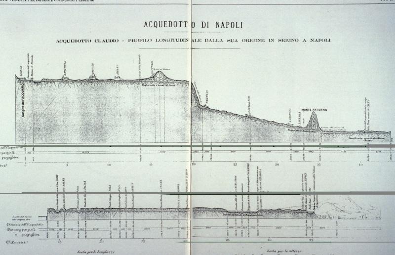

[above] working drawings of the 1889 project to redevelop the water sytem. [right] underground branch of the Aqua Augusta, which is also known as the Serino aqueduct. This particular branch of the 87-mile-long aqueduct was built between 30 and 20 B.C. and carried water to private villas on the hill of Posillipo
144 |

| 145
146 |
[above] water network system of naples

| 147
XVIII. A SHIFTING SURFACE
The reason for surface movement is multifaceted. The cities unique topography, featuring a deep aquifer, sloping terrain, and numerous cavities, allows water to permeate the ground above the tuff. Initially robust, this terrain can gradually shift due to water absorption, leading to erosion caused by significant hydraulic gradients. These ongoing, albeit minor, movements contribute substantially to the erosion of ageing structures and infrastructure.
However, any disruption, such as a rupture in an aqueduct or sewer line overload, intensifies water infiltration. This amplifies the previously mentioned phenomena, potentially culminating in collapses and sinkholes, furthering the challenges faced by the area.
148 |

| 149 High
Medium Low
Landmovement Risk
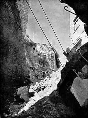
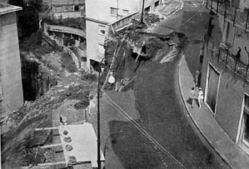
Retaining wall collapse and street cave-in on via Tasso (June 1966)

150 |
Mergellina
Posillipo
Substrata
[above] landslide susceptibility across the ridge
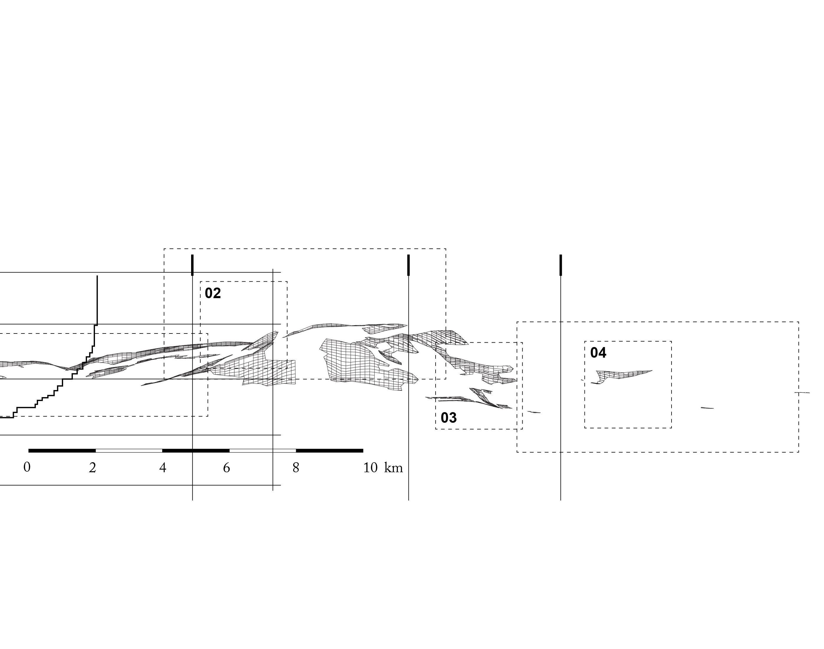
| 151
Chiaia Vomero
Quatieri Spagnoli Montecalvario
XIX. TRAVERSING THE RIDGE
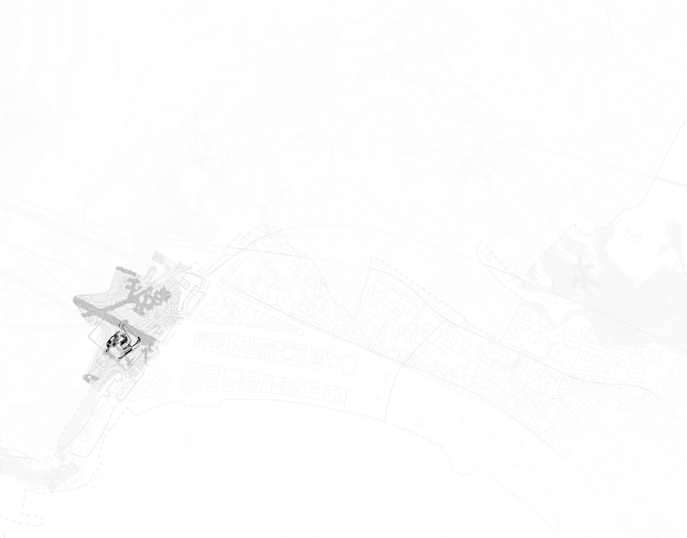
[above] network of zones along the ridge
152 |
| 153


156 |
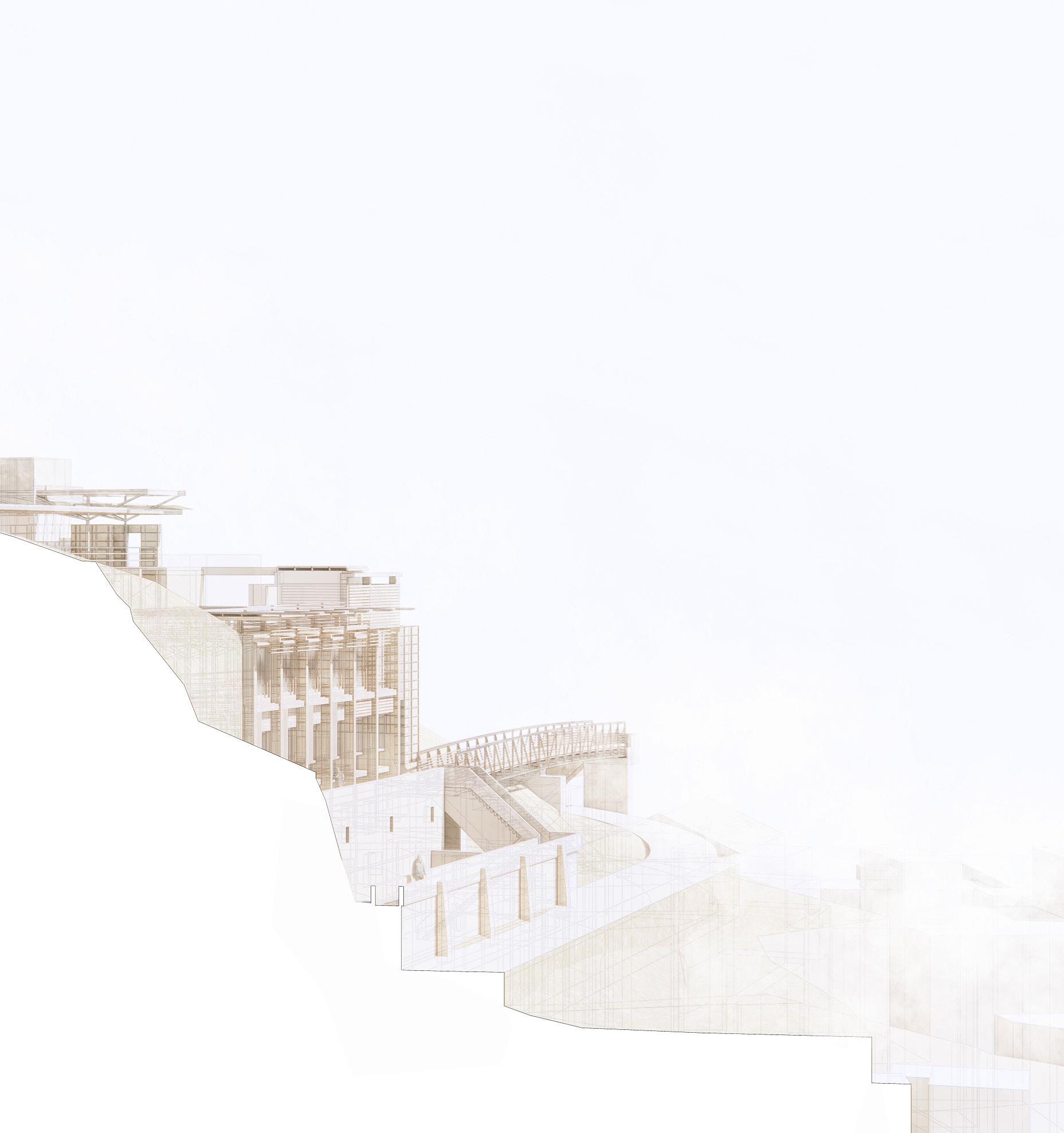
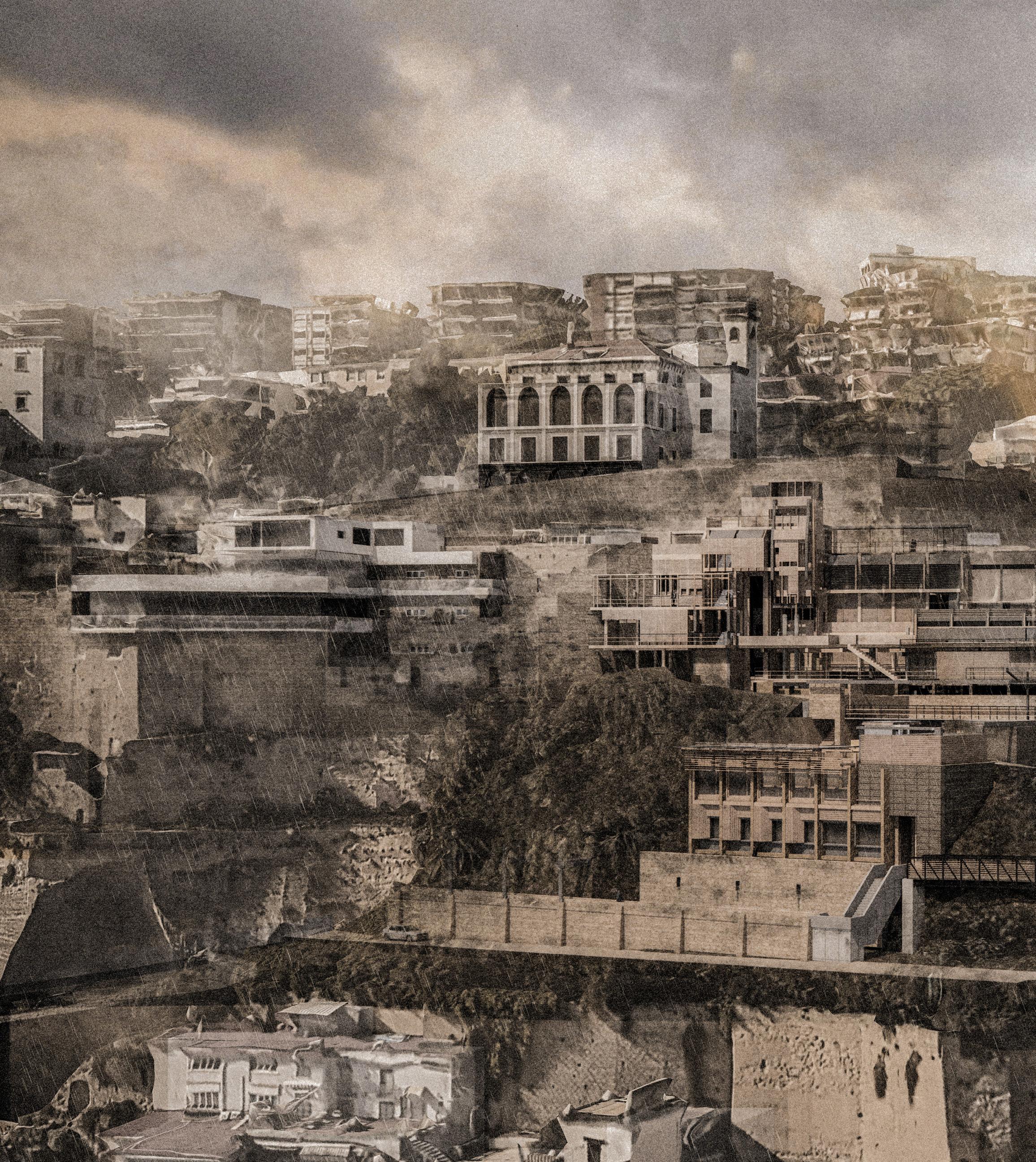
[above] posillipo ridge with the proposed hydrological guild

| 157
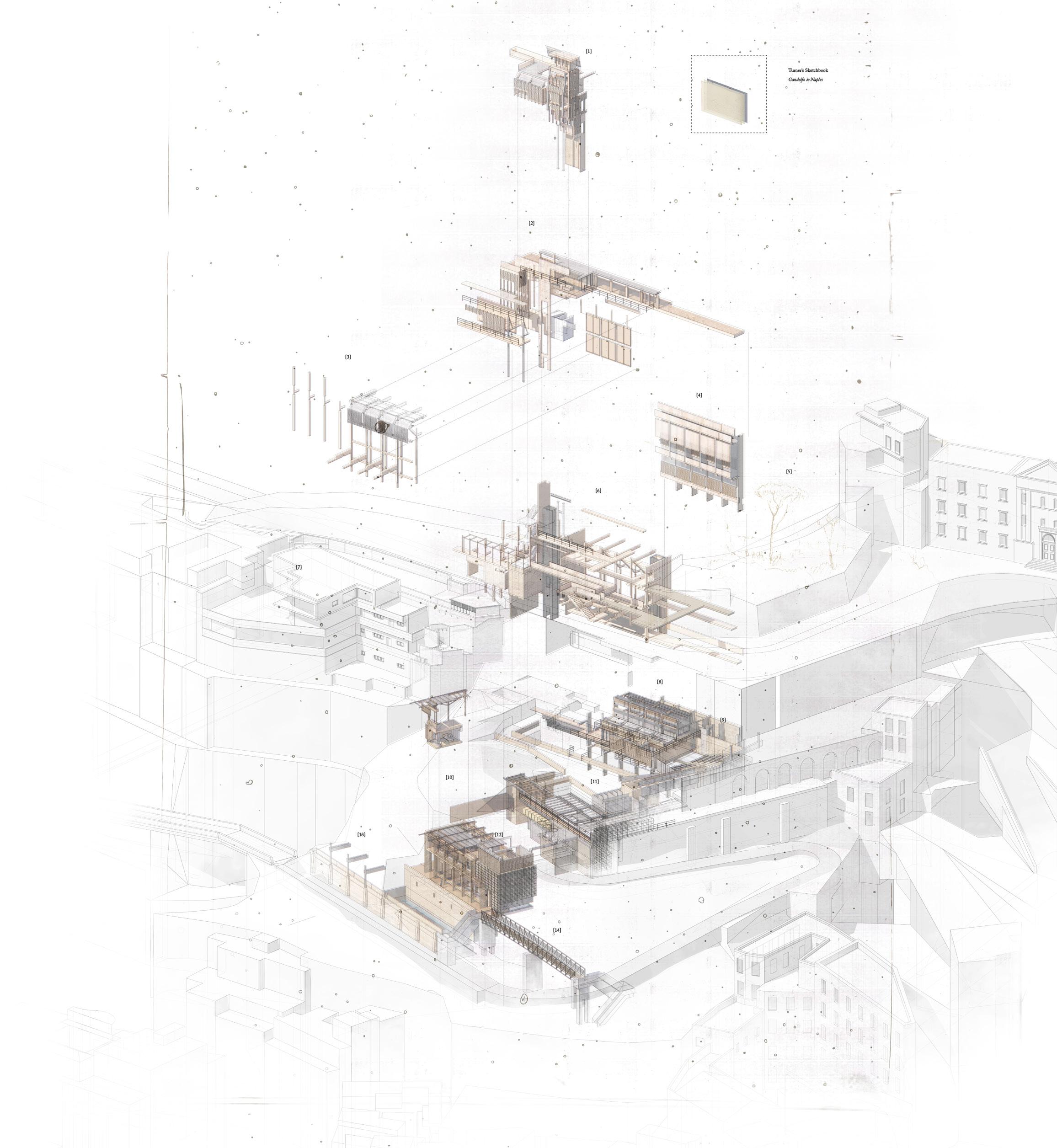
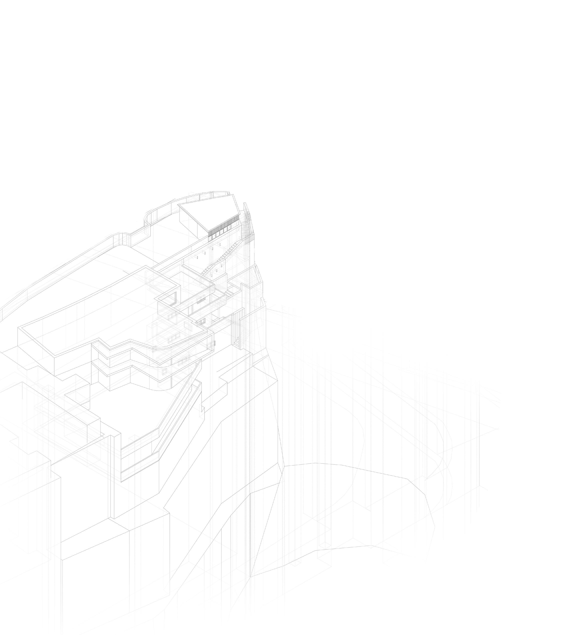
[above] exploded isometric of the hydrolical guild
158 |

XX. THE HYDROLOGICAL GUILD
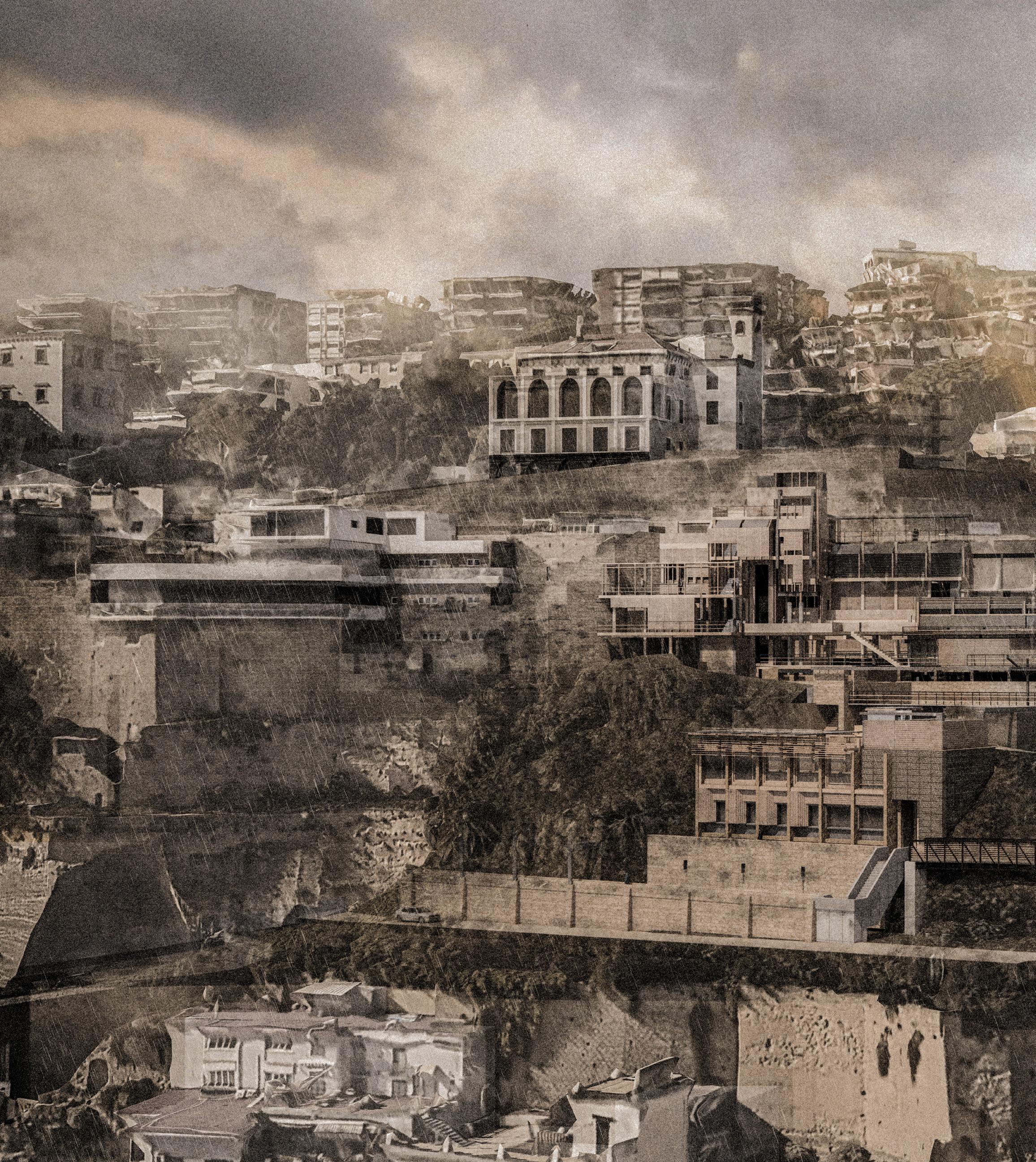
The Hydrological Guild seeks to address the problems of surface movement caused by water seeping into the porous tuff ridge of Posillipo. This is accomplished through a range of programmes underpinned by a series of retention basins. These strategically placed basins are intended to control excess water during periods of heavy rainfall, reducing soil erosion and stabilising the landscape. By carefully managing water runoff, The Guild aims to lessen the effects of hydraulic gradients, reducing the burden on infrastructure and contributing to the overall stability of the ridge.
[1] [2]
[3]
[4] [5] [6]
[7]
[8] [9] [10]
[11]
[12] [13]
[14]
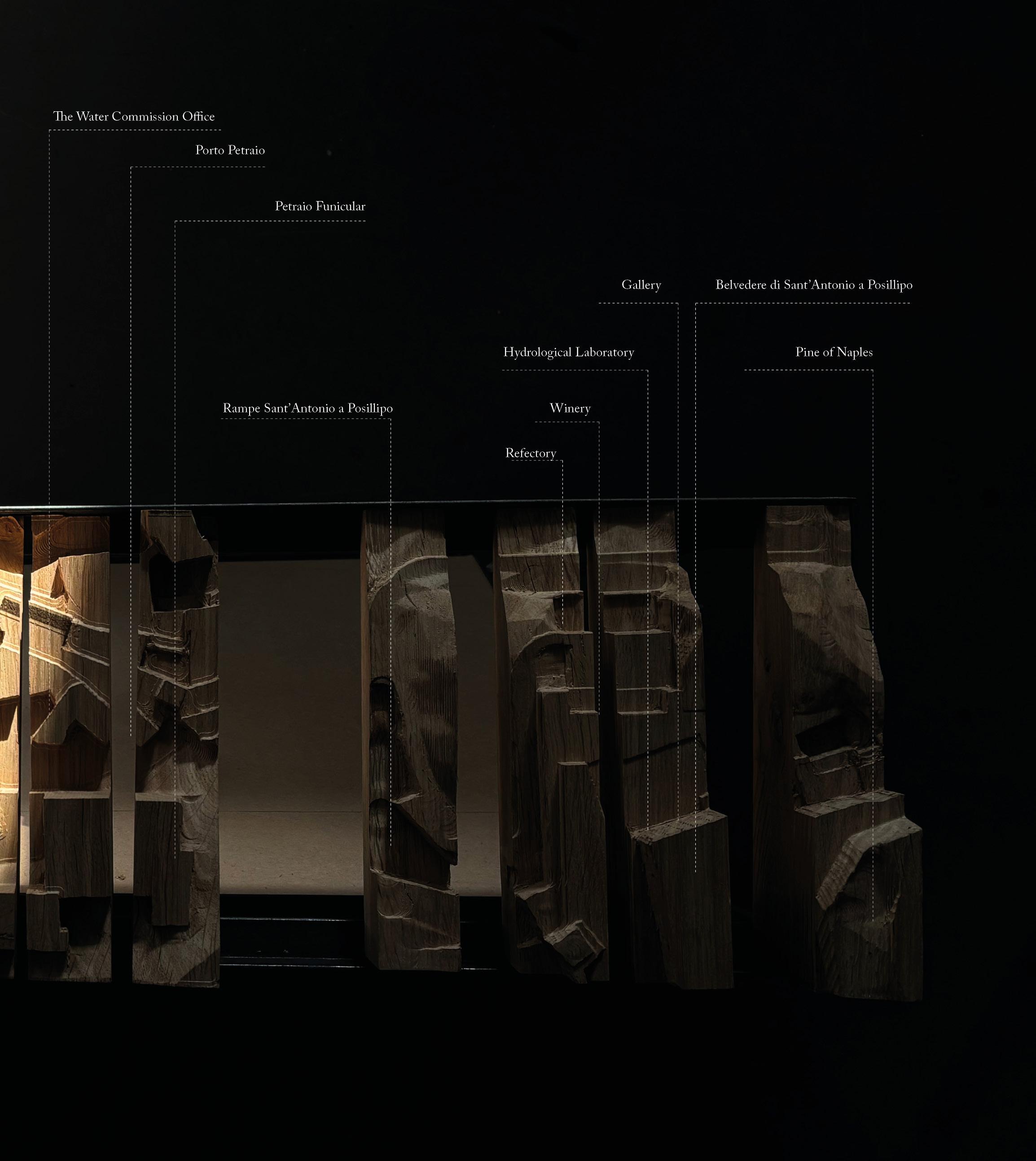
belvedere stack tower conditioned envelope of gallery timber & steel primary structure laboratory stack vent Pine of Naples by J.M.W Turner gallery circulation & viewing balconies Villa Crespi by Davide Pacanowski hydrological laboratory amphitheatre accommodation vessels greco di tufo winery refectory observation walkway pedestrian bridge
| 159
160 |
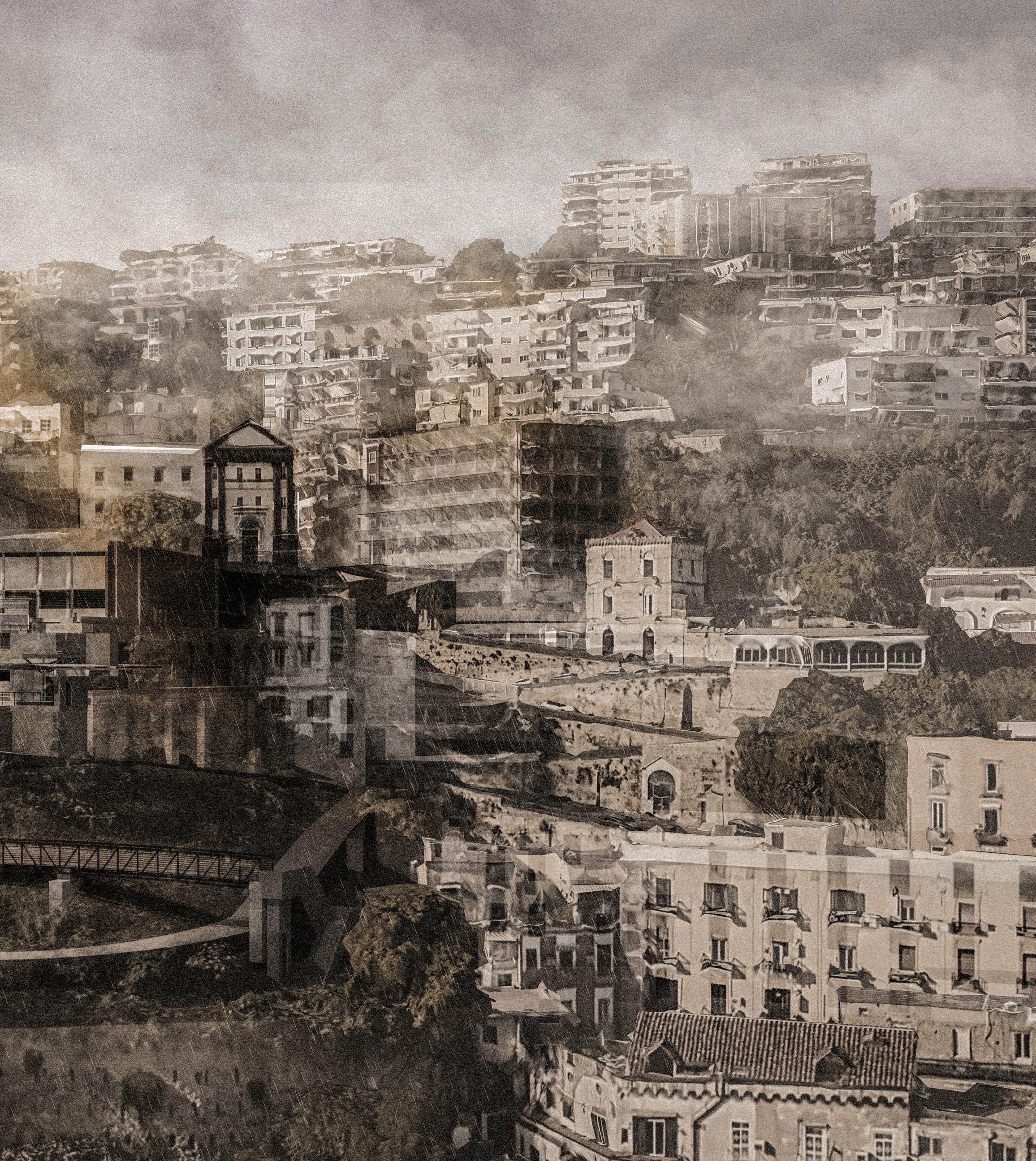
[above] perspective view of the Guild in the tufo ridge
| 161

Location Plan The Hydrological Guild
162 |

| 163
164 |
arrival area viewing balconies stack vent gallery retention basin vineyard refectory
basin
arrival area [1] [2] [3] [4] [5] [6] [7] [8] [9]
upper
retention
lower
[1] [2] [3] [4]
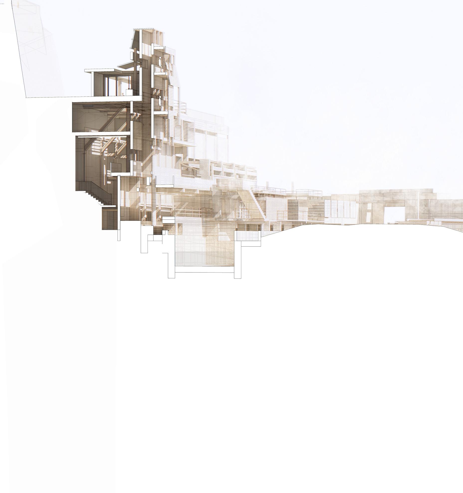
Long Perspective Section AA through retention basin, laboratory, auditorium
[5] [6]
| 165
[9]
[7] [8]


XXI. INHABITING A BELVEDERE
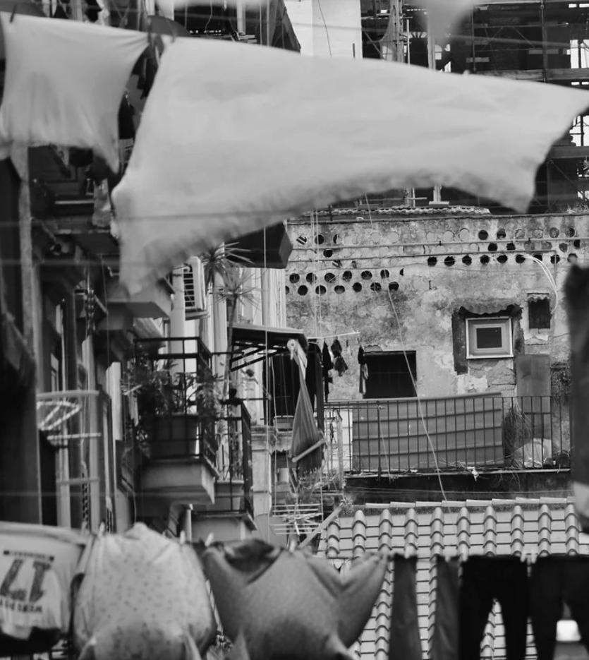
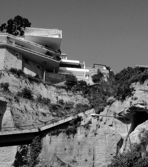
The Hydrological Guild utilises the existing concrete structure that serves as a support for the viewpoint point adjacent to the church of Sant’Antonio in Posillipo. In its current state of disrepair, it presents a significant hazard to the local inhabitants. Nevertheless, it appears that those who are less privileged to reside in one of the expansive surrounding villas have taken up residence in the ruin. The daily sight of clothes hanging out suggests that some individuals, likely homeless and in desperate circumstances, have found refuge in these spaces. In periods of crisis, even a nondescript concrete ruin can become a home.
[left] existing concrete retain structure supporting the sant’antonio belvedere and the lives of homeless refugees
| 167
Short Section BB
through retention basin, laboratory, auditorium
viewing terrace
timber stack vent
observation walkway retention basin
hydrological laboratory
concrete stack vent amphitheatre
Chiesa di Sant’Antonio a Posillipo
168 |
[1] [2] [3] [4] [5] [6] [7] [8]
[1]
[2]
[3]
[4]
| 169
[5]
[6]
[7]
[8]
XXII. STABILISING THE RIDGE
Spanning the expanse of this tuff ridge, there exist four distinct monitoring zones that are dedicated to the observation and analysis of surface movement. These zones are characterised by the specific geological and infrastructural phenomena they monitor, which include:
1. The detection and monitoring of landslides, which are typically triggered by factors such as changes in groundwater levels, seismic activity, and human interference.
2. The identification and tracking of sinkholes, which are often caused by the dissolution of soluble rocks or the collapse of underground cavities.
3. The phenomenon of aquifer rebound, which refers to the rise of the ground level due to the recovery of an aquifer’s water level.
4. The deterioration of buildings, often resulting from factors such as age, environmental conditions, and poor construction practices.
170 |
[left] isometric of villa crespi [right] villa crespi perched on top of and built from the tufo ridge
172 |
[7] [8]
[9]
Perspective Section CC through laboratory, winery & refectory
[1]
[2]
[3]
[4]
[5]
[6]
[7]
[8]
[9]

stack vent hydrological laboratory
water flow rate monitoring
water collection channel
retention basin
winery refectory
accommodation
water overflow channel
| 173
[1] [5] [2] [3] [4] [6]

174 |
[1] [5] [6]
[7]
[10]
[3]
[4]
[2]
Isometric View
showing the water collection strategy of the hydrolgical guild
[1]
[2]
[3]
[4]
[5]
[6]
[7]
[8]
[9]
[10]

stack vent gutter
laboratory rain collection
water flow rate channels
sluice gate
retention basin 1
winery rainwater collection
retention basin 2
refectory rainwater collection
retention basin 3
retaining wall
| 175
[8] [9]
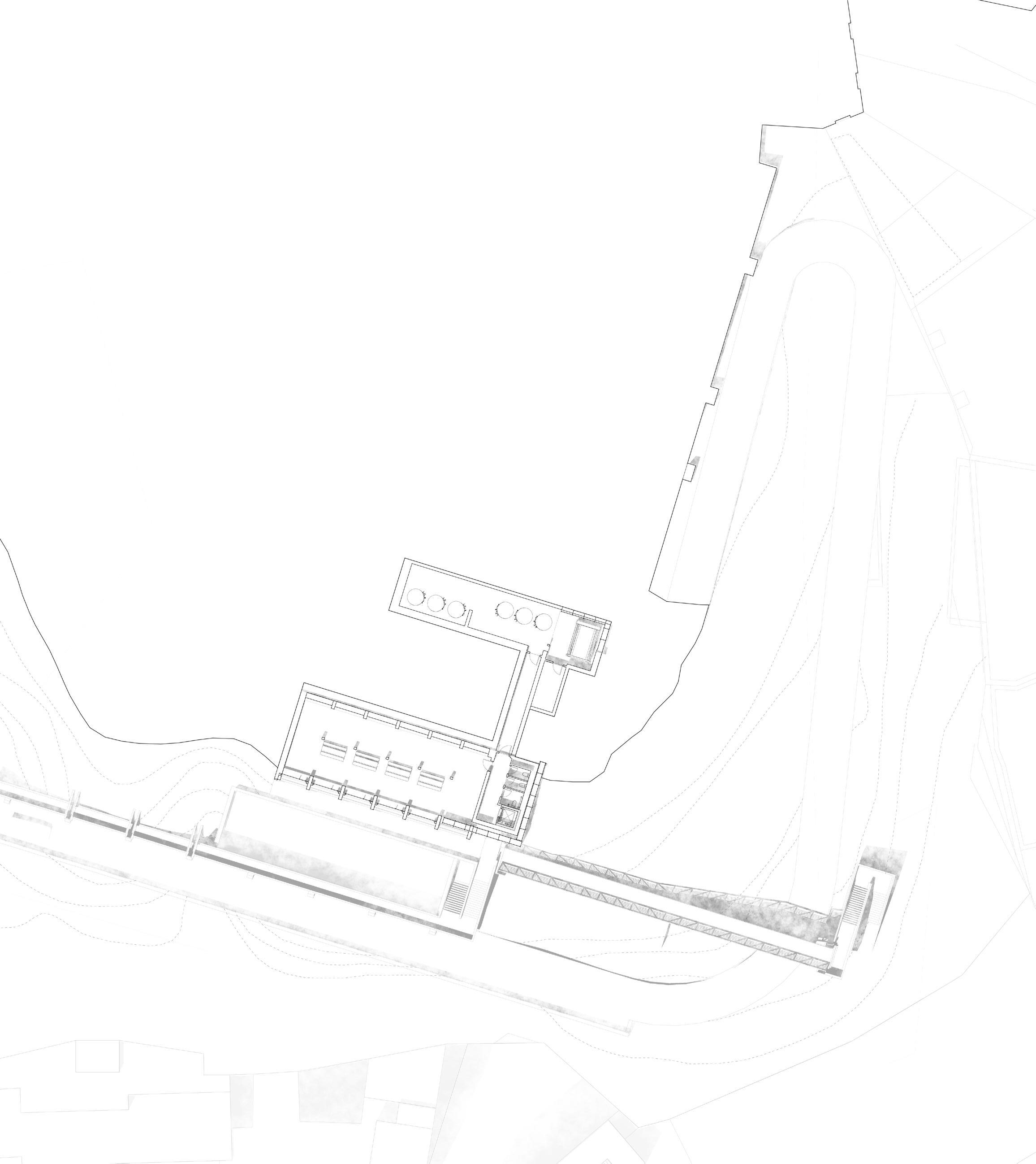
Site Plan at level 2
through refectory & fermentation rooms
observation walkway

176 |
access road retention bason refectory
[1] [2] [3] [4] [5] [6] [7]
access tunnel fermentation rooms pedestrian bridge
| 177
[4] [3] [2]
[1]
[7]
[6] [5]
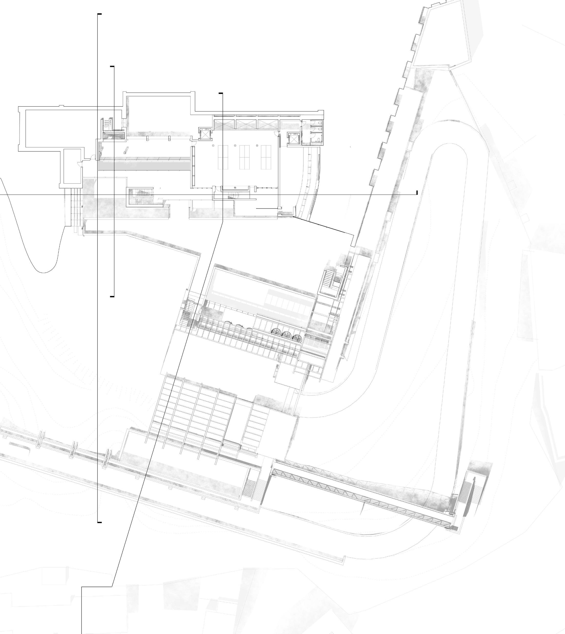
Site Plan at level 4
through retention basin, observation deck & fermentation room

178 |
[1] [2] [3] [4] [5] [6] [7] [8]
retention basin sluice gate overflow channel piazza observation deck retention basin fermentation room delivery area

| 179
[3] [2] [4] [6] [7] [8] [5]
[1]

180 | basement gallery heat pump service room retention basin observation deck basement gallery 2 laboratory ventilation stack ampitheatre [1] [2] [3] [4] [5] [6] [7] [8]
A
Site Plan at level 6 through laboratory, ventilation stack & ampitheatre
| 181
[3] [5] [4] A B C F F B
[8] [7]
[1] [2]
[6]
Site Plan at level 8
through exhibition rooms, stack vent & lab office
temporary exhibition room
stack vent
exhibition room
viewing walkway
sketchbook room
storage rooms
concrete stack vent
lab office
182 | [1] [2] [3] [4] [5] [6] [7] [8]
A

| 183 [1] [2] [3] [4] [5] [8] [6] [7] A B C F F B
1 ]
Meteorological Observatory
Painting Studio
Belvedere
2]
Stone Yard Drawing Office
Belvedere
Parco dei Ventaglieri
Chiesa della SS. Trinità delle Monache
[Zone
184 |
[Zone
[Zone 3]
Largo Petraio
Funicular Station
Water Commission Office
Tabbacci
Belvedere
XXIII. A NETWORK OF MONITORING
Across this tuff ridge are four monitoring zones dealing with surface movement, these being; landslides, sinkholes, aquifer rebound, building degradation.

[Zone 4]
Belvedere di Sant'Antonio
Hydrological Laboratory Gallery
Winery
Refectory
Belvedere
| 185

186 |
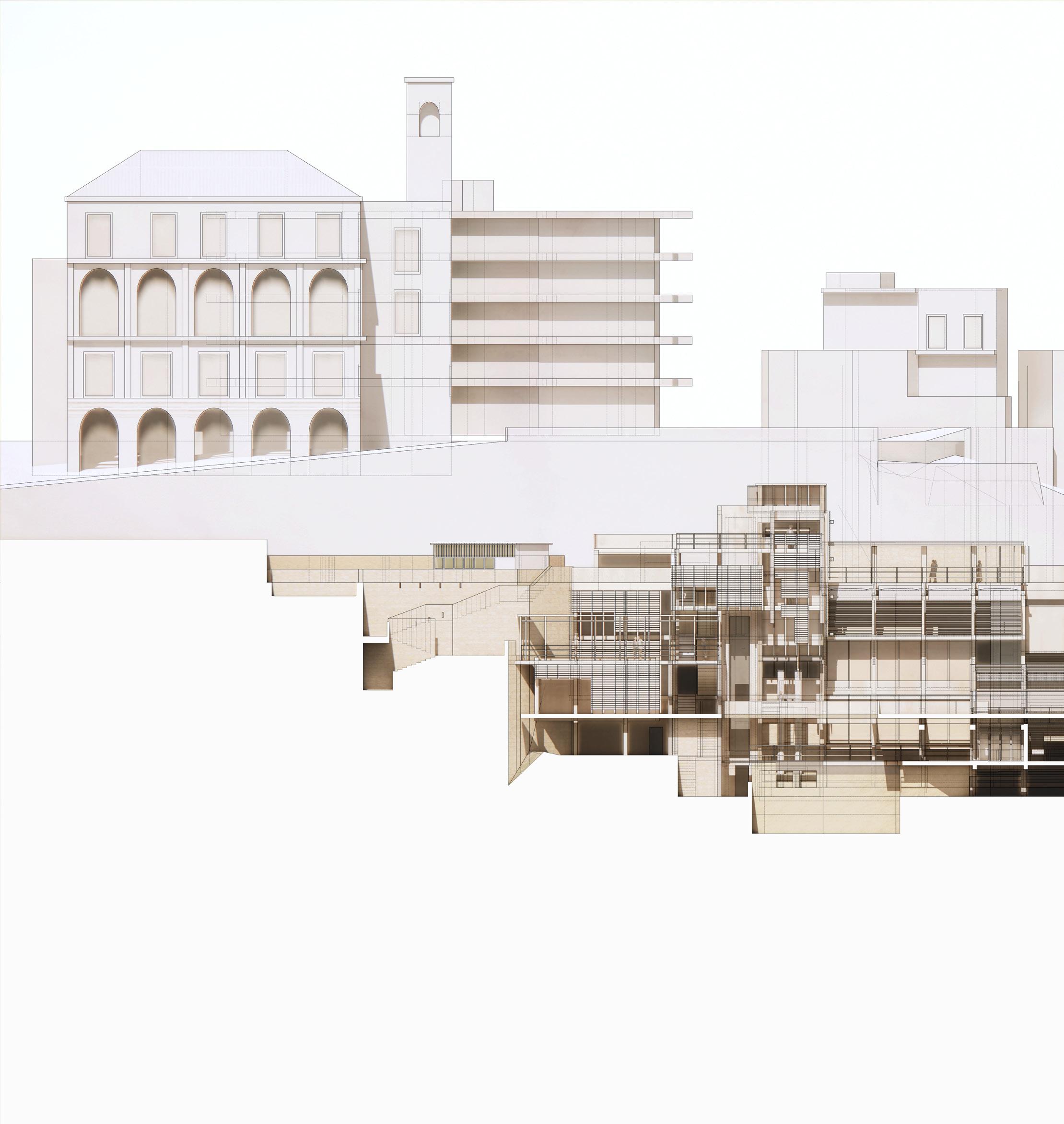
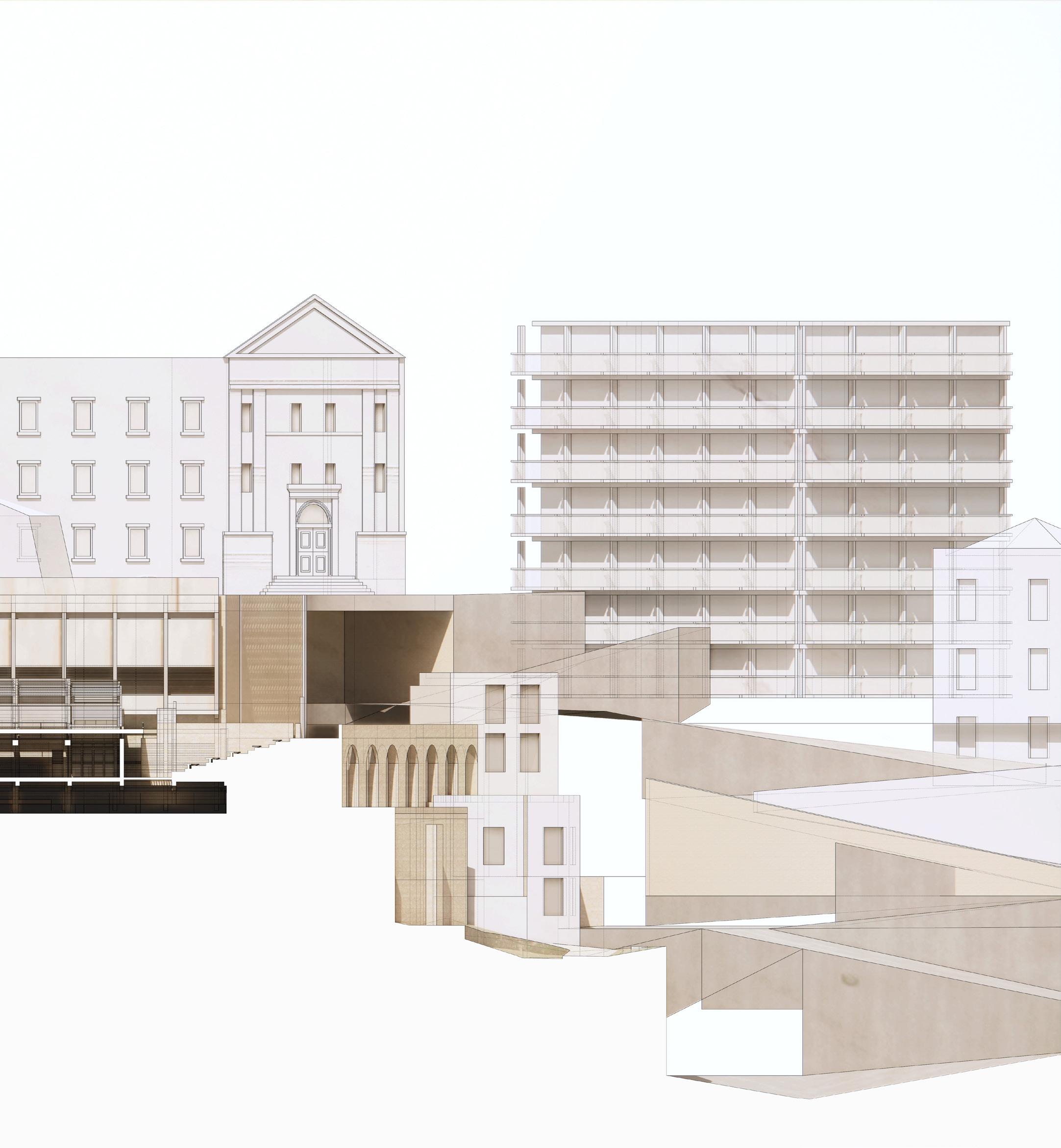
[above] isolated south east elevation of the hydrogical guild

| 187
188 |
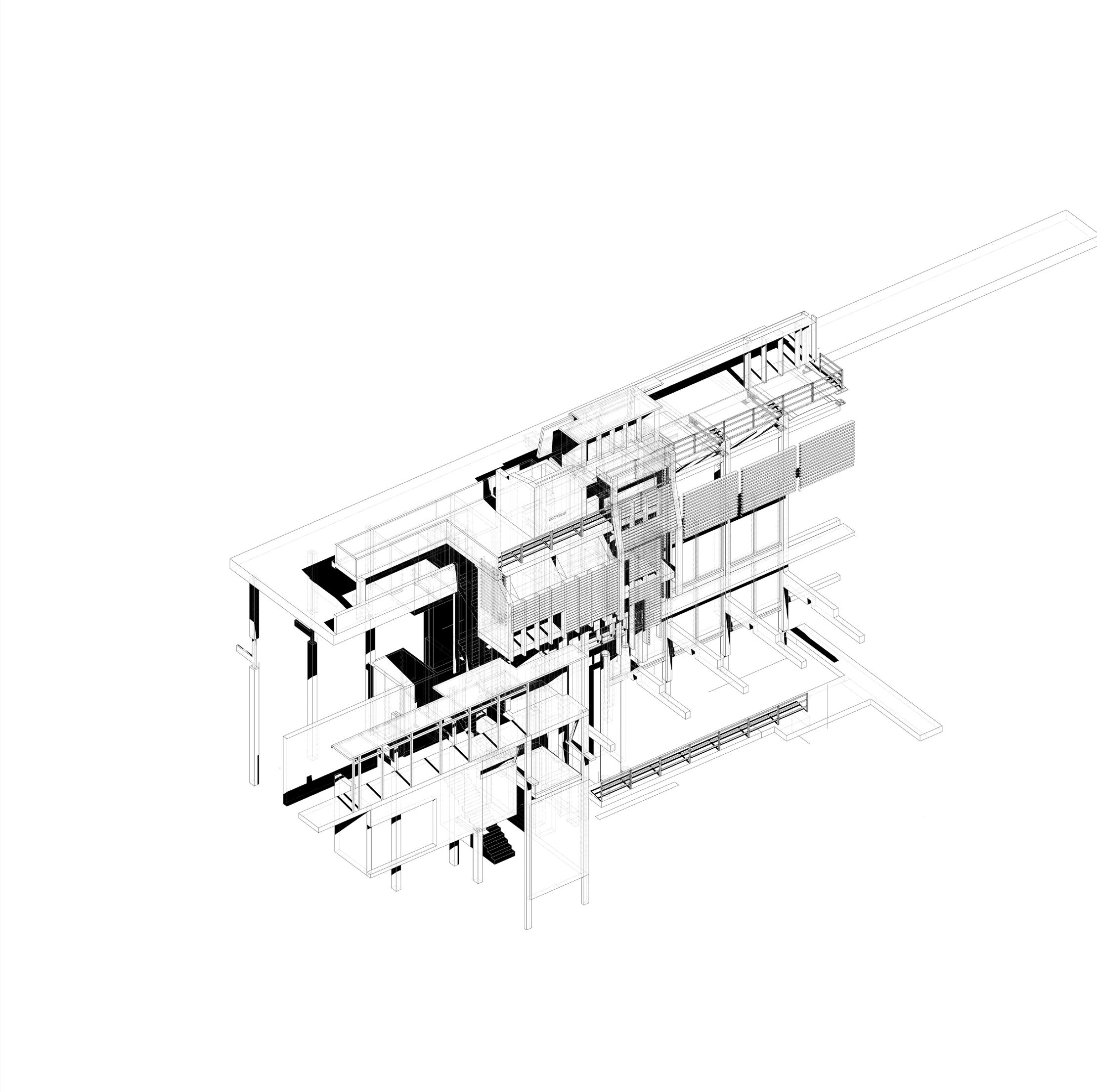
THE GALLERY
The Gallery serves as a repository for Neapolitan paintings sourced from churches currently under restoration, as well as the work of J.M.W. Turner. The large stack vent not only generates a cooling atmosphere for the plaza below, but also provides a succession of balconies that offer sweeping panoramas, paying homage to Turner’s enduring captivation—Vesuvius. From these strategically positioned observation points, visitors are privy to views of Vesuvius’ iconic silhouette, invoking Turner’s fascination with the interplay of light and the magnificence of nature. This arrangement serves as a testament to the harmonious coexistence of art, architecture, and the natural world, echoing Turner’s profound connection to the landscape and its ever-evolving elements.
| 189
190 |
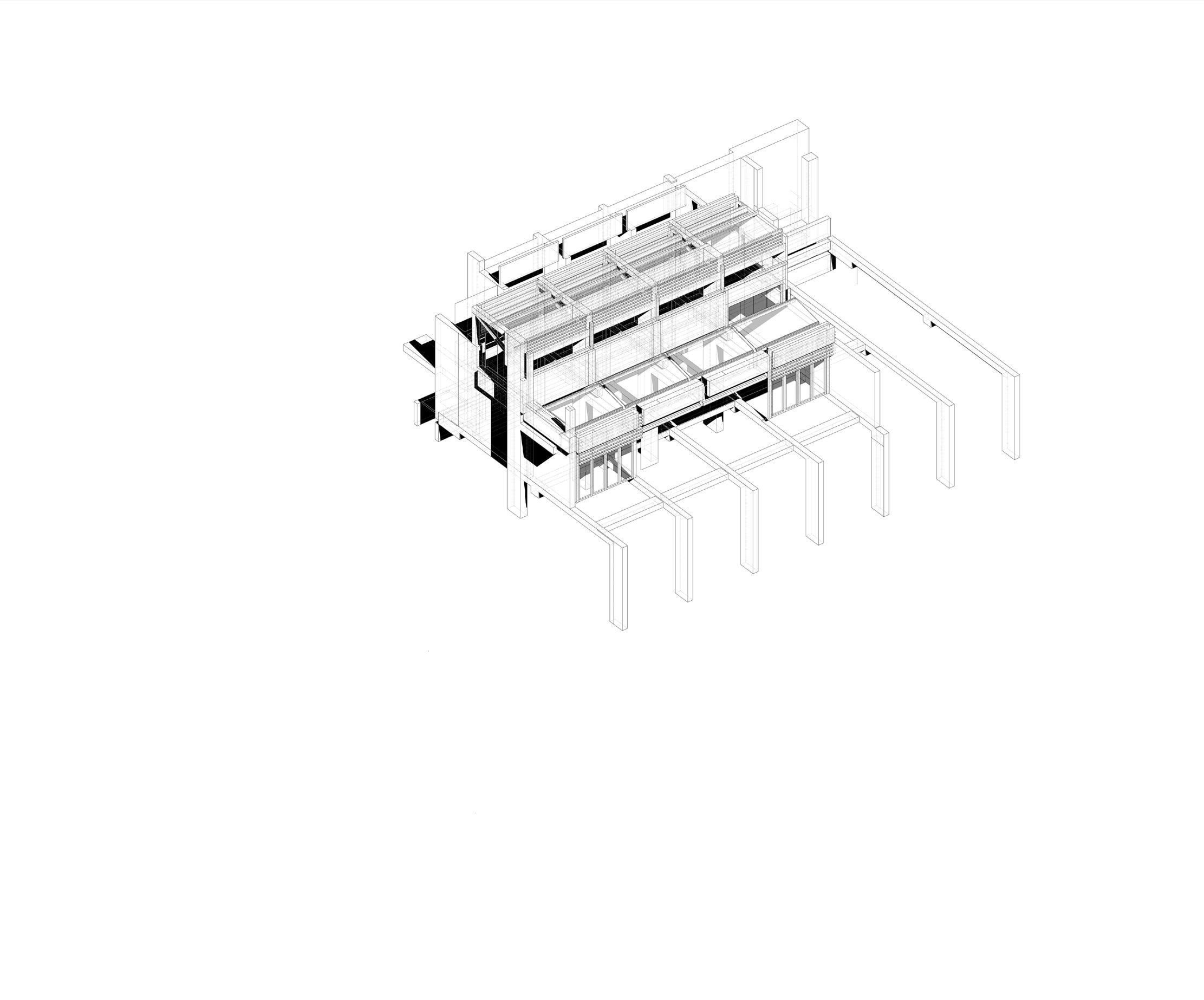
THE LABORATORY
The Laboratory safeguards the Neapolitan aquifer from groundwater rebound, a result of reduced groundwater exploitation. From 1990 to 2015, a significant groundwater rebound of up to +16.54 meters was observed, causing unexpected flooding in buildings and agricultural soils. Retention and detention basins are used to manage water runoff, maintaining aquifer stability during heavy rain or service disruptions. These basins control stormwater flow, gradually releasing water to reduce downstream flooding, thereby contributing to the city’s water resource management.
| 191
192 |
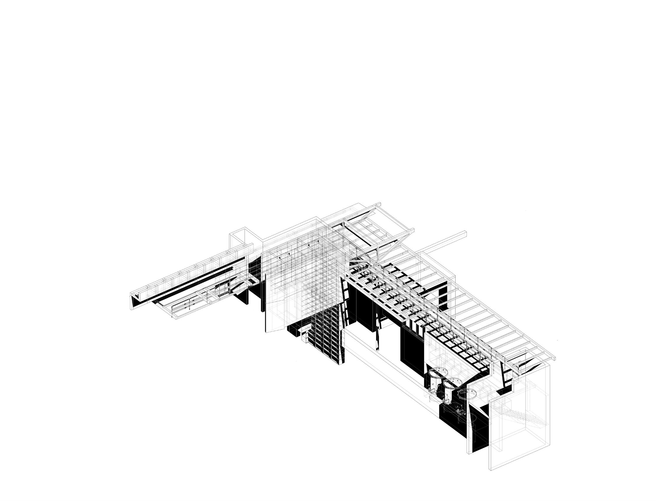
THE WINERY
The Winery is cut into and built from the tuff ridge, generating optimal humidity conditions or fermenting the local Greco di Tufo grape, a variant of Greco Bianco. The name ‘Tufo’ refers to both the village and the volcanic rock it’s built upon, distinct from limestone tufa, formed by compacted ash from eruptions.
| 193
194 |

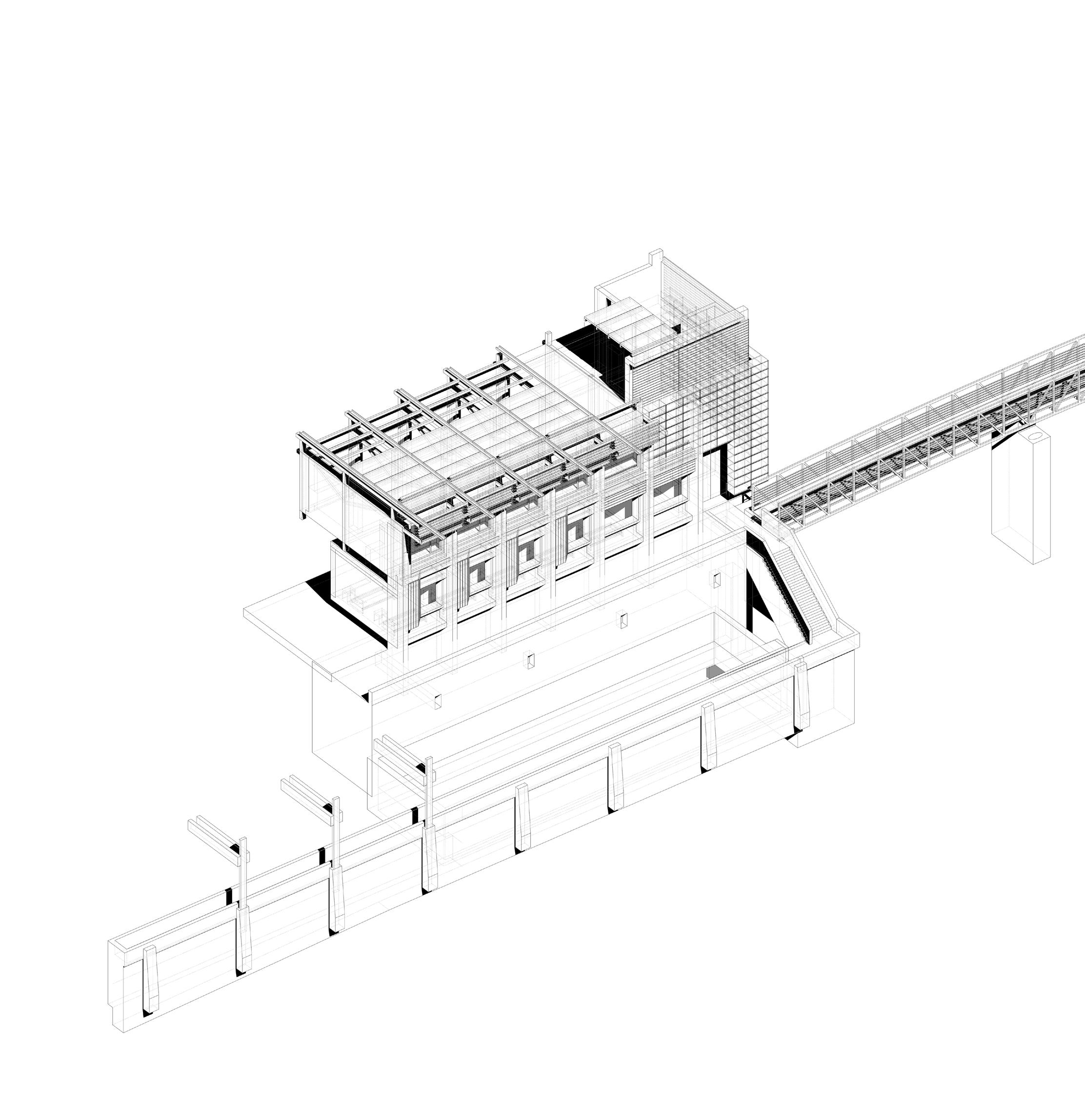
THE REFECTORY
The Refectory, with its dual functionality, serves as a crucial element in retaining the loose topsoil while also providing a dining hall for the enjoyment of the locally produced Greco di Tufo wine. The interior is furnished with long wooden tables and benches, promoting a communal dining experience for visitor to the Guild. Large windows illuminate the space with natural light and offer captivating views of the surrounding vineyards and the majestic Vesuvius in the distance.
| 195

196 |
[above] isolated north elevation of the meterological observatory

| 197
198 |
THE OBSERVATORY
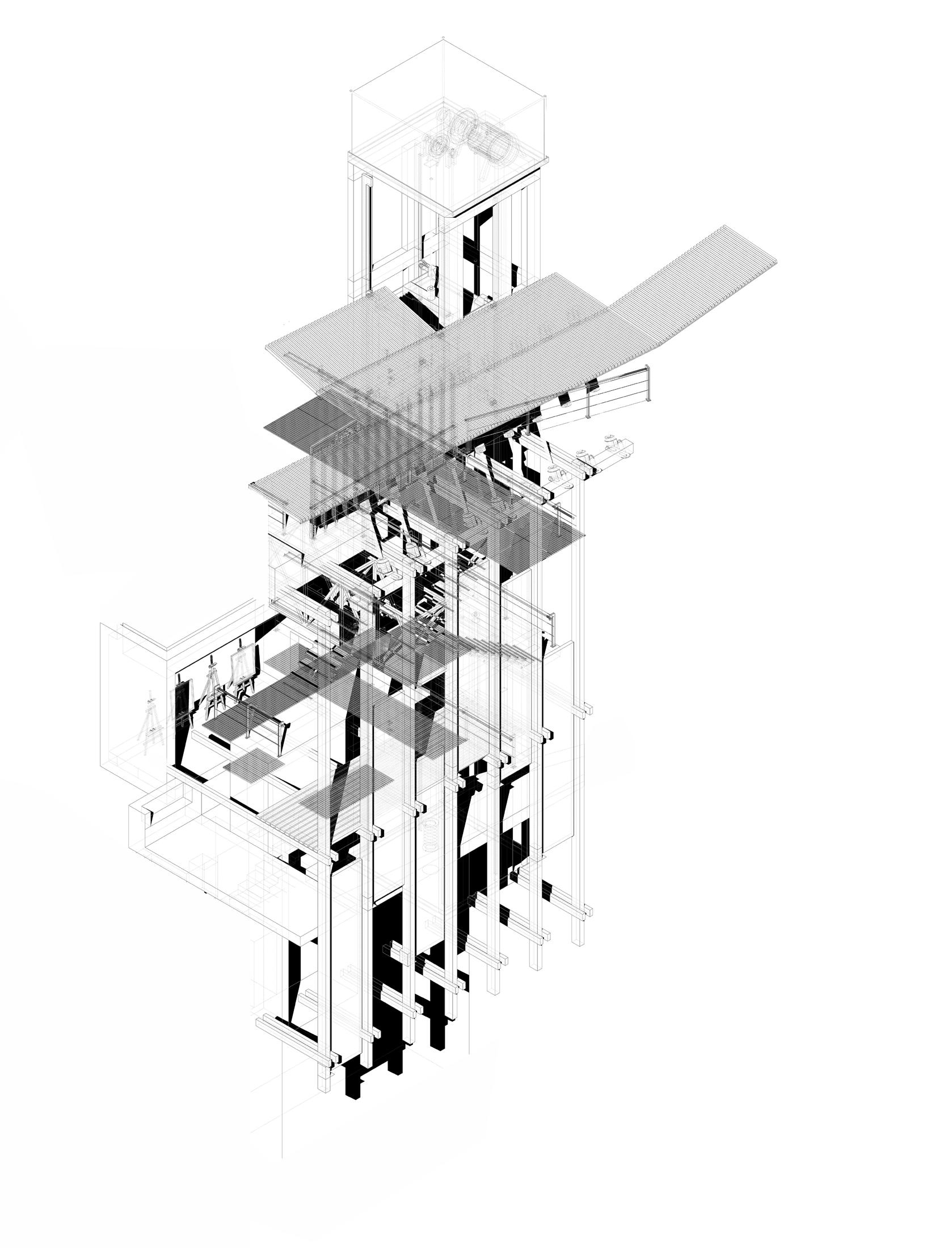
The Meteorological Observatory serves as a dedicated facility for the measurement, recording, and monitoring of atmospheric conditions. These conditions are rendered perceptible through an architectural design that is characterized by its ‘twitching’ nature, dynamically responding to the environmental stimuli.
Strategically situated amidst the elevated terrain of Parco Ventaglieri, the Observatory vigilantly monitors meteorological parameters such as the intensity of rainfall, ambient temperature, and humidity levels. The collected data can be cross-referenced with patterns of ground movement, thereby facilitating a more comprehensive understanding of the triggers for geological phenomena such as landslides and sinkholes.
| 199
200 |
[above] isolated south elevation of the masons yard

| 201
202 |

THE STONE MASONS YARD
The Stone Mason’s Yard emerges as a bastion safeguarding Naples’ cherished craftsmanship and reverence for heritage. This initiative reflects an acute understanding of the city’s architectural history and the imperative for meticulous conservation - a commitment to stone that requires careful stewardship. Strategically positioned, the masons yard offers an elevated perspective to the south while utilising the existing church structure as both a backdrop and a sanctuary for the artisans diligently at work. Beneath a sprawling canopy of timber screens, designed to combat the relentless Neapolitan sun, workers find respite from its harsh rays, while the structure ingeniously collects and channels rainwater during huge deluge.
| 203

204 |

REFLECTION DRAWING
| 205
REFLECTION
DRAWING

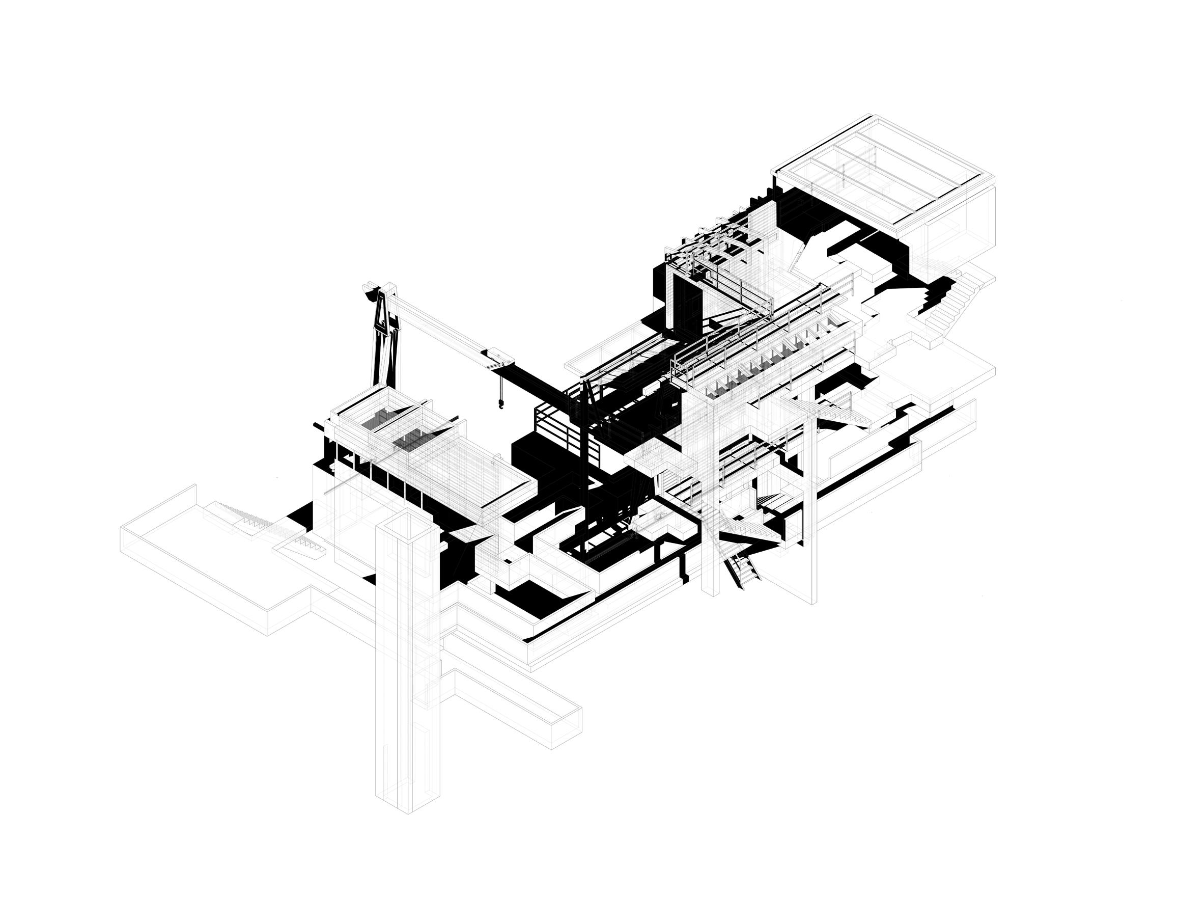
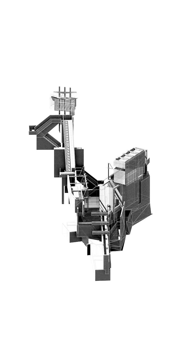
As my understanding of the city and drawing techniques expanded, each project adopted a distinct graphic style. In the final semester of this thesis, I curated and refined drawings to provide a more consistent graphic representation of the work, using the material at hand as a reference. A pivotal method for unifying the series of projects I had been working on was the isometric, which aided in understanding the key tectonic strategies of each proposal and deconstructing their associated programmes.
By reverting to this straightforward yet effective drawing method, each proposal or component of a proposal could be developed with the same rigour and read as an individual piece within the context of the shifting ground. This proved particularly useful when constructing a set of hybrid figures, which incorporated elements of my working group’s architectures. This was complemented by a consistent style of rendering the proposals, orchestrating the material concerns of each site and bringing clarity to the spatial assemblage.
In addition to traditional drawing methods, studio leaders strongly encouraged the exploration of more speculative drawing methods for the ground. In Studio D, my proposal was concerned with broader reciprocal landscapes, which generated a series of larger mappings and a more relaxed approach to factual representation.
206 |


208 |


| 209

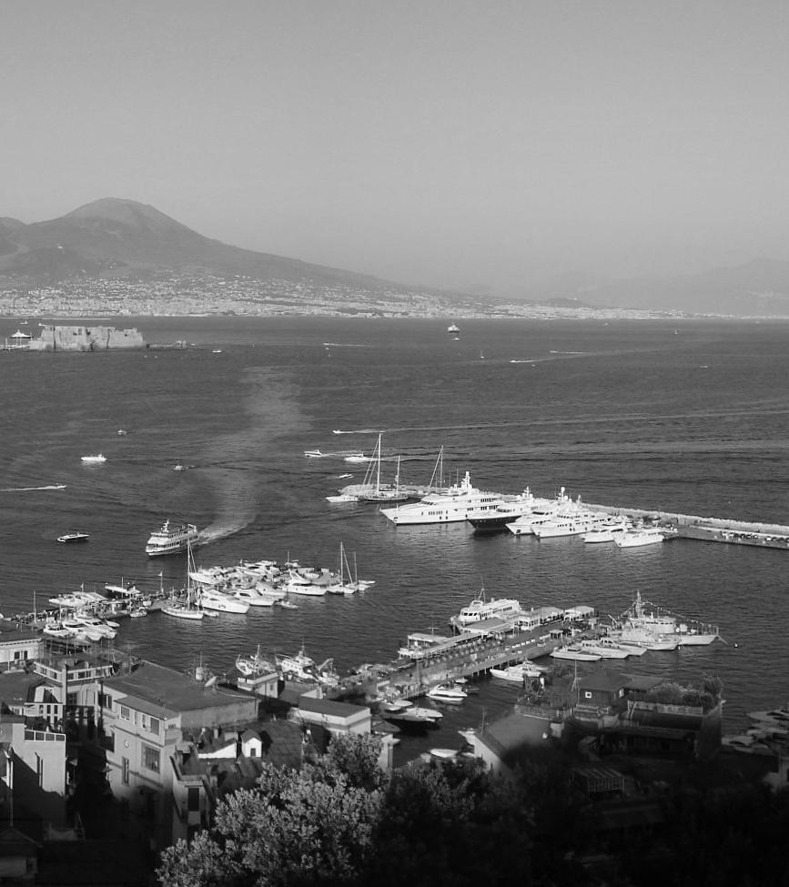

DETAIL
DEFINING ARCHITECTURAL FOOTINGS
XXIV. Framing
XXV. Embedding
XXVI. Transecting
[an assemblage of actions shape the observatory, stone yard & hydrological guild]
The Hydrological Guild is the culmination of a comprehensive investigation into Neapolitan Ground conditions through the development of a studioli, observatory, stone yard and the works of J.M.W. Turner. It employs a common architectureal language that is articulated through a set of individual and group investigations , these sharing a key set of moves.
| 213 FIVE.
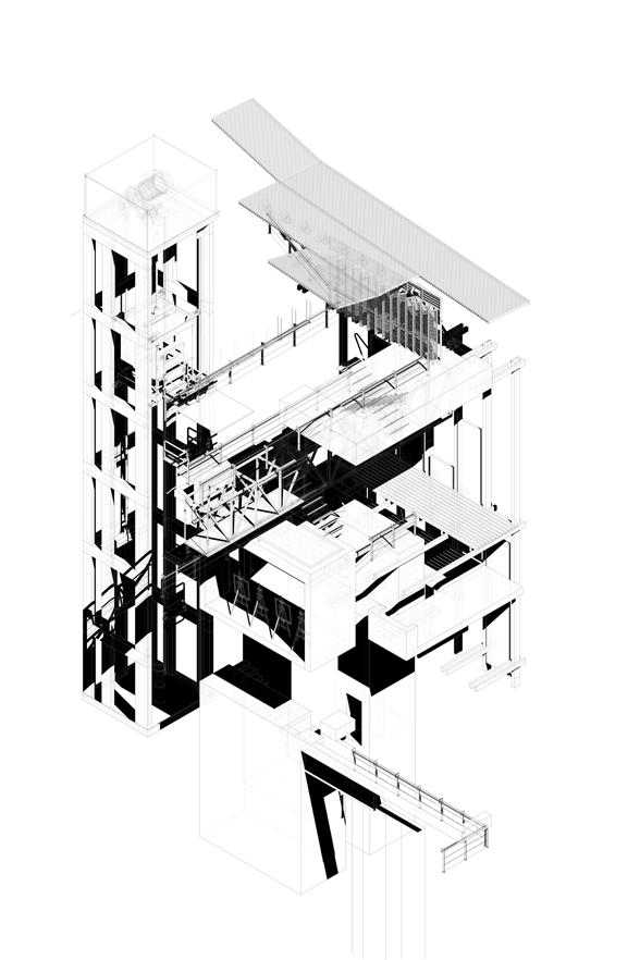
XXIV. FRAMING
Many of Turner’s Neapolitan sketches are panoramic vistas across the city taken from elevated positions. This is reflected in the series of framed views and elevated framed structures that provide views across the city.
214 |
| 215
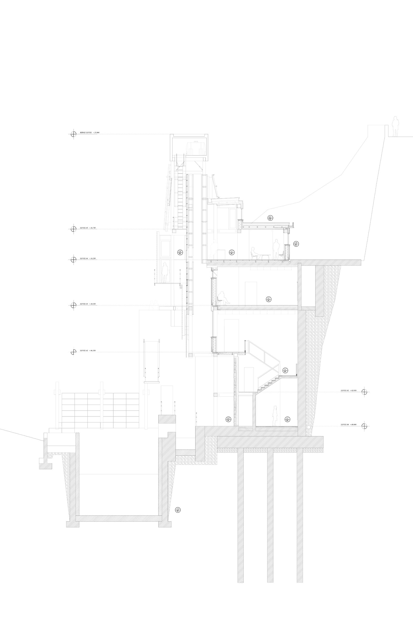
M - Materiality
E - Environmental
F - Function
C - Contextual
Capture
M - Steamed metal + Primary LVL columns + Secondary steel tension wires
E - Holds water collected from the facade and keeps it at a high gravitational potential
F - Collects rainwater runoff and avoids over saturation of the ground below
C - Mirrors the parallel cliff face and frames views towards Vesuvius
Stack
M - Primary LVL Columns/Beams + Secondary LVL Stressed Skin Cassette Panels
E - Pulls fresh air through and to reduce the need for AC system
F - Provide fresh air to gallery spaces behind
C - Supports tuff facade system
Channel
M - Tuff cladding panels + steel support frame
E - Provide breathable facade while channelling water into collection trays
F - Channel and store water
C - Mirror cliff face
Stair
M - CLT steps + LVL Stressed Skin Cassette Panels + Timber cladding
E - Vertical transition through states of atmosphere and moisture
F - Circulation + scale (scala)
C - Connects and breaks through the existing concrete belvedere
Enclose
M - Tuff stonework + Concrete retaining wall
E - Create a dry, dark, sheltered space for Turners artwork
F - Protection from the elements + Collection of rainwater in pool
C - Provides a lighting quality to display light sensitive artwork by Turner
216 |

| 217
Roof Construction
0.5 mm tin-plated stainless-steel standing seam roofing
27 mm composite wood boarding 120 mm ventilated cavity underlayer; 16 mm fibreboard
2≈ 100 mm mineral-wool insulation vapour-retarding layer;
2 5 mm OSB
100 mm mineral-wool insulation
9 mm 3-ply laminated softwood boarding 320 mm rafters
External Walls
27 mm untreated softwood boarding
2≈ 60 mm mineral wool 16 mm fibreboard; 60/180 mm wood bearers with mineral-wool insulation between 15 mm OSB; 40/60 mm battens with insulation
19 mm 3-ply lam. softwood internal lining
218 |
EW RC 01 01

| 219 EW RC 01 01
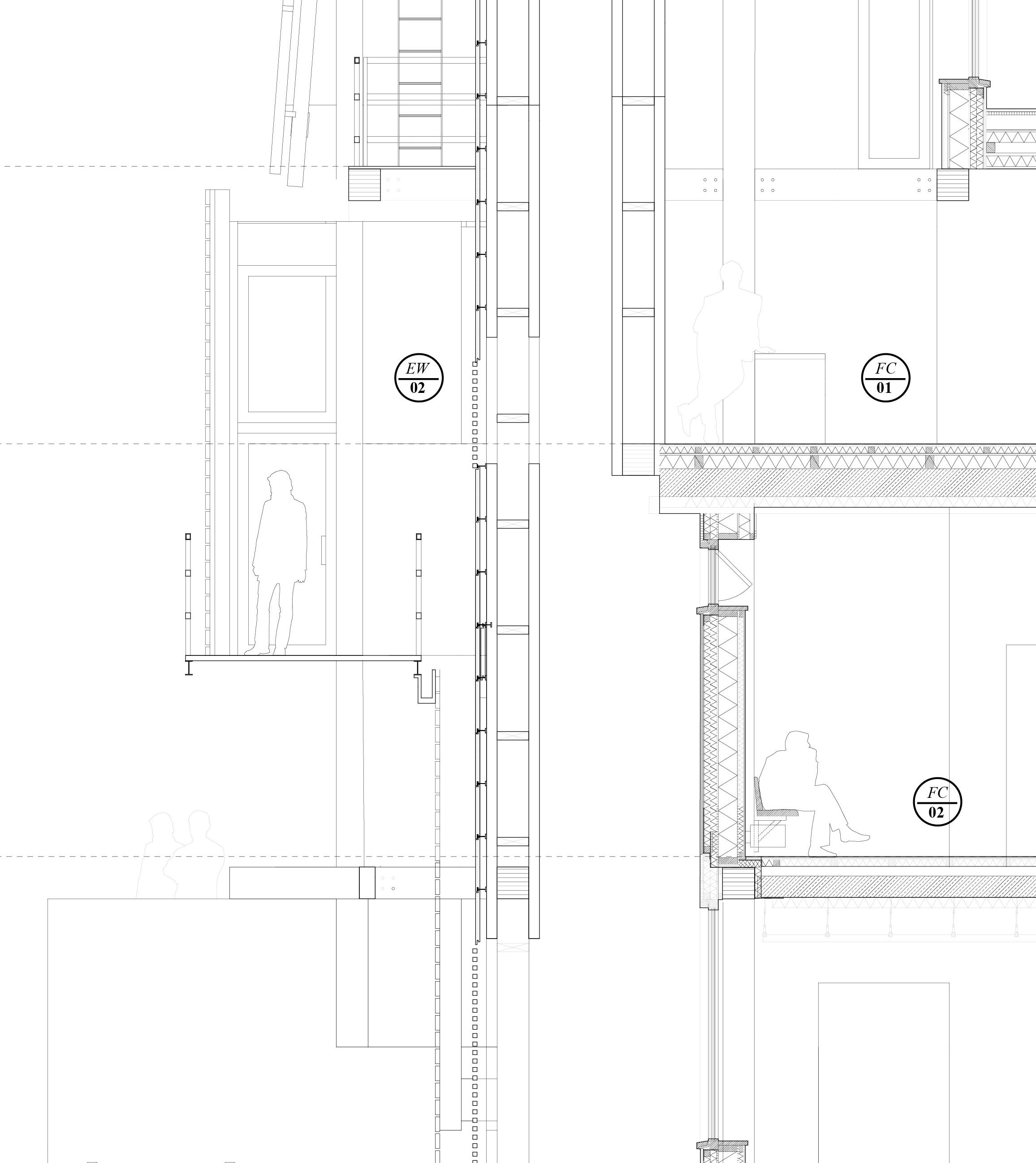
Floor Construction
30 mm wood boarding; 60/60 mm battens with insulation; vapour-retarding layer;
15 mm OSB
60/160 mm wood bearers with glass wool
80/120 mm wood bearers with glass wool
300 mm concrete floor slab
5 mm PVC flooring; 70 mm screed
200 mm reinforced concrete slab
100 mm acoustic insulation
20/89 mm oak louvers suspended ceiling
External Walls
300mm LVL Beam
Stressed skin cassette panel
Aluminium angle brakcet
flashing tuff panel
220 |
FC 01 FC 02 EW 02
| 221 FC 01 FC 02 EW 02
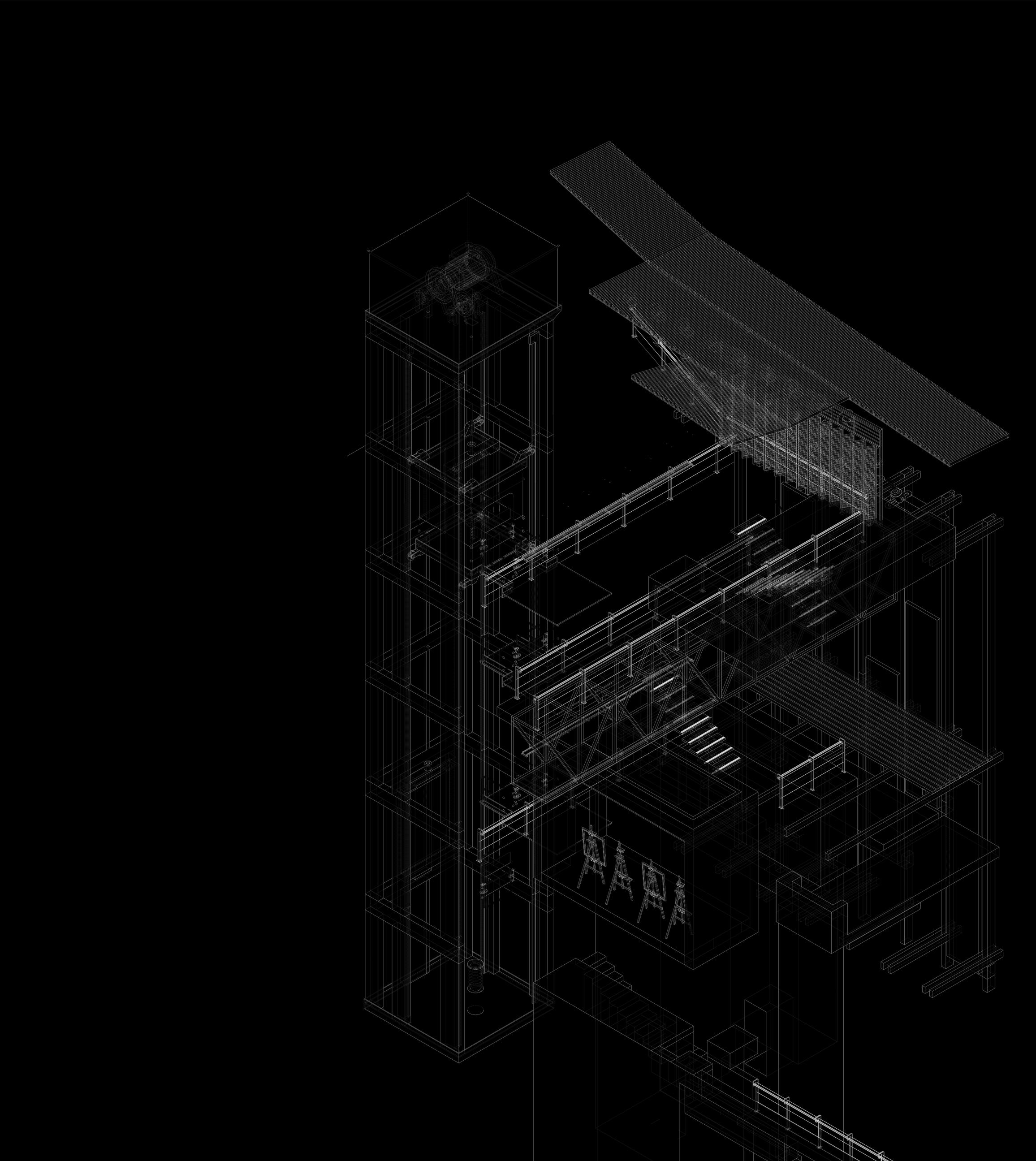
222 | [1]
[3] [4] [2]
[5]
[6]
[8]
[7]
Isometric View
showing the series of balconies within the observatory
[1]
[2]
[3]
[4]
[5]
[6]
[7]
[8]

access lift
rainwater collection roof
facade pulleys
terrace overlooking parco ventaglieri
hygrometer bridge
painting balcony
painting canvas store room
painting studio
| 223
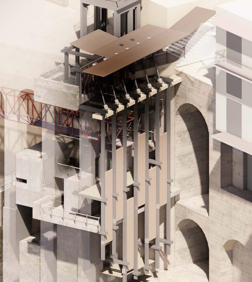

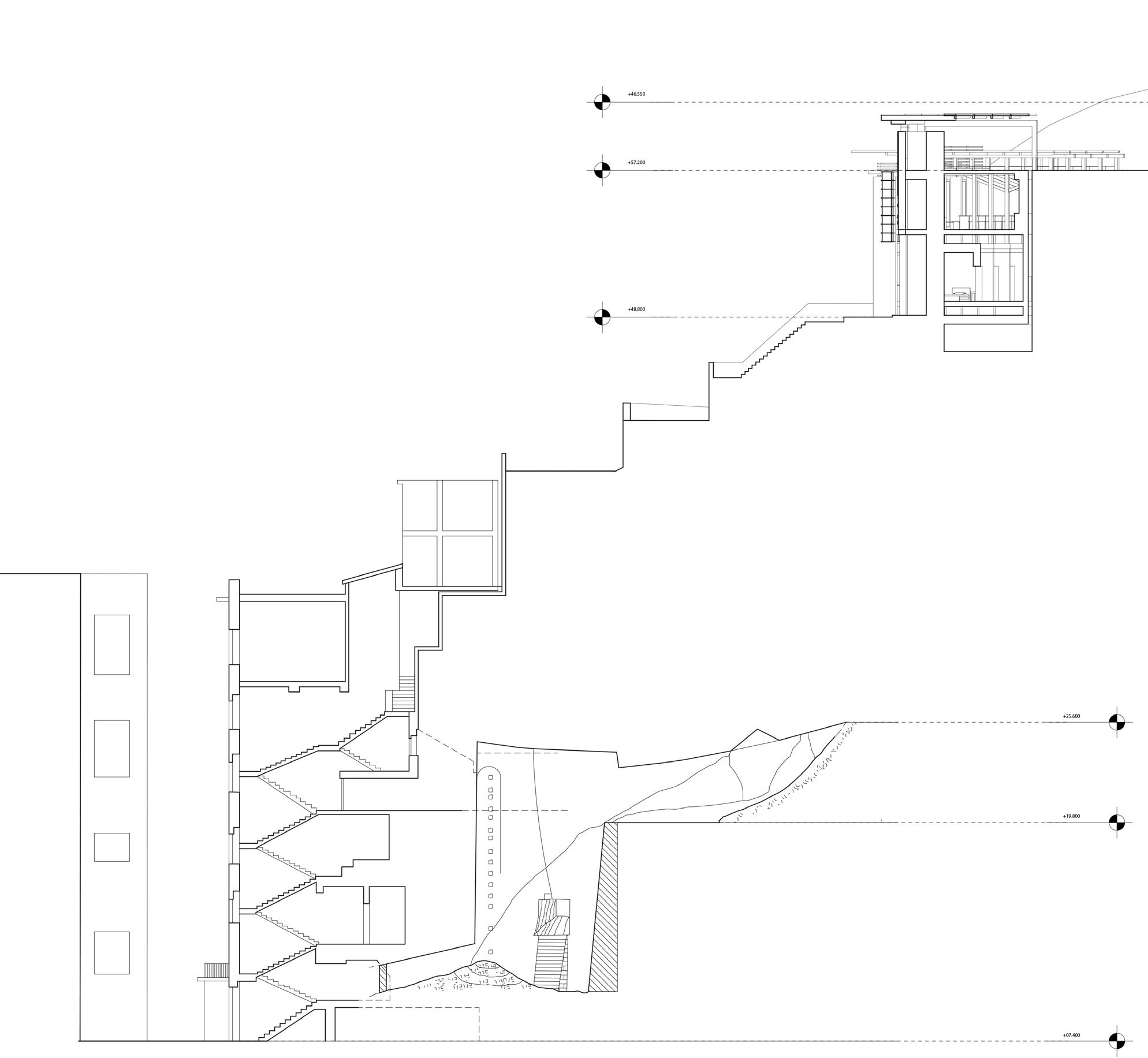
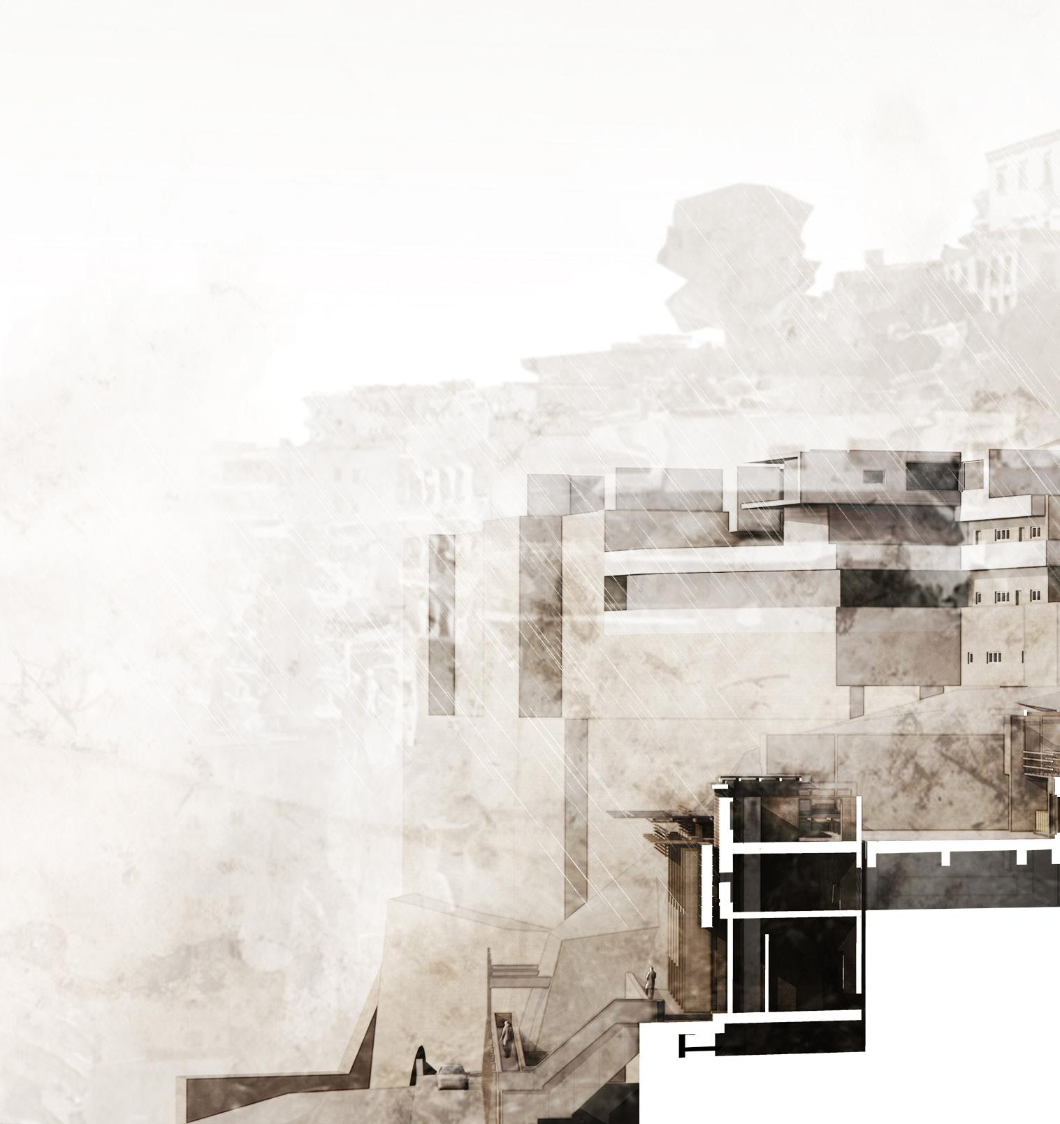
[above] perspective elevation showing the circulation and supporting framework across different levels of the observatory.
[left] Isolated isometric of the meteorological observatory that inhabits a set of retaining tufo arches. The external frame ‘twitches’ in response to chances in moisture and which change the opening heights of the shutters on the painting balconies looking to the south.
| 225
XXV. EMBEDDING
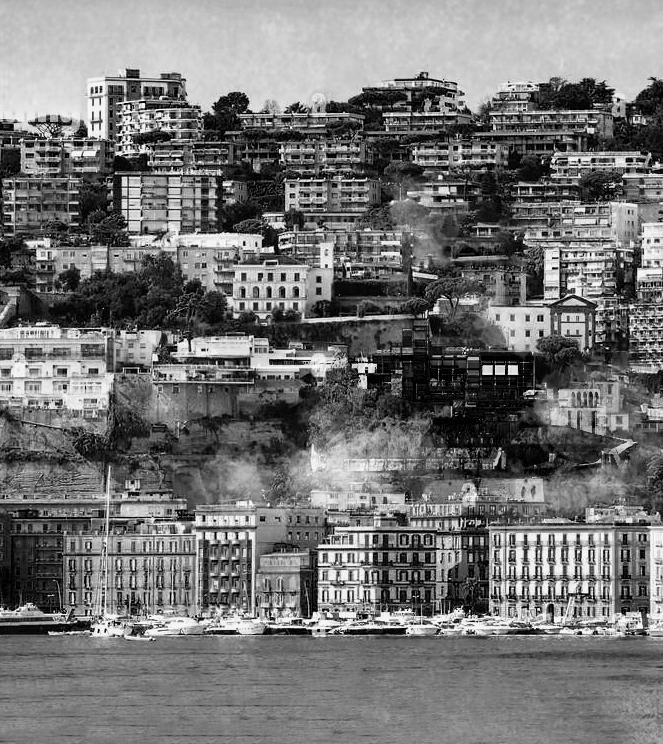
Just as the city’s structures are carved and constructed using the underlying Tuff, the Guild emerges from and melds with the very ground it stands upon, intricately carved into the cliffside to form an artificial landscape. This design not only addresses the inherent challenges of materiality and environment but also harmonizes with the topography of the Hills of Posillipo.
The initial stages of constructing the Guild involve sculpting into the tuff ridge. This serves a dual purpose: anchoring the building securely while crafting a series of basins strategically positioned to capture and manage water runoff. This approach underscores the Guild’s commitment to sustainable practices and respect for the natural environment in contemporary architecture.
226 |
| 227

228 |
[9]
[1] [2] [6] [7]
[3]
[4]
[5]
[8]
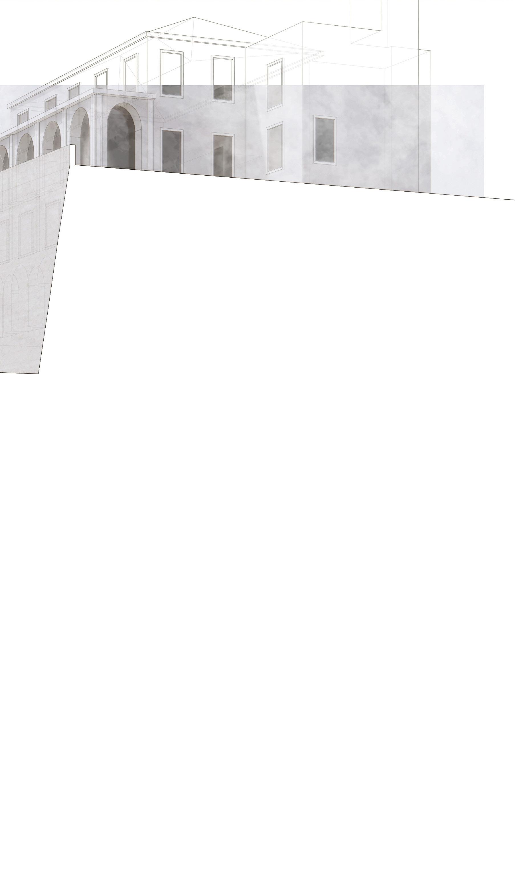
Footing throughstack vent, gallery & bains
[1]
[2]
[3]
[4]
[5]
[6]
[7]
[8]
[9]
stack vent viewing balcony
upper reception area gallery
ventilated corridoor observation walkway gallery
concrete pile foundations retention basin
| 229
External Walls
200 mm tuff stone wall
20 mm cement mortar; sealing layer
30 mm cement mortar, coated 120 mm brick wall, plastered
Floor Construction
65/65 mm solid oak handrail
15 mm glass balustrade
10 mm steel plate
9 mm three-ply oak-veneered plinth fascia, 10 mm shadow joint
380/119 mm angled steps:
5 mm oak veneer on 15 mm chipboard 10 mm composite wood board fixed to concrete
structural stairs
10 mm finely sandblasted
Tuff stone
65 mm heated screed
10 mm impact-sound
insulation
40 mm insulation
40 mm polyurethane
thermal insulation
220 mm concrete slab
230 |
EW FC FC 03 03 04

| 231 EW FC FC 03 03 04

Foundations
300 mm piperno slab
500mm concrete strip foundation
11500mm concrete pile foundation
232 |
FD 01
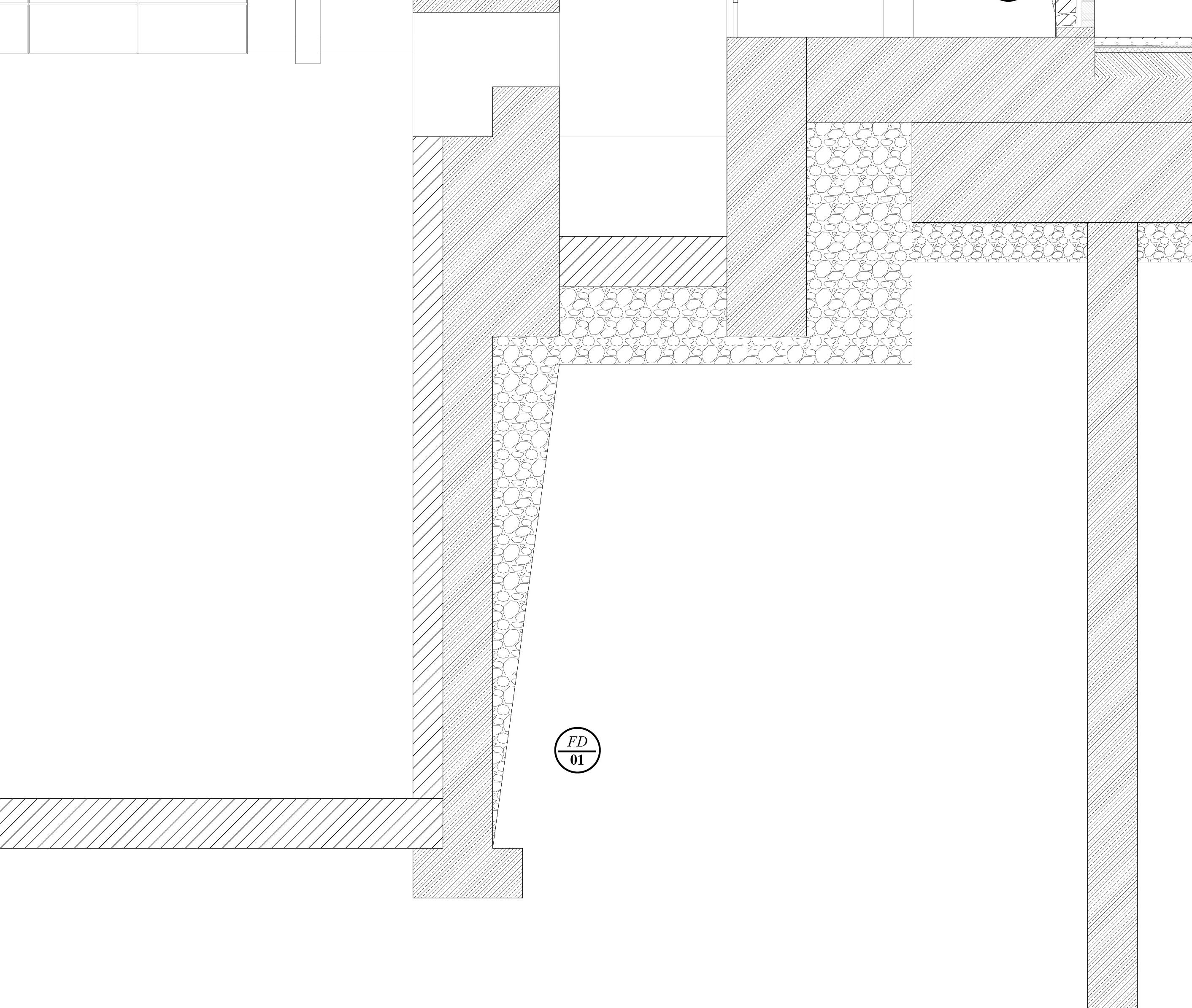
| 233 FD 01
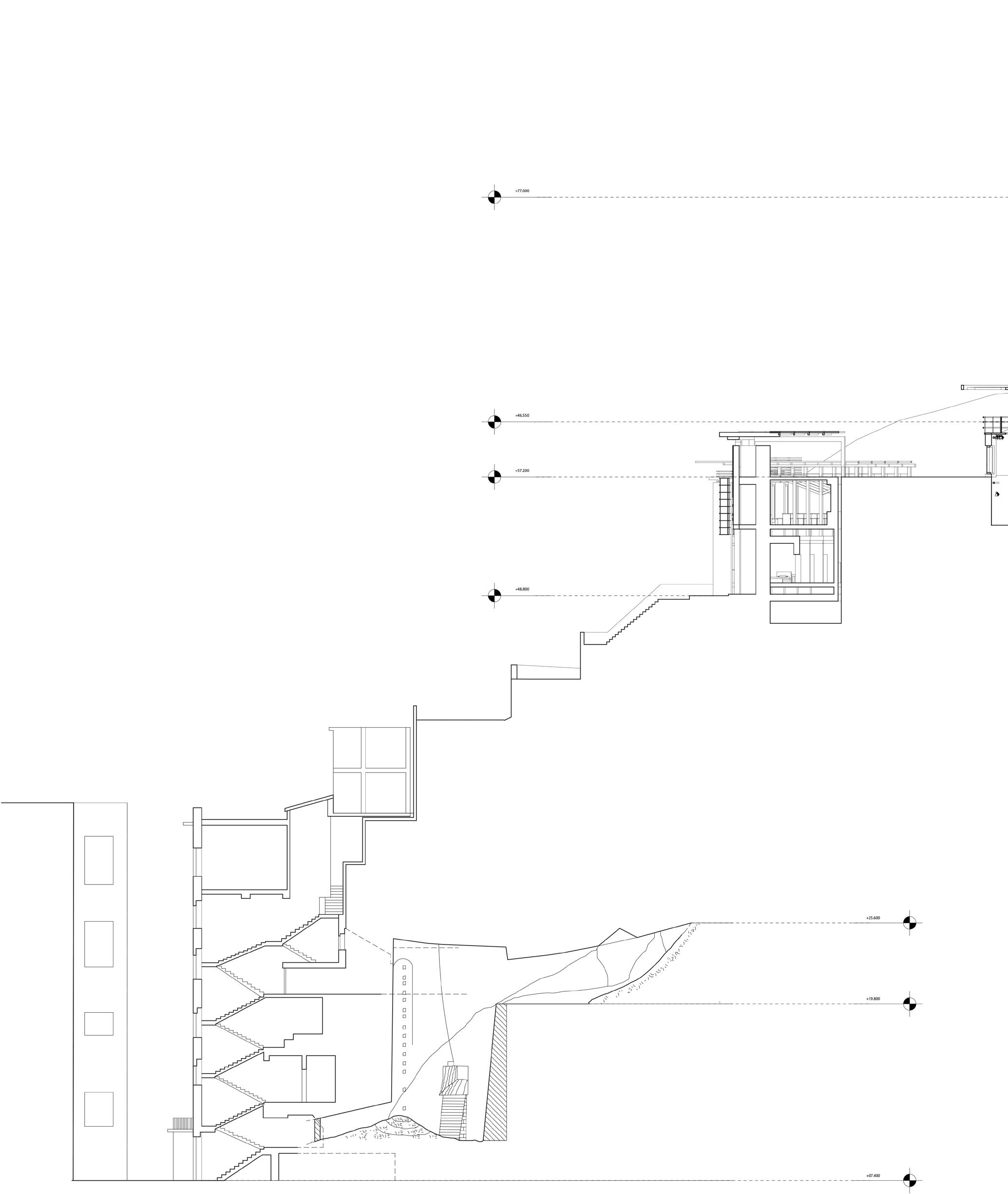
234 |

| 235 [5]
XXVI. TRANSECTING
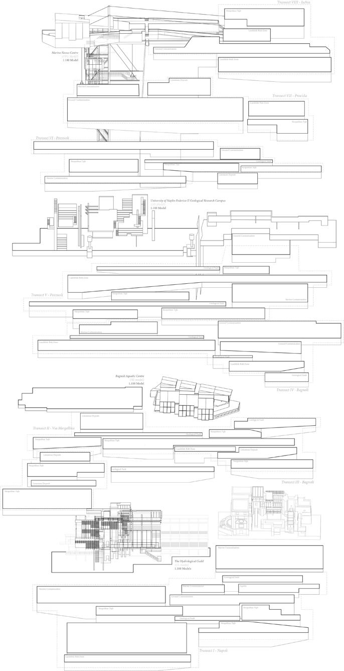
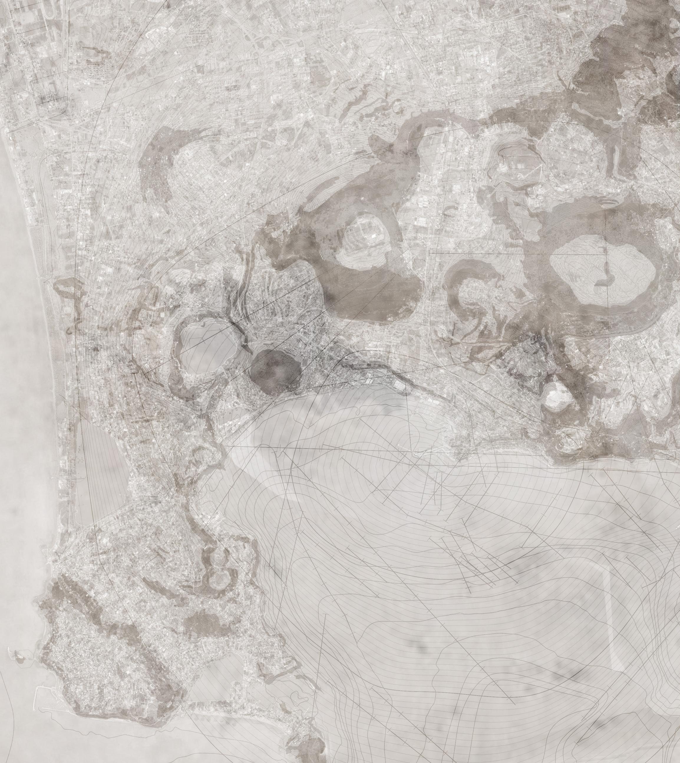
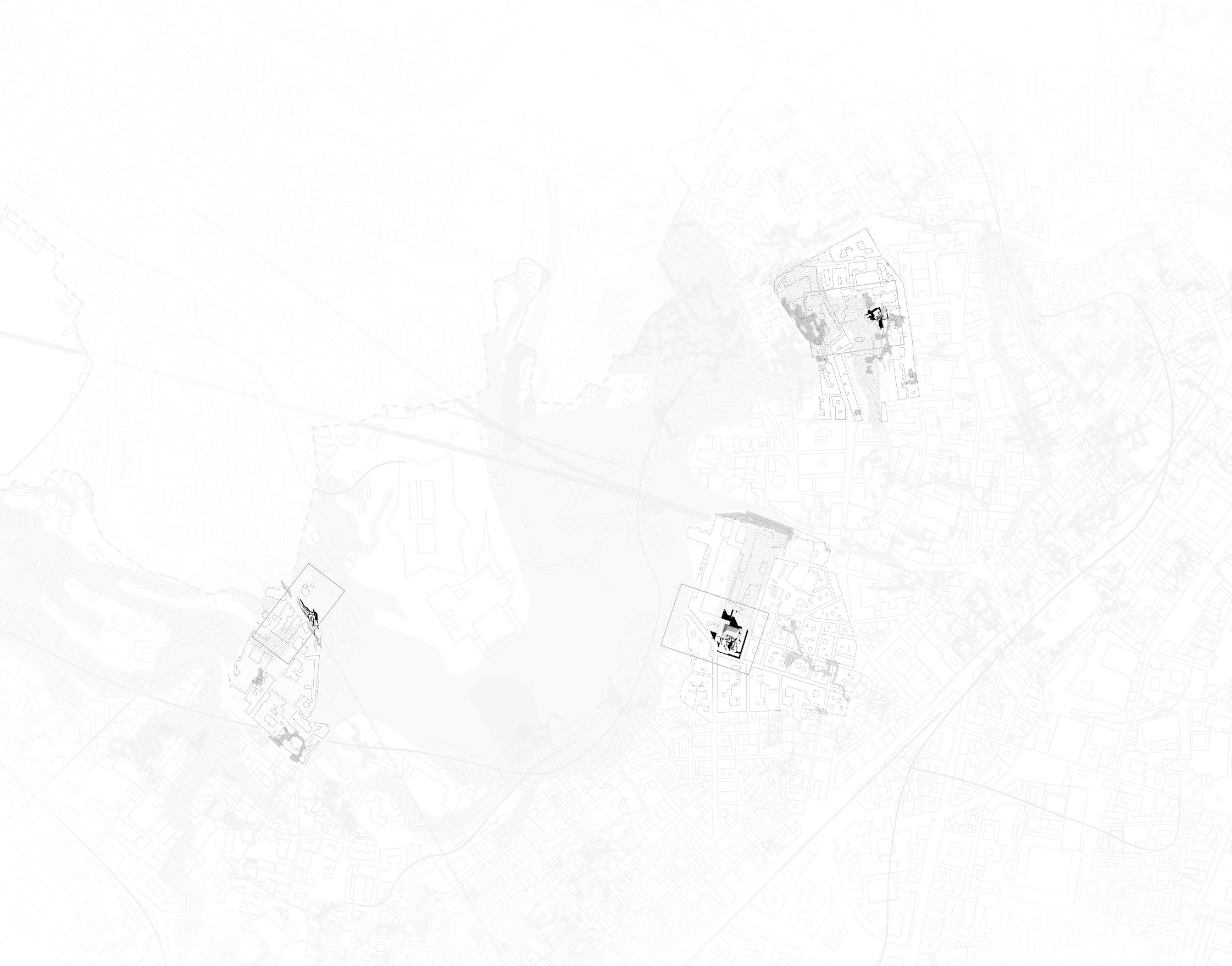
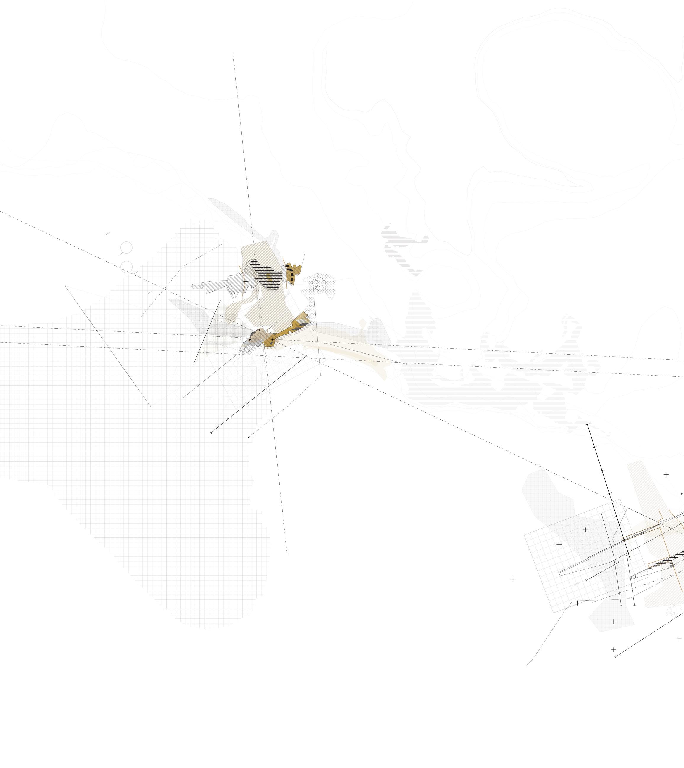
When mapping our separate material flows in the Bay of Naples, we were able to identify specific site of extreme overlapping ground conditions. When delineating these forces we developed a joint language of drawing communication as a way of being able to develop joint architectural hybrid figures. The Neapolitan Ground Drawing shows the 1-50,000 mapping generated during this process.
Following on from the identification of these sites of dense overlapping ground conditions, we were able to generate transects of specific intervention (areas that would be at the behest of most of these forces simultaneously). These transects appear at four separate points down the coast of the Bay of Naples, and each of them has an area within which architectures are proposed, as well as a wider area. This wider area contains the data of these forces in full. As a result the area of specific interest not only sits within these transects but also pulls in the forces from a wider field of research. This map shows these four transects and their wider fields.
With the aim of mapping these conditions as a way of testing our architectures, this drawing overlaps our site specific research as a way of generating hyper active overlapped conditions ( these include areas of high landslide risk, Bradyseism, Sea Level Rise, Ground and Water Contamination among others. By generating these labs we were able to test the hybrid architectures and categorise specific tectonics in position.
236 |


238 |
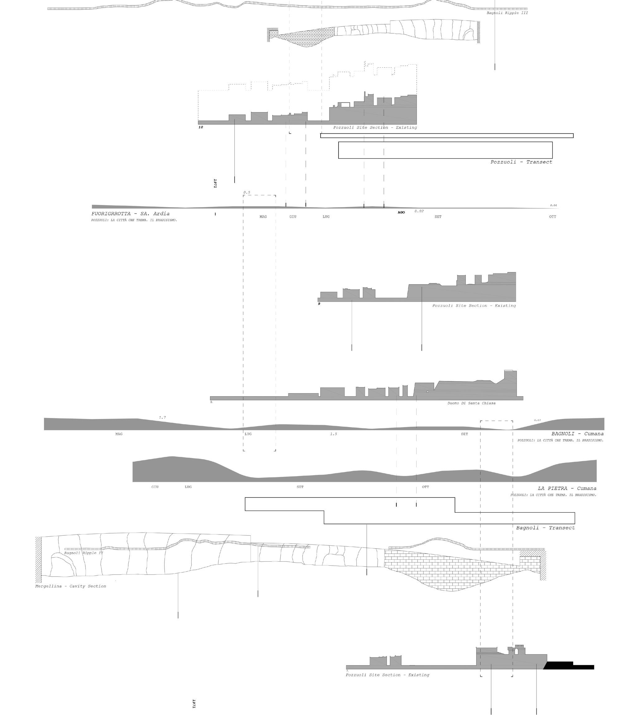
| 239
240 |

| 241

242 |

| 243
244 |

| 245
246 |

REFLECTION EXHIBITING
| 247
REFLECTION
EXHIBITING

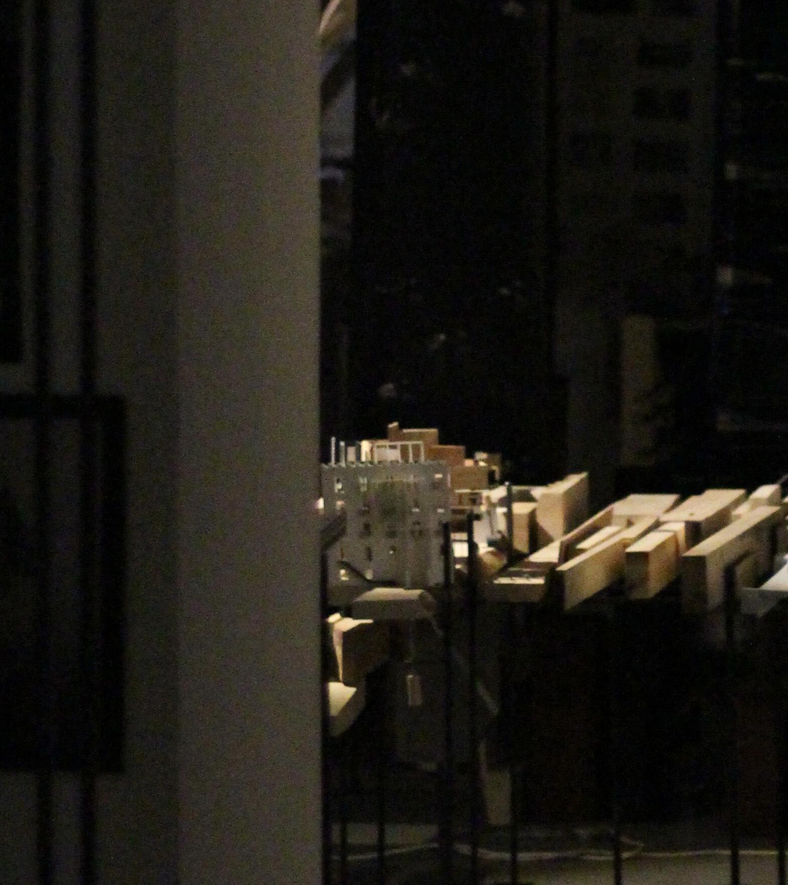
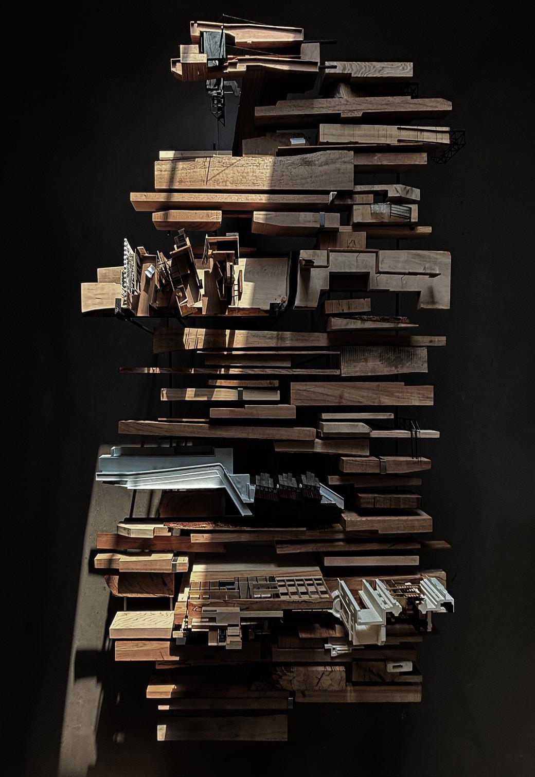
The exhibition of this work was the primary focus of our final semester, with physical outputs taking precedence as the medium for conveying a considered architectural design-research project. Having amassed a significant body of work over the past three semesters, we were tasked with critically reviewing and revising previous work, repositioning it for presentation to a broader audience. This necessitated both reflective and forward-thinking approaches to how we might install our projects within the studio space.
With this output as the focal point, and drawing from previous work, I formed a new working group focused on seismic matter, eruptions, datums, landslides, and monitoring. These themes served as the driving force for our final exhibition, fostering an understanding of each other’s projects and guiding us towards a shared output that would optimally exhibit our research to date.
This collective approach to exhibiting the work facilitated the presentation of shared outputs in relation to the individual concerns of our projects. Ultimately, the exhibition of this work transcended the mere display of individual pieces to become a celebration of a collective interpretation of a shifting ground condition.
248 |

| 249

250 |


| 251
252 |

| 253
254 |

| 255

256 |

| 257
258 |
| 259
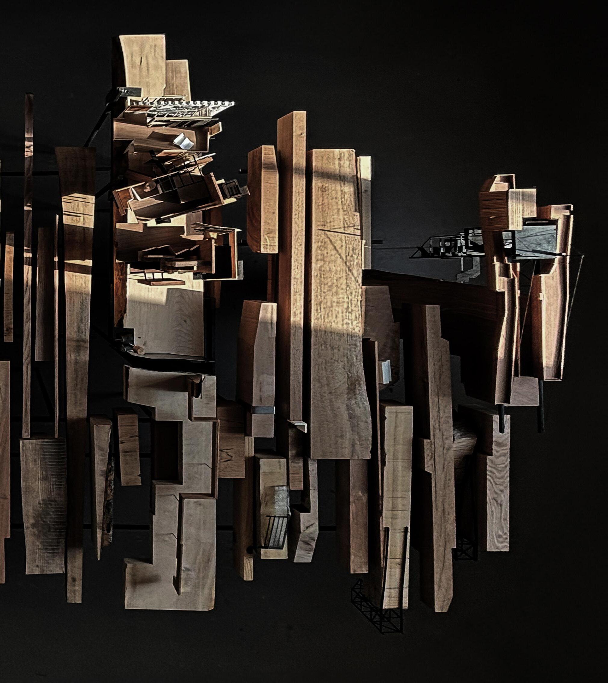
BIBLIOGRAPHY [IMAGE CREDITS]
Most historic images were found at: https://www.flickr.com/search/?text=naples
Naples Cemetery wall collapses. Retrieved from https://www. wantedinrome.com/news/italy-naples-cemetery-collapsepoggioreale.html
Belvedere Sant’Antonio. Retrieved from https://www. laboratorionapoletano.com/2013/07/chi-sono-i-disperati-cheabitano-sotto.html.
Holy Family and Saints. Retrieved from https://www. metmuseum.org/art/collection/search/437455.
Panorama from San Martino. Retrieved from http:// napolicapitalediunregno.altervista.org/napoli-panorama-dasan-martino-con-vista-della-cupola-appartenuta-la-chiesadella-santissima-trinita-delle-monache-e-la-chiesa-di-santachiara-foto-1870-75-ca/.
The Quartieri Spagnoli Park. Retrieved from https://www. articolo45.it/il-parco-dei-quartieri-spagnoli-un-polmoneverde-nel-centro-di-napoli/.
Saint Jerome and the Angel of Judgement. https://www. collezionegalleriaborghese.it/en/opere/saint-jerome-and-theangel-of-judgement.
Street of Naples. Retrieved from https://www.flickr.com/ photos/131415280@N03/38301821075/sizes/l/.
*All site photos were taken by author
260 |
Benjamin, Andrew. ‘Surface Effects: Borromini, Semper, Loos’. The Journal of Architecture 11, no. 1 (1 February 2006): 1–36. https://doi.org/10.1080/13602360600636099.
Casey, Edward S. Remembering, Second Edition: A Phenomenological Study. 2nd ed. Indiana University Press, 2000. https://www.jstor. org/stable/j.ctt16gzfjf.
Deleuze, Gilles, and Jonathan Strauss. ‘The Fold’. Yale French Studies, no. 80 (1991): 227–47. https://doi.org/10.2307/2930269.
Finberg, A. J. The Life of J.M.W. Turner / by A.J. Finberg; with a Supplement by Hilda F. Finberg. Second edition revised. Oxford: Clarendon Press, 1961.
Gerundo, Carlo, Valerio Di Pinto, and Vincenzo Stefano. ‘Naples and Its Parallel City’, 9, 2015.
Guarino, Paolo M., and Stefania Nisio. ‘Anthropogenic Sinkholes in the Territory of the City of Naples (Southern Italy)’. Physics and Chemistry of the Earth, Innovative modelling approaches for disaster risk reduction, 49 (1 January 2012): 92–102. https:// doi.org/10.1016/j.pce.2011.10.023.
Hamilton, James. Turner and the Scientists / James Hamilton. London: Tate Gallery Pub., 1998.
Howard, Luke. Essay on the Modifications of Clouds / Luke Howard. Cambridge Library Collection. Earth Science. Place of publication not identified: publisher not identified, 1865.
Hutton, Jane Elizabeth. Reciprocal Landscapes: Stories in Material Movements / Jane Hutton. ; Abingdon, Oxon ; Routledge, Taylor & Francis Group, 2020.
‘Il sottosuolo di Napoli. Relazione della Commissione di studio. Napoli, A cura del Comune, 1967. da AA. VV. | Libreria del Castello’. Accessed 03 May 2024. https://www.abebooks.it/ prima-edizione/sottosuolo-Napoli-Relazione-Commissionestudio-cura/31565719908/bd.
‘Naples Life,Death & Miracle’. Accessed 03 May 2024. http:// www.naplesldm.com/aqueduct.php.
Object, object. ‘Anthropogenic Sinkholes of the City of Naples, Italy: An Update’. Accessed 03 May 2024. https://core.ac.uk/ reader/541676150.
Rispoli, Concetta, Diego Di Martire, Domenico Calcaterra, Piergiulio Cappelletti, Sossio Fabio Graziano, and Luigi Guerriero. ‘Sinkholes Threatening Places of Worship in the Historic Center of Naples’. Journal of Cultural Heritage 46 (1 November 2020): 313–19. https://doi.org/10.1016/j. culher.2020.09.009.
Ruskin, John. Modern Painters. G. Routledge, 1860.
Vitruvius, Ingrid D. Rowland, and Thomas Noble Howe. Vitruvius: ‘Ten Books on Architecture’. Cambridge University Press, 1999. https://doi.org/10.1017/CBO9780511840951.
webmaster. ‘Il Parco Dei Quartieri Spagnoli, Un Polmone Verde Nel Centro Di Napoli’. Articolo45, 16 November 2015. https:// www.articolo45.it/il-parco-dei-quartieri-spagnoli-un-polmoneverde-nel-centro-di-napoli/.
Wolfrum, Sophie. Porous City: From Metaphor to Urban Agenda / Editors, Sophie Wolfrum [and 6 Others]. Basel: Birkhäuser, 2018.
[TEXT] | 261


 [left] abondoned cavity in mergellina, cut out of the tufo ridge


 Saint Jerome and the Angel of Judgement


 [1]
[2]
[3]
[4] [5]
[6]
[7]


