

Places Past, Present and Future
Spelthorne
Spelthorne is a borough in the north of Surrey, on the fringes of London, with a population of around 100,000 people. It sits on the northern banks of the River Thames, and to the south of Heathrow Airport.
Until the late 19th century, the area was a predominantly rural part of the former county of Middlesex, with Staines as the main market town. The arrival of the railway and growth of London sparked several waves of suburban growth, transforming the existing towns and villages into the suburban fringes of London, balancing the attractiveness of living near a city with the green open spaces of the countryside, common to much of ‘urban’ Surrey today. Since the creation of the Metropolitan Green Belt in the early 1970s, the built-up area has changed very little. The borough’s built character is very strongly related to its historic development patterns.
The borough hosts major infrastructure, particularly reservoirs, water supply and motorways that support London and the wider south-east. Kempton Park, Shepperton Studios and BP’s offices in Sunbury are significant landmarks and destinations.
Spelthorne is likely to see significant residentialled development in the future, particularly in its well-connected town centres. Well-designed development offers a significant opportunity to create new, integrated and valued places and neighbourhoods that could provide benefit to new and existing communities.


Find out more background information about the borough in Appendix A ‘Understanding Spelthorne Today’.
Staines-uponThames
Sunbury Common
Lower Sunbury
Shepperton
Stanwell
Ashford
Laleham
Heathrow Airport
Feltham
Egham
Key features of Spelthorne

Green Belt


Water
Much of the borough is covered by the Metropolitan Green Belt, placing a strong focus on development in existing built up areas.
Bounded by the River Thames to the south, Spelthorne hosts major reservoirs and water supply infrastructure for the wider London and southeast, as well needing to manage flood risks.


Urban Morphology
Many parts of Spelthorne bear the hallmark of the era in which they were developed, with strong patterns of regular plots, straight streets and suburban development.

Attractive green open spaces
Vibrant High Streets
The River Thames
The Design Vision & Borough-Wide Principles
The Design Code has drawn on the views of the local community to define what good design is in Spelthorne, and the vision for how places should look, function and engage the community (both present and future) in coming years. The vision is set out across five themes, with supporting design principles to help make it happen.
BOROUGH-WIDE DESIGN VISION
All development in Spelthorne will contribute to achieving the vision for future design of places in the borough.
BOROUGH-WIDE DESIGN PRINCIPLES
All proposals for new development in the borough must apply the following design principles.
Where did this come from?
The Vision for the future and Principles for change were developed by the Spelthorne Design Code Citizens Panel and wider community through the engagement process.


Sustainable Urban Design
Blend modern infrastructure and development with heritage through sustainable, high-quality and timeless architecture and design, reflecting the borough’s historic identity on the edges of both city and countryside.
• Use the Design Code and your own studies to understand what is important to conserve, what new development can learn from the past, and what the priorities for change are in the local area, before considering how to address these in your design proposals.
• Design for longevity, adaptability, ease of maintenance and to make a long-term contribution to the places of Spelthorne.
• Reflect key characteristics such as building grain, roofscapes, detailing and building lines, and avoid abrupt changes in character without a clear transition between existing and new.


Commitment to Green Space
Protect, maintain and rejuvenate green spaces, with a focus on the importance of integrating natural areas into urban environments for residents’ well-being and improved biodiversity.
• Spelthorne’s historic development is strongly tied to the desire healthy urban living, being connected to both city and nature. New development should continue to enhance this approach, with usable, accessible and welcoming green open spaces.
• Make connections to the rivers of Spelthorne for both people and nature, and provide a range of green open spaces for new and existing residents to improve provision for all.
• Respect and retain riverside settings that provide amenity, placemaking and functional benefits.
• Make streets green spaces with trees and planting to provide shade and access to nature.


Connectivity
Enhance access to and the quality of public transport links, and improve the quality and safety of routes for pedestrians and cyclists.

Strong, Mixed Communities
Create inclusive places and spaces that cater to all, using design to physically and socially unite existing and new communities.


Climate Change Resilience
Mitigate the impact of development and adapt to varied risks that may be worsened by climate change, through thoughtful design and natural solutions, that can also enhance the quality of open spaces for people and nature.
• Create streets and enhance existing streets that reduce car dominance and prioritise active travel movement, particularly major arterial roads and town centre roads.
• Include supporting facilities such as cycle hubs, cycle parking, seating, water refill points
• Daily uses should be within walking distance of all homes, and all uses designed so that they can co-exist with each other, especially in Spelthorne’s town centres.
• Encourage the use of riversides for walking, cycling, leisure and recreation
• Create connections between existing and new neighbourhoods
• Create healthy spaces for people, that encourage the development of a community and a range of social interaction.
• New development should feel part of the surrounding area, and encourage social interaction
• Homes and buildings should be adaptable for the future, and reflect the diversity of living needs of Spelthorne’s existing and new communities. They should be practical, with enough storage and outdoor amenity space for modern living.
• Ensure all public space is safe, comfortable and secure for all.
• Reuse and refurbish existing buildings first where this will reduce lifetime carbon emissions
• Use natural and sustainable design solutions to manage increased intensity of surface water flooding events
• Seek betterment for surrounding areas where possible through the replacement of existing impermeable surfaces with more permeable materials and planting
• Design drainage features that can be managed and maintained over the long term
• Use a diverse and robust mix of native species in planting that can withstand changes in climactic conditions
Staines-upon-Thames


Staines-upon-Thames is the largest town of the borough, a market town on the River Thames in the northwest of Spelthorne. Historically known simply as Staines (being renamed in 2012), the town is the largest in Spelthorne with the largest shopping area, key facilities and a growing population.

PAST
The location of Staines is likely to have originated from the position of a Roman bridge across the Thames. The earliest records of Staines as a settlement are from the town’s first market, held in 1218. Construction of the current Staines bridge was completed in 1832 representing the first major development since medieval times; substantially changing the town’s street pattern to accommodate the new bridge location.
The arrival of the railway in 1848 stimulated growth of the town, including residential development along London Road and Kingston Road. In 1864, the Hale Mill linoleum factory opened, becoming a key economic driver to the town and occupying up to 20 ha of land at its height in the 1920s.


The town grew southeast in the early to mid20th century, with widespread construction of suburban semi-detached housing which remains today. Some of the post-WWII housing was built specifically to accommodate Heathrow Airport workers, as the airport rapidly expanded.


Later 20th century development was increasingly car-oriented, and infrastructure projects included construction of the A30 bypass in the 1960s. The Elmsleigh Shopping Centre opened in 1980, along with a multi-storey car park. The closure of the Hale Mills linoleum plant in 1973 opened up availability of this site which was redeveloped in the late 1990s to become the Two Rivers Shopping Centre, along with large areas of surface-level car parking.


PRESENT
Today’s urban form of Staines town centre is heavily influenced by 20th century car-oriented development, resulting in large block forms including shopping centres and office blocks. The four-lane A308 road (Clarence Street / Thames Street) adds to the centre’s car dominance, causing severance between the High Street and the Market Square. In contrast to these modern additions to the town, the High Street contains many smaller older buildings, providing a more traditional town centre character. The High Street has also been pedestrianised, improving the pedestrian experience.
Notable buildings in the town include the Renaissance style Town Hall built in 1880. Also, a large vacant department store building (formerly Debenhams) located on the corner of the High Street and Thames Street (A308). Twenty-first century development includes the two towers (15 and 13 stories) currently being constructed on the former Masonic Hall and Telephone Exchange sites, representing some of the highest site densities achieved in the borough to date.
In contrast, Church Street (west of the centre) has retained a distinct ‘village’ character despite its close proximity to 20th and 21st century developments, and is recognised as a Conservation Area. A fine urban grain, mixture of building types, and proximity to the Grade II* listed St Marys Church and cemetery provide a rural village feel.
The remainder of Staines comprises largely of suburban dwellings from a range of eras; from typical 1930s semi’s through to more modern, 1990s cluster-style residential layouts. The predominant housing layout in the older, southeastern part of Staines is typically regular and linear.
Find out more background information about the borough in Appendix A ‘Understanding Spelthorne Today’.
Laleham
Egham
Ashford
River Thames
Staines Moor
The Design Vision & Principles for Change
Staines-upon-Thames will be an inclusive, well-connected urban centre with improved riverside access, better design, and flood mitigation. Key priorities include balancing heritage, enhancing connectivity, and transforming the area into a modern, safe town with green spaces and a public riverfront.
DESIGN PRINCIPLES
Sustainable Urban Design
• Conserve the street-level and townscape experience of areas with strong place identity
• Create new town centre neighbourhoods that are integrated with their surroundings and improve the townscape of the area
Commitment to Green Space
• Improve connections to the rivers, physically and visually, with improved safety and quality of spaces adjacent to the Thames
• Create new urban public open spaces to enhance the town centre
Connectivity
• Create new walking and cycling connections through new town centre neighbourhoods
• Improve the safety and security of existing paths and cycle routes
Strong, Mixed Communities
• Development that integrates new residents into the existing community, through physical links and new shared infrastructure and facilities
• Improve safety in public spaces
Climate Change Resilience
• Improve surface water permeability by converting impermeable hard surfaces to softer, permeable and planted spaces
• New development must not worsen fluvial, surface water or groundwater flood risks
Where did this come from?
The Vision for the future and Principles for change were developed by the Spelthorne Design Code Citizens Panel and wider community through the engagement process.
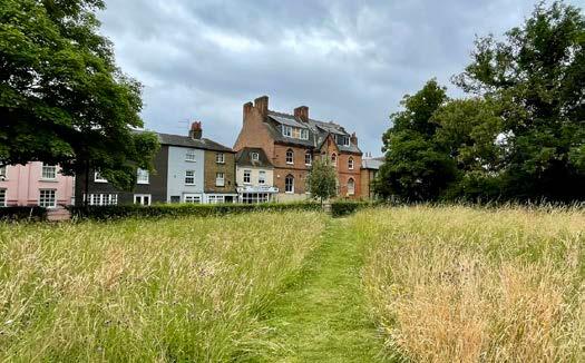
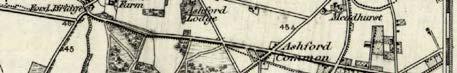
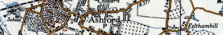
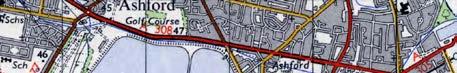
Ashford


Ashford is a large town located centrally within Spelthorne. The town is predominantly suburban with a high proportion of semi-detached homes. Ashford has a well-used High Street, a railway station, and several local / neighbourhood centres spread throughout the suburban area.

PAST
Ashford was originally recorded as Exeforde on the Middlesex Domesday map. The land was held by Robert, Count of Mortain, a half-brother to William the Conqueror.
The modern-day name of Ashford derives from a crossing point over the River Ash. In 1789, this crossing was upgraded to a stone bridge by the Hampton and Staines Turnpike Trust. Today, the river is located to the south of Ashford meandering north of Staines bypass and passing under Fordbridge Roundabout.
Before the 19th century, Ashford Common was a large area of common land found in the south and east of the town. This was used during the reign of King George III for British military displays.


Public rights were removed from this land in 1809 through the Enclosure Act, and much of the land is now developed.
In 1902, Ashford Manor Golf Club was established within Ashford’s manorial estate. In the same year, the construction of Staines Reservoir was completed. In 1924, construction of the Queen Mary Reservoir was completed. At the time, it was the largest reservoir in the world. The reservoir was used to test submersibles during World War II.


PRESENT
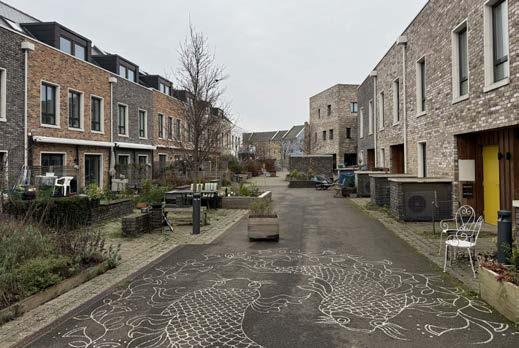
Ashford’s land use is largely suburban residential. The predominant housing type is low-rise detached and semi-detached; mainly built between 1885 and 1960. A recent development north of Church Road introduces some higher densities with apartment blocks up to five storeys high.
The town centre is predominantly linear in form along Church Road, extending east-west from St Matthew’s Parish Church to Ashford railway station. The centre includes a wide range of shops and services including several convenience stores, takeaways, coffee shops, hairdressers, health & beauty salons, a library and a bank.
Ashford includes eight primary schools and two secondary schools. Ashford Hospital is located northwest of the A30 London Road, providing mostly day surgical and outpatients services. The prison HMP Bronzefield is also located on the edge of Ashford. This is the largest female prison in Europe.
Ashford includes several churches, including CofE churches St Matthew’s (Church Road) and St Hilda’s (Woodthorpe Road); and Roman Catholic church St Michael’s (Fordbridge Road). The latter was designed by Sir Giles Gilbert Scott in a distinctive Romanesque Revival style, built in several stages between 1927 and 1960.
Access to green space in Ashford is limited to several relatively small green areas. These include Hengrove Park, Woodthorpe Road Play Area, Ashford Recreation Ground, and Feltham Hill Road Recreation Ground. Notably, Ashford Manor Golf Club constitutes a large proportion of the overall green space; however, this is not publicly accessible.
Find out more background information about the borough in Appendix A ‘Understanding Spelthorne Today’.
High Street
Sunbury Common
Queen Mary Reservoir Hospital A308
The Design Vision & Principles for Change
Ashford will be a safe, community-focused area with green spaces, a revitalised High Street, local parks, and minimal high-rise development. Community feedback emphasises keeping Ashford family-friendly with a focus on youth and vibrant public spaces.
DESIGN PRINCIPLES
Sustainable Urban Design
• Prioritise apartment development close to public transport and main streets
• A wide mix of different types of homes in new development, that integrate well and are inspired by the existing character of the town
Commitment to Green Space
• Trees, planting and street greening throughout the High Street, major roads and all public realm
Connectivity
• Improve walking and cycling space, especially around the High Street and station
• Successful car parking arrangements that do not add to the car dominance of streets
Strong, Mixed Communities
• Include space for local independent businesses as a core part of the appeal and vibrancy of the town centre
• Improve safety in public spaces
Climate Change Resilience
• Improve surface water permeability by converting impermeable hard surfaces to softer, permeable and planted spaces
• Create more shade and cooling in streets and open spaces
Where did this come from?
The Vision for the future and Principles for change were developed by the Spelthorne Design Code Citizens Panel and wider community through the engagement process.
Sunbury Common

PAST
The name ‘Sunbury’ has an unclear origin with variations of the name included in two AngloSaxon charters and the later Domesday Book of 1086.
Since early mapping, Sunbury Cross has been at the intersection of five main roads. Until the railway arrived in Sunbury in 1864, the area was mainly open fields. The arrival of the Shepperton branch line triggered development in the area.
A clock tower was constructed in the middle of the Sunbury Cross junction in 1897 to commemorate Queen Victoria’s diamond jubilee. Moved temporarily to the shopping centre in the 1960s following a vehicle accident, it was later reinstated to a prominent position by Sunbury
Sunbury Common is a post-war suburban residential area located to the north and west of the town centre at Sunbury Cross, located alongside the Sunbury Cross Roundabout and M3 motorway. The town centre is intersected by the Staines Road West (A308) dual carriageway, with a parade of shops to the north and Sunbury Cross shopping centre to the south.

Cross Roundabout in 1997 on the centenary of the
Significant change took place in the 1960s with the construction of several high-rise buildings and Sunbury Cross shopping centre. An example high-rise development was Spelthorne Grove apartment building, constructed between 196364. The building, today known as Cedar House,


PRESENT
Sunbury Cross offers a range of shops, fast food outlets, health & beauty services, convenience stores and supermarkets. Housing in the centre largely comprises high-density apartments located in tower blocks and above retail units. There are several community buildings include a library and church. Additionally, offices and a Premier Inn hotel are also located in the town. The town is well-connected by train with Sunbury railway station providing direct connections to London Waterloo.
The wider area of Sunbury Common includes several industrial estates and a large suburban residential area with a population of 8,500. The housing is predominantly post-1950s semidetached development. In the northwest is located the British Petroleum (BP) International Centre for Business & Technology; a large business park campus occupied exclusively by BP.
A key challenge faced by Sunbury Common and Sunbury Cross is the legacy of 1960s high-rise and car-oriented development. Large amounts of space are dedicated to the car and crossing Staines Road West is challenging due to the dual carriageway and railings, with the underpasses being undesirable for some users.
Find out more background information about the borough in Appendix A ‘Understanding Spelthorne Today’.
Sunbury Cross
BP Offices
Lower Sunbury
M3
A308
Kempton Park
The Design Vision & Principles for Change
Sunbury Common will become a safer, more human-scale place for residents and visitors, particularly in Sunbury Cross. Key priorities include improving accessibility for all, a comfortable and welcoming environment, reduced impact from vehicles, and reduced severance between places caused by infrastructure.
DESIGN PRINCIPLES
Sustainable Urban Design
• Prioritise apartment development close to public transport and main streets
• Built form that creates human-scale environments for people first with improved safety
Commitment to Green Space
• Trees, planting and street greening throughout major roads and all public realm
• New well-maintained green spaces that are designed positively, and not ‘leftover’ around buildings
Connectivity
• Reduce severance caused by infrastructure
• Improve walking and cycling provision in streets and to the rail station
• Reduce the dominance of cars in the streets
Strong, Mixed Communities
• Improve safety in public spaces
• Include a wide mix of homes, supported by community facilities
Climate Change Resilience
• Improve surface water permeability by converting impermeable hard surfaces to softer, permeable and planted spaces
• Create more shade and cooling in streets and open spaces
Where did this come from?
The Vision for the future and Principles for change were developed by the Spelthorne Design Code Citizens Panel and wider community through the engagement process.
Shepperton
The village of Shepperton is located to the south of the borough, spread across a number of localities. The village offers a wide range of shops and services. Shepperton railway station, a terminus station, is located to the north of the town and provides frequent direct connections to London Waterloo. Shepperton’s residential areas are frequently set within attractive tree-lined streets.

PAST
Shepperton’s location on the River Thames is significant due the importance of this river as a transport route since the late 13th century. Products including grain, vegetables, and building materials were transported by the river. To aid river navigation, Shepperton Lock and Sunbury Lock were built near Shepperton in the 1810s.
Shepperton village or ‘Old Shepperton’ is the oldest part of the settlement, with Church Square serving as the original settlement nucleus. The

square has a range of historic buildings, most notably the St Nicholas Parish Church, built in 1614. Sir Nikolaus Pevsner described the square, with its glimpse of the River Thames, as “one of the most perfect village pictures that the area has to offer”.
The construction of the Shepperton branch line in 1864 shifted the growth of the settlement northwards as Shepperton station was constructed 1 mile north of the original village. Shepperton developed to its current linear form down the High Street, connecting to Shepperton Village via Church Road.


PRESENT
Shepperton High Street is a thriving street with a wide range of shops and cafés, including independent businesses. The High Street is a wide road with parking roads either side. There is a good sense of enclosure owing to the mature trees which line the street. There is a large mix of land uses including housing, offices, a hotel, library and church; adding to the vibrancy of the area.
The residential areas in Shepperton are suburban developments mostly constructed in a linear pattern. Houses are mostly detached and semidetached, along tree-lined streets. Broadlands Avenue is an attractive area with generous plot sizes and large, detached houses.
There are several accessible green spaces in Shepperton, including Shepperton Recreation Ground and Manor Park. Unlike other areas in Spelthorne, Shepperton has close proximity to surrounding fields and rural areas, as well as Public Rights of Way providing a variety of walking routes.
Shepperton village today is a conservation area and has a more nucleated form compared to the more modern areas of Shepperton to the north. While Chertsey Road comprises predominantly older properties, mixed with largely sensitive additions; St Nicholas Drive represents 1960s expansion of the village with buildings that have little relationship to the historic context. However, the settlement retains its village feel due to its smaller size and separation from the rest of Shepperton to the north.
Find out more background information about the borough in Appendix A ‘Understanding Spelthorne Today’.
Shepperton Studios Littleton
Shepperton
Shepperton Green
The Design Vision & Principles for Change
Shepperton will preserve its village charm while embracing welldesigned new development. The community supports a new square in the centre, better cycling infrastructure along the Thames, and a semi-pedestrianised High Street that retains independent shops while supporting sustainable growth and transport.
PRINCIPLES
Sustainable Urban Design
• Ensure sensitive intensification of existing suburban areas reflects the existing street scene and architecture
Connectivity
• Improve walking and cycling provision in streets and to the rail station
• Reduce the dominance of cars and highway infrastructure in the streets
Commitment to Green Space
• Reflect the existing ‘green’ and verdant character of the place
• Include planting, seating and high quality materials throughout the public realm
Strong, Mixed Communities
• Improve safety in public spaces
• Include a wide mix of homes, supported by community facilities
Climate Change Resilience
• Improve surface water permeability by converting existing impermeable hard surfaces to softer, permeable and planted spaces
Where did this come from?
The Vision for the future and Principles for change were developed by the Spelthorne Design Code Citizens Panel and wider community through the engagement process.
Lower Sunbury

PAST
Lower Sunbury has long been a rural riverside village on the Thames. During the Georgian period, many larger properties were built particularly along the River Thames. Notably this included a group of Huguenot refugees, and it is possible that French Street is named after these settlers.
Lower Sunbury, also known as Sunbury Village, is located in the southern part of Sunbury-on-Thames, at the eastern boundary of Spelthorne Borough. Along the River Thames, it is a historic and characterful area which has retained a village feel despite its context near urban areas.

Sunbury Park, located close to the River Thames, is the site of a Tudor Manor House, built for a courtier of Elizabeth I. The site changed hands in 1851, and a large double winged house was built on the site. This was demolished in 1946 following dilapidation during World War II. The wider park, with historic walled garden, remains today. It is owned by Surrey County Council and managed by Spelthorne Council.

PRESENT
The centre of Lower Sunbury today is characterised by a village feel, due to the fine urban grain and variety of historical properties along Thames Street, which is narrow in places. Sunbury Park adds to the historical feel of the town, with its walled garden. There is a limited range of shops and services in the centre, including a convenience store and a small range of restaurants. Across Lower Sunbury, there are 3 secondary schools.
Lower Sunbury’s residential areas are comprised mostly of 1930s to 1960s semi-detached houses. These have more generous plot sizes and are generally larger properties compared to the nearby areas of Upper Sunbury and Ashford. There is good access to green space in Lower Sunbury, including Sunbury Park, Rivermead Island, and Lower Hampton Road Park. Lower Sunbury also benefits from close proximity to the River Thames, which is accessible via Rivermead Island and the Old Slipway Park. However, access is limited to the Thames along Thames Street due to buildings backing onto the river.
Find out more background information about the borough in Appendix A ‘Understanding Spelthorne Today’.
Kempton Park
Sunbury Cross
Upper Halliford
Sunbury Lock
River Thames
Sunbury Park
M3
The Design Vision & Principles for Change
Lower Sunbury will maintain its village-style, quiet character. Key priorities include improving accessibility for all, particularly those with reduced mobility. The community seeks a comfortable, welldesigned environment with ample common spaces, reduced congestion and a welcoming atmosphere.
PRINCIPLES
Sustainable Urban Design
• Ensure sensitive intensification of existing suburban areas reflects the existing street scene and architecture
• Use materials that reflect and complement the heritage of the surroundings
Commitment to Green Space
• Reflect the existing ‘green’ and verdant character of the place
• Include planting, seating and high quality materials throughout the public realm
Connectivity
• Improve walking and cycling provision in streets and to the rail station
• Enhance walking and cycling connections to, from and along the River Thames
Strong, Mixed Communities
• Improve safety in public spaces
• Include a wide mix of homes, supported by community facilities
Climate Change Resilience
• Improve surface water permeability by converting impermeable hard surfaces to softer, permeable and planted spaces
Where did this come from?
The Vision for the future and Principles for change were developed by the Spelthorne Design Code Citizens Panel and wider community through the engagement process.
DESIGN
Stanwell

Stanwell is a predominantly residential suburban area in the north of Spelthorne Borough, located east and northeast of the Staines Reservoirs. It is the northernmost settlement in Surrey. There is a small historic village centre to the north of Stanwell, with a village green, pub, church, and small range of shops and services. Stanwell is in close proximity to Heathrow Airport to the north.


PAST
The Domesday book of 1086 records ‘Stanwelle’, unusually retained by a man with an AngloSaxon name. In 1603, the manor of Stanwell was granted to Thomas Knyvet who helped to foil the attempt of Guy Fawkes to blow up the Houses of Parliament. Up until the 20th century the area was mainly farmland and moor land surrounding the village of Stanwell.
The extent of Stanwell was cut substantially during the 20th Century with the construction of the Staines Reservoirs in 1902 and the

development of Heathrow Airport (originally Harmondsworth Aerodrome) which became operational in 1930. Additionally, some land was taken west of Stanwell Moor for the construction of the M25 in the 1980s.
Large-scale construction of new homes began following World War II. Over 300 prefabricated houses were built between Town Lane and Long Lane between 1945 and 1948. Several smaller developments of terraced and semi-detached houses, including those either side of Park Road, were built since 1954 by the British Airways Staff Housing Society.
PRESENT
The suburban residential areas today comprise largely of semi-detached and terraced housing built between the 1950s to 1970s, with some early 21st century development. The urban form involves regular perimeter blocks with areas of green space distributed throughout. The historic centre of Stanwell retains a village feel distinct from the surrounding 20th century suburban development. The urban form is nucleated, with St Mary the Virgin Church and the village serving as focal points. A variety of historic properties from different time periods adds to the village character. The centre benefits from several shops and services including a convenience store, public house, a range of takeaways and a florist. There is a small commercial area within the northeast of Stanwell linked to airport activities.
There is a good provision of green space throughout Stanwell, including by the Stanwell village. This includes Village Park, Lauser Road Park, West Bedfont playing fields, and Clyde Road Park and playground.
Find out more background information about the borough in Appendix A ‘Understanding Spelthorne Today’.
Heathrow Airport
Staines Reservoirs
King
George VI Reservoir
Stanwell Moor
Stanwell Village
Ashford
The Design Vision & Principles for Change
Stanwell will develop a clearer place identity and have better integration with the rest of Spelthorne. Development should focus on addressing infrastructure gaps, prioritise healthy placemaking and create more connected spaces, both green and built, to foster community cohesion and opportunity.
DESIGN PRINCIPLES
Sustainable Urban Design
• Ensure that edges between different land uses successfully manage any impacts from one use to another
• Create places that have sufficient density to be vibrant, sustainable and safe
Commitment to Green Space
• Extend and enhance existing green spaces, with green corridors into new development
• Create new green spaces that can host community events and become places to meet, socialise and relax
Connectivity
• Enhance walking and cycling connections to existing streets and the wider context, including Heathrow and employment areas
• Improve the safety, security and attractiveness of existing links
Strong, Mixed Communities
• Prioritise health and wellbeing as a key design driver for new development
• Improve safety in public spaces
• Include a wide mix of homes, supported by community facilities
Climate Change Resilience
• Improve surface water permeability by converting impermeable hard surfaces to softer, permeable and planted spaces
• Create more shade and cooling in streets and open spaces
Where did this come from?
The Vision for the future and Principles for change were developed by the Spelthorne Design Code Citizens Panel and wider community through the engagement process.