HIGHER GROUND INITIATIVE LAND PORTION #230 Land Planning + Resiliency 10.01.2022 REPUBLIC OF NAURU Department of Climate Change & National Resilience METROCOLOGY

Prepared for:
THE GOVERNMENT OF THE REPUBLIC OF NAURU


Department of Climate Change & National Resilience
The Honourable Rennier Gadabu M.P., Minister for Climate Change and National Resilience
Under the leadership & guidance of:
The Ministerial Troika:
The Honorable Martin Hunt M.P.,
The Honorable Rennier Gadabu M.P.,
The Honorable Reagan Aliklik M.P.,
The Higher Ground Initiative Committee:
Marlene Moses
Berilyn Jeremiah
Reagan Moses
Novena Itsimaera
Chitra Jeremiah
Gabrissa Hartman
Yvette Duburiya
Newman Rykers
Dexter Bretchefeld
With support from:
Benedict Joseph Abourke
Chelsa Buramen
Minister for Finance and Sustainable Development
Minister for Climate Change and National Resilience
Minister for Nauru Rehabilitation Corporation
Chair
Secretary for Commerce Industry and Environment
Secretary for Climate Change and National Resilience
Secretary for Finance
Secretary for Foreign Affairs and Trade Secretary for Infrastructure
Secretary for Lands Management
Chair for RONPHOS Corporation
Chair for Nauru Rehabilitation Corporation
Operations Manager, Nauru Rehabilitation Corporation
Operations Manager, RONPHOS Corporation
METROCOLOGY
Prepared by: Mallory Baches
Demetri Baches and, Glenn Walters
Adeline Lerner
Shaoyu Chen
Project Director, Strategic Planning

Project Manager, Master Planning
Land Planning + Resiliency
Landscape & Site Planning
Landscape & Environmental Planning GIS

SECTION 1.0
SECTION 2.0
STRATEGIC PLANNING
SECTION 3.0
NEIGHBOURHOOD PLANNING
SECTION 4.0

TOWNSHIP PLANNING
SECTION 5.0
SECTION 6.0
ISLAND WIDE MASTER PLAN APPENDIX
SECTION 1.0
Human communities and natural habitats share many similarities. Both require diverse and complex environments to sustain themselves. When properly provided these environments nurture the interrelationships of varied community settlement patterns within metropolitan regions, and diverse ecosystems within natural habitats. When either environment is denied its inherent complexities or addressed in isolation of the other, it suffers and becomes unsustainable.
Having been subject to modeling and specialist professions over the previous half century, the human environment has been eroded to the point of abstraction. In the past, when a natural area was lost to human settlement, a hamlet, village, town, or city was gained in its place that was equally complex and diverse as the nature it replaced. The process represented an “even trade” between the natural and human environments; it can be argued that culture, economy, and the growth of society are as critical to humans as biodiversity and vibrant, evolving ecosystems are to nature. Today when a piece of nature is lost, a housing estate, shopping centre, or business park replaces it. These “products” represent a net loss to both systems: the natural habitat destroyed is replaced by substandard human habitat. Heavily reliant on modelling and simple
statistics to facilitate delivery, such “product-based” development ignores the underling complexity of people’s actions and needs.
Modelling, by definition, is a simplification of reality. Despite the good intentions of elected officials, planners, engineers, architects, environmentalists, and developers, typically when modelling is applied to complex systems like the human environment, the impacts are negative. The result is that today’s communities are made to suffer on two fronts: one at the hands of those who promote and enforce the simplistic system of specialties that encourage the improperly designed places we live in, and the other at the reactionary hands of those seeking to eliminate the negative impacts on the natural environment of these improperly designed places at any cost. Little if any serious attention is paid to the declining quality of life experienced by the human inhabitants of the places that result, nor to the general quality of the natural ecosystems that remain.
The Master Plan for Land Portion 230 is designed according to the principles and techniques of neotraditional or New Urban planning. The Plan encourages complex
relationships that leverage cultural, economic, and social forces called out in the Pillars of the Higher Ground Initiative’s mandates as well as the United Nations Sustainable Development Goals.1 The neighbourhoods and township that result from the guidance of these frameworks are critical to Nauru and its future as a sovereign nation because they provide the basis for living within the context of a world increasingly reliant on resilient strategies for survival. Laying the foundations for and sustaining community is one of the most important of human endeavours. Because it is apparent throughout the world that the conventional model of development has not resulted in better communities, the Master Plan for LP230 is intended to illustrate what the mandates set forth by Government would look like for a Nauru that balances the human and natural habitats over the decades to come.
If nothing were done to describe a vision for the future of Nauru, then the existing land tenure practices, adhoc development, inappropriate housing designs, and lack of land use regulations would dictate a very different future to that proposed by the LP230 Master Plan. Over the lifetimes of the next generation, the probability of Nauru remaining an independent nation state, without a holistic and comprehensive vision, is debatable.
The Island’s existing housing stock requires repair and renovations, and new housing is urgently needed to alleviate over-crowding and the debilitating social and economic consequences that stem from such conditions. One solution is to rely on the remediation of previously undevelopable land on Topside; relocating existing residents there, especially those in need of new housing and/or who must migrate from increasingly vulnerable areas susceptible to erosion and inundation resulting from sea level rise, is a simple and straightforward solution. However, it is only the first of many steps requiring a coordinated and holistic approach by Government, one which must manage the migration, deliver the homes, and build the settlements that will be needed. Inadequate planning of any of these efforts will jeopardize the success of the
Higher Ground Initiative (HGI). For example, the building of new communities and settlements that consume too much of the Island’s most precious resource — its land — will render any efforts to deliver improved housing a fleeting success. Any plan to design resilient communities without also planing for the restoration of the Island’s natural environment and developing sustainable food production systems will leave new development unsustainable, no matter the quality. Therefore, the successful solution to the Nation’s challenges promised by HGI depends on tailoring a master planning vision that balances the Island’s capacity to carry its current population, with the population’s ability to implement and maintain the social and environmental systems needed to secure their sovereignty.
Outside dependencies are Nauru’s greatest vulnerability. As uncertainties in global supply chains increase, global political unrest grows, and changes to weather patterns unfold, it is imperative that the Nation establish a level of housing and food security capable of offsetting external shocks. Nauru must have a durable vision on all fronts, in order for HGI to succeed.
Conventional planing is characterized by segregated uses accessed primarily by motorized vehicles, and generates the greatest amount of negative externalities caused by development, more so than any other form of planning. In fact, low density car-dependent development is behind only industrial agriculture, in total carbon emissions footprint. Conventional planning results in the least productive pattern of development, consistently unable to generate the revenues necessary to fund the cost of infrastructure needed to service it. Conventional planning is the most consumptive form of planning, generating a disproportionate coverage of land in relation to the number of people it can accommodate. In a small island nation such as Nauru, any one negative externality would be enough to seriously threaten the viability of the HGI mandate, and the future sovereignty of the Nation. All three occurring together guarantee failure. It is therefore imperative to develop a vision for the future of Nauru that is based on a different model of planning and development, one that is community based.
The vision for Nauru employs the principles and techniques of community-based planning as championed by the Smart Growth and New Urbanism movements in the United States, Europe, and Australasia. Integral to HGI’s success
is the proper selection of the type of housing and its constructability. Selecting the proper planning approach informs all other elements involved in delivering community, from housing to agriculture and the natural environment. For example, any solution to the need for improved housing must prioritize “durability,” balancing it with other considerations including even cost. Without durable housing, there are no sustainable communities. Currently almost all building materials are imported into Nauru. This is the same for food and fuel. Building a future that generates local skills and capacities to implement and maintain the systems that deliver housing, food and energy will be the basis for resiliency.
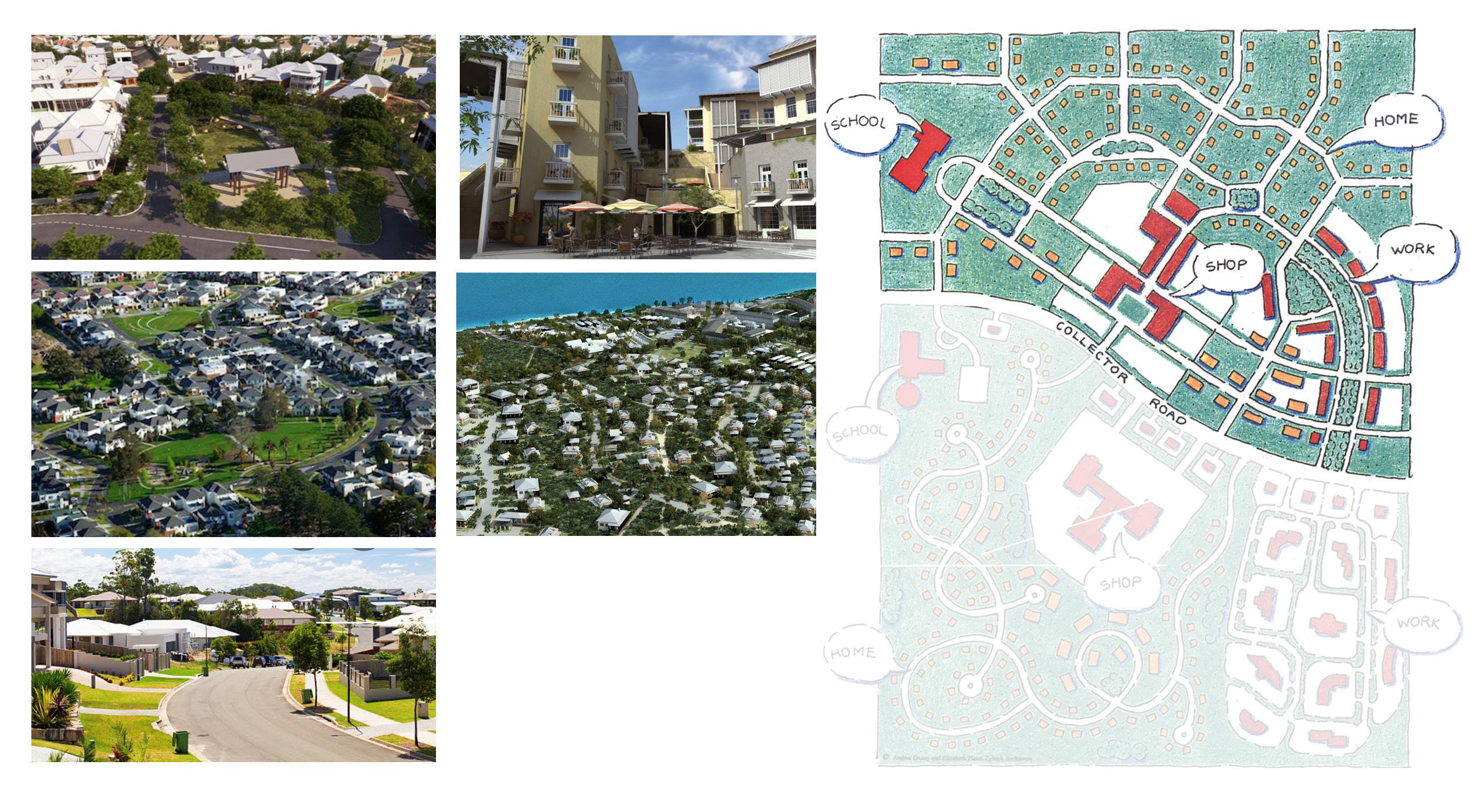
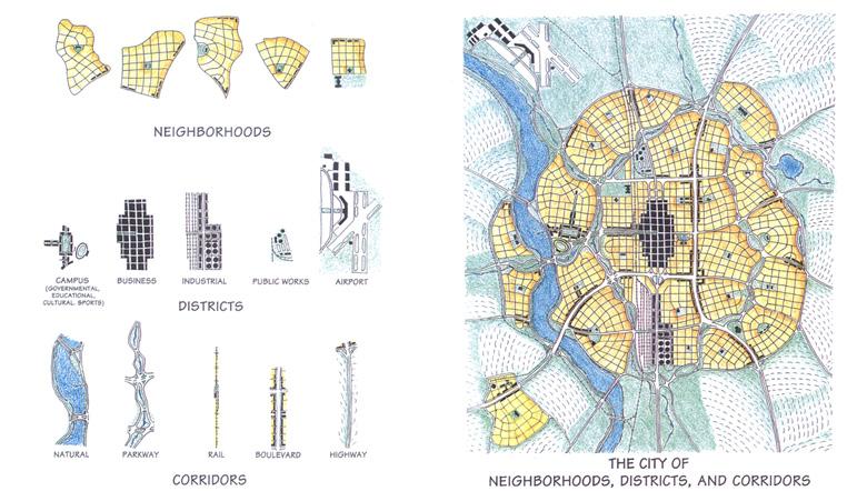
A transect describes a geographical cross-section of a region, which can be used to reveal a sequence of environments. For human environments, this cross-section can be used to depict a set of habitats that vary by their level and intensity of urban character, a continuum that ranges from rural to urban. In transect planning, this range of environments is the basis for organizing the components of the built form: building, lot, land use, street, and all the other physical and functional elements that create the character of a place. One of the key concepts of transect planning is the idea of creating what are called “immersive environments”.
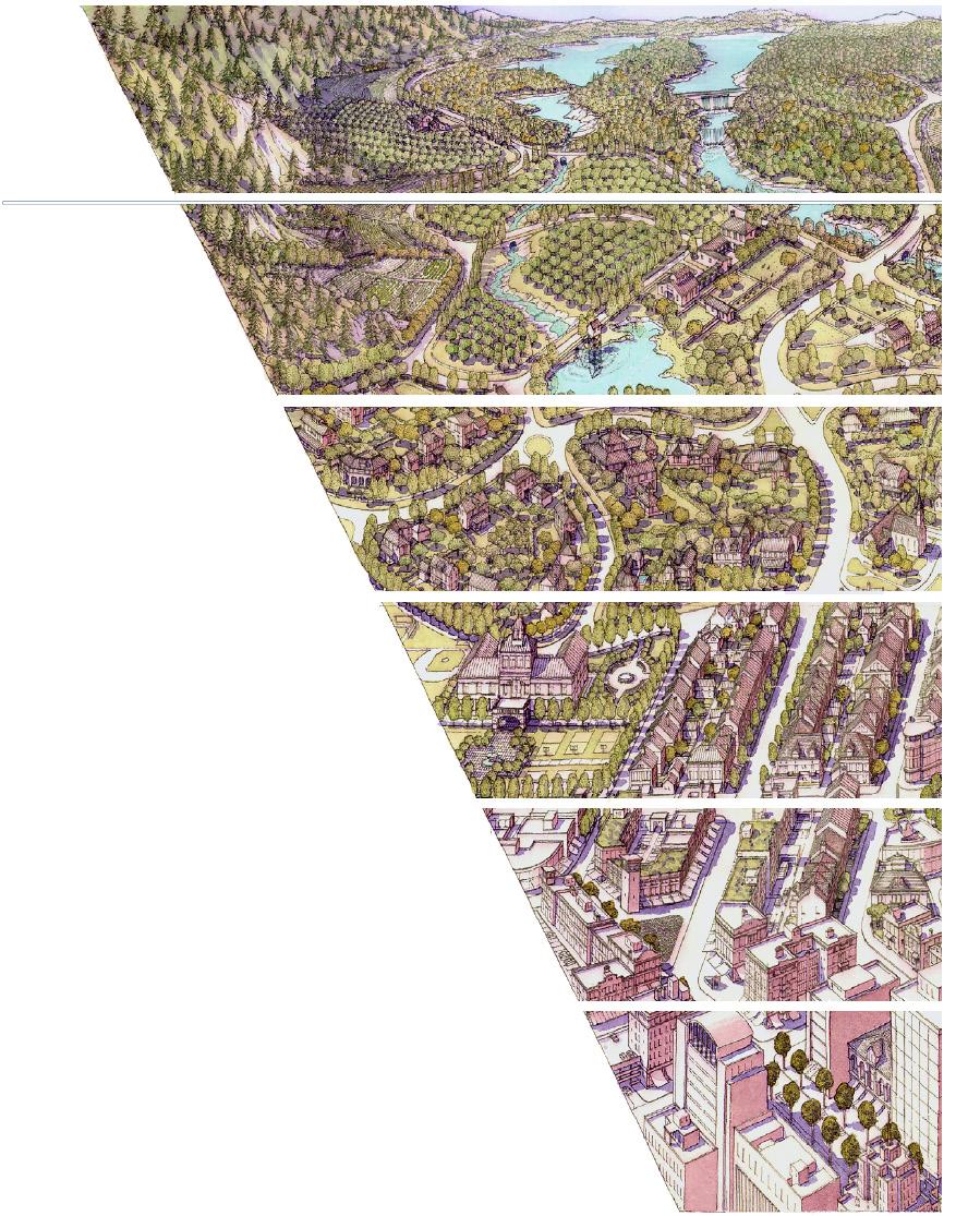
Successful immersive environments are based on the selection and arrangement of all the components that together comprise a particular type of environment. Each environment, or “transect zone,” is comprised of elements that keep it true to its specific character. Through a complete understanding of the transect, planners can specify different urban intensities that look and feel appropriate to their locations. For instance, a farmhouse would not contribute to the immersive quality of town centre, whereas a two or three floor apartment or commercial building would. Wide
streets and open swales find a place on the transect in more rural areas, while narrow streets with sidewalks and curbs are appropriate for urban areas.
The idea of the transect originated in the 1900’s as an ecological tool used to describe a series of natural habitats. A typical example is the transect that runs from ocean - tobeach - to - dune line, in to a coastal forest. The transect allows scientists to study each habitat and observe the constituent elements of each. The idea has been found to apply equally well to the human habitat, and has been used as a tool for master planning and urban design since the 1990’s.
For example, communities can be assigned zones based on the locallydesired level of density and intensity of activities. The highest intensity and density zone are located at the centre of large cities. The next level of density and intensity are assigned to the high streets and adjoining areas around the centres of cities, as well as the actual centres of towns and villages.
The zones covering the largest areas of all community types represent the residential neighbourhoods that surround the centres and high streets
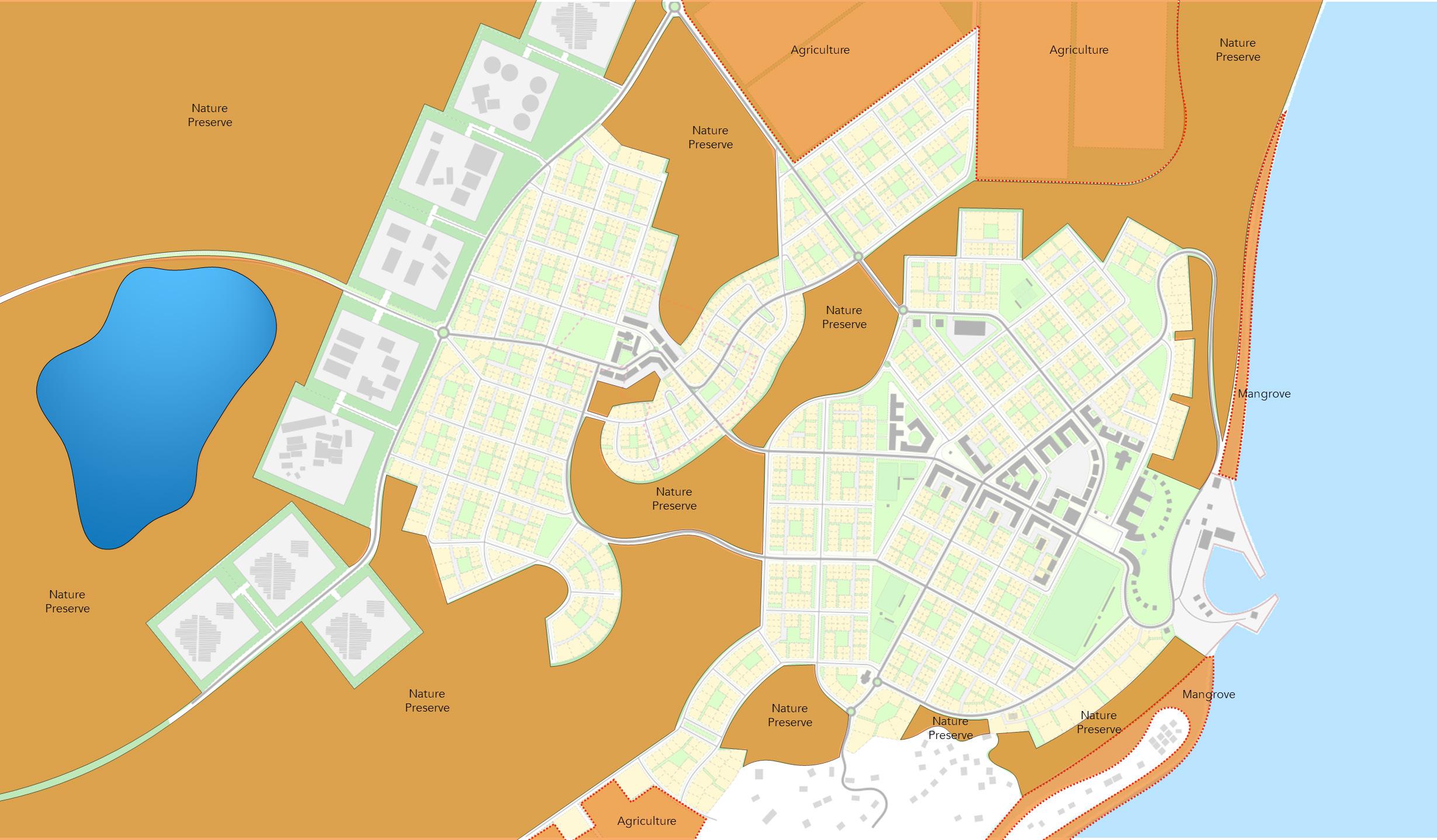
of cities, towns and villages. The lowest densities and intensities are located along the periphery of communities, where housing and development give way to rural and agricultural areas. Interspersed within these rural areas are natural preserves, representing land set aside for conservation such as forests and other environmental assets.
Each Transect Zone constitutes a lifestyle providing people opportunities and experiences based on their individual preferences. These can change over time, and even from day to day. The common thread for any well-planned community is that access to all these lifestyle choices are within a 10- to 15-minute walk. Transect based designs find a place for everyone and everything. The master plan for Land Portion 230 depicts a village community, one that can grow over time based on need into a Town.

Nauru has no shortage of studies, assessments, and reporting produced over the previous fifty years covering almost all topics related to the geography, environment, and development of the Island. The plans, designs, and strategies presented in this HGI Land Planning & Resiliency report are heavily informed by two documents in particular: the 1994 Master Land Use Plan, prepared by the Nauru Australia Corp.; and the Nauru Higher Ground Project 2020, prepared by Calibre & More & Co.
The 1994 Master Land Use Plan contains a wealth of information, and was used to establish a base of understanding concerning the Island’s potential for redevelopment, employing the principles and techniques of Transect Planning. The 1994 Plan’s analysis of remediating mined lands to enable habitation and natural restoration, and the mapping of specific geologies and geographic conditions, were instrumental in determining the broad Strategic Plan for locating new settlements and determining how these would be connected to the existing settlement patterns and infrastructure in Nauru, as presented in this Report.
The Nauru Higher Ground Project 2020 took the 1994 Plan a step further, proposing new settlement plans for housing and infrastructure on Topside based on potential sea level rise resulting from global

climate change. The scope, divided into three stages, also involved a workshop with Stakeholders and delivered a concept programme and estimated cost for the proposed initiatives. These findings and corresponding plans provided context for the community site planning and Island-wide master plan presented in this Report. They also informed the further need to engage in a “master planning” process for restoration of the natural environment and creation of on-Island agricultural production, equal to that for the community planning presented herein.
The land development model most commonly utilized around the globe following World War II has proven to be unsustainable economically and inequitable, nor is it climate resilient.
Today the adoption of these models by both developed and still-developing nations is a key driver of global climate change and rising economic inequality.
The administration, implementation, and maintenance of land development based on industrial-scaled planning and construction methods reinforces reliance on foreign loan programs, specialized skills and expertise, and supply chain delivery schedules.
There are alternative models proven to tackle the many problems associated with this predominant contemporary approach. They are based on observations of successful places, both traditional and contemporary.
These models have become known as New Urbanism, Smart Growth, and Livable Communities.
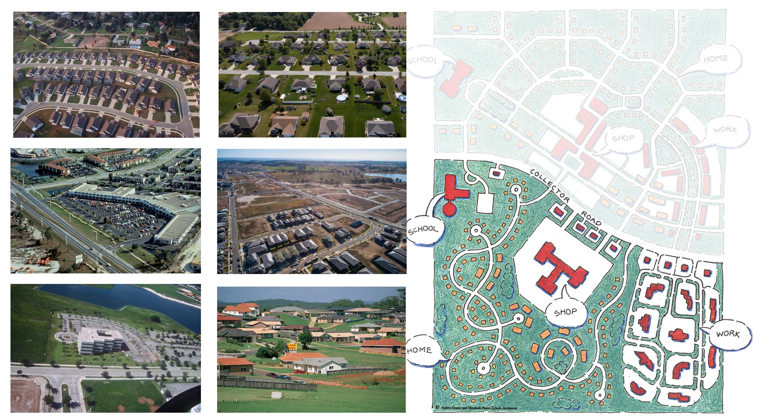
The planning approach described by the terms New Urbanism, Smart Growth, and Livable Communities is based on the design principles of time-tested communities. The communities that result are inherently resilient, especially in regards to energy consumption and economic sustainability.
Neighbourhood-based master plans promote healthier populations, broader participation in social and economic opportunities, and are less damaging to the natural environment.
The model is similar throughout the world, and easily adaptable to different climates, geographies, and cultures. The main principles of neighbourhoodbased planning are the 5-minute pedestrian walk to most daily needs, a mix of housing options and densities, an interconnected network of streets and pedestrian ways, a generous distribution of open spaces within walking distance of all residences, and the prominent location of civic institutions dispersed throughout the community.
The Neighbourhood Planning model optimizes land development differently from Contemporary Planning. This difference is foundational to the success of all long-term initiatives aimed at maintaining Nauru as a viable nation state. The key resides in the model’s ability to conserve natural land while maximizing land that is used for development. A resilient human habitat is only viable in Nauru if supportive agricultural and natural habitats can be protected and nurtured in tandem with new communities.
The neighbourhood model employs the 5-minute pedestrian shed as the basis for allocating many daily needs within easy reach of residents on foot. Growth is accommodated by adding 5-minute walking neighbourhoods as needed. In this way, a single neighbourhood can grow to become a village, town, or even a city if need be, consisting of multiple 5-minute walkable neighbourhoods. Each neighbourhood enables efficient access to services and amenities while maximizing flexibility in housing and lifestyle options for residents. The human habitat created by Neighbourhood Planning lays the foundation for economic and social resiliency, and just as importantly, enables the planning and development of natural and
agricultural systems that must exist to support the sustainability of the Island.
Higher Ground Initiative (HGI)
HGI is a generational undertaking to ensure the long term survival and viability of Nauru as a sovereign nation state.
HGI PILLARS SUPPORTED BY CONTEMPORARY PLANNING
Economic Diversification
Affordable Green Housing
Education & Training
Food Security
Water Security
Public Health
Environmental Restoration
Cultural Restoration
Good Governance
Existing conditions on Nauru present significant challenges to fulfilling the Pillars of the Higher Ground Initiative. When fully acknowledged, the tasks required to solve the core challenge of this project and fully implement the Cabinet’s mandate require the transformation of many of the Nauru’s economic, institutional, and living arrangements to secure a higher quality of life that is more resilient and economically sustainable. In this regard, HGI represents the building of a Nauru 2.0, a second phase of the evolution of the nation, inclusive of smarter homes and buildings to create smarter neighbourhoods and communities, that together will create a smarter nation.
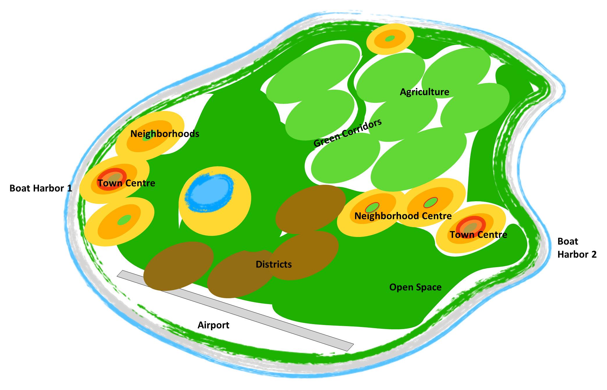
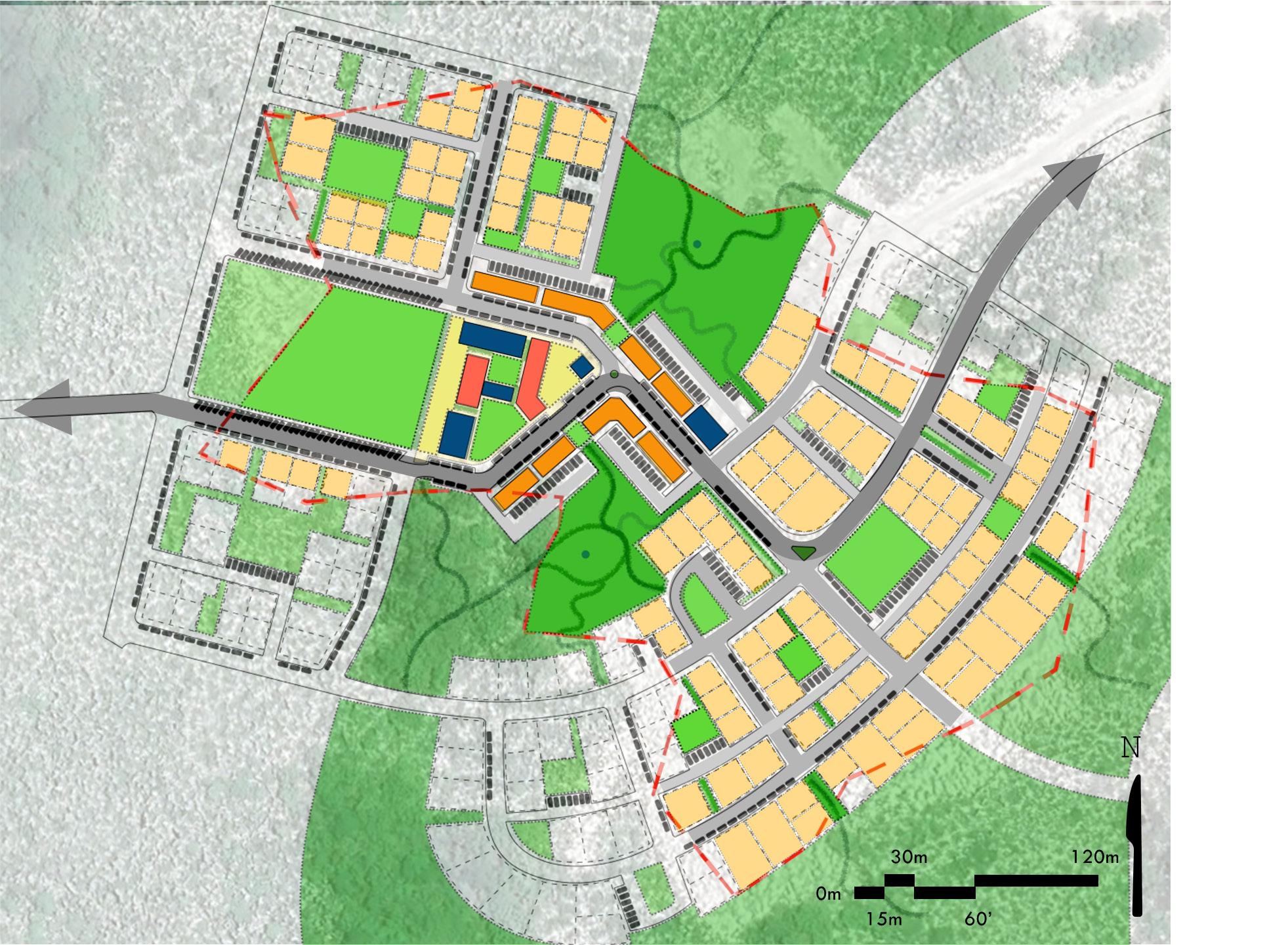
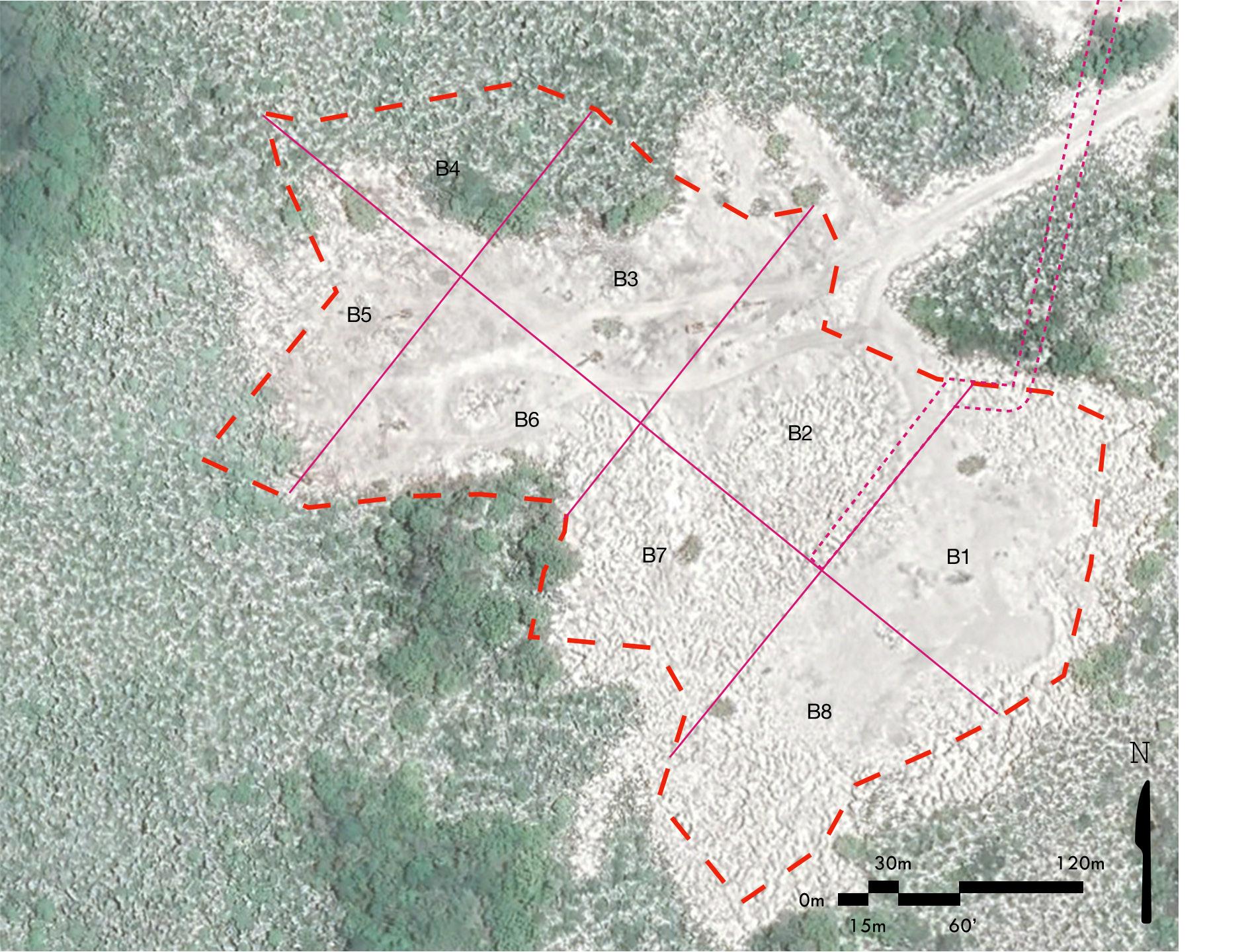
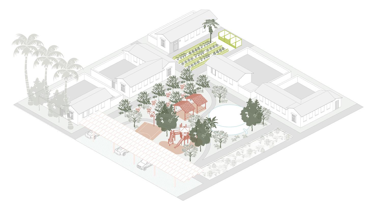
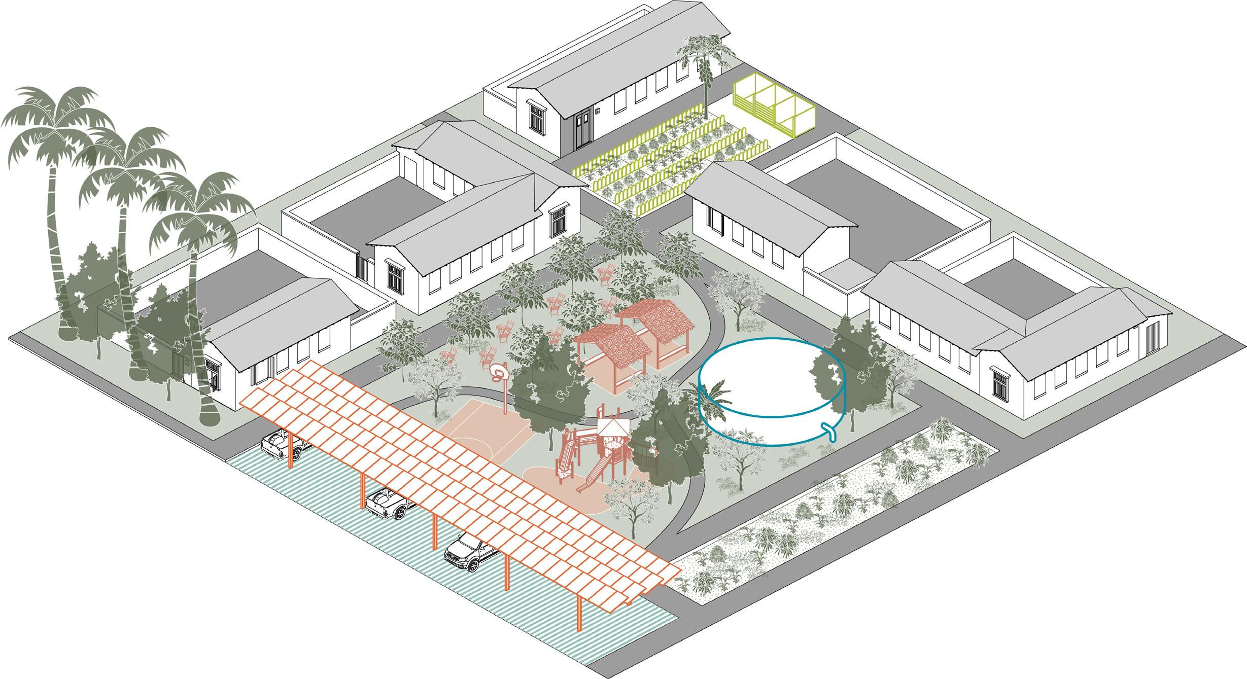
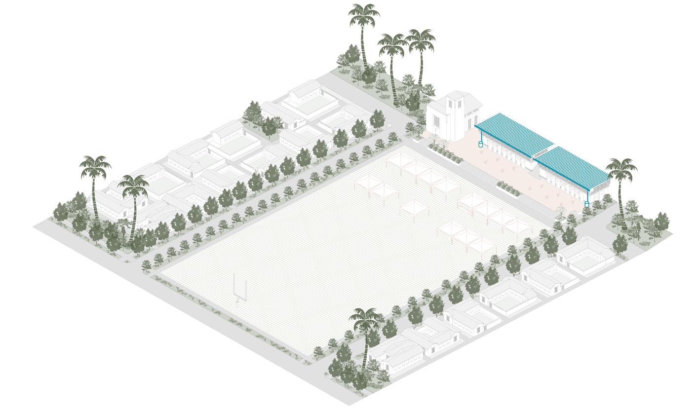
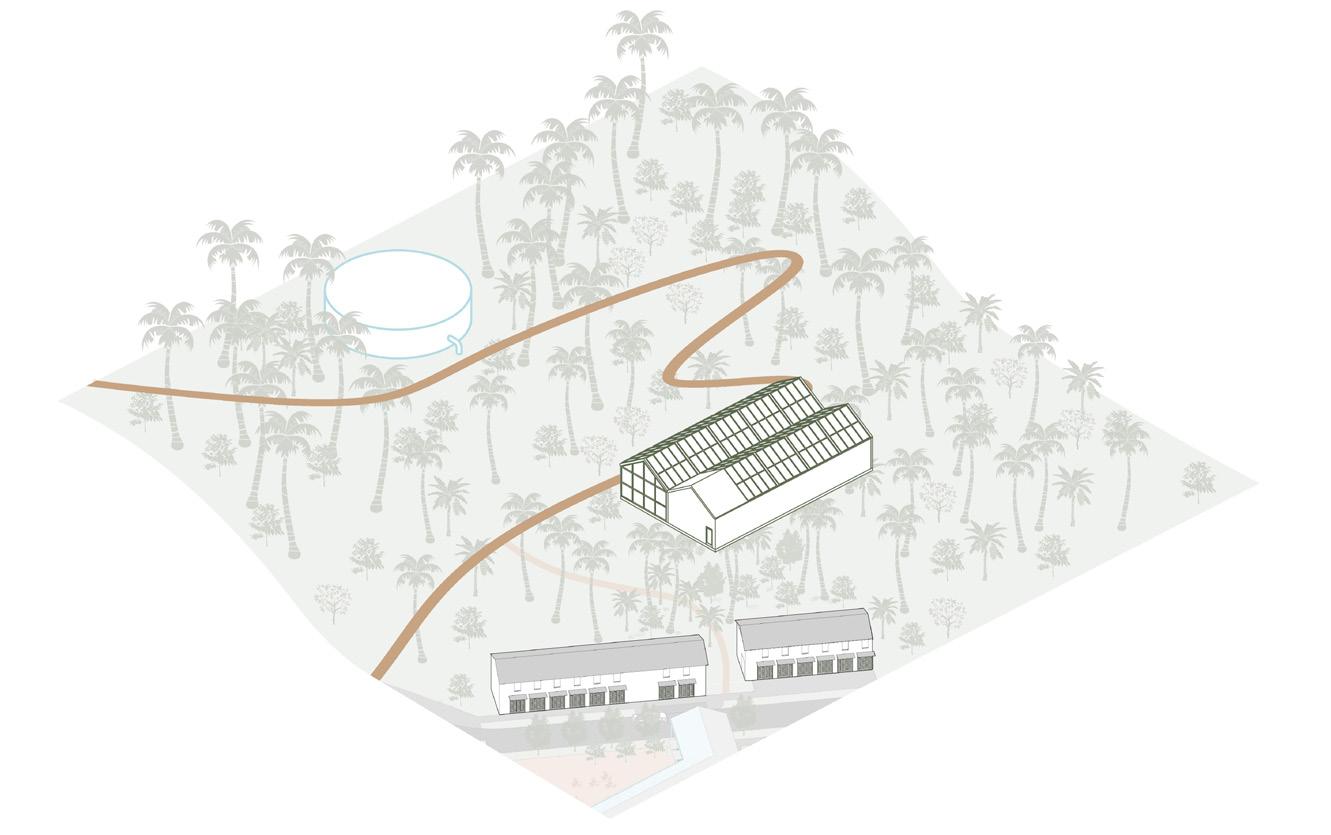
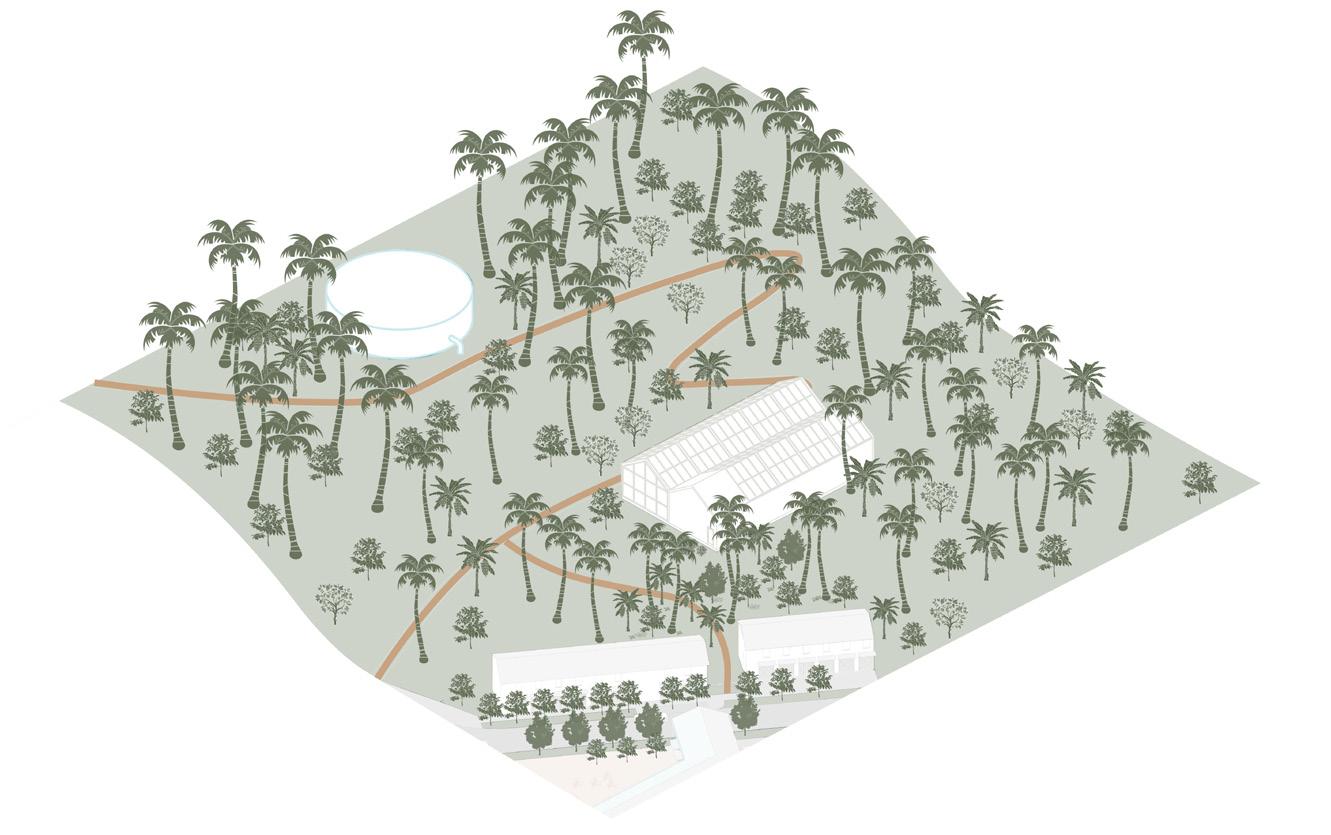
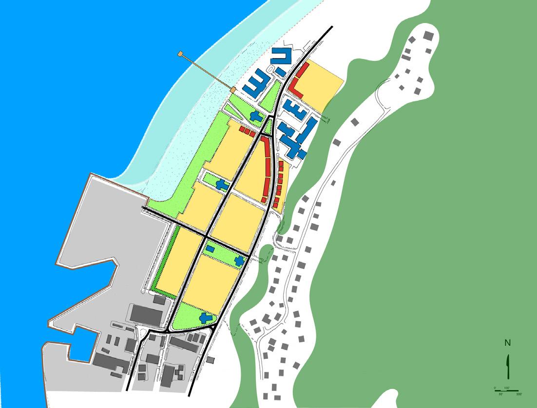
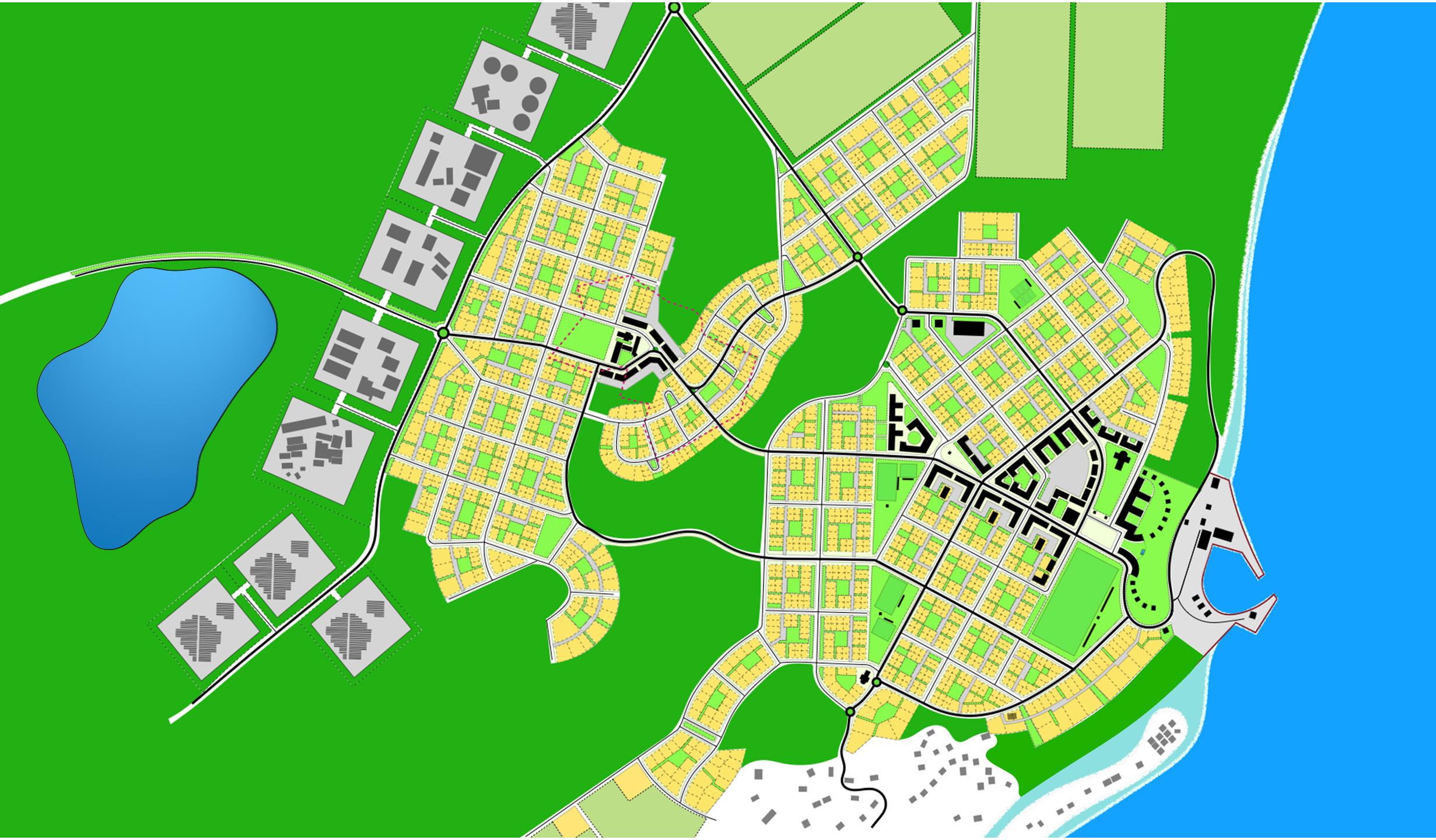
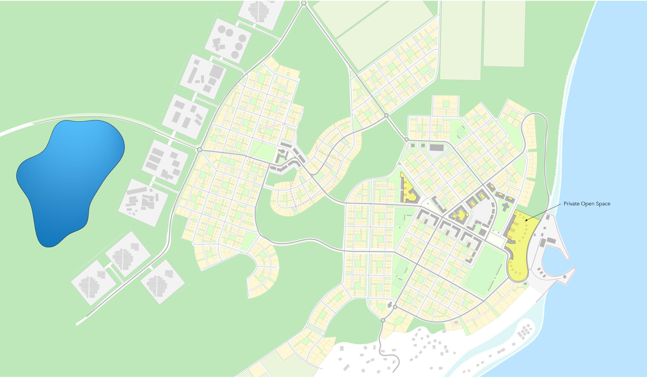
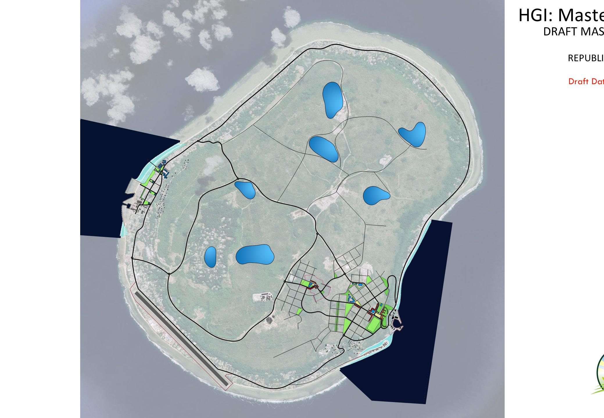
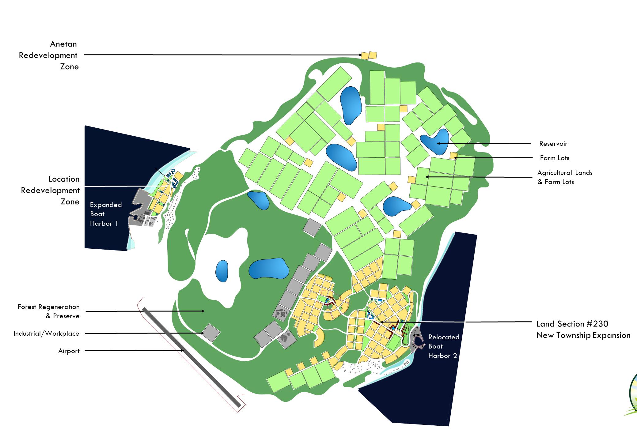
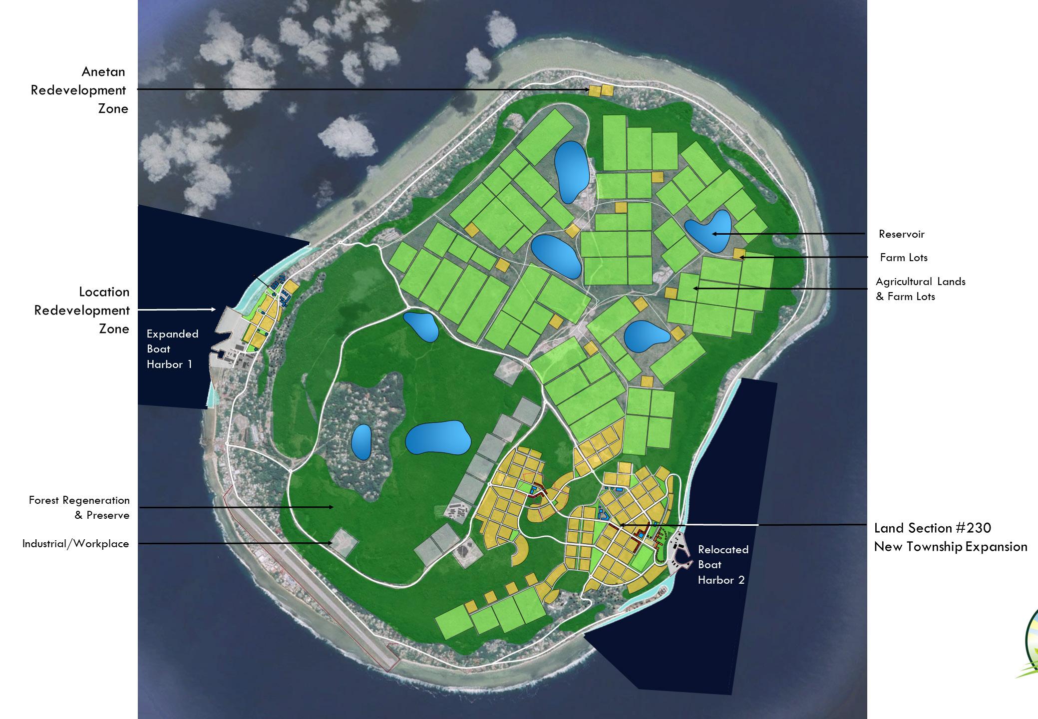
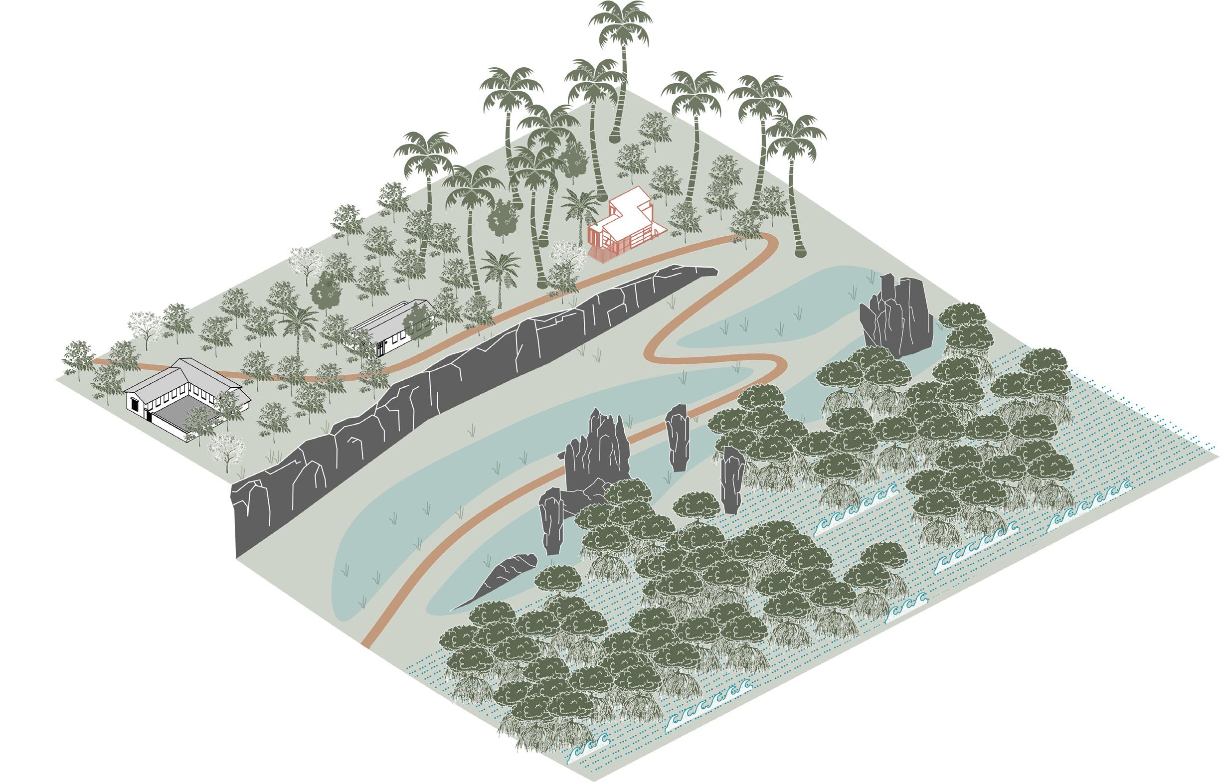
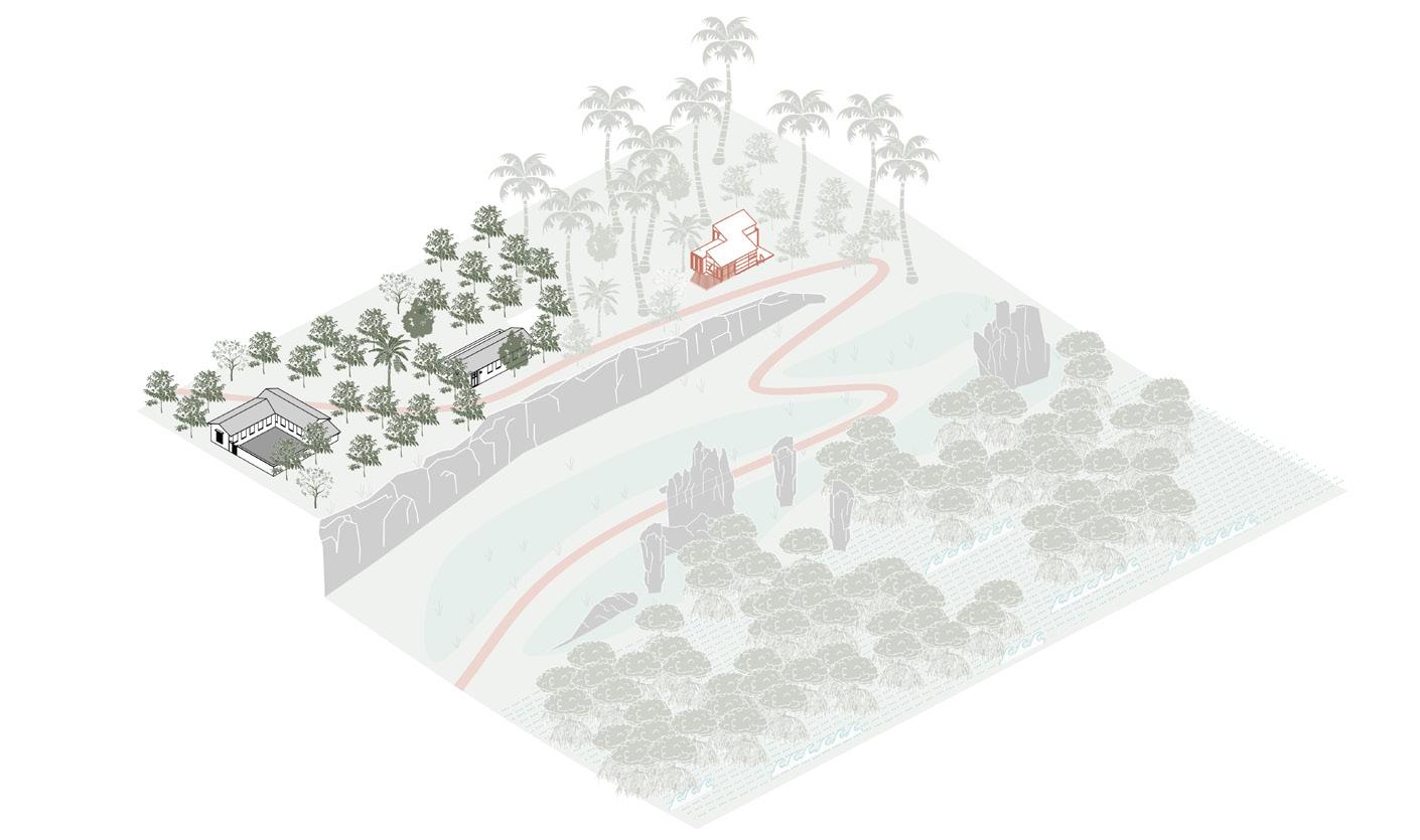
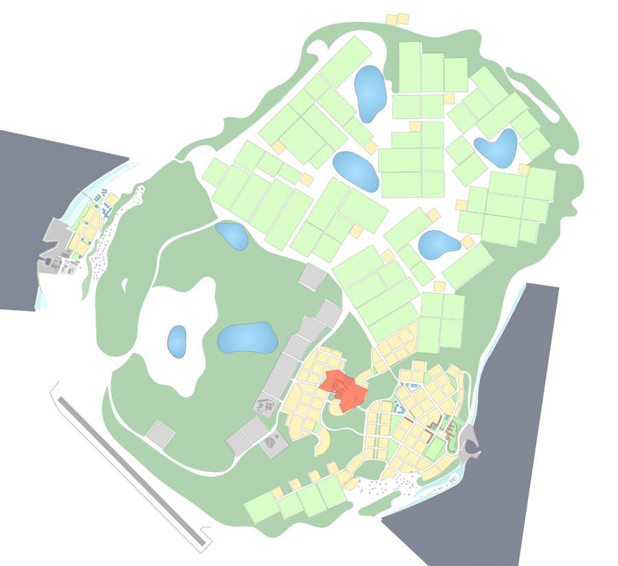
The Pilot Project that will initiate the tasks required, and showcase the solutions needed, is the development of Land Portion 230 (LP230). At approximately 10 hectares, this Government controlled land provides a multi-purpose platform for a “whole of government approach” to build security and resiliency for the residents of Nauru, using the planning principles and techniques of neighbourhood and community design.
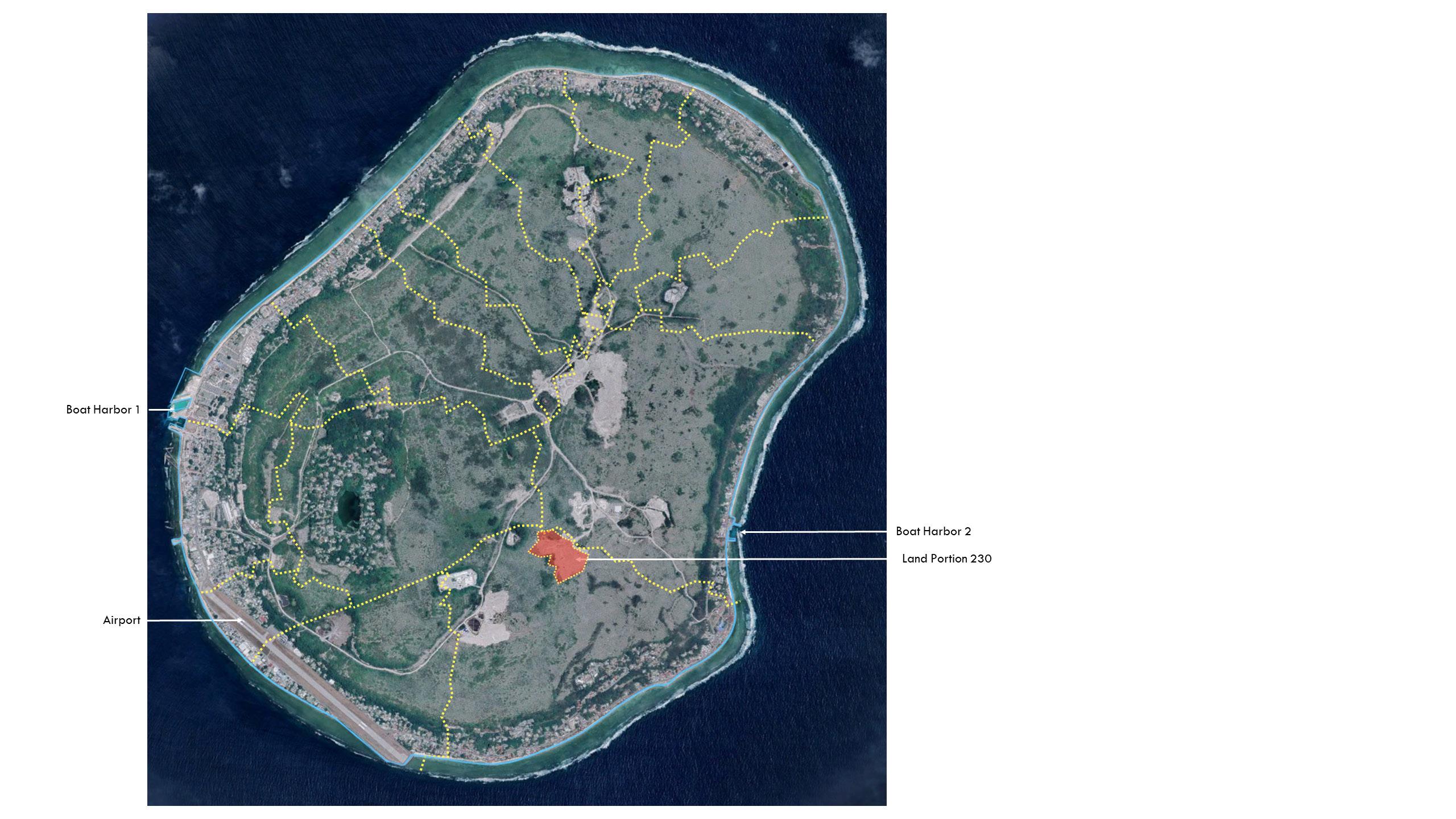
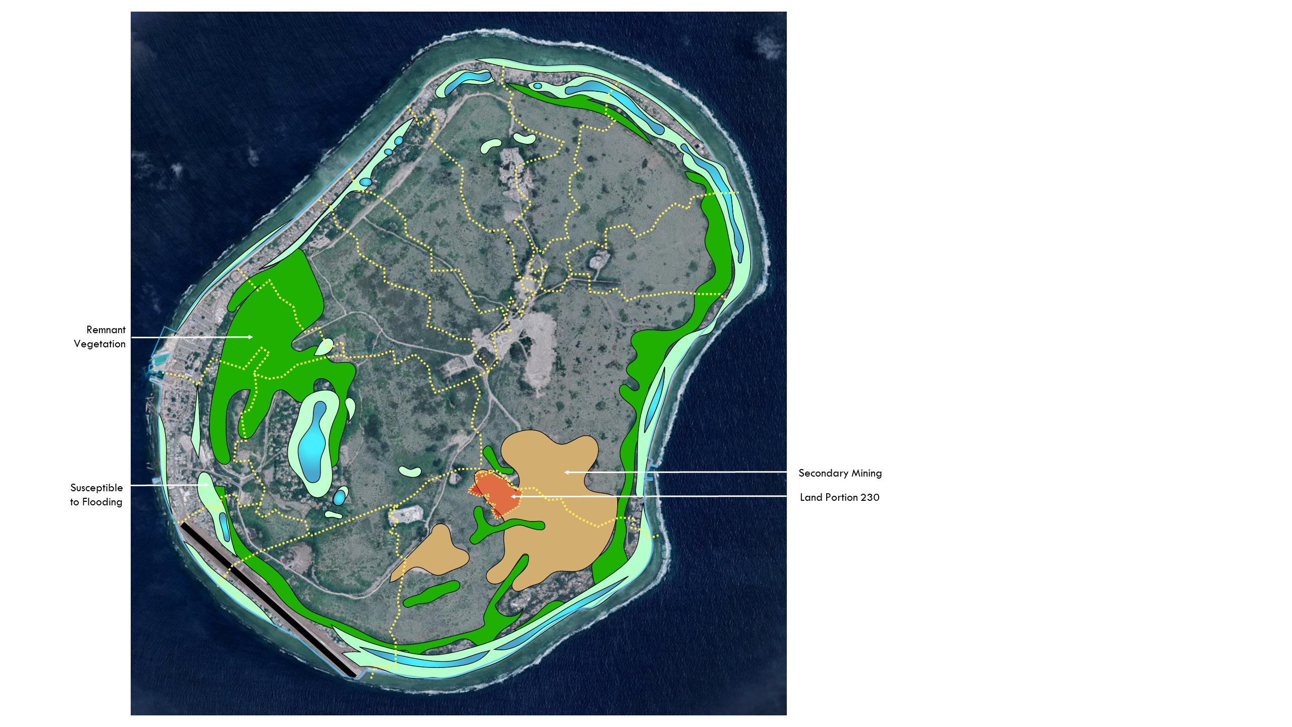
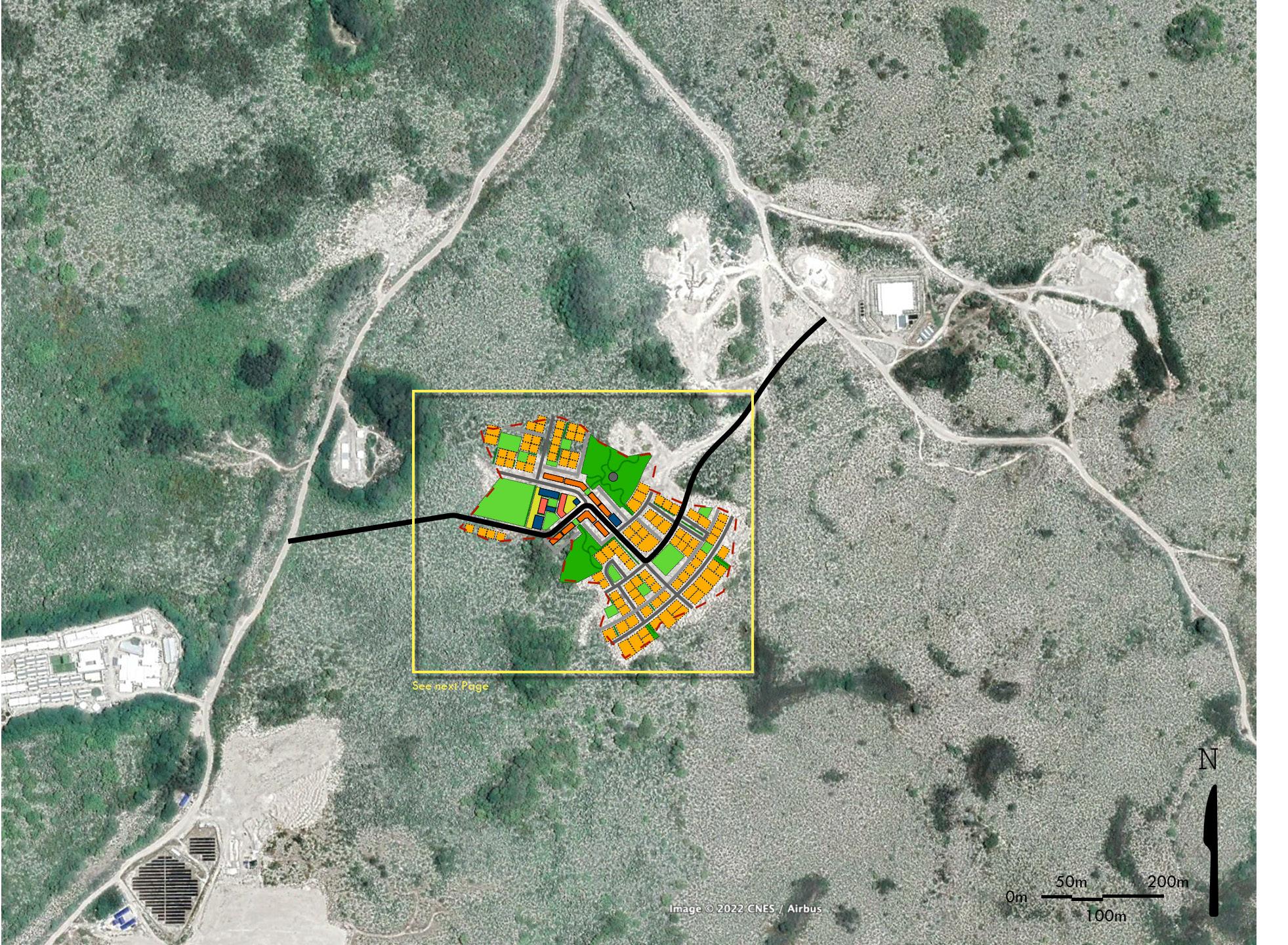
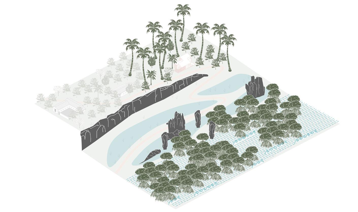
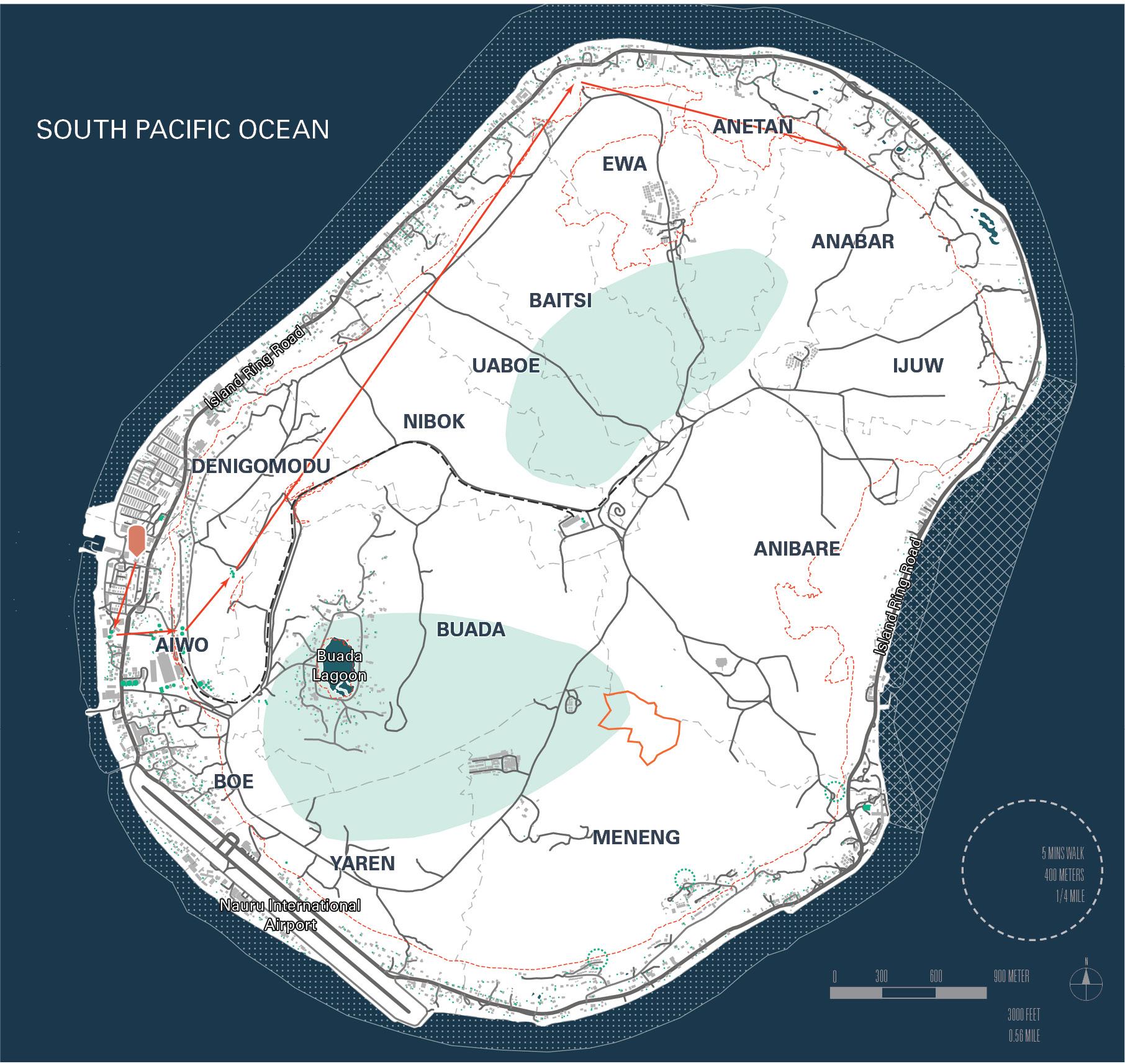
LP230’s geographic location is ideally suited for redevelopment. The property and adjacent lands are some of the most heavily disturbed areas resulting from previous mining on Topside.. Secondary mining is currently underway and once completed, the land will become available for new settlement. Development at LP230 will not infringe upon the scarce vegetation remaining on the Island. SECTION
LP230’s geographic location is ideally suited to provide a link between the east and west sides of the Island, serving as a focus for the managed migration to Topside, of areas along the shores of Nauru that are vulnerable to sea level rise..
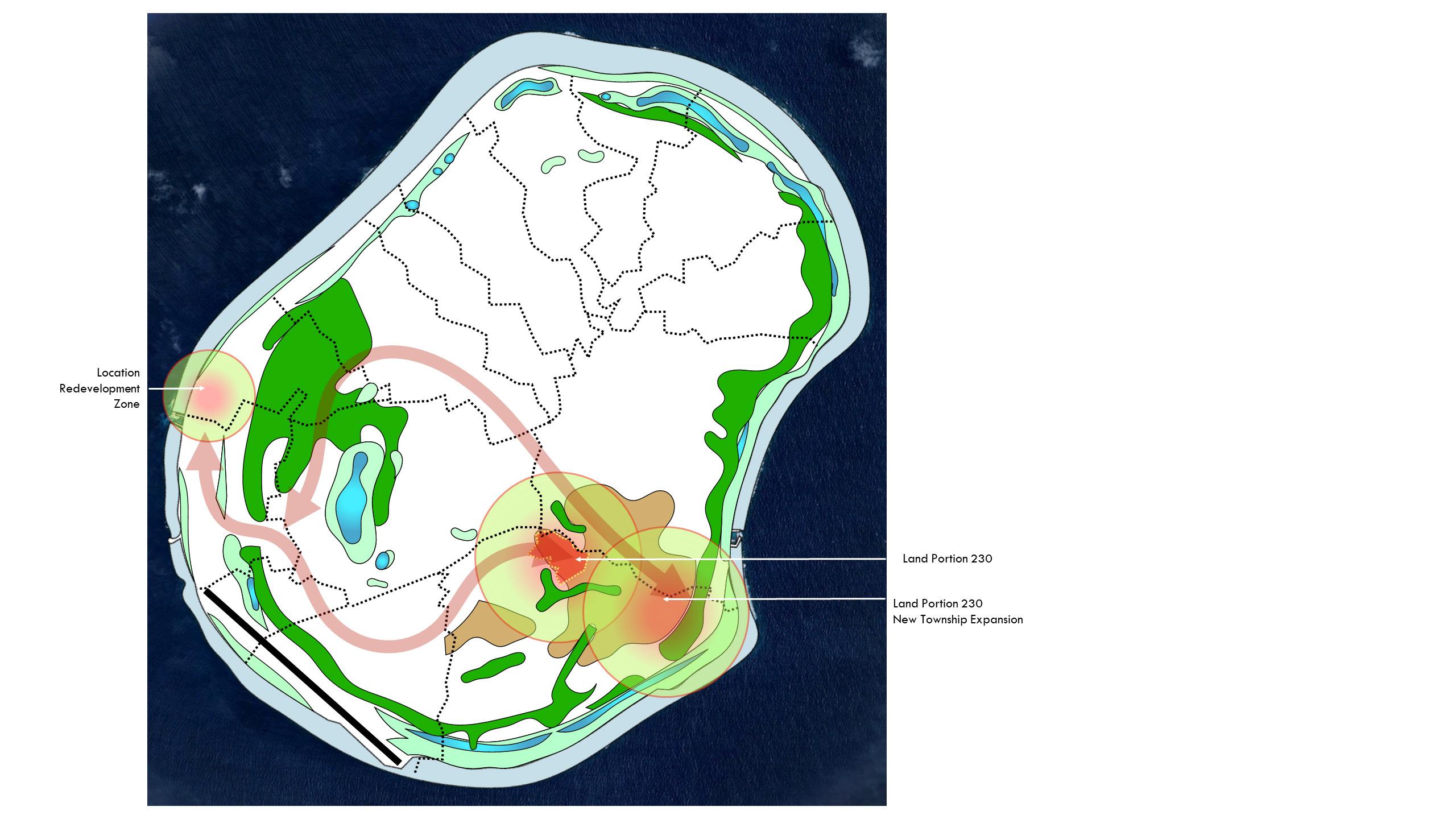
LP230 is proximate to existing areas of population, road access, Boat Harbor #2, and electric utilities.
SECTION 2.0
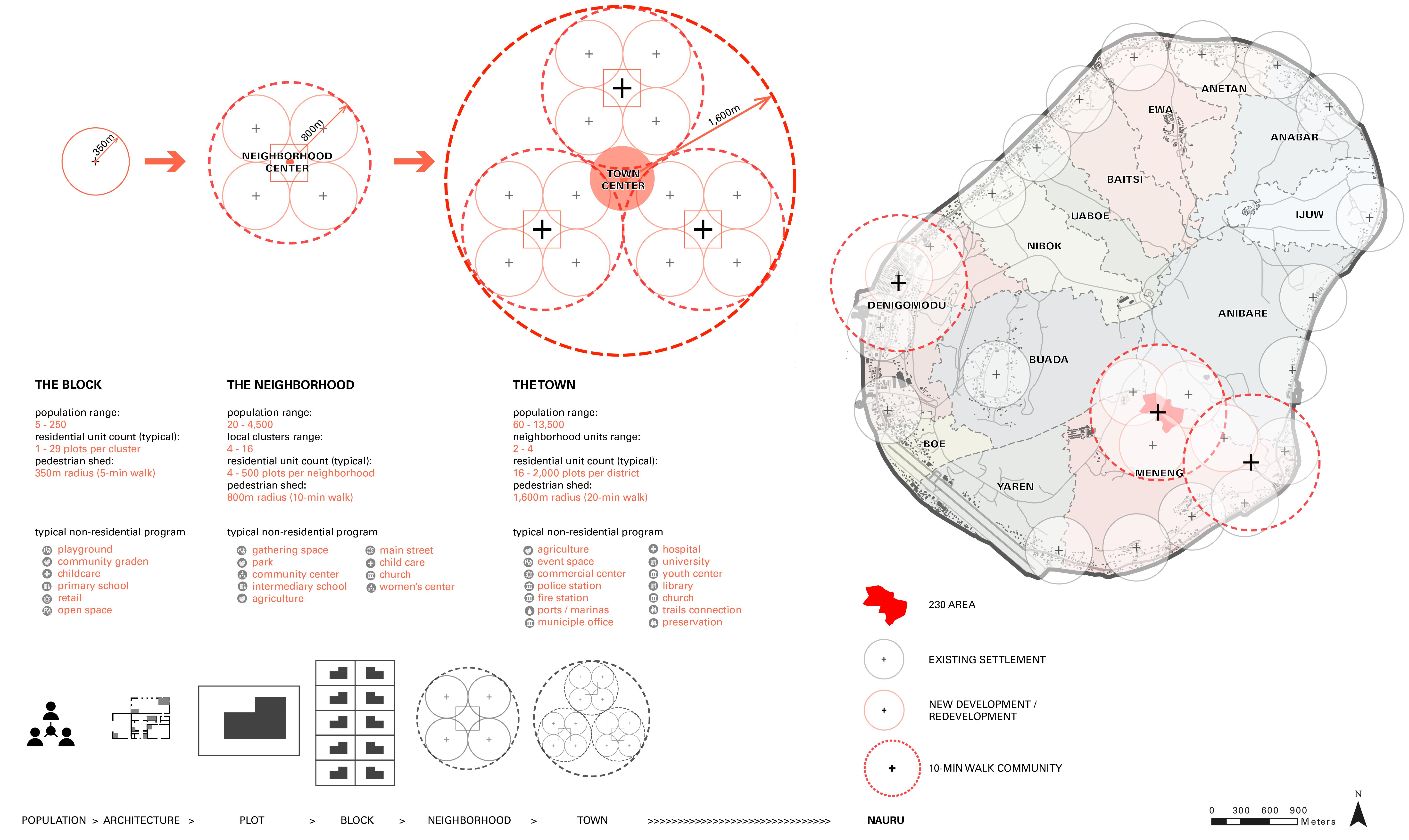
Resilient community land planning and urban design require understanding of the carrying capacity of the land that is being planned. The term “carrying capacity” refers to the ability, and to what degree, land is able to be inhabited. Determining the population target establishes how many offices and shops are needed, what level of infrastructure is required to adequately service the population and businesses proposed, what provisions for fire, safety, medical, and educational facilities should be made, and how to budget for the ongoing maintenance of all the above. Transect-based planning uses the increment of the neighbourhood as the defining structure for all community design. Within each of the 10-minute catchments that constitute a neighbourhood, the plan allocates a mix of uses, housing, and recreational spaces to permit most daily needs to be achieved within a short walk. This foundation enables a robust method for designing over large areas, in order to achieve quantifiable outcomes that can determine the practicality of a plan.
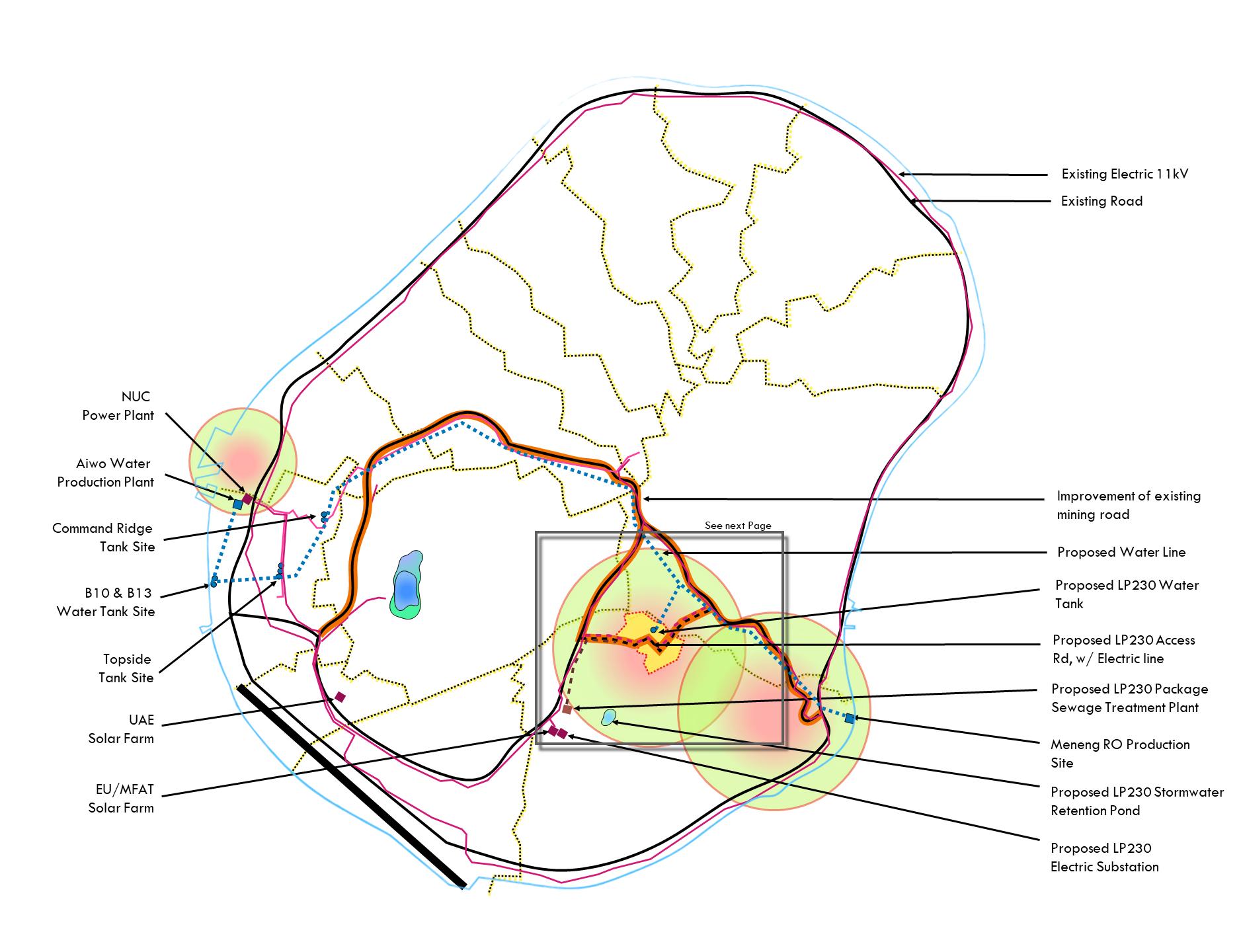
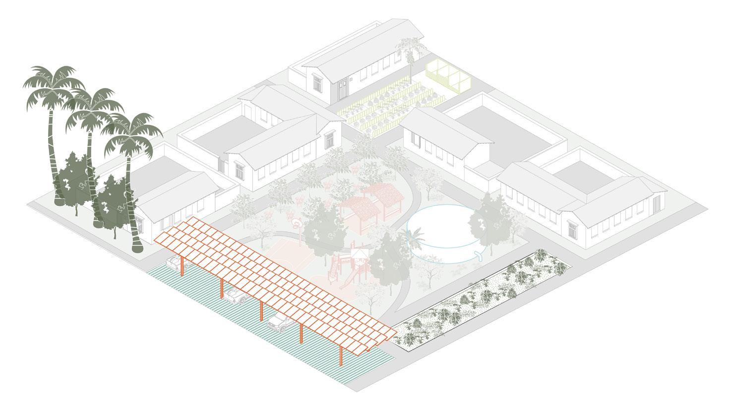
A new East-West Corridor across Topside will provide road and utility access free from future disruptions caused due to sea level rise along the coast.
LP230 and its future expansion will serve as anchors to establish redundancy in the Nation’s water and electric production. A temporary package sewage treatment facility is planned to service the initial development of LP230.
Existing mining roads will need to be resurfaced and sealed by concrete/asphalt to protect from weather, reduce dust, and provide for safe transportation.
A new access road connection between the two existing and improved mining roads will provide thru-access to LP230. Electric utilities will run parallel to the new access road, buried underground to create a looped connection between the two existing 11kV lines.
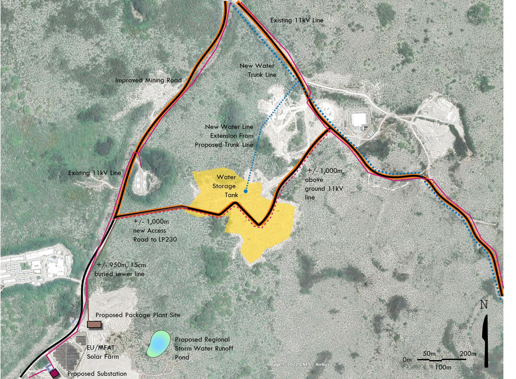
The package sewer treatment facility will be gravity-fed from LP230, with underground pipe running under the new access road.
It is strongly recommended that a second Desalinization Plant be developed at the Meneng RO location connected to the existing Aiwo Production Plant via a water trunk line crossing the length of Topside. To the north of LP230, a spur line would feed a 575,000 liter water tank located in LP230.
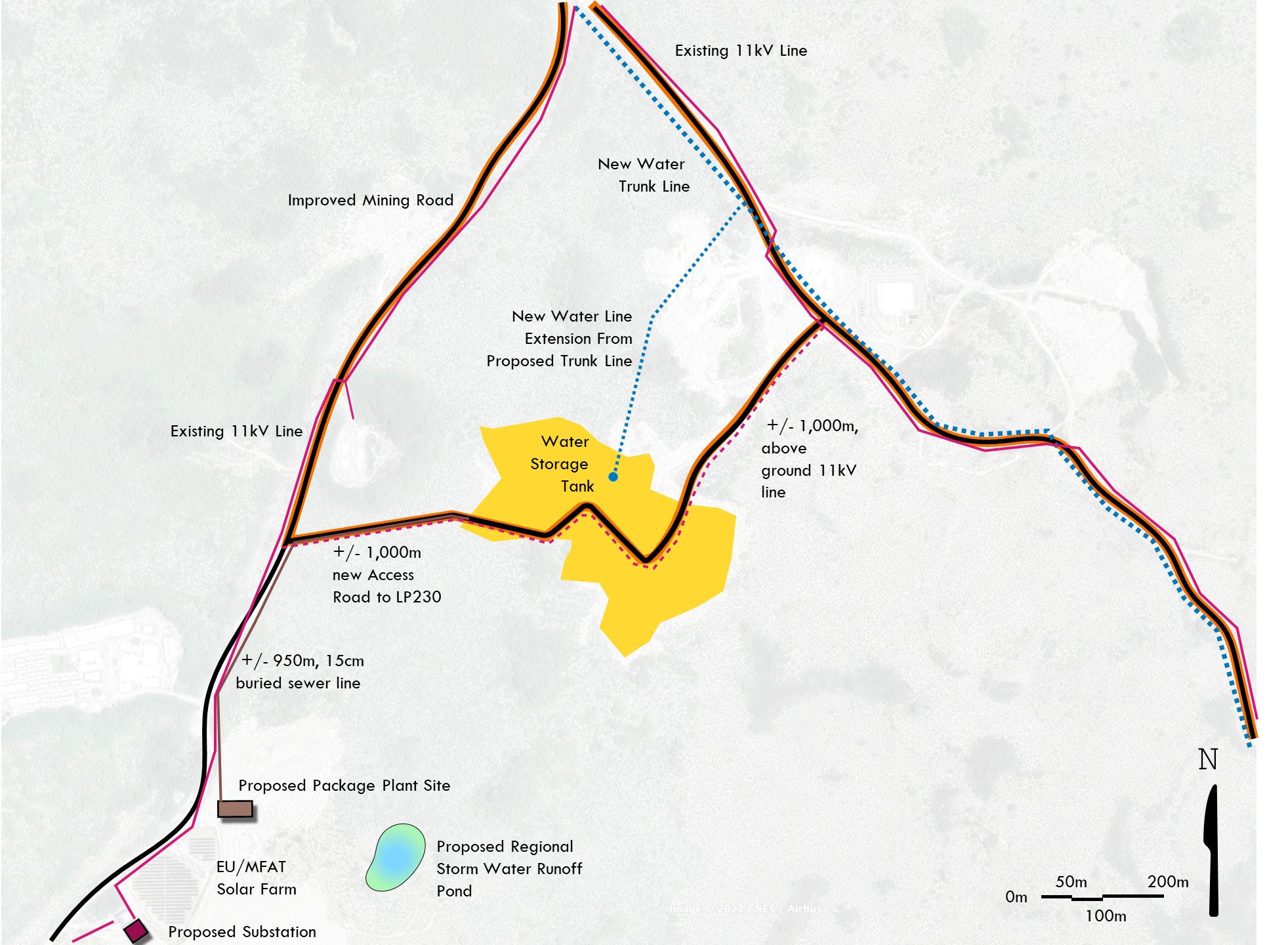
An underground reticulated water and sewer system would serve the residents of the neighbourhood planned for LP230. The water system would be gravity-fed from the water tank located at the highest point in LP230, with sufficient pressure to service 450 to 500 people living and visiting the community.
An electric substation adjacent to the EU/MFAT Solar Farm would service LP230.
Additional survey work will be needed to fix the location of a regional storm water pond facility. Within the larger expansion plans for LP230, a site to the southwest near the EU/MFAT Solar Farm and Package Sewer Treatment Plant site is proposed.
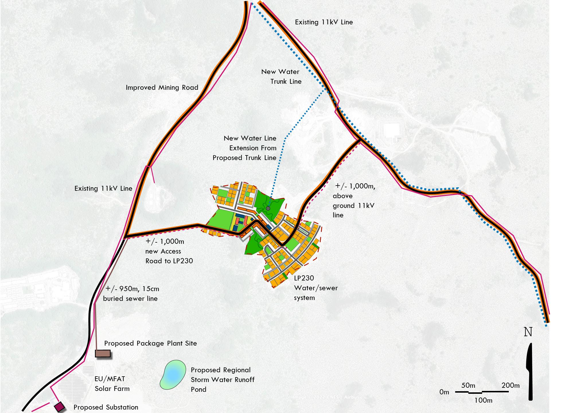
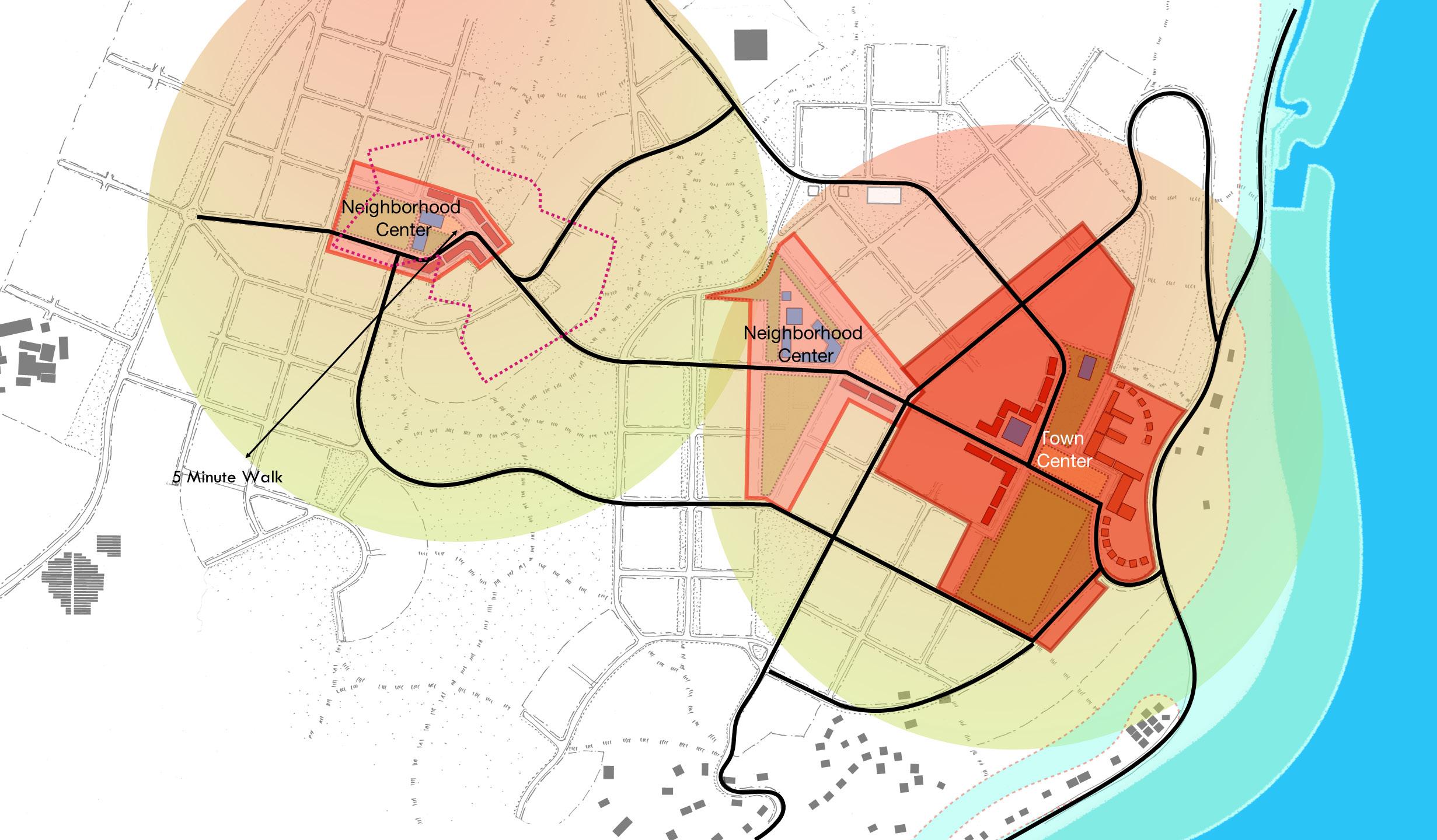
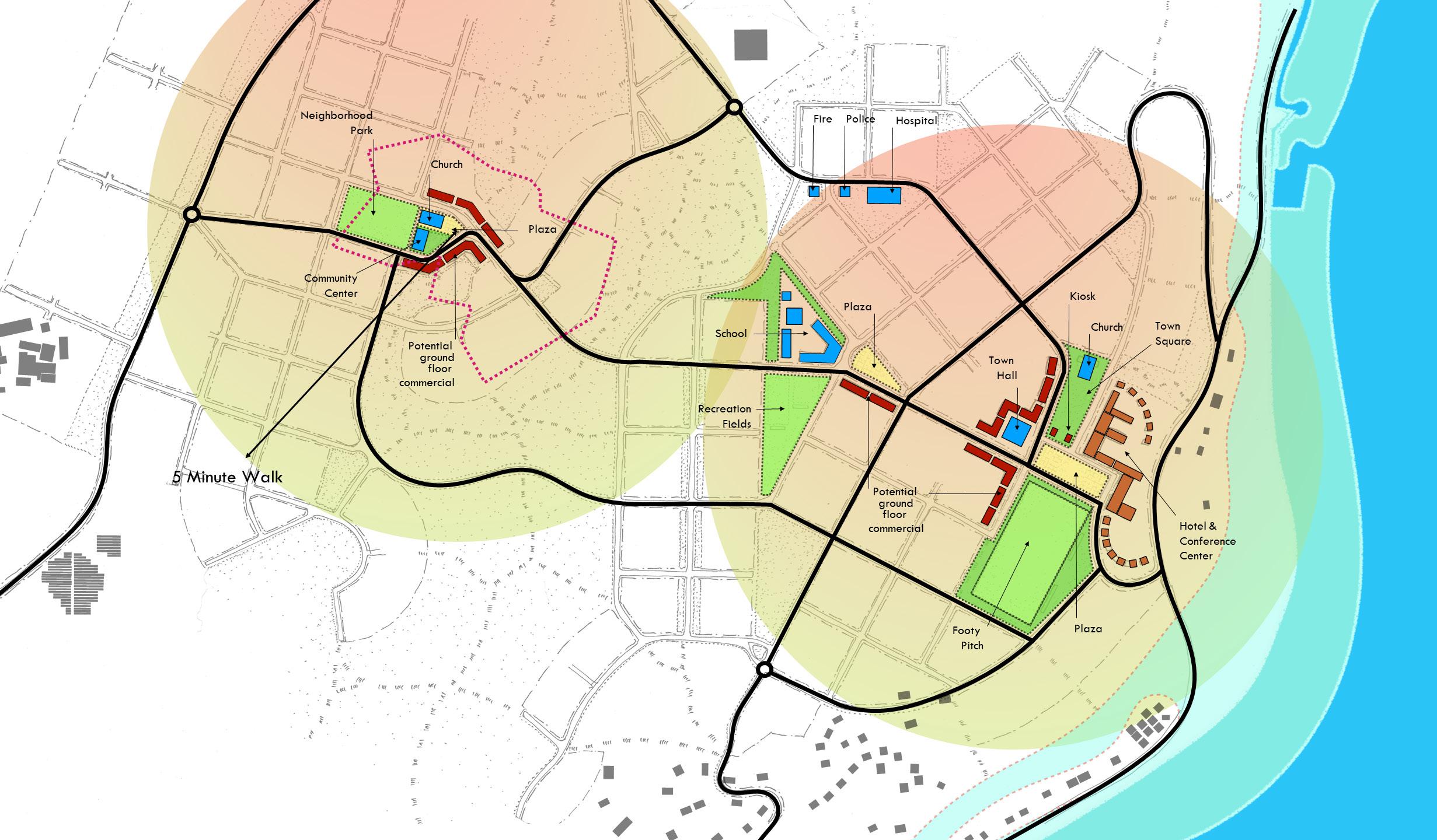
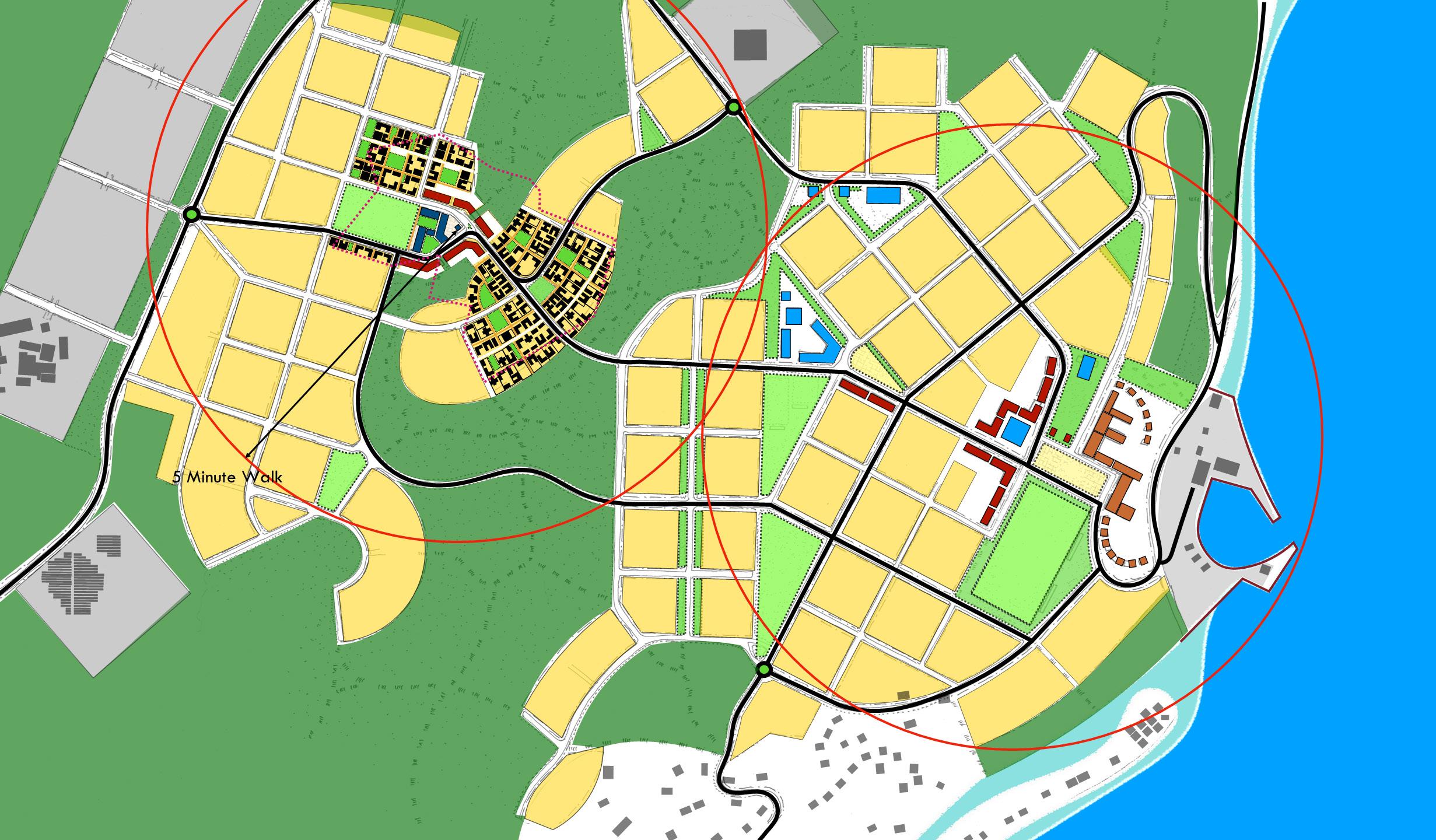
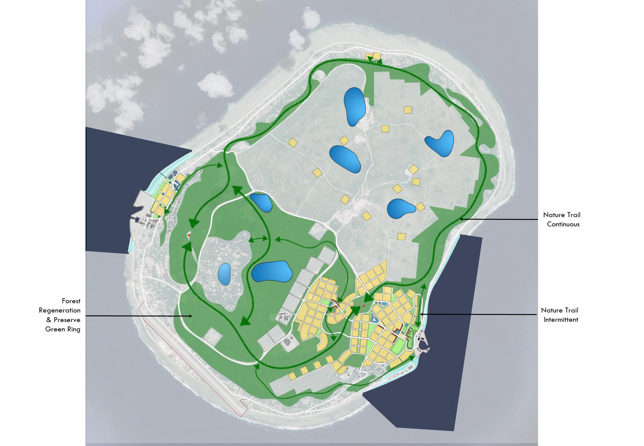
The site plan for LP230 is designed to be expandable. Each expansion is based on the increment of neighbourhood planning. LP230 itself is the centre of what will become a neighbourhood, defined as the 5-minute walk from the centre to the edge of a grouping of housing, businesses, and open spaces.
Each neighbourhood is programmed to be self-sufficient in fulfilling most of the needs of residents without requiring driving.
The Expansion Plan shows how the 5-minute walk determines the development of the rest of LP230, as well as a second neighbourhood. The two combined would eventually become a new Township. Should circumstances demand, the expanded township has the capacity to accommodate the entire current population of Nauru.
The Neighbourhood is the fundamental unit organizing the spatial layout of resilient communities. A neighbourhood is framed around the pedestrian-shed, the maximum distance comfortably walked in 10 minutes. A pedestrian shed is roughly 1,000 meters in length, equating to approximately 80 hectares of land area within each 10-minute circle. A neighbourhood standing separate from other communities in the countryside is a Village. Two or more villages that combine together form a Town. Expansion of Villages and Towns occurs by adding new neighbourhood units, not by expanding the pedestrian shed of existing neighbourhoods. As more neighbourhoods are added to Towns, they become Cities.
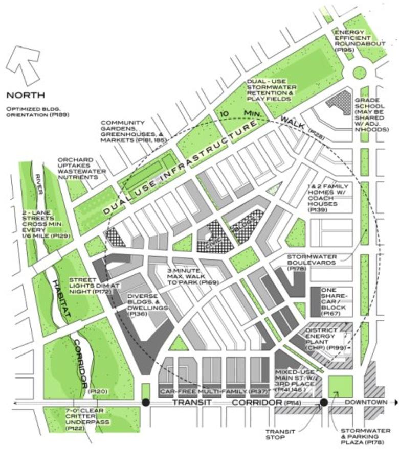
Within a neighbourhood, the needs of daily life are accessible by short walk such that most residents do not require the use of a car. The importance of pedestrian- scaled communities cannot
be underestimated. The greatest contributor to long term societal, economic, and environmental resiliency is automobile independence. By reducing or even eliminating the need to drive to access many daily needs, nations can significantly cut carbon emissions and increase social equity among the young, elderly, and those unable to drive due to differing abilities and income. Additional physical design principles behind Neighbourhood Planning include the following:
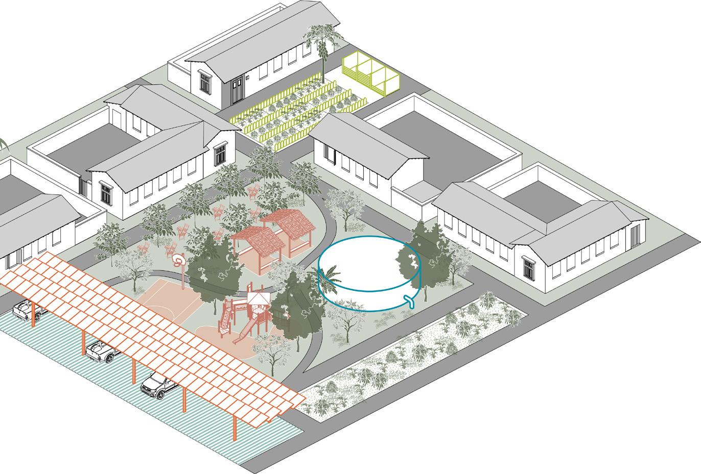
Neighbourhoods provide for a balanced set of activities: shopping, work, schooling, recreation and dwelling within walking distance. The neighbourhood provides housing for a variety of incomes. Inclusive housing includes backyard ancillary apartments, apartments above shops, and apartment buildings adjacent to workplaces, as well as cottages, attached housing, and large homes.
A variety of business types are also accommodated, from retail and professional offices to live-work units allowing home businesses to operate. The neighbourhood has a centre and edge. The combination of a focus and a limit contributes to the social identity of the community. The centre is a public space, which may be a plaza, a square, a green, or an important street intersection. It is located near the physical centre of the community, unless compelled
by a geographic circumstance to be elsewhere. Other locations may be justified by a shoreline, a transportation corridor, or a compelling view.
The neighbourhood’s centre is the locus of the neighbourhood’s civic buildings and, if dense enough, serves as the location for a transit stop. Shops and workplaces are usually associated with the centre, especially in a village. In the aggregation of neighbourhoods which create towns and cities, these buildings should be at the perimeter, along major thoroughfares where they gain intensity by combining with those of other neighbourhoods. The edges of a neighbourhood vary in character. In villages, the edge is usually defined by open space. In towns and cities, the edge is often another neighbourhood or an intervening corridor.
The neighbourhood is structured on a fine-grained network of thoroughfares; this shortens pedestrian routes and provides multiple routes that diffuse traffic. Neighbourhood thoroughfares are designed to provide equitably for pedestrian comfort and for automobile movement. Increasing pedestrian activity encourages the casual meetings that form the bonds of community. The neighbourhood reserves special sites as locations of civic buildings. These enhance community identity and foster civic participation.
Current land remediation at LP230 does not include mechanical crushing or compaction of soil. The existing remediation method would be acceptable for temporary housing supported on steel beams, but may be substandard for quality construction of buildings and infrastructure. The operation as currently practiced leaves two issues that represent a risk for the long-term performance of buildings and other infrastructure.
1: Large pieces of rock are prone to becoming stuck at depth, not falling all the way to the bottom of a hole and leaving voids below the stuck rock or between pieces of large rock. Any unplanned voids below ground are not desirable. Voids may collapse over time or allow fine sands to be washed into the voids by water, resulting in surface rupture and loss of support under any foundations at the surface.
2: The existing limestone rock is hard and incompressible under small building loads, and any compression of loose rock or voids would result in differential supports and movements under linear footings. Differential movements would be more detrimental to building performance than a uniform movement, causing foundation settlement and compromising structural integrity.
Note: See Geotechnical report dated April 11, 2022, undertaken by Metrocology and Terracon Consultants for proper remediation procedures.
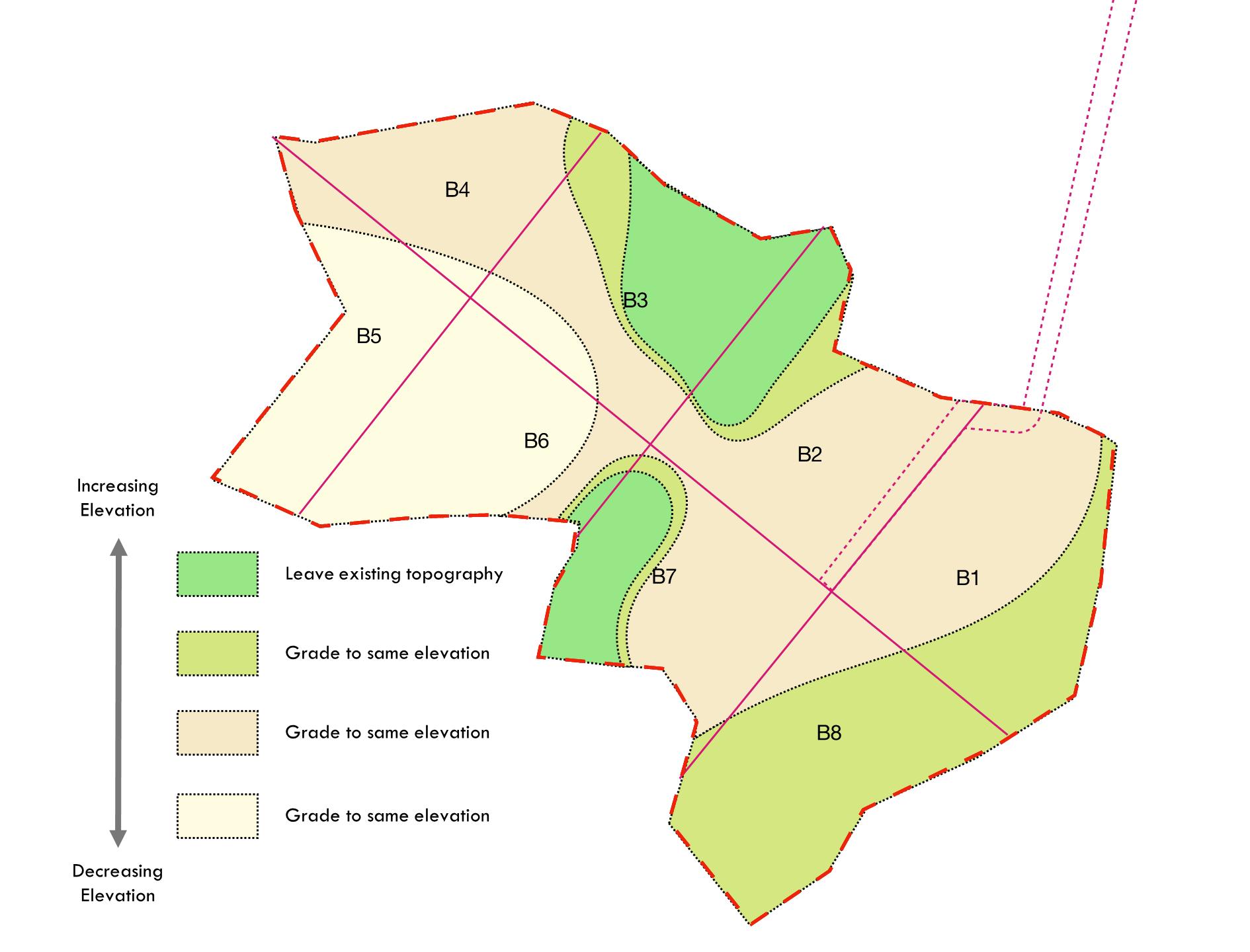
Once remediated properly, the topography of LP230 will require grading to establish slopes necessary to successfully drain the site, provide for efficient water and sewer service, and create a more aesthetically pleasing topography.
Since no survey of LP230 exists, previous topography was overlaid on the site and a measure of the highest and lowest point was estimated.
Using the estimate of +/- 9 meters, a final contour map was created to provide a guide for the earthworks needed to prepare LP230 for development.
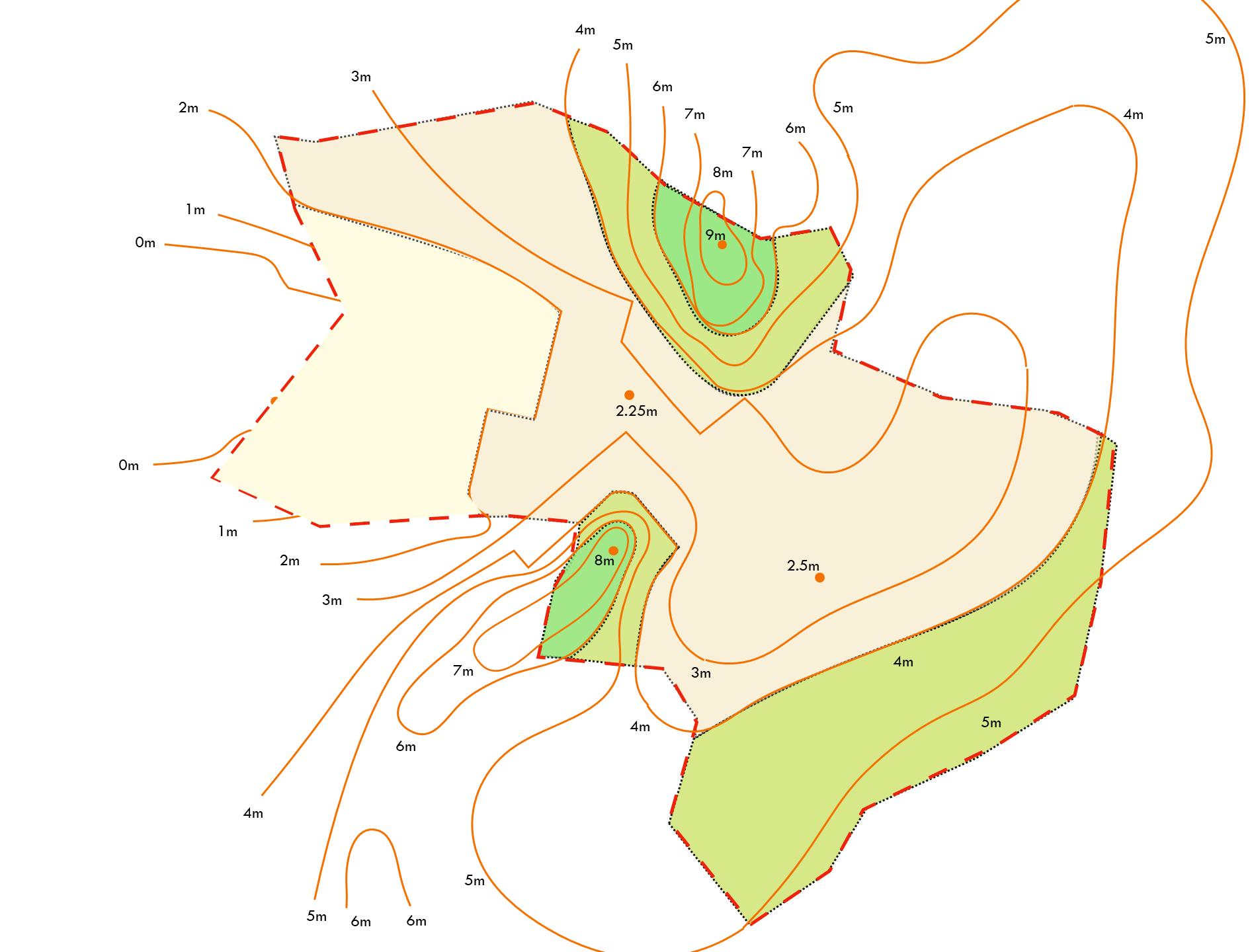
The Site Plan for the new development was drawn based on the proposed counters, to provide suitable drainage and appealing character to the neighbourhood. When overlaid on the proposed contours, the site plan demonstrates an integrative land use approach where compelling vistas are created, ecological drainage is encouraged, and subtle topographical changes inform the central square and spine of the community as well as the natural edges of the neighbourhood.
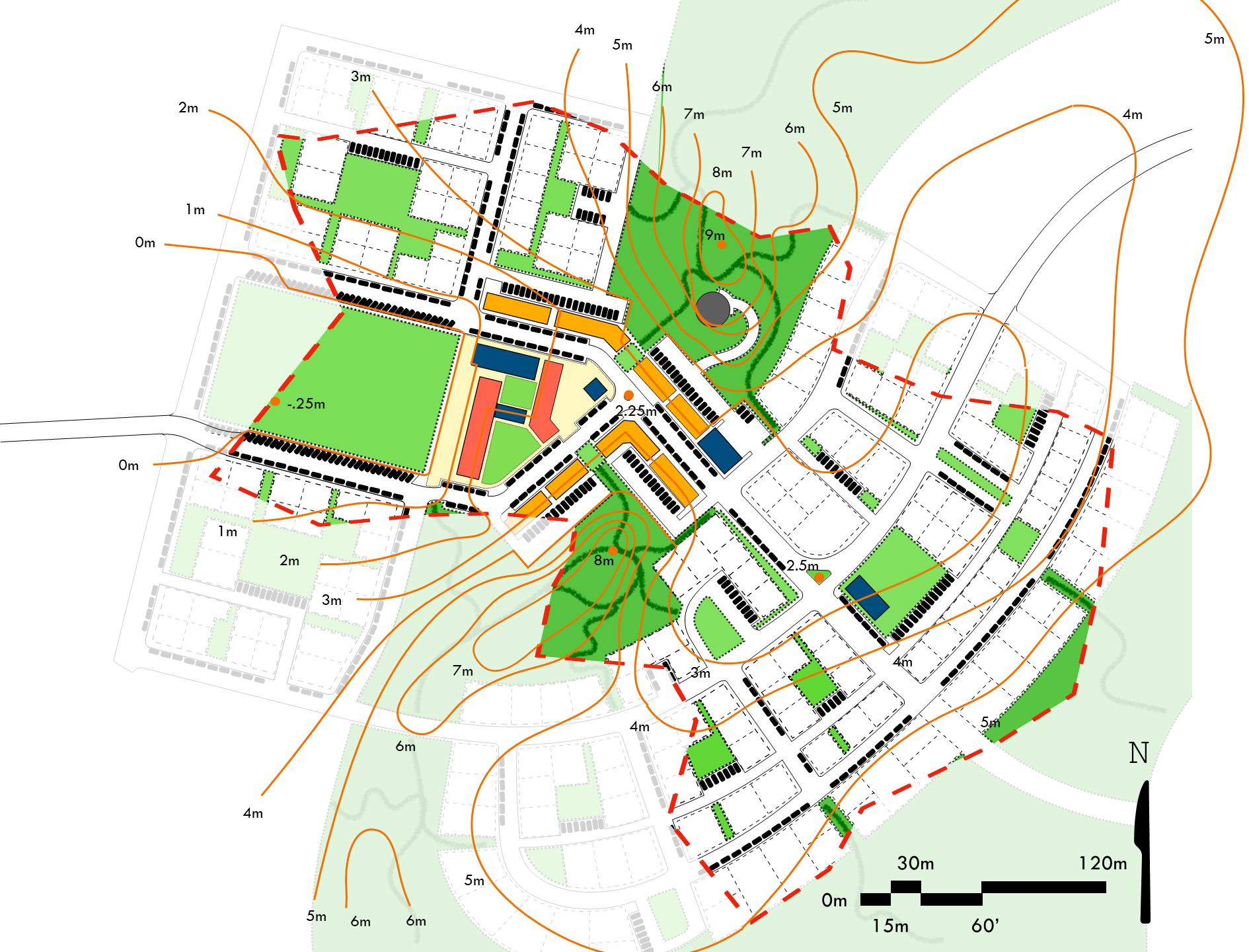
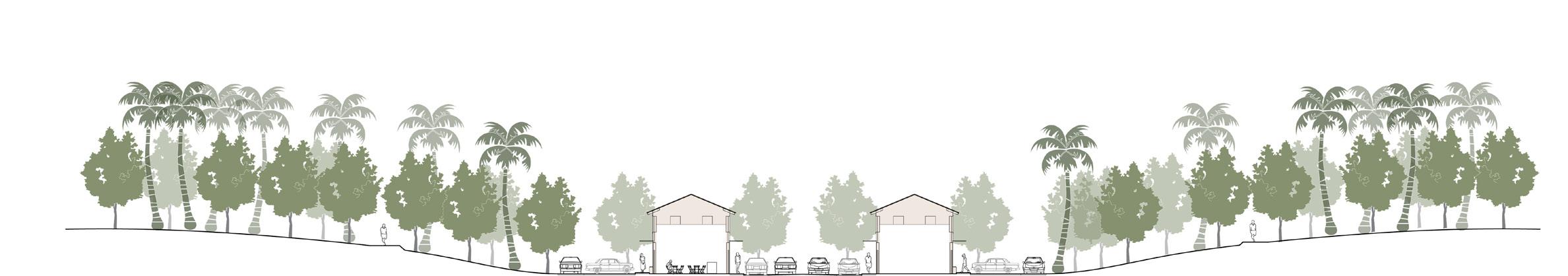
The grade changes proposed for LP230 are illustrated by the two sections, A and B. These show how the topography changes along a line, drawn across the site plan shown in the upper left.
The change in grade across LP230 will not only assist in drainage and infrastructure building, but will also create beauty in the neighbourhood, elevating important areas such as the neighbourhood centre and creating views across the site reinforcing connection among the residents to each other and the civic amenities provided.

Water Security
Energy Security
Food Security
• Roof top Solar Energy Paneling
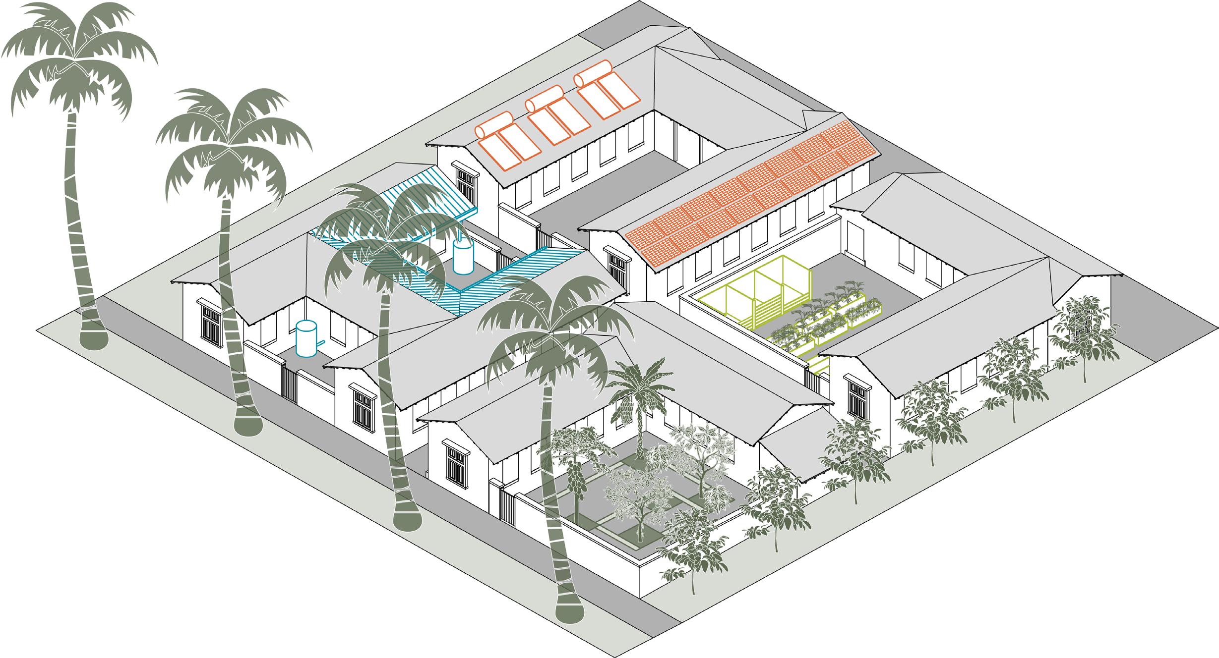
• Roof top water collection
• Solar water heating
• Grey water systems
• Composting
Public Health Cultural Restoration Environmental Restoration
Roof Water Collection
Water Security
Energy Security
Food Security
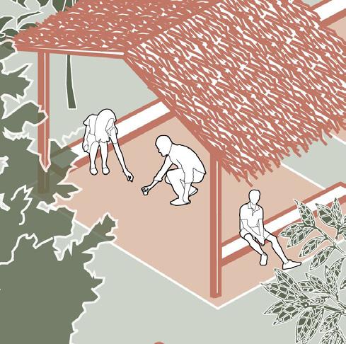
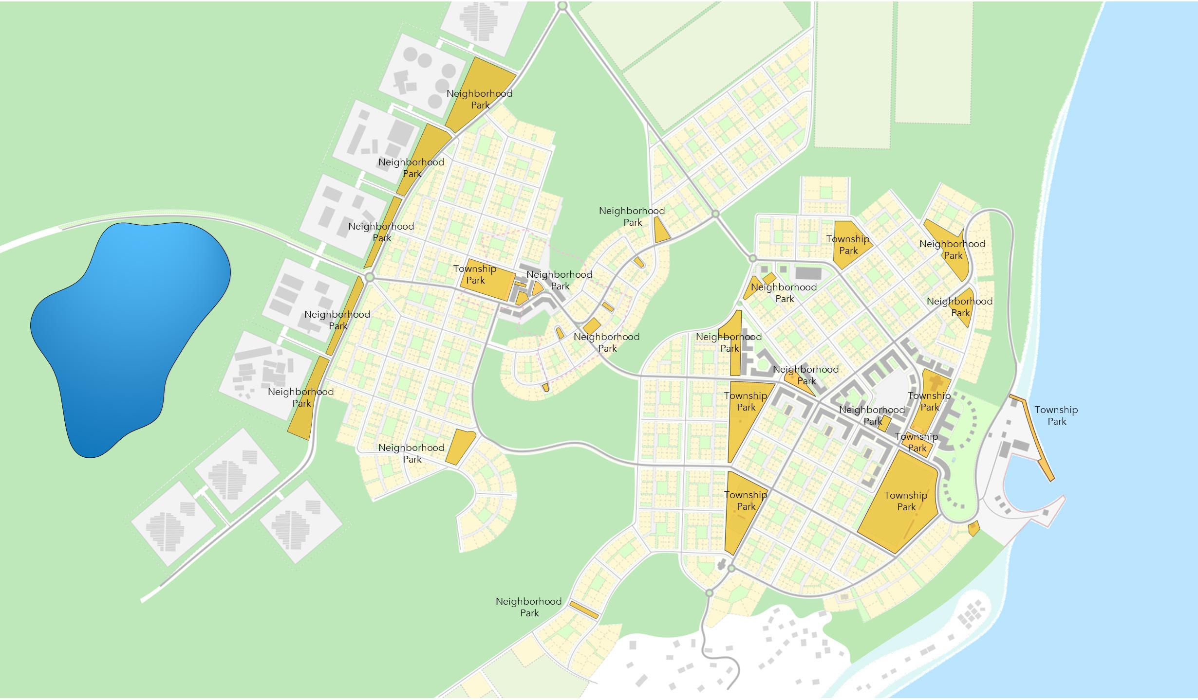
• Small public spaces offer more opportunity for private conversations and spontaneous use without the need to schedule times or negotiate for space. These encourage a broad level of participation by the public in a community’s open spaces.
• Children participate more readily in smaller spaces, especially young girls.
• Women feel more comfortable along the edges of open spaces under trees or structures that offer shade and a feeling of being contained.
• The size of small parks permits them to be readily accessible to all residents within a short walk offering access to the elderly and young children.
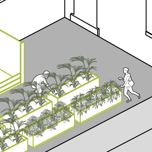
• Because they take up less space, they can be more numerous and therefore proximate to all housing which enables more domestic uses such as a community garden.
Public Health
Cultural Restoration
Environmental Restoration
Water Security
Land Rehabilitation
The Neighbourhood Centre shows how gender, disability, and age inclusivity for residents manifests in public buildings, facilities and services.
• Public Health: daily activities such as church are a walkable distance from housing.
• Police: central location helps elevate role in the community.
• Day Care Centre: managed by church, supports pursuits of mothers outside the home.
• Community Hall: offers flexible program based on the needs of nearby residents, i.e. clinic for elderly, school for families, skill-building class room space for building industry workers, small business support services for entrepreneurs.
Note: Empowerment of women is a core UN Sustainable Development Goal
Public Health
Cultural Restoration
Food Security
Environmental Restoration
Water Security
Public Health
• Public Health: large space central to multiple neighbourhoods, programmable for physical and cultural activities, supports gathering and shared activation at the larger community level.
• Determination of management and maintenance, as well as number/ location of township parks in Districts, must be determined by Nauruan Government.
Cultural Restoration
Economic Diversification
Environmental Restoration
Water Security
Food Security
Land Rehabilitation

The presence of natural open spaces bring Nature into the community.
Nature preserves will foster even stronger ties for Nauruan’s to their Island, which have been impacted as a result of colonialism and its legacy of mining. Regenerating the Island’s natural environment creates a direct connection to the county’s relationship with resiliency.
The presence of a robust natural environment is a linchpin to HGI’s success. Societies develop a sustainable cultural identity through access to their surrounding natural environment.
The presence of nature in the daily lives of people also has strong ties to public health and environmental sustainability. The master plan embeds nature as an element to be preserved and experienced.
Public Health
Cultural Restoration
Economic Diversification
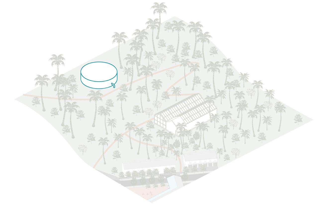
Storage Tank
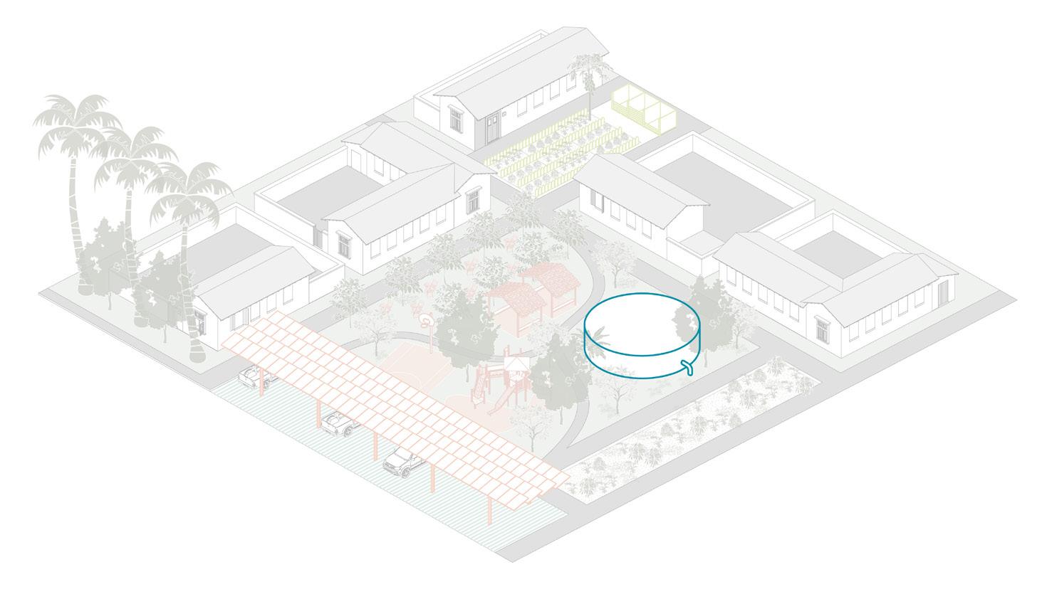
Streets, Roads & Pedestrian Ways, Water & Sewer, and Electricity establish the base for servicing the accessibility and livability needs of future residents and businesses. These will be augmented by additional green utilities and infrastructure such as solar, individual water collection systems built as part of housing and commercial buildings, tree plantings, and passive cooling designs.
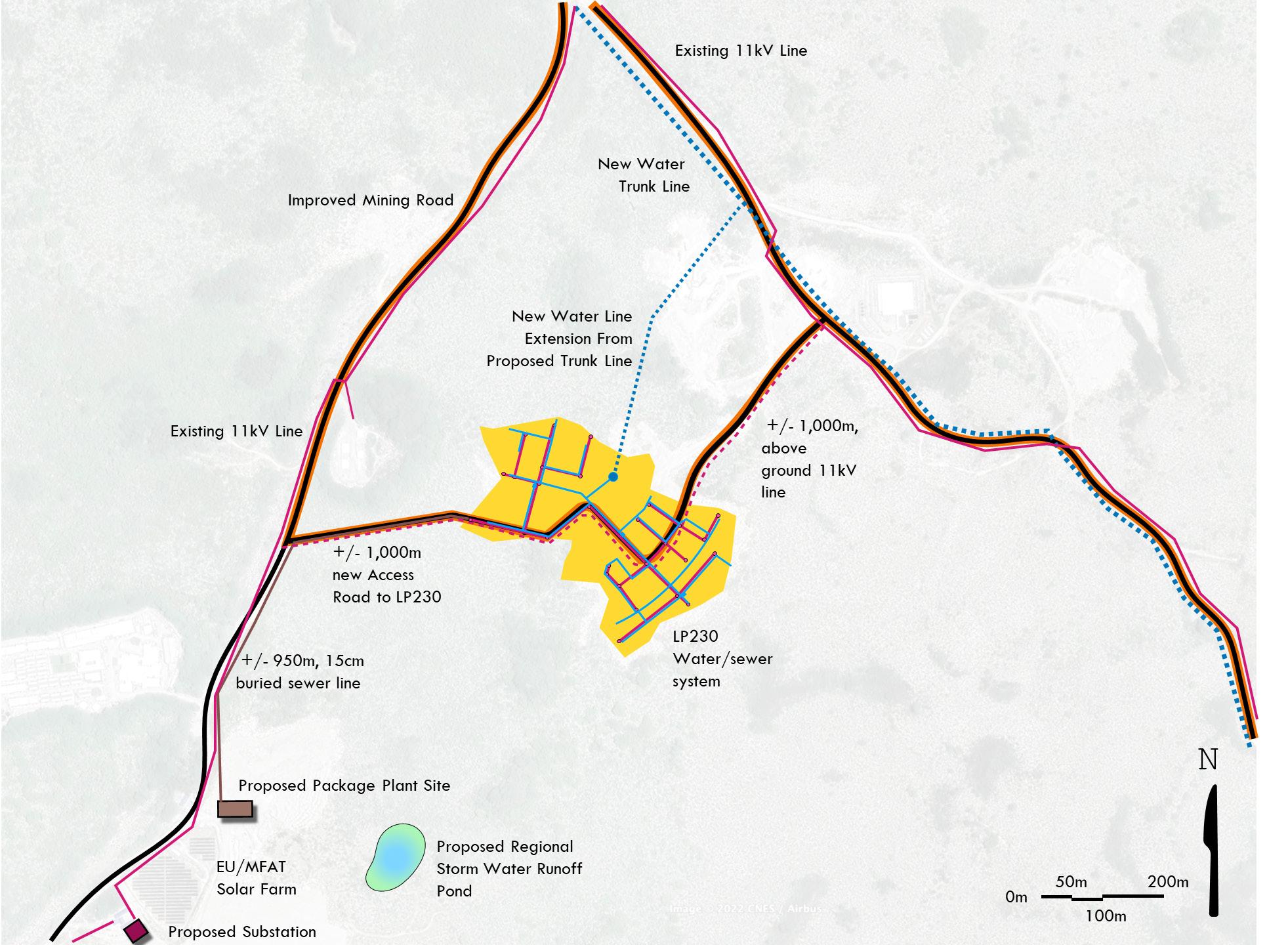
A reticulated sanitary sewer and water system will tap into each home and business on LP230. Approximately 2,142m of 15cm water lines and 3 fire hydrants evenly spaced, will provide adequate water pressure to service the population of residents and visitors to the new neighbourhood. A 15m diameter, 10m tall water tank elevated 7m above the lowest point on LP230 will store approximately 600,000 liters of water.
The sewer system will be gravity fed to a Package Treatment plant. The system will be approximately 1,714m of 15cm pipes under LP230, connected to a pipe approximately 950m in length to reach the Package Plant.
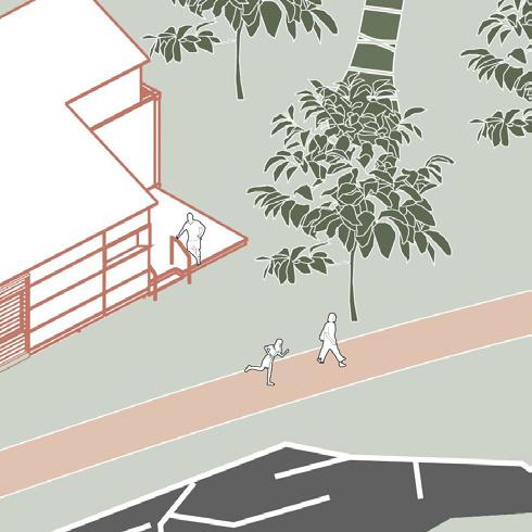
Streets, roads, and pedestrian footpaths will provide access to all areas of the new neighbourhood. Their designs balance the needs of people cycling, walking, and driving, making thoroughfares safe and usable by young children, the elderly, and people with disabilities.
Nauru has the unique opportunity to pursue a national approach to stormwater management through agreements among agencies and townships, in support of its commitment to resilient growth and land development strategies.
Design guidelines for Nauru’s road network, townships, and neighbourhoods should include advocacy for best management practices and water conservation and reuse, including reforestation, eliminating curb cuts, implementing home-, industrial-, and commercial-scale rainwater capture and reuse, and use of porous paving materials, rain gardens, and vegetated bioswales.
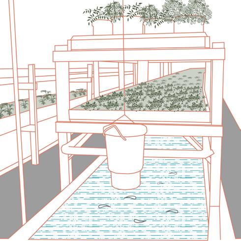
The Island must rely on a multi-faceted approach to environmental restoration, in order to achieve viable working and public lands. To facilitate a future for Nauru which includes a restored and healthy landscape for the benefit of all, this plan utilizes an Environmental Matrix of open space typologies (see left; full matrix on following page).


This matrix can be used as a guide for implementing resilient and green infrastructure, island-wide conservation, and open space zones within various scales and applied typologies, and baseline metrics for enhancing Nauru’s herbaceous wetlands, fortified shorelines and mangrove forests, tall closed forests, croplands, shrub and grasslands, and urban and rural green spaces.
Roof Garden Herbs, Brassicas
Balcony Garden Herbs
Window Garden Herbs
Kitchen Garden Herbs, Brassicas Yard Garden
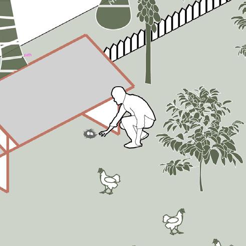
Poultry (hens only) herbs, Brassicas, top fruit, soft fruit & berries
Allotment Garden
Poultry (hens only), herbs, top fruit, Soft Fruit & Berries, Brassicas
Community Garden Root Vegetables, herbs, Brassicas, Top Fruit, Soft fruit & berries.
Food Production Poultry, Root Crops, Top Fruit, Soft Fruit & Berries, Herbs, Legumes, cereals, marrows, & squashes, red meat, brassicas, dairy, Milk fish, ocean fish, fish farms Forage-able
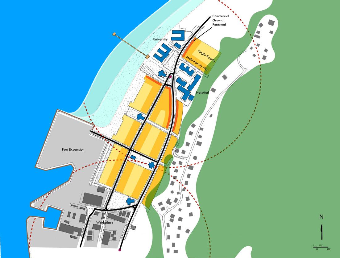
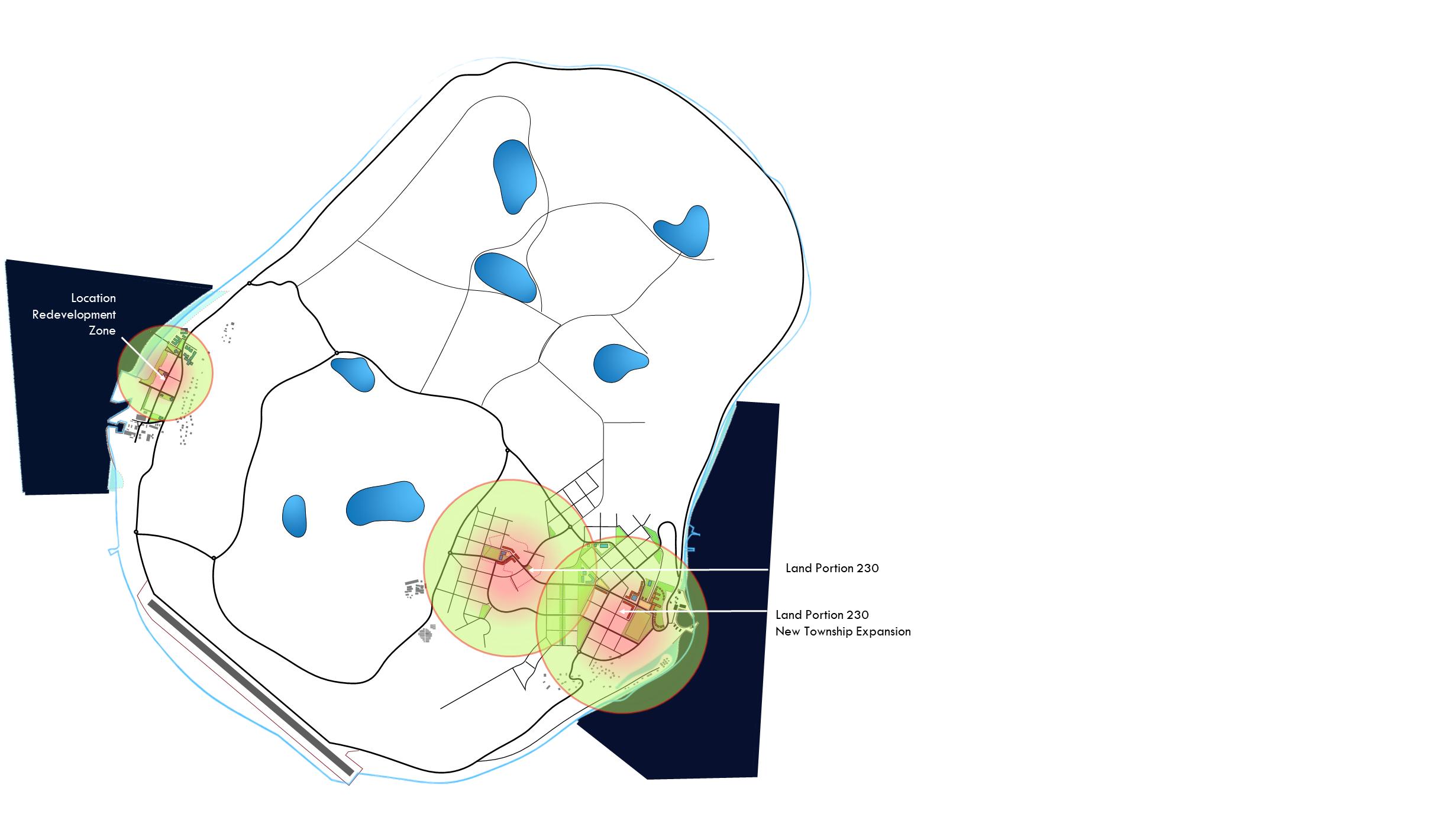
To successfully address the needs of the population of Nauru over the multiple decades required to implement HGI, any plan to improve housing and relocate those susceptible to climate change related impacts requires a multi-faceted approach. To this end, the HGI Master Plan establishes a strategy for housing and relocation that addresses new “greenfield” development, as well as existing “infill” redevelopment initiatives. LP230 is the example of new development, employing the principles and techniques of community planning at the lot and block scale to provide walkable, mixed use neighbourhoods on undeveloped lands. The HGI Team selected The Location to illustrate an example of how redevelopment, using the same principles and techniques employed at LP230, can target areas with existing substandard housing stock and infrastructure. Both strategies will be required to successfully strengthen the Nation’s social, economic, and environmental performance.
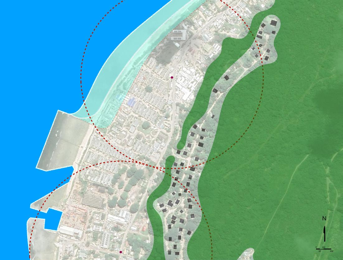
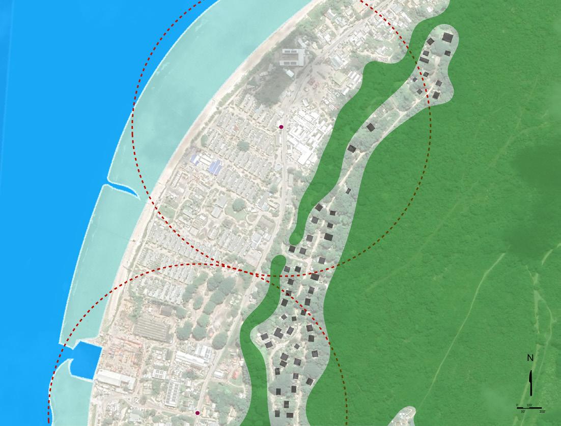
The Location’s site, adjacent to the expansion of Boat Harbor 1, is a prime candidate for “infill” redevelopment planning. The conceptual Master Plan for The Location considers the existing uses and housing, the Harbor expansion, and future sea level rise scenarios to develop a pair of neighbourhoods that leverages the employment and accessibility concentrated in the surrounding area. Existing employment at nearby government offices and the Port, and civic uses such as churches, the University, and Hospital represent significant fixed investments that should be carefully reinvested through a predictable plan of improvements focused on new housing and infrastructure upgrades.
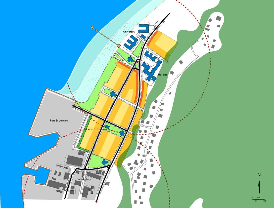
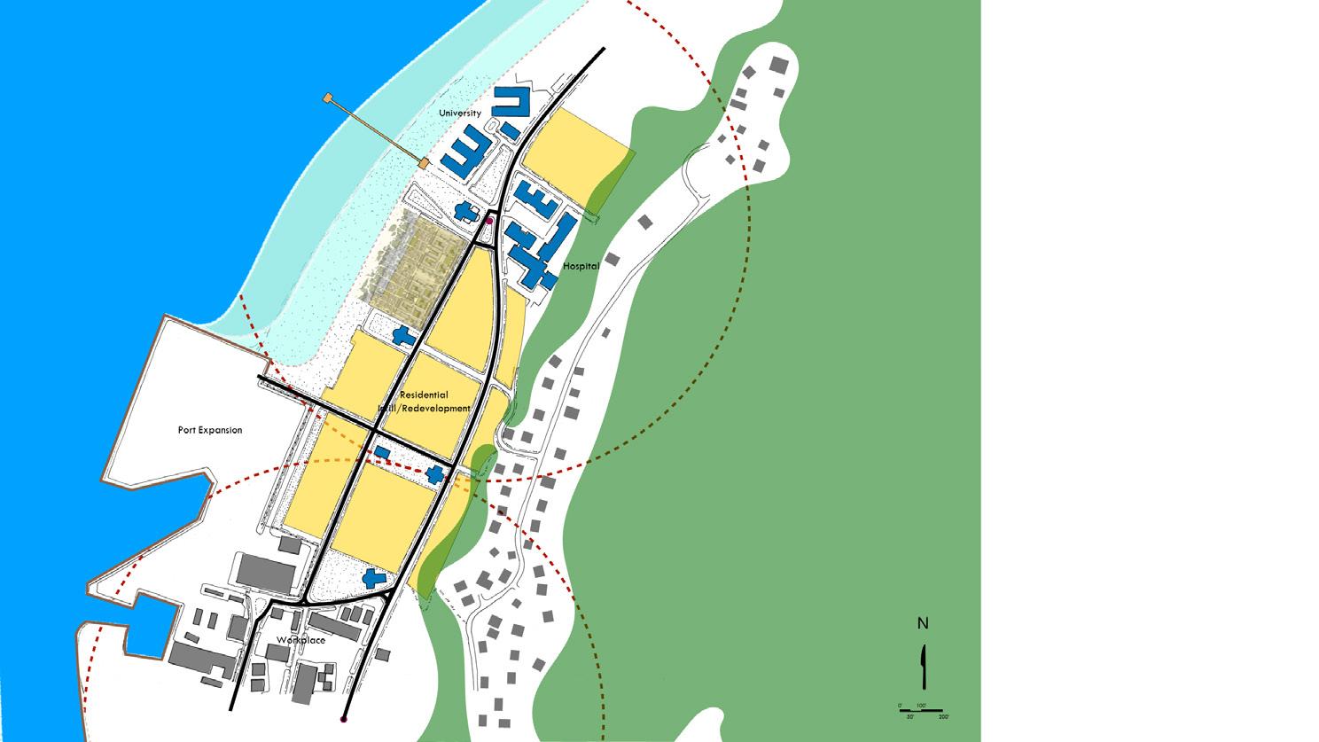
Infill redevelopments permit the option of more rapid response by Government to the challenges of housing and relocation because roading and utilities are already in place, thus reducing timelines and costs for their provision. Additionally, the disruption for some residents is markedly less, as they can remain “in place” within proximity to existing family and other social support networks, conserving these important aspects of community-building. Given that erosion and sea level rise will not impact all existing settled areas of Nauru, the need to move the entire population to Topside should not be deemed a necessity. Substantial areas of current habitation will remain secure and thus should be treated as viable alternatives, for those who choose it, to the option of relocating to Topside.
The Plans illustrate the phased redevelopment of lands cleared of substandard housing relating to the Harbor Expansion, and the select infill of new housing and businesses based on the pedestrian walking shed, centreed on two employment and civic anchors: the Harbor and Government centre to the south, and the Hospital / University complex to the north. The northern anchor envisions a prominent access to the beach, marked with a new fishing pier and pavilion. The housing plans are identical to those that would be built on LP230.
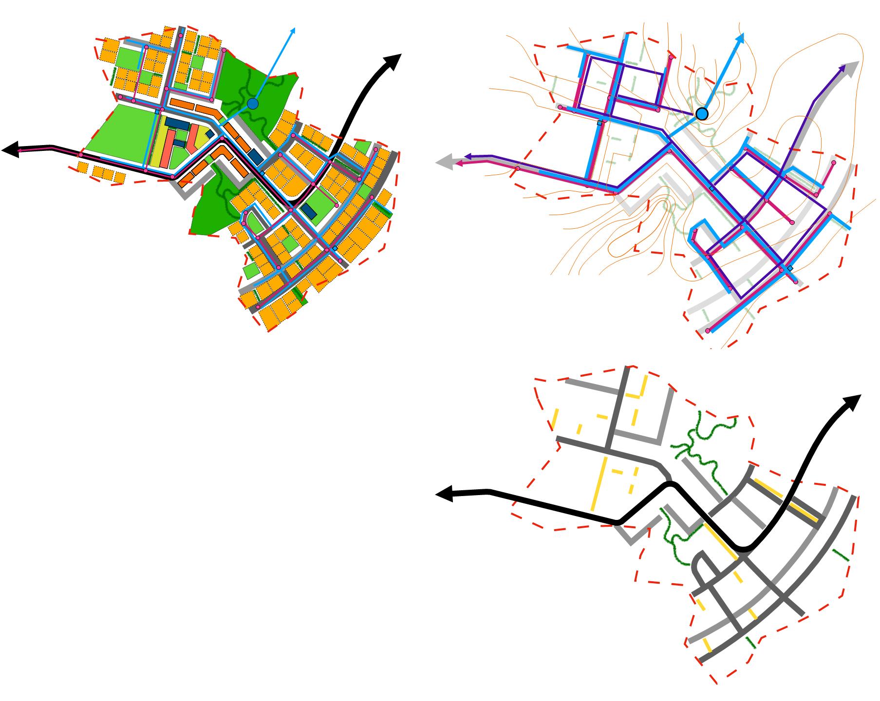
Towns are finite places with geographic boundaries derived from topography, watersheds, coastlines, farmlands, forests, and river basins. They are composed of multiple neighbourhood units structured on the 10-minute pedestrian shed. Each contain a centre that serves as the hub for gathering, culture, and business for the immediate residents of the neighbourhood. Properly planned towns serve as the fundamental economic unit of the modern nation. Services, public policy, physical planning, and economic strategies are leveraged and magnified by the presence of properly planned towns and cities, enabling governments the means to address the social equity, quality of life, and standard of living needs of its citizens.
Towns should comprise a spectrum of public and private uses to support a nationwide economy that benefits people of all incomes. Affordable housing should be distributed throughout the Town to be near job opportunities and to avoid concentrations of poverty. To do so, a variety of housing types must be part of the neighbourhood fabric.
The physical organization of the Town should be supported by a framework of transportation alternatives. Transit, pedestrian, and bicycle systems should maximize access and mobility throughout each neighbourhood within a Town, while reducing the overall dependence upon the automobile for every daily need. Block structure is a key component in the delivery of a transportation system comprised of mobility options. Shorter blocks with regularly spaced intersections and cross block pedestrian connections reduce the distances required to access daily needs.
The Town has a necessary and fragile relationship to its agrarian and natural landscapes that is environmental, economic, and cultural. Farmland and nature are as important to the Town as the garden is to the house. Proper town planning enables governments to support healthy natural environments and provide an important means for establishing food security by limiting encroachment into sensitive habitats and valuable agricultural lands.
The town planning techniques previously described play an outsized role in the future development of Nauru. Land scarcity, population migration, limited resources, and the unpredictable outcomes of global climate change require a foundational change in the approach to enabling, constructing, and servicing communities on-Island. The plans for the expansion of LP230 into a New Town establish the principles and techniques required. The intent behind the plans is to illustrate how the various designs provided by the HGI Planning, Architecture, and Land Tenure Reporting can be implemented over time to successfully maintain Nauru as a sovereign nation state.
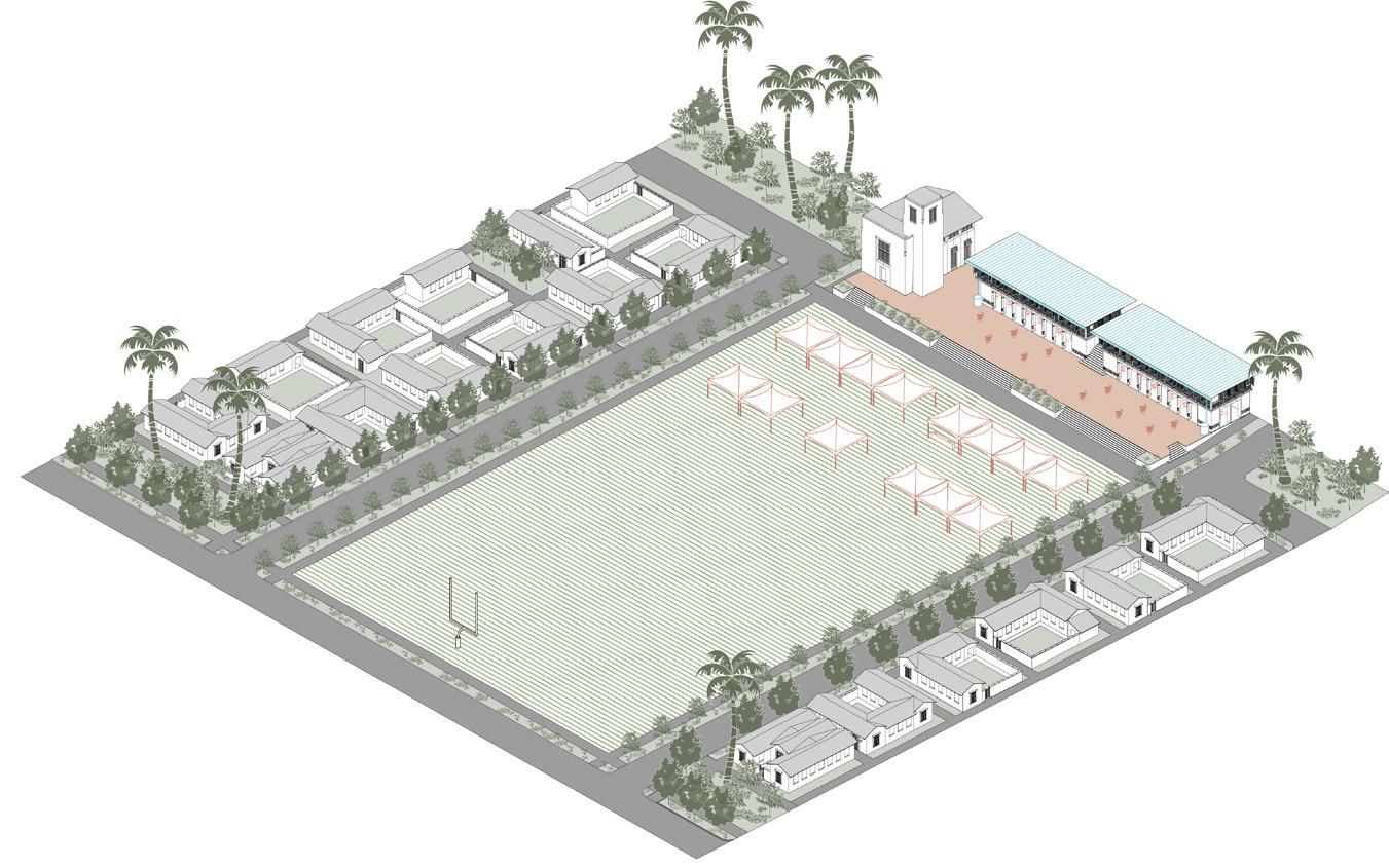
The New Town envisioned would offer the Government of Nauru the flexibility to respond to unforeseen political and economic events stemming from global climate change. Located on Topside, the Town would be entirely free from erosion and concerns of sea level rise. The Master Plan is scaled to accommodate the current population of Nauru, should future conditions warrant. Two neighbourhood units are depicted, each with a centre. The combination of the two neighbourhoods makes viable a higher order centre, in the form of a town centre. The town centre would be along the edge of the escarpment looking out over the Pacific. Depending on the final population and the need to relocate current Government facilities from more vulnerable locations, the town centre has the capacity to serve as the Nauru’s new capital.
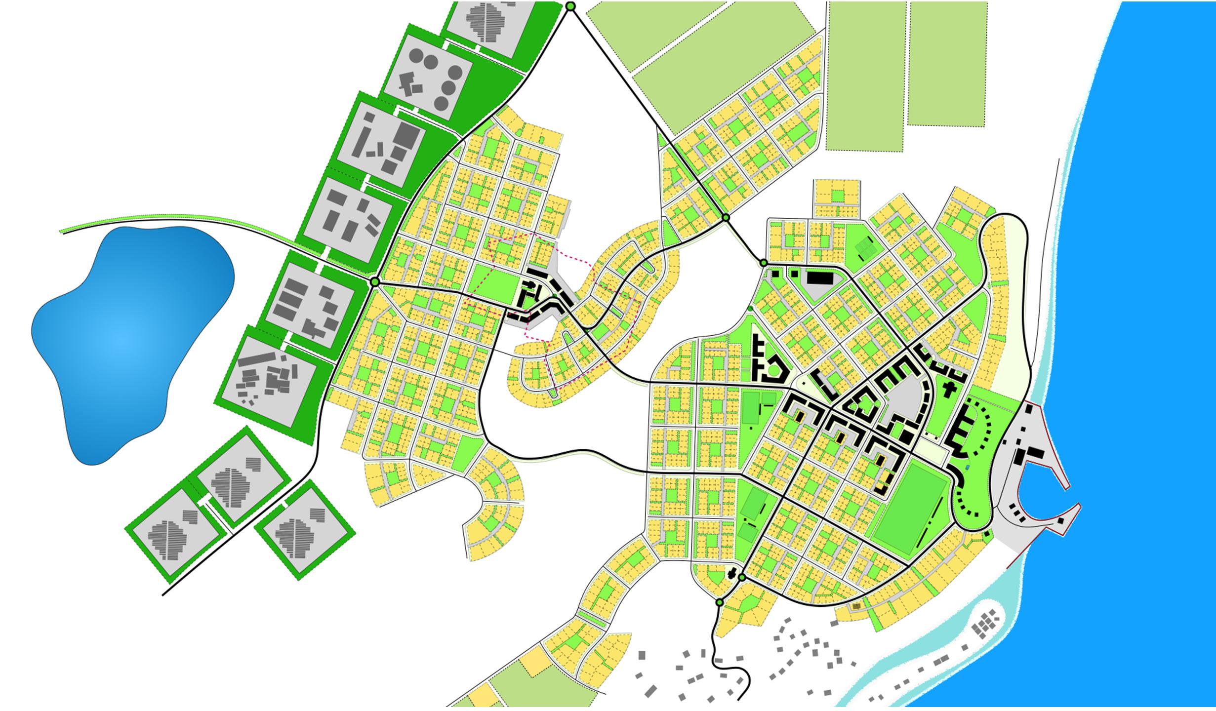
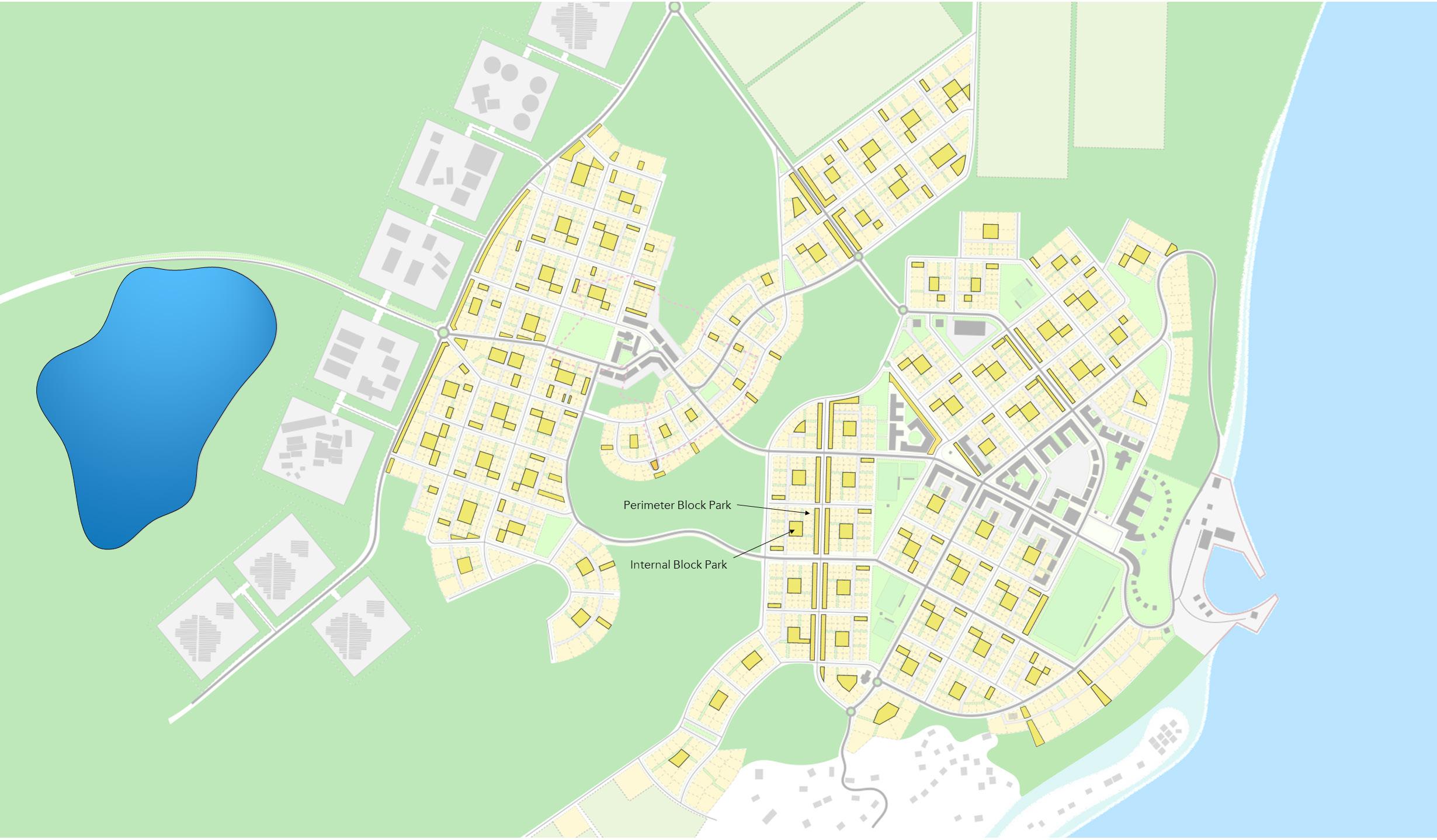
The Master Plan employs the hectare block model used in LP230. At the macro scale, the hectare block and accompanying housing establishes a block system promoting walkability and accessibility to town centres and the services located there. At the micro scale, the hectare block organizes housing around a central open space for the immediate residents of the block. The open space offers an immediate gathering spot and a location for water and energy infrastructure at the block level. Additional ancillary spaces provide connectivity of the central block open space through the Town’s street system. The support spaces provide additional amenity programming based on the desire of the block residents, such as community gardens or playgrounds.
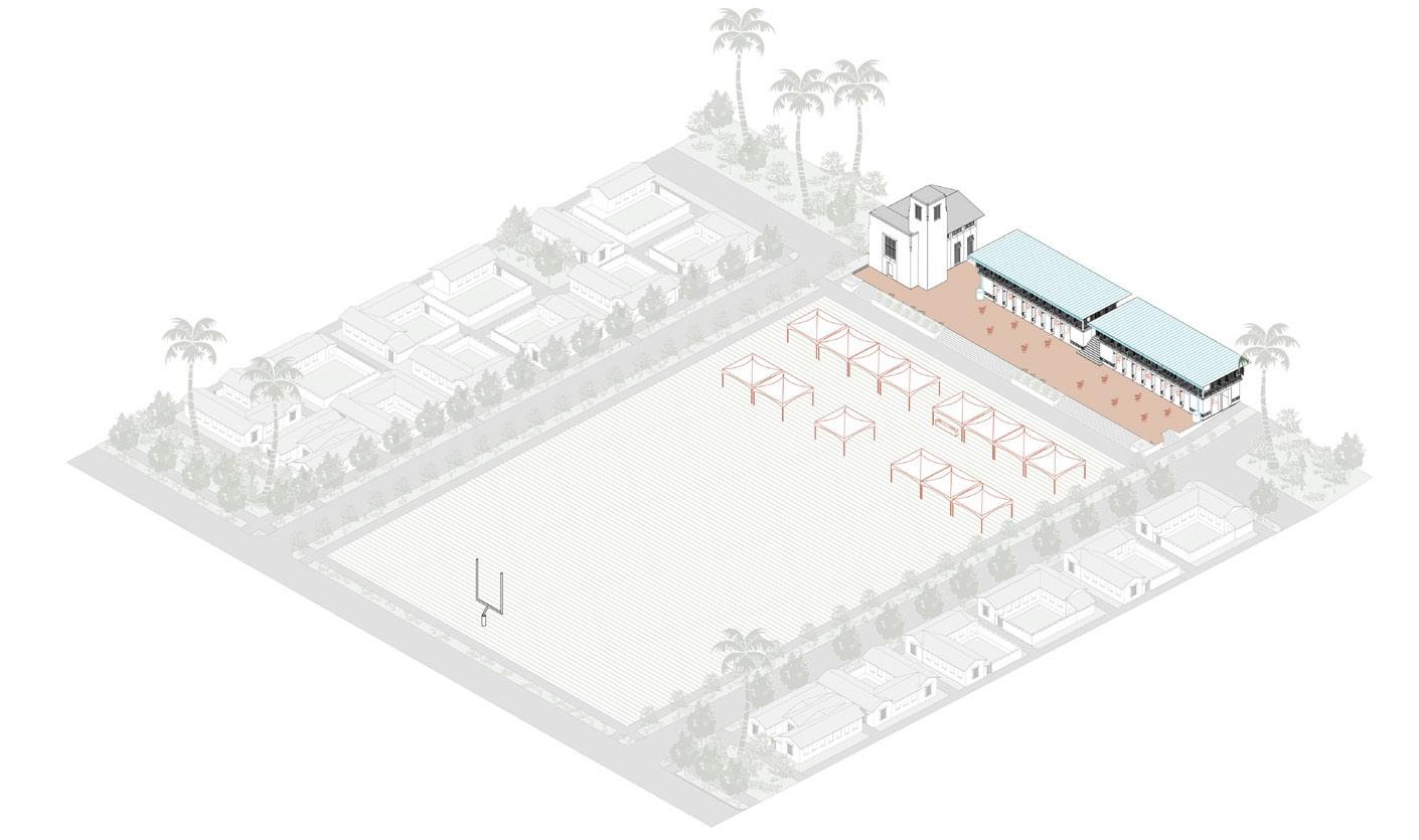
The open space plan expands beyond the internal block parks, providing additional categories of green space based on scale and location. Along the edges of the Town are connected corridors of natural preserve and agricultural land. Within the Town, community scaled spaces provide passive and active recreational uses. At the largest scale, a national rugby pitch would help define the town centre located along the ridge line, with views out over the Pacific. Other open spaces would provide for tennis, basketball, and athletic fields for schools and a possible new university campus.
Brassicas
Poultry (hens only) herbs, Brassicas, top fruit, soft fruit & berries
Allotment Garden Poultry (hens only), herbs, top fruit, Soft Fruit & Berries, Brassicas Community Garden Root Vegetables, herbs, Brassicas, Top Fruit, Soft fruit & berries.
Food Production Poultry, Root Crops, Top Fruit, Soft Fruit & Berries, Herbs, Legumes, cereals, marrows, & squashes, red meat, brassicas, dairy, Milk fish, ocean fish, fish farms
Brassicas
Poultry (hens only) herbs, Brassicas, top fruit, soft fruit & berries
Allotment Garden Poultry (hens only), herbs, top fruit, Soft Fruit & Berries, Brassicas
Community Garden Root Vegetables, herbs, Brassicas, Top Fruit, Soft fruit & berries.
Food Production Poultry, Root Crops, Top Fruit, Soft Fruit & Berries, Herbs, Legumes, cereals, marrows, & squashes, red meat, brassicas, dairy, Milk fish, ocean fish, fish farms
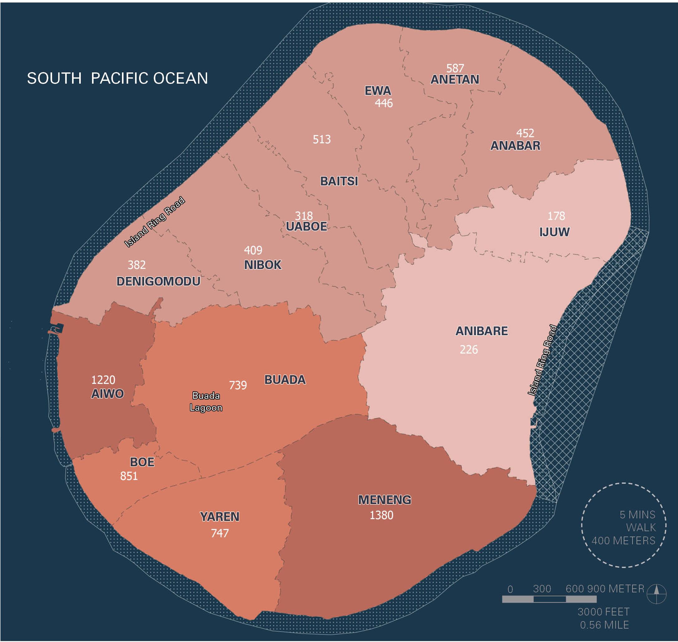
Total Area: 21.0 square kilometers
Developed and/or un-developable: 8.0 square kilometers
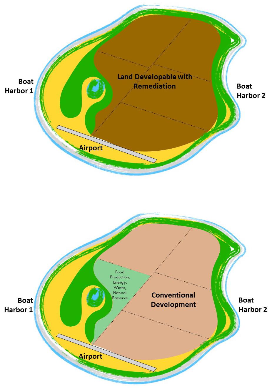
Land Developable after remediation: 13.0 square kilometers
*Conventional Development: 10.5 square kilometers
*Conventional development is defined as:
- 1,000m2 lots for family units and individuals, totaling approximately 6,000.
- 25% allocation to roads and parking
- 15% allocation to open space
- 20% allocation to other uses, ie commercial workplace, civic institutions.
Food Production, Energy & Water, 2.5 square kilometers Natural Preserve
To successfully position Nauru to provide for its citizens and maintain its independent sovereignty in the decades to come, the Higher Ground Initiative must be implemented in response to two equally important demands. The first and primary focus of this Master Planning Report is to address the physical designs of new settlements and the redevelopment of existing communities. Doing so enables significant improvements to Nauru’s social and economic condition. Likewise, it enables response to the second critical demand: the restoration of the natural environment to support native ecosystems and food production. New communities and the relocation of critical infrastructure and vulnerable populations will not be enough to guarantee a successful implementation of HGI. A symbiotic relationship between people and the natural environment must be re-established.
The Master Plan purposefully clusters the development and redevelopment of the Island’s settlement pattern to contain urban sprawl. Nauru’s most valuable commodity is its land. Every square meter must be assigned a use. As with human populations, natural systems and agriculture thrive at certain scales, and stagnate at others. Human populations achieve greater economic, cultural, and social output when urban design is properly provided for in walkable, more dense environments.
Conversely, populations struggle to achieve success at densities that are low and heavily dependent on wasteful transportation modes. The less people and their communities sprawl across the landscape, the more productive and resilient they are. For natural habitats and agriculture, the relationship is the reverse. The more land area set aside for forests and food production, the more robust and resilient they become. For a nation with a finite amount of land at its disposal, finding a proper balance between land assigned to people, with land assigned to nature and food, is the most important outcome of HGI.
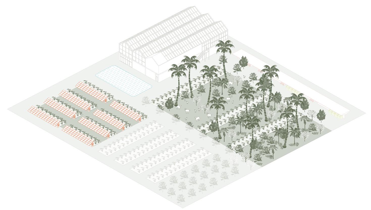
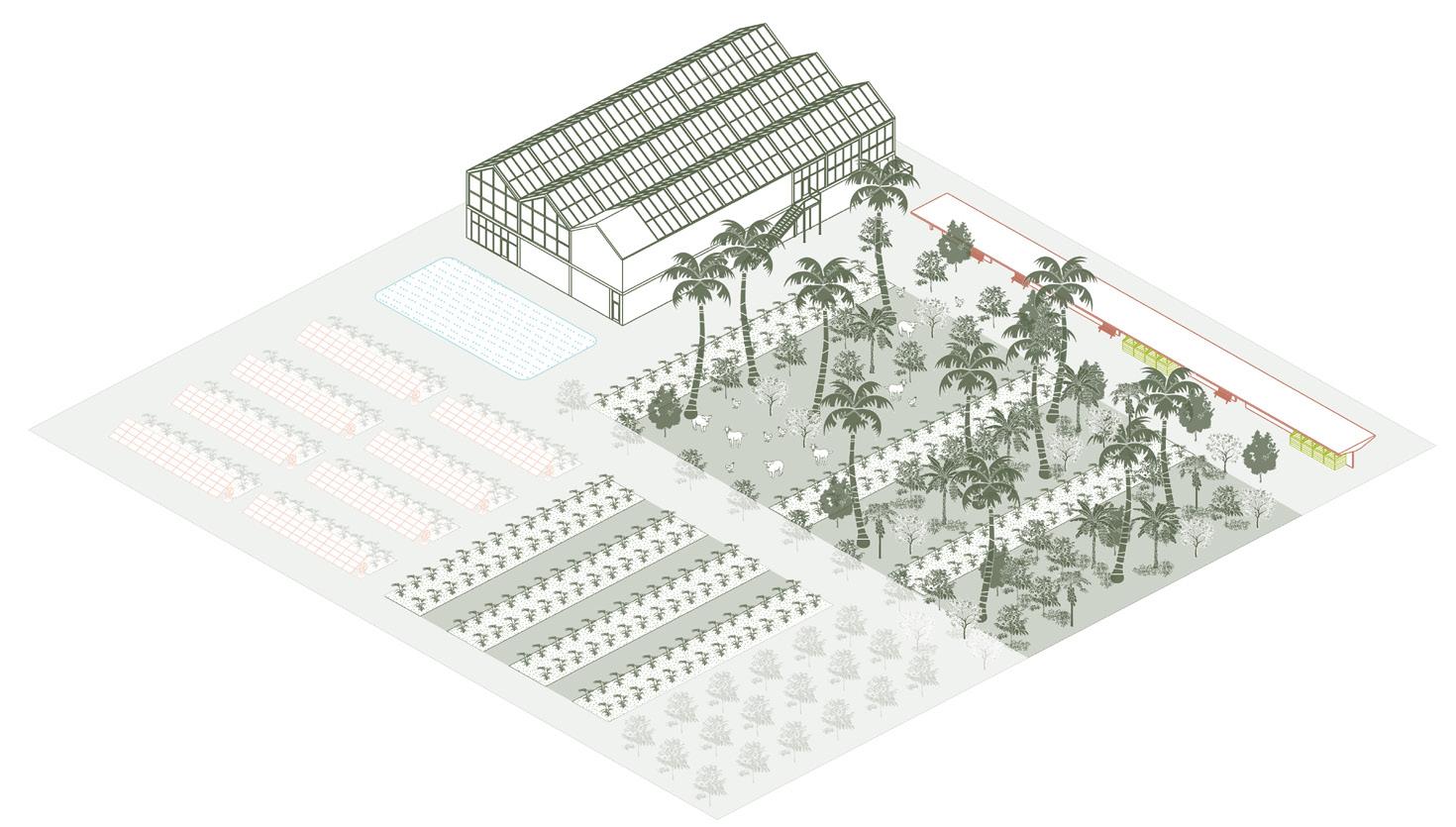
The Master Plan begins the process of finding this balance. The relationship between population and food production capacity is one that can be calculated. Based on population, the equivalent land area required to feed that population can be calculated. Generally speaking, a population the size of Nauru’s would require approximately 100 square kilometers, to achieve 100% food production independence. With a land area of approximately 20 square kilometers the base case for Nauru is some combination of on-Island food production and food importation. The more land that can be set aside for food production, the more resilient the outcome. Food production substantially consists of field farming, but also includes greenhouses, aquaculture, as well as other technology-based systems, and water reservoirs. All require land.
Viable forests require a network of large tracts and connected corridors, to permit species of animal and insect to thrive. The greater the total area set aside for replanting native species, the more resilient the natural environment becomes. A secondary outcome that serves to support the good production system stems from the forest canopy that can be re-introduced. The more forests, the quicker soils can be replenished and become available for agricultural use.
By focusing on the managed migration of residents to improved housing, and away from vulnerable locations susceptible to erosion and sea level rise, the HGI Master Plan establishes a viable economic and social footprint for the human population. The remaining land area can be set aside for forest replanting and food production.
Public Health
Cultural Restoration
Nauru’s coastlines provide opportunities for tourism, resilience planning, and restoration of the island’s native ecology. By implementing an island-wide living shoreline strategy which restores mangrove habitat, supports brackish wetland environments, and creates reforested buffers along water quality-sensitive areas and areas susceptible to erosion, Nauru will enhance its terrestrial and aquatic habitat, minimize impacts of sea level rise, and celebrate the island’s unique atoll environment.
Land Rehabilitation
Environmental Restoration
Economic Diversification
Land Rehabilitation
Food Security
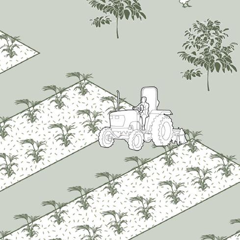
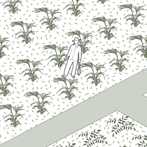
Large scale agricultural systems in Nauru will not only provide island-wide access to fresh food, but also generate and replenish healthy soil and vegetation. Commercial farms will utilize a regenerative, diversified approach to food production, including nursery practices, hydroponics, agroforestry and silvopasture, agrivoltaics, and planting non water-intensive native crops. Farming and forestry will grow in tandem as both an industry and rehabilitation strategy for the island.
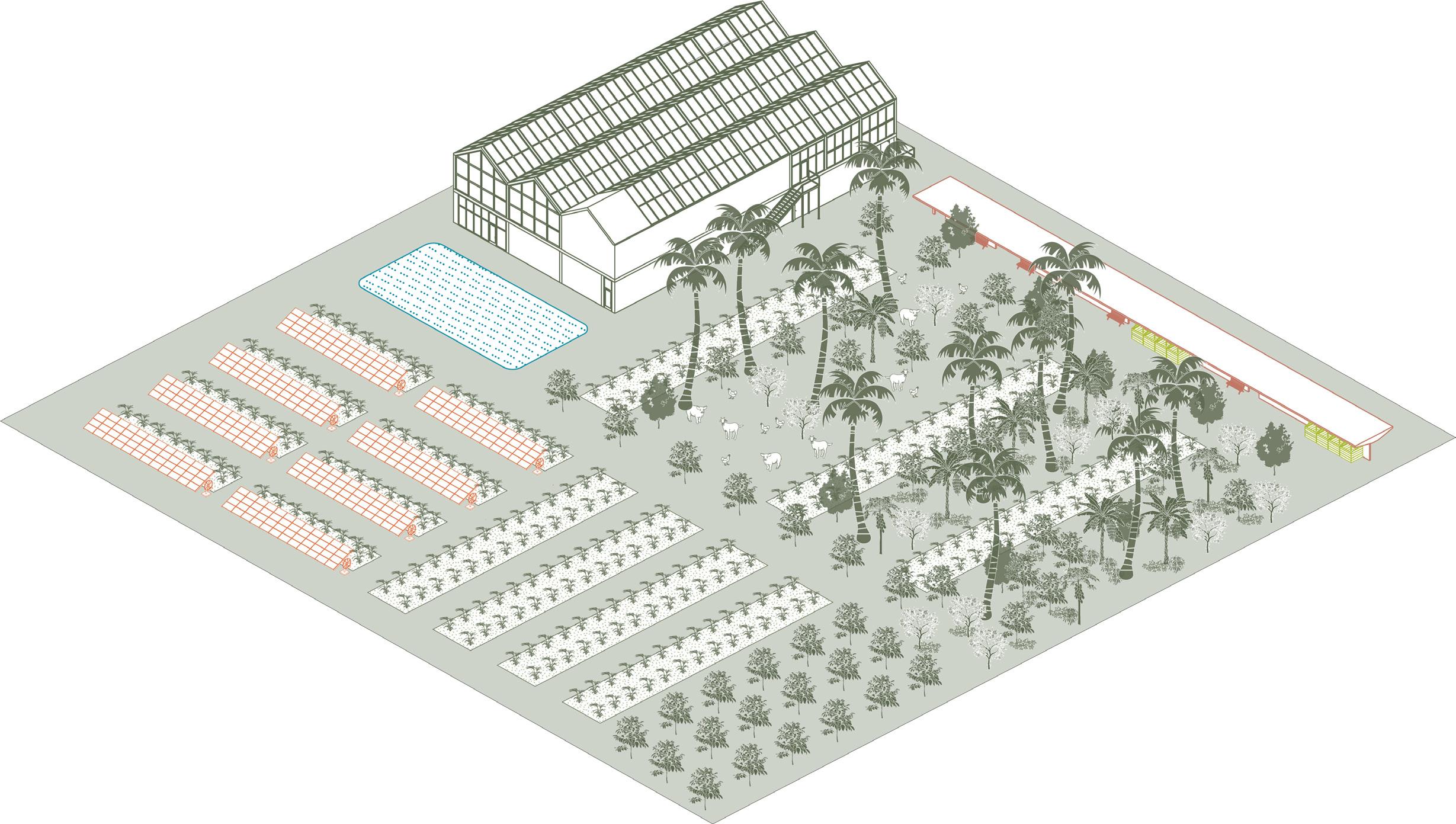
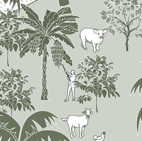
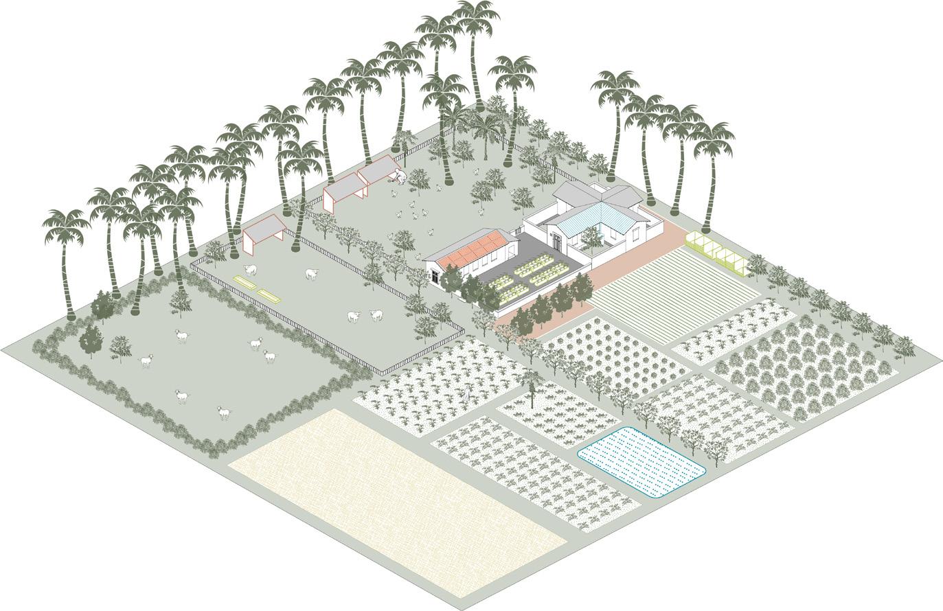

Farming residences are a smaller scale opportunity for supporting Nauru’s food system and agricultural economy. Farmsteads can serve as both places of business and homes for those along rural edges of townships. Small-scale, closed-loop systems for power and nutrient cycling provide regenerative operations for agricultural homesteads. These residences are an important part of Nauru’s ecological landscape transition, from urban areas to the island’s large open space network.
The largest concentrations of remaining forests and undisturbed vegetation is located along the slopes rising to Topside and at the southern end of the Island. It is at these locations where the Master Plan envisions the reforestation of Nauru to be concentrated, establishing a tree canopy along most of the southern half of the island that reconnects the slopes along the perimeter and to the north with a circular corridor. The remainder of Topside would be set aside for food production. It is outside the scope of this HGI Master Planning effort, to fully plan the environmental initiative that reforestation and food production require. The most important recommendation to consider from the plans enabled by this Reporting is the need to engage in a follow up environmental planning effort that addresses fully this demand to the same level of detail provided for the community planning.
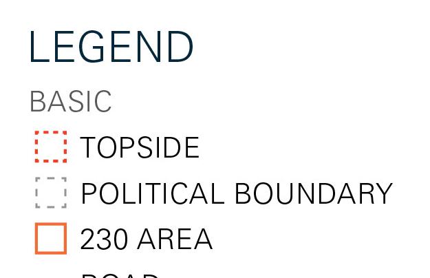
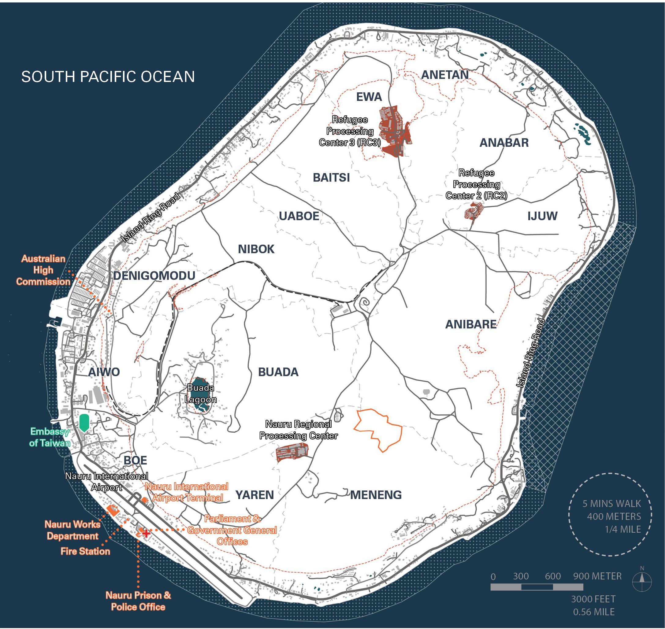
LEGEND BASE TOPSIDE
POLITICAL BOUNDARY
230 AREA ROAD
RAILWAY
POINT OF INTEREST
AIRPORT
COMMUNITY SERVICES
SOLAR ENERGY
GOVERNMENT
GARBAGE DUMP
REFUGEE CENTRE
SPORTS
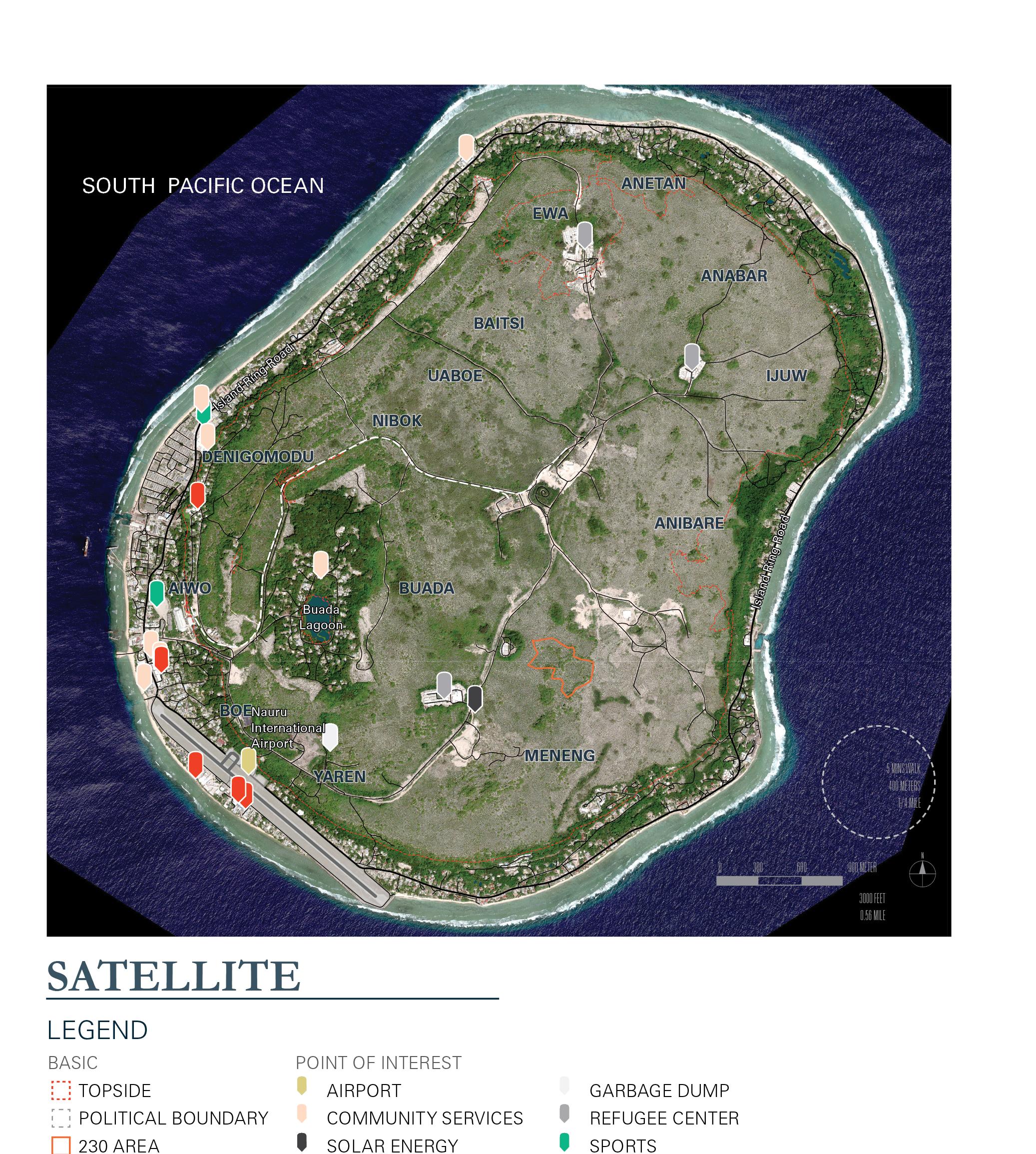
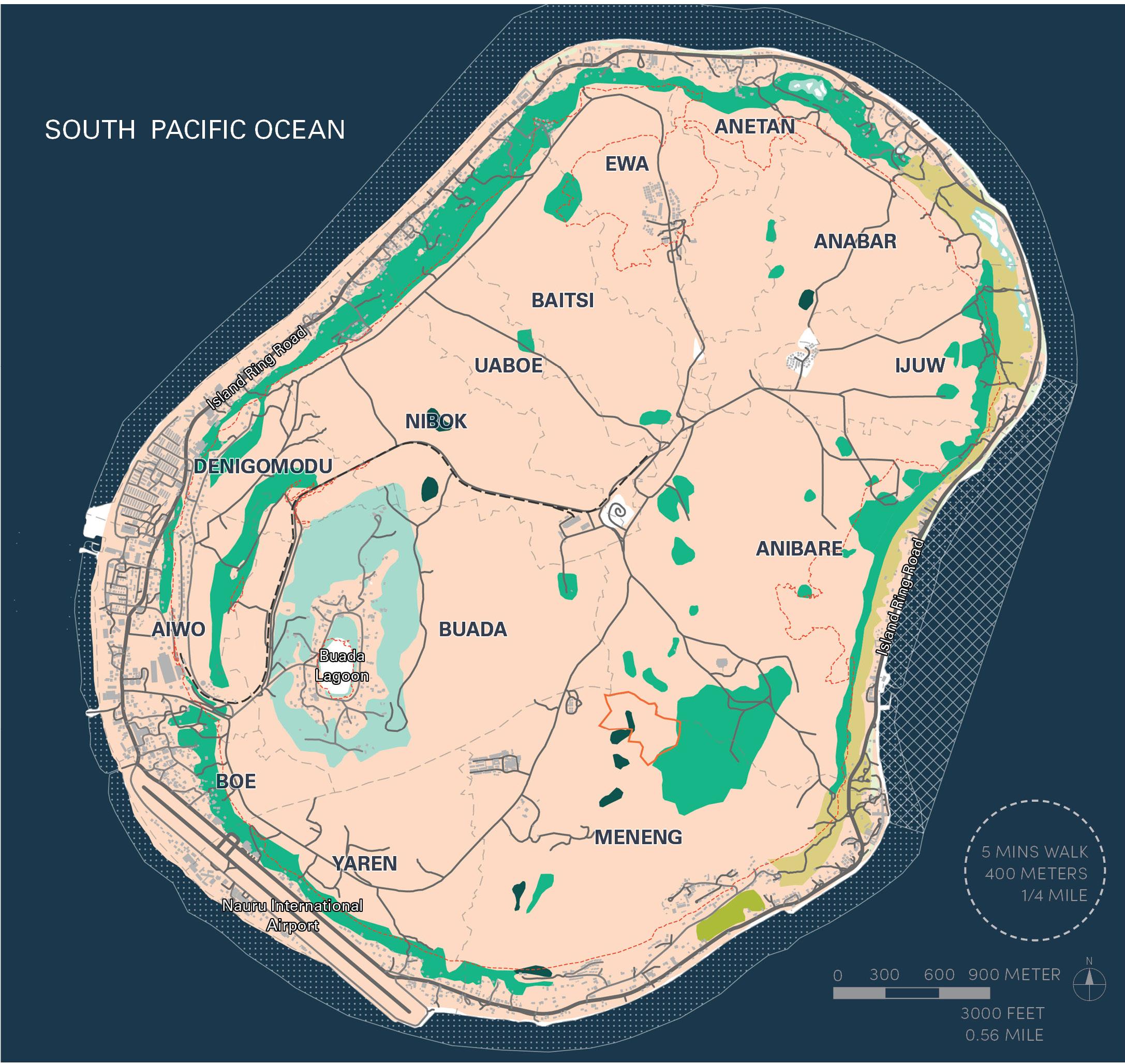
Geospatial data regarding land use, previous plannnig efforts, resilience planning, habitat and vegetation, and physiography were gathered to inform land planning for Land Portion 230 and the Island.
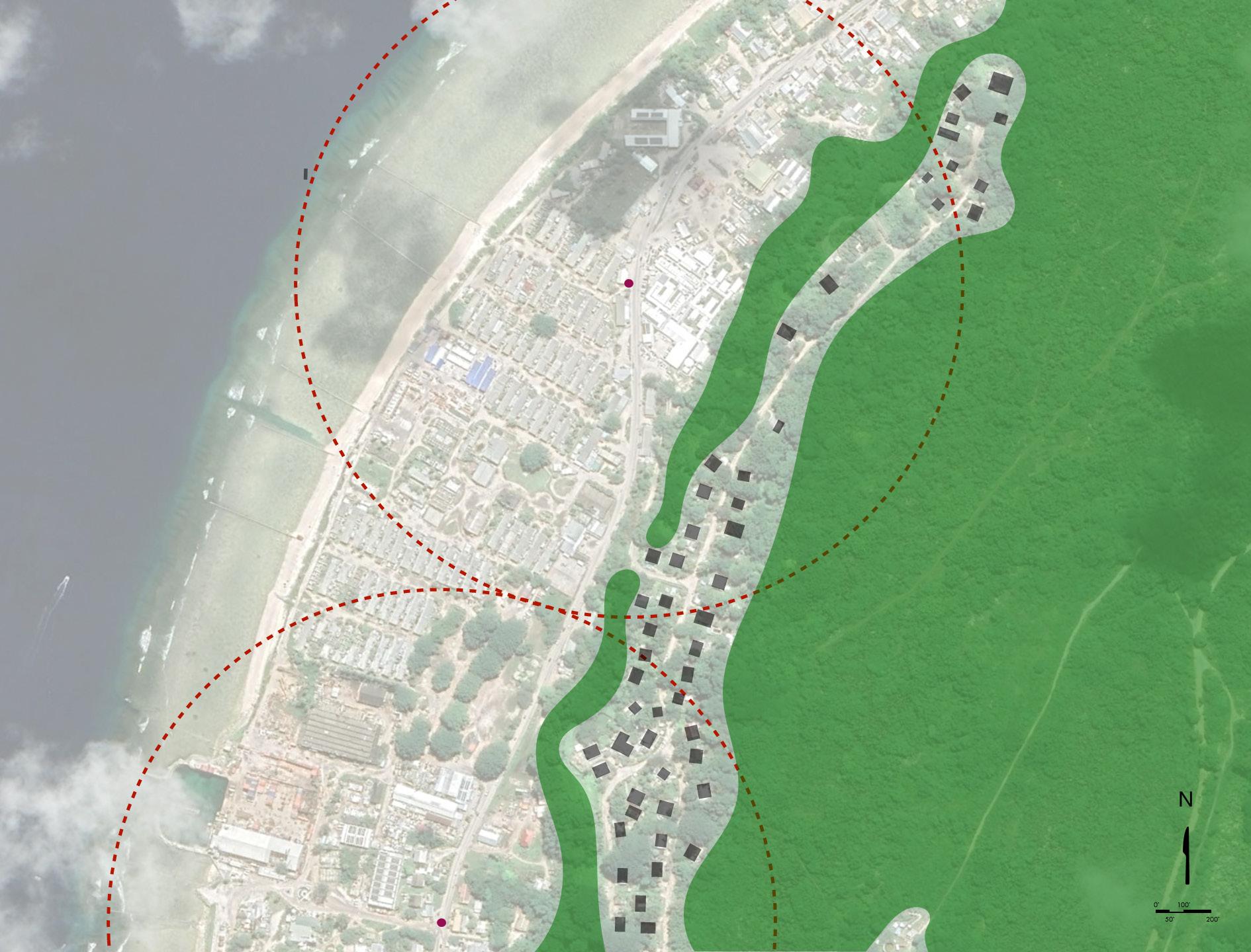
While the majority of the community lives and operates along the coast and littoral zone of the island, most of the existing vegetation rests at the edge of Topside, along a coastal bluff and surrounding the Buada Lagoon. Several mining roads traversing the topside are visible from the satellite image.
BASE
TOPSIDE
POLITICAL BOUNDARY
230 AREA
ROAD
RAILWAY
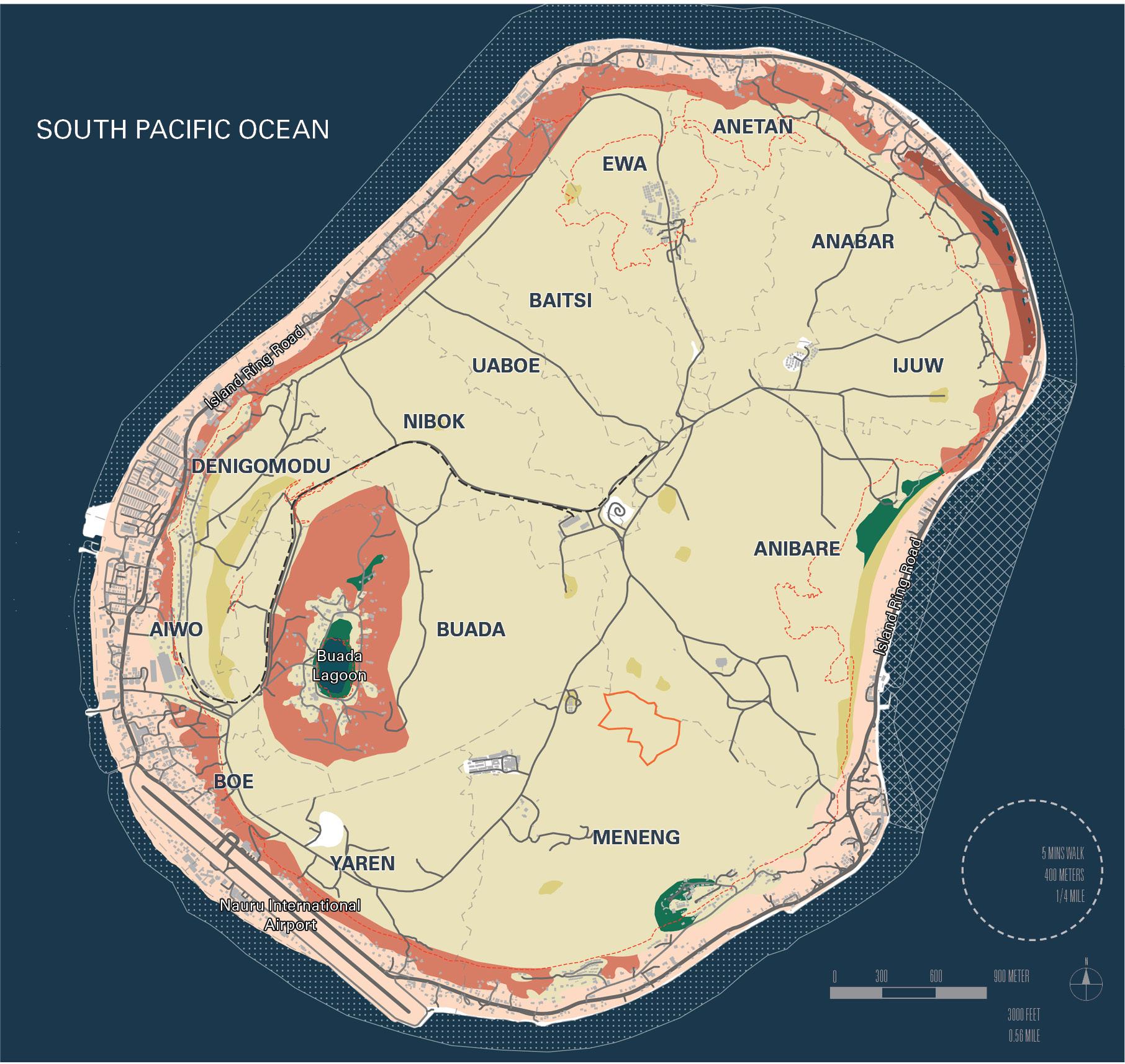
VEGETATION
DISTURBED AREA
FRESHWATER AND LITTORAL VEGETATION
MID-HIGH CLOSED FOREST
TALL OPEN FOREST
TALL CLOSED SHRUB
TALL CLOSED FOREST
VERY TALL CLOSED FOREST
Based on the data from 1994, most of the topside of the island in Nauru is disturbed by mining activities. The remaining vegetations are mostly along the bluff and clustered near Buada Lagoon. A few small patches of forest are scattered across the island.
Source: Nauru GIS 2020, OSM 2021, RDFS 1994
LEGEND
BASE TOPSIDE
POLITICAL BOUNDARY 230 AREA ROAD
RAILWAY
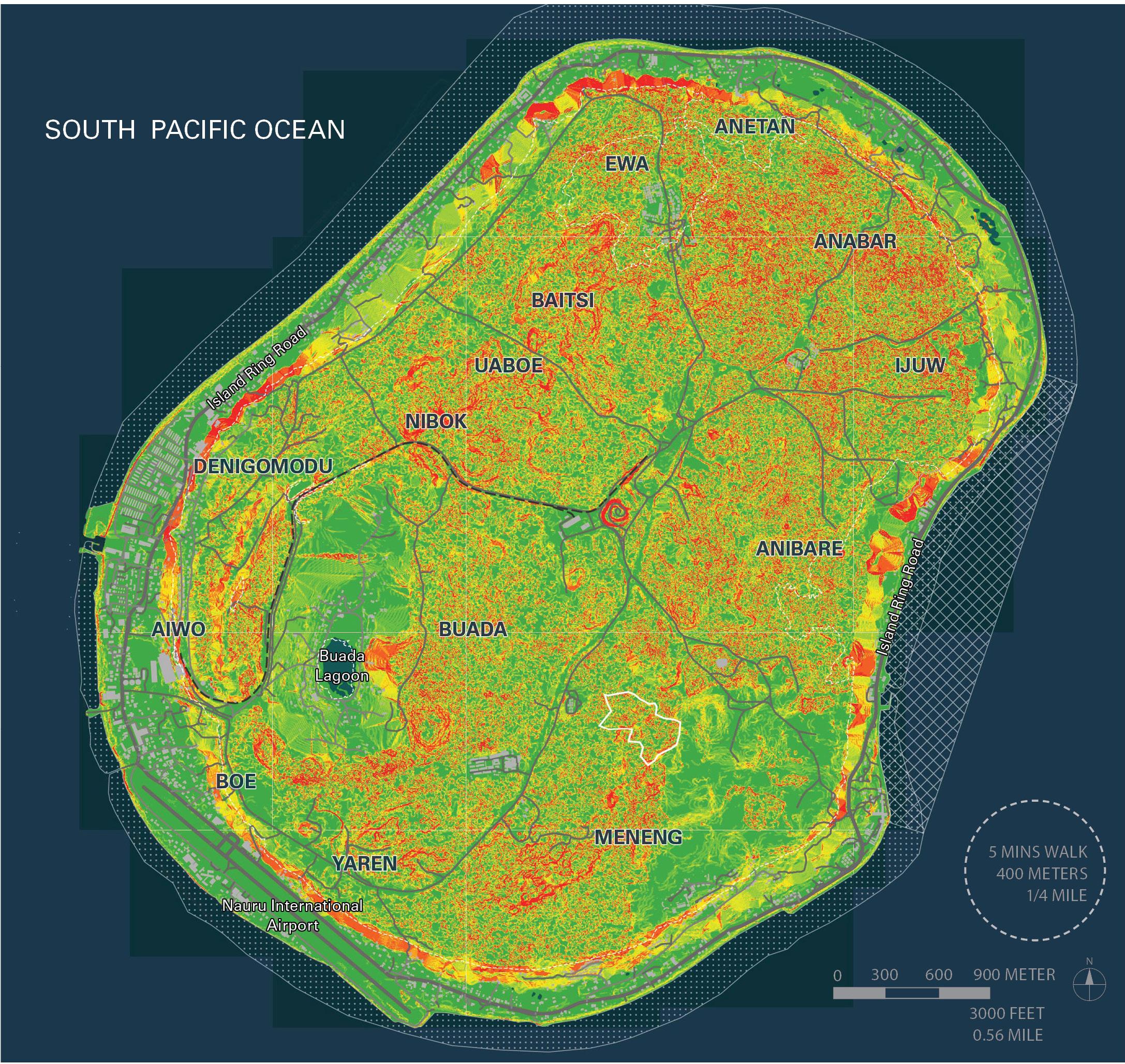
SOIL NON-SOIL
SHALLOW RECENT MODERATELY SHALLOW
PINNACLE COVERED NON-SOIL
PINNACLE DOMINANT MODERATELY DEEP
Most of the topside is dominated by pinnacles and in lack of top soil.
LEGEND BASE TOPSIDE
POLITICAL BOUNDARY
230 AREA ROAD RAILWAY BUILDING
OCEAN
ELEVATION (METERS)
-7.9 TO -5
-4.9 TO 0
0.1 TO 5
5.1 TO 10
10.1 TO 15
15.1 TO 20
20.1 TO 25
25.1 TO 30
30.1 TO 35
35.1 TO 40
40.1 TO 45
45.1 TO 50
50.1 TO 55
55.1 TO 60
60.1 TO 65
65.1 TO 70
70.1 TO 75
Topside is about 30 meters above sea level, with several depressions in the middle. The major depression is centreed by Buada Lagoon. It is recomended that other depressions throughout the island be studied as targets for freshwater or supplementary lagoon storage, represented as areas in deep green on this map. Areas of interest for freshwater storage include Ewa, Anibare, Buada, Baitsi, Nibok, and Anabar.
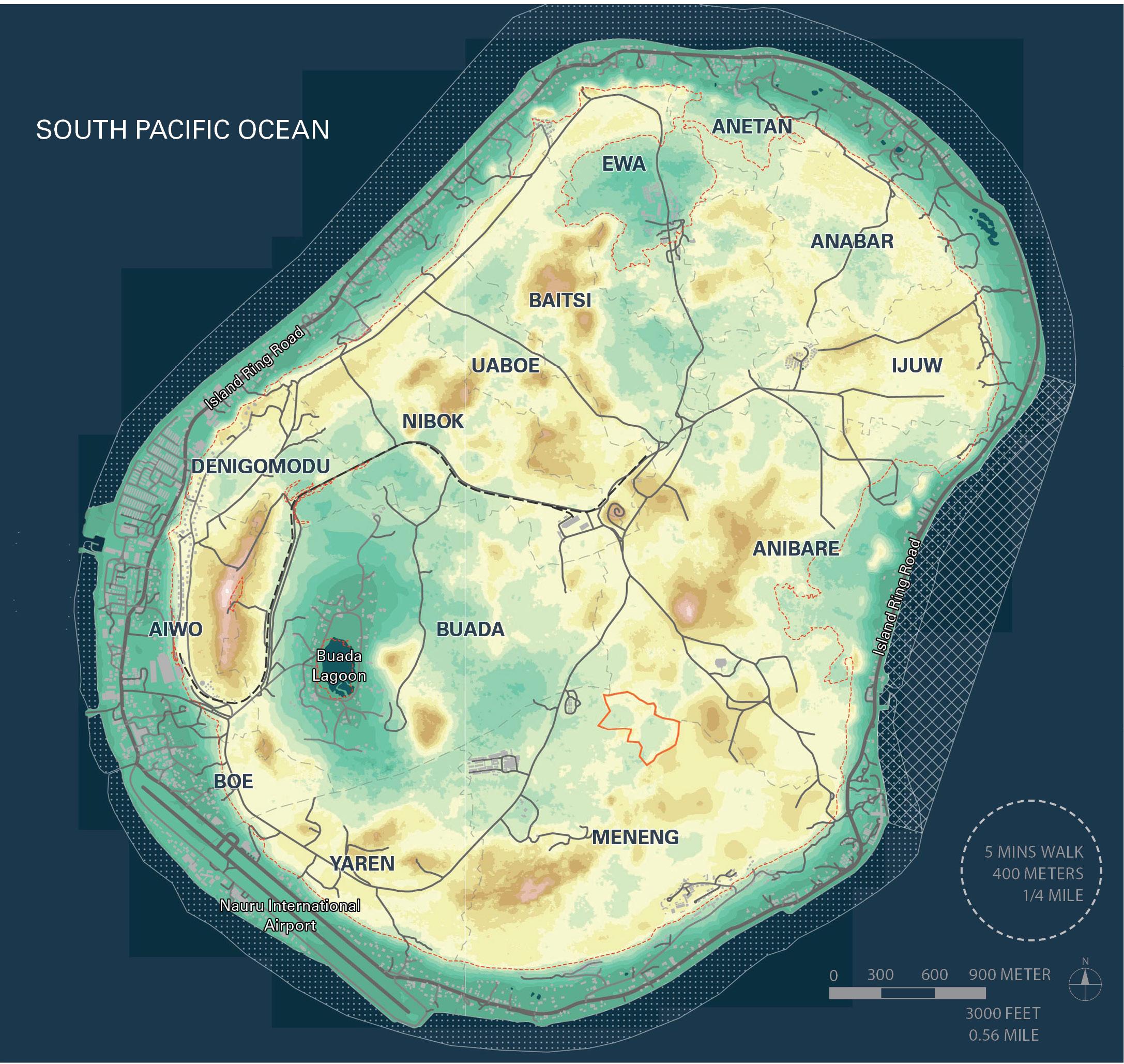
Several scattered spots in Topside have a slope greater than 30%, which is not ideal for development. The spreading pattern indicates areas that are impacted by mining activities and the remnants of pinnacle structure.
Source: Nauru GIS 2020, OSM 2021, RDFS 1994, Nauru Water and Sanitation Plan 2015
METROCOLOGY
SECTION 6.0 ISLAND MAPPING
LEGEND BASE TOPSIDE
POLITICAL BOUNDARY
230 AREA
ROAD
RAILWAY
BUILDING
OCEAN
LAGOON
FRESHWATER AQUIFER
(>5M THICK, 1994)
TANK
PROPOSE TANKS
DESALINATION FACILITY
PUMPING ROUTE
Two freshwater aquifers were identified based on data from 1994.
SECTION 6.0 ISLAND MAPPING
LEGEND
BASE TOPSIDE
POLITICAL BOUNDARY
230 AREA
ROAD
RAILWAY
LANDCOVER
LAGOON
BEACH
ROCK
BARE ROCK
SCRUB
WOOD
POINT OF INTEREST
AIRPORT
COMMUNITY SERVICES
SOLAR ENERGY
GOVERNMENT
GARBAGE DUMP
REFUGEE CENTRE
SPORTS
The majority of the land is covered by scrub. Forested areas are along the bluff and around Buada Lagoon.
SECTION 6.0 ISLAND MAPPING
LEGEND
BASE TOPSIDE
POLITICAL BOUNDARY
230 AREA
ROAD
RAILWAY
POINT OF INTEREST
AIRPORT
COMMUNITY SERVICES
SOLAR ENERGY
GOVERNMENT
GARBAGE DUMP
REFUGEE CENTRE
SPORTS
ATTRACTION
HOTEL
MUSEUM
HISTORIC
RESTAURANT
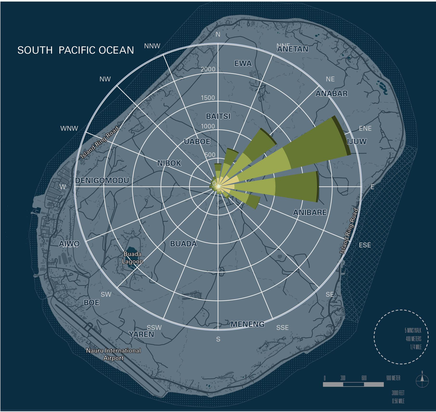
The majority of the Points of Interest (POI’s) are located in the southwest side of island.
Source: Nauru GIS 2020, OSM 2021
SECTION 6.0 ISLAND MAPPING
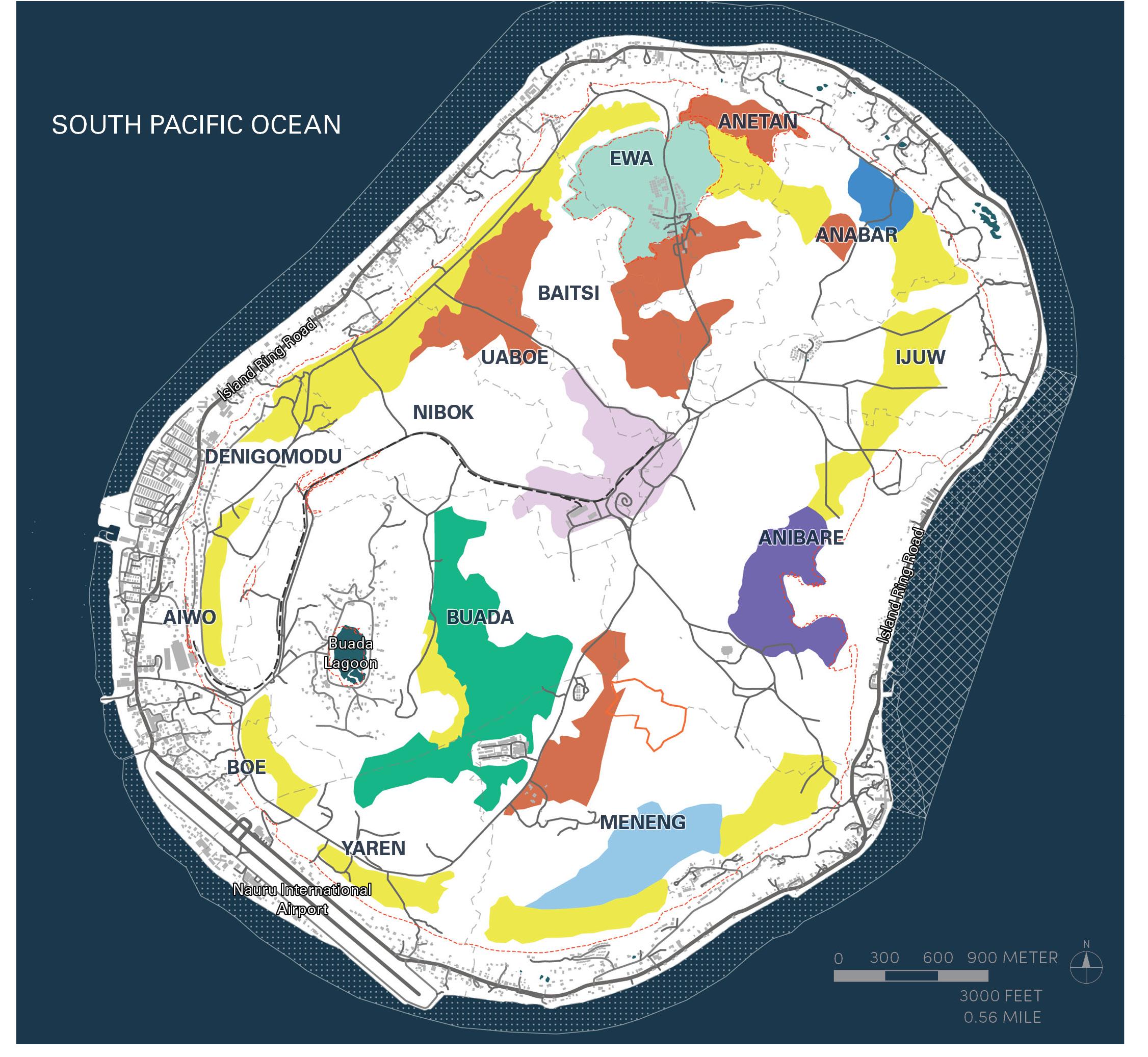
Government facilities are primarily located in the Southwest area of the island.
The 1994 Plan calls for relocation or expansion of some government facilities toward Meneng in the future (see Land Use Plan).
LEGEND
BASE TOPSIDE
POLITICAL BOUNDARY
230 AREA
ROAD
RAILWAY
LAND USE
RESIDENTIAL COMMERCIAL
CEMETERY
INDUSTRIAL
CONSTRUCTION
QUARRY
BROWNFIELD
POINT OF INTEREST
AIRPORT
COMMUNITY SERVICES
SOLAR ENERGY
GOVERNMENT
GARBAGE DUMP
REFUGEE CENTRE
SPORTS
LEGEND BASE
TOPSIDE
POLITICAL BOUNDARY
230 AREA
ROAD
RAILWAY
BUILDING
OCEAN
LAND USE
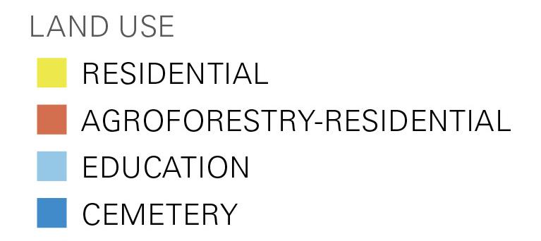
RESIDENTIAL
AGROFORESTRY-RESIDENTIAL
EDUCATION
CEMETERY
GOVERNMENT
INDUSTRIAL
SPORTS-RECREATION
WATER RESEVOIR
April 11, 2022
Metrocology
528 Selma Street, Unit E
Savannah, GA 31401
Attn: Mr. Demetri Baches
P: (305) 606 7701
E: demetri@metrocology.com
Re: Preliminary Geotechnical Engineering Considerations
NRC Ronphos Work Collaboration
Section #230, Republic of Nauru
Terracon Project No. ES215346

Dear Mr. Baches:
Terracon Consultants, Inc. (Terracon) provides this letter to document the geotechnical evaluation and preliminary recommendations for the referenced development in The Republic of Nauru. The services were performed in accordance with Terracon Proposal No. PES215346 dated December 16, 2021. Our report is based on a video call with Mr. Benedict Joseph Abourke, who drove to several sites in and around Land Section #230, showing the current mining and land remediation practices in place, as well as examples of building construction and lands similarly prepared post mining. In addition to the tour and discussion with Mr. Abourke, we have had several meetings with Demetri Baches of Metrocology to understand the scale of future development being envisioned by the master planning. We have not visited the site, nor performed any testing. No construction drawings, civil works, or soil studies were provided for our review. Our evaluation and recommendations were limited to the information from the video call and our discussions with those parties listed above.
We understand the project is to develop infrastructure, including housing, schools, and other public buildings on land that has been used for phosphate mining. The following sections outline our;
1- Understanding of the project,
2- Findings from the video call,
3- Discussions with relevant parties, and
4- Evaluation and preliminary recommendations for site preparation for the proposed development.
Proposal for Preliminary Geotechnical Engineering Considerations Services
NRC Ronphos Work Collaboration ■ Section #230, Republic of Nauru
April 11, 2022■ Terracon Project No. ES215346
Our understanding of the project was based on conversations with Mr. Demetri Baches of Metrocology. Nauru is a small island nation located near the equator in the Pacific Ocean. A majority of the population is currently concentrated around the low-lying areas along the coastline. The infrastructure along the coastline is affected by high tides and waves from the ocean. To cope with the rising sea level from global climate change, The Republic of Nauru is working with the United Nations and other agencies to relocate the population to the upper lands referred to as the Higher Ground Initiative. The area is called Topside by Nauruan’s and consists mostly of lands that have been actively mined for phosphate since the early 1950’s.
Item Description
Site Information
Existing Improvements
Existing Topography
The review was for various locations in and around Land Section #230, that had been, and in some instances are still being mined for phosphate. The approximate coordinates are
■ Latitude: -0.535708°, Longitude: 166.944848°, elevation 106 ft based on Google Earth.
Phosphate mining and mining access roads. The site featured limestone pinnacles and troughs from the removed phosphate.
Irregular and uneven with limestone and fills. Based on Google Earth imagery, site elevations range between 60 to 100 feet above sea level.
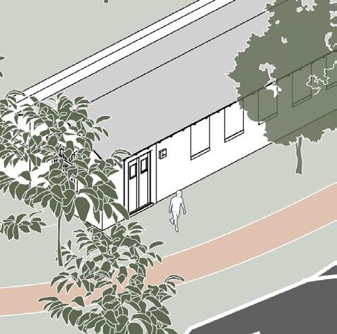
The proposed developments are at the conceptual master planning stage without any construction documentation, or civil engineering plans. In general, the development will include housing, churches and schools for the relocation of the population from the coastline to Topside. The buildings will be permanent structures, typically one or two stories in height. Most likely, the buildings will be constructed of wood, concrete, or steel, supported on permanent concrete foundations, not prefabricated units shipped from another country.
Arranged by Mr. Demetri Baches, Mr. Benedict Aborke gave Guoming Lin a video tour of the island on March 16, 2022. During the 1.5-hour video call, Mr. Aborke toured, through the camera on his smartphone, the phosphate mines and the ongoing remediation work, a detention facility showing typical building construction and foundation support examples, the mining access roads, and the main island loop road along the coast. This section summarizes the information gathered from the call.
Responsive ■ Resourceful ■ Reliable
Proposal for Preliminary Geotechnical Engineering Considerations Services
NRC Ronphos Work Collaboration
April 11, 2022
■ Section #230, Republic of Nauru
■ Terracon Project No. ES215346
At the phosphate mine remediation site, it was visible via the video that the ground was covered with mostly white (light grey) limestone type material. No vegetation cover was visible on the remediated lands at Section #230, but small trees were visible beyond the work area. A few vehicles were visible in the background, but I did not see any construction equipment that would be considered typical for mining and construction, such as, bulldozers, excavators, or compactors. It appeared the remediation work was being completed mostly by manual labor. Rock of variable size was moved manually to fill the holes, or troughs from the phosphate mining operation. No compaction was performed on the filled holes, or areas.
At the detention facility, it was visible via video that the typical construction of the buildings was minimalistic, resembling prefabricated manufactured housing and temporary office space in the United States. The buildings were one-story, metal shell-type construction transported from overseas. Upon close inspection of the foundation systems, it was apparent via the video that the buildings were supported on steel beams (H or W sections). The steel beams were supported on pieces of cut stone(s) resting on the ground. Some tie-down straps were used to resist uplift wind loads.
In a follow-up discussion with Mr. Demetri Baches, he explained and showed plans of the proposed new developments. These plans envision permanent structures and not simple prefabricated buildings currently used by the detention center example. The new structures will be suited for the economic and environmental conditions of the region. It is expected the new structures will be one to two stories tall, constructed of concrete, wood, and/or steel. The foundations will be cast in place concrete that is expected to last at least 50 years, the normal design life for buildings.
The focus of this evaluation is the subsurface conditions and preparation of the subgrade to support the proposed developments. Based on the video call and discussions with Mr. Baches and Mr. Aborke, the areas that are being considered for future development are underlain with limestone and leftover phosphate from previous mining. We are not aware of any soft soils. A limited amount of topsoil may be present outside the old mines where small trees and vegetation have grown. We have no information and did not make an effort to assess if there are voids or natural solution cavities that may be present in the limestone formation. In and of itself, limestone is an adequate material to support a typical one or two-story building without risk of settlement or bearing capacity failure. The natural limestone can also support roadways and slopes or embankments of moderate heights (say 20 feet) without the need for special reinforcements, as well as underground infrastructure needs. The above are general considerations. A more detailed evaluation should be performed for the specific location and design and construction of structures and infrastructure to be built.
One special aspect of this site is the site's history as a phosphate mine. The information used in this report is based on scenes observed from the video call. Specific information about the mine
Proposal for Preliminary Geotechnical Engineering Considerations Services
NRC Ronphos Work Collaboration ■ Section #230, Republic of Nauru
April 11, 2022■ Terracon Project No. ES215346
operation, including the depth and extent of the extraction is not known. The phosphate is excavated out, either manually or mechanically, from the crevices and holes between the limestone pinnacles. The pinnacles are then pushed down, and the rock pieces used to fill the holes or spaces created from the removal of the phosphate. From the video, it is apparent that the rock is in variable sizes and was being placed in the holes manually. No mechanical crushing or compaction is performed in the current operation. This operation would be acceptable for temporary housing supported on steel beams but may not be up to standard for quality construction of buildings and infrastructure. The operation as currently practiced leaves two issues that represent a risk for the long-term performance of buildings or other infrastructures.
1- Large pieces of rock are prone to becoming stuck at depth not falling all the way to the bottom of a hole, leaving voids below the stuck rock or between pieces of large rock. Any unplanned voids below ground are not desirable. The voids may collapse over time or allow fine sands to be washed into the voids by water resulting in surface rupture and loss of support under any foundations at the surface.
2- The existing limetone rock is hard and incompressible under small building loads, and any compression of lose rock or voids would result in differential supports and movements under linear footings. Differential movements would be more detrimental to building performance than a uniform movement causing foundation settlement and compromise of structural integrity.
Responsive
We recommend the following step-by-step process of site remediation of the subgrade for future development. These recommendations are based on the observed site conditions and remediation operation from the video and the conceptual master plans being prepared. The recommendations are intended to address concerns related to the ongoing site remediation operation. Additional investigation and evaluation should be performed for any site and projectspecific developments.
1. For each hole to be filled, the contractor should measure the size and depth to evaluate the best way to fill the holes. Insure there are no debris or other deleterious material at the bottom of the hole. We recommend gravel-sized rock with typical dimensions of 2.0 centimeters to 7.5 centimeters. For large holes, larger rock may be used in combination with gravel to make sure the larger rocks are not stuck in the holes. The gravel should be used to fill voids between large pieces of rock.
2. For holes deeper than five feet, the holes should be filled in lifts, less than 1 meter in each lift. A lift is the layer of gravel to be placed at once. A steel rod or a wood board needs to be used to tamp each lift of the rock to compact the gravel fill. The worker should observe the filling and tampering process to make sure the rock is not stuck in the middle of the hole, leaving voids at the bottom or between the rock pieces.
Responsive ■ Resourceful
■ Reliable
Proposal for Preliminary Geotechnical Engineering Considerations Services
NRC Ronphos Work Collaboration ■ Section #230, Republic of Nauru April 11, 2022 ■ Terracon Project No. ES215346
3. As a quality assurance measure, the volume of gravel used to fill the hole should be consistent with the size and depth of the hole. We recommend the project superintendent to calculate the volume of each hole or area to be filled and prepare the gravel of the required volume. If the volume of the gravel used is considerably less than the calculated volume, the superintendent should investigate the work by inquiring the process and the of removing or excavating gravel fill to make sure there are no large voids. Close attention should be directed to deep (deeper than 1.5 meters), and smaller holes (less than 0.5 meters) as this type of hole tends to have a greater risk of fill arching before reaching the bottom.
4. For troughs and large areas that are accessible to vehicles or construction equipment, crushed gravel or gravel of mixed size should be used. The purpose of mixed size is to allow smaller gravel to fill the voids between larger gravel to achieve compacton without voids. The fill should be placed in lifts of 30 centimeters in thickness or thinner. A vibratory compaction roller is a preferred equipment for compaction. If a vibratory roller is not available or if the dry gravel can be compacted without the need for a vibratory roller, the compaction may be achieved by running a bulldozer or an excavator bucket in the area.
5. The surface of the filled area should be stable based on the vehicle or equipment in operation. The surface should not exhibit rutting or pumping under loaded trucks. Soft or unstable ground should be repaired by excavation and backfill using additional gravel.
6. The surface should be graded to shed water and avoid ponding. A gradient of 2 to 5 percent is recommended. Any localized areas that experience ponding after rains should be regraded to prevent ponding of water.
We appreciate the opportunity to provide this summary report.
Sincerely,
Terracon Consultants, Inc.
Guoming Lin, Ph.D., P.E., D.GE Senior Consultant
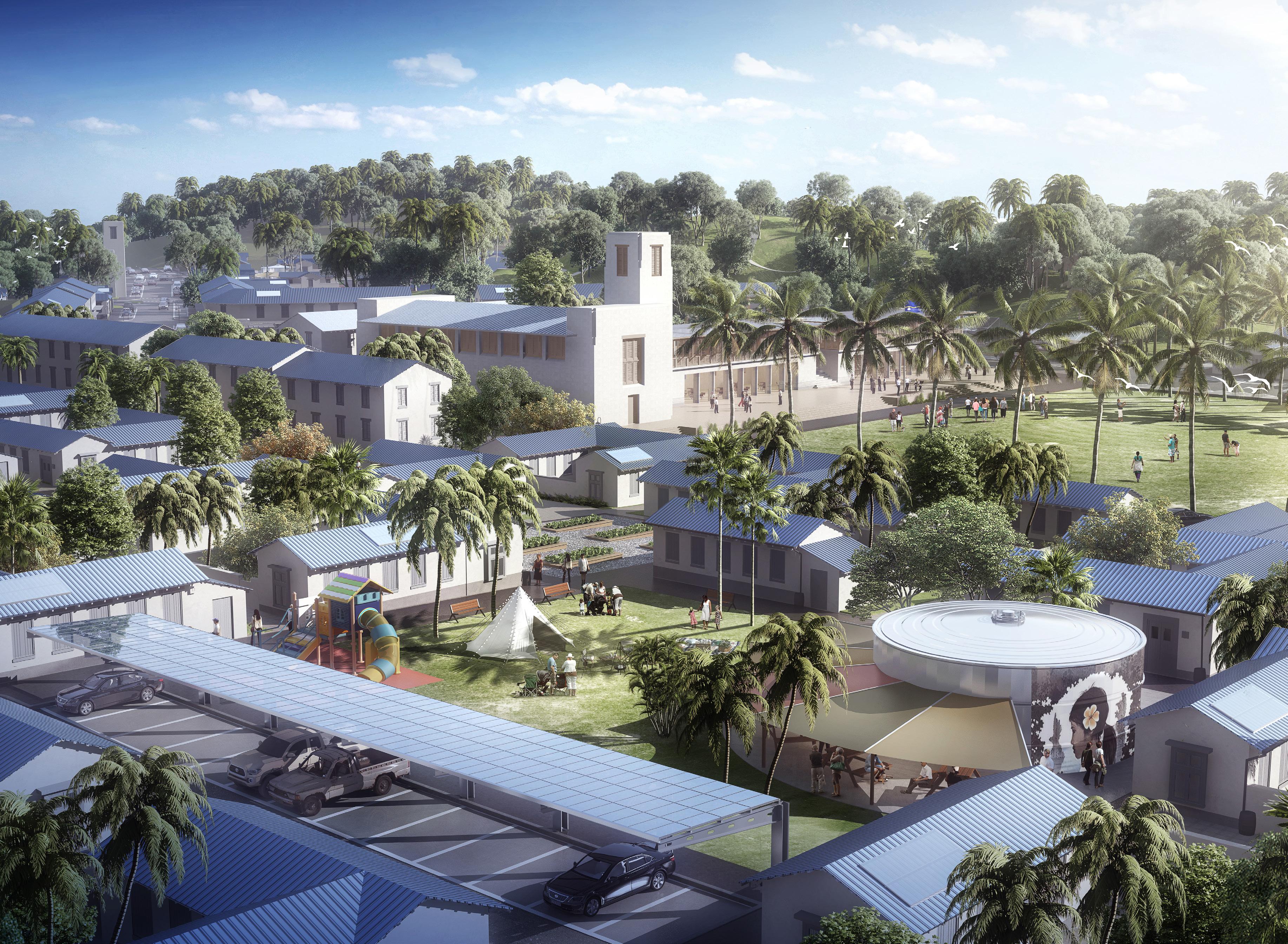
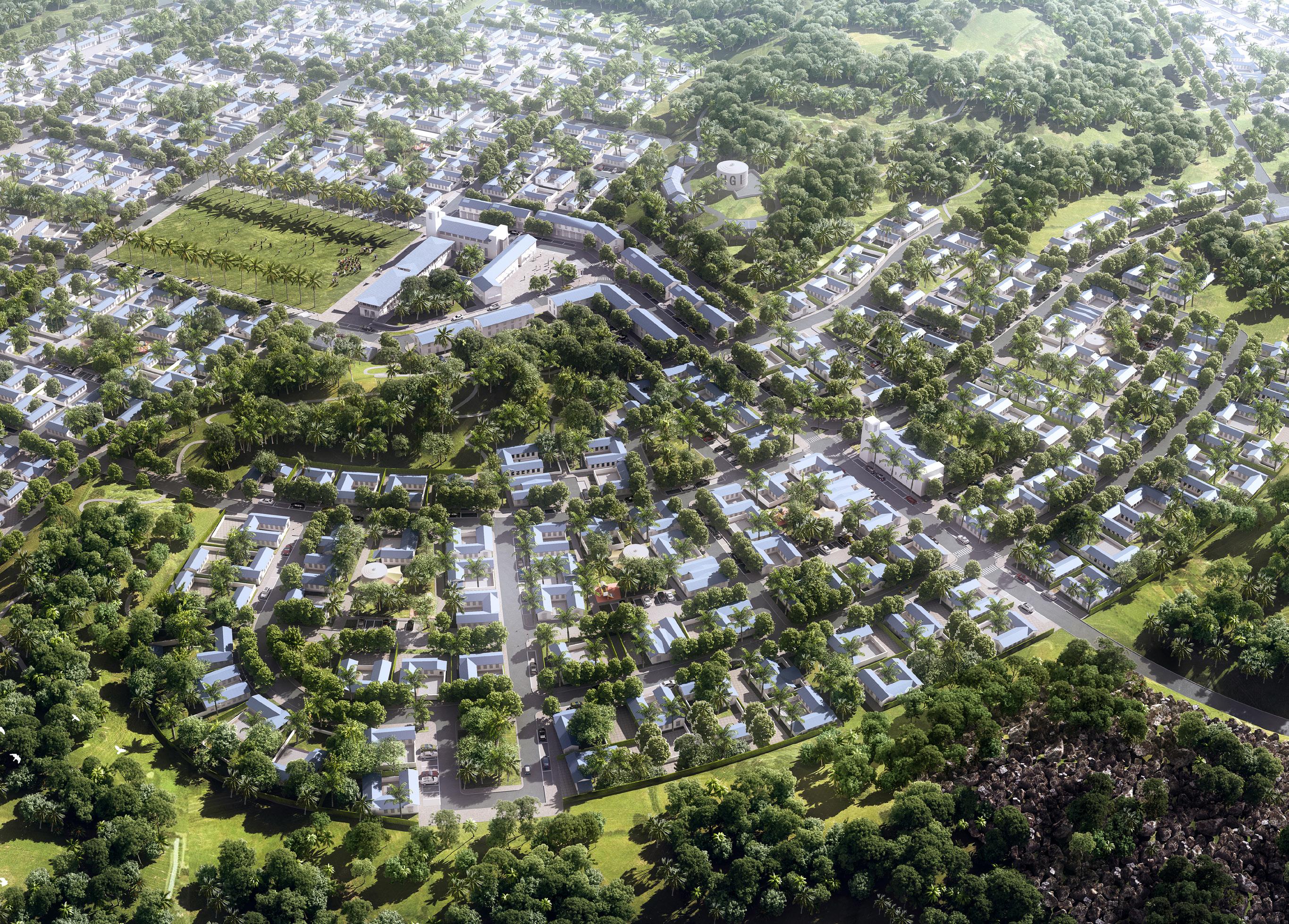
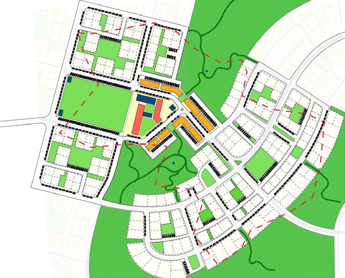
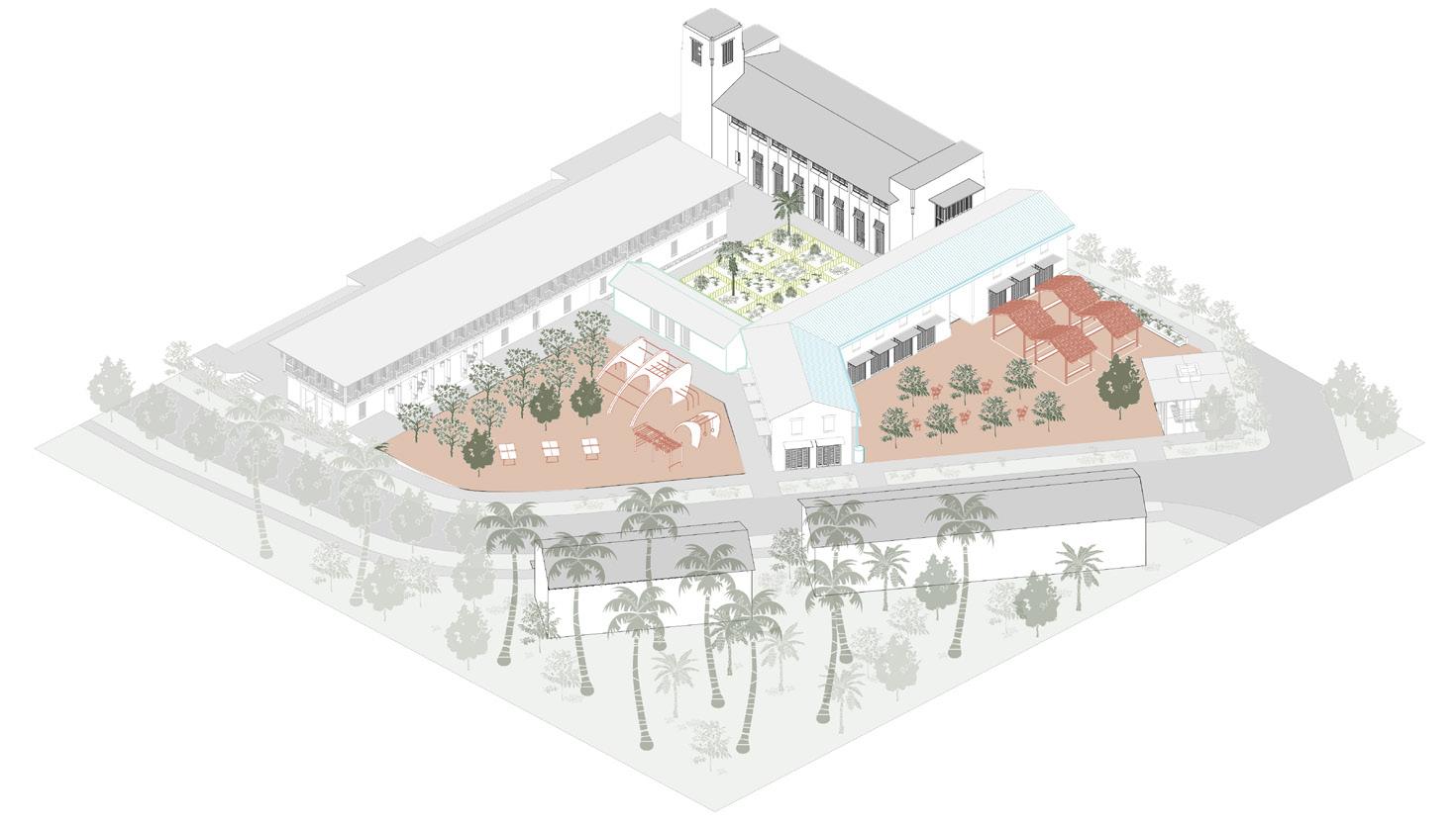
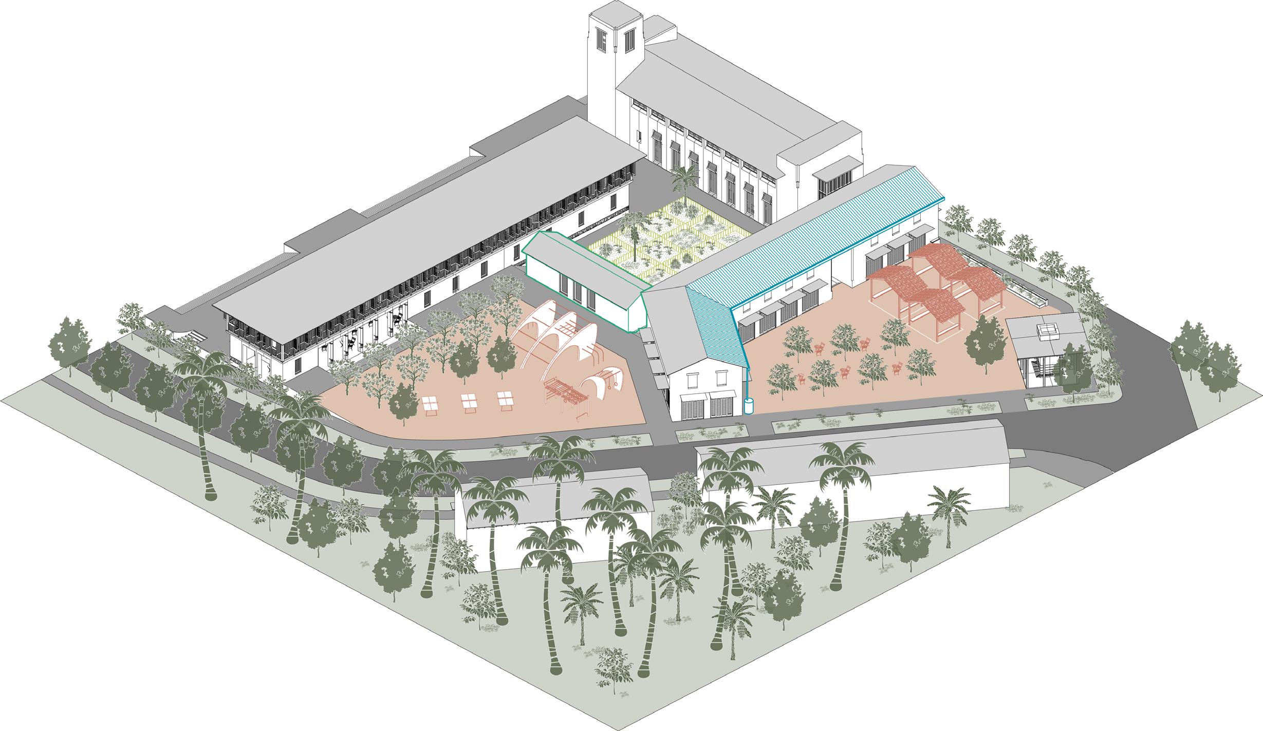
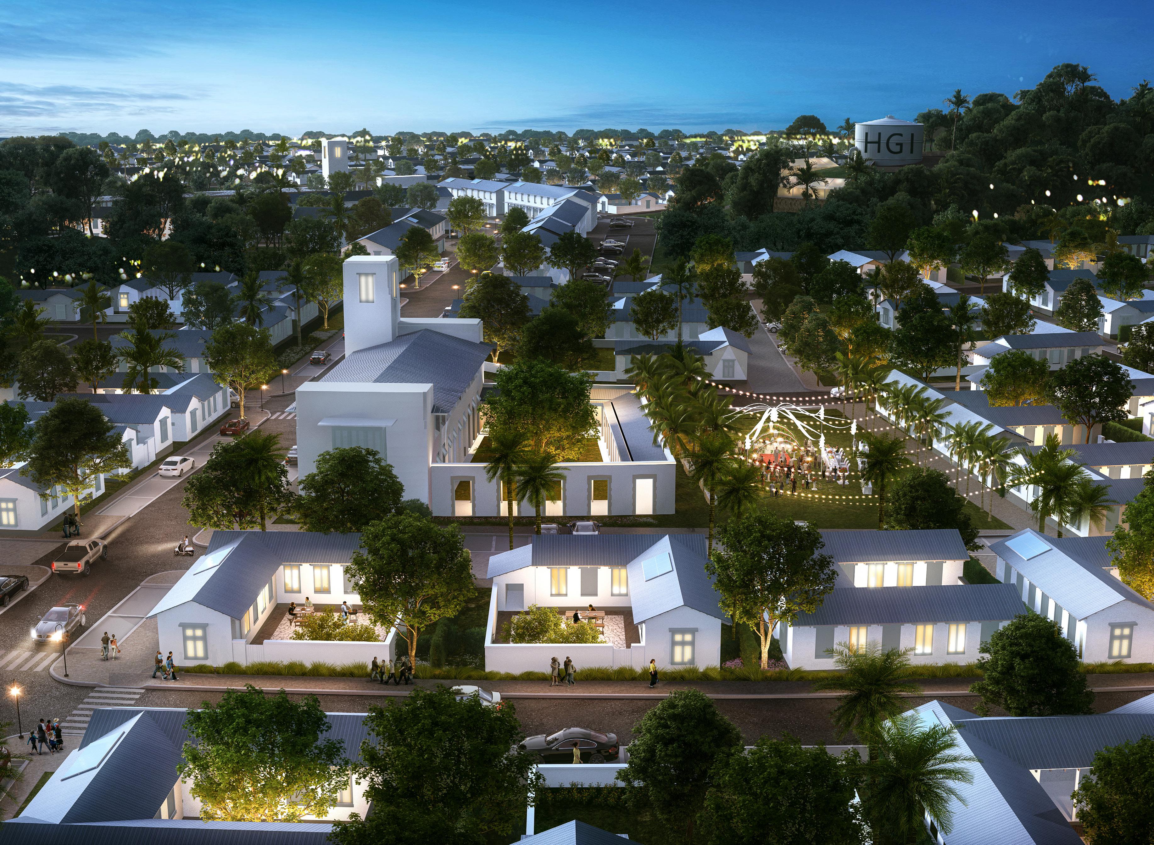
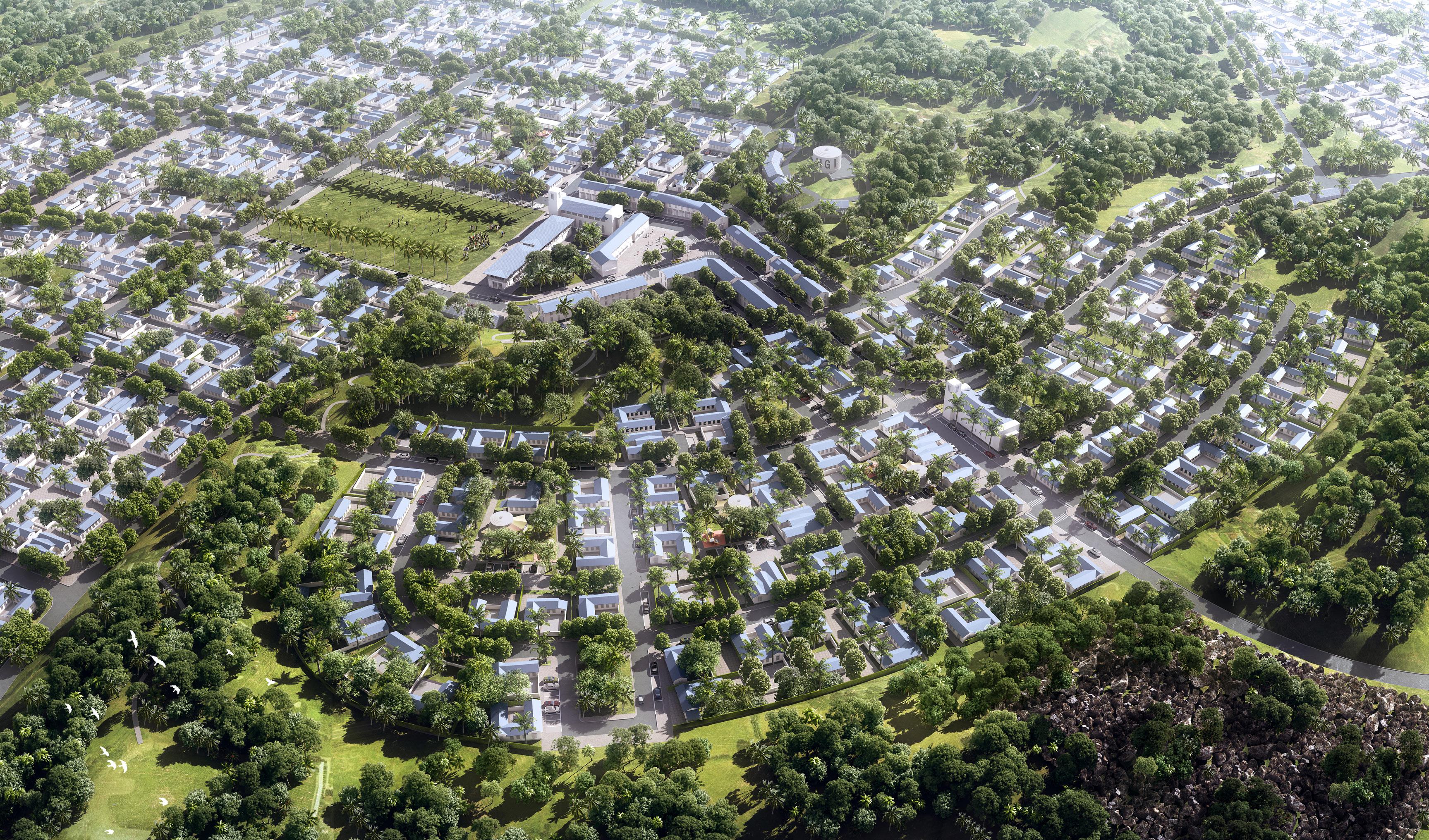
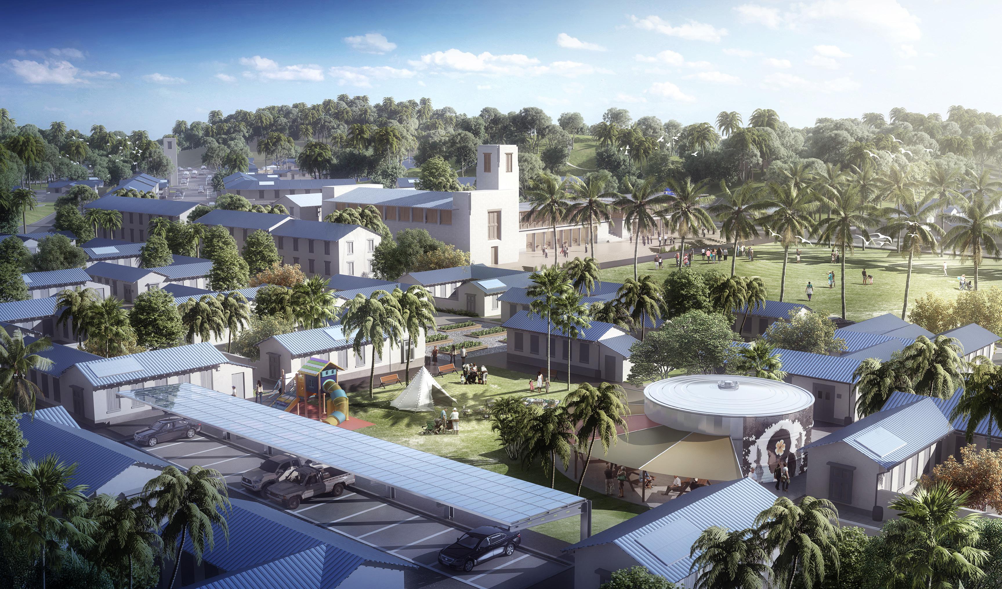
The aerial view of Land Portion 230 gives an overall perspective of the development pattern of the property and proposed expansion, as fully developed.
In this view the central square, adjacent community centre and commercial buildings, and nearby township park can be seen in the upper left of the illustration, flanked by blocks of housing in a variety of lot types and configurations. Reaching into the centre and fanning outward, nature preserves integrate the natural environment of Nauru into the neighbourhood and surround its edges.
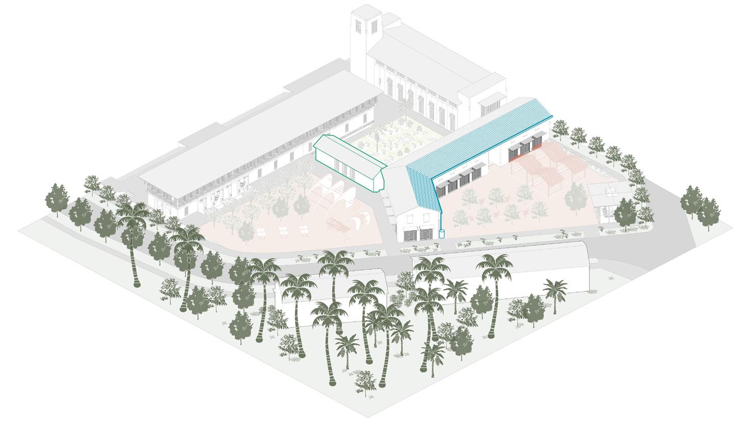
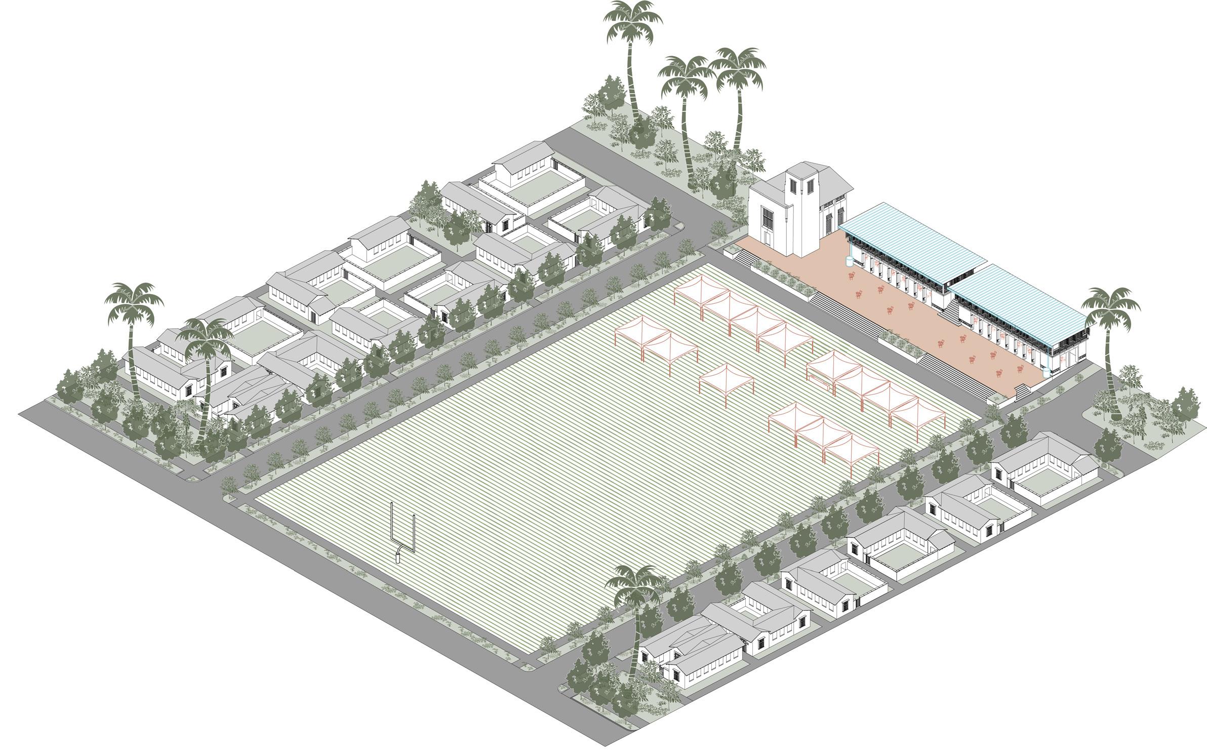
This aerial view shows most of the east neighbourhood of Land Portion 230. The housing types are the same types used in the denser neighbourhood adjacent to the civic block, and the small blocks are typically two lots deep. But the public spaces in this east neighbourhood are larger, which draws down coverage and density. The geometry is also a little looser, and more perimeter lots afford long views to more people. The two neighbourhoods differ and so increase the choices afforded to Nauruans. The denser lots help make the infrastructure more affordable and therefore help underwrite the infrastructure costs of this east neighbourhood.
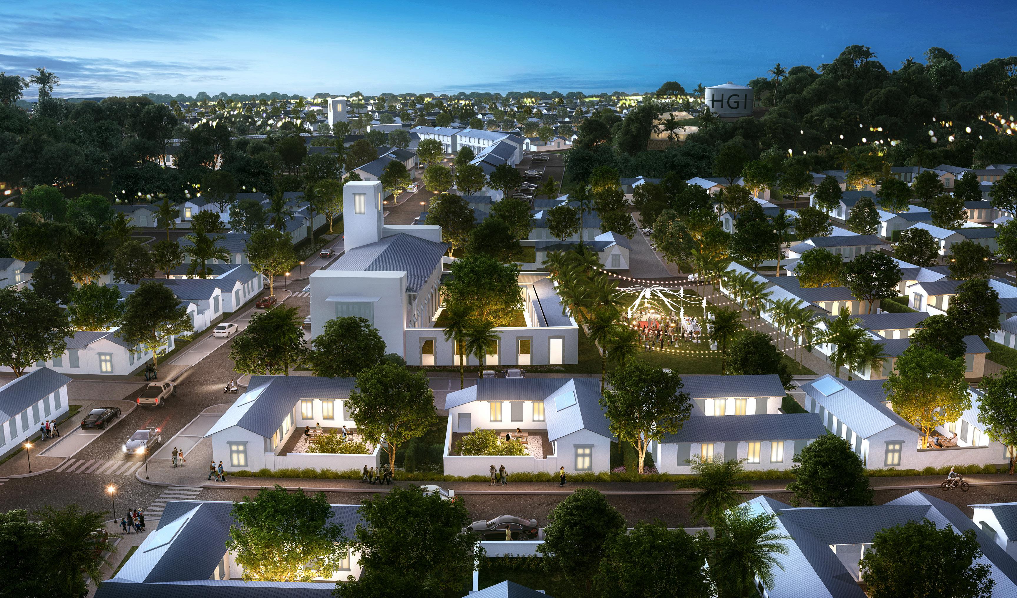
This aerial view shows an alternate daytime view of the church square in the east neighbourhood of Land Portion 230. From this angle, tvariation of layout of the interior courtyards of housing, and especially the way that they provide the opportunity for lush private open space to each lot, can been observed. The church serves as a focal point of activity for the neighbourhood, offering public open space to the community through the active front plaza, the passive side square, and the more secluded interior courtyard that together surround the church.
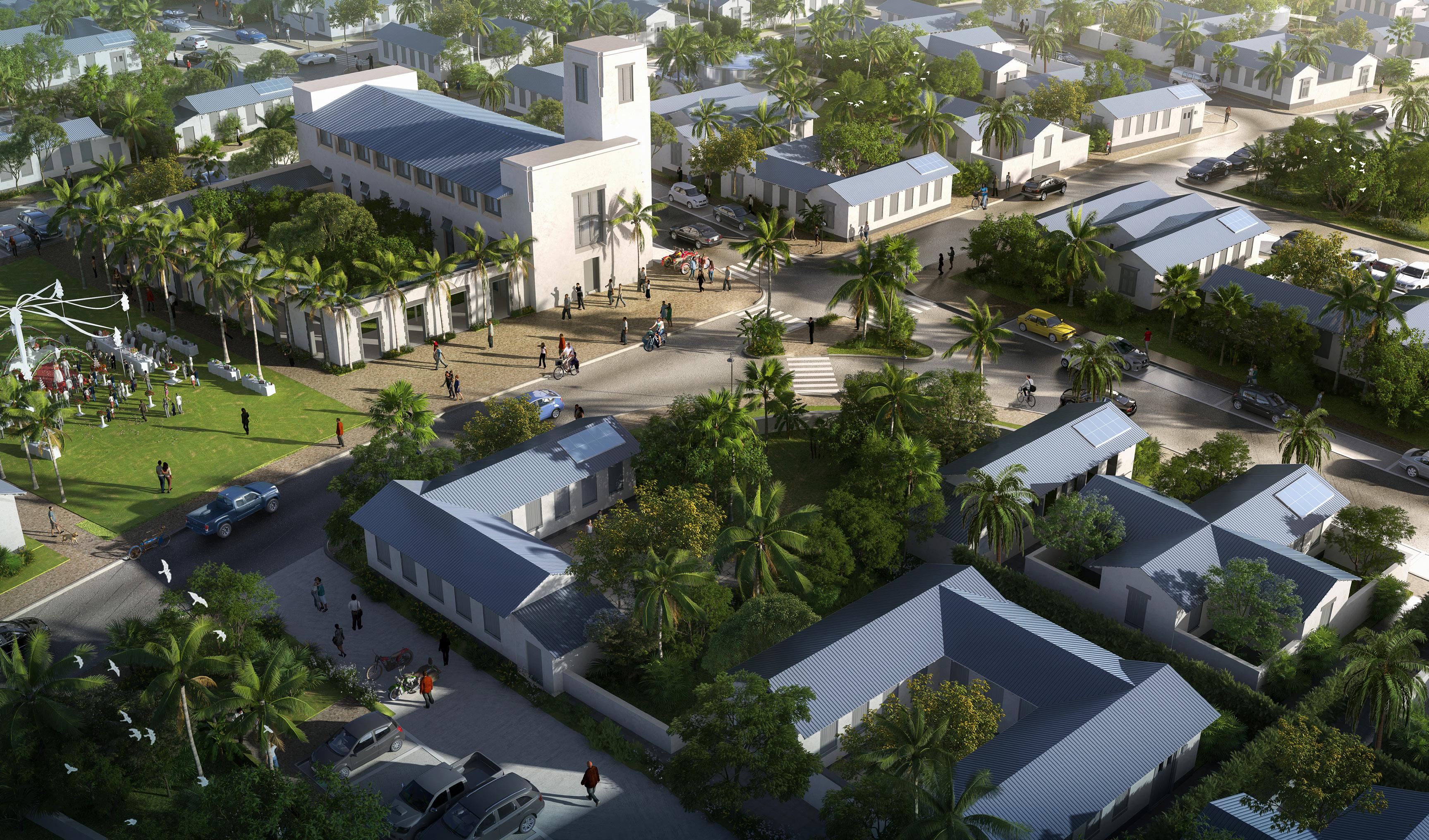
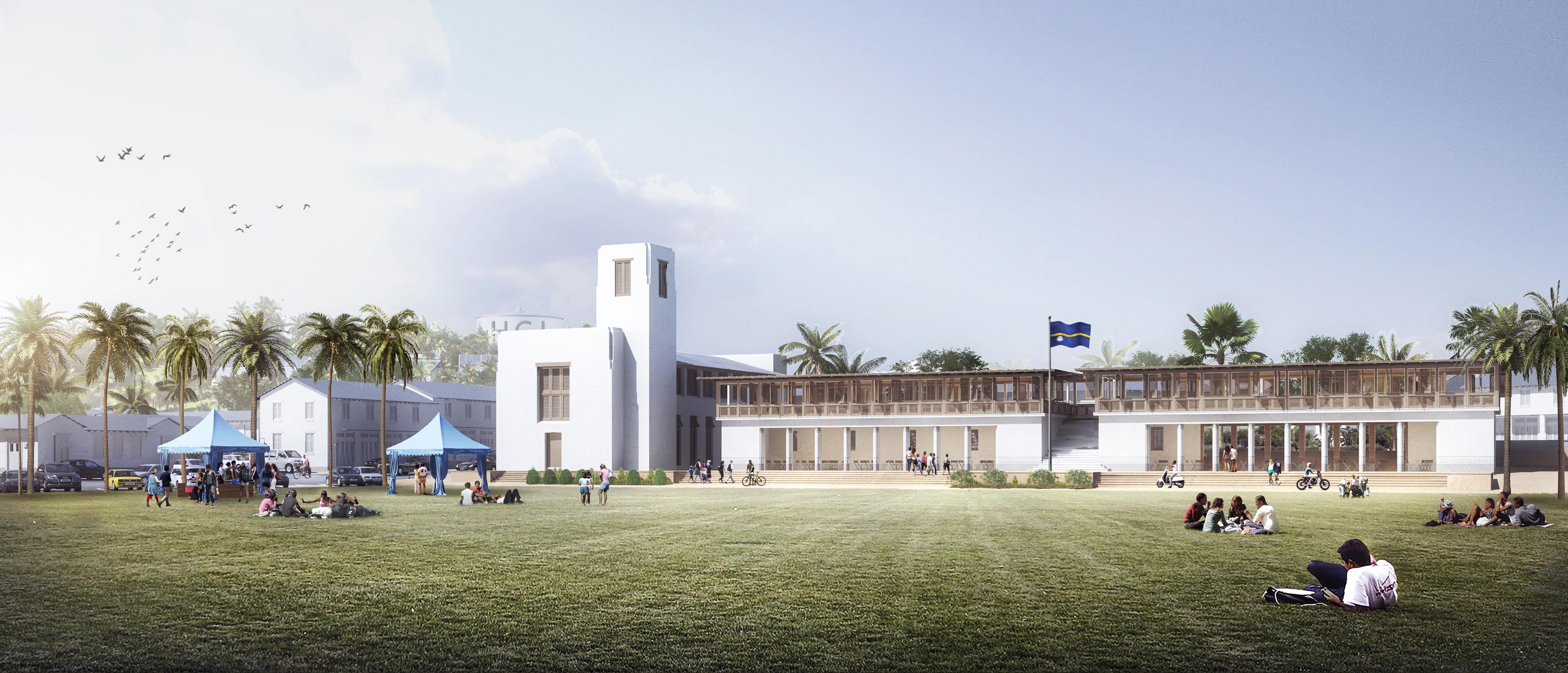
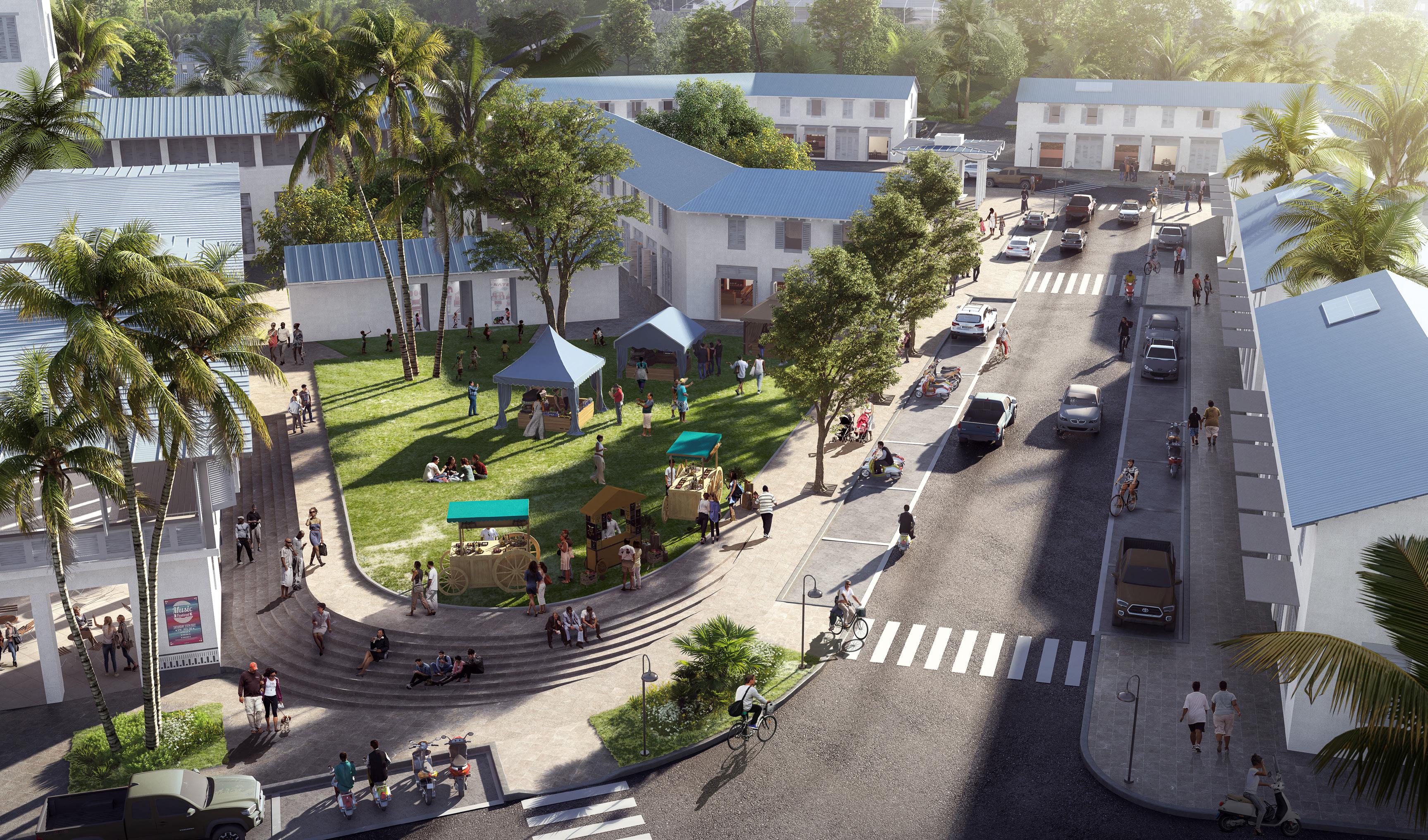
The rugby field, which can be used for most any purpose, is the largest public space in Land Portion 230. It is lined on the north and south sides by small, one-story single family houses and on the east side by a civic block. The civic block has a chapel and a multipurpose building lifted over a ground floor open space. Both levels are flexible and can be used for a variety of uses.
The several buildings on the block form four public spaces – an elevated terrace overlooking the rugby filed, a courtyard for the chapel, a green lawn, and a paved commercial space on the east side of the block. These spaces are formed by live-work units with commercial ground floors and residential upper floors.”
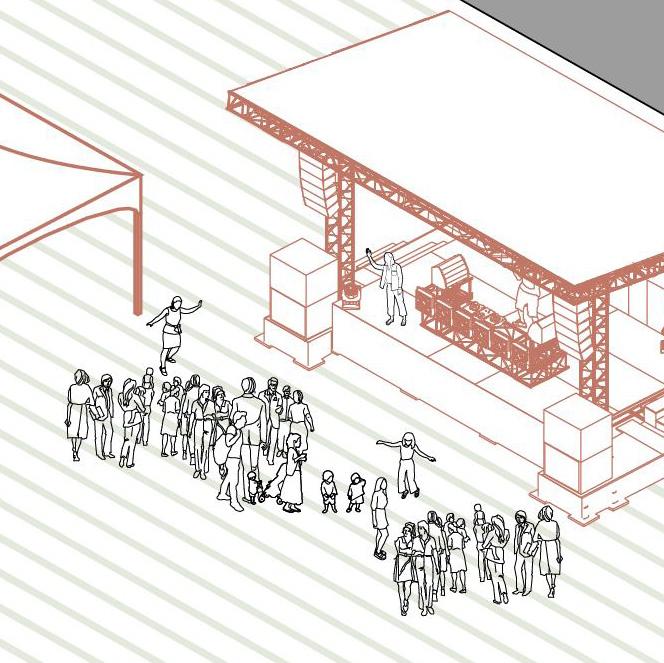
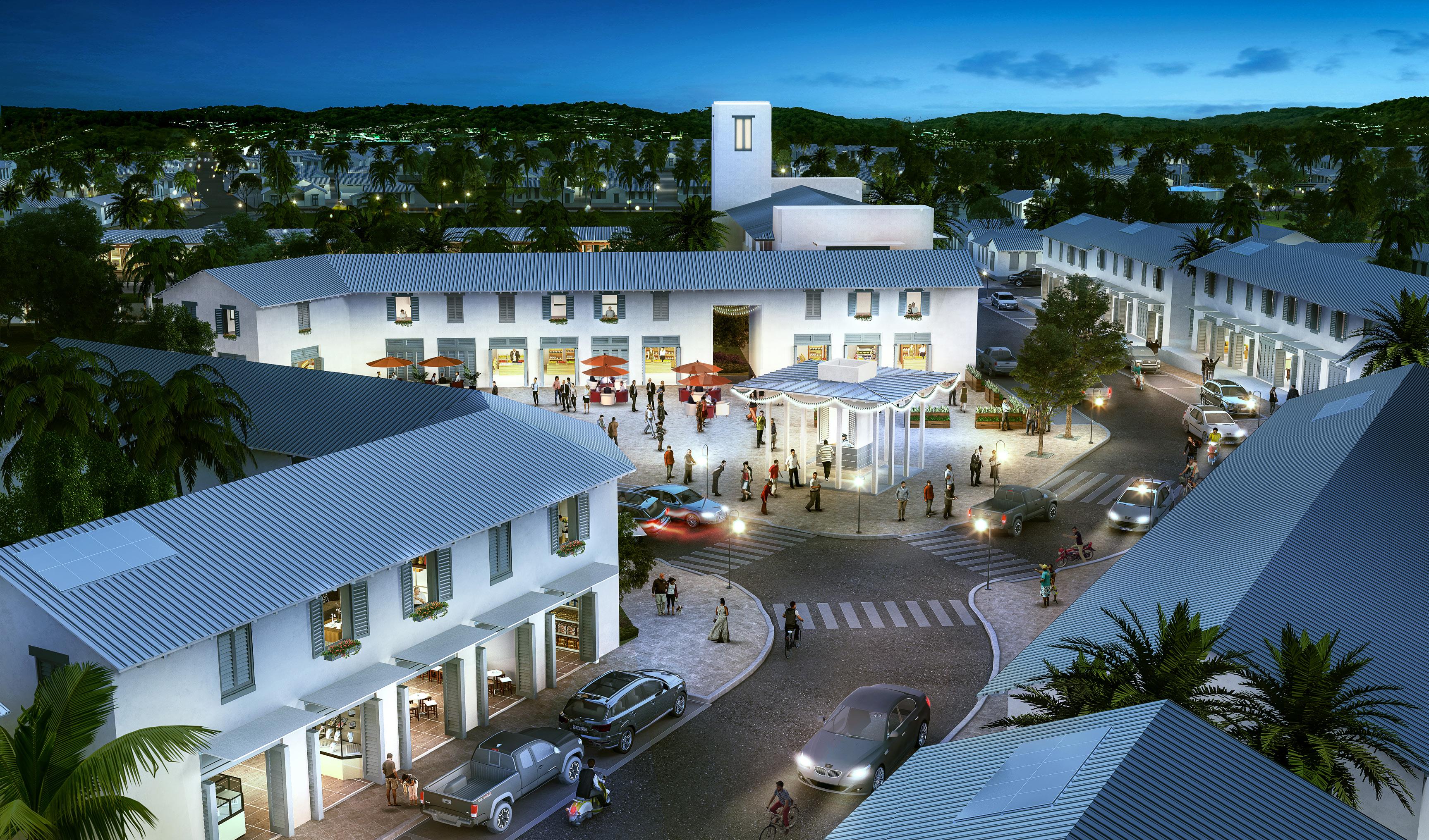
At the centre of this view, the paved commercial space at the centre of Land Portion 230 is shown at night, where open shops on the ground floor of live-work units encourage gathering and provide daily needs for the community. While this evening activity adds to the liveliness of the neighbourhood and supports the commercial activity of shop owners, it also serves an important purpose. Providing “eyes on the street” during a wider range of hours of the day, this central plaza contributes to the passive community policing of the neighbourhood, and spurs opportunity to casually interact with neighbors, helping to strengthen community ties and feelings of belonging in the neighbourhood as well.
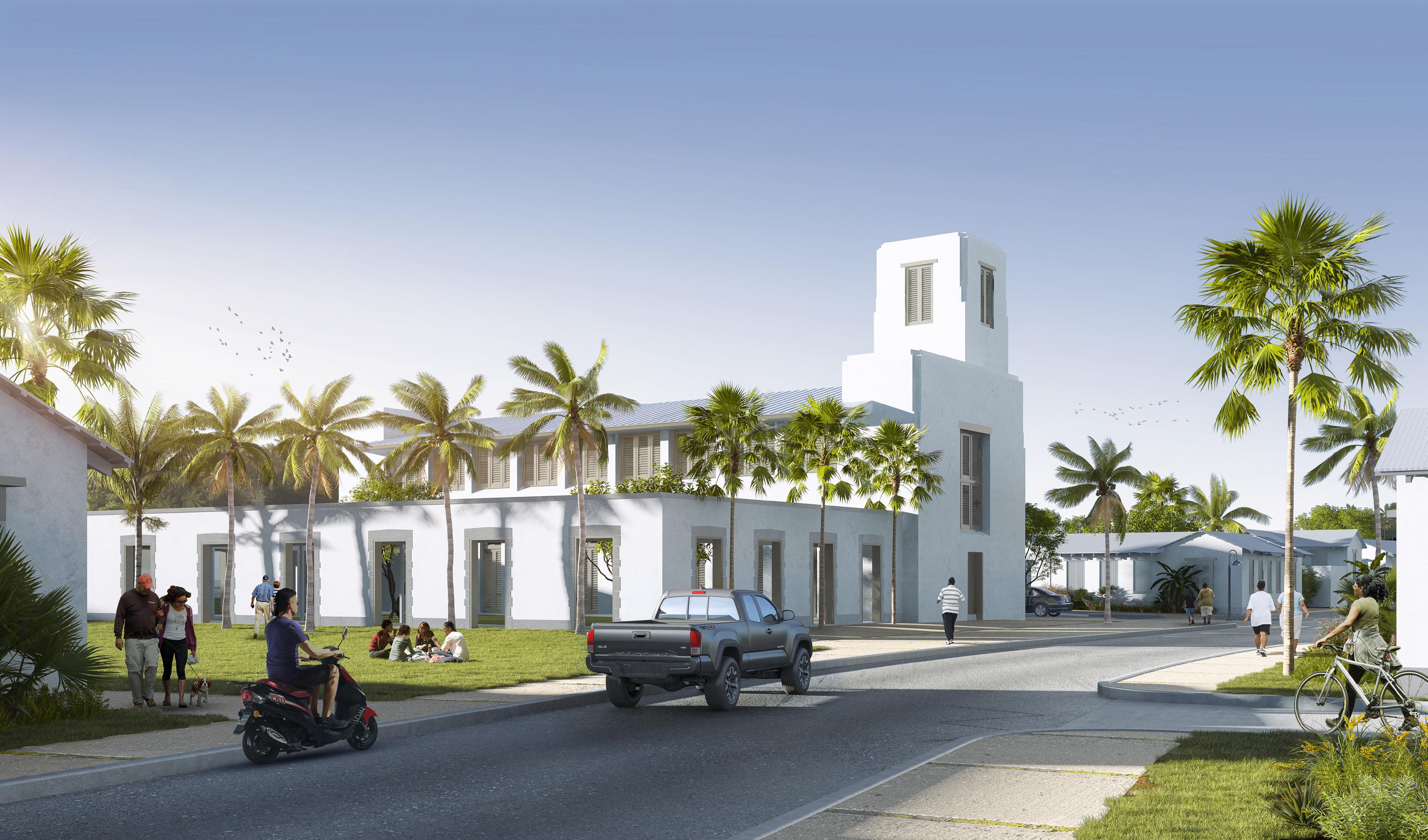
One of the entrances to Land Portion 230 is from the south, and this view shows what it would look like to come upon the public buildings from this direction. There is a small hill behind the live-work units on the right. A raised terrace facing the rugby field is straight ahead, and at the north end of the terrace is the bell tower of the chapel, which is visible from every direction in Land Portion 230. The multi-purpose buildings lining the elevated terraces are both about 200 square meters and single rooms. The upper floors are shuttered and well-ventilated, with views in several directions. The ground floors are also open, providing cover, shade, and also passage from one outdoor space to another.
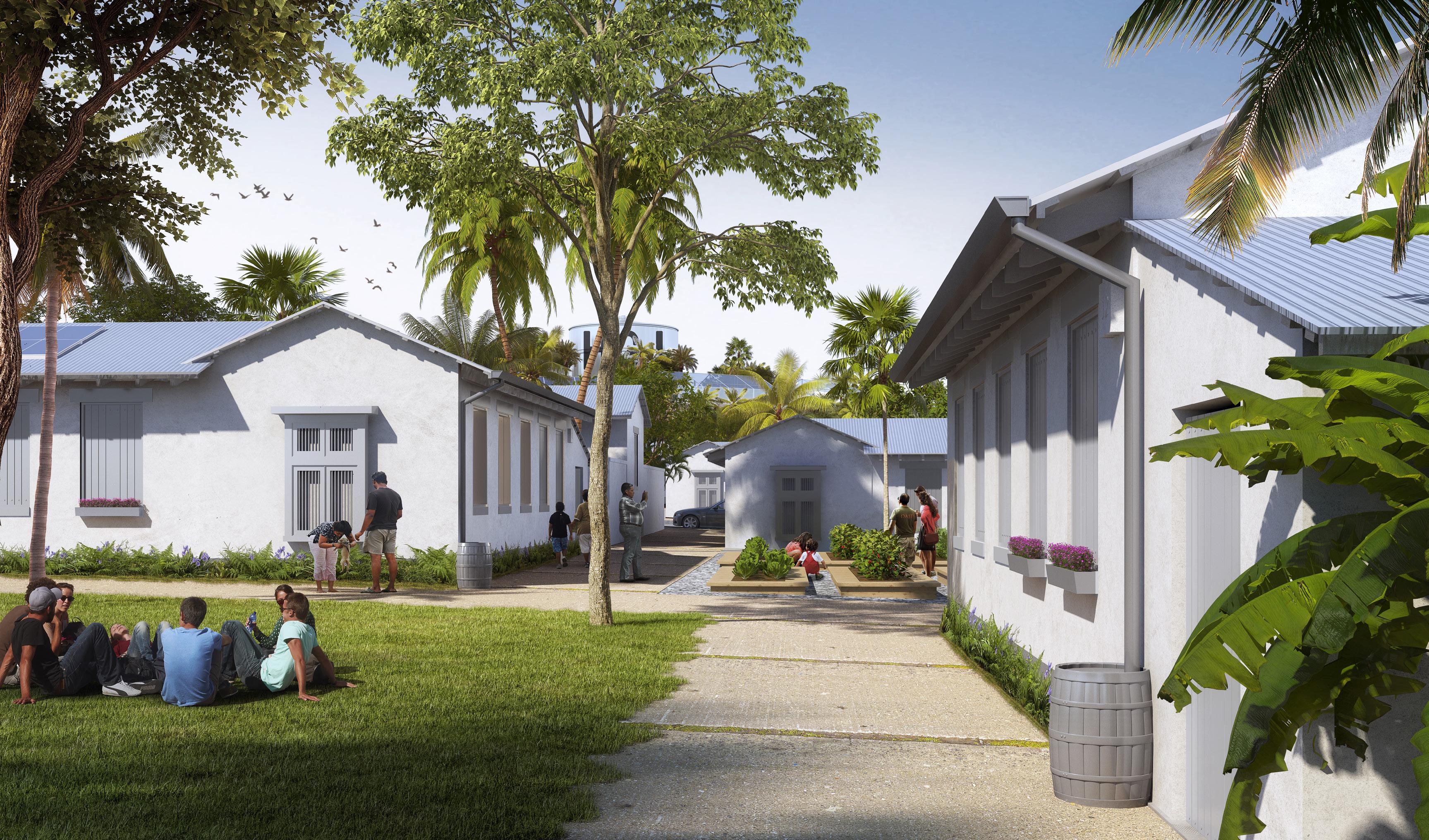
The single family housing north of the rugby filed is denser than housing in the east neighbourhood, but its density and coverage can be dialed up or down by recombining the small 200 square meter parcels that make up the small blocks. Each house sits on a 14 by 14 meter site separated from adjacent houses by a two meter buffer. Each house has a small secure inner yard that is walled. Footpaths and small parks are formed by a combination of building walls and garden walls. Trees in private yards hang over the footpath and become part of the views in the public areas.
Each house sits on a small public space and these spaces, strung out along mid-block footpaths, vary in size so that the experience of walking through the neighbourhood varies. Generally, the site coverage decreases toward the perimeter of the first development phase. Here there is a small public space on both sides of the footpath. The long views are behind us in this view but several houses in the middle of this block are afforded long perimeter views because of these small public spaces.
The central square and the main street running through Land Portion 230 allow for a mix of uses, through the live-work units that provide commercial ground floor spaces with residential units above. A variety of building uses, determined based on the daily needs of the nearby neighbourhood residents, will provide goods and services while also offering places of employment for the community, at enterprises owned and managed by members of the community.
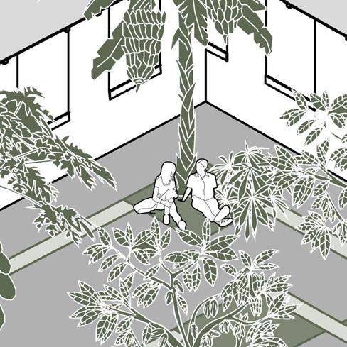
This ground-level view of the east neighbourhood church square highlights the priority that the pedestrian experience is given over that of motor vehicles, underscoring the embedded walkability of the planning for Land Portion 230 and the environmental, social, health, and cultural benefits that it provides.