
PLAN
PREPARED BY: RMA | FINAL 3.21.2019
SUNRISE IMPROVEMENTS MASTER
ACKNOWLEDGMENTS 01 EXECUTIVE SUMMARY, VISION STATEMENT & PLAN HIGHLIGHTS 1 EXE CUTIVE SUMMARY 1 S TUDY AREA 2 P LAN OVERVIEW 3 M ARKET OVERVIEW 3 VIS ION STATEMENT 4 PLAN HIGHLIGHTS 4 0 2 RECOMMENDATIONS & STRATEGIES 9 A . OPPORTUNITY SITES 11 S ITE 1 – NW 15 TH STREET VACANT CITY PROPERTY 1 2 SITE 2 – FORMER PUBLIC WORKS COMPLEX 16 S ITE 2 – ALTERNATIVE B 1 8 SITE 3 – FORMER POST OFFICE 2 0 SITE 4 – SUNRISE GOLF VILLAGE PARK 24 S ITE 5 – FORMER CAR DEALERSHIP (ALONG UNIVERSITY DRIVE) 26 S ITE 6 – FORMER WALGREENS (ALONG SUNRISE BOULEVARD) 2 8 SITE 7 – FORMER GAS STATION 32 S ITE 8 – OAKLAND PARK VACANT PROPERTY 3 4 SITE 9 – SUNRISE VILLAGE PARK MIXED-USE NODE 38 S ITE 10 - PPG INDUSTRIES – POTENTIAL RELOCATION AND REUSE 4 0 B. DISTRICTS 44 VILLA GE CENTER 47 C OMMERCIAL CENTER 56 SUNSET STRIP GATEWAYS 64 C OMMERCIAL CORRIDORS 72 NON -COMMERCIAL NEIGHBORHOODS 81 C . CITY INFRASTRUCTURE & QUALITY OF LIFE 86 O VERVIEW 86 C OMPLETE STREETS 8 7 CONNECTIVITY 87 A . PEDESTRIAN 8 8 B. BICYCLE 8 9 C. VEHICULAR 90 D . TRANSIT 91 E . DRIVE AISLE CONNECTIONS 9 2 STREETSCAPE IMPROVEMENTS 96 A . STREETSCAPE ELEMENTS 96 B . VILLAGE CENTER 98 C . GATEWAY ENTRANCES 99 D . RESIDENTIAL 101 E . COMMERCIAL CENTER 102 F. COMMERCIAL CORRIDORS 104 G . TRAIL/ SHARED-USE PATH 107 INFRAS TRUCTURE 108 SIGN AGE & LANDSCAPE 109 IMA GE & BRAND 110 MER CHANT ASSOCIATION & NEIGHBORHOOD AMBASSADOR PROGRAM & COMMUNITY INVOLVEMENT 111 RE GULATORY ENVIRONMENT 112 LIGHTIN G & WAYFINDING 114 P ARKS, PLAZAS & PUBLIC ART 116 0 3 IMPLEMENTATION 118 A . STAFFING RESOURCES & ORGANIZATION 118 B . INCENTIVE PROGRAMS & FUNDING SOURCES 120 C . RECOMMENDATION MATRIX 122 0 4 APPENDICES 123 MARKET ANALYSIS MOBILITY AND PUBLIC REALM ANALYSIS PUBLIC ENGAGEMENT BRAND MANUAL "HOW TO" GUIDE NEIGHBORHOOD AMBASSADOR PROGRAM "HOW TO" GUIDE CONTENTS
ACKNOWLEDGMENTS
Prepared for the City of Sunrise East Sunrise Improvements Master Plan (ESIMP)
Prepared by REDEVELOPMENT MANAGEMENT ASSOCIATES (RMA)
SUNRISE C ELEBRATE
Grid Page Intentionally Insert For Layout Purposes
&
HIGHLIGHTS
EXECUTIVE SUMMARY
EXECUTIVE SUMMARY, VISION STATEMENT
PLAN
01
In May 2017, the City of Sunrise commissioned Redevelopment Management Associates (RMA) to undertake the East Sunrise Improvements Master Plan (hereinafter referred to as the “Plan”) per the response to RFQ 15-04-09-MS. The goal was to develop an improvement master plan for the East Sunrise area to stimulate investment and redevelopment of non-residential areas and to revitalize existing neighborhoods. The Plan is generally organized as follows: SECTION 1 EXE CUTIVE SUMMARY, VISION STATEMENT & PLAN HIGHLIGHTS Executive Summary Vision Statement Plan Highlights SECTION 2 RE COMMENDATIONS & STRATEGIES Opportunity Sites Districts City Infrastructure & Quality of Life SECTION 3 IMPLEMENTATION SE CTION 4 APPENDICES Market Analysis Mobility and Public Realm Analysis Public Engagement Brand Manual "How To" Guide Neighborhood Ambassador Program "How To" Guide 1 | EAST SUNRISE IMPROVEMENTS MASTER PLAN
STUDY AREA
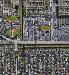
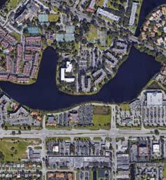
The plan study area consists of a two square mile area in the eastern portion of Sunrise that extends east of University Drive (SR 817), including the University Drive corridor, to the municipal boundaries and south from West Oakland Park Boulevard (SR 816) to Sunrise Boulevard (SR 838). All parcels adjacent to the University Drive corridor are included in the boundaries of the study area. Sunset Strip, a city collector street, is a central spine and focal point for business and community services.


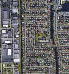
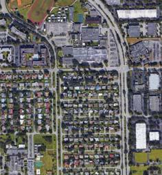
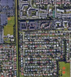
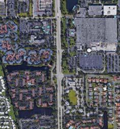

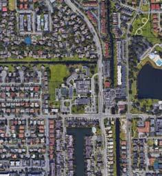


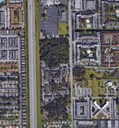


CITY OF SUNRISE EAST SUNRISE IMPROVEMENTS MASTER PLAN STUDY AREA

The City of Sunrise continues to experience strong economic growth and gains in the quality of life realm, with a diverse array of new development projects and businesses being added to the tax base each year. City leadership and staff have carefully guided new development and public projects to achieve this progress, including efforts in recent years aimed at helping east Sunrise attract its share of both public and private investments.
City leadership has also made a strong commitment to east Sunrise, with a focus on action and market-responsive strategies and plans. This plan is the next phase of that commitment, and as promised, the City has already begun to implement some of the ideas described in later sections.
While the analyses, principles, and recommendations in this plan focus on the study area, many of them will also have application citywide.

EAST
PLAN
0mile 0.25miles
STUDY AREA
BOUNDARY
W OAKLAND BLVD W SUNRISE BLVD W SUNRISE BLVD N UNIVERSITY DR FLORIDA’S TURNPIKE SUNSET STRIP SUNSET STRIP NW 64TH AVE NW 19TH ST NW 56TH AVE NEIGHBORHOOD BOUNDARY BOUNDARIES EXTEND TO INCLUDE ALL PROPERTIES ADJACENT TO UNIVERSITY DRIVE. VACANT LOTS VACANT CITY PROPERTY SUNRISE GOLF VILLAGE PARK VACANT LOT PLANTATION HIGH SCHOOL MOTOROLA MOBILITY INC. VILLAGE ELEMENTARY SCHOOL THE HOME DEPOT MIRROR LAKE ELEMENTARY SCHOOL ROYAL PALM ELEMENTARY SCHOOL LAUDERHILL TOWN CENTRE LIBRARY SUNRISE COUNTRY CLUB SUNRISE LAKES CONDOS LAUDERHILL PARK PLANTATION MIDDLE SCHOOL JEWISH COMMUNITY CENTER
SUNRISE IMPROVEMENTS MASTER
STUDY AREA 2 | EAST SUNRISE IMPROVEMENTS MASTER PLAN
PLAN OVERVIEW
Gathering extensive community and stakeholder perspectives and feedback has been a core goal during the development of this plan. Substantial efforts were made by City leaders and staff to communicate both the opportunities for such feedback, as well as the results of analyses and potential solutions as they were developed. Interviews, focus groups, workshops, public meetings, and feedback sessions were well-attended and had active participation. Online feedback mechanisms including surveys also resulted in substantial stakeholder participation, and special efforts were made to obtain feedback from the real estate and business investment communities to ensure the private sector concurred the plan was market driven and feasible. The goal was to create a shared vision from a broad base of stakeholders.
By creating consensus around a shared vision, the plan helps clarify community hopes and expectations and reduces risks for investors and developers. By identifying key opportunity sites, the team was able to craft redevelopment scenarios for each site that when developed will contribute substantially to the city’s tax base as well as brand the city as a target for private investment. The plan recognizes that different areas or districts of east Sunrise have their own unique characteristics and opportunities. The "districts" were identified based on unique physical attributes - including location and land use patterns - and focus on market perceptions. They are not related to any existing districts related to voting or elected officials. Potential improvements to mobility and infrastructure, and programs and plans that enhance the city infrastructure and quality of life in east Sunrise form the foundation for this plan.
Finally, the implementation matrix will help the city stay focused on key recommendations while providing a long term guide to follow. The matrix and the continued focus on east Sunrise will attract other civic partners, provide a general but flexible timeline, and create clearer roles and responsibilities to accelerate progress. This focus on effective implementation will help brand the city to attract outside investment more quickly and accomplish the shared vision.
MARKET OVERVIEW
To arrive at realistic market driven recommendations, an analysis was conducted of the five key drivers of Economic Development; Land, Labor, Markets, Capital, and Regulation. Below is a summary overview of the real estate market, existing workforce, prominent industries, and regulatory environment.
LAND
• The retail market showed the highest potential for new development and the most activity in the existing market. Over the past 5 years, Triple Net (NNN) rents have nearly doubled and vacancy rates have significantly dropped.
• The office market showed the least potential for new development and the least activity in the existing market. Since 2012 rents within the immediate area have decreased and vacancy rates have increased.
• Additional industrial space with light industrial/flex uses (i.e. art gallery or micro-brewery) is ideal for the community. east Sunrise has a small amount of industrial space; existing space in the market is 100% absorbed.
• There is opportunity to introduce additional multifamily product and density to the area; apartment and townhome design would complement the scale of the community.
LABOR
• Strong workforce clusters in retail and transportation/utilities exist.
• Strong employment clusters in construction, wholesale trade, transportation/utilities, arts/accommodation/food & beverage, and other services exist.
MARKETS
• There is a potential customer base that can be captured from the high traffic volume on the major corridors.
• A diverse mix of international restaurants along University Drive creates opportunity for a brand that highlights the clustering of culinary offerings.
• Low Consumer Spending Index and retail leakage to other areas is occurring.
CAPITAL
• Bank deposits in east Sunrise have grown at an average of 6.1% annually since 2013. This indicates a healthy and stable local economy.
• There’s a need for better coordination and promotion amongst the 700+ merchants and businesses to capitalize on the availability of so many establishments.
REGULATION
• The existing regulatory environment presents an opportunity to modify certain land use and zoning regulations that would encourage growth and facilitate development in east Sunrise. Conversely zoning allows for uses that are not compatible with the vision of the community therefore zoning in progress may be considered.
• Work to ensure permitting process is not difficult, expensive, and lengthy.
3 | EAST SUNRISE IMPROVEMENTS MASTER PLAN
VISION STATEMENT
The process to develop this plan began with the identification of a shared vision for the future. Residents, businesses, civic leaders, developers, City staff, elected officials, and other stakeholders contributed their dreams and ideas to help create the following Vision Statement:
“EAST SUNRISE WILL BE A DYNAMIC AND WELCOMING COMMUNITY THAT APPRECIATES AND CELEBRATES ITS DIVERSE PEOPLE AND CULTURE THAT EMBRACES SMART GROWTH AND DEVELOPMENT, WHILE PRESERVING ITS UNIQUE HERITAGE AS SUNRISE’S ORIGINAL NEIGHBORHOOD. ALL OF SUNRISE WILL WORK TOGETHER
TO CREATE EXCEPTIONALLY VIBRANT AND WALKABLE NEIGHBORHOODS WITH STREETSCAPES, PARKS AND RECREATIONAL AMENITIES, CIVIC BUILDINGS, AND QUALITY PUBLIC SPACES WHERE RESIDENTS CAN ENJOY OPPORTUNITIES FOR INTERACTION AND ENRICHMENT. NEW PROGRAMMING AND INITIATIVES WILL FACILITATE
AND FOSTER A THRIVING LOCAL BUSINESS COMMUNITY AND ENHANCED QUALITY OF LIFE EAST SUNRISE
WILL BE A PLACE CELEBRATED FOR YEARS TO COME .”
In order to capitalize on unique opportunities, some flexibility is appropriate for implementation. The Vision Statement will help the community, elected officials and staff ensure that those adjustments are still consistent with both the ultimate outcomes desired by the community and the market-responsive strategies found in this plan. All of this focus on east Sunrise has created new energy and excitement within and about the community. People are ready to Celebrate Sunrise!
PLAN HIGHLIGHTS
This plan is intended to provide guidance over an extended period of time, however there are some very visible and important first steps the City can take to launch the plan and generate excitement in east Sunrise. The City does not need, nor does it have, a broad base of industry sectors to capitalize on (such as a large industrial or corporate park), nor does it need a metropolitan downtown in the classic sense of word with towering, dense office uses and corporate headquarters, to become a desirable city to live, work, invest in, and recreate. What Sunrise does have is a warm and inviting environment that celebrates and embraces a diverse and culturally rich population. In 2010 a Knight Foundation study interviewed 26 communities and nearly 14,000 people over a five year period and discovered that people are attracted to three main characteristics regarding their desired city: They are seeking a city with social offerings, openness and aesthetics.
Sunrise is poised to easily offer those city characteristics and amplify them to create a desirable and enviable city brand and identification. The following are Plan highlights that respond to those city traits sought by community members to further push east Sunrise to the forefront of desirability.
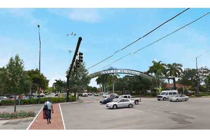
Focus on the Main Gateways to the Village Center
Promote on a grand scale the gateways to Sunset Strip and the Village Center as an arrival point to a coveted and celebrated part of the city.
NEXT STEPS
5 Design dramatic entry features that attract attention and spark conversation that “something is happening “in east Sunrise.
5 Prepare and promote the parcels at each gateway as prime real estate development opportunities; engage current property owners in the process.
5 Focus intensively on attracting highly visible projects that are for future generations, i.e. entertainment and social interaction at Sunrise Boulevard, and/or drone delivery stations on the large surface parking areas at University Drive.
4 | EAST SUNRISE IMPROVEMENTS MASTER PLAN


 W Gateway at Sunrise Boulevard Concept
W Gateway at University Drive Concept
W Retrofit Landmark at 68 th Avenue Concept
W Gateway at Sunrise Boulevard Concept
W Gateway at University Drive Concept
W Retrofit Landmark at 68 th Avenue Concept
5 | EAST SUNRISE IMPROVEMENTS MASTER PLAN
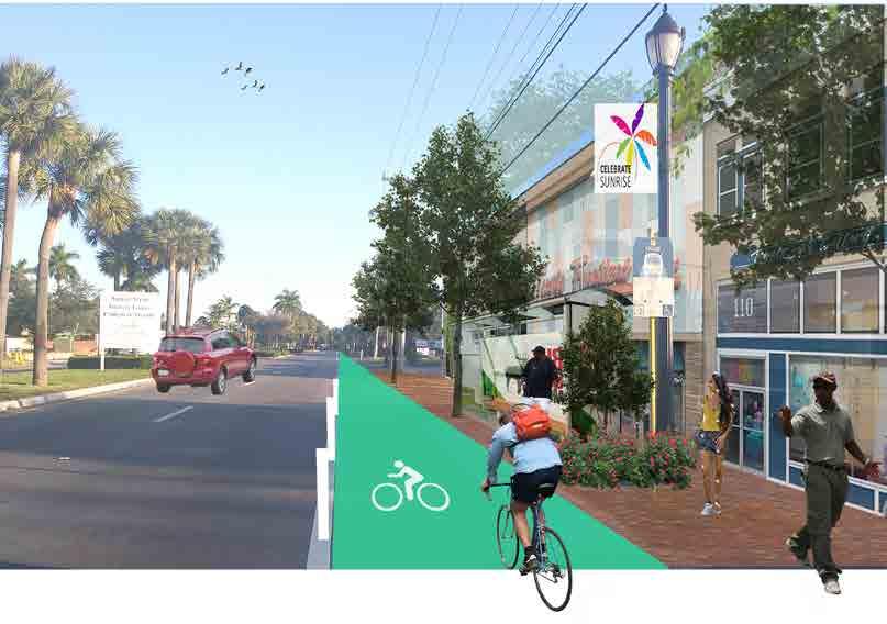
Develop the east Sunrise Brand

Brand east Sunrise as a unique and walkable Village Center with highly desirable places to live, work and do business nearby.
NEXT STEPS
5 Create and display bold “Vision Boards” and marketing materials; one board to be placed in city hall and the second one as a traveling display taken to homeowners meetings, special events and any public forum where the Vision can be promoted.
5 Promote the small scale and quaint pedestrian environment that draws people to the “Main Street” of Village Center.
5 Use this unique environment to brand the area as a welcoming and socially connected place for visitors.
5 Host themed “Main Street” events and programs to attract new tenants.
Focus on the Districts
Use the distinct and unique characteristics defined in each “district" to set the City of Sunrise apart from other cities.
NEXT STEPS
5 For Village Center and the surrounding neighborhoods, promote the attractive location of east Sunrise where people can choose from a wide variety of housing types, work nearby and walk to a Main Street in the heart of the city.
5 For the Commercial Center, promote the connectivity to the Village Center and development opportunities.
5 For the major Commercial Corridors, in particular University Drive, focus on the cluster of diverse and international businesses that can only be found in Sunrise.
5 Brand each of these “districts” with clearly recognizable signage, street signs and markers.
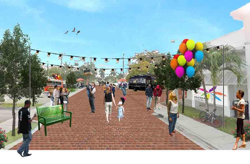
T Walkable Village Center Brand Campaign Concept T Commercial Center Main Street Concept6 | EAST SUNRISE IMPROVEMENTS MASTER PLAN
Market & Develop Opportunity Sites
Use existing public and privately owned sites to create real estate development momentum in east Sunrise.
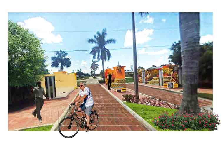
NEXT STEPS
5 Focus on the redevelopment of the former post office site first to provide energy and attention for the Village Center. This project can move forward quickly and will form a quality public plaza for the public to socialize and recreate.
5 Target the city owned 15th Street site for immediate results by issuing an RFP for redevelopment of the site. This project will draw needed residential to the area and create real estate comparables for additional residential real estate development in east Sunrise.
Preferred Enhancements to Attract Positive Community Investment
The purpose of this conceptual plan is to provide a framework for the redevelopment of Northwest 15th Street Vacant Property. Dimensions and square footages are approximate and may vary with actual construction. Modifications to the conceptual plan may vary, however the essence of the development, building placement, and program shown here, should be prioritized.
The purpose of this conceptual plan is to provide a framework for the redevelopment of Northwest 15th Street Vacant City Property. however the essence of the development, building placement, and program shown here, should be followed.
NORTH Landscape Property Line+/- 366’ +/- 408’ +/343’ +/340’ Vehicular access Ground floor commercial uses Enhance pedestrian experience along Sunset Strip Vehicular access Paver DrivewayInterior Courtyard P assage wa y Passageway Passageway P assage wa y P assage wa y Paver Driveway 53’ 24’ 010203040506 1213140708091011 16 17 18 19 20 21 22 23 15 Setback T Village Center Gathering Space Concept
7 | EAST SUNRISE IMPROVEMENTS MASTER PLAN
Structure the Implementation Team
Ensure there is clarity for the mission, and visibility for the department and person (s), who will be in charge of implementing the plan.
NEXT STEPS
5 Organize two teams, one internal and other external, with individuals who will be the support systems for implementing the Plan.
5 Hire a lead manager to be the point of contact for implementation of the Plan.
5 Prepare quality marketing and promotional materials that show the public at large what the goals are and promotes the “Vision” on a regular basis.
5 Create a public relations schedule to celebrate the successes of each effort of the plan.
5 Provide regular opportunities for the lead manager to update the Mayor and Commission at public meetings about progress, needed adjustments to the plan, funding strategies and requests, and other relevant opportunities.
City Public Informa�on
Office
Internal City Task Force
Private Sector Partners
East Sunrise Organiza�onal Coordina�on
Biz Leaders
Neighborhood Representa�on
Public Partners/ Quasi Public
Prepared By: RMAParks & Recrea�onal, Community Develop ment, Police, Engineering, City Manager’s Office, Economic Development, Planning
Chambers of Commerce, Realtors
Key Property Owners, Large Local Developers and Business Leaders
Broward County Transit, FDOT, Conven�on and Visitors Bureau, Broward Alliance, MPO, Key Legislators, House/ Senate, County Commission
Civic Groups, Home Owners Associa�ons, Clergy
Press, Public Rela�ons
8 | EAST SUNRISE IMPROVEMENTS MASTER PLAN
RECOMMENDATIONS & STRATEGIES
This section of the plan focuses on the strategies for redevelopment of individual “OPPORTUNITY SITES”, as well as strategies for larger sections of the city or “DISTRICTS”. This will give the city a two-pronged approach; the Opportunity Sites section of the plan provides in-depth real estate analysis on site specific developments, whereas the recommendations for each district enables the city to create strong physical and visual connections between the disparate areas that currently lack cohesion. Finally, additional recommendations are made related to “CITY INFRASTRUCTURE AND QUALITY OF LIFE”. These non-site or district specific recommendations capture all other elements that are important for a comprehensive approach to the transformation of east Sunrise.
9 | EAST SUNRISE IMPROVEMENTS MASTER PLAN
02
The purpose of this section is to provide guidance and insights about private development opportunities and public investments on key sites throughout east Sunrise. The most significant redevelopment opportunities were identified based on community and city staff input, location, ownership, size, land development regulations, vacancies, and recent public and private investments nearby. This section explores development scenarios appropriate on these sites based on the following:
• real estate and business market conditions,
• community goals and aspirations,
• current and potential land development regulations,
• general financial feasibility,
• transportation connectivity,
• surrounding developments and public amenities, and
• overall ownership patterns in proximity.
Using RMA’s expertise in Economic Development, Urban Design, and Identity and Branding, for each site we undertook the following effort:
• explored a variety of potential development scenarios,
• developed conceptual site plans for one or more of those scenarios,
• identified any needed amendments to land development regulations to permit each scenario,
• conducted a preliminary financial analysis to test for general feasibility,
• assessed impact on overall neighborhood place brand repositioning, overall economic impact and jobs growth,
• considered ways to minimize gentrification, and
• considered the likely marketplace phasing as the brand repositioning took place over time.
A total of 10 sites were evaluated using this approach with varying degrees of detail. The following sections summarize our work and guidance for each site with the following caveats:
• The analyses are for a particular point in time. Changing market conditions, ownership patterns, community consensus, and successful or failed projects and businesses can change the preferred development guidance over time.
• The guidance provided is not intended to support any particular development proposal or scenario. Each such proposal should be carefully evaluated against the factors above and fully vetted with community leadership and nearby property owners and residents.
• Private development is driven by perceptions of risk and return that go beyond the financial. Perceived risks related to community consensus, predictability and timeliness of development approval processes, marketplace responsiveness, and other factors often vary by developer and investor based on their own experience and investment objectives. This simply means that “feasibility” also varies and a negative response from a few developers does not mean all others will have the same perspective or reach the same conclusion. This is often the case when suburban developers approach a more urban redevelopment project.
The concepts contained here were also reviewed with city staff and others to help ensure consistency of community desires and visions, current perspectives of the development community, residents and other community members, and elected officials. The map shown here identifies the 10 sites.
10 | EAST SUNRISE IMPROVEMENTS MASTER PLAN
A. OPPORTUNITY SITES
The following pages provide alternative scenarios for each of the sites that support overall revitalization strategies, financial feasibility, community desires, a healthy mix of housing affordability, and economic opportunities for families, businesses, and the private development community. Each suggested project works to balance these items in ways that lift the entire east Sunrise neighborhood.

11 | EAST SUNRISE IMPROVEMENTS MASTER PLAN
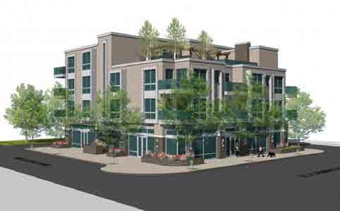
NAME: NW 15 TH STREET VACANT CITY PROPERTY
GROSS SITE AREA: 3.0 acres
PREFERRED PROGRAM: 30 Townhomes/Live-Work units with Community Amenities
DESCRIPTION:
The site is located along the west side of Sunset Strip between NW 15th Street and NW 16th Street, currently the site is vacant. This site is surrounded by RS-5 Residential Single Family (5 DU/AC). This site is ¼ mile from the Sunrise Golf Village Park (plaza and neighborhood commercial), ½ mile from Sunrise Boulevard (major commercial corridor), and 1 mile from the Village Center (parks, school, civic, businesses).
This site is strategically important as an opportunity to introduce visible new housing styles more responsive to current market conditions in ways that take advantage of the walkability of east Sunrise. In addition, the suggested live/work townhomes embrace the existing entrepreneurial culture of the neighborhood and encourages microbusiness and small business development as a way to grow household wealth and prosperity. The added density is required to provide financial feasibility for private investment and development. It also helps improve housing affordability.
The site design carefully includes setbacks from existing single-family properties using a perimeter driveway, and a Form Based Code is suggested to further setback the taller parts of each structure from those single-family homes. In addition, significant open and community spaces have been included to enhance informal social interaction, community building, and the anticipated small business activities. This includes wider landscaping buffers from Sunset Strip, a community pool, and a dog park.
Future Land Use: Low Density (5)
Future Land Use: Low-Medium (10 DU/AC)
Zoning: Form-based code with density of 10 DU/AC
least (50) feet from the right-of-way 20’ rear 10’ side
Total # of units: 5 du/acre x 3.0 acres = 15 units
Max. Height: Two (2) stories or 25 FT (per comp plan)
Ten (10) stories or 100 FT (per zoning)
Parking required: 2.0/unit x 15 units = 30 spaces
Guest parking = 3 spaces (10 %)
Form-based code
least (50) feet from the right-of-way 20’ rear 10’ side
Total # of units: 10 du/acre x 3.0 acres = 30 units
Max. Height: Two (2) stories or 25 FT, except that: 1) Three (3) stories or 35 FT provided that it is separated by at least 100 FT
Parking Provided: 2-car garage per unit= 60 spaces
small (non-restaurant) retail business out of up to 30% of the unit.
SITE 1 – ALTERNATIVE A
COURTYARD AREA
10’ (sb) 25’ (sb) 10’ (sb) 20’ (sb) Site 1 - Alternative A 12 | EAST SUNRISE IMPROVEMENTS MASTER PLAN
Enlarged Preferred Enhancements to
Positive
COURTYARD AREA NORTH Passageway P assage y P assage wa y Shelte Landscape passageways Setback Line Property Line+/- 366’ +/- 408’ +/343’ +/340’ Vehicular access Enhance pedestrian experience along Sunset Strip Vehicular access Paver Driveway Paver Driveway Drivew ay Pa ver Drivewa y Interior Courtyard 24’ 53’ 53’ 53’ 53’ 53’ 24’24’24’24’24’24’24’ 24’24’24’24’ 24’24’24’24’ 24’24’24’24’24’24’ 24’24’24’ 24’24’24’ 24’24’ 010203040506 0708 09 10 11 12 13 14 1516171819202122 23 24 25 26 27 28 29 30 Single Family Homes Site 1 - Alternative A
Attract
Community Investment The purpose of this conceptual plan is to provide a framework for the redevelopment of Northwest 15th Street Vacant Property. Dimensions and square footages are approximate and may vary with actual construction. Modifications to the conceptual plan may vary, however the essence of the development, building placement, and program shown here, should be prioritized. 13 | EAST SUNRISE IMPROVEMENTS MASTER PLAN
NAME: NW 15 TH STREET VACANT CITY PROPERTY
GROSS SITE AREA: 3.0 acres
PREFERRED PROGRAM: 23 Townhome units, 17 small retail spaces below townhomes surrounding community spaces
DESCRIPTION:
The site is located along the west side of Sunset Strip between NW 15th Street and NW 16th Street, currently the site is vacant. This site is surrounded by RS-5 Residential Single Family (5 DU/AC). This site is ¼ mile from the Sunrise Golf Village Park (plaza and neighborhood commercial), ½ mile from Sunrise Boulevard (major commercial corridor), and 1 mile from the Village Center (parks, school, civic, businesses).
This site is strategically important as an opportunity to introduce visible new housing styles more responsive to current market conditions in ways that take advantage of the walkability of east Sunrise. In addition, the suggested small retail spaces below townhomes embrace the existing entrepreneurial culture of the neighborhood and encourages micro-business and small business development as a way to grow household wealth and prosperity. The added density and inclusion of commercial spaces is required to provide financial feasibility for private investment and development. It also helps improve housing affordability by using the commercial rents to support the housing costs for each family.
The site design carefully includes setbacks from existing single-family properties using a perimeter driveway, and a Form Based Code is suggested to further setback the taller parts of each structure from those single-family homes. In addition, significant open and community spaces have been included to enhance informal social interaction, community building, and the anticipated small business activities. This includes wider landscaping buffers from Sunset Strip, a community pool, and a dog park. Extra visitor parking is included to support the small business enterprises.
Future Land Use: Low Density (5)
Future Land Use: Low-Medium (10 DU/AC)
Zoning: Form-based code with density of 10 DU/AC
Form-based code
least (50) feet from the right-of-way 20’ rear 10’ side
Total # of units: 5 du/acre x 3.0 acres = 15 units
Max. Height: Two (2) stories or 25 FT (per comp plan) Ten (10) stories or 100 FT (per zoning)
Parking required: 2.0/unit x 15 units = 30 spaces Guest parking = 3 spaces (10 %)
least (50) feet from the right-of-way 20’ rear 10’ side
Total # of units: 23 units (based on concept development)
Max. Height: Two (2) stories or 25 FT, except that: 1) Three (3) stories or 35 FT provided that it is separated by at least 100 FT Parking Provided: 2-car garage per unit= 46 spaces Guest parking = 43 spaces
SITE 1 – ALTERNATIVE B
10’ (sb) 25’ (sb) 10’ (sb) 20’ (sb) Site 1 - Alternative B 14 | EAST SUNRISE IMPROVEMENTS MASTER PLAN


The purpose of this conceptual plan is to provide a framework for the redevelopment of Northwest 15th Street Vacant City Property. however the essence of the development, building placement, and program shown here, should be followed. NORTH Landscape Property Line+/- 366’ +/- 408’ +/343’ +/340’ Vehicular access Ground floor commercial uses Enhance pedestrian experience along Sunset Strip Vehicular access Paver DrivewayInterior Courtyard P assage wa y Passagewa Passagewa P assage wa y P assage wa y Paver Driveway 53’ 24’ 010203040506 1213140708091011 16 17 18 19 20 21 22 23 15 Setback Sample Developments (APPLICABLE FOR ALTERNATIVE A & B) S Photo Source: Greenwich at Abacoa Jupiter Townhomes S Example of mixed-use development with ground floor stores and upper floor living S Photo Source: Greenwich at Abacoa Jupiter Townhomes Site 1 - Alternative B Enlarged Preferred Enhancements to Attract Positive Community Investment The purpose of this conceptual plan is to provide a framework for the redevelopment of Northwest 15th Street Vacant Property. Dimensions and square footages are approximate and may vary with actual construction. Modifications to the conceptual plan may vary, however the essence of the development, building placement, and program shown here, should be prioritized. 15 | EAST SUNRISE IMPROVEMENTS MASTER PLAN
NAME: FORMER PUBLIC WORKS COMPLEX
GROSS SITE AREA: 2.1 acres
PREFERRED PROGRAM: Flex commercial spaces with live/work townhomes and open space
DESCRIPTION:
The site includes 2 parcels, is located at the southwest corner of NW 20th Street and NW 19th Street, is currently vacant, and is used by the City of Sunrise for temporary construction storage. This site is bounded on the north and east by RS-5 Residential Single Family (5 DU/AC) and by B-3 General Business District and I-1 Light Industrial on the west side. This site is ¼ mile from City Park, Village Multipurpose Center, Village Civic Center, retail, and neighborhood businesses. In addition, this site is facing a waterway on the south side giving a potential opportunity for waterfront deck amenities. Zoning to the south in the City of Plantation includes light industrial.
This site is somewhat unique in east Sunrise because of its proximity to other industrial and commercial areas and the site’s ability to provide employment opportunities within walking distance. Given the strategic goal of creating such employment opportunities, and in support of the entrepreneurial culture of east Sunrise, the suggested program is for flex commercial spaces that can house a wide variety of business enterprises from small fabrication to warehouses to offices – or any combination of these. Additionally, a small number of live/work townhomes are proposed in support of the employment/ affordability strategies and as a buffer to homes east of the site. Open space for displays or business events is also provided (no outdoor storage is suggested). The 2 parcels should be combined to improve marketability.
The proposed site plan creates carefully organized and buffered parallel parking along NW 20th Street to substantially improve conditions along the rear of the existing single-family homes. It also limits building heights to 1-2 stories to minimize visual impact. Finally, the open space and boardwalk help to reposition the canal as a neighborhood amenity.
Future Land Use: Area 1 Commercial
Zoning: Area 1 and Area 2 have both
Future Land Use: Commercial (unify the 2 areas) Zoning: B-2 Community Business District with uses shall conform to the RM-25 district.
Setbacks: 25’ front 20’ rear 10’ side Max. Height: Area 1 Area 2 Ten (10) stories or 100 FT (per zoning)
Form-based code
Setbacks Per Concept: 15’ front (max. from NW 20th Street) shall accomodate any canal easements)
Combined Lot Size: 92,545 SF/ 2.1 Acres
Proposed Max. Height: Three (3) stories or 35 FT Parking Provided: +/- 98 spaces
small (non-restaurant) retail business out of up to 30% of the unit.
Flex Spaces: Industrial/ warehousing type spaces with an open floor plan that may be internally subdivided and retail business.
2 - Alternative A
SITE 2 – ALTERNATIVE A
10’ (sb) 25’ (sb) 20’ (sb) Site
16 | EAST SUNRISE IMPROVEMENTS MASTER PLAN
Enlarged Preferred Enhancements to Attract Positive Community Investment
purpose of this conceptual plan is to provide a framework for the
of this conceptual plan is to provide a framework for the
of Former Public Works Complex.
of
Street
and
footages are approximate and may vary with actual construction.
the essence of the development, building placement, and program shown here, should be followed.
to the conceptual plan may vary, however the essence of the development, building placement, and program shown here, should be
The
redevelopment
however
NORTH Landscape Property Line Adjacent Commercial Uses Adjacent Uses Adjacent Uses +/- 420’ +/194’ +/- 420’ +/194’ Vehicular access Vehicular access Landscape Enhance pedestrian passageway Open Driveway canal side pedestrian experience Property of Old Control District Provide shading device/ storage space 07 06 0306 0810 05 14 14 12 12 Site 2 - Alternative A
The purpose
redevelopment
Northwest 15th
Vacant Property. Dimensions
square
Modifications
prioritized. 17 | EAST SUNRISE IMPROVEMENTS MASTER PLAN
NAME: FORMER PUBLIC WORKS COMPLEX
GROSS SITE AREA: 2.1 acres
PREFERRED PROGRAM: 36 Multi-family apartments and a small flex commercial space building, significant new open space
DESCRIPTION:
The site includes 2 parcels, is located at the southwest corner of NW 20th Street and NW 19th Street, is currently vacant, and is used by the City of Sunrise for temporary construction storage. This site is bounded on the north and east by RS-5 Residential
Single Family (5 DU/AC) and by B-3 General Business District and I-1 Light Industrial on the west side. This site is ¼ mile from City Park, Village Multipurpose Center, Village Civic Center, retail, and neighborhood businesses. In addition, this site is facing a waterway on the south side giving a potential opportunity for waterfront deck amenities. Zoning to the south in the City of Plantation includes light industrial.
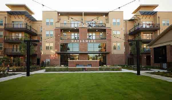
Given other existing commercial uses on the street, multi-family rental apartments are proposed as an appropriate and financially feasible residential use option for the site, including a potential mix of market and affordable units. They are complemented by substantial open spaces, carefully designed parallel parking to the north, and a small flex commercial building that might house a community maker space or vocationaltechnical training facility – or similar businesses. The two parcels should be combined to improve marketability and development potential.
The site is designed to maximize open space at the canal and along NW 19th Street as significant new neighborhood amenities. There is potential for a dog park, kayak launch, fishing area, or community garden as well. Proposed height limits have been substantially reduced (from 250 feet to 45 feet) to reduce impacts to nearby homes.
Future Land Use: Area 1 Commercial
Zoning: Area 1 and Area 2 have both
Future Land Use: Commercial (unify the 2 areas)
Zoning: B-2 Community Business District with uses shall conform to the RM-25 district.
Setbacks: 25’ front 20’ rear 10’ side Max. Height: Area 1 Area 2 Ten (10) stories or 100 FT (per zoning)
Form-based code
Setbacks Per Concept: 15’ front (max. from NW 20th Street) shall accomodate any canal easements)
Combined Lot Size: 92,545 SF
Proposed Max. Height: Four (4) stories or 45 FT
Parking Provided: +/- 106 spaces
Flex Spaces: Industrial/ warehousing type spaces with an open floor plan that may be internally subdivided business.
SITE 2 – ALTERNATIVE B
10’ (sb) 25’ (sb) 10’ (sb) 20’ (sb) Site 2 - Alternative B 18 | EAST SUNRISE IMPROVEMENTS MASTER PLAN
Sample Developments
Enlarged Preferred Enhancements to Attract Positive Community Investment


The purpose of this
plan is to provide a
for the
The purpose of this conceptual plan is to provide a framework for the redevelopment of Northwest 15th Street Vacant Property. Dimensions and square footages are approximate and may vary with actual construction. Modifications to the conceptual plan may vary, however the essence of the development, building placement, and program shown here, should be prioritized.
of Former Public Works Complex. however the essence of the
program shown here,
be
conceptual
framework
redevelopment
development, building placement, and
should
followed. NORTH Property Line+/- 420’ +/194’ +/- 420’ +/194’ Enhance pedestrian passageway Open Consider providing a second point of access Vehicular access Driveway Landscape Adjacent Commercial Uses Adjacent Uses Adjacent Uses Landscape canal side pedestrian experience Property of Old Control District 1008
S
Photo
Source: Abacoa Townhouses (live/work units). Jupiter,
FL
(applicable to
live/
work units and townhouses)
(APPLICABLE FOR ALTERNATIVE A & B)
S
Photo
Source: Propeller coworking flex spaces. New Orleans, LA (applicable to flex spaces)
S
Photo
Source:
Watermere
Frisco.
Image
from
National
Association of
Home
Builders website.
Frisco, TX
(applicable to
Alternative B multi-family)
S
Photo
Source:
Icehouse coworking flex
spaces.
New
Orleans,
LA
(applicable to
flex
spaces)
Site 2 - Alternative B
19 | EAST SUNRISE IMPROVEMENTS MASTER PLAN
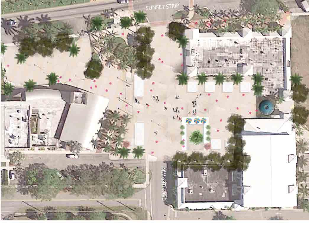
NAME: FORMER POST OFFICE
GROSS SITE AREA: 0.4 acres
PREFERRED PROGRAM: Large Public Plaza
DESCRIPTION:
The site is located on NW 68th Avenue just south of Sunset Strip, and currently the former post office building is on site. This site is surrounded by CF Community Facilities, B-3A General Business Overlay District, and B-3 General Business District. This site is in proximity to City Park, Village Multipurpose Center, Village Civic Center, retail, an elementary school, and neighborhood businesses. Parts of the site are used to access both businesses and the recreation center.
Proposed use of this site includes removal of the existing structure, upgrading of lighting and electrical systems, and construction of public plaza unifying the Civic complexes and parks/open spaces on two sides of the street. The plaza will serve as a prominent central gathering place for events and other celebrations and community activities. Along with temporary street closures, a farmers’ market, food truck events, and weekend vendors are just a few possible uses. Public art should be integrated throughout the plaza, including using the existing tree to remain as well as the potential for projected public art onto building walls at night. The Plaza should be formally named using a public process to create excitement and reinforce positive branding efforts.
Access for emergency vehicles would be maintained, and residential street traffic would be rerouted around the Civic Center during events. These temporary closures are not expected to impact Fire Station operations since NW 69th Avenue and NW 22nd Court will remain open at all times.
SITE 3 – ALTERNATIVE A
Village Civic Center Villag Civic Center CommercialCommercial Site 3 - Alternative A 20 | EAST SUNRISE IMPROVEMENTS MASTER PLAN
Developments
Enlarged Preferred Enhancements to Attract Positive Community Investment

however the essence of the development and program shown here, should be followed. NORTH Landscape to City Park Enhance facade w/ living green wall New Paver Area Temporal Stage Enhance pedestrian experience Allow access to fire and emergency Vendors Dumpster Foodtrucks tree to remain Provide shading devices on special events Garden Village Civic Center Village Commercial Sample
(APPLICABLE FOR ALTERNATIVE A AND B) East Sunrise Redevelopment Opportuni�es Site 03 Alterna�ve A Sample Developments (applicable for Alterna�ve A) S Photo Source: Village Farmer’s Market. Mount Pleasant, Brampton, Ontario S Former Post Office Site Conceptual Vision Plan Site 3 - Alternative A
The purpose of this conceptual plan is to provide a framework for the redevelopment of Former Post Office Site. Dimensions and square footages are approximate and may vary with actual construction. Modifications to the conceptual plan may vary, however the essence of the development, building placement, and program shown here, should be prioritized. 21 | EAST SUNRISE IMPROVEMENTS MASTER PLAN
EXISTING
NAME: FORMER POST OFFICE
GROSS SITE AREA: 0.4 acres
PREFERRED PROGRAM: Restoration for civic use
ESTIMATED PROJECT COST: $1.5 to $2.5 million (including 5 years of operations)
DESCRIPTION:
The site is located on NW 68th Avenue just south of Sunset Strip, and currently the former post office building is on site. This site is surrounded by CF Community Facilities, B-3A General Business Overlay District, and B-3 General Business District. This site is in proximity to City Park, Village Multipurpose Center, Village Civic Center, retail, a school, and neighborhood businesses. Parts of the site are used to access both businesses and the recreation center.

Proposed use includes substantially upgrading the structure for ADA accessibility, building code requirements, aesthetics, landscaping, group congregation code requirements, and lighting to house a very small civic use such as recreation, historical museum, or cultural organization with operating subsidies by the City. No private investment or revenue generation is anticipated for these functions given the very limited space available and the very limited aesthetic qualities of the structure.
PROPOSED
SITE 3 – ALTERNATIVE B
Site 3 - Alternative B 22 | EAST SUNRISE IMPROVEMENTS MASTER PLAN
Grid Page Intentionally Insert For Layout Purposes
East Sunrise Redevelopment Opportuni�es Site 04 Alterna�ve A
Site Informa�on
NAME: SUNRISE GOLF VILLAGE PARK
GROSS SITE AREA: 0.4 acres
PREFERRED PROGRAM: Improved public open space, plaza
Name: Sunrise Golf Village Park
Current En�tlements
Future Land Use: Commercial Zoning: CF - Community Facili�es
Preferred Enhancements to A�ract Posi�ve Community Investment
Future Land Use: Commercial Zoning: CF - Community Facili�es
ESTIMATED PROJECT COST: $175,000 (including 5 years of operations)
Owner: Public Size: 19,358 SF/ 0.4 Acres
DESCRIPTION:
The site is located on Sunset Strip and NW 12th Court, currently the site is an open public space. This site is bounded by RS-5 Residential Single Family (5 DU/AC) on the west side, and B-3 General Business District on the north south and east sides. This site is in proximity to retail, neighborhood businesses and ¼ mile from Sunrise Blvd (major commercial corridor).
Exis�ng Use: 82 - Forests, parks, recrea�onal areas
Golf Village Park has the potential to be the center of a vibrant mixed-use node on Sunset Strip. Suggested improvements include added public art (temporary so it can be changed regularly to increase interest), lighting, landscaping, security cameras, and more open areas to accommodate events. Removal of the current concrete benches helps make the park more open and inviting and provides an opportunity for adjacent restaurants to place seating at the edge of the park. This provides positive activity and natural surveillance to improve both real and perceived safety. Colorful flowers and shrubs in key locations will help improve a sense of care and concern and help reduce inappropriate behaviors. Keeping the park space as open as possible gives added flexibility for more events and programming, including the regular kinds of events hosted by the Police Department, potential holiday displays, and community gardening.
Site 4
Alternative
Site Improvements
Proposed Use: Community plaza and/or community garden
New lawn area: 9,853 SF
New paver area: 9,505 SF
Poten�al # of trees: 12 @ 20’ O.C.
Type of trees: Shade trees
Poten�al # of lights: 8
Type of lights: Street lights
Other poten�al elements: Public art, sculpture, small lights, security cameras, and landscaping
-
A SITE 4 – ALTERNATIVE A
10’ (sb) Adjacent commercial Adjacent commercial Adjacent residen�al Adjacent commercial Adjacent commercial Adjacent residen�al 24 | EAST SUNRISE IMPROVEMENTS MASTER PLAN
Sample Developments
(APPLICABLE FOR ALTERNATIVE A)
Enlarged Preferred Enhancements to A�ract Posi�ve Community Investment
Enlarged Preferred Enhancements to Attract Positive Community Investment

The purpose of this conceptual plan is to provide a framework for the redevelopment of Sunrise Golf Village Park. Dimensions and square footages are approximate and may vary with actual construc�on. Modifica�ons to the conceptual plan may vary, however the essence of the development and program shown here, should be followed.
The purpose of this conceptual plan is to provide a framework for the redevelopment of Sunrise Village Golf Park. Dimensions and square footages are approximate and may vary with actual construction. Modifications to the conceptual plan may vary, however the essence of the development, building placement, and program shown here, should be prioritized.
Site 4 - Alternative A
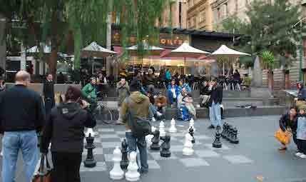
S Photo Source: Sunset Triangle Plaza (interactive plaza). Los Angeles, CA
S Photo Source: Interactive plaza with chess games. Melbourne, Australia
S
Photo
Source:
Community
gardens grow flowers,
herbs,
vegetables, and community. Photo courtesy of Kristen McIvor
Opportuni�es
NORTH Landscape buffer Public Art/ sculpture Mul�purpose open space for community events Public Art/ sculpture/ Holiday display Outdoor Dining Shade trees Poten�al to enhance pedestrian experience along Sunset Strip Enhance bus shelter Street Ligh�ng Facade improvements (open up local business to park plaza) Property Line+/- 100’ +/193’ Adjacent commercial Adjacent commercial Adjacent residen�al Street Ligh�ng
25 | EAST SUNRISE IMPROVEMENTS MASTER PLAN
FORMER CAR DEALERSHIP (ALONG UNIVERSITY DRIVE)
GROSS SITE AREA: 3.2 acres
PREFERRED PROGRAM: Three (3) restaurants, retail, and public open spaces
Future Land Use: Commercial
Future Land Use: Commercial
DESCRIPTION:
This privately-owned site is located on the east side of University Drive south of Oakland Park Boulevard. Currently the site is vacant and has abandoned buildings that the current owner has permits to demolish. This site is surrounded by B-3 General Business District, and R/OS Recreation/ Open Space, with RM-25 Residential Multi Family (16-25 DU/AC) nearby. It consists of three parcels under one ownership.
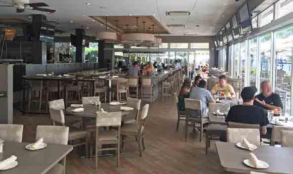
Given the unique location along a major roadway and a significant waterway (C13/Middle River), the site presents an opportunity to bring additional sit-down restaurants into east Sunrise in a highly marketable configuration. This takes full advantage of the existing strong mix of international restaurants, and it creates a new kind of dining destination with a cluster of such restaurants. Similar clusters have been successful along major roadways in North Miami Beach and elsewhere.
The site plan suggests outdoor dining overlooking the canal, unique signage along University Drive, and ample landscape buffering to communicate a higher quality kind of dining experience. Such clustering typically reduces the amount of parking needed, and the site plan shows slightly less than current regulations require, so some kind of regulatory relief may be needed. Suggested heights are significantly lower than permitted, minimizing visual impacts for nearby homes. Consolidation of parcels is also suggested as a way to maximize investment value.
Zoning: B-3 General Business District 20’ rear 10’ side
Max. Lot Coverage: 49,935 SF (35%) Max. Height: 250 FT Parking Required: Res/bar = 1/50 SF
Zoning: B-3 General Business District
Proposed Land Redevelopment 20’ rear 10’ side
Building 1 Gross Area: 7,650 SF
Building 2 Gross Area: 7,650 SF Building 3 Gross Area: 7,650 SF
Gross Building Area: 22,950 SF
Proposed Max. Height: 1 sty or 25 FT Parking Provided: +/- 195 spaces
Site 5 - Alternative A SITE 5 – ALTERNATIVE A NAME:
10’ (sb) 75’ (sb) 10’ (sb) 20’ (sb) 75’ (sb) 12 3 26 | EAST SUNRISE IMPROVEMENTS MASTER PLAN
Sample Developments
FOR
Enlarged Preferred Enhancements to Attract Positive Community Investment

purpose of this conceptual
the essence of the development,
for the
The purpose of this conceptual plan is to provide a framework for the redevelopment of

Site. Dimensions and square footages are approximate and may vary with actual construction. Modifications to the conceptual plan may vary, however the essence of the development, building placement, and program shown here, should be prioritized.
placement, and program shown here,
followed.
Site 5 - Alternative A The
plan is to provide a framework
redevelopment of Former Car Dealership site. however
building
should be
NORTH Dumpster/ recycle (2) Loading zone/ services Kitchen/ services Kitchen/ services Kitchen/ services Palm trees on north facade Outdoor dining on passageway Waterfront deck dining South facing facade shall provide wide overhangs, shade trees and any other shading strategies Landscape Adjacent commercia Adjacent commercial Adjacent commercial Landscape Enhance pedestrian experience Setback Line Court ya rd P assage wa y Court ya rd P assage wa y Property Line+/- 418’ +/322’ +/358’ +/- 420’ Driveway 12 15 16 16 16 16 03 13 13 12 12 12 12 12 75’ (sb) 12 385’ 90’ 85’ 90’ 85’ 90’ Property of South Florida Water Management District
S
Photo
Source:
Proposed
Ridgedale
Center (3-restaurants). Minnetonka, MN
(APPLICABLE
ALTERNATIVE A)
S Photo Source: The Manor at Flagler Village (restaurants and open spaces). Fort Lauderdale, FL
S
Photo
Source:
Ideas
for waterfront dining. Shooters Waterfront Cafe. Fort Lauderdale, FL
S
Photo
Source:
Ideas
for waterfront dining. Shooters Waterfront Cafe. Fort Lauderdale, FL
Former Car Dealership
27 | EAST SUNRISE IMPROVEMENTS MASTER PLAN
NAME: FORMER WALGREENS (ALONG SUNRISE BOULEVARD)
GROSS SITE AREA: 1.9 acres
PREFERRED PROGRAM: Adaptive reuse of existing building for a microbrewery and outdoor dining and events space
DESCRIPTION:
The site is located at Sunrise Boulevard and Sunset Strip, a key gateway into east Sunrise. Currently, the site has a vacant building, but the former tenant is still paying rent. This site is surrounded by B-3 General Business District, with RM-25 Residential Multi Family (16-25 DU/AC) nearby. This site is in proximity to interstate highways and ¼ mile to Sunrise Golf Village Park area.
Given the importance of this highly-visible gateway site to the image and brand of the entire east Sunrise community, a Microbrewery is proposed using the existing building with significant outdoor seating and site amenities. This includes significant public art, strong pedestrian amenities, excellent lighting and signage, and colorful landscaping consistent with such facilities in more vibrant urban environments. This development pattern will help people recognize east Sunrise for its urban qualities and vibrancy, a major attraction in the current marketplace. It also helps broaden the mix of entertainment and dining options on Sunset Strip and provides good employment opportunities for area residents.
An additional vacant parcel to the north may also present an expansion opportunity in the future. Nearby public improvements on Sunset Strip will also help enhance this key gateway.
Future Land Use: Commercial Zoning: B-3 General Business District
Future Land Use: Commercial Zoning: B-3 General Business District
Max. Height: 250
Parking Required: Restaurant/bar = 1/50
Proposed Use: Micro brewery/ tap room should be opened/ expanded closer to Sunrise Boulevard
Parking Provided: +/- 70 spaces (on-site)
Site 6 - Alternative A SITE 6 – ALTERNATIVE A
20’ rear 10’ side
FT
SF
75’ (sb) 10’ (sb) 10’ (sb) 20’ (sb) 75’ (sb) Vacant Commercia 14,768 SF 28 | EAST SUNRISE IMPROVEMENTS MASTER PLAN
Enlarged Preferred Enhancements to Attract Positive Community Investment
of this conceptual plan is to provide a framework for the
of former
purpose of this conceptual plan is to provide a framework for the redevelopment of former Walgreens site.
Site. Dimensions and square footages are approximate and may vary with actual construction.
to the conceptual plan may vary, however the essence of the development, building placement, and program shown here, should be prioritized.
the essence of the development, building placement, and program shown here, should be followed.
Site 6 - Alternative A The
however
NORTH 10’ (sb) 10’ (sb) 20’ (sb) Pedestrian Access Pedestrian access Pedestrian access Vehicular Access Vehicular Access Vehicular Access Outdoor Facade impromenets (overhang / garage doors) Services Customer area Landscape Interior improvements Enhance pedestrian experience Landscape Commercial CommercialCommercial Vacant Commercial Commercial for a gateway public art element 10 06 06 06 06 06 08 10 06 06 135’ 105’ 14,768 SF
The purpose
redevelopment
Walgreens
Modifications
29 | EAST SUNRISE IMPROVEMENTS MASTER PLAN
NAME: FORMER WALGREENS (ALONG SUNRISE BOULEVARD)
GROSS SITE AREA: 1.9 acres
PREFERRED PROGRAM: Office building, retail, and open public space
DESCRIPTION:
The site is located at Sunrise Boulevard and Sunset Strip, a key gateway into east Sunrise. Currently, the site has a vacant building, but the former tenant is still paying rent. This site is surrounded by B-3 General Business District, with RM-25 Residential Multi Family (16-25 DU/AC) nearby. This site is in proximity to interstate highways and ¼ mile to Sunrise Golf Village Park area.
Given the importance of this highly-visible gateway site to the image and brand of the entire east Sunrise community, a new signature office building carefully positioned on the corner of the site is proposed. With a major tenant occupying most of the building, a well-designed building with significant signage and quality site amenities will help create an image of new investment, provide new jobs, and help support nearby retail and restaurant businesses. The first floor of the office building will have retail space and outdoor seating to help create vibrancy. Pedestrian amenities will reinforce the walkability of Sunset Strip, and public art, landscaping, and architectural lighting will help tell a new story about east Sunrise. These features will be complemented by nearby public improvements as part of an overall Gateway improvements approach.
Note that a standard multi-tenant office building will not have the same impact or likely be financially feasible here given current office market rents.
Future Land Use: Commercial Zoning: B-3 General Business District 20’ rear 10’ side
Max. Height: 250 FT Parking Required: Restaurant/bar = 1/50 SF
Future Land Use: Commercial Zoning: B-3 General Business District
Proposed Redevelopment
Building Ground Floor: 16,094 SF Proposed Height: Four (4) Stories or 45 FT Parking Provided: +/- 93 spaces
Allow sizable signage to act as a landmark (reference point) to the district.
Site 6 - Alternative B SITE 6 – ALTERNATIVE B
*Note:
75’ (sb) 10’ (sb) 10’ (sb) 20’ (sb) 10’ (sb) 10’ (sb) 20’ (sb) 16,094 SF (@ GF)
30 | EAST SUNRISE IMPROVEMENTS MASTER PLAN
Sample
Enlarged Preferred Enhancements to Attract Positive Community Investment


purpose of this
The purpose of this conceptual plan is to provide a framework for the
of former Walgreens Site. Dimensions and square footages are approximate and may vary with actual construction. Modifications to the conceptual plan may vary, however the essence of the development, building placement, and program shown here, should be prioritized.
the essence of the
Site 6 - Alternative B The
conceptual plan is to provide a framework for the redevelopment of former Walgreens site. however
development, building placement, and program shown here, should be followed. NORTH Pedestrian Access Pedestrian access Vehicular Access Vehicular Access Vehicular Access Enhance pedestrian experience Pocket park should consider public art, bike racks, and street furnishings Landscape Commercial CommercialCommercial Vacant Commercial Commercial 167’ 68’ 45’ 171’ 10’ (sb) 10’ (sb) 20’ (sb) 16,094 SF (@ GF) 09 07 03 09 08 06 09 06 09 08 09 for a gateway public art element
Developments (APPLICABLE FOR ALTERNATIVE A AND B) S Photo Source: Funky Buddha Brewery. Oakland Park, FL (applicable to Alternative A) S Photo Source: Sweetwater Brewing Company (in and outdoor active spaces). Atlanta, GA (applicable to Alternative A) S Photo Source: Idea for signature small office building with highly impactful signage for a major tenant. Rendering by Elion Partners and Kraus Anderson from Finance and Commerce digital magazine. (applicable to Alternative B)
redevelopment
31 | EAST SUNRISE IMPROVEMENTS MASTER PLAN
NAME: FORMER GAS STATION
GROSS SITE AREA: 0.4 acres
PREFERRED PROGRAM: City-controlled Parking lot
DESCRIPTION:
The site is located at Sunset Strip and NW 12th Court. Currently the site is vacant and has an abandoned building. The site contains chemicals below ground from the former gas station operations. This site is surrounded by B-3 General Business District, CF Community Facilities, and RS-5 Residential Single Family (5 DU/AC). This site is in proximity to Sunrise Golf Village Park area and ¼ mile from Sunrise Boulevard (major east-west commercial corridor and connector to interstate highways).
Nearby businesses, including one popular restaurant, struggle with parking in this area. By converting this site to a City-controlled parking lot, this proposal will remove the eyesore of the old gas station building and make lighting, public art, and landscaping improvements to improve aesthetics and safety. This will also support multiple small businesses in the process. By obtaining site control in this way through a lease-option or purchase, the City also creates new options for future mixed-use development in the immediate area.
The lot can also be used to host or support events in the area that celebrate Sunrise Village Park and the small businesses in the area. Carefully designed access control, signage, and lighting can help police manage past loitering issues.
Future Land Use: Commercial Zoning: B-3 General Business District
Future Land Use: Commercial Zoning: B-3 General Business District
Proposed Improvements
Setbacks: 25’ front 20’ rear 10’ side
Max. Lot Coverage: 6,191 SF (35%)
Max. Height: 250 FT
Parking Required: Restaurant/bar = 1/50 SF
-
Primary Use: Parking Lot
Secondary Use: Community Events
Parking Provided: +/- 40 spaces
Paver Area: 15,725 SF
Type of Trees: Shade trees along street edge Landscape Area: 2,500 SF +/- 12 new units
SITE 7 – ALTERNATIVE A
25’ (sb) 10’ (sb) 10’ (sb) 20’ (sb) Site 7
Alternative A 32 | EAST SUNRISE IMPROVEMENTS MASTER PLAN
Enlarged Preferred Enhancements to Attract Positive Community Investment
The purpose of this
and
the
with
be
the
the
Sample Developments
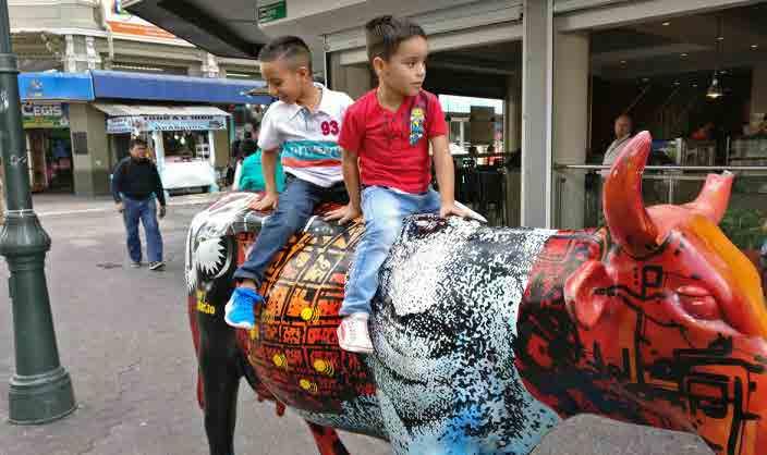
however the essence of the development and program shown here, should be followed. NORTH Commercial Commercial development Sunrise Golf Village Park Commercial Landscape Paver Area Vehicular access Vehicular access Shade trees Shade trees Public art Enhance pedestrian experience Space may be use for special events Property of City of Sunrise
(APPLICABLE FOR ALTERNATIVE A)
S
Photo
Source:
Idea for public art.
Painted Cow Homenaje to Marito Mortadela. San Jose, Costa Rica
S
Photo
Source:
Permeable
Surface Parking Lot. Ateliertern.com. France
S
Photo
Source:
UC
Davis Arboretum.
Parking
lot retrofit. Davis, CA
Site 7 - Alternative A
conceptual plan is to provide a framework for
redevelopment of former Gas Station (along Sunset Strip). Dimensions and square footages are approximate
may vary
actual construction. Modifications to
conceptual plan may vary, however
essence of the development, building placement, and program shown here, should
prioritized. 33 | EAST SUNRISE IMPROVEMENTS MASTER PLAN
NAME: OAKLAND PARK VACANT PROPERTY
GROSS SITE AREA: 7.2 acres
PREFERRED PROGRAM: Mixed-use with townhomes, multi-family rental apartments, retail, and commercial
DESCRIPTION:
This privately-owned site is located along Oakland Park Boulevard one parcel east of NW 68th Avenue and west of NW 64th Avenue. Currently the site is vacant and does not include a second site adjacent to 68th Avenue. This site is surrounded by B-3 General Business District, and RS-5 Residential Single Family (5 DU/AC). This site is adjacent to retail, and ½ mile to City Park, Village Multipurpose Center, Village Civic Center, and neighborhood businesses.
This highly visible site provides a unique opportunity to introduce new and higher quality rental housing and urban oriented retail – and make a clear statement about new investment in the area. By mixing a small percentage of affordable units with market rate units, including townhomes and one small mid-rise apartment building for a total of 126 units, the proposed project will add a significant number of new residents and their buying power for nearby businesses. The approximately 12,000 sf of commercial space would include retail and office uses situated along the sidewalk with parking in the rear. To help buffer existing homes, low rise townhomes are positioned on the south end of the site, proposed heights are substantially less than the 250 feet permitted, commercial spaces are limited to the northern portions of the site, and lighting will be carefully designed to minimize impacts to existing homes. Access points onto Oakland Park Boulevard will also minimize traffic impacts inside the neighborhood.
Future Land Use: Commercial Zoning: B-3 General Business District
Future Land Use: Commercial Zoning: B-3 General Business District with uses shall conform to the RM-25 district.
rear
side
Density: 25 du/acre x 7.2 acres = 180 units
Proposed Improvements apartments
Parking Provided: 326 spaces
8 - Alternative A
SITE 8 – ALTERNATIVE A
20’
10’
10’ (sb) 75’ (sb) 10’ (sb) 20’ (sb) Site
34 | EAST SUNRISE IMPROVEMENTS MASTER PLAN
The purpose of this conceptual plan is to provide a framework for the redevelopment of Vacant Commercial site (along Oakland Park Blvd).
Enlarged Preferred Enhancements to Attract Positive Community Investment
the essence of the development, building placement, and program shown here, should be followed.
The purpose of this conceptual plan is to provide a framework for the redevelopment of former Vacant Commercial site (along Oakland Park Blvd).
Dimensions and square footages are approximate and may vary with actual construction. Modifications to the conceptual plan may vary, however the essence of the development, building placement, and program shown here, should be prioritized.
however
NORTH Property Line Adjacent Uses Adjacent Commercial Uses Commercial Mid-Rise Adjacent Commercial Uses +/- 935’ +/165’ +/378’ +/- 665’ Landscape Vehicular access to incorporate public art, bike racks, and neighborhood Vehicular access Landscape Open Space Vehicular access Enhanced pedestrian experience should be as close to sidewalk as possible Site 8 - Alternative A
35 | EAST SUNRISE IMPROVEMENTS MASTER PLAN
NAME: OAKLAND PARK VACANT PROPERTY
GROSS SITE AREA: 7.2 acres
PREFERRED PROGRAM: Mixed-use with townhomes, hotel, multi-family apartments, retail, and commercial
DESCRIPTION:
This privately-owned site is located along Oakland Park Boulevard one parcel east of NW 68th Avenue and west of NW 64th Avenue. Currently the site is vacant and does not include a second site adjacent to 68th Avenue. This site is surrounded by B-3 General Business District, and RS-5 Residential Single Family (5 DU/AC). This site is in adjacent to retail, and ½ mile to City Park, Village Multipurpose Center, Village Civic Center, and neighborhood businesses.
This highly visible site provides a unique opportunity to introduce new and higher quality rental housing, a quality hotel, and urban oriented retail and offices – and make a clear statement about new investment in the area. By including a 120room hotel and mixing a small percentage of affordable units with market rate units, including townhomes and one small mid-rise apartment building for a total of 87 units, the proposed project will add a significant number of new residents and visitors and their buying power for nearby businesses. The approximately 12,000 sf of commercial space would include retail and office uses situated along the sidewalk with parking in the rear. To help buffer existing homes, low rise townhomes are positioned on the south end of the site, proposed heights are substantially less than the 250 feet permitted, commercial spaces are limited to the northern portions of the site, and lighting will be carefully designed to minimize impacts to existing homes. Access points onto Oakland Park Boulevard will also minimize traffic impacts inside the neighborhood.
Structured parking allows significant open space on the western portion of the site that will also help create community interactions and permit some small events.
Future Land Use: Commercial Zoning: B-3 General Business District 20’ rear 10’ side
Density: 25 du/acre x 7.2 acres = 180 units
Future Land Use: Commercial Zoning: B-3 General Business District with uses shall conform to the RM-25 district.
Proposed Improvements apartments Hotel: 120 rooms
Proposed Hotel Height: 5 stories Gross Parking Provided: +/- 430 spaces
SITE 8 – ALTERNATIVE B
10’ (sb) 75’ (sb) 10’ (sb) 20’ (sb)
Site 8 - Alternative B 36 | EAST SUNRISE IMPROVEMENTS MASTER PLAN
Sample Developments
Enlarged Preferred Enhancements to Attract Positive Community Investment


The purpose of this conceptual plan is to provide a framework for the redevelopment of Vacant Commercial site (along Oakland Park
The purpose of this conceptual plan is to provide a framework for the redevelopment of former Vacant Commercial site (along Oakland Park
however the essence of the development, building placement, and program shown here, should be followed
Dimensions and square footages are approximate and may vary with actual construction. Modifications to the conceptual plan may vary, however the essence of the development, building placement, and program shown here, should be prioritized.
Blvd).
NORTH Property Line Adjacent Uses Adjacent Commercial Uses Commercial Mid-Rise Hotel Adjacent Commercial Uses +/- 935’ +/165’ +/378’ +/- 665’ Landscape 3-sty Structured parking Pocket park Vehicular access Vehicular access Open Space facade improvements Vehicular access Enhance pedestrian experience to incorporate public art, bike racks, and neighborhood should be as close to sidewalk as possible Landscape
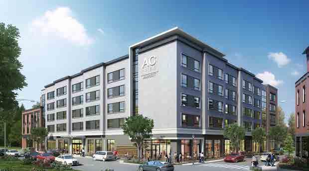
T Photo Source: Idea for 5-story quality hotel. Rendering by AC Hotel, Portsmouth, NH (designed by PROCON) (applicable to Alternative B)
(APPLICABLE FOR ALTERNATIVE A AND B)
S Photo Source: Idea for traditional 2 - 3 story townhomes. Image of Brush Hill Townhomes at Evening Rose. Tallahassee, FL (applicable to Alternative A and Alternative B)
S Photo Source: Idea for mixed-use development. Paseo Verde TOD Development with affordable housing. Philadelphia, PA. CNU Public Square. (applicable to Alternative A and Alternative B)
S Photo Source: Idea for modern 2 - 3 story townhomes. Rendering by Trolley Bus Urban Development (applicable to Alternative A and Alternative B)
Site 8 - Alternative B
Blvd).
37 | EAST SUNRISE IMPROVEMENTS MASTER PLAN
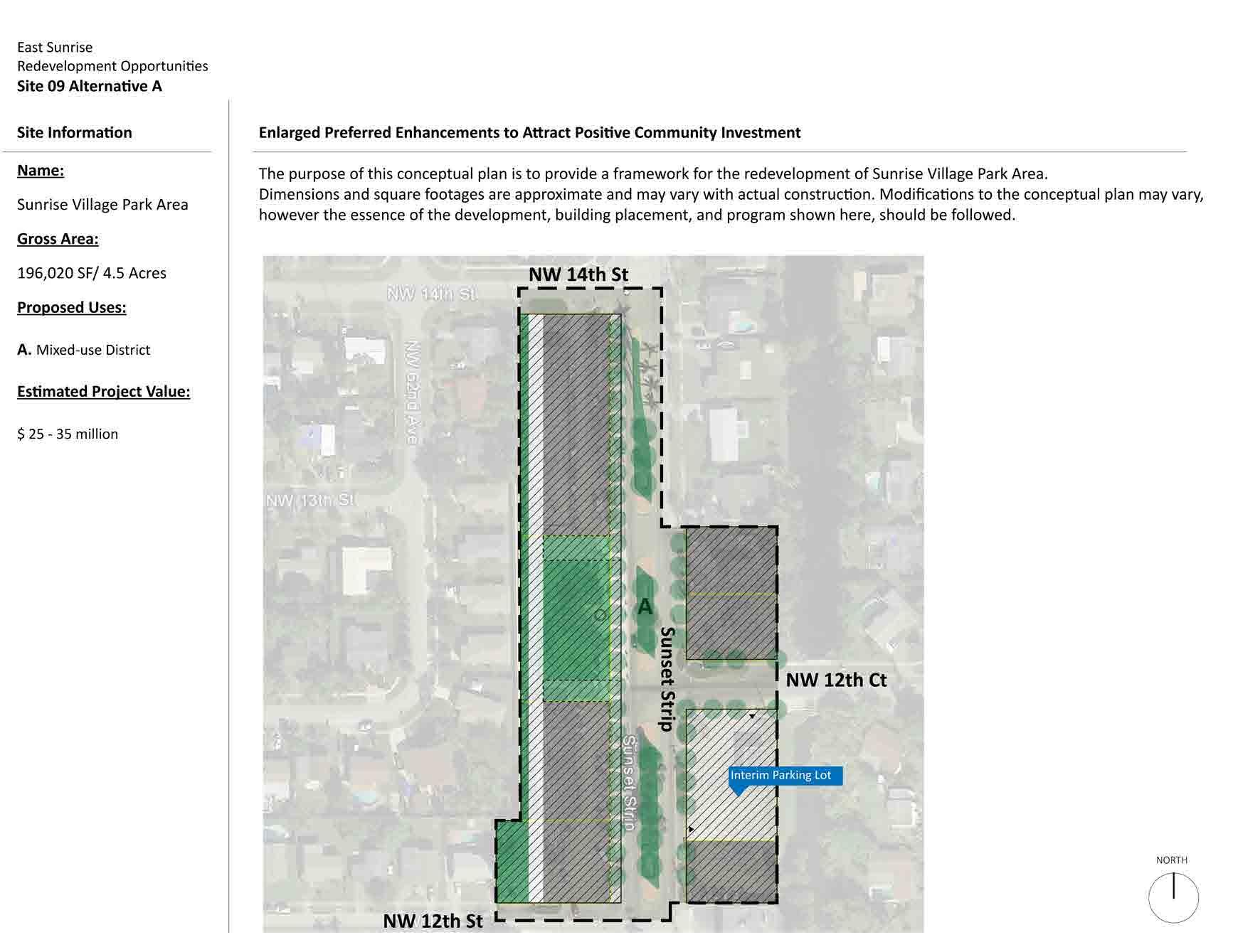
SUNRISE VILLAGE PARK MIXED-USE NODE
GROSS SITE AREA: 4.5 acres
PREFERRED PROGRAM: Mixed-use district with retail, commercial, housing, and open public spaces

DESCRIPTION:
The site is located on both sides of Sunset Strip between NW 12th Street and NW 14th Street. This site is surrounded by B-3 General Business District, RS-5 Residential Single Family (5 DU/AC), and CF Community Facilities.
With appropriate private site assembly, this part of Sunset Strip can become a vibrant and unique mixed-use development that enhances the walkability, image, and prosperity of east Sunrise. This includes the potential for affordable living options, small business opportunities, and great park/civic spaces. While the exact size and configuration will depend on the extent and timing of private site assembly, including any City incentives for such assembly, the redevelopment of the area into an urban, mixed-use pattern is suggested.
SITE 9 – ALTERNATIVE A NAME:
Site 9 - Alternative A 38 | EAST SUNRISE IMPROVEMENTS MASTER PLAN
Enlarged Preferred Enhancements to Attract Positive Community Investment
The purpose of this conceptual plan is to provide a framework for the redevelopment of former Sunrise Village Park Area. Dimensions and square footages are approximate and may vary with actual construction. Modifications to the conceptual plan may vary, however the essence of the development, building placement, and program shown here, should be prioritized.
Sample Developments
(APPLICABLE FOR ALTERNATIVE A AND B)
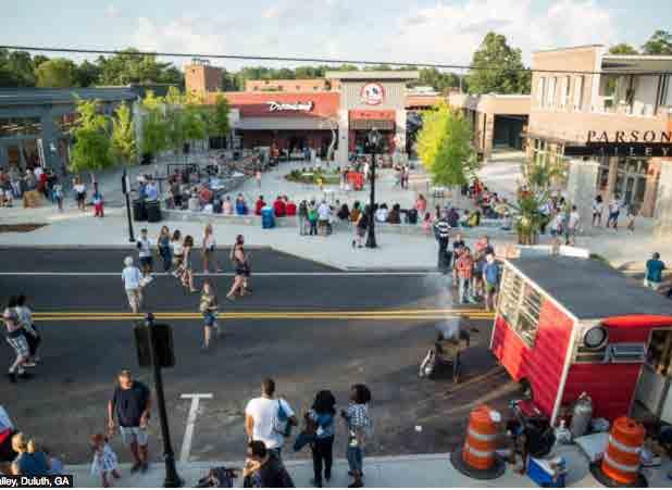
S Photo Source: Idea to revitalize area through community events/gatherings. Parson's Alley activation, Duluth, GA. Image from Public SquareSite 9 - Alternative A
39 | EAST SUNRISE IMPROVEMENTS MASTER PLAN
NAME:
East Sunrise Redevelopment Opportuni�es Site 10 Alterna�ve A
PPG INDUSTRIES – POTENTIAL RELOCATION AND REUSE
GROSS SITE AREA: 13.4 acres
Site Informa�on Name: PPG Industries Site
Current En�tlements
Future Land Use: Industrial Zoning: I-1 Light Industrial
Preferred Enhancements to A�ract Posi�ve Community Investment
Future Land Use: Industrial Zoning: Form-based code commercial development
PREFERRED PROGRAM:
DESCRIPTION:
Redevelopment as commercial or light industrial uses, including an entrepreneurial village with small business development opportunities for local residents.
Owner: Private Site Gross Area: 583,704 SF/ 13.4 Acres
This privately-owned site is located along NW 20th Street west of NW 19th Street. This site is bounded by Light Industrial, RS-5 Residential Single Family (5 DU/AC), B-3 General Business District, and CF Community Facilities. This site is bounded by canals along its north and west borders.

Exis�ng Use: Paint Tes�ng Site
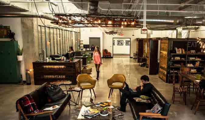
To expand employment and small business opportunities for area residents, a highly flexible commercial space project is suggested. It would include some space for business assistance/incubator/accelerator programs, the availability of shorter-term leases, and partnerships with area trade schools and universities.
The site will be heavily buffered adjacent to residential areas, buildings will not exceed 2 stories to minimize visual impacts, and the site will include a secondary emergency access point for Fire Department responses. It will also contain a major open space for potential small business events. No heavy fabricating or outdoor storage will be permitted, but some specialty retail and gallery space could be included.
Site 10 - Alternative A
Proposed Land Development
Proposed Use: Commercial Development and Entrepreneurial Village
Poten�al Flex Space: +/- 111,500 SF
Proposed Height: 1-2 stories
Parking Provided: +/- 320 spaces
Flex Spaces Defini�on: Industrial/ warehousing type spaces with an open floor plan that may be internally subdivided and/or u�lized in its en�rely for a variety of uses, such as, office, gallery, ar�st studio, storage, and specialty retail business.
SITE 10 - ALTERNATIVE A
NW 20TH STREET NW 20TH STREET A. Commercial Development NW 19th St A
40 | EAST SUNRISE IMPROVEMENTS MASTER PLAN
Sample Developments
(APPLICABLE FOR ALTERNATIVE A AND B)
Enlarged Preferred Enhancements to A�ract Posi�ve Community Investment

Enlarged Preferred Enhancements to Attract Positive Community Investment

The purpose of this conceptual plan is to provide a framework for the redevelopment of PPG Industries Site. Dimensions and square footages are approximate and may vary with actual construc�on. Modifica�ons to the conceptual plan may vary, however the essence of the development, building placement, and program shown here, should be followed.
The purpose of this conceptual plan is to provide a framework for the redevelopment of former PPG Industries Site. Dimensions and square footages are approximate and may vary with actual construction. Modifications to the conceptual plan may vary, however the essence of the development, building placement, and program shown here, should be prioritized.

NORTH NW 20TH STREET A. Commercial Development NW 19th St Poten�al emergency access Landscape buffer Flex spaces Open space A Site 10 - Alternative A
W Photo Source: Idea for coworking spaces. Entrepreneurial Hub Catapult. Lakeland Economic Development Council. Lakeland, FL (applicable to flex spaces)
S Photo Source: Idea for flex spaces exterior. Family owned company that improves the lifestyle and efficiencies of organizations and their employees by creating integrated, flexible, and custom tailored workspaces. By One Workplace. California
S Photo Source: Idea for technical school. MICA’s Open Works Entrepreneur Residence Program. Baltimore, MD (applicable to flex spaces)
S
Photo
Source:
Idea for small scale multi-family
residential.
San Mateo EDI
International
Sixteen5Hundred Inc. The
Registry.
San
Francisco,
CA (applicable to Alternative B apartments)
S
Photo
Source:
Idea
for business incubator. WeWork Security Building. (applicable to flex spaces)
41 | EAST SUNRISE IMPROVEMENTS MASTER PLAN
NAME:
East Sunrise Redevelopment Opportuni�es Site 10 Alterna�ve B
PPG INDUSTRIES – POTENTIAL RELOCATION AND REUSE
GROSS SITE AREA: 13.4 acres
Site Informa�on Name: PPG Industries Site
PREFERRED PROGRAM: Redevelopment as residential use that provides several housing types focused on affordability.
DESCRIPTION:
This privately-owned site is located along NW 20th Street west of NW 19th Street. This site is bounded by Light Industrial, RS-5 Residential Single Family (5 DU/AC), B-3 General Business District, and CF Community Facilities. This site is bounded by canals along its north and west borders.

Owner: Private Site Gross Area: 583,704 SF/ 13.4 Acres
Exis�ng Use: Paint Tes�ng Site
Because of the size of this site, it provides a unique opportunity to introduce a mix of housing types focused on both homeownership and affordability. The suggested development includes duplexes that would be owner-occupied and create an income stream from the rental side to improve affordability. In addition, owner-occupied live/work units will create opportunities for small businesses that produce secondary income and improve affordability. Finally, higher-density rental apartments would include electric car-sharing, a small day care facility, and community amenities like a pool and central green space. All units will be constructed for low energy use to enhance affordability as well. City transit shuttles would have a stop inside the site. In the near future, an automated electric vehicle may be available to transport youth and seniors unable to drive themselves.
Current En�tlements
Future Land Use: Industrial Zoning: I-1 Light Industrial
Preferred Enhancements to A�ract Posi�ve Community Investment
Future Land Use: Residen�al Zoning: Form-based code with density of 20 du/acre
Proposed Land Development
Proposed Use: A. Apartments
Poten�al # of Apartments: 180 units
Proposed Apartments Height: 2-3 stories
B. Duplexes
Poten�al # of Duplexes: 16 units
Proposed Duplexes Height: 1-2 stories
C. Live/ Work Units
Poten�al # of Units: 28
Proposed Live/ Work Height: 1-2 stories
Poten�al Gross Residen�al: 224 dwelling units
Parking Provided: +/- 332 spaces
Site 10 - Alternative B
SITE 10 - ALTERNATIVE B
NW 20TH STREET NW 20TH STREET A B C NW 19th St
42 | EAST SUNRISE IMPROVEMENTS MASTER PLAN
Site Informa�on
Name:
Industries Site
Gross Area:
Proposed Use:
A. Apartments
Duplexes
Live/ Work Units
Es�mated Project Value:
30 - 35 million
Enlarged Preferred Enhancements to Attract Positive Community Investment
Enlarged Preferred Enhancements to A�ract Posi�ve Community Investment
The purpose of this conceptual plan is to provide a framework for the redevelopment of former PPG Industries Site. Dimensions and square footages are approximate and may vary with actual construction. Modifications to the conceptual plan may vary, however the essence of the development, building placement, and program shown here, should be prioritized.
The purpose of this conceptual plan is to provide a framework for the redevelopment of PPG Industries Site. Dimensions and square footages are approximate and may vary with actual construc�on. Modifica�ons to the conceptual plan may vary, however the essence of the development, building placement, and program shown here, should be followed.

East Sunrise Redevelopment Opportuni�es Site 10 Alterna�ve B
PPG
Site
583,704 SF/ 13.4 Acres
B.
C.
$
NORTH NW 20TH STREET A B C NW 19th St Poten�al connec�on Courtyard Landscape buffer Site 10 - Alternative B
43 | EAST SUNRISE IMPROVEMENTS MASTER PLAN
DISTRICTS
In order to discuss general land use, building design, public realm, site configurations and commercial uses and activities, the team needed to identify character areas, or “Districts” that would become strategic areas of focus. The Urban Design portion of the scope of services enabled the team to identify and highlight the assets and attributes of these key areas of the city. There should be a strong emphasis on labeling these geographic places within the east Sunrise boundaries as Districts, so they become part of the daily lexicon. This approach also enables the plan implementers to understand and work on a vision that is character based, not simply real estate based.
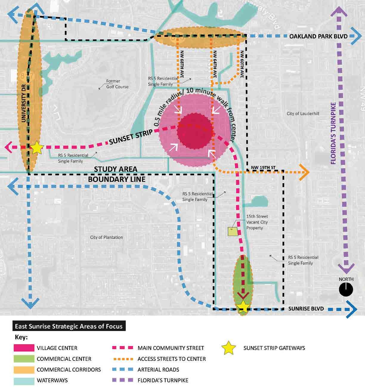
B.
44 | EAST SUNRISE IMPROVEMENTS MASTER PLAN
THE METHODOLOGY AND VISUAL ORIENTATION UTILIZED TO CONDUCT THE URBAN DESIGN ANALYSIS CONSISTED OF:
• east Sunrise Framework Diagram
• Strategic Areas of Focus
• Existing Conditions Photo Inventory
• Public Realm Review
• Comprehensive Plan and Land Development Code Review
• Vacant, Abandoned and Opportunity Sites Review
• Parks, Open Spaces, and Community Facilities Review
• Design Incentives and Programs Review
THE GENERAL LOCATION OF THE CHARACTER AREAS OR DISTRICTS IDENTIFIED AND ANALYZED INCLUDE:
• Village Center - Sunset Strip between Northwest 70th Avenue and Northwest 64th Avenue
• Commercial Center- Sunset Strip between Sunrise Boulevard and Northwest 14th Street
• Sunset Strip Gateways - Entry Points or Gateways at Sunrise Boulevard and University Drive
• Commercial Corridors - University Drive; Oakland Park Boulevard
• Non-Commercial Neighborhoods (not visually depicted on diagram)
GENERAL URBAN DESIGN OBSERVATIONS
This part of the City is essentially built-out. Therefore, all new development will happen in the form of:
• Redevelopment; completely redesigning a site of some previous or existing building
• Adaptive Reuse; retrofitting/ improving an existing building and/or infrastructure
• Public Spaces; retrofitting sites into community gathering spaces, i.e. plazas and pocket parks
At its core the basic urban design of the study area consists mostly of single family residential, multifamily complexes, suburban strip mall commercial corridors at the edges, and small neighborhood commercial centers (along Sunset Strip) as part of the Village Center.
The study area has a strong community presence and a central geographic core (along Sunset Strip between NW 68thAve and NW 64thAve) that consists of small neighborhood commercial, civic and cultural centers, public spaces, and City Park, but it lacks a sense of place and constant activity. It has great “bones” to create a comfortable, small-scale, walkable neighborhood main street serving as the community’s spinal cord and preferred gathering space.
The major commercial corridors (University Drive, Sunrise Boulevard, and Oakland Park Boulevard) consist primarily of suburban style strip malls. The pedestrian experience is characterized by narrow sidewalks next to wide, high-traffic roadways, and is therefore not safe and/or inviting. The City needs to improve these major commercial corridors in ways that create a system of importance to all modes of transportation, not only vehicular, but also pedestrian, bicycle and transit. In other words, implement Complete Streets policies that prioritize the pedestrian first. Other activities should include retrofits of existing suburban strip malls into walkable outdoor malls or other reuse options, development of vacant parcels to fill the gaps, and improved walking and bicycle connections to nearby residential areas, including pathways along Sunset Strip.
Good urban design and place making conditions have the following components. They:
• Invite people to walk comfortably along wide sidewalks with shade trees and street furnishings
• Provide an interesting pedestrian experience, where active uses are next to the sidewalk
• Enhance community identity and civic pride through arts
• Engage the community in small interventions, such as crosswalks or gateway enhancements
• Encourage local businesses to improve building façades and to promote outdoor activities
• Create a cohesive architectural style that identifies the community, e.g. Caribbean Style
• Provide landscaping with street trees, low and mid-height shrubs, flowering shrubs and palm trees.
45 | EAST SUNRISE IMPROVEMENTS MASTER PLAN
Grid Page Intentionally Insert For Layout Purposes
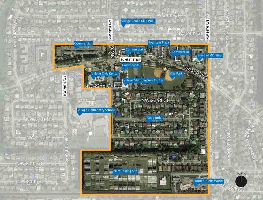
VILLAGE CENTER VILLAGE CENTER The Village Center is on track to become the city’s Main Street rich in culture, diversity, activity and ambiance. It’s has the potential to dramatically and positively change how the public views the city as a whole, because a city’s central core area, or in this case its Main Street, defines the soul of a city. Village Center Current Conditions Analysis EXISTING GEOGRAPHIC CONDITIONS CHARACTER & PHYSICAL CONDITIONS ACTIVITIES REGULATORY CONDITIONS MOBILITY CONDITIONS IDENTITY & BRAND CONDITIONS Village Center Vision Village Center Recommendations CHARACTER & PHYSICAL RECOMMENDATIONS ACTIVITIES RECOMMENDATIONS REGULATORY RECOMMENDATIONS MOBILITY RECOMMENDATIONS IDENTITY & BRAND RECOMMENDATIONS Current Conditions Analysis EXISTING GEOGRAPHIC CONDITIONS Location: Sunset Strip between NW 70th Avenue and NW 64th Avenue and south to City limit (canal) Size: +/-75 acres and Sunset Strip linear corridor stretches 0.30 miles/ 6.5-minute walk VILLAGE CENTER AERIAL IMAGE 47 | EAST SUNRISE IMPROVEMENTS MASTER PLAN
VILLAGE CENTER

CHARACTER & PHYSICAL CONDITIONS
Village Center is on track to become the jewel of the city, it’s “Main Street”. The city is fortunate in that the “bones” of this built environment with its unique blend of uses, character and comfortable human scale, is very conducive to creating a vibrant, main street style destination. Village Center has many public and private assets including City Park, Village Civic Center, Sunrise Chamber of Commerce, Village Multipurpose Center, Village Elementary School, First Baptist Church, a Police Substation, an open public plaza, and a mix of small commercial businesses. This district functions as the social and commercial center of east Sunrise. The recent and planned city improvements to Sunset Strip, several parks, water fountain plaza, multiple commercial locations, commercial facades, and lighting in the area, all reinforce the commitment to the revitalization of the Village Center.
The retail is set back from the street with parking in front however which is suburban in nature, and not conducive to main street design patterns. Some amenities such as bus shelters do not provide adequate protection, especially from rain.
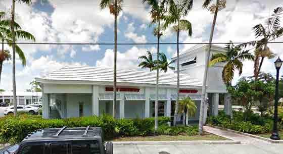
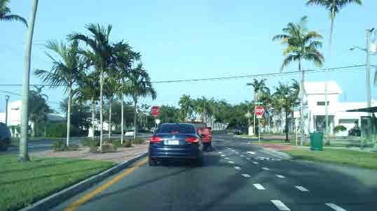
The district contains a variety of single-story commercial structures along Sunset Strip and visibility of many businesses is limited. Signage is difficult to see and read from the street due in part to the way buildings are set back from the sidewalks and street. Crisp white “island” architecture with pitched roof towers and slatted awnings in areas east of NW 68th Avenue create a somewhat unique appearance, but the plaza to the west is hardly noticeable behind the landscaping and trees.
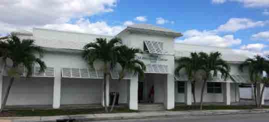
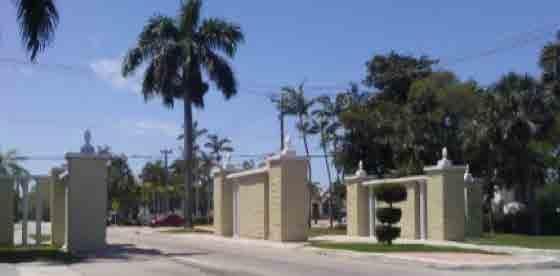
Single family homes south of City Park are within easy walking distance of the existing civic and commercial amenities. The homes are also close to the potential employment centers to the south on the former Public Works and PPG sites. Those two major redevelopment sites are currently incompatible (vacant and passive industrial) with the concept of a vibrant Village Center. Additionally, the two sites are physically separated by a canal, which negates their ability to positively impact the Village Center.
Note: redevelopment of the Public Works and PPG sites are discussed in detail in the Opportunity Sites section of this plan
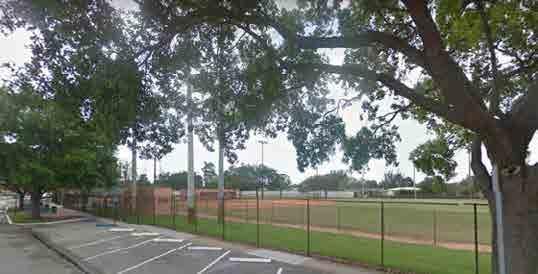 S Complete Streets along Sunset Strip reaching NW 68th Avenue with buffered bicycle lanes. This could be a potential location to position a public art landmark that will welcome people to this area.
S Commercial with façade upgrades showcasing white architecture with tower, covered area, and slanted wood awnings.
S City Park located along Sunset Strip between NW 68th Avenue and NW 64th Avenue. A great asset for this community. It provides an open space to play, and the potential to provide a place to gather and take a rest.
S Gateway structure along NW 68th Avenue reaching Sunset Strip. This could serve as a canvas for the community to paint it and make it part of a symbol and point of reference for this area.
W Barbershop Landmark
T Village Multipurpose Center
S Complete Streets along Sunset Strip reaching NW 68th Avenue with buffered bicycle lanes. This could be a potential location to position a public art landmark that will welcome people to this area.
S Commercial with façade upgrades showcasing white architecture with tower, covered area, and slanted wood awnings.
S City Park located along Sunset Strip between NW 68th Avenue and NW 64th Avenue. A great asset for this community. It provides an open space to play, and the potential to provide a place to gather and take a rest.
S Gateway structure along NW 68th Avenue reaching Sunset Strip. This could serve as a canvas for the community to paint it and make it part of a symbol and point of reference for this area.
W Barbershop Landmark
T Village Multipurpose Center
48 | EAST SUNRISE IMPROVEMENTS MASTER PLAN
ACTIVITIES
Commercial uses generate limited pedestrian activity in the Village Center, however, a variety of public programs, events, and services help attract visitors from near and far. Notably, some very limited outdoor dining is already present. This type of commercial activity should be expanded because it helps enliven the area. Recreational programming is the most significant public activity, but a variety of holiday-related events and parades also occur in this area, as do events at the school. We did not find evidence of regularly occurring special events typical of a Main Street however. Main Streets benefit from organized and ongoing activity which should be a goal.
REGULATORY CONDITIONS
Signage regulations allow for monument or ground signs (which is a suburban concept) however most signage is on the buildings, (which is an urban design). Since the goal is to mimic Main Street characteristics, urban regulations are preferred. The uniform color and style of signage on the renovated properties creates a nice, consistent look on the facades.
Landscaping requirements include one tree per each 25 lineal feet, however any visibility issues have been accommodated in some locations by installing thinner Alexander palms instead of shade trees. This is a good choice of landscape material to maintain visibility, but not good for shading pedestrians.

Outdoor dining and a strong restaurant presence are very important to create an active and lively main street environment. Attracting food and beverage establishments is difficult however due to the high cost of opening such an establishment. Generally, any regulatory barriers that arise during permitting of restaurants should be removed or addressed.
The suburban style setbacks of the retail and commercial buildings is not compatible with a Main Street environment that favor pedestrians. As this area transforms and becomes more economically vibrant, regulations of new development or redevelopment should require all buildings to come to the street edge, and eliminate setbacks and parking in front of buildings. Parking should be relegated to the rear of the buildings. Buffers to residential neighborhoods should be required. This long-term goal will potentially occur when the existing buildings meet their natural lifespan and require either demolition or total rehabilitation, or the Village Center becomes a hot area for retail investment.
MOBILITY CONDITIONS
Main Streets and city centers should be a focal point for mobility connections; both ingress and egress. Village Center should strive to incorporate a transit hub and include various forms of mobility in the right- of-way improvements, which the City proactively did by incorporating bike lanes into new roadway improvements along Sunset Strip.
A secondary aspect of mobility is parking. Parking for the civic and commercial properties is generally adequate for current activity levels, and is well-distributed for a walkable place. The new improvements to City Park, additional programming, and an influx of new restaurant or retail businesses will likely strain the current parking supply.
Major development sites in the south end of Village Center (former Public Works and PPG Opportunity Sites) need better pedestrian connections to nearby amenities, events, and shopping/dining. The canal is a major barrier at this time.
IDENTITY & BRAND CONDITIONS
Village Center has the opportunity to create a dynamic brand and identity that truly reflects the “Main Street” character of the area. Brand development is formed by identifying the current assets and special elements found only in Village Center, and then creating a message (both visually and with words) that tells the world what they can expect to see and do when they arrive. Once a brand is formed, the city can promote the brand through print materials, social media, special events and programming supported by a strong brand presence in city hall such as vision boards in the lobby.
It’s a very unique asset that if branded and marketed correctly can set the city apart from other cities. The “Gateway” redevelopment at Sunrise Boulevard and University Drive (discussed in later sections) provides natural bookends to this small scale but urban main street environment.
VILLAGE CENTER
S Village Center current retail in the back and parking in the front is not conducive to active sidewalk activity.
49 | EAST SUNRISE IMPROVEMENTS MASTER PLAN
VILLAGE CENTER
Vision
The Village Center will become a jewel of the city as a very popular and vibrant destination for a diverse group of people of all ages.

After entering a newly revitalized “gateway” at Sunrise Boulevard, the pedestrian friendly Sunset Strip meanders through a vibrant mixed-use neighborhood where many people are walking and biking to City Park, the new plaza and nearby businesses both day and night. Village Center area businesses will prosper, including new international cafés and restaurants that become part of the current cluster. Nearby homes will see new investment as people understand the benefits and value of the branded and highly regarded neighborhood. The “Main Street” feel of the Village Center will add to the charm of the City of Sunrise brand.
The following photos capture the journey one takes from:
1. entering the renovated Sunrise Boulevard Gateway
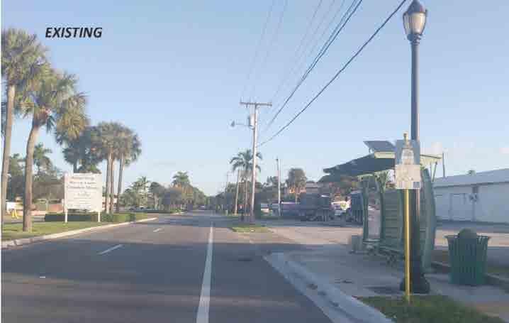
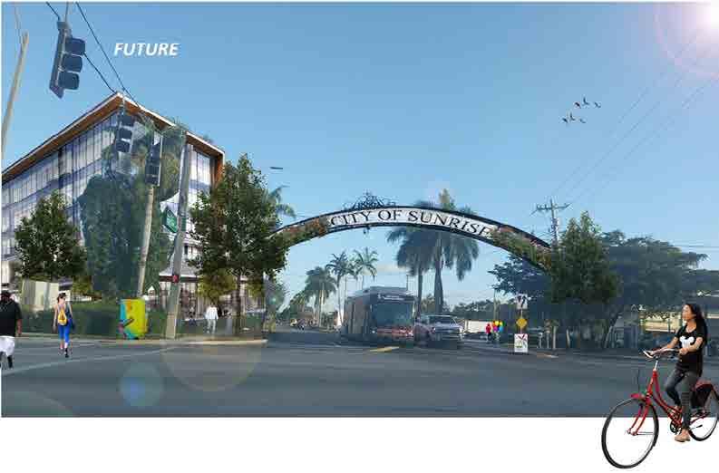
2. driving along Sunset Strip through the new commercial center

3. walking in the Village Center and
4. heading towards the new Plaza along a paver walkway closed for an event.
S Sunset Strip gateway at Sunrise Boulevard existing conditions S Sunset Strip gateway at Sunrise Boulevard enhancements example S Sunset Strip existing conditions S Sunset Strip enhancements example1 2
50 | EAST SUNRISE IMPROVEMENTS MASTER PLAN
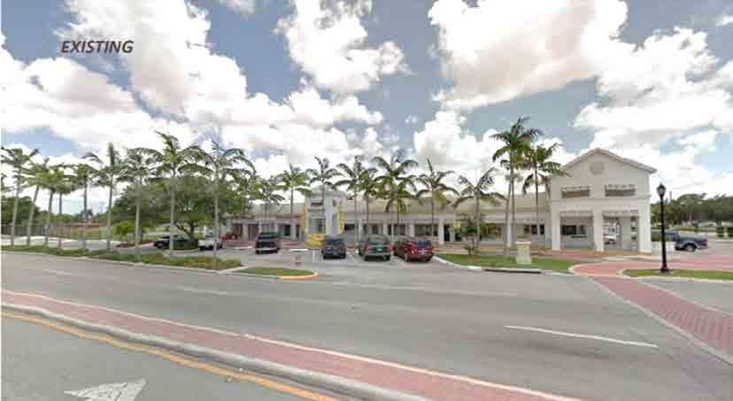


VILLAGE CENTER
S Village Center existing conditions
S Village Center enhancements example
S NW 68 th Avenue existing conditions
S NW 68th Avenue enhancements example
3 4 51 | EAST SUNRISE IMPROVEMENTS MASTER PLAN
VILLAGE CENTER
Recommendations
CHARACTER & PHYSICAL IDENTITY RECOMMENDATIONS
• Invest in Street Elements to Define the Area: Invest in unique streetscape elements including special lighting with locations for banners, improved bus shelters, wayfinding signs, banners, and street furnishings.
• Develop the New Public Plaza: Design and build the proposed public plaza between the recreation center and civic center and include the following components into the design: moveable seating, electric outlets for food kiosks and vendors, and wiring for a sound system. Name the plaza as part of overall branding efforts.

• Enhance the Gateways at NW 68th Avenue/Sunset Strip: include improvements to the new traffic circle, the existing structures at NW 68th Avenue, and the Civic Center site. Use public art in round-a-bout, special lighting, create a community garden, and incorporate youth projects as part of the improvements.

• Invest in Public Art: Create a public art plan for the area that includes locations for both permanent and temporary installations. Consider murals on some City structures and use competitions for major works in traffic circles. Engage youth and seniors in the public art efforts. Make sure the art is lighted at night. Include the existing fountain area in the plans for public art. Use public art as part of key crosswalks.
ACTIVITIES RECOMMENDATIONS
• Host Temporary Vendors to Create Activity: Create regular and themed events to activate the parking areas of the commercial plazas by permitting temporary vendor structures/tents/kiosks up to the sidewalk that include food, arts/crafts, live music, and food trucks. Amendments to loosen regulations for food trucks could be considered. Use the City Park on-street parking area as a site for events as well.
• Hold Special Events: Expand themed community events such as farmers’ markets, food trucks, movie nights, Caribbean nights, outdoor salsa, neighborhood Olympics, domino championships, and reggae nights.

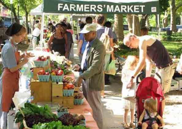
EXISTING
POTENTIAL
W Potential City Park Improvements S Example of community farmer’s market – potential community activity within the “Village Center” S Example of food trucks community event – potential activity along City Park angled parking area and/or proposed new civic plaza52 | EAST SUNRISE IMPROVEMENTS MASTER PLAN
REGULATORY RECOMMENDATIONS
• Create Form Based Code: Create a form-based code (FBC) to dictate building placement to street edge, neighborhood buffers, architectural character, signage, parking, and landscaping, particularly on the north side of Sunset Strip between NW 70th and NW 64thAvenues. Allow for mixed use.
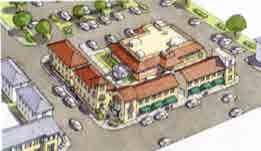
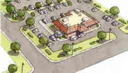
• Create Cohesive Design Guidelines that are Graphically Depicted: Facades, business signage, lighting, and landscaping. Connect disparate plazas visually as a single location with color. Include distinctive architectural features (e.g. Caribbean)
• Include CPTED (Crime Prevention through Environmental Design): Require enhanced CPTED design review for public and private projects.
• Regulate Trash: In addition to new dumpster program, consider a trash compactor program. They are more conducive to retail areas.

MOBILITY RECOMMENDATIONS
• Invest in Infrastructure Improvements: Add additional shade trees (carefully coordinated with lighting), and add flowers and flowering shrubs at key points in the right of way (R.O.W.).
• Create a Safe Routes to School Plan: Consider improvements that will promote and highlight the safety of students walking and biking to school, and promote the route as a quality of life element for the area.
• Increase Bike Presence: Explore a bike share program for the area and add more bicycle racks. Create better bike connections to the Village Center along both NW 64th and 68th Avenues.
• Consider a Pedestrian Bridge across the Canal: Connect to the current PPG site when the site is redeveloped.
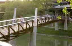
• Explore Shared Parking Arrangements: Explore options with area institutions including churches and schools. Consider entering into a short or long term lease arrangement for a nominal fee to provide public parking for events and activities held on Sunset Strip.
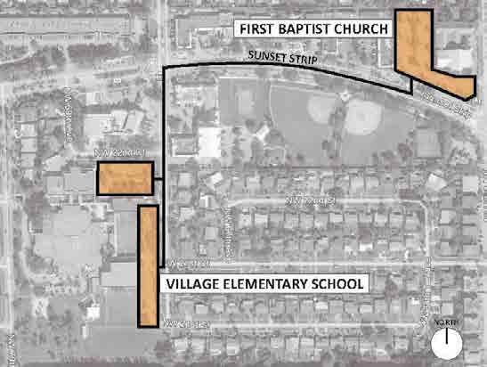
• Explore a Local Transit Route: Transit ridership may increase over time, so consider a shared route along Sunset Strip between University Drive and Sunrise Boulevard with a frequency of no more than 15 minutes and stops at the Village Center, Commercial Center, and both major gateways. Consider drawing residents from Sunrise Lakes and Waterbridge communities.
VILLAGE CENTER
S Example of suburban code with parking in the front of retail. Source: Retrofitted drive-through retail site. Image credit: Sprawl Repair Manual by Galina Tachieva of DPZ CoDesign
S Example of painted trash compactor. Northwood Village, West Palm Beach, FL
S Potential locations for shared parking on special events
S Example of main street trolley. Doral Trolley
S Example of form-based code with building along the street edge. Source: Retrofitted drive-through retail site. Image credit: Sprawl Repair Manual by Galina Tachieva of DPZ CoDesign
S Example of clear span pedestrian and bikeway bridge connection over canal
53 | EAST SUNRISE IMPROVEMENTS MASTER PLAN
VILLAGE CENTER
IDENTITY & BRAND RECOMMENDATIONS
Create a “Real Faces, Real Places” Campaign: Below is a detailed sample process involved in branding an area such as Village Center using existing people and assets from the community. A variation of a “Real Faces, Real Places” Campaign can be created for Village Center.
1. Define the area “feeling” with descriptive words and photography resulting in visual depictions and descriptions of the area (usually using banners).
• Inventory and categorize the existing merchandise mix and identify target business types to fill vacant shops and to fill the gap and enhance the current merchandise mix.
• Determine the number of banners needed based on district boundaries, pole count, and number of business categories. Usually 12 to 18 different banner styles will be necessary to showcase restaurant, retail and service offerings in a district along with welcome banners at the district entry points.


• Host a workshop with business/property owners to select words that describe the area (i.e. stylish, eclectic, trendy, welcoming, etc.) Business/property owner participation ensures consensus and brand ownership.
• Hire a professional photographer to photograph business owners in their shops, interesting items in shops and restaurants, and anything that matches the descriptive words selected during the workshop. In most districts, not every business owner can be featured on pole banners, so using a professional photographer who artistically selects the business owners that most effectively represent all business owners in that category is a fair and impartial way of determining the “faces” that are used. It is important to note that no business name goes on these banners, only images that collectively represent the area as a whole.
• Finalize banner designs and install.

2. Walker’s guide, district app and/or district website.
• Using the photography and descriptive words, business inventory and categories, develop a printed “walkers guide” for the district. (These guides can be printed annually and include a disclaimer that new businesses may have opened in the district since the last printing.)
• Distribute the guides to all area businesses so they can easily cross promote their business neighbors and to area hotels or other locations that will accept distribution.
• Create a temporary parking lot map sign matching the walkers guide to help new visitors find destinations. The temporary sign will be replaced in later phases of redevelopment, when permanent parking lots and/or structures are completed with permanent wayfinding systems.
• Develop an app or website for the district utilizing the photography, descriptive words and business guide. Each business listed on the guide can have a link to their business websites.
3. Host a district brand launch event.
• During a regularly scheduled art walk or other event, unveil the “Real Places, Real Faces” district campaign
• Follow all typical announcement procedures such as press releases, social media announcements and advertisements, email blasts, etc.
S Example of themed banners with “real faces” from local area. Northwood Village and Mount Dora, FL S Example of themed banners, main street54 | EAST SUNRISE IMPROVEMENTS MASTER PLAN


VILLAGE CENTER
S Example of branded communications and walker’s guide. North Miami, FL
W Example of creative design and campaign launch. Oakland Park, FL
55 | EAST SUNRISE IMPROVEMENTS MASTER PLAN
COMMERCIAL

CENTER The Commercial Center is destined to become an anchor for business and employment at the Sunrise Boulevard Gateway, as well as provide for an activated yet pedestrian friendly conduit to the Village Center. The comfortable neighborhood scale of the buildings creates an attractive environment that will give rise the new image of this east Sunrise neighborhood. Commercial Center Current Conditions Analysis EXISTING GEOGRAPHIC CONDITIONS CHARACTER & PHYSICAL CONDITIONS ACTIVITIES REGULATORY CONDITIONS MOBILITY CONDITIONS IDENTITY & BRAND CONDITIONS Commercial Center Vision Commercial Center Recommendations CHARACTER & PHYSICAL RECOMMENDATIONS ACTIVITIES RECOMMENDATIONS REGULATORY RECOMMENDATIONS MOBILITY RECOMMENDATIONS IDENTITY & BRAND RECOMMENDATIONS COMMERCIAL CENTER AERIAL IMAGE Commercial Center Current Conditions Analysis EXISTING GEOGRAPHIC CONDITIONS Location: Sunset Strip between NW 14th Avenue and Sunrise Blvd. Size: +/-42 acres and Sunset Strip corridor stretches 0.30 miles/ 6.5-minute walk 56 | EAST SUNRISE IMPROVEMENTS MASTER PLAN
CHARACTER & PHYSICAL CONDITIONS
Considered to be the primary gateway to East Sunrise, this area has a predominate mix of small commercial businesses, office buildings, gas stations, a suburban style strip mall, liquor stores, Sunrise Golf Village Park, and limited multifamily residential. The large strip center east of Sunset Strip, and the Walgreens parcel west of Sunset Strip at the entrance to the neighborhood are discussed in more detail in the “Gateway “ section of this plan. Therefore, references to those parcels are largely limited to their connection and impact to the Commercial Center in this portion of the document.

The Commercial Center is a significant business/employment location populated primarily by either large retailers or small businesses. The structures have a suburban style site orientation, with most of the parking lots fronting the main roadways. The majority of the buildings are one or two stories in height. Adjacent residential areas are primarily single story and single family, although walk up apartments exist to the north of NW 11th Street. The transition from the commercial uses on NW 11th Street to the residential uses across the street is not cleanly defined, creating an incompatible condition with the residential use. In addition, the surface parking on the commercial properties has no curb and no sidewalk to separate the parking from the street; this creates a dangerous pedestrian situation.
Although Sunset Strip at both Sunrise Boulevard and NW 14th Street are considered entry points to this community, no gateway features are currently present to let the public know they are entering a unique place in East Sunrise. Similarly, no wayfinding signage exists, and street name signs are difficult to read in some areas. The proximity of the park to several liquor/beer stores contributes to public drinking, as do the park’s comfortable benches.

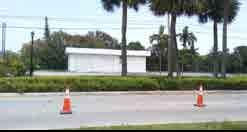
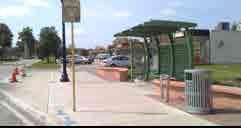
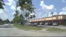
NOTE: There is an entire section of this plan dedicated to the gateway area at Sunset Strip and Sunrise Boulevard with additional emphasis on the real estate redevelopment of those parcels.

COMMERCIAL CENTER
S Sunrise Village Golf Park and Mama’s Kitchen. There is a potential to have a commercial active use adjacent to an open public space
S Shopping along Sunset Strip
S Former Gas Station Site along Sunset Strip
S Commercial at Sunset Strip and NW 14th St
S Bus Stop and Shelter at Sunrise Village Golf Park
S Former Walgreens Site
57 | EAST SUNRISE IMPROVEMENTS MASTER PLAN
COMMERCIAL CENTER
ACTIVITIES
Most activity occurring during the daytime is part of the daily business operations, although there are a few restaurants, a 24-hour laundromat, and convenience and liquor stores that remain open late. Nearby residents reported loitering and public drinking in the park and on vacant properties nearby. There are one or two small events in the Golf Village Park each year. Very little pedestrian activity occurs. Negative activity includes drug use/sales and fights.
REGULATORY CONDITIONS
The current conditions of landscaping, signage, dumpster enclosures, and lighting suggests a need for better standards and enforcement. For the most part, the existing zoning is B-2 Community Business District. This does not allow for mixed-use projects which would help add residential uses to second or third floors facilitating infill development and re-use of some existing structures.
As mentioned above, the commercial and residential incompatibility on NW 11th Street is an issue, therefore additional buffers and/or street trees should be required for any future redevelopment of these parcels.
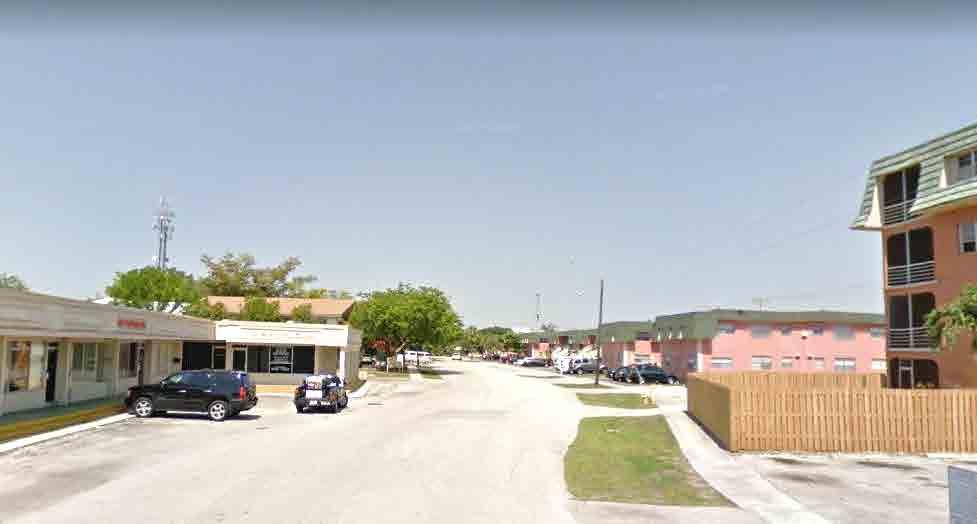
MOBILITY CONDITIONS
Bus shelters and surrounding areas are dark at night and invite loitering. In addition, the bus shelters don’t appear to provide adequate protection from the elements which effect quality of life. New bike lanes and generally good sidewalk lighting promote walking/biking.
Parking for many smaller sites is limited, and some businesses reported that this lack of parking is harming their operations and opportunities to grow. Additionally, there is a general lack of drive aisle connections between sites.
IDENTITY & BRAND CONDITIONS
The tired and deteriorated aesthetics are likely impacting community pride and creating a negative perception of the area in general. This impacts the real estate market potential on the vacant parcels, especially for real estate and market investors that need to believe their investment will be secure and successful. The condition of the commercial uses, the vacant buildings, lack of landscaping, and the vacant lot behind Walgreens, all contribute to the blighting image as one enters the neighborhood. Sunrise Golf Village Park also has a negative impact on the brand/ identity of the area. An immediate message needs to be defined for this portion of the city that repositions the area as an attractive place to invest.
S NW 11th Street incompatibility between commercial and residential uses58 | EAST SUNRISE IMPROVEMENTS MASTER PLAN
Vision
As a major business and employment district at the edge of an exciting and walkable neighborhood, this area will attract private developers and businesses who will upgrade existing properties and build attractive new residential, live/work and retail projects. The larger gateway parcels will attract large scale redevelopment investors that are ripe for public-private partnerships (P3s). A new vibrant entry point for east Sunrise, complete with major public realm gateway features like public art, innovative signage, and active uses will activate the area. The activated and pedestrian friendly Sunset Strip will transition to the nearby homes and improve the image of the residential neighborhood.
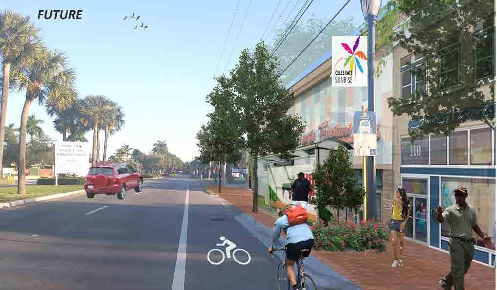
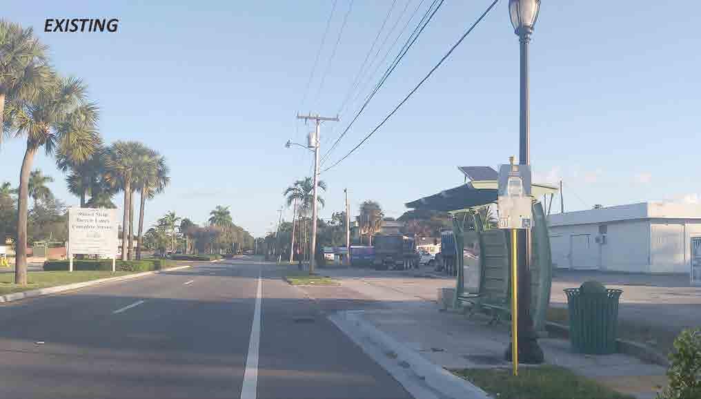
COMMERCIAL CENTER
S Sunset Strip existing conditions
S Sunset Strip enhancements example
59 | EAST SUNRISE IMPROVEMENTS MASTER PLAN
COMMERCIAL CENTER
Recommendations
CHARACTER & PHYSICAL RECOMMENDATIONS
• Invest in Street Elements to Define the Area: Invest in unique streetscape elements including special lighting, banners on existing light poles, improved bus shelters, wayfinding signs, and street furnishings along Sunset Strip between Sunrise Boulevard and NW 14th Street. (Gateway elements further defined in Gateway section of the plan)
• Add Public Art: Integrate public art into public and private projects
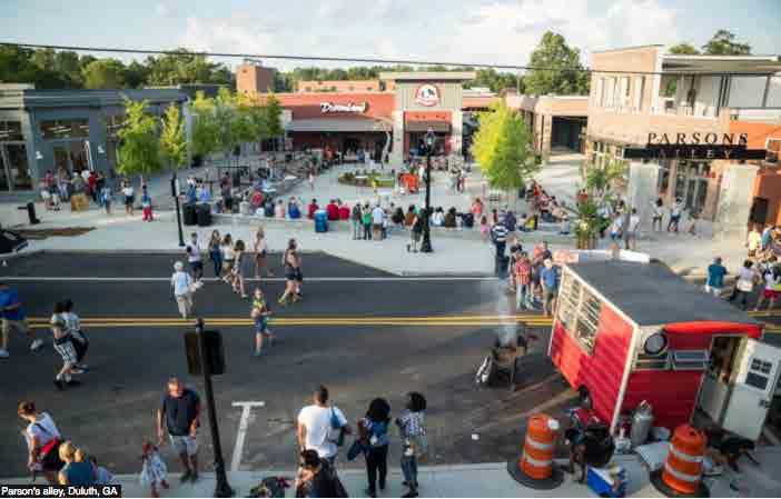
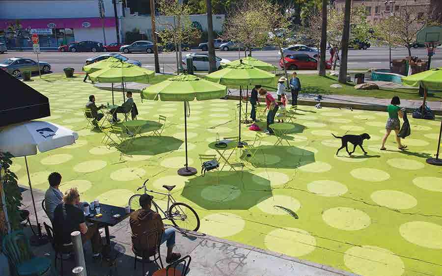
• Long term – Consider Undergrounding Utilities: The visual blight of utility lines is stronger at gateways. Any future street or right of way improvements should consider undergrounding them between Sunrise Boulevard and NW 14th Street at a minimum.
• Activate the Dormant Existing Sunrise Golf Village Park: Add activities and welcoming elements to the green space per the example photo. Coordinate with the retailer (Mama’s Kitchen) to open up the business for café tables to the new plaza.
S Example of interactive public plaza – Los Angeles people streets archpaper S Example of community gathering. Parson’s Alley Activation. Source: Public Square, Duluth, GA60 | EAST SUNRISE IMPROVEMENTS MASTER PLAN
ACTIVITIES RECOMMENDATIONS
• Host Monthly Neighborhood Gatherings for Residents and Business Owners: The goal is to build community trust and involvement in firmly establishing this area as the gateway area undergoing revitalization. Include a food element (food trucks or pop up tents) and set up a tent or booth with City and community residents staffing the booth. City produced materials should be handed out with images of the vision including restored buildings and public realms (sidewalks, landscaping etc.) Add bullets encouraging pride and ownership of the area. Use “Keep Our Gateway Clean” or “Watch us Grow”, or other promotional and motivational messages.
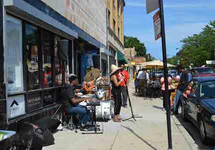
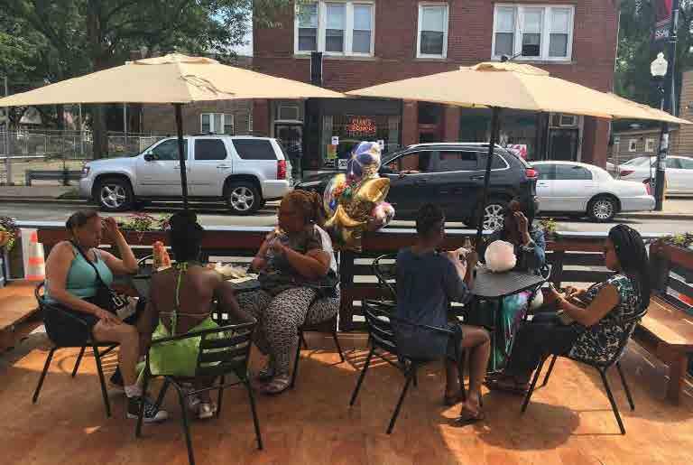
• Mimic the Pompano Proud Mission Statement: Residents who form an alliance through neighborhood improvements work together on a regular basis.

COMMERCIAL CENTER
S Neighborhood Engagement
61 | EAST SUNRISE IMPROVEMENTS MASTER PLAN
COMMERCIAL CENTER
REGULATORY RECOMMENDATIONS
Utilize a Form-Based Code to redevelop parcels: Create regulations to produce zero-setback, small scale, mixed-use neighborhood commercial developments; requirements for open space; 3-6 stories height limits; ground floor retail and offices/live-work; sidewalk dining opportunities; enhanced pedestrian lighting; and parking in the rear or on the street where feasible. Include enhanced minimum lighting requirements for parking areas. Along Sunset Strip, require residential balconies in mixed-use or live/ work buildings large enough for comfortable seating as a way to activate the street.
• Identify Staff Liaison: Contact property owners and act as liaison for redevelopment of the vacant or opportunity sites.
• Create Cohesive Design Guidelines: Facades, business signage, lighting, and landscaping. Include distinctive architectural features (e.g. Caribbean).
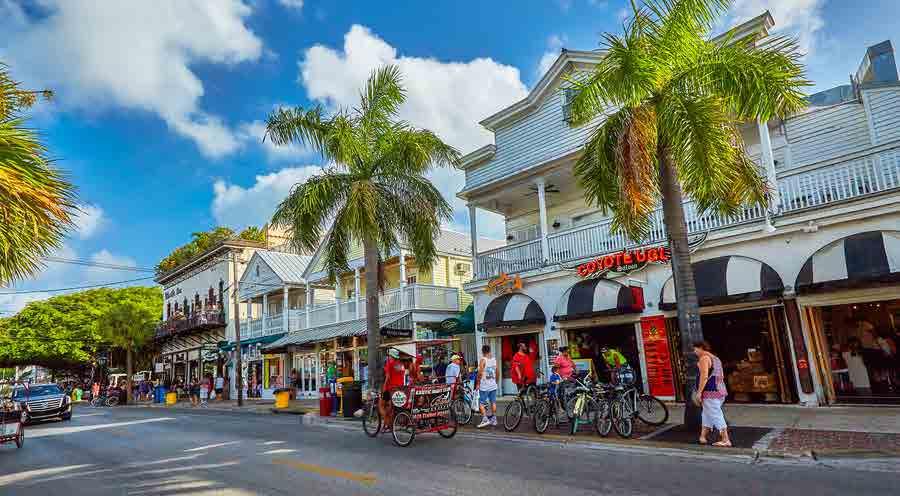
• Include CPTED (Crime Prevention through Environmental Design): Require enhanced CPTED design review for public and private projects.
• Regulate Trash: Prepare guidelines for disposal and dumpster enclosures. Launch an outreach campaign to educate property owners on dumpster regulations and maintenance. Consider implementing a code program similar to the City of Chattanooga, Tennessee called “DeCode Day”, an economic development initiative that aims to promote safety, beautify neighborhood blocks, and strengthens community relationships.
See links for more information:
Z Link to video: https://youtu.be/9hqjAkfx8Ic
Z Links to City Website: http://www.chattanooga.gov/economic-community-development/neighborhood-services/ code-enforcement http://www.chattanooga.gov/economic-community-development/neighborhood-services/ department-programs
Z Links to Article: https://www.chattanoogan.com/2015/10/12/310244/City-Of-Chattanooga-Announces-First. aspx
https://noogatoday.6amcity.com/city-volunteers-to-restore-2-streets-in-inaugural-decodeday/
S Two story mixed-use commercial center example. Image Credit: Coastal Living. Key West, FL62 | EAST SUNRISE IMPROVEMENTS MASTER PLAN
MOBILITY RECOMMENDATIONS
• Clearly Delineate Crosswalks: Each crossing should be defined. This will emphasize the pedestrian presence and help mitigate the large setbacks of the commercial buildings.
• Improve Bus Stop Amenities with Bus Shelters: Provide weather protection/shade, signage, wayfinding maps, trash receptacles, lighting, and landscaping.

COMMUNITY IDENTITY & BRAND RECOMMENDATIONS
• Piggyback on Brand Material from the Gateway and Village Center Brand Sections of this Plan: For this district, highlight the entrepreneurial culture and opportunities.
• Name or Rename Open Spaces and Parks: This can help support overall branding efforts.
COMMERCIAL CENTER
S Example of artistic neighborhood bus shelter
W Example of “themed” light pole banners 63 | EAST SUNRISE IMPROVEMENTS MASTER PLAN
SUNSET
Sunset Strip serves as the spine of
The key
with the Village Center at the heart of the
or
to
occur at
and University Drive, therefore, these gateways play a major role in how the public views the east Sunrise community. An aggressive and laser focused effort to redevelop and improve these gateways will significantly alter and enrich the city’s


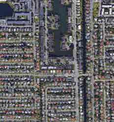
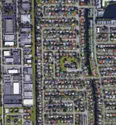
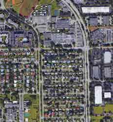


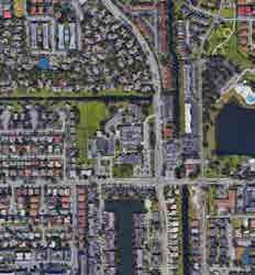
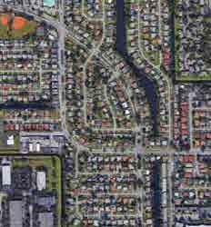
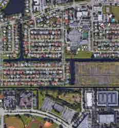
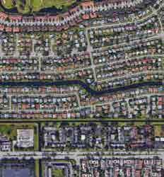
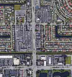

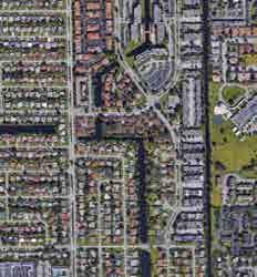


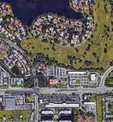


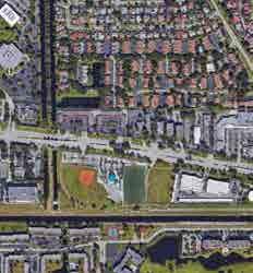
STRIP GATEWAYS
east Sunrise
community.
entry points
gateways
east Sunrise
Sunrise Boulevard
image. A. SUNRISE BOULEVARD GATEWAY Sunrise Boulevard Gateway Current Conditions Analysis EXISTING GEOGRAPHIC CONDITIONS CHARACTER & PHYSICAL CONDITIONS ACTIVITIES REGULATORY CONDITIONS MOBILITY CONDITIONS IDENTITY & BRAND CONDITIONS Sunrise Boulevard Gateways Vision Sunrise Boulevard Gateways Recommendations CHARACTER & PHYSICAL RECOMMENDATIONS ACTIVITIES RECOMMENDATIONS REGULATORY RECOMMENDATIONS MOBILITY RECOMMENDATIONS IDENTITY & BRAND RECOMMENDATIONS SUNSET STRIP SUNRISE BLVD OAKLAND PARK BLVD UNIVERSITY DR Sunrise Boulevard Gateway Current Conditions Analysis EXISTING GEOGRAPHIC CONDITIONS Location: Entry or gateways of Sunset Strip at Sunrise Boulevard and University Drive SUNSET STRIP GATEWAYS AERIAL IMAGE 64 | EAST SUNRISE IMP ROVEMENTS MASTER PLAN
CHARACTER & PHYSICAL CONDITIONS
As discussed in the previous section (Commercial Center), the existing parcels that represent the visual introduction to the east Sunrise neighborhood need to change.
There is room in the public right of way for gateway features, however, unless the private parcels are upgraded and/or change use substantially, there will not be adequate impacts to truly improve the tired and dated perception of the area. Aesthetically pleasing entryways will create a strong sense of pride and begin to change the image of the area. This is imperative to prompt private investment to occur. The private parcels also present a tremendous opportunity to reposition this area as an up and coming neighborhood with a distinct character. The retail strip center and standalone parcel anchoring the gateway can either be renovated or upgraded, or they could be completely redeveloped into higher and better uses. For the purposes of this plan, the conditions and recommendations will look at both options.
In the meantime, it is still recommended to show sample entry or gateway features to the community to begin dialogue on preferences related to gateway design features and imagery.
REGULATORY CONDITIONS
The two private properties that frame the gateway deserve a distinct assessment for redevelopment and design options on both the public right of way, and the private parcels.
Existing site designs and configurations on the privately owned parcels are driven from decades old development patterns that promoted large surface parking areas along major corridors, in this case, Sunrise Boulevard. The parking conditions even enable cars to park directly facing Sunrise Boulevard with no buffer or transition to the sidewalk for the parcel east of Sunset Strip. It also appears that the surface parking areas, including some of the residential properties behind the commercial, are not well maintained creating a blighting effect. The impact is amplified due to the massive amounts of asphalt.
The opportunity exists for the city to position this area as ripe for redevelopment and apply certain incentives to renovate or completely redevelop the existing buildings, and to attract new development to vacant parcels. A targeted approach to the redevelopment of the parcels combined with an in-house economic point of contact could attract interested development partners. Although there are major development opportunities on the large parcels closer to Sunrise Boulevard, it’s not likely the smaller vacant parcels along Sunset Strip will convert to successful retail or mixed-use until there are upgrades on the gateway sites.
Action needs to be taken to ward off incompatible uses that won’t contribute to repositioning the area as up and coming. A zoning in progress should be considered if existing zoning allows for these uses that are identified under the recommendations section.
MOBILITY CONDITIONS
There are sidewalks that wrap the corners of Sunrise Boulevard on both sides of Sunset Strip enabling people to easily walk from the main Boulevard down Sunset Strip. The actual crossing of Sunset Strip is less defined however, even though there are crosswalk markings. The large royal palms give a stately entrance on the west side and in the median, however it feels lopsided when looking north since there are only shade trees on the east side of Sunset Strip.
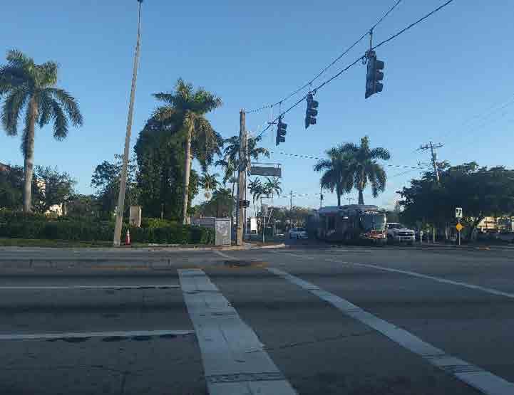
As part of the gateway design, the physical crossing can be designed to maximize pedestrian crossings. However, it is not anticipated that the right of way would need to be reconfigured in any significant way to improve mobility and access.
IDENTITY & BRAND CONDITIONS
The biggest deterrent to east Sunrise is the image upon entering the area on Sunset Strip at Sunrise Boulevard.
SUNSET STRIP GATEWAYS
W
Sunset Strip at Sunrise Boulevard existing crosswalk. Opportunity to improve crosswalk with textured/ colored pavers 65 | EAST SUNRISE IMPROVEMENTS MASTER PLAN
SUNRISE BOULEVARD GATEWAY

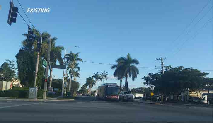
Vision
This area will be the focal point of the city’s new brand for a diverse and desirable, walkable mixed-use neighborhood. The enhanced gateway will welcome people to a very special part of east Sunrise and instantly instill a sense of place with nicely designed buildings and attractive facades. The pedestrian will feel comfortable walking from Sunrise Boulevard down Sunset Strip. Ground floor retail will be active and draw pedestrians to the buildings with residential uses above the buildings as they redevelop. Second floor balconies and higher will become “eyes on the street” and engage residents with the activity below.
Recommendations
A strong recommendation is made to create an organizational structure that ensures there are technically skilled team members (both in house and with consultants) to assist in the real estate aspects of this strategic area of focus.
CHARACTER & PHYSICAL RECOMMENDATIONS
• Begin Design on an Architecturally Significant Gateway Feature: Even though there is more opportunity for gateway options with a redevelopment concept that includes the private parcels, a spotlight can shine on the area as a targeted redevelopment area in the meantime. It will generate excitement when the City makes a bold statement by proposing public improvements to the gateway. Include paver or stamped concrete crosswalks, bold lighting, public art, and an architectural element.
• Create an Exciting “Vision Board”: The entryway parcels that open the possibility for the entire area to become “Mixed-use” can be prominently promoted. Even though the parcels are currently zoned B-3 General Business District, and current property owners might not be willing to sell or change use right now, the vision can be defined to include other options. A higher and better use for the parcels is mixed-use if they were to redevelop. Adding residential to the neighborhood would also increase the disposable income which in turn would help retailers.
• Use the Opportunity Site analysis for Walgreens to Promote Redevelopment: Encourage the property owners to either sell and or redevelop the sites. Contact property owners of the vacant land and Walgreens to coordinate a cohesive approach to redevelopment of the sites. Use the approach to reposition the area as an investment location. The overall brand message is “opportunity for redevelopment”. Contact the strip center property owner as well to promote redevelopment options.
S Sunset Strip gateway at Sunrise Boulevard existing conditions S Example of an exciting gateway sign proclaiming “Gateway to the World’s Greatest Wild Bird Refuge” and a historic downtown that visitors say is quite charming. Photo by: Utah Public Radio. Brigham City, UT S Sunset Strip gateway at Sunrise Boulevard enhancements example66 | EAST SUNRISE IMPROVEMENTS MASTER PLAN
ACTIVITIES RECOMMENDATIONS
• No activities need to be planned per se in addition to those planned under the Commercial Center recommendations. Add information to any promotional materials handed out at events or gatherings that show what the larger vision is.

REGULATORY RECOMMENDATIONS
• Consider a Zoning in Progress: This is needed to limit undesirable and incompatible uses that don’t meet the goal of a mixed use district such as gas stations, standalone single uses, convenience stores, check cashing stores, etc. Mixed-use zoning should ensure people move through an area visiting multiple spaces, and should promote walkability and accessibility between parcels and areas. Uses that are single use destinations such as grocers or banks can on a limited basis, be integrated into a larger project.
• Consider Creating a Zoning District that Provides Density Bonuses: A density bonus for these two gateway sites could be used to prompt a larger scale, mixed-use project to attract residential uses above commercial, restaurants and retail. A concerted effort to have a brewery on the ground floor is recommended.

• Create an Incentive Program that Supports a P3 Concept: Such Public Private Partnerships enable the city to provide public support including but not limited to: parking structures, right of way improvements, land assemblage assistance or monetary assistance to facilitate a certain type of development.
MOBILITY RECOMMENDATIONS
• Continue to position Sunset Strip as a Complete Street: Use textured/colored pavers or similar notable treatments in the crosswalks at each gateway.


• Add Exit-Wayfinding Signage at Each Gateway: Signs should point visitors to nearby expressways including the Florida Turnpike, Sawgrass Express way, I-95, or I-75. They should be easily visible at night.
• Consider Street Name Signs That are Architecturally Significant: Ensure Sunset Strip signs along Sunrise Boulevard and University Drive are lighted and placed on both sides of the intersection.
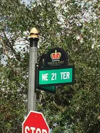
SUNSET STRIP GATEWAYS
S Example of mixed-use project with density bonus. Fort Lauderdale, FL
S Example of crosswalk improvements with textured/ colored pavers. Photo by: Denver Urbanism
S Example of crosswalk improvements with abstract painting by Carlos Cruz-Diez. Miami, FL
W Example of branded street sign. Imperial Point
S Example of crosswalk improvements with textured/ colored pavers. Quebec, Canada
S Example of wayfinding signage. Elk Grove, CA
67 | EAST SUNRISE IMPROVEMENTS MASTER PLAN
SUNRISE BOULEVARD
IDENTITY & BRAND RECOMMENDATIONS
• Create a Visionary and Themed Marketing Collateral Piece: Use the interim and long term vision for the area to produce a marketing piece that shows the redevelopment opportunity on vacant or underutilized properties. Marketing packets should include: a letter from the Mayor saying this area is a strategic area of focus for redevelopment: a map showing vacant parcels with site details such as square footage; a general piece about the City’s overall progress, and a contact for the person that will be in charge of the redevelopment of this area.
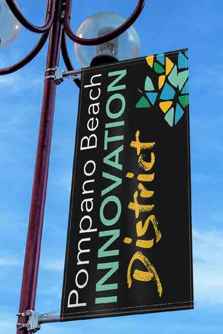

• Create a Web Presence on the City Website: Highlight the Sunrise Gateway area. The information can mimic the marketing pieces referenced above.
 S Example of Downtown Branding. Pompano Beach, FL
GATEWAY 68 | EAST SUNRISE IMPROVEMENTS MASTER PLAN
B. UNIVERSITY DRIVE GATEWAY
University
Conditions
CHARACTER & PHYSICAL CONDITIONS REGULATORY CONDITIONS
MOBILITY CONDITIONS
IDENTITY & BRAND CONDITIONS
University
CHARACTER & PHYSICAL RECOMMENDATIONS
REGULATORY RECOMMENDATIONS
MOBILITY RECOMMENDATIONS
IDENTITY & BRAND RECOMMENDATIONS
University Drive Gateway Current Conditions Analysis
CHARACTER & PHYSICAL CONDITIONS
The Sunrise Boulevard and University Drive gateways differ in two significant ways. From a design standpoint, University Drive has a four-way intersection with major traffic and activity on all four quadrants, whereas Sunrise Boulevard has a little relief from the congestion, hardscape and building mass with the canal and greenway running parallel to the street. Second, the parcels that anchor University Drive at Sunset Strip are not as deteriorated and integrate more seamlessly into the quadrant. The large strip center on University Drive does not offer the same type of redevelopment opportunities however, especially as a mixed-use project.
The similarity is that both commercial strip centers have a profound impact on pedestrians due to the volume of cars that traverse the centers.
This intersection also has some room on the public right of way for gateway features. Aesthetically pleasing entryways will create a strong sense of pride for this neighborhood as well and will begin to frame the street better. The private parcels at the gateway do not present the same opportunity to reposition the area or define it with a distinct character as those on Sunrise Boulevard.

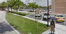
REGULATORY CONDITIONS
The commercial properties that frame the gateway are zoned for commercial use and should remain as such. Like Sunrise Boulevard, the site designs and configuration on the privatelyowned parcels are driven from decades old development patterns that promoted large surface parking areas along major corridors. Stand-alone buildings on the corner are a more recent development pattern, and by giving up parking spaces for “outparcels” the leasable space on the site increases which in turn increases the value of the site. The parking conditions enable cars to park directly facing University Drive with a tiny landscape buffer or transition to the sidewalk.
MOBILITY CONDITIONS
There are sidewalks that wrap the corners of University Drive on both sides of Sunset Strip enabling people to easily walk from the main Boulevard down Sunset Strip. The large royal palms in the median give a stately entrance.
As part of the gateway design, the physical crossing can be designed to maximize pedestrian crossings. However, it is not anticipated that the right of way would need to be reconfigured in any significant way to improve mobility and access.
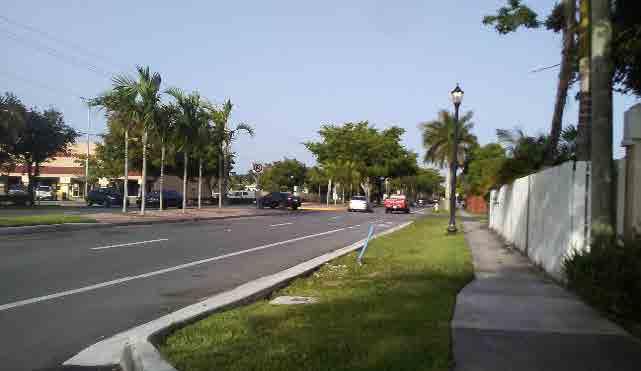
SUNSET STRIP GATEWAYS
Drive Gateway Current
Drive Gateway Vision University Drive Gateway Recommendations
S Sunset Strip Complete Streets at University Drive going towards Village Center. Opportunity to enhance as gateway entry.
S Sunset Strip at University Drive large suburban strip center with parking along the street edge and bus stop missing shelter and bench. Opportunity to improve bus stop with shelter, bench, and community identity branding.
S Sunset Strip at University Drive auto oriented streetscape. Opportunity to improve crosswalks and branding.
69 | EAST SUNRISE IMPROVEMENTS MASTER PLAN
UNIVERSITY DRIVE GATEWAY
IDENTITY & BRAND CONDITIONS
University Drive gateway does not pose quite the same image problem as the Sunrise Boulevard entrance. However, there is still the need to “brand” the area using the gateways.
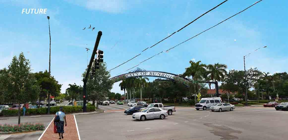

Vision
The vision for this gateway is to create a landmark that will capture the attention a large number of people and attract them to Sunset Strip Village Center
CHARACTER & PHYSICAL RECOMMENDATIONS
• Begin Design on an Architecturally Significant Gateway Feature: Even though there is not the same emphasis on redevelopment of the private parcels, the same spotlight can shine on the area as a strategic area of focus in the meantime. It will generate excitement when the City makes a bold statement by proposing public improvements to the gateway. Include paver or stamped concrete crosswalks, bold lighting and an architectural element.
• Contact Property Owners of the Gateway Parcels to Form Relationships: At some point, the larger center may want to consider redevelopment options. Use the approach of repositioning the area as a prime investment location during discussions.
S Sunset Strip gateway at University Drive existing conditions S Sunset Strip gateway at University Drive enhancements example70 | EAST SUNRISE IMPROVEMENTS MASTER PLAN
REGULATORY RECOMMENDATIONS
• Create a Zoning Compliance Period: Change the zoning to ensure compliance within a 5/10-year period for those issues that are having a negative impact on the gateway, including parking lot renovations that bring the lot into compliance with buffers or vehicular setbacks, landscaping and lighting requirements, etc.
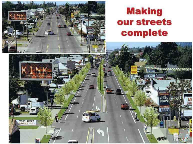
• Provide Flexible Parking Regulations for Development of Outparcels: New uses on outparcels will update the character of the site and should be encouraged.
MOBILITY RECOMMENDATIONS
• Continue to Position Sunset Strip as a Complete Street: Use textured/ colored pavers or similar notable treatments in the crosswalks at each gateway.
• Add Exit-Wayfinding Signage at Each Gateway: Signs should point visitors to nearby expressways including the Florida Turnpike, Sawgrass Express way, I-95, or I-75. They should be easily visible at night.
IDENTITY & BRAND RECOMMENDATIONS
• Marketing Packets for Sunrise Boulevard Gateway can Mention University Drive: Highlight that this area is also part of the strategic area of focus to access the Village Center.

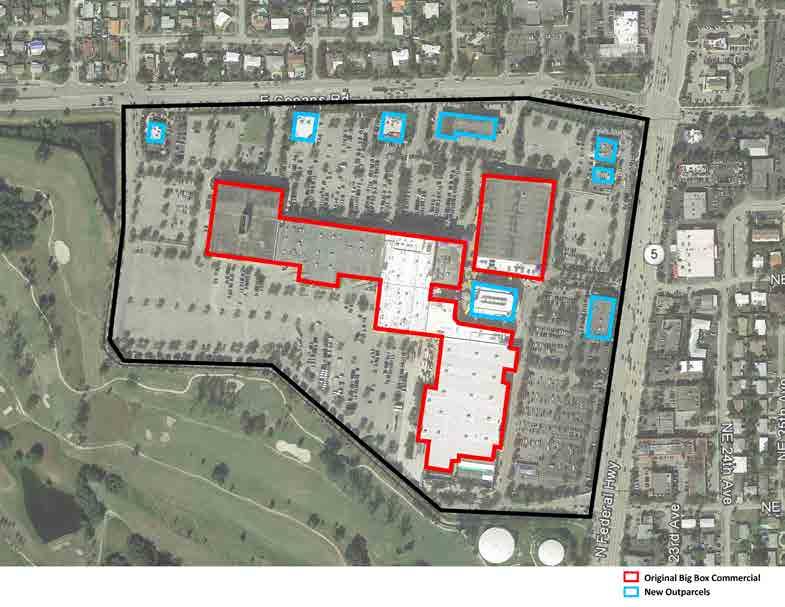
SUNSET STRIP GATEWAYS
S Example of outparcels redevelopment as a transformative tool with building near the street edge. Pompano Beach, FL
S Example of a good major corridor buffer. Photo by: Bikewalklee.blogspot. Lee County, FL
S Example of outparcels redevelopment as a transformative tool. Pompano Beach, FL
71 | EAST SUNRISE IMPROVEMENTS MASTER PLAN
UNIVERSITY DRIVE CORRIDOR AERIAL IMAGE

CORRIDORS
A.
DRIVE CORRIDOR
COMMERCIAL
UNIVERSITY
Current Conditions Analysis CHARACTER & PHYSICAL CONDITIONS ACTIVITIES REGULATORY CONDITIONS MOBILITY CONDITIONS IDENTITY & BRAND CONDITIONS Commercial Corridors Vision Commercial Corridors Recommendations CHARACTER & PHYSICAL RECOMMENDATIONS ACTIVITIES RECOMMENDATIONS REGULATORY RECOMMENDATIONS MOBILITY RECOMMENDATIONS IDENTITY & BRAND RECOMMENDATIONS
72 | EAST SUNRISE IMPROVEMENTS MASTER PLAN
University Drive Corridor Existing Conditions Analysis
CHARACTER & PHYSICAL CONDITIONS
Like many sections of University Drive, this district consists primarily of commercial/retail space in a suburban pattern, with buildings set back behind large parking lots. This includes several long swaths of parking against the sidewalk making the pedestrian experience an intimidating one, especially from the high speed traffic on the roadways. The street is designed for cars to dominate the environment. This of course does not encourage pedestrians and bicyclists to traverse the area. Transit riders find a generally hostile environment waiting for a bus or trolley. Pedestrian connections from the residential areas of east Sunrise are limited, so accessing many of the businesses as a pedestrian or bicyclist is not a comfortable journey. There are very few blocks that provide a green buffer between the cars and the sidewalk, however that configuration is preferable to no buffer.
The main uses along the corridor consist of large big box uses such as Home Depot and Supermarkets, smaller commercial uses such as barber shops and general office, and a large variety of food and beverage options including fast food style.
The corridor has one large vacant site that is ripe for redevelopment (see Opportunity Sites section). At the north end of the district, a 6-story hotel is planned to be converted to an assisted living facility for seniors.
A major waterway (canal) runs east-west in the northern portion of this district, but there are no recreational activities or businesses that take advantage of the view corridors.
Of significance is the imbalance of green space to asphalt along the entire corridor. It’s very unlikely the lanes, or lane widths, will change in the next decade, nor will the commercial oriented uses change short term. In the meantime, creating a balance between asphalt and green/tree canopy is needed.
There are very limited opportunities for full redevelopment of sites, but opportunities exist to develop outparcels in the large parking lots.
ACTIVITIES
Major corridors are not generally conducive to public gatherings like there are on small main streets. However, there needs to be a recognition that large parking lots and other venues offer opportunity for community interaction. One example is a hospital in Ft Lauderdale that uses the parking lot on busy US1 (Federal Highway) for a “pop-up” green market each Thursday from 3:00 – 7:00 PM. It activates the street and creates a sense of place and slows traffic.

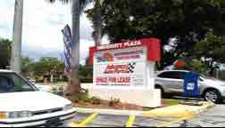
Of significance is the large cluster of diverse international restaurants. This can be capitalized on, not so much as an activity, but as a perceived sense of activity and brand.
REGULATORY CONDITIONS
Current zoning and parking regulations have permitted large sections of parking lots along University Drive to result in an almost abandoned look, with no outparcel development.
COMMERCIAL CORRIDORS
S University Drive existing sidewalk and bicycle lane conditions not conducive for a safe and comfortable environment
S University Drive looking north. This image shows that University Drive is a very wide street, that accommodates many cars, narrow bicycle lanes, with small sidewalks, with lots of space to park, and buildings at setback behind large parking lots
S Local business along University Drive
S Typical strip center at University Drive
S The Home Depot along University Drive. The home improvements store attracts a lot of people to the area. It would be enjoyable to provide that market with friendly and comfortable spaces
S Former car dealership along University Drive
73 | EAST SUNRISE IMPROVEMENTS MASTER
PLAN
UNIVERSITY DRIVE CORRIDOR
MOBILITY CONDITIONS
The most prevalent issue regarding mobility is the continuous interaction of cars and pedestrians, especially at the entryways to the commercial centers. In addition, there is a need to better separate the sidewalk from the roadway.
Bike lanes are on par with the street in terms of elevation, however that’s an uneven hierarchy in terms of safety and mobility. This corridor has the opportunity to introduce a solution to better separate bikes and cars due to the width of the lanes.
IDENTITY & BRAND CONDITIONS
Most major corridors in south Florida lack identity. They are auto oriented, dangerous and unappealing. This street, however, has opportunity to build upon the previous right of way improvements to create an example for other cities to follow in terms of brand and image. There is currently a lack of signage, banners, or special streetscape components to indicate you are “somewhere”.
Vision
With a growing cluster of restaurants highlighting international cuisine, this east Sunrise corridor becomes a recognizable destination for specialty food products and venues. Bright and bold banners signal you have arrived and new green buffers promote the perception of safer walk along the sidewalk. As parcels near the canal redevelop, views to the canal create opportunity for new restaurants. Bicyclists from nearby neighborhoods are finding it easier to go car-free. Lowes and Home Depot are considering the inclusion of outparcel restaurants at their sites. New wayfinding signage connects diners and shoppers to the Village Center in east Sunrise – as does the trolley.
Recommendations
CHARACTER & PHYSICAL RECOMMENDATIONS
• Create Expanded Sidewalk “Green Buffers” with “Bulb Outs” or Pedestrian Areas at Key Nodes for Pedestrian Emphasis: The goal is to clearly promote the pedestrian presence on the street.
• Create an Elaborate Landscaping and Lighting Theme that Promotes an International Food Themed Environment: Incorporate internationally acclaimed public art displays, specialized lighting, and direct pathways to international shops and restaurants. (Capitalize on the physical assets in the area) Fill in medians with appropriate landscaping, not just grass.
• Invest in a Themed Light Pole/Banner Program: One that highlights the many international restaurants or other assets in the corridor.
• Design and Build a Wayfinding Signage System: It should help direct customers to the Village Center, City Park, and the new public plaza.
• Incentivize Suburban Reuse Projects on Large Parcels: These should feel more like lifestyle centers or outdoor malls. An example is adding a small plaza or pop up coffee shop to start the transition and later adding more retail as parking reductions take place.
• Encourage Property Owners to Build Outparcels Near the Sidewalk: Such uses should not have a drive through but should offer outdoor seating.
 Retail Frontage Walkway
S Example of over emphasized pedestrian elements i.e. pavers that meet the street edge. Lauderdale by the Sea.
Retail Frontage Walkway
S Example of over emphasized pedestrian elements i.e. pavers that meet the street edge. Lauderdale by the Sea.
74 | EAST SUNRISE IMPROVEMENTS MASTER PLAN
ACTIVITIES RECOMMENDATIONS
• Invest in an Annual Event: It should include celebrating the collection of international restaurants in this corridor.
• Organize a Monthly Walk, Bike, and Dine: Include dine event discounts for east Sunrise residents.
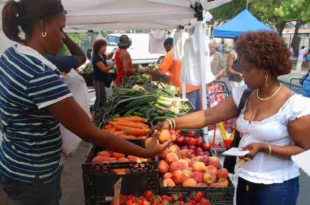
REGULATORY RECOMMENDATIONS
• Incentivize Property Owners to Improve their Property: Work with owners to create regulations to reduce linear parking frontage (green buffer and small or large outparcel development) This may require reducing minimum parking requirements.
• Create a “Major Commercial Corridor” Overlay District Related to Parking Requirements: The increased use of Uber, ride sharing, autonomous vehicles, and other changes to automobile use will open up an opportunity for reuse of existing surface parking areas. The overlay district could provide alternative minimum parking requirements if certain criteria is met to address parking usage.
• Create Enhanced Minimum Lighting Requirements: Focus on parking areas and adjacent sidewalks.
• Create Enhanced Landscaping Requirements: Focus on the sidewalk areas that significantly enhance the pedestrian experience and overall image of the street.
• Enhance Enforcement of Regulations: Focus on trash disposal and dumpster enclosures.
MOBILITY RECOMMENDATIONS
• Dramatically Enhance the Pedestrian Realm along University Drive: Use distinctive pavement to connect sidewalks all the way to the storefronts of commercial plazas. This corridor has the opportunity to introduce a solution to better separate bikes and cars due to the width of the lanes.

• Incentivize or Require Improved Drive Aisle Connections.
• Institute Complete Street Concepts: Continue work with FDOT, Broward County MPO and other agencies to improve roadways according to complete streets principles, including an emphasis on protected bicycle lanes in color coated thermoplastic to improve visibility. The bike lane coating should be done immediately.
• Clearly Delineate Crosswalks: Repaint them if necessary and use public art for crosswalks at the gateway intersection at Sunset Strip.
• Improve Bus Stop Amenities with Bus Shelters: Provide weather protection/ shade, signage, wayfinding map, trash receptacles, lighting, and landscaping.
• Provide or Incentivize Bicycle Racks: Particularly on commercial properties.

COMMERCIAL CORRIDORS
S Example of University Drive complete streets retrofit.
S Example of “pop-up” green market. Photo by: Project for Public Spaces S Example of a protected bicycle lane
75 | EAST SUNRISE IMPROVEMENTS MASTER PLAN
COMMERCIAL CORRIDORS
IDENTITY & BRAND RECOMMENDATIONS
• Lead an effort to coordinate the Business Community: Create a business association and marketing plan – including a distinct name for this part of the corridor that connects it to east Sunrise, e.g. “The Drive”. Add themed banners and print materials that promote “The Drive” and the emphasis on diverse dining options. Encourage the merchants to prepare “Drive Discounts” and specials for residents. Seek publicity.
• Hold or sponsor a Major Annual International Dining Event: Include this corridor and the Village Center. One element of the event should involve food delivery by bicycle using the Sunset Strip bike lanes.


 S Example of Saborea Puerto Rico: A Culinary Extravaganza has grown from the best annual culinary festival in the Caribbean to one of the best in the world
X L INK TO PROGRAM: Saborea Spreads Word about Puerto Rico's Culinary Greatness
S Example of Saborea Puerto Rico: A Culinary Extravaganza has grown from the best annual culinary festival in the Caribbean to one of the best in the world
X L INK TO PROGRAM: Saborea Spreads Word about Puerto Rico's Culinary Greatness
76 | EAST SUNRISE IMPROVEMENTS MASTER PLAN
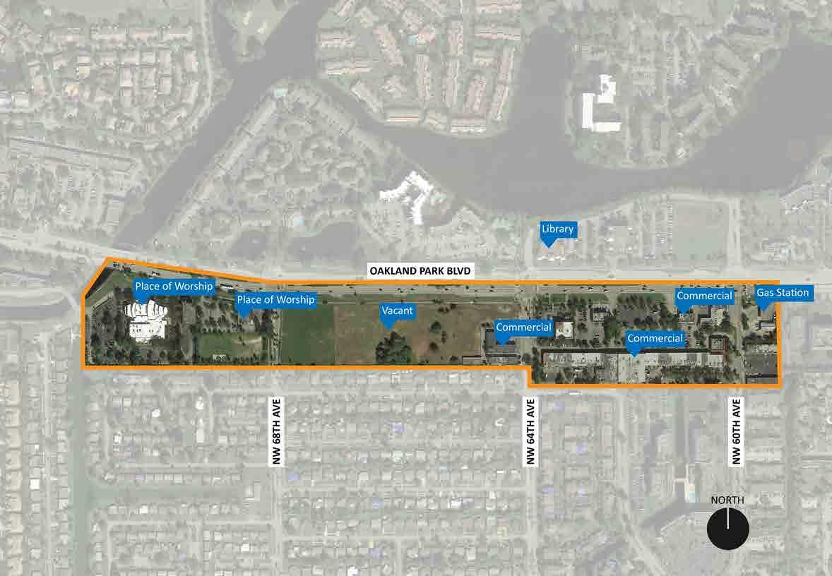
COMMERCIAL CORRIDORS B. OAKLAND PARK BOULEVARD CORRIDOR Oakland Park Corridor Current Conditions Analysis EXISTING GEOGRAPHIC CONDITIONS CHARACTER & PHYSICAL CONDITIONS ACTIVITIES REGULATORY CONDITIONS MOBILITY CONDITIONS IDENTITY & BRAND CONDITIONS Oakland Park Corridor Vision Oakland Park Corridor Recommendations CHARACTER & PHYSICAL RECOMMENDATIONS ACTIVITIES RECOMMENDATIONS REGULATORY RECOMMENDATIONS MOBILITY RECOMMENDATIONS IDENTITY & BRAND RECOMMENDATIONS Oakland Park Corridor Current Conditions Analysis EXISTING GEOGRAPHIC CONDITIONS Location: Oakland Park Blvd from city limits to the west and one parcel east of NW 60th Avenue. Size: +/- 41 acres and Oakland Park Boulevard linear corridor stretches 0.60 miles/ 11-minute walk OAKLAND PARK CORRIDOR AERIAL IMAGE 77 | EAST S UNRISE IMPROVEMENTS MASTER PLAN
OAKLAND PARK BOULEVARD CORRIDOR

CHARACTER & PHYSICAL CONDITIONS
Only the south side of this corridor lies within the City of Sunrise. It contains a series of suburban style commercial and civic structures, including several multi-story buildings situated close to the right of way. A neighborhood entry feature exists at NW 68th Avenue at the south end of the corridor but does not include any identification signage. A major commercial strip center sits at the eastern edge of the study area, and a major development site lies between NW 64th and 68th Avenues. The small strip centers at NW 64th Avenue were identified as problem spots for negative activity by stakeholders.
Oakland Park Boulevard is a major arterial, carrying high speed traffic with high volumes. A bike lane is present along the southern edge but is not buffered. The sidewalk sits a good distance from the roadway which is good for pedestrians. There are several major bus stop areas but not all have shelters. Landscaping is sparse and limited to trees and green shrubs. Sunrise Lakes Drive North runs for a short distance parallel to Oakland Park Boulevard to create a service road and a major unimproved green space along Middle River. The street is a major connector to other highways, i.e. I-95, Turnpike etc.
Unlike University Drive, Oakland Park Boulevard has a far greater residential presence although not necessarily in Sunrise city limits. The heavy residential presence along the corridor enables the city to continue to promote and foster additional residential development, in particular, on the Opportunity Site #8.
ACTIVITIES
Two significant religious facilities create limited activity in the area, as do the small commercial strip centers on the eastern edge.

REGULATORY CONDITIONS
Like University Drive, this street is not conducive to the same type of pedestrian activity found on a main street. The current zoning code states the B-3 general is intended to apply to arterial streets and traffic ways where business establishments are “primarily not of a neighborhood or community’s service type, and do not cater directly to pedestrians”.

MOBILITY CONDITIONS
Similar to the other main corridors in this plan, there is a need to better protect the bike lanes. Sidewalks are well-located to encourage walking but lack pedestrian lighting and sense of security. Bus stop areas lack adequate lighting. The lanes are very wide, and the median is very small in most locations. There is not a great deal of pedestrian crossings however when street improvements are considered by FDOT, the lanes should be narrowed, and medians widened.
S Oakland Park Boulevard and University Drive S Oakland Park vacant property S Oakland Park Boulevard suburban shopping center S Example of pedestrian safety islands. Photo from NACTO (National Association of City Transportation Officials)78 | EAST SUNRISE IMPROVEMENTS MASTER PLAN
IDENTITY & BRAND CONDITIONS
There are no indicators that this corridor is part of Sunrise or east Sunrise. Like University Drive, a visitor may not even know what city they are in due to a lack of wayfinding.
Space exists to create major entry green space features at the east and west ends of this corridor leaving room for “markers” or brand elements.
There is an opportunity to use the one large redevelopment parcel to reaffirm the residential presence along this street which can reinforce and brand the area as a good place to live. Another alternative is a commercial development, however market conditions will drive that option.
Oakland Park Corridor Vision
A major new project of high-quality architecture and design announces this northern boundary of east Sunrise as a quality place to live. The sidewalk experience along the corridor is enhanced with well-lit walking paths and protected bike lanes adding a unique quality of life amenity.
Oakland Park Corridor Recommendations
CHARACTER & PHYSICAL RECOMMENDATIONS
• Invest in Entry Features: Identify a location at the Middle River green space on the west, and the southwest corner of NW 64th Avenue and Oakland Park Boulevard. These “bookends” should highlight the area as being in east Sunrise.
• Enhance the Gateway Features at NW 68th Avenue: Create something similar at NW 64th Avenue to announce the entry to Village Center.

• Add Wayfinding and Streetscape Branding Elements: Banners, lighting, etc.
ACTIVITIES RECOMMENDATIONS
• Approach area churches about adopting parts of the green space as community gardens or local flower gardens using volunteers to activate the spaces.
COMMERCIAL CORRIDORS
79 | EAST SUNRISE IMPROVEMENTS MASTER PLAN
OAKLAND PARK BOULEVARD CORRIDOR
REGULATORY RECOMMENDATIONS
• Promote a Major High-Quality Residential or Mixed-Use Project on the Vacant Site Identified as Opportunity Site #8: Consider additional density, parking reduction, and fast tracked permitting. Zoning will need to be amended. Create minimum lighting requirements for parking area and adjacent sidewalks.
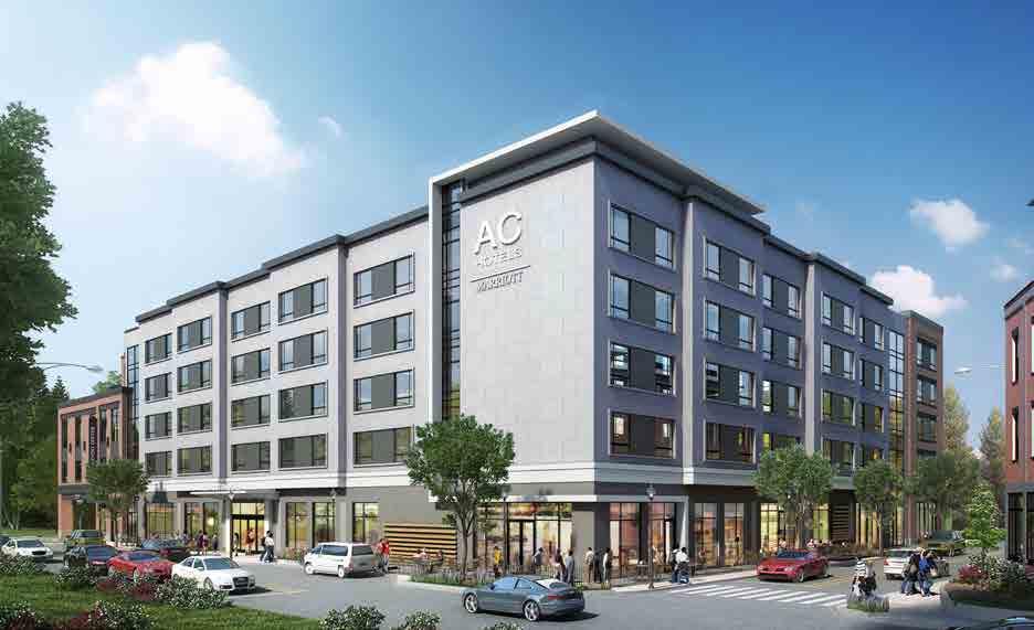

MOBILITY RECOMMENDATIONS
• Continue work with FDOT, Broward County MPO and Other Agencies to Better Protect Bicycle Lanes: Bike lanes or sharrows south into the neighborhoods will help connect a major project to the Village Center and facilitate walking/biking by area residents.
• Improve Bus Stop Amenities: Provide weather protection/shade, signage, wayfinding map, trash disposal, lighting, and landscaping.
IDENTITY & BRAND RECOMMENDATIONS
• Encourage Any Major Development to Recognize and Promote its Location in east Sunrise: This might be in the form of naming, signage, or certain streetscape elements. (E.g. east Sunrise Marriott).
S Example of potential mixed-use development along Oakland Park Blvd. Paseo Verde TOD Development with affordable housing. CNU Public Square, Philadelphia, PA S Example of potential 5-story quality hotel along Oakland Park Blvd. Rendering by AC Hotel (designed by PROCON), Portsmouth, NH80 | EAST SUNRISE IMPROVEMENTS MASTER PLAN
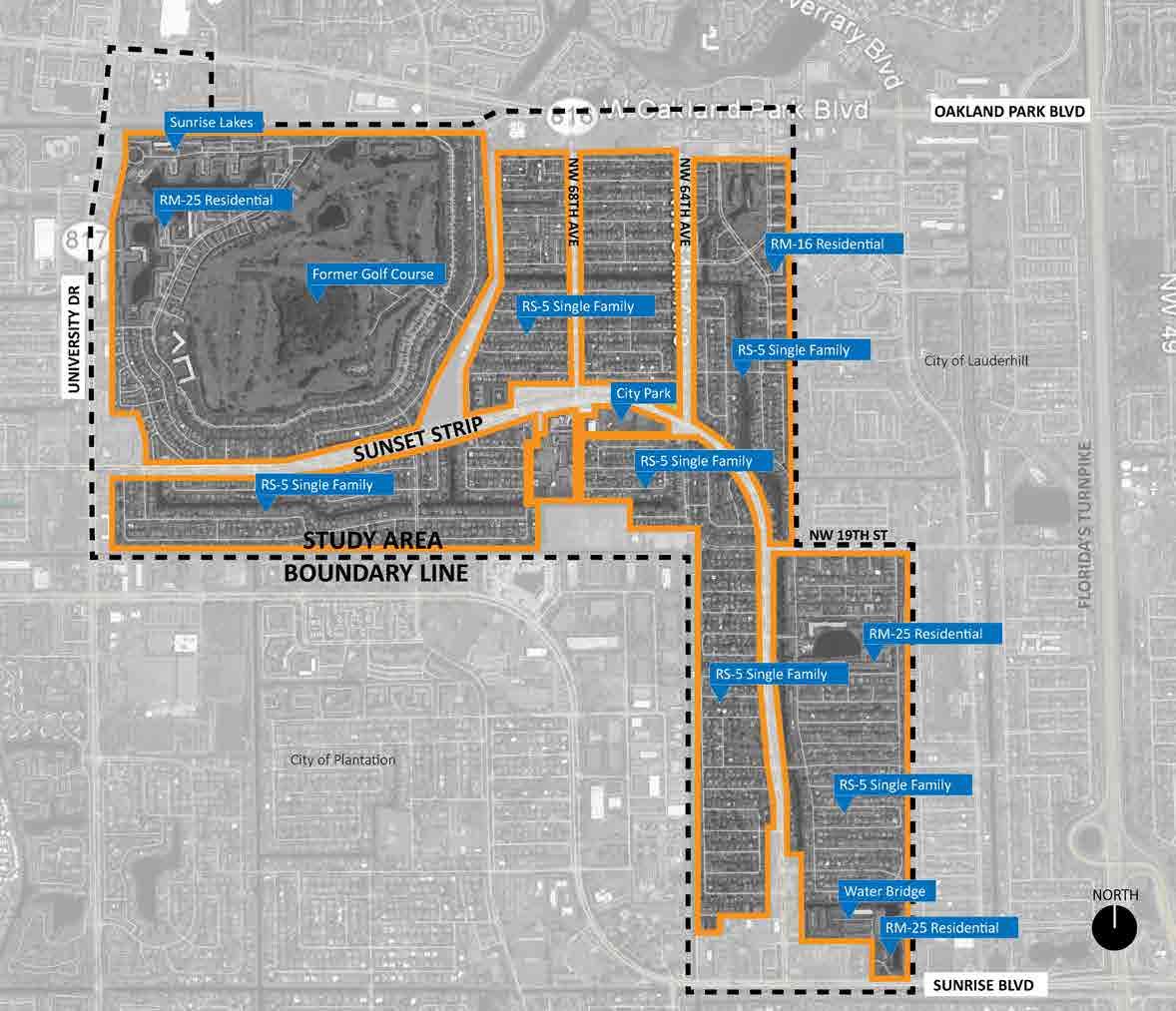
NON-COMMERCIAL NEIGHBORHOODS NON-COMMERCIAL NEIGHBORHOODS Non-Commercial Neighborhoods Current Conditions Analysis EXISTING GEOGRAPHIC CONDITIONS CHARACTER & PHYSICAL CONDITIONS ACTIVITIES REGULATORY CONDITIONS MOBILITY CONDITIONS IDENTITY & BRAND CONDITIONS Non-Commercial Neighborhoods Vision Non-Commercial Neighborhoods Recommendations CHARACTER & PHYSICAL RECOMMENDATIONS ACTIVITIES RECOMMENDATIONS REGULATORY RECOMMENDATIONS MOBILITY RECOMMENDATIONS IDENTITY & BRAND RECOMMENDATIONS Non-Commercial Neighborhoods Current Conditions Analysis EXISTING GEOGRAPHIC CONDITIONS Location: All areas in the study area not included in commercial centers and corridors. NON-COMMERCIAL NEIGHBORHOODS AERIAL IMAGE 81 | EAST SUNRISE IMPROVEMENTS MASTER PLAN
NON-COMMERCIAL NEIGHBORHOODS
CHARACTER & PHYSICAL CONDITIONS
Beyond Sunset Strip and the commercial corridors, much of east Sunrise is comprised of traditional residential neighborhoods. A diversity of housing types exists in east Sunrise which is optimal. Traditional neighborhood sections of single-family homes are supplemented by multi-family rentals and condominiums near the former golf course. Smaller multi-family rental complexes are scattered in the eastern half of the neighborhood as well; a number of these have seen significant disinvestment. One unique feature is the presence of single-family homes along the major roadways, including Sunset Strip.
Recreational opportunities are scattered throughout, including parks, a community pool, lakes and canals.

ACTIVITIES
A number of homeowner associations provide both social and civic opportunities for residents to come together. Some provide private trolley services as well. Sunrise Police also host regular activities as part of their community policing efforts.
REGULATORY CONDITIONS
The current zoning regulations do not allow parking in streets, alleys and right of ways. Parking in swales is permitted if the owner approves, provided the car is parallel to the sidewalk and off the pavement. There were no other notable regulatory conditions found that would impact a neighborhood.
MOBILITY CONDITIONS
Several roadways have central medians with trees, and many have traffic calming devices. Lighting of roadways and sidewalks vary greatly. In many areas, residents use the front swale for parking, resulting in an image of disorder and often destroying the landscaping.
IDENTITY & BRAND CONDITIONS
Some neighborhoods have signage or some marker/monument that identifies the area by name. Private development and HOA/Condominium complexes also use identification markers.
 S Sunrise Lakes 55+ Community (3 story). Multi-family condominium
S Typical single-family residence (1 story)
S Sunrise Lakes 55+ Community (3 story). Multi-family condominium
S Typical single-family residence (1 story)
82 | EAST SUNRISE IMPROVEMENTS MASTER PLAN
Vision
Newly upgraded apartments, homes, and roadways result in large numbers of residents walking and biking daily and in the evenings to the Village Center and commercial districts. Swales hold new trees and landscaping – not cars. Most front yards have flowers and other landscaping as well as new lighting. Apartment buildings are well-maintained and managed, with new amenities for families. Cars travel at slower speeds, and visitors admire the public art. Property values increase along with homeownership, but affordability programs permit people to stay and enjoy all the improvements.
Recommendations
CHARACTER & PHYSICAL RECOMMENDATIONS
• Install New Themed Street Name Signs: An icon or image on signs can instantly identify a neighborhood promoting pride and community engagement. Also, add the neighborhood name or icon to public facilities in the area.

• Create an Incentive Program for Front Yards: Encourage bright porch lights and small light poles in front yards to help improve lighting on sidewalks.
• Initiate a Tree Giveaway Program: Encourage residents to come pick up a free tree twice a year to plant in their front yard. Follow up with a neighborhood “House of the Month” whereby winners who show before and afters can “win” benefits from the city such as coupons for city restaurants.
• Initiate a ‘Paint, Plant and Pave Program” or Mimic the DeCode Day Concept Previously mentioned: See details on the following page for Paint/Plant/Pave Program (PPP).
NON-COMMERCIAL NEIGHBORHOODS
xample of community participation in home beautification. Pompano Beach WOW Award Winner
W Example of branded street sign. Imperial Point
83 | EAST SUNRISE IMPROVEMENTS MASTER PLAN
Paint/Plant/Pave Program (PPP)
Blighted or broken-down elements on the façade of a house create a syndrome referred to as “The Broken Window Syndrome”. The concept refers to the negative impact that comes from an area that has a cluster, or ever a few houses, with broken windows, peeling or worn paint, dead landscaping and other blighting conditions. As properties deteriorate, neighborhood pride dissolves and more people let their properties fall into disarray. Property values then decline. Sometimes the lack of funds, especially for seniors, is a major cause of the lack of maintenance. The PPP Program allows the City to provide assistance to owner-occupants of single family homes to help spruce up the front of their homes. The program can be custom designed to address the issues specific to east Sunrise but in general have the following guidelines:
The main areas of improvement include:
• Painting – House, eaves, fascia board, architectural elements
• Plant – Limited landscape, irrigation, pruning and replanting
• Pave – Driveway improvements compatible with the area
The program can include the following efforts:
• Promote the Program – A local community sponsor is found to help promote the program. Local press is invited to promote the program and the City can inform residents in water bills or other mechanisms that reach homeowners.
• Who Qualifies? – A decision on which homes qualify depend on the goals and the issues to be addressed as well as the amount of funding available for the program. Generally, it is for owner-occupants not renters, however in some cases, the City may permit a landlord to participate unless there are multiple code violations and there is reason to believe there is lack of care on the owner’s part.
• Program Costs – The amount of funds can range from a few hundred dollars to thousands of dollars per home. Generally, a guideline is between $ 500 - $ 2,500 depending on the program allowances and home value. Sometimes the homeowner must provide a match that would reduce the City’s portion of assistance or would increase the amount of funds available. Other times, and in cases where the homeowner doesn’t have the cash to match, they can provide in-kind services or sweat equity in the form of labor.
• Look for Sponsors – A local home improvement center should be identified to provide materials at cost or below cost.
• Look for Technical Volunteers – The City can identify a pool of builders or subcontractors to provide man hours to “oversee” the work to be done.
• Labor Force – Local volunteers combined with stipends paid to workers generally meet the labor requirements. Neighborhood Ambassadors play a large role in this effort.
• Location of Program – The most effective approach is to target one neighborhood at a time where the results can be clearly and immediately seen for instant results. A small neighborhood block gathering can be held to showcase the improvements when done, then move on to the next neighborhood.
• Who Maintains the Improvements? – Maintenance of the improvements is mandatory and owners are required to sign a document saying they will maintain the improvements for a period of years.
In summary, the program can be created to address the issues specific to east Sunrise.
84 | EAST SUNRISE IMPROVEMENTS MASTER PLAN
ACTIVITIES RECOMMENDATIONS
• Work with Resident Associations on Community Pride Campaigns: Create walking clubs, volunteer programs to improve front porch lighting (using porch light incentive program), and a series of block parties to help neighbors get to know each other and spend more time outside.
• Consider Contacting Building Broward Together: This effective program is a resident based initiative to improve neighborhoods supported by a local non-profit.
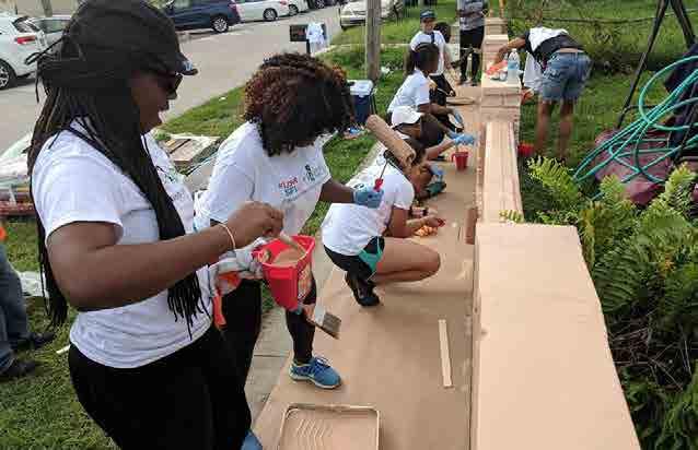

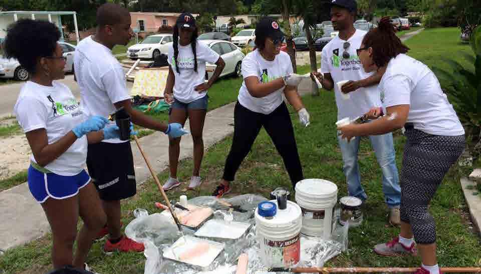
REGULATORY RECOMMENDATIONS
• Create Minimum Lighting Requirements: Target parking areas, walkways, and adjacent sidewalks of multi-family buildings and properties, religious properties, and City facilities.
• Incentivize or Require Driveway Improvements to Limit Haphazard Parking of Cars: For those areas where the swale is insufficient to accommodate multiple vehicles per household, consider allowing an additional driveway surface area based on specific design criteria. Secondly enforce the regulation that prohibiting haphazard parking in the swales.
• See DeCode Day under Commercial Center Regulatory Recommendations.
MOBILITY RECOMMENDATIONS
• Enhance Lighting, Landscaping, Bike Paths, and Other Pedestrian conditions: start by targeting the area along NW 19th Street east of Sunset Strip to create a safer east-west connector.
• Clearly Delineate and Light Crosswalks
• Use sharrows on neighborhood collector streets to encourage biking.
IDENTITY & BRAND RECOMMENDATIONS
• Highlight the Neighborhood's Efforts to Become a “Tree City” Through the Tree Giveaway Program: Ensure area residents and associations are actively involved in all “green or “”tree” branding initiatives. Give a city proclamation for resident who spruce up their houses. Promote the proclamation in the neighborhood.
• Explore the Usefulness of More Clearly Identifying Sub-Neighborhoods.
• Mimic the Pompano Proud Mission Statement: Resident who form an alliance through neighborhood improvements work together on a regular basis.
S Example of Building Broward Together community activityNON-COMMERCIAL NEIGHBORHOODS85 | EAST SUNRISE IMPROVEMENTS MASTER PLAN
C. CITY INFRASTRUCTURE & QUALITY OF LIFE
This section of the plan focuses on the supporting elements related to vertical real estate development projects and districtwide redevelopment activity. If the public realm within a city is clearly defined and inviting, a person will feel comfortable from the moment they enter the city limits. The first introduction usually begins with the roads and connectivity points to other places. Do people know they entered the city and where they are? Can they find what they are looking for and can they get there easily and safely? Once they leave their cars the walkability of the city becomes more obvious and everything from signage and landscape, lighting and wayfinding, and bicycle and transit conditions influence how a person feels in your city. The regulations influence how they feel about the buildings, and the public plazas, parks, and art and cultural displays impact their desire to use these assets. The combination of these publicly driven features become the city’s brand and creates a lasting impression that defines the image of the city. Progressive cities recognize the connections between the public realm and human reaction and strive to ensure the experience is positive and rewarding. If not, people will not want to visit or stay very long, and the economics of the city will suffer.
This section delves into the public realm experience and provides recommendations to improve existing conditions to create a desirable and inviting place to be.
OVERVIEW
Background
Previous studies and design proposals have already been developed within the study area, including: Sunset Strip Complete Streets; FDOT Oakland Park Boulevard Alternatives Analysis; Broward MPO University Drive Mobility Improvements Planning Study; City of Sunrise Leisure Services Master Plan; and City of Sunrise Bicycle & Pedestrian Greenways & Trails Master Plan. This report helps to build on those initial ideas as well as introduce opportunities for potential improvements.
Design Objectives
City officials and staff helped to identify specific objectives, as did the public during the East Sunrise Improvements Master Plan kick-off meeting. These were taken into consideration as well as other design standards, guidelines and potential improvements in this report. These include:
• Build on capital improvements initiatives (Sunset Strip Complete Streets Project)
• Promote context sensitive design alternatives that respond to neighborhood character
• Create equitable distribution of the public right-of-way for pedestrians, runners, bicyclist, drivers, and transit users (Complete Streets)
• Strengthen access to, from and through east Sunrise
• Explore opportunities of regional connectivity
• Coordinate with other municipalities for mutual benefits of surrounding areas
• Improve mobility for pedestrians, bicyclists, drivers, and transit users with new connections
• Assure pedestrians and bicyclists with comfortable, accessible, convenient, and safe routes
• Improve function and aesthetics of streetscape design
• Improve amenities to encourage people to walk, bicycle, or use transit
• Create community identity through architecture, furnishings and other improvements
• Create vibrant neighborhood and village centers
• Improve public realm; building frontage, sidewalks, furnishings zones, landscape (tree grate, planting strips, swales, and medians), on-street parking, travel lanes, as well as other civic spaces (parks, squares, plazas)
• Opportunities for potential improvements for private spaces to enhance the public realm
• Establish implementable solutions with a gradual approach (short-term through long-term)
• Provide examples of other communities and case studies with similar goals
• Develop driveway, landscape, streetscape furnishing, and street lighting standards
• Develop a series of traffic calming techniques to control vehicle speed
• Develop a way-finding and signage plan
• Create civic pride/ sense of belonging by enhancing the street aesthetics
• Enhance local businesses
• Program social events/ activities to build on community engagement
• Improve transit connectivity to civic centers for all users
86 | EAST SUNRISE IMPROVEMENTS MASTER PLAN
COMPLETE STREETS
The City of Sunrise and the Florida Department of Transportation (FDOT) has done an excellent job with the implementation and construction of the Sunset Strip Complete Streets Project that seeks to improve mobility along Sunset Strip from Nob Hill Road to Sunrise Boulevard in Sunrise.
What are Complete Streets and why they are important?
According to the national Smart Growth America organization, "Complete Streets are streets for everyone." They are designed and operated to enable safe access for all users, including pedestrians, bicyclists, motorists and transit riders of all ages and abilities. Complete Streets make it easy to cross the streets, walk to shops, and bicycle to work. A Complete Streets approach integrates people and place in the planning, design, construction, operation, and maintenance of transportation networks. This helps to ensure streets are safer for all people, balance the needs of different modes, and support local land uses, economies, cultures, and natural environments."
Complete streets improve quality of life and transforms the overall development patterns of a community and generates greater potential for economic growth. It differs from traffic patterns of the past 50 years which favored the use of the automobile as the primary way of transportation. This created wider roads, larger parking lots, and smaller sidewalks. To create alternatives where a person's mobility experience is valued, planning professionals have re-adapted streets to meet current needs and provide an adequate space for pedestrians as well as cars. This is an attempt to make streets and the public realm equally comfortable for people, cars and transit. The City of Sunrise has already begun introducing the concept of Complete Streets.
CONNECTIVITY
In urban planning, connectivity is a vital component in making communities more livable. The ability to connect people to places through various modes of travel help to create diverse, vibrant and healthy communities. A comprehensive transportation network system connects people whether they are pedestrians, bicyclists, drivers, public transit riders or any combination of these travel methods.
The focus on connectivity over the last several decades has relied mostly on the use of motor vehicles. Unfortunately, this has led to a sprawl model of planning that has left many communities having to deal with the effects of extremely wide thoroughfares filled with traffic congestion, with little to no regard for pedestrians and bicyclists. Fortunately, there has been a growing awareness of people and community placemaking, so pedestrians and bicyclists are finally being recognized for their role and contribution to a balanced network.
Important destinations such as neighborhood centers require good connectivity to attract people to support businesses as well as to help meet daily needs. A well balanced transportation network helps reduce the reliance of automobile trips, lessoning the need to drive and alleviate traffic congestion. The younger and older generations, as well as those who do not own a car are also better served with a level of independence.
In this section, connectivity of east Sunrise is analyzed in its current state in four categories: Pedestrian, Bicycle, Vehicular, and Transit. Opportunities for potential improvements are illustrated in diagram form.
87 | EAST SUNRISE IMPROVEMENTS MASTER PLAN
A. PEDESTRIAN
The purpose of this section is to illustrate existing and planned pedestrian connections and pathways and to illustrate opportunities for potential improvements to create an environment that is attractive, interesting, convenient, safe, and accommodates daily needs.
This diagram helps to illustrate the neighborhood structure of east Sunrise and its relationship of residential, village and neighborhood centers. A pedestrian shed of both 0.25 and 0.5 mile are illustrated from these centers to demonstrate the catchment area that people could potentially walk to. This is the distance that most people will walk rather than drive. The 0.25-mile shed is often defined as the area covered by a 5-minute walk and considered the ideal size of a neighborhood. In both low-density neighborhoods as well as transit centers of high-density, the catchment area size is increased to 0.5mile shed which is about a ten-minute walk.
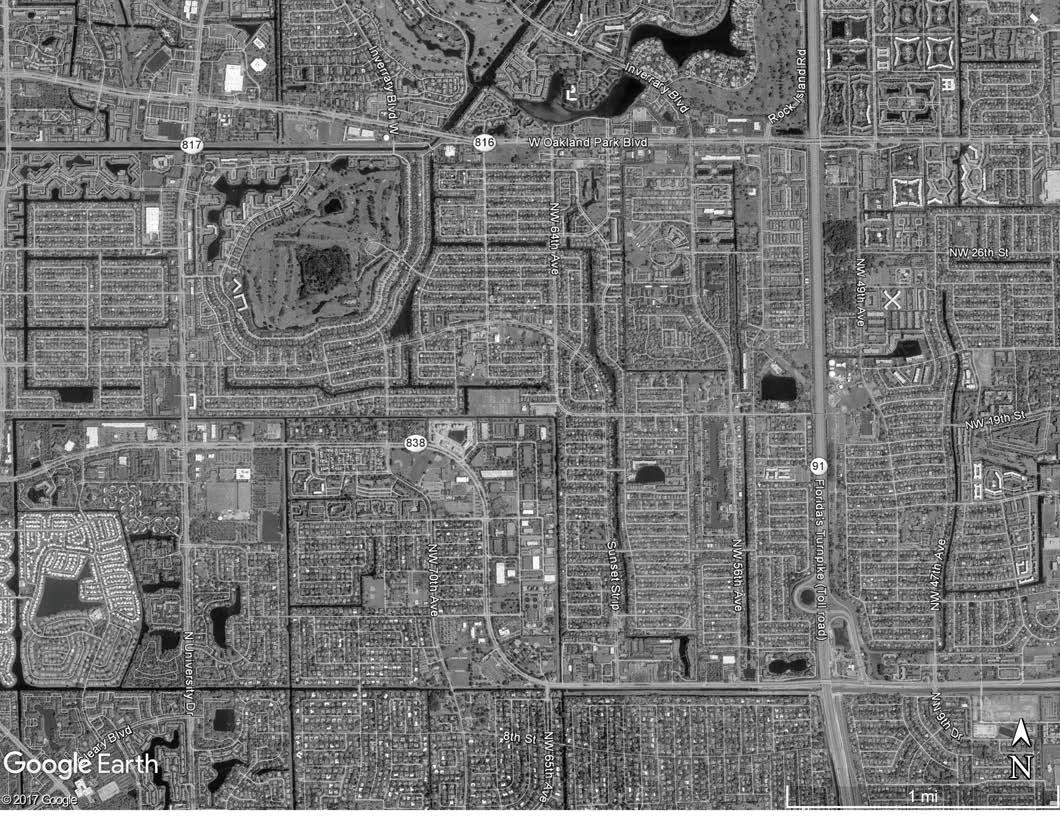
CHALLENGES
• Certain sidewalks are too narrow or too close to the roadway to be comfortable for walkers
• Limited seating and shade are available for walkers to take rests
• Shade along major pathways is limited
• Some destinations are separated by canals, community fencing, or wide major roadways
• Many basic household needs not available at a walking distance
• Current/planned median along Sunset Strip connecting residential neighborhoods to Village Center does not accommodate pedestrians (e.g. linear park)
• The need to create a Trail/ Shared-Use Path along canals
• Streetscape amenities and conditions, such as furnishings, seating, leaning bars, shelters, planters with flowers, inconsistent lighting
• Proposed development at Sunrise Country Club Golf Course property needs to improve connectivity with rest of the study area
InverraryBlvd
Walkability Map LegendStudy Area Boundary Boundary Bo u n d a r y B ou n d ar y Boundary Oakland Park Blvd Sunrise Blvd S u n s et S trip N W 6 4t h A v e N W 6 8 th A ve N Un iv er s i t y Dr
N Study Area Boundary Church/ Religiousc School/ Educa�on Park/ Open Space Public Library/ Civic Improve Connec�vity Public Ameni�es Pedestrian Conflict s p l Enhance Sidewalks Linear Park Trail/ Shared-Use Path Village Center Pedestrian Priority Routes: Pedestrian Nodes Pedestrian Walking Distance Neighborhood Center +/- 5 Minute Walk (0.25mi) +/- 10 Minute Walk (0.50mi) c c c c c c c s c c s p c s s ss s p p ! p p p l p ! ! 88 | EAST SUNRISE IMPROVEMENTS MASTER PLAN
B. BICYCLE
The purpose of this section is to evaluate existing and planned pathways to create an integrated bicycle network system that connects to existing and proposed routes for recreation or as an alternative mode of transportation.
According to the Bicycle & Pedestrian Greenways & Trails Master Plan adopted in 2014, residents showed an interest for the City to provide a comprehensive bicycle network (bicycle lanes, buffered bicycle lanes, shared-use side paths, bicycle friendly intersections, and shared lane markings). This diagram illustrates various existing and planned bicycle lanes throughout east Sunrise. Opportunities to create new local and regional connections, such as, trails, bicycle paths, or shared-use are identified. A 5-minute bicycle ride is equivalent to 1 mile, which encompasses most of east Sunrise.
CHALLENGES
• Expanding and competing bicycle lanes along Sunrise Boulevard, Oakland Park Boulevard and University Drive to connect to the regional system.
• Few existing bicycle amenities, such as parking rest areas (parking racks, water fountains, shade trees, shelter, bike repair stations).
• No existing bicycle share program.
• Coordination with proposed pedestrian, transit, and vehicular improvements.
• No clear connections to Sunrise Country Club Golf Course property and proposed development.
• Need for a shorter connection between the Village Center and the regional trail system on Sunrise Boulevard.
p
b v
City Planned Bicycle Connection
Existing Bicycle Connection
Potential Future Regional Bicycle Connection (outside study area)
Potential Bicycle Connection (within study area)
Potential Future Local Bicycle Connection (outside study area)
Potential Trail/Shared-Use Path (within study area)
Potential Future Trail/Shared-Use Path (outside study area)
Potential Bicycle and Pedestrian Bridge Connection
Potential Bicycle and Vehicular Bridge Connection s
Improve Connectivity!
Church/ Religious School/ Educa on Park/ Open Space Public Library/ Civic
Bicycle Lanes/buffer (arterials)
Sharrows (residential streets)
• Trail/ Shared-Use Path (canal)
Note
All bicycles are permitted on residential streets without designated markings. Proposed conditions outside the City of Sunrise must be coordinated with adjacent cities.
Bicycle Routes Map Legend•
•
s s s s s s s p p p
p p p l l p
! ! Poten al route to Everglades Poten al route to A1A Poten al route to A1A City of City of Lauderhill Boundary B ou nda ry B o u n dary Boundary b b b v Oakland Park Blvd Sunrise Blvd Su n s e t S t r pi NW 64 th Av e N W 6 8 t h A v e N U n i v ers i t y D r NW 19th StNW 20th St N 5 inutesbi y le ride (1 ile) fro the Villa e Center 89 | EAST SUNRISE IMPROVEMENTS MASTER PLAN
C. VEHICULAR
The purpose of this section is to evaluate existing and planned vehicular circulation along with potential new connections that create a more efficient internal roadway network for east Sunrise. This will minimize the need to enter more heavily used traffic arterials and thoroughfares and improve safety.
east Sunrise has a fairy well laid out street network, allowing for multiple options to circulate, but there are some challenges.
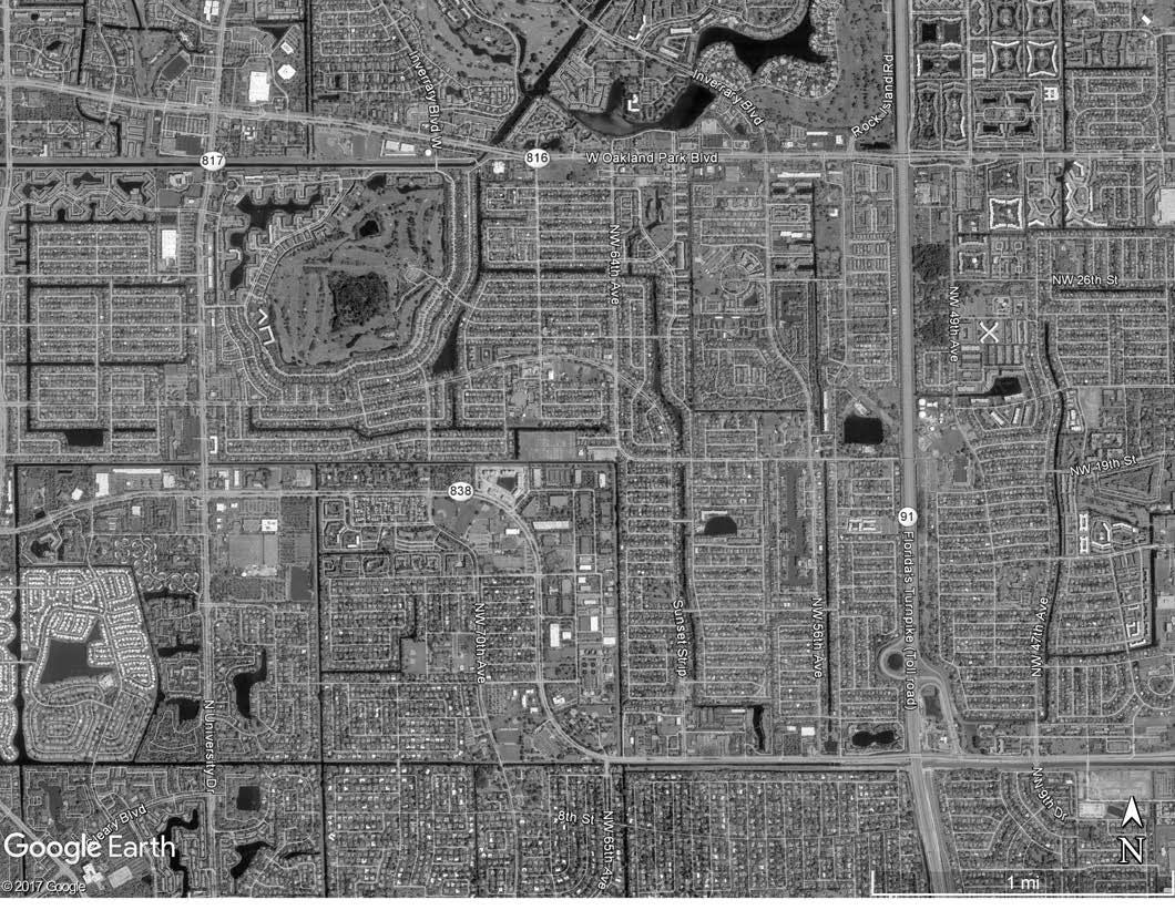

CHALLENGES
• Some key areas are incomplete and will benefit from new connections, such as new streets, and shared service drive aisles.
• On street parking in some areas is limited or missing, leaving pedestrians on the sidewalk without a buffer.
• High vehicle speeds on some residential streets are creating safety hazards for pedestrians and bicyclists.
• Parking in swales is a community concern and creates a sense of disorder.
• Poor connections to and through PPG Industries site.
InverraryBlvd
New Street Connec�onsNew
Frontage Street
Improve
Drive Aisle Connec�ons
New
Shared Service Drive Aisle
On-Street
Parking Opportunity
Connec�vity Illustra�ve Map Legend
Study Area Boundary
Boundary Bo u n d a r y B ou n d ar y Boundary N Oakland Park Blvd Sunrise Blvd S un se t Strip N W 6 4t h A v e N W 6 8 th A ve N Un iv er s i t y Dr
Sunset
Strip
Improve
Connec�vity
Vehicular
Conflict
! Exis�ng
Surface Parking at Village Center
Parking P P P P P P ! ! 90 | EAST SUNRISE IMPROVEMENTS MASTER PLAN
D. TRANSIT
Safe, reliable, and predictable transit service is a key component of successful walkable communities. It can ease cost burdens of limited income households, provide independence to seniors and children, and create affordable access to employment and educational opportunities. east Sunrise has several bus routes provided by both the County and City, particularly in the northwest section along University Drive and Sunset Strip.
CHALLENGES
• Although there are many options along major perimeter arterial roadways, the study area lacks a local defined route that connects the neighborhood and village centers together and to perimeter routes with regular frequency.
• Safe and comfortable bus stops that reflect east Sunrise community identity are generally absent.
• Direct routes to City facilities are limited.
• Direct routes to regional shopping and entertainment amenities do not exist.
Breeze Route Route 2 Transporta�on Routes Map Legend Breeze Stops Bus Stops Route 6 Route 7 Route 3&4 Route 36 Route 81 Route 72 Route 56 Exis�ng Broward County Bus Routes Exis�ng City Bus Routes Exis�ng Stops Proposed Routes and Connec�ons Study Area Boundary 2 81 81 36 72 7 56 6 3&4 Boundary Bo u n d a r y B ou n d ar y Boundary Oakland Park Blvd Sunrise Blvd S u n s et S trip N W 6 4t h A v e N W 6 8 th A ve N Un iv er s i t y Dr InverraryBlvd N 91 | EAST SUNRISE IMPROVEMENTS MASTER PLAN
E. DRIVE AISLE CONNECTIONS
This section illustrates challenges with drive aisle connections between abutting disconnected properties throughout the district. The lack of such connections creates extra traffic congestion, reduces retail spending, impedes walkability, and creates additional conflict points with bicycles. The examples shown are meant to illustrate the general issue and do not identify every location where solutions are needed.
SUNRISE BOULEVARD
Location
Southwest block at the intersection of Sunrise Boulevard and Sunset Strip, bounded by NW 11th Street on the north, Sunset Strip on the east, Sunrise Boulevard on the south, and canal on the west.
Block Conditions
• Large mega block composed of a commercial shopping center, individual commercial pads surrounded in parking lots with perimeter businesses
• Two undeveloped parcels and an abandoned former chain store at a significant intersection providing a unique opportunity for potential development

• Limited existing drive aisle connections with several conflicts’ points
• Multiple curb cut entry points from the arterial thoroughfare
Exis�ng Secondary
Exis�ng Main Drive Aisle Connec�ons
Service Drive Aisle
P P P PP P P P P NW 11th St Del Lago Cr Exis�ng Primary Streets EXISTING CONDITIONS Access Rd Sunset Strip Sunrise Blvd Vacant Land 1.5 acres Abandoned Building 1.9 acres
Streets
Exis�ng
Exis�ng curb cuts/ entry points Conflict; Exis�ng barrier (landscape/ fence) between drive aisles Commercial Parking Lot NORTH E1.
92 | EAST SUNRISE IMPROVEMENTS MASTER PLAN
SUNSET STRIP
Location
North block of Village Center at Sunset Strip between NW 68th Avenue and NW 64th Avenue, bounded by NW 24th Street on the north, NW 64th Avenue on the east, Sunset Strip on the south, and NW 68th Avenue on the west.

Block Conditions
• Commercial block of mostly small shopping centers facing Sunset Strip
• Block includes small civic space, church anchoring corner with abutting single family residential behind
Long, narrow block with the commercial side on curve
Multiple drive aisle conflicts
• Many curb cuts
• No rear shared service lane
On-street parking
EXISTING
Main
Service
E2.
•
•
•
P P PP Sunset Strip NW 64th Ave NW 68th Ave NW 24th St P Exis�ng Primary Streets
CONDITIONS Exis�ng Secondary Streets Exis�ng
Drive Aisle Connec�ons Exis�ng
Drive Aisle Exis�ng curb cuts/ entry points Conflict; Exis�ng barrier (landscape/ fence) between drive aisles Commercial Parking Lot NORTH 93 | EAST SUNRISE IMPROVEMENTS MASTER PLAN
UNIVERSITY DRIVE
Location
Intersection at Sunset Strip and University Drive, bounded by shopping plaza on the north, residential single-family homes on the east, city boundary/ canal on the south, and residential single-family homes on the west.
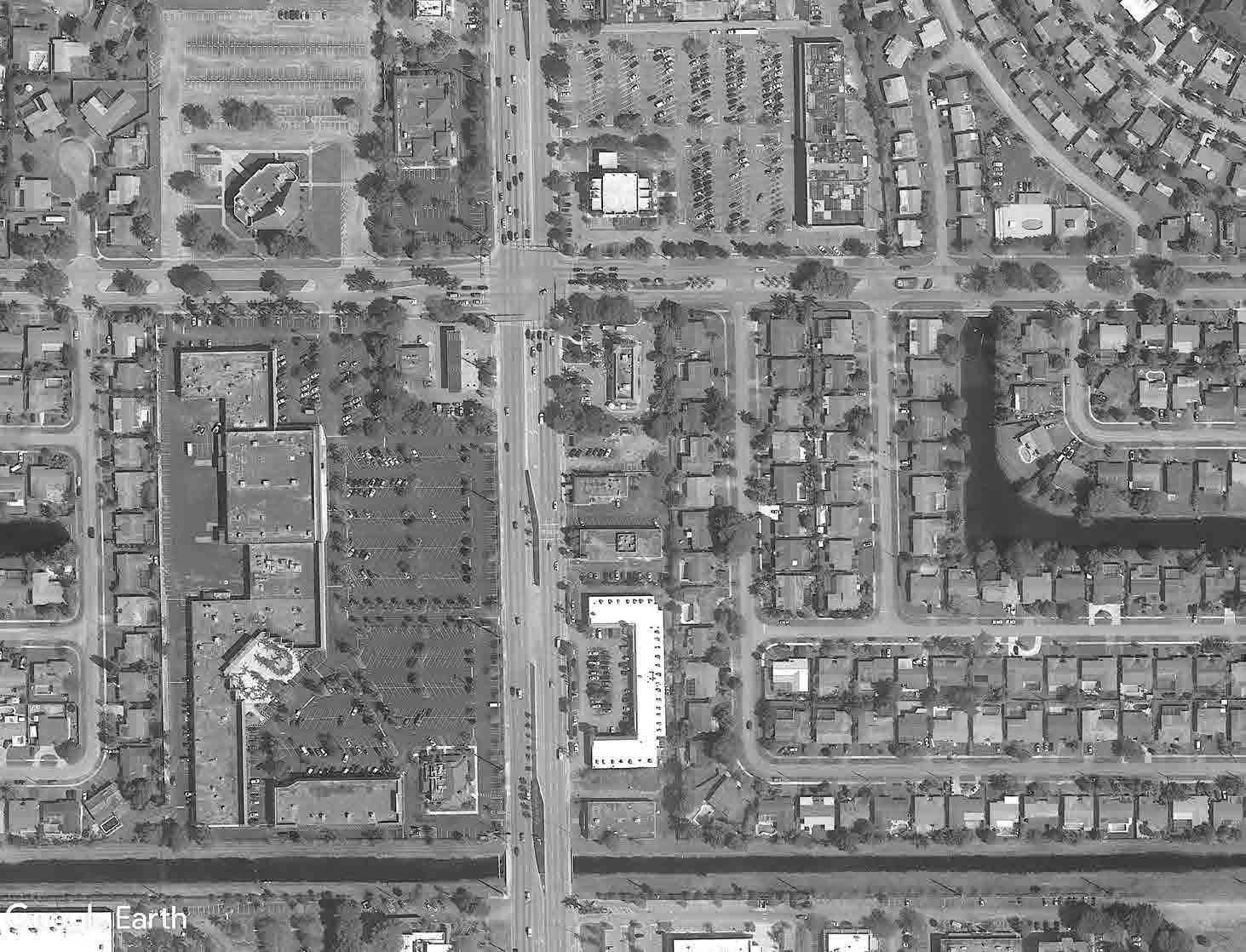
Block Conditions
• Intersection with two large shopping centers and various independent commercial pods
• Multiple drive aisle conflict points within smaller commercial pods
• Several drive aisle connections with conflicts points in larger shopping centers
• Multiple curb cut entry points from arterial thoroughfare
• Non-continuous rear service drive aisle
• Shallow lots create challenges for redevelopment
EXISTING CONDITIONS
Exis�ng Primary Streets
Exis�ng Secondary and Ter�ary Streets
Exis�ng Main Drive Aisle Connec�ons
Exis�ng Service Drive Aisle
E3.
University Drive NW 82nd Way Sunset Strip P P P P P
Exis�ng curb cuts/ entry points Conflict; Exis�ng barrier (landscape/ fence) between drive aisles Commercial Parking Lot NORTH P P P P P P P 94 | EAST SUNRISE IMPROVEMENTS MASTER PLAN
EXISTING CONDITIONS
OAKLAND PARK BOULEVARD
Loca�on: Oakland Park Blvd between 60th and 64th Ave
Location
The sutdy block is bounded by Oakland Park Blvd (to the north), 60th Ave (to the east), 64th Ave (to the west), and NW 30th St (to the south).
Block Condi�ons:
South block along Oakland Park Boulevard between NW 64th Avenue and NW 60th Avenue, bounded by Oakland Park Boulevard on the north, NW 60th Avenue on the east, NW 30th Street on the south, and NW 64th Avenue on the west.
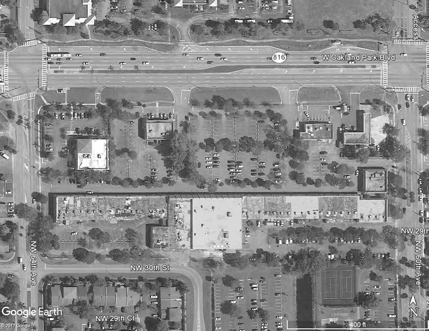
Block Conditions
Currently the block is comprised of commercial and religious uses Sunset Strip, single family residen�al along NW 24th St.
•
Large shopping center with various independent commercials pods
Opportuni�es:
• Several drive aisle conflicts within smaller commercial pods
• Multiple curb cut entry point from arterial thoroughfare
Provide drive aisle connec�on through fountain plaza; with pavers to maintain plaza space when not in traffic use. Provide drive aisle connec�on through exis�ng struture to consolidate curb cuts/ entry points to two instead of four.
• One rear service drive aisle conflict
P
EXISTING CONDITIONS
Exis�ng Primary Streets
Exis�ng Secondary and Ter�ary Streets
Exis�ng Main Drive Aisle Connec�ons
Exis�ng Service Drive Aisle
Exis�ng curb cuts/ entry points
Commercial Parking Lot
Conflict; Exis�ng barrier (landscape/ fence) between drive aisles
E4.
Okland Park
Blvd NW 30th St NW 64th Ave NW 60th Ave
P
P P P
NORTH 95 | EAST SUNRISE IMPROVEMENTS MASTER PLAN
STREETSCAPE
IMPROVEMENTS
The purpose of this section is to analyze the existing streetscape conditions and to identify constrains and opportunities for potential improvements to the streets based on the identified street character. The city is undergoing major capital improvements and street transformations with the Sunset Strip Complete Streets Project, therefore this analysis builds on those initial ideas and suggests other short-term streetscape improvements, where possible. As market conditions improve and investment occurs, additional future design enhancements can be explored.
THOROUGHFARE CHARACTER TYPOLOGIES:
Village Center Sunset Strip between NW 70th Avenue and NW 64th Avenue
Linear Park Sunset Strip between NW 14th Street and NW 64th Avenue Sunset Strip between NW 70th Avenue and NW 82nd Terrace
Gateway Entrances NW 68th Avenue between Oakland Park Boulevard and Sunset Strip NW 64th Avenue between Oakland Park Boulevard and Sunset Strip
Residential NW 24th Street between NW 68th Avenue and NW 64th Avenue
Commercial Center Sunset Strip between Sunrise Boulevard and NW 14th Street Sunset Strip between NW 82nd Terrace and University Drive
Commercial Corridors Sunrise Boulevard University Drive Oakland Park Boulevard
Trail/ Shared-Use Path Along canal bordering city limits of Sunrise and Plantation Along canal bordering city limits of Sunrise and Lauderhill near Oakland Park Boulevard
The street sections shown in this document were typical samples taken from each area to give a general concept of the street conditions.
A. STREETSCAPE ELEMENTS
PUBLIC REALM
The appearance and character of a public right-of-way plays a large role in the overall quality and livability of a community. The design of building and thoroughfare elements that form these spaces are important details that contribute to attracting and retaining people with positive urban experiences. This may include:
• Building Frontage – buildings should be brought to the front of streets, with off street parking and service at the rear of properties
• Windows and Doors – a fair distribution of doors and windows makes a building livelier and interesting
• Storefronts – retail at ground level with larger window showcasing the business help attract potential customers as well as make street livelier and interesting
• Canopies (awning) – provides some shade and shelter for pedestrians, limits glare from sunlight and adds architectural character
• Arcades (architecture) – provides shade and shelter for pedestrian and adds architectural character
• Sidewalk – areas should be clearly defined for pedestrian walking along storefronts and furnishing zones for outdoor tables and benches
• Bulb-out Curb Extension – expansion of sidewalk at intersection or mid-blocks, narrows crosswalk distance, increases area for street furnishings
• Crosswalk – identifies location for pedestrian to safely cross street at intersection or mid-blocks, special design treatment reinforces a community’s character image/brand
• On-street Parallel Parking – provides buffer from moving traffic, increase retail sales with drive-by consumers
STREETSCAPE FURNISHINGS
Furnishings provide important amenities for pedestrians. They add functionality and vitality to a street, attract people, provide visual interest, improve safety and comfort, and reinforce a community’s character image/brand. This may include:
• Seating and Leaning Rails - for rest and comfort of pedestrian
• Bicycle Rack – provides storage for bicycles
• Bollard - short post to protect pedestrians from vehicular traffic
• Tree Grate – increases sidewalk area and protects pedestrians from tree roots
• Bus Shelter – protect and comfort transit user from weather
• Waste/Recycle Bin – help to maintain clean streets by providing a place discard and recycle waste
• Drinking Fountain – provides hydration to pedestrians
SIDEWALK, ALLEY, PARKING, AND STREET LIGHTING
Increases nighttime safety; enhances the public realm with unique features. This may include:
• Highway Lamps – lighting used on arterial thoroughfares scaled for motorized vehicles (+25’)
• Pedestrian-scale Street Lamps – lighting used at urban centers scaled for a pedestrian environment (+/- 15’)
• Hanging Street Lights – lighting hung from wires attached to building facades freeing up the need for post
• String lighting – string of lights hung from building facades creating a festive look
• Bollard Lighting – low lighting installed on bollards scaled for pedestrian walkways
• Accent Landscape – used to illuminate landscape (tree trunks and canopy)
• Lighting from private businesses and buildings
• Blue Lighting and Smart Lighting - technological trends in safety and efficiency
96 | EAST SUNRISE IMPROVEMENTS MASTER PLAN
LANDSCAPE
Enhances aesthetics; defines, shapes, and scales public realm; improves exterior climate conditions; accentuates areas; buffers elements; contributes to local ecological environment; and promotes sustainability. This may include:
• Trees – Used to create shade for pedestrian activity, increase canopy cover for ecological benefits, and scale down thoroughfare widths.
• Hedges – Used to enhance medians and tree planters, control access to and from areas, buffer element from sound and visibility, or used to accent design.
• Accent – special or flowering species (tree or hedge) used to accentuate a particular location.
• Groundcover – Used to enhance medians, tree planters, or accent areas.
• Sod – grass areas used for recreational purposes, civic parks, greens, swales, or on sub-urban lawns
• Gravel – used to enhance medians and tree planters. Paving material for trails, paths, and walkways
TRAFFIC CALMING DEVICES
Protect areas from speed through-traffic; improve pedestrian safety; and reduce noise pollution. This may include:
• Traffic Circle, Roundabout – circular intersection that causes vehicles to continuously flow in one direction around a central island
• Speed Table, Raised Pedestrian Crossing – raises entire wheelbase of a vehicle to reduce speed
• Raised Intersection Table - speed table at intersection
• Narrowed Lanes
• Extensive street trees
• Bulb-out Curb Extensions – narrow width of roadway at pedestrian crossings
• Chokers – curb extensions that narrow roadway to single lane at certain areas
• Pedestrian Refuge Island – small island that narrows lane widths
• Bollard – short post to divert traffic from areas
DRIVEWAY STANDARDS
Bring uniformity in design, material and dimension to enhance aesthetics and appeal. This may include:
• Design: Encourage single straight head-in driveway and discourage semi-circle driveway
• Materials, colors, design, and finishes: Limit options to bring uniformity
• Dimension: Avoid excessive driveway widths and turning radii
PUBLIC WAYFINDING SIGNAGE
A comprehensive wayfinding signage system helps to inform people of the surroundings in an environment with information at strategic points to guide people in the right direction. A uniform design helps to reflect the character and image of a community’s brand. This may include:
• Gateway Sign – usually located near an entrance into as a community welcoming visitor to the area
• Neighborhood Sign –identifying a local neighborhood area
• Town and Village Center Sign – signage identifying arrival at a community’s urban center
• Public Building and Facility Sign – specifically identifying a municipality’s public buildings
• Exit wayfinding - leading people back to major roadways and expressways
• Directional Sign – signage on a poll showing directional arrows to significant locations
• Parking Sign – signage on a pole or mounted to a building identifying detection to parking
• Parking Lot/Garage ID Sign – signage identifying a particular parking lot and/or garage
• Neighborhood Street Map Directory – a map identifying an area, local landmarks, significant locations and local businesses
PRIVATE SIGNAGE
Signs play a major role in the identification and promotion of a business. They impact streetscapes and pedestrian experiences. A signage code will benefit east Sunrise as it prevents improper placement, neglect, and excessiveness. A new code will preserve and enhance the appearance of streetscapes and assures that signs are properly maintained. This may include:
• Building Sign – limited to individual building located at the top or at building entrance
• Storefront Sign – limited to businesses above storefronts
• Window Sign – limited to a storefront window
• Pedestrian Blade Sign – signage perpendicular to building façade easily read by a pedestrian walking along the sidewalk
• Pedestrian A-frame Sign – a movable sign directed to pedestrians usually displaying a current sale or daily special (these signs should be prohibited to attract vehicular attention)
• Building Directory Sign – sign mounted on a wall near a building entrance identifying building occupants
• Address Sign – numerical signs identifying address of a building or storefront
PUBLIC ART
Public art plays a major role in creating a sense of community and civic pride. It can serve as an initiative to bring the community together and improve feelings of safety and pride. This may include:
• Sculptures
• Murals
• Light displays
• Seating
• Artistic pedestrian crosswalks
• Unique streetscape elements
97 | EAST SUNRISE IMPROVEMENTS MASTER PLAN
VILLAGE CENTER
This area is the heart and soul of east Sunrise. The recently constructed Complete Streets improvements along Sunset Strip will help to reinforce this role, but a variety of other design features and conditions do not contribute to the “village feel” of the area. These include parking lots in poor condition, limited tree canopies for outdoor dining and pedestrian comfort, the lack of parallel parking to protect pedestrians (where feasible), the lack of a wayfinding system, some inconsistencies in lighting coverage and color, and significant setbacks for structures away from the sidewalks. To help clarify these concepts, we have included some short-term improvement ideas on the following pages.
Description
01 One lane in each direction
02 6’ bicycle lane
03 Bicycle buffer
04 8’ sidewalk along City Park
Short-Term Improvements
01 Increase tree canopy along sidewalk (pedestrian comfort; shade)
02 Provide additional landscape at median (street aesthetics)
03 Provide “main street” character banners at street light posts (community identity and branding)
04 Provide wayfinding signage at major intersections (community identity and branding)
05 Provide enhancements to bus stops; shelter structure, bench, bicycle storage (pedestrian comfort)
06 Crosswalk enhancements at major intersections and mid-block crossings; paint day with the community (community identity and branding)
07 Provide bollards at angle parking (pedestrian safety)
08 Expand pedestrian oriented street lights and parking lot lighting (pedestrian safety)
09 Provide “bike share” racks
10 Provide public art (community identity and branding)
B.
SUNSET STRIP - BETWEEN NW 68TH AVENUE & NW 64TH AVENUE
STREET SECTION PLAN R.O.W AL Asphalt Removal & Landscape B Bicycle Lane BB Bicycle Buffer BU Building C Curb and Gu�er G/T Strip of Grass/ Shade Tree PL Planters SF Single-Family Home D Driveway L Travel Lane TG Tree Grates VV Vehicular Verge DBL Dedicated Bus Lane M/TL Median/ Turn Lane S Sidewalk X Excess Pavement EAS Easement P Parking SB Setback Y Yard LEGEND 98 | EAST SUNRISE IMPROVEMENTS MASTER PLAN
GATEWAY ENTRANCES
These streets serve as entry ways into the Village Center from Oakland Park Boulevard. They include a median with large palms and are mostly fronted by single-family residential. On NW 68th Avenue, there is a brick-like structure with columns serving as a physical gateway into the neighborhood. There are many opportunities throughout the area to continue a similar theme of other brick-like architectural features that build upon the character of east Sunrise and serve as amenities to pedestrians and bicyclists. These streets have limited traffic calming features, little wayfinding signage, and inconsistent lighting.
Description
01 4’ sidewalk
02 2 lanes in each direction
03 9’-6” median
04 No curb and gutter at sidewalk. Only curb at median.
05 Major arterial street lighting (both sides)
Short-Term Improvements
01 Maintain lane widths
02 Designate “sharrow” along travel lanes (shared lane marking)
03 Provide traffic calming measures, such as, striped intersections, painted crosswalks, raised speed table, and bollards. (pedestrian safety)
04 Increase tree canopy along sidewalk (pedestrian comfort; shade)
05 Provide additional landscape at median (street aesthetics)
STREET
C.
NW
68TH AVENUE BETWEEN SUNSET STRIP & OAKLAND PARK BOULEVARD
AL Asphalt Removal & Landscape B Bicycle Lane BB Bicycle Buffer BU Building C Curb and Gu�er G/T Strip of Grass/ Shade Tree PL Planters SF Single-Family Home D Driveway L Travel Lane TG Tree Grates VV Vehicular Verge DBL Dedicated Bus Lane M/TL Median/ Turn Lane S Sidewalk X Excess Pavement EAS Easement P Parking SB Setback Y Yard LEGEND
SECTION PLAN R.O.W W Gateway entrance sample photo. Ybor City, Tampa. FL 99 | EAST SUNRISE IMPROVEMENTS MASTER PLAN
GATEWAY ENTRANCES
Description
Narrow lane widths
One lane in each direction
Designate bike lane and buffer (both sides)
New 6’-8’ sidewalk (both sides)
Short-Term Improvements
01 Provide traffic calming measures, such as, striped intersections, painted crosswalks, raised speed table, and bollards. (pedestrian safety)
02 Increase tree canopy along sidewalk (pedestrian comfort; shade)
03 Provide additional landscape at median (street aesthetics)
04 Provide banners at existing street light post (community identity and branding)
05 Provide wayfinding signage at major intersections (community identity and branding)
STREET SECTION
AL Asphalt Removal & Landscape B Bicycle Lane BB Bicycle Buffer BU Building C Curb and Gu�er G/T Strip of Grass/ Shade Tree PL Planters SF Single-Family Home D Driveway L Travel Lane TG Tree Grates VV Vehicular Verge DBL Dedicated Bus Lane M/TL Median/ Turn Lane S Sidewalk X Excess Pavement EAS Easement P Parking SB Setback Y Yard LEGEND
PLAN R.O.W
01
02
03
04
C.
(CONTINUED) NW 64TH
AVENUE BETWEEN SUNSET STRIP & OAKLAND PARK BOULEVARD
100 | EAST SUNRISE IMPROVEMENTS MASTER PLAN
Most residential streets within the study area need only basic improvements such as improved lighting, landscape and minimal street furnishings. When planting trees, consideration should be given to its corresponding formality or informality within the community. For instance, tree-lined streets of one species are more appropriate for residential neighborhoods that have consistent building patterns with sidewalks and proximity to density. Natural clusters of multiple species are likely to be in less dense residential areas with less consistent building patterns and perhaps no sidewalks. The selection of tree species can help define smaller individual neighborhoods within east Sunrise. Streets should be narrowed when reconstructed or repaved. Some streets may benefit from traffic calming designs such as traffic circles, roundabouts, bottlenecks, or raised intersection tables to limit and control vehicular speeds. Parking on swales may be organized with a parking pad design standard using permeable pavers and/or crushed gravel. This may be implemented with a required permit.
R.O.W
Description
4’ sidewalk
One lane in each direction
No curb and gutter at sidewalk
Major arterial style street lighting (south side)
Short-Term Improvements
Maintain lane widths
Designate “sharrow” along travel lanes (shared lane marking)
Increase tree canopy along sidewalk (pedestrian comfort)
Enhance driveway surface within right-of-way
Replace major arterial style street lighting with decorative pedestrianoriented lighting (street aesthetics)
Improve street lighting (night safety)
STREET SECTION
D. RESIDENTIAL
01
02
03
04
01
02
03
04
05
06
NW 24TH
STREET BETWEEN NW 68TH AVENUE & NW
64TH
AVENUE
PLAN
AL Asphalt Removal & Landscape B Bicycle Lane BB Bicycle Buffer BU Building C Curb and Gu�er G/T Strip of Grass/ Shade Tree PL Planters SF Single-Family Home D Driveway L Travel Lane TG Tree Grates VV Vehicular Verge DBL Dedicated Bus Lane M/TL Median/ Turn Lane S Sidewalk X Excess Pavement EAS Easement P Parking SB Setback Y Yard LEGEND 101 | EAST SUNRISE IMPROVEMENTS MASTER PLAN
COMMERCIAL CENTER
These areas feed traffic from the commercial arterials into east Sunrise. They serve as gateways and handle a large volume of traffic. As such, these intersections are considered important and valuable commercial areas and image-making gateway sites due to proximity and visibility. Even though these street sections have sidewalks and sometime bicycle lanes, they are not currently pedestrian or bicycle friendly.
Description
01 Narrow lane widths; restriped
02 Designate bicycle lane along street edge
03 Enhanced lighting at intersections
Short-Term Improvements
01 Increase tree canopy along sidewalk (pedestrian comfort; shade)
02 Provide additional landscape at median (street aesthetics)
03 Provide “commercial center” character banners at street light posts (community identity and branding)
04 Provide wayfinding signage at major intersections (community identity and branding)
05 Provide enhancements to bus stops; shelter structure, bench, bicycle storage (pedestrian comfort)
06 Crosswalk enhancements at major intersections and midblock crossings; paint day with the community (community identity and branding)
07 Improve street lighting and nearby parking lot/ building exterior (night safety)
08 Provide public art (community identity and branding)
09 Provide “gateway” sign at the intersection of Sunset Strip and Sunrise Boulevard (community identity and branding)
10 Provide flexible barrier to buffer bicycle lane
STREET SECTION
E.
SUNSET STRIP - BETWEEN NW 14TH STREET & SUNRISE BOULEVARD
PLAN AL Asphalt Removal & Landscape B Bicycle Lane BB Bicycle Buffer BU Building C Curb and Gu�er G/T Strip of Grass/ Shade Tree PL Planters SF Single-Family Home D Driveway L Travel Lane TG Tree Grates VV Vehicular Verge DBL Dedicated Bus Lane M/TL Median/ Turn Lane S Sidewalk X Excess Pavement EAS Easement P Parking SB Setback Y Yard LEGEND R.O.W 102 | EAST SUNRISE IMPROVEMENTS MASTER PLAN
CENTER
Two lanes in each direction
5’ bicycle lane per FDOT
Short-Term Improvements
01 Increase tree canopy along sidewalk (pedestrian comfort; shade)
02 Provide additional landscape at median (street aesthetics)
Provide “commercial center” character banners at street light posts (community identity and branding)
04 Provide wayfinding signage at major intersections (community identity and branding)
05 Provide enhancements to bus stops; shelter structure, bench, bicycle storage (pedestrian comfort)
06 Crosswalk enhancements at major intersections and mid-block crossings; paint day with the community (community identity and branding)
07 Improve street lighting and nearby parking lot/ building exterior (night safety)
08 Provide public art (community identity and branding)
09 Provide “gateway” sign at the intersection of Sunset Strip and Sunrise Boulevard (community identity and branding)
E. COMMERCIAL
(CONTINUED) Description 01
02
03
SUNSET STRIP - BETWEEN NW 82ND TERRACE & UNIVERSITY DRIVE 10’8’ AL Asphalt Removal & Landscape B Bicycle Lane BB Bicycle Buffer BU Building C Curb and Gu�er G/T Strip of Grass/ Shade Tree PL Planters SF Single-Family Home D Driveway L Travel Lane TG Tree Grates VV Vehicular Verge DBL Dedicated Bus Lane M/TL Median/ Turn Lane S Sidewalk X Excess Pavement EAS Easement P Parking SB Setback Y Yard LEGEND STREET SECTION PLAN R.O.W 103 | EAST SUNRISE IMPROVEMENTS MASTER PLAN
COMMERCIAL CORRIDORS
Sunrise Boulevard, University Drive and Oakland Park Boulevard are heavily traveled arterials that feed the larger regional area as well as surround the perimeter of east Sunrise. Even though these thoroughfares have sidewalks and sometimes bicycle lanes, these streets are not pedestrian or bicycle friendly. Opportunities to improve their use and aesthetics are still possible with the use of easements to expand the sidewalk and incorporate bicycle facilities. In a few areas, service streets may be useful to reduce the number of curb cuts along these major arterials and improve connectivity within a parcel or between parcels. Reducing the number of curb cuts along arterials is important to reduce the impact on traffic flow and the number of conflict points between pedestrians, bicyclists and vehicles. These tools are important as these streets intersect with east Sunrise’s neighborhood center streets.
Like the neighborhood centers, maintaining building frontage along the street edge is essential to make the pedestrian experience continuous, pleasant and safe. While this is preferred, it is not completely necessary. Buildings lining the street, at the intersections of major corridors with Sunset Strip, will help define entry points into east Sunrise. Corner plazas and special architecture features that create a gateway entry should be incorporated at these intersections. This, however, will only be feasible if the market conditions exist to redevelop these neighborhood centers or at the very least the out parcels along the main corridors.
As redevelopment occurs, there are opportunities to implement an easement to expand the sidewalk area and provide shade trees. Sidewalks should be wide and contain shade trees to provide ample space for outdoor dining and comfort for pedestrians. Opportunity to include wide awnings or covered arcades over sidewalk area to provide shelter from weather should be explored. Parallel on-street parking to buffer pedestrians from street traffic on service streets are ideal. Streetscape furnishing, lighting and materials should reflect a neighborhood commercial character and include a comprehensive signage wayfinding system. Buildings should be mixed-use with ground floor retail storefronts.
and Mid-Term Improvements
STREET SECTION
F.
5’ 5’ AL Asphalt Removal & Landscape B Bicycle Lane BB Bicycle Buffer BU Building C Curb and Gu�er G/T Strip of Grass/ Shade Tree PL Planters SF Single-Family Home D Driveway L Travel Lane TG Tree Grates VV Vehicular Verge DBL Dedicated Bus Lane M/TL Median/ Turn Lane S Sidewalk X Excess Pavement EAS Easement P Parking SB Setback Y Yard LEGEND
PLAN R.O.W Description 01 Sidewalk width varies 02 Three lanes in each direction 03 13’-6” median with turn lane 04 Major arterial street lighting fixtures Short
01 Maintain existing curb 02 Narrow lane widths; restripe 03 Designate bicycle lanes on both sides and provide buffer with bendable barrier 04 Increase tree canopy along sidewalk (pedestrian comfort; shade) 05 Provide additional landscape at median (street aesthetics) 06 Provide “commercial” character banners at street light posts (community identity and branding) 07 Provide wayfinding signage at major intersections (community identity and branding) 08 Provide enhancements to bus stops; shelter structure, bench, bicycle storage (pedestrian comfort) 09 Crosswalk enhancements at major intersections and mid-block crossings; paint day with the community (community identity and branding) 10 Provide “gateway” sign at the intersection of Sunset Strip and Sunrise Boulevard (community identity and branding)
SUNRISE BOULEVARD
104 | EAST SUNRISE IMPROVEMENTS MASTER PLAN
CORRIDORS
DRIVE
STREET SECTION
5’ sidewalk
Three lanes in each direction
21’-3” median with turn lane
Bicycle lane markings
Major arterial street lighting
Short and Mid-Term Improvements
Maintain existing curb
Narrow lane widths; restripe to allow more space for bicycle lanes and buffers
Designate bicycle lanes on both sides
Increase tree canopy along sidewalk (pedestrian comfort; shade)
Provide additional landscape at median (street aesthetics)
Provide “commercial” character banners at street light posts (community identity and branding)
Provide wayfinding signage at major intersections (community identity and branding)
Provide enhancements to bus stops; shelter structure, bench, bicycle storage (pedestrian comfort)
Crosswalk enhancements at major intersections and mid-block crossings; paint day with the community (community identity and branding)
Provide clearly defined pedestrian pathway connections to commercial buildings
F. COMMERCIAL
(CONTINUED) Description 01
02
03
04
05
01
02
03
04
05
06
07
08
09
10
UNIVERSITY
PLAN AL Asphalt Removal & Landscape B Bicycle Lane BB Bicycle Buffer BU Building C Curb and Gu�er G/T Strip of Grass/ Shade Tree PL Planters SF Single-Family Home D Driveway L Travel Lane TG Tree Grates VV Vehicular Verge DBL Dedicated Bus Lane M/TL Median/ Turn Lane S Sidewalk X Excess Pavement EAS Easement P Parking SB Setback Y Yard LEGEND R.O.W 105 | EAST SUNRISE IMPROVEMENTS MASTER PLAN
CORRIDORS
6’ outer sidewalk
Three lanes in each direction
31’-7” median with turn lane
Major arterial street lighting
Short and Mid-Term Improvements
01 Maintain existing curb
Narrow lane widths; restripe to allow more space for bicycle lanes and bendable barrier buffers
Designate bicycle lanes on both sides
Increase tree canopy along sidewalk (pedestrian comfort; shade)
Provide additional landscape at median (street aesthetics)
Provide “commercial” character banners at street light posts (community identity and branding)
07 Provide wayfinding signage at major intersections (community identity and branding)
08 Provide enhancements to bus stops; shelter structure, bench, bicycle storage (pedestrian comfort)
09 Crosswalk enhancements at major intersections and mid-block crossings; paint day with the community (community identity and branding)
AL Asphalt Removal & Landscape B Bicycle Lane BB Bicycle Buffer BU Building C Curb and Gu�er G/T Strip of Grass/ Shade Tree PL Planters SF Single-Family Home D Driveway L Travel Lane TG Tree Grates VV Vehicular Verge DBL Dedicated Bus Lane M/TL Median/ Turn Lane S Sidewalk X Excess Pavement EAS Easement P Parking SB Setback Y Yard LEGEND STREET SECTION PLAN R.O.W F. COMMERCIAL
(CONTINUED) Description 01
02
03
04
02
03
04
05
06
OAKLAND PARK BOULEVARD
106 | EAST SUNRISE IMPROVEMENTS MASTER PLAN
G. TRAIL/ SHARED-USE PATH
A trail is an independent path separated from motorized traffic and dedicated to a specific use or activity such as walking, running, hiking, bicycling or equestrian horseback riding. Trails can be paved or unpaved depending on its location within a community. The closer it is to an urban environment, the more likely it will be paved and include added amenities. The further out, the more rural in character it will be with fewer amenities.
Shared-use paths are usually paved paths separated from motorized traffic and dedicated for travel by a variety of non-motorized users such as bicyclists, pedestrians, skaters, joggers, and others.
east Sunrise currently has no shared-use paths, but two opportunities were identified to build them.
A potential trail/ shared-use path along the canal bordering the city limits of Sunrise and Plantation is proposed. This route provides an opportunity to link the two communities together as well as help provide a safe route to the schools within each city, helping reduce the need for school children to walk or bike along the heavier traffic arterial thoroughfares. This route may also be expanded on for recreational uses to reach other destinations.
A second trail/path along the canal (C-13/ Middle River) partially bordering the city limits of Sunrise and Lauderhill near Oakland Park Boulevard provides an opportunity to take users west to the Everglades Conservation Levee Greenway.
Potentially, these paths may be expanded with an integrated bicycle network system that can help connect to other nearby trails such as:
• Hiatus Road Greenway: The Hiatus Road Greenway, which parallels the C-42 Canal, consists of approximately five miles of multipurpose paved pathway between the cities of Sunrise and Plantation. The trail includes landscaping, benches, and signage in a suburban area.
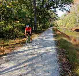
• The Plantation Preserve Linear Trail: a one-mile trail that bisects a public 18-hole golf course (the Plantation Preserve Golf Course) and has water paralleling on both sides, traversing wetlands and is a popular spot for birdwatching.
• C-13 Canal Greenway Trail: offers a paved, flat, and open route from the outskirts of Oakland Park through Lauderdale Lakes.
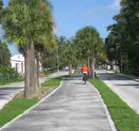

• New River Greenway: Runs east-west and connects to the everglades. A potential expansion of this route may include a proposed path along the North Fork New River east towards the Turnpike (parallel to Sunrise Boulevard). From the Turnpike there is an opportunity to connect to an existing trail that heads south. With a few other potentially viable connections, this route may connect to the New River Greenway.
TRAIL/ SHARED-USE


CANAL SECTION TRAIL EXAMPLES Water Control District Green Space Proposed Trail/SharedUsed Path The Blake
School
Exis ng
Canal
NW 74th Ave/
Gold Key
Blvd Pedestrian
Bridge
Single Family Home (beyond) Condominium (beyond) City of Sunrise City of Planta ti on Planta ti on W at er Control District Planta ti on W at er Control District
Hudson River Greenway, NYC
Katy
Trail, Dallas Pinellas Trail, Tampa
C&O
Canal, Washington DC
Description 01 Designate unpaved route for trail/ shared-use path 02 Add lighting on the trail and adjacent properties. Special lighting on and around the potential crossing connections 03 Provide dog waste stations 04 Provide “trail” programming events Mid-Term Improvements 01 Provide shade trees along path making sure they do not conflict with lighting 02 Pave route for trail/ shared-use path Long-Term Improvements 01 Expand new paved path to encourage greater capacity 02 Enhance path amenities to include rest areas with water and shelter 03 Provide bike share stations at trail heads 04 Provide pedestrian bridge over canal
PATH 107 | EAST SUNRISE IMPROVEMENTS MASTER PLAN
INFRASTRUCTURE
The purpose of this section is to review issues related to infrastructure including water, wastewater, natural gas, utilities and storm water systems.
WATER
The City of Sunrise Utilities Department’s drinking water is from the Biscayne aquifer through a series of wells. The aquifer is replenished by surface water recharge that percolates into the aquifer through many feet of soil, sand and rock that act as natural filters to remove impurities. The City’s wells have a capacity to deliver 51.5 million gallons of water per day and the Utility serves approximately 215,000 people within Sunrise, Weston, Davie, and Southwest Ranches. The Utilities Department operates four well fields and three water treatment plants.
Treatment of the water includes lime softening, filtration, and disinfection. Also, a small portion of the water is treated with Reverse Osmosis membranes at the Springtree Water Treatment Plant. Treated water is stored to meet peak demand periods. Chlorine and ammonia are added for disinfection and fluoride is added for dental health purposes.
The east Sunrise Improvements Study Area is treated at the Springtree Water Treatment Plant and that water is pumped through a transmission system consisting of pipes and storage tanks to ensure demands of local distribution systems are met. The permitted capacity of the Springtree Water Treatment Plant is 25.5 MGD, the current annual average daily water demand is 14.8 MGD and, as of April 24, 2017, outstanding committed capacity is 0.05 MGD. Therefore, approximately 10.7 MGD of additional water capacity exists for development in east Sunrise.
WASTEWATER
There are three wastewater treatment plants currently operated by the City of Sunrise Utilities Department: Springtree Wastewater Treatment Facility (WWTF) with a capacity of 10 MGD, Sawgrass WWTF with a capacity of 20 MGD, and Southwest WWTF with a capacity of 0.99 MGD. The total wastewater treatment plant capacity for the City of Sunrise service area is 30.99 MGD.
The east Sunrise Improvements exist within the Springtree WWTF Service Area. The total current wastewater demand within this area are approximately 8.7 MGD, and, as of April 24, 2017, outstanding committed capacity is 0.05 MGD. Therefore, approximately 11.5 MGD of water treatment capacity exists for development in east Sunrise.
NATURAL GAS
The City of Sunrise owns a natural gas utility that provides service to nearly 10,000 homes and businesses located in Sunrise, Tamarac, Lauderhill and Weston. In order to determine available capacity, a specific service request must be made for each subject property.
STORMWATER
The City of Sunrise drainage system consists of a tertiary system of catch basins and roadside swales, a secondary system of canals and lakes and a primary canal system, which is regulated by the South Florida Water Management District. The City is currently undertaking a Master Planning Effort with a consultant to update the specific stormwater needs throughout the City.
GENERAL FEEDBACK BASED ON PROPOSED STREETSCAPE IMPROVEMENTS
The proposed streetscape improvements have been reviewed in relation to the existing infrastructure. For each of the corridor improvements planned, there are no direct conflicts with existing or known proposed infrastructure. Each of the corridors must be reviewed for site specific conflicts with infrastructure during the design phase. Stormwater inlets may need to be adjusted horizontally or converted into gutter inlets to accommodate proposed curbing.
108 | EAST SUNRISE IMPROVEMENTS MASTER PLAN
SIGNAGE & LANDSCAPE
The way people feel about a place as they travel through it is influenced by many things, but signage and landscaping have a very significant impact on those perceptions – and the willingness of people to invest their time and money in a place. Signage is an essential tool for communicating what kinds of businesses and public institutions are present, and even private signage helps us find our way. If poorly designed or maintained, signage can also make a place feel chaotic, unwelcoming, boring, or disorderly – qualities that are not attractive to most people.
The Plan addresses the need for careful design and placement of signage as part of the strategic recommendations for each District. It also suggests the need to coordinate signage placement and design carefully with landscaping requirements that can sometimes block signage unintentionally. Several Opportunity Sites recommendations discuss the need for special attention to this kind of design coordination.
Landscaping helps create environments that soften the look and feel of the hard materials we use to build structures, roads, sidewalks, plazas and other spaces. Sidewalks lined with shade trees and colorful flowers are places people want to be. Medians and front yards with colorful flowers help people feel engaged and safer. Landscape buffers between single family homes and other uses help make both kinds of places more appealing. Even parking lots with great landscaping can be appealing to visitors and shoppers. Research has validated the health benefits of landscaping and other natural features as well. The Plan addresses landscaping concepts and requirements as part of the recommendations for each District, and it suggests some kinds of landscape buffers for several of the Opportunity Sites, including some suggested ways to create new landscape requirements as part of a new form-based code.
By carefully addressing signage, landscaping, and the balance between them for commercial properties, the Plan helps to improve the attractiveness and appeal of public spaces – including commercial spaces. This new attractiveness will accelerate the rates of visitation, investment, walking/biking, spending, and social interaction that make places vibrant.
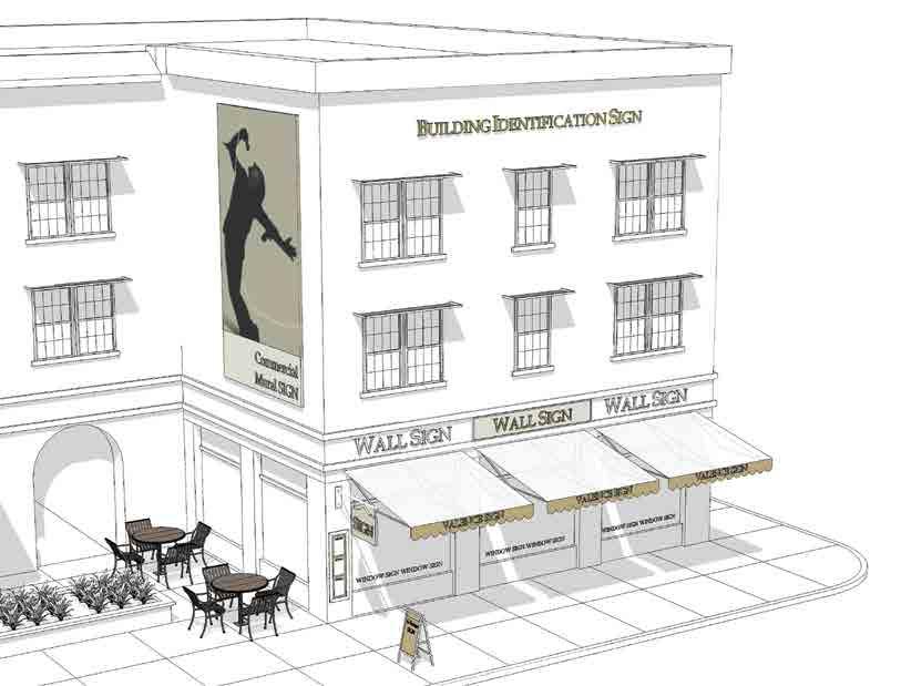
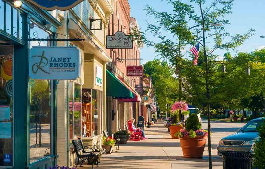
NEXT STEPS
5 Ensure signage design guidelines promote the districts and the goals within or create signage guidelines to help businesses and properties amplify the image and brand for east Sunrise.
5 Encourage business owners to upgrade signage.
W Example of signage design guidelines S Example of well-designed sidewalk with business signage and landscape. AMAC Small Business Solutions109 | EAST SUNRISE IMPROVEMENTS MASTER PLAN
IMAGE & BRAND
Successful implementation of the Plan strategies and projects will require intentionally addressing the image and brand of east Sunrise in order to accelerate progress and change the way people feel about the place. Through the redevelopment and revitalization planning process, several initial steps of brand development and marketing strategy were begun. However, additional steps need to be taken to create a brand promise, and business and consumer attraction marketing plan and campaign.
To assist with future implementation, the following objectives and strategies were developed:
Image and brand tend to define people and describe a city or particular neighborhood/district based on certain assets and attributes (or lack of). Once a city or district has undergone a branding and visioning process, it’s important to convey that message and reinforce the brand. Everything from signage, print materials, city logo, tag lines, color schemes, design guidelines, regulatory guidelines, retail storefronts, building heights and connections, perception of safety, decorum at city council meetings, and even types of landscaping materials all contribute to the image of a city or a particular area. The constant reminder of “WHO” the city or neighborhood is should be part of everyday discussion inside city hall.
NEXT STEPS
1. Create a branding campaign (see “City Branding Guide” in the appendix for action steps).
2. Create community identity (brand) through architecture, furnishings and other improvements.
3. Create regularly occurring signature events for communities to connect and celebrate, building community pride and supporting the city brand.
4. Hold “Banker/Broker” Events – this program is designed to engage both the banking and brokerage industries in the redevelopment process. The Neighborhood Ambassadors can assist with the event. Information about what the City is doing to attract business and promote housing opportunities and development is provided during a fun and entertaining event. Tours can be arranged to tour the attendees around key sites to inform them of what’s going on in the City. Collecting a data base of contacts begins the process of ongoing communication and outreach and results in word spreading about the redevelopment efforts underway.
5. Implement a clean and safe program: Adequate law enforcement is required to protect property values, commercial activity levels and the quality of life of the residents. The term “clean and safe” is the modern, urban phrase for well-maintained streets and a police presence. The reputation of the City rests on the shoulders of a safe environment where residents and visitors feel safe to walk throughout the area at all times of the day and night. Community policing involves a plan that includes proper staffing and training of personnel, and engagement with the citizens and businesses of the area.
6. Promote east Sunrise and its assets to increase awareness, elevating the opportunity for investors, developers and businesses to discover the business - friendly environment in Sunrise, including participation in:
5 Chambers of Commerce activities and events
5 Trade Shows
Trade shows that are forums for expanding businesses including retailers, restaurants and other businesses should be part of the City’s Business Attraction Program. For example, International Council of Shopping Centers has over 70,000 members and conducts conferences throughout the year that afford the opportunity to meet representatives from the industry and talk with them about the City and its opportunities. The annual regional conference is held in Orlando every August. Urban Land Institute is another valuable entity for affiliation; the city should become a member and attend events to reach the development industry professionals who attend ULI events.
5 Discovery tours during events
Use events to tour potential businesses and investors, showcasing the opportunities available and increasing interest and commitment to the area.
110 | EAST SUNRISE IMPROVEMENTS MASTER PLAN
Merchant Association & Neighborhood Ambassador Program & Community Involvement
Existing businesses have a major role to play in strengthening the brand of east Sunrise, and they need to get better organized to have real impact. Working with the Chamber of Commerce – or even independently – a core group of merchants should be recruited to provide guidance, support, ideas, and regular feedback. The exact structure will depend on those involved.
A key program for these business people to champion is the Neighborhood Ambassadors Program. The objective of this program is to educate and engage residents and business owners through social networking events presented by the City of Sunrise and hosted by area shops and restaurants. This helps with great storytelling and referrals. A more complete description of the program is located in the Plan appendix.
Strong communities have engaged resident and business members. A Neighborhood Ambassador Program creates a forum to ensure the residential and business communities are made aware of and participate in the redevelopment process. This format can be used for a main street or business area as well in the form of a Merchant Ambassador Program. For the purposes of this plan, the Neighborhood Ambassador Program will provide the template that can be used as a guide for multiple purposes. These “Ambassadors” are key to providing an army of people who are actively promoting the shared vision and future of the City. They become “brand champions”.
NEXT STEPS
5 Engage the resident and business community and create a platform for outreach and exposure for the initiatives outlined in the Master Plan.
5 Use the Neighborhood Ambassadors program as a vehicle for an expanded, more effective merchant association (for business crosspromotions and word-of-mouth recommendation).
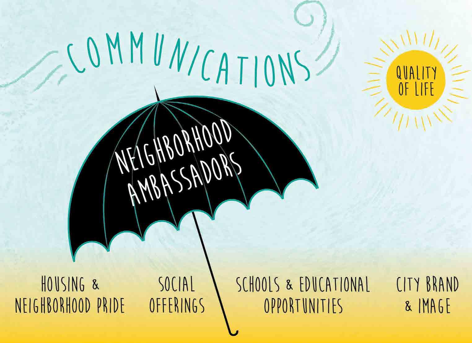
111 | EAST SUNRISE IMPROVEMENTS MASTER PLAN
REGULATORY ENVIRONMENT
The following link visually demonstrates how a form based code impacts different types of properties going through a redevelopment process.
VISUALIZING BETTER RULES https://vimeo.com/89351836
Two important aspects of an effective regulatory environment are predictability and speed. New or amended regulations should work to maximize predictability using clear language and foster educational efforts to guide the private sector’s understanding of the regulations. east Sunrise projects could also receive priority or expedited permit processing and other regulatory approvals. Such features are highly attractive to potential developers and investors and given the current regulatory environment in many nearby communities, this may create a competitive advantage for east Sunrise.
Regulation is where a local government has the most ability to influence economic growth. Cities should look at their regulations as an incentive for development; if done effectively they will result in not only new development but improved quality of life.
Recommendations discussed in more detail in the Opportunity Sites and Districts sections include:
• more extensive use of form-based codes that help with both certainty and flexibility,
• enhanced code enforcement education and penalty efforts,
• the use of new design guidelines for a variety of features including lighting, landscaping and signage, and
• the provision of regulatory and enforcement flexibility as incentives when the majority of other regulations and guidelines have been adhered to or created on a particular site.
Note that although specific regulatory suggestions were made for the Opportunity Sites, regulatory options may vary once a form-based code is developed for east Sunrise.
The following section is from formbasedcode.org, and clearly demonstrates the benefits and intent of such as code:
A form-based code is a land development regulation that fosters predictable built results and a high-quality public realm by using physical form (rather than separation of uses) as the organizing principle for the code. A form-based code is a regulation, not a mere guideline, adopted into city, town, or county law. A form-based code offers a powerful alternative to conventional zoning regulation.
Form-based codes address the relationship between building facades and the public realm, the form and mass of buildings in relation to one another, and the scale and types of streets and blocks. The regulations and standards in form-based codes are presented in both words and clearly drawn diagrams and other visuals. They are keyed to a regulating plan that designates the appropriate form and scale (and therefore, character) of development, rather than only distinctions in land-use types.
This approach contrasts with conventional zoning’s focus on the micromanagement and segregation of land uses, and the control of development intensity through abstract and uncoordinated parameters (e.g., FAR, dwellings per acre, setbacks, parking ratios, traffic LOS), to the neglect of an integrated built form. Not to be confused with design guidelines or general statements of policy, form-based codes are regulatory, not advisory. They are drafted to implement a community plan. They try to achieve a community vision based on time-tested forms of urbanism. Ultimately, a form-based code is a tool; the quality of development outcomes depends on the quality and objectives of the community plan that a code implements.
CONVENTIONAL ZONING
Density use, FAR (floor area ratio), setbacks, parking requirements, maximum building heights specified
ZONING DESIGN GUIDELINES

Conventional zoning requirements, plus frequency of openings and surface articulation specified

FORM-BASED CODES Street and building types (or mix of types), build-to lines, number of floors, and percentage of built site frontage specified.
112 | EAST SUNRISE IMPROVEMENTS MASTER PLAN
FIVE MAIN ELEMENTS OF FORM-BASED CODES

1. RE GULATING PLAN - A PLAN OR MAP OF THE REGULATED AREA DESIGNATING THE LOCATIONS WHERE DIFFERENT BUILDING FORM STANDARDS APPLY.
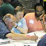
NEXT STEPS
5 Initiate Form-Based Code amendments.
2. PU BLIC STANDARDS - SPECIFIES ELEMENTS IN THE PUBLIC REALM: SIDEWALK, TRAVEL LANES, ON-STREET PARKING, STREET TREES AND FURNITURE, ETC.
3. B UILDING STANDARDS - REGULATIONS CONTROLLING THE FEATURES, CONFIGURATIONS, AND FUNCTIONS OF BUILDINGS THAT DEFINE AND SHAPE THE PUBLIC REALM.
4. A DMINISTRATION - A CLEARLY DEFINED AND STREAMLINED APPLICATION AND PROJECT REVIEW PROCESS.
5. D EFINITIONS - A GLOSSARY TO ENSURE THE PRECISE USE OF TECHNICAL TERMS
113 | EAST SUNRISE IMPROVEMENTS MASTER PLAN
LIGHTING & WAYFINDING
Vibrant places attract residents and visitors who will support cultural and recreational activities, patronize businesses, and attend special events. As east Sunrise becomes a place more people want to spend time, some of those people will be visitors not familiar with the area, and many of them will visit at night. Additionally, area residents will want to walk and stroll more in the evenings as exciting new businesses, events, recreational programs, and cultural opportunities increase.
To make these visits and walking experiences more enjoyable, special attention is needed to create or enhance different kinds of lighting. Also, a system of signage and icons will help visitors more easily find their way to and from east Sunrise. As described in the recommendations for each district, lighting investments will need to be made by both public and private entities, and some new regulations will be needed.
The City will need to drive the development of a wayfinding system for east Sunrise that is part of a larger system for the entire City. As suggested in the sections for each district, those signs and icons will need adequate lighting, so visitors can comfortably find their way after dark.
NEXT STEPS

5 Create an east Sunrise Lighting Program with themed design elements 5 Place lighting in areas defined in each district in the plan. 5 Create an east Sunrise Wayfinding Design Program including themed design elements with signage specifications 5 Place wayfinding signage at locations described in each district per the plan
PEDESTRIAN ORIENTED STREET LIGHTS
SEASONAL LIGHTS
PLACE BRANDING
POLE BANNER
BUSINESS
LIGHTS
PEDESTRIAN ORIENTED STREET LIGHTS
PLACE
BRANDING SIGNAGE AND ICONS BUSINESS LIGHTS
S
Example of a well-lit retail street along west Atlantic Avenue. Downtown Delray Beach, FL S Example of a well-lit retail street along northeast 2nd Avenue. Downtown Delray Beach, FL 114 | EAST SUNRISE IMPROVEMENTS MASTER PLAN
S east Sunrise Sample Wayfinding Package
VILLAGE CENTER
SUNSET STRIP GATEWAYS
CITY
PARK
COMMERCIAL CENTER COMMERCIAL CORRIDORS
CIVIC PLAZA
CITY PARK BASKETBALL MULTIPURPOSE FIELD PLAYGROUND TRAIL SHOPS
CAFE
COMMERCIAL RESTAURANTS SHOPS CAFES THE HOME DEPOT MAMA’S KITCHEN
SUNRISE GOLF VILLAGE PARK
VILLAGE CENTER BIKE WAYP iCITY PARK CIVIC PLAZA SHOPS 115 | EAST SUNRISE IMPROVEMENTS MASTER PLAN
PARKS, PLAZAS & PUBLIC ART
Public places where neighbors can comfortably spend time getting to know each other are an essential part of a healthy, vibrant community. A variety of these public spaces, from the formal to the informal, encourages positive social interactions among people of diverse backgrounds, ages, income levels, and even native languages. Public art in such places helps express care and concern and communicates the energy and culture of a particular place. Given the diversity of east Sunrise, a diverse array of public spaces will help improve community cohesion, pride, and reputation or brand.
The City has already made significant commitments for exciting improvements to multiple parks in east Sunrise in ways that enhance opportunities for more use and social interaction. Also, this Plan recommends some additional changes to parks and open spaces in the sections for various districts and on some of the opportunity sites.
Urban plazas are a different kind of public space more suited to events, markets, vendors, entertainers, and retail connections. An urban solution with less landscaping than parks, plazas can also help with the positive identity or brand of a place. A new major central plaza is recommended and more fully described in the Village Center District and Post Office opportunity site sections of the Plan. It will function as a regular gathering place for both residents and visitors, and it will become a key part of the identity of east Sunrise.
Public art can help transform the way people feel about a place. It has been used for centuries to express community pride, tolerance, diversity, and the creative culture of places. Given the variety of public spaces available in east Sunrise, including medians, parks, plazas, and civic buildings, there is a tremendous opportunity to use public art to change perceptions, enhance community pride, improve wayfinding, and make walking a more enjoyable experience. Specific recommendations for ways to include public art can be found in several sections on Districts, with a special focus on gateways and the Village Center. Also, several opportunity sites provide significant opportunities to include public art on private property.
NEXT STEPS
5 Create guidelines for public art and codify them at a commission meeting to guide installation per recommendations in each district.
 S Example of public art in public spaces by Sextafeira. Coral Gables, FL
116 | EAST SUNRISE IMPROVEMENTS MASTER PLAN
 S Example of well-designed plaza with vendors, seating, and pavers. Charleston, SC
S Example of public art in public spaces by Sextafeira. Agueda, Portugal
S Example of well-designed plaza with vendors, seating, and pavers. Charleston, SC
S Example of public art in public spaces by Sextafeira. Agueda, Portugal
117 | EAST SUNRISE IMPROVEMENTS MASTER PLAN
IMPLEMENTATION
A. STAFFING RESOURCES & ORGANIZATION
Managing the implementation of so many improvement projects and programs will require multiple partners and champions both inside and outside City Hall. Setting priorities, establishing feedback loops to assess progress, coordinating and sequencing various efforts, ensuring that all efforts support the shared vision, attracting new funding, and communicating to internal and external audiences will require people and processes not currently in place. The City has already recognized the need for a person to manage this coordination focusing exclusively on east Sunrise.
At the same time, support from others will be essential for success. This includes strong priority support from key City staff from every department including but not limited to: Recreation, Community Development, Police, Communications, Engineering, and of course the City Manager’s Office. To help ensure both close coordination and broader team support, the creation of an “internal” east Sunrise Task Force is recommended. The Task Force should meet monthly, follow a formal agenda, and create meeting notes that clarify assignments, deadlines, and targets for progress measures.
Beyond City Hall, active partnerships will be needed with east Sunrise Homeowner Associations, County Engineering and Development staff, Broward County Transit, Broward Alliance, Chambers of Commerce, the Convention and Visitors Bureau, and Realtors groups, among others. A kick- off event of some type should include these partners, and they should be brought back on occasion to hear progress reports and successes within the community. It is important to make it clear they need to actively support the Plan and east Sunrise.
More specifically, there is a need to create a group of carefully selected east Sunrise business leaders to provide regular feedback about project and program details, progress and priorities. Initially, this group should meet monthly. Longer term, they can meet quarterly. A longer-term goal is for the businesses to self-organize around co-marketing opportunities, including events.
Annually, in order to maximize support and engagement by all partners and stakeholders, the City should present a progress update at a location in east Sunrise. Branded marketing materials that promote the progress should be produced and distributed as often as possible.
NEXT STEPS 5 Create an internal east Sunrise Task Force 5 Create a partnership group list and host Celebrate Sunrise kick-off event 5 Create a business forum for “In the Biz” business leaders to hear about redevelopment plans 5 Hire lead staff person 5 Create and distribute promotional materials regarding plans 03 118 | EAST SUNRISE IMPROVEMENTS MASTER PLAN
Internal City Task Force
East
Coordina�on
Sunrise Organiza�onal
Parks & Recrea�onal, Community Develop ment, Police, Engineering, City Manager’s Office, Economic Development, Planning Private Sector Partners Chambers of Commerce, Realtors Biz Leaders Key Property Owners, Large Local Developers and Business Leaders Public Partners/ Quasi Public Broward County Transit, FDOT, Conven�on and Visitors Bureau, Broward Alliance, MPO, Key Legislators, House/ Senate, County Commission Neighborhood Representa�on Civic Groups, Home Owners Associa�ons, Clergy City Public Informa�on Office Press, Public Rela�ons Prepared By: RMA 119 | EAST SUNRISE IMPROVEMENTS MASTER PLAN
PROGRAMS & FUNDING SOURCES
There are a wide variety of incentives available throughout the county and state. While cities are not inclined to provide local general funds to the private sector, there are certain market conditions that cannot be overcome without some form of financial assistance. The cities that choose to utilize taxpayer dollars for incentives need to ensure the programs are effectively addressing problems that the private sector market can’t address alone. Also, the “but for” test should be applied to all incentive programs, i.e. “but for” the city’s assistance, a project or investment in a project, would not happen. City incentives can be extremely effective at stabilizing weak or unstable real estate conditions, especially in areas where the small business owner or large development site cannot afford to invest funds in the property and still produce a positive cash flow. By assisting property and business owners, the city can create a stable real estate climate and attract new investment that would not have otherwise been realized.
At the time of this study, there are approximately 707 businesses within the east Sunrise Study Area. The large number of businesses in the district is beneficial from a collective cluster standpoint. The famous Aristotle quote “The whole is greater than the sum of its parts” applies in this instance. Opportunity exists for better coordination among merchants as well as business retention and recruitment programs.
THE FOLLOWING SECTION DEFINES CURRENT AND OPTIONAL INCENTIVE PROGRAMS AS WELL AS OTHER FUNDING SOURCES FROM COUNTY, STATE AND FEDERAL SOURCES.
City of Sunrise Incentives
• Are primarily available for headquarters facilities and regional operations that require high-wage corporate employees. Technology-based, value-added operations are also incentive candidates.
• May be awarded upon receipt of a certificate of occupancy, or over a specified period of time.
• Vary by project, but award amounts generally range from $50,000 to more than $1million.
Broward County Incentives
• Broward Redevelopment Program - The Broward Redevelopment Program provides funding for eligible projects in defined redevelopment areas which have demonstrated blighting conditions, higher unemployment rates and lower property value growth than those of the municipality which the project is located or the County. The county has a formal application process and incentive funds are capped.
• Broward County Job Growth Incentive - The incentive is a direct cash incentive paid to new or existing companies creating jobs in excess of 115% of the County's average annual wage. This program requires the joint participation of Broward County and the municipality in which the company is, or will be located. Companies could receive up to $2,000 per new job created to a maximum Broward County contribution of $200,000 per company.
• Worker Training Programs - Career Source Broward offers employer’s financial assistance through several grant funded training programs for both new hires and existing employees.
• Metropolitan Planning Organization Funding - The City should work with the MPO and advocate for additional transportation investments that will improve connectivity and aesthetics of the area’s main corridors.
State Incentives
• Qualified Target Industry Tax Refund - The Qualified Target Industry Tax Refund incentive is available for companies that create high wage jobs in targeted high value-added industries. This incentive includes refunds on corporate income, sales, ad valorem, intangible personal property, insurance premium, and certain other taxes.
• Brownfield Incentives - Florida offers incentives to businesses that locate on a brownfield site with a Brownfield Site Rehabilitation Agreement (BSRA). The Brownfield Redevelopment Bonus Refund is available to encourage Brownfield redevelopment and job creation. Approved applicants receive tax refunds of up to $2,500 for each job created.
• Research and Development Tax Credit - Florida provides a corporate income tax credit for certain qualified research expenses for eligible businesses in the following industries: Aviation and Aerospace, Cloud Information Technology, Homeland Security & Defense, Information Technology, Life Sciences, Manufacturing, Marine Sciences, Materials Science, Nanotechnology
B. INCENTIVE
DATA FOR ALL BUSINESSES IN AREA EAST SUNRISE STUDY AREA CITY OF SUNRISE BROWARD COUNTY Total Businesses: 707 4,776 97,729 Total Employees: 3,924 50,0111,066,495 (US Census Bureau, Census 2010, ESRI Inc.)
120 | EAST SUNRISE IMPROVEM ENTS MASTER PLAN
• Manufacturing Machinery and Equipment Sales Tax Exemption - Offers tax exemption on the purchase of machinery and equipment purchased by qualifying Florida manufacturing companies.
• New Markets Tax Credits - The New Markets Tax Credit (NMTC) Incentive Program provides low interest, privatesector financing for commercial and mixed-use projects in low income areas. Eligible projects must meet a minimum capital investment of $5 million and varying job creation thresholds for consideration. Tax credits totaling 39 percent of the original investment amount are issued to individual and corporate investors making onetime, upfront equity contributions to qualified development projects through community development entities and claimed over a period of seven years.
• Department of Economic Opportunity Grants - The Florida Department of Economic Opportunity (DEO) provides grants to local governments for the planning and implementation of economic development initiatives. Grants are usually in the $40,000 range.
• Economic Development Transportation Fund - Enterprise Florida developed the Economic Development Transportation Fund, commonly referred to as the “Road Fund,” an incentive tool designed to alleviate transportation problems that adversely impact a specific company’s location or expansion decision. The award amount is based on the number of new and retained jobs and the eligible transportation project costs, up to $3 million. The award is made to the local government on behalf of a specific business for public transportation improvements.
Federal Programs
• Industrial Revenue Bonds - Established expressly for existing small and mid-sized manufacturers, and 501(c) (3) non-profit corporations, the Industrial Revenue Bond (IRB) program is marketed and coordinated in Broward County by the OESBD. This is a federal program providing tax exempt financing for qualified capital projects. Bond proceeds must be used for the acquisition of land and/or a building, construction of a new facility, renovation of an existing facility or purchasing machinery or equipment.
• Community Development Block Grants - CDBG funding is available for eligible projects through Broward County. The program funds can be used to build community facilities, roads, parks, and repair or rehabilitate housing, provide new or increased public services to residents, or fund initiatives that generate or retain new jobs.
• Housing and Urban Development Grants and Loans - The US Department of Housing and Urban Development (HUD) provides low-interest loans to local governments for the implementation of capital projects for revitalization and economic development, including streetscape and infrastructure improvements. These loans can be supplemented by Economic Development Initiative (EDI) grants from HUD.
Additional Incentive Programs (City Incentive crafted for specific city goals)
• Facade & Business Site Improvement Program - This program encourages business owners to enhance their existing business facades through exterior improvements. This includes most exterior elements including windows, doors, paint, signage, design elements, etc. The CRA provides 80% of project costs up to a maximum contribution of $20,000 per property address, linear footage etc. Amounts can vary per program guidelines.
• Strategic Investment Program (SIP) - This program, which uses a formula that considers the amount of new tax increment generated from each project, is for rehabilitation or renovation of properties, tenant improvements, etc. Payment is made on a reimbursement basis. The maximum grant amount can be established to meet the needs of each district. Generally the incentive range from $10,000 - $50,000 for large buildouts such as restaurants.
• Capital Improvement Grant Program - This “interest only” program works in conjunction with the lenders and provides an incentive of 50% of the interest on a loan amortized over a five year period. The maximum loan amount the incentive will apply against is $350,000. The interest payment amount is intended to reduce the upfront costs of renovation to buildings.
• Strategic Investment Streetscape Program (SISP) - This program is designed to work in concert with new development and public infrastructure upgrades to create a higher quality environment and develop a sense of community. Eligible expenses include sidewalk and streetscape improvements or other streetscape elements related to a project.
• Relocation and Development Incentive Program - This program allows the city to cover moving expenses or other items associated with attracting targeted tenants to the area, or relocating an existing tenant. Each project is considered separately since conditions vary from project to project.
• Real Estate Development Accelerator (REDA) - This program is for all major projects that are (usually) ground up development projects. The minimum amount of investment must be $5 million in construction. This mimics a tax increment financing program whereby the incentive funds come from the development itself based on the new city taxes created from the new development.
• Public Private Partnerships - Municipalities routinely partner with developers to encourage design and/or construction of parks and other public facilities and infrastructure projects. This type of partnership between the city and private sector community has been used to deliver projects such as entertainment and cultural facilities, governmental facilities, infrastructure improvements and land development.
• Business Improvement District (BID) - This is a long-term goal. The City’s business retention and attraction program should initially focus on businesses and building relationships for future BID implementation. Once the business community is stabilized a BID can be created for street beautification such as planter beds, marketing and promotion of area businesses, and general upgrades to a specific area.
NEXT STEPS 5 Review incentives and choose which ones to incorporate into the implementation of the plan 5 Create an incentive “package” that defines what assistance is available in east Sunrise and share with the business community 121 | EAST SUNRISE IMPROVEMENTS MASTER PLAN
C. RECOMMENDATION MATRIX
An implementation matrix summarizing the recommended plan tasks, suggested timelines, and roles for various departments and partners was provided separately to City staff. It is a tool that will be updated regularly.
122 | EAST SUNRISE IMPROVEMENTS MASTER PLAN
APPENDICES Click the links below to view/download PDFs. Market Analysis Mobility and Public Realm Analysis Public Engagement Brand Manual "How To" Guide Neighborhood Ambassador Program "How To" Guide 04 123 | EAST SUNRISE IMPROVEMENTS MASTER PLAN
WWW.RMA.US.COM