City of Launceston Recreation & Open Space Strategy



In total, the City of Launceston (the City) has 253 public open spaces (POS) which equal a total of 980 hectares of POS.
The City of Launceston recognises the importance of open space and recreation in its strategic planning. Open spaces and recreation facilities, when designed, maintained, and utilised thoughtfully, can become dynamic assets that benefit the health and livability of a city and its inhabitants.
Over recent years and in response to the Covid 19 pandemic, the City of Launceston has grown and changed. There is need for a refreshed Recreation and Open Space Strategy that reflects the changing needs of the population, demographic shifts, urban growth, and visitors.
Dynamic and considered planning will ensure that Launceston continues to be a highly livable city. A city with fantastic public amenities and services that meet the current and future needs of the community.
This document provides a summary overview of results from the background research and analysis to date of policy and open space provision in the Launceston Local Government Area (LGA).
The project will replace previous open space planning by the City. This includes:
• The Launceston Play Spaces Strategy 2013
• The previous Open Space Strategy endorsed in 2007.
• The Regional Open Space Strategy endorsed in 2004.
The term public open space (POS) encompasses the variety of spaces within the urban environment that are freely accessible to the wider community for recreation and enjoyment. The definition can be context dependent and, in a policy context varies from state to state.
The Local Government (Building and Miscellaneous Provisions) Act 1993 (LGBMP 1993) Part 3 – Subdivisions, defines public open space as:
‘space for public recreation or public gardens or for similar purposes’.
Under the Local Government Act 1993, public open space is not defined however public land is defined as:
‘a public pier or public jetty, any land that provides health, recreation, amusement or sporting facilities for public use, any public park or garden, any land acquired under this Act for the purpose of establishing or extending public land, any land shown on a subdivision plan as public open space that is acquired by a council under the Local Government (Building and Miscellaneous Provisions) Act 1993 and any other land that the council determines is public land.’
The Tasmanian Open Space Policy and Planning Framework defines open space as:
‘Land and water settings maintained and managed for a range of environmental and social purposes and that are valued and may be used by the community.’
As such, POS can encompass a variety of land uses, such as parks, pathways, malls, riparian areas for recreation activities, environments with ecological significance, golf courses, cemeteries, and bushland reserves.
The following key terms are defined in the context of this report.
Accessibility
The degree to which the numbers of people have access to a location, facility, program, open space, and cycle and walk networks.
Walking, cycling or using public transport. Active transport is an alternative to car travel and can provide benefits, such as increasing daily physical activity and reducing greenhouse gas emissions. Ancillary benefits can also include an increase in the sense of community and improved mental health.
The structures and places in which we live, work and play, including land uses, transportation systems and design features.
Catchment
This is the sphere of influence of an open space and it reflects the origins of users and how long they may stay.
Encumbered
Public land that is restricted, and which the primary purpose is not open space for one or more of the functions described above can be considered as encumbered. Such spaces may be investigated for potential use where appropriate for recreational purposes where there is a gap or need.
This is the primary purpose or role of the open space within the network of open spaces across Launceston.
The administrative area covered by local government councils in Australia
Open space
Land and water settings maintained and managed for a range of environmental and social purposes and that may be used by the community
A design-based approach to shaping urban environments and optimising the performance and efficiency of neighborhoods, towns and cities, paying particular attention to the way urban spaces work, interface between public and private realms and natural environment, cultural values, integrated movement systems and built form.
As part of the project, a review by SGS Economics and Planning was undertaken to provide an overview of the policy and legislative framework for the collection of open space contributions within the Tasmanian Planning Scheme. The findings from this background review are presented in Appendix 1.
Background
To ensure Council can continue to provide high quality open space into the future, adequate open space contributions will be required. The current legislative context within Tasmania includes limited options available to Councils to utilise when capturing development contributions for open space. The most widely used is the one twentieth land or equivalent cash contribution under the LGBMP 1993, which is leveraged in numerous Open Space Contribution Plans across the state.
The City of Launceston has no formal policy relating to public open space contributions and instead relies on established internal processes to capture funding.
Tasmanian Civil and Administrative Tribunal (TASCAT) and Tasmanian Planning Commission
SGS Reviewed four Tasmanian Civil and Administrative Tribunal (TASCAT) cases in which open space contributions was a topic. The TASCAT cases were chosen based on their role in establishing precedents within this area of law. There were no relevant cases for open space found from the Tasmanian Planning Commission.
This analysis indicates that there is some support from the Tribunal for councils to refuse subdivision applications under s85 of the Act if the open space contribution is not appropriate. This can include what constitutes an increase in demand for open space, what discretion Councils have in applying the one twentieth rate stipulated under the LGBMP 1993, both nominally and in what form this will take, being land or a cash payment, in what instance contributions may be collected when an earlier
contribution has already been made, and what quality of land this must be.
Noting that the small number of cases brings a level of uncertainty to the above case law, to summarise, guidance from the reviewed case law indicates that:
• Council has the ability to refuse subdivision applications under s85 of the LGBMP 1993 based on open space considerations.
• There is a need to consider whether the subdivision will result in additional demand for open space.
• Council has discretion to apply the full 5 per cent rate.
• Council has discretion to determine whether this should take the form of cash or land.
• Council can specify the type and quality of land it will accept as a contribution, and
• Council can require a new contribution be made for a new subdivision on land that was previously subdivided and subject to a contribution.
Case law indicates that the current system of capturing contributions is well established under LGBMP 1993, noting however that demand must be first established.
In the development of the open space contributions policy the following components should be considered:
• If a subdivision results in an increase in demand for public open space.
• The type and quality of open space being offered.
• Any open space strategy or contributions policy that would provide guidance on whether a contribution should be accepted as land or cash payment.
When complete, the City of Launceston Recreation and Open Space Strategy will sit within the City’s Integrated Corporate Planning Framework.
This Strategy is intended to guide the future planning, provision, use, management and development of the municipality’s open space, including recreational opportunities.
The Strategy enables Council officers to respond quickly to planning enquiries and guide Council’s decisions in the acquisition and disposal of land.
It is noted that this project builds on top of previous open space planning conducted by the City. The previous Open Space Plan endorsed by the City was drafted in 2007 , more recently the Open Space Plan drafted in 2015 was not endorsed by the city. The project also builds on other strategic planning engaged by the City relating to green space, play and recreation, including those listed in Table 1 and the:
• Previous Open Space Strategies: 2007 (endorsed) and 2015 (unendorsed).
• The Regional Open Space Strategy endorsed in 2004.
1 City strategies and plans
DocumentPurpose
Play Spaces Strategy 2013 Provides principles for the location of parks for play, vision and framework for play and investment.
Potential alignments
• Recommendation for an open space catchment hierarchy of no more than 3 levels.
• Areas where population or density will increase in future and where new play spaces will be required to serve those developing areas.
Northern Tasmanian Sports Facility Plan 2023
Provides future directions for the planning and provision of formal sport and active recreation facilities in the municipality.
• Continue to build on and expand existing sport and recreation facilities.
• Seek to promote the use of existing sport and active recreation facilities, partner with schools.
• Undertake a demand study for informal active sport to understand the community’s needs.
Figure 1 Hierarchy City of Launceston Strategic Plans
Urban Greening Strategy 2023 - 2040 Sets target for doubling canopy cover in the urban area by 2040, improving urban forest diversity and supporting biodiversity. .
• Create a green network that provides linkages between places and connects people to key destinations including open spaces.
• Provide approachable and accessible green elements.
• Increase tree canopy on active transport corridors.
• Ensure effects of extreme heat are mitigated.
Launceston Transport Strategy 2020 - 2040
Provides actions to deliver the 20 year transport vision and strategic direction for the City. Including integrated transport,
• Improve diversity of travel mode share by supporting walking, and riding for short trips and journeys to work.
• Prioritisation of access to public and active transport options.
• Integrated transport and land use planning in new activity centers to ensure livability and positive public health outcomes.
GREATER LAUNCESTON PLAN
Department of Infrastructure and Transport 2019 - 2034
REGIONAL LEGISLATION & PLANS
• Northern Tasmania Sports Facility Plan 2023
• Tasmanian Planning Scheme 2022
• Launceston Local Provisions Schedule
CORPORATE STRATEGIC PLAN City Of Launceston 2014 - 2024
RECREATION AND OPEN SPACE STRATEGY
2024 - 2040
ASSOCIATED POLICIES & DELIVERABLES
• Recreation and Open Space Implementation Plan
• Policies and Guidelines for Recreation and Open Space
• Open Space Contributions Policy
CITY OF LAUNCESTON INFLUENCING STRATEGIES, PLANS, & PROCEDURES
• Launceston Residential Strategy 2009-2029
• Launceston Transport Strategy 2020-2040
• Public Open Space Assessment and Acquisition Process
• Stormwater System Management Plan
• Sustainability Strategy 2019
• Sustainability Action Plan 20222030
• Urban Greening Strategy 20232040
• Reserve Management Plans
• Conservation Management Plans
• Bushfire Management Strategy for Council owned and Managed Land 2015-2025
As part of this project scope, a review of open space strategy hierarchy classification frameworks is to be undertaken. Under the previously endorsed open space strategy (2007), land was classified into six categories:
• Local
• District
• Sub-Regional
• Regional
• State
• National Challenges identified using the City’s existing framework include:
• Applicability of categories to settlement types and catchments.
• Number of category types (viewed as needing consolidation).
• Alignment with current open space spatial data.
A Revised POS Hierarchy
A hierarchy of open spaces is a function of the importance of providing access to a range of spaces which offer different benefits and functions for the community. It is used to document the size, use and distribution of open spaces and will be used by Council to address future gaps and provisions under different growth scenarios.
To create a new framework to guide the planning and provision of open space, there is a need to review and update the City’s POS hierarchy and classifications to address current identified challenges and make sure that:
• They are in line with current industry standards and best practice.
• The framework is simplified and usable for the City’s planners and open space managers
• They best reflect and serve the needs and activities of the community.
Based off work to date, a proposed hierarchy is provided in Table 1 opposite.
The POS functions are the primary use and expected activities undertaken within POS. These functions could be applied to an open space as ether the primary or secondary function, acknowledging that some spaces have more than one key use.
The City’s POS functions have been identified as:
• Recreation
• Conservation
• Urban and Civic
• Sport
• Access way / Link
• Utility
Public land that is restricted, and which the primary purpose is not open space for one or more of the functions described above can be considered as encumbered. Such spaces may be investigated for potential use where appropriate for recreational purposes where there is a gap or need. These spaces include:
• Government schools
• Utility easements
• Cemeteries
• Reservoirs
• Road reserves
• Streets and Transport Corridors
ClassificationSummary
Small Local Small Local spaces are often too small to play a recreational role, however provide a local link or green pocket. Less than 0.4ha N/a The City of Launceston will no longer accept spaces of this size as open space.
Local Local spaces are typically small parklands that service the recreational needs of the local residential population, such as children’s play, dog walking, informal sport, and relaxation
Neighborhood Neighborhood spaces serve as the recreational and social focus of a community. Residents of surrounding areas are attracted by the variety of features and facilities, informal sport, and opportunities to socialise.
to 1ha400m or 5min walk
Regional / Municipal Regional / municipal spaces are principally designed to provide for organised formal sport and can provide for local or community-level recreation. 5ha to 15ha+2km or 5 min drive
National National spaces may accommodate important recreation and organised sport space as well as significant nature spaces for conservation. They may also include environmental features such as water bodies.
The process of engagement for the project is extensive and has been designed to meet the City’s engagement principles (refer to CoL Community Engagement Framework, 2022).
Targeted and meaningful engagement ensures the future planning and development of recreation and open space is aligned with the needs and expectations of the community. It also ensures that Council is informing the community of the project at key stages.
Engagement has occurred across three stages from November 2023 and detailed summaries are provided in the appendices of this document. Together, the consultation has provided important insights into the community’s needs, desires and challenges with the City’s recreation and open space areas.
• Formal public promotion - Posters were placed in parks around the LGA notifying the community about the survey and providing links to the Tomorrow Together page (Council’s online community engagement tool).
• Community survey - Focusing on open space use, needs, aspirations and challenges. The community survey was hosted over four weeks on the Council’s Tomorrow Together page. Over 600 responses were received.
• Council Staff Workshop #1 - The workshop attended by approximately 43 Launceston City Council staff from both Strategic and Operations roles. Using the World Cafe format to uncover strengths, weaknesses and opportunities around open space provision and servicing.
• Online Stakeholder Workshops - Held with key stakeholder groups from access and inclusion, seniors, youth, natural environment, active recreation, and education fields.
• Councilor and ELT Session - TBC
Engagement Participation
Participants engaged to date across the project stages.
Engagement ActivityNumber of engaged
Strategic and Operational
Workshop x 1
43
Community Survey 605
Tracks and Trails Survey 614
Online Stakeholder Group
Workshops x 6
35 Stakeholders from 21 Groups
Total engaged 1300
• For both passive and active recreation, respondents predominantly cited that the parks and open spaces of Launceston somewhat meet their needs.
• Respondents cited the following recreational activities that Launceston should invest in to improve the playgrounds, parks, and reserves: Play, Walking, Climbing, Exercising the dog, Mountain biking, Trail running, Other – including outdoor gyms, yoga spaces, basketball courts, disc golf, picnic spaces and seating.
• A key need for improved playgrounds in the LGA. There is a particular desire for upgraded play areas that provide for a range of ages and abilities (from young toddlers to older teens and adults) with fenced areas that are easy for parents to supervise and all-weather facilities. Age-appropriate and abilityappropriate facilities were also mentioned by respondents.
• Dog walking is a popular activity in the LGA; many respondents noted a need for more dogs on a leash and off-leash areas and paths close to home.
• Activities that were mentioned by respondents that increase the use of their local park include basketball courts and half courts, disc golf, safe bike paths and walking trails.
• Amenities mentioned by respondents that would increase the use of their local park included toilets, seating, BBQ facilities, shade and fenced areas, and water refill stations. Some respondents also mentioned food and beverage opportunities would improve POS.
• Generally, survey respondents reported that they had access to a playground, park or reserve within a 5-10 minute walk of home (81%).
• A third of respondents reported issues when accessing the playgrounds, parks, and reserves in Launceston. Highlighting a general need to improve accessibility. Key issues mentioned by respondents as limiting access were: Safety concerns with few enclosed play spaces, mobility issues, parking issues, limited toilet facilities, limited public transport options and the quality of walking paths and bike paths.
• Need for better management of dog areas (to allow for a balance of areas that allow dogs, including fenced off-leash areas and areas that are restricted to dogs).
The top 5 most important ideas when thinking about the future of Launceston’s playgrounds, parks and reserves were cited as:
1. Supporting health and wellbeing.
2. Providing spaces that are accessible and equitable.
3. Tackling anti-social behavior in public open spaces.
4. Enhancing and growing the urban tree canopy.
5. Protecting the natural environment.
601 community online survey respondents over four weeks
Top 5 most popular POS in Launceston
56% Walk to their local park
37% Drive to their local park
33% of respondents reported issues when accessing POS’s*
37% of respondents felt that Launceston lacks POS
*Respondent’s key issues:
Safety concerns with enclosed playgrounds.
Lack of inclusive spaces for people with disabilities and mobility issues.
Limited public transport and cycling connections to POS.
Management of dog areas including fenced off-lead areas. The prevalence of smaller suburban parks with limited use or amenities Desire to upgrade play areas that provide a range of ages and abilities use.
81% reported having a POS within a 5-10 minutes walk from home
Tracks and trails are essential components of outdoor recreational spaces, offering opportunities for walking, hiking, biking, and more. These paths wind through natural landscapes, urban areas, and parks, providing avenues for exercise, relaxation, and exploration.
A second survey was conducted on Tomorrow Together to understand the communities experiences, preferences, and any challenges encountered while utilising tracks, trails, and shared paths in the Launceston area.
Key Findings
• Walking, running, cycling, and mountain biking are the top four most frequent ways of using Launceston’s tracks and trails. Other ways include wheelchairs, e-scooting and horse riding.
• The top four motivations for using the tracks and trails are to exercise, for leisure and recreation, to be in nature, and for relaxation. Highlighting the importance of both spaces for active and passive recreation.
• The majority of respondents access tracks, trails and shared paths weekly (39%), or daily (31%).
• Key factors that would increase respondents usage of tracks, trails and shared paths included: More amenities along the trails, better quality trails and more trails in the area.
Frequency
A total of five workshops were conducted over February 2024, engaging with the following key stakeholder groups for the project:
Access and Inclusions and Seniors groups
• Life Without Barriers
• NOSS Tasmania
• Baptcare
• Migrant Resource Centre (Northern Tasmania) Inc
• COTA Tasmania
Youth and Education Groups
• Playgroup Tasmania
• University of Tasmania
• Department for Education, Children and Young People
• Early Childhood Australia
Business Community and Tourism
• Northern Tasmania Development Corporation
• Visit Northern Tasmania
Active Recreation
• Active Tasmania
• Bicycle Network
• Crag Care Tasmania
• Launceston Mountain Bike Club
• Launceston Parkrun
• Tamar Bicycle Users Group
Natural Environment and Cultural Heritage
• UTAS
• Parks and Wildlife Tasmania
• Tasmanian Fire Service
• Decyp, Aboriginal Education
• Green spaces are crucial for the health of the community and maintaining the livability of a place. They are a key draw-card for visitors and locals alike.
• There is a need to prioritise the accessibility of POS for those who are walking, cycling, and using public transport. Many of the City’s POS are not easily accessible by active transport.
• Wayfinding is a key area for improvement to help people understand where to go, provide information about the POS and share stories about the history and community.
• Opportunities to activate open spaces that are currently not very appealing due to lack of amenity.
• Launceston’s climate means that you need shade, shelter and opportunities to sit in the sun in the POS. There are times of year when some trails and areas get wet and boggy, meaning that some trails are seasonal. Due to the seasons, lighting is also an important consideration to enable safe travel paths and activities at night and in the darker, winter months.
• Key need for play spaces that support the safe use by different ages and abilities, including fenced or enclosed spaces. Riverbend Park is a good example of this, but is unique in the context of Launceston.
• Addressing gaps in provisions for key groups such as young girls, 18-25 year olds and seniors who may feel excluded from some traditional POS offerings.
Community Aspirations and Ideas for POS
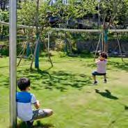
Play spaces that support different ages, abilities, and needs
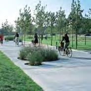
Improved and safer connections for bike riding and walking to POS
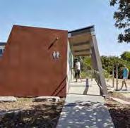
Considered planning of toilets, charging points and facilities
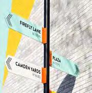
Improved wayfinding for trails and POS

for
access at night

Partnership opportunities for improving POS, such as partnering with schools.
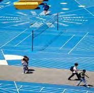
Opportunities for informal active recreation like grassy spaces and basketball hoops
Opportunities for knowledge and cultural sharing through plants
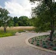
Use local plant species in POS design
The City’s population is currently 71,878 and forecast to reach 74,000 by 20321.
The City experienced a burst of growth between 2016 and 2020, growing 8.1%. Yearly population growth has since slowed in 2021 and 2022 to 0.1%2.
The population profile of the City shows that Launceston has a more aged population than Australia as a whole, but is younger than Tasmania in general. Population trends show all Tasmanian LGA’s will have over 20% of the population aged over 65 years by 2037.
As the population has grown over the years, it has also changed in makeup. The Nepalese and Indian communities are now the third and fourth largest after those of Australian and English descent3.
Launceston proportionally less healthy than Australia as a whole, with some significant differences between suburbs.
Homelessness has increased 87% from 2016 to 20214. Many complex contributing factors, including access to affordable housing, changes in economic circumstances and mental health issues.
As the City’s population increases, ages and changes in makeup the value and demand placed on existing POS will increase. With this growth it is critical that adequate and proper planning occurs to ensure that the provision of facilities and amenities meet the needs of the community.
This includes ensuring that public open spaces are culturally inclusive, age inclusive, and universally accessible.
(55,000) 31,274 71,8787 35,3936 75,000
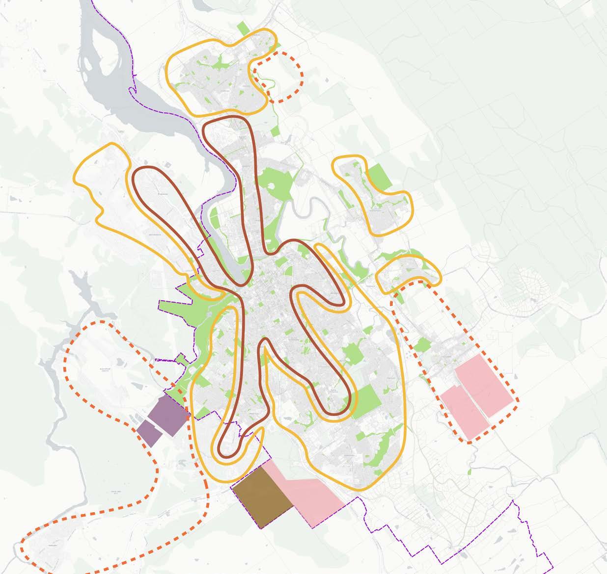
As identified in the report State of the City of Launceston 2023, historical growth areas for residential housing in Launceston have been exhausted. Areas to accommodate future population growth have been identified in the Greater Launceston Plan including:
• Priority urban consolidation in the inner suburbs and CBD
• Supporting urban consolidation in the outer suburbs such as Ravenswood, Kings Meadows, Waverley.
• Development in the Waverley and St Leondards growth corridor
• Development in the South West growth corridor
• Development of Strategic Reserve south of Prospect
Integrated Planning
Integrated land use planning of these areas will be required in the future to ensure that POS provision is delivered where people need it.
Studies show that residents with larger neighborhood parks within 1600m engage in 150 more minutes of recreational walking per week than those with smaller parks8. In the urban fringe areas experiencing growth, higher levels of amenity will potentially be required in existing open spaces to cater for higher use, and there will be increased demand for places to walk and cycle closer to home.
The provision of POS intersects with and has co-benefits with other features of the urban environment and natural processes. The following section maps and identifies how POS provision interacts with the following areas:
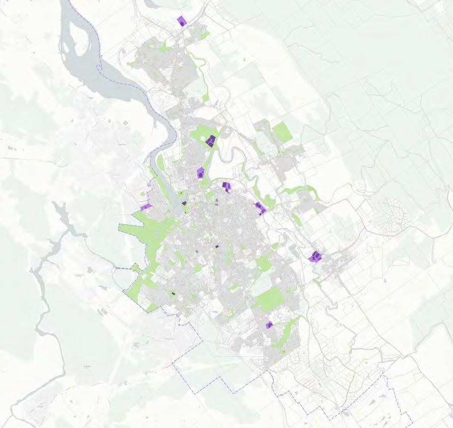
• Sport and recreation
• Play and youth spaces
• Tracks and trails
• Tourism
• Blue / green infrastructure
Considerations for the Launceston Recreationand Open Space Strategy
The Northern Tasmanian Sports Facility Plan is the key document regarding future directions for the planning and provision of formal sport and active recreation facilities in Launceston and surrounding LGA’s. Recommendations and strategic priorities from the plan, relating to POS provision are summarised in Appendix 3.
Mega trends identified by the CSIRO that are also predicted to shape the future of Australian Sport in the coming years include:
Consideration 1: Growing demand for informal social sports
Increase in fitness-based activity and non-formal sports participation is growing with 74% of the Australian population now participating in nonsport related activities (compared to 46% in 2001)9. Open Space provides a valuable platform fostering pathways to sport by providing spaces for social groups to gather and undertake commitment-free activities.
Consideration 2: Growing demand for outdoor ‘in-the-environment’ sports
These has been a growth in participation in outdoor ‘in-the-environment’ sports such as climbing, bushwalking, kayaking and mountainbiking. This includes greater use of green and blue spaces such as parks and rivers. Increased demand for natural areas needs to be balanced with maintenance and protection of these areas ecological values.
Consideration 3: Growing demand for inclusive, accessible, multi-purpose sports and recreation and open spaces
Wide-ranging use of community facilities should consider multi-purpose functions that are accessible and inclusive of diverse community members. Barriers to participation in formalised sports remain significant for some groups, including older populations, people from regional and remote areas, First Nations peoples, low socio-economic individuals, LGBTIQ+ people, people from culturally diverse backgrounds, and people with disability10.
Consideration 4: Interconnected open spaces with linking trails and pathways
Recreational walking (47.1%), running (14.5%), bush walking (14.1%), cycling (11.3%) and mountain biking (7.1%) all rank in the top eight sports with the highest participation rates in Tasmania11. Planning open space that facilitates interconnected pathways and trails that allow for shared multi purpose use would further promote the activities of walking, running and cycling.
Planning should consider barriers to participation and aim to be inclusive for all community members. E.g. Addressing female concerns around cycling safety through providing protected, well lit, connected cycling paths may promote women’s participation in cycling in Tasmania12. Tasmania has a higher participation rate in mountain biking (7%) compared to the Australian average (2%). Considering broader regional bike networks that connect to mountain bike trails may be important for open space planning.
Consideration 5: Mitigating Climate change impacts on sports and recreation
Climate change, and the associated increasing average global temperatures and frequency and intensity of extreme weather events, has been identified as a key threat to sports and recreation in Australia13.
Understanding the changing sports and rec needs of the community into the future
People need active recreation and open spaces for both organised and non-organised activities. Studies have shown that while participation in sport-related activities has decreased, nonsport, informal physical activities have increased greatly. This includes activities such as mountain biking, walking and gym use.
A survey conducted by the NTDC (Northern Tasmanian Development Corporation) for the Northern Tasmania Sports Facility Plan 2023 found that the average driving distance to sports facility for Launceston LGA respondents was 7km. Many respondents travel over 50km to attend sports facilities
Opportunities to increase participation and health outcomes
• Explore opportunities for more informal active recreation facilities i.e. grassed areas and hard surfaces.
• Explore partnership opportunities with schools through a community use agreement. Note alignment with strategic directions in the Northern Tasmanian Sports Facility Plan 2023. It would require understanding gaps and areas where facilities are lacking.
• Increase opportunities for cycling (in various forms).
• Provision for opportunities for old and young participants.
• Consider multi-purpose functions for community facilities and infrastructure
• Consider design and infrastructure barriers to participation for key groups such as women, LGBTQ+ people, people from culturally diverse backgrounds and those with disability.
Inclusive spaces that cater for a diversity of age groups
Young people need active recreation and open spaces for both organised and non-organised activities.
The City has some highly regarded play spaces in Riverbend Park, City Park and Punchbowl Reserve. However not all play spaces have a high level of amenity, meaning the distribution of quality play spaces is limited. There is a key need to address issues around inclusion and accessibility to ensure that more play spaces are catering to the diversity of the community’s needs.
Opportunities to design for all
• The play structures and equipment in POS can aim to cater to users of diverse ages and abilities from toddlers to young adults.
• Fenced play spaces are a key need for the community, particularly sought by parents with younger children, or children with special needs.
• Young people typically rely on lifts and public transport, limiting their access to POS spaces. This can be helped through safe pedestrian connections and public transport.
• Pedestrian paths provide users with an easy way to exercise, paths should be wide and smooth enough to use a stroller or wheelchair.
• Flexible design can allow for spaces that take on different uses at different times of day.
• Designing for inclusion can promote intergenerational social connections.
• Young girls are a key group often excluded from POS. Research shows that this group values swings, trampolines, and hangout spots like sheltered benches.

To get more people moving there is a key need to ensure that the City’s tracks and trails are safe and accessible.
The dominant mode of transport in the LGA is private car. Currently the proportion of people who travel to work by car is 89%, while 2% travel by bus and 5% walk. To improve the use of the city’s tracks and trails there is need to address the following factors:
• Some tracks and trails are not suitable year round
• Survey respondents cite a lack of safe pedestrian or cycling connections to accessing trails as a barrier to their use. Pointing to a need for lower traffic speeds, safe crossings, and continuous footpaths are to connecting people to their POS.
• Trail design including the quality and width of the trail surface is a key barrier for some users who may be deterred due to safety and accessibility concerns.
• Access to necessary amenities along trails (such as public toilets, places to rest and water fountains) is a key benefit that allows access for more people to use trails.
There is a key need to accommodate growing users including:
• Mountain biking
• Trail Running
• BMX
• Parkrun
• Bushwalkers and dog walkers

Launceston’s POS are key visitor attractions for the region.
Open spaces that are primary attractions for interstate and non-local visitors are Cataract Gorge, Riverbend Park, City Park, and Duck Reach power station, which is increasingly popular. These places are primary attractions aka ‘the crown jewels of the city’.
Launceston is a short stay destination
The upcoming state caravan and camping plan will include data that supports an increase in RV facilities. Lilydale Falls and Myrtle Park are mentioned as good spaces that support RV visitors but are often at capacity during busy months.
Tourist visits to Tasmania:
There were 1.25 million visitors to Tasmania last year (2023) with visitors spending 12.23 million nights, staying on average for ~9.5 nights14.
Interstate visitors made up 1,0097,000 of visitors visiting from outside Tasmania, while 185,200 were international (202315.
The mix of visitor trips around Tasmania were 39% interstate, 54% from within the state and 7% international16.
Altogether, tourism Gross State Product (GSP) both indirectly and directly contributed $2.59 billion or 6.7% of Tasmania’s total GSP. Accompanying this was the indirect and direct employment of 37,300 jobs, which is 12.1% of all jobs across Tasmania17
Both tourism GSP and tourism filled jobs on average were the highest in the country18
POS to visit in Launceston:
Cataract Gorge experienced 256K visitors and 20% of all vistor attraction visits across Tasmania
vistited Launceston City making up 42% of all visits to Tasmania
Visitors
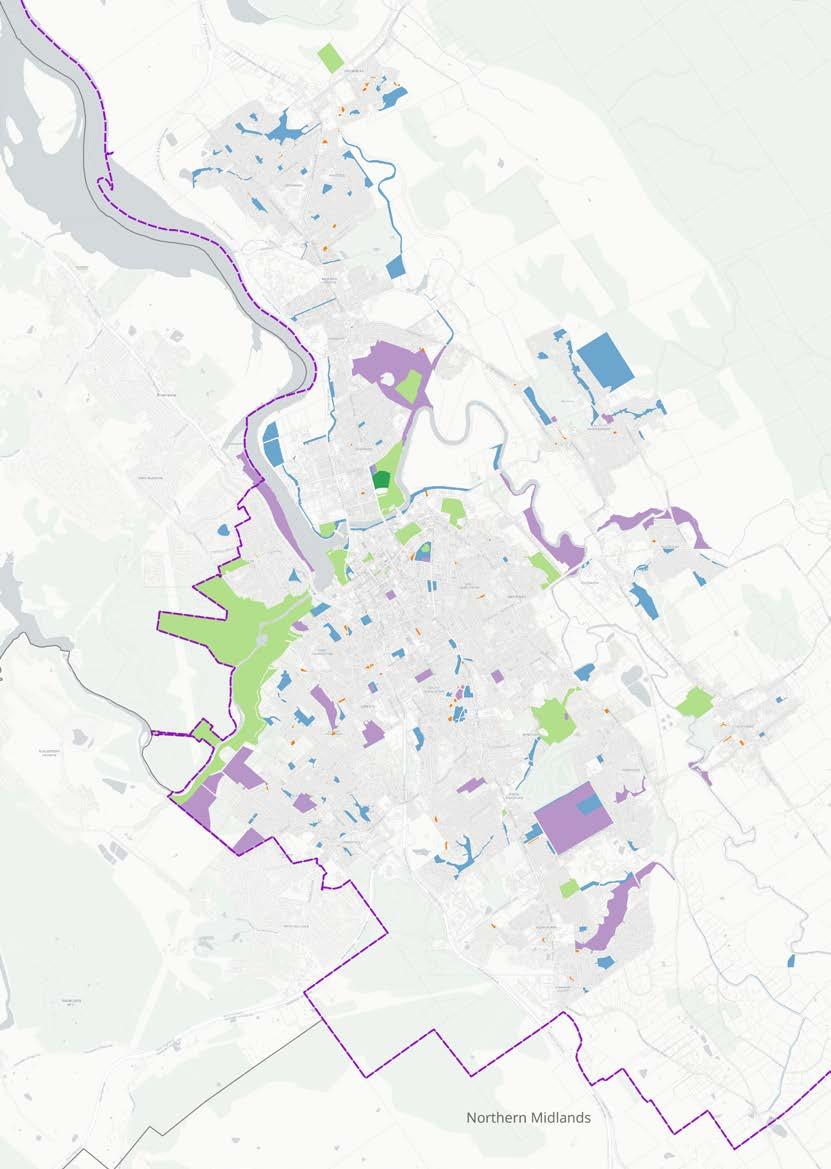
Launceston’s POS has a relationship with the water ways and hydrological processes.
Launceston sits at the confluence of the North and South Esk Rivers and kanamaluka/Tamar Estuary. The waterways are a key part of the City’s landscape and influence on development patterns.
Flood overlays demonstrate the extent of potential future flooding impacts of the Tamar, North and South Esk rivers. In a 2000 year ARI scenario 374ha of POS would be impacted (over a third of the municipalities POS). This is a key consideration for the future planning and management of POS to ensure resilience in flood scenarios.
Key considerations planning blue green POS
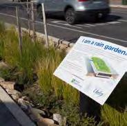
• Ensure that green open spaces are resilient to the impacts of climate change.
• Look at opportunities for pro POS in areas encumbered by flooding, particularly riverside trails along the Noth Esk to St Leonards.

• Opportunities for design responses to manage water in-place in POS subject to flooding and ov
• Opportunities for design responses that ensure mov


