

Executive Summary
About the Place Plan
The City Heart Place Plan has been developed by the City of Launceston to guide how we’ll develop the Launceston at its very centre (bounded approximately by Cimitiere, Wellington, Elizabeth and Tamar Streets). The Place Plan defines the area’s future mixed-use character, open space and river walk connections, and how these link with neighbouring precincts.
Six Character Areas have been outlined to guide the Place Plan:The Civic Spine, CBD Core East, East Fringe, South Fringe, CBD Core West and West Fringe. Each section includes a character statement, future guiding statement, key moves to get there, and an action plan for the City of Launceston to take forward in the future.
Council will use the Place Plan to prioritise projects, with actions incrementally building to long-term solutions. It will work through local partnerships and groups with ‘custodianship’ of outcomes, and will map out the staging for delivery of actions, short-term pathways to long-term changes, and continue ongoing engagement to fine-tune and advance implementation of this Place Plan.
Background
The Launceston City Heart Project is a commitment of the Launceston City Deal, in partnership with the Australian Government, Tasmanian Government and City of Launceston, to breathe new life into our public areas and streetscapes and create safer, more accessible pedestrian and bicycle links. With the majority of the Stage 1 components complete, Stage 2 of the City Heart Project is now underway, and includes the development of a Place Plan.
The Launceston City Heart Masterplan, which was first developed in 2015, is being refreshed and converted into this Place Plan to enable the City of Launceston to carry forward the intent of Stage 2 of the City Heart Project, and in recognition of lessons learnt over the last few years including:
· The need to enable more granular staged rollout of infrastructure in the absence of large capital grants.
· The need to enable thematic infrastructure funding more in keeping with council’s strategies and action plans and other grant mechanisms, such as funding urban greening or road safety.
· Recognising the interconnected nature of many of council’s plans, which require incremental progress, testing and refinement of actions as lessons are learnt.
Unlike the Masterplan, the Place Plan contains actions that are mapped spatially and sequenced, but are not necessarily rigid in their design and delivery. This, accompanied by an Implementation Plan (which will remain a ‘live document’), and an Urban Design Guide to outline how the City of Launceston’s public space should operate (including typical plans and sections), allows for a more flexible approach to implementation of actions and reprioritisation over time.
This approach enables a range of stakeholders to be involved in the formation and the delivery of actions – so that it can be delivered ‘piece by piece’. This approach is described more fully in Appendix A, and in the Urban Design Guide which is a companion manual to this document.
This Place Plan is intended to be a flexible and collaborative document that describes outcomes and stages to achieve those outcomes, without relying on whole-street Masterplans.

Introduction
1. Background and Strategic Context
1.1 Background
Through the City Heart Place Plan we will continue to deliver on the City Heart vision:
“The vision for the Launceston City Heart Project is to make central Launceston the premier business, retail and lifestyle hub of Northern Tasmania and to cement the city’s reputation as the most liveable regional centre in Australia.”
The City Heart Place Plan draws its boundary from the City Heart Masterplan. It generally aligns to the Central Activities District Parking Implementation Plan 2021, and is informed by community and stakeholder feedback. It sits in the core of the Central Area, a designated area under the Tasmanian Planning Scheme, Launceston Local Provisions Schedule (LAU-S15)
as the ‘central business zone’, an area intended for ‘the concentration of the higher order business, retail, administrative, professional, community, and entertainment functions’ (and a building height of 14.5m). Figure 1 provides the context of the City Heart Place Plan (item 2) and surrounding precincts.

1.2 The City Heart Character Areas
Figure 2 illustrates the six Character Areas that have been identified in the City Heart Place Plan, each with their own current and planned future characteristics. Specific actions have been identified for each Character Area, as well as the City Heart as a whole, as described in section 5. The Six Character Areas are:
1. Civic Spine (section 6 of this document)
2. CBD Core East (section 7)
3. East Fringe (section 8)
4. South Fringe (section 9)
5. CBD Core West (section 10)
6. West Fringe (section 11).

Figure 1 - Launceston City Heart and surrounding precincts
Figure 2 - City Heart Place Plan boundary and Character Areas.
1.3 Strategic Context
The City Heart Place Plan is guided by strategic documents at state, regional and local levels. The following table outlines the key influence that each of these strategic documents has had on the Place Plan:
Strategic Document Key influencing components on this Place Plan
Greater Launceston Plan
Northern Tasmania Regional Land Use Strategy
Deliver F.1 City Heart project, B.2 (walk/cycle) pathways, B.3 local connector route (A3 diversion), supporting G.1 Living City and F.3 Inveresk Precinct.
Goal 2 Liveability (and all its Strategic Directions).
City of Launceston Urban Design Guide Street typologies, materials and design elements.
City of Launceston Strategic Plan 2014-2024
City of Launceston Urban Greening Strategy 20232040 and Implementation Plan 2023-2040
City of Launceston Transport Strategy 20202040 and Four Year Implementation Plan (2021)
Deliver Goals 1 - Creativity and innovation, and 7 - A city that stimulates economic activity and vibrancy, and supporting the remaining goals.
Deliver Themes 1 and 4 (urban canopy, and street trees), and specifically the priority corridors in O-23 of the Implementation Plan (CBD Green Zones).
In respect of the Four Year Implementation Plan, Table 1:
· Delivering ‘Launceston City Heart – Streetscape Improvements’, though this Place Plan
· Integrating the ‘Network Operating Plan’ – by rationalising cycle routes and slow zones in the CBD
· Adopting and guiding ‘Parking Implementation Plans’ (as an action to review the use of Council-owned off-street carparks)
· Adopting ‘Pedestrian Improvement Program’ with locations for scatter crossings and wider footpaths.
And considering the implications and sequencing of the St John St upgrade and two-way streets proposal (s3).
City of Launceston Residential Strategy 2009-2029
City of Launceston Sustainability Strategy 2019 and Action Plan 2022-2030
City of Launceston Tourism Plan 2019-2022
Consider the influence of land suitable for higher density development surrounding the City Heart.
Consider WSUD (3.14), delivering the urban forest (3.19, 5.8) and open space (5.9), supporting the rollout of active transport / cycle lanes (6.31, 6.33) and the car parking strategy (6.34).
Support Outcome 1 ‘friendly locals’ through growing local events and local activation of streets, Outcome 2 through intuitive wayfinding through the City, and Outcome 6 by opportunities to assist small business to use street space, and during events.
Economic Development Strategy 2022-2026
Central Activities District Parking Implementation Plan (CADPIP) 2021
City of Launceston Public Art Strategy 2023-2031
City of Launceston Cultural Strategy 2020-2030
City of Launceston Innovating with Intelligence – A City for the Future (City Innovation Strategy 2023)
City of Launceston Events Strategy 2016-2019
Access Framework for Action 2020-2024
Theme 3 / Action 3.10 Supporting the City’s creative and cultural industries, and Theme 4 / Action 4.1 Continuing the City Heart project to support the retail and services sector.
Progress actions ‘off-street carparks consolidation and redevelopment’ through the Carpark Use Strategy action.
Support ‘on-street parking consistency’ through a rationalisation of street space, including parking/loading, in the City Heart.
Support objective 4 (Public art embedded in placemaking and city shaping), particularly city centre laneway art (see Action 7.1.2).
Support QVMAG unique stories (Action 13.4.1), a focus on food (with City of Gastronomy themes for each Character Area), culture and tourism (through new event space), public art/culture/placemaking (in Action 7.1.2), and bringing our history to the streets (4.2) with intuitive wayfinding and public art.
Support Outcome 4 Environment and Place – uptake of sustainable mobility and enhanced amenity of public spaces and parks, and Outcome 5, Economy and Investment – developing the visitor economy, night-time economy, and promoting innovation
Support all goals, particularly Goal 4 – City Activation and Goal 5 –Community Safety and Amenity (both in Action 7.1.2)
Commitment 2, Tactile Ground Surface Indicators (TGSI) – in Actions 9.4, 10.4.1, 12.4.1 and 13.4.1
The City Heart Place Plan is guided by strategic documents at state, regional and local levels. The following table outlines the key influence that each of these strategic documents has had on the Place Plan:

Strategic Document Key influencing components on this Place Plan
This Place Plan and Character Areas were developed out of the City Heart Masterplan (2015) and a review of relevant engagement, plans and strategies since 2015 to take forward the intent of Stage 2. In addition, new analysis of place, and multiple rounds of co-ordinated engagement across council departments was undertaken.
The City Heart Place Plan can be read together with the City of Launceston’s Vision in the Strategic Plan and key strategic plans including the Greater Launceston Plan and Regional Land Use Strategy. The planning, design, delivery and maintenance of new public space is intended to be in accordance with the considerations and detailed guidance set out in the Urban Design Guide.
This Place Plan is intended to be a flexible and collaborative document that describes outcomes and stages to achieve those outcomes, without relying on whole-street Masterplans. The opportunity has also been taken to:
· improve strategic alignment with strategies and plans developed by council since 2015
· cascade spatial ideas from the Greater Launceston Plan, and inform further strategic planning of the city
· take account of Launceston’s designation as a UNESCO Creative City of Gastronomy in 2021
· take account of future trends influencing the City of Launceston, including housing pressure, transport, urban canopy and urban heat (detailed in Appendix B).
Council intends to use this Place Plan to prioritise projects within the City Heart and ensure they are strategically aligned. Actions have been developed so they incrementally build to a long-term solution, allowing for complex interdependencies to be worked out, and in many cases starting with trials to ensure that the action is likely to deliver a successful solution.
Some additional methods that council intends to use to help the Place Plan achieve its aims, build on success and mitigate risks are:
· having local partnerships and working with groups with ‘custodianship’ of outcomes, ranging from the Chamber of Commerce and Launceston Central (in terms of overarching actions and City of Gastronomy themes), through to individual groups like Harvest Market.
· mapping out risks and interdependencies during implementation, and staging delivery of actions
· mapping out short-term (quick, low cost, temporary) paths to long-term (higher cost, permanent) changes
· ongoing engagement to fine-tune and advance the Implementation Plan as a ‘live document’.
2.3
Monitoring and Measuring
Monitoring and measurement of individual actions should happen continuously throughout the implementation process to ensure that the action plans reflect what works, with the right stakeholders involved, and are regularly amended when required to steer toward successful outcomes.
The success of Place can be baselined and measured through periodic measurement. At a macro level, the relative performance of Launceston to the other major cities in Australia is measured in the ‘Progress in Australian Cities and Regions Dashboard’, under ‘Comparison’, ‘Significant Urban Area’, with a baseline drawn from:
· ‘Actively Trading Businesses’ (as a proxy for supporting business and retail)
· ‘Multi-Unit Dwellings’ and ‘Young People learning/ earning’ (as a proxy for supporting inner city living)
· ‘Transport Mode for JTW: Active Travel’ (as a proxy for improving access on foot, by bike)
· Domestic Trips Involving Nature Activities (as a proxy for safe, welcoming public space)
· ‘Internal Migration’ (as an overall proxy of retaining talent, which includes the city’s liveability). 1st is the best rank achievable.
Figure 3 – Launceston’s rank within Australian cities, 2021-2022 (Progress of Australian Cities and Regions).
People learning or earning


Launceston performs quite well on most indicators, with a relatively higher priority in improving young people learning and earning, and internal migration. These can be improved by providing more for younger people in the city. The move of the University of Tasmania (UTAS) to Inveresk (2021 – 2024) is a key factor that the City Heart can capitalise on, with better connections via City Park. A more refined model for performance measurement will be developed as part of the implementation process.
Other more granular objective measures can also be used (e.g. SpendMapp, PlaceMapp) in addition to ‘pulse’ surveys of residents and visitors to the City Heart, against the outcomes derived from engagement themes in the City Heart Project in 2015, at Figure 4.
2.4 Future Engagement
Council will continue to engage with the community through a range of methods (including the Together Tomorrow online platform) to understand what residents, visitors and tourists value as unique and distinctive about their places, and capture the aspirations of the community for the future identity of their place.


Central Area, or Central Activities District (CAD)
City Heart
City of Launceston, or council
Cycle Path / Cycle Lane
DSG
Nodes and Paths
An area under the Tasmanian Planning Scheme, Launceston Local Provisions Schedule, designated for ‘the concentration of the higher order business, retail, administrative, professional, community, and entertainment functions’.
The core of the Central Area, to which the former City Heart Masterplan, and now this Place Plan applies.
The council, as the governing entity of the City Heart.
A separated space for bicycle riders, separate from other modes.
The Tasmanian Department of State Growth.
These are terms by Kevin Lynch in ‘Image of the City’ as ways that people intuitively navigate, specifically here arrival points like bus stops, and the routes to get there.
City of Launceston Network Operations Plan.
City of Launceston Network Operating Framework.
TGSI
Tomorrow Together
Quietway
Tactile ground surface indicators (ie tactile paving).
Launceston’s online engagement platform https://tomorrowtogetherlaunceston.com.au/
A street that is comfortable for walking and cycling. These tend to have footpaths and are comfortable to cross informally, but no cycle paths as they are comfortable to ride along without separation. Traffic should be < 500 vehicles per hour, and ≤ 30km/h.
Refer to the appendices for further information.
Figure 4 – Place Plan outcomes to regularly monitor
Analysis and Proposals
3. How to read the Place Plan
Section 5 describes the City Heart context as a whole, followed by Sections 5 to 11 which describe each of the six Character Areas. Each section includes a character statement for that Character Area, a future guiding statement, key moves to get there, and an action plan for the council to deliver on.
3.3 Key Moves
The key moves, and priority actions, summarise the external influences and actions that will be required to achieve the Future Guiding Statements for each of the Character Areas. Examples of key moves include narrowing traffic lanes or converting one-way streets into two-way streets.
These are provided on a map synthesising the existing strengths, external influences and potential actions to leverage and enhance future opportunities. While not every detailed action appears on the key moves map, it is useful to co-ordinate between projects in the same spatial area, to ensure major actions are not missed.
3.4 Action Plans
including events, outdoor dining and casual seating for workers, tourists, and locals to inhabit the city and admire its heritage…’
3.1 Character Statement and Future Guiding Statement
Each of the six Character Areas begins with a description of the current environment including its form, uses, key activities and its role and function within the City Heart. This is followed by a future guiding statement which describes the intended outcome for the Character Area based on external influences such as land use change, which will form the basis for the action plan.
3.2
Strengths and Opportunities
A short summary and simple visualisation of the key strengths and opportunities of each Character Area is provided, drawing from the detailed analysis in Appendix C. This comprises the following:
Component Description
Analysis
A detailed analysis of the issue or challenge the action seeks to address Strengths Identifies strengths that the action seeks to build on (see 4.2) Opportunities Identifies opportunities that the action seeks to capitalise on.
The seven action plans – one for the City Heart as a whole, and one each for the Character Areas – will be used to coordinate the allocation of funding and resources towards placed based projects and initiatives to support the distinctive identity, needs and desires of the local users of that area.
Each action plan is organised into three key place elements (movement, vibrancy and physical form) and aligned to the six themes captured in the engagement feedback (outlined in Appendix B):
Element Description
Movement Sets out the actions to enhance movement, particularly moving on foot, and by bike, to support a diverse range of users. This includes street crossings, street furniture, trees, lighting, accessible design and wayfinding.
Key Engagement Themes: Streetscape Improvements for Vibrant Streets; Making Transport Accessible for all Road Users.
Vibrancy Sets out the actions to assist the city in reaching its economic potential and supports community participation. This includes events and activities, investment promotion, tourism, marketing and temporary activation.
Key Engagement Themes: Events and Activation; Business and Retail
Physical form Sets out the actions that contribute to the city’s urban character and unique sense of place, both buildings and spaces. This includes greening, awnings, historic buildings, materials and location of public open space.
Key Engagement Themes: Inclusive, Welcoming and Safe Public Spaces; Inner City Living
Each place element is then split out over time to show how short-term actions (now and next) build to long-term outcomes:
Step
NOW
(Step 1)
NEXT (Step 2)
LONG-TERM
(Step 3)
Description
Proposes a solution to solve or enable progress of the issue as the first step toward a longer-term outcome. These are generally actions that can be taken immediately because they do not have significant interdependencies, are relatively cheap or easy to implement, or can be removed if they do not work as intended.
Pilots and trials, paint and signs, planters and parklets are all examples of temporary infrastructure that can be used to test long-term change.
These are short-term actions that can be taken but may require a preliminary step (in or concurrent to ‘Now’) before they can be actioned.
An example would be confirming the demand for an event first (step 1) before developing a management plan (step 2) for that event. Like ‘now’ actions, these do not involve complex interdependencies, and build on short-term actions.
These are typically the ‘end state’ goals that the Now/Next actions are intended to build towards. They may require further development, partnering and resolving interdependencies.
The Now/Next steps help justify the effort and money required to implement the longterm solution – proving demand for investment. In this respect, there is ‘progressive certainty’ that the solution is sustainable and desirable.
Note: For the purpose of referring to actions, an action in Chapter 5, Action 5.5.1, (Step 1) would be referred to as 5.5.1(1), and so on.
This Place Plan is intended to be a live document, with changes managed through the Implementation Plan. Insights from trials in now/next should be used to shape or modify long-term solutions. Therefore, these action plans should be regularly reviewed, with completed actions removed and new actions added, guided by the Future Guiding Statement. Likewise, the key moves map (and supporting analysis in Appendix C) should be updated every 5 years with a document refresh in accordance with section Strategic Context1.3.

4. The City Heart Context and Character
4.1 The City Heart Context
The City Heart Place Plan outlines six distinctive Character Areas drawn largely from within the existing City Heart Masterplan boundary. It has been amended slightly to include Princes Square, the East Fringe past Earl Street, and to ensure streets are wholly within one Character Area, not split between them. The Place Plan provides an action plan for the whole City Heart and for each Character Area to support the implementation of the City Heart Masterplan Stage 2.
This Place Plan shifts the focus from ‘whole of street’ upgrades towards place-wide Character Areas,
4.2 Building on Success
embracing a holistic approach to city development and street upgrades, recognising that each area presents its own unique issues and opportunities, and supports different users.
In respect of the design of public space, particularly streets, this Place Plan should be read together with the Urban Design Guide, particularly Chapter 2 Vision and Considerations, Chapter 3 Street Design and Chapter 4 Materials. Guidance on the best practice for installation of specific elements set out in this Place Plan is provided in Chapter 5 of the Urban Design Guide.
To ensure that new and improved infrastructure and activation is authentic, achievable and long-lived, the Place Plan leverages off existing successes and current developments in and around the City Heart, including:
· Making better connections between the city’s current gastronomic, retail and commercial clusters.
· Retail and hospitality clusters around upper St John Street, George Street and Charles Street, whose fledgling success merits timely support.
· Supporting and connecting to the city’s regular gastronomic events including Festivale in City Park, NORTH Festival, Fiesta on George, and the weekly Harvest Market in the Cimitiere St / Cameron St Carpark (Cimitiere Street Carpark).
· A relaunched theatre district with the redevelopment of Princess Theatre and the Earl Arts Centre.
· The reopening of Albert Hall as a newly renovated and updated venue, the return of Niche Market, and its use as a temporary theatre (which could be further explored in the future if successful).
· Potential to expand the Junction Arts Festival beyond Princes Square, and Harvest Market to Cameron Street.
· The new University of Tasmania campus that is transforming the city into a ‘university town’.
· The changing city fringe with new highend developments, such as the envisaged redevelopments ‘ReUnion’ (former TAFE building, 10 – 16 Wellington Street), the Fragrance Group hotels (former A Harrap & Son site, 130 Cimitiere Street) and the old Caltex site (207 – 215 Charles Street).
Leveraging Opportunities
Emerging opportunities that stand to further strengthen and intensify Place Plan Actions include:
· Attracting workers to live in Launceston and commute to the SunCable manufacturing facility at Bell Bay, which is currently going through the Major Project Proposal process, as well as supporting living for the wider Tamar Valley.
· Tourism generated by the Creative City of Gastronomy designation.
· Denser development around the City Heart, in the ‘areas of transition’ identified in the Launceston Residential Strategy 2009 – 2029 (Figure 5).

5. The City Heart as a Whole
Themes: Movement, Form and Vibrancy
Mapping the themes of movement, form and vibrancy in the City Heart reveals opportunities that can be further leveraged in the action plan. The first two maps provide the context of movement connectivity and activity nodes respectively, while the third map illustrates opportunities to build upon the City Heart’s vibrancy. 5.1
Movement
Figure 5 shows the existing and potential future walking and cycling movement routes within and through the City Heart. This includes a central area, and radiating network, of quietways or slow streets that are comfortable and welcoming for people to walk and cycle on without requiring expensive separated cycleways. Refer to 5.3.1 for associated actions to deliver these.
Figure 5 – Movement theme: Key bike network routes, highlighting the use of quietways to create a complete network (defined as slow streets for walking and cycling)

Figure 6 shows the key nodes and pathways through the City Heart linking the Character Areas together and to their surrounds. The nodes are identified as major and minor public nodes such as Princes Square and the bus interchange; and private nodes such as the James Boag Brewery.
Figure 6 – Form: Key nodes and paths linking together the City Heart and its surrounds


Additional locations may be identified during the life of this City Heart Place Plan, including those envisaged by the Public Art Strategy:
· Laneway Festival and Street Art Gallery (page 26).
· Outdoor Gallery and City Signature (page 30).
Launceston’s identity as a City of Gastronomy can be strengthened and developed by local businesses in partnership with representative groups including the Chamber of Commerce and Launceston Central.
The vibrancy map is not exhaustive, and additional opportunities for the City (in partnership with others or independently) are likely to be identified during the life of this Place Plan to support the City of Gastronomy. These could potentially include:
· Opportunities for gastronomic displays and collections at the City library or Design Tasmania.
· New events and activities, such as a cooking show on City Radio.
· More publically accessible productive garden beds.
8 - The Launceston City of Gastronomy’s position as gateway to the Northern Forage road trip

5.2 Strengths and Opportunities
Movement The DSG Launceston Network Operating Framework (2020) maps contain overlapping bus, cycling, walking and traffic routes.
In practice, most commercial streets have space to prioritise only two modes before compromising on the level of service for all users.
Vibrancy There is a lack of play space in the city, particularly at the southern end.
There is not a comprehensive approach to event spaces, indoor and outdoor. Some Character Areas lack suitable event spaces, or have outgrown available space, and many lack plans of management.
Form City of Launceston owns and operates 5 carparks in the City Heart, providing 831 spaces. The CADPIP identifies Cimitiere Street Carpark , Elizabeth Street and York Street West Carpark as potential for redevelopment.
The NOF, informed by engagement with City of Launceston, is broadly consistent with the longterm aims of the city, including the strategic objectives and principles, and actions such as the relocation of the bus interchange from St John Street, and York, Tamar & Cimitiere Streets as primary traffic routes.
Thematic budgeting for events allows a greater focus on the theme of play across the city.
Princes Square is designed for peaceful contemplation but can cater for some events (e.g. Junction Arts Festival), if not children / play.
Harvest Market has capacity to grow given more space.
CADPIP analysis shows existing multi-storey carparks are well used for short stay parking that supports visitors and retailing, while open air parking is generally longer stay commuter parking that could be displaced to carparks outside the City Heart.
Applying the strategic objectives, principles and actions, using the NOF Appendix B maps as a base, City of Launceston can refine the networks for the City Heart to reduce conflict between modes and prioritise people’s free movement within the City Heart, less impeded by vehicular traffic.
Potential to strengthen City of Gastronomy designation.
Playfulness can be integrated into streetscape upgrades. Temporary street closures can provide event space, as has already been done for ‘Fiesta on George’.
Cimitiere Street Carpark and York Street West Carpark and Benders Lane carparks contribute only 119 (8%) of the total 1,472 council spaces and would have limited overall impact if adaptively reused.
Distribution of council carparks enables a widespread activation and events program. Key strengths and opportunities of the City Heart to be
Figure
Theme Analysis Strengths Opportunities


Initiate process with DSG to redesignate Tamar, Cimitiere and York Streets as the A3 route and update wayfinding to redirect traffic to new route.
Update Wayfinding Strategy (City Heart Masterplan Stage 1) and incorporate intuitive wayfinding.
Initiate implementation of Twoway Streets Strategy generally as per the Transport Strategy Implementation Plan, and in particular:
· Test lane narrowing on Paterson St (between St John and George Streets), and George Street (between Paterson and Brisbane Streets), using tactical measures
· Explore two-way traffic operation on Charles (between Paterson and York Streets), George (between Paterson and Brisbane Streets) and Paterson Streets (between St John and George St).
Explore extension of the Twoway Street Strategy to include lane narrowing or two-way traffic operation on George (between Brisbane and York) and York (between George and Wellington) Streets.
Work with DSG to agree the long-term desired bus circulation and align bus routes to desired City Heart bus corridors.
Reallocate road space as needed for new primary cycle and bus priority routes, and bus movements.

Form
Develop an events strategy and a lighting strategy. Consider a specific event that incorporates laneways (e.g. laneway festival).
Explore activation elements including play, public art, feature lighting, speakers, and street performers, with a view to long-term regular use that can be evolved over time. Priority location for activation: Brisbane Street Mall.
Support and partner with Launceston Central to develop a ‘business improvement district’ model for the City Heart.
Explore opportunities to partner, advocate or lead initiatives which support Launceston’s identity as a City of Gastronomy.
Produce plans of management for event spaces around the City Heart, including the process for bump in/out, location of sewer, water and electricity points, temporary amenities and seating.
Document successful activation initiatives in update to Events strategy for longevity and to maintain corporate knowledge.
Commission a study to identify optimal retail mix for the area (exact extent to be confirmed, however centred around the Mall and the Birchalls development).
Consider the potential for high intensity uses outside the City Heart to connect into and activate the city centre. Such uses could include sporting or conference facilities, or significantly enhanced recreation opportunities around the Tamar Estuary.
Develop a ‘playful city’ strategy incorporating both play equipment and infrastructure that encourages people of all ages to linger and engage in playful behaviour.
Partner with market, event and festival organisers to program and curate the festivals and make best use of Launceston’s public space.
Pro-actively work to attract potential operators to curate the retail offering.
Develop an initial study identifying the City Heart’s immediate programmatic needs, such as play or event spaces, and which Council-owned off-street carparks would be best suited to facilitate those activities.
Facilitate the use of redundant space within existing Councilowned off-street carparks, such as former ticket booths and undercrofts, for pop-up shops, cycle parking or delivery consolidation centres.
Undertake a study to explore reallocation of Council-owned off-street carparks in and around the City Heart to other needs (including integrated multistorey uses).
Study to be informed by the Transport Strategy, the Recreation and Open Space Strategy (underway), and the updated Residential Strategy.
Note the goal of reducing unnecessary traffic within the centre may be furthered by retaining consolidated carparks on the fringe and facilitating other uses in the centre.
Use redundant Council-owned off-street carparks to activate the City Heart in accordance with the results of the car park reallocation study.
Protect and enhance the City Heart’s heritage character by adopting an updated awning policy.

Vibrancy
6. Civic Spine
Also known as: Civic Link
Civic Spine is the heritage backbone of the City, connecting two of Launceston’s iconic parks and Civic Square. It is home to numerous state-registered heritage buildings, many lovingly restored, as well as home to the government administrative and professional legal services.
It is a quiet area with large open streetscape and tucked between the hustle and bustle of the core and the scenic river edge.


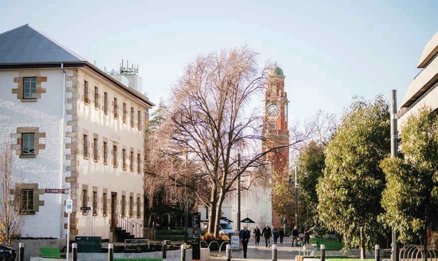

The Civic Spine is a vibrant connection for pedestrians and bike riders moving between Launceston’s cultural hotspots, and for students coming into the city centre. A leafy boulevard bookended by Royal Park and City Park, it is the central link in a cultural trail that takes in the Cataract Gorge, both QVMAG sites, Civic Square and Albert Hall.
Development of the old TAFE in the west and the new accommodation precinct in the east have contributed to Cameron Street becoming the first stop for tourists wanting to admire the city’s architectural heritage, and is popular with locals due to its casual seating, outdoor dining and regular events.
The Civic Spine will be vibrant, green, and have more street activity including events, outdoor dining and casual seating for workers, tourists and locals to inhabit the city and appreciate its heritage. As a street book-ended by public open space, and the home to the city’s two most iconic open markets it has significant potential for temporary road closures to allow markets to expand and activate the street.
6.1 Character Statement
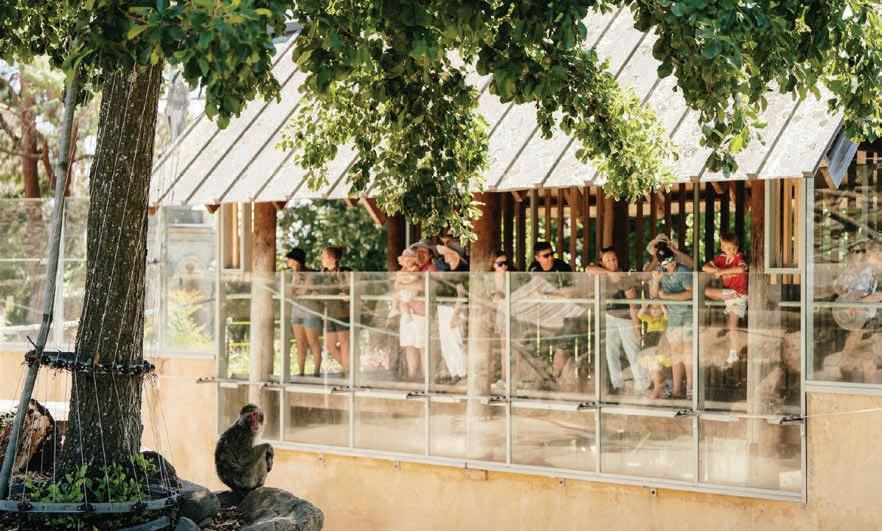
Figure 10 - Clockwise from top: QVMAG Royal Park, monkey enclosure at City Park, Civic Square, Harvest Market, Harvest Market, aerial view of Cameron Street looking west.
6.2 Future Guiding Statement


7. CBD Core East
Also known as: Theatre District
The CBD Core East is the secret charm and heritage heart of the CBD, famous for its legacy of venues, outdoor dining, entertainment and arcades, centred on Princess Theatre on Brisbane Street, and extending up to the ‘eat street’ of George Street.
Hidden gems can be discovered through internal courtyards, ways, laneways, squares and quadrants. Its boutique retail mix, health services, bespoke culinary experiences, and fine heritage buildings contribute to a distinct sense of identity and human scale like no other place. Brisbane Avenue houses one of the CBD’s most leafy streets, supporting local and independent businesses and George Street holds a strong identity as a well-established eat street with an array of outdoor dining experiences, all contributing to the City’s liveliness.


The tree-lined, pedestrian friendly atmosphere of The Avenue, one of the prettiest streets in the City Heart, extends to Princess Theatre / Earl Street intersection of Brisbane Street.
George Street will continue to be a key Eat Street in the City Heart, lined with iconic flowering ornamental pear trees, that shade and give character to outdoor dining. Risks to safety and comfort for patrons will be managed through wider footpaths and street calming.
Partnerships with venues and restaurants will build the City’s evening economy, supported by more space for walking, outdoor dining, greening and lighting, and better cross-connections between venues and clusters of restaurants.
Figure 14 – Images clockwise from left: The Princess Theatre, theatre in Dicky White’s Lane, Brisbane Arcade, Alberto’s on George Street, singers in the Quadrant, The Old Umbrella Shop on George Street.
7.2 Future Guiding Statement
7.1 Character Statement


8. East Fringe
Also known as: Dress Circle
The East Fringe is a fusion of hospitality, entertainment, and health services. Night-time bars and restaurants surround the Princess Theatre remaining open late into the evening, with a mix of health and medical service providers active in the daytime.


8.2
The East Fringe will be a transition zone between the bustling City Heart and the leafy residential areas of East Launceston. At night it will provide locals and patrons of the Princess Theatre with fine dining options and late-night bars. An improved environment along Brisbane Street from Earl Street to Tamar Street will cater for evening visitors with better lighting, drop-off and accessible parking. As the city vibe expands east, daytime uses including tourism, healthcare and retail will be supported through wider footpaths, improved wayfinding, public seating, amenities and greenery.
Figure 18 – Clockwise from top: Brisbane Street, east end, Design Tasmania, houses at the east end of York Street
Future Guiding Statement
8.1 Character Statement


9. South Fringe
Also known as: Cultural Quarter (CuQ)
The South Fringe is alive with activity and has an eclectic mix of retail, restaurants, bars, cafes, health, beauty outlets and residential dwellings, all which form one of the city’s most alternative mixed-use and environments. Lined by heritage and a mix of architectural styles this area sets a backdrop as a unique vibrant home to an emerging creative community.


9.2 Future Guiding Statement
The South Fringe will be a bustling night-time economy filled with a variety of eating options that extend the dining trail of restaurants, cafes and bars down St John Street and Elizabeth Street to Charles Street. At its heart lies the lush peaceful oasis of Princes Square, which is welllit and feels safe to use, day and night.
The area is inclusive, attracting a variety of visitors during the day and night and providing diverse activities and food options. Wellactivated, safe streets connect the main walking routes of Charles Street and St John Street and to new developments to the west and south. They are known for their greenery, ambient lighting and outdoor dining that provides a sense of safety when walking around.
Figure 22 - Clockwise from top: Du Cane, dining deck at Tinka on St John Street, kids’ artwork at Princes Square, Buddha Thai on Charles Street, Junction Arts Festival shenanigans at Princes Square, artistic lighting at Princes Square.
9.1 Character Statement

10. CBD Core West
Also known as: City West
10.1 Character Statement
The City Core West is loud and proud, with the large movement of people and transport all contributing to a vibrant and contrasting atmosphere. The high-quality public realm of Brisbane Street Mall and the spine of Charles Street support much of the city’s retail outlets and anchor stores.
It is here that residents and visitors can shop, socialise and enjoy the lively street environments, or walk over to Kingsway and enjoy a range of retail choices and great food options in a quiet tree lined atmosphere.


10.2 Future Guiding Statement
The CBD Core West is the commercial mixed use (shopping, business and fitness retail) hub of the city. Activity is centred on Brisbane Street and extends to Charles Street and Kingsway via a calmed Brisbane Street west, and north from Brisbane Mall to Civic Square via Dechaineaux Way. With the rerouting of traffic around the city, the CBD Core West is a seamless pedestrian-friendly zone.
Café and gathering spaces on the fringes activate the area during the day and night, and Birchalls as a public arcade energises the centre of the mall as a focal point for the city. Laneways and side streets branch out from Brisbane Street Mall to the north, west and south, increasing activation across site and providing more eyes on the street.
The area is inclusive and safe for young and creative people, leveraging the pulse of the retail heart.
Figure 26 – Christmas in Brisbane Street Mall, The Pantry on Charles Street, Christmas on St John Street, Brisbane Street viewed from the west, Kingsway signage, skateboarders on Kingsway.


11. West Fringe
Also known as: Western Quarter (WeQ)
11.1 Character Statement
West Fringe serves as the western gateway to Launceston’s City Heart and offers a glimpse into the city’s architectural evolution. It is a place of contrasts, where expansive urban blocks are threaded with laneways and the streetscape accommodates Victorian era urban forms alongside early 20th century drive-through architecture. These speak to an era when cars first began to shape urban life. Cinemas and multicultural cuisine options contribute to a dynamic space where the past and present coexist.


11.2 Future Guiding Statement
The West Fringe area caters for pleasant connections across Wellington Street to the new residential areas, high-end hotels as well as existing supermarket, education uses and facilities. This heralds a reinvention of the West Fringe as the vibrant local centre for a new progressive urban neighbourhood, while celebrating its unique architectural heritage through adaptive reuse.
This area will organically evolve to respond to the diversity of new residents, visitors and tourists, showcasing its uniquely urban counterpoint to the greener areas to the north and south. It will cater for a new type of inner urban living with active ground floors and entertainment, and is well connected through its blocks to the west, north and south.
Figure 30 – Gatsu on Wellington Street, interior of Gatsu on Wellington Street, Morty’s Food Place on Brisbane Street, aerial view of the Plough Inn on Brisbane Street, Morty’s Food Place, the Pod Inn on Wellington Street.

Appendices
Appendix A: About Place Plans
Appendix B: How the Place Plan was developed and how to get involved
Appendix C: Analysis
Appendix A
1. About Place Plans
1.1 What is a Place Plan?
A Place Plan sets out the current and desired future character of the area, and how the council will achieve this. The City Heart Place Plan captures the needs, desires, aspirations and
1.2 Why focus on Place?
Place is both a physical space and a sense of belonging and attachment to that physical space. For example, a ‘neighbourhood’ may have fuzzy boundaries that are nonetheless perceptible to its residents and their ‘neighbours’. A town, a city, a high street, a square, a park, or even a building could be understood as a place. It is made up of three integrated parts:
· The physical aspects of a place, such as the infrastructure, design, architecture, historical landmarks, streetscapes, open and green spaces.
1.3 What is Place Character?
Place character is the unique identity and distinctiveness that distinguishes one place from another. In addition to the physical form and activity of an area, place character also considers meaning - people’s perceptions, sentiment and experiences of a place, and their intentions about how they use that place.
Character can be contrasted with ‘placelessness’ – areas that are monotonous, uniform, soulless, out of scale, without the presence of people, or barren of vegetation. Placelessness also extends to places that may not have those features but could be anywhere, with no cues from the historical context or identity of the community in which they sit, or that are inauthentic in their response to their setting. To this end, it is important to note, that what may contribute to character in one area might appear inauthentic in another.
values of local people and coordinates inputs from diverse stakeholders – including residents, business owners, traders and associations – as shared aspirations for the future of the place.
1.4 Local Place Governance: A Potential Model
To foster the longevity of actions, particularly vibrancy (activation and events) each Character Area should be supported by place governance partnerships, that can work between council and community and take ownership and steering of action implementation. The purpose of the place partnerships is to:
· How places are used and experienced, including activities and events, the economic activity of that area, or people simply out on the street socialising.
· The operational aspects of places, such as the management, maintenance, security and decisionmaking bodies (such as Business Improvement Districts) and their direction about how the space will be used (such as whether bicycles can be parked or ridden through the place).
One way to think about place character is to ask whether individual elements (building, events, shared identity2) should be enhanced, maintained, kept or changed, as illustrated in Figure 34.

The form, activities and meaning taken together make up a place’s identity. These elements combined are the building blocks for the Place Plans.
2 This can range from self-identifying characteristics (we are a theatre district, or a city of laneways), through to the names used for areas, streets and spaces, and the agreed vision for how the area might change.
· collectively develop the future identity, high level objectives and future actions for a Character Area.
Case Study: The Randwick Collaboration Area
· encourage participation from diverse stakeholders and facilitate the co-designing, co-managing, and co-implementation processes
· manage the roles and responsibilities of decisionmaking delegates and support community champions
· create financial models and resource sharing between parties for ongoing sustainability, and
· collectively manage area character and brand.
A major health and education precinct in Sydney, the Greater Sydney Commission undertook a participatory planning process for this ‘collaboration area’, resulting in the publication of a Place Strategy in 2018. As recommended by the place strategy, a Randwick Collaboration Area Group (RCA Group) was set up comprising University of NSW, Randwick City Council, Australian Turf Club (a major landholder) and NSW Health. This group had over 20 meetings in 18 months, and formulated an MOU, two years of project plans funded by $500,000 of joint contributions as well as successful state funding bids, technical working groups and action plans.
A local reference group comprised of nominated community leaders can also enrich the development of a Character Area. Each representative brings a different set of skills, knowledge, interests, and life experiences to the group, to help collectively shape the future identity and actions that are inclusive of different parts of the community and their needs (both common and divergent).
Reference group representatives could include.
· Landlords and property owner representatives
· Housing representatives
· Social services representatives
· Youth representatives
· Arts, Education and Cultural organisation representatives
· Community or resident representatives
· Business owners + Business representatives
The RCA Group has been a model for other health and education districts around the state. Part of the RCA Group, the Randwick Health and Innovation Precinct (RHIP) is a collaboration between the University of NSW and NSW Health, which has been operating since 2016 and continues to operate to deliver $1.5bn of projects in the area.
· City Marketing representatives
· Tourism representatives
· Visitor representatives or people who recreate in the area
· Sporting club representatives
· Hospitality representatives
· Health, wellbeing representatives.
As the City Heart Place Plan and strategic action plans are testing a new way of working, the actions may be amended, refocused or alternative outcomes may become prioritised in response to community feedback and the priorities of local governance reference groups.
The strategic action plans can be considered living documents and read individually. They may be reviewed and updated by the reference groups at regular intervals.
Figure 34 - Ask whether individual elements of a place should be enhanced, maintained, kept or changed.
Appendix B
1. How the City Heart Place Plan was developed
In 2015, the City of Launceston endorsed a City Heart Project, which identified infrastructure to support events and business and attract investment and activity to public spaces. The City Heart Project was supported by a Federal, State and Local government ‘Launceston City Deal’ funded with $19.8 million of co-funding comprising $7.5m from the Australian Government, $5.8m from the Tasmanian Government and $6.1m from the City of Launceston. That funding enabled Stage 1 to be delivered – the upgrade of Quadrant Mall, Civic Square and Brisbane Street Mall, as well as wayfinding to be rolled out across the city.
Stage 2, envisaged as further street upgrades for St John Street and Paterson Street, was not realised as further joint funding arrangements and a location for a central bus interchange were not forthcoming.
This Place Plan and Character Areas were developed out of the City Heart Masterplan and a review of relevant engagement, plans and strategies since 2015 to take forward the intent of Stage 2. In addition, new analysis of place, coordinated engagement across council departments was undertaken.
Six Character Areas are represented, each through a character statement that outlines the unique and positive character of that area and is complemented
by a future guiding statement that delivers an overview of the area’s current assets and conditions, articulates future developments and provides clear recommendations on how an area can evolve.
To guide the future character of each area, broad community engagement feedback captured from a wide cross-section of the community, as well as community and stakeholder feedback gathered from the Urban Greening Strategy and the ongoing Tomorrow Together engagement program were all used.
These action plans list the key actions required to enhance, maintain, keep or change the character of each area to deliver on the community’s vision.
This Place Plan builds on the City Heart Masterplan, subsequent strategies and plans that are set out in the previous section, and workshops with Council to refine and distil actions from unrealised concept plans for Paterson Street and St John Street. The Place Plan also draws on engagement across multiple projects relating to the City Heart area, as follows in the following subsection.
1.1 Findings of Previous Engagement
The six key themes and subsequent ideas for action arising from the engagement processes have been integrated into the six Character Area action plans, as follows:
Streetscape Improvements for
· Provide more street seating and weather protected shelter.
· Provide additional safety and feature lighting to make the street and places welcoming and safe.
· Provide environmentally friendly solar lights and sensor lighting.
· Provide varied types of greening and landscaping.
· Provide additional toilets and toilet signage.
· Strengthen wayfinding and provide a better range of information services for visitors.
· Create laneway connections through beautification, greenery and art installations and turn laneways into places to explore.
· Increase the width of footpaths and create accessible streets.

Events and Activation
· Support outdoor dining and provide opportunities for a range of dining experiences, including pop-up venues, street parklets and food vans.
· Support the nighttime economy, including restaurants, bars, businesses opening late and late night venues through heritage feature lighting, ambient safety lighting, and warmth on streets during winter.
· Temporary street closures to enliven the CBD.
· Provide public art, including sound and light installations, public sculptures, water features, recognition of Aboriginal culture through Aboriginal public art and cultural installations.
· Host public events and activities that support the arts, live music, festivals, family friendly activities, art exhibitions, historical tours, and cultural industries.
· More affordable community activities, and event experiences, with free events for children, families, people from all socio-economic backgrounds and varying abilities.
· Introduce more diversified activities in multi-use spaces, such as sensory playgrounds, gathering spaces, events and performances, food and beverage and weekend markets.
· Provide funding to support existing organisations and community groups who organise local events.
Figure 35 - The Launceston City Heart Project, 2015
Theme Observations
Vibrant Streets
Figure 36 - Themes and observations from previous engagement
Business and Retail
Observations
· Support unique, boutique and diverse retail offerings.
· Support adaptive reuse of underutilised buildings and activate empty shopfronts and vacant upper levels providing spaces for Launceston community groups, creative groups, emergent artists, exhibitions, studios, or office space.
· Allow for flexibility within permit structures to support temporary appropriation of space.
· Attract new business innovators through start-up programs. incentives and innovative partnerships
Inclusive, Welcoming and Safe Public Spaces
· Provide comfortable and safe weather protected meeting places.
· Provide a diversity of spaces to meet and create connections /linkages within the CBD.
· Provide points of interest between attractors and destinations
· Provide inclusive places for all.
· More CCTV Cameras in the CBD.
· Deliver strategies to minimise antisocial behaviour, such as ‘designing out crime’.
· Increase maintenance of public spaces, including regular cleaning of streets and public toilets and graffiti removal.
Inner City Living
· Create, promote, and support inner city residential opportunities.
· Provide a range of housing options.
· Allow for flexibility in planning schemes, building and/or heritage legislation for more residential uses of upper storeys.
· Provide mixed use planning.
Making Transport Accessible for all Road Users
· Make streets more pedestrian and bike friendly through beautify the streets and making them more attractive for walking and by providing more protected bike paths and links to CBD.
· Provide safe and comfortable bus stops.
· Provide enough parking in key activity areas.
· Improve connectivity across the city, and especially to key sites.
1.2
Trends influencing the City Heart
The following trends identified in the State of the City Report 2023 that are relevant to the development of this Place Plan, are described below:
Trend Description Relevance
Housing Pressure Launceston’s population continues to rise, with over 5,000 new residents since 2016.
The State of the City report projects 480 new dwellings are required as infill by 2036 (14% of all new dwellings), which are likely to be in the City Heart and surrounds.
Homelessness and severe overcrowding in dwellings are both rising, with 150180 rough sleepers reported.
Housing unaffordability, while widespread, is particularly impacting Launceston. Launceston (statistical area) has a median household income that is under the median mortgage repayment (2021). Rentals are tight – vacancies since 2021 average 1%.
The projected infill development represents a 27%* increase in inner urban dwellings in and around the City Heart, bringing vibrancy and new urban services (see Transport Strategy Directions L2, C1 and C4).
Transport Launceston’s car mode share is 88-89% of trips, which will saturate key roads unless public and active transport is improved.
Urban Canopy, Biophilia and Urban Heat
To mitigate both current heatwaves and the future effects of climate change, Launceston has adopted a target of 40% tree canopy cover, from a baseline of 20%.
Trees can also contribute to beautification and thus street appeal of businesses, and induces a positive physiological response in people (known as ‘biophilia’).
Improved access to the city by bus, and around the city on foot and by bike, as well as more infill development can help reduce car dependence and future congestion.
The city centre has some of the poorest canopy cover of the Municipality – 6.9% (2nd worst)**. This limits shading and cooling and effects the visual amenity and sense of place of the city.
* Comparing the projected dwellings in the State of the City Report with ABS dwelling counts for the Launceston locality (SAL60322), which generally covers the City Heart.
** As can be seen in the Launceston Greening Strategy.
Figure 37 - Trends influencing change in Launceston City Heart (from State of the City Report, 2023)
Appendix C
1. Analysis
The following analysis represents a snapshot of each of the Character Areas used to inform the action plans in the Place Plan. This analysis was undertaken in 2023/2024, and some items, particularly trade and employment, may have changed.

The following mapping has supported the development of Civic Spine Character Area.


1.1 Civic Spine Area Context Maps
Figure 38 - Cameron Street Historical Tour
Figure 39 - Council Owned Land
Figure 40 - Public Amenities


Figure 42 - Hospitality Venues and traffic flows
Figure 43 - Traffic Circulation


Figure 44 - CBD Historical Tour
Figure 45 - Council owned land and Key Attractions
Figure 46 - Public Amenities
Figure 47 - Trade and Employment


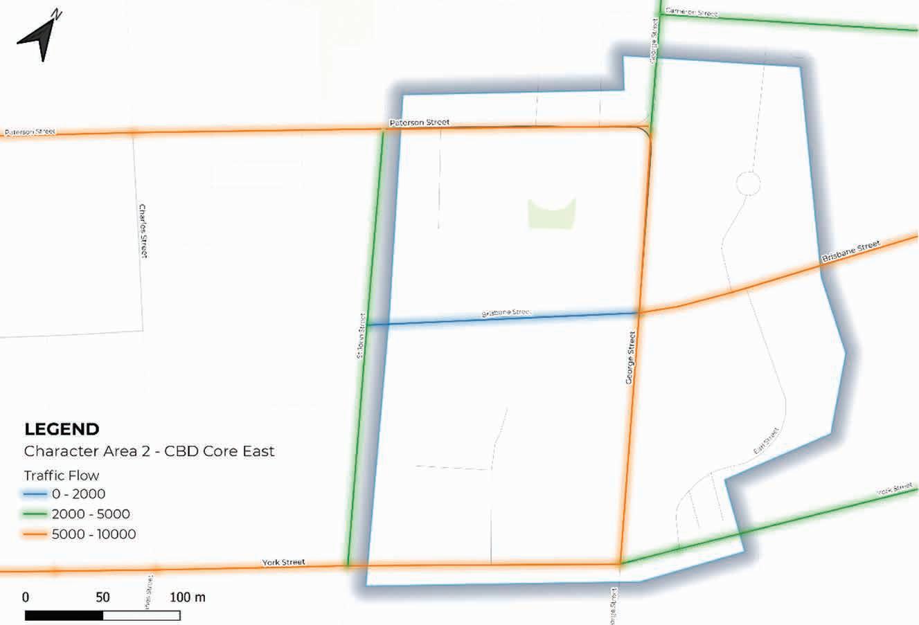

Figure 49 - Traffic Circulation
Figure 51 - Public Amenities
Figure 52 - Trade and Employment


1.4 South Fringe Area Context Maps
The following mapping has supported the development of South Fringe Character Area.


Figure 53 - Hospitality Venues
Figure 54 - Night-time Economy
Figure 55 - Council owned land
Figure 56 - Public amenities


The following mapping has supported the development of CBD West Core Character Area.


Figure 57 - Hospitality and Traffic Volumes
Figure 58 - Night Time Economy
Figure 59 - Council Owned Land
Figure 60 - Public Amenities


Figure 61 - Trade and Employment
Figure 62 - Night time economy
Figure 63 - Hospitality Venues and Traffic Volumes
Figure 64 - Traffic Circulation


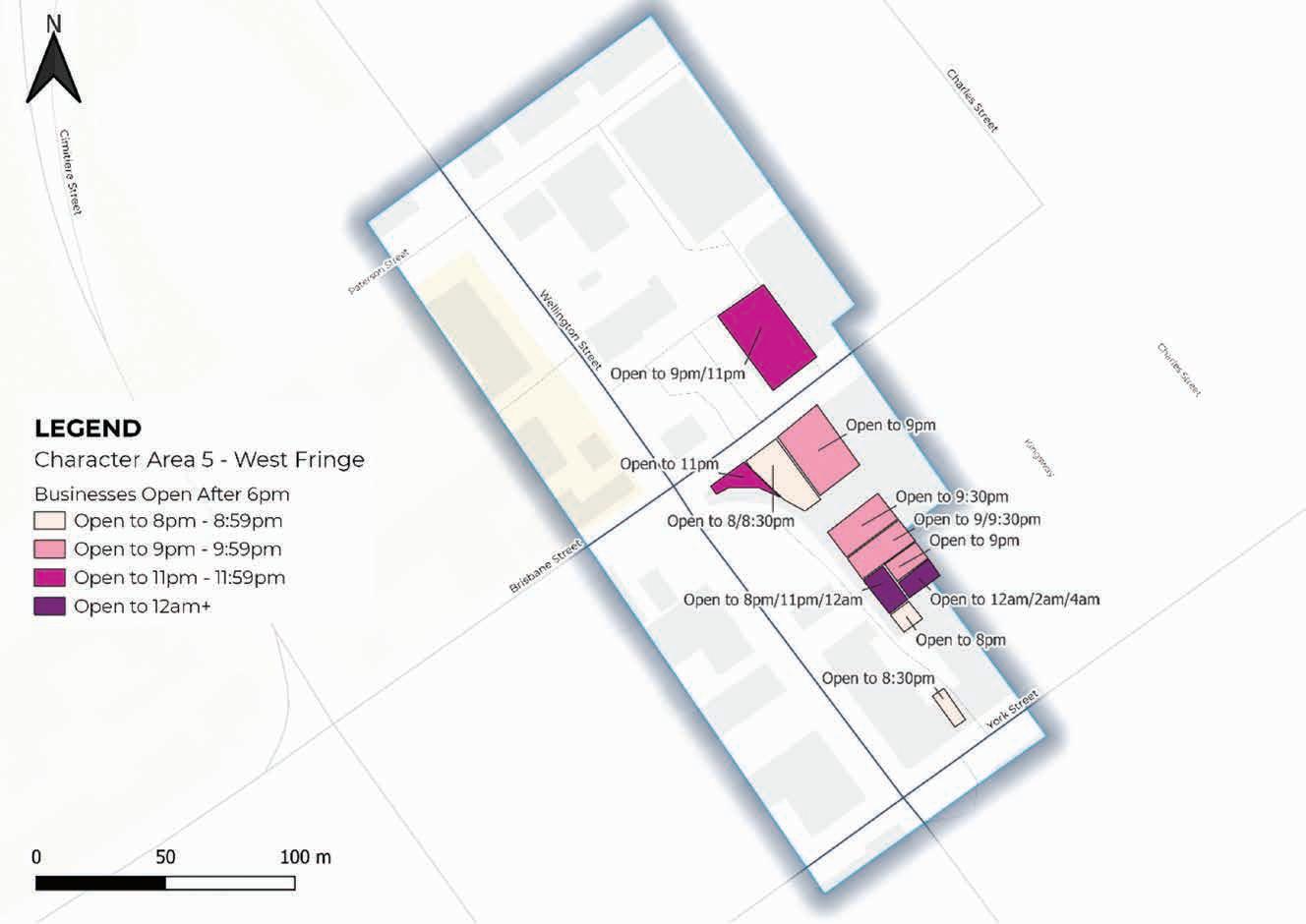

Figure 65 - Council Owned Land
Figure 66 - Public Amenities
Figure 67 - Night time economy
Figure 68 - Hospitality and Traffic Volumes


Photography Credits
· Front Cover
Artist credit: Mel McVee
· Page: 2
Image credit: Melanie Kate Photography
· Page: 8
Image credit: Launceston Central
· Page: 9
Image credit: Launceston Central
· Page: 13
Image credit: Cameron Jones Visuals
· Page:15
Image credit: Renee Hodskiss Photography
· Page: 22
Image credit: Nick Hanson Visuals
· Page: 23
Image credit: Nick Hanson Visuals
· Page: 25
Image credit: Nick Hanson Visuals, Cameron Jones Visuals, Renee Hodskiss Photography
· Page: 33
Image credit: Launceston Centeral, Cameron Jones Visuals, Launceston Central, Kate Pedley
· Page: 41
Image credit: Dianna Snape
· Page: 49
Image credit: Nick Hanson Visuals, Melanie Kate Photography, Renee Hodskiss Photography
· Page: 57
Image credit: Nick Hanson Visuals, Launceston Central, Launceston Place Brand Toolkit, Ideas BanQ,
· Page: 65
Image credit: Nick Hanson Visuals, Launceston Central, Oscar Sloane Photography
· Page 73
Image credit: Launceston Central
· Back Cover
Image credit: Nick Hanson Visuals
Figure 70 - Trade and Employment

Town Hall, 18-28 St John Street Launceston T 03 6323 3000
E contactus@launceston.tas.gov.au www.launceston.tas.gov.au