CITY OF KAMLOOPS


SEPT 2022


[THIS PAGE LEFT INTENTIONALLY BLANK]
[THIS PAGE LEFT INTENTIONALLY BLANK]
The North Shore will be an inclusive, dynamic, and complete community that provides a high quality of life for every resident; fosters a vibrant local economy; supports personal safety and environmental resilience; and offers accessible amenities, services, and activities for all ages, incomes, and abilities.
• Inclusive - The North Shore will be welcoming, affordable, and accessible with a strong sense of community pride. It will be a place where people feel safe, ethnic and cultural diversity are celebrated, all residents are treated equitably and respectfully, and a diverse mix of housing options and services ensures people of all walks of life can thrive.
• Dynamic - An attractive, eclectic, authentic, and innovative destination for local arts, culture, and food, the North Shore will be animated day and night by creative entrepreneurs; inviting streetscapes and public gathering spaces; and lively entertainment, events, and recreational opportunities.
• Complete - With a well-connected network of sidewalks, bike routes, and green streets, the North Shore will provide residents convenient access to a wide range of retail options, employment areas, health services, parks, waterfront amenities, and community facilities.
The identified principles combine the values expressed by the community through the North Shore engagement process with best planning practices to promote sustainable development and support the long-term interests of North Shore residents, businesses, and visitors. These principles seek to build on the desirable qualities and existing strengths of the North Shore and can help serve as a set of guiding ideals by both public- and private-sector partners in future neighbourhood design, development, and decision making.
In addition to informing the content of this plan, the principles should be taken into consideration when examining development proposals to determine potential benefits to the community and if new development is appropriate as proposed.
The vision and principles provide direction for the plan’s goals, objectives, and policies and were created using input from the community.
Mixed-Use Districts
Walkable neighbourhood centres that invite North Shore residents and visitors to live, work, shop, and play.
Embrace the Waterfront
A waterfront that provides opportunities for recreating, socializing, shopping, and dining while enhancing natural ecosystems and mitigating flood risk.
Housing options that span the spectrum between single-family homes and high-rise apartments support affordability and the needs of a diverse demographic.
An urban realm that supports the health of residents and enhances safety through improvements to lighting, landscaping, signage, transportation infrastructure, and building design.
A well-connected network of sidewalks and multi-use paths connect distinct districts, neighbourhood nodes, and major amenities in an accessible, safe, and convenient manner.
The North Shore’s unique character, culture, and history, including its Indigenous heritage, is celebrated through its built form and community events.
Community Building
Land uses and a built form that support local people, businesses, and community groups to grow, collaborate, and undertake projects that improve the community and better the lives of residents.
Public gathering spaces provide opportunities for seating, eating, events, and socializing.

City staff engaged youth through multiple sessions with different school groups during the North Shore planning process to learn their perspectives on what could be added or changed to make the North Shore more attractive, what places and activities they love, and what their vision is for the future of the area. These engagement opportunities included the following initiatives:
City staff met virtually with over 180 NorKam Senior Secondary students to discuss their perspectives on the North Shore. The students were also given a photo journal assignment where they took photos of places around the North Shore that resonated or had value for them and described what elements of these places were most meaningful and why. The students selected their top photos and presented them to City staff. The results were incorporated into an interactive map on the project website.
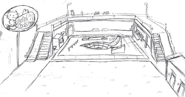
Following an engagement session with a class from Brocklehurst Middle School, City staff tasked students with a group design workshop assignment to obtain their ideas for key sites on the North Shore. The students then selected project sites, brainstormed ideas for youth- oriented community amenities they would like to see on the North Shore, and developed conceptual drawings to present to City staff. Concepts included an aviation museum, skateboard park, restaurant, and recreation centre.
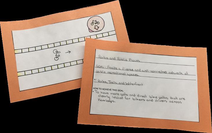
City staff engaged a second class from Brocklehurst Middle School, which included an assignment to develop a North Shore card deck. Each student developed one card relating to a topic area and draft plan goal. On one side, the students drew an image representing what the goal meant to them. For the other side, the students worked in groups to develop key ideas to help achieve each goal and added their ideas to the cards. The students then presented them to City staff.
In addition to contributing to the overall community vision and guiding principles for the plan, youth perspectives informed a number of policies and planning considerations and are highlighted in sidebar "Youth Input" comments throughout the North Shore Neighbourhood Plan.
The North Shore Neighbourhood Plan is an update to the 2008 plan of the same name. Its purpose is to provide neighbourhood-level direction to guide decisions related to planning and land use management for North Kamloops, Brocklehurst, and the Airport Lands over a 20-year time frame.
This plan provides a framework for the location and types of housing, shops, offices, and other forms of development and land uses that are envisioned for the area and gives guidance on what buildings and private and public spaces should look like.
In addition to land use and urban design considerations, the North Shore Neighbourhood Plan provides direction on the future transportation network, parks, public places, heritage resources, and community facilities in the plan area. The policies in the plan also address other issues and opportunities that are important to the people who live, work, and visit the North Shore, including those opportunities related to arts, culture, economic development, food security, and health and safety.
The North Shore Neighbourhood Plan describes key redevelopment areas, design concepts, and plan implementation, including short-, medium-, and long-term actions.
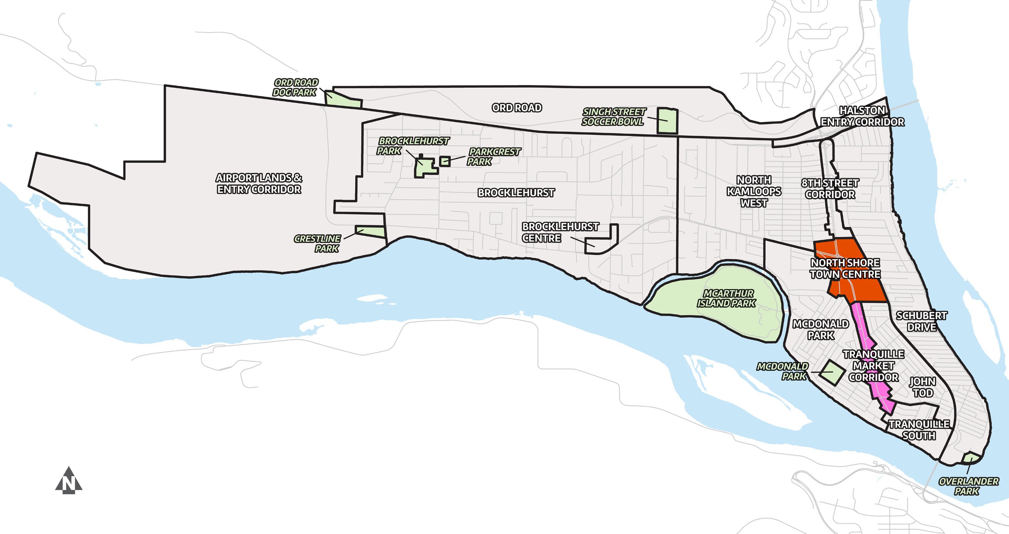
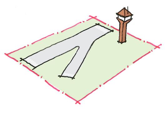
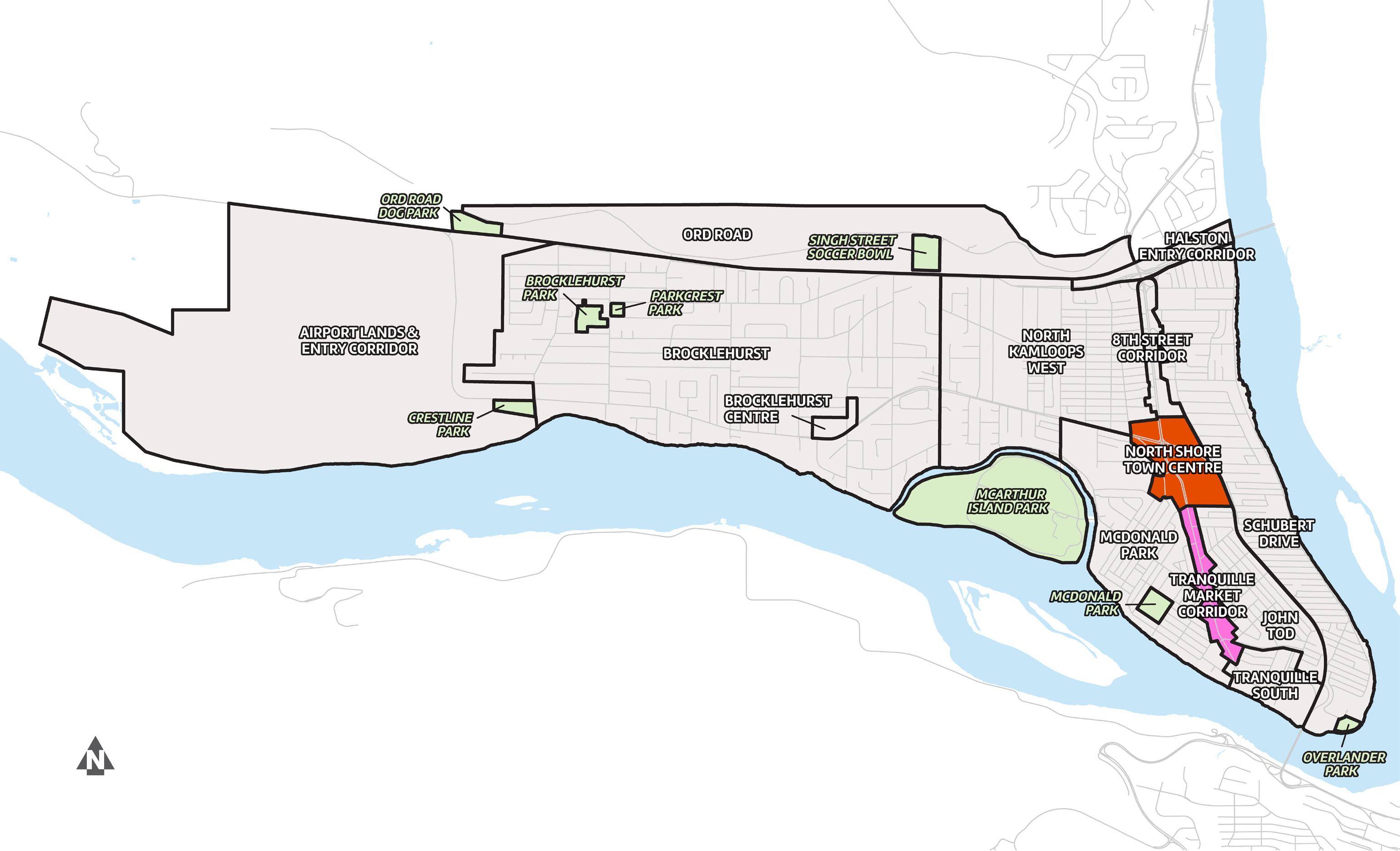
The North Shore Neighbourhood Plan covers the areas illustrated above.
The North Shore Neighbourhood Plan includes policies related to specific “character areas” (e.g. North Shore Town Centre, Tranquille Market Corridor) as well as “topic area” policies (e.g. Transportation and Mobility, Housing) that apply more generally across the plan area. However, the plan should be read in its entirety, as matters outlined in one section may apply to others.
The North Shore Neighbourhood Plan includes the following sections:
Section 1 contains the community vision for the North Shore, guiding principles, information on the purpose and scope of the plan, and a summary of the engagement process.
Section 2 provides the neighbourhood context and profile for the plan area, including population statistics, housing data, and other key demographic information.
Section 3 outlines key directions for future land use, including land use designations in the plan area that are established in the City’s Official Community Plan (KAMPLAN).
Sections 4 and 5 contain goals, objectives, and policies for 13 character areas and 8 topic areas.
Section 6 describes “big moves”—key redevelopment areas, new housing opportunities, and catalyst projects—that could have a positive impact for the North Shore.
• Section 7 includes a list of action items for implementation to be carried out over the 20-year life of the plan.
• Section 8 contains the North Shore Development Permit Area Guidelines.
• Section 9 features reference maps, including maps that illustrate the transportation network, key entry corridors and gateways, and utilities.
• Section 10 contains the appendices, including a glossary of terms.
Key terminology is defined in Section 10 Appendix AGlossary.
The City has a number of plans and bylaws to guide municipal planning. The Official Community Plan provides the highest level of direction in the City planning hierarchy. Given the Official Community Plan’s broad scope, its policies do not provide the same level of detail as neighbourhood plans (e.g. North Shore Neighbourhood Plan) or plans for specific topics (e.g. Transportation Master Plan).
Land use plans like the Official Community Plan and North Shore Neighbourhood Plan provide direction in terms of future land use that may lead to Zoning Bylaw amendments, subject to Council approval. Development permit area guidelines, such as those found within this plan and the Official Community Plan, provide guidance to applicants for specific areas and types of development.
Figure 1.1 » Where a neighbourhood plan fits into the planning process
PROVINCIAL LEGISLATION
NEIGHBOURHOOD PLAN
ZONING BYLAW
DEVELOPMENT PERMIT
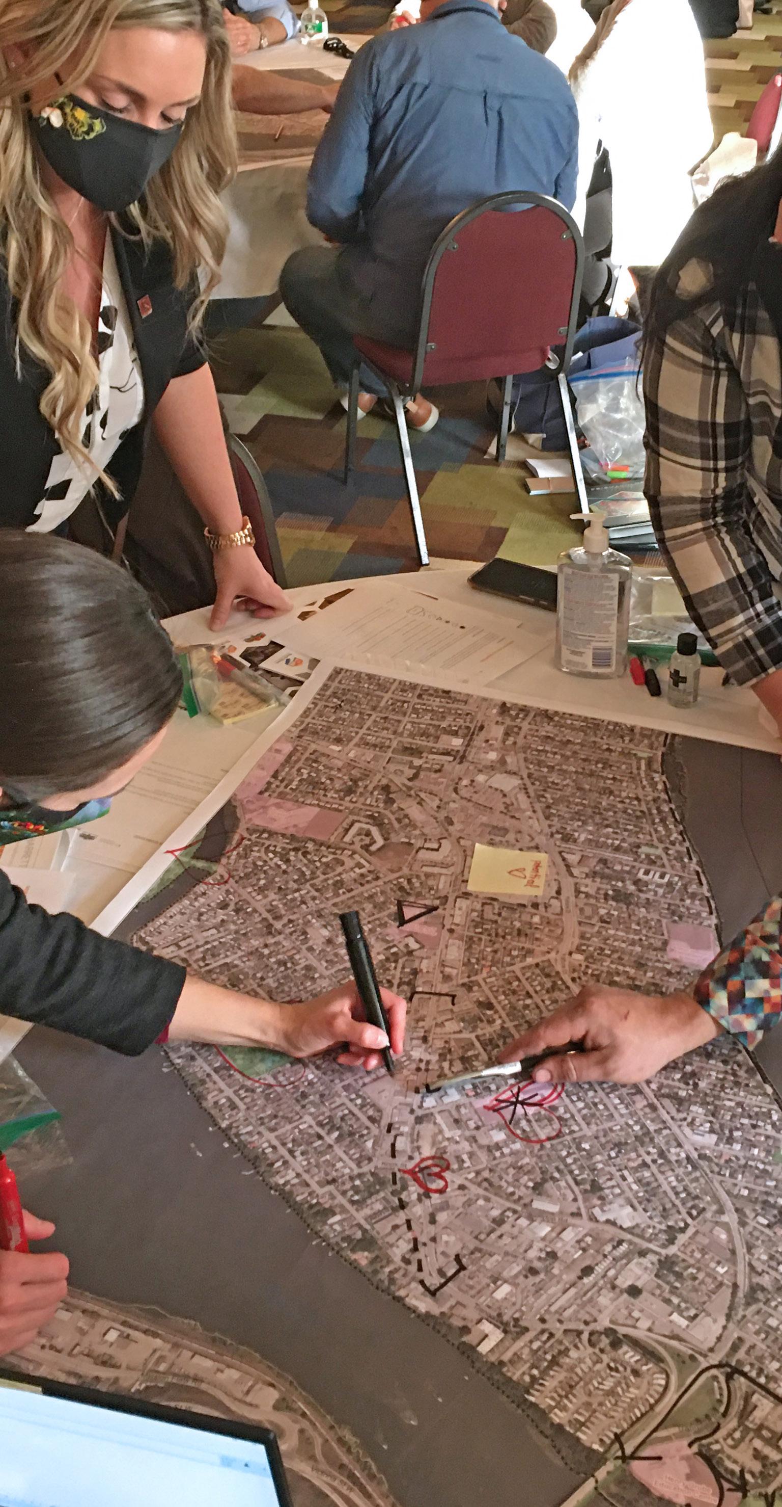
The North Shore Neighbourhood Plan was developed through a community engagement process involving the public, stakeholders, Tk’emlúps te Secwépemc, the North Shore Neighbourhood Plan Advisory Group (NSNP-AG), and City Council that began in early 2020 and concluded in late 2022.
Phase 1 consisted of compiling background information for the North Shore area on a variety of topics, such as population, land use, housing, transportation, and employment, to provide an overview of existing conditions.
Phase 2 involved community engagement via open houses, pop-up booths, an online survey, and a multi-day design charrette workshop to identify the vision, issues, and opportunities that the North Shore Neighbourhood Plan should address.
Phase 3 consisted of developing the draft North Shore Neighbourhood Plan based on feedback from Phase 2 and included Council, public, stakeholder, and NSNP-AG input on the draft prior to presenting the final plan to Council
More information about the community engagement process is available on the City’s website.
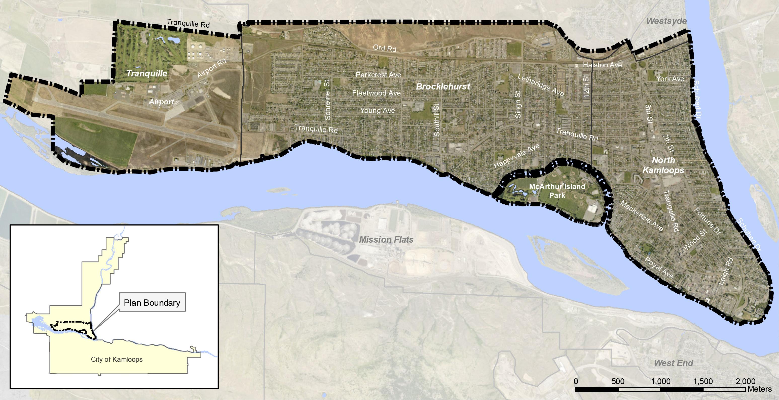
The plan area includes the Brocklehurst and North Kamloops neighbourhoods, as defined in the City’s Official Community Plan, as well as the lands encompassing and immediately adjacent to the Kamloops Airport.
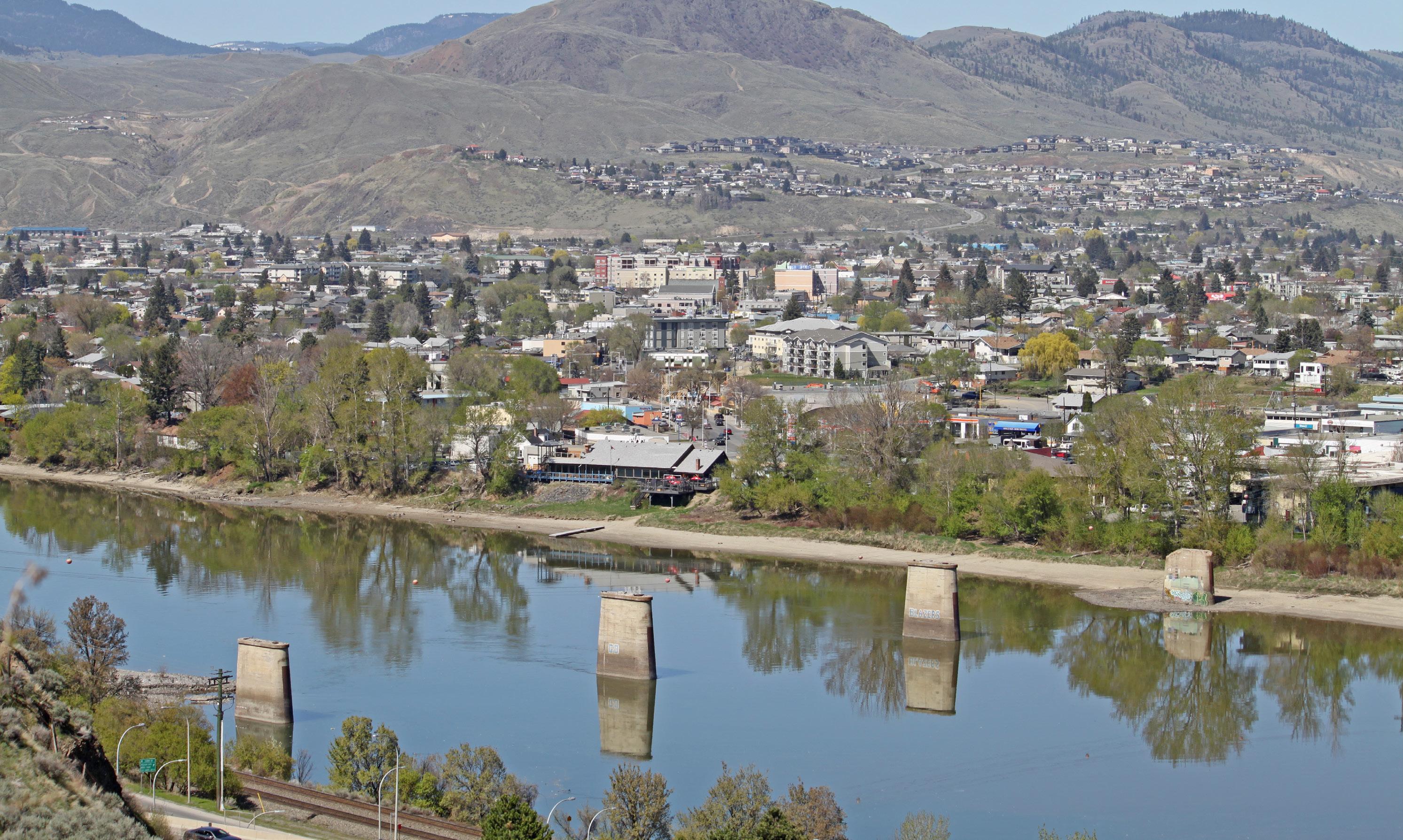
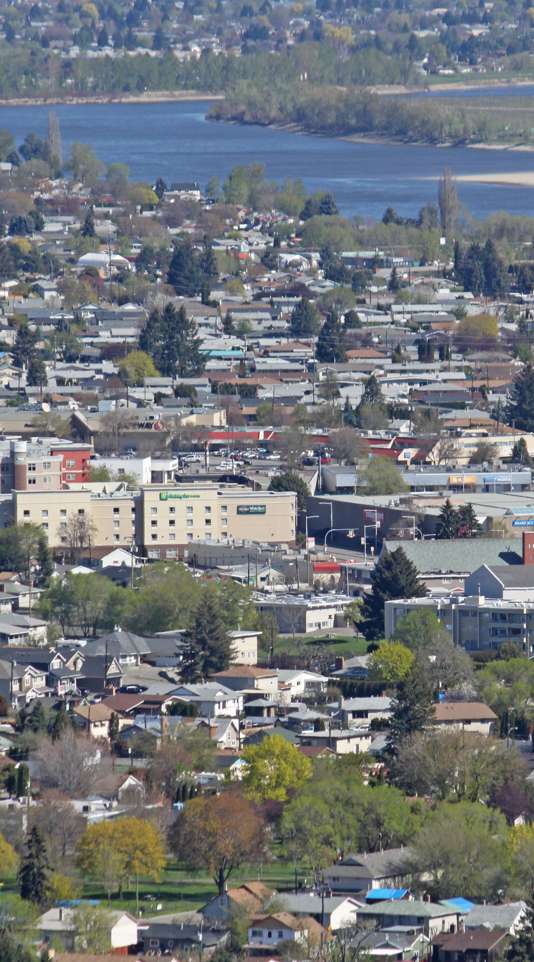
With a topographically flat and relatively central location on the northwest shores of the Thompson Rivers, the plan area covers about 20% of Kamloops’ developed land. Well served by major roads, public transit, and active transportation networks, the plan area is one of the best connected and most diversely developed parts of the city.
As of the 2016 Census, the population of the plan area was approximately 25,715 people, or 28.5% of Kamloops’ total population of 90,280. With a land area of 14.9 km2, it had an average population density of 1,730 people per km2. The area is bound by the hills of the Lac du Bois Grasslands and a CN Rail line (east of 8th Street) to the north; by the North Thompson River to the east; by the Thompson River to the south; and by the property lines of the Kamloops Airport and Kamloops Golf and Country Club to the west.
By 2039, the North Shore's population is estimated to reach 31,095, a 20% increase from 2016.
The plan area is one of the most densely populated areas of the city, with a variety of commercial, institutional, and residential land uses that range from single-family homes to six-storey, mixed-use developments. Economic activity in the plan area is equally diverse, with restaurants, retail, office, entertainment venues, light to heavy industry, and a major regional airport. The plan area also features a number of major parks, recreational facilities, cultural assets, and heritage resources.
North Kamloops is one of Kamloops’ four Core Sector neighbourhoods defined in the City’s Official Community Plan and is connected to the City's South Shore via the Overlanders Bridge. The neighbourhood has over 7 km of shoreline along the North Thompson and Thompson Rivers, a land area of 4 km2, and a population of 10,995 residents as of the 2016 Census.
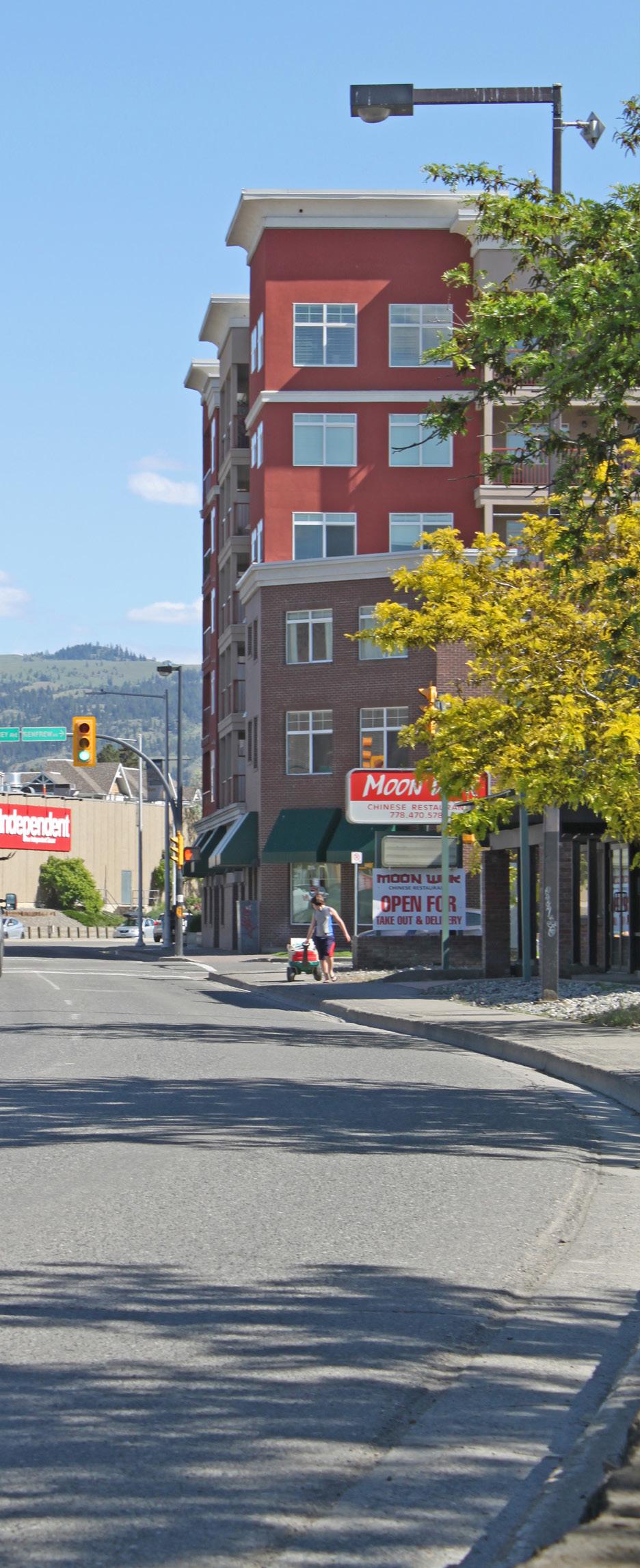
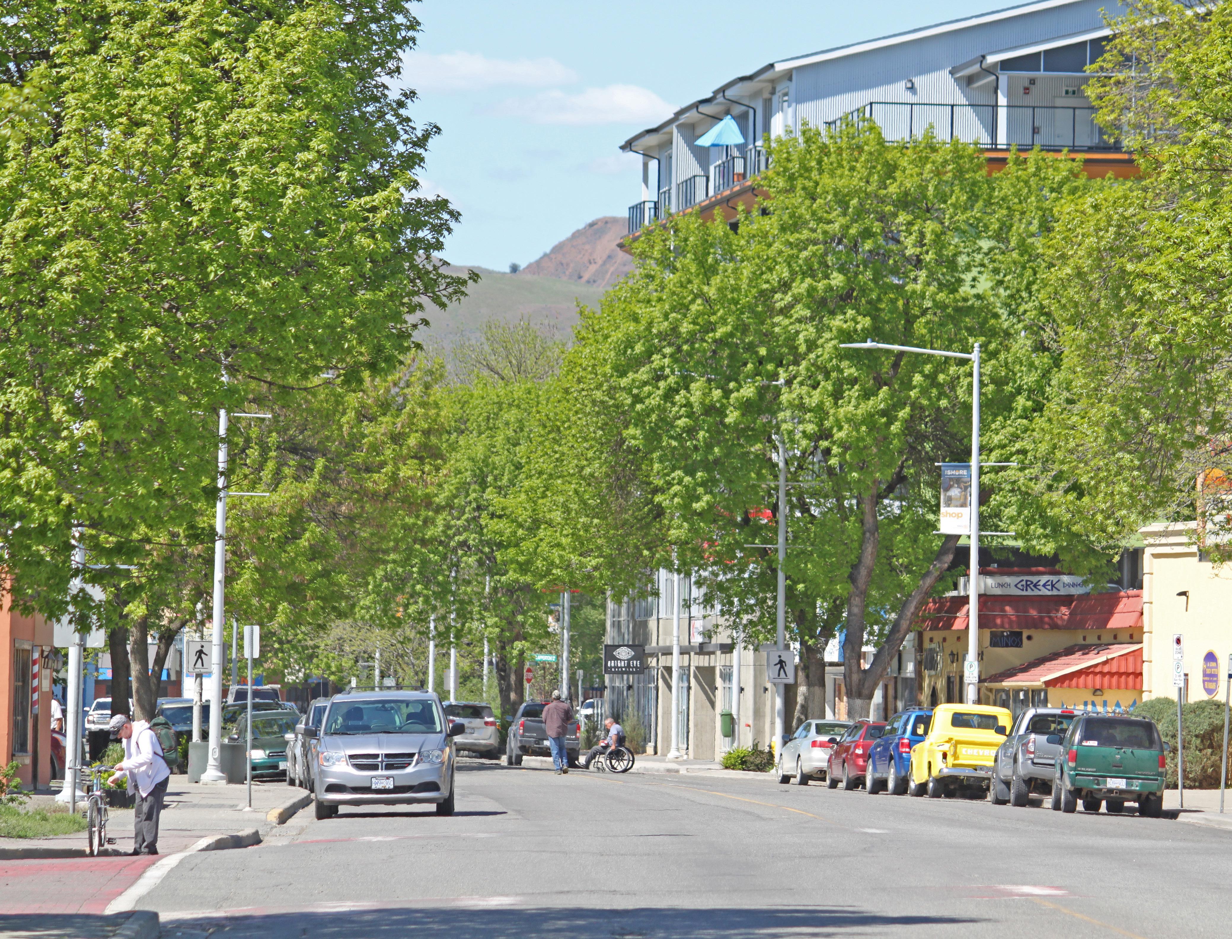
Containing the North Shore Town Centre and Tranquille Market Corridor, North Kamloops serves as the major commercial hub for the North Shore and for neighbourhoods outside of the plan area, such as Batchelor Heights. It is home to most of the North Shore’s commercial, entertainment, and cultural amenities.
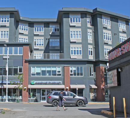
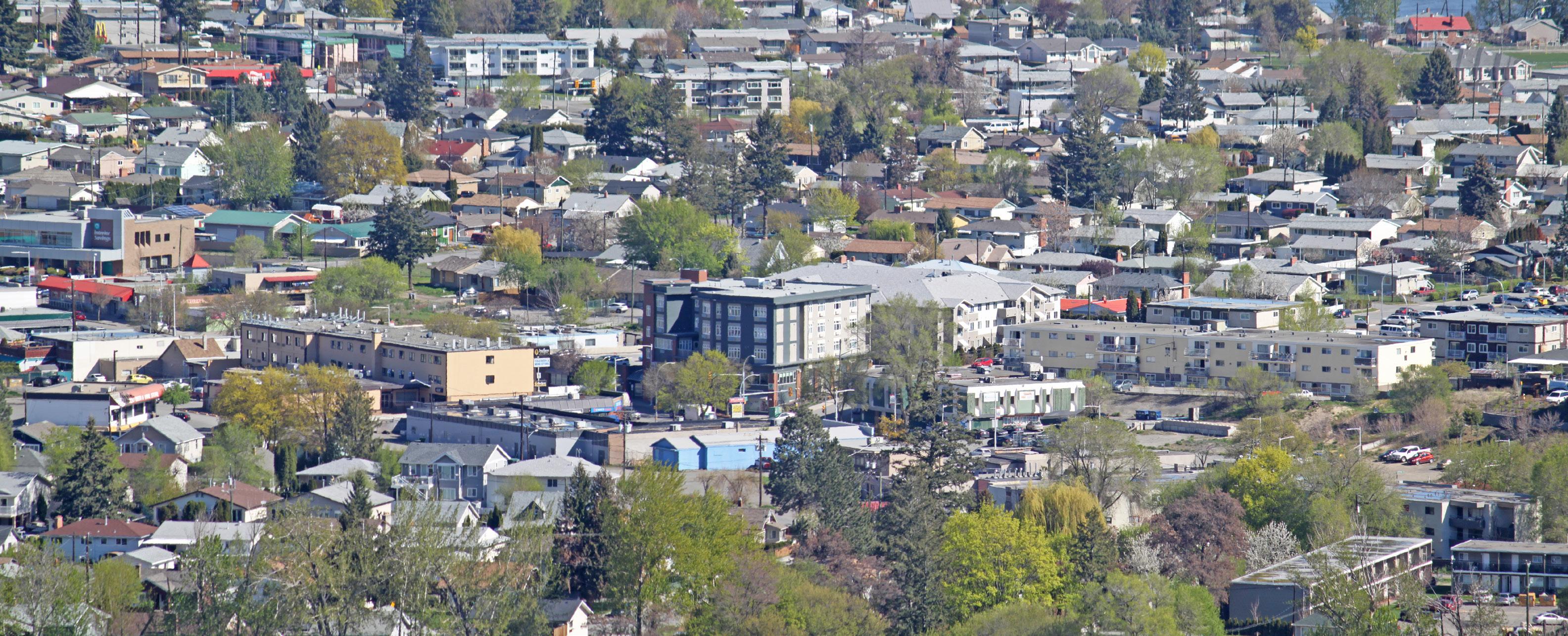
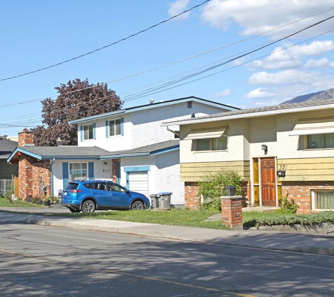
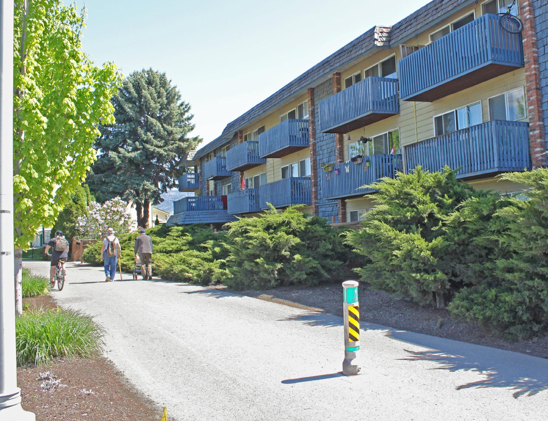
North Kamloops also features a diverse mix of residential building stock, including single-family homes, duplexes, row housing, small walk-up apartments, and mixed-use apartment buildings up to six storeys. The McDonald Park area, in the southwest of North Kamloops, contains some of the oldest single-family homes on the North Shore, including many constructed in the early 1900s. A majority of the single-family homes in other parts of North Kamloops were constructed in the 1960s and 1970s. Older multi-family buildings, including duplexes and walk-up apartments, can be found throughout North Kamloops, while newer apartment developments have generally been occurring within the North Shore Town Centre and Tranquille Market Corridor areas. North Kamloops also has the largest share of rental housing in the city, which includes rental apartment buildings and secondary suites in single-family homes.
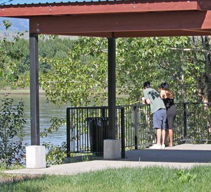
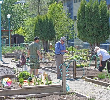
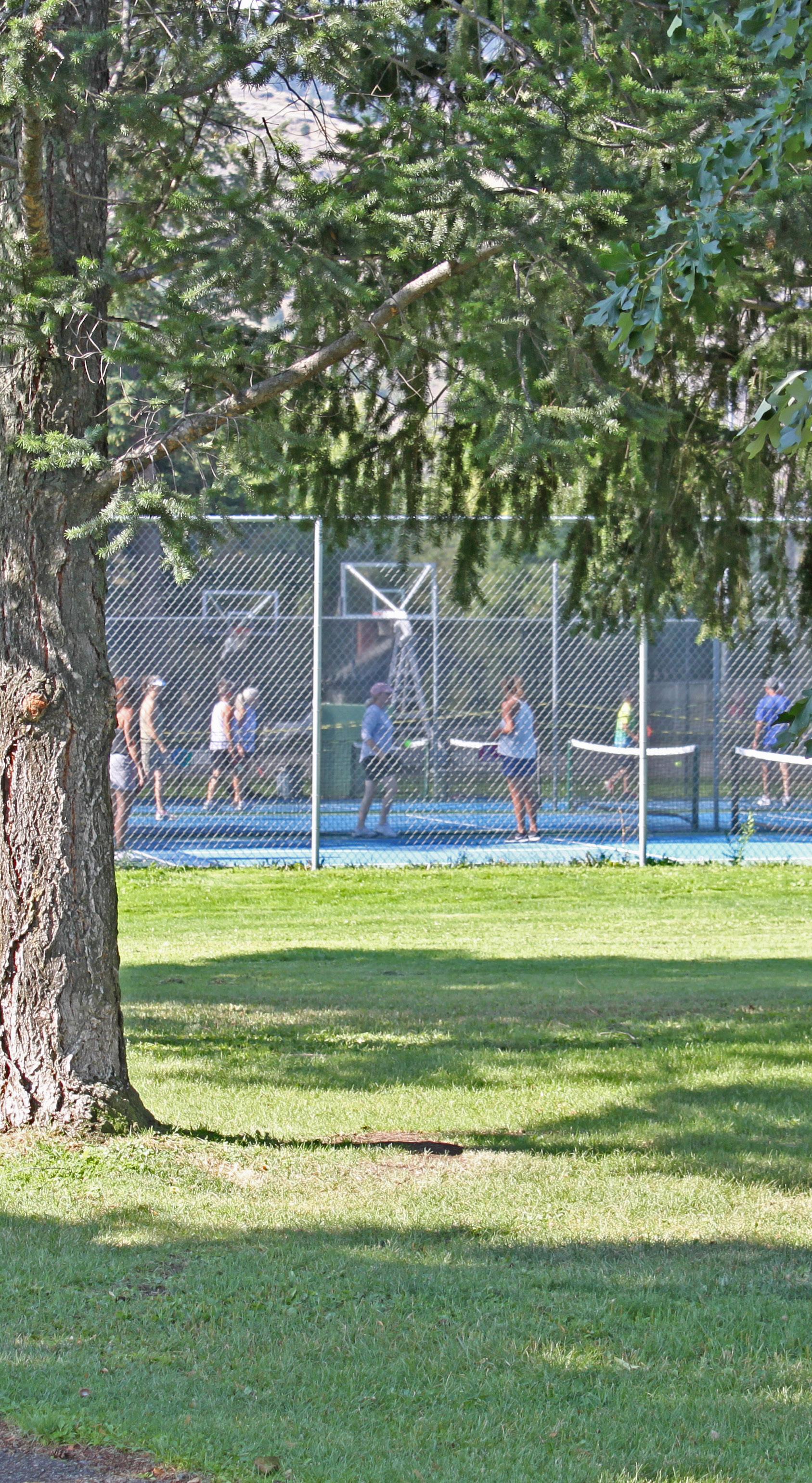
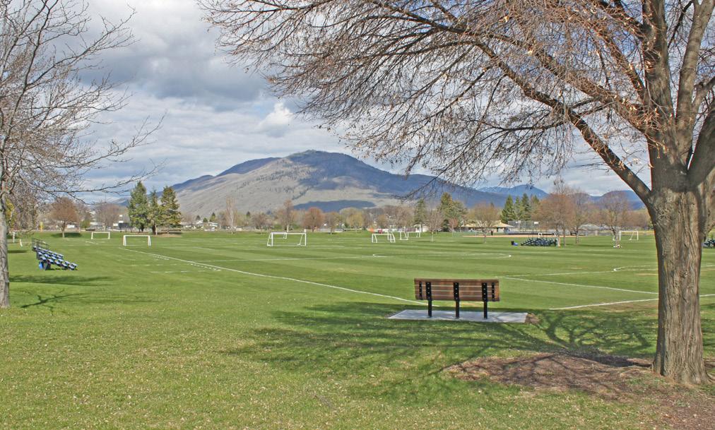
McArthur Island, the largest park in the plan area, contains sports fields and major athletic facilities as well as passive recreational space and over 4 km of the Rivers Trail multi-use path network. Other notable parks in North Kamloops include McDonald Park, which features a community garden, playground, pickleball courts, and spray park; and Overlander Park, which offers tennis courts, beach volleyball courts, and access to Overlander Beach.
The Brocklehurst neighbourhood, with a land area of 6 km2 and a 2016 population of 14,720, is largely residential in character. Brocklehurst was generally developed later than North Kamloops, with fewer homes constructed prior to the 1960s and a larger share of housing constructed in the 1980s and 1990s.
Single-family housing makes up the greatest share of the neighbourhood’s land use; however, it contains more multi-family units than the city average. Compared to North Kamloops, Brocklehurst has a higher share of low-density multi-family housing, such as duplexes and row houses, and a smaller share of apartment buildings. Low-density multi-family housing can be found throughout the neighbourhood while high-density multi-family housing is generally concentrated along Tranquille Road.
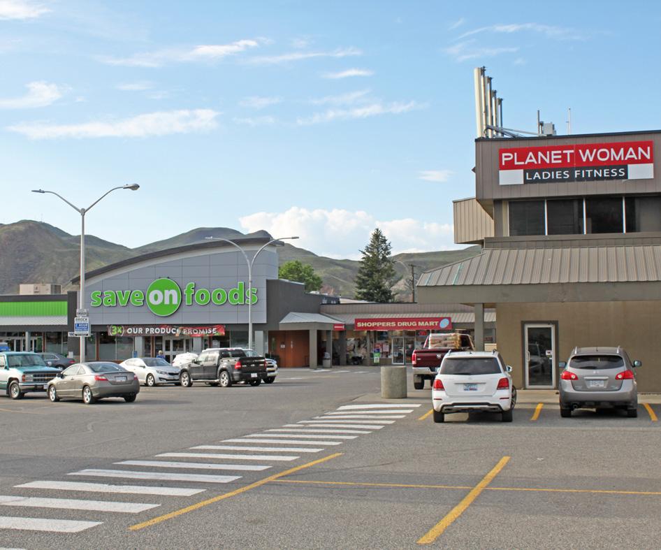
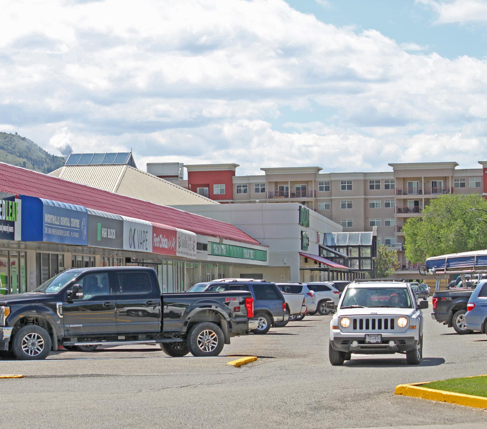
Brocklehurst Centre, also located along Tranquille Road, is the neighbourhood’s primary commercial retail area. In addition to several small shops and restaurants, it includes a major grocery store and pharmacy. 12th Street and sections of Ord Road contain additional commercial areas, which are generally comprised of light industrial and service commercial uses.
Notable parks include Brocklehurst Park, which contains the Brocklehurst Recreation Centre arena and pool; Singh Street Soccer Bowl; Crestline Park; Parkcrest Park; and Ord Road Dog Park.
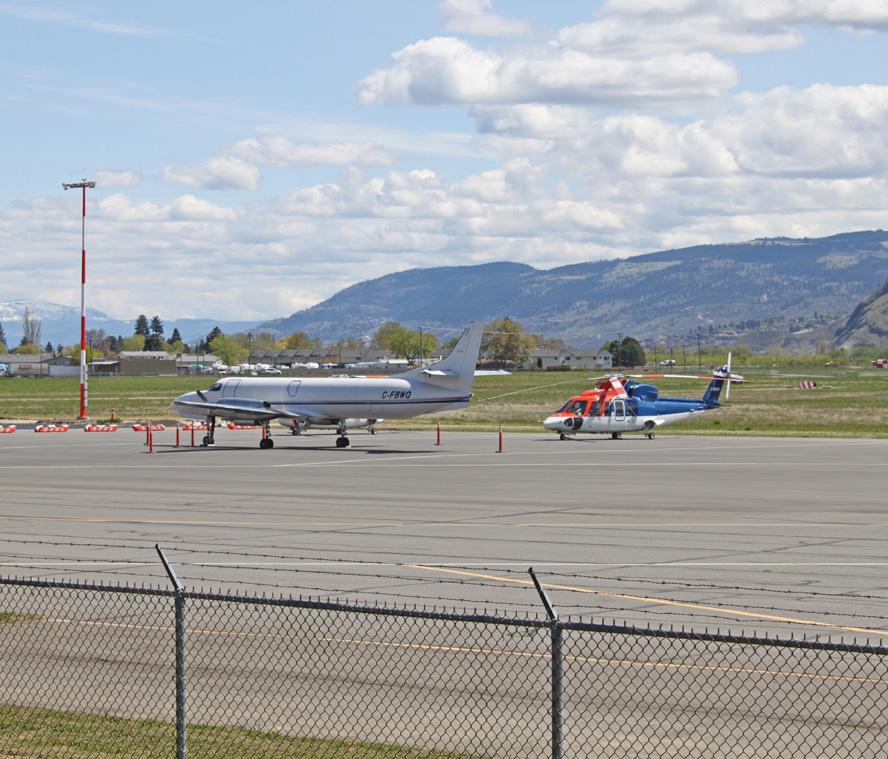
The Kamloops Airport and adjacent lands ("Airport Lands"), include the Kamloops Golf and Country Club and the Suncor fuel terminal. Located to the west of the Brocklehurst neighbourhood, the Airport Lands form part of the Tranquille neighbourhood, as defined in the Official Community Plan. As the remainder of the Tranquille neighbourhood is agricultural and addressed by the City’s Agricultural Area Plan, those portions are not included within the North Shore plan area.
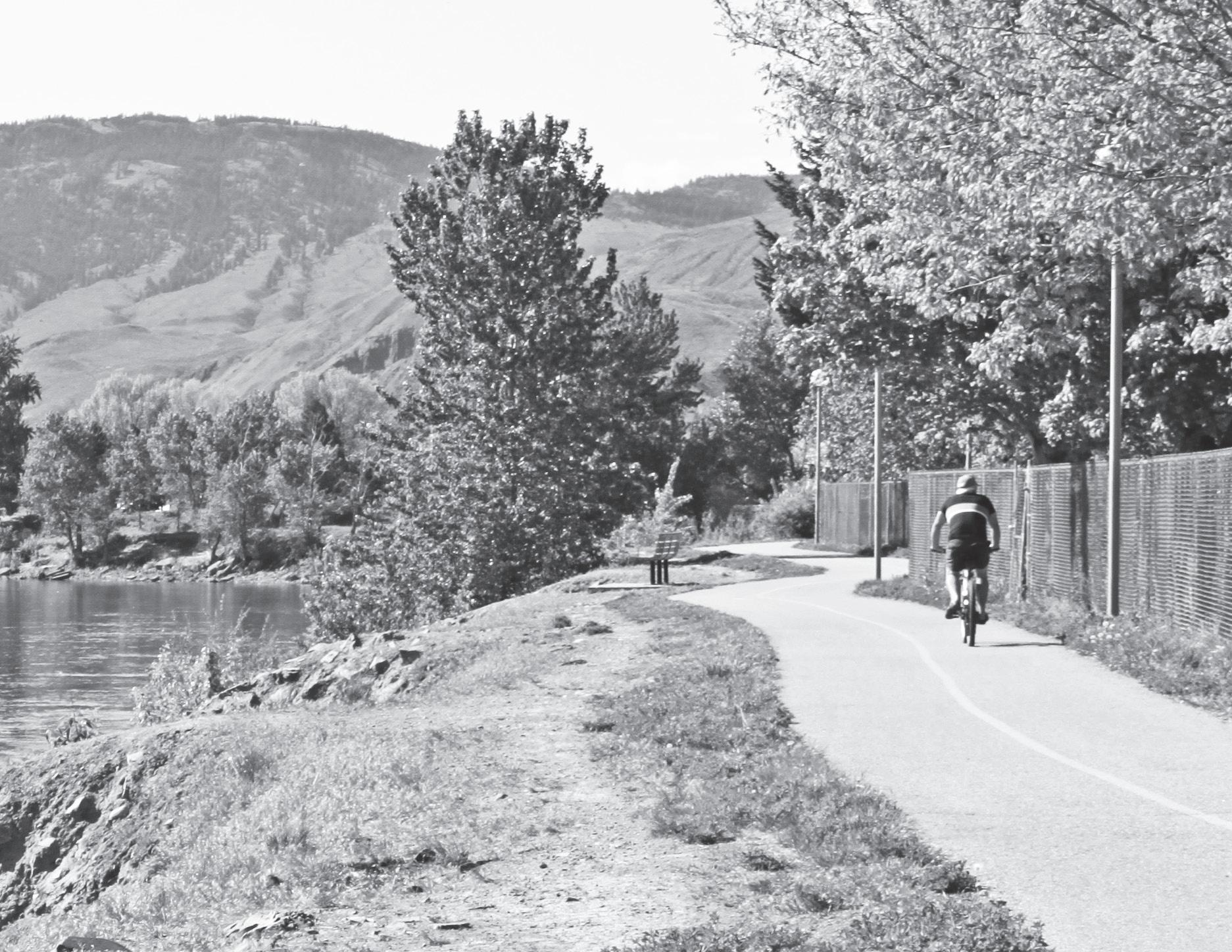
The Airport Lands contain no residential uses but the shoreline to the south of the airport has over 5 km of gravel trails that are well used by local residents and form an extension of the City’s Rivers Trail multi-use path network.
Aside from the potential for ongoing expansion of the airport and its related commercial operations, which are also addressed by the Kamloops Airport Land Use and Development Plan, the land uses for the Airport
Lands are not anticipated to change significantly over the life of the North Shore Neighbourhood Plan. However, the Brocklehurst West Future Development Area (FDA)—a large undeveloped parcel of land across Tranquille Road from the Airport Lands (see Figure 3.1)—may be redeveloped within this plan's time frame. The North Shore Neighbourhood Plan will inform future development of the Brocklehurst West FDA, address considerations for the airport entry corridor along Tranquille Road, and provide guidance on how the Airport Lands can be better integrated with the adjacent Brocklehurst neighbourhood.
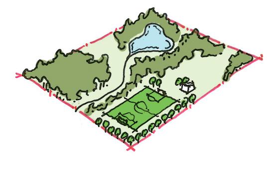
The North Shore contains a large service area and over a quarter of the city's residents. As such, it is home to a significant number of major amenities and destinations for locals and visitors alike. Figure 2.2 highlights some key locations and points of interest within the plan area.
The plan area's population was 25,715 as of the 2016 Census and was estimated to be 26,308 as of 2020, which represents a 27.5% share of the city total. As of 2020, Brocklehurst and North Kamloops populations were estimated to be 14,993 and 11,315, respectively.
Between 2006 and 2016, the plan area grew in population by 7.4%, or 1,780 residents, with the majority (86%) of that growth occurring in Brocklehurst. Over the same 10-year period, Kamloops' population grew by 12.3%, or 9,904 residents. Between 2016 and 2020, the plan area grew by an estimated 2.3%, or 593 residents, with slightly over half (54%) of that growth occurring in North Kamloops. The City of Kamloops is estimated to have grown by 6%, or 5,403 residents, over the same period.
At 299.25 km2, Kamloops is one of British Columbia’s largest municipalities by land area. With an estimated 2020 population of 95,684 and large tracts of undeveloped parkland, agricultural fields, rangeland, and steep slopes, the city has a relatively low average population density of 319.7 people per km2 (or about 3 people per hectare). By comparison, the plan area's average population density as of 2020 is approximately 1,770 people per km2 (or 17.7 people per hectare). Excluding the airport, golf course, and industrial lands in the west of the plan area, North Kamloops and Brocklehurst have population densities of 2,829 and 2,520 people per km2, respectively, making them the most densely populated neighbourhoods in the city.
Age Characteristics
As of the 2016 Census, the plan area's median age was 44.2 years old—two years older than the city-wide median of 42.2 years. The largest age cohorts in the city are from 50 to 64 years (21.7% of the total population) and 20 to 34 years (20.4%). These are the two largest age cohorts in the plan area as well; however, they comprise a slightly smaller share of the total population (21.2% and 19.8% respectively). Compared to the city average, the plan area also has a slightly smaller share of youth and young adults aged 10 to 24 (16% vs. 17.6%) as well as a smaller share of residents aged 35 to 49 (17.4% vs. 18.6%). The plan area also has a notably higher share of seniors, with 21.5% of the population aged 65 years or over compared to 18.2% for the city as a whole.
At the neighbourhood level, Brocklehurst has a slightly older population than North Kamloops, with median ages of 44.3 and 44.0 years, respectively. Compared to city averages, Brocklehurst has a lower share of residents aged 20 to 34, slightly fewer residents aged 35 to 49, and a slightly higher share of children aged 0 to 9. North Kamloops has notably fewer youth aged 10 to 19, slightly fewer residents aged 35 to 54, and a higher share of residents aged 20 to 34. The latter trend may be due to North Kamloops’ larger rental stock, more affordable housing, central location, and solid public transit access attracting more TRU students and young working adults. Both neighbourhoods also have a larger share of seniors, particularly those aged 70 and over, which may, in part, be due to the large number of seniors’ retirement and care homes in the plan area.
The household composition of the plan area differs considerably between Brocklehurst and North Kamloops, with Brocklehurst more closely following city averages.
North Kamloops’ unique composition is likely due in part to having a higher concentration of multi-family housing and an older stock of single -family homes, which generally have smaller square footage than more recently constructed homes. In combination with the relative affordability of the area, these factors tend to attract a greater share of young adults living without children and retain long-time residents whose children no longer live at home.
This is reflected not only in the age cohort data but also in the average household size for North Kamloops, which is 2.1 residents compared to 2.4 residents for both Brocklehurst and Kamloops as a whole. It is also reflected in the percentage of one-person households, which compose 39.5% of North Kamloops households compared to 27.4% for Brocklehurst and 27.1% city wide. Of all households in North Kamloops, 29% have children living at home compared to 36.9% for Brocklehurst and 35.4% city wide.
The median household income in the plan area is $55,565, with Brocklehurst at $63,658 and North Kamloops at $46,478. Respectively, these are 13.8% and 37% lower than the city-wide median household income of $73,822. While significant, these discrepancies can partly be attributed to the plan area’s higher share of seniors, whose regular incomes (e.g. pensions) are lower than would be for those with full-time employment.
For North Kamloops, the lower median income can also be attributed to its higher share of young adults who typically make lower incomes than those at a later stage in their careers. Young adults, such as university students, are also more likely to be employed on a part-time basis. A significant factor behind North Kamloops’ low median household income is its smaller average household size, which results in fewer income earners living under one roof. This is evidenced by North Kamloops’ median individual income of $26,287, which is only 26.6% lower than the city-wide figure of $35,830. Further contributing to North Kamloops’ lower income figures may be differences in its labour force composition, which includes a higher share of people working in lower income industries, such as retail trade, compared to the city average.
Regardless of these factors, 19.9% of individuals in the plan area are considered to be low income, including 15.7% in Brocklehurst and 25.3% in North Kamloops, compared with 12.6% for all of Kamloops.
According to the 2016 Census, the housing stock in the plan area is composed of 23.7% mediumto high-density multi-family (e.g. apartments), 36.5% low-density multi-family (e.g. townhouses, duplexes), and 39.8% single-family homes. By comparison, the city as a whole is composed of 18.0% medium- to high-density multi-family, 30.1% low-density multi-family, and 51.9% single -family homes. Brocklehurst has the largest share of single -family homes (42.5%) and low- density multi-family housing (43.2%) in the plan area, while North Kamloops has the largest share of medium- to high-density multi-family housing (34.2%).
In the 10-year period from 2007 to 2016, building permits were issued for 1,087 units in the plan area, with a majority (63.4%) occurring in Brocklehurst. From 2017 to 2019, building permits have been issued for 329 units in the plan area, which indicates that the average annual pace of development following the 2016 Census has largely remained the same for the plan area— approximately 110 new units per year. However, since 2016, the share of new unit construction in the plan area has increased in North Kamloops relative to Brocklehurst from about one-third to two-thirds (63.8%) of all new units. Similarly, the form of development has also shifted towards a greater share of medium- to high-density multi-family, which has accounted for two-thirds (68.4%) of all new units in the plan area over the last three years.
According to the Canada Mortgage and Housing Corporation, housing is considered to be unaffordable when a household spends more than 30% of its pre-tax income on adequate shelter. As of 2016, 23.0% of Kamloops households spend more than 30% of their income on housing. At the neighbourhood level, Brocklehurst has slightly fewer unaffordable households (22.3%) than the city-wide average, while North Kamloops has significantly more (36.2%).
In Brocklehurst, 14.5% of homeowners live in unaffordable housing compared to the city average (13.7%) but renters (42.1%) have fewer affordability challenges than the city average (46.8%). In North Kamloops, 17.5% of homeowners and 52.6% of renters live in unaffordable housing, which is higher than city averages. North Kamloops’ affordability challenges are further magnified by the much larger share of rental households in the neighbourhood (53.3%) compared to homeowner households (46.7%), whereas in Brocklehurst the share of owners (71.5%) to renters (28.6%) is more comparable to city averages (72.0% vs. 28.0%).
The overall trends suggest unaffordable rental housing is a significant city-wide challenge but is a particularly acute issue in North Kamloops. By contrast, a much smaller share of homeowners face affordability challenges regardless of their neighbourhood.
The North Shore's housing stock is older than the Kamloops average, with 16.2% of its housing constructed before 1961, including just under a quarter (23.2%) of North Kamloops’ housing stock. By comparison, 12.1% of Kamloops total housing stock was constructed in this period. A majority (53.9%) of housing in the plan area was constructed from 1961 to 1980, which was also the most significant period of residential construction for Kamloops as a whole when 41.7% of its current housing stock was completed.
Located further from the city’s core, Brocklehurst was generally developed later than North Kamloops and has a greater share (24.6% vs. 15.7%) of housing constructed from 1981 to 2000. Just over a quarter (28.1%) of the city’s current housing stock was built in this period. Housing constructed since 2001 accounts for 9.5% of housing in the plan area, or about half of the city-wide average of 17.9%.
Mode Share
As of the 2016 Census, most residents in the plan area commute to work as either a driver or passenger of a private vehicle. At 84.2%, this is only slightly lower than the Kamloops average of 88.7%. However, at the neighbourhood level, the share of residents commuting by private vehicle is notably lower in North Kamloops (80.3%) than in Brocklehurst (86.9%).
Similarly, North Kamloops has a higher share of residents commuting by sustainable transportation modes than the city average, including for walking (7.6% vs. 5.5%), biking (2.4% vs. 1.2%), and public transit (7.0% vs. 4.5%). In Brocklehurst, a larger share of residents commute by public transit (6.4%) than the city average, a comparable share by biking (1.4%), and a smaller share by walking (2.7%). Compared to Brocklehurst, North Kamloops’ greater concentration of employment lands and closer proximity to Downtown likely improves the viability of walking and biking for its residents.
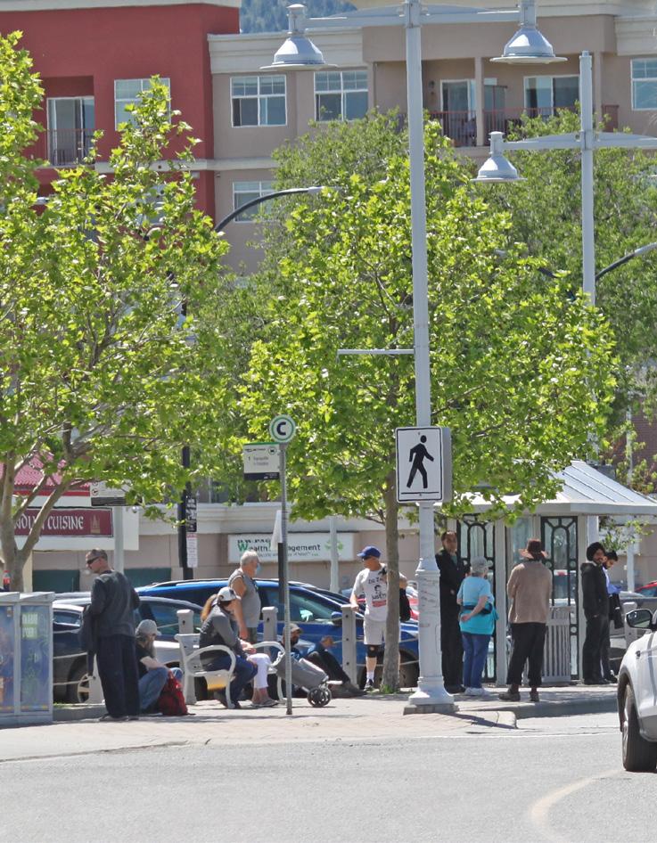
The plan area has a number of beneficial attributes that support walkability, including a flat topography, a relatively high population density, and a compact mix of uses. This is especially true in North Kamloops, where 63.7% of residents live within a 5- to 10-minute (400 m) walk of key amenities in commercial centres. This compares with 7.8% of Brocklehurst residents and 22% of residents city wide. Despite these advantages, safety for pedestrians may be impacted by gaps in the area's sidewalk network.
Areas with a higher degree of walkability include major arterials, such as Fortune Drive, 8th Street, and Tranquille Road east of Desmond Street, and the Tranquille Market Corridor, which have sidewalks on both sides of the street and anchor the North Shore’s commercial centres. The Rivers Trail multi-use pathway also provides Schubert Drive and McArthur Island with a high degree of walkability. The areas of the North Shore particularly lacking in pedestrian infrastructure include most of North Kamloops’ local roads—many of which only have gravel shoulders—and much of Brocklehurst’s overall road network.
To help address some of these gaps in the North Shore's pedestrian network, a number of future improvements are proposed in the City’s Transportation Master Plan. This includes adding sidewalks to improve pedestrian connections between the McDonald Park, John Tod, and Schubert Drive residential areas in North Kamloops and improving pedestrian facilities that connect to schools in Brocklehurst.
The plan area has over 20 km of bicycle paths, including multi-use pathways, off-road trails, shared routes, and bicycle lanes. Brocklehurst has just under 10 km of paths, while North Kamloops contains over 13 km. The Rivers Trail multi-use pathway along Schubert Drive and the multi-use pathway along Singh Street serve as major north-south routes, while shared routes along Royal Avenue and along Fleetwood/ Lethbridge Avenues serve as east–west corridors. The Rivers Trail multi-use pathway around McArthur Island provides another major component of the network. Several new routes that will improve the connectivity of the bicycle network are proposed in the City’s Transportation Master Plan. These include a multi-use pathway along Tranquille Road from Desmond Street to Aviation Way and shared routes connecting the North Shore Town Centre to the existing network via Renfrew and Nelson Streets.
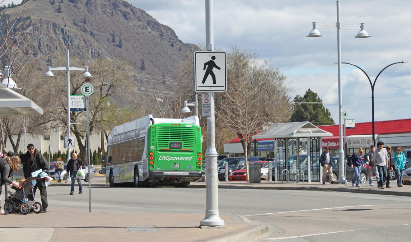
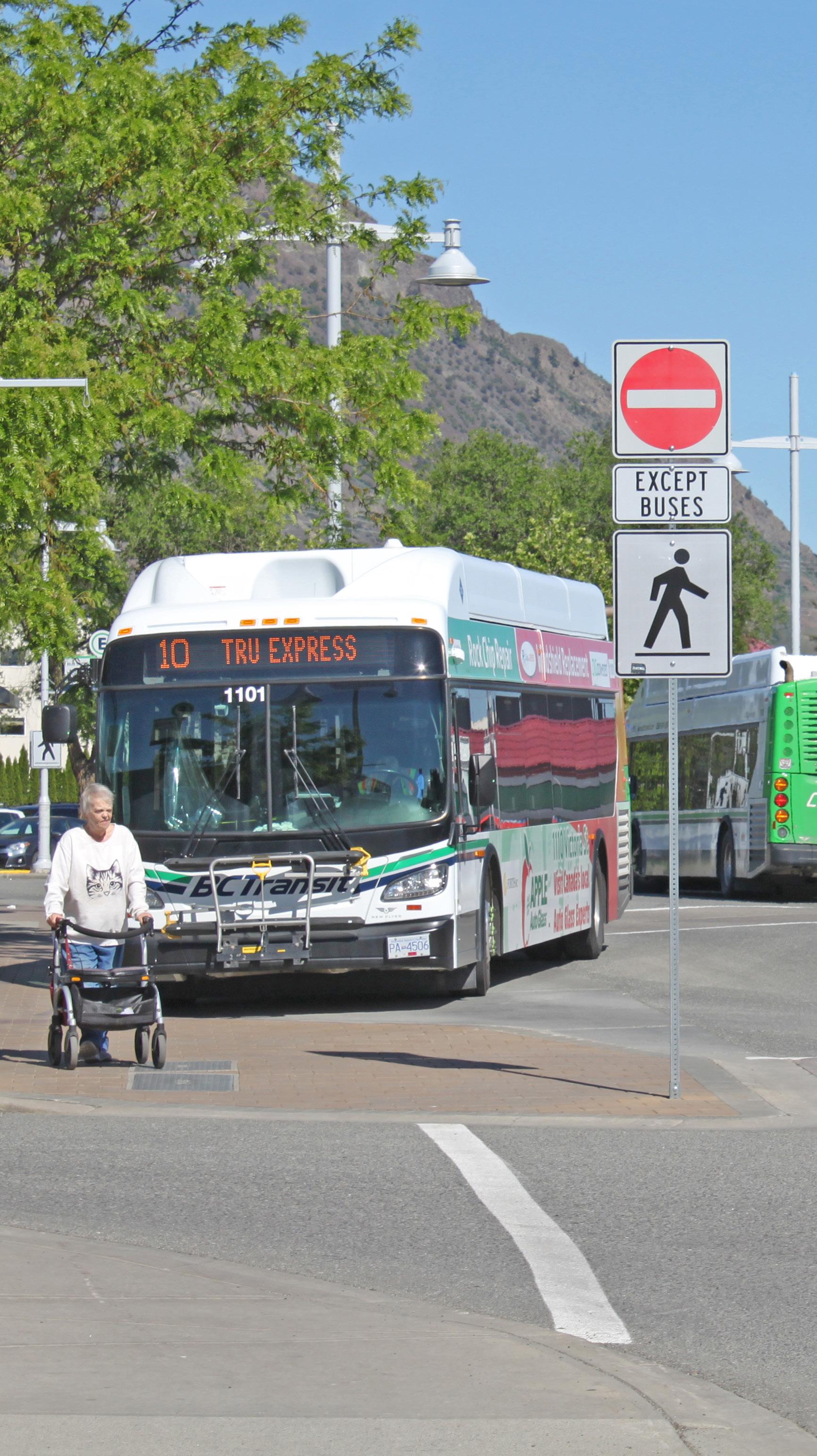
The plan area is well served by public transit, containing stops for 6 of Kamloops’ 14 bus routes. As a major commercial area with a central location and relatively high population density, North Kamloops is particularly well connected to the rest of Kamloops and is home to one of the city’s three transit exchanges. With 129 transit stops within the plan area, 93.4% of residents live within a 5- to 10-minute (400 m) walk of a transit stop. This includes 92.8% of residents in North Kamloops and 93.9% in Brocklehurst. Notable areas with transit access challenges include McArthur Island, which has no dedicated transit stops, and Ord Road, which has limited physical connections to nearby transit routes due to the rail corridor to the south.

The plan area includes a variety of road classifications, including major arterials, minor arterials, a Downtown arterial (on Tranquille Road within the Tranquille Market Corridor), collectors, and local roads. The plan area is well connected with adjacent neighbourhoods and points beyond. The Overlanders Bridge connects the plan area with the city's South Shore; the Halston Bridge connects the North Shore with Tk'emlúps te Secwépemc lands and Highway 5 to the east; and the Halston Interchange provides connections to Batchelor Heights and Westsyde to the north.
The plan area’s road network is composed of two different grid systems—the more traditional rectilinear grid of North Kamloops, with major routes running north–south, and the more curvilinear grid of Brocklehurst, with major routes running east–west. The neighbourhoods’ distinct development periods, differing orientations to the shoreline, and shared agricultural history have all shaped their respective road networks.
A number of roads in the plan area are occasionally closed for events. This most notably occurs during the annual Boogie the Bridge event, which can close lanes or sections of the Overlanders Bridge, Tranquille Road, Fortune Drive, Schubert Drive, and various local roads in North Kamloops.
The plan area contains a number of large private and City-owned parking lots in major commercial areas and at other key community destinations, including McArthur Island, North Shore Town Centre, Brocklehurst Centre, and the Kamloops Airport.
There are no paid on-street parking zones on the North Shore, but on-street parking within the Tranquille Market Corridor is limited to two hours. On-street parking is permitted along most non-arterial roads within the plan area.
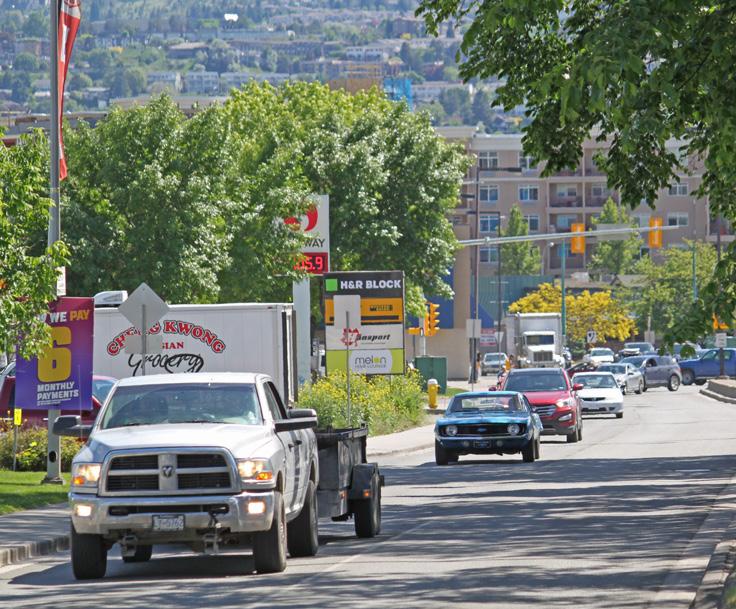
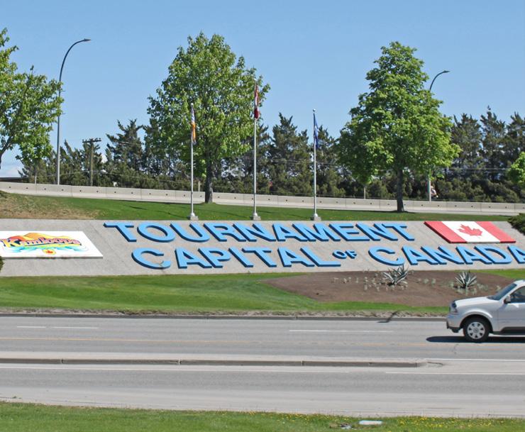
Four major entry corridors serve as key gateways for residents and visitors to the North Shore, including three vehicle-oriented corridors—the Overlanders Bridge entry corridor, the Halston Avenue entry corridor, and the Tranquille Road airport entry corridor—and a major entry corridor for pedestrians and cyclists via the Rivers Trail. The first three corridors have road-oriented signage that welcome people to the area, including on Tranquille Road north of the Overlanders Bridge, on Airport Road west of Tranquille Road, and on Halston Avenue west of Kingston Avenue. City of Kamloops signage is present at all three road corridors, North Shore Business Improvement Association signage is present at the Overlanders Bridge and Halston Avenue, and provincial government signage is present at Airport Road. Where the Rivers Trail meets the multi-use path on-ramp to the Overlanders Bridge, there is also pedestrian and cyclist- oriented City signage.
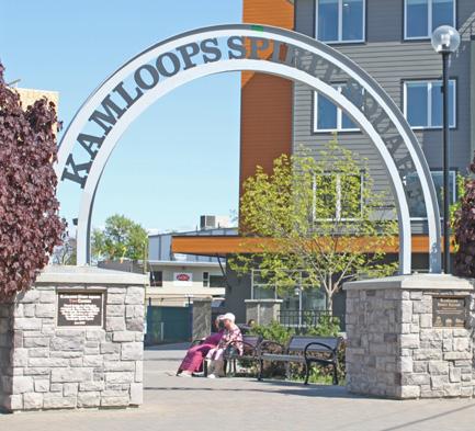
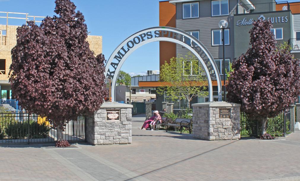
Additional gateway features in the form of prominent signage, public art, or archways can also be found at entry points to landmark destinations within the plan area. These include features at Kamloops Airport, Spirit Square, McDonald Park, McArthur Island Park, the Overlanders Bridge, and the north and south ends of the Tranquille Market Corridor. In addition to serving as symbolic gateways, such features contribute to beautification, placemaking, and wayfinding efforts.
Over 40% of the plan area’s land is dedicated to employment- or economic development-related uses. With a diversity of commercial, institutional, and industrial lands, these uses include retail, restaurants, private and government offices, warehousing, schools, and cultural and entertainment facilities.
As shown in Figure 2.24, the business licences in the plan area account for about 20% of all active business licences in Kamloops. Over two-thirds of business licences within the plan area are located in North Kamloops. Major employment areas include the North Shore Town Centre, Tranquille Market Corridor, Brocklehurst Centre, Halston Avenue, 8th Street, 12th Street, and the Kamloops Airport and adjacent industrial areas.
The largest employment industries in the plan area are retail trade (14%), health care and social assistance (13.4%), and accommodation and food services (10.4%). Similarly, the largest industries by labour force for all of Kamloops are health care and social assistance (14%), retail trade (12.8%), and accommodation and food services (9.6%).
In comparison to the city average, the plan area has a greater share of residents employed in administrative and support, waste management and remediation services (5.8% vs. 3.8%); construction (9.8% vs. 8.1%); transportation and warehousing (6.3% vs. 5.4%); manufacturing (5.8% vs. 5.3%); and other services (5.7% vs. 4.9%).
With a concentration of both employment and residential land uses and a relatively central location, 45.2% of North Kamloops residents' commute time is less than 15 minutes to work and 39% is approximately 15–29 minutes. This compares with 38.6% and 44.6%, respectively, for the city as a whole. Located further from the core of the city and containing fewer employment lands, 33.9% of Brocklehurst’s residents commute less than 15 minutes to work and 48.5% commute between 15–29 minutes. Overall, 16.8% of plan area residents commute 30 minutes or more to work, compared with 14.6% city wide.
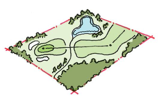
The plan area contains 83 ha of parks and public space, including 74 ha of City parkland and 9 ha of provincial parkland. At the neighbourhood level, Brocklehurst contains 20 ha of parkland and North Kamloops, which includes McArthur Island, contains 63 ha. These range from large nature parks to small neighbourhood tot lots.
Major parks include the Lac du Bois Grasslands Protected Area, McArthur Island Park, Brocklehurst Park, McDonald Park, and Overlander Park. The Lac du Bois Grasslands Protected Area encompasses a large expanse of rare grassland and forest ecosystems that are regulated and managed by the Province. Most of the protected area falls outside of the plan area boundaries to the north but remains a well-used passive recreational asset and a defining landscape feature of the North Shore.
Other notable community recreation spaces and facilities include Brocklehurst Park and Recreation Centre (including the arena and pool facilities), Overlander Park Beach and beach volleyball courts, the John Tod Centre, Kamloops BMX Track, Kamloops Golf and Country Club, Ord Road Dog Park, and Aviation Way Dog Park.
There are also a number of small squares and plazas located through the plan area, including Spirit Square, the sundial plaza at the McArthur Island Xeriscape Garden, and the McDonald Park entry plaza at the foot of Holway Street. Roads are also occasionally closed to vehicle traffic for special events, such as Boogie the Bridge and the BrewLoops Festival.
The North Shore has relatively good parks and recreation coverage, with 79.5% of the plan area’s population living within a 5- to 10-minute (400 m) walk of a park or civic recreational facility—higher than the city-wide average of 74.9%. At the neighbourhood level, this includes 72.6% of Brocklehurst residents and 88.5% of North Kamloops residents.
The plan area currently has a diverse mix of land uses, including a range of residential housing types, retail, small-scale commercial offices, social services, parks, public utilities, rail corridors, industrial facilities, and agricultural lands.
The formally designated land uses for the plan area, as defined by the Official Community Plan, are shown in Figure 3.1 and a breakdown of land use by area is provided in Table 3.1.
Urban residential land use makes up nearly half (47%) of the plan area and accounts for 21% of the city’s total Urban land use. The Urban designation makes up a large share of Brocklehurst at 69%. Commercial uses account for 6% of the plan area’s land use and make up 21% of the city’s total designated commercial areas. North Kamloops has a greater share of commercial uses—about three times that of Brocklehurst. This includes the North Shore Town Centre and Tranquille Market Corridor, which are mixed-use areas containing a concentration of multi-family residential, retail, restaurants, and other commercial services.
The North Shore plan area covers 20% of Kamloops' total developed land area and contains 13 different Official Community Plan land uses.
The Brock Shopping Centre, defined as a Major Neighbourhood Centre in the Official Community Plan, anchors Brocklehurst's primary commercial area. Other notable commercial areas include the 8th Street Corridor and service commercial clusters along 12th Street and Halston Avenue and within the Tranquille South character area.
The plan area also includes Light Industrial uses, predominantly along Ord Road and Halston Avenue, and Medium and Heavy Industrial uses along Tranquille Road to the north of the Kamloops Airport. Combined, industrial uses account for 4% of the plan area. A land use unique to the North Shore, the Kamloops Airport is the principal airport for the city and region and covers a large area to the west of Brocklehurst, accounting for 18% of the plan area’s total designated land.
Parks and Open Space accounts for the third-largest land use in the plan area at 8%. The largest park space is McArthur Island Park, which comprises over half (56%) of all Parks and Open Space on the North Shore. Another sizeable green space is the Kamloops Golf and Country Club, which is located to the north of the airport, accounts for 4% of the plan area's designated land, and is the only instance of Golf Course land use in the plan area. Educational/Institutional land use, which includes facilities such as schools, Fire Station No. 2, and the John Tod Centre, covers 3% of the North Shore.
While not a prominent feature of the plan area, there are sizeable parcels of Agricultural-designated land to the north of Ord Road and on the western portions of the Kamloops Airport Authority Society’s property. In total, these account for 7% of the plan area.
The North Shore is also home to two Future Development Areas (FDAs): the Brocklehurst West FDA and the Henry Grube Education Centre FDA. As defined by the Official Community Plan, FDAs are lands designated to accommodate future population growth that require specialized design and sensitive integration considerations prior to development. These FDAs cover 2% of the plan area and account for a 15% share of the city’s total FDA lands. Following further planning and review, these areas may eventually accommodate a mix of commercial, residential, recreational, and/or other land uses.
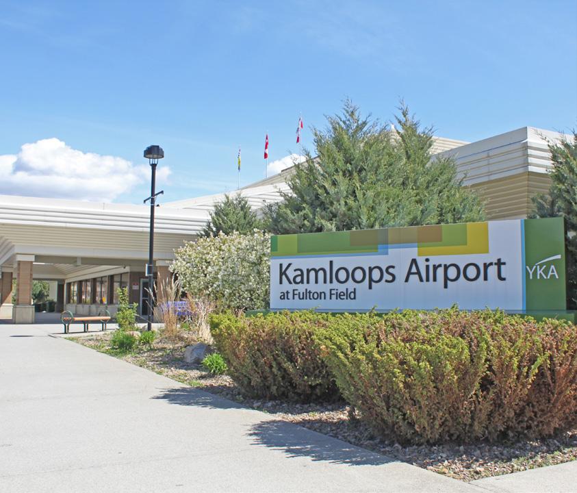
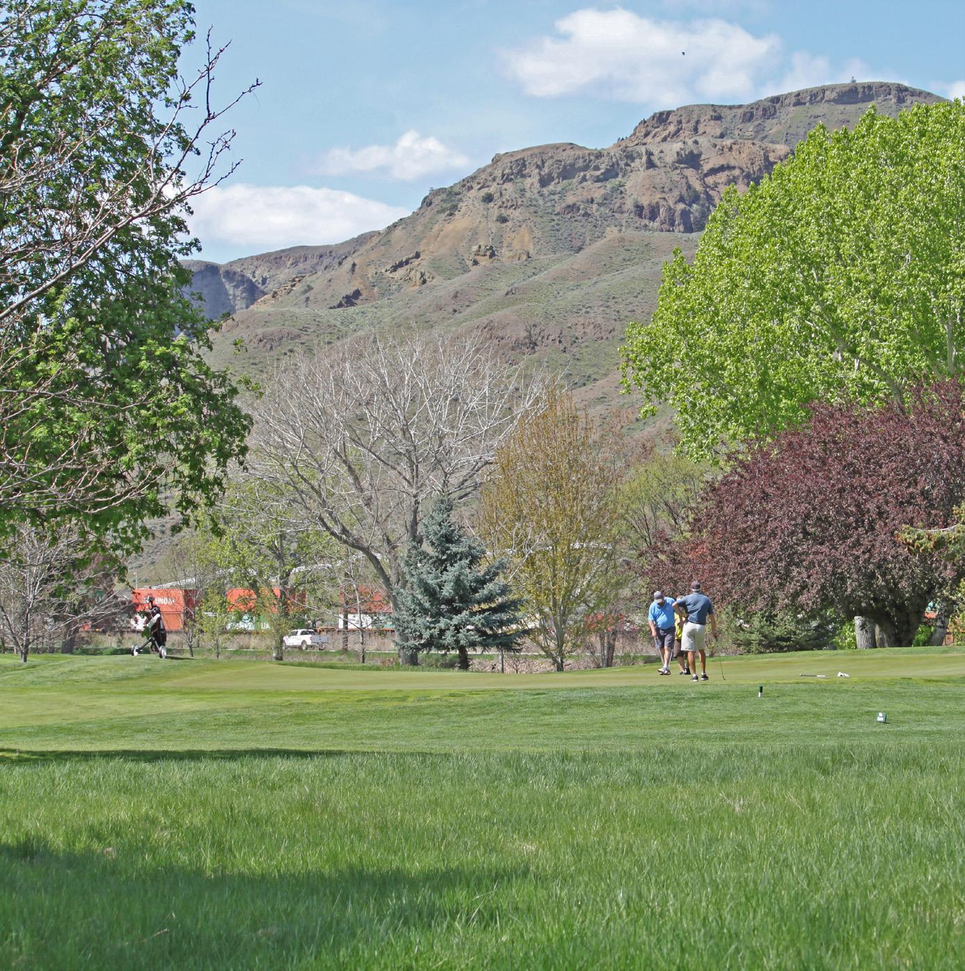
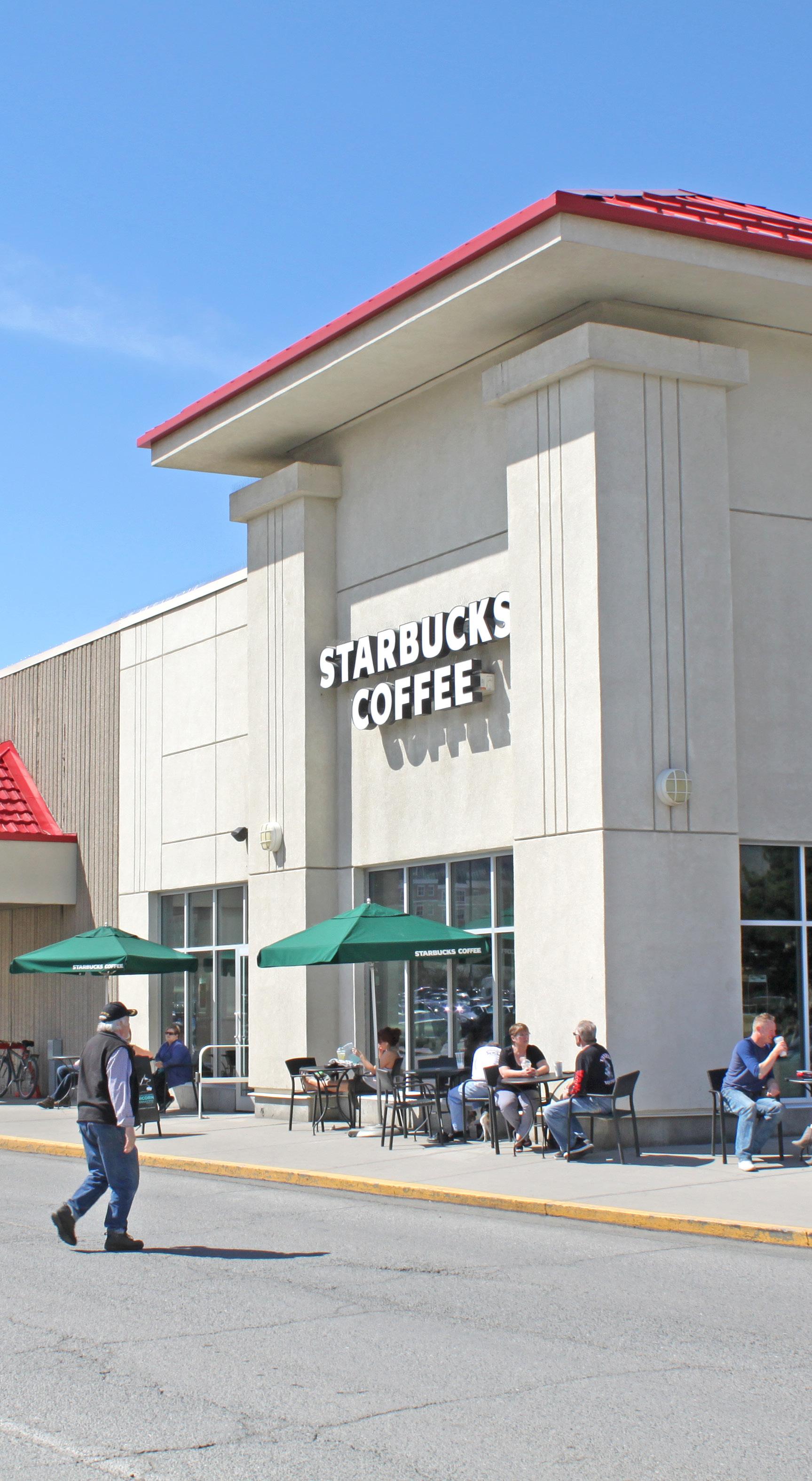
Table 3.1 » Land Use Breakdown by Area
Land use designations are established within the Official Community Plan and are a key implementation tool in helping the City manage growth and development. They identify general uses that are provided for in each designation, give direction on the appropriate development mix, and identify where land uses should be located. Tables 3.2 to 3.4 provide a high-level overview of land use designations within the plan area, as described in the Official Community Plan.
The land uses provided and densities noted are generalized, which leaves it to the Zoning Bylaw to prescribe permitted uses and regulations regarding such things as density, lot coverage, and setbacks. The City may consider higher densities beyond the limits stipulated in the following tables but only subject to certain conditions, such as availability of servicing; compatibility with existing neighbourhood form and character; and proximity to transit, recreation, shopping, and other community amenities.
North Shore Town Centre To allow for a mix of medium- to high- density multi-family and commercial uses.
Future development in this designation may include commercial (retail and office) and mixed-use, with commercial on lower floors and residential above.
Development should be pedestrian and transit oriented where appropriate while not impeding movement of goods and emergency services along major transportation corridors.
Tranquille Market Corridor To allow for a mix of medium- to high- density multi-family, commercial, and community uses.

Future development in this designation may include commercial (retail and office) and mixed-use, with commercial on lower floors and residential apartments on upper floors.
Development should be pedestrian and transit oriented.
Urban
UrbanMajor Neighbourhood Centres
To allow for a broad range of housing, including single -family and low-, medium-, and high- density multi-family housing in a variety of forms.
Development should be pedestrian and ground oriented.
To allow for a mix of medium- to medium/high- density multi-family and mixed-use adjacent to or along arterial and collector roads within 400 m of major neighbourhood centres.
Development should be pedestrian and transit oriented.
Note: Major neighbourhood centres are specific areas within and not a separate land use designation from Urban.
Single -family, secondary suites, intensive residential, duplexes, row houses, manufactured homes, stacked townhouses, triplexes, fourplexes, walk-up apartments, and other forms.
Secondary suites and intensive residential (where permitted and subject to individual evaluation), stacked townhouses, triplexes, fourplexes, and walk-up apartments.
Up to 125 units/ha
Up to 125 units/ha
Commercial To allow for a wide range of commercial uses including retail, office, goods and services, as well as community amenities. Commercial areas may include shopping centres; large -format retail; and, in neighbourhood centres within Urban residential areas, mixed-use and multi-family development that is transit and pedestrian oriented.
Educational/Institutional To provide for services to the community, including schools; hospitals; fire halls; cemeteries; major government, cultural, or recreational facilities; community centres; and places for religious assembly.
Future Development Area To provide lands that are proposed to be developed at some future date in order to accommodate population growth and that require specialized design and sensitive integration considerations.
Light Industrial To allow for a mix of trades and technology, research and development, warehousing, wholesale distribution, storage of materials and equipment, and other light industrial activities with compatible commercial uses.
Medium and Heavy Industrial To allow for manufacturing activities that include the storage and processing of raw, bulk, or extracted materials, including wood and forest products, sand and/or gravel, concrete and minerals, metals, and petroleum products.
Golf Course To allow for lands designated as golf course.
Parks and Open Space To protect areas of ecological significance, including wildlife corridors, and to allow for active and passive recreation via various City parks classified as city wide parks, community parks, neighbourhood parks, tot lots, linear parks, nature parks, and open space. Includes recreational and other community facilities located within City parks.
Public Service Utilities To allow for municipal services and infrastructure essential to the public, including water treatment plants and other civic utilities.
The future land use direction for the North Shore is informed by a high-level framework focused on adding more opportunities for residential density to support revitalization, affordability, and a greater diversity of housing choice.
This framework is made up of a hierarchy of three area types with different directions in terms of the principal form and density of new residential infill development.
• Mixed-Use Districts
• Key Corridors and Shoulder Areas
• Neighbourhood Sensitive Infill Areas
An overview of each area type is provided on the following page and shown in Figure 3.2.
The intent of the future land use framework is to provide general guidelines in terms of the levels of residential density, types of housing forms, and approximate locations that would be supported by the City for new infill and multi-family residential or mixed-use development.
As the residential forms and densities outlined here are generalized, the Zoning Bylaw will ultimately prescribe permitted uses and regulations regarding such things as building height and density. Following adoption of the North Shore Neighbourhood Plan, the Zoning Bylaw will be amended to better align with the plan's land use directions for the area.

The City may consider building forms, heights, and densities outside of the characteristics outlined here subject to certain conditions, such as availability of servicing; compatibility with the existing neighbourhood; and proximity to commercial and community services and amenities, including transit.
Further direction on land use for specific areas of the North Shore is provided within the character area policies (Section 4).

Area Type Description
Walkable, mixed-use centres and corridors that are well serviced by transit and offer a variety of commercial and community amenities.
Principal Form and Density Supported
Medium- to high-density mixed-use development composed of residential apartment buildings with ground-floor commercial uses up to 4 to 6 storeys in height, or up to 10 storeys in the North Shore Town Centre.
Locations
• North Shore Town Centre
• Tranquille Market Corridor
• Tranquille South Service Commercial Area
• Brocklehurst Centre
• 8th Street Corridor
• Brocklehurst West FDA
Area Type Description
Residential areas along key transportation corridors and/or adjacent to mixed-use districts that are well served by transit and/or nearby amenities.
Principal Form and Density Supported
Low- to medium-density residential infill opportunities, such as rowhouses, townhouses, and apartments up to 4 storeys, where providing parking access from arterial roads can be avoided.
Locations
• Key Corridors
• Fortune Drive
• Tranquille Road west of 9th Street
• MacKenzie Avenue
• 12th, Singh, Southill, and Windbreak Streets
• Shoulder Areas
• Areas adjacent to/within a convenient (200 m) walking distance of mixed-use districts
• Areas adjacent to/within a convenient (100 m) walking distance of Key Corridors
Area Type Description
Low-density residential areas typically composed of single -family homes, residential suites, duplexes, and townhouses.
Principal Form and Density Supported
Low-density, ground-oriented multi-family residential infill opportunities, such as residential suites, duplexes, and townhouses.
Locations
Areas designated within the Official Community Plan for Urban residential use outside of the noted mixed-use districts, key corridors, and shoulder areas. Infill development will most commonly be supported on corner lots and adjacent assembled lots, with mid-block development opportunities assessed on a case -by- case basis.
[THIS PAGE LEFT INTENTIONALLY BLANK]
The North Shore Neighbourhood Plan identifies 13 character areas, which each display a unique form, character, and/or function within the plan area. This section describes defining characteristics, objectives, and policies for each.
The overall intent of the character areas is to respect and enhance the qualities that residents consider desirable and attractive.
The 13 character areas are the following:
• North Shore Town Centre
• Tranquille Market Corridor
• Tranquille South
• 8th Street Corridor
• Schubert Drive Neighbourhood
• John Tod Neighbourhood
• McDonald Park Neighbourhood
• Halston Entry Corridor
• North Kamloops West
• Brocklehurst Centre
• Brocklehurst
• Ord Road
• Airport Lands & Entry Corridor
This section links to all of the guiding principles.
[THIS PAGE LEFT INTENTIONALLY BLANK]
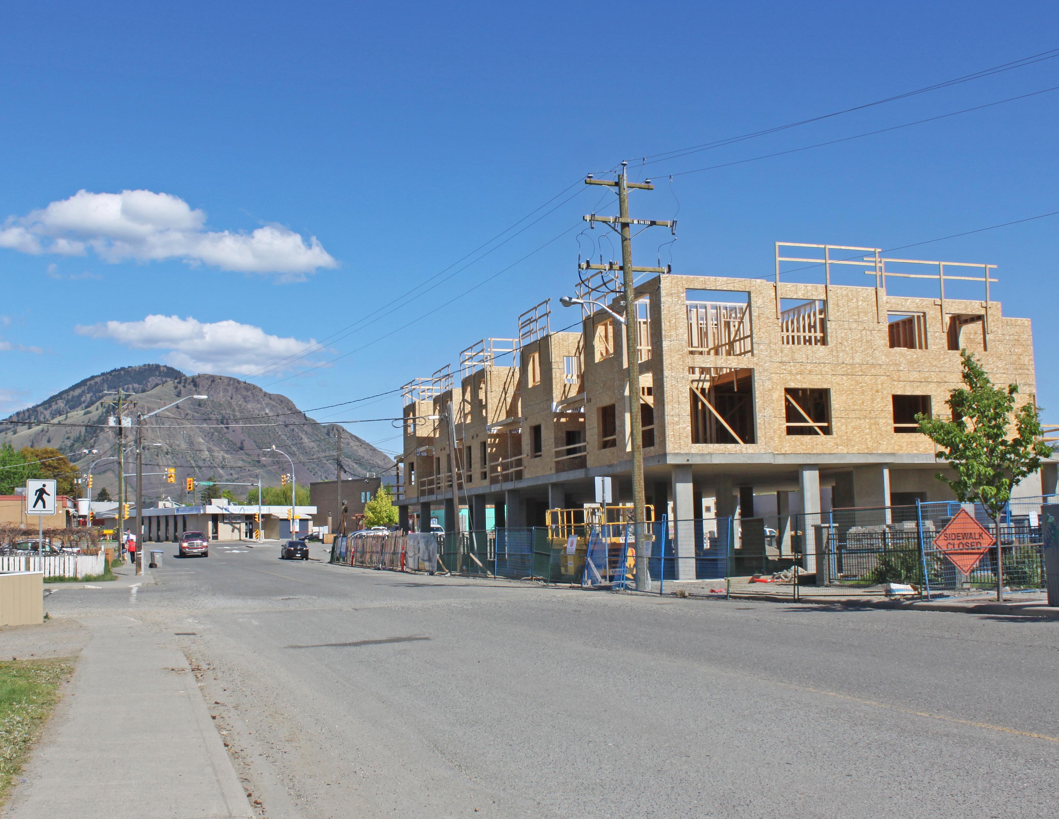
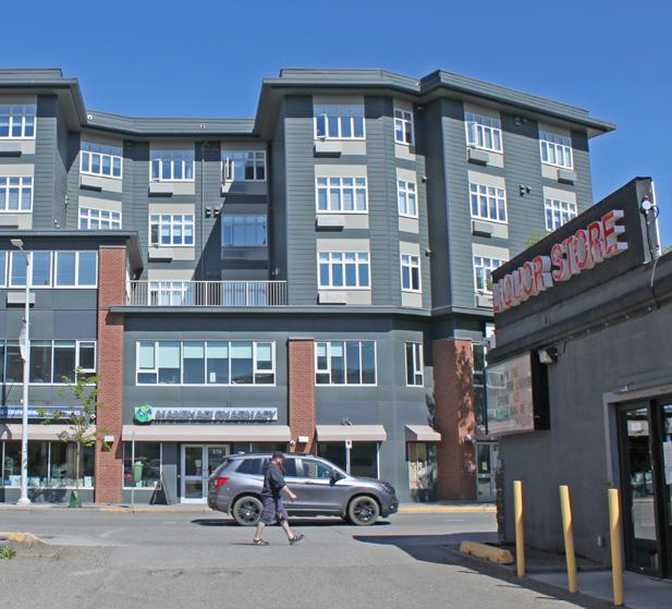
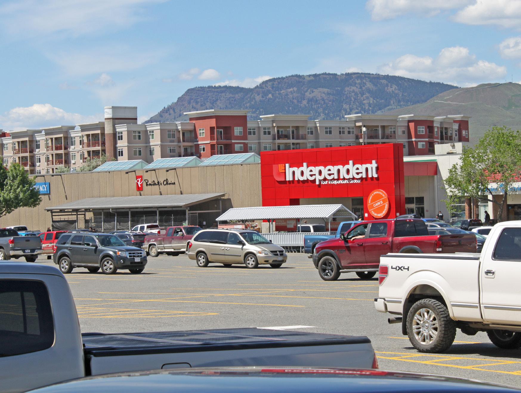
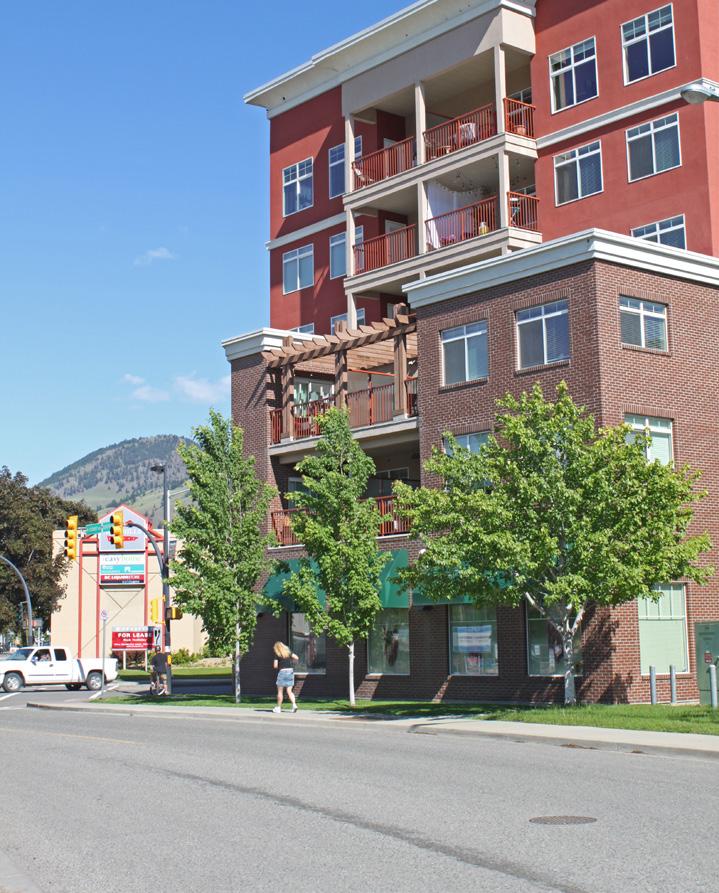
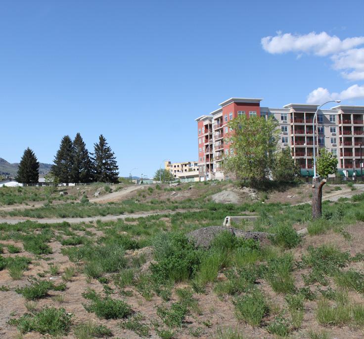
The primary commercial and transportation hub for the North Shore, the North Shore Town Centre is a mixed-use centre located in the middle of North Kamloops, where the major arterials of Tranquille Road, Fortune Drive, and 8th Street converge. Key opportunities for the area include creating an urban village with more medium- to high- density mixed-use development, improving the area’s walkability with pedestrian-oriented building forms and public spaces, and expanding retail options while retaining opportunities for large -format retail anchors.
• To enhance the North Shore Town Centre as a thriving retail, employment, and transit hub with a walkable, dynamic urban village setting.
• To provide more opportunities for diverse multi-family housing and expanded commercial retail options.
• To support well-being and provide a community gathering place in the North Shore Town Centre.

1 Continue to support the North Shore Town Centre as the North Shore’s primary commercial and transportation hub, a major destination, and one of the city’s principal pedestrian- and transit- oriented mixed-use centres.
2 Encourage redevelopment that breaks up large parcels and land assemblies with narrow pedestrian-oriented internal roads and walkways (or “mews”) fronted by small-scale commercial shops and restaurants to support the creation of an urban village.
3 Support a mix of residential, commercial, and community uses within the North Shore Town Centre, including multi-family residential, office, hotel, cultural facilities, social services, recreational amenities, public institutions, entertainment venues, restaurants, personal service businesses, and retail stores.
4 Require a comprehensive development review of major parcels and large land assemblies (over 0.5 ha) prior to development approval to ensure proposed development appropriately integrates with surrounding land uses; enhances area connectivity; and aligns with the vision, goals, and objectives of this plan.
5 Extend the boundary of the North Shore Town Centre area to include the comprehensive development site at 700 Cottonwood Avenue and the adjoining church site at 815 Renfrew Avenue.
6 Ensure new development at 700 Cottonwood Avenue incorporates a mix of uses, is well integrated with surrounding community amenities, such as the North Shore Community Centre and North Kamloops Library, and is well connected to the rest of the North Shore Town Centre with clearly marked and accessible pedestrian routes.
The vacant lot at 700 Cottonwood Avenue is zoned for high-density comprehensive development (see policies 5 and 6)
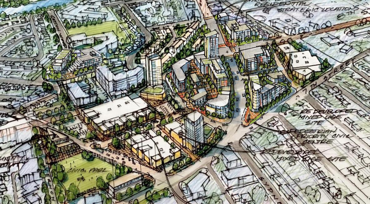
The North Shore Town Centre is envisioned to be redeveloped as an urban village with a series of internal, open- air walkways fronted by commercial uses (see Section 6: Big Moves for more details)
7 Ensure that economic initiatives undertaken by the City and its economic development organization, Venture Kamloops, enhance the function and character of the North Shore Town Centre as a hub for employment, shopping, dining, entertainment, arts, culture, tourism, and local businesses.
8 Support the development of new office space, including medical offices, to encourage the retention and growth of local businesses, attract new commercial and institutional services, and expand opportunities for local employment.
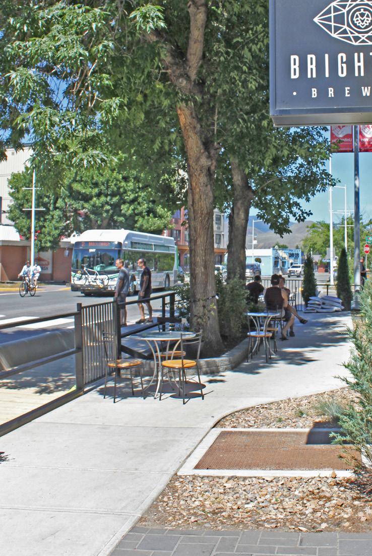
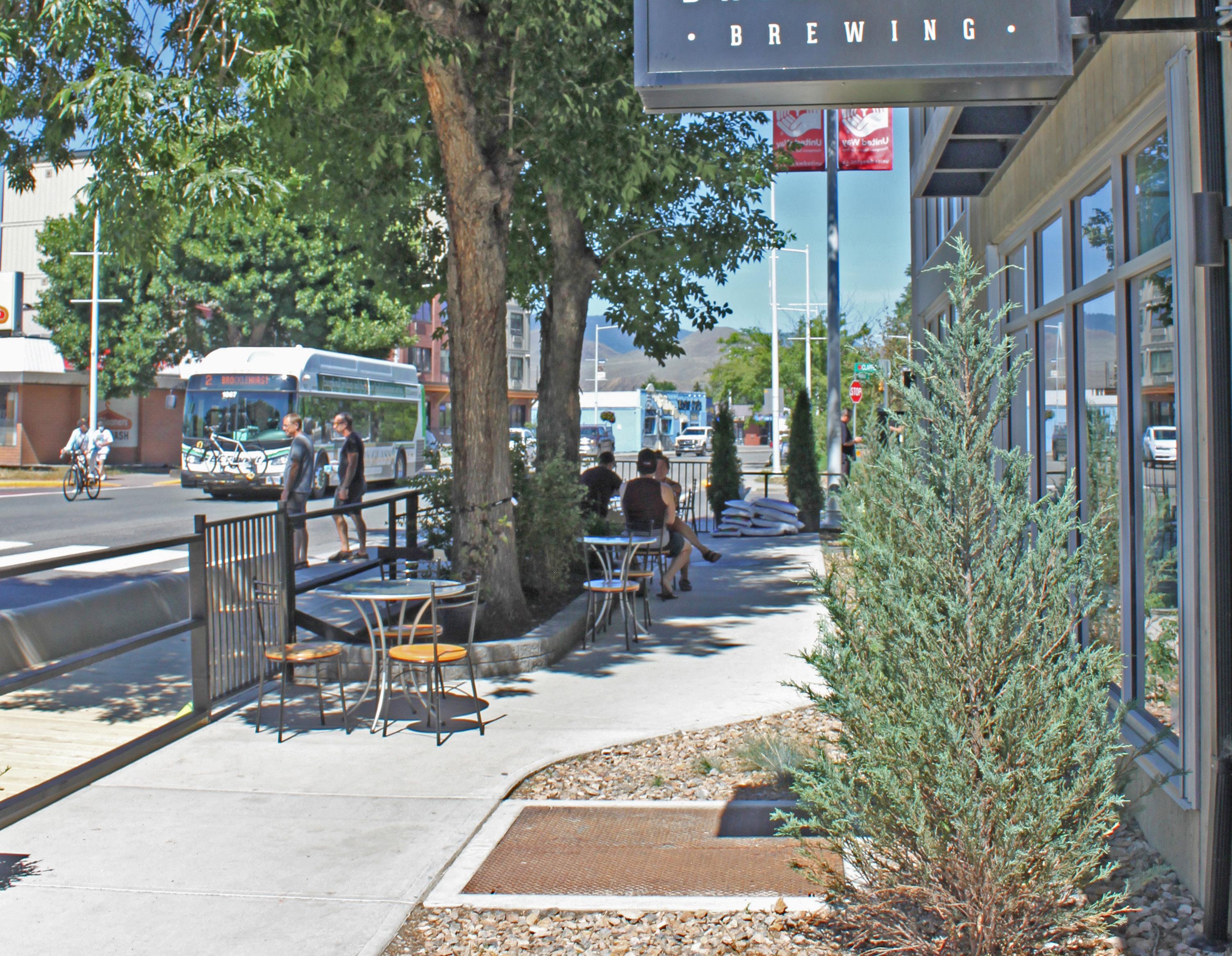
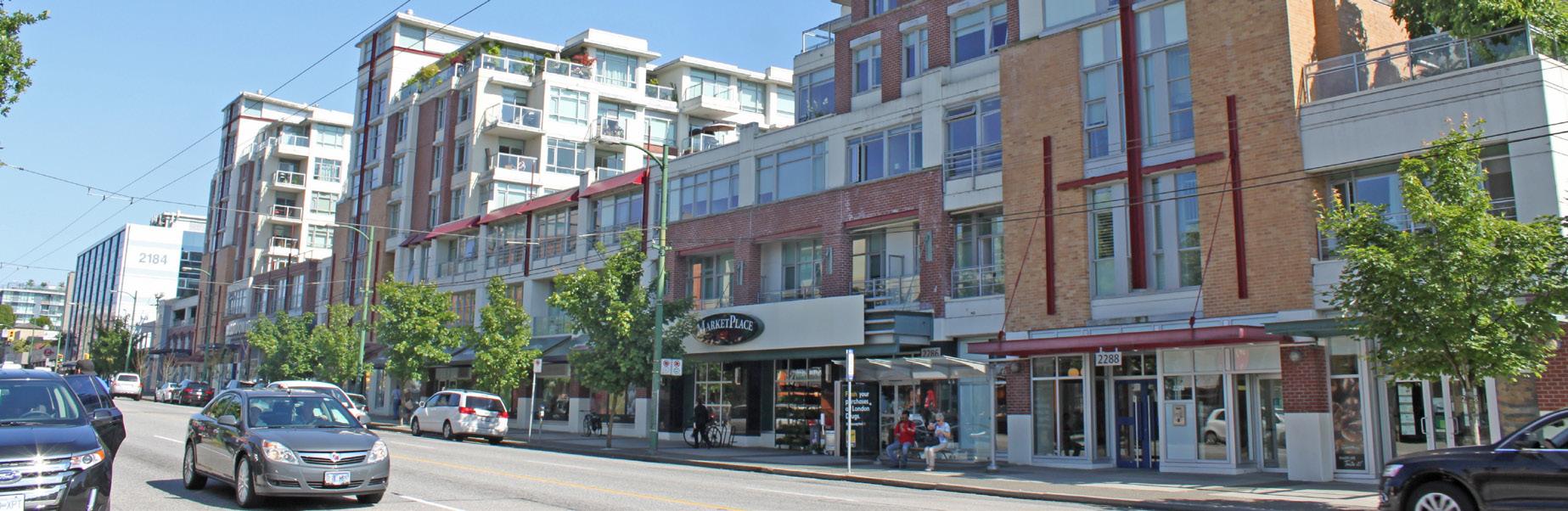
Example of a mixed-use building with a grocery store, small commercial units at street level, and residential units above (see policy 13)
9 Encourage commercial uses, such as retail, cafés, restaurants, and tourism- and entertainment-related venues, to locate at street level to support a lively, vibrant, and pedestrian-friendly public realm.
10 Where mixed-use development combines office and retail, encourage office uses to be located above the ground floor and more active commercial retail uses (e.g. cafés and restaurants) at street level to support a pedestrian-oriented environment.
11 Encourage pedestrian-oriented commercial retail uses at ground level where a building fronts Tranquille Road, Fortune Drive, 8th Street, Sydney Avenue, or any newly created internal roads. Frontages off of the above-noted streets may have commercial retail or residential uses at ground level but should be designed to be pedestrian and ground oriented.
12 Discourage auto-oriented commercial uses, such as drive-thru restaurants, gas stations, and automobile sales and services, from locating within the North Shore Town Centre.
13 Encourage large-format retail development to incorporate a mix of residential uses above and small-format retail units around its ground-level exterior to support pedestrian activity and the commercial vibrancy of the area.
14 Require street-facing residential units in mixed-use development to be located above the ground floor to retain and support active commercial uses at street level.
15 Encourage ground-floor residential dwellings that are located adjacent to a street in multi-family development to provide individual, at-grade entrances with direct connections to a public sidewalk.
16 Support ground-oriented housing, such as townhouses or rowhouses, on the lower floors of high-density multi-family residential development to encourage a more pedestrian- oriented urban environment, where not fronting commercial-oriented streets.
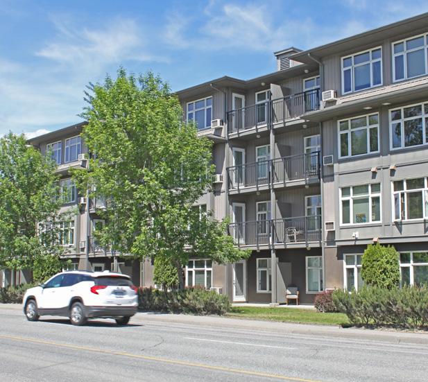
17 Support medium- to high-density multi-family residential and mixed-use development up to 10 storeys or as permitted in the Zoning Bylaw, and in accordance with the North Shore Development Permit Area Guidelines and Multi-family Development Permit Area Guidelines.
18 Continue to support a mix of market and non-market housing units within the same residential development.
19 Require a building height impact assessment to determine shadow impacts and encroachment into public view corridors for buildings that exceed six storeys in accordance with the North Shore Development Permit Area Guidelines.
20 Encourage buildings above three storeys in height to step back upper storeys to support a human-scaled form and pedestrian-friendly environment. Building siting and design strategies should be used to reduce apparent building mass and shadowing impacts on priority public realm, such as Tranquille Road, the North Shore Transit Exchange, parks, and plazas. Stepback heights should be informed by the rooflines of adjacent buildings.
21 Ensure that new buildings located along the edges of the North Shore Town Centre consider scale, orientation, setbacks, massing, and building height to provide a sensitive transition to adjacent areas.
Improve travel between the North Shore Town Centre and other areas of the city for pedestrians, cyclists, and transit users through well-designed, clearly marked, connected, accessible, and safe active transportation and transit routes.
Upgrade pedestrian crossings as required in conjunction with nearby redevelopment or capital projects to ensure they continue to meet user volume, safety, wayfinding, and mobility needs.
Explore options for new east-west bicycle routes and corresponding intersection improvements for bike crossings of Tranquille Road and Fortune Drive to enhance connections with adjacent residential areas and the Rivers Trail multi-use path network, including:
Connecting the North Shore Transit Exchange with the Schubert Drive Neighbourhood and Rivers Trail via a new route along Comox Avenue and 7th Street.
Connecting the North Shore Transit Exchange with the McDonald Park neighbourhood and McArthur Island Park via a new route along Renfrew Avenue.
Ensure redevelopment of properties adjacent to the North Shore Transit Exchange incorporate transit-oriented development practices to support pedestrians and transit users, such as providing bicycle parking areas, commercial uses that cater to the needs of commuters, and outdoor pedestrian spaces and building access points oriented to the transit exchange.
26 Explore opportunities to integrate transit exchange improvements, such as more space for bike parking, seating areas, weather protection, or landscaping, as a condition of development approval to improve area beautification as well as user safety and comfort.
27 Support closing the Fortune Drive frontage road to vehicle traffic and reconfiguring it for a widened pedestrian pathway with new street trees, landscaping, and lighting, and an improved transit stop.
28 Explore opportunities to reconfigure the road and pedestrian network in conjunction with redevelopment of large parcels and land assemblies to improve wayfinding, traffic circulation and flow, and pedestrian safety and accessibility. This may include identifying a new road connection between Nelson Avenue and Poplar Street or reconfiguring Simcoe Avenue as a network of internal commercial-fronted pedestrian walkways.
29 Mitigate potential impacts from development on the traffic patterns of arterial roadways, including considering reciprocal parking and access where appropriate while prioritizing the needs of pedestrian safety and accessibility as per the City of Kamloops Hierarchy of Transportation and Mobility Priorities in the Transportation Master Plan.
30 Discourage development of new surface parking lots and encourage the replacement of existing surface parking lots with underground parking as a condition of redevelopment.
31 Work with developers to provide surplus off-street parking that integrates short-term public pay parking in parking structures built as part of new development to address long-term demand.
32 Explore new parking management strategies to maximize usage and customer turnover as future development increases parking demand and reduces surface parking options.
33 Consider reduced parking requirements for new high-density multi-family residential and mixed-use development that is within a convenient (400 m or less) walking distance of the North Shore Transit Exchange, connected to the transit exchange by an accessible pedestrian pathway, and shows thoughtful integration of transit-oriented development strategies to encourage use of alternative transportation modes.
34 Maintain Tranquille Road and Sydney Avenue / the North Shore Transit Exchange as the North Shore Town Centre’s primary pedestrian-oriented corridors, supported by an accessible, inclusive, and well-designed public realm.
35 Support the establishment of a more pedestrian- oriented streetscape along the North Shore Town Centre's high-traffic frontages of Fortune Drive, 8th Street, and Tranquille Road, through sidewalk upgrades, added street trees, and other public realm improvements.
36 Work with developers to retain public view corridors of Mount Peter and Mount Paul to the east as viewed from:
36-1 The intersection of Tranquille Road, 8th Street, and Fortune Drive
36-2 The North Shore Transit Exchange
36-3 Any major future parks or plazas implemented within the North Shore Town Centre with an existing view
37 Consider mid-block crossings in areas of high pedestrian activity to allow for ease of movement and improved walkability between key destinations.
Mid-block crossing:
A marked crosswalk placed on a street between two intersections.
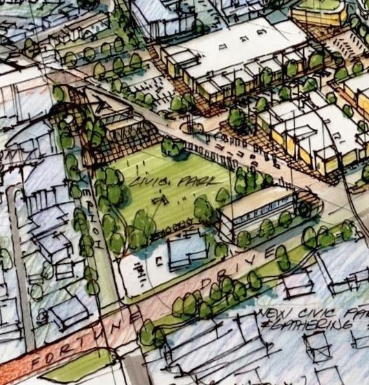
The redevelopment concept for the North Shore envisions an opportunity for a new civic park and public amenity building (see Section 6: Big Moves for more details)
38 Explore opportunities to add street trees, enhanced lighting, paving treatments, and public art as part of streetscape improvements completed as a public realm project, in conjunction with the redevelopment of large parcels and land assemblies, and/or during the creation of new internal roads or pedestrian walkways.
39 Support the installation of gateway features and landmark structures at key entry areas to welcome residents and visitors and help identify the North Shore Town Centre as the North Shore’s principal mixed-use centre. Key gateway areas include:
39-1 The intersection of Tranquille Road, 8th Street, and Fortune Drive
39-2 The intersection of Fortune Drive and Vernon Avenue
39-3 The North Shore Transit Exchange
40 Require a minimum building height of four (4) storeys for sites adjacent to the intersection of Tranquille Road, 8th Street, and Fortune Drive to create landmark focal points and encourage mixed-use development consistent with the North Shore Neighbourhood Plan’s vision for the area. Building height minimums can be reduced to two (2) storeys if other gateway features, such as public art and/or landscaped pedestrian plazas, are used.
41 Ensure new development and public realm improvements reflect Crime Prevention Through Environmental Design principles, such as by providing opportunities for natural surveillance, incorporating appropriate lighting features, and avoiding the creation of hidden spaces in accordance with the North Shore Development Permit Area Guidelines.
42 Work with major landowners and developers in the North Shore Town Centre to identify a central site to construct a major community gathering place, including a civic park and public amenity building, to accommodate community events and activities that cater to families and individuals of all ages and abilities.
43 Explore opportunities to provide enhanced pedestrian spaces and amenities, including small plazas, seating areas, and/or pedestrian walkways or mews as a condition of a development approval for large, central parcels or land assemblies.
44 Encourage public art projects in the area that help strengthen community identity, contribute to North Shore Town Centre beautification, and recognize the area’s history, including Secwepemc heritage.
45 Support major arts, cultural, and community events and facilities within the North Shore Town Centre that promote local artists and entrepreneurs, fill gaps in existing offerings and amenities, attract visitors and investment to the area, and contribute to community building.
The historic commercial heart of the North Shore, the Tranquille Market Corridor extends from Palm Street in the south to Vernon Avenue and Poplar Street at its northern end and links the Tranquille South area with the North Shore Town Centre. The corridor is the primary pedestrian-oriented commercial, cultural, and economic hub on the North Shore and includes a diverse mix of retail, office, entertainment, residential, and community uses.
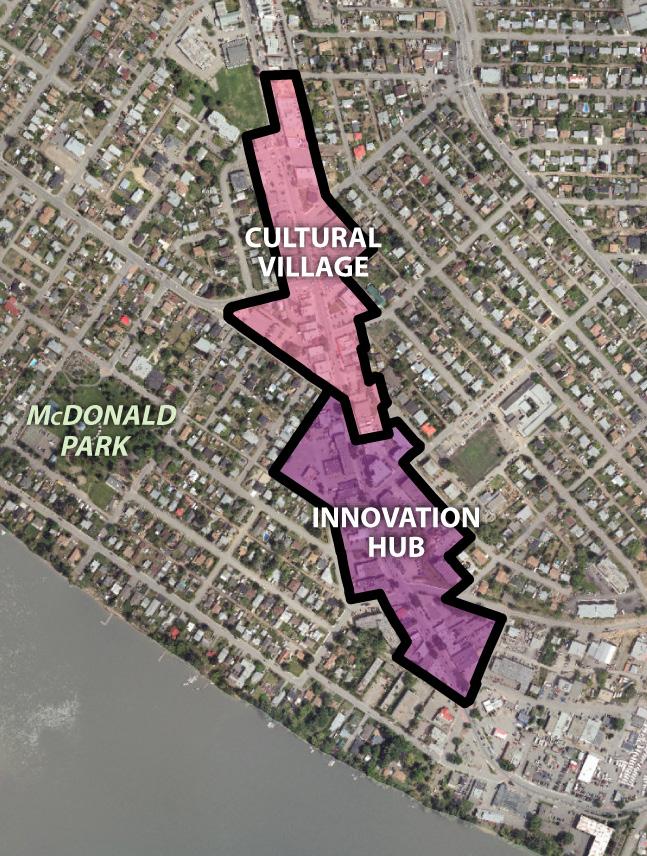
Key opportunities in the area include the development of an Innovation Hub with institutional and office uses, a Cultural Village with a diverse mix of small-format local retailers, and streetscape improvements to enhance the public realm and support the area as an attractive destination for residents and visitors.
• To encourage employment opportunities and housing options that allow area residents to live, work, shop, and socialize on the corridor.
• To establish a community heart in the Tranquille Market Corridor with smaller storefronts, thriving local businesses, and opportunities for community gathering.
• To improve the streetscape, enhance the pedestrian experience, and support an attractive destination for residents and visitors of all ages and abilities.


1 Support a mix of residential, commercial, and community uses within the Tranquille Market Corridor, including multi-family residential, office, hotel, cultural facilities, social services, recreational amenities, public institutions, entertainment venues, restaurants, personal service businesses, and retail stores.
2 Encourage a concentration of commercial and institutional office employment uses within the Innovation Hub area, along with complementary uses such as multi-family residential, hotel space, business services, educational facilities, restaurants, and retail stores.
3 Encourage a concentration of smaller-scale social, cultural, shopping, and entertainment uses within the Cultural Village area, such as live entertainment venues, public art installations, outdoor community gathering and event spaces, social enterprises, restaurants, and local “mom-and-pop” retail stores.
4 Discourage large land assemblies within the Cultural Village area to maintain the smaller historic storefronts, fine-grain character, and pedestrian scale of the area. Large land assemblies may be considered where proposed development:
4-1 Contributes an identified community need for the area (e.g. community facility, public gathering space)
4-2 Is designed to reflect the scale and reflect or enhance the character of adjacent buildings in accordance with the North Shore Development Permit Area Guidelines
4-3 Is consistent with the overall vision and intent of this plan
5 Continue to support a mix of residential, commercial, and institutional uses within the portion of the Tranquille Market Corridor to the north of the Cultural Village, including uses that help provide a transition between the Tranquille Market Corridor and North Shore Town Centre areas. Consider supporting new uses in this area that complement the adjacent community- oriented uses envisioned for the North Shore Town Centre area within this plan.
6 Support medium-density residential uses on lots within the Tranquille Market Corridor that do not front Tranquille Road to add to the mix of housing supply in the area and provide a transition in use and form between adjacent lower-density residential areas.
Overview of the envisioned Cultural Village and Innovation Hub areas (see Section 6: Big Moves for more details)
Example of the smaller-scale commercial uses within the Cultural Village area (see policy 3)

Ensure that economic initiatives undertaken by the City and its economic development organization, Venture Kamloops, enhance the function and character of the Tranquille Market Corridor as a hub for employment, shopping, dining, entertainment, arts and culture, social enterprise, and local businesses.
Support the development of new office space along the corridor—particularly within the Innovation Hub area—to revitalize aging building stock, attract new and innovative businesses, and encourage more local employment in the area to support pedestrian activity and local commercial
Encourage the development of new arts, culture, and entertainment uses—particularly within the Cultural Village area—to support the corridor as a visitor destination and bolster pedestrian activity and local businesses during evenings and weekends.
10 Encourage commercial uses, such as retail, cafés, restaurants, and tourism- and entertainment-related venues, to locate at street level to support a lively, vibrant, and pedestrian-friendly public realm.
11 Where mixed-use development combines office and retail, encourage office uses to be located above the ground floor and more active commercial retail uses (e.g. cafés and restaurants) at street level to support a pedestrian-oriented environment.
12 Encourage pedestrian-oriented commercial retail uses at ground level where a building fronts Tranquille Road or the south leg of Yew Street. On corner lots, side street frontages off of Tranquille Road may have commercial retail or residential uses at ground level but should be designed to be pedestrian and ground oriented.
13 Discourage auto-oriented commercial uses, such as drive-thru restaurants, gas stations, and automobile sales and services, from locating along the Tranquille Market Corridor.
Youth Input:
The Tranquille Market Corridor has a lot of retail potential and could even be seen as a “mini downtown”—it just needs to be modernized.
14 Maintain Tranquille Road as the North Shore’s pre - eminent streetfront retail corridor supported by an accessible, inclusive, and well-designed public realm.
15 Require street-facing residential units in mixed-use development to be located above the ground floor to retain and support active commercial uses at street level.
16 Encourage ground-floor residential dwellings that are located adjacent to a street in multi-family development to provide individual, at-grade entrances with direct connections to a public sidewalk.
17 Support ground-oriented housing, such as townhouses or rowhouses, on the lower floors of high-density multi-family residential development to encourage a more pedestrian-oriented urban environment.
18 Support medium- to high-density multi-family residential and mixed-use development up to six storeys as permitted in the Zoning Bylaw, and in accordance with the North Shore Development Permit Area Guidelines and Multi-Family Development Permit Area Guidelines.
19 Continue to support a mix of market and non-market housing units within the same residential development.
20 Ensure that new mid-rise buildings located adjacent to public gathering spaces, such as public parks and plazas, are sited and designed to reduce shadow impacts on these spaces.
21 Encourage a two- to three-storey street wall along Tranquille Road within the Cultural Village to retain the historic pedestrian-scale form and character of the area. Where buildings are proposed above these heights, upper storeys should be stepped back to reduce shadowing impacts and apparent building mass. Stepback heights should be informed by the rooflines of adjacent buildings.
22 Ensure that new buildings located along the edges of the Tranquille Market Corridor consider scale, orientation, setbacks, massing, and building height to provide a sensitive transition to adjacent areas.
Through-block walkway:
A pathway through a development site that provides a pedestrian connection between blocks or across a block.
23 Improve travel between the Tranquille Market Corridor and other areas of the city for pedestrians, cyclists, and transit users through well-designed, clearly marked, connected, accessible, and safe active transportation and transit routes.
24 Explore options for new and/or improved east-west bicycle routes and corresponding intersection improvements for bike crossings of the Tranquille Market Corridor to enhance connections with adjacent residential areas and the Rivers Trail multi-use path network, including:
24-1 Connecting the McDonald Park neighbourhood and John Tod neighbourhood to the Tranquille Market Corridor via new routes along Clapperton Road and Knox Street to the south, and along Oak Road and MacKenzie Avenue to the north
24-2 Upgrading the Royal Avenue bike route between Knox Street and Palm Street to a separated multi-use path
25 Continue to maintain clearly-marked, accessible pedestrian crossings, including mid-block crossings, to support pedestrian safety and mobility in areas of high pedestrian activity.
26 Consider the impact of new development on existing pedestrian crossings and upgrade them as required to ensure they continue to meet pedestrian volume, safety, wayfinding, and mobility needs.
27 Encourage through-block walkways in the redevelopment of key sites as convenient, well- designed connections for pedestrians, which may exist as a private easement or public right- of-way.
28 Make use of wayfinding strategies that clarify pedestrian and cyclist routes through the area to better connect and improve navigation between the corridor’s offset side streets.
29 Continue to provide reduced parking requirements for new businesses that repurpose existing buildings along Tranquille Road in order to support corridor revitalization, creative reuse of underutilized spaces, and restoration of building façades in accordance with the Zoning Bylaw.
30 Implement parking management strategies as required to address continued growth and long-term parking needs of the corridor as per the recommendations of the Parking Management Plan.
31 Support new and existing gateway features and landmark structures at key entry points to the Tranquille Market Corridor to welcome residents and visitors; define the area as the North Shore’s primary commercial, cultural, and economic hub; and contribute to placemaking that differentiates it from other neighbourhoods and destinations around the city.
32 Encourage the use of decorative lighting features, public art, landscaping, and other beautification strategies as part of new development and public realm improvements to support a vibrant pedestrian experience and reinforce the cultural and entertainment function of the Tranquille Market Corridor.
33 Ensure accessibility considerations, such as appropriate sidewalk widths, planter and street furniture siting, and curb letdown and crossing design, are addressed in the implementation of new streetscape and public realm improvement projects.
34 Ensure new development and public realm improvements reflect Crime Prevention Through Environmental Design principles, such as by providing opportunities for natural surveillance, incorporating appropriate lighting features, and avoiding the creation of hidden spaces in accordance with the North Shore Development Permit Area Guidelines.
35 Implement road and streetscape improvements, such as bulb-outs, accessibility upgrades, planter replacement, street furniture enhancements, and consistent decorative sidewalks, as part of the Tranquille Road Complete Streets plan (or a successive plan) and ensure capital budgets exist for the long-term maintenance of these assets.
36 Retain mature trees where feasible and plant new and replacement street trees as needed during the course of streetscape improvement projects to enhance corridor beautification, improve the pedestrian experience, and support City environmental goals.
37 Work with community partners, such as the North Shore Business Improvement Association, to further their work in identifying public realm improvement opportunities on the Tranquille Market Corridor and implementing solutions, including collaborating to pursue relevant funding and exploring options to use available municipal resources for public realm and streetscape improvement projects.
Explore opportunities for new public gathering spaces as part of future development along the corridor, including pocket parks, plazas, and flexible road spaces that can support special event
Support the temporary closure of streets to accommodate special events and festivals. Consider streetscape and public realm improvements to strengthen the function and flexibility of key street sections, such as the south leg of Yew Street (adjacent to Spirit Square and Yew Park), to support more frequent event and pedestrian-oriented use.
40 Encourage public art projects in the area that help strengthen community identity, contribute to corridor beautification, and recognize the area’s history, including Secwepemc heritage.
41 Support major arts, cultural, and community events along the Tranquille Market Corridor that promote local artists and entrepreneurs, attract visitors and investment to the area, and contribute to community building.
42 Work with the City’s Heritage Engagement Group and other community partners to assess the heritage value of properties in the area for potential solicitation and addition to the City’s Heritage Recognition Plaque Program and/or potential future inclusion on the City’s Heritage Register.
Located west of the Overlanders Bridge, Tranquille South encompasses the east entry to the Tranquille Market Corridor and contains a mix of uses, including streetfront commercial retail, a large service commercial area, and the Riverdale Trailer Court. Tranquille South presents unique opportunities to connect Tranquille Road with the waterfront and introduce new residential and commercial waterfront development, public realm improvements, and enhanced connectivity via public and private investment.
• To improve access to the waterfront via an extension of the Rivers Trail and other public realm enhancements.
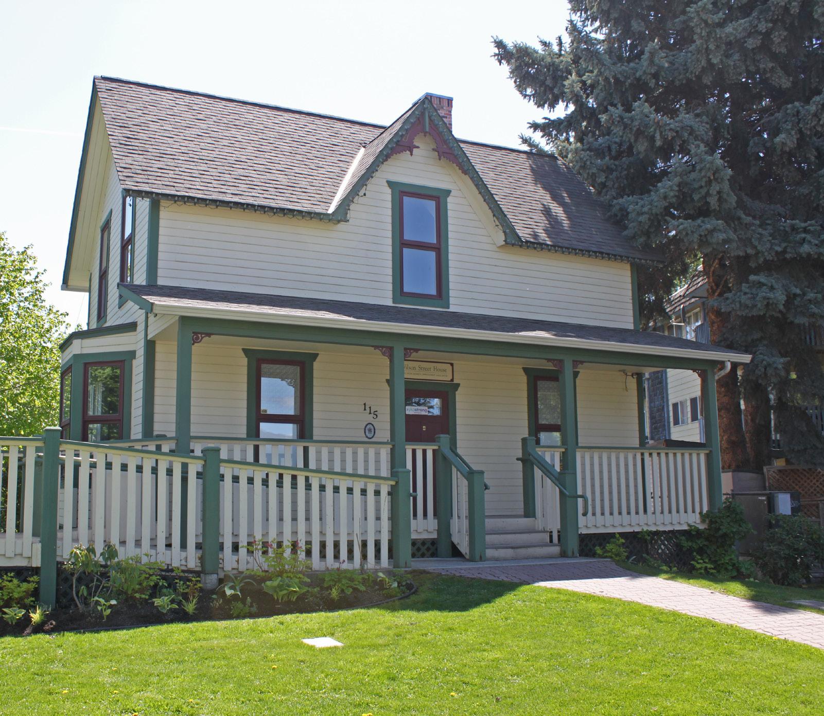
• To re-imagine the Tranquille South area as an industrial arts district of maker spaces, live/work units, and complementary commercial services, including opportunities for production, processing, and distribution.
• To support new waterfront development, including a mix of housing options and riverfront commercial opportunities.

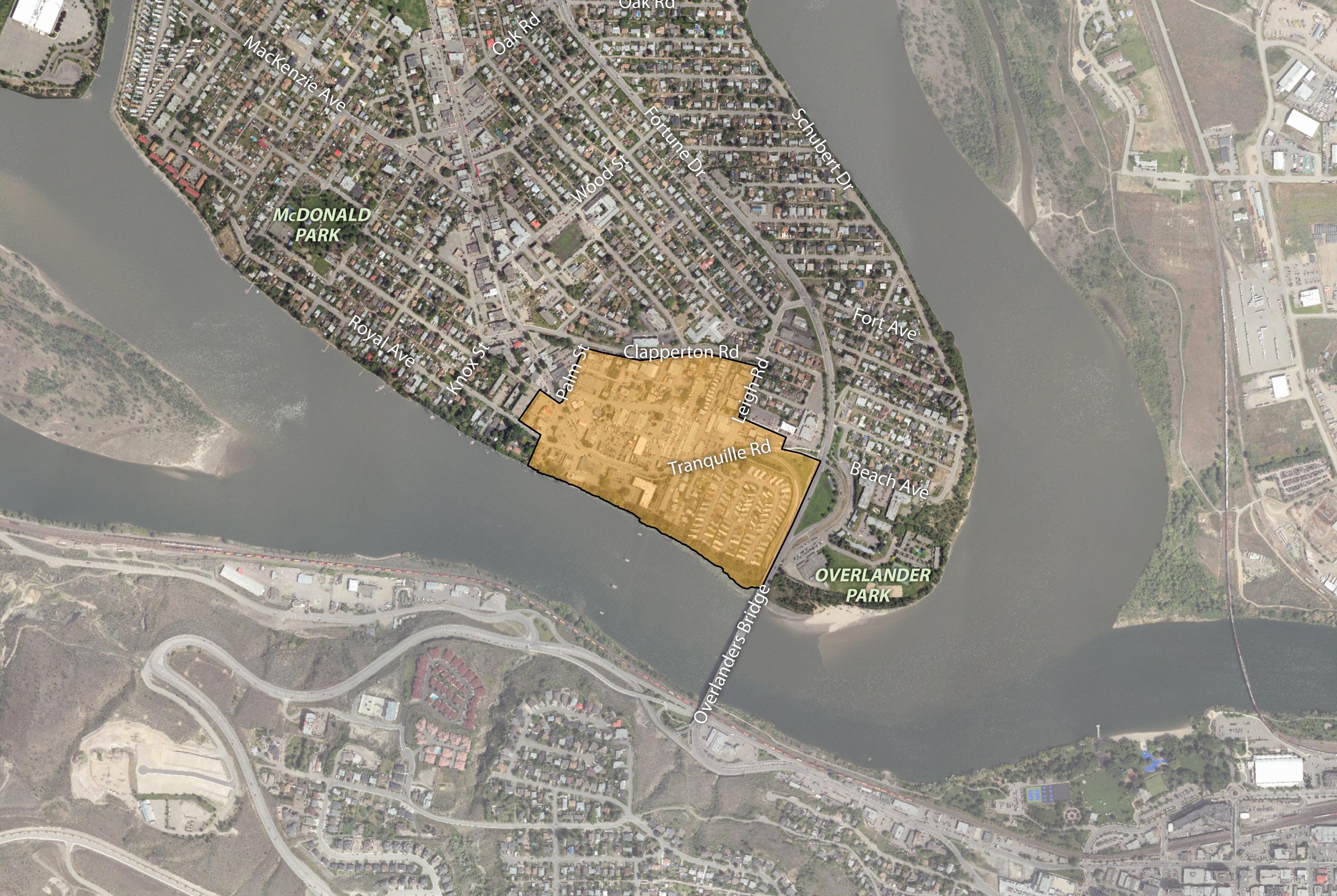
Land Use
1 Support a mix of residential, commercial, and community uses within Tranquille South, including multi-family residential, office, hotel, cultural facilities, social services, recreational amenities, public institutions, entertainment venues, restaurants, personal service businesses, retail stores, and processing and distribution facilities.
2 Encourage a concentration of commercial, community, and cultural uses and public waterfront amenity space within the waterfront-adjacent commercial area south of Tranquille Road in order to introduce new amenities and services to the area and better- connect Tranquille Road to the Thompson River.
3 Transition the existing C4 (Service Commercial) zoned area between Tranquille Road and Clapperton Road to C1 (General Commercial) or C6 (Arterial Commercial) zoning in order to support a broader range of commercial uses as well as introduce mixed-use multi-family residential development into the area, including opportunities for live/work units.
4 Encourage any future redevelopment of the Riverdale Trailer Court to include a mix of low- to medium-density multi-family residential uses, such as rowhouses, stacked townhouses, and apartments while considering commercial retail uses for buildings fronting Tranquille Road in order to continue the commercial streetfront character of the corridor.
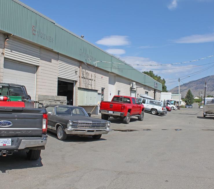
Tranquille South is envisioned to be redeveloped as a mixed-use waterfront district with shoreline commercial opportunities, multi-family housing, and opportunities for industrial arts
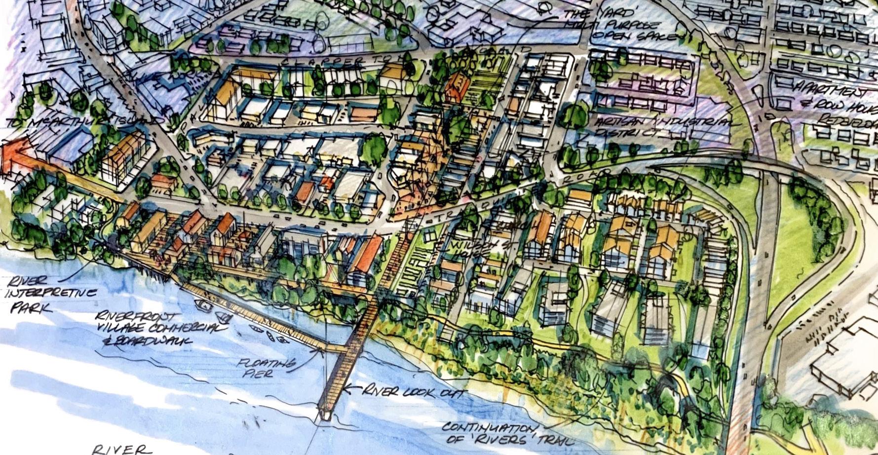
Railspur Alley on Granville Island is an example of a pedestrian-oriented maker space district (see policies 3, 7)
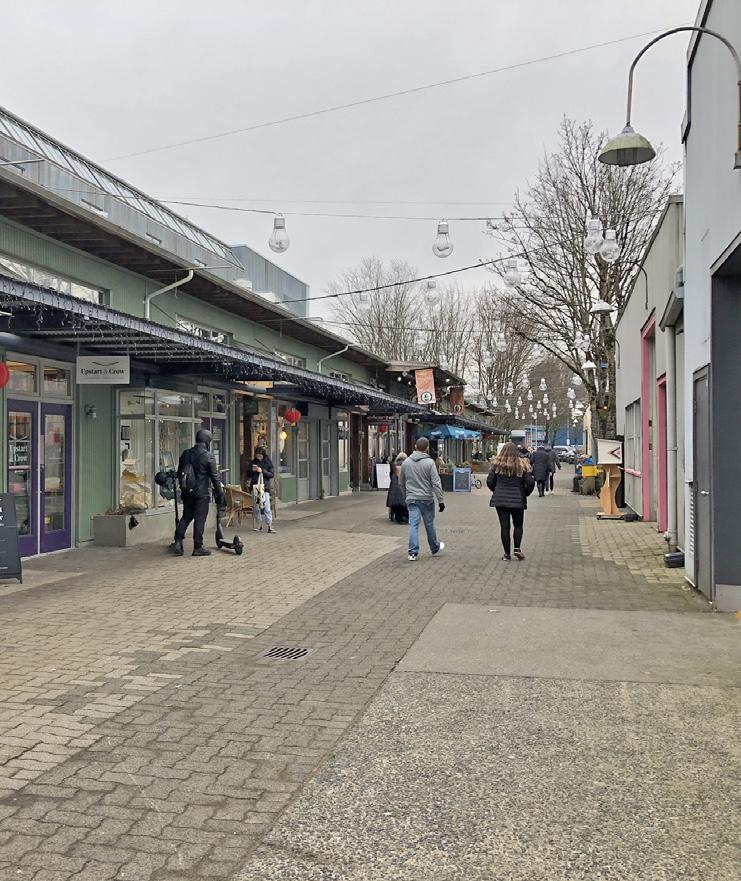
5 Ensure that economic initiatives undertaken by the City and its economic development organization, Venture Kamloops, enhance the function and character of the Tranquille South area as a creative and production- oriented hub for employment, shopping, dining, entertainment, arts and culture, light manufacturing, and local businesses.
6 Support the development of new employment space, including office, service commercial, light industrial, and creative industry uses, to revitalize aging building stock, attract new and innovative businesses, and encourage more local employment in the area to support pedestrian activity and local commercial services.
7 Encourage the development of artisan maker-spaces, light-industrial production, and food industry uses—particularly within the service commercial area—to bolster opportunities for local artists, craft producers, and entrepreneurs.
8 Continue to support new and existing food system services in the area that contribute to local food security, including urban agricultural production, food processing facilities, and food distribution services, such as the Kamloops Food Bank.
9 Encourage pedestrian-oriented commercial retail uses at ground level where a building fronts Tranquille Road. On corner lots, side street frontages off of Tranquille Road may have commercial or residential uses at ground level but should be designed to be pedestrian and ground oriented.
10 Encourage commercial uses, such as retail, cafés, restaurants, and tourism- and entertainment-related venues, to locate adjacent to the waterfront in commercial areas, to support a lively, vibrant, and pedestrian-friendly waterfront experience.
11 Where mixed-use development combines office and retail, encourage office uses to be located above the ground floor and more active commercial retail uses (e.g. cafés and restaurants) at street level to support a pedestrian-oriented environment.
12 Discourage new auto-oriented commercial uses, such as drive-thru restaurants, gas stations, and automobile sales and services, from locating along Tranquille Road.
13 Maintain Tranquille Road as the North Shore’s pre - eminent streetfront retail corridor supported by an accessible, inclusive, and well-designed public realm.
14 Support the redevelopment of existing singleand two-family zoned residential parcels within the Tranquille South area (i.e. along Don Street) for low- to medium-density multi-family residential uses, such as rowhouses, stacked townhouses, and apartments.
15 Encourage any future multi-family residential redevelopment of the Riverdale Trailer Court to be sited and designed to maximize waterfront views for residents while providing waterfront- oriented open space for public and passive recreational use.
16 Support the development of live/work units within the service commercial area north of Tranquille Road to add to the mix of housing options on the North Shore and provide an opportunity for creative entrepreneurs to combine their workspace with their living quarters.
17 Encourage ground-floor residential dwellings that are located adjacent to a street in multi-family development to provide individual, at-grade entrances with direct connections to a public sidewalk.
18 Support medium- to high-density multi-family residential and mixed-use development up to six storeys along Tranquille Road as permitted in the Zoning Bylaw, and in accordance with the North Shore Development Permit Area Guidelines and Multi-Family Development Permit Area Guidelines.
19 Support ground-oriented housing, such as townhouses or rowhouses, on the lower floors of high-density multi-family residential development to encourage a more pedestrian- oriented urban environment.
20 Require street-facing residential units in mixed-use development to be located above the ground floor to retain and support active commercial uses at street level.
21 Continue to support a mix of market and non-market housing units within the same residential development.
Height Requirements and Edge Conditions
22 Ensure that new mid-rise buildings located adjacent to public gathering spaces, such as public parks and plazas, are sited and designed to reduce shadow impacts on these spaces.
23 Encourage a two- to three-storey street wall along Tranquille Road to retain the historic pedestrian-scale form and character of the area. Where buildings are proposed above these heights, upper storeys should be stepped back to reduce shadowing impacts and apparent building mass. Stepback heights should be informed by the rooflines of adjacent buildings.
24 Ensure that new buildings located adjacent to single-family housing areas consider scale, orientation, setbacks, massing, and building height to provide a sensitive transition in form and character.
Live/work unit:
Typically a ground-level commercial work space with an attached residential unit on the floor above that supports self- employed residents involved in making, servicing, or selling of goods or providing personal and professional services (see Section 6: Big Moves for more details).
Existing multi-family development fronting Tranquille Road
Existing multi-use path along Tranquille Road
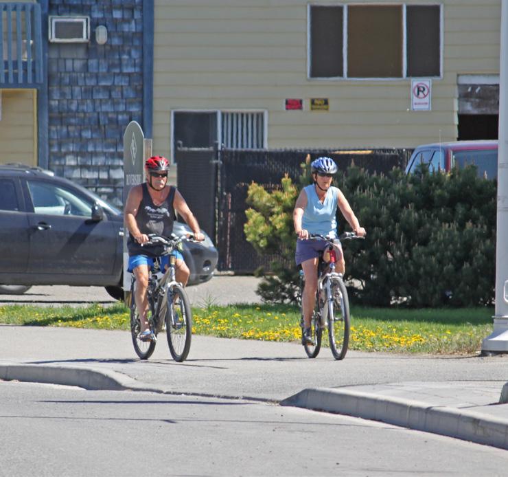
Current Rivers Trail wayfinding signage at the foot of Overlanders Bridge—a more consistent wayfinding strategy could reduce the number of signs while improving clarity for users (see policy 32)
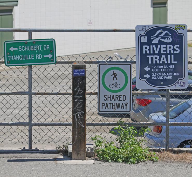
25 Improve travel between Tranquille South and other areas of the city for pedestrians, cyclists, and transit users through well-designed, clearly marked, connected, accessible, and safe active transportation and transit routes.
26 Explore options for new and/or improved east-west bicycle routes and corresponding intersection improvements for bike crossings to enhance connections with adjacent residential areas and the Rivers Trail multi-use path network, including:
26-1 Connecting the McDonald Park neighbourhood, John Tod neighbourhood, and Tranquille Market Corridor via a new route along Clapperton Road
26-2 Upgrading the Royal Avenue bike route between Knox Street and Palm Street to a separated multi-use path
27 Explore opportunities to provide a higher standard of pedestrian facility (e.g. sidewalk or multi-use path) along Clapperton Road than that identified in the Transportation Master Plan (i.e. a pedestrian shoulder) in conjunction with development of a new Clapperton Road bike route.
28 Work with waterfront landowners and developers to pursue a waterfront extension of the Rivers Trail from the Overlanders Bridge to Royal Avenue in conjunction with waterfront redevelopment. Assess the feasibility of such an extension, including the following considerations:
28-1 Integrating flood mitigation measures
28-2 Providing riparian area enhancements
28-3 Incorporating improvements to the Overlanders Bridge multi-use path
29 Continue to maintain clearly-marked, accessible pedestrian crossings, including mid-block crossings, to support pedestrian safety and mobility in areas of high pedestrian activity.
30 Consider the impact of new development on existing pedestrian crossings and upgrade them as required to ensure they continue to meet pedestrian volume, safety, wayfinding, and mobility needs.
31 Encourage through-block walkways in the redevelopment of key sites, including waterfront sites, as convenient, well- designed connections for pedestrians, which may exist as a private easement or public right- of-way.
32 Make use of wayfinding strategies to clarify pedestrian and cyclist routes through the area and highlight key amenities, including waterfront access areas.
33 Continue to provide reduced parking requirements for new businesses that repurpose existing buildings along Tranquille Road in order to support corridor revitalization, creative reuse of underutilized spaces, and restoration of building façades in accordance with the Zoning Bylaw.
34 Implement parking management strategies as required to address continued growth and long-term parking needs of the corridor as per the recommendations of the Parking Management Plan.
35 Ensure new waterfront development sites are well integrated with adjacent multi-use paths, public areas, and the shoreline; provide a visual connection between Tranquille Road and the riverfront; and that they incorporate waterfront access, landscaping, and amenity considerations.
36 Work with landowners and developers to create waterfront pedestrian amenity space, such as a public boardwalk feature, as a condition of redevelopment and where not in conflict with Riparian Areas Regulation Development Permit Area Guidelines. Consider opportunities for incorporating floating pier sections to provide more direct pedestrian interaction with the river and an area for watercraft mooring and recreational watersport access.
37 Ensure new waterfront development and waterfront public space improvements incorporate aspects of flood risk mitigation and/or adaptation and ecological restoration considerations in accordance with the North Shore Development Permit Area Guidelines and Riparian Areas Regulation Development Permit Area Guidelines.
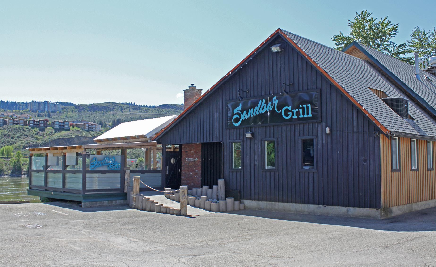
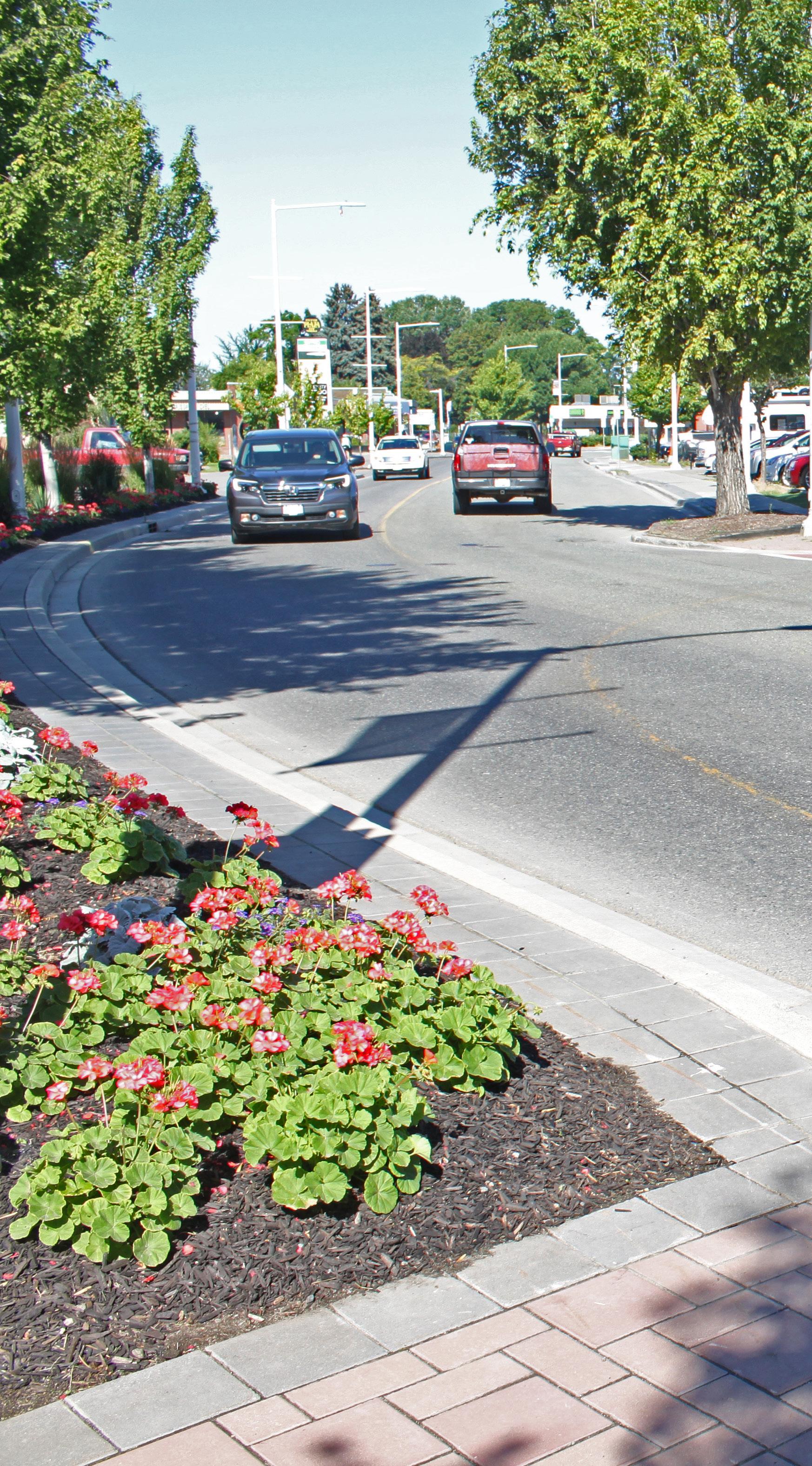
Support new and existing gateway features and landmark structures at key entry points to the North Shore and Tranquille Market Corridor to welcome residents and visitors; define the commercial and cultural identity of the area; and contribute to placemaking that differentiates it from other neighbourhoods and destinations around the city.
Encourage the use of decorative lighting features, public art, landscaping, and other beautification strategies as part of new development and public realm improvements to support a vibrant pedestrian experience and reinforce the cultural and entertainment function of Tranquille Road.
Ensure accessibility considerations, such as appropriate sidewalk widths, planter and street furniture siting, and curb letdown and crossing design, are addressed in the implementation of new streetscape and public realm improvement
Ensure new development and public realm improvements reflect Crime Prevention Through Environmental Design principles, such as by providing opportunities for natural surveillance, incorporating appropriate lighting features, and avoiding the creation of hidden spaces in accordance with the North Shore Development Permit Area Guidelines.
42 Implement road and streetscape improvements, such as bulb-outs, accessibility upgrades, planter replacement, street furniture enhancements, and consistent decorative sidewalks, as part of the Tranquille Road Complete Streets plan (or a successive plan) and ensure capital budgets exist for the long-term maintenance of these assets.
43 Retain mature trees where feasible and plant new and replacement street trees as needed during the course of streetscape improvement projects to enhance corridor beautification, improve the pedestrian experience, and support City environmental goals.
44 Work with community partners, such as the North Shore Business Improvement Association, to further their work in identifying public realm improvement opportunities along Tranquille Road and implementing solutions, including collaborating to pursue relevant funding and exploring options to use available municipal resources for public realm and streetscape improvement projects.
45 Explore opportunities for creative re-use of the historic Thompson River bridge pillars in conjunction with waterfront redevelopment, future waterfront extension of the Rivers Trail, and/or other capital projects in the area.
46 Consider integrating the Thompson River bridge pillars into a new pedestrian lookout pier and/or high-visibility public art installation to contribute to sense of place and to provide more opportunities for public waterfront access and interaction.
47 Explore opportunities for new public gathering spaces as part of future development, including pocket parks, plazas, and flexible road spaces that can support special event closures.
48 Support the temporary closure of streets to accommodate special events and festivals. Consider streetscape and public realm improvements to strengthen the function and flexibility of key street sections, such as the south section of Royal Avenue and/or Palm Street, to support more frequent event and pedestrian- oriented use.
49 Consider opportunities for the City to acquire the P4-zoned (Public and Quasi-Public Use) waterfront property at the foot of Palm Street in tandem with future waterfront redevelopment in order to connect Royal Avenue with a future waterfront Rivers Trail extension.
50 Work with Tk’emlúps te Secwépemc and other community partners, such as the Kamloops Aboriginal Friendship Society, to explore the potential for a Secwepemc heritage interpretive park at the P4-zoned property at the foot of Palm Street.
51 Encourage public art projects in the area that help strengthen community identity, contribute to corridor beautification, and recognize the area’s history, including Secwepemc heritage. Key focus areas include waterfront public spaces, gateway areas, and other areas of high pedestrian activity.
52 Support major arts, cultural, and community events along Tranquille Road, in public spaces adjacent to the waterfront, and within the service commercial area that promote local artists and entrepreneurs, attract visitors and investment to the area, and contribute to community building.
53 Work with the City’s Heritage Engagement Group and other community partners to assess the heritage value of properties in the area for potential solicitation and addition to the City’s Heritage Recognition Plaque Program and/or potential future inclusion on the City’s Heritage Register.
54 Encourage the preservation or adaptive reuse of buildings with heritage value. Incorporate or creatively repurpose heritage elements into new development, such as in on-site public art or interpretive features, when preservation of the original structure is not feasible.
The redevelopment concept for the envisioned industrial arts district includes an opportunity for a pedestrian courtyard (see policy 47)
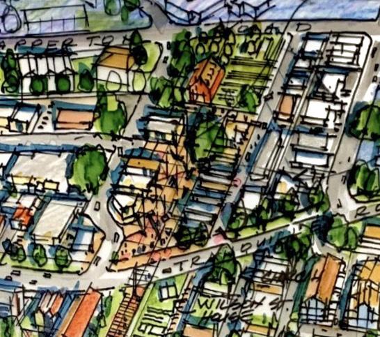
Concept sketch of an industrial arts district with a central pedestrian courtyard (see policy 47)
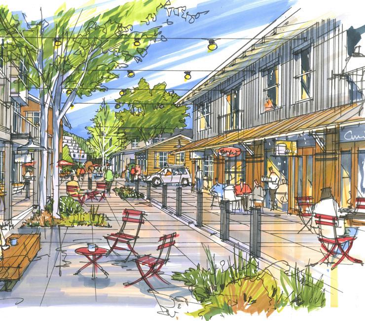
[THIS PAGE LEFT INTENTIONALLY BLANK]
The 8th Street Corridor is an auto-oriented commercial corridor and gateway to the North Shore. The intent for this corridor is to continue supporting commercial uses while encouraging opportunities for mixed-use and multi-family development as well as safe and accessible crossings and connections for pedestrians, cyclists, and transit users. Future redevelopment presents opportunities for public realm improvements to help create a more comfortable pedestrian experience and inviting gateway to the North Shore’s commercial core.
• To maintain a vibrant commercial corridor and attractive gateway to the North Shore.
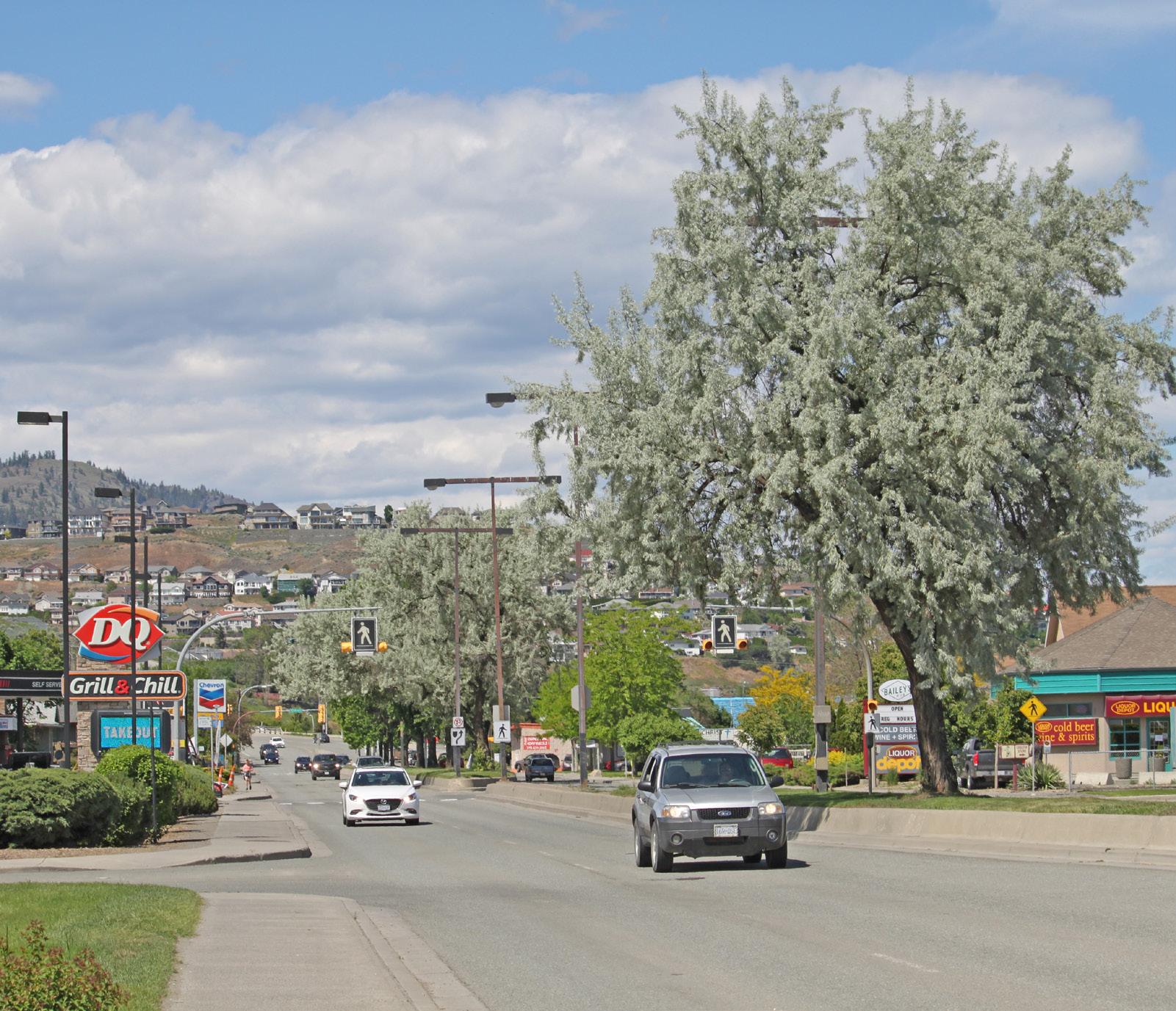
• To increase opportunities for mixed-use and multi-family development.
• To provide safe and accessible connections for pedestrians, cyclists, and transit users.
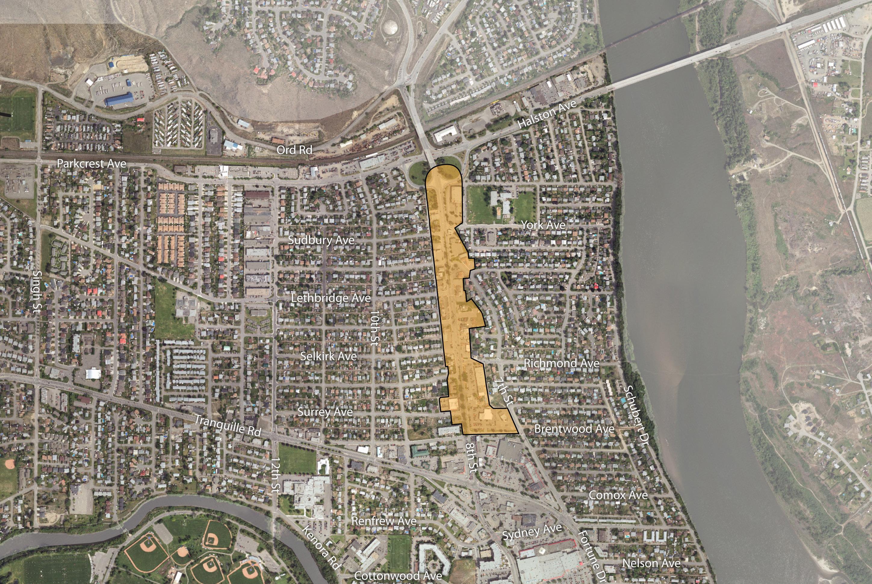
1 Support a mix of arterial commercial, multi-family residential, and institutional uses along the 8th Street Corridor, including small- and large -format retail, community and cultural facilities, recreational amenities, restaurants, and personal service businesses.
2 Support medium-density mixed-use development consisting of commercial and multi-family residential up to four storeys as permitted in the Zoning Bylaw.
3 Support active commercial uses at the street level of mixed-use development to encourage increased pedestrian activity and improved vitality for the corridor.
4 Ensure new residential development along the corridor incorporates design strategies to improve sensitive integration with surrounding residential areas and avoids providing parking access from arterial roads.
5 Support commercial retail uses to locate on the ground floor to encourage pedestrian activity and complement the public realm.
6 Minimize the impact of auto-oriented commercial uses through site and building design that addresses pedestrian safety and enhances the public realm in accordance with the Commercial Development Permit Area Guidelines in the Official Community Plan.
7 Support arterial commercial uses that cater to the needs of commuters and residents living in the surrounding area and that minimize impacts on adjacent uses through screening and landscaping.
8 Encourage large-format retail development to incorporate a mix of residential uses above and small-format retail units around its ground-level exterior to support pedestrian activity and the commercial vibrancy of the area.
Example mixed-use building with grocery store and smaller commercial units at street level, residential apartments above, and rowhouses fronting the side street

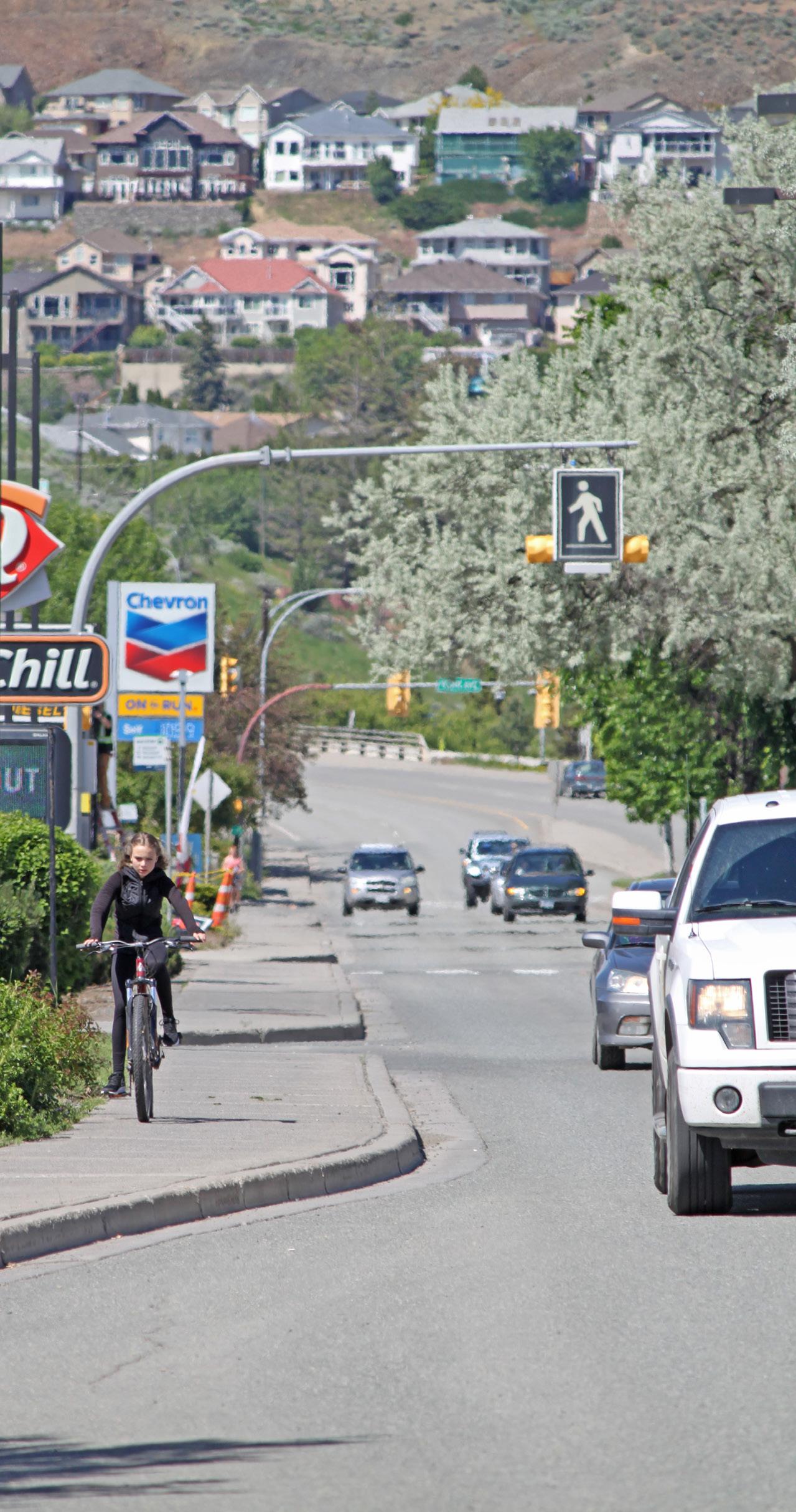
Explore opportunities for improved bicycle crossing of 8th Street at its intersection with the York Avenue/Sudbury Avenue bike route to enhance user convenience, safety, and wayfinding.
Ensure crossings of 8th Street at the intersection of key pedestrian and bicycle routes are safe, comfortable, and accessible to improve east-west connections between adjacent residential areas.
Upgrade pedestrian crossings as required in conjunction with nearby redevelopment or capital projects to ensure they continue to meet user volume, safety, wayfinding, and mobility
Ensure development does not significantly impact the traffic patterns of arterial roadways and consider reciprocal parking and access where appropriate.
14 Consider improvements to 8th Street Park as part of adjacent redevelopment or capital projects that complement surrounding businesses, the adjacent transit stop, and the Sudbury Avenue bike route, such as by providing outdoor eating and seating areas, cycling amenities, and/or landscaping improvements.
15 Encourage future redevelopment of property adjacent to 8th Street Park to integrate the park into its site design, such as by facing pedestrian- oriented uses towards the park, to enhance park use and function.
Implement public realm and streetscape improvements, such as landscaping, lighting, signage, and parking area upgrades, through identified capital projects and/or as a condition of development approval to improve beautification as well as connectivity and safety for pedestrians and cyclists.

The Schubert Drive neighbourhood is largely composed of single-family homes and duplexes, but concentrations of other multi-family housing forms, such as apartments and larger townhouse and rowhouse complexes, are located near the North Shore Town Centre and Overlander Park. A defining feature of the area is the waterfront Rivers Trail multi-use path. The Rivers Trail is an important recreation and transportation corridor for residents and a key piece of the City’s multi-use path network. The North Thompson River shoreline, including riparian and beach areas such as Overlander Park Beach, is an important natural asset within a convenient walking distance of residents. The intent for the Schubert Drive neighbourhood is to maintain the residential character of the area while allowing for sensitive infill opportunities, enhancing the area’s unique natural and recreational assets, and providing a safe pedestrian and cycling network.
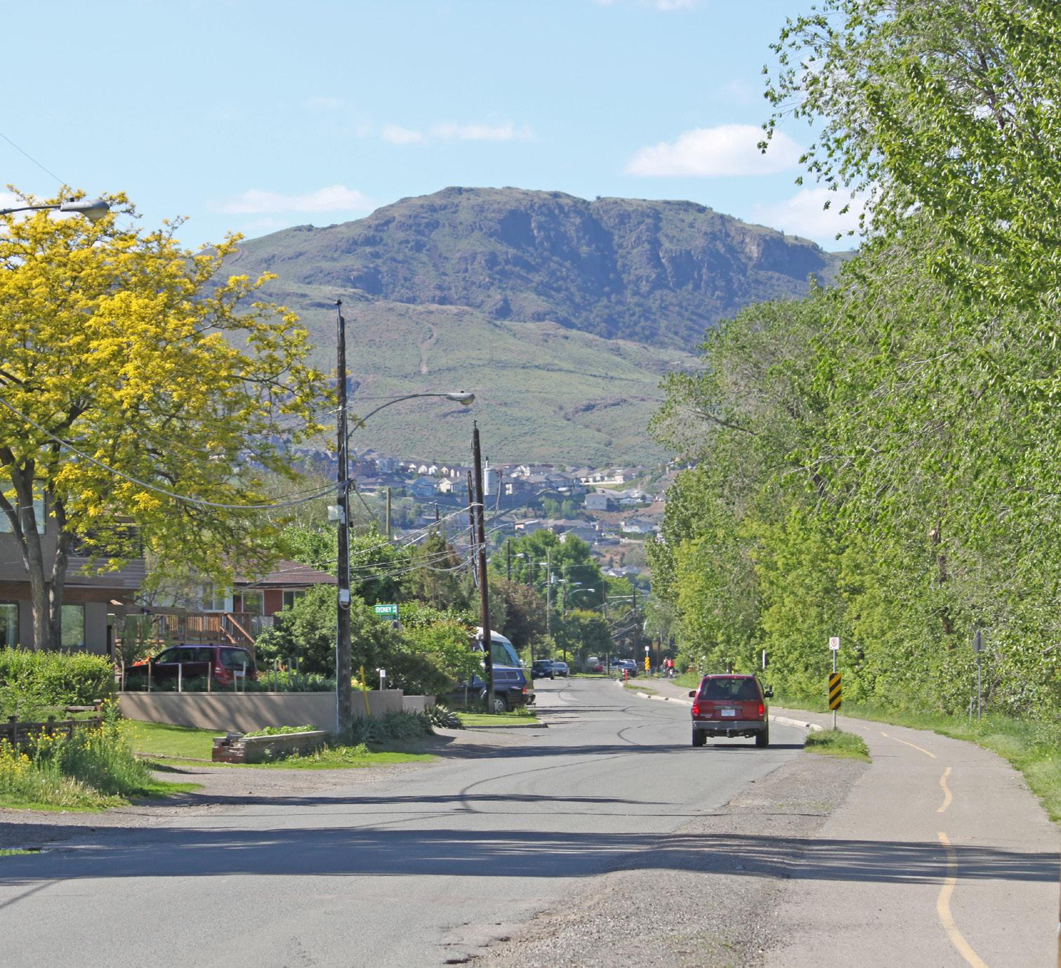
• To provide opportunities for sensitive infill housing forms where compatible with the existing residential character and where floodplain hazards can be adequately addressed.
• To connect residents with the rest of the North Shore and key neighbourhood amenities, such as parks, schools, and nearby commercial areas, via an accessible pedestrian and bicycle network.
• To retain and enhance the area’s natural and recreational assets, including parks, beaches, and the Rivers Trail.
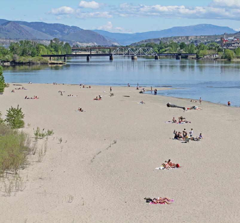
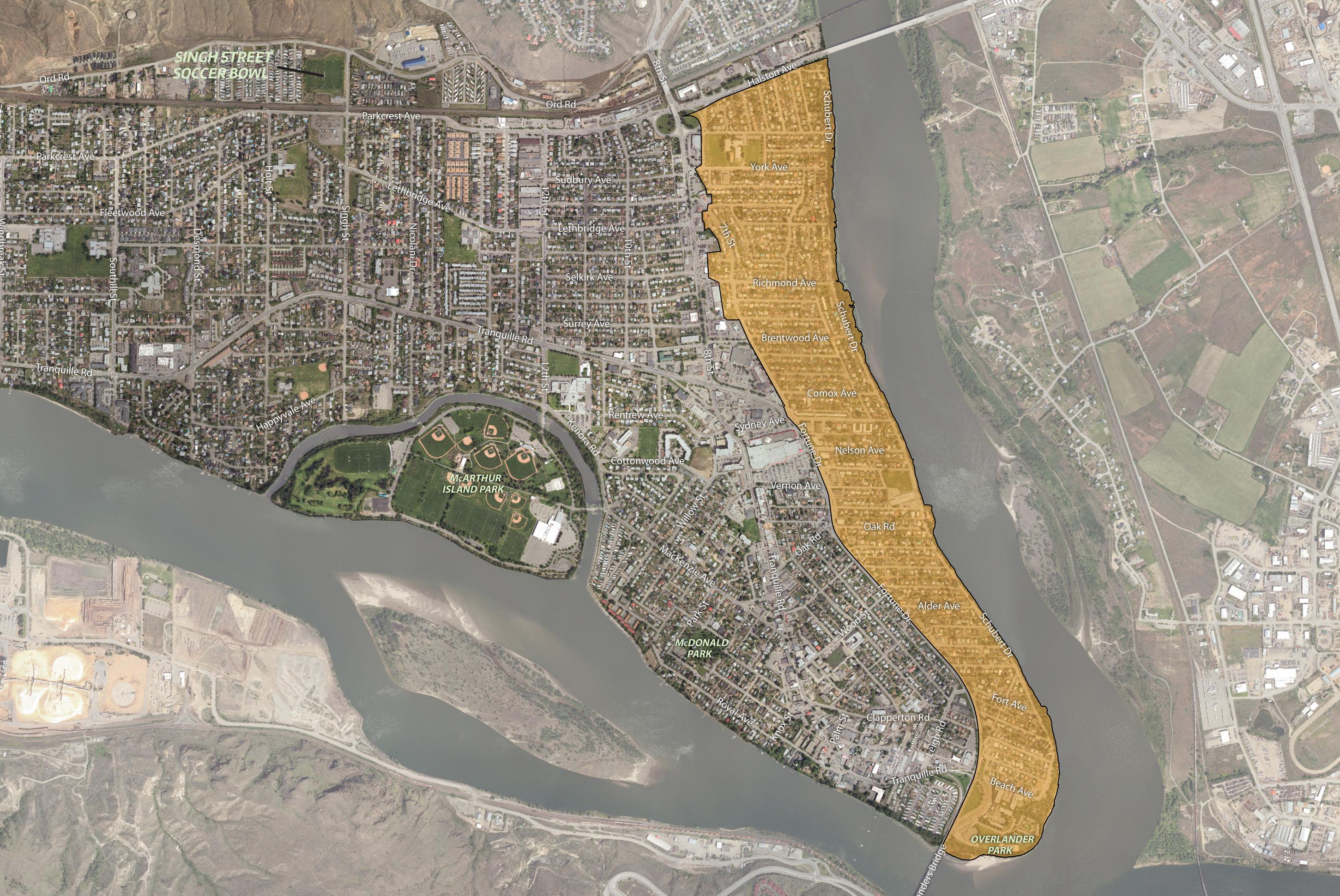
1 Ensure development of the Henry Grube Education Centre Future Development Area (FDA) contributes amenities that benefit surrounding residents and complement the area’s waterfront location and recreational uses, including the potential for waterfront- oriented commercial and/or tourism-related services.
2 Explore opportunities for development of the Henry Grube Education Centre FDA to better integrate the site with the surrounding multi-use path network—which may include opportunities to redefine and revitalize public space beneath the Overlanders Bridge—to enhance multi-use path safety, function, and user experience.
3 Support infill development that sensitively integrates with the neighbourhood, which may include small-lot residential infill, small-lot intensive duplexes, and residential suites. Above - ground garden suites will be considered if built up out of the floodplain.
4 Consider land assembly of corner lots and adjacent lots to facilitate low-density multi-family residential development, including row houses and stacked townhouses, where these housing forms can be sensitively integrated and can avoid providing parking access from arterial roads. Mid-block infill opportunities would be assessed on a case-by-base basis.
5 Support low- to medium-density multi-family residential, such as row houses, stacked townhouses, and apartments, near key amenities and the transit network, including on lots and land assemblies adjacent to the North Shore Town Centre, 8th Street, and Fortune Drive, where these housing forms can be sensitively integrated and can avoid providing parking access from arterial roads.
6 Discourage commercial development along Fortune Drive between Vernon Avenue and Beach Avenue.
Existing multi-family residential on Nelson Avenue (see policy 5)
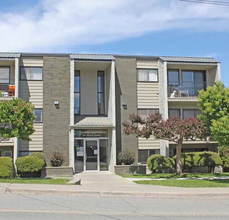
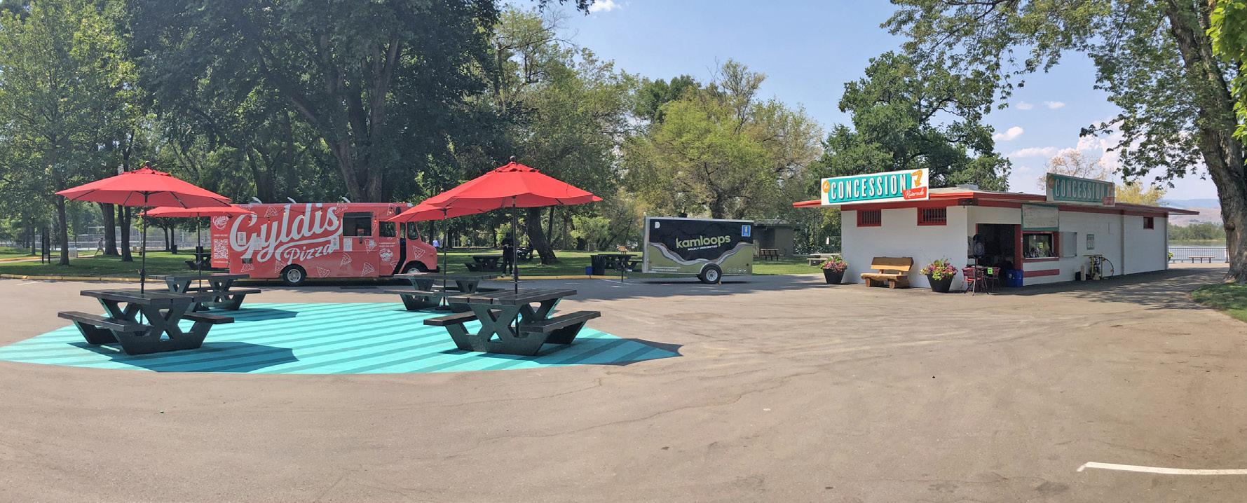
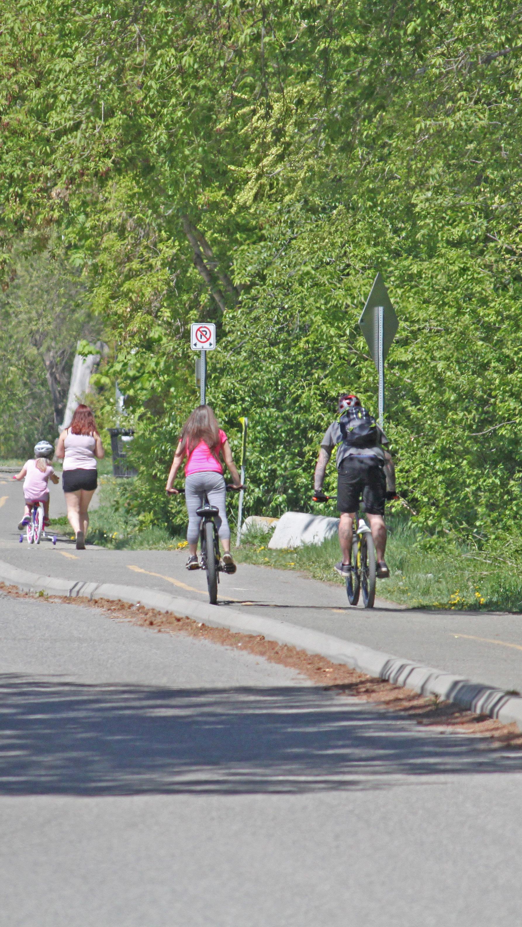
Connect residents with key community amenities by linking all parks, elementary schools, and nearby commercial areas to the Rivers Trail via an accessible pedestrian network, including completing new pedestrian facilities along the following routes as per the Transportation Master
8 Explore options for new east-west bicycle routes to improve connections with nearby commercial amenities, the Rivers Trail multi-use path network, and adjacent residential areas, including:
8-1 Connecting Schubert Drive to the North Shore Town Centre via Comox Avenue and 7th Street
8-2 Connecting Schubert Drive to Fortune Drive and the John Tod neighbourhood via Fort Avenue
9 Explore options for a direct multi-use path connection between the Rivers Trail at Overlanders Park and the Rivers Trail along Schubert Drive, either along the waterfront or at the east end of Kitchener Crescent as per the Transportation Master Plan.
10 Connect residents with the rest of the North Shore by creating safe, comfortable, and accessible crossings of Fortune Drive and 8th Street at the intersection of key pedestrian and bicycle routes to improve east-west connections between adjacent residential areas.
11 Explore opportunities for a new neighbourhood park, as defined by the City’s parks classification system, in the Schubert Drive and Brentwood Avenue area to address an identified gap in the parks network as per the Official Community Plan and Parks Master Plan. A new neighbourhood park could be created through identification of a new site or through improvements or expansion of an existing park space, such as the Richmond Tot Lot, and could provide opportunities for new recreational amenities, such as waterfront access and/or a dog park.
12 Consider waterfront sites for new neighbourhood park space and/or consider adding new waterfront connections when upgrading existing park spaces.
13 Ensure new and existing waterfront public spaces are accessible and have amenities that complement their waterfront location, such as appropriate wayfinding signage, viewpoint seating, accessible pathways to beach areas, and accessible launches for non-motorized watercraft.
14 Explore opportunities for public space improvements at Overlander Park, such as new seating, upgraded washroom facilities, universally accessible beach access, additional bike parking, and improved Rivers Trail connections.
15 Ensure any new waterfront development or waterfront park improvements incorporate aspects of flood risk mitigation and/or adaptation in their siting and design, including locating habitable spaces above the 200-year flood plain elevation and considering strategies that slow, store, convey, and/or discharge water.
16 Encourage new waterfront development and public capital works to incorporate greening and other restoration measures to enhance the ecology of the river shoreline and riparian areas.
Existing shoreline access at Overlander Beach (see policy 13)
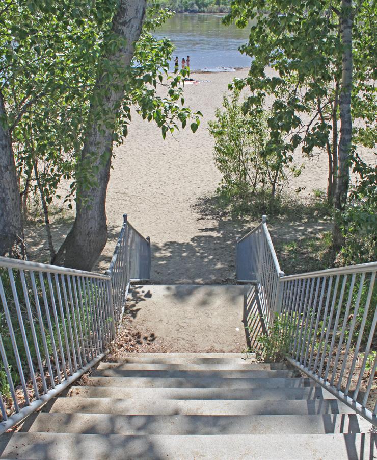
The Schubert Park Lookout provides opportunities for public waterfront access
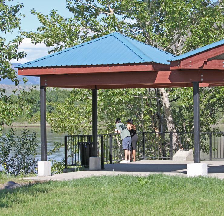
[THIS PAGE LEFT INTENTIONALLY BLANK]
The John Tod neighbourhood is largely defined by single-family homes but also contains multi-family housing forms, such as duplexes and apartments. Multi-family housing tends to be concentrated towards Clapperton Road, adjacent to the Tranquille Market Corridor, and near the North Shore Town Centre. A defining feature of the area is the John Tod Centre at the heart of the neighbourhood, providing greenspace and a key recreational and community amenity for residents.
The intent for the John Tod neighbourhood is to maintain the low-density form and character of the area while allowing for sensitive infill opportunities and providing safe pedestrian and cycling connections.
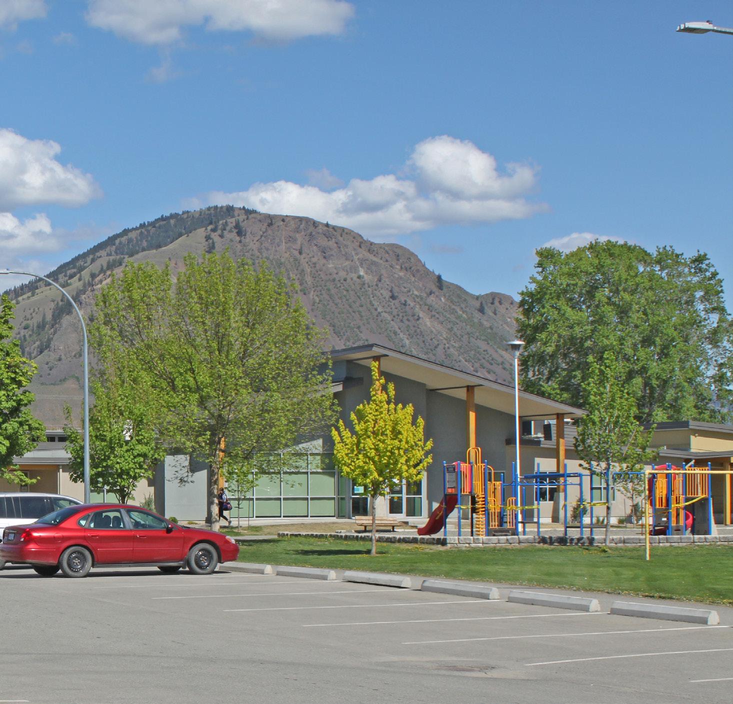
• To preserve the low-density residential character of the neighbourhood while supporting opportunities for sensitive infill and missing middle housing
• To improve housing supply and provide transitional building forms between adjacent higher- density mixed-use areas.
• To improve neighbourhood safety and connections for pedestrians and cyclists.
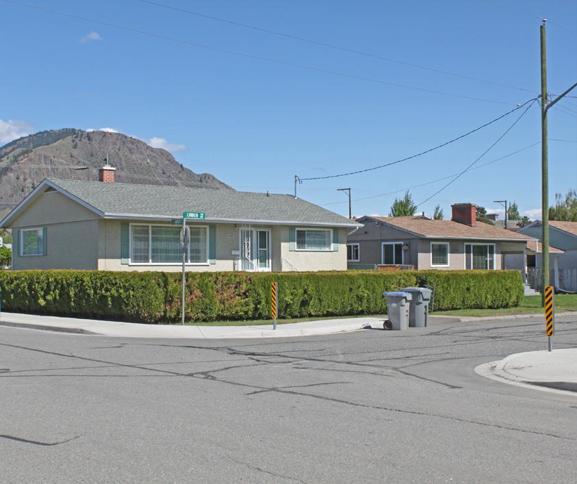
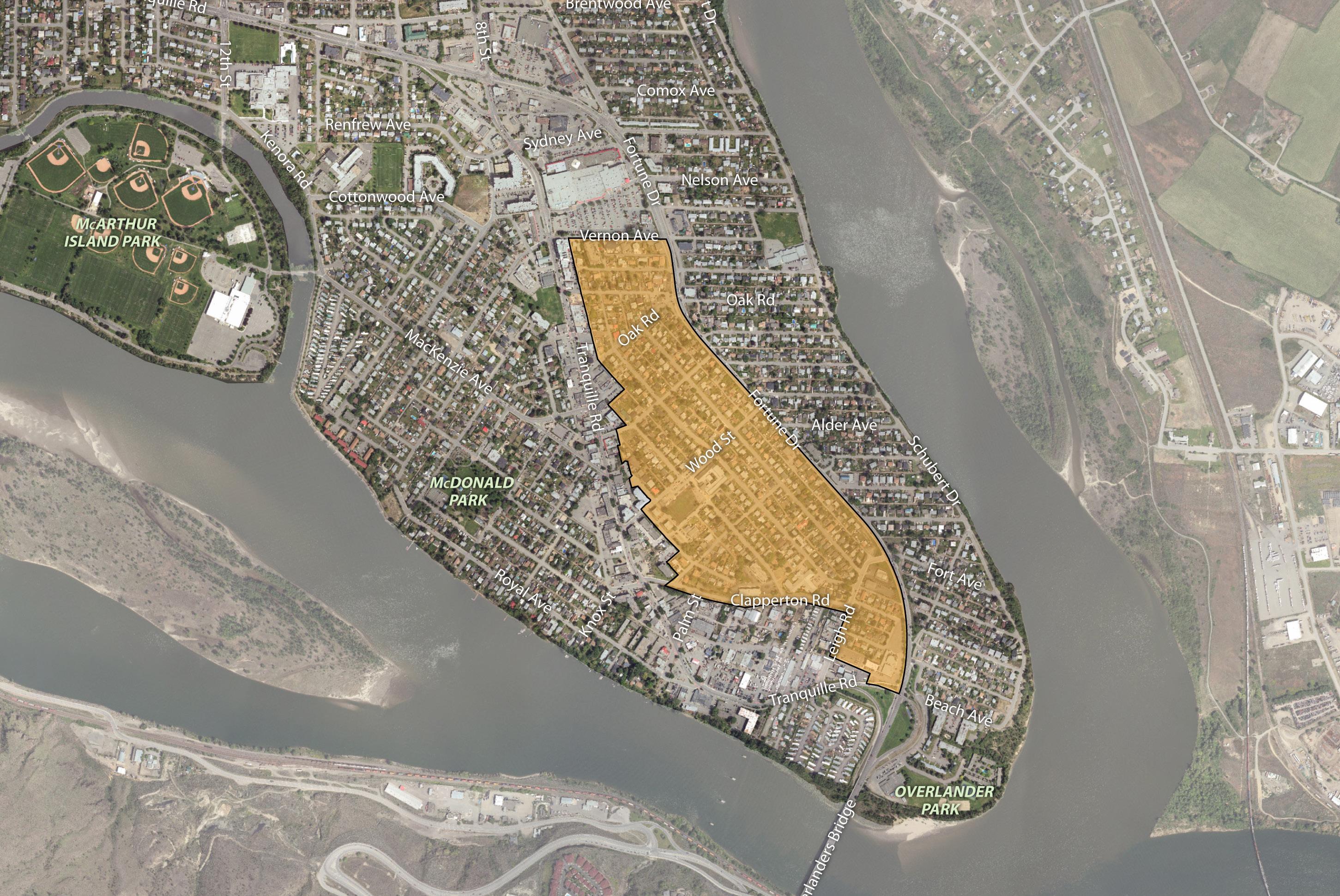
1 Support infill development that sensitively integrates with the neighbourhood, which may include small-lot residential infill, small-lot intensive duplexes, and residential suites. Above - ground garden suites will be considered if built up out of the floodplain.
2 Consider land assembly of corner lots and adjacent lots to facilitate low-density multi-family residential development, including row houses and stacked townhouses, where these housing forms can be sensitively integrated and can avoid providing parking access from arterial roads. Mid-block infill opportunities would be assessed on a case-by-base basis.
3 Support low- to medium-density multifamily residential, such as row houses, stacked townhouses, and apartments, near key amenities and the transit network, including on lots and land assemblies north of Elm Avenue and adjacent to the Tranquille Market Corridor, Fortune Drive, and Clapperton Road, where these housing forms can be sensitively integrated and can avoid providing parking access from arterial roads.
4 Connect residents with key community amenities by linking the John Tod Centre and nearby commercial areas via an accessible pedestrian network, including adding a sidewalk along McGowan Avenue and pedestrian routes along Clapperton Road and Elm Avenue as per the Transportation Master Plan.
5 Explore options for new east-west bicycle routes to improve connections with nearby commercial amenities, the Rivers Trail multi-use path network, and adjacent residential areas, including:
5-1 Connecting Fortune Drive and a potential Fort Avenue bike route to the Tranquille Market Corridor via Leigh Road and Clapperton Road
5-2 Connecting Fortune Drive to the Tranquille Market Corridor via Oak Road
6 Connect residents with the rest of the North Shore by creating safe, comfortable, and accessible crossings of Tranquille Road and Fortune Drive at the intersection of key pedestrian and bicycle routes to improve east-west connections between adjacent residential areas.
Existing multi-family residential on Vernon Avenue (see policy 3)
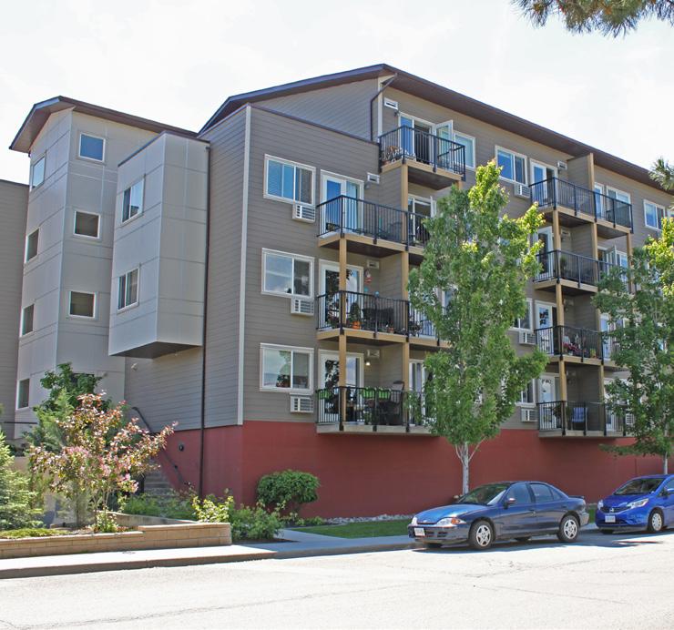
A type of ground-oriented, multi-family housing that spans the spectrum between single-family homes and high-rise apartment buildings (e.g. townhouses, rowhouses, triplexes, fourplexes).
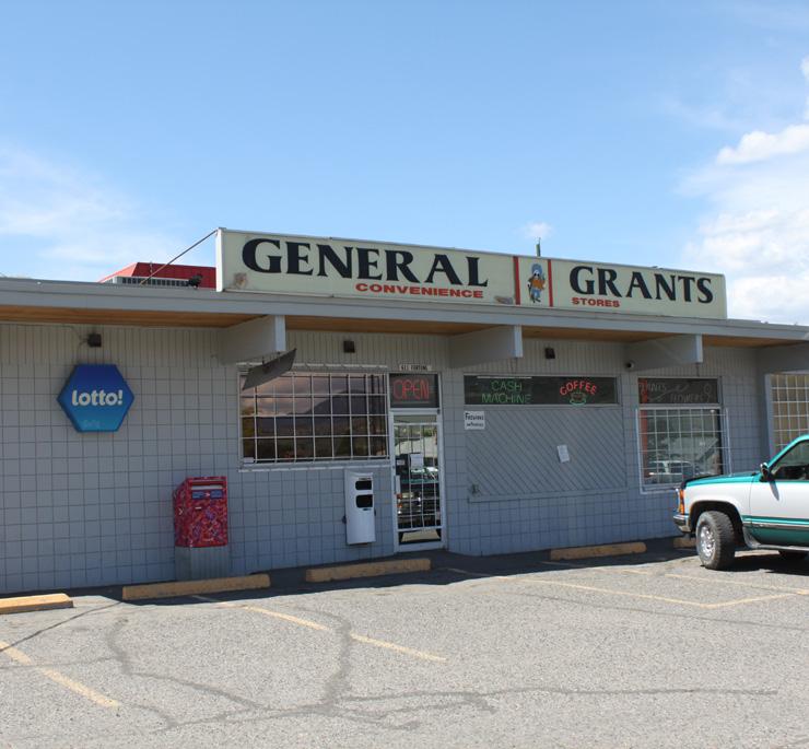
7 Encourage continued commercial and/or new mixed-use development at existing Commercial- designated sites north of Oak Road, where providing direct access for parking from arterial roads is minimized.
8 Discourage commercial development along Fortune Drive between Oak Road and Leigh Road.
9 Continue to support existing community uses in the area, including the John Tod Centre, the Japanese Canadian Cultural Centre, and church sites, and encourage these sites to be retained, enhanced, and/or repurposed to continue providing community-oriented amenities and services for the area.
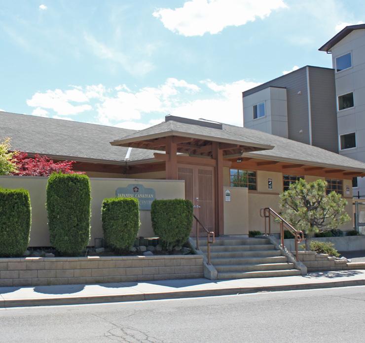
10 Work with School District No. 73, the Kamloops Community YMCA-YWCA, and the Boys & Girls Club of Kamloops to explore opportunities for enhancing the John Tod Centre field and outdoor spaces to better serve the needs of the neighbourhood, such as by improving field access points and planting more trees.
11 Work with community partners, including the North Shore Central Community Association, to identify opportunities for increasing neighbourhood safety in areas of concern. This may include conducting site evaluations for Crime Prevention Through Environmental Design principles to identify appropriate safety enhancement strategies, such as improvements to lighting, capital maintenance, and surveillance measures in key public spaces and pedestrian routes.
One of the oldest residential neighbourhoods in Kamloops, with most residential areas located within the 200-year floodplain, the McDonald Park neighbourhood contains a mix of housing types, including apartments, townhouses, duplexes, and single -family homes on smaller lots. Situated along the Thompson River, the neighbourhood boasts a large park and community facilities and is within walking distance of the Tranquille Market Corridor and McArthur Island. The intent for the area is to support residential development that is appropriate to the scale and character of the neighbourhood and to focus on issues of safety, livability, and beautification.
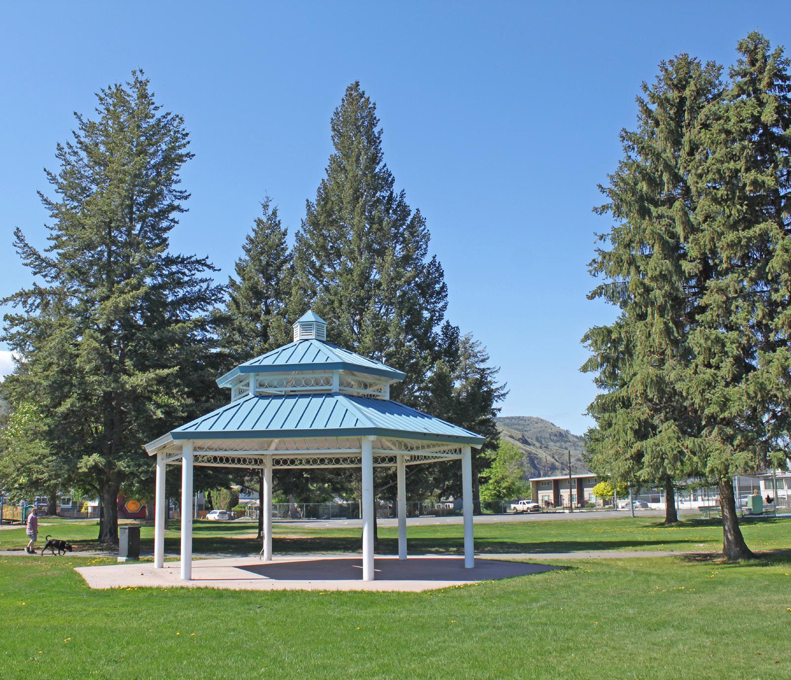
• To preserve neighbourhood character while encouraging sensitive infill opportunities that increase the diversity and supply of housing.
• To improve safety and connectivity for pedestrians and cyclists.
• To enhance neighbourhood safety and livability by improving and activating public spaces.
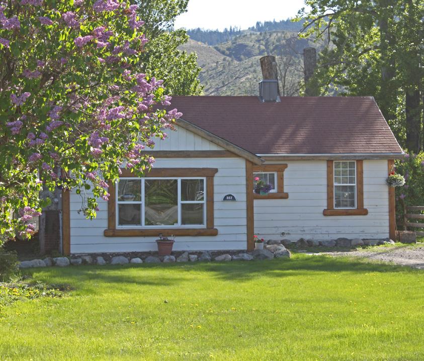
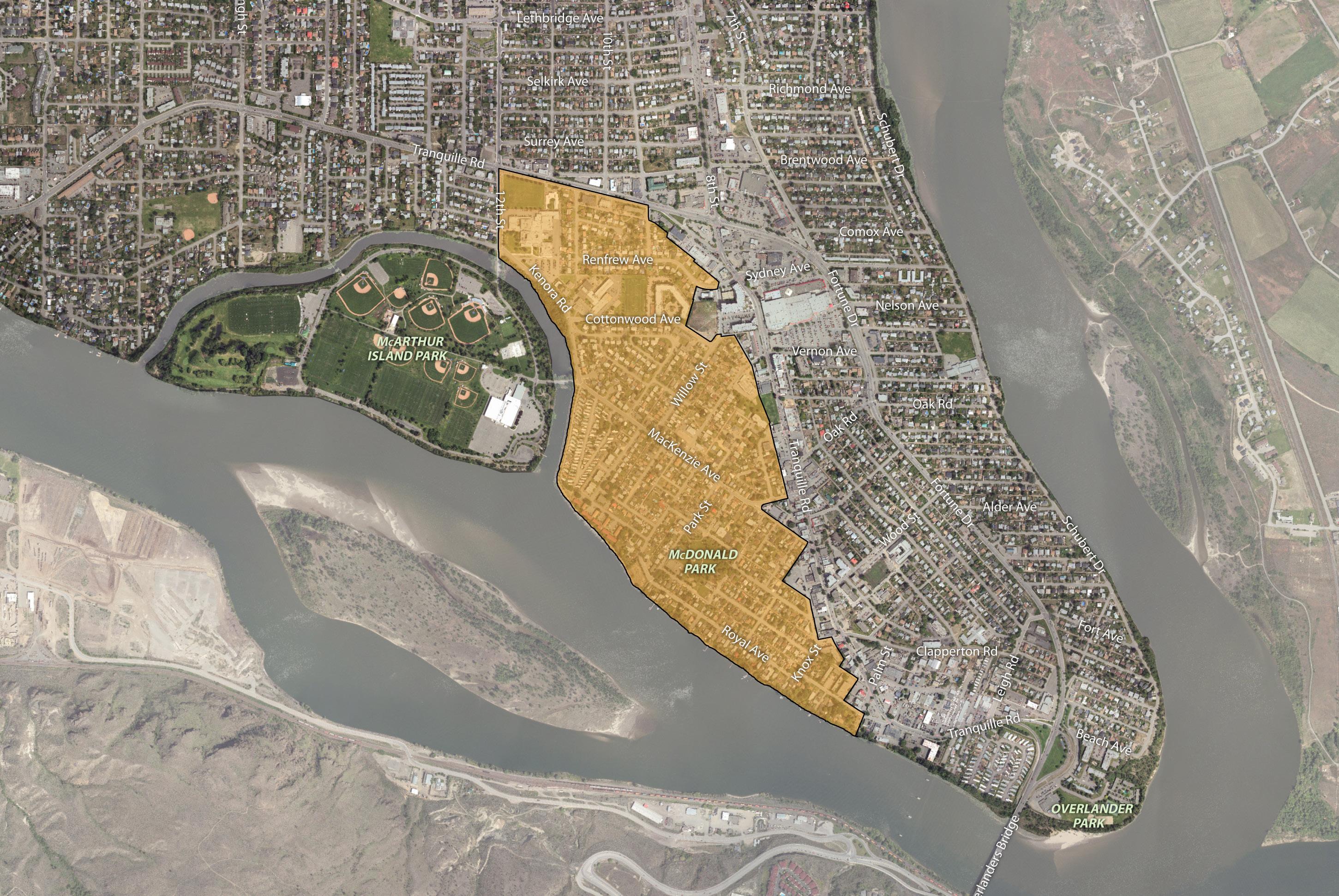
1 Support infill development that sensitively integrates with the neighbourhood, which may include small-lot residential infill, small-lot intensive duplexes, and residential suites. Above - ground garden suites will be considered if built up out of the floodplain.
2 Consider land assembly of corner lots and adjacent lots to facilitate low-density multi-family residential development, including row houses and stacked townhouses, where these housing forms can be sensitively integrated and can avoid providing parking access from arterial roads and MacKenzie Avenue. Mid-block infill opportunities would be assessed on a case-by-base basis.
3 Support low- to medium-density multi-family residential, such as row houses, stacked townhouses, and apartments, near key amenities and the transit network, including on lots and land assemblies adjacent to the North Shore Town Centre, Tranquille Market Corridor, Tranquille Road, MacKenzie Avenue, and Yew Street, where these housing forms can be sensitively integrated and can avoid providing parking access from arterial roads and MacKenzie Avenue.
4 Consider limited ground-oriented commercial uses as part of future residential redevelopment of the Woodland Mobile Home Park given it supports waterfront activity and access and can serve the needs of neighbourhood residents, Rivers Trail users, and visitors to McArthur Island Park.
5 Consider limited ground-oriented commercial uses as part of future residential redevelopment on parcels across the street from Spirit Square given it supports pedestrian activity and complements plaza event and programming opportunities.
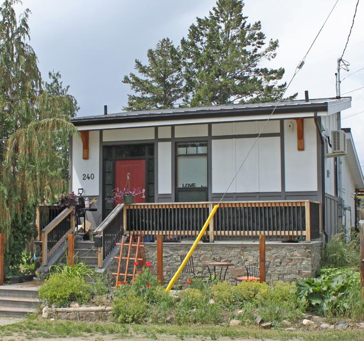
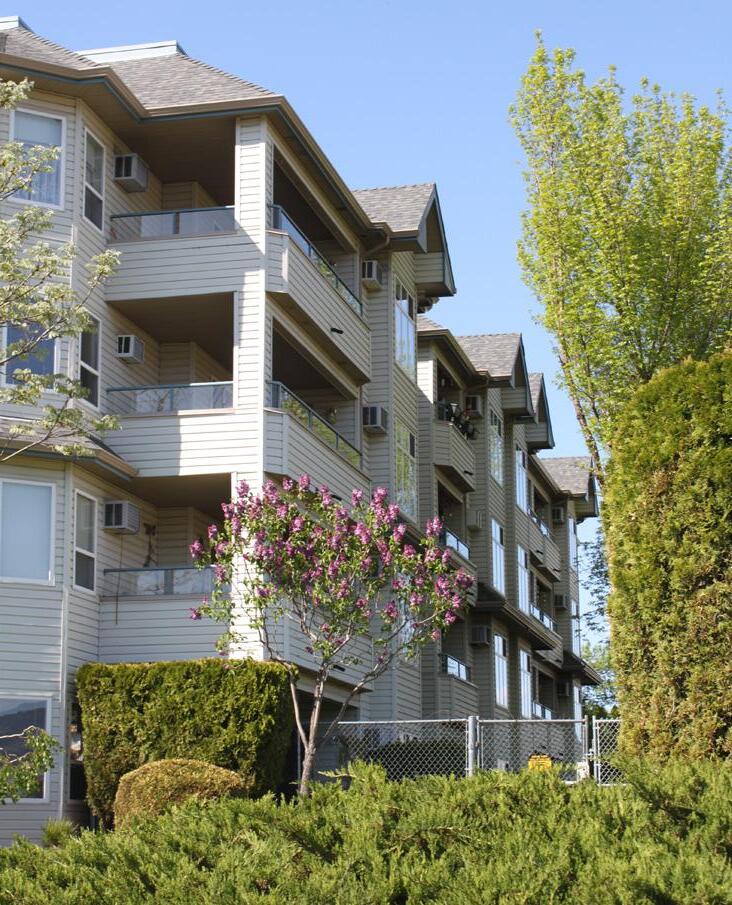
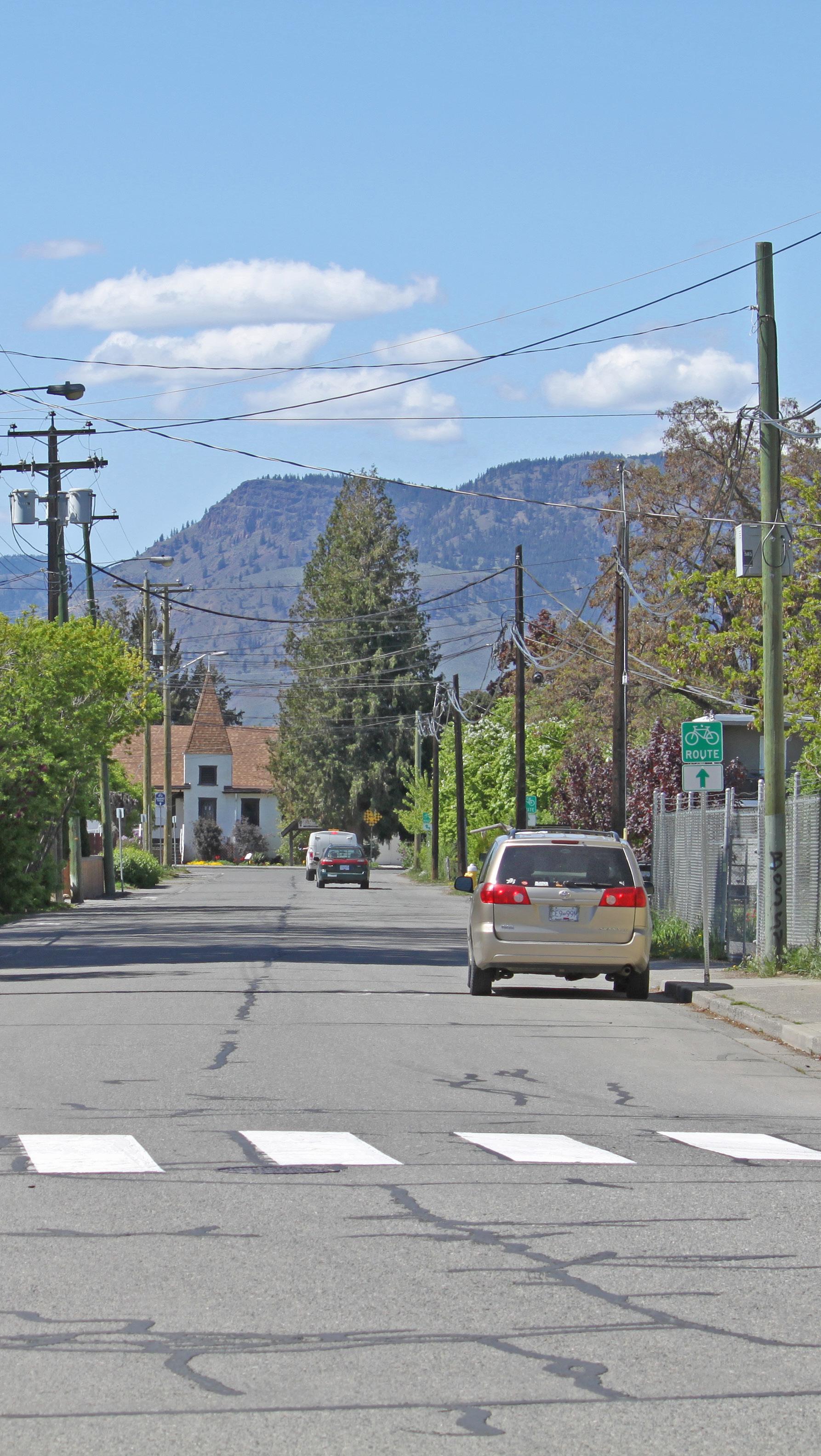
Connect residents with key community amenities by linking all parks, schools, nearby commercial areas, and the Rivers Trail via an accessible pedestrian network, including completing new pedestrian facilities along the following routes as per the Transportation Master Plan:
9th Street
10th Street
MacKenzie Avenue
Poplar Street
Renfrew Avenue Thrupp Street Willow Street Yew Street
7 Explore options for new east-west bicycle routes to improve connections with nearby commercial amenities, McArthur Island Park, the Rivers Trail multi-use path network, and adjacent residential areas, including:
7-1 Connecting a potential Clapperton Road bike route to the Royal Avenue bike route via Knox Street
7-2 Connecting the Tranquille Market Corridor and a potential Oak Road bike route to McArthur Island Park and the Rivers Trail via MacKenzie Avenue—potentially in conjunction with MacKenzie Avenue pedestrian improvements identified in the Transportation Master Plan
7-3 Connecting the North Shore Town Centre and Transit Exchange to McArthur Island Park via Renfrew Avenue as per the Transportation Master Plan
8 Enhance connectivity, safety, and wayfinding for pedestrians and cyclists between the Tranquille Market Corridor and Rivers Trail by upgrading the Royal Avenue bike route between Knox Street and Palm Street to a separated multi-use path. Additional land will be acquired to accommodate improvements by expanding the City-owned public right-of-way as properties are redeveloped along Royal Avenue.
9 Connect residents within the McDonald Park neighbourhood and with the rest of the North Shore by creating safe, comfortable, and accessible crossings of MacKenzie Avenue and Tranquille Road at the intersection of key pedestrian and bicycle routes to improve access to neighbourhood amenities and adjacent residential areas.
10 Consider installing roundabouts at the 12th Street and MacKenzie Avenue entrances to McArthur Island as part of future development and road improvement projects in the area to calm vehicle traffic, provide safer crossings for pedestrians and cyclists, and create gateway features that enhance beautification and wayfinding for residents and visitors.
11 Explore opportunities to implement traffic calming measures on local roads as part of future development and road improvement projects in accordance with City traffic calming guidelines.
Traffic calming:
Design strategies intended to slow traffic and improve pedestrian and traffic safety, such as narrowing roads; reducing posted speed limits; enhancing pedestrian crossings; and installing roundabouts, speed bumps, and stop signs.
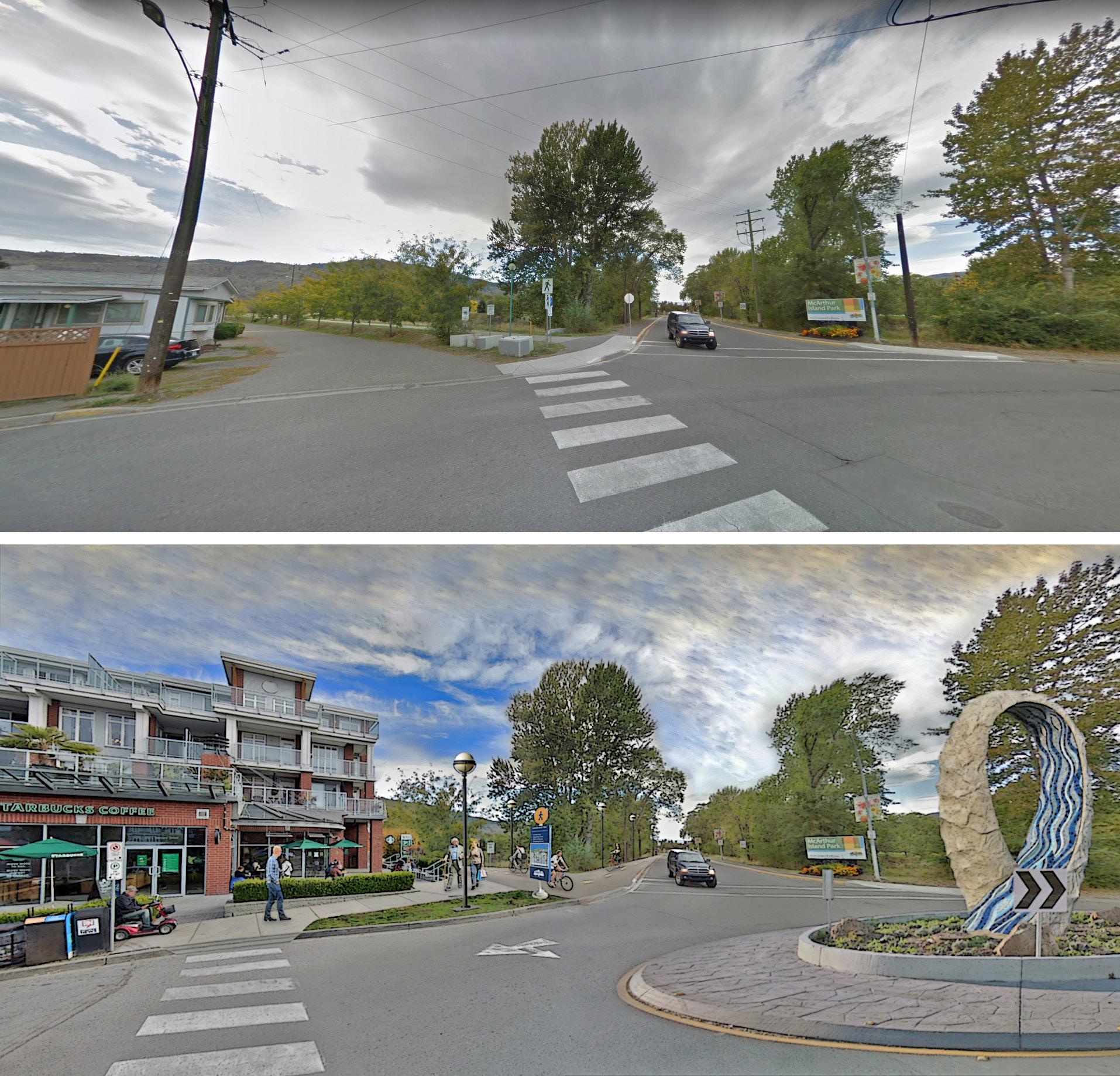
12 Support low- to medium-density multi-family residential for any potential future redevelopment of the Woodland Mobile Home Park site.
The east side of the site should incorporate complementary building forms and transitional building heights to bridge the height and scale of adjacent single-family dwellings.
13 Formalize a pedestrian connection within the City right-of-way between the west end of Lilac Avenue and the adjacent section of the Rivers Trail to improve waterfront access and connectivity. Explore opportunities to enhance the vacant waterfront space to the south of this right-of-way as part of future redevelopment of the Woodland Mobile Home Park, such as through the addition of new public art, landscaping, and seating areas.

14 Ensure new multi-family waterfront development sites are well integrated with adjacent multi-use paths, public areas, and the shoreline and that they complement these features through waterfront access, landscaping, and amenity considerations.
15 Ensure new waterfront development and waterfront public space improvements incorporate aspects of flood risk mitigation and/or adaptation and ecological restoration considerations in accordance with the North Shore Development Permit Area Guidelines and/or Riparian Areas Regulation Development Permit Area Guidelines.
16 Consider opportunities to enhance or repurpose Yew Park to make better use of the space. This could include improving its pedestrian connection with Spirit Square to increase use and programming opportunities; adding new park amenities, such as picnic areas, food vendor parking, and improved landscaping; or redeveloping the property to meet other community needs, such as new housing opportunities.
17 Consider improvements to better activate McDonald Park year-round, including additional lighting, enhanced playground equipment, winter amenities, and other features that would support year-round park events and programming.
18 Work with the RCMP, North Shore Business Improvement Association, McDonald Park Neighbourhood Association, Community Services (Bylaw) staff, outreach workers, and other community partners to identify opportunities and priorities for enhancing neighbourhood safety.
19 Work with the City’s Heritage Engagement Group and the McDonald Park Neighbourhood Association to assess the heritage value of properties in the area for potential solicitation and addition to the City’s Heritage Recognition Plaque Program and/or potential future inclusion on the City’s Heritage Register.
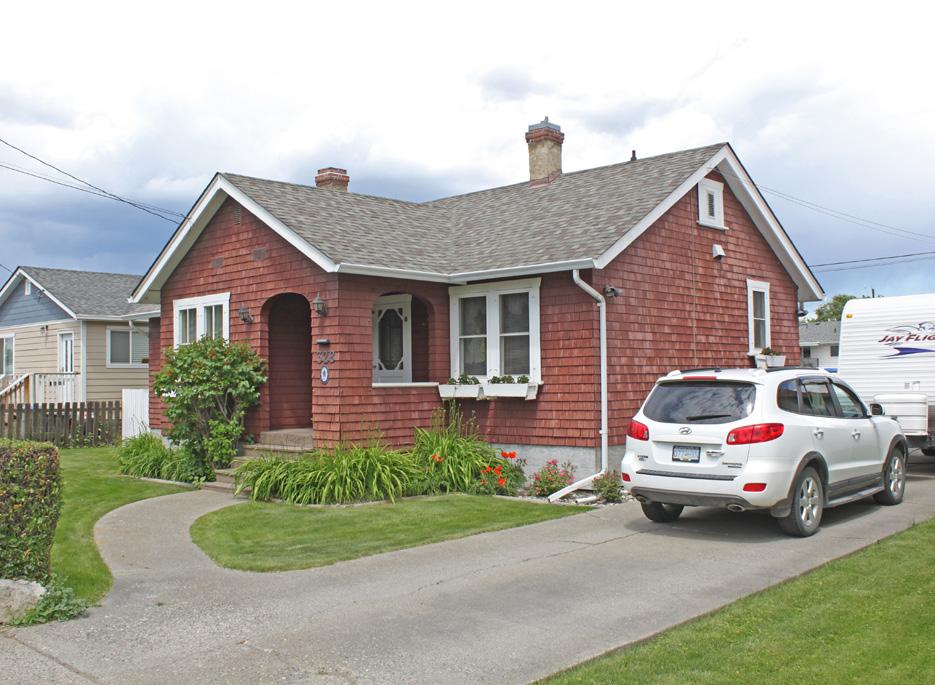
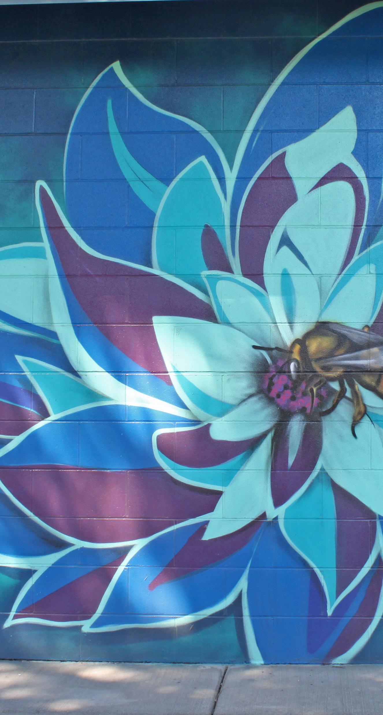
[THIS PAGE LEFT INTENTIONALLY BLANK]
The Halston Entry Corridor is an auto-oriented light-industrial and commercial corridor and gateway to the North Shore. The intent for this corridor is to continue supporting commercial and light industrial uses while considering streetscape and public realm improvements to provide a welcoming first impression to the North Shore.
• To mitigate potential land use conflicts between new development and the rail corridor through site and building design.
• To maintain commercial and light industrial employment areas.
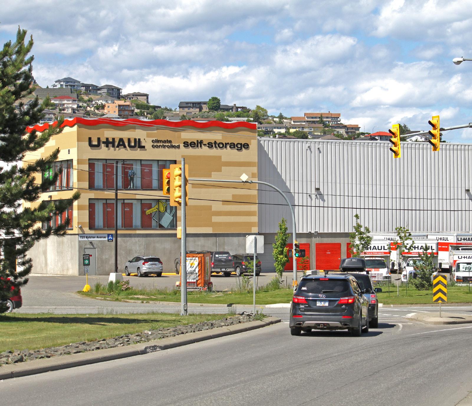
• To provide an attractive gateway and entry corridor to the North Shore.

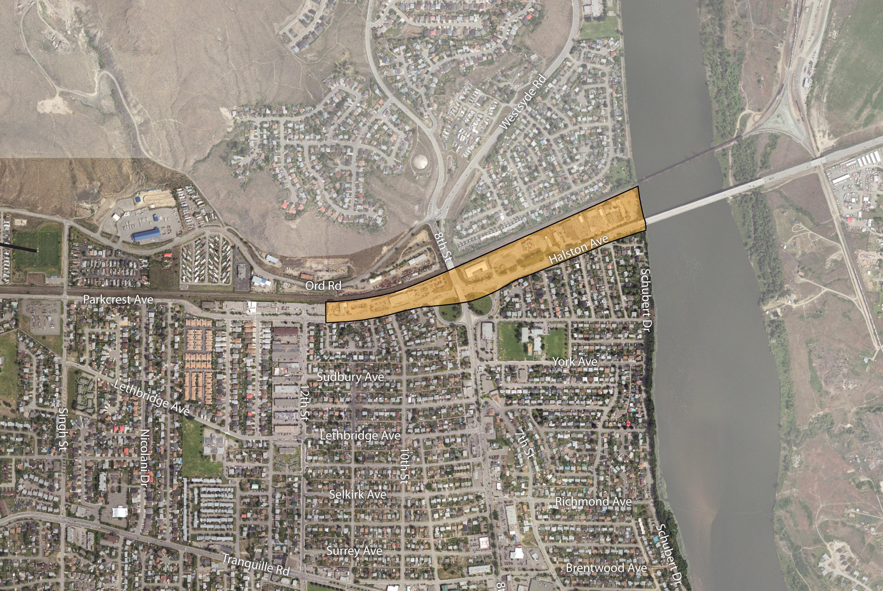
1 Continue to support a mix of employment- generating light industrial and service commercial uses along the Halston Entry Corridor.
2 Ensure that new development is compatible with or enhances the form, character, and use of existing development and reduces potential impacts on adjacent sites as well as potential impacts from the adjacent rail corridor through appropriate mitigation strategies, including setback, buffering, and access control considerations.
3 Minimize the impact of auto-oriented commercial and industrial uses through site and building design that addresses pedestrian safety and enhances the public realm in accordance with the Commercial and Industrial Development Permit Area Guidelines in the Official Community Plan.
4 Support service commercial uses that cater to the needs of commuters and residents living in the surrounding area and that minimize impacts on adjacent uses through screening and landscaping.
5 Encourage new development to achieve high standards in building and site design and incorporate landmark-defining design elements to support corridor beautification and create a more welcoming gateway.

Ensure development does not significantly impact the traffic patterns of arterial roadways and consider reciprocal parking and access where appropriate.
Ensure crossings of Halston Avenue at the intersection of key pedestrian and bicycle routes are safe, comfortable, and accessible to improve connections between adjacent residential areas. Upgrade pedestrian crossings as required in conjunction with nearby redevelopment or capital projects to ensure they continue to meet user volume, safety, wayfinding, and mobility
Improve pedestrian connections and safety along the Halston Entry Corridor by completing a gap in the sidewalk network on the south side of Halston Avenue between the east and west 8th Street on-ramps as per the Transportation Master Plan.
10 Implement public realm and streetscape improvements, such as landscaping, lighting, signage, and parking area upgrades, through identified capital projects and/or as a condition of development approval to improve beautification as well as connectivity and safety for pedestrians and cyclists.
11 Explore opportunities to incorporate public art along the corridor as part of new development or capital projects to support beautification and a more welcoming gateway.
12 Explore opportunities to improve the Rivers Trail beneath the rail bridge and Halston Bridge in conjunction with adjacent development or capital projects to enhance user safety and comfort, which may include incorporating Crime Prevention Through Environmental Design strategies, such as improved lighting, signage, and sightlines.
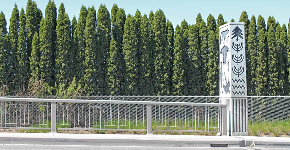
The North Kamloops West area contains a mix of residential, commercial, and institutional uses. Residential uses include low- to medium-density forms, such as single-family homes, duplexes, townhouse complexes, and apartments. Commercial areas include portions of Halston Avenue, Tranquille Road, and 12th Street, which runs north-south through the centre of the area and contains a strip of service commercial uses. The 12th Street corridor is served by a transit route, is bisected by pedestrian and cycling routes along Lethbridge Avenue, which is the primary east-west corridor through the area, and is within walking distance of a neighbourhood school. The intent for the area is to maintain the area’s primarily residential form and character while supporting opportunities for sensitive residential infill and encouraging commercial uses on 12th Street that better integrate with and serve the needs of surrounding residents.
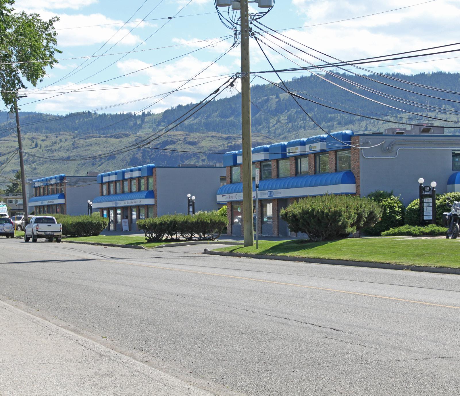
• To maintain the existing residential character of the neighbourhood while considering sensitive infill opportunities that increase the supply and diversity of housing.
• To support opportunities for local-serving commercial uses that improve walkability and increase the diversity of commercial amenities in the area.
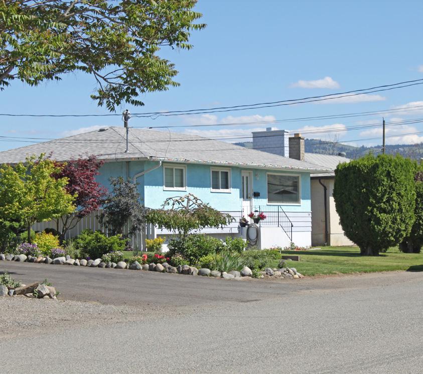
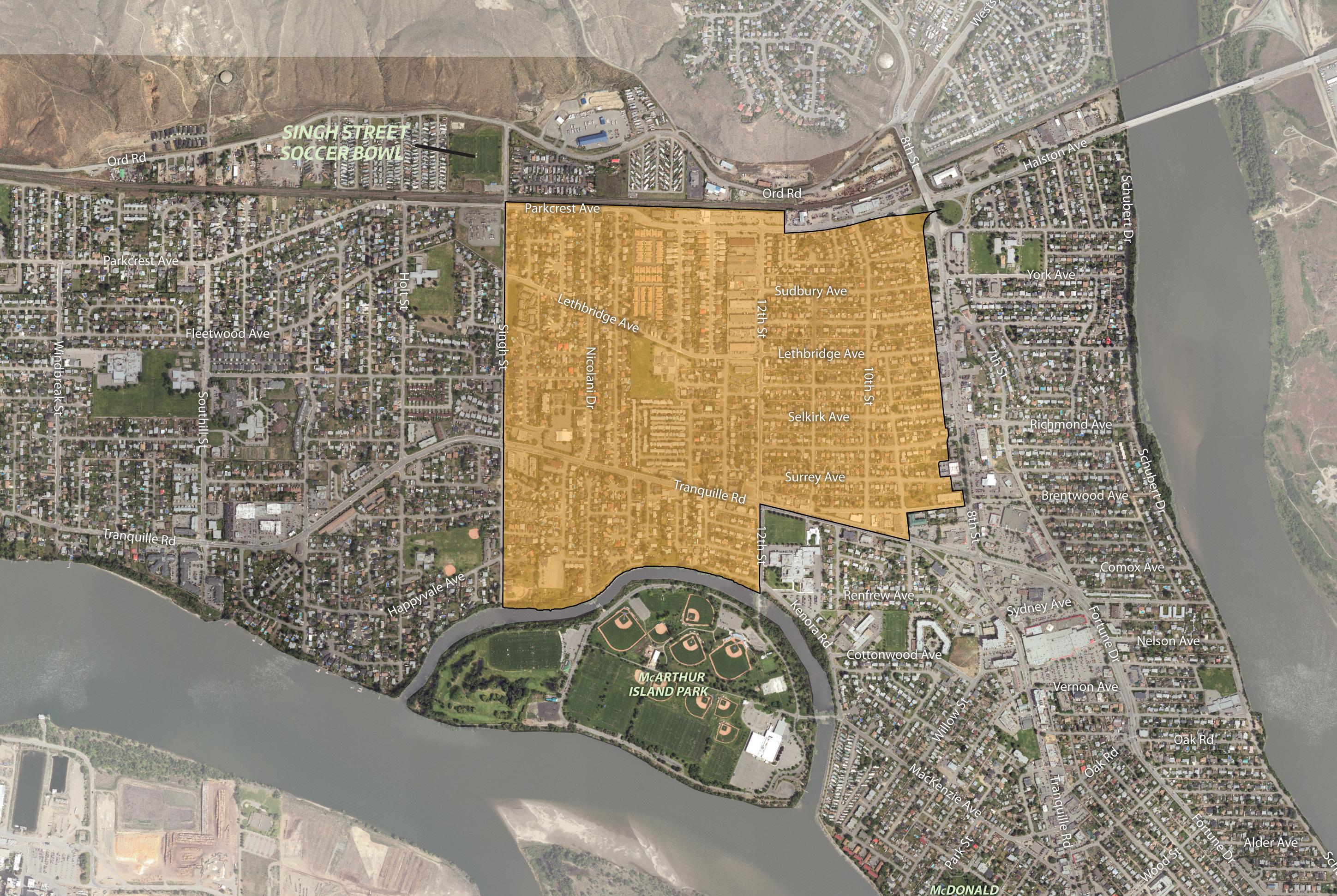
1 Support infill development that sensitively integrates with the neighbourhood, which may include small-lot residential infill, small-lot intensive duplexes, and residential suites. Above - ground garden suites will be considered if built up out of the floodplain.
2 Consider land assembly of corner lots and adjacent lots to facilitate low-density multi-family residential development, including row houses and stacked townhouses, where these housing forms can be sensitively integrated and can avoid providing parking access from arterial roads. Mid-block infill opportunities would be assessed on a case-by-base basis.
3 Support low- to medium-density multifamily residential, such as row houses, stacked townhouses, and apartments, near key amenities and the transit network, including on lots and land assemblies adjacent to Tranquille Road, 8th Street, 12th Street, and Singh Street, where these housing forms can be sensitively integrated and can avoid providing parking access from arterial roads.
4 Support local-serving commercial uses on the northwest corner of 12th Street and Lethbridge Avenue, which could include a café/restaurant or small-scale grocer, to cater to the needs of residents and commuters and function as a central gathering place for the neighbourhood.
5 Continue to support new service commercial uses along Halston Avenue and 12th Street provided potential conflicts with surrounding residential uses are mitigated and streetscape improvements are considered (e.g. landscaping, street trees, sidewalks) in accordance with the Commercial Development Permit Area Guidelines in the Official Community Plan.
6 Encourage continued commercial and/ or new mixed-use development at existing Commercial- designated sites along Tranquille Road, where providing direct access for parking from arterial roads is minimized.
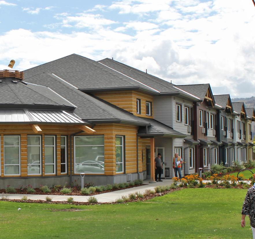
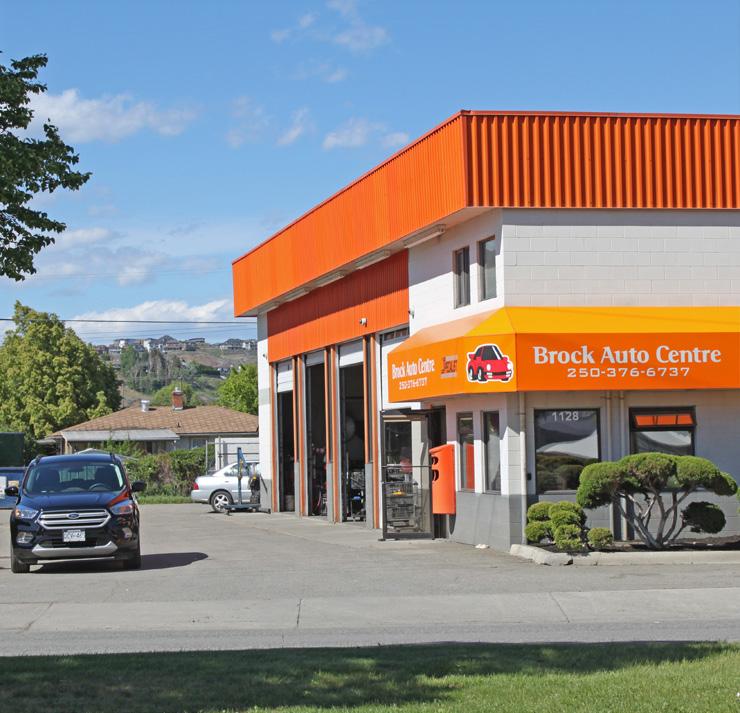

Connect residents with key community amenities by linking nearby schools, major parks, and commercial areas via an accessible pedestrian network, including completing new pedestrian facilities along the following routes as per the Transportation Master Plan:
Lethbridge Avenue
Moncton Avenue
Westminster Avenue
Parkcrest Avenue
12th Street
Enhance the bicycle network to improve connections with nearby commercial amenities, the Rivers Trail multi-use path network, and adjacent residential areas, including completing new routes along the following streets as per the Transportation Master Plan:
Halston Avenue
10th Street
9 Connect residents with the rest of the North Shore by creating safe, comfortable, and accessible crossings of Tranquille Road, 8th Street, and Singh Street at the intersection of key pedestrian and bicycle routes to improve connections between adjacent residential areas.
10 Explore opportunities to complete an active transportation connection between the south end of Popp Street and the west end of Kenora Road along the north side of the McArthur Island Park Slough, such as by acquiring land as a condition of future redevelopment in the area.
11 Improve connectivity with parks and neighbourhood amenities outside the pedestrian and cycling network, such as Sherbrooke Park, through the use of wayfinding signage to better direct pedestrians and cyclists through the area.
Brocklehurst Centre, located along Tranquille Road, is the Brocklehurst neighbourhood’s primary commercial retail area, with several small shops, restaurants, and a major grocery store. It is a designated Major Neighbourhood Centre as per the Official Community Plan, which are encouraged to provide a mix of services, amenities, and transportation options to create complete neighbourhoods where residents can live, work, play, and reduce their reliance on private automobiles.
The intent for Brocklehurst Centre is to strengthen its function as a neighbourhood centre by making it more pedestrian friendly and providing more opportunities for commercial, residential, and community use.
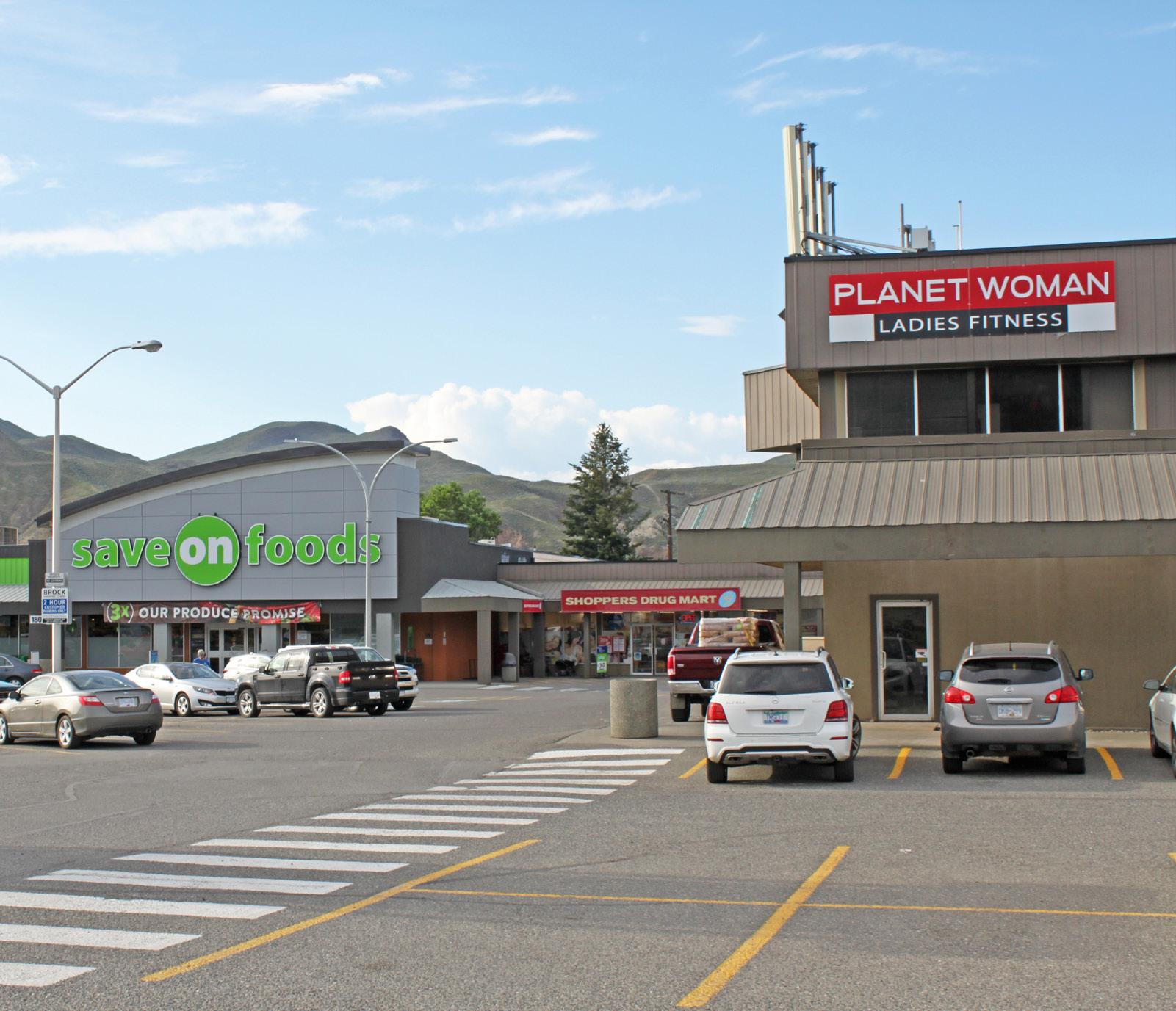
• To provide mixed-use infill opportunities that increase housing supply, encourage pedestrian vibrancy, and support the success of area businesses.
• To support opportunities for new and expanded business opportunities, entertainment options, and commercial services.
• To consider new community uses, public spaces, and amenities that improve walkability and help create a complete neighbourhood centre where residents can live, work, and play.
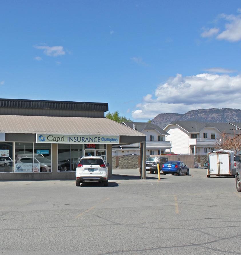
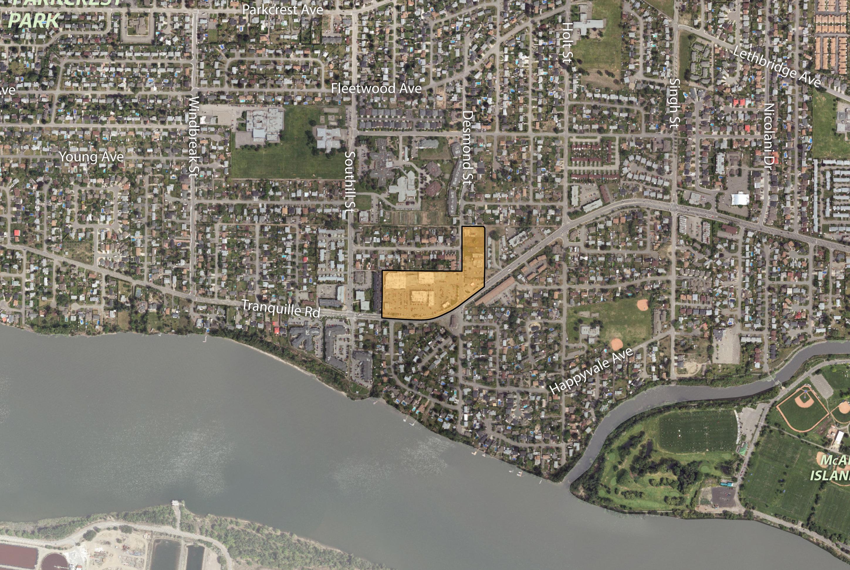
Mixed-use development southwest of Brocklehurst Centre along Tranquille Road (see policy 8)
1 Continue to support the function of Brocklehurst Centre as the neighbourhood’s primary commercial anchor while expanding opportunities for new residential and community uses and pedestrian-oriented amenities.
2 Support medium- to high-density residential and mixed-use infill development up to six storeys for areas zoned for shopping centre commercial use.
3 Encourage multi-family residential infill development on lots adjacent to or along arterial and collector roads within a 400 m radius of Brocklehurst Centre where these housing forms can be sensitively integrated and can avoid providing parking access from arterial roads as per the Official Community Plan.
4 Consider low- to medium-density multifamily residential, such as row houses, stacked townhouses, and apartments on lots and land assemblies that are within and/or adjacent to Brocklehurst Centre but front a local road, where these housing forms can be sensitively integrated with the surrounding neighbourhood.
5 Support commercial retail uses to locate on the ground floor to encourage pedestrian activity and complement the public realm.
6 Minimize the impact of auto-oriented commercial uses through site and building design that addresses pedestrian safety and enhances the public realm in accordance with the Commercial Development Permit Area Guidelines in the Official Community Plan.
7 Encourage large-format retail development to incorporate a mix of residential uses above and small-format retail units around its ground-level exterior to support pedestrian activity and the commercial vibrancy of the area.
8 Consider ground-floor commercial uses within mixed-use infill development on lots and land assemblies fronting the south side of Tranquille Road between Mayfair Street and Desmond Street to expand commercial opportunities in the area and provide a consistent commercial streetfront character.
capital improvements in the area include a new multi-use path along the south side of
Upgrade pedestrian crossings as required in conjunction with nearby redevelopment or capital projects to ensure they continue to meet user volume, safety, wayfinding, and mobility
Ensure development does not significantly impact the traffic patterns of arterial roadways and consider reciprocal parking and access where appropriate.
12 Explore opportunities to implement a small public or semi-public gathering space, such as a pocket park, plaza, and/or outdoor seating area, in conjunction with new development or capital projects to provide a pedestrian-oriented space for socializing, eating, and community programming.
Implement public realm and streetscape improvements, such as landscaping, lighting, signage, public art, and parking area upgrades, through identified capital projects and/or as a condition of development approval to improve beautification as well as connectivity and safety for pedestrians and cyclists.
Have outdoor eating areas with benches, picnic tables, and green space, with various plants, for younger generations to enjoy eating outside.
13 Encourage the preservation or adaptive reuse of the historic Brocklehurst Community Hall at the southwest corner of Tranquille Road and Desmond Street. Incorporate or creatively repurpose heritage elements into new development, such as in on-site public art or interpretive features, when preservation of the original structure is not feasible.
Brocklehurst is largely residential in character with single-family homes making up the greatest share of the area’s land use. Despite this, it contains more multi-family units than the city average. Low-density multi-family housing, such as duplexes and row houses, can be found throughout the neighbourhood while high-density multi-family forms, such as apartments, are generally concentrated along Tranquille Road. Commercial uses are limited, which results in residents having to travel further for their daily needs.
The intent for Brocklehurst is to maintain the neighbourhood’s low-density form and character while encouraging sensitive residential infill, considering local-serving commercial nodes, and improving walking and cycling routes.
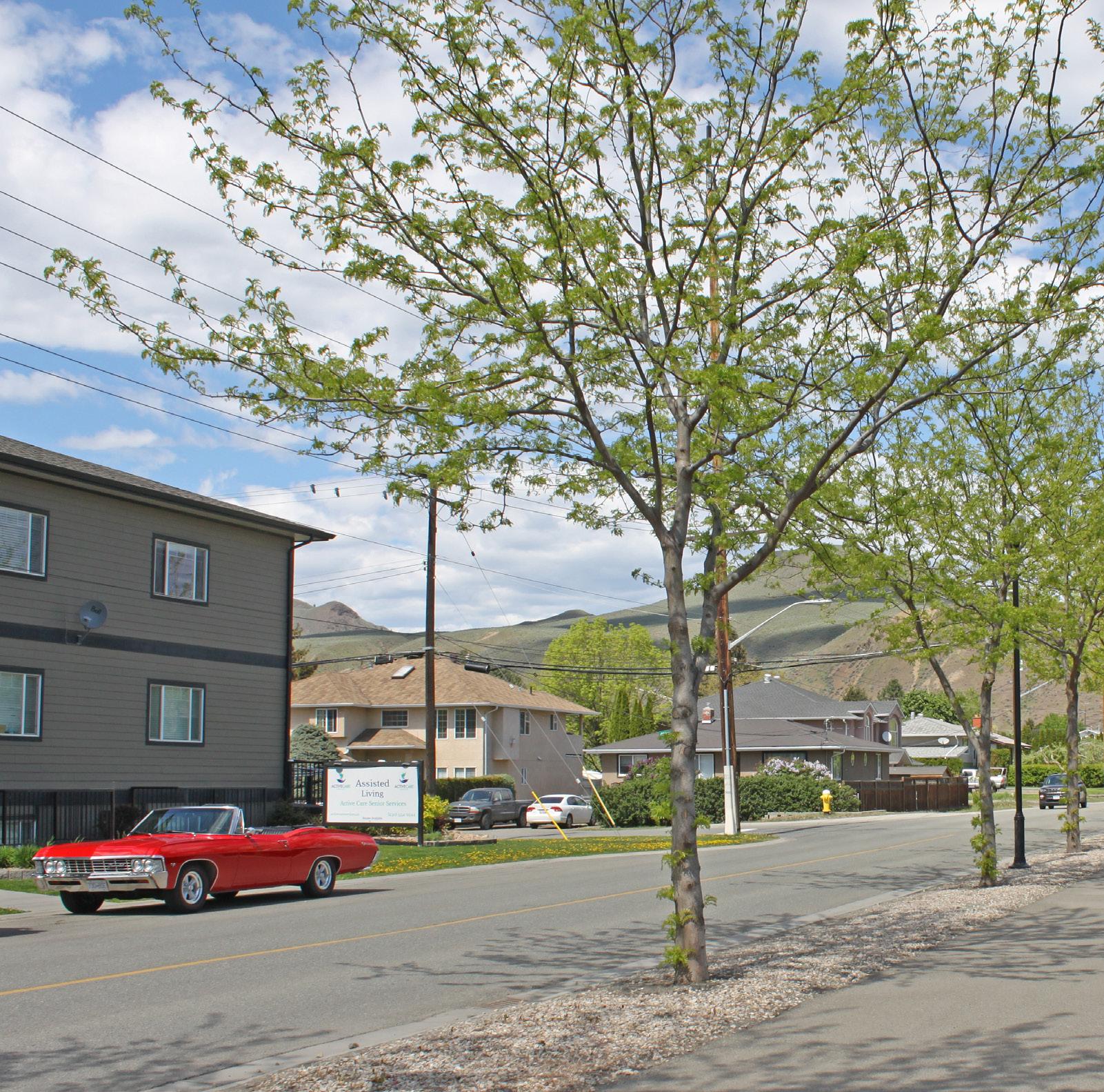
• To encourage sensitive infill opportunities that increase housing supply while preserving neighbourhood character.
• To consider small-scale commercial nodes in residential areas to improve walkability and access to commercial amenities.
• To improve safety and accessibility for pedestrians, cyclists, and transit users.
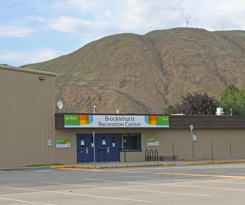
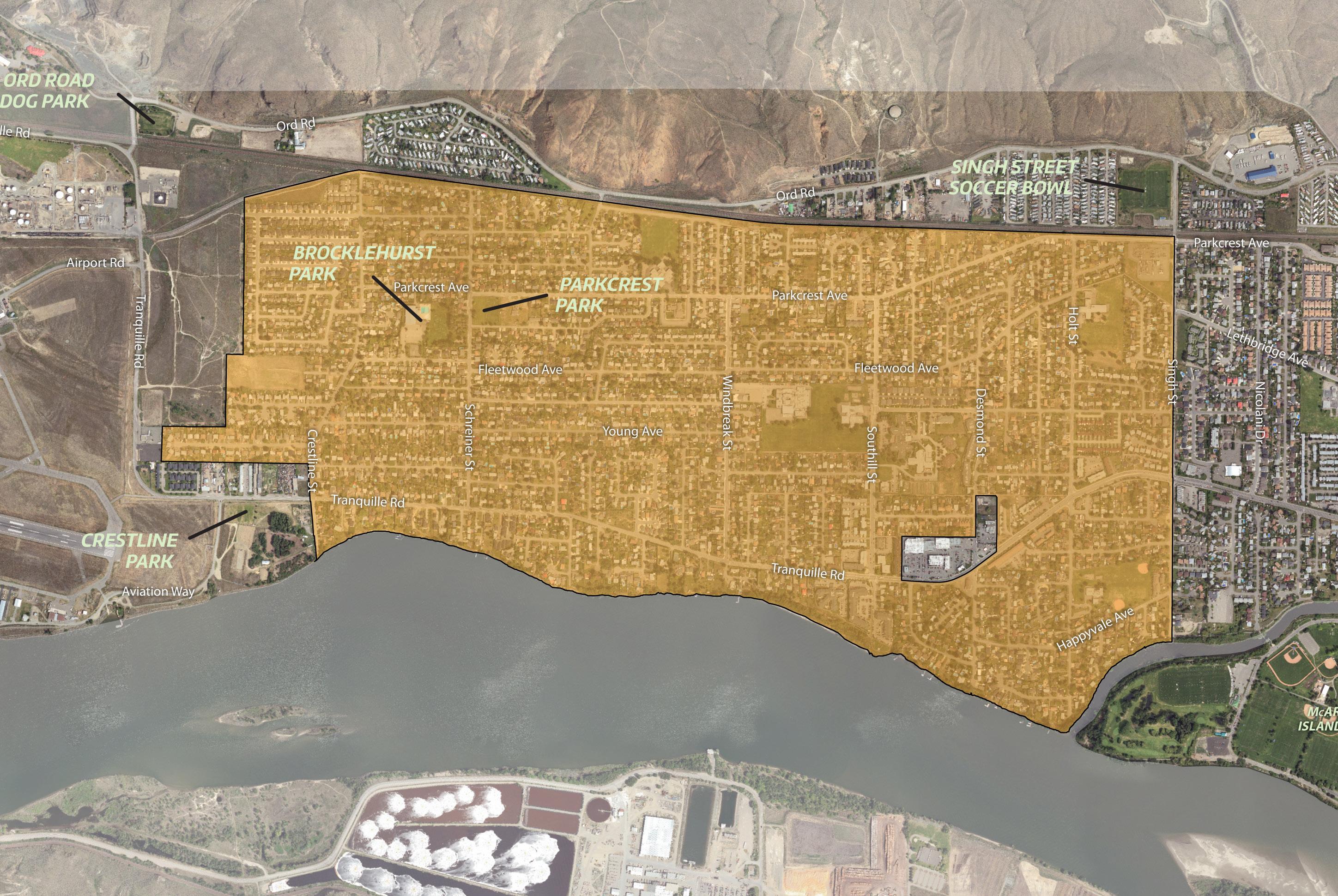
1 Support infill development that sensitively integrates with the neighbourhood, which may include small-lot residential infill, small-lot intensive duplexes, and residential suites. Above - ground garden suites will be considered if built up out of the floodplain.
2 Consider land assembly of corner lots and adjacent lots to facilitate low-density multi-family residential development, including row houses and stacked townhouses, where these housing forms can be sensitively integrated and can avoid providing parking access from arterial roads. Mid-block infill opportunities would be assessed on a case-by-base basis.
3 Support low- to medium-density multifamily residential, such as row houses, stacked townhouses, and apartments, near key amenities and the transit network, including on lots and land assemblies fronting Tranquille Road, Singh Street, Southill Street, and Windbreak Street or adjacent to Brocklehurst Centre, where these housing forms can be sensitively integrated and can avoid providing parking access from arterial roads.
4 Continue to support existing local-serving commercial amenities at the southeast corner of Parkcrest Avenue and Windbreak Street. Consider new or expanded commercial uses on this lot and/or adjacent lots if it can be sensitively integrated with adjacent homes.
5 Support new small-scale, local-serving commercial uses on corner lots and adjacent lots, such as a small grocer, café, or daycare, to provide key amenities within a convenient walking distance (400 m) for neighbourhood residents. This could be in the form of a repurposed single-family home or the redevelopment of an underutilized space.
6 Encourage the design of neighbourhood commercial development to reflect the single -family form of the surrounding area in order to minimize impacts to adjacent homes and better complement the existing character of the neighbourhood.
7 Explore opportunities to increase or enhance public waterfront access in conjunction with new waterfront development or capital projects, which may include improvements to pathways, wayfinding features, and lighting at the foot of public rights-of-way (e.g. Desmond Street, Holt Street).
8 Explore opportunities to obtain public access at the river’s edge where it is currently controlled through private ownership, where possible.
9 Ensure new waterfront development and waterfront public space improvements incorporate aspects of flood risk mitigation and/or adaptation and ecological restoration considerations in accordance with the Riparian Areas Regulation Development Permit Area Guidelines.
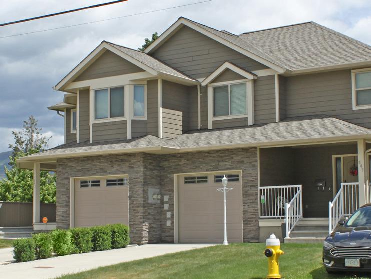
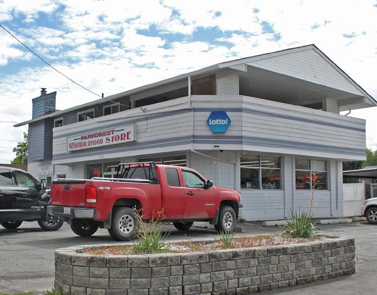
Youth Input (see policy 7): Holt Beach is a great place to meet up with your friends and play sports, go swimming, or lay under the sun.
10 Improve pedestrian and cyclist safety and connections with nearby commercial and community amenities, the Rivers Trail multi-use path network, and adjacent residential areas via the following as per the Transportation Master Plan:
10-1 New or improved pedestrian facilities along:
10-1-1 Briarwood Avenue
10-1-2 Fleetwood Avenue
10-1-3 Greenfield Avenue
10-1-4 Happyvale Avenue
10-1-5 McLean Street
10-1-6 Parkcrest Avenue
10-1-7 Southill Avenue
10-2 A multi-use path along Tranquille Road between Southill Street and Aviation Way
11 Continue to implement accessibility improvements at transit stops, including seating, lighting, accessible, paths, and concrete pads with room for wheelchair ramps and unloading areas.
12 Connect residents with the rest of the North Shore by creating safe, comfortable, and accessible crossings of Tranquille Road, Singh Street, and the CN rail corridor at the intersection of key pedestrian and bicycle routes to improve connections between adjacent residential areas.
13 Explore opportunities to implement traffic calming measures as part of future development and road improvement projects in the area, such as narrowing roads, adding more stop signs at intersections, reducing speed limits, providing more pedestrian-controlled crossings, and installing speed monitoring display signs.
14 Implement public realm and streetscape improvements along Tranquille Road from Crestline Street to Southill Street, such as new lighting, landscaping, active transportation infrastructure, and potential undergrounding of utilities, through identified capital projects and/ or as a condition of development approval to improve beautification as well as connectivity and safety for pedestrians and cyclists.
15 Explore opportunities to strengthen the connection and potential for shared recreational opportunities between Brocklehurst Park and Parkcrest Park, such as through improved wayfinding features, enhanced sightlines, and a formalized pedestrian crossing at Schreiner Street and Bossert Avenue.
16 Work with community partners to ensure community parks, such as Brocklehurst Park, provide the necessary amenities (e.g. electrical infrastructure) to support community events and identify opportunities for improvements where needed.
17 Work with School District No. 73 to rebuild Parkcrest Elementary and explore opportunities to improve pedestrian and cycling connections and crossings in the area to enhance safety and accessibility for students.
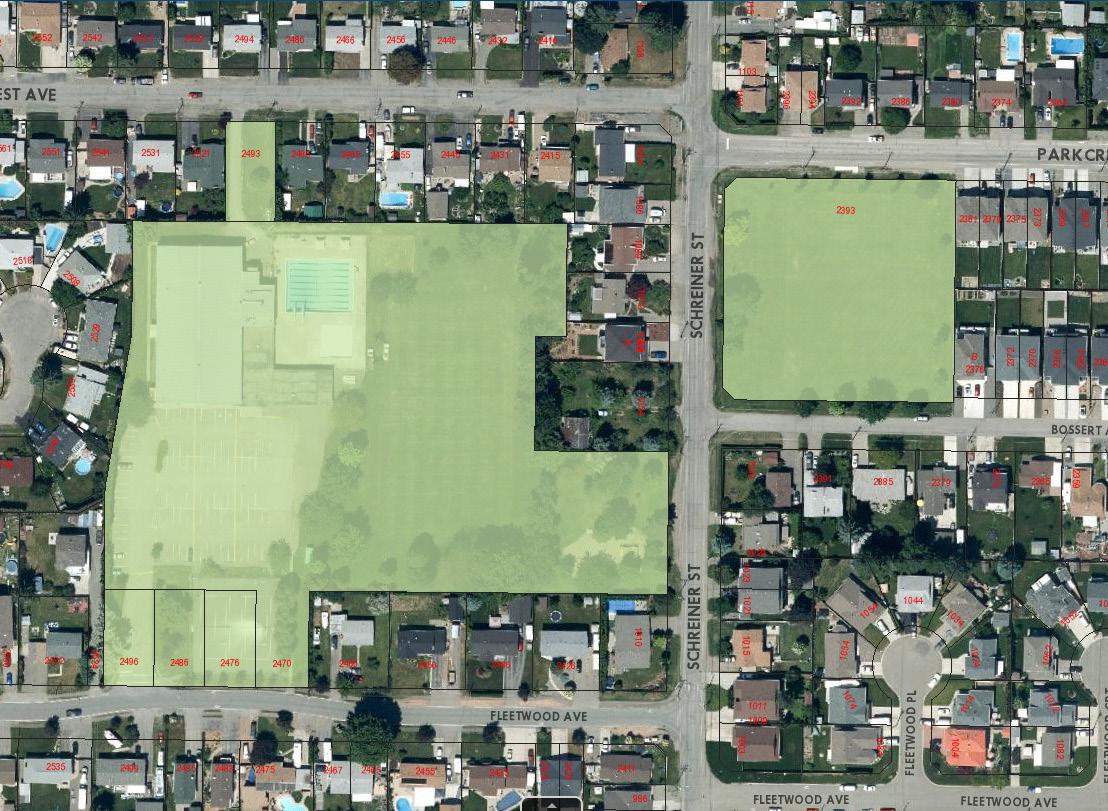
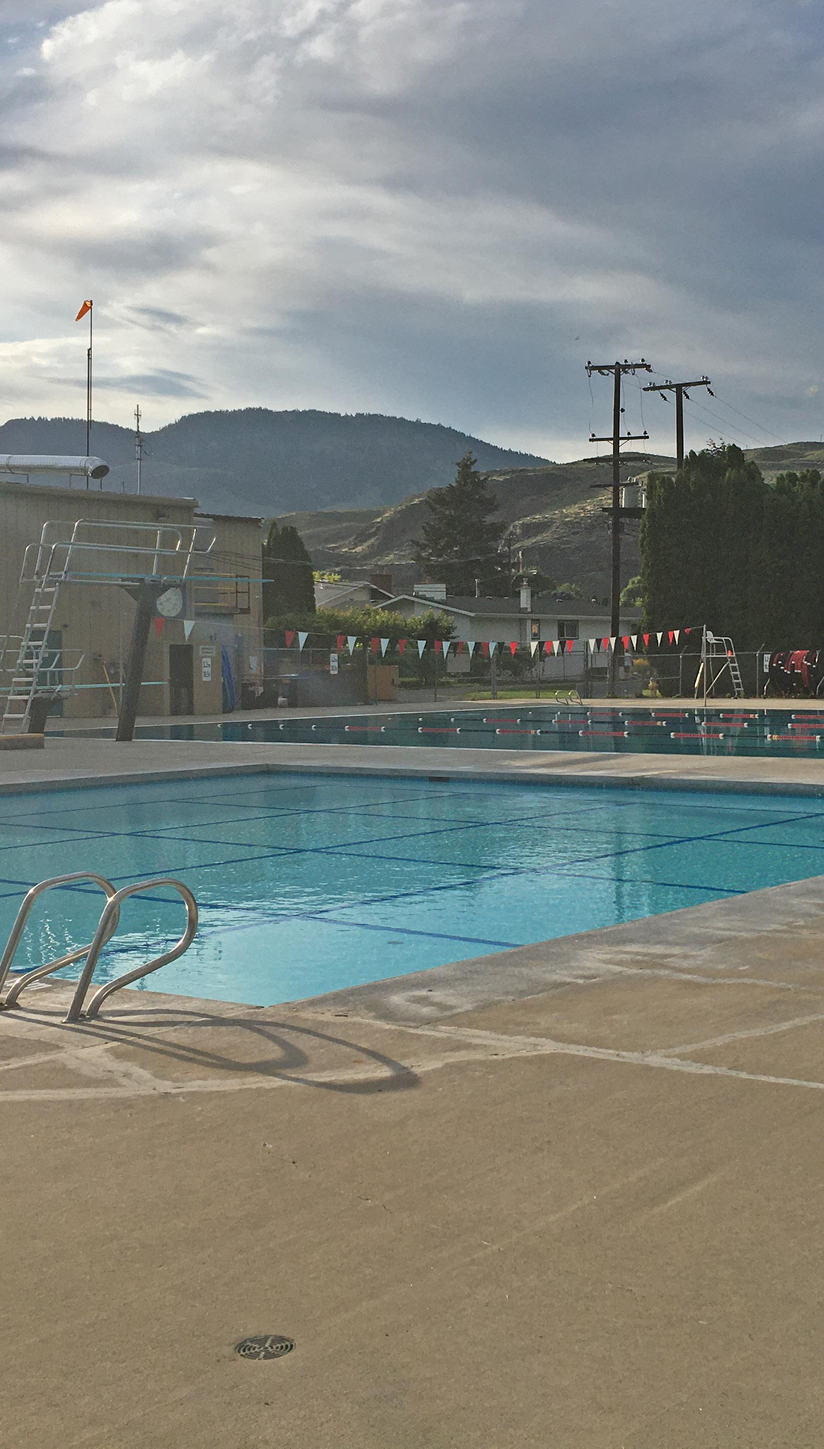
[THIS PAGE LEFT INTENTIONALLY BLANK]
The Ord Road corridor defines the northern extent of the plan area, where it borders the dry hills of the Lac du Bois Grasslands Protected Area. Ord Road is a designated truck route and one of the few major east-west corridors on the North Shore, with an eclectic mix of commercial, light industrial, recreational, and residential uses. Connectivity with the rest of the North Shore is impeded by a CN rail corridor, with access to Ord Road limited to three at-grade crossings (at Tranquille Road, McLean Street, and Singh Street) and the 8th Street overpass.
The intent for this corridor is to continue supporting the existing mix of uses while limiting residential density, improving connectivity and active transportation safety, and mitigating rail and truck traffic impacts.
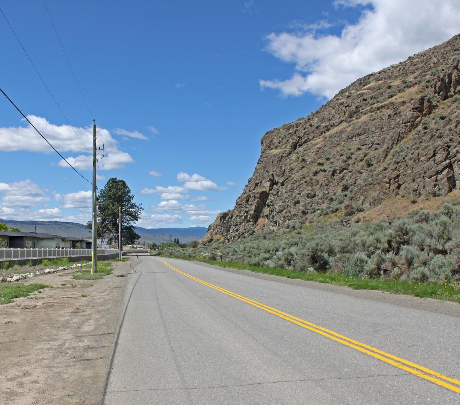
• To maintain commercial and light industrial employment areas while supporting limited residential development.
• To mitigate potential impacts on businesses and residents from truck traffic and rail corridor activity.
• To enhance connectivity with nearby amenities and improve safety and accessibility for pedestrians, cyclists, and transit users.

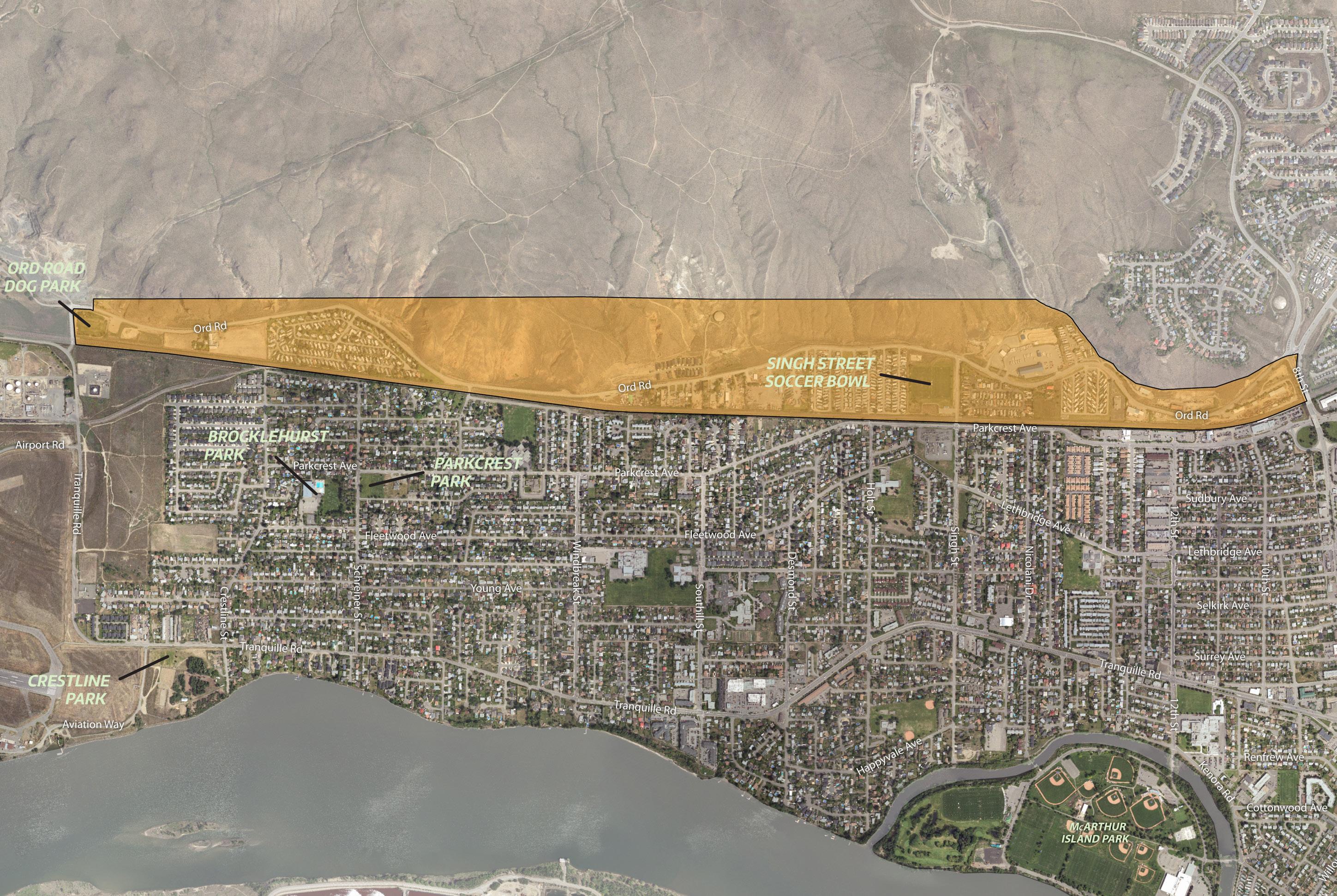
1 Continue to support a mix of employment- generating light industrial and service commercial uses along the Ord Road Corridor.
2 Continue to support new residential development where density is limited to 25 dwelling units per hectare or lower.
3 Ensure that new development complements or enhances the form and character of existing development. Where different land uses are located adjacent to one another, reduce the potential for land use conflicts through context-specific site and building design considerations, such as setbacks and landscape buffering.
4 Reduce potential truck route and rail corridor
5 Minimize the impact of auto-oriented commercial and industrial uses through site and building design that addresses pedestrian safety and enhances the public realm in accordance with the Commercial and Industrial Development Permit Area Guidelines in the Official Community Plan.
6 Support service commercial uses that cater to


Lac du Bois Grasslands Protected Area (see policy 12)

Explore opportunities to improve at-grade rail crossings for active transportation users in conjunction with new development or capital projects to enhance user safety and comfort, which may include improvements to pathways, signage, and lighting.
Improve pedestrian and cyclist safety and connections across the rail corridor and with key recreational amenities along Ord Road, including the Kamloops BMX Track, Singh Street Soccer Bowl, and Ord Road Dog Park, via the following new routes as per the Transportation Master Plan:
A pedestrian shoulder along the entire length of Ord Road
A pedestrian shoulder along McLean Street between Ord Road and Parkcrest Avenue
A multi-use path along Singh Street between Ord Road and Parkcrest Avenue
A shared bicycle route along Ord Road between 8th Street and Singh Street
A bicycle lane along Ord Road between Singh Street and Tranquille Road
9 Work with BC Transit to monitor and assess the need for a new transit route servicing Ord Road in order to accommodate future population growth and mobility needs in the area.
10 Support the upgrading of Ord Road, including the use of Development Cost Charges for funding, to accommodate commercial- and industrial-related truck traffic.
11 Evaluate the Ord Road truck route to determine the feasibility of upgrading it to support the movement of dangerous goods from the airport to Highway 5 via the Halston Avenue connector as per the Transportation Master Plan.
12 Explore opportunities to enhance recreational access to the Lac du Bois Grasslands Protected Area, such as through improvements to trail staging areas, wayfinding signage, and active transportation connectivity, in conjunction with new development and capital projects along the corridor.
8th Street provides the only grade-separated rail crossing to access Ord Road (see policy 7)
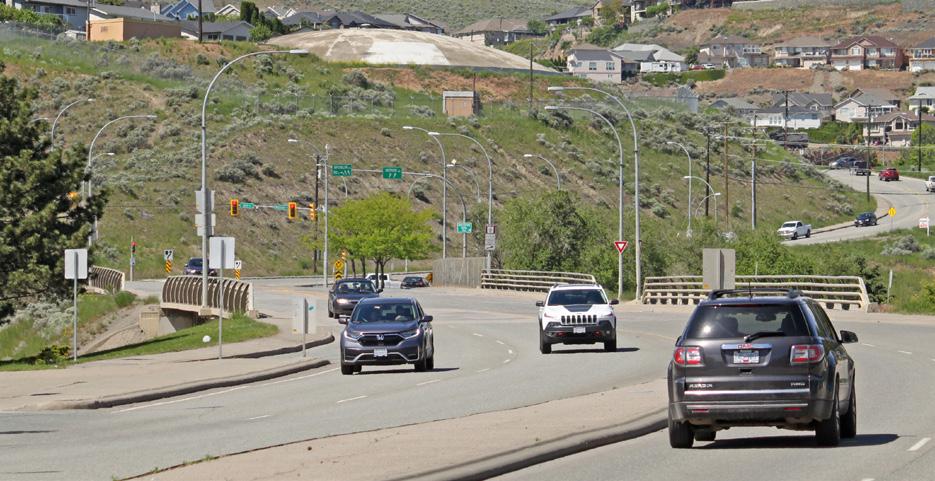
The Kamloops Airport is an important contributor to the city and regional economy, linking Kamloops with several regular and seasonal destinations, including major Canadian cities, and supporting hundreds of jobs and tens of millions of dollars in direct and indirect economic activity each year. The entry corridor area along Tranquille Road to the east of the airport, including the Brocklehurst West Future Development Area (FDA) identified in the Official Community Plan, is one of the last undeveloped areas on the North Shore and presents a unique opportunity for new commercial amenities, residential development, and streetscape improvements. The intent for the Airport Lands and Entry Corridor is to support airport-oriented and employment-generating development on Airport Road, complementary commercial and residential uses fronting Tranquille Road, and beautification improvements to provide a welcoming first impression to the North Shore.
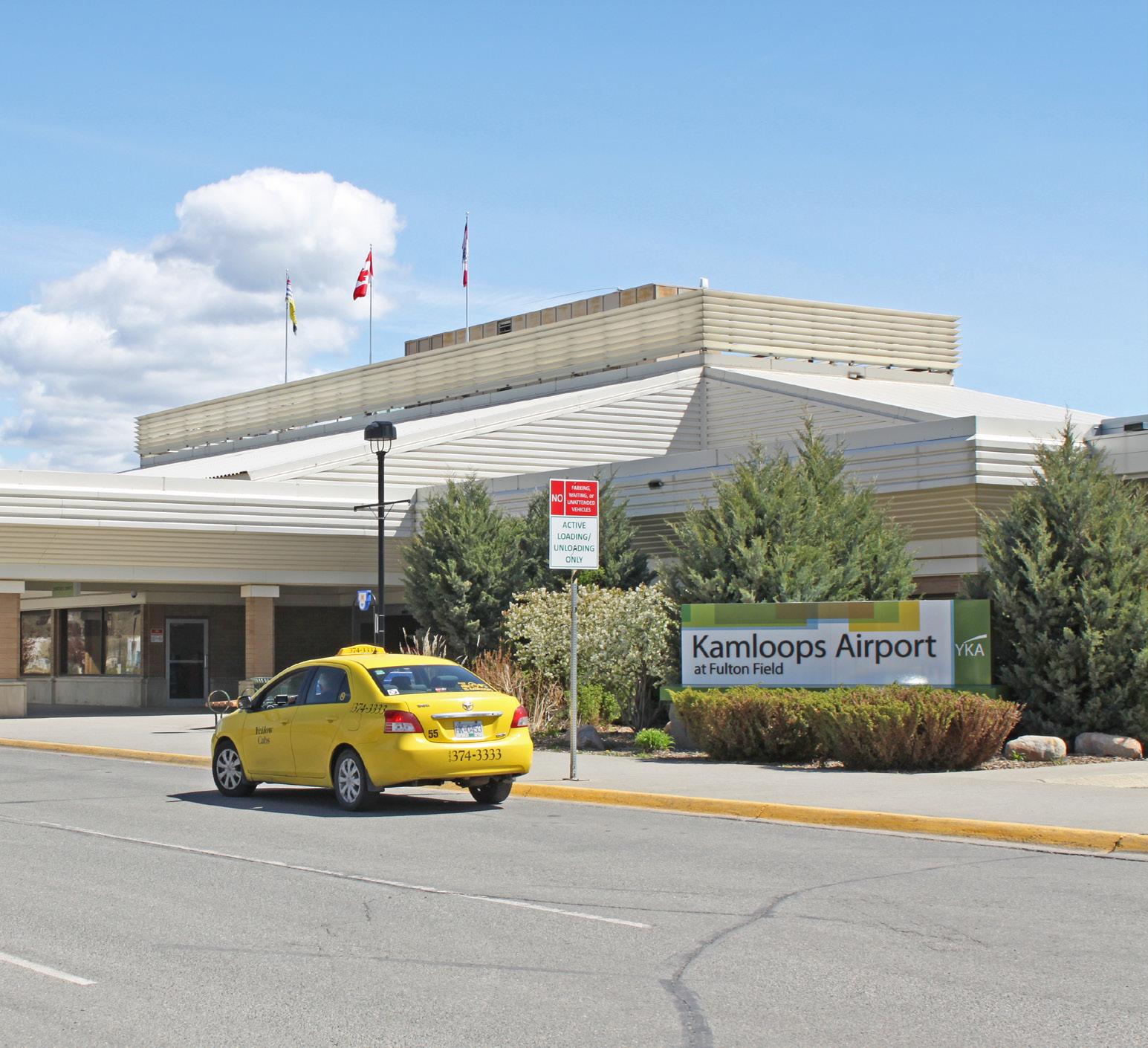
• To encourage land uses and improvements that enhance the airport as a gateway and economic driver for the city and region.
• To provide an attractive entry corridor to the city with adjacent land uses that integrate with surrounding residential areas while supporting the role and function of the airport.

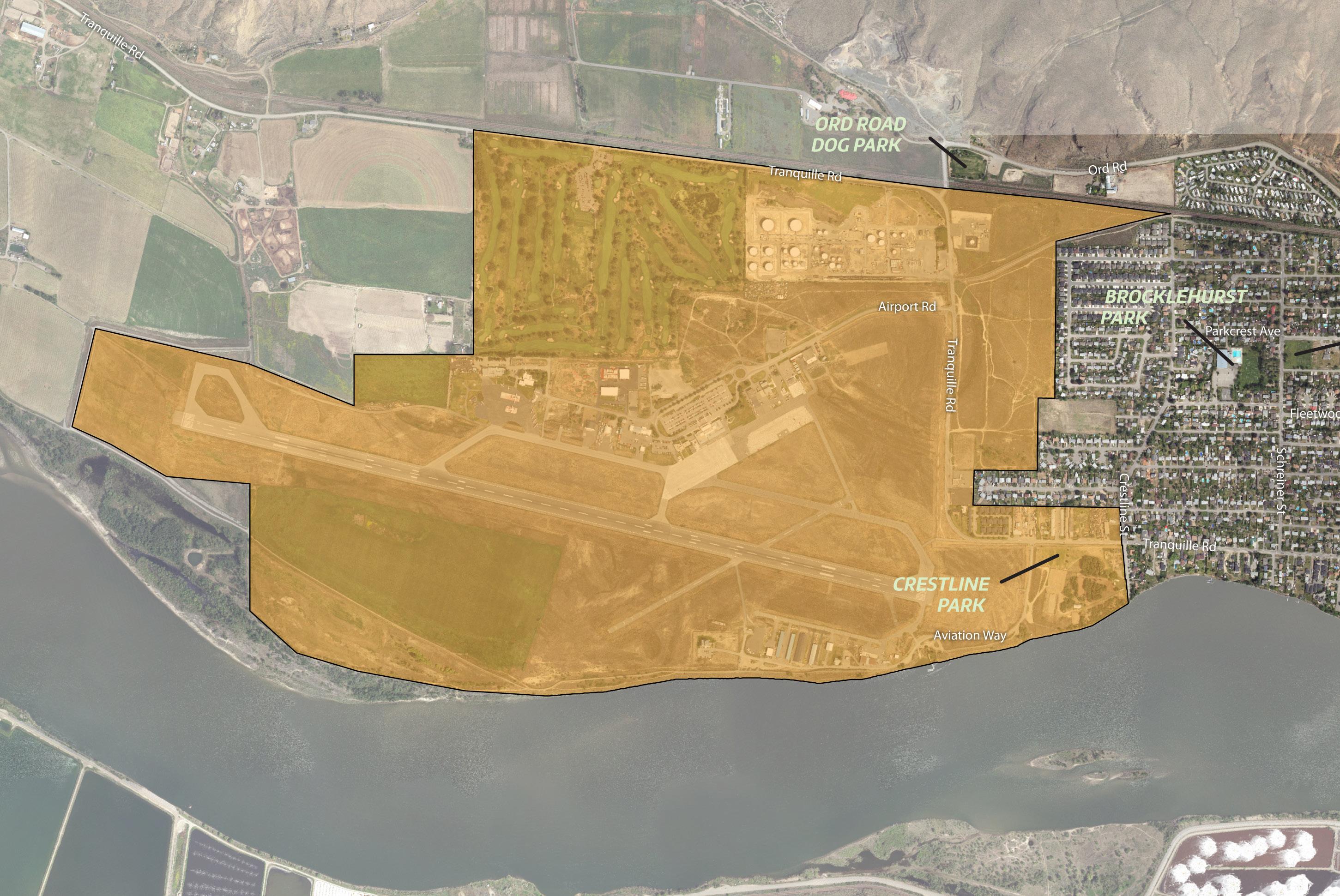
1 Support mixed-use (e.g. multi-family residential with ground-floor retail) and/or standalone commercial uses fronting the east side of the Tranquille Road entry corridor within the Brocklehurst West FDA to support potential tourism and airport operations while providing new housing options and commercial services for the surrounding neighbourhood.
2 Encourage commercial and industrial uses west of Tranquille Road within the Kamloops Airport lands that complement airport functions, contribute to employment, support economic development opportunities, and serve airport visitor needs, which may include tourist accommodation and service commercial uses.
3 Continue to support existing heavy industrial uses at the north end of Tranquille Road while ensuring any new development on adjacent sites integrates appropriate mitigation measures to reduce potential land use conflicts, such as exposure to noise, odours, and/or hazards. Within the Brocklehurst West FDA, this includes a minimum 10 m buffer strip or roadway between residential and industrial areas and a pedestrian buffer strip along the railway spur line as per the Official Community Plan.
4 Ensure new development within the Brocklehurst West FDA does not conflict with major utility corridors in the area while exploring opportunities to repurpose these corridors for compatible low-impact uses that benefit surrounding residents and businesses and contribute to corridor beautification.
5 Encourage a mix of low- to medium-density residential uses within the Brocklehurst West FDA east of the Tranquille Road commercial area to provide a transition in form and character with existing single-family housing areas in Brocklehurst.
6 Encourage the redevelopment of service commercial properties between Tranquille Road and Joyce Avenue to low- to medium-density multi-family housing to better integrate the entry corridor with the surrounding neighbourhood and increase opportunities for corridor beautification.
7 Ensure new development along the Tranquille Road entry corridor incorporates design strategies to improve sensitive integration with surrounding residential areas and limits providing parking access from arterial roads.
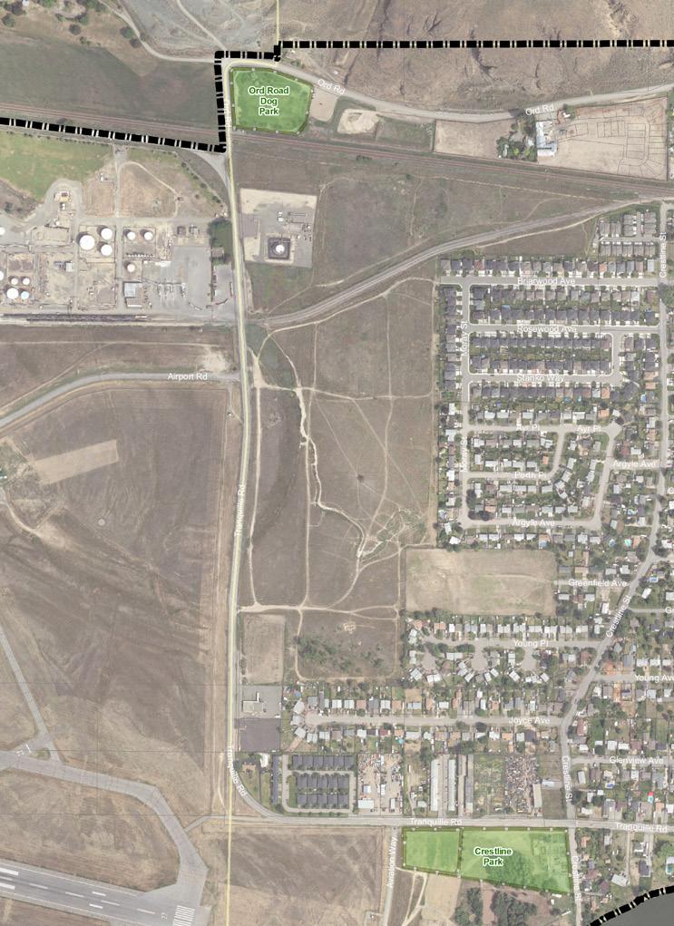
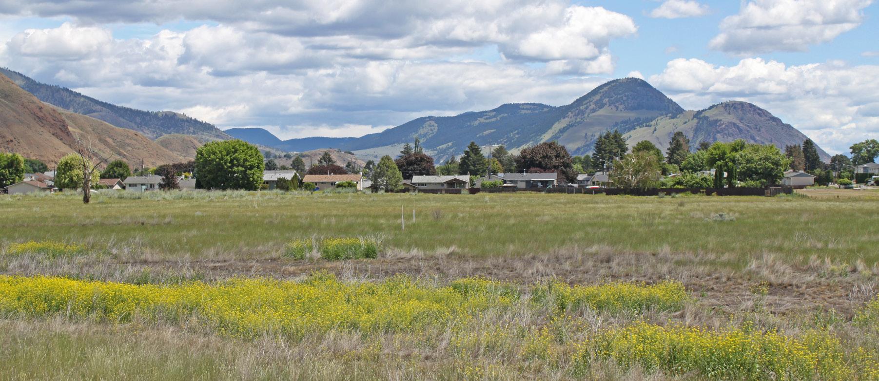
Rivers Trail and dike south of the airport (see policy 20)
Locate commercial retail uses on the ground floor to encourage pedestrian activity and complement the public realm.
Minimize the impact of auto-oriented commercial uses through site and building design that addresses pedestrian safety and enhances the public realm in accordance with the Commercial Development Permit Area Guidelines in the Official Community Plan.
Support arterial commercial uses that cater to the needs of visitors, airport employees, and residents living in the surrounding area and that minimize impacts on adjacent uses through screening and landscaping.
Evaluate the need for new and/or improved pedestrian crossings in the area in conjunction with new development and future capital projects to ensure pedestrian safety, wayfinding, and accessibility is adequately addressed.
12 Improve pedestrian and cyclist safety and connections with the airport and key recreational amenities, including Crestline Park and the Rivers Trail network, via the following new routes as per the Transportation Master Plan:
12-1 A multi-use path along Tranquille Road between Southill Street and Aviation Way
12-2 A bicycle lane along Tranquille Road between Aviation Way and Ord Road
13 Work with BC Transit to monitor and assess the need for a new transit route servicing the Kamloops Airport and Tranquille Road entry corridor, including the Brocklehurst West FDA, in order to accommodate future population growth and mobility needs in the area.
14 Ensure development does not significantly impact the traffic patterns of arterial roadways and consider reciprocal parking and access where appropriate.
15 Ensure the future road network within the Brocklehurst West FDA provides a minimum of two road connections between the Tranquille Road entry corridor and existing residential areas in Brocklehurst as per the Official Community Plan.
16 Continue to refer development applications for tall buildings to Nav Canada to ensure they conform to airport flight path requirements and safety regulations.
17 Implement public realm and streetscape improvements along the Tranquille Road entry corridor, such as new lighting, landscaping, active transportation infrastructure, and potential undergrounding of utilities, through identified capital projects, such as the Tranquille Sanitary Upgrade from Crestline Street to Southill Street, and/or as a condition of development approval to improve beautification as well as connectivity and safety for pedestrians and cyclists.
18 Encourage the use of gateway features, such as landmark structures, signage, and landscaping, on airport lands adjacent to Airport Road and Tranquille Road to enhance the economic and tourism potential of the area and create a more welcoming and attractive first impression for visitors.
19 Work with the Kamloops Airport Authority Society on the development of the new Fulton Field Park and Captain Jennifer Casey Memorial to ensure it meets the needs of the airport, addresses corridor beautification objectives, and is well integrated with the area’s other recreational opportunities and active transportation network.
20 Continue to support use of the Rivers Trail and dike system along the south side of the airport for recreational enjoyment and work with the Kamloops Airport Authority Society to implement any future identified improvements to trail sections, staging areas, or other supporting infrastructure.
21 Explore opportunities to enhance recreational amenities in Crestline Park to meet changing resident needs as new growth and development occurs in the area. Continue to support the existing Crestline Community Garden and Aviation Way Dog Park.
22 Continue to support the Kamloops Golf & Country Club as a recreational activity for residents and visitors while exploring opportunities to enhance its environmental benefits as a green space, including its potential for providing wildlife habitat, green infrastructure services (e.g. stormwater treatment), and flood risk mitigation (e.g. retention ponds).
23 Identify and implement a new neighbourhood park site as a condition of development approval within the Brocklehurst West FDA as per the Parks Master Plan and Official Community Plan.
24 Work with School District No. 73 and landowners within the Brocklehurst West FDA to ensure future development of the adjacent vacant school site parcel accommodates anticipated growth and community needs in the area while providing opportunities to improve active transportation and vehicle connections between Tranquille Road and existing residential areas in Brocklehurst.
[THIS PAGE LEFT INTENTIONALLY BLANK]
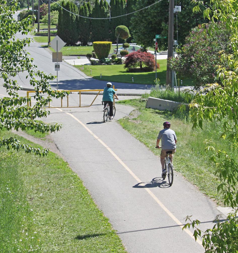
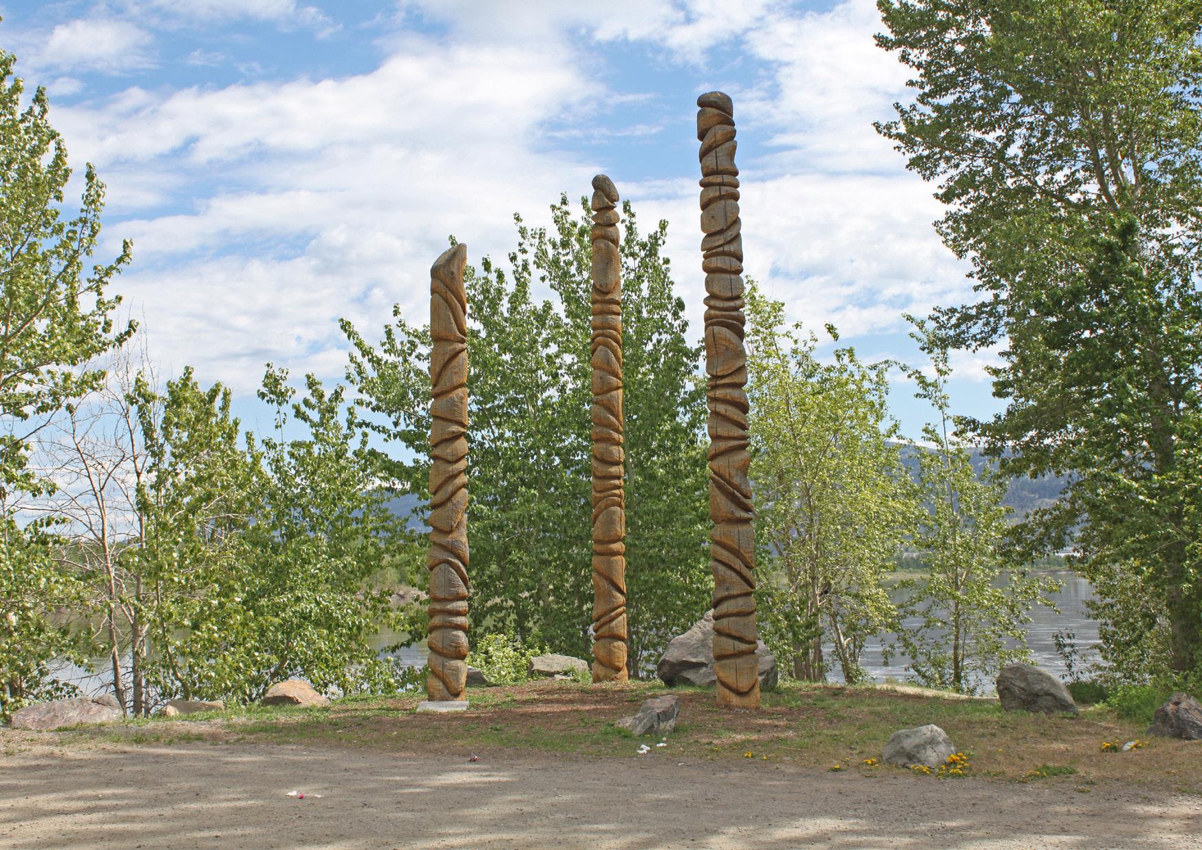
The North Shore Neighbourhood Plan covers eight diverse topic areas that provide guidance on matters that further support the land use directions in this plan. This section describes each topic and the goals and policies for each.
The topic areas include general policies that apply to the entire North Shore plan area, unless otherwise stated, and provide additional guidance to help achieve the vision presented within the North Shore Neighbourhood Plan.
The eight topic areas are the following:
• Transportation and Mobility
• Infrastructure and Environment
• Housing
• Parks and Public Places
• Arts, Culture, and Heritage
• Economic Development
• Health and Safety
• Food Security
This section links to all of the guiding principles.
To establish a sustainable transportation network in the plan area as it continues to grow over the next 20 years, this section includes policies related to transportation infrastructure, facilities, and choices that support the hierarchy of transportation modes established within the Transportation Master Plan (TMP) and Official Community Plan (KAMPLAN). The intent is to create a North Shore transportation network that prioritizes safety, accessibility, and comfort for pedestrians, cyclists, and transit users while reducing vehicle emissions and maintaining efficient use of the road network through effective traffic and parking management.
Policies within this section are organized under the following topics:
• Accessibility
• Sustainable Transportation
• Traffic Management
This section links to the following principles:
• Welcoming Mixed-Use Districts
• Connecting Corridors
• Community Well-Being
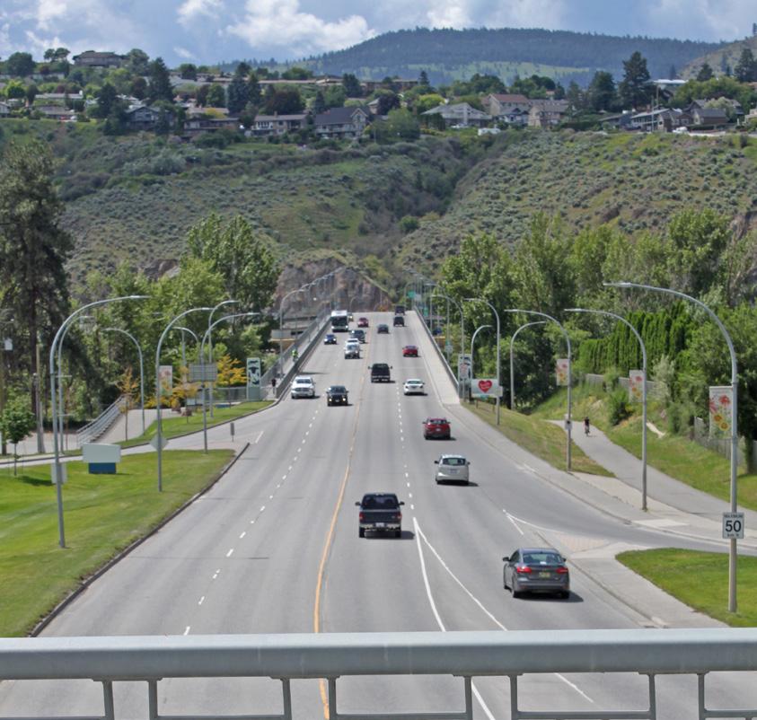
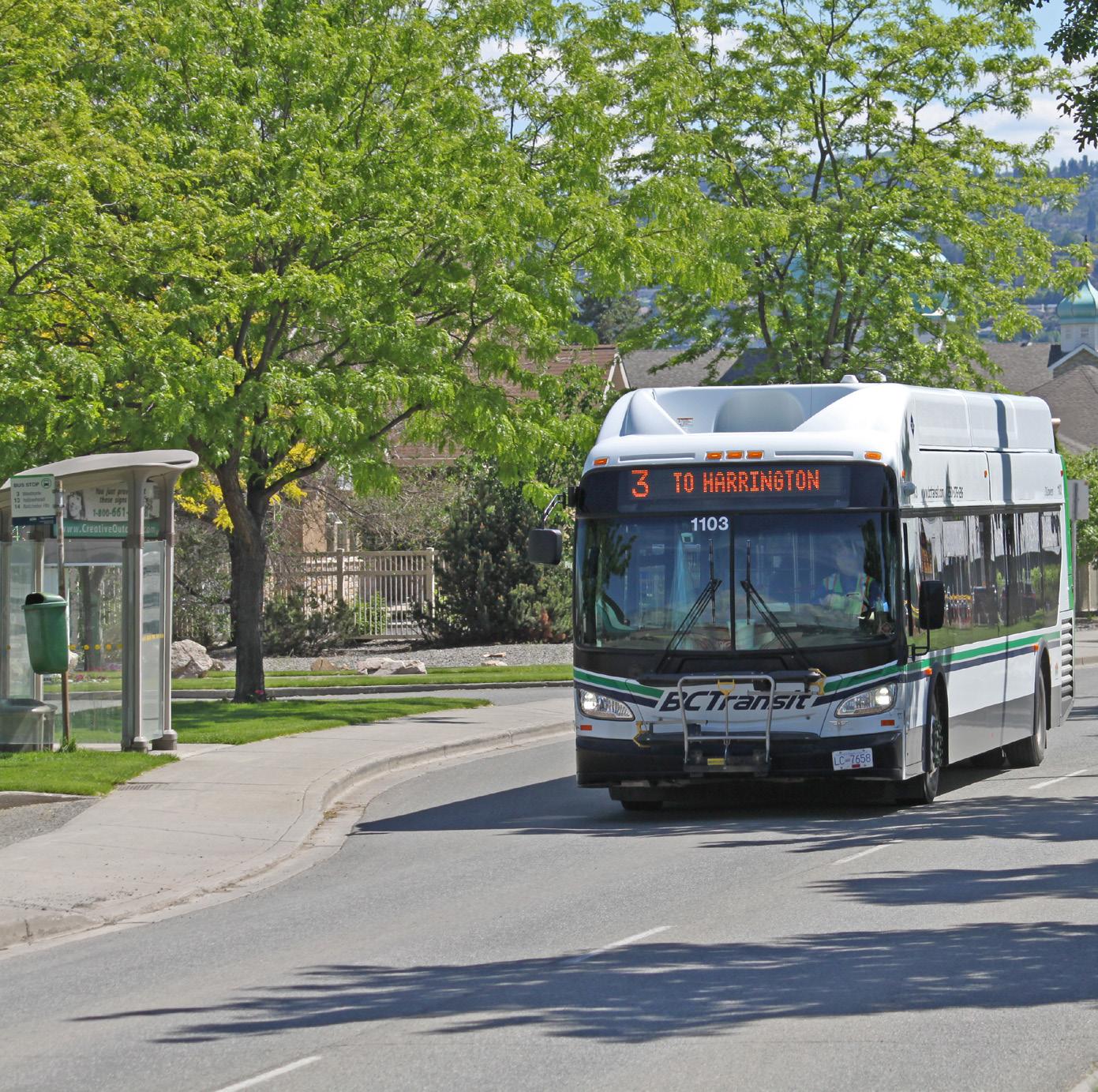
Example of tactile wayfinding surface indicator at the top of stairs (see policy 5)
GOAL: Create a transportation network on the North Shore that is sustainable, safe, accessible, and efficient.
1 Improve accessibility and safety for residents and visitors of all ages and abilities as per the City’s Accessibility and Inclusion Plan, by:
1-1 Closing gaps in the sidewalk network in coordination with new development and capital projects
1-2 Adding curb let-downs from sidewalks at intersections
1-3 Adding audible traffic signals at intersections with traffic lights
2 Accommodate transit riders of all ages and abilities by adding weather protection, seating, lighting, and universal design features at bus stops and shelters of highest use in the plan area, including adding accessible paths/sidewalks to bus pads located on gravel shoulders.
3 Continue to provide accessible parking stalls in proximity to key public gathering places, including plazas, parks, and civic facilities.
4 Incorporate universal design elements into asset management planning for future improvements to civic assets, including sidewalks, bicycle lanes, roads, plazas, and recreational and cultural facilities.
5 Enhance visibility and user-friendliness of active transportation connections by incorporating wayfinding features along key pedestrian and cycling routes and access points, which may include pedestrian and/or cycling signals, tactile differentiation of pathways and connections, and timely repainting and maintenance of existing pathway and crosswalk paint lines.
6 Continue to require landowners to clear snow and ice from sidewalks as per the Road Rightof-Way Usage Bylaw. Prioritize municipal snow and ice clearing of active transportation infrastructure adjacent to or located on City- owned property to increase the viability and safety of walking or cycling for commuters during winter months.
7 Incorporate Crime Prevention Through Environmental Design principles into the design of new and/or upgraded existing pedestrian and cycling routes to enhance safety, security, and comfort for users.
8 Identify informal pedestrian and cycling pathways and assess potential to provide and construct formal active transportation infrastructure to support existing pedestrian and cycling needs. Where presence of private property exists that prevent access by pedestrians or cyclists, consider alternative routes that may fulfill connection needs via public road or lands.
9 Continue to identify and implement opportunities to reduce points of conflict between railway and other modes of transportation throughout the North Shore, particularly at grade-level crossings.
10 Take an equity-based approach to prioritize the implementation (i.e. timing and location) of new active transportation routes and infrastructure improvements, including evaluation of socio - demographic and spatial considerations, such as age, income, and residential density.
11 Ensure pedestrian needs are addressed and prioritized as part of new development and capital projects, particularly in areas with complementary land uses and supporting density, to reduce reliance on private automobiles and align with the City’s Hierarchy of Transportation and Mobility Priorities.
12 Continue to require streetscape improvements where identified in City plans and strategies as a condition of development approval, and develop streetscape improvement plans where needed to support a pedestrian-friendly, accessible, and safe community for residents and visitors.
13 Install new and/or improved pedestrian infrastructure, as identified in Section 9, Map 1, to provide a more connected pedestrian network throughout the plan area. Repair existing sidewalks and pedestrian infrastructure in a timely manner where structural safety is noted or reported.
14 Support a more pedestrian-friendly environment by incorporating decorative and/or wider sidewalks, street trees, seating, wayfinding features, and other design elements in future development and road improvement projects in areas of high pedestrian activity.
15 Prioritize grade-separated sidewalks over other types of pedestrian facilities when implementing new or improved pedestrian routes along arterial roads, truck routes, and other high-traffic corridors to reduce the potential for pedestrian-vehicle conflicts.
16 Explore opportunities to increase the separation between pedestrian shoulders and adjacent roadways to enhance pedestrian safety and comfort. Where feasible, this may include locating parking lanes and/or physical barriers, such as concrete curb stops or landscaping, to provide a buffer between pedestrian shoulders and active roadways.
17 Require that new developments provide a sidewalk on at least one side of the roadway as per the Transportation Master Plan.
18 Continue to explore strategies to make roads safer for pedestrians by using traffic calming, signalized crosswalks, and stop - controlled crossings where appropriate.
19 Continue to prioritize implementation of new and/or improved pedestrian facilities at school sites to facilitate safe and accessible connections for students and families in alignment with the goals of the Safer Schools Program.
Figure 5.1 » City of Kamloops Hierarchy of Transportation and Mobility Priorities
Curb stops provide a buffer between pedestrians and vehicle traffic on McArthur Island (see policy 16)
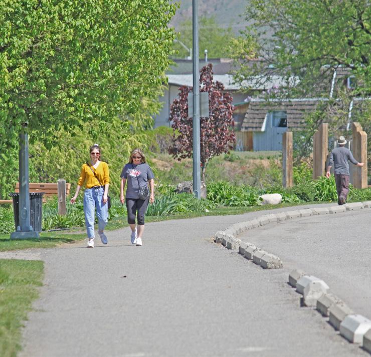
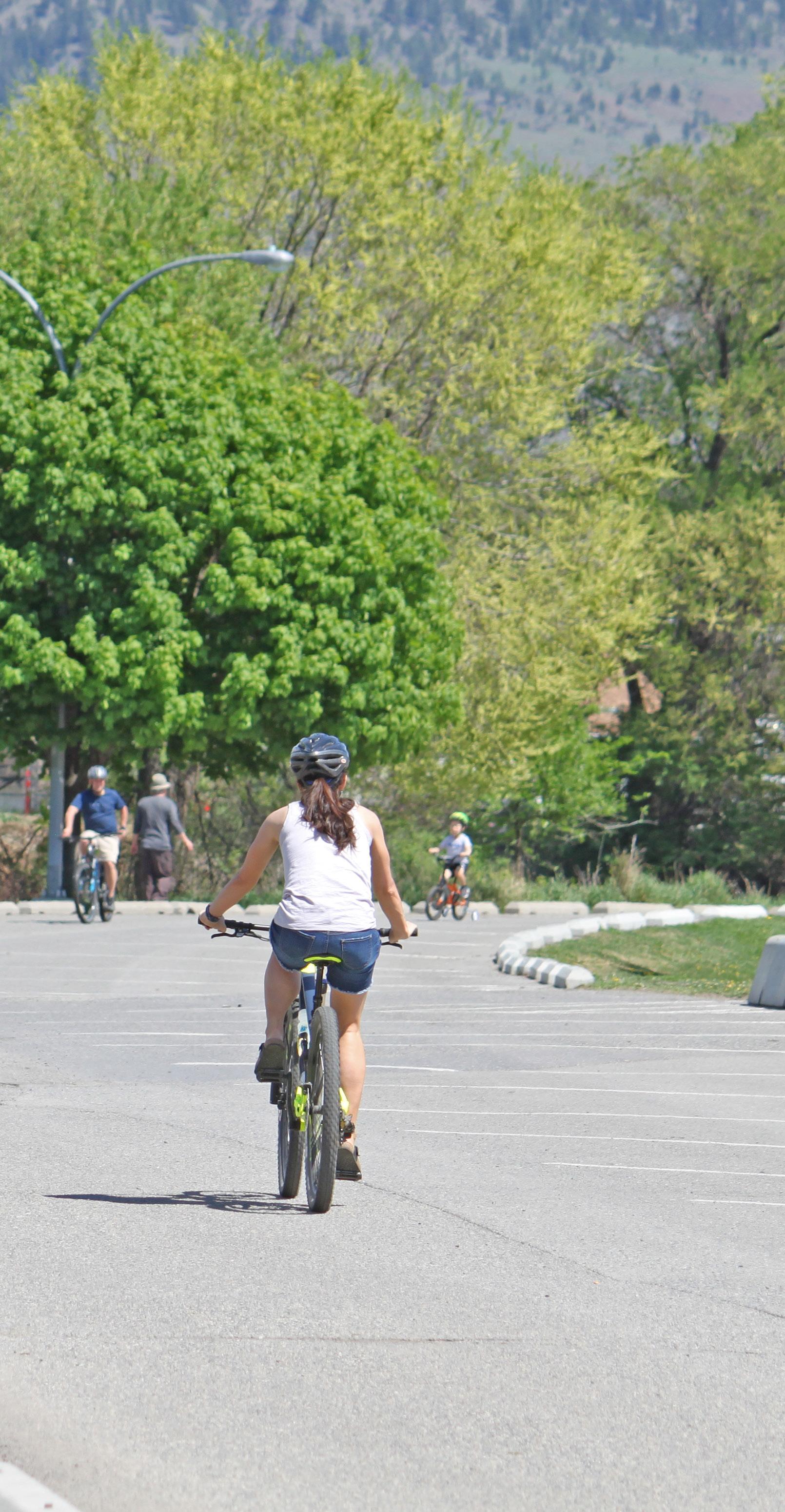
Implement new and/or improved bike routes, as identified in Section 9, Map 2, to provide key east-west and north-south corridors that enhance connections across the plan area and improve citywide connectivity.
Complete an assessment of the Rivers Trail crossing of the Overlanders Bridge to determine its current and long-term suitability as the principal active transportation connection between the North Shore and South Shore, taking into consideration existing and projected user volumes, safety, accessibility, and maintenance (e.g. snow clearing) needs. Identify potential improvements and/or alternative routes to ensure adequate standards can continue to be
Enhance cycling infrastructure through the use of wayfinding features, bicycle repair stations, and bicycle parking racks to help cyclists navigate the bicycle network to key destinations throughout the plan area, including commercial centres, parks, schools, civic facilities, and the transit
23 Continue to build and extend bike routes in conjunction with new development and capital projects as required with the goal of closing existing gaps in the network and prioritizing completion of identified major east-west and north-south connections.
24 Explore the feasibility of constructing separated bicycle lanes when identifying new bicycle routes, particularly for routes along high-volume corridors and/or truck routes, to improve user safety and comfort.
25 Encourage end-of-trip facilities for cyclists in commercial and institutional development and at major employment locations, such as Northills Mall, the McArthur Island Sport and Event Centre, and Brocklehurst Centre, to accommodate cycling as a viable mode choice for commuters.
Youth Input:
Have more safe and direct bike paths that are clearly labelled for bikers and drivers.
26 Consider extending off-peak transit service from the North Shore Transit Exchange to Lansdowne Village Transit Exchange and TRU Transit Exchange to provide additional sustainable transportation options for evening shift workers, nightlife business patrons, and students.
27 Consider the use of transit signal priority and bus queue jump lanes along North Shore bus routes to make transit a more convenient, reliable, and attractive mode choice.
28 Review impacts of new development and capital projects on transit circulation on the North Shore and consider amending routes as necessary to maximize efficiency and minimize trip times for transit riders.
29 Continue to integrate transit facilities, including bus stops, shelters, and exchanges, with pedestrian and cycling infrastructure and wayfinding features to support an interconnected sustainable transportation network for users of all ages and abilities.
30 Encourage compact and well-connected transit- oriented development around the North Shore Transit Exchange that offers a complementary mix of uses to better support existing and encourage greater transit ridership.
31 Ensure the transit network continues to provide bus stops within a convenient walking distance (400 m or less) of entrances to McArthur Island to support transit access for recreational use, community programs, and special events.

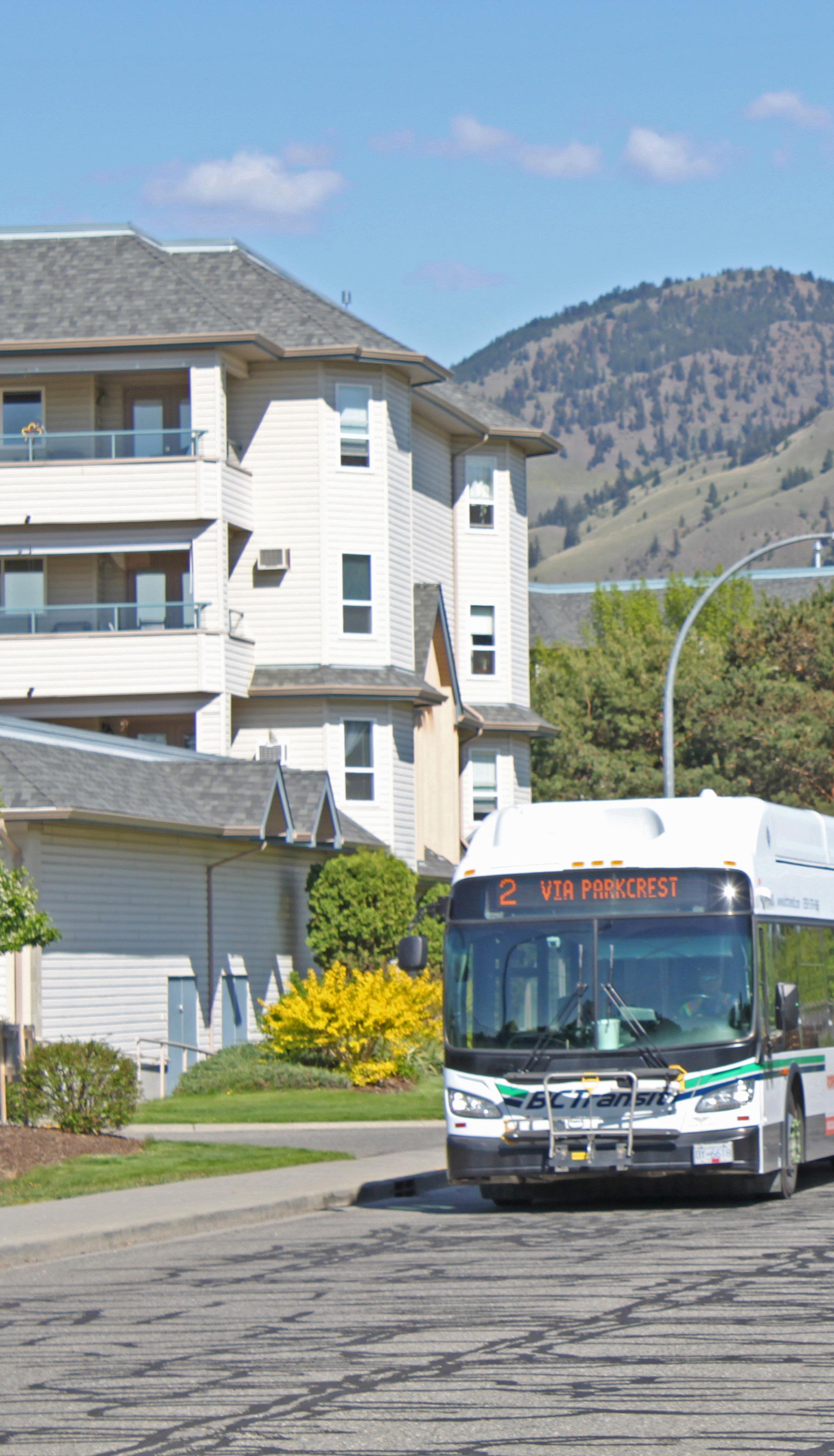
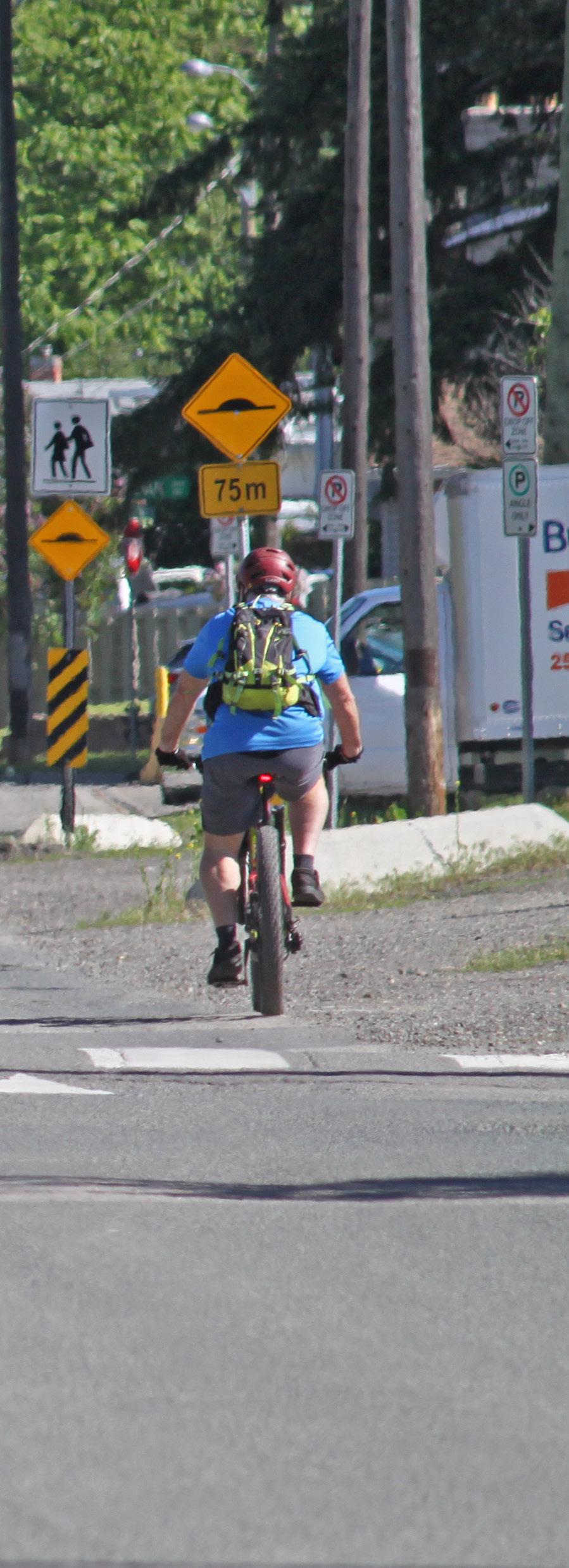
Electric Vehicles & Transportation Demand Management
32 Provide and promote municipal top-up contributions to existing financial incentives that support retrofitting of existing residential and commercial buildings to add electric vehicle charging infrastructure as per the City’s Electric Vehicle and Electric Bike Strategy.
33 Identify suitable areas on the North Shore for the installation of public electric vehicle charging infrastructure, including at key City facilities or on-street locations, to support the transition to clean-energy vehicles as per the City’s Electric Vehicle and Electric Bike Strategy.
34 Support the electrification of all transit fleet vehicles by 2040 in alignment with BC Transit’s Low Carbon Fleet Program and the CleanBC Plan.
35 Encourage residents to transition to more sustainable transportation modes through implementation of the Transportation Master Plan, including enhancements to sustainable transportation services and facilities; wayfinding improvements; a ride-matching service; car share and bike share programs; and secure, publicly accessible end-of-trip bicycle storage amenities.
36 Educate the public on the City’s anti-idling regulations, alternatives to private vehicle use, and resources available to residents through educational outreach and awareness campaigns.
37 Consider implementing traffic calming measures on local roads within residential areas as part of future development and road improvement projects in accordance with City traffic calming guidelines. Potential focus areas include streets adjacent to pedestrian-oriented amenities, such as parks, schools, recreational pathways, and community facilities, to reduce the potential for pedestrian-vehicle conflicts.
38 Require new medium- and high-density mixed-use, multi-family, and commercial development to provide access to off-street parking from the lane, where feasible, or a non-arterial street, and to locate structured parking underground. Where underground parking is not feasible, it should be screened and/or sited in such a manner to not be visible from the street as per the North Shore Development Permit Area Guidelines.
39 Encourage shared parking facilities, including underground facilities, between adjacent and/or multi-phase developments to reduce vehicular access points and potential for pedestrian-vehicle conflict.
40 Encourage developers of multi-family residential buildings to sell or lease surplus parking stalls unbundled from dwelling units to increase off-street parking options for North Shore businesses and residents.
41 Implement parking management strategies (e.g. time limits, pay parking, and/or permit parking) in areas of increasing residential density to address the long-term parking needs of the North Shore, including the recommendations of the Parking Management Plan specific to the Tranquille Market Corridor.
42 Explore opportunities to incorporate more secured parking and charging infrastructure for bicycles and other micromobility devices at key transportation nodes, cultural and recreational facilities, and major commercial developments to facilitate cycling and other mobility options as viable mode choices.
Micromobility devices:
A range of small, lightweight vehicles, such as (electric) bicycles, scooters, and skateboards, that typically transport single individuals at lower speeds than automobiles.
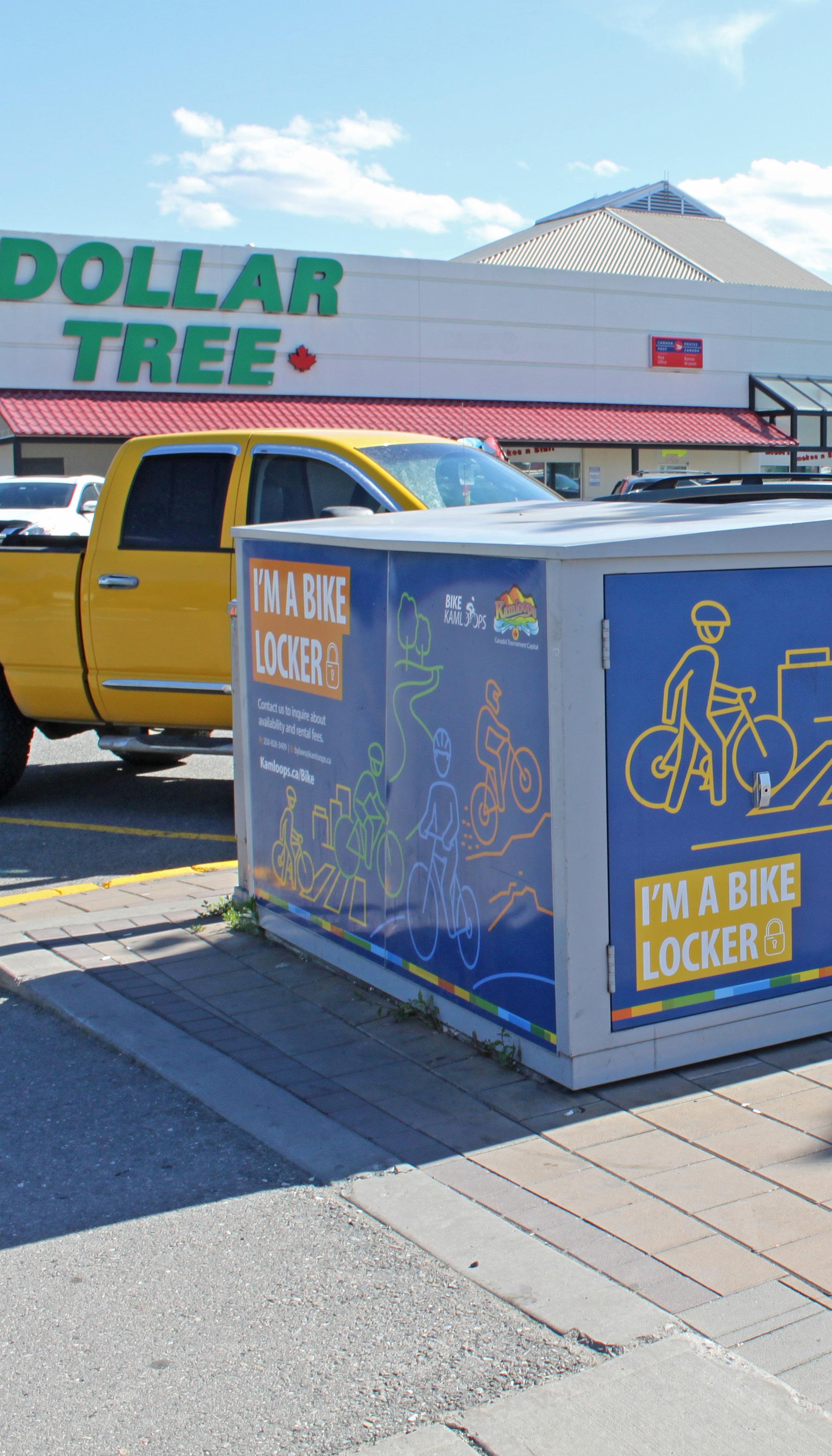
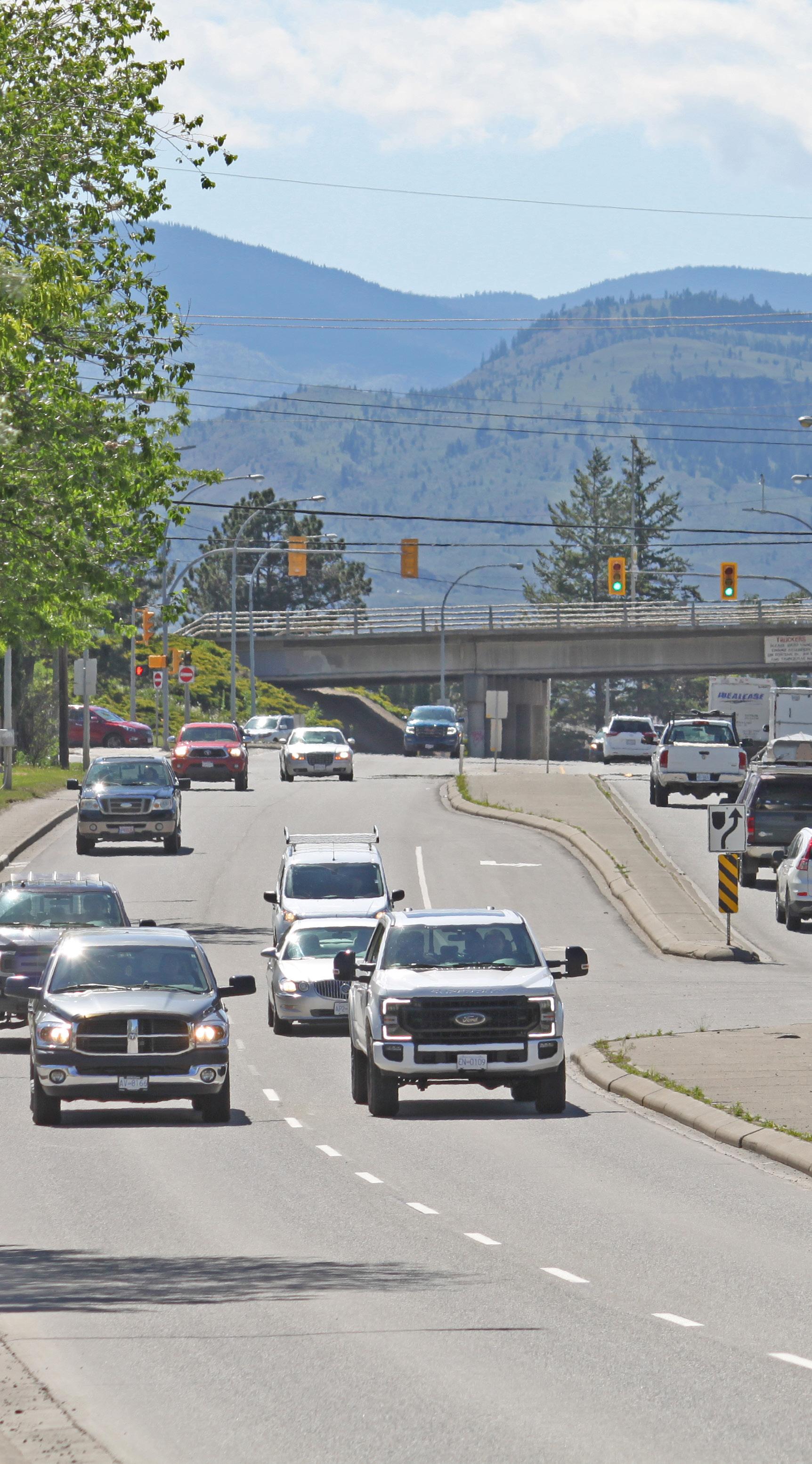
Consider all travel modes (pedestrians, cyclists, transit riders, drivers of private vehicles, and commercial vehicle operators) in future road improvement projects in the plan area, and manage traffic flow to minimize conflict and enhance road safety.
Explore the potential to amend the City’s truck route network, including the dangerous goods route, to reduce impacts on dense urban neighbourhoods while allowing for the safe and efficient movement of goods and services.
Encourage uses that are anticipated to generate higher volumes of truck traffic to locate along designated truck and dangerous goods routes.
Undertake studies to confirm the preferred location, feasibility, and other technical considerations of a second bridge crossing of the Thompson River, taking into consideration the impact on land use; local and regional mobility; and commercial, industrial, and goods movement.
47 Continue to ensure that access and capacity for emergency vehicles and commercial vehicle loading is maintained in future public projects and private development in the plan area.
48 Monitor traffic demands at key intersections and consider improvements, where necessary, to better manage traffic flow, ensure mobility of goods and emergency services, minimize conflict, and enhance road safety.
49 Continue to acknowledge that congestion will occur as part of urban growth and seek solutions to improve and provide sustainable transportation options for residents to offset congestion, emissions, and parking demand.
50 Implement road safety strategies within the North Shore's high crash corridors, such as Tranquille Road, 8th Street, and Fortune Drive as per the directions in the City's Vision Zero Strategy & Action Plan.
[THIS PAGE LEFT INTENTIONALLY BLANK]
A key component of managing growth and land use in the plan area is balancing development in a manner that maintains and enhances the health of natural ecosystems while addressing key issues such as climate change, energy efficiency, and waste reduction to improve overall livability. The policies in this section support a reduction in greenhouse gas emissions from vehicles and buildings, diversion of organic waste and construction waste from landfills, effective stormwater management, enhancement of greenspaces, and expansion of the urban forest.
Policies within this section are organized under the following topics:
• Energy and Emissions
• Natural Environment
• Servicing and Utilities

This section links to the following principles:
• Welcoming Mixed-Use Districts
• Embrace the Waterfront
• Community Well-Being
GOAL: Manage infrastructure
sustainably and efficiently to address the needs of future residents and mitigate impacts on the environment.
1 Continue to identify opportunities and incentives to improve energy efficiency in new buildings while mitigating additional construction costs as the Province transitions to the BC Energy Step Code, wherein all new buildings must be net-zero energy ready, or 80% more efficient than the current BC Building Code, by 2032.
2 Consider implementing the higher steps of the BC Energy Step Code in advance of the provincial target of all new buildings being net-zero energy ready by 2032, in consultation with the building industry.
3 Continue to identify opportunities and incentives for homeowners and commercial building operators to improve energy efficiency by retrofitting 2% of existing dwelling units per year to achieve, on average, 50% GHG emission reductions per unit.
4 Continue to retrofit civic buildings, facilities, and fleets to improve energy efficiency and switch to low carbon energy and fuel sources to achieve GHG reductions of 40% by 2030 and 100% by 2050, compared to the 2007 baseline.
5 Promote opportunities for on-site renewable energy generation at the building scale (e.g. solar photovoltaic thermal systems) and for incorporating low-carbon energy distribution at the neighbourhood scale (e.g. district energy systems).
6 Support adaptive reuse of existing buildings in the plan area. Where reuse is not feasible, encourage selective disassembly to salvage reusable building materials and reduce the amount of demolition, land clearing, and construction waste entering City landfills.
Implement a citywide curbside organics collection program while continuing to encourage homeowners to compost within their
Work with North Shore businesses to identify a viable commercial organic waste collection service and commercial recycling program.
Provide waste reduction and diversion options in civic buildings and at community events, and consider including recycling options with garbage containers on streets with high pedestrian traffic and in all parks in the plan area.
Continue to regulate development in riparian areas through the development permitting process to ensure construction does not adversely affect the shoreline and the North Shore’s natural ecosystem.
Preserve, expand, and maintain the existing tree canopy in the plan area by working with landowners and developers to integrate existing trees into new development and to replace trees that must be removed by planting additional trees in appropriate locations elsewhere on site or off site as per the Urban Forest Management
Prioritize new tree plantings in areas with a less established tree canopy and with less existing shade opportunities in order to decrease the urban heat island effect.
13 Restrict habitable floor area below the 200-year floodplain for garden or carriage suites, excluding an entrance foyer.
14 Encourage property owners to naturalize those portions of their yards that abut environmentally sensitive areas, including riverbanks and sloughs, as approved through a Riparian Areas Regulation Development Permit.
15 Encourage property owners to carry out initiatives that sequester carbon, reduce stormwater runoff, and enhance climate resilience, such as incorporating permeable surfaces, native plants, pollinator-friendly plants, and rain barrels in outdoor areas.
16 Support infill development in existing neighbourhoods prior to extending new development into greenfield areas not formally identified for future development within the Official Community Plan, such as unprotected portions of the Lac Du Bois grasslands, including Grassland Priority Areas identified in Figure 5.2.
17 Support the use of green streets designs for roads upgraded as part of a regular maintenance schedule and for new road development, whereby green streets designs provide for pedestrian pathways, natural drainage systems, additional street trees and vegetation, and traffic calming measures.
18 Improve air quality by reducing vehicle emissions; encouraging more trips via walking, cycling, and transit; and planting more trees to capture CO2.
19 Manage stormwater in accordance with the City’s design guidelines, best practices, and environmental conditions. Improve stormwater facilities to align with contemporary land use and streetscape requirements while supporting robust, sustainable source control initiatives to decrease runoff, improve quality, and decrease irrigation demands.
20 Assess climate change impacts in the plan area, including the potential for flooding, and undertake mitigation measures, which may include upgrades to dike infrastructure, piped systems, and overland drainage facilities, to reduce risks to public safety and property, promote biodiversity, and enhance natural landscapes.
21 Utilize existing capacity of water and sewer networks to accommodate growth and upgrade utility capacity when required by development.
22 Coordinate the timing of upgrades to underground utilities and stormwater projects with active transportation and public realm improvement (e.g. sidewalks, bike lanes, and multi-use pathways), where possible, to reduce construction costs.
23 Optimize use of existing infrastructure and decrease vulnerability to drought and high-temperature climatic events by supporting development that incorporates water conservation measures and heat island effect mitigation through built form and use of climate-appropriate landscaping.
The City supports the availability of diverse housing options that enable people from all walks and stages of life to locate and secure housing that is safe, accessible, affordable, and appropriate. The policies in this section support this vision as the City continues to work as a steward, facilitator, investor, and communicator to strive for an adequate supply of housing across the affordable housing continuum, including shelters, supported or subsidized housing, market rental, and entry-level home ownership.
Policies within this section are organized under the following topics:
• Adequate Housing
• Housing Diversity
• Affordable and Non-Market Housing
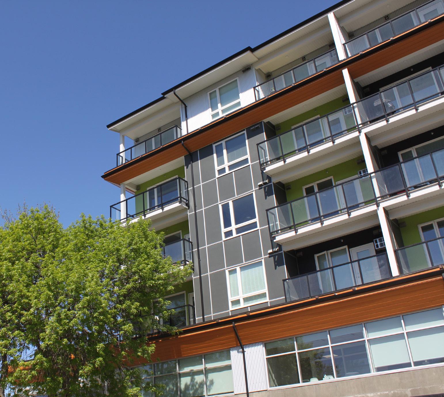
This section links to the following principles:
• Welcoming Mixed-Use Districts
• Connecting Corridors
• Add Missing Housing
• Community Well-Being
GOAL: Encourage an adequate and diverse supply of affordable, safe, accessible, and appropriate housing to meet the needs of residents.
1 Encourage an adequate supply of housing and improve affordability across the housing continuum by ensuring there is enough appropriately designated and zoned residential land to exceed population growth demand, as outlined in the Official Community Plan.
2 Engage landowners and/or developers on the potential for completing a tenant relocation plan to the satisfaction of the City in cases where tenants will be displaced as a result of redevelopment, including the redevelopment of mobile home parks.
3 Support infill housing development to increase rental and homeownership options in established neighbourhoods; support a broader, more inclusive range of demographic housing needs; and make more efficient use of existing municipal infrastructure while ensuring new infill sensitively integrates with the existing neighbourhood character in accordance with the Multi-Family Residential and Intensive Residential Development Permit Area Guidelines.
4 Encourage a variety of housing forms, dwelling sizes, tenure types, and affordability ranges, such as intergenerational housing, micro-suites, row housing, and garden suites, to create diverse and inclusive communities that accommodate residents of all ages, abilities, lifestyles, income levels, and family types.
5 Consider ground-oriented, low- to medium- density multi-family residential development (e.g. row houses, townhouses, and three- to four-storey apartments) or missing middle housing types at corner lots, assembled adjacent lots, and along key corridors where these housing forms can be sensitively integrated and where situated within a convenient (400 m or less) walking distance to transit, services, and amenities. Mid-block infill opportunities would be assessed on a case-by-base basis.
Housing that provides appropriate privacy, space, security, lighting, ventilation, infrastructure, and affordability within a reasonable distance of work and basic amenities.
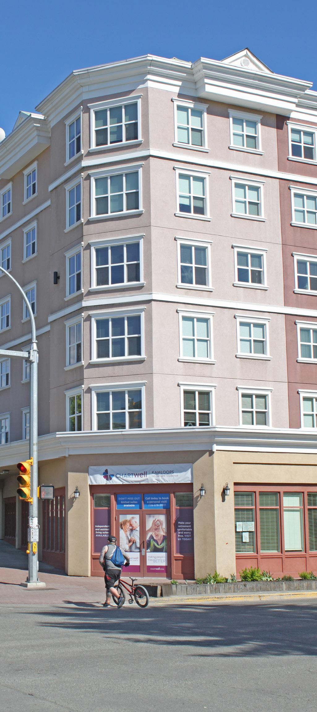
Encourage medium- to high-density mixed-use and multi-family residential development in areas that offer convenient access to transit and community and commercial amenities, including the North Shore Town Centre, Tranquille Market Corridor, Brocklehurst Centre, and 8th Street Corridor, to increase stock and diversity in higher- density housing types and support revitalization of mixed-use districts.
Support rental housing opportunities, such as secondary suites, garden suites, and, where appropriate, carriage suites, on single-family lots in accordance with zoning and flood plain regulations.
Support subdivision of larger single-family lots to create new compact single-family lots or duplex lots (with lane access), where appropriate, and in accordance with zoning and flood plain regulations.
Require, through the building permitting process and BC Building Code regulations, accessible and adaptable housing that incorporates universal design features to provide ease of access and mobility for all ages and abilities.
10 Consider reduced parking requirements for multi-family residential and mixed-use development on a case-by-case basis when a proposed project meets all of the following:
10-1 Is located within a convenient (400 m or less) walking distance of transit services
10-2 Is connected to nearby transit services by an accessible pedestrian pathway
10-3 Contributes to an identified housing need, such as providing affordable, demographic-specific, or missing middle housing unit types
11 Continue to encourage social housing units in new multi-family residential developments through the following mechanisms:
11-1 Reduced parking requirements in accordance with the Zoning Bylaw
11-2 Development Cost Charge (DCC) exemptions for construction of not-forprofit rental housing in accordance with the Development Cost Charges Bylaw and the Local Government Act
11-3 Municipal contributions from the Affordable Housing Reserve Fund
12 Work with the Province and community partners to determine locations for future social housing in the plan area in accordance with the City's memorandum of understanding with BC Housing, which includes considering factors such as proximity to other social housing sites; access to transit, community services, and amenities; and sensitive integration with the surrounding neighbourhood.
13 Support low-density social housing projects and new residential development that provides a mix of market and non-market housing within the same building to foster inclusivity, mixed-income communities, and more seamless integration into existing neighbourhoods.
14 Support alternative housing tenure models such as housing co-operatives, land trusts, shared equity ownership, affordable rental housing, live/work units, and others, to support affordability within the market housing spectrum.
15 Encourage affordable market housing types to locate in areas within a convenient (400 m or less) walking distance to transit, services, and amenities.
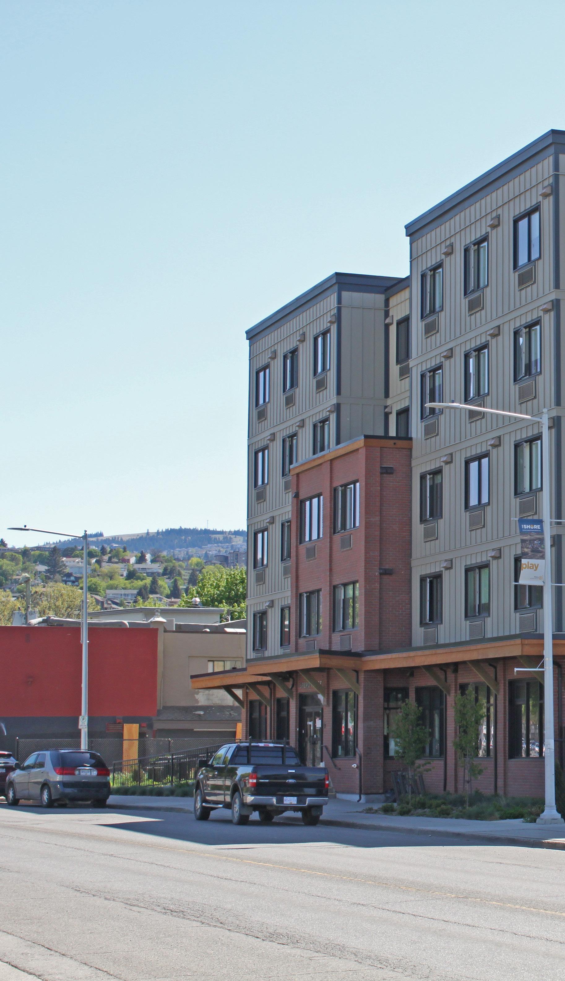
Parks, trails, and public plazas provide residents and visitors with opportunities to socialize, recreate, relax, and connect with nature. North Shore parks, greenspaces, and waterfront areas also help support important habitat and ecological functions while improving livability for residents and visitors. The policies in this section support the enhancement of parks and public places in the plan area through improved connectivity and accessibility for people of all ages and abilities and through programming and events to activate public spaces and celebrate community.
Policies within this section are organized under the following topics:
• Parks, Trails, and Waterfront
• Plazas and Public Amenities
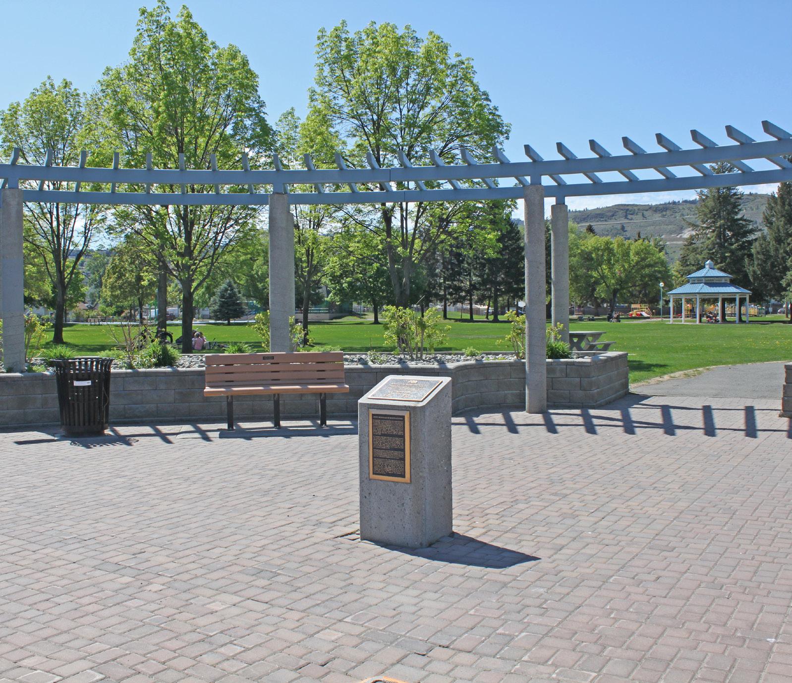
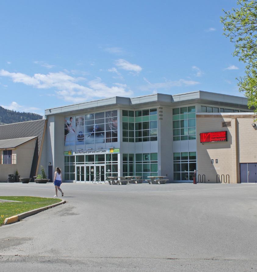
This section links to the following principles:
• Embrace the Waterfront
• Community Building
• Community Well-Being
• Shared Space
GOAL: Provide a diverse and well-connected network of public recreational spaces.
1 Continue to provide and maintain parks and greenspaces in the plan area for passive and active recreational use, including constructing new parks where identified gaps in coverage exist. Major parks (e.g. McArthur Island Park, McDonald Park, Brocklehurst Park) will continue to function as community gathering places and venues for events and festivals.
2 Enhance connectivity to the waterfront and parks system through improvements to the active transportation network as per the Transportation Master Plan and where further identified within this plan.
3 Reinforce the recreational function of the Rivers Trail by completing intermittent gaps in trail connectivity and adding improvements to existing sections, such as wayfinding features, seating, and lighting.
4 Increase riverfront access with new public spaces, improvements to existing parks and beaches, and enhancements to shoreline accessibility.
5 Support healthy landscapes via pest management and water conservation while protecting greenspaces from noxious and/or invasive plants and trees.
6 Continue to integrate landscaping that supports pollinators and beneficial insects into City parks and greenspaces in the plan area, including demonstration gardens in key areas (e.g. McArthur Island Park) to educate residents and visitors on sustainable approaches to landscape design and planting.
7 Maintain natural vegetation along the riverfront, as well as trail, beach, and boat access while providing view opportunities to support visual connections to the river, where feasible.
8 Ensure appropriate flood risk and riparian area preservation measures are taken into consideration for waterfront park management and planning.
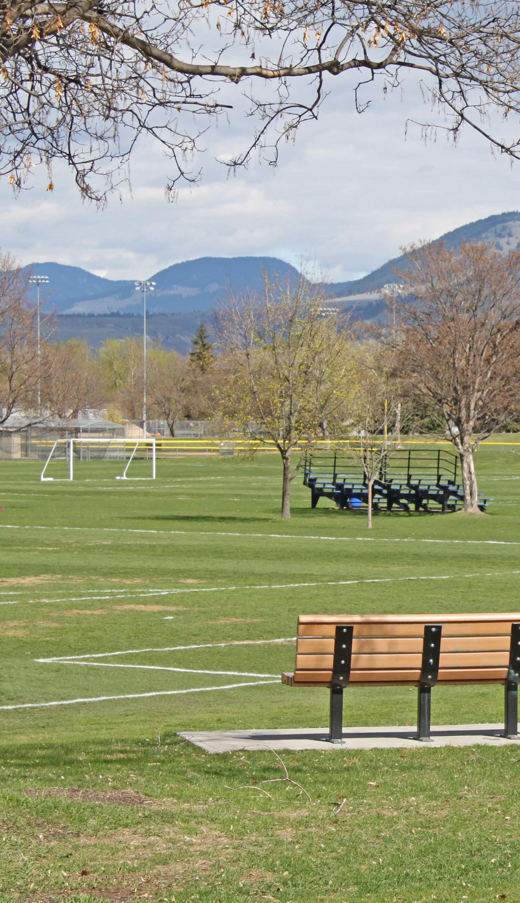
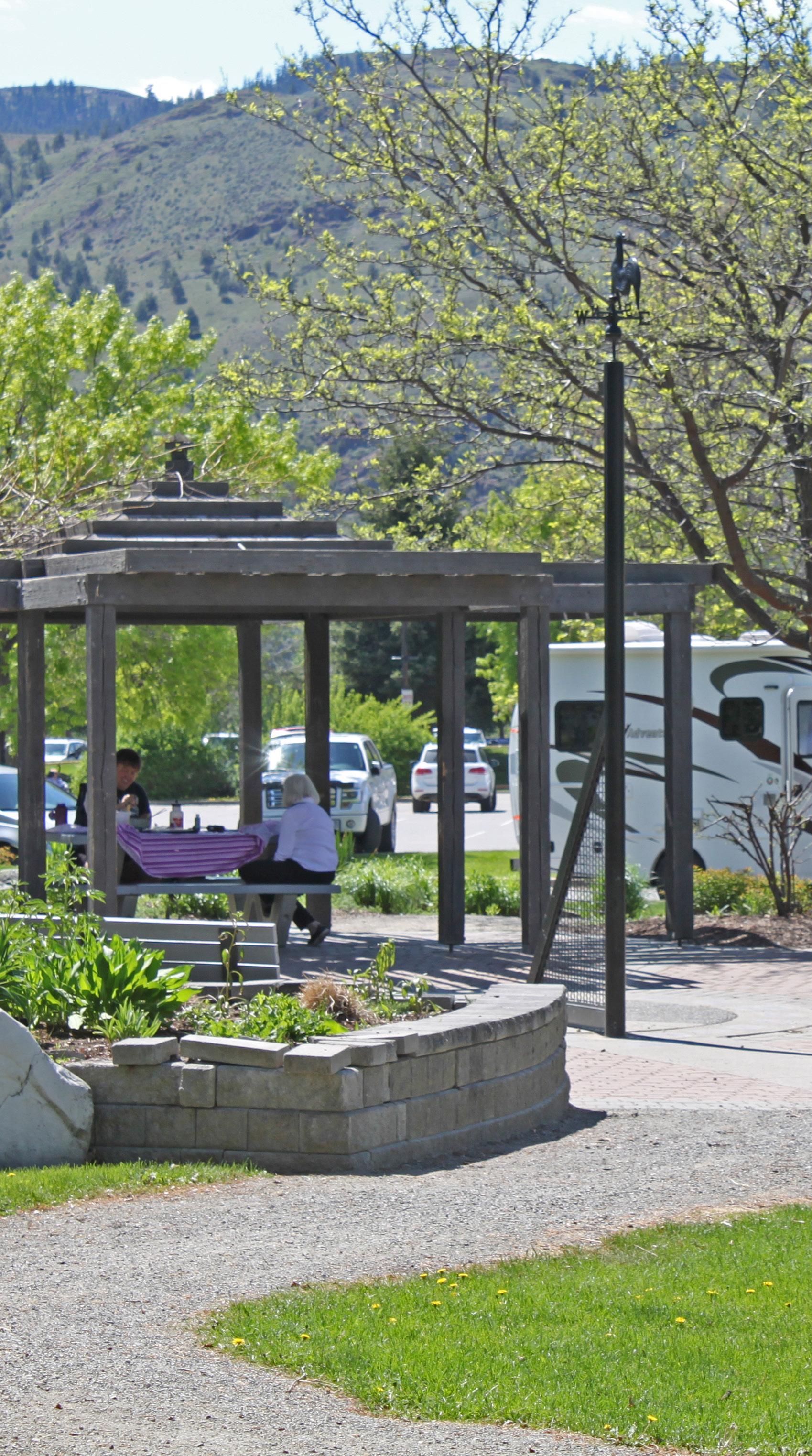
Incorporate universal design features into public realm improvements, including plazas and other public gathering places, to provide inclusive and accessible community amenities for residents and visitors of all ages and abilities.
Explore opportunities to improve existing and identify new plazas, squares, and gathering places, including temporary and/or community-led interventions (e.g. parklets), in areas with high potential for community use, such as at key recreational sites and in mixed-use and commercial areas with high pedestrian
Encourage active street-level commercial uses, such as restaurants, cafés, and retail stores, in buildings located adjacent to public plazas.
Provide gender-neutral public washrooms in convenient locations near areas of high pedestrian traffic, and design them to be secure, easily identifiable, and accessible during daytime and evening hours.
13 Work with the North Shore Business Improvement Association and community groups to include seasonal programming and activities and encourage active year-round use in plazas, parks, and other public gathering places. Where appropriate, consider adding park amenities that support new and existing programming, including the potential for allowing pop-up commercial uses to support the vitality of park spaces.
14 Continue to identify opportunities for improvements to existing parks and plazas, including new seating, lighting, picnic areas, and other amenities, to meet the needs of diverse user groups and ensure active use throughout the day.
The North Shore hosts a number of cultural and heritage assets, such as cultural facilities, annual events, public art, and historic buildings. Many are located in North Kamloops, including the North Kamloops Library, the Kamloops Japanese Canadian Cultural Centre, and the Stage House Theatre. Regular annual events held within the plan area are Music in the Park, Overlander’s Day, the BrewLoops Festival, and Boogie the Bridge. The North Shore Neighbourhood Plan seeks to build on these unique assets to facilitate social gathering, contribute to community and economic development, and reinforce the community's sense of identity.
Policies within this section are organized under the following topics:
• Arts and Culture
• Heritage
This section links to the following principles:
• Welcoming Mixed-Use Districts
• Community Building
• Celebrate Character
• Shared Space
GOAL: Build on the North Shore’s vibrant and diverse arts community and heritage assets to support local entrepreneurs and celebrate local business, food, culture, and history.
1 Identify locations on public and private lands —particularly within mixed-use districts, parks, waterfront areas, and other areas of high pedestrian activity—where public art may serve as landmarks, act as wayfinding features, and define key gateways and corridors that support the North Shore’s cultural identity. The incorporation of public art should be considered during the design phase of development projects to ensure site compatibility and functionality with the private and public realm.
2 Contribute to a more visually appealing and vibrant North Shore by integrating public art into civic infrastructure and improvements, where appropriate, including overpasses, underpasses, retaining walls, park washrooms, community centres, and active transportation routes.
3 Work with community partners, such as the Kamloops Arts Council and North Shore Business Improvement Association, to promote, raise the profile of, and encourage greater participation from residents and visitors in arts and cultural amenities, initiatives, and events.
4 Support the development of new arts and cultural facilities on the North Shore and work with developers and/or community groups to accommodate new cultural uses in existing buildings. Where feasible, encourage new facilities to locate within the North Shore’s mixed-use districts and consider greater flexibility in the application of City development guidelines and regulations (e.g. parking reductions), as determined on a case -by-case basis.
5 Provide culturally relevant and inclusive programs, services, and facilities that reflect the diversity and needs of North Shore residents.
6 Work with Tk’emlúps te Secwépemc and community partners to promote greater understanding and awareness of Secwepemc cultural heritage and language, including as part of events, public art, wayfinding and interpretive signage, and programming.
7 Support local arts and culture by identifying, implementing, and/or improving public spaces on the North Shore that facilitate community gathering and social events.
Youth Input: Creating more graffiti art or murals would increase tourism and make Kamloops a more pleasant city to live in.
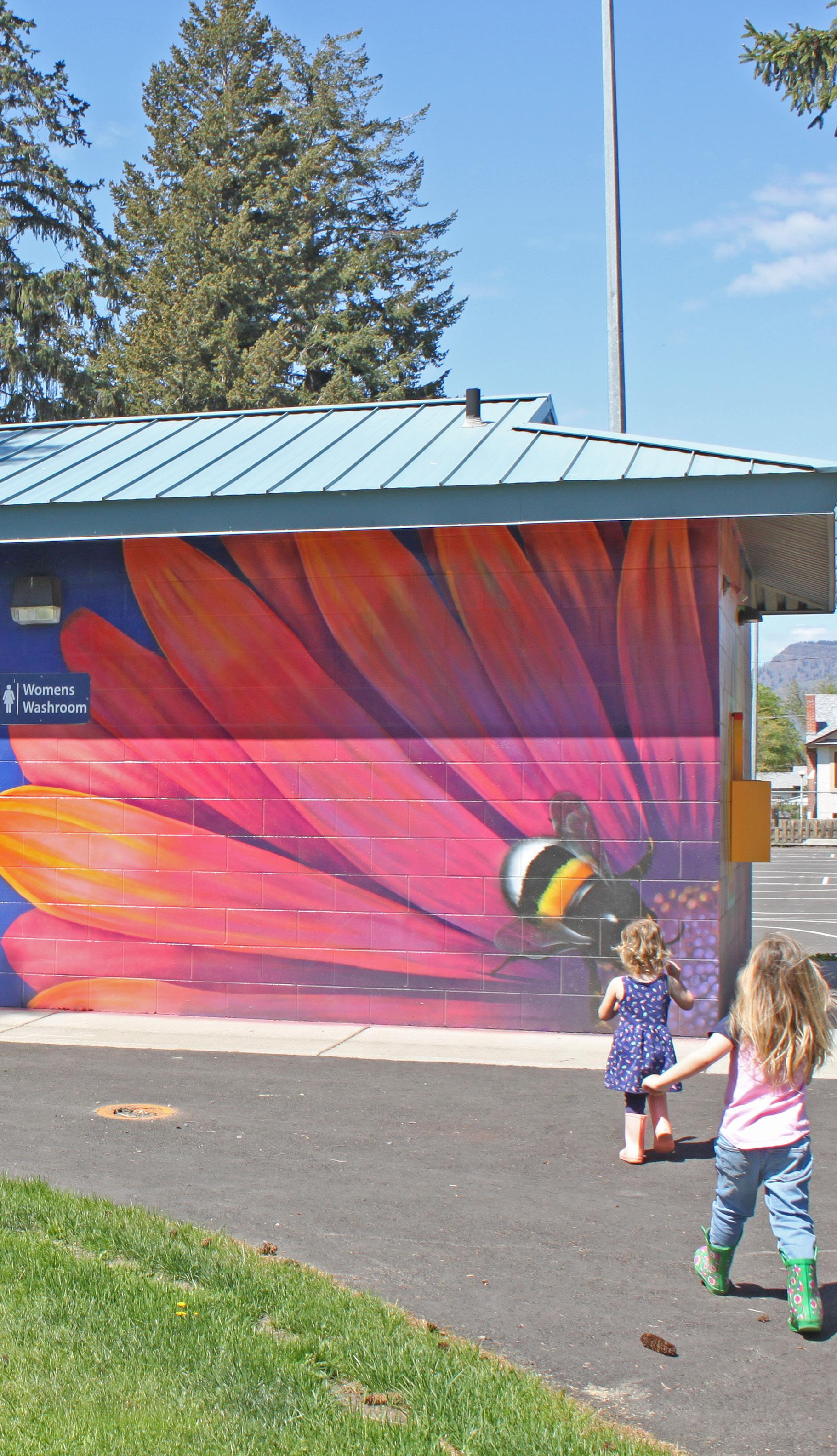
Enhance the historic identity of the plan area for both residents and visitors through complementary heritage events, walking tours, public art, signage, interpretive programs, streetscape design, and architectural detailing.
Consider mechanisms to preserve heritage resources, including heritage conservation areas, on-site density bonusing, off-site density transfers, façade and/or signage improvement grants, parking reductions, and property tax exemptions for heritage revitalization projects.
Support facilities and community groups that raise awareness of local history and heritage
Encourage the adaptive reuse of vacant or underutilized heritage buildings for community or commercial amenities that permit public access and serve to enhance appreciation and awareness of built heritage.
12 Utilize heritage revitalization agreements to relocate, retain, and/or incorporate heritage elements into new developments when preservation of the original structure is not technically feasible, such as through façade retention, reuse of historic building materials, or the creative repurposing and display of historic objects as on-site public art or interpretive features.
13 Work with the City’s Heritage Engagement Group and other community partners to assess the heritage value of properties in the area for potential landowner solicitation and addition to the City’s Heritage Recognition Plaque Program and/or potential inclusion on the City’s Heritage Register.
14 Provide greater flexibility in the application of City development permit area guidelines and regulations where it can support the preservation of non- conforming heritage, as determined on a case -by-case basis.
Having a sustainable local economy is a key contributor to overall community health and vitality. In particular, community economic development strategies can leverage investment to promote revitalization efforts, create local jobs, support community social services and housing needs, encourage community collaboration and entrepreneurship, and result in more dollars being reinvested back into the community. The North Shore Neighbourhood Plan seeks to enhance the viability of local businesses, stimulate private investment, and support community economic development through a range of strategies that include promoting the North Shore as a tourist and entertainment destination and building upon the area’s unique natural, cultural, and commercial amenities.
Policies within this section are organized under the following topics:
• Community Economic Development
• Tourism
This section links to the following principles:
• Welcoming Mixed-Use Districts
• Community Building
• Celebrate Character
GOAL: Enhance and expand the diversity of the North Shore's economy; attract private investment; and promote tourism-oriented businesses, services, and events.
1 Ensure the North Shore Revitalization Tax Exemption area reflects the on-the-ground realities and revitalization needs of the North Shore Town Centre and Tranquille Market Corridor to optimize its effectiveness and amend the eligible exemption area to be consistent with the land use boundaries presented within this plan.
2 Encourage revitalization of existing commercial frontages through enforcement of the Good Neighbour Bylaw and use of incentives, such as the North Shore Revitalization Tax Exemption, to support alteration projects for existing buildings.
3 Work with community partners to explore other potential incentives to encourage North Shore business owners and commercial landowners to maintain and invest in façade, lighting, signage, and other improvements to their properties.
4 Continue to work with community partners and the development industry to ensure existing incentives are well promoted, understood, and used as intended, and that any potential future amendments or new incentives are targeted to address specific community needs and support City goals and objectives for the area.
5 Continue to support a range of employment lands on the North Shore, including industrial, institutional, office, retail, and service commercial uses, to provide residents with access to a wide variety of services and employment opportunities and to ensure the area maintains a diverse and resilient economic base that offers opportunities for production, consumption, and distribution of goods and services.
6 Encourage the development of new office space on the North Shore to support local employment opportunities, attract new businesses, and revitalize aging building stock while balancing the broader goals of the Official Community Plan that seek to retain Downtown as the primary location for office development in the city.
7 Support the development of small-scale, local-serving commercial uses, such as corner stores and cafés, in areas outside of a convenient walking distance (400 m) of the North Shore’s mixed-use and neighbourhood commercial centres to improve resident access to commercial amenities, subject to site-specific evaluation.
8 Work with the North Shore Business Improvement Association, the Thompson Region Division of Family Practice, and other health service groups to identify suitable locations for a medical clinic and to attract more medical service professionals to the North Shore.
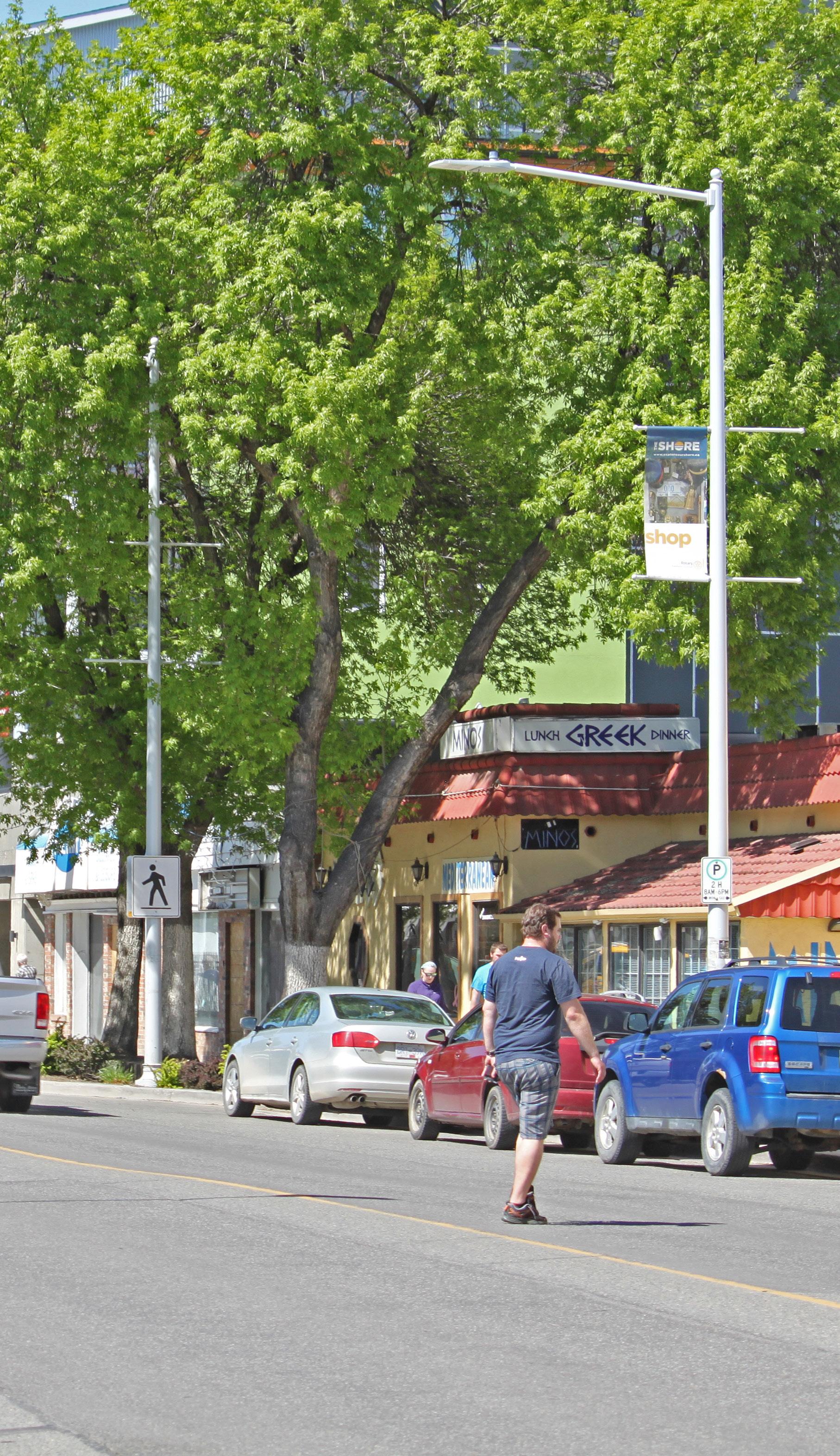
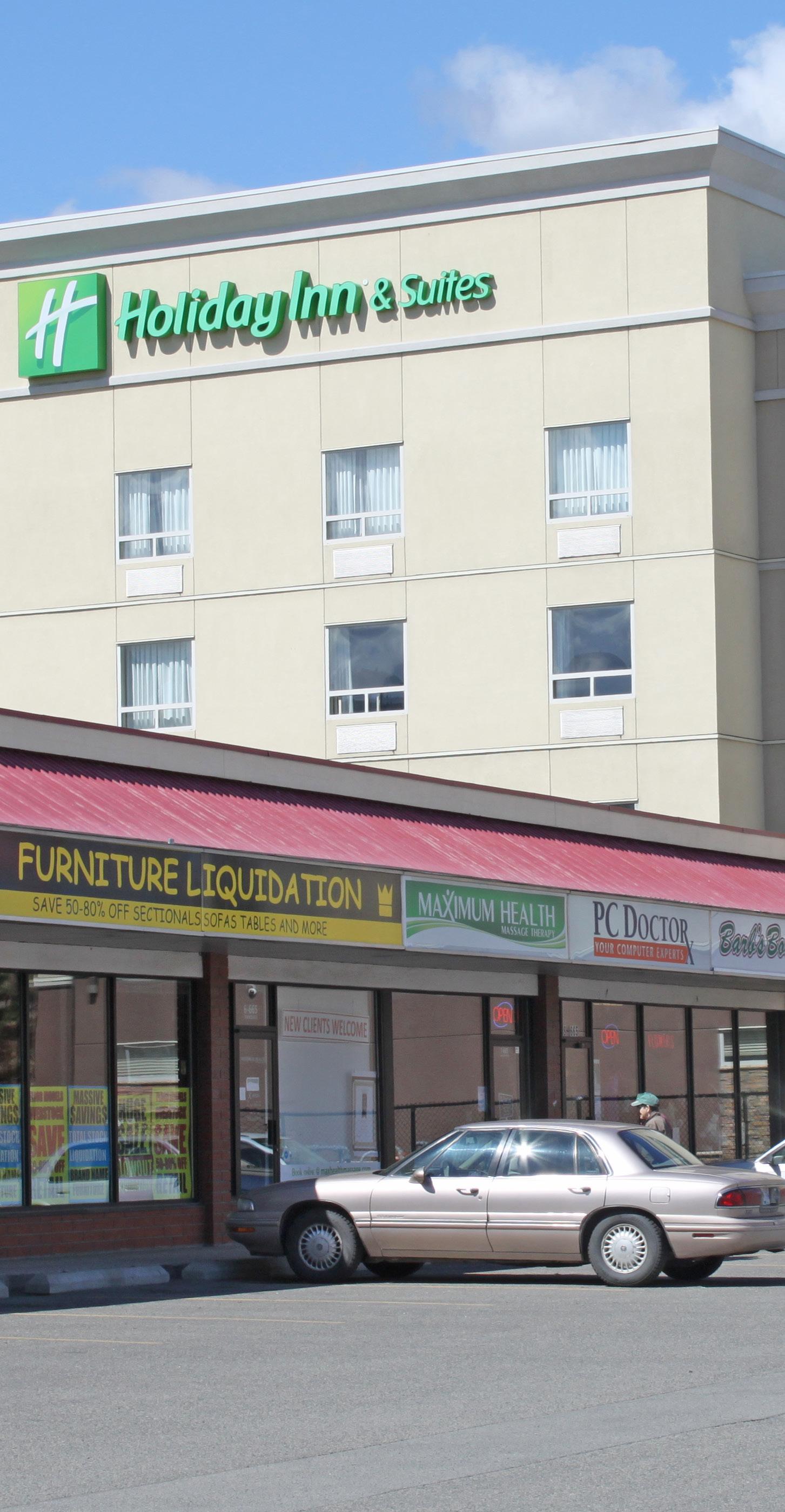
Work with local economic development, innovation, and business groups, such as Venture Kamloops, the Kamloops Innovation Centre, and the North Shore Business Improvement Association, to improve business investment attraction efforts and entrepreneurial support programs on the North Shore.
11 Consider ways of integrating tourism opportunities when identifying key areas for infrastructure and amenity improvements, such as waterfront development, new pedestrian and cycling connections, and streetscape beautification.
Enhance the image, marketability, and appeal of the North Shore as an investment opportunity and tourist destination by working with community partners, such as the North Shore Business Improvement Association and Tourism Kamloops, to:
Leverage existing programs, such as the Tournament Capital Program
Market the area’s distinctive landmarks and amenities, including natural and recreational assets
Strengthen placemaking to create a memorable user experience
Support community events, from large festivals to neighbourhood block parties, that celebrate the North Shore’s unique history, culture, food, and business community
12 Continue working with the Kamloops Airport Authority Society to ensure lands, infrastructure, and services adjacent to the Kamloops Airport support its logistic, investment, and visitor needs and strengthen its function as a major gateway and economic activity generator for the city and region.
13 Work with tourism and hospitality industry groups to ensure there is adequate and appropriately located land designated for tourism services and accommodations while ensuring redevelopment of existing visitor amenities, such as aging hotels and motels, does not negatively impact long-term industry needs.
14 Ensure key destinations and visitor amenities, such as the Kamloops Airport, McArthur Island, and commercial centres, are well connected by a range of transportation options and supported by adequate signage, accommodations, and other tourism services to support visitor mobility, wayfinding, and overall experience.
[THIS PAGE LEFT INTENTIONALLY BLANK]
Participating in physical exercise and social activity is shown to provide positive physical and mental health outcomes. Safety concerns, including crime and poor perceptions of safety, can act as barriers that discourage outdoor participation in physical and social recreation in urban public spaces, including streets, plazas, and parks. Strategies that reduce conflicting uses and support increased pedestrian activity can add vitality to public spaces and encourage a more active and social lifestyle for residents. These policies seek to address real and perceived safety issues while supporting the physical and mental health of residents through collaboration with community partners and design, regulation, and amenity considerations.
Policies within this section are organized under the following topics:
• Safe Streets, Spaces, and Buildings
• Community Health and Well-Being
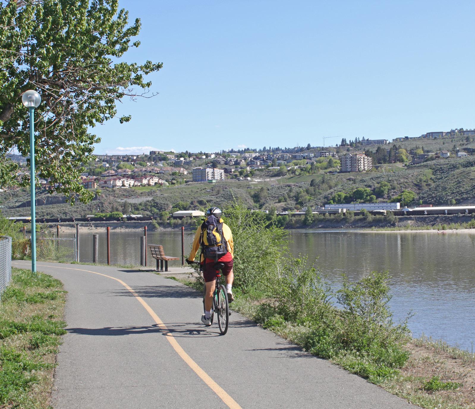
This section links to the following principles:
• Welcoming Mixed-Use Districts
• Community Building
• Add Missing Housing
• Community Well-Being
• Shared Space
GOAL: Foster a healthy and active community where residents and visitors of all ages feel safe, supported, and secure.
1 Incorporate principles of Crime Prevention Through Environmental Design in the planning and design of public spaces, including streets, parks, trails, recreational facilities, active transportation corridors, and community gathering places, to create safer and more welcoming neighbourhoods, including:
1-1 Providing opportunities for natural surveillance to deter crime and nuisance behaviour.
1-2 Incorporating access control strategies to attract, direct, or restrict pedestrian movement and deter illegitimate uses.
1-3 Better defining public and private areas to provide distinct transitions between uses and to foster a sense of responsibility over both types of spaces.
1-4 Ensuring public or semi-public spaces are attractive and well maintained so that they are inviting, well used, and cared for.
2 Ensure all new development within the North Shore Town Centre and Tranquille Market Corridor incorporate Crime Prevention Through Environmental Design principles into building and site design as per the North Shore Development Permit Area Guidelines.
3 Provide adequate outdoor lighting of paths, trails, event areas, and recreational facilities to improve visibility and wayfinding, create lively and inviting spaces, and enhance safety at all hours of the day.
4 Reduce nuisance behaviour and support an enhanced image of the North Shore through enforcement and annual review of the Good Neighbour Bylaw.
5 Work with the RCMP, North Shore Business Improvement Association, Community Services (Bylaw) Officers, and other community partners to improve safety, security of property, and public behaviour within the plan area.
6 Encourage social service agencies to locate in areas directly accessible by their clientele, either through public transit, cycling, or pedestrian routes, while encouraging sensitive integration of these services to mitigate potential conflicts with surrounding land uses.
7 Improve the resilience of the North Shore through periodic review and ongoing improvement to development standards in regards to fire protection, emergency access, flood protection and mitigation, and climate change mitigation and adaptation.
8 Continue to apply streetscape design standards and elements that improve safety and comfort for pedestrians, including universal design strategies that support a more accessible and inclusive public realm.
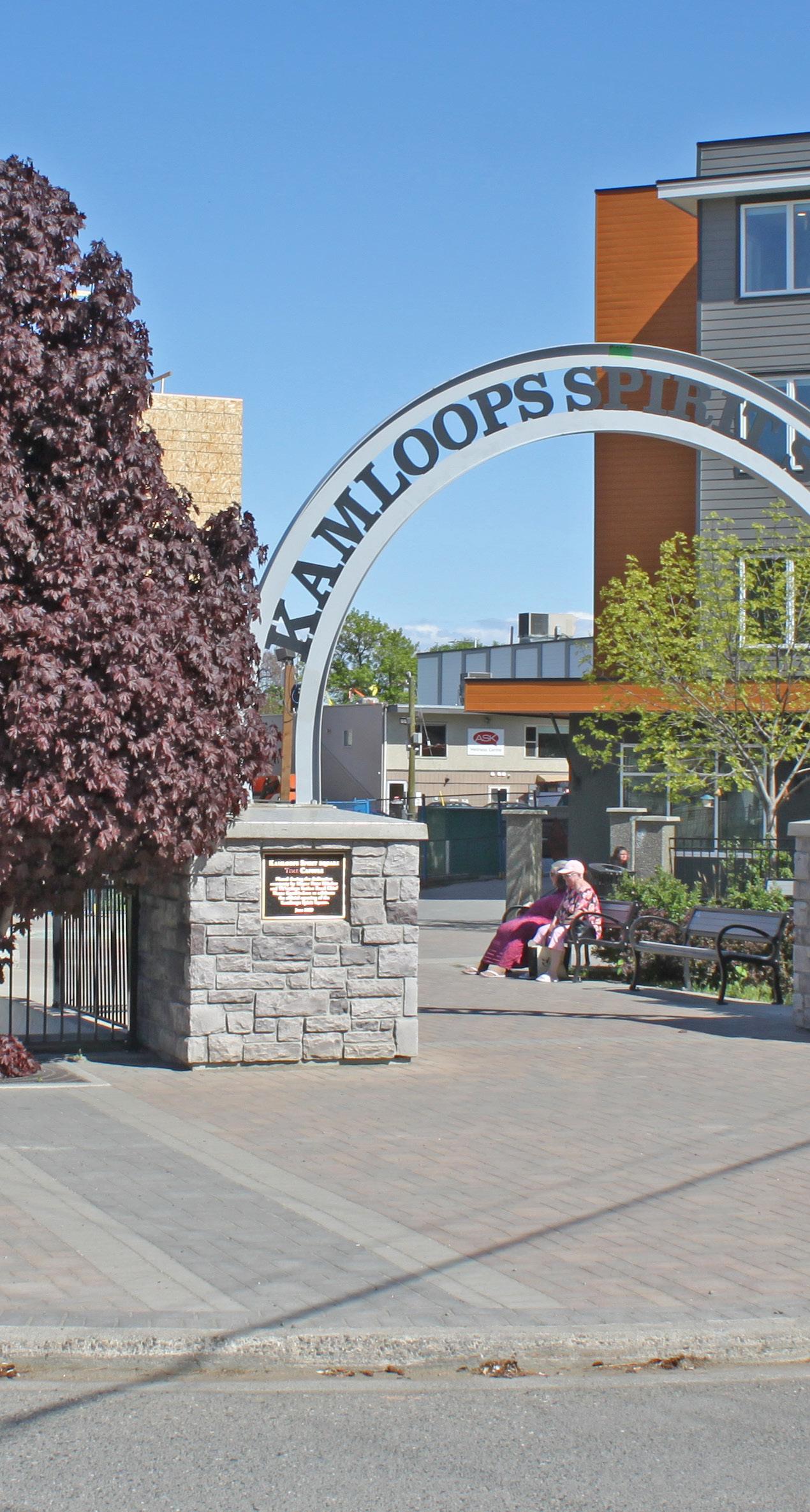
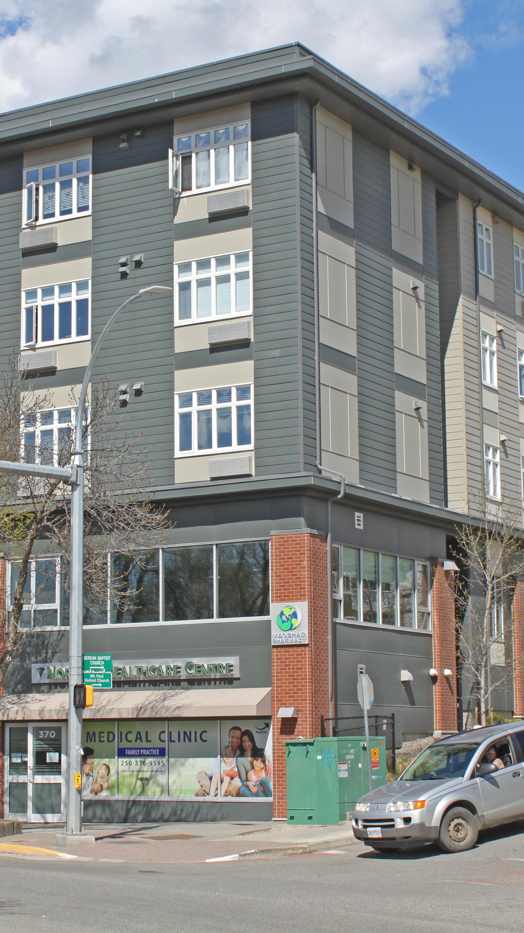
Encourage new development and capital projects to integrate healthy built environment principles, as outlined by the Province's Healthy Built Environment Linkages Toolkit, such as:
Incorporating natural elements
Supporting a complete and compact neighbourhood form
Contributing to a safe and accessible active transportation network
Collaborate with other levels of government, community partners, and social agencies to identify and implement initiatives that address homelessness.
Reduce the risk of heat-related illness during the summer months by continuing to expand the city’s urban tree canopy, using misting stations at community events, and installing drinking water fountains in areas with high pedestrian activity, where needed.
Work with community partners to ensure adequate health services are in place to address the needs of families, seniors, and people experiencing challenges with mental health and/or addiction.
13 Encourage healthy and active modes of transportation by beautifying streetscapes and continuing to identify new and improve existing routes that contribute to a well-connected network of sidewalks, bike paths, and public transit facilities.
14 Contribute to mental health and well-being through the development of new public gathering spaces and supporting local events and activities, including those relating to arts, culture, and food, to promote social gathering, community building, and local entrepreneurs.
15 Support physical health by continuing to improve and expand greenspaces, park amenities, recreational facilities, and active transportation infrastructure.
16 Ensure adequate waste, recycling, and/or other receptacles, such as safe needle disposal bins, are provided in areas of high pedestrian activity, including the Tranquille Market Corridor, North Shore Town Centre, Rivers Trail, and parks.
[THIS PAGE LEFT INTENTIONALLY BLANK]
Availability of nutritious and affordable food is essential for the health and well-being of every resident. A sustainable local food system—one that includes commercial and community opportunities for food production, processing, and distribution—improves access to and understanding of local food needs and strengthens community and economic development. The events of recent years, which have included climate-, health-, and geopolitical-induced supply chain disruptions, have shown the fragility of the global food supply system that communities rely on to stock their grocery store shelves. Building a strong local food system is key to mitigating global uncertainty and supporting the long-term health and resilience of our communities.
Policies within this section are organized under the following topics:
• Food Assets
• Local Food Access and Awareness
This section links to the following principles:
• Welcoming Mixed-Use Districts
• Community Building
• Community Well-Being
• Shared Space
GOAL: Support a local food system that enhances community health, resiliency, and economic development opportunities.
1 Continue to provide food-growing opportunities for residents who do not have access to arable land by identifying locations for new community gardens on public lands as the population of the plan area continues to increase, as projected in the Official Community Plan.
2 Encourage the use of urban agriculture as a means of placemaking, community building, activating key public spaces, and revitalizing vacant and underutilized lots on the North Shore.
3 Support the development of new urban food production strategies, such as rooftop gardens, community gardens, and edible landscaping, through provisions in the North Shore Development Permit Area Guidelines that encourage developers to create food assets as amenities.
4 Explore opportunities to incorporate community food assets, such as community kitchens, into potential future community amenity incentives developed for multi-family and/or mixed-use development on the North Shore.
5 Support the North Shore’s growing role as the centre of a regional food system hub and facilitate job creation in the food sector by supporting land uses that provide opportunities for food production, processing, distribution, consumption, and waste management.
6 Incorporate community food amenities, such as seating, picnic areas, outdoor cooking facilities, and/or concession stands in key public spaces, such as parks, plazas, and civic facilities, to support active community use, events, and programming.
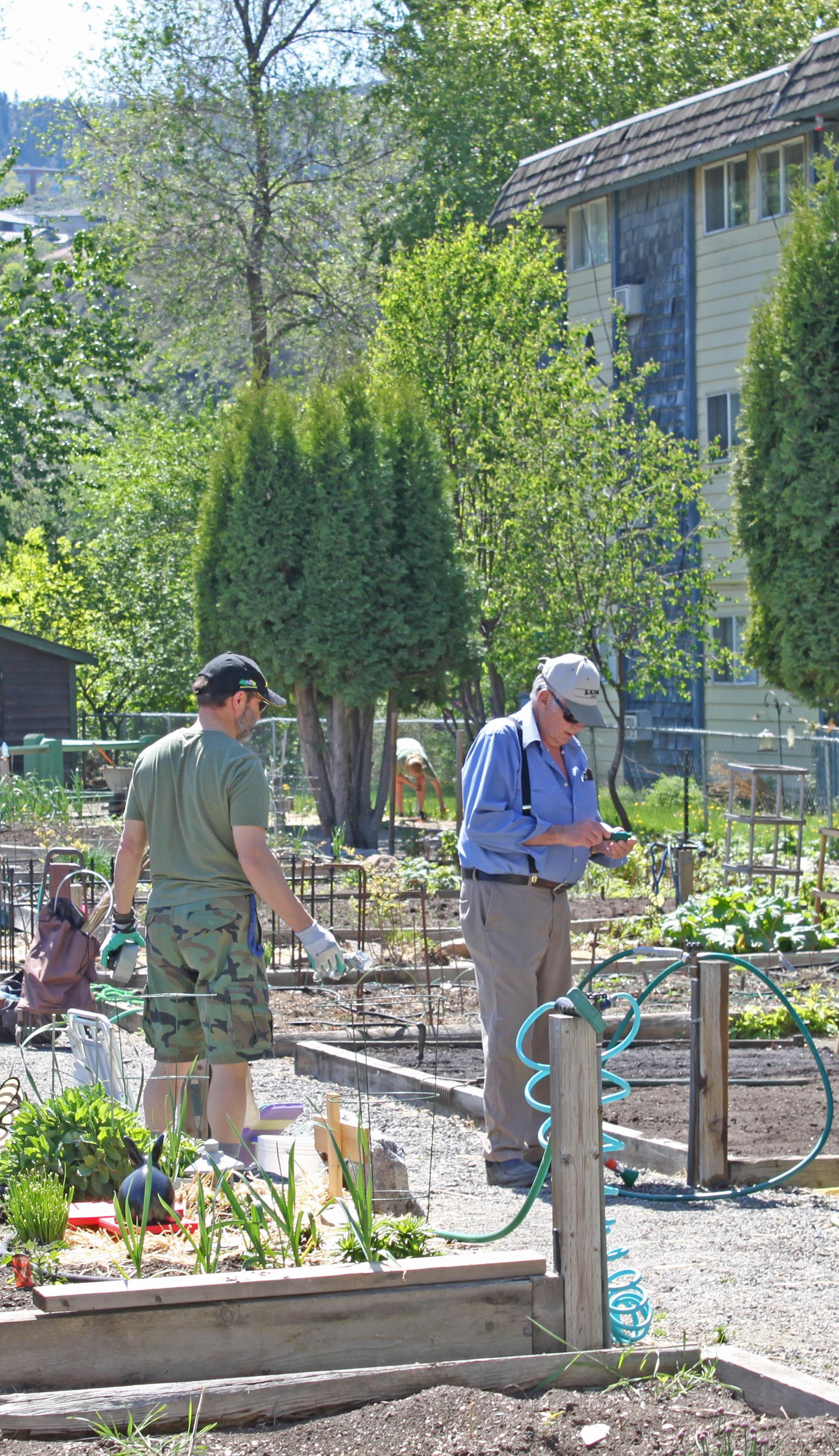
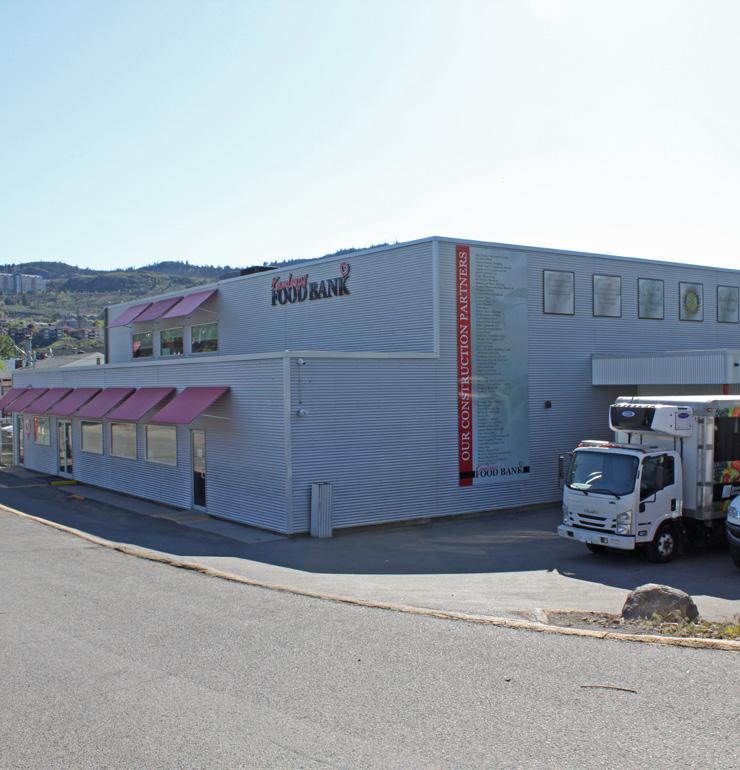
7 Support residential yard- and garden-sharing initiatives to increase urban food production opportunities for residents who do not have access to arable land while capitalizing on the North Shore’s favourable micro-climate and productive valley-bottom soil.
8 Support the operation of food trucks and mobile food vendors within designated parks and plazas, with an emphasis on locations where they may complement existing amenities or event spaces (e.g. Yew Park) or increase food access and food retail options in areas where there are few food retail outlets (e.g. Overlander Park).
9 Work with School District No. 73 to support the use of school facilities as educational sites for urban agriculture and to help address the needs of school food services, including supporting opportunities for new neighbourhood kitchen spaces that can be used for nearby school food programs.
10 Support North Shore businesses, social enterprises, and non-profit agencies involved in the processing and distribution of healthy, local, and sustainable food, including those addressing the needs of food-insecure residents and those connected to a food business incubator.
11 Explore opportunities to expand existing community garden drop-off services for mulch, dirt, seedlings, and waste removal to include urban farms, which may reduce transport to rural City composting facilities while supporting the productivity and viability of a broader range of urban food production initiatives.
12 Ensure community food access is taken into consideration in the planning, routing, and prioritizing of the City’s sustainable transportation projects, particularly from the perspective of residents experiencing food insecurity who may be living with mobility barriers, such as lower incomes and/or disabilities.
13 Work with community partners to further their work in identifying food system challenges on the North Shore, educating the public, and implementing solutions, including collaborating to pursue relevant funding and exploring opportunities to use available municipal land for community food systems projects, where appropriate.
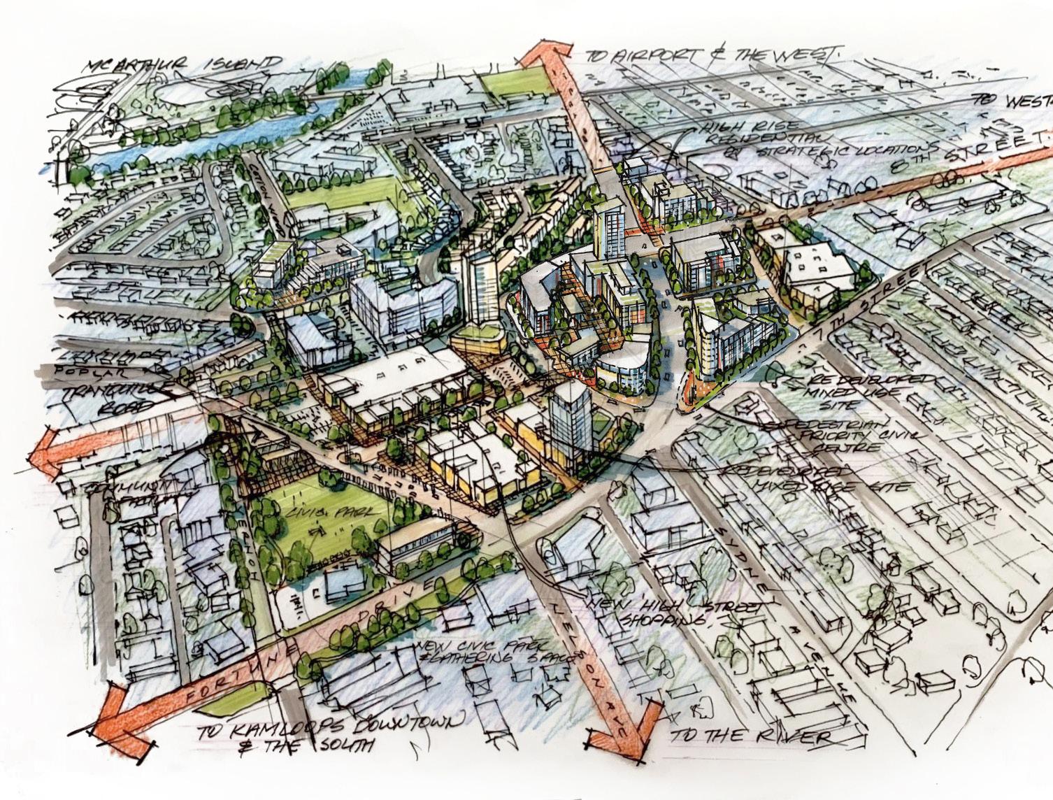

The following section presents 10 Big Moves—a series of design concepts and ideas for key areas of the North Shore that, if realized, would help achieve the vision of an inclusive, dynamic, and complete North Shore. These are categorized as Key Redevelopment Areas, New Housing Opportunities, and Catalyst Projects.
High-level redevelopment concepts envisioned for key mixed-use areas, which include the North Shore Town Centre, Tranquille Market Corridor, and Tranquille South. These concepts are representative of the plan’s vision, goals, and objectives and aim to provide guidance for prospective developers looking to invest in the area as well as for future public capital projects.
Key directions for new infill residential opportunities that will support a more diverse, affordable, and sensitively-integrated supply of housing on the North Shore. This includes housing types for mixed-use areas as well as residential neighbourhoods throughout the North Shore.
Action-oriented concepts on City- and/or privately-owned properties that can be led, facilitated, or supported by the City to serve as transformational catalysts for further investment and revitalization. These do not represent final plans but are subject to further analysis and refinement.
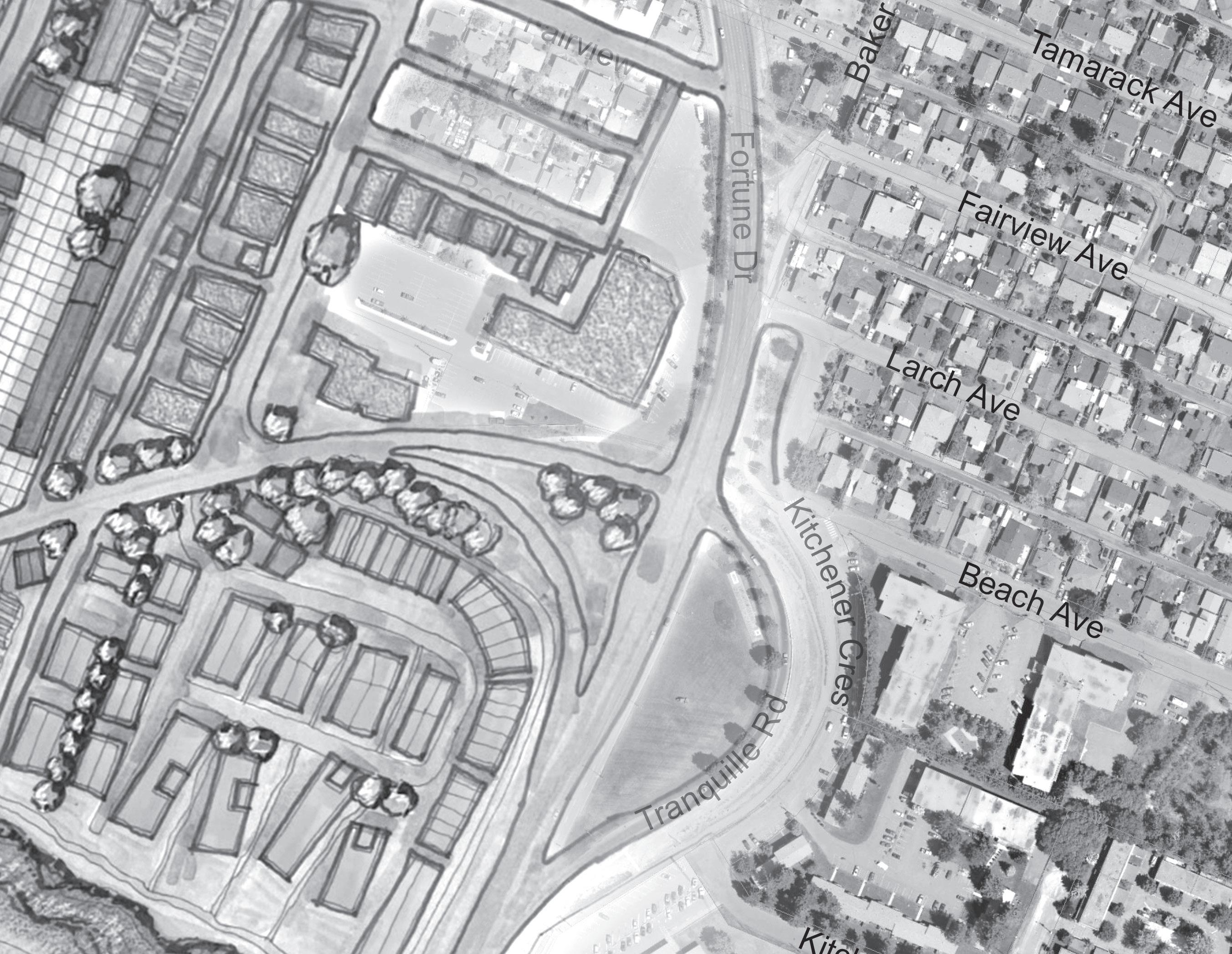
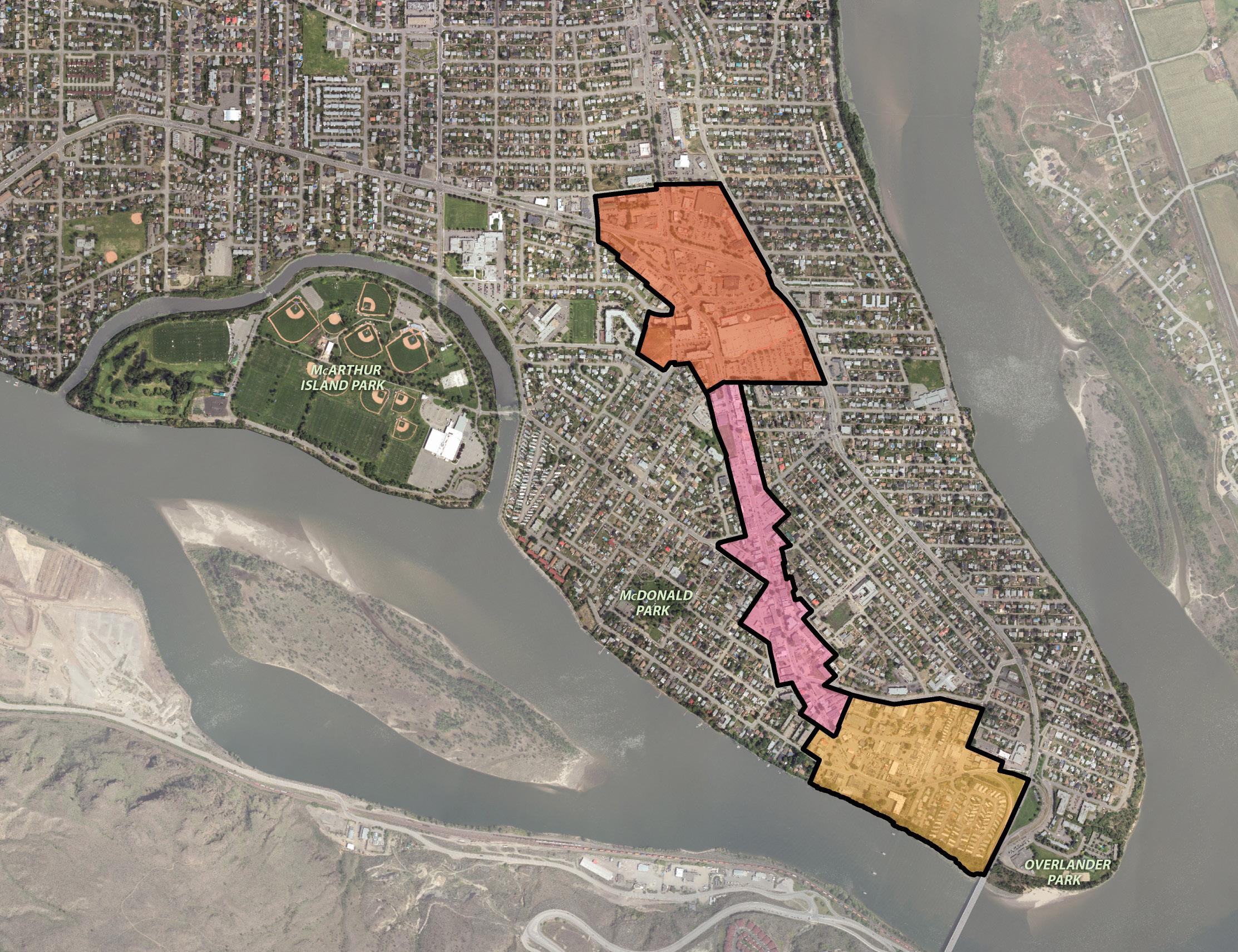
The Official Community Plan encourages a mix of medium- to high-density residential and commercial infill development in the North Shore Town Centre that is pedestrian- and transit-oriented. The concept proposed here builds on this direction by envisioning an urban village with a series of internal, openair walkways that are fronted by commercial uses and connect pedestrians with the transit exchange. Commercial uses would include large -format retail anchors (or “big box” stores) that are better integrated with pedestrians by being wrapped with other uses also known as a “bury the box” concept (i.e. large-format retail with residential units on top and smaller retail units around the outside). As redevelopment would be market-driven, this land use concept could take up to two decades to be fully realized.
Zoning has recently been updated to better support the higher-density uses envisioned for this area. The City will continue to work with landowners and developers to ensure that site planning, design, and development align with the vision and objectives of this plan.
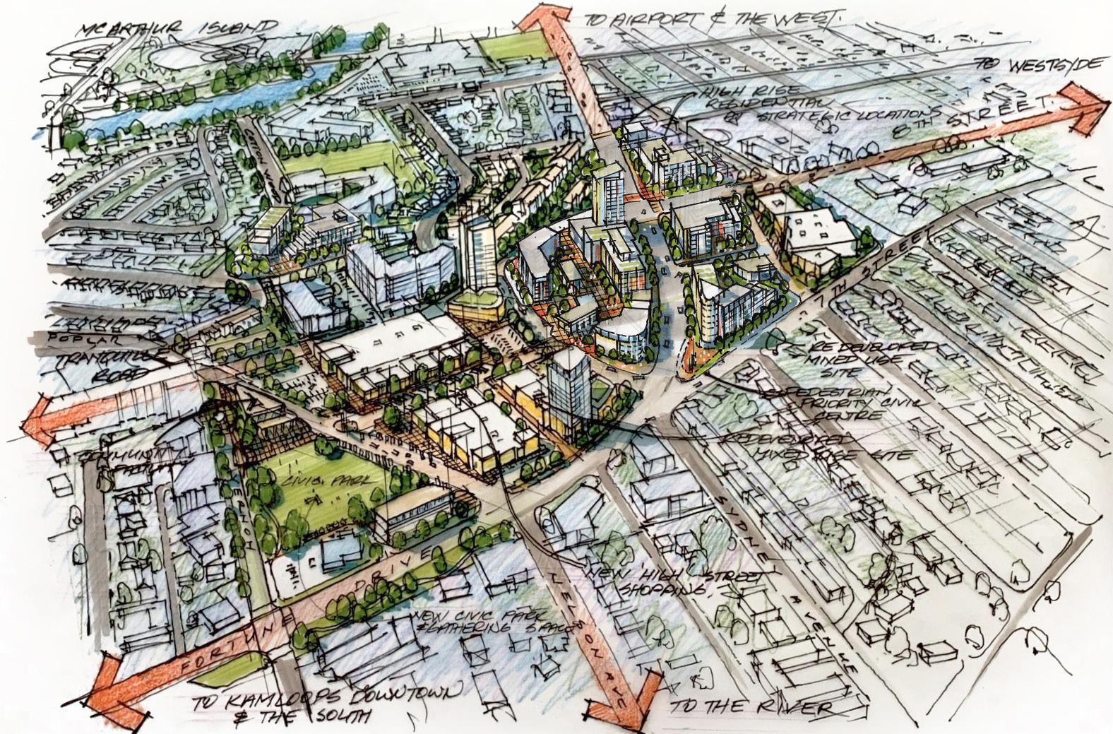
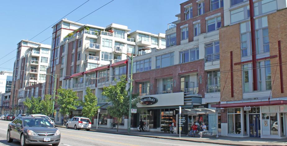
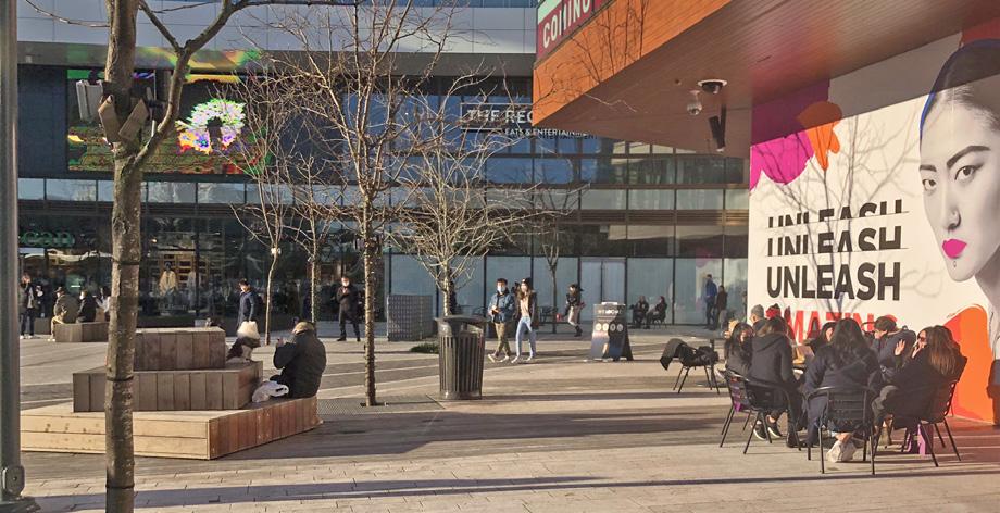
The Tranquille Market Corridor is envisioned as a walkable, mixed-use corridor with two character- defining areas: the Cultural Village and the Innovation Hub. The Cultural Village concept focuses on preserving smaller storefronts and pedestrian scale in the heart of the Tranquille Market Corridor. Property owners of buildings with heritage and/or character value would be encouraged to maintain and restore building façades and redevelopment involving large land assemblies would be discouraged to maintain the fine-grain retail character. The concept also encourages land assembly and redevelopment of adjacent multi-family zoned residential properties (e.g. on Dot Street and Yew Street) to facilitate ground-oriented missing middle housing within walking distance of the corridor’s shops and amenities.
The Innovation Hub concept is proposed in the area further south, around the Kamloops Innovation Centre and North Shore Health Science Centre. The vision here is for more intensive redevelopment to occur, including land assemblies, that could accommodate innovative uses (e.g. high-tech), incubator spaces, larger institutional and corporate entities, and hotel space. The character here would be defined by larger-scale, mixed-use buildings that would distinguish it from the Cultural Village.
Zoning has recently been updated in the area and a new set of North Shore Development Permit Area Guidelines—to be adopted as part of this plan—will provide further guidance in terms of the form and character of redevelopment in the area. A number of proposed actions in the North Shore Neighbourhood Plan will further support the vision for this area, including streetscape improvements and new east-west bike routes.
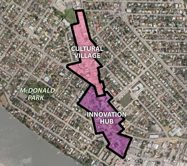

Tranquille South presents a unique opportunity for waterfront development and placemaking, which includes taking different approaches to three distinct areas. At the Riverdale Trailer Court site (a), redevelopment could open up public access and views to the waterfront (see Big Move 9 for more details). New multi-family residential development could offer a diverse mix of housing forms while being mindful to mitigate displacement of existing residents.
The service commercial area north of Tranquille Road (b) is proposed to transition to an industrial arts district of maker spaces. Redevelopment in the area would create opportunities to introduce live/work units into the area (see Big Move 6 for more details) and a potential central works yard gathering space where the public can be immersed in the creative activities and services offered in the area.
The retail commercial area fronting the waterfront and Tranquille Road (c) are envisioned to include shops and restaurants set on a riverfront boardwalk and an interpretive park at the foot of Palm Street, which would be designed to reflect the unique character and riverfront history of the area, including its Indigenous heritage.
A number of actions in the North Shore Neighbourhood Plan will support the vision for this area, including amending the Zoning Bylaw to better support the proposed land uses, exploring the feasibility of extending the Rivers Trail along the waterfront, and improving the Tranquille Road streetscape.
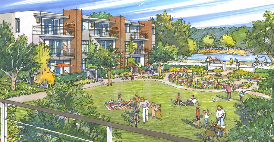
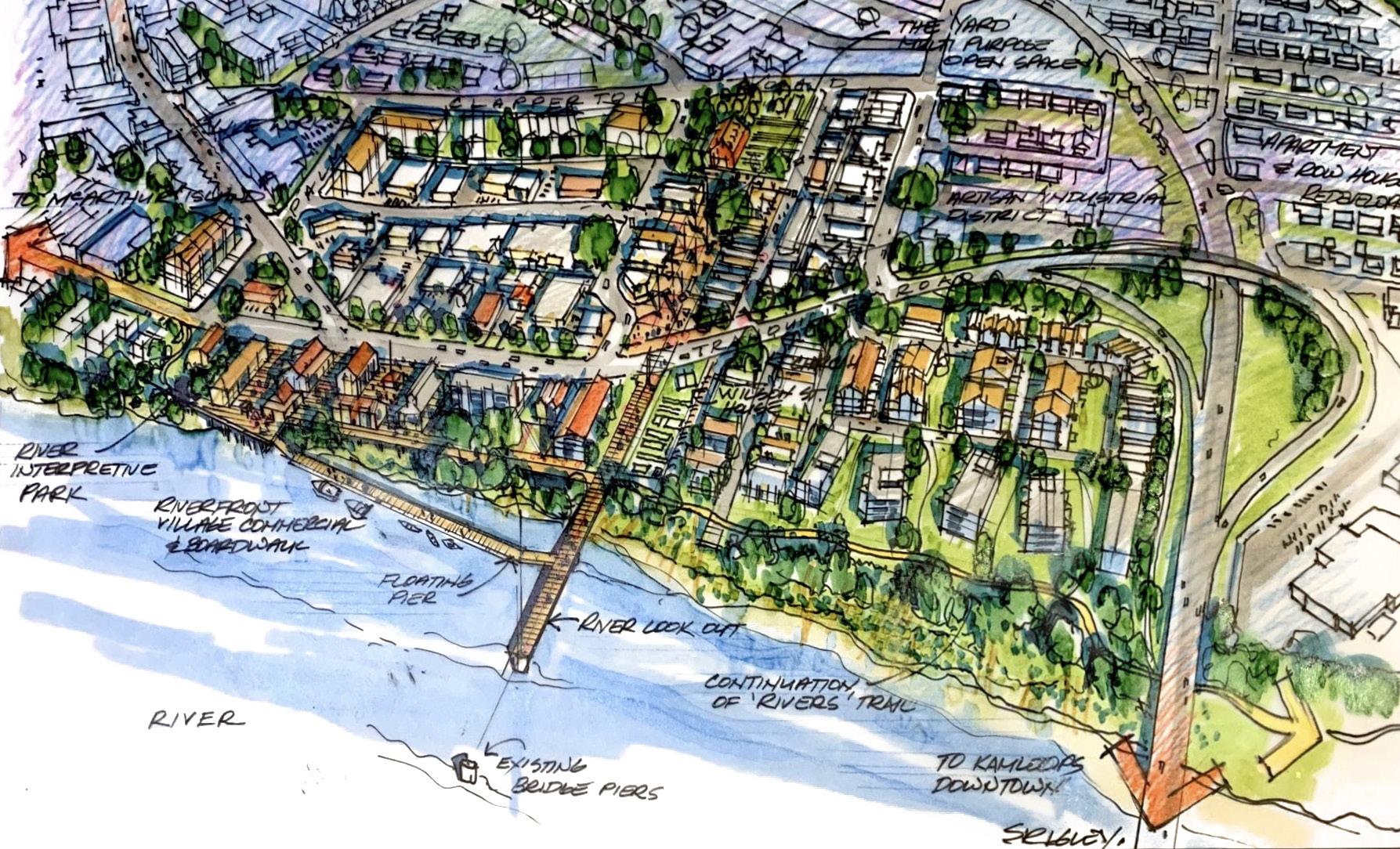
Missing middle housing, defined here as ground-oriented, low-density multi-family (e.g. townhouses, rowhouses, triplexes, fourplexes), is a type of housing in the middle of a spectrum between single-family homes and high-rise apartment buildings. Missing middle housing adds to the diversity of housing options for residents and are typically more affordable than single-family homes. This housing type can also be more sensitively integrated into low-density neighbourhoods than higher-density development.
As per Section 3: Future Land Use, missing middle housing forms would be encouraged across the North Shore in areas with access to transit, services, and amenities. This includes along key corridors, such as Fortune Drive, in areas adjacent to mixed-use districts, such as the North Shore Town Centre, and on corner lots and adjacent assembled lots in residential areas, where they can be sensitively integrated. Mid-block infill opportunities would be assessed on a case-by-base basis.
A proposed short-term action within the North Shore Neighbourhood Plan is to amend the Zoning Bylaw to reflect the plan's land use directions. This will include a review of key areas to consider for rezoning that will, in addition to the housing and area-specific policies within this plan, further support development of missing middle housing forms.
Another short-term action is for the City to develop a new infill housing zone to better support implementation of missing middle housing forms.
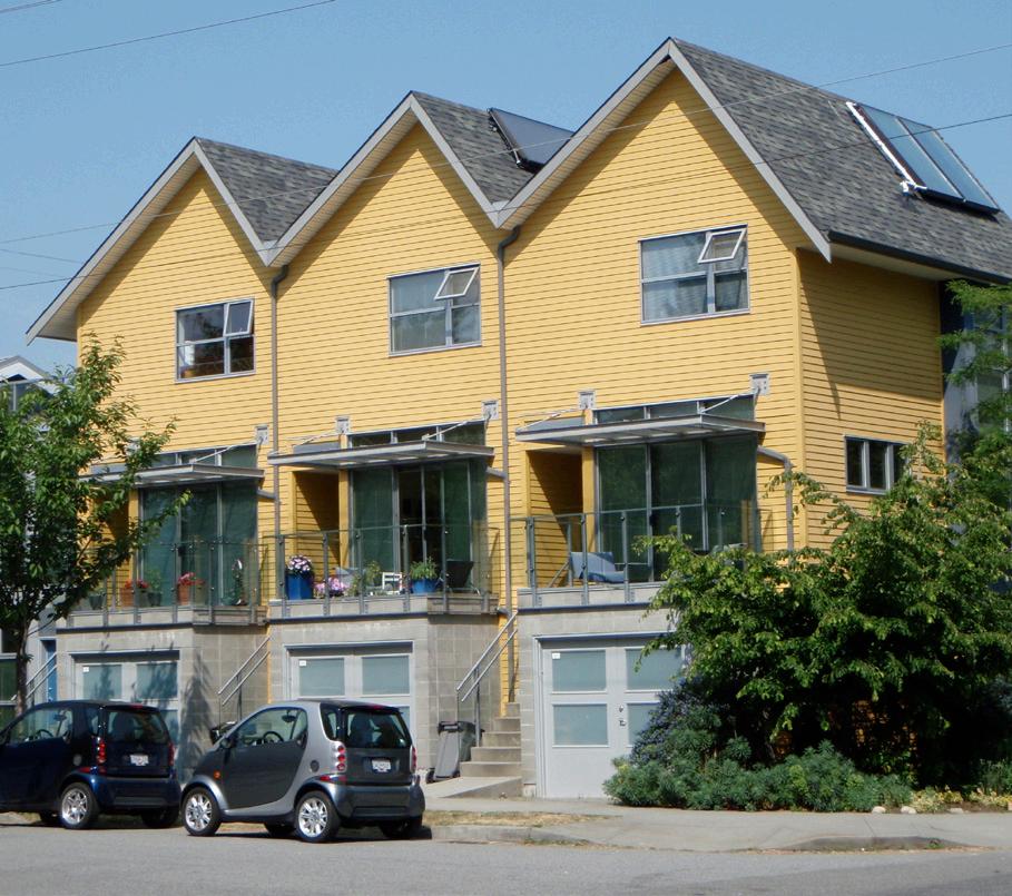
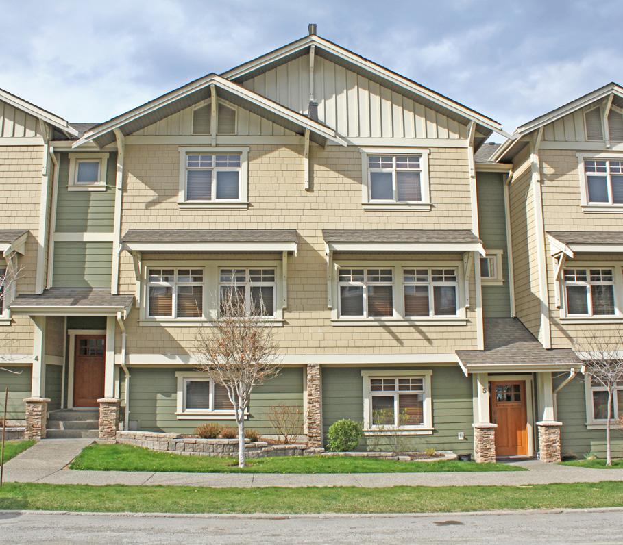
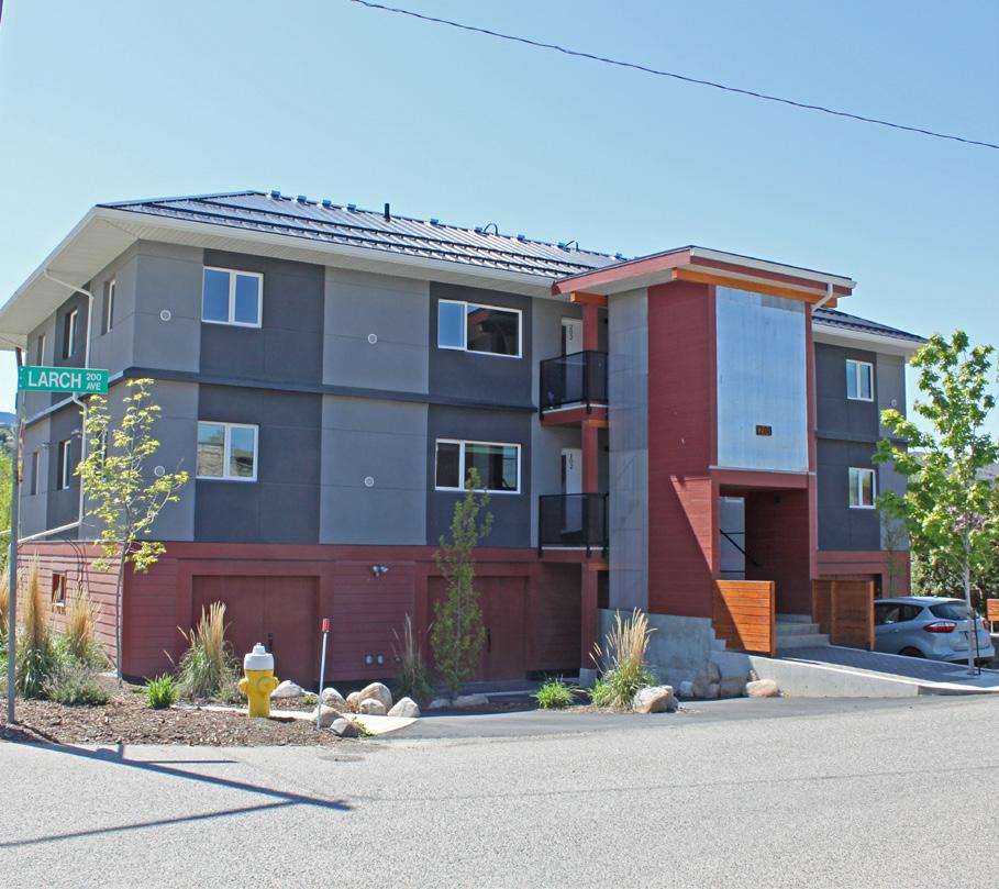
To support sensitive infill housing in the form of small single-family residences and duplexes, a proposed zoning change would allow subdivision of larger lots (>740 m2) to create compact 370 m2 single-family lots and duplexes on 464 m2 lots with lane access. An Intensive Residential Development Permit would be required and would provide guidance on the form and character of these housing forms to ensure development occurs in a manner that is sensitive to the existing built form. The zoning amendments would change current RT1 and RS1 lots to the new RT1C (formerly RT-3) zone and would allow sensitive infill and more housing options on the North Shore. A majority of residential lots in the McDonald Park neighbourhood already have this zoning and the recent Zoning Bylaw update also changed areas of the Downtown and West End to this zoning.
Following adoption of the North Shore Neighbourhood Plan, the Zoning Bylaw will be amended to change RT1- and RS1-zoned areas of the North Shore to RT1C zoning to support subdivision of large lots and allow sensitive infill of compact single-family housing and duplexes.
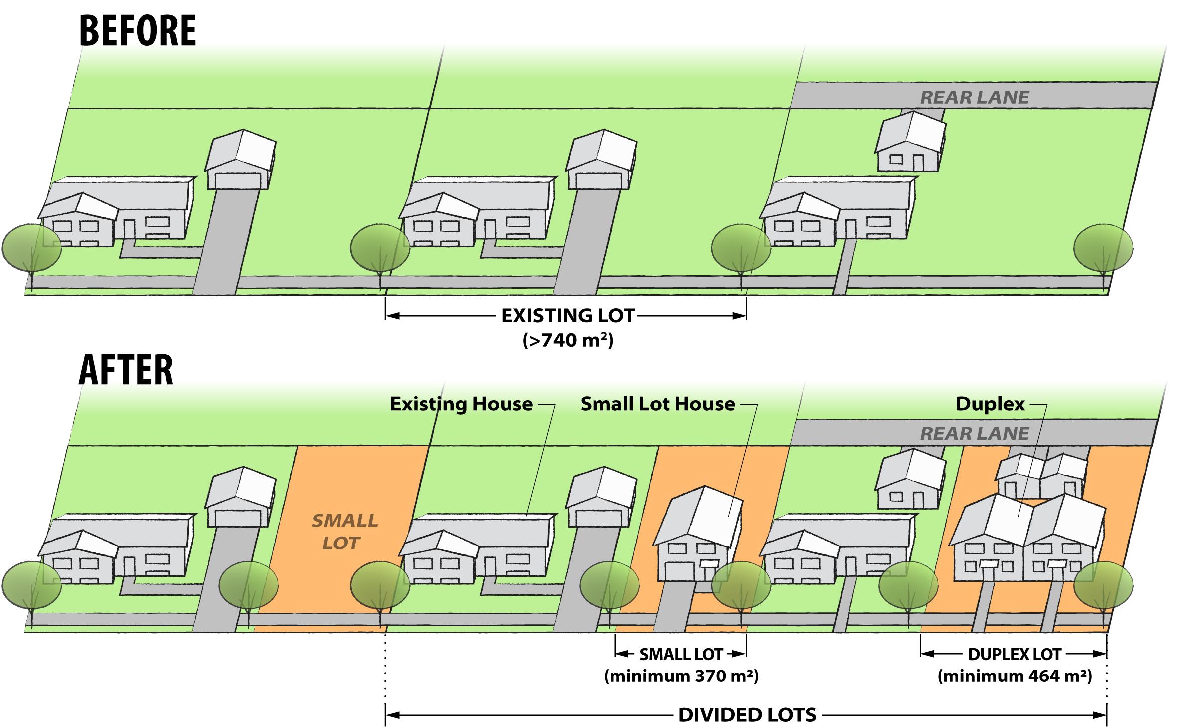
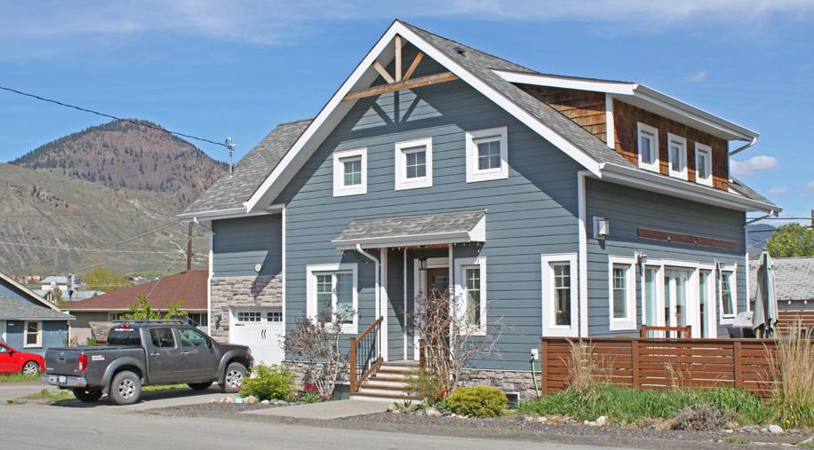
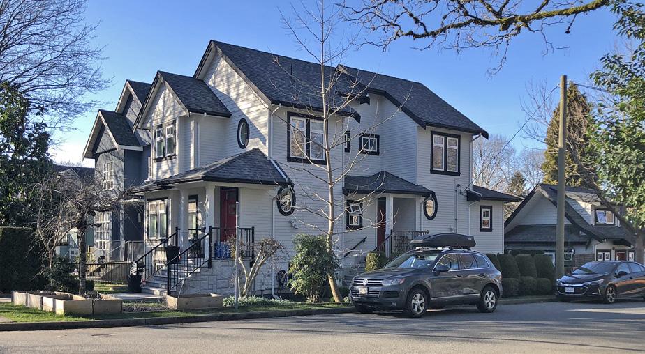
The proposed concept for Tranquille South involves transitioning the service commercial area between Tranquille Road and Clapperton Road to support an industrial arts district of maker spaces with live/work units in commercial buildings. The intent would be to bring housing and employment options closer together, and to provide additional housing options in walking distance of services and amenities on Tranquille Road. Over time, these uses may also result in redevelopment that increases the attractiveness and visual appeal of the area.
Live/work units typically support self-employed residents involved in making, servicing, or selling of goods or providing personal and professional services. Complementary live/work businesses would be encouraged in the Tranquille South service commercial area to support the industrial arts district vision, but live/work units may be supported in other mixed-use areas.
To facilitate the development of live/work units, the area would be rezoned from Service Commercial (C4) to Arterial Commercial (C6) or General Commercial (C1) following adoption of the North Shore Neighbourhood Plan. This would permit multi-family residential uses above street-level commercial uses.
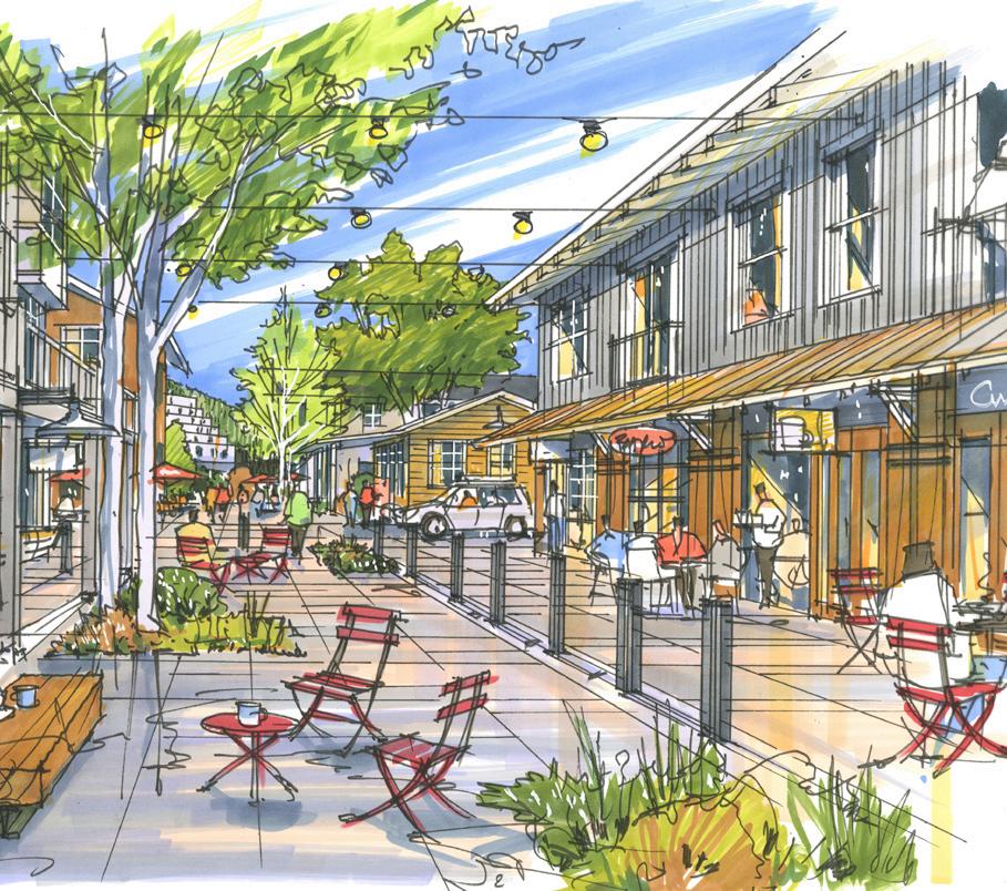
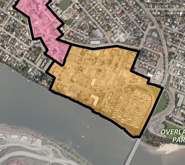
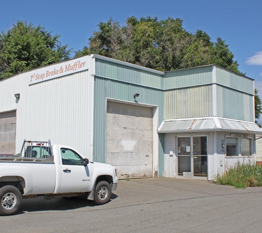
The Official Community Plan encourages the provision of parks in areas identified for future growth, in areas of substantial anticipated infill development, and in areas deficient in park space. The North Shore Town Centre reflects all three of these scenarios and residents identified the need for more indoor and outdoor community gathering spaces during North Shore engagement. The area currently contains a number of privately-owned sites with large surface parking areas that could be repurposed for community space, similar to the civic park green space and public amenity building concept identified through the design charrette process. This concept identifies the southern end of the Northills Shopping Centre property as a possible site, but other properties in the area could potentially accommodate this concept.
As the parcels in the area are privately-owned land, this concept would be developer-initiated, with timing dependent on market conditions and landowner interest. When redevelopment is eventually pursued here, the City will work with landowners to identify an appropriate site and explore options for acquiring land for public use.
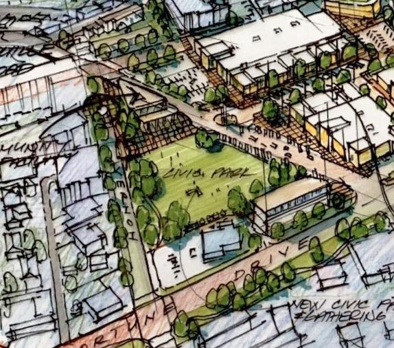
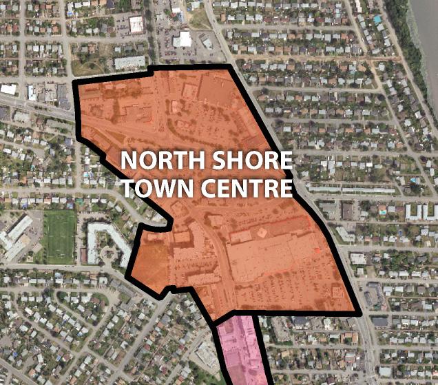
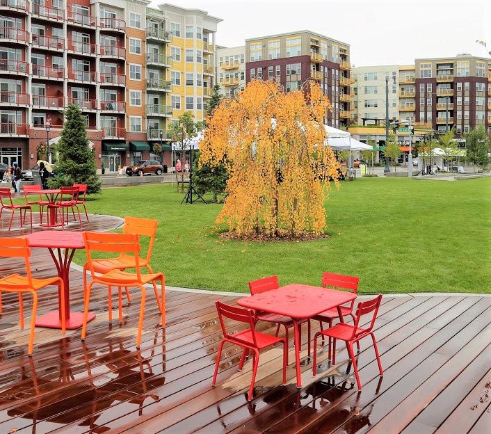
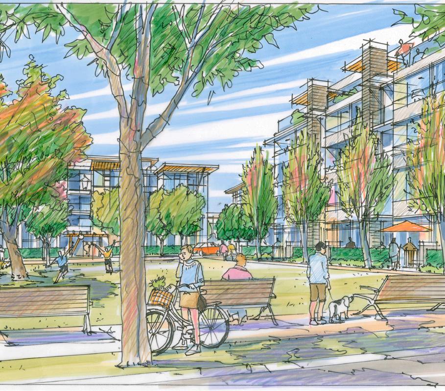
The Official Community Plan and Parks Master Plan highlight the need for a new neighbourhood park in the vicinity of Schubert Drive and Brentwood Avenue but do not identify a specific site.
As per the Parks Master Plan parks classification system, a "neighbourhood park" is typically between 0.2 ha (0.5 ac) and 5 ha (12.5 ac) and can include play equipment, pathways, open grass, seating, and, in some cases, recreation facilities. These parks are meant to form the visual, physical, and social focus of the neighbourhood and are typically accessed by walking, so they do not require parking lots.
A waterfront park space could be explored for this area as there is currently no formal, accessible waterfront or beach access along the northern section of Schubert Drive despite informal use by residents. A waterfront location with a formal shoreline access point for residents and non-motorized watercraft would help address public input received during the North Shore planning process to improve public space, access, and recreational opportunities along the waterfront.
A new neighbourhood park could be created through identification of a new site or through improvements or expansion of an existing park space, such as the Richmond Tot Lot, and could provide opportunities for new recreational amenities, such as waterfront access and/or a dog park. A proposed action in the North Shore Neighbourhood Plan is to undertake a study to identify a site and implementation considerations for a new neighbourhood park in the vicinity of Schubert Drive and Brentwood Avenue.

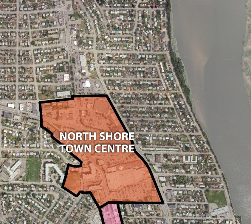
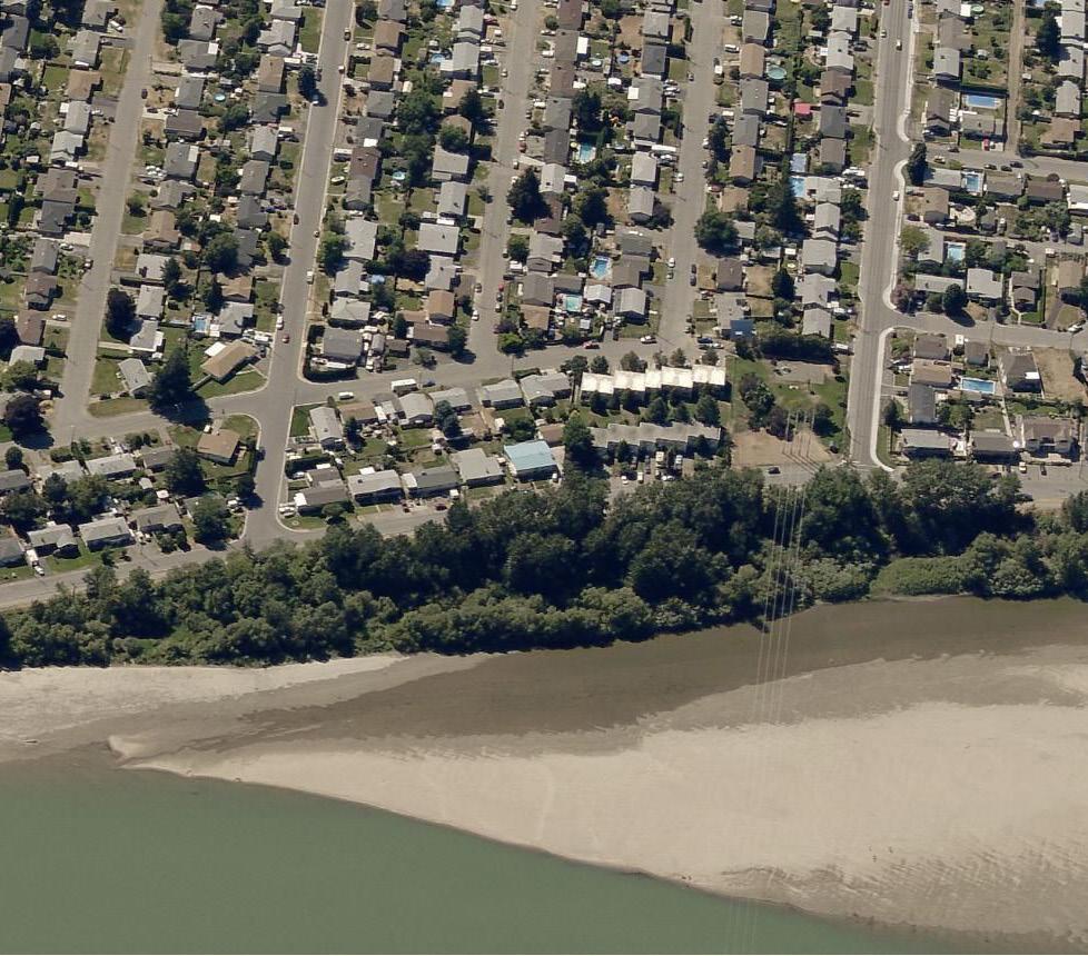
The redevelopment concept for Tranquille South identifies a waterfront extension of the Rivers Trail from the Overlanders Bridge to Royal Avenue, and could include opportunities for shoreline riparian area enhancement and flood mitigation strategies. The concept also identifies other complementary waterfront improvements that could be integrated into the Rivers Trail network, including a potential pedestrian boardwalk and pier extension that makes use of the old Thompson River bridge pillars. The intent would be to provide improved public access to a pedestrian-oriented waterfront as well as support opportunities for a re-imagined commercial element that connects Tranquille Road to the Thompson River.
The City will work with waterfront landowners to assess the feasibility of a waterfront extension of the Rivers Trail from the Overlanders Bridge to Royal Avenue in conjunction with waterfront redevelopment, including considerations for integrating flood mitigation measures, riparian area enhancements, and creative re-use of the old bridge pillars for a pedestrian pier extension or other (e.g. public art) feature.
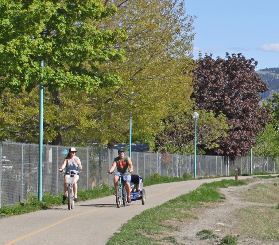

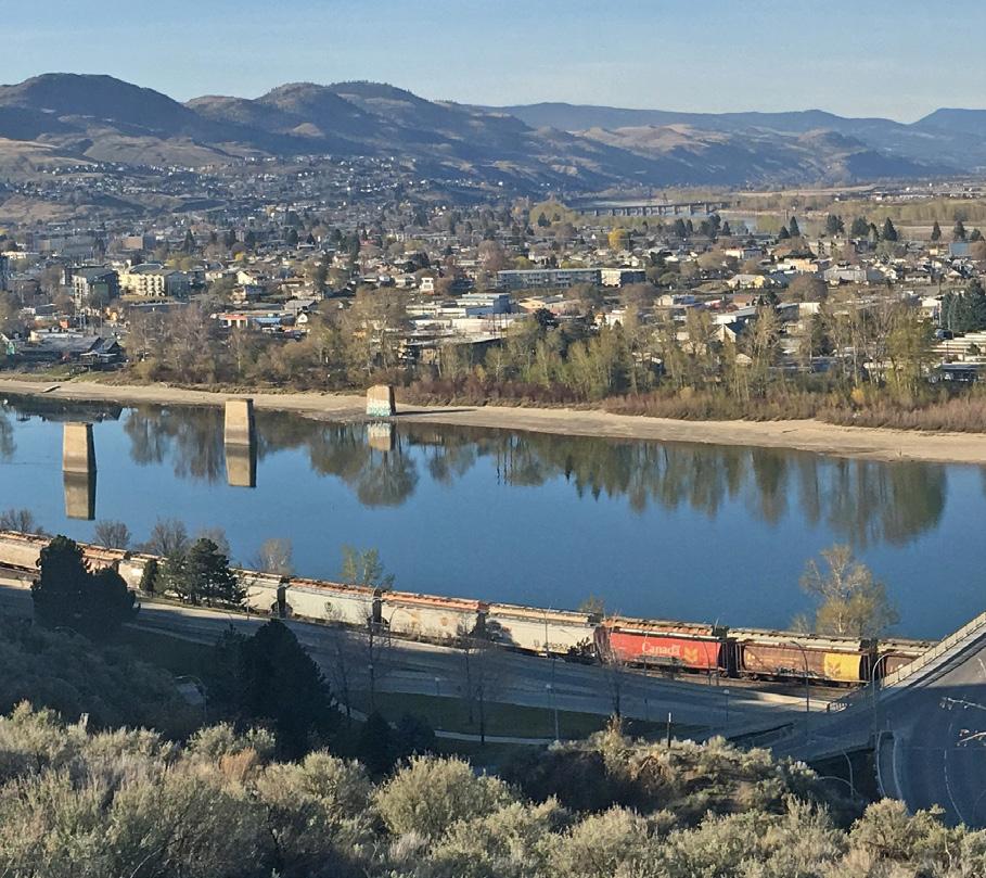
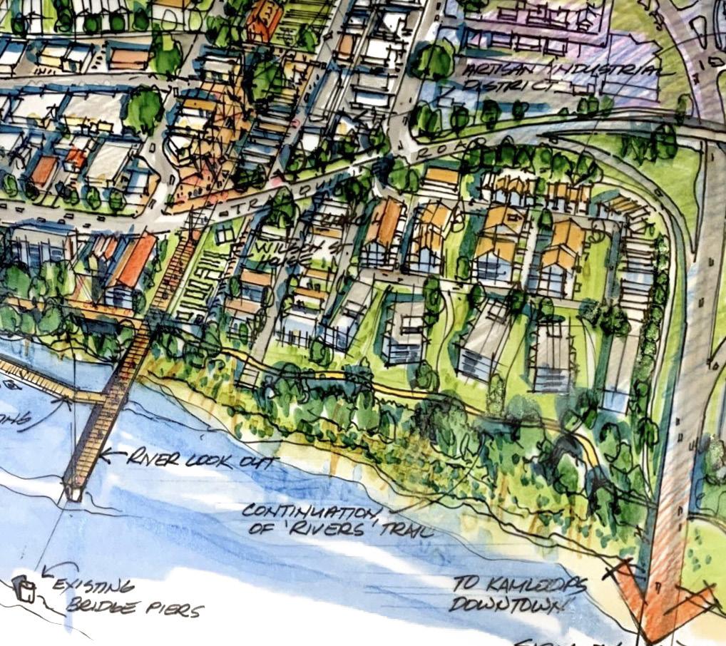
Public feedback received during fall 2020 engagement highlighted the importance of an east–west cycling connection through the McDonald Park, John Tod, and Schubert Drive neighbourhoods, including the need for safe crossings of Tranquille Road and Fortune Drive to support recreational users and improved amenity access (e.g. children travelling to and from Arthur Hatton Elementary). The Rivers Trail largely runs adjacent to the waterfront around the perimeter of North Kamloops and a more direct connection through these neighbourhoods is lacking.
Three east-west cycling routes have been identified to better connect the three neighbourhoods from Rivers Trail (on Royal Avenue) to Rivers Trail (on Schubert Drive) with safe and accessible crossings on the Tranquille Market Corridor and Fortune Drive. Potential routes include Comox Avenue through 7th Street, the North Shore Transit Exchange, and Renfrew Avenue to Kenora Road; Oak Road through Tranquille Road, Yew Street, and MacKenzie Avenue to Kenora Road; and Fort Avenue through Leigh Road, Clapperton Road, and Knox Street to Royal Avenue.
Further route refinement may be required prior to implementation, but the new routes could be added to the Transportation Master Plan project list when that plan is reviewed and updated in the coming years, including clarification on timing of implementation. The east-west cycling routes have been included as a proposed action in the North Shore Neighbourhood Plan.
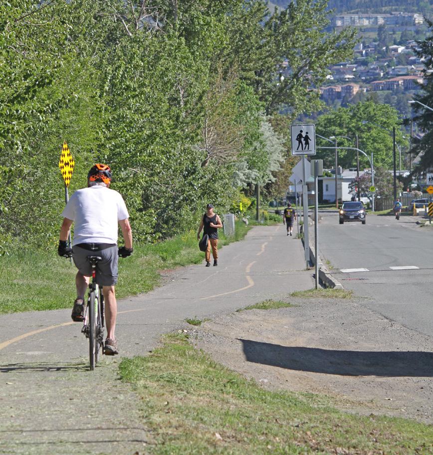
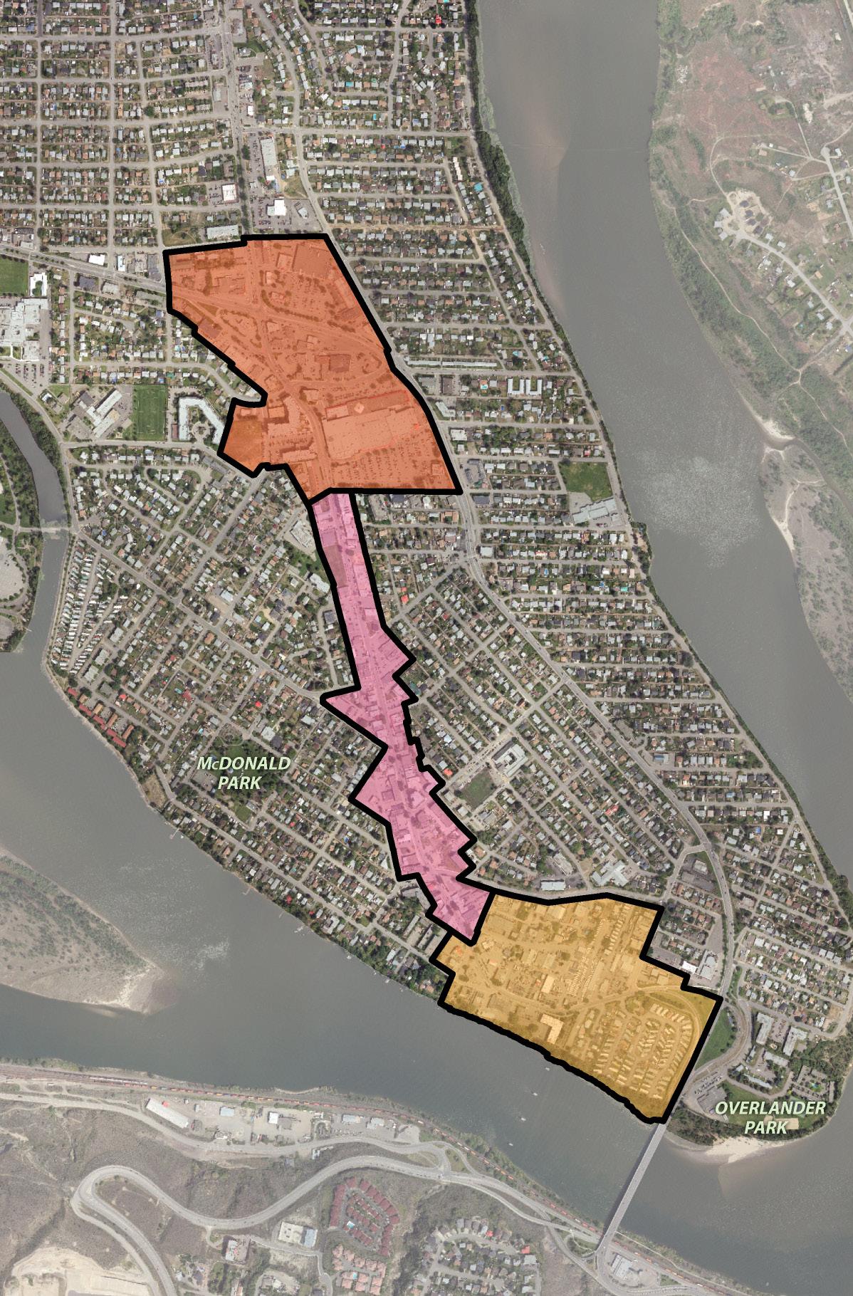
[THIS PAGE LEFT INTENTIONALLY BLANK]
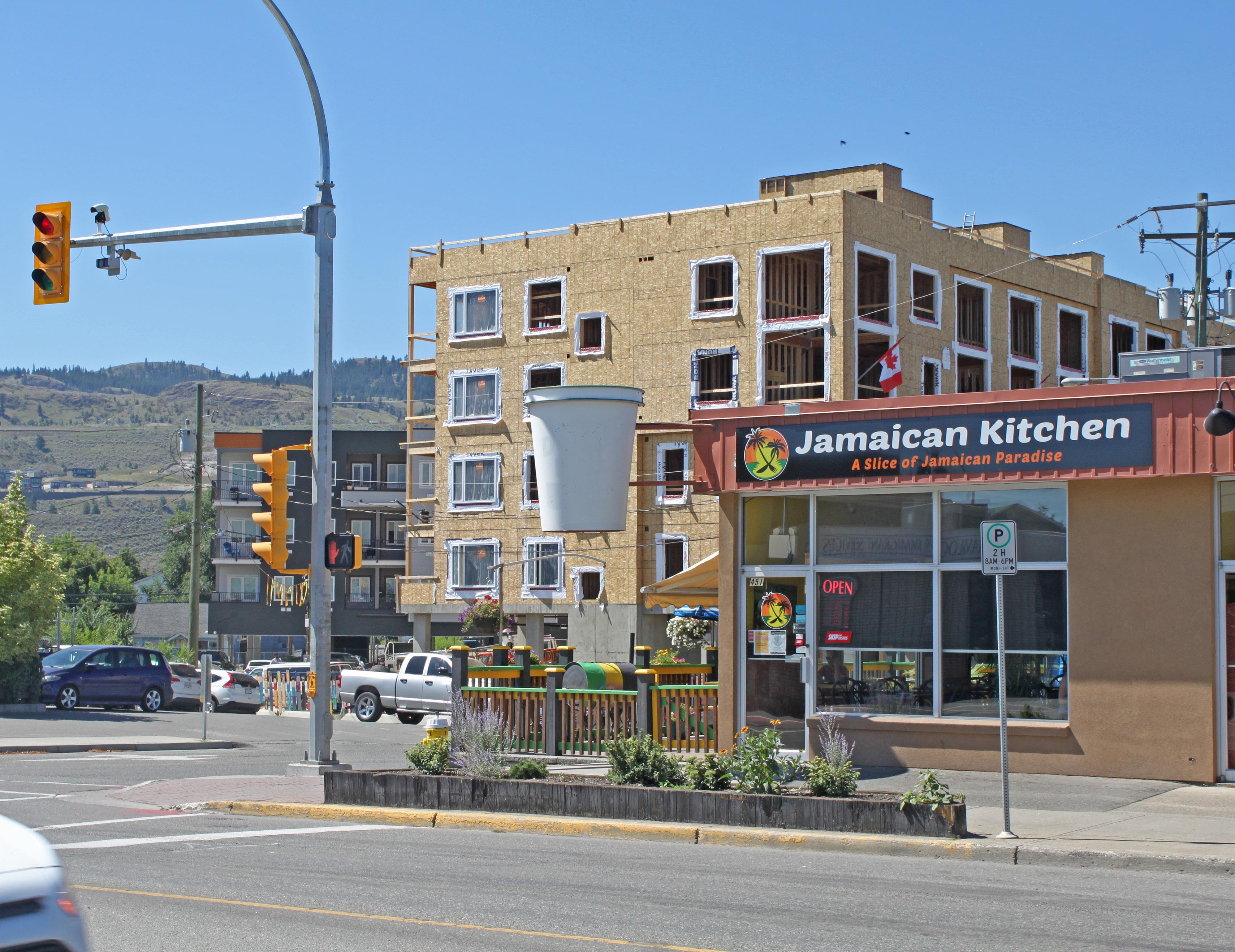
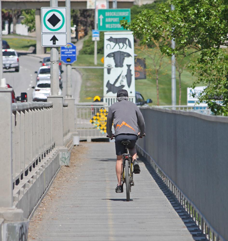
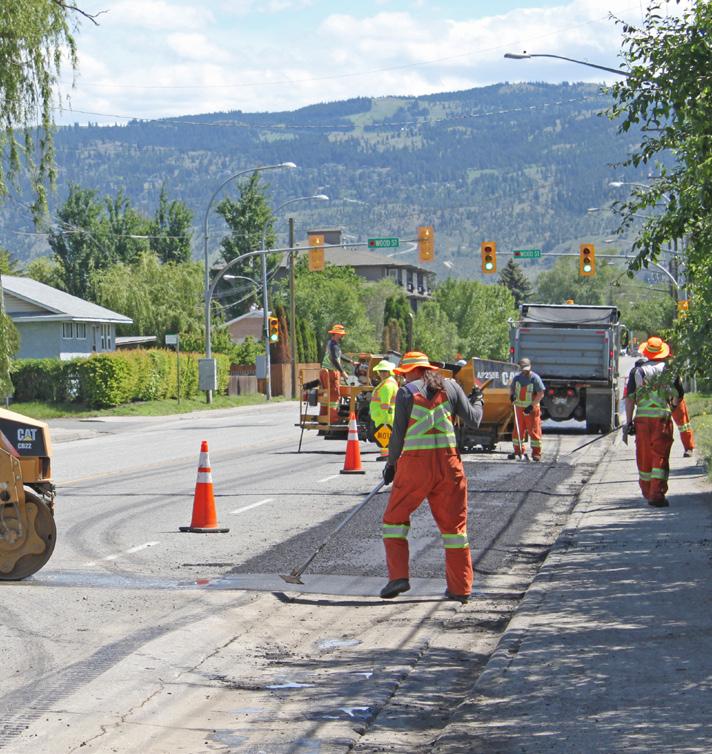
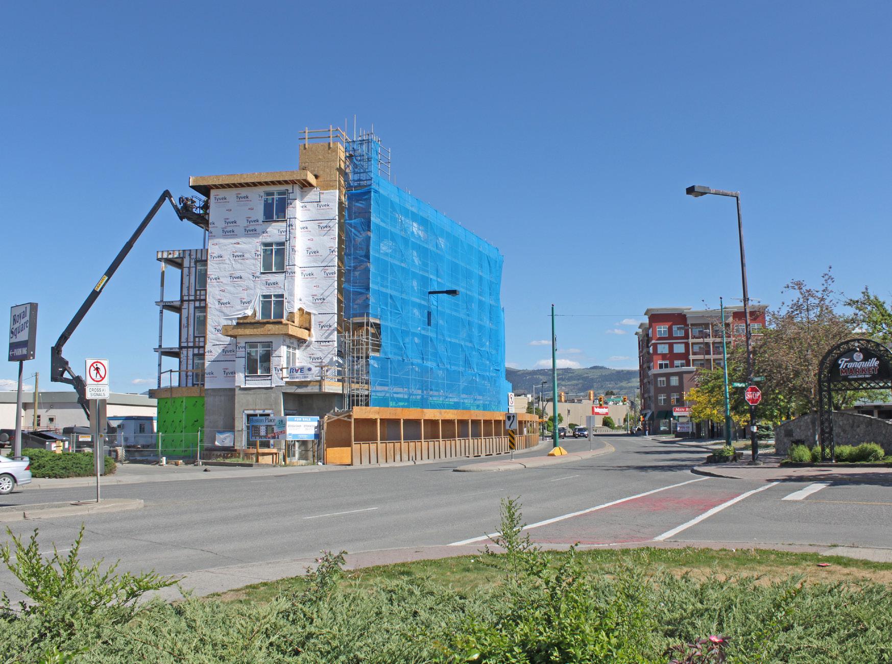
The North Shore Neighbourhood Plan includes a set of short-, medium-, and long-term actions to help implement the plan’s vision for the area over a 20-year time frame.
These actions are supported by the goals, objectives, and policies contained within the plan and are consistent with and complement the direction provided by the City’s Official Community Plan. Several of these actions will involve further engagement with City staff, Council, the public, and stakeholders to implement.
There are a number of other City plans and strategies that address land use and development considerations relevant to the North Shore Neighbourhood Plan area, such as the Transportation Master Plan and Parks Master Plan. Key implementation items that align with these plans are identified here; however, this does not include an exhaustive list of all additional actions and/or capital projects identified in other City plans that may be carried out on the North Shore within the next 20 years.
Many of these actions will require further planning and engagement with City staff, Council, the public, and stakeholders to reach completion.
1 Amend KAMPLAN
2 Amend Zoning
3 North Shore Revitalization Tax Exemption Update
4 Compact Lot Zoning
5 Infill Housing Zoning
6 Fulton Field Park
7 Parkcrest Elementary
8 Parklet Program
9 Landscape Guidelines
10 Outdoor Patio Guidelines
11 Heritage Conservation
Amend the Official Community Plan to formalize the new North Shore Development Permit Area Guidelines and reflect the land use directions in this plan, including an adjustment to the North Shore Town Centre boundary.
Amend the Zoning Bylaw to reflect the land use directions in this plan, including area-specific opportunities for increased density, more mixed-use development, and “missing middle” housing forms.
Update the North Shore Revitalization Tax Exemption Bylaw to reflect the land use directions in this plan, including boundary changes for eligible areas.
Change RT1- and RS1-zoned areas of the North Shore to RT1C zoning to support subdivision of large lots and allow sensitive infill of compact single-family housing and duplexes.
Create a new zone for multi-family infill housing development that considers permitting a maximum of four dwelling units on select properties with lane access to support more opportunities for missing middle housing forms.
Work with the Kamloops Airport Authority Society (KAAS) to implement the new Fulton Field Park and Captain Jennifer Casey Memorial.
Work with School District No. 73 (SD73) to rebuild Parkcrest Elementary and explore opportunities to improve pedestrian and cycling connections and crossings in the area to enhance safety and accessibility for students.
Develop a Parklet Program that includes mixed-use and neighbourhood centres on the North Shore, focusing on areas of high pedestrian activity.
and update the City’s Landscape Guidelines.
and update the City’s Outdoor Patio Guidelines.
Identify additional North Shore properties and heritage assets to include as part of the City’s Heritage Recognition Plaque Program and/or the City’s Heritage Register, in consultation with the City’s Heritage Engagement Group.
12 Royal Avenue Multi-Use Path Upgrade the Royal Avenue bike route between Knox Street and Palm Street to a separated multi-use path. Acquire additional land to expand the City-owned public right-of-way, as needed, to accommodate improvements.
13 Design Criteria Manual Update Review the City’s Design Criteria Manual to identify safety design improvement options for pedestrian and cycling facilities (e.g. pedestrian crossings, pedestrian shoulders, cycling safety treatments).
14 Streetscape and Public Realm Improvement Fund
15 Tranquille Market Corridor Streetscape Plan
Present to Council a proposal to increase annual funding for streetscape and public realm improvement projects to help enhance the accessibility, safety, and character of the Tranquille Market Corridor.
Work with the North Shore Business Improvement Association (NSBIA) to identify, pursue funding for, and implement public realm improvement opportunities on the Tranquille Market Corridor, which may include a review and update of the Tranquille Road Complete Streets plan.
16 Tranquille Market Corridor Parking Strategy Finalize and implement the recommendations of the Parking Management Plan to address continued growth and long-term parking needs of the Tranquille Market Corridor.
17 Heavy Truck Traffic
18 New Neighbourhood Park
Amend the City’s truck route network to avoid heavy truck traffic and the transport of dangerous goods through mixed-use and neighbourhood centres by providing a viable alternative that addresses health and safety, community livability, and transportation needs.
Undertake a study to identify a site and key implementation considerations for a new neighbourhood park in the vicinity of Schubert Drive and Brentwood Avenue to address an identified gap in the parks network as per the Official Community Plan and Parks Master Plan.
19 Lilac Avenue Waterfront Access and Public Space Formalize a pedestrian connection within the City right-of-way between the west end of Lilac Avenue and the adjacent section of the Rivers Trail to improve waterfront access. Work with the landowner of the Woodland Mobile Home Park to implement waterfront public space improvements, such as a small park, as part of future redevelopment.
# Project Actions
20 Airport Entry Corridor Enhancements and Multi-use Path
21 Overlanders Bridge Rivers Trail Crossing
Medium-term
22 Fortune Drive Frontage Road
Medium- to Long-term
23 Waterfront Rivers Trail Extension
Implement public realm and streetscape improvements along the Tranquille Road airport entry corridor, including an extension of the Tranquille Road multi-use path between Southill Street and Aviation Way, in conjunction with the Tranquille Sanitary Upgrade - Crestline to Southill.
Complete an assessment of the Rivers Trail crossing of the Overlanders Bridge to determine its current and long-term suitability for pedestrian and cyclist needs and identify potential improvements.
Close the Fortune Drive frontage road to vehicle traffic and reconfigure it for a widened pedestrian pathway with new street trees, landscaping, lighting, and improved transit stop.
Work with waterfront landowners to assess the feasibility of a waterfront extension of the Rivers Trail from the Overlanders Bridge to Royal Avenue in conjunction with waterfront redevelopment, including considerations for integrating flood mitigation measures, riparian area enhancements, and creative re-use of the old bridge pillars for a pedestrian pier extension or other (e.g. public art) feature.
City
term City
Medium to long term City and Private
24 Brocklehurst West FDA and New Park
25 Henry Grube FDA and Overlander Park Upgrades
Undertake a comprehensive review of the Brocklehurst West Future Development Area (FDA) as a condition of redevelopment to confirm appropriate future uses; assess integration considerations with surrounding land uses; and identify a future neighbourhood park site as per the Official Community Plan and Parks Master Plan.
Undertake a comprehensive review of the Henry Grube Future Development Area (FDA) as a condition of redevelopment to determine appropriate future uses; assess integration considerations with the waterfront, Rivers Trail, Overlander Park, and Overlanders Bridge; and evaluate potential complementary improvements to Overlander Park and Beach.
Medium to long term City and Private
26 East-West Cycling Routes
Identify and implement new east-west bike routes to connect the McDonald Park, John Tod, and Schubert Drive neighbourhoods and Rivers Trail, and add to the Transportation Master Plan project list during its next review and update process. Potential routes include Comox Avenue through 7th Street, the North Shore Transit Exchange, and Renfrew Avenue to Kenora Road; Oak Road through Tranquille Road, Yew Street, and MacKenzie Avenue to Kenora Road; and Fort Avenue through Leigh Road, Clapperton Road, and Knox Street to Royal Avenue.
Medium to long term City and SD73
Medium to long term City
Table 7.1 » List of Action Items (Continued)
27 North Kamloops Roadway Improvements Implement the recommended roadway and intersection improvements identified in the North Shore Traffic Study.
28 Civic Park and Amenity Building Work with private landowners to identify an appropriate site in the North Shore Town Centre to accommodate a civic park and amenity building to achieve the Official Community Plan target of 100% of Kamloops residents living within 400 m of a park or civic recreational facility by 2039.
29 Second Bridge Crossing
Undertake studies to confirm the preferred location, feasibility, and other technical considerations of a second bridge crossing of the Thompson River, taking into consideration the impact on land use; local and regional mobility; and commercial, industrial, and goods movement.
to long term City
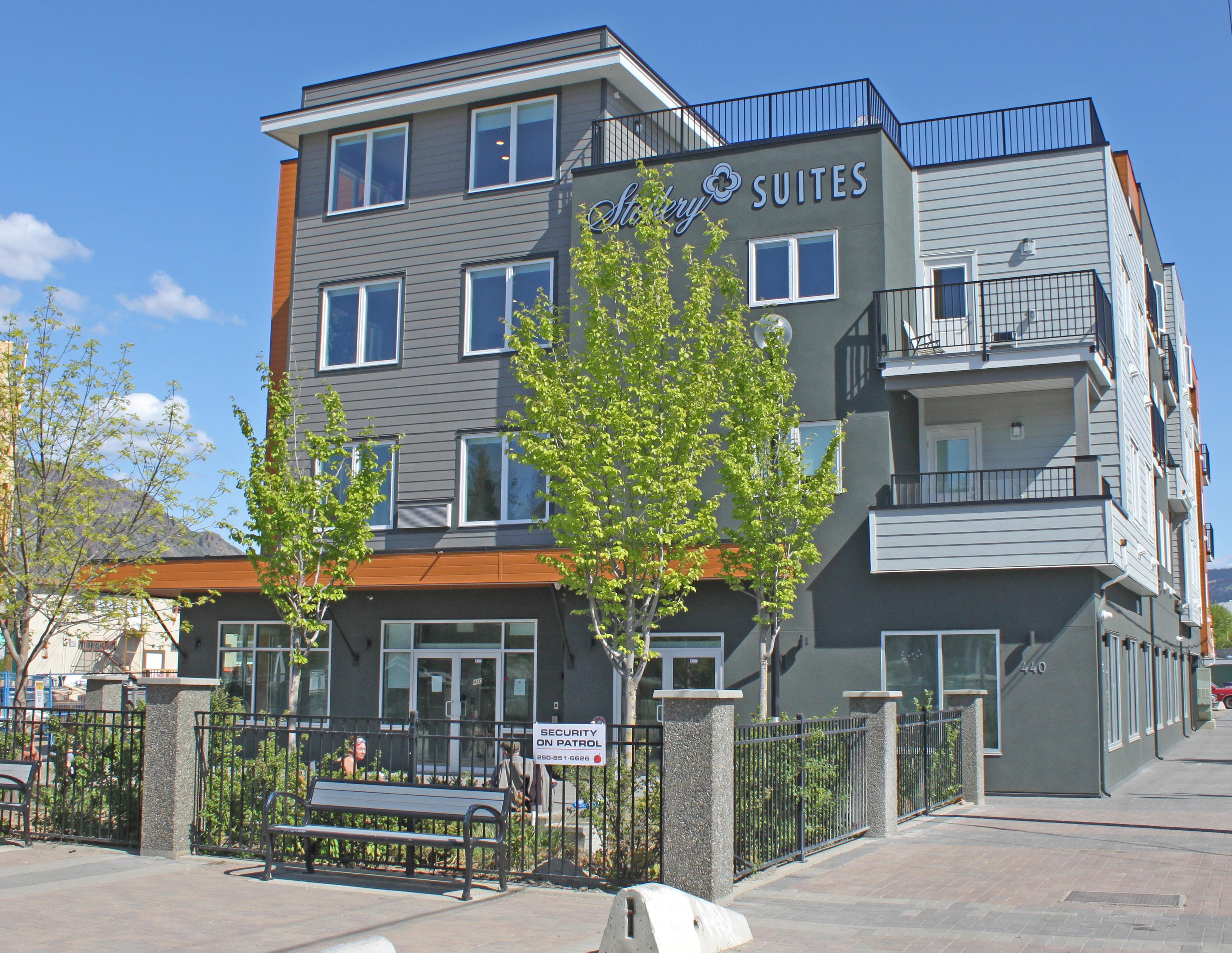
The purpose of the North Shore Development Permit Area is to establish objectives and provide guidelines for the form and character of development in the North Shore Town Centre and Tranquille Market Corridor. These guidelines ensure that all development within these areas advances the vision articulated within the North Shore Neighbourhood Plan.
Development permit applications shall detail pedestrian and vehicular access and circulation, landscaping, building elevations, site layout, and street enhancements. Submissions should show adjacent sites (including opposite street fronts) and must show design details within the adjacent public realm (e.g. street frontage), including transition, pedestrian clear, and furnishing zones, as described in Section 5: Streetscapes. Site plans should also include an accessibility overlay, that identifies accessible pathways, parking, entrances, and other features.
The North Shore Development Permit Area applies to the North Shore Town Centre and Tranquille Market Corridor, as shown in Figure 8.1. Largely form-based, the North Shore Development Permit Area Guidelines should be used in conjunction with the City’s use-specific development permit area guidelines, depending on the development permit application’s proposed uses.
Applications for the following shall not be required to apply for a development permit under the North Shore Development Permit Area Guidelines but may be subject to other City of Kamloops development permit area guidelines:
• internal renovations
• external renovations that do not require a building permit and do not affect the form and character of the building or site (to be determined by the Development, Engineering, and Sustainability Department)
• single- or two-family dwellings
The objectives of the North Shore Development Permit Area Guidelines are to:
• align development with the vision of the North Shore Neighbourhood Plan
• integrate new development into neighbourhoods in a manner that reduces environmental impact
• maintain and enhance desirable characteristics found in existing neighbourhoods
• encourage healthy lifestyles and sustainable local growth through well-designed, durable buildings, landscapes, and public spaces
• animate the public realm to enrich the sense of place
• accommodate active transportation modes and transit usage
• ensure that new development is compatible with the form and character of existing development and mitigate potential impacts on adjacent uses
• support sustainable water and energy management through site and landscape design
The specific level of requirement associated with individual guidelines is determined by the following words:
“Shall” or “must” and/or the use of the adjective “required” means that the definition and/or guideline is required.
“Shall not” or “must not” and/or the use of the adjective “prohibited” means that the definition and/or guideline is prohibited.
“Should” and/or the use of the adjectives “recommended” and/or “encouraged” reflects a strong positive preference of the guidelines. In particular circumstances, there may exist valid reasons to not apply a particular guideline, but any approval will require demonstration that an alternative solution is consistent with the overall intent of the guideline in the opinion of the Development, Engineering, and Sustainability Director.
“Should not” and/or the use of the adjectives “not recommended” and/or “discouraged” reflects a strong negative preference of the guidelines. In particular circumstances, there may exist valid reasons to apply an alternate solution; however, it must be demonstrated that the alternative meets the intent of the guideline in the opinion of the Development, Engineering, and Sustainability Director.
“May” and/or use of the term “optional” means that the guideline is discretionary.
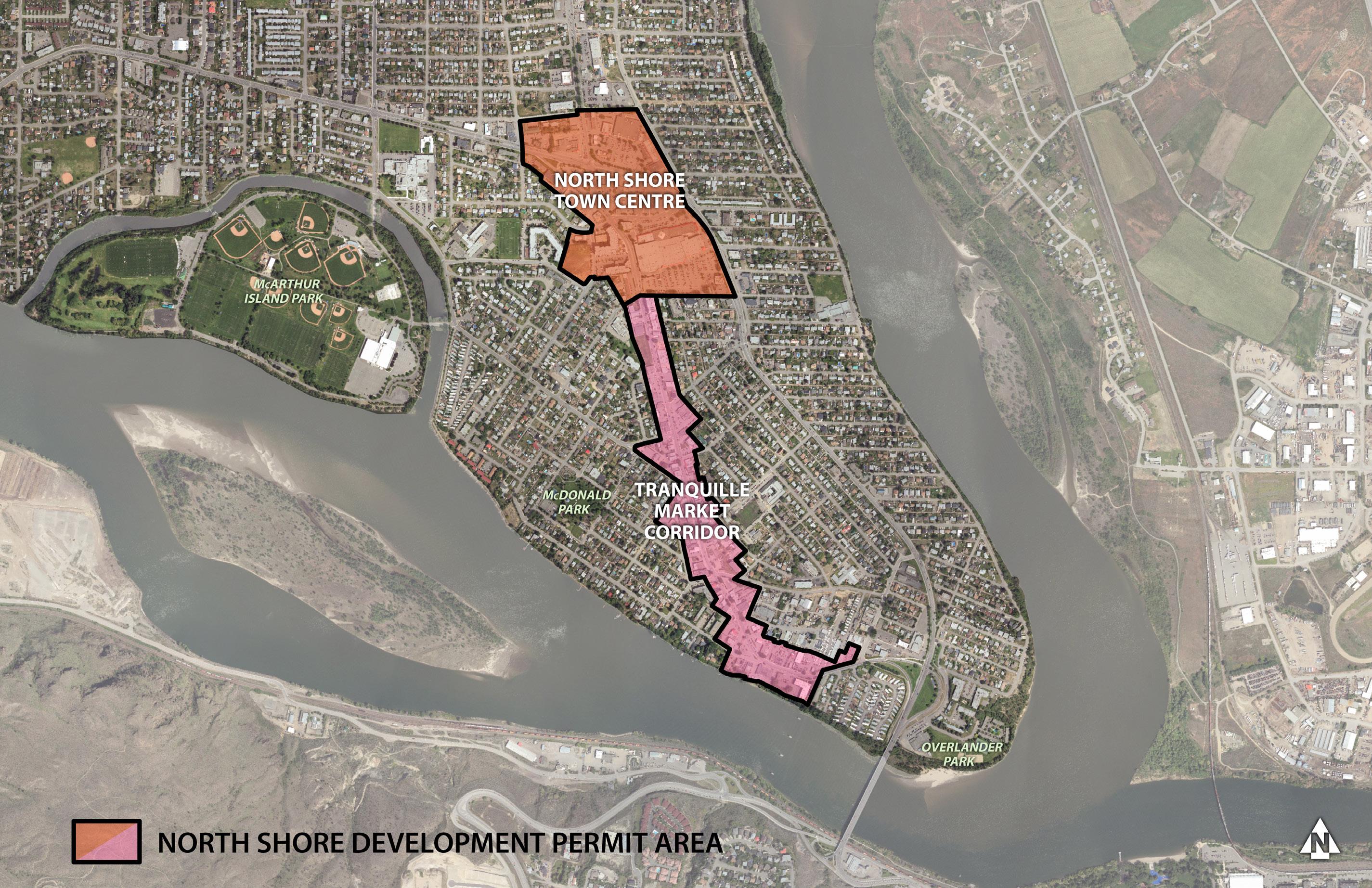
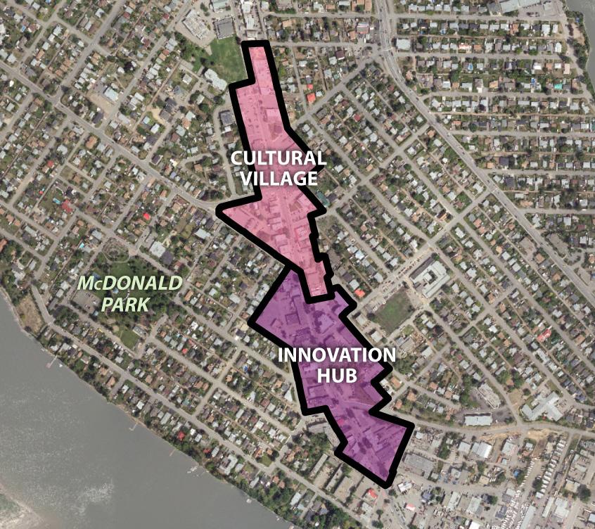
INCLUSIVE. The North Shore is welcoming, affordable, and accessible with a strong sense of community pride and is a place where people feel safe, ethnic and cultural diversity are celebrated, all residents are treated equitably and respectfully, and a diverse mix of housing options and services ensures people of all walks of life can thrive.
• Community Building Land uses and a built form that support local people, businesses, and community groups to grow, collaborate, and undertake projects that improve the community and better the lives of residents.
• Add Missing Housing
Housing options that span the spectrum between single-family homes and high-rise apartments support affordability and the needs of a diverse demographic.
• Community Well-Being
An urban realm that supports the health of residents and enhances safety through improvements to lighting, landscaping, signage, transportation infrastructure, and building design.
DYNAMIC. An attractive, eclectic, authentic, and innovative destination for local arts, culture, and food, the North Shore is animated day and night by creative entrepreneurs; inviting streetscapes and public gathering spaces; and lively entertainment, events, and recreational opportunities.
COMPLETE. With a well-connected network of sidewalks, bike routes, and green streets, the North Shore provides residents convenient access to a wide range of retail options, employment areas, health services, parks, waterfront amenities, and community facilities.
• Celebrate Character
The North Shore’s unique character, culture, and history, including its Indigenous heritage, is celebrated through its built form and community events.
• Shared Space Public gathering spaces provide opportunities for seating, eating, events, and socializing.
• Welcoming Mixed-Use Districts
Walkable neighbourhood centres that invite North Shore residents and visitors to live, work, shop, and play.
• Embrace the Waterfront
A waterfront that provides opportunities for recreating, socializing, shopping, and dining while enhancing natural ecosystems and mitigating flood risk.
• Connecting Corridors
A well-connected network of sidewalks and multi-use paths connect distinct districts, neighbourhood nodes, and major amenities in an accessible, safe, and convenient manner.
The following list of key questions provides an outline to guide applicants in writing their letter of intent as part of the development permit application. Applicants must demonstrate how their project addresses each of the following questions with specific reference to site plans, sections, renderings, and other materials included with the application package. Each section of these guidelines (e.g. Site Planning, Building Design) begins with an example of the language that may be used to describe applications and how they address the guidelines.
How does the proposal effectively integrate uses that are complementary to its surroundings (e.g. through the use of sensitive and/or interesting transitions in building form and character)?
Refer to guidelines: (1) d.iv, d.v, e.ii, g.iii, h; (3) a.ii, a.iv; (4) c.vii
How does the proposal contribute to improved pedestrian safety, accessibility, comfort, and enjoyment?
Refertoguidelines:(1) b, d, e, g, i; (2) a-e, g, i, j, l; (3) b, d, e; (4) a-f, h; (5)
How does the proposal incorporate principles of universal design?
Refertoguidelines:(1)e.ii,h;(2)a.v,l.ii;(3)a.ii
How does the proposal celebrate the North Shore (e.g. art and/or interpretive signage)?
Refer to guidelines: (1) i; (4) c, f-h
How does the proposal contribute to the North Shore’s sense of identity (e.g. heritage preservation, artistic space, and/or cultural interpretation)?
Refer to guidelines: (1) a, i; (4) c, f , g.iv
How does the proposal incorporate places to gather, socialize, or sit?
Refer to guidelines: (1) e; (5) d, e
How does the proposal effectively utilize building (modulation, articulation) and/or landscape design (variety, texture) to enhance and/or create visual interest on the street?
Refer to guidelines: (2) c, d, i, j; (3) b, e; (4) f, g
How does the proposal include greenspace and/or landscaping that is appropriate for the North Shore’s climate and character?
Refer to guidelines: (1) c; (3) b-e; (5) f
How does the proposal enhance neighbourhood connectivity?
Refer to guidelines: (1) b, f; (4) c, h; (5) c
These guidelines prescribe attention to context, such as neighbouring buildings and site conditions, to help achieve the vision for the North Shore.
a. Be a building block for a cohesive North Shore
i. Site design must account for the relationship to existing opportunities and constraints within the surrounding context and demonstrate (through annotation of site plans and elevations) that the improvements are thoughtfully integrated with its context and neighbours.
ii. Site design must demonstrate integration of architecture and landscape architecture. Utilize a landscape architect’s expertise in integrating vegetation and green infrastructure within site designs.
iii. Site design should identify, reflect, and enhance unique site attributes (e.g. irregularly shaped lot, notable landscape features) where they exist.
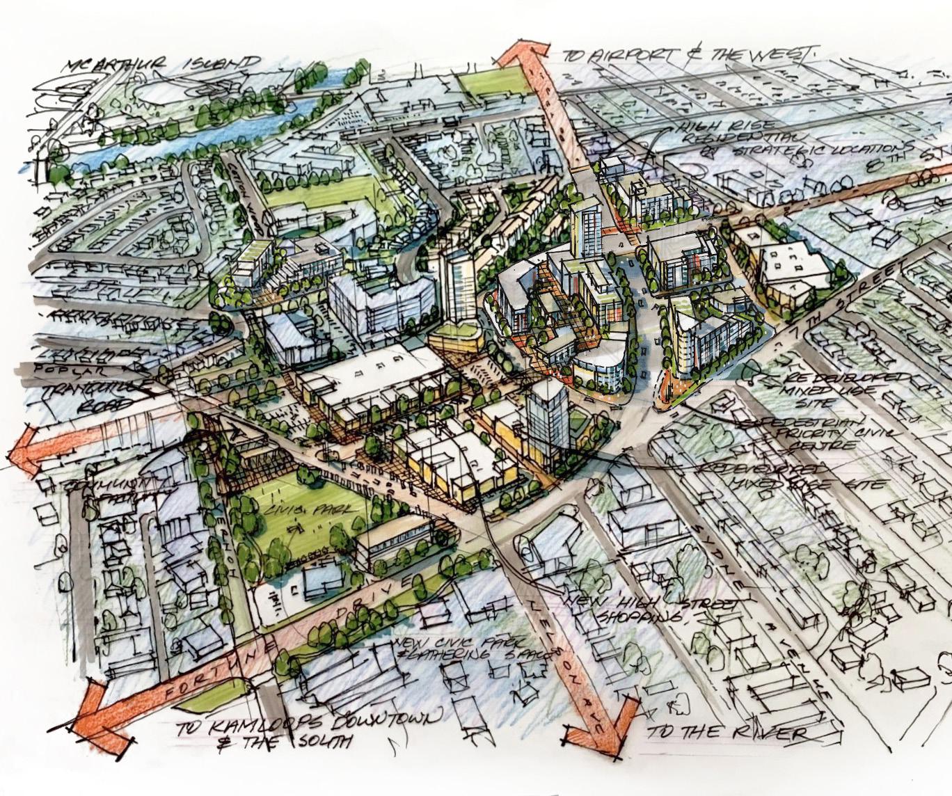
and intuitive wayfinding (paving treatments, sightlines)
Note that the above sketch and descriptions represent an example of appropriate consideration of design guidelines and is for illustration purposes only.
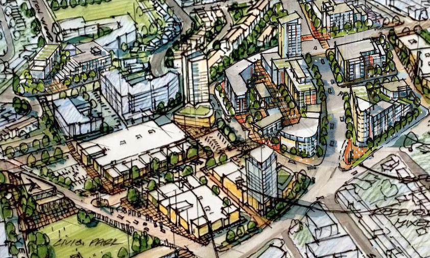
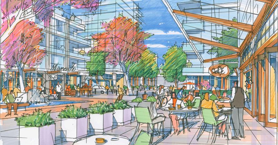
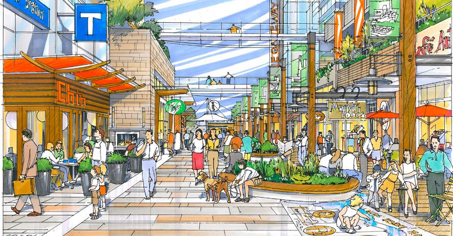
b. Refine, repair, and/or enhance the North Shore's urban fabric
i. Site designs should contribute to a finer-grained network of pedestrian pathways that allow people to safely navigate a site and connect to public streets/lanes and nearby amenities (e.g. businesses, transit exchanges, bicycle routes, parks, and recreation facilities). This is of particular importance for consolidated sites that may require large buildings to be broken up into smaller ones to allow for pedestrian permeability. Locating pathways and crosswalks mid-block or along desire lines (connecting key destinations) is strongly encouraged. An example would be to build internal pedestrian pathways or mews to increase the permeability of large blocks in the North Shore Town Centre, as identified in the North Shore Neighbourhood Plan.
ii. Design sites to promote intuitive wayfinding through pathways, sightlines, and signage. Provide direct access and clear sightlines to bus stops and shelters. Art and ornamental features (e.g. fountains and sculptures) are also encouraged to contribute to pedestrian wayfinding and enjoyment.
iii. Where large/consolidated sites contribute public and semi-public amenity space at ground level, it should be easily accessed from adjoining streets and visible from the public realm/ sidewalk wherever possible to promote intuitive wayfinding. Examples of outdoor amenity areas include landscaped and trellised seating areas, plazas, playgrounds, outdoor cooking areas, and/or irrigated gardens (e.g. ornamental, edible, and/or community).
c. Demonstrate awareness of semi-arid landscape and natural systems context
i. On-site stormwater management should be incorporated in landscape design (e.g. bioswales and rain gardens). It is encouraged to make these landscapes visually interesting and a visible feature of the design.
ii. Designs on sloping sites should work with natural topography. Step buildings along the length of a sloping site (10% or greater) to integrate the building into the slope.
iii. Where necessary, retaining walls with an exposed face of 3 m or greater in height should include terracing and/or articulation. Terraces should be designed to accommodate landscape
areas that soften the wall’s appearance and should be accessible for maintenance. Where walls exceed 1.5 m in height, landscape features, such as trees, shrubs, or vines, should be provided adjacent to the wall. Lock-Block retaining walls are not supported.
Improvements should actively contribute to public life. This happens in the way buildings address the public realm to either frame it or expand it. The following guidelines outline the role development proposals should play in shaping public “rooms” of streets and plazas.
d. Use built form and landscape to frame public and semi-public spaces
i. The siting of new buildings should define the street wall by fronting directly onto the street or be set back to allow for plaza space (not parking) and indoor/outdoor function of the building as an extension of an activated public realm. In cases where a building cannot provide that definition, street edge continuity should be achieved through landscape elements such as trees, fencing, or hedging.
Designs on sloping sites reflect natural topography
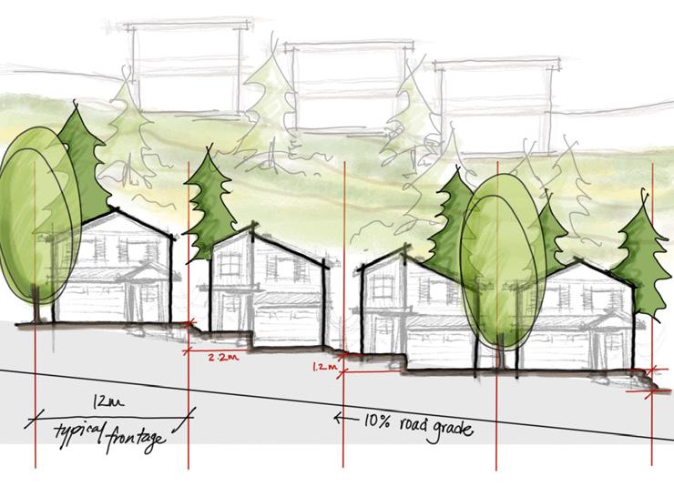
Buildings define the street wall by fronting directly onto the street and should be broken up at least every 45 m.
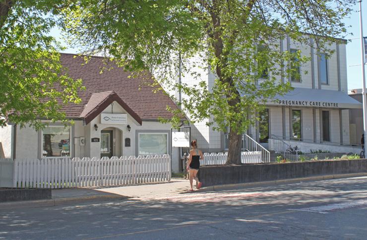
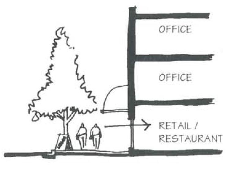

ii. The base of a building should be substantially broken up at least every 45 m to vary the spatial experience for pedestrians. In the Cultural Village area of the Tranquille Market Corridor (see Figure 8.1), this should occur every 15 m to provide a better fit with existing smaller-scale storefronts.
iii. Orient buildings to primary frontages. Building design and use should acknowledge the use of the primary frontage to enhance street character (e.g. ground-level retail; ground-level access; and the use of different textures, scale, or materials on ground level). Buildings backing onto the waterfront should maintain a strong, active, presence along the primary street frontage.
iv. Design building frontages to reflect their uses. In a commercial setting with ground-level commercial retail units (CRUs), this means providing lively pedestrian environments (e.g. with outdoor furnishings). In a residential setting with ground-level residential units, this means using layering of elements, including, but not limited to, street-facing stairs, porches, patios, and landscape elements (plantings, pathways, screen walls, etc.) to transition between the public and private realm.
v. Support safety through the concept of “eyes on the street” by ensuring residential units, offices, and other upper floor uses overlook public and semi-private spaces and connections such as sidewalks, walkways, plazas, gardens, parkland, and strata roads to provide views and surveillance of activity areas.
vi. Front yard and side street yard setback minimums and maximums can be increased only with the use of a pedestrian plaza, front entry landscape feature, or public area feature at the corner of any property adjacent to intersections.
Safe, comfortable, accessible, and enjoyable pedestrian environments should be prioritized.
e. Create pedestrian-friendly environments
i. New development on corner lots or fronting mid-block crosswalks shall incorporate curb-extensions to encourage safer, more pedestrian-friendly streetscapes. The Tranquille Road Complete Streets Plan (or successive plan) should be consulted for identified pedestrian improvement locations.
ii. Places to gather, socialize, and sit are strongly encouraged. Integrate usable, well-framed public and private open spaces, including squares, plazas, and roof-top gardens. Public and semi-public spaces should be located adjacent to sidewalks and active uses (cafés, shops, small businesses, etc.) in highly visible areas and accessible without vehicular traffic interference. They should be oriented to receive sunlight, with trees and landscape to provide weather protection.
iii. Define and transition private and semi-private spaces with elements such as patios, paving treatments, grade changes, and vegetation to transition spaces as appropriate. Ensure clear, accessible paths of travel are maintained along City sidewalks and entryways to buildings.
iv. The Tranquille Road and Sydney Avenue / North Shore Transit Exchange pedestrian realms are of priority importance. Redevelopment along the south side of these streets should utilize architectural strategies (e.g. setbacks/stepbacks) to avoid shadow impacts on the north sidewalk and any adjacent parks or plazas.
v. Sites within the North Shore Town Centre with internal pedestrian pathways (e.g. pedestrian mews) should be fronted by active commercial uses to support pedestrian activity and create a safe, comfortable, and enjoyable pedestrian experience.
f. Accommodate cyclists
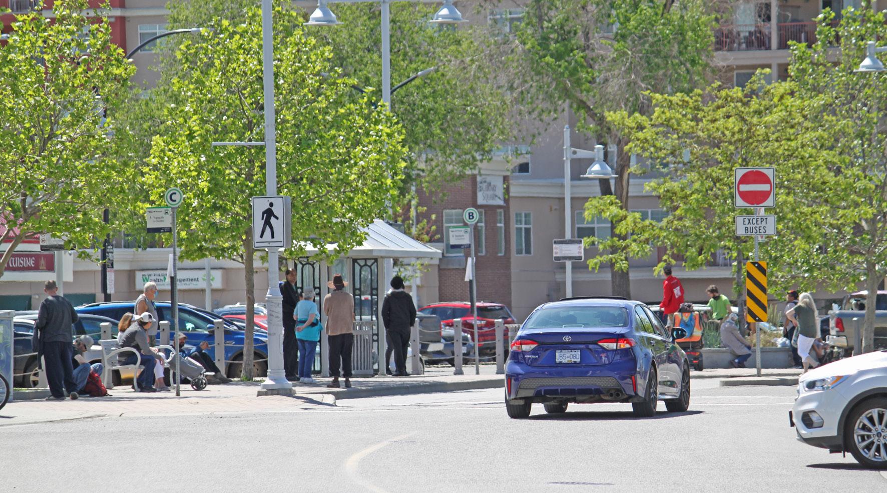
Surface vehicle parking for commercial uses and residential visitors is located at the back of the building and accessed from the alley
i. Short-term bicycle parking should be located near building entrances in highly visible locations, preferably covered.
ii. Long-term bicycle parking shall be secured and weather-protected (e.g. in a locked room or secondary shelter/building) and located near building entrances and lobbies at ground level or underground.
g. Minimize car- and parking-related impacts to the public realm
i. Vehicular access and off-street vehicle parking should be accessed from the alley or, for sites without alley access, from secondary frontages with lower pedestrian activity. Vehicle parking lots and parkades located in front of buildings (adjacent to the primary street) or facing an intersection are not permitted. Where driveways must cross sidewalks, sidewalks should be continuous and level through the conflict zone. Where appropriate, safety and/or traffic-calming measures should be installed to ensure cars slow down and respect pedestrian priority.
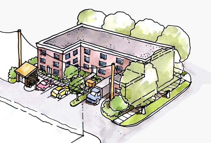

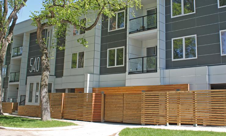
ii. The majority of required off-street parking should be provided underground.
iii. Underground parking should not exceed the level of natural grade. Where underground parking must be partially above grade, this may only happen along rear and secondary frontages. Limit it to 1 m above grade and use attractive, high-quality materials on the exposed structure and/or screen with landscape.
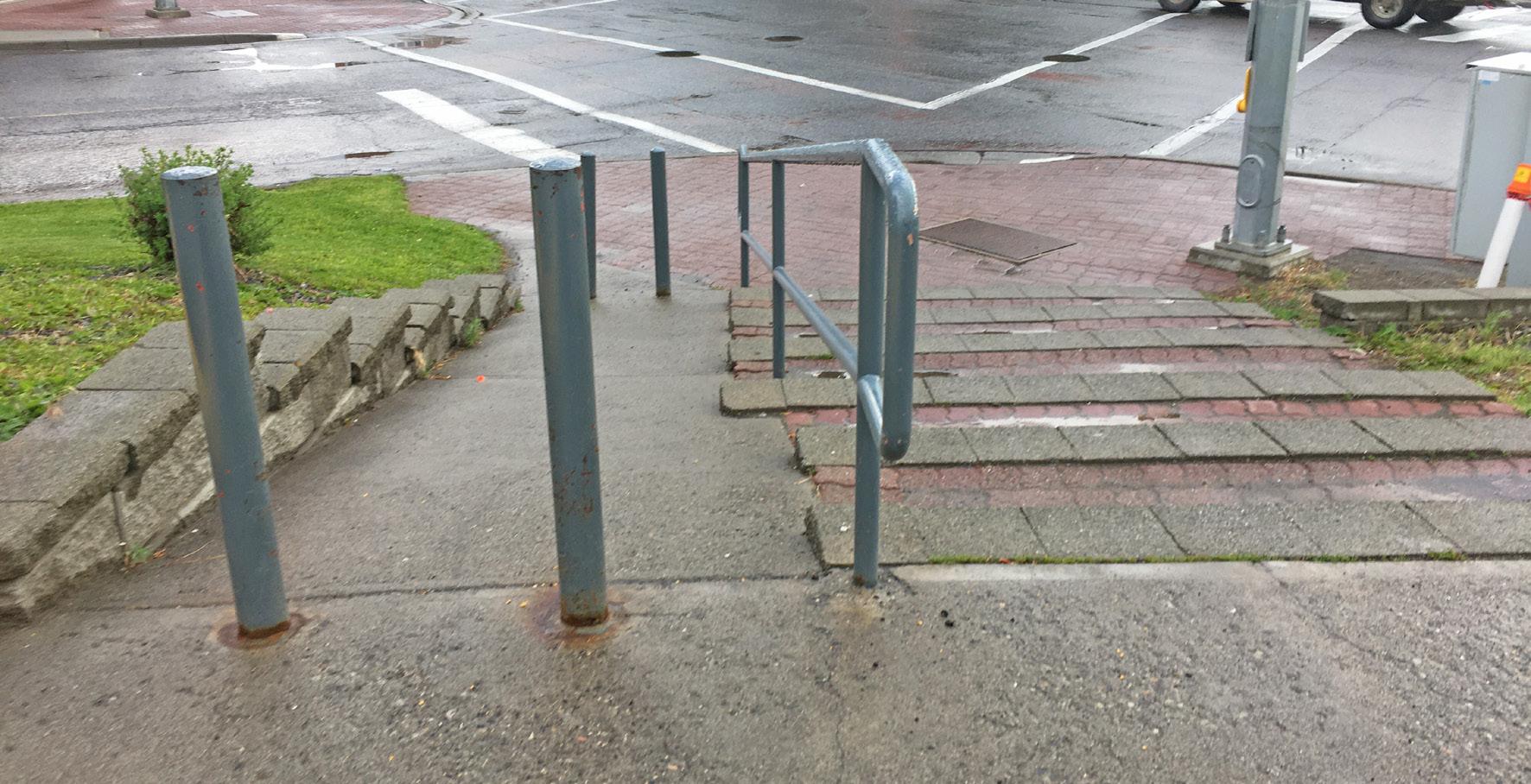
iv. Where above-ground structured parking is proposed, wrap primary frontages with active uses (e.g. CRUs) and/or use creative architectural design and/or public art to add visual interest, screen vehicles and mechanical equipment, and better incorporate parking areas into overall building design.
v. Where unavoidable, parking locations along street frontages must provide a minimum of a 3 m landscape buffer strip between the parking area and a property line.
h. Design universally accessible places
i. Universally accessible pedestrian walkways to primary building entrances must be provided from public sidewalks, parking areas, garbage and storage areas. Fulfilling accessibility requirements through secondary entrances and pathways is discouraged. Pathways should be a minimum of 1.5 m wide.
ii. Building design should provide ground floor commercial uses that are accessible at grade
iii. Site design must consider safe and convenient access for people with diverse mobility needs by minimizing curb cuts, grading sites to achieve gentle inclines, and providing tactile wayfinding surfaces. Where grade changes are unavoidable, provide ramps and steps with railings.
i. Use art and interpretation to enhance the area’s character, wayfinding, and pedestrian experience
i. Public art and interpretive signage provide opportunities to celebrate public space and create a sense of place. Public art and interpretive signage are encouraged in public and semi-public open spaces, especially plazas.
ii. Site layout and design should incorporate public art, interpretive, or other creative design elements to create interest and focal points.
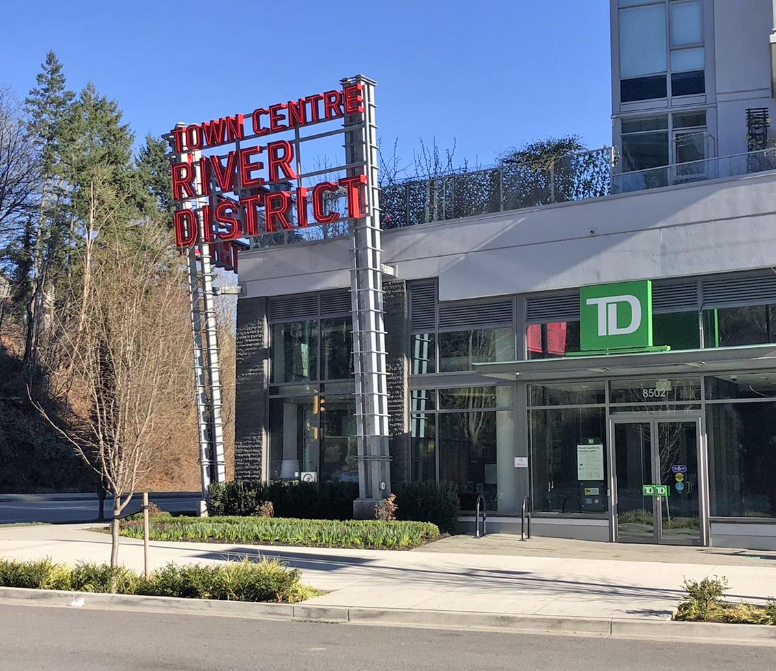
Not only do buildings frame public space, they also interact with it and its occupants. Building design can be welcoming and comforting. Rather than turning its back on the street, a building should present a “friendly face”.
a. Maximize street presence and ground orientation
i. The lower floors of buildings should be designed with ground-oriented units that are 15 m wide at most. At ground level, circulation should be externalized to create direct street access to all parts of the building (rather than a single entry) in order to maximize integration between street and building.
ii. Larger-format retailers (e.g. grocery stores) may exceed 15 m unit widths but should articulate external units (which may also be combined internally) to produce an apparent width of no more than 30 m as viewed from the primary street.
iii. Large retail units are discouraged in the Cultural Village area of the Tranquille Market Corridor to support its historic fine-grain storefront character and smaller, eclectic retail offerings.

Note that the above sketch and description represent an example of appropriate consideration of design guidelines and is for illustration purposes only.
iv. Visual connection to commercial store interiors must be maintained through at least 50% glazing along the primary store frontage. Windows shall be transparent and clear of obstructions (e.g. posters, decorative decals).
v. Orient primary building entrances to the sidewalk on which the building fronts. Primary building entrances must be universally accessible and should be well lit and visually prominent.
vi. Blank walls should not be placed along or easily viewed from pedestrian- oriented streets and arterial roads. Blank walls visible from the road right- of-way should be treated with landscaping, architectural feature(s), and/or artwork so as to cover at least 50% of the blank wall surface.
b. Frame intersections
i. Buildings on corner sites should front both streets, with primary entrances on the chamfered (beveled) corner. If the building’s corner is not chamfered, an entrance on each street should be provided.
ii. Buildings with corner cuts should be carefully designed to maintain pedestrian movement across corners, particularly where grade transitions need to be addressed.
Buildings should have ground-oriented units on lower floors
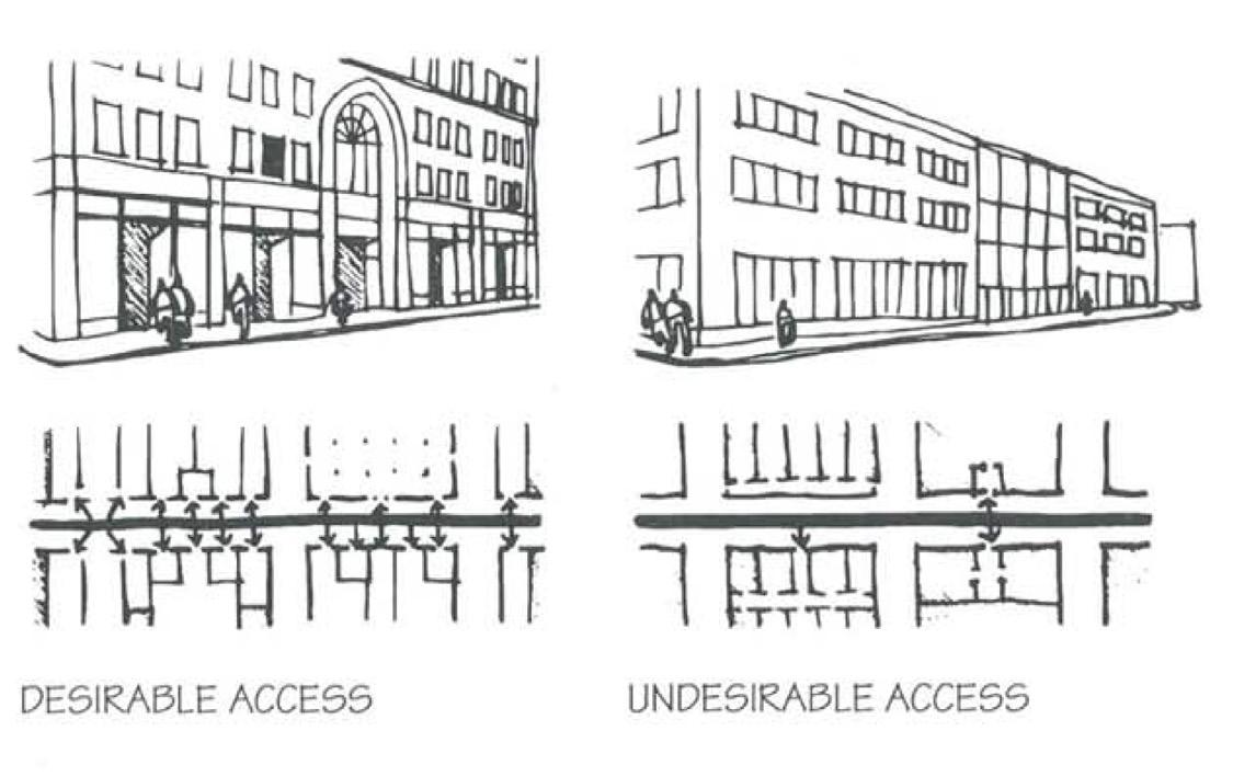
External unit articulation should be maintained for larger commercial buildings
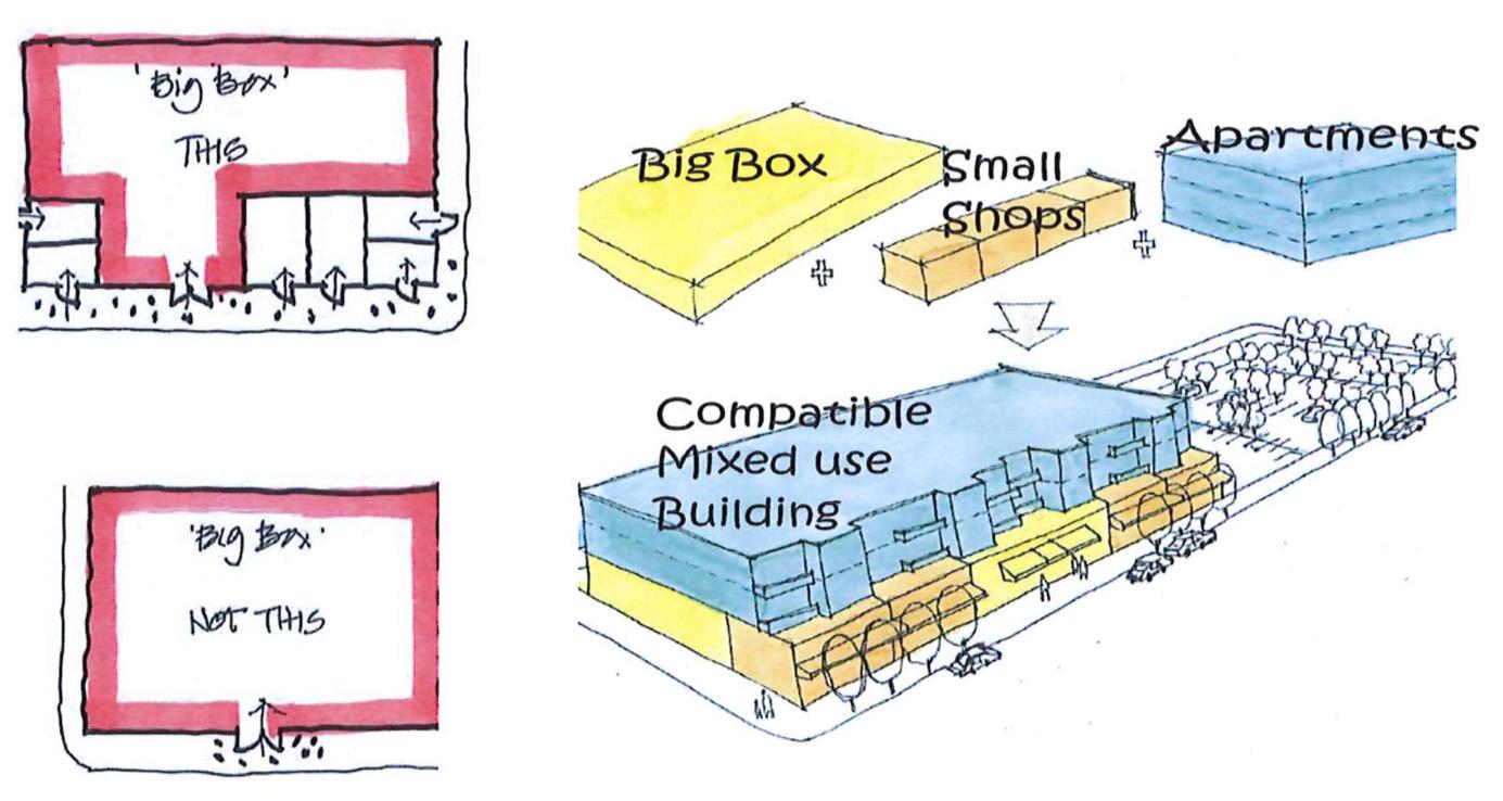
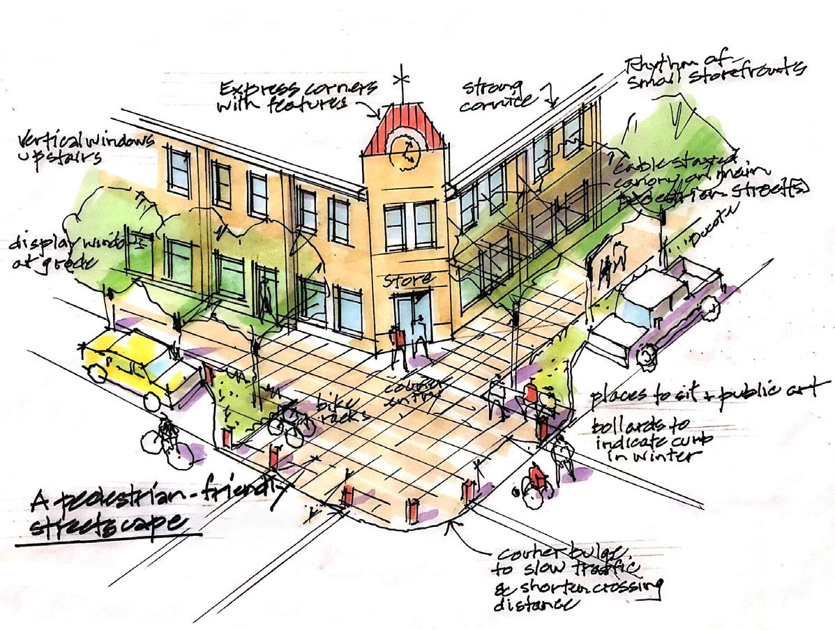
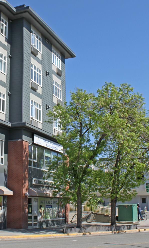
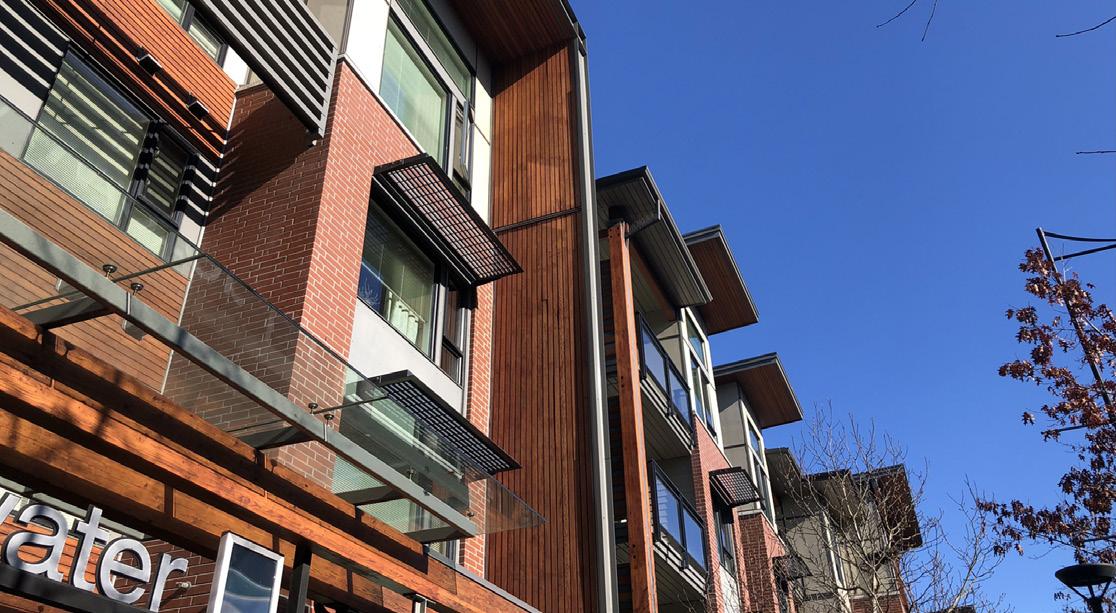
iii. If upper floors cover the corner cut, they should be cantilevered. Ensure a minimum 4 m clearance (equivalent to an over-height storey) between ground and overhang/cantilever. Where necessary, support beams should be sized appropriately and minimized so as to reduce visual and physical obstruction.
iv. Pedestrian-oriented features should be incorporated at corners, either as part of the building (e.g. balcony or canopy) or within the ground level public space. These may include windows and decorative details.
c. Design human-scaled buildings for comfort and enjoyment
i. A minimum street wall of 8 m (two storeys) should be maintained along pedestrian-oriented routes.
ii. Buildings above three storeys shall incorporate stepbacks to minimize shadowing impacts on priority public realm (e.g. Tranquille Road, North Shore Transit Exchange, parks, and plazas).
iii. Vary building massing with architectural features (e.g. balconies) or small stepbacks to create depth and shadow patterns to avoid the appearance of large, homogeneous façades and to reduce apparent building mass.
iv. Articulate building façades (particularly primary façades) with architectural features, varied materials, and subtle horizontal recesses to create variety and interest along the street.
v. Roof design should include articulation to provide visual interest. A variety of roof forms (e.g. gabled, mansard, shed, etc.) are encouraged to create visual interest. Roof designs shall reflect an honest expression of interesting building design (e.g. as a result of building façade and/or volumetric articulation to break up large contiguous/continuous surfaces) and be well proportioned. Ornamental/ faux roof elements (e.g. “hats”) are discouraged.
vi. Roof designs on sloping sites should reflect stepped building massing and follow the slope of the site.
vii. Green roofs and rooftop planter boxes are encouraged to support storm water management and provide outdoor amenity space for residents.
viii. Roof forms of tall and/or significant (e.g. cultural) buildings should be given special design consideration to achieve positive recognition and landmark status.
ix. Rooftop mechanical equipment should be screened from view (i.e. through the design of rooflines and parapets). Screening enclosures should be of similar materials as the building.
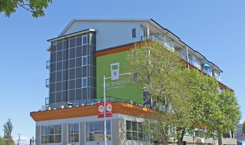
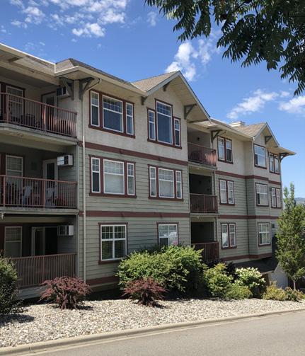
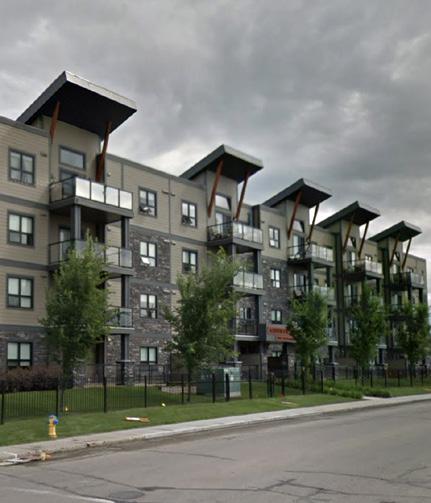
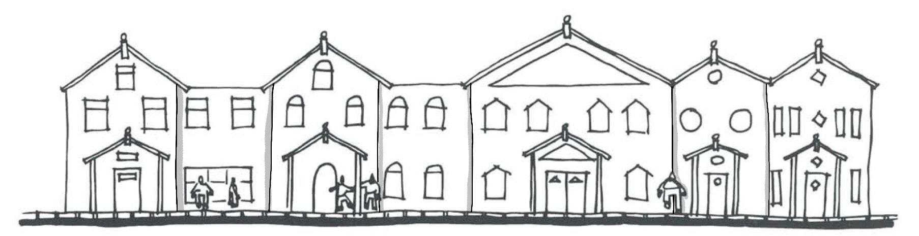
A more vibrant colour palette will be considered within the Cultural Village and Innovation
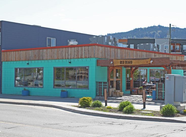
d. Material selection should emphasize durability and reflect an honest expression of building architecture
i. Building façades should be treated with durable building materials that weather well and contribute to an appearance of quality construction and a sense of permanence. Products such as stone, brick, metal, textured concrete, and/or treated wood should be used on a building façade that faces a public street.
ii. The use of multiple material types is encouraged to provide visual interest and emphasize variety in built form (façade and/or volumetric articulation).
iii. Materials selection and application should be logical/integral to building and construction techniques. Heavier materials such as stone and brick should be predominantly used at lower elevations.
iv. Materials should wrap from front elevation to side elevation to avoid the appearance of thin/veneer façade treatments.
v. Special window and balcony treatments (e.g. fritting and/or frosting) should be considered to mitigate bird collisions in the case of tall building designs.
e. Colour selection should complement and reflect authenticity of selected materials
i. A building’s colour palette should complement the site context and natural setting. Earth tones and natural hues are preferred as the dominant building colour. The use of bright/ contrasting colours should be generally limited to trim, architectural details, signage, and other minor building elements.
ii. A broader, more vibrant colour palette will be considered for sites within the Cultural Village and Innovation Hub areas of the Tranquille Market Corridor to support the North Shore Neighbourhood Plan’s vision for them as more creative, innovative, and entertainment-oriented areas.
iii. Colour selection should complement material selection by emphasizing the authentic use of materials and their natural expression (e.g. stained and/or painted wood siding, natural stone, black iron, and corten steel).
iv. Significant and/or bold architectural expressions may depart from colour guidelines in unique sites/circumstances.
Building design should address privacy, strengthen neighbourhood and street identity, and recognize the role of each building’s ability to contribute to a larger pattern of built forms and open space that define the pedestrian experience.
f. Respect privacy
i. Offset window placements between buildings that face each other in close proximity in order to maintain privacy in residential units.
g. Reinforce and enhance neighbourhood character
i. Designs should enhance the character of their neighbourhoods, as described in the North Shore Neighbourhood Plan (e.g. North Shore Town Centre, Tranquille Market Corridor).
The street level encourages pedestrian activity with prominent entry features and ground-oriented units
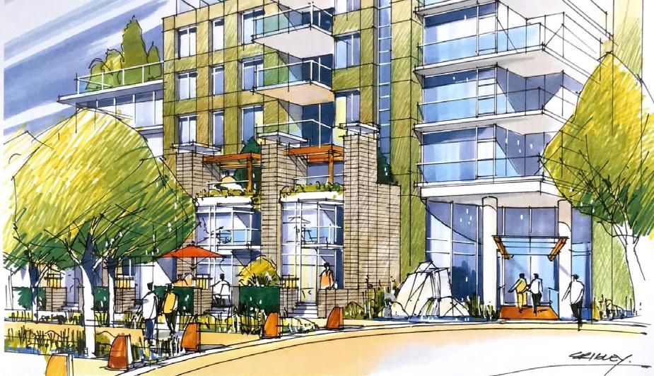
ii. Reflect, complement, or enhance established neighbourhood forms and design features that contribute to neighbourhood character, including roof forms and consistent window spacing. Complement or enhance the character of surrounding buildings with heritage value or other character-defining design elements.
iii. Proposed buildings should relate to adjacent heights. Where a building is introduced that is taller than its neighbours, it should incorporate complementary building forms and transitional building heights to bridge the height and scale of adjacent buildings, especially when next to lower-density residential uses. Design features that relate to the scale of adjacent buildings may also be used (e.g. continuing a horizontal design feature, such as a cornice line, can help connect adjacent buildings).
h. Demonstrate clear transitions and distinctions between uses
i. Separate and distinguish distinct ground-floor entrances of different uses through the use of signage, glazing, indoor-outdoor relationships and transitions, and over-height volumes.
Reflect, complement, or enhance established neighbourhood forms and design features
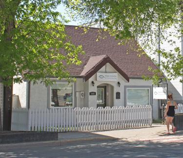
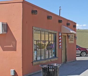

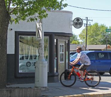
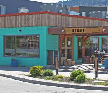
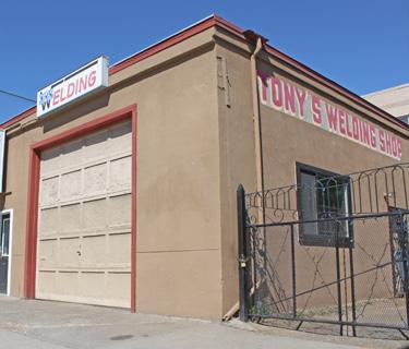
Transition building heights to harmonize with adjacent buildings
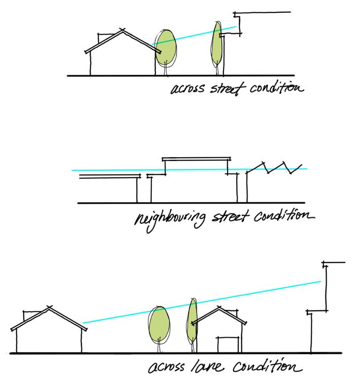
Tall buildings can have a significant impact on the form and character of communities. A well-designed and thoughtfully detailed building can reinforce human scale, enhance pedestrian environments, and accommodate residential and/or commercial densities to support a vibrant urban realm.
i. Create elegant forms
Impacts of tall buildings can be mitigated through building detailing at the pedestrian level, enhancing building entrances and entry features, limiting floor plate sizes, and striving for less bulky, more elegant vertical elements.
The design of lower floors (e.g. the building base) of tall buildings—beyond their impact on block scale and permeability—should accommodate design flexibility and encourage continuous street wall conditions at the pedestrian level (e.g. street interface).
i. The guidelines in Table 8.1 for maximum floorplate sizes are recommended (based on typical building/slab dimensions).
Portion of building between 14 m and 24 m (5 to 7 storeys)
Portion of building greater than 24 m (> 7 storeys)
› Residential floors should not exceed 900 m2 gross area (based on a typical ~20 m x 45 m dimension).
› Commercial floors should not exceed 1,350 m2 gross area (based on a typical ~30 m x 45 m dimension).
› Residential floors should not exceed 625 m2 gross area (based on a typical ~25 m x 25 m dimension).
› Commercial floors shall not exceed 900 m2 gross area (based on a typical ~30 m x 30 m dimension).
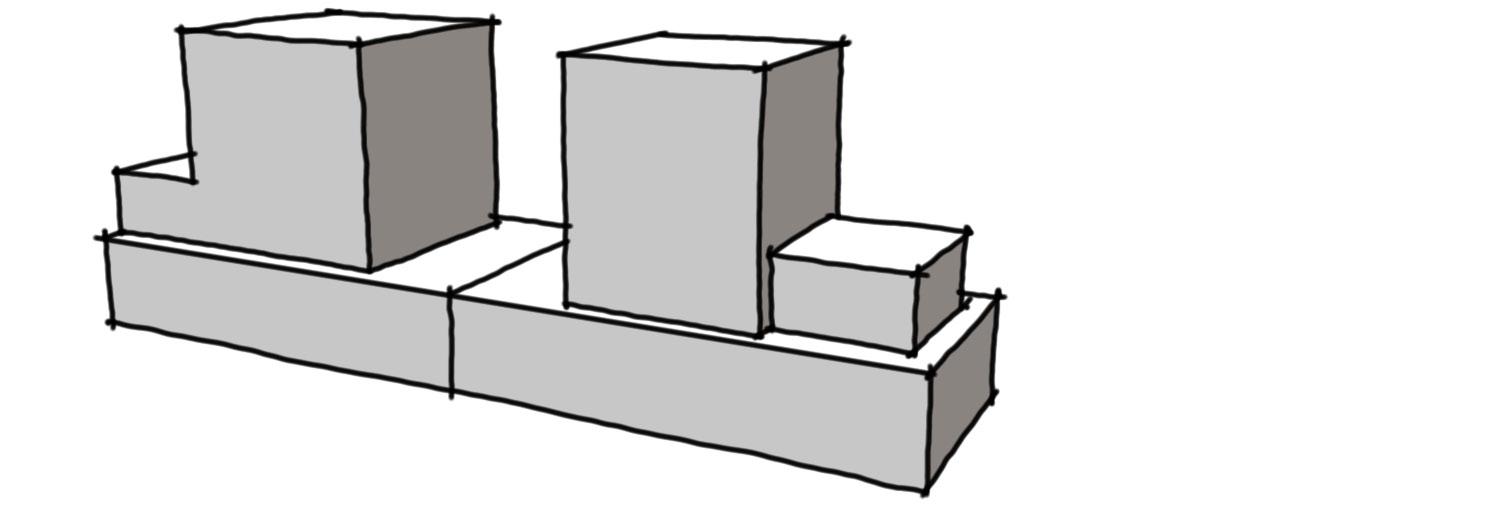
j. Provide separation for livability and neighbourliness
i. Tall buildings should be oriented north-south with a maximum of two tall buildings per block face to ensure privacy, access to sunlight, air flow, and views.
ii. Separation between tall building towers should be 15 m or greater from the side and rear property lines. Separation distance between towers on the same parcel should be 30 m or greater.
iii. Articulate façades of mid-rise and tall buildings at the two to three storey level to create human scale building features and contribute to a comfortable pedestrian environment.
iv. Clearly identify the primary building entrances of tall buildings with feature elements including building and/or landscape design features (e.g. oversized entries, climate protection, building wall recesses, trellis structures, etc.).
v. Proposed buildings taller than six storeys shall demonstrate how the proposed building and site design:
• protects and frames significant public views to important landscape features (e.g. the river valley, prominent mountain peaks) seen from public spaces/streets through building siting and massing
• minimizes shadowing impacts and ensures sunshine reaches public spaces and streets (shadow study). Buildings should be designed to prevent overshadowing on parks and public open spaces and to minimize overshadowing on the North Shore Transit Exchange, and, if possible, semi-private open spaces
• complements or enhances the character of surrounding buildings, particularly if surrounding buildings have significant character or heritage value
• uses elements such as façade articulation and podiums/stepbacks to achieve building designs that are scaled to people/pedestrians adjacent to the public realm, streets and semi-public spaces
• reduces impact of wind at ground level
Deeper façades (recessed balconies) and window screens (louvres) along southand west-facing building aspects protect residents from summer heat
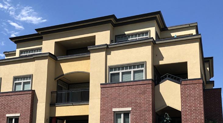
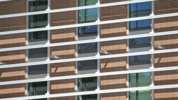
k. Design sustainable buildings
i. Building form, orientation and thermal mass should optimize solar radiation, natural ventilation, and daylighting. Innovation related to sustainability is encouraged in the choice of glass and window products.
ii. Where possible, residential buildings should receive daylight and natural ventilation from at least two sides of the building or from one side and a roof. Where possible, dwelling units should have a choice of aspect—front and back, or on two sides (for corner units).
iii. Designs of new buildings should incorporate floor-to-ceiling heights that increase the amount of interior space that can receive natural light.
Weather protection at entrances and along commercial frontages is encouraged
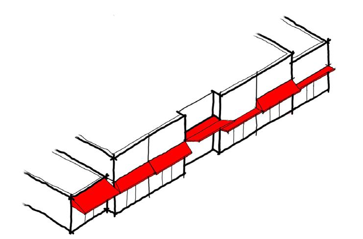
iv. Buildings with double-loaded corridors should be oriented north-south so that all units receive direct sunlight at some point during the day throughout the seasons.
v. Solar shades and/or deeper balconies/overhangs are encouraged along south- and west-facing building façades.
vi. Durable, thermally efficient roofs that reduce heating and cooling and enhance thermal comfort are strongly recommended. Landscaped roofs are encouraged to reduce the heat island effect.
vii. Roof drainage systems should mitigate stormwater runoff effects by diverting storm events to infiltration galleries or other appropriate green infrastructure.
l. Incorporate indoor-outdoor spaces and sheltering elements in building design
i. Weather protection at entrances and along commercial and public/ active frontages is encouraged to cover sidewalks to a minimum depth of 1.5 m. This may be provided in the form of canopies or within the building design (e.g. colonnades), ensuring visibility from the public realm/street is maintained for safety.
ii. Transitional indoor-outdoor spaces, such as sidewalk patios, balconies, and rooftops are encouraged. They should be made accessible to building users as usable common/private outdoor space.
Landscape design helps to create healthy communities for people and can provide habitat for other living creatures.
a. Design with excellence
i. All landscape work should be of a high quality and meet the Canadian Landscape Standard by the Canadian Society of Landscape Architects and Canadian Nursery Landscape Association.
ii. Landscape design should prioritize comfortable, multi-functional, and accessible spaces for various users and uses throughout the changing seasons. Usable and landscaped rooftops are encouraged.
iii. Site and landscape designs should be cohesive and consistent across property lines (including boulevards within the right-of-way). Boulevard landscapes should be consistent along the street frontage and a logical extension of the landscape on the adjoining property or adjoining boulevards. Loose landscape materials (such as gravel and rocks) should not be placed adjacent to or in the boulevard unless adequately contained.
Landscape design should incorporate greenery and be pedestrian friendly, multi-functional, and accessible
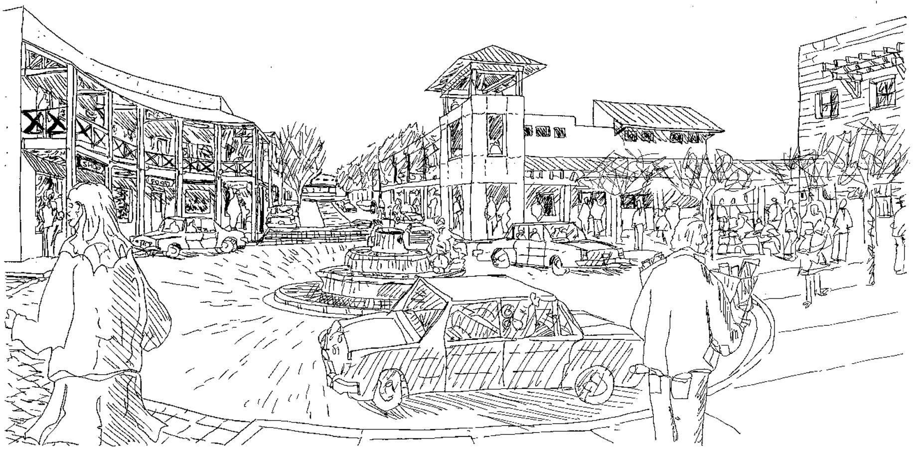
Usable and landscaped rooftops are encouraged
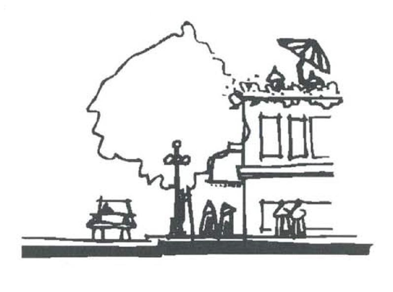
iv. Landscape designs should reflect transitions between programs and uses. Layering of multiple landscape elements (e.g. planters, trellises, and other forms of hard and soft landscape) is encouraged and can enhance the usability of outdoor amenity spaces.
v. Primary building entrances should accommodate feature landscape designs, including, but not limited to, signage and landscape structures, feature paving, and planters.
vi. Landscaping site coverage shall comply with Zoning regulations.
vii. Landscaping should be provided to screen all parking that may be visible from any street and all service areas, utility equipment, and/or loading areas.
b. Enhance the urban forest
i. Preserve mature trees and integrate their necessary soil volumes within new landscape and building designs where possible.
ii. Maintain and enhance the urban tree canopy by replacing any removed mature trees with an equal or greater number of new trees.
iii. Ensure tree plantings match site conditions. Consider soil volume, tree siting, and mature tree size and plant appropriate tree species that align with the conditions and design intent. Where trees are planted in boulevards, trees should share a trench where possible. Where trees cannot be in a trench, each tree should have a minimum of 5 m3 of topsoil. Refer to the City’s Landscape Guidelines for a list of climate-adapted tree species.
iv. Landscape design and materials should provide for and/or enhance habitat value (e.g. birds, pollinators, etc.).
v. Where sightlines are required, use tree species that allow for a minimum branching height of at least 2 m.
c. Good fences make good neighbours
i. Fence height or landscape (e.g. hedges) should not obstruct visibility for vehicles or pedestrians. Standards for fence heights or screens are provided in the Zoning Bylaw.
ii. Fencing materials should complement building design and materials.
iii. Chain-link fences are strongly discouraged. If chain-link fencing is unavoidable, fencing, posts, and all hardware should be black vinyl and should not be visible from the public realm.
iv. On-site service areas and waste collection bins (garbage and recycling) should be secured and screened from view to the street through enclosures, landscape, and walls that reflect the site architecture. Garbage bins must be screened by enclosures (landscape is not sufficient).
Landscape design plays a vital role in mitigating the heat island effect in urban environments. Shading of hardscapes and minimizing impervious surfaces can help mitigate an increase in temperature due to urban development.
d. Minimize impervious surfaces
i. All areas not covered by buildings and/or pedestrian facilities should be landscaped with priority given to permeable surfaces, including boulevards and front and rear yards.
ii. Where feasible, permeable hardscapes are encouraged to mitigate stormwater runoff. They may be porous asphalt, porous concrete, permeable pavers, or concrete-glass-block grid.
iii. Hardscape areas may be included as part of a development's required landscape/amenity area where they include trees and other vegetation.
iv. Creative ways to incorporate greenery are encouraged (e.g. structured soils, silva cells, green roofs, vertical gardens/ walls, planters, balcony landscaping, etc.), particularly on constrained/high-coverage sites.
should not obstruct visibility
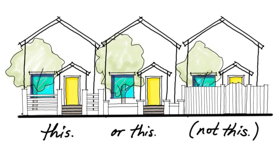
Deciduous trees provide shade in summer and let sunlight through in the winter
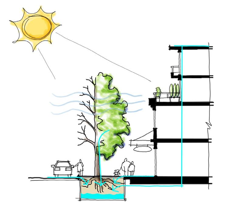
v. Landscape design shall be integrated with surface parking lots to reduce impermeable surfaces and curb climatic impacts. Trees and shrubs help to protect from wind and reduce excessive heat. Landscape islands that screen parking areas are to be a minimum of 1.5 m in width. Where trees are provided, they are to be a minimum 3” caliper when installed. A minimum of one tree per 95 m2 of surface parking area (including circulation and drive aisles) should be planted.
vi. Landscape design should consider green infrastructure services, including shading, windbreaks, and stormwater management. Deciduous plantings provide shade in the hot summer months while allowing for increased solar gain and providing windbreaks to reduce heat loss in winter months.
e. Material selection - hardscapes and softscapes
Materials should be selected with use in mind to determine level of durability and maintenance required.
i. Public and semi-public spaces should be built with high- quality durable materials that allow for active or passive recreational activities.
ii. Pathway paving materials should be robust, durable, and easily maintained.
iii. Plants should be native and/or similarly hardy (adapted). Xeriscaping is encouraged as an important means of conserving water.
iv. Noxious or invasive plants are prohibited.
v. Landscape designs should consider planting palettes that provide seasonal interest, including, but not limited to, fall colours, spring blooms, leaf and bark textures (e.g. compound leaves and exfoliating bark), and fragrances.
vi. Use of edible landscape in the form of fruit trees, nut trees, and edible ground cover is encouraged, provided such plantings are properly maintained to reduce attractants for wildlife predators and pests.
vii. Landscape improvements should be maintained with sub-surface, high- efficiency irrigation (e.g. drip).
viii. Lighter-coloured materials should be used in areas with sun exposure, including for pathway paving and roof materials, to help curb the heat island effect.
The design of buildings and pedestrian spaces has an influence on people’s perceptions and behaviours, including those associated with safety and security. The right design approach can have a beneficial impact on both.
a. Select and design well-integrated security treatments
i. Security treatments should complement the character of the street/building interface and utilize discrete colours and materials and/or ornamental elements.
ii. Security gates, where necessary, must maintain transparency of windows and doors. High quality, durable materials (e.g. metals) are strongly encouraged with colours that complement site and architectural design.
Buildings should be designed with natural surveillance opportunities (e.g. balconies)
b. Integrate principles of Crime Prevention Through Environmental Design
i. Provide opportunities for natural surveillance through consideration of the following strategies:
• Providing clear sightlines between public and private spaces
• Avoiding blind corners in pedestrian pathways, stairwells, corridors, and parking areas
• Locating entries to be clearly visible from the street
• Ensuring fencing or other barriers maximize sightlines between the street and building, such as by designing them to be low enough in height and/or made from visually permeable materials so that they can be seen through or over
• Installing sufficient lighting in public places and other high-traffic pedestrian areas
• Ensuring landscaping does not obstruct sightlines or create hidden spaces
• Siting and designing buildings so that windows, balconies, and/or other opportunities for natural surveillance overlook public spaces and areas of potential security concern
Avoid creating hidden spaces
Permeable barriers, distinct material treatments, and street furniture help define use in public spaces and announce transitions
ii. Incorporate access control strategies to attract, direct, or restrict pedestrian movement and deter illegitimate uses, such as:
• Providing clear entry points
• Using building siting, landscaping, and/or other natural or design features to direct pedestrian traffic through target areas or into gathering spaces
• Using vegetation or unobtrusive decorative barriers as visual cues to deter unauthorized access to private areas
• Designing public or semi-public spaces to attract rather than discourage people from gathering
• Clearly identifying addressing for buildings and externally accessed units
• Using signage to clearly identify spaces, such as parking areas, to prevent unintended access and assist with wayfinding
iii. Define public and private areas to provide distinct transitions between uses, discourage illegitimate use, and clarify and encourage a sense of ownership and responsibility over both types of spaces through one or more of the following strategies:
• Placing permeable and/or soft barriers, such as vegetation, between uses to define spaces while allowing for pedestrian circulation between them
• Using distinct material treatments, such as different coloured or textured pavers, to visually define and/or separate spaces
• Arranging other elements, such as decorative signage, planter boxes, or lighting features, to announce transitions
iv. Ensure public or semi-public spaces are attractive and well maintained so that they are inviting, well used, and cared for, such as by:
• Developing appropriate maintenance regimes that include the quick repair of vandalism and graffiti, replacement of expired lighting, and removal of worn or decayed elements
• Using materials that reduce opportunities for vandalism
• Incorporating design elements that promote community pride and sense of place
Incorporating effective wayfinding strategies, such as appropriately designed and placed signage, helps people to better navigate their surroundings, direct their attention to key amenities, improve accessibility and safety, and enhance the pedestrian experience.
c. Design signage for people and incorporate wayfinding
i. Sign types, styles, and locations should be shown on building elevations. Signage should reflect or complement, and be integrated with, the site’s architectural character. Limit signage in number, location, and size to reduce visual clutter and make individual signs easier to see. Street address numbers should be clearly identified on buildings or units.
ii. Signage should be pedestrian oriented with respect to location, orientation, and scale. Pedestrian-oriented signage should be within 5 m of the ground plane and graphically designed to be readable by pedestrians on the sidewalk.
iii. All signs should be building mounted and integrated with a building’s architecture (e.g. incorporated with canopies) or placed within the Furnishing Zone (refer to Section 5: Streetscapes guidelines). Signage shall not be the dominant feature of the façade or overall development.
Pedestrian-oriented signage ensures wayfinding targets people on sidewalks rather than in cars
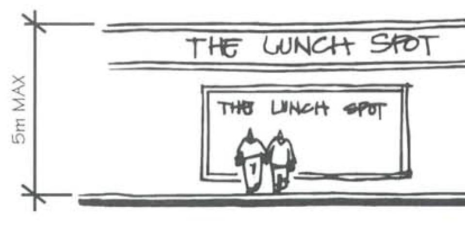
Sculptural signs are encouraged, and internally-lit plastic box signs are strongly discouraged
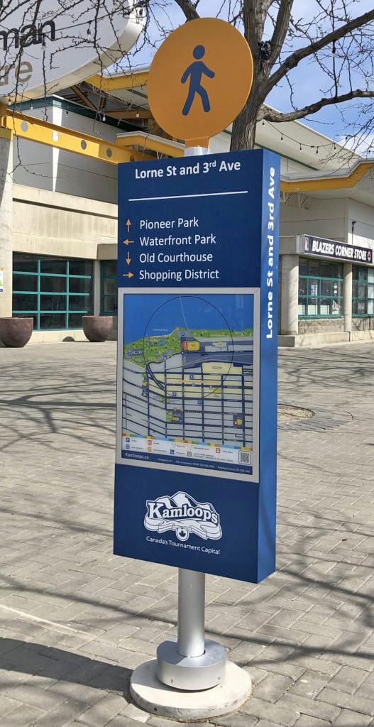
iv. Neon signs, sculptural signs, and artwork are encouraged. Auto - oriented, vinyl, back-lit podium, portable read- o - graph, rooftop, freestanding, and billboard signs shall not be permitted, and internally-lit plastic box signs are strongly discouraged in new development. Back-lighting of signage can occur where individual, three dimensional letters are used.
v. Signage should be made of durable, weather-resistant material; opaque; and coloured in such a way so as to coordinate with the façade of the building.
vi. Window signs should not cover more than 30% of the total area of the ground floor frontage facing any one street.
vii. Signage on commercial buildings should clearly identify uses and business names.
viii. Wayfinding signage should inform users of distances to and from key destinations (e.g. trailheads, landmarks, safe routes).
ix. Interpretive signage should showcase the context and history of the region, city, and neighbourhood, including Secwepemc heritage and language, by describing climate and geological processes/origins; identifying significant views and landscape features; and revealing the stories behind place names, including streets, parks, buildings and other sites of historical importance.
Lighting is an essential feature of any urban environment as it provides for nighttime visibility, enhances safety, and can complement site and building design, making spaces more useful and inviting throughout all hours of the day.
d. Mitigate light pollution
i. Avoid light pollution by avoiding light reflectance, directing lighting downwards, and using full cut off fixtures with horizontal aligned flush-mounted (non-protruding) lenses. Exceptions may be made for signage and architectural lighting.
e. Install lighting for safety
i. On-site lighting should be sufficient to provide clear orientation and personal safety and site security. Ensure continuous lighting along mandatory connections, between parking, entrances, and public sidewalks and clearly identify their termini (entrances, parking and loading areas, etc.).
ii. Do not light areas that are not intended for nighttime use. Focus lighting on priority pathways that provide connection between key destinations that people use at night.
f. Design lighting to create and/or enhance character
i. Create an even wash of light across surfaces desired to be lit.
ii. Place lighting fixtures no higher than 6 m from the ground.
iii. Where lamp standards and fixtures are exposed, the aesthetic quality of these elements must be considered to ensure integration with building and landscape design.
iv. Light sources should emit a warm tone of light, at a maximum of 3000 Kelvin (K).
v. Use up-lighting sparingly and only for accenting architectural elements of landscape features.
vi. Building design should use lighting fixtures that create visual interest and are at a human scale rather than an automobile orientation.

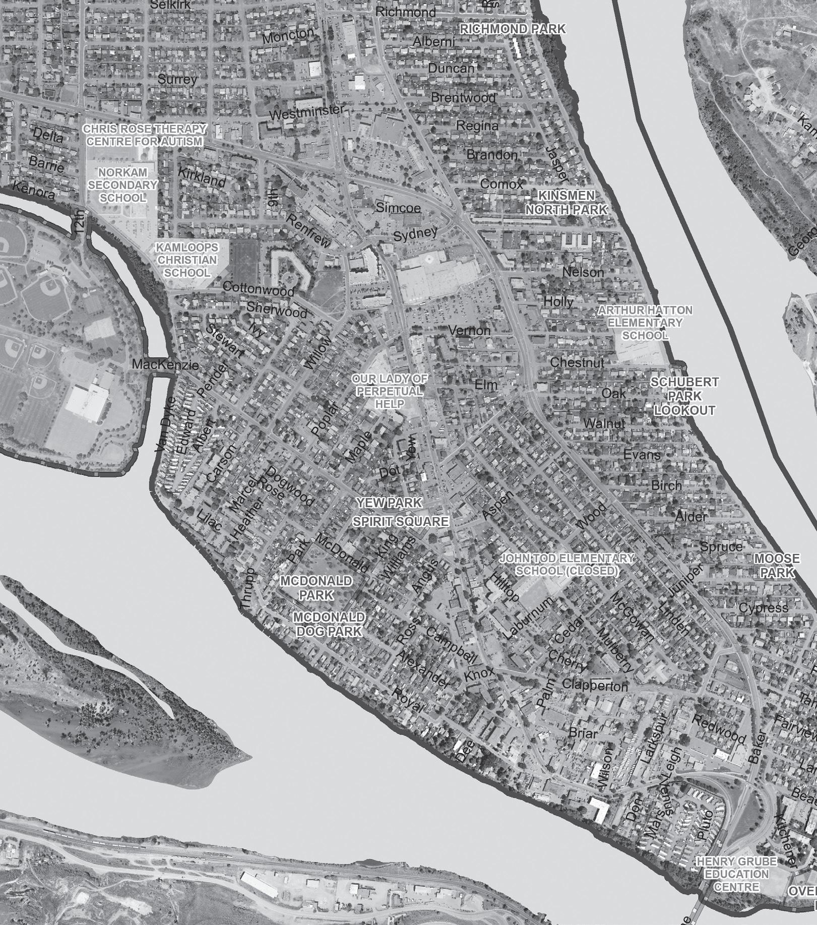
Clarifying and enhancing key sites, such as area- defining landmarks, gateways, and waterfront locations, help to facilitate wayfinding, contribute to beautification, and provide unique opportunities for placemaking.
g. Design gateway sites to announce transitions in key locations of the Tranquille Market Corridor and North Shore Town Centre. Landmark architectural elements (e.g. tall vertical elements and bold orientation) are encouraged to differentiate these sites where identified.
i. Buildings located on gateway sites should incorporate special design features at corners to announce entry into the North Shore Town Centre or Tranquille Market Corridor areas.
ii. Site architecturally significant buildings and provide strong massing where visible at the terminus of a street or walkway or at a gateway location.
iii. Landmark and focal point buildings should incorporate significant architectural styles and features, including distinct landscaping and signage, to distinguish them from adjacent properties and to create a positive impact on the landscape and pedestrian experience.
iv. Sites located adjacent to the intersection of Tranquille Road, 8th Street, and Fortune Drive must meet a minimum building height of four (4) storeys, which can be reduced to two (2) storeys if other gateway features, such as public art and/or landscaped pedestrian plazas, are used.
h. Address, integrate, and activate the waterfront
Where not in conflict with the Riparian Areas
Regulation Development Permit Area or with an assessment by a qualified environmental professional (QEP):
i. Incorporate greening and other restoration measures to enhance the ecology of the Thompson River shoreline and riparian areas.
ii. Site buildings to maximize opportunities for open public space adjacent to the waterfront while ensuring building design emphasizes river views for building occupants.
iii. Incorporate accessible pedestrian pathways, gathering spaces, boardwalks, piers, and/or viewpoints along the waterfront where they can connect with the existing pedestrian network to improve public access to, and enhance the area’s connection with, the Thompson River.
iv. Activate pedestrian spaces adjacent to the shoreline by incorporating complementary uses along the waterfront-facing side of buildings, including opportunities for shopping, dining, recreation, seating, public gathering, and events.
v. Site and/or design buildings to create, frame, or extend visual connections to the waterfront from the primary street to support wayfinding, beautification, and sense of place.
vi. Use materials and design features, such as public art installations, that complement or enhance a waterfront location and contribute to sense of place. Where appropriate, this may include drawing from the area’s historic industrial, agricultural, transportation-related, and/or Secwepemc uses and design traditions.
vii. Mitigate flood risk by ensuring no habitable building space is constructed below the 200-year floodplain elevation and that waterfront sites and landscaping features are designed to avoid or reduce flood impacts, such as through planting flood-tolerant plant species or incorporating design elements that slow, store, convey, and/or discharge water.
Incorporate waterfront pedestrian spaces where feasible
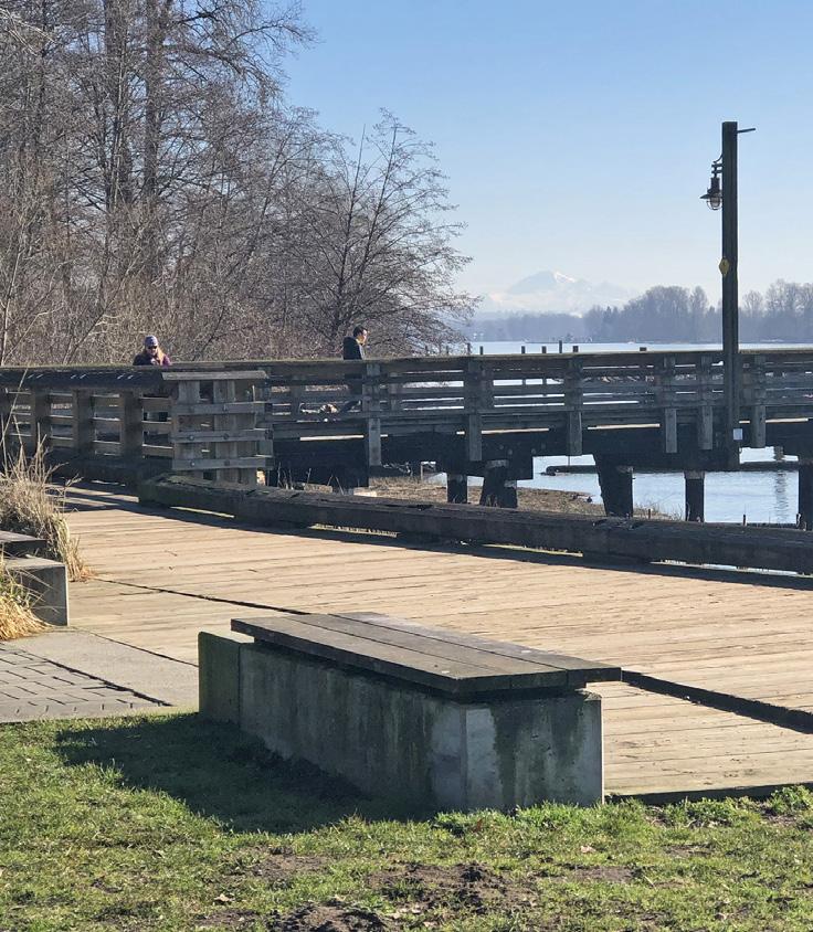
Design features, including public art, can reflect an area's history or past uses
Streets are a fundamentally important place where citizens and visitors engage in shared civic life. The following guidelines prioritize strategies toward comfort, health and safety, accessibility, visual appeal, and spaces of gathering and enjoyment for pedestrians while ensuring functional movement of people, goods and services; operations; and maintenance (e.g. for snow clearing).
a. Consider the needs of all users
Pedestrians and all of their various needs, cyclists, rollerbladers and skaters, electric vehicle and scooter users, and lastly, motor vehicles (cars and trucks).
b. Curb aliment and building placement should be considered to accommodate pedestrian-friendly streetscapes
i. To accommodate the sidewalks diverse functions, sidewalk bulb-outs at intersections and adjacent to mid-block crosswalks should be implemented in conjunction with new development, where feasible. The City's Tranquille Road Complete Streets Plan (or successor plan) should be reviewed for potential curb alignment.
ii. Increased building setbacks from property lines adjacent to the street may also be considered to accommodate complete sidewalk cross-sections.
The street’s many users should find a comfortable place in the space of the cross-section
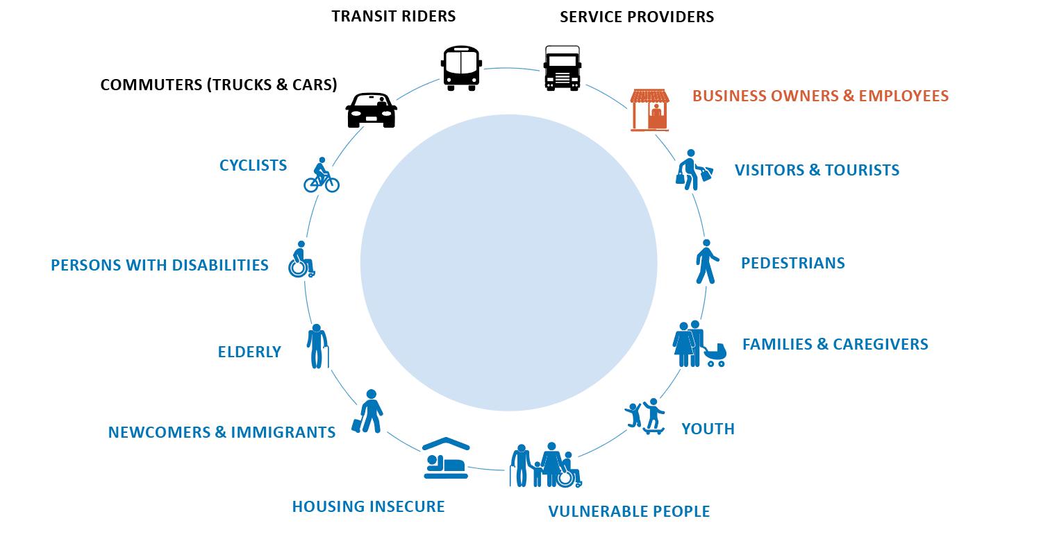
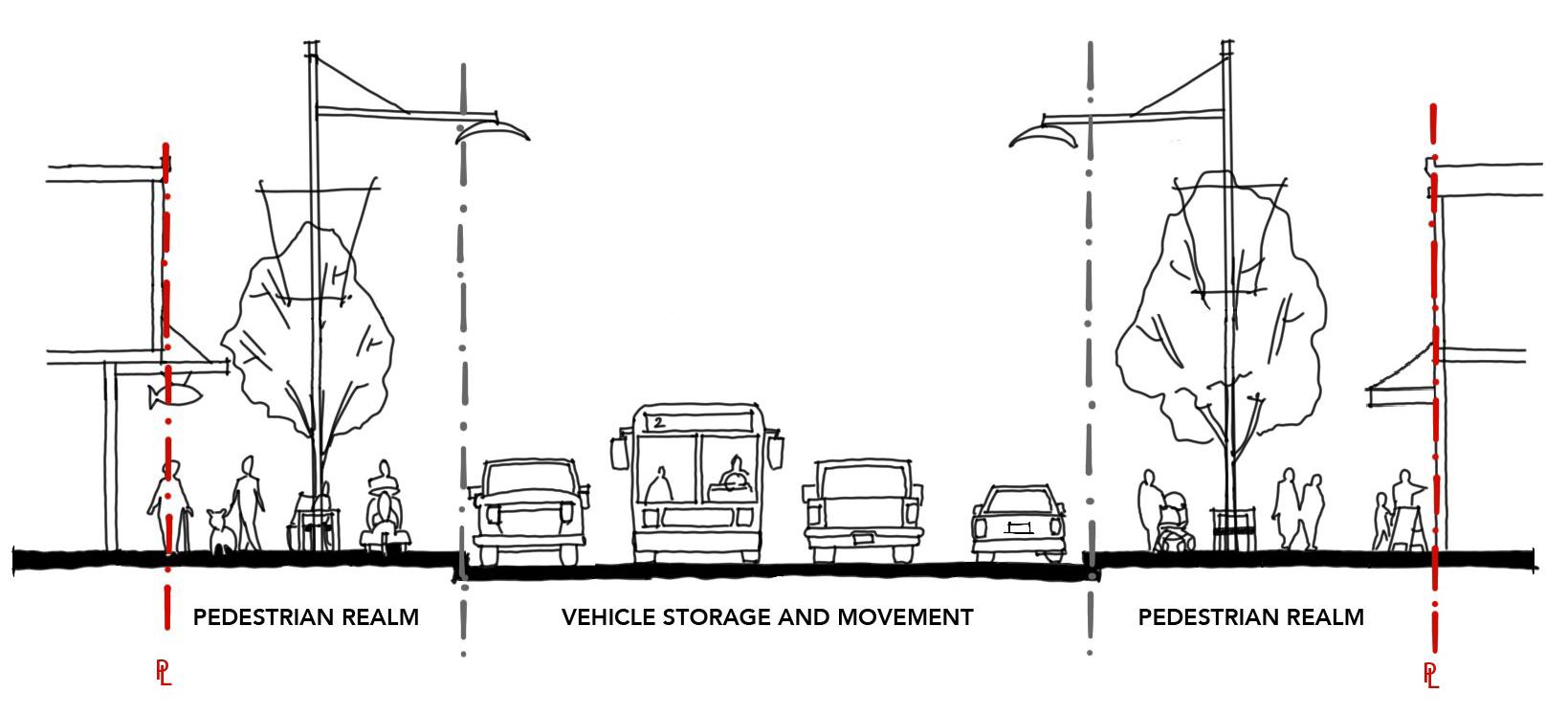
c. Find a home for the sidewalk’s many functions and parts
The sidewalk should be designed to ensure a logical, functional, and well-maintained appearance that is aesthetically pleasing and provides a unifying experience throughout the North Shore Town Centre and Tranquille Market Corridor areas. Sidewalks should clearly allocate sufficient space for the following functions:
i. The Transition Zone – Street designs (and building interfaces) must consider the transitions between public and private space, from building façades and front doors to the sidewalk. The Transition Zone allocates space to accommodate these spatial requirements, grade transitions, and temporary programs (e.g. displays, container plantings, etc.).
ii. The Pedestrian Clear Zone - ensures the safe and unhindered movement of pedestrians (and snow clearing equipment) with a preferred minimum dimension of 2.5 m.
Sidewalk space is organized to efficiently accommodate its many functions
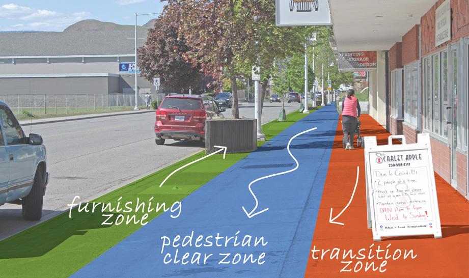
iii. The Furnishing Zone - Trees and other landscape elements, wayfinding signage, and furnishings on sidewalks should be grouped in a dedicated corridor (called the ‘Furnishing Zone’) in order to retain maximum clearance for Pedestrian Clear Zones and create a buffer between cars and pedestrians. The size of the zone will vary to accommodate the desired elements, with a minimum dimension of 1.2 m to accommodate tree wells. Furnishings should be designed to meet the needs of a wide range of users including children, seniors, and persons with disabilities, and may include lighting, bike racks, parking kiosks, sandwich boards, and utility boxes.
d. Incorporate functional street furnishings that welcome human activity
i. Seating should be provided on retail and significant streets, in bulb-out areas, in plazas, and along multi-use paths, located with a “quiet back” and oriented to create and engage with social spaces.
ii. Waste, recycling, and/or other receptacles should be provided on retail streets, at bus stops, near seating, or on bulb-outs near the street corner.
e. Utilize high quality, durable, and easily maintained materials in the design of streetscapes
i. Streetscape design along major corridors (e.g. Tranquille Road, Sydney Avenue/North Shore Transit Exchange, Fortune Drive, 8th Street) should be designed to a higher standard in light of high pedestrian volumes and defined by durable materials such as unit pavers and/ or extensive hardscapes (with planters or tree grates).
ii. Use tree grates (rather than a landscape strip) where pedestrian traffic is high, where sidewalk space is limited, and where siting of underground utilities allows. Tree grate designs should be multi-functional to provide additional utility within the pedestrian realm.
iii. Varied hardscaping materials may be used to delineate different pedestrian realm zones. Material durability and suitability will vary according to the zone’s uses.
iv. In conjunction with new development, existing planter boxes along the Tranquille Market Corridor shall be upgraded or replaced with at-grade tree grates, subject to individual evaluation. Planter treatment should advance a consistent look throughout the area.
f. Include street trees in the boulevard to support healthy streetscapes. New development should include street trees based on the following principles:
i. Cross sectional designs should accommodate sufficient boulevard widths and soil volumes to support street trees and optimize benefits of a mature and well established urban forest.
ii. Location of utilities within cross sectional designs should minimize conflict with rooting depth and spread of street trees.
iii. Tree selection should follow the “right tree right place” principle. Different varieties of trees on different streets can add interest and increase comfort, promote biodiversity, and assist in wayfinding by helping to distinguish one street from another. Refer to the City’s Landscape Guidelines for a list of climate -adapted tree species.
iv. The irrigation systems for City street trees and landscape in boulevards shall be provided and separate from those of private property. Access to irrigation for street trees and landscape in boulevards shall be provided from the City right-of-way.
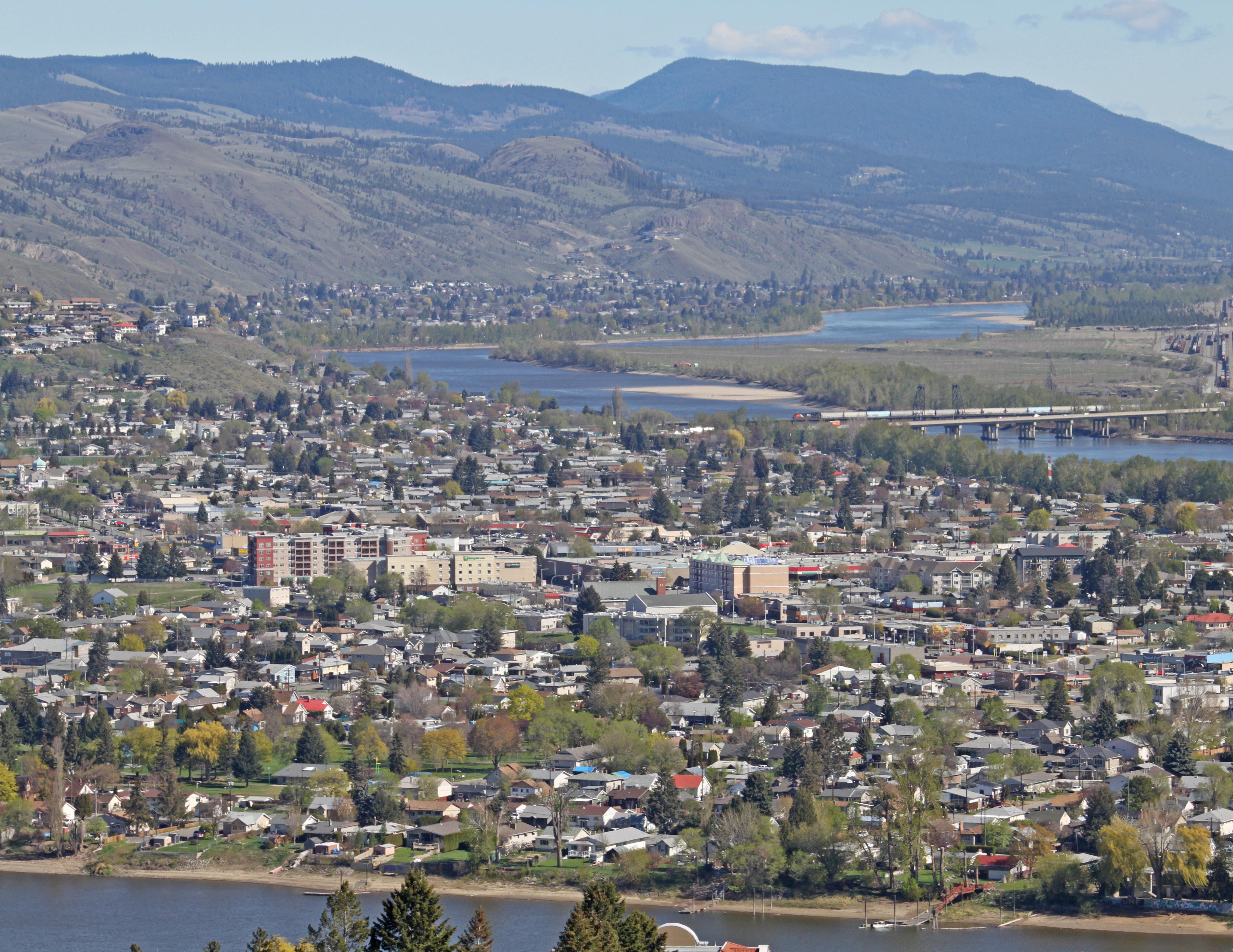
Existing Pedes trian Network: Sidewalk
Mult i-Us e Pathway
Pedes trian Shoulder
Pedes trian Pathway
Off-Road Trail
Proposed Pedes trian Network: Sidewalk
Mult i-Us e Pathway
Pedes trian Shoulder
Pedes trian Pathway
Addit ional Features:
Parks and O pen Space
8 » Sanitary Sewer Network
ional Features: Parks and Open Space
[THIS PAGE LEFT INTENTIONALLY BLANK]
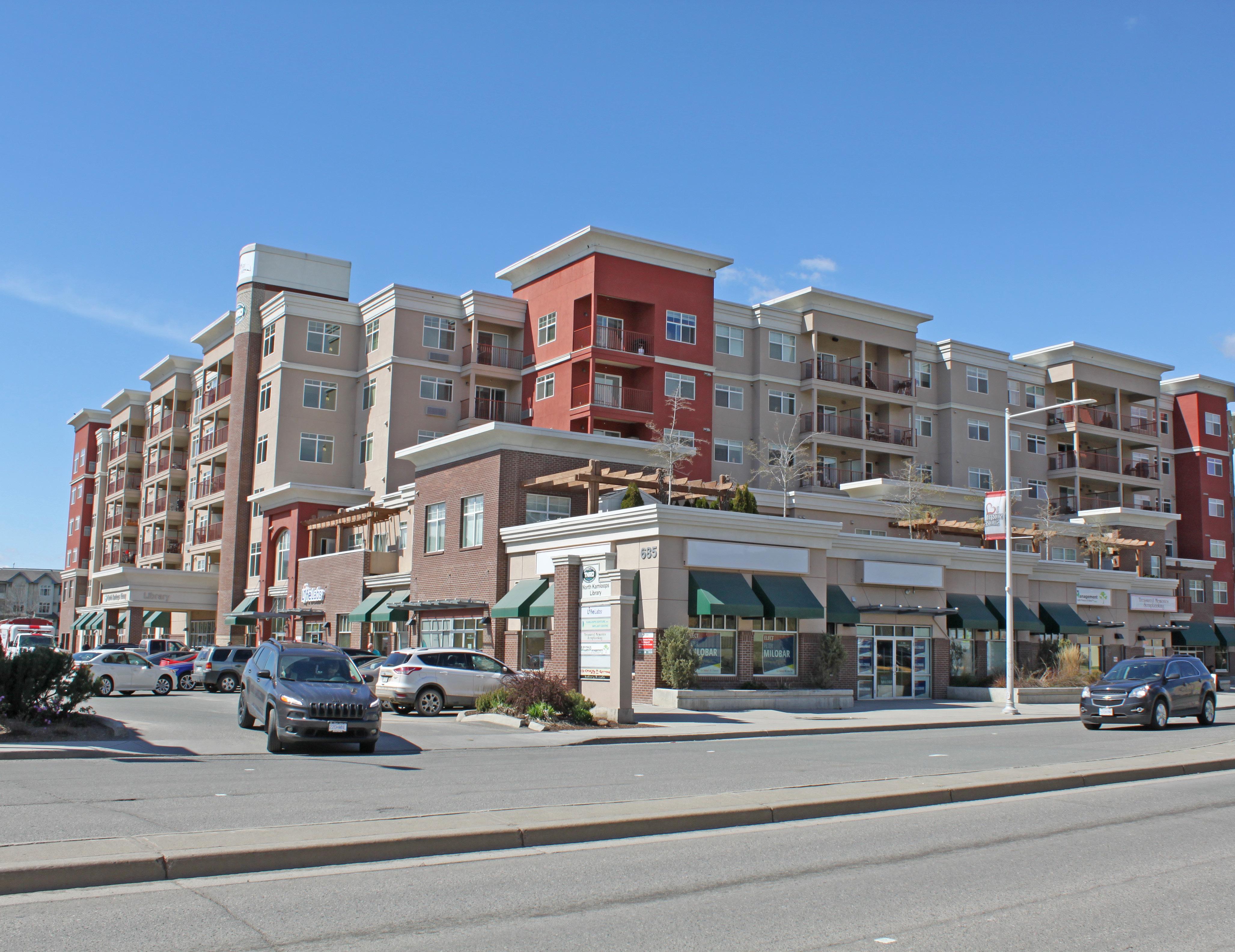
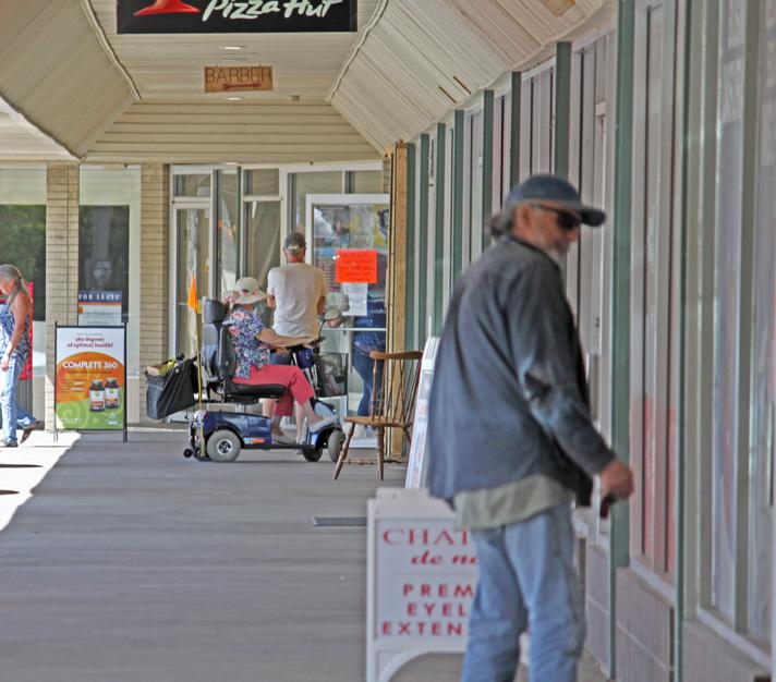
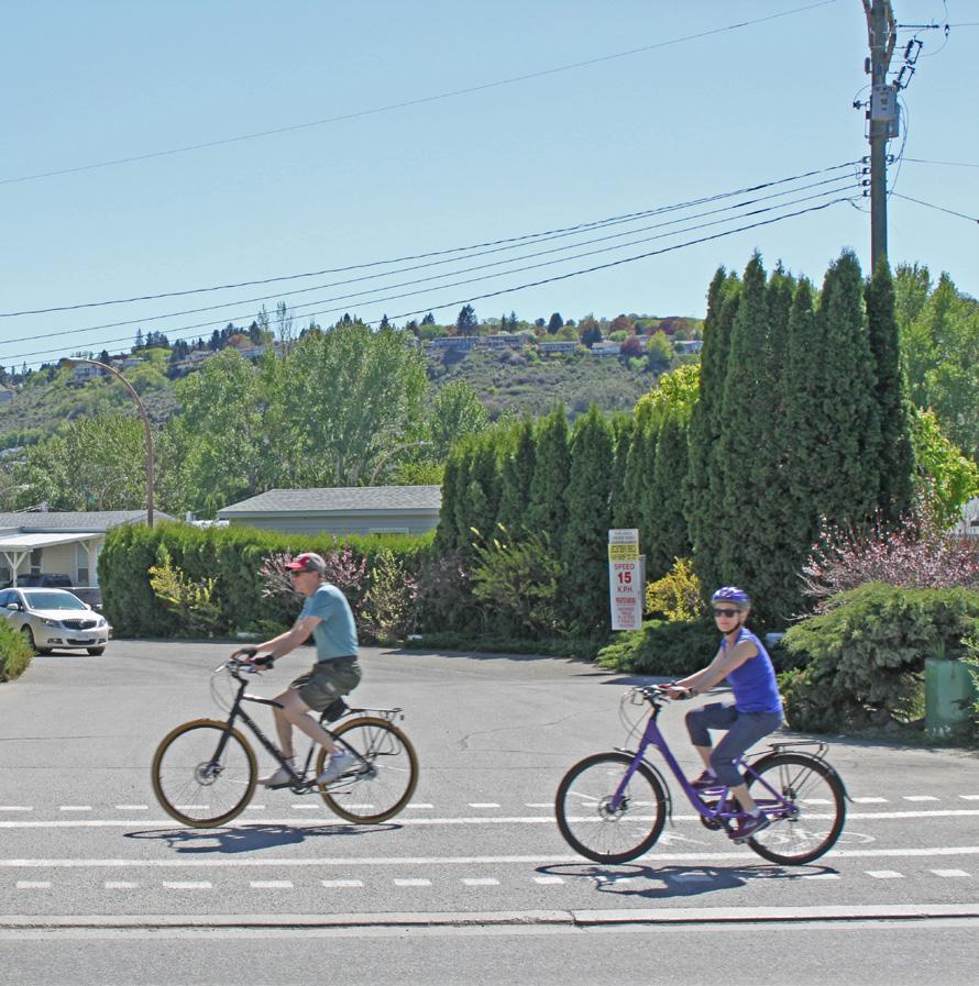
Definitions are provided for clarification and convenience and are not intended to limit the statutory authority where the same term is defined within local government legislation.
Accessibility
Activation of public space
Built environments that are designed and constructed to allow people with a physical or sensory limitation reasonable access and ease of movement around buildings, public spaces, and all associated facilities. In addition to serving people with chronic impairments and disabilities, accessible design features aid people experiencing temporary illness or injury as well as natural declines in vision, hearing, and mobility as they age.
The process of adding vibrancy to public spaces, such as streets, plazas, and parks, by encouraging greater pedestrian volume, engagement, and activity, including walking, socializing, and interacting with the built environment. Activation can be supported by providing a number of interactive elements for pedestrians, such as art installations, street games, seating, public gathering spaces, food, and events.
Active recreation
Any structured recreational activities, such as swimming, tennis, baseball, and weight training, that are supported by specialized indoor and outdoor recreational facilities, institutions, and parkland management.
Active transportation Walking, cycling, and other non-motorized, human-powered modes of travel.
Affordable housing
Arterial commercial
Auto-oriented uses
Big box retail
Carriage suite
Community food assets
Community gardens
Rented or owned dwelling units occupied by residents who earn less than the median income in Kamloops and who do not pay in excess of 30% of their gross annual income on housing, including rent, mortgage, taxes, insurance, and utilities.
Commercial uses adjacent to major arterial roadways that cater to the day-to-day needs of commuters and adjacent neighbourhoods.
Land uses that are designed to accommodate customers and employees arriving by vehicle, such as gas stations, automobile repair shops, and drive-thru restaurants.
Large-format and/or land-intensive commercial development, such as warehouse outlet retail uses.
A self- contained, two -storey dwelling unit that is separate from, subordinate in size to, and accessory to the principal dwelling. A carriage suite shall have a footprint no greater than 80 m2 and shall not have more than 95 m2 of residential living space (see intensive residential).
Resources, facilities, services, or spaces that are available for residents to grow, prepare, share, buy, receive, or learn about food and support the local food system. Examples of food assets include community gardens and orchards, urban farms, farmers markets, food processing infrastructure, community composting facilities, and neighbourhood food networks. Community food assets also include food policy councils and organizations that help bring physical food assets to life.
Parcels of land that may be publicly or privately owned and are cultivated by multiple persons, either on individual small garden plots or on a single, large piece of land gardened collectively by a group of people. Community gardens are often managed by a group of unpaid individuals or volunteers and may include educational components, greenhouses, or other features. The City's community gardens program is operated by a local non-profit organization.
Complete neighbourhoods
Crime Prevention Through Environmental Design (CPTED)
Development Cost Charges (DCCs)
Neighbourhoods that incorporate places for people to live, work, shop, learn, play, and thrive. Complete neighbourhoods provide a diversity of housing choices as well as safe and convenient access to commercial amenities (including places of employment), community gathering places, and parks and recreational facilities via active transportation routes and public transit.
A planning approach that recognizes how the proper design and effective use of the built environment can lead to a reduction in the incidences and fear of crime and an improvement in safety and quality of life.
A fee imposed on residential, commercial, and industrial uses for the purpose of providing funds to assist the City in paying the capital costs of providing, constructing, altering, improving, or expanding sewage, water, drainage, parkland, and roadway facilities, excluding off-street parking facilities, to directly or indirectly service the development for which the charges are imposed.
Development Permit Area
Food security
Food system
Garden suite
Green infrastructure
Area that has been designated under the Local Government Act as requiring issuance of a development permit prior to the commencement of development.
When people have secure access to sufficient amounts of safe and nutritious foods for growth, development, and an active and healthy life. Food insecurity can be caused by the unavailability of food, insufficient purchasing power, inappropriate distribution, or inadequate use of food at the household level.
An interconnected network of practices, processes, and places involved in feeding a population and the inputs and outputs at each stage, including food production, processing, distribution, consumption, and disposal of food and food-related items.
A self- contained, one -storey dwelling unit that is separate from, subordinate in size to, and accessory to the principal dwelling. A garden suite shall have a total floor area of not more than 80 m2 in area (see intensive residential).
The natural vegetative systems and green technologies that perform beneficial ecosystem processes and urban infrastructure services, such as air filtration, stormwater treatment, and environmental temperature regulation (see heat island). Examples of green infrastructure include bioswales, green roofs, and engineered wetlands.
Greenspace
Public or private land that contains a significant cover of vegetation. It can be landscaped with lawns and shrubs or it may consist of natural features.
Greenways Corridors for pedestrians and cyclists that connect parks, natural areas, and other amenities across a neighbourhood, city, or region. Greenways may also be used by wildlife for safe passage through the city.
Ground oriented
Heat island
Housing that provides direct access to and from each dwelling unit and private open space at grade level rather than from a common entrance or hallway.
An urban area that is warmer than its surrounding natural land cover. Trees and vegetation offer natural cooling effects through shading and evaporation of water. As vegetation is replaced by asphalt and concrete, these surfaces absorb more heat, which causes ambient temperatures to rise. Waste heat from vehicles and buildings may further contribute to the heat island effect. Increasing urban vegetation, such as adding parkland and street trees, can help reduce urban heating.
Heritage designation A legal agreement or bylaw that guarantees the protection of all designated properties that are considered to have historical value. Designated buildings and properties must maintain certain standards of appearance and maintenance in order to secure their heritage status.
Heritage recognition A voluntary conservation program, undertaken by the Kamloops Heritage Engagement Group, that provides plaques to publicly identify a building or property with heritage value. There are no legal restrictions regarding construction materials and additions; however, the property must retain heritage value and be in good condition.
Heritage resources
Heritage value
Household income
Community resources of historical significance that include, but are not limited to, buildings, neighbourhoods, streetscapes, viewscapes and vistas, landscapes, public places, important sites and areas, and monuments.
The aesthetic, social, cultural, scientific, or spiritual importance or significance of a historic resource and the opportunities it provides present and future generations in terms of education, placemaking, remembrance, and celebration.
The sum of the incomes of all people aged 15 years or older residing at a single address.
Housing continuum
Inclusive
Infill
Intensive residential
Land assembly
Local-serving commercial
The range of shelter and housing options, including emergency shelters and transitional housing; supportive housing for vulnerable populations, which include seniors and people with mental illness; public and not-for-profit affordable rental housing; market rental; and home ownership.
An inclusive community respects all citizens, gives them access to resources, promotes equal treatment and opportunity, works to eliminate discrimination, values diversity, and engages citizens in decision-making processes that affect their lives.
Development or redevelopment on vacant or underutilized parcels of land within existing urban areas of the city. Infill development often increases densities while using infrastructure and existing community services more efficiently. Examples include redeveloping surface -level parking lots at shopping centres, refurbishing existing buildings for new uses, and redeveloping large residential lots to accommodate more units.
Residential property that is zoned to permit an accessory carriage or garden suite or small-lot residential development, as defined by the Zoning Bylaw.
The joining of smaller contiguous lots to make one larger parcel of developable land.
Small-scale commercial amenities that provide retail sales or limited service functions (e.g. small grocery store, coffee shop, neighbourhood pub, or convenience store) while serving as walkable gathering places for surrounding neighbourhood residents.
Live/work unit
Low-rise buildings
Major employment development
Micromobility devices
A mixed-use unit that typically combines a ground-level commercial work space oriented to the street to provide access to customers and an attached residential unit on the floor above Live/work units typically support self-employed residents involved in making, servicing, or selling of goods or providing personal and professional services.
Buildings that are one to three storeys in height.
Large -scale development that offers residents significant employment opportunities on a neighbourhood, city-wide, or regional level.
A range of small, lightweight vehicles that typically transport single individuals, operate at speeds below 25 km/h, and are human or electric motor powered, such as bicycles, scooters, and skateboards.
Micro -suite
A self- contained, multi-family residential unit with a smaller floor area than conventional residential units, allowing for greater affordability in exchange for less living space.
Mid-block crossing A marked crosswalk placed on a street between two intersections that facilitates convenient movement for pedestrians along more direct routes to key destinations. Mid-block crossings may include design features to increase safety, including bulb-outs, yield lines for vehicles, and pedestrian signals in areas with higher traffic volumes.
Mid-rise buildings
Missing middle housing
Mixed use
Mixed-use districts
Multi-family residential
Not-for-profit rental housing
Buildings that are four to six storeys in height.
A type of ground-oriented, multi-family housing that spans the spectrum between single -family homes and high-rise apartment buildings (e.g. townhouses, rowhouses, triplexes, fourplexes). Missing middle housing adds to the diversity of housing options for residents and is often a family-friendly form of housing that can be more affordable than single-family homes.
The combination of more than one use, such as residential, commercial, industrial, or institutional uses, in the same building or development.
Mixed-use districts are areas of the North Shore that permit mixed-use development and are intended to be pedestrian-friendly, provide transit access, and offer amenities and services within a convenient walking distance (400 m) of residents. These include mixed-use centres (e.g. North Shore Town Centre, Tranquille Market Corridor) and major neighbourhood centres (e.g. Brocklehurst Centre), as defined in the Official Community Plan. Additional mixed-use districts, as identified within the North Shore Neighbourhood Plan, are the 8th Street Corridor, Tranquille South Service Commercial Area, and the Brocklehurst West FDA.
A development where the building or buildings on a lot are used for two or more dwellings in accordance with the regulations for multi-family residential use specified in the Zoning Bylaw.
Purpose -built rental housing that is operated by not-for-profit organizations, usually with government funding. These developments may serve a wide range of populations, such as families, singles, couples, seniors, and/or persons with disabilities. Other not-for-profit housing developments function without government subsidies and may include a mix of market and non-market units.
Office development
Development containing office space for the operation of public or private sector uses, including, but not limited to, professional services, public administration, health care, and higher education.
Parklet
Passive recreation
Pedestrian-oriented uses
A small seating area created by converting an on-street parking stall(s) or boulevard area into a public amenity. Parklets are developed by local businesses and/or neighbourhood residents and approved by municipalities in adherence with established guidelines and regulations. Parklets located in on-street parking stalls are developed on platforms to provide at-grade accessibility from the sidewalk level and are protected from vehicle traffic by an enclosure. Parklets may incorporate landscaping, bicycle parking, and other design features that enhance the space for public use.
Any informal outdoor recreational activity, such as hiking, bird watching, canoeing, and picnicking, that does not require the use or development of recreational fields and facilities and has a minimal environmental impact.
Land uses that provide safe, convenient, and comfortable access to buildings, structures, and key destinations by walking or cycling. Pedestrian-oriented uses incorporate sidewalks, pathways, landscaping, lighting, and other features that promote a sense of safety and encourage people to make use of pedestrian amenities.
Placemaking
Public realm
Redevelopment
A holistic and community-based planning approach to the development and revitalization of cities and neighbourhoods that capitalizes on an area’s unique assets and potential. Placemaking creates attractive spaces of lasting value with a strong sense of identity and civic character that promote personal well-being and encourage compact, mixed-use, and pedestrian- and transit- oriented development.
All areas, linkages, and built form elements that are physically or visually accessible by the public, including, but not limited to, streets; sidewalks; bicycle lanes; bridges; plazas; squares; courtyards; gateways; parks; waterfronts; natural features; view corridors; landmarks; building interfaces; and public amenities such as cultural, civic, and recreational buildings.
Any proposed expansion, addition, or major façade change to an existing building or structure or a proposed development on a formerly occupied site.
Rowhouses Side -by-side, single -family dwellings sharing common walls with one or two adjacent units. Each unit is on its own legal parcel with a formal street address and has its own front and back yard.
Secondary suites
Sense of place
Sensitively integrated
A second dwelling unit that has a total floor area of not more than 90 m² and has a floor space less than 40% of the habitable floor space of the principal building. It must be located within the principal building of a residential occupancy containing only one other dwelling unit. It must be located in and be part of the building, which is a single real estate entity.
The subjective experience of a place as having physical and social attributes that make it distinctive and memorable.
The implementation of development in a manner that is sensitive to the existing built form; considers local characteristics; incorporates high- quality design into the siting configuration, landscaping treatments, and overall building aesthetics; minimizes negative impacts on existing and future development; and ensures protection of the natural environment and protection from hazardous conditions.
Service commercial Commercial uses that have a repair, maintenance, service, or distribution component or are small-scale manufacturing uses. These uses are usually developed with large outdoor areas designated for storage, handling, and servicing of material, goods, and equipment.
Social housing
Stacked townhouse
Supportive housing
Housing units that are owned by the Province or a non-profit housing provider and operated by either the Province or a non-profit housing provider. Social housing is non-market housing within the affordable housing continuum and may be in the form of emergency shelters, supportive housing (housing with on-site supports and social services), or subsidized housing (housing for low-income tenants with rent set at 30% of the household’s gross income).
Typically consists of two residential units stacked one on top of the other in a row of four or more stacked pairs sharing one legal parcel. The units may have more than one storey each, and all units have their own front entrances facing the street or a courtyard.
Housing that combines rental or housing assistance with individualized, flexible, and voluntary support services for people with high needs related to physical or mental health, developmental disabilities, or substance use. Supportive housing units may be located in one building or mixed with non-supportive units. Social and health-related services may be delivered to residents within the units by the regional health authority and/or by not-for-profit organizations, and units may be owned and operated by private or not-for-profit housing providers.
Example of secondary suite locations within a principal dwelling
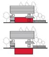
Tall buildings
Through-block walkway
Traffic calming
Universal design
Wayfinding
Buildings that are greater than six storeys or that are greater than three storeys and located in areas characterized by single -family and low- density development.
A pathway through a public or private development site that provides a safe and convenient pedestrian connection between blocks or across a block. Through-block walkways may be developed as private easements or public rights-of-way.
Design strategies intended to slow traffic and improve pedestrian and traffic safety. Examples include narrowing roads, reducing posted speed limits, enhancing pedestrian crossings, installing roundabouts at intersections, constructing speed bumps, and add new traffic signage, such as stop signs.
Design standards meant to create buildings and environments that are inherently accessible to people of all ages and physical abilities.
A system that assists travellers in orienting, navigating, and moving about an environment through the use of visual cues or other measures, including signage.
[THIS PAGE LEFT INTENTIONALLY BLANK]