
Official
Community Plan 2025
Table of Contents
Section A: Vision and Introduction
1. Community Vision .
2. Community Values
3. Bringing the Vision to Life
4. Purpose and Scope
4.1 Planning for the Future of Kamloops
4.2 Legislative Authority and Scope .
4.3 How to Read This Plan
4.4 Links to Other City Plans .
4.5 Planning Framework
5. Official community plan Engagement Process .
5.1 2018 Official Community Plan
5.2 2025 Update .
Section B: Context and Existing Conditions
1. Context.
2. History
3. First Nations Statement
4. Existing Conditions
4.1 Population
4.2 Existing Employment
4.3 Housing Type, Age, and Cost
5. Regional Context Statement
6. Climate Action
6.1 Greenhouse Gas Reduction Targets
Section C: Growth Management
1. Growth Plan. .
1.1 Population Growth Projections
A-3
A- 4
A-5
A-6
A-6
A-6
A-7
A-7
A-7
. A-9
. A-9
A-9
B-2
B-3
B-4
B-5
B-5
B-6
B-7
B-9
B-11
.B-11
C-2
C-2
1.2 Population Growth Distribution
1.3 Housing Unit Projections
1.4 Housing Unit Distribution .
1.5 Alignment with Housing Need Report (2024)
1.6 Housing Type and Density .
1.6.1 Anticipated Housing by Type and Density
1.6.2 Distribution of Anticipated Housing .
by Density and Neighborhood
1.7 Future Commercial, Industrial, and
Educational/Institutional Demand
1.7.1 Commercial
1.7.3 Educational/Institutional
2. Growth Structure .
2.1 Growth Structure Overview
2.2 Growth Areas
2.2.1
2.2.4 Suburban and Rural Neighbourhoods
2.4 Infill Versus Greenfield Development
3. Land Use Plan
3.1 Land Use Designations
3.2 Existing and Proposed Land Uses
4. Transit-Oriented Development
4.1 Transit-Oriented Areas . . . . . .
4.2 Transit-Supporting Area
4.3 Transit-Oriented Development.
5. Future Development Areas
5.1 Core
5.1.1 Henry Grube Education Centre
5.2 Northwest Sector
5.2.1 Brocklehurst West
5.3 Southeast Sector
5.3.1 Juniper West
5.3.2 Orchards Walk East
5.4 Southwest Sector .
5.4.1 Iron Mask North
Section D: Land Use Policies
C-26
C-6
C-27
C-27
C-28
C-28
C-28
C-29
C-29
C-30
C-30
C-31
C-32
C-32
D-1 Land Management and Development D-2
1. General Land Use Policies
1.1 Residential
Commercial .
2. Transit-Oriented Development
3. Area-specific Land Use Policies
D-2
D-3
D-5
D-6 3.1 City Centre
3.2 North Shore Town Centre
D-6
D-6 3.3 Sahali Town Centre
3.4 Valleyview Town Centre
3.5 Aberdeen Town Centre
D-7
D-7
D-8 3.6 Tranquille Market Corridor
3.7 McGill Corridor
3.8 Mid-Rise Commercial
3.9 Urban .
3.10 Suburban
3.11 Rural
3.12 Highway and Service Commercial
3.13 Local Commercial
D-9
D-9
D-10
D-11
D-11
D-12
D-12
3. Environmentally Sensitive Areas
4. Climate Change .
Transportation and Mobility
1. Sustainable Transportation
3. Cycling and Micromobility
D-7 Arts, Culture, Heritage D-34
1. Cultural Heritage and the Arts .
2. Heritage Resources .
3. Archaeology Resource Management
D-34
D-35
D-35
D-8 Health and Safety D-36
1. Health and Safety in Urban Planning
2. Police and Fire Protection .
3. Emergency Preparedness
D-36
D-37
D-37
D-9 Economic Development D-38
1. Community Economic Development .
2. Investment-Friendly Business Climate
3. Strategic Partnerships
4. Tourism
D-38
D-39
D-39
D-10 Social and Community Well-Being D-42
1. Social Planning and Food Security
2. Accessibility and Social Inclusion
3. Civic Engagement
Section E: Implementation
1. Implementation Plan
2. Monitoring and Evaluation
3. Subsidiary Plans
4. Development Alignment
5. Development Permit Areas
6. Development Cost Charges
7. Density Bonusing Program
8. Budget
9. OCP Amendments
10. Temporary Use Permits
E-2
E-2
E-3
E-3
E-4
E-4
E-4
E-4
E-5
E-5
Section F: Development Permit Area Guidelines
1. Language of the Guidelines
Development Permit Area
1. Purpose
2. Area
3. Exemptions
4. Objectives
5. Downtown Plan Vision and Principles
5.2 Connected
5.3 Welcoming
6. Letter of Intent Outline
7. Guidelines
7.1 Site Planning
7.1.1 Part of the Whole
7.1.2 Framing Public Space
7.1.3 A Place of Belonging
7.2 Building Design
7.2.1 Presenting a Friendly Face
7.2.2 Nod to the Neighbours
7.2.3 Mid-Rise and High-Rise Buildings
as Friendly Giants
7.2.4 Respond to Climate and Context
7.3 Landscape Design
Special Considerations
7.5 Streetscapes
7.5.1 Functional Streets for People
North Shore Development Permit Area F-26 1. Purpose
3. Exemptions
Objectives
5. North Shore Neighbourhood Plan
Vision And Principles
5.1 Inclusive .
5.2 Dynamic.
5.3 Complete .
6. Letter of Intent Outline
7. Guidelines
7.1 Site Planning
7.1.1 Part of the Whole
7.1.2 Framing Public Space
7.1.3 A Place of Belonging
7.2 Building Design .
7.2.1 Presenting a Friendly Face
7.2.2 Nod to the Neighbours
7.2.3 Mid-Rise and High-Rise Buildings
7.2.4 Respond to Climate and Context
7.3 Landscape Design .
7.3.1 Healthy Habitats For People and More
7.3.2 Curb the Heat Island Effect
7.4 Special Considerations
7.4.1 Safety and Security
7.4.2 Wayfinding and Signage
7.4.3 Lighting
7.4.4 Significant Sites
7.5 Streetscapes
7.5.1 Functional Streets for People
Multi-Unit Residential Development Permit Area
1. Purpose
2. Area
3. Exemptions
4. Objectives
5. Guidelines
5.1 Site Design
5.2 Built Form
5.2.1 Massing and Scale
5.2.2 Height and Roof Design
5.2.3 Detail, Material, and Colour
F-28
F-28
F-28
F-28
F-29
F-30
F-30
F-30
F-32
F-32
F-34
F-34
F-37
F-38
F-39
F-40
F-40
F-42
F-43
F-43
F-45
F-46
F-47
F-48
F-48
F-50
F-50
F-52
5.3 Parking and Circulation
5.4 Landscaping .
5.5 Amenity Areas
5.6 Lighting and Signage
Intensive Residential Development Permit Area
1. Purpose
2. Area
3. Exemptions
4. Objectives
5. Guidelines .
5.1 Site Design
5.2 Built Form
5.2.1 Massing and Scale
5.2.2 Height and Roof Design
5.2.3 Detail, Material, and Colour
5.2.4 Windows
5.3 Parking and Circulation .
5.5 Amenity Areas
5.6 Safety Features
5.2 Built Form
5.2.1 Massing and Scale
5.2.2 Height and Roof Design
5.2.3 Detail, Material, and Colour
5.3 Parking and Circulation
5.4 Landscaping
5.5 Lighting and Signage
Industrial Development Permit Area F-68
1. Purpose
2. Area
3. Exemptions
4. Objectives
5. Guidelines
5.1 Site Design
5.2 Built Form
5.2.1 Massing and Scale
5.2.2 Height and Roof Design
5.2.3 Detail, Material, and Colour
5.3 Parking and Circulation
5.4 Landscaping .
5.5 Lighting and Signage
F-68
F-69
F-69
F-70
F-70
F-71
F-71
F-71
F-72
F-72
Riparian Areas Protection Regulation F-74
Development Permit Area
1. Purpose .
2. Area
3. Exemptions
4. Objectives
5. Guidelines
Silt Bluffs Hazard Zone Development Permit Area
1. Purpose
2. Area
3. Exemptions
4. Objectives
5. Guidelines
F-74
F-74
F-75
F-75
F-76
F-78
F-78
F-78
F-79
F-79
F-79
Thompson Rivers University Development Permit Area F-82
1. Purpose
2. Area
3. Exemptions
4. Justification
5. Implementation
F-82
F-83
F-84
6. Guidelines
6.1 Guidelines Framework .
6.1.1 Guiding Principles
6.1.2 Public Realm and Landscaping Guidelines
6.1.3 Building Guidelines
6.1.4 Residential Guidelines
6.1.5 McGill Corridor Guidelines
6.1.6 Parking Guidelines
6.1.7 Sustainability .
Orchards Walk Development Permit Area
1. Purpose
2. Area
3. Exemptions .
4. Objectives
5. Guidelines
5.1 General Design Guidelines
5.2 Multi-Unit Residential in Single-Detached
and Two-Unit Residential Form
5.3 Multi-Unit Residential in Semi-detached
and Townhouse Form
5.4 Multi-Unit Residential in Multi-storey
Walk-up Apartment Form
5.5 Village Centre Commercial
5.6 Landscaping and Screening
Aberdeen Slope Hazard Development Permit Area F-104
1. Purpose
2. Area
3. Exemptions
4. Objectives
5. Guidelines
Flood Hazard Development Permit Area
1. Purpose
2. Area
3. Exemptions
3.1 Specific Exemptions to Flood Construction Level .
3.2 Specific Exemptions to Flood Plain Setbacks
4. Objectives
5. Guidelines
Section G: Maps
Map 1 | Land Use
Map 2 | Cycling Network
Map 3 | Transit Network
Map 4 | Major Road Network
Map 5 | Hazard Lands
Map 6 | Parks and Recreation
Map 7 | Water Network
Map 8 | Storm Drainage
Map 9 | Sanitary and Waste Management
Map 10 | Environmentally Sensitive Areas
Map 11 | DPA: Riparian Areas Projection Regulation
Map 12 | DPA: Silt Bluffs Hazard Zone
Map 13 | Transit Oriented Areas
Map 14 | DPA: Aberdeen Slope Hazard
Section H: Appendices
Glossary.
References
F-108
F-108
F-109
. F-109
F-109
F-110
G-4
G-5
G-6
G-7
G-8
G-9
G-10
G-11
G-12
G-13
G-14
G-15
Section A Vision and Introduction

Christopher A. James
Land Acknowledgement
The City of Kamloops occupies land that, since time immemorial, has been a place of great cultural and economic importance in our region. The City acknowledges that we are located on Tḱemlúps te Secwépemc territory, situated within the unceded ancestral lands of the Secwépemc Nation. We honour and respect the people, the territory, and the land that houses our community.
Summary
The City of Kamloops’ Official Community Plan, commonly referred to as KAMPLAN, is the result of creative and inspiring input provided by thousands of residents across the community between 2014 and 2017 and additional input received in 2025. The Official Community Plan provides direction on planning, land use, and development in the city to support a projected population of 134,000 by 2045 while setting the stage for longer-term growth. The plan’s goals and policies aim to support the continued growth of a sustainable and healthy community by addressing social, environmental, and economic concerns while creating vibrant neighbourhoods where people want to live, work, and play. The Official Community Plan is a strategic visionary document that brings the community’s values, priorities, and aspirations to life.
Michelle Gardner
1. Community Vision
Kamloops is a sustainable, environmentally friendly community that supports active and healthy living and is characterized by resilience, inclusiveness, and vibrancy.
Sustainable Community
Kamloops is an environmental leader, inspiring a culture of sustainability among residents as the city progresses towards greater ecological health, livability, economic vitality, and community resiliency.
Healthy People
Recreational and cultural activities are plentiful, further enhancing social networks and supporting healthy and active lifestyles.
Resilient Economy
Kamloops’ economy is growing and vibrant, with training and education opportunities that help retain and attract new businesses.
Inclusive Housing
Shelter is available and affordable to all residents through a variety of housing types that accommodate changing demographics and population growth.
Vibrant Neighbourhoods
Neighbourhoods are safe, compact, and vibrant places to live, work, and play, with diverse housing choices and access to community amenities and public transit.
The Community Vision and Values provide direction for the Official Community Plan’s goals and policies and are based on community input received during the review and update public engagement process.
City of Kamloops
2. Community Values
Develop Complete Neighbourhoods
Create safe, accessible, and inclusive neighbourhoods that are easy to get around in and offer a broad range of housing choices, amenities, and services.
Support Urban Densification
Focus densification in town centres and other mixed-use areas to create vibrant neighbourhoods.
Support the Availability of Diverse Housing Options
Enable people from all walks and stages of life to locate and secure housing that is safe, affordable, and appropriate.
Improve Transportation and Connectivity
Invest in road infrastructure, public transit, and pedestrian, bicycle, and trail networks in the areas of highest need, and plan for all active forms of transportation. Provide safe and convenient access to neighbourhoods, parks, open spaces, and daily amenities for people travelling from home, work, and other destinations.
Invest in Arts, Culture, Sports, and Recreation
Enhance quality of life, community identity, pride, and social networks by investing in community arts, culture, sports, and recreation. Foster healthy and active living by ensuring that parks, trails, and open spaces are available and accessible to all residents.
Support Local and Regional Food Systems
Support the production of local and regional food through partnerships with all levels of government, agricultural producers, distributors, and retailers to enhance community food security and ensure equitable access to healthy food for all residents.
Promote Environmental Stewardship
Reduce the city’s environmental footprint, prioritize restoration of riverfront and riparian areas, protect environmentally sensitive areas, promote water and energy conservation, and support best practices for stormwater management, waste reduction, and airshed management.
Promote Economic Resiliency
Support a vibrant and thriving economy that attracts new businesses and provides opportunities for residents to prosper and Kamloops to flourish.
Optimize Existing Municipal Infrastructure
Utilize existing services to ensure the City has the financial resources to meet residents’ needs in a costeffective manner now and in the future.
Build Regional Partnerships
Work co-operatively with Tḱemlúps te Secwépemc, the Thompson-Nicola Regional District, government agencies, and interest holders to determine and evaluate opportunities for collaboration and planning.

Valery Warren

3. Bringing the Vision to Life
The Community Vision will be brought to life through land use regulations and strategic policy directions, as outlined in Section C: Growth Management and Section D: Land Use Policies. The policy directions cover 10 diverse topic areas that provide guidance for managing land use and growth in the community. The 10 topic areas are:
4. Purpose and Scope
4.1 Planning for the Future of Kamloops
The Official Community Plan’s purpose is to provide a framework of goals and policies to guide decisions on planning and land management within the city’s boundaries. All bylaws and works undertaken by City Council must be consistent with the Official Community Plan
While the scope of the Official Community Plan is to manage the city’s growth to a population of 134,000 over the next 20 years, it is also forward looking and considers the long-term sustainability of the community. As such, the Official Community Plan aims to:
• ensure that the city has room to grow by setting aside sufficient land for future residential and employment use
• continue to encourage compact urban form and increase density in the city in order to conserve land and minimize the impact of development
• ensure that infrastructure is planned and staged to allow the City to manage costs efficiently over the long term
• plan efficiently so that municipal financial resources are allocated wisely
• continue to co-operate through joint planning initiatives on regional matters, such as the economy and the environment, with surrounding municipalities, the regional district, and First Nations
4.2 Legislative Authority and Scope
The provincial Local Government Act requires municipalities in British Columbia to adopt an official community plan and stipulates what must and may be included. The Local Government Act also identifies the consultation requirements and adoption procedures for approving an official community plan as a bylaw. This plan has been prepared in compliance with the legislation.
Adrian Lange
4.3 How to Read This Plan
The Official Community Plan functions as a road map to guide future growth and development. While it is organized by section and according to specific topic areas, it should be read in its entirety as matters in one section apply to others. Topic areas in Section D: Land Use Policies are not listed in order of priority. The Official Community Plan is divided into the following parts:
• Section A contains the Community Vision and Community Values, which articulate the priorities and aspirations of the community to guide growth and development over the next 20 years.
• Section B provides the historical and regional context, existing demographic conditions, and greenhouse gas reduction targets.
• Section C consists of the Growth Plan, which is the City’s primary reference tool for guiding future growth and development, and descriptions of the plan’s land use designations.
• Section D consists of the 10 topic areas and their corresponding policies to realize the Growth Plan.
• Section E outlines the plan’s implementation process and next steps to realize the goals and policies within the plan.
• Section F includes specific guidance for areas and types of development within a development permit area
• Section G includes maps that illustrate the spatial application of the land use policies.
• Section H contains a glossary that provides definitions for key terms found throughout the document.
4.4 Links to Other City Plans
The City has several planning policy documents that guide municipal decision making. The Official Community Plan provides the highest level of direction in the hierarchy of City plans and policies. Given the plan’s broad scope, its policies do not provide the same level of detail as neighbourhood plans or plans for specific topics (e.g. Transportation Master Plan, Parks Plan). All other municipal plans must be consistent with the Official Community Plan’s overall intent and vision. Where there is a direct conflict with other City plans, the Official Community Plan will prevail.
Several of these plans include policies that affect the future growth and development of certain areas or aspects of the city. Some of these subsidiary plans will undergo a critical review to ensure consistency with the Official Community Plan, but they are not intended to become part of or have the same legal effect.
4.5 Planning Framework
The Official Community Plan provides a framework to guide land use and direct development, continuing the City’s progress towards the long-term vision of Kamloops as a more sustainable community. In 2010, the City developed the Sustainable Kamloops Plan: Foundations for Sustainability, an umbrella document that provides direction for a coordinated approach to economic, social, and environmental sustainability across all City departments and the community. The Sustainable Kamloops Plan’s goals and policies were reviewed and considered in the development of the Official Community Plan. In addition, available data on community demographics, projected growth patterns, and historical development trends were integrated with public-, interest holder-, and First Nations-input to develop land use policies that are evidence based and responsive to community needs.
The Official Community Plan uses an adaptive management framework that involves a cyclical and reflective process of action planning, implementation, monitoring, evaluation, and amendments as necessary. An implementation plan associated with the Official Community Plan includes action items, indicators, and targets to achieve the Official Community Plan’s vision and goals. Reliable and relevant data sources are utilized to track and monitor progress towards achieving targets and desired trends associated with the identified indicators. Annual evaluation and reporting include details on proposed adjustments where progress is inadequate or trending in the wrong direction. Section E: Implementation provides details on the Official Community Plan implementation process.
5. Official Community Plan Engagement Process
5.1 2018 Official Community Plan
The last major official community plan update was in 2018. The City publicly launched the review and update process in 2014 and engaged residents in conversations on future growth. The engagement process involved extensive feedback from the public, First Nations, and community partners; input from City staff; review by various senior government agencies; and participation by a City Council-appointed KAMPLAN Advisory Committee. Numerous opportunities for public participation, using a variety of engagement activities, helped reach a broad audience and encouraged people to share their thoughts and provide meaningful input on the development of the 2018 Official Community Plan.
The first phase of the engagement process involved identifying the vision, values, goals, and key issues that were most important to residents through a questionnaire, launch events, information booths, and topicbased meetings. In the second phase, two draft land use scenarios and policy directions were developed for each of the 10 topic areas. Feedback was gathered at community roadshow events, interest holder sessions, and in-depth, self-facilitated group meetings.
The third phase of the process involved developing the first draft of the official community plan and reviewing it with City staff, First Nations, the KAMPLAN Advisory Group, City Council, community partners, government agencies, and the public through referrals, a questionnaire, focus group meetings, and world cafés. The final phase involved refining the draft based on feedback and presenting the official community plan to City Council for final approval through first and second readings, referral to government agencies, a public hearing, and third reading and adoption.
5.2 2025 Update
The Official Community Plan was updated in 2025 to meet legislative requirements for local governments to update their official community plans to accommodate the 20-year housing needs in accordance with the municipality’s most recent housing needs report. Community engagement took place as part of the Kamloops 2024 Housing Needs Report process in November 2024, on the proposed changes to the Official Community Plan in spring 2025, and again on the final document in fall 2025. Engagement included meetings with KAMPLAN Advisory Group, targeted engagement meetings, public information sessions, request for comment on the City’s Let’s Talk page. First Nations engagement included multiple delegations at Tḱemlúps te Secwépemc Chief and Council meetings, TteS participation on the KAMPLAN Advisory Group, conversations with TteS staff, and a focus group session with Urban Indigenous housing providers and non-profit agencies.
Detailed information about the public engagement process is available on the City’s website.
Kathleen Fisher
Section B Context and Existing Conditions
Christopher A. James
1. Context
With a 2021 population of 97,9021 residents and a land area of approximately 293 km2, Kamloops is a growing city and the largest community in the Thompson-Nicola Regional District. A full range of land uses is represented within municipal boundaries, including residential, commercial, mixed-use (residential and commercial), agricultural, industrial, educational, institutional, parks and open space, public service utilities, airport, golf course, and sand and gravel extraction. While the city’s footprint is large, land use constraints, including steep slopes, environmentally sensitive and riparian areas, silt bluffs, flood plains, and provincial Agricultural Land Reserve lands, significantly reduce available and developable land area. As the population of Kamloops increases to 134,000 residents over the next 20 years, Official Community Plan policies will strive to ensure efficient land use to accommodate the needs of residents within this time frame and beyond.
This section provides a historical overview of the city’s growth; outlines how the City will continue to engage First Nations in future planning and projects; provides information on existing population, employment, and housing conditions; describes how the Official Community Plan aligns with the Thompson-Nicola Regional District’s Regional Growth Strategy; and includes greenhouse gas reduction targets, drawing from the City’s sustainability plan.
Peter Olsen

2. History
The City of Kamloops occupies land that has long been a place of great cultural and economic importance. The first people to inhabit this land were members of the Interior Salish Secwépemc language group of British Columbia. The Tḱemlúsemc, “the people of the confluence”, now known as Tḱemlúps te Secwépemc, have lived in this region since time immemorial. The Secwépemc-speaking people lived on these lands as a connected set of communities united by kindred dialects, belief systems, and cultural practices. Self-sufficient and self-governing across an expansive territory of mountain ranges, grasslands, and river valleys, the Secwépemc people have a vast understanding of the land and its character. Communities traditionally moved with seasonal changes, relocating strategically during warmer months to hunt, fish, and gather food and medicines, and assuming fixed residency during winter months in the comfort of pit house villages. Their largest settlements were at Tranquille Creek and the present-day location of the Tḱemlúps te Secwépemc main reserve (Kamloops IR 1).
In 1811, American fur traders arrived in the region with the American-owned Pacific Fur Company, later the Hudson’s Bay Company, which began trading with Secwépemc communities. By 1821, the Hudson’s Bay Company operated a fort north of the Thompson River, which was relocated in 1862 to what is now downtown Kamloops. In the 1850s, the discovery of gold brought a wave of migrants into the British Columbia interior, which led to the development of the first townsite along Victoria Street West and in the current West End neighbourhood. This was followed by the smallpox epidemic in 1862, which decimated the Secwépemc communities locally. Concurrently, the new Colony of British Columbia established the reserve lands for Indigenous communities. The Kamloops reserve was established on the northeast side of the confluence of the North Thompson and South Thompson Rivers, while settlers were offered access to land ownership in the rest of the region, spurring ranching and farming activities.
BC joined Confederation in 1871, courted by the promise of a train service connecting it to the eastern provinces. By 1885, the newly completed Canadian Pacific Railway ran along the southern shore of the South Thompson River. The City of Kamloops was incorporated in 1893, with a population of 500 residents. With the completion of the Canadian Northern Railway (later known as Canadian National Railway), Kamloops established itself as a provincial transportation hub.
During this time, major local institutions were built to support the newly incorporated City. Royal Inland Hospital opened in 1885 with 12 beds and has continued to expand ever since. Located on the north bank of the South Thompson River at the foot of Sqeq7é7em (Mount Peter and Mount Paul), the former Kamloops Indian Residential School opened in 1890 as the Kamloops Industrial School (closed in 1978). The school still stands today, bearing witness to the experiences of the children who lived and died there. For settler children, Saint Anne’s Academy and Stuart Wood School were built within the City of Kamloops in 1880 and 1907, respectively. The courthouse building, built in 1905, still stands on Seymour Street West. The City of Kamloops continued to expand its institutions to support the ongoing growth of the developing region, informed by ongoing planning, as it does today.
With the completion of the Trans-Canada Highway in 1962 and the Yellowhead Highway in 1970, Kamloops further established its reputation as a centre for the transportation of goods and services, and the city began to experience significant growth. This was further supported by the completion of the Coquihalla Highway in 1986, which launched a more direct route to support the movement of goods, services, and people between Kamloops and the Lower Mainland.
Tourism Kamloops | Secwépemc Museum
The City of Kamloops amalgamated with surrounding towns, districts, and other residential areas in the 1960s and 1970s. The Town of North Kamloops amalgamated with the City of Kamloops in 1967, followed by the Town of Valleyview, the Districts of Dufferin and Brocklehurst, and unincorporated areas of the Thompson-Nicola Regional District, including Westsyde, Dallas, Rayleigh, Barnhartvale, and Heffley Creek, in 1973. Several additional neighbourhoods have been built since the era of amalgamation, including Upper Sahali, Juniper Ridge, Aberdeen, Batchelor Heights, and Pineview.
For over 88 years, the historic Red Bridge connected the communities of Kamloops and the Tḱemlúps te Secwépemc reserve lands, with the Mount Paul Industrial Park on the northeast side and downtown Kamloops to the southwest. In September of 2024, the historic bridge was destroyed by arson. This led to a new opportunity to explore a new, modernized connection between the two neighbouring communities, informed by shared planning and economic development priorities.
Major industries have historically included forestry, mining, and agriculture. The transportation, construction, and public (health care, education, and government) sectors have also been strong economic drivers. More recently, the local economy has seen further diversification into the manufacturing, technology, and tourism sectors. Kamloops’ reputation as a centre for sporting and cultural events tourism was solidified with the hosting of the 1993 Canada Summer Games, the branding of Kamloops as Tournament Capital of Canada in 2001 (now Canada’s Tournament Capital), and the completion of the Tournament Capital Centre in 2006. The City of Kamloops is currently expanding its capacity to support sports and events tourism through the construction of a centre for the arts and a new arena space. With its well-established transportation networks, access to markets, a growing university district, diverse recreational amenities, and a consistent growth rate, Kamloops is an attractive destination for both business and lifestyle opportunities.
3. First Nations Statement
The City acknowledges it is located on Tḱemlúps te Secwépemc territory, situated within the unceded ancestral lands of the Secwépemc Nation, within Secwepemcúlecw. The City of Kamloops collaborates with Tḱemlúps te Secwépemc to support reconciliation, environmental sustainability, social health, and economic prosperity. Tḱemlúps te Secwépemc is a key partner, and the City is committed to building relationships, engaging meaningfully, and advancing reconciliation in alignment with legislation, protocols, and new and existing agreements.
The City of Kamloops acknowledges its responsibility in the reconciliation process to urban Indigenous residents within its municipal boundaries. In 2021, 9,885 residents identified as Indigenous, representing approximately 10.5% of the population, a slight increase from 2016 (9.8%). As of 2024, it is estimated that there are 4,590 Indigenous households living off reserve within city limits.

Mary Putnam
4. Existing Conditions
4.1 Population
Kamloops had a population of approximately 85,680 in 2011, 90,280 in 2016, and 97,900 in 20212. The addition of 12,224 residents represents a 14.3% growth over a 10-year period and an annual growth rate of approximately 1.35%. BC Stats data for the same census years estimates Kamloops’ population at 94,486 in 2016 and 102,264 in 2021, which represents approximately 4,500 additional residents that may include temporary residents, students, and similar demographics that may not be accounted for in a five-year census. The most recent BC Stats estimate suggests Kamloops’ population was at 106,971 in 2023.
F IGURE B2: POPULATION GROWTH (2011 TO 2021)


Note: Census data are available for 2011, 2016, and 2021. Population figures between census years were estimated using the average annual growth rate over five-year intervals, which was 1.1% for 2011–2016 and 1.6% for 2016–2021.
The median age3 in the City of Kamloops rose from 41.5 in 2011 to 42.2 in 2016, indicating an aging population during that period. It then slightly declined to 41.6 in 2021, suggesting a modest shift toward a younger population, possibly due to factors such as new residents, births, and migration of younger individuals to the city, including pipeline workers. This trend aligns with the overall pattern seen in British Columbia. Throughout this period, Kamloops consistently had a lower median age than the provincial average, indicating a younger population compared to the rest of the province.
F IGURE B3: 2021 AGE AND SEX PROFILES
Source: Stat Canada, 2021
2 Stats Canada, 2016 Census of Population, 2017, and 2021 Census of Population, 2023.
3 The median age is the age that divides a population into two equal halves, meaning that half the people are younger than this age and half are older. It shows a typical age in the city.

4.2 Existing Employment
Data collection for the 2021 Census occurred in 2020 during the COVID-19 pandemic economic downturn, which impacted income, employment, and related statistics. For perspective, there were 19,155 COVID-19 emergency and recovery benefits recipients reported in Kamloops in the 2021 Census, roughly one-fifth of the entire population. This section is based on Statistics Canada census data, but it also includes data from BC Stats, which offers more recent data, including the post-pandemic recovery.
In 2020, 55,805 residents were employed in the labour force, and the unemployment rate was 7.4%, below the 8.4% average for the province and the Thompson Nicola Regional District4. The most recent data from Statistics Canada reports that the unemployment increased greatly from 4.8% in early 2025 to 8.2% for Kamloops in May 20255
While Kamloops was historically a resource-based city, most of the city and region’s labour force is now employed in service-producing industries. The 2021 Census lists the top three industries by labour force as sales and service occupations; trades, transport, and equipment occupations; and business, finance, and administration occupations. Figure B4 shows the top 10 industries by labour force in 20216.
The median household income increased from $73,822 in 2015 to $88,000 in 2020. This was higher than the 2020 median household income of the Thompson-Nicola Regional District at $82,000 and the province at $85,0007.
4 Statistics Canada, 2021 Census of Population, 2023.
5 Stats Canada, https://www150.statcan.gc.ca/t1/tbl1/en/tv.action?pid=1410045901
6 Custom Stats Canada Census Reports 2006-2021
7 Stats Canada, 2021 Census of Population, 2022.
F IGURE B4: LABOUR FORCE BY INDUSTRY (2006-2021)
4.3 Housing Type, Age, and Cost
In 2021, 70.1% of Kamloops residents lived in homes they owned, which was higher than the provincial average of 66.8%, but lower than the 73.5% homeownership rate in the Thompson-Nicola Regional District region8. The average assessed value of a single-detached home in Kamloops for July 1, 2024, was $693,0009, an increase of 70% since the 2018 Official Community Plan reported price of $408,000.
According to the 2021 Census, the percentage of households spending 30% or more of their total household income on shelter costs was 19.0%, which was lower than the provincial average of 25.4%10. It is important to note that the 2021 Census data included 2020 COVID-19-related financial relief programs that may have impacted the data. Since 2018 Official Community Plan, Kamloops’ rental vacancy rate shifted from 2.1% to a rate of 1.0% in 2021. As of October 2024, the vacancy rate was 1.4%, unchanged from the year prior.11
According to Statistics Canada, 90% of all housing in Kamloops in 2021 was constructed after 1960, with 66% built between 1961 and 2000. As shown in Table B1, single-detached dwellings represented the most common existing housing stock at 50%, followed by 21% for duplexes and manufactured homes, 19% for apartments, and 10% for row houses. The total number of dwellings with usual residents was 39,914, with an average of 2.4 persons per household12
B1: QUANTITY OF HOUSING UNITS BY HOUSING TYPE IN THE CITY OF KAMLOOPS (2021)
Source: Stat Canada, 2021
TABLE
Maria Andrea Patino Garces
Though the existing stock of residential units is currently half made up of single-detached dwellings, the trend towards small-scale multi-unit residential and multi-unit residential development is on the rise. In the five-year period between 2015 and 2019, multi-unit residential accounted for 55% of new residential development, while between 2020 and 2024, this percentage rose to 60%. In 2024, multi-unit residential development accounted for over 69% of all new residential units constructed13. Housing unit projections within the Official Community Plan’s growth management strategy (see Section C: Growth Management) consider these shifting residential development trends. F IGURE B5:
RESIDENTIAL HOUSING STARTS (2015 TO 2024)
Single-Family Dwelling
Garden/Carriage Suite
Multi-Family Duplex
Duplexes
Mobile Home
Year Building Permit Issued
Secondary Suite
Multi-Family Single Unit
Multi-Family 3+ Units Including Apartments
Source: Kamloops 2024 Housing Needs Report based on the City’s building permit Data
City of Kamloops
5. Regional Context Statement
Kamloops is within the Thompson-Nicola Regional District and is subject to its Regional Growth Strategy (2013). The Regional Growth Strategy is a co-operative strategy for all member municipalities to work towards a sustainable future for the region. The vision in the Regional Growth Strategy is:
To create a balance among goals relating to human settlement, economic development and environmental conservation, to ensure that development actions do not significantly limit the options of future generations.
The Local Government Act requires each municipality to prepare a regional context statement as part of its official community plan to identify the relationship between the OCP and the matters referred to in s. 429 (2) of the Local Government Act and any any other regional matters addressed in the Regional Growth Strategy. Where there are any inconsistencies, the City is required to indicate how the official community plan will be made consistent with the Regional Growth Strategy over time.
As shown in Table B2, the growth management strategy and land use policies in the Official Community Plan align with the required content of the Regional Growth Strategy. The Official Community Plan focuses on compact, complete development, which utilizes existing services. It also aims to reduce energy consumption, protect environmentally sensitive areas, and provide sufficient lands for diverse economic development opportunities.
Regional Growth Strategy Policy required under Local Government Act
Human Settlement (Housing): Contain urban and rural sprawl by building on the existing network of diverse regional centres. Direct growth into established centres. Promote policies of infill and intensification. Ensure adequate levels of servicing are provided.
Transportation: Integrate energy and transportation considerations with land use and settlement planning to achieve conservation, mobility, and efficiency goals.
Population and Employment Projections: the 2013 RGS projects 29,000 residents in the Regional District over 25 years (0.8% annual growth rate), 85% of which will located in Kamloops and Merritt, and approximately 17,000 jobs during this time-period.
The Official Community Plan includes policies that support infill development and intensification within mixed-use areas.
Major greenfield development will only occur where already noted in existing neighbourhood plans, with preference given to areas that can most efficiently utilize existing services and infrastructure. Further greenfield development will be discouraged until existing growth areas are fully built out.
The Official Community Plan includes policies to support a fully integrated transportation network that provides safe, efficient, and sustainable transportation options for all residents.
KAMPLAN projects stronger population growth in Kamloops (1.3% annually) than in the region as a whole and envisions Kamloops as an employment hub for the region.
C - Growth Management
D-1 - Land Management and Development
D-4 - Infrastructure
D-5 - Housing
D-2 - Environment
D-3 - Transportation and Mobility
Section B: Context and Existing Conditions
C - Growth Management
D-1 - Land Management and Development
D-9 - Economic Development
TABLE B2: OFFICIAL COMMUNITY PLAN ALIGNMENT WITH THE 2013 THOMPSON-NICOLA REGIONAL DISTRICT REGIONAL GROWTH STRATEGY
KAMPLAN Alignment
Regional Growth Strategy Policy required under Local Government Act
Economic Development: Broaden the region’s economic base through diversification and expansion. Support and encourage existing primary, secondary, and tertiary industries while promoting new economic development opportunities.
The Official Community Plan policies support the retention or expansion of existing businesses and encourage the development of new businesses in order to develop a sustainable, thriving economy. Collaboration with local businesses, industry, and Venture Kamloops will help promote an investment-friendly business climate, with municipal regulations that are transparent and fair and business-related processes that are efficient and responsive.
The Official Community Plan also includes policies to support the preservation of existing commercial and industrial lands and identifies Iron Mask North as a Future Development Area where future industrial activity may occur.
C - Growth Management
D-1 - Land Management and Development
D-9 - Economic Development
Environmental Protection: Protect and enhance the environment through the adoption and co-operative use of stewardship principles.
Parks and Natural Areas: Establish a system of open space planning and work with communities to establish parks, recreation sites, greenways and amenities throughout the region; Collaborate with non-governmental organizations in the development and maintenance of community parks.
Regional District Services: Encourage rural residential development to locate in existing community nodes that have, or can establish, economically sustainable community water and/or sewer services; Consider residential development in resources areas subject to providing basic services and recognizing the limited range of other services.
The Official Community Plan includes policies to regulate development in hazard lands and environmentally sensitive areas with the intent of ensuring public safety, protection of private property, and responsible use of the natural environment. It also provides development permit area guidelines for silt bluffs and riparian areas.
Targets, policies, and actions to reduce greenhouse gas emissions are also found in the Official Community Plan as they relate to transportation, infrastructure, and development.
The Official Community Plan includes policies to help preserve open space and natural areas.
D-2 - Environment
F - Development Permit Area Guidelines
The Official Community Plan discourages peripheral development in areas without adequate utility and other services.
D-1 Land Management and Development
D-2 Environment
D-6 Parks and Recreation
D-1 Land Management and Development
D-4 infrastructure
Regional Growth Strategy Policy required under Local Government Act
Greenhouse Gas Reduction Targets and Policies. The Regional Growth Strategy includes a target of reducing GHGs by 33% by 2050 from 2007 levels and includes a goal to request the Province’s support for resources to monitor and measure greenhouse gas reduction levels.
6. Climate Action
Alignment
KAMPLAN’s GHG reduction targets are noted in the following section.
Section Reference
6.1 Greenhouse Gas Reduction Targets D-2 Environment
In 2007, the City of Kamloops signed on to the British Columbia Climate Action Charter, an agreement between the Province, the Union of BC Municipalities, and local governments. Signatories to the charter agreed to measure and report on greenhouse gas emissions. With the adoption of the Local Government (Green Communities) Statutes Amendment Act in 2008, local governments are now required to include targets, policies, and actions to reduce greenhouse gas emissions in their official community plans.
City Council unanimously adopted the Community Climate Action Plan on June 29, 2021, to provide direction on reducing greenhouse gas emissions in Kamloops, aligning with national and international efforts to limit global temperature rise to 1.5°C. The Community Climate Action Plan policies were reviewed and considered in the development of the 2025 update to the Official Community Plan
6.1 Greenhouse Gas Reduction Targets
The City adopted the following greenhouse gas emissions reduction targets as part of its Community Climate Action Plan (2021):
• reduce community greenhouse gas emissions by 30% by 2030 and 80% by 2050 compared to 2007 levels
• reduce corporate greenhouse gas emissions by 40% by 2030 and 100% by 2050 compared to 2007 levels
Figure B6 illustrates Kamloops’ greenhouse gas emissions up to 2023.
In accordance with the Local Government Act, these Greenhouse Gas Reduction targets are supported by a range of policies and actions embedded throughout this plan to guide implementation and progress. Specific examples of these actions can be found in section D-2.
Section C Growth Management
Alisa Khliestkova
By 2045, the population of Kamloops will be approximately 134,000, based on a projected annual growth rate of 1.3%. While growth can provide social and economic benefits, including jobs, tax revenue, and opportunities for revitalization, it can also impact the natural environment and the capacity of municipal services and infrastructure. This section outlines how and where population growth in Kamloops is expected to occur and how the City will manage future growth by primarily focusing development in areas that can efficiently absorb growth, which will help reduce environmental impacts, create vibrant urban places, and minimize costs borne by the taxpayer. This strategy is supported by the goals and policies found in Section D: Land Use Policies of the Official Community Plan.
1. Growth Plan
1.1 Population Growth Projections
The methodology used to determine population projections analyzed historical trends in census and building permit data, and considered BC Stats’ annual population estimates from 2001 to 2021 and projections through 2046. Using the 2021 Census population of 97,902 as a baseline, three scenarios of average annual growth were considered—1.0% (low), 1.3% (moderate), and 1.4% (high)—to estimate the population in 2025 and project growth over the following 20 years.
Figure C1 shows that under the low-growth scenario (1.0%), Kamloops is projected to reach a population of 124,310 by 2045. With moderate growth (1.3%), the population is expected to reach around 134,000, while under the high-growth rate (1.4%), the city could grow to approximately 141,830 residents by 2045. The moderate-growth scenario (1.3%) was selected as it closely aligns with the historical population accommodation rate based on building permit data, which averaged 1.27%14.
1.2 Population Growth Distribution
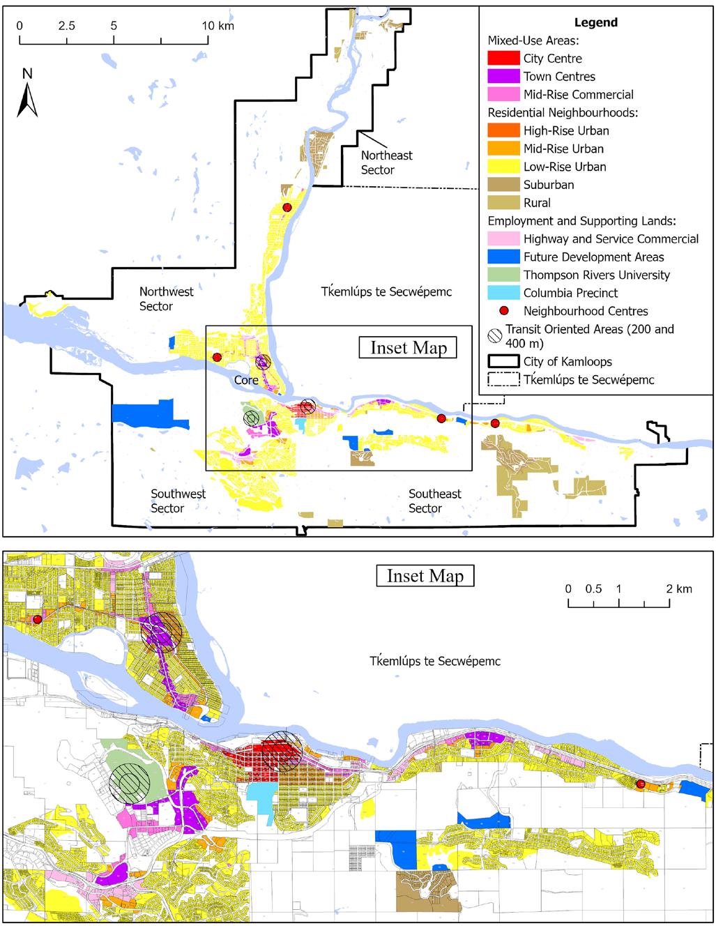
The growth plan within the Official Community Plan considers future growth at a city-wide level and by sectors, which are geographically oriented groups of neighbourhoods. Kamloops has five sectors: the Core, which is centrally located and supported by residents of all sectors, and the Southwest, Southeast, Northwest, and Northeast. The future growth that each sector is expected to receive as the city grows to a population of 134,000 is described below.
F IGURE C1: ANNUAL POPULATION GROWTH (1966–2045)
1.2.1 Core
A key area of focus for future growth in Kamloops will be the Core Sector, as shown in Figure C2. The Official Community Plan strongly encourages mixed-use, multi-unit residential, and infill development to increase density and continue revitalization of the City Centre, Tranquille Market Corridor, and North Shore Town Centre. The Core Sector is projected to absorb 30% of the city-wide population growth.
1.2.2 Southwest
The Southwest Sector is expected to absorb approximately 32% of the total projected population. Mixeduse and medium- to high-density development is expected to occur in the Sahali Town Centre, Aberdeen Town Centre, McGill Corridor, and at Thompson Rivers University (TRU). Aberdeen will continue to be the largest greenfield development area in the city, with low- and medium-density growth occurring primarily on lands identified in the Aberdeen Plan (2008).
1.2.3 Southeast
The Southeast Sector is expected to absorb approximately 26% of the total projected population. Much of the expected growth is anticipated within the Valleyview Town Centre in the form of mixed-use midrise and high-rise development supported by a future transit exchange. Mid-rise residential development is encouraged near the Valleyview Town Centre. The Orchards Walk East Future Development Area and the Pineridge Golf Course will see a mix of low-rise and mid-rise residential buildings. Juniper Ridge will continue to expand to the west as a low-rise and lower-density neighbourhood.
1.2.4 Northwest
The Northwest Sector is projected to absorb approximately 12% of city-wide population growth. Brocklehurst and Westsyde will experience continued growth, primarily through infill development in the form of multi-unit residential, small-scale multi-unit residential, residential suites, and single-detached dwellings and duplexes. While Batchelor Heights experienced significant growth in the past, there is limited land available for development due to adjacent environmentally sensitive areas and steep slopes.
1.2.5 Northeast
The Northeast Sector comprises the Suburban and Rural neighbourhoods of Rayleigh and Heffley Creek and is not projected to experience substantial growth. This is due to the focus on densification within Urban areas of the city to maximize existing services and infrastructure and promote complete neighbourhoods, resulting in limited future growth within Suburban and Rural neighbourhoods.
Population distribution across the Sectors of the City is summarized in Table C1. Population distribution across neighbourhoods is shown in Figure C2.
TABLE C1: POPULATION GROWTH
1.3 Housing Unit Projections
The estimated number of new housing units required to accommodate population growth through 2045 was determined using the population projections in Figure C1, the population distribution in Table C1, and the average household size for each neighbourhood based on Census data. Table C2 outlines the projected housing demand corresponding to various growth rate scenarios between 2025 and 2045.
Assuming a
accommodate the projected population
1.4 Housing Unit Distribution
The anticipated distribution of housing growth in Kamloops was assessed based on an analysis of several inputs, including:
• Building permit issuances and residential development trends of the past 30 years
• Proposed residential densities (units/ha) in existing neighbourhoods and land zoned for future residential use but not yet developed
• Infill redevelopment potential15 on lands deemed to be vacant or underutilized within or adjacent to mixed-use areas
• Infill redevelopment potential of small-scale multi-unit residential in urban areas throughout the city
• Access to and availability of existing servicing, including water, sewer, and roads
Table C3 shows the distribution of future housing unit growth across Kamloops.
1.5 Alignment with Housing Needs Report (2024)
Changes to the Local Government Act made as part of Bill 44, the Housing Statutes (Residential Development) Amendment Act, 2023, require local governments to update their official community plans to accommodate anticipated housing needs over the next 20 years, considering their most recent housing needs reports. To determine future housing needs, the Kamloops 2024 Housing Needs Report used the standardized methodology required by legislation, considering six components of housing need, as outlined in Table C4. The table shows that 23,228 units are needed to meet the six components:
TABLE C3: HOUSING UNIT GROWTH DISTRIBUTION BY SECTOR (2025 TO 2045)
Table C5 shows the results of an analysis of the Official Community Plan’s land use designations and associated zoning designations. The maximum unit capacity was determined by assessing the highest allowable densities to estimate the potential maximum number of units permitted on the properties. The additional unit capacity was calculated by subtracting the current number of units from the estimated maximum potential capacity within each sector.
Based on the moderate population growth scenario identified above, the estimated housing demand by 2045 is approximately 14,000 units. While this projection is slightly below the projection in Component D Supply of Units Needed to Meet Household Growth shown in Table C4 (15,508 units between 2021 and 2041), the additional unit capacity in Table C5 (152,160 units) shows that the Official Community Plan’s land use designations are more than sufficient to meet projected housing needs of 23,228 units. The last column in Table C5 shows how the 23,228 units required by legislation might be distributed across Kamloops if they were constructed.
1.6 Housing Type and Density
1.6.1
Anticipated Housing by Type and Density
As Kamloops plans for a projected population increase to approximately 134,000 residents, future housing development is anticipated to include a balanced and diverse mix of residential densities to meet community needs. Approximately 3,605 low-density units are anticipated. Medium-density housing is expected to account for approximately 3,635 units, while high-density residential development will represent the largest share, with approximately 6,760 units in buildings of five storeys or more, including apartment complexes and mixed-use developments that incorporate both residential and commercial uses.
IGURE C3: ANTICIPATED HOUSING BY DENSITY AND TYPE (2025–2045)
Low-Density Residential (includes single-detached, single-detached with suite, and duplexes in conventional and strata subdivisions, and smallscale multi-unit residential, with a typical density of up to 75 units per hectare)
Medium-Density Residential (includes multi-unit developments of three to four storeys such as townhouses, rowhouses, and small apartment buildings, with a typical density of 75 to 200 units per hectare)
High-Density Residential (includes multi-unit apartment buildings of five or more storeys, and mixed-use commercial and residential developments, with a typicalt density of 200+ units per hectare)
F
1.6.2 Distribution of Anticipated Housing by Density and Neighborhood
The distribution of future housing growth across the sectors of the city is shown in Table C5, while Figure C3 shows the overall breakdown of anticipated housing density and type. Table C6 shows the anticipated neighbourhood and sector distribution of different housing unit density. This detailed distribution of growth was determined considering impacts on the servicing capacity of municipal water, sanitary sewer, storm drainage, and transportation systems. The City’s Five-Year Financial Plan was also reviewed to determine potential financial implications of the growth strategy and policies in Section D: Land Use Policies of the Official Community Plan
16 The Suburban neighbourhood of Heffley Creek and the Rural neighbourhoods of Noble Creek and Knutsford are not listed. New housing development in these areas is anticipated to be minimal (fewer than five new units per neighbourhood over the projection period). The Tranquille neighbourhood is included without projections as additional units are solely contingent on the Tranquille on the Lake development.
1.7 Future Commercial, Industrial, and Educational/Institutional Demand
Continued population growth in Kamloops requires land use policies to manage the supply of lands identified for commercial, industrial, educational, or institutional use. The following section describes the current supply and anticipated future demand for commercial, industrial, educational, and institutional lands in Kamloops, while specific policies pertaining to the Industrial, Educational/Institutional, and the three Commercial land use designations can be found in Section D1: Land Management and Development
1.7.1 Commercial
A range of commercial activities occur within Kamloops, including in the town centres (City Centre, North Shore Town Centre, Sahali Town Centre, Tranquille Market Corridor, McGill Corridor, Valleyview Town Centre, and Aberdeen Town Centre), which comprise a broad mix of office and retail uses. Other retail centres are in the neighbourhoods of Brocklehurst, Aberdeen, Westsyde, Valleyview, and Dallas. Some of these centres include substantial enclosed retail space in traditional mall formats, while smaller retail developments exist in other neighbourhoods. Highway commercial activities, including tourist accommodations and drive-thru restaurants, are primarily focused on the Trans-Canada Highway corridor. Large footprint, single-operator retail space is primarily located in the Southwest Sector and on Tḱemlúps te Secwépemc lands. Homebased businesses are also a variant of commercial activity and are scattered throughout the city. From 2016 to 2025, the total annual growth in commercial floor area was 67,280 sq. ft. (~6,250 m2). Retail and wholesale spaces saw the largest increase, growing by approximately 22,600 sq. ft. (~2,010 m2) per year, reaching a total of 182,000 sq. ft. (~17,000 m2). The 2018 Official Community Plan indicated that the retail inventory had remained consistent, with 5.508 million sq. ft. (~512,000 m2) of retail space as of mid-2016 and 5.087 million sq. ft. (~473,000 m2) as of mid-201717. A 2016 analysis of local retail demand indicated that Kamloops could support approximately 4.65 million sq. ft. (~432,000 m2) of retail space and that the city had an oversupply of retail space based on population-driven demand18. However, between 2015 and 2021, employment in the retail and wholesale industries grew by approximately 13.5% in Kamloops. Given the limited opportunities for greenfield commercial development, new retail development is expected to occur in infill Commercial and mixed-use designated areas.
The office vacancy rate in Kamloops was in the 1% to 3% range as of 201719, with the previously vacant space being leased and a lack of sufficient construction of additional office space to add supply. From 2016 to 2024, office development experienced an annual growth of approximately 17,260 sq. ft. (~1,600 m2), reaching a total of 138,750 sq. ft. (~12,830 m2) by 2025. Bylaw amendments in 2022 which added commercial development to the eligibility criteria for revitalization tax exemptions in the North Shore and Downtown were intended to encourage the development of new purpose-built office space. Construction of The Hive building downtown, with approximately 65,680 sq. ft. (~6,100 m2) of floor area, may have been influenced by these bylaw changes. Discussions with the local business sector during the Official Community Plan update indicated that, as with retail, rather than supply, the greater challenge may be the suitability of existing available office space for business needs. Hotels and motels also saw significant growth, with a total increase of 101,120 sq. ft. (~9,420 m2).
Figure C4 illustrates the growth in commercial floor area by major use categories since 2016.
18 Site Economics Ltd., Real Estate Market Assessment - Kamloops, B.C., 2016.
19 Colliers International, Research and Forecast Report - Thompson-Okanagan Office, Second Quarter 2017, 2017.
17 Colliers International, Research and Forecast Report - Thompson-Okanagan Retail, Second Quarter 2017, 2017.
Determining the land base needed for future commercial development is challenging given the range of commercial building formats. Some are multi-storey with high site coverage and floor area ratios, while others are single-storey with smaller site coverage. It is likely that the full range of commercial activities (retail, office, and highway or service commercial) will be represented during the Official Community Plan’s 20-year timeline. Lands designated for commercial use will be required in mixed-use areas and along highway corridors. Most new commercial development will occur through redevelopment and intensification, with some accommodated on greenfield sites. In addition to lands within city boundaries, it is anticipated that further commercial development will take place on adjacent Tḱemlúps te Secwépemc lands.
1.7.2 Industrial
Kamloops has a long history of industrial activity, ranging from heavy manufacturing facilities (including the Lafarge cement operation and the Kruger and Tolko forest product plants) to industrial parks and light industrial use in the Southwest Sector (Southgate, Iron Mask East/Versatile, and Old City Yard), Southeast Sector (Campbell Creek West and Kelly Douglas), and Northwest Sector (Airport). Outside municipal boundaries, Tḱemlúps te Secwépemc has industrial activities located in the Mount Paul Industrial Park and is planning for potential future industrial expansion, as outlined in the 7 Mile and Area Master Plan.
A 2017 study showed that the industrial vacancy rate had steadily decreased since 2014 and was 1.3% by mid-201720. In response, the 2018 Official Community Plan designated the Iron Mask West and Iron Mask North areas for future industrial development. The 2018 Southwest Sector Industrial Land Strategy projected a 25-year demand for 50 ha of new industrial land and assessed servicing needs to support this growth. As of 2025, servicing projects and earthworks are underway for the 60 ha Iron Mask Industrial Park, located west of Lac Le Jeune Road. This development is expected to help meet the City’s total industrial land needs through 2050. The Iron Mask North Future Development Area also offers capacity for additional industrial growth, although a portion of the area may be used for commercial and multi-unit residential development to complement the Mount Dufferin area and the proposed arena multiplex on Hillside Drive.
A 2025 review of industrial land shows that Kamloops has approximately 1070 ha of industrially designated land (including portions of the Airport lands), most of which is already developed. About 115 ha is considered vacant21 and available for development within municipal boundaries, including the Iron Mask Industrial Park. However, only a portion of this inventory qualifies as prime industrial land, centrally located with access to transportation corridors. Additionally, there are 60 ha of underutilized22 industrial land that are zoned and designated for industrial use but are not being used to their full potential. Figure C5 shows the industrial land inventory by type and land use designations.
Industrial development continues in Kamloops with building permit records indicating that the City approved approximately 101,000 sq. ft. (~9,400 m2) of new industrial building space on an annual basis between 2016 and 2024. While the development of new industrial parks helps address steady industrial demand, the high cost of servicing new industrial subdivisions suggests that the City should maintain existing industrial areas and support opportunities for industrial redevelopment and intensification of those areas.
20 Colliers International, Research and Forecast Report - Thompson-Okanagan Industrial, Second Quarter 2017.
21 The2025 Official Community Plan adopts the definition of vacant land from the 2018 Southwest Sector Industrial Land Strategy. Vacant Industrial Lands are parcels designated for industrial use, each larger than 0.4 hectares, that lack buildings or substantial storage activities visibly connected to adjacent industrial operations, excluding areas with steep slopes or within riparian areas.
22 Underutilized Industrial Land refers to industrial-designated parcels of at least 0.4 hectares in size, with a lot coverage not exceeding 5%, excluding areas with steep slopes or located within riparian areas.
1.7.3 Educational/Institutional
Kamloops is home to various educational/institutional land uses that serve the needs of the Kamloops community and the broader Southern Interior of British Columbia. These uses include education, health and community care, various provincial and federal government offices, recreation, culture, and religious assembly.
Between 2017 and 2025, nearly 641,000 sq. ft. (~6 ha) of new educational and institutional construction took place. Health and community care accounted for approximately 351,330 sq. ft. (~3.2 ha) of this area, followed by schools with about 144,300 sq. ft. (~1.3 ha), and university with approximately 114,130 sq. ft. (~1.0 ha), which represents the largest shares of the total area.
Royal Inland Hospital is the largest health care facility in Kamloops and has expanded its outpatient clinical services with the addition of the nine-storey patient care tower, which provides approximately 255,000 sq. ft. (~23,690 m2) of additional floor area. The educational sector in Kamloops offers learning opportunities for all age groups and demographics. Significant school district projects include the expansion of Valleyview Secondary School, adding approximately 55,415 sq. ft. (~5,150 m2); the construction of Sníne Elementary School in Pineview, which will open in 2026 with about 43,330 sq. ft. (~4,210 m2); and the rebuilding of Parkcrest Elementary in Brocklehurst. TRU continues to expand its on-campus educational opportunities and distance education through the Open Learning program. There have been significant additions to the TRU campus, including the School of Nursing and Population Health in 2020, with approximately 48,500 sq. ft. (~4,500 m2) of floor space.
There will be a continuing need to increase educational and institutional services as Kamloops grows. TRU envisions developing a university village hub, with over 164,500 sq. ft. (16,000 m2) of additional commercial buildings and about 1,500 housing units at full build-out (580 units expected within the horizon of the Official Community Plan). The local school district’s capital plan prioritizes replacement of aging facilities, additions to existing facilities with capacity issues, development of new schools in major growth areas, and the efficient use and maintenance of current school facilities. Some lands have been set aside for future school development, including a new high school site in the Aberdeen neighbourhood. A new BC Cancer centre at the Royal Inland Hospital campus aims to bring radiation therapy closer to residents and is to be completed in 2028. The adjacent Columbia Precinct area is owned by the Province and currently includes a mix of government offices and seniors’ housing. The Official Community Plan and the 2019 Downtown Plan support redevelopment that includes a mix of commercial and residential uses. A fourfold increase in residential units is expected.
2. Growth Structure
2.1 Growth Structure Overview
By planning for compact and complete neighbourhoods close to existing services and community amenities, Kamloops can become a more sustainable city, reduce infrastructure costs, conserve land for future growth, and preserve and maintain natural and agricultural areas. The Official Community Plan’s community vision and values encourage complete neighbourhoods where residents can live, work, and play and reduce their reliance on the private automobile. By regulating land use to support compact development that encourages walkability and other forms of sustainable transportation, the city’s overall environmental impact is lowered while utilizing municipal infrastructure in a more cost-effective manner.
To support the development of compact and complete neighbourhoods, the Official Community Plan growth structure concentrates growth in mixed-use areas, as shown in Figure C7, which include town centres (including the City Centre) and the Mid-Rise Commercial-designated areas. In proximity to mixeduse areas, locations designated Mid-Rise Urban and High-Rise Urban are also expected to see significant multi-unit residential growth. Areas designated Low-Rise Urban are distributed throughout serviced areas of Kamloops and will see less intensive infill and greenfield development, primarily in the form of smallscale multi-unit residential. Future Development Areas provide opportunities for greenfield development with varying degrees of intensity, while Suburban and Rural areas are not planned for significant growth. Employment lands, including those designated Highway and Service Commercial, Local Commercial, or Educational/Institutional (particularly the Columbia Precinct and TRU properties), and even some industrial areas, will also experience some residential growth.
F IGURE C7: GROWTH STRUCTURE MAP
2.2 Growth Areas
2.2.1 Town Centres
Town centres are major mixed-use areas serving neighbourhood residents and the broader community. The primary town centre is the City Centre, which is the heart of Kamloops and the city’s primary civic, cultural, economic, and entertainment district. Regional town centres are secondary to the City Centre and are intersected by major transportation corridors and well served by transit. The scale and type of future development intended within each town centre varies and may include redevelopment of large-format retail and shopping centres into mixed-use areas with new retail space, additional office space, tourist accommodation, community amenities, and residential units. The town centres are as follows:
• City Centre - located in the Downtown, the City Centre is Kamloops’ central business district that acts as the city’s cultural, economic, and political centre. The City Centre and areas immediately adjacent are expected to see some of the city’s largest development projects, including medium- to high-density residential, commercial, mixed-use, and major cultural buildings, such as the Kamloops Centre for the Arts.
• North Shore Town Centre - located in North Kamloops, the North Shore Town Centre is expected to grow significantly over the long term due to the age and low density of existing buildings, large lots, and proximity to the North Shore Transit Exchange.
• Tranquille Market Corridor - located in North Kamloops, the Tranquille Market Corridor is expected to remain a key cultural hub of the city. The Tranquille Market Corridor has been one of the fastestgrowing areas of the City and will continue to see medium- to high-density mixed-use development, including cultural, commercial, and community amenities.
• Sahali Town Centre - located adjacent to TRU, the McGill Corridor, the Lower Sahali neighbourhood, and the Southgate industrial area, the Sahali Town Centre has started to see redevelopment interest in the existing large-format retail stores and is expected to be the fastest-growing centre outside the Core Sector.
• McGill Corridor - located in Southgate, the McGill Corridor is a linear town centre that has seen considerable redevelopment for residential and mixed-uses due to its proximity to Thompson Rivers University. It is expected that the McGill Corridor will see limited future growth due to most of the strip being recently developed.
• Valleyview Town Centre - comprising the current Valleyview Square, the Valleyview Shopping Centre, adjacent big-box style retail stores, and a future transit exchange, the Valleyview Town Centre is expected to receive significant mixed-use and residential development comprising mid-rise and highrise buildings.
• Aberdeen Town Centre - connecting the Dufferin and Aberdeen neighbourhoods, the Aberdeen Town Centre requires the redevelopment of Aberdeen Mall and Aberdeen Village Centre to take shape. It is expected that full redevelopment of the malls may only occur sometime in the latter half of this 20-year plan or beyond.
Overlapping and adjacent to town centres are Transit-Oriented Areas, which are further outlined in Section C: Growth Management, Subsection 4.1, Kamloops’ three Transit-Oriented Areas are provincially designated areas with minimum density established by legislation and include:
• Lansdowne Transit Exchange - located within the Lansdowne Shopping Centre in the City Centre, significant growth is anticipated around this exchange over the long term.
• North Shore Transit Exchange - located in the North Kamloops Town Centre, substantial redevelopment will occur on large strip mall commercial sites and lots currently comprised of singledetached and two-unit dwellings east of Fortune Drive and 7th Street that may be redeveloped with mid-rise buildings.
• Thompson Rivers University Transit Exchange - located at TRU, most growth around this exchange will be related to student dormitory housing and market housing on university land.
In addition to the three provincially designated Transit-Oriented Areas, the future Valleyview Transit Exchange in the Valleyview Town Centre is identified as a Transit-Supporting Area. Growth in the area will be guided by the Valleyview Town Centre’s land use policies and the Transit-Supporting Area policies.
2.2.2 Mid-Rise Commercial
Mixed-use areas designated Mid-Rise Commercial are secondary to town centres regarding scale and intensity of development. These areas serve as anchor points for neighbourhoods and feature varying levels of commercial development and community amenities. They should be highly accessible by walking, bicycling, and/or transit. The Mid-Rise Commercial designation includes neighbourhood centres and key corridors.
There are four neighbourhood centres located along transit corridors, and they typically include shopping centres and other major commercial amenities that cater to the needs of residents of the surrounding neighbourhoods. Areas designated as Mid-Rise Commercial in neighbourhood centres are supported to have additional density. The neighbourhood centres include:
• Brocklehurst - Brock Shopping Centre at Tranquille Road and Desmond Street
• Westsyde - Westsyde Centre at Westsyde Road and Overlander Drive
• Orchards Walk - commercial area adjacent to Grand Boulevard
• Dallas - Dallas Neighbourhood Centre at Dallas Drive and Todd Road.
The corridors designated Mid-Rise Commercial are important transit routes or arterial roads that offer potential for a wide range of mixed-use development. Some of the key corridors include the East Entry Corridor, Victoria Street West, and 8th Street. The current commercial activities on these corridors typically include service and arterial commercial, and these areas have seen redevelopment in recent years. Redevelopment to mid-rise buildings comprising commercial, residential, or mixed-use will be encouraged along these corridors.
2.2.3 Urban Neighbourhoods
Urban residential neighbourhoods include High-Rise Urban, Mid-Rise Urban, and Low-Rise Urban designations. High-Rise Urban designated areas are primarily located immediately adjacent to the City Centre and support the highest density of all stand-alone residential development. Mid-Rise Urban areas are located primarily adjacent to town centres and neighbourhood centres and will support a substantial share of urban residential growth as they facilitate the redevelopment of older existing low-density buildings into mid-rise apartment buildings. Most of the Urban area, including greenfield neighbourhoods, is designated as Low-Rise Urban, which supports a broad range of building types, including singledetached dwellings, small-scale multi-unit residential, townhouses, and low-rise apartments.
2.2.4 Suburban and Rural Neighbourhoods
Suburban and Rural areas are located outside the Urban area. Most Suburban and Rural areas have limited municipal water and sewer utility services, resulting in very little potential for growth. Suburban and Rural designations do not permit small-scale multi-unit residential development and are generally limited to two units per property. However, many properties are further limited to one unit due to additional servicing and/or hazard land constraints.
2.2.5 Employment and Supporting Lands
To support economic vibrancy, several designations set aside land to provide employment and critical services to residents. While mixed-use areas provide employment opportunities in addition to residential growth capacity, the following designations primarily support employment and economic driving activities. Residential development is supported primarily as an accessory to the principal employment or service use.
2.2.5.1
Highway and Service Commercial
The Highway and Service Commercial designation includes areas that are along or adjacent to the provincial highway network. Commercial uses tend to be larger format retail, service commercial (e.g. automobile sales, service, repair), and other commercial uses that require convenient access to the highway network. Highway and Service Commercial-designated areas support uses that have a higher potential impact on adjacent properties (e.g. noise, sound, traffic) compared with the Local Commercial or Mid-Rise Commercial designations.
The main intent of the Highway and Service Commercial designation is to support commercial uses that serve the wider community. Mixed-use or stand-alone multi-unit residential development may be supported on a case-by-case basis where residents are provided access to amenities and alternative transportation options. Areas with clusters of Highway and Service Commercial properties include:
• Aberdeen - adjacent to the Trans-Canada Highway West between the Princeton-Kamloops Highway and Versatile Drive
• Valleyview West - adjacent to the Trans-Canada Highway East connecting the Yellowhead Highway and Trans-Canada Highway interchanges to the west and Valleyview Town Centre to the east
• Valleyview East - adjacent to the Trans-Canada Highway East between Sparrow Road and the Frontage Road and River Road intersection
• Campbell Creek - adjacent to the Trans-Canada Highway East and Kokanee Way intersection
• Ord Road (east) - on Ord Road near the Halston Ave interchange
2.2.5.2 Local Commercial
Areas designated as Local Commercial include local-serving commercial amenities that cater to the needs of the immediate neighbourhood. Common amenities in these areas include cafés, convenience stores, and small grocery stores. These areas serve as pedestrian-friendly nodes and neighbourhood gathering places within existing and developing neighbourhoods.
2.2.5.3 Future Commercial
New neighbourhood centres are strongly encouraged when new neighbourhoods are created, especially when the new community would be far away from existing commercial amenities. These areas would need to be appropriately designated for commercial development. Some examples of potential neighbourhood centres include:
• Aberdeen - potential for a new neighbourhood centre south of the existing Aberdeen neighbourhood
• Upper Sahali - potential for a new neighbourhood centre with the redevelopment of City View Centre
• Brocklehurst West - to occur during the development of the Brocklehurst West Future Development Area
• Iron Mask North - interest has been expressed in establishing a commercial neighbourhood village west of the existing Dufferin neighbourhood
2.2.5.4
Educational/Institutional Lands
There are two areas designated as Educational/Institutional that support additional residential growth, Thompson Rivers University and the Columbia Precinct.
The TRU campus covers an area of over 900 ha and comprises a mix of educational and institutional buildings, outdoor and sports recreational facilities, and both student-oriented dormitory housing and conventional apartment housing. While TRU will continue to be designated as Educational/Institutional, it is anticipated that TRU will receive substantial mixed-use and stand-alone residential development that caters to both post-secondary students and market-oriented housing in accordance with the 2013 TRU Master Plan (being updated in 2025). The Thompson Rivers University Transit Exchange is one of the city’s three designated Transit-Oriented Areas, which will direct additional residential growth to the campus.
The Columbia Precinct includes the expanding Royal Inland Hospital, the Kamloops Law Court building, and various provincial government offices. The 2008 Columbia Precinct Master Plan indicated that the area was underutilized and had significant potential for office, mixed-use, and multi-unit residential development. Currently, 580 new residential units (including replacement of the existing units in the Glenfair Seniors Housing development) are anticipated for the area in partnership with the Province and BC Housing.
2.3 Growth Structure Unit Allocation
Each land use designation has its own total and additional capacity for residential units and its anticipated unit growth, as outlined in Table C7. The maximum unit capacity refers to the hypothetical total number of units that are permitted or could be permitted by the Zoning Bylaw within each land use designation. The additional unit capacity subtracts the units that are already built in each land use designation from its maximum unit capacity. Finally, the anticipated unit growth refers to a more realistic estimate of units that may be constructed within the Official Community Plan’s 20-year timeframe by factoring in market trends and available developable land.
The Low-Rise Urban designation can accommodate the greatest number of housing units (88,970 units) due to the large number of properties in Kamloops that are zoned to permit small-scale multiunit residential, which permits up to four units per lot. Other designations with significant capacity to accommodate growth are the Mid-Rise Urban (32,800 units) and the other town centers (25,450 units). In terms of the additional capacity required to accommodate new housing units, Low-Rise Urban areas will house the largest share (57,310 units), followed by the Mid-Rise Urban (27,530 units), and the other town centers (23,800 units).
The highest estimated housing provision is found in the Mid-Rise Urban areas (3,410 units), followed by the other town centers (2,160 units), and the Mid-Rise Commercial areas (1,680 units). This distribution follows the more efficient infill development pattern, which increases the amount of housing to meet the needs of a growing population while balancing urban density, neighbourhood character, and the use of public infrastructure. The maximum permitted units, additional units (maximum minus existing built units), and anticipated units based on housing projections in Section C: Growth Management, Subsection 1: Growth Plan, are identified in Table C6
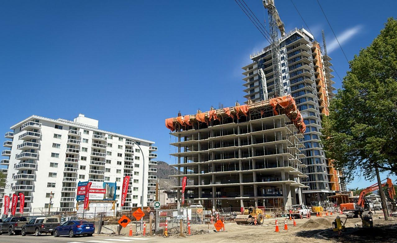
2.4 Infill Versus Greenfield Development
Table C8 shows housing growth in infill and greenfield areas by sector. Future growth in Kamloops indicates a strong emphasis on infill development, with infill areas accounting for approximately 95% of the city’s total maximum unit capacity (186,760 units), compared to just 10,440 units in greenfield areas. Additional capacity is similarly concentrated in infill areas, which can accommodate 141,890 units, while greenfield areas have 10,270 units of additional capacity. However, when taking into consideration the housing market and redevelopment constraints, anticipated growth is relatively modest, with 71% of growth (9,910 units) expected in infill areas and 29% (4,090 units) in greenfield areas. This suggests that while infill development represents the majority of Kamloops’ long-term growth potential, greenfield areas are projected to use a larger proportion of their capacity sooner.
The Core Sector is anticipated to accommodate all of its anticipated 4, 875 units of residential growth through infill development. Similarly, the Northeast and Northwest Sectors are expected to see growth primarily through infill that utilizes urban redevelopment and densification in already developed areas. The Southeast and Southwest Sectors are expected to experience both infill and greenfield growth, with infill development remaining the dominant source of growth overall. While infill development helps manage urban sprawl, well-designed greenfield developments that include multi-unit residential, mixed-use spaces, and a variety of transportation options can create sustainable, connected communities that reduce car dependency and improve quality of life.
TABLE C8: HOUSING GROWTH IN INFILL AND GREENFIELD AREAS BY SECTOR
Neighbourhood
3. Land Use Plan
3.1 Land Use Designations
Land use designations are one of the key implementation tools for achieving an official community plan’s growth strategy and managing development in the city. They establish the general uses that are provided for in each designation, give direction on the appropriate development mix, and identify where land uses should be located (see Map 1: Land Use). The land uses provided in each designation are generalized, which leaves it to the City’s Zoning Bylaw No. 55 to prescribe permitted uses and regulations regarding density, lot coverage, setbacks, and building form and character.
Table C9 provides a high-level overview of each land use designation, broken into the following three categories:
• Mixed-Use Areas: City Centre, North Shore Town Centre, Sahali Town Centre, Valleyview Town Centre, Aberdeen Town Centre, Tranquille Market Corridor, McGill Corridor, and Mid-Rise Commercial.
• Residential Neighbourhoods: High-Rise Urban, Mid-Rise Urban, Low-Rise Urban, Suburban, and Rural
• Employment and Supporting Lands: Highway and Service Commercial, Local Commercial, Light Industrial, Medium and Heavy Industrial, Agricultural, Sand/Gravel Extraction, Golf Course, Parks and Open Space, Public Service Utilities, Educational/Institutional, and Airport.
Official Community Plan policies that provide direction to each land use designation can be found in Section D1: Land Management and Development
City Centre
North Shore Town Centre
Sahali Town Centre
Valleyview Town Centre
Aberdeen Town Centre
To allow for a mix of medium- to high-density multi-unit residential, commercial, and community uses.
Development may include commercial (e.g. retail, office, tourist accommodation), mixed-use with commercial on lower floors and residential above, medium- to highdensity multi-unit residential, and major civic and cultural facilities.
Development should be pedestrian and transit oriented while not impeding movement of goods and emergency services along major transportation corridors.
To allow for the comprehensive development of largeformat retail centres into a mix of medium- to high-density multi-unit residential and commercial uses.
Development may include commercial (e.g. retail, office, tourist accommodation) and mixed-use, with commercial on lower floors and residential above.
Development should be pedestrian and transit oriented where appropriate while not impeding movement of goods and emergency services along major transportation corridors.
TABLE C9: LAND USE DESIGNATIONS
McGill Corridor To allow for a mix of medium- to high-density multi-unit residential and commercial uses.
Development may include commercial (e.g. retail, office, tourist accommodation) and mixed-use, with commercial on lower floors and residential above.
Development should be pedestrian and transit oriented where appropriate while not impeding movement of goods and emergency services along major transportation corridors.
Market Corridor
To allow for a mix of medium- to high-density multi-unit residential, commercial, and community uses.
Development may include commercial (e.g. retail, office, tourist accommodation) and mixed-use, with commercial on lower floors and residential above.
Development should be pedestrian and transit oriented.
,
, and
buildings
Mid-Rise Commercial To allow for a mix of medium- to high-density multi-unit residential, commercial, and community uses.
Development may include commercial (retail and office) and mixed-use, with commercial on lower floors and residential apartments on upper floors.
Development should be pedestrian and transit oriented where appropriate while not impeding movement of goods and emergency services along major transportation corridors.
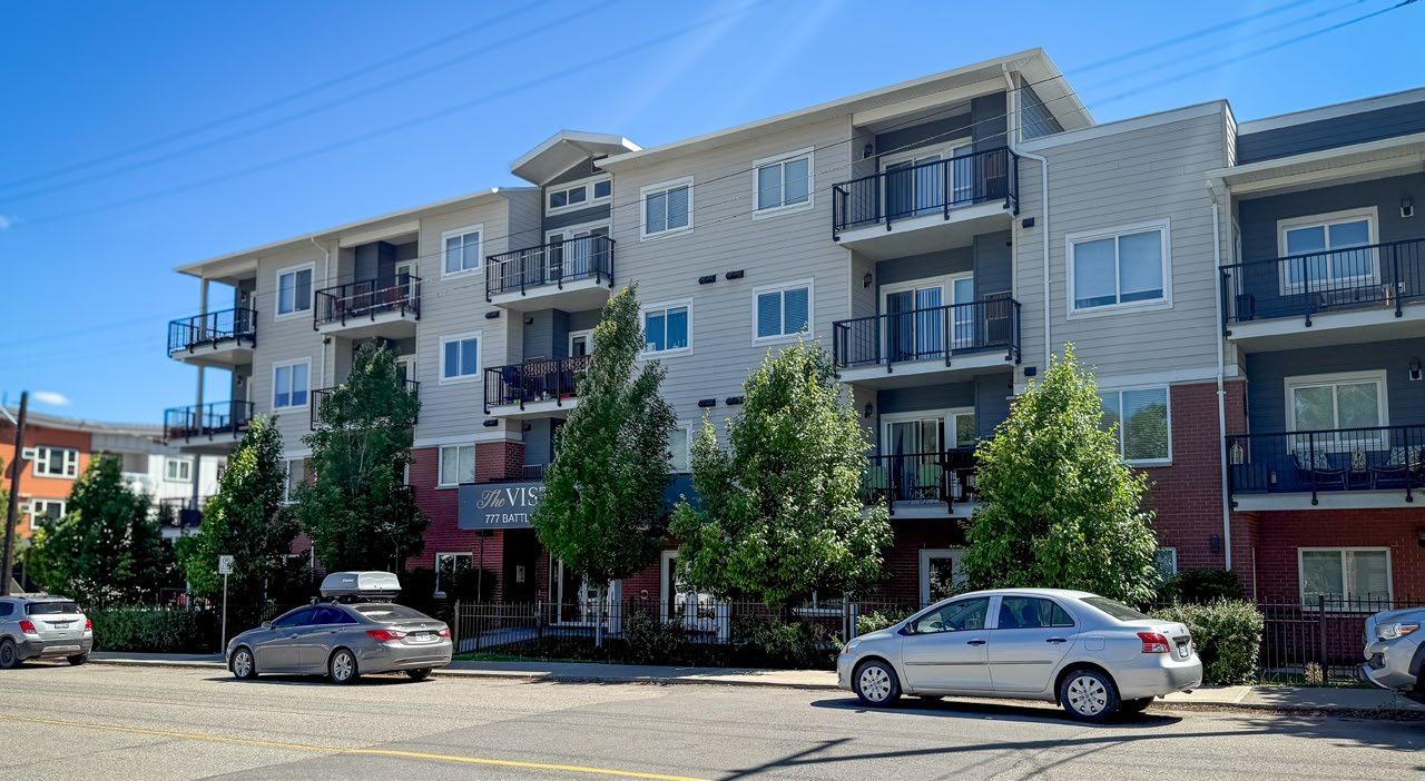
Tranquille
City of Kamloops
TABLE C9: LAND USE DESIGNATIONS
3.1.2 Residential Neighbourhoods
Land Use Purpose
High-Rise Urban To allow for high-rise apartment residential development that may include accessory commercial uses on the ground floor.
Development should be pedestrian and transit oriented and include ground-oriented residential units where possible.
Mid-Rise Urban To allow for a broad range of housing, including multi-unit residential in mid-rise apartment buildings.
Development should be pedestrian and transit oriented and include ground-oriented ground-floor units where possible.
Low-Rise Urban To allow for a broad range of residential uses in lowrise buildings, including single-detached, two-unit (duplex), small-scale multi-unit residential, and multi-unit residential.
Development should be pedestrian and transit oriented.
Suburban To allow for single-detached residential and accessory uses and manufactured homes on residential lots that may not be serviced by municipal utilities.
Mid-rise apartments, stacked townhouses, and housing types permitted in Low-Rise Urban
Single-detached, residential suites, duplexes, multiplexes, row houses, manufactured homes, townhouses, walk-up apartments, and other forms
Single-detached and residential suites (subject to availability of servicing)
to 2.5 floor area ratio
Rural To allow for single-detached residential, including manufactured and modular homes, and accessory uses on country residential lots that may not be serviced by municipal utilities.
Single-detached and secondary suites (subject to availability of servicing)
0.8 to 1.5 floor area ratio (typical maximum 1.2 floor area ratio and 75 units per hectare, except for small-scale multi-unit residential)
Minimum lot area: 929 m2 to 1,858 m2 (depending on servicing availability)
Lot area
minimum size: 0.8 ha to 4 ha (depending on servicing availability)
TABLE C9: LAND USE DESIGNATIONS
3.1.3 Employment and Supporting Lands
Land Use Purpose
Local Commercial To allow for a range of commercial uses, including retail, goods and services, and community amenities that mainly serve the adjacent neighbourhood. Mixed-use development that may be considered includes work-live style, caretaker units for owner-operated businesses, and commercial on lower floors and residential apartments on upper floors.
Highway and Service Commercial
Educational/ Institutional
To allow for a wide range of commercial uses in areas, including along or adjacent to the provincial highway network that serves a regional market and may serve adjacent neighbourhoods. Commercial uses may include retail, automobile service, tourist accommodation, warehousing, and small-scale manufacturing. Mixed-use (commercial and residential) may be considered where appropriate.
To provide services to the community, including schools; universities; correctional facilities; hospitals; fire stations; cemeteries; major government, cultural, or recreational facilities; community centres; and places for religious assembly. Larger institutional sites, such as TRU and the Columbia Precinct, may provide an opportunity for complementary residential and commercial development.
Light Industrial To allow for a mix of trades and technology, research and development, warehousing, wholesale distribution, storage of materials and equipment, and other light industrial activities with compatible commercial uses.
Medium and Heavy Industrial
To allow for manufacturing activities that include the storage and processing of raw, bulk, or extracted materials, including wood and forest products, sand and/or gravel, concrete and minerals, metals, and petroleum products.
TABLE C9: LAND USE
DESIGNATIONS
Airport To allow for airport and aviation industry uses and related commercial services.
Sand/Gravel Extraction To allow for the extraction and preliminary processing of sand and gravel.
Parks and Open Space To protect areas of ecological significance, including wildlife corridors, and to allow for active and passive recreation through various City parks classified as city-wide parks, community parks, neighbourhood parks, tot lots, linear parks, nature parks, open space, and provincial parks. Recreational and other community facilities located within City parks are included in this designation.
Golf Course To allow for golf courses, similar recreational activities, and accessory activities, such as restaurants and hosting events like weddings.
Agricultural To allow for the growing, rearing, producing, harvesting, storing, processing, and selling of agricultural products.
Public Service Utilities To allow for municipal services and infrastructure essential to the public, including sewage and water treatment plants, sanitary landfills, and the City’s Civic Operations Yards.
3.2 Existing and Proposed Land Uses
Section 473(1) of the Local Government Act requires official community plans to include statements and map designations for the area covered by the plan regarding the approximate location, amount, and type of existing and proposed land uses. Statements on the types of proposed land uses are shown on Table C9, while the location of the various types of proposed land uses is shown on Map 1, Land Use Table C10 illustrates the redistribution of the areas of the existing land use categories from the 2018 Official Community Plan (as amended in 2025) into the areas of the proposed land uses in the 2025 Official Community Plan. The location of existing land uses can generally be inferred from the corresponding proposed land uses shown on Map 1
Note: The differences in total figures are partly the result of boundary adjustments made to remove the designation from Crown-owned river areas up to private property lines.
Changes to proposed land use areas from current are discussed as follows:
• In the Urban area, 2,735 hectares are primarily reallocated into low-rise urban (2,519 ha), and mid-rise urban component (156 ha). Additional minor allocations to high-rise urban, commercial, educational, and park uses (totaling 65 ha) help to balance urban development with green space and mixed uses.
• Within the Suburban category, total suburban land decreases slightly from 484 to 475 hectares, with 10 hectares reallocated to parks and open space, signaling a modest enhancement of public green areas.
• The Commercial category experiences significant restructuring, with major allocation to highway and service commercial (93 ha) and mid-rise commercial (76 ha) uses. The introduction of new town centres (28 ha) also supports a shift toward mixed-use development.
• In the Agricultural area, while the majority of land remains agricultural (13,150 ha), 292 hectares are reallocated to parks and open space and 56 hectares to future development.
4. Transit-Oriented Development
4.1 Transit-Oriented Areas
Transit-Oriented Areas are lands that are within 400 m of transit exchanges prescribed by the Local Government Act and Local Government Transit-Oriented Areas Regulation as part of the Housing Statutes (Transit-Oriented Areas) Amendment Act, 2023. The legislation allows increased density and height of buildings with at least 50% of their floor area comprised of residential uses.
Transit-Oriented Areas are not land use designations but act as overlays on top of the land use designations wherein local governments must not exercise zoning authority to restrict the minimum residential density and dimensions defined in the legislation. Within the City of Kamloops, the designated Transit-Oriented Areas are as follows:
• Lansdowne Transit Exchange
• North Shore Transit Exchange
• Thompson Rivers University Transit Exchange
Additional properties outside of the provincially designated areas have been added by the City of Kamloops to complete city blocks using the same height and density allowances.
The minimum permitted building heights and densities (floor area ratios) for residential buildings under the legislation are as follows:
• 0–200 m of a transit exchange: 10 storeys, 3.5 floor area ratio
• 201 m–400 m of a transit exchange: 6 storeys, 2.5 floor area ratio
In addition to provincial legislation, development in the Transit-Oriented Areas must be consistent with all applicable land use policies. The TransitOriented Areas are shown on Map 13, TransitOriented Areas and in Figures C8 to C10 except for land use designations and zones that do not permit residential uses.
0–200 m of an exchange Legend
201–400 m of an exchange Provincial Designations
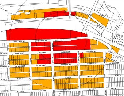
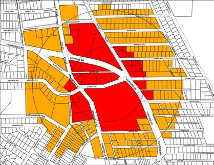
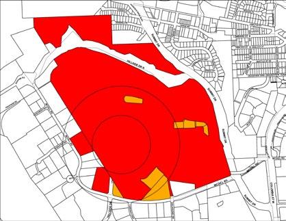
F IGURE C8: LANSDOWNE TRANSIT EXCHANGE
F IGURE C9: NORTH SHORE TRANSIT EXCHANGE
F IGURE C10: THOMPSON RIVERS UNIVERSITY TRANSIT EXCHANGE
4.2 Transit-Supporting Area
In addition to the three provincially designated Transit-Oriented Areas, a Transit-Supporting Area is proposed adjacent to the future Valleyview Transit Exchange. The Transit-Supporting Area supports the transition from auto-oriented highway commercial, service commercial, large-format retail, and low-density residential development to a higher-density, mixed-use community with a wider range of transportation, commercial, and housing options. To support the future transit exchange and associated bus routes, the Transit-Supporting Area encourages increasing the number of residents living close to transit.
Figure C11 identifies building heights that could be supported in the Valleyview Transit-Supporting Area. Similar to the provincial Transit-Oriented Areas, the Transit-Supporting Area envisions building heights of 10 or more storeys closest to the transit exchange (shown in purple), up to six storeys further away from the exchange (shown in pink and orange), and four storeys on the north side of Glenwood Drive east of Plover Road (shown in beige). Development in the area will be subject to approval of rezoning and any necessary infrastructure improvements. As the Transit-Supporting Area contains a planned transit exchange, it is proposed to use the Zoning Bylaw’s Reduced Parking Area parking requirements to encourage car-light development.
SUPPORTING AREA
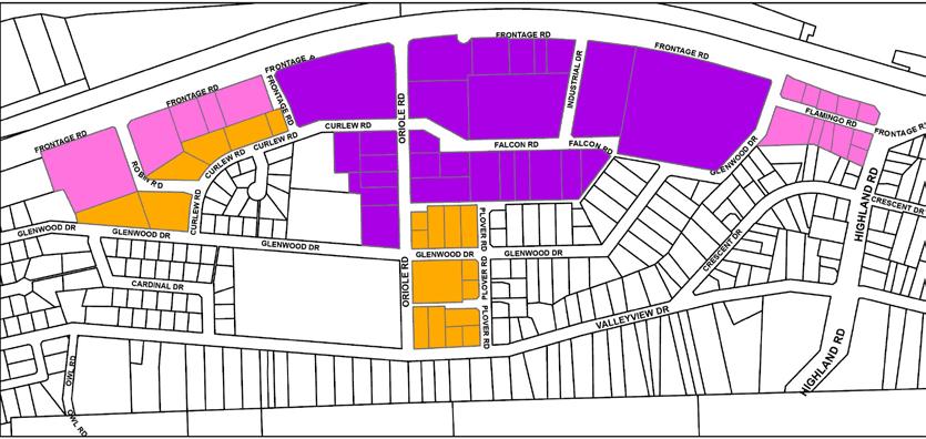
Valleyview Town Centre (10+ Storeys)
Mid-Rise Commercial (6 Storeys)
Mid-Rise Urban (6 Storeys)
4.3 Transit-Oriented Development
For properties outside designated Transit-Oriented Areas and Transit-Supporting Areas, transit-oriented development plays an equally important role in improving transportation options, safety, and connectivity for residents.
Transit-oriented development typically includes a variety of land uses near transit routes. Depending on the scale of the development, these uses may include residential, commercial (e.g. grocery stores, retail), and community amenities, such as child care and community centres. This promotes the creation of complete, livable, and sustainable communities by building more homes near transit and services.
Urban land use designations and those in mixed-use areas either require or support development to be transit-oriented. Each development will be required to follow land use policies found in Section D-3: Transportation and Mobility and the applicable development permit area guidelines relating to mobility and the interface of developments with the sidewalk and road network.
5. Future Development Areas
Future Development Areas are lands that are proposed to be developed at some future date to accommodate population and economic growth and that require specialized design and sensitive integration considerations. Some of the lands are zoned to reflect current or historical uses while others are zoned specifically for future development and are logical extensions of existing subdivisions. For development which does not comply with existing zoning, individual land use, design and environmental studies may be required prior to OCP amendment and rezoning approval. For all developments (regardless of consistency with zoning), servicing plans, transportation impact assessments and development permits may be required by municipal bylaws).
The Future Development Areas are shown on Map 1: Land Use. Some of these areas may be considered for development within the term of the Official Community Plan and will require an amendment before designating specific land uses. These areas will be evaluated individually on the basis of consistency with the policies contained in the Official Community Plan. Land use compatibility will be important; however, the most significant factor will be the availability of and potential for efficient use of servicing. Development cost charges may be used to address costs related to any required service upgrades or extensions. Alternative financing mechanisms may also be utilized in accordance with the Local Government Act
Each of the Future Development Areas has unique development constraints that may affect the timing and scale of development. It is anticipated that the individual evaluations will outline recommended strategies for addressing any development issues.
The following lands are identified as Future Development Areas:
• Henry Grube Education Centre
• Brocklehurst West
• Juniper West
• Orchards Walk East
• Iron Mask North
5.1 Core
5.1.1 Henry Grube Education Centre
Located at the meeting point of the North and South Thompson Rivers, the Henry Grube Education Centre site is a potential location for redevelopment in North Kamloops. Before development approvals, a comprehensive development review is required that addresses the following:
• how the waterfront will be preserved and activated for public use and access, including the use of recreational space, integration of a trail staging point on site, and connectivity to the Rivers Trail from the site
• appropriate types of land uses in the area given traffic and circulation constraints, keeping sensitive integration with the existing residential neighbourhood in mind
• a traffic impact assessment
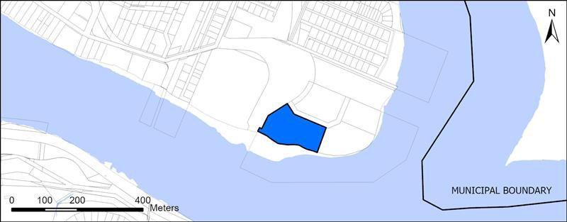
5.2 Northwest Sector
5.2.1
Brocklehurst West
Located within and adjacent to the airport entry corridor and comprising the largest undeveloped greenfield site in the Northwest Sector, this location requires a comprehensive development review before any official community plan amendment or rezoning approval that addresses the following:
• how the proposed development will incorporate a mix of residential, commercial, light industrial, and airport-oriented uses with any new residential uses being oriented adjacent to the existing residential areas
• incorporation of a minimum 10 m buffer strip or roadway between residential and industrial areas and a pedestrian buffer strip along the railway spur line
• a road network pattern providing a minimum of two road connections from the existing residential neighbourhood through to Tranquille Road
• a comprehensive servicing plan for water, sanitary, and storm sewer
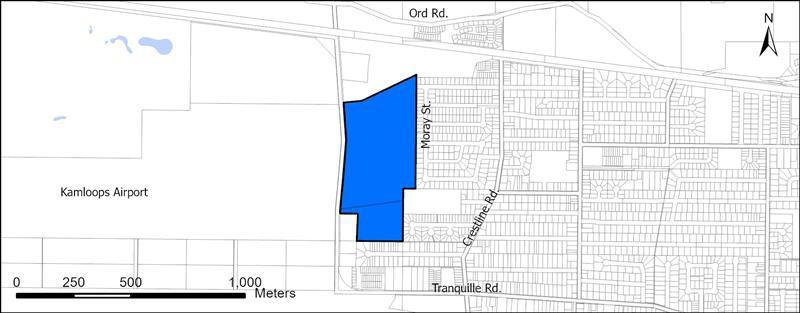

F IGURE C13: BROCKLEHURST WEST FUTURE DEVELOPMENT AREA MAP
Tharoushan Kandarajah
5.3 Southeast Sector
5.3.1 Juniper West
There are two main portions of the Juniper West Future Development Area. The area that is adjacent to Highland Road and north of Qu’Appelle Boulevard consists primarily of steep slopes, open space, and a pipeline right-of-way that transects the parcel.
The other portion of this Future Development Area, which is adjacent to Rose Hill Road and north of the Rose Hill neighbourhood, is approximately 44.9 ha of undeveloped Crown land. Based on a preliminary geotechnical study prepared for the City, approximately 18.6 ha (41%) of the parcel are suitable for residential development. An additional 9.9 ha (22%) could be available for development if earthworks and engineering were completed. Approximately 9.2 ha (20%) of the parcel are considered unsuitable for development because of steep slopes (slopes greater than 25%). In addition, a number of existing easements for utilities cross the parcel, occupying 7.3 ha.
Access will be a major consideration for the future development of this parcel. Before any official community plan amendment or rezoning approvals, a comprehensive development review is required that includes the following:
• a geotechnical study, including subsurface investigation and detailed analysis to support detailed geotechnical design recommendations
• a comprehensive servicing plan for water, sanitary, and storm sewer
• details on the type of residential development that can occur on the site
• wildfire risk assessment
• public park, open space and school needs
In addition, as the site includes both identified riparian areas and lands located within the Silt Bluffs Hazard Zone, the respective development permit area guidelines in Section F: Development Permit Guidelines will apply to future development on the site.
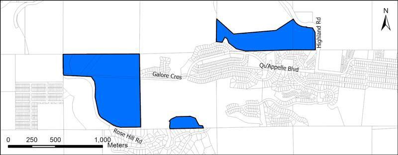
F
5.3.2 Orchards Walk East
The Orchards Walk East Future Development Area is located between the existing Orchards Walk Development in Valleyview and the Pineridge Golf Course in Dallas, south of the Trans-Canada Highway East and north of the South Thompson Silt Bluff Benchlands. As Orchards Walk is built out and Pineridge Golf Course is redeveloped, Orchards Walk East will accommodate additional residential growth and provide public open space and transportation connectivity between Valleyview and Dallas. Before any official community plan amendment or rezoning approval, a comprehensive development review is required that includes the following:
• A road network plan that connects Valleyview Drive to Dallas Drive
• A plan that details how the site will provide connections with existing and identified future active transportation paths in the Dallas and Valleyview neighbourhoods, as per the City’s Transportation Plan, and public transit stops
• A comprehensive servicing plan for water, sanitary, and storm sewer
• A geotechnical study that considers the presence of silt bluffs and steep slopes in identifying areas suitable for development
• Public open space and park needs for the area
In addition, as the site includes both identified riparian areas and lands located within the Silt Bluffs Hazard Zone, the respective development permit area guidelines in Section F: Development Permit Area Guidelines will apply to future development on the site.
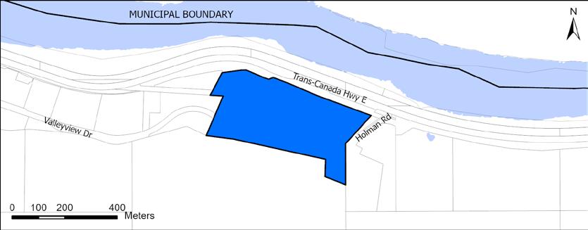
5.4 Southwest Sector
5.4.1
Iron Mask North
Iron Mask North comprises an extensive area of Crown land and private property, much of which is within the Agricultural Land Reserve (ALR) that abuts the City’s westernmost boundary. Those portions of property outside the ALR are reserved for industrial development and other complementary uses to facilitate future growth. A range of light, medium, and heavy industrial uses may be considered, subject to evaluation based on consistency with the policies contained in the OCP. Additionally, residential and commercial uses may be considered, particularly in areas adjacent to Kenna Cartwright Park. Prior to development other than agricultural use, a future Official Community Plan amendment will be required to define the specific land use plan for the area. As the area is located within an entrance corridor to the city, careful consideration of the potential impact to visual quality, as well as factors such as noise, dust, and traffic, must be considered. Development of this area must address constraints including environmentally sensitive areas, steep slopes, a lack of City utility services, and access which may require approval from the Ministry of Transportation and Transit.
All portions of Iron Mask North which are within the ALR are reserved for agricultural use in accordance with Agricultural Land Commission Act. However, the City may, after careful analysis and consultation with the Agricultural Land Commission, support ALR exclusion and, only then, explore future development options consistent with the considerations noted above for non-ALR land. Any zoning or development other than for purposes consistent with the ALC Act would require an OCP amendment.
In 2025, the Agricultural Land Commission stated that it had no objection of designation of the Iron Mask North Future Development Area for industrial use but emphasized that substantial commencement or Iron Mask West must be demonstrated prior to the submission of any applications to exclude land for industrial development in Iron Mask North. Substantial commencement was defined by the Commission as 50% of the raw law land base being subdivided into smaller lots, followed by their sale and build-out.
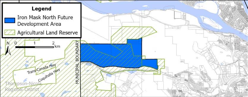
F IGURE C16: IRON MASK NORTH FUTURE DEVELOPMENT AREA MAP
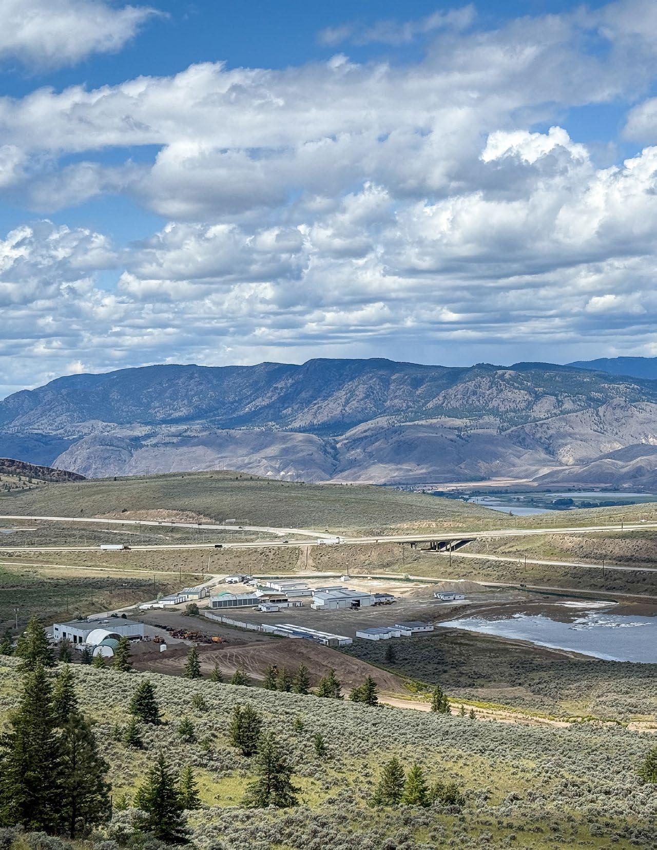
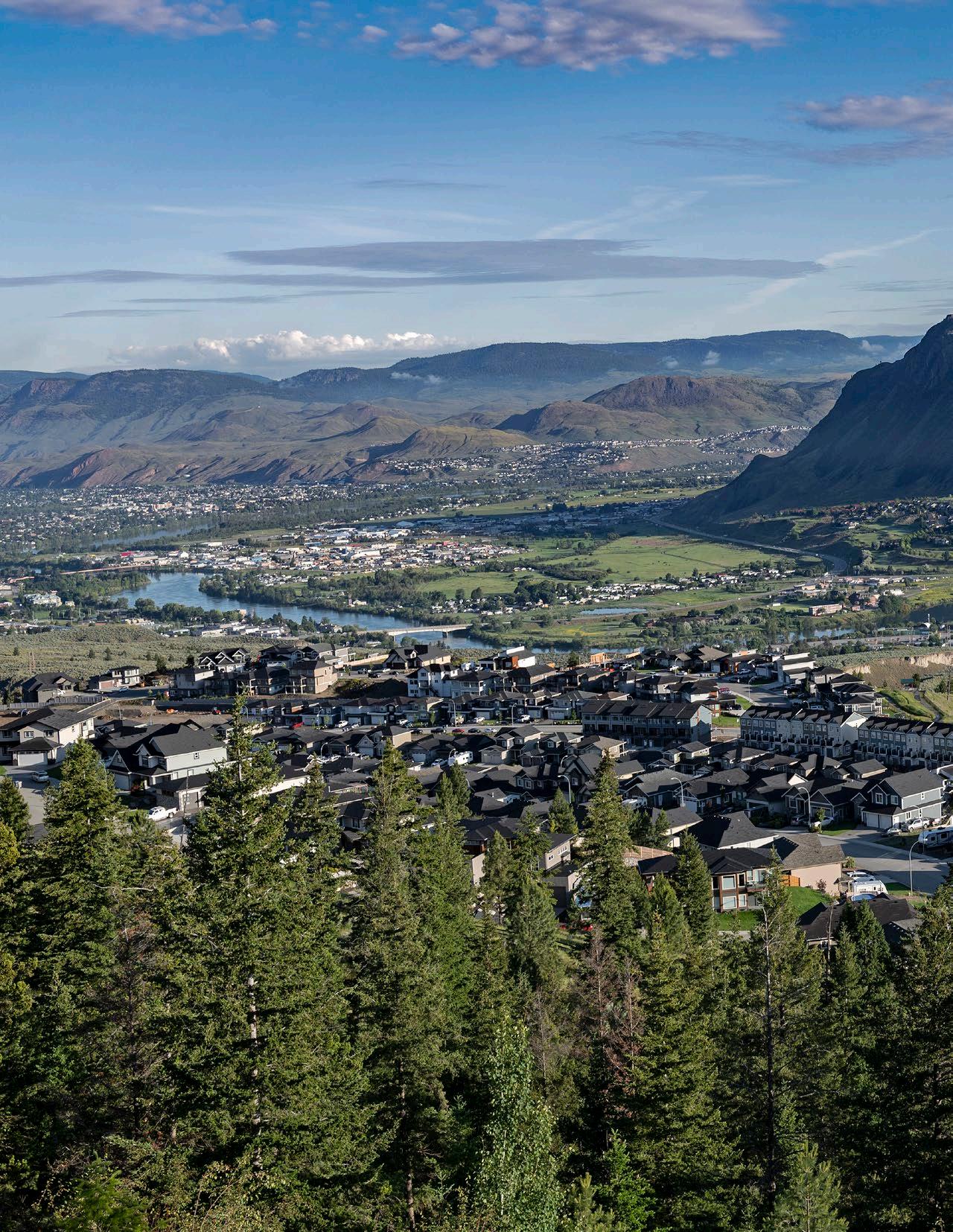
Section D Land Use Policies
Explore TNRD | Kelly Funk
Land Management and Development
This section links to the following Community Values:
• Develop complete neighbourhoods
• Support urban densification
• Support the availability of diverse housing options
• Improve transportation and connectivity
• Promote economic resiliency
• Optimize existing municipal infrastructure
• Support local and regional food systems
As Kamloops grows to a population of 134,000 over the next 20 years, efficient management and use of land resources will be required to ensure the long-term sustainability of the city’s developable land base. Policies supporting compact, complete, mixed-use communities that encourage infill opportunities and the efficient use of existing services will allow the City to optimize municipal infrastructure, reduce the need to extend services beyond existing built-up areas, and reduce costs. The attractiveness and livability of neighbourhoods will be enhanced through policies focused on providing pedestrian-friendly streets, expanding housing diversity, blending commercial and residential uses where appropriate, and connecting people to pedestrian and cycling routes so that residents can shop, work, and play where they live.
This section provides policy direction for land management and development and establishes a framework for directing future growth. The following policies will guide development approvals and updates to future neighbourhood and area plans.
1. General Land Use Policies
1.1 Residential
Residential policies provided in this section govern all residential uses within the Official Community Plan, unless otherwise specified.
GOAL: Encourage the development of compact urban form and walkable neighbourhoods with convenient access to transit and daily needs.
1. Require that new residential development be planned and developed to include the following:
i. Access to daily lifestyle needs and amenities such as shopping, schools, community amenities, and recreation
ii. Access to parks, nature, and/or open space within a 5- to 10-minute (400 m) walking distance
iii. Convenient access to areas of employment by public transit or active transportation linkages
iv. Diverse housing types and unit sizes to support residents of various age groups, family types, lifestyles, and income levels
v. Transportation design (including streets, pedestrian paths, cycle routes, and transit linkages) that contributes to a network of fully integrated, safe, and accessible routes to all destinations, including:
a. For minor infill development, including small-scale multi-unit residential, active transportation infrastructure (sidewalks and/or multi-use pathways) identified in the Active Transportation Plan should be provided along property frontages.
b. For significant residential development, active transportation infrastructure (sidewalks and/or multi-use pathways) should be provided along property frontages and connect to the existing off-site active transportation network in the vicinity.
vi. Integration and connectivity with adjacent neighbourhoods and the broader city by extending adjacent greenways where available
vii. Landscaping, parking, and site design standards
viii. Availability of municipal services
2. Address hazard area requirements, including those associated with the 200-year flood plain, steep slopes, and high wildfire risk areas, as per Map 5: Hazard Lands, and in the silt bluffs, as per Map 12: Development Permit Area: Silt Bluffs Hazard Zone, subject to individual evaluation.
3. Encourage developers of multi-unit residential of larger scale than small-scale multi-unit residential permitted under legislation, such as townhouses and mid-rise to high-rise buildings, to include a community consultation process that involves the public and relevant interest groups.
4. Require development that may have a significant impact on the public realm or on other properties (e.g. multi-unit residential, intensive residential) to meet the applicable design guidelines regarding form and character, as outlined in Section F: Development Permit Area Guidelines.
5. Foster improved urban form, streetscapes, and building cohesiveness by:
i. Encouraging the consolidation of smaller individual lots to enable comprehensive redevelopment of larger-scale developments and discouraging the creation of orphaned individual lots that cannot be easily redeveloped in areas identified for medium- and high-density growth
ii. Prioritizing taller, higher-density development, such as apartment buildings of four or more storeys, on corner lots unless there is already an apartment building on the block face
iii. Requiring active transportation and streetscape improvements along frontages of development projects
iv. Limiting vehicle access to lanes and local roads where possible to minimize impacts on traffic flow, emergency response, and active transportation networks
v. Planning for loading zones for residences and businesses
6. Discourage residential development other than small-scale multi-unit residential required by legislation in areas without sidewalks and in neighbourhoods serviced by only one access road that must cross a railway line.
7. Utilize existing parking exemptions, reductions, and cash-in-lieu of parking provisions within the Zoning Bylaw, and consider further reducing parking requirements for multi-unit residential in mixed-use areas when a high level of alternative transportation amenities are provided.
8. Consider site-specific zoning amendments and variances that are consistent with the intent of the land use designations and support the goals and policies of the Official Community Plan, as appropriate to the site context.
9. Require taller and higher-density developments to sensitively integrate when adjacent to lowerdensity designations, such as by using step-backs, greater setbacks, and various other site planning, landscaping, or architectural methods.
10. Ensure development approvals processes adequately mitigate impacts to archaeological sites in accordance with the provincial Heritage Conservation Act and as outlined in Section D-1: Arts, Culture, and Heritage.
1.2 Commercial
Policies provided in this section govern all commercial uses within the Official Community Plan, unless otherwise specified.
GOAL: Encourage commercial development that is appropriately scaled for the context and well operated to support vibrant, livable communities.
1. Retain and encourage the enhancement of local-serving commercial within existing neighbourhoods to provide amenities and daily needs within walking distance for residents.
2. Continue to support neighbourhood-serving land uses, such as community centres, places of worship, local-serving commercial, and child and community care facilities, within residential and commercial-designated areas of the city, subject to zoning and individual evaluation.
3. Support the role and function of the City Centre and other town centres as the primary areas of mixed-use development in the city.
4. Encourage larger-scale office development, such as multi-storey office complexes, to locate in the City Centre and other town centres
5. Encourage mixed-use and multi-unit residential development within mixed-use areas where there is a strong commercial component.
6. Support the redevelopment of existing underused commercial space, which may include a residential component.
7. Require commercial or mixed-use development that may have a significant impact on the public realm to meet the applicable design guidelines regarding form and character, as outlined in Section F: Development Permit Area Guidelines.
8. In town centres and other mixed-use areas, enhance the pedestrian environment through welldesigned landscaping, canopies for weather protection, outdoor seating for restaurants and cafés, and wider and/or separated sidewalks.
9. Ensure that stand-alone residential developments in commercial and mixed-use areas enhance the public realm through architectural design, well-designed landscaping, and wider and/or separated sidewalks.
10. In town centres, other mixed-use areas, and Highway and Service Commercial areas, support tourism accommodation and commercial-oriented uses that cater to both residents and the traveling public (e.g. restaurants, cafes, and grocery stores).
11. Monitor commercial land needs over time to ensure an appropriate mix of commercial and residential development.
12. Ensure drive-thrus and other commercial activities that create queuing do not prevent the safe and consistent movement on roadways, active transportation corridors, and internal roads and walkways through the use of site planning.
13. Support the development of land previously used for industrial or commercial use with known or suspected contamination (i.e. brownfield sites). Require as part of the development process, a contaminated site cleanup plan that incorporates sustainable methods of demolition and cleanup, including natural and ecological forms of remediation and the reuse of building materials where possible, as directed by the Province and in accordance with the Environmental Management Act
14. Regarding home-based businesses:
i. Continue to permit home-based businesses in accordance with the Zoning Bylaw;
ii. Review existing regulations to consider expanding the range of one-person home-based business types for which client visits are permitted (e.g. to include bookkeepers, life coaches, personal trainers, and counsellors), subject to restrictions such as the maximum number of client visits per day, required parking, and hours of operation, to support small-scale start-up businesses without adversely impacting residential neighbourhoods or commercial districts; and
iii. Discourage home-based business types such as health services and professional practices to minimize adverse impacts on residential neighbourhoods and support the vibrancy of existing commercial districts.
15. Restrict kennels, in any form, from locating within the city. Kennels may be considered upon receipt of a rezoning application, subject to a parcel-specific evaluation. The evaluation may take the following criteria into consideration:
i. The size of the facility, including the maximum number of dogs to be housed
ii. The facility’s distance from the proposed property boundaries
iii. Adjacent land uses
iv. Screening requirements as found within the implementing bylaws
v. Other matters the City considers relevant, including possible sound attenuation measures and neighbourhood consultation
16. Discourage clustering of pawnshops. The City will consider site-specific rezoning applications for pawnshops, subject to the following criteria:
i. The scale of the establishment relative to the development site and adjacent properties
ii. Proximity to existing pawnshops
iii. Compatibility with adjacent land uses
iv. Visibility of the establishment from the street
v. Consultation from relevant business improvement area associations
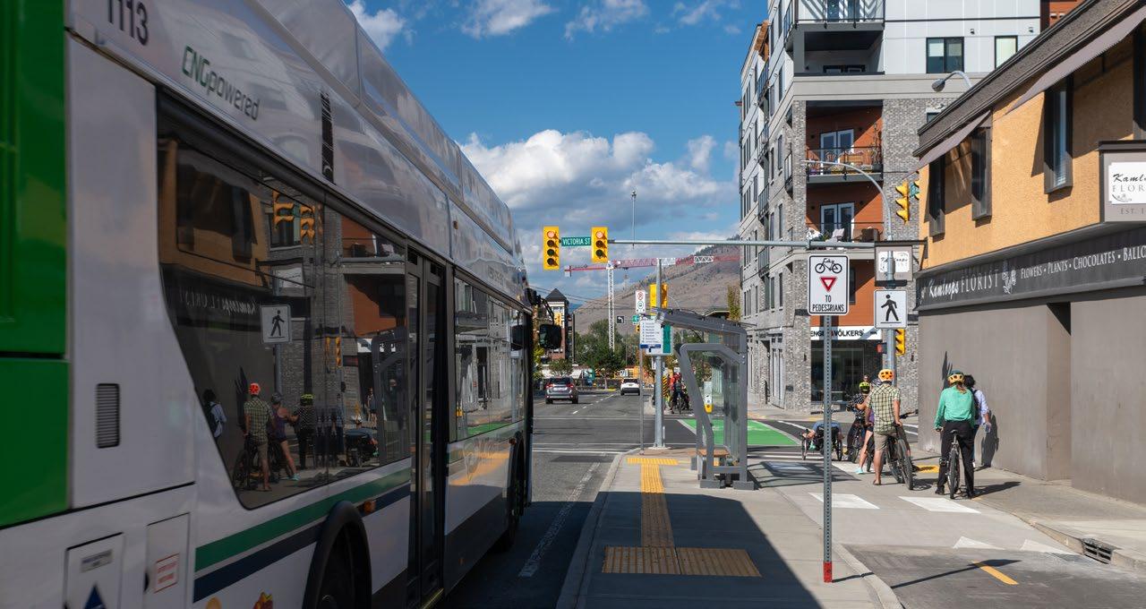
2. Transit-Oriented Development
Goal: Support the development of Transit-Oriented Areas and Transit-Supporting Areas as vibrant, livable, pedestrian-oriented community hubs.
1. Applications to rezone properties in the Transit-Oriented Areas to permit legislated density (floor area ratio) and height will be evaluated individually based on:
i. Consistency with the legislation and applicable municipal land use policies and bylaws
ii. Review of servicing constraints
iii. Consolidation of individual lots into larger development parcels (minimum 1,000 m² per parcel) to provide adequate open areas for landscaping, amenity space, stormwater retention, and setbacks between taller buildings and neighbouring properties
iv. Connectivity to the transit exchanges via active transportation infrastructure (e.g. sidewalks, multi-use pathways) and contribution to the public realm through trees and other streetscape improvements
v. Compliance with the Multi-Unit Residential Development Permit Area Guidelines
vi. Limiting vehicular access to the lane where available
vii. Review of protected heritage sites in accordance BC Heritage Conservation Act
2. Off-street parking for vehicles is not required for residential units; however, accessible parking and loading zones may be required. All vehicle and bicycle parking spaces and areas provided shall be in accordance with zoning regulations.
3. Developments within Transit-Oriented Areas that do not provide most units with their own parking space should provide quality active transportation amenities for residents, such as repair and wash stations and storage facilities for a wide range of active transportation devices (e.g. bicycles, cargo bikes, electric bikes, electric scooters).
4. Encourage transit-oriented development through a Transit-Supporting Area adjacent to the planned Valleyview Transit Exchange, where:
i. Applications to rezone properties for increased height and density are evaluated based on the criteria outlined in Section 2.1 above, except that building height and densities are not mandated by legislation
ii. Off-street residential parking is required in accordance with the Reduced Parking Area requirements in the Zoning Bylaw
3. Area-specific Land Use Policies
The following policies correspond to the land use designations in Section C: Growth Management and are shown on Map 1: Land Use.
3.1 City Centre
GOAL: Maintain and enhance the City Centre as a vibrant, mixed-use environment and the primary civic, entertainment, and cultural hub of Kamloops.
1. Invest in public spaces, cultural facilities, and amenities, including pedestrian-friendly streets and public gathering places.
2. Support the development of a mixed-use environment that emphasizes quality public space while allowing for neighbourhood densification, including stand-alone commercial, multi-unit residential, and mixed-use
3. Support the range of densities allowed in the Zoning Bylaw while respecting the unique neighbourhood characteristics of the City Centre through sensitive integration with the surrounding built form.
4. Encourage new commercial and multi-unit residential improvements in commercial areas through tax exemptions, as per the City Centre Revitalization Tax Exemption Bylaw
5. Explore opportunities to develop vacant or underused lands to support the revitalization of the City Centre.
6. Maintain the City Centre as the primary location for office development in the city, including major financial institutions.
7. Prohibit auto-oriented commercial uses in the City Centre (e.g. drive-thru, service commercial, strip mall developments).
8. Consider high-density, stand-alone residential development, except where pedestrian-oriented commercial retail uses are encouraged by the Downtown Plan
3.2 North Shore Town Centre
GOAL: Support development of the North Shore Town Centre as a pedestrian- and transit-oriented, mixeduse area.
1. Support commercial-oriented uses that cater to residents and tourists (e.g. tourist accommodation).
2. Encourage mixed-use, transit-oriented development that combines multi-unit residential and ground-floor, commercial-oriented uses as well as public gathering spaces and public art that enhance the identity of the North Shore.
3. Support new office development within the North Shore Town Centre.
4. Encourage land uses that support walkability and transit use and enhance pedestrian connectivity within the North Shore Town Centre, particularly to the North Shore Transit Exchange.
5. Support urban revitalization of the North Shore Town Centre through tax exemptions, as per the North Shore Revitalization Tax Exemption Bylaw
6. Discourage auto-oriented commercial uses in the North Shore Town Centre (e.g. drive-thru, service commercial, strip mall developments).
3.3 Sahali Town Centre
GOAL: Support development of the Sahali Town Centre as a pedestrian- and transit-oriented, mixed-use environment and as a southern gateway to the city
1. Support the Sahali Town Centre as a commercial-oriented, mixed-use environment that incorporates medium- to high-density residential with active transportation corridors and functions as both a gateway to Kamloops and a key destination for residents and tourists.
2. Support mixed-use and residential high-rise development on larger parcels, provided towers are set back and or stepped down from neighbouring Low-Rise Urban and Mid-Rise Urban-designated properties.
3. Require site design to clearly define access to the road network and utilize shared entry points and reciprocal access agreements between adjacent properties to ensure the transportation network functions efficiently.
4. Balance traffic flow and reduce congestion between the Sahali Town Centre, Thompson Rivers University (TRU), the Southwest Sector, and the City Centre through public and private investments that improve transit and active transportation connections.
5. Support urban revitalization of the Sahali Town Centre through the provision of tax exemptions for the redevelopment of hotel sites, as per the Hotel and Motel Redevelopment Revitalization Tax Exemption Bylaw
3.4 Valleyview Town Centre
GOAL: Support development of the Valleyview Town Centre as a pedestrian- and transit-oriented, mixeduse environment and as an eastern gateway to the city.
1. Support the Valleyview Town Centre as a commercial-oriented, mixed-use eastern gateway to Kamloops that incorporates medium- to high-density residential adjacent to the Valleyview transit exchange and active transportation corridors.
2. Support the development of a highly walkable main-street atmosphere along Oriole Road, Falcon Road, and Industrial Drive through the use of wide sidewalks, street trees, ground-floor commercial, and other placemaking methods.
3. Redevelopment should be planned to address access and circulation for pedestrians, alternative modes, and vehicles, including transit, utilizing shared entry points and reciprocal access agreements to ensure the transportation network functions efficiently.
4. Balance traffic flow and reduce congestion between the Trans-Canada Highway East, Valleyview Drive and the surrounding areas through public and private investments that improve transit and active transportation connections.
5. Support the creation of a neighbourhood park in or adjacent to the Valleyview Town Centre to support the recreation and amenity needs of residents of this emerging high-density community.
6. Encourage new development to use best practices relating to stormwater retention and the 200-year flood plain level using strategies that address hydrological issues while also providing visual appeal and amenities to residents.
3.5 Aberdeen Town Centre
GOAL: Support the development of Aberdeen Town Centre as a pedestrian- and transit-oriented, mixed-use environment and a southwestern gateway to the city.
1. Support the redevelopment of the existing large-format commercial retail centre at Aberdeen Mall and Aberdeen Village into a commercial-oriented, mixed-use town centre environment that incorporates medium- to high-density residential with active transportation corridors and that functions as both a gateway to the city and a key destination for residents and tourists.
2. Redevelopment should be planned to address access and circulation for pedestrians, alternative modes, and vehicles, including transit, utilizing shared entry points and reciprocal access agreements to ensure the transportation network functions efficiently.
3. Balance traffic flow and reduce congestion between the Dufferin, Aberdeen, Southgate, and Upper Sahali neighbourhoods through public and private investments that improve transit and active transportation connections.
4. Require the use of on-site plazas and private amenity space in conjunction with the development to accommodate the passive recreation needs of customers and residents in the Aberdeen Town Centre.
3.6 Tranquille Market Corridor
GOAL: Maintain and enhance the Tranquille Market Corridor as a commercial, cultural, and economic hub on the North Shore.
1. Encourage mixed-use, transit-oriented development along the Tranquille Market Corridor that provides a pedestrian-focused environment and supports its function as both a destination and a link between the North Shore and the City Centre.
2. Stimulate new private investment in the Tranquille Market Corridor through tax exemptions for qualified development and other potential incentive programs.
3. Support a North Shore revitalization strategy consistent with the City’s North Shore Neighbourhood Plan, which focuses on streetscape improvements, beautification, and active transportation improvements.
4. Support the North Shore Neighbourhood Plan’s vision of the corridor where institutional, office uses, and complementary uses are encouraged in the Innovation Hub, while smaller-scale social, cultural, shopping, and entertainment uses are encouraged in the Cultural Village.
5. Encourage commercial uses (e.g. retail, cafés, restaurants, tourism- and entertainment-related venues), community and cultural uses, and public waterfront amenity space within the waterfrontadjacent commercial area south of Tranquille Road to connect Tranquille Road to the Thompson River in accordance with the North Shore Neighbourhood Plan.
6. Prohibit auto-oriented commercial uses in the Tranquille Market Corridor (e.g. drive-thru, service commercial, strip mall developments).
7. Support urban revitalization of the Tranquille Market Corridor through tax exemptions, as per the North Shore Revitalization Tax Exemption Bylaw.
3.7 McGill Corridor
GOAL: Create a vibrant, mixed-use, pedestrian- and transit-oriented “university district” destination.
1. Support mixed-use development along McGill Road between Summit Drive and Hillside Drive to facilitate the development of a lively urban destination with a combination of commercial, residential, and limited office uses.
2. Locate landmarks and gateway features at entries (e.g. the intersection of Summit Drive and Hillside Drive) through well-designed landscaping and prominent architectural elements that serve as a lively pedestrian entryway to the TRU campus.
3. Where high-rise development is considered, ensure new development includes a street wall or podium of three to six storeys to encourage a pedestrian-oriented, main-street environment.
4. Require new development on the corridor to include decorative sidewalks and street trees consistent with existing development along the corridor.
5. Encourage affordable housing units within new multi-unit residential along the McGill Corridor to support students attending TRU.
6. Implement landscape buffering, increased setbacks, and sound attenuation barriers to ensure that the residential and commercial uses on the McGill Corridor are not impacted by activities within the Southgate industrial area.
7. Prohibit auto-oriented commercial uses in the McGill Corridor (e.g. drive-thru, service commercial, strip mall developments).
3.8 Mid-Rise Commercial
GOAL: Support the development of vibrant, pedestrian-oriented, mixed-use Mid-Rise Commercial areas that accommodate residential growth and provide a high level of services and amenities.
1. Support the intensification, repurposing, or redevelopment of existing shopping centres, strip malls, parking lots, and service commercial sites to accommodate pedestrian-oriented, multi-storey, mixeduse development, particularly in Mid-Rise Commercial areas identified as neighbourhood centres.
2. Encourage a high calibre of landscaping and amenity space, including the development of publicly accessible plaza space in neighbourhood centres
3. Retain and enhance local-serving commercial and small-scale office development in Mid-Rise Commercial areas to provide services and accommodate daily needs within walking distance for residents.
4. Support building heights of up to six storeys where ground floor commercial development is accompanied by upper-storey residential units or for hotel development, provided buildings are suitably set back, stepped down, and/or buffered from neighbouring lower-order land uses.
5. Permit stand-alone multi-unit residential development in areas designated as Mid-Rise Commercial, subject to individual evaluation, including project design that supports pedestrian-oriented streetscapes, and consideration of commercial space needs in the vicinity.
6. Support a high standard of site design, built form, landscaping, and amenity space through compliance with the applicable design guidelines regarding form and character, as outlined in Section F: Development Permit Area Guidelines
3.9 Urban
This section covers three designations: Low-Rise Urban, Mid-Rise Urban, and High-Rise Urban. The use of the capitalized term Urban in this document refers generally to these three designations as a whole.
GOAL: Focus development within existing Urban areas and support diverse housing types to meet people’s needs.
1. Support infill development proposals that are appropriate to the applicable Urban land use designation, existing and planned built form for the area, and availability of municipal services and infrastructure.
2. Encourage multi-unit residential development in Urban-designated areas that is appropriately designed and sited to reduce the potential impacts of concentrating higher-density housing. Where new multi-unit residential development is located in close proximity to an existing one, it should use a differing building form, treatment, density, and/or tenure.
3. Encourage a range of unit sizes and tenures in Urban residential development, referring to Section D-5: Housing for further details on housing diversity.
4. In Low-Rise Urban areas:
i. Support infill development that includes residential suites, infill subdivisions, small-scale multiunit residential, townhouses, row houses, and low-rise apartment buildings.
ii. Support a maximum height of three storeys for infill development, except on corner lots adjacent to a collector or arterial road, where four storeys may be supported on a case-by-case basis.
iii. Development is subject to the guidelines in Section F: Intensive Residential Development Permit Area or Section F: Multi-Unit Residential Development Permit Area to support highquality design, residential viability, and sensitive integration.
iv. Discourage rezoning or variance applications to allow smaller lots or panhandle lots in areas with a high potential for comprehensive development with lot consolidation.
v. Where zoning or variance applications to allow small lots (less than 464 m2) or panhandle lots are considered, restrict development on the individual subdivided lots to single-detached with residential suite so that the combined density of the lots does not exceed the legislated density of the parent parcel (typically four units) to minimize adverse community impacts of vehicle parking and maneuvering and loss of landscaped green space along street frontages. Infill development greater than one single-detached dwelling with a suite may be considered on oversized panhandle lots where all maneuvering can occur on site, and required servicing is provided.
5. In Mid-Rise Urban areas:
i. Support infill development that includes townhouses, row houses, and low-rise or midrise apartment buildings subject to availability of utility services and active transportation infrastructure, such as sidewalks and multi-use pathways, as identified in the policies of Section D-1: Land Management and Development, Subsection 1.1: Residential
ii. For infill development, support building height of up to four storeys. Up to six storeys may be supported on lots that are:
a. Along arterial roads as per Map 4: Major Road Network; or
b. In Transit-Oriented Areas, the Transit-Supporting Area, or blocks intersected by a TransitOriented Area, provided the criteria for Transit-Oriented Areas are met
iii. Mid-Rise Urban development shall comply with Section F: Multi-Unit Residential Development Permit Area Guidelines
6. In High-Rise Urban areas:
i. Support high-rise apartments and other high-density development in core areas of Kamloops, primarily Downtown, adjacent to the Central Business District. High-Rise Urban development may be considered in other areas on a case-by-case basis when adjacent to a town centre where development complies with the conditions below.
ii. High-Rise Urban development shall comply with Section F: Multi-Unit Residential Development Permit Area Guidelines
iii. High-rise and other high-density development shall feature a high calibre of urban design, including pedestrian-oriented podiums on the lower storeys of towers, substantial indoor and outdoor amenity space for residents, and use of street trees, wide or separated sidewalks, and
3.10 Suburban
GOAL: Maintain suburban neighbourhoods as low-density, single-detached residential development.
1. Maintain Suburban neighbourhoods as single-detached and low-density residential areas that are consistent with the existing scale and character of the neighbourhood.
2. Limit additional subdivision in Suburban areas to what is permitted in the current zoning, subject to compliance with the Subdivision and Development Control Bylaw and review of existing servicing and area-specific constraints (e.g. topography, access, soils). Discourage rezoning and variances to accommodate subdivision where there are servicing capacity constraints.
3. Consider the construction of residential suites in Suburban areas subject to compliance with the Zoning Bylaw, the Subdivision and Development Control Bylaw, the availability and standard of municipal services and infrastructure, and the guidelines in Section F: Intensive Residential Development Permit Area and Section F: South Thompson Silt Bluff Development Permit Area
3.11 Rural
GOAL: Maintain rural neighbourhoods as primarily large-lot, single-detached residential development.
1. Maintain Rural neighbourhoods as low-density residential areas that are consistent with the existing scale and character of the neighbourhood.
2. Support the retention of large farms and ranches in areas designated as Rural to ensure the continued economic viability of the farm or ranch.
3. Limit additional subdivision in Rural areas to what is permitted in the current zoning, subject to compliance with the Subdivision and Development Control Bylaw and review of existing servicing, and area-specific constraints (e.g. topography, access, soils). Discourage rezoning and variances to accommodate subdivision where there are servicing capacity constraints.
4. Discourage the further subdivision and development of Rural residential areas using private water systems that are external to the municipal water supply or where there is limited capacity in the municipal water system.
5. Consider the construction of residential suites in Rural areas subject to compliance with the Zoning Bylaw, the Subdivision and Development Control Bylaw, the availability and standard of municipal services and infrastructure, and the guidelines in Section F: Intensive Residential Development Permit Area and Section F: South Thompson Silt Bluff Development Permit Area
3.12 Highway and Service Commercial
GOAL: Establish a strong, diversified commercial base to provide employment and a high level of service to residents and visitors.
1. Continue to permit the full range of service and highway commercial uses, including retail, recreation facilities, automobile sales and services, warehousing, light industry, and hotel/motel uses, to meet the needs of Kamloops residents and the travelling public.
2. Encourage large-format retail that caters to a regional market to locate adjacent to the Trans-Canada Highway corridor, where the road network can handle the anticipated traffic demands.
3. Encourage auto-oriented enterprises or businesses that rely on highway exposure (e.g. strip commercial development, automobile sales and service, drive-thrus) to develop adjacent to the Trans-Canada Highway, where the road network can handle traffic demands.
4. Discourage larger-scale office development in areas designated Highway and Service Commercial.
5. Consider proposals for mixed-use or stand-alone multi-unit residential development up to six storeys on a case-by-case basis in areas that are near mixed-use areas, schools, parks, and other amenities. Development of stand-alone multi-unit residential development should consider the commercial space needs in the vicinity.
6. Require commercial or mixed-use development that may have a significant impact on the public realm to meet the applicable design guidelines regarding form and character, as outlined in Section F: Development Permit Area Guidelines
3.13 Local Commercial
GOAL: Provide small-scale and local-serving commercial amenities while creating walkable gathering places for surrounding neighbourhood residents.
1. Continue to permit a full range of local commercial and community-serving uses, such as small grocery stores, convenience stores, daycares, restaurants, and, where appropriate, neighbourhood pubs.
2. Support the development of new Local Commercial development in Urban-designated areas through future official community plan amendments and rezoning applications to create walkable, amenity-rich neighbourhoods. Small-scale Local Commercial areas may be supported in Suburban and Rural areas, subject to the availability of municipal services and transportation infrastructure.
3. Encourage accessory residential development, such as caretaker’s suites and small-scale mixed-use development, in Local Commercial areas as per zoning or through rezoning, subject to individual evaluation.
3.14 Educational/Institutional
GOAL: Support the development of educational and institutional facilities to meet the needs of residents.
1. Work with the local school district to plan for school locations based on the size and composition of the projected school-age population as new neighbourhoods develop, existing neighbourhoods evolve, and demographics shift.
2. Encourage joint use of school facilities and community facilities.
3. Support the development of health services and appropriate expansion of Royal Inland Hospital and other health care facilities, as per Map 1: Land Use. The form and character of future expansions should be compatible with the surrounding neighbourhood context.
4. Encourage provincial, federal, and municipal governments to locate their primary offices and service facilities within the City Centre as a preferred destination.
5. Support TRU’s vision of a campus that is a complete urban village, characterized by mixed-use, multiunit residential, commercial retail, academic and institutional space, amenities, and green space. This vision seeks to encourage a walkable, lively, pedestrian-oriented environment that meets the needs of students, staff, campus residents, and visitors.
6. For the redevelopment of the Columbia Precinct lands (see Map 1: Land Use), consider opportunities for commercial, residential, and mixed-use redevelopment of the area.
7. Consider the use of other Educational/Institutional-designated land for multi-unit residential uses through the co-location of schools, government offices, or community facilities with multi-unit residential development.
8. Support accessory and small-scale commercial activities on Educational/Institutional-designated properties that support the experience and/or intent of the related facility.
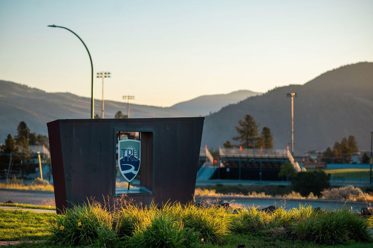
Christopher
A. James
3.15 Industrial
GOAL: Provide an adequate supply of serviced industrial land to maintain a diverse range of development opportunities.
1. Require new industries that may affect air quality beyond the thresholds established by the Province to locate outside the Thompson Valley and implement mitigation measures determined by the relevant provincial ministry. Regarding existing Industrial-zoned land, work with industries to implement appropriate mitigation measures and best practices to reduce air quality impacts.
2. Encourage medium and heavy industrial development to operate in such a way as to mitigate potential conflict with adjacent land uses through means such as sound attenuation barriers and landscape buffers. For further guidelines, see Section F: Industrial Development Permit Area.
3. Require that development proponents prepare a comprehensive development plan where large areas of land are designated for industrial purposes to address land use and servicing concerns as part of the project application evaluation process.
4. Consider light industrial development as part of commercial uses, providing that:
i. The proposed development is compatible with adjacent land uses
ii. The form and character complement existing development on adjacent properties and balance traffic flow with the aim of creating a more pedestrian-friendly environment.
5. Ensure that an adequate supply of Industrial lands exists to meet anticipated future needs, as described in the Growth Plan in Section C: Growth Management:
i. Strongly discourage official community plan amendments and rezoning applications that convert Industrial-designated properties to non-industrial uses, such as office or retail development.
ii. Where Industrial-designated properties are proposed to be redesignated or rezoned to nonindustrial land uses to accommodate future growth or for the revitalization of a neighbourhood, the City shall review the existing inventory of industrial lands and offset a potential net loss through the identification of future industrial land areas.
6. Restrict sand and gravel excavation, screening, and materials storage to the areas designated as Sand/Gravel Extraction on Map 1: Land Use, except for:
i. Non-commercial operations involving the excavation or deposit of material for limited construction purposes, which may be permitted where necessary, subject to the Earthwork Control Bylaw
7. Restrict additional processing of any kind, including crushing or the manufacturing of asphalt, concrete, or other materials. Such activities are permitted only in Heavy Industrial areas or where permitted by temporary industrial use permits under conditions imposed by City Council.
8. Require sand and gravel extraction to be conducted in a manner that limits the impact on neighbouring properties, including control of hours of operation, dust control, screening, access, traffic circulation, and site reclamation.
3.16 Airport
GOAL: Promote the importance of the airport for the future economic development of Kamloops and the region.
1. Support the development of Airport lands zoned CD10 (Kamloops Airport Comprehensive Development Zone 10) with the intent of providing additional employment-generating activities for the North Shore.
2. Provide commercial and community amenities by the airport to meet the needs of existing businesses and residents, along with the tourists.
3.17 Golf Course
GOAL: Promote environmental stewardship in the redevelopment and maintenance of golf courses within the city.
1. Prohibit the use of municipal potable water sources for irrigation purposes.
2. Support accessory commercial uses (e.g. restaurants; concessions; sporting equipment sale, rental, and repair; banquet/meeting spaces).
3. Support additional accessory uses or alternative uses that may be considered appropriate, subject to a site-specific evaluation and public consultation, which may include:
i. Residential development where:
a. The lands are appropriately redesignated and comply with all Official Community Plan policies
b. Support from the Agricultural Land Commission is obtained for the development of lands within the Agricultural Land Reserve
c. Development is planned to protect identified environmentally sensitive lands, provide larger buffers between adjoining properties, and reduce the developable footprint to ensure large tracts of land remain viable for agricultural purposes
d. Public transit is within close proximity
e. Amenities such as shopping, community facilities, parks, leisure services, and schools are available to or planned to provide services for residents
f. The scale and intensity of the development respect the existing neighbourhood
g. The proposed development can be fully serviced without requiring extension of municipal infrastructure, except where provided by the applicant
4. A hotel, motel, or bed-and-breakfast facility where:
i. Support from the Agricultural Land Commission is obtained for the development of lands within the Agricultural Land Reserve
ii. Tourist traffic can be directed away from local roads, preferably to arterial routes
iii. The proposal can be sensitively integrated and is demonstrated to have a limited impact on adjacent properties
iv. The building height recognizes existing built form, does not compromise privacy, and is positioned in such a manner as to preserve views to the extent possible
v. A spa and/or health facility developed in conjunction with a hotel/motel
3.18 Agricultural
GOAL: Protect, promote, and enhance local agriculture.
1. Continue to work with the Agricultural Land Commission to ensure that agriculture-related activities are the primary use within the Agricultural Land Reserve in the city and that all existing and proposed compatible non-farm uses of Agricultural Land Reserve land be reviewed and considered for their impact on and ability to contribute net benefits that enhance local agriculture.
2. Support and promote local agriculture by preserving the agricultural land base through local and regional initiatives that protect and further develop the local food industry, collaborating with regional partners and senior levels of government, and pursuing relevant funding opportunities as identified in the City’s Agriculture Area Plan (2013).
3. Support agri-tourism activities that promote or market farm products produced on Agricultural Land Reserve and Agricultural-designated lands subject to the provisions and permitted activities allowed in the Zoning Bylaw and regulations established by the Province.
4. Consider residential suites, including manufactured homes, subject to compliance with the Zoning Bylaw, the Subdivision and Development Control Bylaw, the availability and standard of municipal services and infrastructure, and the guidelines in Section F: Intensive Residential Development Permit Area and Section F: South Thompson Silt Bluff Development Permit Area, subject to approval by the Agricultural Land Commission where required.
5. Consider a buffer area to minimize conflicts between agricultural and other land uses (e.g. residential/commercial) through mitigation measures, such as:
i. Access restrictions, where appropriate
ii. Minimum distance setbacks for intensive agricultural operations
iii. Fencing requirements and landscape buffers consistent with provincial guidelines for residential developments adjacent to agricultural operations
iv. Restriction of further residential development in outlying areas
v. Continued liaison with the provincial ministries and Crown agencies in the planning, disposition, and management of Crown lands
6. Discourage subdivision of lands within the Agricultural Land Reserve and/or Agricultural-designated areas. City utilities and services generally will not be provided to these lands. Where water extensions have been approved, they will be limited to domestic supply only on the basis of one connection per existing lot.
7. Consider utility corridors within an existing right-of-way that have a low impact on the land base, which may be subject to conditions, thresholds, or other requirements, as determined by the City and the Agricultural Land Commission.
8. Consider biodiversity conservation, passive recreation (e.g. hiking), heritage, and wildlife or scenery viewing purposes on Agricultural Land Reserve lands if the area occupied by any associated buildings and structures does not exceed 100 m2 for each parcel and the purpose does not include the creation of wetland intended to manage urban runoff or waste.

D-2 Environment
This section links to the following Community Values:
• Promote environmental stewardship
• Optimize existing municipal infrastructure
Kamloops has a total land area of approximately 29,300 ha, approximately 15% of which is designated for residential, commercial, or mixed-use, and approximately 50% is designated as Agricultural. Elevations range from approximately 300 m to over 1,100 m, which results in diverse ecosystems, including some of the rarest in the province. City boundaries include grassland, ponderosa pine, Douglas fir, and cottonwood ecosystems, all of which are home to various at-risk species. At-risk wildlife species in the city include Lewis’s woodpecker, American badger, burrowing owl, monarch butterfly, spotted owl, western screech owl, great blue heron, western rattlesnake, gopher snake, and Great Basin spadefoot.
As growth continues, land use policies that regulate development will help protect environmentally sensitive riparian or critical habitat areas, including watercourses, water bodies, grasslands, tree stands, and wildlife corridors. Development in areas with silt bluffs, steep slopes, high wildfire risk, or surface and groundwater issues will require policies to mitigate risks to property and residents.
As a signatory of the British Columbia Climate Action Charter, the City has made a commitment to reduce both corporate and community-wide greenhouse gas emissions with a goal to become carbon-neutral and create a complete, compact, more energy-efficient community. The policies in this section are intended to help balance continued growth with environmental protection and sustainability.
1. Natural Environment
GOAL: Maintain, restore, and enhance the city’s natural environment and biodiversity.
1. Protect riverfront lands from further riverbank erosion by undertaking the following:
i. Maintain natural vegetation, except where not vegetated erosion control is necessary (e.g. riprap)
ii. Enforce Section F: Riparian Areas Protection Regulation Development Permit Area for all activity defined as development under the provincial Riparian Areas Protection Regulation (as amended) that is located within 30m of the high watermark or the top of a stream’s ravine bank
2. Work with senior levels of government to monitor and mitigate, where necessary, riverbank erosion on City property.
3. Work with the Thompson-Nicola Regional District and the Province to reduce or mitigate the amount of silt associated with development activity entering the North and South Thompson Rivers to prevent further degradation of the rivers.
4. Connect neighbourhoods, where possible, with new and existing multi-use pathways and trails that provide linkages to mixed-use areas, neighbourhood centres, and parks and recreation areas via a greenways network, which can help preserve natural biodiversity, facilitate the safe movement of wildlife, and reduce opportunities for human-wildlife conflict.
5. Support the expansion and enhancement of the city’s tree canopy while the City continues to urbanize and densify, as per the City’s Urban Forest Management Strategy, to improve air quality, capture carbon dioxide, reduce heat island effects, support public health, and beautify the community. As recommended in the strategy, preservation of mature trees, replacement of removed trees, and planting of new trees should occur in conjunction with new development, infill development, and redevelopment to support the Strategy’s tree canopy target of 20%.
6. Promote strategies that reduce local air pollution and people’s exposure to air pollutants, including a periodic review and update of the City’s Airshed Management Plan and potential collaboration with industry and other government agencies in the region.
7. Continue to control invasive plant species in accordance with provincial and federal requirements using tools such as public education and the City’s Solid Waste, Recyclables, and Organics Bylaw.
8. Manage pests using public education, an integrated pest management approach and compliance with the Pesticide Use Control Bylaw
2. Hazard Lands
GOAL: Discourage land uses and land disturbance in areas that could risk public safety or cause property damage.
1. Identify hazardous or potentially hazardous areas and establish appropriate guidelines for development, including mitigation measures or restrictions. Currently, hazard lands include flood plains, steep slopes (grades greater than 25%), and the wildland-urban interface (wildfire risk areas). These areas are shown on Map 5: Hazard Lands as approximate and may be revised with additional study or as development proceeds.
2. Encourage safe development in areas identified as silt bluffs on Map 12: Development Permit Area: Silt Bluffs Hazard Zone by administering the guidelines outlined in Section F: Silt Bluffs Hazard Zone Development Permit Area
3. Consider slopes steeper than 35% as unsuitable for development and designate these lands as Parks and Open Space. Control development in areas with steep slopes between 25 and 35% in grade through the designation of a development permit area, as per Section 488 (1)(b) of the Local Government Act.
4. Proactively reduce and mitigate wildfire impacts on communities adjacent to high-risk wildfire areas, which could include:
i. Incorporating FireSmart disciplines into neighbourhood planning and property development (e.g. encouraging removal of combustible materials close to the home, replacing highly flammable plants with fire-resistant vegetation, and using non-combustible cladding on new buildings)
ii. Aligning local government actions with the Community Wildfire Resiliency Plan
iii. Requiring an assessment of the geographical features of the lands intended for development, in consultation with the Province, to address the potential for wildland-urban interface hazards and to determine the suitability of proposed development to the land
iv. Continuing to require registration of a wildland-urban interface covenant for all new developments in high wildfire risk areas, as outlined in Map 5: Hazard Lands, before subdivision approval or issuance of a building permit
v. Continuing to require the preparation and implementation of wildfire threat control plans as a condition of approvals for new development in high wildfire risk areas, particularly where forested open space will be transferred to the City
vi. Potentially designating a development permit area, as per Section 488 (1)(b) of the Local Government Act, to address wildfire risks
5. Continue to prohibit habitable space below the 200-year flood plain elevation through restrictive covenants as a condition of subdivision approval and for all new carriage suites, garden suites, multi-unit residential, and small-scale multi-unit residential development in accordance with zoning regulations.
6. Manage risk to public safety related to new single-detached dwellings, new duplexes, and additions and alterations to existing buildings that create additional dwelling units within the 200-year flood plain, through measures which could include:
i. Continuing to register save harmless covenants where development is permitted within the flood plain; and,
ii. Amending zoning regulations and/or implementing a flood plain development permit area to discourage development below the 200-year flood plain elevation, provide building setbacks to accommodate shoreline erosion, and provide conditions for safe development
7. Review options for managing risk to public safety related to development adjacent to smaller watercourses, such as Peterson Creek.
8. Work with senior levels of government to assess the projected impact on dikes and stormwater infrastructure and respond to changing conditions by reviewing existing and adopting new flood control measures where necessary.
9. Encourage safe development within and in proximity to areas identified on Map 14: Development Permit Area: Aberdeen Slope Hazard Zone by administering the development permit area guidelines outlined in Section F: Aberdeen Slope Hazard Zone Development Permit Area as a condition of development approvals.
10. Explore opportunities to fund infrastructure, such as piezometers and dewatering wells, necessary to monitor and manage groundwater within and downstream of the Aberdeen Slope Hazard Zone to maintain long-term geotechnical stability and public safety.
3. Environmentally Sensitive Areas
GOAL: Protect environmentally sensitive areas from development and human activity.
1. Protect environmentally sensitive areas shown on Map 10: Environmentally Sensitive Areas from development and human activity by using one or more of the following mechanisms:
i. Potential designation of a development permit area, as per Section 488 (1)(a) of the Local Government Act
ii. Environmental protection bylaws, such as the Tree Protection Bylaw, the Earthwork Control Bylaw, and the Watercourses Regulations Bylaw
iii. Designation of environmentally sensitive areas as Parks and Open Space where the area involves wildlife corridors to reduce human-wildlife conflict
iv. Identification of strips or buffer areas as determined by a registered professional biologist around wildlife habitat and sensitive ecosystems
v. Density-bonusing provisions or cluster development
vi. Conservation covenants
2. Work co-operatively with senior levels of government and other interest holders to inventory and identify new environmentally sensitive areas and ensure conservation through the City’s bylaws and/ or additional means where appropriate.
3. Partner with the Province to further study, inventory, and map grasslands identified on Map 10: Environmentally Sensitive Areas, evaluate their potential as environmentally sensitive areas, and identify approaches to conservation that reduce or avoid impact from development.
4. Require the preparation of environmental studies by a registered professional biologist or other appropriate professional approved by the City when additional means of protecting environmentally sensitive areas are required to assist the City in determining the location and extent of the environmental characteristics of an area and to recommend any development monitoring and mitigation measures.
5. Protect the ecosystem and the environment by directing urban growth to primary growth areas identified in Figure C7: Growth Structure Map, and incorporate environmentally sensitive area planning in future neighbourhood-planning exercises.
6. Protect and restore wetlands, riparian areas, and streams, including the potential for daylighting some streams, in the urban environment.
7. Review and periodically update the Riparian Areas Protection Regulation Development Permit Area Bylaw and guidelines outlined in Section F: Riparian Areas Protection Regulation Development Permit Area to ensure that municipal bylaws and permitting processes provide comparable protection to riparian areas and remain in accordance with the provincial Riparian Areas Protection Regulation (as amended).
8. Protect fish-bearing watercourses and water bodies from encroaching development by applying the City’s Watercourses Regulations Bylaw and by requiring developers to consult relevant government agencies and understand their obligations under the Water Sustainability Act and other applicable provincial or federal legislation.
9. Reduce the potential for human-wildlife conflict through habitat protection, minimizing and securing wildlife attractants, and other mitigation strategies in areas where a registered professional biologist has observed species-at-risk and vulnerable wildlife populations.
10. Work with community partners to study and inventory wildlife corridors, including those identified in Map 10, evaluate their potential as environmentally sensitive areas, and identify approaches to conservation that reduce or avoid impact from development.
11. Implement attractant management strategies in public spaces, waste systems, and landfill operations, in alignment with Bear Smart principles.
12. Enhance public awareness of environmentally sensitive areas, including grasslands and wildlife corridors, through community education initiatives, promotional materials, and informational signage, in collaboration with community agencies and other interest holders.
13. Monitor road safety performance within or adjacent to wildlife corridors.
4. Climate Change
GOAL: Develop adaptive strategies and minimize Kamloops’ contributions to climate change.
1. Continue to meet the City’s commitments to the British Columbia Climate Action Charter by measuring and reducing corporate and community-wide greenhouse gas emissions and investing in local climate action projects that reduce emissions and build adaptive capacity in Kamloops.
2. Continue to support the implementation of the Community Climate Action Plan to reduce city-wide greenhouse gas emissions by promoting low-carbon resilient development through electrification or other renewable energy sources, urban densification, supporting alternative and zero-emission transportation options, encouraging energy-efficient buildings, managing organic waste effectively, and protecting and enhancing urban ecosystems.
3. Improve efficiency and reduce greenhouse gas emissions in the operation of civic buildings and facilities, as per the City’s Strategic Energy Management Plan.
4. Consider incentives and other measures to encourage energy efficiency and reduce greenhouse gas emissions in the construction and retrofitting of commercial and residential buildings.
5. Ensure that climate change impacts and resilience measures are factored into decision making regarding development and long-term planning initiatives for natural events, such as storms, droughts, flooding, wildfires, and extreme heat.
6. Work with Tḱemlúps te Secwépemc, the Thompson-Nicola Regional District, provincial agencies, local businesses, other interest holders, and the public to identify and implement regional initiatives to increase resilience to the impacts of climate change through education, promotion, leadership, and key partnerships.
7. Encourage using sources of renewable energy (e.g. wind turbines, solar, biomass) to reduce greenhouse gas emissions, ecological impacts, and air quality issues associated with the combustion of fossil fuels.
D-3
Transportation and Mobility
This section links to the following Community Values:
• Improve transportation and connectivity
• Optimize existing municipal infrastructure
• Promote environmental stewardship
• Support urban densification
The way people move around Kamloops and the movement of goods and emergency services contribute greatly to how the city grows and how residents connect to the community. A well-functioning transportation network accommodates daily commuting and lifestyle needs by providing a range of safe, efficient, affordable, and accessible transportation options for people of all ages and abilities. It also allows for efficient movement of goods and emergency services that support the social and economic well-being of the community.
Transportation can have a significant impact on the environment through the consumption of land for roads, air pollution, and greenhouse gases from vehicle emissions. Mobility patterns will evolve with changes in demographics as Kamloops residents adapt to growth, respond to traffic congestion, and aim to reduce greenhouse gas emissions.
Adapting to growth will require increased emphasis on more sustainable forms of mobility such as walking, cycling and micromobility, transit, and carpooling; supportive infrastructure such as sidewalks, bike lanes, and multi-use pathways; and policies that prioritize complete streets and complete neighbourhoods. Land use and transportation are integrally connected, and the key to a well-functioning transportation network is providing residents with a variety of transportation options.
The Official Community Plan’s transportation policies are consistent with the underlying principles and directions in the Transportation Master Plan, which is the City’s guiding document for planning and implementing transportation improvements over the next 20 years.
1. Sustainable Transportation
GOAL: Create an environmentally, socially, culturally, and economically sustainable transportation system.
1. Manage transportation infrastructure to meet the needs of users according to the following hierarchy:
i. Walking
ii. Cycling and micromobility
iii. Transit
iv. Movement of goods and emergency services
v. High-occupancy vehicles
vi. Single-occupant vehicles
2. Adopt a complete streets approach where appropriate to adjacent land uses that provides safe and comfortable access, movement, and crossing to users of all ages and abilities (including pedestrians, bicyclists, public transit passengers, drivers of private automobiles, and operators of commercial vehicles).
3. Accept that traffic congestion will occur as a result of urban growth and finite space, and offset congestion by providing sustainable transportation options for residents’ daily commute as part of a transportation demand management strategy.
4. Consider opportunities to encourage electric vehicle charge stations in new multi-unit residential, commercial office, and mixed-use developments via parking variances or other development incentives.
5. Continue to require new residential development to be electric vehicle-capable in accordance with the Zoning Bylaw and encourage new buildings and retrofitting of existing buildings to include electric vehicle charging infrastructure, which may be funded through provincial incentive programs and rebates from manufacturers.
6. Continue to require less off-street parking for residential development in Core Areas and neighbourhood centres and for residents less likely to own vehicles (e.g. seniors housing, affordable market rental housing, social housing), as per the Zoning Bylaw
7. Continue the use of payment in lieu of parking for every approved parking stall reduction. Funds collected will be assigned to and used for projects related to the Public Transportation and Pedestrian Upgrade Reserve Fund.
8. Consider parking variances when sustainable transportation options and incentives are provided, when the proposed development is in proximity to frequent transit, or when there is a surplus of onstreet parking, subject to meeting cash-in-lieu requirements.
9. Continue to allow on-street parking permits to be considered towards meeting off-street parking requirements in the Zoning Bylaw
10. Consider using alternative street standards in new development areas in conjunction with an overall development plan to encourage a reduction in the impact of automobile traffic on neighbourhood livability and support active transportation usage.
11. Continue to provide lower transportation development cost charges for multi-unit residential development in key growth areas, including the Core Sector, Lower Sahali, and Thompson Rivers University.
12. Require subdivisions and other developments to provide pedestrian and active transportation infrastructure within the development site and property frontages at the developer’s cost. For larger developments, connectivity to sustainable transportation networks in the vicinity should be provided in conjunction with development approvals.
13. Improve the experience for pedestrians and other active transportation users through wayfinding features that help users navigate through the community, and infrastructure that supports safe navigation through high-traffic areas.
2. Walking
GOAL: Develop a pedestrian-friendly community with networks that integrate with transit, neighbourhood amenities, parks, open space, and schools.
1. Increase the safety and accessibility of sidewalks and pathways by improving the design of new streets and retrofitting existing streets as they are replaced or upgraded.
2. Encourage walking by planning complementary land uses closer together and creating direct pedestrian connections to key destinations (e.g. major employment, schools, commercial and daily amenities), especially in mixed-use areas such as town centres and neighbourhood centres. This includes building connections with more compact mixed-use developments, multiple direct route options, and reduced block sizes.
3. Improve neighbourhood connectivity through the implementation of relevant policies within the City’s transportation plans.
4. Require commercial centres to design parking facilities to meet pedestrian needs. This includes the safe design of internal pedestrian walkways and crosswalks connecting parking aisles to entrance points and connecting internal walkways to City sidewalks and transit stops.
5. Require new residential and other development that generates significant pedestrian activity to provide sidewalks or multiuse pathways on adjacent City roadways where facilities are identified in the Active Transportation Plan or provide connectivity with the network.
6. Encourage development applications that substantially increase residential density on parcels serviced by active transportation infrastructure or where off-site improvements are provided that connect the development site with existing active transportation facilities in the vicinity.
3. Cycling and Micromobility
GOAL: Provide safe and convenient active transportation routes suitable for commuting, recreating, and other daily trips.
1. Create a continuous network of safe and direct active transportation routes to encourage commuting and other daily trips that connect residents to major employment, schools, and amenities in mixed-use areas, such as town centres and neighbourhood centres, with dedicated cycle lanes, neighbourhood bikeways, or multi-use pathways.
2. Explore the creation of separated cycle lanes or multi-use pathways for routes that are adjacent to high-volume motor vehicle traffic corridors.
3. Support improvements that raise awareness among vehicular traffic and increase safety for and visibility of cyclists and micromobility users, such as those using skateboards, rollerblades, or scooters.
4. Continue to require on-site secure bicycle parking in accordance with the Zoning Bylaw.
5. Encourage end-of-trip amenities, such as showers, lockers, and bicycle repair stations, to encourage increased cycling usage in major employment and institutional facilities.
6. Explore and seek co-operation for the use of utility right-of-way corridors as multi-use pathways for active transportation users.
7. Improve safety and encourage bicycling among all residents and visitors by continuing to implement the City’s Active Transportation Plan
4. Transit
GOAL: Foster an efficient, affordable, safe, and accessible transit system that is an attractive alternative to the private vehicle and integrates with other transportation modes.
1. Support more direct and higher frequency public transit service in areas where the City aims to achieve higher density, such as mixed-use areas, Transit-Oriented Areas, and Transit-Supporting Areas.
2. Explore options to improve transit service in existing and future neighbourhood developments based on user demand and anticipated population growth.
3. Work with BC Transit to expand transit service in accordance with the Transit Future Action Plan, which should be updated to reflect population growth trends.
4. Encourage use of the ProPASS program and other transit initiatives to reduce rush hour congestion and vehicle emissions.
5. Work with BC Transit and other interest holders to explore options for park and ride facilities at key locations around the city.
6. Improve bus stop accessibility and safety to encourage transit use by implementing the transit objectives within the City’s Transportation Master Plan
7. Continue to expand bus shelter coverage throughout the City to make transit more attractive to users.
5. Movement of Goods and Emergency Services
GOAL: Maintain and enhance the efficient movement of goods and emergency services.
1. Maintain, protect, and enhance the existing goods movement network to support economic development in the city and the region.
2. Provide a truck route network for the transportation of heavy, over-sized, and dangerous goods, restricted to designated arterials and appropriate industrial collectors to avoid truck traffic through high-density residential areas and areas designated for mixed-use, pedestrian- and transit-oriented development to support livability for Kamloops residents and visitors.
3. Maximize the efficiency of the existing goods movement network by regulating on-street and offstreet loading, as outlined in the Zoning Bylaw.
4. Locate transportation-dependent industries and businesses close to major road network access points and key goods movement corridors with minimum intrusion on other land uses.
5. Work with the goods movement industry and other interest holders to address the efficient, safe, and timely movement of goods to and throughout Kamloops and the region.
6. Provide sufficient access for evacuation and fire control, including emergency response vehicles, within the transportation network.
6. Integrated Transportation System
GOAL: Sustain the responsible planning and development of roads and transportation connections to facilitate the efficient movement of people.
1. Require that active modes of transportation (e.g. walking, bicycling) integrate into the public transit system through key connections to contribute to a fully integrated transit system.
2. Support local and regional mobility and public safety by maintaining and improving road connections between neighbourhoods and with the provincial highway network for commuters and for commercial, industrial, and goods movement. Map 4: Major Road Network shows future potential projects under consideration, which include:
i. A secondary bridge crossing the Thompson River. No additional river crossings are anticipated within the term of this plan, although upgrading and rehabilitating existing bridges may be required. The City will protect an additional corridor across the Thompson River for growth beyond the 134,000 population. During the term of the Official Community Plan, the City will undertake studies to confirm the location of the preferred crossing.
ii. Replacement of the Red Bridge over the South Thompson River between the City of Kamloops and Tḱemlúps te Secwépemc Reserve lands. The Red Bridge was destroyed by arson in 2024 and provided an important link between the two jurisdictions for residents and businesses.
iii. Road connections between Aberdeen and Pineview and between Dallas and Valleyview. These connections will facilitate improved mobility for residents between neighbourhoods, including for active transportation and transit users.
3. Support the work of the Ministry of Transportation and Transit in completing its Kamloops Area Transportation Study and encourage the Ministry to implement the identified road network and active transportation improvements.
4. Connect gaps in the road network as development allows and where new connections provide multiple benefits to the community, including access for all modes of transportation, as deemed appropriate.
5. Reduce the number of collisions causing fatalities or serious injuries to zero through initiatives identified in the City’s Transportation Master Plan, including those designed to increase road safety and improve public awareness.
6. Monitor trends in curbside and road shoulder parking associated with urban densification and implement parking management strategies where appropriate, which could include expanded areas of metered parking, time-limited parking, and residential parking permits.
D-4 Infrastructure
This section links to the following Community Values:
• Optimize existing municipal infrastructure
• Promote environmental stewardship
• Support urban densification
City infrastructure refers to the assets used to treat and distribute water, manage stormwater, collect and manage solid waste, and collect and treat wastewater. Infrastructure also includes City roads and the transportation network, which is discussed in Section D3: Transportation and Mobility. Regulatory requirements help ensure the health and safety of the public, while the City strives to deliver services in an environmentally and economically sustainable manner.
While some infrastructure upgrades will be required as the city grows to a population of 134,000, the strategic focus is on infill development to minimize the need for new infrastructure and ensure fiscal responsibility.
1. Efficient and Cost-Effective Servicing
GOAL: Provide services in a cost-effective and efficient manner, balancing demands with affordability.
1. Encourage infill over peripheral development and utilize existing municipal services to reduce the overall infrastructure costs to the municipality, taxpayers, and ratepayers.
2. Plan for growth in a manner that supports additional housing units while minimizing the need for additional infrastructure to the City’s inventory.
3. Encourage the development of a more compact and efficient land use and servicing system that emphasizes higher densities, energy conservation, environmental sustainability, and fiscal responsibility.
4. Utilize development cost charges to offset costs arising from new growth and expansion of municipal services and infrastructure. In cases where infrastructure upgrade costs are not or cannot be recovered through development cost charges, applicants may be required to pay for infrastructure necessary to service their development.
5. Manage the City’s capital assets (roads, water, sewer, civic facilities, and other municipal infrastructure) using best practices in asset management to track and manage the maintenance and replacement of City infrastructure to maximize value to the community.
2. Water Network
GOAL: Provide clean, safe, and reliable drinking water and encourage water conservation.
1. Continue to manage drinking water supply and distribution through conservation measures, including water rates that incentivize conservation to provide an adequate supply for a growing population beyond the life of the Official Community Plan
2. Collaborate with the Thompson-Nicola Regional District and the Province on initiatives to protect the South Thompson River watershed, which is the city’s main water source.
3. Monitor demand and implement water conservation strategies to reduce per capita consumption through public awareness, education, drought-resistant landscaping, and initiatives to encourage lower water usage.
3. Storm Drainage
GOAL: Encourage the use of integrated stormwater management techniques.
1. Support an integrated stormwater management approach that addresses surface water, stormwater, and groundwater and mitigates development impacts in order to help preserve watercourse health and habitat and protect life and property.
2. Continue to implement the policy recommendations within the City’s Integrated Stormwater Management Plan (2009) and continue to monitor and periodically update the City’s Strategic Watershed Plans
3. Encourage the use of adaptive planning and low-impact development techniques (e.g. swales, rainwater harvesting, amended topsoil) to manage stormwater on site and minimize runoff, subject to suitable site conditions.
4. Limit the percentage of lot coverage that can be made of non-permeable surfaces through the Zoning Bylaw and encourage the innovative use of permeable surfaces (e.g. green roofs, pavers, green driveways, and dual-purpose stormwater retention ponds that function as amenity space).
5. Protect, enhance, and use existing natural drainage patterns as the primary storm drainage system. The City will continue to use stormwater detention and retention as its principal means of managing stormwater, with greater emphasis on overland flow routing.
6. Protect watercourses from encroaching development by applying the City’s Watercourses Regulations Bylaw and by requiring developers to consult relevant government agencies and understand their obligations under the Water Sustainability Act and other applicable provincial and federal legislation.
4. Solid Waste
GOAL: Reduce solid waste disposal by adopting a zero-waste philosophy and implementing diversion programs.
1. Support ongoing initiatives, policies, and services for solid waste management of recyclables, compostables, and garbage, and ensure alignment with the Thompson-Nicola Regional District’s Regional Solid Waste Management Plan (as amended), where appropriate.
2. Continue to emphasize waste diversion through community education and awareness.
3. Show leadership in recycling, composting, diversion, and waste management by implementing the City’s Zero Waste program in civic facilities, and provide regular and consistent progress updates.
4. Extend the potential service life of the Mission Flats Landfill to 2075 through exploration and implementation of waste diversion opportunities.
5. Sanitary Sewer
GOAL: Manage wastewater to safeguard public health and protect the environment.
1. Continue to meet or exceed provincial and federal wastewater treatment regulations to safeguard public health and protect the environment using the Kamloops Sewage Treatment Centre on Mission Flats Road as the primary means of wastewater treatment within the city.
2. Continue to implement, monitor, and update, where necessary, the policies and guidelines identified in the City’s Liquid Waste Management Plan and Sanitary Sewer Bylaw.
3. Continue to pursue innovative effluent treatment, disposal, reuse, and discharge methods.
4. Continue to explore opportunities to manage biosolids in conjunction with other city-generated waste.
5. Implement source control practices to protect collection and treatment systems from detrimental wastewater quality.
D-5 Housing
This section links to the following Community Values:
• Develop complete neighbourhoods
• Support urban densification
• Support the availability of diverse housing options
As Kamloops grows to accommodate a population of 134,000 by 2045, limited land supply will require innovative forms of infill development. Mixed-use and larger-scale multi-unit residential development in and adjacent to mixed-use areas supports the live, work, and play concept of complete, vibrant neighbourhoods found in the Official Community Plan’s vision. Small-scale multi-unit residential development, including residential suites, triplexes, and fourplexes, and medium-scale developments, including row houses, townhouses, and low-rise apartments, will provide a range of housing and tenure types to meet the diverse needs of the community while sensitively integrating new residents into existing neighbourhoods.
Resilient communities strive to provide housing that is affordable, safe, and appropriate for all residents. To address the specific needs of diverse resident demographic groups, provincial legislation requires local governments to address seven areas of housing need in their housing needs reports and official community plans: affordable housing, rental housing, special needs housing, seniors housing, family housing, housing in proximity to alternative transportation modes, and shelters and housing for people at risk of homelessness. This section complements the land use policies elsewhere in the Official Community Plan, specifically addressing these seven areas of housing need detailed in the Kamloops 2024 Housing Needs Report. The City will work closely with private developers, builders, affordable housing providers, and all levels of government to implement the following policies to encourage diverse housing types to meet the needs of all residents.
1. Housing Diversity
GOAL: Increase the diversity of housing types to create inclusive and complete neighbourhoods
1. Encourage new development to include a mix of housing types, unit sizes, and/or tenures to accommodate varying income levels, age groups, household sizes and structures, and lifestyles.
2. Develop a strategy to encourage and incentivize the development of more family-friendly units in Kamloops, consistent with the Kamloops 2024 Housing Needs Report which identifies a need for 4,080 additional three-bedroom units (29% of all units) and 4,955 additional four-bedroom units (35% of all units) by 2041.
3. Foster community diversity by encouraging the distribution of new units suitable for a wide range of family sizes, household structures, and demographic groups in all neighbourhoods.
4. Encourage multi-unit residential and mixed-use development through land assembly or infill development on vacant and underutilized lots in mixed-use areas to create walkable, vibrant neighbourhoods.
5. Encourage innovative forms of ground-oriented multi-unit residential housing (e.g. non-strata row houses, stacked townhouses) within walking distance of parks, schools, child care facilities, and mixed-use commercial areas to attract a mix of residents, including households with children.
6. Encourage creative forms of residential infill development on Urban residential lots (e.g. small-scale multi-unit residential, small-lot residential) while ensuring development is sensitively integrated, in accordance with Section F: Intensive Residential Development Permit Area
7. Require new development to provide adequate amenity space for the needs of the social and
recreational needs of residents, including families, in accordance with the Zoning Bylaw and Section F: Development Permit Area Guidelines.
2. Housing Affordability
GOAL: Ensure there is an adequate supply of housing to meet population growth and improve affordability across the housing continuum.
1. Work with and advocate to senior levels of government, which have the primary responsibility for developing non-market and below-market housing through subsidies, below-market financing, and capital investments, to deliver affordable units.
2. Encourage the development of affordable units in developments on publicly owned land (municipal, provincial, and federal) through initiatives such as the Community Land Trust and partnership with BC Housing and BC Builds.
3. Consider the use of land leases, life leases, strata conversion policies, density bonuses, funds from the City’s Affordable Housing Reserve, and other tools to preserve existing and develop new affordable housing
4. Secure affordable units in market and not-for-profit housing projects through the use of housing agreement provisions.
5. Explore innovative ways to fund the City’s Affordable Housing Reserve.
6. Redevelopment of manufactured home parks and other forms of affordable housing and moderatelypriced housing should be planned to minimize displacement and accommodate existing residents within the new development. Consideration should be given to offering displaced residents the first right of refusal and phasing to accommodate the relocation of tenants. In addition to meeting the requirements outlined in the Residential Tenancy Act and the Manufactured Home Park Tenancy Act, developers are encouraged to work collaboratively with residents to explore relocation supports.
7. Continue to enhance community capacity in the affordable housing sector by:
i. Encouraging partnerships between not-for-profit organizations and the development community
ii. Prioritizing development applications where the project includes affordable housing
iii. Providing applicants with guidance for projects
iv. Encouraging public engagement before development
v. Exempting the requirement to pay development cost charges for affordable not-for-profit rental housing as provided in Section 563 (1) of the Local Government Act
8. Support housing affordability through innovative forms of tenure such as co-operative housing and affordable home ownership models.
9. Collaborate with funding agencies, other levels of government, and local community organizations to support Indigenous-led non-market housing development that is specifically designed to meet the needs of Indigenous households.
3. Rental Housing
GOAL: Support the development and retention of rental housing to meet the needs of Kamloops residents.
1. Incentivize the construction of new rental housing stock secured through a housing agreement via use of the Purpose-Built Rental Development Revitalization Tax Exemption Bylaw
2. Encourage the construction of rental housing units within small-scale multi-unit residential developments, including residential suites (secondary suites, garden suites, and carriage suites), as permitted in the Zoning Bylaw and subject to Section D: Land Use Policies and Section F: Development Permit Area Guidelines.
4. Housing for Priority Populations
GOAL: Provide a range of housing options for seniors, low-income individuals and families, persons with special needs, and the unhoused population.
1. Encourage housing options that incorporate universal design features and/or are connected to the adjacent pedestrian sidewalk network to provide ease of access and mobility for seniors and persons with disabilities.
2. Require adaptable design of all ground-level, single-storey units with an accessible path of travel in new multi-unit residential housing units, as per the adaptable housing provisions within the BC Building Code.
3. Encourage supportive housing, seniors housing, subsidized housing, emergency shelters, and community care facilities to locate in or adjacent to mixed-use areas to enable access to services and facilities required for daily living, and allow for individuals and families that require supports to be integrated into the social fabric of the community.
4. Encourage supportive housing, subsidized housing, and emergency shelters to be distributed throughout the community and appropriately managed by community partners to minimize adverse impacts associated with over-concentration of priority community groups.
5. Consider the use of underutilized private and public lands in all land use designations for temporary housing initiatives funded by senior governments, including supportive housing and emergency shelters, subject to individual evaluation, including technical review, robust community engagement, compatibility with adjacent land uses, and long-term vision for the area.
6. Support the work of non-profit community partners to assist people in the transition from homelessness to long-term housing stability.
7. Collaborate with community partners on Indigenous-led projects to prioritize services and support affordable housing solutions for Indigenous people experiencing or at risk of homelessness.
5. Housing in Proximity to Alternative Transportation Modes
GOAL: Encourage the development of new housing in close proximity to transportation infrastructure that supports walking, cycling, public transit, or other alternative forms of transportation.
1. Encourage the development of medium- and high-density housing in areas that are serviced by active transportation infrastructure, such as sidewalks and multi-use pathways, and within walking distance to transit routes and transit exchanges, including designated Transit-Oriented Areas and Transit-Supporting Areas.
2. Require active transportation infrastructure for new development in proximity to alternate transportation modes in accordance with Section D-1: Land Management and Development and Section D-3: Transportation and Mobility.
Kia Lapointe
Parks and Recreation
This section links to the following Community Values:
• Invest in arts, culture, sports, and recreation
• Develop complete neighbourhoods
• Improve transportation and connectivity
Parks, open space, and recreational facilities contribute to the health and well-being of residents and visitors by providing diverse lifestyle choices and opportunities. Kamloops’ extensive networks of parks and recreation facilities provide health benefits through active and passive recreation opportunities and strengthen social networks by serving as key community gathering places. In addition, the City continues to invest in sports tourism through its Tournament Capital Program, which attracts diverse sporting and recreation events to Kamloops’ world-class recreation facilities.
Kamloops has more than 100 municipal parks, which cover over 1,500 ha25. These parks range from citywide parks, such as Riverside Park, to community parks, neighbourhood parks, and tot lots. The distribution of these parks throughout the city, in combination with linear parks and the City’s trail system, provides accessible opportunities for active living and recreational linkages between neighbourhoods and key destinations. The City will work to enhance its parks and trails system through implementation of the Parks Plan (2025) and Trails Master Plan (2013).
1. Parks, Programming, and Facilities
GOAL: Ensure access to parks, recreation programming, and facilities for residents and visitors.
1. Implement the recommendations of the City’s Parks Plan for decisions related to parkland acquisition, parks planning and capital development, outdoor recreation, parks operations, and park management.
2. Continue to implement the recommendations of the Recreation Master Plan (2019) regarding service delivery and planning for infrastructure such as arts and culture facilities (including development of a new performing arts venue and other creative spaces); aquatics facilities; indoor ice arenas; curling facilities; court, field and specialty spaces; sports fields; and play spaces.
3. Provide access to a variety of recreation programs, facilities, and services in neighbourhoods.
4. Provide and distribute neighbourhood parks in areas identified for future growth, in areas of substantial anticipated infill development and in areas deficient in park space in alignment with the Parks Plan
5. Engage with the Parks Engagement Group, neighbourhood residents, and potential user groups in the planning and design of major park improvements and new park development to ensure community needs and perspectives are adequately addressed.
6. Connect neighbourhoods, where possible, by linking the city’s parkland through a continuous, multiuse trail system using linear parks, open space, natural corridors, and walkways to access services and amenities such as shopping, areas of employment, parks, civic facilities, and schools, as per the City’s Trails Master Plan (2013) and the Active Transportation Plan
25 This total includes City-owned and operated city-wide, community, linear, nature, and neighbourhood parks; tot lots; and open space. Privately and provincially operated parks and provincial parks within city boundaries are not included.
7. Continue to support City utilities within the Parks and Open Space land use designation where the utilities function as green space used for passive recreation purposes by area residents.
8. Consider a range of complementary and supporting land uses at the Tournament Capital Ranch lands located north of Rayleigh and adjacent to the North Thompson River, subject to approval by the Agricultural Land Commission and infrastructure capacity, where applicable.
9. Explore opportunities for increased public ownership and access along the waterfront where possible, including through development approvals processes.
10. Foster collaboration with regional tourism organizations and experience providers to enhance public parks with improved amenities that encourage year-round visitation and activity.
2. Parkland and Open Space
GOAL: Provide funding for the maintenance, enhancement, acquisition, and preservation of parks, open space, and trail networks.
1. Acquire new parkland through dedication associated with development projects in accordance with the parkland acquisition standards and criteria (for developing and developed areas), as recommended by the City’s Parks Plan
2. Facilitate future park acquisition and development at the time of subdivision when the City may take 5% of the subdivided land or take the cash equivalent of the 5% parkland dedication in accordance with the Local Government Act. The following will not be considered in fulfillment of parkland dedication:
i. Parcels less than 0.4 ha, unless the land will form an integral part of a designated park ii. Slopes steeper than 35%, though these areas may be used to provide passive recreation opportunities, preserve natural features, and protect wildlife corridors (see Section D-2: Environment, Subsection 2: Hazard Lands for further policy direction regarding steep slopes).
Arts, Culture, Heritage
This section links to the following Community Values:
• Invest in arts, culture, sports, and recreation
• Build regional partnerships
Arts, culture, and heritage play a vital role in how we engage with one another and support community and economic development. Our local cultural sector is a reflection of our community’s identity, vitality, resilience, and livability. A thriving arts and culture sector provides diverse opportunities for residents and visitors to engage in and celebrate the cultural heritage of Kamloops and the history of our region.
The City utilizes policies, programs, plans, and engagement groups to help support and grow the community’s arts, culture, and heritage sector. These include the You Are Here Kamloops Cultural Strategic Plan (2024–2034), the Heritage Resources Tax Incentive Program, the Heritage Register, the Arts and Culture Engagement Group, the Heritage Engagement Group, the Joint Cultural Heritage Working Group (with Tḱemlúps te Secwépemc), and the Letter of Understanding Negotiation and Formalization of Cultural Heritage Protocol Agreement (between the City of Kamloops and Tḱemlúps te Secwépemc).
This section provides goals and policies for arts, culture, and heritage planning to guide initiatives, partnerships, and investments that support the creation of public art and cultural facilities and the preservation and protection of cultural heritage and heritage resources, including archaeological sites.
1. Cultural Heritage and the Arts
GOAL: Enhance the quality of life of residents and strengthen community identity by supporting cultural heritage and the arts
1. Provide culturally relevant, welcoming and inclusive programs, services, and facilities that reflect the diversity and voice of the community.
2. Enhance the City’s cultural profile for both residents and visitors through events, public art, and heritage awareness, preservation, and protection of cultural heritage and heritage resources
3. Engage local artists and the City’s Arts Engagement Group to animate spaces through public art in both public and private development projects that relate to the city’s natural, social, and built environment.
4. Use public art as an opportunity for creative placemaking and as a wayfinding function to guide and convene residents to key community gathering places, heritage monuments, natural features, and nodes.
5. Engage and collaborate with Tḱemlúps te Secwépemc and other area First Nations to encourage, support, and facilitate reconciliation, authorship, and voice of First Nations culture and heritage in Kamloops.
6. Collaborate with the cultural community in understanding local arts, culture, and heritage resources and needs and in supporting the development of arts and culture infrastructure, as identified in the You Are Here Cultural Strategic Plan (2024–2034).
7. Support the integration of creative spaces and cultural amenities into new developments and explore the potential to repurpose existing spaces for cultural use, as identified in the You Are Here Cultural Strategic Plan (2024–2034).
8. Work with community partners to explore potential locations for large-scale cultural festivals or public gatherings.
2. Heritage Resources
GOAL: Identify and preserve heritage resources
1. Identify and, where possible, preserve heritage resources and assets in Kamloops through a variety of mechanisms, including continued engagement with the Heritage Engagement Group, the Heritage Recognition Plaque Program, the City of Kamloops Heritage Designation and Heritage Register Program, and heritage revitalization agreements.
2. Work closely with Tḱemlúps te Secwépemc to ensure alignment with the protocol agreement and the Heritage Conservation Act in carefully preserving local Indigenous cultural heritage, and through the Joint Cultural Heritage Working Group, continue to collaborate with Tḱemlúps te Secwépemc on heritage protection.
3. Provide incentives to preserve, restore, and rehabilitate heritage buildings, as per the City’s Heritage Resources Tax Incentive Program.
4. Support the preservation of heritage buildings, wherever possible, in their original location. Where this is not possible, the City may encourage relocation and restoration to an appropriate alternative site.
5. Encourage adaptive reuse of heritage buildings appropriate with future land use designations, provided that a heritage revitalization agreement is negotiated with the City and the use is permitted under the Zoning Bylaw.
6. Celebrate and enhance public awareness about the city’s rich cultural heritage and architectural history through diverse means, such as heritage plaques, museum exhibitions, unique signage, special events, and walking tours, recognizing that:
i. Natural and human-altered landscapes and the built environment may have heritage value that reflects both Indigenous and Settler relationships with the land
ii. Heritage value may not solely reflect tangible elements of culture, such as structures or Ancestral belongings, and that places and landscapes may hold stories, memories of events, and teachings that connect communities to those places and enhance our collective sense of belonging.
3. Archaeology Resource Management
GOAL: Mitigate unauthorized impacts to protected archaeological sites.
1. Mitigate development-related impacts to archaeological sites in accordance with the provincial Heritage Conservation Act using the following process:
i. Screen applications for archaeological risk following provincial standards, and issue local government notification letters to applicants that provide screening results and provincial guidance regarding compliance with the Heritage Conservation Act. In cases where a direct conflict has been identified between a proposed development and a known archaeological site, require written assurance from the BC Archaeology Branch or a qualified consulting archaeologist that provincial archaeological requirements have been or will be met before development approval.
ii. Conduct application screening and response in a manner that reflects the intent of the Letter of Understanding, Negotiation, and Formalization of Cultural Heritage Protocol Agreement (2019) and any subsequent protocols, processes, or memorandums of understanding as developed between the City and Tḱemlúps te Secwépemc.
2. Mitigate City project-related impacts to archaeological sites in accordance with the provincial Heritage Conservation Act using the following process:
i. In the spirit and intent of the Letter of Understanding, Negotiation, and Formalization of Cultural Heritage Protocol Agreement (2019), recognize and support Indigenous stewardship responsibility for archaeology and cultural heritage in the Secwepemcúlecw.
ii. In collaboration with Tḱemlúps te Secwépemc Archaeology Department (Knúcwmens le Sxwixwéytemc Archaeology Services Ltd.), screen upcoming City projects for archaeological needs and engage in planning and execution of archaeological assessments that are compliant with the methods, terms, and conditions described in active Heritage Conservation Act permits and Tḱemlúps’ guidelines, policies, and protocols pertaining to cultural heritage informed by Indigenous cultural laws.
D-8
Health and Safety
This section links to the following Community Values:
• Develop complete neighbourhoods
• Promote environmental stewardship
Planning and land use decisions have a direct impact on the health and safety of a community. By building and designing communities where health and safety considerations are fully integrated into the development process, a community can become more resilient. This includes providing emergency services to respond to the growing and changing needs of the community, incorporating specific design features into neighbourhoods to help prevent crime, providing measures for wildfire protection, and designating adjacent land uses that are compatible and serve to enhance the health and safety of the community.
The management and delivery of health and safety services in Kamloops includes the coordination of many organizations, including regional health services (e.g. Interior Health, BC Ambulance Service), Kamloops Fire Rescue, RCMP, and various City departments. Together, they ensure that the residents of Kamloops remain safe at home, work, and play and that they can safely use the infrastructure and services the City offers. The following policies support efforts to ensure Kamloops continues to be a safe and healthy community through urban planning and design, managing development impacts, and providing community and emergency services.
1. Health and Safety in Urban Planning
GOAL: Improve the health and safety of the public through urban planning.
1. Incorporate principles of Crime Prevention through Environmental Design (CPTED) in the planning and design of parks, trails, recreational facilities, active transportation corridors, community gathering places, and commercial, industrial, institutional, and multi-unit residential development to create safer neighbourhoods.
2. Consult the regional health authority’s Healthy Built Environment Linkages Toolkit and other best practices as a framework to guide the review of development applications that have the potential to affect community health, as well as assist in the preparation of long-range plans and strategies (e.g. Official Community Plan, neighbourhood plans, parks and transportation plans).
3. Continue to review improvements to building requirements and development standards, where legislation allows, with the goal of improving fire protection.
4. Consider appropriate fire prevention requirements and emergency response, access, and egress standards as part of neighbourhood planning and development approvals to create safe and resilient neighbourhoods, discouraging housing that is higher density or that caters to priority populations in areas with highly constrained access (e.g. neighbourhoods accessed by a single road that must cross an active railway line).
5. Encourage safety and residential livability adjacent to railways by use of the Guidelines for New Development in Proximity to Railway Operations, prepared for the Federation of Canadian Municipalities and the Railway Association of Canada, during the rezoning and development permit application review process for new multi-unit residential development. As per the guidelines, new multi-unit residential development adjacent to rail lines should incorporate increased setbacks for residential buildings; site and building design that mitigates noise and vibration impacts; sound attenuation fencing; safety barriers such as berms, crash walls, and crash berms; and security fencing. Noise impact studies may be required through a rezoning application process.
6. Reduce the adverse health impacts of extreme heat events on the communities, particularly vulnerable populations, by supporting initiatives such as installing seasonal water fountains and misting stations and enhancing the urban tree canopy and permeable areas in accordance with the Extreme Heat Response Plan (2024).
7. Explore options to support the development, maintenance, and improved access to essential public health services, such as public washrooms, drinking fountains, and misting stations.
2. Police and Fire Protection
GOAL: Provide police and fire protection service levels appropriate for the growing and changing needs of the community.
1. Continue to improve community safety by providing police, fire, and emergency services at service levels that adapt to population growth and the changing needs of the community, considering Kamloops Fire Rescue’s Community Risk Assessment and Standards of Cover document and the local RCMP’s Strategic Priorities.
2. Identify current policing and crime issues and potential strategies to address them.
3. Support the continued use of the City’s Community Safety Crime Prevention program and fire education and prevention initiatives in collaboration with Kamloops Fire Rescue, community agencies, and other interest holders.
3. Emergency Preparedness
GOAL: Minimize risks to public health, safety, property, and the environment.
1. Manage coordination and delivery of emergency services in response to natural and human-induced hazards by maintaining and periodically updating the City’s Emergency Response Plan (2012).
2. Collaborate and coordinate with all levels of government, the RCMP, and other emergency service providers to plan, prepare, and respond to major emergencies, disaster events, and recovery efforts, as per the Kamloops Emergency Program.
3. Enhance public safety and mitigate risk from wildfire to property and community infrastructure, as per the recommendations within the City’s Community Wildfire Resiliency Plan
D-9
Economic Development
This section links to the following Community Values:
• Invest in arts, culture, sports, and recreation
• Develop complete neighbourhoods
• Improve transportation and connectivity
• Promote economic resiliency
A thriving economy is fundamental to the well-being of the city’s residents. It is essential for stimulating new growth, attracting business investment, and providing quality employment opportunities. Historically, Kamloops was a meeting place of people that facilitated trade in goods and services, knowledge, and culture. In the last half of the 20th century, industrial activities, such as forestry, agriculture, and mining, generated investment in the local and regional economy, while growth was experienced in the transportation and construction sectors. Over the same period, Kamloops became a regional centre for the public sector areas of health care, education, and government. In recent years, tourism and manufacturing have become significant economic drivers, while technology-based companies have provided increasing benefits to the vitality of all industries. Serviced by two international rail companies and located within a four-hour drive of Canada’s largest port, Kamloops is naturally sited to function as a core service centre for the Interior of BC and for businesses looking to expand into Western Canada and international markets.
To support continued economic growth, the City needs to maintain regional partnerships and collaborate with local economic development organizations, including Venture Kamloops (the economic arm of the City), Tourism Kamloops, the Chamber of Commerce, and the respective local area business improvement associations. This section identifies policies that will help build on existing capacity to support a sustainable and vibrant economy in Kamloops.
1. Community Economic Development
GOAL: Support a thriving local economy that generates business opportunities and fosters entrepreneurism.
1. Continue to implement the North Shore and City Centre revitalization tax exemption programs and explore opportunities to use other funding mechanisms (e.g. tax increment financing) to support growth and infill development within the Core Sector.
2. Continue to support the work of the local area business improvement associations and the Chamber of Commerce to revitalize commercial areas, retain and enhance existing businesses, and attract new businesses to the city.
3. Identify opportunities to support and leverage business clusters that result in economic benefits within the community, including business specialization, shared knowledge, development of social capital, and increased innovation.
4. Continue to support home-based businesses in accordance with the Zoning Bylaw and review the existing regulations to consider increasing the range of uses for which client visits to the home may be permitted to support start-up businesses.
2. Investment-friendly Business Climate
GOAL: Provide a favourable environment and support local economic development initiatives to retain, expand, and attract business investment in the community.
1. Support efforts by Venture Kamloops to promote the city as an attractive destination for new business investment, with a focus on attracting sustainable growth in strategic sectors that can support a skilled local workforce.
2. Support the retention and growth of existing businesses by working with Venture Kamloops, business owners, and interest holders to develop strategies that help businesses to remain competitive, stay in the community, thrive, and expand.
3. Foster a supportive municipal regulatory environment that maximizes efficiencies in the City’s permitting and licensing processes, simplifies steps for applicants, reduces wait times and supports innovation.
4. Prioritize policies and partnerships that expand and improve access to affordable, high-quality child care and other social infrastructure needed to ensure working families can fully participate in the economy and local businesses can access the talent they need to succeed.
3. Strategic Partnerships
GOAL: Strengthen strategic partnerships for the mutual economic benefit of the region.
1. Work collaboratively with organizations including but not limited to the Thompson-Nicola Regional District, Tḱemlúps te Secwépemc and affiliated agencies, the Chamber of Commerce, Venture Kamloops, Community Futures Thompson Country, Tourism Kamloops, Thompson Rivers University, the Kamloops Airport Authority, local area business improvement associations, and local businesses to promote and establish the city as a premier location for business, recreation, and tourism, leading to a more diversified and healthy economy.
2. The City will continue to foster a strong, co-operative relationship with Tḱemlúps te Secwépemc to address matters of mutual concern, including, but not limited to, economic development, and will continue to work collaboratively towards economic reconciliation.
3. Explore opportunities to collect and share business and economic data that can be used as a tool to enhance local understanding of key trends and indicators and better inform policy and investment decisions.
4. Collaborate with Tḱemlúps te Secwépemc, Tourism Kamloops, and other interest holders as part of Host Kamloops Tḱemlúps and other initiatives to identify and seize opportunities for major community, cultural, and sporting events.
5. Collaborate with local, provincial, and national sport organizations to support the Canada’s Tournament Capital brand as a key economic driver in the region.
4. Tourism
GOAL: Support tourism opportunities that increase community vibrancy and contribute to a thriving economy.
1. Support Tourism Kamloops in its endeavour to develop a local brand, a marketable community identity, and tourism opportunities that attract a global audience.
2. Promote Kamloops through initiatives such as the Tournament Capital Program and those that highlight the region’s First Nations culture, ethnic diversity, heritage resources, and the arts.
3. Encourage mixed-use and multi-unit residential development, cultural facilities, and tourist accommodation in the City Centre and other town centres and mixed-use areas to increase vibrancy and to support amenities, events, and activities for residents and visitors.
4. Collaborate with Tḱemlúps te Secwépemc and Tourism Kamloops to support opportunities for Indigenous-led tourism initiatives that celebrate Indigenous culture, history, and knowledge while contributing to local economic development.
5. Offer education and communication to the tourism sector on open and transparent procurement processes to support the development of signature attractions that stimulate tourism and economic growth.
6. Streamline development pathways for landmark regional tourism projects where they align with municipal land use and infrastructure servicing plans.
7. Collaborate with economic development partners (e.g. the Chamber of Commerce, Venture Kamloops, Tourism Kamloops) and local interest holders to strategically plan and activate neighbourhoods adjacent to the waterfront, ensuring alignment with broader community goals for livability, sustainability, and economic vitality.
8. Work with community partners to explore potential locations for large-scale cultural festivals or public gatherings.

Jeff Putnam
D-10
Social and Community Well-Being
This section links to the following Community Values:
• Invest in arts, culture, sports, and recreation
• Support local and regional food systems
• Build regional partnerships
• Support the availability of diverse housing options
• Improve transportation and connectivity
The City fosters a culture of health and well-being in the community through investment in arts, culture, sport, recreation, and social development. The City offers a wide array of programs and services for people of all ages and abilities, including initiatives such as the Strategic Health Alliance, which provides cliniciansupported exercises for individuals living with chronic conditions in partnership with the regional health authority, and the Affordable Recreation for Community Health (ARCH) program, which provides recreation subsidies for low-income individuals and families. Participation in civic life is encouraged through community development work with neighbourhood associations, public participation on community engagement groups, and opportunities for engagement in the development of municipal plans, budgets, and major projects.
The City has been engaging in multi-sector partnerships to address issues related to affordable housing, homelessness, child care, accessibility, food security, and mental health and addictions, with a focus on specific demographic groups, including children and youth, seniors, off- and on-reserve Indigenous communities, and persons with disabilities. Policies in the City’s Food and Urban Agriculture Plan (2015) provide direction to enhance the sustainability of the local agriculture sector and the local food system
The City works in partnership with the regional health authority and other government agencies, and with social agencies, to provide the necessary services, infrastructure, and programs that support community health and wellness. The policies in this section provide direction to help support a socially equitable, accessible and inclusive community with a high quality of life and positive well-being outcomes for all residents.
1. Social Planning and Food Security
GOAL: Support the development of partnerships, policies, and programs that strengthen and enhance the health and well-being of local residents.
1. Encourage and pursue multi-sector partnerships with the regional health authority, the local school district, Indigenous peoples, social agencies, and neighbourhood associations to support community well-being.
2. Continue to help promote and support social programs and initiatives based on evolving needs that build capacity within the community.
3. Work with other levels of government and community partners to ensure that available underutilized public spaces are used to support community needs as required. Non-market housing, community services, child care facilities, educational institutions, and recreational, cultural, or heritage facilities may be considered appropriate community uses.
4. Foster family-friendly communities by encouraging the development of new child care facilities close to home through land use planning (e.g. permitting child care facilities within multi-unit residential developments in proximity to green spaces needed for outdoor play), partnerships with non-profit and private daycare providers, and incentives such as the Commercial Daycare Facility Revitalization Tax Exemption Bylaw.
5. Support a sustainable local food system in Urban and Suburban areas through ongoing implementation of the City’s Food and Urban Agriculture Plan (2015), including encouraging urban agriculture such as community gardens as a means of placemaking and revitalizing vacant and underutilized lots, remediating brownfield sites and public spaces; and supporting farmers’ markets.
6. Continue to support community food action infrastructure, such as community food hubs, food banks, gleaning, community kitchens, and public produce, in partnership with local agencies.
2. Accessibility and Social Inclusion
GOAL: Ensure that amenities, services, and cultural and recreational opportunities are equitably available and accessible to all residents, reflecting the diverse needs, identities, and experiences within the community.
1. Encourage social interaction between all residents through the design, provision, and programming of public spaces and civic facilities.
2. Encourage the development of community amenities and services, including child care facilities, within mixed-use areas, which are accessible to all residents through public transit and active transportation routes.
3. Continue to implement the Accessibility Plan (2023), as per the Accessibility BC Act, with a goal of making Kamloops one of the most accessible, inclusive cities in Canada. This includes the use of universal design principles in all civic areas of the built environment, programs and services, employment, and transportation.
4. Incorporate an organizational diversity lens that ensures City Administration reflects the community we serve, improves accessibility, and builds employee capacity for inclusion and equity.
5. Provide opportunities for seniors to stay socially connected and active through access to recreation facilities and programs that support active aging and by promoting services that facilitate aging in place.
3. Civic Engagement
GOAL: Provide opportunities for all residents to participate in civic affairs.
1. Foster community participation by providing public engagement opportunities during the planning process for municipal plans and strategies and for major capital projects.
2. Utilize an Indigenous-led process to include Indigenous voices and perspectives in land use, environmental stewardship, and cultural heritage policies. This may include planning processes, integration of Indigenous traditional knowledge, and support of Indigenous housing, culture, sport, and language development.
3. Continue to work with neighbourhood associations and other community partner organizations, including Indigenous agencies, during municipal planning processes to enhance a sense of place and support neighbourhood improvement initiatives. Ensure that policy decisions reflect the cultural, racial, socio-economic, linguistic, and age- and gender identity-based diversity of Kamloops residents, including Indigenous voices.
4. Evaluate the effectiveness of engagement activities and adjust them as needed to encourage meaningful participation from Kamloops’ diverse residents. Encourage developers, businesses, and other community organizations to communicate early and often with the public on proposed development and land use changes.
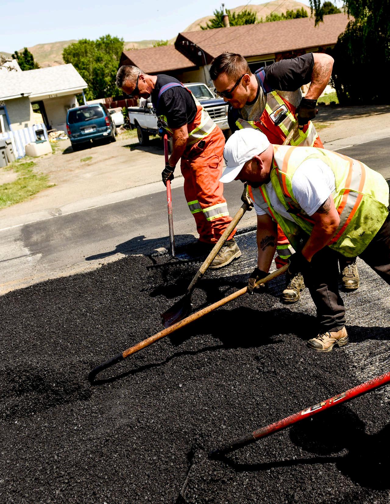
Section E Implementation
The Official Community Plan provides a growth plan, goals, and policies to guide decisions on planning and land use management within the City’s jurisdiction. The Official Community Plan addresses core aspects of community planning, including:
• Future growth and development
• Coordination of land use, future growth patterns, and infrastructure
• Building and landscape design guidelines
• Anticipated housing needs and proposed densities
• Provision of municipal services, parks, and public facilities
• Reduction of greenhouse gas emissions
• Protection of environmentally sensitive areas
It provides a strategy for land use planning and future growth over the next 20 years to an estimated population of 134,000. Implementing the goals and policies in the Official Community Plan will help achieve a vision of Kamloops as a more sustainable, healthy, vibrant, and thriving community.
1. Implementation Plan
The Official Community Plan will be implemented in coordination with all City departments. Implementation will require a combined corporate, community, and private sector effort to achieve its goals. In accordance with the Local Government Act, City Council will not adopt bylaws or authorize works to be undertaken unless those bylaws and works are consistent with the Official Community Plan. City Council will be guided by the Official Community Plan in all of its decisions, and City staff members are directed to consider the Official Community Plan in all of their work.
The Zoning Bylaw is one of the primary tools used to implement the Official Community Plan. Some amendments to the Zoning Bylaw will be necessary to bring it into conformity with Official Community Plan policies regarding land use, density, building height, and form and character. Such amendments will be considered as part of the Zoning Bylaw review and update process during the implementation of the Official Community Plan
Community involvement in neighbourhood planning exercises will be encouraged as the Official Community Plan is implemented. This involvement will be supported by the City’s public engagement process in accordance with the guiding principles in the Public Engagement Handbook.
The implementation plan will:
• Identify short-, medium-, and long-term actions required to implement the Official Community Plan
• Identify City departmental and external agency responsibilities regarding primary and supporting roles for each action item
• Include a timeline to complete action items
• Contain measurements of success to quantify progress
2. Monitoring and Evaluation
Monitoring and evaluation by staff will occur annually to assess how well the City is doing in achieving the Official Community Plan’s goals. Monitoring can show which areas of the Official Community Plan are being addressed and performing well, and which areas require further attention. Evaluation will consist of reviewing whether current goals and policies remain valid in light of ongoing learning and unanticipated changes in the community. The City will adopt an adaptive management framework for this process, as shown in Figure E1, which will consist of:
• Designing an implementation plan with actions and timelines for completion
• Implementing the actions within the plan
• Monitoring outcomes by establishing targets and measurable indicators and using reliable and relevant data sources to track progress
• Evaluating and reporting on indicators and progress towards targets and trends annually
• Adjusting and amending City plans, policies, and operations where necessary to achieve success
3. Subsidiary Plans
The City develops and periodically updates subsidiary plans, policies, and guidelines, some of which complement and overlap with the Official Community Plan. Existing subsidiary plans include, but are not limited to, neighbourhood and local area plans, master plans, and strategies.
In addition to the Official Community Plan, City planning, operations, and decision making will continue to be informed by these subsidiary plans, policies, and guidelines; however, they are not part of the Official Community Plan and are not intended to be given the same legal effect as the Official Community Plan
The City may also review and update the Zoning Bylaw and other bylaws to ensure consistency with the Official Community Plan
During the development of new neighbourhood plans or the revision of existing plans, the following factors will be addressed:
• How the neighbourhood plan is contributing to the achievement of the goals and policies of the Official Community Plan
• How the neighbourhood plan intends to achieve the Official Community Plan’s growth plan, housing objectives, and density targets
• How the neighbourhood plan supports a shift to walking, bicycling, and using transit through land use and urban design considerations
• The location of various land uses and a servicing plan for infrastructure and transportation improvements (including active transportation)
• Social, economic, environmental, and cultural issues as required
• An engagement strategy to obtain input from residents in the development of the plan
• Other requirements deemed appropriate by the City
4. Development Alignment
All development applications submitted to the City will be assessed for consistency with the Official Community Plan and any relevant subsidiary plans, policies, and guidelines. Project proponents must consider the complete Official Community Plan and its overall goals and demonstrate how their proposals are consistent with the Official Community Plan’s vision and intent.
5. Development Permit Areas
Development permits are required for areas designated in the Official Community Plan and identified in Section F: Development Permit Area Guidelines. Development permit area guidelines are governed by a set of development policies and guidelines that pertain to specific areas in the Official Community Plan. In general, properties located within a development permit area require a development permit to be obtained before applying for a building permit, subdividing land, or engaging in land-altering activities. A development permit area helps guide property owners and assists the City in addressing specific types of development, including intensive residential (e.g. small lots, triplexes, garden suites, and carriage suites), multi-unit residential (and mixed-use), commercial, and industrial. Development permit area guidelines also help protect environmentally sensitive and critical habitat areas while restricting development in areas with hazardous conditions, such as steep slopes and silt bluffs.
6. Development Cost Charges
Development cost charges are one-time charges that municipalities can levy on most new subdivisions and buildings at the time of approval. Development cost charges shift the financial responsibility from taxpayers to developers for providing capital costs for off-site infrastructure resulting from new growth, including sanitary sewer, water, storm drainage, roads, and parkland. As such, development cost charges are a useful tool for implementing new infrastructure to support growth.
The City will periodically review and update its Development Cost Charges Bylaw and capital budget approach to align more closely with full-cost and life cycle accounting of various types of growth in different locations, with the intention of addressing costs, achieving a better return on investment, and supporting sustainable development as outlined in the Official Community Plan
7. Density Bonusing Program
Density bonuses offer developers the opportunity to create a level of density that surpasses the allowable floor area ratio permitted in the Zoning Bylaw in exchange for community amenities such as parks or affordable housing. This means that a developer can build to a higher density if an amenity contribution is provided to the municipality. The density bonus sets out the type and value of amenities expected in return for the bonus density. Typically, density bonuses are used in designated zones where higher density is desired. Landowners and developers of sites with density bonus zoning have the choice to make no amenity contribution and develop at the base density or make the required contribution and develop at the higher bonus density. As part of the Official Community Plan’s implementation plan, the City will explore a density-bonusing program that includes the type of public benefits that qualify for a density bonus, defines areas of the city where the bonus applies, and provides a formula explaining how bonuses are calculated.
8. Budget
A key component of implementing the Official Community Plan is ensuring consistency with the City’s Five-Year Financial Plan. Proposed operational and capital expenditures that help achieve the Official Community Plan’s goals and policies will be reviewed each year as part of the City’s annual budget process.
9. OCP Amendments
There may be certain situations where a site- or policy-specific Official Community Plan amendment is necessary, such as the adoption of a local area, neighbourhood, or comprehensive development plan. Such amendments bring added provisions or clarifications for specific areas or topics, but they must not conflict with the Official Community Plan’s vision and goals. When an owner-initiated Official Community Plan amendment is considered by City Council, the following shall be considered as part of the decision:
• The impact of the proposed change on the achievement of the Official Community Plan’s vision and goals
• The appropriateness of the proposed change
• Compatibility with adjacent land uses
• Proposed amenities that provide community benefits
• The degree to which the proposal enhances the natural environment or ecological systems of the site or the surrounding area
• Implications for municipal infrastructure, including roads, water, sanitary and storm sewer, parks, and public facilities
10. Temporary Use Permits
Pursuant to Section 492 of the Local Government Act, the entire city is designated as an area where temporary uses may be allowed. A temporary use designation allows a use of land, on a temporary basis, that is not otherwise permitted in the Zoning Bylaw. City Council may issue a temporary use permit for a period of up to three years, renewable only once, and subject to the conditions outlined below. Upon expiration of a temporary use permit, the permitted uses revert to those outlined in the Zoning Bylaw. Temporary uses granted through a temporary use permit must:
• Not be noxious or undesirable because of smoke, noise, vibration, dirt, glare, odour, radiation, or electrical interference
• Not be either a health hazard or health impediment within the meaning of the Public Health Act, as amended from time to time
• Not have a negative impact on adjacent lands
• Not create a significant increase in the level or demand for services
• Not permanently alter the site upon which it is located
• Be compatible with the property’s land use designation
• Before issuing a temporary use permit, City Council may specify further conditions to be binding on the holder of the permit.
Section F Development Permit Area Guidelines
Maedeh Hedayatifard
Introduction
Development permit areas are designated for the following purposes. Before the alteration or subdivision of land or the construction of buildings and structures, an owner of property within a development permit area must receive approval from the City for a development permit consistent with the applicable guidelines.
TABLE
F1:
LOCAL GOVERNMENT ACT, SECTION 488(1) DESIGNATION OF DEVELOPMENT PERMIT AREAS
Development Permit Area Local Government Act Section 488(1)
Purpose
Downtown f The establishment of objectives for the form and character of commercial, industrial, and multi-family residential development
North Shore f The establishment of objectives for the form and character of commercial, industrial, and multi-family residential development
Multi-Family
Residential f The establishment of objectives for the form and character of multi-family residential development
Intensive Residential e The establishment of objectives for the form and character of intensive residential development
Commercial d, f The revitalization of an area in which commercial use is permitted and the establishment of objectives for the form and character of commercial development
Industrial f The establishment of objectives for the form and character of industrial development
Riparian Areas Protection Regulation a The protection of the natural environment, its ecosystems, and biological diversity
Silt Bluffs Hazard Zone b The protection of development from hazardous conditions
Thompson Rivers University a, e, f, h The protection of the natural environment, its ecosystems and biological diversity; the establishment of objectives for the form and character of commercial, industrial, and multi-family; the establishment of objectives for the form and character of intensive residential development; and the establishment of objectives aimed at promoting energy conservation
Orchards Walk e The establishment of objectives for the form and character of intensive residential development
Aberdeen Slope Hazard
b The protection of development from hazardous conditions
Flood Hazard b The protection of development from hazardous conditions
While some development permit areas apply city-wide, others are for specific areas, and maps have been provided for reference. Where land is subject to more than one development permit area designation, the application will be subject to the requirements of all applicable development permit areas and associated guidelines.
A development permit is required before the commencement of any activity specified in the applicable development permit area guidelines. The geographic area which is subject to development permit is included in the various development permit area guidelines as well as Map 11 – DPA: Riparian Areas Protection Regulation, Map 12 - DPA: Silt Bluffs Hazard Zone, and Map 14 - DPA: Aberdeen Slope Hazard. For precise boundaries of each development permit area, please refer to the City of Kamloops website.
Zoning Bylaw variances may be considered through the issuance of a development permit:
• If they do not affect use or density
• If the variance complies with the intent of the development permit area guidelines
• If the variance enhances the proposed development
• If the variance is necessary to avoid a physical constraint
• If the variance does not adversely impact adjacent land
In accordance with the Development Permit Procedure and Delegation Bylaw, delegated authority to issue a development permit can fall to the Development, Engineering, and Sustainability Department for applications which are not submitted concurrently with an application:
(a) to amend the Official Community Plan; (b) to amend the Zoning Bylaw; (c) for a Development Variance Permit; or (d) for a Temporary Use Permit.
1. Language of the Guidelines
The specific level of requirement associated with individual guidelines is determined by the following words:
“The City” is used to describe the City of Kamloops as a local government or corporation, whereas “the city” and “Kamloops” are used to describe the physical area of the municipality.
“Shall”, “must”, “will”, and/or the use of the adjective “required” means that the definition and/or guideline is required.
“Shall not”, “must not”, “will not”, and/or the use of the adjective “prohibited” means that the definition and/ or guideline is prohibited.
“Should” and/or the use of the adjectives “recommended” and/or “encouraged” reflect a strong positive preference for the guideline. In particular circumstances, valid reasons may exist not to apply a particular guideline, but any approval will require demonstration that an alternative solution is consistent with the overall intent of the guideline and be approved by designated City administration.
“Should not” and/or the use of the adjectives “not recommended” and/or “discouraged” reflect a strong negative preference of the guideline. In particular circumstances, valid reasons may exist to apply an alternate solution; however, it must be demonstrated that the alternative meets the overall intent of the guideline and be approved by the designated City Administration.
“May” and/or use of the term “optional” means that the guideline is discretionary.
Downtown Development
Permit Area
1. Purpose
The purpose of the Downtown Development Permit Area is to establish objectives and provide guidelines for the form and character of development in Downtown Kamloops. These guidelines ensure that all development within Downtown advances the vision articulated within the Downtown Plan. Development permit applications shall detail pedestrian and vehicular access and circulation, landscaping, building elevations, site layout, and street enhancements. Submissions should show adjacent sites (including opposite street fronts) and must show design details within the adjacent public realm (e.g. street frontage), including transition, pedestrian clear, and Furnishing Zones, as described in Section 7.5: Streetscapes. Site plans should also include an accessibility overlay that identifies accessible pathways, parking, entrances, and other features.
2. Area
The Downtown Development Permit Area applies to the Downtown Core, Waterfront District, East and West Entry Corridors, and Columbia Precinct, as shown in Figure F1. Largely form-based, the Downtown Development Permit Area Guidelines should be used in conjunction with the City’s use-specific development permit area guidelines, depending on the development permit application’s proposed uses.
3. Exemptions
Applications for the following shall not be required to apply for development permits:
• Internal renovations
• External renovations that do not require a building permit and do not affect the form and character of the building or site (to be determined by the Development, Engineering, and Sustainability Department)
• Single- or two-family dwellings
City of Kamloops
4. Objectives
The objectives of the Downtown Development Permit Area Guidelines are to:
• Align development with the vision of the Downtown Plan
• Integrate new development into neighbourhoods in a manner that reduces environmental impact
• Maintain and enhance desirable characteristics found in existing neighbourhoods
• Encourage healthy lifestyles and sustainable local growth through well-designed, durable buildings, landscapes, and public spaces
• Animate the public realm to enrich the sense of place
• Accommodate active transportation modes and transit usage
• Ensure that new development is compatible with the form and character of existing development and mitigate potential impacts on adjacent uses
• Support sustainable water and energy management through site and landscape design


5. Downtown Plan Vision and Principles
5.1 Vibrant
Downtown is lively and eclectic, with a thriving arts and entertainment district that celebrates and supports local businesses, restaurants, and cultural events and attracts residents and visitors of all lifestyles, ages, and abilities.
1. Compact Mix of Land Uses: A place where people can live, work, and play.
2. Focused Commercial Activity: A destination for shopping, dining, and employment.
3. Housing Diversity: Homes for people of all walks and stages of life.
Downtown Development Permit Area
5.2 Connected
With its network of green streets, public gathering places, and active transportation corridors, Downtown offers a walkable, bikeable, and accessible public realm that promotes sustainable and healthy living and conveniently links residents with surrounding neighbourhoods.
1. Pedestrian First: A walkable community heart that is accessible, safe, convenient, and active
2. Neighbourhood Connectivity: Key amenities and experiences are connected.
3. Public Gathering Spaces: Places for markets, festivals, sitting, and socializing.
5.3 Welcoming
Accessible, safe, attractive, and affordable, Downtown provides diverse housing types and public amenities that foster social interaction, inclusivity, and an enduring sense of community.
1. Attractive Surroundings: Full of greenery, public art, heritage, and character.
2. Make Downtown Memorable: Downtown’s unique character, culture, arts, food, and events are highlighted as key attractions for residents and tourists.
Peter Olsen
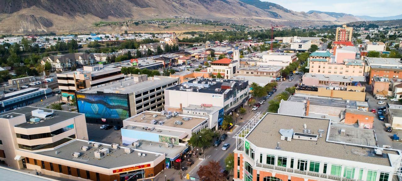
6. Letter of Intent Outline
The following list of key questions provides an outline to guide applicants in writing their letter of intent as part of the development permit application. Applicants must demonstrate how their project addresses each of the following questions with specific reference to site plans, sections, renderings, and other materials included with the application package. Each section of these guidelines (e.g. Site Planning, Building Design) begins with an example of the language that may be used to describe applications and how they address the guidelines.
A Vibrant Downtown
How does the proposal effectively integrate complimentary uses within Downtown (e.g. through sensitive and/or interesting transitions in building form and character)?
Refer to guidelines: 7.1.2 (1) iv, v; 7.1.3 (1)i; 7.1.3 (3) iii; 7.1.3 (4); 7.3.1 (1) ii, iv; 7.4 (2) v
How does the proposal effectively utilize building (modulation, articulation) and/or landscape design (variety, texture) to enhance and/or create visual interest on the street?
Refer to guidelines: 7.2.1 (3), (4); 7.2.3 (1), (2); 7.3.1 (2); 7.3.2 (2); 7.4 (5)
How does the proposal incorporate principles of universal design?
Refer to guidelines: 7.1.3 (1) i; 7.1.3 (4); 7.2.1 (1) iv; 7.2.4 (2) ii; 7.3.1 (1) ii
A Connected Downtown
How does the proposal contribute to improved pedestrian safety, accessibility, comfort, and enjoyment?
Refer to guidelines: 7.1.2 (1); 7.1.3 (1); 7.1.3 (3); 7.1.3 (5); 7.2.1 (1) to (5); 7.2.2 (2); 7.2.3 (1), (2); 7.2.4 (2); 7.3.1 (2); 7.3.2 (1), (2); 7.4 (1) to (5), (7); 7.5
How does the proposal enhance neighbourhood connectivity?
Refer to guidelines: 7.1.1 (2) ii; 7.5.1 (2)
How does the proposal incorporate places to gather, socialize, or sit?
Refer to guidelines: 7.1.3 (1); 7.5.1 (3), (4)
A Welcoming Downtown
How does the proposal celebrate Downtown (e.g. art and/or interpretive signage)?
Refer to guidelines: 7.1.3 (5); 7.4 (2), (5), (6)
How does the proposal contribute to Kamloops’ sense of identity (e.g. heritage preservation, artistic space, and/or cultural interpretation)?
Refer to guidelines: 7.1.1 (1) i; 7.4 (2), (5)
How does the proposal include green space that is appropriate for Kamloops’ climate and character?
Refer to guidelines: 7.1.1 (3); 7.3.1 (2), (3); 7.3.2 (1), (2); 7.5.1 (5)
7. Guidelines
7.1 Site Planning
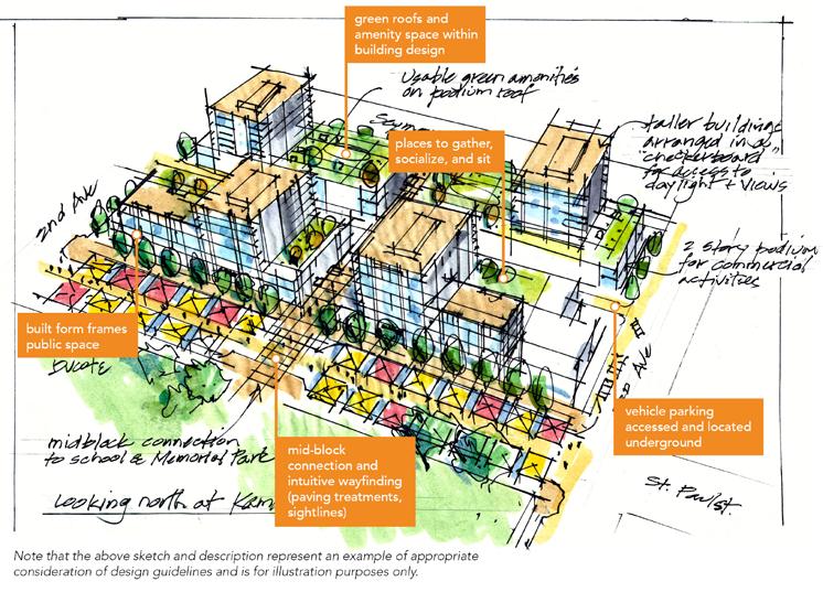
7.1.1 Part of the Whole
These guidelines prescribe attention to context, such as neighbouring buildings and site conditions, to help achieve the vision for Downtown.
1. Be a building block for a cohesive Downtown
i. Site design must account for the relationship to existing opportunities and constraints within the surrounding context and demonstrate (through annotation of site plans and elevations) that the improvements are thoughtfully integrated with its context and neighbours.
ii. Site design must demonstrate integration of architecture and landscape architecture - utilize a landscape architect’s expertise in integrating vegetation and green infrastructure within site designs.
iii. Site design should identify, reflect, and enhance unique site attributes (e.g. irregularly shaped lot, notable landscape features) where they exist.
2. Refine, repair, and/or enhance Downtown’s urban fabric
i. Site designs should contribute to a finer-grained network of pedestrian pathways that allow people to safely navigate a site and connect to public streets/lanes and nearby amenities (e.g. businesses, transit exchanges, bicycle routes, parks, recreation facilities). This is of particular importance for consolidated sites that may require large buildings to be broken up into smaller ones to allow for pedestrian permeability. Locating pathways and crosswalks mid-block or along desired lines (connecting key destinations) is strongly encouraged. An example would be to build crosswalks across streets, completing the “Alley Loop” identified in the Downtown Plan
ii. Design sites to promote intuitive wayfinding through pathways, sightlines, and signage. Provide direct access and clear sightlines to bus stops and shelters. Art and ornamental features (e.g. fountains, sculptures) are also encouraged to contribute to pedestrian wayfinding and enjoyment.
iii. Where large/consolidated sites contribute public and semi-public amenity space at ground level, it should be easily accessed from adjoining streets and visible from the public realm/sidewalk wherever possible to promote intuitive wayfinding. Examples of outdoor amenity areas include landscaped and trellised seating areas, plazas, playgrounds, and/or gardens (e.g. ornamental and/ or community).
F IGURE F2: CONCEPT PLAN FROM THE DOWNTOWN DESIGN CHARRETTE SHOWING THE “ALLEY LOOP” (HIGHLIGHTED IN COLOUR)—MID-BLOCK CROSSWALKS AND LARGE SITES WITH PLAZA SPACES INCREASE MID-BLOCK PEDESTRIAN PERMEABILITY AND EXPAND THE PUBLIC REALM
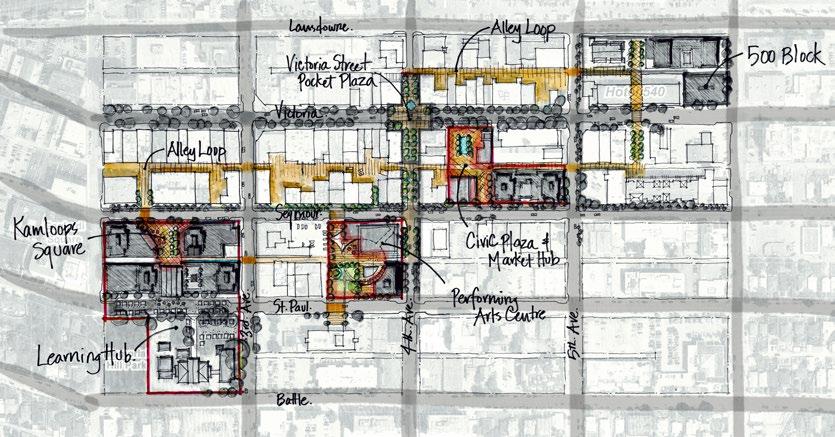
3. Demonstrate awareness of the semi-arid landscape and natural systems context
i. On-site stormwater management should be incorporated in landscape design (e.g. bioswales, rain gardens). It is encouraged to make these landscapes visually interesting and a visible feature of the design.
ii. Designs on sloping sites should work with natural topography. Step buildings along the length of a sloping site (10% or greater) to integrate the building into the slope.
iii. Where necessary, retaining walls with an exposed face of 3 m or greater in height should include terracing and/or articulation. Terraces should be designed to accommodate landscape areas that soften the wall’s appearance and should be accessible for maintenance. Where walls exceed 1.5 m in height, landscape features, such as trees, shrubs, or vines, should be provided adjacent to the wall. Lock-block retaining walls are not supported. Designs on sloping sites reflect natural topography
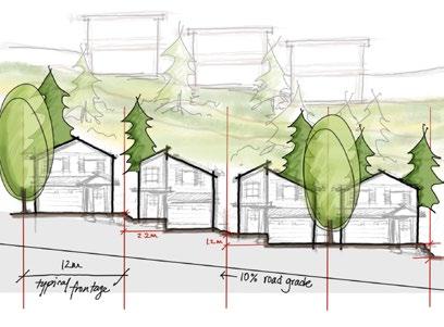
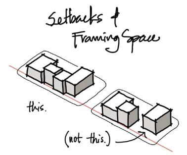
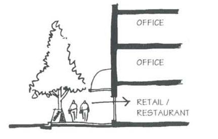
7.1.2 Framing Public Space
Improvements should actively contribute to public life. In downtowns, this happens in the way buildings address the public realm to either frame it or expand it. The following guidelines outline the role development proposals should play in shaping Downtown’s public “rooms” of streets and plazas.
1. Use built form and landscape to frame public and semi-public spaces
i. The siting of new buildings should define the street wall by fronting directly onto the street or be set back to allow for plaza space (not parking) and indoor/outdoor function of the building as an extension of an activated public realm. In cases where a building cannot provide that definition, street edge continuity should be achieved through landscape elements such as trees, fencing, or hedging.
ii. The base of a building should be substantially broken up at least every 45 m to vary the spatial experience for pedestrians.
iii. Orient buildings to primary frontages. The building design and use should acknowledge the use of the primary frontage to enhance street character (e.g. ground-level retail, ground-level access, the use of different textures, scale, or materials on ground level).
iv. Design building frontages to reflect their uses. In a commercial setting with ground-level commercial retail units, this means providing lively pedestrian environments (e.g. with outdoor furnishings). In a residential setting with ground-level residential units, this means using layering of elements, including, but not limited to, street-facing stairs, porches, patios, and landscape elements (e.g. plantings, pathways, screen walls) to transition between the public and private realm.
v. Support safety through the concept of “eyes on the street” by ensuring residential units, offices, and other upper-floor uses overlook public and semi-private spaces and connections such as sidewalks, walkways, plazas, gardens, parkland, and strata roads to provide views and surveillance of activity areas.
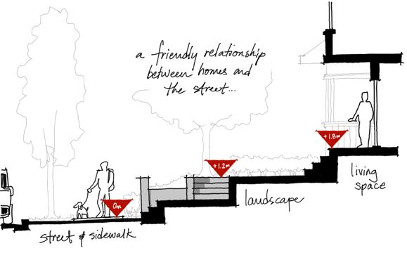
A friendly relationship between homes and the street
Buildings define the street wall by fronting directly onto the street and should be broken up at least every 45 m.
Direct views and access to ground-level commercial storefronts
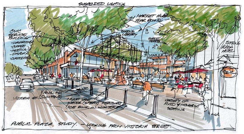
A well-framed public plaza adjacent to a sidewalk, café, and market
7.1.3 A Place of Belonging
Safe, comfortable, accessible, and enjoyable pedestrian environments should be prioritized.
1. Create pedestrian-friendly environments
i. Places to gather, socialize, and sit are strongly encouraged. Integrate usable, well-framed public and private open spaces, including squares, plazas, and rooftop gardens. Public and semi-public spaces should be centrally located, adjacent to sidewalks and active uses (e.g. cafés, shops, small businesses) in highly visible areas, and accessible without vehicular traffic interference. They should be oriented to receive sunlight, with trees and landscape to provide weather protection.
ii. In some cases, public streets become an extension of private commercial spaces. In other cases, private plazas extend from the sidewalk for public use. Define and transition private and semiprivate spaces with elements such as patios, paving treatments, grade changes, and vegetation to transition between spaces as appropriate.
iii. Provide benches, shelters, and other amenities near main entrances.
iv. The Victoria Street and Seymour Street pedestrian realms are of priority importance within Downtown. Redevelopment along the south side of these streets should utilize architectural strategies (e.g. setbacks/stepbacks) to avoid shadow impacts on the north sidewalk.
2. Accommodate cyclists
i. Short-term bicycle parking should be located near building entrances in highly visible locations, preferably covered.
ii. Long-term bicycle parking shall be secured and weather-protected (e.g. in a locked room or secondary shelter/building) and located near building entrances and lobbies at ground level or underground.
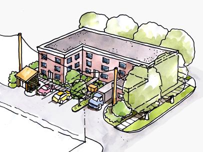
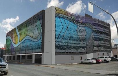
3. Minimize car- and parking-related impacts to the public realm
i. Vehicular access and off-street vehicle parking should be accessed from the alley. Vehicle parking lots and parkades located in front of buildings (adjacent to the primary street) or facing an intersection are not permitted. Where driveways must cross sidewalks, sidewalks should be continuous and level through the conflict zone. Where appropriate, it is encouraged that safety and/or traffic-calming measures be installed to ensure cars slow down and respect pedestrian priority.
ii. The majority of required off-street parking should be provided underground.
iii. Underground parking should not exceed the level of natural grade. Where underground parking must be partially above grade, this may only happen along rear and secondary frontages. Limit it to 1 m above grade and use attractive, high-quality materials on the exposed structure and/or screen with landscape.
iv. Where above-ground structured parking is required, wrap primary frontages with active uses (e.g. commercial retail units) and explore opportunities to screen upper floors/blank parkade walls.
4. Design universally accessible places
i. Universally accessible pedestrian walkways to primary building entrances must be provided from public sidewalks, parking areas, solid waste and storage areas. Fulfilling accessibility requirements through secondary entrances and pathways is discouraged. Pathways should be a minimum of 1.5 m wide.
ii. Site design must consider safe and convenient access for people with diverse mobility needs by minimizing curb cuts, grading sites to achieve gentle inclines, and providing tactile wayfinding surfaces. Where grade changes are unavoidable, provide ramps and steps with railings.
5. Use art and interpretation to reinforce Downtown’s identity
i. Public art and interpretive signage provide opportunities to celebrate public space and create a sense of place. Public art and interpretive signage are encouraged in public and semi-public open spaces, especially plazas.
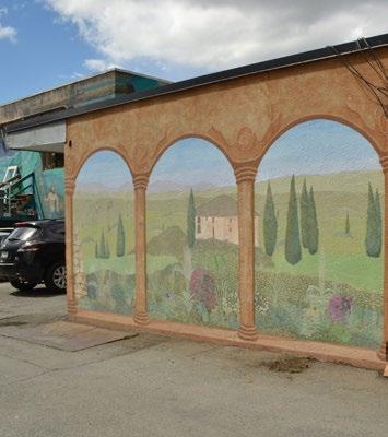
Improvements adjacent to the “Alley Loop” are encouraged to paint alley-facing walls of buildings with murals, contributing to the already flourishing ‘mural-scape’. Murals are encouraged to enliven and visually expand the alley’s space.
Surface vehicle parking for commercial uses and residential visitors is located at the back of the building and accessed from the alley
Structured parking is screened by public art (work by Bill Frymire)
7.2 Building Design
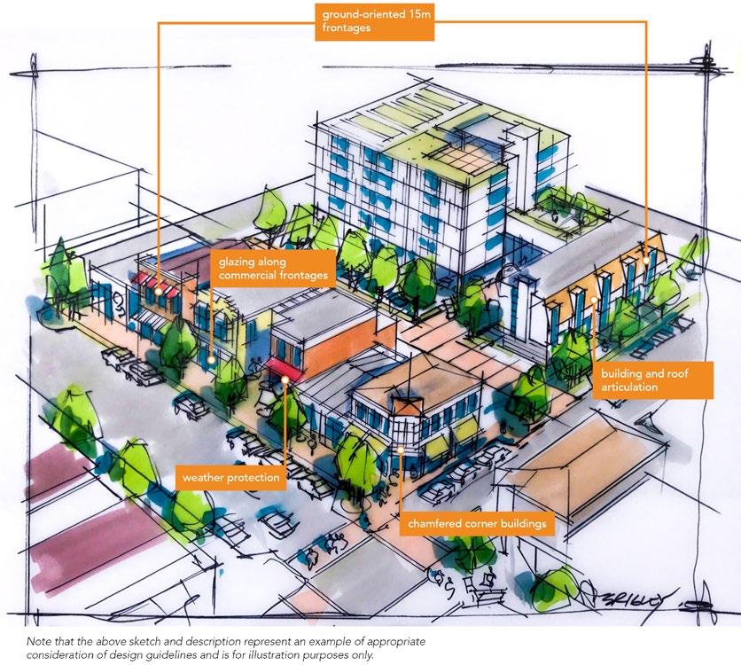
7.2.1 Presenting a Friendly Face
Buildings frame public space and interact with it and its occupants. Building design can be welcoming and comforting. Rather than turning its back on the street, a building should present a “friendly face”.
1. Maximize street presence and ground orientation
i. The lower floors of buildings should be designed with ground-oriented units that are 15 m wide at most. At ground level, circulation should be externalized to create direct street access to all parts of the building (rather than a single entry) to maximize integration between street and building.
ii. A larger retailer should articulate external units but may combine units internally.
iii. Visual connection to commercial store interiors must be maintained through at least 75% glazing along the primary store frontage. Windows shall be transparent and clear of obstructions (e.g. posters, decorative decals).
iv. Orient primary building entrances to the sidewalk on which the building fronts. Primary building entrances must be universally accessible and should be well-lit and visually prominent.
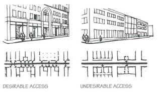
Buildings should have groundoriented units on lower floors
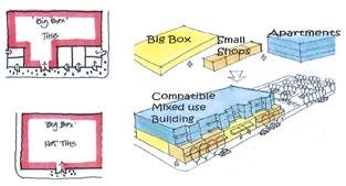
v. Blank walls should not be placed along or easily viewed from pedestrian-oriented streets and arterial roads. Blank walls visible from the road right-of-way should be treated with landscaping, architectural feature(s) and/or artwork to cover at least 50% of the blank wall surface.
2. Frame intersections
i. Buildings on corner sites should front both streets, with primary entrances on the chamfered (bevelled) corner. If the building’s corner is not chamfered, an entrance on each street should be provided.
ii. Buildings with corner cuts should be carefully designed to maintain through movement across corners, particularly where grade transitions need to be addressed.
iii. If upper floors cover the corner cut, they should be cantilevered. Ensure a minimum 4 m clearance (equivalent to an over-height storey) between the ground and the overhang/cantilever. Where necessary, support beams should be sized appropriately and minimized to reduce visual and physical obstruction.
iv. Pedestrian-oriented features should be incorporated at corners, either as part of the building (e.g. balcony or canopy) or within the ground-level public space. These may include windows and decorative details.
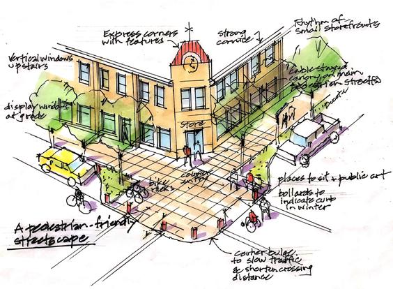
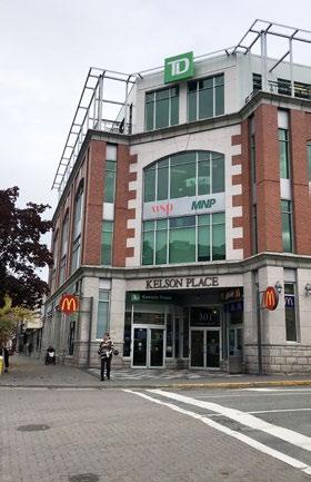
3. Design human-scaled buildings for comfort and enjoyment
i. A minimum street wall of 8 m (two storeys) should be maintained along pedestrian-oriented routes.
ii. Buildings above three storeys may require stepbacks to minimize shadowing impacts on the priority public realm (e.g. Victoria Street, Seymour Street).
iii. Vary building massing with architectural features (e.g. balconies) or small stepbacks to create depth and shadow patterns to avoid the appearance of large, homogeneous façades and to reduce apparent building mass.
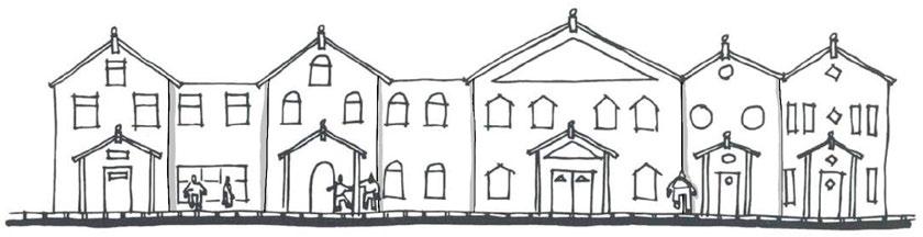
Buildings on corner sites provide unique urban design opportunities within Downtown
Building roofline reflects individual units
iv. Articulate building façades (particularly primary façades) with architectural features, varied materials, and subtle horizontal recesses to create variety and interest along the street.
v. Roof design should include articulation to provide visual interest. A variety of roof forms (e.g. gabled, mansard, shed.) are encouraged to create visual interest. Roof designs shall reflect an honest expression of interesting building design (e.g. as a result of building façade and/or volumetric articulation to break up large contiguous/continuous surfaces) and be well-proportioned. Ornamental/faux roof elements (e.g. “hats”) are discouraged.
vi. Roof designs on sloping sites should reflect stepped building massing and follow the slope of the site.
vii. Green roofs are encouraged where feasible.
viii. Roof forms of high-rise and/or significant (e.g. cultural) buildings may be given special design consideration to achieve positive recognition and landmark status.
ix. Rooftop mechanical equipment should be screened from view (i.e. through the design of rooflines and parapets). Screening enclosures should be of similar materials to the building.
4. Material selection should emphasize durability and reflect an honest expression of building architecture
i. Durable building materials, particularly along primary façades, should be selected for their quality and durability. They should weather well over time and contribute to the appearance of quality construction that evokes a sense of permanence. Products such as stone, brick, metal, textured concrete, and/or treated wood should be used on a building façade that faces a public street.
ii. The use of multiple material types is encouraged to provide visual interest and emphasize variety in built form (façade and/or volumetric articulation).
iii. Materials selection and application should be logical/integral to building and construction techniques. If stone or masonry brick façades are to be used, traditional placement of building materials should be considered (e.g. placing stone above large windows or voids would look out of place). Similarly, masonry brick or stone at a higher elevation (e.g. higher than the sixth floor) would also look unnatural.
iv. Materials should wrap from front elevation to side elevation to avoid the appearance of thin/veneer façade treatments.
v. Special window and balcony treatments (e.g. fritting and/or frosting) should be considered to mitigate bird collisions in the case of high-rise building designs.
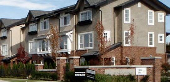
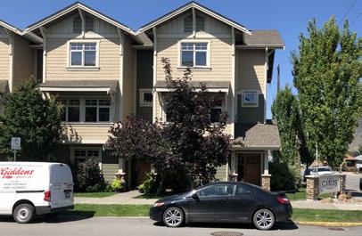
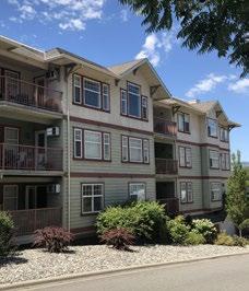
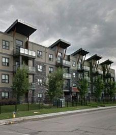
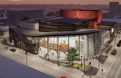
Building massing creates depth and patterns
Fine-grained features create variety and interest
This Not this
Proposed Centre for the Arts design
Materials emphasize durability

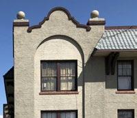
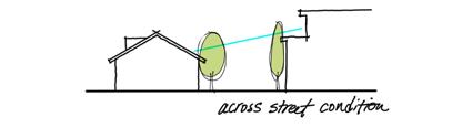

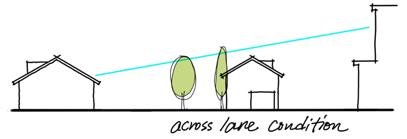
5. Colour selection should complement and reflect the authenticity of selected materials
i. A building’s colour palette should complement the site context and natural setting. Earth tones and natural hues are preferred as the dominant building colour. The use of bright/contrasting colours should be generally limited to trim, architectural details, signage, and other minor building elements.
ii. Colour selection should complement material selection by emphasizing the authentic use of materials and their natural expression (e.g. stained and/or painted wood siding, natural stone, black iron, corten steel).
iii. Significant and/or bold architectural expressions may depart from colour guidelines in unique sites/circumstances.
7.2.2 Nod to the Neighbours
Building design should address privacy, strengthen neighbourhood and street identity, and recognize the role of each building’s façade design and ability to contribute to a larger pattern of building forms and open space that define the pedestrian experience.
1. Respect privacy
i. Offset window placements between buildings that face each other in close proximity to maintain privacy in residential units.
2. Reinforce and enhance neighbourhood character
i. Designs should enhance the character of their neighbourhoods, as described in the Downtown Plan (e.g. Waterfront District, Downtown Core).
ii. Reflect, complement, or enhance established neighbourhood forms and design features that contribute to neighbourhood character, including roof forms and consistent window spacing. Complement or enhance the character of surrounding buildings with heritage value.
iii. Proposed buildings should relate to adjacent heights. Where a building is introduced that is taller than its neighbours, it should incorporate complementary building forms and transitional building heights to bridge the height and scale of adjacent buildings, especially when next to lower-density residential uses. If this is not possible, design features that relate to the scale of adjacent buildings may be used (e.g. continuing a horizontal design feature, such as a cornice line, can help connect adjacent buildings).
3. Demonstrate clear transitions and distinctions between uses
i. Separate and articulate distinct ground-floor entrances of different uses through the use of signage, glazing, indoor-outdoor relationships and transitions, and overheight volumes.
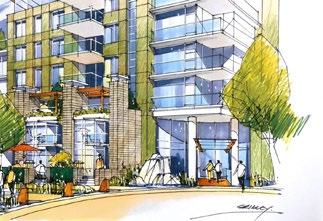
The street level encourages pedestrian activity with prominent entry features and ground-oriented units
Reflect, complement, or enhance established neighbourhood forms and design features
7.2.3 Mid-Rise and High-Rise Buildings as Friendly Giants
High-rise buildings can have a significant impact on the form and character of communities. A welldesigned and thoughtfully detailed building can reinforce human scale, enhance pedestrian environments, and accommodate residential and/or commercial densities to support a vibrant Downtown.
1. Create elegant forms
i. Impacts of high-rise buildings can be mitigated through building detailing at the pedestrian level, enhancing building entrances and entry features, limiting floor plate sizes, and striving for less bulky, more elegant vertical elements.
ii. The design of lower floors (e.g. the building base) of high-rise buildings—beyond their impact on block scale and permeability—should accommodate design flexibility and encourage continuous street wall conditions at the pedestrian level (e.g. street interface).
iii. The following guidelines for maximum floor plate sizes are recommended (based on typical building/slab dimensions):
Portion of building between 14 m and 24 m (5 to 7 storeys)
Portion of building greater than 24 m (> 7 storeys)
Residential floors should not exceed 900 m2 gross area (based on a typical ~20 m x 45 m dimension).
Commercial floors should not exceed 1,350 m2 gross area (based on a typical ~30 m x 45 m dimension).
Residential floors should not exceed 625 m2 gross area (based on a typical ~25 m x 25 m dimension).
Commercial floors shall not exceed 900 m2 gross area (based on a typical ~30 m x 30 m dimension).
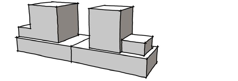
2. Provide separation for livability and neighbourliness
i. High-rise buildings should be oriented north-south with a maximum of two high-rise buildings per block face to ensure privacy, access to sunlight, air flow, and views.
ii. Separation between high-rise building towers should be 15 m or greater from the side and rear property lines. The separation distance between towers on the same parcel should be 30 m or greater.
iii. Articulate façades of mid-rise and high-rise buildings at the two- to three-storey level to create human-scale building features and contribute to a comfortable pedestrian environment.
TABLE F2: FLOOR PLATE SIZE GUIDELINES
Example of separation and floor plate guidelines for tall buildings
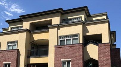
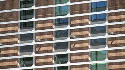
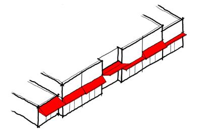
iv. Clearly identify the primary building entrances of high-rise buildings with feature elements, including building and/or landscape design features (e.g. oversized entries, climate protection, building wall recesses, trellis structures).
v. Proposed buildings taller than six storeys shall demonstrate how the proposed building and site design:
a. Protects and frames significant public views to important landscape features (e.g. the river valley, prominent mountain peaks) seen from public spaces/streets through building siting and massing
b. Minimizes shadowing impacts and ensures sunshine reaches public spaces and streets (shadow study). Buildings should be designed to prevent overshadowing on parks and public open spaces and to minimize overshadowing on Victoria Street, Seymour Street, and, if possible, semi-private open spaces
c. Complements or enhances the character of surrounding buildings, particularly if the surrounding buildings have heritage value
d. Uses elements such as façade articulation and podiums/stepbacks to achieve building designs that are scaled to people/pedestrians adjacent to the public realm, streets and semi-public spaces
e. Reduces the impact of wind at ground level
7.2.4 Respond to Climate and Context
3. Design sustainable buildings
i. Building form, orientation, and thermal mass should optimize solar radiation, natural ventilation, and daylighting. Innovation related to sustainability is encouraged in the choice of glass and window products.
ii. Where possible, residential buildings should receive daylight and natural ventilation from at least two sides of the building or from one side and the roof. Where possible, dwelling units should have a choice of aspect—front and back or on two sides (for corner units).
iii. Designs of new buildings should incorporate floor-to-ceiling heights that increase the amount of interior space that can receive natural light.
iv. Buildings with double-loaded corridors should be oriented northsouth so that all units receive direct sunlight at some point during the day throughout the seasons.
v. Solar shades and/or deeper balconies/overhangs are encouraged along south- and west-facing building façades.
vi. Durable, thermally efficient roofs that reduce heating and cooling and enhance thermal comfort are strongly recommended. Landscaped roofs are encouraged to reduce the heat island effect.
vii. Roof drainage systems should mitigate stormwater runoff effects by diverting storm events to infiltration galleries or other appropriate green infrastructure.
4. Incorporate indoor-outdoor spaces and sheltering elements in building design
i. Weather protection at entrances and along commercial and public/ active frontages is encouraged to cover sidewalks to a minimum depth of 1.5 m. This may be provided in the form of canopies or in the building design (e.g. colonnades), ensuring visibility from the public realm/street is maintained for safety.
ii. Transitional indoor-outdoor spaces, such as sidewalk patios, balconies, and rooftops, are encouraged. They should be made accessible to building users as usable common/private outdoor space.
Deeper façades (recessed balconies) and window screens (louvres) along south- and west-facing building aspects protect residents from summer heat
7.3 Landscape Design
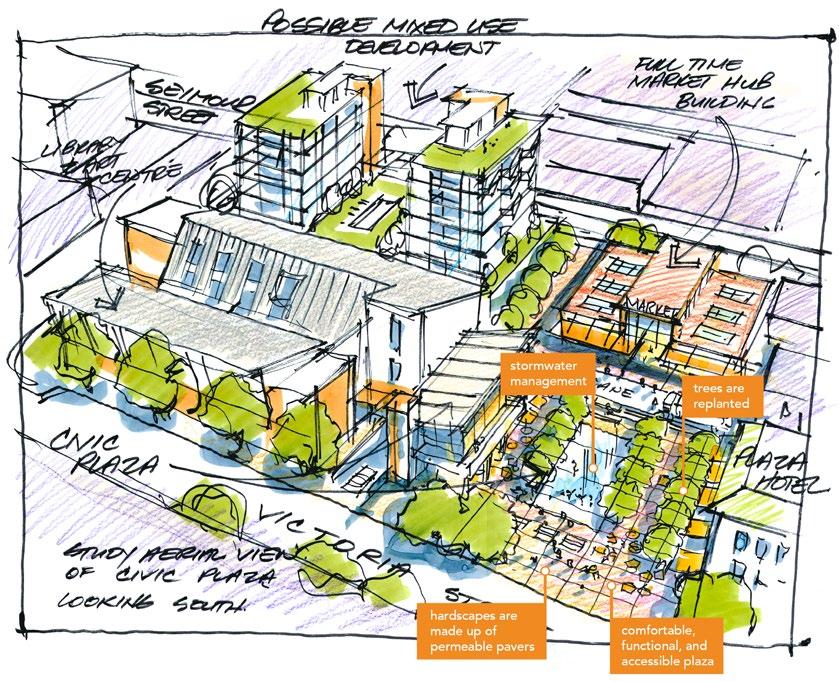
7.3.1 Healthy Habitats for People and More
Landscape design helps create healthy communities for people and can provide habitat for other living creatures.
1. Design with excellence
i. All landscape work should be of a high quality and meet the Canadian Landscape Standard by the Canadian Society of Landscape Architects and Canadian Nursery Landscape Association.
ii. Landscape design should prioritize comfortable, multi-functional, and accessible spaces for various users and uses throughout the changing seasons. Usable and landscaped rooftops are encouraged.
iii. Site and landscape designs should be cohesive and consistent across property lines (including boulevards within the right-of-way). Boulevard landscapes should be consistent along the street frontage and a logical extension of the landscape on the adjoining property or adjoining boulevards. Loose landscape materials, such as gravel and rocks, should not be placed adjacent to or in the boulevard unless adequately contained.
iv. Landscape designs should reflect transitions between programs and uses. Layering of multiple landscape elements (e.g. planters, trellises, other forms of hard and soft landscape) is encouraged and can enhance the usability of outdoor amenity spaces.
v. Primary building entrances should accommodate feature landscape designs, including, but not limited to, signage and landscape structures, feature paving, and planters.
Usable and landscaped rooftops are encouraged
2. Enhance the urban forest
i. Preserve mature trees and integrate their necessary soil volumes within new landscape and building designs where possible.
ii. Compensate for the loss of existing trees/landscape by replacing 2:1 with new plant material of comparable benefit. Trees in Downtown should not be removed as part of any improvement without City approval.
iii. Ensure tree plantings match site conditions. Consider soil volume, tree siting, and mature tree size, and plant appropriate tree species that align with the conditions and design intent. Where trees are planted in boulevards, trees should share a trench where possible. Where trees cannot be in a trench, each tree should have a minimum of 5 m3 of topsoil. Refer to the City’s Landscape Guidelines for a list of climate-adapted tree species.
iv. Landscape design and materials should provide for and/or enhance habitat value (e.g. birds, pollinators).
v. Where sightlines are required, use tree species that allow for a minimum branching height of at least 2 m.
3. Good fences make good neighbours
i. Fence height or landscape (e.g. hedges) should not obstruct visibility for vehicles or pedestrians. Standards for fence heights or screens are provided in the Zoning Bylaw
ii. Fencing materials should complement building design and materials.
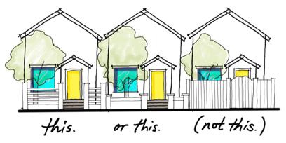
iii. Chain-link fences are strongly discouraged. If chain-link fencing is unavoidable, the fencing, posts, and all hardware should be black vinyl and should not be visible from the public realm.
iv. On-site service areas and waste collection bins (garbage and recycling) should be secured and screened from view to the street through enclosures, landscapes, and walls that reflect the site architecture. Solid waste bins must be screened by enclosures (landscape is not sufficient).
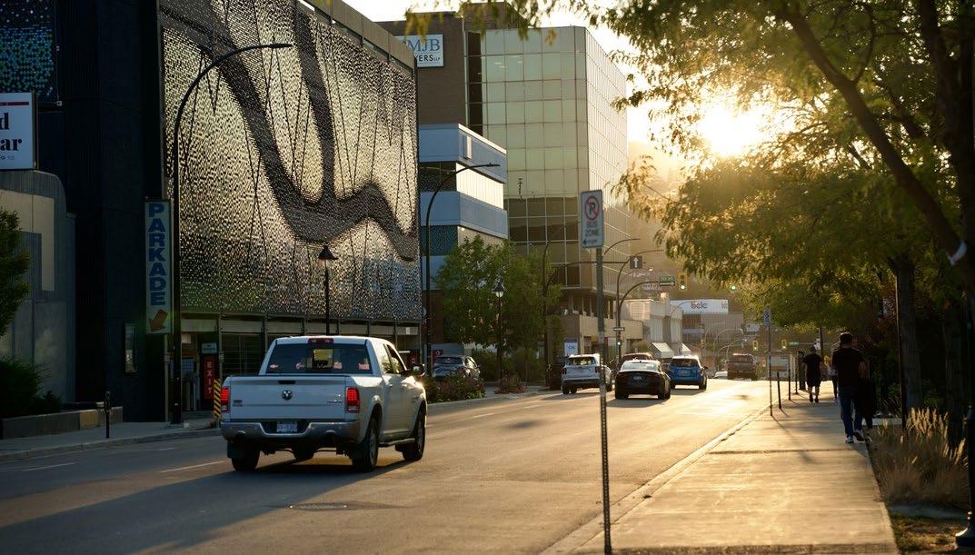
Fences should not obstruct visibility
Mel Antoni Cabarrubias
7.3.2 Curb the Heat Island Effect
Landscape design plays a vital role in mitigating the heat island effect in urban environments. Shading of hardscapes and minimizing impervious surfaces can help mitigate an increase in temperature due to urban development.
1. Minimize impervious surfaces
i. All areas not covered by buildings and/or pedestrian facilities should be landscaped with priority given to permeable surfaces, including boulevards and front and rear yards.
ii. Where feasible, permeable hardscapes are encouraged to mitigate stormwater runoff. They may be porous asphalt, porous concrete, permeable pavers, or concrete-glass-block grid.
iii. Hard surfacing is not permitted as a complete substitute for softscape in front yards (over 30% of area).
iv. Creative ways to incorporate greenery are encouraged (e.g. structured soils, silva cells, green roofs, vertical gardens/walls, planters), particularly on constrained/high-coverage sites.
v. Landscape design integrated with surface parking lots is essential in reducing impermeable surfaces and curbing climatic impacts. Trees and shrubs help protect from wind and reduce excessive heat. Landscape islands that screen parking areas are to be a minimum of 1.5 m in width. Where trees are provided, they are to be a minimum 3” caliper when installed. A minimum of one tree per 95 m2 of surface parking area (including circulation and drive aisles) should be planted. All parking lot edges along the street should include a 1 m wide landscape strip.
vi. Landscape design should consider green infrastructure services, including shading, windbreaks, and stormwater management. Deciduous plantings provide shade in the hot summer months while allowing for increased solar gain and providing windbreaks to reduce heat loss in the winter months.
2. Material selection - hardscapes and softscapes
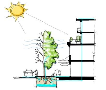
Materials should be selected with use in mind to determine the level of durability and maintenance required.
i. Public and semi-public spaces should be built with high-quality durable materials that allow for active or passive recreational activities.
ii. Pathway paving materials should be robust, durable, and easily maintained. They should be light in colour to help curb the heat island effect.
iii. Plants should be native and/or similarly hardy (adapted). Xeriscaping is encouraged as an important means of conserving water.
iv. Noxious or invasive plants are prohibited.
v. Landscape designs should consider planting palettes that provide seasonal interest, including, but not limited to, fall colour, spring blooms, leaf and bark textures (e.g. compound leaves, exfoliating bark), and fragrances.
vi. Use of edible landscape in the form of fruit trees, nut trees, and edible ground cover is encouraged, provided such plantings are properly maintained to reduce attractants for wildlife predators and pests.
vii. Landscape improvements should be maintained with subsurface, high-efficiency irrigation (e.g. drip).
Deciduous trees provide shade in summer and let sunlight through in the winter

7.4 Special Considerations
1. Select and design well-integrated security treatments
i. Site and building design should consider principles of Crime Prevention Through Environmental Design (CPTED)
ii. Security treatments should complement the character of the street/ building interface and utilize discrete colours and materials and/or ornamental elements.
iii. Security gates—where necessary—must maintain transparency of windows and doors. High-quality, durable materials (e.g. metals) are strongly encouraged, with colours that complement the site and architectural design.
2. Design signage for people and incorporate wayfinding
i. Sign types, styles, and locations should be shown on building elevations. Signage should reflect or complement—and be integrated with—the site’s architectural character. Limit signage in number, location, and size to reduce visual clutter and make individual signs easier to see. Street address numbers should be clearly identified on buildings or units.
ii. Signage throughout Downtown should be pedestrian oriented with respect to location, orientation, and scale. Pedestrian-oriented signage should be within 5 m of the ground plane and graphically designed to be readable by pedestrians on the sidewalk.
iii. All signs should be building mounted and integrated with a building’s architecture (e.g. incorporated with canopies) or placed within the Furnishing Zone (refer to Section 7.5: Streetscapes).
iv. Neon signs, sculptural signs, and artwork are encouraged. Rooftop and billboard signs shall not be permitted, and internally lit plastic box signs are strongly discouraged in new development. Freestanding signs are strongly discouraged in the Downtown Core and Columbia Precinct.
v. Signage on commercial buildings should clearly identify uses and business names.
vi. Wayfinding signage within Downtown should inform users of distances to and from key destinations (e.g. trailheads, landmarks, safe routes).
vii. Interpretive signage should showcase the context and history of the region, Kamloops, and Downtown by describing climate and geological processes/origins, identifying significant views and landscape features, and revealing the stories behind place names, including streets, parks, buildings and other sites of historical importance.
3. Mitigate light pollution
i. Avoid light pollution by avoiding light reflectance, directing lighting downwards, and using full cut-off fixtures with horizontally aligned flush-mounted (non-protruding) lenses. Exceptions may be made for signage and architectural lighting.

Full cut-off fixtures should be used to mitigate light pollution
Security gates must maintain transparency and complement site and architectural design
Pedestrian-oriented signage ensures wayfinding targets people on sidewalks rather than in cars
Sculptural signs are encouraged, and internallylit plastic box signs are strongly discouraged
4. Install lighting for safety
i. On-site lighting should be sufficient to provide clear orientation, personal safety, and site security. Ensure continuous lighting along mandatory connections, between parking, entrances, and public sidewalks, and clearly identify their termini (e.g. entrances, parking and loading areas).
ii. Do not light areas that are not intended for nighttime use. Focus lighting on priority pathways that provide connections between key destinations that people use at night.
5. Design lighting to create and/or enhance character
i. Create an even wash of light across surfaces desired to be lit.
ii. Place lighting fixtures no higher than 6.0 m from the ground.
iii. Where lamp standards and fixtures are exposed, the aesthetic quality of these elements must be considered to ensure integration with building and landscape design.
iv. Light sources should emit a warm tone of light, at a maximum of 3,000 Kelvin (K).
v. Use uplighting sparingly and only for accenting architectural elements of landscape features.
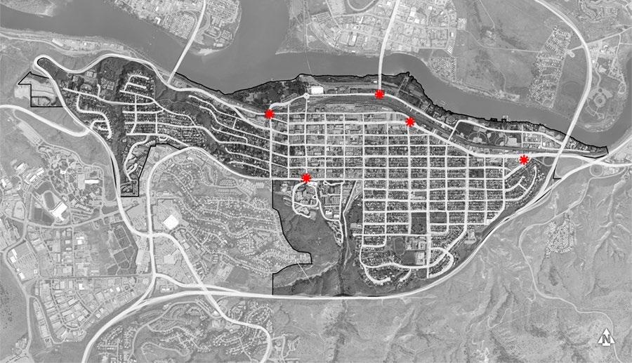
6. Design gateway sites to announce transitions in key locations throughout Downtown
i. Landmark architectural elements (e.g. tall vertical elements and bold orientation) are encouraged to differentiate these sites where identified.
ii. Buildings located on gateway sites should incorporate special design features at corners to announce entry into Downtown.
iii. Site architecturally significant buildings and provide strong massing where visible at the terminus of a street or walkway or at a gateway location.
7. Address and integrate railscapes
i. Incorporate greening and beautification adjacent to Canadian National and Canadian Pacific Railway rights-of-way.
ii. Maintain visual connection to the other side of the railway as much as possible to support wayfinding and orientation.
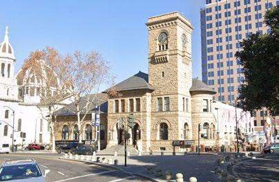
A clock tower creates strong definition at the street corner
7.5 Streetscapes
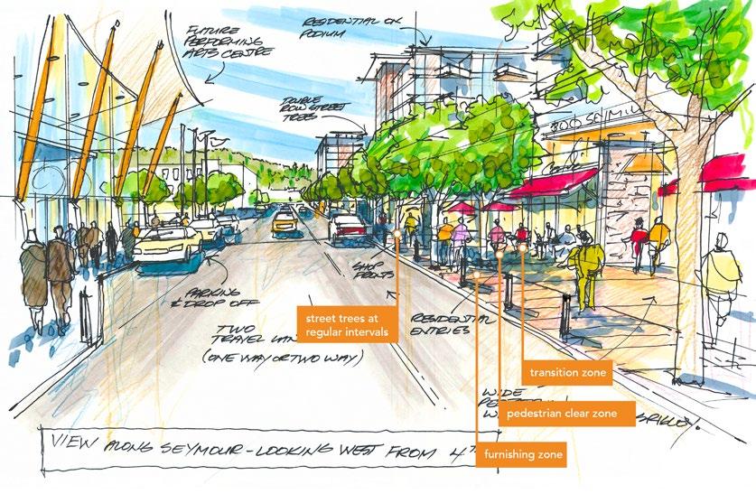
7.5.1 Functional Streets for People
Streets are a fundamentally important place where citizens and visitors engage in shared civic life. The following guidelines prioritize strategies that focus on comfort, health and safety, accessibility, visual appeal, and spaces of gathering and enjoyment for pedestrians while ensuring functional movement of people, goods, and services; operations; and maintenance (e.g. for snow clearing).
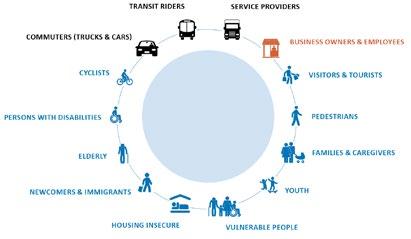
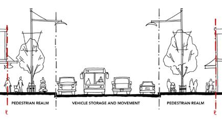
The street’s many users should find a comfortable place in the space of the cross-section
1. Consider the needs of all users, including pedestrians and all of their various needs, cyclists, rollerbladers and skaters, electric vehicle and scooter users, and lastly, motor vehicles (cars and trucks).
2. Find a home for the sidewalk’s many functions and parts. The sidewalk should be designed to ensure a logical, functional, and well-maintained appearance that is aesthetically pleasing and provides a unifying experience throughout Downtown. To do this we allocate space for the sidewalk’s different functions. Sidewalks should clearly allocate sufficient space for the following (refer to the Transportation Association of Canada Geometric Design Guide for Canadian Roads):
i. The Transition Zone - Street designs (and building interfaces) must consider the transitions between public and private space, from building façades and ‘front doors’ to the sidewalk. The Transition Zone allocates space to accommodate these spatial requirements, grade transitions, and temporary programs (e.g. displays, container plantings).
ii. The Pedestrian Clear Zone - ensures the safe and unhindered movement of pedestrians (and snow clearing equipment) with a minimum dimension of 2.5 m.
iii. The Furnishing Zone - Landscape elements, wayfinding signage, and furnishings on sidewalks should be grouped in a dedicated corridor (called the Furnishing Zone) to retain maximum clearance for Pedestrian Clear Zones and create a buffer between cars and pedestrians. The size of the zone will vary to accommodate the desired elements, with a minimum dimension of 1.2 m to accommodate tree wells. Furnishings should be designed to meet the needs of a wide range of users, including children, seniors, and persons with disabilities, and may include lighting, bike racks, parking kiosks, sandwich boards, and utility boxes.
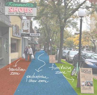
Sidewalk space is organized to accommodate its many functions in the most efficient way
3. Incorporate functional street furnishings that welcome human activity
i. Seating should be provided on retail and significant streets and in bulb-out areas, located with a “quiet back” and oriented to create and engage with social spaces. Additionally, seating should be located along steep streets and paths to provide a place to rest. Where feasible, street furniture should be movable.
ii. Waste/recycling/other receptacles should be provided on retail streets, at bus stops, near seating, or on bulb-outs near the street corner.
4. Utilize high-quality, durable, and easily maintained materials in the design of streetscapes
i. Streetscape design along major streets of the Downtown Core (e.g. Victoria Street, Seymour Street) should be designed to a higher standard in light of high pedestrian volumes and defined by durable materials such as unit pavers and/or extensive hardscapes (with planters or tree grates).
ii. Use tree grates (rather than a landscape strip) where pedestrian traffic is high and where sidewalk space is limited. Tree grate designs should be multi-functional to provide additional utility within the pedestrian realm.
iii. Varied hardscaping materials may be used to delineate different pedestrian realm zones. Material durability and suitability will vary according to the zone’s uses.
5. Prioritize street trees and boulevards as vital to the health and order of the streetscape
i. Cross-sectional designs should accommodate sufficient boulevard widths and soil volumes to support street trees and optimize the benefits of a mature and well-established urban forest.
ii. Location of utilities within cross-sectional designs should minimize conflict with rooting depth and spread of street trees.
iii. Tree selection should follow the right tree, right place principle. Different varieties of trees on different streets can add interest and increase comfort, promote biodiversity, and assist in wayfinding by helping to distinguish one street from another. Refer to the City’s Landscape Guidelines for a list of climate-adapted tree species.
iv. The irrigation systems for City street trees and landscape in boulevards shall be provided and separate from those of private property. Access to irrigation for street trees and landscape in boulevards shall be provided from the City’s right-of-way.
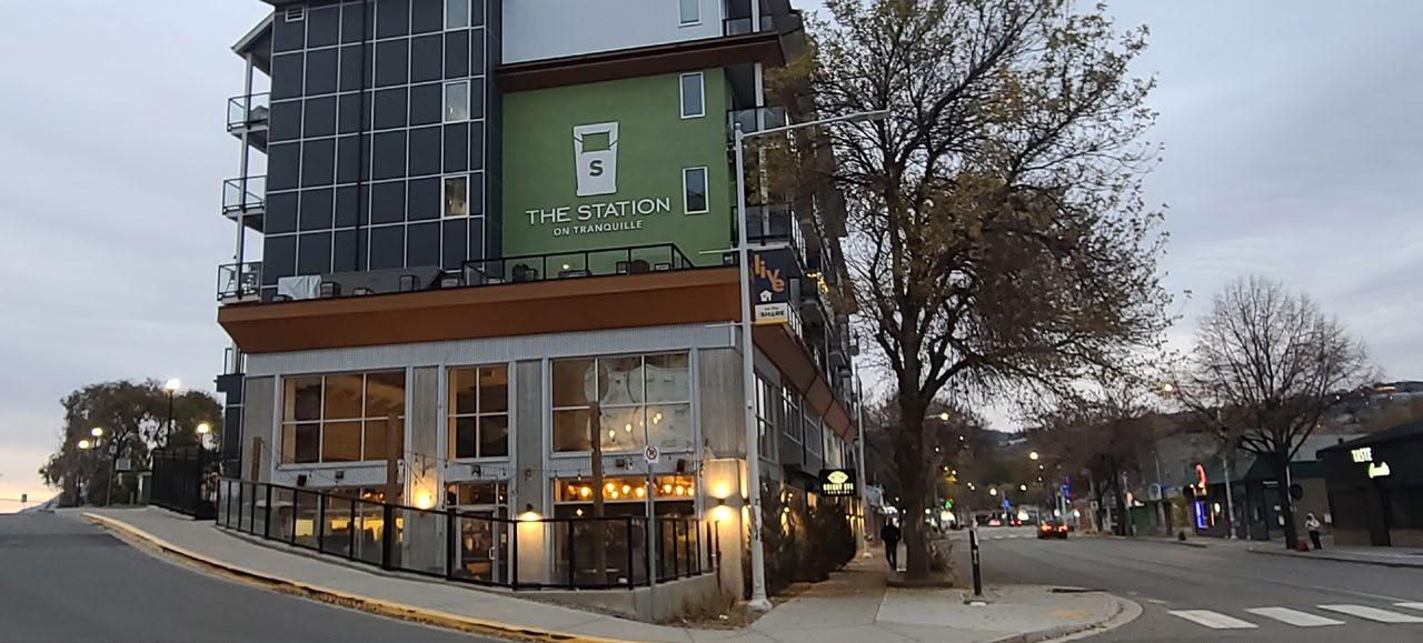
North Shore Development Permit Area
1. Purpose
The purpose of the North Shore Development Permit Area is to establish objectives and provide guidelines for the form and character of development in the North Shore Town Centre and Tranquille Market Corridor. These guidelines ensure that all development within these areas advances the vision articulated within the North Shore Neighbourhood Plan
Development permit applications shall detail pedestrian and vehicular access and circulation, landscaping, building elevations, site layout, and street enhancements. Submissions should show adjacent sites (including opposite street fronts) and must show design details within the adjacent public realm (e.g. street frontage), including transition, pedestrian clear, and Furnishing Zones, as described in Section 7.5: Streetscapes. Site plans should also include an accessibility overlay that identifies accessible pathways, parking, entrances, and other features.
2. Area
The North Shore Development Permit Area applies to the North Shore Town Centre and Tranquille Market Corridor, as shown in Figure F4. Largely form-based, the North Shore Development Permit Area Guidelines should be used in conjunction with the City’s use-specific development permit area guidelines, depending on the development permit application’s proposed uses.
3. Exemptions
Applications for the following shall not be required to apply for a development permit under the North Shore Development Permit Area Guidelines, but they may be subject to other City of Kamloops development permit area guidelines:
• Internal renovations
• External renovations that do not require a building permit and do not affect the form and character of the building or site (to be determined by the Development, Engineering, and Sustainability Department)
• Single- or two-family dwellings
City of Kamloops
4. Objectives
The objectives of the North Shore Development Permit Area Guidelines are to:
• Align development with the vision of the North Shore Neighbourhood Plan
• Integrate new development into neighbourhoods in a manner that reduces environmental impact
• Maintain and enhance desirable characteristics found in existing neighbourhoods
• Encourage healthy lifestyles and sustainable local growth through well-designed, durable buildings, landscapes, and public spaces
• Animate the public realm to enrich the sense of place
• Accommodate active transportation modes and transit usage
• Ensure that new development is compatible with the form and character of existing development and mitigate potential impacts on adjacent uses
• Support sustainable water and energy management through site and landscape design
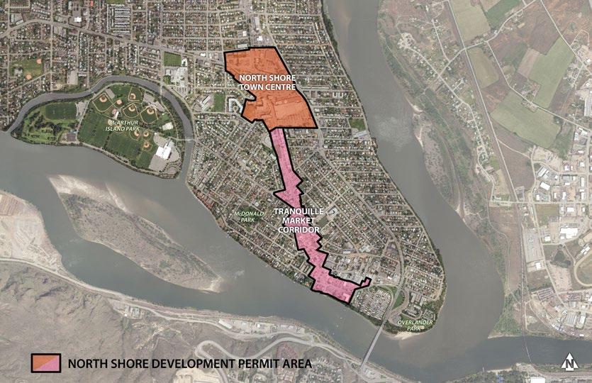
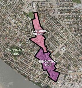
F IGURE F4: NORTH SHORE DEVELOPMENT PERMIT AREA MAP
Tranquille Market Corridor
5. North Shore Neighbourhood Plan Vision And Principles
5.1 Inclusive
The North Shore is welcoming, affordable, and accessible with a strong sense of community pride and is a place where people feel safe, ethnic and cultural diversity are celebrated, all residents are treated equitably and respectfully, and a diverse mix of housing options and services ensures people of all walks of life can thrive.
1. Community Building
Land uses and a built form that support local people, businesses, and community groups to grow, collaborate, and undertake projects that improve the community and better the lives of residents.
2. Add Missing Housing
Housing options that span the spectrum between single-detached homes and high-rise apartments support affordability and the needs of a diverse demographic.
3. Community Well-Being
An urban realm that supports the health of residents and enhances safety through improvements to lighting, landscaping, signage, transportation infrastructure, and building design.
5.2 Dynamic
An attractive, eclectic, authentic, and innovative destination for local arts, culture, and food, the North Shore is animated day and night by creative entrepreneurs, inviting streetscapes and public gathering spaces, and lively entertainment, events, and recreational opportunities.
1. Celebrate Character
The North Shore’s unique character, culture, and history, including its Indigenous heritage, are celebrated through its built form and community events.
2. Shared Space
Public gathering spaces provide opportunities for seating, eating, events, and socializing.
5.3 Complete
With a well-connected network of sidewalks, bike routes, and green streets, the North Shore provides residents convenient access to a wide range of retail options, employment areas, health services, parks, waterfront amenities, and community facilities.
1. Welcoming Mixed-Use Districts
Walkable neighbourhood centres that invite North Shore residents and visitors to live, work, shop, and play.
2. Embrace the Waterfront
A waterfront that provides opportunities for recreating, socializing, shopping, and dining while enhancing natural ecosystems and mitigating flood risk.
3. Connecting Corridors
A well-connected network of sidewalks and multi-use paths connects distinct districts, neighbourhood nodes, and major amenities in an accessible, safe, and convenient manner.
6. Letter of intent outline
The following list of key questions provides an outline to guide applicants in writing their letter of intent as part of the development permit application. Applicants must demonstrate how their project addresses each of the following questions with specific reference to site plans, sections, renderings, and other materials included with the application package. Each section of these guidelines (e.g. Site Planning, Building Design) begins with an example of the language that may be used to describe applications and how they address the guidelines.
An Inclusive North Shore
How does the proposal effectively integrate uses that are complementary to its surroundings (e.g. through the use of sensitive and/or interesting transitions in building form and character)?
Refer to guidelines: 7.1.2(1) iv, v; 7.1.3 (1) ii, (3), (4); 7.3.1 (1) ii, iv; 7.4.2 (1) ii, vii
How does the proposal contribute to improved pedestrian safety, accessibility, comfort, and enjoyment?
Refer to guidelines: 7.1.1(2), (4), (5), (7), (8), (9); 7.2.1 (1) to (5); 7.2.2 (1), (2); 7.2.3 (2); 7.3.1 (2); 7.3.2 (1), (2); 7.4.1 (1), (2); 7.4.2; 7.4.3; 7.4.5 (2); 7.5
How does the proposal incorporate principles of universal design?
Refer to guidelines: 7.1.3 (1) ii, (4); 7.2.1 (1) v; 7.2.3 (2) ii; 7.3.1 (1) ii
A Dynamic North Shore
How does the proposal celebrate the North Shore (e.g. art, interpretive signage)?
Refer to guidelines: 7.1.1 (5); 7.4.2 (1); 7.4.3; 7.4.4 (2)
How does the proposal contribute to the North Shore’s sense of identity (e.g. heritage preservation, artistic space, cultural interpretation)?
Refer to guidelines: 7.1.1. (1), (5); 7.4.1; 7.4.2 (1); 7.4.3 (3); 7.4.4 (1) iv
How does the proposal incorporate places to gather, socialize, or sit?
Refer to guidelines: 7.1.3 (1); 7.5.1 (4), (5)
A Complete North Shore
How does the proposal effectively utilize building (modulation, articulation) and/or landscape design (variety, texture) to enhance and/or create visual interest on the street?
Refer to guidelines: 7.2.1 (3), (4); 7.2.3 (1), (2); 7.3.1 (2); 7.3.2 (2); 7.4.3 (3); 7.4.4 (1)
How does the proposal include green space and/or landscaping that is appropriate for the North Shore’s climate and character?
Refer to guidelines: 7.1.1 (3); 7.3.1 (2), (3); 7.3.2 (2); 7.5.1 (6)
How does the proposal enhance neighbourhood connectivity?
Refer to guidelines: 7.1.1 (2); 7.1.3 (2); 7.4.1; 7.4.2 (1); 7.4.4 (2); 7.5.1 (3)
7. Guidelines
7.1 Site Planning
7.1.1 Part of the whole
These guidelines prescribe attention to context, such as neighbouring buildings and site conditions, to help achieve the vision for the North Shore.
1. Be a building block for a cohesive North Shore
i. Site design must account for the relationship to existing opportunities and constraints within the surrounding context and demonstrate (through annotation of site plans and elevations) that the improvements are thoughtfully integrated with its context and neighbours.
ii. Site design must demonstrate integration of architecture and landscape architecture. Utilize a landscape architect’s expertise in integrating vegetation and green infrastructure within site designs.
iii. Site design should identify, reflect, and enhance unique site attributes (e.g. irregularly shaped lot, notable landscape features) where they exist.
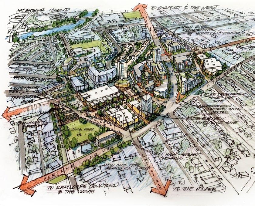
mid-block connection and intuitive wayfinding (paving treatments, sightlines)
vehicle parking located underground and accessed from a non-arterial street
green roofs and amenity space within building design
places to gather, socialize, and sit
Note that the above sketch and descriptions represent an example of appropriate consideration of design guidelines and is for illustration purposes only.
2. Refine, repair, and/or enhance the North Shore’s urban fabric
i. Site designs should contribute to a finer-grained network of pedestrian pathways that allow people to safely navigate a site and connect to public streets/lanes and nearby amenities (e.g. businesses, transit exchanges, bicycle routes, parks, recreation facilities). This is of particular importance for consolidated sites that may require large buildings to be broken up into smaller ones to allow for pedestrian permeability. Locating pathways and crosswalks mid-block or along desire lines (connecting key destinations) is strongly encouraged. An example would be to build internal pedestrian pathways or mews to increase the permeability of large blocks in the North Shore Town Centre, as identified in the North Shore Neighbourhood Plan
built form frames public space
ii. Design sites to promote intuitive wayfinding through pathways, sightlines, and signage. Provide direct access and clear sightlines to bus stops and shelters. Art and ornamental features (e.g. fountains, sculptures) are also encouraged to contribute to pedestrian wayfinding and enjoyment.
iii. Where large/consolidated sites contribute public and semi-public amenity space at ground level, it should be easily accessed from adjoining streets and visible from the public realm/sidewalk wherever possible to promote intuitive wayfinding. Examples of outdoor amenity areas include landscaped and trellised seating areas, plazas, playgrounds, outdoor cooking areas, and/or irrigated gardens (e.g. ornamental, edible, community).
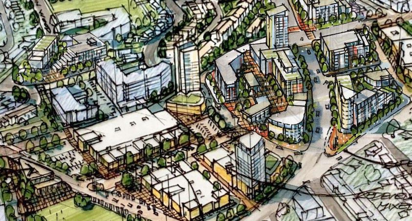
Sketch showing redevelopment concept for the North Shore Town Centre with large sites broken up by internal pedestrian pathways or mews to increase pedestrian permeability and expand the public realm
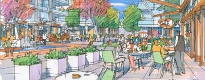
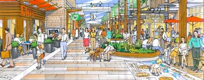
3. Demonstrate awareness of the semi-arid landscape and natural systems context.
i. On-site stormwater management should be incorporated in landscape design (e.g. bioswales, rain gardens). It is encouraged to make these landscapes visually interesting and a visible feature of the design.
ii. Designs on sloping sites should work with natural topography. Step buildings along the length of a sloping site (10% or greater) to integrate the building into the slope.
iii. Where necessary, retaining walls with an exposed face of 3 m or greater in height should include terracing and/or articulation. Terraces should be designed to accommodate landscape areas that soften the wall’s appearance and should be accessible for maintenance. Where walls exceed 1.5 m in height, landscape features, such as trees, shrubs, or vines, should be provided adjacent to the wall. Lock-Block retaining walls are not supported.
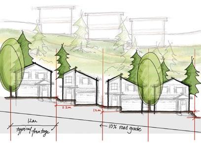
Designs on sloping sites reflect natural topography
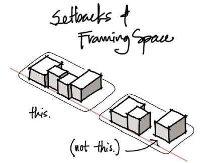
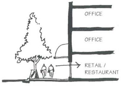
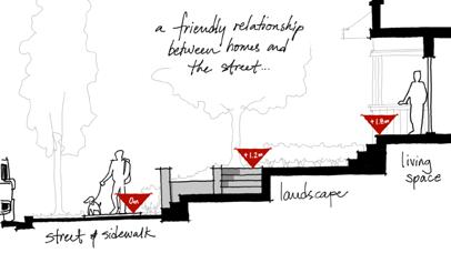
7.1.2 Framing Public Space
Improvements should actively contribute to public life. This happens in the way buildings address the public realm to either frame it or expand it. The following guidelines outline the role development proposals should play in shaping public “rooms” of streets and plazas.
1. Use built form and landscape to frame public and semi-public spaces
i. The siting of new buildings should define the street wall by fronting directly onto the street or be set back to allow for plaza space (not parking) and indoor/outdoor function of the building as an extension of an activated public realm. In cases where a building cannot provide that definition, street edge continuity should be achieved through landscape elements such as trees, fencing, or hedging.
ii. The base of a building should be substantially broken up at least every 45 m to vary the spatial experience for pedestrians. In the Cultural Village area of the Tranquille Market Corridor (see Figure F4), this should occur every 15 m to provide a better fit with existing smaller-scale storefronts.
iii. Orient buildings to primary frontages. Building design and use should acknowledge the use of the primary frontage to enhance street character (e.g. ground-level retail; ground-level access; the use of different textures, scale, or materials on ground level). Buildings backing onto the waterfront should maintain a strong, active, presence along the primary street frontage.
iv. Design building frontages to reflect their uses. In a commercial setting with ground-level commercial retail units, this means providing lively pedestrian environments (e.g. with outdoor furnishings). In a residential setting with ground-level residential units, this means using layering of elements, including, but not limited to, street-facing stairs, porches, patios, and landscape elements (e.g. plantings, pathways, screen walls) to transition between the public and private realm.
v. Support safety through the concept of “eyes on the street” by ensuring residential units, offices, and other upper-floor uses overlook public and semi-private spaces and connections, such as sidewalks, walkways, plazas, gardens, parkland, and strata roads, to provide views and surveillance of activity areas.
vi. Front yard and side street yard setback minimums and maximums can be increased only with the use of a pedestrian plaza, front entry landscape feature, or public area feature at the corner of any property adjacent to intersections.
7.1.3 A Place of Belonging
Safe, comfortable, accessible, and enjoyable pedestrian environments should be prioritized.
1. Create pedestrian-friendly environments
i. New development on corner lots or fronting mid-block crosswalks shall incorporate curb extensions to encourage safer, more pedestrian-friendly streetscapes. The Tranquille Road Complete Streets Plan (or successive plan) should be consulted for identified pedestrian improvement locations.
ii. Places to gather, socialize, and sit are strongly encouraged. Integrate usable, well-framed public and private open spaces, including squares, plazas, and rooftop gardens. Public and semi-public spaces should be located adjacent to sidewalks and active uses (e.g. cafés, shops, small businesses) in highly visible areas and accessible without vehicular traffic interference. They should be oriented to receive sunlight, with trees and landscape to provide weather protection.
Direct views and access to ground-level commercial storefronts
Buildings define the street wall by fronting directly onto the street and should be broken up at least every 45 m.
The narrower historic lot widths of the Cultural Village should be maintained and/or reflected in building design
iii. Define and transition private and semi-private spaces with elements such as patios, paving treatments, grade changes, and vegetation to transition spaces as appropriate. Ensure that clear and accessible paths of travel are maintained along City sidewalks and entryways to buildings.
iv. The Tranquille Road and Sydney Avenue/North Shore Transit Exchange pedestrian realms are of priority importance. Redevelopment along the south side of these streets should utilize architectural strategies (e.g. setbacks/stepbacks) to avoid shadow impacts on the north sidewalk and any adjacent parks or plazas.
v. Sites within the North Shore Town Centre with internal pedestrian pathways (e.g. pedestrian mews) should be fronted by active commercial uses to support pedestrian activity and create a safe, comfortable, and enjoyable pedestrian experience.
2. Accommodate cyclists
i. Short-term bicycle parking should be located near building entrances in highly visible locations, preferably covered.
ii. Long-term bicycle parking shall be secured and weather-protected (e.g. in a locked room or secondary shelter/building) and located near building entrances and lobbies at ground level or underground.
3. Minimize car- and parking-related impacts to the public realm
i. Vehicular access and off-street vehicle parking should be accessed from the alley or, for sites without alley access, from secondary frontages with lower pedestrian activity. Vehicle parking lots and parkades located in front of buildings (adjacent to the primary street) or facing an intersection are not permitted. Where driveways must cross sidewalks, sidewalks should be continuous and level through the conflict zone. Where appropriate, safety and/or traffic-calming measures should be installed to ensure cars slow down and respect pedestrian priority.
ii. The majority of required off-street parking should be provided underground.
iii. Underground parking should not exceed the level of natural grade. Where underground parking must be partially above grade, this may only happen along rear and secondary frontages. Limit it to 1 m above grade and use attractive, high-quality materials on the exposed structure and/or screen with landscape.
iv. Where above-ground structured parking is proposed, wrap primary frontages with active uses (e.g. commercial retail units) and/or use creative architectural design and/or public art to add visual interest, screen vehicles and mechanical equipment, and better incorporate parking areas into overall building design.
v. Where unavoidable, parking locations along street frontages must provide a minimum of a 3 m landscape buffer strip between the parking area and a property line.
4. Design universally accessible places
i. Universally accessible pedestrian walkways to primary building entrances must be provided from public sidewalks, parking areas, solid waste and storage areas. Fulfilling accessibility requirements through secondary entrances and pathways is discouraged. Pathways should be a minimum of 1.5 m wide.
ii. Building design should provide ground-floor commercial uses that are accessible at grade.
iii. Site design must consider safe and convenient access for people with diverse mobility needs by minimizing curb cuts, grading sites to achieve gentle inclines, and providing tactile wayfinding surfaces. Where grade changes are unavoidable, provide ramps and steps with railings.
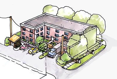
Surface vehicle parking for commercial uses and residential visitors is located at the back of the building and accessed from the alley
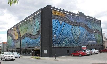
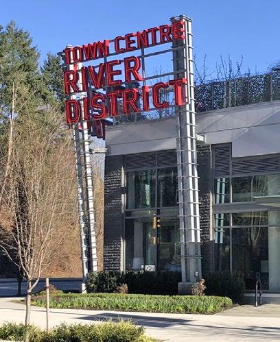
Signage and public art features can add interest and focal points and contribute to sense of place
Structured parking on Lansdowne Street is screened by public art (work by Bill Frymire)
5. Use art and interpretation to enhance the area’s character, wayfinding, and pedestrian experience
i. Public art and interpretive signage provide opportunities to celebrate public space and create a sense of place. Public art and interpretive signage are encouraged in public and semi-public open spaces, especially plazas.
ii. Site layout and design should incorporate public art, interpretive, or other creative design elements to create interest and focal points.
7.2 Building Design
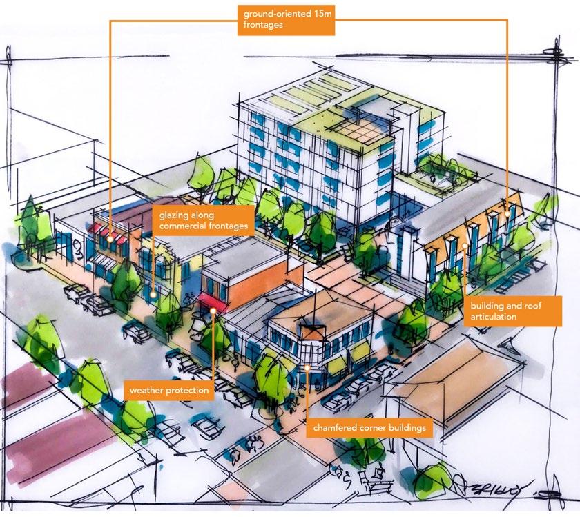
Note that the above sketch and description represent an example of appropriate consideration of design guidelines and is for illustration purposes only.
7.2.1 Presenting a Friendly Face
Buildings frame public space and interact with it and its occupants. Building design can be welcoming and comforting. Rather than turning its back on the street, a building should present a “friendly face”.
1. Maximize street presence and ground orientation
i. The lower floors of buildings should be designed with ground-oriented units that are 15 m wide at most. At ground level, circulation should be externalized to create direct street access to all parts of the building (rather than a single entry) to maximize integration between street and building.
ii. Larger-format retailers (e.g. grocery stores) may exceed 15 m unit widths, but external units (which may also be combined internally) should be articulated to produce an apparent width of no more than 30 m as viewed from the primary street.
iii. Large retail units are discouraged in the Cultural Village area of the Tranquille Market Corridor to support its historic fine-grain storefront character and smaller, eclectic retail offerings.
iv. Visual connection to commercial store interiors must be maintained through at least 50% glazing along the primary store frontage. Windows shall be transparent and clear of obstructions (e.g. posters, decorative decals).
v. Orient primary building entrances to the sidewalk on which the building fronts. Primary building entrances must be universally accessible and should be well lit and visually prominent.
vi. Blank walls should not be placed along or easily viewed from pedestrian-oriented streets and arterial roads. Blank walls visible from the road right-of-way should be treated with landscaping, architectural feature(s), and/or artwork so as to cover at least 50% of the blank wall surface.
2. Frame intersections
i. Buildings on corner sites should front both streets, with primary entrances on the chamfered (bevelled) corner. If the building’s corner is not chamfered, an entrance on each street should be provided.
ii. Buildings with corner cuts should be carefully designed to maintain pedestrian movement across corners, particularly where grade transitions need to be addressed.
iii. If upper floors cover the corner cut, they should be cantilevered. Ensure a minimum 4 m clearance (equivalent to an over-height storey) between the ground and the overhang/cantilever. Where necessary, support beams should be sized appropriately and minimized to reduce visual and physical obstruction.
iv. Pedestrian-oriented features should be incorporated at corners, either as part of the building (e.g. balconies, canopies) or within the ground-level public space. These may include windows and decorative details.
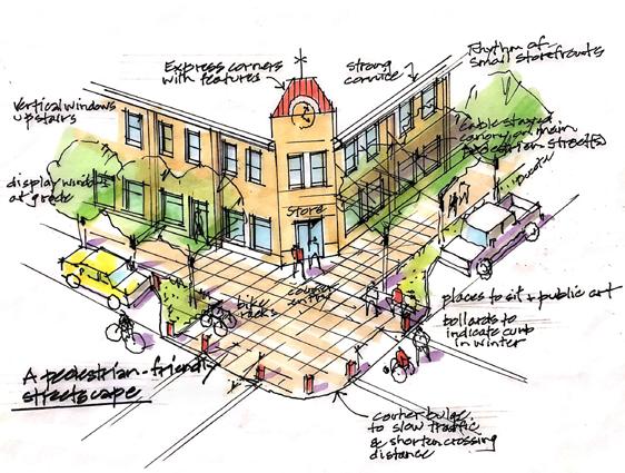
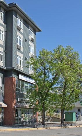
Buildings on corner sites provide unique urban design opportunities
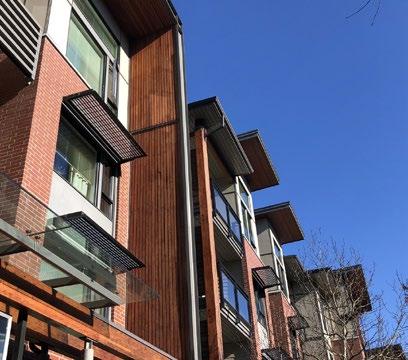
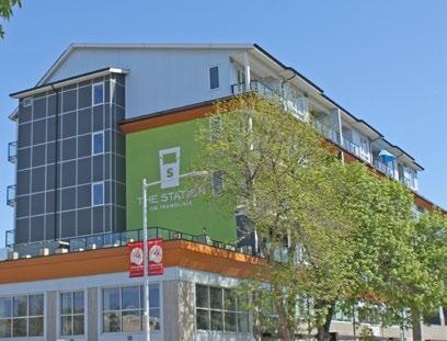
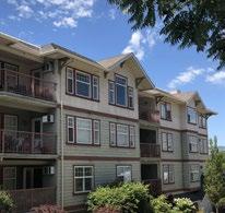
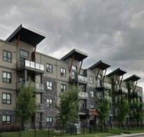
3. Design human-scaled buildings for comfort and enjoyment
i. A minimum street wall of 8 m (two storeys) should be maintained along pedestrian-oriented routes.
ii. Buildings above three storeys shall incorporate stepbacks to minimize shadowing impacts on priority public realm (e.g. Tranquille Road, North Shore Transit Exchange, parks, plazas).
iii. Vary building massing with architectural features (e.g. balconies) or small stepbacks to create depth and shadow patterns to avoid the appearance of large, homogeneous façades and to reduce apparent building mass.
iv. Articulate building façades (particularly primary façades) with architectural features, varied materials, and subtle horizontal recesses to create variety and interest along the street.
v. Roof design should include articulation to provide visual interest. A variety of roof forms (e.g. gabled, mansard, shed) are encouraged to create visual interest. Roof designs shall reflect an honest expression of interesting building design (e.g. as a result of building façade, volumetric articulation to break up large contiguous/continuous surfaces) and be well proportioned. Ornamental/faux roof elements (e.g. “hats”) are discouraged.
vi. Roof designs on sloping sites should reflect stepped building massing and follow the slope of the site.
vii. Green roofs and rooftop planter boxes are encouraged to support stormwater management and provide outdoor amenity space for residents.
viii. Roof forms of high-rise buildings and/or significant (e.g. cultural) buildings should be given special design consideration to achieve positive recognition and landmark status.
ix. Rooftop mechanical equipment should be screened from view (i.e. through the design of rooflines and parapets). Screening enclosures should be of similar materials to the building.
4. Material selection should emphasize durability and reflect an honest expression of building architecture
i. Building façades should be treated with durable building materials that weather well and contribute to the appearance of quality construction and a sense of permanence. Products such as stone, brick, metal, textured concrete, and/or treated wood should be used on a building façade that faces a public street.
ii. The use of multiple material types is encouraged to provide visual interest and emphasize variety in built form (façade and/or volumetric articulation).
iii. Materials selection and application should be logical/integral to building and construction techniques. Heavier materials, such as stone and brick, should predominantly be used at lower elevations.
iv. Materials should wrap from front elevation to side elevation to avoid the appearance of thin/veneer façade treatments.
v. Special window and balcony treatments (e.g. fritting, frosting) should be considered to mitigate bird collisions in the case of high-rise building designs.
This Not This
Varied materials create variety and interest
Building massing creates depth and patterns
5. Colour selection should complement and reflect the authenticity of selected materials
i. A building’s colour palette should complement the site context and natural setting. Earth tones and natural hues are preferred as the dominant building colour. The use of bright/contrasting colours should generally be limited to trim, architectural details, signage, and other minor building elements.
ii. A broader, more vibrant colour palette will be considered for sites within the Cultural Village and Innovation Hub areas of the Tranquille Market Corridor to support the North Shore Neighbourhood Plan’s vision for them as more creative, innovative, and entertainmentoriented areas.
iii. Colour selection should complement material selection by emphasizing the authentic use of materials and their natural expression (e.g. stained and/or painted wood siding, natural stone, black iron, corten steel).
iv. Significant and/or bold architectural expressions may depart from colour guidelines in unique sites/circumstances.
7.2.2 Nod to the Neighbours
Building design should address privacy, strengthen neighbourhood and street identity, and recognize the role of each building’s ability to contribute to a larger pattern of built forms and open space that defines the pedestrian experience.
1. Respect privacy
i. Offset window placements between buildings that face each other in close proximity to maintain privacy in residential units.
2. Reinforce and enhance neighbourhood character
i. Designs should enhance the character of their neighbourhoods, as described in the North Shore Neighbourhood Plan (e.g. North Shore Town Centre, Tranquille Market Corridor).
ii. Reflect, complement, or enhance established neighbourhood forms and design features that contribute to neighbourhood character, including roof forms and consistent window spacing. Complement or enhance the character of surrounding buildings with heritage value or other character-defining design elements.
iii. Proposed buildings should relate to adjacent heights. Where a building is introduced that is taller than its neighbours, it should incorporate complementary building forms and transitional building heights to bridge the height and scale of adjacent buildings, especially when next to lower-density residential uses. Design features that relate to the scale of adjacent buildings may also be used (e.g. continuing a horizontal design feature, such as a cornice line, can help connect adjacent buildings).
3. Demonstrate clear transitions and distinctions between uses
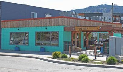
A more vibrant colour palette will be considered within the Cultural Village and Innovation Hub
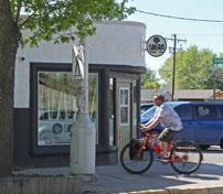
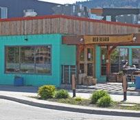
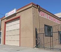
Reflect, complement, or enhance established neighbourhood forms and design features
i. Separate and distinguish ground-floor entrances of different uses through the use of signage, glazing, indoor-outdoor relationships and transitions, and overheight volumes.
7.2.3 Mid-Rise and High-Rise Buildings
High-rise buildings can have a significant impact on the form and character of communities. A welldesigned and thoughtfully detailed building can reinforce human scale, enhance pedestrian environments, and accommodate residential and/or commercial densities to support a vibrant urban realm.
1. Create elegant forms
i. Impacts of high-rise buildings can be mitigated through building detailing at the pedestrian level, enhancing building entrances and entry features, limiting floor plate sizes, and striving for less bulky, more elegant vertical elements.
ii. The design of lower floors (e.g. the building base) of high-rise buildings—beyond their impact on block scale and permeability—should accommodate design flexibility and encourage continuous street wall conditions at the pedestrian level (e.g. street interface).
a. The guidelines in Table F3 for maximum floor plate sizes are recommended (based on typical building/slab dimensions).
Portion of building between 14 m and 24 m (5 to 7 storeys)
Portion of building greater than 24 m (> 7 storeys)
Residential floors should not exceed 900 m2 gross area (based on a typical ~20 m x 45 m dimension).
Commercial floors should not exceed 1,350 m2 gross area (based on a typical ~30 m x 45 m dimension).
Residential floors should not exceed 625 m2 gross area (based on a typical ~25 m x 25 m dimension).
Commercial floors shall not exceed 900 m2 gross area (based on a typical ~30 m x 30 m dimension).
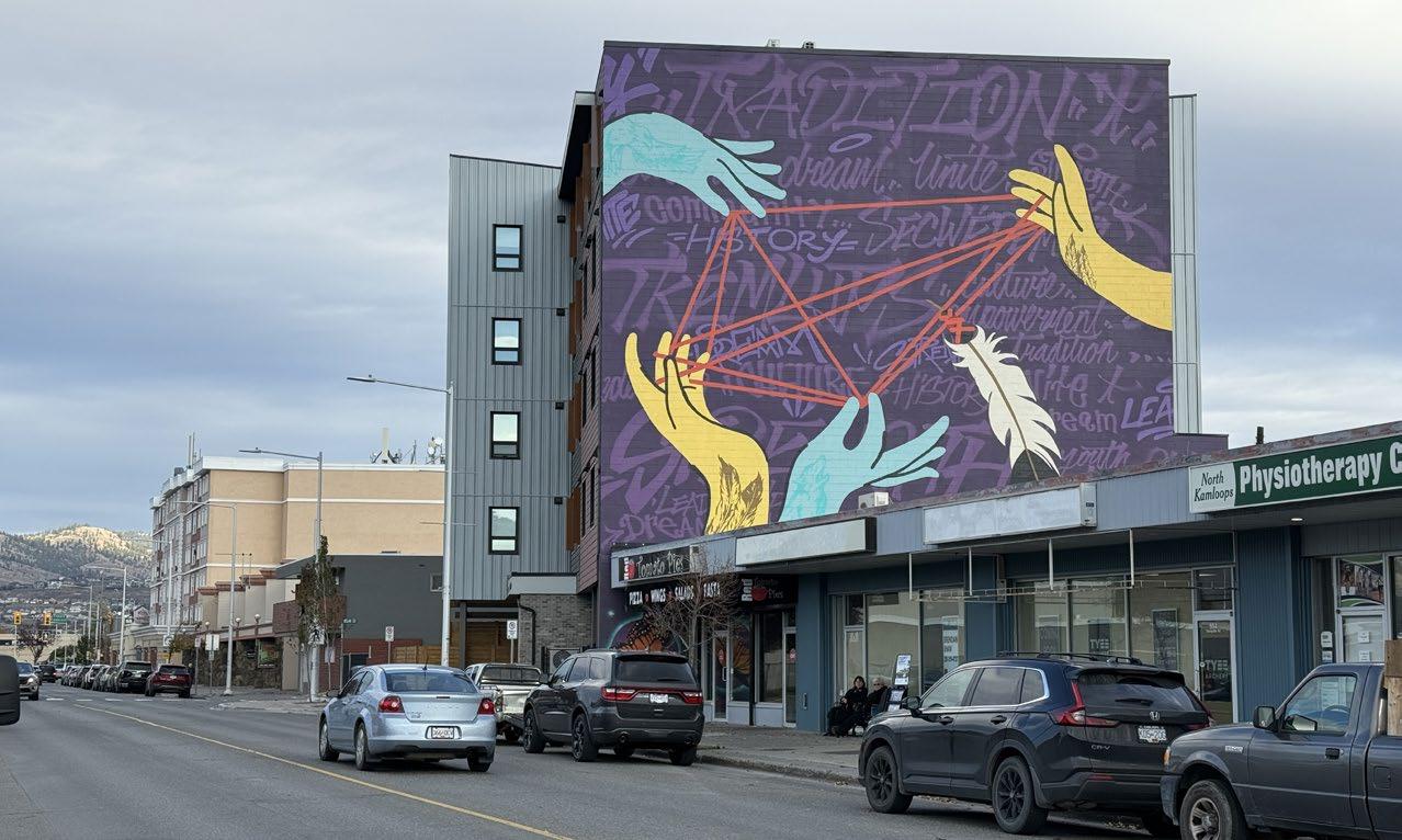
2. Provide separation for livability and neighbourliness
i. High-rise buildings should be oriented north-south with a maximum of two high-rise buildings per block face to ensure privacy, access to sunlight, air flow, and views.
ii. Separation between high-rise building towers should be 15 m or greater from the side and rear property lines. The separation distance between towers on the same parcel should be 30 m or greater.
iii. Articulate façades of mid-rise and high-rise buildings at the two- to three-storey level to create human-scale building features and contribute to a comfortable pedestrian environment.
iv. Clearly identify the primary building entrances of high-rise buildings with feature elements, including building and/ or landscape design features (e.g. oversized entries, climate protection, building wall recesses, trellis structures).
v. Proposed buildings taller than six storeys shall demonstrate how the proposed building and site design:
Example of separation and floor plate guidelines for tall buildings
a. Protects and frames significant public views to important landscape features (e.g. the river valley, prominent mountain peaks) seen from the public spaces/streets through building siting and massing.
b. Minimizes shadowing impacts and ensures sunshine reaches public spaces and streets (shadow study). Buildings should be designed to prevent overshadowing on parks and public open spaces and to minimize overshadowing on the North Shore Transit Exchange, and, if possible, semi-private open spaces.
c. Complements or enhances the character of surrounding buildings, particularly if the surrounding buildings have significant character or heritage value.
d. Uses elements, such as façade articulation and podiums/stepbacks, to achieve building designs that are scaled to people/pedestrians adjacent to the public realm, streets, and semipublic spaces.
e. Reduces impact of wind at ground level.
7.2.4 Respond to Climate and Context
1. Design sustainable buildings
i. Building form, orientation, and thermal mass should optimize solar radiation, natural ventilation, and daylighting. Innovation related to sustainability is encouraged in the choice of glass and window products.
ii. Where possible, residential buildings should receive daylight and natural ventilation from at least two sides of the building or from one side and the roof. Where possible, dwelling units should have a choice of aspect—front and back, or on two sides (for corner units).
iii. Designs of new buildings should incorporate floor-to-ceiling heights that increase the amount of interior space that can receive natural light.
iv. Buildings with double-loaded corridors should be oriented north-south so that all units receive direct sunlight at some point
Deeper façades (recessed balconies) and window screens (louvres) along south- and west-facing building aspects protect residents from summer heat
during the day throughout the seasons.
v. Solar shades and/or deeper balconies/overhangs are encouraged along south- and west-facing building façades.
vi. Durable, thermally efficient roofs that reduce heating and cooling and enhance thermal comfort are strongly recommended. Landscaped roofs are encouraged to reduce the heat island effect.
vii. Roof drainage systems should mitigate stormwater runoff effects by diverting storm events to infiltration galleries or other appropriate green infrastructure.
Weather protection at entrances and along commercial frontages is encouraged
7.3 Landscape Design
2. Incorporate indoor-outdoor spaces and sheltering elements in building design
i. Weather protection at entrances and along commercial and public/active frontages is encouraged to cover sidewalks to a minimum depth of 1.5 m. This may be provided in the form of canopies or in the building design (e.g. colonnades), ensuring visibility from the public realm/street is maintained for safety.
ii. Transitional indoor-outdoor spaces, such as sidewalk patios, balconies, and rooftops, are encouraged. They should be made accessible to building users as usable common/private outdoor space.
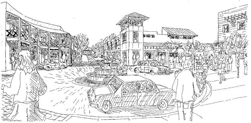
Landscape design should incorporate greenery and be pedestrian friendly, multi-functional, and accessible
7.3.1 Healthy Habitats For People and More
Landscape design helps to create healthy communities for people and can provide habitat for other living creatures.
1. Design with excellence i. All landscape work should be of a high quality and meet the Canadian Landscape Standard by the Canadian Society of Landscape Architects and Canadian Nursery Landscape Association.
ii. Landscape design should prioritize comfortable, multi-functional, and accessible spaces for various users and uses throughout the changing seasons. Usable and landscaped rooftops are encouraged.
iii. Site and landscape designs should be cohesive and consistent across property lines, including boulevards within the right-of-way. Boulevard landscapes should be consistent along the street frontage and a logical extension of the landscape on the adjoining property or adjoining boulevards. Loose landscape materials, such as gravel and rocks, should not be placed adjacent to or in the boulevard unless adequately contained.
iv. Landscape designs should reflect transitions between programs and uses. Layering of multiple landscape elements (e.g. planters, trellises, other forms of hard and soft landscape) is encouraged and can enhance the usability of outdoor amenity spaces.
v. Primary building entrances should accommodate feature landscape designs, including, but not limited to, signage and landscape structures, feature paving, and planters.
vi. Landscaping site coverage shall comply with zoning regulations.
vii. Landscaping should be provided to screen all parking that may be visible from any street and all service areas, utility equipment, and/or loading areas.
2. Enhance the urban forest
i. Preserve mature trees and integrate their necessary soil volumes within new landscape and building designs where possible.
ii. Maintain and enhance the urban tree canopy by replacing any removed mature trees with an equal or greater number of new trees.
iii. Ensure tree plantings match site conditions. Consider soil volume, tree siting, and mature tree size, and plant appropriate tree species that align with the conditions and design intent. Where trees are planted in boulevards, trees should share a trench where possible. Where trees cannot be in a trench, each tree should have a minimum of 5 m3 of topsoil. Refer to the City’s Landscape Guidelines for a list of climate-adapted tree species.
iv. Landscape design and materials should provide for and/or enhance habitat value (e.g. birds, pollinators).
v. Where sightlines are required, use tree species that allow for a minimum branching height of at least 2 m.
3. Good fences make good neighbours
i. Fence height or landscape (e.g. hedges) should not obstruct visibility for vehicles or pedestrians. Standards for fence heights or screens are provided in the Zoning Bylaw
ii. Fencing materials should complement building design and materials.
iii. Chain-link fences are strongly discouraged. If chain-link fencing is unavoidable, the fencing, posts, and all hardware should be black vinyl and should not be visible from the public realm
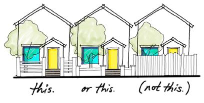
Fences should not obstruct visibility
iv. On-site service areas and waste collection bins (garbage, organics and recycling) should be secured and screened from view to the street through enclosures, landscapes, and walls that reflect the site architecture. Solid Waste bins must be screened by enclosures (landscape is not sufficient).
Usable and landscaped rooftops are encouraged
7.3.2 Curb the Heat Island Effect
Landscape design plays a vital role in mitigating the heat island effect in urban environments. Shading of hardscapes and minimizing impervious surfaces can help mitigate an increase in temperature due to urban development.
1. Minimize impervious surfaces
i. All areas not covered by buildings and/or pedestrian facilities should be landscaped, with priority given to permeable surfaces, including boulevards and front and rear yards.
ii. Where feasible, permeable hardscapes are encouraged to mitigate stormwater runoff. They may be porous asphalt, porous concrete, permeable pavers, or concrete/glass-block grid.
iii. Hardscape areas may be included as part of a development’s required landscape/amenity area where they include trees and other vegetation.
iv. Creative ways to incorporate greenery are encouraged (e.g. structured soils, silva cells, green roofs, vertical gardens/walls, planters, balcony landscaping), particularly on constrained/highcoverage sites.
v. Landscape design shall be integrated with surface parking lots to reduce impermeable surfaces and curb climatic impacts. Trees and shrubs help protect from wind and reduce excessive heat. Landscape islands that screen parking areas are to be a minimum of 1.5 m in width. Where trees are provided, they are to be a minimum 3” caliper when installed. A minimum of one tree per 95 m2 of surface parking area (including circulation and drive aisles) should be planted.
vi. Landscape design should consider green infrastructure services, including shading, windbreaks, and stormwater management. Deciduous plantings provide shade in the hot summer months while allowing for increased solar gain and providing windbreaks to reduce heat loss in the winter months.
2. Material selection - hardscapes and softscapes
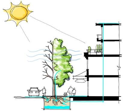
Deciduous trees provide shade in summer and let sunlight through in the winter
i. Materials should be selected with use in mind to determine the level of durability and maintenance required.
ii. Public and semi-public spaces should be built with high-quality, durable materials that allow for active or passive recreational activities.
iii. Pathway paving materials should be robust, durable, and easily maintained.
iv. Plants should be native and/or similarly hardy (adapted). Xeriscaping is encouraged as an important means of conserving water.
v. Noxious or invasive plants are prohibited.
vi. Landscape designs should consider planting palettes that provide seasonal interest, including, but not limited to, fall colours, spring blooms, leaf and bark textures (e.g. compound leaves, exfoliating bark), and fragrances.
vii. Use of edible landscape in the form of fruit trees, nut trees, and edible ground cover is encouraged, provided such plantings are properly maintained to reduce attractants for wildlife predators and pests.
viii. Landscape improvements should be maintained with sub-surface, high-efficiency irrigation (e.g. drip).
ix. Lighter-coloured materials should be used in areas with sun exposure, including for pathway paving and roof materials, to help curb the heat island effect.
7.4 Special Considerations
7.4.1 Safety and Security
The design of buildings and pedestrian spaces has an influence on people’s perceptions and behaviours, including those associated with safety and security. The right design approach can have a beneficial impact on both.
1. Select and design well-integrated security treatments
i. Security treatments should complement the character of the street/ building interface and utilize discrete colours and materials and/or ornamental elements.
ii. Security gates, where necessary, must maintain transparency of windows and doors. High-quality, durable materials (e.g. metals) are strongly encouraged with colours that complement site and architectural design.
2. Integrate principles of Crime Prevention Through Environmental Design (CPTED)
i. Provide opportunities for natural surveillance through consideration of the following strategies:
a. Providing clear sightlines between public and private spaces
b. Avoiding blind corners in pedestrian pathways, stairwells, corridors, and parking areas
c. Locating entries to be clearly visible from the street
d. Ensuring fencing or other barriers maximize sightlines between the street and building, such as by designing them to be low enough in height and/or made from visually permeable materials so that they can be seen through or over
e. Installing sufficient lighting in public places and other high-traffic pedestrian areas
f. Ensuring landscaping does not obstruct sightlines or create hidden spaces
g. Siting and designing buildings so that windows, balconies, and/or other opportunities for natural surveillance overlook public spaces and areas of potential security concern
Buildings should be designed with natural surveillance opportunities
Avoid creating hidden spaces
(e.g. balconies)
ii. Incorporate access control strategies to attract, direct, or restrict pedestrian movement and deter illegitimate uses, such as:
a. Providing clear entry points
b. Using building siting, landscaping, and/or other natural or design features to direct pedestrian traffic through target areas or into gathering spaces
c. Using vegetation or unobtrusive decorative barriers as visual cues to deter unauthorized access to private areas
d. Designing public or semi-public spaces to attract rather than discourage people from gathering
e. Clearly identifying the addressing for buildings and externally accessed units
f. Using signage to clearly identify spaces, such as parking areas, to prevent unintended access and assist with wayfinding
iii. Define public and private areas to provide distinct transitions between uses, discourage illegitimate use, and clarify and encourage a sense of ownership and responsibility over both types of spaces through one or more of the following strategies:
a. Placing permeable and/or soft barriers, such as vegetation, between uses to define spaces while allowing for pedestrian circulation between them
b. Using distinct material treatments, such as different coloured or textured pavers, to visually define and/or separate spaces
c. Arranging other elements, such as decorative signage, planter boxes, or lighting features, to announce transitions
Permeable barriers, distinct material treatments, and street furniture help define use in public spaces and announce transitions
iv. Ensure public or semi-public spaces are attractive and well maintained so that they are inviting, well used, and cared for, such as by:
a. Developing appropriate maintenance regimes that include the quick repair of vandalism and graffiti, replacement of expired lighting, and removal of worn or decayed elements
b. Using materials that reduce opportunities for vandalism
c. Incorporating design elements that promote community pride and a sense of place
7.4.2 Wayfinding and Signage
Incorporating effective wayfinding strategies, such as appropriately designed and placed signage, helps people to better navigate their surroundings, direct their attention to key amenities, improve accessibility and safety, and enhance the pedestrian experience.
1. Design signage for people and incorporate wayfinding
i. Sign types, styles, and locations should be shown on building elevations. Signage should reflect or complement and be integrated with the site’s architectural character. Limit signage in number, location, and size to reduce visual clutter and make individual signs easier to see. Street address numbers should be clearly identified on buildings or units.
ii. Signage should be pedestrian oriented with respect to location, orientation, and scale. Pedestrian-oriented signage should be within 5 m of the ground plane and graphically designed to be readable by pedestrians on the sidewalk.
iii. All signs should be building mounted and integrated with a building’s architecture (e.g. incorporated with canopies) or placed within the Furnishing Zone (refer to Section 7.5: Streetscapes). Signage shall not be the dominant feature of the façade or overall development.
iv. Neon signs, sculptural signs, and artwork are encouraged. Autooriented, vinyl, back-lit podium, portable read-o-graph, rooftop, freestanding, and billboard signs shall not be permitted, and internally lit plastic box signs are strongly discouraged in new development. Back-lighting of signage can occur where individual, three-dimensional letters are used.
v. Signage should be made of durable, weather-resistant material, be opaque, and be coloured in such a way to coordinate with the façade of the building.
vi. Window signs should not cover more than 30% of the total area of the ground-floor frontage facing any one street.
vii. Signage on commercial buildings should clearly identify uses and business names.
viii. Wayfinding signage should inform users of distances to and from key destinations (e.g. trailheads, landmarks, safe routes).
ix. Interpretive signage should showcase the context and history of the region, city, and neighbourhood, including Secwépemc heritage and language, by describing climate and geological processes/origins, identifying significant views and landscape features, and revealing the stories behind place names, including streets, parks, buildings, and other sites of historical importance.
Pedestrian-oriented signage ensures wayfinding targets people on sidewalks rather than in cars

Sculptural signs are encouraged, and internallylit plastic box signs are strongly discouraged
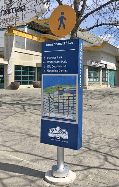
City of Kamloops wayfinding signage
7.4.3 Lighting
Lighting is an essential feature of any urban environment as it provides for nighttime visibility, enhances safety, and can complement site and building design, making spaces more useful and inviting throughout all hours of the day.
1. Mitigate light pollution
i. Avoid light pollution by avoiding light reflectance, directing lighting downwards, and using full cut-off fixtures with horizontally aligned flush-mounted (non-protruding) lenses. Exceptions may be made for signage and architectural lighting.
2. Install lighting for safety
i. On-site lighting should be sufficient to provide clear orientation, personal safety, and site security. Ensure continuous lighting along mandatory connections, between parking, entrances, and public sidewalks, and clearly identify their termini (e.g. entrances, parking and loading areas).
ii. Do not light areas that are not intended for nighttime use. Focus lighting on priority pathways that provide connections between key destinations that people use at night.

Full cut-off fixtures should be used to mitigate light pollution
3. Design lighting to create and/or enhance character
i. Create an even wash of light across surfaces desired to be lit.
ii. Place lighting fixtures no higher than 6 m from the ground.
iii. Where lamp standards and fixtures are exposed, the aesthetic quality of these elements must be considered to ensure integration with building and landscape design.
iv. Light sources should emit a warm tone of light, at a maximum of 3,000 Kelvin (K).
v. Use up-lighting sparingly and only for accenting architectural elements of landscape features.
vi. Building design should use lighting fixtures that create visual interest and are at a human scale rather than an automobile orientation.
7.4.4 Significant Sites
Clarifying and enhancing key sites, such as area-defining landmarks, gateways, and waterfront locations, help to facilitate wayfinding, contribute to beautification, and provide unique opportunities for placemaking
1. Design gateway sites to announce transitions in key locations of the Tranquille Market Corridor and North Shore Town Centre. Landmark architectural elements (e.g. tall vertical elements, bold orientation) are encouraged to differentiate these sites where identified.
i. Buildings located on gateway sites should incorporate special design features at corners to announce entry into the North Shore Town Centre or Tranquille Market Corridor areas.
ii. Site architecturally significant buildings and provide strong massing where visible at the terminus of a street or walkway or a gateway location.
iii. Landmark and focal point buildings should incorporate significant architectural styles and features, including distinct landscaping and signage, to distinguish them from adjacent properties and to create a positive impact on the landscape and pedestrian experience.
iv. Sites located adjacent to the intersection of Tranquille Road, 8th Street, and Fortune Drive must meet a minimum building height of four storeys, which can be reduced to two storeys if other gateway features, such as public art and/or landscaped pedestrian plazas, are used.
2. Address, integrate, and activate the waterfront where not in conflict with the Riparian Areas Protection Regulation Development Permit Area or with an assessment by a qualified environmental professional:
i. Incorporate greening and other restoration measures to enhance the ecology of the Thompson River shoreline and riparian areas.
ii. Site buildings to maximize opportunities for open public space adjacent to the waterfront while ensuring building design emphasizes river views for building occupants.
iii. Incorporate accessible pedestrian pathways, gathering spaces, boardwalks, piers, and/or viewpoints along the waterfront where they can connect with the existing pedestrian network to improve public access to and enhance the area’s connection with the Thompson River.
iv. Activate pedestrian spaces adjacent to the shoreline by incorporating complementary uses along the waterfront-facing side of buildings, including opportunities for shopping, dining, recreation, seating, public gathering, and events.
v. Site and/or design buildings to create, frame, or extend visual connections to the waterfront from the primary street to support wayfinding, beautification, and sense of place.
vi. Use materials and design features, such as public art installations, that complement or enhance a waterfront location and contribute to a sense of place. Where appropriate, this may include drawing from the area’s historic industrial, agricultural, transportation-related, and/or Secwépemc uses and design traditions.
vii. Mitigate flood risk by ensuring no habitable building space is constructed below the 200-year flood plain elevation and that waterfront sites and landscaping features are designed to avoid or reduce flood impacts, such as through planting flood-tolerant plant species or incorporating design elements that slow, store, convey, and/or discharge water.
Incorporate waterfront pedestrian spaces where feasible
Gateway locations
Design features, including public art, can reflect an area's history or past uses
7.5 Streetscapes

The street’s many users should find a comfortable place in the space of the cross-section
7.5.1 Functional Streets for People
Streets are a fundamentally important place where citizens and visitors engage in shared civic life. The following guidelines prioritize strategies that focus on comfort, health and safety, accessibility, visual appeal, and spaces of gathering and enjoyment for pedestrians while ensuring functional movement of people, goods and services, operations, and maintenance (e.g. for snow clearing).
1. Consider the needs of all users
i. Pedestrians and all of their various needs, cyclists, rollerbladers and skaters, electric vehicle and scooter users, and lastly, motor vehicles (cars and trucks).
2. Curb alignment and building placement should be considered to accommodate pedestrianfriendly streetscapes
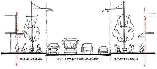
i. To accommodate the sidewalk’s diverse functions, sidewalk bulb-outs at intersections and adjacent to mid-block crosswalks should be implemented in conjunction with new development, where feasible. The City’s Tranquille Road Complete Streets Plan (or successor plan) should be reviewed for potential curb alignment.
ii. Increased building setbacks from property lines adjacent to the street may also be considered to accommodate complete sidewalk cross-sections.
3. Find a home for the sidewalk’s many functions and parts
i. The sidewalk should be designed to ensure a logical, functional, and well-maintained appearance that is aesthetically pleasing and provides a unifying experience throughout the North Shore Town Centre and Tranquille Market Corridor areas. Sidewalks should clearly allocate sufficient space for the following functions:
a. The Transition Zone - Street designs (and building interfaces) must consider the transitions between public and private space, from building façades and front doors to the sidewalk. The Transition Zone allocates space to accommodate these spatial requirements, grade transitions, and temporary programs (e.g. displays, container plantings).
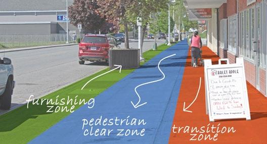
Sidewalk space is organized to efficiently accommodate its many functions
b. The Pedestrian Clear Zone - This zone ensures the safe and unhindered movement of pedestrians (and snow-clearing equipment) with a preferred minimum dimension of 2.5 m.
c. The Furnishing Zone - Trees and other landscape elements, wayfinding signage, and furnishings on sidewalks should be grouped in a dedicated corridor (called the Furnishing Zone) to retain maximum clearance for Pedestrian Clear Zones and create a buffer between cars and pedestrians. The size of the zone will vary to accommodate the desired elements, with a minimum dimension of 1.2 m to accommodate tree wells. Furnishings should be designed to meet the needs of a wide range of users, including children, seniors, and persons with disabilities, and may include lighting, bike racks, parking kiosks, sandwich boards, and utility boxes.
4. Incorporate functional street furnishings that welcome human activity
i. Seating should be provided on retail and significant streets, in bulb-out areas, in plazas, and along multi-use paths, located with a “quiet back” and oriented to create and engage with social spaces.
ii. Waste, recycling, and/or other receptacles should be provided on retail streets, at bus stops, near seating, or on bulb-outs near the street corner.
5. Utilize high-quality, durable, and easily maintained materials in the design of streetscapes
i. Streetscape design along major corridors (e.g. Tranquille Road, Sydney Avenue/North Shore Transit Exchange, Fortune Drive, 8th Street) should be designed to a higher standard in light of high pedestrian volumes and defined by durable materials such as unit pavers and/or extensive hardscapes (with planters or tree grates).
ii. Use tree grates (rather than a landscape strip) where pedestrian traffic is high, where sidewalk space is limited, and where siting of underground utilities allows. Tree grate designs should be multi-functional to provide additional utility within the pedestrian realm.
iii. Varied hardscaping materials may be used to delineate different pedestrian realm zones. Material durability and suitability will vary according to the zone’s uses.
iv. In conjunction with new development, existing planter boxes along the Tranquille Market Corridor shall be upgraded or replaced with at-grade tree grates, subject to individual evaluation. Planter treatments should advance a consistent look throughout the area.
6. Include street trees in the boulevard to support healthy streetscapes. New development should include street trees based on the following principles:
i. Cross-sectional designs should accommodate sufficient boulevard widths and soil volumes to support street trees and optimize the benefits of a mature and well-established urban forest.
ii. Location of utilities within cross-sectional designs should minimize conflict with rooting depth and spread of street trees.
iii. Tree selection should follow the “right tree, right place” principle. Different varieties of trees on different streets can add interest and increase comfort, promote biodiversity, and assist in wayfinding by helping to distinguish one street from another. Refer to the City’s Landscape Guidelines for a list of climate-adapted tree species.
iv. The irrigation systems for City street trees and landscape in boulevards shall be provided and separate from those of private property. Access to irrigation for street trees and landscape in boulevards shall be provided from the City’s right-of-way.
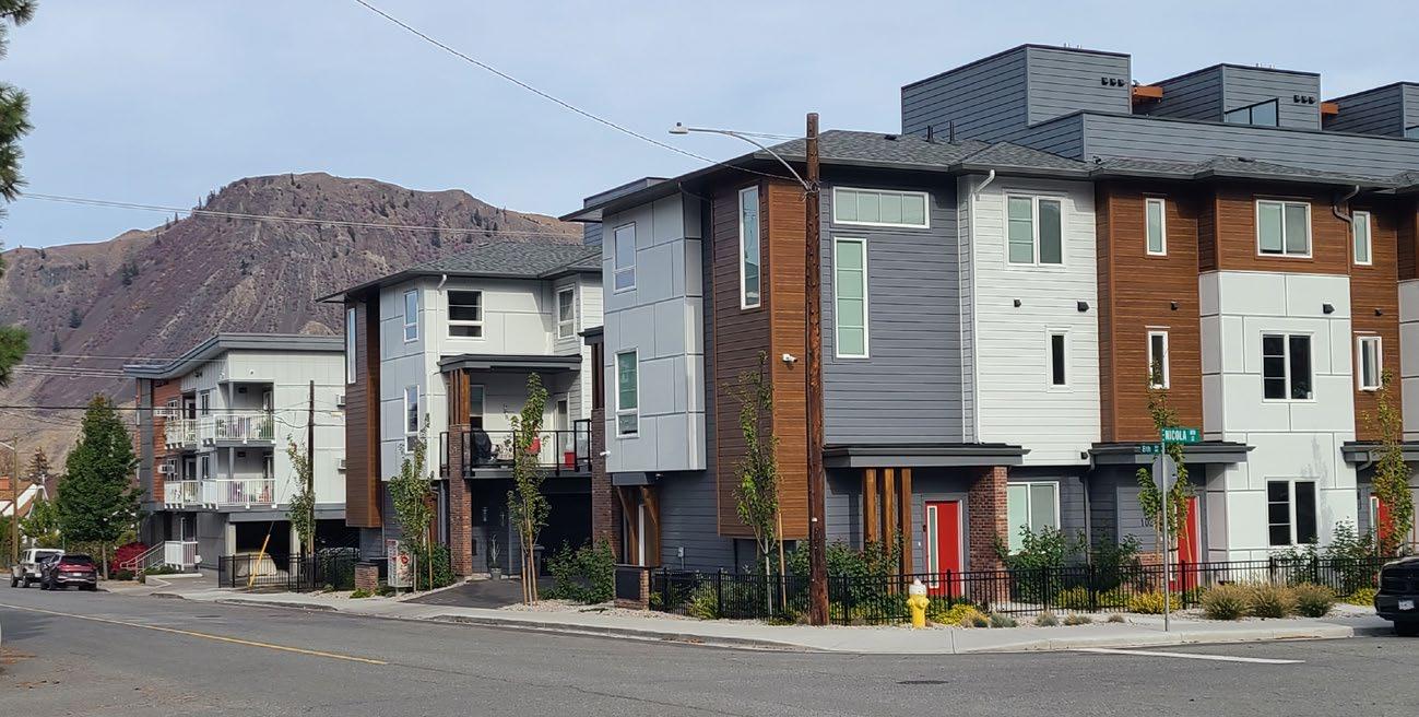
Multi-Unit Residential Development Permit Area
1. Purpose
The purpose of the Multi-Unit Residential Development Permit Area is to establish objectives and provide guidelines for the form and character of multi-unit residential development in the city. These guidelines ensure that multi-unit residential development occurs in a manner that is sensitive to the existing built form by encouraging new development to consider local characteristics and incorporate high-quality design into the siting configuration, landscaping treatments, and overall building aesthetics.
2. Area
The Multi-Unit Residential Development Permit Area applies to all multi-unit development within the city for properties currently zoned or that will become zoned for multi-unit residential and containing multi-unit residential uses. Where the Multi-Unit Residential Development Permit Area overlaps with other development permit areas, all applicable guidelines will be considered.
3. Exemptions
A development permit will not be required for the following:
• Internal renovations
• External renovations that do not affect the form and character of the building or site (to be determined by the Development, Engineering, and Sustainability Department)
• Subdivisions
City of Kamloops
4. Objectives
The Multi-Unit Residential Development Permit Area Guidelines promote quality residential development that:
• Enhances natural and built environments within the community through sensitive integration of new buildings and amenities
• Maintains desirable characteristics found in existing neighbourhoods
• Encourages healthy lifestyles and sustainable local growth through well-designed, durable buildings, landscapes, and public spaces
• Animates the public realm to enrich a sense of place
• Accommodates active transportation modes and transit usage
• Mitigates potential impacts on adjacent land uses
• Supports water and energy management through site and landscape design
5. Guidelines
5.1
Site Design
1. Effective site design considers a development’s relationship with adjacent buildings, streets, open spaces, and amenities.
2. Site design should consider access for people with diverse mobility needs through the use of features such as ramps/inclines, steps with railings, and tactile wayfinding surfaces.
3. Where a proposed building would be taller than adjacent development, a podium feature similar in height to an abutting building (or buildings) should be considered to provide a transition in scale. Where a building exceeds four storeys in height, all storeys above the podium should be setback 3 m to create a comfortable street environment.
4. Where a building directly abuts an arterial street, buffering consisting of sidewalks with landscape areas should be a minimum of 3 m wide, as measured from the curb to the principal building.
5. Building siting and massing should foster a comfortable pedestrian environment and help to define and animate a streetscape. The common setback line of a street should be considered when siting a building.
6. Shorter building frontages are encouraged as a means to support enhanced pedestrian connectivity.
7. To increase privacy, direct sightlines between facing residential units should be minimized through window placement and design.
8. Ground-floor residential units should provide a private pedestrian access to the street at grade, thereby enhancing a street’s function, liveliness, and appeal.
9. Residential units should have access to daylight and private amenity space (e.g. garden, balcony, courtyard, rooftop patio).
10. Development should be designed to consider natural features, such as topography, rock outcroppings, and mature trees. Buildings and structures should be set back from the edge of a natural feature. Where mature trees must be removed as part of a development, tree replacements will be identified in the landscape plan.
11. Opportunities for passive heating and cooling and natural lighting should be considered early in the planning and design process to create buildings that save energy and emit fewer greenhouse gas emissions.
12. To help achieve the City’s sustainability initiatives and encourage healthy lifestyles, developments should feature pathways that allow people to safely navigate a site and connect to nearby amenities (e.g. businesses, bus stations, bicycle routes, parks, recreation facilities). Pathways should be a minimum of 1.5 m wide.
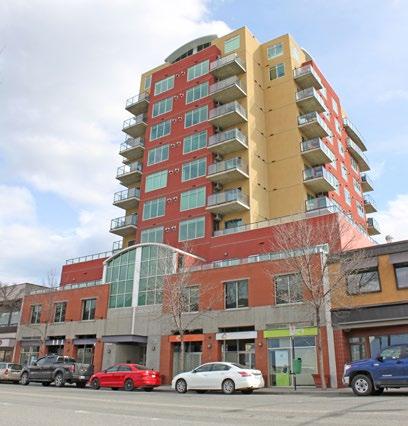
height as abutting buildings help transition from shorter to taller buildings
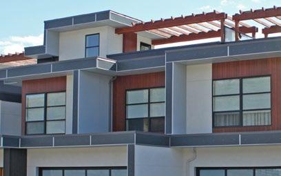
Offsetting windows from facing residential units and using window blinkers can help promote privacy
A podium set at the same
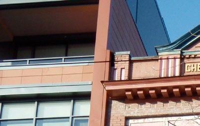
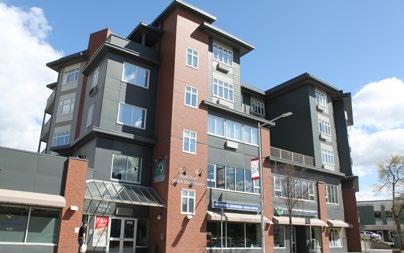
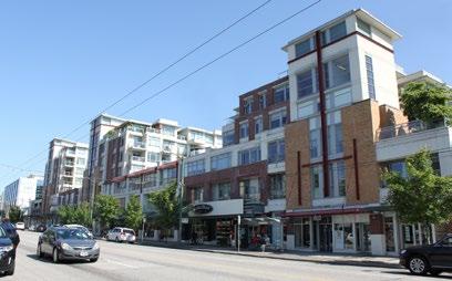
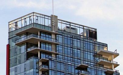
5.2 Built Form
5.2.1 Massing and Scale
Building mass refers to volume, while scale considers a building’s dimensions in relation to people and the surrounding environmental context (e.g. adjacent buildings, open space).
1. New development should complement the scale of adjacent buildings. Where a mid-rise or high-rise building is introduced, it should incorporate design features that bridge the scale of adjacent buildings in a manner that continues or enriches the rhythm of a street (e.g. horizontal design features such as a cornice line can help connect adjacent buildings, and stepping a building can assist in a scale transition between sites).
2. The appearance of a single, uninterrupted mass should be avoided through the incorporation of design features, such as rain pipes, chimneys, podiums, and balconies, that contribute to an articulated building façade.
3. To support healthy lifestyles and the enjoyment of outdoor amenity spaces, shadow impacts from a proposed mid-rise or high-rise building should be considered. A shadow impact study may be required to demonstrate that shadows do not exceed a one-hour duration on the rear yards, decks, patios, and pools of adjacent residential properties on the summer solstice (i.e. June 21) and autumn equinox (i.e. September 21).
4. A mid-rise or high-rise building should conform to a narrow massing profile to reduce the potential for casting a shadow. A mid-rise or high-rise building’s mass and roof should be designed to avoid casting shadows on neighbouring residential properties. For example, introducing massing cut-outs and building contouring (e.g. stepping) can help mitigate shadow impacts.
5.2.2 Height and Roof Design
1. A development site’s context (e.g. neighbouring buildings, slope, potential for shadow impact) should be considered when selecting a roof design. A variety of roof designs and aesthetic styles may be appropriate (e.g. modern, mansard, peaked, flat, gable).
2. Buildings should contribute to visual wayfinding in the community. Significant street corners (e.g. at an intersection or a curve in a prominent street) may support a building feature of increased height and/or distinctive architectural elements to create a landmark.
3. Buildings should provide awnings or canopies adjacent to pedestrian pathways for weather relief and visual interest.
4. Rooftop mechanical units should not be sited within close proximity to adjacent residential unit windows. Roof design features, such as parapets, should be used to screen rooftop mechanical units.
Aligning horizontal design features can help connect adjacent buildings
Vertical columns and cut- outs help disguise building mass
Stepping and cut- outs reduce massing and shadow impacts
Rooftop mechanical
5.2.3 Detail, Material, and Colour
1. Small-scale detail is appropriate at or near the ground floor to provide visual interest from the perspective of the street. Larger-scale detail is important when the building is viewed from a longer distance; therefore, such detail is more appropriate above the mid-elevation sections of a large building.
2. Durable building materials that weather well over time contribute to the appearance of quality construction that evokes a sense of permanence. Products such as stone, brick, metal, textured concrete, and/or treated wood should be used on a building façade that faces a public street.
3. The use of multiple material types is encouraged to provide visual variety in built form.
4. The placement and use of materials should be logical. If stone or masonry brick façades are to be used, traditional placement of building materials should be considered (e.g. placing stone above large windows or voids would look out of place). Similarly, masonry brick or stone at a higher elevation (e.g. higher than the sixth floor) would also look unnatural.
5. Townhouse end units should appear to be oriented towards the street (e.g. through the use of entrance features, front porches, glazing, or other design elements). Materials used on the front façade should wrap around and cover the end unit’s side.
6. Window placement, entrance locations and features, awnings, materials, and complementary scale can be used to enhance the streetscape.
7. A building’s colour palette should complement the site’s surrounding context and the community’s natural setting. Accent colours may be used to highlight a building’s components (e.g. building trim, doors, wrought iron features, window frames).
8. Building entrances should be clearly identifiable, be of human scale, and add character to the overall streetscape.
9. Light and light fixtures should enhance the character of the development. Illumination should be contained within the property boundary.
Small-scale detail is more appropriate at or near ground floor, while larger scale detail is appropriate at higher levels
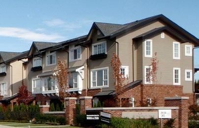
Materials should wrap from front elevation to side elevation
10. Heating, ventilation, and air conditioning (HVAC) units, mechanical and equipment rooms, and elevator penthouses should be integrated with the design of the building and screened with durable, design-compatible finishes.
5.3 Parking and Circulation
1. Well-lit underground parking is encouraged for high-density multi-unit residential developments.
2. Parking should be located at the rear of the building and will be accessed by internal circulation or maneuvering aisles. A continuous major circulation aisle should be provided to facilitate on-site traffic circulation.
3. Townhouses and other cluster forms of development that have driveways provided in front of garages should be set back 6 m from a drive aisle to maintain proper traffic circulation.
Additional Guidelines
The following additional guidelines will apply to all mixed-use development:
• Pedestrian-level commercial development should be distinguishable from the residential development above.
• Ground-floor commercial windows should be transparent, and frontages should be permeable, with street access provided for pedestrians. Mirrored or dark-tinted windows are not appropriate on a public-facing façade.
• All signage should complement a building’s design.
4. Surface parking areas will be configured into parking clusters and will feature landscape islands to protect pedestrians. Parking design should consider snow storage to maintain vehicle and pedestrian movement. Amenity areas will not be accepted for snow dumping or storage.
5. Parking spaces should be located to allow casual surveillance to enhance safety.
6. The use of special paving (e.g. pavers, concrete) should be used to define entrances to a multi-unit residential development, pedestrian crosswalks, parking stalls and driveways in front of individual units, and common areas.
7. Site entrance points should be defined by landscaping, tree planting, signage, lighting, or other design features.
8. Shared access points with adjacent properties are encouraged where viable. Reciprocal parking agreements may be required between adjoining lots to better facilitate on-site circulation.
9. Long-term residential bicycle parking will be sited in secure locations. Visitor bicycle parking should be located near building entrances and should not obstruct pedestrian movement.
10. Assigned parking spaces should be identified in an attractive and subtle manner. Identification should not be painted on the stall surface.
11. Visitor parking should be clearly identified and conveniently located for visitors.
12. Surface parking areas have the potential to be a source of noise and light that may affect residential dwelling units on and off site. To reduce this potential impact, areas between dwelling units and parking areas should be screened with landscaping such as berms and/or dense hedges.
13. To enhance safety, loading and service areas should be separated from sidewalks and pathways.
14. Areas for garbage, organics and recycling bins will be sited to permit efficient year-round collection.
5.4 Landscaping
1. All areas not covered by buildings, structures, and parking, including the boulevard and front and rear yards, will be landscaped with an irrigation system at the time of development.
2. Loose landscape materials should not be placed adjacent to or in the boulevard unless adequately contained.
3. Maintain and enhance the urban tree canopy by replacing any removed mature trees with an equal or greater number of new trees.
4. Street trees should be sited in the boulevard. Bollards may be considered as an appropriate substitute for street trees to enhance pedestrian comfort in locations that cannot accommodate trees.
5. New landscaping covering 100 m2 or more in total site area will require landscape plans prepared by a registered landscape architect.
6. Art and ornamental features, such as water fountains and sculptures, are encouraged to promote beautification of the development and contribute to pedestrian wayfinding. Landscaping should distinguish between private space and public space and define entrances to a development while preserving pedestrian safety.
7. All retaining walls should be architecturally textured. Large, smoothfaced block walls shall be discouraged.
8. Retaining walls with an exposed face of 3 m or greater in height are encouraged to incorporate terracing and/or articulation. Terraces should be designed to accommodate landscape areas that soften the wall’s appearance and are accessible for maintenance. Where walls exceed 1.5 m in height, landscape features, such as trees, shrubs, or vines, should be provided adjacent to the wall.
9. Street-fronting façades should include landscaping adjacent to the foundations of buildings and structures.
Special paving treatments help define key areas
10. Fencing materials should complement building design and materials. Where chain-link fences are provided, the fencing, posts, and all hardware should be black vinyl.
11. Landscaping should feature indigenous plants. Xeriscaping is encouraged as an important means of conserving water. Noxious or invasive plants are not appropriate selections for a landscape.
12. Use of edible landscaping in the form of fruit trees, nut trees, and edible ground cover is encouraged, provided such plantings are properly maintained to reduce attractants for wildlife predators and pests.
13. Waste, recycling, and/or compost bins will be secured and visually screened through landscaping and walls that reflect the site’s built form.
14. Electrical kiosks should be wrapped and/or screened with landscaping, providing that clearance requirements are maintained.
15. Landscape design should consider the use of FireSmart principles, including: i. Avoiding highly combustible, high fuel, coniferous trees (e.g. fir, pine, spruce) and shrubs (e.g. cedar, juniper, yew) close to any building, especially for properties adjacent to high wildfire risk open space areas, where terrain is steep, or fire response time is expected to be long; and, ii. Planting low-fuel, low-combustion deciduous trees, shrubs or perennials where landscaping is needed close to a building to meet minimum zoning requirements, provide buffering between neighbours or screen parking, building foundations, or pad-mounted transformers.
5.5 Amenity Areas
16. Incorporate decks, balconies, and common outdoor amenity spaces into multi-unit residential developments.
17. Provide elements such as constructed planters, gazebos, trellises, pergolas, and other forms of hard and soft landscaping, including opportunities for urban agriculture, to enhance the usability of decks, balconies, and outdoor amenity space.
18. Common outdoor amenity areas should be built with high-quality, durable materials that allow for active or passive recreational activities. Examples of outdoor amenity areas include irrigated edible gardens, landscaped and trellised seating areas, playgrounds, clubhouses, and outdoor cooking areas.
19. Outdoor amenity areas should be centrally located in highly visible areas and accessible without vehicular traffic interference. Such amenity areas should be oriented to receive sunlight, with trees and landscaping to provide weather protection.
20. Where multi-unit residential developments are located in close proximity to parks or schools, opportunities to reduce the required outdoor amenity area will be considered on a case-by-case basis. In these situations, the City may explore partnerships and/or funding opportunities with the developer to provide improvements to the neighbourhood park space for the use of all residents of the area.
5.6 Lighting and Signage
1. Entrances, pathways, open spaces, and parking areas should be well lit to avoid dark expanses and enhance safety. Light fixtures that complement the character of the development and surrounding area are encouraged, and creating light pollution on adjacent properties should be avoided.
2. Developments that consist of multiple buildings should include a site map at the primary access point to assist with site navigation for emergency response crews.
3. Signage should reflect the architectural character of the development and not be visually obtrusive or add perceived clutter. Entry signs should be placed at or below eye level and be integrated with landscaping or other features.
4. Street address numbers should be clearly identified on buildings or units.
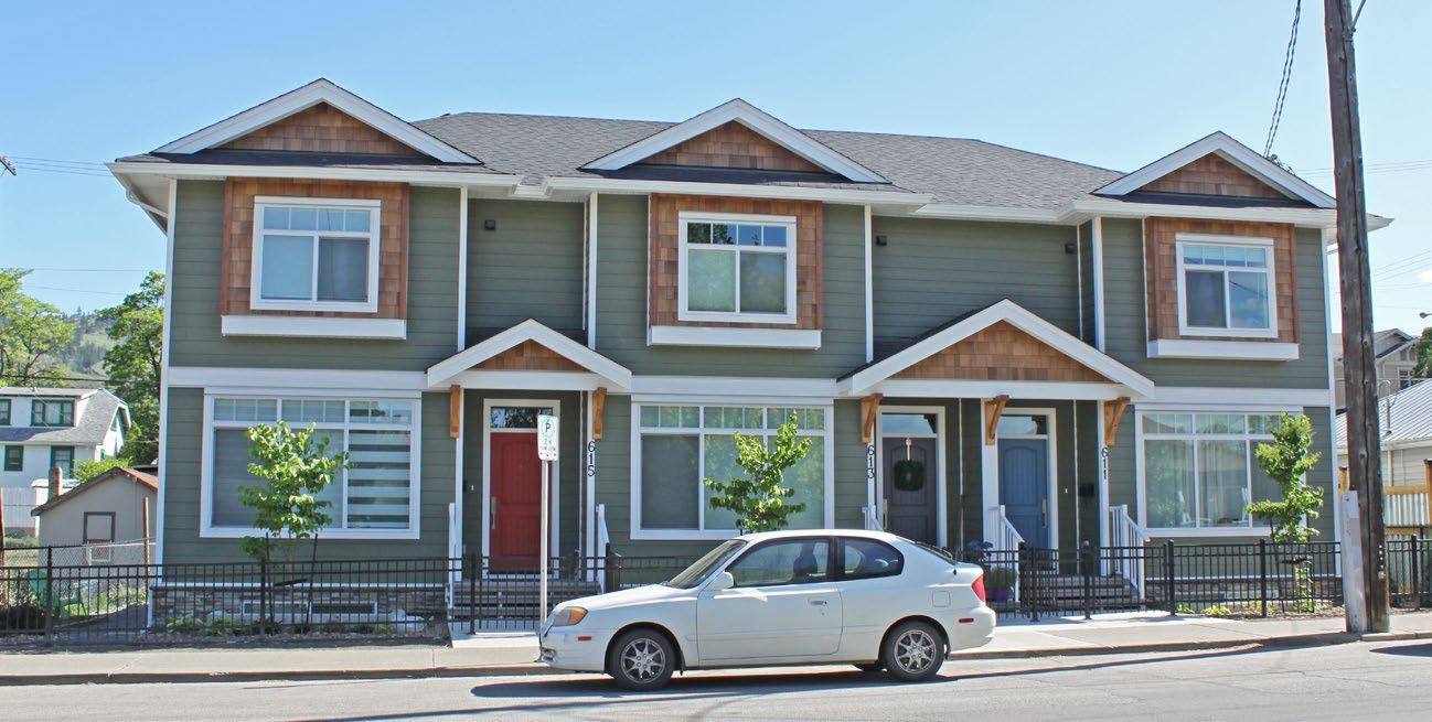
Intensive Residential Development Permit Area
1. Purpose
The purpose of the Intensive Residential Development Permit Area is to establish objectives and provide guidelines for the form and character of intensive residential development in the city. These guidelines ensure that residential infill development occurs in a manner that is sensitive to the existing built form by encouraging new development to consider local characteristics and incorporate high-quality design into the siting configuration, landscaping treatments, and overall building aesthetics.
2. Area
The Intensive Residential Development Permit Area applies to all intensive residential, including “smallscale multi-unit residential development within the city. Where the Intensive Residential Development Permit Area overlaps with other development permit areas, all applicable guidelines will be considered.
For the purpose of this development permit area, an intensive residential development permit shall be required before the issuance of a building permit for any of the following in a Division Eight - Residential Zones in the Zoning Bylaw:
• Any development that consists of:
- Two or more residential buildings
- Three or more dwelling units
- A single-detached residential building that is being converted into a two-unit residential building (duplex)
• Any development on a lot that has:
- An overall area of less than 929 m2 that was subdivided off of an existing property through a subdivision application that creates no more than three new lots
- An overall area of less than 370 m2
- Less than 9 m in lot frontage, which includes panhandle lots
City of Kamloops
3. Exemptions
A development permit will not be required for the following:
• Minor exterior alterations that do not require a building permit
• Construction of an accessory building
• Construction of one secondary suite in a single-detached residential building
• Construction of one two-unit residential building (duplex) on a lot (except where a single detached building is being converted into a duplex)
4. Objectives
The Intensive Residential Development Permit Area Guidelines promote quality development that:
• Achieves a high degree of residential livability and occupant safety
• Considers site-specific characteristics and encourages compatibility with existing dwellings in terms of setbacks, landscaping, massing, and detail
• Preserves and enhances the scale and character of individual neighbourhoods and streetscapes through sensitive integration
• Provides a form of sustainable housing using existing service infrastructure
• Provides a mix of housing forms, homeownership opportunities, and quality rental housing
5. Guidelines
5.1 Site Design
Effective site design considers a development’s contextual relationship with adjacent buildings, streets, open spaces, and amenities.
1. Buildings should include features such as porches, balconies, verandas, and/or covered entryways to animate the street.
2. Buildings should be designed to work with the natural topography of the site. Wherever possible, the first floor of a building should be set into the existing grade, and retaining walls, if necessary, should be kept low and terraced.
3. The primary entrance to each dwelling unit must be easily accessible from the street and should be oriented towards the nearest street frontage. Direct, hard-surfaced pedestrian pathways must be provided between primary entrances and the street.
4. To promote the appearance of residential development from the street, soft landscaped street yards are required up to the municipal sidewalk or street.
5. Where a residential building is sited adjacent to a street, it should be architecturally treated to appear to face the street. Buildings on corner lots or double-fronting lots should face both streets and provide entrances to units from both the primary street and the flanking street.
6. Street yard setbacks should consider the setbacks of adjacent properties and reflect the general character of the neighbourhood. Building additions that add dwelling units should be sited in a way that considers the front yard setbacks of the existing dwelling unit.
Development that steps up the hillside to match the topography and reduce the impact on neighbouring buildings
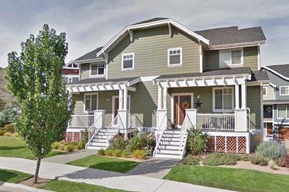
Comprehensive landscaping of front yards improves street appeal and discourages use of front yards for parking
A dormer window adds articulation and helps reduce the mass of the upper floor
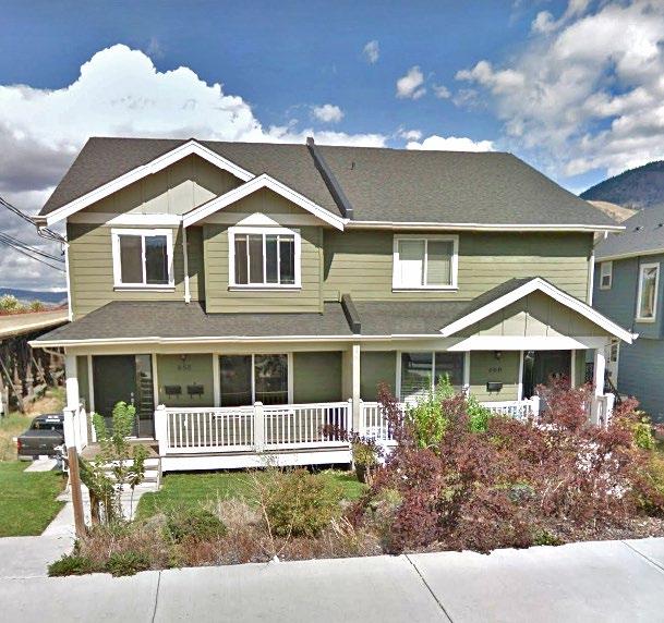
Non-symmetrical designs may be used to support building articulation
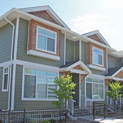
5.2 Built Form
5.2.1 Massing and Scale
Building mass refers to volume, while scale considers a building’s dimensions in relation to people and the surrounding environmental context (e.g. adjacent buildings, open space).
1. Building design should consider the immediate surroundings and not appear out of scale or character to the adjacent homes. Building mass and scale should complement the rhythm of adjacent buildings and the overall neighbourhood pattern.
2. Upper storeys should be smaller in mass than lower storeys to reduce the appearance of a box and reduce visual and shadow impact on neighbouring properties, particularly when a new building is taller than its neighbours. The reduction in mass may be achieved through stepping in of the building face and sloped roofs.
3. Two- and three-storey buildings shall include articulation in building façades, such as recesses, projections, and varied setbacks, to foster visual interest and break up building mass.
4. Shadow and privacy impacts on adjacent properties should be reduced through setbacks and stepping the building away from neighbouring residential properties.
5.2.2 Height and Roof Design
1. Where proposed buildings are taller than their neighbours, building height should be mitigated by incorporating all or part of the upper storey into the truss system.
2. Variation in the character of rooflines, such as steep roof pitches, gables, hips, and dormers, is encouraged.
5.2.3 Detail, Material, and Colour
1. Building details and materials should complement the established neighbourhood.
2. Materials and colours should be used to emphasize prominent features, and the incorporation of two or more building materials is required. Durable textured building materials, such as cultured stone, brick, and/or shakes, should be applied to no less than 20% of public-facing façades.
3. A building’s colour palette should complement the site’s surrounding context and the community’s natural setting. Accent colours may be used to highlight architectural features, such as window trim, soffits, and gables.
4. For buildings with multiple street frontages, each building façade fronting a street shall incorporate sufficient architectural detail to create visual interest from the street.
5. Roofing materials should complement the overall building design and be compatible with materials used on adjacent properties.
6. Buildings shall be architecturally cohesive in terms of cladding, roofing materials, colour, and architectural style. For additions that add a dwelling unit or units to a building, façade and roofing improvements may be required on the existing portion of the building to provide an attractive, integrated appearance. The new units should be fully connected to existing units through a common wall, floor, and roof system.
7. Where multiple residential buildings are constructed on a site, the cladding, roofing materials, colour, and architectural style of each building shall be complementary. Upgrades to the existing principal dwelling may be required.
Gable roof features above entrances and bay windows fosters visual interest
5.2.4 Windows
8. Windows shall:
i. Be emphasized through the use of colour, exterior casings, and trim or similar architectural features and complement the building design
ii. Be oriented towards the primary street frontage to allow the natural observation of the street and, where possible, be located on all façades and levels
iii. be sited to minimize the privacy impacts of existing adjacent dwellings and yards
iv. be used to reduce the impact of large, blank walls and may include dormer or bay-style windows
9. Skylights, glass blocks, and similar features should be used to provide daylight and preserve privacy.
10. Visual impact of blank walls and garages on the streetscape should be minimized through the use of windows and side-facing garages.
5.3 Parking and Circulation
1. On lots serviced by rear lanes, all parking shall be accessed from the lane and front yards shall be landscaped. Parking spaces directly accessed from the lane must be set back in accordance with the Zoning Bylaw to provide adequate maneuvering room.
2. Where parking must be provided in the front or side street yard, driveway access width shall be limited as much as possible, and any parking spaces that do not directly access the street shall be screened by landscaping.
3. Shared driveways should be used to provide access to split-title duplexes or other multi-unit residential developments. Reciprocal access easements shall be required where the driveway is not designated common property. Where shared driveways are not practical, narrow individual driveways separated by landscaping may also be used.
4. On corner lots and double-fronting lots where access is allowed on both frontages, driveways and parking spaces should be split between the available frontages to disperse traffic.
5. Garages should be oriented away from the street wherever possible. Street-fronting garages should be recessed behind the front façade of the principal dwelling unit and should not be the dominant housing feature visible from the street.
5.4 Landscaping
1. Landscaping should be used to define private outdoor space from public areas, frame building entrances, enhance the appearance of blank walls, and foster the street appeal of new development. Trees shall be provided in street-facing yards to beautify the public realm and enhance the urban tree canopy.
2. Maintain and enhance the urban tree canopy by replacing any removed mature trees with an equal or greater number of new trees.
3. Landscaping should be used to define and screen off-street parking areas. Areas facing public streets that do not contain parking or driveways shall be landscaped. Durable landscape materials, such as trees, boulders and low (maximum 1.2 m height) fences or landscape walls, should be used in required street yard landscape areas to restrict their informal use for parking.
4. Shrubs, other dense vegetation, and fencing should be used strategically adjacent to parking areas to provide screening and reduce the amount of light pollution on neighbouring properties.
5. Careful building placement and site design should be used to retain and protect mature trees.
6. Fencing materials should complement building design and materials. Where chain-link fences are provided, the fencing, posts, and all hardware should be black vinyl.
7. Sufficient area shall be allocated on site for storage of solid waste receptacles (garbage, organics and recycling) without impeding pedestrian pathways, parking, or landscaped areas. For developments comprising four or more units, solid waste carts shall be screened from the street and neighbouring properties.
8. Landscape design should consider the use of FireSmart principles, including: i. Avoiding highly combustible, high fuel, coniferous trees (e.g. fir, pine, spruce) and shrubs (e.g. cedar, juniper, yew) close to any building, especially for properties adjacent to high wildfire risk open space areas, where terrain is steep, or fire response time is expected to be long ii. Planting low-fuel, low-combustion deciduous trees, shrubs, or perennials where landscaping is needed close to a building to meet minimum zoning requirements, provide buffering between neighbours or screen parking, building foundations, or pad-mounted transformers.
5.5 Amenity Areas
1. All dwelling units should have access to high-quality, usable outside amenity space. This can be provided in the form of decks, patios, and dedicated yard or garden areas. Each residential unit should have access to outdoor amenity space no smaller than 20 m2
2. Amenity areas should be designed to allow access to daylight and offer privacy for residents. Fencing or landscape features should be used to define the outdoor amenity space of separate dwelling units and foster privacy.
3. Balconies should face the lane, street, or shared yard between residential buildings and should not overlook adjacent properties. Privacy screens shall be used to mitigate impacts on adjacent properties.
5.6 Safety Features
1. The primary entrance to each residential unit should face or be visible from the street. Architectural features, such as covered entryways, are encouraged to assist in wayfinding.
2. Address numbers shall be posted on the building near the primary entrance, in a colour contrasting with the building, and either illuminated in periods of darkness or reflective for easy visibility at night. When building addresses are not visible from the street frontage, directional address signs are required.
3. All residential units must be connected to the nearest dedicated public road by an unobstructed, hard-surfaced path at least 1 m wide, with lighting that does not spill over onto neighbouring properties.
Example of high-visibility addressing with contrasting colours, lighting installed for illumination, and a covered entryway.
4. For properties within the 200-year flood plain, built form shall consist of carriage suites or dwelling units with crawl spaces or structured parking at the ground level to mitigate the risk of flood damage to habitable spaces.
Commercial Development
Permit Area
1. Purpose
The purpose of the Commercial Development Permit Area is to establish objectives and provide guidelines for the form and character of commercial development in the city. These guidelines ensure that commercial development occurs in a manner that is sensitive to the existing built form by encouraging new development to consider local characteristics and incorporate high-quality design into the siting configuration, landscaping treatments, and overall building aesthetics.
2. Area
The Commercial Development Permit Area applies to all commercial development within the city for properties currently zoned or that will become zoned for commercial and containing commercial uses. Where the Commercial Development Permit Area overlaps with other development permit areas, all applicable guidelines will be considered.
3. Exemptions
A development permit will not be required for the following:
• Internal renovations
• External renovations that do not require a building permit and do not affect the form and character of the building or site (to be determined by the Development, Engineering, and Sustainability Department)
• Subdivisions
• Additions or renovations that are not visible from the public realm
4. Objectives
The Commercial Development Permit Area Guidelines promote quality commercial development that:
• Enhances the natural and built environments within the community through the sensitive integration of new buildings and amenities
• Maintains desirable characteristics found in existing neighbourhoods
• Encourages healthy lifestyles and sustainable local growth through well-designed, durable buildings, landscapes, and public spaces
• Animates the public realm to enrich a sense of place
• Accommodates active transportation modes and transit usage
• Mitigates potential impacts on adjacent land uses
• Supports sustainable energy and water management through site and landscape design
5. Guidelines
5.1
Site Design
Effective site design considers a development’s contextual relationship with adjacent buildings, streets, open spaces, and amenities.
1. Commercial development should be designed to benefit from a site’s natural topography and exposure to sunlight to reduce environmental impacts. Opportunities for passive heating and cooling and natural lighting should be considered early in the planning and design process to create buildings that have energy savings and emit fewer greenhouse gas emissions.
2. Pedestrian paths should provide safe and direct access to commercial businesses from municipal sidewalks and on-site parking areas. Pedestrian paths and sidewalks should be raised to enhance pedestrian visibility and reduce vehicle speeds.
3. Site design should consider access for people with diverse mobility needs through the use of features such as ramps/inclines, steps with railings, and tactile wayfinding surfaces.
4. Driveways should be well lit and defined by raised curbs and landscaping.
5. Buildings should be designed to incorporate architectural features that animate all street frontages.
6. The common building setback line of a street should be considered when siting a building.
7. Outdoor sales and display areas should be architecturally integrated with the building and landscape design of the property. These areas should be enclosed and screened with durable materials and permanent landscaping.
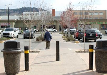
Raised pedestrian path through a commercial parking lot
8. Outdoor storage areas, solid waste bins, or loading/unloading areas should be oriented away from adjacent residential areas and streets.
9. Where permitted, drive-thru facilities should be located at the side or rear of the building, except where such siting will conflict with adjacent residential uses, in which case alternate orientations may be considered.
Example of passive solar shading
Aligning horizontal design features can help connect adjacent buildings
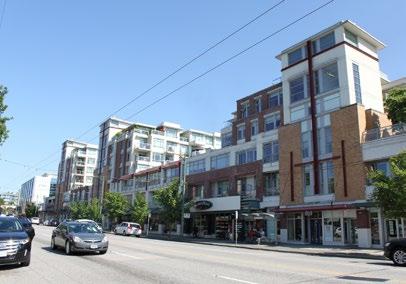
Stepping and cut- outs reduce massing and shadow impacts
Making use of natural daylight in roof design can help reduce a building’s energy consumption needs
5.2 Built Form
5.2.1 Massing and Scale
Building mass refers to volume, whereas scale considers a building’s dimensions in relation to people and the surrounding environmental context (e.g. adjacent buildings, open space).
1. New development should incorporate design features that complement the scale of adjacent buildings and enrich the rhythm of a street. For example, horizontal design features, such as a cornice line, can help connect adjacent buildings, while stepping a building can assist in a scale transition between sites.
2. Buildings should incorporate architectural features and variation to avoid the appearance of long, blank façades and to reduce apparent building mass.
3. Mid-rise and high-rise buildings should conform to a narrow massing profile and use massing cut-outs and/or building contouring (e.g. stepping) to reduce shadow impacts on neighbouring properties.
4. To support healthy lifestyles and the enjoyment of outdoor amenity spaces during the spring, summer, and fall months, shadow impacts from a proposed mid-rise or high-rise building should not exceed a one-hour duration on rear yards, decks, patios, and pools of adjacent residential properties on the summer solstice (i.e. June 21) and autumn equinox (i.e. September 21).
5.2.2 Height and Roof Design
1. Intelligent roof design should be used to reduce a building’s energy consumption needs by using daylight for heating, cooling, and internal lighting.
2. Buildings should contribute to visual wayfinding in the community. Significant street corners (e.g. at an intersection or a curve in a prominent street) may support a building feature of increased height and/or distinctive architectural elements to create a landmark.
3. Buildings should provide awnings or canopies adjacent to pedestrian pathways for weather relief and visual interest.
4. Roof design should add visual interest to a building. Where flat roofs are used, the roofline should provide modulation (e.g. changes in elevation, projection, architectural features).
5. Rooftop mechanical equipment should be screened by parapets or other architectural roof design features.
5.2.3 Detail, Material, and Colour
1. Durable building materials should be used to contribute to the appearance of quality construction that evokes a sense of permanence. Products such as stone, brick, metal, textured concrete, treated wood, and fibre cement siding should be used on a building façade that faces a public street.
2. To assist with public wayfinding, business entrances should be well defined through signage, architectural design features (e.g. awnings, building articulation, use of detailed building materials), lighting, and landscape.
3. A building’s colour palette should complement the site’s surrounding context and the community’s natural setting. Accent colours may be used to highlight key building components, such as entrances, common areas, changes in business, and/or service areas.
4. Mirrored or dark-tinted windows are not appropriate on a public-facing façade.
Entrances defined through features such as signage, awnings, and building materials can assist with public wayfinding
5. The selection of building detail, material, and colour should support energy-efficient buildings with low greenhouse gases. For example, the placement and design of walls capable of supporting thermal mass loading can help reduce internal heating-related energy consumption.
5.3 Parking and Circulation
1. Shared access points with adjacent properties are encouraged, where viable. Reciprocal parking agreements may be required between adjoining lots to better facilitate on-site circulation.
2. Short-term bicycle parking racks should be covered and located near the principal entrance of a commercial building.
3. Parking spaces should not be sited in front yard or other street yard setback areas. Parking areas should be located to the rear of a building that fronts onto a public street.
4. Drive-thru facilities should be located away from adjacent uses, screened with landscaping from public streets, and designed to achieve safe pedestrian and vehicle movements. Drive-thru areas should include an adequate number of queuing spaces to avoid congestion of circulation aisles and streets.
5.4 Landscaping
1. All areas not covered by buildings, structures, and parking, including the boulevard and front and rear yards, will be landscaped with an irrigation system at the time of development. Loose landscape materials should be contained on the property.
2. Street trees should be sited in the boulevard, or where there are utility constraints in the boulevard, in the front yard. Bollards may be considered as an appropriate substitute for street trees to enhance pedestrian comfort in locations that cannot accommodate trees. Where street trees are not suitable in the boulevard, alternative landscaping that separates pedestrian space from the roadway may be considered as an appropriate substitute, such as xeriscaping with boulders, bushes, and robust desert plants.
3. New landscaping covering 100 m2 or more in total site area will require landscape plans prepared by a registered landscape architect.
4. Commercial buildings should have soft-landscape areas planted with trees and shrubs along a minimum of 30% of a non-interactive building façade. Landscaping will provide shade to reduce energy consumption during the summer months and provide visual relief from a building’s mass while preserving sufficient space for signage and windows.
5. Fuel bars shall be buffered from adjacent uses and streets by a minimum 3 m wide soft-landscape buffer to help mitigate vehicle headlights, sounds, and general appearance. Buffers should feature a combination of trees, shrubs, and dense low-hedge plants.
6. Sound attenuation features, such as a landscaped berm with a solid fence, should be considered to buffer noxious uses, such as drive-thru menu boards, loading zones, and car washes, from residential or institutional uses.
7. Outdoor storage areas, waste disposal, and loading/unloading areas should be visually screened and landscaped from residential areas and public streets.
8. Landscape plant selection should be appropriate to the Kamloops climate (i.e. native plants and xeriscaping should be used) and provide visual interest year-round. A mix of coniferous and deciduous trees and shrubs should be planted.
9. Landscape design should consider the use of FireSmart principles, including: i. Avoiding highly combustible, high fuel, coniferous trees (e.g. fir, pine, spruce) and shrubs (e.g. cedar, juniper, yew) close to any building, especially for properties adjacent to high wildfire risk open space areas, where terrain is steep, or fire response time is expected to be long; and, ii. Planting low-fuel, low-combustion deciduous trees, shrubs or perennials where landscaping is needed close to a building to meet minimum zoning requirements, provide buffering between neighbours or screen parking, building foundations, or pad-mounted transformers.
10. Landscape features, such as trees, bollards, raised curbs, and signage (or a combination thereof), should be used to define safe pedestrian paths.
11. Landscaping should be used to separate large expanses of parking into smaller subsections. Accordingly, landscaping islands should be located at each end of every parking aisle. In the case of longer parking aisles, landscape islands should be provided in the middle of the aisle as well. Landscaping islands should be large enough to support healthy plant growth and include at least one tree per parking aisle.
5.5 Lighting and Signage
1. Lighting and light standards in all public areas, including parking lots, should relate to the pedestrian and should be directed toward the ground to avoid light pollution on neighbouring properties. The preferred design for lighting within front yards is with ground-mounted units that are located discreetly within landscaped areas. Lighting plans may be required. Lighting may also be incorporated into building design.
2. Placement of signs shall not obstruct pedestrian movement, vehicular traffic, or sightlines. All free-standing signs should feature landscaping around their base.
3. Wall-mounted signage should complement a building’s design.
4. Free-standing signage should be integrated with landscaping at the base. Mounting supports should reflect the materials and design character of the corresponding commercial building. All wiring and/or conduits to a sign should not be visible to passing vehicles or pedestrians.
5. Illuminated signs should not direct glare off site.
Free-standing signage should be integrated with landscaping at the base
Industrial Development
Permit Area
1. Purpose
The purpose of the Industrial Development Permit Area is to establish objectives and provide guidelines for the form and character of industrial development in the city. These guidelines ensure that industrial development occurs in a manner that is sensitive to the existing built form by encouraging new development to consider local characteristics and incorporate high-quality design into the siting configuration, landscaping treatments, and overall building aesthetics.
2. Area
The Industrial Development Permit Area applies to all industrial development within Kamloops for properties currently zoned or that will become zoned for industrial and containing industrial uses, including all railway and airport lands. Where the Industrial Development Permit Area overlaps with other development permit areas, all applicable guidelines will be considered.
3. Exemptions
A development permit will not be required for the following:
• Internal renovations
• External renovations that do not affect the form and character of the building
• Accessory buildings and additions that are not visible from a public road or adjacent properties
City of Kamloops
4. Objectives
The Industrial Development Permit Area Guidelines promote quality industrial development that:
• Provides a high standard of built form, site design, and landscaping
• Balances the desire for efficient traffic flows with the need to move towards a more pedestrian-friendly environment
• Minimizes conflicts between industrial development and other land uses
5. Guidelines
5.1 Site Design
Effective site design considers a development’s contextual relationship with adjacent buildings, streets, open spaces, and amenities.
1. Site design should encourage buildings to be oriented to maximize the development’s street appeal. Access points to business components frequented by the public should be oriented towards the street.
2. Outdoor storage areas, solid waste bins, and loading/unloading areas should be oriented away from adjacent residential areas and streets.
3. Site design should encourage the safe and efficient movement of both pedestrians and vehicular traffic (including truck traffic) on site. Plans should include pedestrian walkways along building frontages, as well as pedestrian connections between building frontages, parking areas, and the street. Entrances to buildings should be located to maximize pedestrian safety.
4. Site design should consider access for people with diverse mobility needs through the use of features such as ramps/inclines, steps with railings, and tactile wayfinding surfaces.
5. Site design should prioritize security and pedestrian safety. Site layout should incorporate Crime Prevention Through Environmental Design (CPTED) such as natural surveillance (e.g. maintaining clear sightlines. encouraging visibility of parking and storage areas from windows) and natural access control (e.g. use of site design to guide people towards public areas and deter people from informal entrance points).
6. Where permitted, drive-thru facilities should be located at the side or rear of the building, except where such siting will conflict with adjacent residential uses, in which case alternate orientations may be considered.
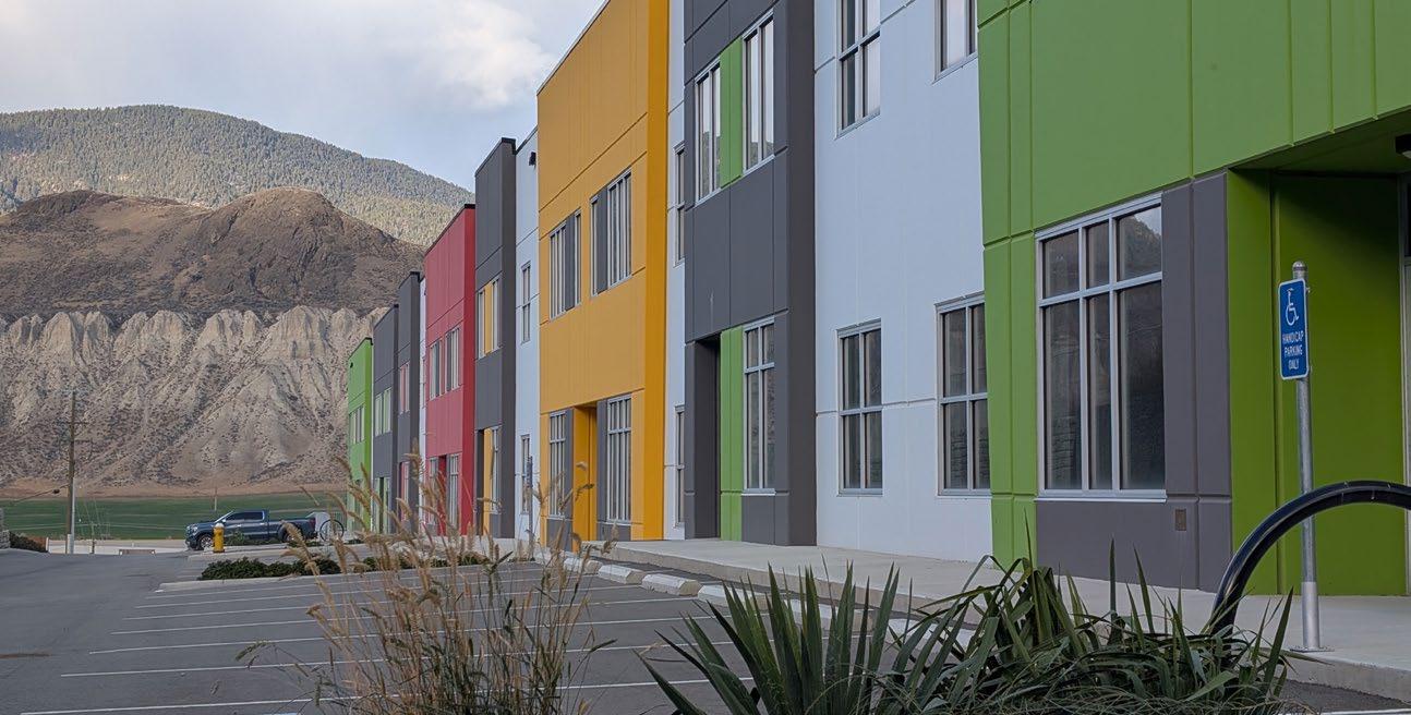
5.2 Built Form
5.2.1 Massing and Scale
1. Building mass refers to volume, whereas scale considers a building’s dimensions in relation to people and the surrounding environmental context (e.g. adjacent buildings. open space).
2. Buildings should utilize variation in façade treatment and vertical and/or horizontal articulation to avoid the appearance of long, homogeneous façades and to reduce apparent building mass.
3. Publicly accessible office, recreational, and/ or customer service areas should incorporate architectural details, such as windows, entry features, distinctive rooflines, and exterior finish materials, to foster a human scale and distinguish such areas from more utilitarian warehousing, manufacturing, and processing areas.
Variation in facade treatment and articulation break up homogeneous expanses and reduce apparent building mass
4. The architectural style of buildings containing multiple units, including accessory dwelling units, should remain cohesive over the entire frontage. Individual entry points should be identifiable at the pedestrian level without detracting from the building’s overall appearance.
City of Kamloops
5.2.2 Height and Roof Design
5. Buildings should utilize variation in the roofline to add visual interest and avoid the appearance of long, plain, box-like building façades.
6. Rooftop mechanical equipment should be screened by parapets or other architectural roof design features.
5.2.3 Detail, Material, and Colour
1. Buildings on corner sites or with double road frontage should be designed to acknowledge the building’s visibility from each street through continuity of design, colour, materials, exterior finish, and signage.
2. Large expanses of highly reflective treatments and glazing (e.g. mirror glass) should be avoided on exterior walls to prevent heat and glare impacts on adjacent properties and roads.
3. Publicly accessible office, recreational, and/or customer service areas should incorporate quality materials such as natural wood, stone, and glass.
4. To support healthy lifestyles and the enjoyment of outdoor amenity spaces during spring, summer, and fall months, shadow impacts from a proposed mid-rise or high-rise building should not exceed a one-hour duration on rear yards, decks, patios, and pools of adjacent residential properties on the summer solstice (i.e. June 21) and autumn equinox (i.e. September 21).
5.3 Parking and Circulation
1. On-site parking should generally be located at the side or rear of the property or underground. Parking lots should be screened and landscaped.
2. Landscaping should be used to separate large expanses of parking into smaller subsections. Landscaping islands should be located at each end of every parking aisle. In the case of longer parking aisles, landscape islands should also be provided in the middle of the aisle. Landscaping islands should be large enough to support healthy plant growth and include at least one tree per parking aisle.
3. Outdoor storage areas, solid waste bins, and loading/unloading areas should be visually screened by landscaping. Where loading/ unloading areas must be located close to adjacent residential uses, landscape buffers and sound attenuation measures should be used.
4. Where bicycle parking is required, bicycle racks should be located near building entrances.
5. Drive-thru facilities should be located away from adjacent uses, screened with landscaping from public streets, and designed to achieve safe pedestrian and vehicle movements. Drive-thru areas should include an adequate number of queuing spaces to avoid congestion of circulation aisles and streets.
Garbage bins can be effectively screened using landscaping, fencing, a trellis, or other design features
6. Shared access driveways are encouraged to minimize the number of entry/exit points along the road and to maximize spacing between these points. Shared accesses and drive aisles should be protected through reciprocal access agreements.
5.4 Landscaping
1. All areas not covered by buildings or structures and not required for parking, loading, storage, assembly, processing, or manufacturing should be suitably landscaped. All landscaped areas should be irrigated using automatic irrigation systems. The provision of landscaping should consider the use of xeriscaping and native landscaping materials.
2. New landscaping covering 100 m2 or more in total site area will require landscape plans prepared by a registered landscape architect.
3. Landscape design should emphasize yards and boulevards that front roads and highways to improve the public image and street appeal of the development. Corner lot landscaping should consider all street frontages equally and provide consistent quality of design, orientation, and detail.
4. Where visual screening is required, the use of shrubs, trees, and other plantings to form an opaque visual barrier is encouraged. For properties located adjacent to residential areas, a 4 m wide landscape buffer must be provided between sites.
5. For industrial uses that produce high volumes of noise, including, but not limited to, rail yards, intermodal yards, container storage, and manufacturing uses, landscape features should be utilized to buffer noise. Such features could include earth berms, sound attenuation walls, trees, and dense shrub plantings.
6. Landscape design should prioritize security and pedestrian safety. Landscape design should incorporate CPTED principles such as enhancing lighting and minimizing dark areas, encouraging opportunities for natural surveillance, and using visual cues to control access to the site.
7. Utility installations should be integrated into landscaped areas and building design for screening purposes. Use of decorative wraps on electrical boxes and other such utilities is encouraged.
8. Landscape design should consider the use of FireSmart principles, including:
i. Avoiding highly combustible, high fuel, coniferous trees (e.g. fir, pine, spruce) and shrubs (e.g. cedar, juniper, yew) close to any building, especially for properties adjacent to high wildfire risk open space areas, where terrain is steep, or fire response time is expected to be long; and, ii. Planting low-fuel, low-combustion deciduous trees, shrubs or perennials where landscaping is needed close to a building to meet minimum zoning requirements, provide buffering between neighbours or screen parking, building foundations, or pad-mounted transformers.
5.5 Lighting and Signage
areas
1. Except where the property fronts a highway, all free-standing signage should be monument style and pedestrian oriented. All free-standing signage should be integrated into landscape areas.
2. Fascia signs should be integrated into the building’s façade and should complement existing signage.
3. Lighting and light standards in all public areas, including parking lots, should relate to the pedestrian and should be directed toward the ground to avoid light pollution on neighbouring properties. The preferred design for lighting within front yards is with ground-mounted units that are located discreetly within landscaped areas. Lighting plans may be required. Lighting may also be incorporated into building design.
Decorative wrap on an electrical box can help integrate utility installations into landscaped
Riparian Areas Protection Regulation Development Permit Area
1. Purpose
The purpose of the Riparian Areas Protection Regulation Development Permit Area is to establish objectives and provide guidelines for the protection of the natural environment and its ecosystems and biological diversity, and, in particular, fish, fish habitat, and riparian habitat pursuant to the provisions of the Local Government Act. These guidelines establish conditions to protect the natural environment from inappropriate development and to mitigate negative impacts.
2. Area
A development permit shall be required for all activity defined as development under the Riparian Areas Protection Regulation that is located within 30 m of the high water mark or top of a stream’s ravine bank. Development is defined in the Riparian Areas Protection Regulation as follows:
(a) the addition, removal or alteration of soil, vegetation or a building or other structure;
(b) without limiting paragraph (a), the addition, removal or alteration of works and services described in section 506 (1) [subdivision serving requirements] of the Local Government Act;
(c) subdivision as defined in section 455 [definitions in relation to Part 14] of the Local Government Act
Leah Clare
The Riparian Area Protection Regulation Development Permit Area applies to all privately owned land located within 30 m of the high water mark or top of a stream’s ravine bank of the North and South Thompson Rivers, Kamloops Lake, all their tributaries, and all water bodies containing fish habitat within city boundaries.
Map 11: Development Permit Area: Riparian Areas Protection Regulation identifies most watercourses and water bodies subject to this development permit area; however, the map does not include all watercourses or water bodies within city limits. Should a stream or other watercourse not identified on the map be identified in the future, it is the responsibility of the proponent to contact the City of Kamloops to determine whether or not this Riparian Area Protection Regulation Development Permit Area applies. Where the Riparian Area Protection Regulation Development Permit Area overlaps with other development permit areas, all applicable guidelines will be considered.
3. Exemptions
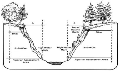
A development permit will not be required for the following:
• Farming activities
• Minor interior and exterior renovations to existing buildings that do not negatively impact the natural environment during construction (e.g. movement of machinery), excluding any additions or increases in building volume
• Mining activities, hydroelectric facilities, and forest management, including the logging of land
Existing permanent structures, roads, or other development within the riparian area are considered legal and conforming. Consequently, landowners are entitled to continue using their land in the same manner as they have historically, even if a streamside protection and enhancement area is designated on it.
4. Objectives
The intent of the Riparian Area Protection Regulation Development Permit Area is to regulate development activities in the riparian areas adjacent to watercourses to preserve natural features, ecosystem functions, and conditions that support fish habitat. The objectives are:
• Reducing or eliminating erosion
• Maintaining the tree canopy
• Protecting ground and surface water from contamination
Riparian Assessment Area
5. Guidelines
Before undertaking any activities defined as development within the Riparian Area Protection Regulation Development Permit Area, property shall obtain a development permit from the City of Kamloops. The application for this permit shall demonstrate that the proposed development adheres to the following guidelines:
1. A qualified environmental professional will be retained at the expense of the applicant for the purpose of preparing a report on the riparian area pursuant to the Riparian Areas Protection Regulation Assessment Methodology Guidebook. The report will be submitted to the relevant provincial ministry and the City of Kamloops. Where the qualified environmental professional report proposes a harmful alteration, disruption, or destruction to fish habitat pursuant to the federal Fisheries Act and/or other applicable federal regulations, the development permit shall not be issued unless the harmful alteration, disruption, or destruction is subsequently approved by Fisheries and Oceans Canada. In order to apply for a harmful alteration, disruption, or destruction, the City must express support in principle for the harmful alteration, disruption, or destruction and identify the context as identified by the qualified environmental professional report.
2. Where the qualified environmental professional’s report describes an area designated as streamside protection and enhancement area, the development permit will not allow any development activities to take place therein, and the owner will be required to provide a plan for protecting the streamside protection and enhancement area over the long term through measures to be implemented as a condition of the development permit, such as: i. a dedication back to the Crown, the Province, or the City of Kamloops ii. gifting to a nature protection organization such as a conservation authority iii. the registration of a restrictive covenant over the streamside protection and enhancement area to secure it as a riparian buffer to remain free of development
3. Where the qualified environmental professional’s report describes an area as suitable for development with mitigating measures, the development permit shall allow the development if it is in strict compliance with the measures described in the report. Monitoring and regular reporting by professionals retained by the applicant may be required, as specified in the development permit.
4. Variances to the Zoning Bylaw may be granted in compliance with the qualified environmental professional’s report.
5. If the nature of a proposed project in a riparian assessment area changes, the qualified environmental professional will be required to reassess the proposal with respect to the streamside protection and enhancement area.
6. New landscaping covering 100 m2 or more in total site area will require landscape plans prepared by a registered landscape architect.
Juanita Mayfield
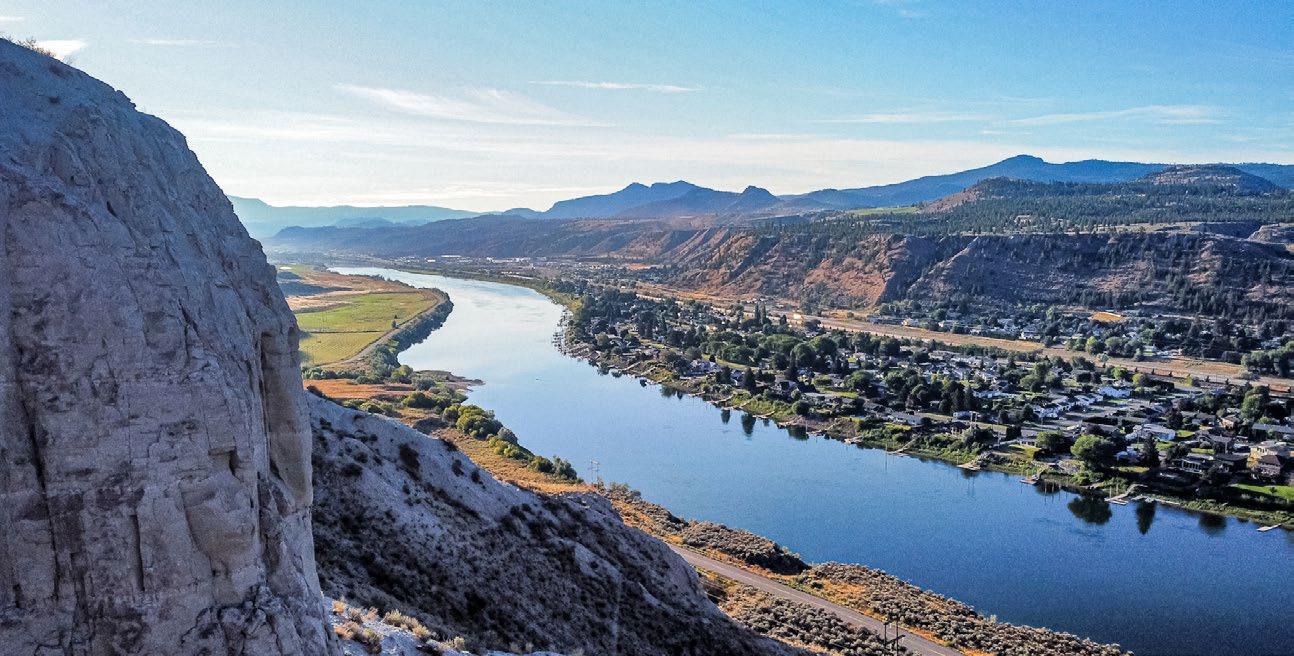
Silt Bluffs Hazard Zone Development Permit Area
1. Purpose
The purpose of the Silt Bluffs Hazard Zone Development Permit Area is to establish objectives and provide guidelines for the protection of development from hazardous conditions in the Silt Bluffs Hazard Zone. A development permit shall be required before the issuance of a building permit (including an earthworks permit) or the approval of a subdivision application for any development in the designated area.
2. Area
The Silt Bluffs Hazard Zone Development Permit Area, as shown on Map 12: Development Permit Area: Silt Bluffs Hazard Zone, extends approximately from Rose Hill Road to Campbell Creek at the eastern boundary of the city. The area includes a Red Zone and a Yellow Zone (Foreset/Backset Areas). The Red Zone is the area that extends from the toe of the slope of the silt benchland escarpment to the valley wall. The Yellow Zone (Foreset Area) extends away (typically north) from the toe of the slope of the benchland escarpment to the maximum extent that a landslide event would likely reach. The Yellow Zone (Backset Area) extends behind (typically south) the benchland escarpment up the valley wall.
Detailed geotechnical analysis and study have identified extensive silts in and adjacent to the bluffs bordering the South Thompson River. These areas are susceptible to hazardous conditions, such as sinkholes, piping (the formation of underground tunnels and caving due to internal water erosion), and various types of slope failure and resulting landslide runout. Substantial harm and/or damage could result from development in this area.
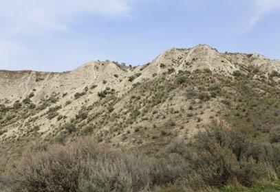
Travis Bonner
Typical landscape features of the Silt Bluffs Hazard Zone
3. Exemptions
A development permit will not be required for the following:
• Renovations to an existing building or structure that do not increase the building or structure’s footprint, disturb its foundation, or convert an unenclosed space (e.g. a carport) to an enclosed space (e.g. a garage, habitable space)
• Replacement of an existing manufactured home with a new manufactured home with a footprint no greater than 150% the area of the original, provided drainage is directed to the municipal storm system or natural drainage courses
• New, non-habitable accessory buildings or structures less than 10 m2 in area
• One addition less than 25 m2 in footprint, provided drainage is directed to the municipal storm system or natural drainage courses, the improvement is not located between the existing dwelling and a bluff or drainage gulley, and professional Geotechnical supervision is provided
• Applications where a geotechnical engineer provides a sealed letter demonstrating that the proposed development is completely outside the Yellow Zone (Foreset/Backset Areas) and the Red Zone
4. Objectives
The Silt Bluffs Hazard Zone Development Permit Area has the following objectives:
• To regulate development on and adjacent to the silt bluffs in such a manner as to protect life and property from the identified hazardous conditions
• To determine the conditions or requirements that need to be met to safeguard life and property
5. Guidelines
1. Within the Red Zone, development may be susceptible to, encourage, and intensify damage from geotechnical hazards, such as soil collapse, surface erosion, piping (internal erosion), sinkholes, and ground caving, and may cause landslides that would impact life and property in the Foreset Area. Accordingly:
i. Development in the Red Zone is strongly discouraged and may only be considered where density is not increased through subdivision of lands or rezoning applications. In these instances, development to the minimum permitted density (i.e. one building per lot plus nonhabitable accessory buildings) may be considered in accordance with these development permit area guidelines.
2. Within the Yellow Zone (Foreset Area), life and property are susceptible to injury from landslides. Accordingly:
i. Development applications, such as subdivision and rezoning applications, that increase residential density or commercial floor space or change use will only be supported where new units or commercial space is provided outside the defined foreset angle and the development is constructed in accordance with these development permit area guidelines.
ii. Development applications, such as building permits for building additions or accessory buildings, that do not increase the number of units may be considered where development is constructed in accordance with these development permit area guidelines.
Foreset Angles
The City of Kamloops Foreset Area is based on a foreset angle of 2.25H:1V where the silt bluffs are irrigated or potentially irrigated, such as the Gateway Industrial Park. A foreset angle of 1.9H:1V is used where the silt bluffs are located on municipal or Crown land and are not irrigated, such as Orchards Walk.
Subject to site-specific evaluation by a qualified geotechnical engineer, the City may support a reduced foreset angle where warranted by local circumstances, provided the reduction does not achieve a foreset angle steeper than 1.8H:1V for areas below publicly owned, non-irrigated lands, such as the Orchards Walk site.
Hazard vs. Risk Assessments
Determination of foreset angles should utilize a hazard-based assessment rather than a riskbased assessment.
• Hazard-based assessments consider the potential hazard of a slide event occurring within the defined foreset area, regardless of the density of development that may be impacted by the slide, whereas risk-based assessments consider the potential risk to development that varies with increased density of development.
• An acceptable level of hazard is generally considered to be 1:500 or once every 500 years per 1,000 m length of escarpment.
3. Within the Yellow Zone (Backset Area), development has the potential to impact the stability of the silt benchlands below the backset area through the release of surface and/or groundwater discharges. Accordingly:
i. All development applications in this area must be constructed in accordance with these development permit area guidelines.
4. All development applications within the Red Zone and Yellow Zone (Foreset/Backset Areas) on Map 12: Development Permit Area: Silt Bluffs Hazard Zone shall be accompanied by a geotechnical report that has been prepared by a professional geotechnical engineer who is qualified to practise in the field of geotechnical engineering. This report will assist the City in determining the level of development that can be safely constructed and what conditions or requirements it will impose on the applicant. The geotechnical report shall:
i. Define the extent and character of all surface geological materials and the groundwater regime in the area proposed for development, including on silt bluffs located directly above, below, or adjacent to the site.
ii. Define the type and extent of hazard zones within the area, including:
a. The potential for slope failure above, below, or within the development (based on expert judgment, which may use extrapolation of past performance on site and in the vicinity, modelling of various factors, including current and future conditions on site, and/or other means deemed appropriate by the geotechnical engineer).
b. The potential distribution of runout from the current toe of the slope in the event of a slope failure, as measured by a foreset angle. Foreset angles are angles measured from the crest of the slope to the area below the silt benchland. See foreset angle description (right) and foreset and setback diagram (below) for more information. Any new habitable space should be located outside the established foreset angle
c. The location and characteristics of present and potential future soil collapse (e.g. collapse in the form of piping, caving, sinkholes)
iii. In very limited instances where buildings or structures are to be sited on top of the silt benchlands, identify any recommended setbacks from hazards such as sinkholes, gulleys, areas of erosion, and the benchland escarpment needed to promote safe development. Typically, the setback from the toe of the slope of the benchland escarpment will be based on a minimum slope of 2.5H:1V (see diagram below).
iv. For properties in the Backset Area (and the Red Zone in the very limited instances where development is contemplated), the geotechnical report shall:
a. indicate how stormwater runoff and leakage from pipes related to the development will be controlled to avoid concentration of runoff or groundwater seepage within the benchlands to reduce potential for erosion, piping, and sinkhole activity (e.g. directing runoff flows directly to the municipal storm system and providing impermeable liners under the home to inhibit water infiltration into subsoils)
b. discuss the stability of soils and geology on which the proposed development will be sited and, if applicable, indicate any special measures needed to facilitate safe construction
c. indicate any buffer areas between proposed Backset Zone development and silt benchlands (and any identified hazards within the Red Zone) that are necessary to reduce the risk of damage to lands and infrastructure
v. Provide a plan for safe disposal of any unstable soils to ensure that they are reconditioned such that they are no longer collapsible or are excavated such that they are not used in construction on or off site.
vi. Recommend specific design features and/or mitigative measures for development so that potential hazards are reduced, eliminated, or accommodated. Subject to a geotechnical engineer’s review, such initiatives may include, but are not limited to, the following:
a. minimizing the width of structures within Foreset hazard areas
b. avoiding siting additions and accessory buildings between the existing dwelling and the benchland to prevent the improvement from being pushed into the principal dwelling by the slide
c. using appropriate foundation types and foundation drainage systems for additions based on site conditions
d. building protective structures that divert landslide debris away from areas of development and habitation (restrictive covenants or security deposits will be utilized to ensure such structures are constructed in accordance with the development permit)
e. where new buildings in the Red Zone are considered, using appropriate foundations to reduce risk of collapse settlement (e.g. pile foundations)
vii. Indicate any other factors deemed relevant by the qualified professional geotechnical engineer.
5. All development within the Silt Bluffs Hazard Zone shall be under the direct supervision of a qualified professional geotechnical engineer.
6. Applicants for a development permit within the Silt Bluffs Hazard Zone Development Permit Area may be requested to voluntarily register a save harmless covenant under Section 219 of the Land Title Act against their legal parcels.
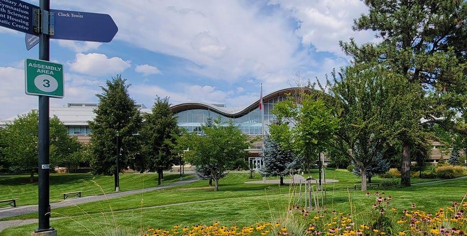
Thompson Rivers University Development Permit Area
1. Purpose
In accordance with Section 488 (1) of the Local Government Act, the Thompson Rivers University Development Permit Area is designated for the purpose of:
• Protecting the natural environment, its ecosystems, and biological diversity (Category a)
• Establishing objectives for the form and character of commercial, industrial, or multi-family residential development (Category e)
• Establishing objectives for the form and character of intensive residential development (Category f)
• Establishing objectives aimed at promoting energy conservation (Category h)
A development permit shall be required for multi-unit residential development, commercial development, or mixed multi-unit residential and commercial development in the CD-9 (Thompson Rivers University Comprehensive Development Zone 9) zone for any improvements to a property, including alterations, site design, landscaping, new construction, or building permit. Development permits shall detail parking, vehicular access and circulation, pedestrian access and circulation, landscaping, building elevations, site layout, and street enhancement.
Sheikh Farzin Rahman
2. Area
The entire Thompson Rivers University (TRU) campus is designated as a development permit area (see TRU boundary shown below).
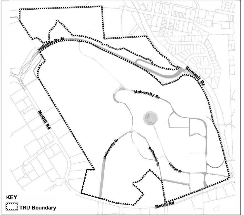
3. Exemptions
A development permit will not be required for the following:
• Internal renovations
• External renovations that do not affect the form and character of the building or site
• Any buildings, landscaping, or public realm improvements constructed or altered in Subzone “A” (Education Precinct) of CD9 (Thompson Rivers University Comprehensive Development Zone 9)
• Any buildings, landscaping, or public realm improvements constructed or altered in Subzone “D” (Outdoor Research Precinct) of CD-9 (Thompson Rivers University Comprehensive Development Zone 9)
• Any roads, public realm improvements, or other infrastructure that are not on a parcel being developed for residential or commercial use
F IGURE F5: THOMPSON RIVERS UNIVERSITY
AREA MAP
4. Justification
TRU is developing a large, mixed-use precinct and a multi-unit residential neighbourhood on the campus. While TRU is responsible for approving the design of university and university-related buildings in Subzone “A” (Education Precinct) and Subzone “D” (Outdoor Research Precinct), the City has an interest in the siting and design of market residential, commercial, and mixed-use developments in Subzone “B” (Mixed-use Precinct) and Subzone “C” (Residential Precinct).
The objectives of these guidelines are to:
• ensure a high quality of design and livability for residential buildings and neighbourhoods
• ensure a high quality of design for commercial buildings, particularly those that are highly visible because they front major roads
• ensure that new development is sensitive to the character of the natural environment
• achieve a sustainable residential and commercial community
5. Implementation
Notwithstanding anything to the contrary in other development permit areas, development in the Thompson Rivers University Development Permit Area is not subject to the Multi-Unit Residential Development Permit Area Guidelines.
In accordance with the Development Permit Procedure and Delegation Bylaw, delegated authority to issue a development permit can fall to the Development, Engineering, and Sustainability Department for applications for all residential and commercial developments; however, developments that directly front McGill Road will require City Council’s approval.
6. Guidelines
Development permits issued for multi-unit residential, commercial, or mixed residential and commercial developments shall take the following guidelines into consideration. City planning staff shall determine which guidelines apply after consulting the applicant and researching the subject property.
6.1 Guidelines Framework
The Thompson Rivers University Development Permit Area Guidelines are structured as follows:
• Guiding Principles state guiding principles that are to be applied to neighbourhood design, urban design, built form, open space design, landscaping, and the public realm
• Public Realm and Landscaping Guidelines contain guidelines for public realm, open space design, and landscaping.
• Building Guidelines contain general guidelines that apply to all buildings (commercial, residential, and mixed-use).
• Residential Guidelines contain guidelines that, in addition to the general building guidelines, apply to residential buildings. Some of these guidelines apply to two specific sub-areas (Eastern Parcels and North Bench Village), as shown in the plan below.
• McGill Corridor Guidelines contain guidelines that, in addition to the general building guidelines, apply to buildings on parcels that front McGill Road.
• Parking Guidelines contain guidelines for off-street parking.
• Sustainability contains sustainability guidelines that apply to site planning, building design, building materials, and infrastructure.
F
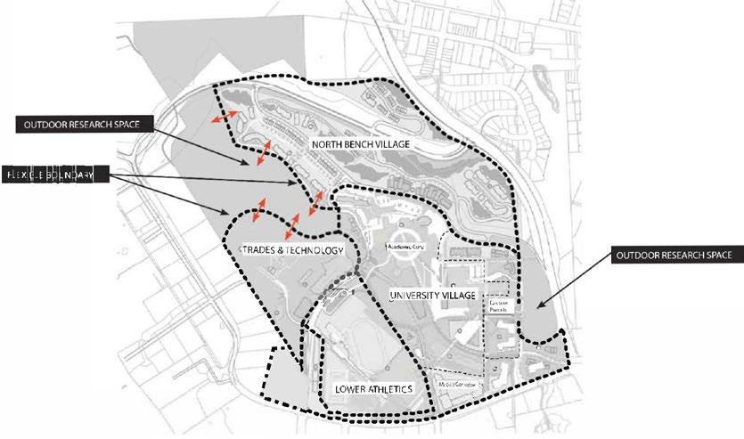
6.1.1 Guiding principles
Five overarching principles for the physical development of the campus are identified: Connectivity, Activity, Identity, Sustainability, and Community.
1. Connectivity
i. The primary vision is to create a campus that is cohesive, walkable, and pedestrian focused. To provide this, the overall campus development and parcels are connected by a hierarchy of green networks that move people throughout the campus effectively, efficiently, and safely.
2. Activity
i. TRU intends to be a vibrant mixed-use campus community. To create campus life and vibrancy, it is important that the campus supports various desired activities on campus through a mix of open spaces, diverse housing types, and commercial tenants.
3. Identity
i. Another element of the vision is to create an identity for the campus and make TRU a destination institution.
ii. Campus identity is also physically established through the character of the campus as it relates to the look and feel of the campus through the creation of iconic landmarks, buildings, gateways, and nodes.
4. Sustainability
i. TRU strives to create a high-quality campus environment that demonstrates its commitment to sustainability at all levels.
5. Community
i. TRU intends to be designed as a comprehensive community. It should provide diverse housing options, integrated academics, community and commercial spaces, and a densified core.
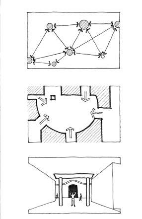
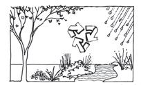
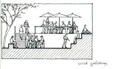
6.1.2 Public Realm and Landscaping Guidelines
1. Key Principles
i. Connectivity on campus is important to link the various precincts. A strong public realm is well connected by a series of well-laid-out networks.
ii. Enhancing activity on campus relies on a variety of open spaces. Increasing the quality of life and vibrancy on campus is strongly supported by a variety of open spaces.
iii. TRU’s goal of enhancing its identity will be greatly supported by the public realm through the identification and development of gateways and nodes around the campus.
iv. Developing the public realm with regionally appropriate, durable, and environmentally sound landscape elements and materials will ensure more sustainable development over time.


2. Standards
i. All landscaping must meet a high standard of design. New landscaping covering 100 m2 or more in total site area will require landscape plans prepared by a registered landscape architect.
3. Site Disturbance
i. Development should limit disturbance to existing vegetation. The retention of existing trees is strongly encouraged. This is particularly important in the Outdoor Research areas on campus.
4. Safety
i. As the campus adds residential and retail uses, it will increase the afterhours presence on campus. It is important that people feel safe moving around campus at all times, especially at night.
a. Provide adequate lighting for all pedestrian spaces.
b. Install emergency call stations at key nodes.
c. The design of pedestrian corridors and open spaces should abide by Crime Prevention Through Environmental Design (CPTED) principles.
5. Designing for the Seasons
i. The public realm should be designed with the seasons in mind to allow for year-round enjoyment.
a. Winter-proof - All landscape elements and materials should be designed and selected to withstand cold climates. Designs of open spaces should be suitable for a winter climate, including incorporating areas for snow storage.
b. Sun and Shade - Public spaces should provide areas of summer shading where people can relax on hot days and areas that are exposed to the winter sun. The use of deciduous trees can be used to achieve seasonal sun/shade benefits.
c. Canopy - Create a canopy along circulation networks for weather protection and a sense of security. Use suitable tree species that have a high crown understorey to allow for comfortable pedestrian passage underneath.
d. Wind Protection - Design of pedestrian corridors should use planting and other elements to protect against cold winds during winter seasons.
e. Seasonal Plant Materials - Create a diverse plant palette with a variety of plants that “announce” the seasons and provide seasonal interest and/or display, such as blossoms in spring, fall colours, textured branches in winter, and flowers.
6. Connectivity
i. All open spaces on campus should have a strong connection to a pedestrian network. Direct access to building entries through open space should be ensured through thoughtful layout and design.
7. Define Open Spaces
i. Use landscape elements and vegetation to define outdoor spaces and create edges.
8. Sidewalks and Paths
i. Sidewalks and paths should have a hard walking surface at least 2 m wide. Adjacent to buildings or streets, these sidewalks or paths should be set back at least 2 m from adjacent structures or roadways.
9. Pedestrian and Vehicular Interaction
i. Pedestrian corridors should be designed to limit interactions with vehicular traffic. Where there are conflicts between vehicular, cycling, and pedestrian traffic, pedestrian traffic should take priority, followed by cycling. Raised pedestrian crossings and other strategies should be used at street crossings. Where pedestrians and vehicles share the circulation space, careful attention should be given to providing a pedestrian-friendly corridor that creates the feeling of a walkway rather than a street.
10. Gateways
i. Gateways should be enhanced with public realm features to help signify the arrival experience for people entering the campus by all modes of transport and to assist them with elements should be of consistent character to ensure a coherent identity upon arrival. Public access for all modes should be maintained at gateways. The gateway at McGill Road and Summit Drive should incorporate a prominent landmark, art, or water feature.
11. Nodes
i. Nodes on a campus are important points of interest that help to mark new districts and provide wayfinding and direction across the campus. Nodes can be created through interesting designs of open spaces and can incorporate special features, such as public art, to create landmarks that identify and associate a space within its greater context.
12. Relationship to Architecture
i. Design of landscape elements should relate to the style, materials, and colours of adjacent architecture and carry a consistent design language and identity.
13. Complementary, Modern, and Natural Materials
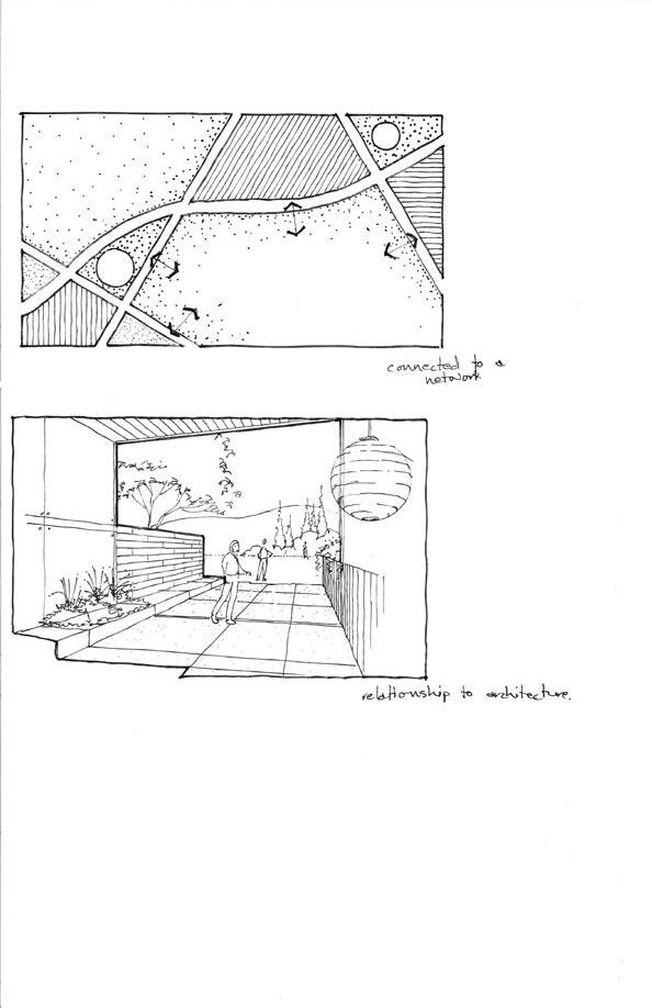
i. Landscape materials that are complementary to the local context, contemporary, and appropriate to the surroundings are encouraged.
14. High Quality, Durable, and Low Maintenance
i. A sense of permanence through the use of quality and durable materials that weather well is encouraged. All landscape elements and materials should require as little maintenance as possible, especially in outlying areas of the campus. Materials and designs should be vandal proof and resistant to damage and graffiti.
15. Signage
i. Signage is a crucial element of campus navigation and character.
ii. City Regulations - The City’s Sign Regulations Bylaw requirements must be met.
iii. Wayfinding Signs - Signage should be provided at every intersection of any circulation network to support overall wayfinding and navigation.
iv. Building Signs - Building names and addresses should be clearly visible, reflect the architectural character of the development, and not be visually obtrusive or present a cluttered image.
v. Commercial Signs - Commercial signage that identifies the business should be located above the storefront façade. Signs should not obscure the transparency of the storefront. Back-lit sign boxes, billboards, revolving signs, inflatable devices, roof signs, sandwich boards, and other sidewalk signs should not be used.
vi. Gateway Signage - TRU signage should be prominent at all gateways.
vii. Interpretive Signs - Interpretive signage is encouraged to educate students on the sustainability features of the public realm and landscape.
16. Lighting
i. Exterior lighting is required to provide safe, illuminated passage for night use. It should further be integrated as a design feature, and not just as a safety element, to support the aesthetic identity of place and usability of the open spaces at all times of the day. Consider the following:
a. Types - Lighting for the public realm should be designed considering three scales of experience: the campus scale, the streetscape scale, and the pedestrian scale. Lighting fixtures should be selected to respond to these scales and provide life and vibrancy to the campus.
b. Placement - Fixtures should be placed so that light patterns intersect at 2 m above ground.
c. Light Pollution - All light fixtures should be “night sky” compliant with cut-off levels to reduce light pollution.
d. Coloured Lighting - Coloured lighting should be considered along key circulation networks. This can help promote wayfinding
e. Intensity - The intensity of exterior lighting should follow Illuminating Engineering Society of North America standards.
f. Efficiency - Outdoor lighting design should light only the area required. Use the most efficient, proven, cost-effective lighting technologies, such as LED, and use controls to manage lighting requirements (e.g. daylight sensors).
17. Paving
i. The paving design for open spaces and networks across campus should consider the following guidelines.
ii. Linear Patterns - Along movement corridors, paving should have a linear layout to visually promote travel down the pedestrian corridor.
iii. Responsive Patterns - Paving patterns should be broken up to respond to a change in function of an open space or network and to accommodate change in furnishing layout or design, entrances to buildings, intersections with sidewalks, and other design influences.
iv. Size of Paving Area - Large areas should have the same paving. Parking surfaces are excluded.
18. Fencing and Screening Materials
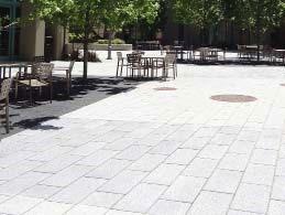
i. Standard wood picket fences are discouraged. The placement of chain-link fences should consider the surrounding context and should be limited to areas that are not visible to pedestrian networks or from the streets and fronts of buildings. Low-maintenance planting (e.g. hedging) is preferred or a combination of “hard” and “soft” materials can be used to create interest.
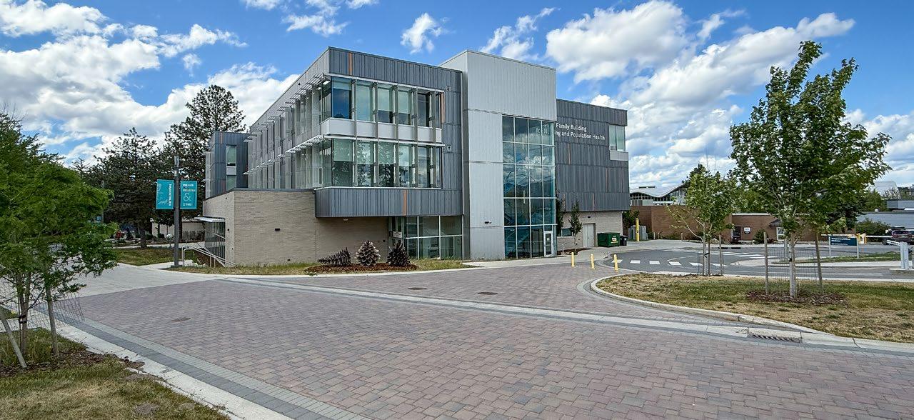
19. Planting
i. Native Plants - Plant material should be native to the Kamloops region as much as possible or otherwise tolerant of the local climate.
ii. Pest Management - Herbicide and pesticide use is not supported, and integrated pest management principles should be considered in the design and selection of plantings.
iii. Drought Tolerant - Plants should be drought-tolerant, and landscaping should use xeriscaping and synergistic groupings of plant species (e.g. use trees to provide shade for plants to reduce the number of plants that dry out).
iv. Energy Use - Locate planting to improve the energy efficiency of buildings (i.e. consider shading and the solar exposure of buildings).
v. Messy Trees - Limit the use of trees that drop a lot of fruit and cause maintenance issues or safety issues for pedestrians/cyclists.
vi. Street Trees - Street trees are encouraged in all boulevard areas that have low-growing plants for visibility purposes. Street tree spacing should be no less than 10 m. Use a continuous planting trench to allow for greater soil volume, which will increase the potential root health of the tree. Use suitable street tree species that have a high crown understorey to allow for comfortable pedestrian passage underneath (multi-stemmed trees for street trees are discouraged).
20. Soils
i. Landscaping soil media shall be selected to support the selected plant species and to be able to absorb and hold rainwater to help limit the need for irrigation.
6.1.3 Building Guidelines
This section provides planning and architectural guidelines at the building and parcel level. The intent is to provide a design framework upon which the TRU campus can develop a sense of place and identity through the built form.
1. Setbacks
i. Street enclosures should be considered where buildings meet the street to achieve a continuous street wall that guides pedestrian movement and supports the framing of public networks and places.
2. Heights
i. The maximum allowable building height is 12 storeys. Any parking levels above the existing grade are included in the overall building height. New buildings should not create major height differences in relation to adjacent and nearby buildings. Taller structures should be located along the McGill Corridor, and building heights should decrease toward the north.
ii. Townhomes between 3 and 4 storeys, mid-rises between 4 and 6 storeys, and high-rises between 7 and 12 storeys are encouraged. Each building’s position within a parcel will also dictate the general height parameters.
a. McGill Corridor Heights - Buildings in this district should be of higher density than in other areas of the campus and should be between 4 and 12 storeys in height. Lower podiums with a higher tower element are encouraged. Although more height is encouraged to be located along this edge, the footprint of taller buildings should be kept to a reasonable size to not create massive walls along the southern edge of the campus.
b. Eastern Parcel Heights - Buildings in this district should be between four and six storeys. This district transitions between the higher structures along the McGill Corridor, the larger institutional buildings, such as Old Main and the Science building, and the lower residential districts to the north. New buildings located directly north of the Old Main extension should respect and maintain views to the north. A higher point tower of up to eight storeys upon a lower one- or two-storey podium may be considered for this site to maintain the existing views of the Old Main extension.
c. North Bench Village Heights - To protect views to the north, heights of buildings should be lowest in this district and should be between 2 and 12 storeys. Taller buildings should be located uphill of shorter buildings.

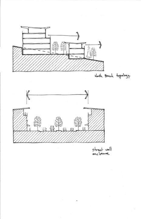
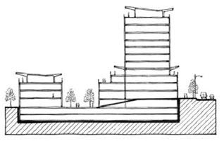
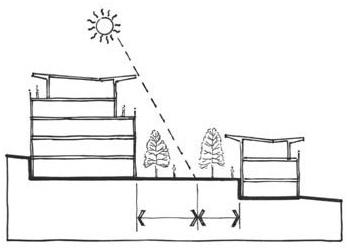
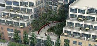
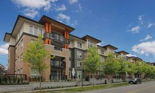
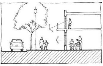
3. Separation Between Buildings and Shadowing
i. Buildings should maintain an appropriate separation from other existing buildings. An appropriate ratio of building height to building separation should be determined by reducing overshadowing of the public realm and adjacent buildings, minimizing solar glare and reflection due to proximity, and maximizing daylighting and privacy.
4. Massing
i. Building surfaces of considerable mass should be broken down, and large, uninterrupted walls should be avoided. The use of mullions, window patterns, panelling, material changes, visually interesting materials, planar setbacks, exposed structural elements, and architectural shading elements may assist in breaking down mass.
5. Terracing
i. Buildings should be terraced at single-floor increments or double-floor increments. Avoid terracing increments beyond two storeys, as this will create a bulky appearance.
6. Large Footprints
i. Large footprints that appear bulky and create an unwelcoming wall should be avoided. The articulation of floor plates using indentations and creating opportunities for permeability are encouraged.
7. Building Relation to Street
i. Buildings must promote friendly streetscapes. Commercial uses at grade should be oriented towards the street. Upper floors should provide windows with street views, and residential uses should be oriented towards the street with only low design elements, such as hedges, to achieve privacy.
8. Building Entries and Weather Protection
i. Weather protection canopies located within the base building element zone are encouraged to improve the pedestrian experience. Weather protection must be provided at all principal entries to buildings to provide a sense of arrival and better wayfinding.

Individual Residential Entries
Maximize individual entryways for all residential market developments. Townhomes should have their own clearly identifiable entries, complete with weather protection, stairs, and gateways that interface with public paths and public areas that, in turn, connect to the rest of the campus.
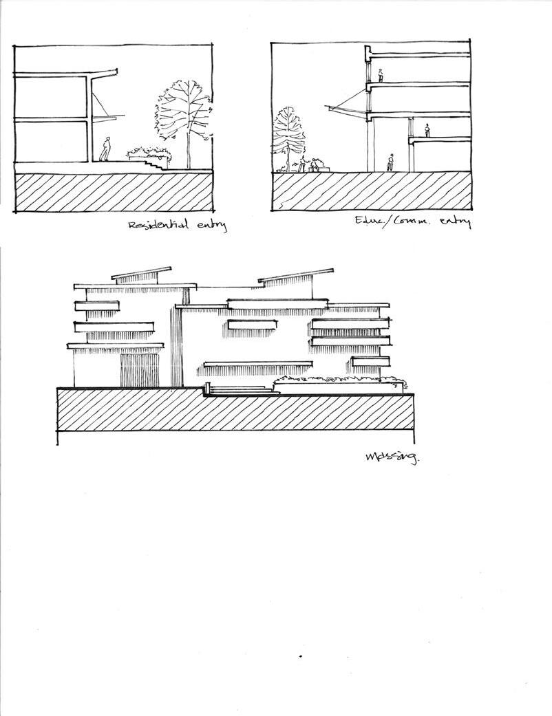
10. Daylighting and Glazing
i. Storeys at grade should have greater degrees of transparency and glazing on walls that face a pedestrian way. Habitable rooms are encouraged to have direct access to sunlight. Buildings should take into account the distinct seasons and consider minimizing solar gain during the summer while allowing sunlight to enter in the winter.
11. Universal Accessibility
i. TRU is encouraged to provide access to people of all levels of ability to all buildings on campus. Facility servicing zones, such as mechanical rooms, are excluded. All new construction must comply with the Building Access Handbook.
12. Roofs as a Design Element
i. Roofscapes should be considered as design elements and be visually interesting when seen from above, such as from adjacent buildings or higher terraces of the same building.
13. Rooflines
i. Horizontal roof forms that promote vistas and view lines should be considered over gables and other traditional residential forms.
14. Rooftops for Living
i. Consider rooftops for sustainable, recreational, or open space uses, such as rooftop gardens, green roofs, viewing platforms, energy generation, or other amenity-type space. Green roofs should use native plantings and grasses.
15. Rooftop Equipment
i. Rooftop units should be screened from view.
16. Balconies
i. To maintain a high design standard, balconies should be integral to the overall design of the building and not appear tacked on.
17. Topography
i. Buildings located on slopes should be terraced with the existing topography of the site.
18. Views
i. TRU is situated to enjoy spectacular mountain views towards the north and east. These views provide visual interest and provide natural campus wayfinding Buildings should be oriented towards vistas and should be respectful of campus view corridors and the views of adjacent sites. Careful placement of higher portions of a building and terracing buildings with the topography to respect the existing views of neighbouring buildings are encouraged.
19. Rainwater Management
i. Buildings are required to capture and retain rainwater from rooftops pursuant to the Subdivision and Development Control Bylaw.
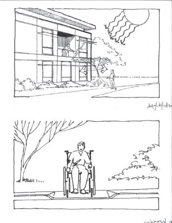
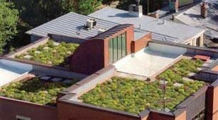
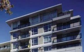
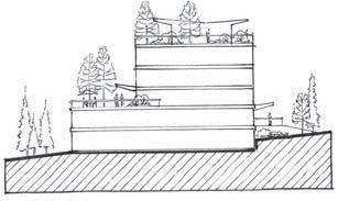
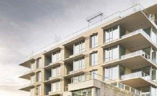
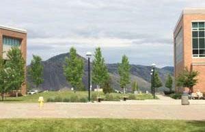
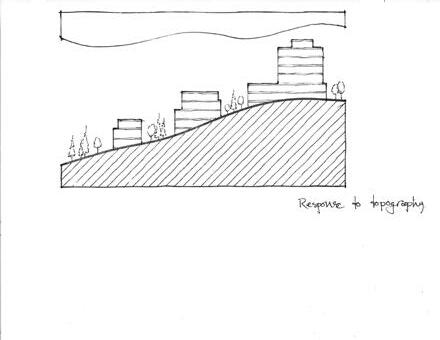
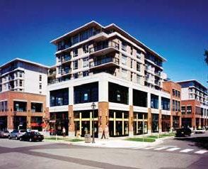
20. Architectural Materials
i. Although all buildings within the TRU campus should have an overall cohesive appearance, it is of particular interest that structures within the same parcel appear as a “family” of buildings, relate in similar massing language, and use the same material palette. Buildings should have variation among themselves within parcels but appear as an integrated whole.
ii. A sense of permanence through the use of quality and durable materials that weather well is encouraged. Buildings should not look low quality, generic, and out of context with the high quality of design on campus. Architectural expression that appears to mimic styles of a different place or era and architecture that references historical styles are strongly discouraged.
iii. Building materials that respond to the pedestrian scale are encouraged, especially at the ground plane, to promote visual interest at the streetscape.
iv. Exterior colours should be chosen to reflect the area’s natural colours, mainly earth tones and warm colours, with bolder colours for accents and trim.
v. Preferred exterior architectural materials include:
a. natural wood products
b. glass
c. concrete
d. stone and brick
e. stucco (as a secondary material)
vi. The following exterior materials are discouraged:
a. plastic
b. vinyl siding
c. faux-natural finishes
d. false muntin bars
e. stamped concrete block
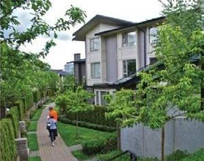
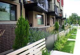
6.1.4 Residential Guidelines
Residential buildings and mixed-use buildings that include housing should adhere to these guidelines and the Building Guidelines.
1. Private Outdoor Spaces
i. Ground-floor, private open space is encouraged for all at-grade units, and such spaces should be large enough to accommodate patio furniture and gardening. These spaces should be designed to provide privacy through appropriate design and screening. Planting should be of an appropriate size for the scale of the residential yard.
2. Fencing and Privacy
i. Fences and screening should be used to delineate spaces and create privacy for residential units while keeping Crime Prevention Through Environmental Design (CPTED) in mind.
a. Front yard fencing - where required, should be no more than 1 m in height and should provide frequent access into the property to create pedestrian permeability. Where front yard fencing is not critical to the privacy of the residential unit, transparent or semi-transparent fencing alternatives are preferred.
b. Side yard fencing - where required, should be no more than 1 m high unless stepped up with the topography. Where developments have units with windows or outdoor patios facing a side yard, privacy should be enhanced through the use of fences or vegetation screens with a maximum height of 1 m.
3. Eastern Parcels
i. The Eastern Parcels is a specialized sub-area that contains land on either side of the Old Main extension on the east side of the TRU campus.
a. Connectivity - Development in the Eastern Parcels should have a strong relationship with adjacent public open spaces and front these networks to promote walkability and an urban front. Any building or townhome should front these public open spaces and should not have backyards, loading zones, or parking entries on these façades.
b. Nodes/Landmarks - Nodes and/or landmarks should be strategically located where major confluences of networks come together or at gateways and entries.
c. Housing Types - Consideration must be given to the close proximity of residential development in this area to large-scale, institutional buildings. The change in scale should not be drastic between the market and academic parcel scale. As a result, stand-alone townhome groupings with drive-ups are not wellsuited to this area. A denser urban typology, such as mid-rises (4 to 6 storeys) and towers (7 to 12 storeys), is more appropriate.
d. University-focused Residential - Given the proximity to the academic campus, some of the residential development in this sub-area should cater to the campus community. Rental dwellings are encouraged.
4. North Bench Village
i. The North Bench Village is a multi-unit residential community located along the lower slopes of campus north of the ring road. The topography in this district varies significantly and, as a result, every parcel is unique. These parcels have sweeping views of the mountains to the north.
a. Connectivity - Development in the North Bench Village should have a strong relationship with adjacent public open spaces and front upon these networks to promote walkability and an urban front. Any building or townhome should front upon these public open spaces and should not have backyards, loading zones, or parking entries upon these façades. To support the vision for a connected campus, pedestrian and visual permeability across University Drive North and Hillside Drive North should be created.
b. Nodes/Amenities/Landmarks - Any amenity/community buildings intended to support the North Bench Village should be centrally located. Examples of amenity spaces include social or meeting spaces. Such spaces are encouraged to be prominently located and connected to adjacent public open spaces and networks.
c. Sustainable Communities - The North Bench Village should be a community that promotes walkability, social opportunities, diversity of population, and sustainable development. It should be a village that welcomes and is home to people of all ages, from young families to seniors.
d. Housing Typology - A variety of housing types is encouraged, in particular, lower-scale, multi-unit residential typologies such as townhomes and mid-rises (four to six storeys). Single-detached residential is only appropriate if terrain, geotechnical, storm drainage, or other physical constraints make parcels unsuitable for multi-unit residential
e. Complementary Design Standards - All residential developments must complement the overall architectural expression and design standards of the academic parcels to the south.
f. Diversity of Housing Options - The dwelling units within this district are encouraged to have diverse housing options and include some rental options for TRU students and staff.
5. Distinguish Between Residential and Commercial Use
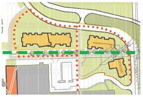
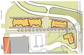
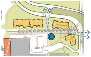
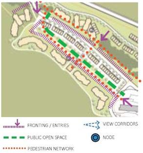
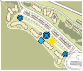
i. In mixed-use residential and commercial buildings, pedestrian-level commercial use should be distinguished from the residential use above by using horizontal architectural features and varying materials and colours.
6.1.5 McGill Corridor Guidelines
1. In addition to complying with the Building Guidelines and the Residential Guidelines (as appropriate), buildings that front McGill Road should also reflect these specific guidelines:
2. Connectivity - Development in the McGill Corridor sub-area should have a strong relationship with adjacent public open spaces and front these networks to promote walkability and an urban front. Developments should not locate loading zones or parking entryways on these fronts, as doing so will disrupt the pedestrian experience. Frontage and transparency at the ground level should be maximized.
3. Nodes/Landmark - Nodes and/or landmarks should be strategically located where major confluences of networks come together and at gateways and entries.
4. Model Development - Development in the McGill Corridor sub-area should act as a catalyst and model for future developments along the McGill Corridor.
5. Commercial Base - Developments in the McGill Corridor should have a commercial-oriented base at street level.
6. Vibrant Tenant Mix - The tenant mix is encouraged to support a vibrant atmosphere year-round.
7. Lively Gateway to Academic Campus - The area around the intersection of Summit Drive and McGill Road may combine market and academic uses. This parcel acts as the front face of TRU, presents the university identity, and serves as a lively pedestrian gateway to the campus. While appealing to the pedestrian scale, it will also act as a landmark to the wider community.
8. Residential - Residential uses, except lobbies and entranceways, should be located above ground level. Residential towers and mid-rises are encouraged to front the McGill Corridor.
9. Weather Protection - Building façades along major street frontages should incorporate awnings or canopies that are at least 1.5 m wide to provide pedestrian weather protection and add visual interest.
10. McGill Road Frontage - Developments that front McGill Road should have a strong relationship to the street and should not have large areas of surface parking between building façades and the sidewalk.
11. Corner Buildings - Buildings at significant intersections should be designed as landmark buildings that treat both adjacent streets as important pedestrian-oriented commercial frontages, incorporate distinctive architectural features, provide corner setbacks of at least 4.5 m, and use height, density, and form to convey their strategic location.
12. Sidewalks - Buildings should allow for a continuous sidewalk of 3 m between the curb line and building façades along major streets.
13. Parking Limitation - No off-street surface parking should be located between the principal building façade and McGill Road.
6.1.6 Parking Guidelines
1. Structured Underground Parking
i. Parking for mixed-use buildings and high-rise residential buildings should be underground or in the structure, except for visitor parking.
2. Safety
i. Surface and structured parking should be designed with safety in mind and include appropriate lighting levels and emergency call stations.
3. Service and Loading Areas
i. Service and loading areas should be concealed where possible.
4. Surface Parking
i. Surface parking lots should be broken up to avoid large, continuous parking areas and should incorporate landscaping. Surface parking should be located at the sides or the rear of buildings. ii. Landscaping adjacent to surface parking lots should be designed to receive parking lot drainage.
6.1.7 Sustainability
1. Site Planning
i. Site planning should reduce the negative impacts of development on the natural environment and generally maintain the natural landscape, vegetation, and environmental attributes of each parcel. Projects should be developed in a manner that reflects the character of the natural landscape at TRU.
2. Water Consumption
i. Site planning and building design should reduce the consumption of potable water and reduce the impact on the regional water supply and treatment system.
a. Water Meters - A spool should be installed in the incoming water main of each building to allow for future installation of water meters.
b. Toilets - All toilets should be either minimum 6 L/3 L dual-flush or low-flush/high-efficiency toilets (max 4.2 L per flush).
c. Fixtures - All fixtures should be ultra low flow. Kitchen faucets should be a maximum of 1.75 gallons per minute, bathroom faucets should be a maximum of 1.2 gallons per minute, and shower heads should be a maximum of 1.75 gallons per minute.
d. Xeriscaping - Drought-tolerant plants should be used in landscaping, and planting beds should be mulched to a 50 mm depth to reduce loss of water by evaporation.
e. Lawns - Grass coverage should not exceed a maximum of 50% of the total soft and/or vegetated landscaped area within the property line.
f. Irrigation - Irrigation systems for all non-grass planted surfaces should be high-efficiency (trickle or drip feed) systems only.
3. Storm Water Management
i. Site planning must take into account the stormwater management objectives and practices contained in the Subdivision and Development Control Bylaw
ii. Wherever possible, based on site grades, paving should be graded to drain into depressed landscape areas to reduce runoff and filter pollutants.
4. Energy Efficiency
i. American Society of Heating, Refrigerating and Air-Conditioning Engineers/National Energy Code of Canada for Buildings - All buildings should be designed to meet the current BC Building Code, including required standards, such as the American Society of Heating, Refrigerating and AirConditioning Engineers Standard 90.1 or the National Energy Code of Canada for Buildings. The appropriate American Society of Heating, Refrigerating and Air-Conditioning Engineers/National Energy Code of Canada for Buildings compliance checklist should be completed to demonstrate that all mandatory requirements are being met. Buildings designed without a common corridor should meet or exceed the EnerGuide for New Homes rating of 80.
ii. ENERGY STAR - Only ENERGY STAR-rated dishwashers and refrigerators should be installed, and ENERGY STAR-rated front-loading, horizontal-axis washing machines should be installed if included as part of an appliance package or an optional appliance package.
iii. Utility Consultation - All building design concepts should be subject to a pre-design energy utilization consultation with BC Hydro and FortisBC or their approved agents (if available at the time of preliminary conceptual design).
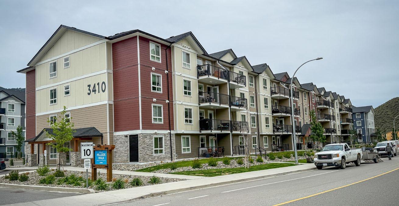
Orchards Walk Development Permit Area
1. Purpose
The purpose of the Orchards Walk Development Permit Area is to establish objectives and provide guidelines for the form and character of commercial and residential development in the Orchards Walk area. These guidelines ensure that development occurs in a manner that is sensitive to the existing built form and surrounding natural features by encouraging new development to consider local characteristics and incorporate high-quality design into the siting configuration, landscaping treatments, and overall building aesthetics.
2. Area
The Orchards Walk Development Permit Area applies to all properties within the designated area shown on the Orchards Walk Development Permit Area map. Where the Orchards Walk Development Permit Area overlaps with other development permit areas, all applicable guidelines will be considered.
3. Exemptions
A development permit will not be required for the following:
• Internal renovations
• External renovations that do not affect the form and character of the building or that result in increased lot coverage (to be determined by the Development, Engineering, and Sustainability Department)
4. Objectives
The Orchards Walk Development Permit Area Guidelines promote quality development that:
• Ensures the form and character of development within Orchards Walk respect and enhance the unique natural qualities of the area through the sensitive addition of new buildings and amenities
• Encourages healthy lifestyles and sustainable local growth through well-designed, durable buildings; landscapes; and public spaces
• Reinforces the compact, walkable, pedestrian-oriented vision for the site
• Animates the public realm to enrich a sense of place
• Accommodates active transportation modes and transit usage
• Mitigates potential impacts on adjacent land uses
• Supports sustainable energy and water management through site and landscape design
• Welcomes both residents and visitors alike to the Kamloops region on this highly visible tract of land adjacent to the Trans-Canada Highway East
5. Guidelines
5.1 General Design Guidelines
Development permits issued in this area shall be in accordance with the following guidelines:
1. The site must be designed and developed in a comprehensive manner to maximize view corridors towards the river and towards the bluffs and to ensure that streetscape elements, such as lighting, furniture, paving treatments, and tree plantings, display a unified design theme.
2. The streets shall be designed to provide a safe and pleasant environment for both pedestrians and vehicles. Major road corridors should be designed to safely accommodate on- or off-road bike lanes whenever possible.
3. The site will accommodate a variety of building types, forms, and heights to create visual interest and appeal to a variety of income levels and age groups.
4. The site must create a centrally located, pedestrian-oriented village centre that serves the daily needs of adjacent residents and also serves as a neighbourhood gathering space and focal point for the community.
5. Opportunities to share parking with adjacent complementary uses should be considered wherever possible (e.g. to meet retail demand during the day and residential demand at night) to reduce space dedicated to parking and to encourage walking within the community.
6. Quality materials must be used to evoke a sense of permanence and to reflect the dramatic natural setting.
7. Entrance signage to the development should be visually appealing to the travelling public and consistent with the scale, character, quality, and image of the development.
8. Signage within the development will be encouraged to be pedestrian oriented, small-scale, and consistent with the architectural character of the building or use that it is advertising. To this end, hanging and window signs will be encouraged within the commercial plaza area with monumentstyle, free-standing signs, and directional signs located at key entrances and at gateways throughout the development.
9. On-site parking will be discouraged in any yard abutting Valleyview Drive or Grand Boulevard.
5.2 Multi-Unit Residential in Single-Detached and Two-Unit Residential Form
Development permits, including those for multi-unit residential development in single- and two-family residential form, shall be issued in accordance with the following guidelines:
1. Ensure buildings are oriented towards the street. This can be accommodated by having the main entrance face the internal road or public street.
2. Encourage an urban form of housing that strongly relates to the street and maximizes the potential of the site by respecting the following guidelines:
i. ensure a minimum lot size of 200 m2
ii. permit variations in the front yard setback from a minimum of 1.5 m to a maximum of 6.0 m (or the foreset line, whichever is greater) to provide transition space from public to private space and to provide opportunities for decks and balconies
iii. ensure a minimum side yard setback of 1.2 m from interior lot lines and 3.0 m from exterior lot lines
iv. ensure a minimum rear yard setback of 3.0 m, except where an attached garage faces a rear lane where the minimum rear yard setback is reduced to 1.5 m
v. permit a maximum site coverage of 60%
vi. permit a maximum building height of two storeys, not to exceed 10 m
3. Accessory buildings are not permitted in the front yard and shall have a minimum side yard setback of 0.0 m (or 1.2 m where an accessory building accommodates a secondary suite) and a rear yard setback of 1.5 m.
4. Permit a secondary suite within the principal dwelling or within an accessory building, provided the secondary suite is clearly incidental in size and scale to the primary single-detached use of the site and meets other design guidelines (e.g. building height, lot coverage).
5. Permit fences to a maximum height of 1.0 m in the front yard, except that the maximum fence height in the front yard may be increased to 1.5 m for a length not to exceed 25% of the width of the lot.
6. Permit fences to a maximum of 2 m in the side and rear yard, except that the maximum fence height in the side yard shall be 1.0 m where the side yard abuts a street.
7. Encourage the creation of usable outdoor amenity space in the form of front and rear courtyards that provide shade in summer months and wind protection in winter months.
8. Ensure that a minimum of 25% of the site is landscaped.
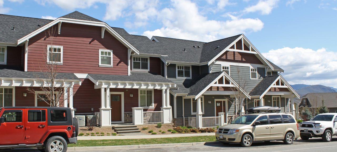
5.3 Multi-Unit Residential in Semi-detached and Townhouse Form
Development permits, including those for multi-unit residential development in semi-detached and townhouse forms, shall be issued in accordance with the following guidelines:
1. Ensure buildings are oriented towards the street, including an internal access roadway. This can be accomplished by having the main entrance face the street.
2. Encourage an urban form of housing that strongly relates to the street and maximizes the potential of the site by respecting the following siting guidelines:
i. Permit variations in the front yard setback from a minimum of 1.5 m to a maximum of 6.0 m (or the foreset line, whichever is greater) to provide transition space from public to private space and to provide opportunities for decks and balconies
ii. Ensure a minimum side yard setback of 0.0 m from interior lot lines, 3.0 m from exterior lot lines, and 2.4 m between detached buildings
iii. Ensure a minimum rear yard setback of 3.0 m, except where an attached or detached garage faces a rear lane where the minimum rear yard setback is reduced to 1.5 m
iv. Permit a maximum site coverage of 60%
v. Permit a maximum building height of three storeys, not to exceed 12 m
3. Ensure visual variety of building forms through articulation, modulation, varied setbacks, indentations, building separation, roof modulation, varied roof pitch, finish, and the use of various natural building materials (e.g. brick, wood, stone) and colours to reflect the semi-arid Kamloops landscape.
4. Facilitate strong street edges by ensuring general consistency in the front yard setbacks within the same street block.
5. Discourage parking in the front yard on ground-oriented multi-unit residential development fronting Valleyview Drive or Grand Boulevard.
6. Ensure recreational vehicle parking is intensively screened and landscaped and is not located adjacent to Valleyview Drive.
7. Break down common parking areas into small clusters and visually separate these areas through curbing, lighting, directional signage, landscaping, or any combination of these elements.
8. Permit fences to a maximum height of 1.0 m in the front yard, except that the minimum fence height in the front yard may be increased to 1.5 m for a length not to exceed 25% of the width of the lot.
9. Permit fences to a maximum height of 2 m in the side and rear yard, except that the maximum fence height in the side yard shall be 1.0 m where the side yard abuts a street.
10. Encourage the creation of usable outdoor amenity space in the form of front and rear courtyards that provide shade in hot summer months and wind protection in cool winter months.
11. Ensure that a minimum of 25% of the site is landscaped.
Andrew Macaulay
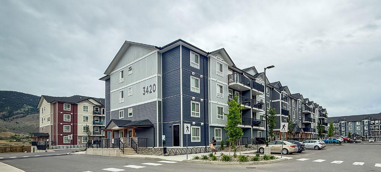
5.4 Multi-Unit Residential in Multi-storey Walk-up Apartment Form
Development permits, including those for multi-unit residential development in multi-storey walk-up apartment form, shall be issued in accordance with the following guidelines:
1. Ensure buildings are oriented towards the street. This can be accomplished by having the main entrance face the street.
2. Encourage an urban form of housing that strongly relates to the street and maximizes the potential of the site by respecting the following siting guidelines:
i. Permit variations in the front yard setback from a minimum of 1.5 m to a maximum of 6.0 m (or the foreset line, whichever is greater) to provide transition space from public to private space and to provide opportunity for decks and balconies
ii. Ensure a minimum side yard setback of 0.0 m interior lot lines, 3.0 m from exterior lot lines, and 2.4 m between detached buildings
iii. Ensure a minimum rear yard setback of 6.0 m, except where an attached or detached garage faces a rear lane where the minimum rear yard setback is reduced to 1.5 m
iv. Permit a maximum lot coverage of 60%
v. Permit a maximum building height of four storeys, not to exceed 18.0 m, with the exception that no more than 20% of the roof area may be constructed to a maximum height of 20.0 m to accommodate various vertical architectural elements
3. Ensure the visual variety of building forms through articulation, modulation, varied setbacks, indentations, building separation, roof modulation, varied roof pitch and finish, and the use of various natural building materials (e.g. brick, wood, stone) and colours to reflect the arid Kamloops landscape.
4. Discourage parking in the front yard of multi-storey walk-up apartments fronting Valleyview Drive or Grand Boulevard.
5. Ensure that recreational vehicle parking is intensively screened and landscaped and not located adjacent to Valleyview Drive.
6. Break down common parking areas into small clusters and separate them visually through curbing, lighting, directional signage, landscaping, or any combination of these elements.
7. Permit fences to a maximum height of 1.0 m in the front yard, except that the maximum fence height in the front yard may be increased to 1.5 m for a length not to exceed 25% of the width of the lot.
8. Permit fences to a maximum height of 2 m in the side and rear yard, except that the maximum fence height in the side yard shall be 1.0 m where the side yard abuts a street.
9. Ensure that a minimum of 25% of the site is landscaped.
5.5 Village Centre Commercial
Development permits, including commercial and mixed-use development, shall be issued in accordance with the following guidelines:
1. Encourage a highly pedestrian-oriented village centre by:
i. Ensuring buildings are oriented towards the street
ii. Ensuring a high level of architectural detail that provides visual interest at street level
iii. Accommodating transparent ground-level commercial to animate the street space
iv. Clearly identifying the primary entrance to a building by using special architectural treatments, signage, and landscaping
v. Discouraging stand-alone buildings surrounded by parking
vi. Providing visual variety through articulation, modulation, varied setbacks, indentations, building separation, roof modulation, varied roof pitch and finish, and the use of various natural building materials (e.g. brick, wood, stone) and colours that reflect the arid Kamloops landscape.
2. Encourage an urban village centre that strongly relates to the street, is pedestrian oriented, and has a human scale by respecting the following siting guidelines:
i. Encouraging commercial development to locate close to the street edge to enliven the street and to reinforce an urban character
ii. Encouraging setbacks from the street where outdoor courtyards, seating areas, or plaza space are provided
iii. Permitting a maximum lot coverage of 90% and a maximum floor area ratio of 3.0
iv. Permitting a maximum building height of four storeys, not to exceed 16.0 m, with the exception that no more than 20% of the roof area may be constructed to a maximum height of 18.0 m to accommodate various vertical architectural elements
3. Encourage a landmark vertical architectural element at a highly visible location within the commercial plaza to reinforce a sense of place and to visually identify the centre of Orchards Walk.
4. Permit mixed-use multi-unit residential and commercial development within the village centre commercial area, provided the ground floor is preserved for commercial uses.
5. Distinguish pedestrian-level commercial uses architecturally from attached residential units using horizontal architectural features, building indentations, and varying colours and material types.
6. Separate ground-level residential development entries from the commercial entrance, and ensure the residential entries are clearly visible from the street.
7. Encourage upper-level outdoor activity spaces, including decks, balconies, and patios, to be located adjacent to residential uses.
8. Break down common parking areas into small clusters, and visually separate them through curbing, lighting, directional signage, landscaping, or any combination of these elements.
9. Encourage the development of a central plaza area to function as both the village centre and the community gathering space.
10. Ensure that a minimum of 15% of the site is landscaped.
11. Encourage low-level monument, fascia, or hanging projecting signage is of a scale and level of detail that reflects the pedestrian orientation of the village centre.
12. Ensure site lighting is directed to minimize light pollution and potential impact on adjacent residential areas.
5.6 Landscaping and Screening
1. Provide landscape plans prepared by a registered landscape architect for all new landscaping covering 100 m2 or more in total site area.
2. Ensure public open space is usable, is located in highly visible areas, and, where possible, includes trees that provide necessary shade in summer months and an open canopy to facilitate sun access in winter months.
3. Preserve and creatively integrate existing trees and topographical features into the development where feasible.
4. Use tree species and vegetation commonly found within the Kamloops area.
5. Use landscaping to define public and private areas and to provide visual and physical breaks in hard urban surfaces (e.g. parking areas, façades, courtyards, patios).
6. Ensure that solid waste (garbage, organics and recycling) containers, utility connections, rooftop mechanical equipment, etc. are appropriately located and screened from the view of building tenants, the street, and other prominent viewpoints.
7. Use additional landscaping, tree planting, signage, and lighting to emphasize neighbourhood entrance points.
8. Encourage a wide variety of sound attenuation facilities adjacent to the Trans-Canada Highway East, including fences, landscaped walls, berms, and other similar techniques, that are designed to reduce noise impacts and to complement the character and quality of the adjacent development.
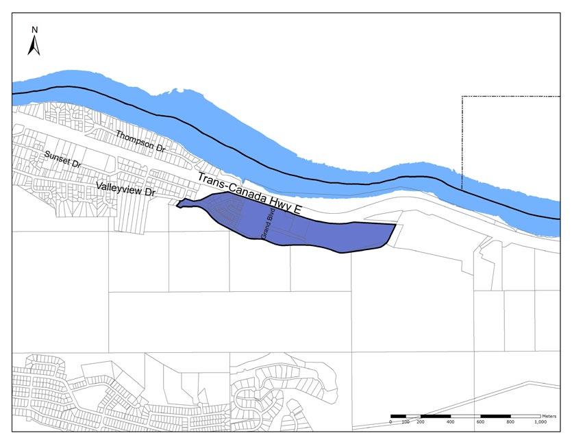
F IGURE F7: ORCHARDS WALK DEVELOPMENT PERMIT AREA MAP
Aberdeen Slope Hazard Development Permit Area
1. Purpose
The purpose of the Aberdeen Slope Hazard Development Permit Area is to establish objectives and provide guidelines for the protection of development from hazardous conditions in the Aberdeen Slope Hazard Zone. A development permit shall be required prior to the issuance of a building permit (including an earthworks permit), or the approval of a subdivision application or for the approval of a zoning application for any development in the designated area.
2. Area
The Aberdeen Slope Hazard Area, as shown on Map 14: Development Permit Area: Aberdeen Slope Hazard, extends approximately from lands south of Hugh Allan Drive and west of the Kamloops-Princeton Highway to the Pineview neighbourhood. It includes an area currently under treatment and monitoring for ground stability.
Detailed geotechnical analyses and studies have identified this area as susceptible to large-scale instability under adverse conditions of slope, groundwater pressure and geology.
Susan Helly
3. Exemptions
A development permit will not be required for the following:
• Renovations to an existing building or structure that do not increase the building or structure’s footprint, disturb its foundation, or convert an unenclosed space (e.g. a carport) to an enclosed space (e.g. a garage or habitable space)
• Approved interior plumbing work or hot tubs that do not interfere with the irrigation meter and domestic meter setup
• Siting permits for sheds 10 m2 or less OR new, non-habitable accessory buildings or structures less than 10 m2 in area
• Permits for demolitions or fire repair of existing buildings
• Properties which already have all required covenants registered on title through a previous application of Council Policy EDS-16 Technical Criteria for Development Conditions in the Aberdeen Hills Neighbourhood of the Aberdeen Slope Stability Development Permit Area
The professional assessment component of the development permit outlined in Section 5.1.i. and ii. below will not be required for rezoning applications when the existing zoning and proposed zoning fall within the same Official Community Plan land use designation (e.g. rezoning from R2 to R1 or to RM3. All are within the same Low-Rise Urban OCP land use designation and therefore exempt from component outlined in 5.1.i and ii).
4. Objectives
The objectives of the Aberdeen Slope Hazard Development Permit Area are:
• Regulating development within the Aberdeen Slope Hazard Zone in such a manner as to protect life and property from the identified hazardous conditions
• Determining the conditions or requirements that need to be included in the development permit to safeguard life and property
• Minimizing the risk to people and property from slope hazard
• Developing on the land in a safe manner that minimizes the impacts on or near steep slopes, including the potential runout area below
• Reducing slope hazards and landslide risk to people and property by carefully managing development and construction practices on or near steep slopes
Aberdeen Slope Stability: A Risk Management Approach
Development of the Aberdeen area of Kamloops began in the late 1970s, mostly starting in the lower central area and spreading outward from there. The development was supported by extensive geotechnical work provided by Klohn Leonoff on behalf of Dominion Construction Properties Ltd.
In 1995, ground movement affected a cluster of homes over a limited area south of Howe Road and just east of the Howe Road/ Van Horne Drive intersection, subsequently referred to as the Van Horne Slide. Emergency remedial treatment of the Van Horne Slide involved the installation of 13 pumped wells. By early 1996, the Van Horne Slide had been effectively stopped.
Since 1995, new developments in Aberdeen have largely consisted of infill construction within the existing developed areas and new subdivisions to the south and upslope of the older existing developments. A large portion of Aberdeen is dependent on continuous, effective treatment for maintaining stability. Should treatment stop, it is anticipated that within several days of the termination of treatment, the calculated driving and resisting forces will become about equal, putting the slope at risk of failure.
Although proven effective at maintaining stability, the existing treatment system is complex, has limited redundancies, and has limited automated backup systems. The treatment system requires continuing careful monitoring and constant maintenance.
As part of the ongoing management and monitoring of groundwater and stability in the Aberdeen area, the City worked with Golder and Associates to develop a risk management plan in 2008. The plan formalized management practices and requirements that the City already used, compiled into a concise and prescriptive format. It allows City staff to track data and conditions, ensuring any required management activities are completed within set time periods.
These activities include weekly monitoring, biannual testing, and annual stability studies. The first decade of the risk management plan was successful. The adopted procedures allow for accurate tracking of data, maintenance records, and management activities. The risk management plan is considered an integral component of the Aberdeen Groundwater Program.
• Avoiding alteration of steep slopes that may cause instability of the land or adjacent areas
• Minimizing the probability of groundwater recharge caused by development
• Utilizing professional design of drainage structures and mitigation works with supervision during construction and postconstruction certification
• Encouraging ongoing maintenance and monitoring of steep slopes
5. Guidelines
Within the Aberdeen Slope Hazard Zone, development may be susceptible to or encourage and intensify damage from geotechnical hazards, such as small-scale soil collapse, ground saturation, and large-scale ground instability. Accordingly:
1. Rezoning in the Aberdeen Slope Hazard Zone may only be considered where professional reports conclude that the resulting development will not negatively impact the ground stability and groundwater conditions on other properties. The following items are required:
i. A professional assessment that, in consideration of hydrogeological and water balance conditions, the proposed development as designed will not result in a negative impact on ground water conditions in any of the known stability sections.
ii. A professional assessment that follows Engineers and Geoscientists British Columbia Professional Practice Guidelines - Landslide Assessments in British Columbia. Specifically, to determine that the site is currently stable and will continue to be stable following development. The assessment should include factual information regarding soil and bedrock stratigraphy at the site, identification and detailed descriptions of Tertiary Age Kamloops Group bedrock deposits (where present), installation of multiple piezometers and monitoring for a sufficient period of time to assess natural variations in groundwater pressures in the overburden and bedrock, and stability analysis.
2. Subdivision in the Aberdeen Slope Hazard Zone may only be considered where professional reports conclude that the resulting development will not negatively impact the ground stability and groundwater conditions on other properties. These requirements may also be applied to an earthworks permit at the City’s discretion. The following items apply:
i. Any items listed above for rezoning that were not satisfactorily provided at the time of zoning.
ii. Design, financing, and/or installation of any off-site and on-site works proposed as part of the assessments above.
iii. Installation of appropriate on-site monitoring devices to ensure the City maintains the ability to monitor slope stability and groundwater pressures for the purposes of managing and maintaining slope stability in the Aberdeen neighbourhood. This may include, but is not limited to, monitoring wells, such as vibrating wire piezometer(s), slope inclinometers, flow monitoring sites, or other instruments as deemed appropriate for the site being developed.
iv. Irrigation covenants are applied to the title of every lot, restricting the amount of outdoor irrigation to prevent unnecessary outdoor water use.
v. Swimming pools are discouraged, and, at the option of the City, a covenant restricting the installation of pools must be registered against each legal parcel.
vi. Cut and fills that result in a net change in the volume of soil must be evaluated to ensure stability of geological sections is maintained.
3. At the building permit stage, the following may be required:
i. Any items listed above for subdivisions that were not satisfactorily provided at the time of subdivision.
ii. The Chief Building Inspector/Manager shall require a covenant to be registered against the title of the property which details the conditions of this development permit ensures that the conditions are fulfilled prior to the issuance of a building permit for each new home or building.
iii. Roof drainage must connect directly to the City’s municipal storm drainage system to prevent water from getting into the ground.
iv. Assessment by a Qualified Professional based on the landscaping that confirms an appropriate irrigation budget for the lot to prevent unnecessary outdoor water use. The Chief Building Inspector may require that an Irrigation covenant is applied to the title of the lot restricting the amount of outdoor irrigation that reflects this updated irrigation budget.
v. A water meter configuration to isolate and monitor outdoor water use, typically requiring two separate water meters.
Flood Hazard Development Permit Area
1. Purpose
The purpose of the Flood Hazard Development Permit Area is to establish objectives and provide guidelines for the protection of development activity from hazardous conditions in the flood plain. A development permit shall be required prior to approval of a subdivision application or the issuance of a building permit for any development in the designated area.
2. Area
The Flood Hazard Development Permit Area is shown on Map 5: Hazard Lands and extends along the shorelines of the North Thompson River, South Thompson River, and Thompson River and Peterson Creek from Columbia Street north to the South Thompson River.
3. Exemptions
A development permit will not be required if the following conditions are met:
• The development activity complies with the minimum flood construction level identified from City mapping or is exempt from the requirement to comply with the flood construction level, as detailed below, and
• The development activity complies with the minimum flood plain setbacks or is exempt from the requirement to comply with the minimum flood plain setbacks, as detailed below OR
• The development activity consists of a renovation of an existing building that does not involve an addition, excluding the renovation of pre-existing basements, or an addition to a building that would not increase the size of the building by more than 25% of the floor area existing at the date of adoption of these guidelines, so long as when complete, the addition involves no further contravention of the flood plain setback guidelines, and
• The applicant voluntarily agrees to a covenant being registered under section 219 of the Land Title Act
Travis Bonner
3.1 Specific Exemptions to Flood Construction Level
The underside of any floor system, the top of any concrete slab, or the top of any mobile or modular home pad may be below the applicable flood construction level in the following cases:
• Where an existing building is legally non-conforming to the flood construction level provisions of these guidelines, and the use and density of the building conforms to the Zoning Bylaw, the building may be renovated or repaired only to the extent that the renovation or repair would, when complete, involve no further contravention of the flood construction level existing at the time the renovation or repair was started.
• Non-enclosed areas such as carports, porches, and balconies.
• Non-habitable buildings such as storage buildings and domestic greenhouses.
• Parking areas, including garages and enclosed underground parking areas.
- In the case of an enclosed underground parking area, an unobstructed means of pedestrian ingress and egress must be provided above the flood construction level, and signs must be posted at all points of entry notifying users that the parking area is not protected from inundation by floodwaters.
• Open-sided recreation shelters, stands, wash houses, washrooms, docks, and other outdoor facilities.
• Agricultural land uses:
- Farm dwelling units on parcel sizes 8.0 ha or greater and located within the Agricultural Land Reserve need not comply with the flood construction level, provided they are no lower than 1.0 m above the natural ground elevation taken at any point on the perimeter of the building.
Open-sided livestock housing buildings.
Closed-sided livestock housing need not comply with the flood construction level, provided they are no lower than 1.0 m above the natural ground elevation taken at any point on the perimeter of the building.
For other farm buildings, flood proofing is at the discretion of the owner.
• On-loading and off-loading facilities associated with water-oriented industry (such as port or marina buildings) and portable sawmills, provided that major electrical switchgear is placed above the flood construction level.
3.2 Specific Exemptions to Flood Plain Setbacks
The setback may be less than the guidelines in the following cases:
• Where an existing building is legally non-conforming to the flood plain setback provisions in these guidelines, and the use and density of the building conforms to the Zoning Bylaw, the building may be renovated or repaired only to the extent that the renovation or repair would, when complete, involve no further contravention of the flood plain setback guidelines existing at the time the renovation or repair was started.
• On-loading and off-loading facilities associated with water-oriented industry (such as port or marina buildings) and portable sawmills.
4. Objectives
The objectives of the Flood Hazard Development Permit Area are to:
• Regulate development activity within the flood plain to protect life and property from the identified hazardous condition of flooding
• Determine the conditions or requirements that need to be met to safeguard life and property
5. Guidelines
Where the Flood Plain Development Permit Area overlaps with other development permit areas, all applicable guidelines will be considered.
Prior to undertaking any development activity on lands or a portion of lands located in a Flood Hazard Development Permit Area and to which an exemption does not apply, an owner of lands or an appropriate delegate must receive approval for a development permit that meets the following guidelines:
1. Flood Construction Level
i. Freeboard allocation:
a. The vertical height that has been added to the designated flood level to establish the flood construction level is 0.6 m in the flood plains of the South Thompson River, the North Thompson River, the Thompson River, and Kamloops Lake.
b. The vertical height that must be added to accommodate flood waters and to establish the flood construction level is 0.45 m, measured from the edge of the asphalt at the centre of the lot’s frontage, in the flood plain of Peterson Creek.
ii. No building or any part thereof shall be constructed, reconstructed, moved, extended, or located with the underside of a wooden floor system, top of a concrete slab, or modular or mobile home pad of any area used as a usable area, including business or storage of goods damageable by floodwaters, lower than the elevation interpolated between the flood construction level elevation points on City mapping. Where a crawlspace is used to elevate the usable area above the minimum flood construction level, the maximum ceiling height of the crawlspace shall be in accordance with the British Columbia Building Code and shall remain unfinished. The usable area means any room or space within a building that is or can be used for human occupancy, commercial sales, or storage of goods, possessions, or equipment (including furnaces).
iii. The required elevation may be achieved by structural elevation, by adequately compacted landfill, or by a combination of both structural elevation and landfill.
iv. No area below the required elevation shall be used for the installation of furnaces, major electrical switchgear, or other fixed equipment susceptible to damage by floodwater.
v. Where landfill is used to achieve the required flood construction level, the fill must not adversely impact neighbouring properties by increasing the surface water elevation or directing flows towards those properties
2. Flood Plain Setbacks
i. Setbacks maintain a flow path during flooding and allow for potential land erosion. No building shall be constructed, reconstructed, moved, extended, or located: within 30 m of the South Thompson River, the North Thompson River, the Thompson River, or Kamloops Lake
within 15 m of Peterson Creek
within 7.5 m of any structure for flood protection or seepage control, the subsurface movement of water through or along a dike, or any dike right-of-way used for protection works
ii. The setback distance will be measured from the top of the bank or from the natural boundary where the top of the bank is not clearly defined. The top of the bank means the points closest to the natural boundary of a watercourse where a break in the slope of the land occurs that the natural slope beyond the break is flatter than 3:1. The setback distance will be measured to the nearest part of the building, including roofs, eaves, and any overhanging components or cantilevered portions of a building or to the toe of a fill slope.
iii. Additional setbacks from watercourses (i.e. any natural or human-made depression with welldefined banks that contains water at least part of the year) may be required under the Riparian Areas Regulation Development Permit Area and any other municipal, provincial, or federal regulation.
3. Alterative Measures
Where the flood construction level or flood plain setbacks cannot be practicably achieved, the City may consider approval provided the following:
i. That every effort has been made to conform to the flood construction level and flood plain setbacks and that the proposed building has been raised or set back as much as practical. This is to be explained in a report and certified by a registered professional engineer or architect. The
report will outline why the flood construction level cannot be achieved and how the proposed elevation is the maximum that is feasible.
ii. A report, certified by a registered professional engineer or geoscientist with experience in geotechnical engineering, confirming that the land and the proposed reduced flood construction level or setback may be used safely for the intended use.
iii. A report, certified by a registered professional architect, detailing the measures taken in building design for flood proofing to mitigate risks to life and property. The report will outline how elements of the building will be used and constructed so that there is little to no risk to life, that damages are minimal, and the recovery time is minimized. Damages should consider both contents and structure. Examples may include using waterproof building materials, non-porous finishes, flood-resistant insulation, watertight windows and doors, flood-resistant flooring, the ability to accommodate temporary flood barriers, electrical systems and furnace equipment above the flood construction level, non-essential functions on ground floors, and flexible or temporary layouts on ground floors.
iv. Whether the applicant voluntarily agrees to a covenant being registered under section 219 of the Land Title Act
v. Any additional information the Development, Engineering, and Sustainability Director determines is required to assist Council or the Development, Engineering, and Sustainability Director in considering the application.
vi. The granting of an approval, and the approval itself, may be made subject to any terms and conditions the City considers necessary or advisable.
vii. Applications for which a covenant under section 219 of the Land Title Act are not voluntarily offered are unlikely to be recommended for approval due to the risks associated with development activity in the flood plain

Section G Maps
Arek Halusko


Map 6 | Parks and Recreation

Projection Regulation
Areas
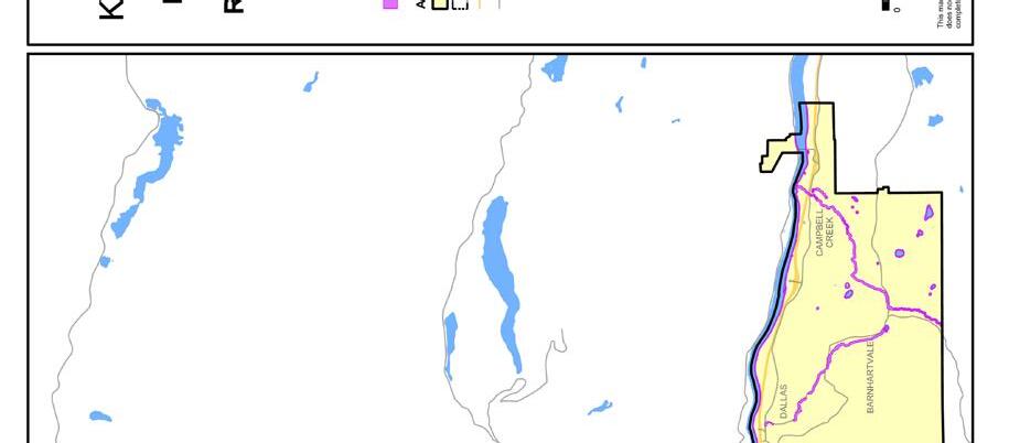
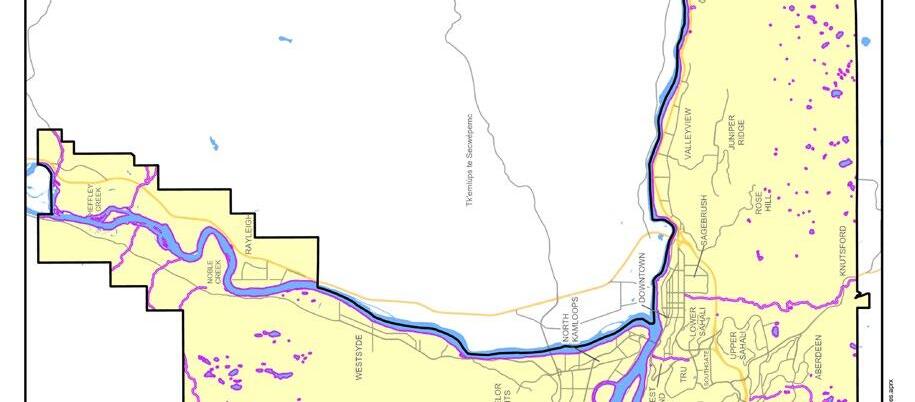
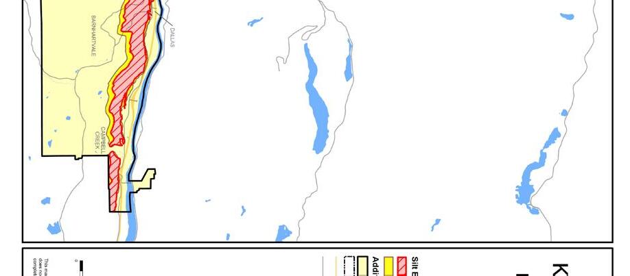
Map 12 | DPA: Silt Bluffs

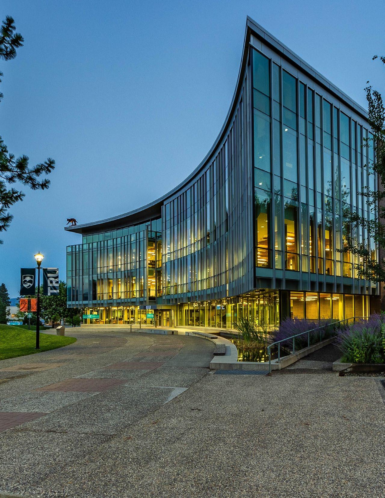
Section H
Appendices
Steven Gillingham
Glossary
Definitions are provided for convenience and are not intended to limit the statutory authority where the same term is defined within local government legislation.
Accessibility
Built environments that are designed and constructed to allow people with a physical or sensory limitation reasonable access and ease of movement around buildings, public spaces, and all associated facilities. In addition to serving people with chronic impairments and disabilities, accessible design features aid people experiencing temporary illness or injury as well as natural declines in vision, hearing, and mobility as they age.
Active transportation
Any form of human-powered transportation, such as walking, cycling, or rolling using a skateboard, in-line skates, or a wheelchair, and micromobility devices that give you a boost, such as electric wheelchairs, mobility scooters, e-bikes, and e-scooters.
Adaptable design
Designing buildings so that accessibility features can be added more easily and inexpensively after construction to meet the changing needs of occupants as mobility becomes limited by age, disability, or illness.
Adaptive management
A structured, continual process of learning from planning and management successes and challenges with the goal of improving the effectiveness of policies over time.
Affordable housing
Rented or owned dwelling units occupied by residents who earn less than the median income in Kamloops and who do not pay more than 30% of their gross annual income on housing, including rent, mortgage, taxes, insurance, and utilities.
Agri-tourism
A tourist activity, service, or facility directly associated with and accessory to land that is classified as a farm under the Assessment Act, including farm tours, sleigh rides, corn mazes, and wine tasting.
Airport entry corridor
Located immediately east of the Kamloops Airport, the airport entry corridor is a significant gateway to the North Shore and the rest of Kamloops. Situated within and adjacent to the Brocklehurst West Future Development Area, which includes large, vacant brownfield parcels and the last large greenfield site on the North Shore, the corridor’s potential for redevelopment provides opportunities to enhance the vitality of the area and strengthen its role as a gateway to the city.
Biosolids
Residual organic material that is recovered during the municipal wastewater treatment process. Biosolids are composted by the City, mixed with soil to reintroduce beneficial nutrients, and then used for agricultural and landscaping applications. This strategy has been shown to have the lowest environmental impact compared to other waste management strategies, such as landfill or incineration, and has the added benefits of contributing to local food security and reducing costs for taxpayers.
Carriage suite
A self-contained, two-storey dwelling unit that is separate from and accessory to the principal dwelling. A carriage suite shall have a footprint no greater than 80 m2 and shall not have more than 90 m² of residential living space (see intensive residential).
Central Business District
The city’s civic and commercial core and a key destination for employment and services for the community and the surrounding region. With an intensive concentration of community, commercial, cultural, and recreational facilities and activities supported by medium- to highdensity multi-unit residential and mixed-use development, the Central Business District provides a vibrant, diverse, and distinct centre for the community.
Child care facility
A facility that is licensed in accordance with the Community Care and Assisted Living Act
City Centre Revitalization Tax Exemption Bylaw
City of Kamloops City Centre Revitalization Tax Exemption Bylaw No. 22415, 2022.
Commercial Daycare Facility Revitalization Tax Exemption Bylaw
City of Kamloops Commercial Daycare Facility Revitalization Tax Exemption Bylaw No. 22-4-18, 2022.
Community
care facility
Any facility licensed under the Community Care and Assisted Living Act that provides personal care, supervision, social or educational training, or physical or mental rehabilitative therapy, with or without charge, to persons not related by blood or marriage to an operator of the facility.
Community gardens
Parcels of land that may be publicly or privately owned and are cultivated by multiple people, either on individual small garden plots or on a single, large piece of land gardened collectively by a group of people. Community gardens are often managed by a group of unpaid individuals or volunteers and may include educational components, greenhouses, or other features. The City’s community gardens program is operated by a local non-profit organization.
Complete neighbourhoods
Neighbourhoods that incorporate places for people to live, work, shop, learn, play, and thrive. Complete neighbourhoods provide diverse housing choices and safe and convenient access to commercial amenities (including places of employment), community gathering places, and parks and recreational facilities via active transportation routes and public transit.
Complete streets
Streets designed and operated to enable users of all ages and abilities, including pedestrians, cyclists, public transit passengers and vehicles, commercial vehicles, and private automobiles, with safe and comfortable access, movement, and crossing. Complete streets are intended to serve all users and transportation modes equally, as opposed to conventional 20thcentury designs that prioritize low-occupancy motorized vehicles.
Core housing need
Households that fall below at least one of the Canadian Mortgage and Housing Corporation’s standards for adequacy, affordability, or suitability and that spend 30% or more of their before-tax income on housing.
Crime Prevention Through Environmental Design (CPTED)
A planning approach that recognizes how the proper design and effective use of the built environment can reduce the incidence and fear of crime and improve safety and quality of life.
Daylighting
The process of restoring a stream to a more natural above-ground state after having been previously buried, filled in, or diverted during the historic growth and development of a city. Daylighting and rehabilitation of streams can provide valuable environmental and social benefits, including wildlife corridor and riparian habitat enhancement, recreational and educational opportunities, and community beautification.
Designated flood level
The observed or calculated elevation for the flood with magnitude equal to a flood having a 200-year recurrence interval and is used in the calculation of the flood construction level
Development cost charges
A fee imposed on residential, commercial, and industrial uses to provide funds to assist the City in paying the capital costs of providing, constructing, altering, improving, or expanding sewage, water, drainage, parkland, and roadway facilities, not including off-street parking facilities, to directly or indirectly service the development for which the charges are imposed.
Development Cost Charges Bylaw
Development Cost Charges Bylaw No. 48-100.
Development permit area
An area that has been designated under the Local Government Act as requiring issuance of a development permit before beginning development.
Development Permit Procedure and Delegation Bylaw
Development Permit Procedure and Delegation
Bylaw No. 51-2, 2024
Earthwork Control Bylaw
Earthwork Control By-law No. 4-19, 1981
Environmentally sensitive area
A site, area, or any parcel of land that has, or with remedial action could achieve, desirable environmental attributes worthy of retention or special care. Such attributes may contribute to the protection and/or creation of wildlife habitat, soil stability, water retention or recharge, vegetative cover, and similar vital ecological functions. Areas can range in size from small patches to extensive landscape features and can include rare or common habitats, plants, and animals.
Extreme core housing need
Households that fall below at least one of the Canadian Mortgage and Housing Corporation’s standards for adequacy, affordability, or suitability and that spend 50% or more of their before-tax income on housing.
Flood construction level
The designated flood level plus the allowance for freeboard and is used to establish the elevation of the underside of a wooden floor system, top of a concrete slab, or modular or mobile home pad. For the purposes of the Flood Hazard Development Permit Area, the flood construction level is provided by the City.
Flood
plain
A lowland area, regardless of the presence of dikes, or other flood-proofing measures, or not, which, by reasons of land elevation, is susceptible to flooding from an adjoining watercourse, and for administration purposes is taken to be that area submerged by the designated flood level
Food security
When people have secure access to sufficient amounts of safe and nutritious foods for growth, development, and an active and healthy life. Food insecurity can be caused by the unavailability of food, insufficient purchasing power, inappropriate distribution, or inadequate use of food at the household level.
Food system
An interconnected network of practices, processes, and places involved in feeding a population and the inputs and outputs at each stage, including food production, processing, distribution, consumption, and disposal of food and food-related items.
Garden suite
A self-contained, one-storey dwelling unit that is separate from and accessory to the principal dwelling. A garden suite shall have a total floor area of not more than 90 m2 in area (see intensive residential).
Greenfield
An undeveloped tract of land, typically found on the edge of the city, that may have potential for urban development, including commercial, residential, and industrial uses, and may be used for recreational purposes by residents.
Green space
Public or private land that contains a significant cover of vegetation. It can be landscaped with lawns and shrubs, or it may consist of natural features.
Greenways
Active transportation corridors that connect parks, natural areas, and other amenities across a neighbourhood, city, or region. Greenways may also be used by wildlife for safe passage through the city.
Ground oriented
Housing that provides direct access to and from each dwelling unit and private open space at grade level, rather than from a common entrance or hallway.
Hazard area
Land that may have significant development constraints or cannot be developed due to flooding, soil composition, ground instability, wildfire risk, or excess slope.
Healthy built environment
Human-made or modified physical surroundings in which people live, work, and play that have been specifically designed to encourage and support physical, mental, and social health and well-being.
Heat island
An urban area that is warmer than its surrounding natural land cover. Trees and vegetation offer natural cooling effects through shading and evaporation of water. As vegetation is replaced by asphalt and concrete, these surfaces absorb more heat, which causes ambient temperatures to rise. Waste heat from vehicles and buildings may further contribute to the heat island effect. Increasing urban vegetation, such as adding parkland, on-site landscaping, and street trees, can help reduce urban heating.
Heritage resources
Community resources of historical significance that include, but are not limited to, buildings, neighbourhoods, streetscapes, viewscapes and vistas, landscapes, public places, important sites and areas, and monuments.
Heritage value
The aesthetic, social, cultural, scientific, or spiritual importance or significance of a historic resource and the opportunities it provides present and future generations in terms of education, placemaking, remembrance, and celebration.
High-rise (buildings)
Buildings that are greater than six storeys.
Highway corridor
A provincial arterial highway as defined by the Province in the Transportation Act
Hotel and Motel Redevelopment
Revitalization Tax Exemption Bylaw
City of Kamloops Hotel and Motel Redevelopment Revitalization Tax Exemption Bylaw No. 22-4-19, 2022.
Household income
The sum of the incomes of all people aged 15 years or older residing at a single address.
Housing agreement
Terms and conditions agreed to by the City and an owner regarding the occupancy of housing units. Terms or conditions may include the following:
• tenure of the housing units
• availability of housing units to categories of persons identified in the agreement
• the administration and management of the housing units
• the rent, lease, sale, or share prices that may be charged and the rate at which these may be increased over time.
Housing continuum
The range of shelter and housing options includes emergency shelters and transitional housing, supportive housing for priority populations, including seniors and people with mental illness, public and not-for-profit affordable rental housing, market rental, and home ownership.
Inclusive
An inclusive community respects all citizens, gives them full access to resources, promotes equal treatment and opportunity, works to eliminate discrimination, values diversity, and engages all citizens in decision-making processes that affect their lives.
Infill
Development or redevelopment on vacant or underutilized parcels of land within existing urban areas of the city, often increasing density while using infrastructure and existing community services more efficiently than peripheral greenfield development.
Examples include:
• subdividing larger, single-detached residential lots into additional lots, adding residential suites, redeveloping a singledetached residential building into a twounit residential building or a small-scale multi-unit residential project
• redeveloping surface-level parking lots at shopping centres, refurbishing existing buildings for new uses, and redeveloping large residential lots to accommodate more units
Intensive residential
Small-scale residential infill development that includes carriage suites, garden suites, small-scale multi-unit residential; conversion of residential buildings to add an additional unit or units; small lot development; and infill development as described in Section F: Development Permit Area Guidelines
Intensification
The development of a property, site, or area at a higher density than currently exists through redevelopment, the development of vacant and/or underutilized lots within previously developed areas, infill development, and the expansion or conversion of existing buildings.
Land assembly
The joining of smaller contiguous lots to make one larger parcel of developable land.
Large-format retail
Land-intensive commercial development, such as warehouse outlet retail uses or big box stores.
Life lease
This form of prepaid rental housing is a legal agreement that permits purchasers to occupy a home for life or until they are no longer capable of living there in exchange for an initial lump sum payment and subsequent monthly payments. Monthly payments cover the ongoing project management fees, maintenance, operating expenses, and, in some cases, rent, depending on the size of the initial payment.
Local-serving commercial
Small-scale commercial amenities within residential neighbourhoods that provide retail sales or limited-service functions (e.g. small grocery store, coffee shop, neighbourhood pub, convenience store) while serving as walkable gathering places for surrounding neighbourhood residents.
Low-rise (buildings)
Buildings that are one to three storeys in height.
Mid-rise (buildings)
Buildings that are four to six storeys in height.
Mixed-use
The combination of more than one use, such as residential, commercial, industrial, or institutional uses, in the same building or development.
Mixed-use areas
Locations in the city that contain or are planned to be developed primarily with mixeduse (commercial and multi-unit residential) development. For the purposes of the Official Community Plan, mixed-use areas include town centres and areas designated as Mid-Rise Commercial
Mixed-use areas should be accessible by transit, integrated with active transportation networks, and feature community amenities, such as shopping, cultural and/or recreational facilities, health services, and community gathering places to meet the needs of adjacent neighbourhoods and the broader community.
Multi-unit residential
A development where the building or buildings on a lot are used for three or more dwellings in accordance with the regulations for multi-unit residential use specified in the Zoning Bylaw
Natural boundary
The visible high watermark of any lake, river, stream, or other body of water where the presence and action of the water are so common and usual and so long continued in all ordinary years as to mark upon the soil of the bed of the lake, river, stream, or other body of water a character distinct from that of the banks thereof, in respect to vegetation, as well as in respect to the nature of the soil itself (Land Act, RSBC 1996, c 245, s 1). The natural boundary also includes the best estimate of the edge of dormant or old side channels and marsh areas.
Neighbourhood centres
Urban areas within the city, secondary to town centres, that support the needs of the surrounding neighbourhood by providing a range of commercial and community amenities. They serve as social and economic focal points for residents and provide opportunities to live, work, and play within the neighbourhood they serve.
North Shore Revitalization
Tax Exemption Bylaw
City of Kamloops North Shore Revitalization Tax Exemption Bylaw No. 22-4-20, 2022.
Not-for-profit rental housing
Purpose-built rental housing that is operated by not-for-profit organizations, usually with government funding. These developments may serve a wide range of populations, such as families, singles, couples, seniors, and/or persons with disabilities. Other not-for-profit housing developments function without government subsidies and may include a mix of market and non-market units.
Office development
Development containing office space for the operation of public or private sector uses, including, but not limited to, professional services, public administration, health care, and higher education.
Official
Community Plan
Official Community Plan Bylaw No. 68, 2025
Passive recreation
Any informal outdoor recreational activity, such as hiking, bird watching, canoeing, and picnicking, that does not require the use or development of recreational fields and facilities and has a minimal environmental impact.
Pesticide Use Control Bylaw
Pesticide Use Control Bylaw No. 26-4, 2016
Placemaking
A holistic and community-based planning approach that builds on an area’s unique assets and creates attractive walkable spaces with a strong sense of identity and civic character. Placemaking promotes personal well-being by drawing people to a common third place, other than their home and work, which offers residents space to strengthen the connections between people and the places they share.
Public realm
All areas, linkages, and built form elements that are physically or visually accessible by the public, including, but not limited to, streets, sidewalks, bicycle lanes, bridges, plazas, squares, courtyards, gateways, parks, waterfronts, natural features, view corridors, landmarks, building interfaces, and public amenities, such as cultural, civic, and recreational buildings.
Purpose-Built Rental Development
Revitalization Tax Exemption Bylaw
Purpose-Built Rental Development
Revitalization Tax Exemption Bylaw No. 22-4-21, 2024
Qualified environmental professional
A scientist or technologist who specializes in a relevant applied science or technology, is registered in British Columbia with an appropriate professional organization, and, through demonstrated suitable education, experience, accreditation, and knowledge, may be reasonably relied upon to provide advice within an area of expertise that includes, but is not necessarily limited to, agrology, forestry, biology, engineering, geomorphology, hydrology, and/or landscape architecture.
Redevelopment
Any proposed expansion, addition, or major façade change to an existing building or structure, or a proposed development on a formerly occupied site.
Row houses
Side-by-side, single-unit dwellings sharing common walls with one or two adjacent units. Each unit is on its own legal parcel with a formal street address and may have its own front and back yard.
Sanitary Sewer Bylaw
Sanitary Sewer Bylaw No. 32-35, 1983.
Secondary suite
A self-contained dwelling unit within a building or portion of a building which is completely separated from other parts of the building by fire separation, is located in a building of only residential occupancy which contains only one other dwelling unit and common spaces, and where both dwelling units constitute a single real estate entity.
Sense of place
The subjective experience of a place as having physical and social attributes that make it distinctive and memorable.
Sensitively integrated
The implementation of development in a manner that considers existing characteristics and planned vision for the area; incorporates high-quality design into the siting configuration, landscaping treatments, and overall building aesthetics; minimizes negative impacts on existing and future development; and ensures protection of the natural environment and protection from hazardous conditions.
Sign Regulations Bylaw
City of Kamloops Sign Regulations
By-law No. 11-77, 2001
Silt bluffs
A distinctive landscape feature of the South Thompson River Valley in eastern Kamloops formed from the erosion of ancient glacial lake floor sediments. The resulting benchlands present unstable and hazardous conditions for development.
Small-scale multi-unit residential
A development where the building(s) are used for three or four dwelling units in accordance with the Local Government Act or for five to six units where zoning permits, and where allowable density may be configured in forms such as multiple single- or semi-detached dwellings, residential suite(s), or a combination of such building types and multiplexes and townhouses.
Solid Waste, Recyclables, and Organics Bylaw
Solid Waste, Recyclables, and Organics Bylaw No. 40-67, 2021
Stacked townhouse
Typically consists of two residential units stacked one on top of the other in a row of four or more stacked pairs sharing one legal parcel. The units may have more than one storey each, and all units have their own front entrances facing the street or a courtyard.
Subdivision and Development Control Bylaw
Subdivision and Development Control
Bylaw No. 4-33, 2012.
Supportive housing
Housing that combines rental or housing assistance with individualized, flexible, and voluntary support services for people with high needs related to physical or mental health, developmental disabilities, or substance use. Supportive housing units may be located in one building or mixed with nonsupportive units. Social and health-related services may be delivered to residents within the units by the regional health authority and/ or by not-for-profit organizations. Units may be owned and operated by private or not-forprofit housing providers.
Tournament Capital Program
The Tournament Capital Program highlights Kamloops’ role as Canada’s Tournament Capital—the country’s top sports tourism destination for medium-sized cities. Through the promotion of nationally significant programs and events, the program attracts diverse sporting and recreation events to Kamloops’ world-class recreation facilities and effectively promotes local assets, lifestyle, and community amenities while developing local sport and fitness.
Town Centres
Urban areas with infill development potential that support the needs of the surrounding neighbourhood and broader community by providing a wide range of commercial amenities, medium- to high-density residential development, transit access, and community services. They serve as major anchor points within the city and provide residents with opportunities to live, work, and play within a convenient area.
Designated town centres include the City Centre, North Shore Town Centre, Sahali Town Centre, Valleyview Town Centre, Aberdeen Town Centre, Tranquille Market Corridor, and McGill Corridor.
Tree Protection Bylaw
Tree Protection Bylaw No. 50-1, 2017
2018 Official Community Plan
Official Community Plan Bylaw No. 46-1, 2017 (adopted 2018)
Universal design
Design standards meant to create buildings and environments that are inherently accessible to people of all ages and physical abilities.
Watercourses Regulations Bylaw
Watercourses Regulations By-law, No. 17-6, 1979.
Wayfinding
A system that assists travellers in orienting, navigating, and moving about an environment through the use of visual cues or other measures, including signage.
Wildland-urban interface
Refers to the line or zone where structures and other human development meet or intermingle with undeveloped natural lands. This interface poses unique development challenges in terms of mitigating wildfire risk and other negative environmental impacts.
Zoning Bylaw
Zoning Bylaw No. 55, 2021.
References
BC Assessment. 2025. Southern Interior 2025 Property Assessments Announced https://info.bcassessment.ca/news/Pages/Southern-Interior-2025-Property-AssessmentsAnnounced.aspx (accessed April 15, 2025).
Canada Mortgage and Housing Corporation (CMHC). 2024. Rental Market Report: British Columbia Highlights. City of Kamloops. 2011. Industrial Land Review, 2010-2015. http://www.kamloops.ca/communityplanning/pdfs/11-IndustrialLandReview.pdf (accessed February 15, 2017).
Colliers International. 2016. Research and Forecast Report – Thompson-Okanagan Retail. Second Quarter, 2016. http://www.collierscanada.com/en/commercial-property-research (accessed February 15, 2017).
Collier International. 2016. Research and Forecast Report – Thompson-Okanagan Industrial. Fourth Quarter, 2016.
http://www.collierscanada.com/en/commercial-property-research/2016/thompson-okanaganindustrial-market-report-q4-2016#.WRJBZMuGNow (accessed February 15, 2017).
Colliers International. 2016. Research and Forecast Report – Thompson-Okanagan Office. Fourth Quarter, 2016. http://www.collierscanada.com/en/commercial-property-research/2016/thompson-okanaganoffice-market-report-q4-2016#.WRJCvsuGNow (accessed February 15, 2017).
Site Economic Ltd. 2016. Real Estate Market Assessment – Kamloops, BC. http://www.venturekamloops.com/pdf/kamloops-redevelopment-analysis.pdf (accessed March 2, 2017).
Statistics Canada. 2007. Kamloops, British Columbia (Code5933042) (table). 2006 Community Profiles. 2006 Census. Statistics Canada
Catalogue no. 92-591-XWE. Ottawa. Released March 13, 2007. http://www12.statcan.ca/censusrecensement/2006/dp-pd/prof/92-591/index.cfm?Lang=E (accessed May 9, 2017).
Statistics Canada. 2012. Kamloops, British Columbia (Code 5933042) and Canada (Code 01) (table). Census Profile. 2011 Census. Statistics Canada
Catalogue no. 98-316-XWE. Ottawa. Released October 24, 2012. http://www12.statcan.gc.ca/ census-recensement/2011/dp-pd/prof/index.cfm?Lang=E (accessed May 9, 2017).
Statistics Canada. 2013. Kamloops, CY, British Columbia (Code 5933042) (table). National Household Survey (NHS) Profile. 2011
National Household Survey. Statistics Canada Catalogue no. 99-004-XWE. Ottawa. Released September 11, 2013. http://www12.statcan.gc.ca/nhs-enm/2011/dp-pd/prof/index.cfm?Lang=E (accessed May 9, 2017).
Statistics Canada. 2017. Kamloops, CY [Census subdivision], British Columbia and Canada [Country] (table). Census Profile. 2016 Census. Statistics Canada
Catalogue no. 98-316-X2016001. Ottawa. Released May 3, 2017. http://www12.statcan.gc.ca/ census-recensement/2016/dp-pd/prof/index.cfm?Lang=E (accessed May 9, 2017).
Statistics Canada. 2023. (table). Census Profile. 2021 Census of Population. Statistics Canada Catalogue no. 98-316-X2021001. Ottawa. Released November 15, 2023. https://www12.statcan.gc.ca/census-recensement/2021/dp-pd/prof/index.cfm?Lang=E (accessed April 15, 2025)
Venture Kamloops. 2014. Economic Impact Study. http://venturekamloops.com/pdf/2014-Economic-Impact-Study-After-revisions.pdf (accessed March 2, 2017).