• Vibrant - Downtown is lively and eclectic with a thriving arts and entertainment district that celebrates and supports local businesses, restaurants, and cultural events and attracts residents and visitors of all lifestyles, ages, and abilities.
• Connected - With its network of green streets, public gathering places, and active transportation corridors, Downtown offers a walkable, bikeable, and accessible public realm that promotes sustainable and healthy living and conveniently links residents with surrounding neighbourhoods.
• Welcoming - Accessible, safe, attractive, and affordable, Downtown provides a diversity of housing types and public amenities that foster social interaction, inclusivity, and an enduring sense of community.
During the Downtown Plan engagement process, the community provided its perspectives on the key issues and opportunities for the plan area that matter most. This feedback helped to create the vision and principles for a successful downtown, which serve as the guiding framework for the plan.
THE ROLE OF A SUCCESSFUL DOWNTOWN
Downtowns are the geographic and symbolic heart of any city. Providing a concentration of housing, businesses, and amenities, downtowns are where residents and visitors converge to work, shop, socialize, be entertained, and participate in civic life. A socially, culturally, and economically vibrant downtown serves as a focal point for human and financial capital and brings outsized benefits to the broader city and region. A successful downtown is a bustling, well-connected, and memorable place that fosters social interaction, economic growth, and cultural creativity while supporting community health and well-being through a walkable, attractive, and inclusive public realm
Downtowns are the defining feature of a city. They embody its identity and reflect its distinct history and culture, which are expressed through its architecture, public art, gathering spaces, local businesses, heritage resources, and natural features. Interactions between these elements and the social lives of residents produce the diversity, vibrancy, and unique sense of place that contribute to a city’s livability and make it a destination for tourists, jobs, new residents, and other investments.
The following principles are intended to support this role and the community’s vision of Downtown as the thriving heart of Kamloops.
PRINCIPLES FOR A SUCCESSFUL DOWNTOWN
Compact Mix of Land Uses
A place where people can live, work, and play
Pedestrian First
A walkable community heart that is accessible, safe, convenient, and active
Housing Diversity
Homes for people of all walks and stages of life
Focused Commercial Activity
A destination for shopping, dining, and employment
Neighbourhood Connectivity
Key amenities and experiences are connected
Make Downtown Memorable
Downtown’s unique character, culture, arts, food, and events are highlighted as key attractions for residents and tourists
Public Gathering Spaces
Places for markets, festivals, sitting, and socializing
Attractive Surroundings
Full of greenery, public art, heritage, and character
YOUTH VISION
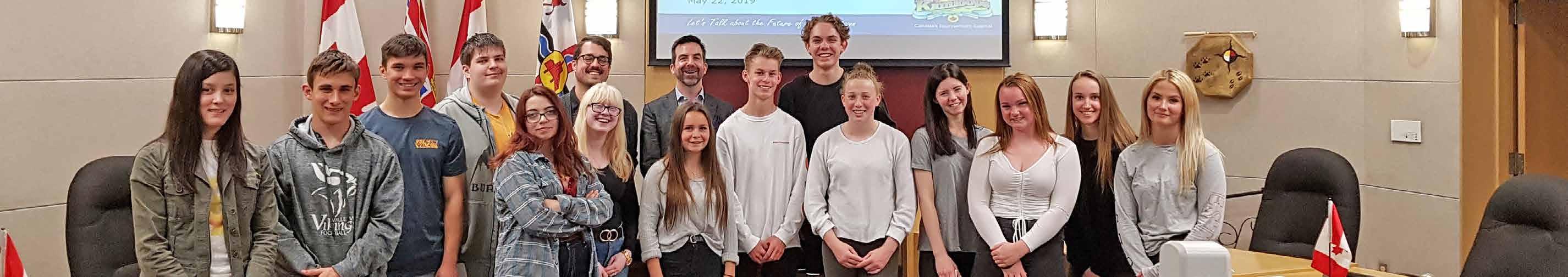
In May 2019, City staff engaged youth in a Grade 11 Social Studies class at Valleyview Secondary to develop a youth vision for Downtown. Staff presented the community vision and key principles for a successful downtown and asked the students what they would like to see to make Downtown more attractive to them. The class was then given an assignment—to develop vision statements that represent an ideal, desired future state for Downtown and to present these statements to staff in Council Chambers. The youth vision statements for Downtown are included below.
“Our city is important to us and to the future of Kamloops. We, as a generation, need your help to make our city thrive. Keep it safe, friendly, and fun for all.”
“We believe that downtown Kamloops should be a connected, welcoming, and vibrant community that attracts people of all ages. By introducing fun and innovative activities all year round, Kamloops will become a thriving, friendly neighbourhood that brings society together. We also believe that adding more colour and plants to our city will greatly improve the attractiveness, causing more people to visit and allowing Kamloops to flourish.”
“A city’s downtown is supposed to be the heartbeat of the city, providing life to all that stems from it. Two common themes the youth would like to see acted upon are an injection of fresh, trendy business and a welcoming atmosphere. By investing in spicing up the downtown with local art pieces, greenery, and pedestrian attractions on every street, the whole area will become more attractive to locals, tourists, and businesses alike.”
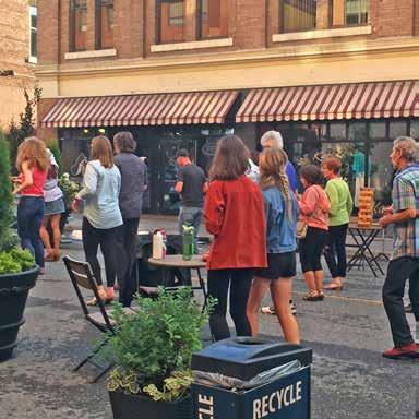
“We believe blocking off a street for food trucks during the summer would both bring youth downtown and increase the sense of community. Incorporating a city plaza downtown would include a lot more seating and people could interact. Bringing new and fresh stores targeted toward youth would increase the amount of younger generations downtown. All youth have the love of music in common, and having more live music would make downtown more lively and more enjoyable and attractive to youth in the city.”
“Making Kamloops more eco-friendly and bringing in different bands or artists is an easy way to attract young people. Increasing the bus routes and times as well as making it more reasonable and reliable will eliminate transportation issues for a lot of youth. Updating some of the shops and stores downtown will gravitate people to want to walk around and hang out in that area.”
Valleyview Secondary students presented their visions for Downtown to City staff in Council Chambers at City Hall
PURPOSE AND SCOPE
The Downtown Plan is an update to the City Centre Plan (2005). Its purpose is to provide neighbourhood-level direction to guide decisions related to planning and land use management for the Downtown, Sagebrush, and West End neighbourhoods over a 20-year time frame.
This plan provides a framework for the location and types of housing, shops, offices, and other forms of development and land uses that are envisioned for the area and gives guidance on what buildings and private and public spaces should look like.
In addition to land use and urban design considerations, the Downtown Plan provides direction on the future transportation network, parks, public places, heritage resources, and community facilities in the plan area. The policies in the plan also address other issues and opportunities that are important to the people who live, work, and visit Downtown, including those opportunities related to arts, culture, economic development, food security, and health and safety.
The Downtown Plan identifies potential sites for redevelopment, design concepts, and an implementation plan, including short-, medium-, and long-term actions.
HOW TO READ THIS PLAN
The Downtown Plan includes policies related to specific “character areas” (Downtown Core, Waterfront District, etc.), as well as “topic area” policies (Transportation and Mobility, Housing, etc.) that apply more generally across the plan area. However, the plan should be read in its entirety, as matters outlined in one section may apply to others. The Downtown Plan includes the following sections:
• Section 1 contains the community vision for Downtown, key principles for a successful downtown, information on the purpose and scope of the plan, and a summary of the engagement process.
• Section 2 provides the neighbourhood context and profile for the plan area, including population statistics, housing data, and other key demographic information.
• Section 3 includes the future land use map, which identifies the land use designations in the plan area that are established in the City’s Official Community Plan (KAMPLAN).
• Sections 4 through 9 contain objectives and policies for eight character areas and goals and policies for five topic areas.
• Section 10 describes “big moves”—catalyst projects on city-owned land and key redevelopment sites on provincial and privately- owner lands—that could have a positive impact for Downtown and the broader plan area.
• Section 11 includes a list of action items for implementation to be carried out over the life of the plan.
• Section 12 includes Development Permit Area guidelines for Downtown.
• Section 13 features reference maps, including maps that illustrate the future transportation network, existing parking areas, and key entry corridors and gateways.
• Section 14 contains the appendices, including a list of future active transportation projects for the plan area, as well as a glossary of terms.
Glossary
Key terminology is italicized throughout the plan and defined in Section 14, Appendix B - Glossary. The exception is legislative acts that are referenced in the plan (i.e. Local Government Act), which are italicized but not defined.
LINKS TO OTHER CITY PLANS
The City has a number of plans and bylaws to guide municipal planning. The Official Community Plan (OCP) provides the highest level of direction in the City planning hierarchy. Given the OCP’s broad scope, its policies do not provide the same level of detail as neighbourhood plans (e.g. Downtown Plan) or plans for specific topics (e.g. Transportation Master Plan).
Land use plans like the OCP and Downtown Plan provide direction in terms of future land use that may lead to Zoning Bylaw amendments, subject to Council approval. Development Permit Area guidelines, such as those found within this plan and the OCP, provide guidance to applicants for specific areas and types of development.
Figure 1.1 » Where a neighbourhood plan fits into the planning process
DOWNTOWN PLAN ENGAGEMENT PROCESS
The Downtown Plan was developed through a community engagement process involving the public, stakeholders, Tk’emlúps te Secwépemc (TteS), the Downtown Plan Advisory Committee (DTAC), and City Council that began in early 2018 and concluded in December 2019.
• Phase 1 consisted of compiling background information for the Downtown Plan area on a variety of topics, such as population, land use, housing, transportation, and employment, as an overview of existing conditions.
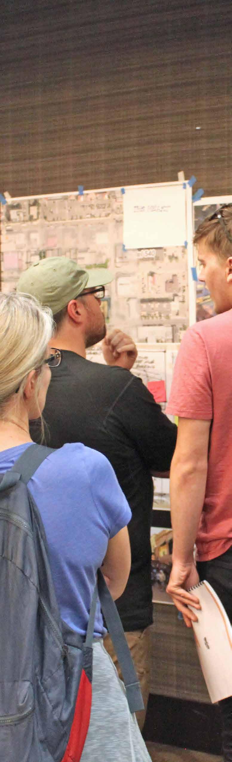
• Phase 2 involved community engagement via open houses, online surveys, and a design charrette to identify the vision, issues, and opportunities that the Downtown Plan should address.
• Phase 3 consisted of developing the draft of the Downtown Plan based on feedback from Phase 2 and included Council, public, stakeholder, TteS, and DTAC input on the draft prior to presenting the final plan to Council for final adoption.
More information about the community engagement process is available on the City’s website.
Figure 1.2 » Downtown Plan Project Phases
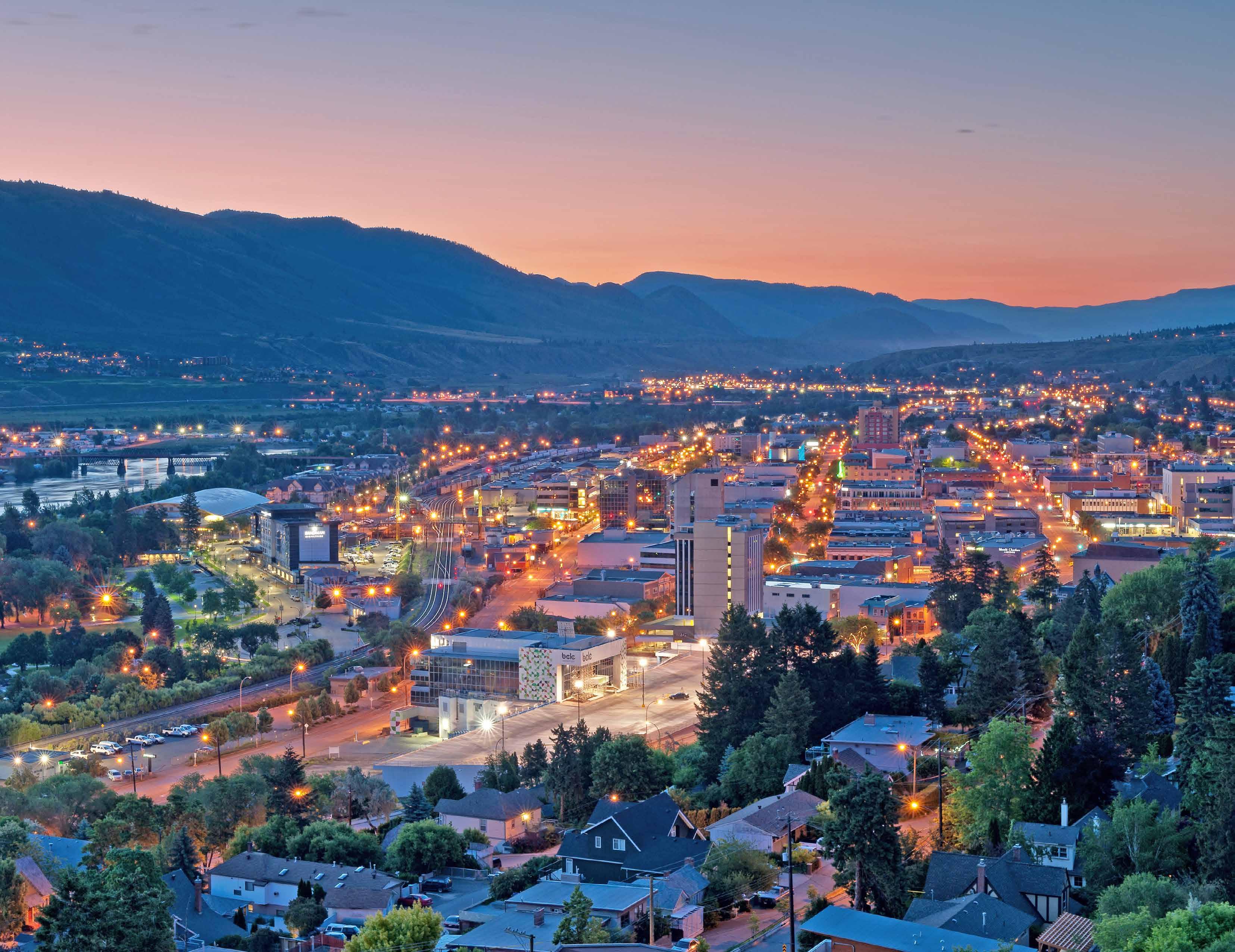
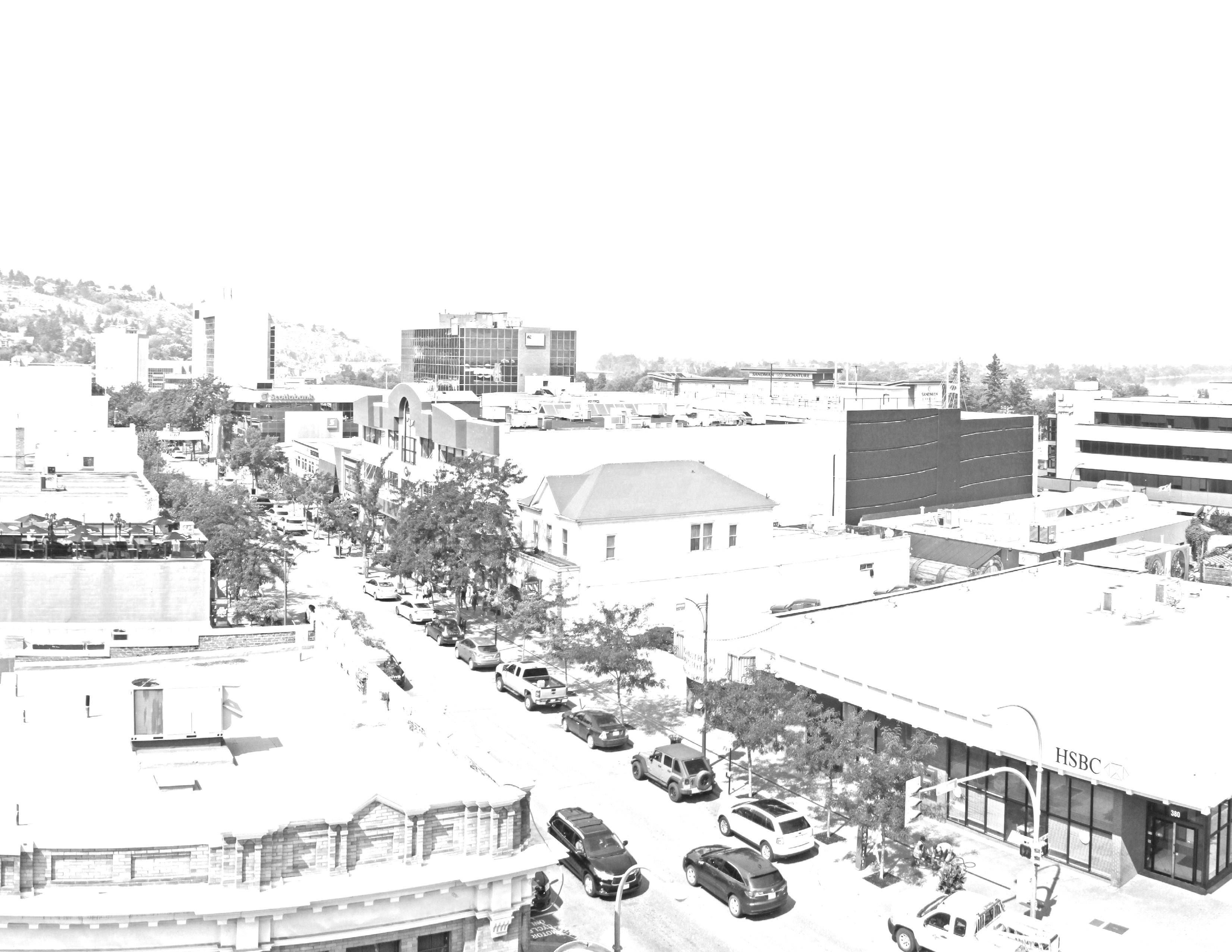
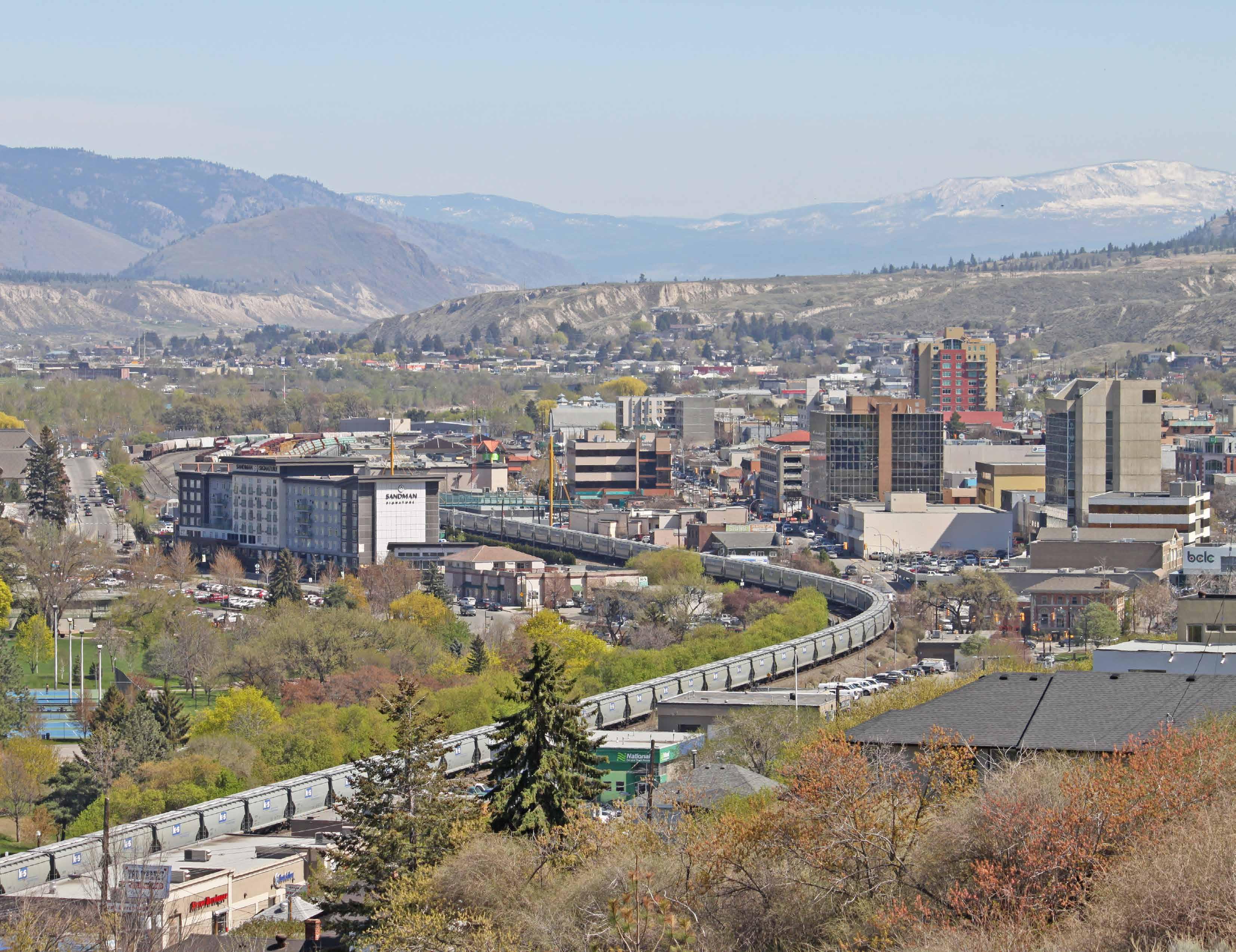
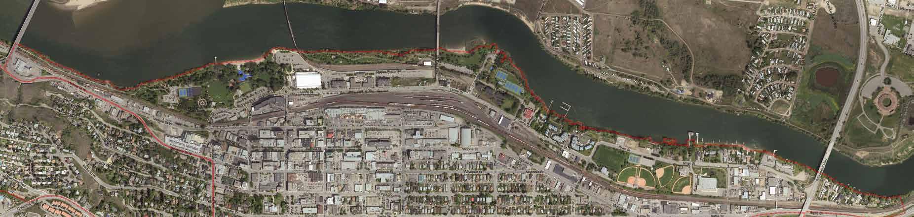
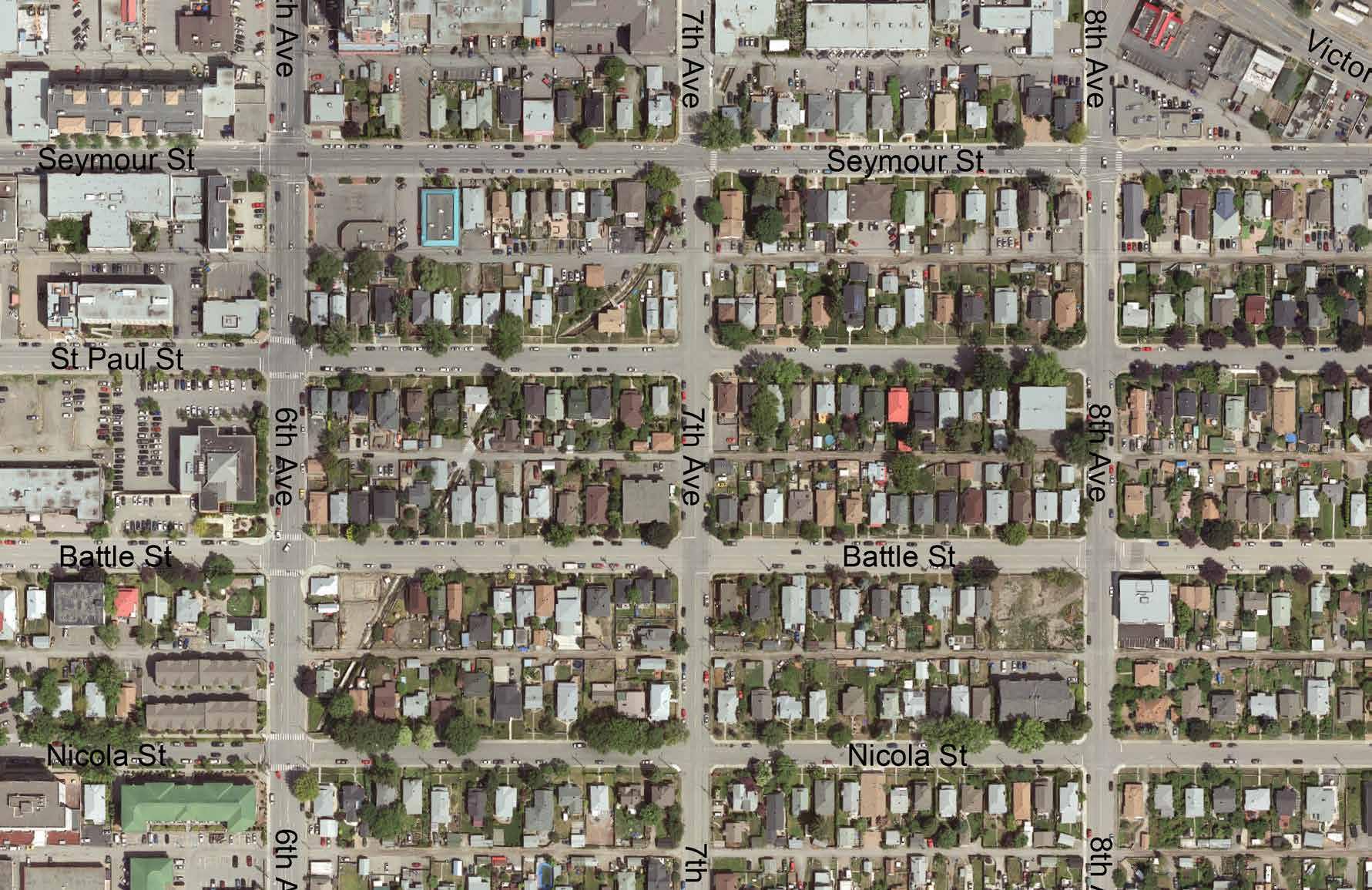
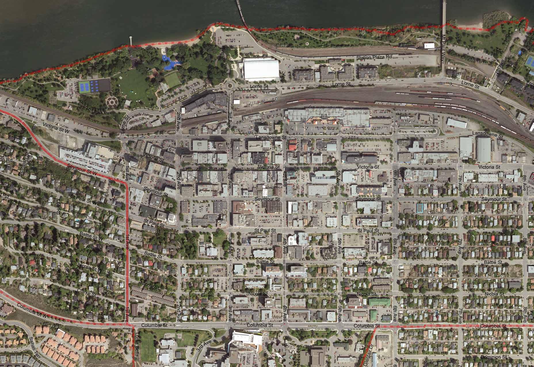
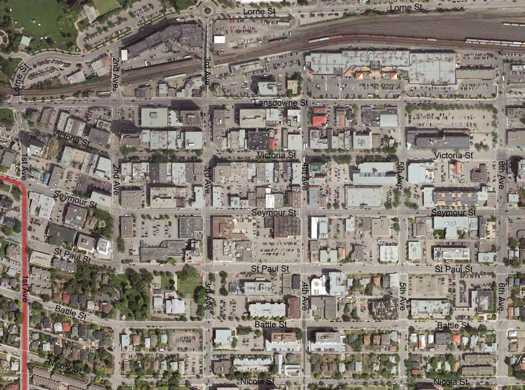
The plan area includes the Downtown, Sagebrush, and West End neighbourhoods, which are located near the geographic centre of Kamloops’ municipal boundaries on the south shore of the Thompson and South Thompson Rivers.
CONTEXT
With a central location that is well served by major road, public transit, and active transportation networks, the plan area is the most accessible and frequently visited part of the city. As of the 2016 Census, the population of the plan area is approximately 9,460 people, or 10.5% of Kamloops’ total population of 90,280. With a land area of 5.4 km², it has an average population density of 1,758 people per km².
The area is bound to the north by Victoria Street West and the Thompson and South Thompson Rivers, to the east/southeast by the Trans Canada Highway, to the south by Peterson Creek Park and Columbia Street West, and to the west by Summit Drive, as per the plan area boundaries shown on Figure 2.1.
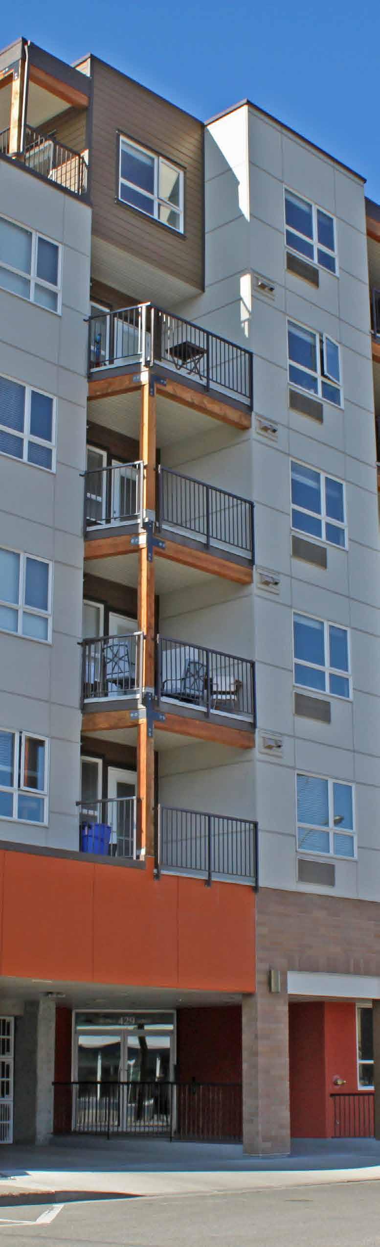
The plan area contains some of Kamloops’ most densely populated neighbourhoods, with a diversity of commercial, institutional, park, and residential land uses ranging from 100-year-old single -family homes to 10-storey office towers that are organized around a traditional urban street grid. Economic activity in the plan area consists of restaurants, retail, office, health care facilities, and arts and entertainment venues. The plan area also features several City parks, recreational facilities, and designated heritage resources.
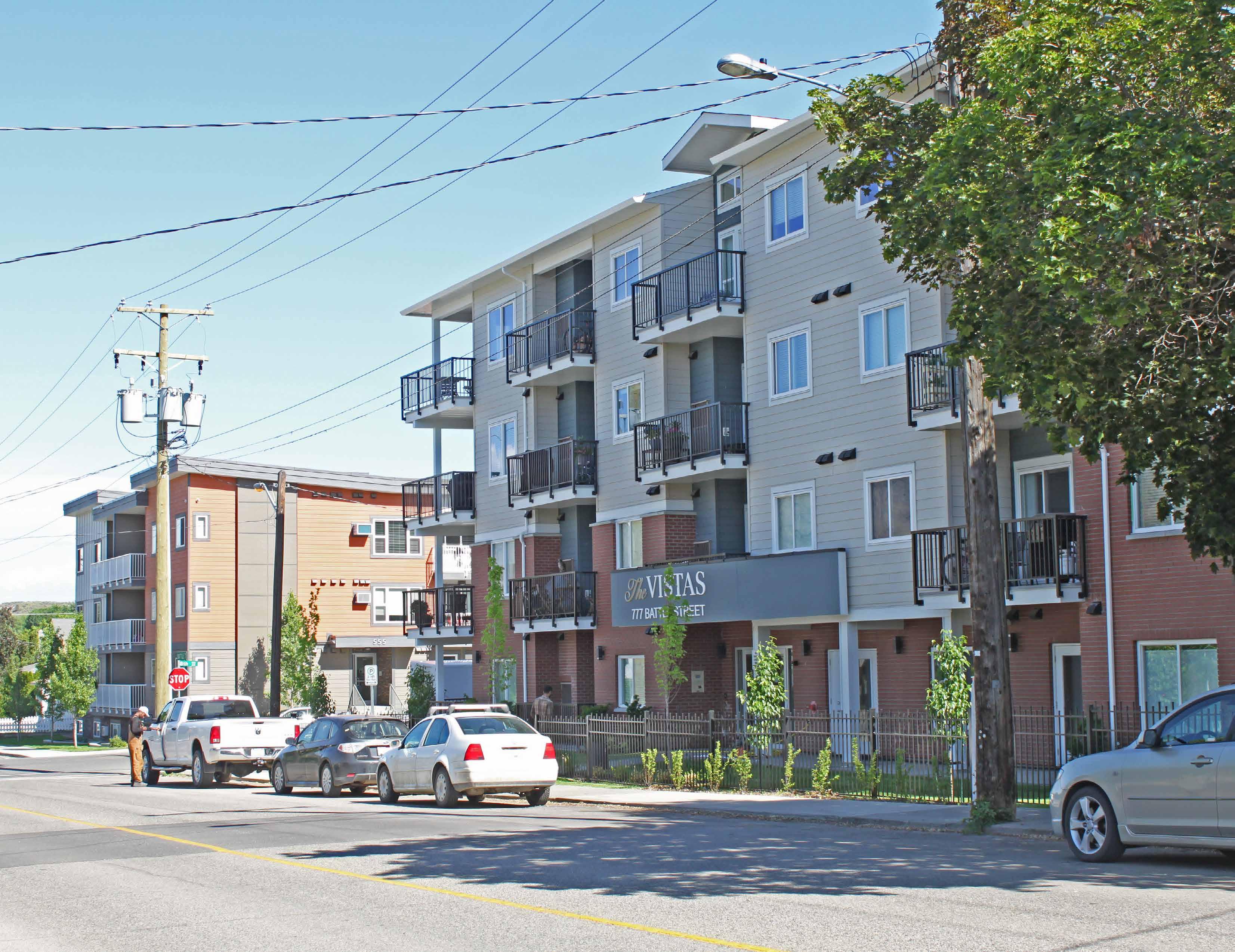
Downtown
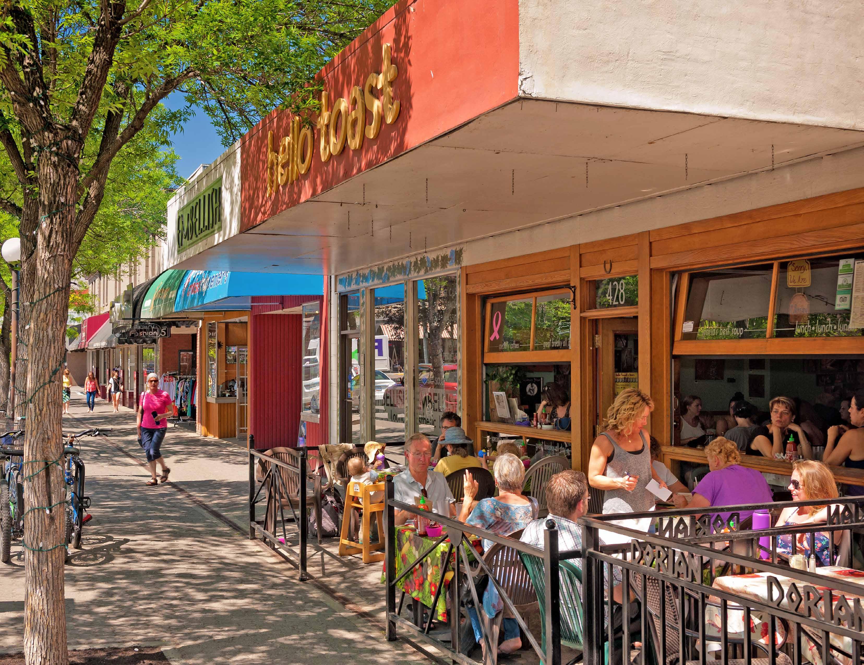
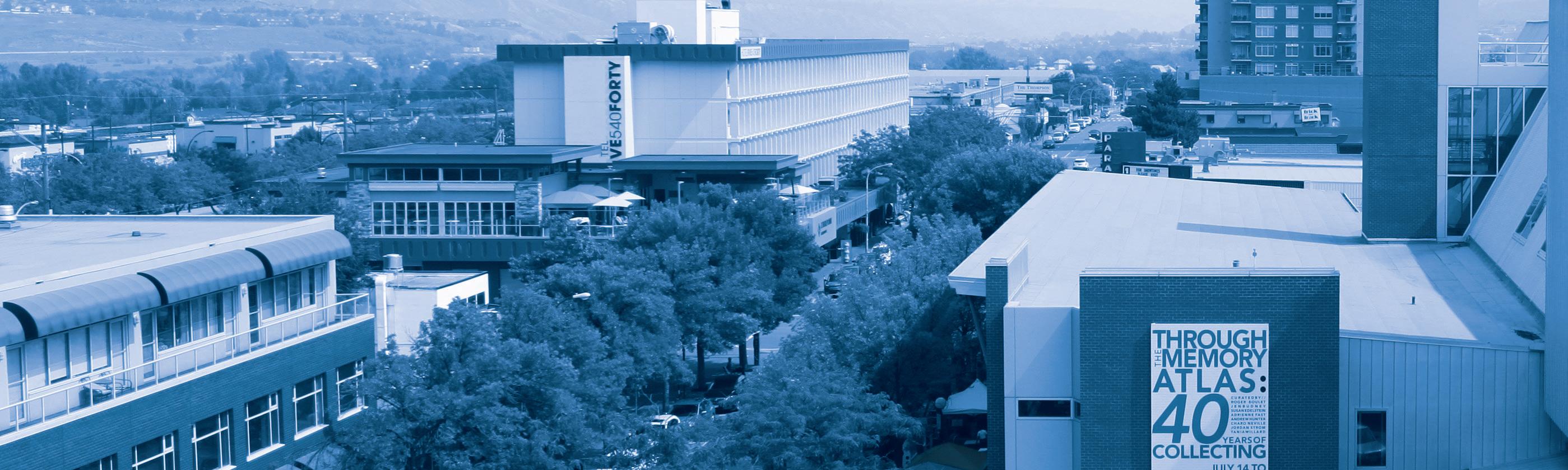
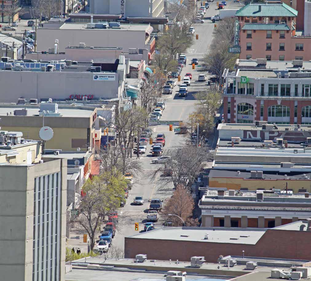
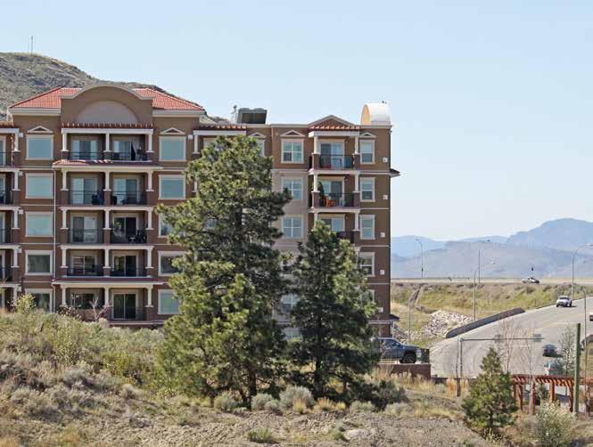
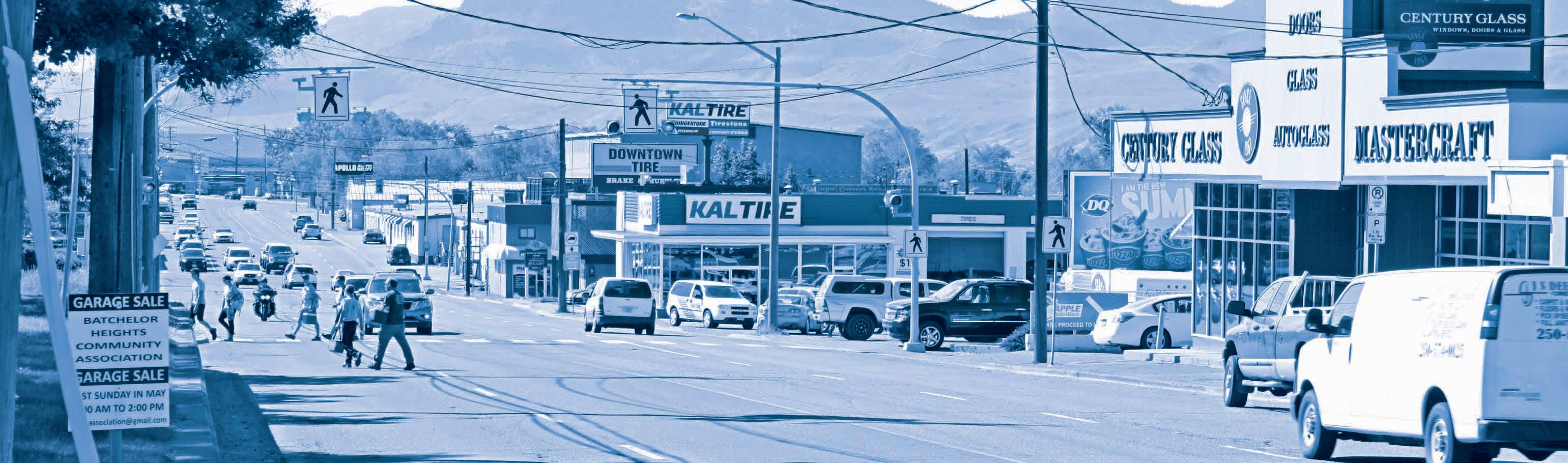
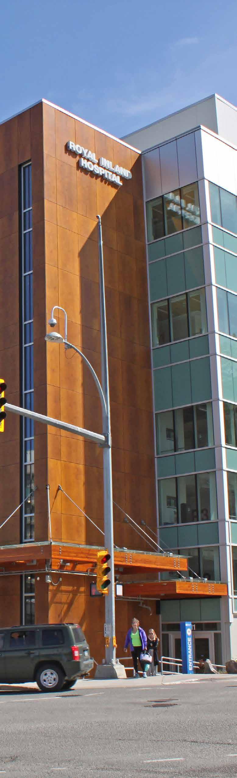
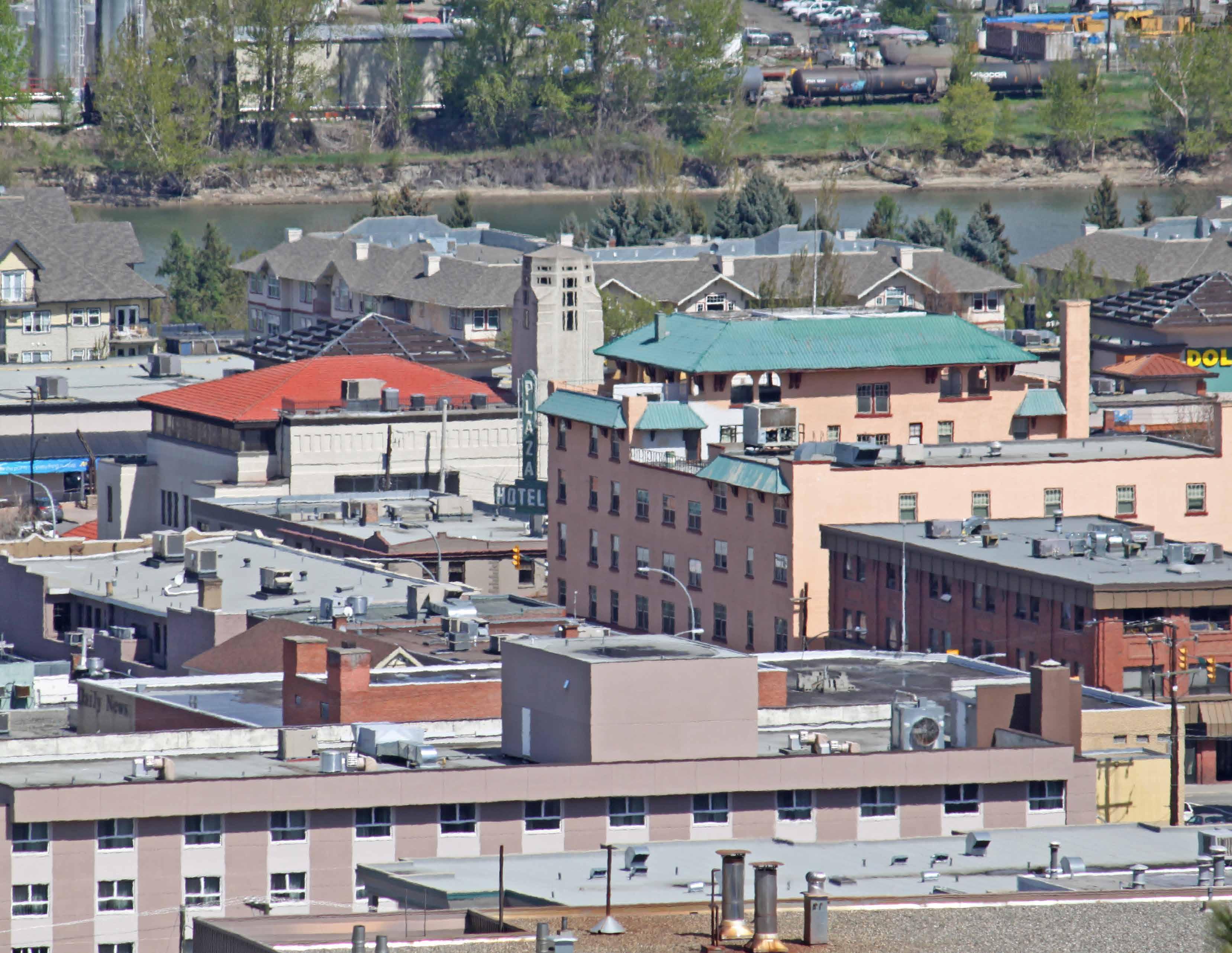
Downtown, which includes the Central Business District (CBD), forms the economic, social, and cultural heart of the city. With 4.2 km of shoreline along the Thompson and South Thompson Rivers, a land area of 2.7 km², and a 2016 population of 3,940, Downtown is home to many of the city’s most prominent entertainment and cultural amenities, heritage sites, parks, and recreational facilities. Running eastwest through Downtown, Victoria Street is the city’s pre - eminent streetfront retail corridor and serves as a key commercial, business, and cultural district for the community. To the south of the CBD is the Columbia Precinct, which contains a mix of provincial government offices, social housing, and some of the city’s largest government institutions and facilities, including Royal Inland Hospital and a provincial courthouse.
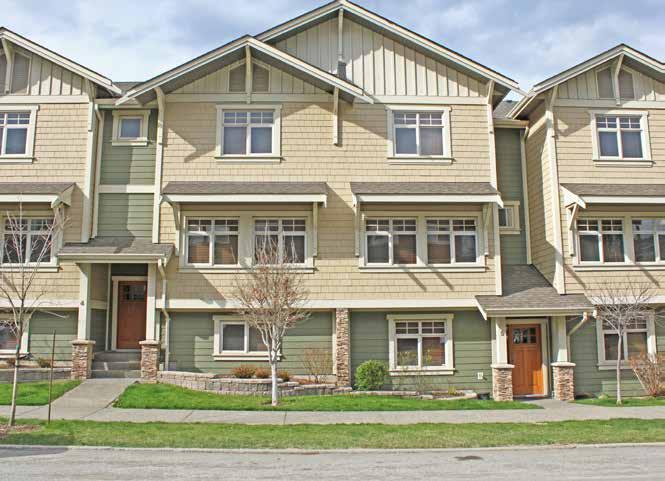
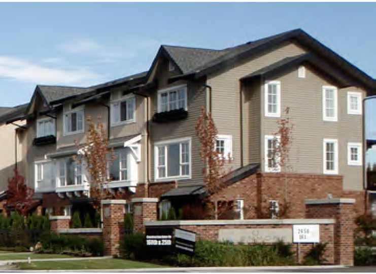
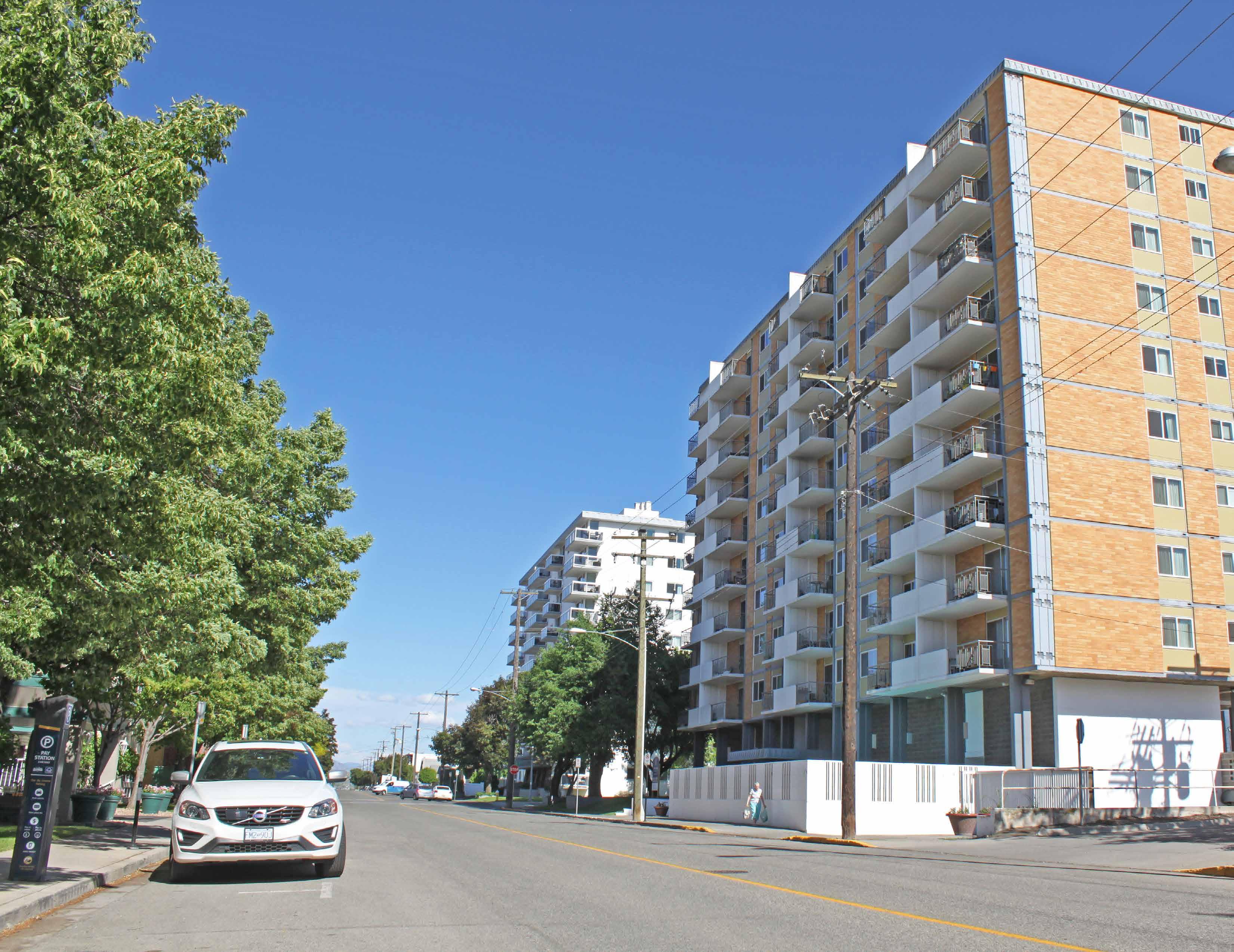
Downtown also features a diverse mix of residential building stock. Housing in the East End character area is largely composed of single-family homes that were originally constructed in the early 1900s. In recent years, residential suites on single-family lots and multi-family development achieved through land assembly have increased density in the neighbourhood. With several blocks zoned for the highest permitted residential density in the city, the nine-block area bound by 3rd and 6th Avenues, Columbia Street, and St. Paul Street contains a significant stock of multi-family development constructed from the 1960s onward, including a mix of townhouses, apartments, and residential towers up to 14 storeys tall.
A key community gathering place, Riverside Park hosts major community events, including Canada Day, Music in the Park, and Ribfest, and features active and passive recreational amenities and riverfront access for residents and visitors. Other major parks in Downtown include Waterfront Park and Pioneer Park, which are connected to Riverside Park via the Rivers Trail multi-use pathway, and Peterson Creek Park, which features walking and hiking trails as well as the Xget’tem’ Trail multi-use pathway, which connects Sahali to Downtown.
VIctoria Street, as seen from the West End
Sagebrush
The Sagebrush neighbourhood, with a land area of 1.4 km² and a 2016 population of 2,550, is residential in character and is predominantly composed of single-family houses. Largely an extension of the residential development pattern found in Downtown’s east end, the northern blocks of Sagebrush were built out from the early 1900s to the 1940s, and the southern and eastern blocks were built out in the 1950s and early 1960s. Adding to the residential mix are several walk-up apartment buildings constructed in the 1950s to 1970s, which are scattered throughout the area. In recent years, residential infill development has included carriage and garden suites on single -family lots and townhouses on multi-family sites. In addition to residential uses and a series of small parks, notable landmarks include three schools, Pleasant Street Cemetery, and Sagebrush Theatre.
West End
Largely residential in character, the West End neighbourhood has a land area of 1.3 km² and a 2016 population of 2,970. As the city’s first established townsite, the West End holds a significant stock of single-family heritage homes in its eastern end, some of which date back to the late 1800s. To the west and above the original West End neighbourhood are a mix of primarily single-family homes and duplexes. West of the Guerin Creek ravine, the residential
Plan Boundary
stock is more diverse, with single-family homes, duplexes, townhouses, and apartment buildings. The southern end of the neighbourhood, south of Grandview Terrace, is composed of a number of post-war townhouse complexes and walk-up apartments, many of which provide housing for students attending Thompson Rivers University (TRU) given its close proximity.
StrathconaTerr SummitDr
McGill Rd
Hwy W
Sagebrush
End
Boundary City of Kamloops
Figure 2.1 » Plan Area and Neighbourhood Boundaries
POPULATION TRENDS
The overall population of the plan area was 9,460 as of the 2016 Census, which represents a 10.5% share of the city’s total. In 2016, the populations of Downtown, Sagebrush, and the West End were 3,940, 2,550, and 2,970 respectively. Between 2006 and 2016, the plan area grew in population by 5.7% (or approximately 510 residents), with much of that growth occurring in new residential developments in the Guerin Creek area of the West End. Over the same 10-year period, the population of Kamloops grew by 12.3% or 9,904 residents.
Population Density
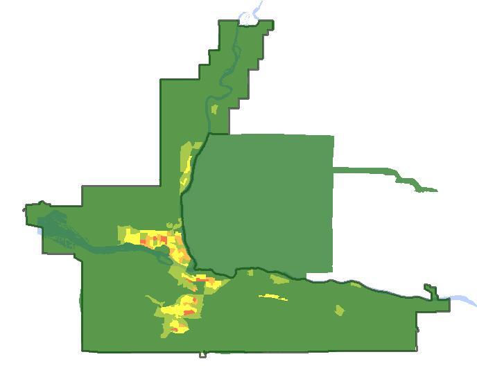
Figure 2.2 » Population Density Map
Population Density
At 299.25 km², Kamloops is one of British Columbia’s largest municipalities by land area. With a 2016 population of 90,280 and large tracts of undeveloped parkland, agricultural fields, rangeland, and steep slopes, the city has a relatively low average population density of 301.7 people per km² (or about 3 people per hectare).
By comparison, the average population density of the plan area is about 1,758 people per km² (or 17.6 people per hectare), with the greatest concentration occurring to the south of the CBD, where more multi-family housing is located. In the nine blocks bound by 3rd Avenue, St. Paul Street, 6th Avenue, and Columbia Street, the population density averages about 6,157 people per km² (or 61.6 people per hectare).
Note: Much of the growth in the West End occurred in new residential developments in the Guerin Creek area
Figure 2.3 » Plan Area Population (2016)
Figure 2.5 » Projected Growth (2016 - 2039)
Figure 2.4 » Population Growth (2006 - 2016)
Figure 2.6 » Population Density (2016) | people/km²
DEMOGRAPHICS
Age Characteristics
The median age of the plan area in 2016 was 46.3 years, which is just over 4 years older than the city-wide median age of 42.2 years. The largest age categories in the city are from 50 to 64 years (21.7% of total population) and 20 to 34 years (20.4%). Within the plan area, the 20 to 34 year age cohort is larger, comprising 25.7% of the total population versus 22.6% for the 50 to 64 year age cohort. While the plan area has a large proportion of residents aged 20 to 34, it also has a significant share of residents aged 65 and over (23.8%) and fewer children and youth aged 0 to 19 (13.2%) compared to the city as a whole (18.2% and 21.1% respectively), which is consistent with the plan area’s higher median age.
At the neighbourhood level, Downtown has the oldest median age of any neighbourhood in the city at 53.1 years due to having a large proportion of residents aged 65 and over (33.2%) and a low proportion of children and youth aged 0 to 19 (9.4%). The West End, with the youngest median age in the plan area at 38.8 years, had a notably high proportion of residents aged 20 to 34 (32.7%), which is likely due to its proximity to TRU.
2.7 » Median Age (2016)
Household Composition
The household composition of the plan area is quite different from the city as a whole. The area’s higher concentration of multi-family housing and older stock of single-family homes, which generally have smaller square footage than more recently constructed homes, likely attract and retain a greater share of younger adults living without children and long-time residents whose children no longer live at home.
This is reflected not only in the age category data cited above, but in the average household size for the plan area, which is 1.9 residents compared to 2.4 residents for Kamloops as a whole, and in the percentage of one-person households, which is 44.9% compared to the city-wide average of 27.1%. Of all households in the plan area, just 19.7% have children living at home compared to the city-wide figure of 35.4%.
Income
The median household income in the plan area is $57,202, which is 22.5% lower than the city-wide median household income of $73,822. While significant, this discrepancy is largely due to average household sizes being smaller in the plan area than the city-wide average, resulting in fewer income earners living under one roof. By comparison, the median individual income in the plan area is $33,073, much closer to the city-wide figure of $35,830. However, 17.9% of individuals in the plan area are considered to be low-income, compared to 12.6% for all of Kamloops.
Figure 2.9 » One-Person Households (2016)
Figure 2.10 » Families with Children (2016)
Figure 2.11 » Median Household Income (2016)
Figure 2.12 » Median Individual Income (2016)
$35,830
2.13
Figure
Figure 2.14 » Population & Age Distribution (2016) | Plan Area
85 to 89 years 90+ years
80 to 84 years
75 to 79 years
70 to 74 years
65 to 69 years
60 to 64 years
55 to 59 years
50 to 54 years
45 to 49 years
40 to 44 years
35 to 39 years
30 to 34 years
25 to 29 years
20 to 24 years
15 to 19 years
10 to 14 years
5 to 9 years
0 to 4 years
Figure 2.16 » Population & Age Distribution (2016) | Sagebrush
90+ years
85 to 89 years
80 to 84 years
75 to 79 years
70 to 74 years
65 to 69 years
60 to 64 years
55 to 59 years
50 to 54 years
45 to 49 years
40 to 44 years
35 to 39 years
30 to 34 years
25 to 29 years
20 to 24 years
15 to 19 years
10 to 14 years
5 to 9 years
0 to 4 years
8%6%4%2%0%2%4%6%8%
Kamloops
Figure 2.15 » Population & Age Distribution (2016) | Downtown
80 to 84 years 85 to 89 years 90+ years
75 to 79 years
70 to 74 years
65 to 69 years
60 to 64 years
55 to 59 years
50 to 54 years
45 to 49 years
40 to 44 years
35 to 39 years
30 to 34 years
20 to 24 years 25 to 29 years
5 to 9 years 10 to 14 years 15 to 19 years
0 to 4 years
Figure 2.17 » Population & Age Distribution (2016) | West End
90+ years
85 to 89 years
80 to 84 years
75 to 79 years
70 to 74 years
65 to 69 years
60 to 64 years
55 to 59 years
50 to 54 years
45 to 49 years
40 to 44 years
35 to 39 years
30 to 34 years
25 to 29 years
20 to 24 years
15 to 19 years
10 to 14 years
5 to 9 years
0 to 4 years
West End Female
Kamloops Male
West End
Kamloops
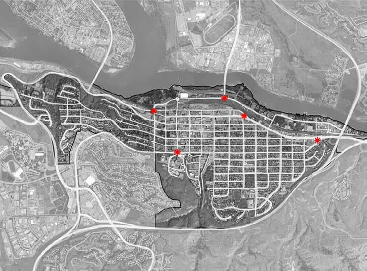
KEY LOCATIONS AND POINTS OF INTEREST
The plan area serves as the primary economic and cultural hub for the city and region. As such, it is home to a significant number of major amenities and destinations for locals and tourists alike. The below figure highlights some key locations and points of interest within the plan area.
Neighbourhood Context
Figure 2.18 » Key Locations and Points of Interest
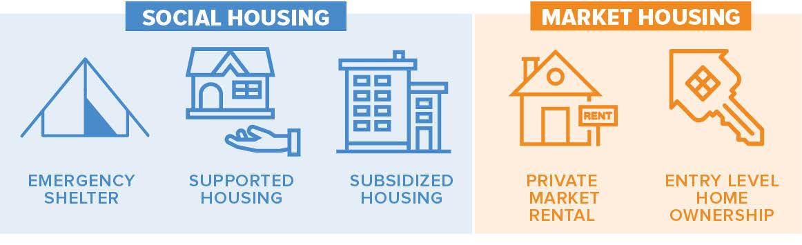
HOUSING
Housing Types
According to the 2016 Census, the housing stock of the plan area is composed of 45.4% medium- to high-density multi-family (e.g. apartments), 20% low-density multi-family (e.g. townhouses, duplexes), and 34.6% single-family homes, with a majority of single-family homes located in Sagebrush, the West End, and the east end of Downtown. Downtown has the largest share of multi-family housing, which composes 82.2% of its total housing stock. By comparison, the city as a whole is composed of 18% mediumto high-density multi-family, 30.1% low-density multi-family, and 51.9% single-family homes.
Housing Affordability and Tenure
According to the Canada Mortgage and Housing Corporation (CMHC), housing is considered to be unaffordable when a household spends more than 30% of its pre-tax income on adequate shelter. As of 2016, 32% of households in the plan area spent more than 30% of their income on housing in comparison to the Kamloops average of 23%.
In the plan area, 17% of owners are living in unaffordable housing, while this figure is 48% for renters. The same figures for the city as a whole are 14% and 47%, respectively. Within the plan area, 56% of housing is owner occupied and 44% is rented, compared with a Kamloops average of 72% owner- occupied housing to 28% rented.
The overall trends suggest that while affordability affects a greater percentage of homeowners and renters within the plan area than in the city as a whole, housing affordability for renters is a significant city-wide issue and is not specific to renters within the plan area.
Age of Housing Stock
As the plan area contains some of the city’s oldest streets, its housing stock is significantly older than the Kamloops average. Within the plan area, the greatest share of housing was constructed prior to 1961 (35.6%), and 10.4% of the housing stock has been constructed since 2001, primarily in the form of multi-family in Downtown and multi-family and single -family in the Guerin Creek area of the West End. By contrast, in the Sagebrush neighbourhood, only 3.4% of housing has been constructed since 2001, with 91.7% of housing constructed prior to 1981.
The most significant period of residential development for Kamloops as a whole was between 1961 and 1980, when 41.7% of the city’s current housing stock was built. Between 1981 and 2000, 28.1% of the current housing stock was constructed, with 2001 to 2016 accounting for 17.9%.
Figure 2.19 » Housing Composition (2016)
Figure 2.21 » Tenure (2016)
Figure 2.20 » Residents in Unaffordable Housing (2016)
Figure 2.22 » Period of Housing Construction (2016)
EMPLOYMENT AND LOCAL ECONOMY
The plan area encompasses the largest employment area in the city and region, with a diversity of commercial, institutional, and industrial uses, including retail, restaurants, hotels, private and government offices, schools, cultural and entertainment facilities, rail transport operations, and a major hospital with supporting medical offices. Major employers include Interior Health, School District No. 73, the City of Kamloops, the BC Lottery Corporation, and CN Rail.
The largest industries employing residents of the plan area include health care and social assistance (15.1%), accommodation and food services (12.5%), and retail trade (11.9%).
Similarly, the largest industries by labour force for all of Kamloops are health care and social assistance (14.0%), retail trade (12.8%), and accommodation and food services (9.6%). In comparison to the city-wide average, the plan area has a greater share of residents employed in educational services (9.7% vs. 6.8%); accommodation and food services (12.5% vs. 9.6%); arts, entertainment, and recreation (3.5% vs. 2.7%); professional, scientific, and technical services (7.4% vs. 5.7%); and information and cultural industries (1.7% vs. 1.4%).
With a high concentration of both employment and residential land uses, 59.9% of plan area residents spend less than 15 minutes commuting to work, compared with 42.1% for the city as a whole.
Figure 2.24 » Commute Duration (2016)
Figure 2.23 » Share of Business Licences (2018)
Plan Area Rest of Kamloops
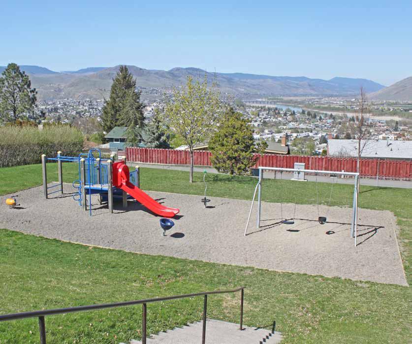
PARKS AND PUBLIC SPACE
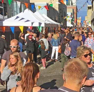
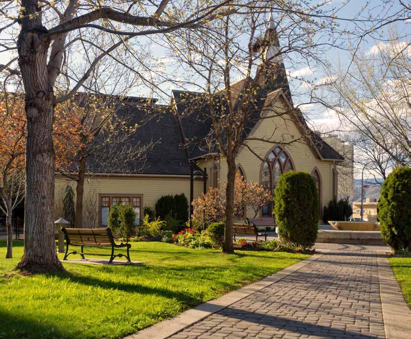
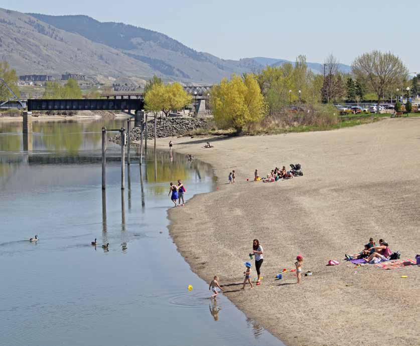
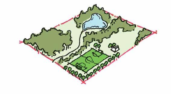
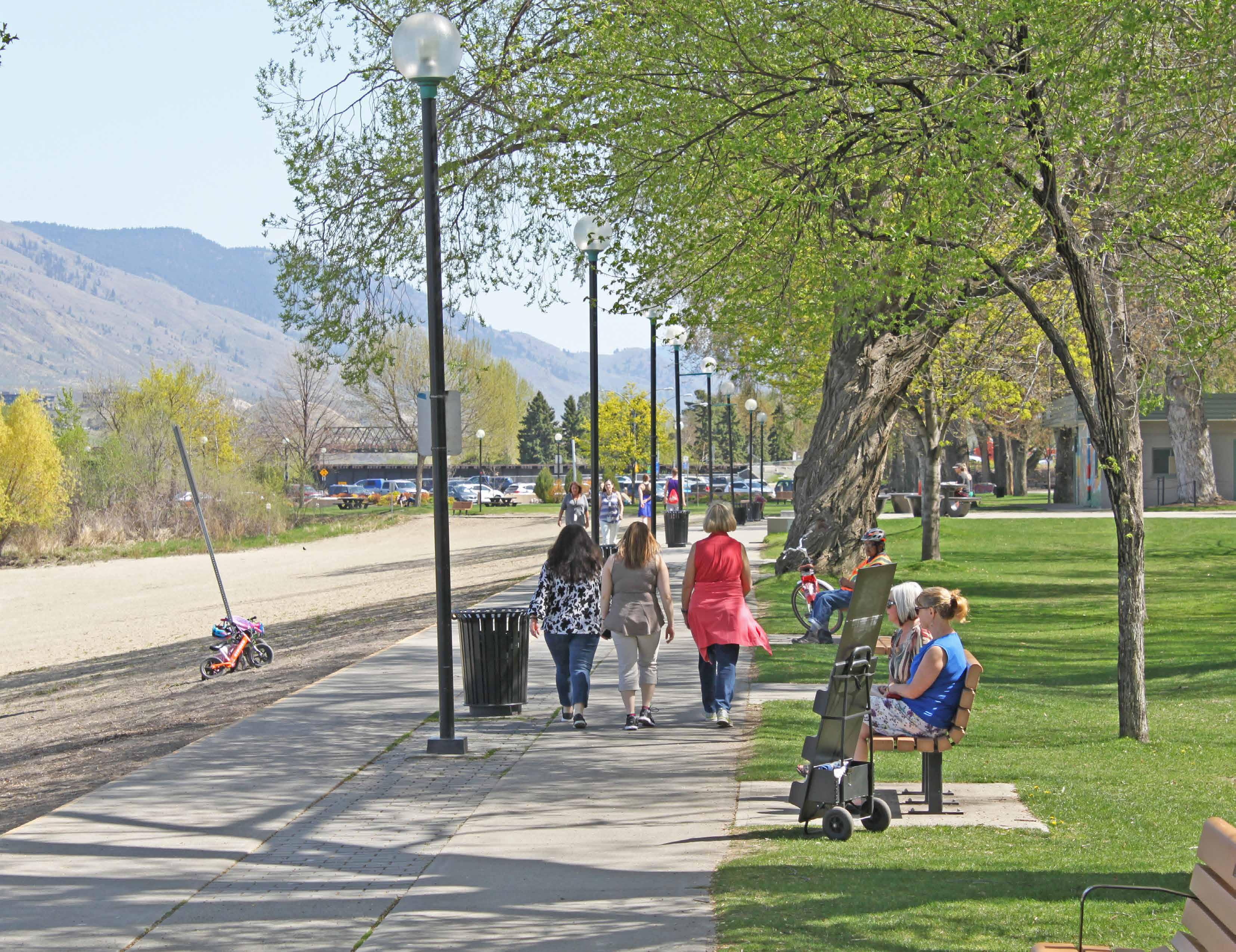
The plan area contains over 68 ha of parks and public space, ranging from large nature parks to neighbourhood tot lots. Major parks include Riverside Park, Waterfront Park, Pioneer Park, Exhibition Park, and Peterson Creek Park. Riverside Park is a key community gathering place, and, in the summer, it is used for community events, including Canada Day celebrations, Music in the Park, and Ribfest.
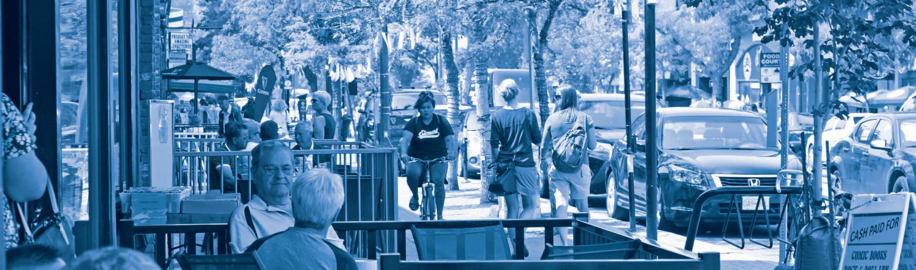
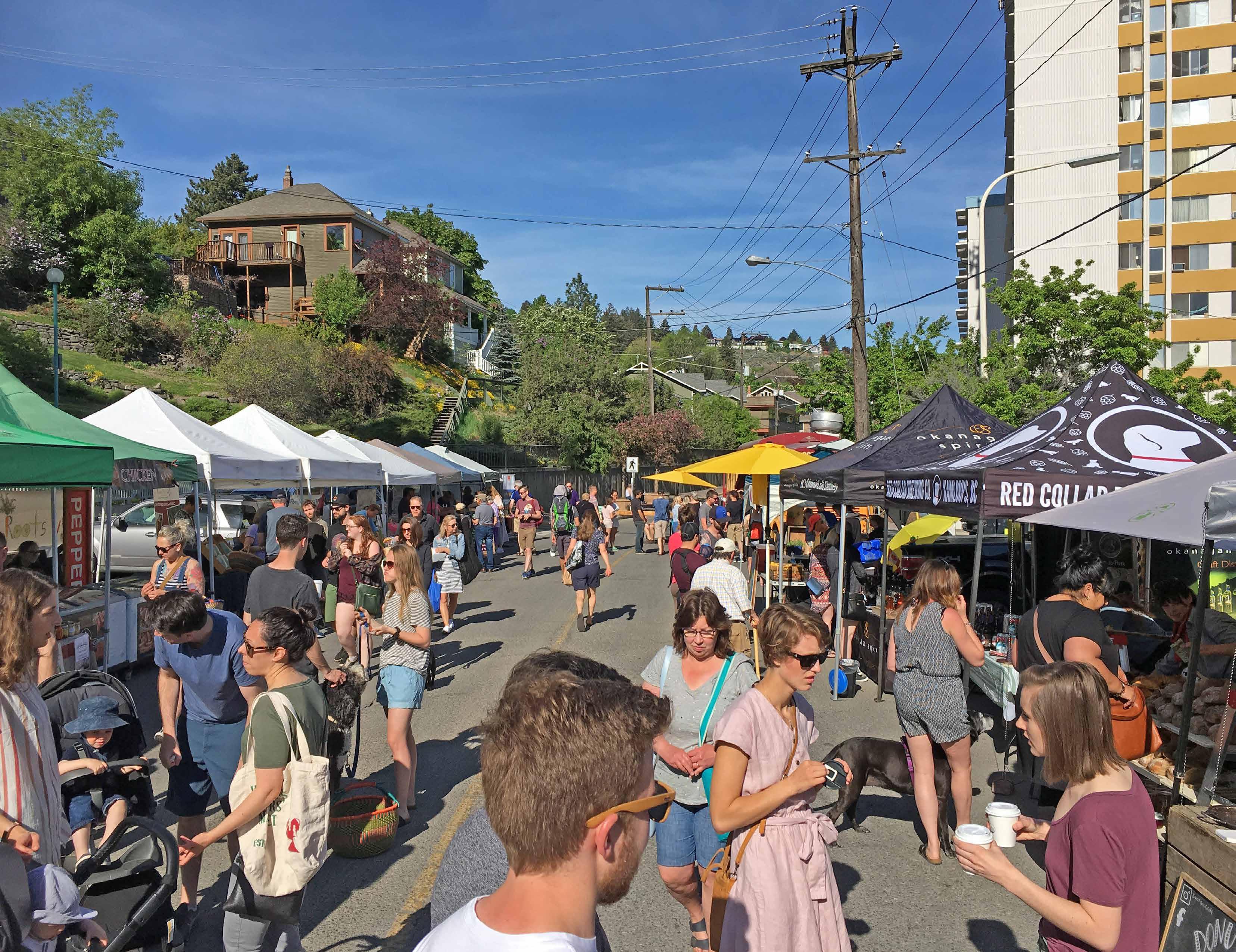
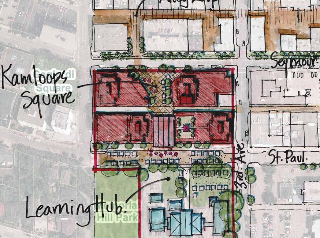
Downtown is also home to a number of small plazas and squares, including Gaglardi Square and Station Plaza. Victoria Street serves as the city’s historic main street and is a symbolic gathering place that is subject to temporary road closures during key civic events. The 200 block of St. Paul Street is closed on Saturday mornings between April and October for the Kamloops Farmers’ Market, which also makes use of the fields on the former Stuart Wood School site.
The entire Sagebrush neighbourhood and most of the Downtown and West End neighbourhoods are within a 5- to 10-minute (400 m) walk of a park, recreational facility, or trail. Despite the relatively good level of walkability within the plan area, connectivity can be hindered by physical barriers such as rail lines and steep topography.
McIntosh Tot Lot
Riverside Park Beach
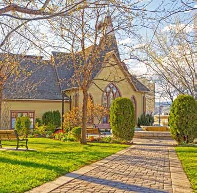
St. Andrew’s on the Square
Peterson Creek Park
TRANSPORTATION AND MOBILITY
Share of Transportation Modes
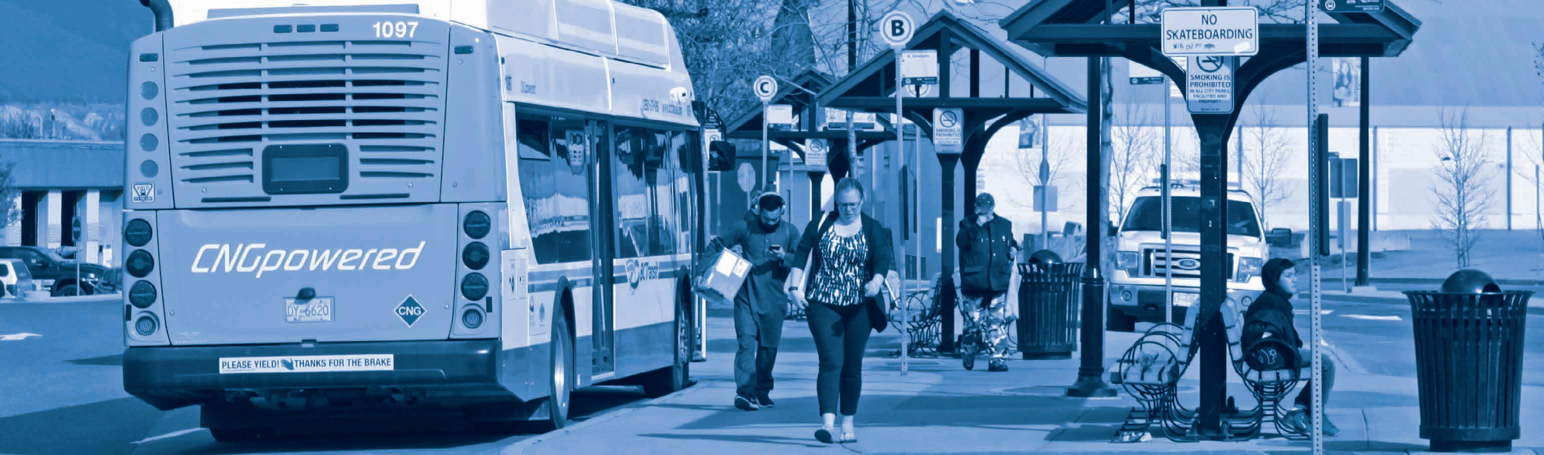
As of the 2016 Census, most residents in the plan area commuted to work as either a driver or passenger of a private vehicle (69.9%), which was notably lower than the Kamloops average of 88.7%.
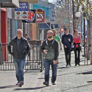
As reported in that census, a significant share of residents in the plan area commuted by sustainable transportation modes, such as by walking (20.4%), bicycle (3%), or public transit (5%), accounting for a total share of 28.4%. By comparison, in all of Kamloops, a total of 11.3% of commuters used these three modes. In the Downtown neighbourhood, sustainable modes of transportation are used by an even greater share of residents, accounting for 37.3% of all commutes.
The greatest difference between the plan area neighbourhoods and the rest of the city is the high percentage of commuters walking to work, with Downtown (29%), the West End (15.8%), and Sagebrush (14.3%) having the first, fourth, and fifth highest percentages, respectively, out of all city neighbourhoods. Sagebrush had the highest percentage of commuters cycling to work of any neighbourhood in the city, at 5.7%, and the West End had the highest percentage of commuters using public transit of any neighbourhood in the city, at 7.2%.
Figure 2.25 » Transportation Modes Used by Commuters (2016)
Figure 2.26 » Sustainable Transportation Modes Used by Commuters (2016)
Pedestrian Network
With a diversity of urban amenities and a well- connected pedestrian network, the plan area contains some of the city’s most walkable areas. Walkability in these areas is a result of urban design and the high population density. Over 47% of the plan area’s population lives within a 5- to 10-minute (400 m) walk of the CBD.
Most streets in the Downtown and Sagebrush neighbourhoods have sidewalks, while the Xget’tem’ Trail multi-use pathway through Peterson Creek Park and the Rivers Trail connect the plan area to adjacent neighbourhoods and the city’s network of green spaces. Walkability remains a challenge in many areas within the West End neighbourhood where steep topography, an irregular street grid, and fewer sidewalks reduce pedestrian connectivity.
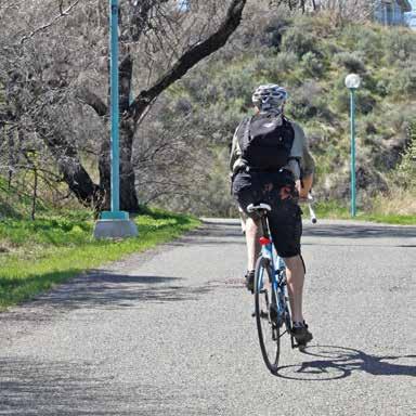
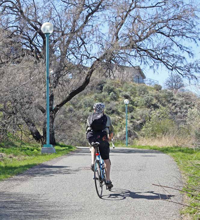
Bicycle Network
The plan area has over 9 km of bicycle paths, including multi-use pathways, off-road trails, shared routes, and bicycle lanes. Downtown contains the most extensive share of the network, with the Rivers Trail multi-use pathway along the waterfront and shared routes along St. Paul and Nicola Streets serving as the primary east-west corridors.
Despite having the highest ridership for commuters in the city, the Sagebrush neighbourhood currently has no designated bicycle routes. However, as per the Transportation Master Plan, a future shared route is proposed along 8th Avenue, which will connect with the existing routes along St. Paul and Nicola Streets. Additional north-south bicycle routes are proposed along Summit Drive, 2nd Avenue, and 5th Avenue as well as through the West End via Lombard Street, Centre Avenue, Grandview Terrace, and Dalgleish Drive.
Completed in 2018, the Xget’tem’ Trail multi-use pathway provides north-south connectivity between Downtown and neighbourhoods in the City’s Southwest Sector.
Transit Network
The plan area is well-served by public transit, with 9 of Kamloops’ 14 transit routes having stops in the area. As a major employment and entertainment area, Downtown is particularly well-connected to the rest of the city and is home to one of the city’s three transit exchanges. With 82 transit stops within the plan area, all residents of Downtown and Sagebrush live within a 5- to 10-minute (400 m) walk of a transit stop. Within the West End, all residents except those living west of Guerin Creek are also within a 5- to 10-minute (400 m) walk of a transit stop.
Strathcona Park Multi-use Path
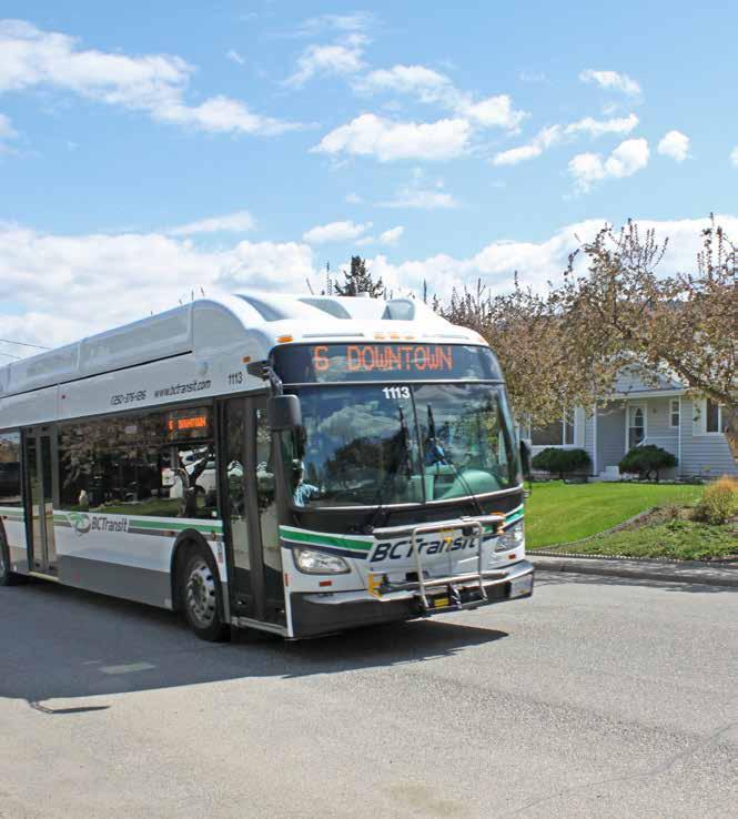
Bus Route No. 6 - Downtown Loop
Road Network
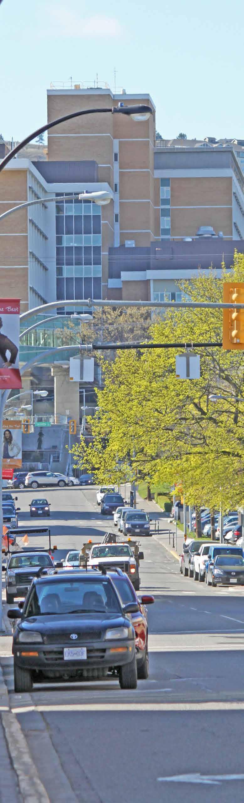
With a majority of the plan area built on a traditional urban street grid and several major corridors for accessing adjacent neighbourhoods and the provincial highway system, the plan area is well connected with the rest of Kamloops and beyond.
The plan area includes a variety of road classifications, including major arterials, minor arterials, Downtown arterials, major collectors, minor collectors, and local roads. Three provincial highways—Highway 1, 5, and 97—border the plan area to the south and east.
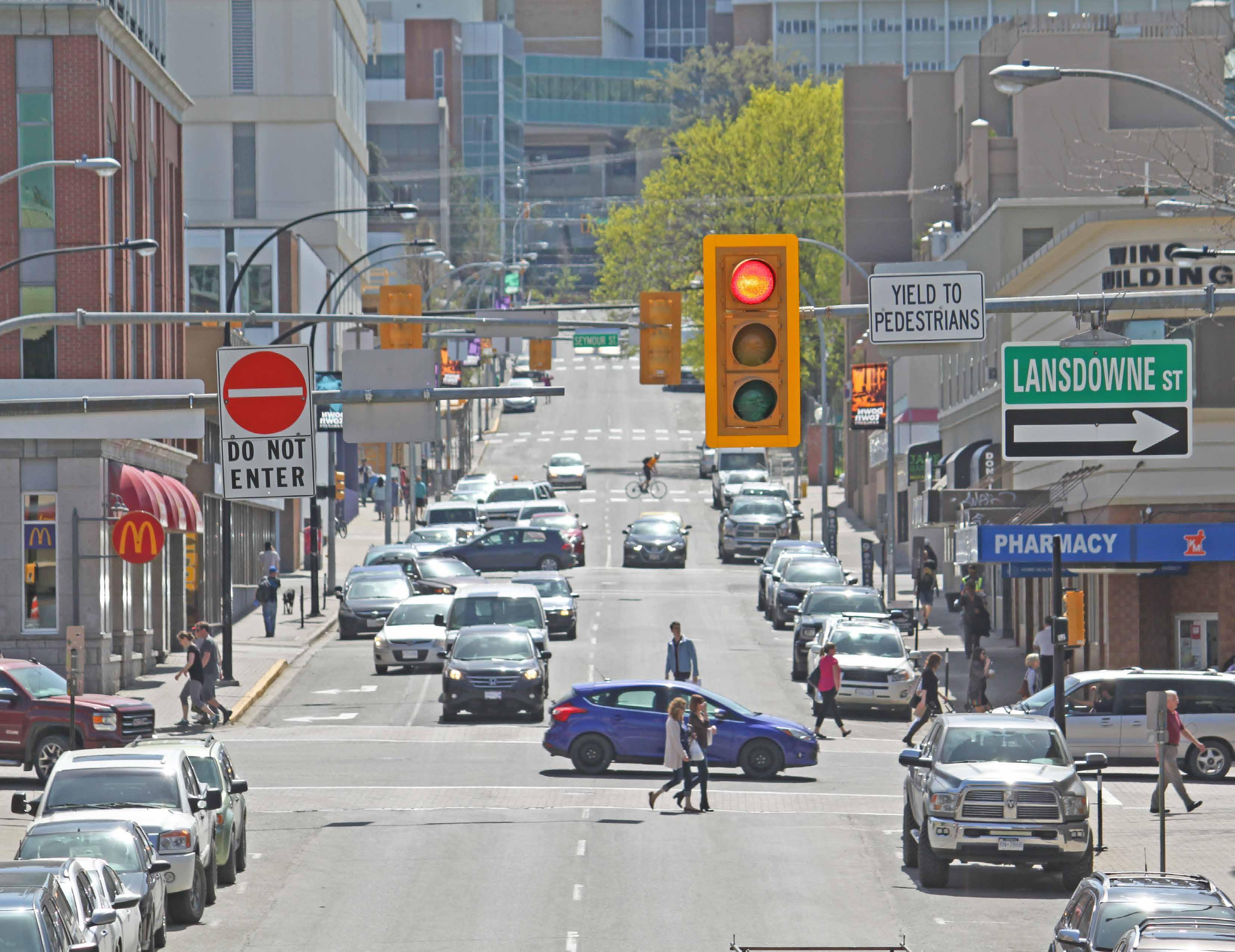
Major arterials moving the greatest volume of traffic through the plan area include Summit Drive, Columbia Street, Lansdowne Street, Seymour Street, and the east end of Battle Street.
Parking
The plan area contains over 17 ha of surface parking lots and several major public and private parkades in addition to on-street parking permitted along the majority of roads within the plan area.
Most Downtown parking is metered, but it is free on Sundays, statutory holidays, and from 6:00 pm to 9:00 am daily. Public parkades are free on weekends, while rates and times vary for the mix of public and private surface lots. Monthly parking passes are available for purchase, and residential parking passes are available to residents who live in areas with on-street parking restrictions.
Gateways
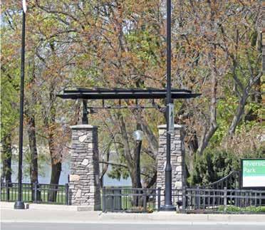
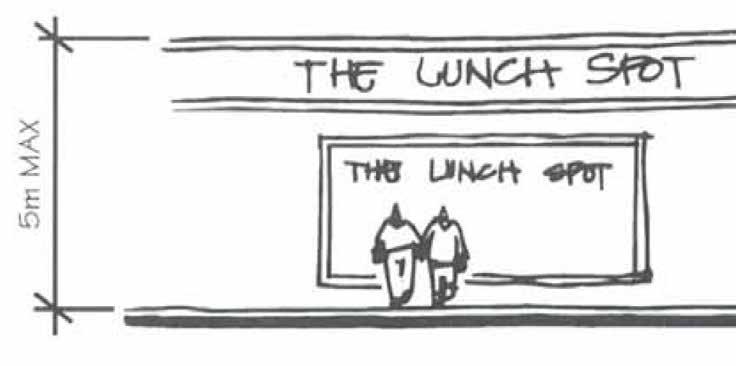
Entry corridors serve as key gateways for residents and visitors to Downtown. Road-oriented gateway signage welcomes people to Downtown Kamloops on Victoria Street West at Seymour Street West, Victoria Street at Lansdowne Street and 8th Avenue, Columbia Street west of 1st Avenue, and Battle Street west of the Yellowhead Bridge overpass. The historic CN Rail train station on Lorne Street is a key gateway for tourists arriving on the Rocky Mountaineer.
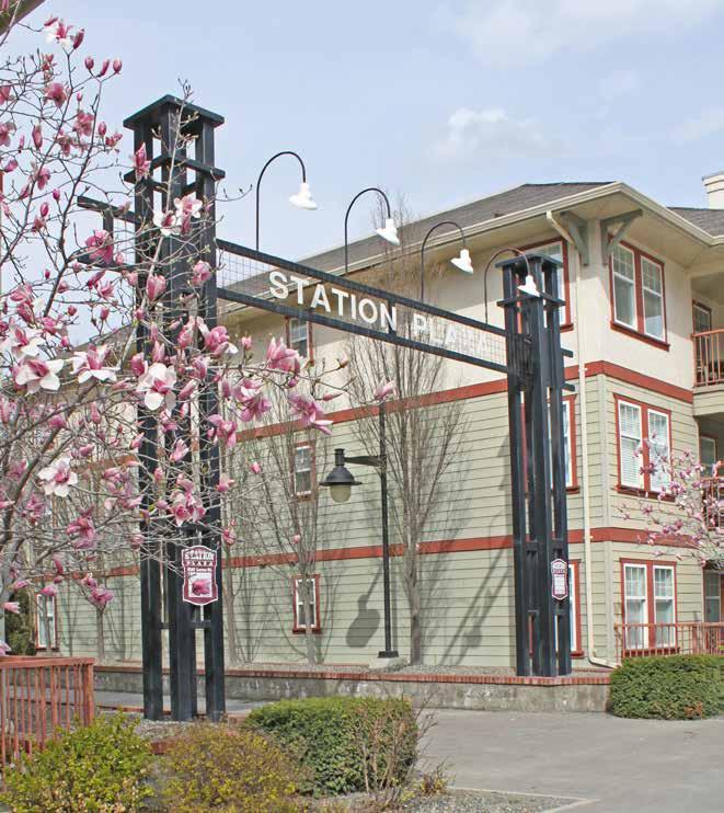
Gateway features can also be found at entry points to landmark destinations within the plan area, including Riverside Park, Peterson Creek Park, Station Plaza, Gaglardi Square, and the Kamloops Farmers’ Market’s Saturday location at the former Stuart Wood School site. In addition to serving as physical and symbolic gateways, such features contribute to public art, placemaking, and wayfinding efforts.
9th Avenue
Entrance to Station Plaza
The plan area has a diverse mix of uses, including a range of residential housing types, retail, government and commercial offices, health care facilities, landmark institutional buildings, public utilities, rail yards, parks, and major cultural and recreational facilities.
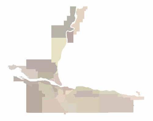
The formally designated land uses for the plan area, as defined by the Official Community Plan (OCP), are shown in Figure 3.1.
The West End and Sagebrush are largely composed of Urban (residential), Parks and Open Space, and Educational/Institutional land uses, while Downtown has a much greater share of Commercial land use, including the City Centre, which is a mixed-use area containing the city’s greatest concentration of commercial office space, streetfront retail, and cultural institutions.
Downtown also features large Parks and Open Space areas, including Riverside Park, which functions as a key gathering place for the community, and Peterson Creek Park, which provides connectivity between Sahali and Downtown. The plan area also encompasses the Columbia Precinct, a large Educational/Institutional area that contains government institutional facilities, including the provincial courthouse, government offices, and health care facilities, such as Royal Inland Hospital.
Land Use
DESIGNATED LAND USE
Land use designations are established within the OCP and are a key implementation tool in helping the City manage growth and development. They identify general uses that are provided for in each designation, give direction on the appropriate development mix, and identify where land uses should be located. Table 3.1 provides a high-level overview of land use designations within the plan area, as described in the OCP.
The land uses provided and densities noted are generalized, which leaves it to the Zoning Bylaw to prescribe permitted uses and regulations regarding such things as density, lot coverage, and setbacks. The City may consider higher densities beyond the limits stipulated in Table 3.1, but only subject to certain conditions, such as availability of servicing; compatibility with existing neighbourhood form and character; and proximity to transit, recreation, shopping, and other community amenities.
City Centre
To allow for a mix of medium- to high- density multi-family, commercial, and community uses.
Future development in this designation may include commercial (retail and office), mixed-use, with commercial on lower floors and residential above, medium- to high- density multi-family, and major civic and cultural facilities.
Development should be pedestrian- and transit- oriented where appropriate while not impeding movement of goods and emergency services along major transportation corridors.
Urban To allow for a broad range of housing, including single -family and low-, medium-, and high- density multi-family housing in a variety of forms.
Development should be pedestrian- and ground- oriented
Single-family, residential suites, duplexes, row houses, manufactured homes, stacked townhouses, triplexes, fourplexes, walk up apartments, and other forms.
Up to 125 units/ha
Table 3.1 » Land Use Designations
LAND USE
Commercial
Parks and Open Space
Public Service Utilities
Educational/Institutional
PURPOSE
To allow for a wide range of commercial uses including retail, office, goods and services, as well as community amenities.
To protect areas of ecological significance, including wildlife corridors, and to allow for active and passive recreation via various City parks classified as city wide parks, community parks, neighbourhood parks, tot lots, linear parks, nature parks, and open space.
Recreational and other community facilities located within City parks are included in this designation.
To allow for municipal services and infrastructure essential to the public, including water treatment plants and other civic utilities.
To provide for services to the community, including schools; hospitals; fire halls; cemeteries; major government, cultural, or recreational facilities; community centres; and places for religious assembly.
Table 3.1 » Land Use Designations (Continued)
The Downtown Plan identifies eight distinct character areas, which each display a unique form, character, and function within the broader plan area. This section describes their defining characteristics as well as the objectives and policies for each.
OVERVIEW
The overall intent of the character areas is to respect and enhance the qualities that residents consider desirable and attractive.
The eight character areas are the following:
• Downtown Core
• Waterfront District
• West Entry Corridor
• East Entry Corridor
• Columbia Precinct
• East End
• Sagebrush
• West End
Figure 4.1 » Downtown Plan Character Areas
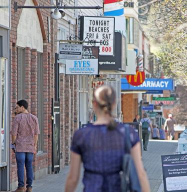
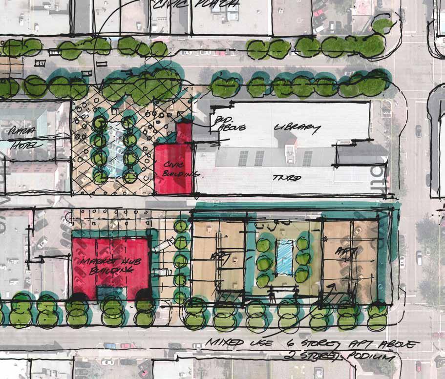
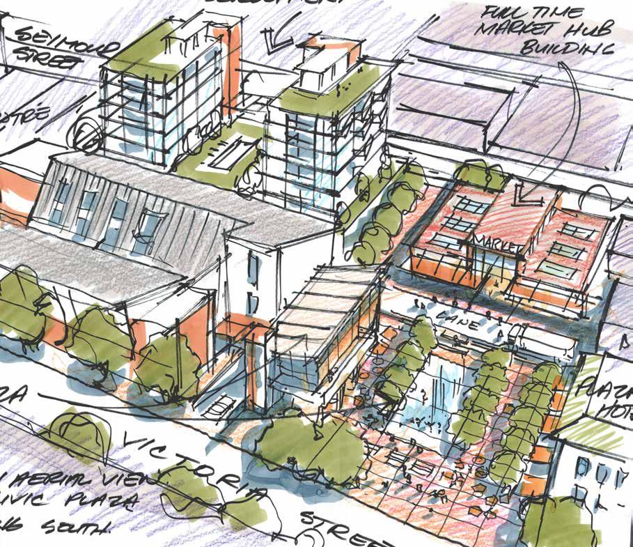
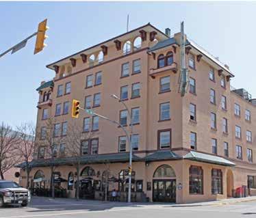
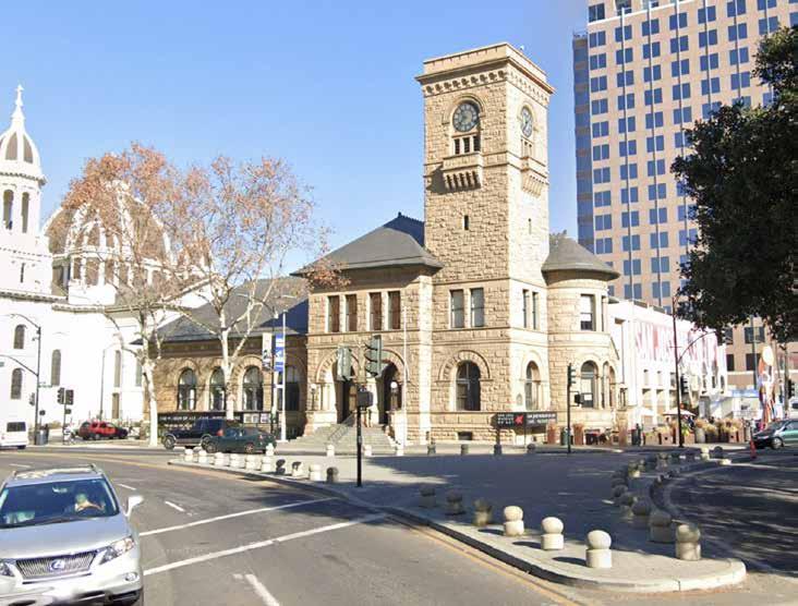
DOWNTOWN CORE
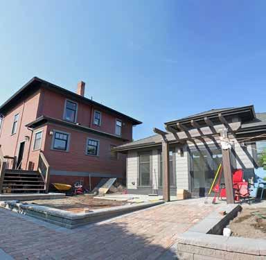
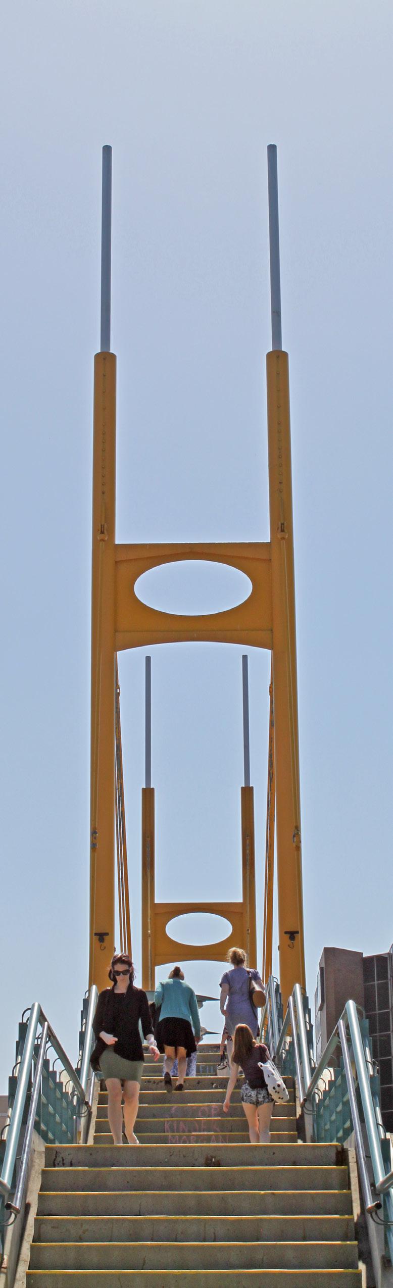
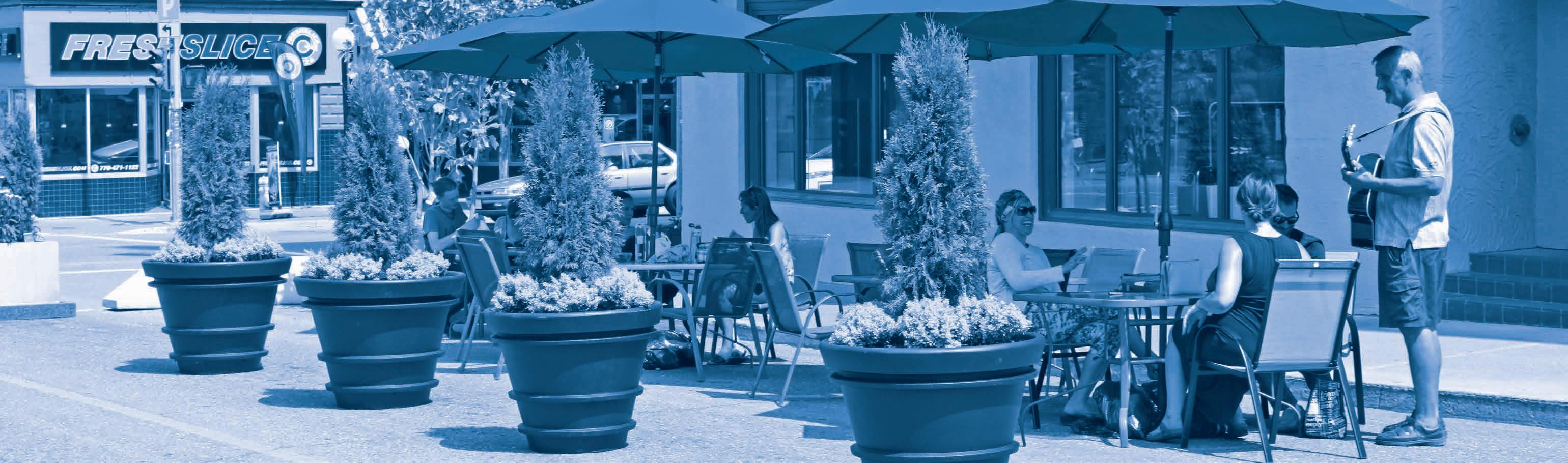
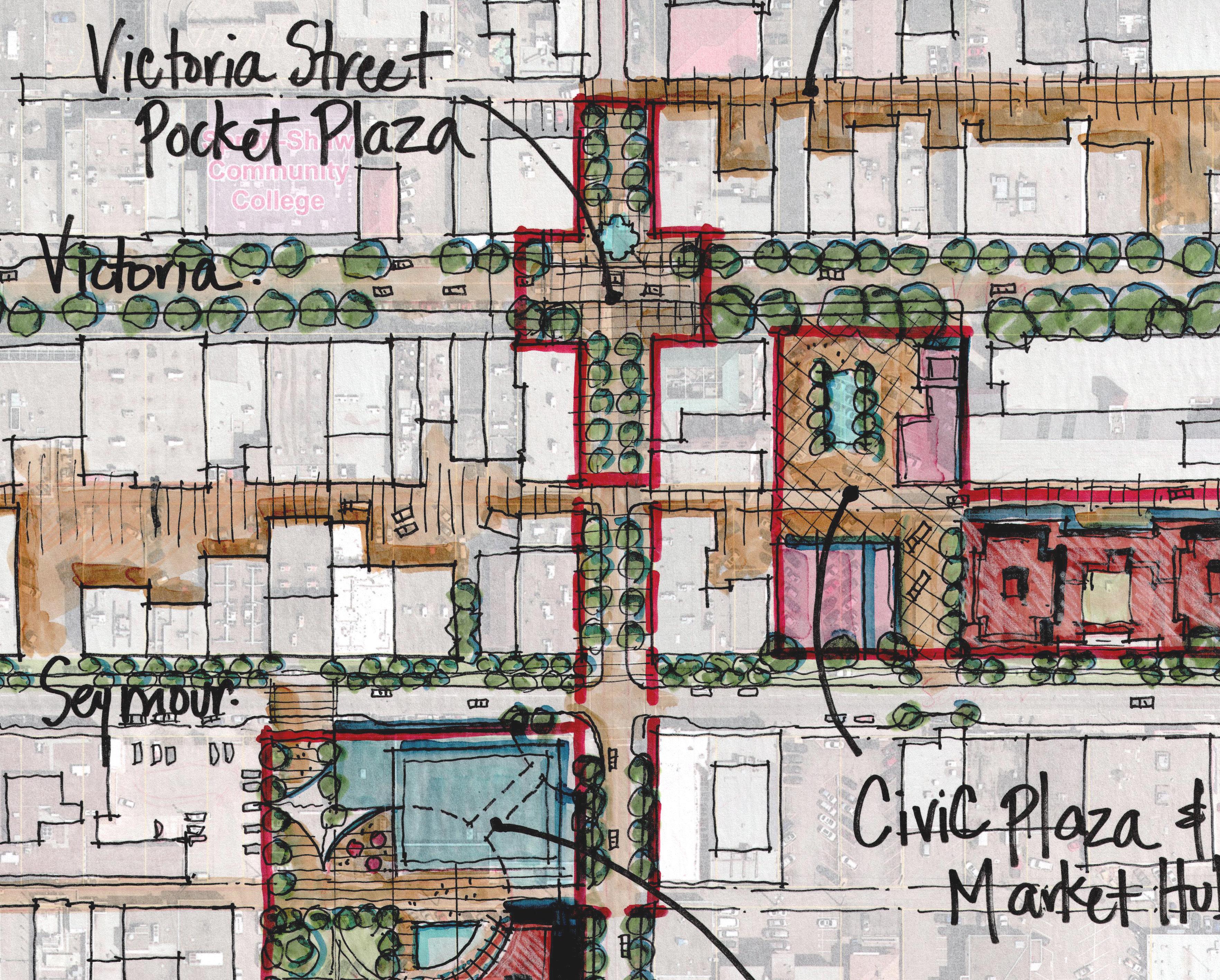
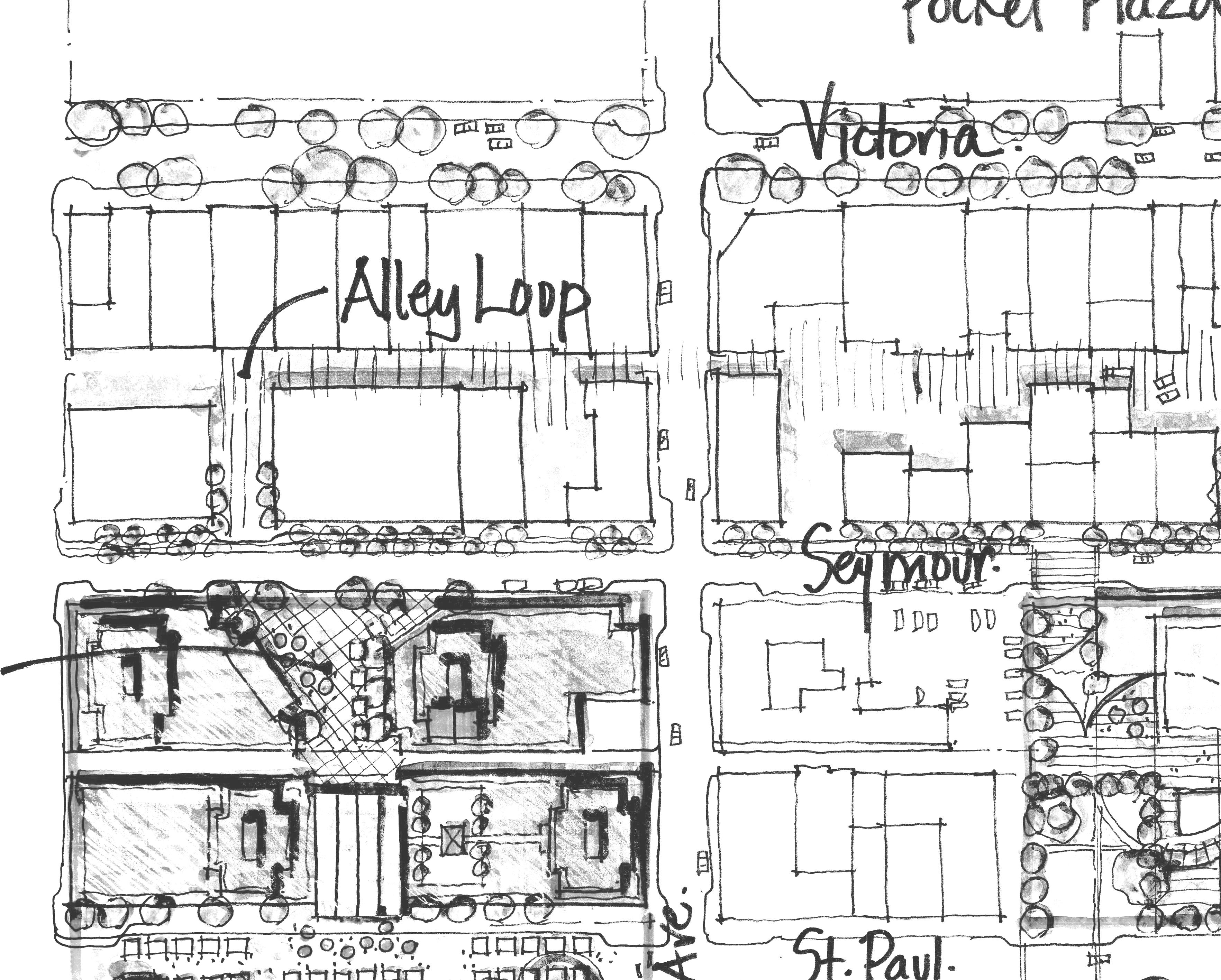
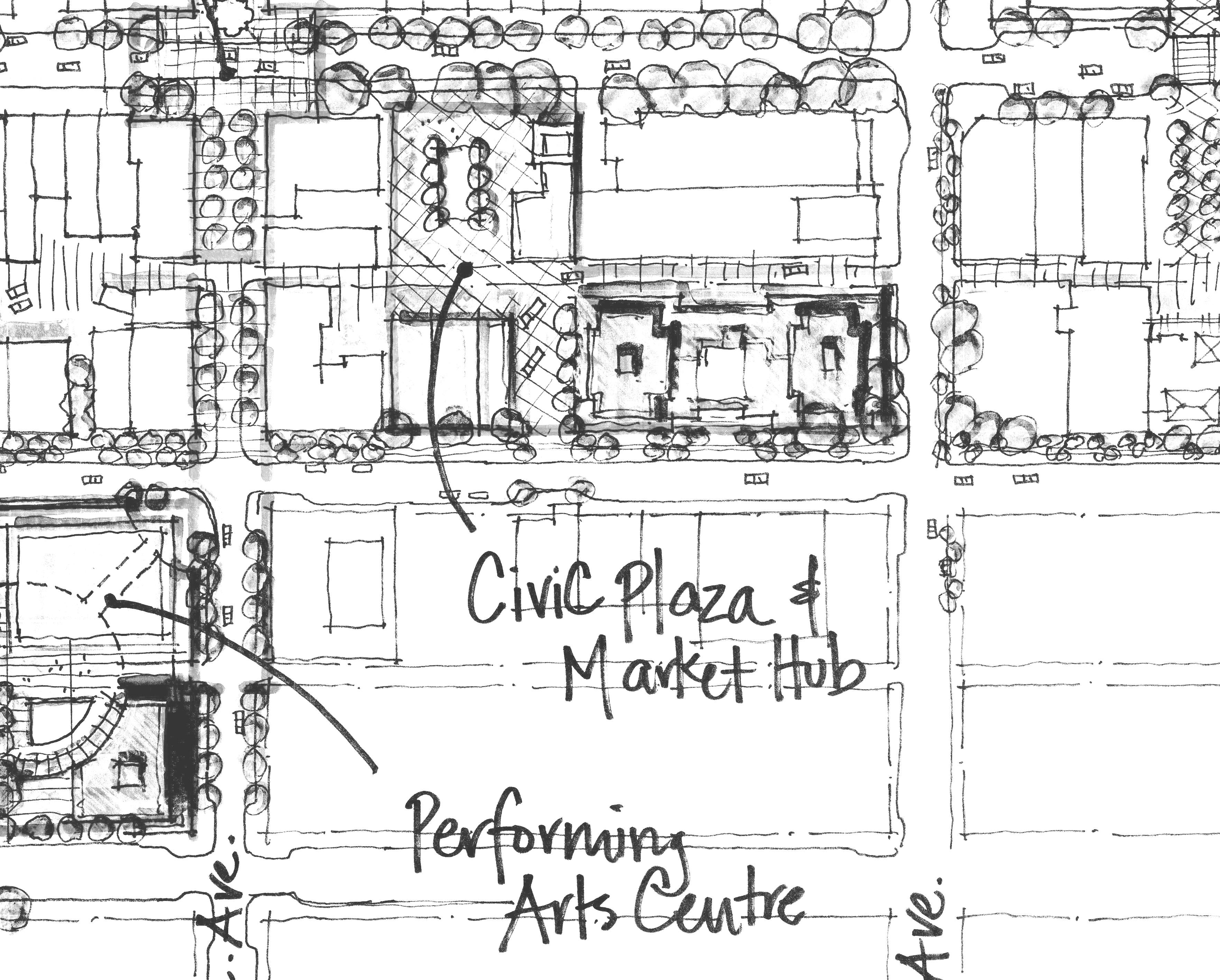
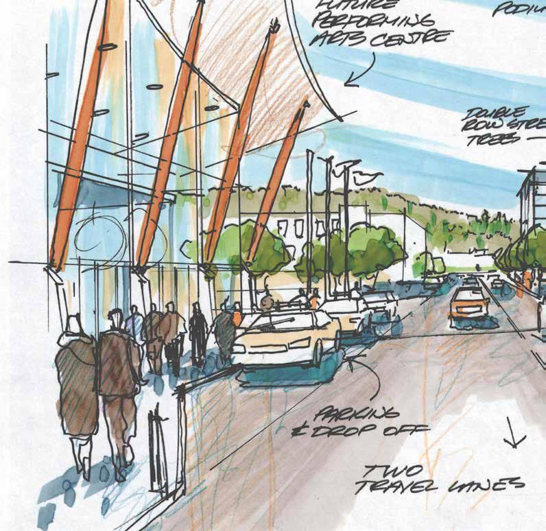
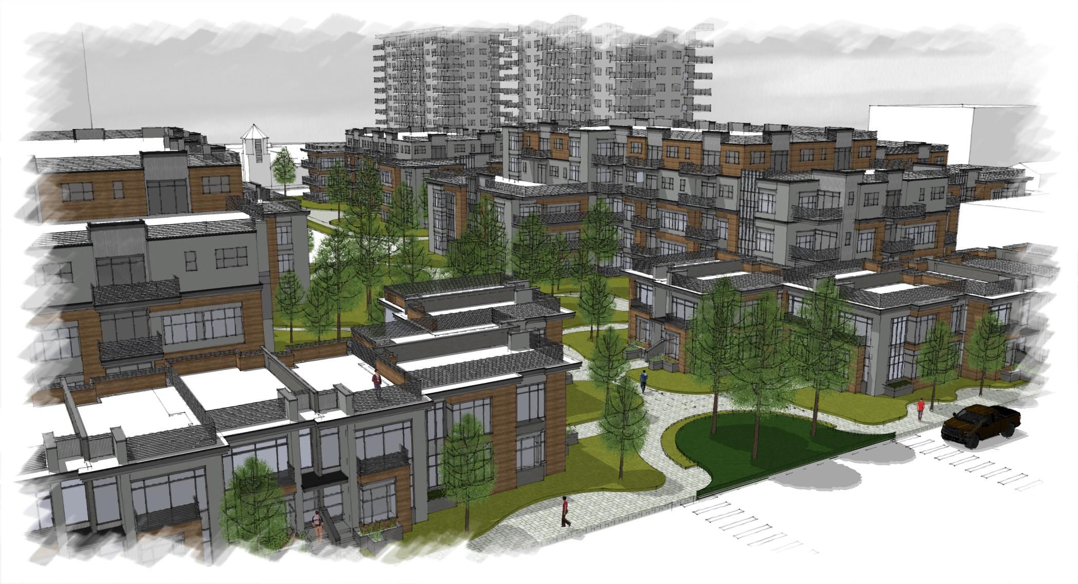
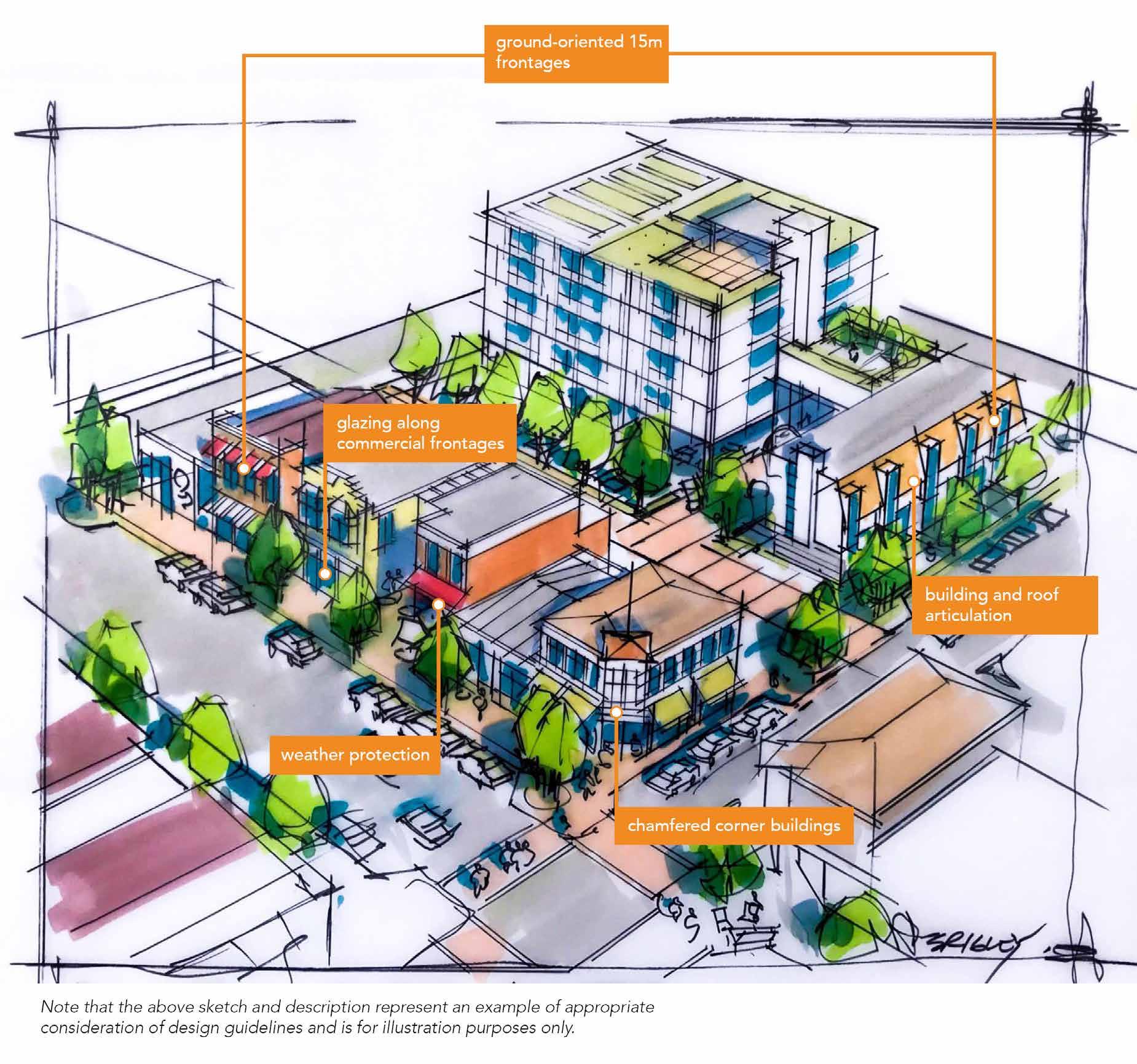
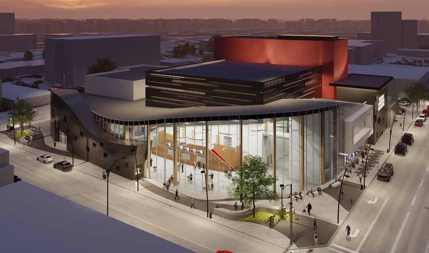
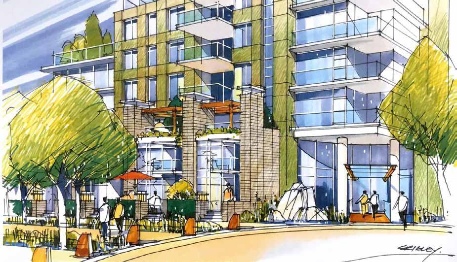
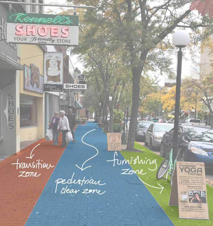
The Downtown Core is the primary civic, employment, and cultural hub of Kamloops and features the highest concentration of office space, streetfront retail, community facilities, entertainment venues, and multi-family residential development in the city. There are opportunities to increase the density and vibrancy of the Downtown Core by encouraging more multi-family and mixed-use infill development, which would attract more residents and visitors and support the viability of businesses, public amenities, and events. Improving the quality of the public realm by investing in beautification; public gathering places; wayfinding features; and pedestrian, cycling, and transit infrastructure will improve the walkability and character of the area, encourage greater sustainable transportation use, and be beneficial to the health and safety of residents.
OBJECTIVES
• To maintain the Downtown Core as the city’s primary civic, entertainment, and cultural hub and the city’s principal location for employment and office development.
• To increase residential density and ensure that new development respects the scale, character, and function of the Downtown Core.
• To provide a safe, connected, accessible, attractive, and welcoming environment with amenities that cater to workers, residents, and visitors.
POLICIES
Land Use
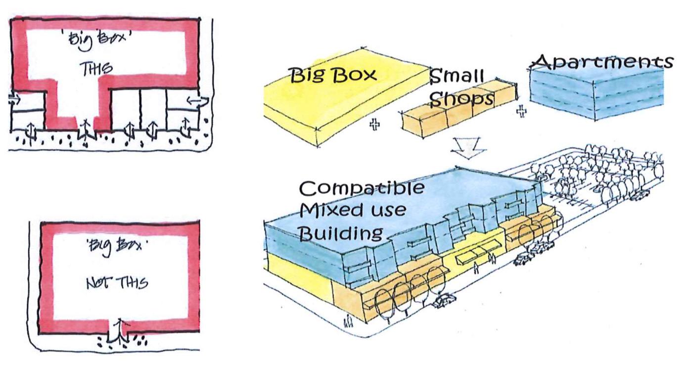
1 Provide zoning within the Downtown Core to support a strong concentration of commercial employment uses, along with complementary uses such as multi-family residential, hotels, restaurants, cultural and recreational facilities, community amenities, civic and public institutions, personal service businesses, entertainment venues, and retail stores.
Economic Activity
2 Ensure that economic initiatives undertaken by the City and its economic development organization, Venture Kamloops, reinforce the function and character of the Downtown Core as a destination for shopping, dining, entertainment, tourism, and employment.
3 Support the development and growth of a wide variety of local businesses and amenities to serve residents and visitors.
Commercial Activity
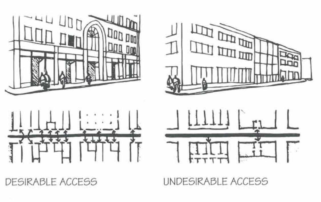
4 Encourage commercial uses, such as retail, cafés, restaurants, and tourism- and entertainment-related venues, to locate at street level to support a lively, vibrant, pedestrian-friendly public realm
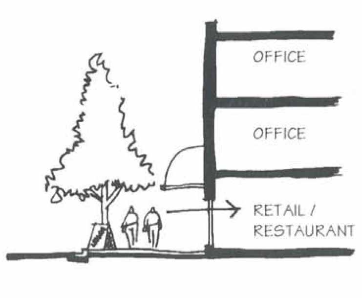
5 Where mixed-use development combines office and retail, encourage office uses to be located above the ground floor and more active commercial retail uses (e.g. cafés and restaurants) at street level to support a pedestrian-oriented environment.
6 Encourage pedestrian-oriented commercial retail uses at ground level where a building fronts:
6-1 Lansdowne and Victoria Streets between 1st and 8th Avenues
6-2 Seymour Street between 1st and 9th Avenues
6-3 Columbia Street between 3rd and 6th Avenues
6-4 3rd and 6th Avenues between Lansdowne Street and Columbia Street
6-5 1st, 2nd, 4th, 5th, 7th, and 8th Avenues between Lansdowne and Seymour Streets
7 Discourage auto-oriented commercial uses, such as drive-thru restaurants, gas stations, and automobile sales and services, from locating in the Downtown Core.
8 Maintain Victoria Street as the City’s pre-eminent streetfront retail corridor supported by an accessible, inclusive, and well-designed public realm
Residential Development
9 Require street-facing residential units in mixed-use development to be located above or below the ground floor to retain and support active commercial uses at street level.
10 Encourage ground-floor residential dwellings that are located adjacent to a street in multi-family development to provide individual, at-grade entrances with direct connections to a public sidewalk.
11 Support ground-oriented housing such as townhouses on the lower floors of high- density multi-family residential development to encourage a more pedestrian-oriented urban environment.
12 Support high-density multi-family residential development as permitted in the Zoning Bylaw, and in accordance with Section 12: Downtown Development Permit Area Guidelines and the Multi-family Development Permit Area guidelines in the Official Community Plan.
Street-facing residential units above the ground floor in a mixed-use development (see policy 9)
Ground-oriented housing on the lower floors of high-density multi-family residential development (see policy 11)
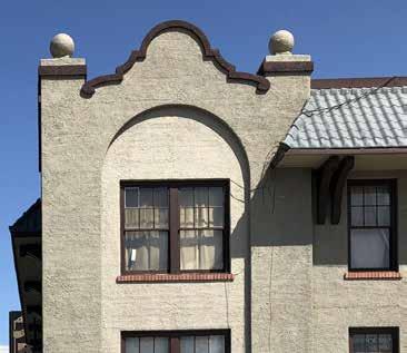
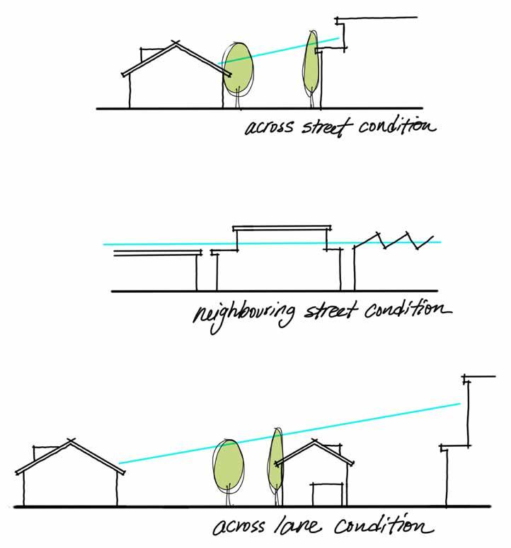
Height Requirements and Edge Conditions
13 Require a building height impact assessment to determine shadow impacts and encroachment into public view corridors for buildings that exceed six storeys, in accordance with Section 12: Downtown Development Permit Area Guidelines.
14 Maintain a two- to three-storey street wall along Victoria Street to retain the historic form and character of Downtown’s high street, in accordance with Section 12: Downtown Development Permit Area Guidelines.
15 Ensure that new buildings located along the edges of the Downtown Core consider scale, orientation, setbacks, massing, and building height to provide a sensitive transition to adjacent character areas.
Transportation and Connectivity
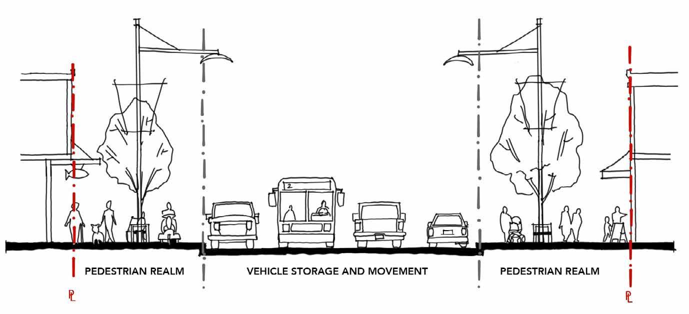
16 Improve travel between the Downtown Core and other areas of the city for pedestrians, cyclists, and transit users through well-designed, clearly marked, connected, accessible, and safe active transportation and transit routes, as per Section 13, Maps 1 to 3.
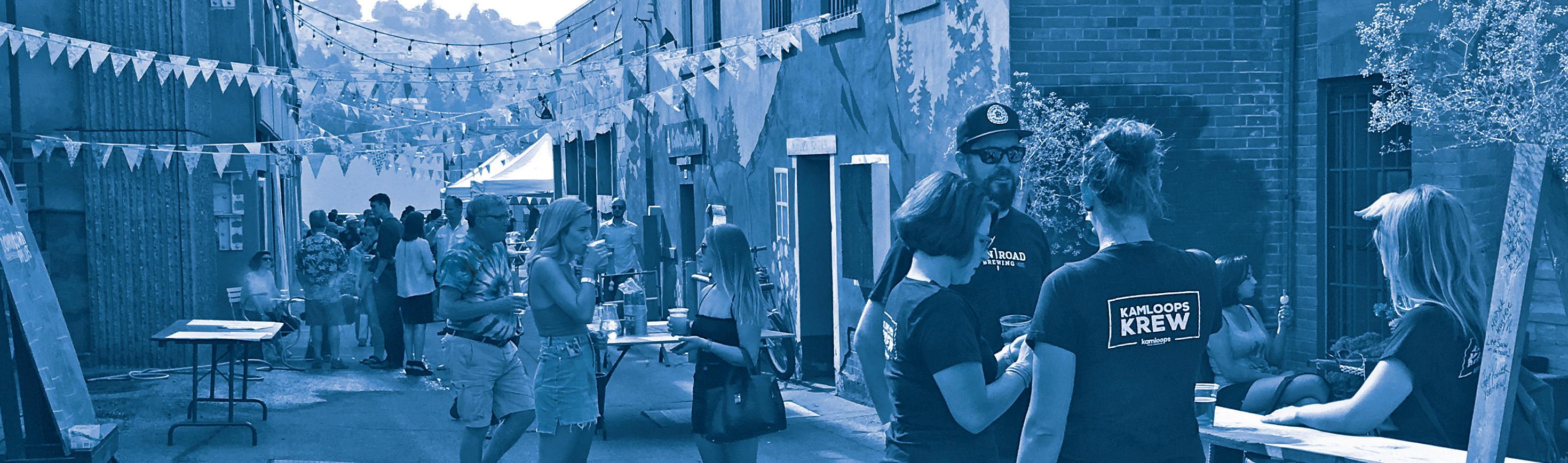
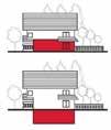
17 Partner with the Kamloops Central Business Improvement Association (KCBIA) and local businesses to activate Downtown Core alleys into lively pedestrian walkways that feature public art, retail access, connectivity to key destinations, and special events such as back-alley parties, while maintaining access for commercial vehicles, waste and recycling collection, and emergency services.
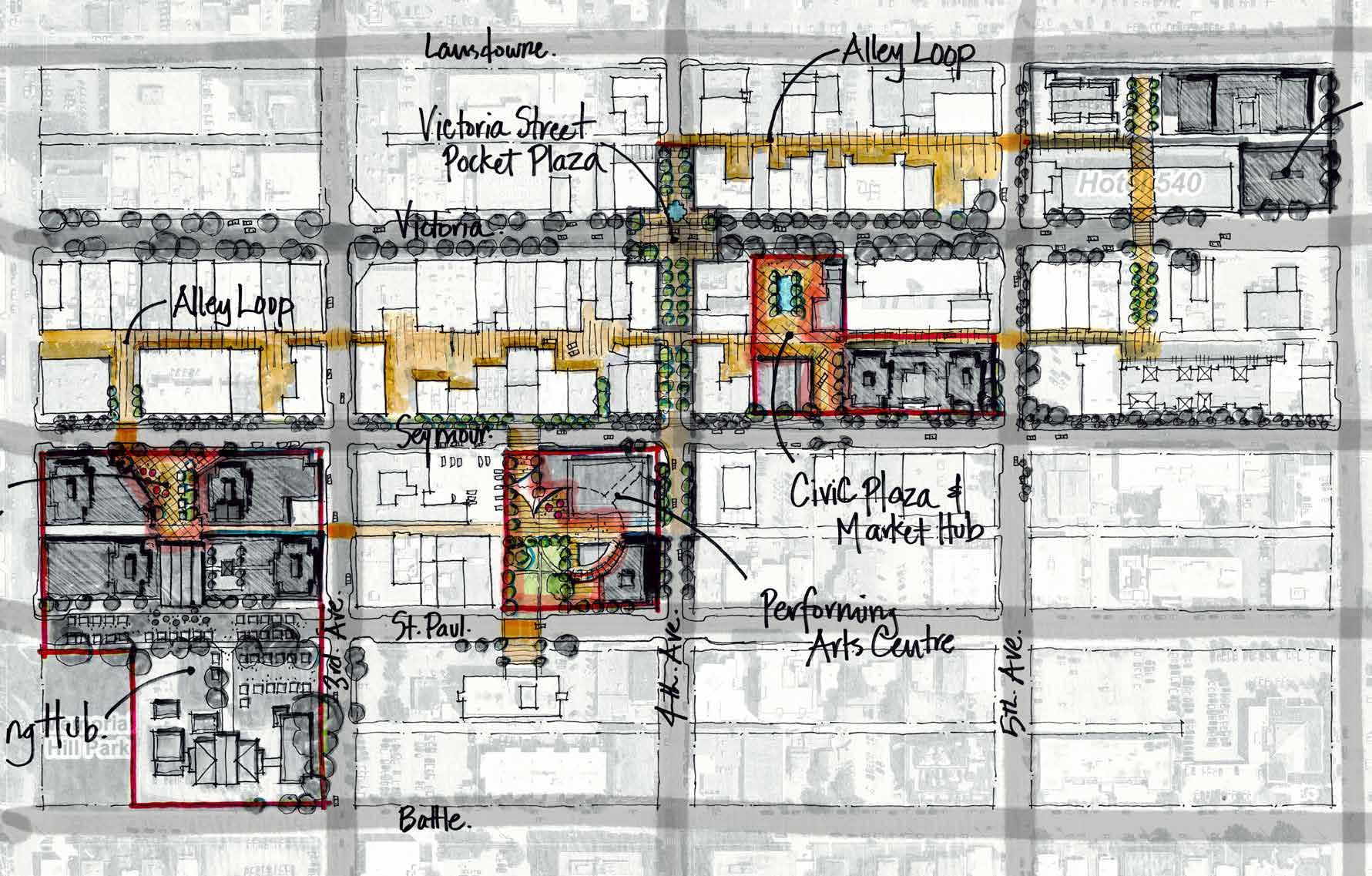
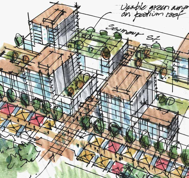
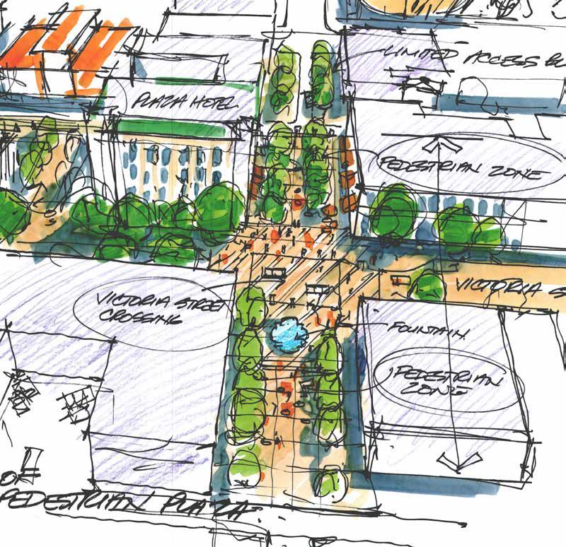
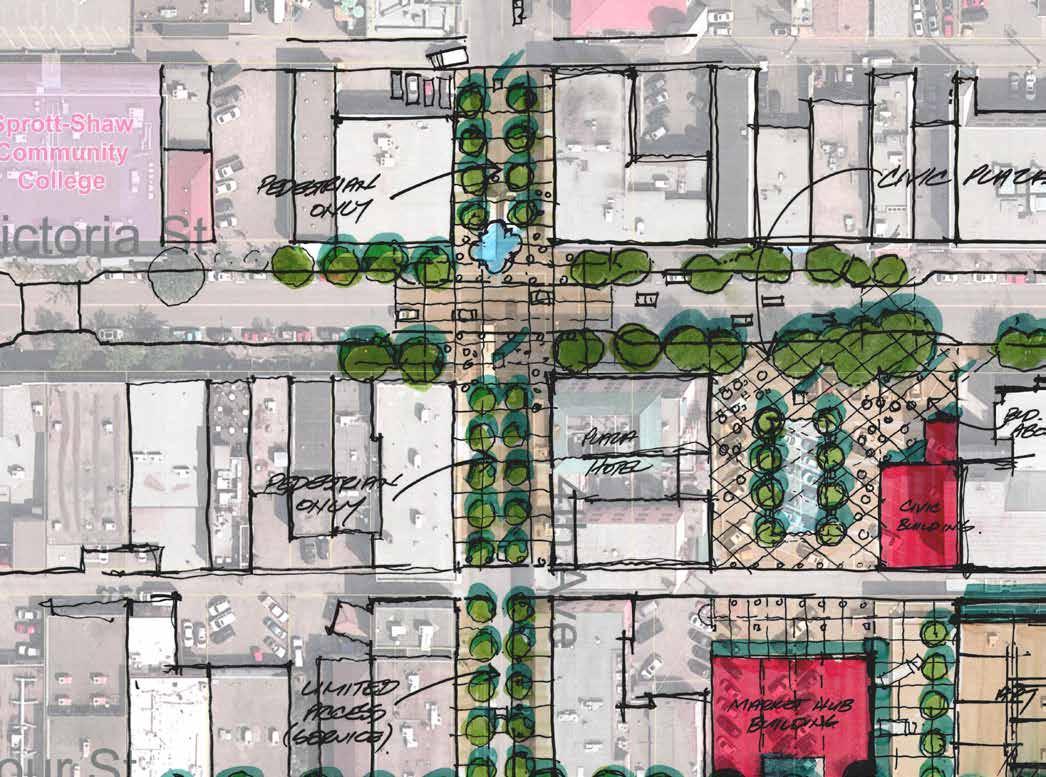
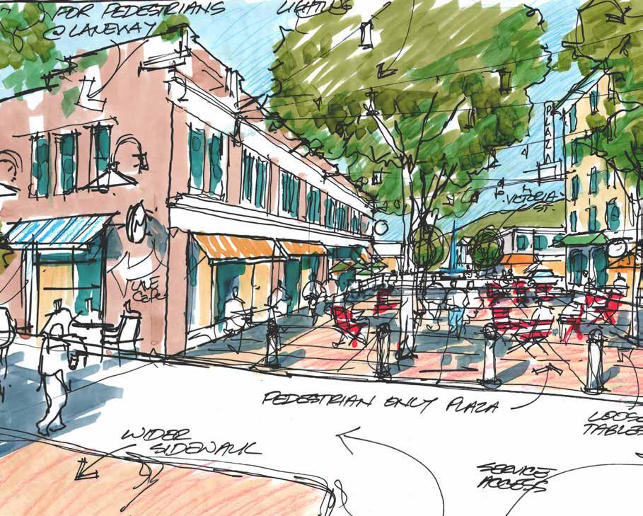
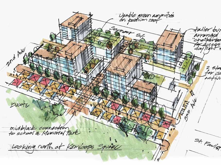
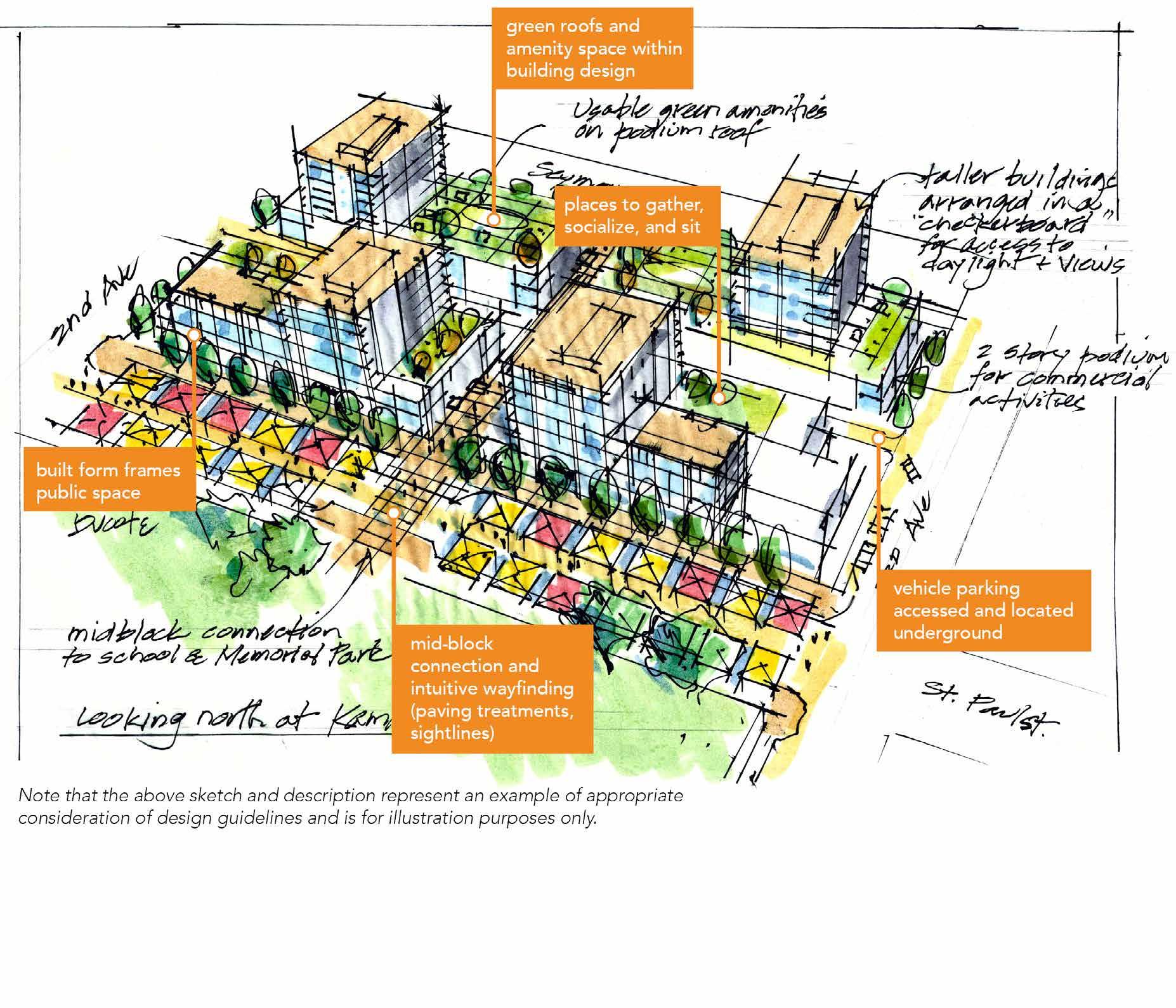
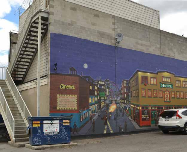
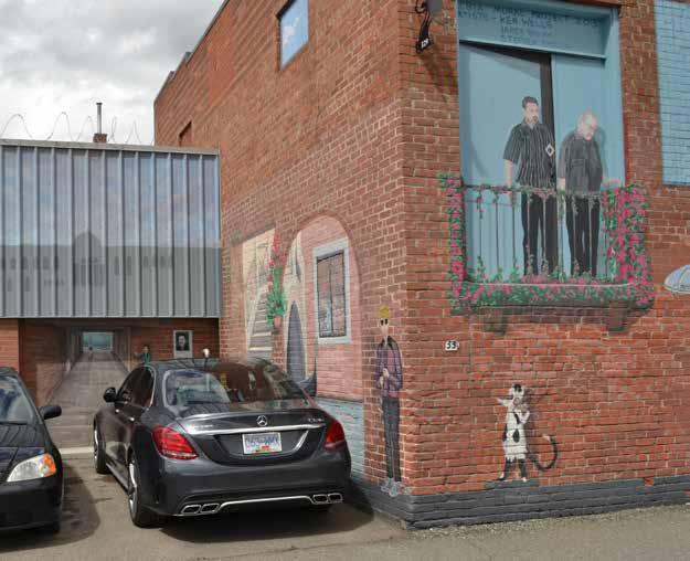
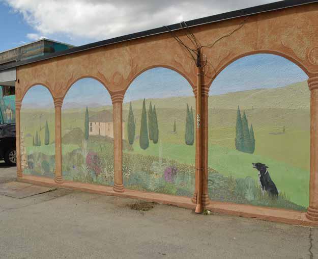
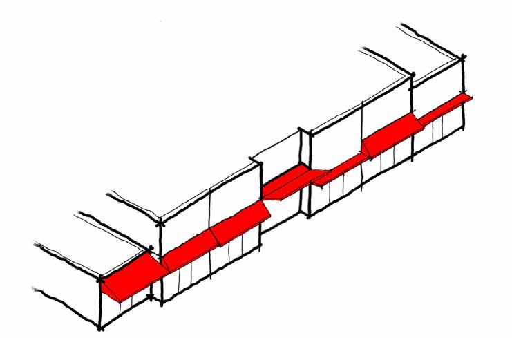
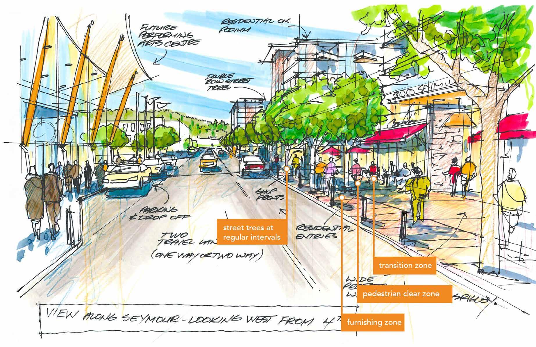
Figure 4.2 » “Alley Loop” concept generated during the Downtown Design Charrette proposes activating a network of Downtown alleys (see policy 17 below)
18 Conduct an analysis comparing one-way and two-way traffic patterns and functionality on Seymour and Lansdowne Streets as well as other one-way streets in Downtown, and evaluate the potential impacts on the road network, Downtown businesses, and the public realm.
19 Consider mid-block crossings in areas of high pedestrian activity to allow for ease of movement and improved walkability between key destinations.
20 Encourage through-block walkways in the redevelopment of key sites as convenient, well- designed connections for pedestrians, which may exist as a private easement or public right- of-way.
23 Work with developers to provide surplus off-street parking that integrates short-term public pay parking in parking structures built as part of new development to address long-term demand.
Public Realm
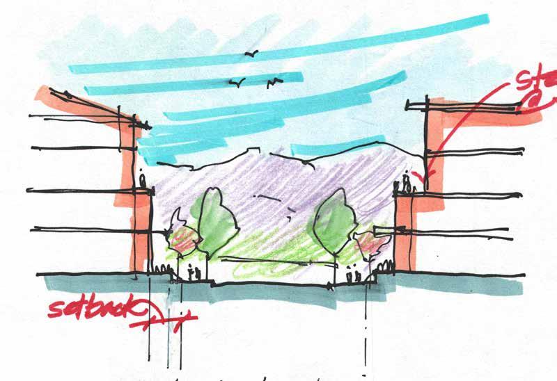
24 Retain public view corridors of the valley landscape and mountains to the north on 3rd to 8th Avenues.
25 Support the installation of gateway features and landmark structures in Downtown entry corridors that welcome residents and visitors and help identify the Downtown Core as the heart of the city.
21 Use off-street public and private parking structures to address employee and long-term parking needs in the Downtown Core, and prioritize on-street parking for Downtown customers and visitors.
22 Consider rate zones (e.g. a higher parking meter rate on Victoria Street than peripheral streets) and/or a range of time limits (e.g. one-hour time limits on Victoria Street and two- and three-hour time limits on peripheral streets) in Downtown on-street parking stalls to maximize usage and customer turnover.
26 Require redevelopment at the corner of Victoria Street and Lansdowne Street to incorporate gateway features in accordance with Section 12: Downtown Development Permit Area Guidelines to enhance the east entry into the Downtown Core.
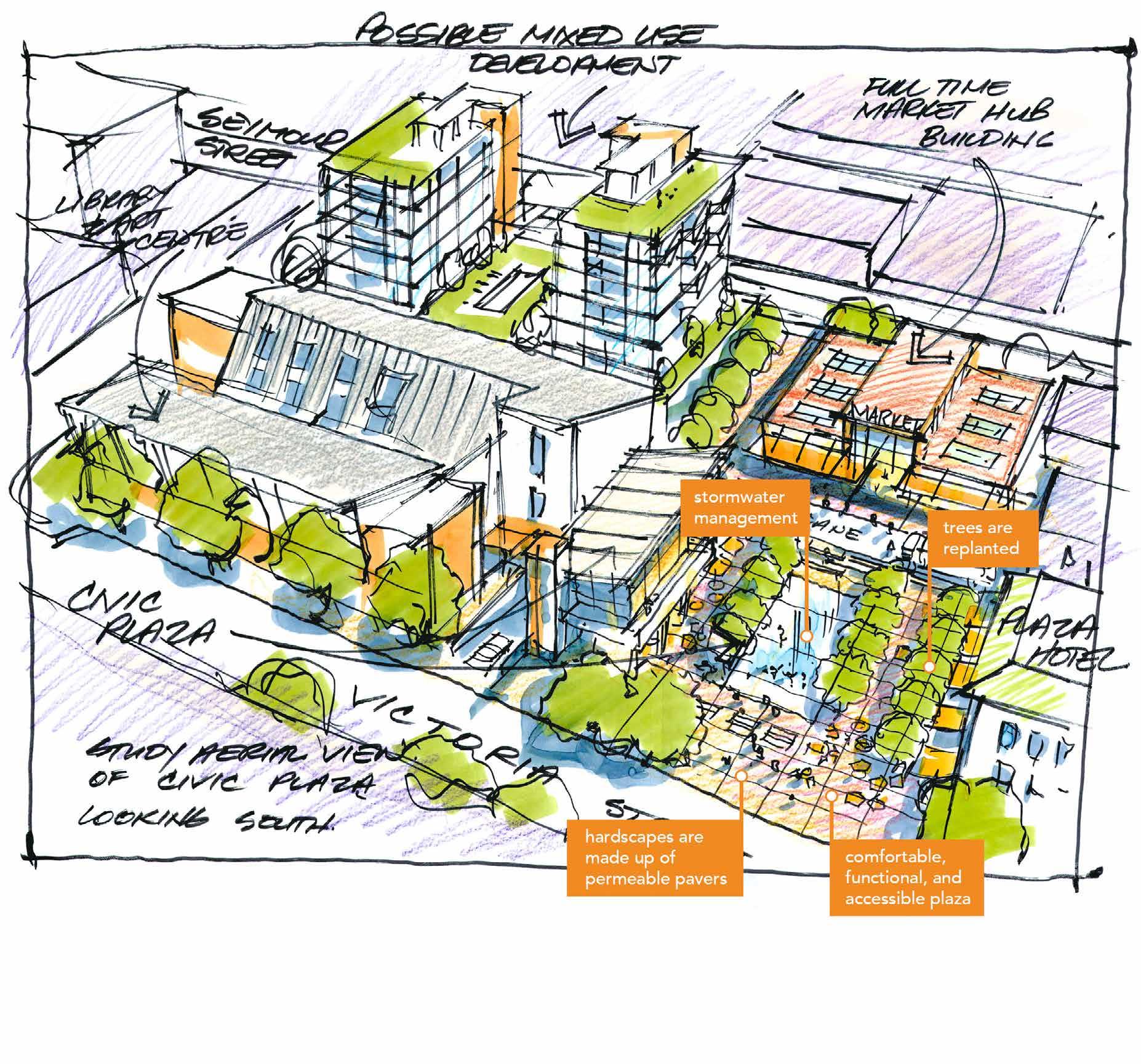
A conceptual through-block walkway connecting the 200 block of St. Paul Street with Seymour Street (see policy 20)
THROUGH-BLOCK WALKWAY
Parks and Public Places
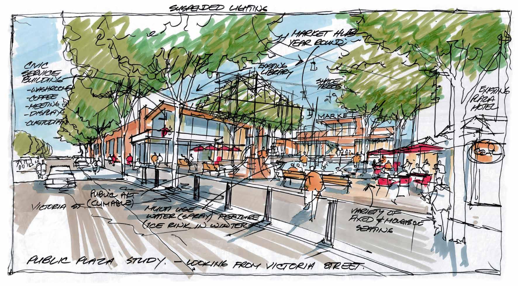
27 Identify specific locations and develop detailed designs for new parks, plazas, and other public gathering places in the Downtown Core that are attractive, functional, accessible, and integrate natural elements with the pedestrian network as part of the implementation of this plan.
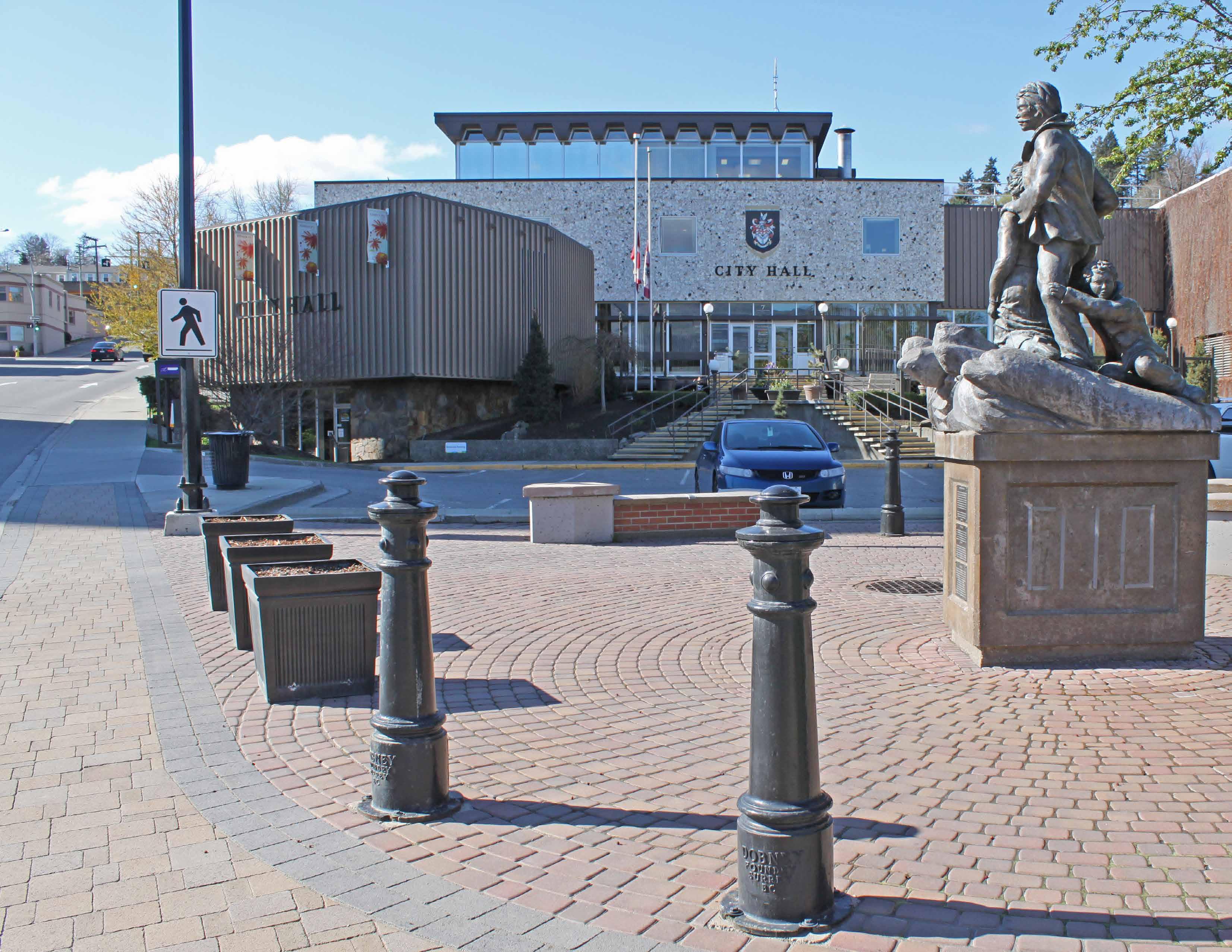
28 Ensure, if redeveloped, that City Hall remains in the Downtown Core as a key civic institution.
Arts, Culture, and Heritage
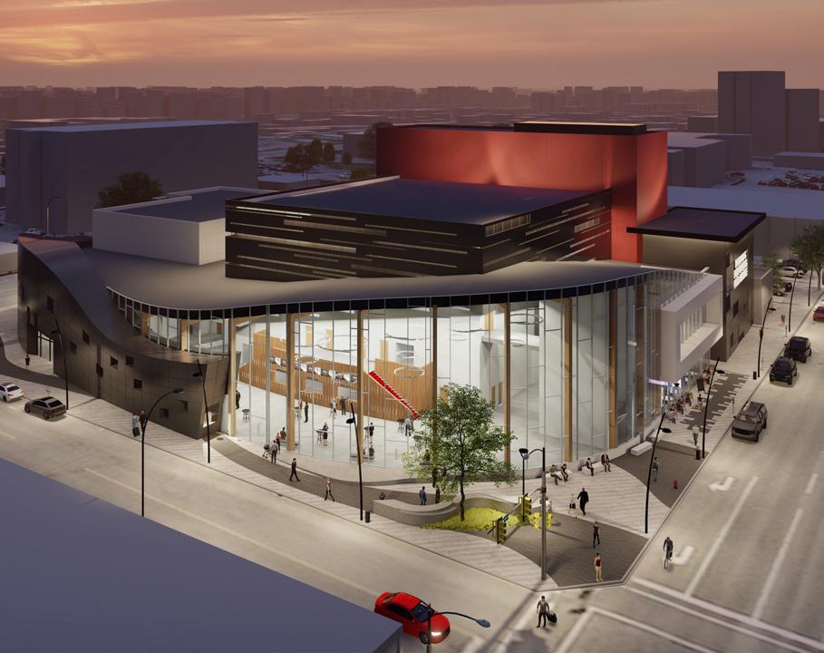
29 Support major arts, cultural, and recreational events and facilities in the Downtown Core that raise the profile of the arts, fill gaps in existing offerings and amenities, and stimulate further investment.
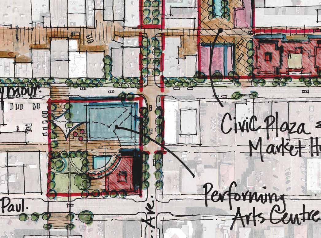
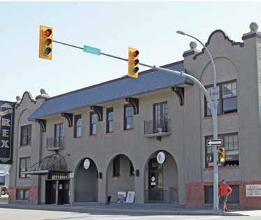
30 Consider adaptive reuse of vacant or underutilized heritage buildings, such as the former Stuart Wood School, as community amenities that permit public access and serve to enhance appreciation and awareness of local and regional cultural heritage, including Secwépemc heritage.
WATERFRONT DISTRICT
Defined by the South Thompson River to the north and a major rail corridor to the south, the Waterfront District includes key City parks, recreational and cultural facilities, the Rivers Trail, a mix of housing types, and service commercial areas. Enhancing connectivity to the waterfront and encouraging residential infill (where permitted) would provide a greater number of residents with improved access to key amenities within the Waterfront District. Additional opportunities in the area include enhancing the Rivers Trail and exploring ways to improve public access to the waterfront while protecting the natural environment and riverbank.
OBJECTIVES
• To improve public access to the waterfront and enhance connections to the South Thompson River to create a cohesive, well-designed, and vibrant waterfront area that supports active and passive recreational opportunities.
• To encourage medium- and high-density residential infill in the west Waterfront District and low- to medium-density residential infill in the east Waterfront District.
POLICIES
Economic Activity
1 Continue to promote Riverside Park as a destination for passive and active recreational activities for the enjoyment of residents and visitors, and support entertainment, cultural, and community events that celebrate and enhance the identity of Kamloops.
2 Support tourism-oriented businesses and services, and encourage entertainment, restaurants, cafés, and retail in the west Waterfront District area outside of Riverside Park.
Commercial Activity
3 Support commercial retail uses to locate on the ground floor when a building fronts Lorne Street to encourage pedestrian activity and complement the public realm.
4 Continue to permit service commercial activities in the east Waterfront District, as per existing zoning, based on the continuing economic viability of these uses, potential for conversion to other uses over the long-term, and opportunity to minimize impacts on adjacent uses through screening and landscaping.
Figure 4.3 » Overview of west and east Waterfront District
Residential Development
5 Encourage medium- to high-density multi-family residential development, including mid-rise and tall buildings, to locate in the west Waterfront District.
6 Encourage land assembly of single-family lots to facilitate low- to medium-density multi-family residential development, including row housing and stacked townhouses, in the east Waterfront District.
Public Realm
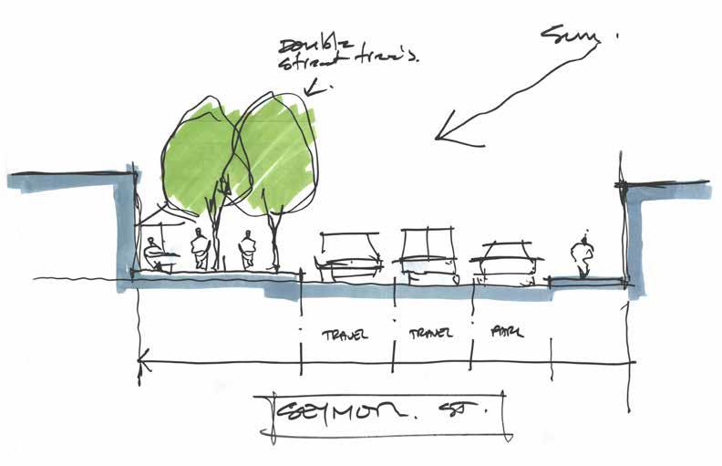
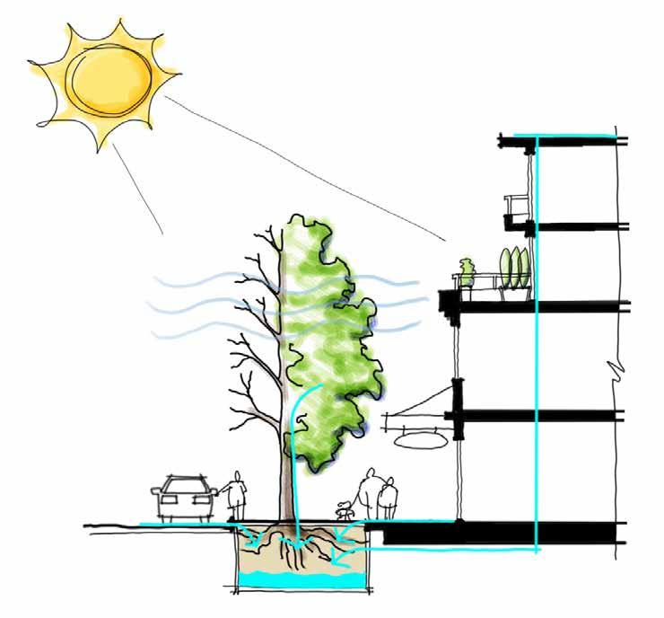
7 Improve public access to the waterfront and create a more enjoyable walking and cycling experience in the riverfront parks through public realm improvements, including more street trees and plantings, seating, picnic amenities, widened pathways, lighting, bicycle racks, public art, and wayfinding features, in accordance with the Riverside to Pioneer Parks Management Plan.
Parks and Public Places
8 Consider improvements to greenspaces, community amenities, recreational facilities, and the Rivers Trail in the east Waterfront District to support year-round pedestrian activity and public use of the area.
Transportation and Connectivity
9 Complete enhancements to the Rivers Trail and other pedestrian and cycling infrastructure in the riverfront parks, including path widening, better separation of pedestrian and cycling uses, new loop trails, a clarified trail hierarchy, and improved wayfinding signage, as per the Riverside to Pioneer Parks Management Plan.
10 Continue to recognize the Red Bridge, which is owned and maintained by the Province, as a key connection between the Tk’emlύps te Secwépemc (TteS) Mount Paul Industrial Park and the Waterfront District.
11 Avoid pedestrian and vehicle conflict by adding a sidewalk on the north side of River Street from the Yacht Club west to 10th Avenue with limited vehicle access points to the adjacent parking area, as per Section 13, Map 1.
12 Continue to provide pedestrian and cycling connectivity through the area, with a priority on parks and trail connections, as per Section 13, Maps 1 and 2.
Height Requirements
13 Require a building height impact assessment to determine shadow impacts and encroachment into public view corridors for buildings that exceed six storeys, in accordance with Section 12: Downtown Development Permit Area Guidelines.
WEST ENTRY CORRIDOR
The West Entry Corridor serves as the primary connection between Downtown and the North Shore and contains a numbers of social services and low-density auto-oriented commercial uses. Recent improvements made to the West Entry Corridor along Victoria Street West include new street lighting, landscaping, sidewalks, and undergrounding of utilities, which will enhance aesthetic qualities to create a more attractive, safe, accessible, and memorable gateway to Downtown. In addition, encouraging a greater mix of land uses and more pedestrian-friendly development along the corridor will add to the visual appeal, character, and connectivity of the area.
OBJECTIVES
• To provide a safe, accessible, and comfortable pedestrian environment.
• To encourage a mix of uses, including residential and commercial, that improve aesthetic appeal, cater to the needs of commuters and residents in the area, and enhance the West Entry Corridor as a gateway to Downtown.
POLICIES
Residential Development
1 Support mixed-use development that includes active commercial uses at the street level to encourage increased pedestrian activity and improved vitality for the corridor.
2 Ensure that multi-family residential development is focused towards the street for properties that back on to the railway.
3 Balance the needs of social housing and supportive services with other uses in the corridor to provide an inclusive environment for all residents of and visitors to the area.
Commercial Activity
4 Support commercial retail uses to locate on the ground floor to encourage pedestrian activity and complement the public realm.
5 Continue to permit arterial commercial activities in the corridor based on the continuing economic viability of these uses, potential for conversion to other uses over the long term, and opportunity to minimize impacts on adjacent uses through screening and landscaping.
Transportation and Connectivity
6 Ensure that new development does not significantly impact the traffic patterns of the arterial roadway, and consider reciprocal parking and access where appropriate.
7 Monitor pedestrian activity in the corridor, and consider future improvements where appropriate to promote a safe and accessible public realm.
EAST ENTRY CORRIDOR
The East Entry Corridor is comprised of a mix of low- density commercial, retail, and auto-oriented uses. The corridor is a major gateway into Downtown from the east that is constrained to the north by a rail corridor and bordered to the south primarily by single -family homes. There are opportunities to introduce a broader mix of uses into the area, including more arterial commercial uses and mixed-use development to help create a vibrant, pedestrian-friendly gateway. These uses could better serve surrounding residents, improve the commercial viability of the corridor, and provide a more attractive first-impression for Downtown. Any new development adjacent to the rail corridor will need to mitigate potential land use conflicts through appropriate setbacks, buffering, and building design considerations.
OBJECTIVES
• To mitigate potential land use conflicts between new development and the rail corridor through site and building design.
• To encourage a mix of uses that improve commercial viability, aesthetic appeal, and enhance the East Entry Corridor as a gateway to Downtown.
• To improve the quality of the pedestrian realm via streetscape improvements (e.g. street trees, widened sidewalks).
POLICIES
Residential Development
1 Support mixed-use development that includes active commercial uses at the street level to encourage increased pedestrian activity and improved vitality for the corridor.
2 Ensure that multi-family residential development is focused towards the street for properties that back on to the railway.
Commercial Activity
3 Support commercial retail uses to locate on the ground floor to encourage pedestrian activity and complement the public realm.
4 Minimize impact of auto-oriented commercial uses through site and building design that addresses pedestrian safety and enhances the public realm, in accordance with Section 12: Downtown Development Permit Area Guidelines.
5 Encourage arterial commercial uses that cater to the needs of commuters and residents living in the surrounding area, and minimize impacts on adjacent uses through screening and landscaping.
Transportation and Connectivity
6 Implement public realm and streetscape improvements, including new lighting, landscaping, and sidewalks as well as potential undergrounding of utilities in the entry corridor through identified capital projects and/or as a condition of development approval to improve connectivity and safety for pedestrians and cyclists.
7 Ensure that development does not significantly impact the traffic patterns of the arterial roadway, and consider reciprocal parking and access where appropriate.
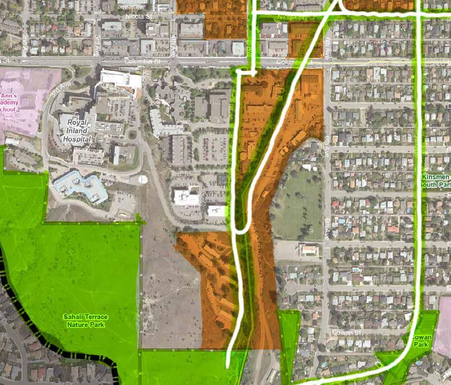
COLUMBIA PRECINCT
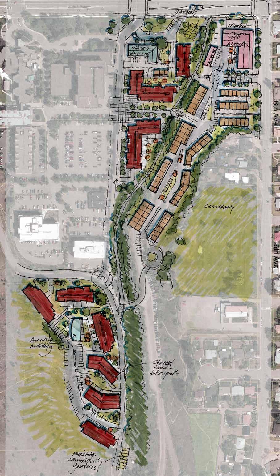
The Columbia Precinct is a large tract of Crown land located to the south of the Downtown Core that contains a mix of provincial government offices, social housing, and some of the city’s largest government institutions, including Royal Inland Hospital (RIH) and the Kamloops provincial courthouse. As the precinct contains large vacant and underutilized areas, there are opportunities to work with the Province to explore redevelopment for uses including residential, commercial, and institutional. Redevelopment should also aim to enhance the natural features of Peterson Creek, which runs through the precinct; provide a higher-profile gateway for Peterson Creek Park to the south; and enhance the area’s active transportation network. The implementation of the objectives and policies in this section will require collaboration, partnership, and agreement between the City and the Province as part of the update of the Columbia Street Precinct Master Plan (2008) and redevelopment of the site.
OBJECTIVES
• To collaborate with the Province in the review and update of the Columbia Street Precinct Master Plan (2008) and ensure alignment with the vision, goals, objectives, and policies of this plan.
• To provide a mix of housing, including market and affordable units, to respond to community needs.
• To support institutional and commercial office development that is complementary to the needs of adjacent provincial government agencies and health care services.
• To support small-scale commercial amenities that provide retail sales or limited service functions for residents of the surrounding neighbourhood.
• To incorporate Peterson Creek into the site in a manner that protects and enhances its natural ecosystem in accordance with the provincial Riparian Areas Protection Regulation while providing a greenway and trail corridor for pedestrians and cyclists.
• To provide a safe and convenient on-site walking and cycling experience, with internal pathways and connections to transit and the City’s active transportation network.
• To collaborate with the Province in developing site-specific Development Permit Area guidelines that encourage a high-quality, visually appealing built form as well as enhancements to the public realm, which are consistent with the City’s Development Permit Area guidelines for Downtown, Multi-family Residential, and Commercial.
POLICIES
Land Use
1 Collaborate with the Province in the review and update of the Columbia Street Precinct Master Plan (2008) to identify appropriate land uses that meet the social, environmental, and economic needs of the community (in consultation with the public and stakeholders) and fit within the vision, goals, objectives, and policies of this plan. Redevelopment of the site should strive to create a complete neighbourhood rather than primarily an office/institutional precinct. As such, a range of housing types, office, retail, and transportation uses should be considered to create a livable and walkable community.
Economic Activity
2 Support the redevelopment of the Columbia Precinct based on a highest and best use analysis, which should consider institutional and commercial office, retail, and multi-family residential uses that contribute to the vitality and economic health of the area.
Commercial Activity
3 Support future uses that could benefit from proximity to Royal Inland Hospital and the provincial courthouse, such as health, legal, and administrative services.
4 Support retail that caters to nearby office workers and residents, including restaurants and small-scale commercial services. Retail should be located on the ground floor, especially along the Columbia Street frontage, to activate the street, contribute to a more pedestrian-friendly environment, and provide a more seamless transition between the Downtown Core and the Columbia Precinct.
5 Support small-scale commercial retail use on the southwest corner of 6th Avenue and Columbia Street, which could include a café/restaurant or local-serving grocer and function as both a gathering place for the neighbourhood and a gateway to the precinct.
6 Prohibit auto-oriented commercial uses, such as drive-thru businesses, gas stations, and automobile sales and services, from locating in the area.
Residential Development
7 Support mixed-use and multi-family residential development of varying densities based on land availability, a market analysis, and in accordance with the updated site plan for the area. Mixed-use development should include active commercial uses at the street level to encourage increased pedestrian activity in the area.
8 Support redevelopment of existing provincially- owned social housing to higher densities, provided that tenants who are displaced are offered accessible subsidized units on other sites in the plan area during the redevelopment process and offered first opportunity for accessible subsidized units in new social housing developed onsite.
Height Requirements
9 Require a building height impact assessment to determine shadow impacts and encroachment into public view corridors for buildings that exceed six storeys.
Transportation and Connectivity
10 Ensure connectivity, circulation, and access throughout the site for pedestrians, cyclists, transit users, and private and commercial vehicles. This should include internal connections to buildings, greenspaces, and parking areas and off-site connections to surrounding neighbourhoods, the Downtown Core, and Columbia Street via roads, sidewalks, and pathways.
11 Allow for continuation of the Xget’tem’ Trail (Peterson Creek multi-use pathway) through the site and toward a connection with the future 5th Avenue bicycle lane.
12 Encourage a greenway and trail corridor adjacent to the Peterson Creek riparian setback area with path lighting, sitting areas, and wayfinding signage.
13 Evaluate transit service and facilities as the site is developed to provide convenient and accessible connections to employees and residents.
14 Safely accommodate and promote walking, cycling, transit, and carpooling to reduce single - occupancy vehicle trips to and from the site and to minimize parking demand.
15 Encourage the installation of electric vehicle charging stations at key locations to support the transition to clean-energy vehicles.
16 Encourage end-of-trip facilities (i.e. secure bike storage, e-bike charging areas, change rooms, showers, etc.) to make cycling a more convenient mode choice for commuters.
Public
Realm
17 Support public realm improvements that result in improved wayfinding and connectivity to the Downtown Core, Royal Inland Hospital, Peterson Creek Park, and surrounding neighbourhoods.
18 Retain public view corridors of the valley landscape and mountains to the north throughout the site.
Parks and Public Places
19 Minimize dedication of grey space to parking and roads and maximize the amount of greenspace and landscaped areas on-site to create visual interest and improve the pedestrian experience.
20 Incorporate greenspace as an integral, essential, and well-designed component of development in both the public and private realm, and improve public access to Peterson Creek Park.
21 Continue to support on-site community gardens, and encourage additional garden sites or plots for the benefit of existing and new users.
22 Maintain riparian setback areas from Peterson Creek in compliance with the provincial Riparian Areas Protection Regulation and the results of riparian assessments conducted through the master plan update process.
23 Maintain Peterson Creek Park as a nature park that supports passive recreational opportunities.
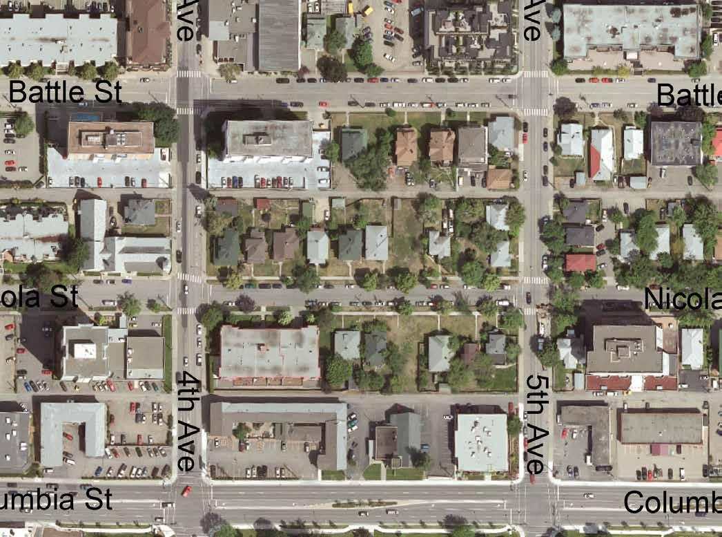
EAST END
The East End character area consists primarily of single -family homes. Located east of the Downtown Core, the area is a convenient walking distance from work, shopping, and community amenities. The area’s central location has made it desirable for residential infill, with a number of new residential suites and multi-family developments constructed in recent years. Multi-family residential will continue to be encouraged in the blocks adjacent to the Downtown Core, where medium-density uses are permitted.
OBJECTIVES
• To encourage sensitive integration of residential infill that respects the form and character of the neighbourhood.
• To concentrate medium-density multi-family residential uses in the blocks closest to the Downtown Core to allow for a transition between the higher-density Downtown Core and the primarily single-family and low-density areas to the east.
• To provide access to greenspace for area residents within a convenient walking distance (400 m).
POLICIES
Residential Development
1 Continue to support a mix of residential uses, including single-family, duplexes, residential suites, and low- to medium-density multi-family residential
2 Support land assembly to enable new multi-family development based on current zoning in the 600 and 700 blocks of St. Paul and Battle Streets.
3 Consider land assembly involving corner lots and adjacent lots to facilitate multi-family residential development as appropriate to sensitively integrate with surrounding form and character.
Transportation & Connectivity
4 Enhance the pedestrian experience through streetscape improvements (e.g. street trees and green infrastructure) and by adding sidewalks on avenues where gaps in the network exist, as per the Transportation Master Plan.
5 Enhance the bicycle network by adding a connection to the Sagebrush neighbourhood via the shared bicycle route on 8th Avenue and through the use of wayfinding signage to guide cyclists through the area to key Downtown destinations.
Commercial Activity
6 Discourage commercial conversions of single-family homes, except as permitted under existing zoning, to retain neighbourhood vitality outside of business hours.
Parks and Public Places
7 Consider acquiring land for park use in the 600 and 700 blocks of St. Paul and Battle Streets to provide access to greenspace within a convenient walking distance (400 m) for area residents, as per the target established within the KAMPLAN Implementation Strategy.
8 Maintain Prince Charles Park as an accessible, multi-purpose community park with family- oriented recreational facilities and seasonal performance space.
Figure 4.4 » 600 and 700 blocks of St. Paul and Battle Streets
SAGEBRUSH
The Sagebrush neighbourhood is a residential area characterized primarily by single-family homes organized around a traditional urban street grid. Several apartment buildings and a series of small parks are also scattered throughout the area. Prominent community amenities include three schools, a cemetery, and the Sagebrush Theatre. Sensitive infill that respects the lower-density form while improving housing diversity and affordability in the area will be encouraged. Given its proximity to Downtown and high number of cyclists, strengthening the active transportation network in the area would make commuting and access to nearby amenities more convenient while encouraging greater sustainable transportation use. Opportunities for a neighbourhood commercial use, such as a corner store or café, within a convenient walking distance of residents, could also be explored as a key amenity for the neighbourhood.
OBJECTIVES
• To maintain the existing low-density form and character of the neighbourhood while supporting sensitive infill to improve the housing diversity and affordability of the area.
• To explore an opportunity for a small-scale commercial amenity (e.g. neighbourhood café) to cater to the needs of nearby residents.
POLICIES
Residential Development
1 Consider infill development that sensitively integrates with the neighbourhood, which may include duplexes, small-lot residential infill, garden suites, or carriage suites
2 Consider land assembly of corner lots and adjacent lots along collector roads and transit routes, as per Section 13, Maps 3 and 4, to facilitate low-density multi-family residential development, including row houses and stacked townhouses, where these housing forms can be sensitively integrated
Transportation and Connectivity
3 Enhance the pedestrian experience through streetscape improvements (e.g. street trees, benches/seating, and green infrastructure) and by adding sidewalks where gaps in the network exist, as per the Transportation Master Plan.
4 Improve cycling connections to Downtown by adding a shared bicycle route on 8th Avenue and wayfinding signage to guide cyclists to key destinations, as per the Transportation Master Plan.
Commercial Activity
5 Support small-scale commercial retail use, such as a corner store or café, as a key amenity for neighbourhood residents. This could be in the form of a redeveloped single-family home on a corner lot or the redevelopment of an underutilized space.
6 Encourage the design of neighbourhood commercial development to reflect the single -family form of the surrounding area in order to minimize impacts to adjacent homes and better complement the existing character of the neighbourhood.
Parks and Public Places
7 Maintain, preserve, and enhance access to existing parks and trails, and formalize other trails into the City’s trail network, as per the Trails Master Plan, to continue to provide greenspace and passive recreation opportunities within a convenient walking distance (400 m) of neighbourhood residents.
Education and Culture
8 Encourage School District No. 73 to maintain and consider expanding existing educational facilities in the neighbourhood and to maintain and enhance the Sagebrush Theatre as a cultural asset for residents and visitors.
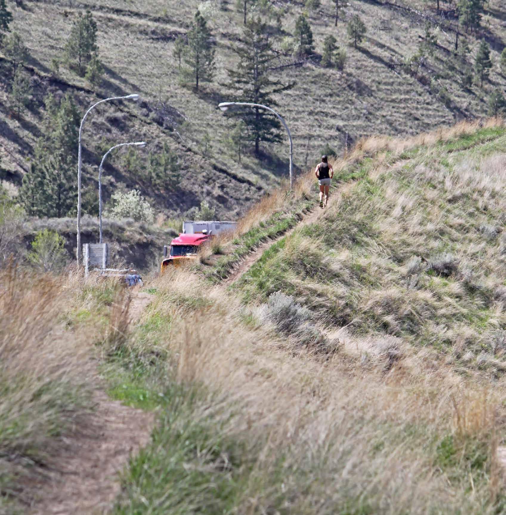
The Ridge Trail, a well-used informal trail running between Highway 1 and the Sagebrush neighbourhood
WEST END
The West End is a predominantly residential neighbourhood consisting of several distinct pockets of development that have been shaped through different periods of historical growth and by the area’s unique topography. Housing types range from heritage homes, which are found in the oldest part of the West End, to duplexes, townhouses, and apartment buildings in other parts of the neighbourhood. Within some of these areas, there are opportunities to increase density through sensitive infill (including residential suites) and through land assembly to create multi-family housing, provided development can be sensitively integrated with existing neighbourhood form and character. As Thompson Rivers University (TRU) continues to grow, connectivity will need to be enhanced to improve accessibility and walkability for pedestrians, cyclists, and transit users travelling between the university, the West End, and the Downtown Core.
OBJECTIVES
• To encourage sensitive integration of residential infill that respects the form and character of the neighbourhood while providing opportunities for increased density, where appropriate.
• To preserve the form and character of heritage buildings, streets, and other resources in the historic blocks of older residential development closer to the Downtown Core.
POLICIES
Residential Development
1 Consider infill development, including small-lot residential infill or residential suites, that sensitively integrates with the neighbourhood while preserving the predominant single -family housing form in existing RS-1 (single -family residential) zoned areas. If a Heritage Conservation Area (HCA) is established, future development in the designated area will be regulated under a heritage alteration permit in accordance with the development guidelines and conditions established within the HCA.
2 Consider land assembly of RT-1 (two-family residential) zoned corner lots and adjacent lots west of Boundary Road to facilitate lowto medium-density multi-family residential development, including row houses, stacked townhouses, and apartments.
3 Consider supporting higher densities in future redevelopment of university-owned lands across Summit Drive from the TRU campus.
4 Explore the creation of a Heritage Conservation Area(s) in consultation with the community and key stakeholders. If approved, this will include the development of design guidelines that support the conservation and rehabilitation of existing buildings and help ensure that new development is integrated sensitively into the historic context of the conservation area.
Transportation and Connectivity
5 Require a sidewalk as a condition of development approval for future multi-family, mixed-use, or commercial development west of Boundary Road on streets where no sidewalks currently exist, as per Appendix A: List of Active Transportation Projects, to help establish the pedestrian network and improve accessibility and walkability in the area.
6 Improve connectivity and wayfinding for cyclists in the West End linking TRU and Downtown, including a shared bicycle route between the Strathcona Park multi-use trail and the proposed Summit Drive overpass and signage along the existing St. Paul Street West shared route, as per Section 13, Maps 1 and 2.
7 Consider enhancements to transit routes through the area to increase connectivity and to provide greater transit access for residents.
Parks and Public Places
8 Continue to provide public access to parks, trails, and greenspaces within a convenient walking distance (400 m) of neighbourhood residents.
9 Continue to implement proposed parks improvements, including a neighbourhood park adjacent to the Chinese Cemetery, as per the Parks Master Plan.
To establish a sustainable transportation network in the plan area as it continues to grow over the next 20 years, this section includes policies related to transportation infrastructure, facilities, and choices that support the hierarchy of transportation modes established within the Transportation Master Plan (TMP) and Official Community Plan (KAMPLAN).
The intent is to create a Downtown transportation network that prioritizes safety, accessibility, and comfort for pedestrians, cyclists, and transit users while reducing vehicle emissions and maintaining efficient use of the road network through traffic and parking management.
Policies within this section are organized under the following topics:
• Sustainable Transportation
• Traffic Management
GOAL: Create a Downtown transportation network that is sustainable, safe, and efficient.
POLICIES
SUSTAINABLE TRANSPORTATION
Accessibility
1 Improve accessibility and safety for residents and visitors of all ages and abilities, as per the City’s Accessibility and Inclusion Plan, by:
1-1 Closing gaps in the sidewalk network
1-2 Adding curb let- downs from sidewalks at intersections
1-3 Adding audible traffic signals at intersections with traffic lights
2 Accommodate transit riders of all ages and abilities by adding weather protection, seating, lighting, and universal design features at bus stops and shelters of highest use in the plan area.
3 Continue to provide accessible parking stalls in proximity to key public gathering places, including plazas, parks, and civic facilities.
4 Incorporate universal design elements into asset management planning for future improvements to civic assets, including sidewalks, bicycle lanes, roads, plazas, and recreational and cultural facilities.
5 Continue to require landowners to clear snow and ice from sidewalks as per the Road Right- of-way Usage Bylaw, and prioritize snow and ice clearing by City crews from active transportation infrastructure adjacent to or located on City- owned proper ty to increase the viability of walking or cycling as a choice for commuters during the winter months.
6 Continue to require streetscape improvements where identified in City plans and strategies as a condition of development approval, and develop streetscape improvement plans where needed to support a pedestrian-friendly and accessible Downtown for residents and visitors.
7 Install sidewalks as identified in Appendix A: List of Active Transportation Projects, to provide a fully- connected pedestrian network throughout the plan area.
8 Support a more pedestrian-friendly environment by incorporating decorative and/or wider sidewalks, street trees, seating, wayfinding features, and other design elements in future development and road improvement projects in the plan area.
Figure 5.1 » City of Kamloops Hierarchy of Transportation and Mobility Priorities
Cycling and Connectivity
9 Improve connectivity between the Downtown Core and Waterfront District for pedestrians and cyclists through development of a bicycle lane at 2nd Avenue, as per the Transportation Master Plan and as shown in Section 13, Map 2.
10 Improve cycling connections through the Sagebrush neighbourhood to Downtown by adding a shared bicycle route on 8th Avenue connecting to the existing bicycle route at Nicola Street, as per the Transportation Master Plan and as shown in Section 13, Map 2.
11 Enhance connectivity for active transportation users between Downtown and other neighbourhoods by constructing the Bestwick Connector multi-use pathway, the 5th Avenue bicycle lane, a shared bicycle route from Strathcona Park through the West End, and a multi-use overpass of Summit Drive, as per the Transportation Master Plan and as shown in Section 13, Map 2.
12 Enhance cycling infrastructure through the use of wayfinding features, bicycle repair stations, and bicycle parking racks to help cyclists navigate the bicycle network to key destinations throughout the plan area.
13 Explore the feasibility of separated bicycle lanes when identifying new bicycle routes.
14 Encourage end-of-trip facilities for cyclists in commercial and institutional development and at major employment locations to accommodate cycling as a viable mode choice for commuters.
15 Increase the number of secured, indoor bicycle parking stalls required for multi-family residential development within the Downtown Off-Street Parking Specified Area as identified in the Zoning Bylaw.
16 Explore providing secured bicycle parking within Downtown parkades as part of the City’s parking management strategy.
17 Consider extending off-peak transit service from the Lansdowne Village Exchange to key destinations (e.g. TRU) and other key areas of the city to provide additional sustainable transportation options for staff and patrons of Downtown businesses.
18 Consider the use of transit priority and/or high occupancy vehicle (HOV) lanes for buses and vehicles with more than one person at peak hours on major arterials in Downtown to make transit and carpooling convenient and attractive mode choices.
19 Review impacts of new public and private development on transit circulation in the Downtown Core and consider amending routes as necessary to maximize efficiency and minimize trip times for transit riders.
20 Consider enhancements to transit service in the plan area to provide a dedicated Downtown route with improved connections to residential and institutional areas.
21 Continue to integrate transit facilities, including bus stops, shelters, and exchanges, with pedestrian and cycling infrastructure to support an interconnected sustainable transportation network for users of all ages and abilities.
Electric Vehicles and Transportation Demand Management
22 Explore incentives to support retrofitting of existing residential and commercial buildings to add electric vehicle (EV) charging infrastructure.
23 Consider parking requirements for EV and e-bike charging infrastructure in new development within the future Community EV and E-Bike Strategy, and amend the Zoning Bylaw to reflect these recommendations.
24 Consider installing EV charging infrastructure at civic and cultural facilities, major parks, and other key public gathering places in Downtown in partnership with external utility operators.
25 Encourage residents to transition to more sustainable transportation modes through implementation of the Transportation Master Plan, including enhancements to sustainable transportation services and facilities, wayfinding improvements, a ride-matching service, and car share and bike share programs.
TRAFFIC MANAGEMENT
Parking
1 Require new medium- and high-density mixed-use, multi-family, and commercial development to provide access to off-street parking from the lane, and to locate structured parking underground. Where underground parking is not feasible, it should be screened and/or located in such a manner to not be visible from the street, as per Section 12: Downtown Development Permit Area Guidelines.
2 Encourage shared underground parking facilities between adjacent and/or multi-phase developments to reduce vehicular access points and potential for pedestrian-vehicle conflict.
3 Encourage developers of multi-family residential buildings to sell or lease surplus parking stalls unbundled from dwelling units to increase off-street parking options for Downtown businesses and residents.
4 Consider expanding areas with on-street parking restrictions (e.g. time limits and pay parking) as residential density increases.
5 Extend the Downtown Off-Street Parking Specified Area within the Zoning Bylaw to be consistent with the future City Centre land use designation, as shown in Figure 3.1, Section 3: Future Land Use, on the 400 block of Battle Street, 600 block of Seymour Street, and 700 block of Victoria Street.
6 Explore the potential to use additional revenue collected from parking meter rate increases within the plan area to help fund active transportation or public realm improvements in Downtown.
Road Network
7 Consider all travel modes (pedestrians, cyclists, transit riders, drivers of private vehicles, and commercial vehicle operators) in future road improvement projects in the plan area, and manage traffic flow to minimize conflict and enhance road safety.
8 Explore the potential to amend the truck route network to avoid heavy truck traffic through Downtown.
9 Continue to ensure that access for emergency vehicles is maintained in future public projects and private development in the plan area.
A critical component of managing growth and land use in the plan area is balancing development in a manner that maintains and enhances the health of natural ecosystems, while addressing key issues such as climate change, energy efficiency, and waste reduction to improve overall livability.
The policies in this section support a reduction in greenhouse gas emissions from vehicles and buildings, diversion of organic waste and construction waste from landfills, effective stormwater management, enhancement of greenspaces, and expansion of the urban forest.
Policies within this section are organized under the following topics:
• Energy and Emissions
• Natural Environment
GOAL: Manage infrastructure sustainably and efficiently to address the needs of future residents and mitigate impacts on the environment.
POLICIES
ENERGY AND EMISSIONS
1 Continue to retrofit existing civic buildings, facilities, and street lighting in the plan area to improve energy efficiency with a goal of meeting the Corporate Energy and Emissions Plan targets of carbon-neutral civic buildings by 2035 and net-zero energy ready civic buildings by 2050.
2 Continue to identify opportunities and incentives to improve energy efficiency in new buildings while mitigating additional construction costs as the Province transitions to the BC Energy Step Code, wherein all new buildings must be 20% more efficient than the current BC Building Code (Step 3) by 2022, and net-zero energy ready, or 80% more efficient than the current BC Building Code, by 2032.
3 Encourage energy retrofits and installation of renewable energy systems to reduce greenhouse gas emissions from existing homes and buildings through incentives, financing mechanisms, and increasing awareness of available rebates from the Province and utility operators.
4 Support adaptive reuse of existing buildings in the plan area. Where reuse is not feasible, encourage selective disassembly to salvage reusable building materials and reduce the amount of demolition, land clearing, and construction (DLC) waste entering City landfills.
NATURAL ENVIRONMENT
1 Provide waste reduction and diversion options in civic buildings and at community events, and consider including recycling options with garbage containers on streets with high pedestrian traffic and in all parks in the plan area.
2 Work with Downtown businesses to identify a viable commercial organic waste collection service and commercial recycling program.
3 Assess climate change impacts in the plan area, including potential flooding from drainage channel overflow following major storm events, and undertake mitigation measures, which may include upgrades to the Peterson Creek drainage channel, to reduce risks to public safety and to property.
4 Manage stormwater in accordance with the City’s stormwater design guidelines and encourage the use of green infrastructure (e.g. bioswales, green roofs, green strips, planting beds, rainwater harvesting, and depressed landscaping) and permeable surfaces to manage stormwater on site and minimize runoff.
Environment
5 Preserve, expand, and maintain the existing tree canopy in the plan area by working with landowners and developers to integrate existing trees into new development, and to replace trees that must be removed by planting additional trees in appropriate locations elsewhere on site or off site, as per the Urban Forest Management Strategy.
6 Improve air quality by reducing vehicle emissions; encouraging more trips via walking, cycling, and transit; and planting more trees to capture CO2
Figure 6.1 » Environmental Features in the Plan Area
The City supports the availability of diverse housing options that enable people from all walks and stages of life to locate and secure housing that is safe, accessible, affordable, and appropriate.
The policies in this section support this vision as the City continues to work as a steward, facilitator, investor, and communicator to ensure an adequate supply of housing across the affordable housing continuum, including shelters, supported or subsidized housing, market rental, and entry-level home ownership.
Policies within this section are organized under the following topics:
• Housing Diversity
• Social Housing
GOAL: Ensure an adequate and diverse supply of affordable, safe, accessible, and appropriate housing to meet the needs of residents.
POLICIES
HOUSING DIVERSITY
1 Encourage a variety of housing forms, dwelling sizes, tenure types, and affordability ranges, such as intergenerational housing, micro-suites, row housing, and garden suites, to create a diverse Downtown that accommodates residents of all ages, abilities, lifestyles, income levels, and household compositions.
2 Support new residential development that integrates a mix of market and non-market housing within the same building to foster inclusivity and mixed-income communities.
3 Support medium- to high-density mixed-use development along Frequent Transit Network corridors, as per Section 13, Map 3.
4 Continue to support rental housing opportunities, such as secondary suites, garden suites, and, where appropriate, carriage suites, for individuals and families on single-family lots in the plan area.
5 Encourage accessible and adaptable housing that incorporates universal design features and provides ease of access and mobility for all ages and abilities.
Figure 7.1 » Affordable Housing Continuum
SOCIAL HOUSING
1 Continue to encourage social housing units in new multi-family residential developments through the following mechanisms:
1-1 Reduced parking requirements and density bonusing provisions, in accordance with the Zoning Bylaw
1-2 Development Cost Charge (DCC) exemptions for construction of not-for-profit rental housing, in accordance with the Development Cost Charges Bylaw and the Local Government Act
1-3 Municipal contributions from the Affordable Housing Reserve Fund
2 Work with the Province and community partners to determine locations for future social housing in the plan area, considering factors that include proximity to other social housing sites; access to transit, community services, and amenities; and sensitive integration with the surrounding neighbourhood.
Parks, trails, and public plazas provide residents and visitors with opportunities to socialize, recreate, relax, and connect with nature. Downtown parks, greenspaces, and waterfront areas also help support important habitat and ecological functions while improving livability for residents and visitors.
The policies in this section support the enhancement of parks and public places in the plan area through improved connectivity and accessibility for people of all ages and abilities and through programming and events to activate public spaces and celebrate community.
Policies within this section are organized under the following topics:
• Parks, Programming, and Trails
• Plazas and Community Amenities
GOAL: Provide a well-connected network of parks, recreational facilities, and public gathering places in the Downtown Plan area for the health and wellness of residents and visitors.
POLICIES
PARKS, PROGRAMMING, AND TRAILS
1 Continue to provide parks and greenspaces in the plan area for passive and active recreational use. Major parks (e.g. Riverside Park) will continue to function as community gathering places and venues for events and festivals.
2 Enhance connectivity to the waterfront and Rivers Trail through improvements to the active transportation network, as per the Transportation Master Plan.
3 Support healthy landscapes via pest management and water conservation while protecting greenspaces from noxious and/or invasive plants and trees.
4 Continue to integrate landscaping that supports pollinators and beneficial insects into City parks and greenspaces in the plan area, and provide demonstration gardens in key areas (e.g. Riverside Park) to educate residents and visitors on sustainable approaches to landscape design and planting.
5 Maintain natural vegetation along the riverfront, as well as trail, beach, and boat access, as per the Riverside to Pioneer Parks Management Plan.
PLAZAS AND COMMUNITY AMENITIES
1 Incorporate universal design features into public realm improvements, including plazas and other public gathering places, to provide inclusive and accessible community amenities for residents and visitors of all ages and abilities.
2 Explore opportunities to improve existing and identify new plazas, squares, and gathering places in Downtown areas with high pedestrian activity and potential for community use.
3 Encourage active street-level commercial uses, such as restaurants, cafés, and retail stores, in buildings located adjacent to public plazas.
4 Provide gender-neutral public washrooms in convenient locations near areas of high pedestrian traffic, and design them to be secure, easily identifiable, and accessible during daytime and evening hours.
5 Work with the KCBIA and community groups to include seasonal programming and activities and encourage active year-round use in plazas, parks, and other public gathering places.
Parks and Recreation
Figure 8.1 » Parks and Public Spaces
To help ensure the social, economic, and cultural vitality of the plan area as it grows over the next 20 years, the policies in this section build on the area’s strengths and support new opportunities to enhance its health and well-being and that of its residents.
These policies encourage a high quality of life for residents and an engaging experience for visitors by supporting uses that strengthen the sense of community and identity of the Downtown Plan area, act as economic drivers for the city and region, encourage a sustainable local food system, and improve walkability and safety.
Policies within this section are organized under the following topics:
• Education
• Arts and Culture
• Heritage
• Economic Development
• Food Security
• Health and Safety
GOAL: Foster a welcoming, accessible, and economically thriving Downtown that brings residents and visitors together to celebrate local business, food, arts, culture, and heritage.
POLICIES
EDUCATION
1 Work with School District No. 73 to monitor population growth in the plan area and continue to assess the need for a Downtown school.
ARTS AND CULTURE
1 Identify locations on public and private lands where public art may serve as landmarks, act as wayfinding features, and define key gateways and corridors that support Downtown’s cultural identity. The incorporation of public art should be considered during the design phase of development projects to ensure site compatibility and functionality with the private and public realm
2 Contribute to a more visually appealing and vibrant Downtown by integrating public art into civic infrastructure and improvements, where appropriate, including overpasses, underpasses, retaining walls, park washrooms, community centres, and active transportation routes.
3 Work with community partners (e.g. Kamloops Arts Council, Western Canada Theatre, Kamloops Art Gallery, KCBIA) to promote, raise the profile of, and encourage greater participation from residents and visitors in arts and cultural amenities, initiatives, and events.
ECONOMIC DEVELOPMENT
1 Consider amending the City Centre Revitalization Tax Exemption Bylaw to include commercial development and extend the eligible exemption area to support economic growth and employment opportunities Downtown. Explore other potential incentives to encourage Downtown business owners and commercial landowners to maintain and invest in façade, lighting, signage, and other improvements to their properties.
2 Continue to work with the KCBIA, Tourism Kamloops, the tourism industry, and community partners to leverage distinctive landmarks, events, businesses, and amenities to strengthen Downtown placemaking and create a memorable user experience that enhances Downtown’s brand image and marketability to tourists and investors.
3 Encourage private investment in a convention centre in a suitable location in the west Waterfront District or Downtown Core in collaboration with Venture Kamloops and community partners.
HERITAGE
1 Enhance the historic identity of the plan area for both residents and visitors through complementary heritage events, walking tours, public art, signage, interpretive programs, streetscape design, and architectural detailing.
2 Consider mechanisms to preserve heritage resources, including heritage conservation areas, on-site density bonusing, off-site density transfers, façade and/or signage improvement grants, parking reductions, and property tax exemptions for heritage revitalization projects.
3 Support facilities in Downtown that raise awareness of local history and heritage resources, such as the Kamloops Museum & Archives, St. Andrew’s on the Square, and Kamloops Heritage Railway.
4 Encourage the adaptive reuse of vacant or underutilized heritage buildings for community or commercial amenities that permit public access and serve to enhance appreciation and awareness of built heritage.
5 Explore opportunities to acknowledge and celebrate Secwépemc cultural heritage in the design and programming of public spaces, particularly in the Downtown Core and Waterfront District.
6 Utilize heritage revitalization agreements to retain and incorporate heritage elements into new developments when preservation of the original structure is not technically feasible, such as through façade retention, reuse of historic building materials, or the creative repurposing and display of historic objects as on-site public art or interpretive features.
7 Assess the heritage value of public and private property in the plan area and propose new additions to the Heritage Register based on their significance.
8 Provide greater flexibility in the application of City Development Permit Area guidelines and regulations to support the preservation of non- conforming heritage structures when possible and desirable, as determined on a case -by-case basis.
Heritage Assets
Figure 9.1
FOOD SECURITY
1 Consider density bonusing provisions to encourage community food assets such as community gardens in new multi-family developments in the Central Business District
2 Continue to provide food-growing opportunities for residents who do not have access to arable land by identifying locations for new community gardens on City-owned land as population density in the plan area continues to increase, as projected in the Official Community Plan.
3 Support the development of a year-round farmers’ market or public market facility within Downtown to improve access to nutritious foods, support local producers, and serve as a key amenity and attraction for residents and visitors.
HEALTH AND SAFETY
1 Continue to work with other levels of government, community partners, and social agencies to identify initiatives to address homelessness.
2 Continue to apply streetscape design standards and elements that improve safety and comfort for pedestrians.
3 Work with the RCMP, KCBIA, and other community partners to improve safety, security of property, and public behaviour within the plan area.
4 Provide outdoor lighting of paths, trails, event areas, and recreational facilities to ensure public spaces in the plan area feel as attractive and safe to pedestrians in the evening as they are in the daytime. Consider creative lighting installations to further improve visibility and wayfinding, make spaces feel livelier and more inviting, and enhance safety.
5 Reduce the risk of heat-related illness during the summer months through the use of misting stations during community events and drinking water fountains in areas with high pedestrian activity.
Figure 9.2 » Central Business District (CBD) zone, as per the Zoning Bylaw
The following section presents seven Big Moves—a series of design concepts and ideas for key areas of Downtown that, if realized, would help achieve the vision of a vibrant, connected, and welcoming Downtown. These are categorized as either Catalyst Projects or Key Redevelopment Sites.
CATALYST PROJECTS
Action-oriented concepts for City-owned land that can be led, facilitated, or supported by the City to serve as transformational catalysts for further Downtown investment and revitalization. These do not represent final plans, but are subject to further analysis and refinement.
KEY REDEVELOPMENT SITES
Ideas or opportunities envisioned for key Downtown sites, which include provincially- and privately-owned properties. These concepts are representative of the Downtown Plan’s vision, goals, and objectives and aim to provide guidance to prospective developers looking to invest in the area.
Figure
DESCRIPTION
This concept proposes a centre for the arts on the former Kamloops Daily News site, which is owned by the City and currently functions as a surface parking lot. A centre for the arts would reinforce the role and character of Downtown as a destination for arts, culture, entertainment, and tourism.
This concept would also integrate with and enhance the taming of Seymour Street by replacing a parking lot with a cultural facility. Off-site improvements to the public realm, including wider sidewalks, street trees, and other elements, would enhance and improve the comfort and safety of pedestrians. The addition of a major city amenity could also serve to attract additional investment and complementary uses to the area.
Please note that the illustration at top left, which includes a design concept for a centre for the arts located on the former Kamloops Daily News property, was first presented at a public open house in June 2018. This occurred before Mr. Fawcett’s proposal to Council on January 8, 2019, entitled A New Plan for a Performing Arts Centre in Downtown Kamloops, which included the design concept shown at bottom right.
NEXT STEPS
The City will hold a referendum on a centre for the arts on April 4, 2020. This will include engagement with the Kamloops Centre for the Arts Society, stakeholders, and the public.
DESCRIPTION
To increase vibrancy on Seymour Street and improve the pedestrian experience, traffic must be slowed. This design concept retains two vehicle travel lanes (which could remain as one -way or change to two-way) and provides wider sidewalks on either side of the street.
In addition to wider sidewalks, proposed improvements include street trees, mid-block crossings, and curb bulb-outs, which may require reconfiguration of parking near intersections. These enhancements will create an improved pedestrian and aesthetic environment that balances commercial, retail, and residential uses and provides more space for café and restaurant patios.
The proposed area includes Seymour Street between 1st and 6th Avenues, which is a City- owned public right-of-way. This section of Seymour Street runs adjacent to the proposed centre for the arts—a catalyst project described on the previous page. If constructed, a centre for the arts could offer off-site improvements, such as plaza space, trees, benches, and other elements to further improve the pedestrian experience along this stretch of Seymour Street.
NEXT STEPS
One of the proposed actions in the Downtown Plan is an analysis of current one-way traffic in Downtown, including Seymour Street and other one-way corridors (e.g. Lansdowne Street) to determine the feasibility and desirability of converting them to two-way traffic. The analysis should consider the potential impacts different scenarios would have on the road network, Downtown businesses, and the public realm
Lansdowne St.
Battle St.
6th Ave.
DESCRIPTION
In this concept, portions of 4th Avenue between Seymour Street and Lansdowne Street have been redesigned as a pedestrianized plaza area.
The 4th Avenue Pedestrian Plaza would function as the centre or heart of Downtown. Along 4th Avenue, the half-blocks to the north and south of Victoria Street would be closed to vehicles while Victoria Street would remain open to east-west vehicle traffic. The half-blocks south of Lansdowne Street and north of Seymour Street and the adjacent alleyways would remain open for emergency and service delivery vehicles and rear access business parking.
The plaza, framed by landmark heritage buildings, such as the Plaza Hotel and the Galloway-Ellis Building, would function as an animated, lively public space with lighting, seating, textured surface areas, seasonal planting, and a potential water fountain. Opportunities for enlarged patio spaces would be encouraged in front of local cafés and restaurants on 4th Avenue to help further animate the space.
NEXT STEPS
The City will undertake a scoping study (Class D estimate) to identify the costs to design and build the plaza. Following its completion, the results will be presented to Council along with a recommended funding strategy. Pending Council approval, design and construction of the plaza will commence once sufficient funds are allocated, which could include grant funding.
DESCRIPTION
The Columbia Precinct is a large, provincially- owned site. On the northern extent, this concept identifies residential and commercial redevelopment opportunities, including townhouses and low- density multi-family housing to the east of Peterson Creek, with some medium-density multi-family housing (e.g. walk-up apartments), office space, a potential daycare, and community uses to the west.
The Peterson Creek Multi-use Path (Xget’tem’ Trail), which connects Sahali to Downtown, could be extended through the site and continue as a greenway along the creek. On the corner of 6th Avenue and Columbia Street, an existing government building could be repurposed (if feasible) to include a café, bakery, small grocer, or other shops to help animate the street and provide key amenities for nearby office workers and local residents. The intent for this site is to create a walkable, pedestrian-friendly environment that mixes low- to medium-density multi-family housing with key commercial amenities. On the southern extent of the site, this concept proposes to redevelop the existing affordable seniors housing with low- to medium- density affordable seniors housing, an amenity building, and community gathering spaces, such as community gardens
NEXT STEPS
The provincial government is currently undergoing a review and update of its 2008 Columbia Street Precinct Master Plan, which proposes redevelopment of the area and a mix of uses similar to the City’s envisioned concept. The City will continue to work with the Province to support its planning process and ensure the area’s eventual redevelopment is consistent with the vision and objectives of the Downtown Plan.
Columbia St.
Columbia St.
DESCRIPTION
This developer-driven concept involves parcel consolidation and redevelopment of existing single-family homes in the 400 block of Nicola Street and the south side of the 400 block of Battle Street to higher densities. The developer envisions several new multi-family buildings including a mix of rental apartments, condos, and townhouses, that will provide an additional 200 to 400 residential units in the Downtown Core. Existing apartments on the site will remain in this concept.
The development concept also includes pedestrian and cyclist connections incorporated into the site via greenspace and public pathways that will enhance the walkability and livability of the neighbourhood. Several nearby amenities, such as the hospital, medical clinics, dining, and shopping add to the convenience, vitality, and attractiveness of Downtown as the area continues to grow.
NEXT STEPS
The City will continue to work with the site’s developer to ensure that site planning, design, and development align with the vision and objectives of this plan.
Battle St.
City Gardens, Kamloops
City Gardens, Kamloops
DESCRIPTION
This concept proposes three key elements on a site composed of multiple privately-owned properties: 1) a civic plaza; 2) a public market; and 3) a mixed-use development.
The parking lot between the Plaza Hotel and the TRND Building could be redesigned as a year-round civic plaza. By incorporating seating, shade trees, lighting, and outdoor café patios, the plaza would come alive as a key gathering place for socializing, resting, eating, and celebrating. In the centre of the plaza, a spray park could offer relief from the heat and potentially be transformed into a skating rink in the winter. Included is a small civic building with public washrooms, public meeting rooms, gallery space, food and beverages, and an administration office for staff to manage the space.
Connected to the plaza to the south would be a year-round public market, which could feature local and regional farmers, artisans, and other vendors. Adjacent to the market is a mixed-use residential development featuring residential condominiums above ground-floor commercial to animate Seymour Street and provide amenities for residents and nearby office workers. The building could be oriented north-south to maximize access to daylight and mountain views.
Existing surface parking would be replaced by underground structured parking on site as part of the mixed-use development. While these projects could be developed without the other, there are benefits to developing these sites as one complete integrated concept.
NEXT STEPS
Once redevelopment of the former Value Village site is pursued by the landowner, the City will work with them to ensure their project reflects the vision and objectives of this plan. The City will also continue to work with the Kamloops Public Market Cooperative in search of a suitable site for a year-round public market, which may not occur on this site, but should be located Downtown as a key amenity and attraction for residents and visitors.
As the site for the civic plaza is also privately owned, this concept may similarly not occur. However, in consultation with private landowners and the public, the City will endeavour to explore new public plaza space within Downtown during the lifetime of this plan.
Mixed-use Development
DESCRIPTION
Kamloops Square, a privately-owned commercial strip mall on the 200 block between St. Paul Street and Seymour Street, has redevelopment potential.
This concept proposes redevelopment of the entire site into a medium- to high-density mixed-use residential/commercial project. As shown in the image at bottom right, a mid-block pedestrian and cyclist connection through the site could be incorporated to link the former Stuart Wood School to Seymour Street. On Saturdays, during the Kamloops Farmers’ Market season, this area is vibrant, and the design concept aims to enhance this experience.
The residential buildings would be oriented north-south and offset from one another in order to maximize access to daylight and views to the mountains. Greenspace could be incorporated on site in the form of trees and landscaping, rooftop gardens, and/or other amenities for residents.
Preserve public view corridors of the mountains and river valley through setbacks and “shoulders” on taller buildings
NEXT STEPS
As Kamloops Square is privately-owned land, this concept would be developer-driven and timing would be dependent on market conditions and landowner interest. It is possible that completion of one or more nearby catalyst projects, such as the centre for the arts or the taming of Seymour Street, would help stimulate reinvestment in this site. When redevelopment is eventually pursued here, the City will work with the developer to encourage this concept or a similar design in accordance with the City’s development guidelines.
The Downtown Plan includes a set of short-, medium-, and long-term actions to help implement the plan’s vision for the area over its 20-year time frame.
These actions are supported by the goals, objectives, and policies contained within the plan and are consistent with and complement the direction provided by the City’s Official Community Plan (OCP). Several of these actions will involve engagement with City staff, Council, Tk’emlúps te Secwépemc (TteS), the public, and stakeholders to implement.
There are a number of other City plans and strategies that address land use and development considerations relevant to the Downtown Plan area. Many of these contain additional actions and/or capital projects that will be carried out in the Downtown area within the next 20 years. These include the list of active transportation projects identified in the Transportation Master Plan (TMP), which are included in Appendix A.
1 4th Avenue Pedestrian Plaza
Conduct a project scoping study to identify costs to design and construct the plaza !
2 Columbia Precinct Engage with the Province in its update of the 2008 Columbia Street Precinct Master Plan
3 Commercial Incentives
4 Public Market
5 Centre for the Arts
6 Former Stuart Wood School
Province
Review and update the City’s Revitalization Tax Exemption Bylaws (City Centre and North Shore) to include commercial development as eligible for a tax exemption under the bylaw !
Work with the Kamloops Public Market Cooperative and other community partners to identify an appropriate site for a year-round farmers’ market or public market facility within Downtown
Hold a referendum on a centre for the arts proposal on April 4, 2020 !
Work with Tk’emlúps te Secwépemc (TteS) and other community partners to determine the future use of the former Stuart Wood School as a key public amenity in Downtown that incorporates local, regional, and Secwépemc heritage into site and programming for the facility
7 Taming Seymour Street Conduct an analysis of one-way vs. two-way traffic patterns and functionality in Downtown
8 Parklet Program Develop a Parklet Program for Downtown, focusing on areas of high pedestrian activity
9 Streetscape and Public Realm Improvement Fund
10
Present to Council a proposal to increase annual funding for streetscape and public realm improvement projects to help improve accessibility, safety, and character of the Downtown
12 Heritage Conservation Explore the development of a Heritage Conservation Area(s) in consultation with the community Short-term City
13 Downtown Parking
14 400 Block Nicola Street
Develop a strategy to address future parking demand in Downtown, as identified through the Transportation Master Plan, considering parking management, land acquisition, and potential development of new or additions to existing parking structures
Work with the landowner in the redevelopment of the 400 block of Nicola Street and additional parcels on the south side of the 400 block of Battle Street
15 Former Value Village site Encourage the redevelopment concept of the former Value Village site and adjacent parking lots with the landowner/developer
16 Heavy Truck Traffic
Amend the City’s truck route network to avoid heavy truck traffic through Downtown by providing a viable alternative that addresses health and safety, community livability, and transportation needs
17 Access to Greenspace
18 Kamloops Square
Identify a location for a new neighbourhood park in the East End character area to achieve the OCP target of 100% of Kamloops residents living within 400 m of a park or civic recreational facility by 2039
Explore the redevelopment concept of Kamloops Square with the landowner during the life of the Downtown Plan as part of the plan’s regular review process and as streetscape improvements occur on Seymour Street
19 Civic Plaza Work with private landowners to identify an appropriate site in the Downtown Core to accommodate a civic plaza
20 Peterson Creek
Identify capital improvements to increase the storm drainage capacity of Peterson Creek through the plan area !
Table 11.1 » List of Action Items (Continued)
PURPOSE
The purpose of the Downtown Development Permit Area (DPA) is to establish objectives and provide guidelines for the form and character of development in Downtown Kamloops. These guidelines ensure that all development within Downtown advances the vision articulated within the Downtown Plan.
Development Permit applications shall detail pedestrian and vehicular access and circulation, landscaping, building elevations, site layout, and street enhancements. Submissions should show adjacent sites (including opposite street fronts) and must show design details within the adjacent public realm (e.g. street frontage), including transition, pedestrian clear, and furnishing zones, as described in Section 5: Streetscapes. Site plans should also include an accessibility overlay, that identifies accessible pathways, parking, entrances, and other features.
AREA
The Downtown Development Permit Area applies to the Downtown Core, Waterfront District, East and West Entry Corridors, and Columbia Precinct, as shown in Figure 12.1. Largely form-based, the Downtown DPA Guidelines should be used in conjunction with the City’s use-specific Development Permit Area guidelines, depending on the Development Permit Application’s proposed uses.
EXEMPTIONS
Applications for the following shall not be required to apply for Development Permits:
• internal renovations
• external renovations that do not require a Building Permit and do not affect the form and character of the building or site (to be determined by the Development, Engineering, and Sustainability Department)
• single- or two-family dwellings
OBJECTIVES
The objectives of the Downtown DPA Guidelines are to:
• align development with the vision of the Downtown Plan
• integrate new development into neighbourhoods in a manner that reduces environmental impact
• maintain and enhance desirable characteristics found in existing neighbourhoods
• encourage healthy lifestyles and sustainable local growth through well-designed, durable buildings, landscapes, and public spaces
• animate the public realm to enrich the sense of place
• accommodate active transportation modes and transit usage
• ensure that new development is compatible with the form and character of existing development and mitigate potential impacts on adjacent uses
• support sustainable water and energy management through site and landscape design
LANGUAGE OF GUIDELINES
The specific level of requirement associated with individual guidelines is determined by the following words:
“Shall” or “must” and/or the use of the adjective “required” means that the definition and/or guideline is required.
“Shall not” or “must not” and/or the use of the adjective “prohibited” means that the definition and/or guideline is prohibited.
“Should” and/or the use of the adjectives “recommended” and/or “encouraged” reflects a strong positive preference of the guidelines. In particular circumstances, there may exist valid reasons to not apply a particular guideline, but any approval will require demonstration that an alternative solution is consistent with the overall intent of the guideline in the opinion of the Development, Engineering, and Sustainability Director.
“Should not” and/or the use of the adjectives “not recommended” and/or “discouraged” reflects a strong negative preference of the guidelines. In particular circumstances, there may exist valid reasons to apply an alternate solution; however, it must be demonstrated that the alternative meets the intent of the guideline in the opinion of the Development, Engineering, and Sustainability Director.
“May” and/or use of the term “optional” means that the guideline is discretionary.
Downtown Development Permit Area
Figure 12.1 » Downtown Development Permit Area Map
DOWNTOWN PLAN VISION & PRINCIPLES
VIBRANT. Downtown is lively and eclectic with a thriving arts and entertainment district that celebrates and supports local businesses, restaurants, and cultural events and attracts residents and visitors of all lifestyles, ages, and abilities.
• Compact Mix of Land Uses
A place where people can live, work, and play
• Focused Commercial Activity
A destination for shopping, dining, and employment
• Housing Diversity Homes for people of all walks and stages of life
CONNECTED. With its network of green streets, public gathering places, and active transportation corridors, Downtown offers a walkable, bikeable, and accessible public realm that promotes sustainable and healthy living and conveniently links residents with surrounding neighbourhoods.
• Pedestrian First
A walkable community heart that is accessible, safe, convenient, and active
• Neighbourhood Connectivity
Key amenities and experiences are connected
• Public Gathering Spaces Places for markets, festivals, sitting, and socializing
WELCOMING. Accessible, safe, attractive, and affordable, Downtown provides a diversity of housing types and public amenities that foster social interaction, inclusivity, and an enduring sense of community.
• Attractive Surroundings
Full of greenery, public art, heritage, and character
• Make Downtown Memorable Downtown’s unique character, culture, arts, food, and events are highlighted as key attractions for residents and tourists
‘LETTER OF INTENT’ OUTLINE
The following list of key questions provides an outline to guide applicants in writing their letter of intent as part of the Development Permit application. Applicants must demonstrate how their project addresses each of the following questions with specific reference to site plans, sections, renderings, and other materials included with the application package. Each section of these guidelines (e.g. Site Planning, Building Design) begins with an example of the language that may be used to describe applications and how they address the guidelines.
1 | SITE PLANNING
PART OF THE WHOLE
These guidelines prescribe attention to context, such as neighbouring buildings and site conditions, to help achieve the vision for Downtown.
a. Be a building block for a cohesive Downtown
a.i Site design must account for the relationship to existing opportunities and constraints within the surrounding context and demonstrate (through annotation of site plans and elevations) that the improvements are thoughtfully integrated with its context and neighbours.
a.ii Site design must demonstrate integration of architecture and landscape architecture - utilize a landscape architect’s expertise in integrating vegetation and green infrastructure within site designs.
a.iii Site design should identify, reflect and enhance unique site attributes (e.g. irregularly shaped lot, notable landscape features) where they exist.
b. Refine, repair, and/or enhance Downtown’s urban fabric
b.i Site designs should contribute to a finer-grained network of pedestrian pathways that allow people to safely navigate a site and connect to public streets/lanes and nearby amenities (e.g. businesses, transit exchanges, bicycle routes, parks, and recreation facilities). This is of particular importance for consolidated sites that may require large buildings to be broken up into smaller ones to allow for pedestrian permeability. Locating pathways and crosswalks mid-block or along desire lines (connecting key destinations) is strongly encouraged. An example would be to build crosswalks across streets completing the “Alley Loop” identified in the Downtown Plan.
b.ii Design sites to promote intuitive wayfinding through pathways, sightlines, and signage. Provide direct access and clear sightlines to bus stops and shelters. Art and ornamental features (e.g. fountains and sculptures) are also encouraged to contribute to pedestrian wayfinding and enjoyment.
Figure 12.2 » Concept Plan from the Downtown Design Charrette showing the “Alley Loop” (highlighted in colour)—mid-block crosswalks and large sites with plaza spaces increase mid-block pedestrian permeability and expand the public realm
b.iii Where large/consolidated sites contribute public and semi-public amenity space at ground level, it should be easily accessed from adjoining streets and visible from the public realm/sidewalk wherever possible to promote intuitive wayfinding. Examples of outdoor amenity areas include landscaped and trellised seating areas, plazas, playgrounds and/or gardens (e.g. ornamental and/or community).
c. Demonstrate awareness of semi-arid landscape and natural systems context
c.i On-site stormwater management should be incorporated in landscape design (e.g. bioswales and rain gardens). It is encouraged to make these landscapes visually interesting and a visible feature of the design.
c.ii Designs on sloping sites should work with natural topography. Step buildings along the length of a sloping site (10% or greater) to integrate the building into the slope.
c.iii Where necessary, retaining walls with an exposed face of 3 m or greater in height should include terracing and/or articulation. Terraces should be
designed to accommodate landscape areas that soften the wall’s appearance and should be accessible for maintenance. Where walls exceed 1.5 m in height, landscape features, such as trees, shrubs, or vines, should be provided adjacent to the wall. Lock-block retaining walls are not supported.
FRAMING PUBLIC SPACE
Improvements should actively contribute to public life. In downtowns this happens in the way buildings address the public realm to either frame it or expand it. The following guidelines outline the role development proposals should play in shaping Downtown’s public “rooms” of streets and plazas.
d. Use built form and landscape to frame public and semi-public spaces
d.i The siting of new buildings should define the street wall by fronting directly onto the street or be set back to allow for plaza space (not parking) and indoor/outdoor function of the building as an extension of an activated public realm. In cases where a building cannot provide that definition, street edge continuity should be achieved through landscape elements such as trees, fencing, or hedging.
Designs on sloping sites reflect natural topography
Buildings define the street wall by fronting directly onto the street and should be broken up at least every 45 m.
d.ii The base of a building should be substantially broken up at least every 45 m to vary the spatial experience for pedestrians.
d.iii Orient buildings to primary frontages. The building design and use should acknowledge the use of the primary frontage to enhance street character (e.g. ground-level retail; ground-level access; and the use of different textures, scale, or materials on ground level).
A PLACE OF BELONGING
Safe, comfortable, accessible, and enjoyable pedestrian environments should be prioritized.
e. Create pedestrian-friendly environments
d.iv Design building frontages to reflect their uses. In a commercial setting with ground-level commercial retail units (CRUs), this means providing lively pedestrian environments (e.g. with outdoor furnishings). In a residential setting with ground-level residential units, this means using layering of elements, including, but not limited to, street-facing stairs, porches, patios, and landscape elements (plantings, pathways, screen walls, etc.) to transition between the public and private realm.
d.v Support safety through the concept of “eyes on the street” by ensuring residential units, offices, and other upper floor uses overlook public and semi-private spaces and connections such as sidewalks, walkways, plazas, gardens, parkland, and strata roads to provide views and surveillance of activity areas.
e.i Places to gather, socialize, and sit are strongly encouraged. Integrate usable, well-framed public and private open spaces, including squares, plazas, and roof-top gardens. Public and semi-public spaces should be centrally located, adjacent to sidewalks and active uses (cafés, shops, small businesses, etc.) in highly visible areas, and accessible without vehicular traffic interference. They should be oriented to receive sunlight, with trees and landscape to provide weather protection.
e.ii In some cases, public streets become an extension of private commercial spaces. In others, private plazas extend from the sidewalk for public use. Define and transition private and semi-private spaces with elements such as patios, paving treatments, grade changes, and vegetation to transition spaces as appropriate.
e.iii Provide benches, shelters, and other amenities near main entrances.
Direct views and access to ground-level commercial storefronts
A friendly relationship between homes and the street
e.iv The Victoria Street and Seymour Street pedestrian realms are of priority importance within Downtown. Redevelopment along the south side of these streets should utilize architectural strategies (e.g. setbacks/stepbacks) to avoid shadow impacts on the north sidewalk
f. Accommodate cyclists
f.i Short-term bicycle parking should be located near building entrances in highly visible locations, preferably covered.
f.ii Long-term bicycle parking shall be secured and weather-protected (e.g. in a locked room or secondary shelter/building) and located near building entrances and lobbies at ground level or underground.
g. Minimize car- and parking-related impacts to the public realm
g.i Vehicular access and off-street vehicle parking should be accessed from the alley. Vehicle parking lots and parkades located in front of buildings (adjacent to the primary street) or facing an intersection are not permitted. Where driveways must cross sidewalks, sidewalks should be continuous and level through the conflict zone. Where appropriate, it is encouraged that safety and/or traffic-calming measures be installed to ensure cars slow down and respect pedestrian priority.
A well-framed public plaza adjacent to a sidewalk, café, and market
Surface vehicle parking for commercial uses and residential visitors is located at the back of the building and accessed from the alley
g.ii The majority of required off-street parking should be provided underground.
g.iii Underground parking should not exceed the level of natural grade. Where underground parking must be partially above grade, this may only happen along rear and secondary frontages. Limit it to 1 m above grade and use attractive, high-quality materials on the exposed structure and/or screen with landscape.
g.iv Where above-ground structured parking is required, wrap primary frontages with active uses (e.g. CRUs) and explore opportunities to screen upper floors/blank parkade walls.
Improvements adjacent to the “Alley Loop” are encouraged to paint alley-facing walls of buildings with murals, contributing to the already flourishing ‘mural-scape’. Murals are encouraged to enliven and visually expand the alley’s space.
h. Design universally accessible places
h.i Universally accessible pedestrian walkways to primary building entrances must be provided from public sidewalks, parking areas, garbage and storage areas. Fulfilling accessibility requirements through secondary entrances and pathways is discouraged. Pathways should be a minimum of 1.5 m wide.
h.ii Site design must consider safe and convenient access for people with diverse mobility needs by minimizing curb cuts, grading sites to achieve gentle inclines, and providing tactile wayfinding surfaces. Where grade changes are unavoidable, provide ramps and steps with railings.
i. Use art and interpretation to reinforce Downtown’s identity
i.i Public art and interpretive signage provide opportunities to celebrate public space and create a sense of place. Public art and interpretive signage are encouraged in public and semi-public open spaces, especially plazas.
Structured parking is screened by public art (work by Bill Frymire)
2 | BUILDING DESIGN
PRESENTING A FRIENDLY FACE
Not only do buildings frame public space, they also interact with it and its occupants. Building design can be welcoming and comforting. Rather than turning its back on the street, a building should present a “friendly face”.
a. Maximize street presence and ground orientation
a.i The lower floors of buildings should be designed with ground-oriented units that are 15 m wide at most. At ground level, circulation should be externalized to create direct street access to all parts of the building (rather than a single entry) in order to maximize integration between street and building.
a.ii A larger retailer should articulate external units but may combine units internally.
a.iii Visual connection to commercial store interiors must be maintained through at least 75% glazing along the primary store frontage. Windows shall be transparent and clear of obstructions (e.g. posters, decorative decals).
Buildings should have ground-oriented units on lower floors
External unit articulation should be maintained for larger commercial buildings
a.iv Orient primary building entrances to the sidewalk on which the building fronts. Primary building entrances must be universally accessible and should be well-lit and visually prominent.
a.v Blank walls should not be placed along or easily viewed from pedestrian- oriented streets and arterial roads. Blank walls visible from the road right- of-way should be treated with landscaping, architectural feature(s), and/or artwork so as to cover at least 50% of the blank wall surface.
b. Frame intersections
b.i Buildings on corner sites should front both streets, with primary entrances on the chamfered (beveled) corner. If the building’s corner is not chamfered, an entrance on each street should be provided.
b.ii Buildings with corner cuts should be carefully designed to maintain through movement across corners, particularly where grade transitions need to be addressed.
b.iii If upper floors cover the corner cut, they should be cantilevered. Ensure a minimum 4 m clearance (equivalent to an over-height storey) between ground and overhang/cantilever. Where necessary, support beams should be sized appropriately and minimized so as to reduce visual and physical obstruction.
b.iv Pedestrian-oriented features should be incorporated at corners, either as part of the building (e.g. balcony or canopy) or within the ground level public space. These may include windows and decorative details.
c. Design human-scaled buildings for comfort and enjoyment
c.i A minimum street wall of 8 m (two storeys) should be maintained along pedestrian-oriented routes.
c.ii Buildings above three storeys may require stepbacks to minimize shadowing impacts on priority public realm (e.g. Victoria and Seymour Streets).
c.iii Vary building massing with architectural features (e.g. balconies) or small stepbacks to create depth and shadow patterns to avoid the appearance of large, homogeneous façades and to reduce apparent building mass.
Buildings on corner sites provide unique urban design opportunities within Downtown
Building massing creates depth and patterns
Fine-grained features create variety and interest
c.iv Articulate building façades (particularly primary façades) with architectural features, varied materials, and subtle horizontal recesses to create variety and interest along the street.
c.v Roof design should include articulation to provide visual interest. A variety of roof forms (e.g. gabled, mansard, shed, etc.) are encouraged to create visual interest. Roof designs shall reflect an honest expression of interesting building design (e.g. as a result of building façade and/or volumetric articulation to break up large contiguous/continuous surfaces) and be well-proportioned. Ornamental/ faux roof elements (e.g. “hats”) are discouraged.
c.vi Roof designs on sloping sites should reflect stepped building massing and follow the slope of the site.
c.vii Green roofs are encouraged where feasible.
c.viii Roof forms of tall and/or significant (e.g. cultural) buildings may be given special design consideration to achieve positive recognition and landmark status.
c.ix Rooftop mechanical equipment should be screened from view (i.e. through the design of rooflines and parapets). Screening enclosures should be of similar materials as the building.
Proposed Centre for the Arts design concept
This Not This
Building roofline reflects individual units
d. Material selection should emphasize durability and reflect an honest expression of building architecture
d.i Durable building materials, particularly along primary façades, should be selected for their quality and durability. They should weather well over time and contribute to an appearance of quality construction that evokes a sense of permanence. Products such as stone, brick, metal, textured concrete, and/or treated wood should be used on a building façade that faces a public street.
d.ii The use of multiple material types is encouraged to provide visual interest and emphasize variety in built form (façade and/or volumetric articulation).
d.iii Materials selection and application should be logical/integral to building and construction techniques. If stone or masonry brick façades are to be used, traditional placement of building materials should be considered (e.g. placing stone above large windows or voids would look out of place). Similarly, masonry brick or stone at a higher elevation (e.g. higher than the sixth floor) would also look unnatural.
d.iv Materials should wrap from front elevation to side elevation to avoid the appearance of thin/veneer façade treatments.
d.v Special window and balcony treatments (e.g. fritting and/or frosting) should be considered to mitigate bird collisions in the case of tall building designs.
e. Colour selection should complement and reflect authenticity of selected materials
e.i A building’s colour palette should complement the site context and natural setting. Earth tones and natural hues are preferred as the dominant building colour. The use of bright/contrasting colours should be generally limited to trim, architectural details, signage, and other minor building elements.
e.ii Colour selection should complement material selection by emphasizing the authentic use of materials and their natural expression (e.g. stained and/or painted wood siding, natural stone, black iron, and corten steel).
e.iii Significant and/or bold architectural expressions may depart from colour guidelines in unique sites/circumstances.
Materials emphasize durability
Reflect, complement, or enhance established neighbourhood forms and design features
NOD TO THE NEIGHBOURS
Building design should address privacy, strengthen neighbourhood and street identity, and recognize the role of each building’s façade design and ability to contribute to a larger pattern of building forms and open space that define the pedestrian experience.
f. Respect privacy
f.i Offset window placements between buildings that face each other in close proximity in order to maintain privacy in residential units.
g. Reinforce and enhance neighbourhood character
g.i Designs should enhance the character of their neighbourhoods, as described in the Downtown Plan (e.g. Waterfront District, Downtown Core).
g.ii Reflect, complement, or enhance established neighbourhood forms and design features that contribute to neighbourhood character, including roof forms and consistent window spacing. Complement or enhance the character of surrounding buildings with heritage value.
g.iii Proposed buildings should relate to adjacent heights. Where a building is introduced that is taller than its neighbours, it should incorporate complementary building forms and transitional building heights to bridge the height and scale of adjacent buildings, especially when next to lower-density residential uses. If this is not possible, design features that relate to the scale of adjacent buildings may be used (e.g. continuing a horizontal design feature, such as a cornice line, can help connect adjacent buildings).
h. Demonstrate clear transitions and distinctions between uses
h.i Separate and articulate distinct ground-floor entrances of different uses through the use of signage, glazing, indoor-outdoor relationships and transitions, and over-height volumes.
The street level encourages pedestrian activity with prominent entry features and ground-oriented units
Transition building heights to harmonize with adjacent buildings
MID-RISE AND TALL BUILDINGS AS FRIENDLY GIANTS
Tall buildings can have a significant impact on the form and character of communities. A well-designed and thoughtfully detailed building can reinforce human scale, enhance pedestrian environments, and accommodate residential and/or commercial densities to support a vibrant Downtown.
i. Create elegant forms
Impacts of tall buildings can be mitigated through building detailing at the pedestrian level, enhancing building entrances and entry features, limiting floor plate sizes, and striving for less bulky, more elegant vertical elements.
The design of lower floors (e.g. the building base) of tall buildings—beyond their impact on block scale and permeability—should accommodate design flexibility and encourage continuous street wall conditions at the pedestrian level (e.g. street interface).
i.i The following guidelines for maximum floorplate sizes are recommended (based on typical building/slab dimensions):
Portion of building greater than 24 m (> 7 storeys)
• Residential floors should not exceed 900 m2 gross area (based on a typical ~20 m x 45 m dimension).
• Commercial floors should not exceed 1,350 m2 gross area (based on a typical ~30 m x 45 m dimension).
• Residential floors should not exceed 625 m2 gross area (based on a typical ~25 m x 25 m dimension).
• Commercial floors shall not exceed 900 m2 gross area (based on a typical ~30 m x 30 m dimension).
Example of separation and floor plate guidelines for tall buildings
Portion of building between 14 m and 24 m (5 to 7 storeys)
Table 12.1 » Floor Plate Size Guidelines
j. Provide separation for livability and neighbourliness
j.i Tall buildings should be oriented north-south with a maximum of two tall buildings per block face to ensure privacy, access to sunlight, air flow, and views.
j.ii Separation between tall building towers should be 15 m or greater from the side and rear property lines. Separation distance between towers on the same parcel should be 30 m or greater.
j.iii Articulate façades of mid-rise and tall buildings at the two to three storey level to create human scale building features and contribute to a comfortable pedestrian environment.
j.iv Clearly identify the primary building entrances of tall buildings with feature elements including building and/or landscape design features (e.g. oversized entries, climate protection, building wall recesses, trellis structures, etc.).
j.v Proposed buildings taller than six storeys shall demonstrate how the proposed building and site design:
• protects and frames significant public views to important landscape features (e.g. the river valley, prominent mountain peaks) seen from public spaces/streets through building siting and massing
• minimizes shadowing impacts and ensures sunshine reaches public spaces and streets (shadow study). Buildings should be designed to prevent overshadowing on parks and public open spaces and to minimize overshadowing on Victoria Street, Seymour Street, and, if possible, semi-private open spaces
• complements or enhances the character of surrounding buildings, particularly if surrounding buildings have heritage value
• uses elements such as façade articulation and podiums/stepbacks to achieve building designs that are scaled to people/pedestrians adjacent to the public realm, streets and semipublic spaces
• reduces impact of wind at ground level
RESPOND TO CLIMATE AND CONTEXT
k. Design sustainable buildings
k.i Building form, orientation and thermal mass should optimize solar radiation, natural ventilation, and daylighting. Innovation related to sustainability is encouraged in the choice of glass and window products.
k.ii Where possible, residential buildings should receive daylight and natural ventilation from at least two sides of the building or from one side and a roof. Where possible, dwelling units should have a choice of aspect—front and back, or on two sides (for corner units).
k.iii Designs of new buildings should incorporate floor-to-ceiling heights that increase the amount of interior space that can receive natural light.
k.iv Buildings with double-loaded corridors should be oriented north-south so that all units receive direct sunlight at some point during the day throughout the seasons.
k.v Solar shades and/or deeper balconies/overhangs are encouraged along south- and west-facing building façades.
k.vi Durable, thermally efficient roofs that reduce heating and cooling and enhance thermal comfort are strongly recommended. Landscaped roofs are encouraged to reduce the heat island effect.
k.vii Roof drainage systems should mitigate stormwater runoff effects by diverting storm events to infiltration galleries or other appropriate green infrastructure.
l. Incorporate indoor-outdoor spaces and sheltering elements in building design
l.i Weather protection at entrances and along commercial and public/ active frontages is encouraged to cover sidewalks to a minimum depth of 1.5 m. This may be provided in the form of canopies or within the building design (e.g. colonnades), ensuring visibility from the public realm/street is maintained for safety.
l.ii Transitional indoor-outdoor spaces, such as sidewalk patios, balconies, and rooftops are encouraged. They should be made accessible to building users as usable common/private outdoor space.
Deeper façades (recessed balconies) and window screens (louvres) along southand west-facing building aspects protect residents from summer heat
Weather protection at entrances and along commercial frontages is encouraged
3 | LANDSCAPE DESIGN
HEALTHY HABITATS FOR PEOPLE AND MORE
Landscape design helps to create healthy communities for people and can provide habitat for other living creatures.
a. Design with excellence
a.i All landscape work should be of a high quality and meet the Canadian Landscape Standard by the Canadian Society of Landscape Architects and Canadian Nursery Landscape Association.
a.ii Landscape design should prioritize comfortable, multi-functional, and accessible spaces for various users and uses throughout the changing seasons. Usable and landscaped rooftops are encouraged.
Usable and landscaped rooftops are encouraged
a.iii Site and landscape designs should be cohesive and consistent across property lines (including boulevards within the right-of-way). Boulevard landscapes should be consistent along the street frontage and a logical extension of the landscape on the adjoining property or adjoining boulevards. Loose landscape materials (such as gravel and rocks) should not be placed adjacent to or in the boulevard unless adequately contained.
a.iv Landscape designs should reflect transitions between programs and uses. Layering of multiple landscape elements (e.g. planters, trellises, and other forms of hard and soft landscape) is encouraged and can enhance the usability of outdoor amenity spaces.
a.v Primary building entrances should accommodate feature landscape designs, including, but not limited to, signage and landscape structures, feature paving, and planters.
b. Enhance the urban forest
b.i Preserve mature trees and integrate their necessary soil volumes within new landscape and building designs where possible.
b.ii Compensate for the loss of existing trees/landscape by replacing (2:1) with new plant material of comparable benefit. Trees in Downtown should not be removed as part of any improvement without City approval.
b.iii Ensure tree plantings match site conditions. Consider soil volume, tree siting, and mature tree size and plant appropriate tree species that align with the conditions and design intent. Where trees are planted in boulevards, trees should share a trench where possible. Where trees cannot be in a trench, each tree should have a minimum of 5 m3 of topsoil. Refer to the City’s Landscape Guidelines for a list of climate-adapted tree species.
b.iv Landscape design and materials should provide for and/or enhance habitat value (e.g. birds, pollinators, etc.).
b.v Where sightlines are required, use tree species that allow for a minimum branching height of at least 2 m.
Fences should not obstruct visibility
c. Good fences make good neighbours
c.i Fence height or landscape (e.g. hedges) should not obstruct visibility for vehicles or pedestrians. Standards for fence heights or screens are provided in the Zoning Bylaw.
c.ii Fencing materials should complement building design and materials.
c.iii Chain-link fences are strongly discouraged. If chain-link fencing is unavoidable, fencing, posts, and all hardware should be black vinyl and should not be visible from the public realm.
c.iv On-site service areas and waste collection bins (garbage and recycling) should be secured and screened from view to the street through enclosures, landscape, and walls that reflect the site architecture. Garbage bins must be screened by enclosures (landscape is not sufficient).
CURB THE HEAT ISLAND EFFECT
Landscape design plays a vital role in mitigating the heat island effect in urban environments. Shading of hardscapes and minimizing impervious surfaces can help mitigate an increase in temperature due to urban development.
d. Minimize impervious surfaces
d.i All areas not covered by buildings and/or pedestrian facilities should be landscaped with priority given to permeable surfaces, including boulevards and front and rear yards.
d.ii Where feasible, permeable hardscapes are encouraged to mitigate stormwater runoff. They may be porous asphalt, porous concrete, permeable pavers, or concrete-glass-block grid.
d.iii Hard surfacing is not permitted as a complete substitute for softscape in front yards (over 30% of area).
d.iv Creative ways to incorporate greenery are encouraged (e.g. structured soils, silva cells, green roofs, vertical gardens/walls, planters, etc.), particularly on constrained/high-coverage sites.
d.v Landscape design integrated with surface parking lots is essential in reducing impermeable surfaces and curbing climatic impacts. Trees and shrubs help to protect from wind and reduce excessive heat. Landscape islands that screen parking areas are to be a minimum of 1.5 m in width. Where trees are provided, they are to be a minimum 3” caliper when installed. A minimum of one tree per 95 m2 of surface parking area (including circulation and drive aisles) should be planted. All parking lot edges along the street should include a 1 m wide landscape strip.
d.vi Landscape design should consider green infrastructure services, including shading, windbreaks, and stormwater management. Deciduous plantings provide shade in the hot summer months while allowing for increased solar gain and providing windbreaks to reduce heat loss in winter months.
e. Material selection - hardscapes and softscapes
Materials should be selected with use in mind to determine level of durability and maintenance required.
e.i Public and semi-public spaces should be built with high- quality durable materials that allow for active or passive recreational activities.
e.ii Pathway paving materials should be robust, durable, and easily maintained. They should be light in colour to help curb the heat island effect.
e.iii Plants should be native and/or similarly hardy (adapted). Xeriscaping is encouraged as an important means of conserving water.
e.iv Noxious or invasive plants are prohibited.
e.v Landscape designs should consider planting palettes that provide seasonal interest, including but not limited to fall colour, spring blooms, leaf and bark textures (e.g. compound leaves and exfoliating bark), and fragrances.
e.vi Use of edible landscape in the form of fruit trees, nut trees, and edible ground cover is encouraged, provided such plantings are properly maintained to reduce attractants for wildlife predators and pests.
e.vii Landscape improvements should be maintained with sub-surface, high efficiency irrigation (e.g. drip).
Deciduous trees provide shade in summer and let sunlight through in the winter
Security gates must maintain transparency and complement site and architectural design
Pedestrian-oriented signage ensures wayfinding targets people on sidewalks rather than in cars
Sculptural signs are encouraged, and internally-lit plastic box signs are strongly discouraged
4 | SPECIAL CONSIDERATIONS
a. Select and design well-integrated security treatments
a.i Site and building design should consider principles of Crime Prevention Through Environmental Design (CPTED).
a.ii Security treatments should complement the character of the street/building interface and utilize discrete colours and materials and/or ornamental elements.
a.iii Security gates—where necessary— must maintain transparency of windows and doors. High quality, durable materials (e.g. metals) are strongly encouraged, with colours that complements site and architectural design.
b. Design signage for people and incorporate wayfinding
b.i Sign types, styles, and locations should be shown on building elevations. Signage should reflect or complement —and be integrated with—the site’s architectural character. Limit signage in number, location, and size to reduce visual clutter and make individual signs easier to see. Street address numbers should be clearly identified on buildings or units.
b.ii Signage throughout Downtown should be pedestrian oriented with respect to location, orientation, and scale. Pedestrian-oriented signage should be within 5 metres of the ground plane and graphically designed to be readable by pedestrians on the sidewalk.
b.iii All signs should be building mounted and integrated with a building’s architecture (e.g. incorporated with canopies) or placed within the Furnishing Zone (refer to Section ST: Streetscape Guidelines).
b.iv Neon signs, sculptural signs, and artwork are encouraged. Rooftop and billboard signs shall not be permitted, and internally-lit plastic box signs are strongly discouraged in new development. Freestanding signs are strongly discouraged in the Downtown Core and Columbia Precinct.
b.v Signage on commercial buildings should clearly identify uses and business names.
b.vi Wayfinding signage within Downtown should inform users of distances to and from key destinations (e.g. trailheads, landmarks, and safe routes).
b.vii Interpretive signage should showcase the context and history of the region, Kamloops, and Downtown by describing climate and geological processes/origins; identifying significant views and landscape features; and revealing the stories behind place names, including streets, parks, buildings and other sites of historical importance.
c. Mitigate light pollution
c.i Avoid light pollution by avoiding light reflectance, directing lighting downwards, and using full cut off fixtures with horizontal aligned flush-mounted (non-protruding) lenses. Exceptions may be made for signage and architectural lighting.
d. Install lighting for safety
d.i On-site lighting should be sufficient to provide clear orientation and personal safety and site security. Ensure continuous lighting along mandatory connections, between parking, entrances,
and public sidewalks and clearly identify their termini (entrances, parking and loading areas, etc.).
d.ii Do not light areas that are not intended for nighttime use. Focus lighting on priority pathways that provide connection between key destinations that people use at night.
e. Design lighting to create and/or enhance character
e.i Create an even wash of light across surfaces desired to be lit.
e.ii Place lighting fixtures no higher than 6.0 m from the ground.
Full cut-off fixtures should be used to mitigate light pollution
e.iii Where lamp standards and fixtures are exposed, the aesthetic quality of these elements must be considered to ensure integration with building and landscape design.
e.iv Light sources should emit a warm tone of light, at a maximum of 3000 Kelvin (K).
e.v Use up-lighting sparingly and only for accenting architectural elements of landscape features.
f. Design gateway sites to announce transitions in key locations throughout Downtown
Landmark architectural elements (e.g. tall vertical elements and bold orientation) are encouraged to differentiate these sites where identified.
f.i Buildings located on gateway sites should incorporate special design features at corners to announce entry into Downtown.
f.ii Site architecturally significant buildings and provide strong massing where visible at the terminus of a street or walkway or at a gateway location.
g. Address and integrate railscapes
g.i Incorporate greening and beautification adjacent to Canadian National and Canadian Pacific Railway rights-of-ways.
g.ii Maintain visual connection to the other side of the railway as much as possible to support wayfinding and orientation.
Figure 12.3 » Gateway locations
A clock tower creates strong definition at the street corner
5 | STREETSCAPES
FUNCTIONAL STREETS FOR PEOPLE
Streets are a fundamentally important place where citizens and visitors engage in shared civic life. The following guidelines prioritize strategies toward comfort, health and safety, accessibility, visual appeal, and spaces of gathering and enjoyment for pedestrians while ensuring functional movement of people, goods and services; operations; and maintenance (e.g. for snow clearing).
a. Consider the needs of all users
Pedestrians and all of their various needs, cyclists, roller-bladers and skaters, electric vehicle and scooter users, and lastly, motor vehicles (cars and trucks).
The street’s many users should find a comfortable place in the space of the cross-section
Sidewalk space is organized to accommodate its many functions in the most efficient way
b. Find a home for the sidewalk’s many functions and parts
The sidewalk should be designed to ensure a logical, functional, and well-maintained appearance that is aesthetically pleasing and provides a unifying experience throughout Downtown. To do this we allocate space for the sidewalk’s different functions. Sidewalks should clearly allocate sufficient space for the following (refer to Transportation Association of Canada Geometric Design Guide for Canadian Roads):
b.i The Transition Zone – Street designs (and building interfaces) must consider the transitions between public and private space, from building façades and ‘front doors’ to the sidewalk. The Transition Zone allocates space to accommodate these spatial requirements, grade transitions, and temporary programs (e.g. displays, container plantings, etc.).
b.ii The Pedestrian Clear Zone - ensures the safe and unhindered movement of pedestrians (and snow clearing equipment) with a minimum dimension of 2.5 m.
b.iii The Furnishing Zone - Landscape elements, wayfinding signage, and furnishings on sidewalks should be
grouped in a dedicated corridor (called the ‘Furnishing Zone’) in order to retain maximum clearance for Pedestrian Clear Zones and create a buffer between cars and pedestrians. The size of the zone will vary to accommodate the desired elements, with a minimum dimension of 1.2 m to accommodate tree wells. Furnishings should be designed to meet the needs of a wide range of users including children, seniors, and persons with disabilities, and may include lighting, bike racks, parking kiosks, sandwich boards, and utility boxes.
c. Incorporate functional street furnishings that welcome human activity
c.i Seating should be provided on retail and significant streets and in bulb-out areas, located with a “quiet back” and oriented to create and engage with social spaces. Additionally, seating should be located along steep streets and paths to provide a place to rest. Where feasible, street furniture should be movable.
c.ii Waste / recycling / other receptacles should be provided on retail streets, at bus stops, near seating, or on bulb-outs near the street corner.
d. Utilize high quality, durable, and easily maintained materials in the design of streetscapes
d.i Streetscape design along major streets of the Downtown Core (e.g. Victoria Street, Seymour Street) should be designed to a higher standard in light of high pedestrian volumes and defined by durable materials such as unit pavers and/ or extensive hardscapes (with planters or tree grates).
d.ii Use tree grates (rather than a landscape strip) where pedestrian traffic is high and where sidewalk space is limited. Tree grate designs should be multi-functional to provide additional utility within the pedestrian realm.
d.iii Varied hardscaping materials may be used to delineate different pedestrian realm zones. Material durability and suitability will vary according to the zone’s uses.
e. Prioritize street trees and boulevards as vital to the health and order of the streetscape
e.i Cross sectional designs should accommodate sufficient boulevard widths and soil volumes to support street trees and optimize benefits of a mature and well established urban forest.
e.ii Location of utilities within cross sectional designs should minimize conflict with rooting depth and spread of street trees.
e.iii Tree selection should follow the “right tree right place” principle. Different varieties of trees on different streets can add interest and increase comfort, promote biodiversity, and assist in wayfinding by helping to distinguish one street from another. Refer to the City’s Landscape Guidelines for a list of climate -adapted tree species.
e.iv The irrigation systems for City street trees and landscape in boulevards shall be provided and separate from those of private property. Access to irrigation for street trees and landscape in boulevards shall be provided from the City right-of-way.
Existing Pedestrian Network: Sidewalk
Multi-Use Pathway
Pedestrian Shoulder Trails
Proposed Pedestrian Network: Sidewalk
Multi-Use Pathway Parks and Open Space
Pedestrian Network
Exis ting Bicycle Network:
Multi-Use Pathway
Bicycle Lane
Off-Road Trail
Shared Route
Proposed Bicycle Network:
Multi-Use Pathway
Bicycle Lane
Off-Road Trail
Shared Route
Additional Features: Parks and Open Space
Bicycle Network
Road Network
Entry Corridors
The following is a list of active transportation projects identified in the Downtown Plan area. Most of these projects are identified in the Transportation Master Plan (TMP), while others have been identified through the Downtown Plan process, as noted under the “Source” column.
Network Improvements
Lorne
Table A.1 » List of Active Transportation Projects
11th Avenue Sagebrush Pleasant Street to Dominion Street
2nd Avenue Downtown Core Columbia Street to Nicola Street, Lansdowne Street to Lorne Street
13th Avenue Sagebrush/East End Pine Street/Pine Crescent to Columbia Street; Nicola Street to lane south of Battle Street
TMP Nicola Street East End 13th Avenue to Columbia Street
10th Avenue Sagebrush/East End Lane between Pleasant Street and Douglas Street to Pleasant Street; Columbia Street to Nicola Street
Hemlock Street West End Boundary Road to Centre Avenue
Arbutus Street West End Powers Road to Chaparral Place
Bicycle Network Improvements
Peterson Creek Path Columbia Precinct Xget’Tem’ Trail through Columbia Precinct to Columbia Street at 5th Avenue
End Connection
Terrace to Summit Drive Overpass via Lombard Street, Centre Avenue, Grandview Terrace, and Dalgleish Drive
Peterson Creek Path
Precinct Xget’tem’ Trail along Glenfair Drive to Columbia Street at 6th Avenue
8th Avenue Sagebrush/East End Munro Street to Nicola Street
Definitions are provided for plain language convenience and are not intended to limit the statutory authority where the same term is defined within local government legislation.
Accessibility
Activation of public space
Built environments that are designed and constructed to allow people with a physical or sensory limitation reasonable access and ease of movement around buildings, public spaces, and all associated facilities. In addition to serving people with chronic impairments and disabilities, accessible design features aid people experiencing temporary illness or injury as well as natural declines in vision, hearing, and mobility as they age.
The process of adding vibrancy to public spaces, such as streets, plazas, and parks, by encouraging greater pedestrian volume, engagement, and activity, including walking, socializing, and interacting with the built environment. Activation can be supported by providing a number of interactive elements for pedestrians, such as art installations, street games, seating, public gathering spaces, food, and events.
Active recreation
Active transportation
Affordable housing
Any structured recreational activities, such as swimming, tennis, baseball, and weight training, that are supported by specialized indoor and outdoor recreational facilities, institutions, and parkland management.
Walking, cycling, and other non-motorized, human-powered modes of travel.
Rented or owned dwelling units occupied by residents who earn less than the median income in Kamloops and who do not pay in excess of 30% of their gross annual income on housing, including rent, mortgage, taxes, insurance, and utilities.
Arterial commercial
Auto-oriented uses
Big box retail
Carriage suite
Central Business District
Commercial uses adjacent to major arterial roadways that cater to the day-to-day needs of commuters and adjacent neighbourhoods.
Land uses that are designed to accommodate customers and employees arriving by vehicle, such as gas stations, automobile repair shops, and drive-thru restaurants.
Large-format and/or land-intensive commercial development, such as warehouse outlet retail uses.
A self- contained, two -storey dwelling unit that is separate from, subordinate in size to, and accessory to the principal dwelling. A carriage suite shall have a footprint no greater than 80 m2 and shall not have more than 95 m2 of residential living space (see intensive residential).
The city’s civic and commercial core and a key destination for employment and services for the community and surrounding region. With an intensive concentration of community, commercial, cultural, and recreational facilities and activities supported by medium- to high- density multi-family and mixed-use residential development, the Central Business District provides a vibrant, diverse, and distinct centre for the community.
Community food assets
Community gardens
Complete neighbourhoods
Resources, facilities, services, or spaces that are available for residents to grow, prepare, share, buy, receive, or learn about food and support the local food system. Examples of food assets include community gardens and orchards, urban farms, farmers markets, food processing infrastructure, community composting facilities, and neighbourhood food networks. Community food assets also include food policy councils and organizations that help bring physical food assets to life.
Parcels of land that may be publicly or privately owned and are cultivated by multiple persons, either on individual small garden plots or on a single, large piece of land gardened collectively by a group of people. Community gardens are often managed by a group of unpaid individuals or volunteers and may include educational components, greenhouses, or other features. The City's community gardens program is operated by a local non-profit organization.
Neighbourhoods that incorporate places for people to live, work, shop, learn, play, and thrive. Complete neighbourhoods provide a diversity of housing choices as well as safe and convenient access to commercial amenities (including places of employment), community gathering places, and parks and recreational facilities via active transportation routes and public transit.
Crime Prevention Through Environmental Design (CPTED)
Development Cost Charges (DCCs)
A planning approach that recognizes how the proper design and effective use of the built environment can lead to a reduction in the incidences and fear of crime and an improvement in safety and quality of life.
A fee imposed on residential, commercial, and industrial uses for the purpose of providing funds to assist the City in paying the capital costs of providing, constructing, altering, improving, or expanding sewage, water, drainage, parkland, and roadway facilities, excluding off-street parking facilities, to directly or indirectly service the development for which the charges are imposed.
Development Permit Area
Food security
Food system
Garden suite
Green infrastructure
Area that has been designated under the Local Government Act as requiring issuance of a Development Permit prior to the commencement of development.
When people have secure access to sufficient amounts of safe and nutritious foods for growth, development, and an active and healthy life. Food insecurity can be caused by the unavailability of food, insufficient purchasing power, inappropriate distribution, or inadequate use of food at the household level.
An interconnected network of practices, processes, and places involved in feeding a population and the inputs and outputs at each stage, including food production, processing, distribution, consumption, and disposal of food and food-related items.
A self- contained, one -storey dwelling unit that is separate from, subordinate in size to, and accessory to the principal dwelling. A garden suite shall have a total floor area of not more than 80 m2 in area (see intensive residential).
The natural vegetative systems and green technologies that perform beneficial ecosystem processes and urban infrastructure services, such as air filtration, stormwater treatment, and environmental temperature regulation (see heat island). Examples of green infrastructure include bioswales, green roofs, and engineered wetlands.
Public or private land that contains a significant cover of vegetation. It can be landscaped with lawns and shrubs or it may consist of natural features.
Greenways
Corridors for pedestrians and cyclists that connect parks, natural areas, and other amenities across a neighbourhood, city, or region. Greenways may also be used by wildlife for safe passage through the city.
Greenspace
Ground- oriented
Heat island
Heritage designation
Housing that provides direct access to and from each dwelling unit and private open space at grade level rather than from a common entrance or hallway.
An urban area that is warmer than its surrounding natural land cover. Trees and vegetation offer natural cooling effects through shading and evaporation of water. As vegetation is replaced by asphalt and concrete, these surfaces absorb more heat, which causes ambient temperatures to rise. Waste heat from vehicles and buildings may further contribute to the heat island effect. Increasing urban vegetation, such as adding parkland and street trees, can help reduce urban heating.
A legal agreement or bylaw that guarantees the protection of all designated properties that are considered to have historical value. Designated buildings and properties must maintain certain standards of appearance and maintenance in order to secure their heritage status.
Heritage recognition A voluntary conservation program, undertaken by the Kamloops Heritage Engagement Group, that provides plaques to publicly identify a building or property with heritage value. There are no legal restrictions regarding construction materials and additions; however, the property must retain heritage value and be in good condition.
Heritage resources Community resources of historical significance that include, but are not limited to, buildings, neighbourhoods, streetscapes, viewscapes and vistas, landscapes, public places, important sites and areas, and monuments.
Heritage value
Household income
The aesthetic, social, cultural, scientific, or spiritual importance or significance of a historic resource and the opportunities it provides present and future generations in terms of education, placemaking, remembrance, and celebration.
The sum of the incomes of all people aged 15 years or older residing at a single address.
Housing continuum The range of shelter and housing options, including emergency shelters and transitional housing; supportive housing for vulnerable populations, which include seniors and people with mental illness; public and not-for-profit affordable rental housing; market rental; and home ownership.
Inclusive An inclusive community respects all citizens, gives them access to resources, promotes equal treatment and opportunity, works to eliminate discrimination, values diversity, and engages citizens in decision-making processes that affect their lives.
Infill
Intensive residential
Land assembly
Local-serving commercial
Development or redevelopment on vacant or underutilized parcels of land within existing urban areas of the city. Infill development often increases densities while using infrastructure and existing community services more efficiently. Examples include redeveloping surface -level parking lots at shopping centres, refurbishing existing buildings for new uses, and redeveloping large residential lots to accommodate more units.
Residential property that is zoned to permit an accessory carriage or garden suite or small-lot residential development, as defined by the Zoning Bylaw.
The joining of smaller contiguous lots to make one larger parcel of developable land.
Small-scale commercial amenities that provide retail sales or limited service functions (e.g. small grocery store, coffee shop, neighbourhood pub, or convenience store) while serving as walkable gathering places for surrounding neighbourhood residents.
Low-rise buildings
Major employment development
Micro -suite
Mid-block crossing
Mid-rise buildings
Mixed-use
Multi-family residential
Buildings that are one to three storeys in height.
Large -scale development that offers residents significant employment opportunities on a neighbourhood, city-wide, or regional level.
A self- contained, multi-family residential unit with a smaller floor area than conventional residential units, allowing for greater affordability in exchange for less living space.
A marked crosswalk placed on a street between two intersections that facilitates convenient movement for pedestrians along more direct routes to key destinations. Mid-block crossings may include design features to increase safety, including bulb-outs, yield lines for vehicles, and pedestrian signals in areas with higher traffic volumes.
Buildings that are four to six storeys in height.
The combination of more than one use, such as residential, commercial, industrial, or institutional uses, in the same building or development.
A development where the building or buildings on a lot are used for two or more dwellings in accordance with the regulations for multi-family residential use specified in the Zoning Bylaw.
Not-for-profit rental housing
Office development
Parklet
Passive recreation
Pedestrian-oriented uses
Purpose -built rental housing that is operated by not-for-profit organizations, usually with government funding. These developments may serve a wide range of populations, such as families, singles, couples, seniors, and/or persons with disabilities. Other not-for-profit housing developments function without government subsidies and may include a mix of market and non-market units.
Development containing office space for the operation of public or private sector uses, including, but not limited to, professional services, public administration, health care, and higher education.
A small seating area created by converting an on-street parking stall(s) or boulevard area into a public amenity. Parklets are developed by local businesses and/or neighbourhood residents and approved by municipalities in adherence with established guidelines and regulations. Parklets located in on-street parking stalls are developed on platforms to provide at-grade accessibility from the sidewalk level and are protected from vehicle traffic by an enclosure. Parklets may incorporate landscaping, bicycle parking, and other design features that enhance the space for public use.
Any informal outdoor recreational activity, such as hiking, bird watching, canoeing, and picnicking, that does not require the use or development of recreational fields and facilities and has a minimal environmental impact.
Land uses that provide safe, convenient, and comfortable access to buildings, structures, and key destinations by walking or cycling. Pedestrian-oriented uses incorporate sidewalks, pathways, landscaping, lighting, and other features that promote a sense of safety and encourage people to make use of pedestrian amenities.
Placemaking
Public realm
A holistic and community-based planning approach to the development and revitalization of cities and neighbourhoods that capitalizes on an area’s unique assets and potential. Placemaking creates attractive spaces of lasting value with a strong sense of identity and civic character that promote personal well-being and encourage compact, mixed-use, and pedestrian- and transit- oriented development.
All areas, linkages, and built form elements that are physically or visually accessible by the public, including, but not limited to, streets; sidewalks; bicycle lanes; bridges; plazas; squares; courtyards; gateways; parks; waterfronts; natural features; view corridors; landmarks; building interfaces; and public amenities such as cultural, civic, and recreational buildings.
Redevelopment
Row houses
Example of secondary suite locations within a principal dwelling
Secondary suites
Sense of place
Sensitively integrated
Service commercial
Social housing
Stacked townhouse
Any proposed expansion, addition, or major façade change to an existing building or structure or a proposed development on a formerly occupied site.
Side -by-side, single -family dwellings sharing common walls with one or two adjacent units. Each unit is on its own legal parcel with a formal street address and has its own front and back yard.
A second dwelling unit that has a total floor area of not more than 90 m² and has a floor space less than 40% of the habitable floor space of the principal building. It must be located within the principal building of a residential occupancy containing only one other dwelling unit. It must be located in and be part of the building, which is a single real estate entity.
The subjective experience of a place as having physical and social attributes that make it distinctive and memorable.
The implementation of development in a manner that is sensitive to the existing built form; considers local characteristics; incorporates high- quality design into the siting configuration, landscaping treatments, and overall building aesthetics; minimizes negative impacts on existing and future development; and ensures protection of the natural environment and protection from hazardous conditions.
Commercial uses that have a repair, maintenance, service, or distribution component or are small-scale manufacturing uses. These uses are usually developed with large outdoor areas designated for storage, handling, and servicing of material, goods, and equipment.
Housing units that are owned by the Province or a non-profit housing provider and operated by either the Province or a non-profit housing provider. Social housing is non-market housing within the affordable housing continuum and may be in the form of emergency shelters, supported housing (housing with on-site supports and social services), or subsidized housing (housing for low-income tenants with rent set at 30% of the household’s gross income).
Typically consists of two residential units stacked one on top of the other in a row of four or more stacked pairs sharing one legal parcel. The units may have more than one storey each, and all units have their own front entrances facing the street or a courtyard.
Supportive housing Housing that combines rental or housing assistance with individualized, flexible, and voluntary support services for people with high needs related to physical or mental health, developmental disabilities, or substance use. Supportive housing units may be located in one building or mixed with non-supportive units. Social and health-related services may be delivered to residents within the units by the regional health authority and/or by not-for-profit organizations, and units may be owned and operated by private or not-for-profit housing providers.
Tall buildings
Buildings that are greater than six storeys or that are greater than three storeys and located in areas characterized by single -family and low- density development.
Through-block walkway A pathway through a public or private development site that provides a safe and convenient pedestrian connection between blocks or across a block. Through-block walkways may be developed as private easements or public rights-of-way.
Universal design Design standards meant to create buildings and environments that are inherently accessible to people of all ages and physical abilities.
Wayfinding A system that assists travellers in orienting, navigating, and moving about an environment through the use of visual cues or other measures, including signage.