

CITY OF FORT PIERCE
2022/2023 – 2026/2027
This Capital Improvement Plan is a living document and changes as projects progress. Should you have specific questions please contact the City of Fort Pierce Engineering Department at 772‐467‐3782
CAPITAL
IMPROVEMENT PLAN
Fiscal Years
Q:\ENGINEERING\CIP\2022\DRAFT‐WORKING\22‐23 to 26‐27 CIPCover
Table of Contents
Introductionii
Items Included in the CIPii
Project Costiii
Capital Improvement Plan
Introduction
A. Scope
The Capital Improvement Plan represents an annually updated schedule of prospective capital expenditures for major public facilities and infrastructure such as buildings, transportation, and recreational needs. It provides estimated capital costs, sources of funding and timing of work during a five‐year period.
Funding Sourcesiv
Summaryiv
The Capital Improvement Plan encourages the City to forecast not only what expenditures they intend to make, but also to identify potential funding sources to more properly plan for the acquisition of the asset. Upon adoption of the Plan, the first year of the proposed CIP becomes the list of capital items that are scheduled for that budget year.
The program is then updated and revised on an annual basis to ensure previous projections are still on course. In so doing, the City is always working on a prospective five‐year schedule.
The CIP is designed to be a flexible planning tool. Despite its independence from the development of the operating budget, the CIP does not merely represent a wish list of items without regard to the fiscal constraints that will face the City Commission when the time comes to fund the previously identified needs. Rather, all projects proposed for funding in the CIP are prioritized and include projections of revenues that are expected to be available at the time of any expenditure. If sufficient funds do not become available to pay for CIP projects, the document provides flexibility for the Commission to re‐prioritize expenditures and project scheduling.
B. Items Included in the CIP
The City of Fort Pierce includes any project that has a life expectancy of at least ten‐years and a minimum threshold of $50,000 into the CIP. In some cases, we may include an item in the proposed plan that is not tangible. Those items, while not generally considered to be traditional capital items, are sometimes included because they represent a significant, inordinate expenditure on the part of the City.
Transportation CIP1‐4
Buildings CIP5
Parking Facilities CIP6 Park Improvements CIP7‐8 Marina CIP9 SMU CIP10‐11 CIP Summary12 Q:\ENGINEERING\CIP\2022\DRAFT‐WORKING\22‐23 to 26‐27 CIPIntroduction
Projects are solicited from the department heads and brought before the City Commission in a workshop style format to determine project eligibility, necessity, and priority.
C. Project Cost
Project cost estimates are far more detailed and accurate for those items that are scheduled for funding in an earlier fiscal year. The closer it becomes to undertaking a particular project, it becomes increasingly important to have a more accurate picture of the total project costs. Conversely, projects scheduled for later years are likely to change in scope, acquisition costs will fluctuate, and construction costs will vary, therefore less emphasis is placed on the accuracy of the cost figures associated with those projects.
D. Funding Sources
The City is fiscally prudent in exploring all avenues of funding sources for their capital improvement projects. Following is a listing of all funding sources utilized within this CIP and the abbreviations used.
Name / Funding Entity
American Rescue Plan Act of 2021 (US Federal)
Community Development Block Grant ‐ (Disaster Funds) ‐ Grant US Housing and Urban Development
City of Fort Pierce – General Fund Account
FDOT ‐ Congestion Management Funds (Florida Department of Transportation)
Florida Communtiy Trust Grant (Florida Department of Community Affairs)
FDEP319 and TMDL Grants (Florida Department of Environmental Protection)
FDOT ‐ Joint Project Agreement (Florida Department of Transportation)
Federal Emergency Management Agency (US Disaster Funding)
Federal Highway Administration (US ‐ Transportation)
Florida Inland Navigational District (FIND ‐ Special State Taxing District)
Fort Pierce Redevelopment Agency (City of Fort Pierce CRA ‐ Special Taxing District)
E. Summary
The CIP is an accumulation of necessities, desires, and dreams for the betterment of our community. It is essential to prioritize our capital projects to compete with the stiffening allocation of public resources. The year in which a project is scheduled to be undertaken is not necessarily indicative of its relative importance to the community. Scheduling of projects is done in accordance with relative need, coordination with other projects, and the availability of appropriate funding. As with any dynamic environment, it is expected that the plan and budget decisions will evolve, as priorities and needs shift and more specific capital project information becomes available.
Name / Funding Entity
Impact Fees ‐ Building (CitfFtPi)
Impact Fees ‐ Road (City of Fort Pierce)
Impact Fees ‐ Park (City of Fort Pierce)
St. Lucie County Park Municipal Service Tax Unit
South Florida Water Management District
St. Lucie County
Fort Pierce Stormwater Management Utility
Safe Routes to School (Florida Department of Transportation)
St. Lucie Co. / Fort Pierce ‐ 1/2 cent Surtax Funding
FDOT ‐ Transportation Alternative Program (Florida Department of Transportation)
Kiwanis Club Donation
Abbreviation Abbreviation IMP‐B ARPA IMP‐R CDBG‐D IMP‐P CITY‐GF MSTU‐P CMP SFWMD FCT SLC FDEP SMU FDOT‐JPA SR2S FEMA SUR FHWA TAP FIND KW FPRA SS4A
Safe Streets For All
Q:\ENGINEERING\CIP\2022\DRAFT‐WORKING\22‐23 to 26‐27 CIPIntroduction (2)

TRANSPORTATION
Street Projects
T‐1 Street Resurfacing (Citywide) ‐ Annual
Milling, curb replacement and asphalt overlay
T‐2 Pavement Markings
Replacement of pavement markings to comply with MUTCD standards for marking
T‐3 13th Street ‐ Phase 2 (Georgia Avenue to Orange Avenue)
Project includes reconstruction of roadway, drainage, sidewalk, limited landscaping and street lighting. Sanitary sewer, water main, and overhead utilities conversion to underground anticipated, but not, included in project costs.
T‐4 13th Street ‐ Phase 3 (Avenue E to Avenue Q)
Project includes reconstruction of roadway, drainage, undergrounding of utilities and sidewalk reconstruction.
T‐5 13th Street ‐ Phase 4 (Virginia Avenue to Georgia Avenue)
Project includes reconstruction of roadway, drainage, canal enclosure, sidewalk, limited landscaping and street lighting. Sanitary sewer, water main, and overhead utilities conversion to underground anticipated, but not, included in project costs.
T‐6 Wendell Road (8th Street to Chipola Road)
A joint project by the City and Fort Pierce Utilities Authority primarily for the replacement of utilities. This project will entail water and sewer main replacement, drainage improvements, sidewalk replacement and roadway reconstruction.
T‐7 Ohio Avenue (US 1 to 11th Street)
A joint project by the City and Fort Pierce Utilities Authority primarily for the replacement of utilities. The project will entail water and sewer main replacement, drainage improvements, sidewalk replacement, limited landscaping , street lights and roadway construction.
T‐8 Avenue I Corridor (13th Street to 25th Street)
Project includes reconstruction of roadway, drainage, undergrounding of utilities and sidewalk reconstruction. Undergrounding of utilities will also be included.
$8,000,000$0$0$0$0$0$0
$2,000,000$0$150,000$0$0$0$0
$4,000,000$164,474$0$175,000$0$0$0
T‐9 Indian River Drive (Avenue A to Seaway Drive) $2,750,000$0$0$0$0$0$0
Reconstruction of roadway, drainage, sidewalks, street lighting, and landscaping. Conversion of overhead utilities to underground and water/sewer replacement anticipated, but not part of total project cost.
T‐10 Granada Street (Porpoise Avenue to North of Gulfstream Avenue) $750,000$9,500$740,500$0$0$0$0
Paving, drainage, and sidewalks for unpaved section of Granada Street
ITEM
PROJECT NAME TOTAL PROJECT COST PREVIOUSLY APPROPRIATED FY 2022/2023 FY 2023/2024 FY 2024/2025 FY 2025/2026 FY 2026/2027 FUNDING SOURCE UNFUNDED AMOUNT
No.
$ 20,000,000 1,618,860 $ $ 800,000 850,000 $ $ 900,000 950,000$ 1,000,000 $ SUR $ 13,881,140
Const.Const.Const.Const.Const.
250,000 $ ‐$ 50,000$ 50,000$ $ 50,000 50,000$ 50,000 $ CITY‐GF $ ‐
Const.Const.Const.Const.Const.
6,250,000 $ 274,880 $ 175,000 $ ‐$ $ ‐ ‐$ ‐$ $ 5,800,120
DesignDesign
$4,500,000$263,445$0$0$0$0$0 $ 4,236,555
Design
$ 8,000,000
SUR $ 1,850,000
$3,000,000$157,880$2,000,000$842,120$0$0$0 SUR, SMU, FPUA $ ‐
Const.Const.
SUR, SMU, IMP‐R $ 3,660,526
Design
$ 2,750,000
IMP‐R, SMU $ ‐
Q:\ENGINEERING\CIP\2022\DRAFT‐WORKING\22‐23 to 26‐27 CIPTransportation
TRANSPORTATION
Street Projects
T‐11 Means Court Extension (Avenue B to Moore's Creek)
Paving, drainage, and sidewalks for unopened section of Means Court at the Oaks at Moore's Creek
T‐12 Preston Court Reconstruction (Boston Avenue to Delaware Avenue)
New curb and gutter, replace driveway aprons, drainage improvements, milling and overlay.
T‐13 Boston Avenue Reconstruction (10th Street to 13th Street)
New curb and gutter, replace driveway aprons, drainage improvements, milling and overlay.
T‐14 11th Street (Boston Avenue to Orange Avenue)
New curb and gutter, replace driveway aprons, drainage improvements, milling and overlay.
T‐15 Comprehensive Safety Action Plan/Local Roadway Safety Plan
Create plan for future prioritization and implementation of low cost safey improvements towards zero fatalities.
T‐16 Phase III Ocean LED Light Conversion
Design/Const.
Design/Const.
Study/Report
ITEM No. PROJECT NAME TOTAL PROJECT COST PREVIOUSLY APPROPRIATED FY 2022/2023 FY 2023/2024 FY 2024/2025 FY 2025/2026 FY 2026/2027 FUNDING SOURCE UNFUNDED AMOUNT
$600,000$17,000$583,000$0$0$0$0 FPRA, SMU $ ‐
$300,000 $0 $300,000$0$0$0$0 SUR $ ‐
Design/Const.
$300,000 $0 $300,000$0$0$0$0 SUR, SMU $ ‐
$300,000 $0 $300,000$0$0$0$0 SUR, SMU $ ‐
$300,000 $0 $0$300,000$0$0$0 SS4A $ ‐
100,000 $ ‐$ 100,000 $ ‐$ $ ‐ ‐$ ‐$ TBD $ ‐TRANSPORTATION ‐ STREET PROJECTS $ 53,300,000 2,506,039 $ 4,498,500$ 1,917,120$ 950,000$ 1,000,000$ 1,050,000 $ $ 40,178,341 Q:\ENGINEERING\CIP\2022\DRAFT‐WORKING\22‐23 to 26‐27 CIPTransportation

TRANSPORTATION
Streetscape Projects
TS‐1 Avenue D Streetscape (29th Street to Indian River Drive)
From 29th Street to US 1, Avenue D will be resurfaced. New signage and enhanced crosswalks will be installed to improve safety. Fronm US 1 to Indian River Drive, Avenue D will be completely reconstructed and will provide new sidewalks, stamped asphalt crosswalks, landscaping, overhead utilities will be moved underground, and upgraded drainage infrastructure.
TS‐2 5th Street (Orange Ave. to Avenue A)
Reconstruction of roadway, drainage, sidewalks, street lighting, and landscaping. Conversion of overhead utilities to underground.
TS‐3 Depot Drive (Orange Ave. to 2nd St.)
Reconstruction of roadway, drainage, sidewalks, street lighting and landscaping. Project will convert one way traffic to two way and provide on‐street parking.
TS‐4 Hibiscus Park Neighborhood Revitalization
Roadway paving, drainage improvements, sidewalks, street lighting.
ITEM No. PROJECT NAME TOTAL PROJECT COST PREVIOUSLY APPROPRIATED FY 2022/2023 FY 2023/2024 FY 2024/2025 FY 2025/2026 FY 2026/2027 FUNDING SOURCE UNFUNDED AMOUNT
3,000,000 $ 97,575 $ 1,700,000 $ 1,202,425 $ $ ‐ ‐$ ‐$ SUR, FPRA, SMU $ ‐
Design/Const.Const.Const.
750,000 $ ‐$ ‐$ ‐$ $ ‐ ‐$ ‐$ $ 750,000
2,500,000 $ ‐$ ‐$ ‐$ $ ‐ ‐$ ‐$ $ 2,500,000
6,000,000 $ 349,555 $ ‐$ ‐$ $ ‐ ‐$ ‐$ $ 5,650,445
TRANSPORTATION ‐ STREETSCAPE PROJECTS 12,250,000 $ 447,130$ 1,700,000$ 1,202,425$ ‐$ ‐$ ‐$ $ 8,900,445 Q:\ENGINEERING\CIP\2022\DRAFT‐WORKING\22‐23 to 26‐27 CIPStreetscape
Design

TRANSPORTATION
Bicycle/Pedestrian
TB‐1
Emil Avenue Sidewalk (Oleander Ave. to US 1)
Construction of sidewalk on both sides of Emil Avenue
TB‐2
Indian River Drive Sidewalk (Delaware Ave. to Old Fort Park)
Construction of sidewalk along west side of Indian River Drive from existing sidewalk at Delaware Avenue south to Old Fort Park. Project cost includes $15,000 for easement acquisition.
TB‐3
SUN Trail ‐ Historic Downtown Fort Pierce Retrofit ‐ Bike Path/Trail (Georgia Ave. to N. A1A)
Design phase of downtown segment of SUN Trail
TB‐4
SUN Trail ‐ FEC Overpass ‐ Bike Path/Trail (South of Savannah Road)
A proposed joint project between St. Lucie County and the City of Fort Pierce connecting the Savannas Recreation Area Trail with the Indian Hills Trail, crossing FEC Spur track.
$ 300,000$ ‐$ ‐$ $ ‐ ‐$ ‐
TB‐5
SUN Trail ‐ Historic Highwayman Trail Gap (Indian Hills Dr. to Georgia Ave.)
Construction phase of SUN Trail segment
TB‐6 Lawnwood Circle Sidewalk
Install 5 foot wide sidewalk along Lawnwood Circle and Nebraska Avenue. TRANSPORTATION ‐ BICYCLE/PEDESTRIAN
3,575,246 $ 450,000$ 225,651$ 64,750$ $ 2,834,845 ‐$ ‐
ITEM No. PROJECT NAME TOTAL PROJECT COST PREVIOUSLY APPROPRIATED FY 2022/2023FY 2023/2024FY 2024/2025FY 2025/2026FY 2026/2027 FUNDING SOURCE UNFUNDED AMOUNT
700,000 $ ‐$ ‐$ ‐$ $ ‐ 150,000 $ ‐$ SUR $ 550,000
115,000 $ ‐$ ‐$ ‐$ $ ‐ ‐$ ‐$ $ 115,000
300,000
$ SUN $ ‐
Design
$ SUN $ ‐
858,001
$ SUN $ ‐
$ 95,825$ 762,176$ ‐$ $ ‐ ‐$ ‐
Const
500,000 $ ‐$ ‐$ ‐$ $ ‐ ‐$ ‐$ $ 500,000
5,548,247 $ 845,825$ 987,827$ 64,750$ 2,834,845$ 150,000$ ‐$ $ 665,000 TRANSPORTATION TOTALS Street Projects 53,300,000 $ 2,506,039$ 4,498,500$ 1,917,120$ 950,000$ 1,000,000$ 1,050,000 $ $ 40,178,341 Steetscape Projects 12,250,000 $ 447,130$ 1,700,000$ 1,202,425$ ‐$ ‐$ ‐$ $ 8,900,445 Bicycle/Pedestrian Projects 5,548,247 $ 845,825$ 987,827$ 64,750$ 2,834,845$ 150,000$ ‐$ $ 665,000 TOTALS 71,098,247 $ 3,798,994$ 7,186,327$ 3,184,295$ 3,784,845$ 1,150,000$ 1,050,000 $ 49,743,786 $ Q:\ENGINEERING\CIP\2022\DRAFT‐WORKING\22‐23 to 26‐27 CIPBike‐Ped

BUILDINGS
B‐1
Replacement of Fuel Canopy at Public Works
Existing canopy is showing signs of dilapidation. Structure needs to be replaced to meet new wind loads established by the Florida Building Code. Dispensers to be upgraded B‐2
Restoration of Lincoln Theatre at 1132 Avenue D
ITEM No. PROJECT NAME TOTAL PROJECT COST PREVIOUSLY APPROPRIATED FY 2022/2023 FY 2023/2024 FY 2024/2025 FY 2025/2026 FY 2026/2027 FUNDING SOURCE UNFUNDED AMOUNT
400,000 $ ‐$ ‐$ ‐$ $ ‐ ‐$ ‐$ IMP‐B $ 400,000
Lincoln Theatre Renovation 2,000,000 $ 359,394 $ ‐$ ‐$ $ ‐ ‐$ ‐$ FPRA $ 1,640,606
BUILDINGS 2,400,000 $ 359,394$ ‐$ ‐$ ‐$ ‐$ ‐$ $ 2,040,606 Q:\ENGINEERING\CIP\2022\DRAFT‐WORKING\22‐23 to 26‐27 CIPBuildings

PARKING FACILITIES
This project will construct 22 new paved parking spaces (20 spaces plus 2 ADA compliant spaces).
ITEM No. PROJECT NAME TOTAL PROJECT COST PREVIOUSLY APPROPRIATED FY 2022/2023 FY 2023/2024 FY 2024/2025 FY 2025/2026 FY 2026/2027 FUNDING SOURCE UNFUNDED AMOUNT
P‐1 1200 Block Avenue D 145,400 $ ‐$ 145,400 $ ‐$ $ ‐ ‐$ ‐$ FPRA $ ‐
PARKING FACILITIES ‐$ ‐$ ‐$ ‐$ ‐$ ‐$ ‐$ $ ‐Q:\ENGINEERING\CIP\2022\DRAFT‐WORKING\22‐23 to 26‐27 CIPParking

PARK IMPROVEMENTS
PI‐1 Downtown Restroom (Fishing Pier Location)
Proposed construction of a 309 square feet restroom facility containing 2 water closets
PI‐2 PAL Park Restroom Construction
Proposed construction of a 1392 square feet restroom facility and concession area. Building shall include 5 water closets and 3 urinals. PI‐3 PAL Park Football/Soccer Field
Construction of new football/soccer field to accommodate new programming at the PAL Center. (Football facility to include lighting, restroom, press box and concession stand)
PI‐4 Causeway Park Upgrade
An extremly popular destination providing public water access to residents and tourists alike. So popular that parking, traffic flow and pedestrian safety have become a major concern.
The City will plan towards placing lights on the newly construc ted decks. This is a high use area and very popular for night fishing. PI‐6 Moore's Creek Linear Park ‐ Phase 2
The continuation of the linear park concept from 15th Street west to 29th Street. Project includes, canal enlargement, reshaping, pedestrial walkway, lighting and landscaping PI‐7 PAL Park Basketball Court
Design and construction of a new outside basketball court to accommodate new programming at the PAL Center.
No. PROJECT NAME TOTAL PROJECT COST PREVIOUSLY APPROPRIATED FY 2022/2023 FY 2023/2024 FY 2024/2025 FY 2025/2026 FY 2026/2027 FUNDING SOURCE UNFUNDED AMOUNT
ITEM
125,000 $ 1,500$ 123,500$ ‐$ $ ‐ ‐$ ‐$ $ ‐
250,000 $ 1,500 $ ‐$ ‐$ $ ‐ ‐$ ‐$ $ 248,500
300,000 $ ‐$ ‐$ ‐$ $ ‐ ‐$ ‐$ $ 300,000
850,000 $ 350,000 $ ‐$ ‐$ $ ‐ ‐$ ‐$ MSTU‐P $ 500,000
PI‐5 South Bridge Fishing Pier ‐ Solar Lighting 175,000 $ ‐$ ‐$ ‐$ $ ‐ ‐$ ‐$ $ 175,000
8,500,000 $ ‐$ ‐$ ‐$ $ ‐ ‐$ ‐$ $ 8,500,000
65,000 $ ‐$ ‐$ ‐$ $ ‐ ‐$ ‐$ $ 65,000
Q:\ENGINEERING\CIP\2022\DRAFT‐WORKING\22‐23 to 26‐27 CIPPark Improv.
PARK IMPROVEMENTS
Design and construction to rehabilitate existing park facility.
Proposed work includes improvements to the parking lot and trails.
PI‐9
Proposed construction of a seaplane landing lane and associated upland base
PI‐11 Khalil Mack Field
Redesign and construct park facilities including restrooms, concession stand, press box, walkway coverings, and play structures to meet ADA requirements.
PI‐12 Jaycee Park
Design and construction of new playground equipment, re‐building interior trails, and construction of additional parking.
PI‐13 Jaycee Park Floating Docks
ITEM No. PROJECT NAME TOTAL PROJECT COST PREVIOUSLY APPROPRIATED FY 2022/2023 FY 2023/2024 FY 2024/2025 FY 2025/2026 FY 2026/2027 FUNDING SOURCE UNFUNDED AMOUNT
Fenn Park 2,000,000 $ ‐$ ‐$ ‐$ $ ‐ ‐$ ‐$ MSTU‐P $ 2,000,000
PI‐8
200,000 $ 23,890$ 175,000$ ‐$ $ ‐ ‐$ ‐$ CITY‐GF $ 1,110
Seaplane Base
500,000 $ ‐$ ‐$ ‐$ $ ‐ ‐$ ‐$ $ 500,000
1,250,000 $ ‐$ 19,500 $ ‐$ $ ‐ ‐$ ‐$ $ 1,230,500
400,000 $ ‐$ 400,000$ ‐$ $ ‐ ‐$ ‐$ $ ‐PARK IMPROVEMENTS 14,215,000 $ 376,890$ 718,000$ ‐$ ‐$ ‐$ ‐$ $ 13,520,110 KW, FPUA, MSTU‐P Q:\ENGINEERING\CIP\2022\DRAFT‐WORKING\22‐23 to 26‐27 CIPPark Improv.

MARINA PROJECTS
M‐1
Installation of the sewage pump out for north side of the Marina
M‐2 Little Jim ‐ Conversion of Septic to Sewer
This project will convert the existing septic system of the facility to sewer provided by St. Lucie County by extending a force main from the Stan Blum Boat Ramp west to Little Jim. Project design will also include grant research and application.
Enhanced walkway from Cobb's Landing north to existing paver sidewalk (approximately 360'). Walkway to be widened for increased pedestrian and cart traffic.
ITEM No. PROJECT NAME TOTAL PROJECT COST PREVIOUSLY APPROPRIATED FY 2022/2023 FY 2023/2024 FY 2024/2025 FY 2025/2026 FY 2026/2027 FUNDING SOURCE UNFUNDED AMOUNT
Sewage Pump Out Station 175,000 $ ‐$ ‐$ ‐$ $ ‐ ‐$ ‐$ $ 175,000
175,000 $ 143,000 $ 143,000 $ ‐$ $ ‐ ‐$ ‐$ ARPA $ 32,000
75,000 $ ‐$ ‐$ ‐$ $ ‐ ‐$ ‐$ $ 75,000
M‐3 Marina Promenade
MARINA PROJECTS 425,000 $ 143,000$ 143,000$ ‐$ ‐$ ‐$ ‐$ $ 139,000 Q:\ENGINEERING\CIP\2022\DRAFT‐WORKING\22‐23 to 26‐27 CIPMarina

GOLF COURSE PROJECTS
Proposed club house with inside and outside dining, kitchen facilities, pro shop and offices.
G‐2 Golf Cart Barn and Cart Parking
Construction of new 3,840 SF cart barn and associated concrete cart parking area.
G‐3 Pickleball Courts and North Parking Area
ammenities.
ITEM No. PROJECT NAME TOTAL PROJECT COST PREVIOUSLY APPROPRIATED FY 2022/2023 FY 2023/2024 FY 2024/2025 FY 2025/2026 FY 2026/2027 FUNDING SOURCE UNFUNDED AMOUNT
Indian Hills Club House 150,000 $ ‐$ ‐$ ‐$ $ ‐ ‐$ ‐$ $ 150,000
G‐1
200,000 $ ‐$ ‐$ ‐$ $ ‐ ‐$ ‐$ $ 200,000
175,000 $ ‐$ ‐$ ‐$ $ ‐ ‐$ ‐$ $ 175,000
South Parking Area 100,000 $ ‐$ ‐$ ‐$ $ ‐ ‐$ ‐$ $ 100,000 Reconfiguration of south parking area GOLF COURSE PROJECTS 625,000 $ ‐$ ‐$ ‐$ ‐$ ‐$ ‐$ $ 625,000 Q:\ENGINEERING\CIP\2022\DRAFT‐WORKING\22‐23 to 26‐27 CIPGolf Course
Proposed Pickle Ball Courts (4) and parking area for added
G‐4

STORMWATER UTILITY PROJECTS
S‐1 16th Street (Avenue K to Avenue I) ‐ Stormdrain replacement
Project entails the replacement of a decrepit stormdrain along North 16th Street between Avenue K and Avenue I. The existing system has failed due to the deterioration and age of the infrastructure. The project also proposes milling and resurfacing of the roadway
S‐2 Frances Avenue (Fernandina Avenue to Thumb Point Drive)
Project involves the replacement of failing metal side drains along Frances Ave. between Fernandina Ave. and Thumb Point Drive. The pipe will be replaced with concrete pipe and new inlets will be constructed. Replacement of driveway aprons is also planned.
S‐3 Atlantic Avenue (5th Street to 7th Street) ‐ Pipe Replacement
Numerous pavement failures have occurred directly in line with the stormdrain. Public Works Department has repeatedly filled those voids with asphalt. The failures continue to expand creating safety concerns and drainage problems.
S‐4 Avenue Q (14th to 17th Streets) ‐ Stormdrain Replacement
Project entails the replacement of failing stormdrain along Avenue Q between 14th and 17th Streets. Approximately 1,200 LF of 48" pipe along with the installation of 8 drainage structures is proposed. Also the replacement of curb and gutter and resurfacing is planned.
S‐5 Virginia Avenue Canal Stabilization (25th Street ‐ 13th Street)
3,650 LF of canal bank stabilizatin utilizing articulated concrete block mats for canal banks and rip‐rap application along the bottom of the canal.
S‐6 Moore's Creek Erosion Remediation
As a result of Hurricane Irma, Moore's Creek suffered erosion damage along its banks, primarily from 7th to 15th Street.
S‐7
Proposed installation of "Downstream Defenders" to capture and retain stormwater sediment, trash and floatables before entering Moore's Creek
The streets identified for drainage improvements under this project are: Melaleuca, Plover, Pelican, Walnut, Eucalyptus and Cypress. Improvements will include valley gutters constructed on both sides of the roadway, elimination of the remaining roadside swale by re‐grading, driveway replacement, milling and resurfacing.
ITEM No. PROJECT NAME TOTAL PROJECT COST PREVIOUSLY APPROPRIATED FY 2022/2023 FY 2023/2024 FY 2024/2025 FY 2025/2026 FY 2026/2027 FUNDING SOURCE UNFUNDED AMOUNT
300,000 $ ‐$ ‐$ ‐$ $ ‐ ‐$ ‐$ ARPA $ ‐
175,000 $ ‐$ 175,000 $ ‐$ $ ‐ ‐$ ‐$ SMU $ ‐
500,000 $ 5,300$ ‐$ ‐$ $ ‐ ‐$ ‐$ ARPA $ 494,700
600,000 $ 5,400$ ‐$ ‐$ $ ‐ ‐$ ‐$ ARPA $ 594,600
5,500,000 $ ‐$ ‐$ ‐$ $ ‐ ‐$ ‐$ $ 5,500,000
400,000 $ ‐$ ‐$ ‐$ $ ‐ ‐$ ‐$ SMU $ 400,000
213,000 $ ‐$ 213,000 $ ‐$ $ ‐ ‐$ ‐$ SMU $ ‐
Moore's Creek Trash Interceptor
$ 1,750,000 199,750 $ ‐$ 1,300,000 $ $ ‐ ‐$ ‐$ SMU, SUR $ 250,250
S‐8 Surfside Drainage/Resurfacing ‐ Phase II
Q:\ENGINEERING\CIP\2022\DRAFT‐WORKING\22‐23 to 26‐27 CIPSMU
STORMWATER UTILITY PROJECTS
S‐9 Surfside Drainage /Resurfacing ‐ Phase III
The streets identified for drainage improvements under this project are: Sunset Isles, Mimosa and Jacaranda. Improvements will include valley gutters constructed on both sides of the roadway, elimination of the remaining roadside swales by re‐grading, driveway replacement, milling and resurfacing.
S‐10 Surfside Drainage/Resurfacing ‐ Phase IV
The streets identified for drainage improvements under this project are: Surfside, Cypress, Mimosa, Jacaranda, Coconut. Improvements will include valley gutters constructed on both sides of the roadway, elimination of the remaining roadside swales by re‐grading, driveway replacement, milling and resurfacing.
S‐11 Georgia Avenue Basin Improvements
Currentlythe235‐acreGeorgiaAvenueBasindrainsthroughtheIndianHillsGolfCourse lakesystemthendischargesdirectly intotheIndianRiverLagoon.Improvementsare beingproposedtoreducethepollutantsthatarenowdischargingdirectly totheIndian RiverLagoon.Three(3)BMPTreatmentTrainswillbeconstructedtoaccomplishthis goal.
ITEM No. PROJECT NAME TOTAL PROJECT COST PREVIOUSLY APPROPRIATED FY 2022/2023 FY 2023/2024 FY 2024/2025 FY 2025/2026 FY 2026/2027 FUNDING SOURCE UNFUNDED AMOUNT
1,400,000 $ ‐$ ‐$ ‐$ $ ‐ ‐$ ‐$ ARPA $ 1,400,000
2,200,000 $ ‐$ ‐$ ‐$ $ ‐ ‐$ ‐$ SMU, SUR $ 2,200,000
$ 2,000,000 158,000 $ 1,188,000$ ‐$ $ ‐ ‐$ ‐$ SMU, SUR, SFWMD $ 654,000
STORMWATER UTILITY PROJECTS $ 15,038,000 368,450 $ 1,576,000$ 1,300,000$ ‐$ ‐$ ‐$ $ 11,493,550 Q:\ENGINEERING\CIP\2022\DRAFT‐WORKING\22‐23 to 26‐27 CIPSMU
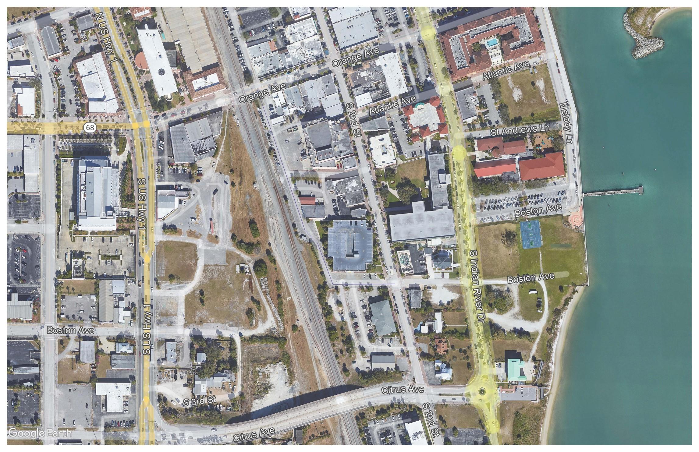
Capital Improvement Plan Transportation Projects
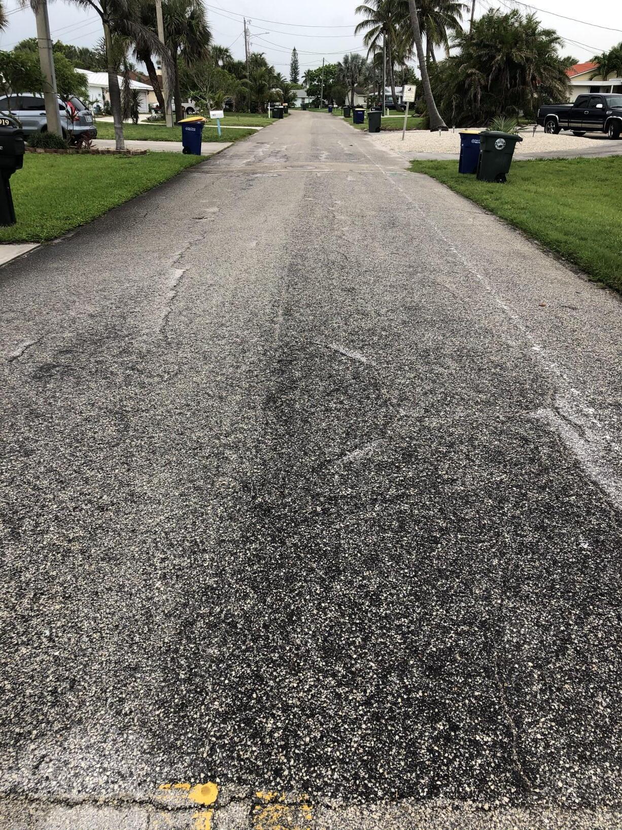
T-1 Street Resurfacing (Citywide) - Annual
Project Description
An alarming high percentage of the City's streets need resurfacing and unfortunately several have reached the point of requiring total reconstruction. The amount of work varies widely between the 56 maintenance sections of the City. Several sections of the City have been resurfaced in the past ten years and require little or no improvements. While other sections of the City have not been resurfaced in the past twenty years and require a substantial amount of work. A street condition report is maintained by the Engineering Department which lists the condition and the estimated cost of improvements.
Project Length: More than 29 miles of roadway are in "poor" condition.
Project Status
The FY 22/23 street resurfacing list includes:
• Rhode Island Avenue (30th Street to 25th Street)
Funding Sources and Breakdowns

TOTAL COST PREVIOUS FY22/23 FY23/24 FY24/25 FY25/26 FY26/27 TOTAL FUNDED UNFUNDED SOURCE $20,000,000 $1,618,860 $800,000 $850,000 $900,000 $950,000 $1,000,000 $6,118,860 $13,881,140 SUR
T-2 Pavement Markings Annual
Project Description
Replacement of pavement markings to comply with MUTCD Standards for marking retroreflectivity.
Project Status
The FY 22/23 Pavement Marking List includes: Okeechobee Road (Hartman Road to 17th Street)

Funding Sources and Breakdowns
Capital Improvement Plan Transportation Projects TOTAL COST PREVIOUS FY22/23 FY23/24 FY24/25 FY25/26 FY26/27 TOTAL UNFUNDED SOURCE $250,000 $0 $50,000 $50,000 $50,000 $50,000 $50,000 $250,000 $0 CITY-GF
Capital Improvement Plan
T-3 13th Street Phase 2 (Georgia Avenue to Orange Avenue)
Project Description
This revitalization project of 13th Street from Georgia Avenue to Orange Avenue will provide total roadway reconstruction. Classified by the Federal Highway Administration as a Urban Major Collector roadway, the improvements will include drainage replacement, roadway and sidewalk reconstruction. This project will also include signage, signalization, pavement markings, street lighting and landscape. Utility upgrades as well as undergrounding of overhead utilities is anticipated, but not included in the total project cost.
Project Length: 0.5 miles
Project Status
Engineering design plans were completed more than 5 years ago. Updated design documents will need to be developed prior to advertisement for construction proposals. The city is actively pursuing grant opportunities for funding of this project. A new proposal from the consultant is being requested. Revised design is anticipated to begin 2nd Quarter 2023.
Funding Sources and Breakdowns

Transportation
TOTAL COST PREVIOUS FY22/23 FY23/24 FY24/25 FY25/26 FY26/27 TOTAL UNFUNDED SOURCE $6,250,000 $274,880 $175,000 $0 $0 $0 $0 $449,880 $5,800,120 SUR, UNFUNDED PHASE PREVIOUS FY22/23 FY23/24 FY24/25 FY25/26 FY26/27 TOTAL UNFUNDED SOURCE Design $263,445 $175,000 $0 $0 $0 $0 $0 $0 SUR Construction $0 $0 $0 $0 $0 $0 $0 $5,800,120 UNFUNDED TOTAL $263,445 $175,000 $0 $0 $0 $0 $0 $5,800,120
Projects
T-4 13th Street Phase 3 (Avenue E to Avenue Q)
Project Description
This revitalization project of 13th Street from Avenue E to Avenue Q will provide total roadway reconstruction. Classified by the Federal Highway Administration as a Urban Major Collector roadway, the improvements will include drainage replacement, roadway and sidewalk reconstruction. This project will also include signage, pavement markings, street lighting and landscape. Utility upgrades as well as undergrounding of overhead utilities is anticipated, but not included in the total project cost.
Project Length: 0.74 miles
Project Status
Engineering design plans were completed more than 5 years ago. Updated design plans will need to be developed prior to advertisement for construction proposals. The city is actively pursuing grant opportunities for funding of this project.
Funding Sources and Breakdowns

Transportation Projects TOTAL COST PREVIOUS FY22/23 FY23/24 FY24/25 FY25/26 FY26/27 TOTAL UNFUNDED SOURCE $4,500,000 $263,445 $0 $0 $0 $0 $0 $263,445 $4,236,555 UNFUNDED PHASE PREVIOUS FY22/23 FY23/24 FY24/25 FY25/26 FY26/27 TOTAL UNFUNDED SOURCE Design $263,445 $0 $0 $0 $0 $0 $263,445 $175,000 UNFUNDED Construction $0 $0 $0 $0 $0 $0 $0 $4,061,555 UNFUNDED TOTAL $263,445 $0 $0 $0 $0 $0 $263,445 $4,236,555 UNFUNDED
Capital Improvement Plan
T-5 13th Street Phase 4 (Virginia Avenue to Georgia Avenue)
Project Description
This section is the final leg of the 13th Street Revitalization project. Classified by the Federal Highway Administration as an Urban Major Collector roadway, the improvements will include drainage replacement, roadway and sidewalk reconstruction. This project will also include signage, signalization, pavement markings, street lighting and landscape. Utility upgrades as well as undergrounding of overhead utilities is anticipated, but not included in the total project cost. A major component of this project is the piping of the 13th Street canal that runs parallel to the roadway from Kentucky Avenue to Virginia Avenue.
Project Length: 0.98 miles
Project Status
Survey and design plans were started more than 10 years ago. Engineering design was stopped due to funding shortfalls. The project would need new survey and design.

Funding Sources and Breakdowns
Capital Improvement Plan Transportation Projects TOTAL COST PREVIOUS FY22/23 FY23/24 FY24/25 FY25/26 FY26/27 TOTAL UNFUNDED SOURCE $8,000,000 $0 $0 $0 $0 $0 $0 $0 $8,000,000 UNFUNDED PHASE PREVIOUS FY22/23 FY23/24 FY24/25 FY25/26 FY26/27 TOTAL UNFUNDED SOURCE Design $0 $0 $0 $0 $0 $0 $0 $500,000 UNFUNDED Construction $0 $0 $0 $0 $0 $0 $0 $7,500,000 UNFUNDED TOTAL $0 $0 $0 $0 $0 $0 $0 $8,000,000 UNFUNDED
T-6 Wendell Road (8th Street to Chipola Road)
Project Description
A joint project by the city and Fort Pierce Utilities Authority primarily for the replacement of utilities. The project will entail water and sewer main replacement, drainage improvements, sidewalk replacement and roadway reconstruction.
Project Length: 0.33 miles
Project Status
Design to begin in FY22/23. Proposal requested from Consultant. Design will begin in the 2nd Quarter of 2023. Construction is anticipated in FY 2024.

Sources and Breakdowns


Funding
Transportation
TOTAL COST PREVIOUS FY22/23 FY23/24 FY24/25 FY25/26 FY26/27 TOTAL UNFUNDED SOURCE $2,000,000 $0 $150,000 $0 $0 $0 $0 $150,000 $1,850,000 SUR, UNFUNDED PHASE PREVIOUS FY22/23 FY23/24 FY24/25 FY25/26 FY26/27 TOTAL UNFUNDED SOURCE Design $0 $150,000 $0 $0 $0 $0 $150,000 $200,000 SUR Construction $0 $0 $0 $0 $0 $0 $0 $1,800,000 UNFUNDED TOTAL $0 $150,000 $0 $0 $0 $0 $150,000 $2,000,000
Capital Improvement Plan
Projects
Capital Improvement Plan Transportation Projects
T-7 Ohio Avenue (11th Street to US1)
Project Description
A joint project by the city and Fort Pierce Utilities Authority primarly for the replacement of utilities. The project will entail water and sewer main replacement, drainage improvements, sidewalk replacement and roadway reconstruction.


TOTAL COST PREVIOUS FY22/23 FY23/24 FY24/25 FY25/26 FY26/27 TOTAL UNFUNDED SOURCE $3,000,000 $157,880 $2,000,000 $842,120 $0 $0 $0 $3,000,000 $0
FPUA PHASE PREVIOUS FY22/23 FY23/24 FY24/25 FY25/26 FY26/27 TOTAL UNFUNDED SOURCE Design $157,880 $0 $0 $0 $0 $0 $157,880 $0 SUR,SMU Construction $0 $2,000,000 $842,120 $0 $0 $0 $2,842,120 $0 SUR, SMU, FPUA TOTAL $157,880 $2,000,000 $842,120 $0 $0 $0 $3,000,000 $0
SUR, SMU,
T-8 Avenue I Corridor (25th Street to 13th Street)
Project Description
Avenue I street improvements will provide complete roadway reconstruction extending from 25th Street east to 13th Street. Classified by the Federal Highway Administration as an Urban Major Collector roadway, the improvements will include drainage replacement, roadway and sidewalk reconstruction. This project also includes signage, pavement markings, decorative street lighting and landscaping. Utility upgrades for water, sewer and gas, as well as undergrounding of overhead utilities is anticipated, but not included in the total project cost.
Revitalization of this corridor, which provides a connection from 25th Street to Lincoln Park Academy, is a crucial step in the total redevelopment of this area. Lincoln Park Academy, a public academic magnet middle and high school, recognized as one of the top schools in the nation is located at the intersection of 17th Street and Avenue I, the mid-point of this project. Vehicular access as well as a greater need for pedestrian accessibility is crucial to the safety of school students, parents and visitors of the facility.
Project Length: 0.76 miles
Project Status
The design plans are at a 30% level, but stopped due to funding shortfalls.


Funding Sources and Breakdowns
Transportation Projects TOTAL COST PREVIOUS FY22/23 FY23/24 FY24/25 FY25/26 FY26/27 TOTAL UNFUNDED SOURCE $4,000,000 $164,474 $0 $175,000 $0 $0 $0 $339,474 $3,660,526 SUR, UNFUNDED PHASE PREVIOUS FY22/23 FY23/24 FY24/25 FY25/26 FY26/27 TOTAL UNFUNDED SOURCE Design $164,474 $0 $175,000 $0 $0 $0 $339,474 $0 SUR Construction $0 $0 $0 $0 $0 $0 $0 $3,660,526 SUR, UNFUNDED TOTAL $164,474 $0 $175,000 $0 $0 $0 $339,474 $3,660,526
Capital Improvement Plan
Capital Improvement Plan Transportation Projects
T-9 Indian River Drive (Avenue A to Seaway Drive)
Project Description
This is a proposed roadway project that entails the addition of on-street parking, drainage replacement, streetscape improvements, and raised pedestrian crosswalks at the Manatee Center and Riverwalk Center. Rehabilitation of this corridor, which provides a connection from the beach to downtown, is another step in the city's revitalization. This road is a St. Lucie County maintained roadway, but the city is proposing to complete the improvements. Due to the number of events that take place in the immediate vicinity, additional on-street parking and enhanced pedestrian crossings are needed.
Project Length: 0.42 miles
Project Status
The City received Grant funding from the State Department of Economic Opportunity in the amount of $2,745,223 for infrastructure improvements on Indian River Drive.


Funding Sources and Breakdowns
TOTAL COST PREVIOUS FY22/23 FY23/24 FY24/25 FY25/26 FY26/27 TOTAL UNFUNDED SOURCE $2,750,000 $0 $0 $0 $0 $0 $0 $0 $2,750,000 UNFUNDED PHASE PREVIOUS FY22/23 FY23/24 FY24/25 FY25/26 FY26/27 TOTAL UNFUNDED SOURCE Design $0 $0 $0 $0 $0 $0 $0 $250,000 UNFUNDED Construction $0 $0 $0 $0 $0 $0 $0 $2,500,000 UNFUNDED TOTAL $0 $0 $0 $0 $0 $0 $0 $2,750,000 UNFUNDED
T-10 Granada Street (Porpoise Avenue to North of Gulfstream Avenue
Project Description
This project will include paving, drainage, and sidewalks for the unpaved section of Granada Street.
Project Status
Survey is complete, engineering design is underway.

Funding Sources and Breakdowns

Projects TOTAL COST PREVIOUS FY22/23 FY23/24 FY24/25 FY25/26 FY26/27 TOTAL UNFUNDED SOURCE $750,000 $9,500 $740,500 $0 $0 $0 $0 $750,000 $0 IMP-R, SMU PHASE PREVIOUS FY22/23 FY23/24 FY24/25 FY25/26 FY26/27 TOTAL UNFUNDED SOURCE Design $9,500 $10,500 $0 $0 $0 $0 $20,000 $0 IMP-R, SMU Construction $0 $730,000 $0 $0 $0 $0 $730,000 $0 IMP-R, SMU TOTAL $9,500 $740,500 $0 $0 $0 $0 $750,000 $0
Capital Improvement Plan Transportation
T-11 Means Court Extension (Avenue B to Moore’s Creek)
Project Description
This project will construct an extension to Means Court from Avenue B to Moore’s Creek. The roadway will serve the proposed Oaks at Moore’s Creek Phase 2 project.
Project Status

TOTAL COST PREVIOUS FY22/23 FY23/24 FY24/25 FY25/26 FY26/27 TOTAL UNFUNDED SOURCE $600,000 $17,000 $583,000 $0 $0 $0 $0 $600,000 $0 SMU, FPRA PHASE PREVIOUS FY22/23 FY23/24 FY24/25 FY25/26 FY26/27 TOTAL UNFUNDED SOURCE Design $17,000 $0 $0 $0 $0 $0 $17,000 $0 SMU Construction $0 $583,000 $0 $0 $0 $0 $583,000 $0 SMU, FPRA TOTAL $17,000 $583,000 $0 $0 $0 $0 $600,000 $0
Capital Improvement Plan Transportation Projects
T-12 Preston Court Reconstruction (Delaware Avenue to Boston Avenue)
Project Description
This project will provide total roadway reconstruction and include drainage replacement, sidewalk reconstruction, upgraded signage and new pavement markings.
Project Length:
Project Status
This project will be combined with the improvements to Boston Avenue and 11th Street. Design to begin 1st Quarter 2023
Funding Sources and Breakdowns

Improvement Plan Transportation Projects TOTAL COST PREVIOUS FY22/23 FY23/24 FY24/25 FY25/26 FY26/27 TOTAL UNFUNDED SOURCE $300,000 $0 $300,000 $0 $0 $0 $0 $300,000 $0 SUR, SMU PHASE PREVIOUS FY22/23 FY23/24 FY24/25 FY25/26 FY26/27 TOTAL UNFUNDED SOURCE Design $0 $35,000 $0 $0 $0 $0 $35,000 $0 SUR, SMU Construction $0 $265,000 $0 $0 $0 $0 $265,000 $0 SUR, SMU TOTAL $0 $300,000 $0 $0 $0 $0 $300,000 $0 SUR, SMU
Capital
T-13 Boston Avenue Reconstruction (13th Street to 10th Street)
Project Description

Capital Improvement Plan Transportation Projects TOTAL COST PREVIOUS FY22/23 FY23/24 FY24/25 FY25/26 FY26/27 TOTAL UNFUNDED SOURCE $300,000 $0 $300,000 $0 $0 $0 $0 $300,000 $0 SUR, SMU PHASE PREVIOUS FY22/23 FY23/24 FY24/25 FY25/26 FY26/27 TOTAL UNFUNDED SOURCE Design $0 $35,000 $0 $0 $0 $0 $35,000 $0 SUR, SMU Construction $0 $265,000 $0 $0 $0 $0 $265,000 $0 SUR, SMU TOTAL $0 $300,000 $0 $0 $0 $0 $300,000 $0 SUR, SMU
T-14 11th Street Improvements (Boston Avenue to Orange Avenue)
Project Description
This project will provide install new curb and gutter, replace driveway aprons, install drainage improvements and mill and overlay the roadway.
Project Length: 0.10 miles
Project Status
This project will be combined with the improvements to Preston Court and Boston Avenue. Design to begin 1st Quarter 2023
Funding Sources and Breakdowns

Improvement Plan Transportation Projects TOTAL COST PREVIOUS FY22/23 FY23/24 FY24/25 FY25/26 FY26/27 TOTAL UNFUNDED SOURCE $300,000 $0 $300,000 $0 $0 $0 $0 $300,000 $0 SUR, SMU PHASE PREVIOUS FY22/23 FY23/24 FY24/25 FY25/26 FY26/27 TOTAL UNFUNDED SOURCE Design $0 $35,000 $0 $0 $0 $0 $35,000 $0 SUR, SMU Construction $0 $265,000 $0 $0 $0 $0 $265,000 $0 SUR, SMU TOTAL $0 $300,000 $0 $0 $0 $0 $300,000 $0 SUR, SMU
Capital
T-15 Comprehensive Safety Action Plan/Local Roadway Safety Plan
Project Description
This project will utilize a professional consultant to perform the required engineering studies to produce a blend of the Comprehensive Safety Action Plan and a Local Roadway Safety Plan. These studies will enable the City to prioritize and implement a variety of low cost safety improvements guided by data driven analyses and proven methods towards goal of zero deaths and serious injuries on our roadways.
Project Status
Staff is pursuing Safe Streets For All (SS4A, Federal) Grant funds for up to 80% of the project costs. Future Projects resulting from these studies will be eligible for other federal safety grants. The SS4A Grant application was submitted on September 15, 2022. Award notification is anticipated in the 1st Quarter of 2023.
Funding Sources and Breakdowns
Capital Improvement Plan Transportation Projects TOTAL COST PREVIOUS FY22/23 FY23/24 FY24/25 FY25/26 FY26/27 TOTAL FUNDED UNFUNDED SOURCE $300,000 $0 $0 $300,000 $0 $0 $0 $300,000 $0 SS4A
Project Description
TBD
Project Status
TBD
Funding Sources and Breakdowns
T-16 Phase III Ocean LED Light Conversion
Capital Improvement Plan Transportation Projects TOTAL COST PREVIOUS FY22/23 FY23/24 FY24/25 FY25/26 FY26/27 TOTAL FUNDED UNFUNDED SOURCE $100,000 $0 $0 $100,000 $0 $0 $0 $100,000 $0
Capital Improvement Plan Streetscape Projects
TS-1 Avenue D Streetscape (29th Street to Indian River Drive)
Project Description
This project will resurface Avenue D from 29th Street east to US 1, additional improvements include upgrades to pavement markings and signage to improve visibility and safety.
Avenue D from US 1 to Indian River Drive will be completely reconstructed to fit the vision for the historic Edgar Town District of Fort Pierce. New sidewalks with landscaping and street lighting. New signage and pavement markings will improve visibility and safety for users. A raised intersection at Avenue D and 2nd Street is being added to the design to further safety enhancements.

TOTAL COST PREVIOUS FY22/23 FY23/24 FY24/25 FY25/26 FY26/27 TOTAL UNFUNDED SOURCE $3,000,000 $97,575 $1,700,000 $1,202,425 $0 $0 $0 $3,000,000 $0 SUR, SMU, FPRA PHASE PREVIOUS FY22/23 FY23/24 FY24/25 FY25/26 FY26/27 TOTAL UNFUNDED SOURCE Design $97,575 $0 $0 $0 $0 $0 $97,575 $0 FPRA Construction $0 $1,700,000 $1,202,425 $0 $0 $0 $2,902,425 $0 SUR, SMU, FPRA TOTAL $97,575 $1,700,000 $1,202,425 $0 $0 $0 $3,000,000 $0
Capital Improvement Plan
TS-2 5th Street (Orange Avenue to Avenue A)
Project Description
The project consists of repaving, drainage, improved sidewalks, landscaping and lighting to better fit the vision near the new 500 Orange Avenue site.
Project Length: 0.06 miles
Project Status
The project has been on the CIP since 2009; this project would complete the streetscape improvements in the vicinity of the Arcade Building.


Funding Sources and Breakdowns
Streetscape Projects TOTAL COST PREVIOUS FY22/23 FY23/24 FY24/25 FY25/26 FY26/27 TOTAL UNFUNDED SOURCE $750,000 $0 $0 $0 $0 $0 $0 $0 $750,000 UNFUNDED PHASE PREVIOUS FY22/23 FY23/24 FY24/25 FY25/26 FY26/27 TOTAL UNFUNDED SOURCE Design $0 $0 $0 $0 $0 $0 $0 $0 UNFUNDED Construction $0 $0 $0 $0 $0 $0 $0 $0 UNFUNDED TOTAL $0 $0 $0 $0 $0 $0 $0 $0
TS-3 Depot Drive (Orange Avenue to Avenue A)
Project Description
Project includes paving, drainage, sidewalks, additional on-street parking, landscaping and lighting improvements.
Project Length: 0.17 miles
Project Status
Project originally placed on CIP in 2009. Property acquired from FEC in March 2017. Future of this project uncertain at this time due to proposed location and unknown configuration of train station.


Streetscape Projects TOTAL COST PREVIOUS FY22/23 FY23/24 FY24/25 FY25/26 FY26/27 TOTAL UNFUNDED SOURCE $2,500,000 $0 $0 $0 $0 $0 $0 $0 $2,500,000 UNFUNDED PHASE PREVIOUS FY22/23 FY23/24 FY24/25 FY25/26 FY26/27 TOTAL UNFUNDED SOURCE Design $0 $0 $0 $0 $0 $0 $0 $300,000 UNFUNDED Construction $0 $0 $0 $0 $0 $0 $0 $2,200,000 UNFUNDED TOTAL $0 $0 $0 $0 $0 $0 $0 $2,500,000
Capital Improvement Plan
TS-4 Hibiscus Park Neighborhood Revitalization
Project Description
Design plans have been completed for the project which includes roadway milling and resurfacing, replacement of existing curb and gutter deficiencies, drainage improvements, sidewalk and pedestrian ramp (ADA) improvements, street lighting, and landscaping.
Project Length: 3.45 miles
Project Status
This community has petitioned the City of Fort Pierce to initiate the process for the development of rehabilitative plans for the aging infrastructure. The City has completed design plans and has held public informational meetings with the Hibiscus Park Homeowners Association. Residents and governmental leaders are in agreement, but construction funding has not been identified. Revitalization of this neighborhood would help spur a resurgence in homeowners property values.

Funding Sources and Breakdowns
Improvement
Streetscape Projects
Capital
Plan
TOTAL COST PREVIOUS FY22/23 FY23/24 FY24/25 FY25/26 FY26/27 TOTAL UNFUNDED SOURCE $6,000,000 $0 $0 $0 $0 $0 $0 $0 $6,000,000 UNFUNDED PHASE PREVIOUS FY22/23 FY23/24 FY24/25 FY25/26 FY26/27 TOTAL UNFUNDED SOURCE Design $349,555 $0 $0 $0 $0 $0 $349,555 $400,445 UNFUNDED Construction $0 $0 $0 $0 $0 $0 $0 $5,599,555 UNFUNDED TOTAL $349,555 $0 $0 $0 $0 $0 $349,555 $6,000,000
Georgia Avenue
TB-1 Emil Avenue Sidewalk (Oleander Avenue to US 1)
Project Description
This project is construction of sidewalk on both sides of Emil Avenue from US 1 west to Oleander Avenue. This is a residential street occupied by many young families with school-age children. The bus stop is a community stop located at Oleander Avenue and Emil Drive. Parents and children are forced to walk in the roadway. Also located at the east end of Emil Avenue at US 1 is the Save A lot Grocery store, where again, pedestrians are forced to walk in the roadway until reaching US 1.
Project Length: 0.40 miles
Project Status
This project is listed on the St. Lucie TPO's Transportation Alternatives Project list. Staff plans to submit for the Transportation Alternatives Program grant funding in January 2023 (anticipated construction funding in FY 2028)
Funding Sources and Breakdowns


Capital Improvement Projects Bicycle/Pedestrian Projects TOTAL COST PREVIOUS FY22/23 FY23/24 FY24/25 FY25/26 FY26/27 TOTAL UNFUNDED SOURCE $700,000 $0 $0 $0 $0 $150,000 $0 $150,000 $550,000 SUR PHASE PREVIOUS FY22/23 FY23/24 FY24/25 FY25/26 FY26/27 TOTAL UNFUNDED SOURCE Design $0 $0 $0 $0 $150,000 $0 $150,000 $0 SUR Construction $0 $0 $0 $0 $0 $0 $0 $550,000 FDOT TAP FY27/28 TOTAL $0 $0 $0 $0 $150,000 $0 $150,000 $550,000
Capital Improvement Projects
TB-2 Indian River Drive Sidewalk (Delaware Avenue to Old Fort Park)
Project Description
This project is for the extension of sidewalk along Indian River Drive from Delaware Avenue south to Old Fort Park. The proposal would be to construct sidewalk along the west side of Indian River Drive. Existing sub-standard sidewalk would be removed and replaced and missing sections of sidewalk would be constructed. To construct this sidewalk, 722’ of frontage would require right-of-way acquisition from five property owners.
Project Length: 0.40 miles
Project Status
Project is currently unfunded. Funding Sources


and Breakdowns
TOTAL COST PREVIOUS FY22/23 FY23/24 FY24/25 FY25/26 FY26/27 TOTAL UNFUNDED SOURCE $115,000 $0 $0 $0 $0 $0 $0 $0 $115,000 UNFUNDED PHASE PREVIOUS FY22/23 FY23/24 FY24/25 FY25/26 FY26/27 TOTAL UNFUNDED SOURCE Design $0 $0 $0 $0 $0 $0 $0 $0 UNFUNDED Construction $0 $0 $0 $0 $0 $0 $0 $0 UNFUNDED TOTAL $0 $0 $0 $0 $0 $0 $0 $115,000
Bicycle/Pedestrian Projects
Capital Improvement Projects
TB-3 SUN Trail Historic Downtown Fort Pierce Retrofit (Georgia Avenue to N A1A)
Project Description
The project will include bicycle accommodations through downtown Fort Pierce. Roadway connections, and railroad coordination will be required.
Project Length: 0.40 miles
Project Status
Design is currently on hold for Coordination with Indian River Drive Improvements and the Downtown Master Plan. Project is eligible for Florida SUN Trail funding and the St. Lucie Walk/Bike Network funds. This project is listed as priority number 4 in the 20/21 List of Priority Projects in the TPO Transportation Alternatives Projects.
and Breakdowns

Funding Sources
TOTAL COST PREVIOUS FY22/23 FY23/24 FY24/25 FY25/26 FY26/27 TOTAL UNFUNDED SOURCE $300,000 $300,000 $0 $0 $0 $0 $0 $0 $0 FDOT SUN PHASE PREVIOUS FY22/23 FY23/24 FY24/25 FY25/26 FY26/27 TOTAL UNFUNDED SOURCE Design $300,000 $0 $0 $0 $0 $0 $300,000 $0 FDOT SUN Construction $0 $0 $0 $0 $0 $0 $0 $0 FDOT SUN TOTAL $300,000 $0 $0 $0 $0 $0 $300,000 $0
TB-4 SUN Trail FEC Overpass Bike Path/Trail (South of Savannah Road)
Project Description
A proposed joint project between St. Lucie County and the City of Fort Pierce connecting the Savannas Recreation Area Trail to the south with the newly constructed Indian Hills Recreation Area to the north. This proposed arerial crossing over an existing FEC rail spur will connect the 1.3 mile Savannas Trail with the 1.44 mile trails to the north. This connection and associated trials will ultimately become part of the Florida East Coast Greenway System.
Project Status
Project is funded by FDOT. Preliminary plan completed and survey is underway.
Funding Sources and Breakdowns Capital Improvement Projects


Bicycle/Pedestrian
TOTAL COST PREVIOUS FY22/23 FY23/24 FY24/25 FY25/26 FY26/27 TOTAL UNFUNDED SOURCE $3,575,426 $450,000 $225,651 $64,750 $2,834,845 $0 $0 $0 $0 FDOT SUN PHASE PREVIOUS FY22/23 FY23/24 FY24/25 FY25/26 FY26/27 TOTAL UNFUNDED SOURCE Design $450,000 $225,651 $64,750 $0 $0 $0 $740,401 $0 FDOT SUN Construction $0 $0 $0 $2,834,845 $0 $0 $2,834,845 $0 FDOT SUN TOTAL $450,000 $225,651 $64,750 $2,834,845 $0 $0 $3,575,246 $0
Projects
TB-5 SUN Trail Historic Highwayman Trail Gap (Indian Hills Drive to Georgia Avenue)
Project Description
A proposed joint project between St. Lucie County and the City of Fort Pierce connecting the Savannas Recreation Area Trail to the south with the newly constructed Indian Hills Recreation Area to the north. This proposed arerial crossing over an existing FEC rail spur will connect the 1.3 mile Savannas Trail with the 1.44 mile trails to the north. This connection and associated trials will ultimately become part of the Florida East Coast Greenway System.
Project Status
Final design is scheduled to be completed in October 2022. State Trail Network Funds in the amount of $792,176 are included in the FY 21/22 25/26


Capital
Bicycle/Pedestrian Projects TOTAL COST PREVIOUS FY22/23 FY23/24 FY24/25 FY25/26 FY26/27 TOTAL UNFUNDED SOURCE $858,001 $95,825 $762,176 $0 $0 $0 $0 $0 $0 FDOT SUN PHASE PREVIOUS FY22/23 FY23/24 FY24/25 FY25/26 FY26/27 TOTAL UNFUNDED SOURCE Design $95,825 $0 $0 $0 $0 $0 $95,825 $0 FDOT SUN Construction $0 $762,176 $0 $0 $0 $0 $762,176 $0 FDOT SUN TOTAL $95,825 $762,176 $0 $0 $0 $0 $858,001 $0
Improvement Projects
TB-6 Lawnwood Circle Sidewalk
Project Description
This project will install a 5’ sidewalk along North and South Lawnwood Circle and Nebraska Avenue within the Lawnwood Circle area. Installation of ADA accessible ramps and crosswalks are included.
Project Status
This is a new project that has not been funded.

Funding Sources and Breakdowns
Capital Improvement Projects Bicycle/Pedestrian Projects TOTAL COST PREVIOUS FY22/23 FY23/24 FY24/25 FY25/26 FY26/27 TOTAL UNFUNDED SOURCE $500,000 $0 $0 $0 $0 $0 $0 $0 $500,000 TBD
S-1 16th Street (Avenue I to Avenue K) Stormdrain Replacement
Project Description
This project will replace the failed storm system on 16th Street between Avenue I to Avenue K, the roadway surface will also be milled and overlayed.
Project Status
Scoping of the project is underway.

Funding Sources and Breakdowns
Stormwater Utility Projects TOTAL COST PREVIOUS FY22/23 FY23/24 FY24/25 FY25/26 FY26/27 TOTAL UNFUNDED SOURCE $300,000 $0 $0 $0 $0 $0 $0 $0 $300,000 ARPA PHASE PREVIOUS FY22/23 FY23/24 FY24/25 FY25/26 FY26/27 TOTAL UNFUNDED SOURCE Design $0 $0 $0 $0 $0 $0 $0 $0 ARPA Construction $0 $0 $0 $0 $0 $0 $0 $0 ARPA TOTAL $0 $0 $0 $0 $0 $0 $0 $0 ARPA
Capital Improvement Projects
Capital Improvement Projects
S-2 Frances Avenue (Fernandina Avenue to Thumb Point Drive)
Project Description
The project will replace the failing storm drains along Frances Avenue between Fernandina Avenue to Thumb Point Drive. New concrete pipe, inlets and driveway aprons will be included in this project.

Funding Sources and Breakdowns
Stormwater Utility Projects TOTAL COST PREVIOUS FY22/23 FY23/24 FY24/25 FY25/26 FY26/27 TOTAL UNFUNDED SOURCE $175,000 $0 $175,000 $0 $0 $0 $0 $0 $0 SMU PHASE PREVIOUS FY22/23 FY23/24 FY24/25 FY25/26 FY26/27 TOTAL UNFUNDED SOURCE Design $0 $25,000 $0 $0 $0 $0 $25,000 $0 SMU Construction $0 $150,000 $0 $0 $0 $0 $150,000 $0 SMU TOTAL $0 $175,000 $0 $0 $0 $0 $175,000 $0
Capital
S-3 Atlantic Avenue (5th Street to 7th Street) Pipe Replacement
Project Description
The failing storm drainage system is causing pavement failures in the area. This project will replace the failing drainage system.
Project Status

Funding Sources and Breakdowns
Stormwater Utility
TOTAL COST PREVIOUS FY22/23 FY23/24 FY24/25 FY25/26 FY26/27 TOTAL UNFUNDED SOURCE $500,000 $5,300 $0 $0 $0 $0 $0 $0 $494,700 ARPA PHASE PREVIOUS FY22/23 FY23/24 FY24/25 FY25/26 FY26/27 TOTAL UNFUNDED SOURCE Design $5,300 $0 $0 $0 $0 $0 $5,300 $44,700 ARPA Construction $0 $0 $0 $0 $0 $0 $0 $450,000 ARPA TOTAL $5,300 $0 $0 $0 $0 $0 $5,300 $494,700
Improvement Projects
Projects
S
-4 Avenue Q (17th Street to 14th Street) Stormdrain Replacement
Project Description
Approximately 1200 feet of drainage structures, curb and gutter, and resurfacing is also included in the project.
Project Status

Funding Sources and Breakdowns
Stormwater Utility Projects TOTAL COST PREVIOUS FY22/23 FY23/24 FY24/25 FY25/26 FY26/27 TOTAL UNFUNDED SOURCE $600,000 $5,400 $0 $0 $0 $0 $0 $5,400 $594,600 ARPA PHASE PREVIOUS FY22/23 FY23/24 FY24/25 FY25/26 FY26/27 TOTAL UNFUNDED SOURCE Design $5,400 $0 $0 $0 $0 $0 $5,400 $54,600 ARPA Construction $0 $0 $0 $0 $0 $0 $0 $540,000 ARPA TOTAL $5,400 $0 $0 $0 $0 $0 $5,400 $594,600
Capital Improvement Projects
Capital Improvement Projects
S-5 Virginia Avenue Canal Stabilization (25th Street to 13th Street)
Project Description
This project will provide bank stabilization for over 3,000 feet of canal along Virginia Avenue. Articulated concrete block mats (ACBM) will be installed in addition to rip-rap along the bottom of the canal.
Project Status

Funding Sources and Breakdowns
Stormwater Utility
TOTAL COST PREVIOUS FY22/23 FY23/24 FY24/25 FY25/26 FY26/27 TOTAL UNFUNDED SOURCE $5,500,000 $0 $0 $0 $0 $0 $0 $0 $5,500,000 UNFUNDED PHASE PREVIOUS FY22/23 FY23/24 FY24/25 FY25/26 FY26/27 TOTAL UNFUNDED SOURCE Design $500,000 $0 $0 $0 $0 $0 $0 $500,000 UNFUNDED Construction $5,000,000 $0 $0 $0 $0 $0 $0 $5,000,000 UNFUNDED TOTAL $5,500,000 $0 $0 $0 $0 $0 $0 $5,500,000
Projects
S-6 Moore’s Creek Erosion Remediation
Project Description
As a result of Hurricane Irma, Moore's Creek suffered erosion damage along its banks, primarily from 7th to 15th Street.
Project Status
Funding Sources and Breakdowns
Stormwater Utility Projects TOTAL COST PREVIOUS FY22/23 FY23/24 FY24/25 FY25/26 FY26/27 TOTAL UNFUNDED SOURCE $400,000 $0 $0 $0 $0 $0 $0 $0 $400,000 SMU PHASE PREVIOUS FY22/23 FY23/24 FY24/25 FY25/26 FY26/27 TOTAL UNFUNDED SOURCE Design $0 $0 $0 $0 $0 $0 $0 $75,000 SMU Construction $0 $0 $0 $0 $0 $0 $0 $325,000 SMU TOTAL $0 $0 $0 $0 $0 $0 $0 $400,000 SMU
Capital Improvement Projects
Capital
Improvement Projects Stormwater Utility Projects
S-7 Moore’s Creek Trash Interceptor
Project Description
Proposed installation of "Downstream Defenders" to capture and retain stormwater sediment, trash and floatables before entering Moore's Creek
Project Status
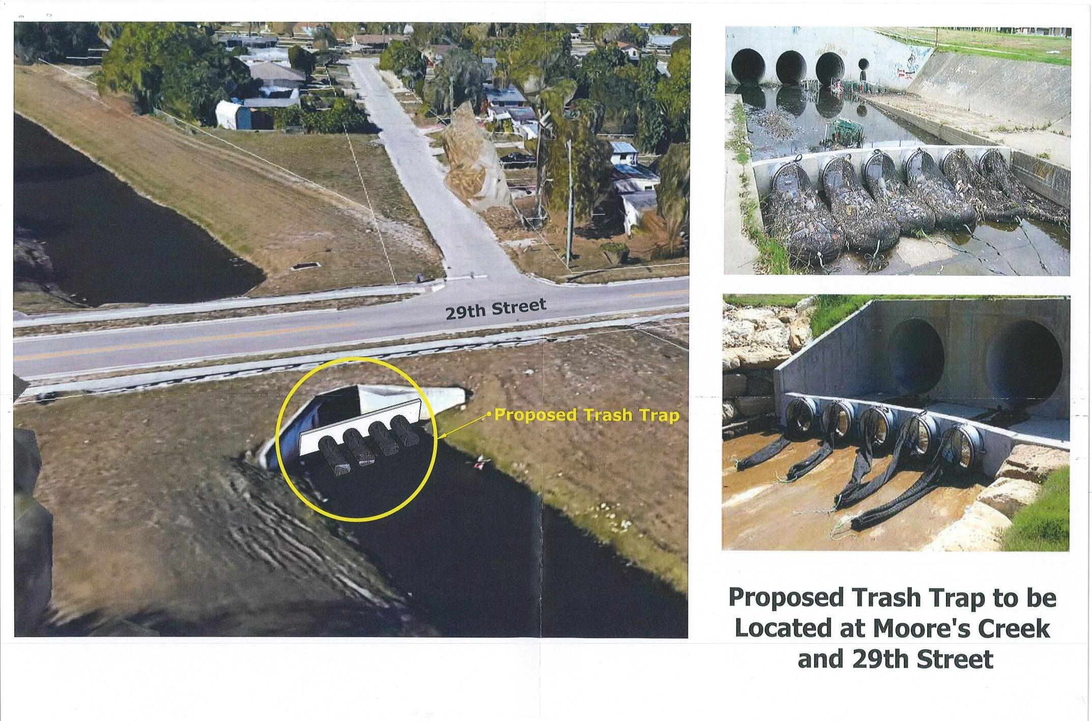
Funding Sources and Breakdowns
TOTAL COST PREVIOUS FY22/23 FY23/24 FY24/25 FY25/26 FY26/27 TOTAL UNFUNDED SOURCE $250,000 $0 $150,000 $0 $0 $0 $0 $0 $100,000 SMU PHASE PREVIOUS FY22/23 FY23/24 FY24/25 FY25/26 FY26/27 TOTAL UNFUNDED SOURCE Design $0 $50,000 $0 $0 $0 $0 $50,000 $0 SMU Construction $0 $100,000 $0 $0 $0 $0 $100,000 $100,000 SMU TOTAL $0 $0 $0 $0 $0 $0 $150,000 $100,000
S-8 Surfside Drainage/Resurfacing Phase II
Project Description
The streets identified for drainage improvements under this project are: Melaleuca, Plover, Pelican, Walnut, Eucalyptus and Cypress. Improvements will include valley gutters constructed on both sides of the roadway, elimination of the remaining roadside swale by regrading, driveway replacement, milling and resurfacing.
Project Status

Capital Improvement Projects Stormwater Utility Projects Construction $0 $0 $1,300,000 $0 TOTAL $199,750 $0 $1,300,000 $0
The streets identified for drainage improvements under this project are: Sunset Isles, Mimosa and Jacaranda. Improvements will include valley gutters constructed on both sides of the grading, driveway replacement,
Funding Sources and Breakdowns

Utility
TOTAL COST PREVIOUS FY22/23 FY23/24 $1,400,000 $0 $0 $0 PHASE PREVIOUS FY22/23 FY23/24 Design $0 $0 $0 Construction $0 $0 $0 $0 $0 $0 $0 $1,400,000 SMU, SUR TOTAL $0 $0 $0 $0 $0 $0 $0 $1,400,000
Stormwater
Projects
S-10 Surfside Drainage/Resurfacing Phase IV
Project Description
The streets identified for drainage improvements under this project are: Surfside, Cypress, Mimosa, Jacaranda, Coconut. Improvements will include valley gutters constructed on both sides of the roadway, elimination of the remaining roadside swales by re-grading, driveway replacement, milling and resurfacing.
Project Status

Funding Sources and Breakdowns

Capital Improvement Projects Stormwater Utility Projects TOTAL COST PREVIOUS FY22/23 FY23/24 FY24/25 FY25/26 FY26/27 TOTAL UNFUNDED SOURCE $2,200,000 $0 $0 $0 $0 $0 $0 $0 $2,200,000 SMU, SUR PHASE PREVIOUS FY22/23 FY23/24 FY24/25 FY25/26 FY26/27 TOTAL UNFUNDED SOURCE Design $0 $0 $0 $0 $0 $0 $0 $125,000 SMU, SUR Construction $0 $0 $0 $0 $0 $0 $0 $2,075,000 SMU, SUR TOTAL $0 $0 $0 $0 $0 $0 $0 $2,200,000
Capital Improvement Projects
S-11 Georgia Avenue Basin Improvements
Project Description
Currently the 235-acre Georgia Avenue Basin drains through the Indian Hills Golf Course lake system then discharges directly into the Indian River Lagoon. Improvements are being proposed to reduce the pollutants that are now discharging directly to the Indian River Lagoon. Three (3) BMP Treatment Trains will be constructed to accomplish this goal.
Project Status
Project has been advertised for bids, the award recommendation will be presented to the Board on August 8, 2022.

Funding Sources
and Breakdowns
Stormwater
TOTAL COST PREVIOUS FY22/23 FY23/24 FY24/25 FY25/26 FY26/27 TOTAL UNFUNDED SOURCE $2,000,000 $158,000 $1,188,000 $0 $0 $0 $0 $0 $654,000 SMU, SUR, SFWMD PHASE PREVIOUS FY22/23 FY23/24 FY24/25 FY25/26 FY26/27 TOTAL UNFUNDED SOURCE Design $158,000 $0 $0 $0 $0 $0 $158,000 $0 SMU, SUR Construction $0 $1,188,000 $0 $0 $0 $0 $1,188,000 $654,000 SMU, SUR, SFWMD TOTAL $158,000 $0 $0 $0 $0 $0 $1,346,000 $2,000,000
Utility Projects