

TRAVANCINHA
DEPARTING FROM CHÃO DO RIO - GREEN FARM STAYS

SOME HISTORICAL REFERENCES TO TRAVANCINHA
The oldest documented references to Travancinha are proof of an ancient history. The earliest references date from the century after thePortuguese nationality, more specifically to the reign of D. Sancho I, son of D. Afonso Henriques. The wife of this monarch, D. Dulce, had the landlord of this land, resulting from the purchases she made to villagers in this area.
Her daughter, D. Mafalda, inherited the properties from her mother, increasing her patrimony with many other lands that she acquired in this parish and a throughout the region of Seia.
The Order of Aviz owned several lands in Travancinha, donated by D. Mafalda: "that dedit ipsi ordini regina donna Mafalda". The house and lands of the Comenda, still today denominated this way, belonged to the Order of Aviz for about three centuries.
The creation of the parish of Travancinha is later than the fourteenth century. The Casal de Travancinha was a county with Foral given by King D. Manuel I in 1514. Some historians wrote that, in addition to Casal and Travancinha, only the parish of Sameice was part of the county of Casal, but others, perhaps more rightly, state a larger municipality of which the towns of Travancinha, Sameice, Várzea de Meruge, S. Paio de Codeço and Meruge were part.

A LITTLE BEFORE HISTORY
The origin of the village of Travancinha is certainly much older than documented history shows. Sources in the village refer to the existence of a castro in the area of Casal de Travancinha. However, today the vestiges of such settlement are of difficult location, not having existed to date any scientific study that proves its existence. The same is said of anthropomorphic graves, dug in the rocks. However, the Roman path is visible to all, in the west limit of Chão do Rio, and in the northern part of the property, near the brook, it is also apparent part of an ancient Roman mill.
Also the toponym Travancinha, diminutive of Travanca, that means obstacle, demonstrates its antiquity. According to the dictionary of toponymia Infopedia, it comes from the low Latin and would mean forest closed of trees with great trunks. Speculating, surely, such a forest would be a great obstacle for the Roman troops that would pass in the Roman path of Travancinha, ambushed by lusos warriors commanded by Viriato... Thus, starting at the Roman path, at the gate of Chão do Rio, we invite you to a little trip in time and in the space of your imagination

GPS 40º 25'16.54''N, 7º 49'25.21''W
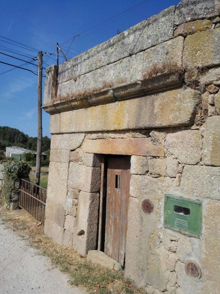
2. BOTICA (PHARMACY)
In the XVI century the Botica (pharmacy) that served the Council of Casal de Travancinha was located in this old building, very close to Chão do Rio, in its access road.
TRAVANCINHA DEPARTING FROM CHÃO DO RIO - GREEN FARM STAYS


GPS 40º 25'19.86''N, 7º 49'33.48''W
3. OUR LADY OF HELP’ CHAPEL
In this chapel located in the neighborhood of São Gião we can find the image of Our Lady of Help carved in granite, which gives name to the chapel. However, it is in homage to our Lady of Fatima, an image also present there, that the night procession of candles is carried out, in which the Mordomas of the feast transport the image statue of our Lady of Fatima to the Parish Church, while praying the rosary and sing religious songs. In the next day, in a daytime festivity, the image returns to the chapel of Our Lady of Help, walking the streets of the village. This procession takes place on the following Saturday and Sunday to 13 May.

5. SEIXINHA CAVE
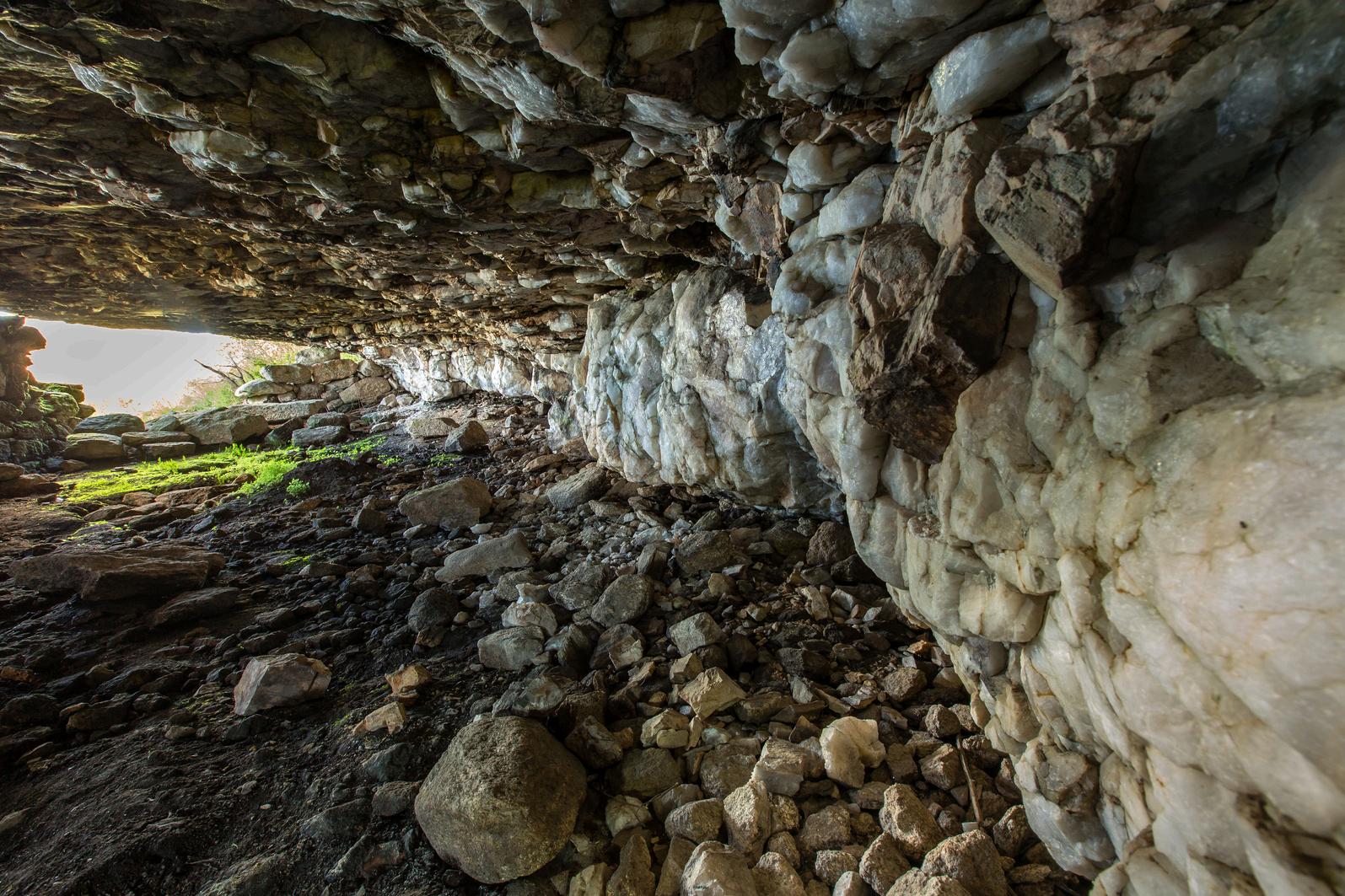
The Seixinha cave doesn’t has its limits on the County of Seia. Beyond the Seixinha Cave, begins the county of Oliveira do Hospital. As we leave the main road, we enter a zone of great cliffs and a fantastic view over Serra da Estrela and the Seia River Valley. And soon we get a feeling that we are entering a mysterious place. In fact, when we look at the big boulder for a while, we can not imagine what we will find when we enter its small, half-hidden, entrance.
There we are dazzled by the beauty of white quartz stone. There is no document that reports its existence, or its purpose. But surely, it served as shelter to shepherds and their flocks in storm days.


6. ROMAN BRIDGE
Beyond the limits of the municipality of Seia, near the parish of Travancinha, following the M507-1, towards Seixo da Beira, near the Seia River, there is a place of great beauty, known as Moinho do Buraco (hole mill). There, there is a water mill and the water of the river in its passage has excavated the rock in great depth (forming big holes). Placed, next to the most recent bridge, that integrates the M507-1, there is a bridge of Roman origin. This bridge, like the roman path of Travancinha would integrate the route to the "splendidissima civitas" of Bobadela.


GPS 40º 25'35.28''N, 7º 49'54.24''W
7. PEDUNCULATED ROCKS
At the entrance of Travancinha there is a group of rock formations of high Geological value, being at the moment to be studied its possible classification. Pedunculated rocks are rock formations resulting from the erosion caused by the action of the wind and the sands. Pedunculated rocks are thinner at the bottom than at the top. Being granite rocks, these existing rock in Travancinha, have acquired particular forms very funny (toothed apple and penguin).


GPS 40º 25'37.96''N, 7º 49'23.54''W
8. BORCEDA PILLARGEODESIC LANDMARK
Known as "Pilar da Borceda" this is one of the two geodesic landmarks of Travancinha. The view is fantastic and from there it is possible to see three districts: Guarda, Coimbra and Viseu and several mountain ranges such as Estrela, Caramulo, Azores, Buçaco and Lousã. It is a privileged spot for astronomic observation.


GPS 40º 25'37.96''N, 7º 49'23.54''W
8.1 "ENTRE SERRAS" SWING
Located at the highest point of the parish, right next to the geodesic landmark, we find the Panoramic Swing "Entre Serras". This project was idealized and carried out, voluntarily, by a group of friends and local inhabitants.
The name of the Swing, "Entre Serras" (between mountains), is due to the fact that from that spot several mountain ranges can be seen, such as: "Serra da Estrela", "Serra do Caramulo", "Serra de Montemuro", "Serra da Lousã", "Serra do Açor" and "Serra do Bussaco".

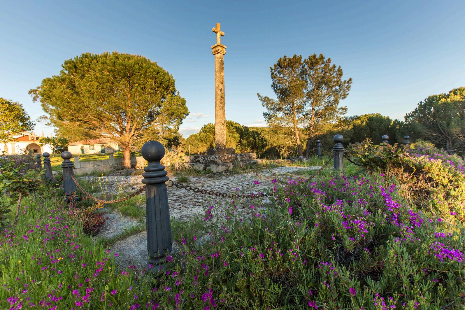
9. DOUBLE CENTENARY CRUISE
The date of its construction is unknown, but everything points to have been erected in the year 1840. In 1940, the year in which Salazar, taking advantage of the celebrations of the "Double Centenary of Nationality" (Foundation of Nationality in 1140 and Restoration of 1640), in order to promote of the virtues of his regime, decided to launch a set of patriotic celebrations by all the country. The socalled "Commemorations of Centennial Commemorations" were set up to build the "Independence Cruises", with the aim of multiplying the existing double centenary cruises. The double centenary cruise of Travancinha was one of those that already existed.

10. OUR LADY OF VIRTUES' CHAPEL
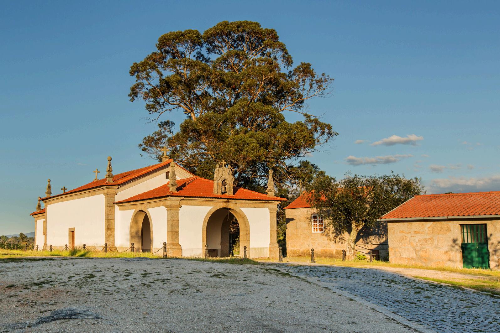
Our Lady of Virtues Chapel, was built by a nobleman from the area of the lower Mondego, in 1742.
This nobleman traveled with his family to the thermal baths of Unhais da Serra, when, passing through Travancinha, had to stop due to the sudden illness of his son. He camped on the grounds now belonging to the Brotherhood of Our Lady of Virtues, and in the days that passed there, having the death of his son imminent, he promised to Our Lady that if she cured his son, in that place, he wood erect temple in her honor The son overcame his illness and the temple was built.
Even today, during the fair of Saints, many persons arrive here coming from the region of that nobleman. Probably, this fair, is a sequence of a pilgrimage to Our Lady of the Virtues
Located between Travancinha and the adjacent André Vale, it has its annual festival, in honor of Our Lady of Virtues, on the second Sunday of August

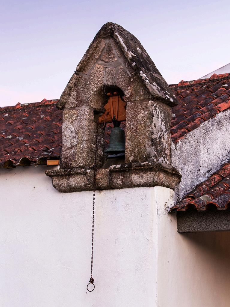
11. ST. SEBASTIAN’S CHAPEL
In this small chapel, located in the “Corro” neighborhood, you can find the image of the martyr Saint Sebastian, as well as the image of the Lord of the Steps. TRAVANCINHA DEPARTING FROM CHÃO DO RIO - GREEN FARM STAYS GPS 40º 25'15.36''N, 7º 49'16.29''W


12. PARISH CHURCH
The people of Travancinha have a strong religious nature. The village patroness is Our Lady of the Rosary, which appears in the main altar of the Parish church. Outside of this eighteenth century church, on its facade, there is a statue of St. Peter, made out of stone.


GPS 40º 24'58.01''N, 7º 49'03.74''W
GPS 40º 25'30.93''N, 7º 49'00.52''W
GPS 40º 25'23.71''N, 7º 49'40.89''W
GPS 40º 25'24.42''N, 7º 49'21.69''W
13. ALMINHAS (WAYSIDE SHRINE)
"It's following the Council of Trent (1545-1563) that the Brotherhood of Souls is created as a way to institutionalize the belief in Purgatory and enforce the belief that the souls of the dead would come out of the Purgatory much sooner if more prayers and alms were made by the living.
Portugal is the only country that has in its cultural heritage the Alminhas (a type of wayside shrine), usually located on the edge of rural roads, at crossroads, into and out of the villages. These are popular representations of Souls in Purgatory who supplicate prayers and alms.
There are many Alminhas across the country. In Travancinha there are four. Until the last century, by them passed by, the pilgrims on the way to St. Euphemia. "


14. OUR LADY OF HEALTH CHAPEL
Our Lady of Health Chapel, St Bento chapel in the past (St Bento was the patron of the military orders), belonged to the Military Detachment. A fire almost destroyed completely it and the inhabitants of Casal raised it in honor of the Lady of Health. It has its annual celebration in honor of Our Lady of Health, on Sunday of Pascoela (the Monday after Sunday Easter).


15. PILLORY
"Casal still has its pillory, built following the manueline charter. It was raised before the the former Comenda House. It is said that originally was made out of wood, as often happened throughout the Middle Ages, but that after attempted robbery, was replaced by the presente model made out of stone. "
Classified as Public Interest monument in 1933.

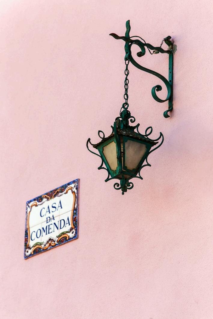
17. COMENDA HOUSE
D. Dulce, wife of D. Sancho I (King of Portugal from 1185 to 1211), was the owner of the Comenda lands. Her daughter, D. Mafalda, heir to these lands, donated them to the Aviz Order. The house and its grounds, denominated Comenda until the present, belonged to the Aviz Order (monastic military order) during three centuries.

40º 24'44.17''N, 7º 48'48.61''W
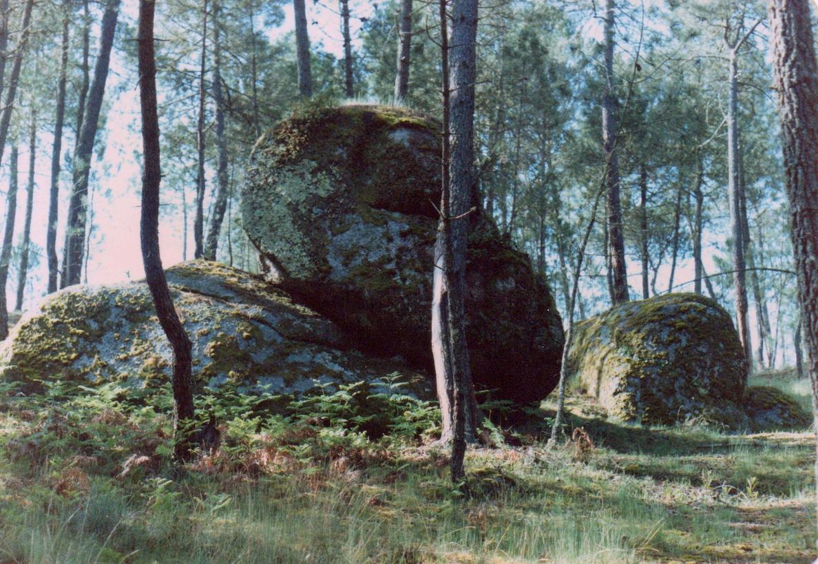
19. GALLOW'S ROCK
It is located in Casal, in a pine forest, behind a house called the Machine House. Until recently it had a ring of iron spiked into the top of the rock, where a rope was tied, that aimed to be tied around the condemned’ neck, for his execution.


21. JAIL
After the 1514 Foral, when Casal de Travancinha was considered as the county seat, and for about three centuries, the county's jail was installed in Travancinha, in the current neighborhood of Corro. From the end of the nineteenth century until the construction of the Centennial Plan schools, already in the twentieth century, it was there that the primary school functioned, before moving to private ownership.


