HERITAGE IN WALES ISSUE 70
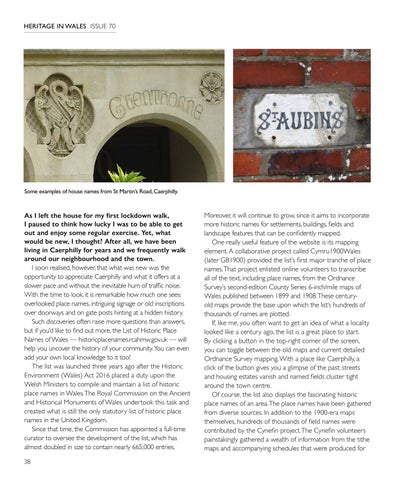
Some examples of house names from St Martin’s Road, Caerphilly.
As I left the house for my first lockdown walk, I paused to think how lucky I was to be able to get out and enjoy some regular exercise. Yet, what would be new, I thought? After all, we have been living in Caerphilly for years and we frequently walk around our neighbourhood and the town. I soon realised, however, that what was new was the opportunity to appreciate Caerphilly and what it offers at a slower pace and without the inevitable hum of traffic noise. With the time to look, it is remarkable how much one sees: overlooked place names, intriguing signage or old inscriptions over doorways and on gate posts hinting at a hidden history. Such discoveries often raise more questions than answers, but if you’d like to find out more, the List of Historic Place Names of Wales — historicplacenames.rcahmw.gov.uk — will help you uncover the history of your community. You can even add your own local knowledge to it too! The list was launched three years ago after the Historic Environment (Wales) Act 2016 placed a duty upon the Welsh Ministers to compile and maintain a list of historic place names in Wales. The Royal Commission on the Ancient and Historical Monuments of Wales undertook this task and created what is still the only statutory list of historic place names in the United Kingdom. Since that time, the Commission has appointed a full-time curator to oversee the development of the list, which has almost doubled in size to contain nearly 665,000 entries. 38
Moreover, it will continue to grow, since it aims to incorporate more historic names for settlements, buildings, fields and landscape features that can be confidently mapped. One really useful feature of the website is its mapping element. A collaborative project called Cymru1900Wales (later GB1900) provided the list’s first major tranche of place names. That project enlisted online volunteers to transcribe all of the text, including place names, from the Ordnance Survey’s second-edition County Series 6-inch/mile maps of Wales published between 1899 and 1908. These centuryold maps provide the base upon which the list’s hundreds of thousands of names are plotted. If, like me, you often want to get an idea of what a locality looked like a century ago, the list is a great place to start. By clicking a button in the top-right corner of the screen, you can toggle between the old maps and current detailed Ordnance Survey mapping. With a place like Caerphilly, a click of the button gives you a glimpse of the past: streets and housing estates vanish and named fields cluster tight around the town centre. Of course, the list also displays the fascinating historic place names of an area. The place names have been gathered from diverse sources. In addition to the 1900-era maps themselves, hundreds of thousands of field names were contributed by the Cynefin project. The Cynefin volunteers painstakingly gathered a wealth of information from the tithe maps and accompanying schedules that were produced for


