Mapping Flood Defense Infrastructure in Tribeca, SoHo, Civic Center and Little Italy
Planning Methods | Graduate School of Architecture, Planning and Preservation
Camila Botero (cb3785), Lance Mikhail Punay (lrp2143), Inneke Rizky Rachmawati (ir2453), & Catharina Utami (cku2103)
December 2022
Contents
History and Background
Research Question
Methodological approach
Data Collection and Analysis
Results and Findings
Final Recommendations
History and Background
Research Question
Methodological approach
Data Collection and Analysis
Results and Findings
Final Recommendations
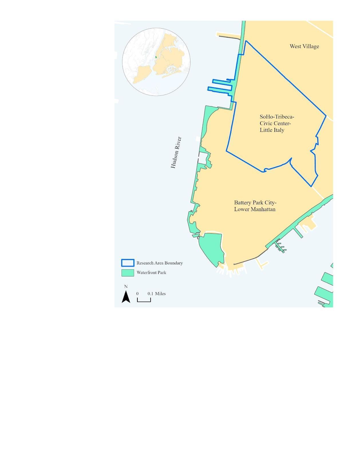
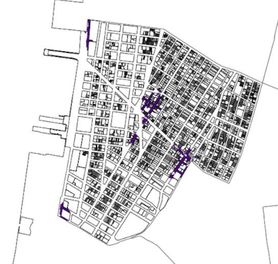
Located in Lower Manhattan, Tribeca, Soho, Civic Center and Little Italy is a neighborhoodwhosenameisanacronymfor“TriangleBelowCanal”
Bounded by Canal Street in the north and Lower Manhattan in the south, the neighborhoodconsistsofover80%ofcommercialactivities.
The waterfront development area is part of the Hudson River Park which includesPier25,26,34,andTribecaUpland.
 Figure 1 (left) . Tribeca, SoHo, Civic Center and Little Italy Neighborhood Boundaries by Neighborhood Tabulation Area (NTA)
History and Background
Research Question
Methodological approach
Data Collection and Analysis
Results and Findings
Final Recommendations
In 2020, the total population in the study area neighborhood had increased by nearly 5%. This neighborhood has a density of 49.2 people per square mile, whichindicatesahigh-densityandpopulousarea.
Compared to New York City’s Median Household Income in 2020 ($66.907), Tribeca'sMedianHouseholdIncomeisalmostthreetimeshigher($200.000).
The neighborhood has 11.342 housing units with an average household size of 2,26peoplepersquaremile.
The population of 30-34 years and 35-39 years together had the highest percentageof33%.Thispercentageisalsohigherthanthecitywide.
Compared to Citywide data, the study area neighborhood has a significantly low rate of residents below the poverty level. Citywide and Tribeca percentage of residentsbelowthepovertylevelis17,3%and2%respectively.
The most dominant race in the study area is White, which accounted for two-thirds of its population and doubled the Citywide percentage. The Asian, Hispanic,andBlackpercentages,are12%,11%,and6%,respectively,lower than theCitywidepercentage.
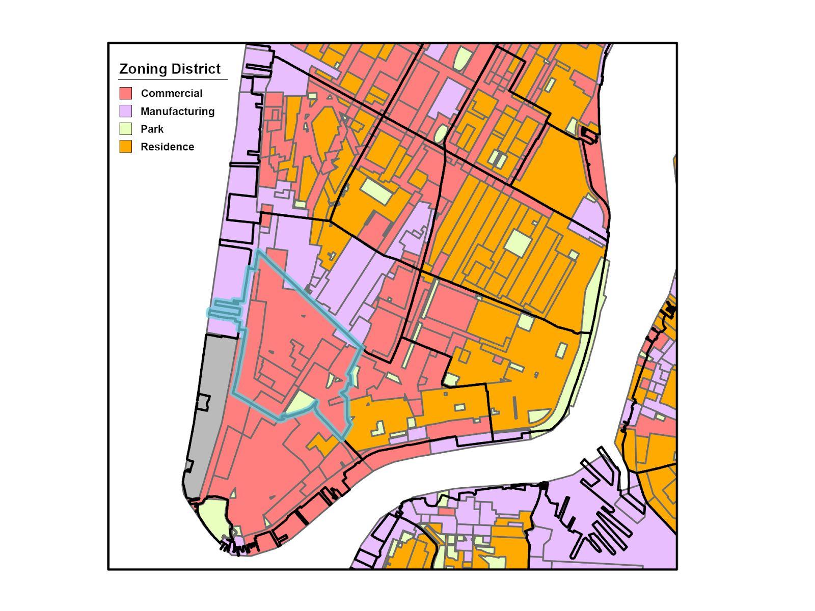
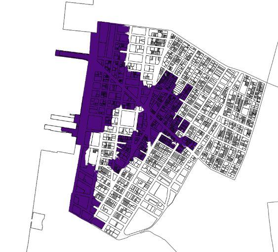
Figure 2. Study Area Neighborhood Zoning District
Research Question
Methodological approach
Data Collection and Analysis
Results and Findings
Final Recommendations
Purpose: understand the current level of preparedness of the study area Neighborhood (Tribeca, SoHo, Civic Center and Little Italy) against the risk of projectedmidtermsealevelriseandfloodinducedbyclimatechange. The preparedness against climate-related hazards such as sea level rise and flood is defined from the state of current infrastructure relevant to climate resilience,planningpoliciesinplace,andmitigationplansinthestudyarea.
What are the available flood defense infrastructures that can prevent direct damage to the study area?
Methodological Approach
Data Collection and Analysis
Results and Findings
Final Recommendations
Literature Review
Taking into account a report written by Rebuild by Design and One
Architecture & Urbanism: Toward a Rainproof New York City: Turning the Concrete Jungle into a Sponge.
Conveyance systems:
Drainage pipes, streets, and blue belts that direct the water flow to be retained or detained by permeable surfaces

Detention systems:
Approach to store water temporarily during a high precipitation event, such as green roofs, park space, bioswales, berms, sunken courts, and sunken green space.
Retention systems:
An area that stores water on a more permanent basis, like ponds, reservoirs, and streams
Building protection:
Structures or elements to protect the built environment such as seawalls, revetments, bulkheads, breakwaters, subway protection, tunnel protection, power plant protection, and floodproofing.
Methodological Approach
Data Collection and Analysis
Results and Findings
Final Recommendations
Quantitative
Method Qualitative Method
Geospatial Analysis: Multiple Criteria
Decision Analysis
Interviews
Methodological Approach
Data Collection and Analysis
Results and Findings
Final Recommendations
Quantitative Method
Geospatial Analysis: Multiple
Criteria
Decision Analysis
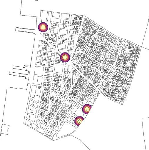
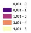
Conveyance systems
• NYC Sewer system
Detention systems
• NYC Open space
• Street tree Census Retention systems
• NYC Hydrography
Building protection
• NYC Hazard Mitigation plans
Flood Hazard
• Sea-Level rise and Floodplain Projection
• Waterfront access Map
New York City Spatial Data
• US Census Bureau by NTAs
• NYC Census Blocks
• Borough Boundaries
Decision Layers
Methodological Approach
Data Collection and Analysis
Results and Findings
Final Recommendations
Interviewees
Qualitative Method
Interviews
Conor Allerton
• Director of Land Use and Housing - New York City Council (District 1 )
Thaddeus Pawlowski
• Managing Director at the Center for Resilient Cities and Landscape
• Adjunct Associate Professor at Columbia University Graduate School of Architecture, Planning and Preservation
Zoe M. Kim
• Environmental Educator of Hudson River Park
Data Collection and Analysis
Results and Findings
Final Recommendations
Euclidiandistance
Decision Analysis
Multiple Criteria
Euclidiandistance
Kerneldensity
Conveyance systems
NYCSewersystem
Detention systems
Greenopenspace
Euclidiandistance
Euclidiandistance

StreettreeCensus Retention systems
NYCHydrography
Building protection
NYCHazardMitigation
Flood Hazard
NYC Flood plain
Sea level rise
x
x
x 1 x 4 x 4 x 1 + + + -
3
2
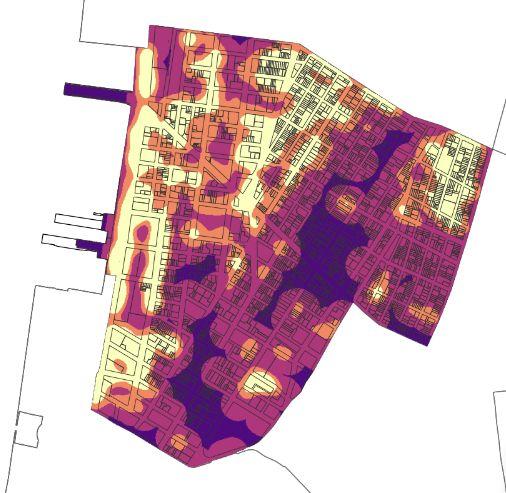
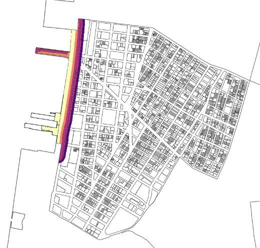
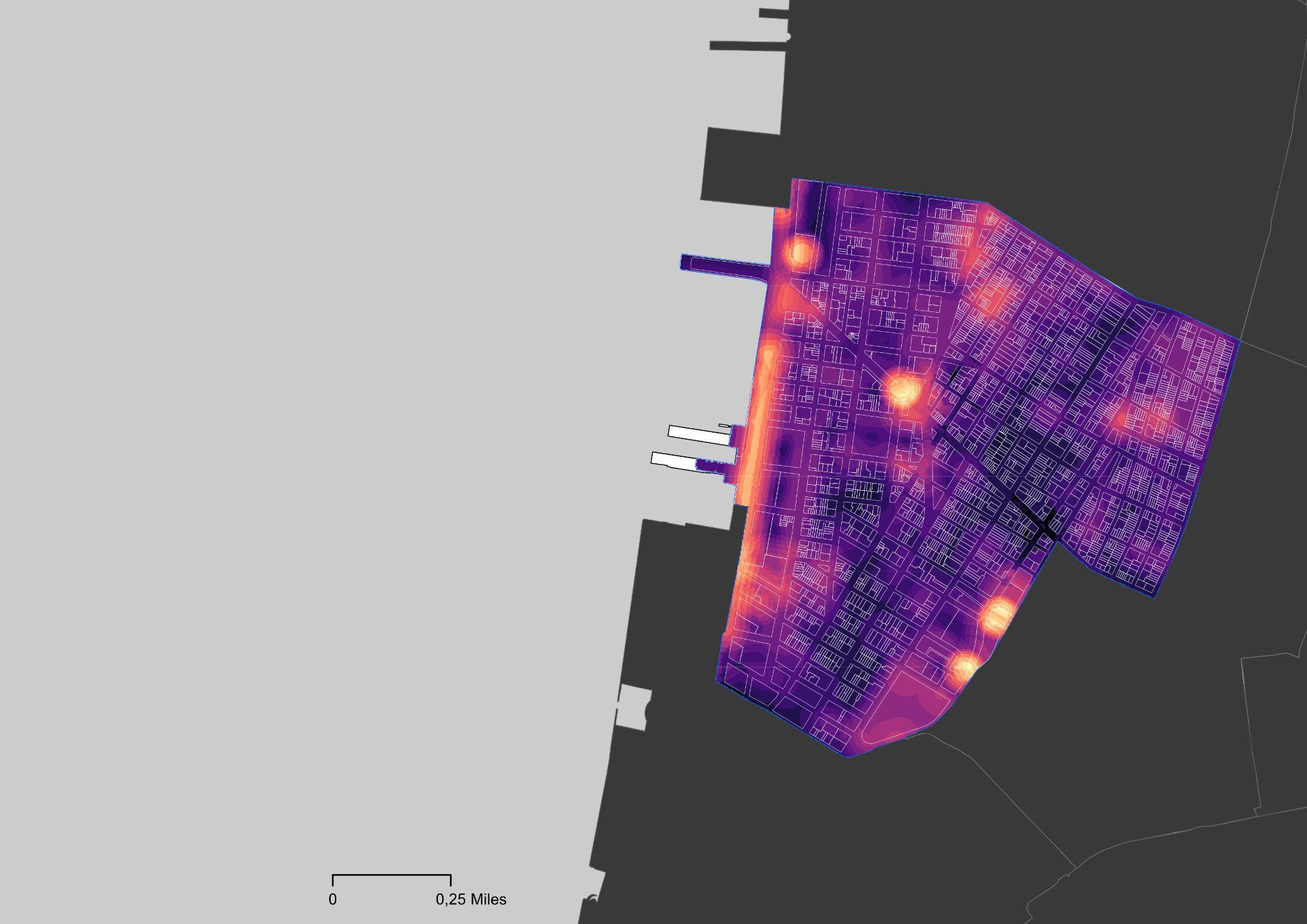
Ranked and Weighted Maps for 2020 and 2050
An example of weighted strategies sourced from Conor Allerton
Data Collection and Analysis
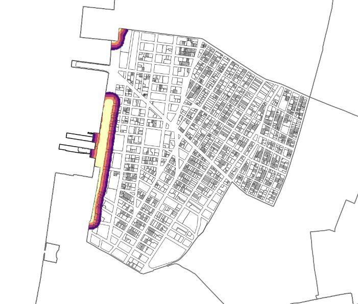
Conveyance Systems
NYC Sewer system
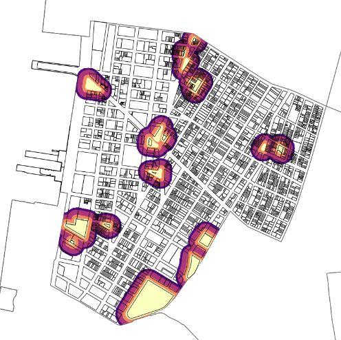
Detention Systems
NYC Green Open Space
Detention Systems
NYC Street Tree Density
Retention Systems
NYC Hydrography
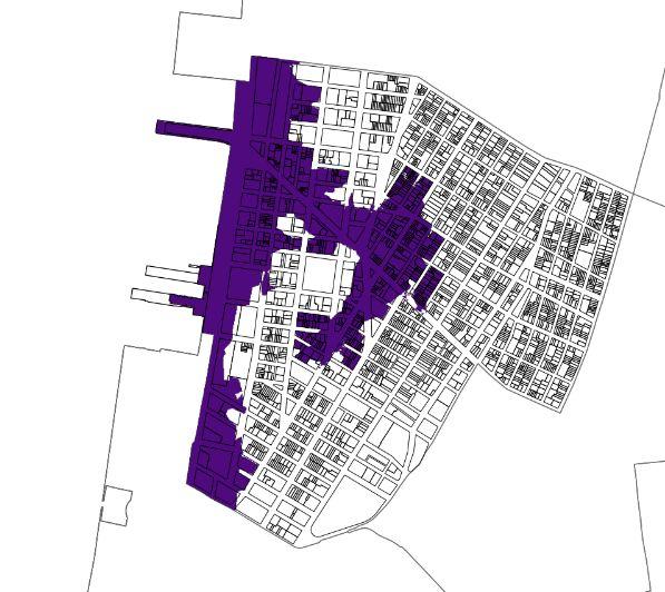


Building Protection NYC Hazard Mitigation Flood Hazard Stormwater (2020) Flood Hazard Sea Level Rise (2020) Decision Layers & Map Algebra (2020) + + + + -x 3 x 2 x 2 x 4 x 4 1 2 3 4 5
Data Collection and Analysis
Conveyance Systems
NYC Sewer system
Detention Systems
NYC Green Open Space
Detention Systems
NYC Street Tree Density
Retention Systems
NYC Hydrography
Building Protection NYC Hazard Mitigation Flood Hazard Stormwater (2050) Flood Hazard Sea Level Rise (2050) + + + + -x 3 x 2 x 2 x 4 x 4 1 2 3 4 5
Layers & Map Algebra (2050)
Decision
GIS
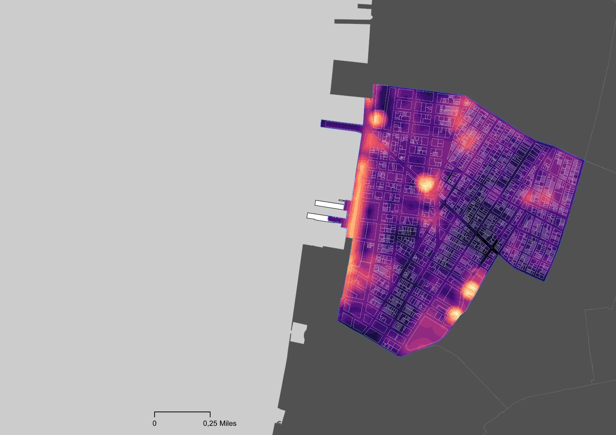
Results and Findings Final Recommendations
(Map Results) 2020 2050
Multicriteria decision map
Multicriteria decision map
Results and Findings
Final Recommendations

The qualitative study conducted provide insights of other initiatives which contributed in reducing the risk of flood to the study area.
The Tribeca Habitat Enhancement Project works on the restoration of the Eastern oysters (Crassostrea virginica) to the Hudson River Estuary. Oyster reefs naturally perform storm surge attenuation, the process by which complex structures catch and reduce wave energy during storms to reduce wave energy that can prevent flood waters from entering the city’s streets.
The City officials also facilitated Zoning Amendment for Coastal Flood which aims to incentivize retrofitting through zoning bonuses and grants, while making sure property owners can financially implement resiliency measures to their buildings.
Community engagement and participation is key to achieving better outcome to the resiliency initiatives.
Figure 3. Oyster Gabion Installment, Hudson River Park (2021)
Final Recommendations
The findings of the study provide further insight about flood-defense infrastructure into the surrounding areas that will be impacted by the sea level rise and storm surge in long-term projections from 2020 and 2050. The spatial model resulting from this research could also be replicatedinotherneighborhoodsacrossthecity.
Control and mitigation planning as well as advance and preventative planningshouldgohandinhandwithparticipatoryplanning.
Themapresultsaddasapointofconsiderationforfuturetenants andpropertyownersinthedecision-makingprocessoccurringduring determiningthefloodinsurance.
ConveyanceandBuildingProtectioninfrastructuresplayasignificant roleinmitigatingtheflood.Otherthanthat,floodproneareascouldalso adoptthenature-basedfloodpreventivemeasuressuchasputtingoysters inwaterecosystemasthebreakwaters.