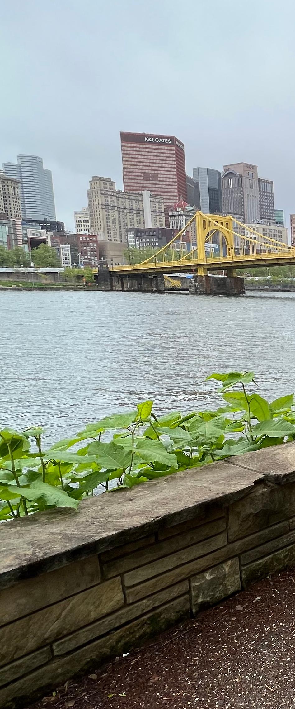
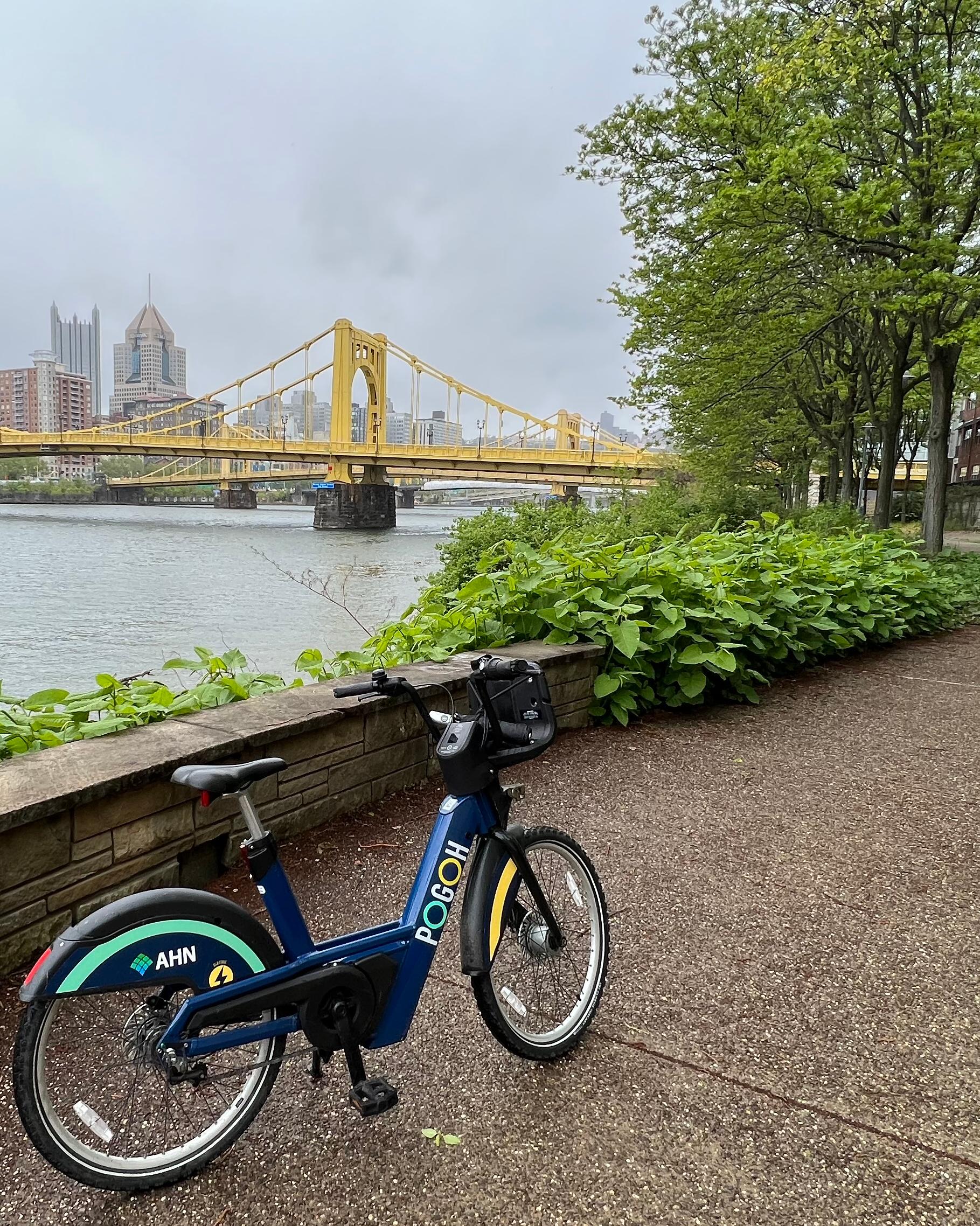
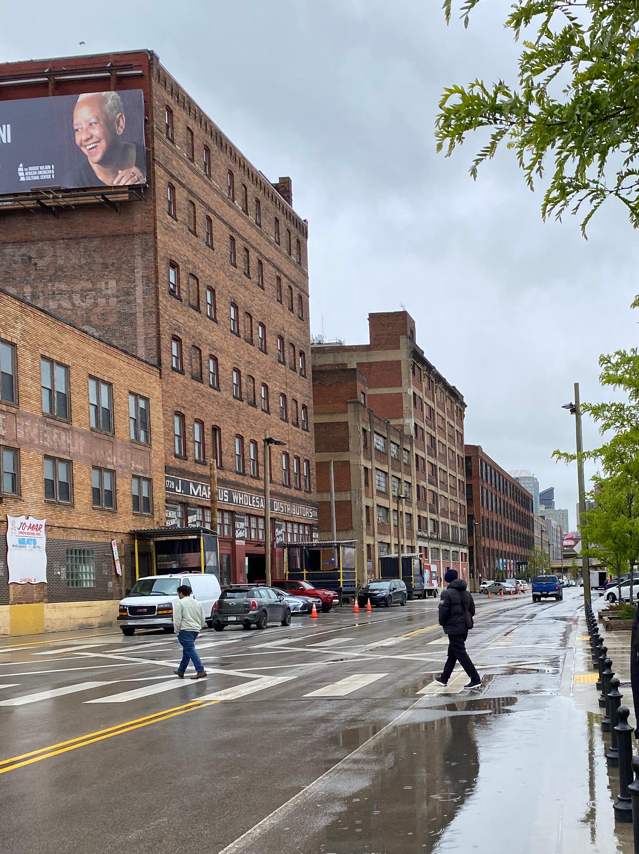
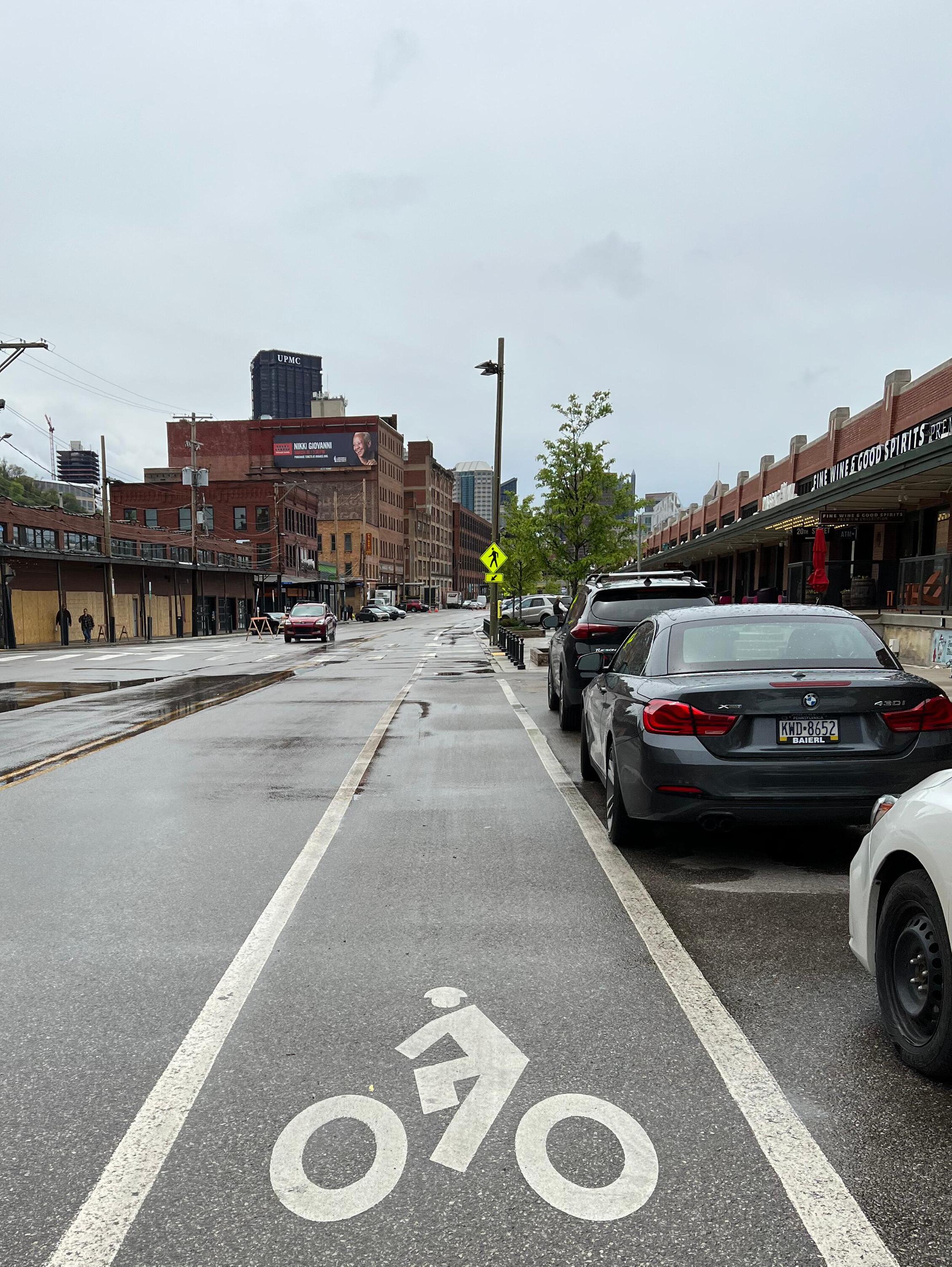
Strip District Mobility: Urban Design Solutions for a Safer Transportation Experience

Page 1


Strip District Mobility: Urban Design Solutions for a Safer Transportation Experience

University of Michigan, Graham Sustainability Institute

2023 Dow Fellows Team 3 in collaboration with 3R Sustainability

Ann Arbor, Michigan and Pittsburgh, Pennsylvania

December 2023

Members of the 2023 Dow Fellows Team 3

Brianna Bartelt, MArch

Charles Collins, MPP

Audrey Dombro, MPP, MURP

Gautam Mathur, MS

Griffin Sproul, MURP

Project Partner

Jana Lake, MBA, SEP, CSR-P, WELL, LEED, GRI

Faculty Advisor

Kit McCullough, MAUD

Strip District Affiliates

Strip District Neighbors

3R Sustainability

Table of Contents

Executive Summary

Introduction

The Strip District, a vibrant and growing area of Pittsburgh, faces mobility challenges that hinder the safety of community members and its environmental sustainability. After exploring prominent options for circulation and pedestrianization, we propose a focus on street-level urban design interventions with an emphasis on the District’s most unsafe intersections.

To assist in this process, we have mapped the crashes in the District in connection with the Vision Zero models and provided an inventory of potential interventions with analysis. We have also created a map of the Strip District that highlights its surface parking lots to showcase the area’s auto-centric focus and the unharnessed potential for other forms of mobility.

By sharing the stories of Strip District community members, we hope that our work will renew a commitment to a human-centric focus of urban design for the Strip District.

01 Background

01.1 Strip District History

The Strip District in Pittsburgh, Pennsylvania, is a place with rich history that is steeped in an industrial past that contributed significantly to the city’s growth and character. Once home to foundries, the wholesale shipping industry, and vibrant markets, the land uses in the Strip District have evolved over time in response to economic pressures. The area’s distinct charm, history and legacy businesses have made the Strip District a popular locale for Pittsburghers and tourists alike.

01.2 Growing Pains

The Strip is currently in a period of rapid growth. In the last five years over 2,000 residential units have been constructed and an additional 2,000 are planned to become available in the next five years. This scale of development combined with a surge of high-tech businesses in the area has accelerated mobility challenges caused by outdated street networks.

01.3 Mobility Issues

The Strip’s mobility challenges are the result of a complicated web of interconnected problems. Misaligned streets, a high influx of vehicles weaving through the district, and the subsequent hunt for parking spaces create a streetscape that is challenging for users of all modes to navigate. Moreover, poorly maintained and missing sidewalks add to the hazards, forcing pedestrians into the street to dance with traffic. This convergence of issues results in high greenhouse gas emissions and significant threats to public safety, including bike accidents, car collisions, and incidents where pedestrians are injured.

01.4 Sustainability Implications

Mobility in the Pittsburgh Strip District is an environmental problem that presents an opportunity for transformative sustainability. Roughly 18% of Pittsburgh’s greenhouse gas emissions are generated by vehicle traffic within the city (City of Pittsburgh, 2019). Automobiles worsen water and air quality, accelerating climate change and resulting in health concerns including asthma and allergies. Pittsburgh’s industrial heritage and historical production of automobiles as well as car-centric urban planning have ingrained a culture of dependency on cars for transportation that urgently must be disrupted to improve environmental outcomes. Addressing urban mobility as an environmental issue is critical for building a more sustainable, livable, and resilient Strip District.

As the district’s population and visitor numbers swell, the demand for safe and efficient travel solutions has become increasingly urgent. Recognizing the historical context and previous efforts to address these issues, it becomes clear that the Strip District community members need to be co-designers and leaders in solutions. Instead of relying solely on technical and design solutions, this paper advocates for community collaboration and co-design as a means to foster meaningful change. By engaging with the community, we aim to highlight the human aspects of the district’s paths of travel, conveying the unique challenges faced by its residents and visitors.

Figure 1: G.M. Hopkins & Co. (1900). Real estate plat-book of the city of Pittsburgh: from official records, private plans and actual surveys, Volume 3.

01 Background

To facilitate this dialogue, the authors of this paper have developed visualizations of what an easier to navigate Strip could look like. These visualizations are not meant to be definitive solutions, but rather a step in the right direction toward incorporating the travel challenges of a diverse group of visitors into the built environment. The insights guiding these visualizations are drawn from real conversations with the people of the Strip District, whose perspectives have been anonymized to protect their identities. Their experiences and ideas provide invaluable input into the potential transformations that can enhance the district’s mobility while preserving its historical character.

02 People Profiles

02.1 Mitchell

Mitchell, a Pittsburgh resident since the early 90s, regularly traverses on his bicycle through the Strip on his way to and from work downtown. An enthusiastic Strip District shopper, Mitchell stops in the Strip to load up on fresh produce in his bicycle cargo baskets but admits that he doesn’t always feel welcome as a bicyclist. The ride through the Strip is a hodge-podge of turns, sidewalks, and some green lanes, and Mitchell says it lacks a safe and ‘intuitive’ route for cyclists. Mitchell shares that when biking on Smallman, sometimes motorists have yelled at him.

02.2 Julio

Julio, a recent arrival to Pittsburgh, lives in Lawrenceville and works for a company in the Strip District. Sometimes he bicycles into the Strip and other days he takes the bus. When he’s feeling social, Julio meets up with friends after work at one of the Strip’s bars to grab drinks. He would spend more time in the Strip if the grocery stores were open late enough for him to shop after work. When he visits to buy groceries on Penn or houseplants at a shop in the Terminal, he usually drives in on the weekends. Having lived in other cities, Julio is surprised that parking in the Strip is free on the weekends, and says he would take transit more if parking was not free. Driving in the Strip, Julio says it would be “easy to hit a pedestrian” because motorists “floor it” despite posted speed limit signs.

02.3 Cassandra

Cassandra is a proud Pittsburgher and current resident of an adjacent neighborhood. When she’s looking for something to do, she often ends up in the Strip District, stocking up on meats, cheeses, and wines. She parks at the Terminal or in a paid lot and groceries are often her first stop, but she usually can’t resist sipping a drink at one of the many bars in the Strip after the shopping is complete. Cassandra loves the Strip because she can spend a full day there. She has not taken public transit before because she says it is “inconvenient”.

02.4 Bill

Bill has been employed in the Strip District for decades. He relies on the bus to take him from the west end to get to work. He’s seen the Strip District change over time and mourns the loss of the vibrant produce businesses that once lined the corridor. Bill says the store he works in is most busy on Sundays. He doesn’t think the Strip District needs to change but he admits he would like to see a convenience store.

Figure 3: Pedestrian Crossing on Smallman, April 2023

02 People Profiles

02.5 Sarah

Sarah is a young Pittsburgher who is a barista in the Strip District and a college student. She does not live in the Strip District, so she drives to work regularly for her commute. She parks behind the coffee shop where she works for free, or sometimes pays for street parking. Although she is not opposed to riding the bus to work, she feels driving herself is most convenient. Sarah admits that there are safety issues related to cars in the Strip District, citing cars driving the wrong directions on one-ways and people often parking in the road to run quick errands. She stated it is common for drivers to not pay for street parking. In fact, during a ten minute conversation with Sarah, there were around five drivers stopped nearby who did not pay for parking and blocked the street.

02.6 Christine

Christine has worked in the Strip District for over 25 years. She is a long-time, 60year resident of a Strip-adjacent neighborhood. To get to the Strip District for work, Christine usually rides the bus and has only positive comments about her public transportation experience. Lately, she has been hitching a ride from a friend who drops her off and picks her up at the northern edge of the Strip District, and then she walks about a mile to get to her job. She feels that parking along Penn Avenue cannot go away because it is necessary for the success of this stretch of businesses. When asked about the newly developed street infrastructure along nearby Smallman Avenue, she felt indifferent about its impact on pedestrian safety and business.

02.7 Lucille

Lucille is both a resident and business owner in the Strip District. Most of Lucille’s customers are not residents of the Strip Districts and usually make a day or half day trip to the Strip District. As a business owner who benefits from connectivity to and within the Strip, Lucille feels that more pedestrian-centered infrastructure, as well as an inter-Strip District transportation system could encourage more people to visit the Strip District.

Figure 5: PRT Riders, April 2023

03 Transportation Context

03.1 Defining the Problem

Parking spots along each street of the Strip District encourage private vehicle transportation to and within the Strip District. As Julio and Cassandra mentioned, the convenience of using a personal vehicle cannot be resisted as the Strip District most days provides enough space for parking needs. However, several days of the year during events, holidays, and some weekends, the Strip District becomes short on parking due to the high demand, which can lead to dangerous conditions for pedestrians and frustrations for motorists. Parking lots further away from the Strip District are underutilized because of the perceived lack of convenience.

“the convenience of using a personal vehicle cannot be resisted as the Strip District most days provides enough space for parking needs.” See page 12 for more

Current bus routes provide low access to the center of the Strip District and hold a negative stigma for some visitors like Cassandra who go to the Strip District frequently but for others like Bill and Christine, provide an essential service. The bus route along Liberty Avenue does not connect efficiently enough with the center of the Strip District, causing some people to avoid using the bus. Others mention the inconvenience of bus schedules as a reason for taking their own personal vehicle to the Strip District. It is simply easier for those visiting to operate on their own schedule rather than wait for a bus that is somewhat disconnected from the place they are trying to reach, further exacerbating the heavy car usage and lack of pedestrian safety.

03.2 Circulator

The concept of a Circulator, or shuttle service, directly serving the transit needs of people within the Strip District has existed for decades. However, the feasibility of a circulator remains in question regarding potential ridership and funding resources. As the Strip District continues to grow in population and popularity, the current street and transportation infrastructure may not fit the needs of the residents and people visiting there.

A circulator would be able to bridge this gap between areas in the outer regions and the center of the Strip District. Therefore, the need for personal vehicle travel directly into the center of the Strip District would be reduced if drivers were willing to park further away and use the Circulator to bring them to the center, providing a safe and sustainable transportation option during busy periods. For visitors like Cassandra, who are already parking farther away and ditching their cars to immerse themselves in the Strip District experience, a circulator might substitute for their movement on foot. For visitors downtown, a circulator with a route coming directly to and from mobility hubs such as Penn Station to the Strip District might discourage traffic congestion in the neighborhood.

Figure 6: Above is a depiction of the land cover of the strip district that is used by surface parking. Our map shows surface parking lots and does not include available street parking.

03 Transportation Context

A circulator would provide a transportation option between Liberty Avenue and the river, which is where most of the Strip District attractions are located. Stops along a circulator route would also be located closer to the attractions, which would serve as an encouragement for people to use this alternative method of transportation compared to personal vehicles. Clear signage and consistent schedule timing would be necessary to convince potential riders; otherwise, existing sentiment toward bus routes could persist with a circulator concept.

Even though the circulator concept has been discussed heavily in the past, there still needs to be more action toward pursuing it as a mechanism to increase connectivity and safety throughout the Strip District. However, the City of Pittsburgh is presently conducting a circulator feasibility study in the Strip District to identify possible ridership, operation details, and funding mechanisms (City of Pittsburgh, 2022). The long-term success of a circulator hinges on whether residents and visitors would actually consider this transit option as a viable replacement for personal vehicle travel to the Strip District, which is an established norm that will be difficult to replace over a short period of time.

03.3 Open Streets

Open Streets focuses on events that temporarily close streets to cars and make them available to pedestrians only. Streets that are designed to be easily walkable allow pedestrians and bicyclists to travel safely throughout certain areas of the city free of cars while also reducing emissions. In Pittsburgh, there are three Open Streets events yearly, with one taking place in the Strip District which is viewed partially as a hindrance and unnatural to local residents and businesses. The one-time event sequence does not cater to the business activity or long-term pedestrian safety according to some Strip District community members as event-goers may not engage with the neighborhood compared to a normal day or weekend. A combination of streets designed for people on a human level promoting walking or biking with long-term consistency could be more sustainable for local Strip District engagement.

The underlying ethos of Open Streets provides critical lessons for the Strip. Many benefits arise from streets free of cars. Less traffic congestion means people can use infrastructure in more sustainable ways, such as by foot and bicycle, that are otherwise unavailable or dangerous because of vehicles while also decreasing air and noise pollution. Since the Strip District is growing and lacks adequate public meeting spaces, such as a park or community center, open streets provide an opportunity for both new and existing residents to gather, increasing the social landscape of the neighborhood and working toward the normalization of pedestrian activity.

On the other hand, business owners indicated the Open Streets initiative and restrictions on car usage have decreased their sales. Because the Strip District is largely known for both its multigenerational and up-and-coming businesses, open streets appear to be a non-starter for the business community when discussing plans to help the neighborhood become more sustainable and safer for pedestrians. Some interviewees mentioned that car usage is mandatory for the economic success of the Strip District and options for deprioritizing personal vehicles would be met with stark resistance.

However, this point is not shared among all businesses. Lucille, a business owner in the Strip District, mentioned that more pedestrian-focused street initiatives might actually help their sales because it would encourage both residents and visiting customers to congregate for longer around the neighborhood without the fear of negative impacts posed by cars. However, as a one-time event that deviates from the norms of the community, Open Streets as it exists annually does not provide the consistent approach to safety that is sorely needed.

“more pedestrian-focused street initiatives might actually help their sales because it would encourage both residents and visiting customers to congregate for longer around the neighborhood without the fear of negative impacts posed by cars.” See page 14 for more

04 Addressing Safety & Mobility

04.1 Strip District Safety Background

The Strip District faces a safety crisis that threatens vulnerable road users. Between 2018 and 2022, there were 444 crashes in the Strip District. Alarmingly, the majority of crashes in the Strip District that affected pedestrians and cyclists occurred in daylight. Further, this statistic likely does not reflect all incidents because by law, police only have to report bicycle crashes if there is either an injury or a bicycle is towed (Bike Pittsburgh, 2016). The Strip District’s vibrancy as a business district and growing residential community is put at risk by daily safety hazards within its boundaries. As many residents and visitors shared, the Strip District experience relies on a thriving business district that is dense and walkable, making each business inviting. When faced with similar safety concerns, other cities have turned to Vision Zero for a commitment to an end to traffic fatalities and serious injuries and for a robust method to get there.

04.2 What Is Vision Zero?

Vision Zero is a road safety program that seeks to eradicate traffic-related fatalities and severe injuries by employing an approach that places responsibility on the infrastructure and road design. It is a comprehensive strategy that focuses on creating safer road environments by prioritizing forms of mobility, engaging with communities, and implementing effective policies and regulations. According to the Vision Zero Network (2022), the concept originated in Sweden in the late 1990s and has since gained traction in the United States. The Vision Zero approach shifts the paradigm from accepting road fatalities as inevitable to viewing them as preventable

through systemic changes and a commitment to safer road design and traffic management. As per the National Highway Traffic Safety Administration (NHTSA, 2019), Vision Zero strategies emphasize engineering, enforcement, education, and evaluation to prioritize safety over speed and convenience.

04.3 Why Commit to Vision Zero?

While the City of Pittsburgh Department of Mobility & Infrastructure (DOMI)’s stated goals align with the Vision Zero agenda, the City should make a firm commitment to Vision Zero in order to begin a process of knowledge sharing, collaboration with cities facing similar challenges, and further access to grants and funds. DOMI’s Goal 1 is that no one dies or is seriously injured traveling on City streets (City of Pittsburgh, 2022). In this stated aim, DOMI has already signed off on one of the Vision Zero tenets, to prevent fatal and serious crashes (Vision Zero Network, 2023). The remainder of the Vision Zero tenets lay out the concrete strategy for achieving this aim. While DOMI’s goals centralize safety, DOMI’s commitment lacks teeth without a Vision Zero approach.

One such Vision Zero tool is the High Injury Network. By connecting road segments within Pittsburgh that consistently experience a high rate of traffic-related injuries and fatalities, High Injury Networks can help to focus resources and interventions where they are needed most, maximizing their impact on reducing crashes. Since committing to Vision Zero in 2017, the City of Philadelphia has constructed a High Injury Network and uses data to show the impact of Complete Streets

implementations (City of Philadelphia, 2023) but the City of Pittsburgh does not yet have a High Injury Network. Using inspiration from a High Injury Network model to identify hotspots, we have designated several intersections that are safety hazards— key to building a saferStrip District.

04.4 High Injury Network

The Government of Pennsylvania’s Department of Transportation publishes annual crash data with spatial information that denotes where every individual crash has occurred. To find high-injury areas in the

Figure 7: Spatial Extent of Crashes that Occurred Whithin the Strip District in 2020 and 2021

04 Addressing Safety & Mobility

Strip District, we cleaned this data for the years of 2020 and 2021 to find crashes that occurred within the Strip District, and plotted them to visualize where they occurred.

As can be seen from Figure 7, most of the accidents within the Strip District occurred on Smallman Street, Pennsylvania Avenue, and Liberty Avenue; the 3 most prominent streets in the area. Crashes occurred throughout the extent of these streets within the district. Most of these crashes occurred in proximity to intersections.

To understand which intersections are the most dangerous, we identified the closest intersection for every crash that occurred in 2021 within our area of interest. The amount of crashes associated with each intersection can be seen in Figure 8. The City of Pittsburgh could benefit from expanding such analysis to the entire city to provide a macro view.

Two intersections that had a significantly higher number of crashes near them compared to others were the intersection of 16th Street and Liberty Avenue, and the intersection of 25th street and Pennsylvania Avenue.

04.5 Inventory Analysis

While the prevalence of collisions in the Strip District is disheartening, it is important to remember these crashes are not inevitable. Motorists, cyclists, and pedestrians adjust their travel behaviors and patterns in response to the built environment and the actions of fellow users. By acknowledging these dynamic relationships, we can consider how minor adjustments to the design of the urban

streetscape have the potential to enhance safety for all.

Figure 9 is a representation of the existing conditions at the intersection of Penn Avenue and 25th Street. The intersection currently has several design features to encourage all users, but motorists in particular, to slow down. Visual cues like the intersection’s large pedestrian crossing signs and boldly painted crosswalks give road users advanced warning they need to look out for pedestrians. Tall vertical plastic posts (called delineators) placed in a half bulb shape about a car’s length before and after the intersection narrow the Penn Avenue lanes. This arrangement encourages cars to slow down before making turns and in so doing, is supposed to reduce vehicle-pedestrian and vehicle-cyclist collisions. While these street design features do slow down traffic, they haven’t been significant enough to make this intersection safer. As shown in Figure 8 Penn Avenue and 25th Street is the second most dangerous intersection in the Strip District. We think the street design and intersections’ context in the greater Strip District are part of why so many crashes happened there between 2020-2021. Penn Avenue is a one way street with two travel lanes and street parking on both sides. Penn Avenue runs the length of the district from the northeastern boundary at 35th street to the south western boundary at 11th Street. The avenue features a variety of land uses from vacant lots, multifamily residential buildings, industrial tenants and commercial retail. Many of the uses that don’t have ground level activity exist between the intersections of 35th and 25th Streets. This context combined with less

Figure 8: Intersections in the Strip District, Highlighted by the Amount of Crashes that Occurred Near Them in 2020 and 2021

04 Addressing Safety & Mobility

street activity can cause motorists and cyclists to speed up because they anticipate there are fewer reasons to stop. The ground floors of the buildings on Penn Ave between 22nd and 16th Streets are filled with activity as visitors window shop, interact with street vendors and dine looking on to the street (or dine outside in the milder months). While intersections in these blocks are not free of crashes, these are places where road users expect to see more activity. The subject intersection is also on a city designated bike route and features a sharrow. For people like Mitchell who rely on their bikes to commute this lane provides a continuous path to downtown but feels very unsafe.

Figure 10 shows the same intersection reimagined to increase safety for all users. This design prioritizes immediate and low-cost traffic calming interventions like pavement treatments, speed tables, and pedestrian signals. These simple yet effective measures can be implemented quickly to enhance road safety. Whereas the existing plastic delineators provide visual and spatial cues for motorists to slow down, speed tables force the behavior change by jostling drivers who approach them with too much speed. Ramped speed tables that span the entire width of the roadway can reduce pedestrian crashes by 45%. Speed tables placed in intersection crosswalks have the secondary benefit of elevating pedestrians which improves their safety by increasing their visibility to motorists. Continuing roadway pavement treatments like contrasting brickwork is important because it gives motorists and cyclists information about the intersection prior to their arrival which encourages

these users to pay more attention to their surroundings, reduce their speeds and be prepared to stop. Improving the lighting in the intersection will also positively contribute to these goals.

More complex and expensive changes, such as reconfiguring entire road layouts, implementing dedicated bike lanes, or redesigning intersections may be beneficial additions to the Strip District; but they require more time, resources, and community involvement to plan and execute effectively. Figure 10 demonstrates how immediate quick fixes have tangible benefits and if enacted, would send a message of the city’s continued commitment to road safety. These low-cost interventions offer a practical next step toward creating an intersection without these safety issues. With a persistent and flexible approach, the city can build public support and trust, which are critically important inputs for the creation of and implementation of more comprehensive, high-level interventions.

Figure 9: Existing Traffic Calming Interventions at the Penn Avenue and 25th Street Intersection
Figure 10: Suggested Traffic Calming Interventions at the Penn Avenue and 25th Street Intersection

05 Conclusion

As the Strip District enhances commercial and residential space and adapts to the influx of people, there will be increased pressure on the area’s mobility infrastructure. With this increased population density, it will be crucial to ensure that inviting infrastructure is set in place to help people move safely and efficiently throughout the Strip. Transformative solutions like circulators are viable methods to achieve this, but are more feasible in the longer term, and therefore do not immediately address the population influx that has already begun, as well as the mobility and safety issues that are stemming from it in the present. Making the District safer through interventions that involve a human-centered design to mobility rather than expanding vehicle infrastructure will encourage more stakeholders to bike and walk within the District, mitigating an increase in congestion and further improving mobility. Overall, this method can act as a way to reduce significant emissions from vehicular sources locally, helping the Strip be a more sustainable neighborhood.

Crashworthiness of the bollard system by experimentally validated virtual test

and Investigation of Critical Impact Point of Steel Guardrails Affecting

The Effectiveness of Selected Devices to Reduce the Speed of Vehicles on Pedestrian Crossings

Cushions A Series of Vertical Deflections, a Promising Traffic Calming Measure: Analysis and Recommendations for Spacing.

Raised Sidewalks

Abou-Senna, H., Radwan, E., & Mohamed, A. (2022). Investigating the correlation between sidewalks and pedestrian safety, Accident Analysis & Prevention, Vol. 166. https://doi.org/10.1016/j.aap.2021.106548 P, S, L $6-12 per sq ft

Curb Radius Reduction P $6-12 per sq

Federal Highway Administration. (2013). “Raised pedestrian crossings” in PEDSAFE: Pedestrian Safety Guide and Countermeasure Selection System. http: //www.pedbikesafe. org/pedsafe/countermeasures_detail.cfm?CM_NUM=7

Curb Extentions (Curb

Medians and Refuge Islands

Street Lighting

Specific Paving Treatments

Diverters

Right-Turn-on-Red Restrictions

Federal Highway Administration. (2008, September). Desktop reference for crash reduction factors, Table 11 [FHWA-SA-08-011].

Harkey, D.L., R. Srinivasan, J. Baek, F. Council, K. Eccles, N. Lefler, F. Gross, B. Persaud, C. Lyon, E. Hauer, & J. Bonneson. (2008). NCHRP Report 617: Accident modification factors for traffic engineering and ITS. Transportation Research Board. (2008). https:// www. hsisinfo.org/detail.cfm?

id=296&msclkid=e7f2deabd13d11ec98b9f689c6c127f9

S

significantly improve pedestrian safety, as most fatal pedestrian crashes occur in locations without sidewalks. A recent study conducted in Central Florida found the likelihood of a pedestrian crash per mile along roadways with no sidewalk is three times greater than when a sidewalk is present.

P $5,000-15,000 each ramped speed tables that span the entire width of the roadway – can reduce pedestrian crashes by 45%.

to $16,000 each

located in the median of a two-way street and provide a safe break point for pedestrians, have been found to reduce pedestrian crashes by 56%.

can help motor vehicle drivers see pedestrians sooner, thus providing critical additional time to avoid crashes. Overhead lighting, outside of intersections, is estimated to reduce all types of crashes by 23%. At intersections, the benefit is even greater – a 27% reduction in crashes.

$500 to $ 1,500 each

$50-200 per square yard

$5,000 to $85,000 each

$200 each

The use of WALK/DON’T WALK pedestrian signal indications at signal locations are important in many cases, including when vehicle signals are not visible to pedestrians, when signal phasing is complex (e.g., there is a dedicated left-turn signal for motorists), at established school zone crossings, when an exclusive pedestrian interval is provided, and for wide streets where pedestrian clearance information is considered helpful.

Paving treatments send a visual to motorists cue about the function of a street. They can also create an aesthetic enhancement of a street and be used to delineate separate space for pedestrians or bicyclists.

Diverters are measures used to discourage or prevent traffic from cutting through a neighborhood.

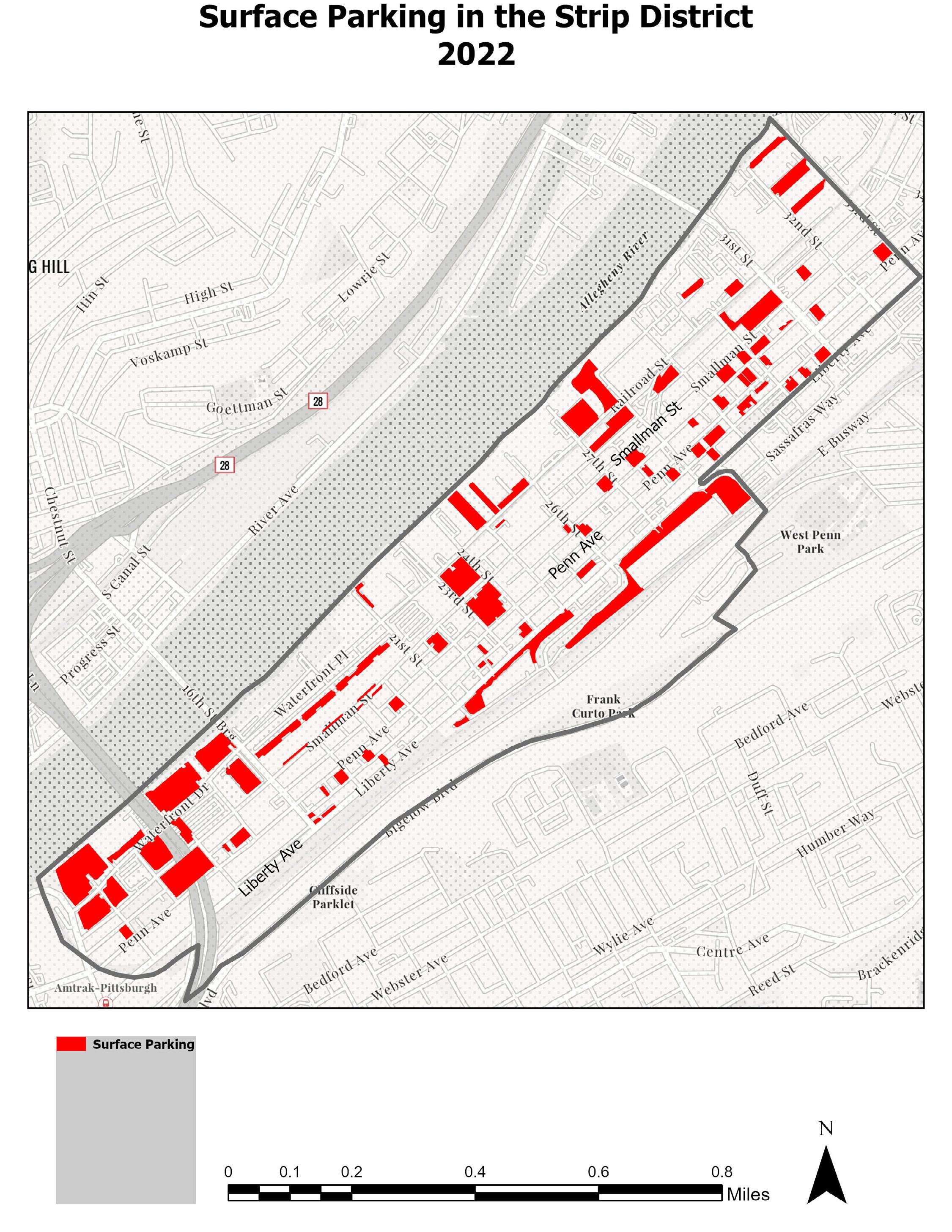
* Penn Ave (P), Smallman (S), Liberty (L) https://globaldesigningcities.org/publication/global-street-design-guide/designing-streets-people/designing-for-motorists/traffic-calming-strategies/ https://studio.mapbox.com/styles/bribarte/cllf7ed7v01oj01qnecmy6qmc/edit/#17.95/40.459095/-79.972429

Pedestrian Signals

LITERATURE REVIEW ARTICLE OVERVIEW METHODOLOGY

Getting an insight into the effects of traffic calming measures on road safety

Impacts of traffic calming interventions on urban vitality

The objective of this paper is to assess the significance of urban traffic calming and to get an insight into the safety impacts of local and area-wide traffic calming interventions enabling a better understanding and therefore ‘better-informed’ decisions on different schemes.

Safety effects of traffic calming initiatives have been analysed on a city-level for larger Hungarian cities and an in-depth research has also been carried out for a more detailed case from the capital of Hungary.

Results show that traffic calming initiatives have a very significant role in enhancing road safety of urban areas. Meanwhile the case study of Budapest explains observed effects in detail allowing for more accurate appraisal tools to be developed.

CITATION (APA)

Juhász, M., & Koren, C. (2016). Getting an Insight into the Effects of Traffic Calming Measures on Road Safety. Transportation Research Procedia, 14, 3811–3820. https: //doi.org/10.1016/j.trpro.2016.05.466

Go slow: an umbrella review of the effects of 20 mph zones and limits on health and health inequalitie

This paper seeks to answer whether the imposition of traffic and parking restrictions helps recover the loss of quality of life.

Transport is an important determinant of health and there is a well-established association between socioeconomic status (SES) and risk of road accidents. Effective traffic calming interventions such as 20 mph zones and limits may therefore improve health and reduce health inequalities.

Traffic calming for the prevention of road traffic injuries: systematic review and meta-analysis To assess whether area-wide traffic calming schemes can reduce road crash related deaths and injuries.

The concepts of urban vitality were studied to investigate the conditions that make streets and squares more lively and attractive to people. These conditions were condensed into a matrix of criteria – applied in the analysis of a set of streets in Belo Horizonte (Brazil) – classified into five categories according to the level of traffic calming that they were subjected. The relationships between each level of traffic calming interventions were evaluated, as well as the fulfilment of these conditions and the resulting urban vitality.

Systematic review methodology was used to identify systematic reviews of the effects of 20 mph zones (including speed limits and road humps) and 20 mph limits on health and SES inequalities in health amongst adults and children.

Data was collected on road user deaths, injuries, and traffic crashes. For each study rate ratios were calculated, the ratio of event rates before and after intervention in the traffic calmed area divided by the corresponding ratio of event rates in the control area, which were pooled to give an overall estimate using a random effects model.

It was concluded that the best results for the permanence of pedestrians are achieved when combining factors of quality of pedestrian areas with more restrictive levels of traffic calming.

Twenty mile per hour zones and limits are effective means of improving public health via reduced accidents and injuries. Whilst there was no direct evidence on the effects of interventions on health inequalities, targeting such interventions in deprived areas may be beneficial.

Area-wide traffic calming in towns and cities has the potential to reduce road traffic injuries. However, further rigorous evaluations of this intervention are needed, especially in low and middle income countries.

Baptista Neto, O., & Barbosa, H. M. (2016). Impacts of traffic calming interventions on urban vitality. Proceedings of the Institution of Civil Engineers - Urban Design and Planning, 169(2), 78–90. https://doi.org/10.1680/jurdp. 15.00007

Cairns, J., Warren, J., Garthwaite, K., Greig, G., & Bambra, C. (2015). Go slow: An umbrella review of the effects of 20 mph zones and limits on health and health inequalities. Journal of Public Health, 37(3), 515–520. https://doi.org/10.1093/pubmed/fdu067

Bunn, F., Collier T, Frost, C., Ker, K., Roberts I., & Wentz, R. (2003). Traffic calming for the prevention of road traffic injuries: systematic review and meta-analysis. Injury Prevention, 9 (3), 200+. https://link-gale-com.proxy.lib. umich.edu/apps/doc/A108693676/AONE? u=umuser&sid=bookmarkAONE&xid=726c2430

A qualitative study on the role of the built environment for short walking trips

The study uses a qualitative approach with the aim to identify built environmental factors influencing short walking distances for transportation among adults (18–65 years), with special attention to micro-scale attributes. Three focus groups where participants who undertook, at least once a week, one short nonshopping trip in any travel mode (were “short trip” is defined as less than 30–45 min walking distance).

A thematic analysis of the data was performed and six categories of factors emerged related to the built environment. Factors were also classified as either barriers to walking, or secondary factors related to the attractiveness of the walking experience and the pedestrian route choice.

The findings suggest that sidewalk width may not only influence pedestrian route choice but can be a barrier to walking.

Ferrer, S., Ruiz, T., & Mars, L. (2015). A qualitative study on the role of the built environment for short walking trips. Transportation Research Part F: Traffic Psychology and Behaviour, 33,

Identifying the determinants and understanding their effect on the perception of safety, security, and comfort by pedestrians and cyclists: A systematic review

Evaluating pedestrian behavior at crosswalks: Validation of a pedestrian behavior questionnaire for the U.S. population

The Effectiveness of Selected Devices to Reduce the Speed of Vehicles on Pedestrian Crossings

A Series of Vertical Deflections, a Promising Traffic Calming Measure: Analysis and Recommendations for Spacing.

Pedestrian Traffic Fatalities by State: 2021 Preliminary Data

Guide for Improving Pedestrian Safety at Uncontrolled Crossing Locations

Parking Benefit Districts

Where the Sidewalk Doesn't End: What Shared Space has to Share

Navigating Main Streets as Places: A People-First Transportation Toolkit

A Wedding for Bella

The aim of this study was to identify and systematically analyze objective and subjective determinants affecting the perception of safety, security and comfort of pedestrians and cyclists and their relationships, in order to assist in the definition of transport policies and infrastructure creation in large smart cities.

The aim of this study was to develop and validate a self-reporting Pedestrian Behavior Questionnaire (PBQ) for the U.S. population to measure frequency of risky behaviors among pedestrians. The PBQ includes 50 survey items that allow respondents to rate the frequency with which they engage in different types of road-using behaviors as pedestrians.

The main goal of this conducted research is to evaluate selected devices that will help reduce the speed of vehicles on pedestrian crossings. Many devices from a group of “speed control measures” and “mid block tools” (refugee islands, speed tables, and raised pedestrian crossings) are examined to find the most effective ones.

the aim of this paper is to analyze the adequate distance between TCMs. Various streets with variable distances and different vertical TCMs were evaluated in Poland and Spain, including raised crosswalks, raised intersections, speed humps and speed cushions.

This report includes state-provided fatality projections for all of 2021, an in-depth analysis of recently released 2020 data from the National Highway Traffic Safety Administration’s (NHTSA) Fatality Analysis Reporting System (FARS) and an overview of proven strategies states and communities are – or should consider –employing to reduce pedestrian crashes and injuries.

This document was produced by the Federal Highway Administration (FHWA) as part of the Safe Transportation for Every Pedestrian (STEP) program. STEP is part of the fourth round of Every Day Counts. STEP's purpose is to help transportation agencies address crashes by promoting countermeasures with known safety benefits at uncontrolled crossing locations.

A case study of Manhattan’s Upper West Side found that charging market prices for the currently unmetered curb spaces would eliminate 22 tons of carbon dioxide emissions per block per year and yield at least $1,025 per household per year to improve public services.

Their mission was to learn more about the Dutch approach to Sustainable Safety, bikeped accommodations and community-based transportation to support a Building Community through Transportation campaign.

Produced in partnership with Main Street America, this project provides guidance to Main Street leaders, community advocates, local officials, transportation professionals, and everyone else in between on how to: 1) Evaluate streets and transportation through the lens of placemaking, 2) Balance the needs of mobility and other street activities, and 3) Build stronger relationships with other decision-makers and the community.

The film is set in Pittsburgh's Strip District, a thriving and diverse open-air market. Part love-story to the city that serves as its setting, the film is also a loving homage to the personalities of three people who each had an impact on director Melissa Martin.

This systematic review followed the PRISMA statement guidelines and checklist (Koberg and Longoni, 2019), being the related checklist presented in Appendix A. It consisted of three methodological steps: material selection, descriptive analysis, and category identification, which allowed the identification of relevant articles on safety, security, and comfort of pedestrians and cyclists, as well as the establishment of relationships between related determinants.

The validation study was conducted on 425 participants (228 males and 197 females) between the ages of 18 and 71. Confirmatory factor analysis differentiated pedestrian behaviors into five factor categories: violations, errors, lapses, aggressive behaviors, and positive behaviors.

Measurements were carried out in several locations in Lower Silesia (south-western Poland, Figure 2). There, 105 places were selected, in four areas of different characters of spatial development: rural, small towns, medium-sized towns, and the large city (Wroc aw). In each of these places were selected: 5 refugee islands, 10 speed tables, 10–15 raised pedestrian crossings (10 in urbanized areas and 15 in rural areas) while maintaining the necessary size of the measurement sample.

Analyzed vertical TCMs included raised intersections (RI), raised crosswalks (RCW), speed humps (StF) and speed cushions (SC).

Traffic speed and density and fear of being hit negatively impact safety perception. Crime is the major security concern, whether with an emphasis on person or property. Bad weather, high air and sound pollution and slopes decrease comfort perception. Poor lighting provides a negative perception of safety, security, and comfort. Vulnerable road users should be involved in policy definition.

This research found that the pedestrian behavior questionnaire developed for the U.S. population met this objective overall. It is therefore useful to all researchers investigating pedestrian safety for all age groups.

There is a wide difference in the impact of the tested devices on speed, and so alters the effectiveness and legitimacy of their use in order to improve pedestrian safety. The greatest reduction of speed in the crosssection P0 is caused by raised pedestrian crossing, as evidenced by positive values of the relative rate of the change of speed.

Identifying the determinants and understanding their effect on the perception of safety, security, and comfort by pedestrians and cyclists: A systematic review. Transportation Research Part F: Traffic Psychology and Behaviour, 91, 136–163. https://doi.org/10.1016/j.trf.2022.10.004

Deb, S., Strawderman, L., DuBien, J., Smith, B., Carruth, D. W., & Garrison, T. M. (2017). Evaluating pedestrian behavior at crosswalks: Validation of a pedestrian behavior questionnaire for the U.S. population. Accident Analysis & Prevention, 106, 191–201. https: //doi.org/10.1016/j.aap.2017.05.020

Kruszyna, M., & Matczuk-Pisarek, M. (2021). The Effectiveness of Selected Devices to Reduce the Speed of Vehicles on Pedestrian Crossings. Sustainability, 13(17), 9678. MDPI AG. Retrieved from http://dx.doi.org/10. 3390/su13179678

Campos Ferreira, M., Dias Costa, P., Abrantes, D., Hora, J., Felício, S., Coimbra, M., & Galvão Dias, T. (2022).

Works Cited

Introducing POGOH: Pittsburgh’s Newest Bike Share Program. POGOH. Retrieved November 19, 2023, from https://pogoh.com/

Jaffe, E. (2016, February 5). Some Bike Infrastructure Is Worse Than None at All. Bloomberg City Lab. https://www.bloomberg.com/news/articles/2016-02-05/study-sharrows-might-be-more-dangerous-to-cyclists-than-having-no-bike-infrastructure

Cassidy, M. (2023, October 10). What You Need to Know About the Vision Zero Annual Report. City of Philadelphia. https://www.phila.gov/2023-10-10-what-you-need-to-knowabout-the-vision-zero-annual-report-2023

Pittsburgh Zoning Map. (Accessed 2023, November 19). City of Pittsburgh Geographic Information Systems (GIS). https://gis.pittsburghpa.gov/pghzoning/

Department of Mobility and Infrastructure; Department of City Planning. (2022). Strip District Mobility Plan. https://apps.pittsburghpa.gov/redtail/images/17111_Strip_District_Mobility_Plan-_Final_Report.pdf

ALL OF ALLEGHENY COUNTY CRASH DATA SINCE 2004 NOW AVAILABLE TO PUBLIC. (2023). Bike PGH. Retrieved November 19, 2023, from https://bikepgh.org/2016/04/28/ all-of-allegheny-county-crash-data-since-2004-now-available-to-public/

What is Vision Zero? (2023). Vision Zero Network. Retrieved November 19, 2023, from https://visionzeronetwork.org/about/what-is-vision-zero/

Kruszyna, M., & Matczuk-Pisarek, M. (2021). The Effectiveness of Selected Devices to Reduce the Speed of Vehicles on Pedestrian Crossings. Sustainability, 13(17), 9678. MDPI AG. Retrieved from http://dx.doi.org/10.3390/su13179678

Turn static files into dynamic content formats.

Create a flipbook
Issuu converts static files into: digital portfolios, online yearbooks, online catalogs, digital photo albums and more. Sign up and create your flipbook.