LANDSCAPE ARCHITECTURE
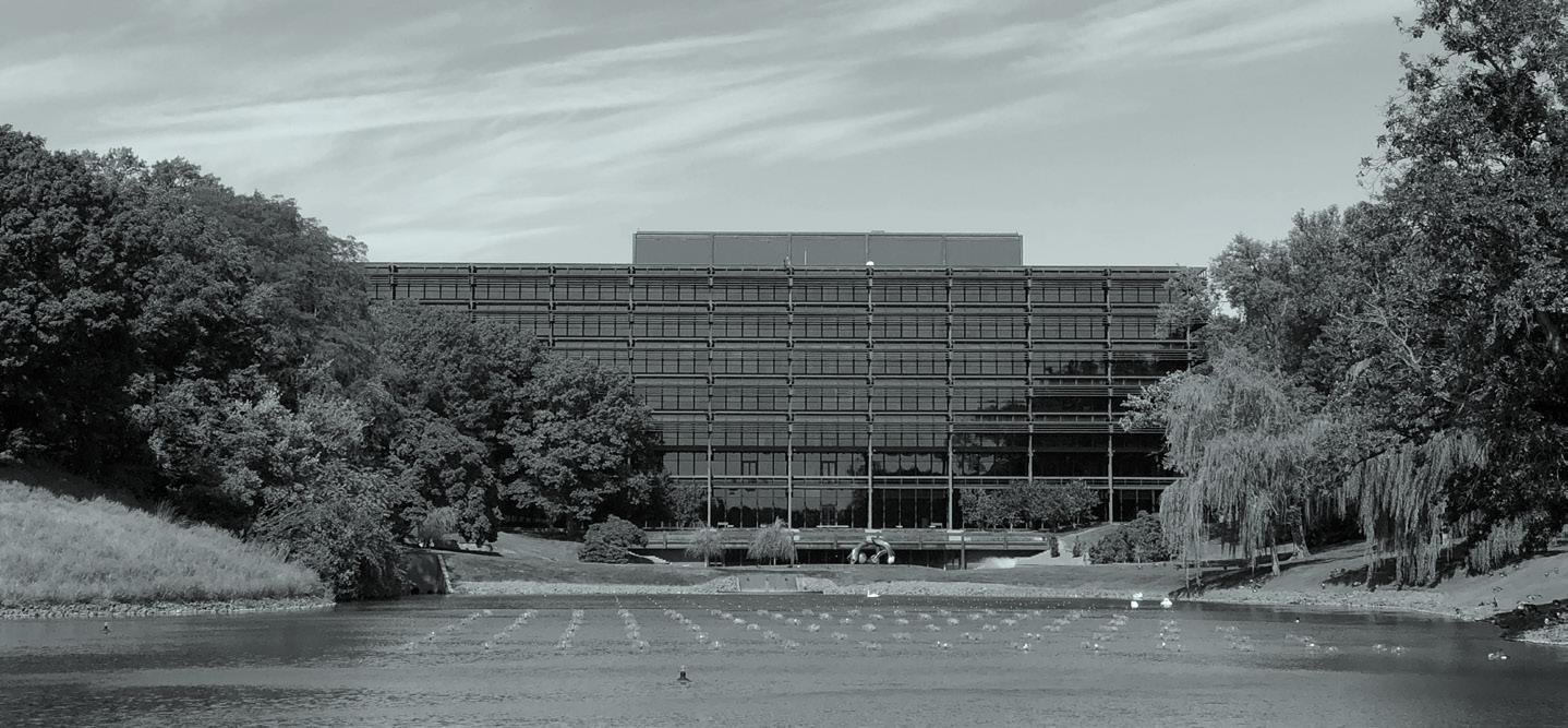
02 The Growing Bond John Deere Headquarter, Moline, IL, USA
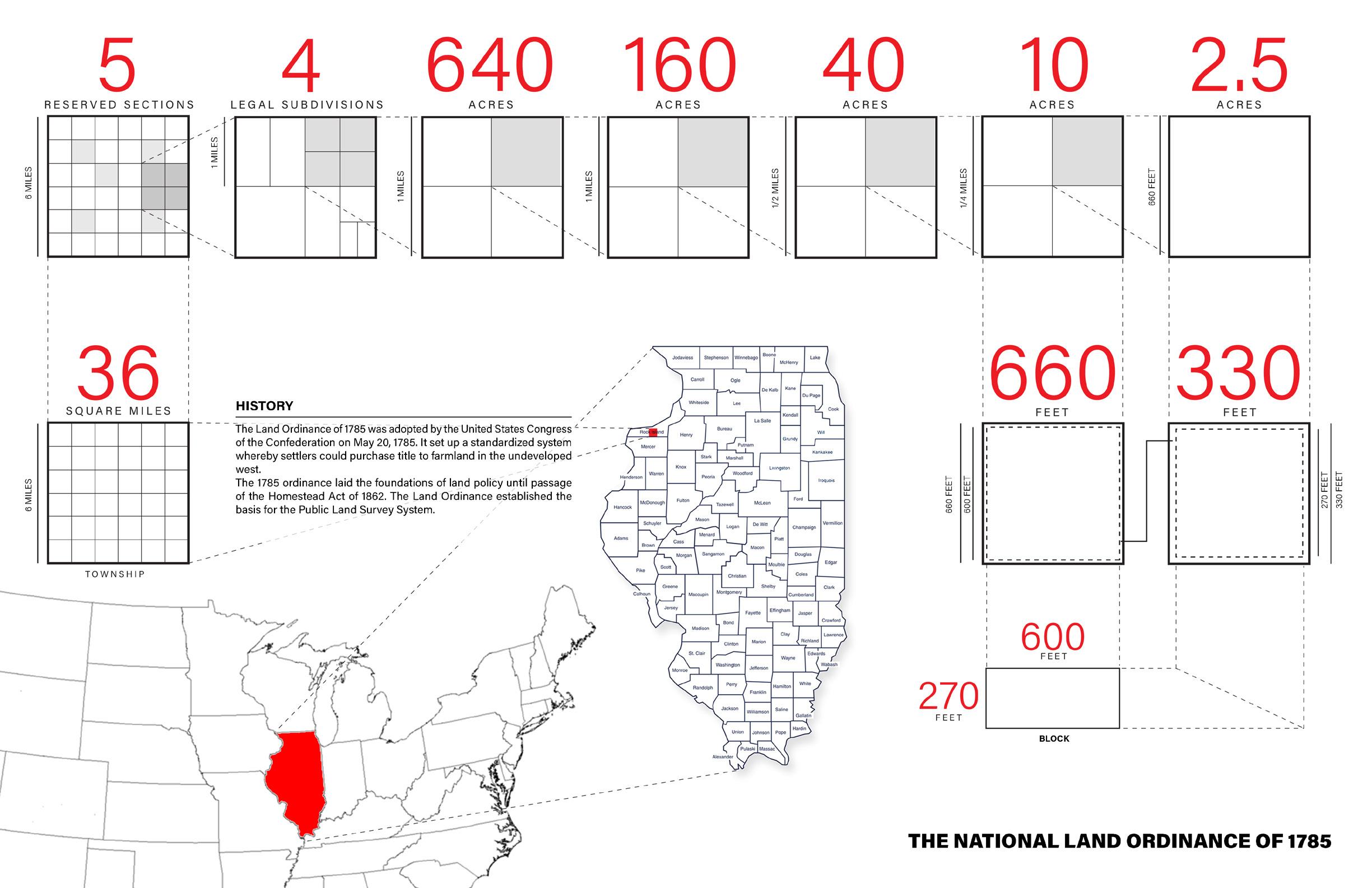
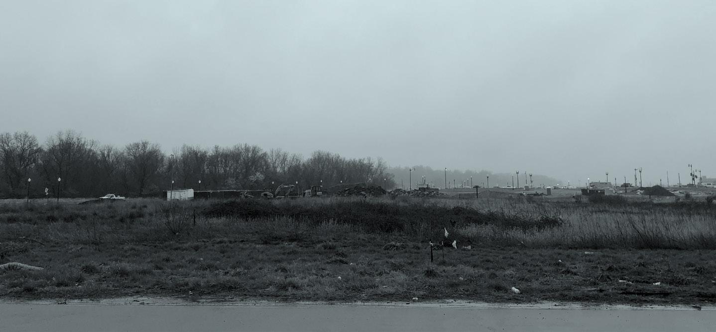
From the first aqueous stirrings of life to the dinosaurs; from man taking his first upright steps to the first wheat being planted. We have conquered the land, mountain and ocean; step by step, civilization has evolved. The wheel of time turns relentlessly, and many duties and challenges lay ahead. But now, perhaps we need to slow down, take a break and review what we have achieved. The land we live on has been measured precisely. The Jeffersonian grid, along with powerful organizations like John Deere company, has made our land easier to build and manage. But with these accomplishments come significant questions.
Should this grid system remain dominant into the future?
Should the relationship bewteen man and landscape remian the same into the future?
Perhaps new technologies can inspire a more enlightened relationship between humans and the landscape. By demonstrating the relationship among humans, landscape, and tools through time—what was, what is, and what could be—I propose to find transformational clues that will lead to new patterns and forms.
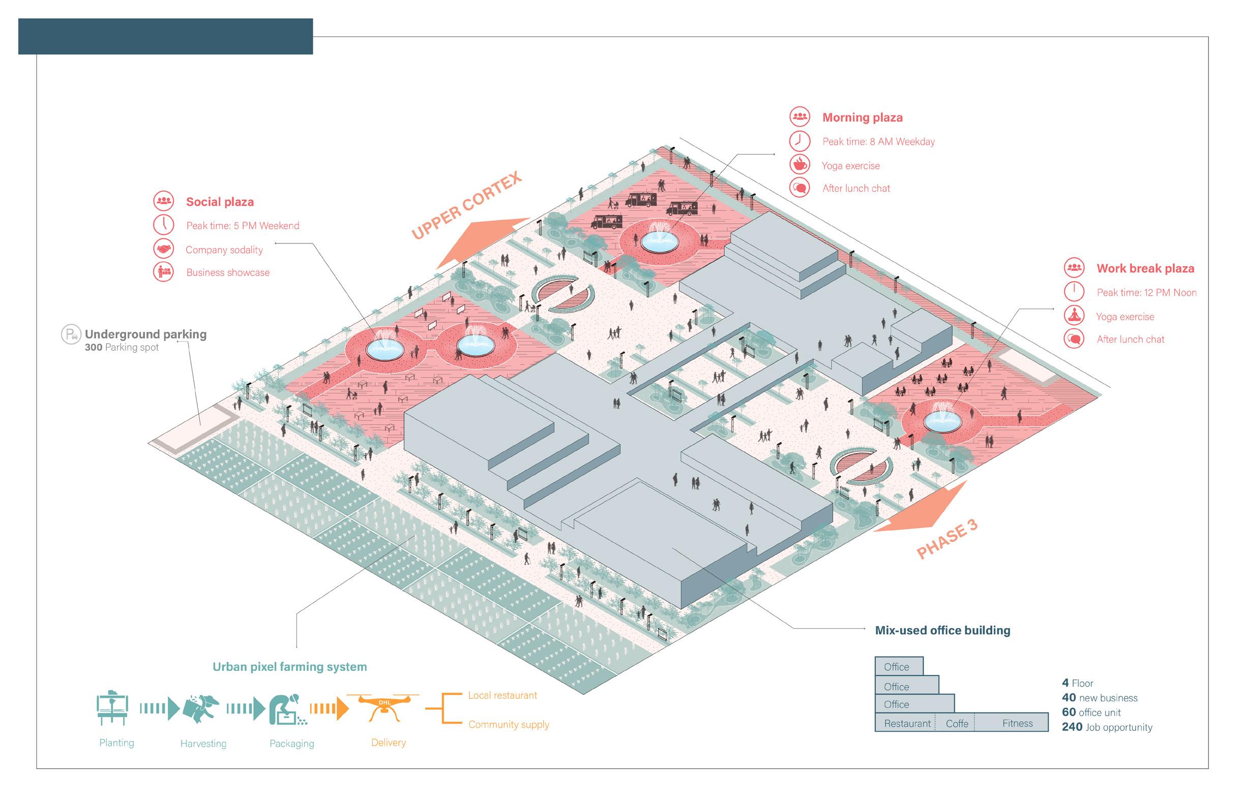
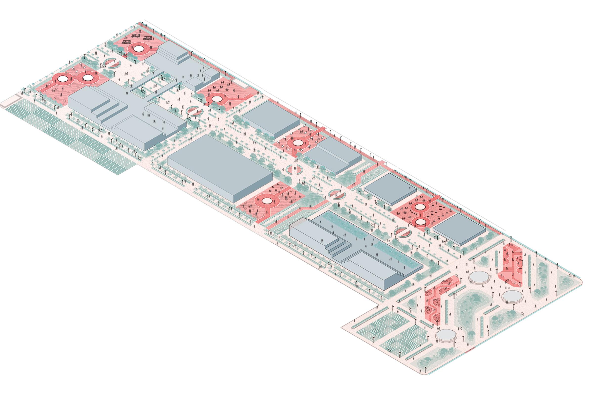
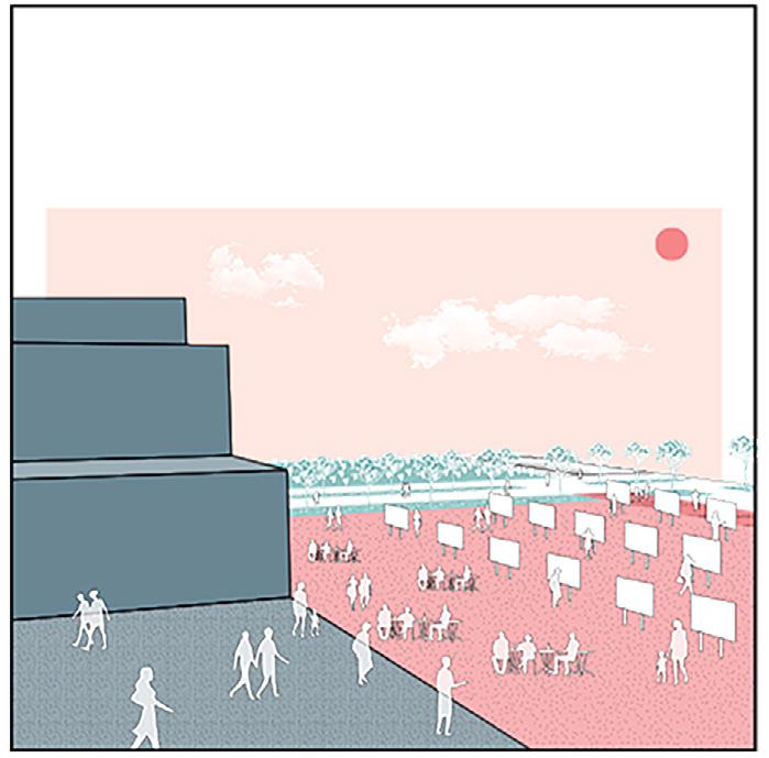
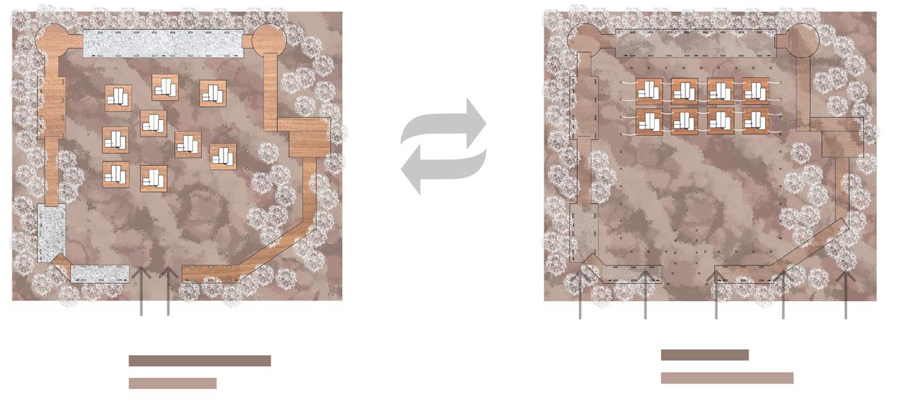
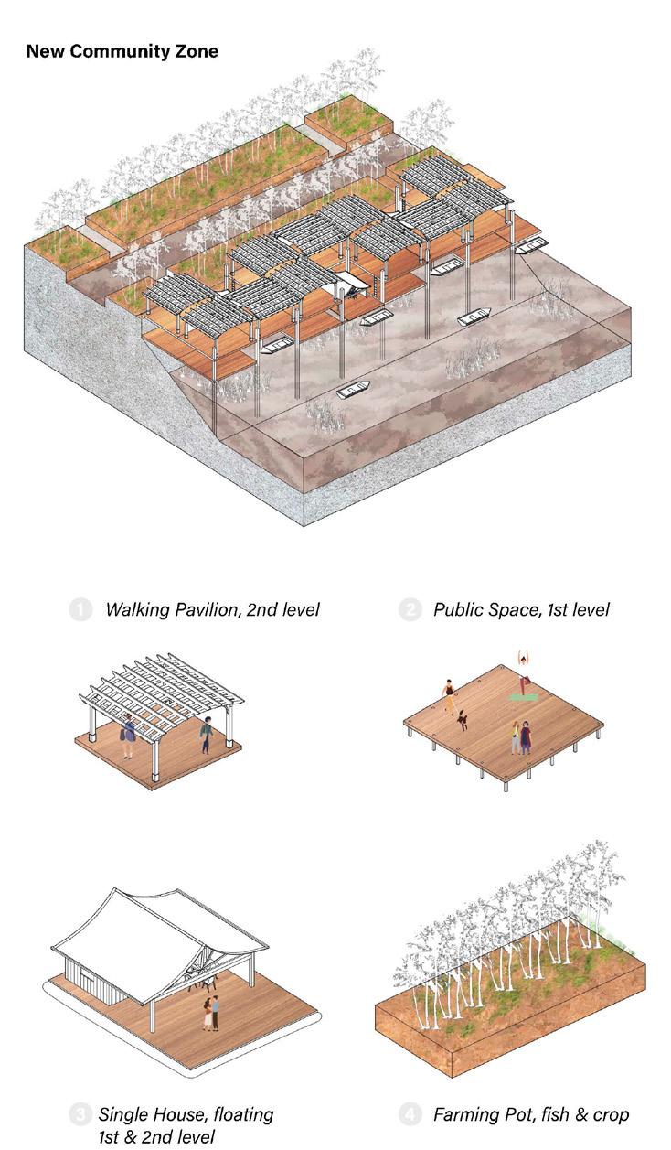
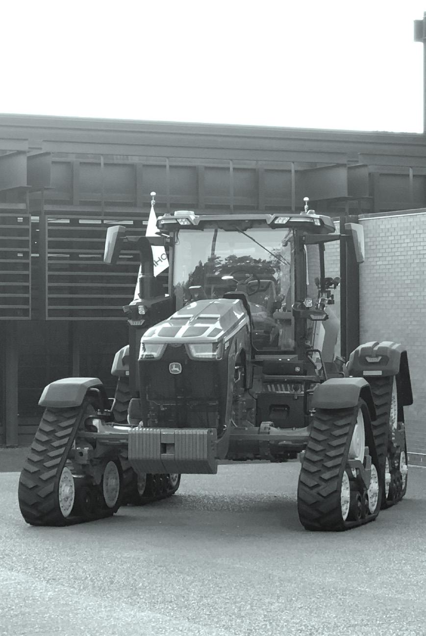
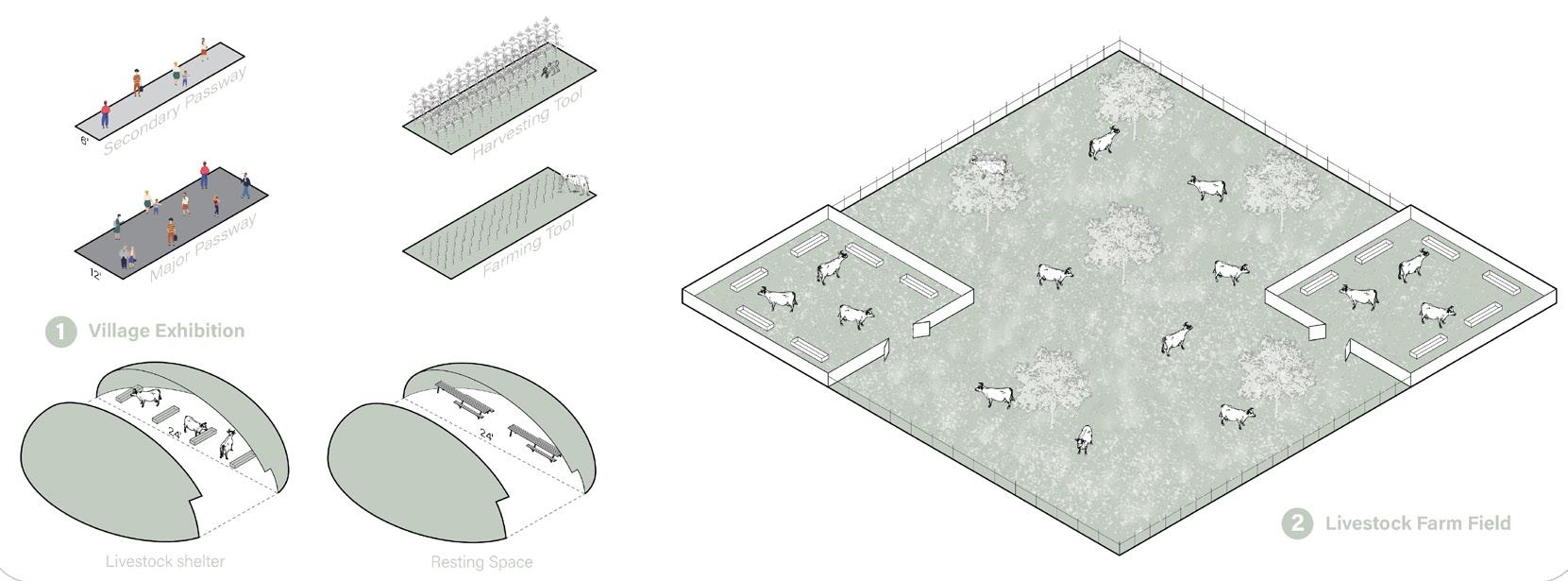
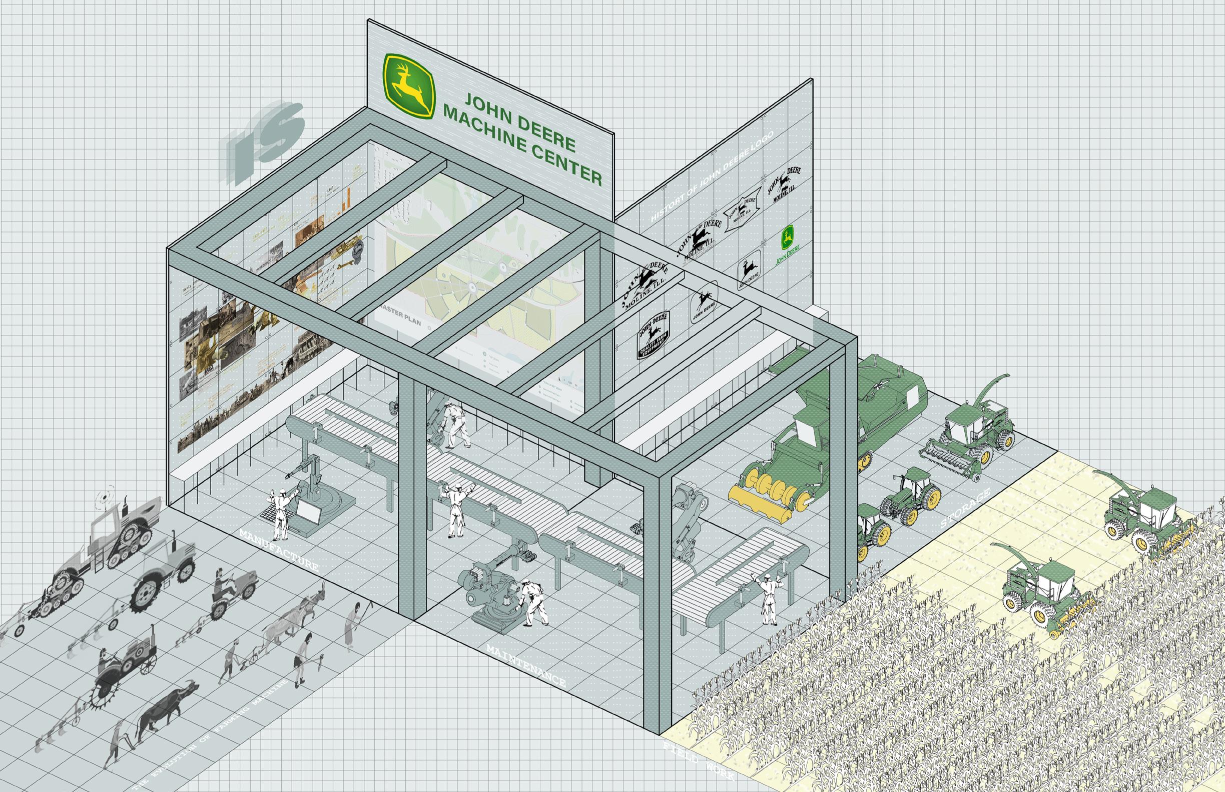
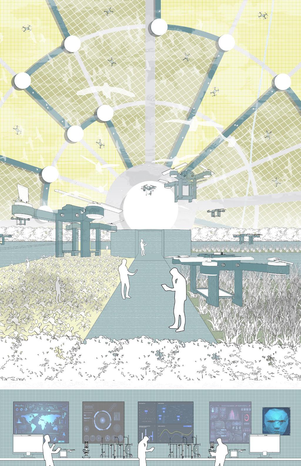
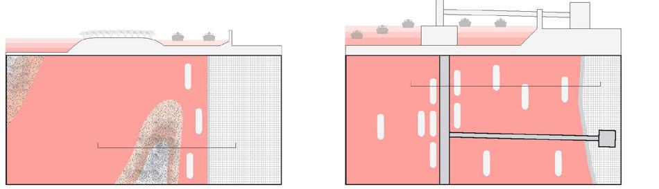
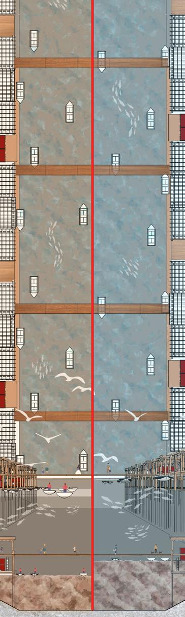
Farming machine exhibition
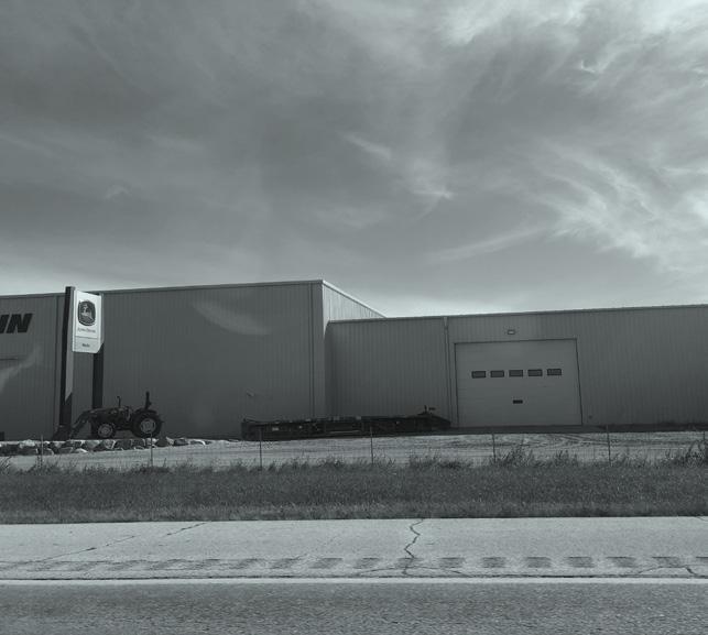
John Deere World Headquarter
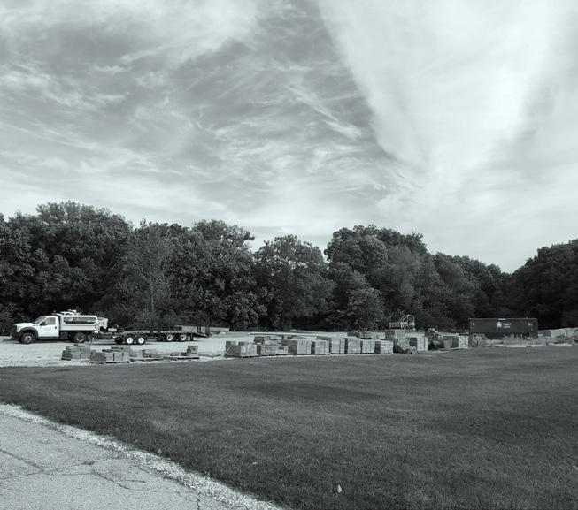
Farming machine warehouse Loading Zone
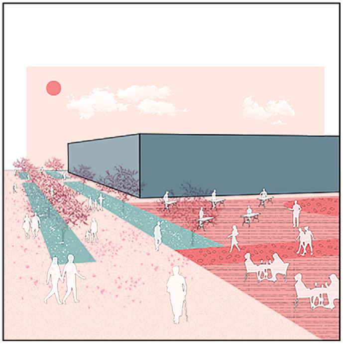
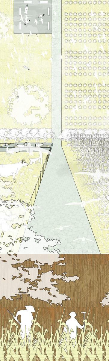
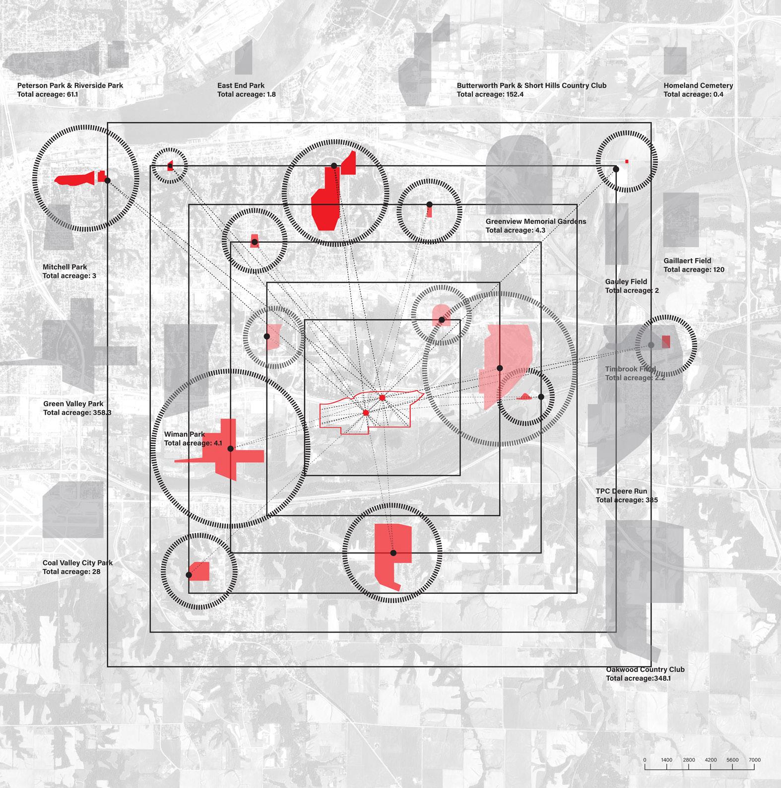 CENTER 1 Extended line of John Deere HQ’s axles wire.
CENTER 2 : Spatial center of main site.
CENTER 1 Extended line of John Deere HQ’s axles wire.
CENTER 2 : Spatial center of main site.
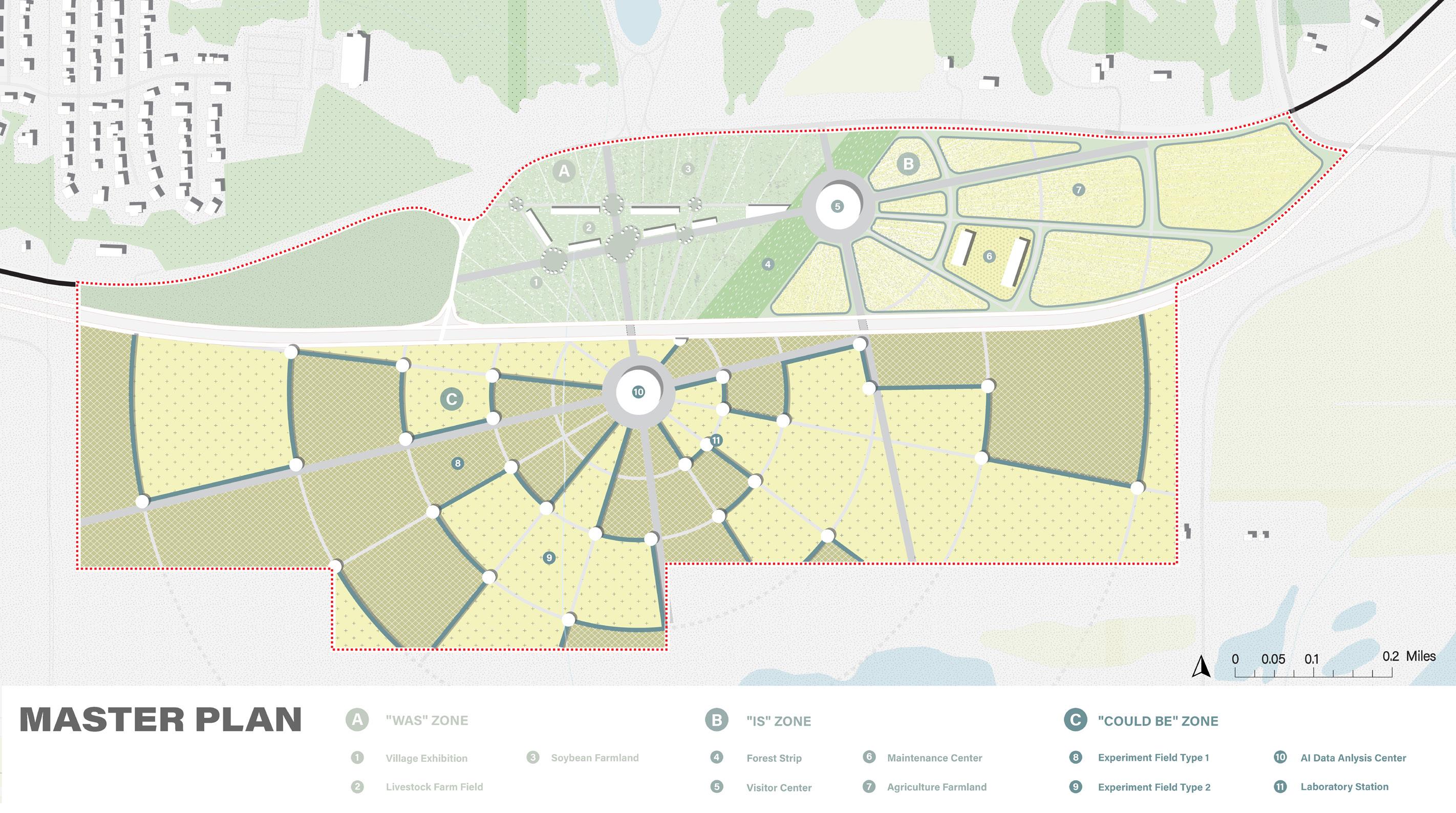
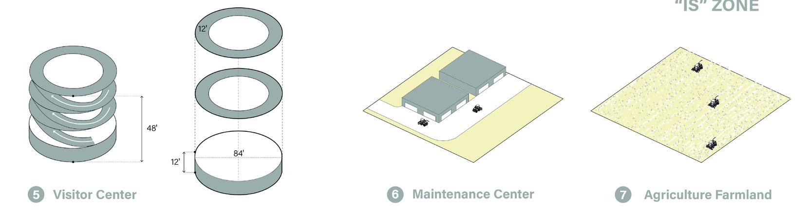
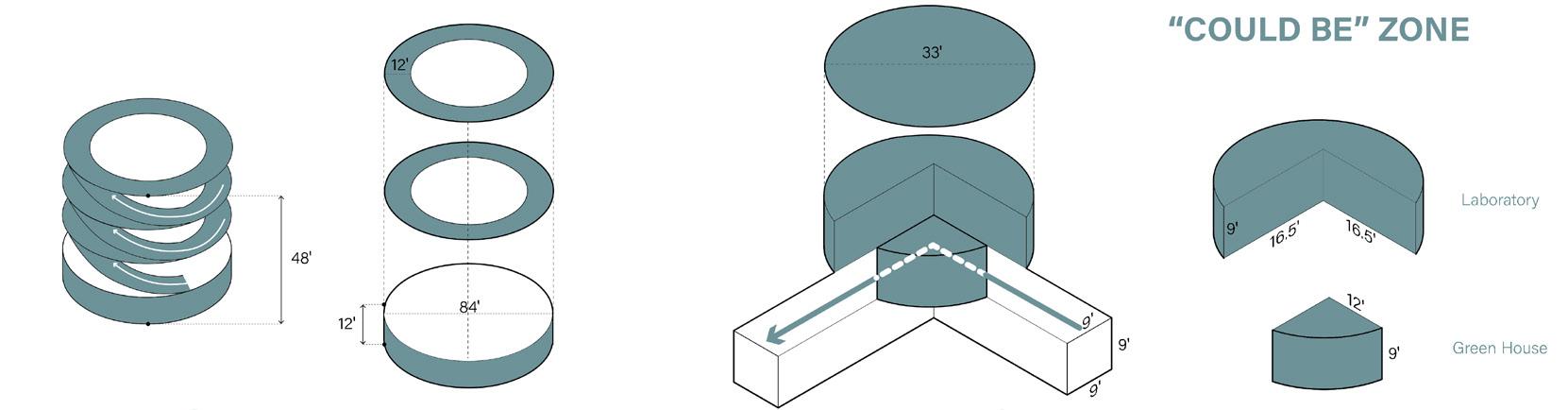
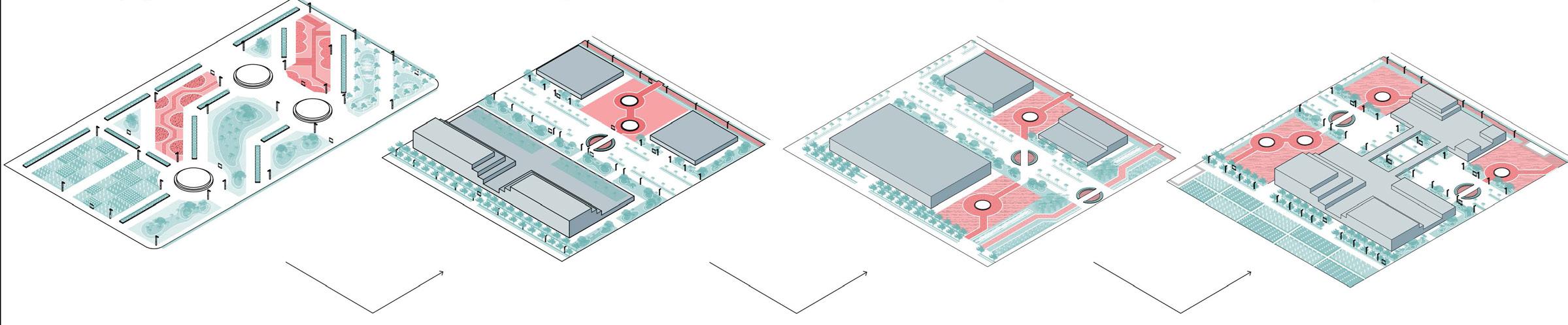
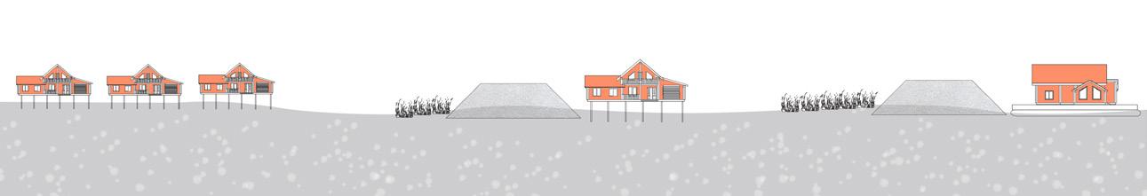
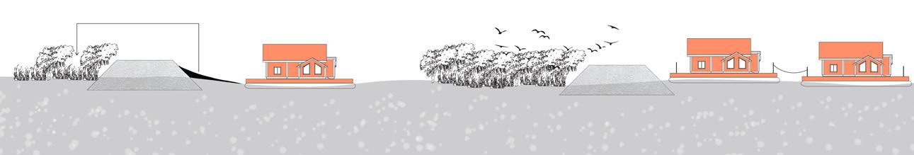
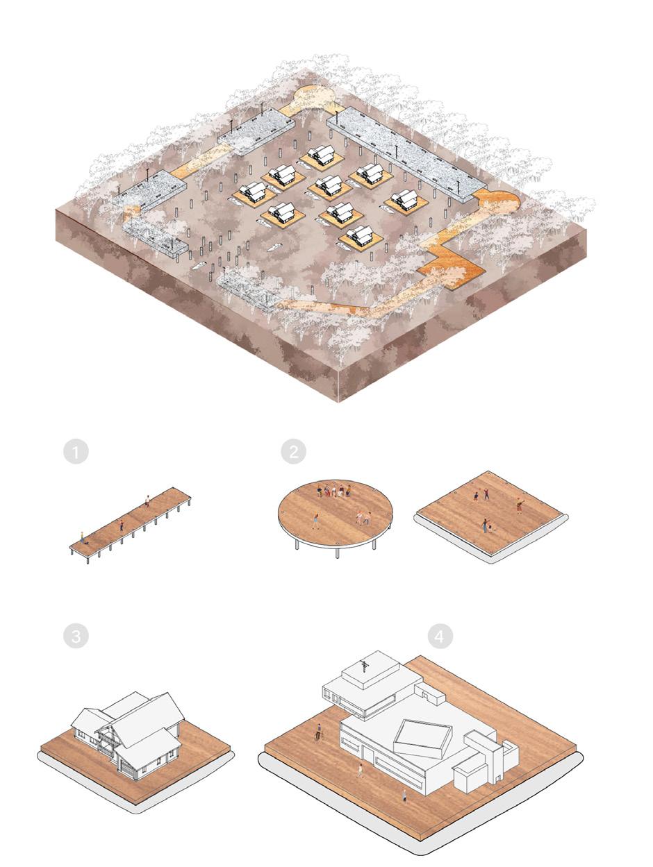
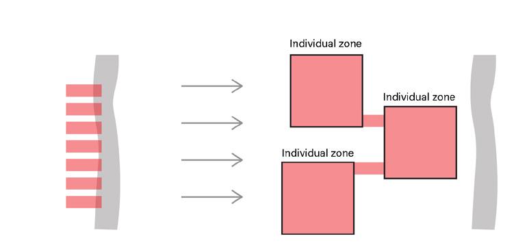
ZONE
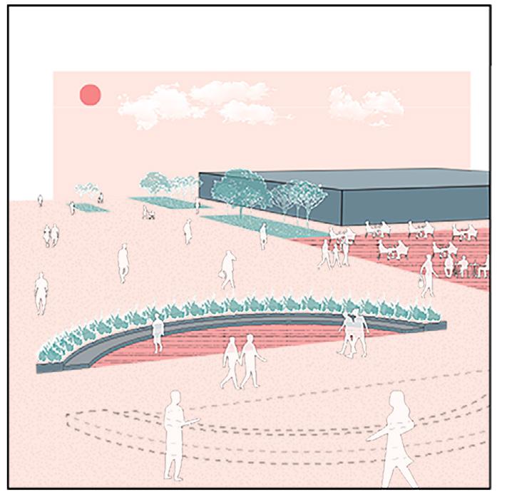
WAS ZONE IS
COULD BE ZONE
The sun is hanging up high in the sky, there is not a single cloud in miles.
“Only if somebody can help me” Said by you. You wipe the sweat on your forehead and push the shovel even deeper into the soil. Look back at your long house, you saw your wife is cooking and your children is feeding the cow. You heard something in the distance, you look at that direction and see something big is moving through the land.
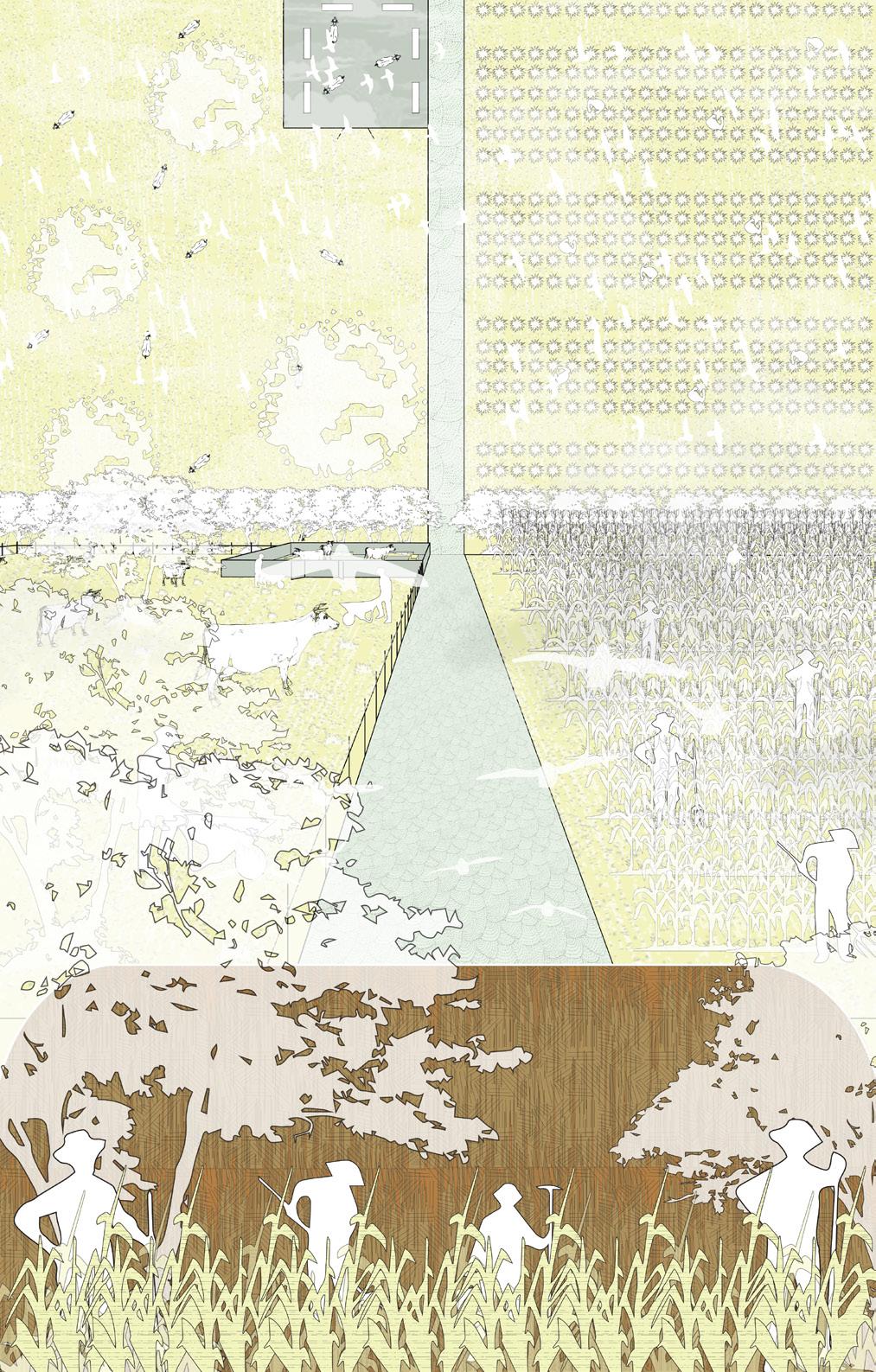
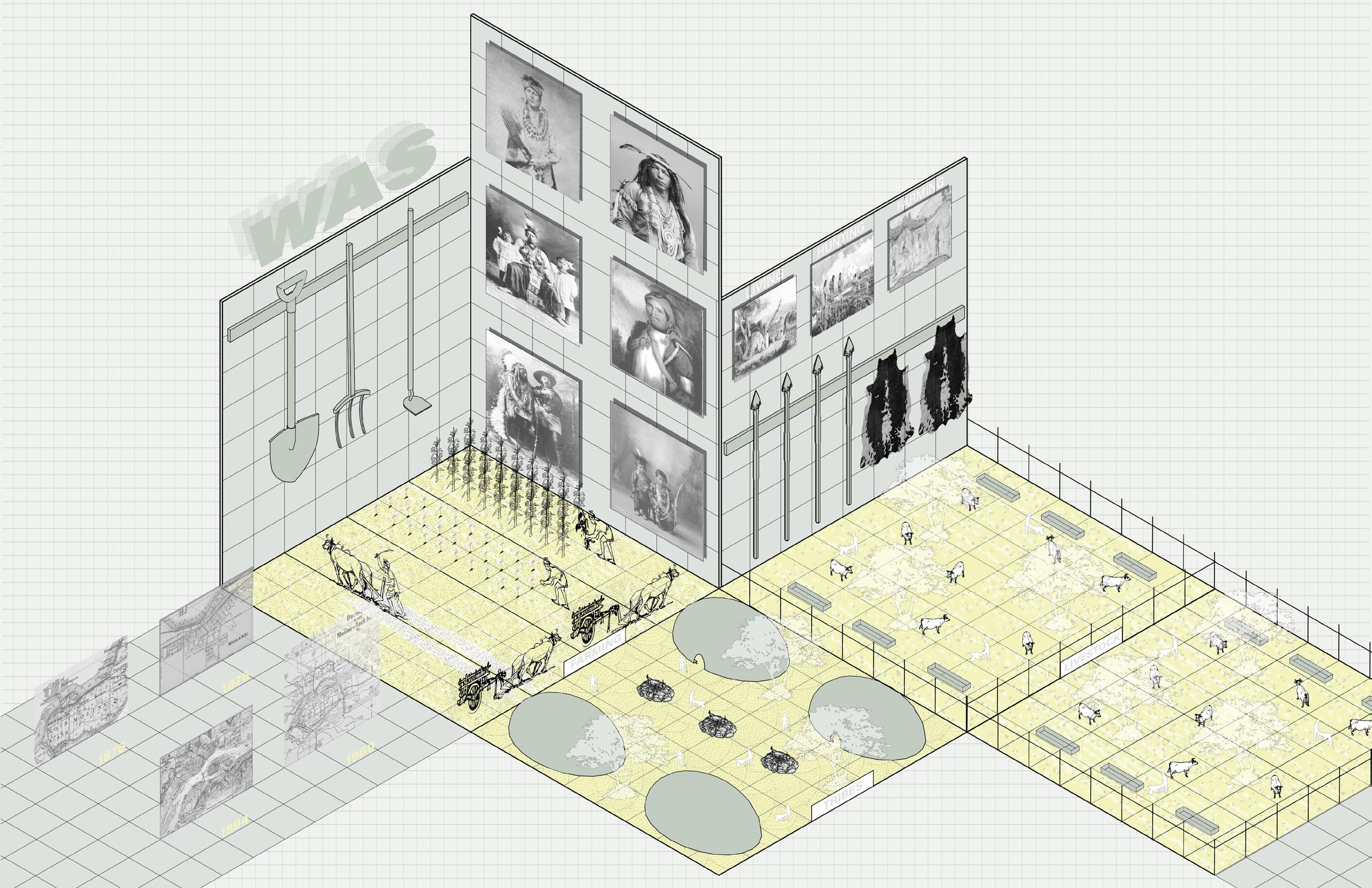
You take a sip of your coffee, put on your working suit, and started the machine.
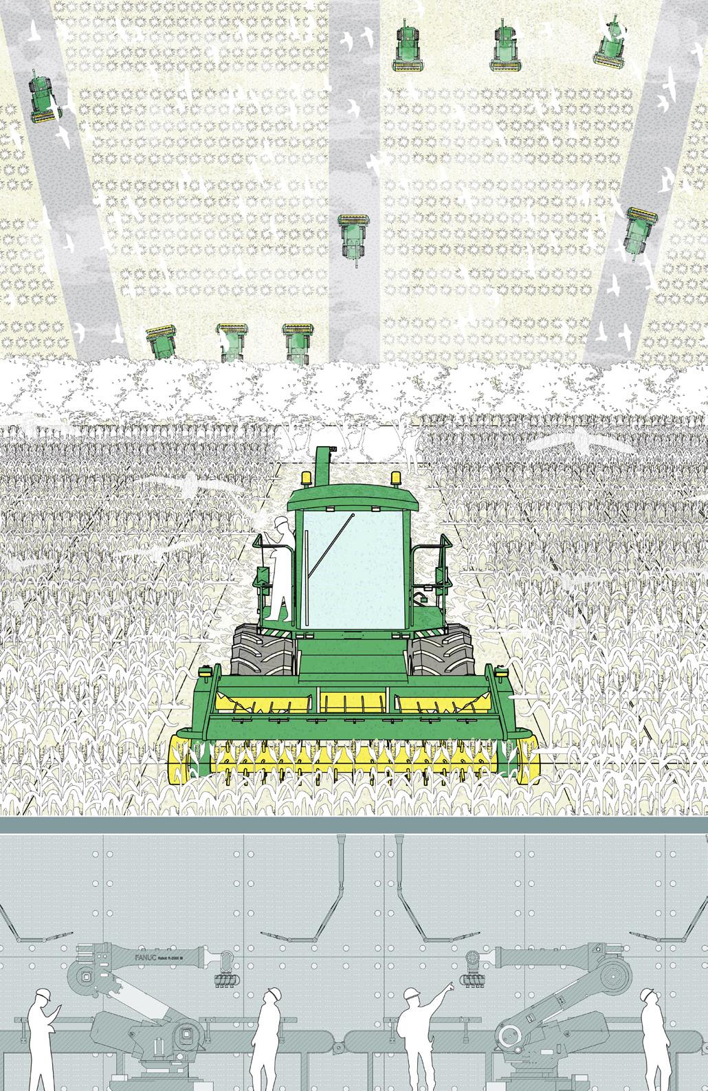
“Another long day conquering the corn field” 3 hours later, you feel sleepy, parked the machine on the side, set an alarm for 15 minutes. Ready for nap.
Just before that, you saw a group of drones slowing flying over Your curiosity encourages you to follow them. You followed it and all of sudden you saw a place that you never seen before.
Drones are taking over the job of your machines. People with lab coat are tapping on their device in front of a plant which is beyond your awareness. You take a peak into the laboratory, you don’t understand any data on the screen, but you realize that it’s the new process of learning and adopting the land take another peak, you saw something familiar.
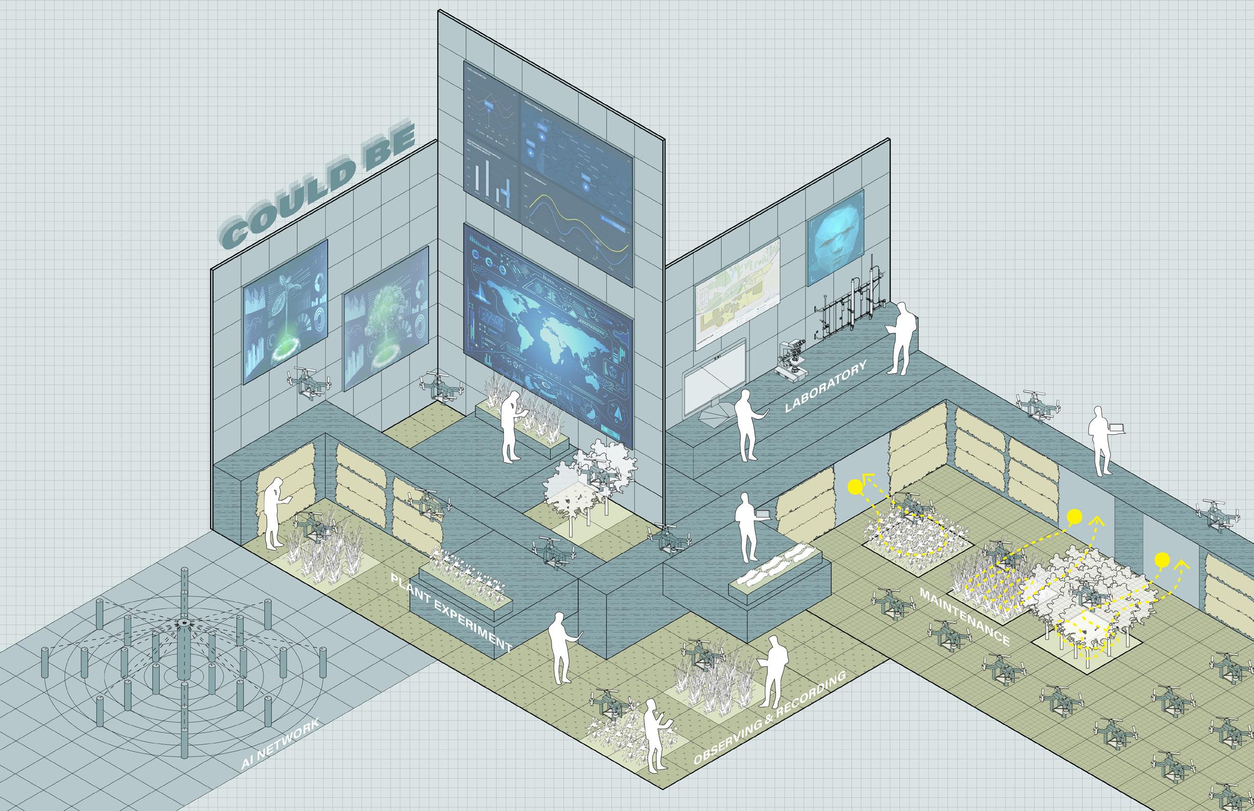
Before you can take a closer look, you were awakened by your 15 mintues alarm. You realized you just fall asleep. You take a deep breath and say “ All those is just a dream...” “ or is it?”
Re-appearing
St. Louis, MO, USA
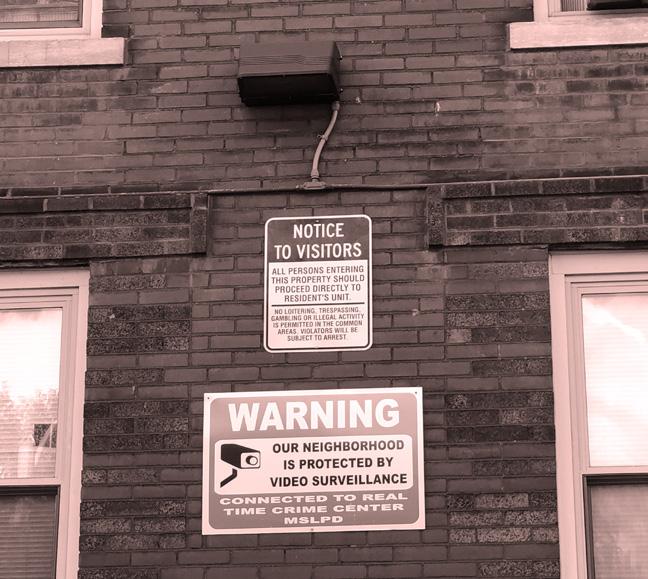
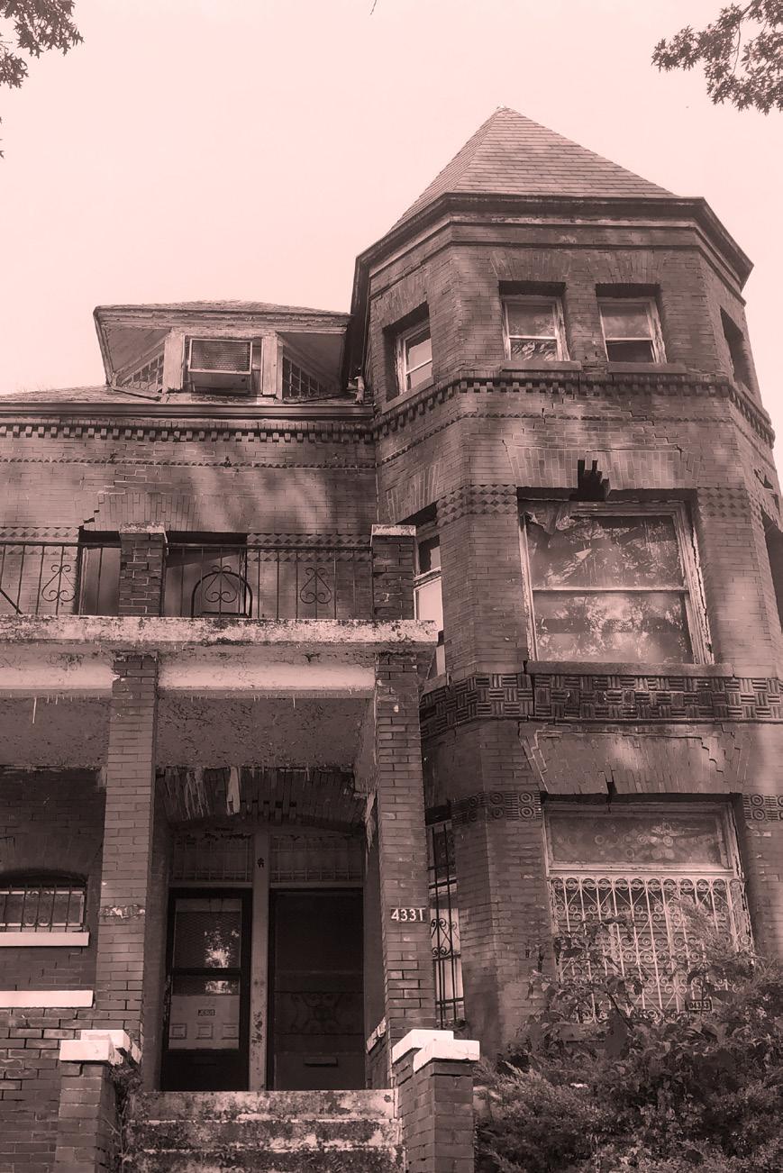
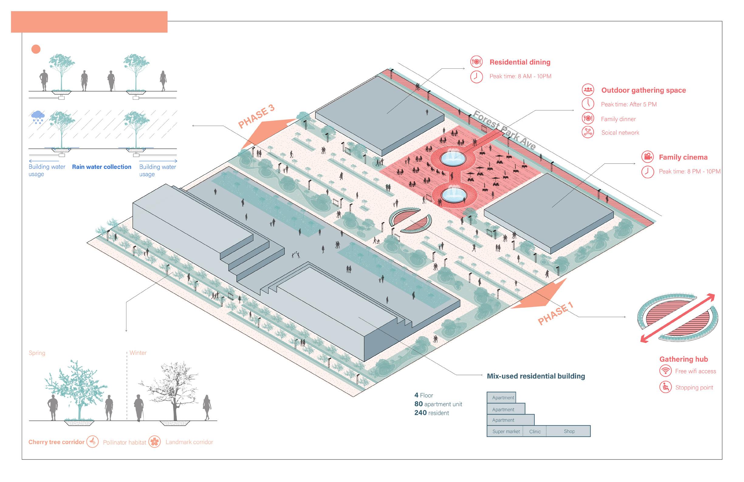
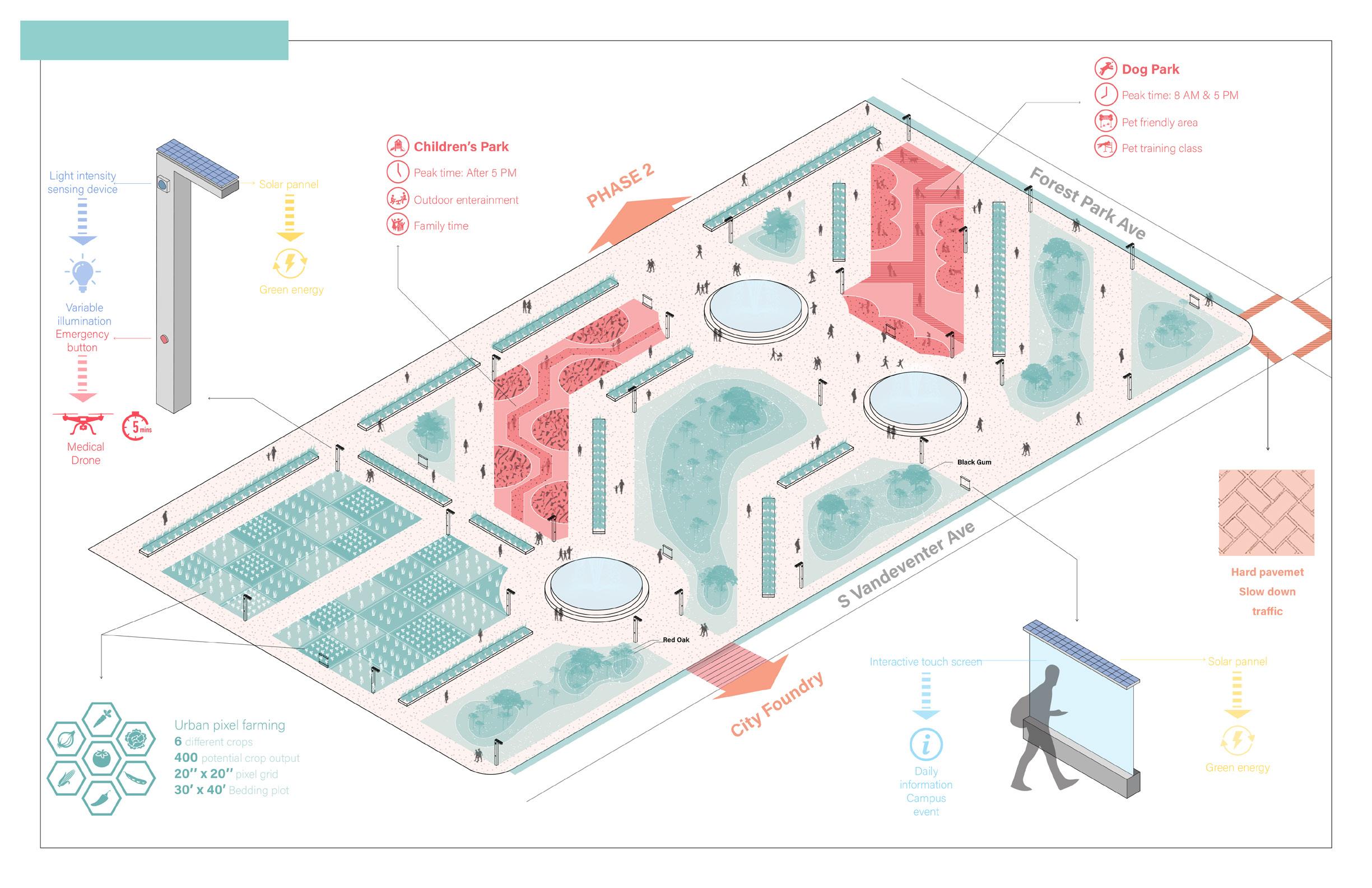
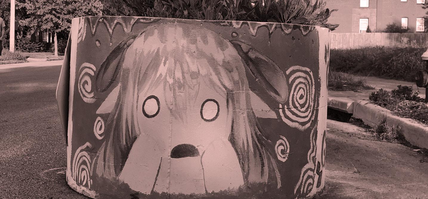
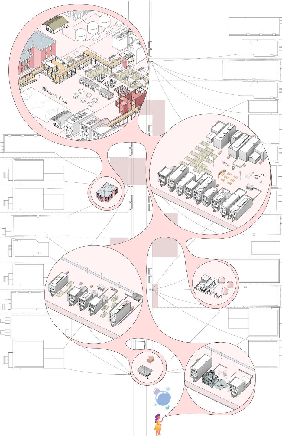
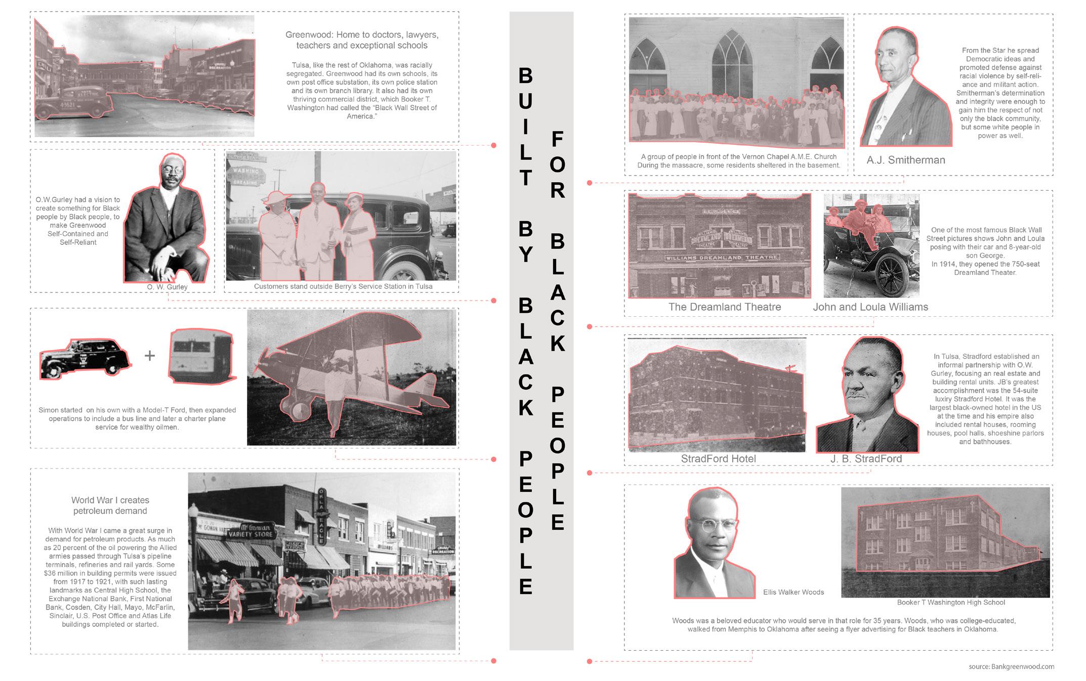
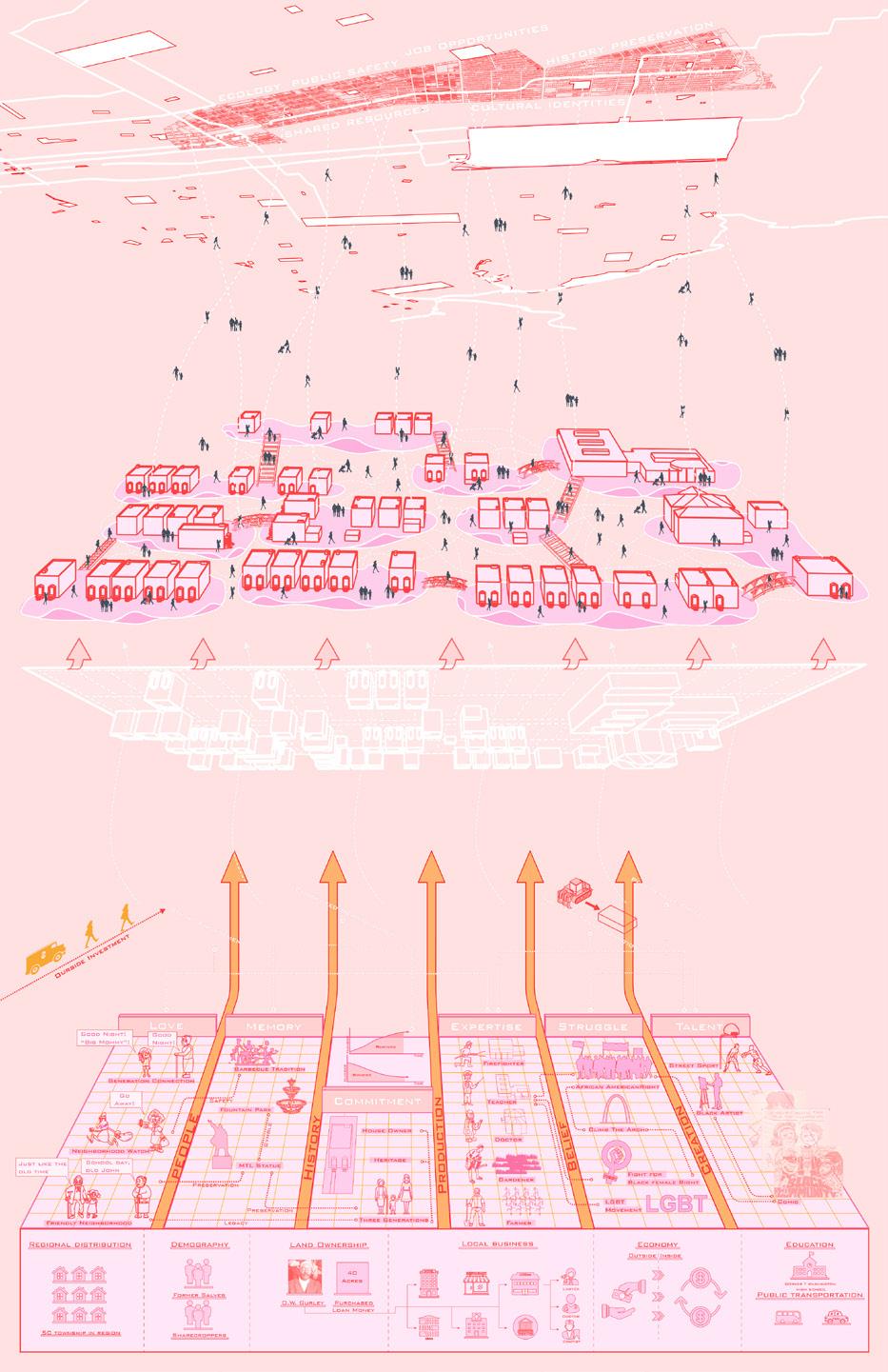
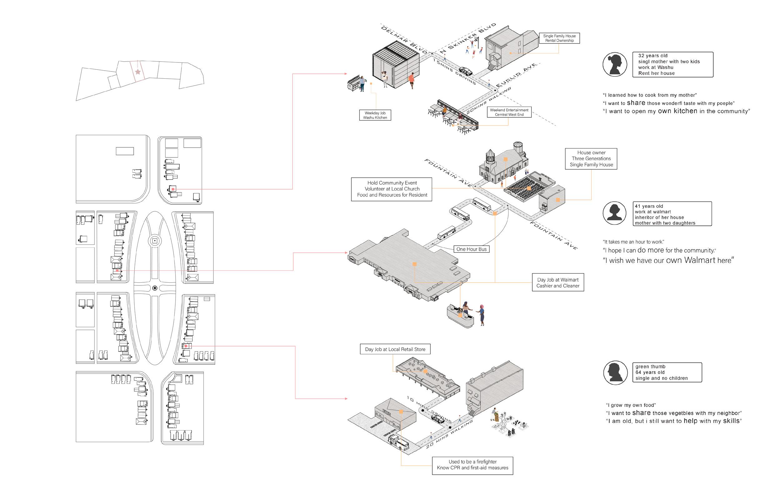
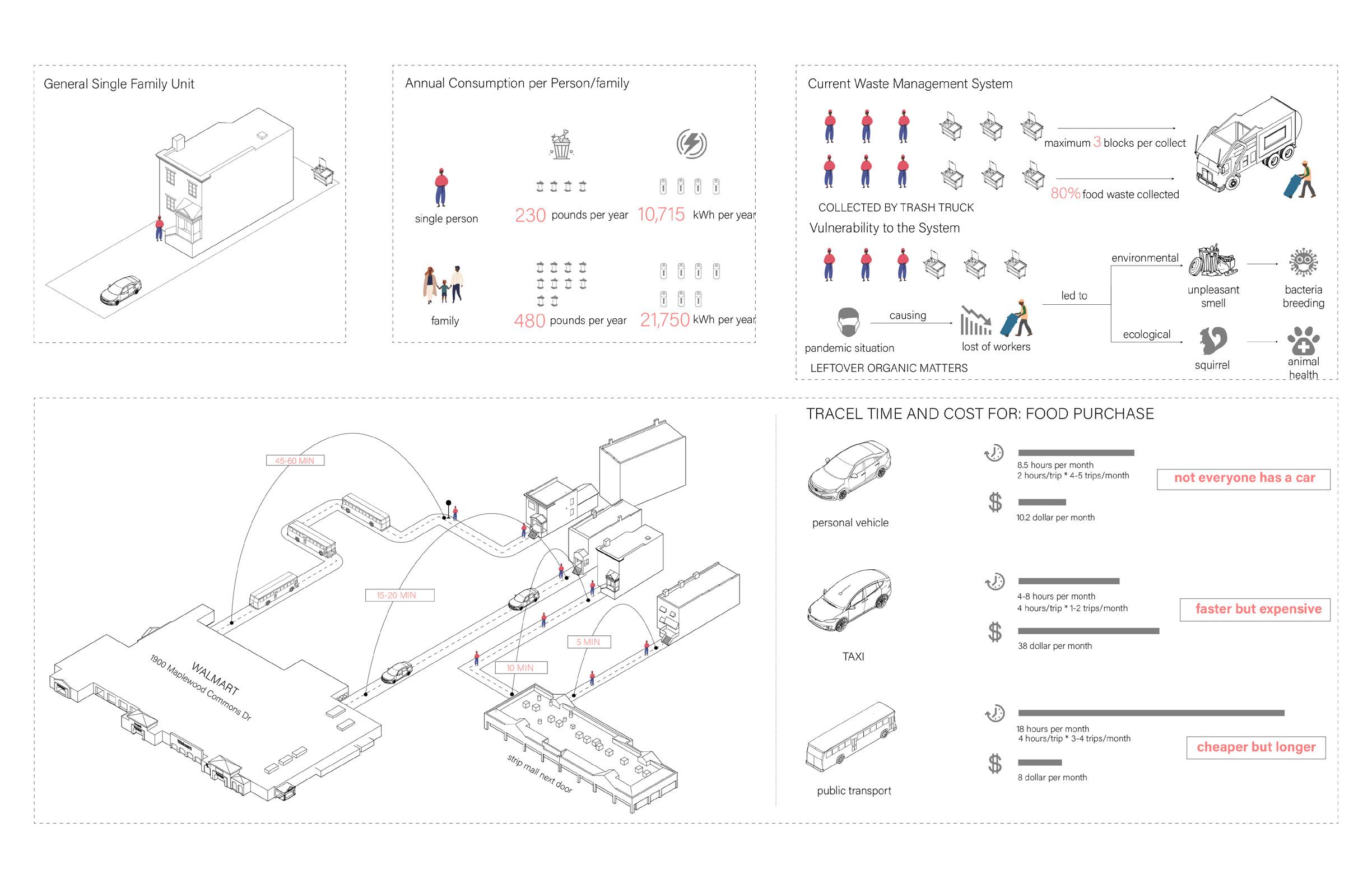
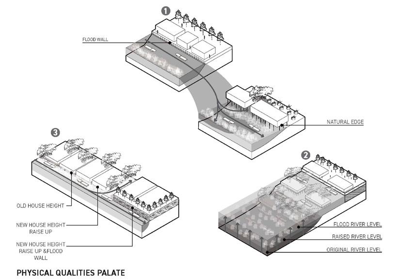
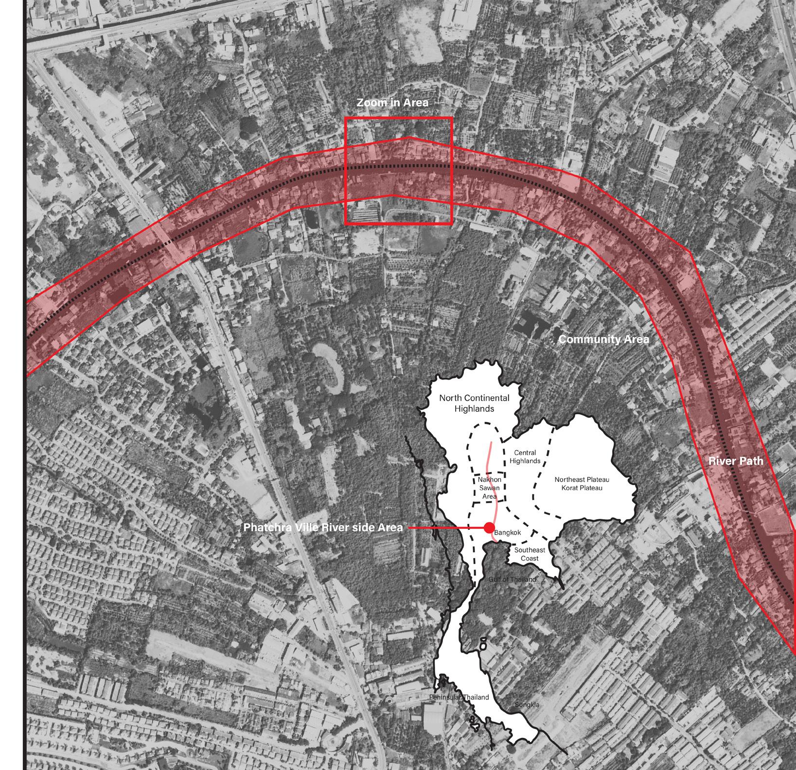
The Hodiamont Track crosses through seven neighborhoods along the Delmar Blvd in north St.louis, which are mostly occupied by African American working class. The track has been once a very active transportation corridor, connecting these once prosperous neighborhoods. But today, the tracks are no longer in use and these neighborhoods are in severe decline, known as an attractor for illegal activities, such as illegal dumping or place of serious crime. The fountain park community as one of the seven neighborhoods used to be a place that filled with history and honor. We are digging out the hidden values here and use that as a base to imagine a new possibility.
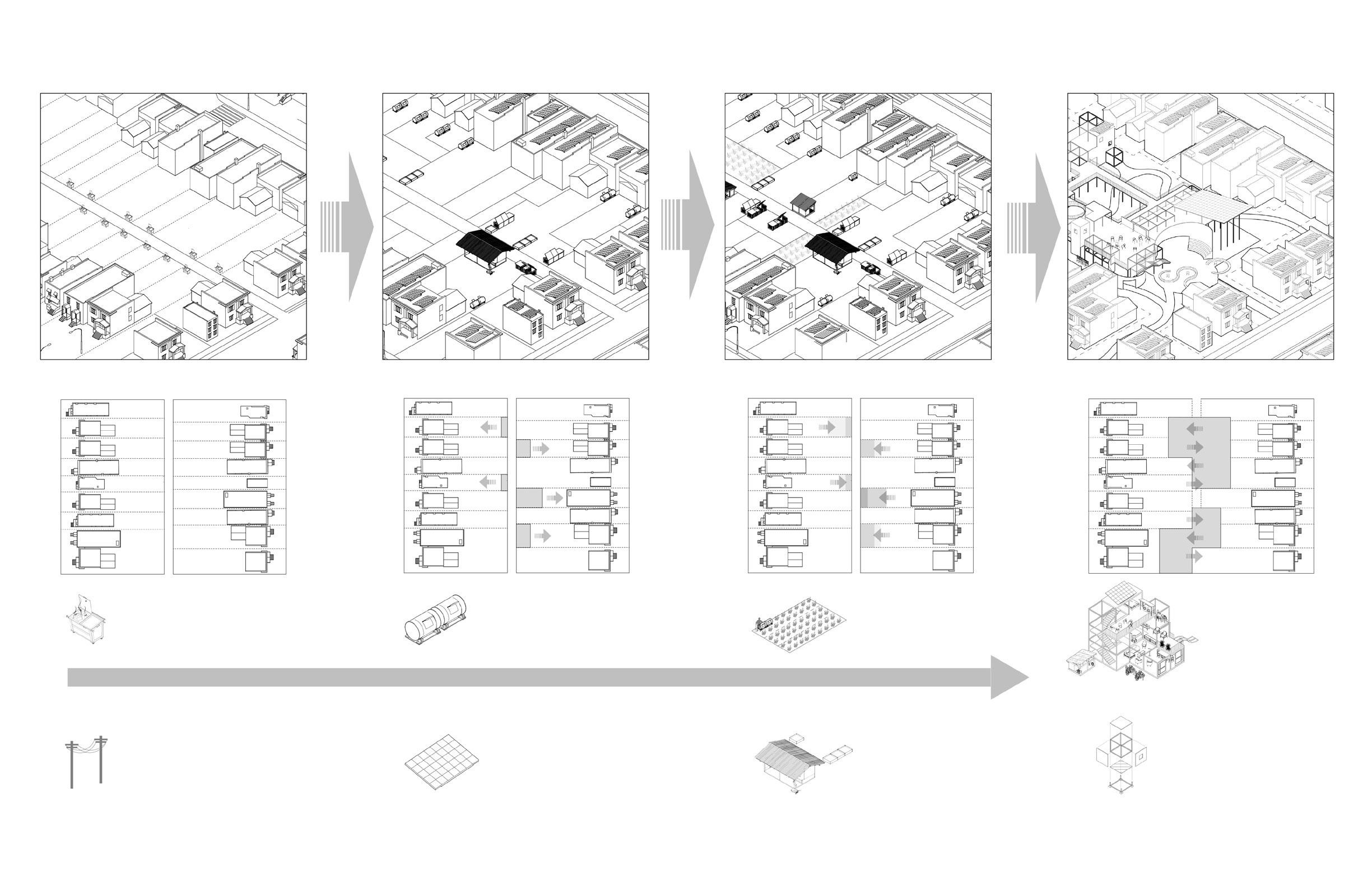
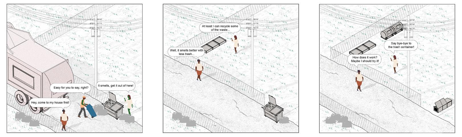
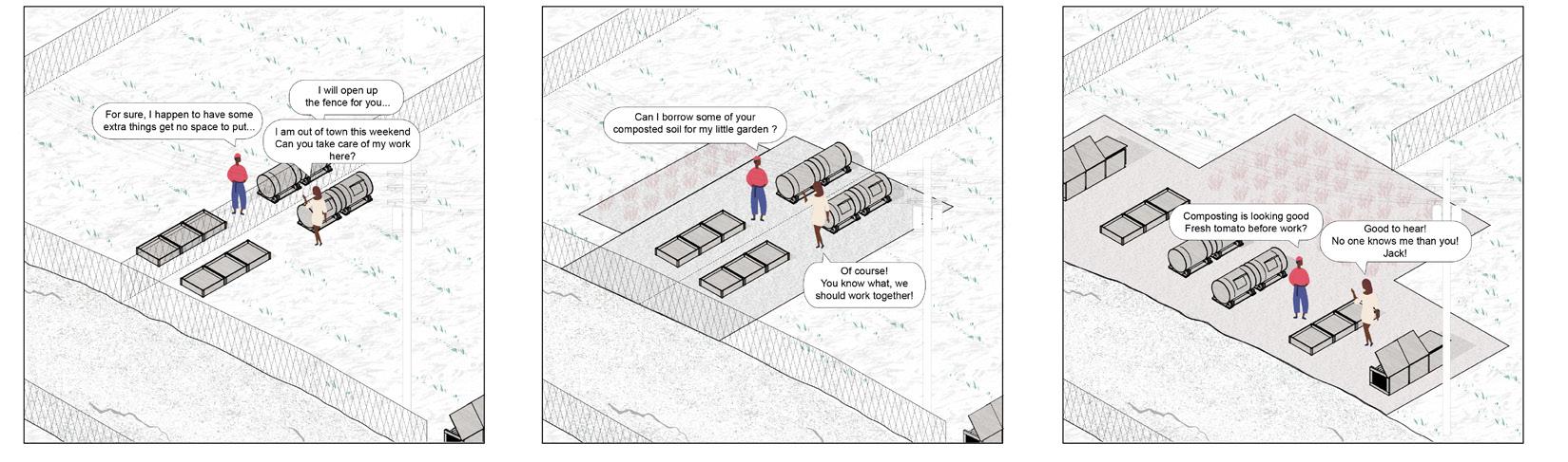
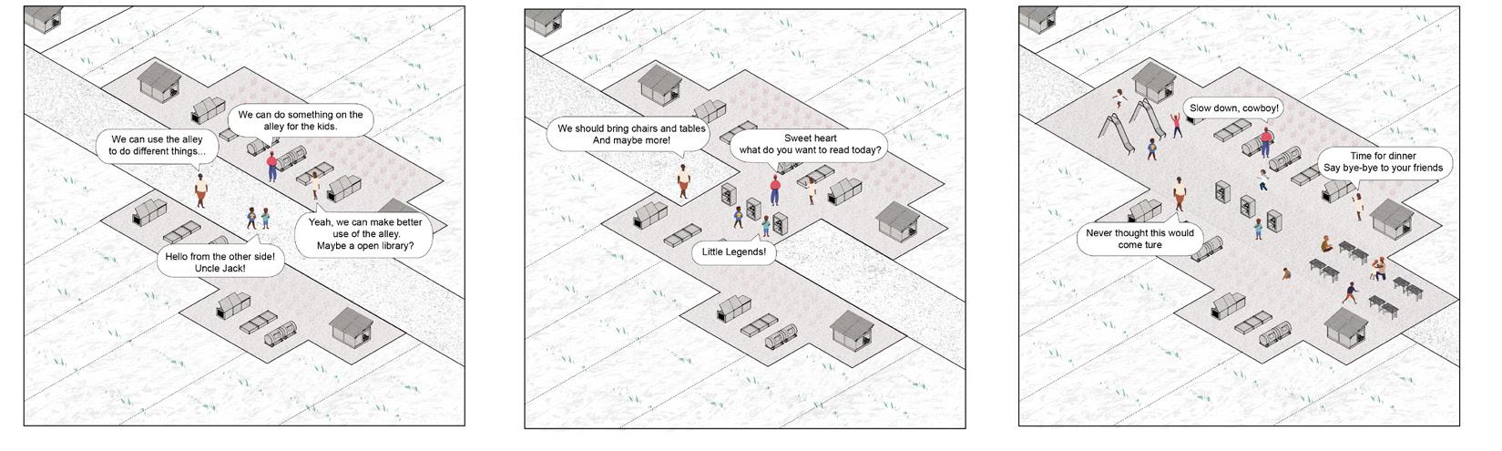
Learning from the success of black wall street and using it as a trigger, we are trying to reconfigure the possible future of the fountain park community. As vulnerable the current system is, whether it is waste treatment, food production or energy generation, we are testing different possibilities through different scenarios with the idea of reshaping the system into a self-sustain and productive one which will help to strengthen the community from within to withstand the outside disturbances. From reforming waste treatment system to community-wide food and energy production system on different scales, the community will have the possibility to support itself. Give them a chance to create a community that is built by its people, for its people. As time goes by and the community are well fit in these strategies, the self-sustainable resource recycle system will help them get rid of traditional municipal services, such as electricity input and trash pick-up, which gives opportunities for new spatial configuration, the alley along backyards disappears and backyards could combine with each other to induce shared ownership of open space inside the neighborhood, as well as reutilizing the unoccupied school building for shared use as anchor of the community, which offer space for further development of the neighborhood under the context of climate change.
03
Abandoned house
Street art
Insecurity A hotbed of crime
As an inspiration to the Greenwood district in Tulsa, also known as Black Wall Street, a once flourishing economic as well as cultural Mecca, we envision Fountain Park to become an emergent cultural epicenter modeled after Black Wall Street, yet adapted to 21 century urban living. Facing challenges of a rapidly changing climate, dwindling energy resources and growing food deserts in urban areas, we developed a set of site specific operations to transition the Fountain Park neighborhood into a self sustainable community towards energy and food supply production. By slowly introducing different forms of waste treatment systems and community-wide food and energy production supplies, the community in Fountain Park will slowly change its economic and spatial configuration starting with one block as testing ground to unfold these site-specific operations.
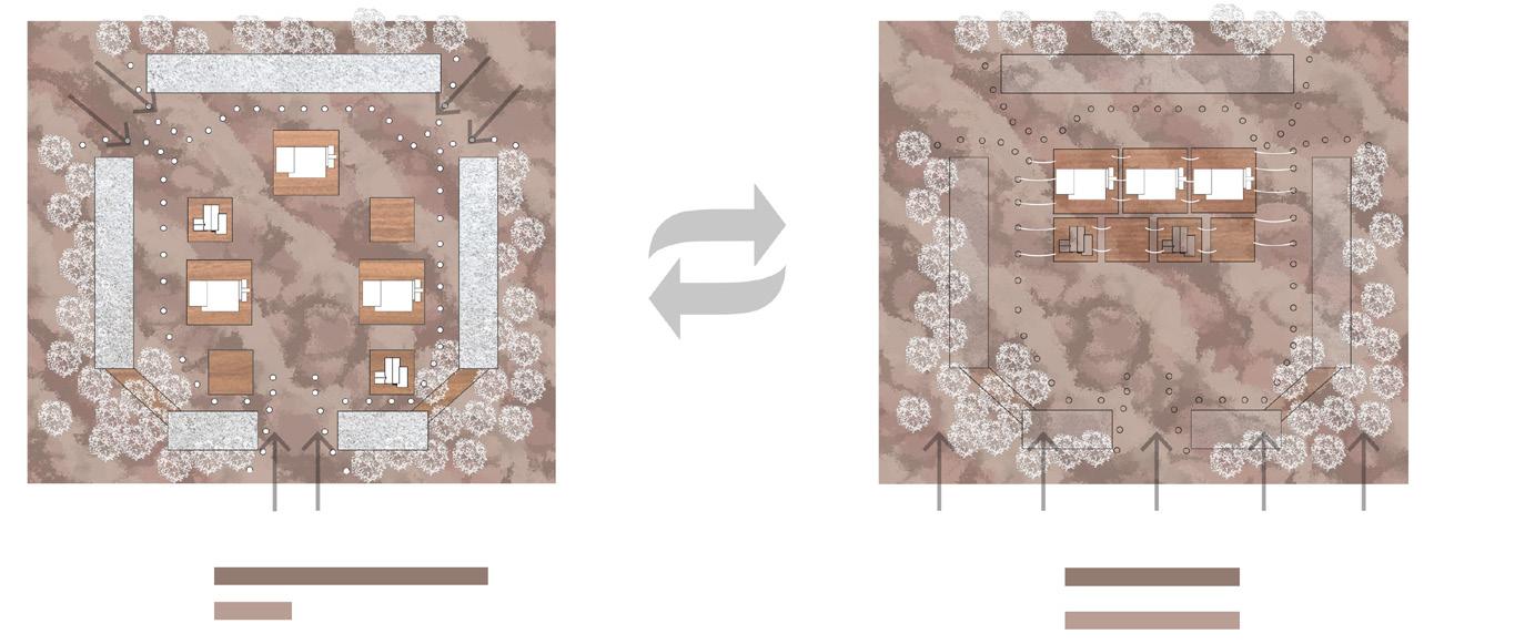
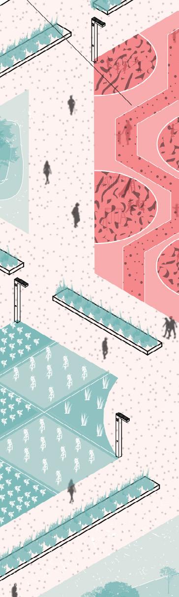
CONCEPT PLAN DESIGN PLAN
People in the Community Status Quo
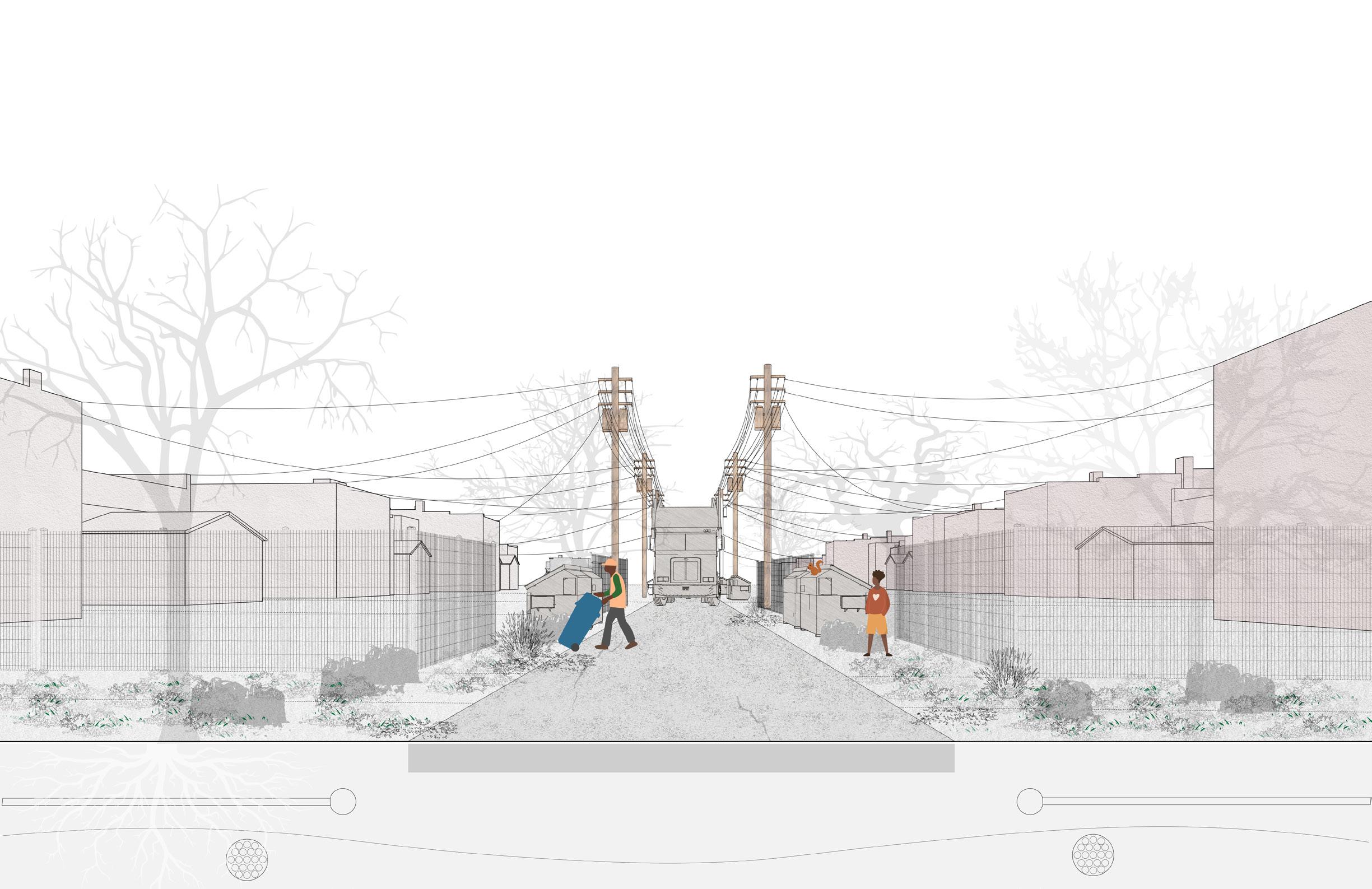
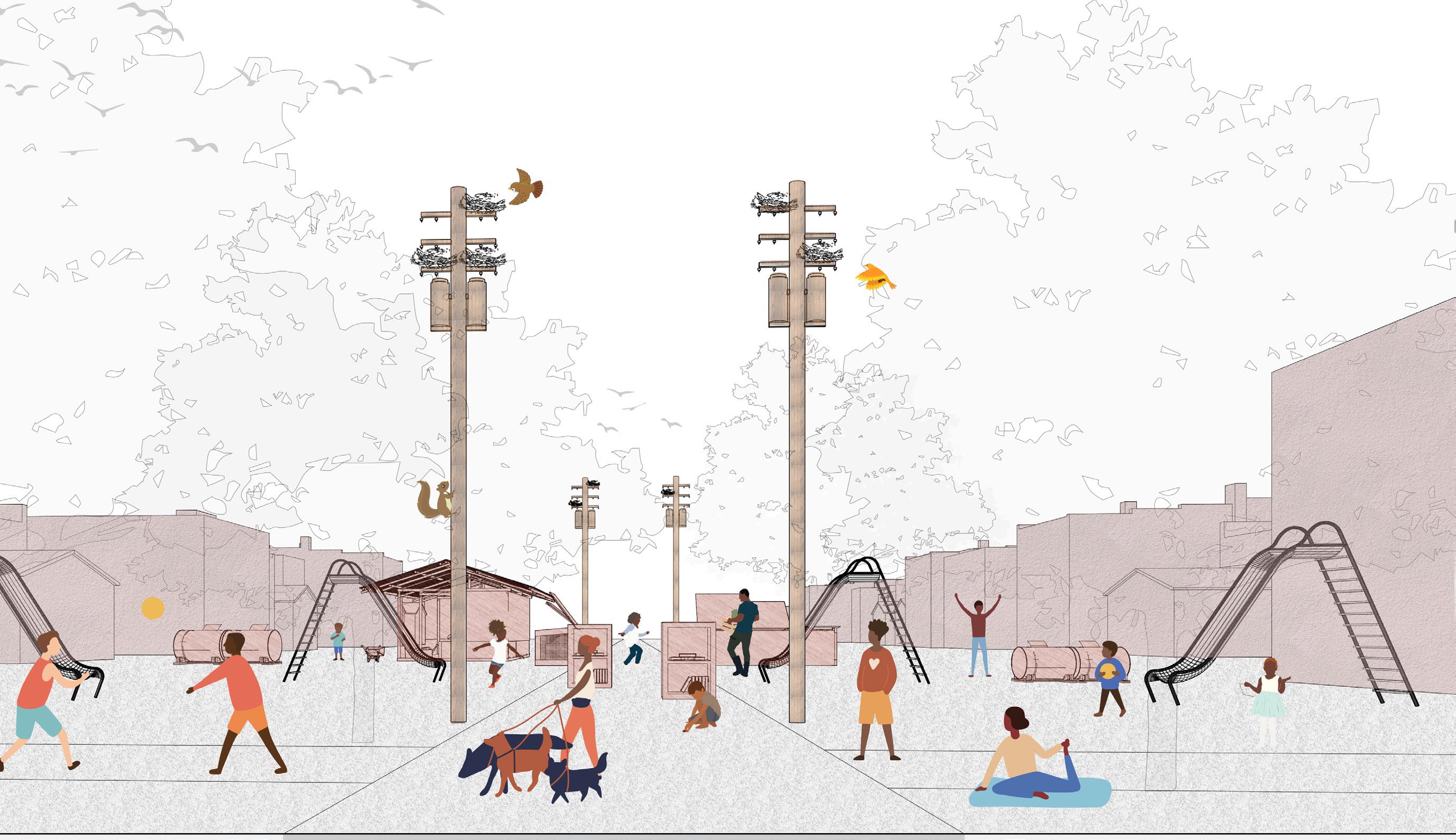
THE DIS-APPEARING ALLEY (through time)
Status Quo Towards a renewable energy system Towards a localized food production Towards a self-sustainable future year 0 year 1-10 year 10-20 year 20 and beyond...
THE ALLEY Shrinking Extending Merging
rash container dominated backyard energy purchased from ameren
bio-energy composting container household soalr panel
backyard pixel farming community reuse hub
new model of social hub moveable and easily assembled unit
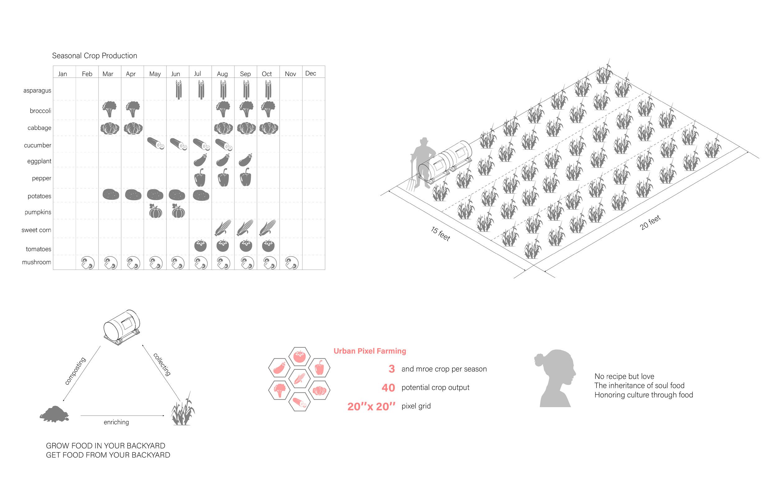
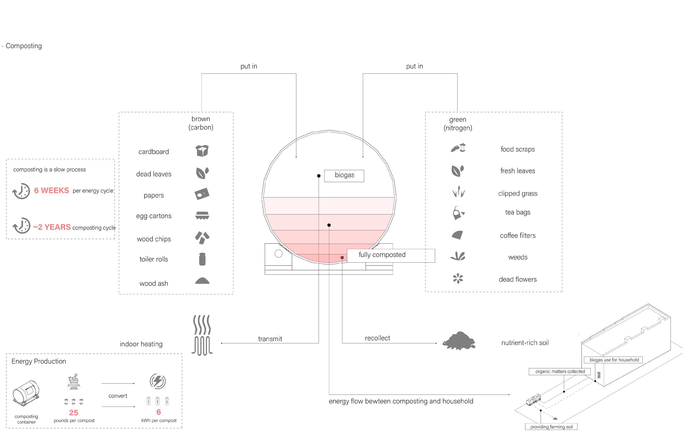
Food Production System
Organic Matter Treatment
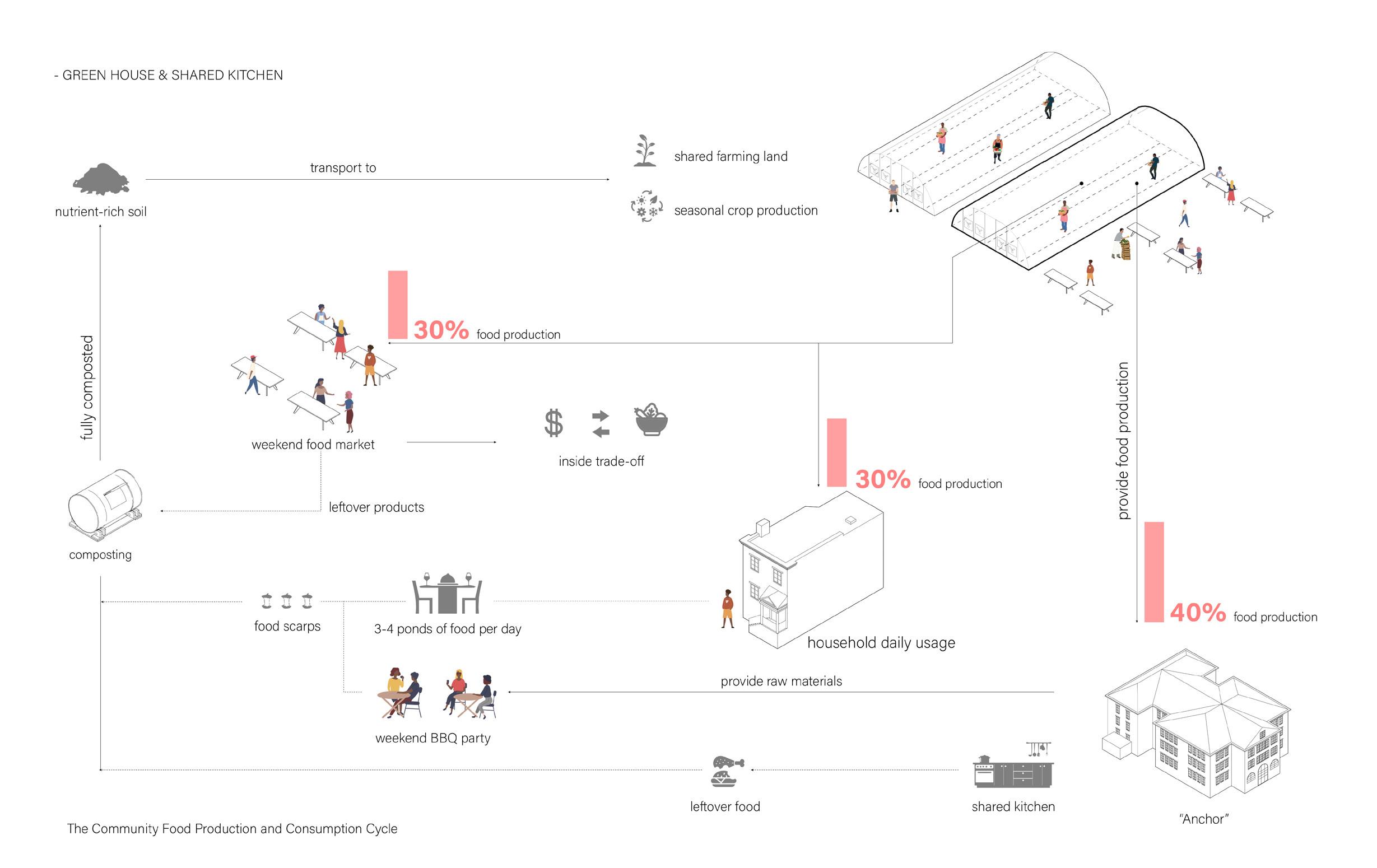
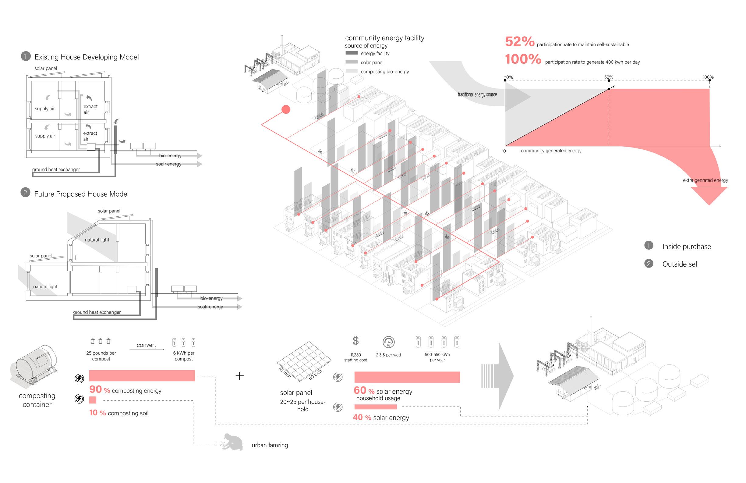
Energy Genreating System The Community Food Flow
From wast to resources
BUILT BY THE PEOPLE SERVED THE PEOPLE FOR THE PEOPLE
From individual to collective Bridging the Alley
URBAN DESIGN
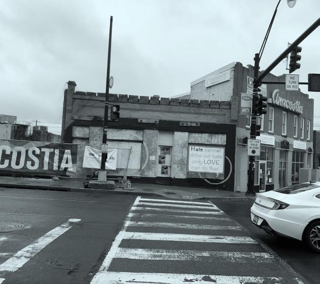
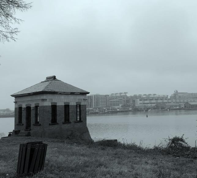
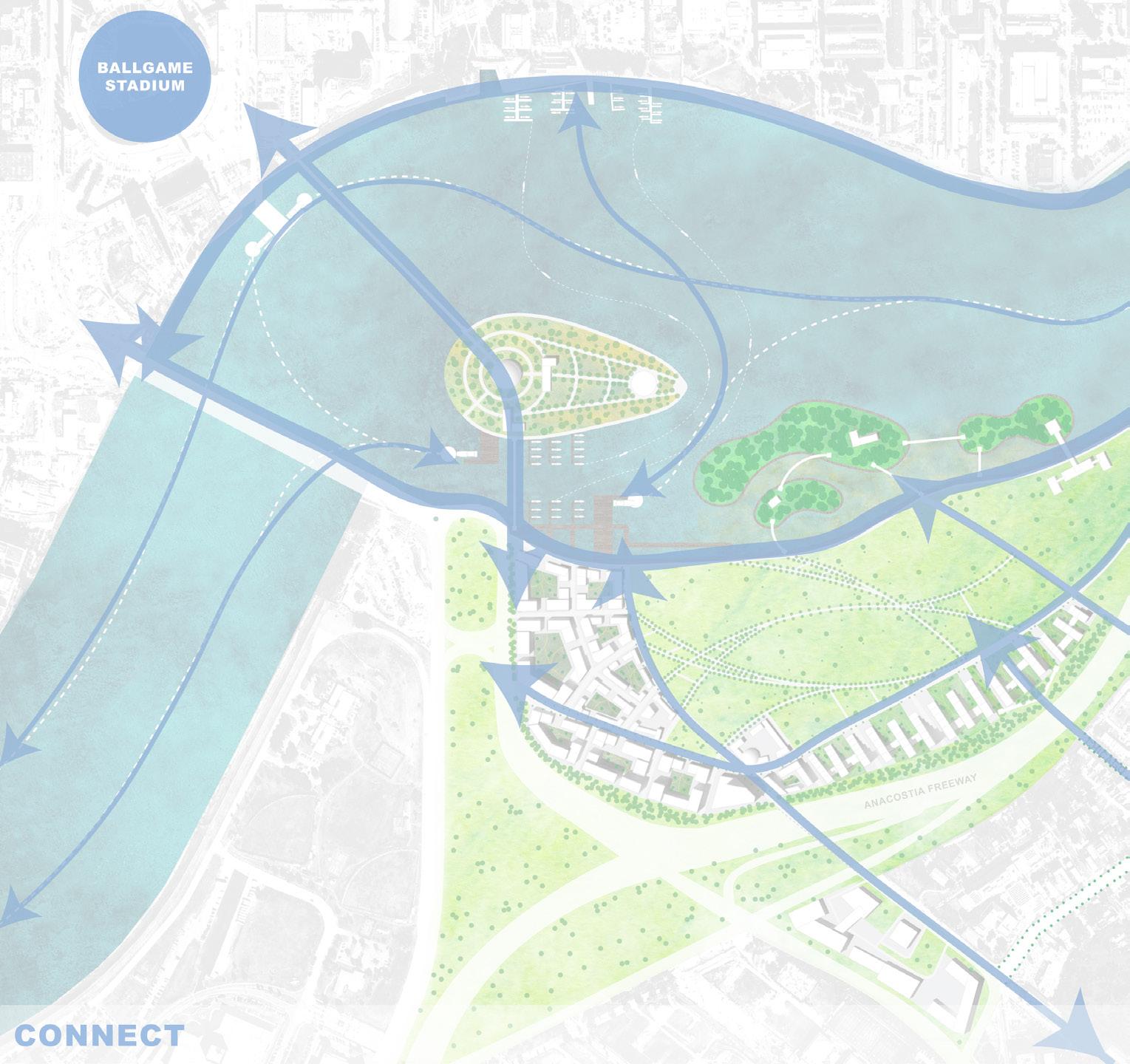
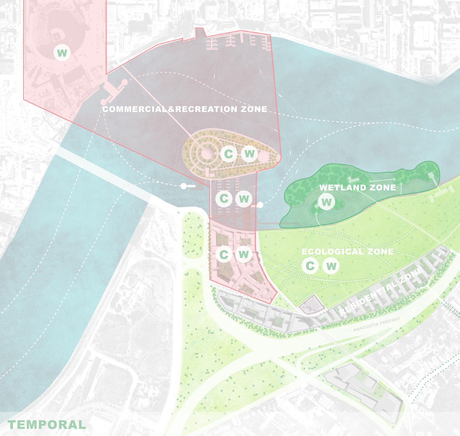
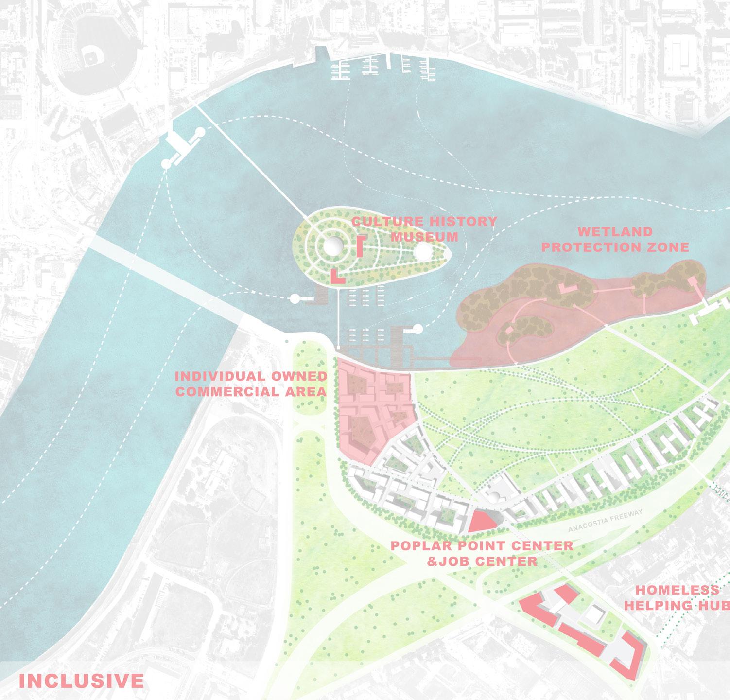
04 Poplar Point Anacostia, Washinton DC, USA
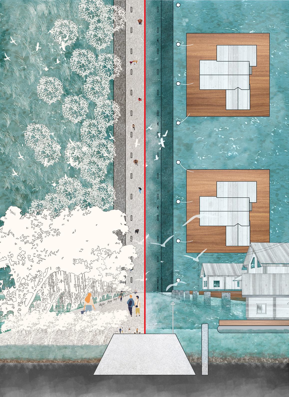
Poplar Point is on the southern bank of the Anacostia River in Washington, D.C. located just two miles from the Capitol building and within walking distance from historic Anacostia and the Anacostia Metro station.
The new planning is aiming to bring more attentions to this area and its surrounding communities. By separting one year into two seasons - warm and cool, a whole new development plan has different foucus during different time of the time. Gaining more investments into the community and enhancing local cultural inheriatge at the same time.
Anacostia Bridge
pumping station Community
Site condition Old
resistance
SECTION A-A
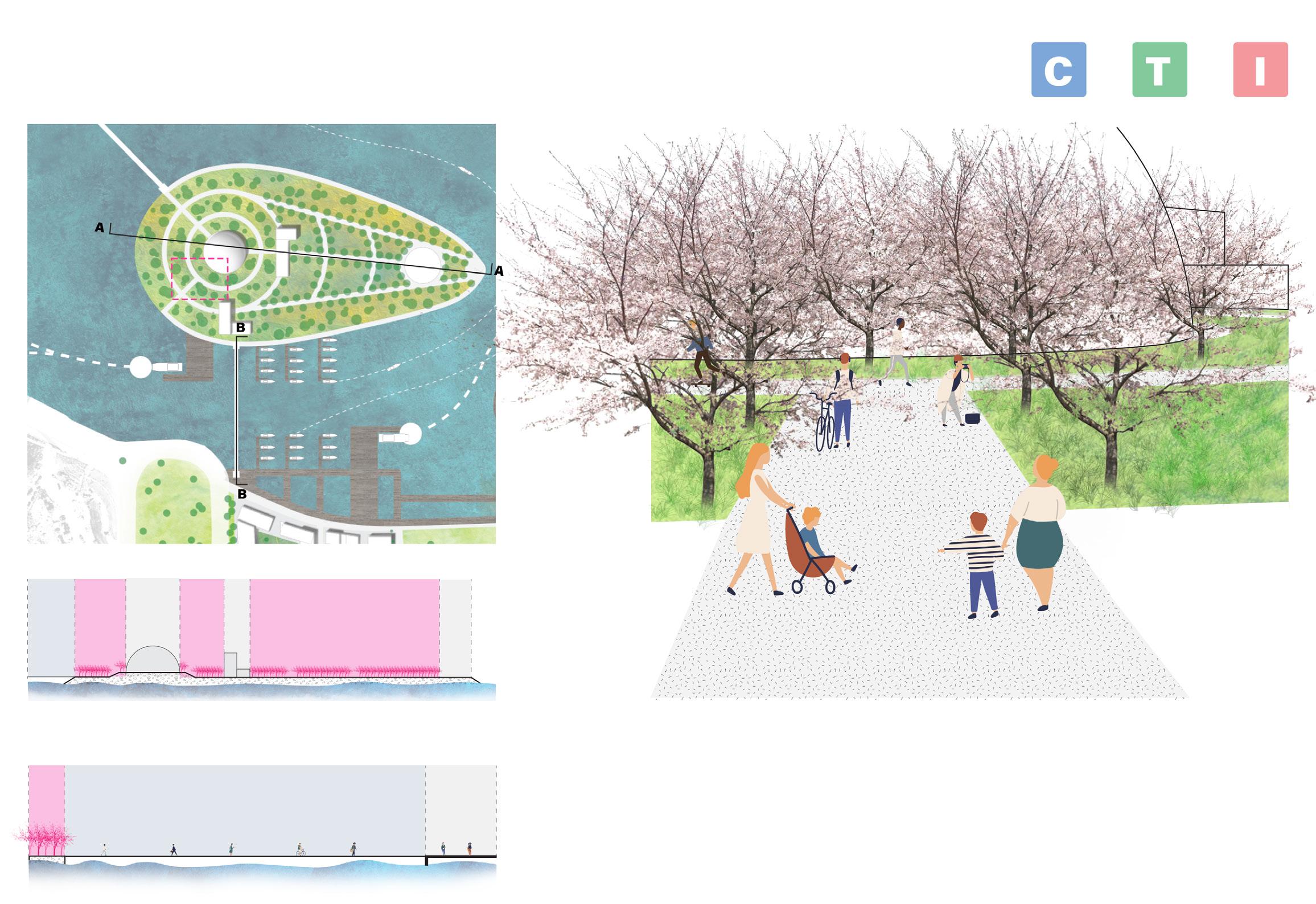
WARM SEASON:
Cherry blossom will attact tourists and ball game watchers. Visitor center serves as a place for information and food. Beer & BBQ plaza will serve as a gathering place for game watchers. Water taxi port will serve as a recreational activitis for outsides.
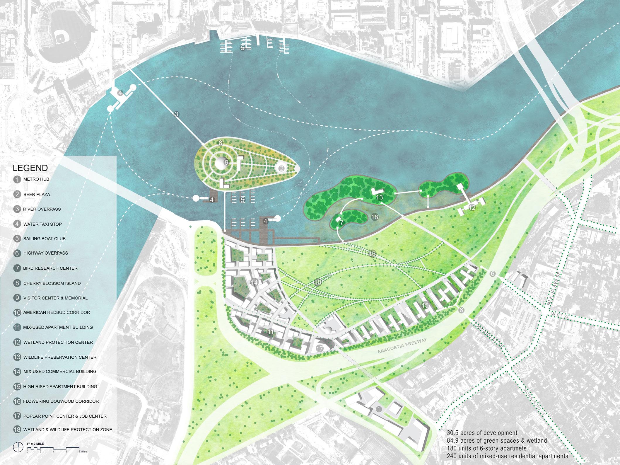
COOL SEASON:
The visitor center will serve as a place to hold conferences and local social events. The port will serve as a transportation choies for local residents on a daily base. The plaza will serve as a place for having outsie movie night or concert for local artists.
MASTER PLAN
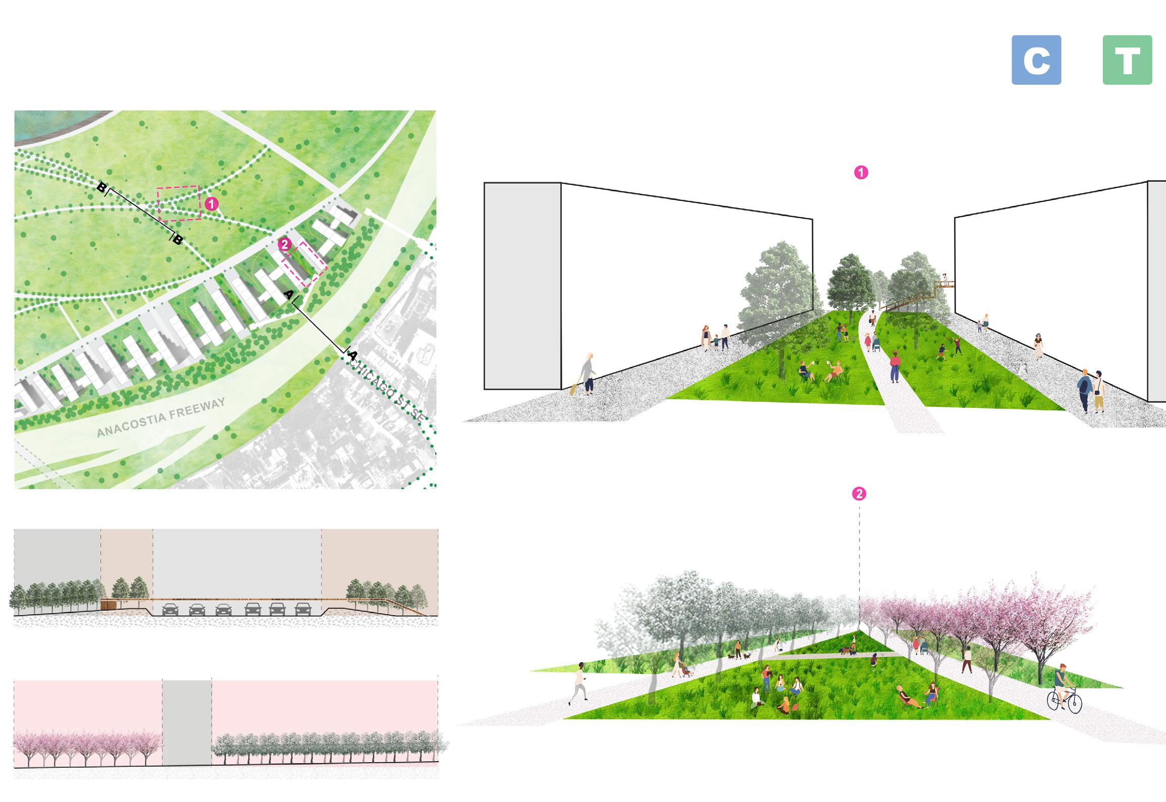
HIGHLIGHT AREA 1
CHERRY BLOOSM ISLAND & WATER TAXI PORT ZOOM IN PLAN
B-B
SECTION
WARM SEASON:
Two islands are serving different animals but not limited to certain species. Both of them will serve as a animal watch piont for tourist and professional researchers. In additional, they have academic proposes as an experiment and outdoor leaning field for schoolage kids.

HIGHLIGHT AREA 3
COOL SEASON WARM SEASON
FLOWERING DOGWOOD
BLOOMING TIME: EARLY
SPRING
COLOR: WHITE, PINK
EASTERN REDBUD
BLOOMING TIME: MARCH TO JUNE
COLOR: RED, PINK
COOL SEASON:
Three islands will become a regional research zone for certain species’s migrtion, and partly closed to outsiders.
HIGHLIGHT AREA 2 WETLAND & WILDLIFE PROTECTION ZONE
IN PLAN
SECTION B-B
ZOOM
SECTION A-A
IN PLAN
SECTION B-B
SEASONAL CORRIDOR & OVERPASS CONNECTION ZOOM
SECTION A-A
URBAN DESIGN
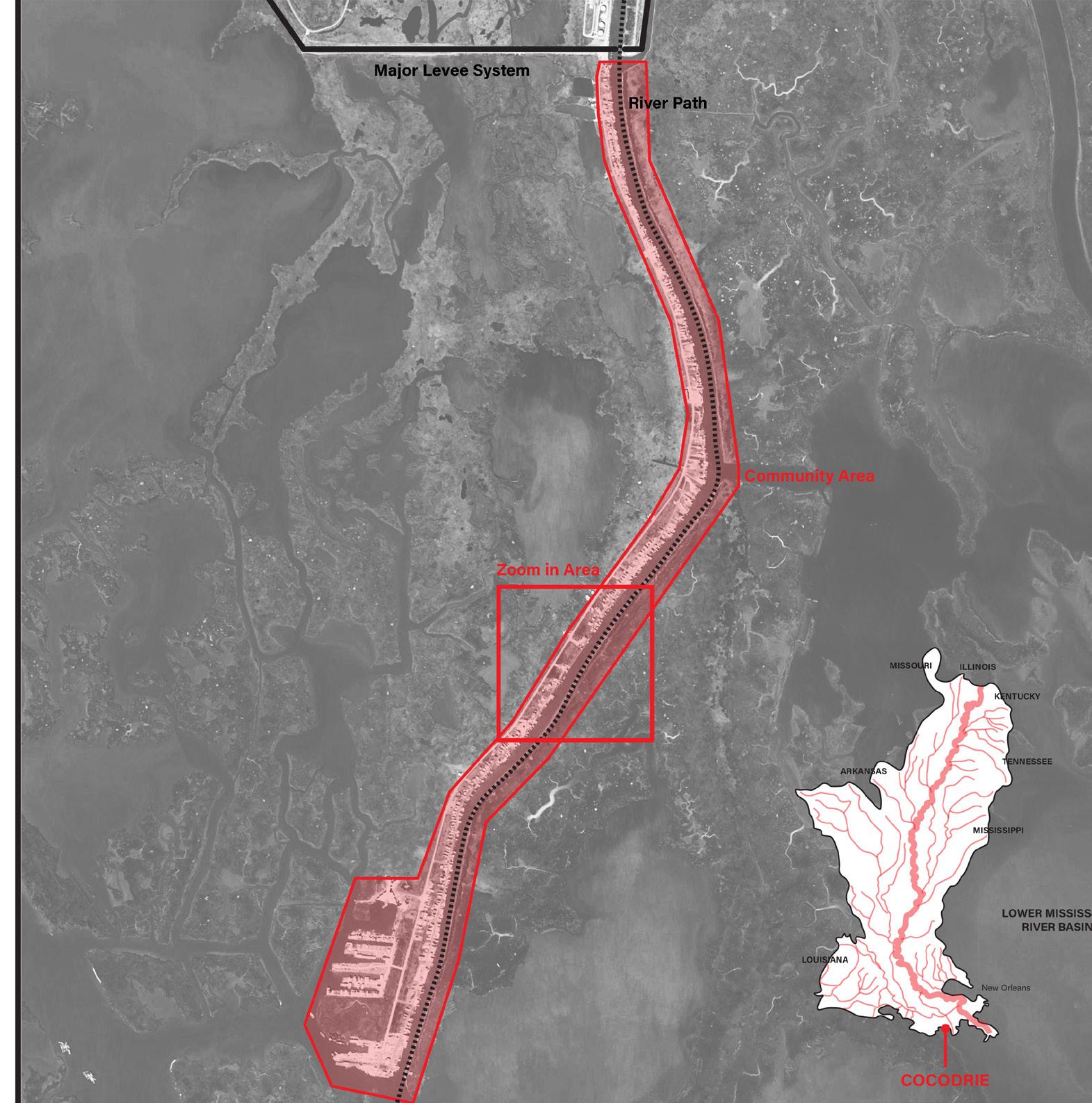
05 All Boats Raise Together New Orleans, USA / Bangkok, Thailand
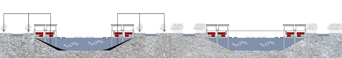
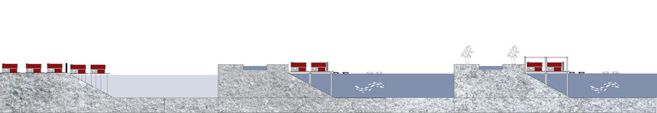
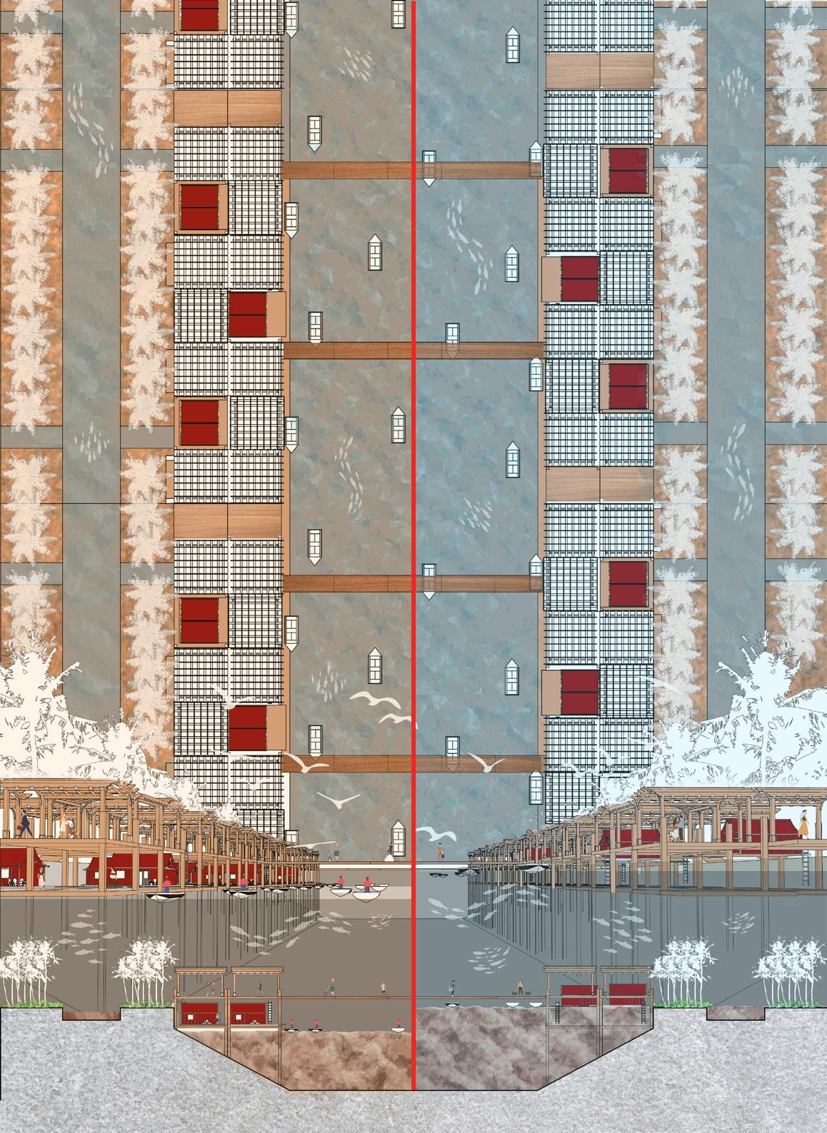
In both contents, it is easy to noticed that human have been trying to manipulate the course of the river for a long time. Whether it is the complex levee system in the lower mississippi or rich people get to build flood walls and poor people get flooded in Thailand causing multiple problems including the tragedy of commons. It is hard to ignore that we have been using hard edges to keep us away from the water and keep us always in a safe postion.
But what if none of those hard edge systems will be able to protect us in the future?
What if we have no choice but to engage rivers as commons?
What if hard and soft edges exist at the same time?
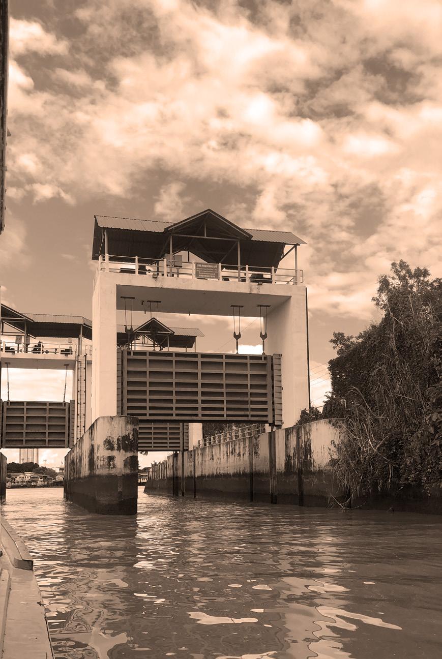
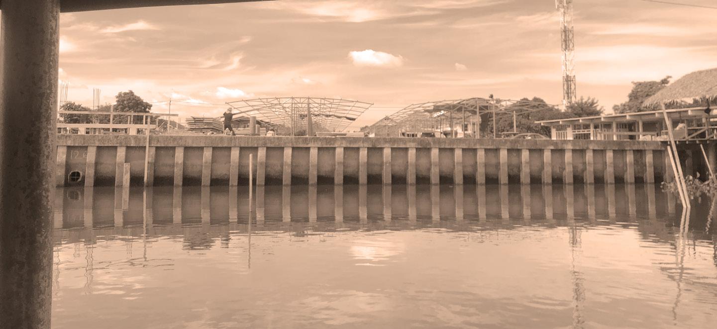 Flood Gate, Bangkok, Thailand
Flood wall under constructio, Bangkok, Thailand
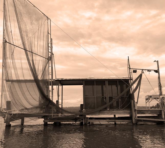
Old fishing station, New Orleans, USA
Flood Gate, Bangkok, Thailand
Flood wall under constructio, Bangkok, Thailand
Old fishing station, New Orleans, USA
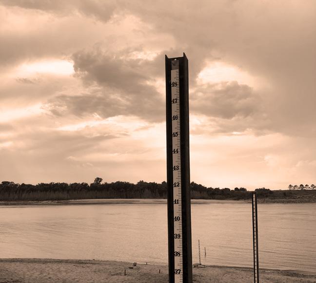
Water
level indicator, New Orleans, USA
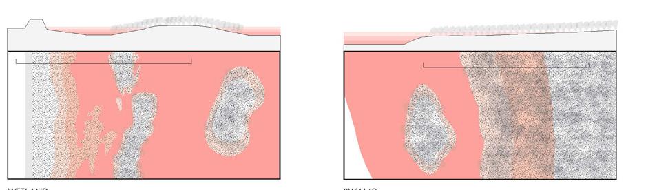
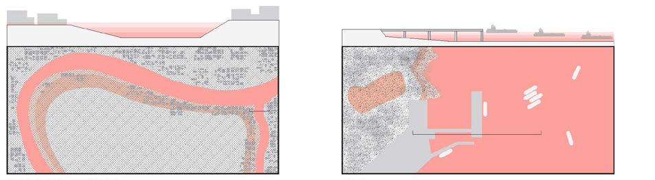
MISSISSIPPI RIVER
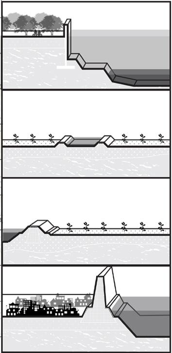
Soft Edge: Highly natural-based edge that redirect or co-exist with the river system
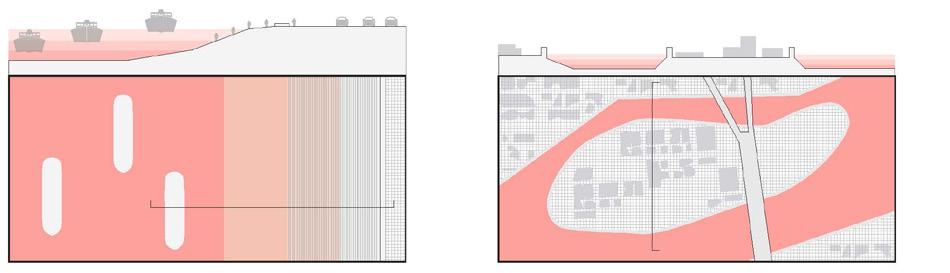
Lower MISSISSIPPI RIVER (NEW Orleans)
Tragedy of the Commons
- The ignorance of public utility
- House height rasing competition
- Investment goes into the other side of the levee
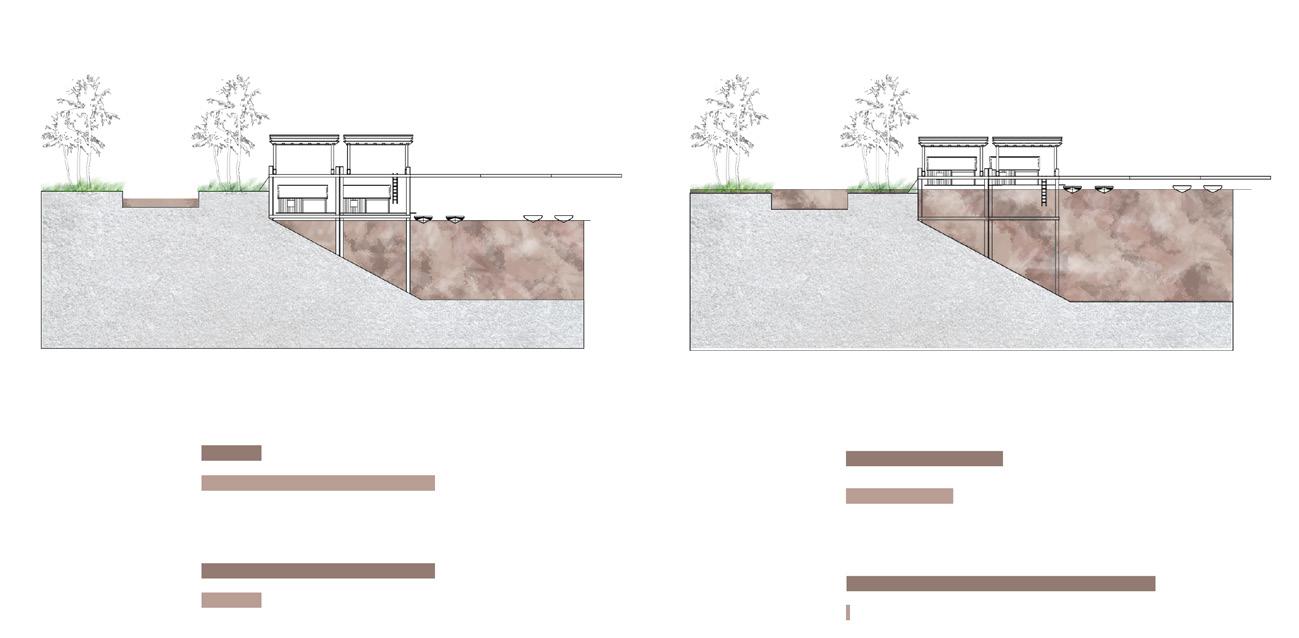
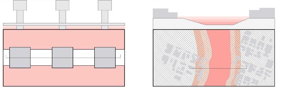
Edge Condition
Condition 1
City flood wall
Built by Goverment
Lifespan: 25 50 years
Condition 2
Individual farm levee
Built by Individual farmer
Lifespan: < years
Condition 3
Large-scale agriculture levee
Built by federal agencies
Lifespan: 5-25 years
Condition 4
Large-scale city levee
Built by goverment
Lifespan: >50 years
Agriculture - Outer Levee Agriculture Inner Levee
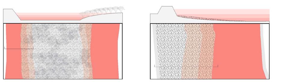
Hard Edge: Highly man-made or urban hard edge that manipulate or change the course of the river system
Soft: Non-protected, extreme vulnerable
Hard: Levee
The cause of vulnerability
- High flood/storm surge risk
- Unprotected by hard edge system
Man-made channel Barge industry Urban levee
- Unable to recover after hazard Old
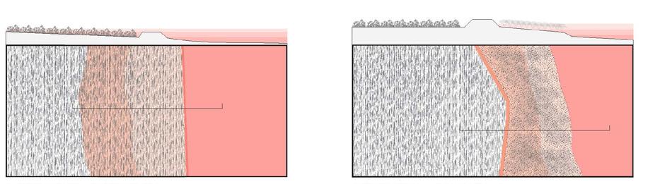
Wetland Swamp
Urban island
New
Zoom in area
Urban Fabric
Urban Fabric
Chao Phraya River
Soft Edge: Highly natural-based edge that redirect or co-exist with the river system
Chao Phraya River (Bangkok area)
Tragedy of the Commons
- No life on river
- Uneven protected method
- Uneven investment distribution
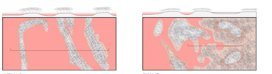
River island nature Alluvial plain
Edge Condition
Completed: Protected by levee/flood wall
Broken: Unprotected or lower protection
The cause of vulnerability
- Uneven resources distribution

- Extreme flood condition
Wetland Swamp
Hard Edge: Highly man-made or urban hard edge that manipulate or change the course of the river system
- Diffcult to rebuild or live
River island residental Port
Flood
Urban outer levee
 Old Urban Fabric New Urban Fabric
Zoom in area
Gate
Old Urban Fabric New Urban Fabric
Zoom in area
Gate


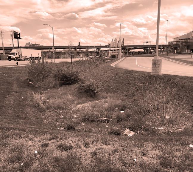
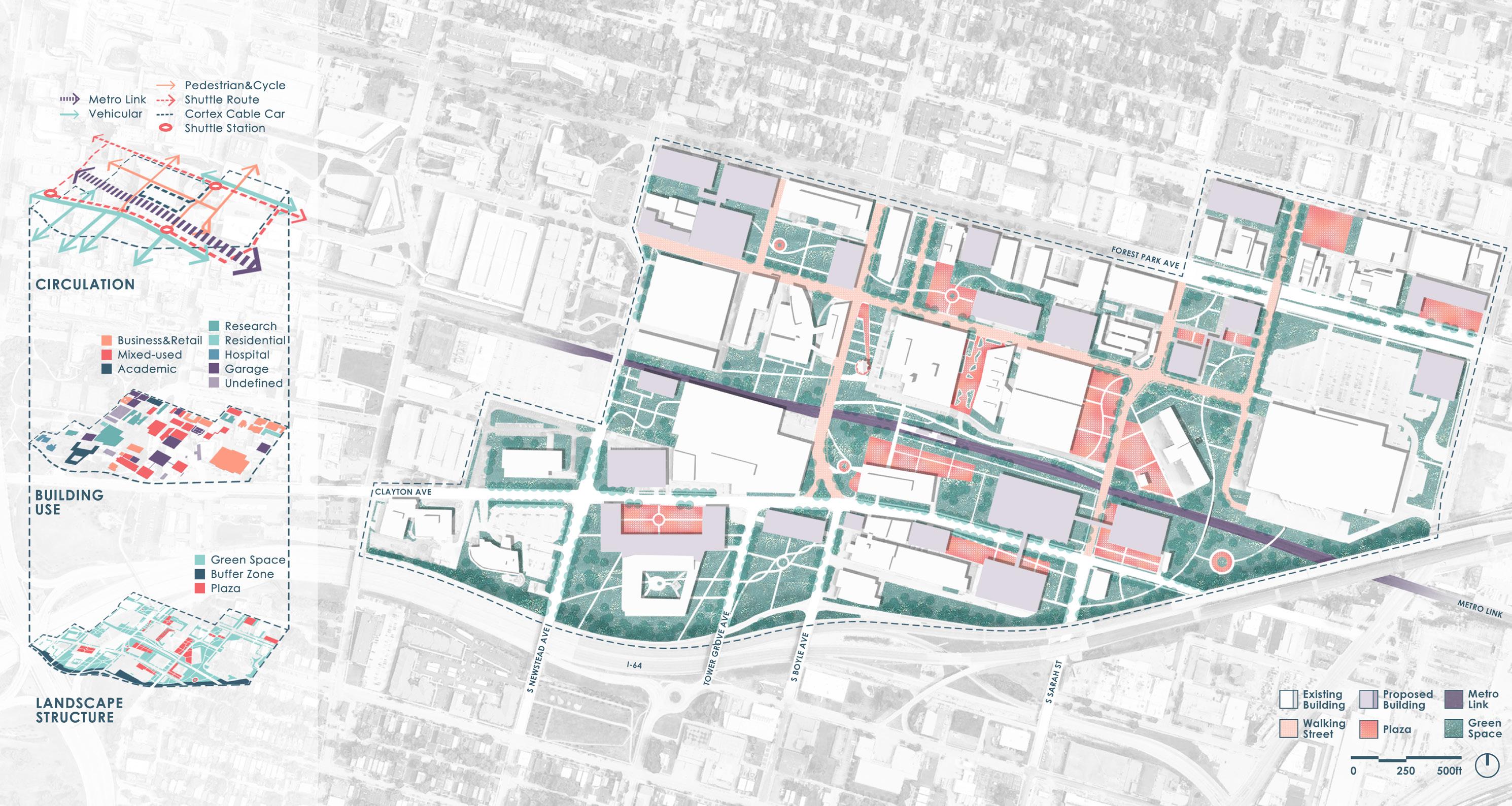
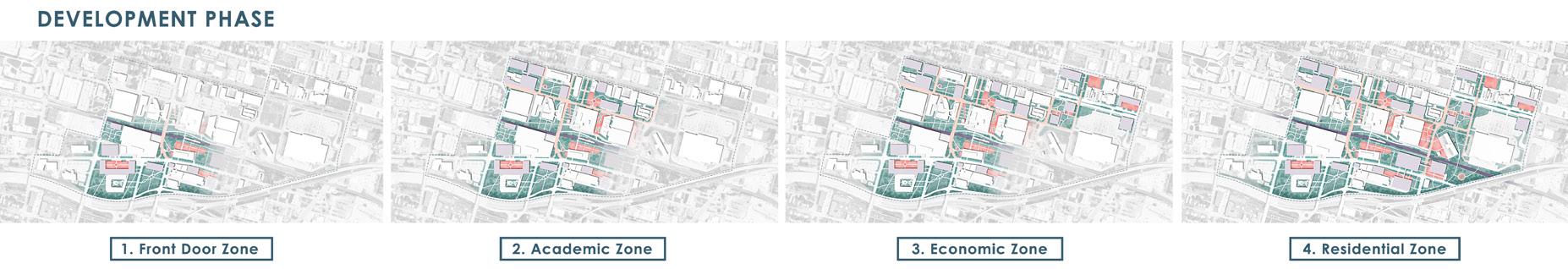
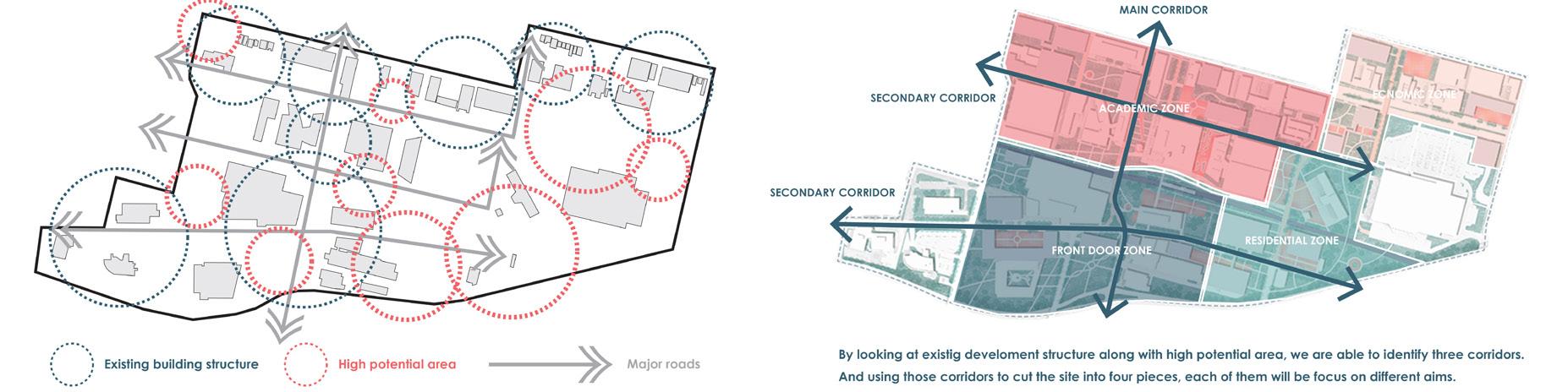
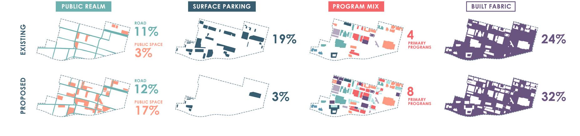
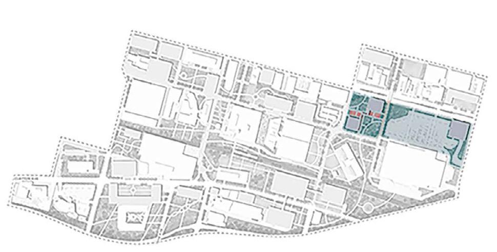
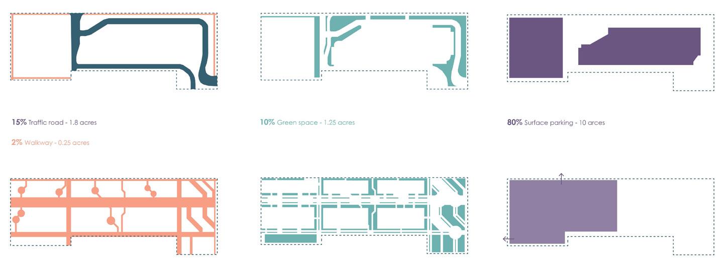
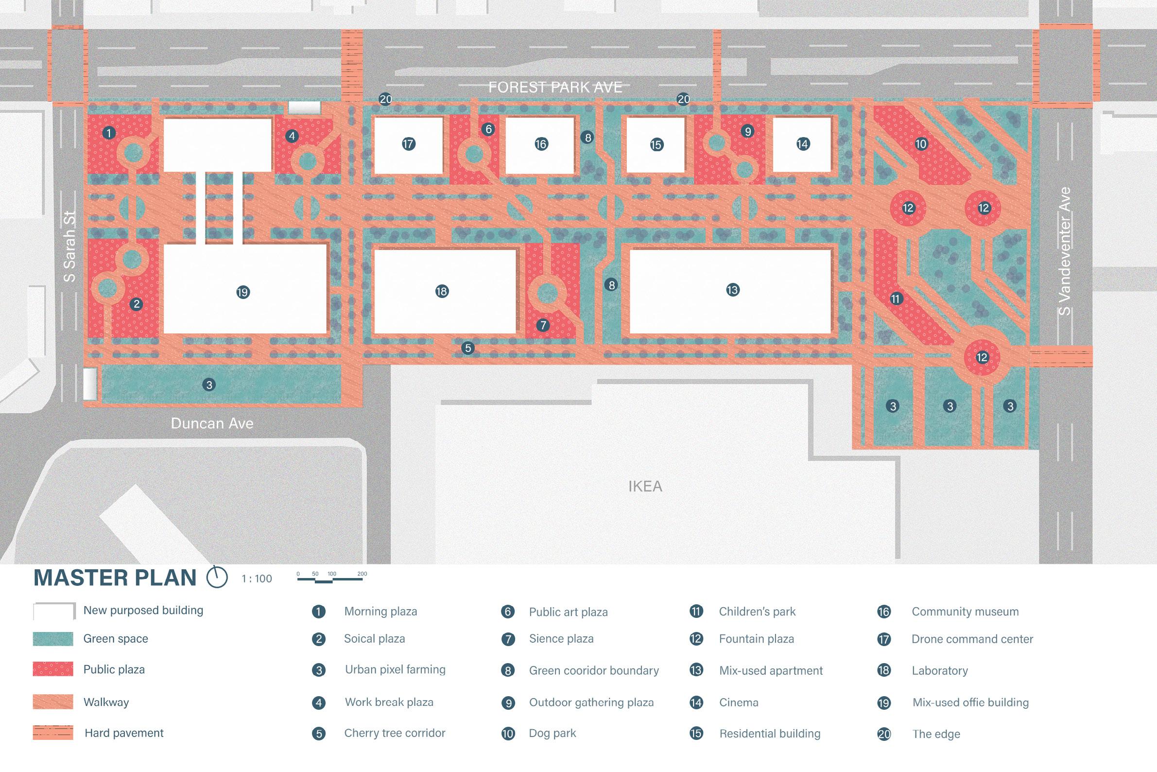
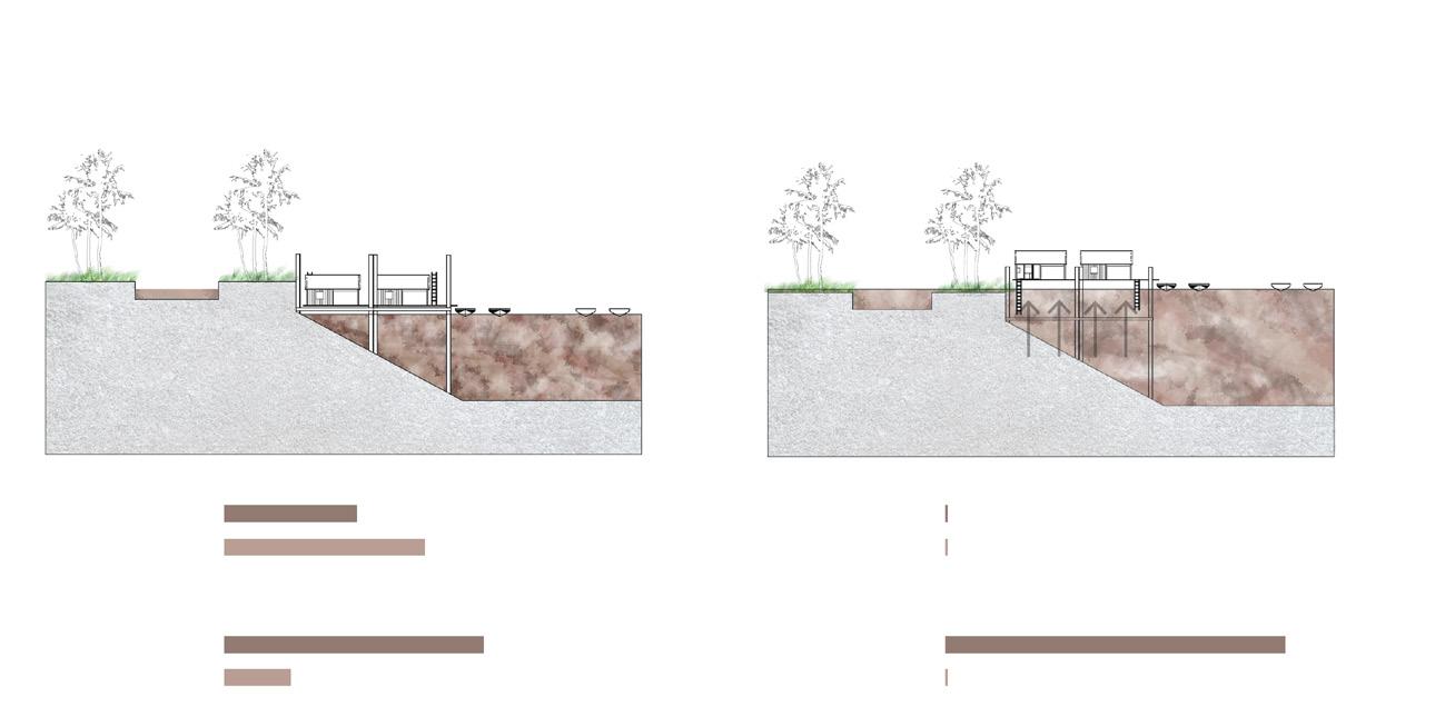
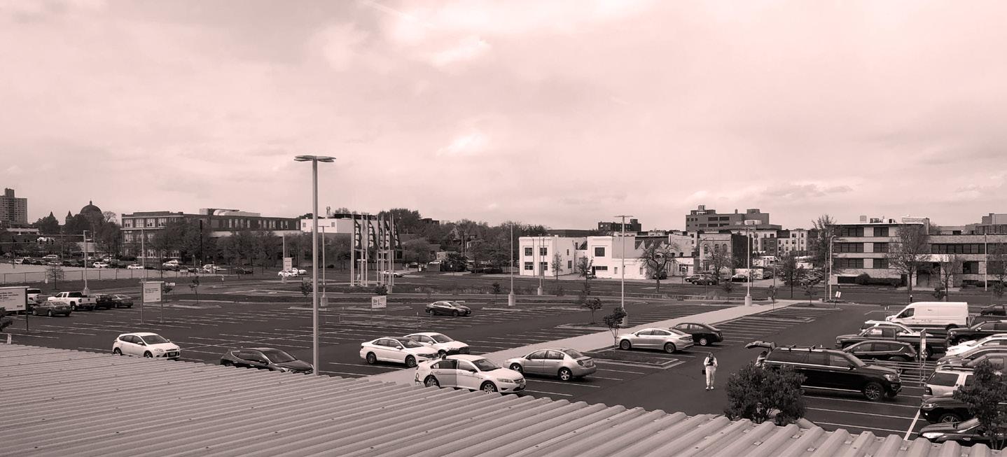 Ray Carroll St. Louis
Existing IKEA Parking
Existing Rain Garden Edge Condition
Ray Carroll St. Louis
Existing IKEA Parking
Existing Rain Garden Edge Condition