5 minute read
Re-appearing

St. Louis, MO, USA

Advertisement
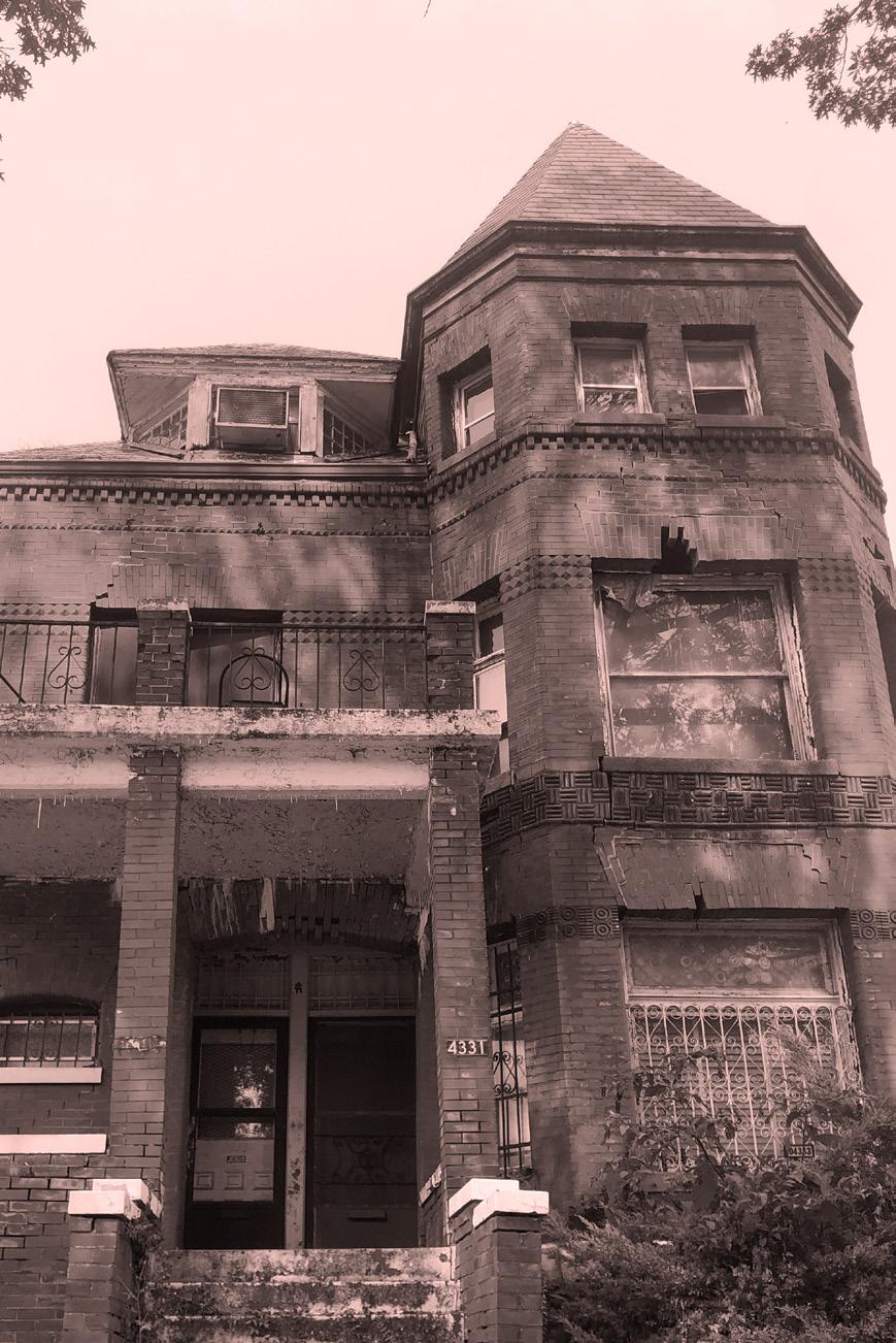
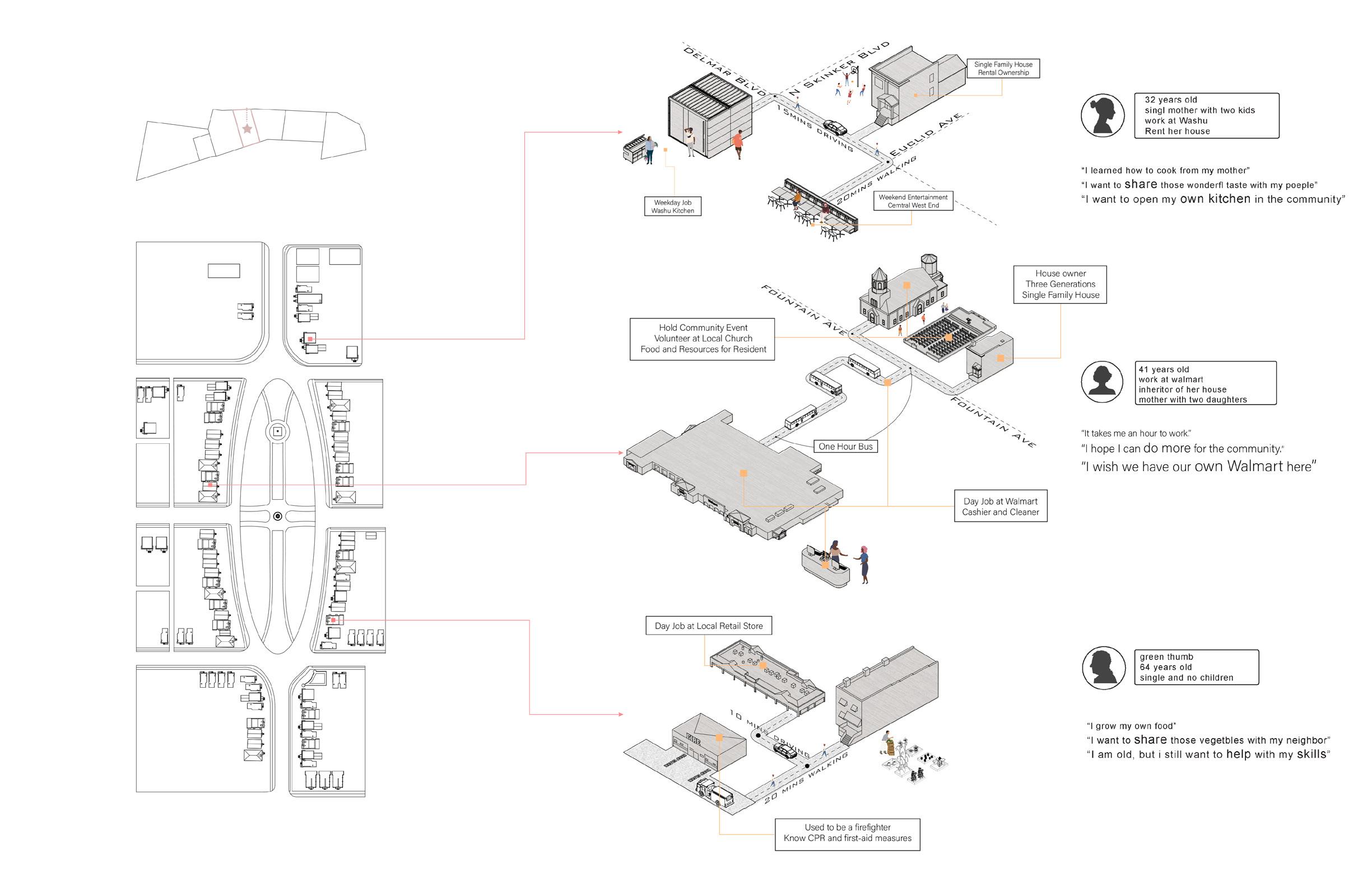
The Hodiamont Track crosses through seven neighborhoods along the Delmar Blvd in north St.louis, which are mostly occupied by African American working class. The track has been once a very active transportation corridor, connecting these once prosperous neighborhoods. But today, the tracks are no longer in use and these neighborhoods are in severe decline, known as an attractor for illegal activities, such as illegal dumping or place of serious crime. The fountain park community as one of the seven neighborhoods used to be a place that filled with history and honor. We are digging out the hidden values here and use that as a base to imagine a new possibility.
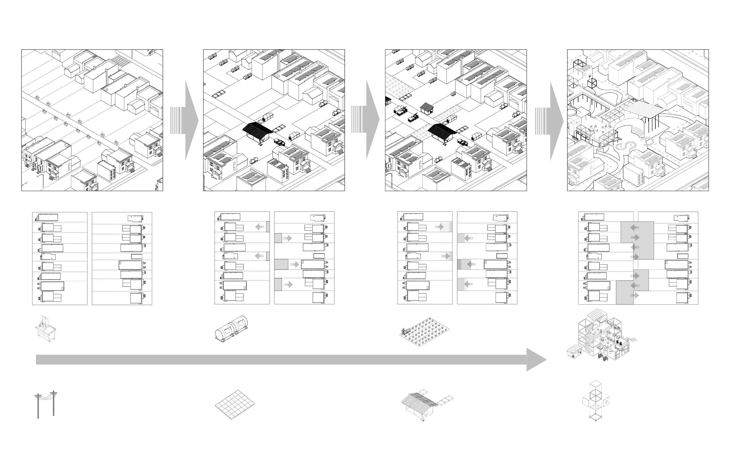
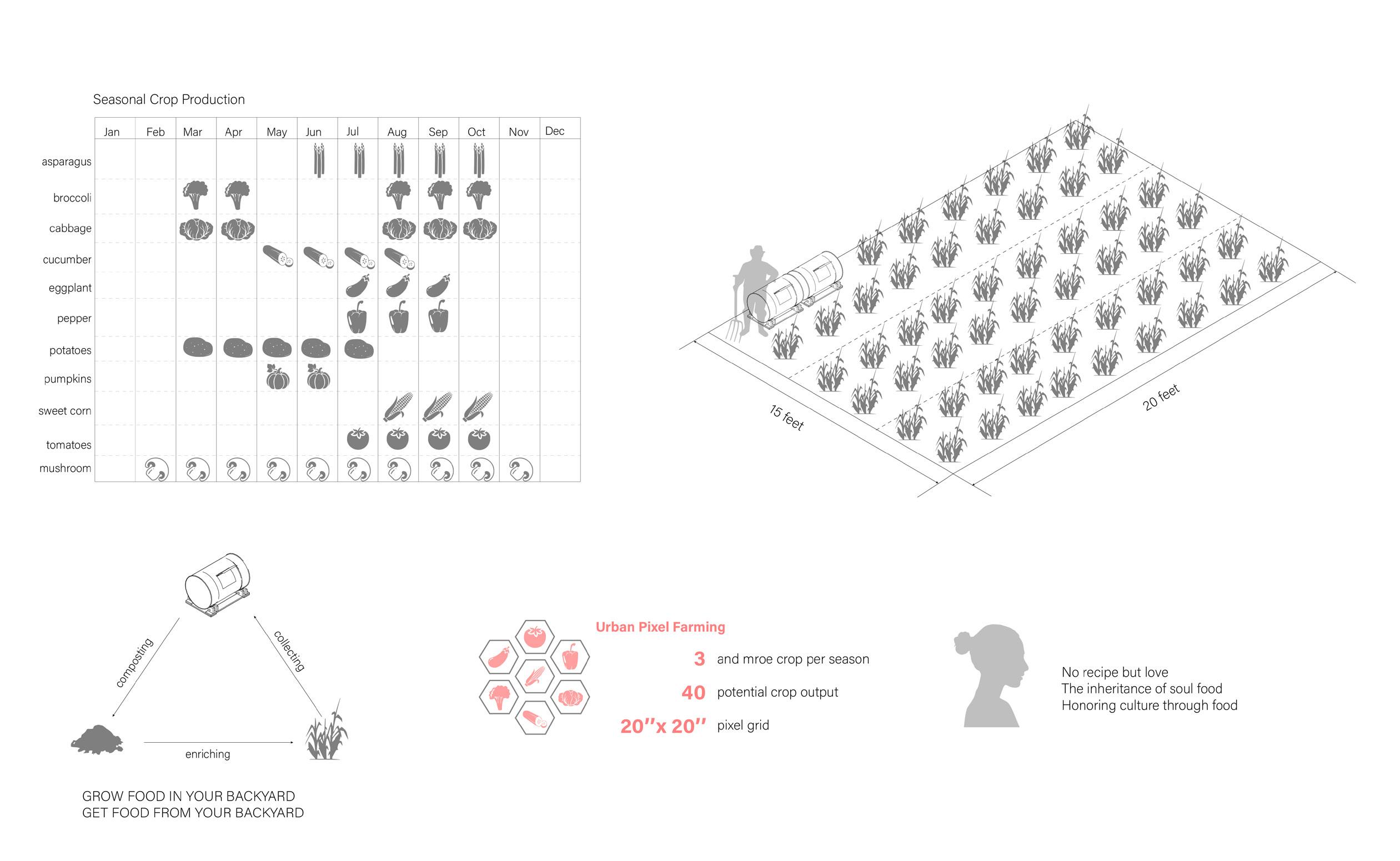
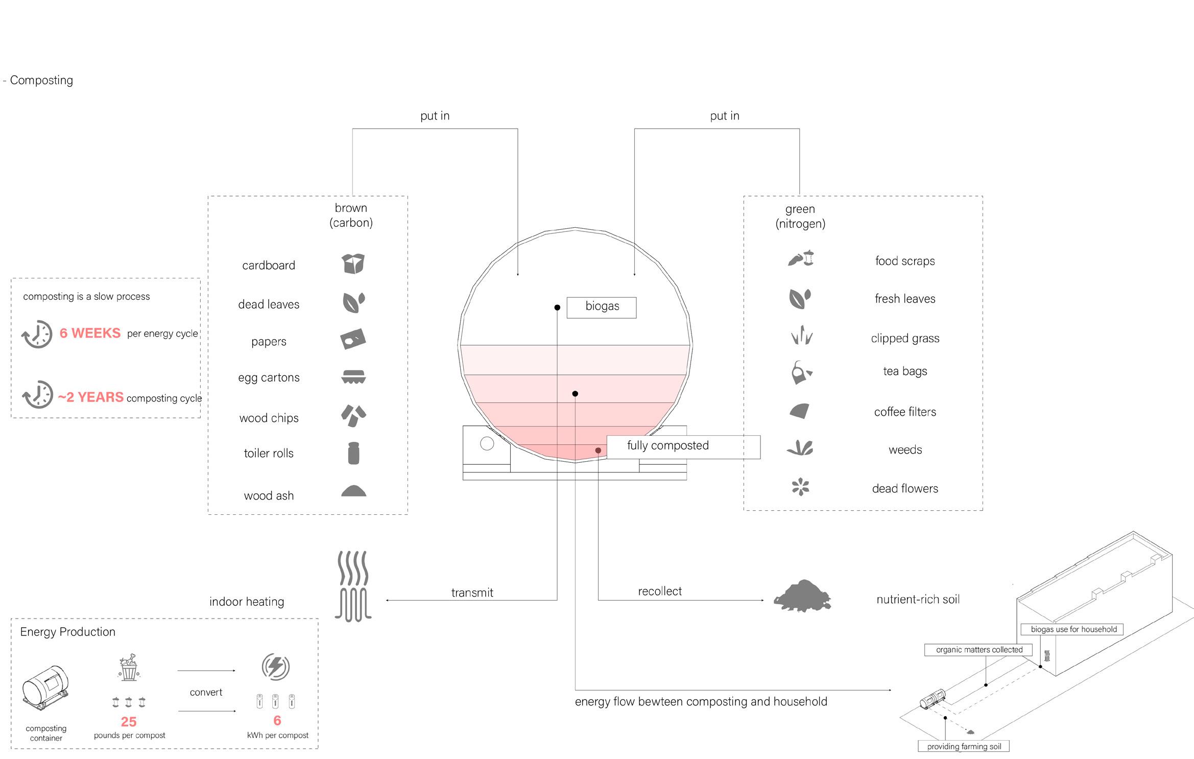
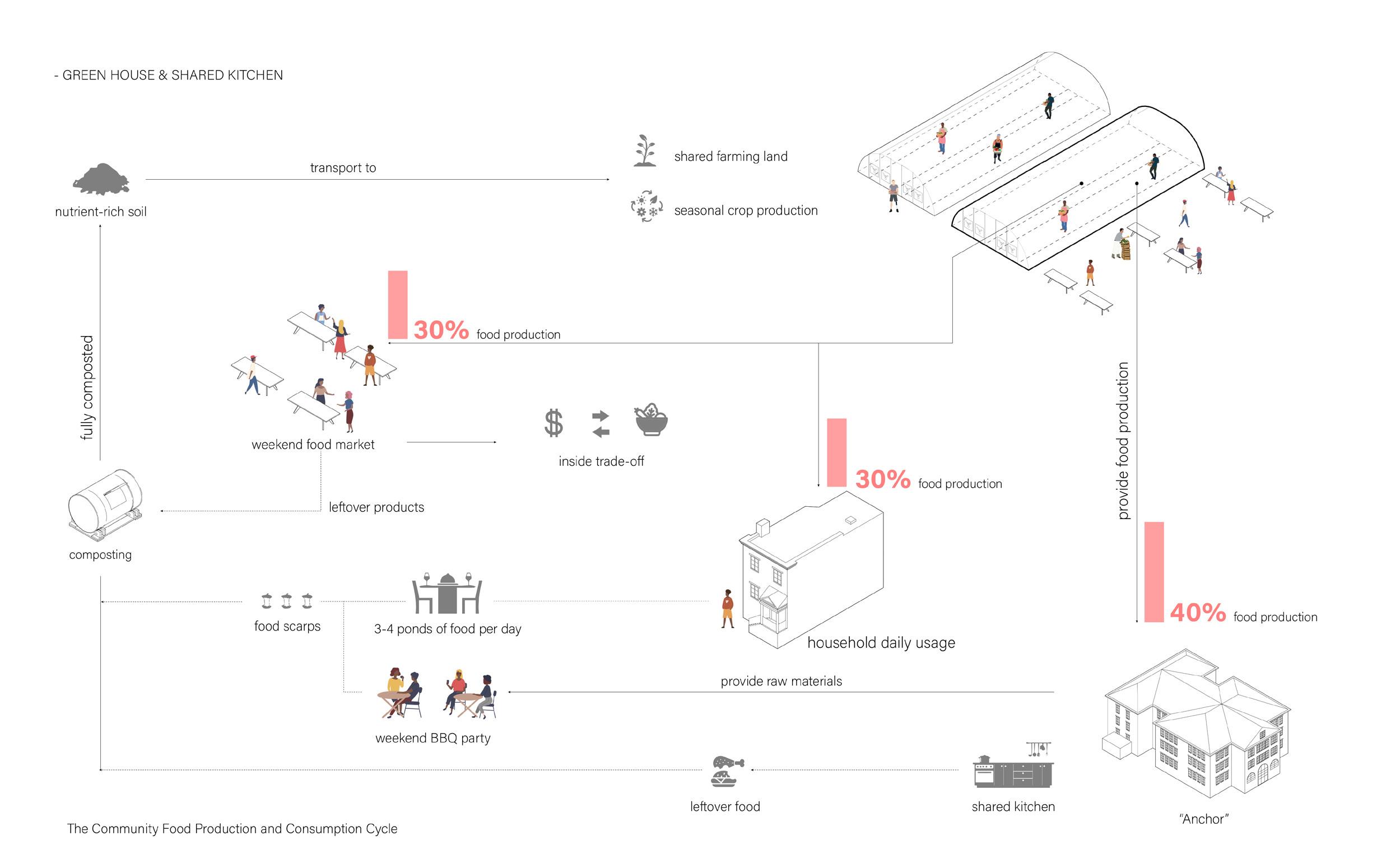
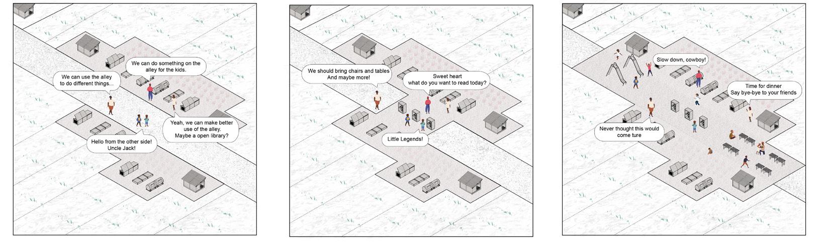
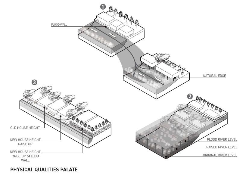
Learning from the success of black wall street and using it as a trigger, we are trying to reconfigure the possible future of the fountain park community. As vulnerable the current system is, whether it is waste treatment, food production or energy generation, we are testing different possibilities through different scenarios with the idea of reshaping the system into a self-sustain and productive one which will help to strengthen the community from within to withstand the outside disturbances. From reforming waste treatment system to community-wide food and energy production system on different scales, the community will have the possibility to support itself. Give them a chance to create a community that is built by its people, for its people. As time goes by and the community are well fit in these strategies, the self-sustainable resource recycle system will help them get rid of traditional municipal services, such as electricity input and trash pick-up, which gives opportunities for new spatial configuration, the alley along backyards disappears and backyards could combine with each other to induce shared ownership of open space inside the neighborhood, as well as reutilizing the unoccupied school building for shared use as anchor of the community, which offer space for further development of the neighborhood under the context of climate change.
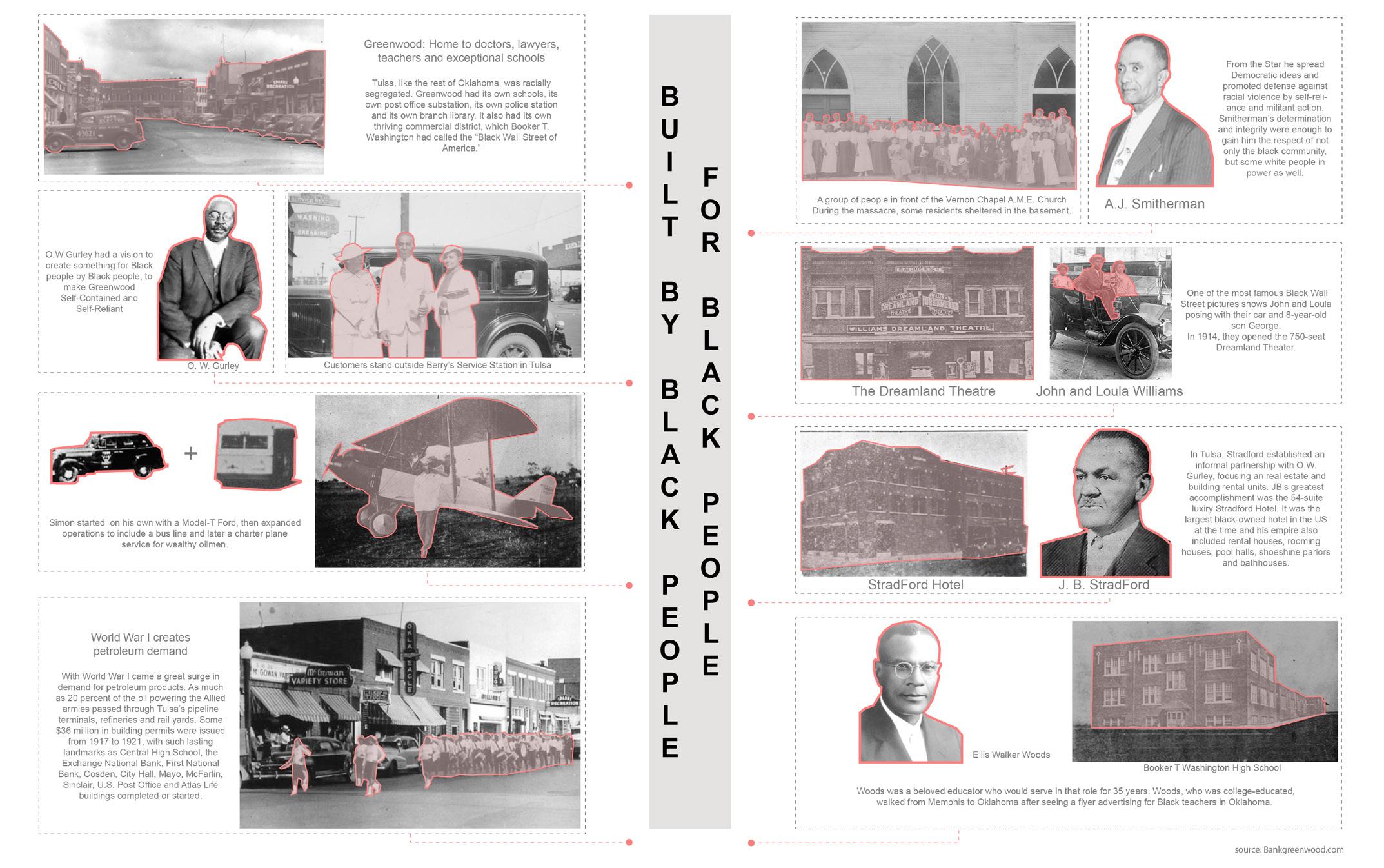
As an inspiration to the Greenwood district in Tulsa, also known as Black Wall Street, a once flourishing economic as well as cultural Mecca, we envision Fountain Park to become an emergent cultural epicenter modeled after Black Wall Street, yet adapted to 21 century urban living. Facing challenges of a rapidly changing climate, dwindling energy resources and growing food deserts in urban areas, we developed a set of site specific operations to transition the Fountain Park neighborhood into a self sustainable community towards energy and food supply production. By slowly introducing different forms of waste treatment systems and community-wide food and energy production supplies, the community in Fountain Park will slowly change its economic and spatial configuration starting with one block as testing ground to unfold these site-specific operations.

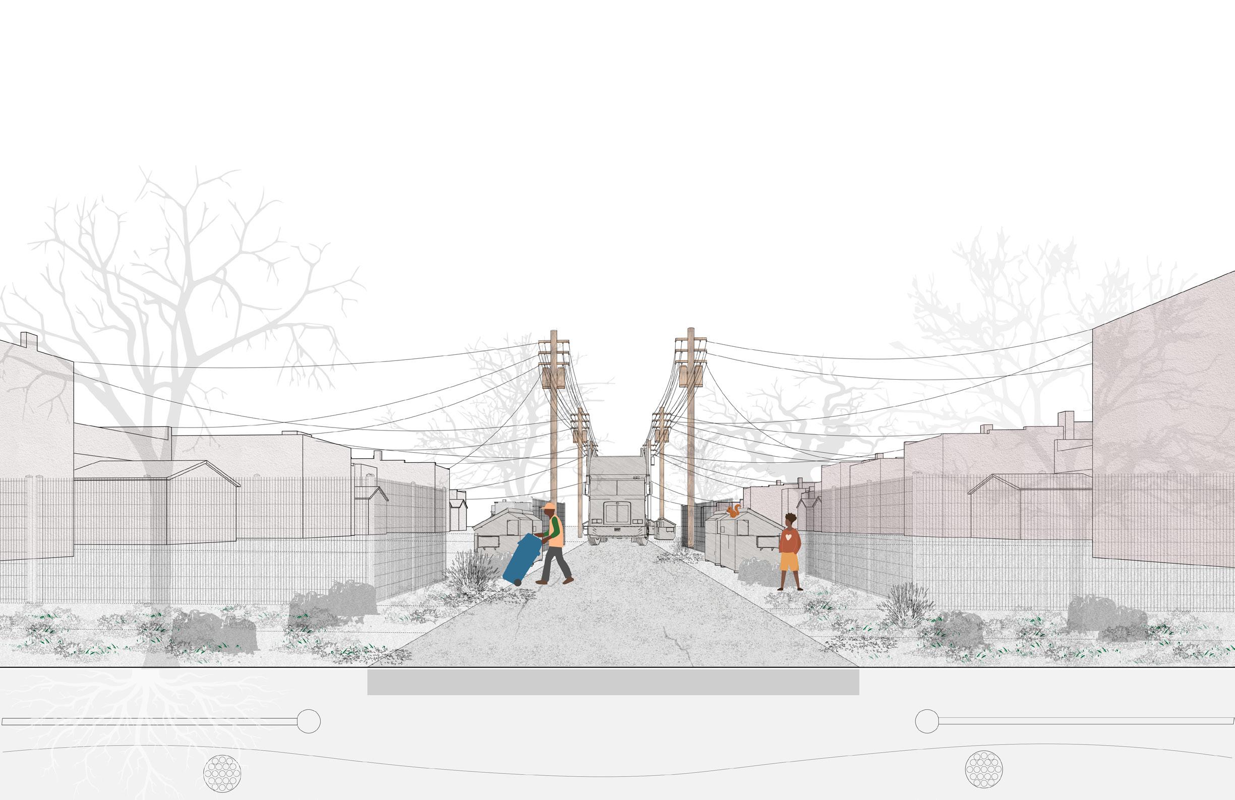
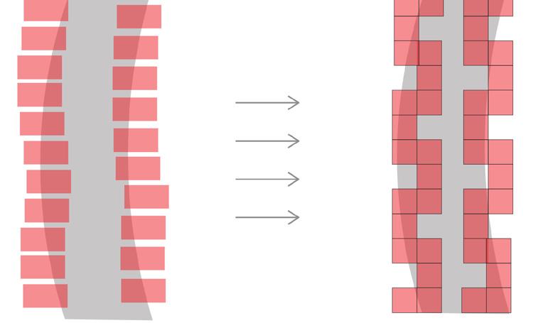
THE DIS-APPEARING ALLEY (through time)
Status Quo Towards a renewable energy system Towards a localized food production Towards a self-sustainable future year 0 year 1-10 year 10-20 year 20 and beyond...
THE ALLEY Shrinking Extending Merging rash container dominated backyard energy purchased from ameren bio-energy composting container household soalr panel backyard pixel farming community reuse hub new model of social hub moveable and easily assembled unit


Urban Design

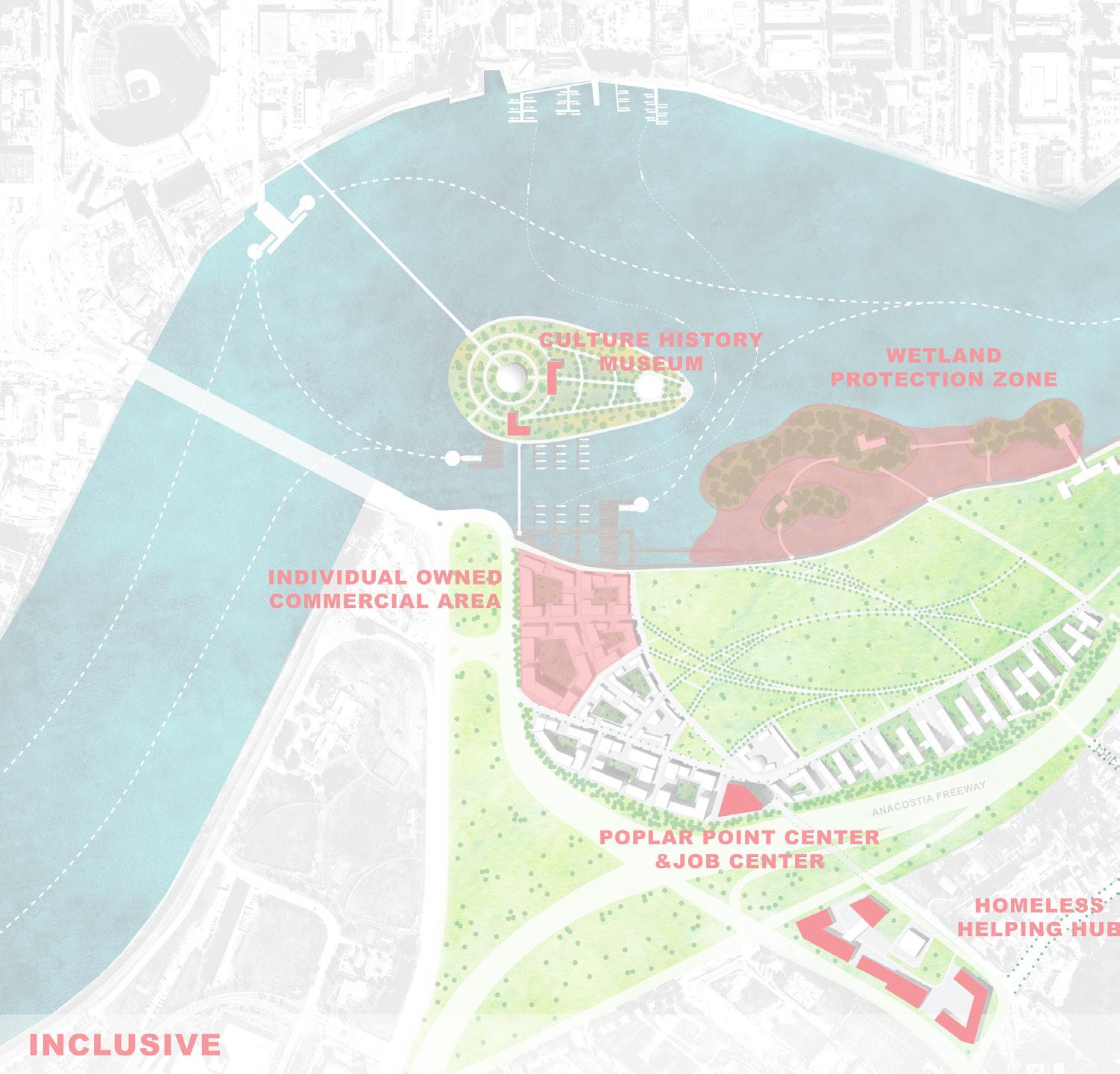
04 Poplar Point Anacostia, Washinton DC, USA
Poplar Point is on the southern bank of the Anacostia River in Washington, D.C. located just two miles from the Capitol building and within walking distance from historic Anacostia and the Anacostia Metro station.

The new planning is aiming to bring more attentions to this area and its surrounding communities. By separting one year into two seasons - warm and cool, a whole new development plan has different foucus during different time of the time. Gaining more investments into the community and enhancing local cultural inheriatge at the same time.

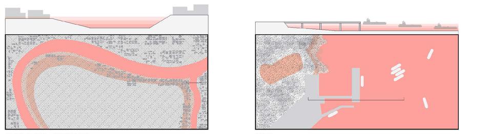
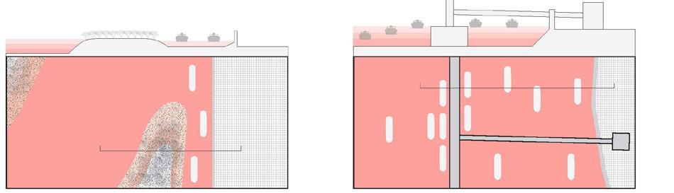
SECTION A-A
WARM SEASON:
Cherry blossom will attact tourists and ball game watchers. Visitor center serves as a place for information and food. Beer & BBQ plaza will serve as a gathering place for game watchers. Water taxi port will serve as a recreational activitis for outsides.
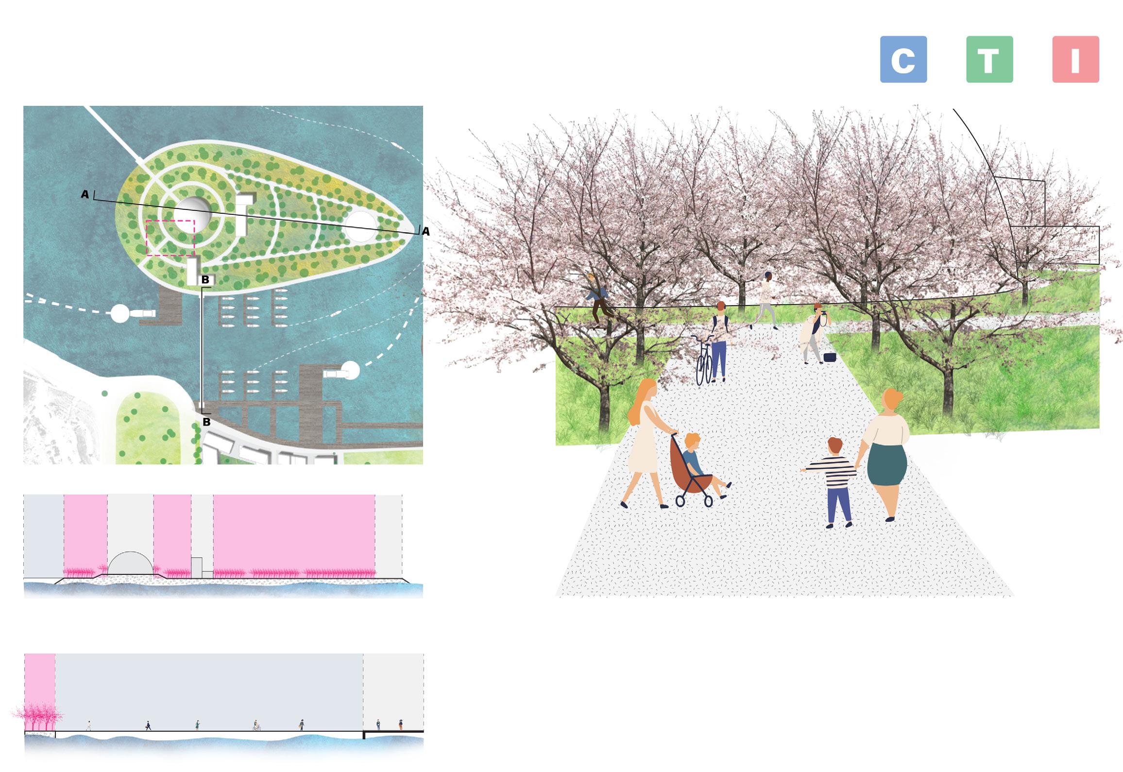

COOL SEASON:
The visitor center will serve as a place to hold conferences and local social events. The port will serve as a transportation choies for local residents on a daily base. The plaza will serve as a place for having outsie movie night or concert for local artists.
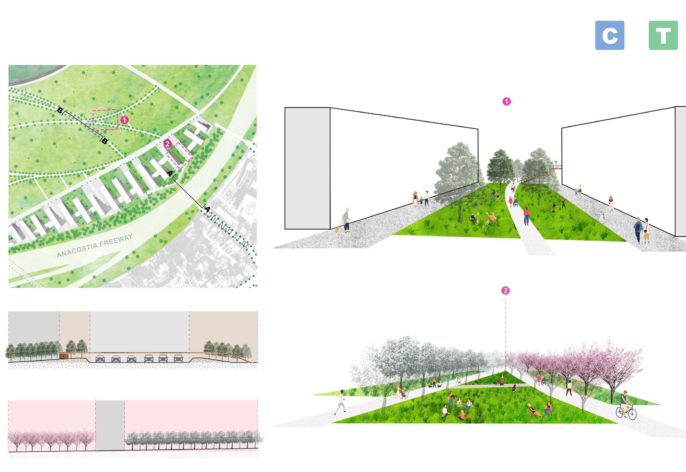
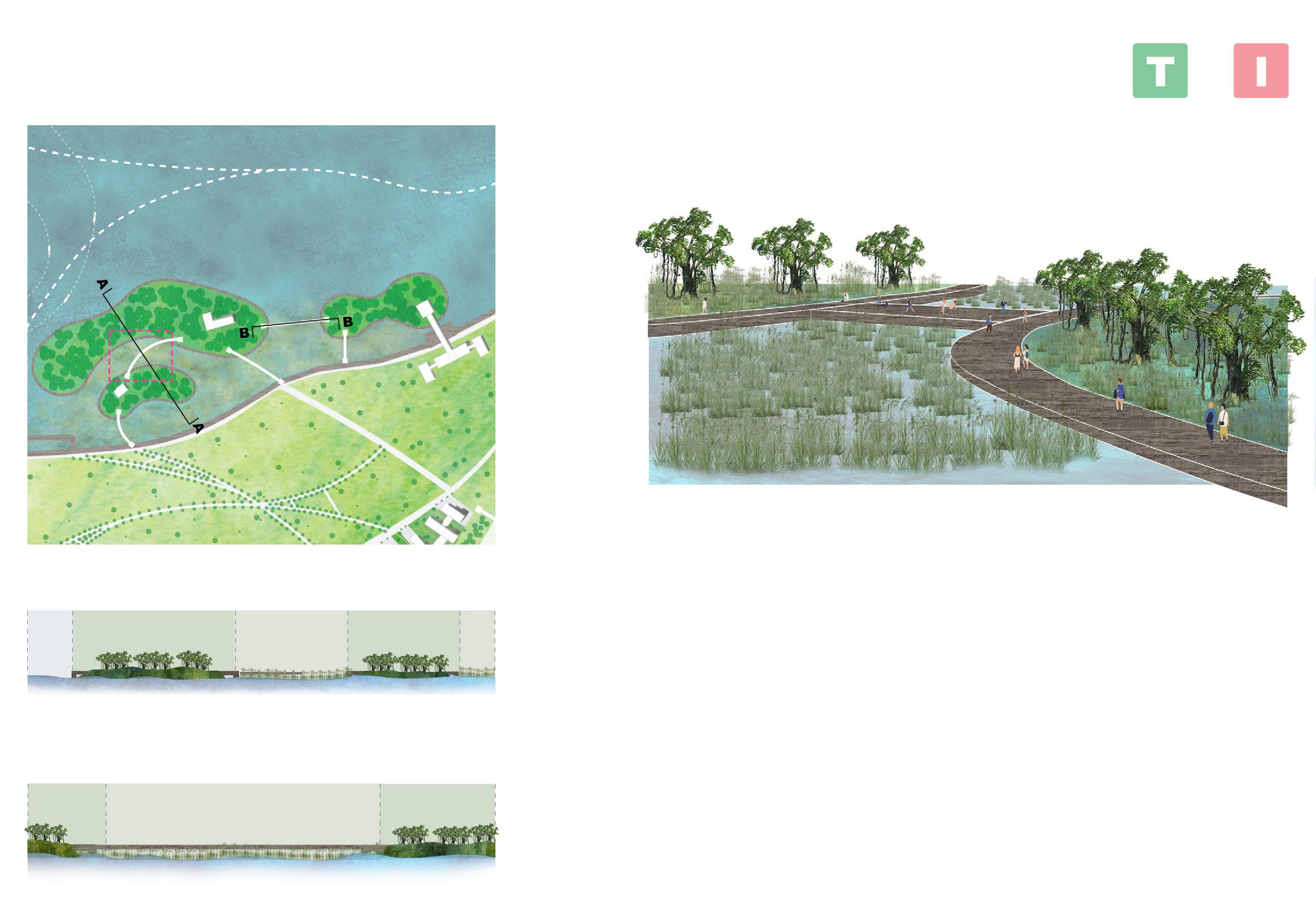
Master Plan
WARM SEASON:
Two islands are serving different animals but not limited to certain species. Both of them will serve as a animal watch piont for tourist and professional researchers. In additional, they have academic proposes as an experiment and outdoor leaning field for schoolage kids.
Highlight Area 3
COOL SEASON WARM SEASON
FLOWERING DOGWOOD
BLOOMING TIME: EARLY
SPRING
COLOR: WHITE, PINK
EASTERN REDBUD
BLOOMING TIME: MARCH TO JUNE
COLOR: RED, PINK
COOL SEASON:
Three islands will become a regional research zone for certain species’s migrtion, and partly closed to outsiders.


Urban Design
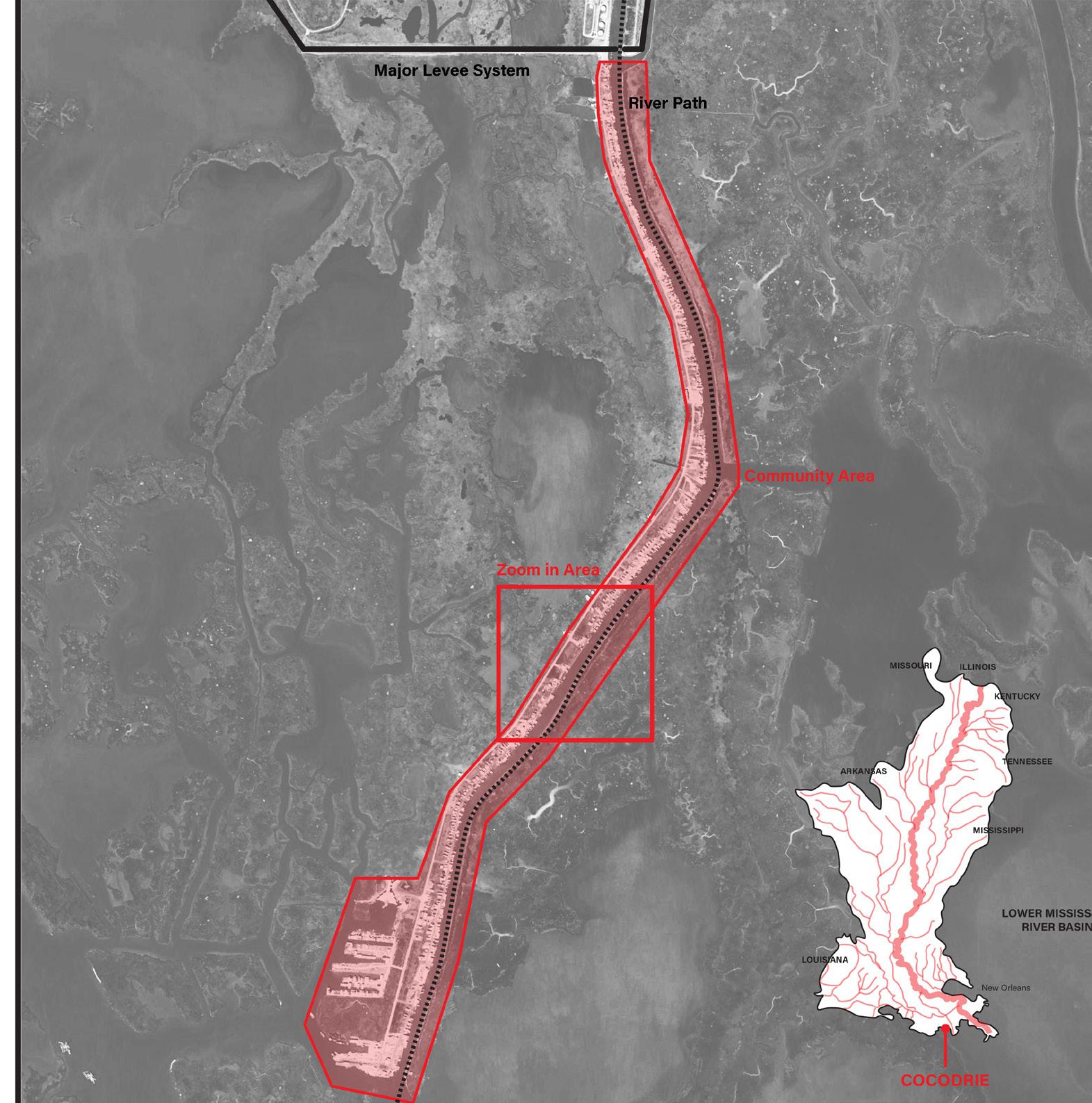
05 All Boats Raise Together New Orleans, USA / Bangkok, Thailand
In both contents, it is easy to noticed that human have been trying to manipulate the course of the river for a long time. Whether it is the complex levee system in the lower mississippi or rich people get to build flood walls and poor people get flooded in Thailand causing multiple problems including the tragedy of commons. It is hard to ignore that we have been using hard edges to keep us away from the water and keep us always in a safe postion.
But what if none of those hard edge systems will be able to protect us in the future?
What if we have no choice but to engage rivers as commons?


What if hard and soft edges exist at the same time?

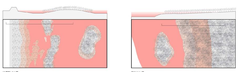
Mississippi River
Soft Edge: Highly natural-based edge that redirect or co-exist with the river system


Lower MISSISSIPPI RIVER (NEW Orleans)
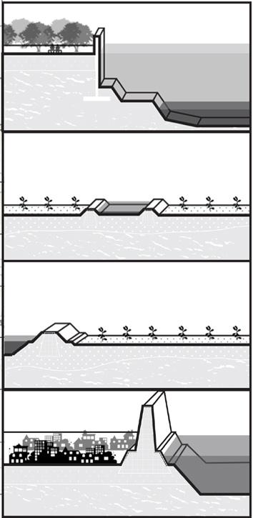
Tragedy of the Commons
- The ignorance of public utility
- House height rasing competition
- Investment goes into the other side of the levee
Edge Condition
Condition 1
City flood wall
Built by Goverment
Lifespan: 25 50 years
Condition 2

Individual farm levee
Built by Individual farmer
Lifespan: < years
Condition 3
Large-scale agriculture levee
Built by federal agencies
Lifespan: 5-25 years
Condition 4
Large-scale city levee
Built by goverment
Lifespan: >50 years
Agriculture - Outer Levee Agriculture Inner Levee
Hard Edge: Highly man-made or urban hard edge that manipulate or change the course of the river system
Soft: Non-protected, extreme vulnerable
Hard: Levee
The cause of vulnerability
- High flood/storm surge risk
- Unprotected by hard edge system
Man-made channel Barge industry Urban levee
- Unable to recover after hazard Old
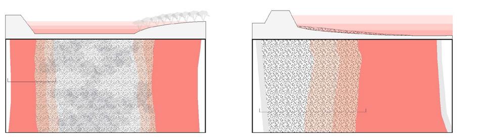
Chao Phraya River
Soft Edge: Highly natural-based edge that redirect or co-exist with the river system
Chao Phraya River (Bangkok area)
Tragedy of the Commons
- No life on river
- Uneven protected method
- Uneven investment distribution
River island nature Alluvial plain
Edge Condition
Completed: Protected by levee/flood wall
Broken: Unprotected or lower protection
The cause of vulnerability
- Uneven resources distribution

- Extreme flood condition
Wetland Swamp
Hard Edge: Highly man-made or urban hard edge that manipulate or change the course of the river system
- Diffcult to rebuild or live
River island residental Port
Flood
Urban outer levee