Des chambres dans la ville dense
post-garages district of Heyvaert in Brussels

the

post-garages district of Heyvaert in Brussels
the post-garages district of Heyvaert in Brussels
Politecnico di Torino, A.A. 2021-2022
Corso di laurea magistrale in Architettura per il Progetto Sostenibile
Tesi di laurea magistrale
Relatore
prof. Angelo Sampieri
Candidata
Beatrice Armano
4 - The garages district: past, present and future of Heyvaert
4.1 Urban economy evolution
4.2 Second-hand car trade: neighbourhood eco nomy and global phenomenon
4.3 The garage spaces
4.4 Which future for Heyvaert?
1 - Bruxelles, Brussel, Brussels: international city, multicultural city, divided city?
1.1 What is Brussels?
1.2 A small global city and its economy
1.3 Multicultural city
1.4 Divided city
2 - The western area of the poor crescent: east Molenbeek and Cureghem
2.1 A highly diverse area
2.2 “Le petite Manchester belge”
2.3 A highly mixed urban fabric
3.1 What is happening to the western first ring?
Players and actions
3.2 The quest for diversity
5 - Des chambres dans la ville dense: projects for the post-garages district
5.1 Strategies
5.2 Courtyards
5.3 Long plots
5.4 Canal-facing plots
Open questions
ENG
In the ‘small global city’ of Brus sels, the working-class neigh bourhoods located in the so-cal led ‘poor crescent’ along the Charleroi Canal have been the subject of transformation plans and real estate pressure for seve ral years.
The Heyvaert district in Cure ghem (located halfway between the municipality of Molenbeek St. Jean and Anderlecht, on the im mediate western outskirts of the city centre) is being been and is going to be in the next future de eply involved in this kind of dy namics. Known in Brussels as the ‘garages district’, it has for years represented an economic cluster hosting an intense buying and selling of used vehicles mainly destined for the African conti nent. Given an (albeit gradual) relocation of the garage business (as well as an intrinsic decline
of the business itself), several lots in Heyvaert would soon be available for new real estate de velopments and public projects.
Although the proposed plan for the area proposes a general vision of quality, some of the suggested transformations seem to have a significant impact on the existing fabric, which to date is deeply fragmented, discontinuous, and opaque.
Starting precisely from a criti cal reading of the current plan, seeking to exploit its general qualities while at the same time making modifications, especially from a typological point of view, this thesis proposes a series of three site-specific proposals that aim to safeguard the quality of spaces through design.
IT All’interno della “piccola città globale” di Bruxelles, i quartie ri popolari (un tempo quartieri operai) situati nella cosiddetta “mezzaluna povera” lungo il Canale Charleroi sono da diversi anni oggetto di piani di trasfor mazione e pressione immobiliare. Il quartiere Heyvaert a Cureghem (situato a metà tra la municipalità di Molenbeek St. Jean e Ander lecht, nell’immediata periferia occidentale del centro storico) è stato e sarà in modo particolare estremamente coinvolto in que sto tipo di dinamica. Conosciuto a Bruxelles come il “quartiere dei garages”, rappresenta da anni un cluster economico che ospita un’intensa attività di compraven dita di veicoli usati diretti prin cipalmente verso il continente africano. Nell’ottica di un trasferi mento (seppur graduale) dell’at tività legata ai garages (nonchè
di un declino intrinseco dell’at tività stessa), numerosi lotti ad Heyvaert risulterebbero a breve disponibili per la realizzazione di nuovi sviluppi immobiliari e progetti pubblici.
Sebbene il piano proposto per l’area proponga una visione gene rale di qualità, alcune delle tra sformazioni suggerite sembrano avere un impatto significativo sul tessuto esistente, ad oggi profon damente frammentato, disconti nuo, opaco.
Partendo proprio da una lettura critica del piano attuale, cercando di sfruttarne le qualità generali andando al tempo stesso ad effet tuare delle modifiche, soprattutto da un punto di vista tipologico, questa tesi propone una serie di tre proposte site-specific che si pongono come obiettivo quello di salvaguardare la qualità degli spazi attraverso il progetto.
Brussels is a small global city (Vandermotten, 2014). ‘Small’ because of its size, which is modest compared to other global cities, and be cause of its actual weight in the global economy. Its ‘global’ dimension derives above all from its political role at the international level and the economical repercussions of this role, as well as the great diversity of its population, which makes Brussels one of the most historically multicultural metropolises in Europe. Like many other big cities, the Belgian capital is both a great generator of wealth and a reservoir of poverty and unemployment. Brussels socio-economic divide is spa tially expressed at different levels and scales.
The first chapter of this thesis examines the socio-spatial fracture that can be observed at the scale of the metropolis but also at the scale of the single municipalities. While Brussels has a very high concen tration of power related to national, transnational institutions and companies, the economically disadvantaged population seem to be concentrated in certain areas of the city. This is not an uncommon phenomenon for a metropolis, which in many cases has led to the social stigmatisation of certain neighbourhoods over the years, parti cularly within what is referred to as the “poor crescent”, which largely corresponds to the former working-class neighbourhoods along the Charleroi Canal.
The second chapter provides a narrative on the state of the art of a portion of the city having the Canal as its axis. In particular, the neighbourhoods of Old Molenbeek and Cureghem, located on the immediate western outskirts of the city centre, are today - in spite of numerous recent and ongoing transformations - among the poorest and most unemployed areas, so that they have been defined as spaces of social relegation (Rosenfeld, 2015). A key characteristic of these neighbourhoods is the high concentration of an architectural heritage that testifies to the industrial character of this part of the city (in fact, it was called ‘the little Belgian Manchester’). In addition to the mo numental complexes, most of which have undergone reconversion in recent years, there is a wealth of more modest architecture (warehou
ses, sheds, workshops) integrated into the blocks (sometimes visible, sometimes hidden within them), some of which are now empty, while others still house small manufacturing activities. The latter benefit from a combination of three factors: the low price of devalued land, the central location and the diversity of building surfaces, which are generally located in the heart of a block on originally wide and deep lots (Le Fort, 2017).
As the third chapter shows, in recent years, the Canal area has been looked at as decisive development capital for the region, to meet the need for new housing and the challenge of revitalising a manufactu ring-type economy within the metropolitan area. The high availability of a ‘small industrial legacy’ characterised by the factors listed above attracted both public and private urban renewal actors, who saw these plots as project opportunities within the poor crescent of Brussels. Numerous plots have thus been the subject of densifying transfor mations, with a certain amount of real estate speculation. In order to cope with this kind of speculation and to ensure certain accessibility to housing, the public sector (both the municipalities and the Region) implemented regulatory measures within the so-called strategic areas.
The fourth chapter focus on one of the strategic and most under pressure areas is the Heyvaert district in Cureghem, mainly known as the ‘garages district’. This is an area that is home to a particular busi ness activity, which consists of the buying and selling of second-hand vehicles mainly destined for countries on the African continent. The numerous industrial buildings (of various sizes, preservation and hi storical interest) in this area are in fact mainly used as garages. Anti cipating, on the one hand, a willingness on the part of the authorities to relocate this trade and, on the other hand, an intrinsic decline of the business itself, the region has proposed a transformation plan for the area, whose main objectives are the creation of housing (densifi cation), the transition to a different type of economy, and the partial de-densification of certain blocks. While the plan aims to set certain limits to avoid real estate speculation, several questions remain open
and a wide margin of freedom is granted to those who will develop future individual projects within the area. One pillar of the transfor mation is the creation of a linear park following the old course of the river Senne, which once flowed through blocks. The plan recognises the presence of built heritage of great quality that is today underva lued and often threatened by demolition and reconstruction projects.
A critical reading of the master plan proposed by the region provides the starting point for the development of the fifth chapter and the fi nal part of the thesis. Although schematic, the vision proposed by the plan appears quite clear: the neighbourhood is painted, almost re-sha ped with a new face, profoundly characterised by attributes such as transparency, homogeneity and restraint of both built surfaces and open spaces. The translation of this vision into practice entails a rather heavy transformation of the existing fabric, characterised by almost opposite attributes: it is in fact deeply fragmented, discontinuous, and uneven. Through the identification of some small clusters of edifices with the function of a garage (or connected to it), three design propo sals are developed that imagine an alternative vision, while providing a greater degree of detail than the masterplan scheme.

international city, multicultural city, divided city

Nestled in the Flemish region and three kilometres distant from the Wal loon border in a bird’s eye view, Brussels1 is a bilingual metropolis-region that could be described as «a compact city in a diffuse network», a «small global city» (51n4e et al., 2011). The city is part of a large network of ci ties, both at a national and at an international level. Its role on the inter national scene, its very diverse population, and an economy that is largely oriented towards the international arena are all features that needs to be considered and analysed within the framework of this network dynamic (Prdd, 2018).
The development of the Region follows in many ways the evolution of the major metropolises. These metropolises are at the heart of a market economy characterised by the increasing mobility of capital, ideas and pe ople. They are also the receptacle of the tensions of contemporary societies marked by pressure on the environment and on social cohesion when the wealth produced by cities is accompanied by high unemployment or social difficulties (Picqué, 2011).
1 Brussels can have different designations. BCR (Region Bruxelles Capitale) is one of the three regions of federal Belgium, which is made up of nineteen municipalities. Often it is consi dered as “Brussels” the whole metropolitan area that develops in the Region ouskirts, which also corresponds to Brussels pool of employment. Although this area is technically outside the region border and belonging to the regions of Flemish and Walloon Brabant, «in evidence, the metropoli tan body of Brussels is way broader than the political-administrative limits of the region» (Vander motten, 2014). Brussels (ville de Bruxelles) is also one of the municipalities of the Region, notably the most ancient one. The thesis will always referts to Brussels in the first of its designation, unless differently specified.
Due to the presence of the European institutions, the NATO and its major position in global networks, «Brussels appears as a global city, but a small, partial and atypical global city» (Vandermotten, 2014). Its position is maybe comparable to Washington: very strong in political terms, but more modest in terms of the direction of the global economy (Hermia & Vandermotten, 2015) if compared to major cities such as Paris or London.

Its “atypicality” as a global city2 is therefore based on its major role as a mediator between politics and economy, and the fact that its importance is not really linked to a role of economic headquarter, but more to its Euro pean and international role (Vandermotten, 2014).
One of the main sectors of the region’s urban economy is indeed the one related to decision-making and supervision roles, which includes all the national and international authorities and companies headquarters and the whole network of activities surrounding the fields of finance, legal services and marketing. Other major sectors are the cultural and crea tive sector, the tourism sector (both leisure and business-related) and the service sector, which is extremely dominant in Brussels economy, consisting in 91% of total employment in 2020 (European Commission, 2020). According to the European Commission data, public administra tion, healthcare and social work, teaching, commerce, and clerical and support services sectors together account for 49.9% of paid employment in Brussels. Additionally, the presence of international institutions, espe cially those of the European Union, attracts a large number of businesses providing support services for those institutions. In 2019, the presence of international institutions in Brussels was estimated to provide for 23.2% of total employment in the region and with around 15% of its GDP, directly and indirectly (Hermia & Vandermotten, 2015).
Studio Associato Bernardo Secchi Paola Viganò, Bruxelles 2040 (2010-2011)
The very high degree of internationalisation of the Brussels economy is linked with the particular intensity of the deindustrialisation process of a city that was a pioneer in urban manufacturing during Industrial Revolu tion. Indeed, it appears among the biggest European cities whose economy is less linked to the industrial sector (in 2018, BCR manufacturing indu stry accounted for only 3% of employment, and the share of value added from industry was 3%, which is very low compared to other large Belgian cities).
global city can be defined as
urban centre that enjoys significant competitive advantages
that serves as a
a
economic
Views over the North District.
The district, which covers the area betwe en Willebroek Quay, the railways along the Gare du Nord and the north perimetre of the inner city. It consists of a concentrated collection of high-rise buildings where many Belgian and multinational compa nies have their headquarters.


the top
the frames come from the
Ramaekers,
Industrial “leftover” on Tour and Taxis site, Quartier Maritime (Molenbeek-St-Jean)

Ceres beer production site in Haren, a municipality in norhern Brussels.
All the frames come from the videos: Jo Ackermans and Robin Ramaekers, Brussels 2040. Three visions for a metropo lis//51n4e, Studio 012, KCAP, 2012

The Brussels Region is an international city-region, with a significant propor tion of foreign people. In 2020, around 35% of people living in Brussels did not have a Belgian nationality (IBSA, 2020)5, and only 33% of Belgian people were born Belgian, which means hat a significant number of Brussels residents swapped their nationality of origin for the Belgian one.
The majority of these foreigners6 (66%) are coming from the 28 countries that are members of the European Union. In 11% of the Region districts the presence of non-Belgian Europeans is more than 35%, with a maximum of 58% in the European district.
The intensity of the process of demo graphic growth that characterised Brus sels Capital Region in the last twenty years was mostly determined by interna tional migration (Hermia, 2018). Thus, together with this general increase of the BCR population, the twenty years from 2000 to 2020 have also seen a 25% increase in the numbers of immigra

tion in the capital city, especially in the number of those immigrants coming from countries belonging to the EU, contributing to giving Brussels a more and more marked European identity (Delwit et al., 2007). This increasingly significant presence of European na tionals in Brussels since the beginning of the 2000s can be seen as the result of the high level of immigration from the new member states (i.e. Poland, Roma nia, Bulgaria), the continued growth in the number of French nationals and the resumption of emigration in the countries of southern Europe as of 2008 (Casier, 2019; Pion, 2016). On the other hand, the migrant crisis of 2015 has un doubtedly contributed to the increase in the arrival of extra-European people to the Belgian capital.
BCR total population
35% foreigners
5 The data from IBSA concerns the legal population, i.e. individuals who are legally domi ciled with their municipal administration. Thus, undocumented migrants, some components of the European presence (such as diplomats) and, more generally, non-domiciled individuals (i.e. students and temporary workers) are not included in the statistics, leading to an underestimation of the actual foreign presence in the official figures.
6 The National Register considers any person who doesn’t have Belgian nationality as fo reign, while residents who have Belgian nationality and another nationality are considered as Belgians (IBSA, 2017)
66% foreigners coming from EU28
34% foreigners coming from outside EU28
65% Belgians
33% born Belgian
BCR foreign population, the most common nationalities. The lighter colour represents the percentage of foreigners who aquired Belgian nationality.
Evolution (2000-2020) of the numbers of foreigners who kept their nationality of origin vs. the ones who became Belgian, compared to the Belgian born population.
Evolution in the numbers of non-Belgian people in Brussels from 1961 to 2021 (in blue), in relation to the general increase of the Region’s population in the same period.
It is widely known that during the Six ties and the Seventies the immigration of a large numbers of foreign minorities brought a significant evolution in the social geography of major West Euro pean cities. Brussels mirrors pretty well this phenomenon, however what di stinguish the Belgian capital from other major cities is the nature of its multi culturality, which can be defined as the outcome of a double movement.
On the one hand, the foreign presence is mainly represented by Mediterrane an (Moroccans, Italians, Spanish, Tur ks, Greeks) “guest workers” and their descendants (De Lannoy & De Corte, 2000). Immigration from these coun tries was originally rather organised7 (Vandermotten, 2014), becoming later a more spontaneous phenomenon. Today, migrants mostly arrive in a scat tered order, sometimes using ethnic networks, sometimes illegal, unregula ted or temporary (which contributes to underestimating the size of the Brussels population and its growth) and with much more diversified origins. Due to the acquisition of the Belgian nationali ty by many people with foreign origins, especially Turkish and Moroccans, the statistics concerning the more common
nationalities in Brussels correspond less and less to the perceived ethnic and cultural diversity of Brussels8 (Delwit et al., 2007). Some areas might indeed be perceived as “foreign minorities cen tres”. They are usually characterised the high visibility of certain ethnic groups and by the presence of a concentration of many ethnic shops, restaurants and services. These businesses are usual ly run by members of the community (ethnic entrepreneurs). Two very well known examples are Old Molenbeek,
7 An example of “organised migration movements” can be found in the arrivals of many Moroccan people in the Sixties. They were directly integrated in the labour market, as in the STIB case. Another example is the immigration of Turkish and Italian people to the coal mines in Wallonia and Limbourg region, who migrated to Brussels later on.

8 According to IBSA, in 2015 only 3.3% of Brussels population had a Moroccan nationality, while 12,8% of the population has a Belgian natio nality but was born Moroccan, which means that around three quarters of Moroccan origin people were naturalised as Belgians. More than half of Con golese origin people aquired the Belgian nationality as well.


associated respectively with Moroccan community9 and Matongé, an area of Ixelles, which is deeply associated with Congolese and other sub-Saharan Afri can countries10. The existence of small scale spatial segregation patterns in the city will be examined further on.
Brussels cultural diversity does not only take into account the presence of the many immigrant workers from poorer countries and their descendants.
The settlement of NATO in 1967 and of European Institutions and international firms later contributed to the arrival of other foreigners, often highly qualified, who mostly define themselves as expa ts. Over the years, each expansion of the European Union has seen high-skilled people from the new member countries arriving in Brussels and mostly settling in the well-heeled districts of the east and south-east of the city and in its pe riphery. The “classical” geography of European presence in Brussels has sli ghtly evolved with the increase in im migration from the newest EU mem bers countries. This process brought a
significant increase in the number of Europeans (mostly Polish, Romanian and Bulgarian) in the western working class districts, thus creating “new fronts of the European presence” in Brussels (Casier, 2019). In some cases, the ten dency of European compatriots to con centrate in the same area is the same as noticed for extra-EU population, while in other cases other populations tend to be more diffuse.
The difference of designation between immigrants and expats could show a certain social distance and socio-spati cal division that can be observed in the urban space and will be examined in the following pages.
9 Although many have aquired Belgian citizenship in the last twenty years, the presence of North African nationalities in all the districts of Old Molenbeek (i.e. eastern side of the municipality) goes beyond the 7%.
10 Most of Congolese people in Brussels live in St.Josse and Molenbeek, especially in Cureghem area, but for many of them Matongé was the first stop when they first arrived in Belgium. It is impor tant to note that a large number of Congolese living in Matongé now have a Belgian citizenship.
The colour of the circles is related to the median taxable inco me per municipality (see colour legend page x).

3
As a metropolitan area, Brussels Capital Region is today one of the ri chest in Europe in terms of GDP3, beside being Belgium’s richest area. If the production of wealth in the BCR is high, the inhabitants are relatively poorer than the other Belgian regions, with a large number of inhabitan ts living on low incomes. In the Brussels Region, the at-risk-of-poverty or social exclusion rate lies between 35% and 42%, which is significantly higher than in the other two regions (where it is between 12% and 15% in Flanders and between 23% and 30% in Wallonia). In particular, over the last ten years one third of Brussels inhabitants have lived on an income be low the at-risk-of-poverty threshold (Observatoire de la santé et du social Bruxelles, 2019), without considering the “hidden poors”4
Brussels is also Belgium’s largest employment area, but paradoxically it is characterised by a high rate of unemployment, especially among young and low-skilled people. The unemployment rate in the BCR is higher than the two other Belgian regions (in 2021, the registered unemployment rate in the region was 11.8%, compared to 4% in the Flanders and 8.5% in Wallonia), than the Belgian average (6.2%) and also higher than the Euro pean average (6.7%)(Statbel, 2019). These paradoxes are partly explained by the high proportion of commuters. Half of the jobs in the Brussels Region, which contribute to the Brussels GDP, are occupied by workers who live in the other two regions of the country (European Commission, 2020). Moreover, most of the jobs require a certain level of qualifica tion (Van Hamme et al., 2011) and/or language skills (most of the time bilingualism or even trilingualism are required). Thus, low-skilled and low-qualified Brussels residents job seekers have greater difficulty finding a job, in particular if their knowledge of languages is limited.
According to the data provided by Eurostat concerning the “Gross domestic product (GDP) at current market prices by metropolitan regions”, the BCR gross domestic product in 2018 was 142 billion euros. Thus, the BCR was ranked as the richest metropolitan area in Europe, after Paris Metropolitan Area, Madrid Metropolitan Area, Milan Metropolitan Area, Munich Metropo litan Region, Berlin Metropolitan Region, Amsterdam Metropolitan Area, Barcelona Metropolitan Area, the Ruhr area, Rome Metropolitan Area, Hamburg Metropolitan Region, Dublin Metropoli tan Area, Stuttgart Region, Frankfurt/Rhine-Main, and Stockholm Metropolitan Area.
4 The survey does not reach certain groups of people in very precarious situations. In 2010, a survey was conducted by the research centre HIVA (Schockaert et al., 2012) on the living of two types of populations of the ‘hidden poor’: the homeless people and people in an irregular situation. This survey reveals the extremely difficult living conditions of these people in extreme poverty: the at-risk-of-poverty rate 72% among the homeless and 96% among those in an irregular situation (who also experience a high poverty gap, that is an indicator that measures how far to assess the extent to which the standard of living of the poor population is far from the the at-ri sk-of-poverty line)
Gross domestic product and unemployment rate intersection. Comparison between BCR and the other Belgian regions, and BCR and ten among the richest regions in Europe (Eurostat, 2019)

Brussels market labour (European commission website, 2020)

Brussels market labour and evolution of the unemployment and average income from 2000 to 2018 (European commission website, 2020; IBSA Brussels; actiris.brussels)
Dichotomous situations are often typical in large cities, where significant social inequalities in terms of participation in the labour market and access to employment are usually linked to multiple factors, like gender, household type, age, educational level and nationality.

However, Brussels Capital Region is characterised by important socio-spa tial contrasts (Observatoire de la santé et du social Bruxelles, 2019). The Regional Plan of Sustainable Development (PRDD 2018) refers to a “social divide” (fracture sociale) that developed in the last decades between poor central districts that concentrate unemployment and poverty on the one hand, and a large and affluent periphery on the other. In 1994, C. Kestelo ot pointed out how Brussels exhibited “three levels of socio-spatial polari sation”: the first between the city and its periphery, which is the major one, the second within the city itself and the third between individual munici palities. These three levels involve different socio-spatial processes:
«The first process is suburbanization, which created a deep spatial segregation along socio-economic, demographic and ethnic lines within the urban region. The second is the consolidation of the ethnic and poor character of the nineteenth century inner city neighbourhoods, through the mechanisms of the housing market and the impact of the economic crisis upon it. The last process concerns a few individual neighbourhoods which experience a downward spiral of environmental and social decay, bringing them to the verge of being no-go areas in the city.» (Kesteloot, 1994)
The social differences internal to the Brussels Capital Region almost seem to follow its topography:
«The waters have shaped Brussels, with valleys, hillsides, high points and low points. These natural elements, which are part of a topographical analysis, have an important meaning for the inha bitants. Indeed, these spatial elements reflect a social structure, with the well-off in the upper part of the territory and the poorest and the activities at the bottom, along the canal. Iconic places at the top, ordinary fabrics at the bottom. Depending on whether one is located at the high or low points, the urban fabric and the morphology of the buildings change: at the bottom, the land is more densely occupied, blocks of buildings within which several
have been developed. At the top, more open typologies, set in the remains of the Brabant forest, gardens and a more inti mate contact with nature.» (Secchi & Viganò, 2011)
«Le développement des banlieues bruxelloises s’est accompagné d’une séparation sociale, délimitée par le tracé de la Senne, et culturelle marquée par une francisation plus ou moins rapide. Le bas de la ville (banlieue industrielle) (namely the municipalities of Molenbeek St. Jean, Anderlech and Forest, ed.), où se sont installées les principales industries, concentre les couches popu laires, alors que le haut de la ville (banlieue bourgeoise) (namely the municipalities of Etterbeek, Ixelles, Saint-Gilles, Saint-Jos se-ten-Noode, Schaerbeek, ed.) est réservé aux grands corps de l’État, à l’administration et aux classes aisées.» (Eggerickx, 2013)
Thus, the social differences projection in the urban landscape were built across time and throughout the history of the city (Vandermotten, 2014).

The urban exodus of the middle and higher classes started from the Sixties and deindustrialisation process occurred after the middle of the Seventies led not only to the urbanisation of the periphery (including beyond the borders of the Brussels Region) but also to a change in the working-class neighbourhoods of the first ring. This change is directly linked to the am plification, starting from the Sixties, of the phenomenon of immigration from poor countries, mostly Morocco and Turkey.
Unlike in France, where this type of immigration concentrated in the large peripheral areas (grands ensembles peripheriques), in Brussels poor immigrants came to populate the degraded central districts, which were often former working class districts that, as a result of the process deindu strialisation gradually lost their traditional working class population over time. The so-called croissant pauvre (poor crescent) has thus developed around the Canal, in the lower part of the pentagon (the historic heart of Brussels) and the first ring districts, in the northern, western and southern periphery of the city centre (Vandermotten, 2014). This area, which form a sort of crescent around the pentagon (hence the name croissant pau vre), includes BCR’s poorest districts. The least economically advantaged
populations have thus been concentrated in this area for several decades now. In addition to a higher than average level of poverty, these districts concentrate generational, cultural and health exclusion factors (Prdd, 2018). To a large extent, the various immigration waves also followed this pattern: rich immigrants settled in the periphery, mainly in the east; po orer migrants ended up in the westerly working-class districts (Kesteloot & Loopmans, 2009). This pattern has recently been partially altered by a process of gentrification, that is the process of reinvestment of some nine teen century districts inhabited by a disadvantaged population by a more affluent population, usually with a higher cultural and/or economic status.
From top to bottom:
View over Cureghem area. The skyscaper in the background is the Tour de Midi, a 38-storey, 148 metres building constructed in the Sixties right next to the South Station.

View over the Canal. All the frames come from the videos: Jo Ackermans and Robin Ramaekers, Brussels 2040. Three visions for a metropo lis//51n4e, Studio 012, KCAP, 2012


If the third level could now be partly contested1, the first and second ones are still valid, as important differences are still visible either between the city and its periphery and within the city itself. At the municipal level, an internal polarisation is observed, since in each of the central communes (eleven out of the nineteen) there is a distinction between a richer part of the territory. For this reason the available data concerning the munici palities most of the time is not representative of the internal differences, making poverty less visible.
The question of (especially non-European) foreigners segregation2 has been largely debated, in particular after the radicalisation phenomenon of some individuals that culminated in the three terrorist attacks carried out by the Islamic state in 2016. In the previous years, the municipality of Mo lenbeek-St-Jean became internationally known as the place of origin and shelter of several terrorists, a “police no-go zone” (The Independent, 2015) and a “ghetto”. The issue of Brussels “ghettoisation” was formerly and subsequently questioned by different voices. In 2011, Secchi and Viganò claimed that in Brussels it would have been more appropriate to talk about “community”rather than “ghettoisation”:
«In fact (and fortunately), even if the East-West social dualisation is present, we are not faced with “closed” neighbourhoods to whi ch only the inhabitants have access, or neighbourhoods suffering from urban violence, etc. In Brussels, the growing diversity of the population leads the neighbourhoods to become “specialised”, to become more colourful. In addition to the cases that have be come clichés, such as Molenbeek for the Moroccans, the Rue de Brabant for the Turks or the lower part of St Gilles-Porte de Halle
1 Kesteloot writes his paper in the Nineties, when many inner-city neighborhoods are experiencing a deep decay, both socially and environmentally. This neglection started to attenuate once the Region began to promote revitalisation projects in those areas that were identified as “priority neighbourhoods”, allowing a concentration of resources in the most vulnerable places of the Region (mostly on the west side of the Canal).
2 Residential segregation implies the relatively strong presence of a specific group in some spatial units combined with a relatively low presence in others (Massey and Denton 1988).
for the Polish, the French in the upper part of St Gilles.There are also a multitude of neighbourhoods that mix diverse populations and cultures.»
If we can argue that it is not correct to describe the contemporary Brussels as a “ghetto”, a certain level of spatial segregation of the migrants (especial ly non European) exists, although the popular image that non-European migrants are concentrated only in migrant-dense areas is not considered as valusable according to the studies (Andersson, E. et al., 2018). It has been demonstrated how Belgian small scale segregation patterns of these migrants is similar to the ones observed in other countries like the Netherlands, Danmark and Sweden.
industry zones
technical education level
high education level
office districts
The map Thinkers vs Makers. Map of the Brussels Metropolitan Area depicting the dominant level of education was produced as part of the exhibition “A Good City Has Industry”, which was the result of the Atelier Brussels Productive Metropolis and exhibited at the Centre for Fine Arts BOZAR in 2017. The map shows the level of education of the inhabitants, identifying a high level of education with the category “thinkers” and a low level of education with that of “makers”, and at the same time identi fies what are today the (mostly monofunctional) productive districts and those characterised by the presence of offices. The image that emerges is that of a city divided in two, with the makers predictably concentrated close to the industrial areas, in particular the Canal area, in the so-called croissant pauvre. Although a social divide exists and is also particularly pronounced, this does not always imply homogeneity within the different neighbourhoods.

In our society, the level of education is correlated with the social posi tion of people. At the Belgian level, in 2017, the at-risk-of-poverty rate of people with low (with a maximum of a lower secondary diploma) reached 28%, compared to 15% for middle (upper secondary education) and 6% among people having a higher education diploma. In recent years, the re has been a clear increase in poverty among people with low levels of education in Belgium, widening the gap in living standards according to the level of education. However, the Brussels Region has the highest proportion of working-age people without a higher secondary education diploma. Compared to the Belgian average, Brussels is characterised by an over-representation of low and high educated population, to the detri ment of medium-level graduates. In 2018, 27% of the Brussels population aged 25 to 64 have at most a lower secondary diploma, 26% have an upper secondary diploma (as their highest diploma) and 47% have a higher edu cation diploma.
References:
SPF Economie-Statistics Belgium, EU-SILC Observatoire de la santé et du social Bruxelles, Baromètre social. Rapport bruxellois sur l’état de la pauvreté
East Molenbeek & Cureghem: past and present

One of the three levels of socio-spatial polarisation characterising Brussels is the one that is observable within single municipalities. According to the statistics, the two Communes of Anderlcht and Molenbeek, both located west to the Pentagon, are especially characterised by a divide which is both social and economic. The question of a poorer, highly multiethnic area characterised by structural problems like high unelmployment rates and criminality rates (especially drug dealing), as well as poor housing conditions has been highly discussed both at national level and worlwide. Indeed, the Old Molenbeek in particular was branded and stigmatised worlwide after the terrorist attacks in Paris (13.11.2015) and Brussels (23.03.2016), described by the international press as “a world of its own” and “the bastion of European jihadism” (Oriani, La Repubblica, 2016), an “Islamic State” (Cohen, NY Times, 2016), “Belgium’s ‘Jihad Central’” (Zaougui, NY Times, 2016), “the Belgian hub of Islamist terrorism” (Stro obants, Le Monde, 2015) and so on.

Going back to the social divide question, a municipality territory is of course heterogeneous, and in turn some other areas belonging to different municipalities turn out to be more homogeneous not only in social terms, but also according to their urban fabric features. It is the case of the 19th century western neighbourhoods of the first ring, like Lower Molenbeek, the Maritime Quarter and Cureghem (in the norther part of Anderlecht). Whether they have a more bourgeoise allure (like the Maritime Quarter) or a working-class character (like Cureghem), what these neighbourhoods have in common is their dense and highly mixed urban fabric, linked to the area’s industrial past. As previously discussed (ch.1), Brussels poor cre scent’s social features are partly linked to the city’s industrial past, whose centre was the Canal.

Indeed, the Willebroek-Bruxelles-Char leroi Canal and all of its surrounding neighbourhoods were deeply shaped or transformed with the industrial boom. This area was indeed home to the many industries that settled in Brussels or started their activity starting from the industrial revolution, strengthening the working-class character of these neigh bourhoods. Furthermore, as the majo rity of workers settled close to the fac tories back in the days of the industrial boom (Viganò, 2020), the neighbourho ods located between the Canal and the railway line are also historically the most densely populated. Despite the many urban transformations that followed the deindustrialisation process (but also the normal degradation process of the bu ildings) the industrial charachter is still very well recongnizable within these neighbourhoods urban landscape.
The railway track separates the “Vieux Molenbeek” from the “Nouveau Molen beek”, which is located Brussels second ring. These neighbourhoods were deve loped later (mainly from 1855 to 1942, and a big residential part only after the Second World War, during the 50s and the 60s). In order to preserve a residen tial character for this area, the munici pality chose not to develop industrial zones (these will be later, but much less densely than in the east). As a result, the neighbourhoods of the second ring are greener, more residential and with a street network much less dense, in contrast to the hyper-dense and hypermixed historic centre of Molenbeek orCureghem. Furthermore, the second ring districts result different from the first ring ones in terms of their popu lation average income. Indeed, neigh bourhoods like Historic Molenbeek and Gare de l’Ouest form a cluster of hou

seholds with a low average taxable in come (lower than 18.000), while in the western parts of Molenbeek, with the exception - with the exception of the low-income social housing areas betwe en West Station and Beekkant, and in Osseghem - the average declared hou sehold income is 30,000 per year (IBSA, 2015).

Besides being historically wor king-class, very highly dense populated neighbourhoods, they have also been functioning as places of arrival for the newcomers to the city for years. Indeed, after the deindustrialisation process, the former working class neighbourhoods (quartiers ouvriers) around the Canal are more indentifiable as “popular nei ghbourhoods”. As a result of the various ethnic roots and the many different life styles of the inhabitants, the atmosphe re is deeply culturally diverse. Although
the street atmosphere in Molenbeek mi ght be largely Moroccan at firts sight, it is extrememly influenced also by Medi terranean, African, Belgian, Asian and European lifestyles. Several examples of ethnic entrepreneurship are visible, especially consisting in local trade.
Like many other former industrial ci ties, Brussels still contains pockets of mixed-use areas and Lower Molenbeek and Cureghem are two of them. Despi te the deindustrialisation process they underwent from the 1960s onwards, these neighbourhoods - which result as particularly dense, multifunctional en vironment marked by its industrial past - despite the deidustrialisation process still hosts different productive activities which have been able to remain there, coexisting with other function as well as different social groups were coexisting with each other.
Thanks to the emergence of new indu stries such as crockery production, car riage making and printing in the 18th century, a large number of factories was built just outside of the mediaeval wal ls and along the course of the Senne, especially in fauburgs like Anderlecht and Molenbeek. The growth of Brussels both as a political and economic epi centre and in demographic terms led to a rapid urban development outside the historical urban fabric1, alongside the already existing networks of national roads that connected Brussels with its hinterland and other cities (Vandyck, 2020). In Vieux Molenbeek and Cure ghem territories, these national roads are the Bergensesteenweg (Chaussé de Mons) the Gentsesteenweg (Chaussé de Gand) and the Jetsesteenweg (Chaus sé de Jette). During the Dutch period (1815-30) two major projects were lau nched, namely the construction of a boulevard peripherique (petite ceintu re) replacing the former city walls, and the Willebroek-Bruxelles-Charleroi Ca nal, opened to navigation in 1832. This new watercourse connected the city to the seaport of Antwerp in the north, and the industrial coal and steel basin
around Charleroi in the south, reinfor cing the traditional industrial axis of the Senne valley and facilitating the supply of coal (together with a collapse of its price). The increase in the availability of coal for both entreprises and popu lation accelerated Brussels industriali sation, attracting more industries to its adjacent districts like Old Molenbeek and Cureghem.
«When the canal to Charleroi was ope ned, the land along it was still deserted. It did not take long for the first factories to set up where coal made it possible to supply energy to the growing number of steam engines.
(...) The industrialisation of Brussels took off thanks to the presence of water - the Senne and the canal - but if its de velopment was so intensive it was than ks to the presence of a railway.»
(Brëes, Renson, Scohier, 2012)
Indeed, just a few years after the ope ning of the Canal, the Allée Verte railway station2 was inaugurated on Molenbeek territory. Soon, two other important stations became operative, the Midi (1840) and the North (1841),
1 The end of the octroi on 21 July 1866 allowed the city of Brussels to expand outside its boundaries and a new plan was commissioned from the architect Victor Besme in 1865.
2 The first Brussels station was located on the route of the first passenger railway line on the continent (Mechelen-Brussels).
and many companies settled close to this transport network.
Thus, it is from the middle of the 19th century that the “crafts city” of Brussels became a “manufacturing city”. While most of the craft production used to be located in Le Marolles and along the Rue Haute axis (both located in the southern area of the Pentagon), the factories and industrial districts settled especially in the West, in the Senne valley, between the Canal and the railway.
«These areas consisted of a tight mix of workshops, small factories and wa rehouses, and residences, organised primarily in closed building blocks. Productive activities occupied the insi des of the building blocks, with housing fronting the street, or organised on the upper floors.»
(Vandyck et al., 2020).

It is in this period that Lower Molenbe ek (or Old Molenbeek, in French Vieux Molenbeek) became the “Belgium’s Litt le Manchester” (Vandermotten, 2014). Indeed, Brussels was at that time the second most industrialised city in the world after Manchester, England, and the municipality of Molenbeek was one of the main industrial centres in the region. The streets and and quays in the areas where these brands were produced have names that explicitly the industrial character of these are as: rue de Birmingham, rue de Man chester, rue de Liverpool, rue de la Sa vonnerie, rue des Houilleurs, rue des Ateliers, Quai de l’Industrie, quai de Mariemont, quai des Charbonnages. With the opening of the Tour et Taxis site in 1907, the main idustrial hub mo ved from Old Molebeek to the Maritime Quarter (north to the avenue Léopold II), which then became one of the main centres of development for Molenbeek in the 20th century (Puissant, Dupont, 2003). Indeed, the T&T rail yeard and all the raw materials arriving there from the colonies fostered the installation of several processing companies (tobacco, wine, spirits, coffee, spices etc.).
Cureghem and the slaughterhouse: when the productive space structu res the urban fabric
Looking at the “Nouveau Plan de Bru xelles Industriel (avec ses suburbains)” that shows the state of the art of Brussels industrial reality in 1910, we see that Cureghem is one of the districts with the higher density of industrial buildings.
The extreme proximity of the railways and the Canal made the position of Cu reghem strategic, fostering the deve lopment of industrial activities mainly linked to textiles and later to animal slaughter (Claudel & Scohier, 2014).
In 1841 a first big slaughterhouse (l’A battoir de Bruxelles) was inaugura ted in Cureghem close to the Ninove Porte, on the site that where later on the Arts and Crafts School was built. The presence of the slaughterhouses, which was the driving force behind the urbanisation of the district and attracted a multitude of activities linked to their presence: meat wholesalers, leather go ods manufacturers, dyeing factories, oil factories, glove factories, candle facto ries. In the 1870s, the presence of an abattoir within the urban fabric started to be considered as source of nuisances. After several negociations between the
Carte figurative des entreprises industrielles dans Bruxelles (1910), dessinée par A. Verwest et F. Xhardez. Les vignettes sont gravées par M. Vandroost. Cette carte, produite à l’occasion de l’Exposition de 1910 à l’initiative des industriels bruxellois, illustre à la fois le souci de la qualité architecturale des bâtiments industriels et leur localisation privilég iée dans le bas de la ville et les faubourgs proches (© La Fonderie).

Ville de Bruxelles and the Anderlecht municipality, a new complex is built in a more decentralised area of Cureghem. The operation entailed the deviation of the river Senne and the extensions the rue Ropsy Chaudron -in order to con nect the site to the South Station- and the rue Heyvaert - in order to connect it to the petite ceinture around the Penta gon (Brëes, Renson, Scohier, 2012).
«The creation of the slaughterhouses in Anderlecht is indicative of the retreat of industrial activities to the suburbs and of a change in the status of space in relation to the urban environment. The slaughterhouses do not fit into a

pre-existing fabric, but rather structure a new neighbourhood.»
(Brëes, Renson, Scohier, 2012)
The increase in the number of workers employed in the factories led to the con struction of hundreds of houses betwe en the factories, especially in the north and west of Cureghem. This was a set of alleys and dead ends where the many workers employed in the neighbouring factories were housed.
Until 1960, the current Brussels-Capi tal Region was still the country’s most important industrial agglomeration. From the turn of the 1960s and 1970s, with the explosion of tertiary functions internationalisation, the Belgian eco nomy started its general deindustriali sation process. Today, Brussels appears among the biggest European cities who se economy is less linked to the indu strial sector3 (Vandermotten, 2014).
«(...) the industrial functions have become residual in the capital4 They have left behind a rich industrial heritage, and it is important to que stion the social relevance of the forms that its conservation and reuse should take in the context of social and urbani stic changes of the region.»
(Vandermotten, 2015)
The deindustrialisation phenomenon and the consequent drop in the prices of industrial building and land brought a boom in industrial buildings conver sion into other functions (mainly resi
3 This reflects the high degree of internatio nalisation of Brussels economy
4 The traditional urban industries, as the textile, food, tobacco and metallurgy transformation sectors have largely disappeared. Today, what is left of the industry in Brussels is mostly identified as small companies, with the exception of some isola ted cases (like the Audi industrial plant in Forest.
dential due to the strong demographic pressure that has exploded in recent years). A large part of the buildings converted for residential use are loca ted in districts with traditional urban morphology like Old Molenbeek and Cureghem. The smaller size of the sites, in general, has obviously helped their change.
This trend of reconversion of former industrial buildings into flats (and more generally the attitude of sensitivi ty towards the industrial heritage) has been read in the general framework of the tertiarisation of the economy and interpreted by some scholars as
«part of a desire to (re)conquer indu strial and working-class neighbourho ods by the middle and wealthy classes.
(...) The industrial past of Brussels thus remains a rich heritage to be discovered, preserved and reallocated; but it would be paradoxical if the hoped-for success of this reallocation did not contribute to further increasing the social divide or to driving the most disadvantaged popula tions out of the formerly working-class neighbourhoods.»
(Ibid.)

«A Molenbeek, l’espace de la production marque le paysage urbain. Même si les cycles industriels sont définitivement fermés, la mémoire du lieu est permanente et vit encore à travers ces espaces ca ractéristiques, témoignage de leur existence. Il s’agit d’une variété d’espaces d’activités industrielles et commerciales des 150 dernières années, de taille et de qualité de construction variées, mais généraleme nt de conception modulaire, flexible avec des hauts plafonds et des surfaces généreuses, ces espaces sont insérés dans le tissu de la ville et souvent encore marqués par l’architecture et les matériaux de qualité utilisés dans le passé. Un vrai capital, un capital spatial dont une grande partie a déjà été perdu (démoli) ou est actuellement occupé par de nouvelles activités : musées, centres cultu rels…, mais dont il subsiste néanmoins une quantité significative qui est partiellement utilisée, mais pas toujours valorisée.»


«While manufacturers grew up along the central axis of the Senne valley, other small to medium activities spread up within the very dense urban fabric, filling in the interior of housing blocks and replacing private gardens, adapting existing resi dential buildings or colonising vacant plots. That process has created highly mixed and unplanned manufacturing neighbourhoods that are still visible today in areas such as Cureghem, Saint Gilles, Evere and others that emerged in the city’s rapid late 19th century growth period»

of making report,


“These industrial faubourgs located in West Brussels and along the Canal axis are mainly characterised by rental housing, made of modest row houses (maisons mitoyennes) hosting one, two or three households. (...) Sometimes, the street facing working-class hou sing is extended in the block interior by dead ends and “square alleys”, lined with shabby little houses”. (Vandermotten, 2014)

For what concerns the housing typology, besides the typical maisions mitoyennes we also find apartment buildings (in French immeubles de rapport), especial ly in Cureghem. Nevertheless, this typology appeared a bit later (Ibid).


3.

On the Canal central area urban transformation
Current plans
«Plan Canal, Plate-Forme Kanal, Fe stival Kanal, Kanal Centre-Pompidou, Signal Kanal… le canal bruxellois est l’objet de toutes les attentions et con voitises. Pouvoirs publics, promoteurs, créatifs et touristes de tout poil, tout le monde veut y acheter, s’y promener, s’y loger jusqu’à l’état de siège.» (Inter Environnement Bruxelles, 2019)

ring inside the city has been claimed in recent years.
The Canal area is today object of a mix of attentions by public programmes, private investors and companies whi ch are attracted by the low prices of the estates and proximity to the city centre. On the other hand, the area is also at the object of attention by policies of pro tection of local inhabitants and several voices criticising the gentrification pro cess going on. Last but not least, a will to keep a space for urban manufactu
The map shows a “future in the ma king” of the examined area, aiming at giving an idea (although probably in a non-exhaustive way) of the high con centration of projects that have been initiated and completed (or are going to be initiated in the near future) by either private, public or semi-public actors. Some of them are of a smaller scale or rather monofunctional in their envi sioned functional programme. Others focus on a mixed development, both on local and larger spatial scales (Ver meulen & Corijn, 2013). Needless to say that this set of project is having and will have a big impact on the city, its image and perception, especially (in the exa mined case) at the local level.
Real estate development operations promoted by
Other important investments (excluding housing)
Canal territory Private investors Culture
Urban entreprise zone
Canal plan strategic areas
Private investors/ to be built
Private + public investors / built
Private + public investors / to be built
Productive buildings/built
Productive buildings/to be built
temporary occupation
Public investors
Over the last twenty years, “vulnerable neighbourhood” located across the Canal area have being object of rein vestment by the public authority at a regional, federal and European level. Different types of public policies, ur ban (renewal) project and investment programmes have thus being initiated. This area was defined according to en vironmental and social indicators, such as the high concentration of derelict or vacant buildings, the lack of comfort of housing, the degradation of public spaces, the high population density and unemployment and school drop-out ra tes (Deloitte et. al, 2001; Sacco, 2010).
The current regional planning fra me1 defines different strategic de velopment zones, a large number of which can be found in the Canal area (Gare de l’Ouest, Midi, Tour & Taxis, Heyvaert, Schaerbeek Formation).

Besides these specific areas, a series of 37 socio-economic projects have been initiatied in the frame of the Eu ropean EFRO-FEDER programme on regional development (EFRO-FE DER, 2007), and are all located in (a part of) the Canal Zone, the Pri ority Intervention Zone (ZIP-PIZ).
In addition, the most fragile areas in the Region are involved in the Urban Renovation Contracts2 (CRU)and the Sustainable Neighbourhood Contracts (CQD)3. Both programmes are under pinned by a contractual collaboration (hence the name “contract”) between the region and the muncipalities, in the CQD case involving the neigbourhood inhabitants (Berger, 2008; Noël, 2009).
In addition to the investment in the CQD, in the early 90s the regional go verment also supported the production of middle-class housing along the Ca nal4.
1 A double-layered planning frame is ap plicable on the administrative territory of the BCR, including the PRDD (Regional plan for sustainable development, 2018) and the PRAS (Regional Land Use Plan, 2001)
2 Aiming at a regional scale, the CRU is a development tool for neighbourhoods spread over several municipalities. It combines urban revita lisation operations in various fields: real estate, socio-economic, environmental or public spaces.
The first series of five CRUs was launched in 2017 and a second series of two in 2020.
3 Aiming at the neighbourhood scale, the first programmes were launched in the early 90s. It is an action plan limited in time and space, setting out a programme of interventions to be carried out with a defined budget. In a spirit of “strengthening” the neighbourhoods, these projects are mainly structured to meet crucial needs in terms of creating or renovating housing, rehabilitating public spaces, creating local infrastructures, improving the envi ronment and social cohesion within the neigho burhood (quartiers.brussels, 2021)
4 This area was called l’Espace du Dév eloppement Renforcé du Logement (EDRL) in French.
Sustainable Neighbourhood contracts in Brussels, https://quartiers.brussels/1/
Types of interventions
public space infrastructure
public housing mixed
MENIN


Besides the numerous projects initiated by the government, real estate develo pers started showing increasing interest in the area. Indeed, they saw a great opportunity in the low-valued estates , especially along the Canal. They started investing in luxury residences, which could be seen as “pockets of privilege” in a working class neighbourhood. A very well known example is the UP-si te project (completed in 2014), a 140 metres high tower that rises right in front of the Tour and Taxis site, whose patrimonialisation was turned into an element of attraction by the developer. Critical voices (such as Inter Environ nement Bruxelles) underline that real estate speculation in Brussels has been particularly “massive” as it was «well fa cilitated through legislation and spatial planning» (CoM, 2018). Indeed, some plans such as the PRAS «give a lot of the facto power to developers, instead of distributing powers between developers and the public sector» (CoM, 2018).
The increase in real estate operations and the pressures carried out on the Ca nal Zone soon showed a conflict of use between low-income and middle-hi gh income housing, as well as between housing and economic and port uses. The conflict were sufficiently acute to require the initiation of a
Canal master plan (CP) in 20125
It was clear that, if Brussels wan ted to cope with the consequences of its rapid demographic growth in a manner that would not be socially exclusive, the current “policy of op portunity” needed to be transformed into a development vision for the Ca nal Zone (Vermeulen & Corijn, 2013). The Plan’s goals are aligned to the ones proposed by Regional Sustainable De velopment Plan (Prdd, 2013&2018). It considers the territory’s industrial he ritage, its urban characteristics and the dynamism of its population as a decisi ve development capital for the RBC, and its purpose is to meet a triple challenge in Brussels: the demographic boom, the development of productive urban eco nomy and the qualitative reinforcement of public spaces to encourage the social cohesion and links between districts.
The potential of the area is the crea tion of 25.000 housing units and 7.500 jobs, as well as more than 200 hectares of public spaces that could be redevelo ped on what Chemetoff highlighted as “Regional Estate”, that is a 313-hectare network of public plots along the 14km of the Canal. Within this “operational
5 The Master Plan was taken over from No vember 2012 by Alexandre Chemetoff, following an international urban planning competition promoted by the Regional government. In 2015,the Plan was initiated a dedicated team was formed and a time-li mited action over a period of ten years to realise its ambitions was set.
zone”, both private and public projects are to be initiated on a privileged basis. (canal.brussels, 2021)
The CP proposes solutions at a master plan level for each sequence (which in cludes one or more bassins) of the Ca nal area. The maps on page 79 shows three of these sequences: Biestebroeck, Birmingham and Sainctelette. Needless to say that the “Espace Constructible du Domain Régional” (that is the space thats is going to be affected by large real estate operation) is mostly concentrated in the brownfields or large industrial areas. An example can be found in the Biestebroek bassin, where large private and private-public parnerships projects are on their way to be realised on for mer industrial land, deeply altering the urban landscape.
Besides the several real estate opera tion providing new housing, it is wor th mentioning the attempts led by both private and public players of investing in urban manufacturing. The topic has been object of research and publi cations such as Cities of Making and Urban Production by Metrolab. Rese arches show the complexity of this at tempt that sometimes can result to be controversial, ending up to push away some kind of industries. Indeed, there seem to be only space for light indu stries in the urban fabric. To cite a few examples in the examied area, Recy K, Abattoirs, Circularium.
UP-Site Tower seen from Bd. Leopold II bridge on the Canal. The project (completed in 2014) consists of a 140 metres high tower rising right in front of the Tour and Taxis site, hosting luxury apartments, offices and facilities.

Tour & Taxis site, Quartier Maritime. According to Extensa, a Brussels-based real estate developer that is leading T&T redevelopment, Tour & Taxis «will offer the optimal balance of diverse accommodation, next-gene ration workspaces, and state-of- the-art conference and seminar venues. All will be complemented by retail and leisure facilities, as well as publicly accessible open and green spaces» (Extensa.eu)


Key West: new mixed project by the Canal in Anderlecht, with over more than 500 new apartments, shops, offices and a day-care centre. According to its developers, BPI Real Estate Belgium, Key West will revitalise the former industrial site of the Biestebroeck bassin offering “quality life by the water”


On the left:

«
The Biestebroeck dock, located south of Cureghem, is the object of a large scale urban development (47 hectars) since 2016. Adopted in 2018, the PPAS (Plan particulier d’affectation du sol - Specific Land use plan) Biestebroeck allowed the creation of 4.000 new housing units with a total of around ten towers, , one of which can be up to 90 metres high.
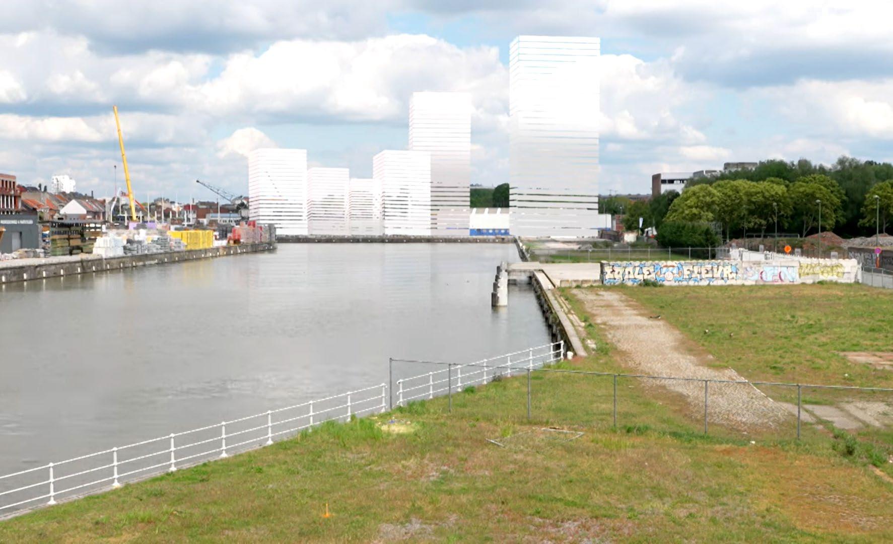
This plan sets out to be ambitious from an environmen tal viewpoint and flexible enough in its implementation to encourage private initiatives. It creates a high-quality environment and neighbourhood while also meeting the needs of future residents of Anderlecht (...)
(Plan Canal)
Key West: new mixed project by the Canal in Anderlecht, with over more than 500 new apartments, shops, offices and a day-care centre. According to its developers, BPI Real Estate Belgium, Key West will revitalise the former industrial site of the Biestebroeck bassin offering “quality life by the water” (BPI real estate).

The objective of the Canal Plan, the thinking behind which is fully supported by the Anderlecht municipal board, is to make better use of unused real estate along the waterway, creating mixed-function districts there that include not just housing but businesses and sports, cultural and training facilities that serve the community. The regional authorities have therefore decided to designate these areas as a ZEMU (business zone in an urban setting).
(Plan Canal)
From its very beginning the CP clai med to place the issue of diversity and the concept of mixité, both social and functional, at the heart of its concerns. Indeed, both terms are mentioned mul tiple times in each programme. The examined neighbourhoods are intrin secally characterised by a dynamic mix. As it has been argued by some critical voices (C. Scohier, M.Van Criekin gen,...) we can observe a sort of discre pancy between the policies that are put in place at an institutional level in a nei ghbourhood and the urban/social rea lity of the neighbourhood itself. Thus, they have a sort of counter effect and, as a result the intrinsic diversity of a place risks to disappear and be replaced by a new one.
When Secchi and Viganò made this ob servation the CP was not effective yet, but things have not been significatly changing. If the plan set as one of its major ambitions the one of producing and housing stock capable of meeting the need of the population, in particular the low income categories. In fact, the number of social, public and coopera tive housing operation is much lower, and they are more modest in size than the big private real estate operations.
As many critical voices have argued the mixité promoted by the plan is a “oneway mixité”, which means that what re ally seems to be promped is the instal lation of the middle classes in the most defavorised, while the opposite is more rare:
«The difficulty of bringing these so cial housing projects to fruition in the more affluent suburbs is matched by a spectacular private property boom in the lower part of the city, particularly
As already mentioned in chapter one, the socio-spatial distribution in Brus sels has recently been partially altered by a process of gentrification started in the early 1990s. Indeed, this period coincides with the institutional birth of the BCR (1989), the first Regional De velopment Plan (1995) and the launch of various urban revitalisation plans (the first CQD were launched in 1993). Moreover, the increase of the city invol vment in international functions was also an important factor, fostering the élitisation and internationalisation of the bourgeois neighbourhoods in the
East of BCR. At the same time, some are as that were inhabited by a disadvanta ged population have been interested by a process of reinvestment by a more af fluent population, usually pretty young, with a higher cultural capital and a mid dle income (Secchi and Viganò, 2011). In the map realised in 2011, Secchi and Viganò mark as gentrified the inner city neighbourhoods on the eastern side of the Canal (mostly belonging to the Brussels municipality) and the Maton gé and St. Boniface districts in Ixelles. Some critical voices summarise gentri fication as «the simultaneous reappro priation (for some) and alienation (for others) of urban areas on the scale of the neighbourhood.” (Van Criekingen, 2006). In other words, the existing so cial fabric has been affected by a cer tain pressure, which might have been exerted directly and suddendly or more subtly. Despite being a phenomenon occurring in a lot of cities worldwide, when discussing it it would be more correct to talk about local forms of gen trification. Indeed, gentrification trends can considerably vary according to pa rameters like the urban context in whi ch it occurs, the rate of a neighbourho od’s transformation, the types of forces involved: “for example, the degree of government control over the real estate market, public and private institutional investors’ attitudes, and even dominant
groups’ enhanced or diminished histo rical interest in the downtown area vary considerably from town to town” (Van Criekingen, 2006).
The examined area, namely the nine teen century neighbourhoods of the poor croissant area, west to the city centre, have been certainly subject to local forms of gentrification, just as many other once neglected districts in contemporary cities. Nevertheless, whi le in some areas of the city (such as St. Gilles, Ixelles, or Dansaert on the east bank of the Canal) the phenomenon is much more marked and visible through statistical indicators, neighbourhoods like Old Molenbeek or Cureghem are still among the poorest in the whole re gion (they have been the arrival place for the most fragile population) . For this reason, it would not be correct to mark these neighbourhoods as gentri fied, although it is undeniable that they might have been seeing too an increase in the number of the middle class popu lation over the last twenty years. Thus, here the gentrification process here is more diffused and time consuming (...). From a spatial perspective, the process is visible through the appearance and increase, especially in the Canal area, of several real estate opearations (most of them lead by private investors or public-private parnerships) offering a
Studio Associato Bernardo Secchi Paola Viganò, Bruxelles 2040 (2010-2011)
mainly residential programme, consi sting either in luxury or middle inco me housing. The surge in loft projects (a market segment that has been taken over by luxury real estate promoters) is another operation that constitute what Van Criekingen calls “pockets of privi lege”, which are still sparse, but differ markedly from their immediate sur roundings.
«In Brussels, civil society and engaged academics often perceive gentrification as a negative process a priori (Rijdams, 2011). As a result, everything that has to do with urban development, reno vation of public space, embellishment or the arrival of upper-class retail or catering industries, is a priori judged as ‘bad’. Although one has to be very cautious about policies that exclude those already marginalised, one has to

admit some neighbourhoods deal with a negative reputation in such a way that once residents are able to, they move away as quickly as possible. (...). While preconditions must be set in order to avoid social exclusion, a direct result of such an approach is the stigmatisation of particular groups: whenever highly educated, newcomers are too easily categorised as ‘gentrifiers’ that should take on this responsibility, while those that move out and who have a ‘depri ved socio-economic profile’ are the vi ctims of the gentrifiers. (...). However, it might be more correct to talk about a convergence of different processes that typify processes of gentrification. Wi thout preconditions concerning social mobility and social mixing that strive for a minimal quality of life and level of welfare, the interaction between plan ning initiatives, housing market dyna mics, governance and policy changes, result in social exclusion of those most vulnerable. An urban development col lectively defining such principles and complementing this with multicultural and local community building could enforce the overall quality and social cohesion in neighbourhoods.
Whatever the social dynamics, nobo dy will ever dispute the fact that these neighbourhoods are at the centre of the Brussels metropolitan region. That cen trality will determine prices of land and real estate developments and the types of activity attracted. It is only in the
declining phase of deindustrialisation and rapid suburbanisation of Brussels’ development that these central neigh bourhoods have been ‘allowed’ to have an ethnocentered development. Today the metropolitan dynamics are back. The Canal Zone is the structuring axis. An enlarged centre is being developed. The challenge is to not follow a Dansa ert trajectory where populations were relocated and new activities brought their own workers and their own pu blic. This time it should be an oppor tunity for upward social mobility of the residents, if they are ready to broaden their public to the city as a whole. That is the tension between gentrification and upward social mobility at stake in this poor ‘croissant’ of Brussels.»
«For many years, we have understood “working in thecity” as services and the knowledge economy. Meanwhile, we have gradually become more aware of the fact that production is something that also belongs in the city and that the city should not purely remain a showcase for consumption»
(Bouwmeester Maitre Architecte, 2018)
as, like the canal zone, and thus exploit the authentic and local nature of such places rather than wipe it away»
(Ibid.)
In recent years, the reintroduction of the spaces of production in the city have seen an increase in the interest of both urban scholars6 and policymakers7 It has been widely argued that keeping the productive enterprises in the city have economic (a diversified economy is more resilent in times of crisis) and spatial reasons
«by retaining enterprise it is also pos sible to maintain the slightly rough but unique character of post-industrial are
But besides that, the reasons are also social. Indeed, Brussels’ socio-spatial reality, with its large “poor crescent” of low income neighbourhoods loca ted around the Canal area, explains the interest in productive city strategies, as providing space for productive activi ties is seen as a policy to mantain shortterm skilled jobs within the capital re gion (Bouwmeester Maitre Architecte, 2018; Cities of Making, 2018; Orban et al., 2021).
6 ULB & Erasmus “Re:Work” (2012) and “End of Line” (2013); Architecture Workroom Brus sels, BRAL & Bond Beter Leefmilieu “Productive BXL” ( 2014); Urban Metabolism (2015); B-MiX (2015); Cities of Making (2017-2019); “Atelier Brus sels. A Good City has Industry” (2016-2017)
7 The growing awareness at the theoretical level of the need the reintegrate productive economy in the city, together with the realisation that the high rate of development of new residential districts would have brought BCR to lose its industrial land, brought the government to start encouraging mixed development between places to live and work by adding a correction mechanism to the change of land use (Bouwmeester Maitre Architecte, 2018).
Although planning tools at a higher level should be able to ensure that pro ductive economy is not omitted from the central Canal area, specific designs solutions to combine living and wor king (which is quite essential to avoid nuisance and mutual mistrust) is not yet provided at a planning level (Bouw meester Maitre Architecte, 2018). Ne vertheless, some solutions have already been set up. Brussels public real esta te operator (citydev.brussels) - which often collaborates with private real esta te deveopers - has indeed been working for some time on large mixed projects combining living and working. Many of these projects tend to favour compact and stacked solutions, with housing units placed above a base of productive activities. As convenient as it could be
for a developer -
«the industrial spaces (developed wi thin a mixed used-project, ed.) are the price to pay for the opportunity to ac cess the real money maker - housing»

(CoM, 2018)
- the critique raised from many expertes is whether this model of
« a raised city of residents above a city of workers down under is hardly a mo del of good urbanisation»
(Bouwmeester Maitre Architecte, 2018)
The mixed-use development discour se is often linked to the gentrification processes (not only social but also in dustrial) mentioned before, which is caused by real estate pressure for resi dential development, allowed in this area. Indeed, although the planning to ols claim to have as a defined goal “to keep economic activity in the city, and to bring people’s workplaces and homes closer together”, former industrial nei ghbourhoods continue to be subject to
citydev.brussels, Nova city
this trend that sees lucrative residential pushing out the remaining productive actitivies from the area. In addition to this, also the new real estate develop ments that foresee mixed project trying to combine residential (usally midd le-income housing) and productive programmes have sometimes a negative impact on the old productive activities, which, according to many researchers, will eventually slowly go outside of the city.
«While certainly some neighbourho ods are characterised by their shabby industrial character and do not provi de a pleasant living environment, the impact of the PRDD and ZEMU could push issues to another extreme whe reby there is no protection for existing manufacturers while all building real estate owners focus on the burgeoning housing market»
(CoM, 2018)
Circularium in Cureghem

The question of the “development” of Brussels “fragile” neighbourhoods, such as Old Molenbeek and Cureghem is a very complex political question, which will not be discussed in depth in this work . It is important to remind that in this work the term “development” does not mean to intend that these neigh bourhood are intrinsically problematic and are supposed to “develop”, in the sense of “improving” and reach the level of other “better”, “developed” districts in the city. Instead, we woud intend this term as an attempt to overcome, or at least contrast and lessen the network of social issues (e.g. socio-financial issues or the diffuculty to access to the market labour) and environmental issues (e.g. the quality of life and the housing con ditions) afftecting these neighbourho ods. The will to contrast these problems should not be seen as an opportunity of speculation but simply as a pursuit of socio-spatial justice in the urban en vironment. Due to its complexity, this type of development, which is supposed to be social and spatial and the same time, has definitely to be intended to happen in the long term. According to P.Viganò, this long-term development is «intrinsically linked to investment in the education of the current, as well as to adequate timing in the improvement of housing»(Viganò, 2021). This could happen with strategic and time-bound investments in the education of the cur
rent population (for example through the insitution of training centres) but also for the renovation and the overall improvement of the housing stock. At a social level, the long term result would probably be close to an increase in so cial mobility for the original population that will remain in their neighbourho od while improving theri own quality of life (we are following a vision that considers professional success one of the pillars of a better quality of life, ed.).
At the same time, a moderate influx of new people will arrive, both in the form of gentrification and as a city of arrival (Viganò, 2021).
«Vu les moyens financiers importants nécessaires pour une rénovation en pro fondeur des logements et une amélior ation globale de la qualité du bâti, il est nécessaire d’adapter et d’échelonner ces rénovations privées dans le temps, pour laisser le temps à la population d’acquérir des capacités financières suf fisantes. Si les développements liés à la rénovation et l’embellissement du parc résidentiel arrivent trop rapidement, la population habitant ces logements ne pourra pas se les approprier et un scén ario mêlant gentrification et déplacem ent de population en sera le résultat. L’enjeu est donc d’accorder le temps de l’augmentation de la qualité résident ielle au temps du développement so cio-économique de la population.» (Viganò, 2021)
4.
Heyvaert, Cureghem

«Chaque quartier a ses grandes et ses petites histoi res. Il en est ainsi aussi pour les quartiers oubliés. Les histoires du quartier Heyvaert parlent de transition, de changement. Elles relient la ville au monde, une guerre civile au Liban fait augmenter la demande de voitures d’occasion, des gens décrient avec lyrisme le quartier comme l’Avenue Louise du commerce de voi tures d’occasion, des Africains qui viennent de Paris avec le Thalys pour faire leur achats ici…»
Le Collège des Bourgmestre et Echevins (2012)
Le quartier Heyvaert: une île
«Lorsqu’on parle des activités métropolitaines, surtout dans les grandes métropoles, on pense toujours a des activités d'excellence; aux activités financières, cultu relles, scientifiques et universitaires, artistiques et de la communication; les activités qu'on imagine com me étant aptes à faire de cette métropole un point de repère pour des populations toujours plus globalisées. Mais la métropole est toujour plus complexe et sou vent on y trouve des activités surprenantes qu'on ne trouve pas dans d'autres cas»
Secchi & Viganò, 2011
A truck transporting cars along Quai de l’Industrie.

Photo by Michiel De Cleene.
Aerial view of Heyvaert from the Abattoirs d’Anderlech.
Frame from the short film Brussels city of making (2017)
Located between the Abattoirs, the Chaussée de Mons, the Canal and the inner ring road, the Heyvaert district is one of a kind in Brussels, in Belgium and even in Europe. In 2015, M. Rosenfeld and M.Van Criekin gen described Heyvaert as a place that was «for most of Brussels residents, an unknown neighbourhood, a blind spot on their mental map». Never theless, the district is mostly known for the peculiar commercial activity that has flourished there for almost forty years, which essentially revolves around the repatriation of second-hand vehicles from all over Europe to Brussels, storing them in the Heyvaert district and then reloading them onto trucks to Antwerp, from where they are loaded onto ships, mainly bound for Western Africa. The many garages located within the district and in its immediate surroundings have thus been an essential link in the export trade of second-hand vehicles from Europe to West Africa, where the cars find a second life. This intense trading activity is the reason Hey vaert is mostly known as “the cars district” or “the garages district”.

This space is characterised by the presence of strong urban markers. Once symbols of technical progress and economic dynamism, these urban markers contribute today to the physical, social and political isolation of Heyvaert (and Cureghem) from the rest of the communes and the city (Rosenfeld, 2015).
The first of these landmarks is the Charleroi Canal. Physical and symbolic boundary cutting the city into two, but also “poverty pocket” in the heart of the capital (Rosenfeld, 2015), the Canal marks the northern limit of the district. Then, the Abattoirs d’Anderlecht (Anderlecht slaughterhouses), which is one of the last European slaughterhouses still active in a city centre. With its open-air hall built on the model of the Parisian halles, it is today the market that attracts more people in Brussels (Mascia, 2015).
Located at the beginning of rue Heyvaert the Abattoirs d’Anderlecht site marks the western extremity of the district. The eastern boundary cor responds to Brussels petite ceinture, that is the road built on the site of the old fortifications that protected the town in mediaeval times. Finally, although it is located more south, the presence of South Station (Gare du Midi, that is the biggest railway station in the country) has also a strong impact on the district.

Source: Région de Bruxelles Capitale, Inventaire du patrimoine architectural. (https://monu ment.heritage.brussels)
Zoom from: Carte figurative des entreprises industrielles dans Bruxelles (1910), dessinée par A. Verwest et F. Xhardez. Les vignettes sont gravées par M. Vandroost. Cette carte, produite à l’occasion de l’Expo sition de 1910 à l’initiative des industriels bruxellois, illustre à la fois le souci de la qualité architecturale des bâtiments industriels et leur localisation privilégiée dans le bas de la ville et les faubourgs proches (© La Fonderie).


The now densely populated district of Cureghem, which until the 19th cen tury was a hamlet with a few mills and breweries, went through a big transfor mation during the Industrial Revolu tion. The construction of the Charleroi Canal accomplished in 1832 and the proximity of the railways (the Gare du Midi has been operating since 1840) made the position of the district stra tegic and fostered the development of activities mainly linked to textiles and later on to animal slaughter (Claudel & Scohier, 2014). In 1841 a first big slau ghterhouse (l’Abattoir de Bruxelles) was inaugurated in Cureghem close to the Ninove Porte, on the site that where la ter on the Arts and Crafts School was built. The presence of the slaughterhou ses, which was the driving force behind the urbanisation of the district and at tracted a multitude of activities linked to their presence: meat wholesalers, leather goods manufacturers, dyeing factories, oil factories, glove factories, candle factories. In the 1870s, the pre sence of an abattoir within the urban fabric started to be considered as source of nuisances. After several negociations between the Ville de Bruxelles and the Anderlecht municipality, a new com plex is built in a more decentralised area of Cureghem. The operation entailed the deviation of the river Senne and the extensions the rue Ropsy Chaudron -in order to connect the site to the South Station- and the rue Heyvaert - in or der to connect it to the petite ceinture
around the Pentagon (Brëes, Renson, Scohier, 2012).
«The creation of the slaughterhouses in Anderlecht is indicative of the retreat of industrial activities to the suburbs and of a change in the status of space. suburbs and a change in the status of the industrial space in relation to the urban environment. The slaughterhou ses do not fit into a pre-existing fabric, but rather structure a new neigh bourhood.»
(Brëes, Renson, Scohier, 2012)
Because of the coexistence with in dustry and the continuous arrival of a population of workers and craftsmen (at the beginning mainly coming from Flanders), Cureghem will never have the allure of a bourgeois neighbourho od. Most of the time the warehouses and ateliers developed in the interior of the blocks, embedded in the urban fa bric, unlike the vast industrial areas on the west bank of the canal (Brëes, Ren son, Scohier, 2012).
After the Second World War, many new migrant workers (mostly from southern Europe, northern Africa and Turkey) came to settle in the neighbourhood. Indeed, due to their proximity to the Gare du Midi, Cureghem and therefore the Heyvaert district have been throu ghout the years arrival places for Bel gium and Brussels newcomers, but they
Rue Heyvaert, vue du dernier tronÇon cÔté pair en 1965, ACA/Urb. 42428bis (31.08.1965). source: monument.heritage. brussels

Vue du pont de la rue des Mégissiers (“shippers street”, ed.) enjambant la Petite Senne. (VAN AUNDENHOVE, J., Les rues d’Anderlecht, Commémorationdu vingtième anniversaire de la fondation d’Anderlechtensia, C.A.F.H.A, 1995, p.168). source: monument.heritage. brussels
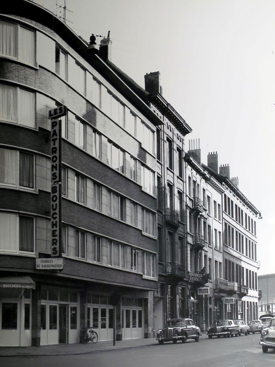
have also been transit places for people who managed to improve their living condition and settle elsewhere. The migration movements conti nued in the 1970s with the arrival of South Americans and of Lebanese, African, East European people from the 1990s onwards.
From the end of 1980s onwards, a new economic activity began to develop in the Heyvaert district, that is the import-export of se cond-hand cars.During the 1990s, garage owners started occupying the spaces left vacant by most of the butchers and meat wholesalers that, due to the introduction of new and stricter hygiene standards, preferred to move to the outskirts of the city rather than undertake expensive compliance work on site (Claudel & Scohier, 2014). Car-re lated business gradually replaced the slaughterhouse and butchery trades, taking advantage of the large industrial spaces and hosting different types of businesses, from the smallest retailer or repairer to the largest vehicle exporter. The first to move into the Heyvaert district were the consignees (most of Lebanese origin) who, in the process of second-hand vehicles trade, took care of transporting the vehicles to the port of Antwerp and then transferring them by ship to western Africa. Once the consignees occupied the warehouses, a series of other
The Halle Libelco, located on quai de l’in dustrie has been for several years one of the biggest garages in Heyvaert. In this picture foreground, we see a man carrying some appliances. Indeed, it was very common to fill up the vehicles directed to Africa with other objects, from electrical appliaces to mattresses.

One of the many exotic shops in the neighbourhood, rue Ropsy-Chau dron, October 2021.
traders came to set up in the vicinity, according to a principle of con centration of activity (rosenfeld,mosaique), thus providing second-hand vehicles importers to have a set of services in the same area. Since then, Heyvaert district has been home to a very intense activity of second-hand car trade, becoming an international reference and hub in the sector. The activity is condensed in a few streets, where it is possible to compare a great variety of vehicles gathered from all around Europe: it is in this concentration that lies the strength of Heyvaert marketplace (rosenfeld, mosaique). Today, there are about sixty businesses spread over approxima tely 60,000 square metres (Perspecrive Brussels, 2021); as the activity has an hybrid status (formal+informal), it is difficult to objectify the number of jobs it generates (Claudel & Scohier, 2014). The car trade activity has been indeed a catalyst for the economic activity of the district, encoura ging the activity of local shops: African food restaurants, exotic grocery shops, pentecostal churches, tele stores and money transfer services. This concentration of shops not only contributed to the affirmation of the repu tation and identity among African importers, but it also made the district attractive to people of African origin who often had no connection with the used car trade (Rosenfeld, 2015).

Every year, hundreds of thousands of European vehicles leave from the port of Antwerp directed to the port of Co tonou, Benin, on board of specialised ships, ready to start a new life and com mercial cycle in sub-saharan Africa (Pe raldi, 2017). There is a sort of analogy between the position of Brussels and Cotonou: these two commercial hubs have the same role, mirrored (Rosen feld, 2017). While Brussels gathers and concentrates vehicles from all over Eu rope, Cotonou, besides being someti mes their place of arrival, takes charge of re-exporting them on the West Afri can market1.
The second-hand vehicles trade is cha racterised by a double dimension, glo bal and local at the same time. Whether in Brussels or Cotonou, the economic activity is extremely rooted in the local and highly concentrated, not only in terms of space, which is extremely limi ted at the urban scale, but also in terms of time of stay of the buyers (Rosenfeld, 2009). Simultaneously, this is a global phenomenon and it must thus be con sidered within its macroeconomic di mension as part of a transnational trade chain.
Europe is currently the largest used li ght-duty vehicles exporter2, mainly exporting to West and North Africa. On the other hand, Africa is now the main importer: between 2015 and 2018, the continent was the ultimate destina tion for 40% of used light-duty vehicles (UNEP report, 2020). The second-hand vehicles export chain is certainly a com mercial activity that has been able to connect the African demand for cheap cars and the many second hand vehi cles available in the world. In several sub-saharan countries, new vehicles are extremely uncommon, and to own a car means having bought it second hand (Rosenfeld, 2017).
This trade is directly linked to ecologi cal issues. Although it can be seen as a recycling chain allowing a recirculation of goods that in Europe have reached the end of their lives, on the other hand it keeps in use vehicles that are old and often polluting and unsafe3. Most of the importing countries still have weak
2 Between 2015 and 2018, The EU was the largest exporter with 54 per cent of the total followed by Japan (27%) and the USA (18%).
1 It is estimated that around 95% of the vehicles that disembark in Cotonou are destinated to the re-exportation. Once they are sold, a customs system is established according to their final destina tion. A preferential regime is set aside for the coun tries landlocked in the hinterland, such as Niger, Mali, Burkina Faso (Rosenfeld, 2017).
3 The Netherlands – one of the largest used vehicle exporters to Africa - studied used European vehicles being exported through their ports and found that many vehicles, mainly destined for West Africa, were between 16 and 20 years old, fell below European Union emission standards and did not have a valid roadworthiness certificate at the time of export.The Gambia, for example, imports vehicles on average 18.8 years old, while a quarter of those imported by Nigeria are nearly 20 years old.
policies regulating the import of used vehicles, while many of the imported vehicles would not be allowed to circu late on the roads of exporting countries (de Jong, 2020).
The trade is not supposed to weaken in the near future (quite the opposite, ac cording to the projection, the “fleet of light duty vehicles” will at least double by 2050). Nevertheless, both exporting and importing countries will have to re gulate the trade and eliminate a range of abuses. On the one hand, exporting countries will have to stop exporting vehicles that are no longer roadwor thy, and fail environment and safety inspections while importing countries must adopt up-to-date regulations. Indeed, before 2020, fifteen African countries announced strict new rules
for vehicle emissions and fuel efficien cy. The rules are a milestone in slashing greenhouse gas emissions in a region that is home to about 400 million peo ple, where many vehicles are past their prime.
The organisation of the commercial chain that allows the circulation of the se vehicles was related to the concept of “globalisation from below” (Rosenfeld, 2017), which was initially proposed to describe a new type of transnational immigrant entrepreneurship (Portes, 1999). In this peculiar case, it can indi cate a trade chain created and led “from below” by migrant communities and based, in Heyvaert as in Africa, on mi gratory and diasporic networks (Clau del & Scohier, 2014).
«The export trade in second-hand vehicles offers a particular insight into the migratory movements that take place in the context of an economic activity. It is indeed interesting to observe that if the movements of people and objects that we observe today in Brussels do take place on a planetary scale, they do so in a radically different way from what we usually associate with the concept of globalisation. It is through the individual initiative of hundreds of transmigrant entrepre neurs building bridges between two worlds separated from each other by physical and cultural borders that real mi gratory circuits are emerging. These migratory circuits are extremely flexible and mobile, and behave in a very different way from the global flows of goods decided “from above” by multinational companies.»
(Rosenfeld
used vehicles trade worldwide
Largest exporter per destination country

main exporters Europe 20.000-145.000

countries where the import is banned
Source: UNEP, based on data collected from major exporters, 2017 Japan 145.000-270.000 USA higher than 270.000
Estimated number of vehicles per year
Europe to Africa
Source: UNEP, based on data collected from major exporters, 2017
Top Markets for Used Light Duty Vehicle Exports from the Three Major Global Expor ters in 2018 Nigeria Lybia Tanzania Guinea Ghana
Used Light Duty Vehicle Import Age Limits in Africa (July 2020)
6-8 years 4-5 years euro 4 main European harbours main African harbours African cars manufacturers
9+ years /no age policy
Light Duty Vehicle Emission Standards in Africa (Euro) (July 2020)


3 years and below euro 5+ euro 3 or below
no emissions standards
The market place refers to a space that manages to combine the double chal lenge of fragmentation and concentra tion. As used vehicles merchandise is produced every time someone decides to sell their old car, this production is random and, in order to be profitable, spread over a vast territory. The marketplace contributes then to collect and organise this flux of vehicles (Rosenfled, 2017). The purpose of con centration lies in the recreation of the conditions of a market in the place that gathers all the vehicles (“market” stan ding both as the economical process allowing to determine a price by com paring supply and demand, and as the physical space where this comparison takes place).
In 2014, it has been estimated that more than 400 vehicles pass through Heyvaert every day. (Claudel & Scohier, 2014).

The Euro-African second-hand vehicles export trade is a complex activity where multiple actors play a role. What allows the cost-effectiveness and efficiency of this process is the independence of its economical actors, each of them taking charge, in a compartmentalised way and with a co-dependency that is me rely functional, of their part of business (Paraldi, 2017).
The export of second-hand vehicles in volves a regular interaction between a fully formal, legal and institutionalised dimension, and a more informal one that relies more on which is based more on the relationships between indivi duals (Rosenfeld, 2009). What most of the people involved in this trade have in common is that they are usually of foreign origin. Many con signees and garage owners are Lebanese or have Lebanese origins, other garage owners and sellers of second-hand go ods have Maghrebi origins, while im


porters and intermediaries are mostly people from Sub-Saharan Africa (Clau del & Scohier, 2014).
Nevertheless, if this is a common point, there are many differences that concern, beside the actors’ origin and their fun cion in the trade, also their legal status in Belgium and their migration project. People’s legal status plays a major role in the distribution of functions and in the occupation of actors. For the most precarious people, such as undocumen ted migrants and asylum seekers, par ticipation in these activities is a way of integrating themselves into an econo mic activity, even if it is informal. Due to this hybrid status of the activity (that as we said lies in its formal and informal interactions), it is difficult to objecti fy the number of jobs it generates.

Rosenfeld identifies nine profiles of ac tors, according to the role they occupy in the trade (Rosenfeld, 2017).
bigger companies
SOCAR shipping agency
_Founded in 1979 _2000 cars/month _20 African destinations _other locations: Paris

KARIM EXPORT transport maritime
_Founded in 1989 _(around) 1660 cars/month _16 African destinations
ABOU ZEID shipping
_Founded in 1984 _13 African destinations _other locations: Paris
The nine profiles of actors according to the role they occupy in the trade and to the loca tion they act in. (Rosenfeld, 2017)
mediates between
They run a space (whose size can vary a lot) that is specialised in purchasing and reselling of second-hand vehicles. The difference among each others lies in their vehicles suppy (as there are different suppliers networks) and the kind of vehicles they sell.
The person responsible for the whole process of vehicles transfer from Hey vaert to their final African destination.
They take charge of the vehicles on behalf of importers by stocking them until their departure, then bringing them to Antwerp port and loading them on a ship that willy carry out the crossing to the African continent. In Heyvaert this role has been monopo lised by Lebanese origin people. They negociate in advance with the ship owners for the purchase of a given number of spots on a ship doing the crossing every month. This spots are then individually resold to the impor ters for each of their vehicles.
It’s the character connecting Europe to Africa. They are entrepreneurs who come to buy a batch of vehicles they will resell on their country of origin. Some of them need to travel to see the goods, others manage to have them dispatched at a distance. In Heyvaert the importers are mostly coming from Benin.
They never get in touch with their clients, that is the importers. The con signees, who play the role of mediators, pay in advance a price that corresponds to a precise surface on the ship.
The person having a mediator role between the buyer and the seller, monetising their expertise on a precise marketplace. Once a trade is finalised, they get a commission both by the buyer they helped to find the item at its best price and by the seller, to whom they brought a client.
The manager of one of the big plots ha ving the status of magasins sous douane (bonded shops), a sort of extension of the port customs exception zone.
The person taking charge of all the administrative procedures that are necessary for the customs clearance of a vehicle bought in Africa.
This profile, which is only present in the west-African part of the commer cial chain, is basically an importer that does not have a supply network of their own. Rather then competitors, the retailers and the importers have quite a complementary role. Indeed, they allow the importers to recover very rapidly part of the capital invested for the purchase of a stock of vehicles.
This profile is present at different levels of the trade, both at Antwerp and Cotonou harbour. In the first case, they have to verify the documents of the vehicles before they are exported, in order to assure they were not stolen and they are not filled with dangerous or illegal goods. On the other hand, the Beninese custom officers need to verify that the number of vehicles corre sponds to the declared one.
Europe
Antwerp harbour


import export export
Africa

garage owners consignees commissioners importers consignees customs officers ship owners
consignees customs officers retailers car sales fleet managers forewarding agents
Heyvaert economic cluster. The color blue identifies the garages still active in 2021.

In Heyvaert, the garages are spaces specialised in selling and purchasing second-hand vehicles. The size of the se garages can vary a lot, from shop windows that can only display a few cars, to some warehouses exceeding one hundred vehicles. The tiny display spaces often have a shop window role. This means that they help guarantee a better visibility to garage owners who have much bigger spaces available, but often located in the Brussels periphery (Rosenfeld, 2017).
Beside their size, there are other para meters that characterise and distinguish the garages. One is the depth configura tion1. Indeed, the depth configurations of mixed street fronts provide informa tion regarding the potential relation ship that exists between the street, the built front and the economic activity in the backyard (Le Fort, 2017). Thus, the depht configuration is in turn lin ked to the plot configuration or plot di stribution. This last parameter indicates
whether the plot2 is a homogeneous or a mixed one.
«The homogeneous configuration con cerns plots where all buildings are exclusively designed to host a producti ve, logistic or economic activity, inclu ding administrative spaces. They are established on large and deep plots of a street front.» (Le Fort, 2018)
One example can be seen in monumen tal buildings like the MBBM (Belgian Metal Boxes Manufacture), which lar gely outscale their contexts in the public domain. This building occupies a wide plot and have a direct relation with the street.
On the other hand, in the case of mixed configurations, the industrial typology is most of the time hidden behind the facades of an ordinary terraced house.
«The mixed configuration concerns plots with more than one building,
1 Urban researchers call “depth” the space configurations which give access, through devices of transitions (such as doors, passages, etc.) from a space - a public one - to another space - a private one (Habraken & Teicher, 2000; Carmona, 2014; Clossick, 2017; Le Fort, 2017).
2 We only take into consideration plots that are occupied by industrial or semi-industrial buil ding typologies. Thus, plots occupied by residential building is not taken into consideration for this classification.
with a residential frontage, sometimes with ground floor shops, and small pro ductive buildings like workshops and warehouses in the backyard. This con figuration may present various readable nuances on and through the street front ground floors:
• Mixed frontage initially made up to allow access to the backyard: artisa nal activities (workshop), industrial (warehouse, small factory) or logistics (stables) were integrated with the very first design of the frontage in a balanced architectural composition.
• Residential frontage, which was tran sformed to enable the access to the back yard: semi-industrial spaces were built as a second step after the constitution of the frontage with a high risk of archi tectural denaturation.» (Le Fort, 2018)
In this case, what happens many times throughout the years is that «whilst the cell wall suggests the illusion to be static, its nucleus is continually under going a transformation.» (Vandyck, 2020)
In the following pages a reading of the building typologies is presented. This research looked at the garage spaces in their current configuration. Besides the
plot distribution and the building typo logy, the reading chosed to focus on the plot sizes and the relationship of the building with the public space. Inde ed, both of them can reveal interesting information both on the current state, such as the economic capacity of a gara ge, and on a possible plot reconfigura tion in a scenario of urban renewal.
homogeneous configuration
Aerial images show that several gara ges were built after the middle of the 70s, that is when the traders settles in Heyvaert. Nevertheless, some warehou ses were already there before, and were adapted to the new economic function.
mixed configuration
In Heyvaert there are many garages that are hidden behind a residential buil ding, which might be related or not to the garage. In mixed-use districts like this, due to the the parcelled landsca pe of ownership within the extents of a building block (Vandyck, 2020), some business results in veritable labyrin ths, hidden behind terraced houses or apartment buildings.


garages size
plot: mixed configuration plot: homogeneous configuration

terraced house/apartment building + warehouse old warehouse iconic industrial building
big, modern warehouse


Although the Heyvaert district had become a major market place within a transnational commercial network, this activity remained relatively unknown to Brussels inhabitants for a long time. This phenomenon could be explained by the marginal status of this district, which makes it a space rarely frequented by people from outside the neighbourho od. Another reason could be that this second-hand vehicle trade was a com
mercial activity carried out by migrant groups and aimed only at other migrant groups. While the presence of the trade was strengthening itself, the municipa lity political authorities remained quite indifferent to this process. At the turn of the XXI century, the visibility of the used car export trade started to incre ase.
The multiplication of garages complicates or discourages the installation of other types of commercial activities; the transport and delivery of cars in a dense neighbourhood such as this one is a source of discomfort for the residents; the cohabitation in the public space between inhabitants and actors of the second-hand car trade is sometimes difficult; the floors of certain buildings in which the cars are stored are left unoccupied, accelerating the deterioration of the building.
(Rosenfeld, 2015)
This went hand in hand with a renewed interest of the political elites for Cure ghem and its inhabitants, probably part ly because this area became politically interesting again due to the granting, in 2004, of the right to vote to non-euro pean foreigners during the municipal elections. The result was therefore a
mobilisation which took the form of a confrontation around the urban plan ning of this area. The growing visibility of the activity led the authorities to identify the trade as a problem that needed to be removed from the area. The first measures taken can be seen as a frontal policy aimed at
driving the export trade in second-hand vehicles out of the district4. Since these strategies were not successful, the ap proach changed in favour of measures that were more aimed to supervise and regulate the presence of those activi ties5.
In addition to this, from the end of the 90s the Heyvaert district started beco ming strategic in the eyes of regional and municipal authorities and different urban renewal measures started being implemented in the district announcing as a priority an objective of social mix. Similarly to many other Brussels neigh bourhoods, the proximity to the Canal and the inner city and the low land and property prices favoured the beginning of a real estate development process de
dicated to a middle class.
In 2013, the Regional Plan for Sustai nable Development affirmed an inten tion of moving the trade away from the city centre, towards what would have been a new monofunctional area.
4 In the early 1990s, the doubling of the municipal tax for businesses involved in the export of second-hand vehicles was the first measure used against garages. After a long legal battle, the criteria on which this additional tax was established were deemed discriminatory, and the measure was withdrawn. Rapport du 4/2/1992 du Collège des bourgmestres et échevins au Conseil communal d’Anderlecht.
5 In 2002, the municipality of Molenbeek decided to set up a service specifically responsible for controlling garages in the Heyvaert district, cal led Cellule Garage. In 2007, the action was extended to the neighbouring municipality of Anderlecht. The idea was to increase administrative controls on the commercial activity. For each business, the validity of the operating permits and compliance with envi ronmental standards were checked. This action only led to the closure of a few garages, while most of the owners managed to get compliance work done and renew their licences.
A Roll on - Roll off (RO-RO) terminal should have been developed by the Port of Brussels on a 2.5 hectare disused site in the outer harbour, enabling a shift in the transport of second-hand cars from road to waterway. The completion of the terminal was announced for 2018, but in the same year the Board of Di rectors of the Port of Brussels decided o to stop the procedure for the award of a concession for the operation, due to the lack of an offer for the establishment of a terminal. The drop in the interest in the operation was apparently linked to the fact that the second-hand vehicles sector was experiencing difficulties at the moment. Indeed, the amount of ga rages located in Heyvaert has in fact de creased in the last decade, especially for what concerns the smaller activities6.
6 source: comparison of images on google street view
Three contrasting possibilities.
The possible futures of Heyvaer future after the failure in the attempt of mass transfer of the trade to the Port.
2018 should they stay or should they go?
massive and collective removal of car de alers.
renewal of ownership structures with se veral possible evolutions.
issues of clearance, rehousing, recycling of land and buildings
stagnation of decision-making processes, political changes, desolidarisation of cer tain exporters, fear of loss of competitive ness
issues of cohabitation, quality of life, com petition of functions
_1 Vers un quartier résidentiel qualitatif?
laissez-faire, real estate speculation, ar rival of middle/high income population
_2 Vers un quartier mixte, durable et qualitatif?
negotiated real estate transition: impetus to be given via CRU or PAD
_3 Vers un quartier aux schémas économiques rénouvelés et durabili sés?
commercial and industrial reconversion around new sectors. development of the district’s technical and training potential, capitalisation on the local and foreign la bour pool
_4 Vers un quartier d’ac cueil et de transit?
Urban decay?
Stabilisation of the districts as a reception place of precarious/immigrant popula tions
negative aspects: grey economy, sans pa piers
positive aspects: community solidarity, first step towards integration, partially qualified labour force
Despite the failure in the RO-RO operation, the current transformation scenario (like the one pictured in Heyvaert masterplan, which is going to be examined further on) foresees the departure of certain properties, mostly the ones occupying the biggest plots. Indeed, some owners see the moving of the garages as an opportunity to diversify their activity and become reals estate developers (Claudel & Scohier, 2014).
The Heyvaert district has been subject or partly included in different project areas by the public authorities. It is currently one of the priori ty areas of intervention within the regional domain of the Canal Plan. Furthermore, it is part of an Urban Renewal Contract (CRU) “Heyva ert-Poincaré”, as well as two neighbourhoods contracts, “Compas” and “Petite Senne”. All of these public projects have a programme based on social cohesion actions and public space or building projects (per spective.brussels, 2021). The two “strategic zones” of Midi Station and the West Station are not far away, as well as the Abattoirs masterplan; the renovation of the Heyvaert district is supposed to be carried out in coherence with these neighbourhood projects.
In addition to this, the area has been been involved in a some private operations over the last few years. A major exemple is development of the Circularium project, a huge circular economy hub, on the D’Ieteren centre, which was launched by the company itself. Another private actor investing in the area is the Abattoir S.A., who is developing a masterplan in its own huge property. As already said in chapter three, these kind of investments are not only aimed at giving a new face to the area (in this specific case based on circular economy and sustainable production), but also to increase the land value in view of a future real estate opera tion.
Elaboration of the vision for the Brus sels 2040
Bruxelles et ses ter ritoires
Studio 010 Bernardo Secchi Paola Viganò
ch.2. Lordinaire et ses potentialités méconn ues. Les marchands de véhicules «de seconde main»
competition drafting The Government of the Brussels-Capital Region approves the interim ‘Canal Plan’ report. Heyvaert is selected as a test site together with Bieste broeck, Birmingham, Béco, Vergote, Buda.
«The Heyvaert district represents this very special way that the city has of putting itself together, blen ding industry and business activities with housing and retail shops. We need to be able to take advan tage of this “intestate heritage”» (A. Chemetoff)
Adption of the Canal Plan implementation methodology: the for mation of a dedicated team; the definition of an operational zone; ten years to realise its ambitions
Atelier Brussels productive metro polis (research)
Development of a vision for the future of D’Ieteren centreContrat de rénovation
studied since 2009
Contrat de quartier Ecluse-Saint Lazar
until 2025 (at least)
urbaine Heyvaert-Poincaré
Contrat de quartier Petite Senne
Contrat de quartier Lemmens Contrat de quartier Compas
Pad Ninove Pad Gare de l’Ouest
Timeline of planning documents and decisions taken by Regional and local instances about Heyvaert districts (2010-2021)
lenght of the Sustainable Neighborhood Contract p.d. under the direction of the municipalities p.d. under the direction of the Region private projects
size of the circle: n. of hounsing units public housing mixed project (ex. public housing+nursery) normal housing citydev: social housing for sale SLRB: social housing for rental
Bruxelles-Cotonou,une anthropologieéconom iquedelafilièreeuro-a fricained’exportation de véhicules d’occasion, Martin Rosenfeld
Heyvaertversune transformation, IEB,2014
anglebonnemariemont
The Port of Brussels aquires a 2.5 hectare site in the outer har bour for the establi shment of a roll-on/ roll-off terminal
angleliverpoolindustrie
anglebonne-enghein
“BienvenueàHeyva ert”, Uzance,vol.4,2015
HeyvaertetleRo-Ro : les deux faces d’une seuleetmêmepièce.
Claire Scohier Bruxelles en mouve ments n°276, 2016
integration
Public enquiry +opinions of authorities
PAD approved Pad Heyvaert
The PAD draft is ap proved in first reading by the Government of the BCR
adaptation underway
The PAD was approved in its third and final rea ding by the Government of the BCR
1. Parc de la Sennette, along which will be located new housing (25% social hou sing), productive activities and facilities
Des vaches et des voitures — Car netsduquartier Heyvaert. Bruxelles en mouve ments n°289, 2017
The BD of the Port de cidesto stop the pro cedure for the award of a concession for the operation of a roll-on/ roll-off terminal in the outer harbour of Brus sels for the transport of vehicles between Brussels and Antwerp.
chaussée de ninove boulevardpoincaré
The ‘Compas’ residential project SLRB (69 social housing for rental) CiryDev(60 social housing for sale)
ongoingsocialhousing programmes ruedeliverpool rueHeyvaert quaidel’industrie
2. Redevelopment of Man chester siteinto a producti ve and cultural hub
3. Construction, extension or change of use of more than 2,000m2 of future housing units. These must include at least 25% of social housing available as low-income households.
new housing to be developed
social housing
Avis d’Inter-Environnement Bruxelles.Enquêtepubli quesurleprojetdeplan d’aménagementdirecteur« Heyvaert»
The master development plan (PAD/ plan d’amenagement directeur) is a plan ning tool of regional competence that allows the definition of the strategic and regulatory aspects of an urban tran sformation. In addition to determining the programme, a PAD establishes the characteristics of buildings, the orga nisation of mobility, the general layout of public spaces (structuring of routes, landscape design) and provides indi cations on the protection of heritage.
The PAD is based on the public authori


ties’ desire to convert the district in ac cordance with the objectives set by the Plan Canal. As one of its premises and main goals is the renewal of the district urban economy, the plan assumes a gra dual abandonment of the neighbourho od by second-hand car dealers, with the consequent availability of numerous large plots of land in the neighbourho od. The idea is to keep the production activities that are better integrated into an urban context and to encourage the installation of new production activi ties (presumably linked to the circular economy) that are compatible with life

- The Makers Disctrictan economy that values local skills

in the city, by “re-establishing a balance between economic function and habita bility”. The neighbourhood thus retains its productive character but at the same time increases its residential vocation (perspective.brussels, 2021). The plan proposes five images whose purpose is to paint fragments of the vision for the future Heyvaert. Thanks to their clari ty, these images were also a crucial tool to allow the citizen to understand and questioning the plan in the discussions sessions that happened before its final approval on October 2021.

The PAD designates a number of axes within the perimeter as privileged places for the (re)development and strengthening of economic activities (especially manufacturing). Thus, this economic purpose brings to a new ar rangement, namely the productive boundary, which delimits spaces on the street front. Here, priority is given to productive activities (and communi ty facilities), while other types of fun ctions are restricted. Furthermore, the plan recommends the preservation of “a sufficient number large parcels to
meet the spatial needs of production/ logistic enterprises” and establishes that buildings ground floors with a footprint of more than 200 square metres must be intended for productive activities.

_building heritage, public space and li ving environment quality improvement
Recognition of the value of the indu strial heritage is expressed through the desire for its enhancement mainly through a new network of public spaces that can emphasise the characteristics of the area.
The plan is based on the concept of
mixitè: social, typological/architectural and of functions. It aims to preserve the diversity of the heritage, the fabric and the urban texture, to set limits to new housing development projects along the canal and the streets (in order to avoid speculation and projects that are inappropriate for the scale of the neigh bourhood) and to improve the quality of the blocks (ventilation/permeabili ty), many of which are now completely saturated.

The district is now densely built (many plots are saturated), but at the same time it has half the population density of neighbouring districts. A potential for an increase in the number of dwel lings is recognised here, but this “can only be achieved if living conditions are improved”. In addition, “it is important that the housing created can also meet the needs of the district’s current inha bitants, including those with limited
incomes” (PAD, 2021). In order to in crease the proportion of socially acces sible housing in the neighbourhood, the PAD requires that projects of a certain size (+ 2000 m2 ) include a minimum percentage (20%) of social housing. The PAD gives indications regarding maximum height and distance betwe en buildings, while still allowing futu re project developers great freedom of composition.
The strategic areas proposed by the plan are essentially two, namely the Senne park and the Canal. Indeed, both areas form a backbone of Brussels urban re newal .

PAD prescriptions: maintenance of a productive boundary on the ground floor and creation of a linear park “la Sennette”.
park
productive boundary
Project scheme: opening up of the two strategic areas through the public space.
Projet de Plan d’Aménagement Directeur Heyvaert, volet informatif, septembre 2021.
vision: “The Marshland Park: the regenerating nature at the service of the city”. One of the images-visions proposed by the Heyvaert masterplan team.
The parc de la Sennette project and its connection with the parc de la Rosée are part of the series of projects initiated in the framework of CRU Heyvaert-Poin caré, the CRU Compas and the Heyva ert PAD. In the long term, this park will constitute an ecological, recreational and social column in the heart of the district, linking the various parks and centres of the district, such as the parc de Porte de Ninove and the Liverpool plain.
1: layout and rethoric
The Senne’s presence is at the origin of the district topography and urbani sation. The bed of this vanished river runs through a series of urban blocks

from north to south, and it is hardly perceptible while walking though the neighbourhood streets. Indeed, the ri verbed has mostly been occupied by adjacent activities: garages, storage and parking spaces, private gardens. What reminds us of its presence is the parcel trace, a segment of the municipal bor der between Anderlecht and Molenbe ek and a series of undeveloped spaces within the bocks. Furthermore, the the distance between the buildings has re mained the same almost everywhere.
The proposed route of the park will be developed on two branches, the first on the bed of the former Sennette, the other forming the connection connection to the Parc de la Rosée.

From bottom to top: past, present and future (vision) of parc de la Sennette.
past: ‘Marais’, Edmond De Schampeleer (1824-1899). The original landscape of the area was similar to the one painted.

past vs present: historical picture of the Senne river, unknown date / a segment of the Senne today. The space is closed to the public and used as a garage.

new development valuable industrial building
Conceptual axonometry of the hypotetical building development along the parc de la Sennette, PAD Heyvaert, october 2021.
Scheme showing the ecological functioning of the parc, OKRA architects.

Multiple scenarios: two examples of possible scenarios , according to the required mix between productive activities, housing and services.
Compas residential project, 2020. Compas is the first big real estate project in Heyvaert. The housing complex faces the future parc de la Sennette.

The vision for the park has two main and complementary points: on the one hand, the creation of a ‘lifeline’ park of high environmental quality, on the other hand the definition of ‘urban li ving rooms’ as places with a high qua lity of use.
The first point aims at “creating a uni que landscape scenography” developing a range of ecological environments that will going to be integrated with the adja cent new urban development projects. Due to the impossibility of reopening the Sennette, the river is supposed to be imagined thanks to the design of the paths, the microtopography, the choice of the planted species, the collection of rainwater.
The main path of the park will be desi gned in the form of a mineral meander structuring the paths and the perspecti ves, and connecting the various facili ties, leaving space for plants and trees. The urban living rooms will form a chain of distinct places within the nei ghborhood. Located on the transversal routes, which are wider than the bed of the than the bed of the Kleine Senne, these rooms can become ‘oasis’ spaces, they will offer freshness in a very mi neral neighbourhood, places to meet, to take a break, to play, to enjoy nature contact and learning about biodiversity, artistic and cultural spaces, showcasing the history and multicultural character of the district.

The parc has economical, environmen tal and social ambitions. Together with
the Canal, the Senne is a backbone of Brussels urban renewal.
The parc project is strategic as it repre sents an important opportunity to cre ate a lifeline in the district, and at the same time it anticipates changes in the district, proposing flexible and evolving development over time. At the same time, it yearns for offering open and so cial spaces in a very densely built neigh borhood. and for creating an ecological corridor that will contribute to the gre en and blue network of Brussels, reduce heat islands and improving the quality of the soil.
The parc width will vary, with a mini mun width of 12m, which could possi bly be narrower at a number of singular points. The park development project wants to integrate the existing resources and heritage. Thus, the reuse of mate rials, demolition products and the inte gration and partial preservation of cer tain built structures are envisaged.
The priority is given to the parc de la Sennette “main branch”, which goes from rue Ropsy-Chaudron to Quai de l’Industrie, and right after to the bran ch goning towards the parc de la Rosée. Then the project studies will be develo ped for the Liverpool- Mégissier block, known as the priority block. The studies for the other segments of the park will be carried out according to the acquisi tion of land and the progress of the va rious projects underway in the district.
vision: “City of flows: where fluids and infrastructures structure the urban”. One of the images-visions propo sed by the Heyvaert masterplan team.

ZAmpone architecture - L’Escaut architectures, Public space and nursery Petit Senne (project under construction)
“The project relates to neighboring ‘operations’: a bree ding ground for creative entrepreneurship, a Lab-Lan gue to promote diversity and cultural exchange, an intergenerational housing project, a bicycle workshop and a number of question marks and dreams for the future”
1: valorisation of the built landscape
The portion of the canal located within the PAD is very specific: both industrial and residential, in a relatively narrow profile and with a fairly high water level.

The plan aims to preserve and enhance the specific characteristics of this section, which is made up of contrasts in size, function and typology.
2: quays as public, logistic and recreatio nal spaces
suggestive vision of the proper development of the area by applying the various urban the various urban planning principles of the PAD.
Possible evolution of the waterfront according to the PAD recommendations and prescrip tions

for the post-garages district

The master plan proposed by the Re gion offers a vision for the “future Heyvaert” that is extremely marked by ideas such as continuity of spaces and transparency. Indeed, the proposed de-densification and densification stra tegies are both meant to support these objectives. The plan also highlights an idea of enhancement of the existing he ritage qualities (which is almost a will of monumentalisation of the industrial character of the area). However, when it comes to apply the ideas of continuity and transparency into the urban fabric and its current conformation, the plan has to deal with spaces that are quite the opposite of transparent and continuous ones. On the contrary, these spaces are pretty dense, opaque and fragmented, hence the plan subverts these three characters of the current fabric.
Recognising the logic of both densifi cation and de-densification actions on this area -which will be hopefully able to “reshape” part of Heyvaert into a continuous, more “transparent” urban environment- and, more in general, its overall qualities, the project presented in this thesis positions itself within the vision proposed by the masterplan. What this thesis wants to argue is that, in some cases, the allure of some spa ces in Heyvaert lies in the fact that
they keep some opacities, they consti tute some unique fragments, they don’t draw attention to continuity, rather to thresholds.
This work would like to observe some possibilities that the existing urban fa bric could offer in Heyvaert’s current state, not really in a heritage conser vation attitude, rather in an attitude of observation of the qualities offered by the existing spaces that risk to be lost in the densification-de densification ope ration.

As inspired by its name, the project sees the urban fabric as a series of intercon nected rooms, many of them hidden in side the blocks and thus not visible from the street. The question posed is “would some of these opaque, fragmented and dense rooms, which could lose their function in the near future and perhaps be erased from the urban fabric, still be able to create quality spaces?”.
In an urban fabric which is the sum of the endless transformations -additions, demolitions, and so on- and then re sult of the history of the last couple of centuries, some typologies and similar configurations have been identified in the previous pages. Yet, the specificity of each case has to be recognised. Three site-specific projects in the post-gara ges Heyvaert are thus presented in the following pages: the courtyard, the long plot and the Canal-facing plot.
The proposals shown in the following pages are the outcome of reflections car ried out at a typological level. This me ans that their most important features were largely thought of without taking into account the programme they could eventually host and would be associa ted with. Nevertheless, at some point it became useful to intersect the typologi cal and programmatic discourse to get more detailed proposals.
Programme-speaking, it is important to remind that the area has been object of research as far as the productive activi ties and urban manufacturing are con cerned since almost a decade. Indeed, as already mentioned in ch. 3, the concept of mixité is hyper-promoted in mixed urban fabric neighbourhoods like Hey vaert. Furthermore, the discourse of ur ban manufacturing (producing goods for the city, inside the city) is more and more promoted by policies intended to promote circular economy values. Whi le the positive implications of urban ma nufacturing are indisputable, what the current debate mostly revolves around is the suitability of productive activi ties in the city. Indeed, it is a matter of fact that not all the activities would be compatible inside the urban fabric, due to factors as pollution, noise ... This is why the dirty, heavy, noisy activities do not usually find space within the city
and are pushed away from it instead. On the other hand, “new” productive activities are way more supported by public authority and are most likely to be able to find space in the urban re newal projects, sometimes replacing the old ones. This latter, unlike the former, claim to be based on economic models such as the circular economy, local pro duction or sustainable development (Orban, Sanchez Trenado, Vanin, 2021). Research carried out in the Brussels context (Cities of Making, 2018; Desi gning Urban Production, 2021) also re marks how most urban manufacturing companies look for big sites to install. How do all of these reflections translate at a design level in the specific case of Heyvaert? The large availability of big plots and warehouses in good state of preservation which are currently emp ty or will be eventually left by the gara ge-related companies will definitely be a ground to experiment with new forms of productive activities.
However, this thesis chooses not to fo cus on these large plots, but to develop smaller projects instead. Thus, it is im portant to acknowledge that in smaller volumes the only productive activities that could eventually find space would be more akin to small workshops.
The methodology consisted in a first step of observation and interpretation of the choses sites’ existing qualities, then a critical reading of the transfor mation scenario proposed by the cur rent projects. It is important to remem ber that these scenarios were not yet defined and clear, since only a sketch design of the whole Heyvaert area was available at the moment this thesis was written (see pages 168-170 of the pre vious chapter). In the design process, this sketch design was used as a starting point to develop a personal design con cept for each site. As already mentio
ned, the projects chose to focus on the residential spaces, which have therefore been designed with more detail. As far as other types of programmes are con cerned (for example productive space as well as public open space), they were just designed schematically.

As already mentioned, the bed of the vanished river runs through a series of urban from north to south.
The map and the following images hi ghlight the plots on Heyvaert district that, according to the masterplan, are a potential land for densification or de-densification actions. It is impor tant to specify that not all of the real estate developments that we see in the conceptual axonometries show already the final layout of the plots, but rather a

potential, envisaged new layout. Also, a precise number of square meter was not indicated, but the building volumes will result from alingments with the exi sting volumes. The demolitions mostly involve the big plots, which are usually completely or almost totally built. The buildings interested are mostly modern warehouses (often built after the 70s, after the car trade installed in the distri ct), with some exception for some older warehouses and row houses.

Parc de la Sennette layout suggested connections


Unique fragment and highly introver ted space, these two trapezoidal shape warehouses were originally built by the City of Brussels in 1886. The two buil dings were originally used as coach hou ses of the Abattoir, and later converted into office buildings by a vehicle ship ping agency until recent years. While rue de la Rosée n.12 was renovated into an office space in the early 2000s, n.14 is currently dismissed. The building has an irregular quadrilateral plan and it is composed of two one-storey sheds vo lumes with a metal frame roof, opening onto a central courtyard covered with a glazed roof structure. The two volu mes were built in different phases (the
central courtyard was originally open, then covered with a glazed metal frame in 1930). With the exception of a few small windows, the brick facades are completely blind and punctuated with pilasters.
On the west side of the building there is a small linear garden called Jardin d’Alem, which develops along the an cient bed of the Petite Senne river (also known as Coupure de la Senne, Zinneke or Zinneke de Saint-Jean). The garden is run by a non-profit organisation and hosts different projects, such as a vege table garden, a compost, a chicken coop and a relaxation area.
Two volumes: the u-shaped shed and the central shed covering the former courtyard


In the scenario suggested by the PAD the courtyard building is demolished and replaced by two new apartment buildings. This brand new plot confi guration would certainly make it easier to organise the buildings programme and allow a more free circulation and a connection between Parc de la Sen nette and Parc de la Rosée that passes through the buildings. Yet, according to the way they are sketched, these two volumes look independent and discon nected from the existing urban fabric.
The project presented in this thesis fol lows a different scheme based on the preservation of the courtyard building . More that on the basis of its architectu ral qualities, what pushes this action is rather the courtyard scheme qualities and the potential that its reinterpreta tion could create. The project is thus ba sed on a few simple actions: the external

brick wall is preserved (together with its sense of opacity), while the inner volu me that occupied the former courtyard is removed, giving space for a new cour tyard/ private garden overlooked by XX new housing hunits. The u-shaped vo lume partially keeps its former appea rance by the means of a new structure inserted between the brick wall and the couryard perimeter. This new structure keeps the same width and distances of the former one, but it gets higher , thus emerging from the existing brick wall, being well recongnisable even from the street because of the different ma teriality of its envelope. Inside the new structure a series of housing hunits is positioned. Three different typologies of duplexes are proposed. The entrance to the building is flipped on the oppo site side. In addition to this, the larger side of the trapezoidal plan is cut and a small, new voume is integrated, getting the role of a filter between the building and the city, the private, opaque and introverted private space and the con tinuum and transparency of the public space.
-The external wall is preserved - A new volume (1m higher than the exi sting wall) is built inside the wall. Inside the structure there are duplex housing units
-The existing central volume is emptied and replaced by a garden - The entrance is flipped and new volume as a filter between the private courtyard and the public space


First


This block is maybe one of the most densely built in the neighbourhood and it is mainly occupied by garages buildin gs, some plots presenting and homoge neous configuration and others a mixed one. Wheter homogeneous or mixed, most of the plots are deep and narrow. Since they are own by the same company, several buildings on this block are in terconnected the one to the other. The examined mixed plots are squeezed
between rue Heyvaert, which is going to mantain a productive character and the new linear Parc de la Sennette.
plot: mixed configuration building: terraced house + warehouse
plot: homogeneous configuration building: warehouse plot: mixed configuration building: terraced house + warehouse


Alternative


The “Liverpool-Mégissiers” block has been one of the major interest sites pre sented by the CRU5 Heyvaert-Poincaré. Indeed, the block is supposed to be stra tegic in the Parc de la Sennette realisa tion process not only due to its central position (located in the middle of rue Heyvaert, namely between the Ninove parc and the Abattoirs), but also to the high concentration of warehouses fun ctioning as garages. Most of the buildin gs, according to the “diagnostic” studies are currently in a bad or even very bad condition. This is the reason why the CRU shows a proposal were the current block central layout is erased, with the exception of some small portions of the existing warehouses (a wall, a paving,
some columns), that would evoke the industrial past of the area, becoming a decorative element for this post-car Heyvaert parc. The demolition of most of the central long plots allows the re alisation of a large traversée. This cross branch of the parc is defined by new 5 storeys apartment buildings whose sha pe eventually contributes at defining smaller blocks within the parc-crossed block.
Zooming out from the block and lo oking at the Traversée design layout it is possible to get how the ideas of continu ity and homogeneity of spaces and tran sparency can be concretely applied on the urban layout through the creation of a large parc which really differs from the hyper-dense former urban fabric. Starting from this reflection, this alter native proposal keeps the countinuous, large public space in the underlying block between rue Heyvaert and the Canal and proposes a different layout for the “Liverpool-Mégissiers” block, which is based on a reconfiguration of the deep, narrow plots though a series of punctual interventions. As a result,
we get a new assemblage of “rooms” and long “corridors”. This striped layout is thus counterposed to the more homo geneous layout of the block nearby. This project is defined at the block level at a masterplan level, where a possible programme of the new configuration in indicated. In addition to this, a long, narrow building with a mixed-used programme has been imagined with a higher detail level.


existing new mixed mixed
Nam eiusapi dempos maximus, quam lat.
Es voluptas a volendis consequi dent porat pori cum que velitiore landisciur modis eatinim enecepu dandige nduciis et, non comnihi caererum, voluptatem quia audae quo delecepra non poritiscil is qui apisit, odi necumet ipis minvelic totati blaut ipsum et fugia conectur? Um ipic tem. Gendiam eatia dolutatur ari ut dolupidel modis cum cum atia soluptate volenimi,


These two warehouses facing Quai de l’Industrie are part of the Canal indu strial landscape and are both currently used as car storage space. They both appear on the Inventaire du patrimoi ne industriel (La Fonderie - 1993-1994) where they are recognised to have an artistic, aesthetic, historical and urban interest. Unfortunately, both buildings are currently in a bad state of preserva tion.
The warehouse on the right (n. 71-73) is positioned fifteen meters backward from the street. A slightly sloped cour tyard with a logistical function (it is currently used as a parking/extra sto rage space) separates it from the quai de l’Industrie. From the courtyard it is possible to access either the basement (which is lower than the street level) or
the first floor through a ramps. Its vo lume consists of two almost identical sheds, one of them also used as an office space for the car-related business.
The warehouse on the left (n.69) is ali gned with the row houses on quai de l’Industrie. Although the volume might originally been built in the early 1900s, its original internal and external layout has been deeply altered by renovations carried out in recent decades in order to adapt the building to a car-storage pro gramme.
A few meters from the two buildings, a pedestrial-cycling footbridge (original ly built in 1944), then rebuilt in 2019 links quai de l’Industrie and quai du Mariemont.


The urban transformation program mes show two different approximative scenarios concerning this couple of bu ildings. The most clear and thus con sidered as a starting point for the new proposal (although always represented at a conceptual level) is the PAD option, which shows a total replacement of the two warehouses by a new building (a part of which would be probably inten ded to host productive activities to meet the goals of the PAD). The voume recal ls the former volume, with a part ali gned with the street front and another one positioned backwards.
Roribus ipsae precull uptio. Fugiae volecate quiata nonse vene ni tiasp eriandi ut quamusamus, officim ipidi ut expeliquatum ideseni mentus consequam, odio te volupta doluptatis ex eum re sit earcium
The project presented in this thesis changes the PAD proposal as it propo ses to preserve and renovate the dou ble-shed building, not only due to its aesthetic qualities, but also and most importantly for its configuration, which has and could still have logistical value. On the other hand, a replacement of quai de l’industrie n.69 by a new buil ding is still proposed. Besides being in a pretty bad state, the existing building current width (12.5 meters) and the fact is partly attached to the adjacent buil dings makes its interiors very dark (also

lacking air circulation). This is the rea son why in this last project it was con sidered more appropriate to speculate a demolition of the building and the con struction of a new one instead of its re novation. The new volume occupies the same plot deepness as the former one, but with a smaller width of 8 meters in stead of 12. This way, a courtyard of the same lenght as the plot finds space next to the building (and partly next to the adjacent couryard). The new building is thought to host a (light) productive or third sector/welfare related on the ground floor and residential program me on the upper floors.
Roribus ipsae precull uptio. Fugiae volecate quiata nonse vene ni tiasp eriandi ut quamusamus, officim ipidi ut expeliquatum ideseni mentus consequam, odio te volupta doluptatis ex eum re sit earcium


Third


Relevant issues concerning urban transformation in Brussels, and the European city more generally, have emerged from the design explora tions carried out in the last chapter of this work. Due to the complexi ty of these issues, this thesis is not going to deal with them in depth; rather, this sort of conclusion is intended to provide insights into issues that are deeply interconnected with the one dealt with in more detail in this thesis, namely that of the urban transformation of wor king-class neighbourhoods.
The first issue concerns the socio-economic and socio-demographic dimension of urban renewal programmes concerning neglected and poor inner-city neighbourhoods. Indeed, any transformation plan concerning so-called “fragile” neighbourhoods located within an in trinsically socio-economically and spatially polarised city like Brussels potentially involves risks and counter-effects. In fact, operations like the creation of new residences and attractive public spaces often result in increased land value and cost of living (namely gentrification) wi thin the neighbourhood and a consequent displacement of the weaker groups towards another ‘low-income’ neighbourhood, which in turn could become the target of the next transformation project. This issue implies that public policies that work with the aim of supporting the economic and social ecosystem (i.e. not only the inhabitants but also certain types of economic and commercial activities currently sustai ning the neighbourhood) are essential. Such policies should not only concern the cost of housing (e.g. by determining a certain percentage of public or affordable housing), but also the production (or support) of lifestyles suitable for the current population.
The second issue, which is in some way related to the first one, has a more economical character as it concerns urban manufacturing. This topic has been largely discussed in recent years and is currently one of the hottest topics in urban discussions and research. As already men tioned in chapter 3, the idea that urban manufacturing should (par tially) be maintained inside the city for both economical and social reasons is today widely shared in both academic and administrative
fields. Of course, putting this idea into practice is much more com plex. Public policies emphasise and sponsor a lot the idea of a mixité of functions (for example stipulating that all ground floors of new buildings must be used for production activities), but most of the time they do not discuss in detail what urban manufacturing actually me ans. As the paper “Who benefits from productive activities?” (Orban, Sanchez Trenado & Vanin, 2021) highlights how the public authori ties seem to only support some “new” productive activities which are based on economic models such as the circular economy, local pro duction or sustainable development. These activities often have a trou blesome social impact as they «tend to favour products of a higher standard, aimed at a middle-class clientele. (...) Finally, these activities are more easily integrated into property developments which promote housing (fitting into small spaces, generating less nuisance) and the consumption habits of the much-coveted middle classes. » (Ibid.). On the other hand, older productive activities (or even economic clusters) that might have been anchored in a certain neighbourhood for deca des end up being pushed away, finding extreme difficulties in remai ning in the city due to public authorities’ lack of support (the garages cluster in Heyvaert could be an example). This phenomenon is related to the issue discussed in the previous paragraph, as deeply influenced by urban dynamics such as «property pressure favouring the resi dential function and development plans oriented towards the middle classes and the associated vision of “quality of life”» (Ibid.). Therefore, the support of this kind of productive sector (that was supposed to be partly aimed at giving jobs to the disadvantaged population), some times ends up contributing to the gentrification processes in places like Cureghem. To sum up, «the continued existence of a productive activity depends fundamentally on how well it reconciles with the interests at the heart of the main urban development project and their expression in social and spatial terms» (Ibid.). This issue implies a need from the institutions, both private and public, «to take a stand
in order to promote a more endogenous and more working-class-o riented economy. Sustainable measures should be implemented, such as the promotion of productive activities which partly meet the social challenges of Brussels or the public supervision of the property mar ket.» (Ibid.)
The third issue concerns the city’s urban fabric and how the urban transformations aiming at renewing and reshaping old and neglected neighbourhoods often end up erasing part of the dense, fragmented and discontinuous urban fabric, which is wiped out, cleaned up and replaced by a newer, more transparent and continuous space. Brussels has for sure demonstrated great attention to the preservation of its built heritage, but in some cases, the “small heritage” has been erased in favour of higher quality new spaces in the framework of big urban renewal programmes. If the urban qualities offered by these projects are certainly indisputable, it could be interesting to investigate more the potential spatial qualities offered by the dense, fragmented city.

51n4e, l’AUC, Bas Smets, Mint, Transolar, Chôros, Urban solutions. (2010). Bruxelles 2040. Petite métropole, métropole mondiale.
Andersson, E. K., Malmberg, B., Costa, R., Sleutjes, B., Stonawski, M. J., & de Valk, H. (2018). A Comparative Study of Segregation Patterns in Bel gium, Denmark, the Netherlands and Sweden: Neighbourhood Concen tration and Representation of Non-European Migrants. European journal of population = Revue europeenne de demographie, 34(2), 251–275. https://doi.org/10.1007/s10680-018-9481-5
Borret, K., Lacasse, G., & Collet, J. (2018). Brussels productive city. Bouw meester Maitre Architecte.
Casier, C. (2019) The transformation of demographic structures and the geography of Europeans in Brussels between 2000 and 2018, Brussels Stu dies [Online], General collection, no 138
Charruadas, P. et Dessouroux, C. (2003). in Étude historique de la Région bruxelloise, des grandes formes urbanistiques et de la législation sur le bâti, ULB-IGEAT, Bruxelles, 225 p. et annexes
Claudel, P., Scohier, C. (2014). Heyvaert. Vers une transformation?
Charruadas, P. et Dessouroux, C. (2003). in Étude historique de la Région bruxelloise, des grandes formes urbanistiques et de la législation sur le bâti, ULB-IGEAT, Bruxelles, 225 p. et annexes
Cities of Making (2018). Cities Report. . https://citiesofmaking.com/wp‐content/uploads/2018/05/CoM_CityReport‐0523‐LR.pdf
De Beule, M., Périlleux, B., Silvestre, M., & Wauty, E. (2017). Brussel ge plande geschiedenis. Stedenbouw in de 19e en 20e eeuw [Brussels planned history. Urban design in the 19th and 20th centuries]. Meert.
De Fossé, M. (2017) Anciens entrepôts urbains de Bruxelles : architecture et construction, Brussels Studies [Online], General collection, no 117
Decroly, J.M.,Van Criekingen, M. (2009) Le Plan de Développement Inter national de Bruxelles (PDI), Brussels Studies [Online], General collection, no 25
Delwit P., Rea A., Swyngedouw M. (2007). Bruxelles, ville ouverte. Immi
gration et diversité au coeur de l’europe, L’ Harmattan
Dessouroux, C., Bensliman, R., Bernard, N., De Laet, S., Demonty, F., Marissal, P., & Surkyn, J. (2016). Housing in Brussels: Diagnosis and chal lenges. Brussels Studies, 2016(Synopsis no. 99). https://doi.org/10.4000/ brussels.1353
Devleeshouwer, P., Sacco, M., Torrekens, C. et al. (2015) Bruxelles, ville mosaïque: Entre espaces, diversités et politiques, Université de Bruxelles. Government of the Brussels Capital Region. (2001). Plan regional d’af fectation du sol [Regional land use plan].
Hermia, J.P., Vandermotten, C. (2015). Le monde dans Bruxelles, Bru xelles dans le monde, Brussels Studies, Fact Sheets, 94. https://doi. org/10.4000/brussels.1316
Kesteloot, C.. Loopmans, M. (2009). Citizens’ forum of Brussels. Social inequalities, Brussels Studies, Synopsis nr. 16. https://doi.org/10.4000/ brussels.1009
Kesteloot, C. (1994). Three Levels of Socio-Spatial Polarization in Brus sels. Built Environment (1978-) , 1994, Vol. 20, No. 3, A Rising European Underclass? (1994), pp. 204-217
Le Fort, B. (2016). Le bâti existant comme ressource de fabrication de la métropole. Metrolab.brussels
Le Fort, B. (2017). La mutabilité spatiale des îlots mixtes du Canal. Metro lab.brussels
Le Fort, B. (2018). Brussels Urban Recycling: Industrial Buildings as Resource. Conference: Third International Conference for Young Urban Researchers, Lisbon
Orban, A., Trenado, C. S., & Vanin, F. (2021). Who benefits from pro ductive activities? Analysis of the case of Cureghem. Brussels Studies, 2021(General collection no. 153). https://doi.org/10.4000/brussels.5358
Rosenfeld, M. (2009). Le commerce d’exportation de voitures d’occasion entre Bruxelles et Cotonou, Cahiers de l’Urmis [Online]
Rosenfeld, M. (2017). Car connection: La filière euro-africaine de véhicul es d’occasion, KARTHALA
Ryckewaert, M., Zaman, J., De Boeck, S. (2021). Variable Arrangements Between Residential and Productive Activities: Conceiving Mixed‐Use for Urban Development in Brussels. Cosmopolis Centre for Urban Research, Vrije Universiteit Brussel, Belgium
Rouyet, Y. (2014). «Rock the Canal! A history of cultural life in the canal area of Brussels», Brussels Studies [Online], Algemene collectie, nr 75, Online op 31 mars 2014.
Secchi, B., Viganò P. (2011). Bruxelles et ses territoires. Plan Régional de Développement Durable. Elaboration d’une vision territoriale métropolit aine à l’horizon 2040 pour Bruxelles.
Studio Paola Viganò, Walloth Urban Advisors, Maitre d’ouvrage Commu ne de Molenbeek St. Jean (2020). Vision d’Avenir. Molenbeek 2050. Partie II et III. Une Vision, des priorités.
Tammaru, T., Ham, M. V., Marcińczak, S., & Musterd, S. (2016). Socio-e conomic segregation in European capital cities: East meets West. Routled ge.
Van Criekingen, M. (2006). What is happening to Brussels’ inner-city nei ghbourhoods?, Brussels Studies [Online], General collection, no 1
Van Criekingen, M. , Rosenfeld, M. (2015). Gentrification vs. place mar chande. Présent et devenir d’une centralité commerciale euro-africaine d’exportation de véhicules d’occasion, Uzance
Vandermotten C. (2014). Bruxelles, une lecture de la ville. De L’Europe des marchands à la capitale de l’Europe, Editions de l’Université de Bru xelles, Collection UBlires
Vandermotten, C. (2015). L’industrie bruxelloise. Deux siècles et demi d’évolution, Bruxelles Développement Urbain, Bruxelles Patrimoines, n° 15-16, pp. 8-21.
Vandyck, F. M., Bertels, I., Wouters, I., & Ryckewaert, M. (2020). Urban industries and the production of space: A typomorphological analysis of the mixed urban fabric around the historical national road Jetsesteenweg
in Brussels, Belgium. Urban Morphology, 24(2), 200–215.
Vermeulen, Sofie & Corijn, Eric. (2013). Gentrification or upward social mobility: the Canal Zone.
WERMIEL, S., BERTELS, I. & WOUTERS, I., 2012. Historical Warehou ses in the Brussels Capital Region: researching and preserving commercial and industrial buildings. Brussels. Innoviris, Vrije Universiteit Brussel.
Data https://bruciel.brussels/ https://ec.europa.eu/eurostat https://gis.urban.brussels/ https://ibsa.brussels/ https://perspective.brussels/
https://issuu.com/architectureworkroom/docs https://bma.brussels/ https://citiesofmaking.com/cities/brussels/ https://www.citydev.brussels/ https://environnement.brussels/
https://www.ieb.be/ https://inspironslequartier.brussels/ https://www.metrolab.brussels/publications/ https://www.molenbeek.irisnet.be/ https://monument.heritage.brussels/ https://perspective.brussels/
Un grande ringraziamento è rivolto al professor Ange lo Sampieri che mi ha supportato durante la scrittura di questa tesi, fornendomi preziosi consigli e ampissima autonomia
Grazie a Bruxelles, città a tratti decadente e contraddit toria, che è stata la mia casa per sette mesi, dove ho avu to la possibilità di osservare sin dal primo giorno la vita nel quartiere Heyvaert, ispirando il tema di questa tesi.
Un grande grazie ai miei genitori e a mio fratello che hanno dimostrato di avere tanta pazienza e alle belle persone conosciute a Stoccolma, Rotterdam e Bruxelles e Torino. Grazie alla dott.ssa Borello per l’ascolto e le par tole e a Elliott Smith per avermi accompagnato con le sue canzoni.