LOOK INTO NATURE AND UNDERSTAND EVERYTHING BETTER LOOK INTO NATURE AND UNDERSTAND EVERYTHING BETTER

California’s New
State Park first in 15 years
2024
| 510
| NAPA PRESERVE
Spring
BAT HEALERS
HIKERS


Visit an East Bay Regional Park and find yourself in nature close to home. Discover. Celebrate. Explore. Dr. Aurelia Reinhardt Redwood Regional Park, Oakland Deane Little Join us for fun events ebparks.org /celebrating-90-years Wildflower Walks Beautiful Blooms Around the Bay Area Get your wildflower guide today — brought to you by POST, your local land trust, protecting open space on the Peninsula and in the South Bay since 1977. OpenSpaceTrust.org/WildflowerGuide © Lauren Korth


F E D E R A T E D I N D I A N S O F
A . C
G R A T O N R A N C H E R I A A R E P R O U D T O S U P P O R T W W W . G R A T O N R A N C H E R I
O M


Protect at-risk species in California by donating a few dollars on lines 403 and/or 410 on the Voluntary Tax Contributions section on your California State Income Tax Form 540 Learn More at: www.wildlife.ca.gov/tax-donation You can help California’s Native Wildlife and Plant Species at Tax-Time DID YOU HEAR? 2024 Local Hero Awards Dr. Katharyn Boyer San Francisco State University, Estuary & Ocean Science Center Yakuta Poonawalla Golden Gate National Parks Conservancy Kellyx Nelson San Mateo Resource Conservation District Naji Lockett Civicorps You’re invited! Sunday, April 7, 2:00-6:00 PM David Brower Center, Berkeley For ticket information, please visit: baynature org/local-hero-awards-2024/
contents features contents

PROFILES 20
Local Heroes
Join our celebration of four inspiring Bay Area people who are caring for the natural world through stewardship, research, and land management. Meet Bay Nature’s 2024
Local Heroes: Naji Lockett, Yakuta Poonawalla, Katharyn Boyer, and Kellyx Nelson.
By
WILDLIFE Bat Healers
When flowers bloom and insects emerge in the spring, so do Northern California’s 17 bat species, making it a good time of year for people to watch them. It’s also when a surge in calls for help keeps NorCal Bats volunteers busy rescuing and tending bats back to health.
By Stephanie Penn
Bay Nature staff 20

PUBLIC LAND 28
The Everything Park
The first new state park in 15 years is opening. Situated at the confluence of the Tuolumne and San Joaquin rivers, your modern state park has to be an overachiever: Dos Rios Ranch’s 2,100 acres will serve wildlife, depleted aquifers, underserved communities, and Indigenous people. “A park of the future,” state parks director Armando Quintero calls it.
By H.R. Smith
CLIMATE 34
East Bay Adaptation (sponsored)
As a major landowner, the East Bay Regional Park District finds itself on the front lines of climate change. Learn about the district’s efforts to prevent wildfire in the hills and prepare for sea level rise along the shoreline.
By Janet Byron
SPRING 2024 | BAY NATURE 5
24
From top: Stephanie Penn, Violeta Encarnación
38
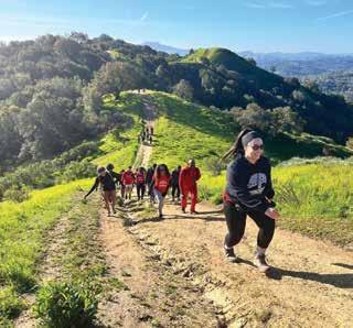
How do you increase inclusiveness in the outdoors? 510 Hikers is a community-grown example that has been building for a decade. Their secret: hold a Bay Area hike nearly every Saturday and welcome everyone.
By Lia Keener
42
By Guananí Gómez-Van Cortright
6 BAY NATURE | BAYNATURE.ORG 12 38 departments THIS SPRING 12 Almanac Rebounds and reflections 14 Signs of the Season It’s not dew 15 The Human Animal Garden cemeteries 16 Nature in the Arts Radical embroidery 18 Small Worlds Coyote brush leaf beetles Naturalist's Notebook See lions
area
bay
north b ay
Taylor Preserve, in the Mayacamas Mountains outside Napa, supports a redwood grove full of
species
is cultivating a stewardship culture through regular opportunities to help out.
Archer
native
and
EXPLORE 15 38 18 from the field: 8 Contributors | 9 BayNature.org | 10 Publisher's Letter 12
Clockwise from top left: Russ Aguilar, Sadie Rose du Vigneaud, Nicholas Collins, Jane Kim

VISIT THE WORLD’S LARGEST MARINE MAMMAL HOSPITAL • Join a Tour • See Rescued Marine Mammals • Find Unique Gifts All in the Marin Headlands! ....Meet the Locals PLAN YOUR VISIT MarineMammalCenter.org/visit-bay
p. 28
H.R. Smith is a freelance science journalist and editor, and a former Knight Science Journalism fellow at MIT. She is exceedingly interested in most things, and is currently at work on a book about habitat restoration and an anthology of queer science writing.
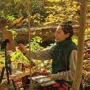
p. 28 & cover G Yang is a background painter and visual development artist currently pursuing a BFA in illustration at ArtCenter College of Design in Pasadena, California. Born and raised in Toronto, Ontario, her work explores emotions through color and light, seeking out the whimsical in everyday life. Yang has exhibited in group shows featuring her plein air paintings at Gallery Nucleus and the Animation Guild.
p. 34 Janet Byron is an independent writer and editor whose work most recently appeared in Estuary News, Maven’s Notebook: California Water News Central, KneeDeep Times, Berkeleyside, and Bay Area Monitor. For 13 years, she was managing editor of the University of California’s California Agriculture journal. She is co-author, with Robert E. Johnson, of the self-guided walking tours book Berkeley Walks (Heyday).
Other contributors to this issue: Jane Kim (p. 12), David Nelson (p. 14), Endria Richardson (p. 15), Sadie Rose du Vigneaud (p. 15), Matthew Harrison Tedford (p. 16), Guananí Gómez-Van Cortright (p. 42), and John Muir Laws (p. 46).
p. 38 Lia Keener joined Bay Nature in June of 2022 and is shaping the organization’s first Outreach Fellow position to expand and better understand Bay Nature’s readership. She graduated from UC Berkeley with a major in environmental biology and minors in Chinese language and journalism, writing for The Leaflet and The Daily Californian. In her free time, she loves painting and searching for critters of all kinds in the Bay Area and in Central Oregon.
p. 18 Russ Aguilar is an educator, artist, and naturalist from Marin County. He has worked as a guide and educator for the National Park Service in five states and the District of Columbia. Presently, he teaches a STEAM class at Aptos Middle School in San Francisco, organizes shows of his artwork, and leads nature walks. His work focuses on sharing the wonders of nature with people of all backgrounds, and his artwork focuses on invertebrate life.

p. 20 Violeta Encarnación is an award-winning Cuban illustrator based in New York City. She enjoys creating works for periodicals like Bay Nature, Apple News, Vox, and The Washington Post, as well as for books, one of which is being published later this year. She blends traditional and digital techniques to tell stories through exciting and colorful images. She has recently found a passion for winter camping, along with growing her own vegetables on her windowsill.
masthead, vol 24, no 2
spring 2024
Ex E cutiv E Dir E ctor/ p ublish E r
Wes Radez
E D itor in c hi E f
Victoria Schlesinger
D igital ED itor
Kate Golden
a rt Dir E ctor
Susan Scandrett
managing E D itor
Alia Salim
outr E ach f E llow
Lia Keener
journalism f E llow
Anushuya Thapa
copy ED itor
Cynthia Rubin
aD v E rtising Dir E ctor
Micaelyn Compton
proofr E a DE r
Dominik Sklarzyk
DE v E lopm E nt manag E r
Barbara Butkus
D E v E lopm E nt a ssociat E Christina Jaramillo
m ark E ting & o utr E ach Dir E ctor
Beth Slatkin
o ffic E m anag E r
Jenny Stampp
i nformation t E chnology m anag E r
Laurence Tietz
cofoun DE rs
David Loeb, Malcolm Margolin
b oar D of Dir E ctors
Deonna Anderson, Catherine Engberg, Nan Ho, Rebecca Johnson (president), Suzanne Moss, Anh Phuong Tran
v olunt EE rs/ i nt E rns
Jacqueline Gauthier, David Wichner
Bay Nature is published quarterly by the Bay Nature Institute
1328 6th Street #2, Berkeley, CA 94710
membership:
$40/year
(888)422-9628, BayNature.org
PO Box 6409, Albany CA 94706
Advertising: advertising@baynature.org
Editorial & Business Office: 1328 6th Street #2, Berkeley, CA 94710 (510)528-8550; (510)528-8117 (fax)
baynature@BayNature.org
Printed by Commerce Printing (Sacramento, CA) using soy-based inks and alternative energy.
ISSN 1531-5193
No part of this magazine may be reproduced without written permission from Bay Nature and its contributors.
© 2024 Bay Nature
8 BAY NATURE | BAYNATURE.ORG FROM THE FIELD | CONTRIBUTORS
Front Cover: The Tuolumne River wends along Dos Rios Ranch in the San Joaquin Valley, the site of California’s first new state park in 15 years. By G Yang
Janet
Byron: Steve Price
what’s popping online
New stories are born, daisy-fresh, each week on BayNature.org. Get great reads, events, trails, and more in our weekly newsletter: TinyURL.com/BayNatureNews

» Precious Muck
Hallelujah: With a shot of funding, some long-deprived Bay wetlands are getting dredged sediment—much of which had previously just been dumped off an underwater cliff. Sonya Bennett-Brandt gets on a boat to follow this magical mud to its new North Bay home and asks: will it be enough to save the shoreline?
» Ag Climate Program Is Short on Applicants
Congress boosted funding for on-farm conservation measures, like making pollinator habitat or wildlife corridors— but the Natural Resources Conservation Service is struggling to spend this windfall, Anushuya Thapa reports.
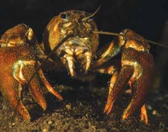
» Eulogy for a Lost Crayfish
It was about a century ago that a sooty crayfish last ambled across the bottom of a Bay Area stream. At last, she and her kin get their due. “For each crayfish is a world unto itself, a host of tiny passengers,” Anton Sorokin writes.
C tions
In the Winter 2024 issue, two photos by Julie Kitzenberger accompanying an opinion piece on beavers were taken along Los Gatos Creek in Campbell, not San Tomas Aquino Creek. Also, the story says researchers have cited at least 20 Indigenous groups in California with words for beaver; the correct number is at least 27.


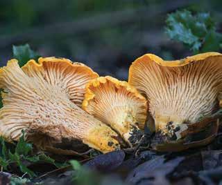
» One Heck of a Fungus Debbie Viess introduces us to our new state mushroom, the California golden chanterelle, which can grow and grow to a mon strous size.
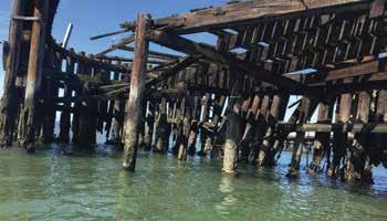
» Make Way for Eelgrass
Richmond’s dilapidated, patently unsafe, toxic-creosoteinfused old pier at Ferry Point is finally going bye-bye this summer, Anushuya Thapa writes.
FROM THE FIELD | BAYNATURE.ORG
SPRING 2024 | BAY NATURE 9
Corre
Clockwise from Wild Billions logo at top: Ross MacDonald; © Scot Rohrer, via iNaturalist, (CC-BY-NC 4.0 DEED); Sonya Bennett-Brandt; Alan Rockefeller, CC-BY-SA via MushroomObserver.org; courtesy of Moffatt & Nichol/EBRPD; Anton Sorokin
growing together

It w I ll be a year th I s March since I stood onstage at the Local Hero Awards and promised that the Bay Nature community would help shape the organization’s future. We asked to hear your thoughts and ideas through surveys, focus groups, and conversations, then listened to your responses.
Collectively, you told us that Bay Nature is more than a magazine. It nourishes those who identify with nature in the San Francisco Bay Area. From these pages, a community grows.
With this understanding, Bay Nature will begin to offer more opportunities to experience our stories together after reading them, deepening our connections with local nature and each other. We’ll take more hikes to explore habitats and ecosystems. Conduct more forums to speak with experts in the field. And visit more project sites where cutting-edge work occurs.
Current magazine subscribers, such as yourself, will be referred to, going forward, as founding members of the Bay Nature community. Rest assured that the Bay Nature magazine you know and love isn’t changing. Rather, you can expect to see more of our stories brought to life.
Bay Nature’s 14th Local Hero Awards event is April 7 in Berkeley, and I invite you to read the profiles of our inspiring honorees in this issue. Dr. Katharyn Boyer, Yakuta Poonawalla, Kellyx Nelson, and Naji Lockett are doing the important work of caring for people and our natural world.
Even as we recognize our community leaders, the Local Hero Awards also celebrate all of you and the efforts by individuals, organizations, and agencies around the area to make local nature and environmental issues tangible parts of daily life. Gathering each year at the Local Hero Awards reminds us that there is nature everywhere. It is common ground that binds us.
Let’s keep exploring nature together in print, online, and outdoors. I hope you will join us in growing and enriching an essential San Francisco Bay Area nature community whose ideas and stewardship are shaping a more equitable and sustainable future for us all.
Please visit BayNature.org/membership or write to me at wes@baynature.org with any questions about Bay Nature’s new membership program.
10 BAY NATURE | BAYNATURE.ORG FROM THE FIELD | PUBLISHER’S LETTER
—Wes Radez Executive Director / Publisher
Clockwise from top left: Usry Alleyne, Violeta Encarnación, G Yang, Russ Aguilar
p. 20
p. 28
p. 18
Local Heroes
New State Park
Coyote Brush Leaf Beetle


lyngsogarden.com / 650.364.1730
345 Shoreway Road, San Carlos

DISCOVER A WORLD OF PLANTS
A sense of wonder and inspiration awaits you at the UC Botanical Garden at Berkeley! Explore a diverse landscape spanning 34 acres, with something new to see or learn with every visit. Browse the Garden Shop, take a class or docent tour, or host your next event at the Garden!
botanicalgarden.berkeley.edu
®
2023 Gold Medal
Image: Saxon Holt
Mon – Sat:
to 5, Sun: 8 to 4
7
Lyngso Vegetable Blend, Nursery Mix, Potting Mix, Essential Soil Landscape Mix, Green Roof Mixes, Bioretention Soil Mixes, Diestel Structured Compost OMRI, Garden Compost OMRI, Biodynamic Compost CDFA, Organic Aged Humus CDFA, Premium Arbor Mulch, Fir Bark, Mocha Chip, Mahogany Mulch, Ground Redwood Bark, Actively Aerated Compost Tea, Mycorrhizal Fungi, Down to Earth Organic Fertilizers, Fish & Kelp Emulsion, Garden Books, Tools, Seeds
Life in Spring
... is full of rebounds and reflection.

Year's

Spotlight: Zodiacal light
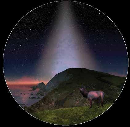
Find a location free of artificial light, like the Point Reyes National Seashore, with a clear view of the western horizon at dusk. It should also be free of fog, moonlight, and clouds, as the sun finally settles into the Pacific. Once it’s gone, look for a tall “pyramid” of diffuse light reaching up from the horizon. This is zodiacal light. The long-observed phenomenon can be seen in the Bay Area during the spring months, close to the equinox. We know photons reflecting off dust particles orbiting the sun cause zodiacal light, but only recently was the dusty planet Mars pinpointed as the particles’ likely source, according to data collected by NASA’s Juno space probe in 2020.
h ammerhead
c hipmunk rebound
Looking at an iNaturalist map, it appears the Golden Gate strait, San Francisco Bay, and Sacramento–San Joaquin Delta delineate the great divide between the Bay Area’s two chief chipmunk species. To the south scurry Merriam’s chipmunks (Neotamias merriami), and to the north bark Sonoma chipmunks (Neotamias sonomae). The latter elusive cutie was spied last year in Sugarloaf Ridge State Park, perhaps for the first time. In spring, a litter of chipmunk pups is born, weaned, and on its way in a matter of weeks.
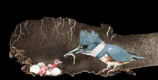
The one species of kingfisher that flies Bay Area skies has an industrious spring. Male and female belted kingfishers ( Megaceryle alcyon) not only woo and choose each other, they also dig a tunnel up to 15 feet deep into a stream bank together. If it’s a tricky vertical location, they may take turns ramming it with their blocky heads, beak first. Next, they shovel dirt from the passageway and new cozy nesting cavity using their fused toes. Their famous rattling call, when made as they approach the nest, may be a kind of “incoming!” alert to family members to clear the passage for their landing.
12 BAY NATURE | BAYNATURE.ORG THIS SPRING | BAY NATURE ALMANAC
ILLUSTRATIONS BY JANE KIM
This
Spotlight: The Night Sky
Sonoma chipmunk
Belted kingfisher
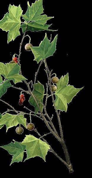
Western sycamore


Whim S y all the W ay do W n
Fanning out like great tentacles, the limbs of California’s native Western sycamore (Platanus racemosa) are a savior when the sun is beating down. In early spring, clusters of fuzzy pom-poms bearing teeny-tiny flowers, maroon if female, dangle from the tips of those billowy branches. The wind, carrying away the tufty seeds, soon transforms the pom-poms into ho-hum brown, nubbly globes. Surprising to think they contain multitudes of acres of future shade.
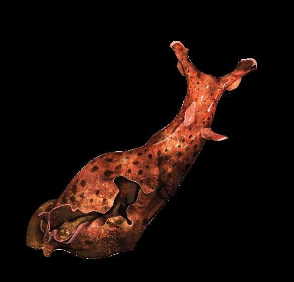
h are of the S ea
Ever wonder how a garden snail looks without its shell? The California brown sea hare ( Aplysia californica) is a pretty good approximation. But a lot bigger (often larger than a human hand), found in tidepools, and known for the clouds of reddish-purple ink it releases in self-defense, irritating nearby anemones. In spring and summer, these hermaphrodites mate and, just before heading to sea hare heaven, lay piles of sticky, jelly-covered “noodles” containing 80 million eggs.
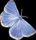
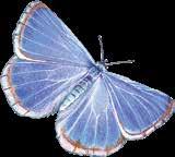
Wingmen
If it’s a silvery blue (Glaucopsyche lygdamus) boom year, you’ll likely know it. The dime-size male butterflies gather around spring mud puddles, sometimes by the hundreds, according to lepidopterist and UC Davis professor Art Shapiro. Slurping up sodium and calcium is one reason, particularly when nectar from flowers in the pea family, their favorite, is hard to come by. It’s also possible that these “mud puddle clubs” somehow increase their chances with the ladies.
SPRING 2024 | BAY NATURE 13
RESEARCH AND WRITING BY BAY NATURE STAFF
California brown sea hare
Silvery blue
When Plants Cry
Have you ever gone outside on an early spring morning and spied “dew” on the grass? And then on closer inspection, you wondered why the droplets only appear on the tips of the blades? Or perhaps you noticed that some plants had water droplets along the margin of the leaves? That’s not dew, it is guttation.
Guttation is actually a mixture of xylem and phloem fluid, which contains sugars and other chemicals produced in the leaves that are exuded by the plant overnight. Unlike dew, which is pure water, guttation is rich in the organic and inorganic dissolved substances that are the lifeblood of the plant. Whereas guttation comes from the plant, dew comes from the atmosphere. You are lucky you got up early that day and were rewarded with this unusual sight, because it soon will evaporate.
What causes guttation? In biology 101, we were taught that when water evaporates from a plant’s leaves it causes fluid to move through the plant, a process called transpiration, but the story is much more complex .
First, a wee refresher: A plant leaf has microscopic holes in its surface, called stomata, that allow in carbon dioxide. A plant combines that CO2 with water by means of photosynthesis, using chlorophyll (perhaps the most important single chemical in the universe). The end product of photosynthesis, oxygen, then escapes through the stoma (lucky us).
A side effect to open stomata is water loss—so much so that 97 to 99 percent of the water brought up through the xylem is lost via transpiration. Each molecule of water lost in the leaf through the stomata is replaced by another adjacent water molecule, which, by capillary action and surface tension, tugs on another molecule, and this goes on down the line through the xylem to the roots. We generally think that water enters the roots passively only because of the pull of this transpiration process, but there is another, less well-known, process also going on: guttation.
The sap within the roots contains dissolved sugars and potassium and other organic and inorganic compounds. The soil in contact with the roots is less rich in such solutes, so water tends to passively enter the roots through osmosis to equalize the concentrations of the compounds in and outside the root. The pressure moving the water
into the root is called the root pressure. The root pressure is so much weaker than the transpiration pressure that the latter overshadows the former during the daytime.
However, at night, photosynthesis shuts down and the stomata are closed, conserving water. If the soil is moist, the root pressure will increase the pressure in the xylem, forcing the leaf to offload some of the fluid. You could think of it as an emergency escape route. When the plant needs to release fluid, and the stoma are closed, the fluid finds another way out. It exits
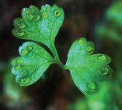
through specialized pores called hydathodes; they are located at the tip of the blade of grass or at the margin of a leaf, typically at the tip of a marginal tooth or serration. If the humidity is high, the guttation does not rapidly evaporate, but accumulates at the leaf tip.
So go exploring in the early morning and see what you can find. Then you can tell your friends that you were engaged in guttation with the plants! That should roll some eyes at the local coffee shop. ◆
David Nelson
The tiny droplets shown in the photos above and below are not dew. They are guttation, a plant’s internal fluids that are exuded at night under certain conditions.

14 BAY NATURE | BAYNATURE.ORG THIS SPRING | SIGNS OF THE SEASON
From top: David Nelson; John Rusk via Flickr, CC BY 2 0 DEED
who is a garden cemetery for?
Running is how i know cemeteries best, which is not as surprising as it seems given the rural cemetery’s history as precursor to the public park in the United States. Anyone who has visited a rural or “garden” cemetery may feel its ambivalent kinship to both public-ness and park-ness. A casual stroll through bare, bleak city streets reveals a compellingly wrought gate, opening to a gently curving path. Abundant trees, shrubs, flowering plants, a green hillside! A view unlike any other in the flat, gray city.
It is easy to miss the gravestones for all the soft green and yellow nature. Certainly before knowing the history of rural cemeteries, I knew their beguiling accessibility. They have felt as much a part of the infrastructure of cities I have lived in as the roads and sidewalks and skylines. In dreary Cambridge, Massachusetts, I ran around the earliest rural cemetery in the country, Mount Auburn, built in 1831. In Brooklyn, I would as often run to Green-Wood Cemetery as to Prospect Park. Now, in Oakland, I run to Mountain View Cemetery.
Prior to the pandemic, I explored its grounds regularly. Before my wife and I got engaged, we meandered up the winding pebble-strewn paths, past the Monterey cypress, the cedar, past the secret outcrop of radiolarian chert, until we found a likely place to sit. The modest skyline of San Francisco and the rounded Headlands and the silver slip of Bay were before us, and we planned our future life together. So drummed into my sense of Oakland was Mountain View that its quintessential privateness did not even register with me until it abruptly closed to the public at the beginning of 2020 due to the pandemic—then was open only to the loved ones of those interred in the cemetery until 2022. A message posted to the Facebook page cited a range of public ills: unruly dogs, trespassing, graffiti, littering, and others.
for these cemeteries. Designed according to Napoleon’s imperial decrees, Père-Lachaise initiated a new-to-the-time practice of selling permanent, private burial plots to individuals and families. Mountain View Cemetery was established in 1863 and designed by landscape architect Frederick Law Olmsted, known, of course, for his public parks. The goal, for Olmsted and other designers, was to honor the dead and for the stewards of the cemetery to protect against the “carelessness, forgetfulness, and individual bad taste” of public opinion.
At Mountain View, Olmsted stressed that replicating the East Coast cemeteries in the “unfortunate” landscape and climate of the Bay Area was infeasible. Trees indigenous to areas with similar climates were preferable. The cypress of lower California were favored for their ability to grow in climates similar to the Bay Area’s, as well as for “seem[ing] more than any other tree to point toward heaven.”

I so love the sprawl, the winding roads, the grasping trees, the uncanny peace of these garden cemeteries. But I also visit with the uneasy sense that I—not having a loved one resting in their hills—am the noise, the crowd, the public city. And, too, I cannot help but think about the longer history of space and sacredness, so often conflated in the cramped or crowded city. Public space is more and more encroached upon, delimiting spaces of sanctuary: Oakland First Fridays are temporarily paused, People’s Park in Berkeley is walled off, parks are cleared of people’s homes, public housing continues to fall.
The rural cemetery has always been equal parts pragmatic and romantic, and a privatized version of the public cemetery was at the core of its rise. A response to increasingly overcrowded, unsanitary, and largely communal city church graveyards, rural cemeteries arose in the 19th century. They are burial grounds built on the accessible outskirts of cities—meant to be serene and picturesque, but not so isolated or remote as to be unreachable for people living within the city. Unlike the later state and regional parks, rural cemeteries are often privately held, entrusted to a nonprofit or board of trustees to determine the extent to which the lands— which can be sprawling and costly to maintain—would be made open to the public.
The Père-Lachaise Cemetery in Paris was an early template
Cemeteries are heady spaces, ripe with meaning for how we think, mostly, about life. The rural cemetery movement reveals the weight the cemetery holds in our imagination. Read through the planning documents or opening remarks for these places, and you’ll find similar yearnings, achingly familiar to anyone who has lived in a big city. If we must live so closely alongside the precarities of modern life, we need the comfort of nature, that is, beauty, softness, space, the remembrance of joy. This is not a private yearning. It is a public one, in the sense that it is shared, equally, by all.
Mountain View partially reopened to the public in 2022. Now, three days a week, anyone may visit. I wish it were open every day. The limits reflect that other reality of Oakland: its shrinking public space, its less welcoming demeanor. Still, I am grateful to visit almost every week. Amid death, I am comforted too by the trespassers, the graffiti, the unleashed dogs. I am comforted by the city, its people who come to the cemetery to be transported, to remember that we are, together, its breathing life. ◆
THIS SPRING | THE HUMAN ANIMAL BY ENDRIA RICHARDSON
SPRING 2024 | BAY NATURE 15
Sadie Rose du Vigneaud
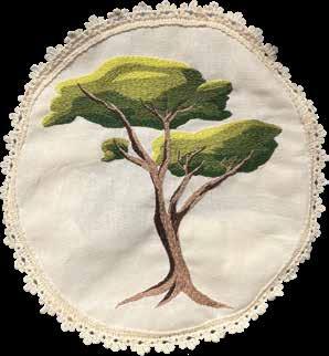
Stitching Nature Together
Along linen dress with exaggerated arms inspired by late-19th-century wedding gowns is adorned with more than three dozen embroidery hoops. Stitched on each circle of beige cloth is a California plant in flower. Sewn with light blue petals and brilliant yellow stamen, there’s the normally white and delicate Marin dwarf flax (Hesperolinon congestum), endemic to the state and found almost exclusively in the Bay Area. The unusual dark blue Baker’s larkspur (Delphinium bakeri ), also endemic and nearly extinct in the wild, is outlined with blue and a few purple threads. The colorful stitchings portray a lively panoply of vegetal life.
The dress is the culmination of an eight-year-long project, titled “the lost ones,” by Bay Area textile artist Liz Harvey. She held public performances and what she calls “social stitching circles,” inviting the public to work on the dress and begin a relationship with an embattled species. The project, she says, “draws on the past to navigate toward an uncertain but yet hopeful future,” highlighting “overlooked species, untold histories, and little-acknowledged art practices.” Describing feelings of “unspoken anguish” about climate change and species loss, Harvey wants to open “a portal to people having a connection.”
The dress functioned as both the focal point and the outcome of 26 performances, held almost entirely in the Bay Area and staged over many years. At these events, while performers donned the dress—sitting, singing, and even dancing—passersby were invited to stop and stitch one of the plants selected by Harvey, often picking up where some unknown embroiderer left off. Harvey says that the unsuspecting participants “weren’t quite sure what they were in for.” And since no prior embroidering experience was necessary, Harvey couldn’t know what to expect either. Though she created initial line drawings on the linen to guide participants, she says that “people were free to elaborate and wander.”
“If a scientist were here,” Harvey acknowledges, “they might say, ‘I don’t think this is right.’” But botanical accuracy was not the point. Harvey recalls a tween, during the project’s first performance, who was “very attached” to their work and concerned about having enough time to complete it. It is as if they entered through the kind of portal Harvey hoped to create, one that builds feelings of connection.
Harvey describes each of these performances as a “devotional ritual,” with the participants’ focus and care creating a ceremonial environment. “You have to slow down,” she says of embroidery. “It’s like the slowest drawing you could do.” In these moments, the dress enabled individuals to have a close, if momentary, relationship with an endangered plant.
The one extinct species represented on the dress, the Santa Barbara morning glory (Calystegia sepium ssp. binghamiae), was declared extinct, believed to be rediscovered, and then determined gone again. Another species depicted, Furbish’s lousewort (Pedicularis furbishiae), was just downlisted from endangered to threatened in 2023. Both species reflect how Harvey’s dress is a
snapshot of endangered plants in an ever-changing world. The dress is a time capsule of endangerment—both hope and loss hang in the balance at the moment of its making.
Playing with time is central to the project. For example, Harvey chose the dress’s 1800s-inspired design as a reference to the century in which the current exponential rise in species extinction began. The dress presents a metaphorical collapsing of time in which we see a symbol of the beginning of the sixth mass extinction, along with images of what is at stake today. The dress reminds us that endangerment has a history.
A need to forge a personal connection with climate change may sound obsolete now that extreme weather events touch nearly everyone. Harvey even laughed when describing that initial impetus for the project, a reflection of how much has changed so quickly. But the connections that might be made with plants through methodical, even ritualistic, attention can be enduring. As Harvey brings this project to an end, she’s moving from the past to what may lie ahead. For her next project, she is “thinking about a future world where plants and humans are connected in ways that might be more fanciful than they already are.” Perhaps she has grieved the loss of these plants and is choosing to embrace hope for their future and for our future with them. ◆ Matthew Harrison Tedford
Liz Harvey’s “the lost ones” is on view at the New Museum Los Gatos, as part of the exhibition the lost ones: iterations and murmurs , through April 14, 2024.

16 BAY NATURE | BAYNATURE.ORG THIS SPRING | NATURE IN THE ARTS
Photo: Sibila Savage; Art: Liz Harvey, the lost ones are whispering, 2015-2023.
Grow community with nature through volunteer land stewardship opportunities for your business, school, or community organization.
Root your child in nature with nature camp & environmental education.
Get outside at our preserves, gardens, & partner properties for outings in English & Spanish. Our 2023 Impact Report is out now! Scan the QR code to explore it.

PLACE FOR AGE 50+ LIFELONG LEARNERS OLLI_BayNature_PubSpring2024_draft1_FINAL.indd 1 2/8/24 10:29 AM outings@landpaths.org (707) 544-7284 618 4th Street, Santa Rosa #217, 95404 landpaths.org
Offering online and in-person courses. Interest Groups include hiking, adventure, language conversation, film, books, and more. Visit olli.sfsu.edu Membership Classes Interest Groups A
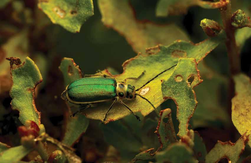
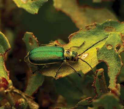
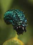
The Tussle Between a Beetle and Its Shrub
Visit Bay a rea coastal scrub or chaparral in spring to find these particularly Californian habitats at their most welcoming. It’s when their soft sages, chamise, ceanothus, and other low-lying plants start to unfurl, early wildflowers peek out between green grasses, and the earth is soft and moist underfoot. Chipping and chirping, towhees and scrub jays set and defend their territories amid the plants and practice their mating songs.
Wander along and you’ll soon find the ubiquitous coyote brush (Baccharis pilularis). A distinguishing species of coastal scrub and chaparral, it hides and shades birds and mammals and wicks dew from the air, sending it down into the soil during the dry season. But an overlooked herbivore, perhaps the shrub’s greatest Achilles’ heel, can defeat this hardy plant’s defenses: the glittering and exquisite coyote brush
leaf beetle (Trirhabda flavolimbata).
When you find coyote brush, and if you look closely on a spring day, you may catch the emerald gleam of this beetle. Once you see one, you’ll likely spot these representatives of the subfamily Galerucinae, skeletonizing leaf beetles, around the immediate area. Skeletonizing leaf beetles are just what they sound like, insects that masticate the soft tissues of a leaf, leaving behind the harder stem, veins, and midribs. Larvae of this beetle subfamily amass on their host plants, feasting on growing leaves, living and mating during the plant’s peak growing season, laying eggs, and dropping frass (invertebrate poop).
Dominating a Bay Area coastal scrubland landscape is no easy feat for any species. It includes adapting to hot and long dry seasons, invasive grasses, a semi-frequent fire cycle, and herbivores for every
season. But the coyote brush is equipped with considerable advantages. Its crown root can reach down as far as 10 feet into the soil, and lateral roots spread in every direction, collecting groundwater long into the dry season. The plant can resprout after a low- intensity brushfire if the root stem remains unscathed. Waxy leaves, impenetrable to many invertebrates, are just plain unpalatable to deer. Its flowers attract parasitic wasps that prey upon other insects that might eat the shrub.
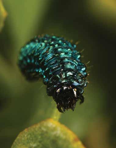
Yet the coyote brush leaf beetle makes this inhospitable plant home during every stage of its life cycle. Hatching from eggs in February, blue-green and shining larvae climb to the buds and leaves of the coyote brush, where they will eat and grow unceasingly for several weeks, nearly reaching the length of an almond and half the breadth. Small but strong jaws
18 BAY NATURE | BAYNATURE.ORG THIS SPRING | SMALL WORLDS
story & photos by russ AguilAr
allow the beetle larvae to succeed where other invertebrates would not, chewing through the waxy coating of the shrub to unlock nutrients inside. A telltale sign coyote brush leaf beetles and their larvae have visited a bush are the semicircles they chew along the edges of leaves.
The larvae and beetles’ beauty belies a mystery: though they shine and glisten in the sunlight and congregate on bushes that birds may visit, such predators often leave them alone. How can this be, when other beetles and larvae are prized treats for spiders, birds, small mammals, wasps, and even some beetles such as predatory rove beetles?
A clue may lie in the close relationship with its host plant, according to research by Wilhelm Boland of Max Planck Institute for Chemical Ecology in Germany. Think of how the famed monarch butterfly (Danaus plexippus) sequesters toxins acquired from milkweed within its body to protect itself from predation. One experience eating the vomit-inducing compounds that the butterfly stores convinces most predators to steer clear of the large, orange-bannered monarch. Similarly, our leaf beetle wields a truly complex and bizarre defense mechanism—and one that is even more powerful.
A coyote brush leaf beetle absorbs chemical compounds from coyote brush into its hemolymph, the insect’s circulatory fluid. The compounds are transported to one of many glands that act as generators and reservoirs for the animal’s defensive chemical munitions. This series of glands contain enzymes that convert the compounds into a precious toxin that is harmless to the beetle. Unlike the monarch, the beetle doesn’t sacrifice its life: leaf beetle larvae can secrete noxious and toxic droplets on demand from
the glands, later reabsorbing it. The smell and taste of these secretions is intended to ward off most predators.
When a beetle larva is fully grown, it crawls to the soil, burrowing underground to pupate and metamorphize. Its body will harden, and many parts will begin to soften, deform, or even liquefy. Within two weeks, it emerges re-formed as an adult, about a third of an inch long. If you thought that was the end of the ordeal for the coyote brush, you’d be mistaken: the adults too feed on the plant, though they’re less
enough to render the wearer impervious to almost any assault. For the toxin-sequestering Trirhabda flavolimbata, a glimmering green shell could become synonymous with a dangerous and disgusting meal. As adults, they can be found congregating on coyote brush, chewing on leaves and flying short distances between host plants as they look for mates and opportunities to feed.
So you wouldn’t be faulted for wondering: how does coyote brush survive the onslaught of this hardy herbivore year after year? Coyote brush enjoys an exceptionally long growing season, as its waxy leaves resist drying out and deep roots draw moisture into the summer.
voracious and less numerous than the larvae.
A full quarter of all known animal species are beetles, and the design of the armor worn by adults makes them especially robust. Their curved, tough exoskeletons can prevent the jaws of small predators, like lacewing larva, ants, or spiders, from finding purchase, and are often hard
Leaf beetles can be sensitive to fire and to frost, as well as to certain predators. This beetle also seems to only sustain its population on coyote brush, and beetles eat large amounts of the plant during their four- to six-week larval stage. If the plant has been burned low or otherwise had its growth disrupted, the beetle may be starved out in a region. The plant will likely recover later.
Unlike some leaf beetles in the family Chrysomelidae, Trirhabda flavolimbata reproduce only once a year, laying eggs in the soil before it is dry. The layer of soil can protect the eggs from the summer’s heat and the frosts of winter. The eggs give rise to voracious larvae once the coyote brush is rapidly growing during late winter and early spring, a characteristic of the scrublands. Because the larvae are the most destructive stage of the beetle’s life cycle and are present for only about a month, a healthy coyote brush will likely survive the insects and recover after the beetle’s season of feasting. ◆
SPRING 2024 | BAY NATURE 19
Left: A coyote brush leaf beetle spends its life on coyote brush, a shrub common in the San Francisco Bay Area. Above: In the beetle’s larval stage it devours the waxy leaves of the plant, leaving jagged bite marks.
LOCAL HEROES
Each year the Bay Nature Institute board and staff select remarkable individuals to honor with a Local Hero Award in recognition of outstanding work on behalf of the natural world of the San Francisco Bay
Area. The 2024 recipients will be celebrated during the 14th annual Bay Nature Local Hero Awards event from 2 to 5 p.m. at the David Brower Center in Berkeley on April 7. BayNature.org/local-hero-awards-2024

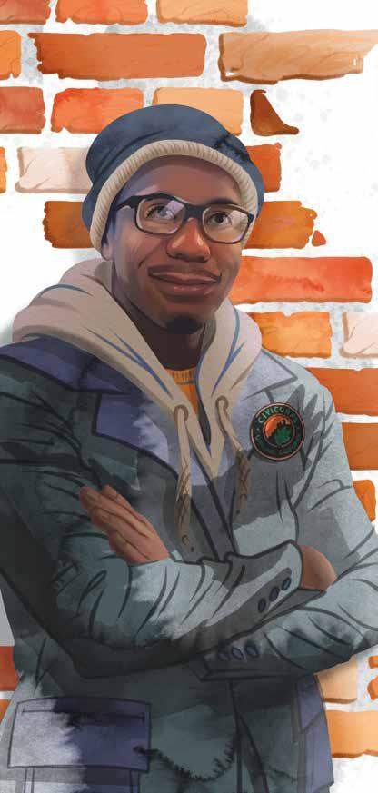
young leader naji lockett
Fallen oak branches, tangles of dense undergrowth, heaps of eucalyptus bark, and packed stands of fir trees cover thousands of acres of public land in the East Bay. Scrambling to lessen the risk of wildfire and clear overgrowth, park agencies and public utilities are contracting help. And Naji Lockett is a hot commodity in that market.
Naji leads young crews who cut and pile that vegetation for later burning or chipping, while keeping an eye out for woodrat nests and other important wildlife habitat. These are long, eight-hour days, sometimes in the rain or intense heat, and it takes a certain secret sauce to keep a crew motivated.
“I’m just working alongside them, so they can get a better understanding of how the work needs to be done and have a good work ethic,” says Naji. “This is a hard labor job … but I just let them know, ‘You’re making a big difference doing this type of work, for the safety of others and the earth itself.’”
At age 24, Naji is the youngest staff member at Civicorps, a nonprofit in West Oakland modeled after the New Deal-era Civilian Conservation Corps. The organization trains 18- to 26-year- olds who live below the poverty line for green jobs, ranging from land management to recycling collection. Naji grew up nearby, close enough to walk to the Civicorps HQ, and started the Civicorps training after finishing high school. Almost two years ago, he accepted a staff position to manage the training crews he’d started in, bringing a calm, empathic leadership style. “Naji has a lot of grit,” says Steven Addison, Civicorps’ conservation program manager. “His path is one people look up to.”
There was a day in Tilden Regional Park, Naji recalls, when his crew was working in the rain, and people were cold, and they started to share stories. “We kind of bonded and built more fortitude, hearing the good and bad about everyone. We’re all going through stuff. And just being humane … like, ‘I’m thankful you understand my situation and don’t judge what goes on outside here, but just respect my work ethic.’” Civicorps cleared almost 1,000 acres in fiscal year 2022.
All the time he’s spent in the parks has Naji envisioning more nature in West Oakland: “If things were a lot more maintained,” he says, “there would be more nature and wildlife would come.” And he has a quiet hope that the community can learn more about ecology, about how “certain plants attract certain insects. And if you can bring insects around, birds come—and if birds come, they’ll nest … just knowing that cycle.”—Victoria Schlesinger
ILLUSTRATIONS BY VIOLETA ENCARNACION
PROFILES | LOCAL HEROES

“My mother was one of the first people in my life who, when I came back from my treks in the Himalayas, she would say ‘નૂર, તમારા ચહેરા પર નૂર છે,’ a Gujarati phrase for ‘there’s this Noor, or glow, on your face,’” Yakuta says. “ I want to see that in every person I interact with—every single human being. That’s what inspires me.”
As associate director of community stewardship and engagement for the Golden Gate National Parks Conservancy, Yakuta brings this glow and nature to others. Her path has come full circle, from a journey that was far from linear.
Yakuta grew up in a Dawoodi Bohra Shia Muslim community in Pune, a city in western India. Around the age she first hiked in the Indian Himalayas, she began questioning the patriarchal institutions and inequities in her community and beyond.
Independent and inspired by the environment, she went from leading youth trips through the forests of India to attending graduate school to moving to San Francisco in 2010 and working for the Sierra Club, then joined GGNPC a decade ago.
At least twice a week, she and her team of 12 invite local Bay Area communities to experience nature in the parks—often for the first time. The team facilitates events such as health and wellness walks at the Presidio, wildflower walks at Mori Point, birding outings at Hawk Hill and Rodeo Lagoon, and partnerships with local public libraries.
Other programming connects themes in nature with international holidays such as Holi and Diwali, Hindu celebrations of color and light; Día de Los Muertos, the day to honor the dead in Mexico; and Eid, an Islamic festival marking the end of a period of fasting and prayer. Yakuta encourages people to celebrate the multicultural landscape of the Bay Area and to see themselves— and their cultures and customs—in nature as they plant native species, tend parklands, and learn about local wildlife.
Yakuta also promotes access to the outdoors through resources like GGNPC’s Roving Ranger and facilitates discussions about questions like “what kind of ancestor do I want to be?” She serves on the board of TOGETHER Bay Area and is a member of the California Landscape Stewardship Network’s Justice, Equity, Diversity and Inclusion Roundtable, among other organizations.
By connecting Bay Area communities with each other and the outdoors, “we’re creating Noor in nature,” Yakuta says. “I can sense it now when there’s a grandmother from the Tenderloin, from the Arab Muslim community, who’s lost her home … but then she comes here and finds a connection with the Rose Garden, for example, because she had a rose garden in her community.”
“Programs in the park allow us to see ourselves not as alone, not as individuals, but as part of a collective,” Yakuta says. “And that in itself is so powerful.” —Lia Keener
SPRING 2024 | BAY NATURE 21
Yakuta Poonawalla first hiked in the Himalayas at age 15.
community hero yakuta poonawalla

San Francisco State University’s Estuary and Ocean Science Center (EOS) in Tiburon, did not grow up near the ocean. But at summer camp on the Chesapeake Bay, at age 11, she dug into the sand—and marveled at its treasures. Clams! Then she wondered what else was down there, and why it stank. She met people, too—oyster farmers and crabbers—who made a living on the bay. Here was a whole gorgeous world sparking her curiosity. “I was just smitten,” she says.
Now she’s the one revealing the shoreline’s treasures to young people. Some are high schoolers or community members from underserved groups, helping to build experimental reefs or restore eelgrass in San Francisco Bay and learning that climate change can mean jobs. Most are SFSU master’s students. Katharyn inculcates in them skepticism and the principles of ecology, and also how those principles work in the real world—dragging them to meetings with government officials, for example. There is no textbook for her class on restoration ecology, because everyone, Katharyn included, is scrambling to figure out how to achieve it. How to bring back our shorelines, and keep them alive in the face of a rising sea, in all their dynamic messiness. And how to do it fast. “We need to come up with the elegant experiment, or survey, or monitoring project, that helps us get that clarity about how to move forward,” Katharyn says. “I feel this really extreme sense of urgency.”
of sand will stay put when the tide comes in, how a concrete reef can be made light enough for one person to handle. (For Katharyn wants the community, not just cranes, to rebuild our shorelines.) On the board outside Katharyn’s mud lab, a student tacked up a sign: “GET DIRTY.”
Lately, Katharyn has focused everything on saving the EOS, one of the few science labs where such questions can be answered. In 2022 SFSU’s administration declared the 45-year-old center would have to scrounge up its own funding to stay open. Katharyn’s team began churning out grant applications. Money has begun to come in. She aims to make shutting down the center an impossibility.
In a blustery winter rainstorm, just off a dock that was once the U.S. Navy’s property, pelicans preen atop the lab’s experimental reefs, where they poke above the water. Drop a simple structure—bags of oyster shells, or big concrete wiffle balls—and complexity moves in. Life loves irregularities. “There’s room for your amphipods and your isopods and your worms, and your algae and your bryozoans, and whatever else. Mussels, sometimes,” Katharyn says, still marveling at the treasures. Then the fish, and the pelicans. Make it appealing enough, and they can hardly say no. —Kate Golden
22 BAY NATURE | BAYNATURE.ORG
environmental educator katharyn boyer
w hen she drives down the San Mateo County coast, Kellyx Nelson doesn’t see a piece of land she hasn’t touched. She sees more than 10 dams removed, 500 acres of natu ral and working land that support carbon sequestration, and miles of creeks and watersheds restored—and that’s just the beginning of the work she’s done as the executive director of the county’s resource conservation district, or RCD for short.
Kellyx describes the RCD as connective tissue—a special dis trict, created by the state, that nimbly supports other players in the landscape of conservation. Despite the RCD’s size, the role inspired her. “Here’s this entity that exists not to take anything from anyone, not to regulate anyone, not to shame anyone, not to litigate anyone, but to help people.” Like a hopeless romantic, she jumped ship from the Peninsula Open Space Trust, abandon ing a burgeoning career inside an extremely well-funded entity to work in an office with no staff, no money, no projects, and a “very bad reputation.” From there, Kellyx became Resource Conservation District. And 18 years later, with a grow ing staff of 26 and a budget nearing $19 million, she’s still seen by some as its symbol.
“People always give me the impossible projects,” Kellyx says. Like the restoration of Pescadero Marsh, a thorny problem whose brackish waters had brought about a standstill mix of conflicting interests, differing jurisdictions, and pointing fingers. The key, she says, is listening, and taking an all-inclusive view of con servation: she sees farmers as stewards and thinks conserva tionists, developers, and even people who hate “enviros” can work together. “You don’t have to choose between the people and the land.”
The real enemy, she says, is bureaucracy. Getting a restoration project permitted, funded, and completed often hinges on perfect timing and a herculean effort—but Kellyx doesn’t think it should. In 2019, she helped found the Cutting Green Tape initiative, which has brought together federal agencies and nonprofits to discuss making restoration work easier. The species they’re protecting, like steelhead and red-legged frogs, “don’t know what juris diction it is,” Kellyx says. “News flash—birds fly, and frogs hop, and fish swim.” And they should get to do so freely.
Kellyx is a connector, even from her living room. Our conversation, happening across a repurposed children’s play table, is interrupted frequently. Neighbors come by to drop off their kids. Her own kids make calls to their friends. She often takes them hiking in the Sierra, or camp ing in Joshua Tree, or road-tripping across the country to national parks. “I guess if I have an image of myself, it’s always with kids and the outdoors, even though it’s not what I’m doing anymore.”
Or maybe it is, but with grown-ups and a little closer to home.
 conservation action kellyx nelson
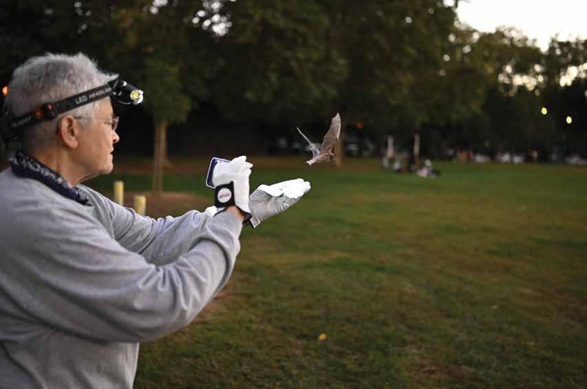
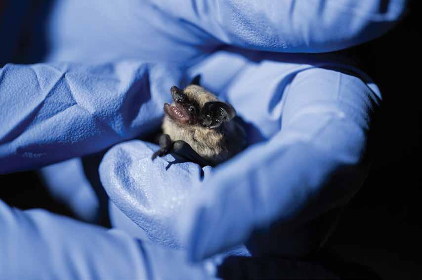
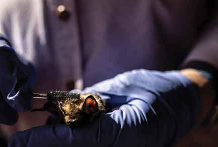
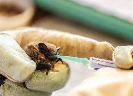
On a warm September afternoon at her home in downtown Sacramento, JoEllen Arnold sits at her table where a wall of windows overlooks her backyard’s wildlife garden. She is laying out tools: thick leather gloves, a dish of wriggling live mealworms, tiny syringes filled with a paste of food and water, a stack of clean, soft rags, and her digital scale that measures in grams. Arnold, a 74-year-old retired schoolteacher, rehabs injured bats. It’s a daily ritual of feeding and tending that will take an hour or two. Like a lactation consultant with an underweight newborn, Arnold weighs each bat before and after its feeding to determine how much food it has taken in. She keeps meticulous records, carefully logging the details in her notebook.
Arnold gently grips one of her rescues in a gloved hand, a female hoary bat called “Lodi,” named for the city where she was rescued. A passerby found Lodi on the ground with a compound fracture in her left elbow in April 2021. Lodi’s tiny face now rests on Arnold’s index finger, while in her other hand Arnold wields a miniature grooming tool—an unused mascara brush—that she maneuvers between the bat’s rounded ears. The colors in Lodi’s luscious fur coat glow in the window light—dark brown, reddish-blond, and white. The frosted white fur tips account for the “hoary” in her species’ name.
Lodi’s extra-thick fur keeps her warm, a necessary adaptation since hoary bats don’t roost in colonies. Instead they are solitary roosters, hanging alone in trees, and sometimes mis -
THE B T

When insects emerge and soon follow. And so do
taken for pine cones. Their color pattern helps to disguise them as bark and leaves. While all rehabilitating bats need their fur checked and groomed occasionally, Lodi’s fur needs extra attention. She does not hang upside down well, so she sleeps with her feet propped up on a piece of bark and ends up lying in her own poop, which gets stuck in her fur. Grooming sleek coats, offering wriggling mealworms with tweezers to hungry bats, and waking up every two hours to feed orphaned newborn bat pups are all routine for Arnold.
“If we don’t care for them, the bats will die. If a bat is injured or sick, they can’t care for themselves and it will die. I can’t stand that thought,” she says. For the past decade, she has volunteered, along with about a dozen others, for NorCal Bats, a nonprofit dedicated to rescuing, rehabilitating, and releasing bats throughout Northern California. “I really hope that everywhere bats live, they can be cared for,” Arnold says.
Tending to the suffering of individual injured bats and nursing them back to health means Arnold and other bat rehabbers spend a lot of time getting to know many of the 17 bat species that live in Northern California. They use that insight to educate the public through frequent walks and presentations, but their years of field experience and health data also make for an unusual bridge between people passionate about bats and the biologists documenting the threats to an entire order of mammals. The rehabbers “give us a window into the wild world, into parts of the ecological
24 BAY NATURE | BAYNATURE.ORG
FEATURE | WILDLIFE
HEALERS flowers bloom in spring, the bats the calls for help to NorCal Bats.
picture that we as scientists may not have without focused studies,” says Leila Harris, a wildlife biologist, bat ecologist, and PhD candidate at UC Davis.
More than half of North America’s 154 bat species are at risk of severe decline, according to the first North American Bat Conservation Alliance’s “State of the Bats” report, published last year. Bats are vulnerable to climate change, collisions with wind turbines, and habitat loss. Millions of hibernating bats in the United States and Canada have been killed by the fungal disease whitenose syndrome since 2007. They also suffer from the fear and disregard of some people.
In January 2023 , in between a series of atmospheric rivers, NorCal Bats received a call that Mexican free-tailed bats were trapped inside a trash can outside a building in Rancho Cordova, east of Sacramento. A concerned bystander had watched in disbelief as a building maintenance worker removed a sign from the exterior of the building where bats were known to roost, according to NorCal Bats. As the sign came down, Mexican free-tailed bats sleeping behind it fell to the ground. They were then scooped up and dumped into a trash can that was filled with wire, broken glass, cigarette butts, and water, and left to die.
The bystander tipped the trash can onto its side and between 30 and 50 bats crawled out and flew away. A NorCal Bats rescue volunteer arrived on the scene to find nine bats still at the site.
Two had already died, one was ultimately euthanized due to its abdominal injuries, and another was taken to the vet with wing injuries. Five more fell under the care of NorCal Bats volunteers until after the winter storms and were then released. The incident was reported to the California Department of Fish and Wildlife CALTIP program, and, NorCal Bats staff say, a CDFW warden talked to the building’s staff about ethical methods of removing bats and the devastating impacts of disturbing roosts, which is illegal. Bats are nongame mammals and have protection under the California Fish and Game Code.
“Sometimes, people choose to kill them just because they’re afraid and … they don’t understand that there are ethical ways of removing them,” says Mary Jean “Corky” Quirk, who founded NorCal Bats in 2006.
Each time a bat is rescued, NorCal Bats sees an opportunity to educate the bat’s “finder” about bat ecology and conservation. Bats that can’t be released into the wild become ambassadors for their educational programs. NorCal Bats partners with Yolo Basin Foundation to lead a regular bat walk and talk program at the Yolo Bypass Wildlife Area throughout the summer. It also makes presentations at schools and libraries and for various organizations year-round and has information tables at events such as reptile shows, bird festivals, and UC Davis Picnic Day. NorCal Bats has permits from CDFW and the U.S. Department of Agriculture to house live, non-releasable bat ambassadors.
SPRING 2024 | BAY NATURE 25
story and photos By s tephanie p enn
Canyon bat
Lodi became one of these ambassadors. Her wing was amputated after her elbow fracture injury, making it impossible for her to survive in the wild. Hoary bats are a relatively uncommon species yet are the most geographically widespread bat in North America.
“When people get to see a bat’s face for the first time, everything changes for them,” Arnold says. The hoary bat’s face is described as “a mix of very beautiful and ‘Um, what kind of dog is that, anyway?’” by authors Charles Hood and José Gabriel Martínez-Fonseca in their new book Nocturnalia.
Once Arnold finishes grooming Lodi, she delicately places her inside a portable butterfly enclosure. Arnold zips the lid closed, carries the enclosure out to the backyard, and hangs it from a tree. She sets a timer for 45 minutes—enough time for a good dose of vitamin D.
When Ted Weller, an ecologist with the U.S. Forest Service, and his team first attached GPS trackers to hoary bats in 2014, they made a surprising discovery. Instead of moving in a linear

Caring for Bats
What to do if you find a bat?
• Never handle a bat alive or dead with your bare hands.
• If you think a bat is sick or injured, contact your local wildlife rehabilitation facility.
Want to create habitat for bats?
• Spring is the best time of year to install bat houses. It’s when some bats are moving from their winter roosts to their summer grounds, so they are more likely to move into the structure.
• To learn more about bat houses, check the websites for NorCal Bats or Merlin Tuttle’s Bat Conservation.
• Plant natives that support local insect populations.
• Install a wildlife escape ramp in water features, such as pools or fountains, that allow a bat, or any animal that falls in, to get itself out.
A quarter million migratory bats roost in the expansion joints on the bridge during the day.
direction toward warmer climates for the winter as biologists had assumed, male hoary bats made long-distance flights in various directions and sometimes hibernated for the entire winter.
Starting in fall of 2022, Weller and his team began using the Motus Wildlife Tracking System to study hoary bats in partnership with CDFW, the USFS, and the U.S. Geological Survey. While the bats are under anesthesia, small lightweight radio transmitters are sutured to their backs, to communicate with a network of towers. Because hoary bats roost in trees instead of caves, these solar-powered trackers recharge in sunlight and can continue to work without a need to recapture bats for battery replacement.
Arnold virtually attended a recent Bats Northwest talk where Weller discussed his ongoing research. She brought her rehabilitator’s lens to the discussion, inquiring about the safety of the sutures and whether they pose a risk of infection to the bats.
Wildlife rehabilitators have a useful role, alongside scientists and conservation managers, in improving understanding of bat ecology. Detailed records like Arnold’s often go back years, documenting the date pups are first received into care or the time of year particular species are brought in for help. Harris is using rehabber records for a current study of prenatal exposure in bats to contaminants. The records help her predict exactly when to start checking maternity roost study sites in various areas and for different species. “For statewide projects in particular, where phenology can differ markedly between, say, SoCal and NorCal, and you have a small crew, local and long-term knowledge like this can be a really useful piece of the puzzle that helps extend limited conservation ecology research dollars,” writes Harris.
To plan for this summer’s fieldwork, Harris will contact bat rehabilitators for estimated pupping dates at roost sites throughout the state. “When rehabbers are able to compile consistent and accurate records over time, these can add to our overall body of knowledge, and even if not statistically robust on their own, can provide initial observations that suggest directions for future research,” she writes. “We need to honor their information and contributions to our understanding of this complex group of mammals.”
The volunteers with NorCal Bats know that any of the region’s local species might end up in their care. They may get pallid bats, our scorpion-eating new state bat; on rare occasions the mastiff
26 BAY NATURE | BAYNATURE.ORG
Lodi’s tiny face now rests on Arnold’s index finger, while in her other hand Arnold wields a miniature grooming tool— an unused mascara brush—that she maneuvers between the bat’s rounded ears.
bat, the largest in the U.S.; or Townsend’s big-eared bats, which, like pallid bats, are referred to as “whispering” bats due to their low-intensity echolocation. Recently there has been an influx of canyon bats, among the first bats to emerge each evening to eat flies, moths, beetles, and other insects. In a typical year, NorCal Bats cares for about eight or nine species, though it varies year to year. But volunteers rescue Mexican free-tailed bats more than any other, due to the sheer quantity of them in the wild and their propensity to live in buildings and bridges, making them much more likely to encounter people.
“When people get to see a bat’s face for the first time, everything changes for them.”

Spring is a transition time for bats. As the insects come out, the bats become more active. It is when some species relocate from their winter homes to their summer homes. It is an ideal time of year to install bat houses, as they are much more likely to be occupied. By summer, bats have already settled into their summer roosts, and by fall they are relocating to save energy as temperatures drop. In winter, they don’t fly every night and when they do, it is usually after dark.
The seasons also bring particular challenges for bat rehabbers. NorCal Bats expects more rescue calls during extreme weather events. Cold temperatures and winter storms increase the number of bats in distress. High winds can break the tree branches where hoary bats roost, causing them to end up on the ground, where they become susceptible to house cat attacks. Extreme heat in the summer can also be deadly, especially for bat pups. When Mexican free-tailed pups overheat, they try to cool off by leaving their roosts. “They cling to each other in chains,” Arnold says, “and when the top pup falls, they all fall.” Sometimes hundreds of pups careen to the ground this way during a heat spell.
Back at her worktable, Arnold moves on to tend a Mexican free-tailed bat nicknamed “Sneezy.” She places a drop of water in his mouth to hydrate him. To be ready for release, a bat needs to
To be ready for release, a bat needs to consistently eat well, maintain a healthy weight, and fly in the “flight tent” set up in Arnold’s basement.
consistently eat well, maintain a healthy weight, and fly in the “flight tent” set up in Arnold’s basement. She monitors flight progress remotely with a video camera, identifying each bat with UV lipstick that shows up under black light in the tent.
The Yolo Bypass in Sacramento Valley is the summer home to the largest urban colony of Mexican free-tailed bats in the state. A quarter million migratory bats roost in the expansion joints on the bridge during the day. Then, at sundown, they emerge together, forming long columns silhouetted against the fading glow of the sky. The bats disperse to hunt for moths and other insects, reaching speeds of up to 100 miles per hour. After hunting throughout the night they return individually and anticlimactically.
“I have a soft spot for them. They get along with anybody. They don’t really care if you’re even their own species. I think that’s kind of cool,” says Quirk. “They live in massive colonies. They know each other. They know their friends. They know their family. They eat so many crop pests. They’re very beneficial to us, and often, people don’t realize how important they are to agriculture and reducing pesticide use.”
Summer is pupping season at the colony and lactating female Mexican free-tailed bats can eat their weight in insects each night. It is also an intense time for Arnold because caring for the newborn pups means feeding them formula every two to three hours day and night. Fall brings new challenges for (continued on page 45)
Spring is a transition time for bats. As the insects come out, the bats become more active.
Pallid bat
Big brown bat
The Everything Park
One of Kimberly Stevenot’s responsibilities as a kid was to hang out by the side of the road and look for park rangers—or anyone else who looked like they might be trouble.
The Tuolumne Rancheria, where many Northern Sierra Mewuk had lived since they were forced out of their homes, was granite and solid red clay. It was about as bad as a place could be for growing anything. So her family snuck around to the few places where the plants they had gardened for generations still grew. Many of those places were in state and national parks.
Those places were better than nothing, but not great. The parks were overgrown, and the plants needed hand-weeding. Controlling weeds with fire, the way the Mewuk used to, was too risky—so much as picking a berry in a state park without authorization put them in violation of California Code 4306. Later, when they learned more about pesticides, that was another worry.
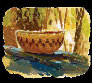
But if they followed a river for long enough, past the long stretches of mining and dredging debris, past the riverbanks kept scrupulously bald for the purposes of agriculture, signs of the old California might emerge—tules, cottonwood, willow, and, in the high loam, valley oaks. A grove of valley oaks creates its own microclimate, a small planet of understory plants and fungi. One of these is the Valley sedge, Carex barbarae, a grass whose rhizomes are one of the most coveted materials for weaving baskets.
Thirty years ago, sometime after her mother died, Kimberly’s husband came back to their home in Modesto, radiant with excitement. He’d spotted something while driving through Caswell Memorial State Park. “I think I found your mom’s sedge beds,” he told her.
Cultivating sedge is a lot of work. People tend to keep their spots secret. If someone starts digging a bed and uncovers suspiciously long, straight rhizomes, they usually know better than
to take any—invariably another weaver will figure it out, and give them hell for it later. The sedge Kimberly’s husband had seen had roots all tangled up in its rhizomes. No one was tending it anymore.
Kimberly remembered how her mother and grandmother would follow the Stanislaus River downstream from the foothills of the Sierras, and the abundance of sedge they described finding there. She decided to go see for herself.
Ripa R ian fo R est is a R a R e sight in the Cent R al Valley. About one million acres of trees, shrubs, and grasses once flourished, drowned, and flourished again along the valley’s rivers, creeks, and floodplains; now, perhaps 130,000 acres remain. In recent years, though, that number has begun to inch up again. Caswell has about 260 acres. Seven miles south of there is Dos Rios Ranch—2,100 acres, much of it former dairy farm and almond orchard, at the extremely floodable confluence of the Tuolumne and San Joaquin rivers—which is steadily being restored to riparian forest. Later this year it will open as California’s first new state park in 15 years.
“I think of this literally as a park of the future,” says Armando Quintero, California Department of Parks and Recreation director. Today, a California state park has to deliver more than just a historical plaque or a scenic vista. Quintero cites Dos Rios Ranch State Park as an example of what the state’s ambitious 30x30 goals could look like—providing shelter during heat waves for wildlife, storing floodwaters, harboring endangered species.
28 BAY NATURE | BAYNATURE.ORG
FEATURE | A NEW STATE PARK
Dos Rios is a test of California’s ability to adapt to the future—and learn from the past.
But it will also be one of the few public parks in an area that has grown rapidly in population with no commensurate growth in open space. Valley residents, many Latino and low-income, have never had the same access to public lands as people who live on the coast. Native inhabitants of the valley have lost so much that the scale of it is difficult to even imagine. Quintero has heard that one of the almond orchards at Dos Rios will stay a few more years—that particular lease isn’t up yet—and he’s delighted about that too. “You don’t usually have a park that has a piece of the agricultural story of the Central Valley,” he says. “We used to say ‘man and nature’ and that always made me pull my hair out. Because man is nature, right? This park is going to be telling a fuller story of California.”
In a larger sense, Dos Rios is also a sign of how much California’s idea of nature is shifting. Dos Rios is becoming a wild space in a landscape that has very little of that. But it also is home to a native-use garden, where Indigenous people can gather culturally important plants without permits, and it will be tended in ways, like traditional burning, that would have been flagrantly illegal a few decades ago. “Our native wildlife, our native butterflies and beetles and bees all lived in that same cultivation space with California people for thousands of years,” says Julie Rentner, an ecologist and the president of River Partners, the nonprofit that bought this land to restore it. “They’re all adapted together.”
Until the 1850s most of Califo R nia was, basically, a nativeuse garden. One of the most vivid descriptions of what that looked like, at least in one part of the Central Valley, comes from interviews done a century ago with Thomas Jefferson Mayfield, the child of white settlers who was taken in by local Choinumne Yokuts in the 1850s after his father disappeared to herd cattle. Mayfield describes growing up in a wildly lush landscape where residents lived so well on acorns, mustard greens, tule roots, ground squirrel, deer, and other wild forage that everyone spent
hours a day playing agility games on a hard-packed sand court they’d built in the middle of their village.
By 1862, it was all over. Mayfield’s family had been only the first of many waves of squatters who killed or chased away the wild game, cut down the trees, brought in livestock that pooped in the waterways, banned fishing and foraging by anyone who wasn’t themselves, and murdered anyone who objected. The surviving Yokuts either left the area or eked out a living shearing sheep and doing laundry for the same people who had destroyed the system that they depended on.
i n the 1920s , at the request of the newly created State Parks Commission, landscape architect Frederick Law Olmsted Jr. and a team of volunteers began traveling the state, looking for iconic California landscapes to parkify. Land was cheap (because of the Great Depression) and the state was flush with federal mon-
Mewuk baskets
These are serving bowls: willow foundation, sedge, bracken fern.
SPRING 2024 | BAY NATURE 29
By h . R . smith paintings B y g yang
ey (because of the Great Depression). An opportunity like this would not come again.
Olmsted’s report to the Commission laid out the usual suspects: mountains, redwoods, coastline, desert. But he also made an impassioned case for preserving riparian areas for scenic, recreational, and ecological reasons that, he wrote, “would bring far greater dividends than the separate pursuit of one or more of these ends independently.” Former state parks director Ruth Coleman says that the Yolo and Sutter bypasses, a mix of farmland and open space that’s meant to flood, are the closest thing to what he was hoping to preserve.
But even before Olmsted made his trip, the Central Valley’s forests were nearly gone. A riparian forest is, by definition, next to a river, and the captains of steamboats puttering upriver through the Central Valley had few compunctions about pulling over and logging a bunch of trees to feed into their boiler rooms. In 1850, California, with exactly 19 days of statehood under its belt, got itself included in the federal Swamp Act, which gave it permission to dry out any “swamp and overflowed lands” (which, when wet, were federal property, like rivers) and sell the results. The transformation of the valley’s 15 million acres of grasslands, wetlands, scrublands, and forest turned a lush, mercurial ecosystem into something more squared off and controlled—a landscape that people now floor the accelerator driving through between the Sierras and the coast.
w hen Kim B e R ly was g R owing U p in San Francisco in the 1960s, her mother told her to never tell anyone she was Mewuk. Tell people you’re Filipino, she said. Otherwise no one will rent to us.
But during the fourth grade, after a lesson about the Spanish missions, and after the teacher said one too many times that all the Indians were dead, Kimberly went home and said that she needed to take some baskets to school and lay some truth on the class. Her mother reluctantly agreed. This was long before the American Indian Religious Freedom Act of 1978, and Mewuk could get harassed and even arrested for gathering.
Kimberly doesn’t remember how her classmates responded. She does remember that a student teacher, who was Native Hawaiian, let Kimberly know she was doing the right thing. “That was kind of the smoke before my fire,” Kimberly says, chuckling.
t oday, the s mithsonian C alls Kim B e R ly on the R eg U la R to consult about Mewuk history and culture. While she was on the board of the California Indian Basketweavers Association, she worked with the national parks system and California state parks to legalize native gathering—no more child lookouts, no more sneaking around. She could go to the same sedge beds that her mother and grandmother had used, but legally this time.
Or at least she could in theory. A few months after the permit was developed, Kimberly drove out to see the county’s park district supervisor and get her permit signed. When she found him, the supervisor informed her that he had never heard of such a permit. Also, he added, Caswell’s sedge was off-limits, because the park was home to a very special and almost extinct creature
known as the riparian brush rabbit.
“Excuse me?” said Kimberly. “You are talking to one of two Mewuk traditional basket weavers here. You want to talk extinct?”
f o R the past C ent UR y, state parks have run on a boom-andbust cycle—funded when times are good, hung out to dry when times get tough. In the late 1970s, California started “trimming back everything except prisons,” says Richard Walker, a historian of the conservation movement in the Bay Area. California also has a long-standing habit of trying to pay for crucial environmental priorities with bond measures, adds environmental historian Jon Christensen. That includes parks and conservation, but also clean water (2014’s controversial Prop. 1) and climate adaptation (on the ballot in November 2024).
One consequence of that unpredictability is that even though Dos Rios has been floated as a possible state park since at least the late 2000s, it was ultimately a nonprofit—River Partners— that pulled together the money to buy the site, with the hope of one day handing it over to a public lands agency. There were no guarantees. “It can be competitive,” says Rentner. “There’s really beautiful properties on the coast and in the forests that would love to become state parks.”
“Bond after bond after bond would come and go, and the money went to the coast,” says Ruth Coleman. As state parks director in the 2000s, she spearheaded the Central Valley Vision Implementation Plan, which sought to develop more state parks in the valley. “If you looked at a map of the California state park system, you will see a bazillion dots along the coast and a lot of dots in urban areas. You will see very few dots in the Central Valley.”
It took River Partners over five years to pull together $22 million in funding to even start the process, from sources like the U.S. Department of Agriculture, the U.S. Fish and Wildlife Service, the California Wildlife Conservation Board, the state Department of Water Resources, the California River Parkways Program, the San Francisco Public Utilities Commission, and the U.S. Bureau
30 BAY NATURE | BAYNATURE.ORG
FEATURE | A NEW STATE PARK
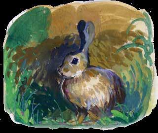
Riparian brush rabbit
The valley that was
California’s Central Valley was transformed dramatically by European settlers in the 19th and 20th centuries. Now, so much water has been spoken for that habitat restoration focuses on landscapes less dependent on year-round surface water—fewer lakes and marshlands, and more forest, shrublands, and grasslands.
Pre-1900s

Where the state parks are
2010s
California's coastal counties have one-third the area of the inland counties, but more than twice as many parks.
Inland
Coastal 83 193
Excludes eight parks that span inland and coastal counties. Data: California State Parks.
of Reclamation. River Partners commissioned site analyses, and planned how to un-level the land, and decided which plants would go in where, in what order. They pulled out the concrete riprap, which had been dumped on the riverbanks to keep the river from spreading out. They put in an order for 2,400 pounds of locally adapted native seed (only to find, when it was time to plant, that the price of that seed had tripled).
Each funding agency governed some different angle—navi-
gable waterways, public spaces, endangered species, flood risks. “We had to go through hydraulic analyses to prove that the trees were not going to impede floodwater conveyance,” says Rentner. “It’s intense.” Getting permits to begin restoring the wet side of the levee took four years longer than the permits for the dry side. River Partners had to navigate at least eight overlapping regulatory processes just to get permission to plant trees next to the river. Coleman worries 2024 could be a return to the bad old days of
SPRING 2024 | BAY NATURE 31
MAP BY KATE GOLDEN
parks funding. But she’s heartened by the fact that Dos Rios has to be so many things to so many people. Because it plays such a variety of roles—biodiversity, public health, climate adaptation, groundwater recharge—it can pull funding from a wide array of sources.
Dos Rios is also a trial run for how the Central Valley will adapt to climate change. Its 2,100 acres make it large for a park in the area. “I think Dos Rios is going to have untold ecosystem benefits we haven’t even begun to understand,” says Coleman. Ten percent of the irrigated farmland in the San Joaquin Valley needs to come out of production by 2040, as water becomes scarcer. That land could become mango farms—or, as is happening in Kern County, to the south, it could become Amazon fulfillment centers. Or it could be an early link in a chain of riparian restorations along the rivers of the Central Valley—a massive wildlife corridor for migratory birds and other species, as well as a hedge against future droughts and flooding.
i f yo U a R e going to B e C ome a state pa RK , a lot of species will come to rely on you. There are the riparian brush rabbits, sure, but also the riparian woodrats (also endangered) that make little houses for themselves out of sticks. There are neotropical migratory songbirds, which stop here on circuits that can stretch from the Brazilian Amazon to western Canada . There are young chinook salmon, which like to forage for insects, amphipods, and other crustaceans in the relatively still waters of a floodplain, instead of getting banged up in some fast-moving stream.
And there are—well, there will be—humans. A lot of them— from kids spending their first night camping in the outdoors to birdwatchers, to trail runners, to friends and families looking for an affordable space to gather, to locals trying to get cool in the broil of summer, to school groups for whom this landscape and its history are going to become their lesson plan. People who never even visit the park will benefit from the floodplain’s ability to capture and store groundwater and reduce the risk of flooding downstream. If the city bus that makes it all the way out to Shiloh Elementary School in West Modesto can go another two miles, there will be the people who ride out here on transit, or on bikes. The average Modesto resident makes about $33,000 a year—about two-thirds the California average. Sixteen percent of city residents, and 20 percent of children, live below the federal poverty line.
Julie Rentner grew up on the outskirts of public outdoor space like this—near Mount Diablo, which owes its continued wildness to California’s public lands buying spree in the 1920s. “I grew up with crazy privilege, not because my family’s rich,” says Rentner. “I didn’t go to jail as a teen probably because I had access to open space.” Then Rentner, as people do, grew up and fell in love with a guy who enrolled at UC Merced.
Rentner was not sure how to process 1990s-era Merced. The air was bad. The water was bad. Nobody had access to open space. Then she saw a job posting for an ecologist.
The instructions for getting to the interview were this: Drive to the end of Dairy Road, and look for the pickup truck. “I got
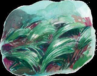
in with the field manager, Stephen Sheppard—this really unassuming tomato farmer from Chowchilla,” says Rentner. “He goes, ‘We’re just going to show you one of our projects, and see if this is something that you think you’d like to work on.’ ” Sheppard drove up a levee, and a vista opened up beneath them. “Three thousand acres of beautiful marshland and forest,” says Rentner. “All clearly just restored. I said, ‘What the heck are you guys up to?’ ” Rentner had studied forestry at UC Berkeley. At no point had anyone mentioned to her that there used to be forests in the Central Valley. But here one was—the beginnings of one, anyway.
Kim B e R ly fo U nd o U t a B o U t d os Rios in the fall of 2019, when Rentner met a niece of hers and invited the family to come out and talk about native uses of the plants that were being put in on the land. People involved in the restoration understood the role these plants were playing ecologically, but wanted to know more about their usefulness to the cultures that had tended them in the first place. “We brought all our baskets, everything, out here,” says Austin Stevenot, Kimberly’s son. “I’d never heard of River Partners. I live in Modesto, which is 12 minutes that way. There’s 2,000 acres here being restored. And I’m like, ‘Who are these people? What the hell is going on?’ ”
Rentner talked about making Dos Rios available for native use, without permits. “Philosophically,” she said, “this restoration we’re trying to do is actually just our impression of what a cultivated natural community in California looks like.”
“They explained everything to us,” says Kimberly. “Every time I think about it I get really emotional. It’s weird.”
“The entire time, I’m thinking, I gotta work for these people,” says Austin. “Afterwards, I went up and I talked to Julie. I’m like, ‘Hey, you guys hiring?’ She goes, ‘Funny thing, I was gonna ask if you’re interested in a job.’ ”
t he C ont R ast B etween d os Rios and its surroundings is striking. On the drive there one hot day in July, the rows of almond trees and corn around the future park stretch unto infinity, but when we turn down a dirt road into the future park, the vista of row crops cuts out like a dropped radio signal. In its place are stubby
32 BAY NATURE | BAYNATURE.ORG
FEATURE | A NEW STATE PARK
Valley sedge
shrubs and scrawny trees—cottonwood and quail bush, planted to fix nitrogen and prepare the way for harder woods like box elder.
As Austin shows us around, he drifts into recipes the way that a character in a musical might burst into song—like the wild duck he rubbed with salt and pepper, roasted in a wood-fired oven and served with garlic chives and elderberry reduction. On fieldwork days, he noshes on whatever’s around. “Everybody else is like, ‘Man, I’m hungry,’ ” he says cheerfully. “I’m like, ‘I’ve been eating this whole damn time.’”
We pass rows of almond trees, torn out at the roots and stacked neatly in piles. This is a place being farmed in reverse, says Austin, who left a job at one of the state’s largest processors of fresh cherries, onions, walnuts, and bell peppers to field-manage the restoration. First the crops go, then native seeds and seedlings are planted. In a few years, the irrigation infrastructure gets pulled out, and these plants will be on their own.
For the five months before our visit, irrigation has been unnecessary. Every plant around us is bisected by a dark stripe, like a bathtub ring—an artifact of when much of Dos Rios was three feet underwater, and Stevenot was getting around by boat. The wet weather was an opportunity to see how the restoration will function as the changing climate continues to drive California weather to greater extremes
For example: the bunnies. In 2014, riparian brush rabbits— transplanted years ago from Caswell to the national wildlife refuge on the other side of the San Joaquin River—were spotted on wildlife cams at Dos Rios. This was both good and bad news. The good: Dos Rios was part of their former range. Now that the plants they liked were here again, they were ready to move back. The bad: much of Dos Rios, like most modern farms, had been laser-leveled for the convenience of farm equipment. What was good for machines is bad for bunnies. The next time Dos Rios flooded, they could drown before they made it to higher ground.
The San Joaquin National Wildlife Refuge was at such a low elevation that when floodwaters got too high, Fish and Wildlife had to go around in boats and rescue any bunny survivors stranded
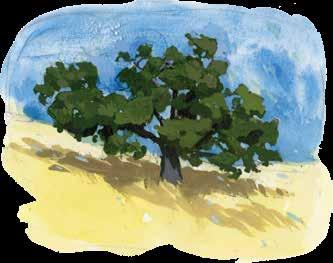
in trees. It made for cute photographs, but it was also depressing.
River Partners began pushing earth into giant mounds and planted them with native shrubs, like wild roses and blackberries, and grasses for cover. The next time a flood came, the bunnies found the mounds, which was great news. Then they ate all the shrubs and grasses that were their cover. The bunnies were now a raptor buffet, and it was back to the drawing board.
The crews replanted the mounds, careful to add some plants that were less tasty to bunnies. They began shaping the dirt again, this time into “bunny ramps”—long slopes leading from the lowest places up to the highest ones, where the bunnies would have room to roam. Moving dirt is expensive, says Austin. But it benefits more than the bunnies, since different species of plants are adapted to different levels of flooding: Cottonwood roots don’t need as much oxygen as other trees, and can survive being flooded for months. Elderberry bushes’ root systems can survive submersion for a little while but can’t make it through a long flood. Coyote brush roots, meanwhile, are happiest above the flood line.
w e pass a C l U mp of sti CK s poking out of the ground—baby cottonwoods filed to pencil points by a group of recently arrived beavers. We pass nervous-looking deer and a smug-looking coyote. “A lot of my dogbane survived, which is super exciting to me,” says Stevenot, gesturing proudly at a squat little plant. “You can see this one already spreading by rhizome.”
Dogbane is another valuable weaving material. It has some of the strongest cellulosic fibers of any plant—similar to hemp, but easier to work with. Like milkweed, which had a bad reputation before people realized how important it was to monarch butterflies, dogbane has been virtually eliminated from farm country because if livestock don’t find enough of the food they actually like, they’ll eat it out of desperation and make themselves sick. “You don’t want sick cows,” says Stevenot. “So the easiest way to deal with it is to just kill it.”
i n 2021, th R ee a CR es of d os Rios we R e set aside specifically for permanent Native use. Austin got a wish list of plants from his mom and aunties, then narrowed it down to what was practical. “It was kind of a last-minute deal,” says Kimberly. “Austin says, ‘Mom, we got these plants.’ … Here I am calling people in the middle of the night—‘Hey, can you come over here? We got to plant this garden.’ ” Volunteers showed up from as far away as the Wilton Rancheria and Fresno, over an hour’s drive away.
The next year, Austin found a few sedge beds during a land survey. Kimberly and a group of other weavers began cleaning them up. They were absolutely full of ticks—unusual and possibly a legacy of there having been so much livestock nearby. A good controlled burn would fix that. Just take some dry grass, light it, and scatter it in places that need some low-intensity fire. Or, Kimberly adds, she does know a guy with a flamethrower.
Even in their messy, tick-filled state, the beds had a quality to them that she recognized. These had once been tended, a long time ago. Now they were going to be cared for again. ◆
SPRING 2024 | BAY NATURE 33
Valley oak
The East Bay's Front Line
Preparing Parks for Climate Change
By Janet Byron
On a fine morning in late December, East Bay Regional Park District naturalist Kevin Dixon and a small group of nature lovers are out birding at Martin Luther King Jr. Regional Shoreline in Alameda. Dixon takes the opportunity to talk about climate change—specifically, how it threatens wetland ecosystems and shoreline parks and trails, including the one surrounding us.
As a large flock of willets lands on the Arrowhead Marsh pier, Dixon explains that places like this will be increasingly submerged as sea levels rise. That means that shorebirds, including the willets, will lose access to the coastal mudflats they depend on for feeding in the winter.
“Creatures in the marsh used to be able to migrate to upland areas at high tide, but everything surrounding the marsh is built up and channeled now,” Dixon says. “At high tide, the birds don’t have anywhere else to go.”
King tides—unusually high tides that occur during some new or full moons—are a preview of what low-lying coastal areas will experience as sea levels rise. When king tides nearly inundated Doolittle Drive on the park’s southern edge in
2022, it was the kind of scene shoreline visitors can expect to see more often in the future. The park district anticipates that if sea levels rise one foot, nearly half of the trail system at Martin Luther King Jr. Regional Shoreline could be underwater—and not only during the king tides that occur three or four times a year.
As the district marks its 90th anniversary this year, king tides, like recent wildfires, offer hints for how its scientists and planners can prepare for the changing climate in the century ahead. The stakes are high: because the district manages so much land across the East Bay, the effects of its decisions now will ripple far beyond park boundaries in the future.
“We are a major landowner within the East Bay, and as a result of that we’re on the front lines of mitigating climate change,” says Brian Holt, the district’s chief of planning, trails, and geographic information systems. “Whether it’s how we manage our forest or grassland, or how we respond to sea level rise along the shorelines, we’re the first line of defense for a lot of East Bay communities and neighborhoods. We play a key role in the adaptation strategy for the East Bay region.”
FUEL BREAKS
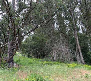
BEFORE AFTER
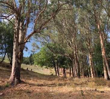
Over the course of several years, crews have worked to reduce fuel loads in this area of Tilden Regional Park, along Golf Course Road. On October 9, 2017—as the Nunn and Tubbs fires raged in Napa and Sonoma counties—that work paid off: park district firefighters were able to quickly extinguish an early-morning fire that started in this location, preventing spread to nearby homes.
34 BAY NATURE | BAYNATURE.ORG
EBRPD
Courtesy
SPONSORED | PARKS AND CLIMATE CHANGE
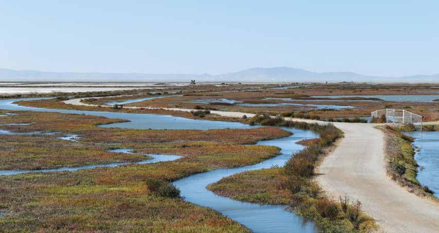
Taking on waT er
From Oakley on the Sacramento–San Joaquin Delta to Fremont on the south end of the San Francisco Bay, the district manages 16 different shoreline parks. In the face of rising seas, these properties are a bulwark for the commercial and industrial areas they border, and for densely populated neighborhoods built on filledin Bay wetlands. At Martin Luther King Jr. Regional Shoreline, for example, 748 acres of protected parkland are hemmed in by Oakland airport, Hegenberger Road, and office complexes.
“The history of the East Bay is that it’s a very industrialized shoreline,” Holt says. “The Bay Trail is important recreational infrastructure and an active transportation facility, but it’s also protection for infrastructure that was developed a century or more ago: rail lines, freeways, wastewater facilities, and landfills.”
It isn’t only human habitat at risk from rising seas. As more marshy shoreline areas are submerged, species such as the endangered Ridgway’s rail and salt marsh harvest mouse will lose access to the intertidal areas they rely on for escape at high tide. Already, the habitat they need—dense stands of pickleweed adjacent to upland, salt-tolerant vegetation—is becoming increasingly rare.
With 55 miles of trail along the water to consider, district planners needed to identify the most vulnerable sites in the park system and home in on those where climate adaptations have the greatest chance of success. In 2021, they published the Risk Assessment and Adaptation Prioritization Plan for the San Francisco Bay Trail, outlining how the district can work with partners to safeguard the shoreline.
In the past, the strategy often focused on armoring—for exam-
ple, building sea walls of stone or concrete to resist storm surges. Now, the district aims to manage water with the help of natural systems. Restoring oyster reefs and aquatic vegetation close to shore slows incoming water, while expanding beaches, marshes, and mudflats absorbs it. Reconnecting creeks to the wetlands that surround the Bay dissipates and drains runoff to help prevent flooding. Sometimes called “green infrastructure” or “naturebased adaptation,” strategies like these incorporate habitat into flood-control measures: for example, the gently sloping design of horizontal levees is more hospitable to plants and wildlife than vertical barriers.
The park district has flagged Martin Luther King Jr. Regional Shoreline as one of the sites most at risk from sea level rise, along with Alameda Point (home of the future Northwest Territories Regional Shoreline) and the regional shoreline parks at Coyote Hills and Hayward. At Hayward Regional Shoreline, design and permitting for marsh restoration is already underway—from creating a new alignment for the Bay Trail to restoring upland habitat that will allow the marsh to “migrate” as sea levels rise.
“Marshes are able to withstand the burden of the king tides,” says Ana M. Alvarez, the district’s deputy general manager. “They slow down the rise of Bay waters and prevent flooding while building better habitats for wildlife, cleaning the water, and storing carbon.”
Elsewhere, earlier investments are already paying off. Chief planner Brian Holt points to Dotson Family Marsh at Point Pinole Regional Shoreline, completed in 2017, as a model for future shoreline restorations. There, the district acquired land and cleaned up
SPRING 2024 | BAY NATURE 35
WRT, Cristina Bejarano
SPONSORED BY THE EAST BAY REGIONAL PARK DISTRICT
Hayward Regional Shoreline
decades’ worth of debris and hazardous material along the heavily industrialized waterfront in order to reconnect historic wetlands to the Bay.
“[The plan] incorporated the Bay Trail, so it provided a new area of public access,” says planning chief Holt. “We ended up with a project that’s not just a sea wall or hard infrastructure, but that takes a former industrial site and makes it something that’s better for people, better for habitat, and more resilient to climate change.”
Fuel F rom T he F ire
Miles from lowland marshes, on the wooded ridgelines that frame the Bay, the threat that most concerns the district isn’t flooding—it’s fire. Patrick McIntyre, a park district fire captain dedicated full time to fuels management, says climate change is increasing the risk that a wildfire originating in the parks could make the jump into surrounding neighborhoods. “It’s the culmination of fire suppression, nonnative species, drought-related stress on native species, and the abnormally large volumes of available fuels in areas of our parks.”
Three factors control the behavior and intensity of wildfires—
topography, weather, and fuel. Because it can’t control topography or weather, the district’s climate mitigation strategy focuses on the fuels that feed fires: overgrowth of understory brush and nonnative species, as well as the estimated 1,500 acres of trees currently dead or dying from drought or fungal diseases across the regional parks.
The district has worked to manage fuels in the East Bay long before climate change was top of mind for park managers. Every year, maintenance crews—with help from grazing goats and cattle—thin vegetation on more than 1,000 acres of grassland, brush and scrub, native oak woodland, and nonnative pine and eucalyptus groves.
But these fuel reduction efforts intensified in 2018, when the district cleared the last of the regulatory hurdles required to implement its Wildfire Hazard Reduction and Resource Management Plan. One key component is the Grizzly Peak Strategic Fuel Break—a buffer zone spanning 54 miles of roadways, trails, and sidewalks. The zone begins at Wildcat Canyon Road in Tilden Regional Park and runs along Grizzly Peak Boulevard, then south through East Bay Municipal Utility District lands to Claremont Canyon Regional Park.
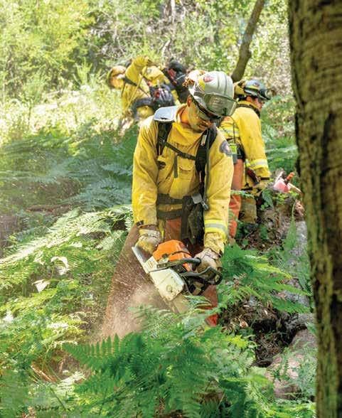
While some firebreaks involve the removal of nearly everything growing on the land, a “shaded fuel break” leaves deliberately selected plants intact. “A shaded fuel break is a way to reduce the fire hazard in an area while preserving and protecting more resilient native vegetation that’s already in place,” McIntyre explains. The goal is to prevent a fire that starts in the grass below from “laddering up” and igniting tree crowns.
Park-goers can observe the approach in progress on the steep slopes above Canon Drive, near the entrance to Tilden Regional Park. Here, native oaks and nonnative red gum eucalyptus have been pruned to eight to 10 feet above the ground and carefully thinned, with brush and small trees removed from the understory. Space is ample, while other areas along Grizzly Peak Boulevard are so thick with brush it’s difficult to see or walk through.
More than 80 percent of the planned fuel break traverses zones classified as “very high fire severity risk”—the state’s top designation for wildfire danger. It includes major and minor roads along the ridgeline, which will be cleared of trees and brush that could impede firefighters’ access during an emergency.
McIntyre says the park district’s crews
36 BAY NATURE | BAYNATURE.ORG
Cayce Clifford
SPONSORED | PARKS AND CLIMATE CHANGE
Crews work to reduce fuel loads in Reinhardt Redwood Regional Park.

Climate Adaptation Across the Parks
PROTECTING BIODIVERSITY:
District lands support 500 vertebrates and 1,550 species of plants—including 15 endangered species, 17 threatened species, and 27 fully protected species or species of special concern.
STORING CARBON: A 2016 study reported that park district lands such as wetlands, grasslands, and forests store about 300,000 metric tons of carbon dioxide equivalents. The district’s recent land acquisitions—like Finley Road Ranch, adjacent to Mount Diablo State Park, and Thurgood Marshall Regional Park—add to the list of protected places keeping carbon out of the atmosphere.
Fire and sea level rise aren’t the only challenges on district planners’ minds. “Increasingly, we’re finding that climate resilience is a part of everything that we do,” says Chief of Stewardship Matt Graul.
SAVING—AND GENERATING—ENERGY:
About 500 different projects—primarily lighting replacements—have helped the parks reduce their overall energy consumption. The district became "energy neutral" in 2017 with the debut of a 1.2-megawatt solar array in the parking lot of Shadow Cliffs Regional Recreation Area in Pleasanton: the array offsets all of the district’s annual electricity usage.

REDUCING WASTE:

The district is adding water-bottle filling stations in parks, and rolling out three-stream sorting stations for compost, recycling, and trash.
PREPARING FOR EXTREME
WEATHER: When ground becomes hardened by drought and compaction, it’s less able to absorb rainwater—so extreme weather events like atmospheric rivers can cause flooding, erosion, and mudslides. In 2018, Alameda and Contra Costa county voters passed Measure FF to support the district’s flood control projects.
work hard to create shaded fuel breaks that maintain ecological diversity and aesthetic value while helping to protect communities near parks from fire. “We’re actually providing for more spacing and resources to maintain the needs of those trees, which are still working to provide shade and retain moisture,” he says. “Restorative management does cost more, but it’s a better approach.”
Funding T he F u T ure
Preparing the parks and protecting the public from rising seas and more frequent fire takes not only long-term planning, but long-term funding. District climate projects also require extra coordination with other landowners and agencies, especially on sites—like Grizzly Peak—where many jurisdictions overlap.
The park district’s climate-resilience work is funded by gen-

BURNING CLEAN:
To dispose of the excess vegetation gathered in fuel reduction efforts, the district has begun using a machine called a carbonator. This clean-burning incinerator creates biochar, a soil amendment that sequesters carbon rather than releasing it into the atmosphere.
eral maintenance funds as well as a range of regional and state initiatives, including the Land and Water Conservation Fund, Proposition 68 (the California Drought, Water, Parks, Climate, Coastal Protection, and Outdoor Access for All Act of 2018), the California Coastal Commission’s Climate Ready Program, San Francisco Bay Restoration Authority Measure AA, and Measures WW and FF.
“The park district is leveraging our work and available resources to obtain additional funding for climate resiliency,” says Sabrina Landreth, the park district’s general manager. “We work closely with our partners at the state and national level to prepare for sea level rise, protect habitat, and create climate-resilient parks.” ◆
This article was paid for and reviewed by the East Bay Regional Park District.
SPRING 2024 | BAY NATURE 37
Clockwise from top left: Michael G. Pagano; Creative Commons; Courtesy EBRPD (2); Stephen Joseph, courtesy EBRPD
SPONSORED BY THE EAST BAY REGIONAL PARK DISTRICT
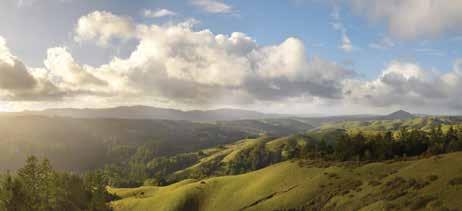
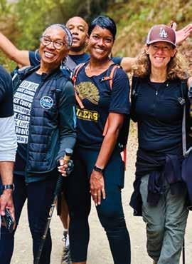
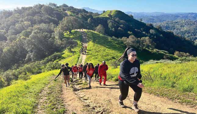

38 BAY NATURE | BAYNATURE.ORG »»»» explore | Community
Clockrwise from upper right: (1) Nick Collins; (2) Roxanne Yameogo; (3) 510 Hikers in Briones Regional Park; (4) Support hug; (5–7) 510 Hikers in Samuel P. Taylor State Park with the view from its Barnabe Fire Road.
Yolanda barnes
Nick collins
1 2 3 7 4 5 6
roxanne yameogo
(1) Lance Yamamoto; (2) Yolanda Barnes; (3) Nicholas Collins; (4) Jose de la cruz; (5) Bree McTaggart; (6) Miguel.v, via Wikimedia Commons; (7) Nicholas Collins
the character of 510
When hiking is also a march for who you want to see in nature.
The redwood S stand tall in the mist near Samuel P. Taylor State Park in Marin County. On a December morning, golden sunlight accents the curve of Sir Francis Drake Boulevard, meeting the earth through the gaps in the trees. As I drive around a bend in the road, a huddle of people wearing black shirts and standing to the side of a dirt parking lot come into view. Their gear emblazoned with “510” in bold lettering is a dead giveaway. This is 510 Hikers.
A crowd starts to form minutes after I park. Warm shouts and laughter fill the cold morning air. It’s like an orchestra tuning before a concert—all the members taking their places, saying hi to their stand-partners, and grinning as the energy simmers and bubbles, everyone eager for the music to begin. If 510 is an orchestra, then Nick Collins, the group’s founder and leader, is its maestro, readying everyone for the downbeat.
At 8:30 a.m. Collins leads us into a circle for what one hiker calls the weekly “pregame speech.” Around me stand 30 or more people of all ages and races. Brown hands clasp walking poles. Some members don beanies to ward off the cold. Plumes of warm breath fill the air as the hikers laugh and chat. Looking around the circle, I see more varieties of outdoor gear and boots than I’ve ever seen before. The black 510 Hikers shirts stand out as the one constant.
On hikes with more newcomers or younger kids, Collins will make a point of asking everyone to stay on the trails, pick up trash, not feed animals, and in general, in his words, “leave no trace.” But most people at today’s event have heard it before, so after Collins welcomes everyone he asks for a moment of silent introspection, there’s a group photo—a ritual that inaugurates every Saturday—and the hikers are off.
“This is community grown and based
By Lia Keener
and developed,” Collins says, “and there’s an authenticity that comes out of it that can’t be copied.”
Coll I n S ha S led 510 hikes for almost 10 years, facilitating thousands of people around the Bay Area, many of whom are Black and brown locals, to head out on a trail for their first time. Although 510 Hikers is now a multi-thousand-person community, it’s also a one-man nonprofit, “it wouldn’t be what it is without Nick,” says Roxanne Yameogo, who has been participating for around three years. “It takes a special person to dedicate every Saturday of their life to organizing a hike.” Together the group has charted more than 500 trails on AllTrails.
510 Hikes has been sponsored and supported by REI and GU Energy Labs, held sponsored races, led trips abroad, and organized drives collecting food and household goods to serve local communities in need. But above all, as surely as one foot follows the other, there is a hike each Saturday.
Born and raised in East Oakland, Collins spent his childhood hiking, picnicking, and playing at Joaquin Miller and Redwood Regional parks with his parents and siblings. After moving to Long Beach for college, where he ran track and field, Collins returned to the Bay Area, and he now works for a publishing company. A desire to lead a healthier life brought him back to the trails he visited as a kid. “I’d become heavy, and I’d walk into a gym and I’d feel lost,” says Collins, now 49. “But I did remember the routes of hiking, and I had that muscle memory of going into the woods.”
The first time he invited friends to hike with him, “none of them came!” Collins says, laughing. “Not one! It was hilarious.” So the next time, he posted an invitation to friends through Facebook, and 510 Hikers, now a Facebook group with more than 12,000 members, took root. Around the same time,
Collins was walking the popular trail to Mission Peak in Fremont with a friend, also a Black man. “We were like, ‘Jesus Christ! There’s not one single Black person on this trail.’ We were there for like two hours and there were maybe a couple hundred people,” Collins says. “This has to change.”
In Samuel P. Taylor , we follow Bill’s Trail, and the smell of wet bay leaves, camphoric and sharp, fills my nostrils, and cool moistness settles on my skin. Bigleaf maple leaves, autumnal in color, flatten silently below my feet, and California hazelnut, Himalayan blackberry, and ferns tangle in wet patches along the trail. Hikers walk single file, and the bubbling energy from the parking lot rises to a rolling boil as hikers laugh and shout, whooping at each other from different points of the trail. As we begin to climb, hikers cheer as they pass each other on switchbacks. They pull out whistles, gifted to the group by a private donor, and trill jubilantly as the group ascends. The hikers pause only for group photos, holding the bright yellow, dinner-plate-size maple leaves to their faces and grinning broadly as friends snap shots. Everywhere on the trail, people are hugging and laughing, talking and listening. “A lot of people like this formula, whatever this magic is,” says Yolanda Barnes, an avid 510 Hiker and a counseling administrator at Mission College in Santa Clara.
As an outdoor community dedicated to increasing inclusiveness on the trail, 510 Hikers is something of a rarity in the Bay Area. Black and brown people are seemingly underrepresented in the outdoors compared to their local populations, although local data is scarce. In a voluntary mailin survey of visitors to the Golden Gate National Recreation Area (GGNRA) conducted by the National Park Service (NPS) in 2016, of the roughly 1,500 respondents, 86 percent were white, 10 percent Asian, and 2 percent Black.
Some conservation organizations and land management agencies in the San Francisco Bay Area and beyond have been trying to understand the reasons behind those statistics and to deliver on DEI aims—par-
SPRING 2024 | BAY NATURE 39
ticularly within the last five years. “George Floyd’s murder in 2020, and the pandemic and other pressures at the time, became a tinderbox that lit a lot of fires,” says Annie Burke, executive director of TOGETHER Bay Area, a regional coalition working toward climate resilience and equity in the Bay Area. “It was this chemistry of pressures that spurred a lot of change.” Many reforms, Burke explains, “are happening below the radar,” through hiring policies, systemslevel shifts, efforts to return land to Indigenous communities, and more. But, Burke says, “there’s so much more work to do.”
Whether there’s been a change in the racial diversity of visitors in Bay Area parks since the 2016 survey may become evident later this year. A demographic survey of East Bay Regional Park District visitors will soon be published by San Francisco State University in partnership with the district. And a more recent usage survey of the GGNRA, with data collected in 2023 by NPS, is scheduled to be published in 2024. A glimpse of statewide numbers is newly available. A voluntary survey of California State Park visitors who obtained free park passes from a California public library between May 2022 and January 2024 showed that of the nearly 6,000
respondents 33 percent identified as white, 28 percent as Latino, 22 percent as Asian, and 3 percent as Black.
Collins feels that with 510 Hikers hitting the trail every Saturday, Black people in the Bay Area and beyond who previously “had to make a decision—do I not go hike and stay with my community, or do I go hike and leave my community?”—now have a choice. “It’s just a nice space to be in—it’s this feeling that’s very hard to put to words that we get when we see our fellow Black
says Collins, referencing Dr. Martin Luther King Jr.’s speech. “I have a dream that my four little children will one day live in a nation where they will not be judged by the color of their skin but by the content of their character.”
As a second grader, Collins memorized King’s speech during Black History Month at his Oakland elementary school, and the words have stuck with him. “Though there’s a frequency and a vibration involved [with] getting people of like
“There’s a whole ’nother vibration that occurs when you’re getting people of the same spirit together.”
hikers on the trail,” says Barnes.
Some other groups in the Bay Area also focus on racial diversity or wellness in the outdoors, including Latino Outdoors, Outdoor Afro, H.E.A.T. (Hiking Every Available Trail), Family Wellness Group, and 209 Hikes. 510 is intentionally open to anyone, regardless of ethnic background, age, or physical ability. “We are content-of-character based,”
skin or like gender together or like orientation together, there’s a whole ’nother vibration that occurs when you’re getting people of the same spirit together,” he says. Part of 510’s inclusive ethos arises from Collins’s upbringing as a Black, transracial adoptee raised by white parents. “I grew up with this mindset of diversity is only helpful.”
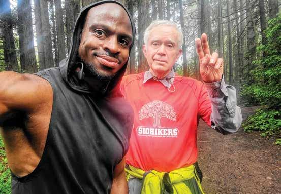
Hikers echo Collins’s appreciation for the 510 community. “There’s something about the people that stay,” Barnes says. “This is like the safest place ever, being in the outdoors and with these people who genuinely care—I’ve only known them for three years, but I feel I’m closer to them than some of the folks I’ve known all my life.” Barnes, who attends roughly 40 out of the 52 weekly hikes each year, says she has cried many times on the trails, deep in conversation with other 510 members. These weekly hikes are “my church, my therapy,” she says. “The hike has to happen.”
Hikers range in age from six to nearly 80 and often number around 100, depending on the Saturday, trekking eight to 10
40 BAY NATURE | BAYNATURE.ORG »»»» explore | community
Raymond “Circus” King
Raymond King (left) snaps a selfie with Benjamin Leon Alarcon (right) on a 510 hike.
raymond king
miles, though shorter routes are almost always available. “We got walkers, we got runners, we got joggers, we got hikers, we got a very broad range of fitness levels that everybody can relate to,” says Raymond King, a 510 Hiker and personal fitness trainer. There’s no set speed. There’s no pressure to move at any pace other than your own— not even when the hikes get intense.
The S un burns away the morning’s cool misty haze, and we leave behind the smell of bay leaves and the earthy musk of the redwood undergrowth. We hike under direct sunshine, clear skies, and sweeping views of Point Reyes National Seashore as we make our way up Barnabe Peak. The hikers’ huffs and puffs mingle with the ever-present laughter and conversation, and we march upward single file, bent double and legs aching, climbing together.
“I’m humbled,” says King, reflecting on his years of hiking experiences with 510. “People like myself, being African American, we’re not exposed to these different trails.” King recalls wearing basketball shoes to hike with 510. “I remember having pain in my ankles and my calves, and someone told me, ‘Why don’t you get some hiking shoes?’ … Being from a basketball background, I didn’t know what that was. I got some trail shoes and that changed everything.”
King first ran into 510 Hikers while at Alamere Falls in Point Reyes nearly nine years ago. “You think of trails, you think of solitude, peace, nobody there—and this is the total opposite,” King says, recalling that chance encounter. “Everybody was laughing and smiling.” He tagged along with the group that day and has been a regular ever since. “It was people who looked like me—a lot of minorities, African Americans, Latinos, Asian people. I was totally in shock.”
Prior to 510 Hikers, King often hiked alone, and although he still runs ahead of the group on their weekly hikes, he credits the group with boosting his self-confidence in the outdoors, to overcome his fear of heights, for example. When the group hiked Half Dome for the first time, King recalls saying to Collins, “I’m like, ‘Man this is crazy—bro, Imma die!’” But with encourage-
ment from Collins and others, King successfully scaled Half Dome. “That’s what the group does,” says King. “It gets people to do things that they didn’t think they could do.”
Showing up with a community is important for other reasons too, Collins says. “There’s something to be said about walking somewhere and knowing that you’re not alone, and other people knowing you’re part of a group … You get treated better.”
Though 510 has grown immensely, building a diverse Bay Area outdoor community and hiking almost weekly, there have been hurdles along the way. “We’ve had a couple experiences with park rangers in the past,” says Collins. “We felt like there was a little bit of racial tension that led to those experiences, and [that’s] unfortunate.”
ily just asked us to leave. We hadn’t even started hiking yet. Hard to share [the] energy that we were given by the ranger there . . . But it was aggressive and unnecessary.”
Collins recalls that in July 2018, he was issued a ticket at the Purisima Creek Redwoods Preserve by a ranger from the Midpeninsula Regional Open Space District. The day before, Collins had requested a permit for hiking at Purisima that was denied. Another large group was already permitted for the same day and parking was limited, according to Midpen, and Collins was issued a 49-person permit for another preserve that was nearby. Permits are required for groups of more than 20 people.
Collins went to Purisima with 510 Hikers and writes that he was “not sure how many we had but it was around [the limit of 20].” Midpen maintains he had “approximately 50 or more people.” Collins was cited for not adhering to his permit, and 510 Hikers gathered at the other preserve.
The encounter remains “a sore spot that offended me,” Collins writes. “Even if we were close to the max number that day or even beyond, they could have eas -
Collins adds that “the trails out there from my experiences are 99% white. I’ve been to those trails no less than 20 times over the past 10 years and have seen maybe nine black people on those trails. Part of the reason for that is a result of people like the sheriffs [rangers] we met that day who were quick to tell us to leave and give me a ticket.”
Midpen public affairs specialist Ryan McCauley says: “We definitely wouldn’t want any group to feel targeted or anything like that—our open spaces are free to everyone, for everyone. I’m happy this is being brought up … I can understand that sort of perception and where they’re coming from.”
Collins appealed the ticket and the court dismissed it in July 2020. In the years since, 510 has continued to hike at Purisima Creek Redwoods Preserve as well as other Midpen preserves. “We’ve gotten past that, and we feel like, in
SPRING 2024 | BAY NATURE 41
McTaggart
Bree
(continued on page 45)
Yolanda Barnes (right) and Bree McTaggart (left) hold up big leaf maple leaves while hiking at Samuel P. Taylor State Park.
A Lush Gem n est L e D on n A pA vALL ey’s sL opes
Napa County’s Archer Taylor Preserve offers redwood hikes, cascades, understory wildflowers, and restoration volunteering
By Gu A n A ní Gómez- vA n c ortri G ht
Amid an atmospheric river’s downpour, the soggy understory of the Archer Taylor Preserve’s Redwood Creek Trail contains a bounty of mushrooms and ferns. Nestled in the Mayacamas Mountains on the western side of the Napa Valley, the preserve protects 400 acres and has more than 15 miles of hiking trails, with options ranging from a brief stroll to a creekside picnic area to climbing up to the craggy summit of Maggie’s Peak.
The preserve is managed by the Land Trust of Napa County, which holds orientations before giving access to the preserve, as well as guided hikes and volunteer days focused on removing invasive Himalayan blackberry and star thistle or clearing and repairing trails.
“It’s an incredibly special resource right here in Napa County,” says Kimberly Howard, development manager for the Land Trust.
A Diverse L A n D sc A pe
From the parking area at the edge of a meadow studded with oaks, the Redwood Creek Trail meanders down a slope and crosses a rain-slicked bridge to a portion of one of the largest second-growth redwood groves in Napa county. While Napa is known for vineyards and valley views, a wet day at Archer Taylor reminds one to look to the forest floor for inspirational vistas. Bursts of rubbery yellow witch’s butter fungi and crusty turkey tail mushrooms abound, and orange-bellied rough-skinned newts
amble through the loam.
Archer Taylor is home to multiple species of fern, and in spring the forest floor blooms with Pacific trillium (Trillium ovatum), golden fairy lantern (Calochortus amabilis), two-eyed violet (Viola ocellata), and other wildflowers.
“There’s such an amazing array of native plant species, bird species, and other wildlife,” says Mike Palladini, stewardship director with the Land Trust.
Heading west, the trail follows Redwood Creek, a tributary of the Napa River, as it cascades around mossy outcroppings of columnar basalt, part of the Sonoma volcanic formation. Growing steeper, the trail forks, with options to continue along the creek up to the Devil’s Well waterfall or leave the water and redwoods behind for higher elevation along the Maggie’s Peak trail.
On the way marked with signs for Maggie’s Peak, the redwoods recede as switchbacks meander through a variety of knobcone pine, MacNab cypress, oak woodland, and eventually chaparral forest. Birds fill the canopy with song, including
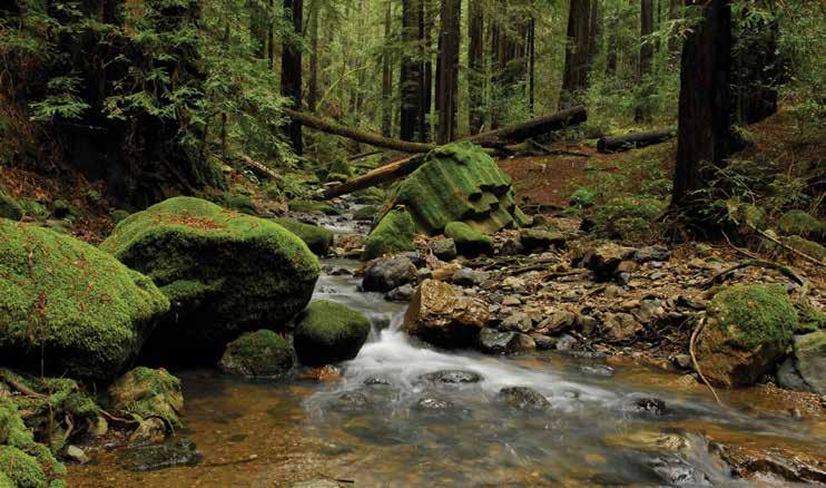
 From top: © chrispester, some rights reserved (CC-BY-NC); Land Trust of Napa County; © lilredhen, some rights reserved (CC-BY-NC) via iNaturalist
Redwood Creek slides between the trees and rocks at Archer Taylor Preserve.
Sonoma Ceanothus
From top: © chrispester, some rights reserved (CC-BY-NC); Land Trust of Napa County; © lilredhen, some rights reserved (CC-BY-NC) via iNaturalist
Redwood Creek slides between the trees and rocks at Archer Taylor Preserve.
Sonoma Ceanothus
»»»» explore | redwoods
Witch’s Butter Fungi
42 BAY NATURE | BAYNATURE.ORG
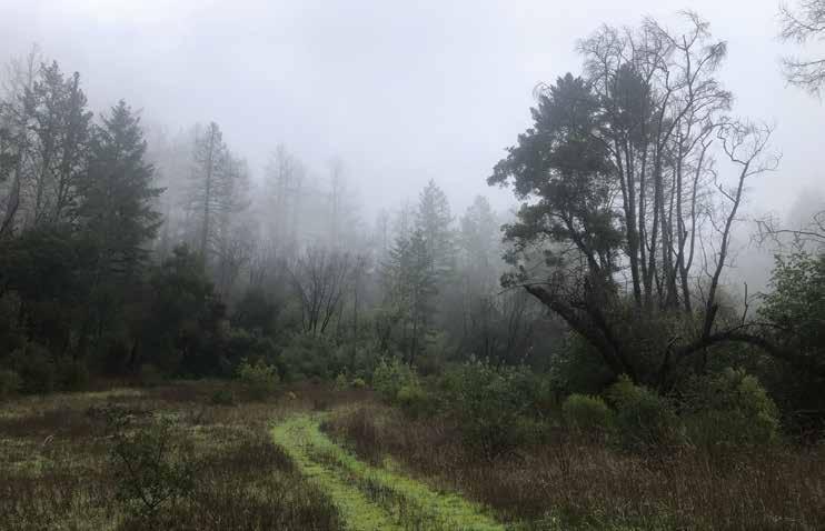
western tanagers, black-headed grosbeaks, and orange-crowned warblers during spring migration season and, year-round, Pacific wrens and pileated woodpeckers, among others. The preserve also provides habitat for the federally listed northern spotted owl, as well as foxes and passing black bears. Occasionally, the woods are interrupted by rocky outcroppings and volcanic ash deposits. On a clear day, intrepid hikers who make the three-miles-one-way walk to the top of 2,065-foot Maggie’s Peak are rewarded with sweeping views of Napa Valley and across the Bay to the south.
p rotecte D in p erpetuity
For a gentler outing with minimal elevation changes, visitors can instead explore the Far Meadow to the east and the Giles Mead trail to the north. Redwoods give way to shrub species such as California hazelnut, bay laurel, and native trailing blackberry as the path passes a moss-encrusted wall left over from homesteading days and enters a meadow shrouded in fog.
The preserve is located on the ancestral lands of the Mayakmah Onasatis or Wappo people, who lived in Napa Valley for more than 10,000 years before the arrival of Europeans. In the 1940s, the preserve’s name -
sake Archer Taylor, a Berkeley professor whose family homesteaded the property, cultivated the Far Meadow for hay. Taylor’s daughters Constance Taylor and Ann Taylor Schwing, a retired conservation attorney, started donating parcels of the property to the Napa Land Trust in 1993.
“Our parents bought the land in late 1944, so my sister and I grew up on the preserve and became determined to protect it forever,” said Ann Taylor Schwing in an email. She continues to volunteer regularly at the preserve. “We donated the land to the Land Trust of Napa County to ensure it will remain just as it is now for future generations.”
On the way back from the meadow to the parking area, the blackened trunks of the redwood grove and new spurts of growth show the impact of the Nuns Fire, part of the 2017 North Bay Complex. The fire burned through the entire preserve and scorched the trunks of many of its conifers, but left most of the canopy intact. The rare California native Sonoma ceanothus (Ceanothus sonomensis), a fragrant flowering shrub whose seeds require fire to germinate, is now flourishing in the fire’s wake. When a wildfire passes through the forest, Napa false indigo ( Amorpha californica var. napensis) survives underground
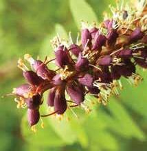
and shoots up vigorously in the aftermath.
“I’ve been helping to restore the land there for a dozen years now, and there’s still always something new to see when I go up there,” Palladini says. ◆
» details
» The Draw: Views, an abundance of native species, and opportunities to volunteer.
» Special Access: Admission to the preserve is by permission only. Visitors can access through the preserve’s guided hikes or by attending an hour-long orientation and signing a waiver. Orientations are held once a month, mostly on Saturdays. Dates for upcoming orientations and special guided hikes are listed on the Napa Land Trust’s website.
» Getting There: The preserve is gated and sits at 6000 Redwood Road, Napa, CA 94558, at the very end of a narrow and windy mountain road.
» Facilities: Pit toilets and picnic tables are available, but there is no running water on-site. Cell phone reception on the property is scarce. Dogs are not allowed.
From top: © Krissa Klein, some rights reserved (CC-BY-NC); Guanani Gómez-Van Cortright; © sushe, some rights reserved (CC-BY-NC)
A foggy winter afternoon in Archer Taylor Preserve’s Far Meadow.
Napa false indigo
Turkey Tail Fungi
We are so grateful to the community of donors who give to Bay Nature, only some of whom we have room to include in this listing. Your support makes it possible for Bay Nature to connect the people of the Bay Area to our natural world and motivate them to solve problems with nature in mind. Thank you for helping Bay Nature thrive!
Publisher’s Circle
$500+ Annual Gift
Anonymous (29)
Joyce Abrams & Andy Kives
Daniel Alegria & Mary Hufty
Leslie Alspach
Daniel Alterman & LiWah Lai
Angela & Robert Amarante
Deonna Anderson* & Derrick Bines
Robert Bruce Anderson
Tom Anderson & Tamia
Marg
Harold Appleton
Elizabeth & Paul Archambeault
Judy & Christopher
Armstrong
John Arnold
Carol Baird** & Alan Harper
Julie Barney
Penny Barron
Ellen Barth
Joel & Wendy Bartlett
Gail & Steve Berger
Louis Berlot & Joyce Cutler
Barbara L. Bessey
Douglas Booth & Margaret Simpson
John Bowers & Linda Stevens
Stewart Brand & Ryan Phelan
Barbara & Robert K Brandriff
Jennifer Braun & Raymond J. Ryan
Daniel & Kathleen Brenzel
Leif Brown & Sara Webber
Phyllis Browning
Stephen Buckhout & Stella
Yang
Andrew Burgess & Max Hu
Robert & Maureen Burness
Andy Butcher
Cristina Campbell & Tim DeWolf
Kim & Robert Carroll
Dennis Casad
Prasad Chakka
Roseanne Chambers
Anne Chambers & Edward McAlpine
Hortensia Chang & John
Steven & Martina Chapman
Willa Chapman
Chateau Seaview
Denise
Claudia
Tim
Pedro
Cheree Hethershaw
Jorgen Hildebrandt
Harriet
Mark
Anne
Carolyn
Dennis &
Frances
Rebecca
Sam
Dorothy Kakimoto
Antje
Jennifer
Kris
Beth
Dana Kueffner & Peter Heinemann
Patrick & Ellie Laherty
Lynn & Gordon Lakso
Lucille Lang Day & Richard
Michael Levine
Craig Lanway
Peter & Sue LaTourrette
Matthew Leddy & Gail Raabe
Rochelle Lefkowitz & Laurence Felix Kramer
Lukasz Lempart
Ron & Sandy Linder
Marie & Barry Lipman
Doug Lipton & Cynthia
Daniel
David Loeb***
Bia Lowe
Mark & Paula Lowery
Andrea Mackenzie & Jenni
Martin
Laura Mahanes & Steven
Weissman
Marilyn Mangle
Dick & Kathy Marshall
Lisa Martin
Pete May** & Diana Biondo
Jeffrey Mayer & Tacy Witter
Sandy McCoy & Natasha
Beery
Ivan Meadows
Michael Meyer
Christopher Miller & Catherine McNamee
Mia Monroe
Alida Morzenti
Suzanne Moss* & Herb
Kasler
Leslie Murdock & Kathleen
Hall
Audre & Roger Newman
John O’Donnell & Therese
Post
Kathleen O’Rourke & John
Sheridan
Ilene Oba & Tim Hockenos
Larry Orman** & Marice
Ashe
David Ortez & Joli Wilson
Anne Pardee
Mary Jane Parrine & Ed
Ehmke
Terry Pedersen
Regina Phelps
Yvette Pirie & Peter Ingram
Mary Porter
Holly Potter & Jeff Garcia
Mary & Matt Powell
Wes & Kathy Radez
Frances & John Raeside**
Maryann Rainey
Marjorie Randolph
Jonathan Rapp
Bruce & Nan Reitz
David Remahl & Monica
Sircar
Lennie & Mike Roberts
Aaron Roland & Annelise
Goldberg
Susan Rosenberg
Margaret & Oscar
Rosenbloom
Daniel & Cindy Rosenheim
Stephen Rosenthal
Dennis & Jan Ruby
Daniel & Lynne Russell
Mike Sabarese
David Sacarelos & Yvette
Lanza
Dianne Safholm
Pat Sandoval & Jon
Kannegaard
Greg Sarris
Don & Mary Savant
Mary Anne Sayler
Susan Scandrett
Bob** & Brenda Schildgen
Jean Schulz
Leonard Schwab
Joseph Sciortino
Judy Scotchmoor & Roland
Gangloff
T.M. Scruggs
Judith Sernatinger
Alice & Michael Shiffman
Gina Solomon & Annette Huddle
Regina Starr Ridley
Tim Stroshane & Jan Ambrosini
Robert Strouse
Dana Swisher
Patricia Thomas & Scott Atthowe
Alicia Torregrosa & Stu Weiss
Aleks Totic
Anh Tran*
Scott Van Tyle
Inta Vodopals
Patrick Waddell & Franklin Smyth
Linda & Sandy Wagner
Catherine Waller
Richard Watkins & Heidi
Hansen
Don Weden
Arlin Weinberger
Bart & Nancy Westcott**
Harry & Mary White
Kitty Whiteside
Peter Wiley
Jumbo & Trevlyn Williams
Jeffrey Wilson & Anne Scheer
David Wimpfheimer
Susan Zellerbach
Bay Nature Sustainers ($30+/month)
Anonymous (2)
John Beland
Suzanne Francoeur Taunt
Russell Miller & Kirk Pessner
Penny & John Pollock
Christopher Reiger & Bibek
Kathy & Lou Shapiro
Roger & Joan Uhlig
Institutions
Anonymous
Amazon Smile
Dorothy and Jonathan Rintels Charitable Foundation
Friends of Sausal Creek
Fund for Nonprofit News at The Miami Foundation
Habitat Potential
The Laney and Pasha Thornton Foundation
March Conservation Fund
PayPal Giving Fund
Poetry Flash
Red Oak Opportunity Foundation
The Schmidt Family Foundation
SunPower
Matching Gifts
Adobe Apple Inc.
Bristol Myers Squibb
Chevron Humankind Matching Gift Program
Fox Corporation
Genentech
Gerson Bakar
Gilead Sciences, Inc.
Google Matching Gifts Program
IBM
Lam Research Employee Gift Match Program
New Harbinger Publications, Inc.
Shell Oil Company Foundation Matching Gifts Program
Wells Fargo
Tribute Gifts
Anonymous in honor of ground squirrels
Anonymous in honor of Anita Pearson
Anonymous In honor of my parents - who made me who I am today
Bruce Hartsough & Lesli
Lee Hartsough in honor of Regina Ridley
Carla Soracco in honor of Sue Rosenthal
Elizabeth Fishel & Bob Houghteling in honor of David Loeb
Frances Johnson in honor of Charlie Johnson
Linda Smith in honor of Carole Lillian George
Meg Conkey in memory of Lester Rowntree
Mia Monroe in honor of Bay Nature heroes
Parker Merrill in honor of Sarah J Merrill
Rachel Hamilton in honor of Dancing Coyote Beach Cottages
Regina Starr Ridley in honor of the Bay Nature staff
Robert & Maureen Burness in honor of Robert Burness
Sam Johnson in honor of Dr. Welton Lee
William Moore in honor of Sally Moore
*Bay Nature Board Member
**Former Bay Nature Board Member
***Founder
Support Bay Nature! Make a donation online at baynature.org/donate
The Bay Nature Institute is a 501(c)(3) nonprofit organization.
44 BAY NATURE | BAYNATURE.ORG
THANK
| SUPPORT FOR BAY NATURE
YOU
Nelson
Charitable Fund at the East Bay Community Foundation Minder Cheng George & Sheri Clyde Suzanne Coberly & Jeffrey Haas Deborah Coburn Rissa Coplan & Reed Holderman** Paul da Silva Sue & Joe Daly Christopher**& Kathryn Dann Thomas Debley Nona Dennis Jacqueline Desoer Tim & Lynn Ditzler Dan & Kathy Dixon Katherine Dollard & Sigurd Meldal Carol Donohoe Herbert & Jane Dwight Andy Earle Anna Edmondson Rebecca & James Eisen Dan Eisenstein Wendy Eliot** & Michael Fitzgibbon Woody & Ann Elliott Catherine Engberg* & Tom Boardman Andrea English & Tom Whiteman
Estey & Tom Patterson Scott Ewart
Felder
Fetcho
Sue
Melissa
Susan
Filakosky
Forrest
Frances Kelly Poh
Frane & Charla Gabert
Fuchs-Chesney
Galbreath & Nicole Canon
Gannon
Farrell & Sue Gardner Philip Gervais Beryl Golden Janice Gonsalves
Lynn Gotchall Marcia Grand
& Nancy Grove
Grubbs** & Richard Taylor Bruce & Joan Hamilton
Hamilton Mike Hammes Melissa Harris Caryl & Mickey Hart
Hartsough** & Lesli Lee Hartsough
Hathaway &
Dailey
Natalie
Mary
David
Anne
Scotto
Theresa
Sharon
Patricia
Bill
Tracy
Rachel
Bruce
Paul
Lynda
Reynolds
Jerry Hearn & Rebecca
& Scott Hein
& Leigh Henderson
Paul & Eva Heninwolf
& Christine
Hernandez-Ramos
Bachen
Davis Hershey
Iwamoto & Colin Rudolph Subbalakshmi Iyer
Jacobson & Ilona Frieden
Johnson
Theis
Johnson & Rick
Sheryl Johnson
Johnson
Derek
Johnson* &
Rodgers
Johnson
Kann Ting Kao & Glenn Serre
& Tim Kardos
Kelly
Karnos Tom & Jane
& Bill Krumbein
(bats continued from page 27)
young Mexican free-tailed bats. “We get juveniles into care that are thin or dehydrated once Mom stops nursing,” Quirk says.
“I like to release the Mexican free-tailed pups back to the colony; that way I know the colony will talk to the young bat about what to do next,” Arnold says. The timing is critical. Once nighttime temperatures consistently fall below 55 degrees Fahrenheit, any pups remaining in care need to be kept for the winter and released the following spring.
To reach the colony, Arnold climbs up the loose rocky slope under the causeway. Traffic rumbles on Interstate 80 overhead. Hanging from her belt is a small white cloth drawstring bag containing three rescue bats she had been rehabilitating since early August—two came to her as pups and one as an adult. Now they were all ready to be released.
A small boulder gives way under Arnold’s boot in the loose sandy material and tumbles down the hill. Undeterred, she steadies herself with her trekking pole and continues up toward the underside of the bridge. When she is close enough to touch the concrete slabs, she stops, flips on her flashlight, and aims it up into the expansion joints. Several roosting bats awaken and turn away from the light, crawling deeper into the cracks. She reaches into her bag, carefully grabs one of the bats, and holds her gloved hand up to the bridge. The bat crawls out of her hand and disappears into the crevice. She repeats the process with the two juveniles.
Typically, adult Mexican free-tailed bats are released near their rescue location instead of being returned to the colony. Arnold brings Sneezy to Grant Park in Sacramento at sunset. After securing her headlamp, she holds Sneezy in one glove, her iPhone in the other. When she gently uncurls the hand holding Sneezy, he stays still for a moment. When he realizes he is free, he crawls to the edge of her fingers, opens up his wings, and does a little drop before gaining lift and flying off into the dusk. “It’s a very beautiful moment,” Arnold says. ◆
(510 continued from page 41)
the past couple of years, we’ve had a different energy from park rangers,” says Collins.
a f T er T he C l I mb comes the view. Visible from the top of Barnabe Peak, the Point Reyes peninsula and Tomales Bay sprawl to the west, Mount Diablo to the east, and Mount Tamalpais to the south. Hikers pause for more group photos, beaming, arms around each other.
The community at the top of Barnabe Peak has blossomed organically from the weekly hikes, offshooting into countless group chats with names like “Party Peoples,” group dinners, white elephant parties, Super Bowl parties, and skydiving outings. People have met, fallen in love, and had kids after meeting through 510, and many regulars like Barnes and Roxanne Yameogo now carpool to the Saturday gathering.
“People are really seeking connection right now. People are lonely, and I think sometimes people are embarrassed by that—no one wants to admit that it’s hard to make friends—but everybody has the same issue,” says Yameogo, an accountant for an Oakland start-up who found 510 after moving to the area from the Peninsula. “I was craving that connection, and what I feel from other people is they’re also craving that connection … we all want the same thing.”
Though 510 Hikers is based in the Bay Area and most of the hikes take place locally, they have also traveled and taken to the trail in Washington State, Hawaii, Arizona, Utah, Jamaica, Canada, and Mexico, with more trips on the books for 2024. Yameogo joined 510 on its trip to Banff, Canada, which involved a lot of karaoke, cooking, and games such as Left, Center, Right, in addition to—of course—a lot of hiking.
The burbling energy of earlier in the day eases into a tired contentedness as the hikers spread out and walk silently over a carpet of yellow maple leaves, making their way back to the parking lot. Tanoaks and alders border the trail and hikers make the slow return, more than eight miles logged on AllTrails. People reach their cars in small groups and depart on their own,
some going to brunch together, others off to their families, some to walk more.
“Each hike is almost like this march of sorts, a model of what we want to see in nature—who we want to see in nature,” Collins says.
And, in the end, “we’re not out there to solve the racial tension of the world,” Collins says. “Martin Luther King Jr. couldn’t do it. How am I gonna do it? But what we can do is, within the community, be a model towards what we believe feels like less racial tension.”
Looking long term, Collins hopes the day comes when 510 Hikers isn’t needed. “It’d be great to sit around with my two boys and talk about how there actually was a need—that I used to go on these hiking trails that had no Black and brown people out there, and have them say, ‘No way, Dad!’” Collins laughs. “Batman would love to retire from Gotham City, right?”
Until then, though, as Yameogo says, “the trail is what connects us,” and 510 hikes on. ◆

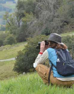
visit us online for a class or in person for a hike
pepperwoodpreserve.org
santa rosa, california
SPRING 2024 | BAY NATURE 45
explore the natural world with us
@PEPPERWOODCA @PEPPERWOODCA @PEPPERWOODPRESERVECA PEPPERWOOD FOUNDATION INSPIRING CONSERVATION THROUGH SCIENCE
FEATURES | CONTINUED


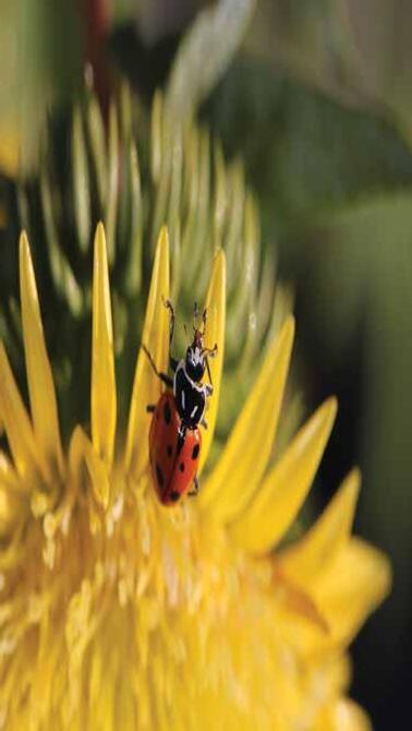
California Flora Nursery Located in Sonoma County, north of Santa Rosa in the town of Fulton calfloranursery.com • 707-528-8813 Specializing in growing California natives THE WAT E R S H E D N URSERY 10% off your next purchase of California Native Plants with this coupon 10% OFF THE W ATERSHED N URSERY 601 Canal Blvd, Richmond, CA 94804 www.TheWatershedNursery.com Sue Johnson Custom Lamps & Shades Since 1972 1745 Solano Avenue Berkeley, CA 94707 510 • 527 • 2623 www.suejohnsonlamps.com
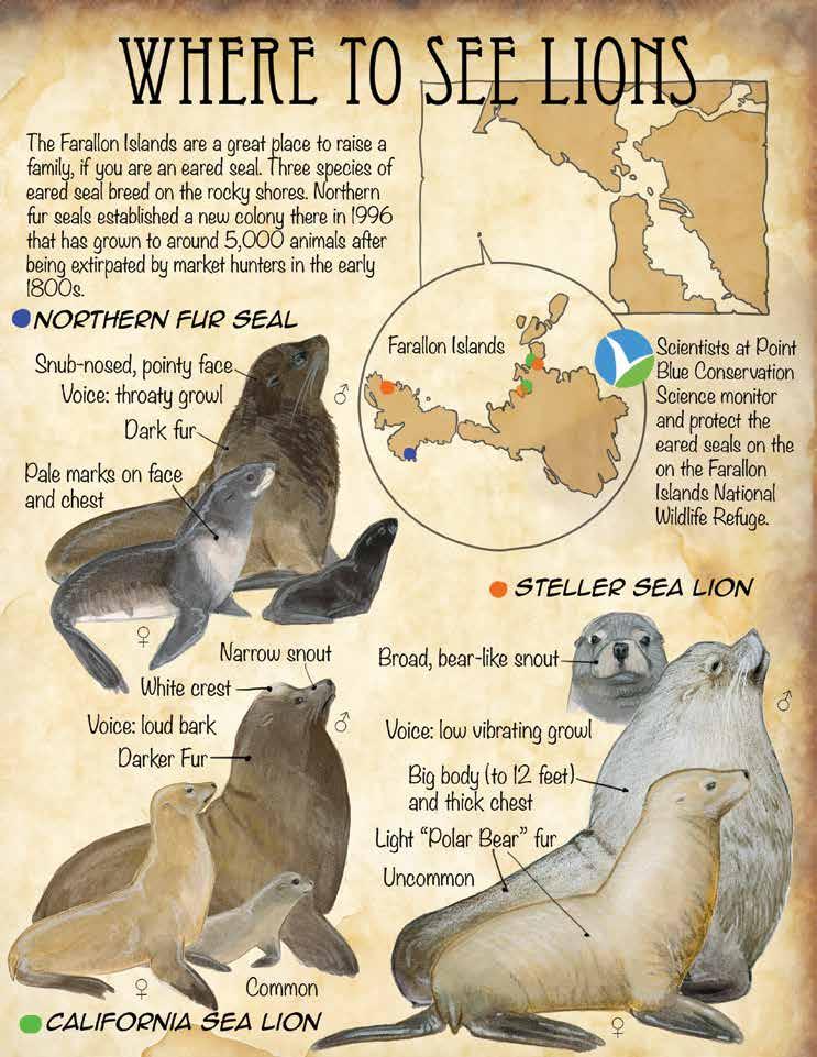
THIS SPRING | NATURALIST ' S NOTEBOOK BY
LAWS 46 BAY NATURE | BAYNATURE.ORG
JOHN MUIR

¿QUIERE AYUDAR A PROTEGER A IHSS DE RECORTES EN EL FUTURO?
Involúcrese en nuestra Campaña de “Saludable en Casa”
2484 Natomas Park Drive #101 Sacramento, CA 95833
LA VERSIÓN DE LA CONVENCIÓN
CLIMATE CHANGER
Noticias de CUHW
Garbage is a manufactured product, created when otherwise recoverable resources are mixed and mashed together.
proveedores y cuidado en un mundo atrapados ambiente, nuestra exponernos a otros consumidor, usted demanda que usted es un usted vive en su relación proveedor de familiar, diferente. años y proveedor hogar, pero sobre el empleador de problemas que Independientes extraño.
CUHW, ha ya durante intervención de dirigidos por Ejecutiva Loretta campaña condado de médico y los trabajadores. En un grupo sido los enriquecido sus plan para
Most rooms in every building in the whole country have a basket where this manufacturing begins Discarded resources are put in one by one, then dumped into a larger bin, and then into a truck with a more modern body based on this one A hydraulic piston smashes everything together The objective is to pack in more cargo before the truck has to be driven to where it can dump onto the land, to be covered in a “sanitary“ way. Liquids leach out and make their way into the planet's
Boletín de los Trabajadores Unidos que Cuidan en Casa
de que se nos haya dañado o se haya abusado de nosotros mentalmente.
•Merecemos el derecho de que se nos pague bajo el esquema del Seguro Social por una vida de trabajo por un miembro de la familia.
•Merecemos vacaciones pagadas, merecemos el derecho de que se nos trate con compasión y respeto por las
water eventually. These “sanitary” methods of filling the land (hence “sanitary landfills”) also provide for anaerobic decomposition of organic materials –which generates methane.
In 1938, Gar Wood Industries of Detroit introduced its first Load-Packer truck body that could be sized to multiple dimensions and mounted on many chassis It began to sell in quantity after World War II. Army engineers returning from Europe had been trained to dump all discards into a single hole and move on. The new compactor truck was perfectly suited to be married to the layered “sanitary” landfill developed in Fresno, California.
“CUHW está rompiendo todos los mitos al enfocarse en los miembros.”
NASA's Astronomy Picture of the Day from February 12, 2002, colored the Earth's methane green and an animation showed how it spins to the poles. NASA said, “Methane (CH4) is second only to carbon dioxide (CO2) in creating a warming greenhouse effect The largest abundance released by the US … is created when anaerobic bacteria break down carbon-based garbage in landfills.” [Emphasis added ]
de marcar un hasta aquí, de nuevo, rompiendo la burbuja del pasado, siempre avanzando acercándonos, conforme continuamos construyendo el “Puente Hacia un Mejor Futuro” Estamos reventando la burbuja cuando nuestro Comité de Constitución sugiere un cambio que combine el espacio de nuestro Secretario Tesorero y que cree una nueva posición, Vicepresidente segundo. El Vicepresidente segundo estará a cargo

número de celular o un teléfono fijo. Una vez más nos salimos de nuestra burbuja, hemos lanzado un Programa de Voluntariado de Incentivos para ofrecer descuentos a nuestros miembros en los negocios al mostrar sus tarjetas del Sindicatolo cual representa un ganar-ganar para todos. Hemos establecido oficinas en más de 9 de nuestros condados. La mayoría de las oficinas tienen bancos de llamadas y capacidad de difusión de web y cuentan con grandes pantallas. Contamos con otra acción que es también otra burbuja que se rompe, y estas son las actualizaciones por email y mensajes de texto que alertan a los miembros de los últimos acontecimientos de IHSS. Yo personalmente quiero salirme de la burbuja en la que se considera la reforma de IHSS en California y sugiero que empecemos con
Landfills are the largest human-created source of methane. In the short term methane is 80 times more powerful than carbon dioxide in creating the greenhouse effect. Making garbage changes the climate!
If you're not for Zero Waste, how much waste are you for?
dificultades que enfrentamos en nuestros trabajos por una paga justa, beneficios médicos y oportunidades de educación, al igual que las otras fuerzas de trabajo.
Urban Ore has been salvaging for reuse in Berkeley since 1981. We have 3 acres of secondhand goods, open 360 days a year until 5:00PM, 900 Murray St near 7th x Ashby Come shop
¡No solamente lo merecemos, pero lo debemos de exigir! Necesitamos
1328 Sixth Street, #2, Berkeley, California 94710 1
PRESIDENTE Address Service Requested NON-PROFIT ORG U.S. POSTAGE PAID CPS
PAID ADVERTISEMENT
DANGER!
