NEIL BARCLAY
Falmouth University / MA Photography
PHO720 Informing Contexts / April 2024
WORK IN PROGRESS PORTFOLIO LANDLOCKED
STATEMENT OF INTENT
LANDLOCKED
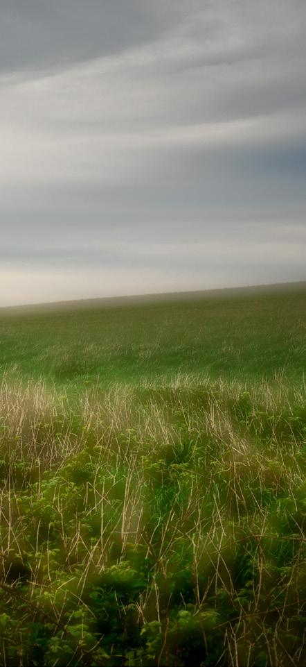
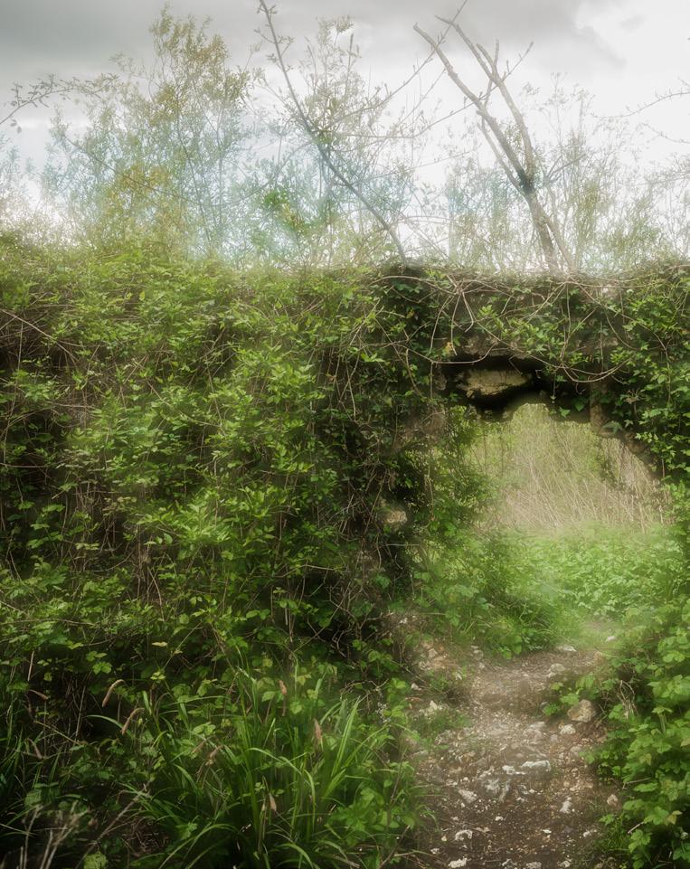
A landscape is negotiated. The gentle crunch of soil and stone, of grass and twig underfoot. The only sound beside a few concluding avian exclamations, the soft breath of a half dozen knots of wind and the periodic swoosh of a passing car on distant tarmac. Present in place and receptive to the melancholic atmosphere of the fading gloaming, this particular trespass will pass unnoticed by the guardians of access to the landscape to which we belong.
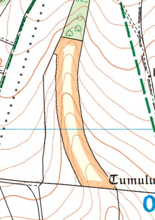
As pockets of open access countryside, surrounded on all sides by private land, access islands are a paradox; land with permissive rights, yet no permissive way to approach or enter them. Except by trespass.
‘Landlocked’ endeavours to project a sense of the ambiguious and abstract nature of these anomalies by surveying seven access islands across Sussex, from three perspectives to convey a sense of their obscure nature, whilst also contributing to the wider debate concerning the rights of access that we currently have to just 8% of our countryside in England & Wales. (Right to Roam, 2024)
“Stand atop a crag, fell or pike in England or Wales and a vista of wide meadows, ancient woodlands, and meandering rivers will unfold before you – a world to explore, or so it seems. Unbeknown to many, our green and pleasant land is crisscrossed by invisible lines of legal ownership, barring you from entering all but a tiny proportion of it.” (McCormick, 2023)
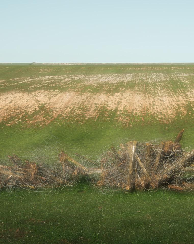
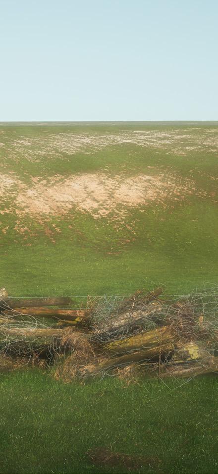
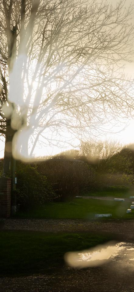
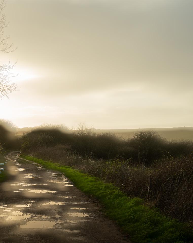
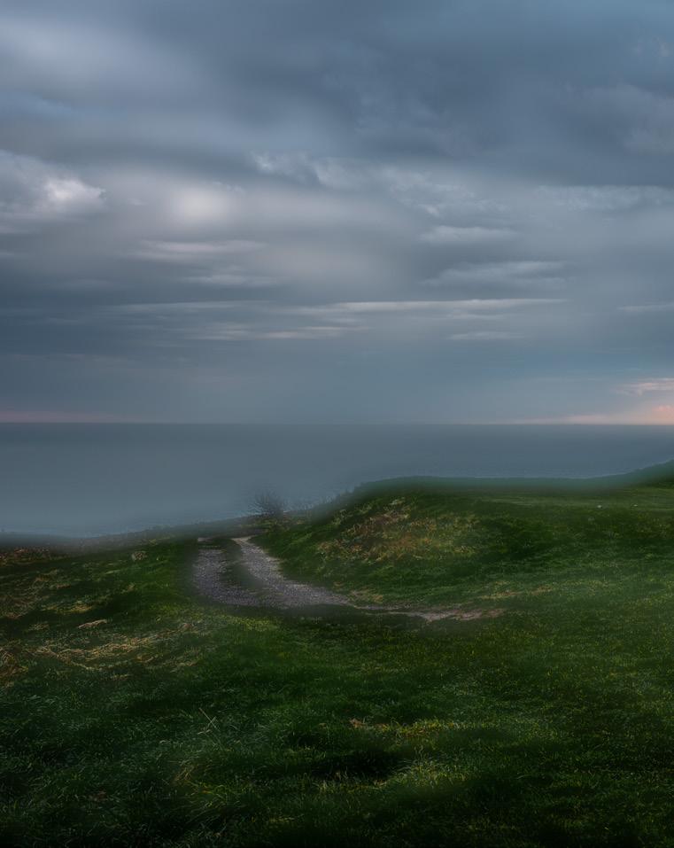
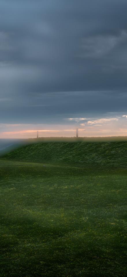
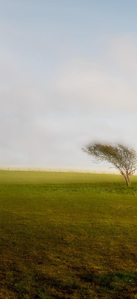
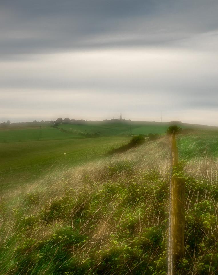
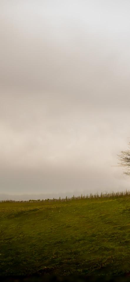
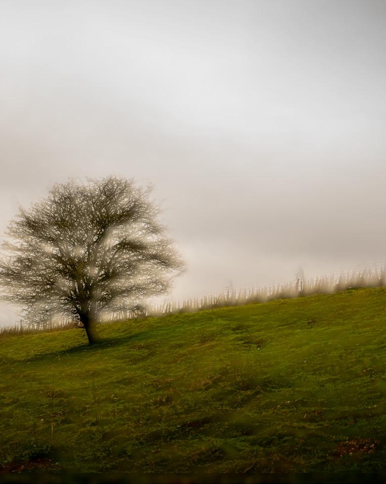
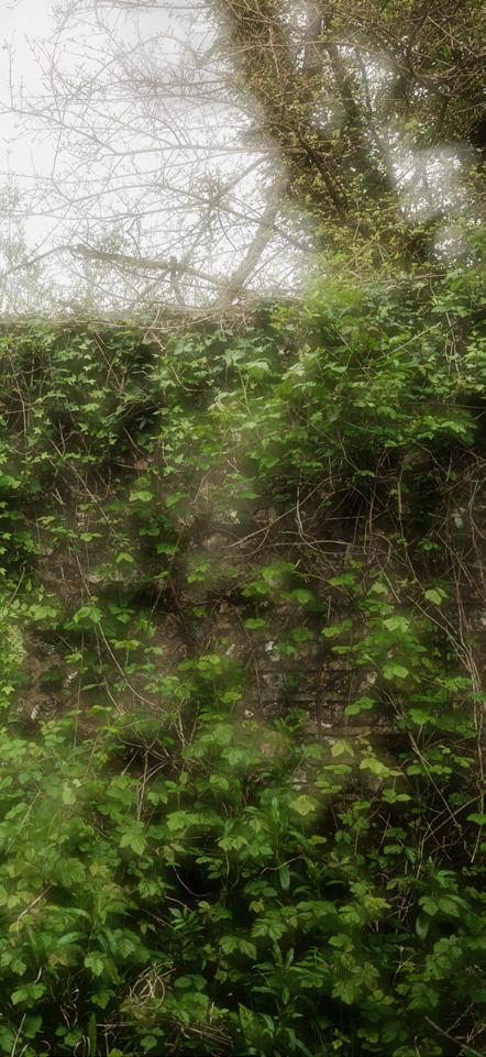
‘Ambiguities’ are composite images, taken from a focused and an unfocused version of the same composition. Alluding to the ambiguous nature of the islands visibility.
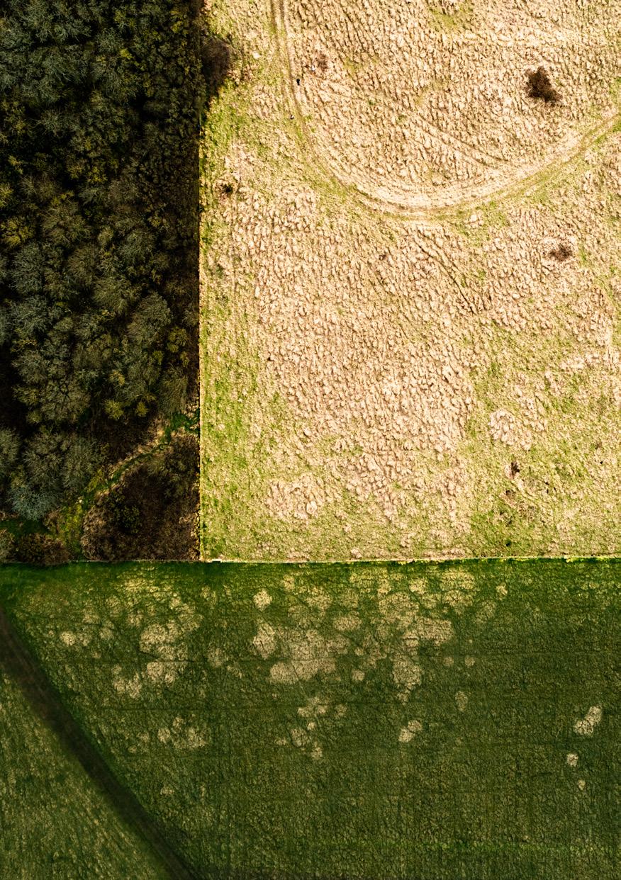
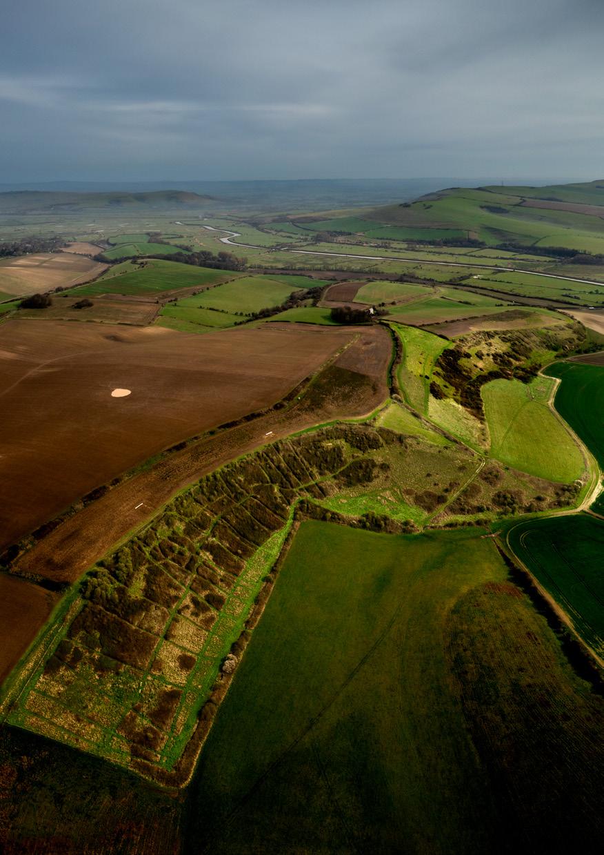
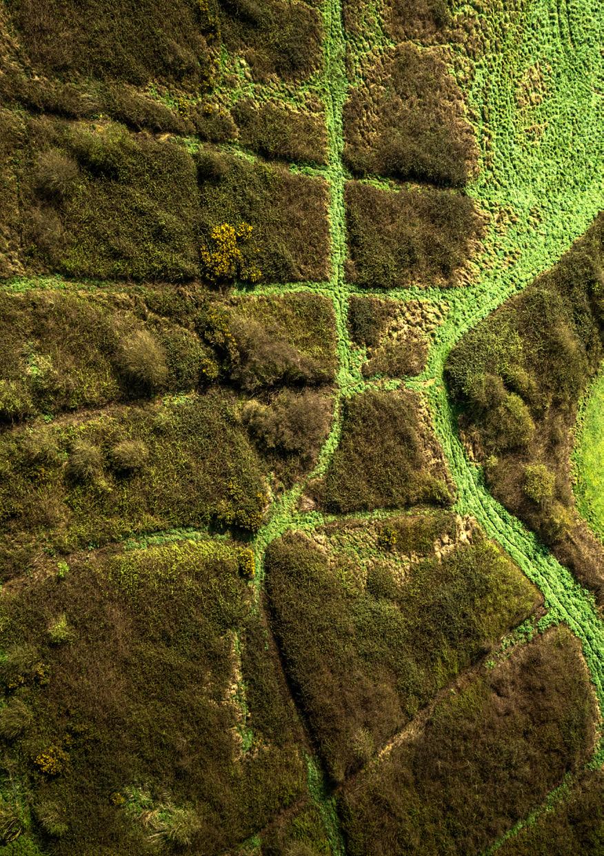
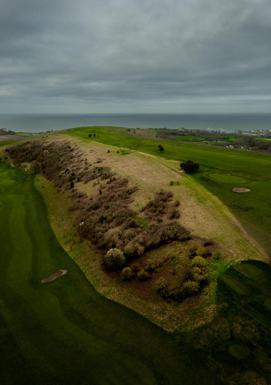
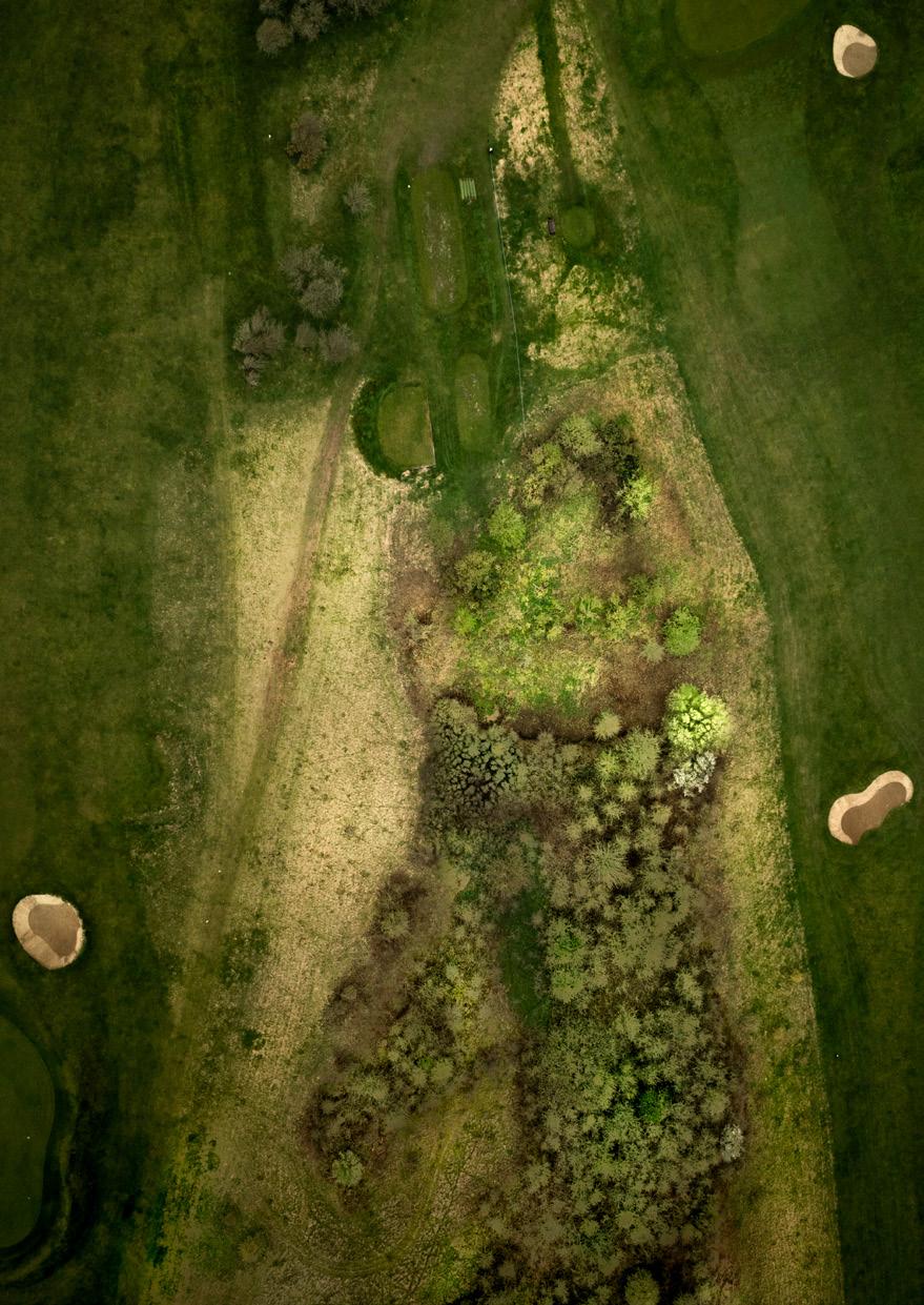
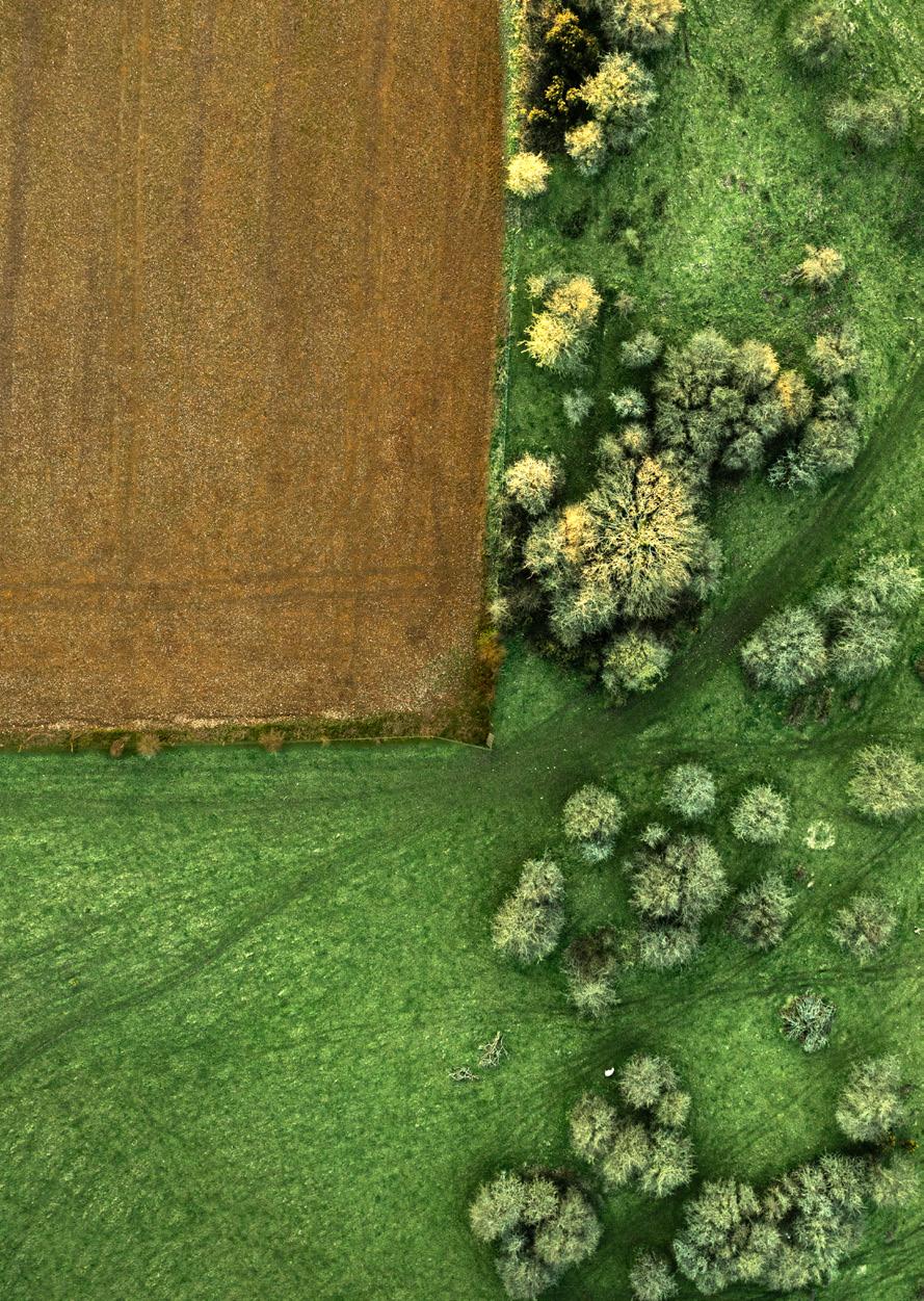
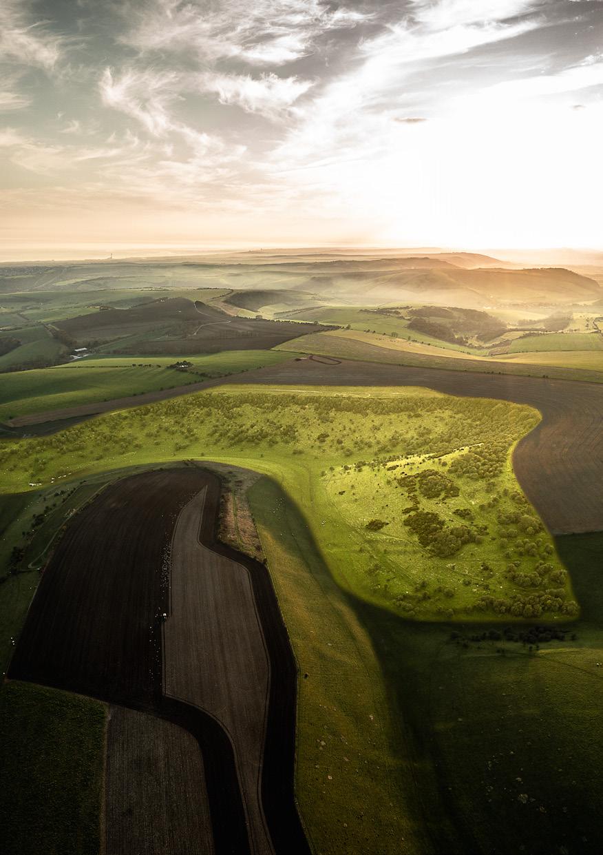
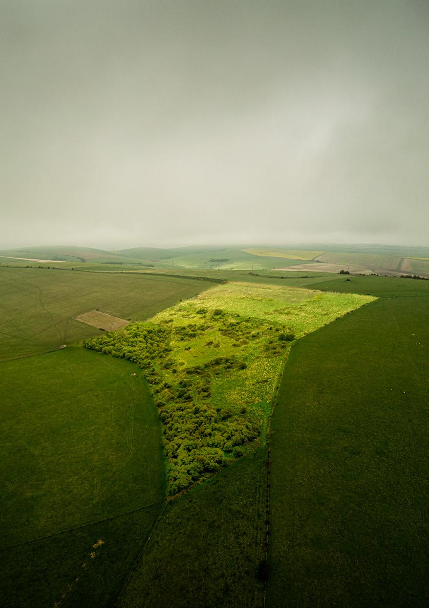
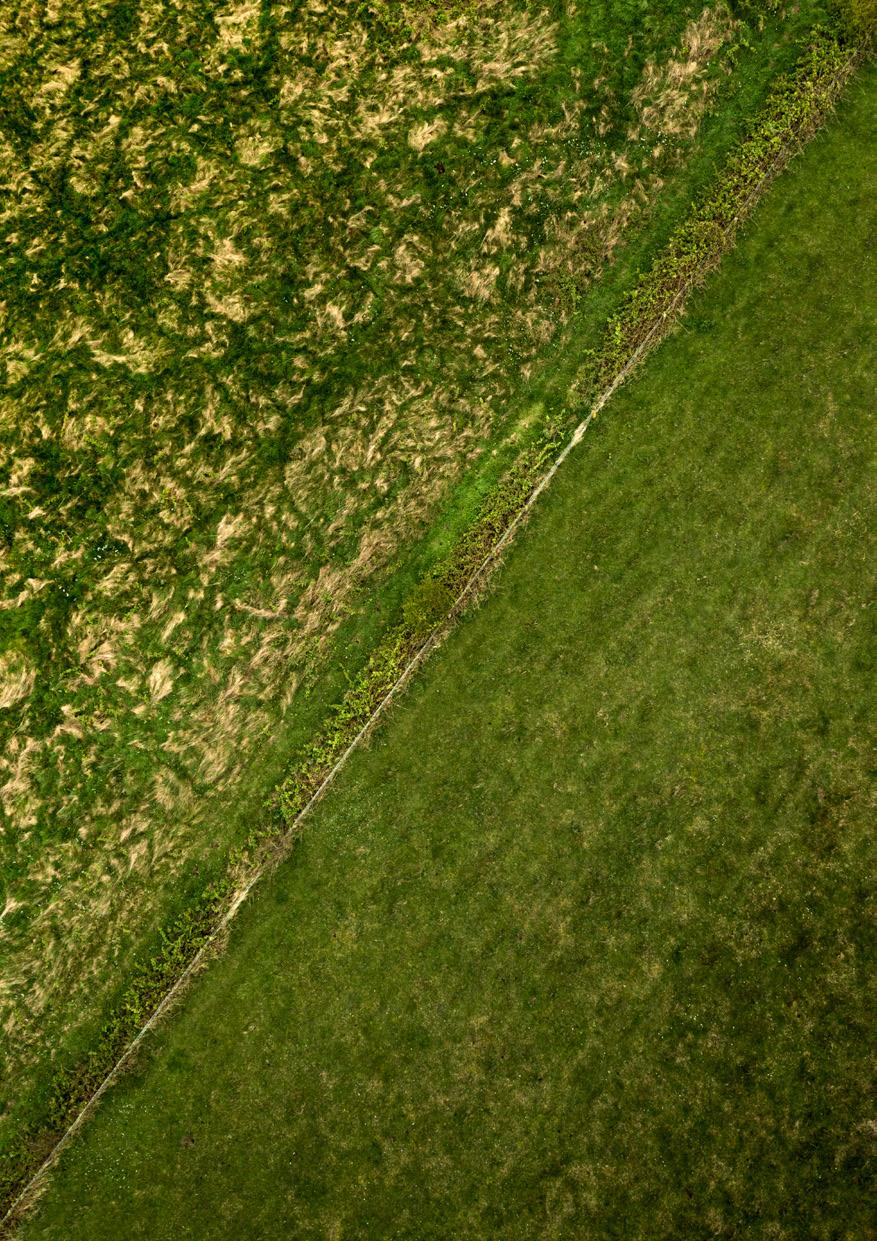
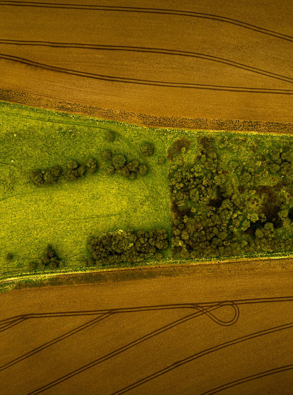
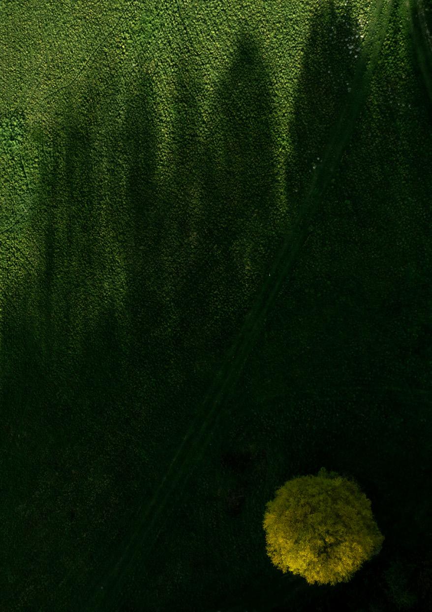
‘Abstractions’ are photographed straight down from the air. The forms, structures and patterns of the land create an abstract visual cue to that of each island’s existence.
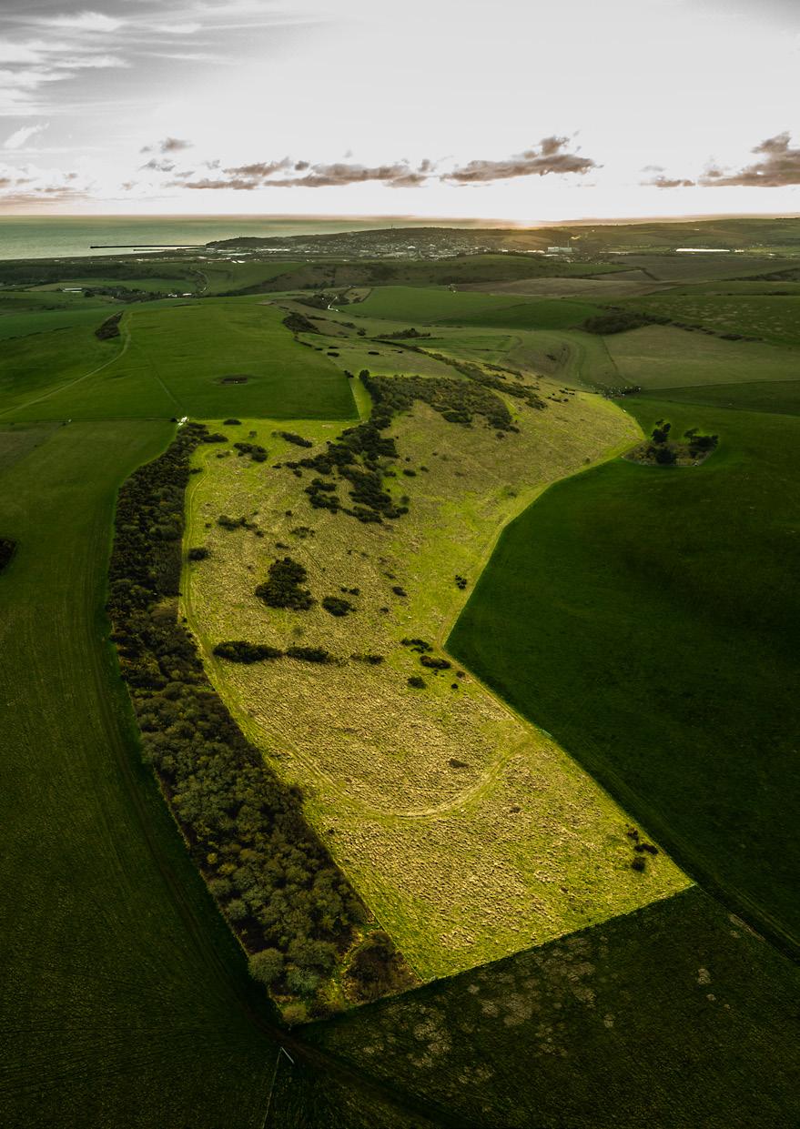
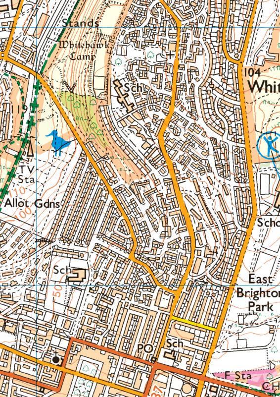
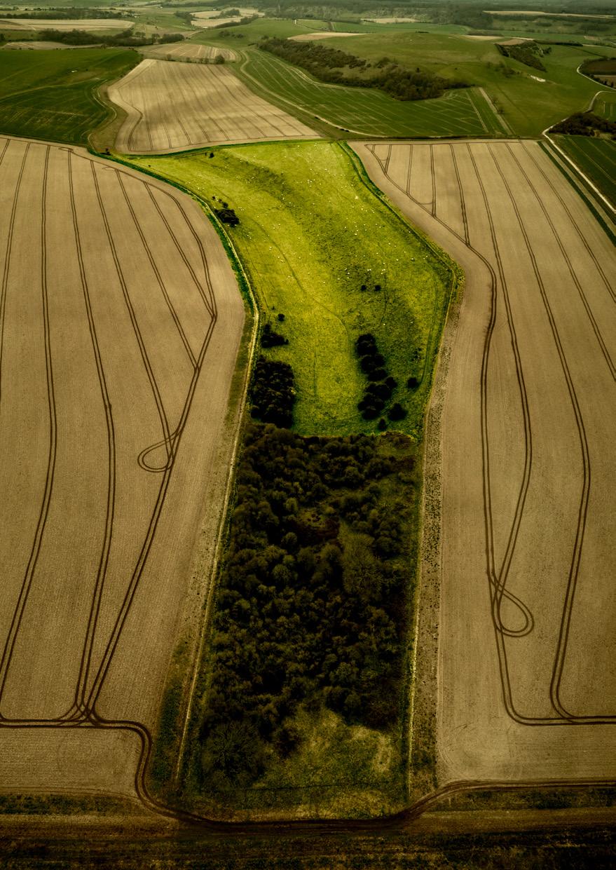
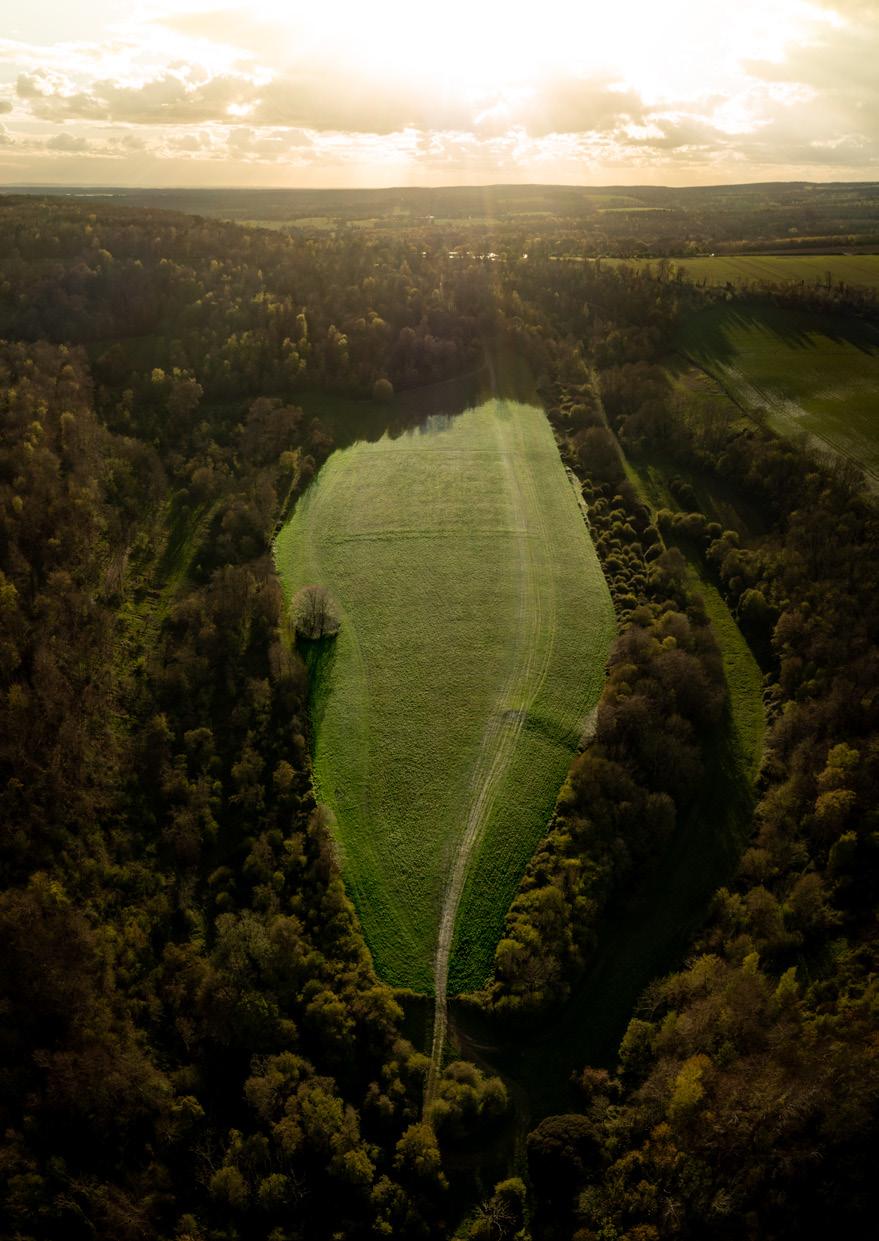
‘Surveys’ are the aerial images, digitally enhanced to highlight the access islands in their entirety within the surrounding countryside. The highlighted island areas resonate a luminosity, providing a sense of the hyperreal and an acknowledgment that we can only see these islands clearly for what they are from such an enhanced perspective.
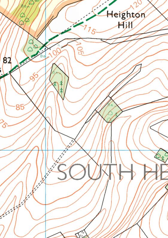
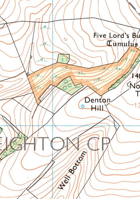
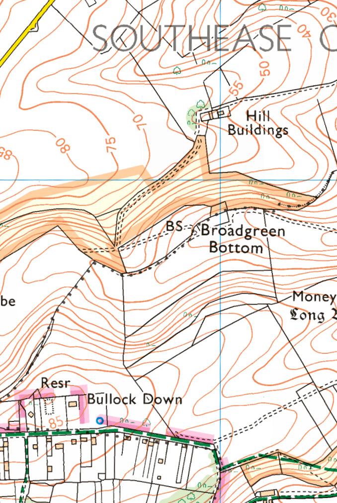
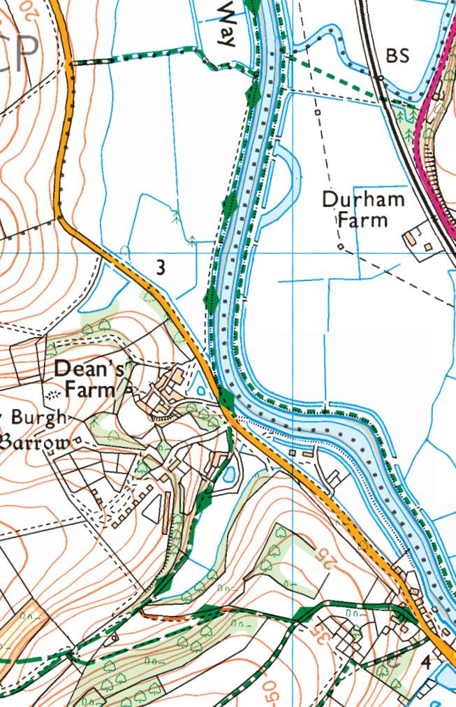
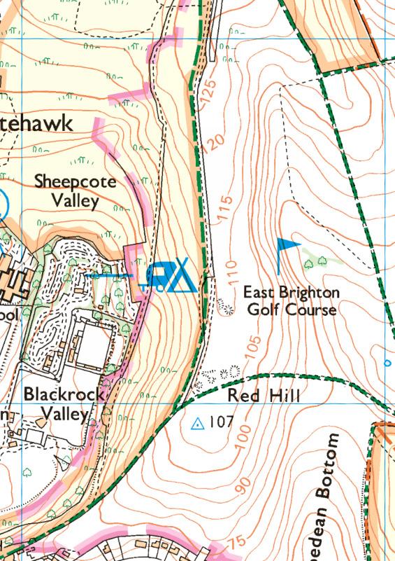
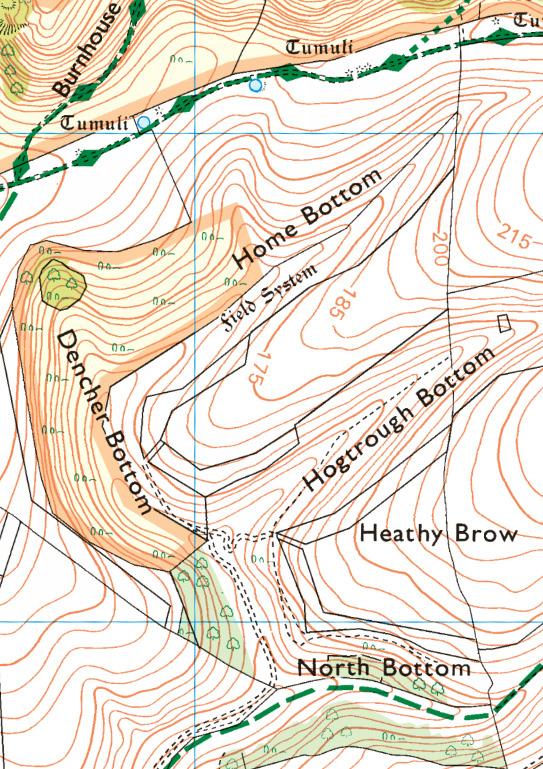
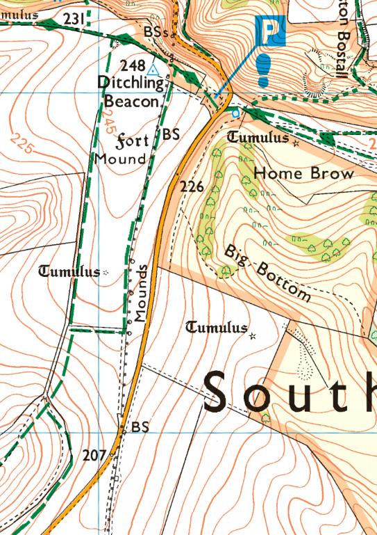
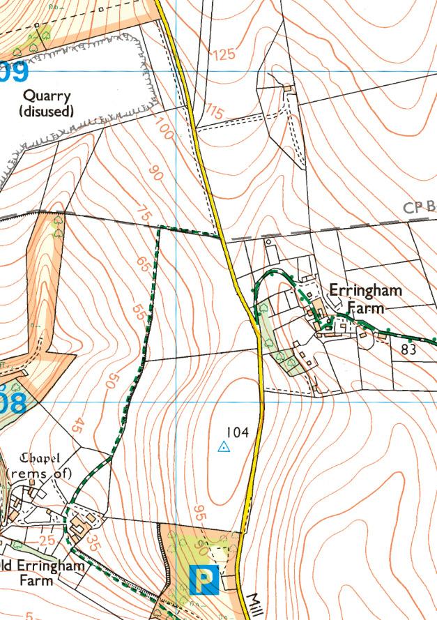
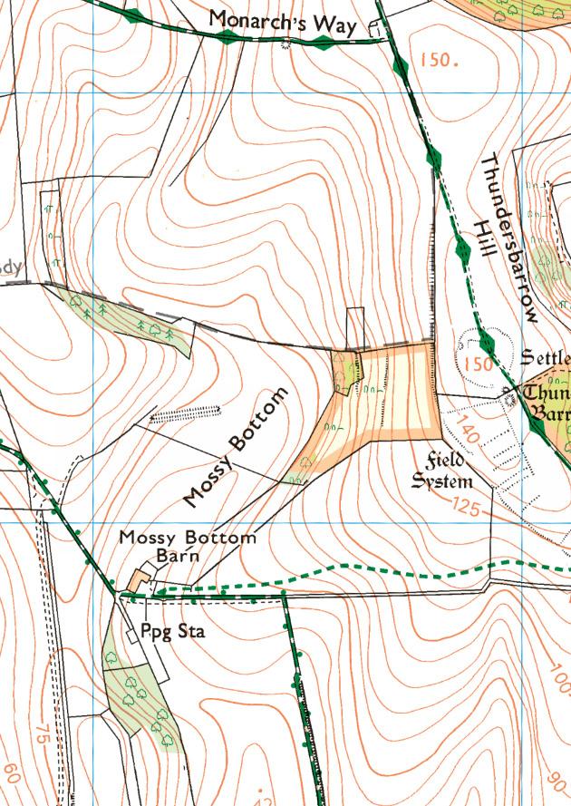
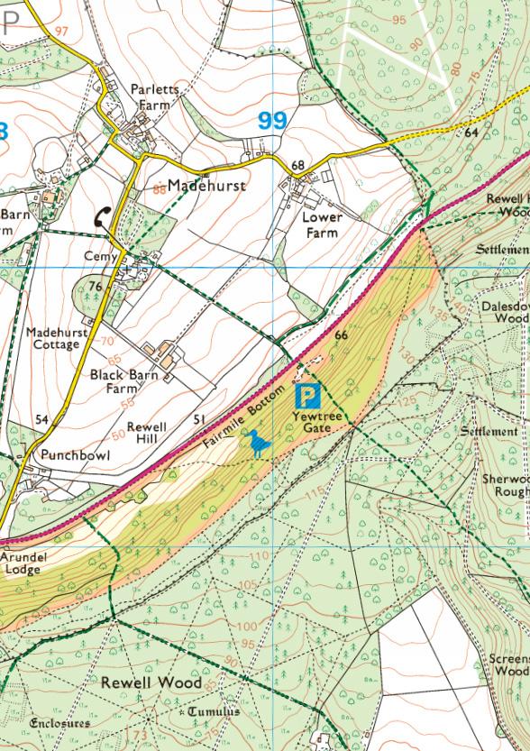
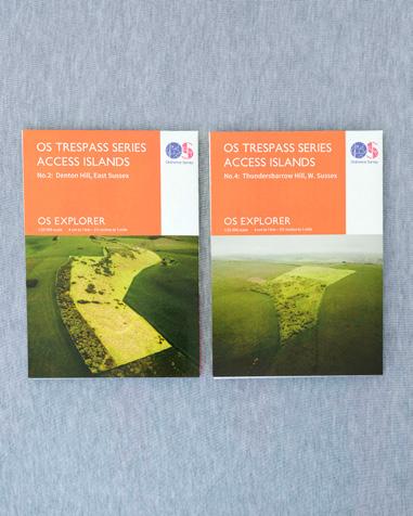
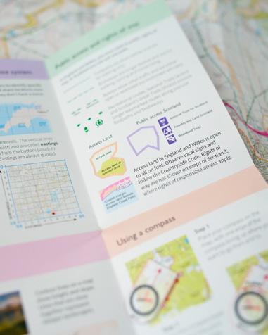
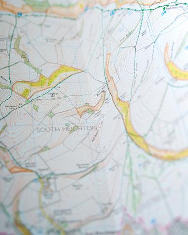
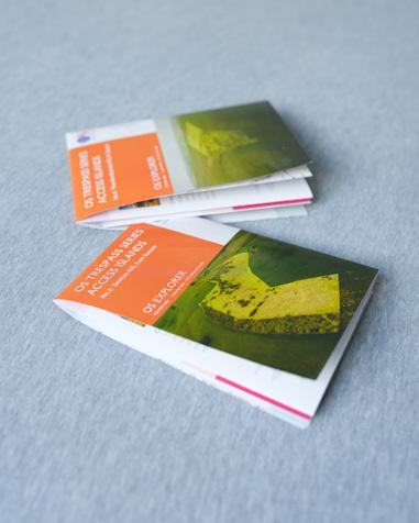
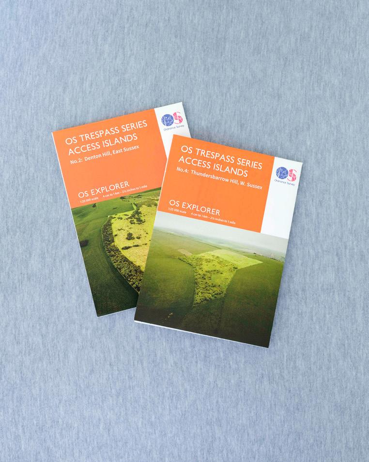
This WIPP is presented as an A5 booklet layout in the anticipation that once printed, it will not be dissimilar in size to an Ordnance Survey map and could be carried alongside one. I have produced two example Ordnance Survey maps (using the OS custom map printing service), each representing one of the access islands featured in the WIPP. The maps themselves feature the islands at the centre, with the cover showing the ‘Survey’ image of that particular island, along with a subtle subversion to the branding of the OS Explorer map series.

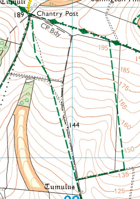
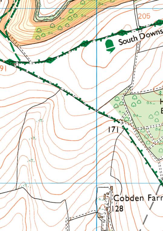
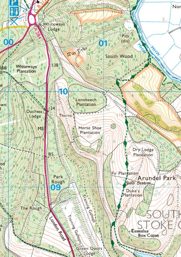
 Arundel Park Chantry Post
Thundersbarrow Hill
Arundel Park Chantry Post
Thundersbarrow Hill
 Dencher Bottom East Brighton
Southease Hill
Denton Hill
Dencher Bottom East Brighton
Southease Hill
Denton Hill
References:
McCORMICK, Lucy. 2023. Millions of Europeans have the right to roam – so why don’t we in Britain? The New European. 2023.
Available at: https://www.theneweuropean.co.uk/millions-of-europeans-have-the-right-to-roam-so-why-dontwe-in-britain/ (accessed 17/04/24)
THE RIGHT TO ROAM, Campaign. Citing data from Natural England CRoW Act 2000 Access Layer, OGL. 2023
Available at: https://www.righttoroam.org.uk/ (accessed 16/04/24)
Figures:
All figures: BARCLAY, Neil. Private collection. January - April, 2024
All cartography: Ordnance Survey © Crown copyright and database rights [2024]
Other:
BURTYNSKY, Edward. Oil.
CREWDSON, Gregory. Beneath the Roses
DARCH, Robert. The Vale.
DEWE MATHEWS, Chloe. Caspian.
FLUSSER, Vilem. Towards a Philosophy of Photography.
GODWIN, Fay. Our Forbidden Land.
HAYES, Nick. The Book of Trespass.
HAYES, Nick. The Trespasser’s Companion.
HENNER, Mishka. Feed Lots.
HENNER, Mishka. Dutch Landscapes
HIDO, House Hunting.
HIDO, Todd. A Road Divided.
OHASHI, Eiji. Roadside Lights I.
JANA, Rosalind. This Pleasant Land.
PAGLEN, Trevor. Landing Sites.
SHORE, Stephen. Modern Instances.
SHORE, Stephen. Topographies: Aerial Surveys of the American Landscape.
WELLS, Liz. Land Matters.
LANDLOCKED
LANDLOCKED
WORK IN PROGRESS PORTFOLIO
All Images: Copyright Neil Barclay, 2024