Urban Design is one of the ways in which we help to support the everyday lives of people in public places. The professional practice of urban design emerged from the disciplines of landscape and architecture as an extension of the traditional concerned with the arrangement of, and relationship between built elements and functional design to place a far greater focus on the in uence of design on people and city life. Over time the professional scope has expanded to include an appreciation of the economic, functional, detail social and use aspects of place. This report provides a contemporary summary of urban design considerations. It uses these to analyse a number of prominent and emerging case studies to investigate the ways in which urban design is being used to facilitate social participation in the public realm. How can we use our contemporary understanding of urban design to analyse the social performance of public places and then use this to recommend tactics for future projects?

People in public spaces
Urban design tactics to facilitate social participation in the public realm
© Australian Urban Design Research Centre
2015
People in Public Places
Urban design tactics to facilitate social participation in the public realm
AUDRC | University of Western Australia
Contents
List of Figures
Figure 1 Principles of social participation
Figure 2 Urban design elements
Figure 3 Analytical framework
Figure 4 Design criteria
Figure 5 Tactics
Introduction | 6 / Research Project Structure | 8 // Case Studies | 20 P1 - P6 Urban Plazas | 22 T1 - T7 Transit | 56 S1 - S5 Social Incubators | 92 /// Tactics Summary | 114 //// Recommendations | 116 References | 124
Credits | 128
| 130
Image
Acknowledgements
Introduction
Urban design has continually engaged with the social life of the city, informing the way in which the public realm is considered and configured.
People in Public Places is intended as a contemporary compendium. It is a document which has taken on a relatively complex task in attempting to bridge the relationship between design and the social ‘performance’ of public places. Urban design is however a discipline which spans disciplines; it is concerned not just with arranging the physical framework of the city but also understanding and shepherding the forces and actions which underpin this spatial configuration to achieve a people-focussed outcome.
Rather than simply facilitating the arrangement of space lie the objectives of urban design, the people-focussed values which underpin the designer’s intentions to produce a certain form or structure. Specific approaches to achieving these may vary from designer to designer but
there is a general agreement that those involved in shaping the urban environment are doing it to enable liveable cities for all. This effectiveness can be about many aspects: promoting economic turnover, maintaining the health of its citizens, inspiring civic pride, responsibly managing resources, accommodating populations, keeping citizens safe or providing the territory for the social lives of the populace.
The research and findings contained within this document are mostly concerned with this last aspect – the territory of the social happenings of the city, the public realm. In particular the research has been designed to help the Metropolitan Redevelopment Authority of Western Australia (MRA) ensure that its public realm projects of the future are broadly appealing to the citizens who will use them
and to promote social wellbeing. As Richard Rogers exclaims in his foreword to Jan Gehl’s book Cities for People ‘Everyone should have the right to easily accessible open spaces, just as they have the right to clean water’1
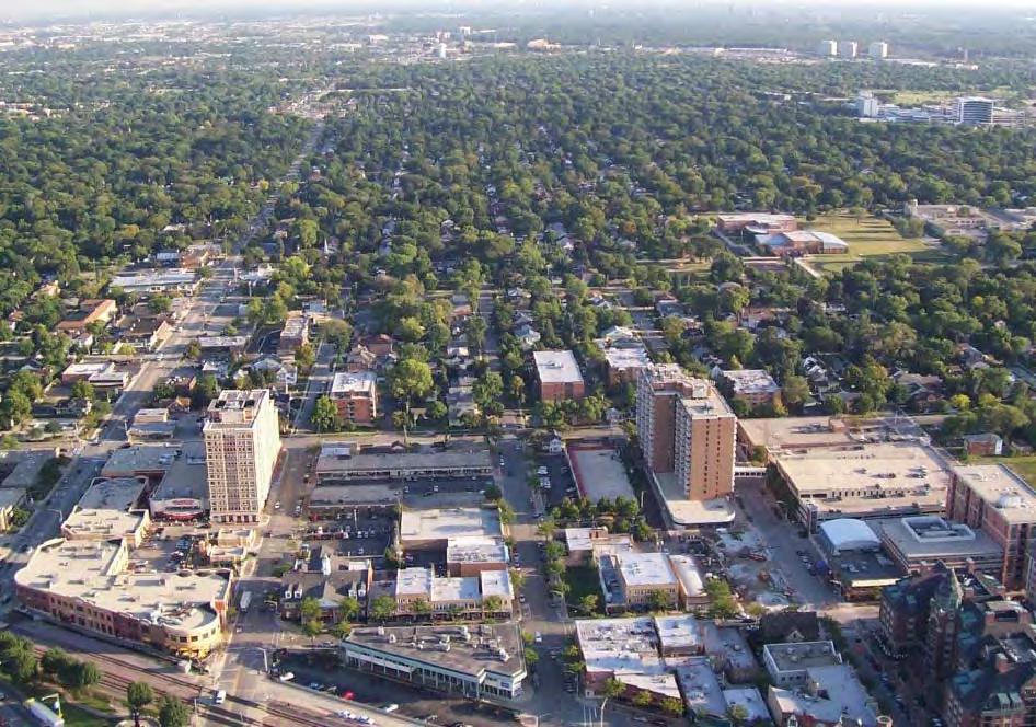
The MRA is a government redevelopment authority which operates in the Perth metropolitan area and has a range of urban redevelopment projects. It often takes on the planning, design and delivery of substantial public realm projects – streets, plazas, parks etc, as part of these activities. In parallel the Department of Planning and Western Australian Planning Commission continues to work towards a compact city model, the chief elements of which are a series of high density urban nodes arranged around public transport, brownfield redevelopment projects and activity corridors along key public transport routes. The vision for these precincts to provide exceptional liveability confirms an important and diversified role for the public realm – it must cater for a greater number and wider range of uses and users. Therein lies part of the challenge — what can be done to ensure that the public realm elements of these ‘new’ project types are suitable and support the social needs of a diverse demographic?
It is a significant challenge for one document to answer as it must comprehend the complex, dynamic and continually evolving and continuously studied relationship between urban design practice and the social functioning of space and then apply this to specific project types. Confounding this is the role of context which means every project must be considered in relation to its geographic, historical, functional, climatic and economic circumstance. The appreciation of the importance of contextual parameters makes
the generalisation of design aspects difficult to achieve whilst also highlighting the risks of going too far with a generic approach. The challenge for this research is to navigate the tension between the general and the specific and provide useful guidance without resorting to simplistic mimicry. Each project should be judged on its merits but this research aims to highlight some fundamental urban design principles which can be adopted.
While much of the attention and research in urban design focuses on overall levels of use, and correlates this to economic benefits and experiential satisfaction levels, this study is focused on the social impact The study approaches this through a research method which establishes a series of principles based around the concept of social participation. Social participation is a meaningful basis for an analytical framework related to the social performance of urban design as it has direct links to other social ‘performance’ territories2. If people participate in a collective or shared setting or activity then this makes civic engagement or the formation of social capital more likely3. This effect has been measured by such means as membership in voluntary organisations and public realm studies.
The principles are connected then related to the contemporary elements of urban design practice. This framework is then applied to a series of relevant case study project types which illustrate the different ways (tactics) in which social participation can and has been facilitated through design. Finally the analytical efforts are summarised into a series of general principles which seem to be supported across many of the projects investigated and could be
2 Shortall, Sally. (2008). Are rural development programmes socially inclusive? Social inclusion, civic engagement, participation, and social capital: Exploring the differences. Journal of Rural Studies, 24, 450-457.
3 Ibid.
1 Rogers, Richard. Foreword in Cities for People, Gehl, Jan. (2010) Island Press, Washington DC
Introduction | 76 | People in Public Places
/ Research Project Structure
The research project documented in this report has been designed to address the objective of informing social particpation outcomes in the design of the public realm.
Research question
The research question stems from the definition of the overall study objective to conduct research and development of design responses/solutions to maximise social participation in urban development projects. Further in achieving this international precedents and research, including delivery and implementation mechanisms were considered. Following initial scoping the research question was defined as:
‘what urban design tactics are suitable to enhance the potential for social participation in state-led public realm projects in new and regenerated urban centres, such as Transit Oriented Developments?’
This is a question of multiple parts. Firstly to understand the relationship between urban design and social participation.
Secondly to apply this knowledge to inform the design of the specific project contexts that have been identified.
Objectives
The research objectives arising from consideration of the research question are:
i.Investigate and define the relationship of urban design practice to enhancing the potential for social participation.
ii.Document tactics which can be employed in the urban design of public realm projects to potentially enhance social participation.
iii.Define principles which can be used to inform the potential for social participation in state led public realm projects.
Method
The research method is split into three parts to address the objectives.
Part 1
Theoretical and case study research is used to establish an understanding of the different ways in which urban design practice contributes to achieving social participation.
This is done by building a definition of social participation, in the context of built environment projects, as a foundation. This identifies 4 key principles.
Following this a survey of urban design theory and practice identifies a series of design elements which can be used to organise the different aspects of the organisation and execution of urban design projects. Each design element consists of a number of design criteria which collate the more specific actions which can be undertaken toward meeting the research objectives related to social participation.
The specific relationships between the design elements and the principles are then established. This is done to understand how the design elements relate to the universal ‘territories’ of social participation and identify any overlaps or shortfalls.
The design elements and their constituent criteria establishes the analytical framework though which existing projects can be interrogated with respect to contributing to social participation.
Part 2
Specific design tactics under each criterion are extracted for a number of case studies from desktop project review and publication. The case studies are chosen to illustrate a range of methods of achieving social participation in public realm projects whilst also providing direct feedback on the specific project types of new and regenerated urban centres, such as Transit Oriented Developments.
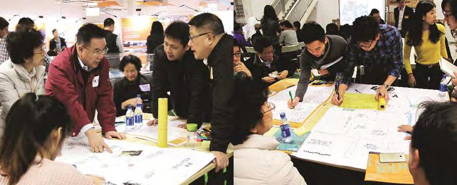
The tactics are then presented using key project images and discussed, where appropriate, in relation to their demographic context. The tactics are arranged in an approximate sequential order, as a kind of story-board, which moves from the tactics which establish the social participation aspects of each project through to the more supporting actions.
Part 3
As referred to in the introduction it is difficult to make formulaic recommendations for urban design process and practice as each case has its own specific context which will influence the choice and order of tactics. Following the application of the analytical framework to the case studies however the tactics are reviewed and summarised into design principles which provide a widely applicable set of guidelines for considering the organisation and execution of the urban design of public realm projects to improve their potential to facilitate social participation.
/ Research Project Structure | 98 | People in Public Places
Definitions & Principles of social participation
Social participation refers to people’s social involvement and interaction with others. Social participation builds social networks, social capital and sense of belonging and is directly related to health and quality of life outcomes1. Facilitation of social interaction in transit-oriented public spaces that serve large volumes of people also requires consideration of catering to a diverse demographic range wherever possible. An ideal urban design response includes attracting different users and groups and encouraging and supporting different types and intensities of interaction. Some key demographics considered in this research include age, gender and cultural background.
Social participation is a widely used term and there is no commonly held definition. A review of literature on social participation however was able to identify the following 4 key principles2 which highlight the socio-spatial territories associated with the design, development and operation of the public realm which support social participation generally:
Sharing
Formal and semi-formal forums and processes for exchange and transfer of knowledge and skills, e.g. men’s shed, community gardens.
1 Levasseur, M., Richard, L., Gauvin, L. & Raymond, É. 2010. Inventory and analysis of de fi nitions of social participation found in the aging literature: Proposed taxonomy of social activities. Social Science & Medicine, 71, 2141-2149.
2 Lindström, M. 2005. Ethnic differences in social participation and social capital in Malmö, Sweden: a population-based study. Social science & medicine, 60, 1527-1546. Mars, G. M. J., Kempen, G. I. J. M., Mesters, I., Proot, I. M. & van Eijk, J. T. M. 2008.
Characteristics of social participation as de fi ned by older adults with a chronic physical illness. Disability and rehabilitation, 30, 1298-1308.
RMIT University 2006. Evaluation of the Stronger Families and Communities Strategy 2000-2004. Melbourne VIC.
Working
Provide paid or voluntary employment opportunities including family and carer responsibilities.
Decision Making
Enable existing community members, representatives and organizations in decision-making process across different project stages including design, activity planning, and place management.
Engagement
Events, activities and their environments which attract different users and groups, encourage and support different types and intensities of interaction, e.g. leisure, recreation, hanging out.
Thus social participation is multi-faceted involving groups, families and individuals in both structured and informal activities and environments, connecting with people in various degrees of intimacy and familiarity and taking part in the organisation and decision making processes which affect their social life and that of the others around them. The literature review has also pointed out the cultural and demographic specificity of certain aspects of social participation. Therefore any learnings from particular projects need to be qualified in terms of this context. Accordingly subsequent work in the presentation of case studies acknowledges their social and demographic context.
Figure 1
The principles are the core actions and behaviours which support the potential for social participation
W ORKING S H ARING
DECISIONMAKINGENGAGEMENT
/ Research Project Structure | 1110 | People in Public Places
Design Elements
Design elements were described which represent the key territories of contemporary urban design practice. These were derived from urban design literature and theory as well as project case studies. Each design element is comprised of a number of more specific possible actions. The relationship of these actions to the overall research objective is discussed in subsequent steps however the design elements are defined below.
NETWORKS & EXCHANGE
Aspects of the organization of the project which relate to community involvement and empowerment in the design process and outcome
PROGRAMMING
The organization and implementation of specific uses.
URBAN STRUCTURE
Aspects which inform the configuration of the fundamental structure of the physical environment
URBAN CHARACTER
Aspects of tradition, style, pattern, form and/or use which
contribute to the arrangement of the built environment. Fundamentally these elements could be understood in relation to two meta-categories: software and hardware.
‘Soft’ aspects relate to establishing a structure for communication, exchange and specific activities within the design process. Typically this is done during the early parts of the project. It often directly informs the programming and enables authentic and enduring participation in the use of the space. It is specific to the situation and may or may not follow conventional top-down engagement practices. Both Networks & Exchange and Programming design elements could be categorised as software.
The ‘hard’ physical elements of the built environmenttraditional urban design components which may or may not take on traditional forms depending on the context and process. The criteria are well understood but the important challenge is to try and understand how the hardware has responded to, or supports the local context. Urban Structure, Urban Character and Programming all deal with the hard physical frameworks of constructed space.
Figure 2
The design elements are the key areas of practice related to the organisation and execution of urban design.
PROGRAMMING URBANCHARACTER
W
S H
NETWORKS&EXCHANGE URBANSTRUCTURE DECISIONMAKINGENGAGEMENT
ORKING
ARING
/ Research Project Structure | 1312 | People in Public Places
Analytical framework 1
The analytical framework provides a way of connecting the theoretical and practical dimensions of the inquiry to help tackle the research question. It allows identification of which urban design elements operate on the key principles of social participation.
For example the principle of Decision Making is substantively connected to the urban design elements of Programming and Networks and Exchange. Both of these elements involve people coming together to organise and manage aspects of the project. For instance being involved in forums to discuss the types of spaces and / or programme of activities they would like to see in their community. They are involved in a collaborative manner to make decisions which impact on either or all relevant stages of the project - planning, design and operation.
This exercise confirms that all of the design elements are in some way related to the principles and validates their consideration in respect of achieving the research objectives.
Networks and Exchange was related to all of the principles endorsing its important position and substantial potential in the design process with respect to achieving the objective of social participation.
Programming also presents a significant connectivity to the principles illustrating its potential importance and efficacy with respect to the research objectives.
Urban Structure is strongly related to Engagement as it provides the physical framework through which activities and events are able to take place both in terms of space and attractivity.
Similarly Urban Character is substantially related to Engagement as it provides aspects of the physical condition with which people and groups identify, which can create an attractive setting to enable a range of different social activities.
Development of the analytical framework indicates that the ‘soft’, or non-traditional aspects of urban design are very important with respect to supporting the principles of social participation. This tends to back up the recent focus on tactical and temporary urban design in practice where ‘bottom-up’ methods have been employed. These designs are generated through the establishment of community and self-directed groups with common interests who largely take on the role of decision making and curating activities.
Figure 3
The analytical framework identifies how the principles relate to the design elements.
ENGAGEMENT W ORKING AHS R I NG DECISIONMAKING
PROGRAMMING URBANCHARACTER NETWORKS&EXCHANGE URBANSTRUCTURE
/ Research Project Structure | 1514 | People in Public Places
Analytical framework 2
All of the design elements were validated with respect to the research objective. Further research was undertaken to identify the key criteria within these design elements which relate to providing the conditions for social participation. This research drew on both traditional and contemporary perspectives.
The practical observations of William Whyte, Clare Cooper Marcus and Jan Gehl provide a useful link between the role of physical elements and conditions in supporting social activity. The writings of Lynch, Cullen and the Joint Center for Urban Design at England’s Oxford Polytechnic Institute provide a robust framework for considering urban structure in relation to providing attractive and comprehensible settings for human interaction. More contemporary publications such as We own the City and Tactical Urbanism explore new paradigms of urban design activity in a digital, socially and governmentally fragmented age. A full list of the publications which have been used to extract the design criteria are presented in the references.
The design criteria are described below under their relevant elements. This research has demonstrated that their are substantially more design criteria under urban structure than the other elements. This is not to say that it is more important but identifies that it is better understood and has received more attention in professional discourse to date.
NETWORKS & EXCHANGE
Collaboration
Organisation of project or infrastructure to facilitate involvement in various stages of project design, including operation and management.
Productivity
Organisation of project or infrastructure to facilitate employment and/or volunteering for a shared or individual purpose/outcome for community members,
Learning & engagement
Organisation of project or infrastructure to facilitate educational or skills-development for community members.
PROGRAMMING
Social & cultural diversity
Use and activation strategies that facilitate the engagement of different cultural and ethnic groups.
Health, wellbeing & play
Use & activation strategies aimed at increasing the health
and wellbeing of all users. Including walkability, increasing green space, and opportunities for passive and active recreation.
URBAN STRUCTURE
Accessibility
Design approaches to ensure accessibility for all users, with special consideration for those who are differently-abled, elderly, or parents with children/prams. Including ramps, lifts (if appropriate), and wide access paths, etc
Flexibility
Design approaches which give users a choice of use and occupation - allowing multiple group and individual combinations and respecting user’s preferences with respect to their willingness to engage.
Amenity & Comfort
Design approaches to support necessary and optional passive activities in a space. Including seating, shading, and materiality.
Connectivity
Design approaches that connect the public realm with its surroundings. Generally the permeability of the public realm including pathways, streets and open space networks.
Legibility
Design approaches that aim to create a coherent set of identifiable elements in the public realm, which have clear formal boundaries. Elements would include landmarks, paths, nodes and edges.
Safety
Design approaches to ensure safety for all users, with special consideration to gender, age, and ethnicity. Including lighting, activation, passive surveillance, visibility of pathways, and ground floor activation etc.
URBAN CHARACTER
Imageability
Design approaches aimed at drawing upon, enhancing, and integrating specific elements of the existing landscape or built form to contribute to a sense of place and attachment that is positively cogitated (attractive).
Complexity
Design approaches which contribute to establishing a sense of diversity and richness in the perception of a place which is interesting and inviting.
COLLABORATION
LEARNING & ENGAGEMENT
PRODUCTIVITY
FLEXIBILITY
ACCESSIBILITY
SAFETY
LEGIBILITY
AMENITY & COMFORT
CONNECTIVITY
SOCIAL & CUTURAL DIVERSITY HEALTH, WELLBEING & PLAY
IMAGEABILITY
COMPLEXITY
Figure 4
The design criteria are the more detailed aspects of each of the design elements which relate to the potential for social participation in the public realm.
W ORKING AHS R I NG DECISIONMAKING
ENGAGEMENT
PROGRAMMING URBANCHARACTER NETWORKS&EXCHANGE URBANSTRUCTURE
/ Research Project Structure | 1716 | People in Public Places
// Case Studies
The case studies have been chosen to best inform the multiple aspects of the research objective.
The analytical framework was applied to a number of case studies to determine what tactics which had been employed under the different design criteria to contribute to the principles of social participation. A range of case studies were selected based on the expectations of the research, both to clarify the understanding of the role of urban design in facilitating social participation in the public realm, and to extend this to inform the future configuration of specific types of projects (state led projects in urban centres such as TODs).
The research adopted 3 types of case studies to inform the research objectives - urban plazas, transit oriented developments and social incubators.
Type 1 – Urban Plazas
Exemplary public realm design projects across a range of locations, budgets, urban contexts and scales. These projects were selected based on their documented ambitions or performance with respect to social participation.
Type 2 – Transit Public realm projects which are specifically related to tran-
sit stations and more intense urban development in the immediate location. These projects were selected based on development maturity, reputation and availability of adequate documentation.
Type 3 – Social incubators
These are a ‘loose’ collection of projects which demonstrate innovative practice - experimental ways of organising urban projects in a contemporary urban context to engender social participation. These projects were selected from current publications.
The case studies include information on user group, ethnicity and status contexts. The notes highlight where the project was specifically focused on bringing isolated groups together. Where possible the definitions for each project are taken directly from sources in the location of the project. For example in a project located in the US definitions of ethnicity are taken from the US Census Bureau, however these may have been simplified for reporting. It should be qualified that these definitions may differ between countries and so should be considered in their local context.
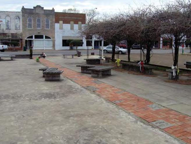
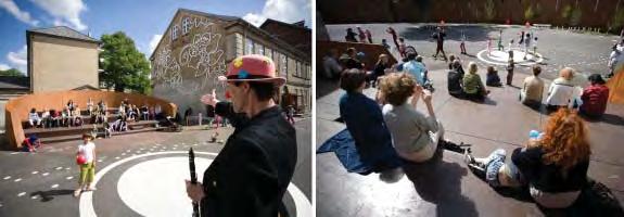
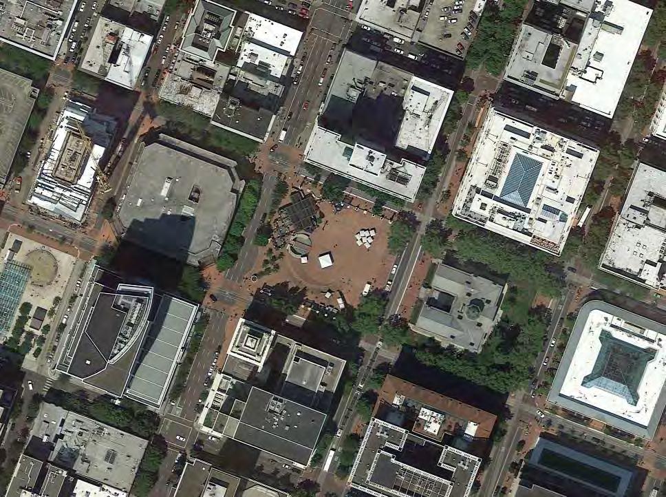
Urban Plaza P1 Okolona Downtown Park Okolona, MS M M S
Transit Social Incubators P2 Putnam Triangle Plaza Brooklyn, New York NY T5 Courthouse Square Arlington, VA P3 Charlotte Ammundsens Square Copenhagen, DK P4 Fly the Flyover Kwun Tong, HK T4 Contra Costa Transit Village Contra Costa, CA P5 Marsupial Bridge Milwaukee, WI P6 Nicolai Cultural Centre Courtyard Kolding, DK P7 Civic Space Phoenix, AZ T1 Pioneer Courthouse Square Portland, Oregon US T6 Del Mar Transit Village Pasadena, CA T7 Hammarby Sjostad Stockholm, SWE S1 Build a better block Dallas, TX S2 Delai Sam Moscow, Russia S3 Garden of Eden Fort Greene Brooklyn NY S4 Roosevelt Road Green Life Axis Taipei, Taiwan S5 Cascoland Kolenkitburt Amsterdam, NL L T3 Arlington Heights Village Arlington, IL T2 Thornton Place Seattle, WA S M M M M L L L L XL S S S S M Local Centre Regional Centre Regional Centre CBD City Centre District Centre CBD City Centre Local Centre Regional Centre CBD Local Centre City Centre Local Centre Regional Centre Regional Centre CBD Local Centre City Centre 22 // Case Studies 70 64 50 44 38 34 30 26 60 56 102 98 92 86 82 76 110 106 | 1918 | People in Public Places
TypeProject ScalePage Context
P1 Okolona Downtown Park
Okolona, MS
Type: Urban Plaza
Context: Local Centre
User Groups: Families Individuals Youth
Ethnicity context: White (26%)
Hispanic (3%)
Black (71%)
Status: Residents
Local business Workers
Students
Key Aspects:
NETWORKS & EXCHANGE
Collaboration
Productivity
Learning & Engagement
PROGRAMMING
Social & Cultural diversity
Health/ wellbeing & play
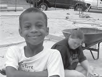
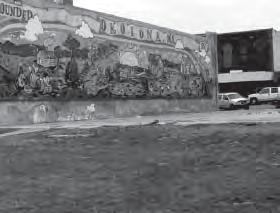
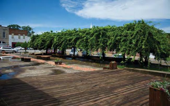
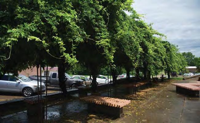
Okolona is a town with a population of around 3000 people and a history of racial segregation. A substantial vacant site in the middle of the downtown area was identified as suitable for a public space project to serve the civic and economic development needs of the community.
Social participation context:
This project is notable as it is a small urban centre attempting to create a public space which can be used to bring the community together and build relationships and trust. How does a project attempt to unify a historically divided community whilst still meeting the functional needs of a public space in an urban centre?
URBAN STRUCTURE
Accessibility
Flexibility
Amenity & Comfort
Connectivity
Legibility
Safety
URBAN CHARACTER
Imageability
Complexity
S

0’17.02”N
34°
88°44’57.10”W
910 m2
// Case Studies | 2120 | People in Public Places
50 m
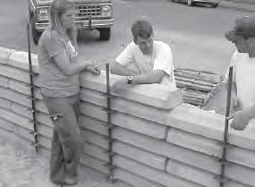
Collaboration
▶ Community led project
A diverse group of citizens including local business owners initiated the idea of a downtown public space project which could build social capital.
Productivity
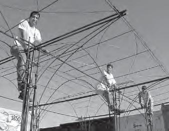
▶ Student enterprise
The detailed design and construction management was undertaken by architecture students as part of their course.
Productivity
▶ Student enterprise
Local high school students were invited to design and paint a mural on the blank side wall of the neighbouring building which addressed the site.
Collaboration
▶ Citizen involvement in design process
The design team spent several weeks in the town and conducted face to face interviews and surveys and were helped by a special ‘committee’ of diverse residents.
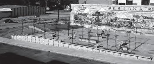
Productivity
▶ Participation in building
Local workers and other citizens, including children became interested in the project and provided labour and shared skills.
Legibility
▶ Defining paths & edges
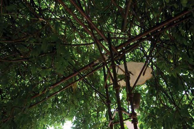
The new retaining wall on the boundary which doubles as a seat and the alignment of the wisteria arbor clearly demarcate the public territory.
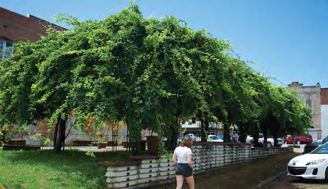
Flexibility
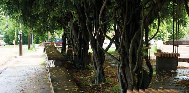
▶ Diversity of Occupation
The capping on the retaining wall doubles as an informal seat which is shaded but is suitable for ‘hanging out’ on the street. This peripheral, streetside occupation of formal public space is often preferebale for some users such as youth.
Flexibility
▶ Flexible community gathering spaces
The open nature of the park and small stage provide flexibility to host a range of different types and scales of events.
Imageability
▶ Community identification in built elements
The new brick paving used to fill in the gaps of previous floors contains handprints and markings of children who were involved in the project.
Amenity & comfort
▶ Tree planting & shade
A wisteria arbor was incorporated to meet the wishes of local residents and workers for a shady place in the downtown area where it would be possible to rest or eat lunch.
Flexibility
▶ Multiple aspect seating
Seating is wide enough and distributed carefully to allow a variety of different scales of groups to use the space whilst respecting privacy.
Imageability
Learning & Engagement
▶ Community management of public space
Local community members who were involved in providing skills and support for the project became unofficial caretakers of the site.
▶ Familiar materiality & Form Materials are familiar yet used in non-conventional ways to create a unique theme and reflect the resourceful nature of small towns.
// Case Studies | 2322 | People in Public Places
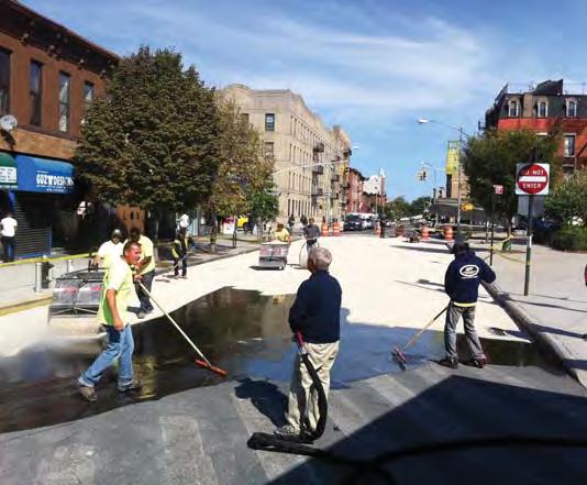
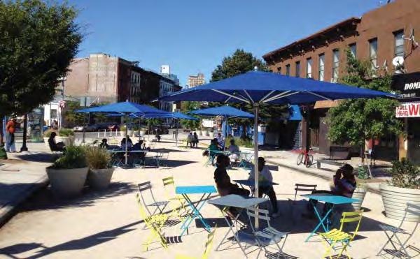
P2 Putnam Triangle Plaza
Brooklyn, New York NY
Type: Urban Plaza
Context: Local Centre
User Groups: families elderly social groups - small
Ethnicity context: African American (40%)
White (30%)
Hispanic (10%)
Key Aspects:
Status: residents residents-new local business NETWORKS & EXCHANGE
Collaboration
Productivity
Social & Cultural diversity
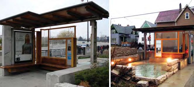
Putnam Triangle Plaza was installed as a temporary public space along the Fulton Street commercial and metro corridor in the neighbourhood of Clinton Hill. The juncture of the street grids had created an awkward road intersection with a large triangular traffic island isolated from the streets and sidewalks. The local business alliance saw an opportunity to create a much needed neighbourhood open space which improved the public realm offering and supported the opportunities for local business.
Social participation context: The area is on the front of a ‘white wave’ out of New York city which is sweeping over the areas of Brooklyn which are well connected to downtown areas. What kind of public space can help support local business and the traditions of local residents promoting a sense of respect and integrating the new residents?
Amenity & Comfort Connectivity
Lear ning & Engagement PROGRAMMING
Health/ wellbeing & play URBAN STRUCTURE
Accessibility Flexibility
Legibility Safety URBAN CHARACTER
Imageability Complexity
S
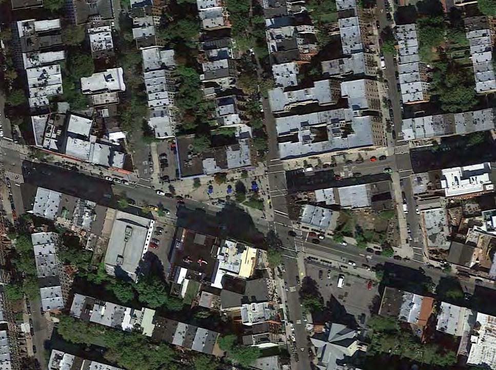
40°40’57.64”N 73°57’42.68”W 1,060 m2 75 m // Case Studies | 2524 | People in Public Places
Collaboration
▶ Community led project
Fulton Area Business (FAB) coalition was formed from local business owners intent on improving local conditions including the public realm.
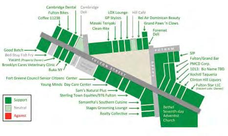
Accessibility
▶ Liberating public space
The urban centre/high street lacked a true public space such as a plaza and there was little opportunity for the local community to gather and meet.
Amenity & comfort > Scale
The public area has increased from 300m2 to 1,060m2 which allows a diverse range of uses to be considered being large enough to accomodate many of the existing community groups in the area involved in active pursuits.
Connectivity
Collaboration
▶ Collaborative partnership and funding
DOT NYC works with selected not-for-profit organizations to create neighbourhood plazas throughout the City to transform underused streets into vibrant, social public spaces.
Legibility
▶ Defining paths & edges
Paving changes help reinforce the transitions between different functions in the public realm and unite public territories.
Safety
▶ Pedestrian improvement
The oblique intersection with bus turning meant poor sight distances and road position for vehicles as well as compromising the safety of pedestrians.
▶ Transport & traffic relocation
An existing bus route was changed allowing the reclamation of roadway for public use adjacent to the traffic island and retail outlets giving patrons a generous and safer forecourt whilst consolidating and simplifying bus traffic movements
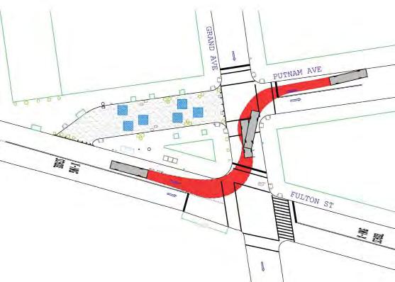
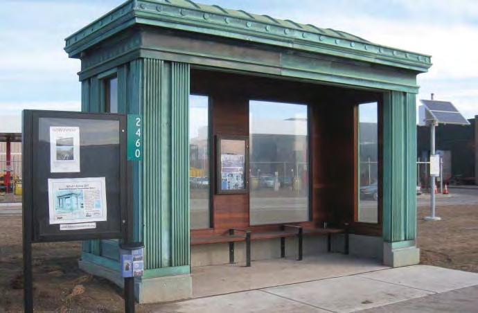
Amenity & comfort > Shelter
The consolidation of the bus routes allowed a shelter to be installed where previously patrons waited at a stop on a traffic island - they are now integrated with the public relm and provide an additional use profile.
Productivity
▶ Local business enhancement
Improved public space was seen as a driver for increasing local business activity.
Flexibility
▶ User specific furniture
After trialling the temporary installation seniors requested seating with arm rests and backs to be included in the future design.
Flexibility
▶ Interim project
In order to convince the local community, test the main ideas and leave space for refinement without significant upheaval a temporary interim stage was implemented.
Flexibility
▶ Flexible equipment
Furniture is lightweight and can be moved by the public depending on their needs.
Legibility
▶ Defining public territory
Planters and granite blocks created a border to an otherwise poorly contained residual open space.
Amenity & Comfort
▶ Tree planting & shade
In the second stage of the project new tree planting is proposed to improve permanent shade and offset the predominance of hard materials.
Programming
▶ Event Management & Coordination
Now that the space is officially ‘created’ local groups can apply to use the space for events through the citywide event & coordination management office.
Learning & engagement
▶ Community management of public space
Volunteers from local businesses maintain and clean the square, and put out tables and chairs each day.
Amenity & comfort
▶ Colour & Surface
The dark asphalt surface was replaced with a light gravel which brightens the area and unites the previously distinct public territories of the sidewalk and traffic island.
// Case Studies | 2726 | People in Public Places
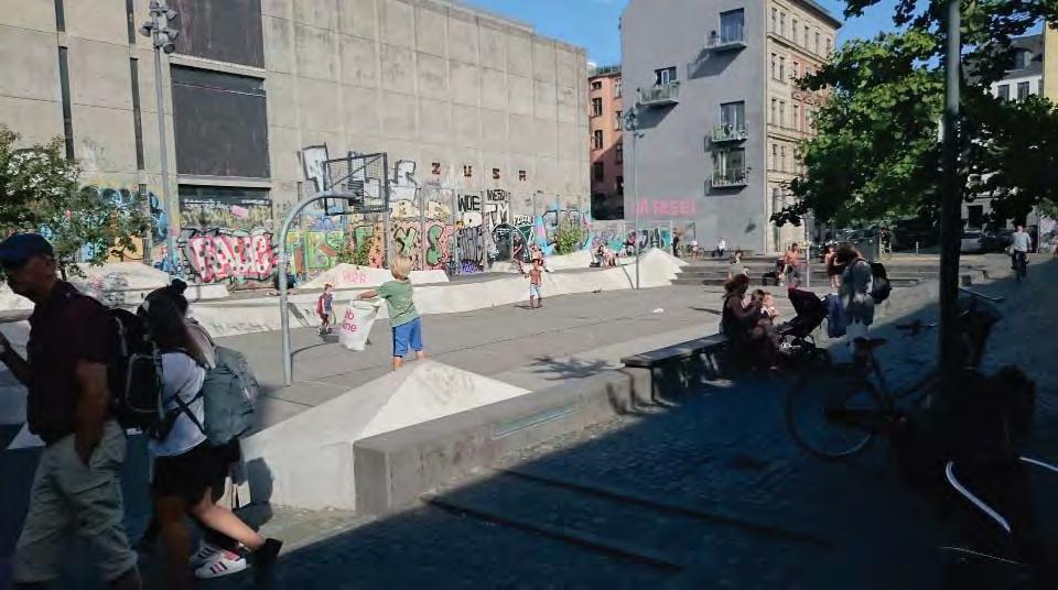
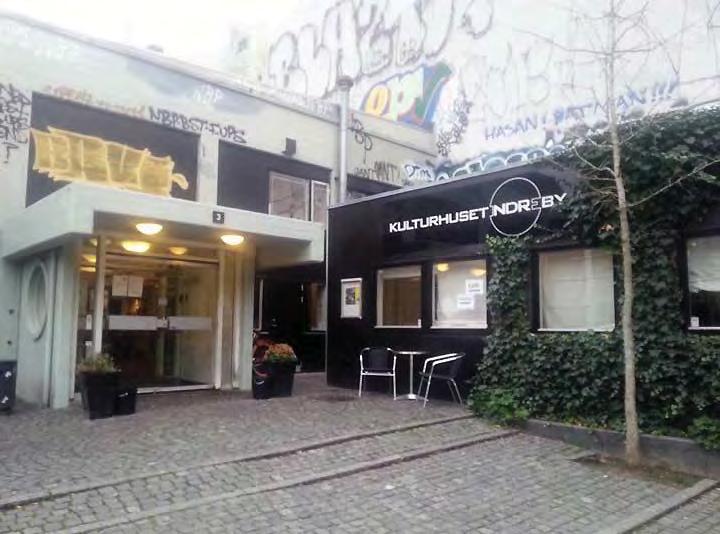
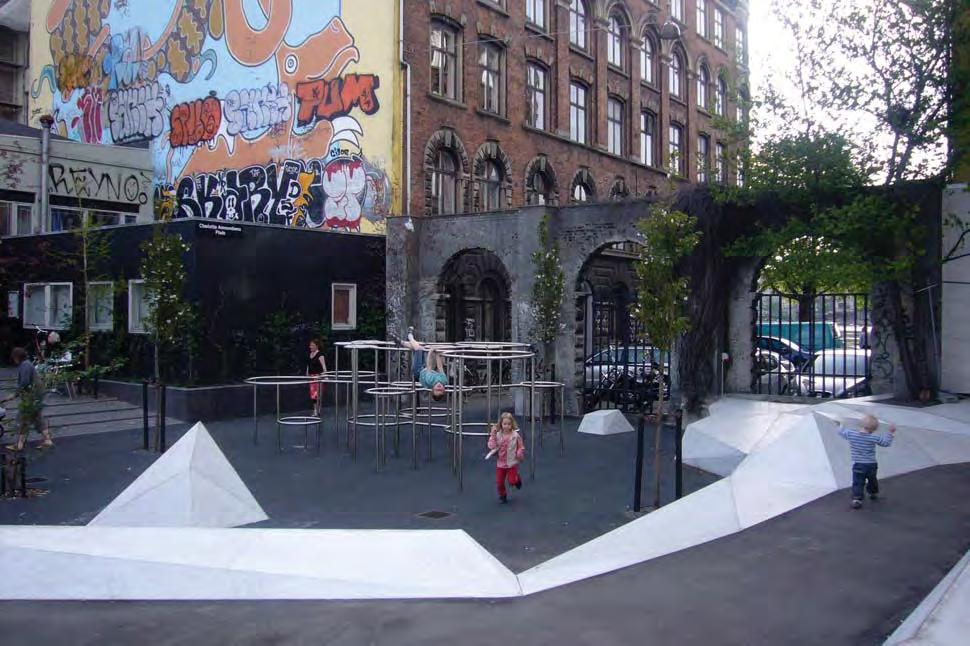
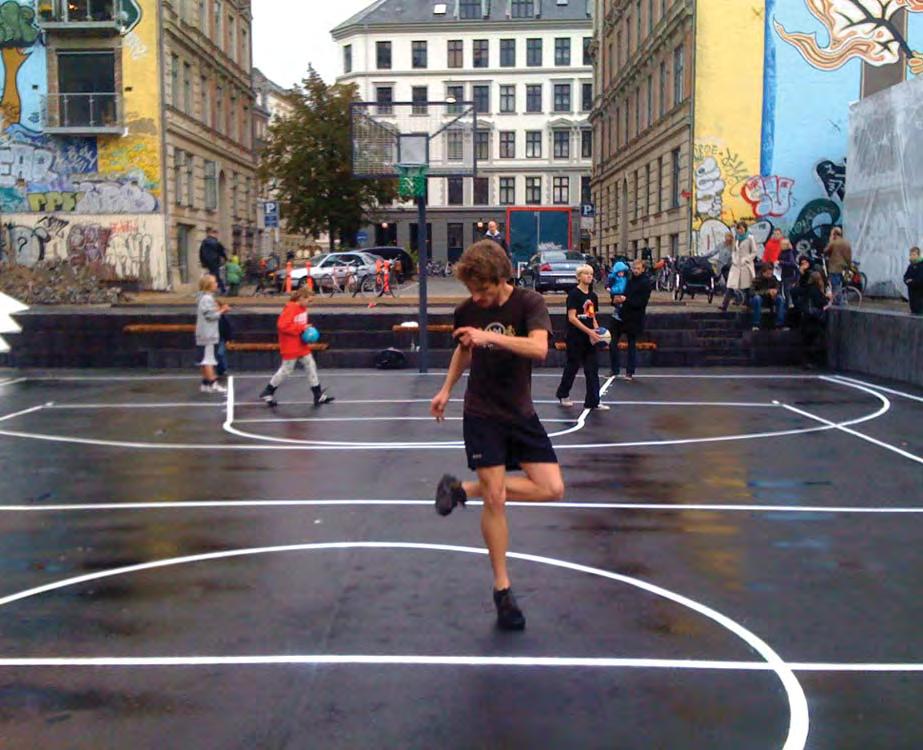
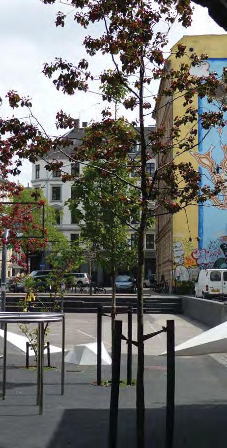
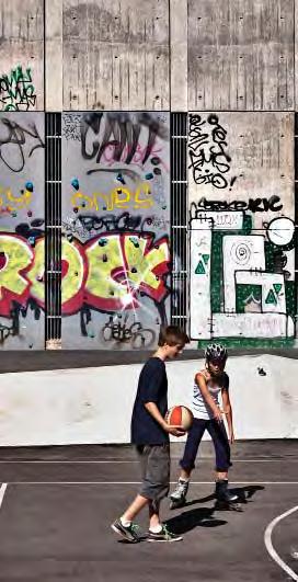
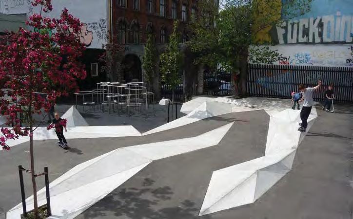
P3 Charlotte Ammundsens Square
Copenhagen, DK
Type: Urban Plaza
Context: City Centre
User Groups: families youth elderly social groups – small social groups - large
Ethnicity context: Danish (77%)
Non-western (15%)
Status: residents
IIn a fast growing city area a traditional square adjacent to a cultural centre which had been colonised by parked vehicles is reimagined to cater for the diverse population that surrounds it. The formerly passive public space is designed and reprogrammed to welcome different types of visitors and residents.
Social participation context: The adjacent cultural centre is used by a wide variety of inner city residents and social groups and also has a youth focus. How can a relatively small urban plaza accommodate a variety of different functions such as markets, hanging out and dance classes with different sized groups and age profiles?
Key Aspects:
NETWORKS & EXCHANGE
Collaboration
Productivity
Lear ning & Engagement
PROGRAMMING
Social & Cultural diversity
Health/ wellbeing & play
Accessibility
Flexibility
Amenity & Comfort
Connectivity
Legibility
Safety
Imageability
Complexity
URBAN STRUCTURE
URBAN CHARACTER
M
// Case Studies | 2928 | People in Public Places
55°41’1.25”N 12°33’49.98”E 1,700 m2 60m
Collaboration
▶ Local community based organisation
The square is immediately adjacent to an existing cultural centre and can augment the existing social and cultural functioning of this location in the city.
Accessibility
▶ Liberating public space
Previously the square was used for parking vehicles and now they are excluded.
Learning & engagement
▶ Community management of public space
Programming
▶ Tradition informing use
Elements of a traditional urban typology – the Copenhagen Square informed the design.
Safety
▶ Colocation
The cultural centre and its cafe directly open onto the square and can ensure the park is active as well as provide passive surveillance.
The adjacent community centre manages the space as part of its overall business operation.
Legibility
▶ Form
The square retains an overall legible form and some traditional elements whilst low scale interventions provide a secondary level of organisation and intrigue.
Connectivity
▶ Maintain through routes for pedestrians
Wide steps allow pedestrians to navigate in a direct fashion between the two street levels at either end of the square without upsetting the place function.
Programming
▶ Civic/Arts anchor
The existing civic and arts function of the community centre can open out into the square.
Complexity
▶ Diversity of type
The square provides traditional elements such as paved courtyards and benches for conventional uses whuich seniors appreciate but which can also be adapted to a variety of uses.
Safety
▶ Openness and sightlines
The square maintains visibility and sightlines by keeping built elements to a low scale.
Programming
▶ Recreational & sporting infrastructure
A sunken surface allows multiple courts for sports use favoured by youth and is collocated with junior play equipment however the scale of the level court surfaces allows larger groups to congergate for a range of active and passive functions such as dancing classes.
Flexibility
▶ Multiple aspect seating
Peripheral benches allow users to orient to the square or the court and can be used for spectating or relaxing.
Accessibility
▶ Integrated universal access design
The sunken playing surface can be reached by a ramp which is integrated into the ‘cliff’ architecture.
Programming
▶ Indeterminate use
An ‘urban cliff’ wanders through the square and provides a dynamic and adaptable surface which can be adapted for a range of youth activities.
Amenity & comfort
▶ Tree planting & shade
Additional tree planting is used to provide seasonal colour, shade and to generally soften a highly urban environment.
Imageability
▶ Community identification in built elements
Blank walls are utilised by local artists to create a continuously changing colourful backdrop.
// Case Studies | 3130 | People in Public Places
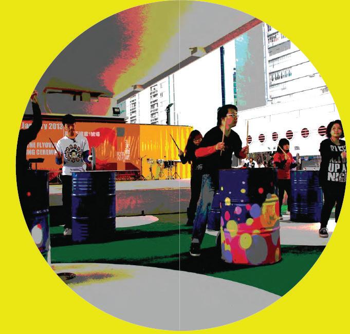
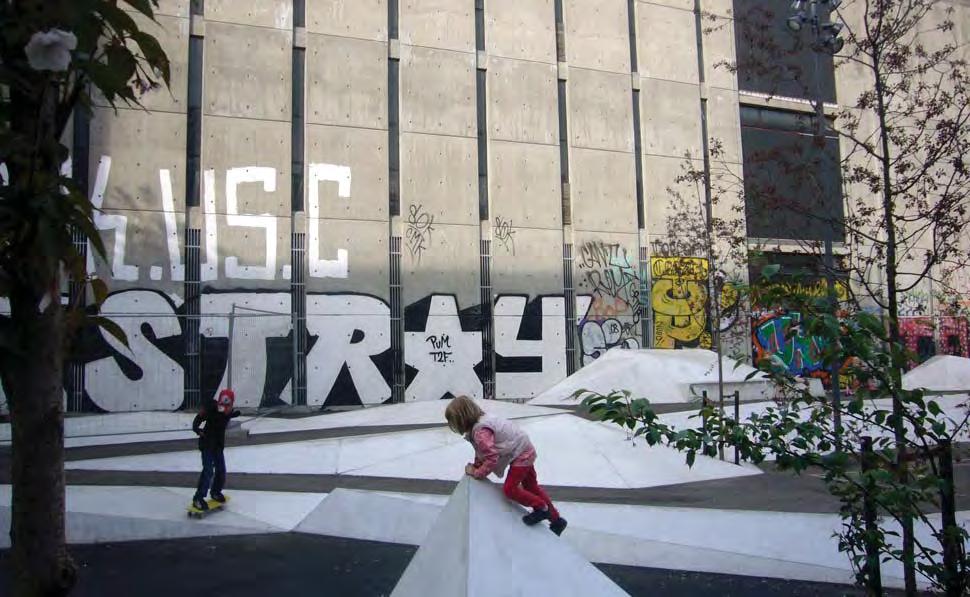
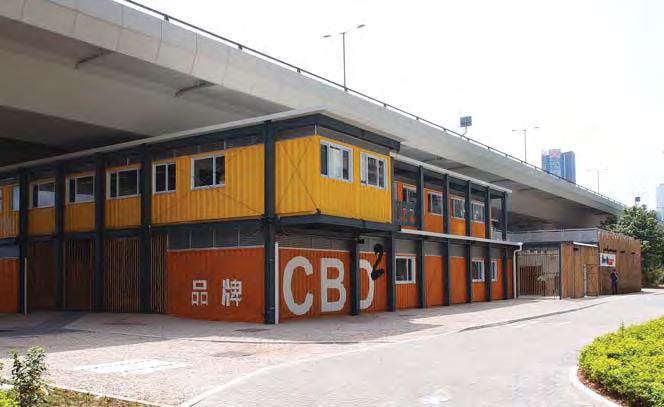
P4 Fly the Flyover
Kwun Tong, HK
Type: Urban Plaza
Context: CBD – infrastructure
User Groups: families youth individuals
Ethnicity context: Chinese HK (97%)
Status: residents workers new workers
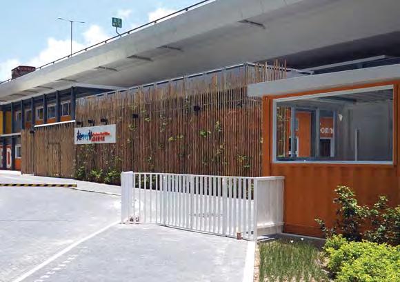
Kowloon East was once a dense manufacturing hub. When large parts of this industry moved to the mainland the result was a remnant fabric of industrial buildings and transport infrastructure. The area is however planned to become a second CBD. EKEO was established to mediate between the policy interests of government and the public interests of the area to help ‘kick-off’ the public realm necessary to support this transition. Fly the flyover was a scheme to try and make use of ‘redundant’ space underneath an elevated expressway.
Social participation context: The area is very high density and has a history of working class occupation and dwelling but is now earmarked for transition to a modern business district. How can the existing long term residents be brought along during the transition and avoid the development of an ‘us’ and ‘them’ community?
NETWORKS & EXCHANGE Collaboration Productivity Learning & Engagement
Aspects: PROGRAMMING Social & Cultural diversity Health/ wellbeing & play URBAN STRUCTURE Accessibility Flexibility Amenity & Comfort Connectivity Legibility Safety URBAN CHARACTER Imageability Complexity M
Key
22°18’41.85”N 114°13’4.74”E
// Case Studies | 3332 | People in Public Places
5,900 m2
170m
Collaboration
▶ Local community based organisation
EKEO established a local office, and was locally branded and focussed, despite having the resources of a government office, and was set up with the specific goal of tapping into and foregrounding the existing and yet unrecognised strong community networks in the area.
Learning & Engagement
▶ Community involvement in vision setting
Prior to any formal plans or projects community members were engaged in workshops to help develop a vision for the waterfront area and understand what all of the constraints and opportunities may be.
Programming
▶ Removing space restrictions
Traditionally the areas under the bridge were fenced off and subject to a number of restrictions on use. Through the mediation and consultation process EKEO was able to align interests and broker agreements to test removal of these barriers.

Accessibility
▶ Liberating public space
Previously access to the area was simply restricted by security fencing. This has been removed.
Amenity & Comfort
▶ Weather Protection
The flyover provides a ‘natural’ canopy and allows a range of events to take place protected from the elements.
Safety
▶ Colocation
The office of EKEO is situated at one of the project which allows passive surveillance of the space in a continuous manner.
Amenity & Comfort
Productivity
▶ Community enterprise
Local community groups have the ability to program the space, to exhibit and promote their activities and skills through the colocated office of EKEO.
Legibility
▶ Defining public territory
New paving, paths, surfacing and landmark structures clearly claim and signify the territory under and adjacent to the flyover as public realm.
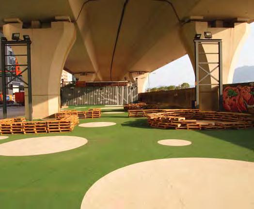
▶ Scale
The height and dimensions of the flyover provide a large volume, of cathedral like proportions, which can be itself an uplifting and special experience.
Connectivity
▶ Public space to overcome infrastructure barrier
The project has opened up a previously ‘forbidden’ territory which acts as a stepping stone to realising the vast potential of the abandoned waterfront as a defining feature of the future public realm.
Connectivity
▶ Integrated public connections
The path networks and public space connect directly to the local street network and integrate the space physically with the local community allowing pedestrian access.
Programming
▶ Indeterminate use
Flexibility
▶ Flexible equipment
A range of furniture and ‘props’ are provided which can be moved to facilitate a variety of events and uses and can be managed and storedby the local EKEO office.
Rather than a predetermined use the large volume under the flyover was designed to be able to stage a diverse range of community events and installations.
Safety
▶ Infrastructure for non-essential activities
A variety of activities can now take place on the site involving a wide range of users which creates a positive perception and passive surveillance.
// Case Studies | 3534 | People in Public Places
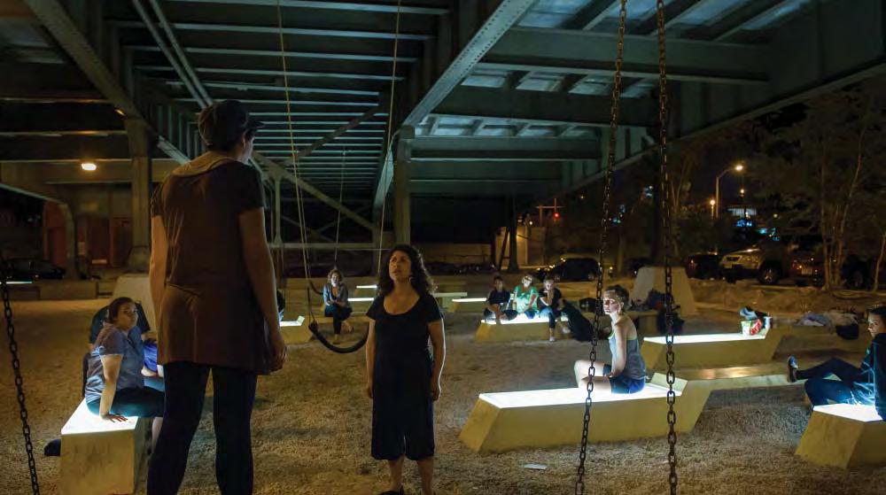
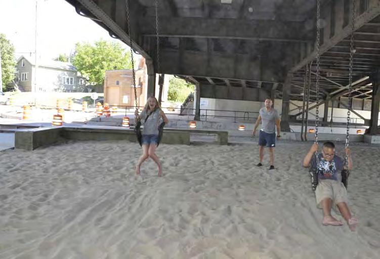
P5 Marsupial Bridge
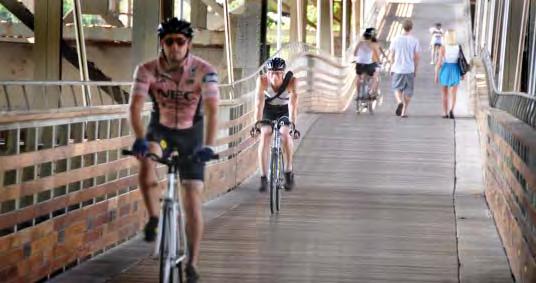
Milwaukee, WI
Type: Urban Plaza
Context: District Centre – infrastructure
User Groups: families social groups – small cyclists
Ethnicity context: European (Polish, German, Italian) White
Status: residents residents - new long-term migrants local business
Key Aspects: M
Marsupial Bridge is a project which seeks to connect communities and provide a unifying element for non-motorised traffic. Typically areas beneath infrastructure have been abandoned or avoided however this project looks to adapt the positive aspects of such places. It draws on the cultural and social diversity of the adjacent Brady Street neighbourhood which is one of the city’s best known and surviving ethnic commercial strips.
Social participation context: The bridge provides a link to the historical Brady Street high street precinct from the new neighbourhoods to the north and is in that sense a device to broaden the social and cultural base of this popular area. The project is a ‘hinge’ between these areas and defines a new civic relationship. How does a project which is all about linear connectivity manage this transition, being more than just a path, and provide an asset in this ‘vague terrain’ for the public life of both communities?
NETWORKS & EXCHANGE Collaboration Productivity Learning & Engagement PROGRAMMING Social & Cultural diversity Health/ wellbeing & play URBAN STRUCTURE Accessibility Flexibility
& Comfort Connectivity Legibility Safety URBAN CHARACTER Imageability Complexity
Amenity
3’13.35”N
43°
87°54’11.95”W 2,800 m2 230m
// Case Studies | 3736 | People in Public Places
Brady Street
Collaboration
▶ Community led project
The project responds to needs identified by communities on the opposite side of the river to the Brady Street Improvement District.
Produtivity
▶ Local business enhancement
The new connection across the river offers new customers to the Brady Street commercial area.
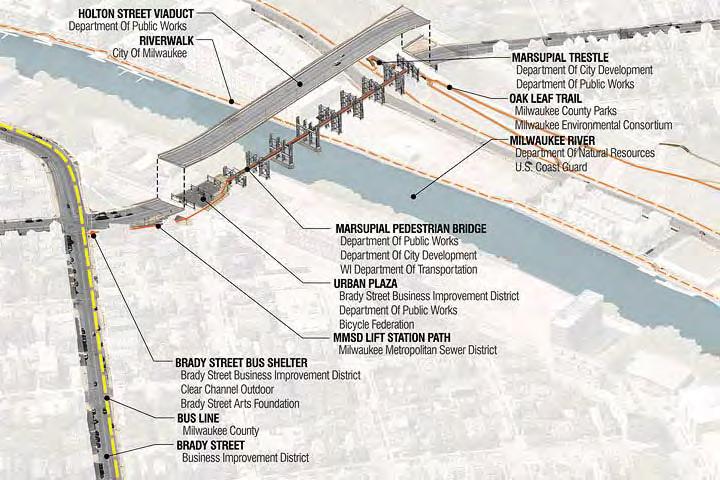
Collaboration
▶ Collaborative partnership and funding
The project works across and with a host of partners including the local arts foundation, local business and Milwaukee Bicycle Federation as well as city, state and federal bodies.
Imageability
▶ Thematically Integrating surrounding uses
The sewer lift station forms a feature of the access path whereas the bridge and plaza utilise the viaduct structure as a ‘host’.
Connectivity
▶ Integrated public connections
Amenity & comfort
▶ Scale
The lofty area under the bridge is adapted to provide a generously scaled covered public realm.
The project stitches together a number of existing and new connections between neighbourhoods, streets and public amenities such as the Milwaukee River walk and Oak Leaf trail.
Connectivity
▶ Public space to overcome infrastructure barrier
The urban plaza provides a place for people to stop and rest or gather which provides activity in a relatively uninhabited area and breaks the long path.
Programming
▶ Indeterminate use
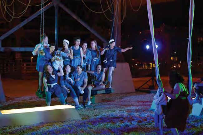
Local community members have appropriated the space for a variety of personal and public events such as film screenings, weddings and plays. Its peripheral character suits more minority and experimental programmes.
Amenity & comfort
▶ Weather protection
The bus shelter and bridge deck provide protection from the weather for both stationary and active users
Accessibility
▶ Streetscape improvements
A uniquely designed bus shelter sets a new quality standard for street furniture and defines the corner of the commercial district.
Legibility
▶ Defining paths & edges
Honed concrete surfacing is a unifying element of the shelter, pathways, ramps and landings.
Learning & engagement
▶ Interpretive content
The bus shelter also acts a specially designed information stand which can be used for project and community information.
Imageability
▶ Familiar materiality & Form
The new bus shelter design was based on the traditional shelters across the city which are distinctive and offer protection from the elements.
// Case Studies | 3938 | People in Public Places
Safety
▶ Infrastructure for non-essential activities
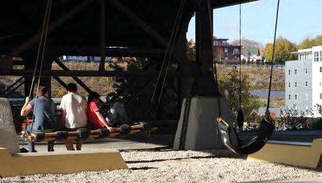
The swings create room for playful occupation of the space and encourage a variety of users to incidentally occupy the plaza.
Programming
▶ Indeterminate use
The urban plaza component occupies the protected territory under the bridge and provides a basic framework of benches and lighting to support multiple uses.
Legibility
▶ Integrated lighting
Lighting is integrated into the structure at close intervals to avoid high contrast environments and ensure the public areas are visible from a variety of locations and distances.
Connectivity
Accessibility
▶ Formalise paths
A number of informal routes in the semi-industrial location have been formalised and enhanced as part of the overall project.
▶ Maintain through routes for pedestrians
The project maintains and extends the bridge crossing for pedestrians to join into the commercial area and connect the neighbourhoods.
Flexibility
▶ Multiple aspect seating
Benches can be used for a variety of seating arrangements and user group sizes. Their variable spacing, lighting and indeterminate orientation make them highly adaptable for performance and play.
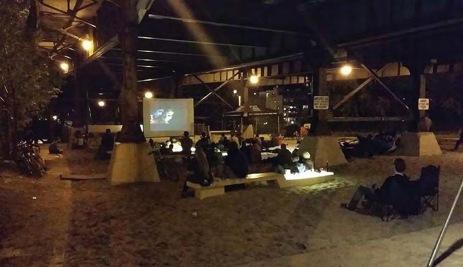
Programming
▶ Recreational & sporting infrastructure
Local artists installed swings in the plaza to take advantage of the large void and these have been formalised by the local authority.
Legibility
▶ Defining public territory
A crushed gravel (non-trafficable) surface to the plaza clearly demarcates a public area for non-traffic activities and is inviting for children and others as a play surface.
Amenity & comfort
Programming
▶ Active transport management
The project is deliberately aimed at improving cycling conditions through the dimensions of the pathways and has been adopted by bicycle users as a meeting place.
▶ Use of natural materials
The bridge deck , railing and bus shelter use wood to humanise the pedestrian and cyclist environment and offset the grand but imposing industrial context.
Safety
▶ Openness and sightline
Low height furniture, semi-transparent railings and a straight, gradual path alignment ensure that sightlines along the length of the pathway and across the plaza are preserved.
// Case Studies | 4140 | People in Public Places
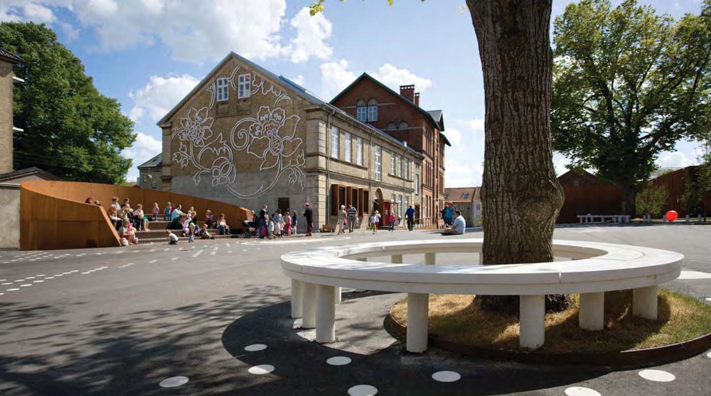
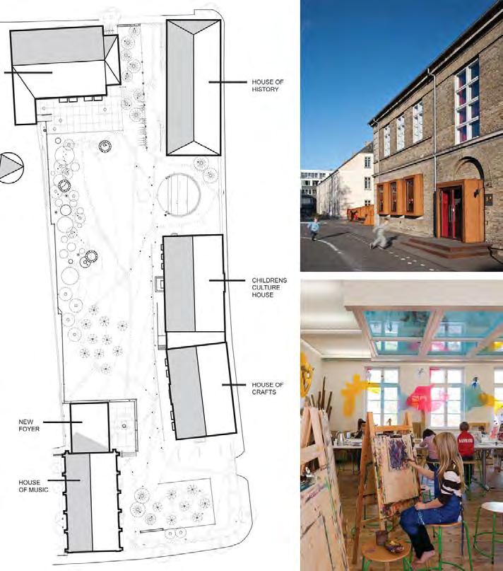
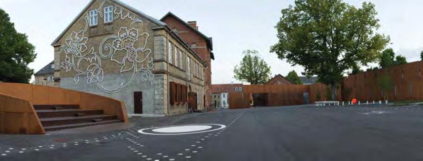
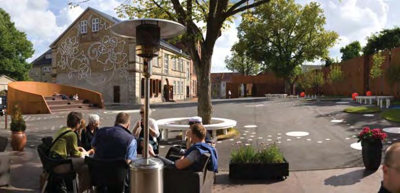
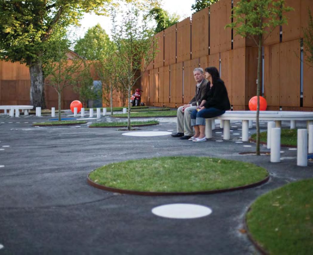
P6 Nicolai Cultural Centre
Courtyard
Kolding, DK
Type: Urban Plaza Context: City Centre
User Groups: families children social groups – small social groups - large
Ethnicity context: Danish (88%)
Non-European (5%)
Status: visitor/tourist residents local business
This urban plaza project is located directly in the city centre and is framed by a number of historical buildings. The challenge for this project was to repurpose a surface car park and create a Cultural Centre which accommodates and weaves together a variety of different uses and user types as well as create a coherent public realm.
Social participation context:
The public space for this project is framed by a number of cultural uses which support different programmes and age groups. Children feature heavily and the centre serves a regional population base. How can the public realm be designed to respond to its rich heritage, accommodate the day to day needs of the children and other uses and users and still provide a gathering place for up to 1000 people for regional events?
Key Aspects:
Collaboration
Productivity
Learning & Engagement PROGRAMMING
Social & Cultural diversity
Health/ wellbeing & play
Accessibility
Flexibility
Amenity & Comfort
Connectivity
Legibility
Imageability Complexity
NETWORKS & EXCHANGE
URBAN STRUCTURE
Safety URBAN CHARACTER
M
m2
m // Case Studies | 4342 | People in Public Places
55°29’28.08”N 9°28’16.08”E 3,800
70
Collaboration
▶ Collaborative partnership and funding
The project was partly sponsored by RealDania who are a member-based philanthropic organization that supports social objectives of projects in the built environment which placed the social agenda very much in the foreground of the design process.

Learning & engagement
▶ Learning centre incorporated into project
The House of children’s culture is supported by the LOA foundation and is an open program were the children of Kolding can do different cultural activities, drama, theatre, dance and movement in the different workshops
Programming
▶ Civic/Arts anchor
There are five civic buildings/functions framing the square and one is available for arts residencies and as a general studio tenancy for local artists. The civic nature consolidates activity and avoids the risk on over dependency on commercial enterpriises.
Collaboration
▶ Collaborative partnership and funding
The project was also sponsored by the Danish Foundation for Culture & Sports facilities which seeks innovation in relation to the design and planning of culture and sports facilities that is rooted in changes and new patterns in everyday life. This further enhanced and diversified the social ambitions of the proect.
Programming
▶ Tradition informing use
The site was originally a group of school buildings and the themes of the schoolyard, learning and occupation by children have been incorporated into the different functions.
Productivity
▶ Community enterprise
The Cinema House is occupied by a not for profit art cinema with an accompanying café which contributes to a consistent use profile.
Programming
▶ Indeterminate use
The large courtyard is relatively free of permanent fixtures and can be adapted to a range of large scale activities and uses.
Flexibility
▶ Diversity of Occupation
The large open aspect with well spaced furniture allows different users and functions within the space to congregate and interact.
Amenity & comfort
▶ Scale
The sense of generous scale of the courtyard is preserved and reinforced by a lack of clutter and a continuous surface treatment.
Legibility
▶ Form
The territory is mostly orthogonal and easily understood through uniting of different elements, consistent surfacing and the placement of thresholds and gateways at the most public locations.
Amenity & comfort
▶ Tree planting & shade
Tree planting has been grouped to soften the repetitive elements and existing trees have been carefully preserved and integrated into the buildings.
Legibility
▶ Defining paths & edges
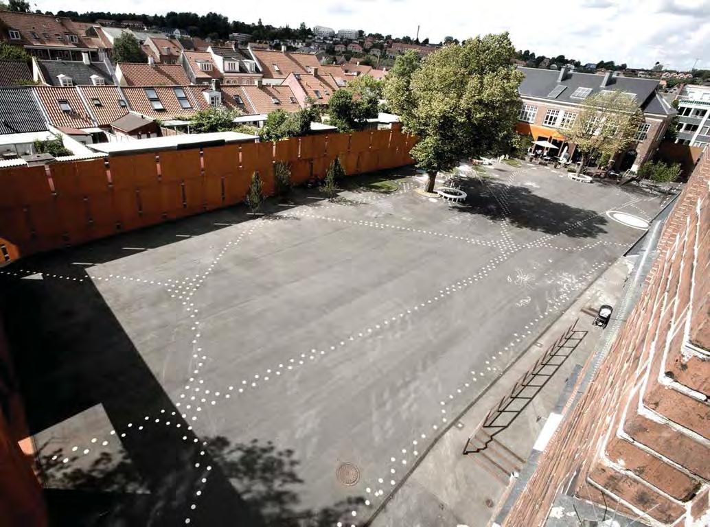
A high steel wall clearly defines, contains the public realm running along what was previously a poorly defined section of the perimeter.
Complexity
▶ Richness & Intrigue
Patterned surfaces are used to overcome the potential monotony of the asphalt surface and suggest a sequence of movement without obstruction.
// Case Studies | 4544 | People in Public Places
Accessibility
▶ Liberating public space
The courtyard had been used for parking and vehicle access however the decision to create a public territory excluded traffic.
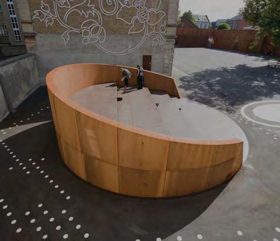
Complexity
▶ Diversity of Type
Whilst the overall ‘schoolyard’ is open subtle variations allow the creation of different’rooms’ for both traditional and inventive use allowing different sized groups and functions to inhabit the area without comprimising larger gatherings.
Safety
Safety
▶ Repetitive use elements
The café, theatre and other perimeter functions provide a routine programme which ensures consistent and varied use profiles.
▶ Maximum adaptability of ground floor
Ground floor openings of the surrounding civic buildings have been redesigned to address the courtyard in key locations to ensure a regular pattern of surveillance and interaction on the public space perimeter.
Accessibility
▶ Universal access design
All of the public realm and buildings are wheelchair accessible and the smooth, level surface of the courtyard is easily negotiated by different users.
Imageability
▶ Repurposing historic structures
The old school buildings have been repurposed for civic functions and the ‘schoolyard’ has been reinstated for play and a range of activities.
Programming
▶ Concerts and Events
The combination and concentration of different civic uses combined with the multi-functionality and scale of the open space allows a diverse range of events to take place.
Imageability
▶ Familiar materiality & Form
The new elements have colours and forms which are sympathetic to the brickwork grounding the design in the local context and encouraging an adoption of the new elements by the existing community.
Connectivity
▶ Integrated public connections
The courtyard provides a pedestrian connection between two perimeter streets whilst the public buildings provide a permeability across their ground floors to integrate the street and open space and avoid an exclusive realm.
Safety
▶ Openness and sightlines
The courtyard is open and space transitions are dealt with in subtle ways through surfacing patterns, trees, voids in structures and low height furniture which maintains sightlines.
// Case Studies | 4746 | People in Public Places
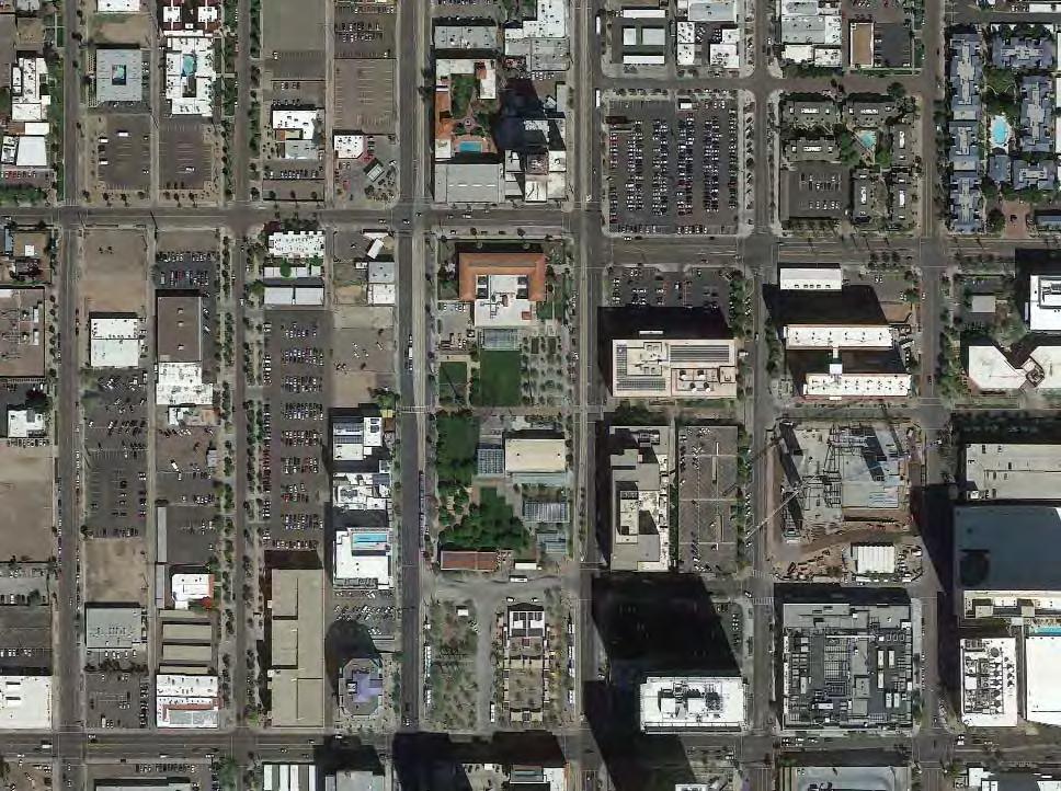
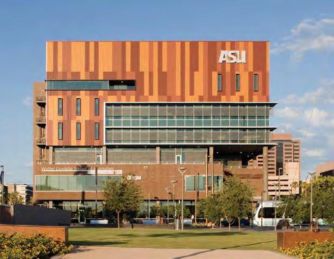
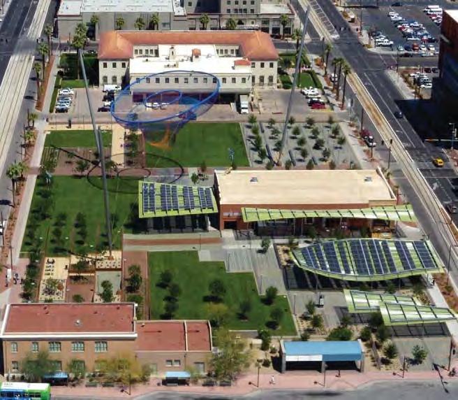
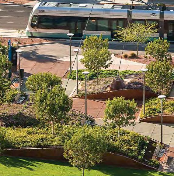
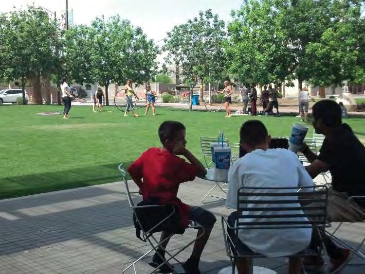
P7 Civic Space
Phoenix, AZ
Type: Urban Plaza Context: CBD
User Groups: all
Ethnicity context: White (66%)
*Hispanic (41%)
African American (6.5%)
Asian (3.2%)
Status: visitor/tourists residents – low income students commercial business
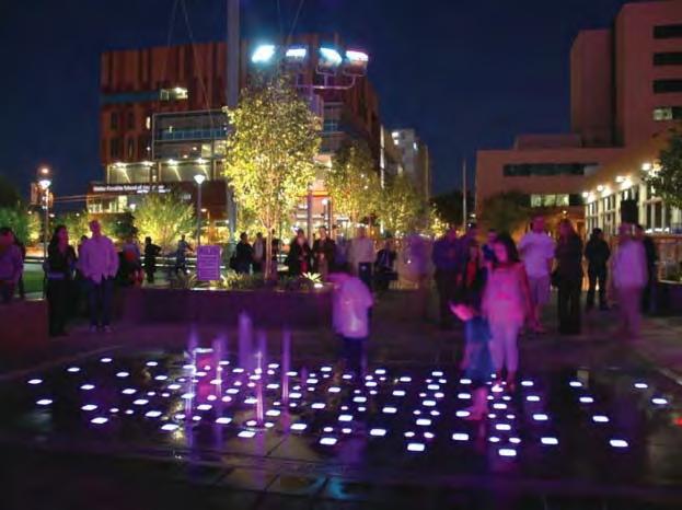
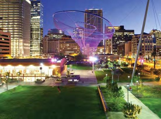
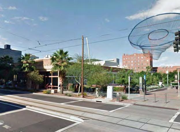
Civic Space Park is nestled in the heart of downtown Phoenix, Arizona . This park, developed in partnership between the City of Phoenix and Arizona State University, brings to the surrounding downtown community a vibrant mix of storefront and respite environment. The park concept weaves together an urban fabric. Various programmable spaces meet the needs of a wide variety of ages and user profiles. Seventy percent of the site will ultimately be shaded with trees and unique undulating shade structures. The park is exclusively for pedestrian use, and it is adjacent to the Central Station Transit Centre.
Social participation context:
Civic Space Park occupies a social nexus in the downtown area. The perimeters are variously occupied by university students, transit patrons, boarding houses and institutional buildings and its central location and scale means a regional civic role. The challenge is for the park to provide a united place with enough flexibility to adapt to its varying functions and mix the passive and active recreation demands of different ages.
Key Aspects:
Collaboration
Productivity
Accessibility
Flexibility
Connectivity
Legibility
Imageability
Complexity
*Note: Hispanic is identi fi ed as a separate ethnicity category in the US census, and may also identify as white in the race category. Hence proportions reported here may exceed 100%.
NETWORKS & EXCHANGE
Learning & Engagement PROGRAMMING
Social & Cultural diversity
STRUCTURE
Health/ wellbeing & play URBAN
Amenity & Comfort
Safety URBAN CHARACTER
L
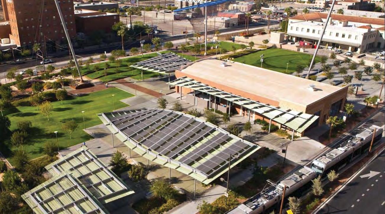
4’26.56”W
230 m
// Case Studies | 4948 | People in Public Places
33°27’12.37”N 112°
21,500 m2
ASU
Collaboration
▶ Collaborative partnership and funding
The University of Arizona saw benefits to its downtown campus profile and functionality in a new public space in this location and partnered with the City of Phoenix local authority
Cultural diversity
▶ Civic/Arts anchor
The project is bounded by tertiary education establishments, a transit hub and a YMCA – the existing building on site was re-purposed for exhibitions and community use.
Collaboration
▶ Collaborative partnership and funding
The project was financed using bonds issued by the city and approved by constituents which gave a wide sense of ownership.
Safety
▶ Colocation
The university and other adjacent functions such as the YMCA gymnasium provide a diverse and continuous user profile.
Accessibility
▶ Liberating public space
Previously the majority of the site was in private ownership and used for parking vehicles, the city acquired the land for public purposes.
Collaboration
▶ Citizen involvement in design process
Community groups were thoroughly engaged in the vision setting process and a collaborative concept ‘the weave’ was generated.
Learning & Engagement
▶ Learning centre incorporated into project
Arizona State University Parks & Management students use the park as a learning laboratory which provides diversity to the use profile and gives adjacent functions an interest in the design and management of the space.
Productivity
▶ Digital Compatibility
The basement and gallery building provide free Wi-Fi which makes it a popular spot with students from the adjacent campus.
Productivity
▶ Retail strategy
A basement level tenancy provides opportunity to take advantage of the destination nature of the park.
Connectivity
▶ Transit connection
The project is directly adjacent to the Downtown Central Station and is bordered by light rail.
Complexity
▶ Diversity of type
A traditional peaceful shaded park area was incorporated into the design at the request of seniors who lived in the area.
// Case Studies | 5150 | People in Public Places
Programming
▶ Children’s attractions
A splash pad allows children to play in an unstructured fashion and is playfully illuminated so that it can be used at night.
Safety
▶ Openness and sightlines
Despite its expansive size the refined lightweight structures and gradual level changes maintain an open aspect and ensure the public realm is visually permeable.
Imageability
▶ Repurposing historic structures
A large 1920s showroom on the site was restored and upgraded to provide community functions. This provides an anchor to the public functioning of the park.
Legibility
▶ Defining paths & edges
The materiality and alignment of the adjacent Taylor Street pedestrian corridor is continued through the site integrating surrounding uses and movement networks particularly the university.
Connectivity
▶ Integrated public connections
The public and open terrain across an entire block acts as an urban connector between the fringing private, public and civic functions.
Accessibility
▶ Pedestrian prioritisation
Vehicles and parking are completely excluded from the park.
Amenity & comfort
▶ Tree planting & shade
Shade canopies and tree planting are critical elements in achieving comfort in the large open space in a desert climate. The spacing of the trees and their placement on the gentle ‘hills’ allows small social groups to form independent of one another.
Programming
▶ Concerts and Events
A stage was incorporated into the design to allow structured events and performances.
Programming
▶ Event Management & Coordination
The event programming is informed by community and focus group interviews and research and funded through a number of local downtown partners.
// Case Studies | 5352 | People in Public Places
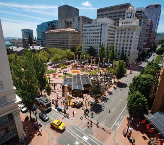
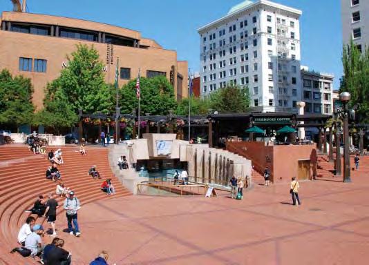
T1 Pioneer Courthouse Square
Portland, Oregon US
Type: Transit Context: CBD
User Groups: all
Ethnicity context: White (70%)
Hispanic (9%)
Asian (7%)
African American (6%)
Native American (1%)
Status: visitors/tourists transit patrons commercial business
Pioneer Courthouse Square was formerly a 2 storey parking garage located on a strategically significant site where surface transit routes intersected. It was transformed into a public square via a design competition in 1980 and has often been held up as an exemplar of transit integrated public realm design.
Social participation context: The downtown location and transit context mean that the space must accommodate the whole diversity of the City. Some users pass through for transfer, others congregate for formal and informal meetings whilst structured programming focusses on large gatherings. How does the spatial design of such a place respond to the diverse demands of social interaction?
Key Aspects:
NETWORKS & EXCHANGE
Collaboration
Productivity
Lear ning & Engagement
PROGRAMMING
Social & Cultural diversity
Health/ wellbeing & play URBAN
Accessibility
Flexibility
Amenity & Comfort
Connectivity
Legibility
Imageability
Complexity
STRUCTURE
Safety URBAN CHARACTER
M
m // Case Studies | 5554 | People in Public Places
45°31’7.10”N 122°40’47.40”W 5,300 m2 75
Collaboration
▶ Community led project Community members called Friends of Pioneer Square raised significant funds to keep the project developing in the face of institutional problems.
Collaboration
▶ Citizen involvement in design process
Extensive citizen involvement in concept development and design selection criteria to remove aesthetic and political bias.
Imageability
▶ Community identification in built elements
Programming
▶ Tradition informing use
The hotel which was originally on the site was once the city’s most popular meeting space.
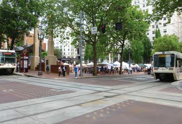
Community members who supported the project had their names engraved onto paving bricks and furniture which are used in the project.
Legibility
▶ Form
The square form of the block is easily understood and reinforced with built elements whilst opposing edges and corners are visible.
Connectivity
▶ Transit connection
The square sits at the crossroads of the downtown transit routes ensuring it is both convenient for a large variety of users and well activated.
Legibility
▶ Defining public territory
Trees, columns, planters, low walls, bollards and transit stops clearly demarcate the extent of the public realm without obstructing sightlines or restricting access and permeability.
Programming
▶ Civic/Arts anchor
The square is home to the downtown Visitor and Travel Information Centre, a Theatre and a studio which broadcasts daily TV news programmes.
Accessibility
▶ Integrated universal access design
The main plaza can be reached by the footpaths and a disabled ramp is integrated into the theatre steps rather than a separate element.
Programming
▶ Indeterminate use
Rather than a predetermined use the large level open area within the square allows a diverse range of community events, stalls and installations.
Safety
▶ Openness and sightlines
The square maintains visibility by recessing building functions and not installing structures which would obstruct sightlines.
Safety
▶ Repetitive use elements
Repetitive daily activities particularly around transit ensure that there is a continuous use profile and passive surveillance.
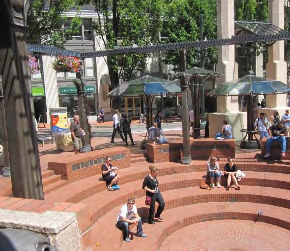
Flexibility
▶ Multiple aspect seating
Peripheral benches allow back to back seating giving visitors a choice to engage with either street or square depending on their prefernce.
Flexibility
▶ Diversity of Occupation
The wide arc of theatre steps allow many individuals and different sized groups to congregate in different locations preserving their privacy and providing them with choice over engagement.
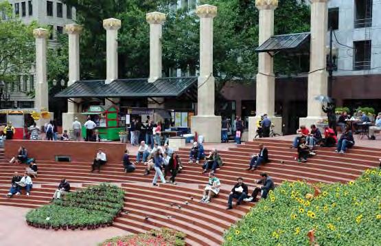
Imageability
▶ Familiar materiality & Form
Bricks, terracotta and neo-classical elements draw on the built heritage whilst providing inviting and familiar textures.
// Case Studies | 5756 | People in Public Places
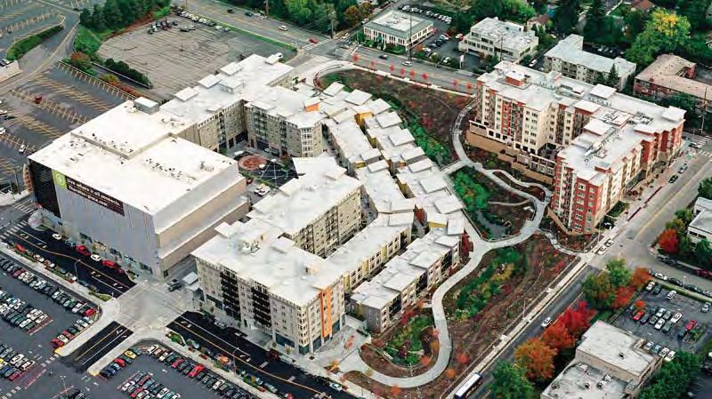
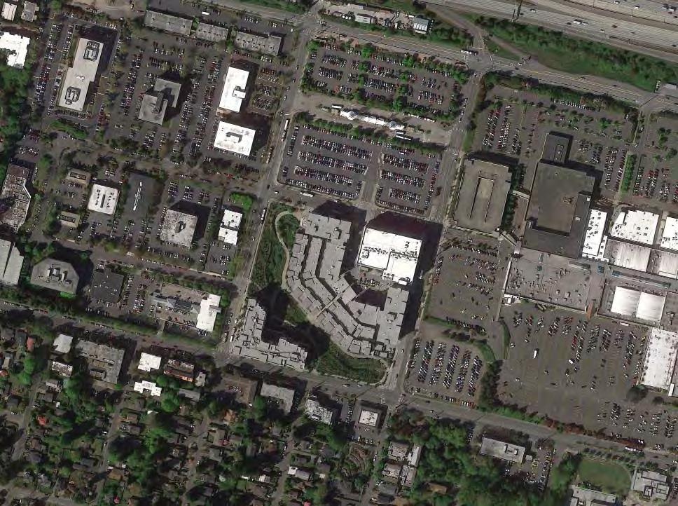
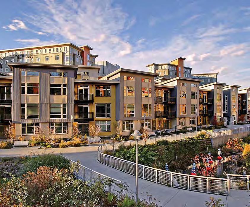
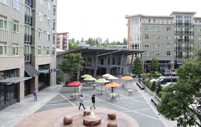
T2 Thornton Place
Seattle, WA
Type: Transit Context: Regional Centre
User Groups: families individuals
Ethnicity context: White (56%)
Hispanic (12%)
Black (3%)
Asian (24%)
Status: Residents
Key Aspects:
Local business Transit patrons NETWORKS
Collaboration
Productivity
Social & Cultural diversity
Thornton Place establishes a new paradigm for urban development in an area which has traditionally catered for commuter parking. The project establishes a high density mixed use environment but makes strong commitments to the public realm both for the use of the new residents immediately adjacent but also as an asset and amenity for the broader neighbourhood. It is a project which sets a benchmark for the transit oriented development pattern that this area will sustain in the future and places the public realm as an integral part of this.
Social Participation Context:
The population is ethnically diverse although within the context of a modern city. The project presents a new type of urban development within a broader transitional frame. How can the public realm contribute to the needs of the existing and future neighbourhood whilst providing for the new local residents and business visitors?
Accessibility
Flexibility
Amenity & Comfort
Connectivity
Legibility
Imageability Complexity
& EXCHANGE
Learning & Engagement PROGRAMMING
Health/ wellbeing & play URBAN STRUCTURE
Safety URBAN CHARACTER
M
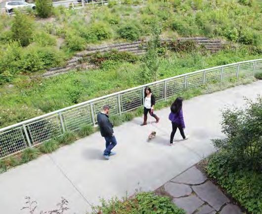
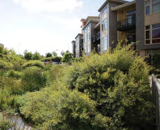
// Case Studies | 5958 | People in Public Places
47°42’8.85”N 122°19’29.25”W 32,000 m2 180 m
Learning & Engagement
▶ Community involvement in vision setting
A public open day and online survey for the broader neighbourhood helped identify the key constraints to retrofitting an automobile dominated neighbourhood and establish local values for a new urban centre.
Programming
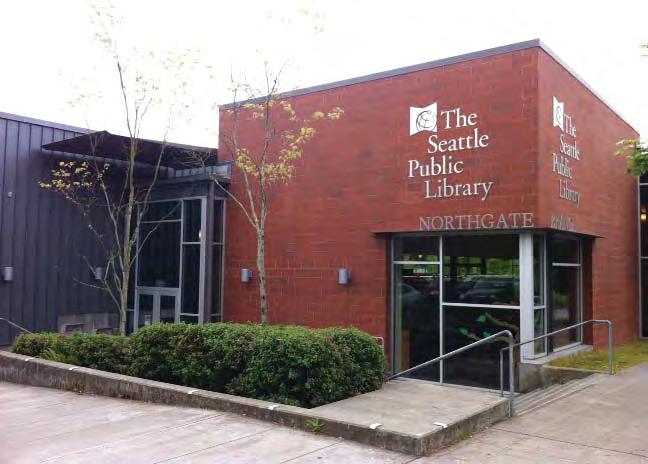
▶ Civic/Arts anchor
A new library and community centre have been constructed in the vicinity within walking distance of Thornton Place with a street frontage to establish a new form of pedestrian oriented urbanism in the neighbourhood.
Connectivity
▶ Public open space network structure
The public areas form part of a broader open space network which has been established for the whole precinct.
Complexity
▶ Diversity of experience
The project incorporates a range of public realm typologies such as formal retail plaza, internal streets, mews and creekside paths.
Legibility
▶ Logical and human scaled public realm
The block dimension of 200m was broken down into smaller parts with public access to create a more pedestrian scaled fabric.
Connectivity
▶ Integrated public connections
The large open space along the creek extends to the borders of the project integrating with existing and future public pedestrian movement networks. This ensures that this part of the site remains truly public.
Connectivity
▶ Transport & traffic relocation
Surface park-and-ride parking spaces have been integrated into a parking structure which reciprocates with the evening and weekend demand patterns of a cinema complex.
Accessibility
▶ Liberating public space
The project has chosen to open a new public green link along the creek line rather than a completely internal semi-public perimeter block arrangement.
Flexibility
▶ Diversity of Occupation
The public pathway along the creek is wide enough to accommodate a range of both active and passive use profiles.
Amenity & comfort
▶ Tree planting & shade
Safety
▶ Colocation
A cinema complex and ground floor retail address the internal street providing a continuous ground level use profile within the block.
Imageability
▶ Natural features and landmarks
The culverted Thronton Creek which is an important Salmon stream has been reimagined as a natural feature which is clearly distinctive in the urban context.
The natural environment of the creek provides a restful outlook for contemplative behaviours.
// Case Studies | 6160 | People in Public Places
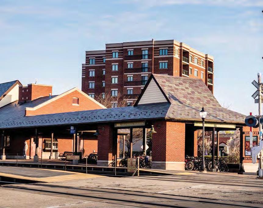
T3 Arlington Heights Village
Arlington, IL
LType: Transit
Context: Regional Centre
User Groups: families individuals elderly social groups – small social groups - large
Ethnicity context: US white (88%)
Status: residents workers local business transit patrons
Arlington Heights was a peripheral village NW of Chicago which became a commuter suburb in the 1970s. Following some isolated downtown redevelopment in the 1980s the relocation and upgrade of the Metra commuter rail station to more closely coincide with the downtown area precipitated coordinated TOD efforts. A significant early challenge was to overcome the dangerous arrangement and barrier effect of the parallel at-grade rail, carpark and highway infrastructure for pedestrians.
Social participation context: Arlington heights is a typical North American urban centre for a large suburban catchment – overrun with asphalt and vehicular priority. The demographics are relatively homogenous and oriented toward white middle class families. With all that said these commuter nodes are attempting to transition into activity centres to try and provide a variety of experiences and business opportunities and cater for an emerging demographic of ‘non-traditional’ households and modern enterprise.
Key Aspects:
NETWORKS & EXCHANGE Collaboration Productivity Learning & Engagement PROGRAMMING Social & Cultural diversity Health/ wellbeing & play URBAN STRUCTURE Accessibility Flexibility Amenity & Comfort Connectivity Legibility Safety URBAN CHARACTER Imageability Complexity
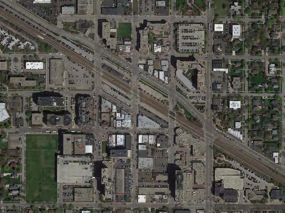
42° 5’2.62”N 87°58’57.68”W
// Case Studies | 6362 | People in Public Places
23.2 Ha
500 m
Collaboration
▶ Local community based organisation
The project was directed by a specially commissioned Task Force comprised of members from the Village Board (council), plan commission, design commission, economic alliance, chamber of commerce, downtown business association, downtown business owners, and residents.
Connectivity
▶ Public space to overcome infrastructure barrier
Improved connectivity between the north and south sides of the new station area, was achieved by creating a public park adjacent to the station to break up the journey across the parallel railway and highway ‘obstacles’ and also introduce a pleasant forecourt to the station area. This staged crossing is particularly important for elderly and any users who may struggle with negotiating complex crossings.
Collaboration
▶ Planning & Design community & stakeholder charrettes
Design charettes and workshops have been used to involve stakeholders including the local community in the planning and preliminary urban design process.
Learning & engagement
▶ Community involvement in vision setting
In a 2 year period during the development of the masterplan the Task Force held 31 public meetings to to gather input, identify issues, formulate recommendations and define the vision and objectives for future development downtown.
Connectivity
▶ Transport & traffic relocation
Learning & engagement
▶ Community involvement in vision setting
Development of a steering committee including community members to review the performance of other TODs and improvement of downtown areas.
The train station was relocated west such that the access movements and pedestrian flows coincide more closely and integrate with the downtown precinct improving the leginilityof the downtown area.
Legibility
▶ Legible town centre
Overall streetscape improvements and a park/plaza on one of the quadrants of the central crossroads builds on the opportunity afforded by the traditional street grid pattern to establish a legible town centre character.
Amenity & comfort
▶ Widened footpaths and parked car buffer
Widened footpaths allow a more relaxed pedestrian experience, whilst parked cars provide an additional buffer to the street.
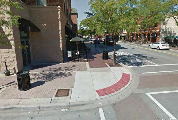
Accessibility
▶ Reduce intersection/ carriageway dimensions
Reductions in turning radii, improved signage, tactile paving, traversable kerb edges and surface changes on the carriageway provide accessible and legible pedestrian environment
Amenity & comfort
▶ Integrated street furniture design
Street furniture such as benches lighting and bins are generously distributed, and provide opportunities for resting and support non-essential activity.
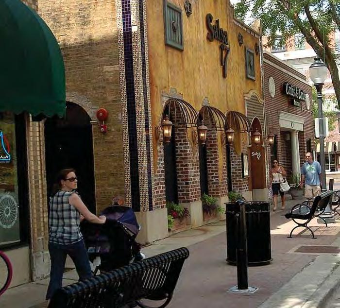
Accessibility
▶ Streetscape improvements
A streetscape program has been implemented with site furnishings, widened footpaths, delineated street parking, high quality and locally appropriate paving materials and continuous ground level storefronts.
// Case Studies | 6564 | People in Public Places
Programming
▶ Civic/Arts anchor
The acquisition of a Metropolitan Performing Arts Theatre provides a vital civic anchor to the precinct and diversifies the occupation and use profiles.
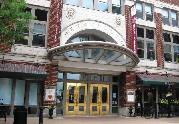
Productivity
▶ Retail strategy
There is a retail strategy developed to support the development of the precinct. Businesses are grouped to create labour and capital exchange synergies and efficiencies.
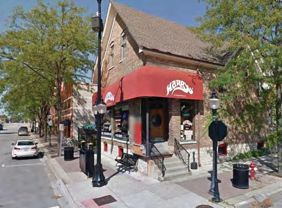
Safety
▶ Infrastructure for non-essential activities
Safety
▶ Openness and sightlines
Wider footpaths and park areas connected with the street have improved sightlines both along streets and around intersection approaches as well as improving vehicle separation.
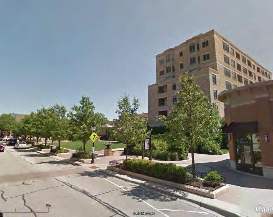
Street furniture, shade, canopies and pocket parks along the street encourage unstructured and variable use of the public realm contributing to passive surveillance.
Programming
▶ Event management and coordination
Marketing and promotion of cultural and recreational events in the city, by the local authority is a vital factor of the downtown success.
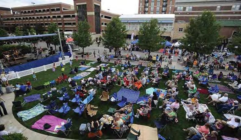
Programming
▶ Active transport management
A specific bicycle & pedestrian advisory commission was formed to manage movement through the public realm.
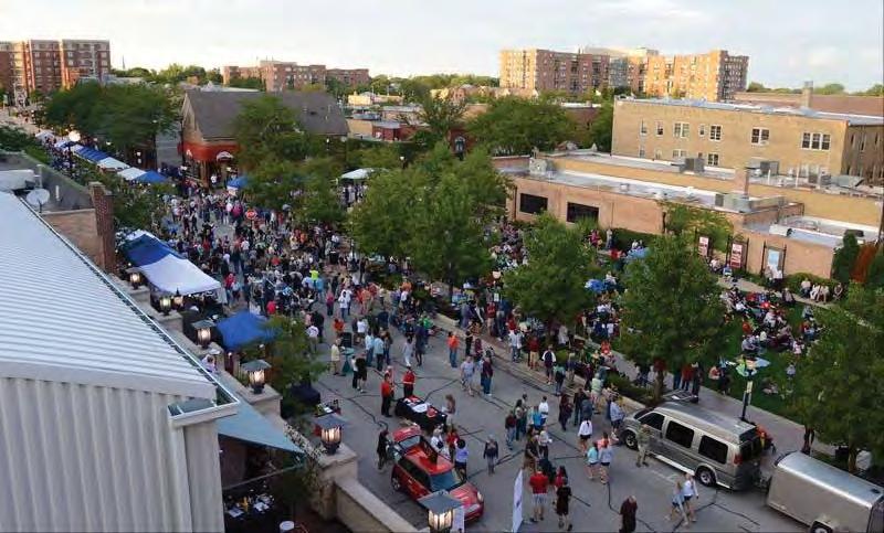
Amenity & comfort
▶ Tree planting & shade
Substantial tree planting provides shade and regulates micro-climate to attract foot traffic and support a range of activities in the public realm including fairs in the summer months..
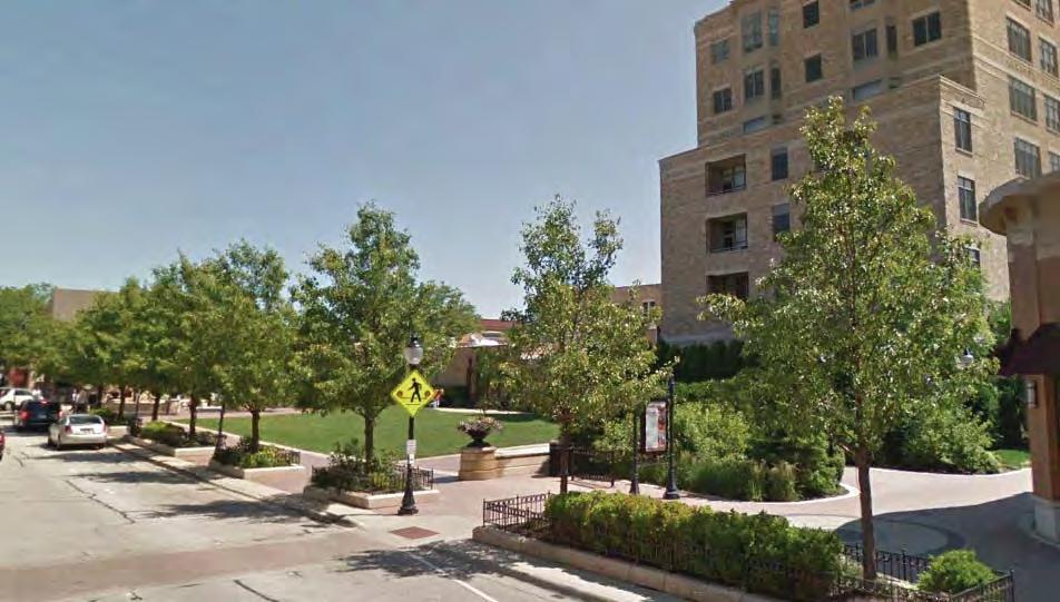
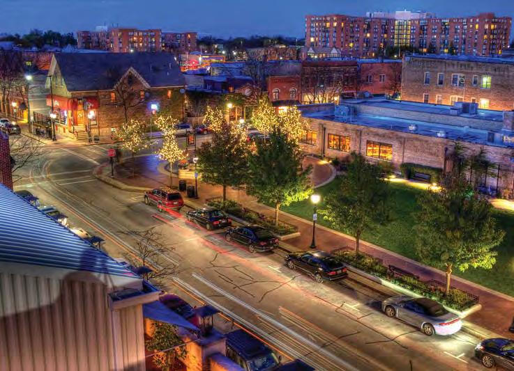
Safety
▶ Street lighting improvement
Street lighting has been substantially improved and there has been a commitment to establishing a pattern of active ground floor frontages with generous openings to the street.
// Case Studies | 6766 | People in Public Places
T4 Contra Costa Transit Village
Contra Costa, CA
Type: Transit Context: Regional Centre
User Groups: families individuals
Ethnicity context:
White (74%)
*Hispanic (12%)
Black (2%)
Asian (14%)
Status: residents local business transit patrons
Key Aspects: L
*Note: Hispanic is identi fi ed as a separate ethnicity category in the US census, and may also identify as white in the race category. Hence proportions reported here may exceed 100%. NETWORKS
Contra Costa Centre Transit Village is located on the BART commuter rail line and was developed as a TOD from a large commuter parking precinct. It is a relatively wealthy suburban context with a high proportion of white households. The station area had to be reconfigured into an accessible public realm. The key enabling factor was the relocation of the parking into a multi-level garage which allowed the community led vision for a town centre connected to the station to be realised.
Social participation context:
This key social participation objective for this project was how to configure the public realm such that it provided a high degree of accessibility whilst providing for a diverse range of experiences and users.
&
STRUCTURE
CHARACTER
Complexity
EXCHANGE Collaboration Productivity Learning & Engagement PROGRAMMING Social & Cultural diversity Health/ wellbeing & play URBAN
Accessibility Flexibility Amenity & Comfort Connectivity Legibility Safety URBAN
Imageability
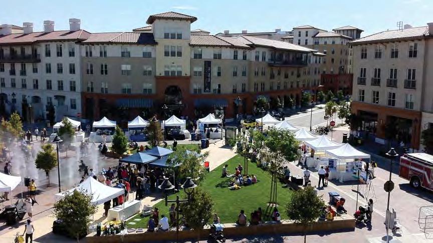
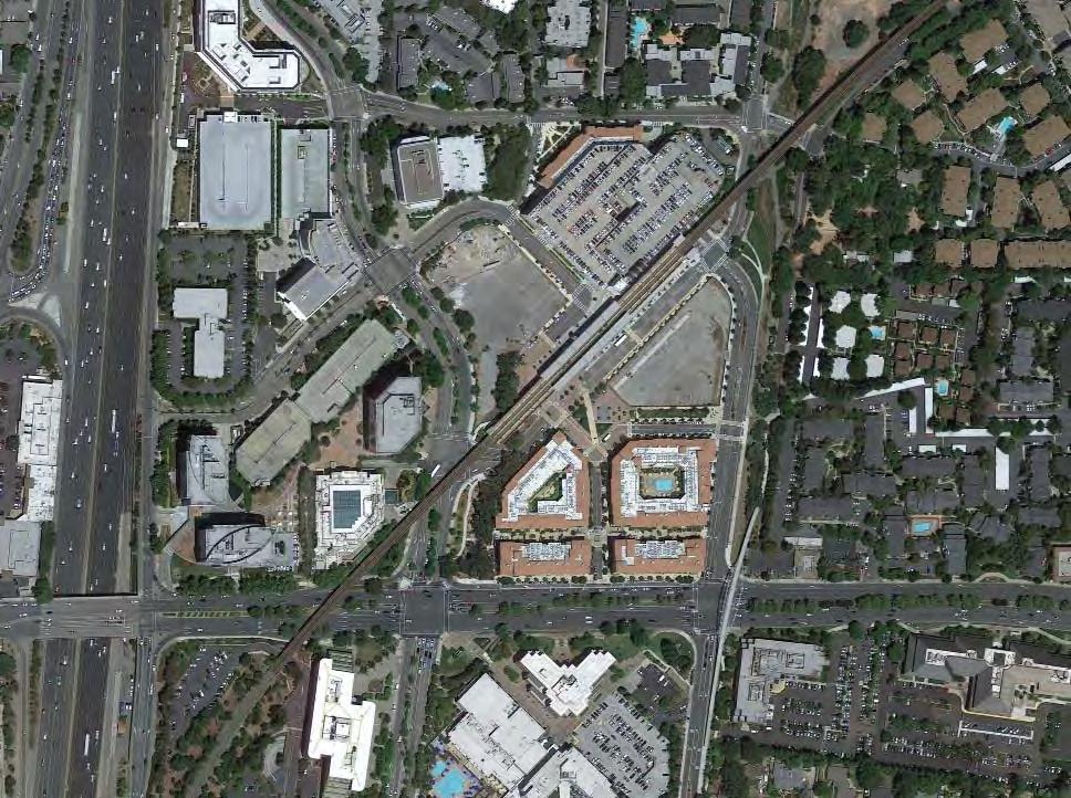
37°55’40.99”N 122° 3’23.14”W
m
m2 // Case Studies | 6968 | People in Public Places
200
85,000
Collaboration
▶ Citizen involvement in design process
The local government held an intensive 6 day public design charrette which took 6 months to organise and included 80 hours of ‘open design studio’ resulting in a unanimously supported concept plan.
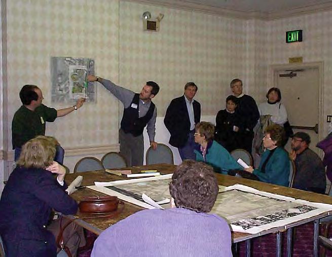
Learning & Engagement
▶ Community involvement in vision setting
As a result of the sophisticated charrette process community values were integrated from the outset and an inclusive project space created.
Accessibility
▶ Liberating public space
The area had been dominated by surface parking and inaccessible by foot or cycle and the construction of structured parking was vital to allow different users to access the space and enable a more diverse range of public functions.
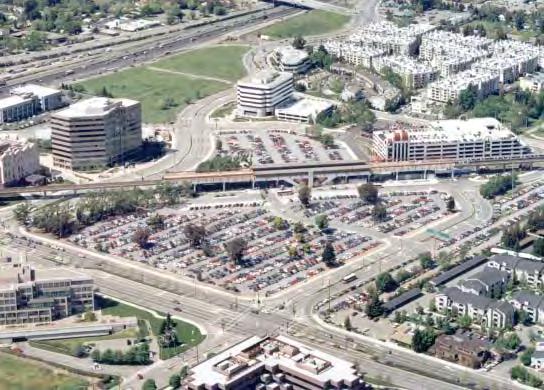
Legibility
▶ Legible town centre
The square dimensions of the town plaza and orthogonal relationships to streets and paths creates a highly legible arrangement of the public realm for all users.
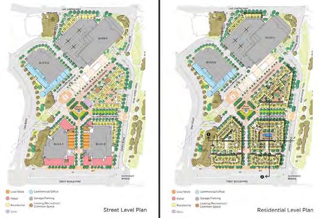
Legibility
▶ Logical and human scaled public realm
The large surface parking area was divided into 5 pedestrian scaled blocks and a hierarchy of streets introduced.
Connectivity
▶ Inter connectedness
The block size was set to a maximum of 65m to ensure that the street grid was walkable and equitable in terms of access.
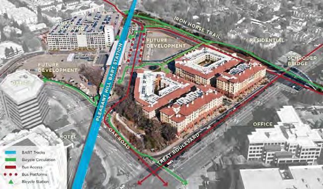
Connectivity
▶ Public space to overcome infrastructure barrier
The Robert I Schroder Overcrossing was used to connect surrounding neighbourhoods to the station area building on an existing trail alignment. Such a structure allows users who may struggle with complex crossing manouvres easy access to the village centre.
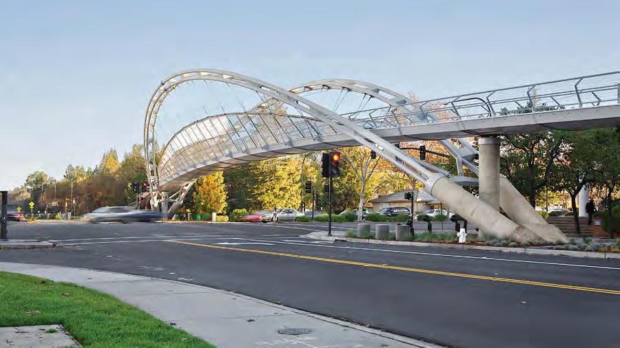
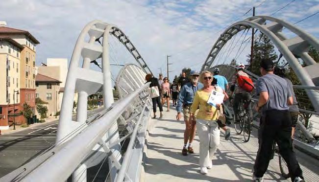
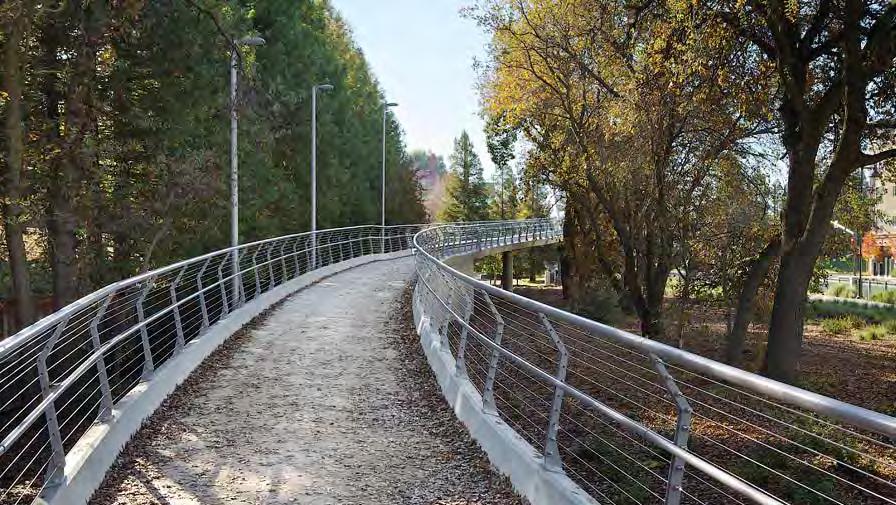
Imageability
▶ Natural features and landmarks
The Iron Horse Trail is integrated into the station area and improved using a landmark bridge structure to reinforce its value and overcome a point of major severance.
// Case Studies | 7170 | People in Public Places
Connectivity
▶ Public open space network structure
Open space networks are connected across the village from station plaza – urban plaza – promenade - trail. This provides a variety of environments for different use preferences and functions.
Legibility
▶ Defining paths & edges
The station access path is clearly demarcated and aligned with the station portal whilst low walls define the central plaza.
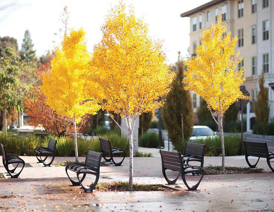
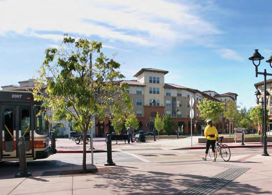
Accessibility
▶ Pedestrian prioritisation
Short blocks with controlled intersections, priority pedestrian crossings, changes in street surfacing and wide footpaths.
Safety
▶ Openness and sightlines
Flexibility
▶ Flexible community gathering spaces
The town plaza has small variations such as grassy banks and low walls to allow different sized groups and users without interrupting the potential for larger community gatherings.
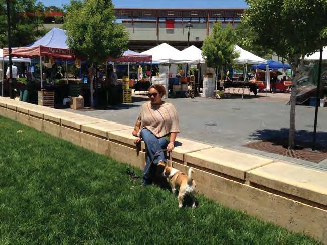
The station can be approached from multiple pedestrian routes and generous public plazas surround the access locations.
Programming
▶ Indeterminate use
The town plaza is free from fixed elements which would restrict different uses allowing a variety of formal and informal activities to take place.
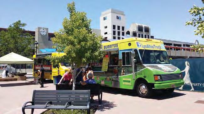
Accessibility
▶ Streetscape improvements
The creation of a buffer zone along the busiest roadway allowed on-street parallel parking that did not interfere with capacity and created a convenient street edge to a major highway particularly for elderly and users requiring greater manoeuvring.
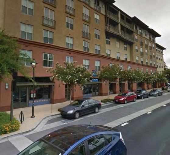
Complexity
▶ Diversity of experience
The public realm provides a variety of connected yet different environments extending from the formal areas around the station to the ‘wild’ routes along the Iron Horse Trail and Fox Creek Park.
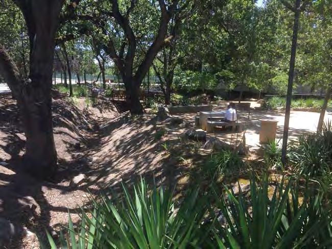
Imageability
▶ Natural features and landmarks
The existing mature trees on the creekline and trail have been carefully integrated and protected.
// Case Studies | 7372 | People in Public Places
T5 Courthouse Square
Arlington, VA
Type: Transit Context: CBD
User Groups: all
Ethnicity context: White (64%)
Hispanic (15%)
Black (8%)
Asian (10%)
Status: visitors/tourists commercial business transit patrons
The Courthouse Sector was one of the first successful TOD projects in the US attracting substantial investment principally through the development of a large private mixed use project adjacent to the Metro station. The public realm quality has however not kept up with building development and increasing transit patronage. There is a clear need for the precinct to engage with design, development and enhancement of this territory to ensure that the civic and functional qualities of the urban centre are sustained and extended into the future.
Social participation context:
Courthouse Square is located centrally in a very busy ethnically diverse city area and must negotiate large numbers of pedestrian commuters as well as the demands of a civic space including much needed passive recreation opportunities. How does the design of a busy central plaza manage the demands of traffic and transit accessibility as well as providing respite and flexibility for larger groups?
Key Aspects:
NETWORKS & EXCHANGE Collaboration Productivity Lear ning & Engagement PROGRAMMING Social & Cultural diversity Health/ wellbeing & play URBAN STRUCTURE Accessibility Flexibility Amenity & Comfort Connectivity Legibility Safety URBAN CHARACTER Imageability Complexity
L
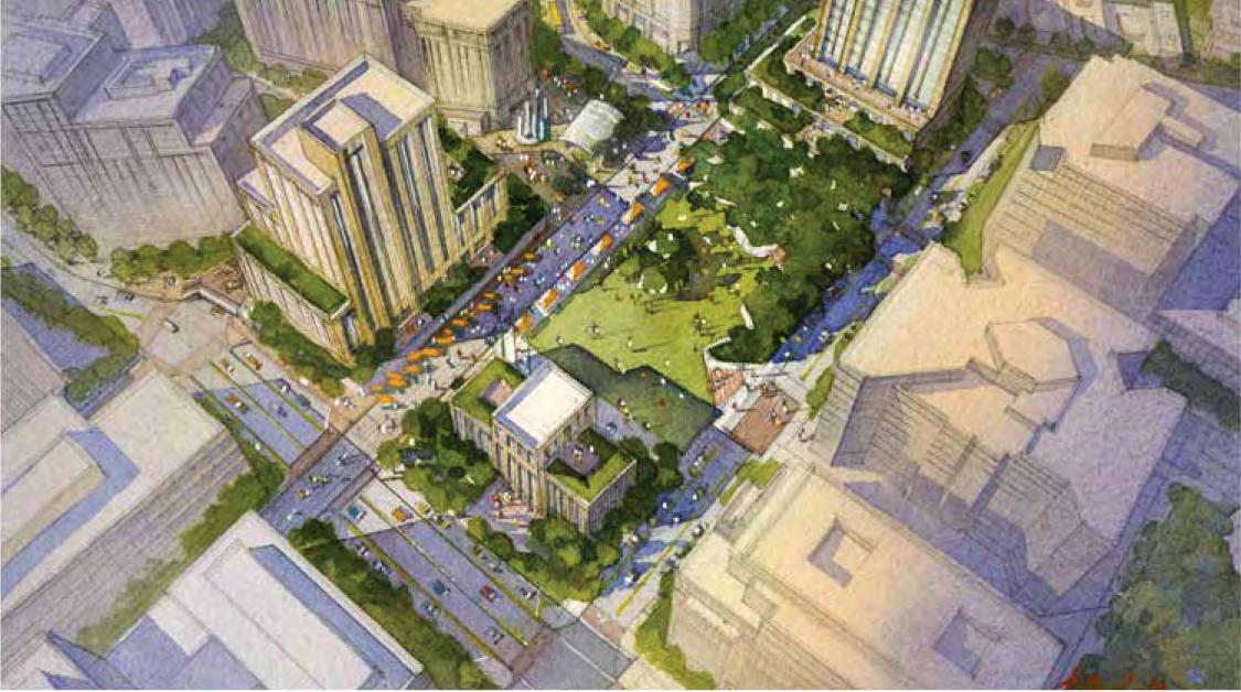
38°53’25.18”N 77° 5’3.92”W
m2
37,500
m // Case Studies | 7574 | People in Public Places
310
Collaboration
▶ Citizen involvement in design process
A 3 day charrette, interactive surveys and feedback channels were instigated at the start of the current phase of the development of the precinct involving urban design experts, county staff and citizens.
Legibility
▶ Defining public territory
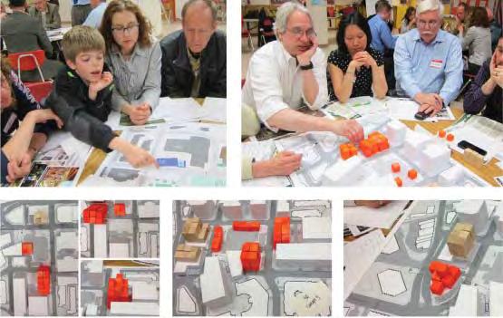
The need for a central public plaza collocated with the transit station was identified early in the urban design concept plan and also that this may need to take the place of some existing uses.
Connectivity
▶ Public open space network structure
The lack of integration of public and open space types in the precinct was a key shortcoming identified in the original project review and led to a strategy to overcome this.
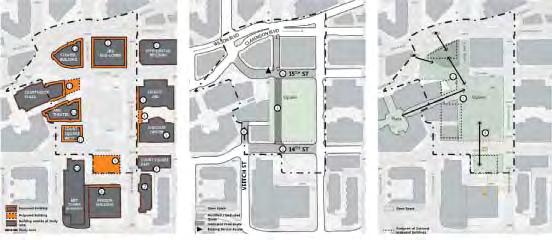
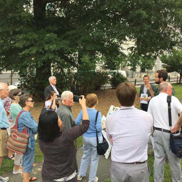
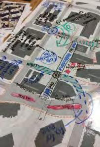
Learning & engagement
▶ Community involvement in vision setting
An Open House day was set up where planners and designers offered walking tours of the precinct to inform the community about the process and outcomes.
Accessibility
▶ Liberating public space
The existing surface car park in the Courthouse Square area is intended to be moved into an underground facility on the site in conjunction with shared streets to enable the creation of a new pedestrian oriented public space precinct.
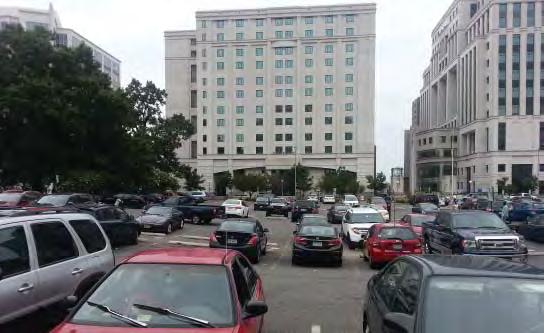
Complexity
▶ Diversity of Type
The initial Courthouse Plaza provided a formal, semi-public space however planning recognises that a greater diversity of public space is required to cater for a wide range of user preferences, allow for a greater range of activities and avoid over-privitasation of the public realm which woulod be exclusionary in such a diverse downtown context.

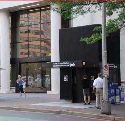
Legibility
▶ Legible town centre
A strong, easily comprehended axial diagram related to key built landmarks underpins the organisation of the public open space areas.
Programming
▶ Government & Social Services
The Courthouse Plaza offers most government services including some human services (such as the Hispanic Committee of Virginia) which are used by a range of different users.
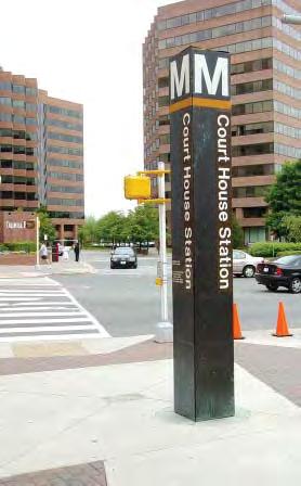
Connectivity
▶ Transport & traffic relocation
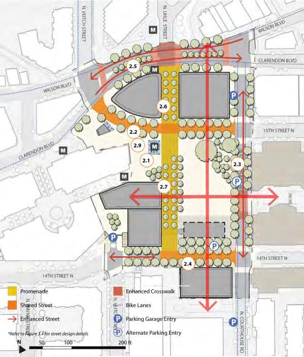
Access to the Metro station is currently compromised by vehicular traffic and the new design creates a new station portal centrally located within a pedestrian precinct.
// Case Studies | 7776 | People in Public Places
Legibility
▶ Logical and human scaled public realm
The design has familiar public realm typologies such as a promenade which uses repetitive tree planting to clearly orient the user.
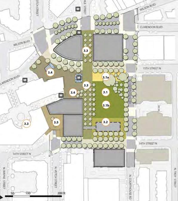
Connectivity
▶ Reinstating streets and pathways
A street connection which was removed for the previous use on the site will be reinstated to reclaim permeability.
Accessibility
▶ Streetscape improvements
Kerbless pedestrian promenades allow maximum permeability for all users, whilst pedestrian road crossings will be substantially upgraded in terms of accessibility.
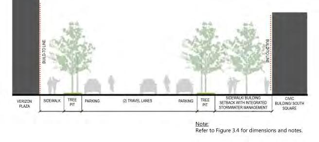
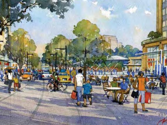
Flexibility
▶ Flexible community gathering spaces
A significant part of the main square is proposed as an open area or ‘lawn’ which can be easily used for passive and structured events.
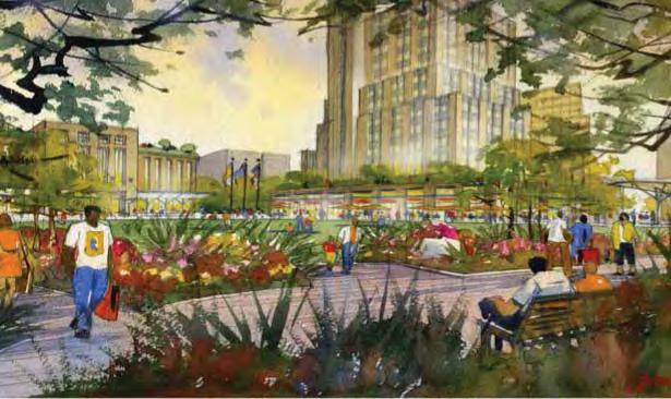
Amenity & Comfort
▶ Tree planting & shade
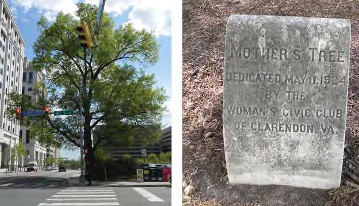
The area currently has poor shade and tree canopy coverage which is a focus of the project to improve the conditions for public use.
Imageability
▶ Natural features and landmarks
Significant memorial trees are made a focus in the design and measures put in place to improve their condition.
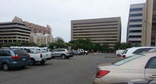
Learning & engagement
▶ Interpretive content
It is intended to incorporate the existing plates which acknowledge the former use of the site as a fort during the Civil War and contemporary historical markers adopt a consistent style such that the overall legibility of the public realm is reinforced.
// Case Studies | 7978 | People in Public Places
T6 Del Mar Transit Village
Pasadena, CA
Type: Transit
Context: Regional Centre
User Groups: families elderly individuals
Ethnicity context:
White (56%)
*Hispanic (33%)
Black (13%)
Asian (13%)
Status: residents transit patrons
*Note:
Del Mar Station on the LA county light rail Gold Line is a transit oriented development situated in the diverse community of Pasadena. It is a substantial scaled single development which encloses the station with buildings. This could have potentially excluded the station from the broader neighbourhood and city catchment particularly as vehicles are not allowed. Careful attention to public connectivity, legibility and scale were presented as the key tactics to ensure that the public realm remained integrated within its broader context and accessible by all users.
Social participation context: Pasadena has a high proportion of Hispanic/Latino residents and the urban forms from the native and early Spanish migrants are both familiar and climatically appropriate. How can the semi-public enclosed plaza typical of this tradition be incorporated into a transit project which must by its nature be highly accessible and inclusionary?
Key Aspects:
Collaboration
Productivity
Legibility
Hispanic is identi fi ed as a separate ethnicity category in the US census, and may also identify as white in the race category. Hence proportions reported here may exceed 100%.
NETWORKS & EXCHANGE
Lear ning & Engagement PROGRAMMING
Social & Cultural diversity
Health/ wellbeing & play URBAN STRUCTURE
Accessibility Flexibility
Amenity & Comfort Connectivity
Safety URBAN CHARACTER
Imageability Complexity
L
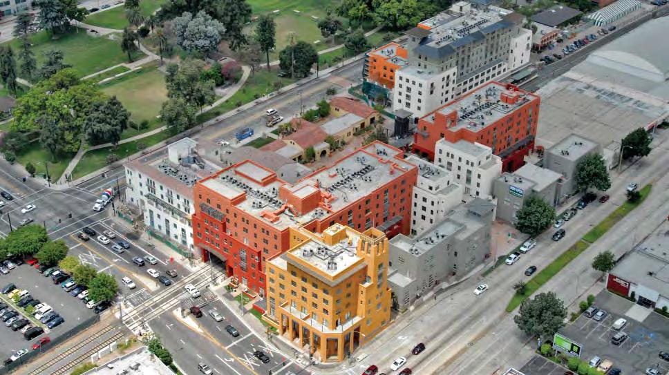
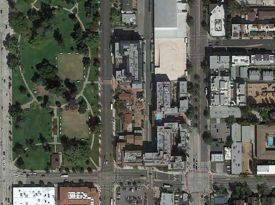
34° 8’29.02”N 118° 8’53.85”W
m // Case Studies | 8180 | People in Public Places
15,600 m2 110
Collaboration
▶ Citizen involvement in design process
A Community Advisory Committee of residents and business representatives was established to provide input into the planning, design and construction phases of the station area project.
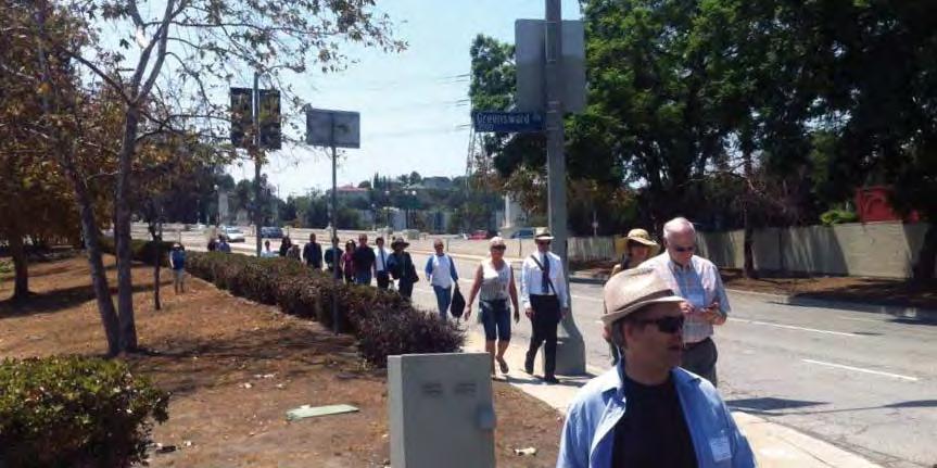
Collaboration
▶ Planning & design frameworks
The local authority had in place comprehensive urban policy frameworks for walkable streets and high quality design which had been previously negotiated with the local community.
Connectivity
▶ Transport & traffic relocation
In order to manage the demand for parking both from new development and commuters without compromising the village intentions the project is built on a 1200 space basement parking garage.
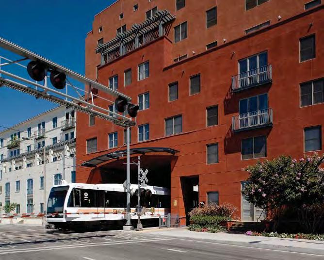
Legibility
▶ Form
The plaza is rectangular and contained by built form and presents a clearly understood diagram for public use.
Imageability
▶ Repurposing historic structures
The old rail depot structure was restored as a centrepiece of the station plaza to maintain historic connections and mediate human scale.
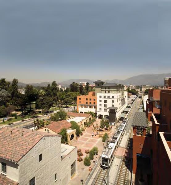
Safety
▶ Colocation
The central historic building which directly addresses the station is tenanted as a restaurant whilst upper level residential terraces and openings provide passive surveillance.
Imageability
▶ Familiar materiality & Form
The project uses a public space structure of interlinked open spaces of varying degrees of publicness drawing from the traditional pueblo hybrids of native and early Spanish settlement.
Programming
▶ Indeterminate use
The main plaza is mostly open and uncluttered allowing for a variety of local and more structured uses depending on demands and the evolution of the residents and business.
Amenity & comfort
▶ Tree planting & shade
A cluster of trees and a water feature immediately adjacent to the platform provides a microclimate for comfortable waiting and rest without compromising station accessibility.
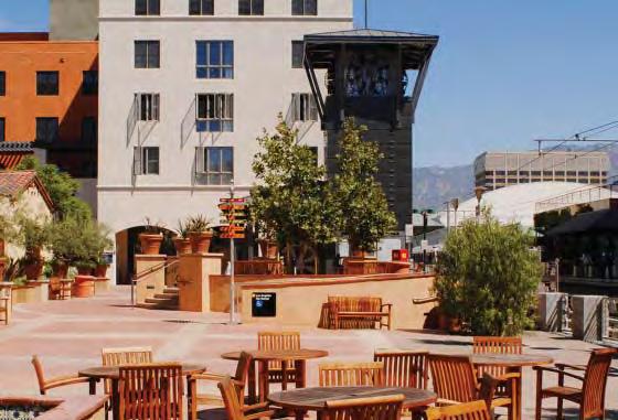
Safety
▶ Maximum adaptability of ground floor
In order to avoid long periods of vacant retail tenancies and compete with other areas in the early stages of the project flexible ground floor lofts were designed.
Legibility
▶ Defining paths & edges
A consistent surfacing material runs through the different yet connected public realm elements clearly defining the public territories and enhancing wayfinding.
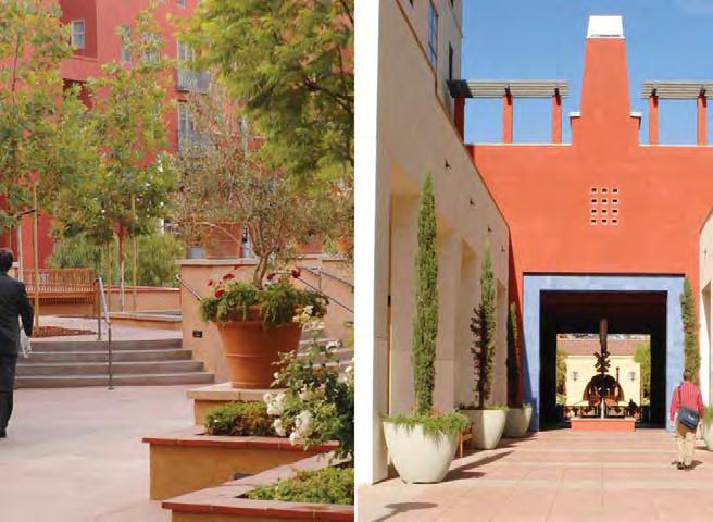
Connectivity
▶ Integrated public connections
The public realm of the station plaza connects through open public pedestrian passages to the bordering bus services and Central Park.
Connectivity
▶ Inter connectedness
The pedestrian axis from the east aligns with the entry to the significant historical building allowing direct access across the track bed.
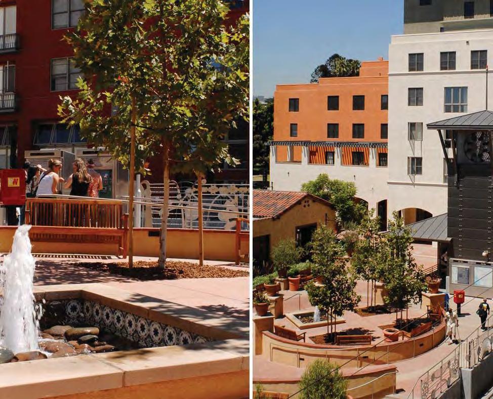
Complexity
▶ Diversity of Type
As well as a diverse range of public spaces and paseos buildings styles and scales are varied to avoid an imposed ‘top-down’ sense of place.
// Case Studies | 8382 | People in Public Places
T7 Hammarby Sjostad
Stockholm, SWE
Type: Transit
Context: Regional Centre
User Groups: families individuals social groups - small
Ethnicity context: NA
Status: residents local business
Hammarby is something of a ‘poster boy’ for contemporary high density sustainable transit integrated development. It’s a very large project involving the creation of several districts with an emphasis on walking, cycling and transit. The project development has put substantial effort and emphasis on the design of open space. In particular the public realm is highly integrated with the built form and is fact just as an important structuring element as the movement network.
Social participation context:
The intention for Hammarby was to be a leader in the area of social sustainability and to provide accommodation for a wide variety of households of varying economic capacity. How did the organisation and design of the public realm attempt to accommodate such a variety of users in a high density setting?
Key Aspects:
NETWORKS & EXCHANGE
Collaboration
Productivity
Learning & Engagement
PROGRAMMING
Social & Cultural diversity
Health/ wellbeing & play
URBAN STRUCTURE
Accessibility
Flexibility
Amenity & Comfort
Connectivity
Legibility
Safety
URBAN CHARACTER
Imageability
Complexity
XL
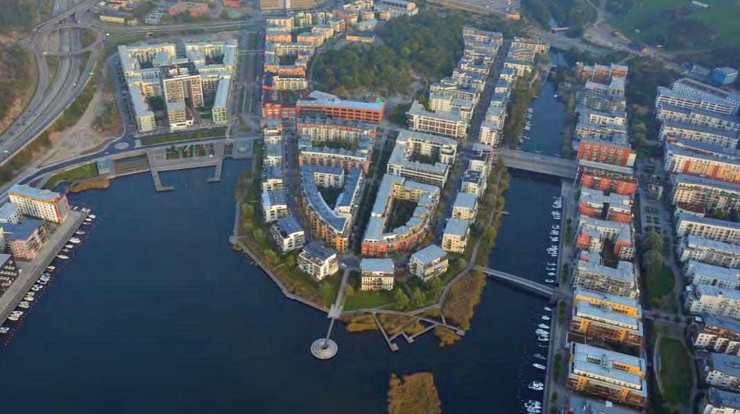
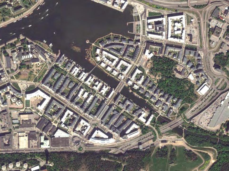
18° 6’14.37”E
59°18’14.90”N
33Ha (St 1 to 4)
// Case Studies | 8584 | People in Public Places
700 m
Learning & Engagement
▶ Learning centre incorporated into project
The Glass House (GlashusEtt) is a purpose built public building in a central location which is used to showcase the environmental systems and programmes and educate residents and visitors.
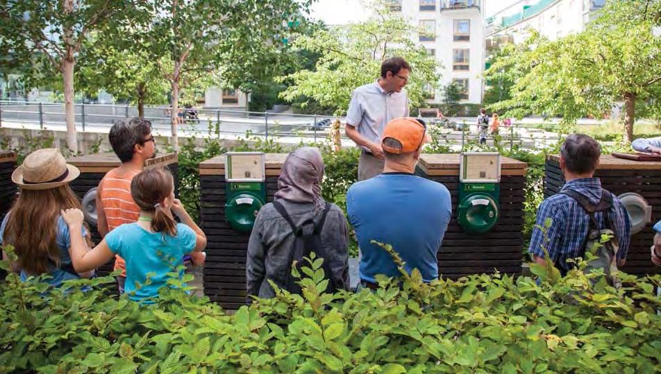
Productivity
▶ Recycling & Reusing
A precinct waste recycling system was integrated into every home meaning everyone is in part responsible for supplying gas for cooking, hot water and heating .
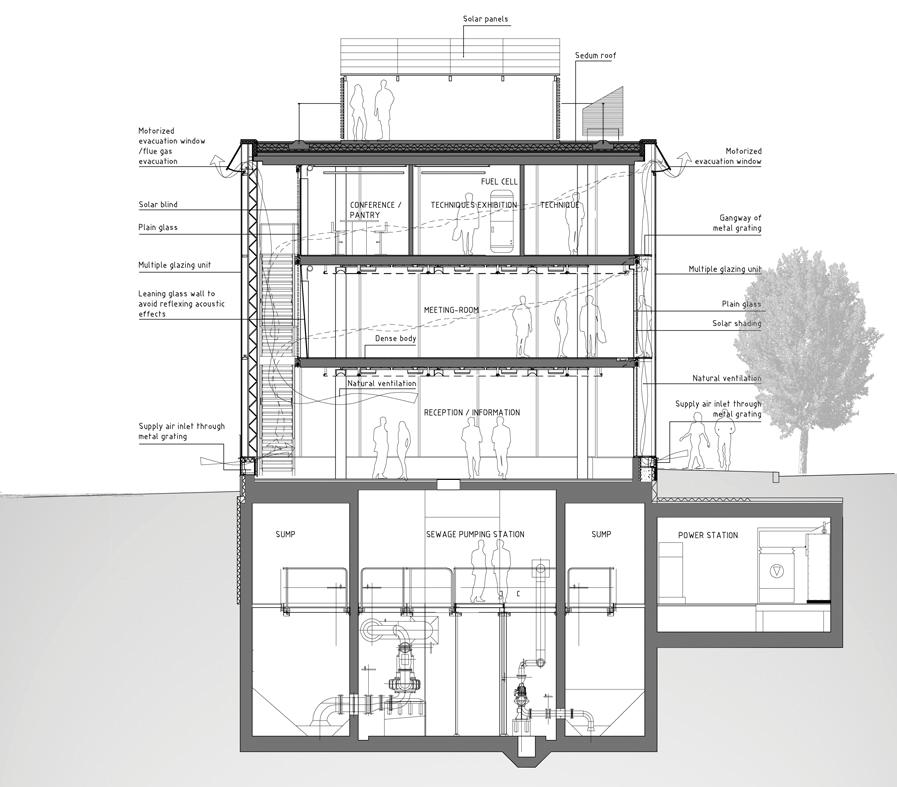
Connectivity
▶ Road based public transport spine
A public transport spine
consolidates and binds the movement networks which combined with new bus routes connects the neighbourhoods with the regional public transport system.
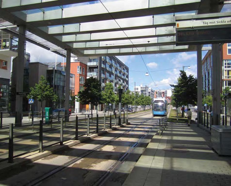
Legibility
▶ Logical and human scaled public realm
The plan is easily understood - generally orthogonal and gridded ,with human scaled block dimensions which sustains permeability and legibility for users.
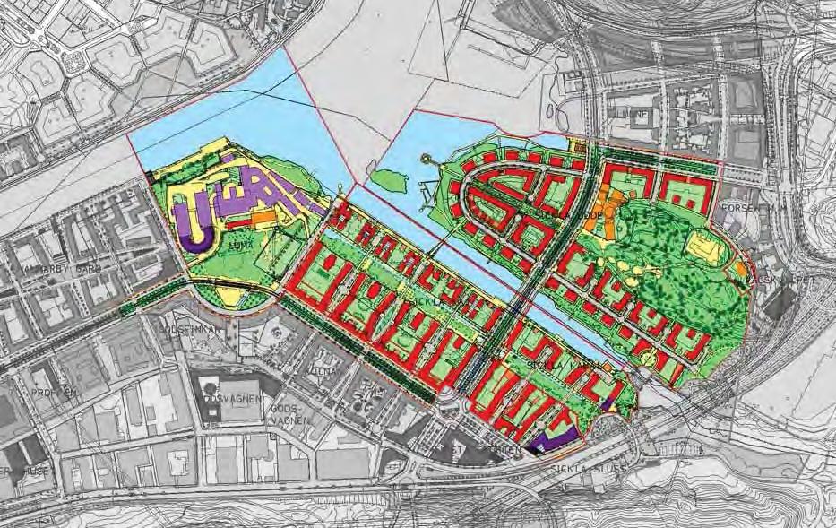
Connectivity
▶ Public open space network structure
In addition to the streets there is an extensive and diverse public open space network which structures movement and increases permeability.
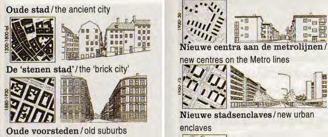
Imageability
▶ Familiar materiality & Form
The built form and open space typologies are derived from traditional Stockholm models such as the ‘villa districts’ and ‘brick city’.
Accessibility
▶ Pedestrian prioritisation
Pedestrian priority is maintained on the local streets through speed restrictions, surface level changes, material changes and narrow carriageways. Generally streets are left ambiguous as to their priority which encourages driver caution and a shared space.
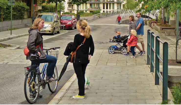
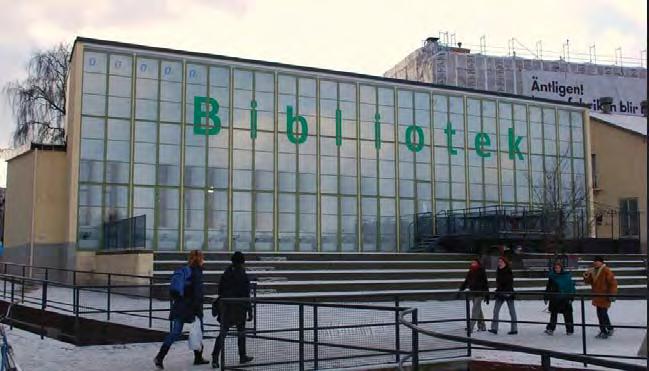
Programming
▶ Civic/Arts anchor
A library, cultural and theatre centre are all integrated into the large precinct.
// Case Studies | 8786 | People in Public Places
Safety
▶ Permeable block forms engage public realm
Open block forms maintain sight lines and allow pedestrian and cycling access to buildings from the public space network keeping it activated.
Safety
▶ Generous balconies address public realm
Generous residential balconies overlook public spaces to maximise the opportunity to achieve passive surveillance.
Safety
▶ Maximum adaptability of ground floor
With the area still establishing population the ground floor uses have been designed with maximum adaptability to ensure that they are given the highest possible chance of remaining active.
Complexity
▶ Diversity of type
The public realm provides a variety of experiences both formal and informal to cater for a wide range of user needs and preferences.
Complexity
▶ Richness & Intrigue
The elements of the public realm are often playful and ‘delight’ is a valued commodity of the design with installations of ambiguous function open to interpretation.
Accessibility
▶ Integrated universal access design
All public spaces are designed to be universally accessible in line with the City of Stockholm Disability Program.
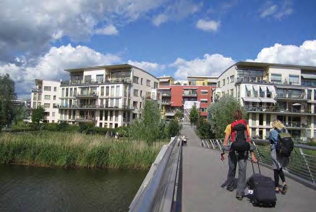
Programming
▶ Recreational & sporting infrastructure
Boat mooring, ski slopes, lake swimming, sporting hall and jogging tracks are incorporated.
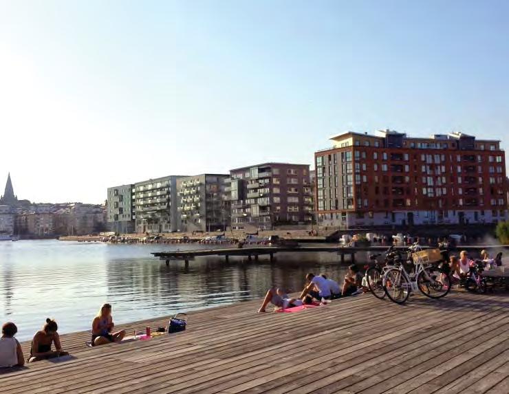
Amenity & comfort
▶ Use of natural materials
There is extensive use of natural materials such as timber, stone, vegetation and water, which invite human occupation of the public realm.
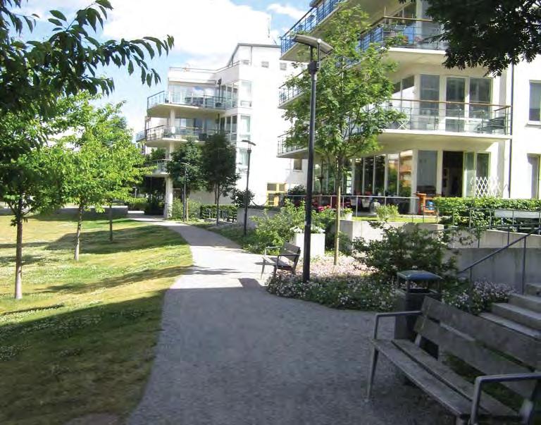
Amenity & comfort
▶ Integrated street furniture design
Street furniture is provided extensively throughout the public realm and related to the different types of occupation imagined in the various spaces.
// Case Studies | 8988 | People in Public Places
S1 Build a better block
Dallas, TX
Type: Social Incubator
Context: Local Centre
User Groups: All
Ethnicity:
Status:
White (63%)
African American (2%)
*Other race (31%)
Visitors/tourists
Transit patrons Residents
Local business Students
*Note: ‘Other race’ often refers to people of hispanic origin who prefer not to be identi fi ed as white.
Key Aspects:
Tyler Street, Oak Cliff close to downtown Dallas, is part of an older part of the city characterized by neglected and boarded up retail areas and car-centric road design.
Build a Better Block was an unauthorised two day event designed to reveal the impact changes to make to the area, and highlight the prohibitive planning restrictions on pedestrian, cycling, and occupation of the street.
Build a Better Block has been particularly well received by local residents and visitors who were able to use the area in a different way and reclaim the street. Local businesses were also able to collaborate to expand their offering into a different space and create a new pattern of self organised public realm which has been exported to other places where auto-dependancy has ‘damaged’ the urban tissue.
NETWORKS & EXCHANGE Collaboration Productivity
& Engagement PROGRAMMING Social & Cultural diversity Health/ wellbeing & play URBAN STRUCTURE Accessibility Flexibility Amenity & Comfort Connectivity
Safety URBAN CHARACTER
Complexity
Learning
Legibility
Imageability
S
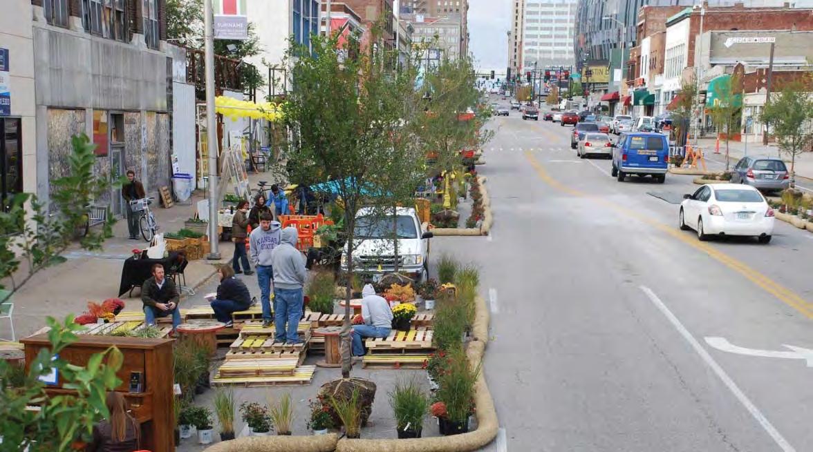
32°44’31.1”N 96°50’16.6”W
820 m2
Tyler Street
// Case Studies | 9190 | People in Public Places
45 m
Collaboration
▶ Community led project
The original Build a Better Block was the initiative of two local residents who sought to revitalise Tyler Street, close to downtown Dallas. They engaged local business owners, and artists, to create a temporary installation
Collaboration
▶ Citizen involvement in the design process
The group identified restrictions they wanted to highlight and overcome, created a plan, and limited themselves to only one block.
Accessibility
▶ Liberating public space
Previously the street was used predominantly for cars, with little foot traffic. The event increased space for pedestrians and minimised the space for vehicles.
Programming
▶ Removing space restrictions
Traditionally the areas is boarded up, car-oriented, and subject to a number of restrictions on use. The project bypassed seeking official permits and instead displayed the number of restrictions they were ignoring throughout the projects areas.
Productivity
▶ Participation in building
Local business owners were an integral part of preparing the pop up shops, spaces, painting the installations and creating the spaces for the project.
Accessibility
▶ Streetscape improvements
The temporary project included furnishings, widened footpaths, flower stalls, pop up art galleries and shops which all improved the aesthetic and functionality of the streetscape.
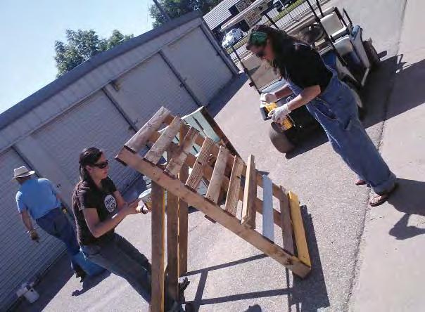
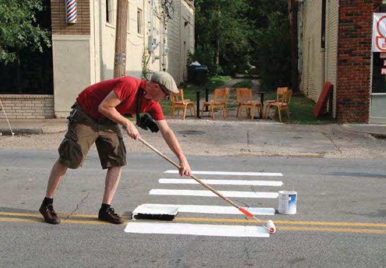
Programming
▶ Active transport management
Traffic calming measures were implemented, such as lining trees along roads, the painting of a temporary bike lane, and designating a widened pedestrian pathway for the duration of the event.
Amenity & comfrot
▶ Widened footpaths and parked car buffer
Temporary buffers increased the pedestrian space and created cycle ways that limited the space for vehicles.
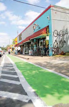
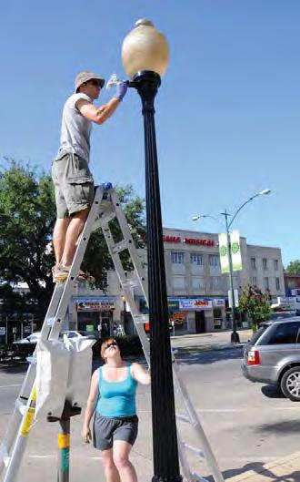
Flexibility
▶ Interim project
In order to convince the local authorities, test the main ideas and ensure permission was granted the project was termed an ‘art installation’ and was temporary in the first instance.
// Case Studies | 9392 | People in Public Places
Legibility
▶ Logical and human scaled public realm
By increasing the space for residents and visitors on foot or bike, and reducing the road width, the public realm became more accessible and appropriately-scaled to befit human interactions.
Legibility
▶ Defining public territory
Planters, crates, and other markers created a border that reduced traffic space on the road and expanded the pedestrian and ‘café’ areas and allowed children to have some freedom.
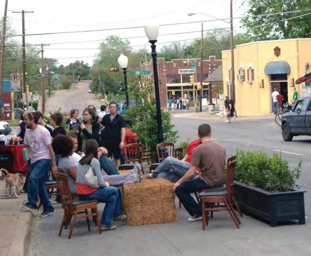
Programming
▶ Indeterminate use
Rather than a predetermined use the street allows a diverse range of community events, stalls and installations.
Safety
▶ Infrastructure for non-essential activities
An eclectic array of seating and tables were provided to facilitate an increased presence on the street, enhancing passive surveillance and activation.
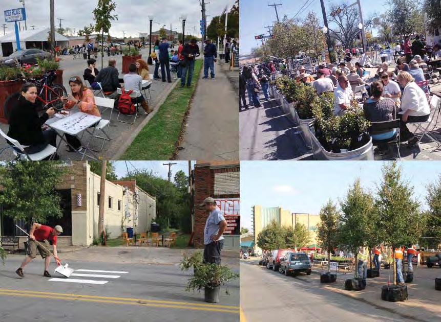
Flexibility
▶ Flexible equipment
A range of furniture and ‘props’ are provided which can be moved to facilitate a variety of events and uses.
Amenity & comfort
▶ Tree planting and shade Shade was provided through trees in planters alongside the areas of seating.
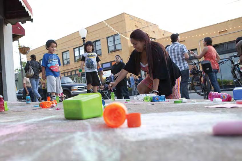
Productivity
▶ Local business enhancement
By providing temporary infrastructure to facilitate walking and sitting the local businesses benefited from a much larger volume of people utilising their services.
Flexibility
▶ Flexible community gathering spaces
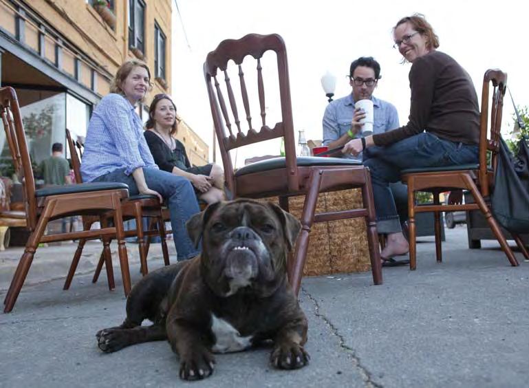
A range of community-minded gathering places were installed including games areas to promote casual interaction amongst different users.
Learning & engagement
▶ Community management of public space
Imageability
▶ Familiar materiality and form
Chairs, hay bales, items of furniture from surrounding stores and restaurants were used to create an integrated familiar feeling to the street.
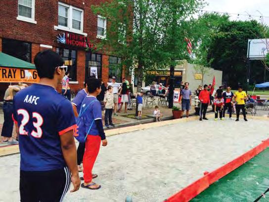
Volunteers from local businesses maintained and clean the street while contributing to the various temporary spaces.
Productivity
▶ Recycling and Reusing
All of the props, from coffee urns, crates, plants, were donated the project by artists or other members of the organising group.
// Case Studies | 9594 | People in Public Places
S2 Delai Sam (do-it-yourself)
Moscow, Russia
Type: Social Incubator Context: City Centre
User Groups: Youth Individuals
Social groups- large
Ethnicity context: Russian
Status: Residents
Local business Students
Transit patrons
Key Aspects:
NETWORKS & EXCHANGE
Collaboration
Productivity
Learning & Engagement
PROGRAMMING
Social & Cultural diversity
Health/ wellbeing & play
Delai Sam is a ‘multi-format event’ based upon DIY and collective principles, created by a group of architects, planners, activists and artists, and now works in collaboration with media and government organisations. Its purpose is to make Moscow ‘comfortable, inviting and eco-friendly’ through events that are held every 6 months.
Delai Sam specifically involves young people, artists, and professionals from a range of fields such as urban ecology, architecture, planning (etc) interested in small, tactical urban interventions.
URBAN STRUCTURE
Accessibility
Flexibility
Amenity & Comfort
Connectivity
Legibility
Safety
URBAN CHARACTER
Imageability
Complexity
S
40°41’37.4”N 73°58’53.6”W
// Case Studies | 9796 | People in Public Places
Moscow
7,300 m
Collaboration
▶ Collaborative partnership and funding
Formal and informal institutions have joined Delai Sam, and commercial art groups such as Flacon Design Centre and Winzavod Contemporary Art Centre have hosted summits and film screenings. It has multiple sources of funding from government (such as the Department of Culture) and media (Moscow News) and other organisations (Moscow Youth Multi-functional Centre).
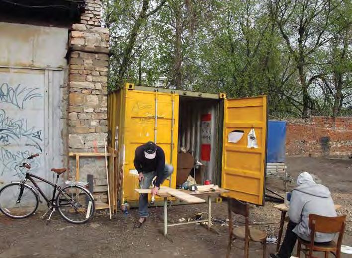
Collaboration
▶ Citizen involvement in design process
The do-It-Yourself summits are informal and agendas are self-generated. Initiative and empowerment to take action is encouraged and targeted to the specific town or city.
Productivity
▶ Participation in building Actions by members of Delai Sam have included creating garden plots, building upcycled benches and spontaneous sculptures.
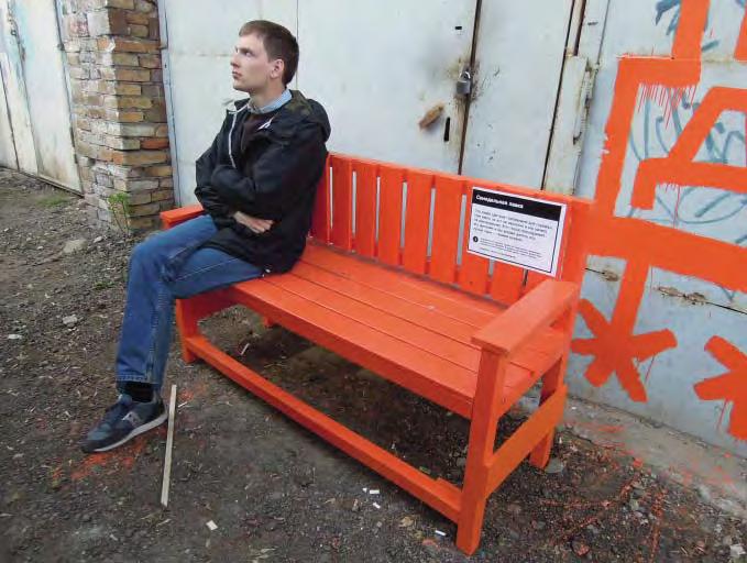
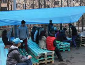
Complexity
▶ Richness and intrigue
Temporary interventions such as putting faces on trees due to be cut down to indicate their environmental importance highlights a different way of perceiving the world and encourages new thinking by residents and visitors.
Collaboration
▶ Community led project
The Day of Action, the Delai Summit, and Delai Film are all successful events that are driven by local ideas and empower citizens to implement urban initiatives.
Learning & engagement
▶ Learning centre incorporated into project Free lectures, discussions and workshops are offered to everyone involved.
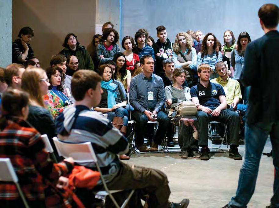
Productivity
▶ Digital compatibility
Events are organised and future ideas and actions are communicated about through the internet allowing people of diverse backgrounds to be involved.
Accesability
▶ Pedestrian prioritisation
Crosswalks were painted as one tactical intervention to highlight the need to increase pedestrian space.
Connectivity
▶ Transport and traffic relocation
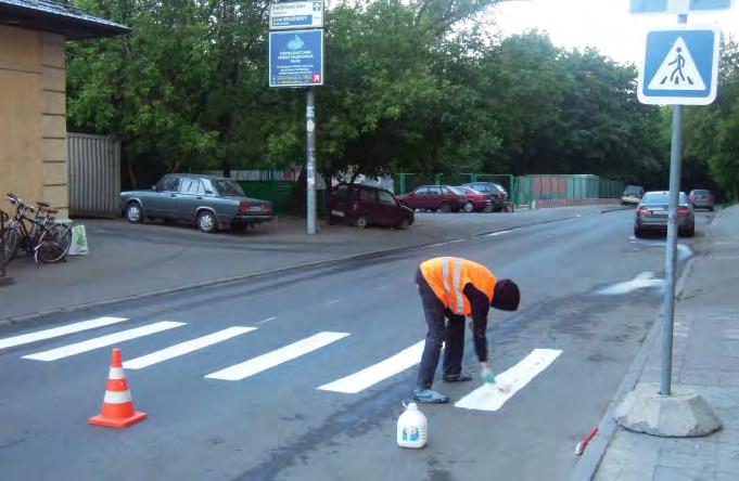
Guerrilla cycle lanes have been painted to foster more cycling, non-vehicular connectivity and safety in certain areas.
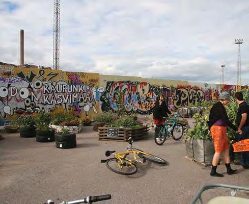
Amenity & comfort
▶ Tree planting and shade
Activities involve actions such as cleaning up the river banks, planting bushes and putting up hammocks.
Programming
▶ Indeterminate use
Local courtyards are often used in multiple and diverse ways, such as using pallets for seating to create a mobile cinema, or using the spaces for masterclasses and workshops.
// Case Studies | 9998 | People in Public Places
S3 Garden of Eden
Fort Greene, Brooklyn, NY
Type: Social Incubator Context: Local Centre
User Groups: Families
Elderly Individuals
Social groups- small
Ethnicity context: African-American Bangladeshi -descent Chinese -descent
Status:
Existing residents (women)
Residents- low income
Long term migrants
Key Aspects:
NETWORKS & EXCHANGE
Collaboration
Productivity
Lear ning & Engagement
PROGRAMMING
Social & Cultural diversity
Health/ wellbeing & play
The Garden of Eden is a plot of land owned by New York City Housing Authority (NYCHA), located near downtown Brooklyn, near the intersection of Myrtle Avenue and Flatbush Avenue. The Garden was initiate as part of the ‘Garden and Greening Program’ in 2009.
Garden of Eden has specifically targeted the participation and active involvement of long term migrants, elderly and local residents, predominantly women, by creating safe spaces to celebrate individual culture and gathering places for sharing of agricultural ideas.
URBAN STRUCTURE
Accessibility
Flexibility
Amenity & Comfort
Connectivity
Legibility
Safety
URBAN CHARACTER
Imageability
Complexity
S
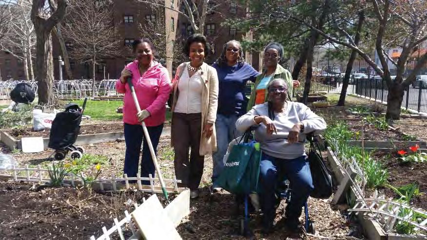
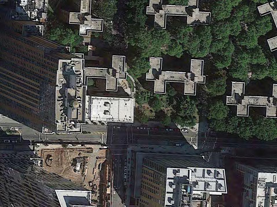
40°41’37.4”N 73°58’53.6”W
m2 50 m // Case Studies | 101100 | People in Public Places
1,000
Collaboration
▶ Local community based organisation
Collaboration between the gardeners and Myrtle Avenue Revitalisation Project (MARP) has addressed the issue of affordable and fresh food, and contributed a consultant in initial stages to help design gardens.
Seeds and other resources are provided by MARP and NYCHA.
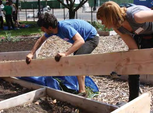
Productivity
▶ Participation in building
The residents are involved in all stages of building of plots, recycling, and other facilities, and grow all of the vegetables and flowers in the garden.
Programming
▶ Tradition informing use
Residents from migrant communities and from various ethnic backgrounds grow plants and vegetables connected to their cultural preferences.
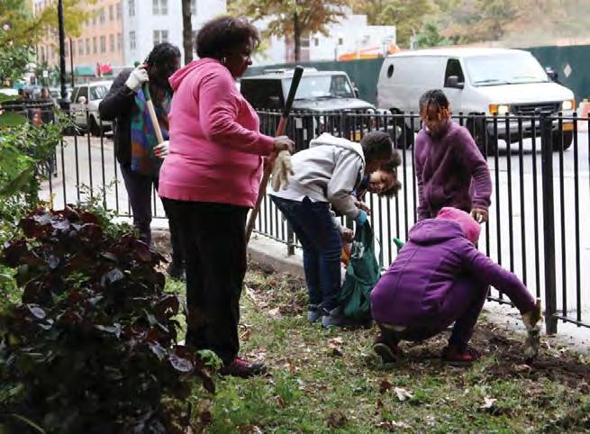
Safety
▶ Repetitive use elements
Repetitive daily activities involved with the maintenance and management of the gardens create a culture of continuous use and activity.
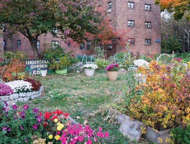
Connectivity
▶ Integrated public connections
The path networks and public space connect directly to the local street network.
Collaboration
▶ Community led project
Although it is on private land the gardeners are encouraged to self-organise by establishing participatory rules, organise activities, and advocate with city government.
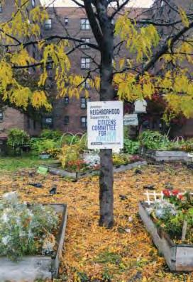
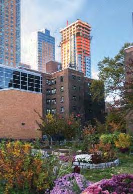
Collaboration
▶ Collaborative partnership and funding
Micro-funding, donors, and grants helps fund the garden, such as to expand the garden and purchase a compost barrel, and install an irrigation system.
Learning & engagement
▶ Learning centre incorporated into project
Though not a formal learning centre, the gardeners are invited to educational workshops and events to improve skills and transfer knowledge.
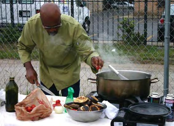
Programming
▶ Recreational & sporting infrastructure
Local residents are encouraged to actively participate in the creation, maintenance and ongoing development of their gardens.
Safety
▶ Openness and sightlines
The garden has no interior walls or areas that restrict sightlines, and therefore creates an open and inviting space.
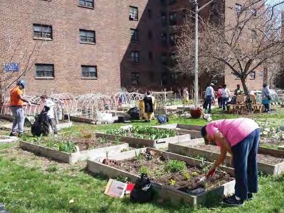
Amenity & comfort
▶ Use of natural materials
Plots, compost systems and irrigation relied on reuse of natural materials available.
// Case Studies | 103102 | People in Public Places
S4 Roosevelt Road Green
Life Axis
Taipei, Taiwan
Type: Social Incubator
Context: City Centre
User Groups: Elderly Youth Social groups- small
Ethnicity: Taiwanese
Status: Existing residents Visitors/tourists Students
Roosevelt Road is a main avenue to the south of the Taipei’s city centre. It was one of the areas chosen to be subject to a government-led greening program that, while initially deemed unsuccessful, was granted a second life through the more collaborative and consultatively-driven process Green Life Roosevelt. The result was four community gardens, each with their own identities and purposes, including ecological design, permaculture, and cultural activities: Rainwater Garden, Ecological Observation Garden, Happy Farm, and Reading and Herb Garden.
The project has been of particular success in attracting elderly residents to use the gardens as meeting places, local students learning about sustainability, and local residents and visitors who engage with the political forums held.
Key Aspects:
NETWORKS & EXCHANGE
Collaboration
Productivity
Learning & Engagement
PROGRAMMING
Social & Cultural diversity
Health/ wellbeing & play
URBAN STRUCTURE
Accessibility
Flexibility
Amenity & Comfort
Connectivity
Legibility
Safety
URBAN CHARACTER
Imageability
Complexity
S
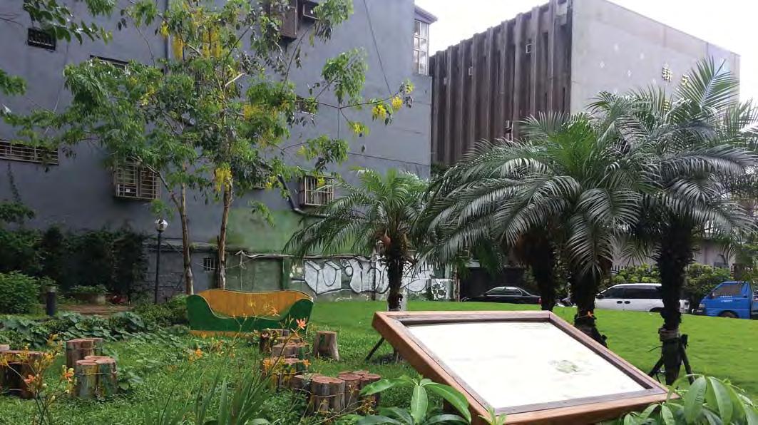
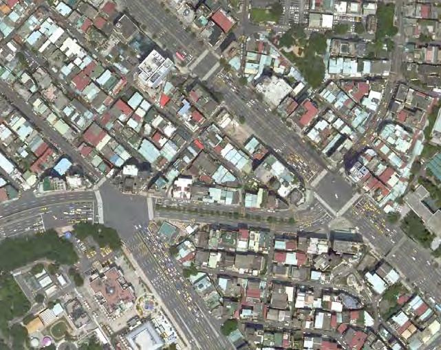
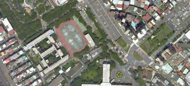
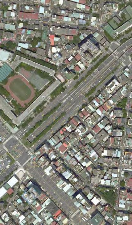
25° 1’12.56”N 121°31’41.77”E
// Case Studies | 105104 | People in Public Places
540m
Collaboration
▶ Citizen involvement in design process
In 2009 a series of workshops led by Classic Landscape Design and Environmental Planning sought to mobilise the community to devise new ways of using the spaces.
Productivity
▶ Local business enhancement
Bookstores, live music venues and cafes near to the Reading and Herb Garden – part of the ‘Willow Den Independent Consortium’- partnered with Classic Design to shape the space uses.
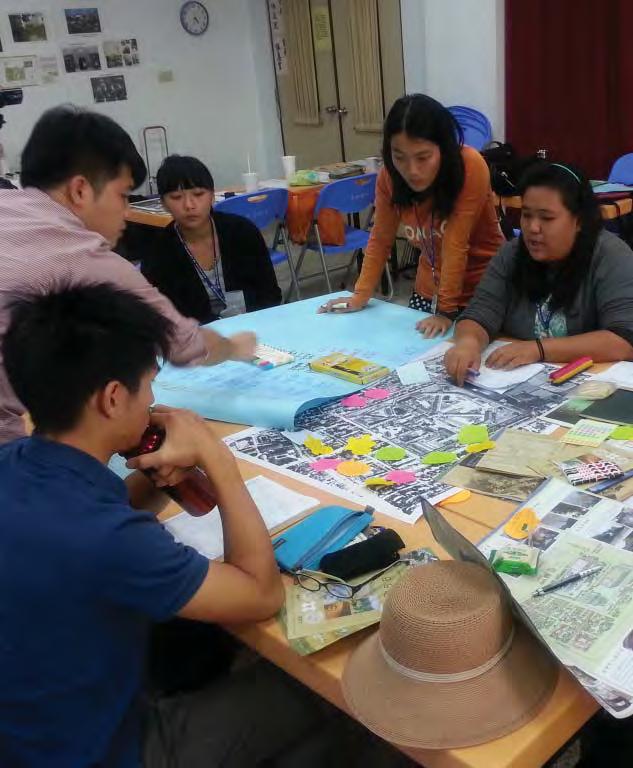
Collaboration
▶ Planning and design community & stakeholder charrettes
In response to the perceived superficial ‘greenwash’ results of ‘Taipei Beautiful’ implemented by the Taipei City Government, the Urban Regeneration Office attempted to initiate a new program. Classic Design involved neighbouring communities as well as non-government groups in each project.
Productivity
▶ Participation in building
A mobile baking oven in the Ecological Observation Garden was built by community members with the help of designers.
Programming
▶ Civic/arts anchor
The Reading and Herb Garden is bounded by cafes, live music venues, and bookstores.
Imageability
▶ Thematically integrating surrounding uses
The Reading and Herb Garden connected to the cultural aspects of the nearby cafes, music and book venues by playing host to public forums.
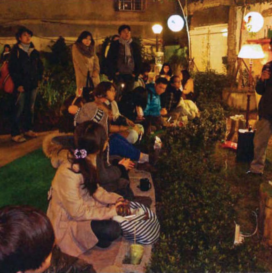
Programming
▶ Concerts and events
The Reading and Herb Garden has been the venue for numerous public ‘salons’ focussed on social issues such as gender, immigration, labour, LGBT rights.
Productivity
▶ Recycling and Reusing
The Rainwater Garden was created using tiles, timbers and concrete fragments from demolished buildings, and facilities to collect and use rainwater.
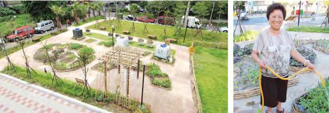
Programming
▶ Indeterminate Use
Happy Farm has become a gathering space as it has free public access. The elderly share experiences and socialise daily.
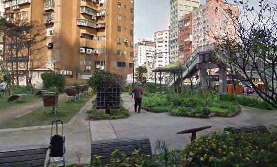
Legibility
▶ Defining public territory
By creating separately-themed gardens, with different ‘identities’ the gardens were recreated as highly-legible spaces that had defined edges.
Flexibility
▶ Flexible community gathering spaces
A range of community-minded gathering places were installed with seating and tables.
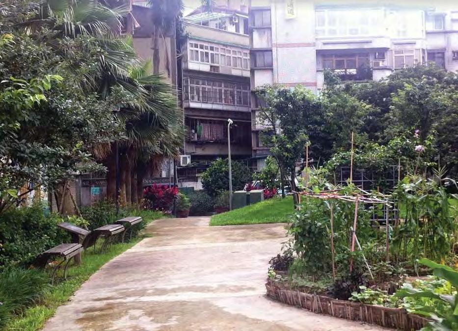
Safety
▶ Infrastructure for non-essential activities
A variety of activities can take place at these different gardens, which encourages ‘lingering’, positive perception and passive surveillance.
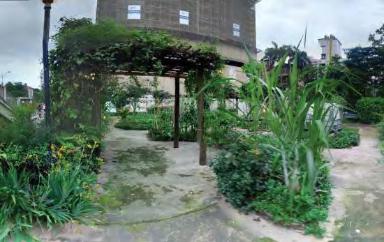
Learning & engagement
▶ Learning Centre incorporated into project
Rainwater Garden is a popular location for schools in the area due to the example set of ecological recycling and sustainability.
// Case Studies | 107106 | People in Public Places
S5 Cascoland Kolenkitburt
Amsterdam, NL
Type: Social incubator
Context: Local Centre
User Groups: families children
Ethnicity context: South Mediterranean (Turkey, Moroccan)
Status: residents residents – low income recent migrants
‘Kolenkit’ was one of the most run-down and socially disadvantaged neighbourhoods in Amsterdam. Small apartments typically house extended migrant families. After receiving attention through a shift in national policy a consortium of state and local government together with a housing corporation and a local community were faced with the prospect of how to regenerate a problematic area and in particular use the public space to improve the social conditions of residents.
Social participation context:
A residential area of high density with a high proportion of migrant families and individuals of a diverse age group. How can a public space project be culturally relevant, engage a wide variety of users and be sustained and maintained?
Key Aspects:
NETWORKS & EXCHANGE
Collaboration
Productivity
Lear ning & Engagement
PROGRAMMING
Social & Cultural diversity
Health/ wellbeing & play URBAN
Accessibility
Flexibility
Amenity & Comfort
Connectivity
Legibility
Safety
Imageability
Complexity
STRUCTURE
URBAN CHARACTER
M
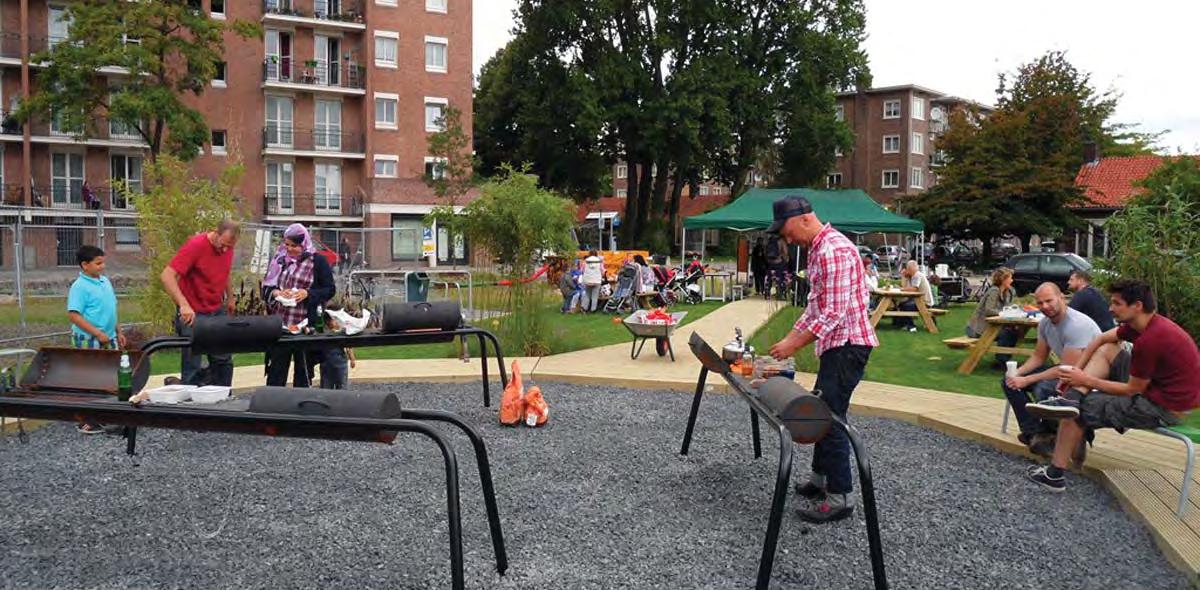
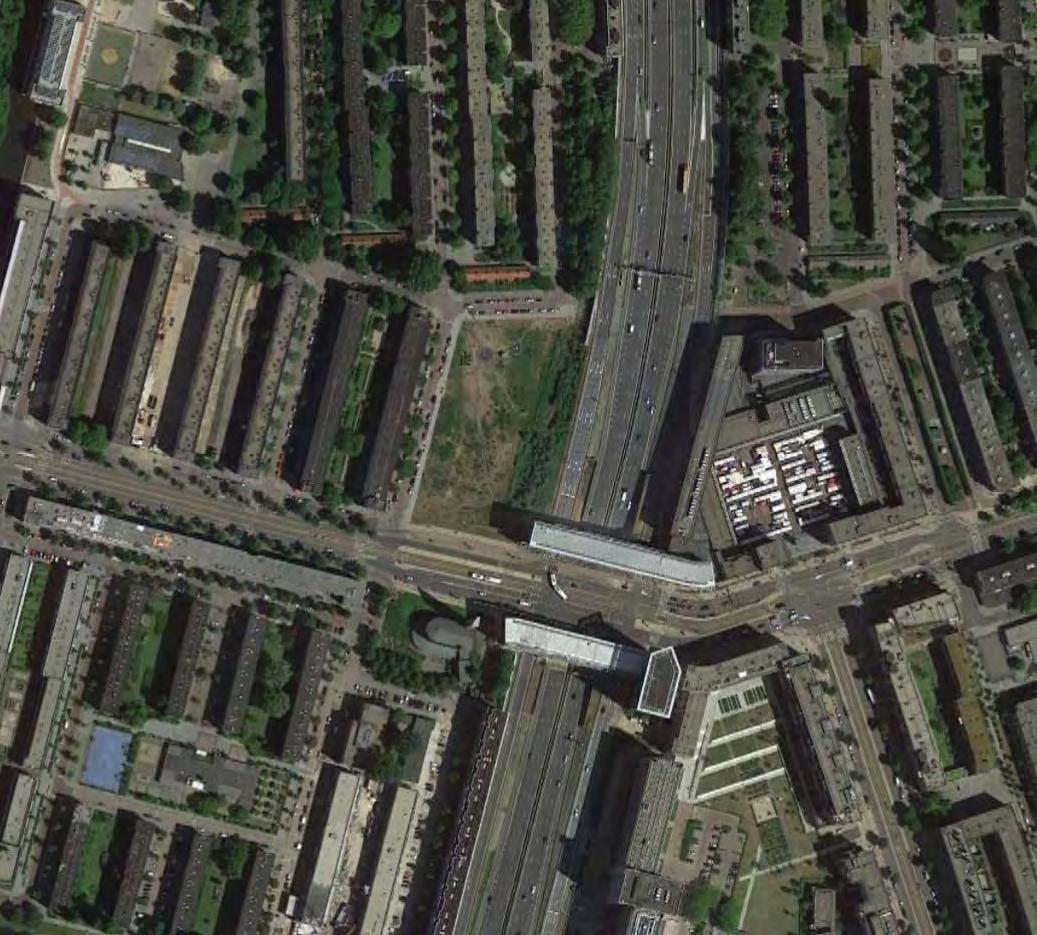
52°22'45.16"N 4°50’35.35”E 10,100 m2
// Case Studies | 109108 | People in Public Places
130 m
Collaboration
▶ Research & experimental enterprise programme
A team of community artists who had been working in the area with a University on the role of cultural enterprise in disadvantaged neighbourhoods were given the opportunity to implement and test their knowledge.
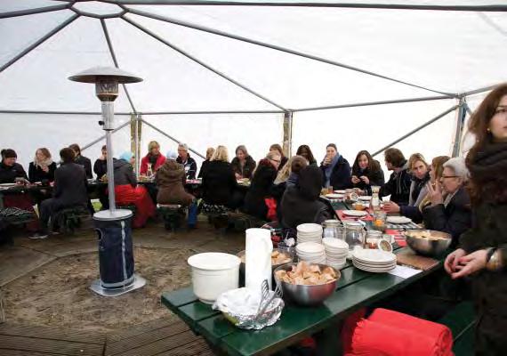
Collaboration
▶ Open neighbourhood forums
Open dinners and other events with a low barrier to entry were set up to gather participants and share information.
Connectivity
Legibility
▶ Defining public territory
The large public space was initially contained by low fencing and planters which enabled residents to reclaim and sections and organise interventions in a more manageable fashion.
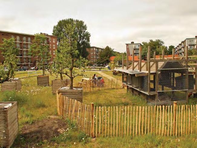
▶ Integrated public connections
The path network connects the public space to three different streets providing a permeable and publicly accessible territory.
Productivity
▶ Participation in building Henhouses and subsequent facilities were designed and made in collaboration with the residents.
Programming
▶ Tradition informing use
Residents from migrant communities expressed a desire to keep cattle and this was translated into the idea for hen-houses.

Safety
▶ Repetitive use elements
Repetitive daily activities involved with the maintennace and management of the gardens and livestock create a continuous use profile.
Accessibility
▶ Formalise paths
Over time, more formal networks of paths were introduced on the large open space to enable access for different mobility needs all year around and define specific routes.
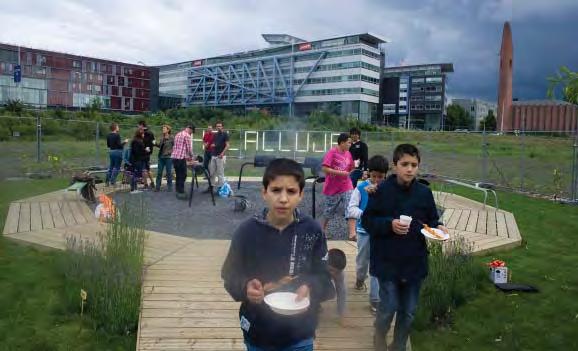
Learning & Engagement
▶ Community management of public space
Several families were selected to look after the public space interventions.
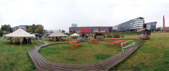
Amenity & Comfort
▶ Weather protection
Movable canopies can be erected or dismantled depending on the weather to give flexibility of occupation and use.
Programming
▶ Recreational & sporting infrastructure
In time after the henhouses reclaimed the public space this allowed the development of further infrastructure for the community such as an ice rink and picnic area.
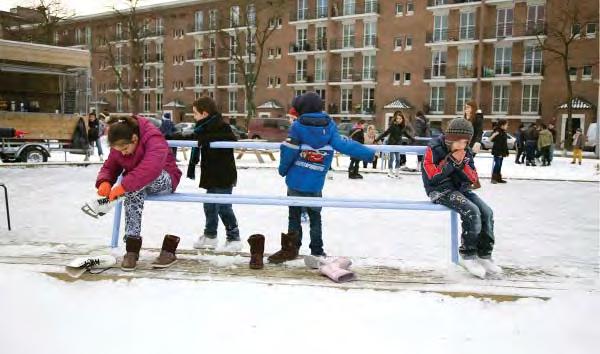
Safety
▶ Infrastructure for non-essential activities
A variety of activities can now take place on the site involving a wide range of ages and social groups which creates a positive perception and passive surveillance.
Flexibility
▶ Flexible community gathering spaces
A range of community-minded gathering places were distributed which allowed different scales of gathering.
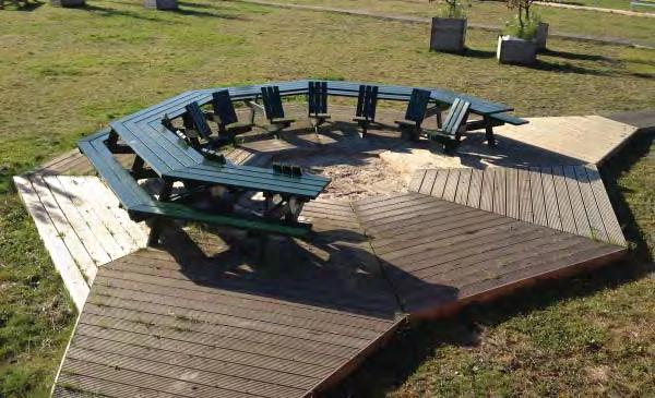
// Case Studies | 111110 | People in Public Places
/// Tactics Summary
PRODUCTIVITY
▶ Participation in building
▶ Student enterprise
▶ Local business enhancement
▶ Recycling & Reusing
▶ Retail strategy
▶ Digital Compatibility
▶ Community enterprise
COLLABORATION
▶ Research & experimental enterprise programme
▶ Open neighbourhood forums
▶ Local community based organisation
▶ Community led project
▶ Collaborative partnership and funding
▶ Citizen involvement in design process
▶ Planning & Design community & stakeholder charrettes
▶ Planning and design frameworks
LEARNING & ENGAGEMENT
▶ Community management of public space
▶ Community involvement in vision setting
▶ Community management of public space
▶ Learning centre incorporated into project
▶ Interpretive signs and markers
SOCIAL & CUTURAL DIVERSITY
▶ Tradition informing use
▶ Removing space restrictions
▶ Event Management & Coordination
▶ Civic/Arts anchor
▶ Children’s attractions and services
▶ Government Services
HEALTH, WELLBEING & PLAY
▶ Recreational & sporting infrastructure
▶ Indeterminate use
▶ Active transport management
▶ Concerts and Events
ENGAGEMENT W ORKING AHS R I NG DECISIONMAKING PROGRAMMING NETWORKS&EXCHANGE
FLEXIBILITY
▶ Flexible equipment
▶ Multiple aspect seating
▶ Flexible community gathering spaces
▶ Diversity of Occupation
▶ Interim project
▶ User specific furniture
URBANCHARACTER URBANSTRUCTURE
ACCESSIBILITY
▶ Formalise paths
▶ Liberating public space
▶ Integrated universal access design
▶ Pedestrian prioritisation
▶ Streetscape improvements
▶ Reduce intersection/ carriageway dimensions
SAFETY
▶ Infrastructure for non-essential activities
▶ Repetitive use elements
▶ Colocation
▶ Pedestrian improvement
▶ Openness and sightlines
▶ Maximum adaptability of ground floor
▶ Generous balconies address public realm
▶ Permeable block forms engage public realm
▶ Street lighting improvement
LEGIBILITY
▶ Defining public territory
▶ Defining paths & edges
▶ Form
▶ Logical and human scaled public realm
▶ Legible town centre
CONNECTIVITY
▶ Integrated public connections
▶ Inter connectedness
▶ Public space to overcome infrastructure barrier
▶ Transport & traffic relocation
▶ Transit connection
▶ Public open space network structure
▶ Road based public transport spine
▶ Maintain through routes for pedestrians
▶ Reinstating streets and pathways
IMAGEABILITY
▶ Community identification in built elements
▶ Familiar materiality & Form
▶ Repurposing historic structures
▶ Natural features and landmarks
COMPLEXITY
▶ Diversity of Type
▶ Diversity of experience
▶ Richness & Intrigue
▶ Thematically Integrating surrounding uses
AMENITY & COMFORT
▶ Weather protection
▶ Scale
▶ Extensive use of natural materials
▶ Integrated street furniture design
▶ Tree planting & shade
▶ Widened footpaths and parked car buffer
▶ Shelter
Figure 6
Tactics are the specific urban design actions extracted from case studies under each of the criteria. By following the analytical framework these tactics have a direct relationship with improving the potential for social participation in the public realm.
/// Tactics Summary | 113112 | People in Public Places
What has the research method revealed to assist in improving the potential for social participation in the design of the public realm?
The development and application of the analytical framework to the case studies has provided a diverse range of urban design tactics which could be used to help meet the research objectives.
Each project has its own unique context and it is difficult to provide an all-encompassing formula or approach. The context often informs the performance ambitions of each project with respect to demographic diversity. For example Marsupial Bridge (P5) is situated in a diverse inner urban enclave, with a history of minority ethnic and social populations and its target demographic bandwidth would therefore be informed by this contextual condition.
The analytical framework clarified that in order to give the best potential to facilitate social participation it is necessary to engage with as many, and preferably all, of the
design elements. Both the software and hardware provide the framework for meeting the research objectives and are often working in tandem, reinforcing and supporting each other. Whilst some of the design criteria may not fall within the classical interpretation of urban design the research has demonstrated that a holistic approach is necessary.
The tactics present as a useful ‘kit of parts’ that can be referenced during the planning and design phases of public space projects. In particular there are a number of general lessons which are consistently represented in the research which act as a set of recommendations or design principles to support social participation in public realm projects.
///// Recommendations
COLLABORATION
LEARNING & ENGAGEMENT
PRODUCTIVITY
SOCIAL & CUTURAL DIVERSITY HEALTH, WELLBEING & PLAY
FLEXIBILITY
ACCESSIBILITY
SAFETY
LEGIBILITY
AMENITY & COMFORT
CONNECTIVITY
IMAGEABILITY COMPLEXITY
W ORKING AHS R I NG DECISIONMAKING
ENGAGEMENT
PROGRAMMING URBANCHARACTER NETWORKS&EXCHANGE URBANSTRUCTURE
//// Recommendations | 115114 | People in Public Places
NETWORKS & EXCHANGE
Collaboration
Establish creative partnerships
Establishing networks and platforms for the initial and ongoing exchange of information are critical early actions which set up the conditions for social participation and continuing engagement. Early partnerships with not for profit agencies and/or creative engagement teams which sit outside of the formal authorities seems to provide the conditions whereby a sense of relevance, ownership and attachment is fostered. (P3, P4, P6, S1 – S6)
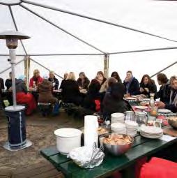
Create a local mediation space
The establishment of a project office adjacent to the site gives the ability to continually exchange information and engage with the community as well as signifying a change and and managing expectations. There would appear to be significant advantage to the efficacy of this process when it is not an authoritarian presence but one which is approachable and acts as a kind of mediator.
(P4, P7, T5, T7, S2, S5)
Community can design
Community participation in early stages of the project process including involvement in decision making in research, planning and design is an essential common aspect to achieve a good level of social participation. This consistent involvement creates a sense of ownership and can lead to self-organisation and community management practices. (P1, P2, P4, P5, T1, T3 – T5, S1 – S5)
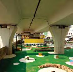
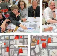
Learning & Engagement
Learning is engaging
Incorporating aspects of learning is an additional and potentially powerful pathway to generate engagement with public place. Whilst this can be addressed through interpretive content there is the opportunity to explore more integrated forms of learning such as providing opportunities and places for ongoing teaching and research. Such programming promises a host of related benefits including safety, productivity, upkeep and imageability.
(P6, P7, T7, S2 – S5)
S5 Cascoland, Kolenkitburt
A team of researchers and artists established an early dialogue with the community setting up open forums with a low barrier to entry.
P4 Fly the Flyover
A mediation organisation (EKEO) was located adjacent to a public plaza as a way of breaking down the communication scales between the city government and the local community.
T5 Courthouse Square
Design workshops were widely advertised and used techniques which were fun and engaging yet still informed the physical properties of the design.
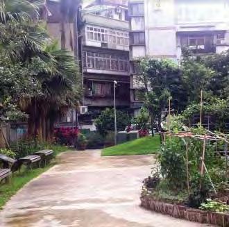
S4 Roosevelt Road Green Life Axis
The rain garden was used by primary school students to monitor climate and the herb garden re-introduced traditional medicines for community use.
Example
Example
Example
Example
Productivity
Hands on!
Involving the community in building allows another pathway for engagement and investment in the relevance and positive perception of public place. This may only be a small component of the project or it may be interim, however its action promises to substantially enhance the potential for social participation. (P1, P4, T1, S1 – S5)
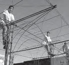
P1 Okolona Downtown Park
Local residents joined students in constructing elements of the park using familiar and locally available materials and techniques.
PROGRAMMING
Social & Cultural Diversity
Use activity spreaders
Colocation of uses which support a permanent, continuous and diverse use profile, for example educational, civic and arts functions are often important in establishing conditions which encourage engagement as they promote a consistent base level of activation.
(P6, P7, T1, T6)
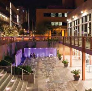
Tradition as generator
Some of the case studies reveal the positive attributes of consulting with local communities with respect to incorporating important social and cultural traditions which have been ‘squeezed-out’ of the public realm or which have been difficult to transfer. For example growing specific plants or enabling collective practices such as cooking.
(P2 - P4, T1, T2, T6, S3 – S5)
P7 Civic Space University students from the adjacent campus building are enticed into the public realm with facilities and wi-fi and a community arts organisation curates a restored showroom.
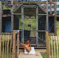
S5 Cascoland, Kolenkitburt
Migrants expressed a desire to keep cattle which was impossible in the high density dwellings, however the public realm was adapted to provide animal husbandry.
Example
Example
Example
//// Recommendations
| 117116 | People in Public Places
URBAN STRUCTURE
Flexibility
Small is effective
Small-scale/seed projects allow different scaled (eg minority) groups to be involved and take ownership where larger representation may be overwhelming or lead to conflict. This also allows for experimental tactics of a low risk nature to be trialled, which could break the shortcomings of traditional top-down planning and design approaches. These can be nested within the framework of a much larger project.
(P1, P2, P4, S1 – S5)
De-programming
Allowing for indeterminate use of public places by providing a ‘loose-fit’ physical framework, such as an open square or adaptable zone (a ‘staging area) creates the ability for use to evolve according to the changing context and use pattern of a project. This allows people to adopt space for interim uses and for it to serve many different groups over time. (P1 – P7, T1, T4, T5, T7, S1, S2, S5)
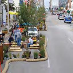
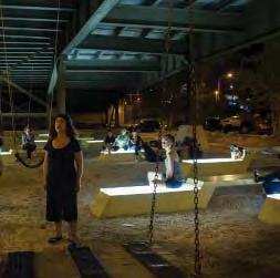
Flexible furniture
Whilst traditional furniture such as park benches are welcoming and useful for those who require specific support such as the elderly, less prescriptive seating arrangements can allow different groups to use the space. For example dual aspect seating on the edge of plazas permits users to orient to the plaza or the street edge which may be preferable for those wanting a peripheral engagement. Similarly furniture which is arranged to allow different sized groups to occupy space can broaden the appeal.
(P1 – P6, T1, T7, S1, S2, S5)
Accessibility
Redress the balance
In many of the projects the movement and accommodation of motor vehicles has become the dominant philosophy informing configuration of the public realm. There is a need to redefine this imbalance, seriously address vehicle parking as an initial step and to claim well located, structurally important public territory back for the pedestrian and focus on the qualitative aspects of human movement in these locations.
(P1 – P3, P6, P7, T1 – T6, S1, S2)
S1 Build a better block
Small interventions change the perception of places and test demographic appeal and ideas without expensive and inflexible construction.
P5 Marsupial Bridge
The indeterminate nature of the plaza with intriguing lighting, adaptable furniture and an open aspect encourage community appropriation for theatre and gathering.
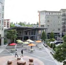
P1 Okolona Downtown Park
The retaining wall defines the public territories but has been capped with a material that invites a street engagement as well as remaining part of the plaza.
T2 Thornton Place
As with many TODs finding a solution to commuter parking was a critical tactic in liberating the public realm to crate a more walkable human centred environment.
Example
Example
Example
Example
Integrate universal access
Accommodating the spatial demands of the more gentle slopes required for some users can often be an afterthought and lead to remnant paths and ramps which are poorly integrated with the overall organisation and functioning of space and become exclusionary in nature. These travel paths can be cleverly integrated into public space design particularly if viewed as a potential opportunity to structure space and thereby become an asset rather than a requirement.
(P3, P6, T1, T2)
Borrow some ‘eyes’
The colocation of functions which augment the typical use profile of public places creates the condition where there is a more consistent pattern of passive surveillance and avoids ‘blind spots’ at certain times of the day. This extends beyond residential and retail considerations which may fluctuate or take time to establish and should consider incorporating civic, institutional, educational and community based organisations in buildings which have a direct visual and physical connection.
(P3, P4, P6, P7, T1, T2, T5, T6, S3 – S5)
Sightlines
Openness and avoiding areas which cannot be seen through the creation of obscured residual spaces and dead-ends.
Visual permeability ensures that places are not able to be territorialised inappropriately, creates a welcoming environment where users can apprehend any perceived threats.
(P3, P5 – P7, T1, T3, T4, S3, S5)
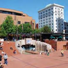
Make it sensible first
Uncluttered easily comprehended, clearly defined, archetypal open spaces seem to present the most flexibility to cater for a variety of functions and different user groups including regional civic uses. These can be subtly yet effectively ‘broken-up’ without imposing structures, through surface patterning, materiality and gradual level changes to also cater for more intimate social gatherings.
(P3, P6, P7, T1, T4, T5, S5)
P3 Charlotte Amundsens Square
The ramp to the sunken sports court describes an ‘urban cliff’ which is an integral piece of furniture for all users.
P3 Charlotte Amundsens Square
A community centre and cafe are colocated with the public space and provide a consistent use and passive surveillance profile
T1 Pioneer Courthouse Square
Enclosed programme is recessed into the ‘topography’ of the square to maintain an open aspect and peripheral elements are visually permeable
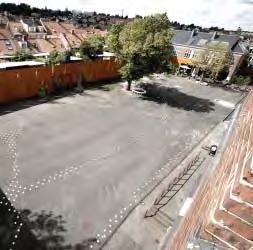
P6 Nicolai Cultural Centre Courtyard
The old ‘schoolyard’ is a clearly understood orthogonal form however painting, planting, materiality and furniture overcome a monolithic perception of space.
Example
Example
Example
Example
Safety
//// Recommendations | 119118 | People in Public Places
Legibility
URBAN STRUCTURE
Human scale
Elements of the public realm which are perceived as overscaled, too large, vast or impermeable can lead to rejection by certain users. The dominance of a large surface car park or long street walls with little public interface are examples of this. Block lengths should be permeable for foot traffic, road surfacing shouldn’t be provided in lieu of footpaths and shared space and use the existing strengths of logically arranged street networks. (P2, P3, P6, P7, T1, T3 – T7, S1)
Connectivity
Legibility (cont) Example
Connectivity is a ground rule
Tactics which deal with connectivity are often very important early modifications to the urban structure and set up the physical framework for other supporting actions to take place. In areas where automobile priority has ‘overtaken’ the ground plane breaking up or remediating complex, unattractive and confusing pedestrian routes with public infrastructure seems to be key to laying the foundations for a better connected and broadly appealing place that promotes active travel.
(P2, P5, T2 – T5, S1)
Overcome the past
In transit related projects often a key piece of public space is needed to overcome the ‘tradition’ of allowing decisions related to motor vehicle movement efficiency to dominate the configuration of the public realm. Providing commuters and town centre users with a ‘welcome mat’ and logical, inviting path to their next destination provides the physical framework to enable pedestrian based urban activity.
(P2, P4, P5, T1 – T7, S1, S3, S4)
Amenity & Comfort
Make it Inviting
Attention to the basics of public space design considering colour, texture, shade and trees can create the underlying physical framework through which a public space is considered pleasing and inviting. Natural and locally appropriate materials can provide a familiarity and offset the monolithic and potentially de-humanising nature of many contemporary construction practices.
(P1 - P7, T1 - T7, S1, S3 - S5)
The large automobile scaled commuter parking lots were broken down into blocks which afforded permeability and encouraged walkability. Example
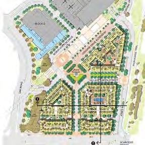
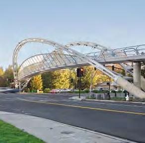
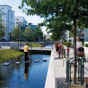
T4 Contra Costa Transit Village
T4 Contra Costa Transit Village
Major road infrastructure often curtails the walkability of a precinct and hinders its potential, generous gestures to connective ‘tissue’ can contribute to re-establishing active transport use.
T3 Arlington Heights Village
A linear park adjacent to the new station was critical in breaking down the barrier effect of parallel arterial transport infrastructure alignments and connecting the two halves of the precinct.
T7 Hammarby Sjostad
Natural materials, tree planting and grassy banks provide a highly inviting public realm.
Example
Example
URBAN CHARACTER
Imageability
Sense of place
Although a difficult term to define there are some tactics which can contribute to enhancing or establishing sense of place. Identification with place on a mnemonic level makes users feel more connected and welcome. Adapting existing structures or spending time to uncover local stories which can be expressed through the design process are examples of ways in which to build recognition and familiarity.
(P3, P6, P7, T1, T2, T5 – T7)
Complexity
Intriguing gestures
Whilst there is a demonstrated need to concentrate on basic underlying forms which are legible and familiar, the role of complexity is to provide the levels of information in the public realm which suggest a diversity of possibilities and enable different scales of perception and use. Such variation can create opportunities for contemplation, spontaneous action or simply invite curious minds.
(P3 – P7, T1, T2, T7, S1 – S5)
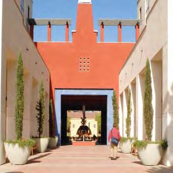
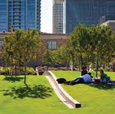
T6 Del Mar Transit Village
Del Mar draws on the familiar structure, forms and materials of the pueblo vernacular architecture of the region to establish a strong and cohesive sense of place.
P7 Civic Space
Within the large park gentle grassed hills create small shaded rooms which remain part of the cohesive overall concept of ‘weaving’ space.
Example
Example
//// Recommendations | 121120 | People in Public Places
References
General
AUSTRALIAN GOVERNMENT 2011. Creating Places for People: An urban design protocol for Australian cities. In: STATE AND TERRITORY PLANNING DEPARTMENTS. Australia: Commonwealth Of Australia.
BELL, B. (ed.) 2004. Good Deeds, Good Design: Community Service Through Architecture, New York NY: Princenton Architectural Press.
BENTLEY, I., ALCOCK, A., MURRAIN, P., MCGLYNN, S. & SMITH, G. 1985. Responsive environments. A manual for designers, London UK, Architectural Press.
BURTON, E. & MITCHELL, L. 2006. Inclusive Urban Design: Streets for Life, Oxford UK, Elsevier Ltd.
CARMONA, M., TIESDELL, S., HEATH, T. & OC, T. 2010. Public Places Urban Spaces; The Dimensions Of Urban Design, New York NY, Architectural Press, Routledge.
CHARLESON, D. 2012. Bridging The Digital Divide: Enhancing empowerment and social capital [Online]. Meadowbrook QLD: Journal of Social Inclusion Griffith University. Available: https://www104.griffith.edu.au/index.php/inclusion/search/search [Accessed October 2015.
CHO, I. S., TRIVIC, Z. & NASUTION, I. 2015. Towards an integrated urban space framework for emerging urban conditions in a high-density context [Online]. Singapore: Journal of Urban Design. Available: http://www.tandfonline.com/doi/ abs/10.1080/13574809.2015.1009009 [Accessed October 2015.
CITY FO GREATER DANDENONG 2013. Community Engagement Planning Framework. Dandenong VIC: City fo Greater Dandenong,.
CULLEN, G. 2008. The Concise Townscape, Burlington MA, Elsevier Ltd. Architectural Press.
DITTMAR, H. & OHLAND, G. (eds.) 2004. The New Transit Town: Best Practices in Transit-Oriented Development, Washington DC: Island Press.
GEHL, J. 2010. Cities for people, Washington, DC, Island Press.
HEDELUND, L. 2007. From Library to Community Centre: Evaluation of Community Center Gellerup. Aarhus DK: Aarhus Municipality.
JACKSON, R. J. & SINCLAIR, S. 2012. Designing Healthy Communities, San Francisco CA, Jossey-Bass.
KELLY, J.-F. 2012. Social Cities. Melbourne VIC: Grattan Institute.
KNOESTER, B., MIAZZO, F. & MINKJAN, M. (eds.) 2014. We Own The City, The Netherlands: trancity*valiz.
LAURSEN, L. H. & ESPVALL, M. 2014. Social capital in Gellerup [Online]. Meadowbrook QLD: Journal of Social Inclusion Griffith University. Available: https://www104.griffith. edu.au/index.php/inclusion/article/view/256/447 [Accessed October 2015.
LEVASSEUR, M., RICHARD, L., GAUVIN, L. & RAYMOND, É. 2010. Inventory and analysis of definitions of social participation found in the aging literature: Proposed taxonomy of social activities. Social Science & Medicine, 71, 21412149.
LINDSTRÖM, M. 2005. Ethnic differences in social participation and social capital in Malmö, Sweden: a population-based study. Social science & medicine, 60, 15271546.
LYDON, M. & GARCIA, A. 2015. A Tactical Urbanism HowTo, Springer.
LYNCH, K. 1960. The image of the city, Cambridge, Mass., Cambridge, Mass. : Massachusetts Institute of Technology.
MARCUS, C. C. & FRANCIS, C. (eds.) 1998. People Places: Design Guidelines For urban Open Space, Canada: John Wiley and Sons, Inc.
MARS, G. M. J., KEMPEN, G. I. J. M., MESTERS, I., PROOT, I. M. & VAN EIJK, J. T. M. 2008. Characteristics of social participation as defined by older adults with a chronic physical illness. Disability and rehabilitation, 30, 1298-1308.
PRITCHARD, G. 2010. Disabled People as Culturally Relevant Teachers [Online]. Meadowbrook QLD: Journal of Social Inclusion Griffith University. Available: https://www104. griffith.edu.au/index.php/inclusion/search/search [Accessed October 2015.
PROJECT FOR PUBLIC SPACES 2012. Placemaking and the future of cities. New York NY.
RMIT UNIVERSITY 2006. Evaluation of the Stronger Families and Communities Strategy 2000-2004. Melbourne VIC.
SOFOULIS, Z., ARMSTRONG, H., BOUNDS, M., LOPES, A. & ANDREWS, T. 2008. Out & About in Penrith: Universal design and cultural context: Accessibility, diversity and recreational space in Penrith. Penrith NSW: University of Western Sydney, Penrith City Counsil.
WHITE, K. 2015. Healthy Spaces and Places [Online]. Australia: Heart Foundation, Planning Institute Australia, Australian Local Goverment Association. Available: http:// www.healthyplaces.org.au/site/index.php [Accessed October 2015.
WHYTE, W. H. 1980. The social life of small urban spaces, Washington, D.C, Conservation Foundation.
Project Specific
P1 Okonola Downtown Square
CRISS, S. 2000. Okolona Downtown Park: Design and construction of a “common ground” through community volunteerism and collaboration. Mississippi USA: Mississippi State University.
CRISS, S. 2002. Okolona Downtown Park [Online]. Kansas KC: University of Kansas. Available: http://kubuildingtech. org/scriss/projects/okolonapark/okolonapark.html [Accessed October 2015.
CRISS, S. 2004. Small Town Center. In: BELL, B. (ed.) Good Deeds, Good Design: Community service through architecture. New York NY: Princenton Architectural Press.
P2 Putnam Triangle Plaza
KELLOGG, P., HILLS, K. & BROWN, A. 2015a. Putnam Triangle Design Concepts and FAQs [Online]. Brokling NY: Fulton Area Businesses. Available: http://faballiance.org/ news/putnam-triangle-progress [Accessed October 2015.
KELLOGG, P., HILLS, K. & BROWN, A. 2015b. Putnam Triangle Plaza [Online]. Brooklin NY: Fulton Area Alliance,. Available: http://www.nyc.gov/html/dot/downloads/pdf/2015-03-putnam-plaza-cb2.pdf [Accessed October 2015.
KELLOGG, P., HILLS, K. & BROWN, A. 2015c. Putnam Triangle Plaza Design Renderings [Online]. Brooklin NY: Fulton Area Alliance,. Available: http://faballiance.org/node/817 [Accessed October 2015.
NEW YORK CITY 2014. Reconstruction of Putnam Plaza. In: DEPARTMENT OF TRANSPORTATION. New York NY.
P3 Charlotte Amundsens Square
1:1 LANDSKAB & SCHIBSBYE, S. 2010. Charlotte Ammundsens Square. In: FERNANDEZ PER, A. & MOZAS, J. (eds.) a+t Independant Magazine Of Architecture And Technology. Espana: a+t ediciones.
JENSEN, S. 2015. Kulturhuset Indre By [Online]. Copenhagen DK. Available: http://kulturhusetindreby.kk.dk/ [Accessed October 2015.
LANDEZINE. 2008. Charlotte Ammundsens Plads [Online]. Slovenia: Landezine / Landscape Architecture Works 2009-2015. Available: http://www.landezine.com/index. php/2011/05/charlotte-ammundsens-plads-by-11-landskab/ [Accessed October 2015.
P4 Fly the Flyover
ENERGIZING KOWLOON EAST OFFICE. 2012. Conceptual Masterplan 4.0 [Online]. Hong Kong: Development Bureau, The HKSAR Government. Available: http://www.ekeo.gov. hk/en/conceptual_master_plan/key_themes/connectivity/ index.html [Accessed October 2015].
ENERGIZING KOWLOON EAST OFFICE. 2014. Stage 3 Public Engagement Pedestrian Environment Improvement Feasibility Study [Online]. Available: http://www.ekeo.gov.hk/kbba-pedestrian/ en/Stage3PublicEngagement01.html [Accessed October 2015].
MALHOLTRA, S. & COMEAU, M. 2014. We Own the CityEnabling Community Practice in Architedcture and Urban planning. In: MIAZZO, F. & KEE, T. (eds.). trancity*valiz.
P5 Marsupial Bridge
HORNE, M. 2013a. Grand Opening of Marsupial Bridge Connector [Online]. Milwaukee WI: Urban Milwaukee. Available: http://urbanmilwaukee.com/2013/08/08/plentyof-horne-grand-opening-of-marsupial-bridge-connector/ [Accessed October 2015.
HORNE, M. 2013b. Why We Lost the Marsupial Bridge Swings [Online]. Milwaukee WI: Urban Milwaukee. Available: http://urbanmilwaukee.com/2013/10/10/plenty-of-hornewhy-we-lost-the-marsupial-bridge-swings/ [Accessed October 2015.
MILWAUKEE HISTORIC PRESERVATION COMMISSION
2001. Historic designation study report: Brady street historic district. Milwaukee WI: City Of Milwaukee.
References | 123122 | People in Public Places
THE STATE UNIVERSITY OF NEW YORK. 2007. Rudy Bruner Award Digital Archive: Crossroads Project [Online]. Buffalo NY: University at Buffalo Libraries. Available: http:// libweb1.lib.buffalo.edu/bruner/type/project.asp?entry=650 [Accessed October 2015.
P6 Nicolai Cultural Centre
ARCHITONIC. 2008. Nicolai Cultural Center, Kolding [Online]. Architonic. Available: http://www.architonic.com/ aisht/nicolai-cultural-center-kolding-dorte-mandrup-arkitekter/5100110 [Accessed October 2015].
OPEN BUILDINGS. 2008. Sct. Nicolai Cultural Centre [Online]. OpenBuildings.com. Available: http://openbuildings.com/buildings/sct-nicolai-cultural-centre-profile-4307 [Accessed October 2015].
TEGNESTUE, K. J. & HOGSBERG, S. 2008. Nicolai Culture Center [Online]. Divisare.com. Available: http://divisare. com/projects/190835-Kristine-Jensens-Tegnestue-Nicolai-Culture-Center [Accessed October 2015].
P7 Civic Space
CITY OF PHOENIX & ARIZONA STATE UNIVERSITY 2010. Civic Space Park. 2011 Rudy Bruner Award Project Data. Phoenix AZ.
B., WHITLOW, H. & KOUDOUNAS, A. 2009. Phoenix Civic Space Park [Online]. Washington WA: Landscape Architectural Foundation. Available: http://landscapeperformance. org/case-study-briefs/phoenix-civic-space-park [Accessed October 2015.
WORLD LANDSCAPE ARCHITECTURE & HOLMES, D. 2013. Civic Space Park Phoenix USA [Online]. China: World Landscape Architecture. Available: http://worldlandscapearchitect.com/civic-space-park-phoenix-usa-aecom/ [Accessed October 2015.
T1 Pioneer Courthouse Square
CARMONA, M., TIESDELL, S., HEATH, T. & OC, T. 2010. Holistic Urban Design. Public Places Urban Spaces: The Dimensions Of Urban Design. Second ed. New York NY: Architectural Press.
LARSON, T. 2014. Portland’s ‘living room’ [Online]. Watertown MA: ArchiTalk. Available: http://architalk-tlarson. blogspot.com.au/2014/06/portlands-living-room.html
[Accessed October 2015.
LONGO, G. 1996. Pioneer Courthouse Square. A Guide To Great American Public Places. New York NY: Urban Initiatives, Inc.
T2 Thorton Place
BERTOLET, D. 2009. Seattle’s First TOD [Online]. Seattle WA: Hugeasscity. Available: http://hugeasscity. com/2009/04/14/seattles-first-tod/ [Accessed October 2015.
BICKNELL, L., CLOWERS, G., FOSTER, M. & HAUGER, T. 2012. Northgate Transit-Oriented Development. In: DEPARTMENT OF PLANNING AND DEVELOPMENT (ed.). Seattle WA: City Of Seattle.
DUNHAM-JONES, E. 2013. Gray, Green and Blue: Seattle’s Northgate [Online]. New York WA: The American Institute of Architects. Available: http://www.aia.org/practicing/ AIAB100516 [Accessed October 2015.
MITHUN ARCHITECTS. 2014. Northgate Neighborhood Revitalization: Transit Oriented Urbanism and Green Infrastructure [Online]. Seattle WA. Available: https://www.facebook.com/mithundesign/timeline [Accessed October 2015.
WEEKS, S. & TRUJILLO, T. 2009. Thorton Place Seattle USA. Seattle WA: University of Washington.
T3 Arlington Heights Village
ARLINGTON HEIGHTS PLANNING 2015. Village of Arlington Heights: Draft 2015 – 2019 consolidated plan for public comment. In: DEPARTMENT OF PLANNING & COMMUNITY DEVELOPMENT (ed.). Arlington Heights IL.
CHICAGO METROPOLITAN AGENCY FOR PLANNING
2015. Village of arlington heights bicycle and pedestrian plan. Chicago IL: Chicago Metropolitan Agency For Planning,.
ENRIGHT, B., HAMID, A. & HAUTT, A. 2007. Downtown Master Plan: Village of Arlington Heights. In: PLANNING & COMMUNITY DEVELOPMENT DEPARTMENT (ed.). Arlington Heights IL.
T4 Contra Costa Centre Transit Village
CONTRA COSTA COUNTY BOARD OF SUPERVISORS
2002. Pleasant Hill BART Station: Shaping a new transit community. In: CONTRA COSTA COUNTY REDEVELOPMENT (ed.). Martinez CA.
MUNICIPAL ADVISORY COUNCIL MEETING 2014. Avalon Walnut Creek at Contra Costa Centre Transit Village. Contra Costa CA: Avalon Bay Communities Inc.
NEWBERG, S. 2012. Form-based code a tool for successful TOD [Online]. Minneapolis MN,. Available: http://streets. mn/2012/07/26/form-based-code-a-tool-for-successfultod/ [Accessed October 2015.
WHITE, K., LOWY, N., CISNEROS, X., JOHNSON, K. & GOSALVEZ, R. 2009. Bay Area 2009 TOD Market Place. San Francisco CA: Urban Land Institute.
T5 Courthouse Square
ARLINGTON COUNTY BOARD 2014. Courthouse civic engagement story. In: DEPARTMENT OF COMMUNITY PLANNING HOUSING & DEVELOPMENT (ed.). Arlington VI: Arlington County.
ARLINGTON COUNTY GOVERNMENT 2014. Demographics Arlington Profile 2014. In: DEPARTMENT OF COMMUNITY PLANNING (ed.). Arlington VI: Urban Design and Research Section.
BROSNAN, R. E., ACURIO, G. & WOODS, D. J. 1993. Courthouse Sector Plan Addendum. In: DEPT. OF COMMUNITY PLANNING HOUSING AND DEVELOPMENT (ed.). Arlington VI: Arlington County,.
DROGE, M. 2000. Courthouse Plan Summary. In: DEPT. OF COMMUNITY PLANNING HOUSING AND DEVELOPMENT (ed.). Arlington VI.
T6 Del Mar Transit Village
MOULE, E. & POLYZOIDES, S. 2015. Del Mar Station Transit Village [Online]. Pasadena CA: Moule and Polyzoides. Available: http://www.mparchitects.com/site/projects/delmar-station-transit-village [Accessed October 2015.
PRESSMAN, B. 2015. A train runs through it: New transit village in Pasadena [Online]. Long Beach CA: LandscapeOnline.com. [Accessed October 2015.
SECKLER, J. 2002. It takes a village [Online]. Pasadena CA: Moule & Polyzoides, Architects and Urbanists. Available: http://www.mparchitects.com/site/press/it-takes-village [Accessed October 2015.
T7 Hammarby Sjostad
ADAMS, D., TIESDELL, S. & WEEKS, G. 2010. Delivering better places in Scotland: A guide to learn from broader
experience. In: DEPARTMENT OF URBAN STUDIES (ed.). Scotland UK: The Scottish Government.
FOLETTA, N. 2011. Hammarby Sjostad. New York NY: Institute for Transportatin and Development Policy.
GAFFNEY, A., HUANG, V., MARAVILLA, K. & SOUBOTIN, N. 2007. Hammarby Sjostad: A case study.
STRANDELL, J. & LI, D. 2012. Hammarby Sjostad. Stockholm: SWECO Sustainable Engineering And Design.
TSENKOVA, S. & HAAS, T. 2013. Planning sustainable communities: Europe’s new model for green living in stockholm. Canada.
S1 Build a better block
BOSTON SOCIETY OF ARCHITECTS. 2015. How to build a better city one block at a time [Online]. Boston Society of Architects. Available: http://www.architects.org/committees/news/how-build-better-city-one-block-time [Accessed October 2015].
HURLEY, D. 2010. The Art Crawl & Better Block Project in Oak Cliff [Online]. Dallas Observer. Available: http://www. dallasobserver.com/slideshow/the-art-crawl-and-betterblock-project-in-oak-cliff-6291064/2.
LYDON, M. & GARCIA, A. 2015. How one weekend in Dallas sparked a movement for urban change [Online]. Next City. Available: https://nextcity.org/features/view/how-oneweekend-in-dallas-sparked-a-movement-for-urban-change [Accessed October 2015].
ROBERTS, J. 2012. The Better Block [Online]. betterblock. org. Available: http://betterblock.org/?s=DALLAS [Accessed October 2015].
SHEARER, R. 2010. Bishops Arts Table a Huge Success [Online]. Go Oak Cliff. Available: http://www.gooakcliff. org/2010/11/bishop-arts-big-table-a-big-success/ [Accessed October 2015].
SJB CITIES. 2012. The better block [Online]. SJB Cities Available: http://sjbcities.com.au/the-better-block/ [Accessed October 2015].
References | 125124 | People in Public Places
S2 Delai Sam
KARGINA, T. 2013. Delai Sam- Russian Community DIY [Online]. Open Democracy Available: https://www.opendemocracy.net/od-russia/tatyana-kargina/%e2%80%98delai-sam%e2%80%99-russian-community-diy.
MAKE, M. 2012. Delai Sam 3 Starts in Moscow [Online]. Partizaning.org - Participatory urban replanning. Available: http://eng.partizaning.org/?p=1815 [Accessed October 2015].
MAKE, M. 2013. Inflate it yourself [Online]. Partizaning. org - Participatory urban replanning. Available: http://eng. partizaning.org/?p=4764 [Accessed October 2015].
MIAZZO, F. & KEE, T. (eds.) 2014. We Own the City- Enabling Community Practice in Architedcture and Urban planning: trancity*valiz.
VBUYANOV, Н. 2014. The Fourth Delai Sammit / DIY Conference to take place in Moscow [Online]. DelaiSam.org. Available: http://delaisam.org/bez-rubriki/1135 [Accessed October 2015].
VOLKOVA, T. 2014. MediaImpact. Moscow – 3 [Online]. Media Impact Available: http://english.mediaudar. net/2014/10/26/mediaimpact-moscow-3/ [Accessed October 2015].
S3 Garden of Eden Community Garden
CHIN, H. 2015. Ingersoll Seniors Put The “Community” In Community Garden At Planting Day [Online]. Fort Greene Focus. Available: http://fortgreenefocus.com/ blog/2015/04/21/ingersoll-seniors-put-the-community-in-community-garden-at-planting-day/ [Accessed October 2015].
MIAZZO, F. & KEE, T. (eds.) 2014. We Own the City- Enabling Community Practice in Architedcture and Urban planning: trancity*valiz.
REVILLA, B. P. 2014. New York success story: growing the Garden of Eden in Brooklyn [Online]. Guardian.com. Available: http://www.theguardian.com/cities/2014/may/20/ new-york-success-story-growing-the-garden-of-eden-inbrooklyn#img-1; [Accessed October 2015].
SCACCIA, A. 2015. Day in the Life: Edna Grant, President of Ingersoll Garden of Eden Governance Board [Online]. Medium.com. Available: https://medium.com/@annamarya_s/day-in-the-life-edna-grant-president-of-ingersollgarden-of-eden-governance-board-5448b3bd9361#. wni9p7qei [Accessed October 2015].
S4 Greenlife Roosvelt
LIEN CHEN-YU; LIU PO-HUNG; SHIH PEI-YIN; HSIEH I-LIN 2011. Planning and Design of Green Points with Community and NGO Participation——The Green Life Axis of Roosevelt Road in Taipei Chinese Landscape Architecture 91-93.
MIAZZO, F. & KEE, T. (eds.) 2014. We Own the City- Enabling Community Practice in Architecture and Urban planning: trancity*valiz.
TAIPEI CITY GOVERNMENT 2013. Taipei Yearbook 2012. 1st ed. Taipei, Taiwan.
S5 Cascoland Kolenkitburt, CASCOLAND. 2010. Cascoland Kolenkit 2010 - 2015 [Online]. The Netherlands: Guardian News and Media Limited. Available: http://cascoland.looze.net/2009/about. php?id=24 [Accessed October 2015.
Cascoland Kolenkit, 2013. Directed by CASCOLAND. Amsterdam: You Tube.
DORRESTEIJN, W., REUS, H., EGGINK, B., PRUIJSER, M. & TRIENEKENS, S. 2011. Kolenkit Cascoland. Amsterdam: University of Amsterdam.
KNOESTER, B., MIAZZO, F. & MINKJAN, M. 2014a. Amsterdam case 1: Cascoland kolenkitbuurt. In: MIAZZO, F. & KEE, T. (eds.) We Own The City. The Netherlands: trancity*valiz.
KNOESTER, B., MIAZZO, F. & MINKJAN, M. 2014b. How art and chickens revived amsterdam’s most unloved district. The Guardian.
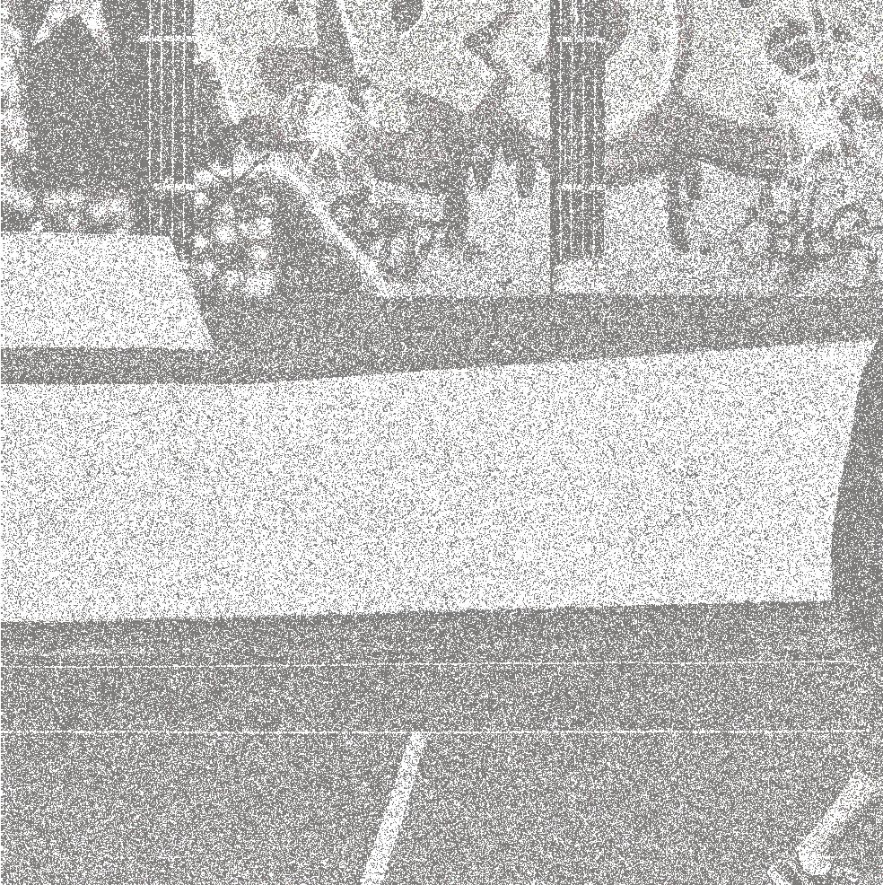

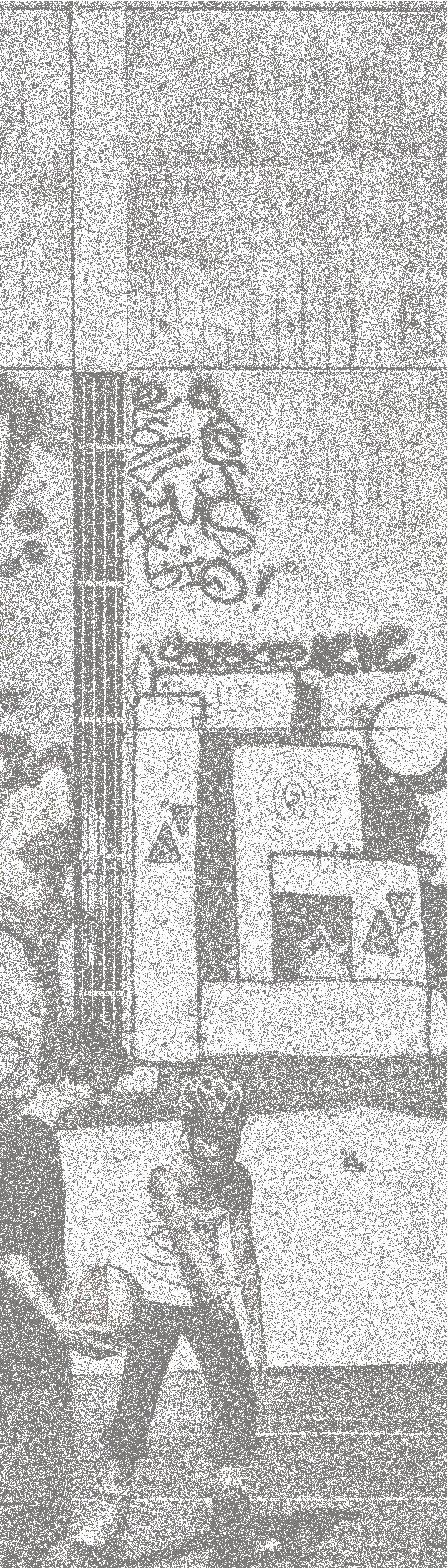

References | 127126 | People in Public Places
Image Sources & Credits
Cover
1 http://www.ekeo.gov.hk/filemanager/content/whatsnew/20130207/Flyover01_10.JPG
Project Specific (in reading order)
P1 Okonola Downtown Square
1 https://www.flickr.com/photos/mistersmed/albums/72157634870349644/ with/3189762259/
2 https:/www.flickr.com/photos/mistersmed/14482932113/in/photostream; 3 https:/www.flickr.com/photos/mistersmed/14482932113/in/photostream;
4 Google: Landsat
5-9 The Small Town Center. 2000. Mississippi State University. Shannon Criss, AIA, Director 10 https:/www.flickr.com/photos/mistersmed/14482932113/in/photostream;
11 https:/www.flickr.com/photos/mistersmed/14482932113/in/photostream;
12 https:/www.flickr.com/photos/mistersmed/14482932113/in/photostream; 13 https://www.flickr.com/photos/mistersmed/albums/72157634870349644/ with/3189762259/
14 https:/www.flickr.com/photos/mistersmed/14482932113/in/photostream;
15 https:/www.flickr.com/photos/mistersmed/14482932113/in/photostream;
P2 Putnam Triangle Plaza
1 http:/bettercities.net/sites/default/files/Picture-001.jpg;
2 Google: Landsat
3 NYC DoT: Putnam Triangle Plaza Brooklyn CB2 Transportation Committee, March 17th, 2015
4 http://www.streetsblog.org/wp-content/uploads/2011/09/asphalt-to-gravel.jpg
5 NYC DoT: Putnam Triangle Plaza Brooklyn CB2 Transportation Committee, March 17th, 2015
6 NYC DoT: Putnam Triangle Plaza Brooklyn CB2 Transportation Committee, March 17th, 2015
7 http:/cdn.brownstoner.com/wp-content/uploads/2015/10/brooklyn-streets-putnam-triangle-plaza-1-1.jpg;
8 http:/faballiance.org/sites/faballiance.org/files/FAB_Alliance_Putnam_Triangle_Pic28.jpg;
9 NYC DoT: Putnam Triangle Plaza Brooklyn CB2 Transportation Committee, March 17th, 2015
P3 Charlotte Amundsens Square
1. http:/www.ordfabrik.dk/wp-content/uploads/2015/08/DSC_0105.jpg;
2 Google: Landsat
3 https:/fbcdn-sphotos-e-a.akamaihd.net/hphotos-ak-xaf1/t31.0-8/p1;
4 http://www.landezine.com/index.php/2011/05/charlotte-ammundsens-plads-by-11-landskab/
5 http:/www.landezine.com/wp-content/uploads/2011/05/11-1til1-landskab.jpg;
6 http:/www.dac.dk/en/dac-life/danish-architecture-guide/copenhagen/charlotte-ammundsens-plads;
7 http://www.dac.dk/media/8837/matrikel8_Foto_JakobGaltt.jpg
8. http:/www.dac.dk/Images/img/1920x1200M/%2847626%29/47626/foto_02. jpg;
9. http://www.landezine.com/index.php/2011/05/charlotte-ammundsens-plads-by-11-landskab/
P4 Fly the Flyover
1 http://www.ekeo.gov.hk/filemanager/content/whatsnew/20130207/Flyover01_10.JPG
2 Google: Digital Globe
3 http://www.ekeo.gov.hk/filemanager/content/about_ekeo/common/images/ EKEO_Team_rgb_Large.jpg
4. http://www.ekeo.gov.hk/filemanager/content/public_engagement/Public_Engagemnent_Collage_s.jpg
5 http://www.ekeo.gov.hk/filemanager/content/pmp/01_after.jpg
6 http://www.archsd.gov.hk/media/exhibition/5481/project_exhibition-2012-dbekeo_03.jpg;
7 http://outstandingindividuals.rfpmagazine.com/wp-content/uploads/2013/09/147ad3ff83d086291da02dfb4ad42919.jpeg;
8 10 http://www.archsd.gov.hk/en/exhibition/temporary-building-for-the-energizing-kowloon-east-office.aspx;
9 http://www.ekeo.gov.hk/filemanager/content/activities/common/images/MaD_ Citizen/MaD_Citizen_01.JPG;
P5 Marsupial Bridge
1 http://urbanmilwaukeedial.com/wp-content/uploads/2013/08/Penelopiad.jpg
2 Google: Landsat
3 http://www.ladallman.com/prj_marsupial_bridge.html4
4 https://overthebarsinmilwaukee.files.wordpress.com/2010/08/marsupial.jpg
5 http://urbanmilwaukee.com/wp-content/uploads/2014/12/popuppark_improvements_094_1.jpg
6 http://media.jrn.com/images/28472315-mjs_tapsnapsbike01.jpg
7 http://www.ladallman.com/prj_brady_bus_shelter.html
8 http://bayviewcompass.com/wp-content/uploads/2012/03/Copper-shelter-Canal-St.jpg
9 http:/urbanmilwaukee.com/wp-content/gallery/lower-east-side/img_0531.jpg;
10 http:/www.luminoustheatre.com/uploads/4/0/4/6/4046468/5335477_orig.jpg;
11 http:/tvjohn.com/wp-sandbox;
12 https://www.facebook.com/Milwaukee-Bike-In-Movie-Series-108233319224455/
13 https://c3.staticflickr.com/4/3684/11978529586_0b5937894d_b.jpg
14 http:/mkebke.com/wp-content/uploads/2013/01/mkebke-interviews-rustychaincafe-marsupialbridge1.jpg;
15 Mike De Sisti, Milwaukee Journal Sentinel
P6 Nicolai Cultural Centre
1 http:/res.cloudinary.com/divisare/image/upload/c_fit,w_1440/f_auto,q_80/v1/ project_images/3027159/11.jpg;
2 Google: Digital Globe
3 http://www.responsive.dk/wp-content/uploads/2014/10/realdania_11.jpg
4 http:/openbuildings.com/buildings/sct-nicolai-cultural-centre-profile-4307/media?group=image#!buildings-media/3;
5 http:/image.architonic.com/imgArc/project-1/4/5202741/DorteMandrup-Sct-Nicolai-Kulturcenter7.jpg;
6 http:/www.architonic.com/aisht/nicolai-cultural-center-kolding-dorte-mandrup-arkitekter/5100110;
7 http:/res.cloudinary.com/divisare/image/upload/c_fit,w_1440/f_auto,q_80/v1/ project_images/3027159/11.jpg;
8 http:/res.cloudinary.com/divisare/image/upload/c_fit,w_1440/f_auto,q_80/v1/ project_images/3027179/35.jpg;
9 http:/res.cloudinary.com/divisare/image/upload/c_fit,w_1440/f_auto,q_80/v1/ project_images/3027169/24.jpg;
10 http:/openbuildings.com/buildings/sct-nicolai-cultural-centre-profile-4307/media?group=image#!buildings-media/3;
11 http:/res.cloudinary.com/divisare/image/upload/b_rgb:000,c_fill,e_colorize:30,f_ auto,g_center,h_960,q_80,w_1440/v1/project_images/3027152/01.jpg;
12 http:/openbuildings.com/buildings/sct-nicolai-cultural-centre-profile-4307/media?group=image#!buildings-media/3;
13 http:/openbuildings.com/buildings/sct-nicolai-cultural-centre-profile-4307/media?group=image#!buildings-media/3;
14 http:/openbuildings.com/buildings/sct-nicolai-cultural-centre-profile-4307/media?group=image#!buildings-media/3;
15 http:/openbuildings.com/buildings/sct-nicolai-cultural-centre-profile-4307/media?group=image#!buildings-media/3;
16 http:/www.kristinejensen.dk/images/randpics/n_28_46.jpg;
17 http:/www.kristinejensen.dk/images/randpics/n_28_46.jpg;
P7 Civic Space
1 CITY OF PHOENIX (2010) Project Data: Rudy Bruner Award for Urban Excellence 2011.
2 Google: Landsat
3. http:/images.adsttc.com/media/images/5013/826f/28ba/0d15/0700/0571/ large_jpg/stringio.jpg?1414401881;
4 CITY OF PHOENIX (2010) Project Data: Rudy Bruner Award for Urban Excellence 2011.
5 ibid.
6 ibid.
7 ibid.
8 http:/www.landezine.com/wp-content/uploads/2013/05/Phoenix-Downtown-Civic-Space-by-AECOM-02.jpg;
9 CITY OF PHOENIX (2010) Project Data: Rudy Bruner Award for Urban Excellence 2011.
10 ibid.
11 Google
12 http:/s3-media3.fl.yelpcdn.com/bphoto/vt3-zxeIAIoNp7YcLZ4C1A/o.jpg;
13 CITY OF PHOENIX (2010) Project Data: Rudy Bruner Award for Urban Excellence 2011.
14 http:/s3-media3.fl.yelpcdn.com/bphoto/c2oCk4jz532WRbUh9Ra0Xw/o.jpg;
T1 Pioneer Courthouse Square
1 http://laevolucionarquitectonica.blogspot.com.au/2011_11_01_archive.html
2 Google: Landsat
3 http:/media.portland.indymedia.org/images/2007/01/351791.jpg;
4 https:/changehere.files.wordpress.com/2011/08/p1020072.jpg;
5 http:/thesquarepdx.org/wp-content/uploads/2014/09/07-Festival-of;
6 https://upload.wikimedia.org/wikipedia/commons/2/23/Pioneer_Courthouse_ Square_-_west_half.jpg
7 https:/portland25.files.wordpress.com/2012/07/img_3307.jpg;
8 http:/theintertwine.org/sites/theintertwine.org/files/park_imgs/pioneer_square_ houck.jpg;
T2 Thorton Place
1 http:/info.aia.org/aiarchitect/2013/1108/images/1108_northgate2.jpg;
2 Google: Landsat
3 VIA Architecture (Seattle DPD) - Northgate Transit - Oriented Development Urban Design Study
4 https:/thenorthgatenews.files.wordpress.com/2013/05/northgate-library.jpg;
5 http:/thorntonplaceliving.com/wp-content/uploads/2014/04/Creekside-Exterior. jpg;
6 http://thorntonplaceliving.com/wp-content/uploads/2014/04/parking-lot.jpg
7 http:/thorntonplaceliving.com/wp-content/uploads/2014/04/Group-walking.jpg;
8 http:/thorntonplaceliving.com/wp-content/uploads/2014/04/IMG_9945.jpg;
T3 Arlington Heights Village
1 http:/wibiti.com/images/hpmain/317/274317.jpg;
2 Google: Landsat
3 https:/myupha.files.wordpress.com/2015/02/hillsborough-charette.jpg;
4 Google
5 Google
6 http://www.panoramio.com/photo_explorer#view=photo&position=12&with_photo_id=52056525&order=date_desc&user=4950147;
7 Google
8 http://www.dailyherald.com/storyimage/DA/20140520/news/140529857/AR/0/ AR-140529857.jpg;
9 http:/chjc.com/wp-content/uploads/2014/11/ct-metropolis-report-tl-arlington-heights-jpg-20140128.jpg;
10 Google
11 Google
12 www.dailyherald.com/storyimage/DA/20150806/news/150809495/AR/0/AR150809495.jpg;
13 http://www.dailyherald.com/storyimage/DA/20130806/news/708069798/ EP/1/1/EP-708069798.jpg;
14 Google
15 http://neverphoto.smugmug.com/Other/test/i-nMCtRw3/0/L/Arlington-Heights-self-L.jpg
T4 Contra Costa Centre Transit Village
1 http:/streets.mn/wp-content/uploads/2012/07/Contra-Costa-Town-Square1.jpg;
2 Google: Landsat
3 LENNERTZ COYLE & ASSOCIATES Pleasant Hill BART Station One Week to a Transit Village After 20+ Years of Struggle. http:/townworks.org/media/projects/Existing_Cond._photo.jpg?1254808712;
4 http:/townworks.org/media/projects/Existing_Cond._photo.jpg?1254808712;
5 http:/server.mediataskforce.com/clients/sold10041/uploads/1_b_49_B1_Avalon_03.jpg;
6 http://cn.mve-architects.com/project.php?lID=49&subgID=7
7 http:/www.arup.com/~/media/Images/Projects/R/Robert_Schroder_Ove;
8 http://cn.mve-architects.com/project.php?lID=49&subgID=8
9 http:/www.arup.com/~/media/Images/Projects/R/Robert_Schroder_Ove;
10 http:/www.forms-surfaces.com/sites/default/files/imagecache/gal-reg-2x/images/6.1_BP_0627_01242012_0_0.jpg;
11 http://cn.mve-architects.com/project.php?lID=49&subgID=9
12 http:/s3-media1.fl.yelpcdn.com/bphoto/A_HLALYlNkIjD9_-NP2DmA/o.jpg;
13 http:/s3-media3.fl.yelpcdn.com/bphoto/7r8b1WM-oGwhwdhAVDtjhA/o.jpg;
14 Google
15 http:/s3-media1.fl.yelpcdn.com/bphoto/5z5Oj9CcNfRjl4R_uCuu_w/o.jpg;
T5 Courthouse Square
1 ARLINGTON COUNTY (2015) Courthouse Sector Plan Addendum: Courthouse Square.
2 Google: Landsat
3 ARLINGTON COUNTY (2015) Envision Courthouse Square: Civic Engagement Story.
4 ibid.
5 https:/pbs.twimg.com/media/CHusIhUUsAEt5w_.jpg;
6 https:/ansuseye.files.wordpress.com/2014/08/20140801_160658.jpg;
7 http://sites.arlingtonva.us/courthouse/2014/06/06/take-outside-new-outdoor-seating-area/?doing_wp_cron=1464334253.2912418842315673828125
8 https:/c2.staticflickr.com/8/7767/17214200834_636bc8703a_b.jpg;
9 ARLINGTON COUNTY (2015) Courthouse Sector Plan Addendum: Courthouse Square.
10-13 ibid.
14 http:/sites.arlingtonva.us/courthouse/files/2014/03/courthouse-big-one.jpg; 15 Google
16 http:/sites.arlingtonva.us/courthouse/files/2014/03/Courthouse-Image-220.jpg; 17 http:/www.ilovearlingtonv.com/wp-content/uploads/2014/02/arpa.jpg;
T6 Del Mar Transit Village
1 http:/bettercities.net/sites/default/files/delmar5.jpg;
2 Google: Landsat
3 http:/la.streetsblog.org/category/people/eric-garcetti;
4 http:/bettercities.net/sites/default/files/delmar1.jpg;
5 http:/bettercities.net/sites/default/files/delmarbirdseyeREV_copy.jpg;
6 http:/www.melendrez.com/files/styles/project_carousel_slide/public/Verticle1_0. jpg?itok=v_4_0Db0; 7-10 ibid.
T7 Hammarby Sjostad
1 https:/upload.wikimedia.org/wikipedia/commons/c/cf/Sickla_udde,_flygfoto_2014-09-20.jpg;
2 Google: Digital Globe
3 http://www.semesteratsea.org/2014/08/08/sustainable-stockholm-the-eus-greenest-city/;
4 http:/www.tengbom.se/client/files/projects/Glashusett/glashusett_5.jpg;
5 https:/c1.staticflickr.com/5/4142/4758786292_4dbbd32f35_b.jpg;
6 http:/blog.cpgcorp.com.sg/?p=2930; Courtesy Stockholm Stadsbyggnadskontor;
7 GAFFNEY, A., HUANG, V., MARAVILLA, K. & SOUBOTIN, N. (2007) Hammarby Sjostad: A Case Study. CP 249 Urban Design in Planning 8 ibid.
9 https:/www.flickr.com/photos/rstaffan/3296999521;
10 http://www.urbangreenbluegrids.com/uploads/Bo02-Hammarby-Sjoestad-002Madeleine-dErsu-840x630.jpg;
11 http://www.tengbom.se/en-US/projects/61/hammarby-sjostad;
12 http://www.urbangreenbluegrids.com/uploads/Bo02-Hammarby-Sjoestad-015Andre-Vaxelaire-840x630.jpg;
13 https://www.flickr.com/photos/la-citta-vita/4758837540/in/photostream/;
14 ibid.
15 http://2.bp.blogspot.com/-0JKJWX5ZS8I/U75A-YPO1jI/AAAAAAAAA_s/-8Z_uiWK6iY/s1600/2014-07-09+19.07.00.jpg;
16 https://www.flickr.com/photos/la-citta-vita/4758837540/in/photostream/;
S1 Build a better block
1 http://nextcity.org/images/made/Build_a_better_block_2400_1607_50_s.jpg;
2 Google: Landsat
3 http:/betterblock.org/wp-content/uploads/2012/12/IMG_20121207_172226.jpg;
4 Google
5 http://teambetterblock.com/wp-content/uploads/2012/10/wichita-2.png;
6 http://teambetterblock.com/wp-content/uploads/2012/02/IMG345.jpg;
7 ibid.
8 http:/www.motherearthliving.com/
9 Elliott Munoz; http://www.gooakcliff.org/wp-content/uploads/2010/08/ DSC_2923.jpg;
10 http://nextcity.org/features/view/how-one-weekend-in-dallas-sparked-a-movement-for-urban-change;
11 http://www.architects.org/sites/default/files/14crop.jpg;
12 http://www.dallasobserver.com/slideshow/the-art-crawl-and-better-block-project-in-oak-cliff-6291064/13;
13 ibid.
14 http:/betterblock.org/wp-content/uploads/2015/09/IMG_6540.jpg;
15 Elliott Munoz; http://www.gooakcliff.org/wp-content/uploads/2010/08/ DSC_2920.jpg;
16 Elliott Munoz; http://www.gooakcliff.org/wp-content/uploads/2010/08/ DSC_2923.jpg;
S2 Delai Sam
1 Tanya Sushenkova (Stan_25); http://english.mediaudar.net/2014/10/26/mediaimpact-moscow-3/;
2 Google: Digital Globe
3 anya Sushenkova (Stan_25); http://english.mediaudar.net/2014/10/26/mediaimpact-moscow-3/;
4 http:/eng.partizaning.org/?p=2475;
5-6 ibid.
7 https://opendemocracy.net/files/htmlimage.jpeg;
8 http:/eng.partizaning.org/?p=2475;
9 http://eng.partizaning.org/wp-content/uploads/2012/04/4922566943_70585c5 472_z.jpeg;
S3 Garden of Eden Community Garden
1 http://2szjru42gz1e30j3izdt5lk7.wpengine.netdna-cdn.com/wp-content/uploads/2015/04/ingersoll-garden-group.jpg;
2 Google: Landsat
3 http://www.theguardian.com/cities/2014/may/20/city-call-out-community-projects-biggest-difference-neighbourhood#img-1;
4 https://medium.com/@annamarya_s/day-in-the-life-edna-grant-president-of-ingersoll-garden-of-eden-governance-board-5448b3bd9361;
5 http://www.theguardian.com/cities/2014/may/20/new-york-success-story-growing-the-garden-of-eden-in-brooklyn#img-1;
6 http://i1.wp.com/fortgreenefocus.com/wp-content/uploads/2015/04/ingersoll-garden-1.jpg
7 http://3.bp.blogspot.com/-tf2zyZNsztQ/UJ65PTjaEwI/AAAAAAAAAGA/2UUQnxImnPU/s1600/06_BZ_HealthyCookingDemo_ChefTsadakeeyah.jpg
8 http://2szjru42gz1e30j3izdt5lk7.wpengine.netdna-cdn.com/wp-content/uploads/2015/04/ingersoll-garden-1.jpg;
S4 Greenlife Roosvelt
1 http://sixstar.moc.gov.tw/g_upload_sixstar/cms/webEdit/A0/B0/C0/D0/E0/F0/ c9312abc-b34c-4ac1-bdb7-024b3991ee10.jpg;
2 Google: Digital Globe
3 http://sixstar.moc.gov.tw/eng-2011/caseStudyAction.do?method=doDetail&&engId=1116;
4 ibid.
5 http://2014communitydesign.blogspot.com.au/p/new-ruralism-experiments.html; 6-8 ibid.
S5 Cascoland Kolenkitburt, 1 http://www.straschnow.com/projects/kolenkit/;
2 Google: Digital Globe
3 http://www.straschnow.com/projects/kolenkit/;
4 http://www.theguardian.com/cities/2014/may/19/how-art-chickens-revived-amsterdam-kolenkitbuurt-cascoland#img-3;
5 Marten van Wijk We Own The City;
6 http://www.straschnow.com/projects/kolenkit/;
7 Oski Collado; http://www.straschnow.com/projects/kolenkit/;
8 http://www.straschnow.com/projects/kolenkit/;
9 ibid.
Image Credits | 129128 | People in Public Places
Acknowledgements
There have been a number of people who have given valuable contributions to the content and structure of this report.
AUDRC
Joerg Baumeister
Zoe Myers
Ana Maria Velasco Munoz
MRA
Janelle Veitch
Brett Wood-Gush
The project was undertaken with the support and assistance of the Metropolitan Redevelopment Authority (WA).
Dr Anthony Duckworth-Smith is Assistant Professor at the Australian Urban Design Research Centre (AUDRC). He is a senior researcher, practitioner and teaches in the Master of Urban Design Programme (UWA).
Acknowledgements | 131130 | People in Public Places
