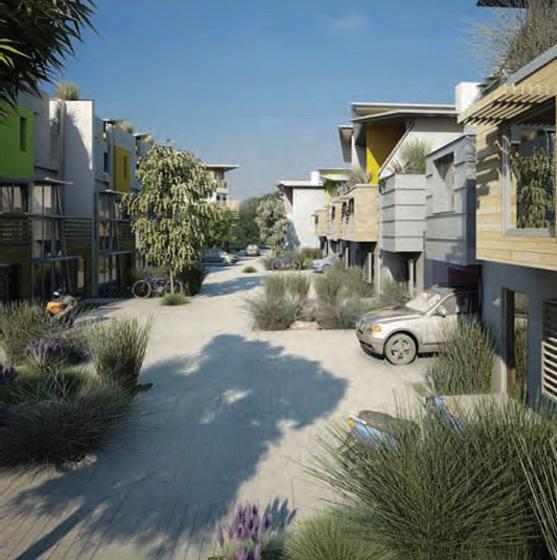
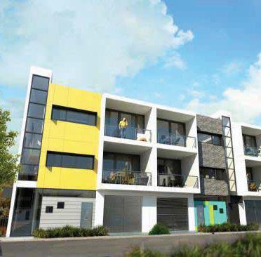
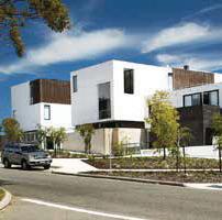
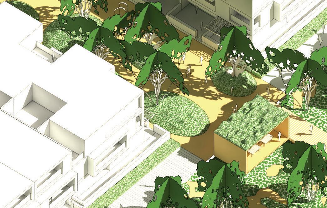
Shoreline medium density village
Addressingthe‘missing middle’ of urban housing inPerth

©Australian Urban Design Research Centre

Julian Bolleter, Joerg Baumeister, Anthony Duckworth-Smith and Iwan Isnin


©Australian Urban Design Research Centre
Julian Bolleter, Joerg Baumeister, Anthony Duckworth-Smith and Iwan Isnin
This research project addresses the question of how Perth can address it’s ‘missing middle’ in terms of urban density...
In late 2016 the Australian Urban Design Research Centre (AUDRC) was engaged by LandCorp to facilitate urban design
design proposal for the Shoreline Model Urban Village, which comprises Lot 207 of the Robb Jetty Local Structure Plan area, and part of the broader Shoreline development area. The research question guiding this process was ‘how can medium density housing typologies be developed in Perth, to address the efforts?’
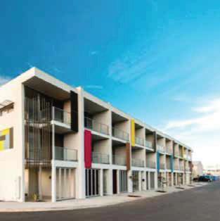
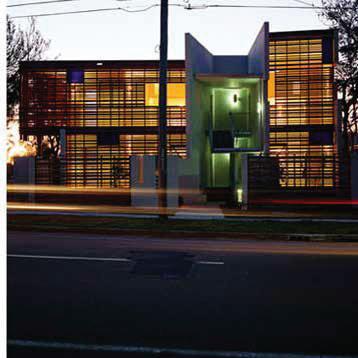
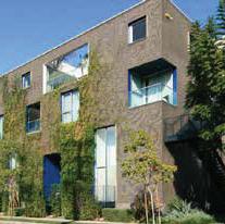
The ‘missing middle’ is understood in this project to mean residential development which has a maximum height of 5 stories and a net density of 25-260 dwellings per hectare – this typically includes 2-3 storey compact housing, terrace style housing, maisonette (manor) housing, dual occupancy housing, townhouse housing, and low rise apartments.
In order to address the overarching question LandCorp, the AUDRC and Lisa Shine Urban Design brought together representatives from state government, local government, the urban design profession, the urban development community and academia to wrestle with this issue. This engagement process included three conducted over a brief 3 month period.
urban design principles by which coordinated medium density housing engagement and design process conducted, and the current Shoreline Model Urban Village planning which
serves as an exemplar for how the ‘missing middle’ can be addressed in Perth.
This report should be read in conjunction with the following documents:
Realm Design Guidelines
• The Robb Jetty Design Guidelines
• The Robb Jetty Local Structure Plan
The housing typology section of the by Lisa Shine Urban Design and is not covered, in full, in this report.
The following chapter sets out the can aid in the delivery of the ‘missing middle’ in Perth...
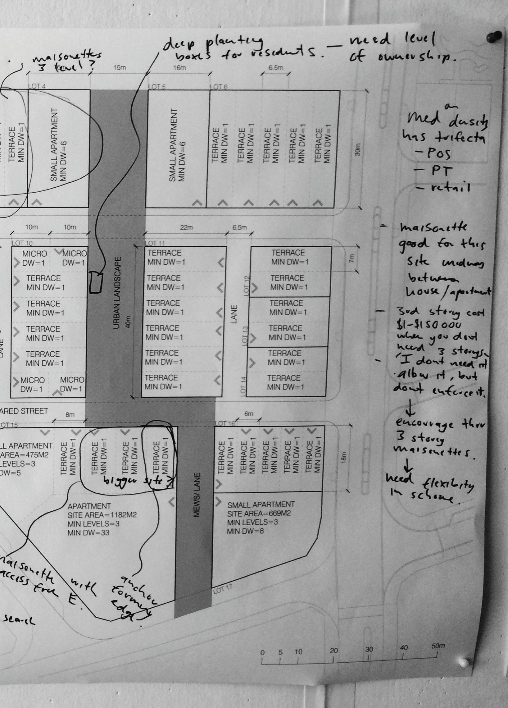
To successfully incentivise medium density living, it is generally regarded such development must offer the trifecta of public transport access, high quality public open space (POS) and access to
scale however there are a number of techniques which can be deployed. These ‘principles’ for achieving coordinated medium density housing in Perth are set out on the following pages in relation to lot and housing types, public open space, and laneways (and small streets). The housing typology
was facilitated by Lisa Shine Urban Design and is not covered, in full, in this chapter.
Principles for achieving coordinated medium density development –
Lot and housing types:
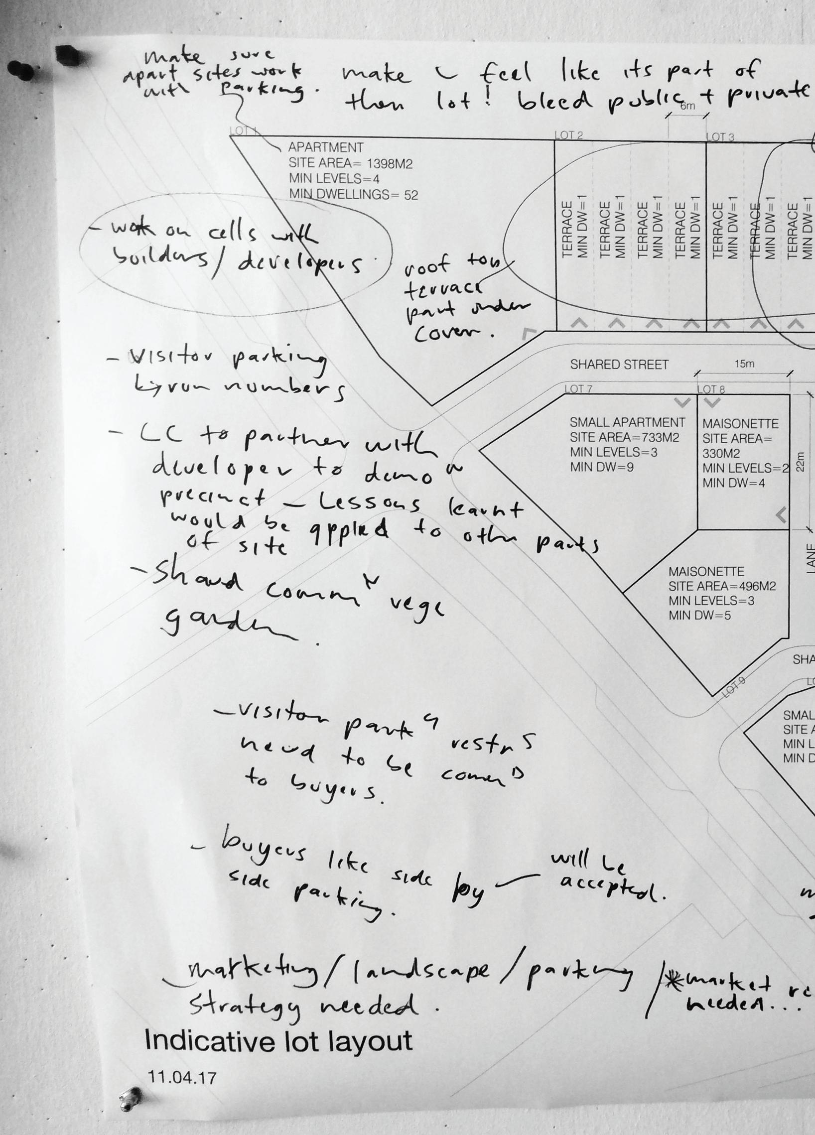
• Allow for a diversity of housing types through the provision of appropriate lot sizes that are appealing to a wide spectrum of developers – from mom and dad investors to tier 2/3 developers. These include compact housing (lots ranging from 45-150m2), maisonette (manor) housing (lots ranging from 250m2), dual occupancy housing (lots ranging from 250m2), terrace housing (lots ranging from 150-220m2), low rise apartment housing (lots from 450m2). Lot types (and planning controls) should preclude free standing suburban housing types.
• Lot arrangement should be models to vary with changing economic conditions. For instance a run of terrace products can be amalgamated into a larger super lot, for larger developers, or remain as single lots for smaller developers.
• Amalgamated lot arrangement should allow for re-subdivision post development.
• Long, thin terrace lots which pose problems for achieving solar access should be avoided.
• ‘Easy and ‘challenging’ lot types in terms of development feasibility developers so that developers are
• Low rise apartments should be concentrated on corner lots in preference to terrace typologies so as to avoid ‘dead edges’ which can result from terraces ‘siding’ onto one street/ laneway.
• In achieving an ‘urban’ feel 2 storey terraces with a maisonette on the third level are preferable to 3 storey terrace housing types which are typically
reluctant to pay the additional $100,000-$150,000 for the third level.
• Higher density housing should be concentrated along the edges of sites with major roads so as to provide a
• Micro lots (~70m2) should be provided in smaller groups close to POS.
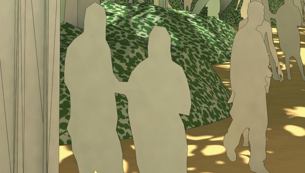
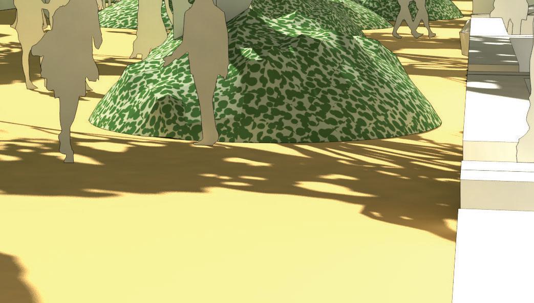
Principles for achieving coordinated medium density development –Public Open Space:
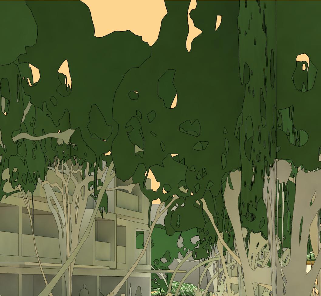
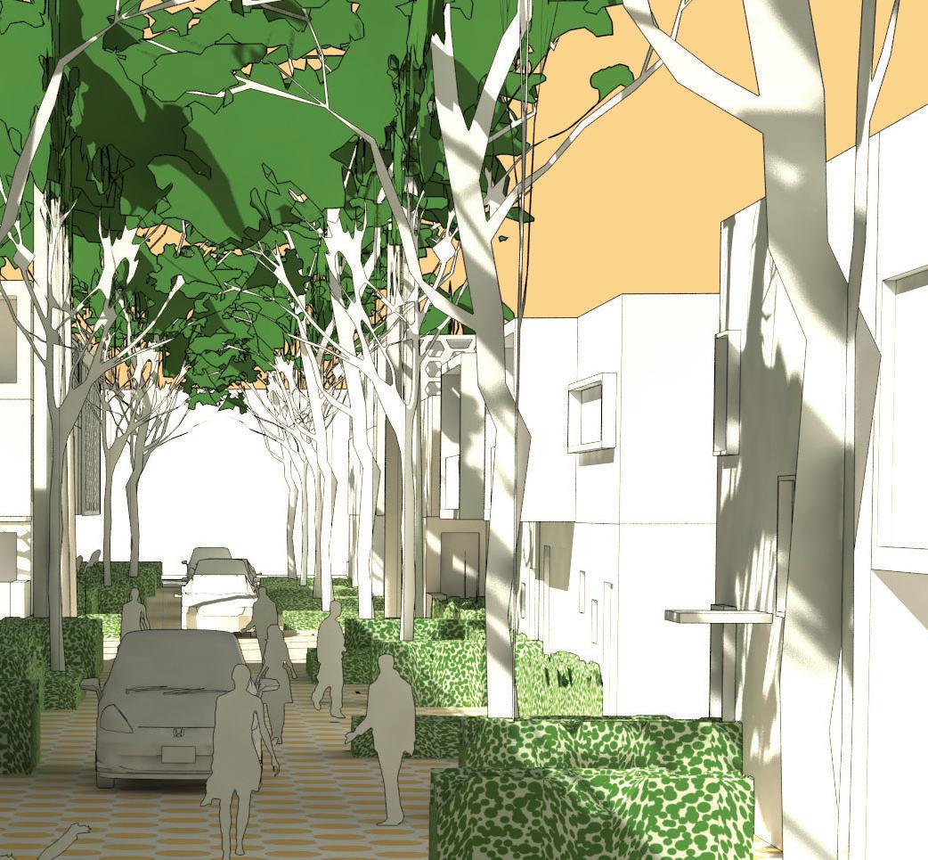
• Local POS should build upon the sense of place and amenity of the local landscape
• The design and layout of local compensate for diminished private open space provision in medium density urban form, and to incentivise downsizing. In this respect it should be
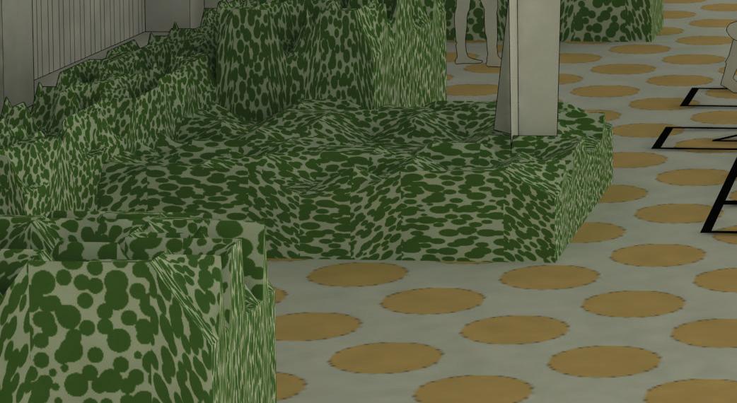
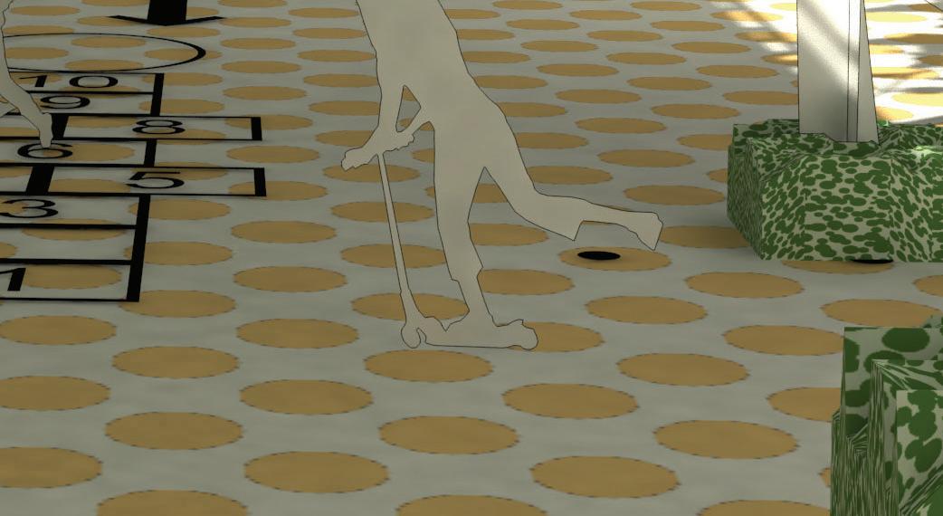
• Local POS should be designed so local residents have ownership of it and contribute to its maintenance. This can be achieved, in one respect, by locating public planting boxes in line with, and adjacent to housing frontages.
• Local POS needs to be consolidated into sizeable parcels for ease of maintenance by local government maintenance teams.
• Medium density housing types
balconies on the 2nd and 3rd stories.
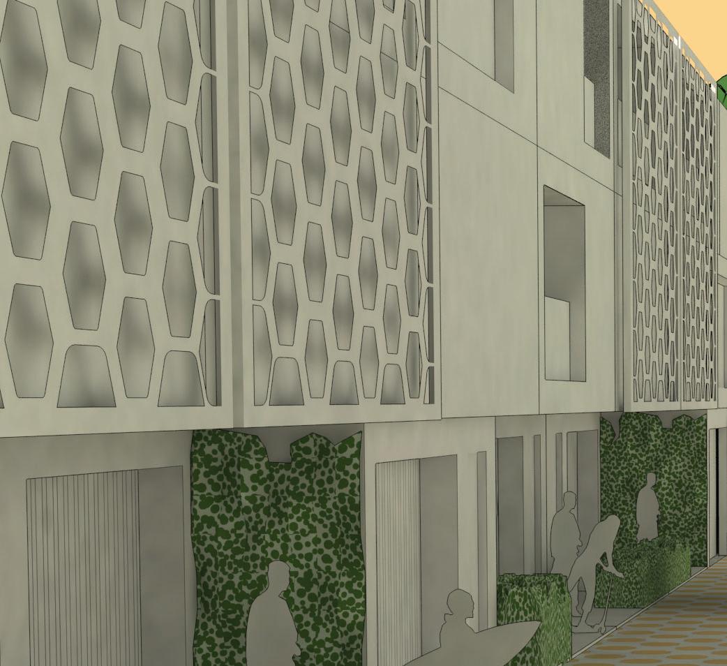
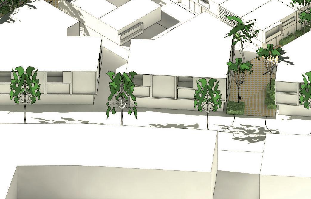
• Zero frontage and side laneways should have an appropriate threshold treatment, involving planting, screening, or possibly a level change, which ensures privacy and a degree of appropriate degree of surveillance
• Higher density ‘missing middle’ housing typologies should be correlated or neighborhood scaled POS, and views.

Principles for achieving coordinated medium density development –Laneways (and small streets):
In general terms laneways which are unattractive, poorly surveilled, and have incentivizing medium density development, particularly when ‘garage
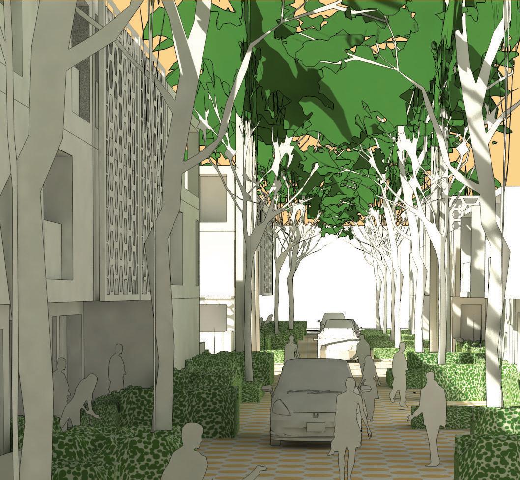
• Laneways should be designed with the required width to allow for tree and shrub planting
• Garage doors on rear accessed medium density housing should be visually permeable to allow passive surveillance of laneway.
• Building edges abutting and be articulated, to allow for visual interest.
• Laneways should be paved with a material which denotes the laneway as a shared pedestrian/ vehicular space
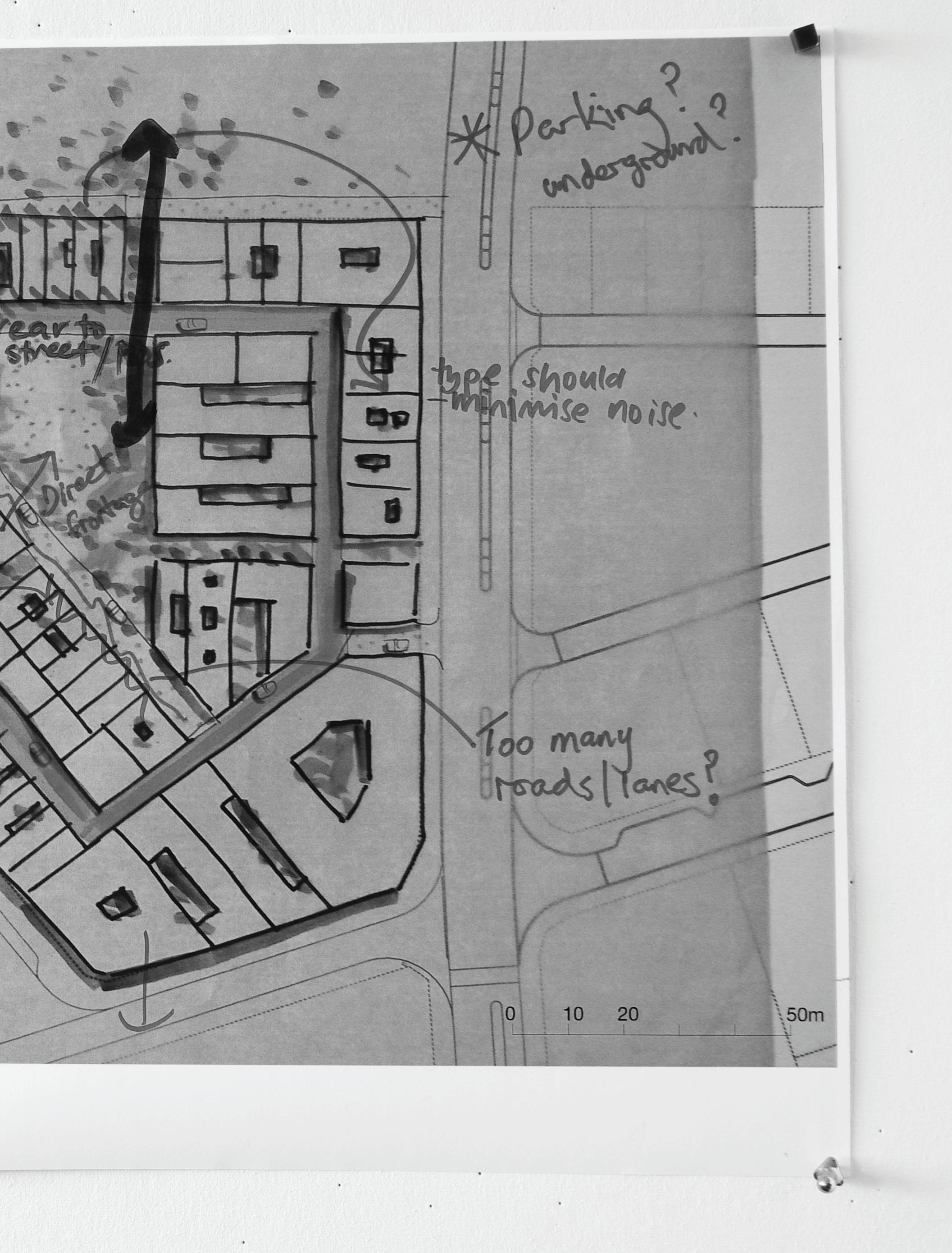
Principles for achieving coordinated medium density development – Car parking
• Where possible utilise ‘tandem’ rather than double garages which have ‘garage heavy’ laneway.
• On larger development sites and amalgamated super lots (above accommodated below, or partly below, ground levels without adversely affecting active streetscapes.
areas should not be provided from active street frontages.
The following section sets out the at the Shoreline Urban Model Village...
Shoreline model urban village. Each step of this process is explained in more detail in the following pages.
•
• Presentation of site analysis
• Presentation of open space typologies which could courtyards, promenades)
• Presentation of ‘missing middle’ housing types
• development scenarios in small groups incoporating open space and housing types
1a. Design development:
• Development of urban design
• Development of lot types, dwelling types and circulation diagrams
5. Possible next steps:
• Partnering of Landcorp with a developer to develop a demonstration precinct
• Collaborative design process involving developers to design ‘cells’ within the scheme, particularly in relation to car
• Assumptions about buyers preferences to be tested with
• Documentation of the Lot 207 scheme for regulatory approvals and CoC:
• Presentation of Lot 207 scheme to DoP and CoC
• Discussion of possible site ‘identities’ carried out in small groups
• Small group exercise to assess urban design scenarios against potential yield, suitability to diversity, amenity) and dismiss less suitable options
2a. Design development:
• selected development option and further develop urban design principles
3a. Design development:
• Revision of selected option in
• Large group critique and relation to lot sizes and space quality and management, lot types, housing types mix.
• Discussion of laneway/ street types
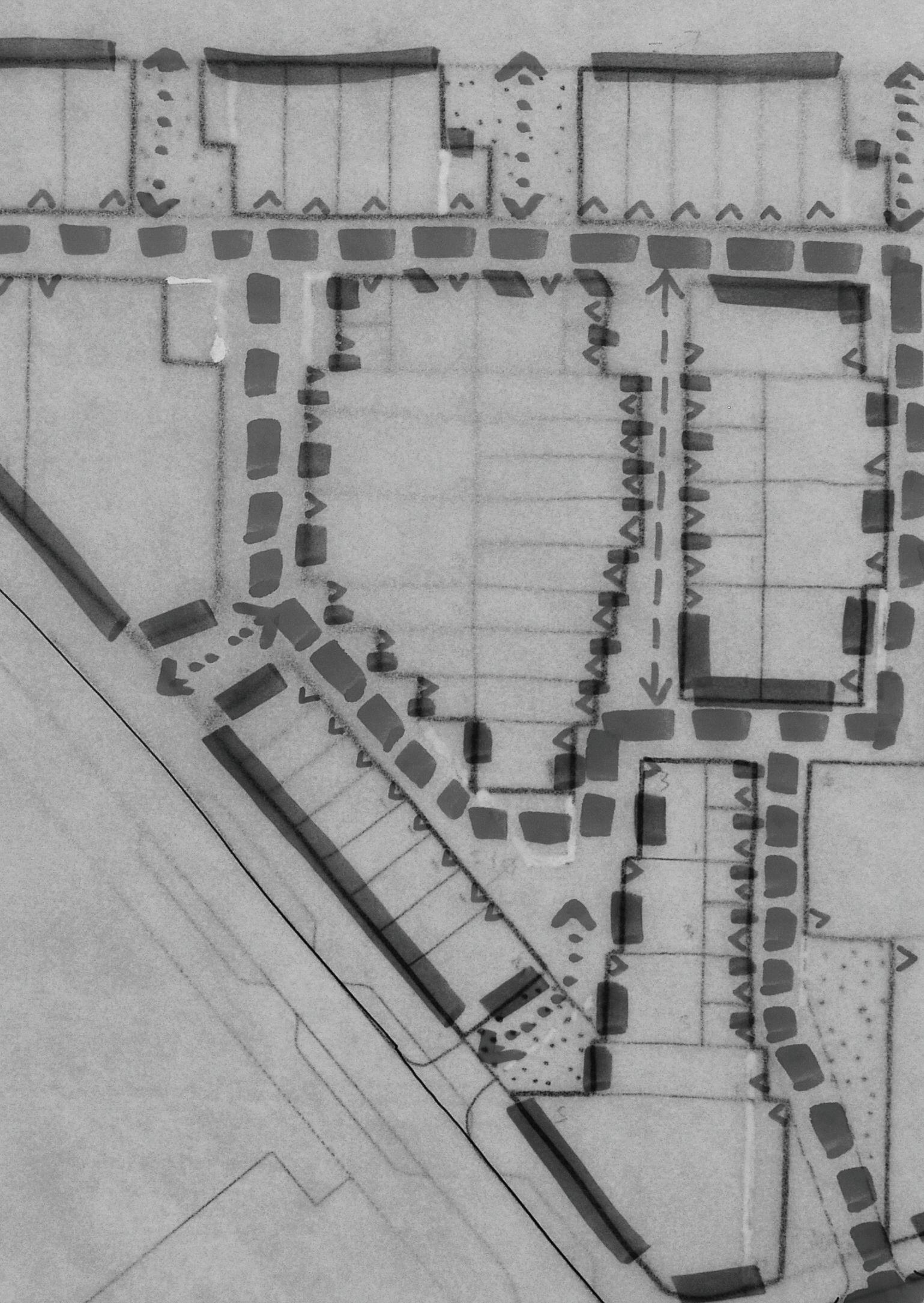
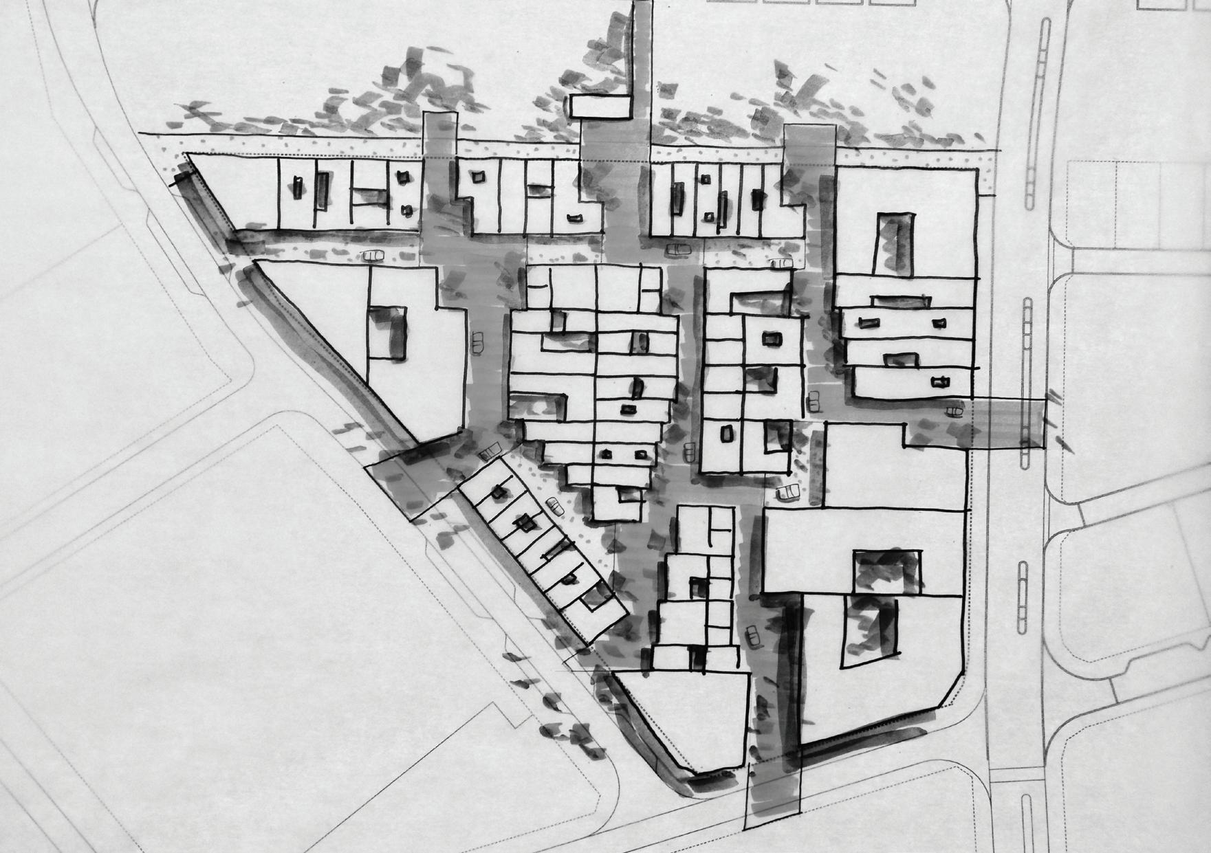
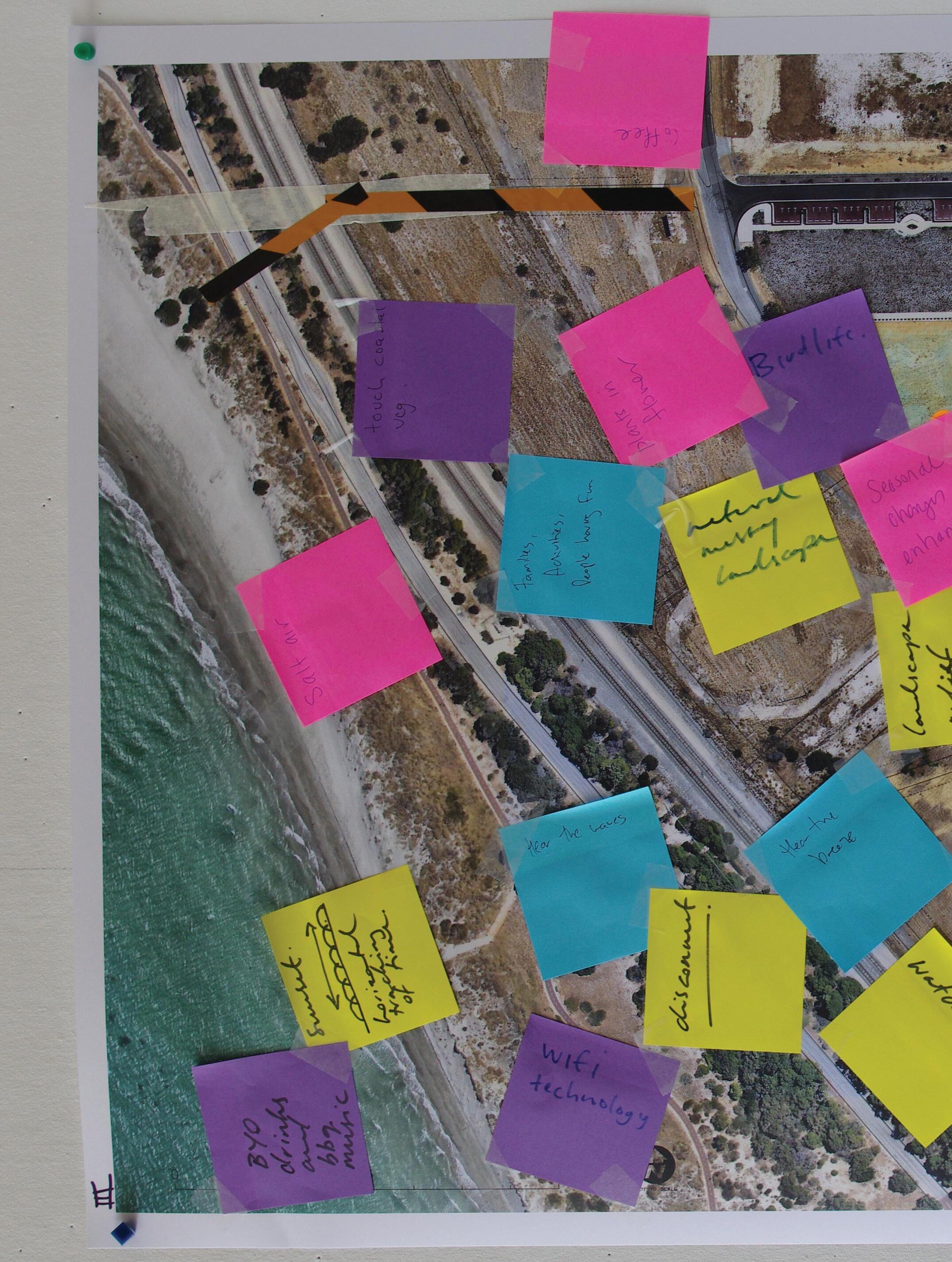
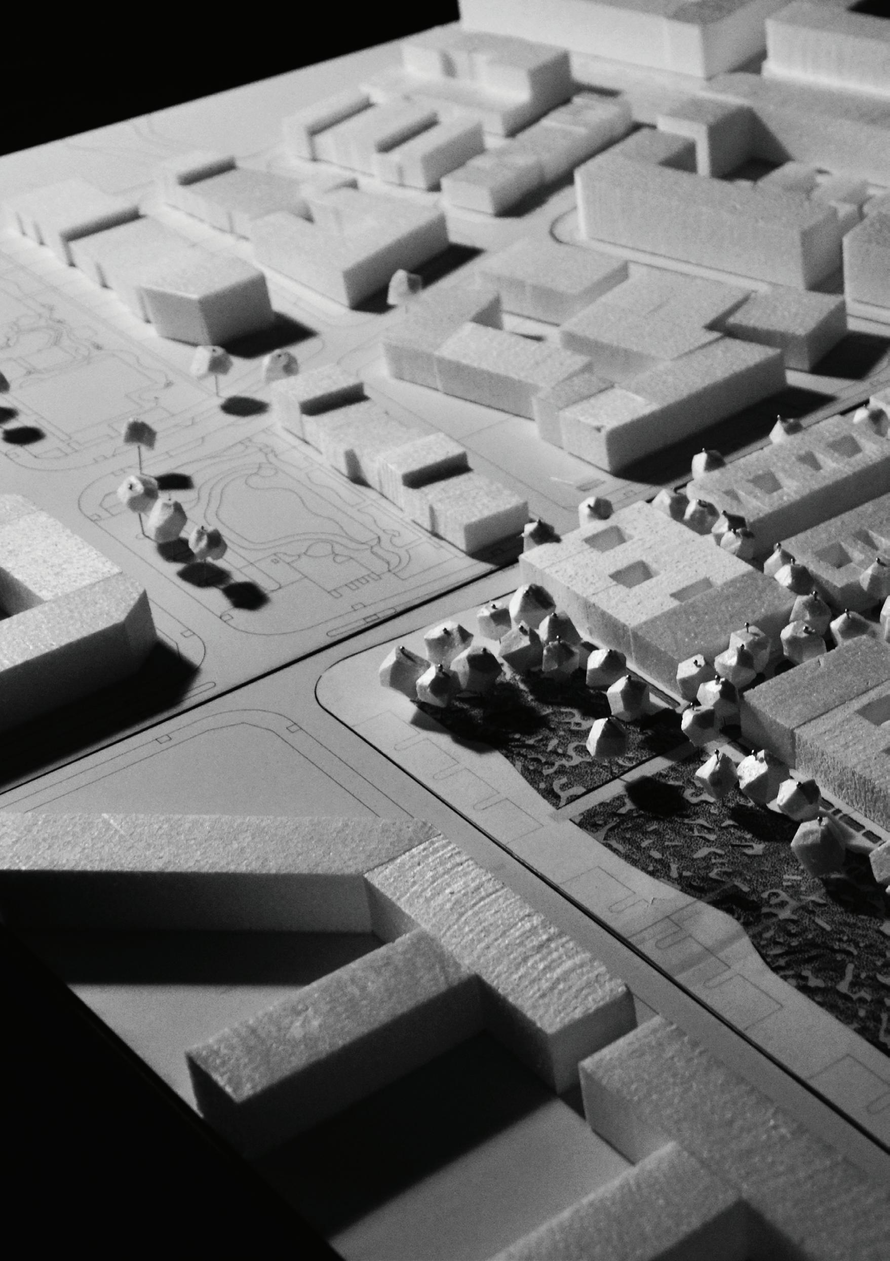
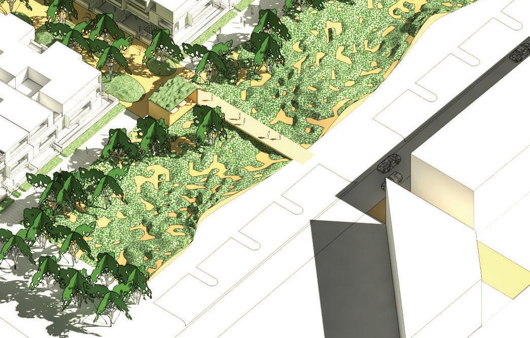
This plan summarizes the site analysis
northern aspect facing onto the POS spine, with views to the ocean is
Winter sun/ wind protection
These varied open space typologies were used to structure the intial scenarios developed in small groups
scenarios in small groups incoporating open space and housing types
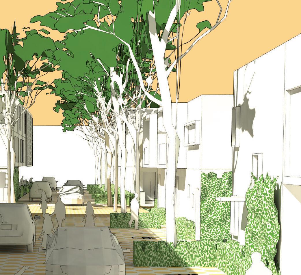
• The development should be both urban and coastal in feel
• The open space structure should be legible yet varied
• Urban patterns should be permeable and provide pedestrian district centre, linear POS and pedestrian bridge
• A range of lot sizes should be distributed throughout the development suitable for a variety of housing typologies
• Larger apartment lots should be located generally on the northern edge of the development on and in the south adjacent to the district centre
• Lots should be suitable for housing that has an urban feel - not suburban
• A range of different terrace products should be provided in short runs
• urban edges
• Too many openings should be avoided along potential Bus Rapit Transit (BRT) route
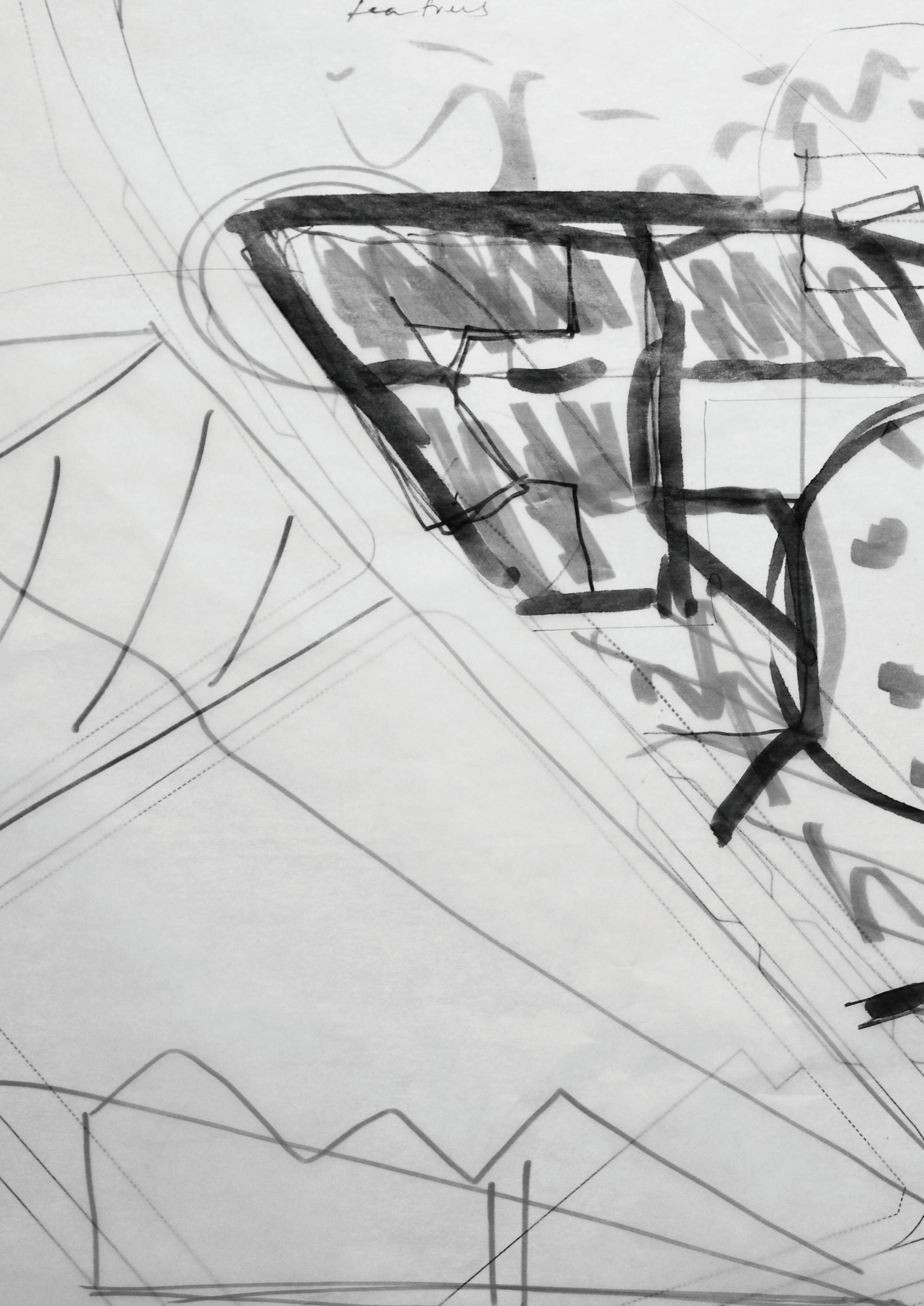
plans were developed from the scenario
to assess urban design scenarios
potential yield, suitability to coastal was carried out
Discussion of possible site ‘identities’ in relation to the coastal context was carried out in small groups

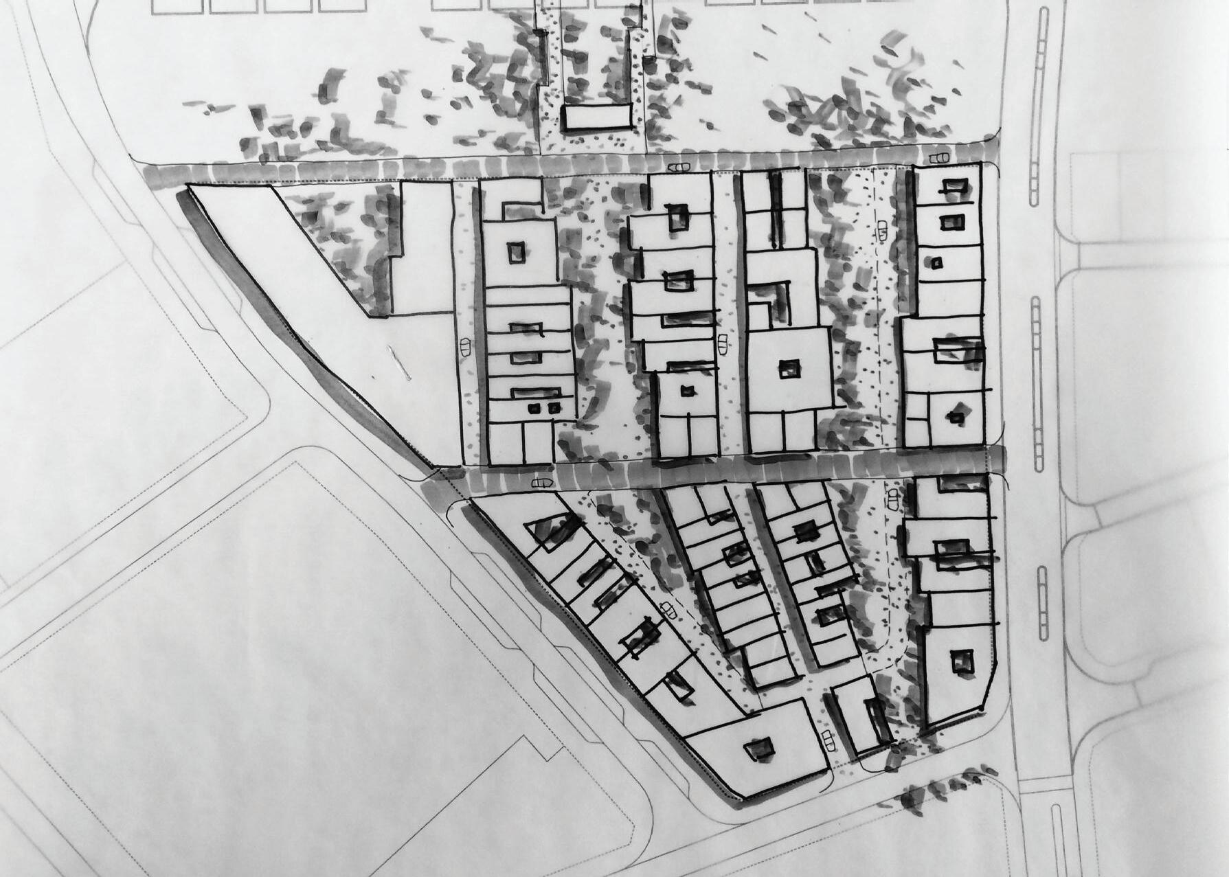
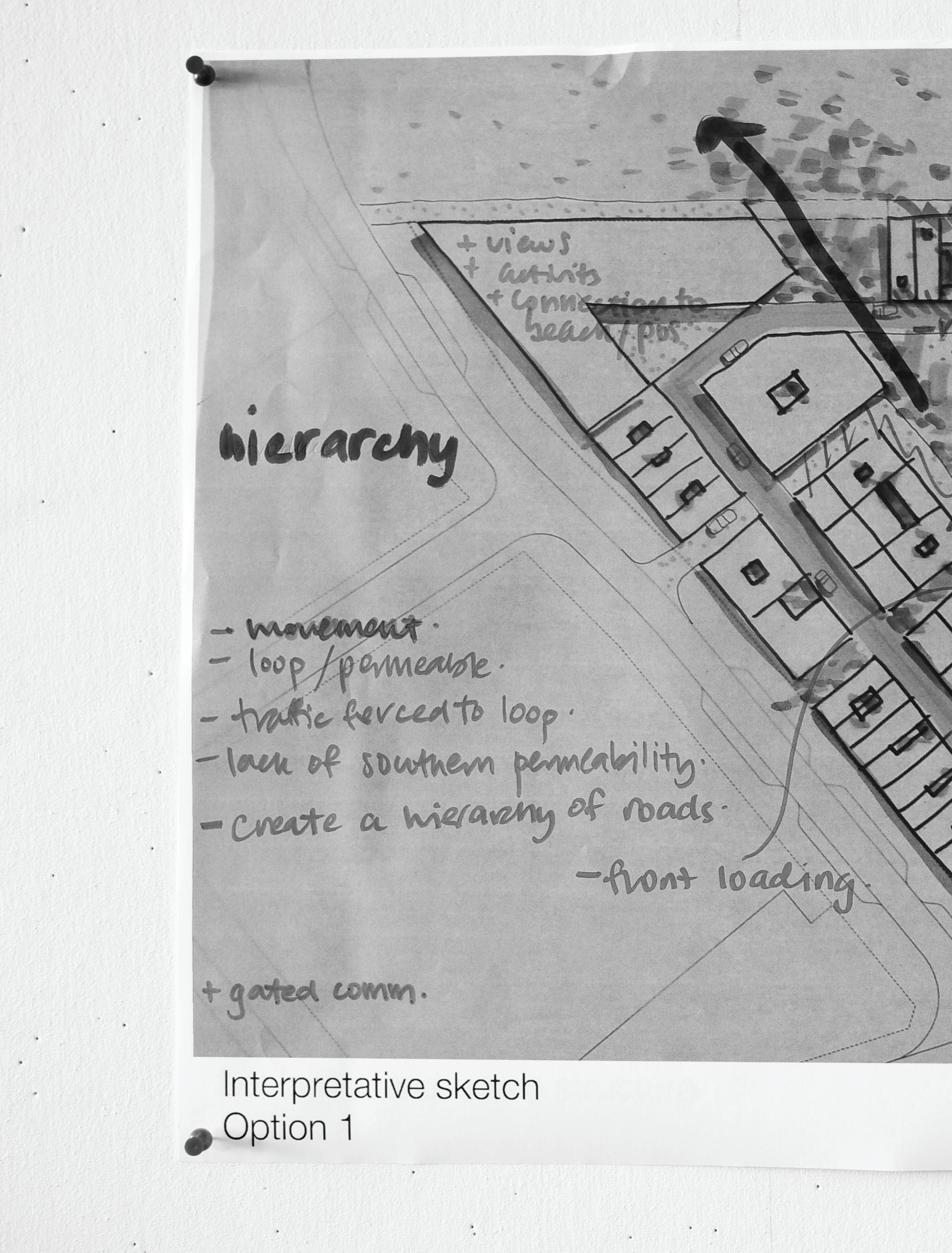
• Issues around vehicular movement and refuse collection need to be resolved
• Direct/ straight vehicular connections should be adopted in
• Concerns raised about garage ‘heavy’ laneways
Open Space
• Open space should be rationalised into one common area
• Open space should be differentiated from the district open space provided adjacent to Lot 207
• The model for the maintenance of open space needs to be resolved
Lots
• The lots need to be of a size and proportion that are appealing to the involved
• Concerns raised about the inadequate depth (in a number of the schemes) fronting onto the major POS to the north
• The sites to the NW, W and S provide the best opportunities for density
Permeability
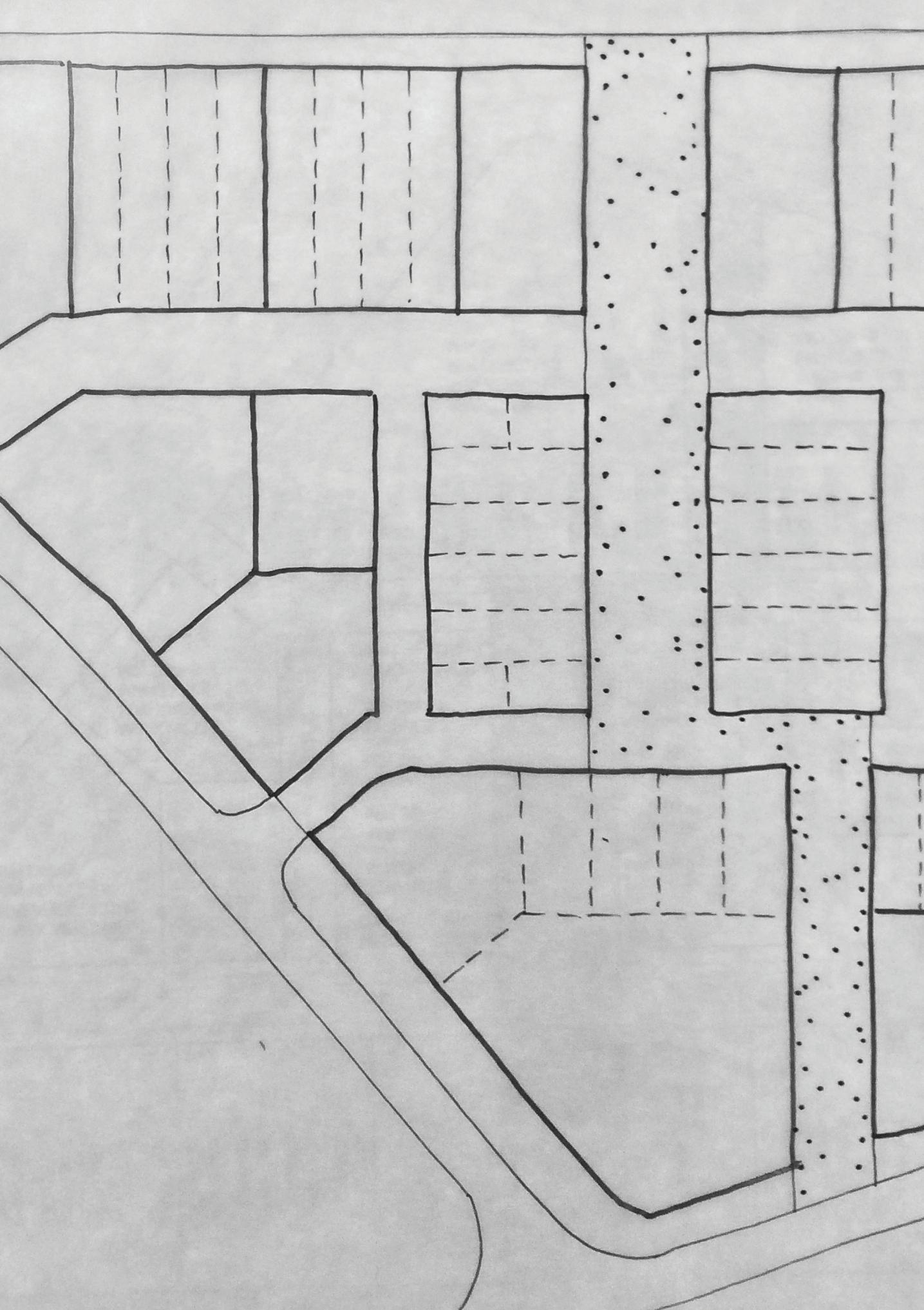
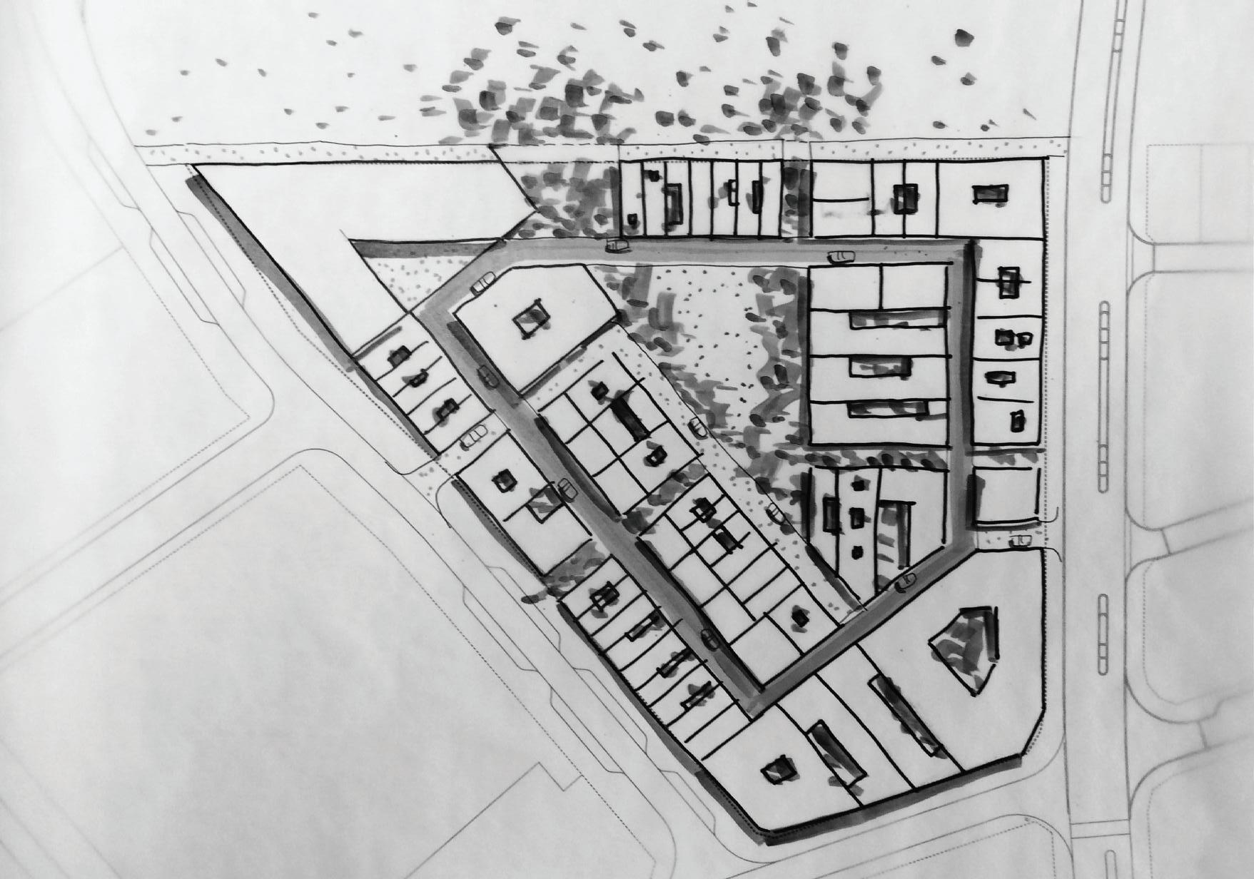
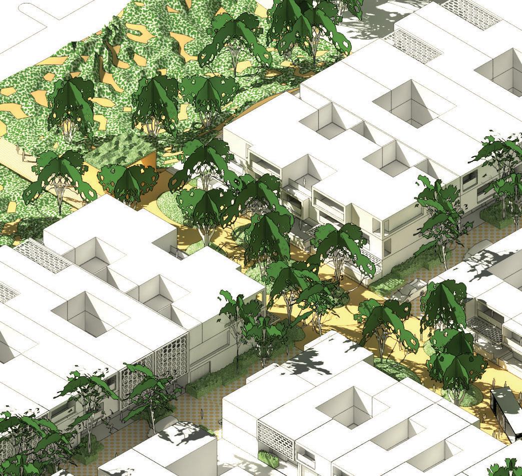
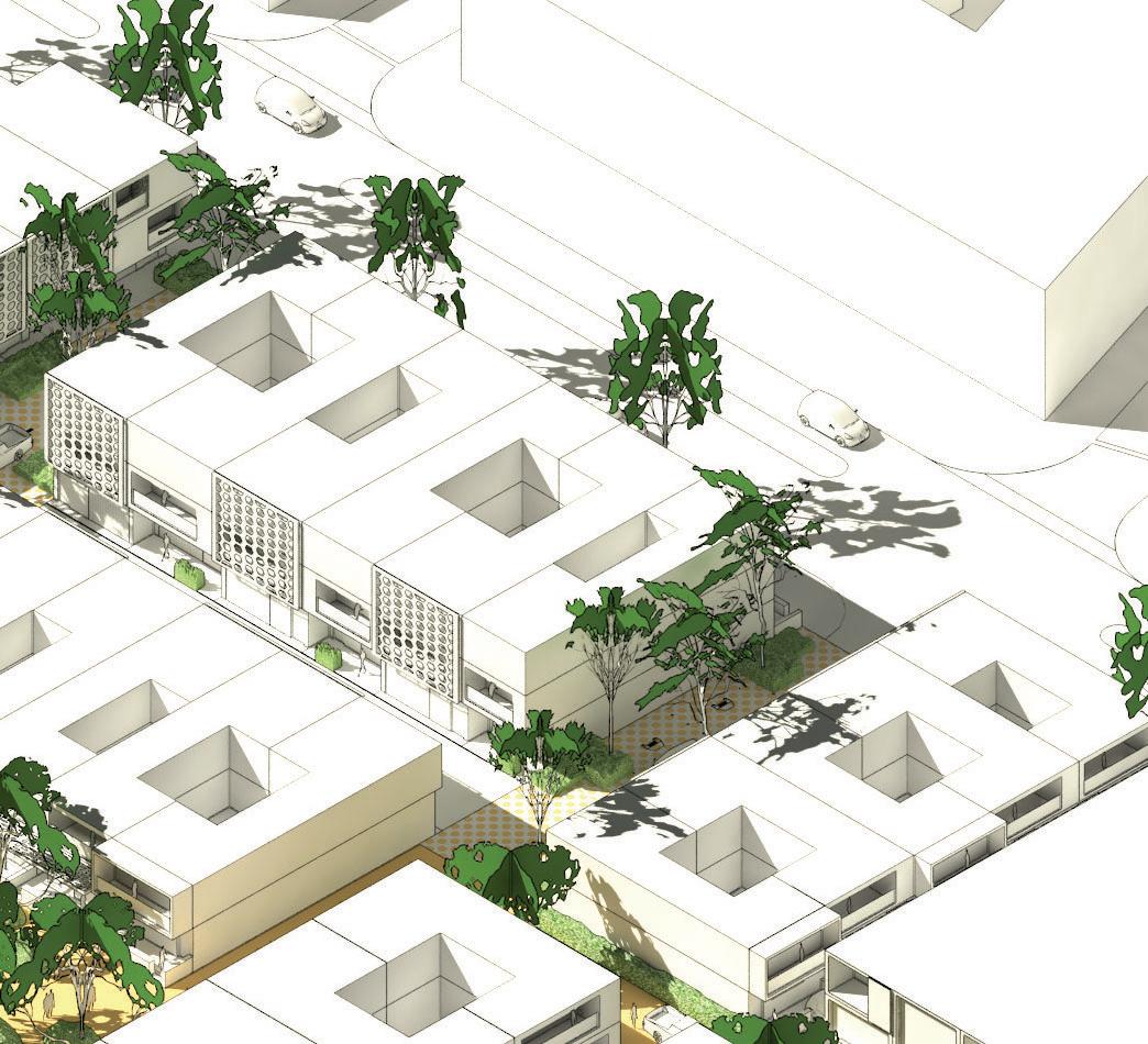
• Pedestrian permeability running north-south through Lot 207 should be provided


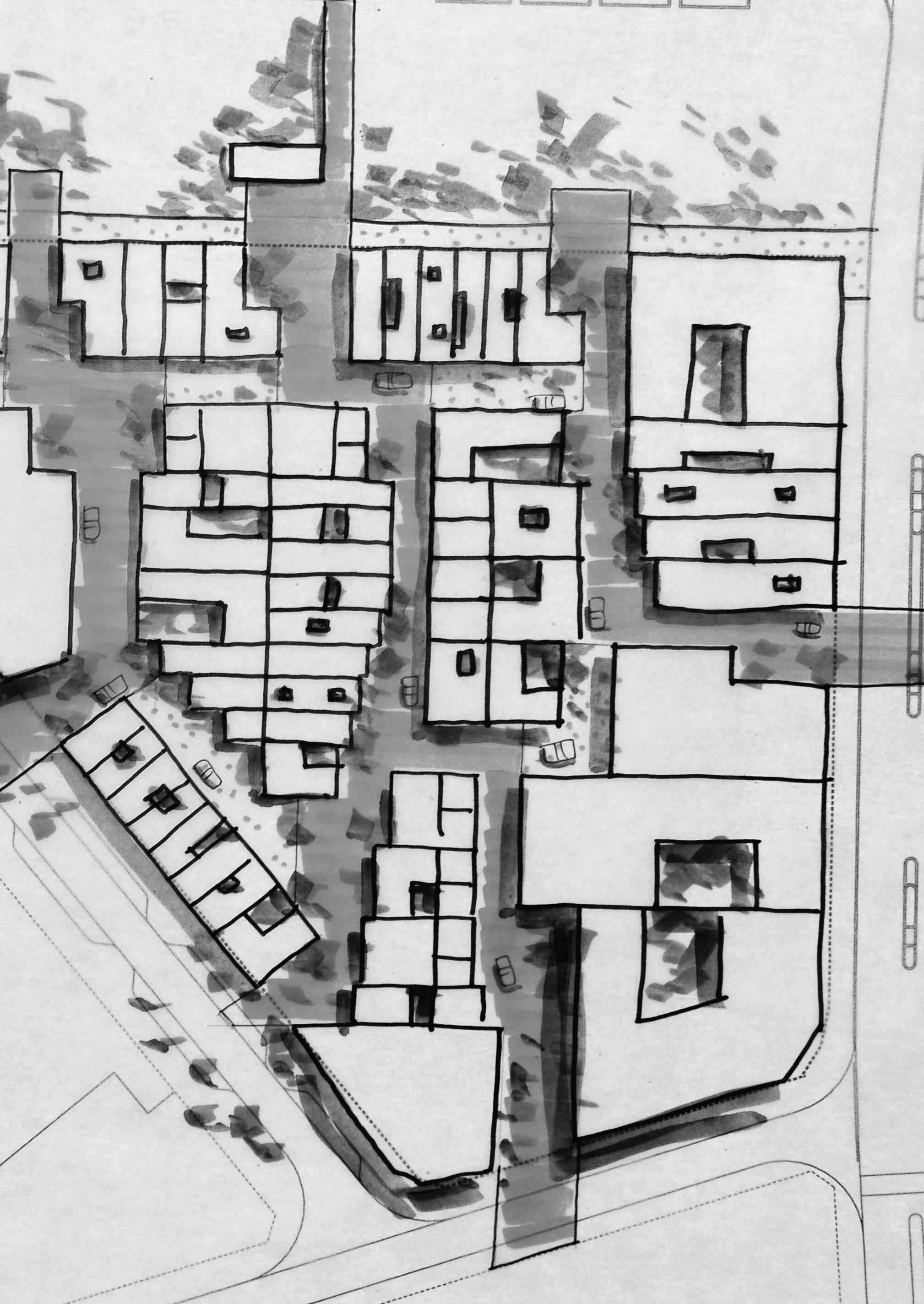
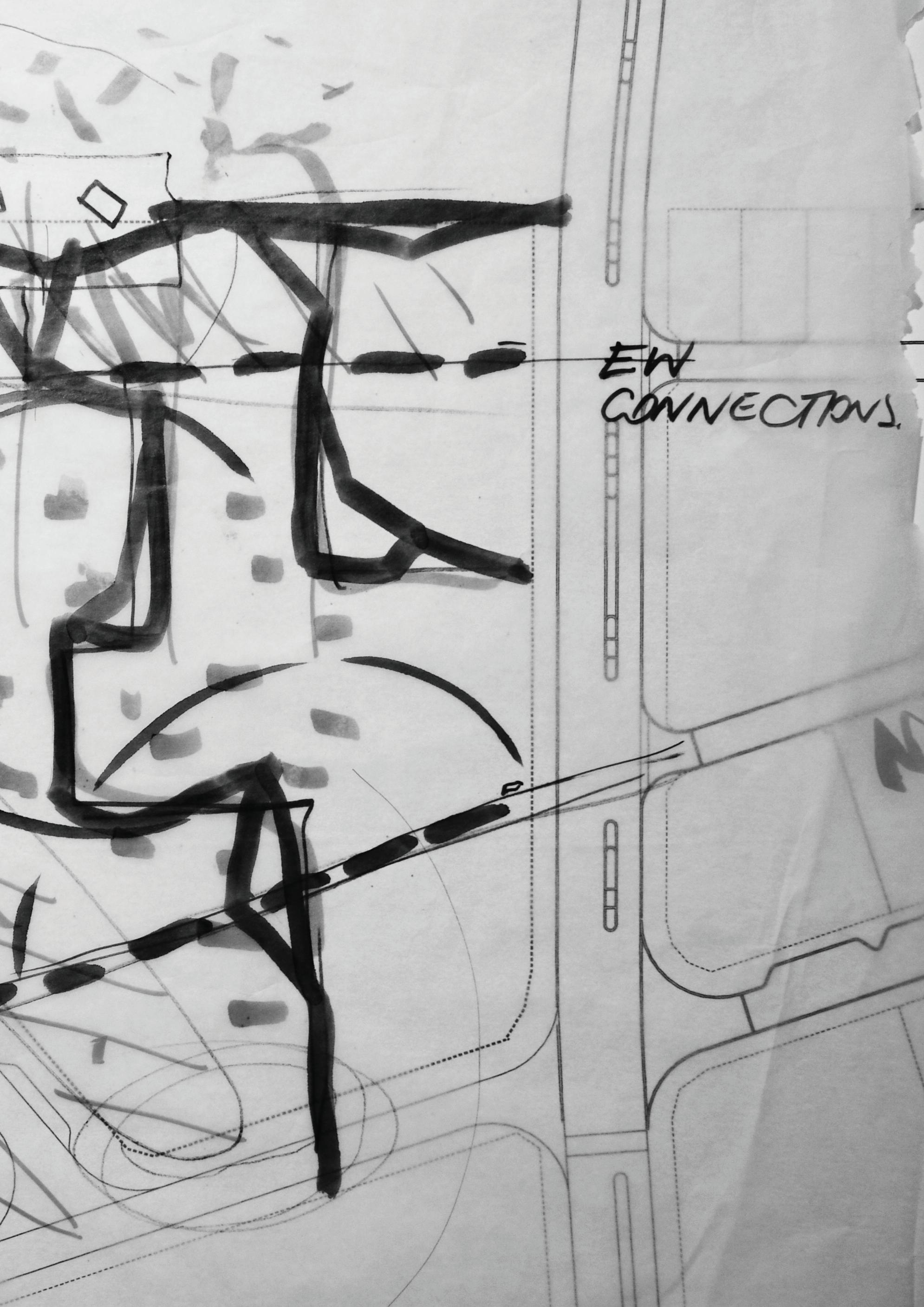
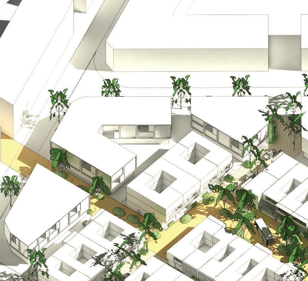
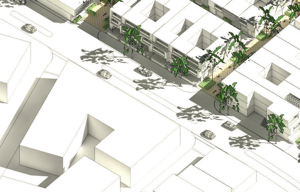
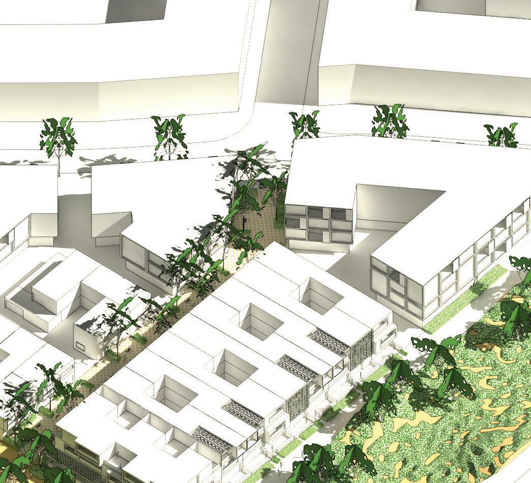
design principles were adopted to structure the development. East-west running lanes/ small streets were regarded as important for providing vehicle permeability, north facing building orientation, and general legibility.
~30m ~40m
A north-south running open space spine was regarded as important for amenity, pedestrian permeability and development identity.
15-10m
public open space quality and management, lot types, housing types mix.
laneways and small streets were presented and a discussion was had as to their possible application in the development.
Osprey Quay Regeneration Area, Portland, USA (proposed)
+ varied width roadway + meandering roadway
- presents challenges to refuse collection
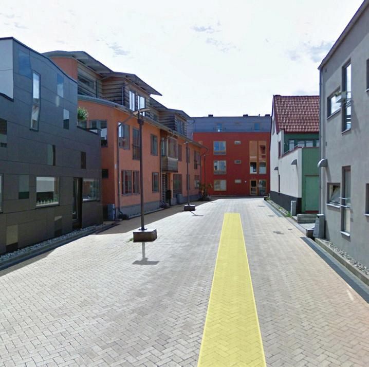
Ba01 Malmo, Sweden
+ varied width roadway
+ no distinction between vehicular and pedestrian spaces
Ba01 Malmo, Sweden- 4m roadway
+ slight step up to dwelling entrances
+ incorporation of water sensitive urban design principles
Section
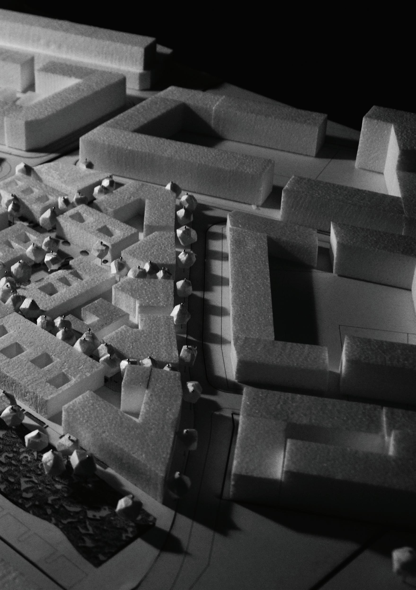
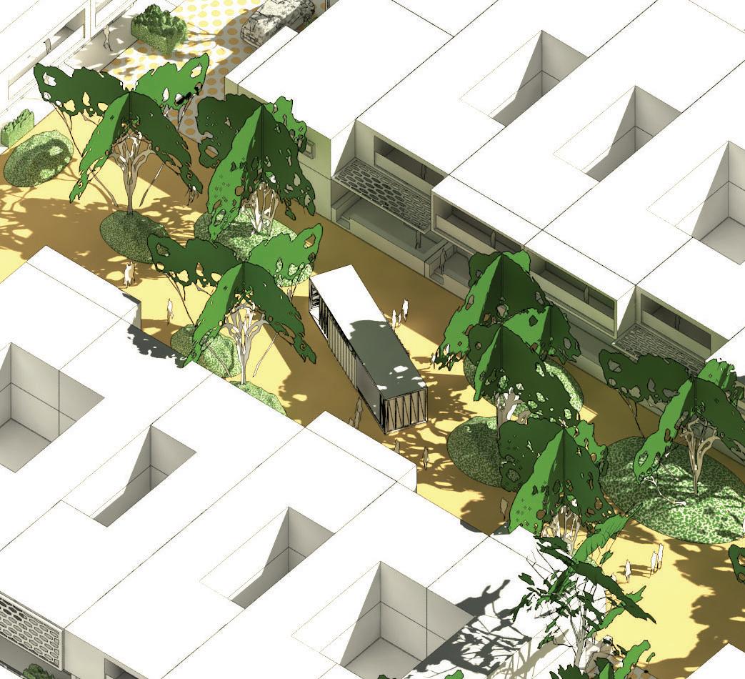
The following section explains the design for the Shoreline model urban village

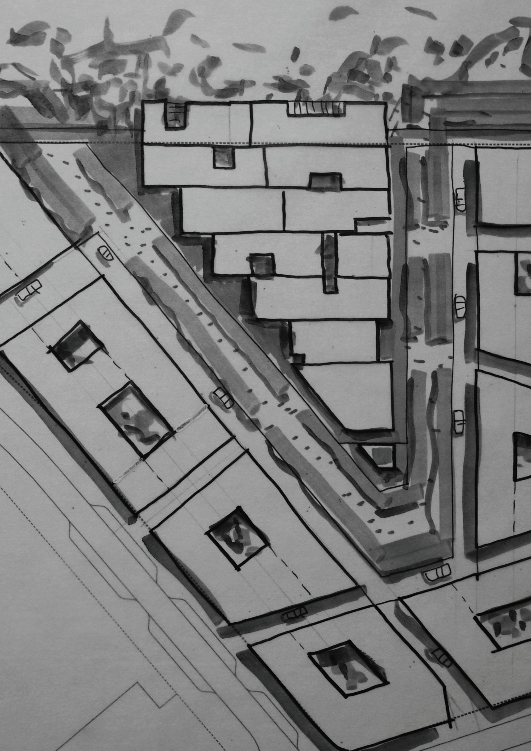
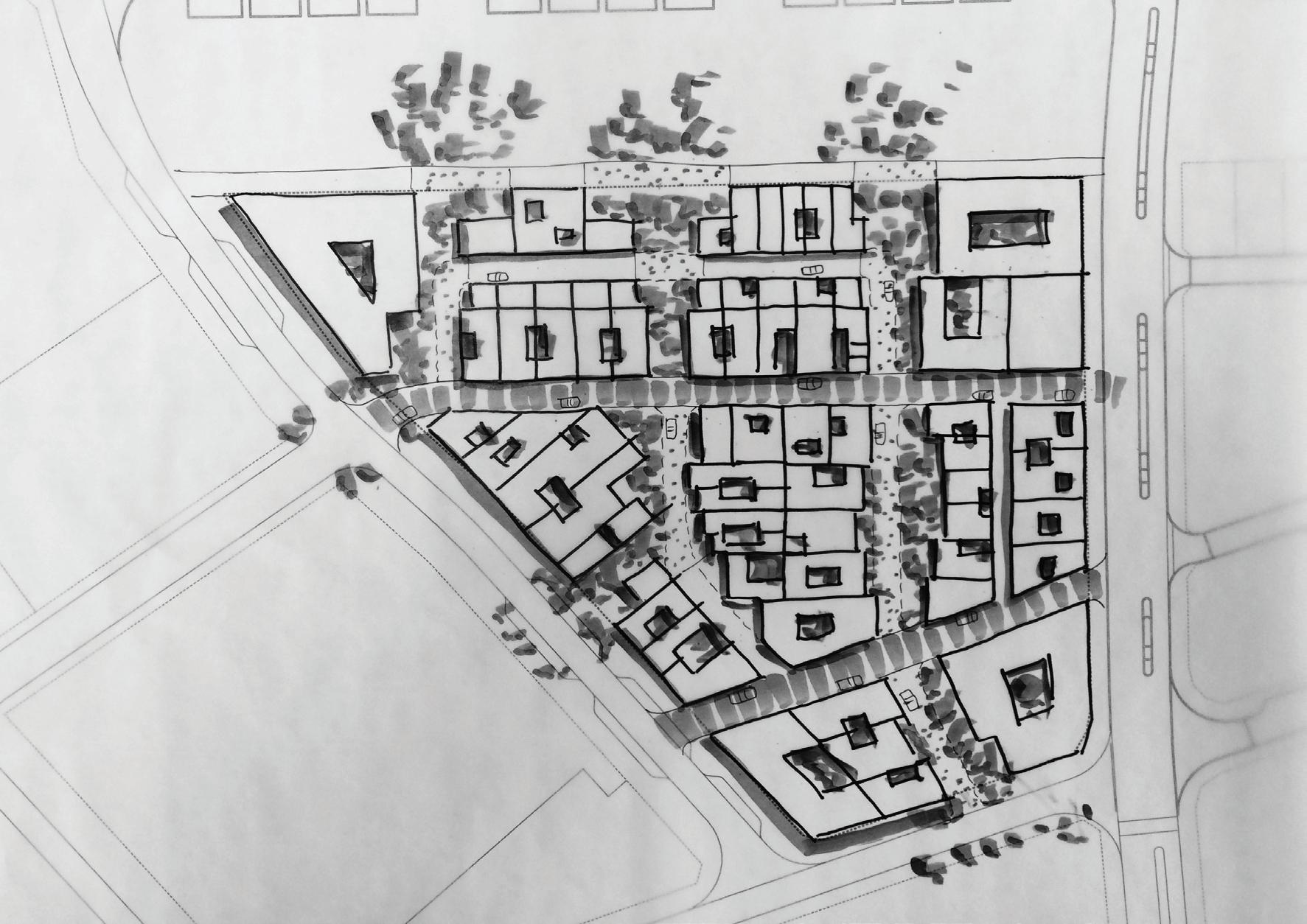
This lot layout plan sets out a 140 dwelling target.
*Calc for apartment sites (>1,000m2) based on 25% of site area being dedicated to OS,
Calc for small apartments/ maisonette sites (<1,000m2) based on 120 dw/ Ha.
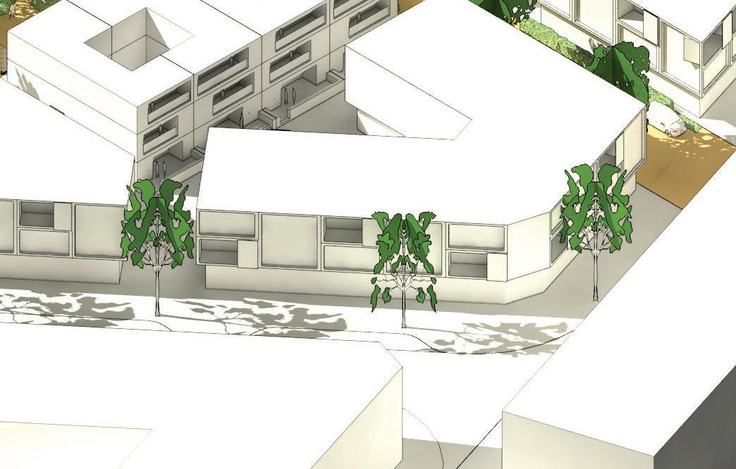
Higher building levels are correlated with site edges , oceans views and access to major POS
Micro lot ‘urban garage’
Lightsview, South Australia
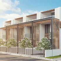
Terrace
Lightsview, South Australia
Maisonette
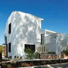
White Gum Valley
Western Australia
This diagram shows indicative building types in relation to site area.The housing typology section of the engagement
Urban Design and is not covered, in full, in this diagram
Terrace + apartment
White Gum Valley
Western Australia
Small apartment
Knutsford
Western Australia
Small apartment
Indoorpilly
Queensland
Apartment
Willoughby CA, USA

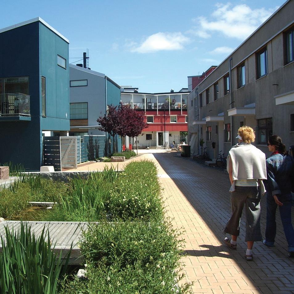
The design and layout of Local POS compensate for diminished private open space provision in medium density urban form, and to incentivise downsizing. In this respect it should

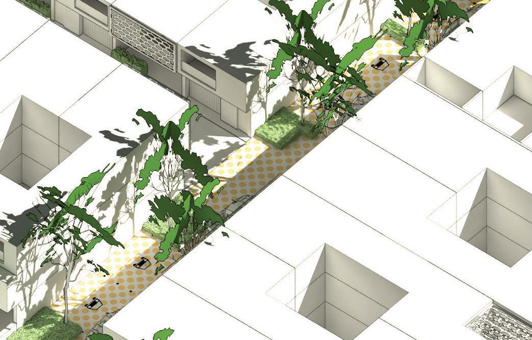
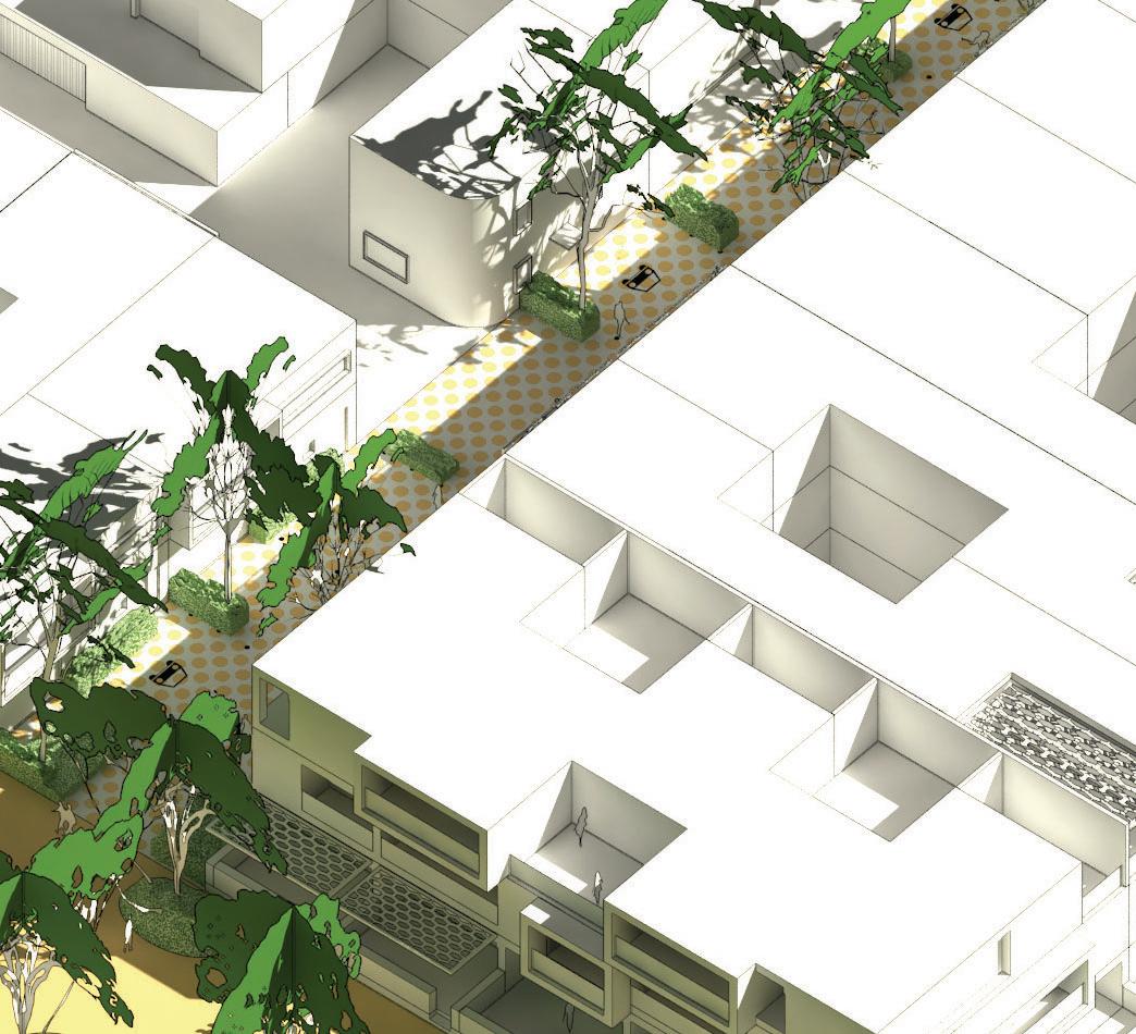
Laneways which are unattractive, poorly surveilled, and have no trees
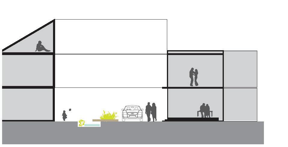
medium density development. In this instance a 10m wide laneway (building to building) accomodates a 2 way- 6m wide road carriageway with tree and shrub planting.
If the east- west running laneways/ way- shown here as a 4m wide carriageway then considerable tree and shrub planting can be introduced into this shared pedestrian/ vehicular space.
• Partnering of Landcorp with a developer to develop a demonstration precinct
•Collaborative design process involving developers to design ‘cells’ within the scheme, particularly in relation to car
•Assumptions about buyers preferences to be tested with
•Documentation of the Lot 207 scheme for regulatory approvals

Julian Bolleter
Julian is an Assistant Professor at the Australian Urban Design Research Centre (AUDRC) at the University of Western Australia. His role at the AUDRC includes teaching a master’s program in urban design and conducting urban design related research and design projects.

Dr Joerg Baumeister
Joerg is Director of the Australian Urban Design Research Centre (AUDRC) and has been researching, practising, educating and exploring Urban Design and Architecture for more than 20 years in Australia, Europe, Africa, and on the Arabian Peninsula.
Other contributors
The Lot 207 urban design plan and the
the result of a close collaboration between the project team at Landcorp, Lisa Shine Urban Design and AUDRC.
The contributors to this report were supported by their AUDRC colleagues
Isnin in the preparation and conducting