GEARY BLVD
THE HEART OF THE RICHMOND
FALL SPRING 2022 UT URBAN DESIGN
CRITICS: DEAN ALMY, GHIGO DITOMMASO (GEHL), LAURA JOHNSON (GEHL)
AUBRY KLINGLER GEARY BLVD SAN FRANCISCO IN 1864
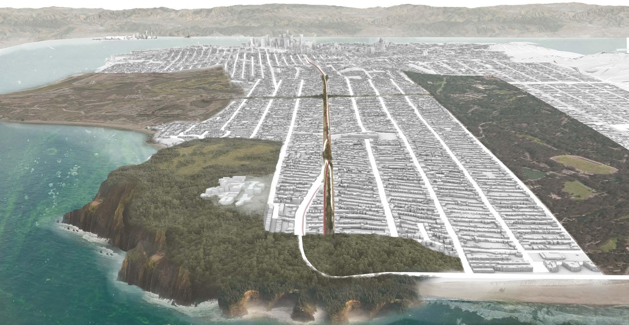
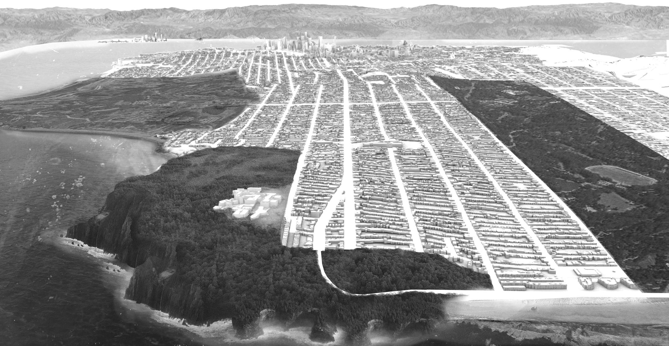
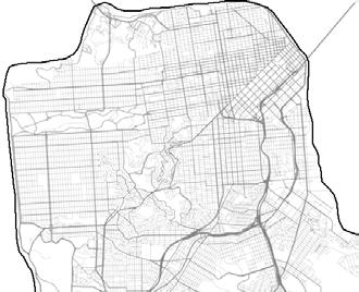
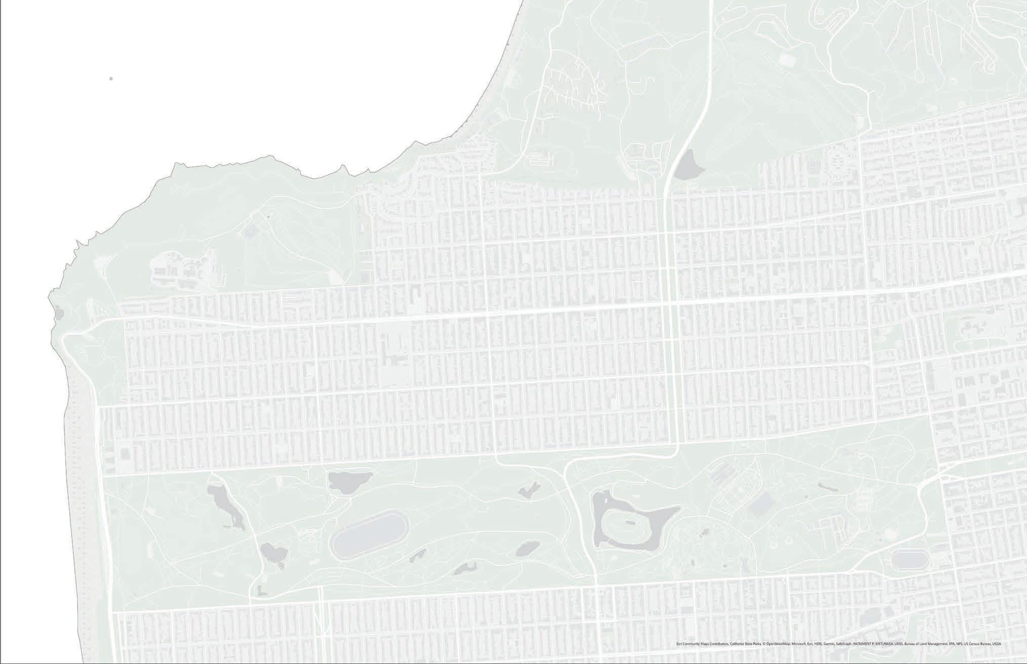
THE CITY
CRITICS: DEAN ALMY, GHIGO DITOMMASO (GEHL), LAURA JOHNSON (GEHL)
SAN
Site Area
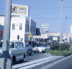
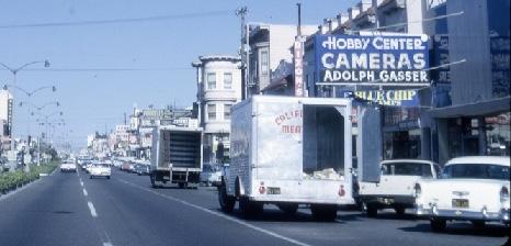
IN 1864
Geary was originally named Point Lobos Road, but was changed to Geary Blvd in the early 20th century after San Francisco’s first mayor John Geary
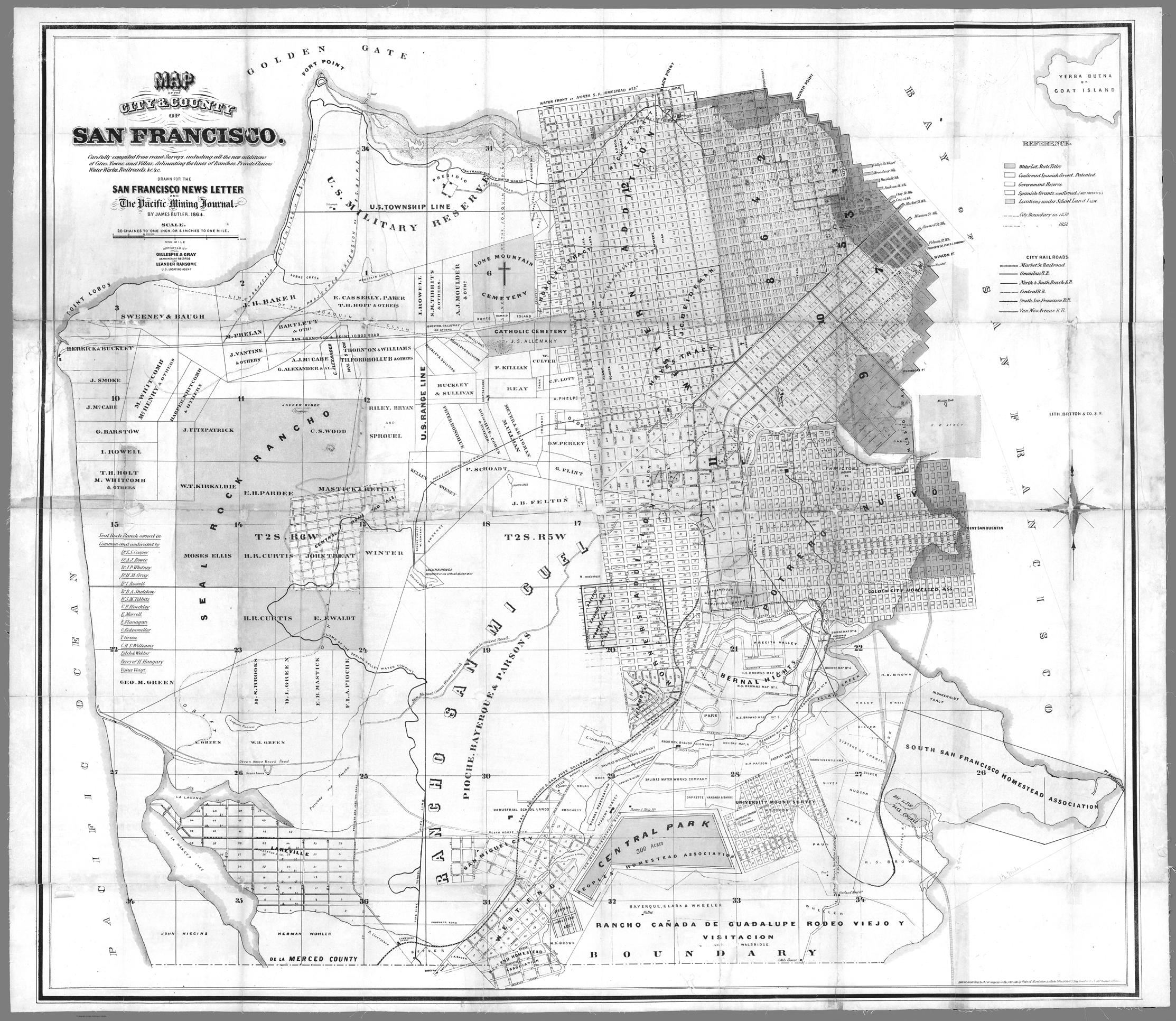
Geary Boulevard was the first street to be built in the Richmond district. And was one of the first corridors for development in the area
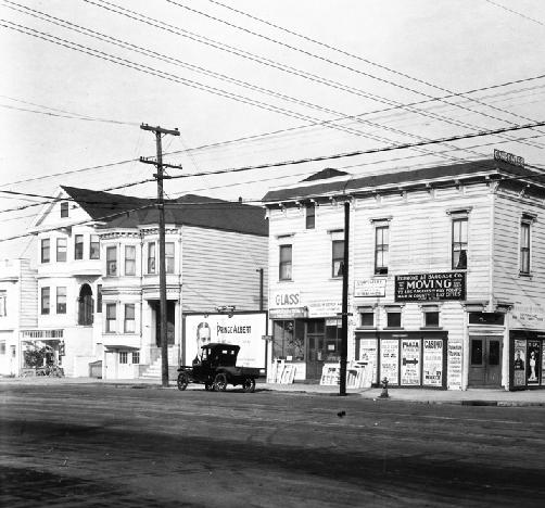
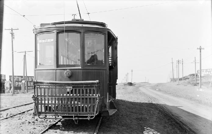
In 1909 a bond was approved to build a street car line from the corner of Market street downtown out to Ocean Beach
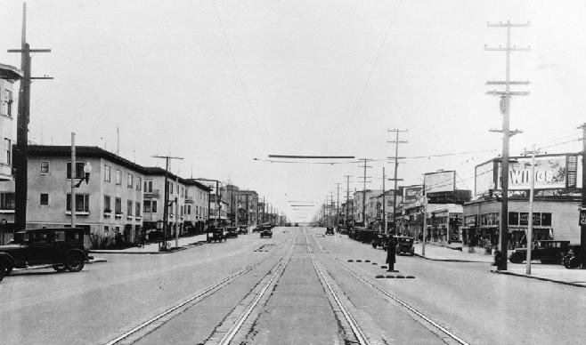
The street
remained


Commercial Areas


ave
point lobos ave
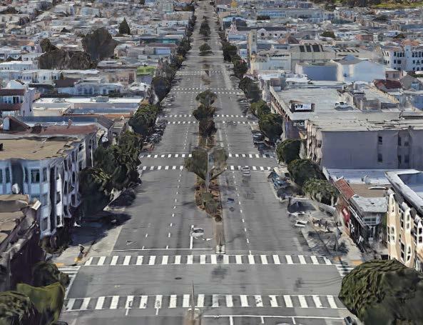
irregular blocks
35th ave 40th ave 43rd ave
access to lands end greenspace george washington highschool
site boundary
ave
ave high point
site boundary
asian community richmond public library
greenspace
presidio middleschool blocks


“little russia”
washington highschool
arguello blvd 4th ave 7th ave 10th ave park presidio blvd 25th ave 28th ave 31st ave 21st ave 17th ave
kaiser permanente medical center park presidio blvd 25th ave 28th ave arguello blvd

commercial area
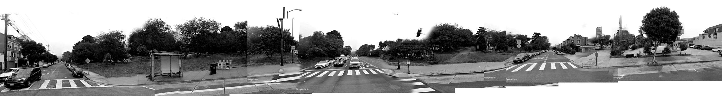
Along this 12-block stretch of Geary, the existing building fabric is at a large scale but with many “missing teeth”
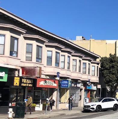
This 14-block stretch of Geary Blvd through Central Richmond contains most of the existing commercial fabric
Outer Richmond, between 28th and 40th ave, is a primarily residential street with a few corner cafes.
The portion of Geary which connects to the coast feel almost suburban
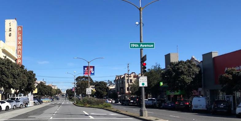
The intersection at Arguello Blvd creates an entry point to the Richmond
Park Presidio, the parkway which runs north-south, creates a large intersection
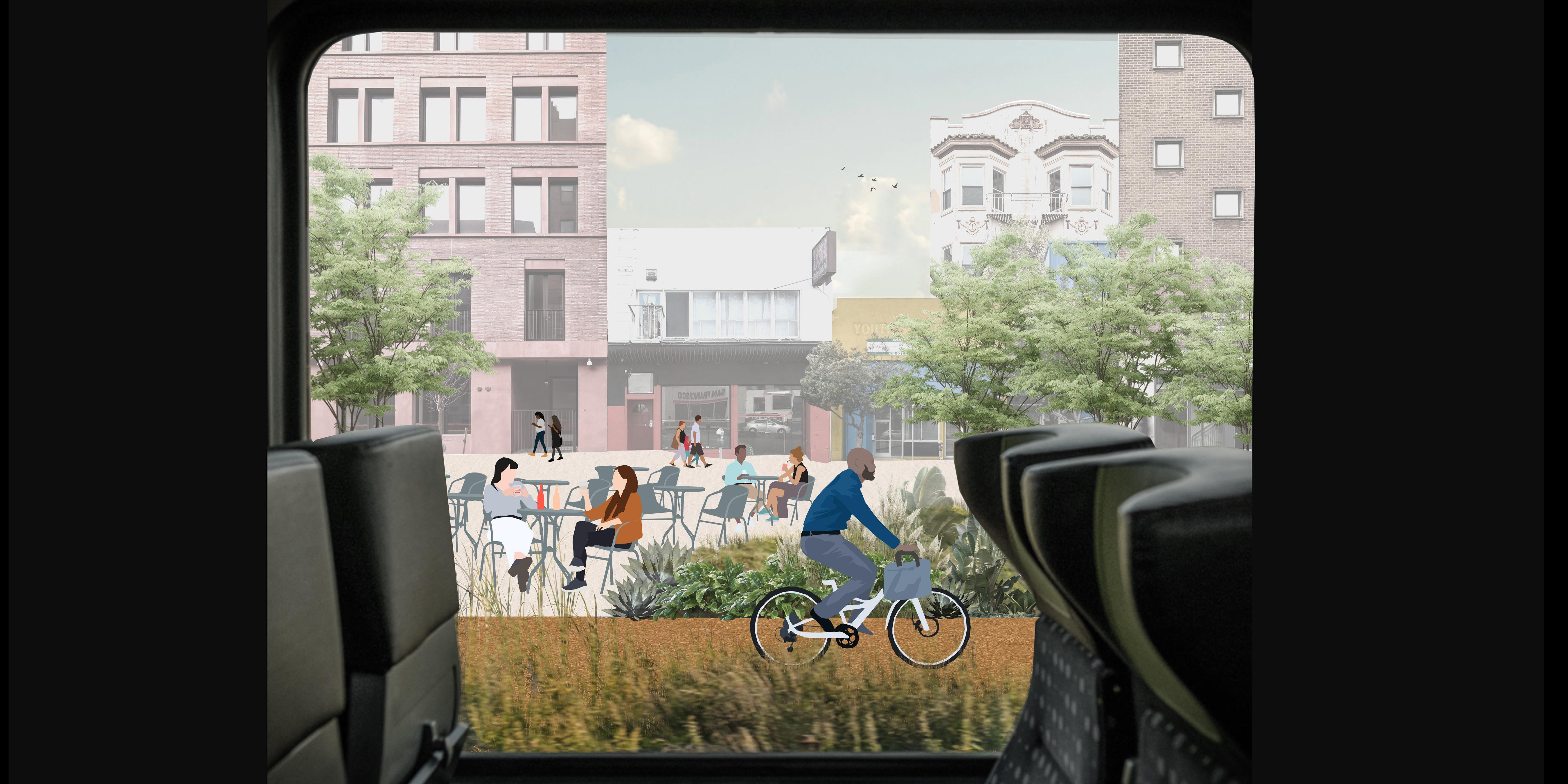
George Washington High School and Presidio Middle School create a threeblock interface along Geary Blvd.
arguello blvd
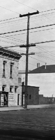
T-01 North side of Geary between 7th and 8th avenue lots of parked cars, several small shops, parking lot, several street trees
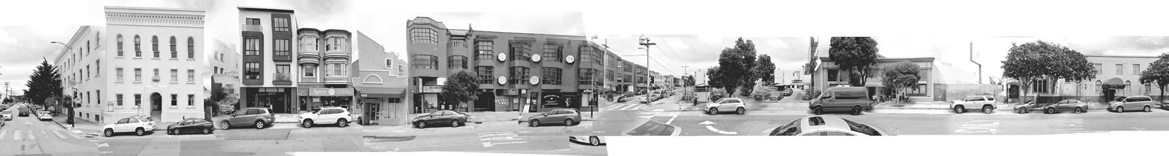
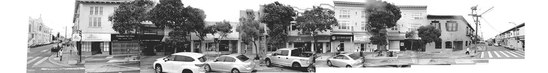
T-02 North side of Geary between 22nd and 23rd avenue angled parking, many small shops, many street trees, parking meters on sidewalk
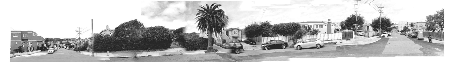
T-03 North side of Geary between 34th and 35th avenue street parking and several cars in driveways, on corner cafe, and no street trees
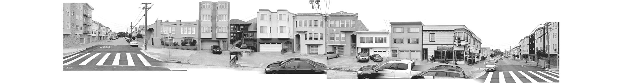
T-04 North side of Geary between 45th and 46th avenue street parking, building setbacks, fenced in front yards, cars parked in driveway
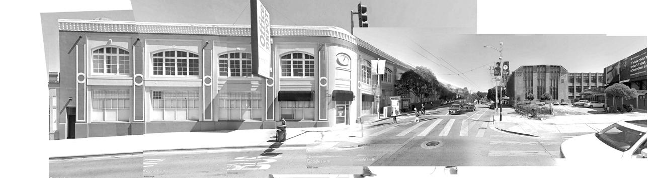
N-01 The intersection of Geary and Arguello Blvd is the entry point to the Richmond District. The intersection is home to an Office Depot, a parking lot, a gas station, and a corner store.
N-02 The intersection of Park Presidio and Geary Blvd creates a long interruption in the fabric of the street.
N-03 The two-block stretch along George Washington High School creates a barrier in the neighborhood.


Node 01 occurs at the intersection of Arguello Blvd and Geary Blvd and acts as a gateway to the Richmond District.

Node 01 signals to the visitor that they are about to enter somewhere new and different, and includes elements such as the dune parklet which are a nod to the identity of the Richmond.
Car Infrastructure (roads, parking lots, etc...)
Commercial/Public Programs
Parks/Public Greenspace
Territory 01 is characterized by long low buildings, prevalent parking lots, gas stations, and other car related spaces.
Kaiser Permanente


T01
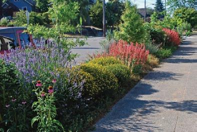
Territory 01 gives visitors and residents opportunities for play and exercise. The pedestrian space and park strip are wide enough to accommodate things like dog parks, playgrounds, tennis and basketball courts, and other such community spaces.
The intersections of Territory 01 have turning lanes to accommodate greater traffic volume due to the proximity to downtown.
N02
Node 02 occurs at the major intersection of Park Presidio, the parkway which runs north to Marin County and south to Daley City.
N02
At Node 02, a density of plantings which mimic the park way, flow into Geary on either side to signal a moment of transition.
T02
Car Infrastructure (roads, parking lots, etc...)
Commercial Store fronts
Parks/Public Greenspace
Territory 02 has a finer grain of existing building fabric than Territory 01. This is currently the liveliest portion of Geary, with many small shops and restaurants.
floor
floor
Holy Virgin Cathedral (Russian Orthodox)
Cathedral Orthodox)

T02
The focus of Territory 02 is to enhance the existing character of the street which is currently be suffocated by car traffic and lack of density.
In Territory 02, every other intersection has a turning lane to accommodate car traffic. The southern side of the street is lined with trees to create a comfortable pedestrian experience on the south side of the street as well.
N03
Node 03 occurs at the 3-block interface created by the Public High School and Middle School in the neighborhood.
N03
Node 03 is focused on the new plaza at the northern edge of the High School where a new community-focused building opens up the site to the neighborhood.

T03
Car Infrastructure (roads, parking lots, etc...)
Commercial Store fronts
Parks/Public Greenspace
Territory 03 is similar to Territory 02 in form, but not in program. The buildings along Geary along this stretch are almost entirely residential.

T03
Territory 03 is focused on strategically injecting new program into the street. Because the surrounding fabric is exclusively residential, utilizing the center of the street gives the opportunity for live/work spaces or corner stores.
T03
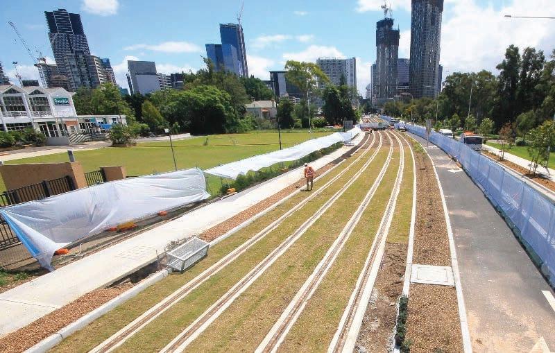
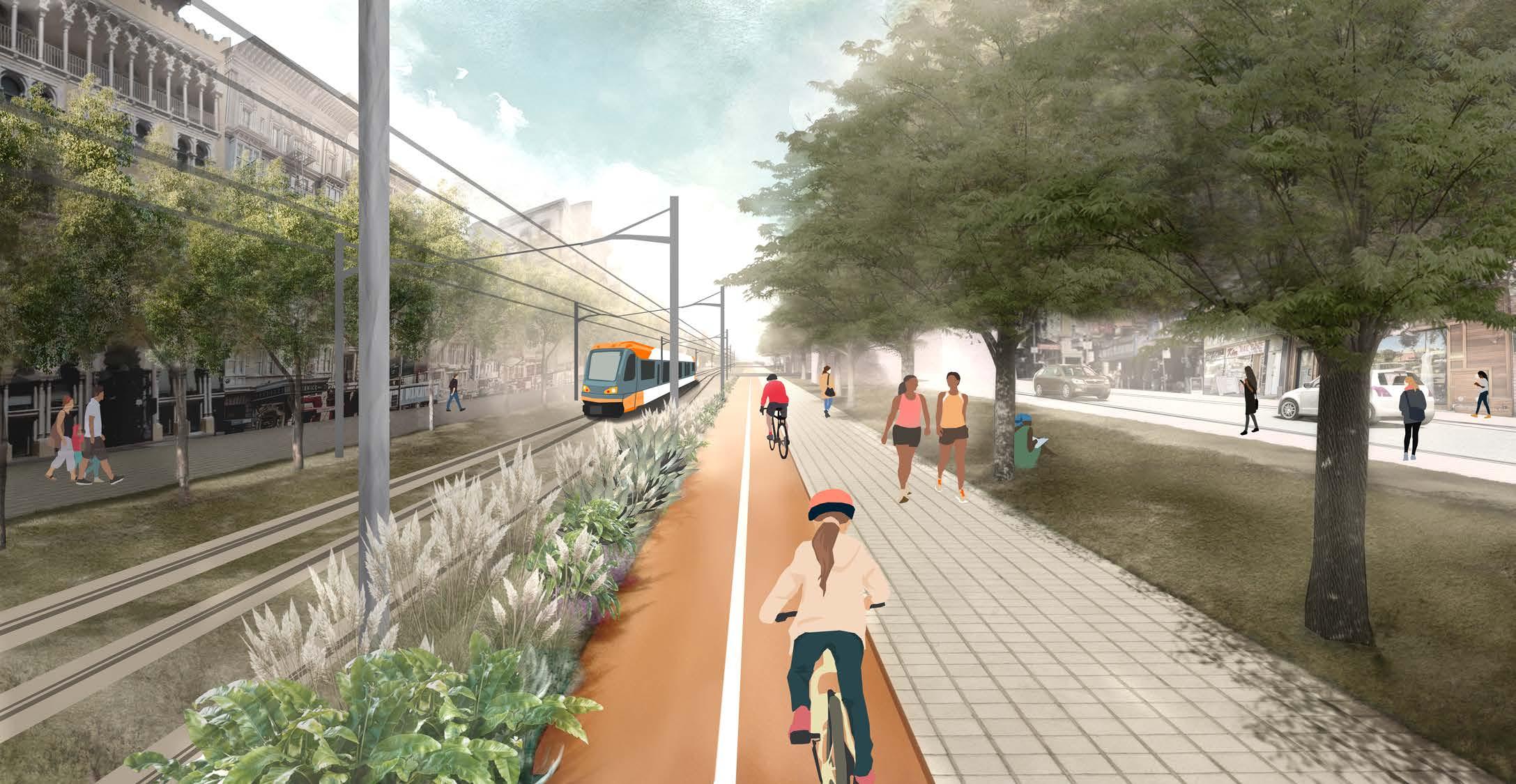
Territory 03 becomes almost like two separate streets, one with cars, and one with the light rail. For fire safety, emergency vehicles can utilize the concrete strips of the light rail tracks.

Car Infrastructure (roads, parking lots, etc...)
Commercial Store fronts
Parks/Public Greenspace
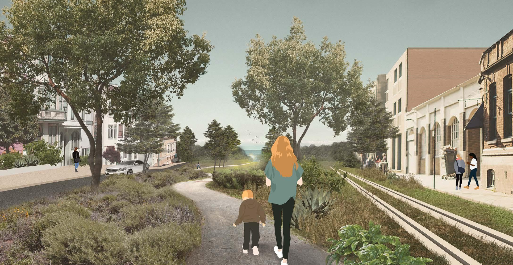
Territory 04 is very different from the other territories. It feels almost suburban, with yard setbacks and detached single family homes.
San Francisco Firehouse #34
Chinese Seventh-day Adventist Church
T04
The central park strip grows significantly in Territory 04 and becomes increasingly more wild the closer it gets to Lands End and the Ocean.
T04
The road and light rail become a one way loop around the Geary/Point Lobos triangle in Territory 04 which allows for more greenspace within the street.
The coastal landscape bleeds into the street
Moments of transition are marked by a density of planting
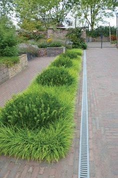
A balance of shade and sun is achieved in recreational spaces
Single
Row
Informal
Lophostemon
of way curb root barrier
pavers stone
varies
open soil volume
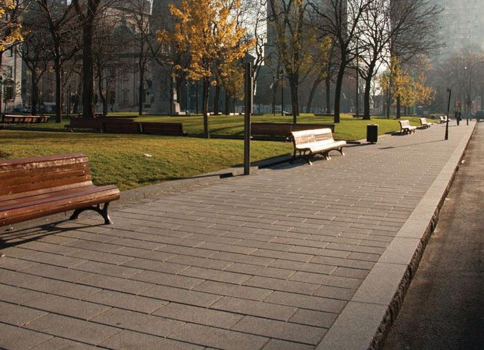
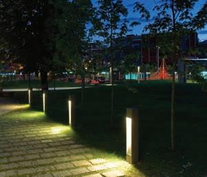
Lighting strategies along Geary exist at different scales to respond to different needs. All lights incorporate solar technology to save energy produced by the grid.
The light rail tracks are embedded in concrete strips which allow low grasses to grow between the rails. The stations are located approximately every six blocks to allow for access with speed.
overhead power supply lines for light rail
emergency vehicle clearance
luminaire for track and platform illumination
topsoil layer concrete reinforcement at light rail tracks
power pole
luminaire for pedestrian area illumination
metal guardrail concrete slab
permeable pavers stone subase