2 minute read
THE IN - BETWEEN 03


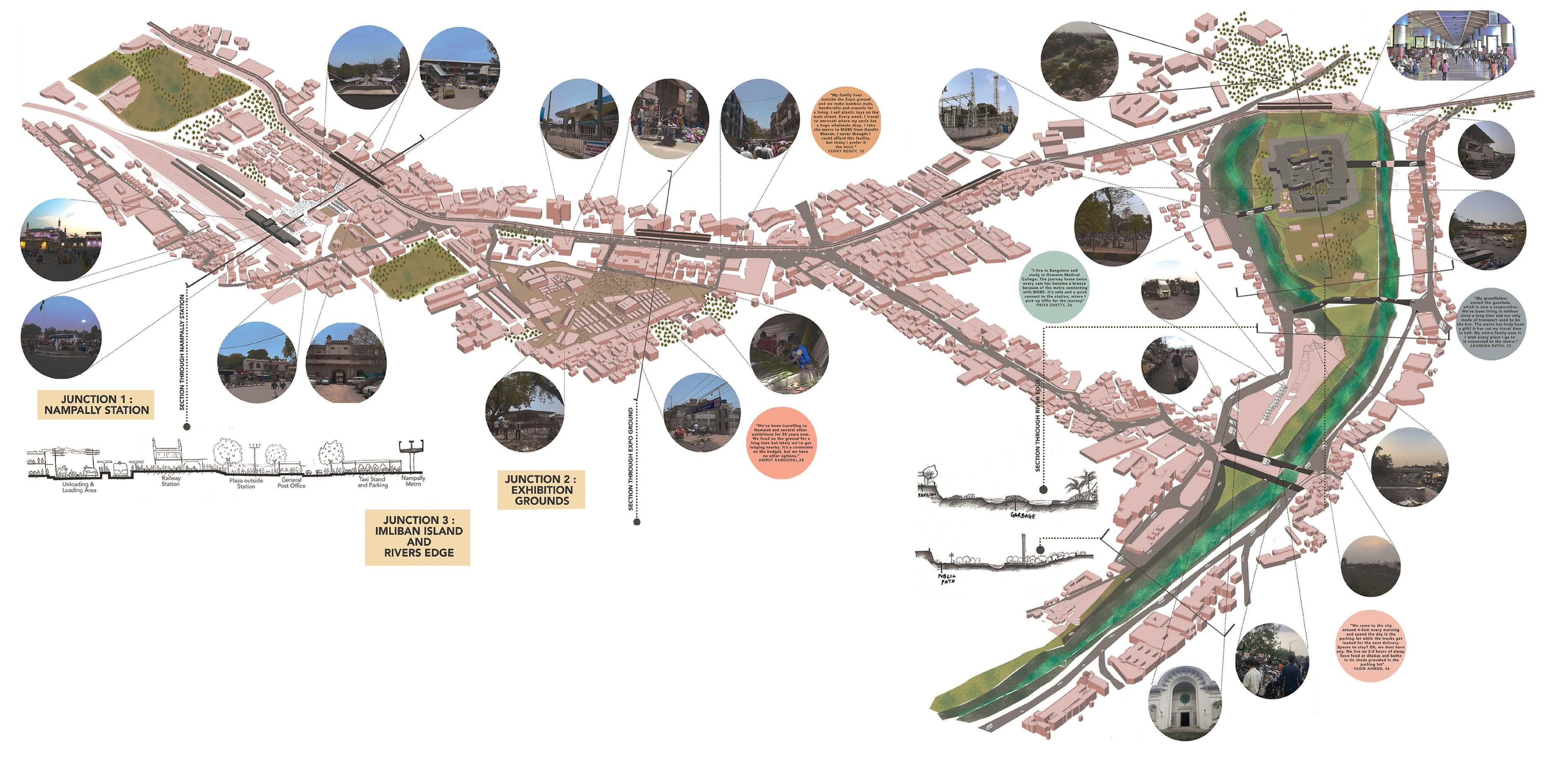
Hyderabad Transport Systems
Year: 2019
Advertisement
Project Type: Urban Design Project
Team: Ashna Negandhi and Rishita Nanda
Author’s Role: 3D, Axonometric, Views, AutoCad & Rendering
Location: Nampally, Hyderabad
Program: Marketspace and connection of the two transport routes
Trading has been an integral part of this city. The transport routes, the roads and trains have created the Hyderabad that is today. Nampally, an important area, has a metro and a train station opposite to eachother. The current situation of that area is congested with hawkers and roads that don’t allow any space for the pedestrians. The design proposed gets rid of the road and creates a well integrated green space for the hawkers to sell.
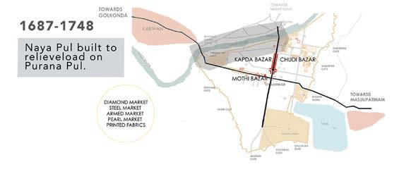
Hyderabad started expanding its business from local areas to larger areas in its vicinity and starts identifying a few places as their main markets.
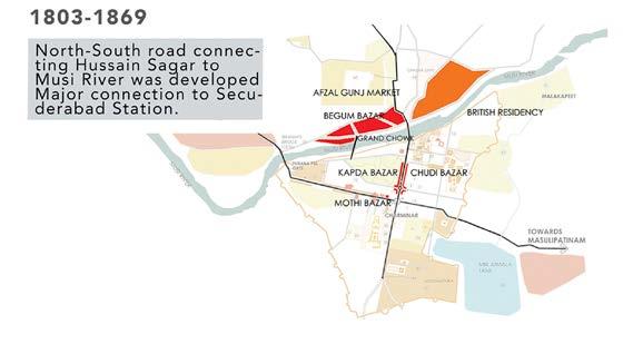
The north south connection of the city expanded with more areas of trading allowing for connection to the Secuderabad Station that was the main railway station during the early 1800’s.

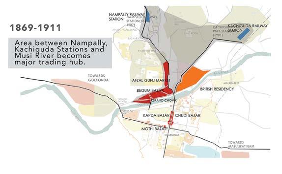
The city further grows northwards, expanding its trading routes via roads and railways and Nampally railway station is set up. The area between the railway station and the Musi river becomes a main trading hub.
Inter-state trading starts with Hyderbabd expanding their spices via roads and railways, expanding more towards the North region through flight networks.
Hyderabad gets identified as the major trading hub in India and now its well connected via roads, railways and flights.

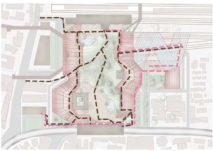
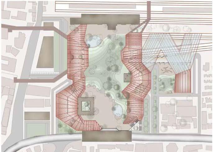
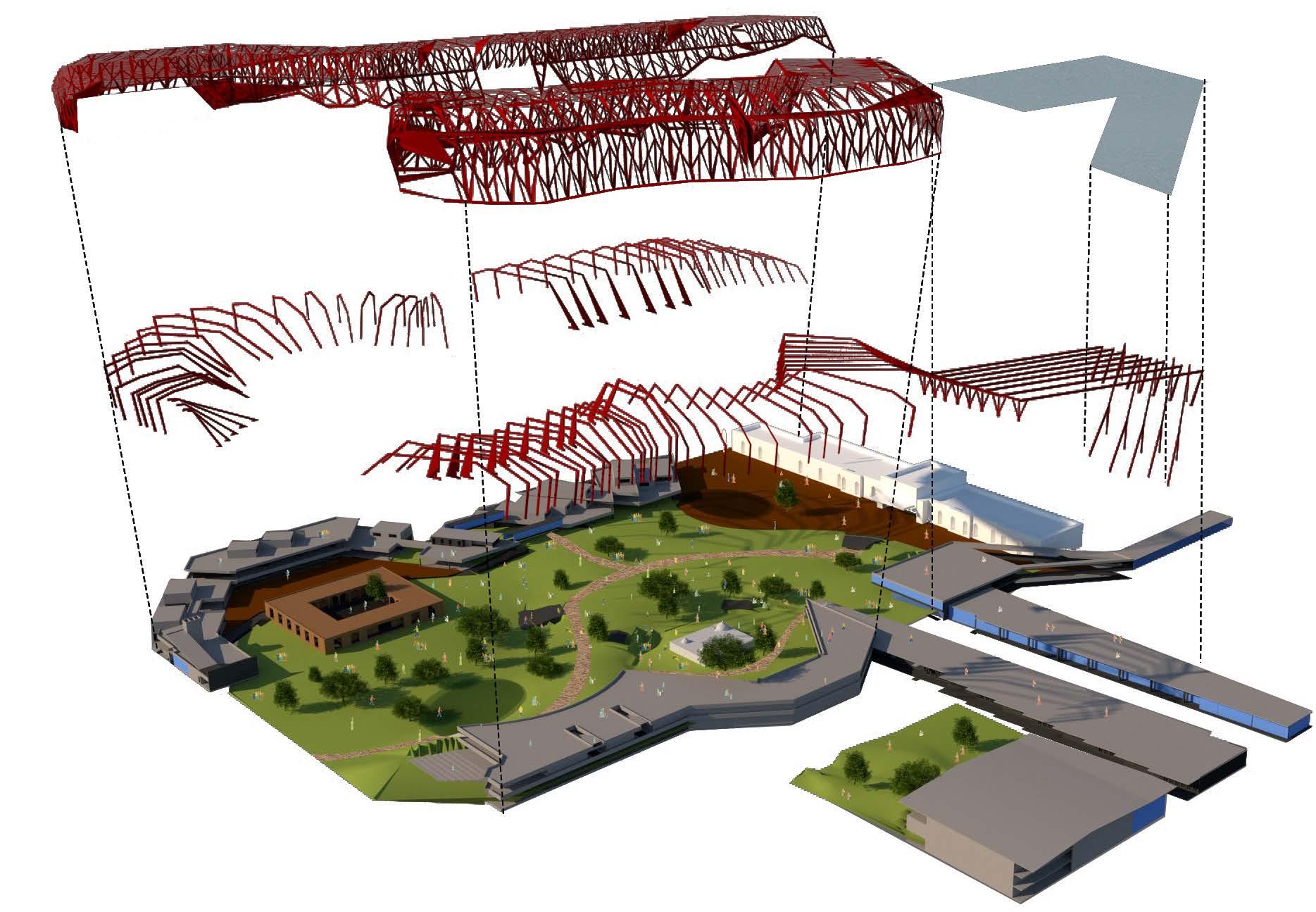
Masterplan connection ideas
Allowing connection between two transport routes through rigid box pattern pathways
Respecting the surroundings and creating connections with main built areas.
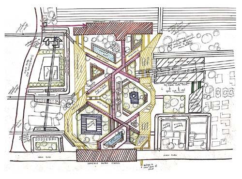
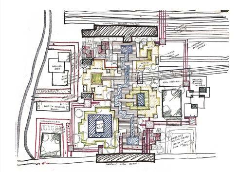
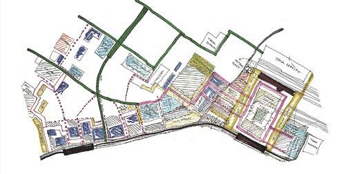

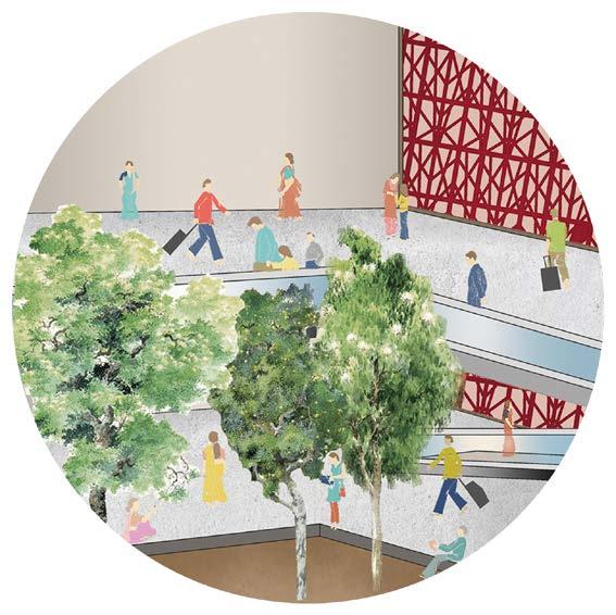
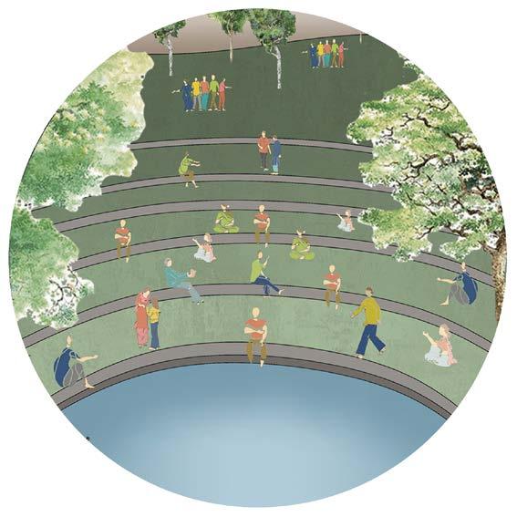
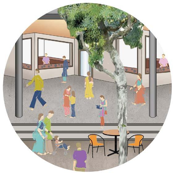
The masterplan connects the Nampally metro station at the South of the plan with the Nampally railway station at the North of the plan and eliminates the concretized area, replacing the same with green pedestrian mounds. The areas on the side of the mounds are turned into marketplace for the locals. The masterplan allows for three routes of connection to the railway station, the first being a public connection through the central green, the second being a covered walkway proposed that allows for play of light and an opportunity to shop in the local marketplace, the third being a direct connection through the first floor level between the two modes of transport. A railway institute to the west is proposed that allows for opportunities to the young railway personnel fo training pusposes. An exhibition promoting tourists and the locals to learn more about the vintage railway coaches is proposed to the north, opposite the railway institute.
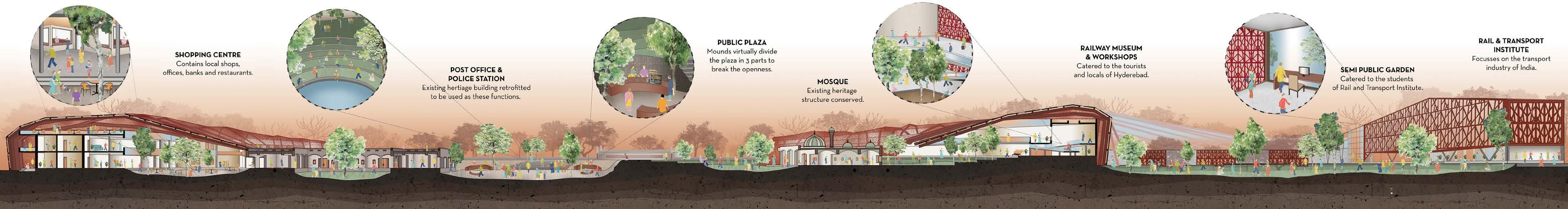
The activities that take place in these sections include of a marketspace being formed, engaging locals with tourists. A green amphitheatre is proposed at the centre of the plan with depressions in the land where water can be collected to keep the environment cool. Three distinct levels of pathways are formed to allow for pedestrian movement connecting the two transport routes.
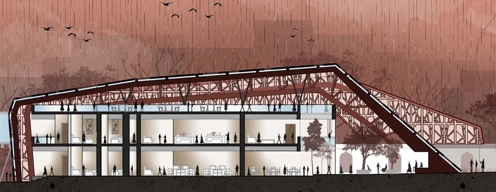
SECTION THROUGH THE RAILWAY INSTITUTE

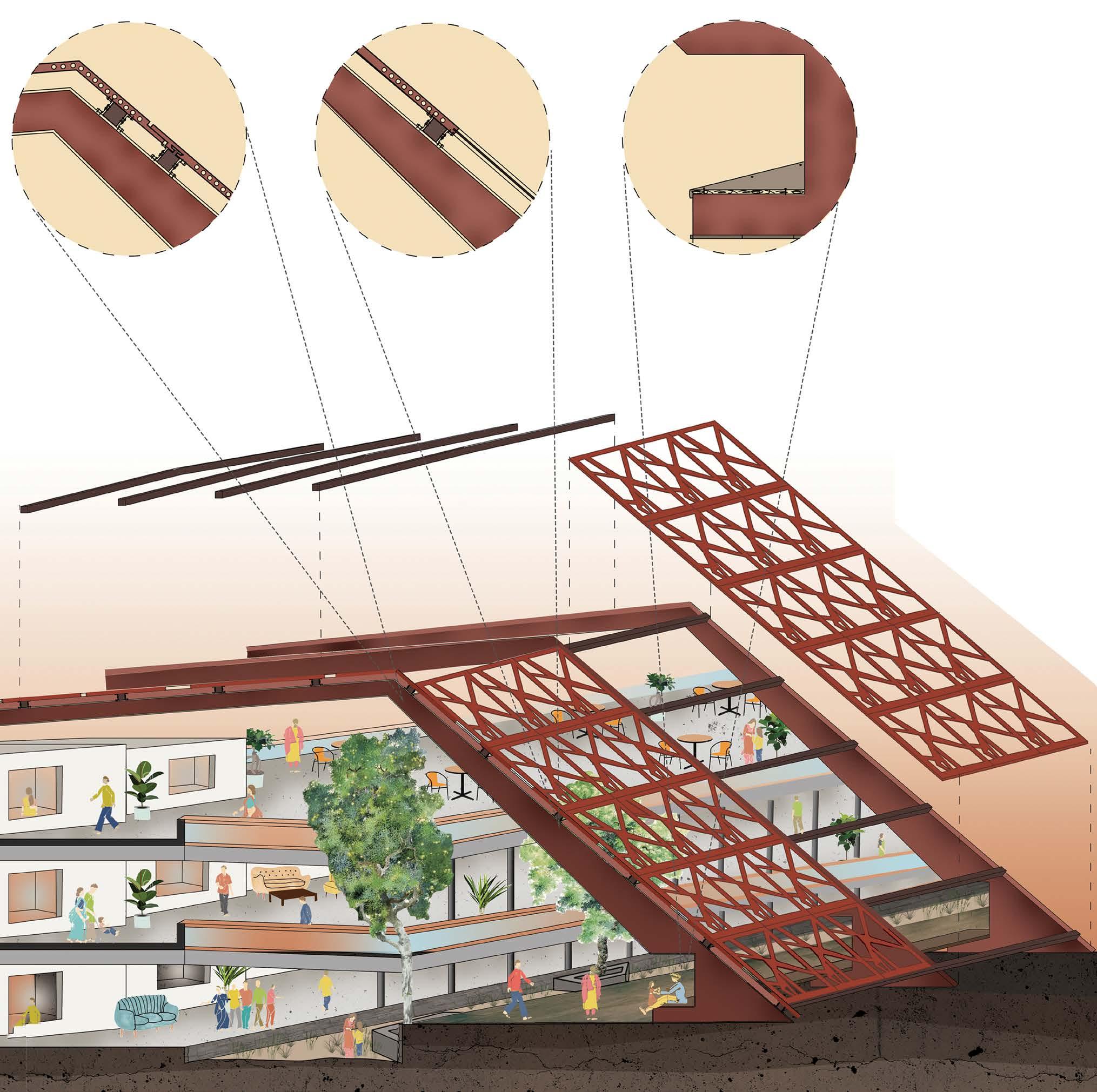
The railway institute consists of an auditorium and classrooms with other administrative activities. The panels are followed in the interior spaces. The supports of the panels in the marketway create a seating arrangement with the roof floor being accessible for restaurants and amenities for the tourists. The side opposite the mounds is provided as a service lane to accommodate the trucks.