Designing a better world, one landscape at a time.
SUSTAINABLE ARCHITECTURE AND LANDSCAPE DESIGN
Politecnico di Milano, 23-25
ALWIN MATHEW
01
Urban and Environmental design Studio, Sem 2 Group of 3 - Focused on : maps, design, drawings, views and digital model making QGIS, Revit, Vray, Photoshop
02
REVIVING THE EDGE
Urban and Landscape Regeneration Studio, Sem 2 Group of 5 - Focused on : design, sketches, site plan, architecture drawings, views and digital model making Revit, Vray, Photoshop
03
04 THE URBAN KNIT
THE RIVER BECKONS
Advanced Landscape Design Studio, Sem 3 Group of 5 - Focused on : design, sketches, views and model making (digital and physical) Revit, Vray, Photoshop
INSIDE OUT
Architectural design Studio, Sem 1 Group of 5 - Focused on : design, sketches, views and model making (digital and physical) Revit, Vray, Autocad, Illustrator, Photoshop
01 How to connect the city to the hills?
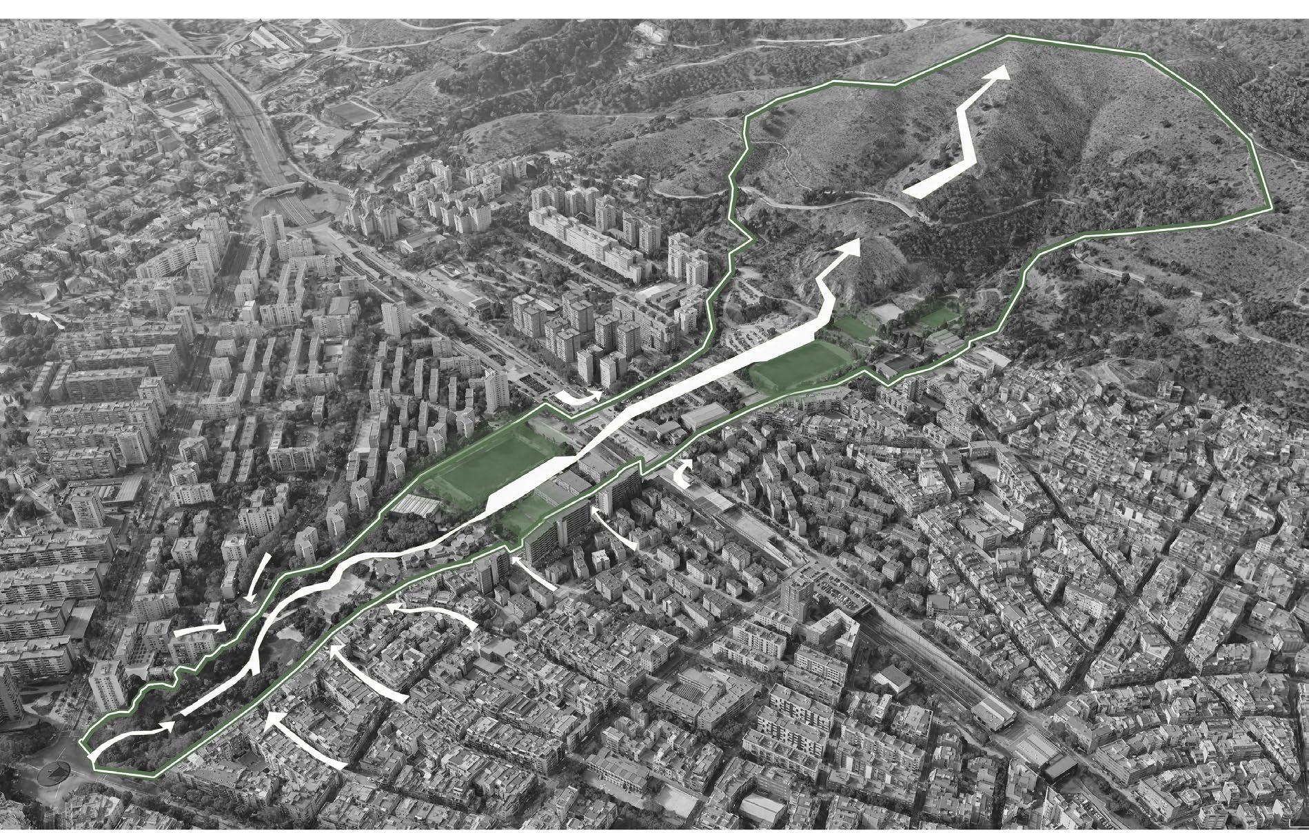
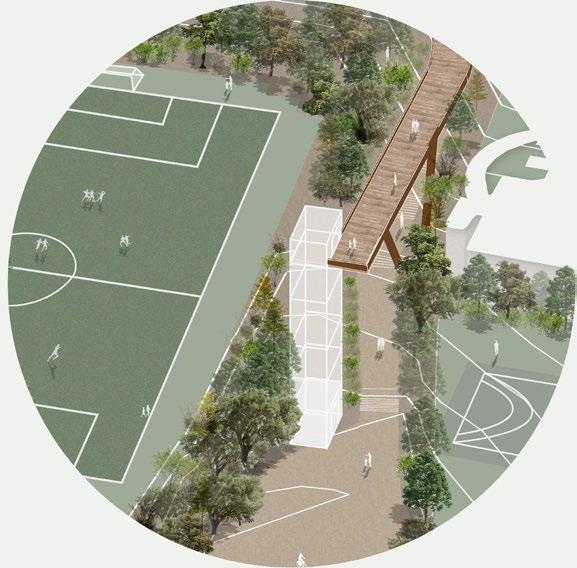
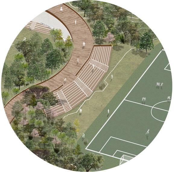
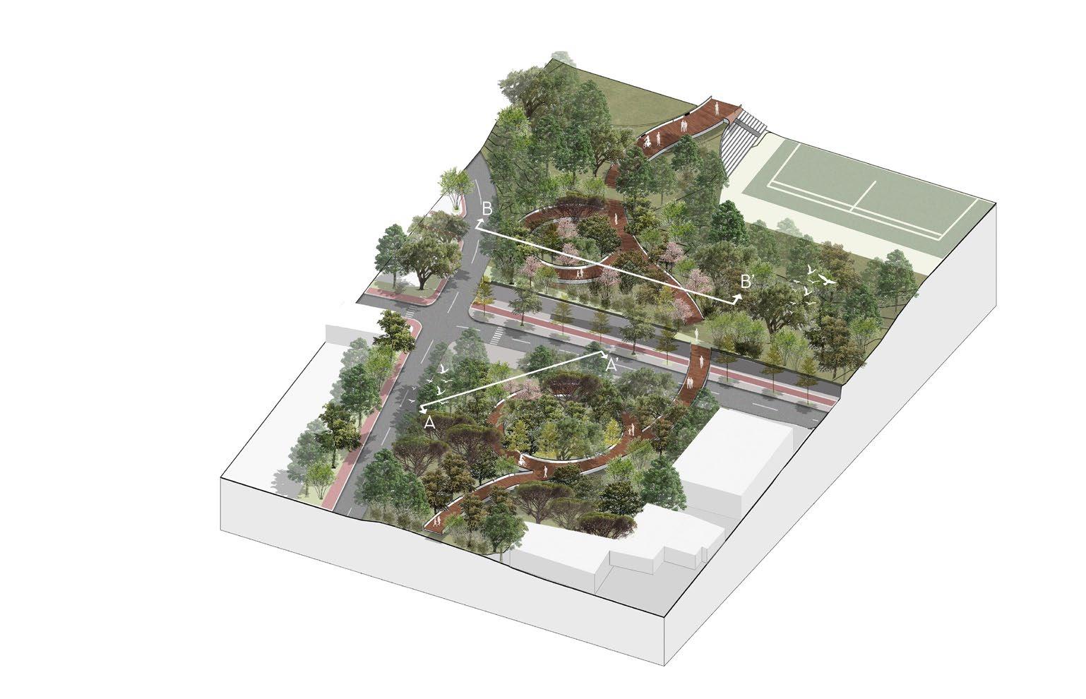
THE URBAN KNIT: AN ECOLOGICAL SOLUTION TO THE PARKING CHAOS OF BARCELONA
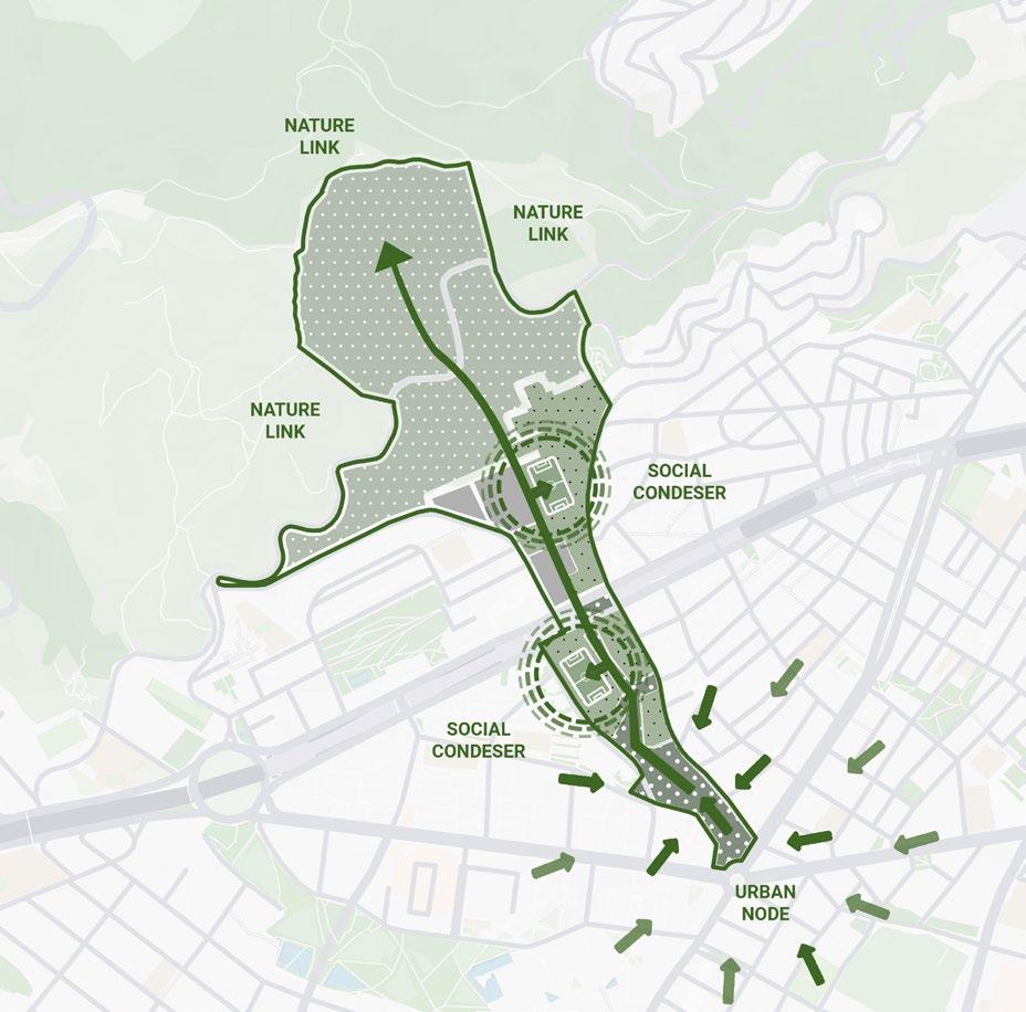
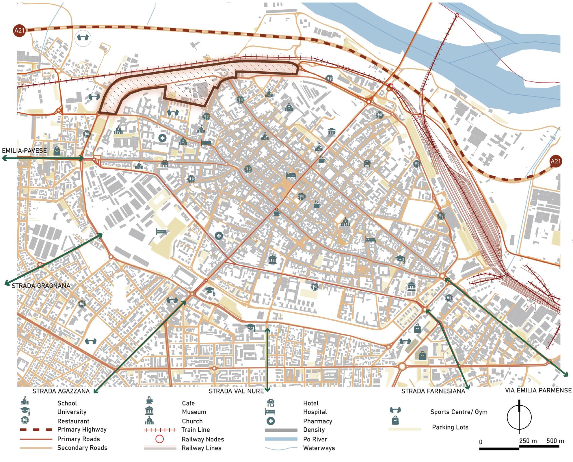
The Les Portes de Collserola project is an urban initiative aimed at reconnecting Barcelona with the Collserola Natural Park through a series of strategic gateways that enhance accessibility, ecological continuity, and urban integration.
Porta de la Guineueta (Gate 12) plays a crucial role in linking Plaça Llucmajor to Passeig de les Aigües, focusing on pedestrian connectivity, environmental restoration, and urban planning. The project establishes a clear pedestrian route through Parc de la Guineueta, improving crossings over Ronda de Dalt. Additionally, it proposes solutions for enhancing public facilities and strengthening ecological corridors between Parc de la Guineueta and Collserola Natural Park. The study also includes mobility improvements, integration with sports facilities, and infrastructure enhancements to create a seamless transition between the city and the hills.
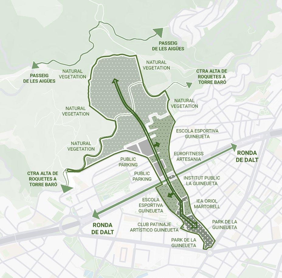
THE SITE
PORTA LA GIUNETTA BARCELONA, SPAIN
1.Plaça Llucmajor/Urban node
5.Mismanaged car parking spaces
2.Parc de la Guineueta
3.Football galleries
6.Difficult to climb terrain
4.Ronda De Dalt
7.Passeig de les Aigües/End point
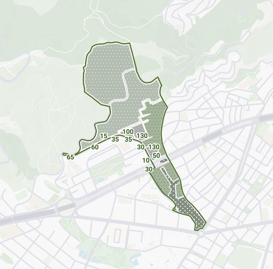
As we deepen our understanding of Parc de la Guineueta and the social influences it has, what intrigued us most was the chaotic and unorganized usage of space for car parking. Any piece of land that was not well maintained or left barren was taken over by the inhabitants around the park for the purpose of car parking.
This presented us with a unique opportunity to free up the enormous amount of land used for parking by introducing a parking facility. The land can now be used for careful and curated landscape features, and the facility in itself can be integrated to the connection that is required from the city to the hill.
Understanding the site charecteristics and social influences
410 cars parked on road sides and unassigned lands
Site strategy to use the connecting link as social condenser
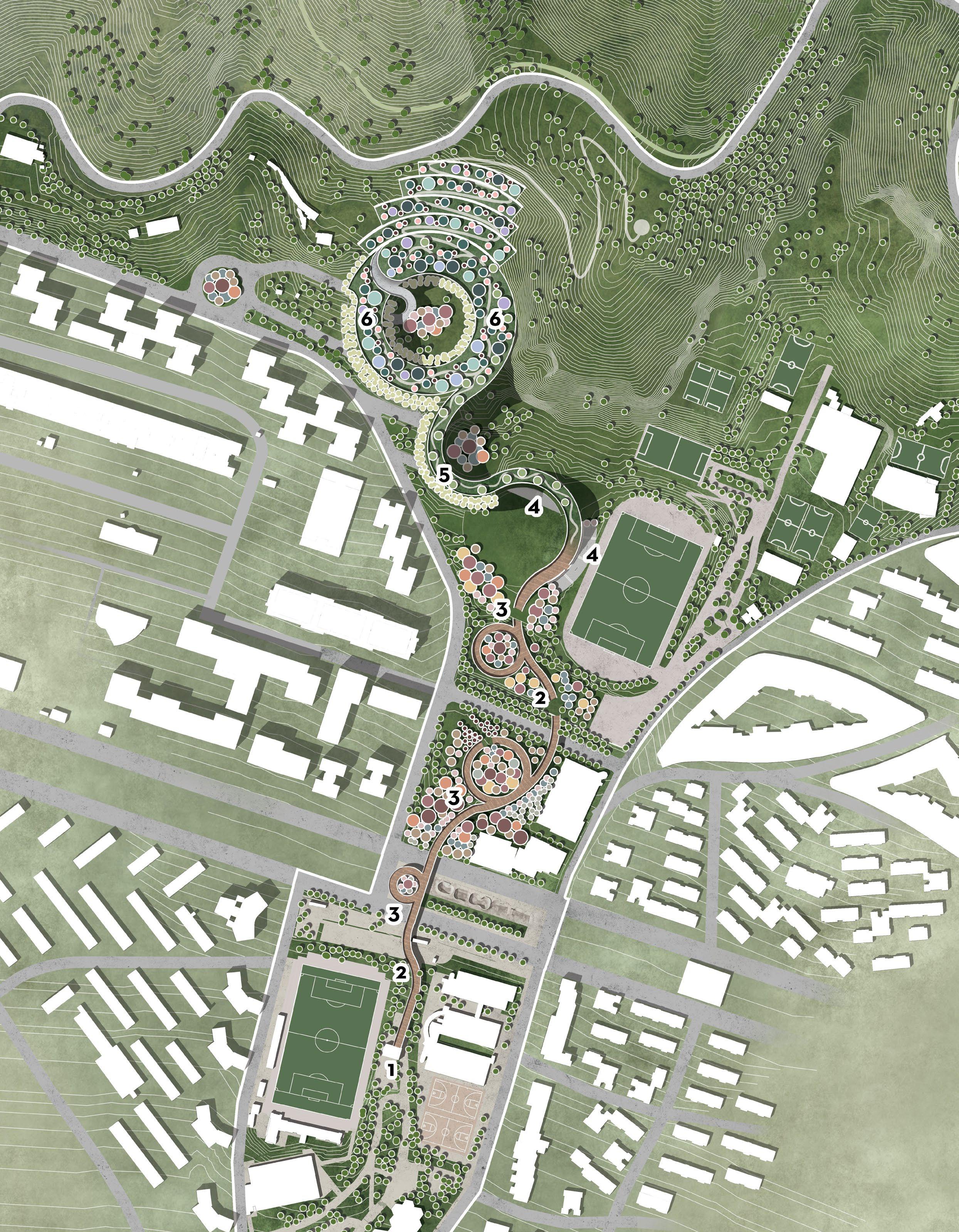
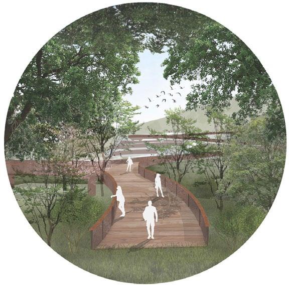
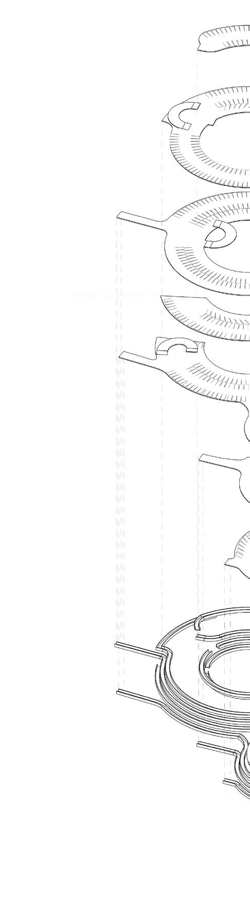
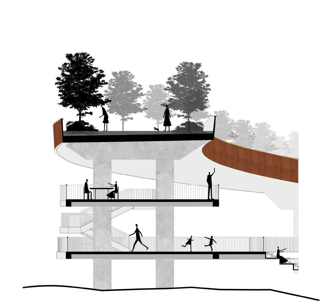
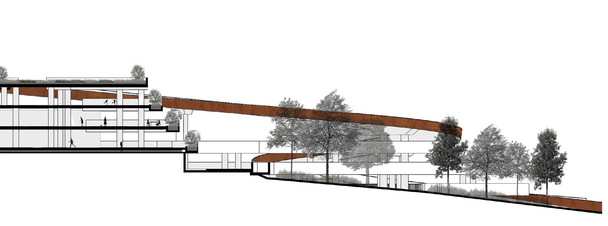
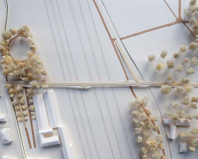
1. RAISED ELEVATOR ENTRY
The point where the curated path begins after organised and the beautiful paths of Parc de la Guineueta.
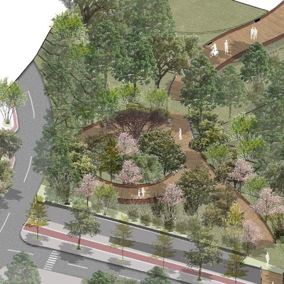
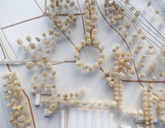
3. TREE CIRCLES
The path turns into loops where a curated experience of trees is presented to the user showcasing native species.
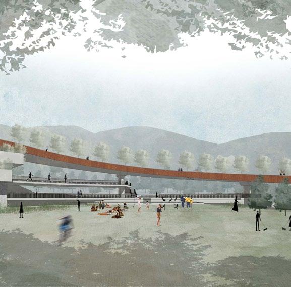
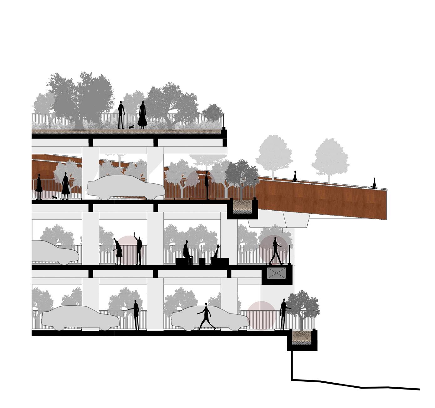
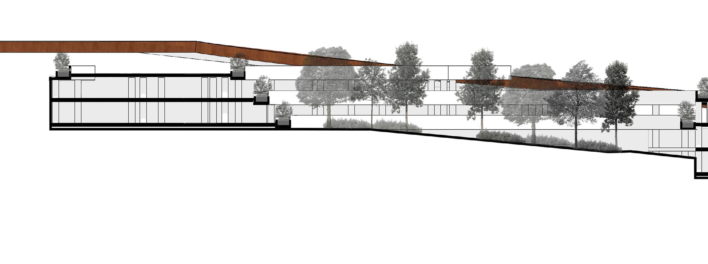
5. PARKING STRUCTURE
The building for parking is designed to smoothen the climb to the hills, reducing the slope and housing vegetation.
2. GROUNDED RAMP ENTRY
Points where the path seamlessly integrates with the ground terrain and continues to connect to the hills.
4. INTEGRATED GALLERIES
The path also opens up to social spaces like galleries next to the existing football fields increasing accessibility.
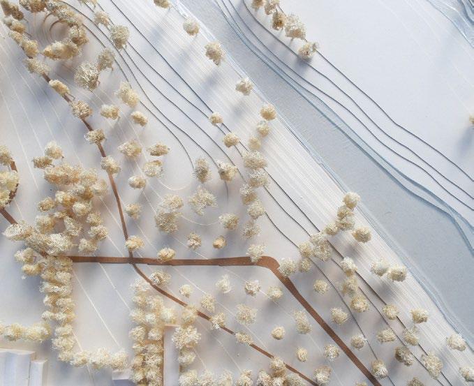
6. INTEGRATED ROOF GARDEN
The path is then turns into an extension of the roof garden of the parking structure, also acting as a social condenser.
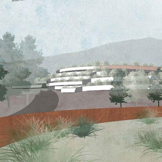
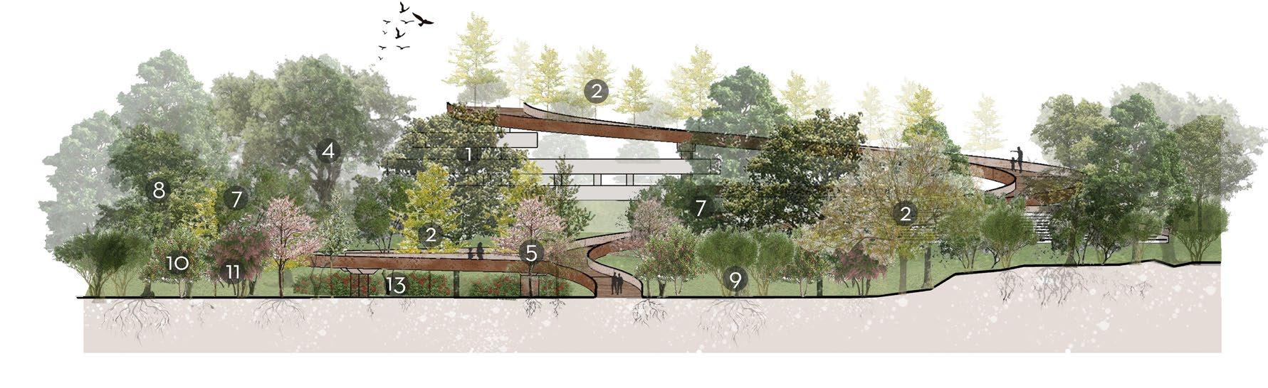
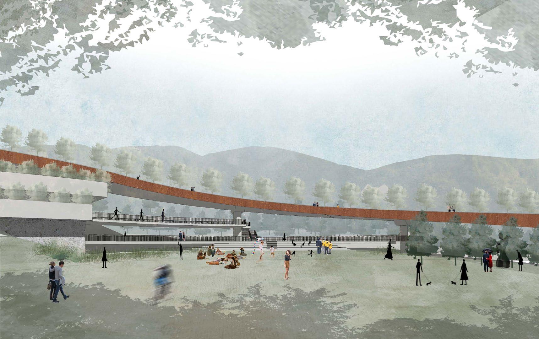
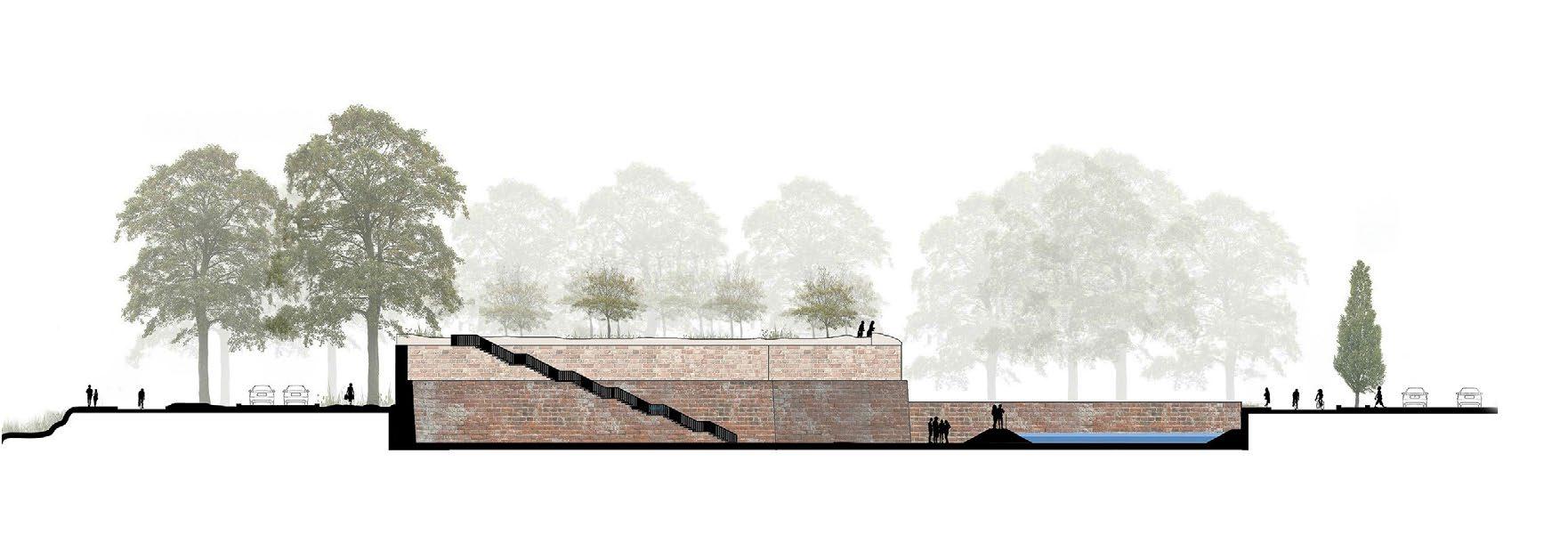
MULTI-FLOOR CAR PARKING STRUCTURE
The structure effectively achieves three strategic goals.
First, it provides a much-needed solution to the neighborhood’s parking chaos, freeing up land for vegetation.
Second, it serves as a gradual transition to the Collserola hills, easing the long ascent for pedestrians and cyclists by integrating the main path into its rooftop.
Finally, the building functions as a social condenser by incorporating vegetation on every floor through planter boxes, creating a leisure-friendly atmosphere and fostering social interactions.
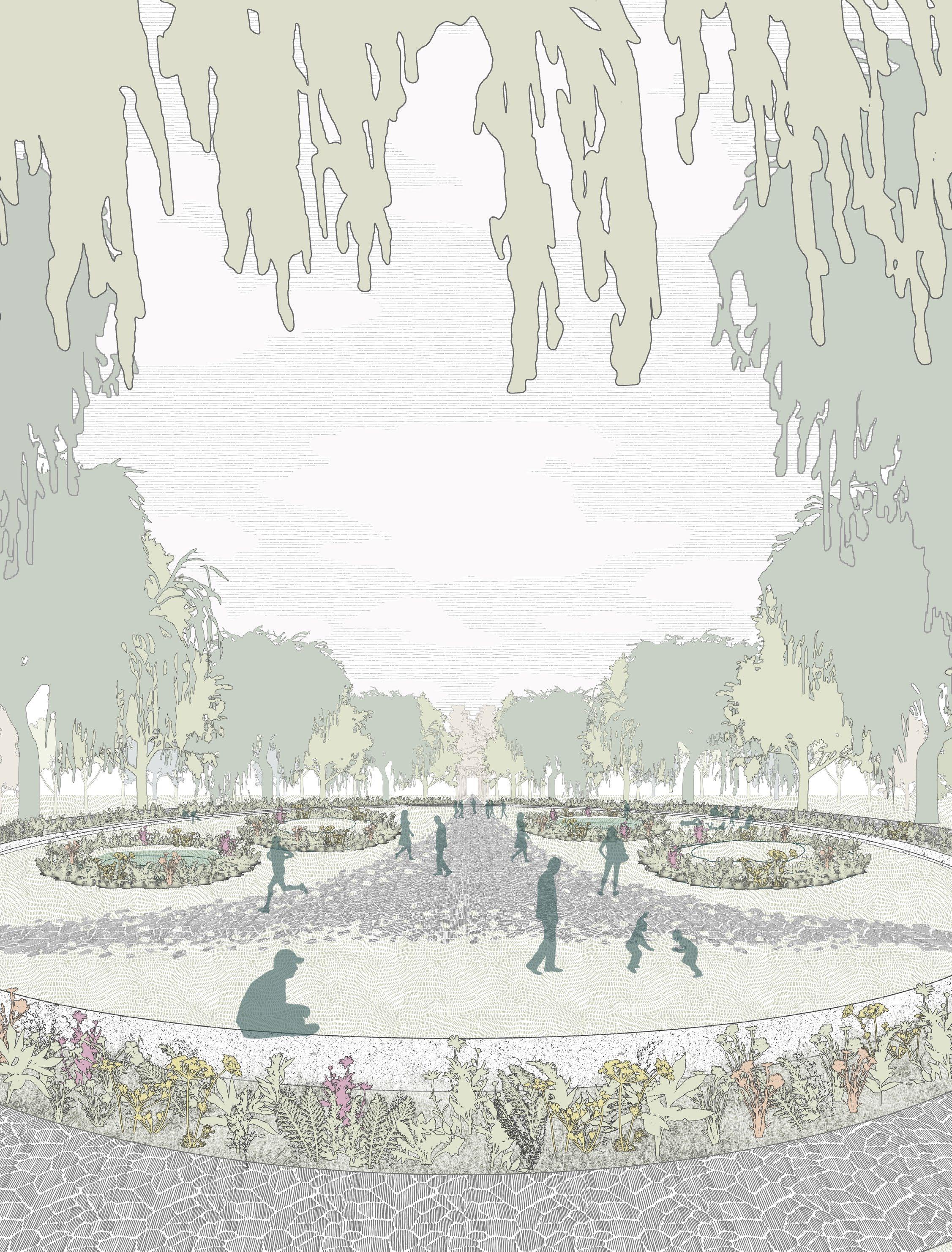
THE CURATED CONNECTION
The curated route effectively implements three key strategies.
First, it creates a playful and engaging link by integrating with the surrounding experiences, such as the football galleries.
Second, it acts as a social condenser, providing dedicated spaces for communal events and gatherings.
Finally, it incorporates tree circles which provide a unique and educational botanical experience rooted to the context of the local ecology.
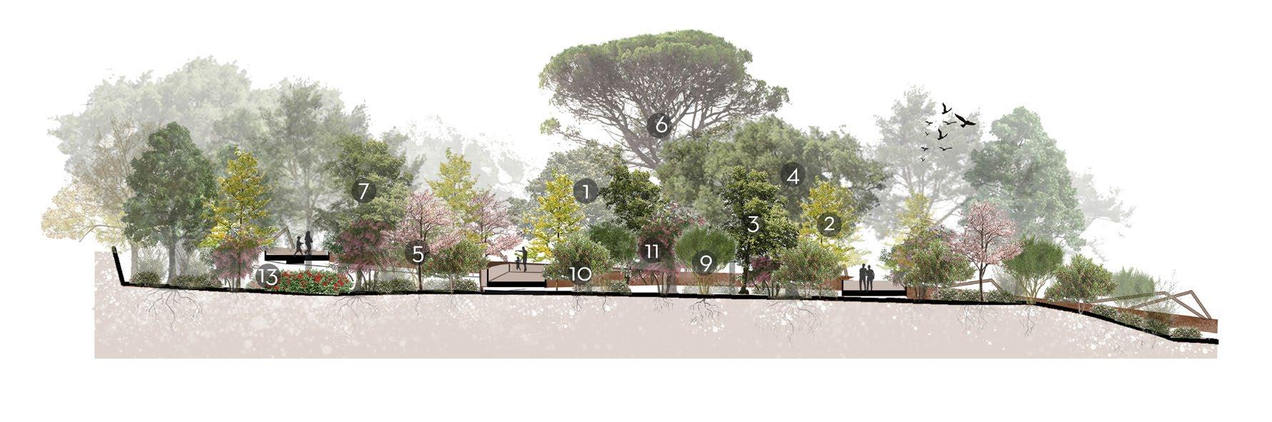
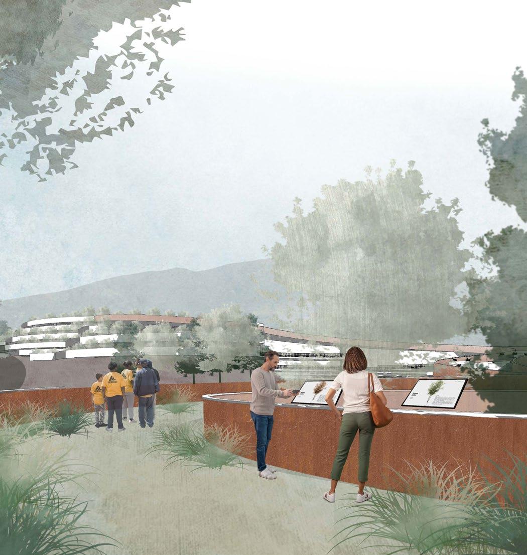
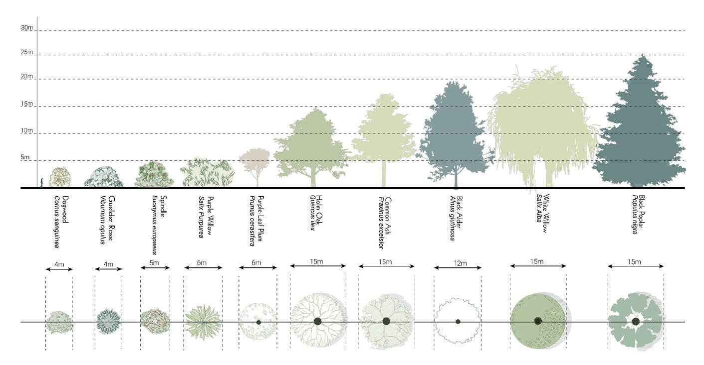
TREE CIRCLES
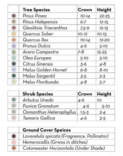
These educates the community about the local landscape and botanical diversity by incorporating circular tree formations, where various species are carefully planted and explained through informational podiums
TREES
Pinus halepensis
Gleditsia triacanthos
Quercus suber
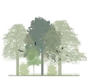
The tree circles act as a point of intersection between the man made and the natural. Here the urban garden and the Collserola hills merge into an experience of the forest coming into the city and vice versa.
Quercus ilex Olea europa
Prunus dulcis
Pinus pinea
Malus : Golden hornet
SHRUBS
Arbutus Unedo
Punice granatum
Tamaric gallica Cotoneaster horizontalis
Osmanthus heterophyllus
THE URBAN KNIT is an ecological solution to the need to connect the city to the hills, simultaneously addressing various contextual environmental problems, fostering social interactions and educating the community. It seamlessly integrates nature with urban life, creating a space that encourages sustainability, community engagement, and environmental awareness.
How to revive layers of hidden heritage?
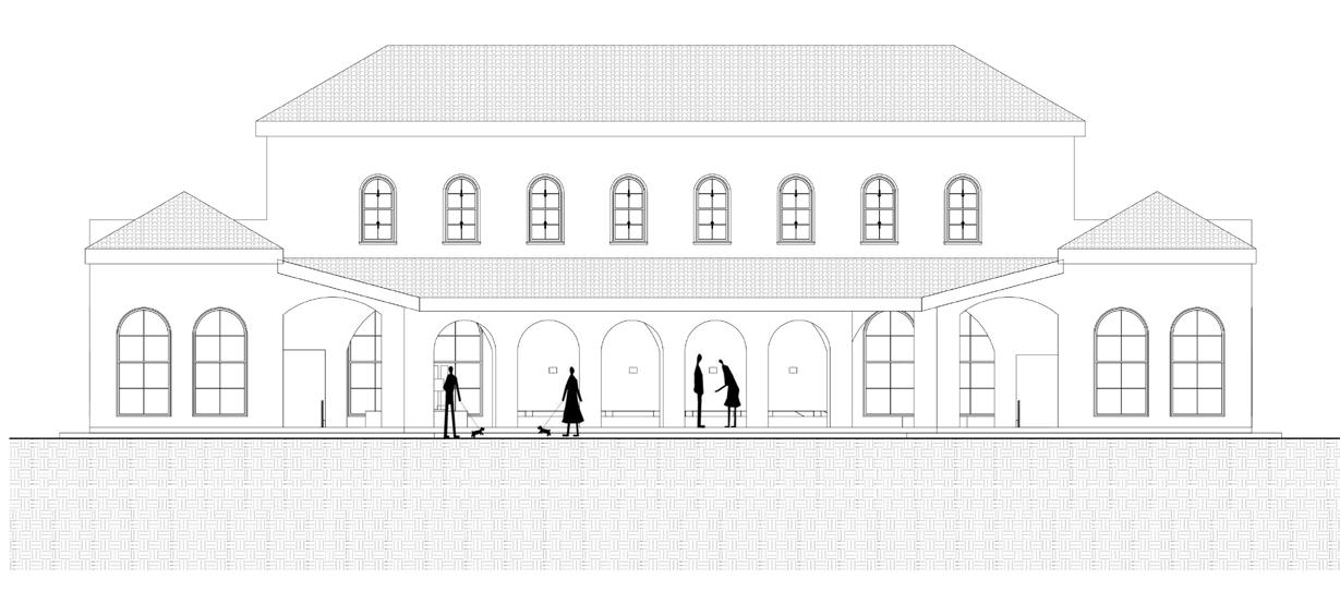
REVIVING THE EDGE: A CULTURAL RESURRECTION ROOTED IN ITALY’S VITICULTURE HERITAGE
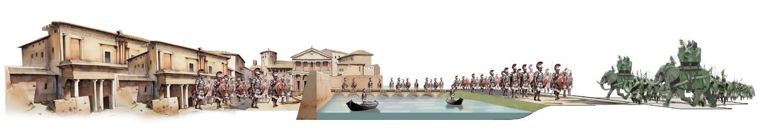
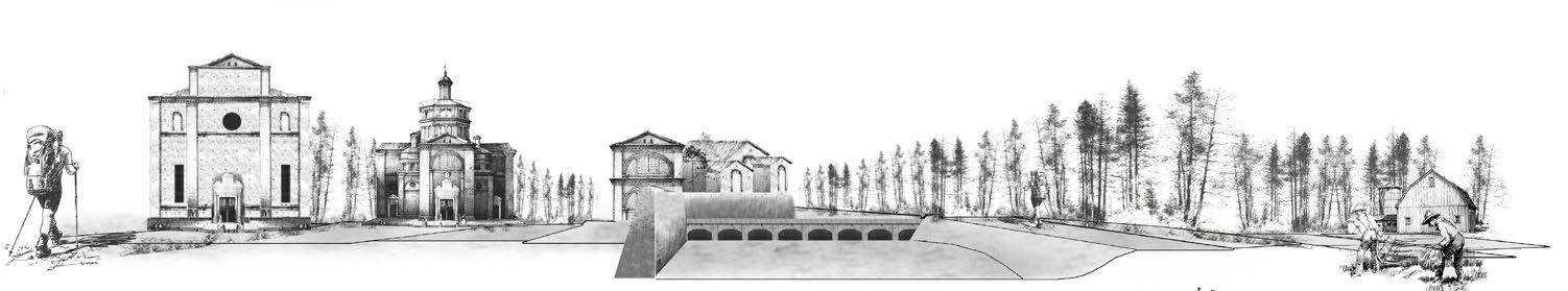
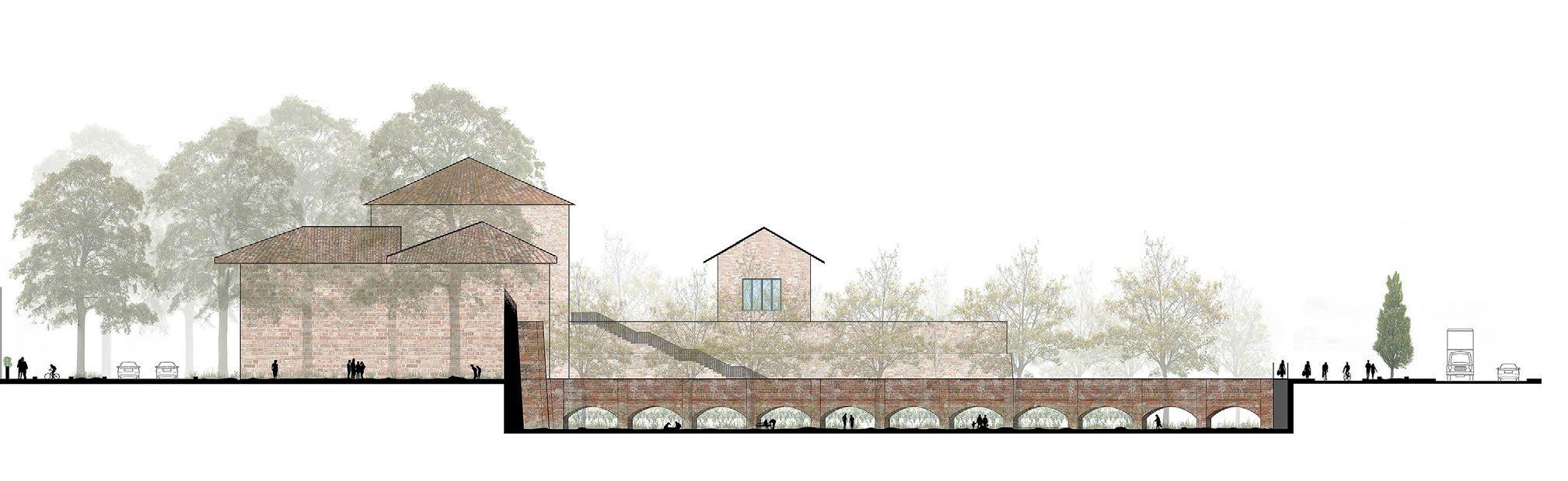
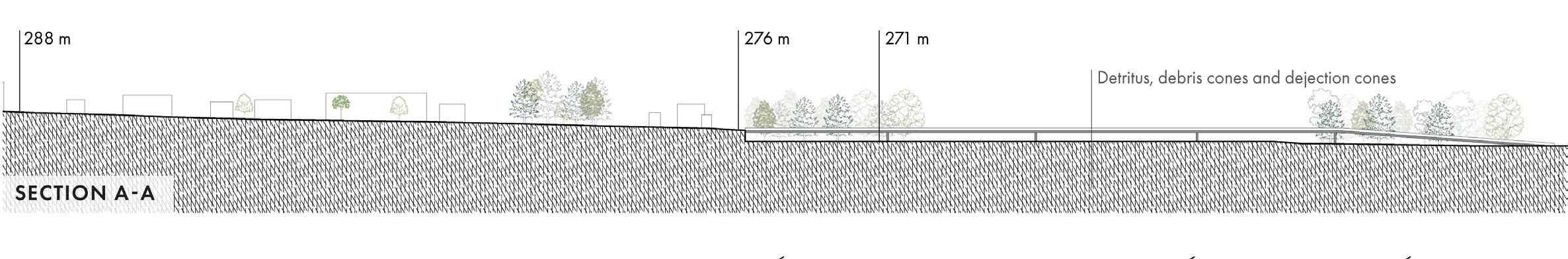
Porto Borghetto, situated at the edge of Piacenza’s urban expansion, stands as a testament to the layered history and diverse heritage of the area. The ancient Roman walls divide two distinct parcels of land: the lower terrain, once a protective water body safeguarding the city from invaders, and a vast, abandoned post-industrial zone, marked by sparsely populated vegetation.
The site is currently used by local residents and visitors for walking, running, cycling, and spending time with pets. Despite its recreational promise, the experience is somewhat compromised by its close proximity to a vehicular road, lack of clear zoning and facilities tailored to the local community.
THE SITE PORTA BORGHETTO PIACENZA, ITALY
Colli Piacentini, a picturesque region in the Piacenza Province, is renowned for its rolling hills, rich viticultural heritage, and deep-rooted winemaking traditions dating back to the Etruscans. The legacy of winemaking, intertwined with local communities and ancient traditions, serves as a profound inspiration for transforming the site into a community-oriented wine garden.
1200 BC
Etruscan Vita Maritata
218 BC
Roman Battle of Trebbia forces
1860s
Route of Via Francigena
2024
The layered history of the site inspired a proposal that responds to contemporary community needs across those same dimensions. It provides recreational and gathering spaces for all age groups, honors the historic walls and water systems by restoring a section of the canal, and supports travelers along the Via Francigena. Most importantly, it reintroduces ancient vita maritata viticulture techniques and small-scale vine cultivation to foster community engagement and celebrate Piacenza’s rich winemaking heritage. Together, these elements create a vibrant landscape that bridges the past and present through shared experiences and cultural continuity.
Porto Borghetto - Current state
2034
Porto Borghetto - Proposed interventions
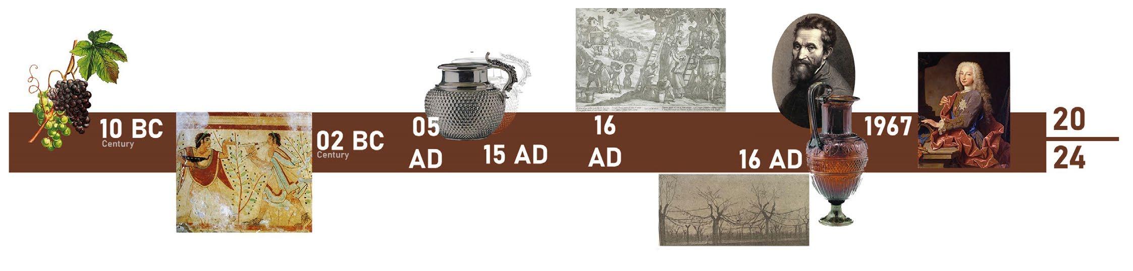
Between 10th and 7th century BC, archaeological findings indicate the presence of Vitis Vinifera in Piacenza hills.
The Etruscans planted vines in the hills, as mentioned by Saserna. They drank wine from the Piacenza.
Apennine forest, Kilkevetra, in his household, revealing the ancient origins of winemaking. Gutturnium
In 1760, a statue of a drunken Hercules was found in Veleia Romano, dating back to the 1 AD.
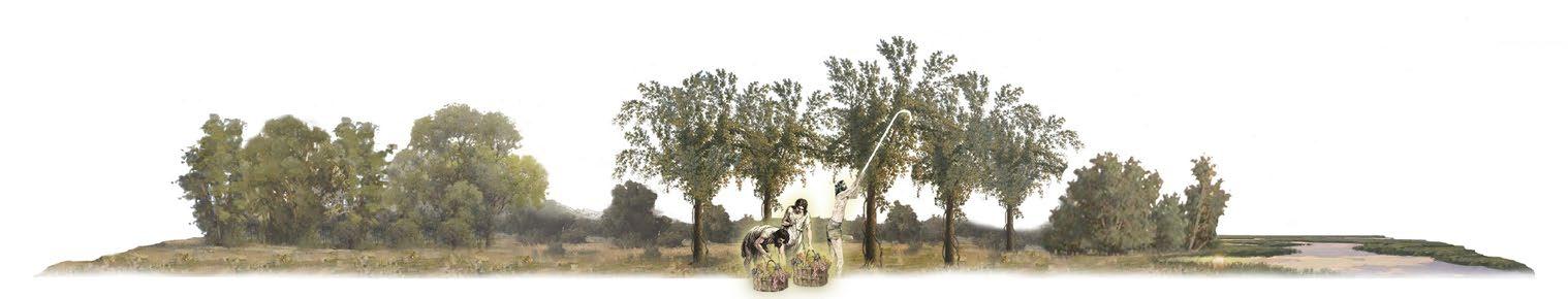
Local wine enthusiasts, marking one of the oldest societies promoting Piacenza wines, founded about two millennia ago. This scene of harvesting, from married vines, is by the Tuscan Antonio Tempesta (1599).
Michelangelo enjoyed Colli Piacentini wines sourced from Piacenza.
Following his testing of the Piacenza wine, King Charles III of Spain stated, “They are excellent wines. I’ve never had finer ones to drink.”
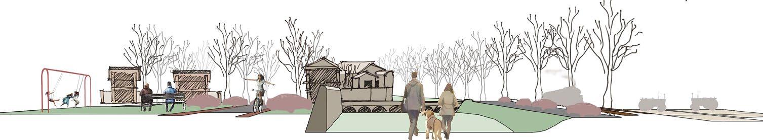
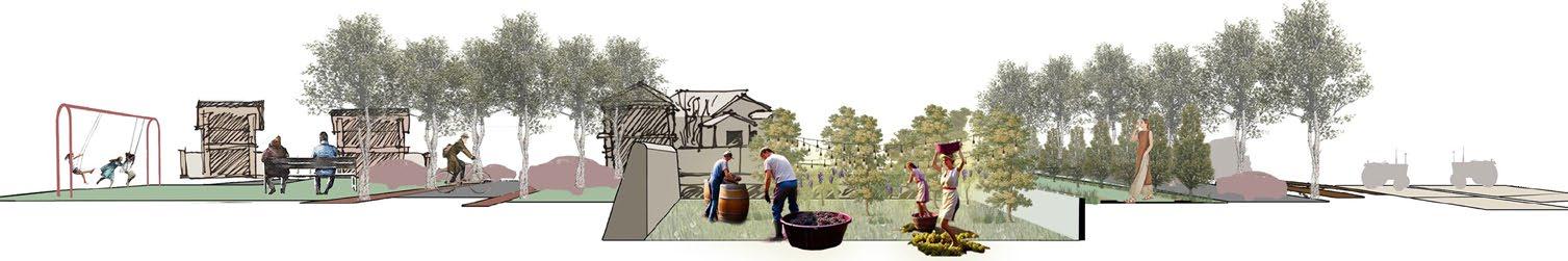
REACTIVATING SITE THROUGH COMMUNITY ENGAGEMENT
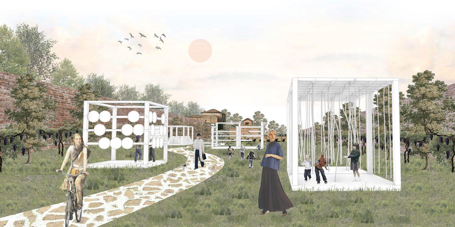
Our primary objective is to actively engage the community by recognizing that the site is currently underused, thus proposing a series of targeted interventions to attract and involve visitors. Central to the design is the installation of a “vita maritata” (married vine) structure, which acts as a symbolic and interactive landmark. This element not only draws people into the field but also invites seasonal engagement, creating a focal point for community interaction.
INCLUSIVE SPACES FOR FAMILIES AND RECREATION
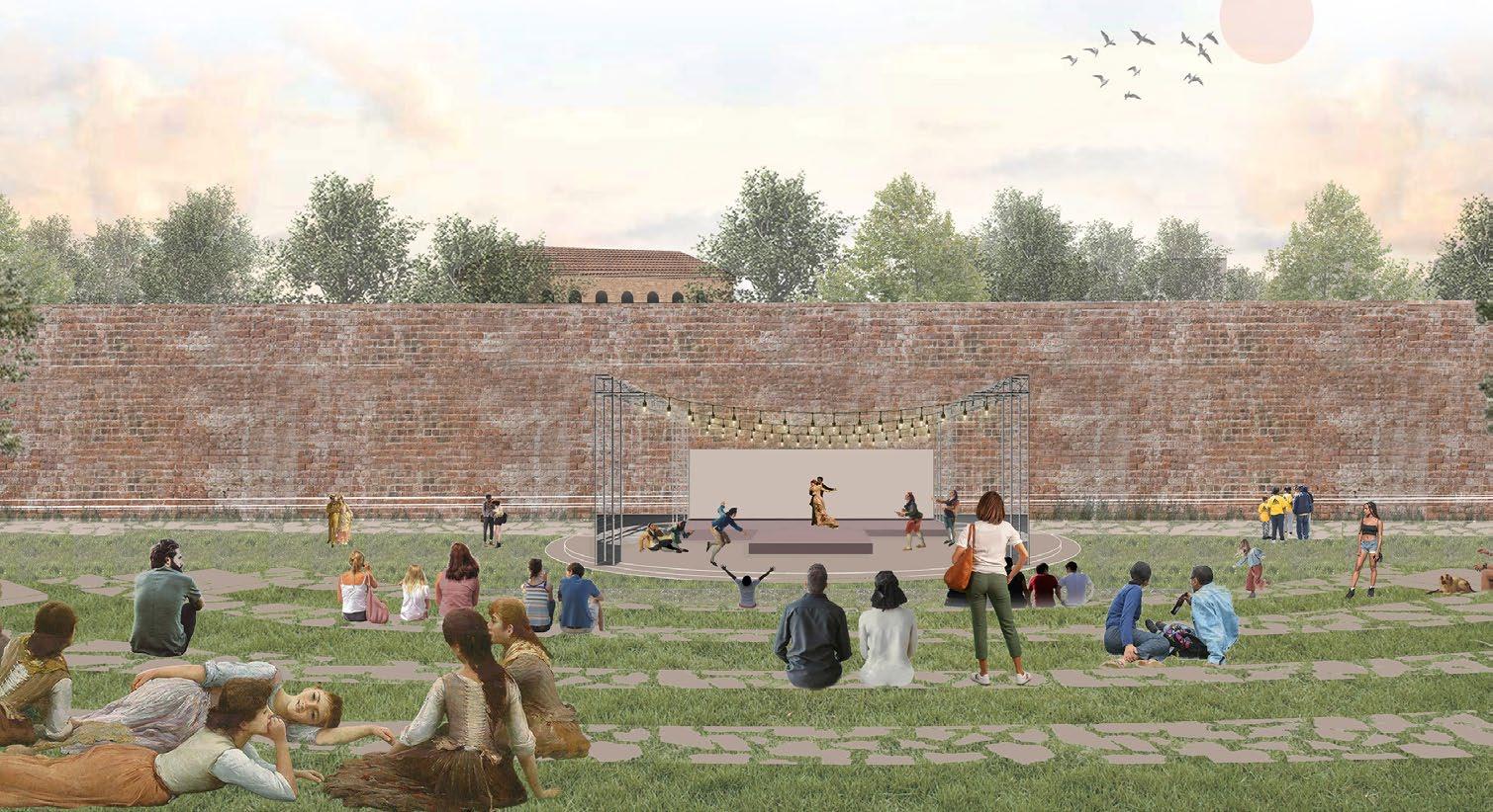
A dedicated children’s park provides a safe and engaging space for families, while a natural amphitheater takes advantage of the site’s open terrain to host community events, performances, and informal gatherings. These additions enrich the site’s social and cultural dimensions, encouraging users of all ages to enjoy the space. Parallel activity zones along the edge of the field add further vibrancy, ensuring that the space remains dynamic and engaging throughout the day.
- Organic
1. BIKE PARKING
A. PIANTATA
Maple, Elm, Mulberry, Olive
Single
B. ALBERATA
Maple, Elm, Mulberry, Olive Rows - Organic
C. TESTUCCHIO
Maple- Pruned Single - c/c 4m
D. TESTUCCHIO
Maple- Pruned Rows - c/c 4m
E. CAPANNONI
Maple- Pruned Squares - c/c 4m
F. ASPARINIO OF AVERSA
Polar- Not pruned Single- c/c 10m
G. CHIANTI
Maple- Pruned Single- c/c 4m
2. REST POINT FOR VIA FRANCIGENA
3. INTERACTIVE FURNITURE MODULES
4. RE-CREATION OF HISTORIC WATER BODY
MOBILITY, ACCESSIBILITY, AND TACTICAL URBANISM
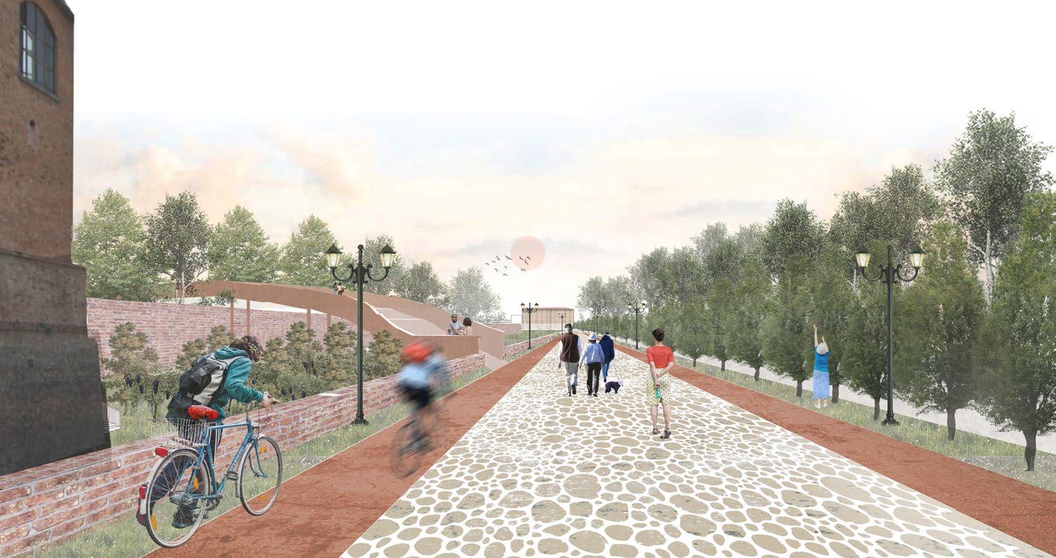
To reduce congestion and enhance accessibility, the proposal introduces clearly defined pedestrian and cycling paths. These are complemented by tactical urbanism strategies such as temporary bike parking and flexible installations, promoting sustainable mobility and making the space more user-friendly. To further support this goal, a portion of the adjacent former factory is repurposed as a designated parking lot, relieving street congestion and prioritizing pedestrian and cyclist safety.
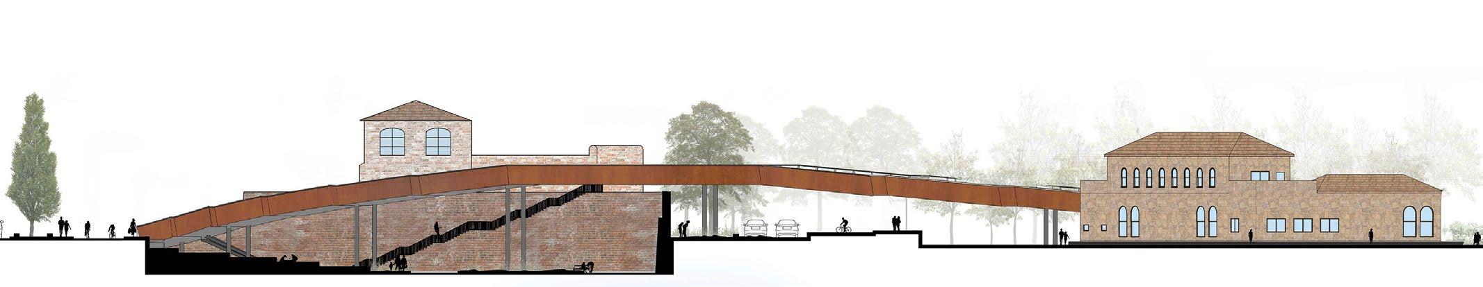
HISTORICAL RESONANCE AND BRIDGING DIVIDED SPACES
A thoughtful intervention connects the two parts of the site, currently separated by a historic wall. By introducing a pond and pedestrian bridge, the design creates a seamless flow between the field and the elevated Giardino area. This element not only improves spatial accessibility but also pays homage to the site’s historical landscape, where water once played a vital role. The bridge invites visitors to enjoy scenic views and reconnect with the site’s layered history.
H. FESTOONS SYSTEM
Maple- Pruned Rows- c/c 4m
I. FESTOONS SYSTEM Maple- Pruned
J. ISTRIAN SYSTEM
Maple- Pruned Circles- c/c 4m
K. BELLUSI SYSTEM
Maple- Pruned Rows- c/c 4m
L. BELLUSI SYSTEM
Maple- Pruned Cross Rows- c/c 4m
M. BELLUSI SYSTEM
Maple- Pruned Rows- c/c 6m
5. AMPHITHEATRE 6. CHILDREN’S PARK 7. CAR PARKING 8. CONNECTING BRIDGE 9. WINERY 10. CENTRAL SQUARE
The interventions are seamlessly integrated into the site with minimal impact on the existing historical buildings and walls, ensuring a low-impact and sustainable approach. The sections and views illustrate key strategies such as the vita maritata formations, the connection between the historical structures and the lower terrain, the bridge linking the divided areas, modular furniture solutions, a natural amphitheatre, and the newly introduced bike and pedestrian path.
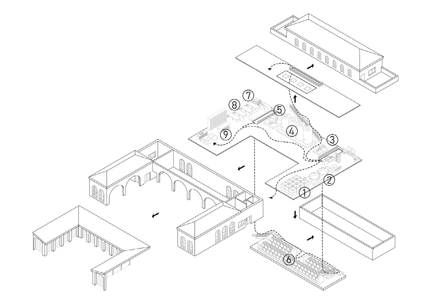
WINE MAKING CIRCULATION
Harvest Storage
Wine Stomping
Wine Crushing Fermentaion
Wine Pressing
Wine Aging
Quality and Testing
Bottling and Labelling
Wine Tasting
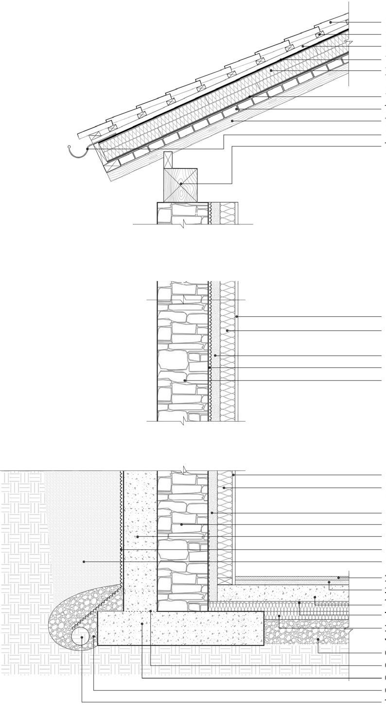
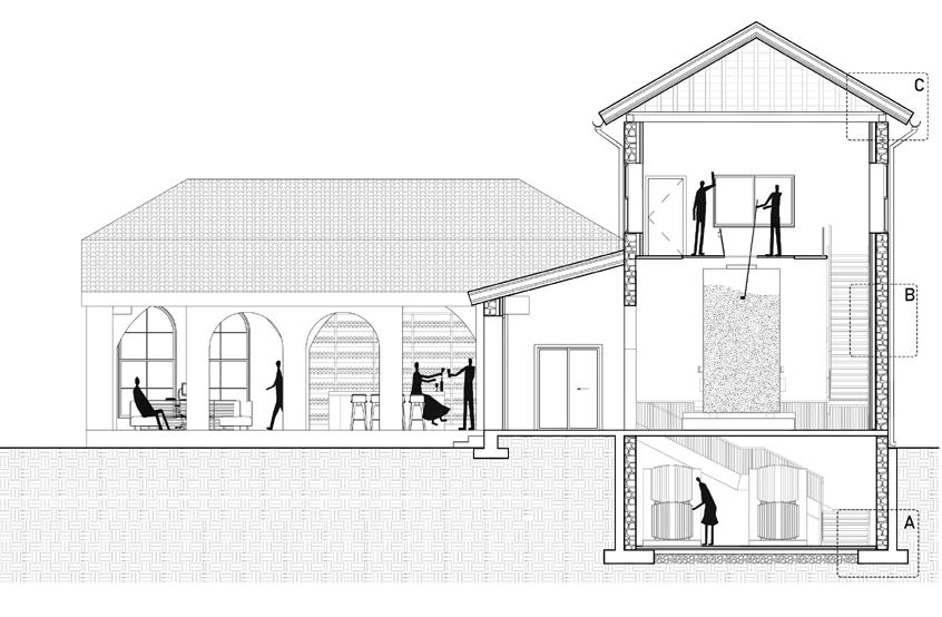
DETAIL C - Roof (U=0.241 W/m2K)
DETAIL B - Wall (U=0.211 W/m2K)
DETAIL A - Foundation
Clay Roofing Tile (u=0.75)
25x 50 Wooden Cross Battens (u=0.13)
25x 50 Wooden Vertical Battens (u=0.13)
10mm Waterproofing Membrane (u=0.17)
XPS polysterol Insulation offset horizontally and vertically (u=0.037)
10mm Vapur Barrier (u=0.031)
Terracotta Bricks (u=0.66)
Wood Rafters
Gutter
Timber Beam
12.5mm Gypsum Board (u=0.25)
100mm Rockwool Insulation in 50x100 Stud Wall (u=0.035)
50mm Closed Cell Spray foam (u=0.026)
15mm Taped Dimple Mat (u=0.4) Sandstone Dry Wall (u=2.3 )
12.5mm Gypsum Board
100mm Rockwool Insulation in 50x100 Stud Wal
50mm Closed Cell Spray foam
300mm Sandstone Dry Wall
200m Concrete Wall
Dimple Mat extending over drain tile
Free Draining Backfill
24mm Terracotta Tiles (u=0.85)
30mm Cement Screed (u=1.4)
100mm Concrete Slab (u=2.0)
10mm Vapour Barrier Taped to wall (u=0.5)
2 Layers of 50mm XPS Rigid Insulation with staggered + offset joints (u=0.04 )
Compacted Crush Stone (u=2.3)
Capillary Break
Continuous Concrete Footing
Crushed Stone Bed wrapped in Filter Fabric
100mm dia Perforated Drain Tile
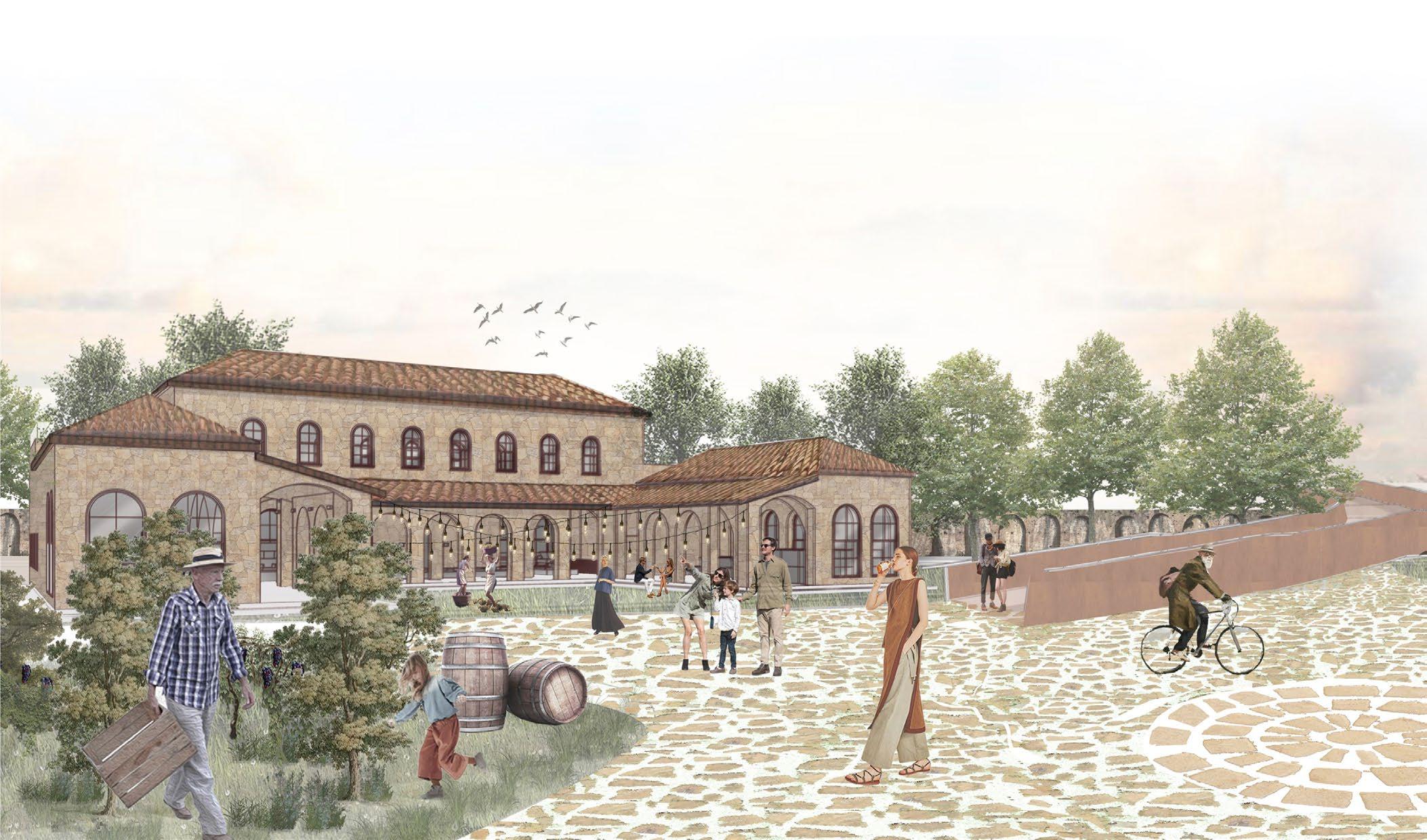
The wine house draws inspiration from a vernacular archetype, characterized by sandstone dry walls and clay roof tiles. The central courtyard can accommodate workshops and community events, fostering a multifunctional and engaging space.
Strategically positioned within the landscape, it anchors the viticultural narrative of the site and complements the surrounding interventions connecting seamlessly with the vineyard, amphitheatre, and communal spaces through the bridge access.
REVIVING THE EDGE is an opportunity to reconnect the community with its rich historical and cultural roots through a vibrant, interactive space that fosters social engagement, sustainable mobility, and recreation. By blending past traditions with contemporary needs, this project creates a dynamic environment that celebrates Piacenza’s heritage while enriching the daily lives of its residents and visitors.
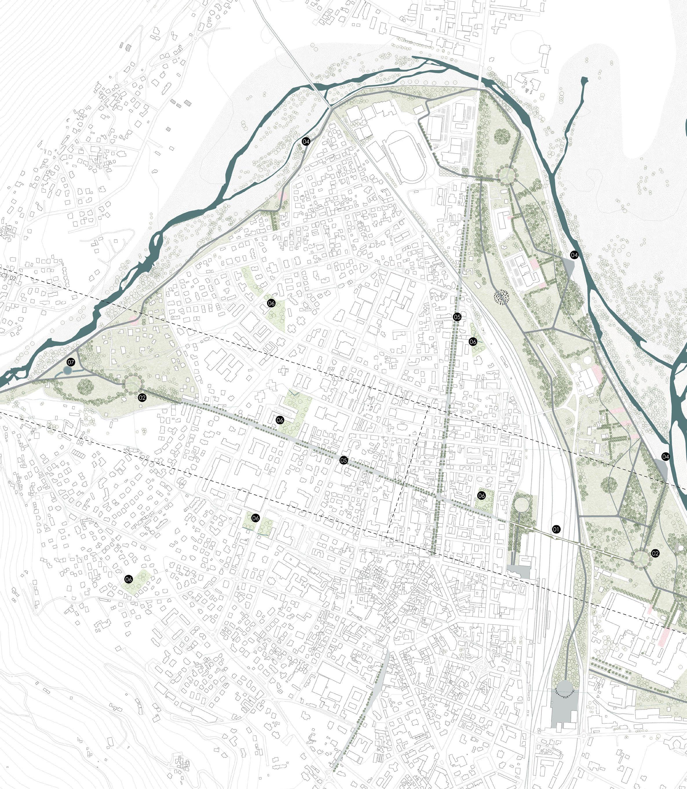
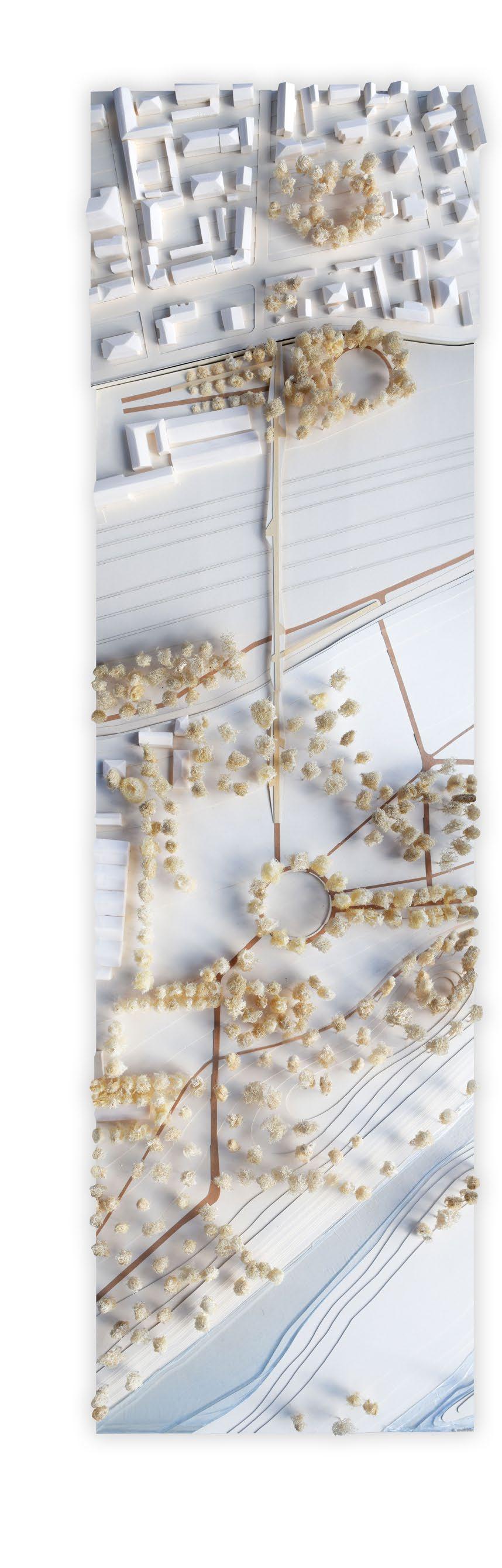
03 How to connect the city to the river?
THE RIVER BECKONS: A RESPONSE TO THE LONG UNANSWERED CALL OF THE RIVER
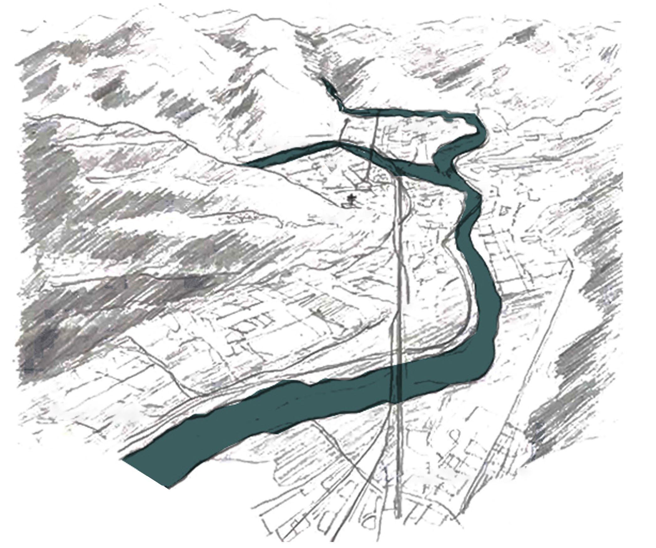
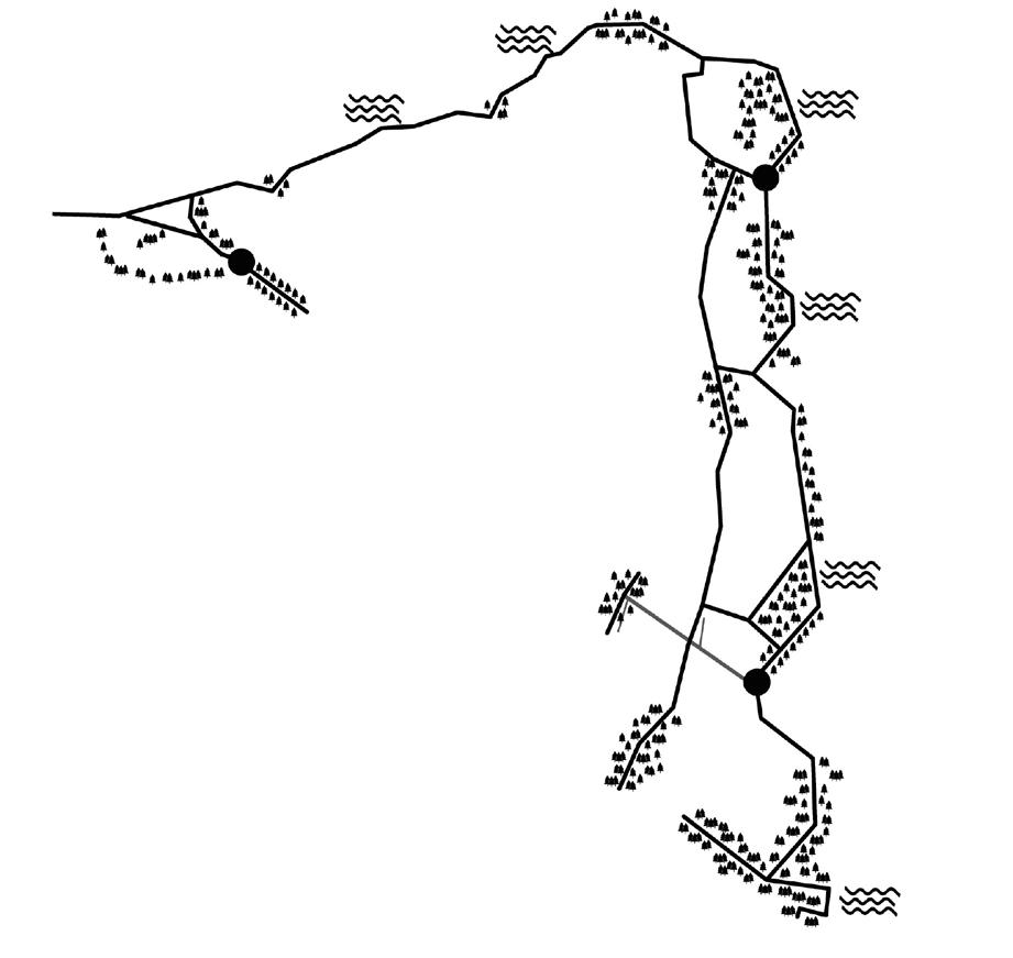
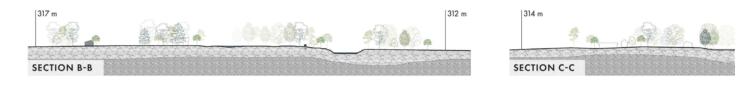
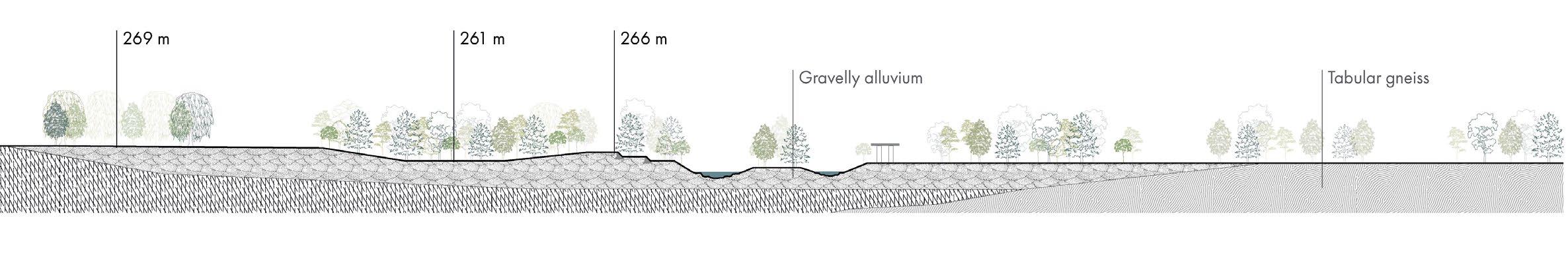
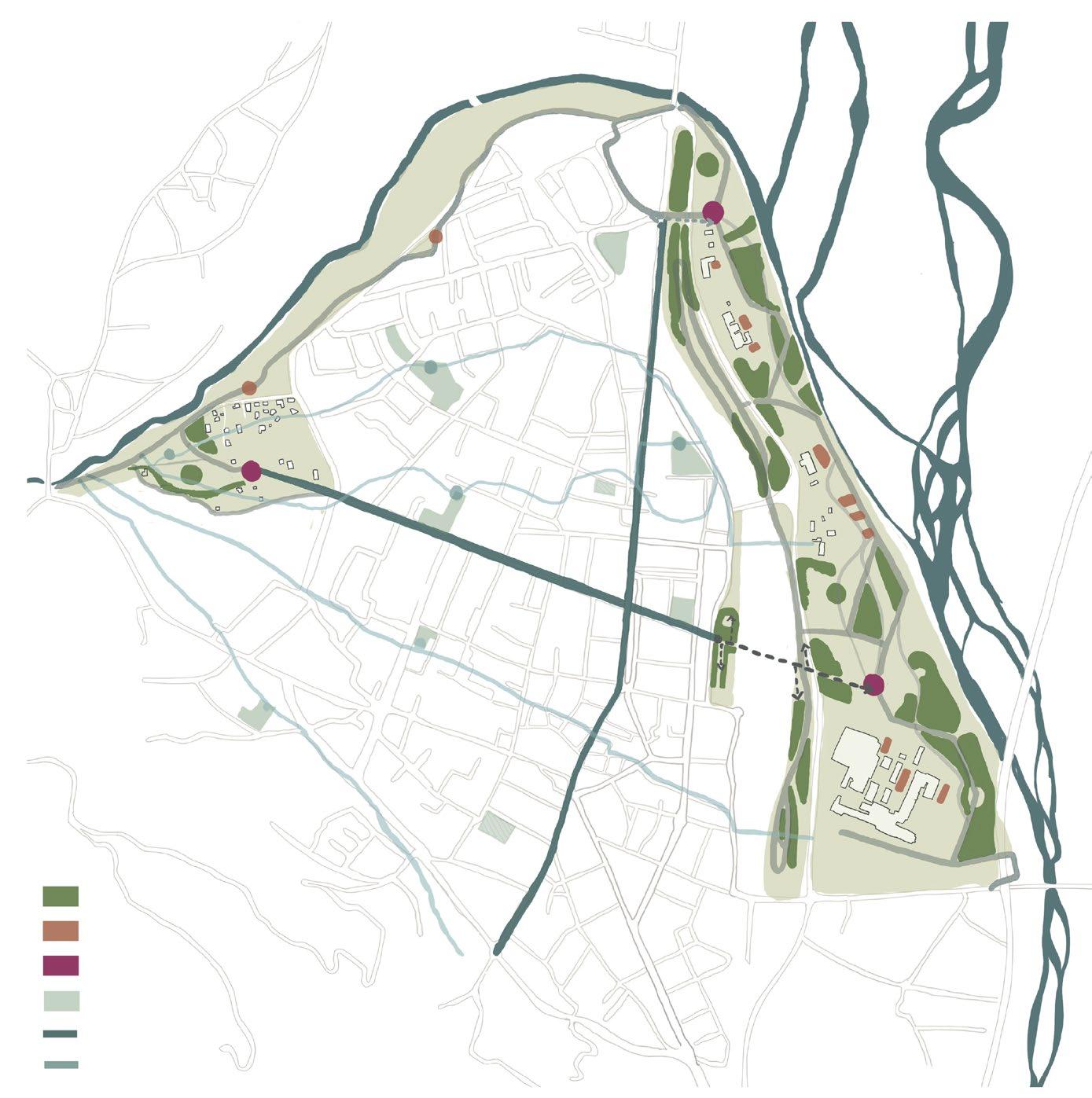
Domodossola, located at the foot of the Alps near the Swiss border, holds significant geographical and historical importance as a key crossing point between northern Italy and central Europe. The ancient Via Sempione trade route, which passes through the town, has long positioned it as a vital connection between Milan and Switzerland.
Despite its proximity to several river systems, Domodossola has become increasingly disconnected from its waterways—natural elements that once shaped its identity and economy. Today, these streams remain so near, yet so far, offering a powerful opportunity to rethink the city’s relationship with its landscape.
THE SITE DOMODOSSOLA, ITALY
VILLADASSOLA
RAILWAY
CALVARIO
BOGNA
TOCE
DOMODOSSOLA VIA
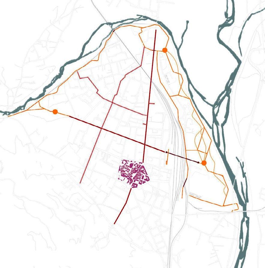
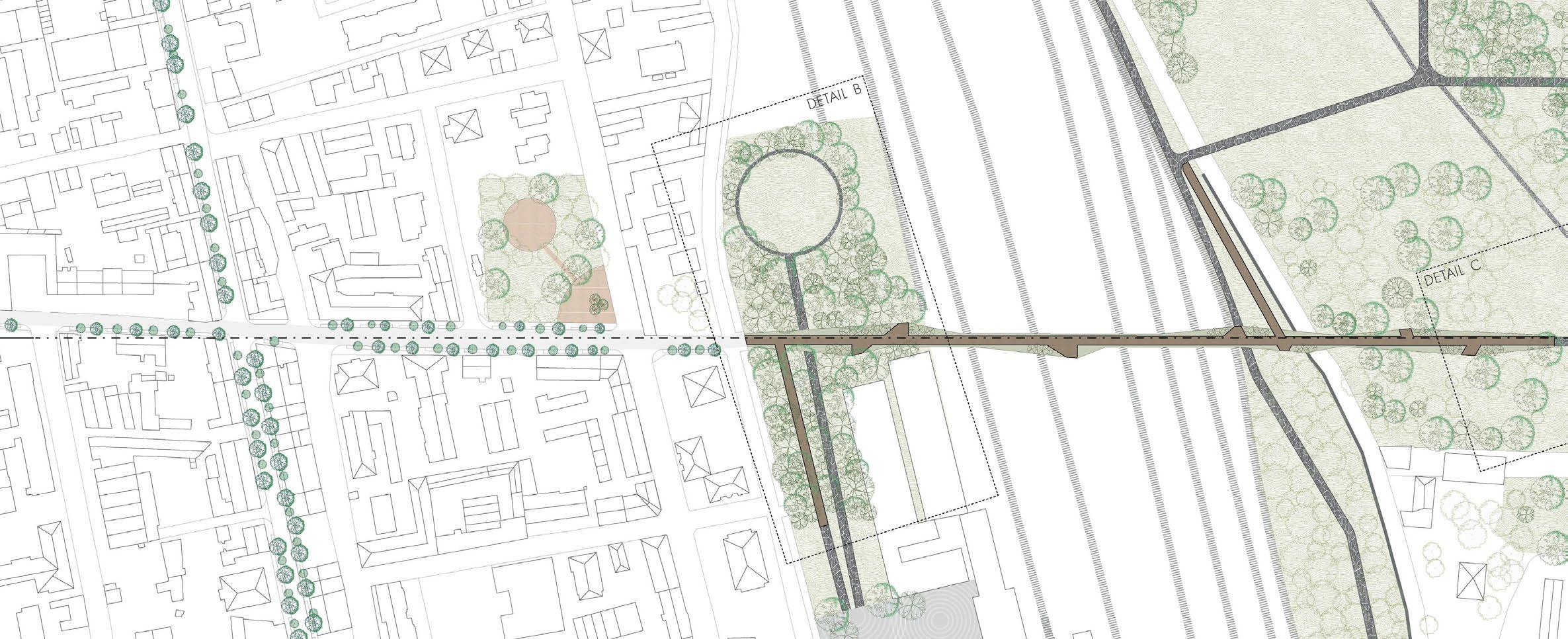
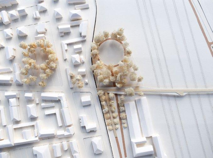
Our goal of reconnecting the city to the river is achieved by improving connectivity between the two.
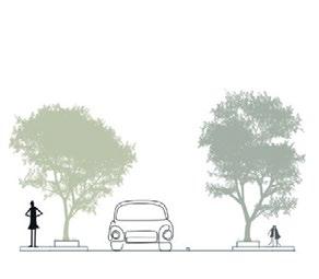
The grey network is enhanced by resolving riverfront discontinuity with a new east-west pathway that mirrors the embrace of the Bogna and Toce rivers. Two key roads—connecting the city vertically and horizontally—are redesigned to prioritize pedestrians, reduce car dominance, and introduce treelined avenues, bringing greenery back to the urban fabric.
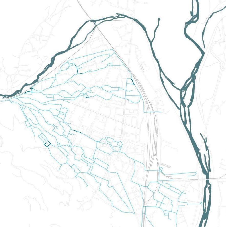
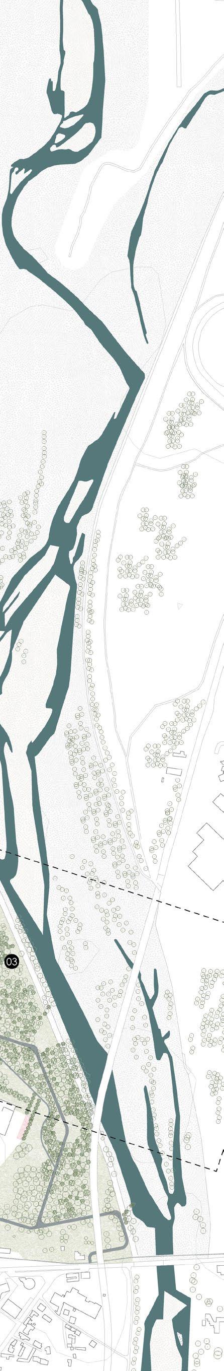
The blue network is strengthened through riverside viewpoints, restoring citizens’ connection with the Toce and Bogna. Historical Roggia canals are reactivated with sensory interventions, reviving awareness of the rivers’ presence.
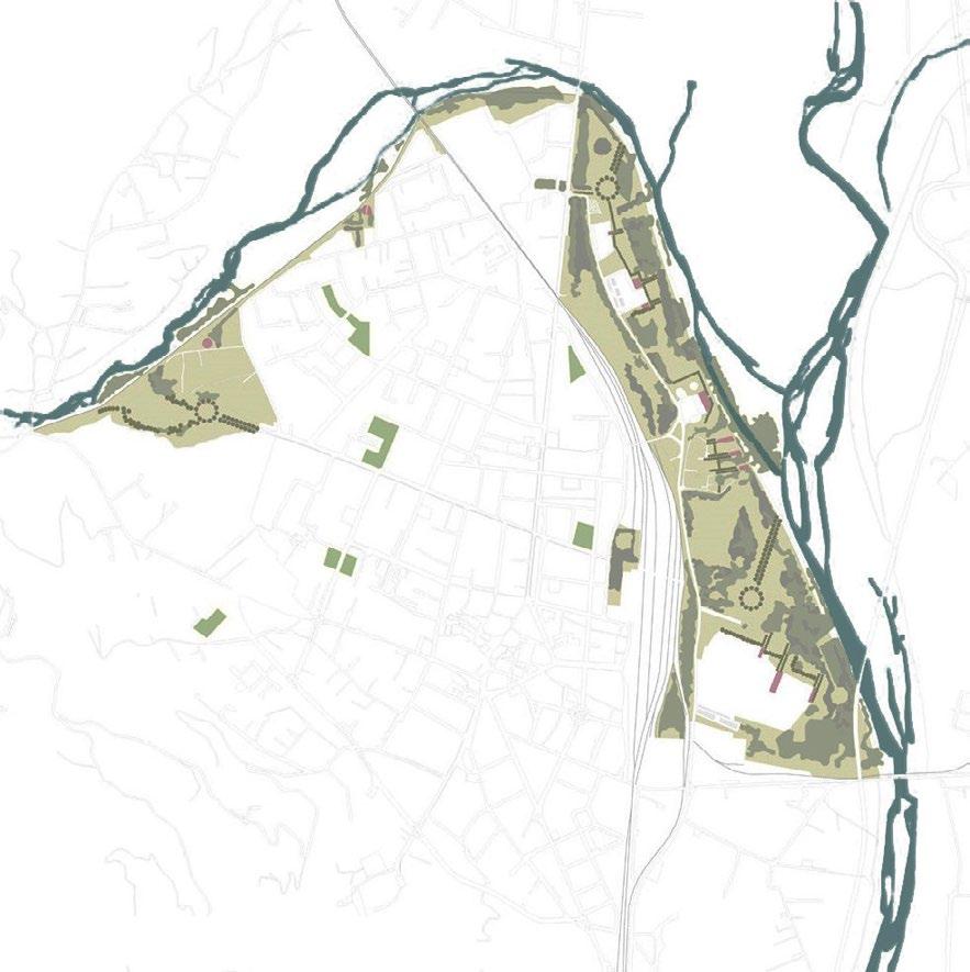
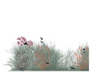
The green network focuses on enriching the river park with native and pollinator species, enhancing biodiversity. Vacant urban spaces within a 5-minute walk are reimagined as civic nodes, turning unused land into vibrant green community spaces.
Understanding the green infrastructure of the city
Understanding the blue infrastructure of the city
Understanding the green infrastructure of the city
new bridge connection
transitional space
amphitheatre
view point on the river
connection axis
civic nodes
recovered roggia canals
main path
secondary path
underground canals
ecological niches
meadow
existing trees
new trees
Formal gathering space
Void in solid (Natural)
Solid in void (Natural)
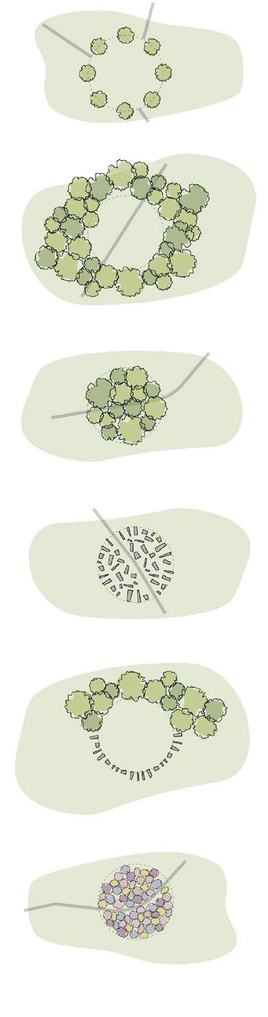
Solid in void (Man-made)
Circle of trees and stones
Permenant flower gardens
Forest : Connected canopies
Promenade: Disconnected canopies
Trees on one side focusing on the river view
The diagrams illustrate how different compositional languages are used to create a curated spatial experience through movement and atmosphere. This journey begins in the city, where key civic nodes are identified and enhanced to reintroduce the presence of water and revive the memory of the forgotten river.
Pedestrian accessibility is strengthened along the two main axes — vertical and horizontal — guiding citizens toward the landscape. Near the railway station, a vegetated bridge offers a soft transition across the infrastructural barrier, signaling entry into a new spatial realm.
Beyond the bridge, a series of landscape compositions unfold, each with distinct experiential rhythms. These curated sequences gradually immerse the user in natural surroundings, ultimately leading to a meaningful reconnection with the river.
Tall grass or garden on both sides
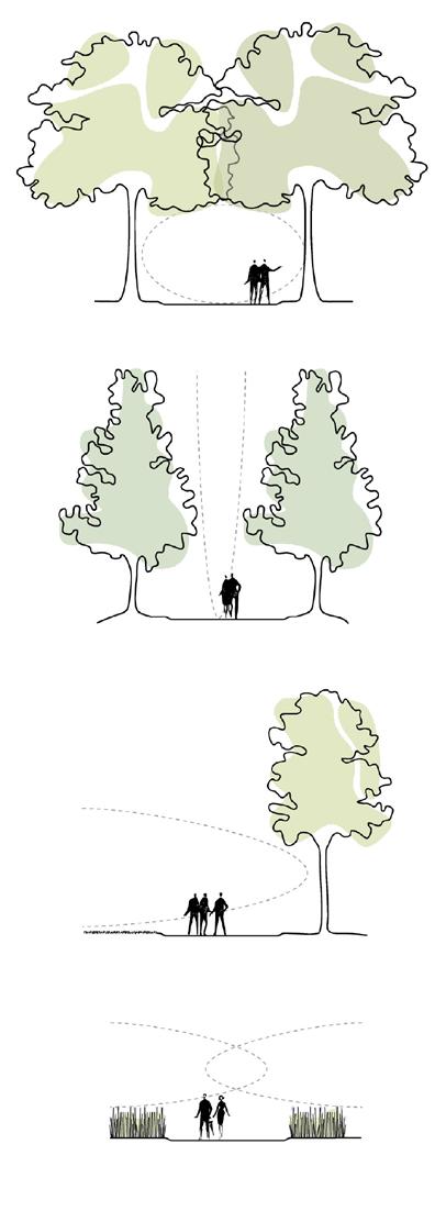
FIGURES OF LANDSCAPE
EXPERIENTIAL RHYTHM OF THE LANDSCAPE
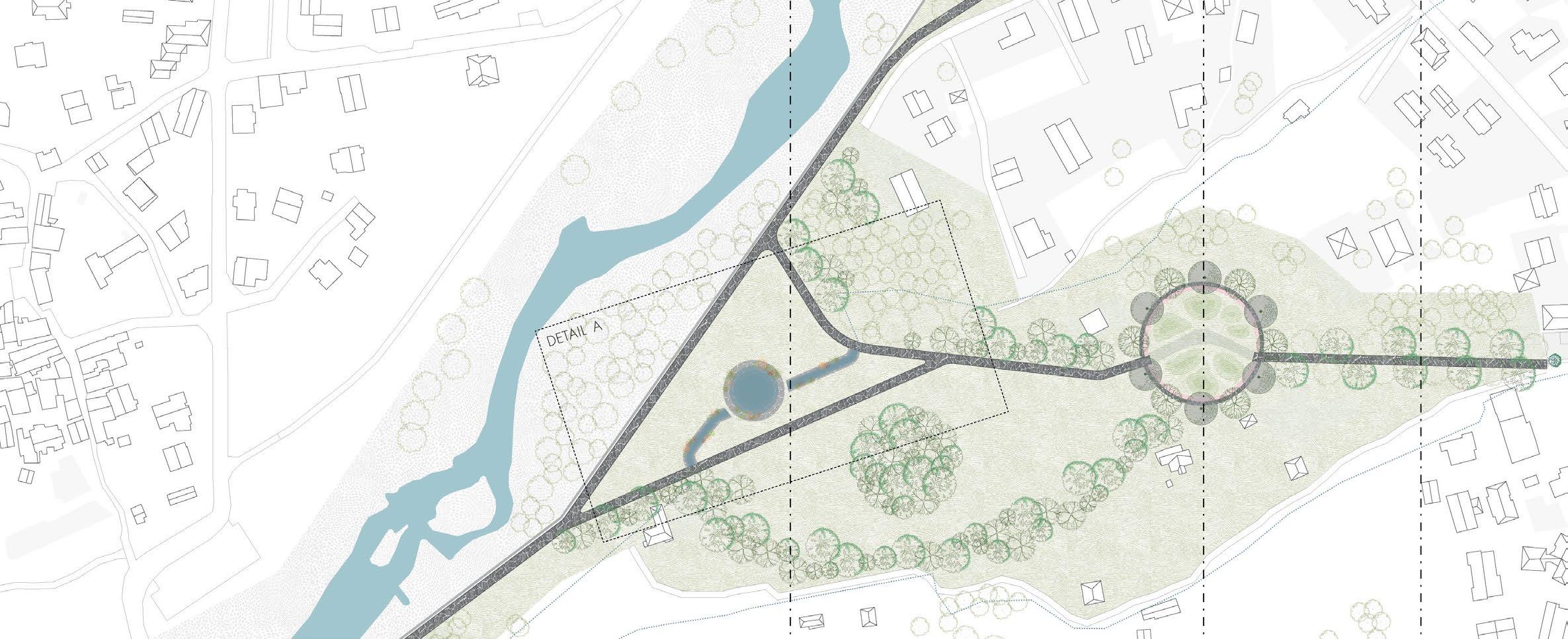
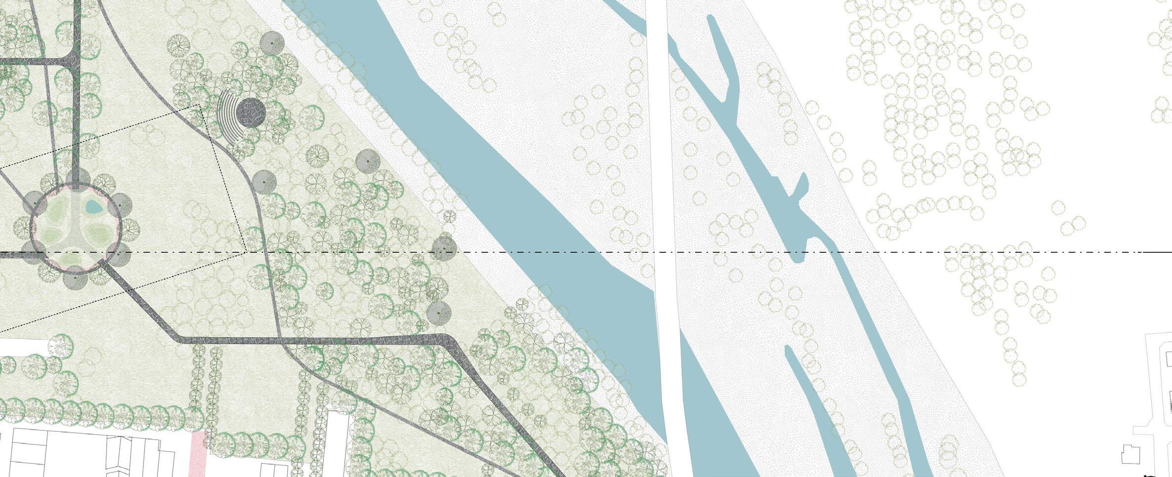
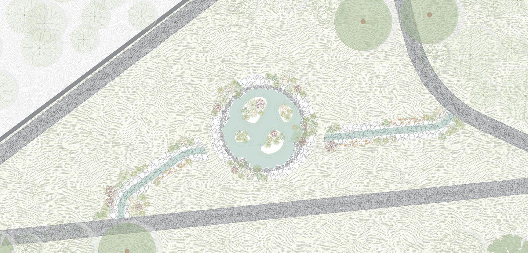
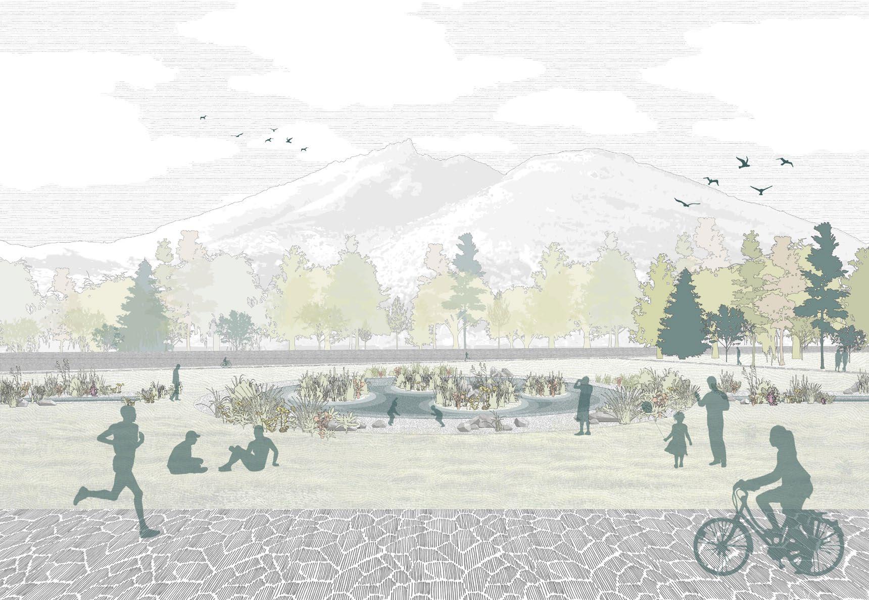
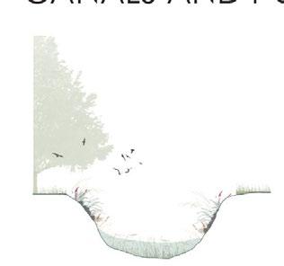
RESTORED ROGGIA
The proposal focuses on creating a green space along the river on the west side of Domodossola city, highlighting the Roggia Canals as the central feature. The design collects water to establish a new ecosystem where water and vegetation coexist and interact in a co-dependent relationship. This space aims to serve as a contemplative area for citizens, where the natural elements of water and plants merge in a unique and harmonious way.
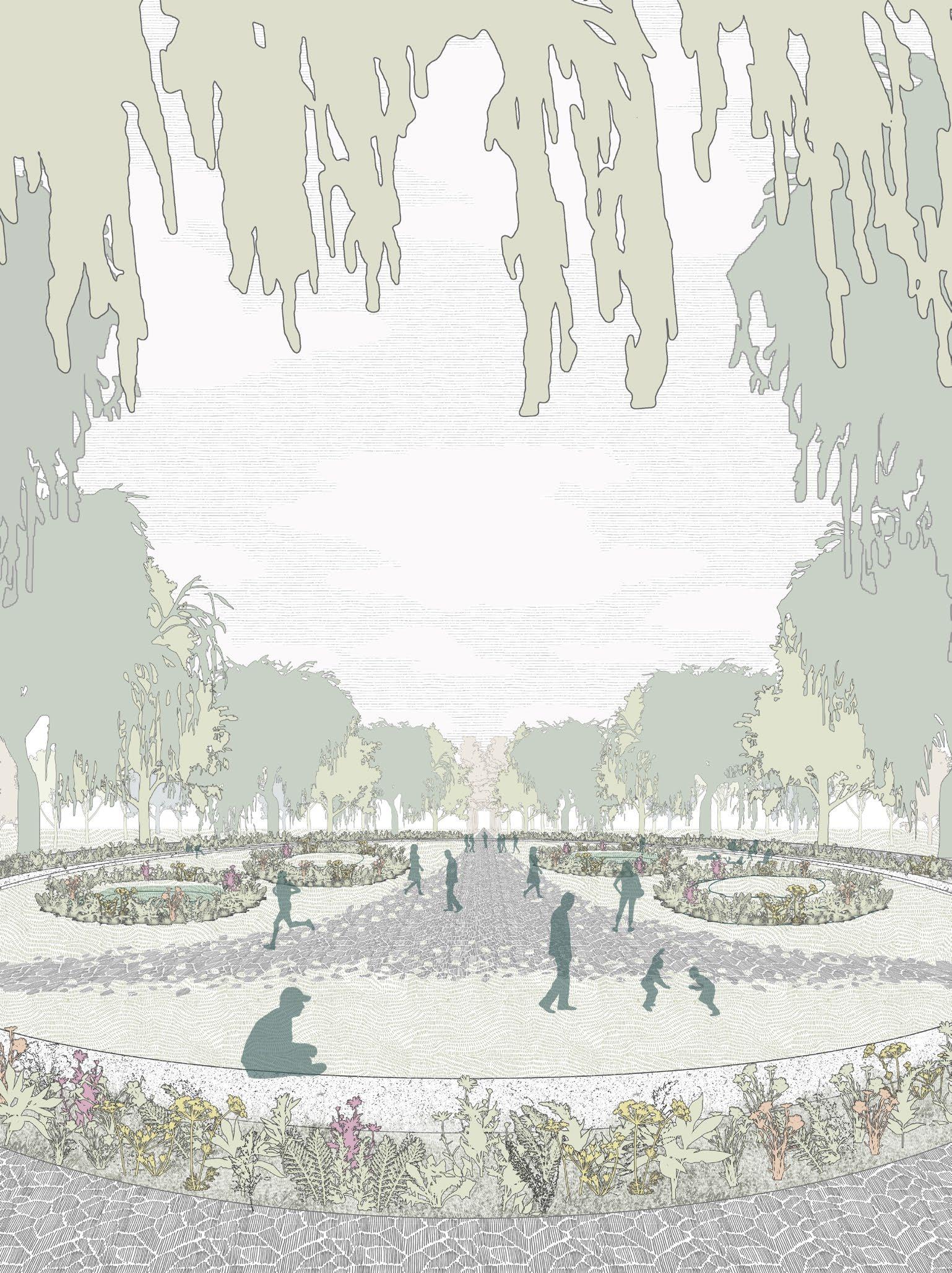
FORMAL TRANSITIONAL SPACE
The transitional spaces serve as a bridge between the city and nature, using natural elements to form welcoming environments. Trees are arranged in a circular pattern to embrace the community, creating a sense of inclusivity. The terrain features varying levels, with small mounds and depressions that hold diverse greenery like flowers and tall grass. The depressions temporarily collect rainwater, further integrating water and vegetation in a unique way.
Forest
Ecological niches
Transitional spaces Civil nodes
Main green axis
Canal regeneration
ECOLOGICAL SERVICES
SCALE AND PROPORTIONS
FOREST
GREEN AXIS
ECOLOGICAL NICHES
TRANSITIONAL SPACES
CANALS AND PONDS
ACTIONS
Maintain and preserve the forest landscape
SERVICES
Provides habitats for wildlife and regulates the microcli-
ACTIONS
Create an urban green connection using vegetation
SERVICES
Provide shade, improve air quality, carbon capture and soil health improvement
ACTIONS
Garden areas that create a transition from built areas to more naturalized ones.
SERVICES
Enhance Biodiversity, carbon capture and soil health improvement
ACTIONS
Rehabilitation of green areas in the city creating awareness of the river.
SERVICES
Provide shade, improve air quality and reduce temperature in summer.
ACTIONS
Regenerating historical canals in certain areas.
SERVICES
Reduce urban runoff, improve water quality and recharge ground water.
THE RIVER BECKONS is a call to restore Domodossola’s deep connection with its waterways, transforming neglected spaces into vibrant, natural environments that foster community engagement. Through thoughtful design, the project reintroduces the flow of water and greenery, creating a seamless transition between urban life and the surrounding landscape.
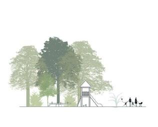
04 How to facilitate learning with nature?
INSIDE OUT: PLAYFUL SPACES THAT BLUR THE BOUNDARIES BETWEEN INDOOR AND OUTDOOR
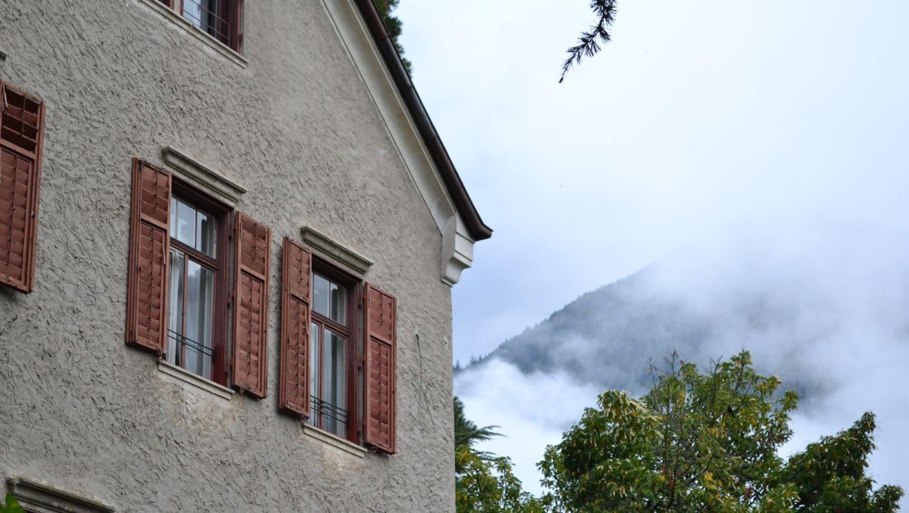
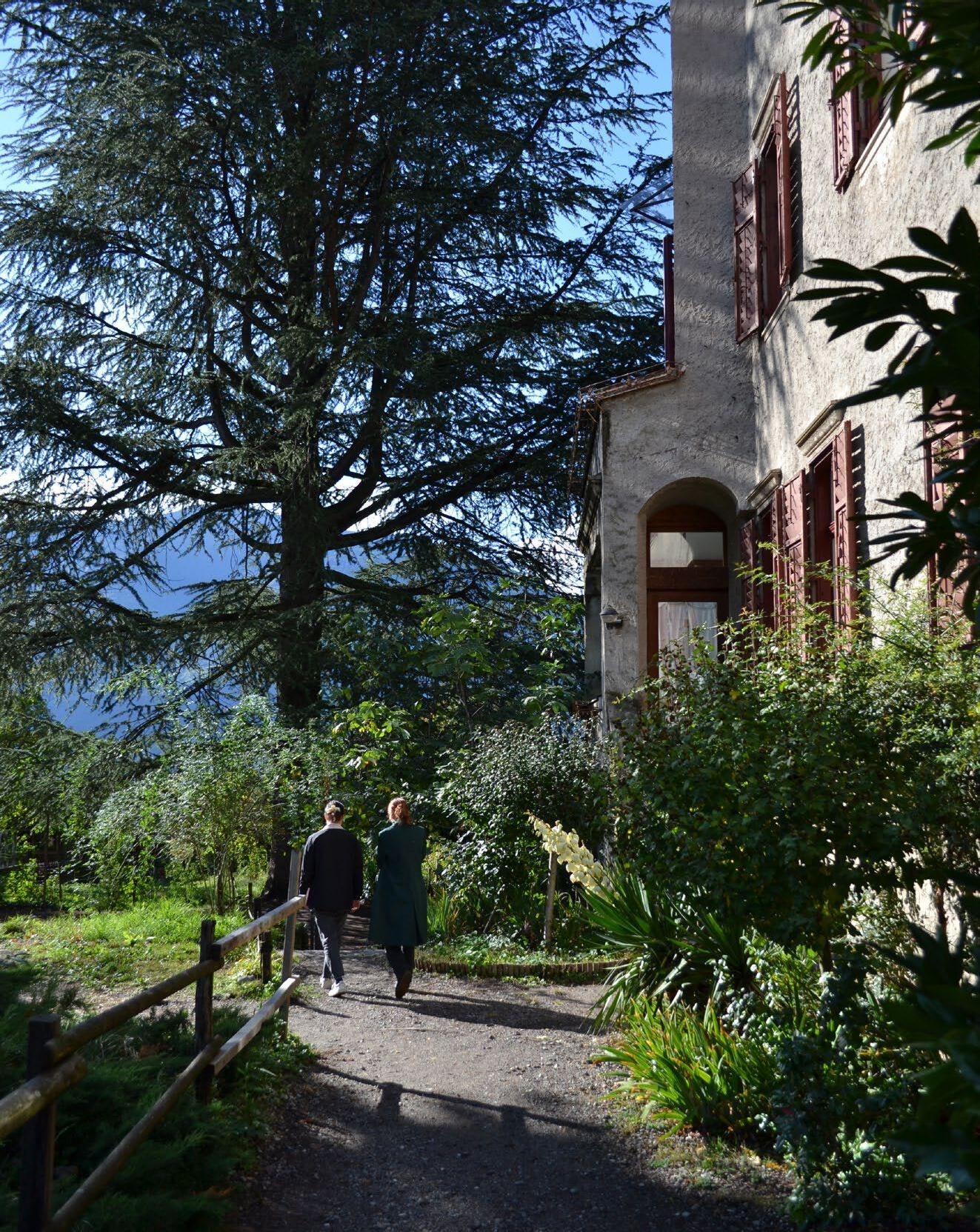
Villa Steiner is located in Merano, a town in northern Italy’s South Tyrol region, known for its unique Alpine-Mediterranean climate and lush natural surroundings. The villa sits in a sheltered valley with the Alps forming a striking backdrop, offering an ideal setting for a nature-oriented learning environment.
Originally a residential building, Villa Steiner has been adapted for Waldorf education. The ground floor houses the kindergarten, while primary school classrooms are located on the upper level. The interior maintains a warm, domestic character, reflecting the building’s origins and supporting a sense of familiarity and comfort for the children.
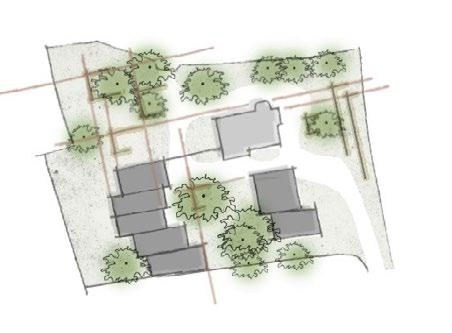
THE SITE
VILLA STEINER, WALDORF SCHOOL MERANO, ITALY
The surrounding outdoor spaces are integral to the educational approach. A large garden filled with diverse vegetation, open play areas, and a vegetable patch reflects the Waldorf emphasis on learning through direct contact with nature. Children engage with natural processes such as growing food and making compost, which are embedded into the curriculum.
The overall spatial organization encourages independence, creativity, and cross-age interaction, fostering both academic and personal growth. The villa and its landscape together create a nurturing environment where architecture and pedagogy are closely intertwined.
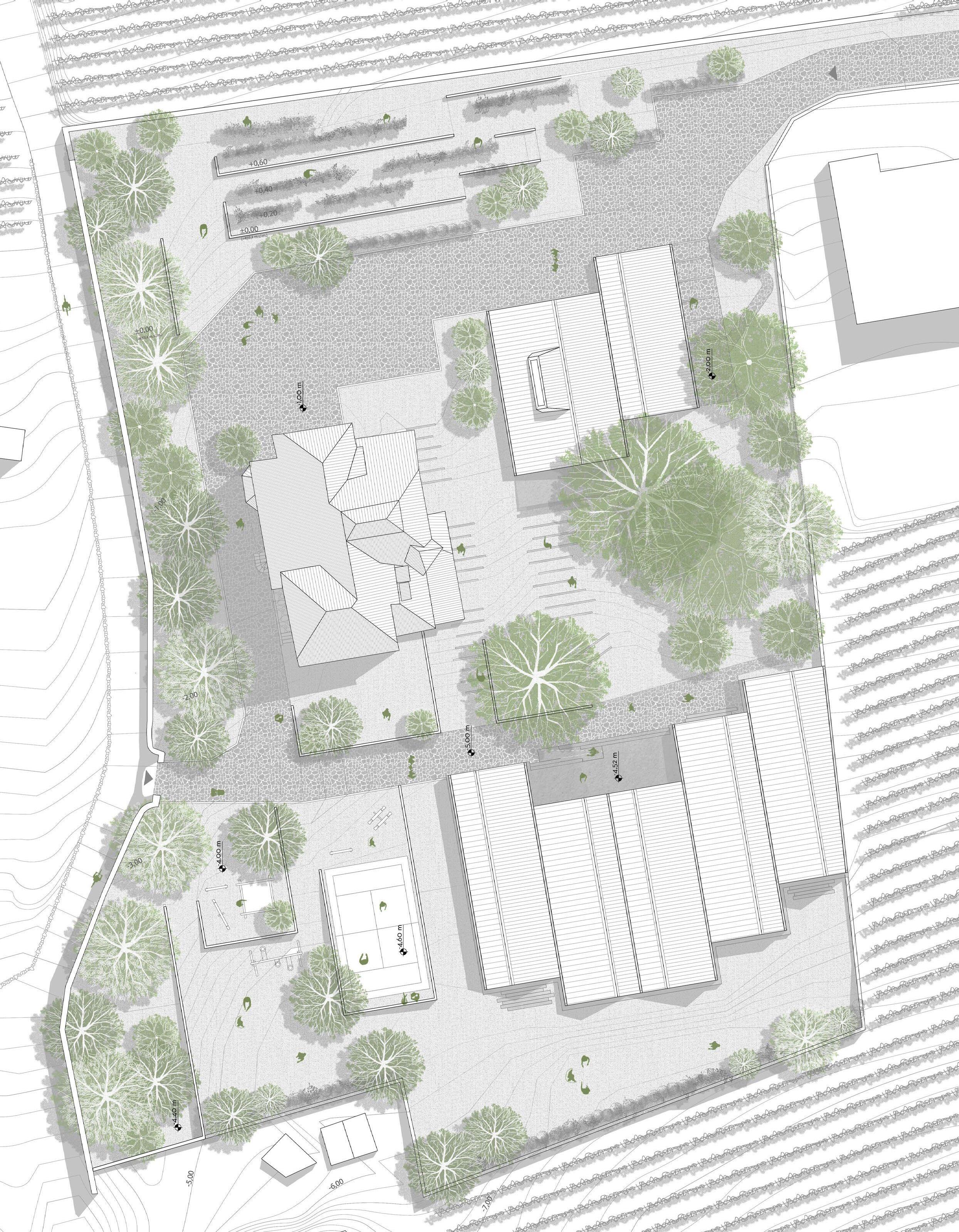
The images show the contextaulity of the Villa Steiner, the usage of vernacular materials, the seemless blending to the natural site contours and the nestling between the towering trees.
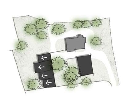
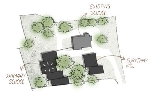
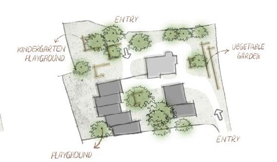
1. Old school building
2. New school building 3. Eurythmy Hall 4. Central tree garden
Vegetable gardens 6.Play platforms
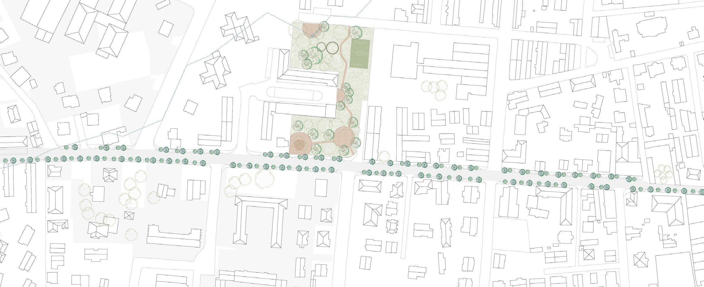
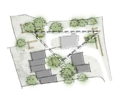
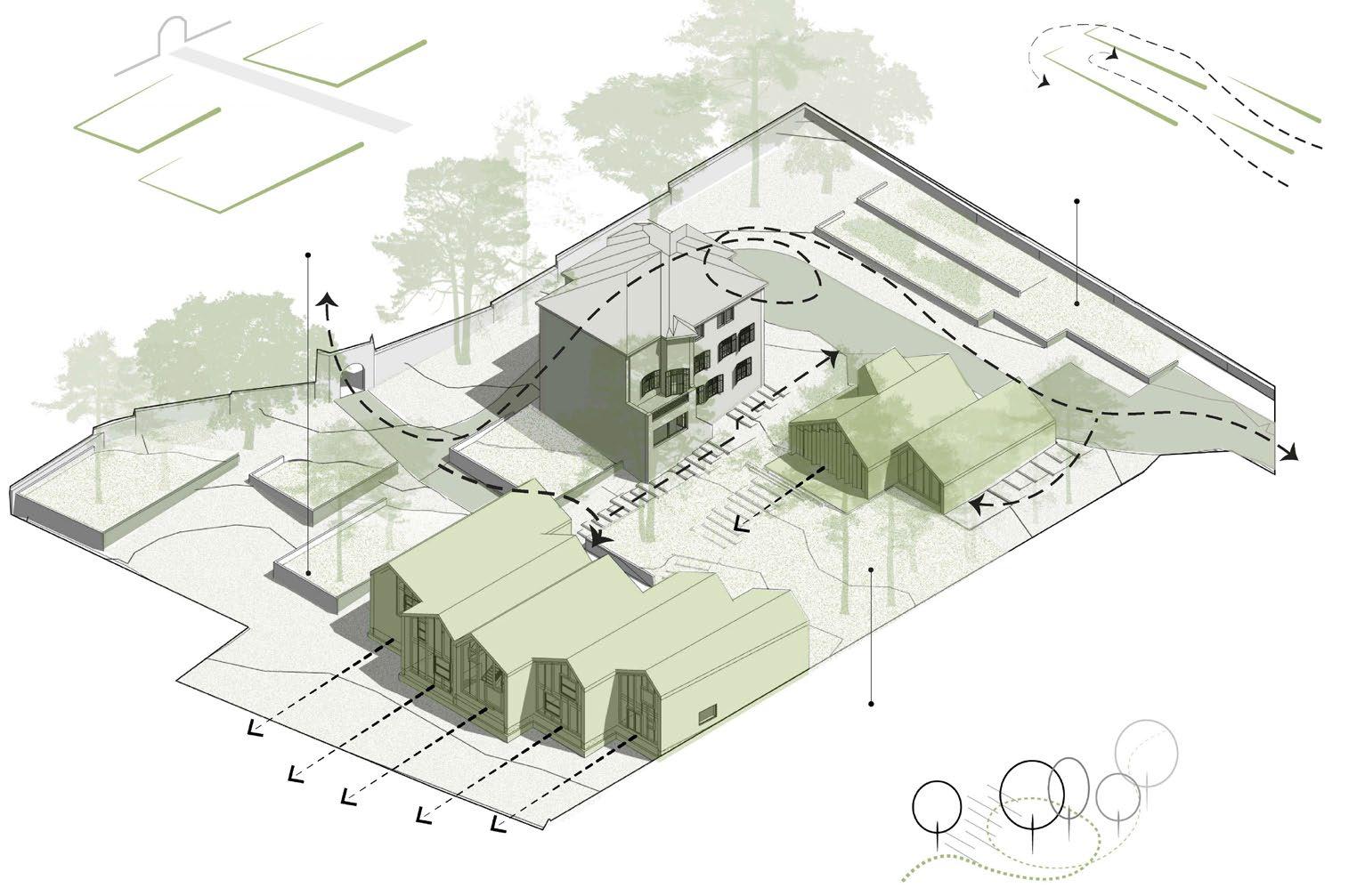
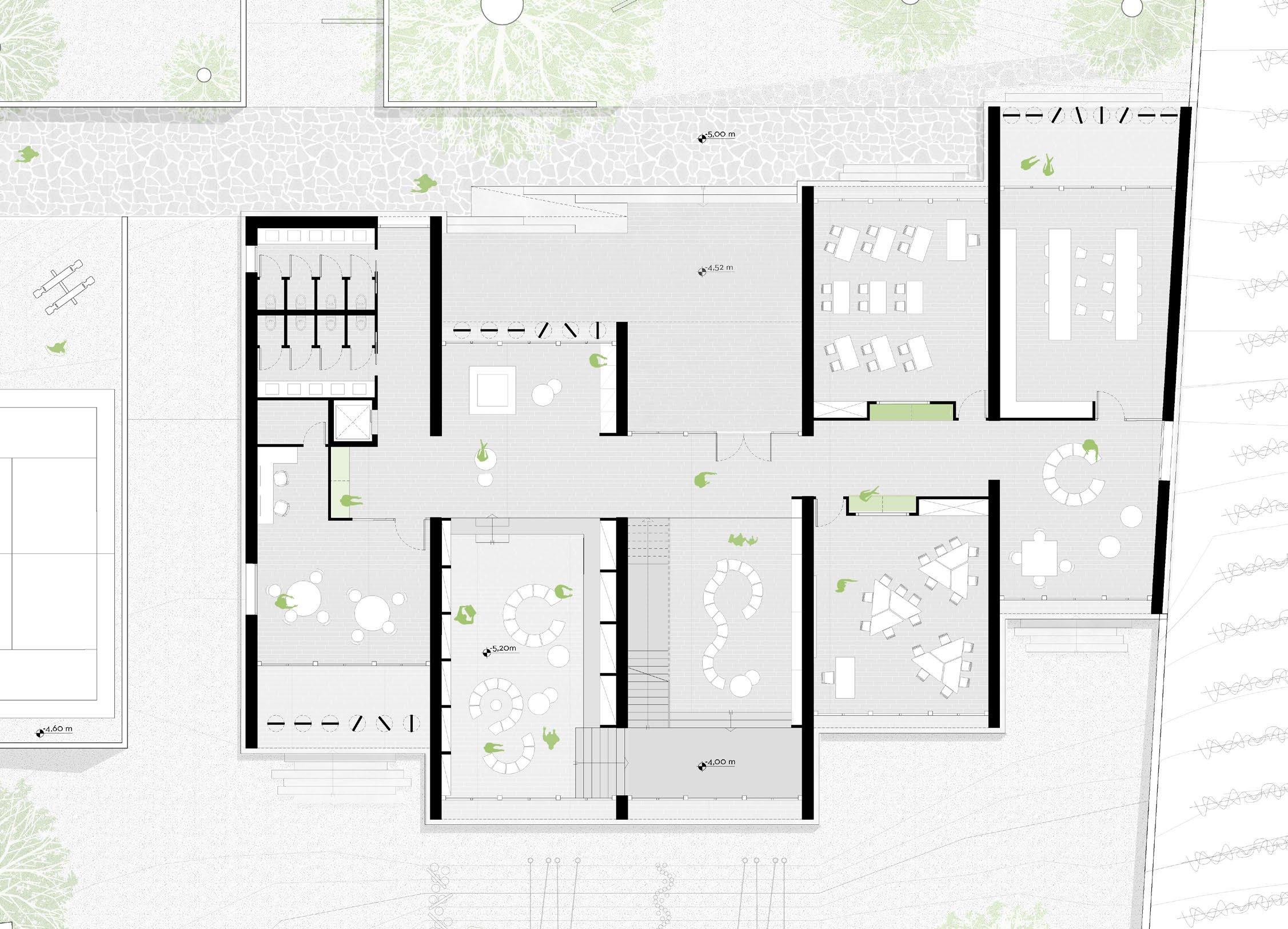
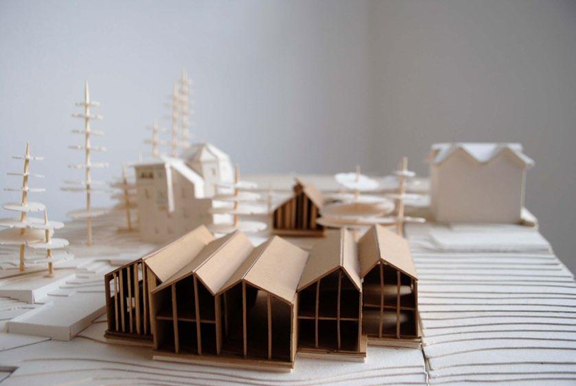
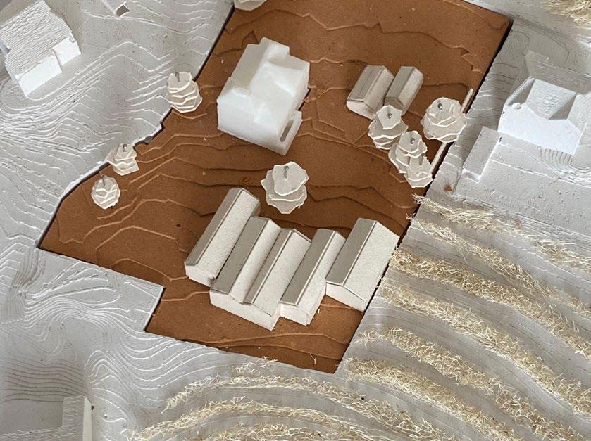
The project aims to expand the existing Waldorf school in Merano while preserving its character and responding sensitively to the site’s natural topography. The vision centers on creating an integrated learning environment that fosters a strong relationship between education and nature.
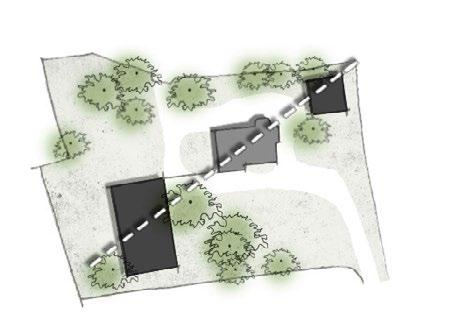
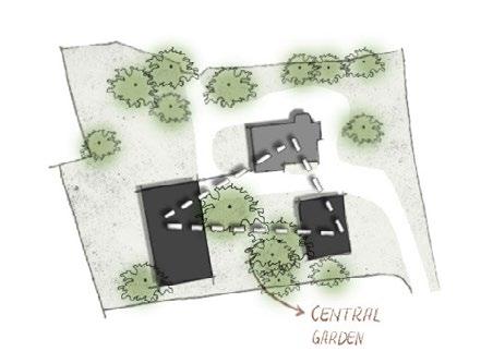
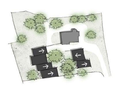
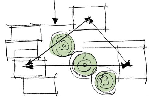
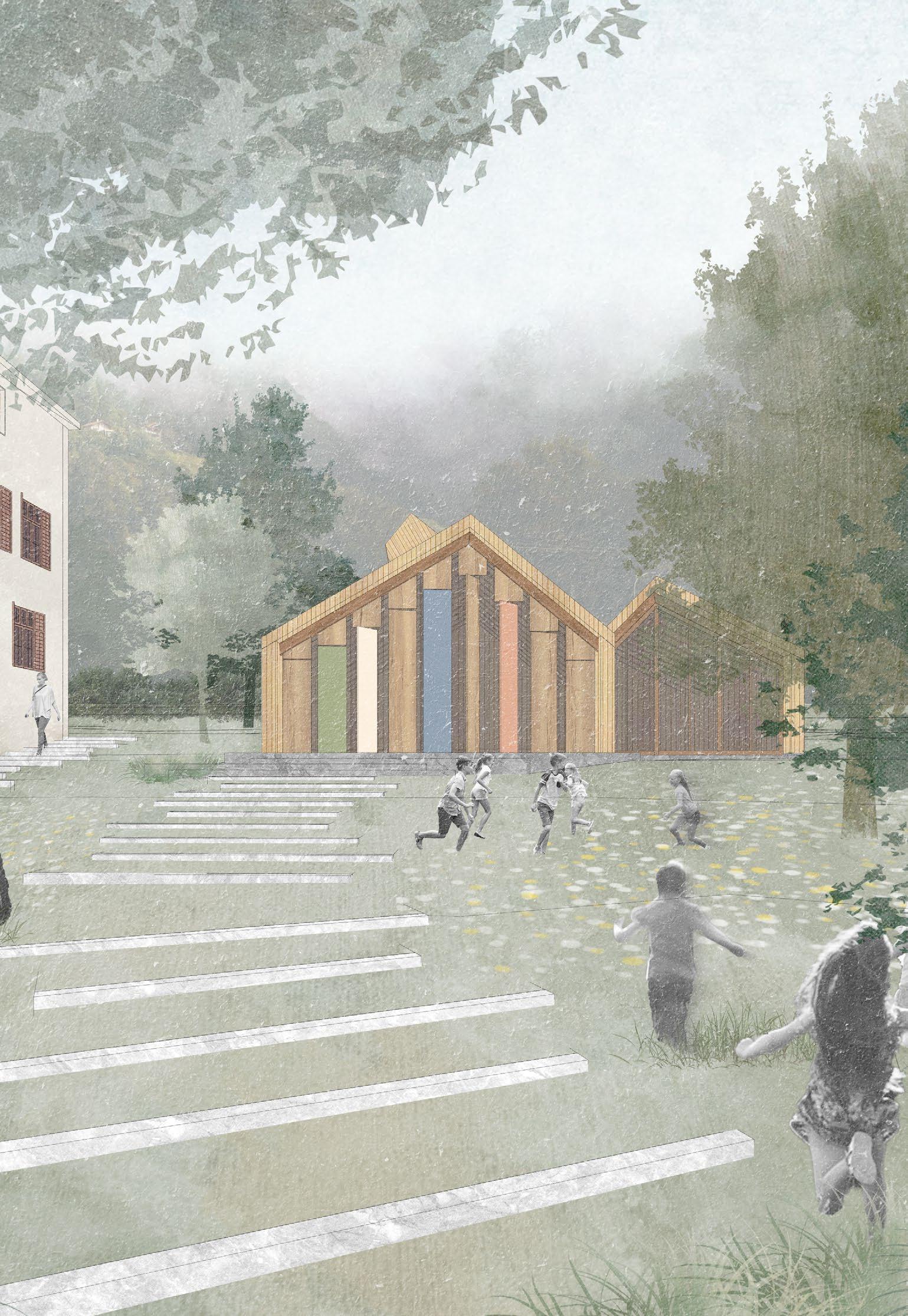
At the heart of the design is a central garden, positioned among existing historic trees and acting as the focal point of the composition. The school’s program is divided into two key functions—learning spaces and the eurythmy room—arranged in a triangular layout around this garden. This configuration ensures a fluid connection to the existing structure while minimizing disturbance to the natural landscape.
The central garden - the heart of the project that creates a harmony between, the exisitng, the built, the natural, the interior and the exterior. A space that invites the students to be part of its curves and crevices and learn with nature.
Landscape elements
TREE GARDEN
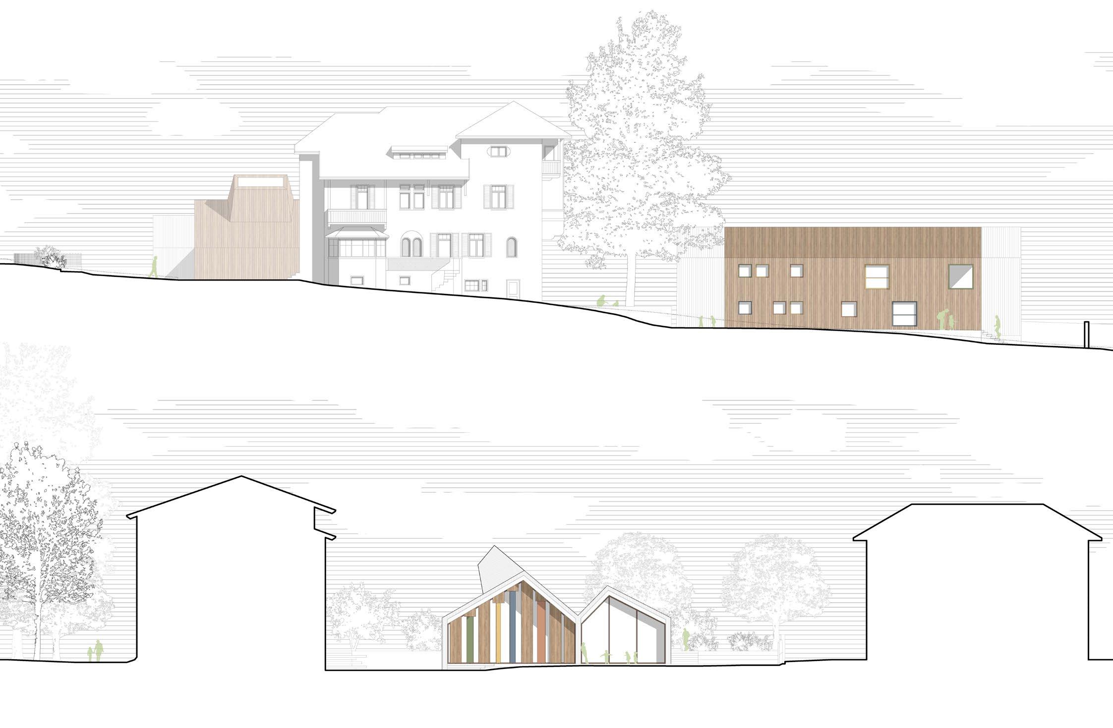
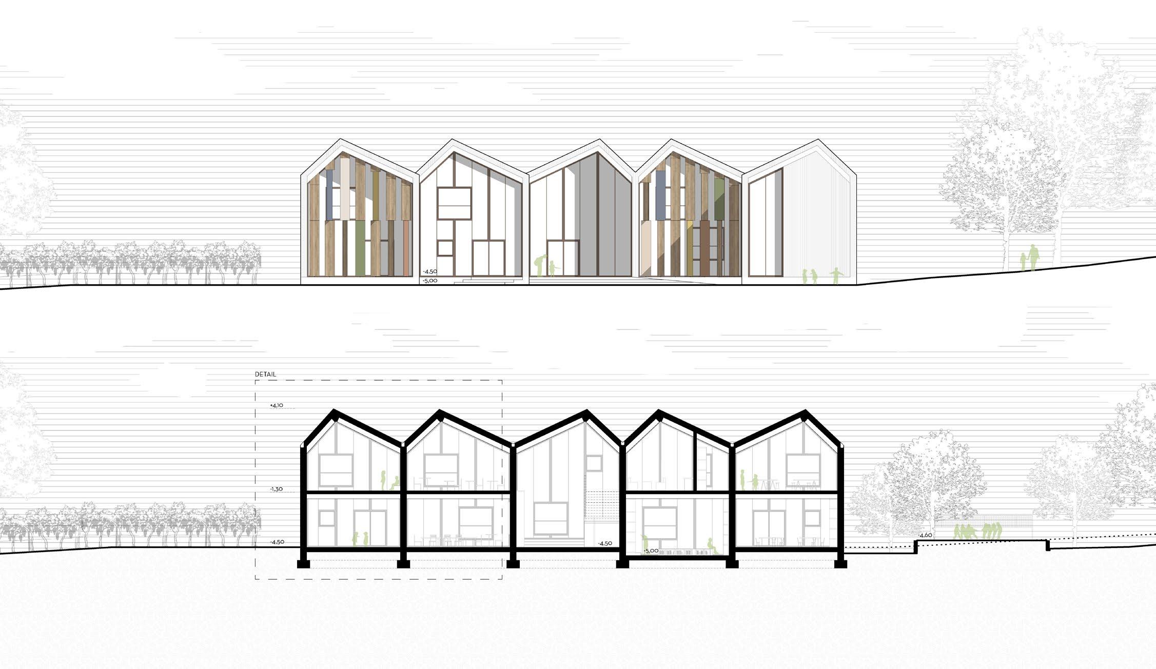
ELEVATION - EURYTHMY HALL
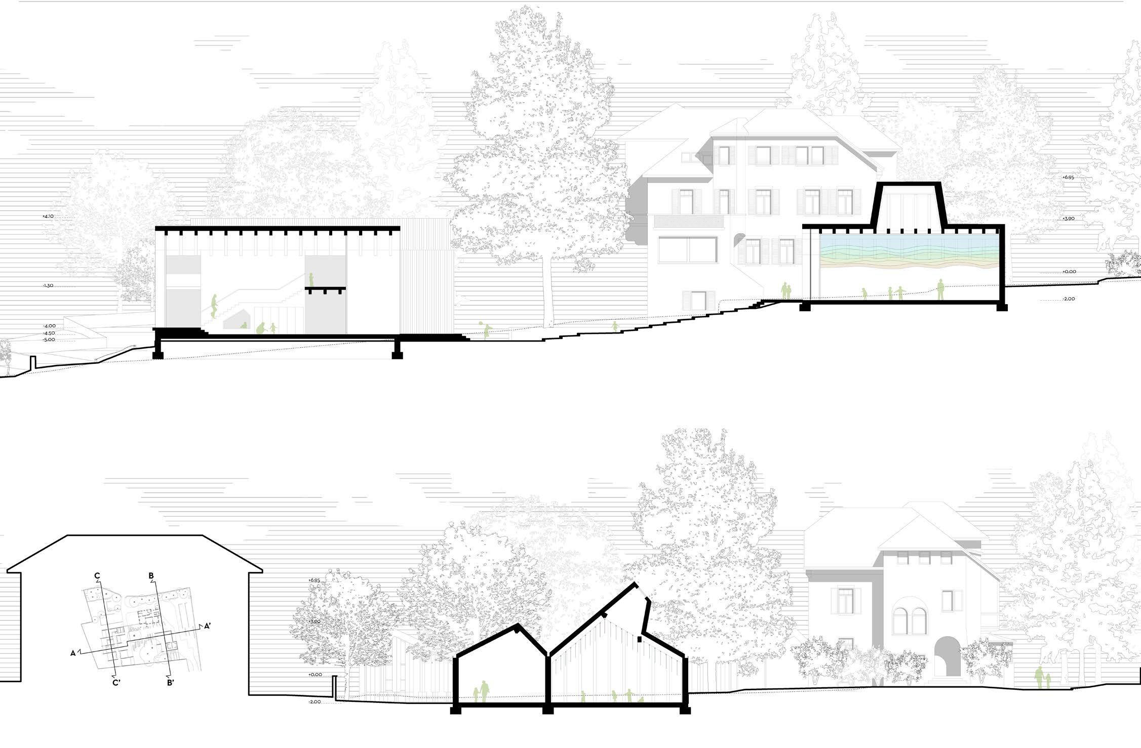
SECTION A-A’
ELEVATION - PRIMARY SCHOOL SIDE
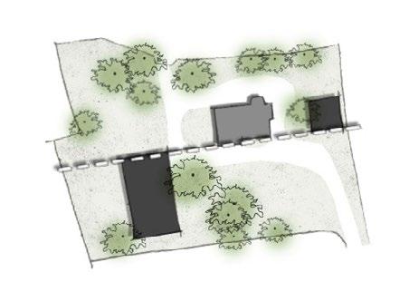
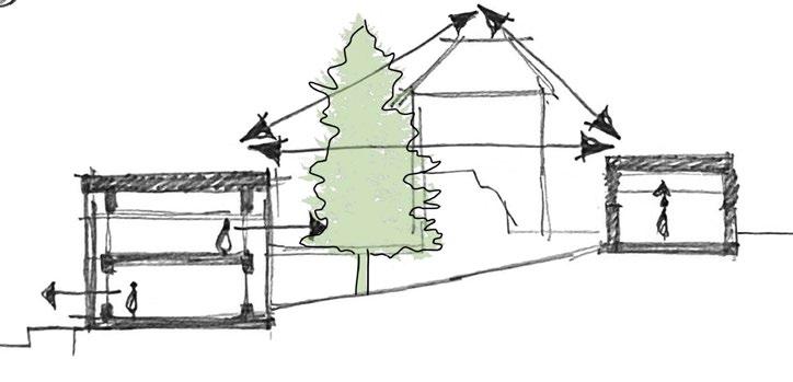
Building volumes are strategically placed to avoid significant tree removal, using smaller, sliding masses to integrate gently with the terrain. The triangular layout also defines distinct zones for gardening, play, and open gathering, unified by design elements like low walls that echo interior details. Minimal grading was applied to the site, with pathways introduced as the main intervention.
NEW SCHOOL BUILDING
ELEVATION
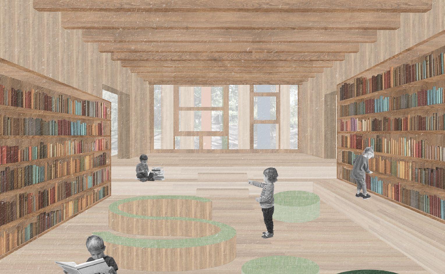
The spatial organization includes clearly defined entrances, one opening directly into the central garden. Inside, a double-height atrium creates a welcoming atmosphere, while the relocated library, semiopen labs, and outdoor-accessible classrooms encourage interaction with nature. The upper floor includes additional classrooms and a teacher’s lounge.
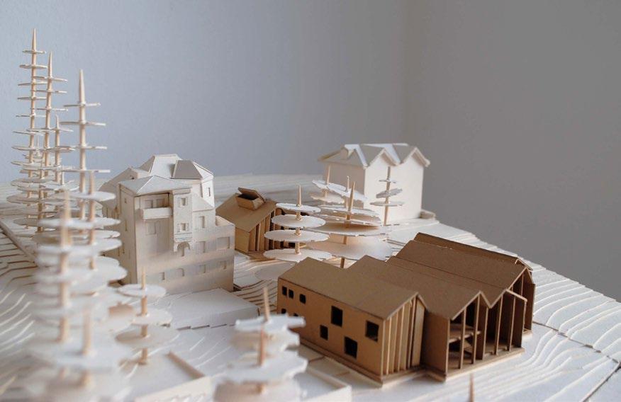
The two models offer complementary insights at different scales. The 1:500 model provides an overview of the site strategy, emphasizing spatial relationships, circulation, and the integration of new volumes within the landscape. It highlights how the central garden is framed and how the overall intervention remains visually subtle in the broader context. In contrast, the 1:200 model allows for a closer examination of architectural details, focusing on the proportions, façade articulation, and internal spatial qualities. Together, they support a comprehensive understanding of both the urban integration and the human-scale experience of the project.
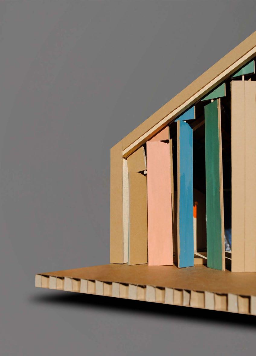
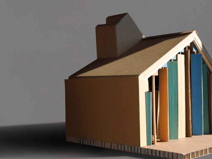
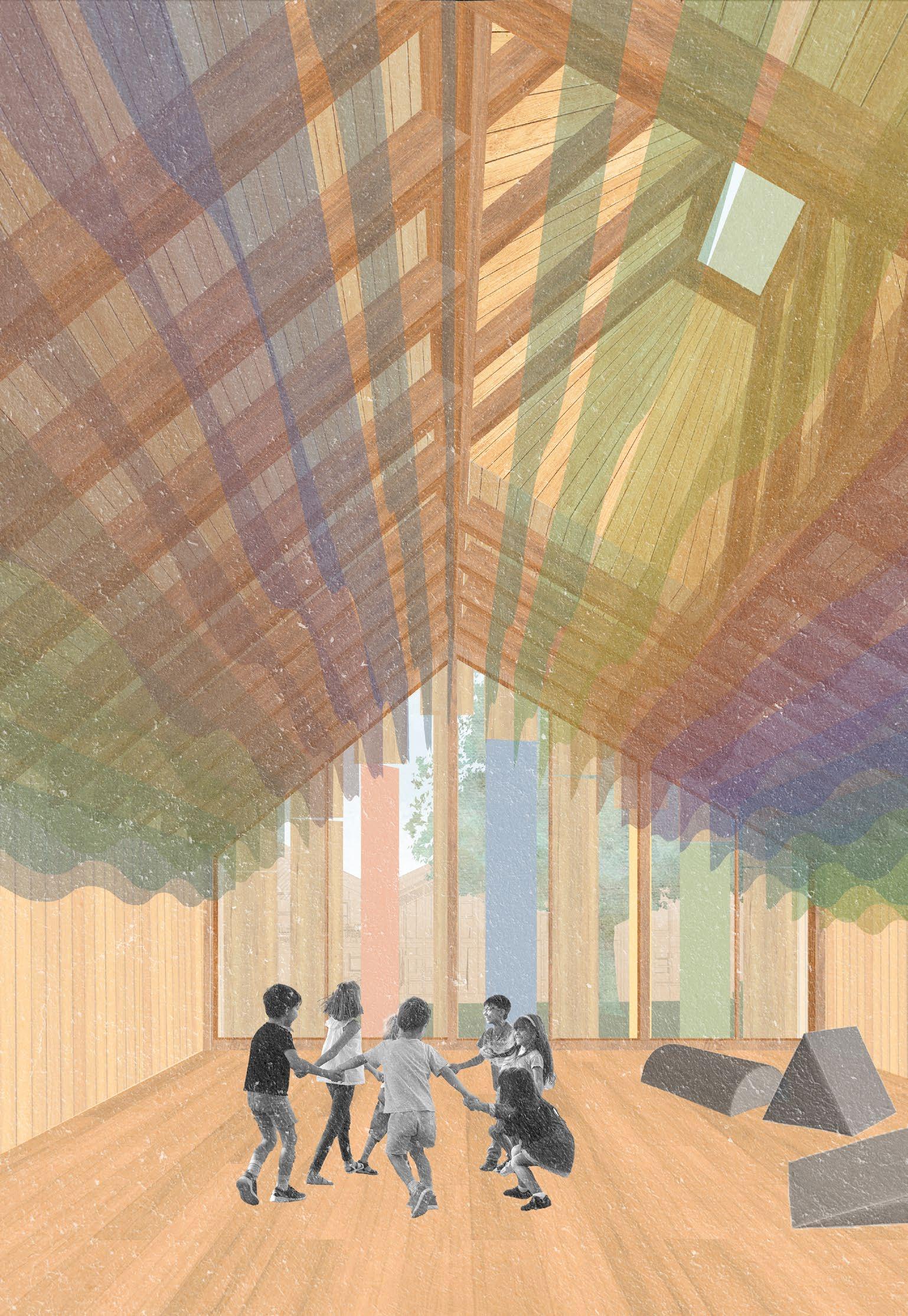
The 1:25 scale model of Eurythmy showcases the various elements at work such as the rotating shading devices, skylight, the usage of wood for various elements and the acrylic ceiling elements. It stands out as a unique space, offering an extraordinary atmosphere characterized by modulated light and playful acrylic elements, creating an inspiring environment conductive to movement and expression. In terms of construction methodology, the project predominantly utilizes wood materials, aligning with principles of sustainability and environmental consciousness while also contributing to the overall aesthetic and warmth of the design.
INSIDE OUT is a harmonious integration of architecture and nature, where the built environment seamlessly blends with the landscape to foster a nurturing, nature-oriented learning experience. By prioritizing sustainability and creating spaces that inspire creativity and interaction, the design ensures that both the interior and exterior contribute to the holistic development of the students.
ABOUT ME
I’m an architectural graduate from India, currently pursuing my Master’s in Sustainable Architecture and Landscape Design in Italy. I have a keen interest in designing spaces that are sustainable, rooted in context, shaped by climate, and deeply felt by the people who experience them.
My approach to design is intuitive yet informed—guided by a strong foundation in sustainable practices and a constant curiosity about how space affects the human mind. I draw inspiration from vernacular wisdom, natural systems, and quiet observations; whether it’s walking through a Laurie Baker home or listening to a mason speak about the grain of a material.
After completing my B.Arch from NIT Trichy in 2020, I worked on residential projects that allowed me to apply these values in real life—designing with topography, engaging with local materials, and learning directly from the hands that build. My early years in practice were shaped through freelance projects, where I worked independently on small-scale residential architecture. This close engagement with clients, contractors, and craftsmen gave me a strong sense of responsibility and the freedom to embed my values directly into the built form.
Now, as a Master’s student at Politecnico di Milano, I’ve been challenged to think at a much broader scale—addressing urban systems, ecological networks, and collective well-being. Collaborating within international, interdisciplinary teams has taught me how to negotiate ideas, work across cultural perspectives, and approach complex problems through a systems-thinking lens. This shift from the personal to the collective, from detail to territory, has helped me grow in a new dimension as a designer.
Across scales and contexts, what remains constant in my work is the effort to respond with sensitivity—to place, to people, and to the planet.