11 minute read
References of Pictures and Used Data

Next Article

Cover
Leviathan gas field, Israel. Author: Péter Magyar ‘Medoks.’
Inside front and back cover: Yellow pipe seamless on white background. Source: Shutterstock ID: 612713408, author: romvo/Shutterstock.com.
Photos between Chapters
2) The Eastern Mediterranean from an authentic 17th century book. Source: Shutterstock ID: 1582008844, author: Krisztian Csatari/Shutterstock.com. 3) Middle Eastern Morning Space View. Source: Shutterstock ID: 315865175, author: Capitano Productions Film/Shutterstock.com. 4) Aerial view of Akcakale Refugee Camp. Source: Shutterstock ID: 547822759, author: Tolga Sezgin/ Shutterstock.com. 5) Russian warship (numbered 158) in the Strait of Istanbul. Source: Shutterstock ID: 626124200, author: Bulent Demir/ Shutterstock.com.
2
INTRODUCTION AND INTERVIEWS The Countries of the Eastern Mediterranean Region
Source of data: World Bank and The World Factbook. Source of flags: Shutterstock ID: 788568298, author: Puwadol Jaturawutthichai/Shutterstock.com. The map is based on: Shutterstock ID: 496799155 author: Peter Hermes Furian/Shutterstock.com. Author: Péter Magyar ‘Medoks.’
Egypt, the Largest Country in the Eastern Mediterranean—Interview with HE Péter Kveck, Former Ambassador of Hungary to Egypt, Presently Director General at the Ministry of Foreign Affairs and Trade
The photo published in this interview was provided by HE Péter Kveck’s office.
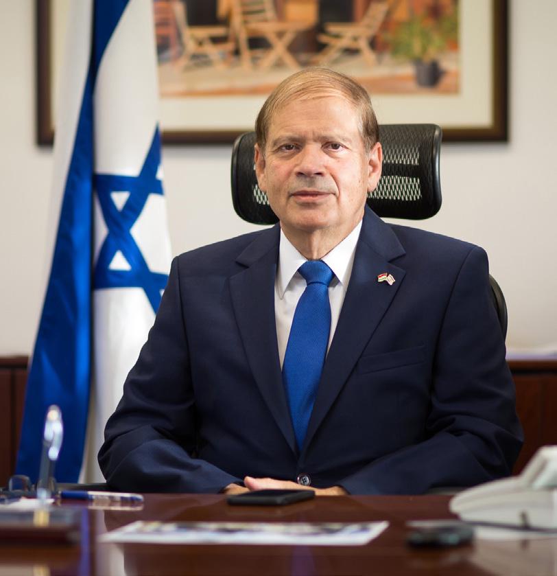
Israel’s Eastern Mediterranean Strategy—Interview with HE Yacov Hadas-Handelsman, the Ambassador of Israel to Hungary
The photo published in this interview was provided by HE Yacov Hadas-Handelsman’s office.
The Situation of Christianity in the Middle East— Interview with State Secretary Tristan Azbej
The photo published in this interview was provided by Tristan Azbej’s office.
3
COUNTRY STUDIES Endgame in Syria? The Dilemmas of Reconstruction
The approximate military situation in Syria in spring 2021. Source: https://en.wikipedia.org/wiki/File:Syrian_Civil_War_ map.svg, author: Ermanarich, licence: CC BY-SA 4.0. The map is based on: Shutterstock ID: 419503543, author: Schwabenblitz/Shutterstock.com. Redesign: Péter Magyar ‘Medoks.’
Countries in the broader region with military involvement in the civil war. Source: https://commons.wikimedia.org/wiki/ File:SyrianCivilWarMap.png, author: Cowik, licence: CC BYSA 3.0. The map is based on: Shutterstock ID: 496799155 author: Peter Hermes Furian/Shutterstock.com. Redesign: Péter Magyar ‘Medoks.’
Syria’s Constitutional Committee in 2019. Source: https:// commons.wikimedia.org/wiki/File:Syria_Constitutional_ Committee_2019.svg, licence: public domain. Redesign: Péter Magyar ‘Medoks.’
The Shia Crescent. Source of data: Pew Forum on Religion & Public Life. Mapping the Global Muslim Population. Pew Research Center. <https://www.pewresearch.org/wpcontent/uploads/sites/7/2009/10/Shiarange.pdf. > The map is based on: Shutterstock ID: 717413170, author: Lickomicko/ Shutterstock.com. Author: Péter Magyar ‘Medoks.’
The Qatar–Turkey pipeline. Data compiled by the editors. The map is based on: Shutterstock ID: 686366476 author: Peter Hermes Furian/Shutterstock.com. Author: Péter Magyar ‘Medoks.’
Israel’s Strategy in the Eastern Mediterranean
The Levant Basin, where Israel’s gas fields are located. Source: https://commons.wikimedia.org/wiki/File:Levant_ Basin.png, author: US Energy Information Administration, licence: public domain. The map is based on: Shutterstock ID: 717413170, author: Lickomicko/Shutterstock.com. Redesign: Péter Magyar ‘Medoks.’
INS Rahav, Israel’s fifth German-made Dolphin submarine. Source: Shutterstock ID: 383065636, author: wideweb/ Shutterstock.com.
A view of Haifa, Israel’s strategic port and industrial city. Source: Shutterstock ID: 482636845, author: Leonid Andronov/Shutterstock.com.
The Greece–Cyprus–Israel axis in the making during their 2017 summit on offshore gas. Source: Shutterstock ID: 661084957, author: Ververidis Vasilis/Shutterstock.com.
Step by Step: Cairo’s Maritime Ambitions and the Build-up of the Egyptian Navy
Table 1: Egypt’s biggest offshore natural gas discoveries in the Eastern Mediterranean as of April 2020. Source of data: John V. Bowlus: Eastern Mediterranean gas: Testing the field. European Council on Foreign Relations. April 2020. <https:// ecfr.eu/special/eastern_med/gas_fields > Graphic design: Péter Somos.
The two Mistral-class ships of the Egyptian Navy: the Anwar al-Sadat in the foreground and the Gamal Abdel Nasser in the background. Source: https://commons.wikimedia.org/ wiki/File:Mistals_Gagnants_(119569323).jpeg, author: Fred Antoine, licence: CC BY-SA 3.0.
Egyptian Navy Frigate transits the Istanbul strait towards the Black Sea for a joint exercise with the Russian Navy. Source: Shutterstock ID: 1854268276, author: Arkeonaval/ Shutterstock.com.
The Ambassador MK III fast missile craft. Source: https:// en.wikipedia.org/wiki/File:Ambassador_MK_III_Fast_Missile_ Craft_-_Egyptian_Navy.jpg, author: AHMED XIV, licence: CC BY-SA 3.0.
Jordan: In between the Gulf and the Eastern Mediterranean
Abdullah I bin Al-Hussein the emir of Transjordan (1921–1946) and the king of Jordan (1946–1951) arriving at Amman in 1920. Source: https://commons.wikimedia.org/wiki/File:%D7%94%D 7%9E%D7%9C%D7%9A_%D7%A2%D7%91%D7%93%D7% 90%D7%9C%D7%9C%D7%94_%D7%91%D7%91%D7%99 %D7%A7%D7%95%D7%A8_%D7%91%D7%A8%D7%91%D 7%AA-%D7%A2%D7%9E%D7%95%D7%9F-JNF022254.jpeg (Jewish National Fund photo archive, 022254), licence: public domain.
King Abdullah I of Jordan and John Glubb, leader of the Arab Legion, the day before the King was assassinated. Source: https://commons.wikimedia.org/wiki/File:Abdulla_the_day_ before_his_death.jpg, author: Glubb Pasha, licence: public domain.
King Hussein in 1953. Source: https://commons.wikimedia.org/ wiki/File:King_Hussein_in_uniform_in_1953.jpg, author: Royal Hashemite Court staff, licence: public domain. King Abdullah II during his first visit to the United States in 1999. Source: https://commons.wikimedia.org/wiki/ File:Abdullah_II.jpg, author: Robert D. Ward, licence: public domain.
A map from 1955 showing Jordan and the West Bank, which was annexed in 1950 and held until the 1967 Six-Day War. Source: Middle East Countries: Syria, Iran, Iraq, Afghanistan, Jordan, Saudi-Arabia. Library of Congress Geography and Map Division Washington, cG7420 1955.A3, https://www.loc.gov/ item/2013593015/, Aeronautical Chart and Information Center (US), created by Aeronautical Chart and Information Center, St. Louis, MO in 1955, licence: public domain.
Syrian Refugees in Jordan between 18–59 Years (Urban and Camp Based). Source: Map: Syrian Refugees in Jordan between 18-59 Years (Urban and Camp Based). UNHCR. 18 September 2018. <https://data2.unhcr.org/en/documents/ details/65827 > Licence: CC BY 3.0 IGO. The map is based on: Shutterstock ID: 494164405, author: PSboom/ Shutterstock.com. Redesign: Péter Magyar ‘Medoks.’
Threats and Challenges in the Post-Qaddafi Libya
Libya’s three traditional regions: Tripolitania to the west, Cyrenaica to east, and Fezzan to the south. Source: https:// commons.wikimedia.org/wiki/File:Map_of_traditional_ provinces_of_Libye-en.svg, authors: NordNordWast–Xfigpower–Bourrichon, licence: CC BY 3.0. Redesign: Péter Magyar ‘Medoks.’
Chart 1: Libya’s crude oil production allocations between 1982 and 2020 (1,000 barrel/day). Source of data: Data download. OPEC. <https://asb.opec.org/data/ASB_Data.php > Accessed: 13 April 2020. Graphic design: Péter Somos.
Gas pipelines across the Mediterranean and the Sahara. Source: https://commons.wikimedia.org/wiki/File:Gas_ pipelines_across_Mediterranee_and_Sahara_map-en.svg, author: Sémhur, licence: CC BY-SA 3.0. The map is based on: Shutterstock ID: 496799155 author: Peter Hermes Furian/ Shutterstock.com. Redesign: Péter Magyar ‘Medoks.’
The 2019 agreement between the Government of National Accord and Turkey on their exclusive economic zones. Source: https://commons.wikimedia.org/wiki/File:Libya_(GNA)Turkey_2019_Istanbul_Agreement.png, author: Turkish Flame, licence: CC BY-SA 3.0. The map is based on: Shutterstock ID: 496799155 author: Peter Hermes Furian/Shutterstock.com. Redesign: Péter Magyar ‘Medoks.’
Cyprus in the EU: From Integration to Present-Day Challenges and Opportunities
The gas situation in the Eastern Mediterranean around Cyprus. Source: https://commons.wikimedia.org/wiki/File:EastMed_ pipeline_project_map.png, author: ArtyomSokolov, licence: CC BY-SA 4.0. The map is based on: Shutterstock ID: 686366476, author: Peter Hermes Furian/Shutterstock.com, Shutterstock ID: 1609330984, author: Dzm1try, Shutterstock ID: 738650821, author: Svitlana A. Redesign: Péter Magyar ‘Medoks.’
The division of Cyprus. Source: https://commons.wikimedia.org/ wiki/File:Cyprus_districts_named.png, author: Golbez, licence: CC BY-SA 2.5. The map is based on: Shutterstock ID: 281818631, author: nale/Shutterstock.com. Redesign: Péter Magyar ‘Medoks.’
Chart 1: Number of Russian tourist in Cyprus between 2007 and 2019. Source of data: Number of tourists from Russia arriving in Cyprus from 2007 to 2019. Statista. August 2020. <https:// www.statista.com/statistics/875774/cyprus-tourist-arrivals-fromrussia/ > Graphic design: Péter Somos.
Chart 2: Russian FDI in Cyprus (million USD, total direct outward investment). Source of data: External Sector Statistics. Bank of Russia. <https://www.cbr.ru/eng/statistics/ macro_itm/svs/ > Accessed: 12 April 2021. Graphic design: Péter Somos.
The proposed route of the EastMed pipeline. Source: https:// commons.wikimedia.org/wiki/File:EastMed_pipeline_map.png, author: Randam, licence: CC BY-SA 4.0. The map is based on: Shutterstock ID: 686366476, author: Peter Hermes Furian/ Shutterstock.com. Redesign: Péter Magyar ‘Medoks.’
The ghost town in Varosha. Source: https://commons. wikimedia.org/wiki/File:Famagusta_-_Gazimagusa_Geisterstadt_ Varosha_08.jpg, author: Zairon, licence: CC BY-SA 4.0.
Greece: Return to the Eastern Mediterranean
Financial assistance to Greece between 2010 and 2018. Source of data: Infographic—Financial assistance to Greece, 2010–2018. European Council, Council of the European Union. Last updated: 25 November 2020. <https://www.consilium.europa. eu/en/infographics/financial-assistance-to-greece-2010-2018/ > © European Union, 2019. Licence: https://www.consilium. europa.eu/en/about-site/copyright/. Author: Péter Magyar ‘Medoks.’
The approximate extent of Greece’s and Turkey’s territorial waters. Source: https://en.wikipedia.org/wiki/File:Aegean_6_ nm.svg, https://en.wikipedia.org/wiki/File:Aegean_12_nm.svg, author: Future Perfect at Sunrise, licence: CC BY-SA 3.0. Redesign: Péter Magyar ‘Medoks.’
Map of the Eastern Mediterranean with conflicting delimitations of the exclusive economic zone and continental shelf areas between Greece, Turkey, and Cyprus. Source: https://commons. wikimedia.org/wiki/File:Eastern_Mediterranean_EEZ_conflicts. svg, author: Future Perfect at Sunrise, licence: CC0 1.0. The map is based on: Shutterstock ID: 686366476, author: Peter Hermes Furian/Shutterstock.com. Redesign: Péter Magyar ‘Medoks.’
The migration crisis in Greece. Source of data: ECHO Daily Map of 24 September 2020 (Greece). European Commission, European Civil Protection and Humanitarian Aid Operations. 24 September 2020. <https://erccportal.jrc.ec.europa.eu/ ercmaps/ECDM_20200924_Greece_Migration_Moria-Camp. pdf > Licence: © European Union, https://ec.europa.eu/info/ legal-notice_en#copyright-notice, CC BY 4.0. The map is based on: Shutterstock ID: 739543561 and 734714053, author: Alesandro14/Shutterstock.com. Author: Péter Magyar ‘Medoks.’
Chart 1: The ratio of military spending in Greece between 2009 and 2019. Source of data: Aaron O’Neill: Greece: Ratio of military spending to gross domestic product (GDP) from 2009 to 2019. Statista. 1 April 2021. <https://www.statista. com/statistics/810411/ratio-of-military-expenditure-to-grossdomestic-product-gdp-greece/ > Graphic design: Péter Somos.
Chart 2: General government total expenditure on defence in the EU member states in 2019 (% of GDP). Source of data: General government expenditure by function (COFOG). Eurostat. Last updated: 22 March 2021. Dataset: gov_10a_exp. Graphic design: Péter Somos.
Crises and a Search for Reforms in Lebanon
The administrative and political map of Lebanon. The map is based on: Shutterstock ID: 1022366671, author: Rainer Lesniewski/Shutterstock.com. Redesign: Péter Magyar ‘Medoks.’
The confessional allocation of the Parliament of Lebanon before and after the Taif Agreement. Source: https://en.wikipedia. org/wiki/Politics_of_Lebanon, licence: CC BY-SA 3.0. Graphic design: Péter Somos.
The distribution of religious groups in Lebanon. Source: https:// en.wikipedia.org/wiki/File:Lebanon_religious_groups_distribution. jpg, author: Sergey Kondrashov, licence: CC BY-SA 3.0. Redesign: Péter Magyar ‘Medoks.’
The 2015 protest in Beirut. Source: Shutterstock ID: 1228876543, author: kateafter/Shutterstock.com.
Hezbollah-controlled territories in the first decade of 2000. Source: https://commons.wikimedia.org/wiki/File:Lebanon_ Jul06.png, author: Orthuberra, licence: CC BY-SA 3.0. Redesign: Péter Magyar ‘Medoks.’
A satellite map showing the likely damage after the 2020 Beirut blast. Source: https://www.jpl.nasa.gov/images/ariadamage-map-beirut-explosion-aftermath, author: NASA/ JPL-Caltech/Earth Observatory of Singapore/ESA, licence: public domain.
Protest in Lebanon after the 4 August explosion. Source: Shutterstock ID: 1795148782, author: LayalJebran/ Shutterstock.com.
4
HORIZONTAL TOPICS The Importance of the Eastern Mediterranean for the Gas Supply Security Endeavours of the European Union
Table 1: The most significant offshore natural gas fields in the Eastern Mediterranean. Source: Tamás Kozma: Turkey and the Geopolitics of Natural Gas in the Eastern Mediterranean. TRENDS Research and Advisory. 13 April 2020. <https://bit.ly/37LinT3 > Accessed: 12 February 2021. Graphic design: Péter Somos.
Chart 1: Energy dependency rate, EU-27, 2008–2018 (% of net imports in gross available energy, based on tonnes of oil equivalent). Source of data: Eurostat (data code: nrg_ind_id). Graphic design: Péter Somos.
Chart 2: Russia’s share in the EU’s gas imports, 2010–2019. Source of data: D. Elagina: Share of extra-EU natural gas imports from Russia from 2010 to 1st half 2020. Statista. 22 January 2021. <https://www.statista.com/ statistics/1021735/share-russian-gas-imports-eu/ > and Eurostat (data code: nrg_124m). Graphic design: Péter Somos.
The Southern Gas Corridor and its parts. Source: https:// commons.wikimedia.org/wiki/File:Southern_Gas_Corridor. png, author: CuriousGolden, licence: CC BY-SA 4.0. The map is based on: Shutterstock ID: 496799155 author: Peter Hermes Furian/Shutterstock.com. Redesign: Péter Magyar ‘Medoks.’
Migration in the Eastern Mediterranean—Key Trends and Challenges
The main migratory routes into the EU. Source of data: Frontex statistics. Frontex. < https://frontex.europa.eu/assets/ Migratory_routes/2021/Detections_of_IBC_2021_05_05. xlsx > Accessed: 27 May 2021. The map is based on: Shutterstock ID: 496799155 author: Peter Hermes Furian/ Shutterstock.com. Author: Péter Magyar ‘Medoks.’
Yearly irregular arrivals on the main migration routes between January 2015 and April 2021. Source of data: Infographic—Migration flows: Eastern, Central and Western routes. European Council, Council of the European Union. Accessed: 27 May 2021. <https://www.consilium.europa. eu/en/infographics/migration-flows/ > Author: Péter Magyar ‘Medoks.’
Top nationalities per main migration routes in 2021 (January–April). Source of data: Infographic—Migration flows: Eastern, Central and Western routes. European Council, Council of the European Union. Accessed: 27 May 2021. <https://www. consilium.europa.eu/en/infographics/migration-flows/ > The map is based on: Shutterstock ID: 496799155 author: Peter Hermes Furian/Shutterstock.com. Author: Péter Magyar ‘Medoks.’
Aid distribution to Syrian refugees in Turkey in 2015. Source: Shutterstock ID: 371588500, author: Melih Cevdet Teksen/ Shutterstock.com.
An aerial view of the Moria refugee camp in 2019. Source: Shutterstock ID: 1649744272, author: Nicolas Economou/ Shutterstock.com.
The new temporary refugee camp in Kara Tepe with UNHCR tents. Source: Shutterstock ID: 1860756055, author: Nicolas Economou/Shutterstock.com.
5
INTERESTS OF EXTERNAL ACTORS Influencing the Eastern Mediterranean: Where Do the US, Russian, and Chinese Interests Collide?
Vice President Joe Biden meets Prime Minister Benjamin Netanyahu during his visit to Israel in 2016. Source: https:// www.flickr.com/photos/usembassyta/25279812749/, author: U.S. Embassy Jerusalem, licence: CC BY 2.0.
The territories proposed to be annexed in the West Bank in 2019. Source: https://commons.wikimedia.org/wiki/
File:Proposed_September_2019_Israeli_annexation_of_ Jordan_Valley.svg, author: Nice4What–NordNordWest, licence: CC BY-SA 3.0. Redesign: Péter Magyar ‘Medoks.’
The signing of the Abraham Accords in September 2020 (from left to right: Abdullatif bin Rashid Al Zayani, Benjamin Netanyahu, Donald Trump, Abdullah bin Zayed Al Nahyan). Source: Shutterstock ID: 1816983455, author: noamgalai/ Shutterstock.com.
A meeting between Putin and Assad in 2015. Source: http://kremlin.ru/events/president/news/50533/ photos/42148, licence: CC BY 4.0.
The Tartus port, the last Russian military base outside former Soviet territory, has a clear geopolitical importance to Moscow. Source: https://en.wikipedia.org/wiki/ File:Detailkarte_der_Marinebasis_Tartus.svg, author: Bin im Garten, licence: CC BY-SA 3.0. Redesign: Péter Magyar ‘Medoks.’
The location of the Suez Economic and Trade Cooperation Zone. Source of data: <http://www.setc-zone.com/ system/2017/04/26/011260607.shtml >. The map is based on: Shutterstock ID: 140529211, author: Peter Hermes Furian/Shutterstock.com. Author: Péter Magyar ‘Medoks.’
The Chinese One Belt and Road initiative and the Turkish Middle Corridor. Data compiled by the editors. The map is based on: Shutterstock ID: 496799155, author: Peter Hermes Furian/Shutterstock.com and Shutterstock ID: 1049737193, author: MicroOne/Shutterstock.com. Author: Péter Magyar ‘Medoks.’
French Interests in the Eastern Mediterranean
Macron visiting Beirut after the explosion in summer 2020. Source: Shutterstock ID: 1796176306, author: James Chehab/Shutterstock.com.
Members of the Union for the Mediterranean established by President Sarkozy in 2008. Source: https://commons. wikimedia.org/wiki/File:Union_for_the_Mediterranean_-_ updatable.svg, author: Treehill, licence: CC BY-SA 4.0. Redesign: Péter Magyar ‘Medoks.’
German president Angela Merkel, Turkish president Recep Tayyip Erdoğan, Russian president Vladimir Putin, and French president Emmanuel Macron before their Syria summit in 2018. Source: http://en.kremlin.ru/events/ president/news/58934/photos/56242, licence: CC BY 4.0. French military presence in the Eastern Mediterranean. Source of data: Manuel Lafont Rapnouil: Alone in the desert? How France can lead Europe in the Middle East. European Council on Foreign Relations. 10 April 2018. <https://ecfr. eu/publication/alone_in_the_desert_how_france_can_lead_ europe_in_the_middle_east/ >; DGONAC/DRR 17/02/2021. Office national des anciens combattants et victimes de guerre. 17 February 2021. <https://www.onac-vg.fr/sites/ default/files/2021-03/Territoires%20opex%20DRR%20 MAJ%2017%2002%202021.pdf >. The map is based on: Shutterstock ID: 686366476, author: Peter Hermes Furian/ Shutterstock.com. Author: Péter Magyar ‘Medoks.’
6
ANTALL JÓZSEF KNOWLEDGE CENTRE
All pictures published in this chapter are possessions of the Antall József Knowledge Centre.
7
AUTHORS
The portraits of our contributing authors were provided by themselves. The portraits of authors of the Antall József Knowledge Centre are possessions of the Antall József Knowledge Centre.