ANAHI RAMOS GRADUATE EXAM PORTFOLIO

REC CENTER
DESIGN

MILLSTONE CENTER
ECOLOGICAL KNOWLEDGE AND RESPONSIBILITY
4 - 11
12 - 19

I-5 REVIVAL LID
HISTORY AND THEORY
REC CENTER
TECHNICAL KNOWLEDGE AND BUILDING INTEGRATION
20 - 27
28 - 37

REC CENTER
DESIGN
MILLSTONE CENTER
ECOLOGICAL KNOWLEDGE AND RESPONSIBILITY
4 - 11
12 - 19
I-5 REVIVAL LID
HISTORY AND THEORY
REC CENTER
TECHNICAL KNOWLEDGE AND BUILDING INTEGRATION
20 - 27
28 - 37
DESIGN
ARCH 403
Team- Brenda Mora, Ethan Baum & Mason Burns
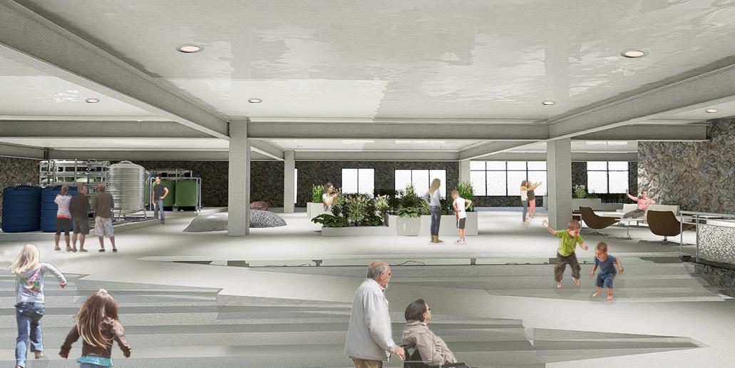
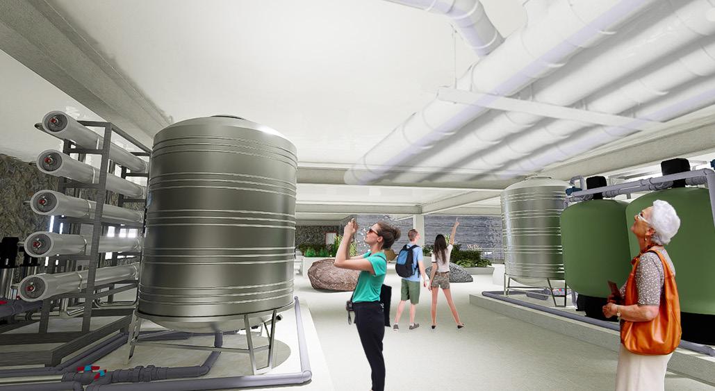
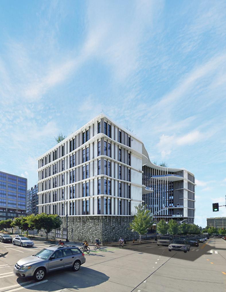
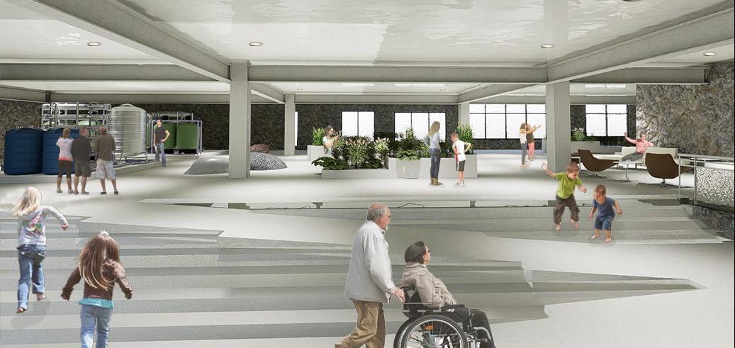
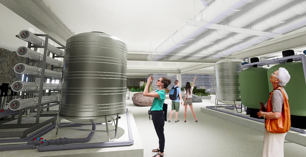
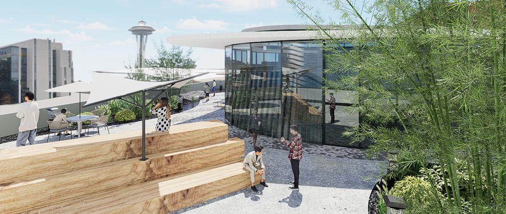
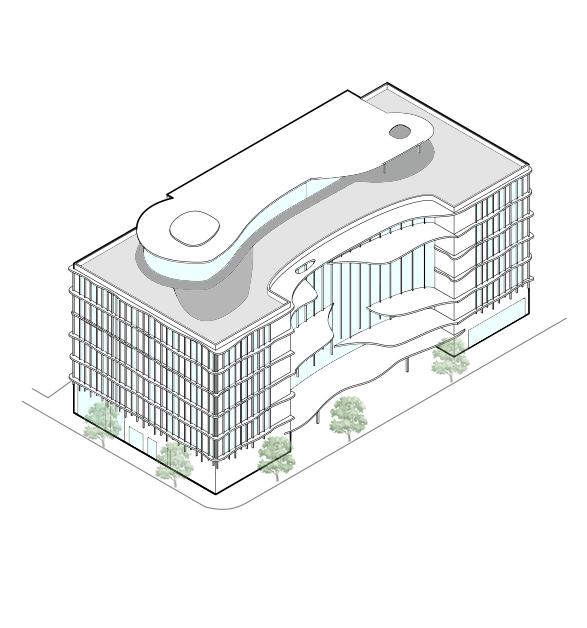
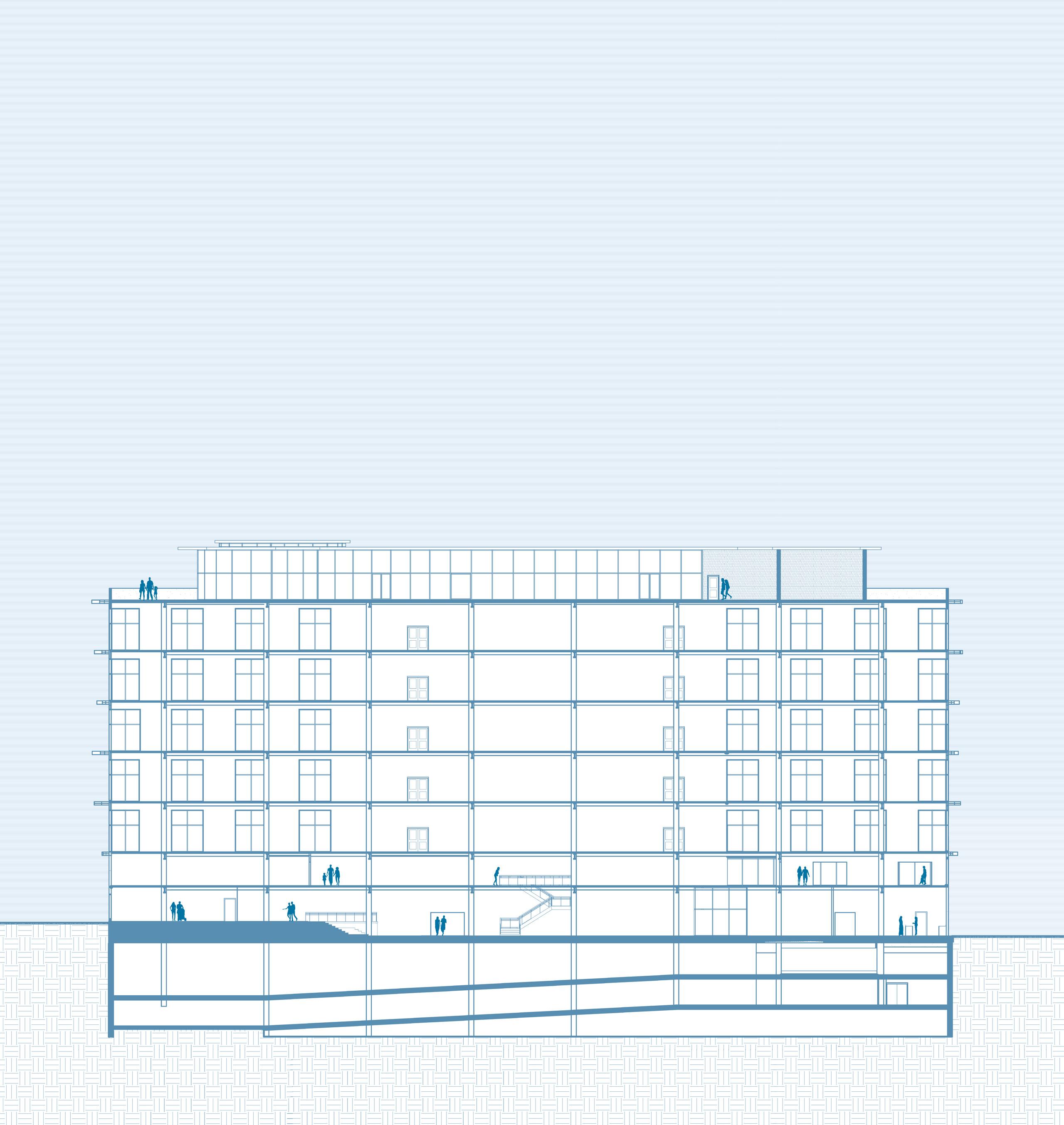
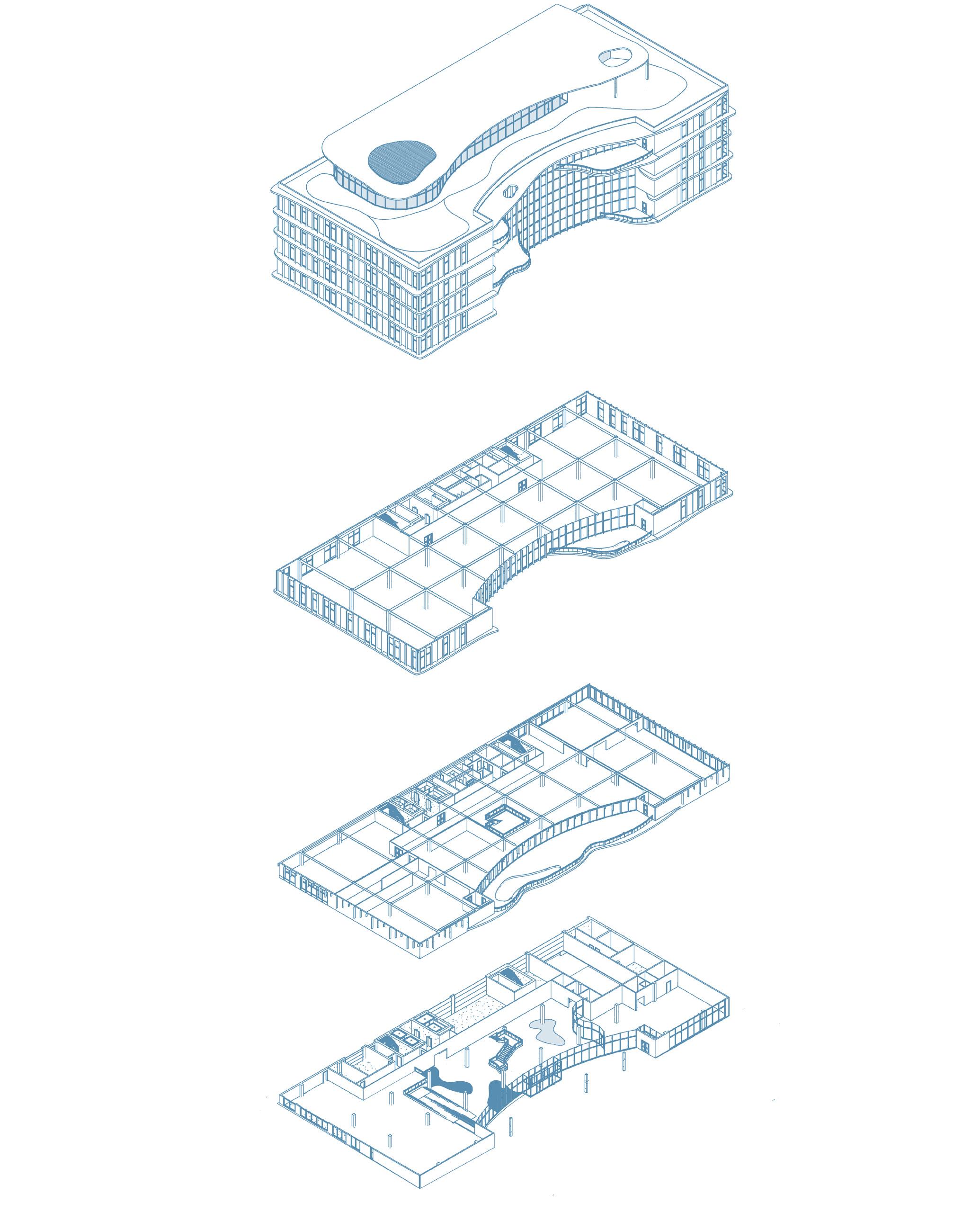
The Rainwater Education and Conservation Center is a multipurpose office building designed with a strong focus on water, both as a functional resource and as an educational element. The flexible office floors can adapt to the needs of different tenants, ensuring versatility. On the first floor, an art gallery showcases the building’s water collection system through interactive educational spaces on the second floor, allowing visitors to observe the filtration process via a visible water cistern. A publicly accessible café further connects the building with the community. Additionally, a rooftop café provides a unique gathering space with views of Seattle. Drainage points on the roof collect rainwater, which then flows through a natural filtration system before entering the cistern for storage. It is then purified using UV and chlorine disinfection before being distributed throughout the building, with the first and second floors dedicated to educating the public about the water purification process.
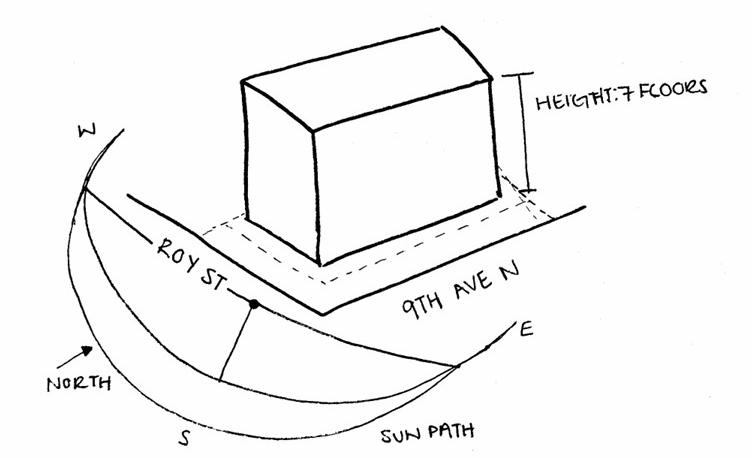
This project shows my understanding of how the design process starts with the conceptual phase and ends with the final product. There were limitations on what we could and couldn’t do with the code guidelines for where the building was taking place. Not only code but also the guidelines the professors gave us to follow, such as keeping the skin design of the building low-cost, using the Living Building Challenge to help guide the design of the building itself, and having a type of gallery in the first two floors for those in the community and surroundings to enjoy. A design challenge we had when designing was to create a unique shape that is not just a rectangle to let natural daylight into the building. It was important to have natural daylight in our building because it is an office building. People will spend most of their days in the office, and providing natural daylight to the spaces will help the health and happiness of people. With that, we carved a crescent-like part of the building on the east side to have natural daylight coming from the glass facade and the creation of balconies to create outdoor spaces for those in the building. The structure also supported vertical fins across the building, allowing for the flow of water and making use of our pre-designed water collection system. Our concept for the project is a gallery space based on water collection and what water can do within a building. The first and second floors of the structure support a water collection area, helping to distribute water throughout the structure and educate visitors on the importance of the reservation and collection of natural resources to not support the waste of resources. Overall, this project helps shape the understanding of the design and construction phase and how it will look in the real world and a better understanding of how architects and construction managers work together to reach a goal when there are limitations.
Applying the Living Building Challenge guidelines to shape the building’s design by selecting four out of the seven categories.
Crafting a beautiful and unique facade design.
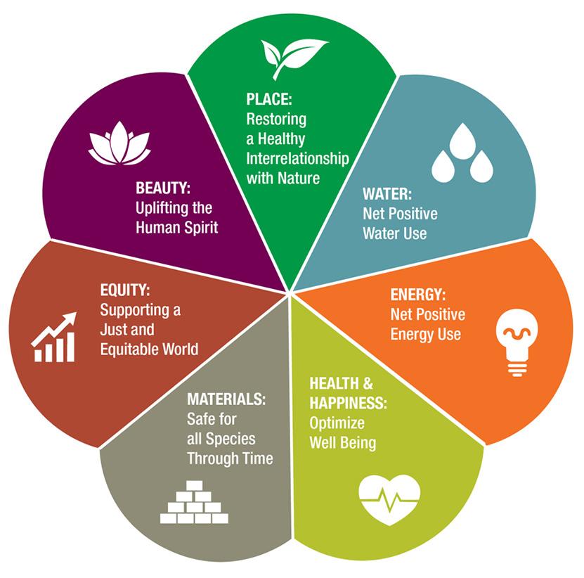
Using locally sourced natural materials for cost reduction and durability.
Implementing an efficient water reuse system.
Designing environments that promote physical and psychological well-being.
Building Guidelines
Sketch Iterations


Iteration 1
Cutting the building ends to create unique caps.


Iteration 2
Cutting the east side to create outdoor spaces and allow natural light in.

Iteration 3
Curving the east side for an interesting facade.


Iteration 4
Removing sections of the east side to create outdoor spaces and define circulation.


Iteration Concept 1
Combining iterations one and two creates spaces at both ends for sidewalk-building interactions and outdoor spaces in the middle for public use.
RFP Project Goals
Overhang Shaped by Water
Creation of Outdoor Space
Carving for Light & Health Fins Shaped by Water
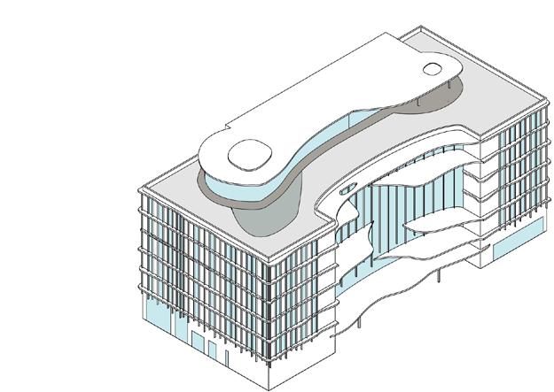
Activate Rooftop
PROGRAM
L1
• Education Space
• Water Tank Systems
• Cafe
• Lobby
• Lounge L2
• Collaboration Space
• Exhibition Space
• Screens
• Water Toys
• Water Tub
• Water in Environment
L3 - L7
• Typical Leasing Office Plan
Rooftop Level
• Cafe
• Outdoor Space
Lounge, cafe and water systems
Typical Leasing Office Plan
Education center and activities
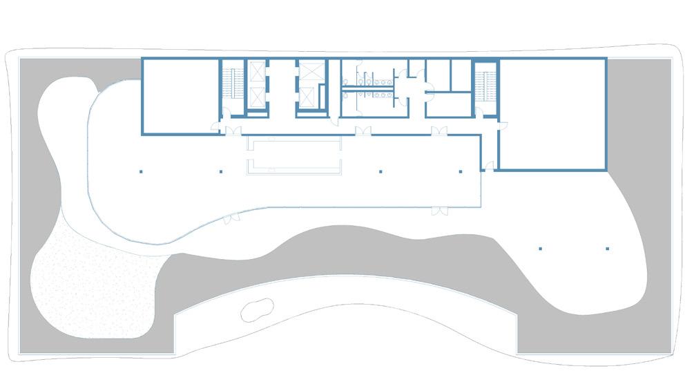
ROOFTOP
Restaurant and outdoor space
ECOLOGICAL KNOWLEDGE AND RESPONSIBILITY
ARCH 511
Team- Michaela Dixon
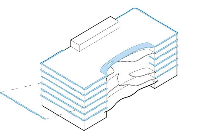
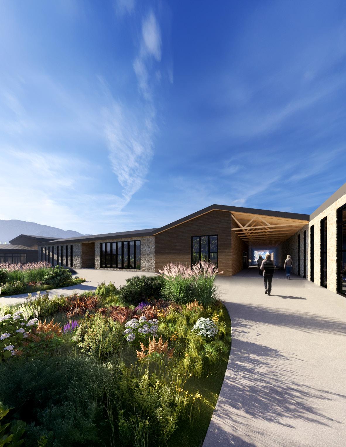
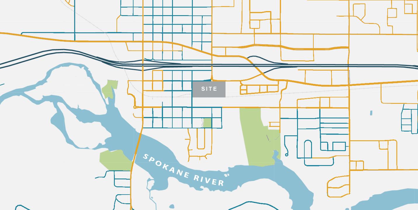
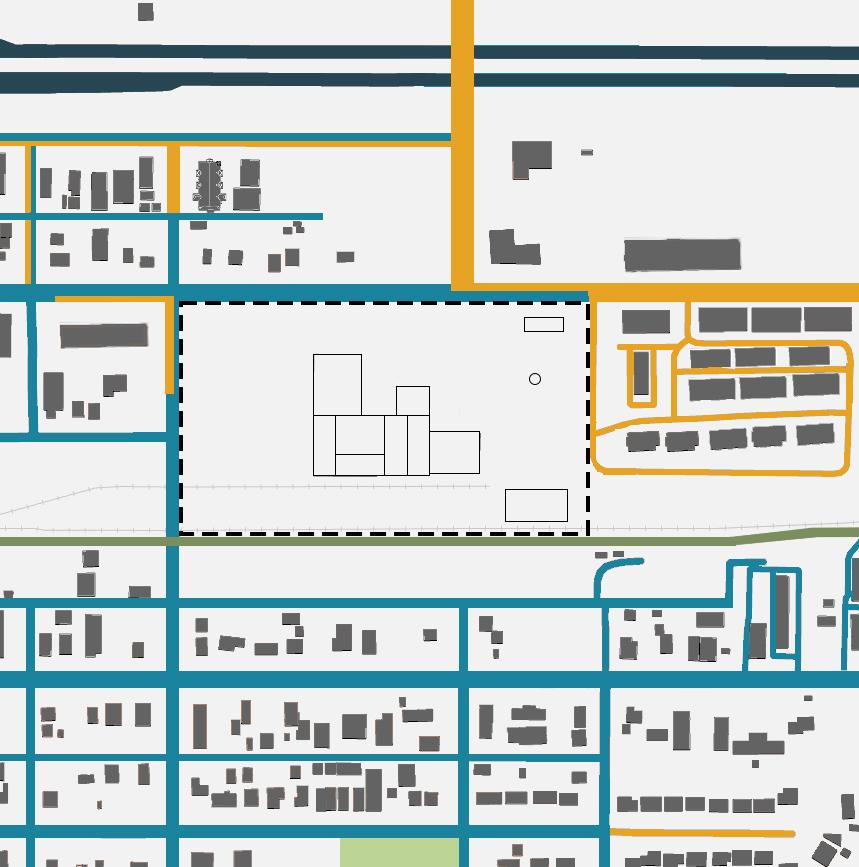
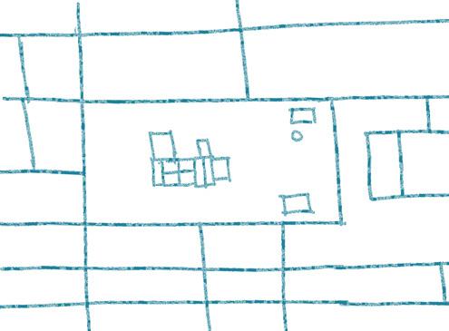
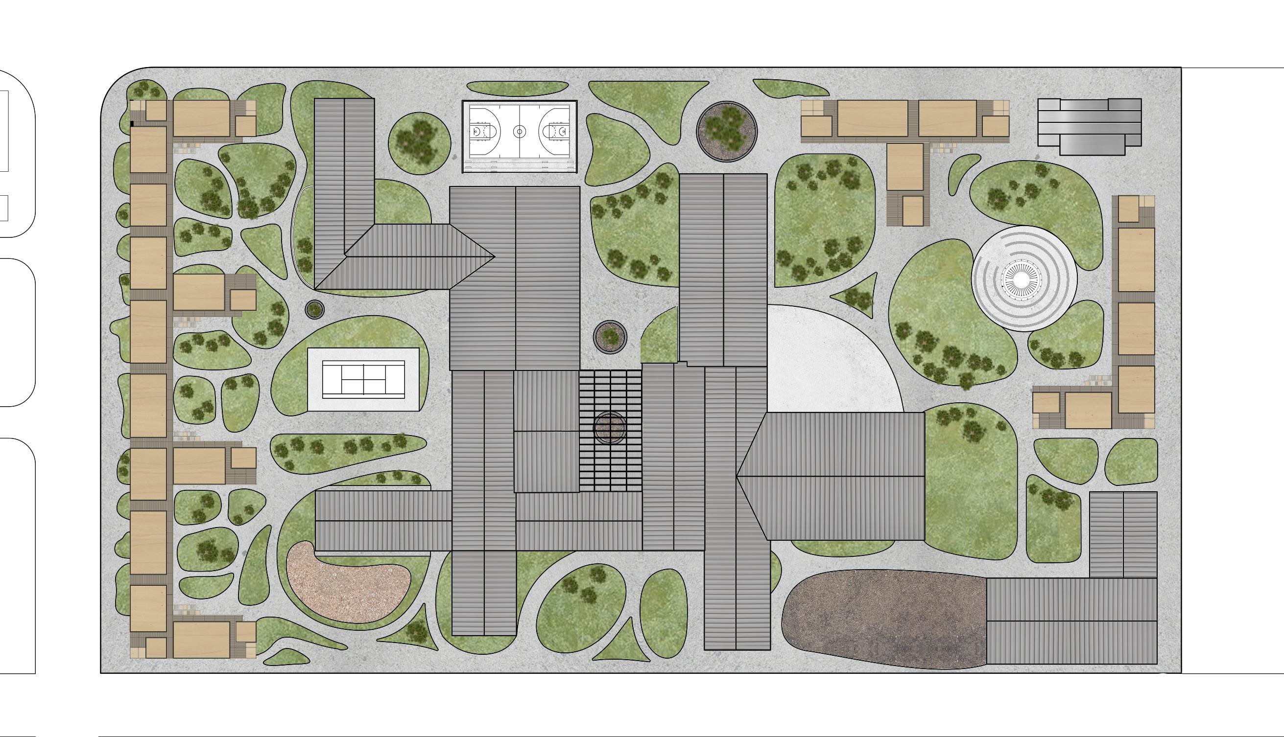
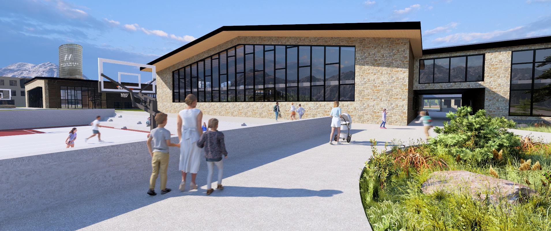
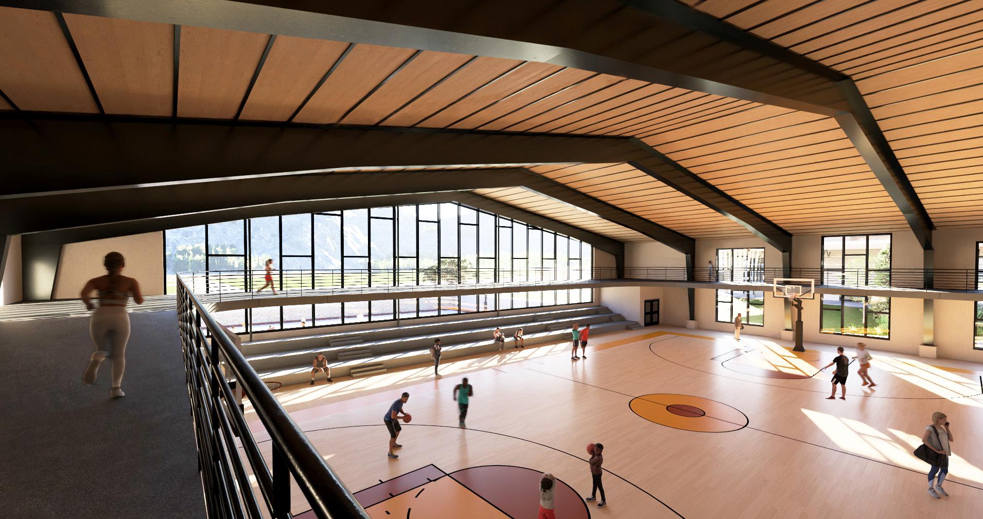
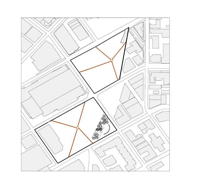
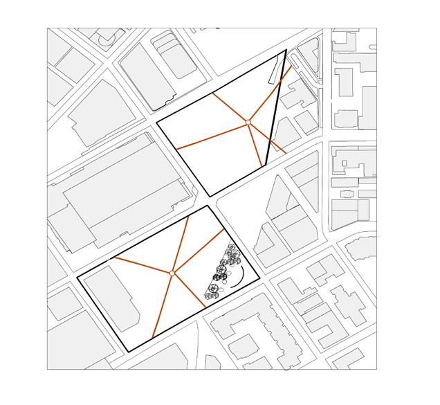
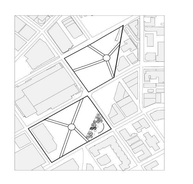
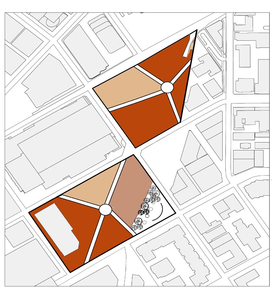
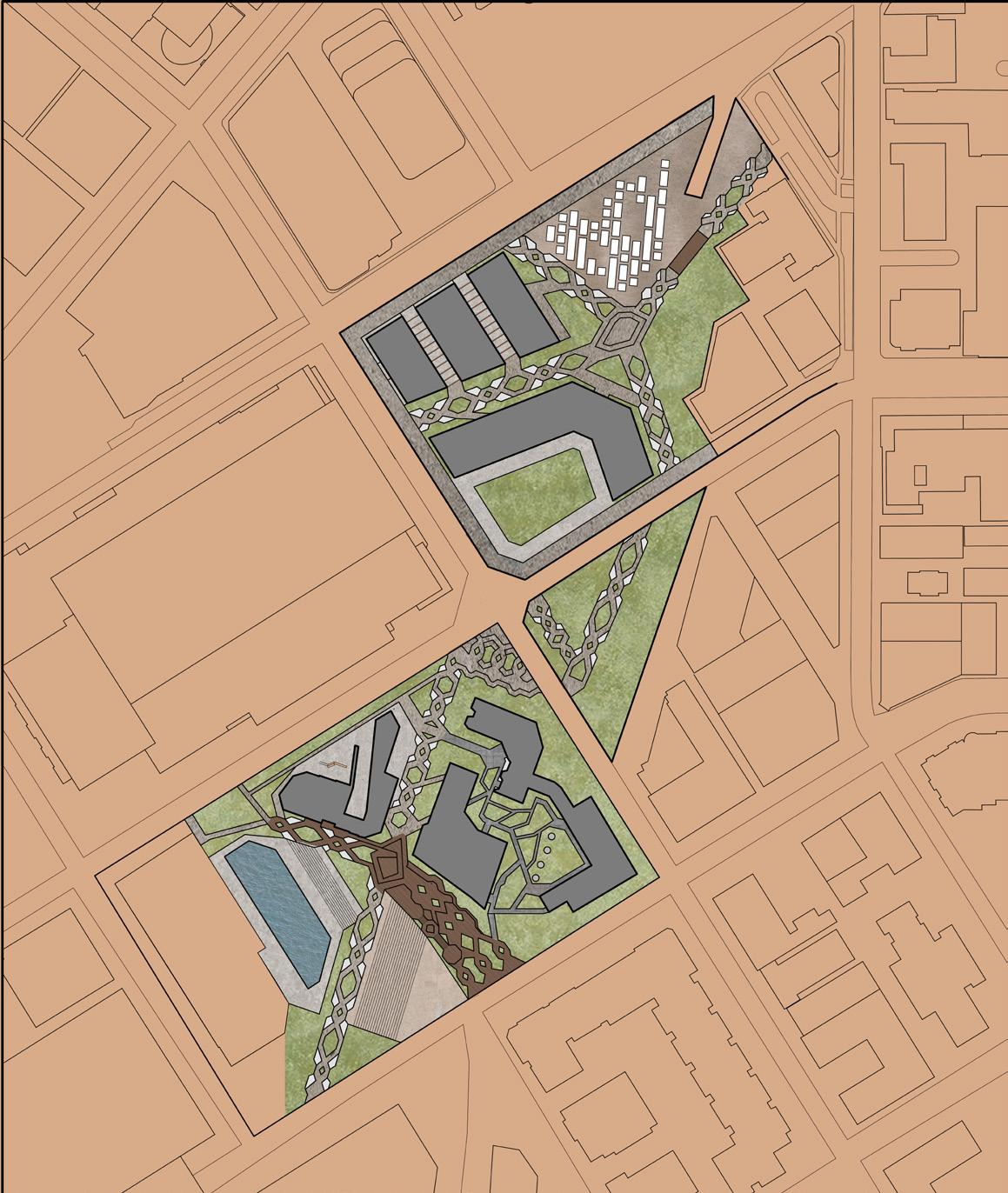
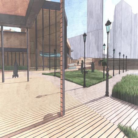
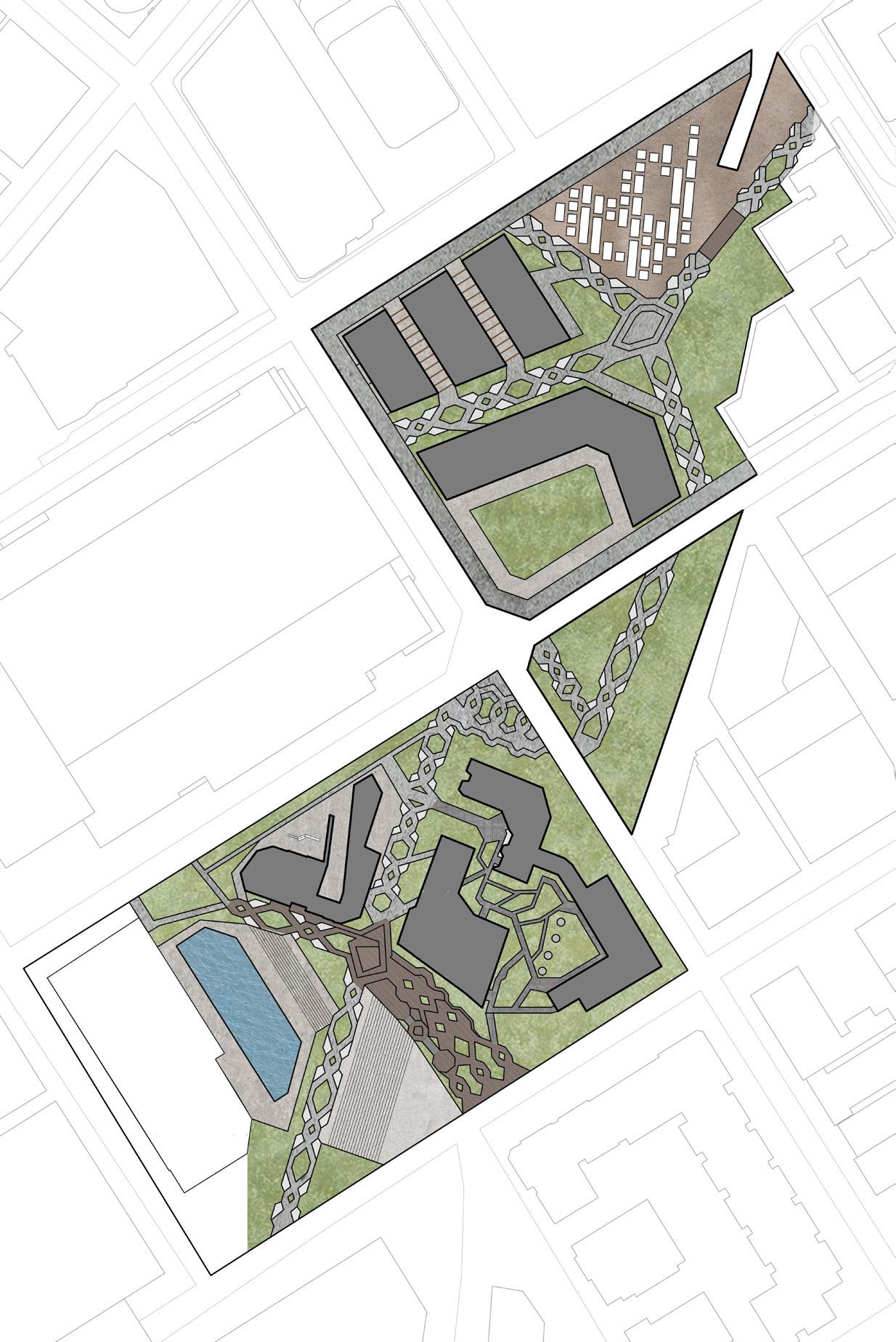
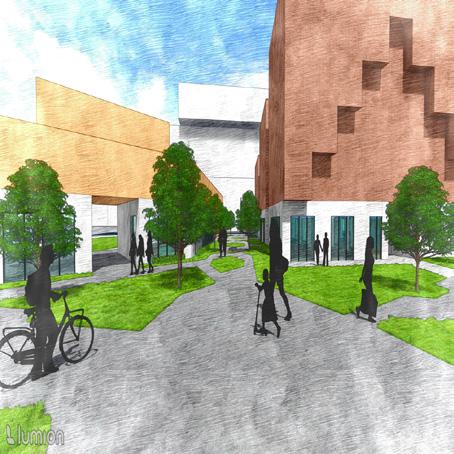
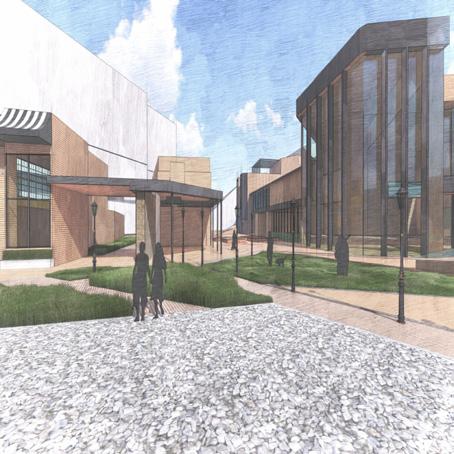
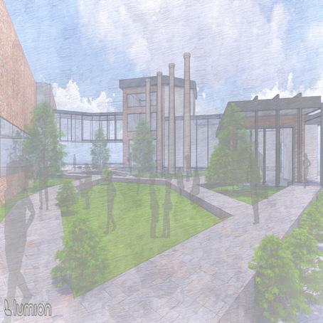
Millstone Center revitalizes the historic Idaho Veneer mill, transforming it into a much-needed community center. Currently, Post Falls lacks essential recreational facilities such as a gym, accessible gym equipment, and a community pool. The goal is to fill this gap by creating a flexible, welcoming space where residents can come together, exercise, and engage in various activities, fostering community growth and connection. In addition to recreational amenities, emphasis is placed on walkability and outdoor spaces. The design features walking paths that connect the residential area, outdoor spaces, and the community center, creating a cohesive and integrated experience. Recognizing the city’s rapid population growth, residential apartments have also been included as part of the design. This approach fosters a sense of unity and encourages interaction, making the space more than just a collection of facilities but a true hub for community engagement.
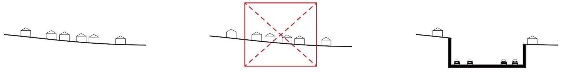
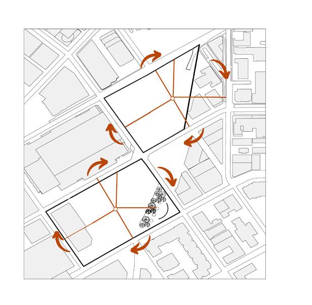
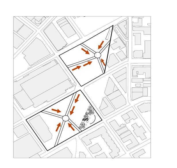
Post Falls is a growing city, which means that there is going to be land that is being used strictly to construct homes, apartment complexes, or commercial spaces with rigid guidelines on how to do it by code. When touring the site, realize that there aren’t sidewalks around the site itself, and if there were, they would be strictly straight sidewalk paths in grid form. With that in mind, breaking the grid-like paths and creating a more organic approach to sidewalks for people to enjoy when coming into the site. The project consists of apartments and mixed-use, but most importantly, a hub for the community to enjoy with the community, recreational, and aquatic centers. Creation of a hub for the community of Post Falls. The paths created are to foster walkability since there isn’t much that is going on in Post Falls due to the lack of sidewalks. These sidewalk paths are carefully planned to weave through green spaces, gardens, and recreational zones, offering residents an opportunity to experience the environment firsthand while encouraging physical activity and social engagement. The addition of local landscaping native to Post Falls to strengthen the local ecosystem to help promote the biodiversity in the area to protect the local wildlife. When it came to the creation of paths throughout the site, we looked into creating access going through the existing structure from the previous veneer mill. Wanting to keep the existing structure to be reused for the community hub was challenging because we had to plan out where exactly people going through the site would want to walk through to create a sense of shortcuts to get from one place to another and make it easy for them. Overall, this project highlights how architects can strategically master plans by considering both ecological factors and the adaptive reuse of existing structures, ensuring minimal disruption to the ecosystem.
Sun and Wind Paths
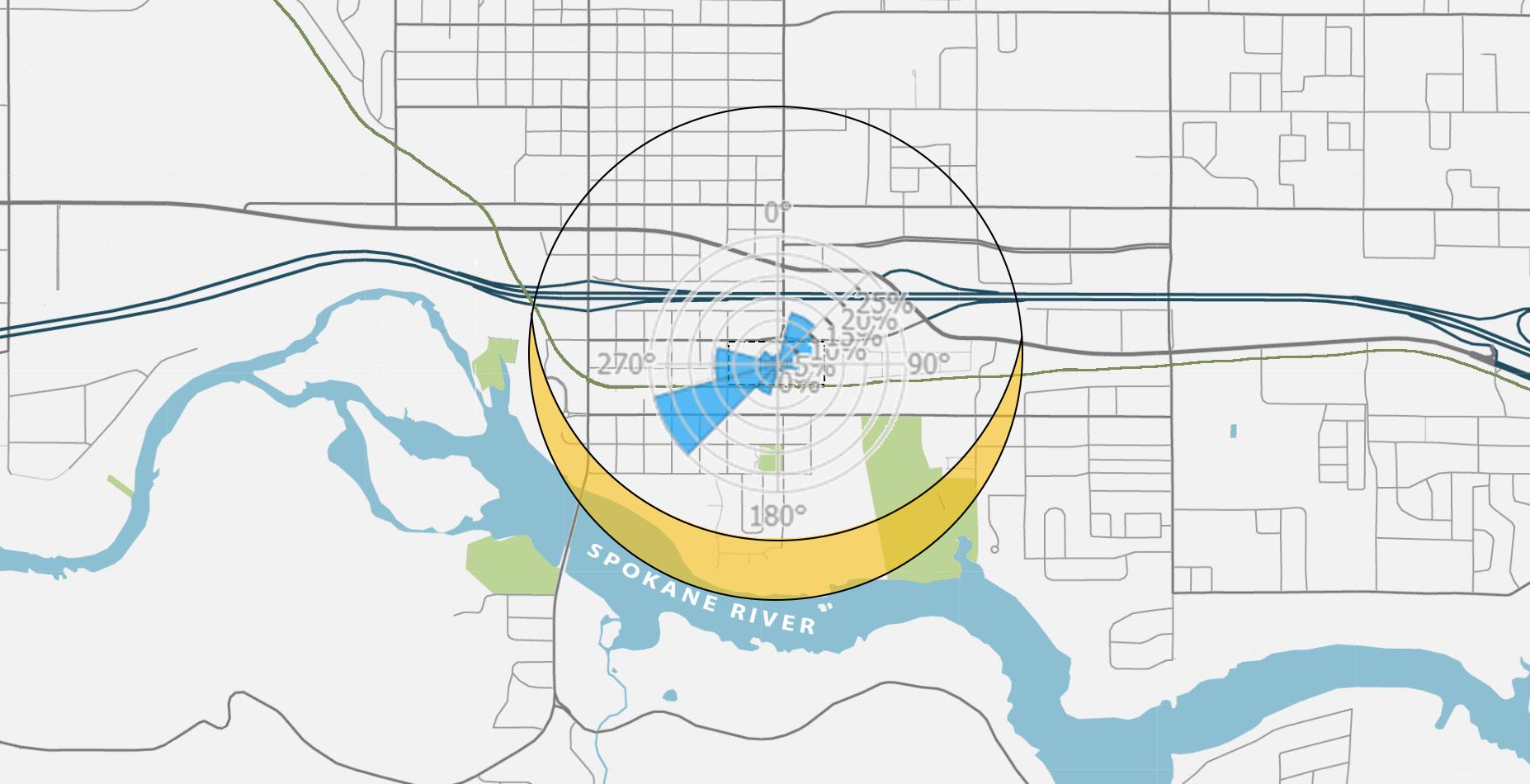
Walkability Map

No Sidewalks
Sidewalks
Centennial Trail
Walkable towns can significantly reduce carbon emissions, but Post Falls isn’t set up for that yet. In theory, residents could walk from place to place, but the town’s infrastructure makes it nearly impossible. Older neighborhoods lack sidewalks entirely, while newer developments include them, creating a patchwork that doesn’t support true walkability. Without consistent pedestrianfriendly planning, the city isn’t designed to encourage walking as a primary mode of transportation.
Proposing for Post Falls:
• The site will feature sidewalks that extend throughout the entire area.
• Integrate sidewalks with building structures.
Make interesting sidewalk patterns to encourage walking to increase foot traffic in the area.
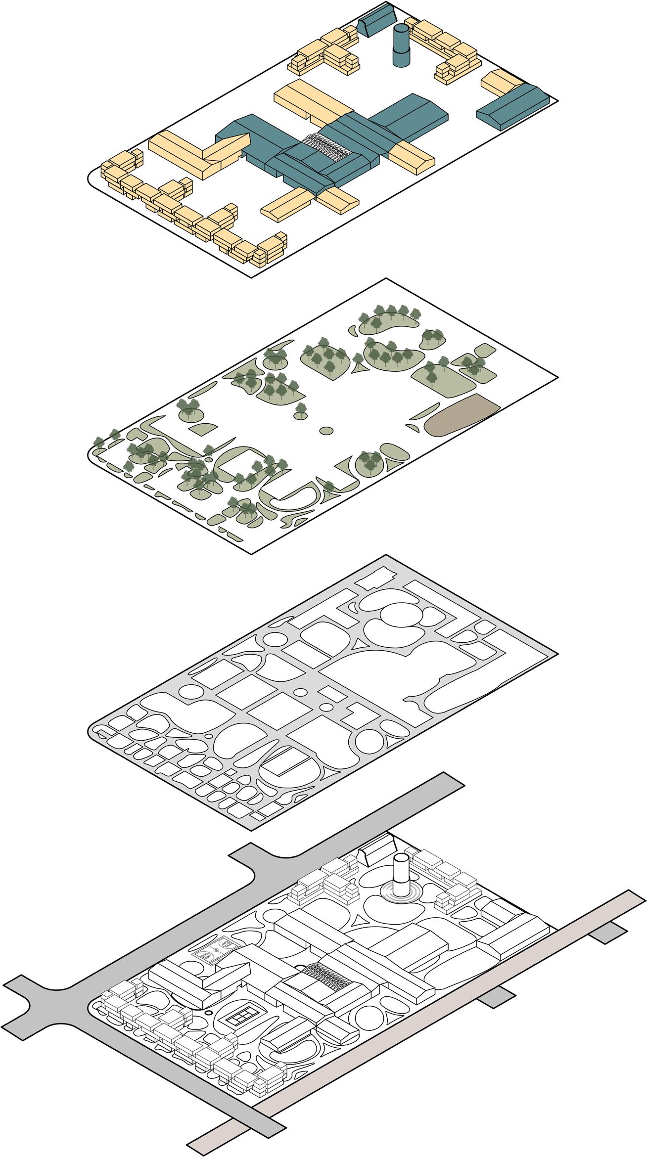
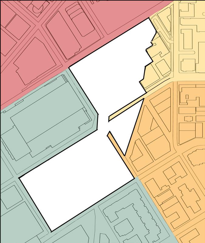
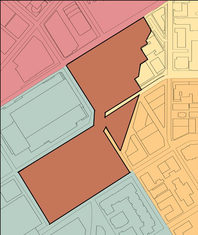
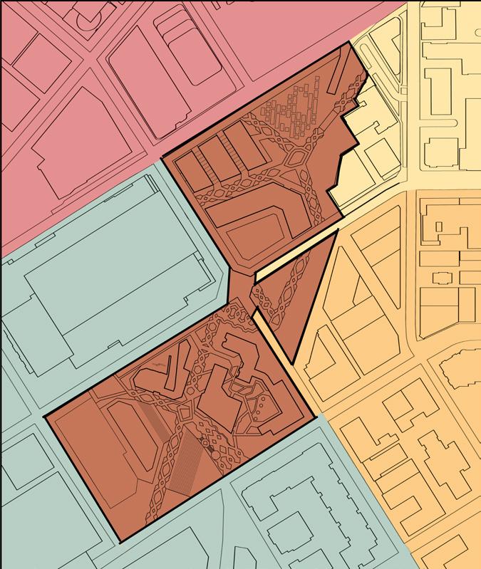
AGAINST THE GRID
Existing Site With Grid System
Grid Path Continue
Buildings
Existing Mill Structures
New Additions
Vegitation
Circulation Paths
Overall Site

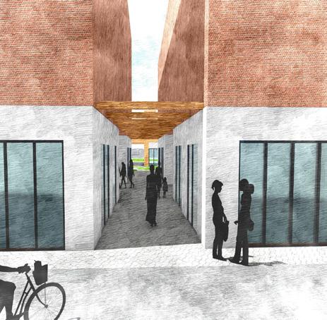
The focus was not only on outdoor circulation but also on how people navigate and access spaces within both existing structures and new buildings across the site. This includes designing intuitive pathways and entry points that enhance connectivity and create a seamless flow between indoor and outdoor environments.
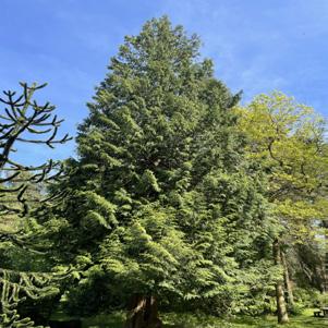
Western red cedar trees placed throughout to help CO2 emissions
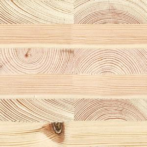
Use of CLT to reduce carbon footprint while it is a local material
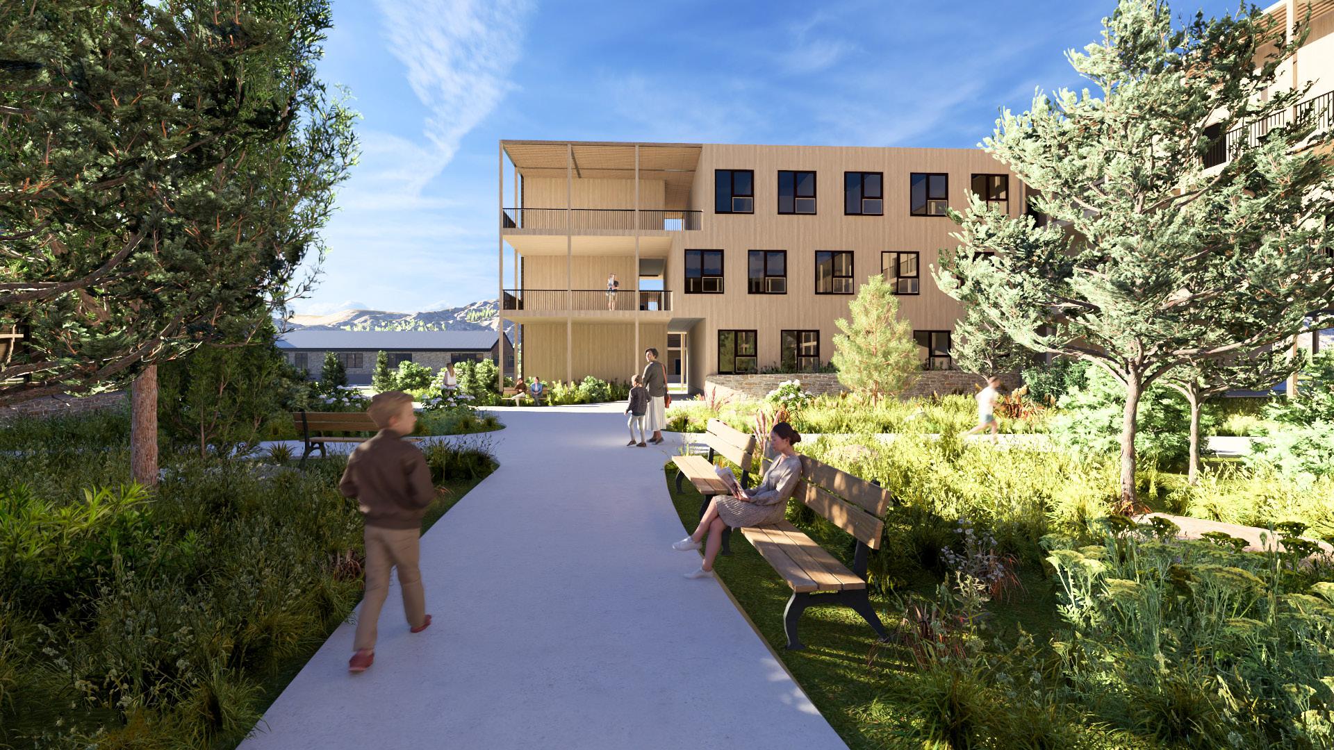
Human and environment interaction with walkable paths in an organic design
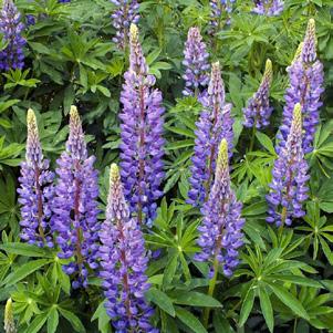
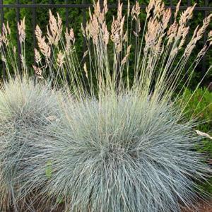
Local vegetation to improve CO2 emission
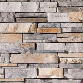

Locally sourced stone complements the landscape, providing durable, lowmaintenance weather resistance
Walkway opening for crossventilation for passive cooling
Human and environment interaction with walkable paths
Local vegetation to improve CO2 emission


Reuse existing building material from previous wood mill
Use of CLT to reduce carbon footprint while it is a local material

FABRICATION LAB COMMUNITY CENTER

OPEN OUTDOOR SPACE


HISTORY AND THEORY
ARCH 510
Team- Yuen Lei Lam & Sweta Waiba
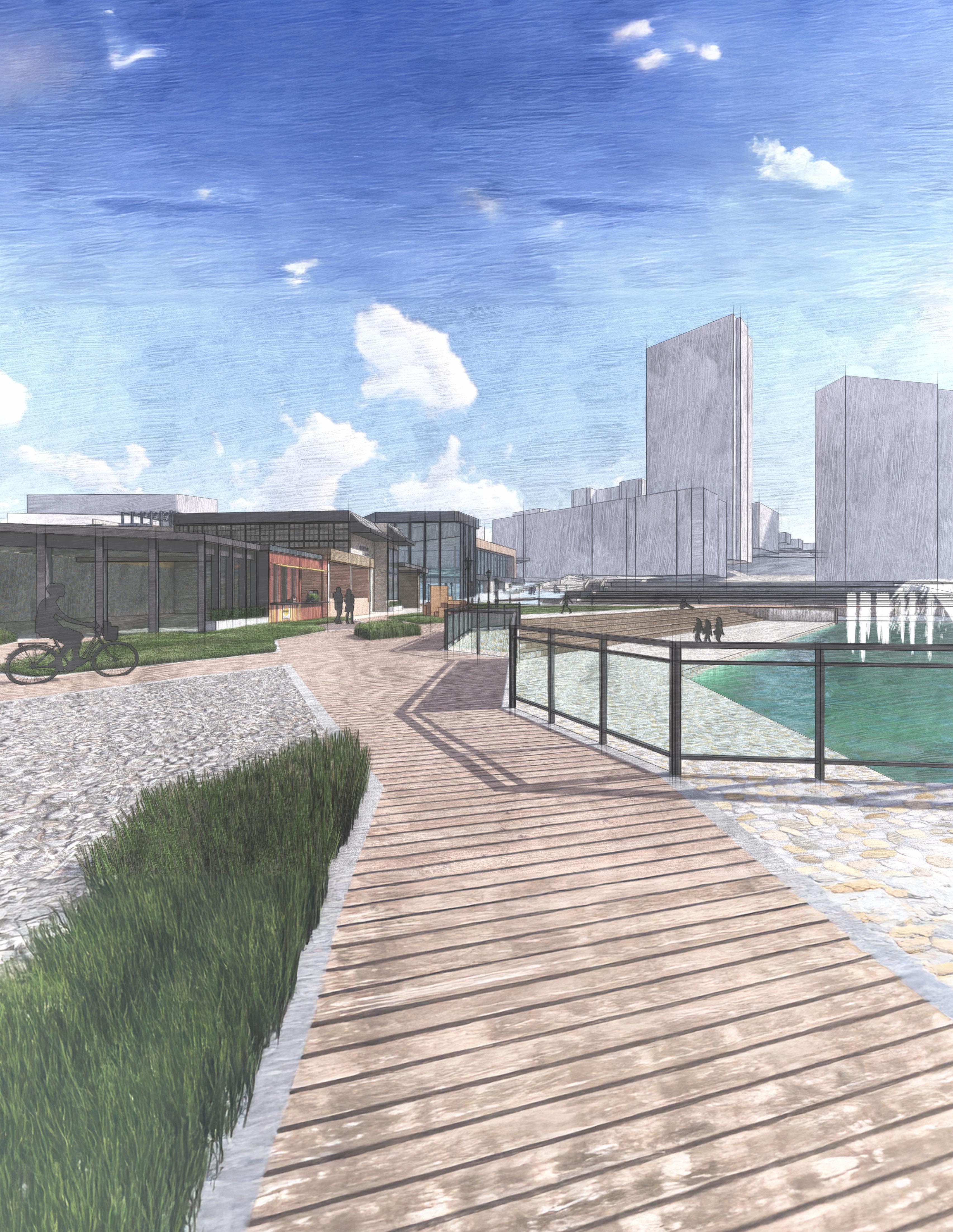
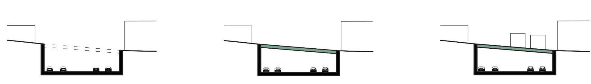
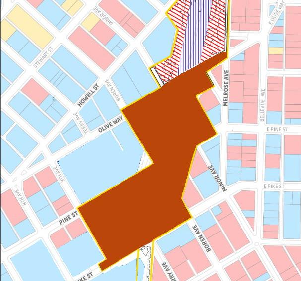
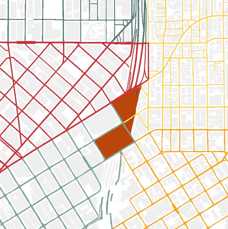
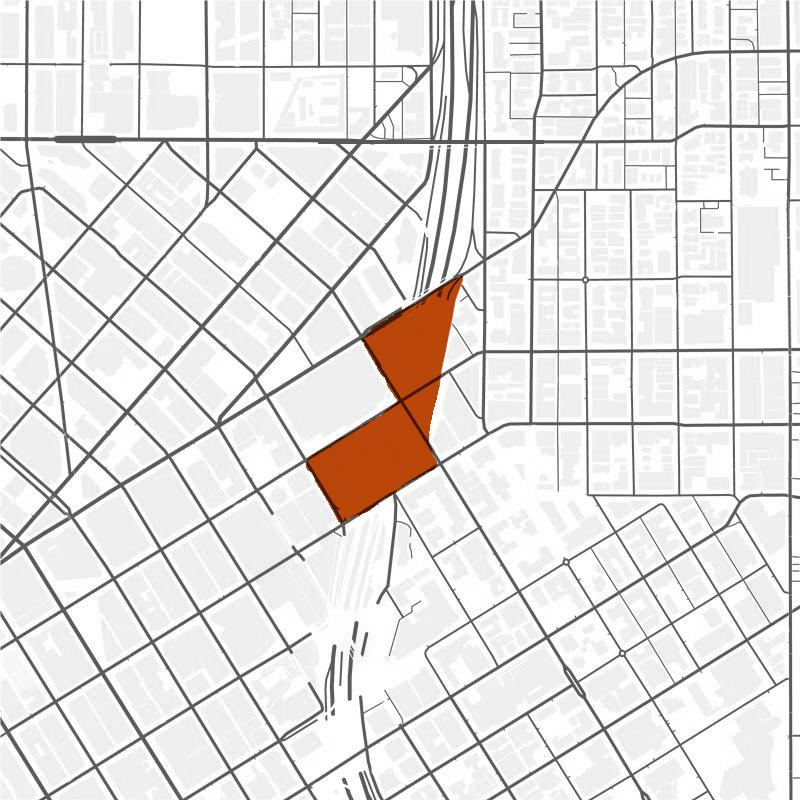
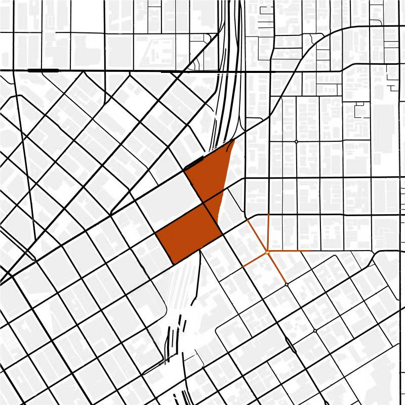
The I-5 Revival Lid challenges the structured grid system of Seattle and its division of neighborhoods within the area. This project addresses the needs of the area, such as affordable housing, community spaces such as a community center, and P-patch gardens, while stimulating economic growth with commercial spaces and food markets. The lid helps to curate an experience for the tourists within Seattle and helps them see what is beyond the intersection; there are neighborhoods with history and uniqueness beyond the highway and now the lid. The lid is a place to help support the surrounding neighborhoods but also connects them within the lid to create a gathering space for people to meet. Within the lid, we look to restore walkability, urban history, culture, and tourism for Seattle in spaces taken over by intersections.
This project critically examines the fractures within Seattle’s urban fabric, particularly how neighborhoods have been divided and what it truly means to reconnect them. Rather than simply claiming that bridging physical gaps will resolve social disconnection, the lid over I-5 is designed to test how architectural interventions can restore divided neighborhoods. By prioritizing walkability to access one neighborhood from another better and sharing public spaces for everyone, interaction among diverse communities in the neighborhoods can be fostered. Its success could address deeper social and historical divides caused by I-5 intervention. It aspires to create a more inclusive, connected, and vibrant Seattle.
Seattle, WA
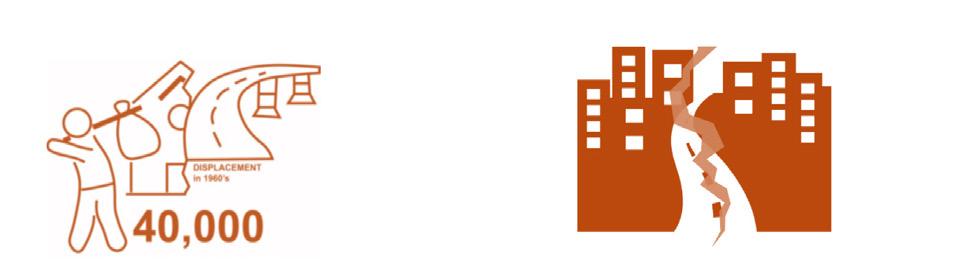
Before the 1960s in Seattle, the area where the intersection goes through was filled with land where residents of Seattle lived. After Intersection 5 was approved, that changed; residents and retail businesses of the area were removed from their respective areas, forcing them to move elsewhere in the city. What was left were bridges connecting neighborhoods above the busy intersection. Connections to neighborhoods left the community heartbroken, mostly in the First Hill and Capitol Hill neighborhoods, which were connected to the heart of downtown Seattle. In theory, this project will help reduce urban fragmentation by bridging physical and social divides, promote sustainable mobility by prioritizing walkability in the area, and enhance social interaction by strengthening shared spaces that bring diverse communities together. By reclaiming urban land, it aspires to create a more inclusive, connected, and vibrant Seattle.
Prior to 1960
Evicting residents for a Seattle highway I-5 cutting through Seattle neighborhoods
Neighborhood separation, limiting interactions
Highway lid uniting neighborhoods
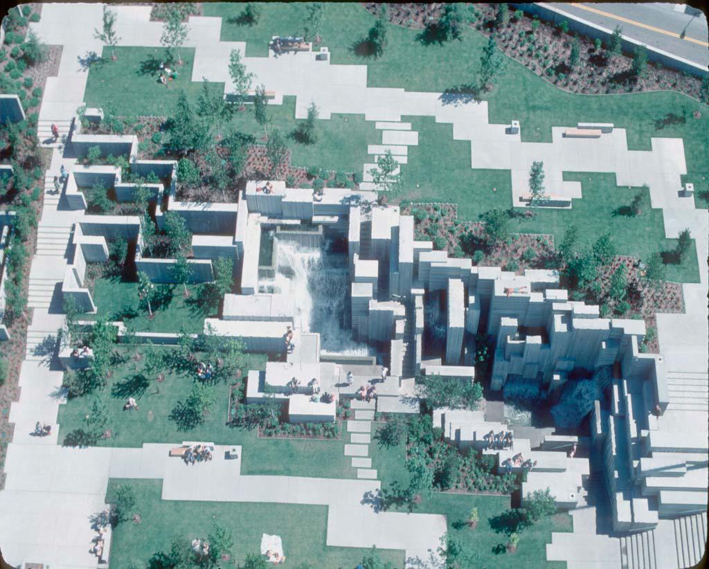
Freeway Park is not an actual park situated on land but more so on top of Intercession 5; it is a lid. It is the only lid that Seattle has currently, and in the future, the city wants to expand lid projects throughout the intersection to bring connections back to Seattle among neighborhoods. Reclaiming the space that was tragically taken away from the intercept to become community space. Freeway Park helps reconnect the communities that were ripped apart; the lid helps create this beautiful landscape for the community and tourists to use. Bring in green space to the busy, up-andcoming city to bring people into the space. Freeway Parks have different gathering spaces, fountains, plaza spaces, and different paths to get from one place to another in the city with its brutal architecture. It is a historical landmark that brings together the community.
Sources
Lid integrating green space and buildings
“Freeway Park.” Arch Journey, archjourney.org/projects/freeway-park/. Accessed 2 Mar. 2025. Joyce, Mariah. “Celebrating 40 Years of Seattle’s First I-5 Lid: Happy Birthday, Freeway Park.” CHS Capitol Hill Seattle News, 11 July 2016, www. capitolhillseattle.com/2016/06/celebrating-40-years-of-seattles-first-i-5-lid-happy-birthday-freeway-park/. Accessed 2 Mar. 2025. Seattle I-5 History, June 2016, lidi5.org/wp-content/uploads/2016/06/seattle-i-5-history.pdf. Accessed 2 Mar. 2025. Webb, Alice. “Freeway Park, Seattle.” Land Perspectives, 1 Feb. 2018, landperspectives.com/2018/02/01/freeway-park-seattle/. Accessed 2 Mar. 2025.
The lid is situated at the heart of the intersection, bridging five major neighborhoods known for their impactful community programs. However, the construction of I-5 disrupted their cultural and social ties, creating a disconnect between them. As a result, these neighborhoods function independently rather than as a cohesive, interconnected community as they once did.
Downtown Retail Core:
• Densest area of Seattle
• Unlimited height zoning in some areas
• Predominantly office buildings
• Single buildings can occupy a full block
Denny Triangle:
• Dense employment centers
• Mid-rise, larger footprint buildings
• Underwent remarkable transformation from low-density to tech hub
First Hill:
• Zoning allows high-rise development
• Rapidly growing neighborhood
• Dense residential uses
• Important institutional uses: hospitals, higher education, religious institutions
Capitol Hill:
• Smaller lots and lower heights
• Mixed-use with residential population
• Hub of small businesses, restaurants, bars, art, and music
• Home to LGBTQIA+ communities and culture


Analyzing the site’s surroundings, it is easy to see that there are social aspects that are missing and that the community needs. Rather than remaining divided, connecting the neighborhoods through shared spaces will foster interaction and community engagement. The lid will help create a more unique Seattle, to go beyond the historically established neighborhoods into how they were when they were connected before. Reclaim the city’s cultural spaces to create an expansion to strengthen the connection. The lid will be fundamental when it comes to incorporating housing solutions due to the lack of housing in the city, additionally bringing in local income with newly developed commercial spaces for the community members and tourists.
Displacements
Disrupt Community Connectivity

Social & Economic Fragmentation

Increase Traffic Environment & Health Noise & Air Pollution
Restoring Community Connection Between Neighborhoods
Creation of Lid to Reduce Issues
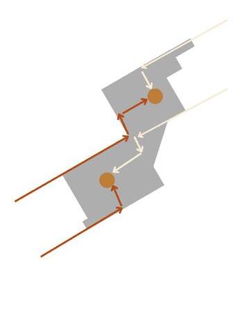
A goal for the lid is to create union within, to not continue with the established grid system of the city. Not continuing the grid to the lid helps prevent the separation of spaces between all the neighborhoods to prevent history from repeating itself with the separation of neighborhoods.
Looking at the overall grid of Seattle
Selection of an interesting grid pattern that doesn’t follow a natural rigid grid
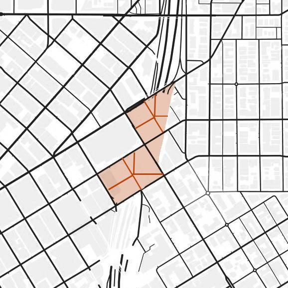
Breaking the grid to create spaces where it can be broken down for cultural, social, and economic reasons to better the environment. The grid division is like the division of neighborhoods, but instead of creating a boundary, it is more for the unity of it.
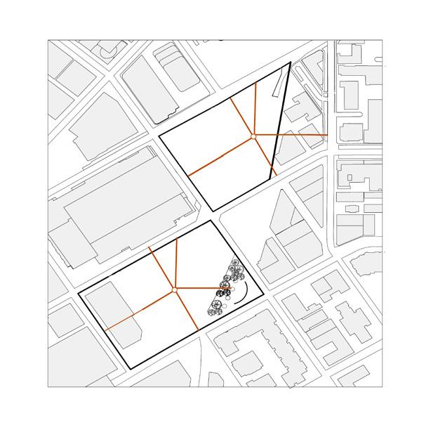
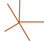
01. Starting Grid Pattern on Lids 02. Rotating Lid Pattern 03. Final Rotating Lid Pattern 04. Removal of Leg for More Room 05. Creation of Pathways to the Center of Lid 06. Final Lid Footprint
Final Lid Pattern for Program
The community’s economy would increase because previously there were no economic factors. With commercial, affordable housing for those in need, in addition to the continuation of the farmers’ market, the economy of the area will grow.
With the addition of outdoor and community centers, there would be more foot traffic in the area. Providing the needs of the community in the rapidly growing city. Helping increases social interaction between those living in the established neighborhoods around the lid.
Traditions previously celebrated will have another home to be able to expand. In addition to creating new traditions within the lids to celebrate the union of neighborhoods through the lid.
The introduction of I-5 disrupted neighborhood connections, creating a void between them.
Reconnecting neighborhoods by building a lid over I-5, bringing the community together into a unified space.
Each neighborhood has its own identity, but the lid unites them through program and landscape to restore connections.
Neighborhoods once divided by I-5 are now reconnecting, coming together as one. The lid design fosters stronger social and cultural interactions, allowing seamless engagement among residents. Its thoughtful landscape design encourages people to gather at the heart of both lids, creating new connections.
Both lids offer a variety of programs catering to both locals and tourists, providing a vibrant space that contributes to Seattle’s growth by utilizing previously unused land. This additional space fosters community events, outdoor markets, recreational areas, and cultural activities, enriching the urban experience. By re-purposing the area over I-5, the lids not only bridge the gap between neighborhoods but also create a dynamic hub for innovation, fostering a sense of shared identity and belonging among residents and visitors alike.
Commercial Center & Apartments
LID 1
• Tourist District Cultural Center
• Performance Art Center
• Outdoor Amphitheater
• Food Market
• Water Feature

Food Market
Mixed Use & Community Center
LID 2
• Community P-Patch Garden
• Commercial Center
• Community Center
• Apartments
Cultural Center
TECHNICAL KNOWLEDGE AND BUILDING INTEGRATION ARCH 403
Team- Brenda Mora, Ethan Baum & Mason Burns
The Rainwater Education and Conservation Center is a multipurpose office building designed with a strong focus on water, both as a functional resource and as an educational element. The flexible office floors can adapt to the needs of different tenants, ensuring versatility. On the first floor, an art gallery showcases the building’s water collection system through interactive educational spaces on the second floor, allowing visitors to observe the filtration process via a visible water cistern. Challenges faced when developing a design are how the skin facade cost can be low while using materials and how water can influence the choice of materials.
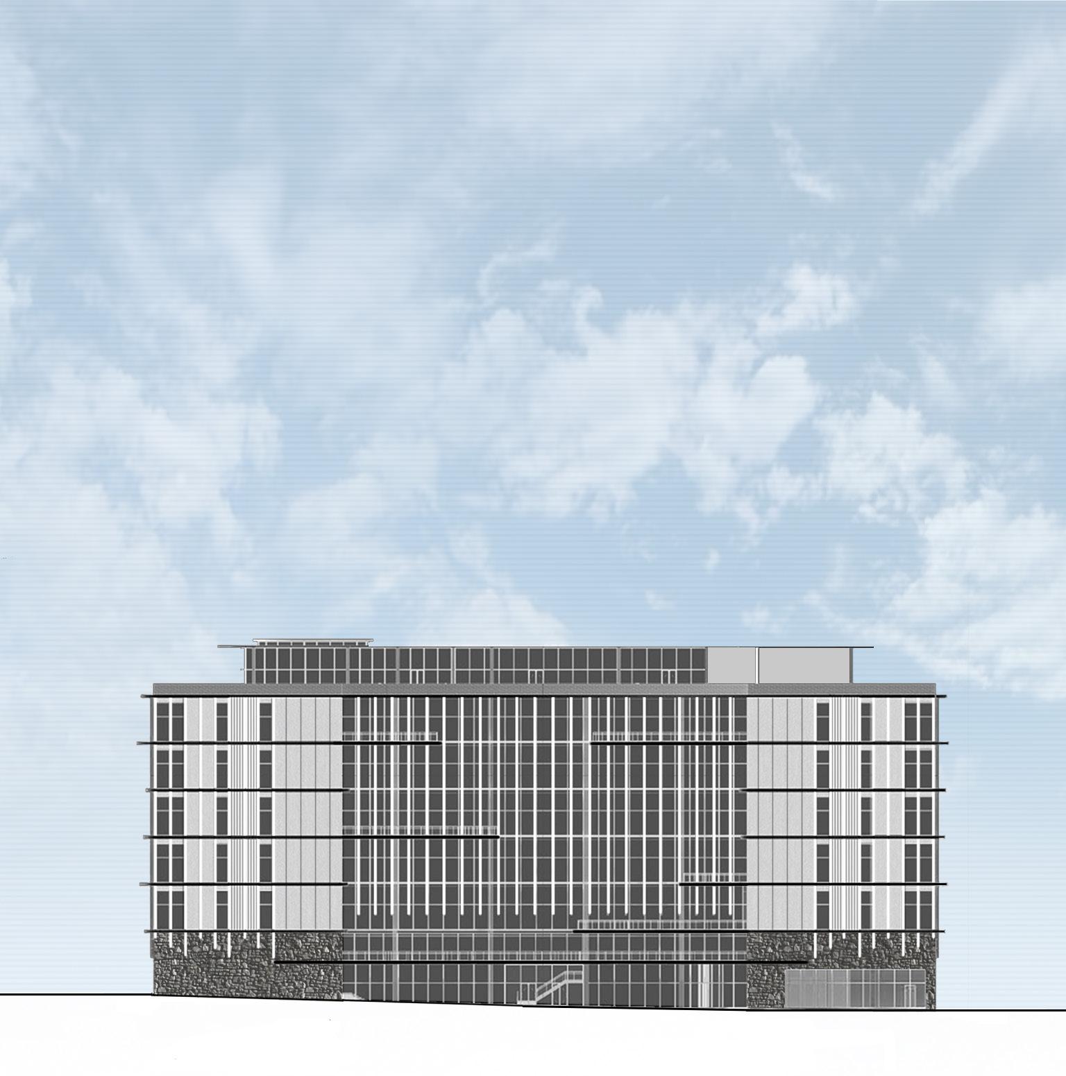
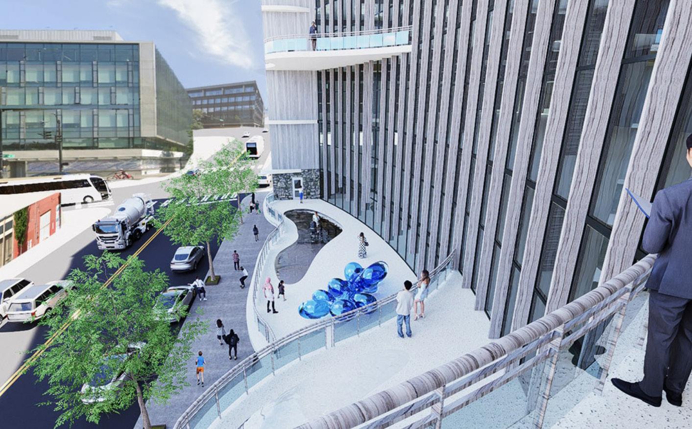
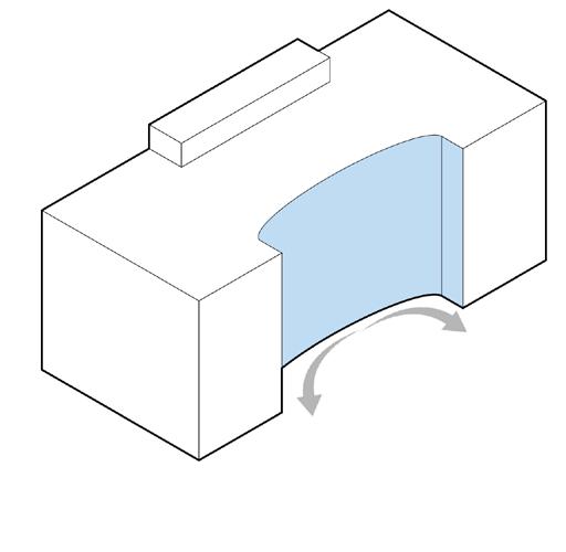
Keeping the skin design of the building low-cost, using the Living Building Challenge to help guide the design of the building itself. Not only low-cost but also designed with a unique building shape that lets in natural daylight with the right amount of glazing. Natural daylight is important since five of the floors are office spaces. People will spend most of their days in the office, and providing natural daylight to the spaces will help people’s health and happiness. With that, we carved a crescent-like part of the building on the east side to have natural daylight coming from the glass facade and the creation of balconies to create outdoor spaces for those in the building.
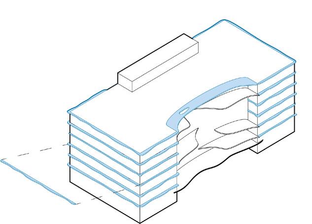
The structure also supported vertical fins across the building, allowing for water flow with the philosophy of “If it doesn’t move by water, it is shaped by water.” Make sure that the materials align with the motive of water due to the goal of collecting water to be reused again in the building with the pre-designed water collection system. Our concept for the project is a gallery space based on water collection and what water can do within a building. The first two floors of the structure support a water collection area, helping to distribute water throughout the structure and educate visitors.
Sketch Iterations of Building Shape
Iteration 1
Cutting the building ends to create unique caps.
Iteration 2
Cutting the east side to create outdoor spaces and allow natural light in.
Iteration 3
Curving the east side for an interesting facade.
Iteration 4
Removing sections of the east side to create outdoor spaces and define circulation.
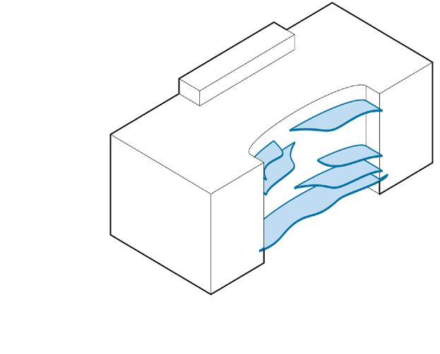
The goal is to shape the facade to optimize natural light and thermal comfort using natural resources, and understand how the glazing and curtain walls affect daylight entry.
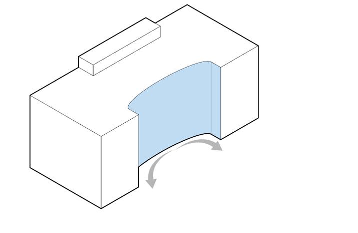
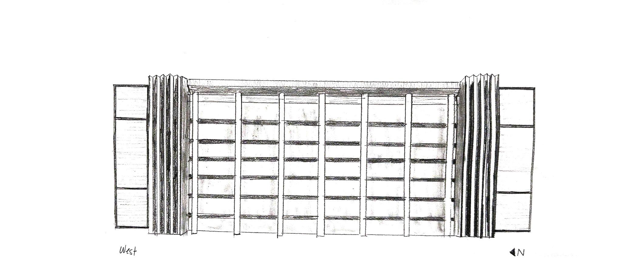
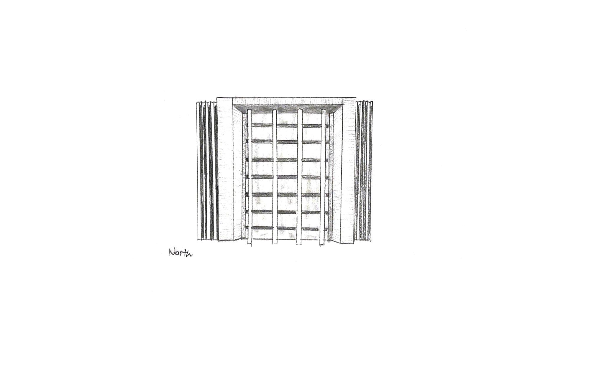
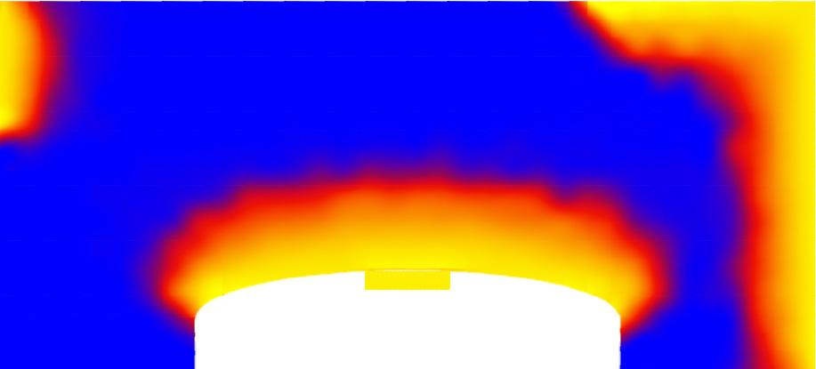
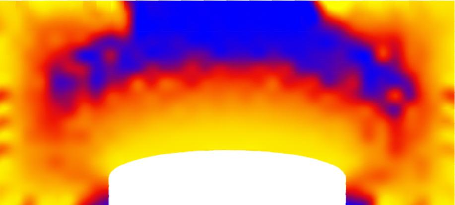
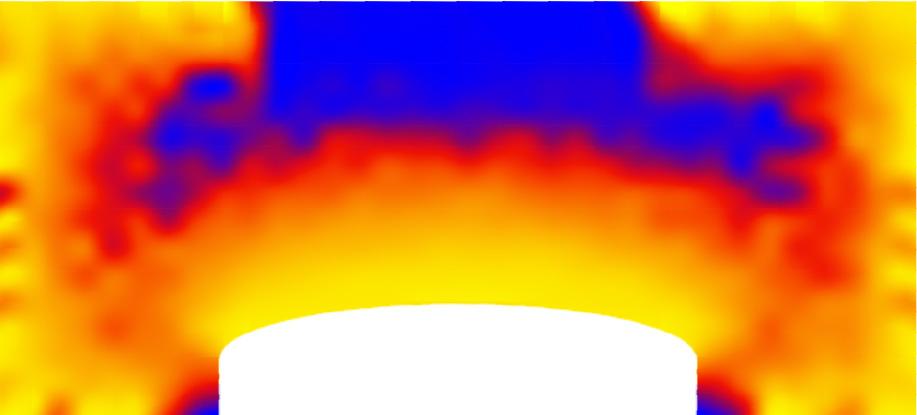
Carving for Light to Enter Through the East Facade
Creation of Overhangs to Block Sunlight
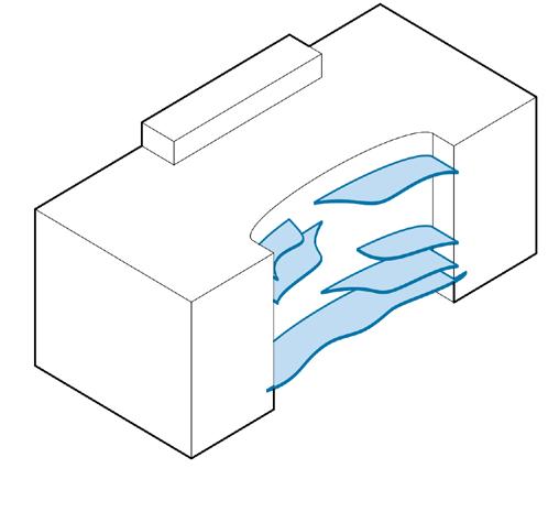
Creation of Balconies to Help Block Out Sun from Entering East Curtain Wall
Integrating Fins to Blockout Sunlight
Final Building Massing with Glazing in Context
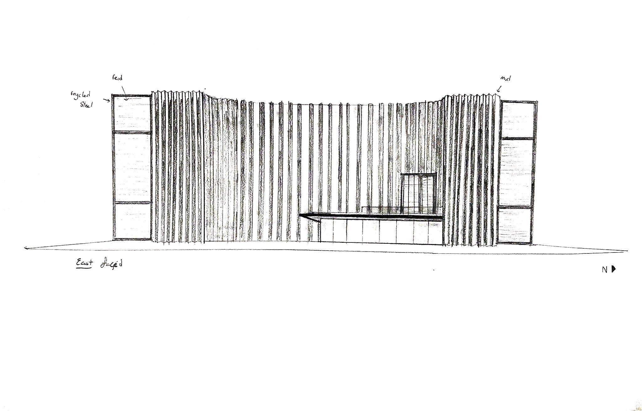
The selection of the facade material was guided by the principle: “If it doesn’t move by water, it is shaped by water.” This philosophy extends to the overall design approach, which centers on the collection and reuse of water within the building. The choice of materials plays a crucial role in shaping this concept, not only by responding to water but also by enhancing the building’s functionality and aesthetics
Aluminum Panel Cladding Shaped by water
A cost-effective, durable, lowmaintenance facade made from recycled materials, ensuring longevity and sustainability.
Fluted Aluminum Panel Cladding Shaped by water
Fluted aluminum panels enhance the building’s aesthetic, reflecting water’s fluidity and supporting the water flow and reuse concept.
Aluminum Fin Shaped by water
A versatile shading device that reduces daylight, with adaptable vertical lengths creating a dynamic facade that mimics water movement and enhances shading and daylight control.
Recycled Road Concrete Basic building material
The design uses repurposed site materials, minimizing costs, enhancing sustainability, and maintaining a strong environmental connection.
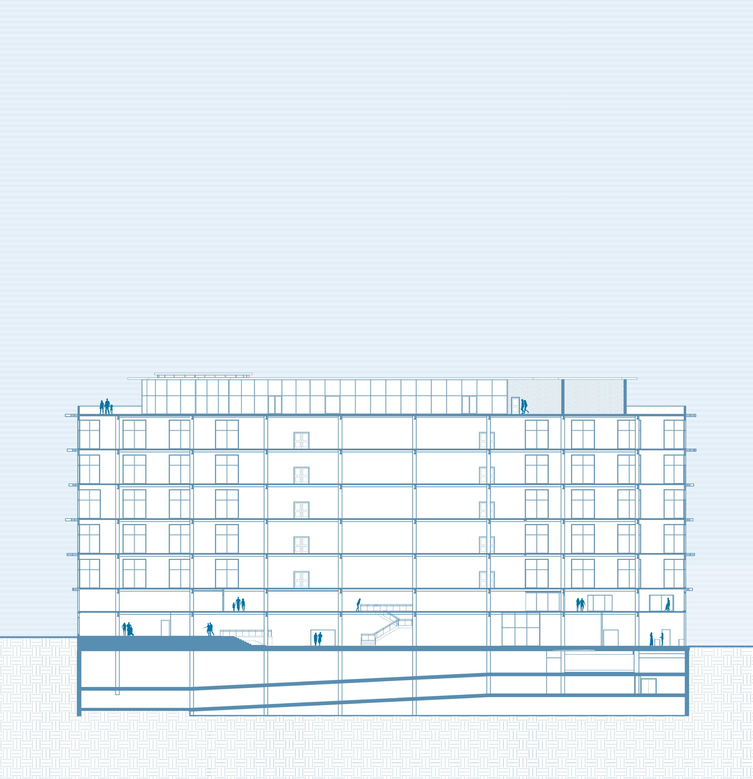
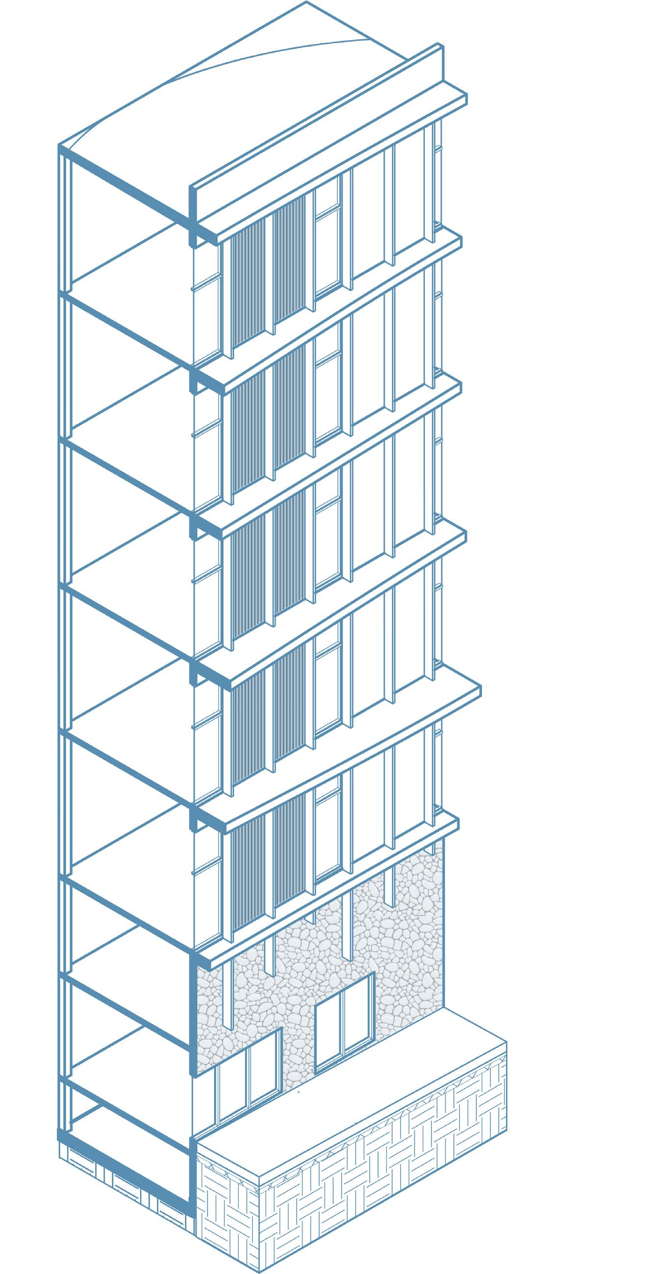
Structural System Axonometric
Structural System Top View

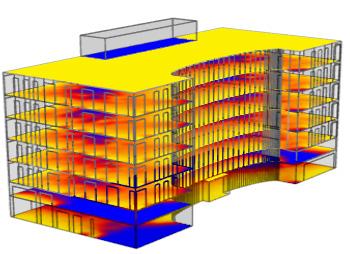
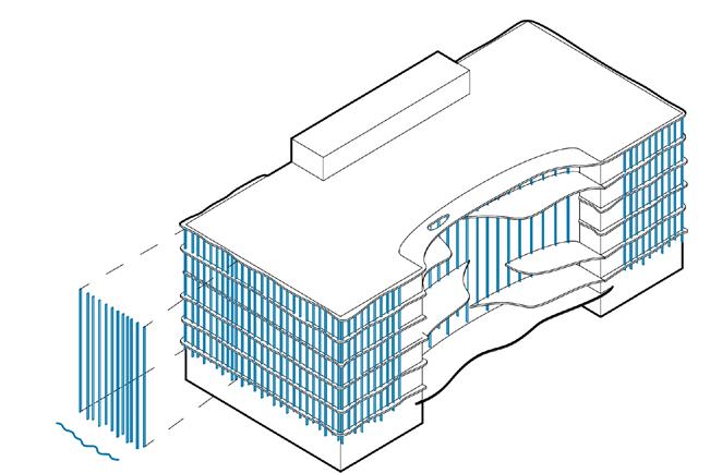
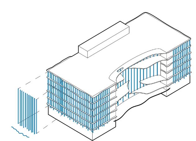
Daylight was a main focus when designing the skin facade of the building. The east facade provides a great amount of daylight that is entering on each leasing floor. In addition to more light entering from both the north and south sides of the building. Daylight entering the building will help with using artificial lighting within the building itself, preventing it from being over lit on each floor.
1. 3’-6” Parapet Roof Aluminum Panel Air Gap Steel Sys. Structure
2. Water Collection Roof Pebble Filter System Top Treatment Transition Media Bottom Drain Mesh System Bottom Fill
3. Aluminum Overhang (Will Vary By Size)
4. 1 1/2” X 12” Aluminum Horizontal Fin System
5. Typ. Concrete Balcony
6. 5/8” Concrete Board
7. K-Series Steel Joist Brace
8. 3” Concrete On Composite Metal Deck
9. 1 1/2” Thermal Bridging
10. 1/2” Pressure Treated Sill
11. Typ. Storefront Curtain Wall Window Glazing
12. 2.5” X 5” Horizontal Mullion
13. Cw Sealant
14. Facade Construction Recycled Concrete Slabs
15. 3 5/16” Insulation
16. 5/8” Gypsum Board
17. 5/8” Steel Bolt
18. Concrete Footing
19. Typ. Storefront Curtain Wall Window Glazing 2.5” X 5” Horizontal Mullion
20. 5/8” Steel Bolt
21. Aluminum Panel
22. 1/2” Sheathing
23. Vapor Retarder
24. 3 1/2” Rigid Foam Insulation
25. 1” Air Barrier
26. 0’-3”X1’-0” Aluminum Fin
Rainwater will be collected from roof drainage points, initially filtered with natural elements, then stored in a cistern on the first floor. It will undergo further purification with UV and chlorine disinfection systems before being distributed throughout the building, primarily on the first and second floors for public display.
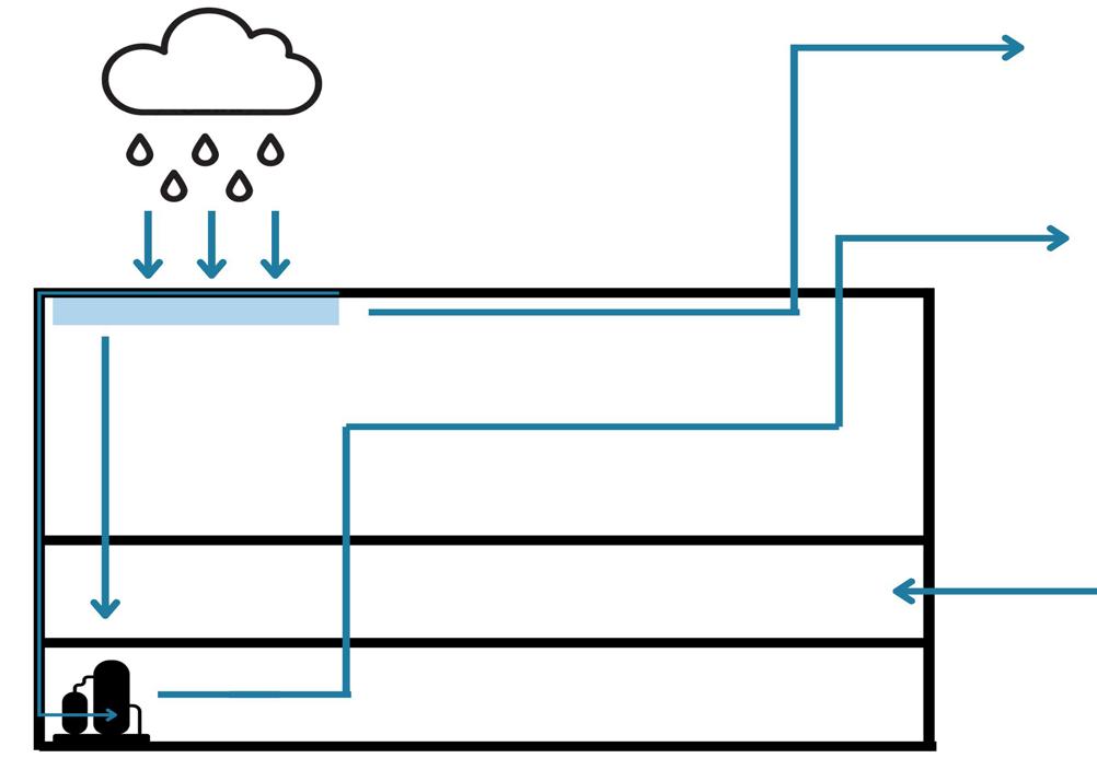
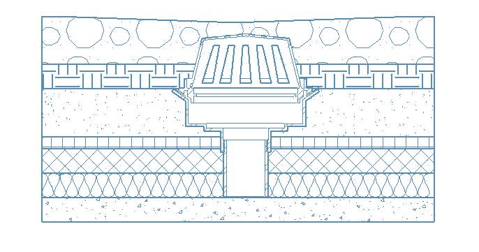
CISTERN LOCATION AND WATER FLOW- EAST SECTION
Detail Key
1. Rainwater Collection Drainage Point
2. 4” Transition Media
3. 1” Bottom Drain Mesh System
4. Bottom Fill
5. 4” Pebble Filter System
6. 2” Top Treatment Media
7. 2” Rigid Foam Insulation
8. 3” Concrete on Composite Metal Decking

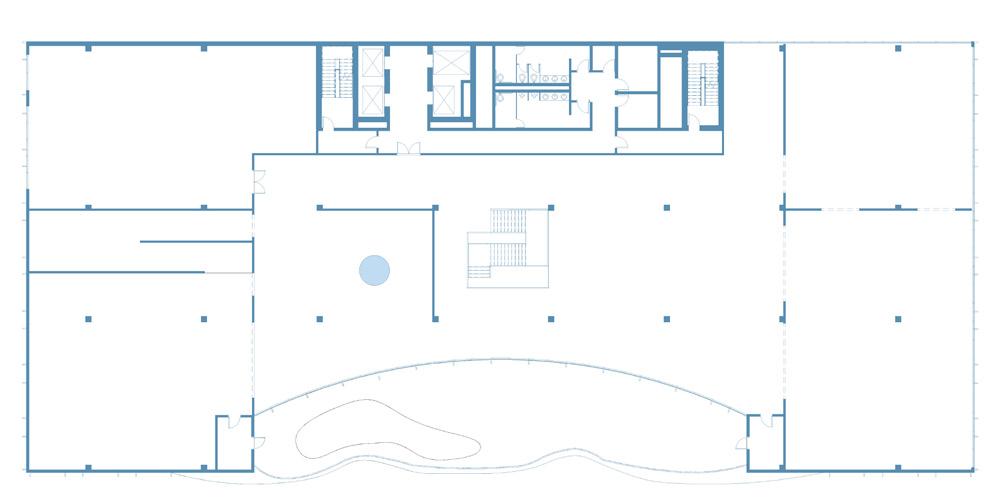
PROGRAM
L1
• Education Space
• Water Tank Systems
• Cafe
• Lobby
• Lounge L2
• Collaboration Space
• Screens
• Exhibition Space
• Water Toys
• Water Tub
• Water in Environment
L3 - L7
• Typical Leasing Office Plan
Rooftop Level
• Cafe
• Outdoor Space